Kamloops Heritage Register - City of Kamloops
Kamloops Heritage Register - City of Kamloops
Kamloops Heritage Register - City of Kamloops

You also want an ePaper? Increase the reach of your titles
YUMPU automatically turns print PDFs into web optimized ePapers that Google loves.
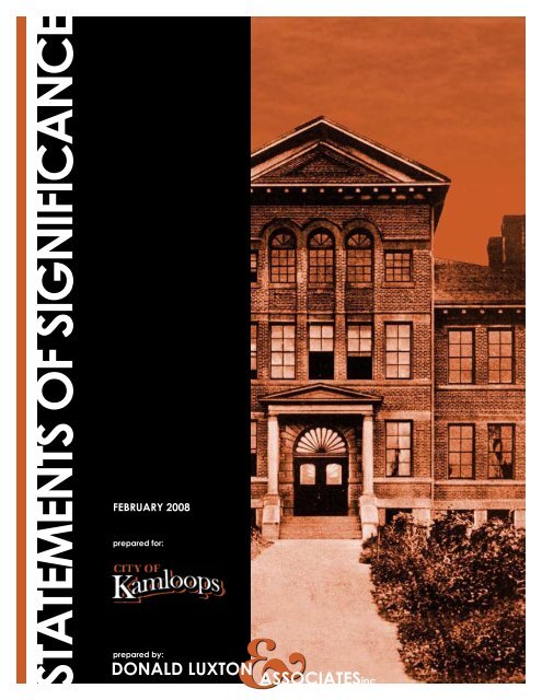
statements oF signiFicance<br />
FeBRuaRY 2008<br />
prepared for:<br />
&<br />
donald luxton associatesinc.<br />
prepared by:
CITY OF KAMLOOPS HERITAGE REGISTER 2007-2008<br />
TABLE OF CONTENTS<br />
THE INLAND CIGAR FACTORY, 297 FIRST AVENUE ........................................................5<br />
THE McINTOSH MEMORIAL, COLUMBIA STREET WEST.................................................8<br />
TOM BONES HOUSE, 328 ROYAL AVENUE.......................................................................10<br />
OLD BANK OF COMMERCE, 118 VICTORIA STREET.......................................................12<br />
MARLATT RESIDENCE, 155 WEST ST. PAUL STREET .....................................................15<br />
WILSON STREET HOUSE, 115 TRANQUILLE ROAD.........................................................17<br />
STUART WOOD SCHOOL, 245 ST. PAUL STREET.............................................................20<br />
CATTLE CAR AND CABOOSE, SEVENTH AVENUE .........................................................23<br />
PLAZA HOTEL, 405 VICTORIA STREET .............................................................................25<br />
NAVAL AMMUNITION DEPOT BUNKERS, 1455 McGILL ROAD.....................................27<br />
KAMLOOPS CHINESE CEMETERY, 850 LOMBARD STREET ..........................................29<br />
PIONEER CEMETERY, 780 LORNE STREET.......................................................................32<br />
HAYDEN HOUSE, 566 FOURTH AVENUE ..........................................................................34<br />
WILLIAM W. BISHOP HOUSE, 619 NICOLA STREET ........................................................36<br />
MEMORIAL ARENA, 740 VICTORIA STREET ....................................................................38<br />
STOODLEY RESIDENCE, 79 NICOLA STREET WEST .......................................................41<br />
CNR STATION, 500 LORNE STREET ...................................................................................43<br />
ST. ANDREW’S ON THE SQUARE, 159 SEYMOUR STREET.............................................46<br />
B.C. SHEEP BREEDERS BUILDING, 961 LORNE STREET.................................................49<br />
KAMLOOPS COURT HOUSE, 7 SEYMOUR STREET WEST ..............................................52<br />
ACKNOWLEDGEMENTS ......................................................................................................55<br />
Donald Luxton & Associates Inc.: 2008<br />
- 1 -
CITY OF KAMLOOPS HERITAGE REGISTER 2007-2008<br />
INTRODUCTION:<br />
THE KAMLOOPS HERITAGE REGISTER<br />
WHAT IS THE KAMLOOPS HERITAGE REGISTER<br />
A community heritage register is an <strong>of</strong>ficial list <strong>of</strong> historic places in a community. As an<br />
information tool, it enables communities to track the importance <strong>of</strong> their historic places, monitor<br />
the state <strong>of</strong> their heritage resources, and take an integrated approach to community planning.<br />
A community heritage register is a planning tool provided for under provincial legislation<br />
(Section 954 <strong>of</strong> the Local Government Act). Local governments establish a community heritage<br />
register by resolution. <strong>Kamloops</strong> enacted a <strong>Heritage</strong> <strong>Register</strong> with 20 identified sites on October<br />
30, 2007.<br />
WHAT IS THE CANADIAN REGISTER OF HISTORIC PLACES<br />
The Canadian <strong>Register</strong> <strong>of</strong> Historic Places is a searchable database accessible via the Internet. It<br />
describes historic places formally recognized by local, provincial and territorial governments,<br />
and by the federal government. Once appropriate documentation on the <strong>Kamloops</strong> <strong>Heritage</strong><br />
<strong>Register</strong> sites has been provided to the BC Registrar for inclusion on the BC <strong>Register</strong> <strong>of</strong> Historic<br />
Places, they will be automatically included on the Canadian <strong>Register</strong>.<br />
The main purpose <strong>of</strong> the Canadian <strong>Register</strong> is to identify, promote and celebrate historic places<br />
in Canada. It will increasingly enhance understanding <strong>of</strong> our cultural heritage by providing a<br />
comprehensive view <strong>of</strong> Canada’s historic places. The Canadian <strong>Register</strong> also provides a valuable<br />
source <strong>of</strong> easily accessible information for government authorities, land-use planners,<br />
developers, the tourism industry, educators, researchers, heritage pr<strong>of</strong>essionals and the general<br />
public. The Canadian <strong>Register</strong> may also be used to establish eligibility for funding under heritage<br />
programs.<br />
WHAT IS A STATEMENT OF SIGNIFICANCE<br />
The ‘Statement <strong>of</strong> Significance’ (SOS) is part <strong>of</strong> the required documentation that must be<br />
submitted for inclusion on the BC and Canadian <strong>Register</strong>s. The SOS for a historic place is made<br />
up <strong>of</strong> three sections: ‘Description <strong>of</strong> Historic Place’, ‘<strong>Heritage</strong> Value’, and ‘Character-Defining<br />
Elements’.<br />
The three sections which comprise the SOS explain: to what the formal recognition applies; why<br />
the place is important or significant; and which principal features <strong>of</strong> the place must be retained in<br />
order to preserve its heritage value. The SOS is intended to explain the heritage value <strong>of</strong> a<br />
historic place to the Canadian <strong>Register</strong> users. It provides guidance to property owners, planners,<br />
architects and others involved in the conservation or rehabilitation <strong>of</strong> historic places. The SOS<br />
helps identify the character-defining elements <strong>of</strong> the place that should be protected when<br />
undertaking a project. It may also be used to assess projects seeking funding under heritage<br />
programs.<br />
Donald Luxton & Associates Inc.: 2008<br />
- 2 -
CITY OF KAMLOOPS HERITAGE REGISTER 2007-2008<br />
Description <strong>of</strong> Historic Place<br />
The ‘Description <strong>of</strong> Historic Place’ section should paint a picture <strong>of</strong> the historic place in two or<br />
three sentences. It should describe very generally what the formal recognition applies to, and<br />
should make clear what elements on the property are included in the historic place and what is<br />
not. The description may also situate the place within its broader context, or setting, wherever<br />
this is helpful. The ‘Description <strong>of</strong> Historic Place’ answers the question: “What has been<br />
formally recognized”<br />
<strong>Heritage</strong> Value<br />
<strong>Heritage</strong> value may be defined as: the aesthetic, historic, scientific, cultural, social or spiritual<br />
importance or significance for past, present or future generations. The ‘<strong>Heritage</strong> Value’ section<br />
describes the core heritage value(s) on which the formal recognition <strong>of</strong> the place is based. It is<br />
intended to explain the significance <strong>of</strong> the historic place to a broad audience. It is also used to<br />
guide the identification <strong>of</strong> character-defining elements. ‘<strong>Heritage</strong> Value’ answers the question:<br />
“Why is this place important or significant”<br />
Historic places may have heritage value because they:<br />
• illustrate achievement in concept and design, technology, and/or planning, or a significant<br />
stage in the development <strong>of</strong> a community, province, territory or the nation<br />
• are associated with events that have contributed to patterns <strong>of</strong> history at the local,<br />
provincial, territorial or national levels<br />
• are associated with the lives <strong>of</strong> persons <strong>of</strong> historical importance at the local, provincial,<br />
territorial or national level<br />
• illustrate or symbolize in whole or in part a cultural tradition, way <strong>of</strong> life, or ideas<br />
important in the development <strong>of</strong> a community, province, territory or the nation.<br />
Character-Defining Elements<br />
The ‘Character-Defining Elements’ section identifies the principal features <strong>of</strong> the historic place<br />
that contribute to its heritage value. ‘Character-Defining Elements’ are: the materials, forms,<br />
location, spatial configurations, uses, and cultural associations or meanings that contribute to the<br />
heritage value <strong>of</strong> a historic place, which must be retained in order to preserve its heritage value.<br />
The information included under ‘Character-Defining Elements’ provides guidance to property<br />
owners, planners, architects and others involved in the conservation or rehabilitation <strong>of</strong> the<br />
historic place.<br />
Character-defining elements may be found in:<br />
• the style, massing, scale or composition <strong>of</strong> the historic place<br />
• features <strong>of</strong> the historic place related to its function<br />
• the interior spatial configurations, or exterior layout, <strong>of</strong> the historic place<br />
• the materials and craftsmanship <strong>of</strong> the historic place<br />
• the relationship between the historic place and its broader setting<br />
• traditional activities that continue to occur at the historic place<br />
• cultural associations or meanings that continue to be associated with the historic place.<br />
Donald Luxton & Associates Inc.: 2008<br />
- 3 -
CITY OF KAMLOOPS HERITAGE REGISTER 2007-2008<br />
Character-defining elements must directly relate to the heritage value(s) <strong>of</strong> the historic place, and<br />
must exist at the time <strong>of</strong> its nomination to the Canadian <strong>Register</strong>. Character-defining elements<br />
should not simply describe the historic place, but should provide an analysis <strong>of</strong> where value lies.<br />
Their identification is a selective process.<br />
UPDATING THE KAMLOOPS HERITAGE REGISTER<br />
The provincial <strong>Heritage</strong> Branch works with local governments and helps fund the development<br />
and improvement <strong>of</strong> community heritage registers so they are consistent with the documentation<br />
standards <strong>of</strong> the BC <strong>Register</strong> <strong>of</strong> Historic Places. It is anticipated that funding for the development<br />
<strong>of</strong> <strong>Heritage</strong> <strong>Register</strong> documentation will be available for the next few years.<br />
In addition to the sites now included on the <strong>Heritage</strong> <strong>Register</strong>, there are a number <strong>of</strong> others that<br />
have community heritage value that have been identified through various inventory projects.<br />
Over the next few years, the <strong>City</strong> <strong>of</strong> <strong>Kamloops</strong> could undertake a phased process that would add<br />
sites to the <strong>Heritage</strong> <strong>Register</strong>, formally identifying their heritage value and undertaking SOS<br />
documentation with the aid <strong>of</strong> senior government cost-shared funding. These resources could<br />
belong to a number <strong>of</strong> different categories <strong>of</strong> owners:<br />
Municipal Sites: Other municipal sites can be identified and added to the <strong>Register</strong> after<br />
internal consultation.<br />
Private Homes: Those scheduled as part <strong>of</strong> a <strong>Heritage</strong> Conservation Area are considered<br />
legally protected, so addition to the <strong>Register</strong> has no further implications. Other homes can<br />
be added on a voluntary basis.<br />
Commercial and Institutional Properties: <strong>Heritage</strong> <strong>Register</strong> listing should be a<br />
minimum prerequisite for any <strong>City</strong> incentives, including tax rebates.<br />
Maintenance & Monitoring<br />
A <strong>Heritage</strong> <strong>Register</strong> listing is not noted on Land Titles, therefore <strong>Heritage</strong> <strong>Register</strong> sites should<br />
therefore be clearly flagged on the municipal database in order to inform owners <strong>of</strong> recognized<br />
heritage significance prior to permit applications.<br />
Proposed changes to <strong>Heritage</strong> <strong>Register</strong> sites should be assessed through the use <strong>of</strong> the Standards<br />
& Guidelines for the Conservation <strong>of</strong> Historic Places in Canada. A periodic review should be<br />
undertaken to ensure that each site is being properly maintained.<br />
Donald Luxton & Associates Inc.: 2008<br />
- 4 -
CITY OF KAMLOOPS HERITAGE REGISTER 2007-2008<br />
THE INLAND CIGAR FACTORY, 297 FIRST AVENUE<br />
Description <strong>of</strong> Historic Place<br />
The Inland Cigar Factory is a two-storey, red-brick Victoria-era commercial structure with a<br />
corbelled cornice, arched second-floor window openings and a recessed central entry. It is<br />
situated on an angled lot at the southwest corner <strong>of</strong> FIRST Avenue and Seymour Street in<br />
downtown <strong>Kamloops</strong>.<br />
<strong>Heritage</strong> Value<br />
The Inland Cigar Factory is significant for its ties to the agricultural history <strong>of</strong> <strong>Kamloops</strong> and is<br />
symbolic as the centre <strong>of</strong> a one-time thriving cigar manufacturing industry. George A. Borthwick<br />
(1866-1927), who hailed from Victoria, established the Inland Cigar Factory in 1894. The<br />
following year, the company was restructured and refinanced by Marshall Pollock Gordon<br />
(1862-1929), who owned a local furniture store and served as <strong>Kamloops</strong> mayor for three terms.<br />
That same year, 1895, this building was erected as the headquarters and factory for the company.<br />
Tobacco for the cigars was imported from Cuba and then blended with locally grown tobacco.<br />
To demonstrate the technique <strong>of</strong> rolling authentic Cuban cigars, the company brought in a<br />
number <strong>of</strong> consultants from Cuba. At its height, the company employed a staff <strong>of</strong> twenty-five<br />
who produced up to 4,000 cigars per day. The Inland Cigar Factory continued to operate in this<br />
space until 1913 when they moved next door; this space was then taken over by the Model<br />
Bakery.<br />
The Inland Cigar Factory is valued for its connection with <strong>Kamloops</strong>’s first commercial district.<br />
Its location on First Avenue was once the center <strong>of</strong> <strong>Kamloops</strong>’s thriving downtown commercial<br />
district, which was situated on Victoria Street West. Over time the commercial district has<br />
shifted further east down Victoria Street. Additionally, the Inland Cigar Factory is valued<br />
architecturally as an example <strong>of</strong> a vernacular industrial structure from the Victorian era. The<br />
walls are constructed <strong>of</strong> an early locally-made red brick.<br />
Character-Defining Elements<br />
Key characteristics that define the heritage character <strong>of</strong> the Inland Cigar Factory include its:<br />
- prominent corner location on an angled lot at the corner <strong>of</strong> First Avenue and Victoria Street<br />
West<br />
- commercial form, scale and massing as expressed by its two-storey height, symmetrical front<br />
façade, rectangular plan and flat ro<strong>of</strong>, with no front or side setbacks<br />
- wood-frame and masonry construction, with common red-brick cladding with flush-struck<br />
mortar joints, segmental arched second-floor window openings, blind arched opening above<br />
central entry, with rubbed brick outline and herringbone infill, and corbelled cornice<br />
- early prefabricated galvanized drainage scuppers at rear<br />
Donald Luxton & Associates Inc.: 2008<br />
- 5 -
CITY OF KAMLOOPS HERITAGE REGISTER 2007-2008<br />
<strong>Kamloops</strong> Museum & Archives #8490<br />
Donald Luxton & Associates Inc.: 2008<br />
- 6 -
CITY OF KAMLOOPS HERITAGE REGISTER 2007-2008<br />
Donald Luxton & Associates Inc.: 2008<br />
- 7 -
CITY OF KAMLOOPS HERITAGE REGISTER 2007-2008<br />
THE McINTOSH MEMORIAL<br />
COLUMBIA STREET WEST<br />
Description <strong>of</strong> Historic Place<br />
The McIntosh Memorial is a one-storey Period Revival pavilion, featuring heavy timber posts,<br />
half-timbering and a high-pitched shingle ro<strong>of</strong>. It is situated at the <strong>Kamloops</strong> Lookout, on a<br />
steeply sloping landscaped site on Columbia Street West, with expansive views <strong>of</strong> <strong>Kamloops</strong>.<br />
<strong>Heritage</strong> Value<br />
The McIntosh Memorial, built in 1932, is significant for its associations with James McIntosh<br />
(1843-1901), one <strong>of</strong> <strong>Kamloops</strong>’s most influential pioneers. Born in Ottawa, McIntosh came to<br />
<strong>Kamloops</strong> in 1865 where he was employed by the Hudson’s Bay Company, and established<br />
himself by helping to build the first paddlewheeler that serviced the Thompson waterways. In<br />
1868, with partner William Fortune, he pre-empted land at Tranquille, and proceeded to build<br />
and operate a flour mill and sawmill. A few years later in 1878, McIntosh embarked upon<br />
another business venture with John Andrew Mara (1840-1920), named the Shuswap Milling<br />
Company, which consisted <strong>of</strong> a grist mill and sawmill. His business ventures continued to<br />
flourish when McIntosh completed the first waterworks in <strong>Kamloops</strong> in 1887, and later installed<br />
the first light system in the town. In addition, McIntosh was highly involved in the <strong>Kamloops</strong><br />
community, serving as the first magistrate, an alderman, first president <strong>of</strong> the Board <strong>of</strong> Trade and<br />
chairman <strong>of</strong> the board <strong>of</strong> the Royal Inland Hospital. His efforts, both social and economic, led<br />
him to become known as the ‘King <strong>of</strong> <strong>Kamloops</strong>.’ Commissioned by the Rotary Club to<br />
commemorate McIntosh’s community efforts, this memorial was originally situated on the west<br />
end <strong>of</strong> the Nicola Wagon Road, where it was unveiled in a ceremony on September 15, 1932. In<br />
1989, the McIntosh Memorial was moved to its current location on Columbia Street West.<br />
The McIntosh Memorial is further valued as an example <strong>of</strong> the work <strong>of</strong> prominent <strong>Kamloops</strong><br />
architect Iain R. Morrison (1906-1954). Born in Kent, England, Morrison studied architecture at<br />
St. Andrew’s College in Fifeshire, Scotland, and emigrated to Canada in 1926. After working for<br />
several larger firms in Vancouver, he opened an <strong>of</strong>fice in <strong>Kamloops</strong> in 1932, where he worked<br />
until his death at the age <strong>of</strong> forty-eight. The decorative detail <strong>of</strong> the McIntosh Memorial<br />
expresses an interest in traditional British stylistic elements, and is a noteworthy example <strong>of</strong> the<br />
romantic traditionalism popular between the First and Second World Wars.<br />
Character-Defining Elements<br />
Key elements that define the heritage character <strong>of</strong> the McIntosh Memorial include its:<br />
- prominent location at a public lookout<br />
- form, scale and massing as expressed by its one-storey height, rectangular plan, central<br />
washroom core, central ro<strong>of</strong> vent and steeply-pitched gabled ro<strong>of</strong><br />
- wood-frame construction, with heavy timber posts and arched brackets made <strong>of</strong> local spruce,<br />
and cedar shingle ro<strong>of</strong><br />
- elements <strong>of</strong> the Period Revival influence as expressed in traditional details such as halftimbering,<br />
flared ro<strong>of</strong> edges and waney-edged boards in the gable peaks<br />
Donald Luxton & Associates Inc.: 2008<br />
- 8 -
CITY OF KAMLOOPS HERITAGE REGISTER 2007-2008<br />
<strong>Kamloops</strong> Museum & Archives #7287<br />
Donald Luxton & Associates Inc.: 2008<br />
- 9 -
CITY OF KAMLOOPS HERITAGE REGISTER 2007-2008<br />
TOM BONES HOUSE, 328 ROYAL AVENUE<br />
Description <strong>of</strong> Historic Place<br />
The Tom Bones House is a one-storey, wood-frame Arts and Crafts cottage with an inset entry<br />
porch and cedar shingle siding. It is situated on the north side <strong>of</strong> Royal Avenue, within the North<br />
Shore district <strong>of</strong> <strong>Kamloops</strong>, with an alley access to the east side.<br />
<strong>Heritage</strong> Value<br />
Built circa 1930, the Tom Bones House is valued for its association with the settlement <strong>of</strong> the<br />
North Shore <strong>of</strong> <strong>Kamloops</strong>. This was primarily a rural farming area with orchards and fields until<br />
1909, when B.C. Fruitlands - a British-based company - was incorporated, and obtained over<br />
9,000 acres on the North Shore. By 1920, the company had increased its holdings to over 22,000<br />
acres, and installed an extensive irrigation system that supplied water to all <strong>of</strong> North <strong>Kamloops</strong>.<br />
After the irrigation system was installed, the company promoted programs to attract settlers to<br />
the area. Over time, the patchwork <strong>of</strong> farms developed into a community and in 1946, the village<br />
<strong>of</strong> North <strong>Kamloops</strong> was incorporated.<br />
The Tom Bones House has heritage significance for its association with first owner, Thomas<br />
Bones (1875-1964), a local carpenter and his wife, Louisa Jane (née Fenner, 1874-1929), who<br />
both hailed from England. Tom Bones worked at the sanitarium in nearby Tranquille, and built<br />
this Arts and Crafts style cottage himself. His carpentry skills are evident on both the exterior<br />
and interior; the round stones for the fireplace were apparently collected from Tranquille.<br />
Additionally, the Tom Bones House is valued as an example <strong>of</strong> an Arts and Crafts Period<br />
Revival cottage and is representative <strong>of</strong> traditional domestic ideals. Between the two World<br />
Wars, houses were expected to display some sort <strong>of</strong> historical reference in order to demonstrate<br />
the owner’s good taste. An Arts and Crafts influence is demonstrated in the diagonally-cut<br />
window trim and built-in flower boxes.<br />
Character-Defining Elements<br />
Key characteristics that define the heritage character <strong>of</strong> the Tom Bones House include its:<br />
- location on Royal Avenue in the North Shore district <strong>of</strong> <strong>Kamloops</strong><br />
- residential form, scale and massing as expressed by its one-storey height with side-gabled ro<strong>of</strong>,<br />
front-gabled projection, inset entry porch and later matching addition to the west side<br />
- wood-frame construction and concrete foundation with stucco finish<br />
- Arts and Crafts influence as expressed by cedar shingle siding, diagonally-cut window trim,<br />
built-in flower boxes and multi-paned glazed front door<br />
- two internal chimneys with stucco finish and corbelled tops<br />
- windows, such as double-hung, 1-over-1 wooden sash windows in single and double assembly<br />
- associated landscape features such as mature perimeter plantings<br />
Donald Luxton & Associates Inc.: 2008<br />
- 10 -
CITY OF KAMLOOPS HERITAGE REGISTER 2007-2008<br />
<strong>City</strong> <strong>of</strong> <strong>Kamloops</strong> Planning Department<br />
Donald Luxton & Associates Inc.: 2008<br />
- 11 -
CITY OF KAMLOOPS HERITAGE REGISTER 2007-2008<br />
OLD BANK OF COMMERCE, 118 VICTORIA STREET<br />
Description <strong>of</strong> Historic Place<br />
The Old Bank <strong>of</strong> Commerce is a two-storey Edwardian Baroque commercial building clad with<br />
<strong>Kamloops</strong> pressed red brick and dressed stone trim. Situated at the northeast corner <strong>of</strong> Victoria<br />
Street and First Avenue, the building is distinguished by its symmetrical front façade, granite<br />
foundation with raised tuckpointing, modillions, pilasters, quoins, external brick chimney,<br />
dentils, lunette windows and a hipped ro<strong>of</strong>. The original 1904 structure was enlarged in 1912<br />
with additions to the rear and the eastern side.<br />
<strong>Heritage</strong> Value<br />
Built in 1904, the Old Bank <strong>of</strong> Commerce is valued for its high quality architecture. The<br />
sophisticated design <strong>of</strong> this branch bank, inspired by the Edwardian Baroque style that was<br />
fashionable in Britain at the time, conveyed a sense <strong>of</strong> conservatism, permanence and security,<br />
which were particularly desirable characteristics for a financial institution. The Temple Bank<br />
was a wide-spread phenomenon, and throughout the province, on the main streets <strong>of</strong> virtually<br />
every community, these "temples" were seen as an important symbol <strong>of</strong> civic pride and progress.<br />
Toronto-based architects Darling & Pearson, as the architects for the Canadian Bank <strong>of</strong><br />
Commerce, provided many sophisticated Classical Revival designs for branch banks built<br />
throughout western Canada. The partnership <strong>of</strong> Frank Darling (1850-1923) and John Andrew<br />
Pearson (1867-1940) was a long and prolific one, and was a major force in Canadian<br />
architecture, climaxing in the federal government's request for Pearson, along with J. Omer<br />
Marchand, to provide the design for the rebuilding <strong>of</strong> the Centre Block <strong>of</strong> the Canadian<br />
Parliament Buildings in Ottawa after it was destroyed by fire in 1916. Darling & Pearson were<br />
responsible for close to a thousand bank projects, ranging in size from urban headquarters to<br />
small wooden structures in remote locations. The Old Bank <strong>of</strong> Commerce displays high quality<br />
materials and craftsmanship throughout. The front facade is clad in dressed stone and <strong>Kamloops</strong><br />
pressed red brick, manufactured at the local brick factory in Mission Flats. Local contractors<br />
Johnston & Gill were responsible for the brickwork and masonry. Robert Mackay (1865-1937)<br />
completed the interior <strong>of</strong> the building which also exhibits the highest quality <strong>of</strong> materials, such as<br />
a marble banking hall floor.<br />
The Old Bank <strong>of</strong> Commerce is additionally significant as a symbol <strong>of</strong> the development <strong>of</strong> the<br />
corporate banking system in <strong>Kamloops</strong> and is valued for its association with the Canadian Bank<br />
<strong>of</strong> Commerce, which occupied the building until 1924. The first bank in <strong>Kamloops</strong> was the Bank<br />
<strong>of</strong> British Columbia, which occupied a wooden building on the southeast corner <strong>of</strong> Victoria<br />
Street and First Avenue in 1887. In 1900, the Canadian Bank <strong>of</strong> Commerce absorbed the Bank <strong>of</strong><br />
British Columbia and utilized the same premises until 1904 when this building was erected.<br />
Among the employees <strong>of</strong> the Old Bank <strong>of</strong> Commerce was Canadian poet and writer Robert<br />
Service (1874-1958), who worked as a clerk at this bank between July and November <strong>of</strong> 1904.<br />
Furthermore, the Old Bank <strong>of</strong> Commerce is a representation <strong>of</strong> the economic growth and<br />
development <strong>of</strong> <strong>Kamloops</strong> during the Edwardian era. In its pioneer phase, the economy <strong>of</strong><br />
<strong>Kamloops</strong> was based on the trade <strong>of</strong> fur, gold and cattle. With the arrival <strong>of</strong> the Canadian Pacific<br />
Railway in 1885, <strong>Kamloops</strong> began to emerge as a prospering business community with an<br />
Donald Luxton & Associates Inc.: 2008<br />
- 12 -
CITY OF KAMLOOPS HERITAGE REGISTER 2007-2008<br />
abundance <strong>of</strong> employment opportunities. The advent <strong>of</strong> the railway not only allowed for the<br />
transport <strong>of</strong> people, but also permitted the mobility <strong>of</strong> goods, which in turn, benefitted trade in<br />
the region. Between 1885 and 1905, the population increased five-fold; this surge can be directly<br />
linked to the rise <strong>of</strong> financial institutions such as the Bank <strong>of</strong> Commerce. In further response to<br />
the growing importance <strong>of</strong> <strong>Kamloops</strong> as a regional centre, the bank was expanded in 1912 with<br />
additions to the rear and the eastern side. The building was occupied between 1953 and 1964 by<br />
<strong>Kamloops</strong> <strong>City</strong> Hall.<br />
Character-Defining Elements<br />
Key elements that define the heritage character <strong>of</strong> the Old Bank <strong>of</strong> Commerce include its:<br />
- corner location, facing Victoria Street and First Avenue in downtown <strong>Kamloops</strong><br />
- monumental commercial form, scale and massing as expressed by its two-storey height,<br />
symmetrical massing with central entry, excavated basement, hipped ro<strong>of</strong> and cubic plan, with<br />
1912 additions at the rear and eastern side<br />
- masonry construction such as granite foundation with raised tuckpointing, red-brick cladding,<br />
and dressed stone trim<br />
- Edwardian Baroque features such as engaged pilasters with exaggerated entasis, overscale<br />
lunettes placed over windows with giant keystones, eave modillions, and block quoins<br />
- fenestration, including wooden sash windows on the ground floor<br />
- external red-brick chimney<br />
- original interior features such as banking hall marble floor, wooden trim and floors, interior<br />
fireplaces and massive bank vault<br />
Donald Luxton & Associates Inc.: 2008<br />
- 13 -
CITY OF KAMLOOPS HERITAGE REGISTER 2007-2008<br />
Canadian Imperial Bank <strong>of</strong> Commerce Archives, circa 1905 [CIBC143.001]<br />
Donald Luxton & Associates Inc.: 2008<br />
- 14 -
CITY OF KAMLOOPS HERITAGE REGISTER 2007-2008<br />
MARLATT RESIDENCE, 155 WEST ST. PAUL STREET<br />
Description <strong>of</strong> Historic Place<br />
The Marlatt Residence is a one and one-half storey, Arts and Crafts ‘Storybook Cottage’, located<br />
on the south side <strong>of</strong> West St. Paul Street in the historic West End neighbourhood <strong>of</strong> <strong>Kamloops</strong>.<br />
This residence is distinctive for its high-pitched, cedar shingle gabled ro<strong>of</strong>, arched garden gate,<br />
half-timbering, stucco cladding and leaded casement windows.<br />
<strong>Heritage</strong> Value<br />
The Marlatt Residence, built in 1930, is valued as a superior example a ‘Storybook Cottage’ and<br />
is a romantic representation <strong>of</strong> traditional domestic ideals. This paralleled the popularity <strong>of</strong> the<br />
period revival styles in North America between the two World Wars. During this time, houses<br />
were expected to display historical references in order to demonstrate the owner’s good taste.<br />
This was especially important in more prestigious neighbourhoods, such as the West End. An<br />
English Arts and Crafts influence is shown in the steeply pitched ro<strong>of</strong>, half-timbering in the front<br />
gable ends, roughcast stucco contrasted with a brick foundation and brick stairs, and leaded<br />
casement windows. A more generalized romantic influence is visible in the arched gate leading<br />
to the garden, which is echoed in the front door’s circular bevelled glass window.<br />
The Marlatt Residence is valued for its associations with first owners, William Alanson George<br />
Marlatt (1867-1959), and his second wife, Ada (née Summers, 1883-1984). William Marlatt<br />
hailed from St. Mary’s, Ontario, and came to <strong>Kamloops</strong> in 1912 where he operated a successful<br />
local hardware and paint business. In 1923, William Marlatt married his second wife, Ada.<br />
Originally a schoolteacher from Markdale, Ontario, Ada Marlatt was a celebrated <strong>Kamloops</strong><br />
resident who lived to the age <strong>of</strong> 102.<br />
Additionally, the Marlatt Residence is significant for its association with the continued<br />
development <strong>of</strong> <strong>Kamloops</strong>’s Upper West End. Residential development <strong>of</strong> the area began at the<br />
turn <strong>of</strong> the century and gradually spread up the hill. Many <strong>of</strong> the larger homes in the area were<br />
constructed between 1910 and 1925. Characteristic <strong>of</strong> the Upper West End neighbourhood are<br />
river cobbles used in garden retaining walls, which are also visible in the Marlatt Residence’s<br />
front terraced garden wall.<br />
Donald Luxton & Associates Inc.: 2008<br />
- 15 -
CITY OF KAMLOOPS HERITAGE REGISTER 2007-2008<br />
Character-Defining Elements<br />
Key elements that define the heritage character <strong>of</strong> the Marlatt Residence include its:<br />
- picturesque setting on a large lot on St. Paul Street West, set back far from the street<br />
- location within the historic West End neighbourhood<br />
- residential form, scale and massing as expressed by its one and one-half storey height and<br />
steeply pitched cross-gabled ro<strong>of</strong> with extension from the gable to garden gate, and projecting<br />
front entrance porch with shed ro<strong>of</strong><br />
- construction materials including wood-frame structure, heavy timber posts, cedar shingle ro<strong>of</strong>,<br />
and masonry elements such as a pressed red brick foundation and front entrance stairs<br />
- elements <strong>of</strong> the English Arts and Crafts style such as half-timbering in the gable ends,<br />
roughcast stucco and internal red-brick chimney with corbelling and chimney pots<br />
- other exterior details including bargeboards with expressed bracket ends, built-in flower boxes<br />
and dentils<br />
- windows such as its rectangular-leaded glass wooden-sash casement windows in double and<br />
triple assembly, double-hung wooden-sash windows, and multi-paned casement windows in the<br />
gable peaks<br />
- original oak front door with bevelled circular glass window<br />
- associated landscape features such as its cobble stone retaining wall at the front, grassed yard,<br />
mature perimeter plantings including lilac and holly, and mature coniferous and deciduous trees<br />
Donald Luxton & Associates Inc.: 2008<br />
- 16 -
CITY OF KAMLOOPS HERITAGE REGISTER 2007-2008<br />
WILSON STREET HOUSE, 115 TRANQUILLE ROAD<br />
Description <strong>of</strong> Historic Place<br />
The Wilson Street House, now relocated to Tranquille Road, is a one and one-half storey, woodframe<br />
house with a steeply pitched side-gabled ro<strong>of</strong>, a central gabled wall dormer and a fullwidth<br />
open verandah. It is situated within the low-density residential neighbourhood <strong>of</strong> North<br />
<strong>Kamloops</strong>.<br />
<strong>Heritage</strong> Value<br />
The Wilson Street House, constructed circa 1909-1910, is valued for its connection with William<br />
Stewart Wilson (1903-1994), who was an esteemed member <strong>of</strong> the <strong>Kamloops</strong> community. In<br />
1927, William Stewart Wilson married Winnifred in Alberta. Two years later the couple moved<br />
to <strong>Kamloops</strong> to farm just east <strong>of</strong> Exptal Farm. In 1934, Wilson opened Wilson Motors, which<br />
<strong>of</strong>fered automobile services, a commercial business distinct from North <strong>Kamloops</strong>’s agricultural<br />
economy <strong>of</strong> the early 1930s. Wilson Motors was located on acreage surrounding the house and<br />
Tranquille Road. William Wilson also was an important political figure in the community and<br />
British Columbia. He was President <strong>of</strong> the British Columbia Auto Dealers Association and Vice<br />
President <strong>of</strong> the Canadian Auto Dealers Association. In 1946 he was elected first commissioner<br />
for the village <strong>of</strong> North <strong>Kamloops</strong>, a position equivalent to that <strong>of</strong> mayor. The following year, in<br />
1947, he was elected as chairman <strong>of</strong> North <strong>Kamloops</strong>. William Stewart Wilson and Winnifred<br />
occupied the house until 1950. The house was briefly used as the Church Manse, before<br />
members <strong>of</strong> Wilson family took up residence again.<br />
The Wilson Street House is further valued for its association with first owner, Frank Edward<br />
Baines (1888-1958), who was a local farmer. American-born Baines was uncle to William<br />
Stewart Wilson and occupied the house, along with his wife Mary, between 1909 and 1920. The<br />
house was constructed in a traditional farmhouse form that was influenced by the Gothic Revival<br />
style, with symmetrical massing, a central entry, a central gable wall dormer and Carpenter<br />
ornamentation.<br />
The Wilson Street House is also significant as a representation <strong>of</strong> the development <strong>of</strong> North<br />
<strong>Kamloops</strong>. The North Shore was primarily a rural farming area with orchards and fields until<br />
1909 when B.C. Fruitlands, a British-based company was incorporated, obtaining over 9,000<br />
acres on the North Shore. By 1920, the company had increased its holdings to over 22,000 acres<br />
and installed an extensive irrigation system that supplied water to all <strong>of</strong> North <strong>Kamloops</strong>. After<br />
the irrigation system was installed, the company promoted programs to attract settlers to the area.<br />
Over time, the patchwork <strong>of</strong> farms developed into a community and in 1946, the village <strong>of</strong> North<br />
<strong>Kamloops</strong> was incorporated. At this time, Wilson Street, which was named in honour <strong>of</strong> the<br />
family, was surveyed and subdivided, leaving the Wilson Street House situated in the middle <strong>of</strong><br />
the street. The house was subsequently moved back and turned around in order to face the new<br />
street. In October <strong>of</strong> 2003, the Wilson Street House was moved to 115 Tranquille Road, and is<br />
now the home <strong>of</strong> the <strong>Kamloops</strong> North Shore Business Improvement Association.<br />
Donald Luxton & Associates Inc.: 2008<br />
- 17 -
CITY OF KAMLOOPS HERITAGE REGISTER 2007-2008<br />
Character-Defining Elements<br />
Key elements that define the heritage character <strong>of</strong> the Wilson Street House include its:<br />
- residential form, scale and massing as expressed by its one and one-half storey height with<br />
steeply pitched side-gabled ro<strong>of</strong> and side bay window<br />
- construction materials as expressed by wood-frame construction and wooden drop siding<br />
- elements <strong>of</strong> the Gothic Revival style such as its symmetrical massing, central entry, central wall<br />
dormer, full-width open verandah, and front gable screen<br />
- internal red-brick chimney<br />
- interior details such as the staircase with a lathe-turned newel post<br />
Photo courtesy <strong>of</strong> Iris Stewart<br />
Donald Luxton & Associates Inc.: 2008<br />
- 18 -
CITY OF KAMLOOPS HERITAGE REGISTER 2007-2008<br />
Donald Luxton & Associates Inc.: 2008<br />
- 19 -
CITY OF KAMLOOPS HERITAGE REGISTER 2007-2008<br />
STUART WOOD SCHOOL, 245 ST. PAUL STREET<br />
Description <strong>of</strong> Historic Place<br />
The Stuart Wood School is a three-storey schoolhouse with a symmetrical façade, clad in red<br />
brick, with a broad hipped ro<strong>of</strong>, front and rear gabled projections and Classical Revival detailing.<br />
Built in 1906-07, it is situated on a large corner lot, surrounded by an open schoolyard with<br />
mature perimeter plantings, set far back from the street, on the south side <strong>of</strong> St. Paul Street in the<br />
downtown core <strong>of</strong> <strong>Kamloops</strong>. Stuart Wood School still operates as an elementary school.<br />
<strong>Heritage</strong> Value<br />
Stuart Wood School is significant as one <strong>of</strong> the earliest surviving schools in <strong>Kamloops</strong>, and its<br />
prominence demonstrates the growth and development <strong>of</strong> the community over time and the high<br />
value that was placed on public education. Opened in 1907 as the <strong>Kamloops</strong> Public School, it<br />
played a vital role in the life <strong>of</strong> local children. Built just fourteen years after <strong>Kamloops</strong> was<br />
incorporated, this was the town’s third public school to be constructed within a twenty-one year<br />
period. <strong>Kamloops</strong>’s first public school was built in 1886 on the site <strong>of</strong> the Old Court House;<br />
however, the town’s rapid population growth necessitated that another school be built in 1892,<br />
which was followed shortly by the construction <strong>of</strong> this school in 1906-07. Until 1913, the<br />
elementary grades met on the first two floors, while the high school grades met on the top floor.<br />
The first principal, Edward Stuart Wood (1857-1942), originally from Peterborough, Ontario,<br />
moved to <strong>Kamloops</strong> in August 1886. Here he met his wife, Gertrude Clarke (1967-1919), who<br />
worked as the first assistant at the school and was also the daughter <strong>of</strong> the first Mayor <strong>of</strong><br />
<strong>Kamloops</strong>, Dr. Sibree Clarke. The couple married in <strong>Kamloops</strong> in 1888. Wood retired from<br />
teaching in 1910, but continued to live in <strong>Kamloops</strong> until his death in 1942. This school was<br />
renamed in his honour in 1922.<br />
Stuart Wood School is also a very significant example <strong>of</strong> the architectural work <strong>of</strong> William Tuff<br />
Whiteway (1856-1940). Whiteway was born in Musgrave, Newfoundland, but relocated to<br />
Vancouver at the time <strong>of</strong> the Great Fire in 1886. In addition to his commercial work, Whiteway<br />
specialized in the design <strong>of</strong> schools, and provided the plans for a number <strong>of</strong> schools throughout<br />
the province. The architecture <strong>of</strong> this school conveys a sense <strong>of</strong> permanence and order,<br />
demonstrating the late persistence <strong>of</strong> the Romanesque Revival style in its massive masonry<br />
construction and round-arched windows. The emerging influence <strong>of</strong> the Classical Revival style is<br />
also evident in the pedimented portico, classical columns, and fanlight window above the central<br />
entrance. The large sash windows were characteristic <strong>of</strong> contemporary school design, arranged to<br />
take advantage <strong>of</strong> natural light and ventilation.<br />
Additionally, the heritage value <strong>of</strong> Stuart Wood School lies in its interpretive value for the<br />
community. Much <strong>of</strong> the exterior and the interior fabric <strong>of</strong> the school is original to its<br />
construction <strong>of</strong> a century ago, providing a tangible link to the past. The top floor classroom has<br />
been interpreted to provide students with the experience <strong>of</strong> a historical classroom setting,<br />
including authentic furnishings.<br />
Donald Luxton & Associates Inc.: 2008<br />
- 20 -
CITY OF KAMLOOPS HERITAGE REGISTER 2007-2008<br />
Character-Defining Elements<br />
Key elements that define the heritage character <strong>of</strong> the Stuart Wood School include its:<br />
- location on a large downtown corner lot, set back far from St. Paul Street<br />
- continuous use as a school for over a century<br />
- institutional form, scale and massing as expressed by its three-storey height, full-height<br />
basement, symmetrical rectangular plan, hipped ro<strong>of</strong> with front and rear gabled projections, and<br />
central front entry with columned and pedimented entry porch<br />
- robust construction, including: wooden materials such as heavy timber internal framing,<br />
wooden columns and bracketted s<strong>of</strong>fits; and masonry elements such as red-brick cladding,<br />
parged stringcourses and internal chimneys<br />
- windows, including: 4-over-4 double-hung wooden sash windows on the first and second<br />
floors; six-over-six double-hung wooden sash windows on the third floor with arched transoms<br />
above the three central windows; and arched fanlight above the front entrance<br />
- high degree <strong>of</strong> retention <strong>of</strong> original interior features such as wooden wainscoting, wooden trim,<br />
maple floors, lath-and-plaster walls, panelled doors with original hardware, internal staircase<br />
with newel posts with drop finials, original room configuration including third-storey classroom,<br />
and original boiler and coal chute<br />
- associated landscape features such as surrounding grassed schoolyard and playing fields, and<br />
mature perimeter plantings such as Silver Maples and Horse Chestnut trees<br />
<strong>Kamloops</strong> Museum & Archives #7321<br />
Donald Luxton & Associates Inc.: 2008<br />
- 21 -
CITY OF KAMLOOPS HERITAGE REGISTER 2007-2008<br />
Donald Luxton & Associates Inc.: 2008<br />
- 22 -
CITY OF KAMLOOPS HERITAGE REGISTER 2007-2008<br />
CATTLE CAR AND CABOOSE, SEVENTH AVENUE<br />
Description <strong>of</strong> Historic Place<br />
The Cattle Car and Caboose are examples <strong>of</strong> early rolling stock, now situated <strong>of</strong>f Seventh<br />
Avenue in <strong>Kamloops</strong>. The Caboose consists <strong>of</strong> an original rail car with tongue-and-groove<br />
wooden cladding and a steering lookout. The Cattle Car consists <strong>of</strong> steel and wood construction,<br />
with a sliding door on the side. The two cars are situated on a railway siding.<br />
<strong>Heritage</strong> Value<br />
The Cattle Car and Caboose are a valued as examples <strong>of</strong> the Canadian Northern Railway’s (later<br />
Canadian National Railway) rolling stock and serve as a testament to the railway’s importance to<br />
the economic development <strong>of</strong> <strong>Kamloops</strong>. The Caboose dates to 1912 and is one <strong>of</strong> only fifty<br />
such cabooses still extant in Canada. The Cattle Car is a boxcar, used to transport cattle, and is <strong>of</strong><br />
an unknown date. The Canadian Northern Railway line was run to <strong>Kamloops</strong> in 1915, enabling<br />
the business community to prosper with an abundance <strong>of</strong> employment opportunities. The railway<br />
allowed passenger transport, and also facilitated the mobility <strong>of</strong> goods, such as livestock, which<br />
in turn, benefitted trade in the region. <strong>Kamloops</strong> was established as a divisional point for the<br />
CNR, a place where trains exchanged crews, resulting in a permanent railway worker population.<br />
In 1919, the Canadian Northern Railway was incorporated by the Dominion Government with<br />
the Grand Trunk Pacific Railway to form the Canadian National Railway, further enhancing its<br />
importance as part <strong>of</strong> a national rail network.<br />
Additionally, the Cattle Car and Caboose are significant for their links to <strong>Kamloops</strong>’s thriving<br />
cattle ranching industry, which was established in the early 1860s and was a fundamental<br />
component <strong>of</strong> the local economy. Initially, pioneer settlers were drawn to <strong>Kamloops</strong> by the<br />
prospect <strong>of</strong> gold; however, many soon discovered that the local terrain and conditions <strong>of</strong>fered<br />
ideal conditions for cattle ranching. The area was home to some <strong>of</strong> British Columbia’s most<br />
successful cattle ranchers, who were recognized for their long trail drives and large ranches.<br />
<strong>Kamloops</strong> later became the headquarters <strong>of</strong> the B.C. Cattlemen’s Association, established 1929,<br />
and the B.C. Livestock Association, established 1943. The CNR facilitated the movement <strong>of</strong><br />
cattle and strengthened <strong>Kamloops</strong>’s position as the center <strong>of</strong> the cattle industry in British<br />
Columbia.<br />
After six decades <strong>of</strong> service, the cattle car and caboose were withdrawn and presented to the<br />
<strong>Kamloops</strong> Chamber <strong>of</strong> Commerce in 1970. The two cars were used as tourist information booths<br />
on the Yellowhead Highway until 1982. They have subsequently been restored and now sit on a<br />
railway siding on land owned by the <strong>City</strong> <strong>of</strong> <strong>Kamloops</strong>.<br />
Donald Luxton & Associates Inc.: 2008<br />
- 23 -
CITY OF KAMLOOPS HERITAGE REGISTER 2007-2008<br />
Character-Defining Elements<br />
Key characteristics that define the heritage character <strong>of</strong> the Cattle Car and Caboose include their:<br />
- location on a railway siding<br />
Cattle Car:<br />
- vernacular form, scale and massing that conform to the functional requirements for the<br />
transport <strong>of</strong> live cattle<br />
- manufactured steel elements such as the undercarriage and wheels<br />
- wood construction <strong>of</strong> the upper car, including wooden side slats with gaps for ventilation and<br />
diagonal supports<br />
Caboose:<br />
- vernacular form, scale and massing that conform to functional requirements, including a<br />
steering lookout;<br />
- manufactured steel elements such as the hog truss undercarriage and wheels<br />
- wood construction <strong>of</strong> the upper car, including tongue-and-groove cladding and wooden sash<br />
windows<br />
Donald Luxton & Associates Inc.: 2008<br />
- 24 -
CITY OF KAMLOOPS HERITAGE REGISTER 2007-2008<br />
PLAZA HOTEL, 405 VICTORIA STREET<br />
Description <strong>of</strong> Historic Place<br />
Situated at the corner <strong>of</strong> Fourth Avenue and Victoria Street in downtown <strong>Kamloops</strong>, the Plaza<br />
Hotel is a prominent landmark in downtown <strong>Kamloops</strong>. It is a five-storey, Spanish Colonial<br />
Revival-style building. It is distinctive for its metal pantile canopies, top-floor outdoor ro<strong>of</strong>top<br />
patio with open round arches, stucco exterior walls, timber brackets and massive wood brackets.<br />
There are later additions to the rear, designed in a sympathetic manner.<br />
<strong>Heritage</strong> Value<br />
The Plaza Hotel, built 1927-1928, is significant for its association with the <strong>Kamloops</strong> Boards <strong>of</strong><br />
Trade, who during the 1920s were promoting <strong>Kamloops</strong>, the ‘Hub <strong>City</strong>,’ as a tourist destination.<br />
The Board’s President headed up an association <strong>of</strong> businessmen who raised $90,000 in shares to<br />
build the Plaza Hotel, intended to be the finest in British Columbia’s interior. Planned as early as<br />
1912, a community hotel was considered an essential amenity that would appeal to the new<br />
influx <strong>of</strong> tourists travelling by motorcar. The Plaza remained popular, and by 1948 a 44-room<br />
expansion was underway. The Plaza remains in use today as one <strong>of</strong> the major hotels in the<br />
downtown area.<br />
The Plaza Hotel is additionally valued as a superior example <strong>of</strong> Spanish Colonial Revival design<br />
by architect Ernest T. Brown (1876-1950). Brown was born in Brighton, England, and<br />
immigrated to Canada where he trained in Guelph as an architect. Brown had a prolific career in<br />
Western Canada, working in Alberta and Saskatchewan before relocating to British Columbia in<br />
1926. In 1927, Brown was <strong>of</strong>fered the commission for the <strong>Kamloops</strong> Lodge 44 <strong>of</strong> the Benevolent<br />
Order <strong>of</strong> the Elks, which he designed in the Spanish Colonial Revival style. The following year,<br />
Brown was selected as architect for the Plaza Hotel, again utilizing a Spanish-inspired style,<br />
popularly referred to as ‘Californian’ and symbolizing the new found freedom <strong>of</strong>fered by the<br />
now readily available automobile. This style became Brown’s trademark and he subsequently<br />
received a commission in Lethbridge, Alberta for a similar community hotel.<br />
Additionally, the Plaza is a valued as a testament to the ability <strong>of</strong> local craftsman and the high<br />
quality materials that were available in <strong>Kamloops</strong>. Johnston & Company, led by William Henry<br />
Johnston (1864-1931). Who were retained for the project, owned the <strong>Kamloops</strong> Brickyards and<br />
were among the leading contractors in the city.<br />
Donald Luxton & Associates Inc.: 2008<br />
- 25 -
CITY OF KAMLOOPS HERITAGE REGISTER 2007-2008<br />
Character-Defining Elements<br />
Key characteristics that define the heritage character <strong>of</strong> the Plaza Hotel include its:<br />
- location at the southeast corner <strong>of</strong> Victoria Street and Fourth Avenue in downtown <strong>Kamloops</strong><br />
- continuous use as a hotel<br />
- commercial form, scale and massing as expressed by its five-storey height, ro<strong>of</strong>top patio,<br />
rectangular plan and projecting canopies<br />
- construction materials as expressed by the rock-dash stucco on the exterior walls; metal pantile<br />
canopies and wrought-iron work; and wood construction, including wooden brackets<br />
- Spanish Colonial Revival features such as round arches at the ground floor and upper level,<br />
top-floor corner balconies with French doors with semi-circular transoms, and outdoor ro<strong>of</strong>top<br />
patio<br />
- early neon ‘Plaza Hotel’ sign<br />
- windows such as original storefronts at ground level and 8-over-1 double-hung wooden sash<br />
windows<br />
- interior features such as lobby with oak floors, dining room, original room configuration, open<br />
staircase with original balustrades and newel posts, plaster mouldings wooden trim<br />
- 1948 addition including: rock-dash stucco exterior walls; windows including 6-over-1 doublehung<br />
wooden sash windows in single and double assembly; and interior features including<br />
original room configuration<br />
<strong>Kamloops</strong> Museum & Archives #6586<br />
Donald Luxton & Associates Inc.: 2008<br />
- 26 -
CITY OF KAMLOOPS HERITAGE REGISTER 2007-2008<br />
NAVAL AMMUNITION DEPOT BUNKERS<br />
1455 McGILL ROAD<br />
Description <strong>of</strong> Historic Place<br />
The former Naval Ammunition Depot consists <strong>of</strong> a variety <strong>of</strong> partially-buried concrete bunkers<br />
grouped along a winding linear access road, located approximately two miles west <strong>of</strong> downtown<br />
<strong>Kamloops</strong>. Located on a flat bench at the edge <strong>of</strong> a steep escarpment, the site is adjacent to an<br />
industrial area on McGill Road. Each structure is comprised <strong>of</strong> a windowless one-storey concrete<br />
storage space, entered through steel entrance doors and enclosed to the full height <strong>of</strong> the store<br />
within by earthen blast protection walls.<br />
<strong>Heritage</strong> Value<br />
The remaining bunkers <strong>of</strong> the former Naval Ammunition Depot, constructed between 1944 and<br />
1945, are historically significant as a rare surviving Canadian example <strong>of</strong> ordnance buildings<br />
from the Second World War era and as symbols <strong>of</strong> Canada’s wartime and military experience.<br />
The bunkers reflect a period <strong>of</strong> national and international investment in defence spending after<br />
the entry <strong>of</strong> the United States into the war in December 1941. In particular, they reflect Canadian<br />
and American strategic concerns that the long, mostly unpopulated Pacific coastline <strong>of</strong> Canada<br />
could provide a back door to the invasion <strong>of</strong> the North American continent, and that coastal<br />
installations were vulnerable to air attack. Planning for the depot began in 1943. It was intended<br />
to store bulk explosives for the western command <strong>of</strong> the Royal Canadian Navy plus stocks<br />
required for the British Fleet under the agreement reached at the Imperial Conference <strong>of</strong> 1911; to<br />
meet operational and practice requirements for the Pacific Fleet by maintaining stocks <strong>of</strong><br />
ammunition for immediate issue; and to repair, manufacture, modify and inspect ammunition<br />
stores and components. Construction at the site was undertaken by one <strong>of</strong> the largest and most<br />
successful construction companies in western Canada, the Vancouver-based Dominion<br />
Construction Company Limited.<br />
The surviving bunkers, commonly known as magazines, are representative <strong>of</strong> the infrastructure<br />
<strong>of</strong> the eight advanced ordnance depots constructed across the country by the Royal Canadian<br />
Navy at strategically significant locations far enough away from the coast that they could not<br />
easily be attacked by carrier-borne aircraft. <strong>Kamloops</strong> was one <strong>of</strong> the sites selected, due to easy<br />
rail access to the ports <strong>of</strong> Vancouver and Prince Rupert and the west coast ports <strong>of</strong> the United<br />
States. At the base <strong>of</strong> the escarpment was the main line <strong>of</strong> the Canadian Pacific Railway; a rail<br />
spur was constructed to facilitate the unloading <strong>of</strong> the ammunition, which was then transported<br />
up the hill through the use <strong>of</strong> a mile-long aerial tramway.<br />
The site originally contained the infrastructure typical <strong>of</strong> an advanced ordnance depot, including<br />
twenty-two bunkers, administration buildings, mess halls, and <strong>of</strong>ficers’ living quarters. Different<br />
magazines stored different materials such as filled shells, cartridges and small arms ammunition.<br />
The bunkers were placed at a safe distance from one another along a linear access road. Three<br />
primary types <strong>of</strong> bunkers have survived; an exposed above-ground bunker <strong>of</strong> board-formed<br />
concrete buried in a mound with extending angled entry walls; an underground bunker with a<br />
red-brick chimney vent; and an exposed above-ground bunker <strong>of</strong> concrete block with a<br />
Donald Luxton & Associates Inc.: 2008<br />
- 27 -
CITY OF KAMLOOPS HERITAGE REGISTER 2007-2008<br />
projecting canopy, with surrounding blast mounds formed behind trapezoidal board-formed<br />
concrete walls. In the event <strong>of</strong> an explosion, the surrounding embankments would direct the blast<br />
upwards through a lightweight wooden ro<strong>of</strong> that was designed to fragment.<br />
By the time the depot opened, the threat <strong>of</strong> invasion was non-existent, however it continued to be<br />
used as back-up storage for the ammunition expended in fleet exercises. The depot was declared<br />
surplus and closed in December 1963, reflecting the onset <strong>of</strong> the Cold War and the perception<br />
that the conduct <strong>of</strong> war had moved beyond land-based confrontation.<br />
Character-Defining Elements<br />
Key characteristics that define the heritage character <strong>of</strong> the Naval Ammunition Depot Bunkers<br />
include their:<br />
- location on a hillside at the edge <strong>of</strong> an embankment, hidden amongst the topography but<br />
proximate to rail and road networks<br />
- arrangement along a linear access road, set back from the main access road<br />
- orientation, form, scale, spacing and massing <strong>of</strong> the various types <strong>of</strong> bunkers expressing their<br />
functional requirements<br />
- construction materials <strong>of</strong> board-formed concrete, vertical concrete revetments, concrete blocks,<br />
red-brick internal vent, steel doors and wooden ro<strong>of</strong>s<br />
- earthen blast protection embankments shaped at the angle <strong>of</strong> repose<br />
- deeply recessed entrances<br />
- internal arrangements <strong>of</strong> magazines including signs <strong>of</strong> shelving and painted signage<br />
Donald Luxton & Associates Inc.: 2008<br />
- 28 -
CITY OF KAMLOOPS HERITAGE REGISTER 2007-2008<br />
KAMLOOPS CHINESE CEMETERY<br />
850 LOMBARD STREET<br />
Description <strong>of</strong> Historic Place<br />
With panoramic views <strong>of</strong> the Thompson River and Mount Paul, the <strong>Kamloops</strong> Chinese Cemetery<br />
is situated on a sloped and open grassland site. It is located north <strong>of</strong> Lombard Avenue and east <strong>of</strong><br />
Hudson's Bay Trail in an area known as the Powers Addition, on the southwestern outskirts <strong>of</strong><br />
downtown <strong>Kamloops</strong>. The cemetery contains marked and unmarked graves <strong>of</strong> Chinese who lived<br />
and worked in <strong>Kamloops</strong> as well as monuments associated with traditional Chinese death ritual<br />
practices.<br />
<strong>Heritage</strong> Value<br />
The <strong>Kamloops</strong> Chinese Cemetery is representative <strong>of</strong> the impact <strong>of</strong> the railway in <strong>Kamloops</strong> and<br />
the resulting substantial Chinese population and strong sense <strong>of</strong> community that continues to the<br />
present day. The Canadian Pacific Railway was built through <strong>Kamloops</strong> in the 1880s and over<br />
17,000 Chinese workers were brought in to build the Yale-<strong>Kamloops</strong> line. After the completion<br />
<strong>of</strong> the rail line in 1885, many Chinese settled temporarily in <strong>Kamloops</strong>, ballooning in population<br />
to over 400 residents in 1890; over one-third <strong>of</strong> the <strong>Kamloops</strong> population at that time. Chinese<br />
residents were given a small section west <strong>of</strong> First Avenue in the original town site for their<br />
Chinatown.<br />
The <strong>Kamloops</strong> Chinese Cemetery is also valued for its reflection <strong>of</strong> traditional Chinese death<br />
ritual practices transplanted into the Western frontier context. Exacerbated by political and<br />
environmental turmoil in China, from approximately the 1850s to the 1910s, thousands <strong>of</strong><br />
Chinese migrated from a small region in the coastal province <strong>of</strong> Guangdong, China to frontier<br />
gold rush sites around the world with the intention <strong>of</strong> eventually returning home. Temporary<br />
Chinese burial grounds were set up in many communities and most followed a basic blueprint in<br />
their spatial arrangement and material culture. The Guangdong Chinese practiced secondary<br />
burial, a traditional custom where, after seven to ten years, bones <strong>of</strong> the deceased were<br />
disinterred by organized bone collectors, transferred to a centralized bone house and shipped<br />
back to China for reburial in family plots. Rituals associated with the choice <strong>of</strong> site (fengshui),<br />
burial <strong>of</strong> the deceased and cyclical rituals such as Qing Ming are distinctly Chinese. The<br />
<strong>Kamloops</strong> Chinese Cemetery has clear evidence <strong>of</strong> traditional Chinese death ritual practices. It is<br />
situated on a north-south axis sloped site with views <strong>of</strong> the Thompson River, which are important<br />
tenets <strong>of</strong> fengshui. Evidence <strong>of</strong> disinterred plots is visible on the landscape, and traditional<br />
funerary monuments are present including a stone altar and a funerary burner. Non-Chinese<br />
influences are reflected in the tombstone styles. The pervasive ideology <strong>of</strong> honouring the<br />
deceased continues to the present day with the recent addition <strong>of</strong> the wooden plank grave<br />
markers and Asian-inspired pagoda and gateway.<br />
The <strong>Kamloops</strong> Chinese Cemetery is further valued as symbolic <strong>of</strong> the transition <strong>of</strong> the Chinese<br />
community from temporary to permanent in the 1920s, and as one <strong>of</strong> Canada’s largest and oldest<br />
intact Chinese cemeteries. The majority <strong>of</strong> Chinese immigrants in <strong>Kamloops</strong> were temporary,<br />
intending to return home to their families after five to ten years. First mentioned in the Inland<br />
Donald Luxton & Associates Inc.: 2008<br />
- 29 -
CITY OF KAMLOOPS HERITAGE REGISTER 2007-2008<br />
Sentinel in 1887, the <strong>Kamloops</strong> Chinese Cemetery was set up by the Chinese as a temporary<br />
burial place. As Chinese were banned from burying their deceased in the Pioneer Cemetery, the<br />
Hudson’s Bay Company allowed the Chinese to select a burial site on land that they owned south<br />
<strong>of</strong> town. The site was demarked by a wooden picket fence, and a stone altar and burner were<br />
placed at the north end <strong>of</strong> the cemetery. Graves were unmarked until after the Chinese Exclusion<br />
Act <strong>of</strong> 1923, when Chinese began to settle permanently in <strong>Kamloops</strong>. This is clearly reflected<br />
with the introduction <strong>of</strong> permanent, marked tombstones, the first <strong>of</strong> which occurred in 1927.<br />
Most marked graves date from the 1930s to the 1960s; the Chinese Cemetery was closed in<br />
1979. The site now contains approximately 125 burial plots, over 50 <strong>of</strong> which were disinterred.<br />
In the present day, members <strong>of</strong> the Chinese community have been actively involved in restoring<br />
and rehabilitating the Chinese Cemetery as a place <strong>of</strong> community commemoration and worship<br />
through a partnership with the <strong>City</strong> <strong>of</strong> <strong>Kamloops</strong> and the <strong>Kamloops</strong> Chinese Cemetery <strong>Heritage</strong><br />
Society.<br />
Character-Defining Elements<br />
Key elements that define the heritage character <strong>of</strong> the Chinese Cemetery include its:<br />
- location on sloped, rolling topography with views <strong>of</strong> the Thompson River and Mount Paul<br />
- situation on an open plot <strong>of</strong> grass and sagebrush vegetation, south <strong>of</strong> Lombard Avenue and east<br />
<strong>of</strong> Hudson's Bay Trail<br />
- original and early elements <strong>of</strong> the burial ground including interred and disinterred grave plots<br />
and cast concrete gate posts<br />
- variety <strong>of</strong> permanent gravestone materials such as carved granite, cast concrete and ceramic tile<br />
grave markers set on a north-south axis and inscribed with the names and birthplace <strong>of</strong> deceased<br />
Chinese<br />
- variety <strong>of</strong> gravestone styles such as shouldered and domed headstones with Masonic and<br />
Chinese symbols<br />
- variety <strong>of</strong> modern commemorative structures associated with traditional Chinese death ritual<br />
practices such the wooden plank grave markers, the cast concrete altar, funerary burner and<br />
memorial, wooden pagoda and Chinese inspired wooden gateway<br />
Donald Luxton & Associates Inc.: 2008<br />
- 30 -
CITY OF KAMLOOPS HERITAGE REGISTER 2007-2008<br />
British Columbia Archives #B-04519<br />
Donald Luxton & Associates Inc.: 2008<br />
- 31 -
CITY OF KAMLOOPS HERITAGE REGISTER 2007-2008<br />
PIONEER CEMETERY, 780 LORNE STREET<br />
Description <strong>of</strong> Historic Place<br />
Set on a flat terrain overlooking the Thompson River and surrounded by a screen <strong>of</strong> mature<br />
deciduous and coniferous trees, the historic Pioneer Cemetery is the oldest burial ground in<br />
<strong>Kamloops</strong>. It is located north <strong>of</strong> Lorne Street at the northeast end <strong>of</strong> town and was closed in<br />
approximately 1900. The cemetery now functions as a park and a number <strong>of</strong> original tombstones<br />
have been relocated to the southwest corner <strong>of</strong> the site.<br />
<strong>Heritage</strong> Value<br />
The Pioneer Cemetery is valued as the oldest burial ground in <strong>Kamloops</strong>, adapted over time to<br />
shifts in the population and community focus in <strong>Kamloops</strong>. It was initially established in 1876 on<br />
private land owned by rancher John Peterson (1825-1908). The cemetery was located near his<br />
home and provided a privately owned space for burial <strong>of</strong> early <strong>Kamloops</strong> residents. During the<br />
construction <strong>of</strong> the Canadian Pacific Railway in the area from 1883 to 1885, and the subsequent<br />
population and economic boom, the <strong>Kamloops</strong> town site extended east, and Peterson’s land -<br />
including the title to the cemetery - was purchased by the New Town Syndicate in 1884. This<br />
syndicate was owned by managing partners Charles Edward Pooley (1845-1912), a Victoria<br />
resident and member <strong>of</strong> the legislature, William Ward (1865-1913), the manager <strong>of</strong> the Bank <strong>of</strong><br />
B.C. and partner in the Douglas Lake Ranch, and John Andrew Mara (1840-1920), a merchant<br />
and former MLA and MP. The syndicate owned a large portion <strong>of</strong> the original and new town site<br />
in <strong>Kamloops</strong>. They charged a small fee for burial in what was, at the time, the only local<br />
cemetery. The <strong>City</strong> <strong>of</strong> <strong>Kamloops</strong> was incorporated in 1893, and five years later purchased land<br />
for the first public cemetery, which became the Pleasant Street Cemetery. The Pioneer Cemetery<br />
was used until approximately 1900. Over time, it fell into disrepair and tombstones were<br />
vandalized. In 1962, the provincial government decreed that the <strong>City</strong> look after the site, which<br />
was then converted into a park; the remaining tombstones were relocated to the southwest corner<br />
<strong>of</strong> the site, laid horizontally in concrete and surrounded by remains <strong>of</strong> an historic wrought iron<br />
fence.<br />
A physical testament to the strength and early beginnings <strong>of</strong> the <strong>Kamloops</strong> community, the<br />
cemetery embodies a collective memory and spirit. A wide variety <strong>of</strong> pioneers were interred at<br />
the cemetery, including many community members who reflect the history, development,<br />
heroism and tragedies <strong>of</strong> the early history <strong>of</strong> <strong>Kamloops</strong>. The earliest headstone is that <strong>of</strong> John<br />
Tannantt Ussher (1844-1879) noted as “Killed by the McLean Bros.” Other pioneers buried here<br />
include John Peterson and his wife, Margaret Alexandra (died 1898) Daniel Berkley Wiley<br />
(1832-1889), Peter J. Fraser (1869-1895), Reverend Freeman Harding (1842-1893) and members<br />
<strong>of</strong> the Edwards, Latremouille and Hancock families.<br />
The cemetery also features many decorative and unique monuments and headstones, in materials<br />
such as sandstone, granite and marble that capture the fundamental nature <strong>of</strong> its original design<br />
as a rustic Victorian park cemetery. The tombstones were generally vertical, monumental in style<br />
and inscribed with traditional Victorian symbols <strong>of</strong> death such as the scroll, column, tree trunk,<br />
clasped hands and star.<br />
Donald Luxton & Associates Inc.: 2008<br />
- 32 -
CITY OF KAMLOOPS HERITAGE REGISTER 2007-2008<br />
Character-Defining Elements<br />
Key elements that define the heritage character <strong>of</strong> the Pioneer Cemetery include its:<br />
- location on historic Lorne Street with views <strong>of</strong> the Thompson River<br />
- open expanse <strong>of</strong> lawn with a perimeter screen <strong>of</strong> mature deciduous trees<br />
- variety <strong>of</strong> high quality gravestone materials such as carved granite, sandstone and marble<br />
- variety <strong>of</strong> gravestone styles such as shouldered, domed and screened headstones, and flat<br />
plaque and slat-faced markers and column types such as sawed-<strong>of</strong>f tree stumps, obelisks, and<br />
columns topped by spheres<br />
- variety <strong>of</strong> Victorian gravestone symbols such as epitaphs, religious and plant/floral motifs, and<br />
body symbolism<br />
<strong>Kamloops</strong> Museum & Archives #3258<br />
Donald Luxton & Associates Inc.: 2008<br />
- 33 -
CITY OF KAMLOOPS HERITAGE REGISTER 2007-2008<br />
HAYDEN HOUSE, 566 FOURTH AVENUE<br />
Description <strong>of</strong> Historic Place<br />
The Hayden House is a two-storey Edwardian era Foursquare-style residence located in<br />
downtown <strong>Kamloops</strong>, adjacent to St. Paul’s Cathedral. Built in 1911, the house features a broad<br />
hipped ro<strong>of</strong> with exposed rafters, two hipped dormers and an open wrap-around verandah.<br />
<strong>Heritage</strong> Value<br />
The Hayden House illustrates the strong economy in <strong>Kamloops</strong> during the boom years <strong>of</strong> the<br />
early 1900s. Spurred by the natural resource and economic boom in British Columbia, and linked<br />
to the Canadian Pacific Railway, this was a fertile location for the establishment <strong>of</strong> numerous<br />
agricultural, mining, lumber and ranching industries. <strong>Kamloops</strong> experienced unprecedented<br />
growth, speculative real estate deals and the arrival <strong>of</strong> large numbers <strong>of</strong> homesteaders into the<br />
area. Financial institutions moved into the downtown area in droves and numerous commercial<br />
businesses opened to service local industries. Downtown residential areas flourished during this<br />
time. Set on a large property, the scale and generous proportions <strong>of</strong> the Hayden House are a<br />
reflection <strong>of</strong> the prosperity <strong>of</strong> the pre-First World War era.<br />
The Hayden House is also significant as a fine, intact example <strong>of</strong> Edwardian-era housing built<br />
typically for the burgeoning middle class <strong>of</strong> the time. It was designed in the Foursquare style,<br />
suitable for standard urban lots, and displays its original rectangular plan, hipped ro<strong>of</strong>, wraparound<br />
verandah and substantially intact interior. Such houses were usually built from pattern<br />
book plans that were readily available at the time. The original owner was William Frank<br />
Hayden (1862-1918), an insurance agent and Canadian Pacific Railway agent who bought<br />
several lots from Mayor J.T. Robinson and Alderman John Freemont Smith as speculative<br />
property. Hayden built this house in 1911 but did not live here. A later owner <strong>of</strong> the house was<br />
Irish-born Harold William Howard (1881-1968), a Canadian National Railway agent who<br />
purchased the house in 1925, and his wife Jessie May Leary, a celebrated pianist and piano<br />
teacher. Harold was recognized for his community involvement as a director and later the<br />
chairman <strong>of</strong> the Royal Inland Hospital. Several alterations were made early on, including rear<br />
additions, extension <strong>of</strong> the verandah and the construction <strong>of</strong> a large brick chimney, that are in<br />
sympathy with the original character <strong>of</strong> the house.<br />
Donald Luxton & Associates Inc.: 2008<br />
- 34 -
CITY OF KAMLOOPS HERITAGE REGISTER 2007-2008<br />
Character-Defining Elements<br />
Key elements that define the heritage character <strong>of</strong> the Hayden House include its:<br />
- prominent location in downtown <strong>Kamloops</strong> on Fourth Avenue, adjacent to St. Paul’s Cathedral<br />
- minimal set-back from the street, on a large corner property<br />
- residential form, scale and cubic massing as expressed by its two-storey height with a broad<br />
hipped ro<strong>of</strong>, wide eaves with exposed rafters, and hipped dormers<br />
- Foursquare style as reflected in its symmetry, open-front verandah with wood-panelled porch<br />
columns, closed balustrade with drainage scuppers, and asymmetrical front entry<br />
- wood-frame construction with lapped siding<br />
- external corbelled red-brick chimney<br />
- regular fenestration, including 1-over-1 double-hung wooden sash windows in single and<br />
double assembly and rectangular coloured leaded glass window on north side<br />
Donald Luxton & Associates Inc.: 2008<br />
- 35 -
CITY OF KAMLOOPS HERITAGE REGISTER 2007-2008<br />
WILLIAM W. BISHOP HOUSE, 619 NICOLA STREET<br />
Description <strong>of</strong> Historic Place<br />
The William W. Bishop House is located on a gently terraced site, in an urban residential<br />
neighbourhood on Nicola Street, south <strong>of</strong> the downtown core. A typical Edwardian Foursquare<br />
in style and detailing, the house is distinguished by its broad hipped ro<strong>of</strong>, inset corner porch and<br />
leaded coloured glass windows.<br />
<strong>Heritage</strong> Value<br />
The William W. Bishop House, built in 1913, is a significant example <strong>of</strong> a finely crafted<br />
Edwardian-era Foursquare that illustrates the strong economy in <strong>Kamloops</strong> at the very end <strong>of</strong> the<br />
boom years <strong>of</strong> the early 1900s. Spurred by the natural resource and economic boom in British<br />
Columbia, and linked to the Canadian Pacific Railway, this was a fertile location for the<br />
establishment <strong>of</strong> numerous agricultural, mining, lumber and ranching industries. <strong>Kamloops</strong><br />
experienced unprecedented growth, speculative real estate deals and the arrival <strong>of</strong> large numbers<br />
<strong>of</strong> homesteaders into the area. A downturn in the economy at the time <strong>of</strong> World War One,<br />
magnified by labour unrest during the building <strong>of</strong> the Canadian National Railway, ended this<br />
period <strong>of</strong> economic growth.<br />
Additionally, the William W. Bishop House is valued for its association with <strong>Kamloops</strong>'s<br />
colourful and politically charged newspaper industry. The house was built for William Wills<br />
Bishop (1874-1940), a printer for The Standard; a newspaper started in 1897 by future mayor <strong>of</strong><br />
<strong>Kamloops</strong>, John T. Robinson, and C. Wentworth Sarel, both Conservatives. The Standard ran in<br />
political opposition to Inland Sentinel, and bought it out in 1914. Bishop worked at The Standard<br />
until 1921, after which he and his wife, Elizabeth Davidson Bishop (née Gray, 1878-1955) sold<br />
and moved to Salmon Arm. Other owners associated with the house were Sarah and Louise Holt,<br />
who remained in the house until their deaths. Their niece, Kay Bingham, lived in the house and<br />
inherited it after her aunts died; she was a well-known and beloved teacher in <strong>Kamloops</strong> who had<br />
a school named after her in 1967.<br />
The William W. Bishop House is further valued as an elegant and notably intact example <strong>of</strong><br />
Edwardian-era architecture, designed as a rational expression <strong>of</strong> modern needs and<br />
conveniences. Typical <strong>of</strong> the housing stock built for the burgeoning middle class, it imparts an<br />
overall sense <strong>of</strong> formality. The pervasive influence <strong>of</strong> the Arts and Crafts movement signalled<br />
loyalty to Britain and traditional values, and is evident in the original design and detailing.<br />
Donald Luxton & Associates Inc.: 2008<br />
- 36 -
CITY OF KAMLOOPS HERITAGE REGISTER 2007-2008<br />
Character-Defining Elements<br />
Key elements that define the heritage character <strong>of</strong> the William W. Bishop House include its:<br />
- location in a residential neighbourhood <strong>of</strong> contemporaneous houses, south <strong>of</strong> downtown<br />
<strong>Kamloops</strong> on Nicola Street<br />
- minimal set-back from the street, on a terraced lot<br />
- residential form, scale and cubic massing as expressed by its two-storey height with a broad<br />
hipped ro<strong>of</strong>, wide closed eaves, central hipped ro<strong>of</strong> dormer and inset corner porch<br />
- Foursquare style as reflected in its stringent symmetry, and corner inset front door<br />
- wood-frame construction with narrow lapped wooden siding on the body <strong>of</strong> the house and the<br />
porch column<br />
- additional external elements such as its red-brick foundation and external corbelled red-brick<br />
chimney<br />
- regular fenestration, including 1-over-1 double-hung wooden-sash windows in single and triple<br />
assembly, with diamond-paned leaded coloured glass in the upper sash<br />
- associated landscape features such as mature deciduous trees at front and side <strong>of</strong> property<br />
Donald Luxton & Associates Inc.: 2008<br />
- 37 -
CITY OF KAMLOOPS HERITAGE REGISTER 2007-2008<br />
MEMORIAL ARENA, 740 VICTORIA STREET<br />
Description <strong>of</strong> Historic Place<br />
The Memorial Arena and is a large sports arena with a high, dual-pitch ro<strong>of</strong> that is centrally<br />
located on Victoria Street in downtown <strong>Kamloops</strong>. Built with a concrete base and steel truss ro<strong>of</strong><br />
structure, the arena seats approximately 2,700 and is utilized by organized and recreational<br />
hockey teams. A horizontal entry pavilion with clerestory ribbon windows is clad in red brick,<br />
and there is a dedicatory bronze plaque centred between the main entries.<br />
<strong>Heritage</strong> Value<br />
The Memorial Arena is significant as a representation <strong>of</strong> postwar community efforts to<br />
commemorate lost soldiers, build community pride and construct new recreational facilities. At<br />
the end <strong>of</strong> World War Two, the return <strong>of</strong> the troops signalled the start <strong>of</strong> a boom in population<br />
growth and a gradual return to prosperity. Wartime restrictions on non-military construction had<br />
deprived communities <strong>of</strong> badly-needed recreational and educational facilities. Many<br />
communities enthusiastically supported initiatives to both memorialize as well as develop new<br />
sports facilities. The <strong>Kamloops</strong> and District War Memorial Recreational Society, incorporated in<br />
1945, set out to raise funds for the first local artificial ice rink. It was designed as part <strong>of</strong> an<br />
ambitious larger complex known as Memorial Centre that was to include a swimming pool,<br />
curling rink and meeting rooms. Vancouver-based architect Charles Burwell Kerrens Van<br />
Norman (1906-1975) was hired to design the whole complex, however only the arena portion<br />
was built. In addition to local fundraising, the Society organized a country-wide raffle, raising<br />
over $173,000 <strong>of</strong> the estimated $220,000 total cost; the municipality borrowed the remaining<br />
funds. Construction began in 1948 and the arena was dedicated on November 11, 1949.<br />
The Memorial Arena is also valued for its association to the growth and development <strong>of</strong><br />
organized hockey leagues in <strong>Kamloops</strong> and for its continuous use as a hockey venue. The first<br />
organized local hockey leagues were formed after World War One; a Junior league in 1918 and a<br />
Senior league in 1919. Under the sponsorship <strong>of</strong> the B.C. Stock Breeders and the provincial<br />
government, a small arena was built on the east end <strong>of</strong> town and the hockey leagues were allotted<br />
time to play during the winter months. It was not until 1931 that the first open air arena was<br />
built. Plans for an artificial ice rink did not surface until 1939, but these were put on hold with<br />
the onset <strong>of</strong> the Second World War. This became the primary arena for the Western Canada<br />
Hockey League junior hockey teams: the <strong>Kamloops</strong> Chiefs (1973-1977); the Junior Oilers (1981-<br />
1984); and the <strong>Kamloops</strong> Blazers (established in 1984). Memorial Arena was superceded by the<br />
Riverside Coliseum (now the Interior Savings Centre) in 1992; however, it continues to be<br />
actively used by lower level hockey teams.<br />
Furthermore, the Memorial Arena is a significant example <strong>of</strong> a large clear-span structure that is<br />
representative <strong>of</strong> contemporary engineering. Supported on a concrete base, the massive exposed<br />
steel truss ro<strong>of</strong> supports heavy timber purlins and a plank ro<strong>of</strong>ing deck. The use <strong>of</strong> timber in the<br />
superstructure and red brick on the front façade attests to the presence <strong>of</strong> local brick and lumber<br />
industries. The flat ro<strong>of</strong> entry pavilion with its horizontal ribbon windows demonstrates the<br />
influence <strong>of</strong> the International Style movement that gained popularity in the postwar era.<br />
Donald Luxton & Associates Inc.: 2008<br />
- 38 -
CITY OF KAMLOOPS HERITAGE REGISTER 2007-2008<br />
Character-Defining Elements<br />
Key elements that define the heritage character <strong>of</strong> the Memorial Arena include its:<br />
- location on Victoria Street in downtown <strong>Kamloops</strong><br />
- continuous public assembly and recreational use<br />
- institutional form, scale and massing as expressed by its single-storey height; large rectangular<br />
open-span interior space; low dual-pitched ro<strong>of</strong> over the arena; and flat ro<strong>of</strong> at the entry<br />
- construction materials, including: board-formed reinforced concrete used for the foundations<br />
and structural piers; concrete block infill walls; massive steel ro<strong>of</strong> trusses; wooden purlins<br />
supporting a wooden plank ro<strong>of</strong>; heavy timber end walls; and red-brick cladding at entry<br />
- International style influences as expressed by the horizontally-proportioned, flat-ro<strong>of</strong>ed entry<br />
pavilion with wood-frame clerestory ribbon windows<br />
- additional exterior features such as the bronze dedicatory plaque placed at the centre <strong>of</strong> the<br />
front façade<br />
- interior features including: concrete stands with wooden bench seating; wooden floors and<br />
ceilings; and exposed interior structure<br />
<strong>Kamloops</strong> Museum & Archives #1788<br />
Donald Luxton & Associates Inc.: 2008<br />
- 39 -
CITY OF KAMLOOPS HERITAGE REGISTER 2007-2008<br />
Donald Luxton & Associates Inc.: 2008<br />
- 40 -
CITY OF KAMLOOPS HERITAGE REGISTER 2007-2008<br />
STOODLEY RESIDENCE, 79 NICOLA STREET WEST<br />
Description <strong>of</strong> Historic Place<br />
The Stoodley Residence is a one-storey Arts and Crafts bungalow located on the north side <strong>of</strong><br />
Nicola Street West in the West End neighbourhood <strong>of</strong> <strong>Kamloops</strong>. Built in 1926, the house is<br />
distinctive for its built-in flower boxes, multi-paned windows, tapered verandah columns and<br />
triangular eave brackets. It sits on the site <strong>of</strong> a hollow gully, which originally extended across the<br />
street and headed down towards the river; evidence <strong>of</strong> this gully can be seen in the river silt, sand<br />
and cobbles that remain among the lush English-style gardens surrounding the house.<br />
<strong>Heritage</strong> Value<br />
Built in 1926, the Stoodley Residence is significant for its Arts and Crafts architecture. The<br />
persistence <strong>of</strong> traditional period revival styles during the interwar years illustrates the pr<strong>of</strong>ound<br />
popularity <strong>of</strong> historical references in domestic architecture. Homeowners <strong>of</strong> the period<br />
understood and found comfort in traditional, historically-referenced architecture, yet appreciated<br />
the domestic comforts <strong>of</strong> the modern home. Typical <strong>of</strong> houses built in the 1920s, The Stoodley<br />
Residence reflects the modern ideals <strong>of</strong> economy and good design as well as an ongoing pride in<br />
past traditions. At the time, it was presumed that a well-built house would display a traditional<br />
and readily-identifiable style as a hallmark <strong>of</strong> good taste. Although modest in stature and<br />
detailing, notable stylistic features <strong>of</strong> the Stoodley Residence include its tapered verandah<br />
columns, multi-paned windows, exposed rafter tails and triangular eave brackets.<br />
Coupled with its lush, abundant English-style garden and prominent street frontage, the Stoodley<br />
Residence contributes significantly to the heritage character <strong>of</strong> the West End neighbourhood.<br />
Residential development <strong>of</strong> the area began at the turn <strong>of</strong> the century and gradually spread up the<br />
hill to the west.<br />
The Stoodley Residence is valued for its associations with first owners, Joseph Octavius<br />
Stoodley (1886-1968) and his wife, Violet Beatrice (née Sweet, 1889-1973) who were both<br />
originally from England. Joseph Stoodley immigrated to <strong>Kamloops</strong> in 1910, and married Violet<br />
two years later. He worked as a city clerk but was also played a prominent role in the local<br />
educational system. In 1920, he was elected Secretary-Treasurer <strong>of</strong> the <strong>Kamloops</strong> School Board.<br />
Stoodley additionally served as Truant Officer (elected 1925), <strong>City</strong> Collector at <strong>City</strong> Hall<br />
(elected 1934), and School Trustee (elected 1939).<br />
Donald Luxton & Associates Inc.: 2008<br />
- 41 -
CITY OF KAMLOOPS HERITAGE REGISTER 2007-2008<br />
Character-Defining Elements<br />
Key elements that define the heritage character <strong>of</strong> the Stoodley Residence include its:<br />
- picturesque setting amongst mature coniferous and deciduous trees, on the site <strong>of</strong> a old gully on<br />
Nicola Street West<br />
- location within the historic West End neighbourhood<br />
- residential form, scale and massing as expressed by its one-storey height with front-gabled ro<strong>of</strong><br />
and shed-ro<strong>of</strong>ed front verandah, originally spanning the width <strong>of</strong> the house, now with partial<br />
enclosure<br />
- Arts and Crafts details such as twin-coursed cedar shingle siding, wooden lapped siding in the<br />
gable ends, bargeboards, triangular eave brackets, exposed rafter tails, and tapered verandah<br />
columns<br />
- external red-brick chimney<br />
- windows such as its multi-paned double-hung windows in double and triple assembly, small<br />
feature windows flanking the chimney, and horizontal window in front gable<br />
- associated landscape features such as its lush English-style garden consisting <strong>of</strong> an abundance<br />
<strong>of</strong> mature, naturalistic plantings<br />
Donald Luxton & Associates Inc.: 2008<br />
- 42 -
CITY OF KAMLOOPS HERITAGE REGISTER 2007-2008<br />
CNR STATION, 500 LORNE STREET<br />
Description <strong>of</strong> Historic Place<br />
The CNR Station is a large, two-storey train station, with a symmetrical front entry, hipped ro<strong>of</strong>,<br />
red-brick cladding and Classical Revival detailing. The south (front) elevation has a prominent<br />
central entry with a projecting gable above. The north (rear) elevation has two gable projections<br />
and a cantilevered wraparound canopy that protects the passenger loading area. The station has<br />
regular multi-paned, multi-assembly fenestration and distinctive block modillion cornices. Built<br />
in 1926-27, it is situated at the bottom <strong>of</strong> Fifth Avenue, on the north side <strong>of</strong> Lorne Street,<br />
adjacent to the CNR rail tracks, just outside downtown <strong>Kamloops</strong>. In 1992, it was designated by<br />
the federal government as a heritage railway station under the <strong>Heritage</strong> Railway Stations<br />
Protection Act.<br />
<strong>Heritage</strong> Value<br />
The CNR Station is significant for its connection with the establishment and growth <strong>of</strong> the<br />
Canadian National Railway, simultaneously marking a period <strong>of</strong> economic growth in <strong>Kamloops</strong>.<br />
In 1919, the Canadian Northern Railway was incorporated with the Grand Trunk Pacific<br />
Railway, forming the Canadian National Railway. This amalgamation allowed the CNR to<br />
compete aggressively with the Canadian Pacific Railway, which had previously established its<br />
transcontinental line through <strong>Kamloops</strong> in 1885. Originally the CNR station was situated north<br />
<strong>of</strong> the city at the <strong>Kamloops</strong> Junction, which was inconvenient for passengers and freight<br />
transport. In 1918, a temporary bridge was completed over the South Thompson River into<br />
<strong>Kamloops</strong>, permitting trains to run into town. The CNR’s service improved dramatically in 1925<br />
when they introduced both a daily mail service from <strong>Kamloops</strong> to Edmonton and a branch line<br />
that ran to Kelowna, which confirmed <strong>Kamloops</strong>’s importance as a regional centre. By 1926, a<br />
permanent steel swing bridge replaced the temporary bridge. This station, which functioned as<br />
both the passenger depot and as the CNR <strong>of</strong>fice building, was built as part <strong>of</strong> this larger complex<br />
<strong>of</strong> rail-related improvements. The unusually large size <strong>of</strong> the structure indicates its regional<br />
importance.<br />
Additionally, the CNR Station is valued as a superior example <strong>of</strong> the restrained classicism<br />
typical <strong>of</strong> the post-World War One era. The design for the building was prepared in Winnipeg by<br />
the CNR Architectural Division. Constructed <strong>of</strong> local pressed red brick, the symmetrical façades<br />
have well-proportioned features, including cast stone door and window voussoirs and massive<br />
wooden brackets that support the front and rear canopies. The original layout <strong>of</strong> the interior was<br />
typical <strong>of</strong> railway stations at the time. The main floor was utilized as the baggage area, ticket<br />
<strong>of</strong>fice, washrooms, ladies waiting room and the men’s smoking room. The top floor housed the<br />
<strong>of</strong>fices for the superintendent and his assistants. The partial basement area was used for general<br />
storage and the heating planting.<br />
The CNR Station is symbolic as a testament to the ability <strong>of</strong> local contractors, Johnston &<br />
Company, led by William Henry Johnston (1864-1931) and James Adam Gill (1856-1940). The<br />
firm also owned the <strong>Kamloops</strong> brickyards and were among the leading contractors in the city.<br />
They were also responsible for several <strong>of</strong> <strong>Kamloops</strong>’s landmark structures including the Old<br />
Bank <strong>of</strong> Commerce.<br />
Donald Luxton & Associates Inc.: 2008<br />
- 43 -
CITY OF KAMLOOPS HERITAGE REGISTER 2007-2008<br />
Character-Defining Elements<br />
Key elements that define the heritage character <strong>of</strong> the CNR Station include its:<br />
- location, at the north end <strong>of</strong> downtown <strong>Kamloops</strong>, adjacent to the CNR railway tracks<br />
- form, scale and massing as expressed by its: two-storey height; hipped ro<strong>of</strong>; symmetrical<br />
rectangular plan; prominent central front entry with cantilevered canopy and projecting gable<br />
above; two projecting gables on the north elevation; and wraparound cantilevered canopy at the<br />
rear<br />
- construction materials such as pressed red-brick cladding, random-coursed sandstone base; cast<br />
stone detailing; galvanized metal modillions, and heavy timber brackets<br />
- Classical Revival detailing such as projecting block modillion cornices, pediments, and brick<br />
and cast stone voussoirs<br />
- fenestration: 9-over-1, double-hung, wooden sash windows in multiple assembly; lunette<br />
windows in the gables; and glazed wooden doors<br />
- associated railway platform and tracks to the north side<br />
<strong>Kamloops</strong> Museum & Archives #5629<br />
Donald Luxton & Associates Inc.: 2008<br />
- 44 -
CITY OF KAMLOOPS HERITAGE REGISTER 2007-2008<br />
Donald Luxton & Associates Inc.: 2008<br />
- 45 -
CITY OF KAMLOOPS HERITAGE REGISTER 2007-2008<br />
ST. ANDREW’S ON THE SQUARE<br />
159 SEYMOUR STREET<br />
Description <strong>of</strong> Historic Place<br />
Located in the heart <strong>of</strong> downtown <strong>Kamloops</strong>, St. Andrew’s on the Square is a prominent, late<br />
Victorian Gothic Revival church located at the corner <strong>of</strong> Seymour Street and Second Avenue.<br />
The church features an <strong>of</strong>fset square front tower with spire and gabled vents, unique corner<br />
buttress detailing and Gothic pointed-arch windows and doors. A large public plaza is now<br />
located to the east side.<br />
<strong>Heritage</strong> Value<br />
St. Andrew’s on the Square is significant as a community facility and focal point that has served<br />
the changing social and religious needs <strong>of</strong> <strong>Kamloops</strong> residents for well over a century. This is<br />
also the <strong>City</strong>’s oldest public building. Reflecting the growth <strong>of</strong> the city and the expansion <strong>of</strong> the<br />
original local Presbyterian congregation, plans to build <strong>Kamloops</strong>’s first permanent church<br />
commenced in 1887. Spearheaded by Reverend John Chisholm, over $5,000 was raised to build<br />
the church on land donated by the CPR, at a location considered to be on the outskirts <strong>of</strong> town at<br />
the time. Construction funds were raised largely by CPR employees, many <strong>of</strong> whom were <strong>of</strong><br />
Scottish descent. The church was built with lumber from the James McIntosh lumber mill.<br />
Named St. Andrew’s Presbyterian Church, it held its first service on Christmas Day, 1887 and<br />
served a Presbyterian congregation until 1925, when Unification resulted in the formation <strong>of</strong> the<br />
United Church <strong>of</strong> Canada. Between 1927 and 1936, the church was used by various groups for<br />
meetings and as a badminton hall and from 1936 to 1942, by the St. Andrew’s and New<br />
Caledonian Society. The Pentecostal Assemblies <strong>of</strong> Canada bought the church in 1942, renaming<br />
it the Calvary Temple. The Reverend Phil Gaglardi (1913-1995), future Minister <strong>of</strong> Highways<br />
famed for the expansion <strong>of</strong> B.C.’s road and ferry systems, headed up the church, completing a<br />
restoration and a large addition to the south in 1945 and 1958 respectively. The church remained<br />
in their ownership, and was eventually converted into a gymnasium and Sunday School classes.<br />
During the late 1950s and 1960s, this site housed the largest Sunday School in Canada. The<br />
church slowly fell into disrepair until 1991, when it was bought by the <strong>City</strong> to avoid demolition.<br />
In 1996, through the collective efforts <strong>of</strong> tireless volunteers, the <strong>Kamloops</strong> <strong>Heritage</strong> Society, the<br />
<strong>City</strong> <strong>of</strong> <strong>Kamloops</strong> and a grant from BC <strong>Heritage</strong> Trust, the church was restored to its original<br />
exterior presence and now serves as a successful community centre and reception hall.<br />
St. Andrew’s on the Square is also a noteworthy late Victorian example <strong>of</strong> the Gothic Revival<br />
style. The church boasts impressive Gothic pointed-arch windows with elegant yet simple<br />
tracery. The window sashes are fitted with stained glass panels that have been donated by various<br />
firms and residents since 1999. The steeple, with a square base and pyramidal ro<strong>of</strong> with frontgabled<br />
louvers on each side, is an unusual feature. Wood buttresses at the corners <strong>of</strong> the church,<br />
whalebone bargeboards and a scalloped wooden ro<strong>of</strong> ridge are distinctly Gothic Revival features.<br />
Donald Luxton & Associates Inc.: 2008<br />
- 46 -
CITY OF KAMLOOPS HERITAGE REGISTER 2007-2008<br />
Furthermore, the Church is a significant surviving example <strong>of</strong> the work <strong>of</strong> architect, civil<br />
engineer and surveyor Robert Henry Lee (1859-1935), who moved to <strong>Kamloops</strong> from the United<br />
States in 1884, and remained here for the rest <strong>of</strong> his life. Lee was responsible for laying out the<br />
townsites <strong>of</strong> Nicola, Merritt and Princeton, and produced architectural designs for numerous<br />
residences, a Roman Catholic Church, a branch for the Bank <strong>of</strong> B.C. and this church. His<br />
architectural accomplishments in this frontier community were prodigious. Lee also became<br />
active in civic affairs, was elected to the first <strong>Kamloops</strong> Council in 1893, then served as mayor<br />
from 1894-1896.<br />
Character-Defining Elements<br />
Key elements that define the heritage character St. Andrew’s on the Square include its:<br />
- corner location in downtown <strong>Kamloops</strong> on Seymour Street at Second Avenue<br />
- continuous use as a public facility<br />
- ecclesiastical form, scale and massing as expressed by its steeply pitched cedar-shingled crossgabled<br />
ro<strong>of</strong> with open eaves, detailed mouldings and notched whalebone bargeboards; square<br />
corner tower with entryway; and steeple with gabled louvered vents, fishscale shingles<br />
decorative metal cap and vane<br />
- wood-frame construction, with original wooden drop siding with cornerboards and scrollcut<br />
trim<br />
- late Victorian vernacular Gothic Revival detailing, such as wooden tracery in Gothic pointedarch<br />
windows and stepped buttresses<br />
- interior features including a vaulted ceiling with a checkerboard <strong>of</strong> diagonally-patterned<br />
wooden panelling<br />
-associated landscape features such as public square and mature deciduous trees<br />
Donald Luxton & Associates Inc.: 2008<br />
- 47 -
CITY OF KAMLOOPS HERITAGE REGISTER 2007-2008<br />
<strong>Kamloops</strong> Museum & Archives #2834<br />
Donald Luxton & Associates Inc.: 2008<br />
- 48 -
CITY OF KAMLOOPS HERITAGE REGISTER 2007-2008<br />
B.C. SHEEP BREEDERS BUILDING<br />
961 LORNE STREET<br />
Description <strong>of</strong> Historic Place<br />
The B.C. Sheep Breeders Building is located on the south side <strong>of</strong> Lorne Street, at the east end <strong>of</strong><br />
downtown <strong>Kamloops</strong>, and is situated close to a CNR spur line. Displaying a simple industrial<br />
vernacular in its form and massing on the exterior with curved façade parapets at the front and<br />
rear, the interior features spectacular wood-frame clear-span construction with laminated wood<br />
bow trusses.<br />
<strong>Heritage</strong> Value<br />
The B.C. Sheep Breeders Building is <strong>of</strong> value to the <strong>Kamloops</strong>’s community as a testament to<br />
the burgeoning and optimistic sheep breeding and wool industry in <strong>Kamloops</strong> in the 1920s and<br />
through its association to the B.C. Sheep Breeders Association. Sheep herding became popular in<br />
<strong>Kamloops</strong> during the First World War. In 1917, the Interior Wool Grower’s Association was<br />
formed by D.W. Strachan and William Harrison to initiate a grading system for wool sold to the<br />
public, and to ensure continued pr<strong>of</strong>its to sheep breeders. During the 1920s, the sheep breeding<br />
industry in B.C. was steadily on the rise, with the largest stock <strong>of</strong> sheep in the <strong>Kamloops</strong> region,<br />
which contained over half <strong>of</strong> the 200,000 sheep in the province. By 1929 the Interior Wool<br />
Grower’s Association’s name was changed to the B.C. Sheep Breeders Association to reflect<br />
their broadening range <strong>of</strong> activities. At the same time, local wool production continued to rise<br />
due to stock failures around the world, and plans were underway to construct a warehouse for the<br />
production and storage <strong>of</strong> wool. This warehouse was built by W.J. M<strong>of</strong>fatt (1880-1967) a<br />
building contractor, for a total cost <strong>of</strong> $4,080 in the summer <strong>of</strong> 1929. M<strong>of</strong>fat also served as<br />
mayor <strong>of</strong> <strong>Kamloops</strong> from 1928-1931 and 1934-1935. This building served the Association until<br />
the 1960s, through a steady decline in the sheep breeding industry starting during the Depression<br />
years and subsequent competition with newly introduced synthetic fibres starting in the 1940s.<br />
Most <strong>of</strong> the sheep flocks in <strong>Kamloops</strong> had disappeared by the late 1960s, by which point the<br />
Association had only a small <strong>of</strong>fice in the building, renting the rest out to gain additional funds.<br />
In 1979, the building was transferred to the <strong>City</strong> <strong>of</strong> <strong>Kamloops</strong> and since 1992 it has been rented<br />
as a costume and prop storage facility by the Western Canadian Theatre Company.<br />
The B.C. Sheep Breeders Building is also valued for its association to the Canadian National<br />
Railway. In 1930 a CNR Rail spur line was built at grade to the rear <strong>of</strong> the building for loading<br />
wool and <strong>of</strong>f-loading <strong>of</strong> sheep into the building. Known as the ‘Wool Spur,’ the rail line was<br />
later used by the B.C. Livestock Producer’s Association for loading cattle.<br />
The B.C. Sheep Breeders Building is further valued for its vernacular industrial design as a<br />
demonstration building for the public, significant through its contextual association to the Fall<br />
Fair that was held just east <strong>of</strong> the building, and to the annual fall sheep show in <strong>Kamloops</strong>.<br />
Simple in its design, the B.C. Sheep Breeders Building reflects its functional nature, including<br />
the symmetrical floor layout, sliding doors for movement <strong>of</strong> sheep and material, and clear span<br />
design allowing greater flexibility for the interior floor plan. The design also reflects its<br />
importance as the showcase building for the BC Sheep Breeders Association. The impressive<br />
Donald Luxton & Associates Inc.: 2008<br />
- 49 -
CITY OF KAMLOOPS HERITAGE REGISTER 2007-2008<br />
heavy timber curved bow trusses, posts and laminated ribs enabled a column-free interior, which<br />
allowed sheep and wool to be displayed during the popular <strong>Kamloops</strong> Fall Fairs, usually held in<br />
September, and the Annual Sheep and Ram Sales in October.<br />
Character-Defining Elements<br />
Key elements that define the heritage character <strong>of</strong> the B.C. Sheep Breeders Building include its:<br />
- location on a sloping site <strong>of</strong>f Lorne Street east <strong>of</strong> downtown <strong>Kamloops</strong><br />
- location just north <strong>of</strong> a CNR spur line<br />
- industrial form, scale and massing as expressed by its rectangular plan with bow ro<strong>of</strong> and raised<br />
front parapets<br />
- concrete foundation and wood-frame clear-span construction, with wooden bow trusses,<br />
laminated ribs and heavy timber posts<br />
- original wooden drop siding with cornerboards<br />
- vernacular industrial design, such as symmetrical curved parapets at front and rear <strong>of</strong> building,<br />
and sliding wood doors at front, side and rear<br />
- regular fenestration including double-hung, 1-over-1 and 4-over-2 wooden sash windows in<br />
single assembly, with vertically-proportioned panes typical <strong>of</strong> the 1920s<br />
- internal red-brick chimney<br />
- interior features including: heavy timber bow truss system with laminated ribs and curved<br />
trusses; wooden plank floors and tongue-and-groove plank fir walls; and functional interior<br />
design as expressed through the delineation <strong>of</strong> space with the storage and display at the rear and<br />
<strong>of</strong>fices at the front<br />
<strong>Kamloops</strong> Museum & Archives #6978<br />
Donald Luxton & Associates Inc.: 2008<br />
- 50 -
CITY OF KAMLOOPS HERITAGE REGISTER 2007-2008<br />
Donald Luxton & Associates Inc.: 2008<br />
- 51 -
CITY OF KAMLOOPS HERITAGE REGISTER 2007-2008<br />
KAMLOOPS COURT HOUSE<br />
7 SEYMOUR STREET WEST<br />
Description <strong>of</strong> Historic Place<br />
The <strong>Kamloops</strong> Court House is three-storey Edwardian Baroque-style structure with contrasting<br />
cladding <strong>of</strong> pressed brick, rubble-stone granite and dressed limestone detailing. The imposing<br />
design features a formal central entry, with prominent parapet gables, a corner tower with copper<br />
cupola and a slate ro<strong>of</strong>. The building is situated on a landmark terraced site at the entrance to the<br />
downtown core, at the corner <strong>of</strong> Seymour Street West and First Avenue, with commanding views<br />
<strong>of</strong> the <strong>City</strong> and the Thompson River. On axis at the rear <strong>of</strong> the Court House is the original Land<br />
Registry.<br />
<strong>Heritage</strong> Value<br />
The <strong>Kamloops</strong> Court House is valued as a landmark complex <strong>of</strong> buildings and surrounding<br />
landscape, consisting <strong>of</strong> the Court House, the Land Registry to the south and a terraced site. As<br />
the physical embodiment <strong>of</strong> the provincial legal system in the <strong>City</strong>’s early years, the complex<br />
was designed to convey a sense <strong>of</strong> justice and authority through the use <strong>of</strong> traditional and<br />
imposing design. As a prominent commercial and industrial hub in the Interior in the early<br />
1900s, <strong>Kamloops</strong> was an important regional centre for the province. The first court house, a<br />
small white-washed log cabin, was erected in 1873 at the west end <strong>of</strong> town. With the subsequent<br />
railway survey and construction in the 1880s, a new wood-frame court house was built at the<br />
corner <strong>of</strong> Victoria Street and First Avenue to serve the growing town site. Quickly outgrown by<br />
the burgeoning population, a grant <strong>of</strong> $20,000 for a new court house and <strong>of</strong>fices was issued by<br />
the province in 1907. The Court House and perimeter wall were completed in 1909, and the Land<br />
Registry added to the rear in 1911.<br />
The <strong>Kamloops</strong> Court House building is further valued as a showcase <strong>of</strong> the province’s prosperity<br />
and growth, and as a symbolic link to the provincial government. During the first years <strong>of</strong> the<br />
twentieth century, the province enjoyed a boom <strong>of</strong> unprecedented proportions, spurred by the<br />
resource-based economy and optimistic foreign investment. A network <strong>of</strong> major regional court<br />
houses were built during this time in Vancouver, Revelstoke, <strong>Kamloops</strong>, Nelson, Vernon and<br />
Fernie that consolidated the province’s administration <strong>of</strong> the judicial system. The heart <strong>of</strong> these<br />
structures, the formal and traditional court room, demonstrates the lasting influence <strong>of</strong> the<br />
traditional British justice system.<br />
The <strong>Kamloops</strong> Court House is also a superb and intact example <strong>of</strong> the influence <strong>of</strong> the<br />
Edwardian Baroque style, and also demonstrates an Arts and Crafts sensibility on the interior.<br />
Mainly symmetrical, the building features an elaborate central entry with ogee shaped door,<br />
prominent parapet gables and a corner square-domed tower. Built primarily <strong>of</strong> local brick, and<br />
provincially-sourced granite, limestone and slate and interior wooden materials from local<br />
lumber mills, the choice <strong>of</strong> materials symbolized a commitment to the use <strong>of</strong> quality British<br />
Columbia materials and products, a source <strong>of</strong> pride in this provincial building. Throughout, there<br />
is an exceptional level <strong>of</strong> design and craftsmanship. It is one <strong>of</strong> the most accomplished designs <strong>of</strong><br />
prominent architects Dalton & Eveleigh. The stained glass was provided by the studio <strong>of</strong> Charles<br />
Donald Luxton & Associates Inc.: 2008<br />
- 52 -
CITY OF KAMLOOPS HERITAGE REGISTER 2007-2008<br />
Bloomfield. The Land Registry, designed by the Provincial Department <strong>of</strong> Public Works, carries<br />
through the same design elements and was entered on axis with the main building.<br />
Now owned by the <strong>City</strong> <strong>of</strong> <strong>Kamloops</strong>, the <strong>Kamloops</strong> Court House is one <strong>of</strong> British Columbia’s<br />
most striking Edwardian-era public buildings and a <strong>Kamloops</strong> landmark.<br />
Character-Defining Elements<br />
The elements that define the heritage character <strong>of</strong> the <strong>Kamloops</strong> Court House include its:<br />
- prominent location on Seymour Street West and First Avenue at the entrance to the downtown<br />
core<br />
- siting on a terraced corner site, set-back from the road with views <strong>of</strong> the <strong>City</strong> and the<br />
Thompson River<br />
- complex traditional form, grand scale and side-gabled massing <strong>of</strong> the Court House with its<br />
central-gabled projection at the front entry, corner square tower with turret on the west side and<br />
bay with windows on the east side<br />
- spatial relationship between the Court House and the Land Registry, including connecting open<br />
external breezeway<br />
- masonry construction <strong>of</strong> the Court House and Land Registry including pressed red brick<br />
facades, tuckpointing, tapered rubble-stone granite foundations, dressed limestone accents and<br />
slate ro<strong>of</strong>s; central exterior granite staircase to main entrance <strong>of</strong> Court House; masonry perimeter<br />
wall with bands <strong>of</strong> rubble-stone granite and dressed stone detailing<br />
- consistent use <strong>of</strong> Edwardian Baroque architectural features such as curved stone modillions,<br />
tapered pinnacles at the corners, crenellated parapets, dressed limestone banding, Palladian and<br />
recessed window openings, and cupola with copper ro<strong>of</strong><br />
- provincial symbolism such carved provincial crest on front projecting bay and interior<br />
dogwood motifs<br />
- fenestration, such as 6-over-1 double-hung wooden sash windows with horns, six-paned<br />
casement window in corner bay, 4-paned casement windows in oriel bay at front entrance and<br />
Palladian window with multi-paned leaded stained glass<br />
- additional exterior details such as copper gutters, and pressed red-brick chimney with limestone<br />
detailing<br />
- intact interior features with Arts and Crafts details <strong>of</strong> the Court House such as the intact<br />
courtroom with judges dais with canopy, prisoners dock, ornate wainscoting, mouldings and<br />
dentils with quatrefoil symbolism and domed ceiling with ornate wooden bracing; general<br />
interior details such as intact room configuration, wooden flooring, gauged plaster cornices,<br />
tapered newel posts with carved dogwood flowers, interior leaded glass with Arts and Crafts<br />
floral influence, mosaic tilework, ogee shaped doorways; oak entry lobby and front entry doors;<br />
and intact jail in the basement<br />
- formal symmetrical landscaping with mature deciduous trees, including Silver Maples, stepped<br />
masonry perimeter wall, and granite staircases<br />
Donald Luxton & Associates Inc.: 2008<br />
- 53 -
CITY OF KAMLOOPS HERITAGE REGISTER 2007-2008<br />
<strong>Kamloops</strong> Museum & Archives #7328<br />
Donald Luxton & Associates Inc.: 2008<br />
- 54 -
CITY OF KAMLOOPS HERITAGE REGISTER 2007-2008<br />
ACKNOWLEDGEMENTS<br />
The project team for The <strong>City</strong> <strong>of</strong> <strong>Kamloops</strong> <strong>Heritage</strong> <strong>Register</strong> 2007-2008 consisted <strong>of</strong> Donald<br />
Luxton, Principal <strong>of</strong> Donald Luxton & Associates Inc.; Penny Robertson; and Laura Pasacreta,<br />
with additional research provided by Dorothy Mindenhall and military history provided by<br />
Richard Linzey, Senior <strong>Heritage</strong> Planner, <strong>Heritage</strong> Branch, Ministry <strong>of</strong> Tourism, Sport and the<br />
Arts.<br />
We would like to sincerely thank the following for all their efforts that ensured the success <strong>of</strong><br />
this project.<br />
<strong>City</strong> <strong>of</strong> <strong>Kamloops</strong><br />
• Carla Stewart, Planner, Community Planning Section, <strong>City</strong> <strong>of</strong> <strong>Kamloops</strong><br />
• Elisabeth Duckworth, Museum Supervisor, <strong>Kamloops</strong> Museum & Archives<br />
Donald Luxton & Associates Inc.: 2008<br />
- 55 -