Untitled - ente nazionale per il turismo di cipro
Untitled - ente nazionale per il turismo di cipro
Untitled - ente nazionale per il turismo di cipro

You also want an ePaper? Increase the reach of your titles
YUMPU automatically turns print PDFs into web optimized ePapers that Google loves.
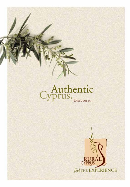
intro<br />
Short<br />
This guidebook has been designed to provide visitors with an extensive<br />
insight into the delightful world of rural Cyprus. This is a world apart from<br />
the beaches and tourist hotspots. Here, timeless v<strong>il</strong>lages, tiny remote<br />
painted churches, stunning scenery, forested mountain tra<strong>il</strong>s and a way<br />
of life that has hardly changed over the past centuries, are just waiting<br />
to be <strong>di</strong>scovered.<br />
The first part of this book provides general information on rural Cyprus,<br />
its history, tra<strong>di</strong>tions, cultures, flora and fauna, places of interest and more.<br />
The second half of the book, deta<strong>il</strong>s 15 recommended driving excursions.<br />
All of the routes can be accomplished eas<strong>il</strong>y within a day’s drive<br />
in a regular car, yet all have something <strong>di</strong>fferent to offer.<br />
The routes highlight points-of-interest along the way and all start and finish<br />
on one of the main roads. These routes are also ideal for organised<br />
group tours with small buses.<br />
The routes include places to stop for walking, cycling, bird watching,<br />
fresh-water fishing or to simply explore the countryside<br />
and charming v<strong>il</strong>lages. All that’s needed is a good road map,<br />
a sunhat, plenty of water, comfortable walking shoes and<br />
a spirit of adventure.<br />
NOTE: The spellings of all place-names conform to those in<strong>di</strong>cated<br />
on the road signs. However, in some cases, these may vary from<br />
those shown on your road map.
Contents<br />
Useful Information<br />
Welcome to Rural Cyprus<br />
Natural Environment<br />
Cultural Heritage<br />
Rural Crafts and Sk<strong>il</strong>ls<br />
Food and Wine<br />
Rural Accommodation<br />
Countryside Activities<br />
Religious and Local Customs and Celebrations<br />
The Rural Year in Cyprus<br />
Route 1 – The Southeast Area<br />
(Kokkinochoria – Red So<strong>il</strong> V<strong>il</strong>lages)<br />
Route 2 – The Central Plain<br />
Route 3 – Larnaka West Coast<br />
Route 4 – Lefkara Area<br />
Route 5 – Machairas and the Southwest<br />
Route 6 – Lemesos (Limassol) Forest<br />
Route 7 – Lemesos (Limassol) West Coast<br />
Route 8 – The Wine V<strong>il</strong>lages<br />
Route 9 – Troodos and the Solea Valley<br />
Route 10 – Troodos and the Marathasa Valley<br />
Route 11 – The Pits<strong>il</strong>ia and Southwest Mesaoria<br />
Route 12 – The Pafos Valleys<br />
Route 13 – Pafos and the Akamas<br />
Route 14 – Polis, Kato Pyrgos and Kykkos<br />
Route 15 – Pafos Forest<br />
3<br />
4<br />
8<br />
12<br />
18<br />
22<br />
28<br />
32<br />
38<br />
44<br />
52<br />
60<br />
64<br />
70<br />
76<br />
82<br />
86<br />
92<br />
98<br />
104<br />
110<br />
116<br />
120<br />
126<br />
132
info Useful<br />
Remember the country code<br />
ñ Avoid the temptation to pick w<strong>il</strong>dflowers and take a photograph instead.<br />
This way you protect the plant and st<strong>il</strong>l have an enduring reminder of its beauty.<br />
ñ Avoid <strong>di</strong>sturbing natural habitats and nesting birds.<br />
ñ Take your litter with you.<br />
ñ Do not light fires, except at designated picnic sites,<br />
Always be particularly careful about extinguishing cigarettes.<br />
Learn Greek:<br />
English is widely spoken in Cyprus. However, it is always an advantage<br />
to know a few key words of Greek – you may find them very useful<br />
and you w<strong>il</strong>l certainly impress the local people.<br />
Hello & goodbye:<br />
Please:<br />
Thank you:<br />
Yes:<br />
No:<br />
Road:<br />
Left:<br />
Right:<br />
Straight on:<br />
Where is<br />
Up (over or above):<br />
Down (below or lower):<br />
Slowly:<br />
Today:<br />
Tomorrow:<br />
Water:<br />
Car:<br />
Petrol:<br />
Mechanic:<br />
Telephone:<br />
Doctor:<br />
Police:<br />
Pharmacy:<br />
Cyprus Coffee:<br />
YIASSOU (plural is YIASSAS)<br />
PARAKALO<br />
EFKHARISTO<br />
NAI<br />
OCHI<br />
DROMOS<br />
ARISTERA<br />
DHEXIA<br />
ISHIA<br />
POU INE<br />
PANO<br />
KATO<br />
SIGA-SIGA<br />
SIMERA<br />
AVRIO<br />
NERO<br />
AFTOKINITO<br />
BEZINA (local <strong>di</strong>alect)<br />
MICHANIKOS<br />
TILEFONO<br />
YIATROS<br />
ASTYNOMIA<br />
FARMAKIO<br />
KAFE - gliko (sweet), metrio (me<strong>di</strong>um),<br />
sketo (no sugar).<br />
Dress Code:<br />
Always dress respectfully when visiting churches and monasteries.
welcome to Rural<br />
Cyprus<br />
Cyprus enjoys an enviable worldwide reputation<br />
as a sun and sea holiday destination,<br />
with year-round sunshine, blue skies and<br />
warm waters. However, this fascinating island<br />
has much more to offer. Away from the tourist<br />
areas, the Cyprus countryside has a <strong>di</strong>verse<br />
wealth of its own with tra<strong>di</strong>tional v<strong>il</strong>lages,<br />
vineyards and wineries, tiny fresco-painted<br />
churches, remote monasteries<br />
and cool shady forests.<br />
This is a nature-lovers para<strong>di</strong>se,<br />
where you can walk for hours without<br />
seeing another living soul. In springtime,<br />
fields of flowers stretch as far as the<br />
eye can see, and a ramble along<br />
a mountain path w<strong>il</strong>l suddenly reveal<br />
a tiny chapel or a Venetian-bu<strong>il</strong>t<br />
bridge that once formed part of the<br />
route of an ancient camel train.<br />
Around every corner is another<br />
surprise; a magnificent view;<br />
a rare sighting of the Cyprus moufflon<br />
as it scam<strong>per</strong>s up an almost<br />
vertical slope; or a chance encounter<br />
with someone who w<strong>il</strong>l surprise you with<br />
his or her knowledge of your language and<br />
an invitation to join the fam<strong>il</strong>y for a coffee<br />
or refreshment.<br />
4
The island of Cyprus may be small but it has<br />
literally hundreds of v<strong>il</strong>lages, many of which are<br />
no more that a handful of houses clustered<br />
around a church, and a coffee-shop that also<br />
serves as the v<strong>il</strong>lage store, post office and<br />
general meeting place. In the more remote parts<br />
of the island, these v<strong>il</strong>lages have remained<br />
virtually unchanged and although motorised<br />
transport has made them more accessible,<br />
their older inhabitants st<strong>il</strong>l cling to the<br />
tra<strong>di</strong>tional lifestyle which basically revolves<br />
around the seasons of planting and harvesting.<br />
For some of these people, the donkey is st<strong>il</strong>l the<br />
preferred mode of transport and these faithful<br />
animals can st<strong>il</strong>l be seen making their way home<br />
from the fields, laden with firewood or green<br />
forage for the fam<strong>il</strong>y goats.<br />
Even in the larger v<strong>il</strong>lages, tra<strong>di</strong>tional values are<br />
st<strong>il</strong>l very much in evidence. Here, maybe the<br />
v<strong>il</strong>lage shepherd carries a mob<strong>il</strong>e phone and the<br />
farmer drives to his fields in a double-cabin<br />
pick-up truck but this is merely a sign of the<br />
times – a veneer that, when scratched, w<strong>il</strong>l<br />
expose the true character of the v<strong>il</strong>lage people -<br />
fam<strong>il</strong>y-orientated, warm-hearted, friendly<br />
and unbelievably hospitable.<br />
5
The main activity in rural Cyprus is arable<br />
and livestock farming. What is grown<br />
where depends on the area, the terrain and<br />
the climate. But the island’s range of<br />
produce is amazing. Just about anything w<strong>il</strong>l<br />
grow here, from tropical fruits such as<br />
mangoes, kiwis and bananas to produce<br />
more associated with that from northern<br />
climates. On the island’s south facing<br />
slopes, especially in the western part of the<br />
Autumn is also the time to harvest the<br />
olives. As in most other Me<strong>di</strong>terranean<br />
countries, the olive plays a significant role<br />
in the lives of the people. Every part of the<br />
tree is important: the deadwood is used to<br />
stoke the winter stoves; the fruit is either<br />
preserved in brine, or crushed for its<br />
precious o<strong>il</strong>. Even the leaves are dried,<br />
blessed and burnt as aromatic incense<br />
during church services. Olive trees grow<br />
all over the island, except high up in the<br />
mountains, where they are unable to<br />
survive the harsher winters.<br />
Almost all v<strong>il</strong>lagers in the remote areas<br />
own at least a small plot of land on which<br />
they grow their own vegetables, such as<br />
tomatoes, cucumbers, pep<strong>per</strong>s and<br />
aubergines, as well as pulse vegetables that<br />
can be dried and stored for the winter<br />
months. They raise chickens for eggs and<br />
meat, and many also keep a few goats,<br />
which provide them with enough m<strong>il</strong>k to<br />
make their own yoghourt and cheeses,<br />
inclu<strong>di</strong>ng Cyprus’ famous Halloumi cheese.<br />
island, are the vineyards. Cyprus is famous<br />
for its fine wines and a visit to one of the<br />
many wineries is a great way to spend<br />
a day. The grapes are harvested during<br />
autumn, when entire fam<strong>il</strong>ies, from<br />
grandparents to the youngest toddlers,<br />
work together in their vineyards to bring<br />
in the crop.<br />
Sea fishing is also an important rural<br />
activity and fishing shelters are dotted<br />
around the coast. Visit them early in the<br />
morning, to watch the fishermen bring<br />
in the catch of the day.<br />
Mining the island’s rich mineral deposits<br />
of cop<strong>per</strong>, asbestos, chromium, pyrites and<br />
umber used to be a lucrative part of the<br />
rural economy but its importance has<br />
declined as the mines gradually become<br />
worked out.<br />
6
Away from the cultivated land, there is an<br />
abundant ecosystem of flora and fauna with<br />
many endemic species. In spring,<br />
the island is carpeted with w<strong>il</strong>d flowers<br />
and orchids. Cyprus is on one of the<br />
north-south migratory paths and during<br />
spring and autumn m<strong>il</strong>lions of birds either<br />
over-fly the island or break their long<br />
journey here. During winter, the Larnaka<br />
and Akrotiri salt lakes are an extraor<strong>di</strong>nary<br />
The Cyprus hinterland is a great place for<br />
botanists, artists, bird watchers, hikers,<br />
ramblers, anglers, cyclists, photographers<br />
and geologists.<br />
The greatest wealth of any country is its<br />
people and whatever your interest or<br />
wherever you travel in Cyprus you can<br />
always be sure of receiving the warmest<br />
of welcomes.<br />
sight with thousands of pink flamingos<br />
wa<strong>di</strong>ng in the shallow waters.<br />
The moufflon, an in<strong>di</strong>genous w<strong>il</strong>d sheep,<br />
roams the forested slopes of the Troodos<br />
range, and both Green and Loggerhead<br />
turtles breed on the island’s more secluded<br />
beaches. The cultural landscape of the rural<br />
areas is rich and varied, with archaeological<br />
sites, monasteries, museums and churches,<br />
wh<strong>il</strong>e tra<strong>di</strong>tional crafts such as basketmaking,<br />
pottery, weaving, wood carving,<br />
and lace-making are st<strong>il</strong>l maintained<br />
in many v<strong>il</strong>lages.<br />
7
natural<br />
Environment<br />
Geology<br />
The island of Cyprus was formed around seventy<br />
m<strong>il</strong>lion years ago by the collision of the<br />
Euro-asian and African tectonic plates.<br />
By the Lower Miocene era, some twenty-five<br />
m<strong>il</strong>lion years ago, the Troodos mountain range<br />
was an island and the Mesaoria (central plain)<br />
and Pantadactylos range to the north were<br />
submerged under the sea (evidence of this<br />
can be found in several areas, where foss<strong>il</strong>ised<br />
seashells can be clearly seen<br />
embedded in the rocks).<br />
The Pentadactylos Mountains began<br />
to emerge eleven m<strong>il</strong>lion years ago<br />
at the end of the Miocene era,<br />
but the Mesaoria appeared much<br />
later, during the Pleistocene Age,<br />
a m<strong>il</strong>lion years ago.<br />
Today, the Troodos massif,<br />
a bulky range with the 1951m<br />
Mount Olympus (Chionistra) at its peak,<br />
dominates the south of the island.<br />
It consists of igneous rock and p<strong>il</strong>low lavas<br />
originally formed from molten rock beneath<br />
the 8,000-metre deep ocean that once separated<br />
the continents of Eurasia and Afro-Arabia.<br />
Its serpentine rocks contain rich deposits<br />
8
of cop<strong>per</strong>, asbestos, chromites and iron pyrites.<br />
Troodos provides a unique opportunity for<br />
anyone interested in geology, because it is one<br />
of the rare places in the world where you can<br />
actually stand on the earth’s mantle.<br />
The Pentadactylos range, which runs parallel<br />
to the northern coastline, is the east<br />
Me<strong>di</strong>terranean’s southernmost range of the<br />
great Alpine-Himalaya chain. It consists of thrust<br />
masses of limestone of the Permian,<br />
Carboniferous and Cretaceous <strong>per</strong>iods,<br />
with marl, sandstone and conglomerates<br />
from the Miocene era on the lower slopes.<br />
The Mesaoria, between the two mountain<br />
ranges, stretches from Morfou in the west<br />
to Ammochostos (Famagusta) in the east,<br />
with the capital, Lefkosia (Nicosia), lying more<br />
or less in the middle. This central plain is mainly<br />
marl and shell-limestone, wh<strong>il</strong>e in the eastern<br />
footh<strong>il</strong>ls of the Troodos range, chalk, limestone<br />
and gypsum are common.<br />
Natural features<br />
The rock formations have played a significant<br />
role in the development of the landscape.<br />
The erosion resistant dunites, serpentines,<br />
gabbros and <strong>di</strong>abases of the Troodos massif are<br />
the main reason for its height and its harsh,<br />
rugged scenery, wh<strong>il</strong>e less erosion-resistant<br />
chalks at lower altitudes have formed the<br />
rounded white landscape of the vineyards.<br />
9
The limestone cliffs of the Akamas have<br />
created karsts, with subterranean streams,<br />
reservoirs and caves containing stalagmites<br />
and stalactites. There are also deep gorges<br />
at the west of the island.<br />
The rivers flowing ra<strong>di</strong>ally from the<br />
Troodos have opened steep-sided river<br />
valleys and there are significant waterfalls<br />
at Kalidonia, Mesapotamos and Fini.<br />
The Salt Lakes at Akrotiri and Larnaka lose<br />
their water in summer due to evaporation<br />
and, unt<strong>il</strong> quite recently, the salt harvested<br />
from the dried-out lake at Larnaka was<br />
sold on the local market.<br />
Coupled with the rock types are the<br />
various kinds of so<strong>il</strong>, which give <strong>di</strong>stinct<br />
colour to the landscape. Deep and fert<strong>il</strong>e<br />
terra rosa has developed on the hard<br />
limestone of the Kokkinochoria<br />
(Red V<strong>il</strong>lages) in the southeast, and rich<br />
brown so<strong>il</strong>s have developed on the p<strong>il</strong>low<br />
lavas. The white limey so<strong>il</strong>s, derived from<br />
the decomposition of limestone rocks,<br />
are widespread and the most suitable for<br />
the cultivation of vines in the <strong>di</strong>stricts of<br />
Pafos and Lemesos (Limassol), wh<strong>il</strong>e very<br />
fert<strong>il</strong>e alluvial so<strong>il</strong>s are present in the river<br />
valleys.<br />
Flora and fauna<br />
The natural vegetation of Cyprus is broadly<br />
split into four categories: forests, maquis,<br />
Me<strong>di</strong>terranean garrigue and herbaceous<br />
plants. The main forest trees at high<br />
altitude are pines, inclu<strong>di</strong>ng the flat-topped<br />
Troodos pine (Pinus nigra s.p. Palasianna).<br />
Cedar, plane, alder, maple and the endemic<br />
golden oak (Quercus alnifolia) grow on the<br />
lower slopes and, near the coasts, juni<strong>per</strong><br />
predominates. The golden oak has been<br />
declared the national tree of Cyprus.<br />
Maquis vegetation, which thrives on poor<br />
quality s<strong>il</strong>iceous so<strong>il</strong>, includes rockroses,<br />
arbutus, myrtle and rosemary. The scrub<br />
vegetation of the garrigue is chiefly on<br />
limestone so<strong>il</strong> and includes the spiny<br />
burnet, ca<strong>per</strong>s and aromatics such as<br />
thyme, rosemary, oregano and lavender.<br />
Cyprus is characterised by an extremely<br />
high number of in<strong>di</strong>genous plant species,<br />
approximately 2000, of which almost<br />
140 are endemic, such as the Cyclamen<br />
cyprium, which has been declared the<br />
national flower of Cyprus. For nature<br />
lovers, early spring is the most rewar<strong>di</strong>ng<br />
<strong>per</strong>iod of the year. There is a riotous<br />
blossoming of poppies, anemones,<br />
cyclamen, iris, gla<strong>di</strong>oli, tulips and crown<br />
daisies. Approximately fifty species,<br />
subspecies and varieties of orchid are<br />
found, inclu<strong>di</strong>ng several endemics.<br />
There are more than 70<br />
organised Nature Tra<strong>il</strong>s in<br />
rural Cyprus. Each is carefully<br />
designed to ensure hikers<br />
appreciate the best viewpoints<br />
and things of interest in the<br />
area. Ask for the special CTO<br />
booklet.<br />
10
Birds on the spring and autumn northsouth<br />
migration use Cyprus as a stopping<br />
point and the two Salt Lakes (Larnaka and<br />
Akrotiri) offer a winter home to large<br />
flocks of greater flamingos (Phoenicopterus<br />
ruber). Nightingales, golden orioles,<br />
hoopoes, rollers and bee-eaters are among<br />
the visitors and residents include several<br />
endemic species, such as the Cyprus<br />
warbler and the Cyprus Wheatear.<br />
The population of the Griffon Vulture<br />
(Gyps fulvus) has declined rapidly over<br />
recent years and the birds no longer visit<br />
many of their tra<strong>di</strong>tional nesting sites.<br />
The Game Service has set up a small<br />
reserve at Agios Ioannis on the Xeros<br />
River and action is being taken to prevent<br />
the loss of the species.<br />
The endemic moufflon (Ovis orientalis<br />
ophion), a type of w<strong>il</strong>d sheep, considered<br />
by many to be Cyprus’ national animal.<br />
At one time, these beautiful shy animals<br />
were hunted almost to extinction.<br />
However, a captive-bree<strong>di</strong>ng programme<br />
has saved the species and today around<br />
10,000 live in and around the Pafos Forest.<br />
They are best seen in a reserve<br />
at the Stavros tis Psokas Forest Station,<br />
in the Troodos range.<br />
Cyprus is one of the few remaining nesting<br />
grounds for the endangered Green Turtle<br />
(Chelonia my<strong>di</strong>as) and the Loggerhead<br />
Turtle (Caretta caretta). Turtles lay their<br />
eggs in the sand on isolated beaches.<br />
Gradual human encroachment into their<br />
territory and depredation of the nests and<br />
hatchlings by foxes and other predators has<br />
severely jeopar<strong>di</strong>sed the survival of these<br />
primeval marine creatures.<br />
In 1978, the Cyprus Fisheries Department<br />
established a turtle hatchery at Lara Beach,<br />
one of the main nesting sites on the west<br />
coast. Turtle eggs are also transported<br />
from other beaches to hatch in safe<br />
con<strong>di</strong>tions at Lara.<br />
Although not a w<strong>il</strong>d animal in danger<br />
of extinction, the Cyprus donkey has<br />
always been an important feature of rural<br />
life. It was a form of transport,<br />
beast of burden and the means for drawing<br />
water from the wells.<br />
The Nubian Donkey (Equus asinus)<br />
is believed to be the domestic donkey’s<br />
ancestor and it is known that donkeys<br />
were domesticated before horses.<br />
What is not known is when the first<br />
donkeys arrived in Cyprus but the remains<br />
of an ass have been found in a tomb from<br />
the seventh century BC. V<strong>il</strong>lagers from the<br />
remoter areas can st<strong>il</strong>l be seen ri<strong>di</strong>ng and<br />
working with donkeys, and there is a<br />
Donkey Sanctuary at the v<strong>il</strong>lage of Vouni,<br />
northwest of Lemesos (Limassol).<br />
11
Cultural<br />
Heritage<br />
As you wander around the island you w<strong>il</strong>l<br />
come across many prehistoric sites,<br />
tombs and sanctuaries depicting the long<br />
cultural heritage of the island.<br />
The ancient history of Cyprus tends to focus<br />
on the great city kingdoms, conquerors and<br />
conflict. Yet farmers and herders, artisans<br />
and miners played an equal role in the chronicle<br />
and they laid down the foundations of the<br />
country’s <strong>di</strong>stinctive culture.<br />
Manmade artefacts from as far back<br />
as 10,000 BC show that Stone Age Man<br />
was present on the island when the<br />
pygmy hippopotamus and dwarf<br />
elephant were on earth.<br />
By 6,800 BC, Neolithic Man was<br />
a sk<strong>il</strong>led hunter, living in stone<br />
and clay huts. He shaped river<br />
pebbles to make axe heads<br />
and chisels. He also created patterned<br />
pottery bowls, clay sculpture and jewellery<br />
of steatite, shell and cornelian.<br />
Arts and crafts started to evolve when<br />
the <strong>di</strong>scovery of ochre and umber pigments<br />
enabled potters to decorate their ceramics<br />
12
with colour. They also started to create figures<br />
of fert<strong>il</strong>ity goddesses and cross-shaped human<br />
forms. Archaeological finds from this era include<br />
animal-shaped vases and a model of a ploughing<br />
scene – signifying the importance of livestock<br />
and arable farming.<br />
The <strong>di</strong>scovery of cop<strong>per</strong> around 3,000BC,<br />
changed life dramatically, as the metal became<br />
the source of immense wealth and triggered<br />
the development of trade with neighbouring<br />
countries. In ad<strong>di</strong>tion, the location of many<br />
of the cop<strong>per</strong> mines prompted previously<br />
agrarian communities from settlements in the<br />
footh<strong>il</strong>ls and plains to relocate to upland areas.<br />
Some cop<strong>per</strong> ore was smelted locally in wood<br />
or charcoal-burning furnaces and the metal was<br />
exported in ingots in the shape of a sheepskin.<br />
By the Late Bronze Age, smiths were using<br />
imported tin mixed with cop<strong>per</strong> to cast large<br />
bronze objects.<br />
Around 1200BC, the arrival of Greek-speaking<br />
settlers as part of the Sea Peoples, caused great<br />
<strong>di</strong>sruption and led to the emergence of the first<br />
of the city kingdoms of the Iron Age and the<br />
Hellenisation of the island.<br />
Cop<strong>per</strong> smelting started the depletion of the<br />
island’s thick forest cover and after Cyprus fell<br />
to the Persians, the forests were further<br />
<strong>di</strong>minished for shipbu<strong>il</strong><strong>di</strong>ng.<br />
13
During the Hellenistic <strong>per</strong>iod (4th century<br />
BC), cop<strong>per</strong> mining was generating such<br />
wealth that Cyprus was able to supply<br />
Alexander the Great, to whose empire the<br />
island then belonged, with a whole fleet<br />
of battleships.<br />
The value of the cop<strong>per</strong> mining and export<br />
trade was the catalyst for the Romans<br />
taking possession of Cyprus in 58BC and<br />
their baskets, ropes, wooden props<br />
and other mining paraphernalia have been<br />
found in shafts of cop<strong>per</strong> mines st<strong>il</strong>l in use<br />
in the last century.<br />
Tenta Prehistoric Site<br />
Today, agriculture, inclu<strong>di</strong>ng the wine<br />
industry, is st<strong>il</strong>l a fundamental part<br />
of the country’s economy and Cypriot<br />
craftspeople continue their cultural<br />
tra<strong>di</strong>tions by creating pottery and weaving,<br />
lace and metalwork just as their ancestors<br />
<strong>di</strong>d in ancient times.<br />
Evidence of the island’s intriguing heritage<br />
can be seen in its many interesting<br />
archaeological museums.<br />
The Cyprus Museum in Lefkosia<br />
(Nicosia) houses the richest collection<br />
of archaeological finds in Cyprus. Prior to<br />
its being bu<strong>il</strong>t in the first decade of the<br />
last century, antiquities were plundered<br />
by entrepreneurs such as Luigi Palma<br />
de Cesnola, an American consul whose<br />
collection was amassed through his<br />
privately organised excavations all over the<br />
island during the Ottoman <strong>per</strong>iod. Sir John<br />
Myres and Max Ohnefalsch-Richter were<br />
the first ex<strong>per</strong>ts to carry out systematic<br />
archaeological work on the island and after<br />
the Cyprus Museum was established,<br />
so many finds were brought to light that<br />
it ran out of space in which to exhibit<br />
them. The museum’s exhibits traverse<br />
the history of Cyprus from the Neolithic<br />
Era (7,000 BC) to the 7th century AD.<br />
Amongst the highlights are an<br />
extraor<strong>di</strong>nary <strong>di</strong>splay of terracotta figures<br />
found in 1929 at Agia Irini Sanctuary<br />
at Morfou, and statue of the goddess<br />
Aphro<strong>di</strong>te <strong>di</strong>scovered at Soli. Another focal<br />
point is the collection of limestone lions<br />
and sphinxes found at Tamassos in 1997.<br />
1 Mouseiou Street, Lefkosia Open Mon-Sat<br />
09:00 – 17:00, Sunday 10:00 – 13:00.<br />
The museum is on the Aphro<strong>di</strong>te<br />
Cultural Route.<br />
14
The Aphro<strong>di</strong>te Cultural<br />
Route (Kiprida Aphro<strong>di</strong>te)<br />
invites you to wander through<br />
layers of history and<br />
culture in the footsteps<br />
of the Goddess.<br />
The Aphro<strong>di</strong>te cult probably<br />
evolved from even older<br />
female fert<strong>il</strong>ity deities and<br />
after eons, the Anassa, (Holy<br />
Queen) of Cyprus, became<br />
completely identified with the<br />
Aphro<strong>di</strong>te of the Greek<br />
Gods of Olympus in the<br />
4th century BC. Although<br />
best known as the Goddess of<br />
Love and Beauty, Aphro<strong>di</strong>te<br />
was also the goddess of cop<strong>per</strong><br />
and was worshipped at<br />
sanctuaries connected to<br />
smelting workshops. Temples,<br />
shrines and natural sites from<br />
around the island such as the<br />
Baths of Aphro<strong>di</strong>te near Polis<br />
tell the tale of the enigmatic<br />
goddess of love and beauty.<br />
The primary sites connected<br />
with the goddess are Paleia<br />
Pafos (Kouklia), Amathous<br />
and Kition and all are well<br />
worth a visit. At all sites,<br />
information boards deta<strong>il</strong><br />
various aspects of Aphro<strong>di</strong>te.<br />
Also, the museums on the<br />
Aphro<strong>di</strong>te route, highlight<br />
the finds connect to the<br />
goddess with the logo of the<br />
Cultural Route.<br />
Brochures of the Aphro<strong>di</strong>te<br />
Route are also ava<strong>il</strong>able from<br />
all CTO Information Offices.<br />
Larnaka District Archaeological<br />
Museum houses finds from Larnaka and<br />
the surroun<strong>di</strong>ng area, which was inhabited<br />
long before the city-kingdom of Kition was<br />
bu<strong>il</strong>t in the 13th century BC by the<br />
Mycenaean Greeks. Among the items from<br />
the prehistoric settlements at Choirokoitia<br />
and Kalavassos are tools made from bone,<br />
picrolite jewellery and a tomb in which<br />
a heavy stone has been laid on the head<br />
and chest of the dead man. Bronze Age<br />
15
faience, ivory and alabaster objects bear<br />
witness to the commerce of the time.<br />
There is a collection of Mycenaean<br />
ceramics, votive terracotta figurines,<br />
glass objects from Roman times and<br />
an interesting exhibition of Cypro-Minoan<br />
inscriptions. The museum also contains<br />
stone anchors found in the area. Plateia<br />
Kalograion.<br />
Open Mon-Fri 09:00-14:30 + Thurs<br />
15:00-17:00 (except July & August).<br />
The Museum is on the Aphro<strong>di</strong>te<br />
Cultural Route.<br />
Lemesos (Limassol) District<br />
Archaeological Museum contains finds<br />
from Kourion and Amathous, the two<br />
important city-kingdoms near Lemesos<br />
(Limassol), as well as from around thirty<br />
other archaeological sites in the <strong>di</strong>strict.<br />
Some of the exhibits date back to the era<br />
before Cyprus had even been settled,<br />
such as the skull and jawbone of a pygmy<br />
hippopotamus and the tusk of a dwarf<br />
elephant found on the Akrotiri peninsula.<br />
Among the finds from Kourion is a large<br />
storage jar that stands one and a half<br />
metres tall. The museum also houses an<br />
extensive collection of pottery, stone tools,<br />
gold, s<strong>il</strong>ver and bronze jewellery and<br />
Byzantine artefacts. Corner of Kaningos<br />
and Vyronos Streets.<br />
Open Mon – Fri 09:00 – 17:00,<br />
Sat 10:00 – 13:00.<br />
The museum is on the Aphro<strong>di</strong>te Cultural<br />
Route.<br />
Pafos District Archaeological Museum<br />
contains finds from the Pafos <strong>di</strong>strict that<br />
date from between the Neolithic and<br />
Venetian <strong>per</strong>iods of the island’s history.<br />
A remarkable find from Lempa is the<br />
skeleton of a twenty-year old woman,<br />
<strong>di</strong>splayed exactly as it was found.<br />
The oldest exhibits are from approximately<br />
8000BC and include stone axes, fragments<br />
of pots and abstract statuettes of steatite<br />
and clay. There are also some intriguing<br />
examples of me<strong>di</strong>cal devices from the<br />
Roman <strong>per</strong>iod. Other remarkable exhibits<br />
include classical funerary steles from<br />
ancient Marion (modern day Polis) and the<br />
beautiful statue of the ‘armed’ Aphro<strong>di</strong>te.<br />
Griva Digeni St.<br />
Open Mon – Fri 09:00 – 17:00,<br />
Sat 10:00 – 13:00.<br />
The museum is on the Aphro<strong>di</strong>te<br />
Cultural Route.<br />
16
Rural<br />
Crafts and<br />
Sk<strong>il</strong>ls<br />
Lekfaritika is the fine embroidery and drawnthread<br />
work that has made Lefkara, the v<strong>il</strong>lage<br />
after which it is named, world famous.<br />
Simple embroidery, known as asproploumia<br />
(white work), was done in Cyprus from very<br />
early times. However, in the Frankish and<br />
Venetian <strong>per</strong>iods (1191 – 1571) when Lefkara<br />
was a summer resort for the nobles,<br />
local women added to their re<strong>per</strong>toire the more<br />
complicated designs created by Venetian<br />
women. Lefkaritika patterns are mainly<br />
geometric with crosses and <strong>di</strong>amonds<br />
and the work is done on beige ‘Irish’<br />
linen with white or dark brown cotton<br />
thread. In the 19th century,<br />
v<strong>il</strong>lage men travelled to Europe,<br />
and later America and Australia,<br />
to sell the embroideries.<br />
Leonardo da Vinci is said to have<br />
come to Lefkara to buy an altar-cloth<br />
for M<strong>il</strong>an cathedral. Lefkaritika is also made<br />
at all the v<strong>il</strong>lages in the area as well as<br />
at Kornos, Lympia, Dali and Athienou.<br />
Pottery in Cyprus goes back to Neolithic times<br />
and you can see fine examples from most <strong>per</strong>iods<br />
of the island’s history in all the island’s<br />
18
archaeological museums. Tra<strong>di</strong>tional potters st<strong>il</strong>l<br />
work in the v<strong>il</strong>lages of Foini and Kornos, using<br />
red clay from local h<strong>il</strong>lsides to make cooking<br />
pots, storage jars, amphorae and plant pots.<br />
The pots are thrown on a small wheel turned by<br />
hand or foot. Before firing, the vessel is bound<br />
with string or cloth strips to prevent cracking<br />
and left to stand overnight. Then the potter<br />
scrapes off any excess clay and rubs the pot<br />
with a stick then with a wet cloth to make it<br />
shine. After being left to dry away from the<br />
wind and sun, the pot is finally fired in a woodburning<br />
k<strong>il</strong>n. Sadly, the giant onion-shaped<br />
earthenware storage jars called pitharia are no<br />
longer made but these enormous vessels are<br />
often used as decorative plant pots.<br />
Ceramic tra<strong>di</strong>tions continue with small potteries<br />
all over the island, making good quality modern<br />
and ethnic ware.<br />
Decorated gourds: The gourd is a vegetable<br />
of the marrow fam<strong>il</strong>y that hangs from a climbing<br />
vine seen adorning the verandas of rural houses.<br />
Kolokia (gourds) come in a range of shapes and<br />
sizes and have long been decorated and used<br />
for practical purposes by Cypriots.<br />
The bottle-shaped gourd is the most useful:<br />
as a wine carafe, a candlestick, a container for<br />
salt or olives and, with its side cut off,<br />
as a water ladle. Decorating gourds, either<br />
by incising geometric patterns or motifs of<br />
animals or flowers into them with a knifepoint<br />
19
or burning the design with a poker,<br />
is a craft st<strong>il</strong>l practiced in the v<strong>il</strong>lages of<br />
Pachyammos and Tries Elies.<br />
Basket making dates from Neolithic<br />
times and today’s methods are virtually<br />
unchanged. Baskets were made to serve<br />
specific practical purposes. In the<br />
Kokkinochoria (Red So<strong>il</strong> V<strong>il</strong>lages),<br />
large strong wicker baskets were made for<br />
gathering and transporting potatoes.<br />
At Lakatameia, riverbed rushes were used<br />
to dress bottles to prevent leakage when<br />
transporting olive o<strong>il</strong>, wine or zivania.<br />
Donkey panniers, known as sirizes, were<br />
also made from rushes. Workers carried<br />
their lunch in small-lidded korokolios and<br />
bread was kept in a macramé type basket,<br />
called a tapatsa that hung from the ce<strong>il</strong>ing.<br />
Tsestos, the large, often colourfully<br />
decorated, flat cane platters used for<br />
carrying bread and drying trahana, (a type<br />
of Cyprus porridge) now often decorate<br />
house walls. Talari, the small cylindrical<br />
baskets used for draining and pressing<br />
halloumi and anari cheeses are st<strong>il</strong>l made<br />
at Akrotiri v<strong>il</strong>lage. Baskets are st<strong>il</strong>l made<br />
at Mesogi too and there is a basketry<br />
museum at Ineia, near Pafos.<br />
Cop<strong>per</strong>ware is an obvious tra<strong>di</strong>tional craft<br />
in a country where the metal featured<br />
prominently throughout history.<br />
The <strong>di</strong>scovery of cop<strong>per</strong> made Cyprus rich<br />
and important in the Bronze Age and<br />
mining was carried out throughout the<br />
centuries. Cop<strong>per</strong>smiths st<strong>il</strong>l make cop<strong>per</strong><br />
pots and kettles, the long-handled pots<br />
known as brikki (in which Cyprus coffee<br />
is made) and exquisite bracelets.<br />
Old cop<strong>per</strong> cauldrons, coffee pots and<br />
lamps often adorn hotels and tavernas.<br />
S<strong>il</strong>verware is made chiefly at Lefkara,<br />
where the men have a long history of<br />
producing cobweb-like f<strong>il</strong>igree work.<br />
Fine s<strong>il</strong>ver wire is bent into complex<br />
designs for teaspoons, bracelets and other<br />
jewellery, as well as intricately worked<br />
containers that hold jars of the tra<strong>di</strong>tional<br />
sweetmeat glyko, and are hung around with<br />
half a dozen small pastry forks. Also made<br />
is solid s<strong>il</strong>verware, inclu<strong>di</strong>ng trays and<br />
pinecone or pomegranate-shaped vessels<br />
for the o<strong>il</strong> and holy water used at baptisms<br />
and blessings.<br />
Weaving: It is known that weaving was<br />
highly developed during Byzantine times<br />
and, during the Venetian and Lusignan<br />
<strong>per</strong>iods, valuable s<strong>il</strong>k and woollen fabrics<br />
renowned for their high quality were<br />
exported in great quantities to Europe.<br />
20
Fyti weaving, which derives its name from<br />
Fyti v<strong>il</strong>lage, consists of colourful geometric<br />
textured designs or ploumia on un-dyed<br />
cotton cloth. The ploumia, in strong reds,<br />
yellows, blues, greens and orange,<br />
are made by placing thick coloured thread<br />
or fyt<strong>il</strong>ia among the warp threads. Fyti<br />
weaving is usually made into rectangular<br />
napkins, tablecloths and bed covers.<br />
The origins of this weaving are lost in the<br />
past but geometric patterns sim<strong>il</strong>ar to<br />
those in Fyti work can be seen on pottery<br />
from the Geometric <strong>per</strong>iod. Another style<br />
of weaving is the Lefkoniko weave of<br />
brightly coloured stripes. This strong fabric,<br />
which comes in a glorious array of bright<br />
colours, makes good tablemats, table<br />
runners, throws for sofas, rugs, bedcovers<br />
and curtains. Cyprus rag rugs are st<strong>il</strong>l made<br />
in many colour combinations, using cotton<br />
thread for the warp and strips of fabric for<br />
the weft. In the mountain v<strong>il</strong>lages, rugs<br />
were woven of a mixture of goat hair and<br />
wool in muted stripes.<br />
to crosses. Ecclesiastical woodcarving was,<br />
and st<strong>il</strong>l is, a specialised craft and elaborate<br />
iconostasis (altar screens) are to be found<br />
in countless churches around the island.<br />
Religious themes sim<strong>il</strong>ar to those of the<br />
iconostasis often found their way onto<br />
household objects too and the local church<br />
was usually depicted on the central panel<br />
of the sendukia. At Mouttoullas, on the<br />
northern slopes of the Troodos Mountains,<br />
artisans used pinewood to make vournes<br />
(wooden troughs), which, accor<strong>di</strong>ng to<br />
size, were used by v<strong>il</strong>lage women for<br />
knea<strong>di</strong>ng bread or doing the laundry.<br />
Also made from pine were sanidhia (long<br />
breadboards), on which the women carried<br />
their loaves to the oven for baking.<br />
Woodcarving: In the days when timber<br />
from the abundant forests of Cyprus was<br />
plentiful, the decorative art of woodcarving<br />
was widespread around the island.<br />
Many rural houses had doors and lintels<br />
with at least some carving – and sometimes<br />
painting as well. Inside there were carved<br />
chairs, wardrobes, corner cupboards,<br />
shelves and sendukia (dowry chests),<br />
in which girls gradually amassed the<br />
household linen needed for their marriage.<br />
The carved designs ranged from flowers,<br />
cypress trees, birds, animals and grapes,<br />
21
Food and<br />
Wine<br />
Hospitality is a byword in Cyprus and Kopiaste<br />
in Greek means, “Come and enjoy our<br />
hospitality”. Where better to try some local<br />
specialities than in rural Cyprus<br />
Much of the food eaten da<strong>il</strong>y - olives, almonds,<br />
figs, beans, chickpeas, dates, bitter herbs and<br />
honey – was known in Biblical times. It is said<br />
that carobs are the ‘husks’ from the parable<br />
of the pro<strong>di</strong>gal son and the ‘locusts’ eaten<br />
by John the Baptist in the w<strong>il</strong>derness.<br />
The tra<strong>di</strong>tional Cypriot <strong>di</strong>et is a healthy<br />
one based on vegetables, salad, pulses,<br />
bread, fruit, olive o<strong>il</strong> and small quantities<br />
of meat. Everything is freshly cooked<br />
and the salad is often picked straight<br />
from the garden. Even Cypriot fast<br />
food is healthy. Try an envelope<br />
of pitta bread f<strong>il</strong>led with char-gr<strong>il</strong>led<br />
souvlakia meat and salad; add a dash<br />
of salt and lemon juice and enjoy<br />
it with a cool local beer.<br />
22
Festive food<br />
On New Year’s Day, a special cake called<br />
Vass<strong>il</strong>iopitta (St Bas<strong>il</strong>’s cake) is baked with a coin<br />
hidden in it. The <strong>per</strong>son fin<strong>di</strong>ng the coin is<br />
promised good luck throughout the year.<br />
Easter is a time of rejoicing. Many Cypriots w<strong>il</strong>l<br />
have given up meat, fish and dairy products<br />
during Lent and the fast is broken after midnight<br />
on Easter Day, with a rich lamb soup called<br />
Mageiritsa (originally from Greece), or the more<br />
popular Avgolemono (egg and lemon soup).<br />
Easter cakes or flaounes, are made from<br />
a special cheese, eggs, spices, herbs and sultanas<br />
wrapped in dough. The main Easter meal<br />
is souvla, large chunks of spit-roasted lamb,<br />
accompanied by roast potatoes, lots of salad<br />
and good wine.<br />
Before Christmas there is another forty-day<br />
fast. Turkeys and pigs are fattened up during the<br />
summer and slaughtered for the Christmas feast.<br />
Some of the pork meat is salted, cured or<br />
smoked to last through the winter. Everyone<br />
eats the icing-sugar covered shortbread called<br />
kourambiedes and spiced honey buns called<br />
melomakarona.<br />
Tra<strong>di</strong>tional Cyprus foods<br />
Halloumi, can be eaten fried, gr<strong>il</strong>led, grated<br />
onto pasta or as is with a slice of watermelon.<br />
It is made by heating a mixture of sheep and<br />
23
goat m<strong>il</strong>k in a hartzi (cauldron) before<br />
ad<strong>di</strong>ng rennet and turning off the heat. The<br />
curds are scooped out, squeezed to<br />
extract the whey, wrapped in cheesecloth<br />
and pressed under a heavy weight. The<br />
cheese is cut into blocks and cooked in the<br />
whey again. When it rises to the surface, it<br />
is taken out, <strong>di</strong>pped in salt and dried mint,<br />
folded in half and left to cool before being<br />
stored in the whey.<br />
Cyprus bread is delicious<br />
anywhere you go, but some<br />
v<strong>il</strong>lages make their own<br />
specialities and these are<br />
exceptionally good.<br />
Look out for the<br />
sesame-covered loaves that<br />
have been baked in the<br />
tra<strong>di</strong>tional beehive-shaped<br />
ovens. The texture<br />
is somewhat denser than<br />
European style breads but the<br />
flavour is outstan<strong>di</strong>ng.<br />
Before the final step, the whey is returned<br />
to the hartzi to make Anari, a cheese<br />
sim<strong>il</strong>ar to ricotta. Fresh m<strong>il</strong>k is added and<br />
the mixture is reheated and stirred with<br />
a small brush called a throumbi unt<strong>il</strong> the<br />
crumbly white cheese floats to the surface.<br />
Some anari is salted and dried to be grated<br />
over pasta. The best way to eat it, though,<br />
is unsalted, with just a drizzle of honey<br />
or carob syrup. Natural yoghurt, strained<br />
or otherwise, is yet another dairy product<br />
that is an integral part of the Cypriot <strong>di</strong>et<br />
and one that quickly becomes a firm<br />
favourite with all the island’s visitors.<br />
The highly nutritious sugary unripe pods<br />
of the carob tree (ceratonia s<strong>il</strong>iqua) used<br />
to be known as the ‘Black Gold of Cyprus’.<br />
charoupomelo, carob syrob, is made<br />
by bo<strong>il</strong>ing the ripe pods to a mash in a<br />
large cauldron of water, straining the<br />
mixture and reducing it to the consistency<br />
of honey. Pasteli is made by bo<strong>il</strong>ing carob<br />
syrup to reduce it further to a thick pulp,<br />
then knea<strong>di</strong>ng it into toffee.<br />
Among the sweetmeats, Glyka are<br />
sugar-preserved fruit and nuts tra<strong>di</strong>tionally<br />
offered to welcome guests to the home.<br />
It is made from green walnuts (Karidaki),<br />
apricots, quinces, tiny white aubergines,<br />
cherries, bitter oranges (citrom<strong>il</strong>o),<br />
curls of grapefruit or bergamot peel<br />
24
or strips of watermelon rind, steeped<br />
in a thick sugar syrup.<br />
Palouze is made in the mountain v<strong>il</strong>lages at<br />
grape harvest time. It is a mixture of grape<br />
juice, flour and sugar that is bo<strong>il</strong>ed unt<strong>il</strong> it<br />
sets like blancmange.<br />
To make soudjouko, almonds are<br />
threaded like beads on string and <strong>di</strong>pped<br />
into bo<strong>il</strong>ing palouze and dried, repeatedly,<br />
unt<strong>il</strong> thickly coated, then hung in the sun<br />
to dry and cut into lengths.<br />
Cyprus Coffee: Strong,<br />
full of flavour and served<br />
in tiny cups together with a<br />
glass of cold water. Ask for:<br />
glyko (sweet); metrio<br />
(me<strong>di</strong>um); or sketo (without<br />
sugar). Be careful not to drink<br />
to the bottom of the cup or<br />
you’ll end up with a mouthful<br />
of coffee grains.<br />
Olives and Olive o<strong>il</strong> are essential to<br />
Cypriot cooking and many fam<strong>il</strong>ies cultivate<br />
a few trees to ensure they have an<br />
adequate supply to last the year.<br />
Olive picking starts in late autumn with the<br />
gathering of the green olives.<br />
These are preserved in brine to be served<br />
as tra<strong>di</strong>tional Cypriot tsakistes. Unique to<br />
Cypriot cuisine, the olives are cracked and<br />
sprinkled with crushed coriander seeds and<br />
chopped garlic, and bathed in lemon and<br />
olive o<strong>il</strong>. At the year’s end, the black olives<br />
are ready to be taken to the olive press,<br />
there to be kneaded and pressed into thick<br />
green o<strong>il</strong>. A slice of freshly toasted bread<br />
is held under the spigot to catch the first<br />
drizzle of the season’s yield. Eliotes, a tasty<br />
olive pastry, is a firm favourite with all<br />
Cypriots.<br />
Cyprus coffee is made in long-handled<br />
brikkia (pots) on a cop<strong>per</strong> or brass<br />
contraption called an outziaki, consisting<br />
of a cylinder of simmering water above<br />
a tray of very hot sand. Coffee beans are<br />
ground to a powder and a heaped<br />
teaspoon plus a demitasse of water are put<br />
into the brikki for each serving. Sugar is<br />
added to taste and you order metrios<br />
(me<strong>di</strong>um), glykos (sweet) or sketos<br />
(unsweetened). The brikki is heated in the<br />
sand and the coffee is allowed to bo<strong>il</strong>.<br />
When it starts to rise, the coffee is poured<br />
into the cup. Cyprus coffee is always<br />
served with a glass of cold water and<br />
you never drink to the bottom of the cup,<br />
as there is a little se<strong>di</strong>ment.<br />
Cyprus has a very long history of wine<br />
production and the island has fifteen<br />
in<strong>di</strong>genous varieties of grape. The wines<br />
of Cyprus are praised in the Song of<br />
Solomon and in 800 BC Hesiodes<br />
described the making of Cyprus wine.<br />
Greek poet Euripides wrote of vast<br />
p<strong>il</strong>grimages to the island to taste the wine,<br />
or Cyprus Nama, as it was then known,<br />
and it was considered delectable by the<br />
Egyptian Pharaohs.<br />
25
Legend tells us that the first mortal to<br />
learn the secret of making wine was King<br />
Icarios, who learned the art from Dionysus,<br />
the god of wine himself. The scene can be<br />
seen today in a mosaic at the House of<br />
Dionysus at Kato Pafos. The words<br />
‘Be happy and drink well’ were found on an<br />
inscription at the site and archaeological<br />
evidence of viticulture and winemaking can<br />
be seen in museums around the island.<br />
Cyprus is one of the oldest<br />
wine producing countries<br />
in the world and CTO has<br />
designed 6 wine routes to help<br />
visitors <strong>di</strong>scover the island’s<br />
fascinating wine producing<br />
regions. Ask for the special<br />
CTO booklet.<br />
The modern wine industry was born<br />
in 1844 when the House of Hagipavlou<br />
was founded to export wine in barrels<br />
to neighbouring countries. In 1893, the<br />
company bu<strong>il</strong>t a winery at Zanatzia, with<br />
pro<strong>per</strong> presses and stone fermentation<br />
tanks.<br />
A British fam<strong>il</strong>y by the name of Chaplin<br />
bu<strong>il</strong>t a winery at Pera Pe<strong>di</strong>, later to be<br />
bought out by Keo, a company started<br />
in 1927. Loel, was formed in 1943 and<br />
developed business links with Eastern Bloc<br />
countries wh<strong>il</strong>e Sodap was created in 1947<br />
as a vine-growers’ coo<strong>per</strong>ative.<br />
These companies, known as the ‘Big Four’,<br />
produced all the wine sold commercially<br />
for many years.<br />
In the early 1980s, the government<br />
encouraged small wineries to open and<br />
there are now over thirty, many of them<br />
in the vineyards themselves.<br />
These smaller wineries are repres<strong>ente</strong>d<br />
by the Vacchus Regional Wineries’<br />
Association. At the same time, the Big Four<br />
opened – or re-opened – regional wineries<br />
and created new marques to complement<br />
the existing classics. Many of the wineries<br />
welcome visitors for guided tours and<br />
tastings, and there is also The Cyprus<br />
Wine Museum at the v<strong>il</strong>lage of Erimi.<br />
After thousands of years of winemaking,<br />
the future of the industry in Cyprus bodes<br />
well and the consumer has a vast choice<br />
of wines from the island of Aphro<strong>di</strong>te.<br />
Commandaria is the oldest name for a<br />
wine in the world. The name derives from<br />
26
the Grande Commanderie (feudal estate)<br />
of the Knights Hospitaller of St John of<br />
Jerusalem, an ecclesiastical m<strong>il</strong>itary order<br />
headquartered at Kolossi. Commandaria is<br />
a dark sweet dessert wine made from<br />
grapes grown in an Appellation d’Origine<br />
Contrôlée area on the southern footh<strong>il</strong>ls of<br />
the Troodos Mountains to the northeast<br />
of Lemesos (Limassol). The grapes,<br />
a combination of the in<strong>di</strong>genous red Mavro<br />
and white Xinisteri, are partially dried in the<br />
sun to enhance their sugar content before<br />
pressing and fermenting.<br />
Zivania is a tra<strong>di</strong>tional spirit that has been<br />
drunk in Cyprus for centuries. It is <strong>di</strong>st<strong>il</strong>led<br />
from grapes with high aci<strong>di</strong>ty, which are<br />
crushed and the whole mass, called zivana,<br />
is put into pitharia (large round clay pots)<br />
and ferm<strong>ente</strong>d. Dist<strong>il</strong>lation begins with the<br />
zivana and some wine or water being put<br />
into a kazani (cauldron), made from<br />
tin-lined cop<strong>per</strong> and the dome-shaped<br />
kapaki (lid), which has a hole in one side,<br />
hermetically sealed. Finally, the loullas,<br />
(cop<strong>per</strong> tube), is fitted into the hole and<br />
its other end is passed through a tub, dani,<br />
of cold water. The mixture is bo<strong>il</strong>ed so<br />
that evaporation occurs and the vapour<br />
condenses as it cools on its way through<br />
the dani, thus completing the process.<br />
There are literally hundreds of tra<strong>di</strong>tional<br />
taverns and restaurants all over Cyprus all<br />
of which serve delicious local specialities<br />
and wines. The v<strong>il</strong>lage coffee shops are<br />
great places to meet the local people and<br />
enjoy a Cyprus coffee or cool drink.<br />
The Vahkis Project<br />
promotes authentic tra<strong>di</strong>tional<br />
Cypriot cuisine, cooked and<br />
served at local tavernas housed<br />
in tra<strong>di</strong>tional bu<strong>il</strong><strong>di</strong>ngs.<br />
The scheme is named after a<br />
famous Cypriot chef<br />
who lived in the city-kingdom<br />
of Kition around 300AD.<br />
Restaurants and tavernas have<br />
to meet all the requirements<br />
of the scheme’s criteria before<br />
they are awarded the Vahkis<br />
certificate.<br />
More information on the food<br />
and drink of Cyprus is<br />
ava<strong>il</strong>able from the Flavours of<br />
Cyprus booklet and from<br />
The Wine Routes booklet,<br />
both of which are ava<strong>il</strong>able<br />
from all CTO Information<br />
Offices.<br />
27
Rural<br />
Accommodation<br />
A rural holiday gives the opportunity<br />
to participate in tra<strong>di</strong>tional activities, to eat in the<br />
v<strong>il</strong>lage tavernas and enjoy the genuine<br />
hospitality of a rural community.<br />
Basic foodstuffs and other supplies, inclu<strong>di</strong>ng<br />
fresh bread, vegetables and fruit can be bought<br />
locally in the v<strong>il</strong>lages.<br />
Ask the friendly v<strong>il</strong>lagers to let you in to the<br />
area’s best-kept secrets and then go<br />
and explore them for first-hand ex<strong>per</strong>ience.<br />
Tra<strong>di</strong>tional houses<br />
Anyone who prefers the charm<br />
of a quiet, rural environment<br />
to the hustle and bustle of a tourist<br />
resort can opt to stay at a tra<strong>di</strong>tional<br />
house in a v<strong>il</strong>lage, accommodation<br />
known in Cyprus as agrotourism.<br />
These pro<strong>per</strong>ties are renovated<br />
tra<strong>di</strong>tional v<strong>il</strong>lage houses.<br />
All have modern kitchens and bathrooms<br />
and are furnished with rustic furniture and soft<br />
furnishings in tra<strong>di</strong>tional weave. Most of the<br />
houses have a garden, where you can enjoy such<br />
delights as lemons fresh from the tree, and some<br />
even have a swimming pool too. You can enjoy<br />
the comfort of a house that w<strong>il</strong>l soon<br />
feel like home.<br />
28
All the pro<strong>per</strong>ties are licensed by the CTO<br />
and are maintained under the umbrella of the<br />
Cyprus Agrotourism Company, an aff<strong>il</strong>iate<br />
company of the CTO and whose members are<br />
the owners of the houses.<br />
Most pro<strong>per</strong>ties are open year-round, so are<br />
ideal for botanists, birdwatchers and hikers,<br />
for whom Cyprus in the early spring is a must.<br />
Tourist v<strong>il</strong>las<br />
Scattered around the countryside are tourist<br />
v<strong>il</strong>las offering high standards of accommodation.<br />
These are in<strong>di</strong>vidual houses with pools,<br />
and many are bu<strong>il</strong>t in local architectural style.<br />
Other accommodation<br />
There is a wide range of accommodation ranging<br />
from hotels to self-catering establishments,<br />
varying in size and capacity and offering<br />
everything from the very basic accommodation<br />
fac<strong>il</strong>ities to the most exclusive features. These<br />
are located in v<strong>il</strong>lages, such as Agros, Lefkara,<br />
Polis/Latsi, Kato Pyrgos, Drouseia, Neo Chorio,<br />
Lysos, Platres, Pedoulas, Kakopetria,<br />
Sp<strong>il</strong>ia and others.<br />
Camp sites<br />
The four camp sites licensed by the CTO are:<br />
Kalymnos Beach (Governor’s Beach), Lemesos<br />
(Limassol) District, and three in the Pafos<br />
<strong>di</strong>strict; Geroskipou Zenon Gardens; Feggari<br />
at Pegeia; and Polis Camping. However, there<br />
29
is another campsite o<strong>per</strong>ating at Troodos,<br />
The Troodos Campsite, which is run by<br />
the Cyprus Forestry Department.<br />
Kalymnos and Feggari are open all year<br />
round, the other coastal ones open March<br />
to October and Troodos opens from May<br />
to October, weather <strong>per</strong>mitting. Fac<strong>il</strong>ities<br />
at each site include showers, to<strong>il</strong>ets<br />
washing fac<strong>il</strong>ities, mini-market and a snack<br />
bar or restaurant.<br />
Tourist Establishments, which is ava<strong>il</strong>able<br />
from the CTO Information Offices.<br />
Cyprus Agrotourism Company<br />
CTO-19 Lemesos Avenue<br />
Melkonian Bu<strong>il</strong><strong>di</strong>ng<br />
CY-1319 Lefkosia<br />
Tel +357 2234 0071<br />
The Kafenion (coffee shop)<br />
is a national institution.<br />
This is the main meeting<br />
place of the v<strong>il</strong>lage and the<br />
place to head for if you need<br />
assistance of any kind.<br />
During daytime it is where<br />
the elderly men come to relax,<br />
play a game of tavli<br />
(backgammon) and put the<br />
world to rights.<br />
The younger men gather here<br />
after work. The kafenion<br />
serves coffee, soft drinks and<br />
few snacks.<br />
Further information regar<strong>di</strong>ng<br />
accommodation is ava<strong>il</strong>able from the<br />
CTO Guide to Hotels and Other<br />
30
Countryside<br />
Activities<br />
European E4 long <strong>di</strong>stance path<br />
It is now possible to walk the length of Europe,<br />
thanks to the European E4 long <strong>di</strong>stance path.<br />
Starting in Gibraltar, the path traverses Spain,<br />
France, Switzerland, Germany, Austria, Hungary,<br />
Bulgaria and Greece; then it is a short air trip to<br />
Crete and on to Cyprus.<br />
The Cyprus section, which has been<br />
set up as a joint venture between the Forestry<br />
Department of the Ministry of Agriculture<br />
and the Cyprus Tourism Organisation,<br />
connects Larnaka and Pafos airports.<br />
Along the way, it passes through areas<br />
of outstan<strong>di</strong>ng natural beauty,<br />
places of ecological importance<br />
and historic and archaeological sites.<br />
All the roads and tracks on the<br />
route are well signposted and the<br />
CTO has published a booklet of the<br />
Cyprus section, splitting it into<br />
comfortable da<strong>il</strong>y sections, with the <strong>di</strong>stance<br />
and time needed to cover each one.<br />
It also gives useful information on the geology,<br />
flora, fauna and points of interest along each<br />
section of the route.<br />
32
Hiking and rambling<br />
The Cyprus Tourism Organisation and the<br />
Forestry Department have created over sixty<br />
nature tra<strong>il</strong>s to assist hikers and ramblers enjoy<br />
the island’s h<strong>il</strong>ls and vales. The tra<strong>il</strong>s, some linear<br />
and others circular, help walkers <strong>di</strong>scover the<br />
most fascinating corners of Cyprus.<br />
The terrain varies from that of Cape Gkreko<br />
in the southeast, through the Troodos<br />
Mountains, the footh<strong>il</strong>ls and forests<br />
to the Akamas peninsula in the west.<br />
The tra<strong>il</strong>s, which are designed to take in areas<br />
of outstan<strong>di</strong>ng natural beauty and cultural<br />
importance, are on gentle gra<strong>di</strong>ents and are<br />
<strong>di</strong>vided into three degrees of <strong>di</strong>fficulty with two<br />
tra<strong>il</strong>s suitable for the <strong>di</strong>sabled.<br />
Wooden signboards mark the start of each trial<br />
and there are pointers to interesting flora<br />
or geological features along each route.<br />
The CTO’s booklet ‘European Long Distance Path<br />
E4 and other Cyprus Nature Tra<strong>il</strong>s’ gives deta<strong>il</strong>s<br />
of the European E4 Path and all the nature trials<br />
with the length, duration and degree of <strong>di</strong>fficulty<br />
of each one. You can pick up a copy at the<br />
nearest CTO information office.<br />
Cycling<br />
If your idea of travelling is to have the wind on<br />
your face, the sun on your back,<br />
the gentle crunch of tyres on gravel,<br />
the scent of pines around you and a glimpse<br />
of the sea sparkling in the <strong>di</strong>stance,<br />
then cycling in Cyprus is for you.<br />
33
Almost all the tourist resorts have bicycles<br />
for hire and the CTO’s guidebook Cyprus<br />
Cycling Routes can be picked up at the<br />
nearest CTO information centre.<br />
The guidebook covers main routes<br />
connecting towns or regions and<br />
excursions within a region. Each itinerary<br />
describes the route from point to point<br />
by altitude and the <strong>di</strong>stance from the start<br />
point. The total <strong>di</strong>stance is given,<br />
as well as the <strong>di</strong>fficulty rating, which is<br />
based on the average moderately fit cyclist.<br />
Recommendations are also made as to the<br />
type of bicycle suitable for each route and<br />
the road surface is described.<br />
The book includes a map of each route.<br />
There is also a longer cycling route in the<br />
Troodos mountains. This is split into three<br />
sections and takes riders from Pano Platres<br />
to the Karvounas mountain saddle;<br />
then to Prodromos and finally back to<br />
Platres. The route is on forest, rural and<br />
secondary roads and it passes v<strong>il</strong>lages,<br />
historical sites, monasteries and areas<br />
of outstan<strong>di</strong>ng natural beauty.<br />
It is signposted and there are markers<br />
pointing to viewpoints etc.<br />
For competitive cyclists, the Cyprus<br />
Cycling Federation, which is a member<br />
of the International Cycling Union (ICU)<br />
organises an annual three-day international<br />
mountain bike competition called ’Afxentia’<br />
that attracts cyclists from all over Europe.<br />
The CCF also runs annual road races.<br />
Horse ri<strong>di</strong>ng<br />
Ri<strong>di</strong>ng is a <strong>di</strong>fferent way<br />
of exploring the hidden secrets of the<br />
Cyprus landscape. There are ri<strong>di</strong>ng stables<br />
and ranches all over the island,<br />
so you can enjoy the Akamas peninsula,<br />
the Cape Gkreko National Forest Park<br />
or the pine-sc<strong>ente</strong>d Troodos Mountains<br />
on horseback. Ri<strong>di</strong>ng allows you to enjoy<br />
nature at a slower pace, to hear the<br />
birdsong and watch the incre<strong>di</strong>ble colours<br />
of the last rays of the setting sun over<br />
sea or mountain.<br />
Ri<strong>di</strong>ng can be enjoyed year-round thanks<br />
to the island’s climate and there is trekking<br />
and hacking for all levels of competence.<br />
Ri<strong>di</strong>ng lessons are also ava<strong>il</strong>able at centres<br />
with well-trained horses and qualified<br />
instructors. The CTO has published<br />
a pamphlet Horse Ri<strong>di</strong>ng in Cyprus and more<br />
information is ava<strong>il</strong>able from the Cyprus<br />
Equestrian Federation. For those who are<br />
nervous of horses, donkey rides are also<br />
ava<strong>il</strong>able.<br />
34
Skiing and snowboar<strong>di</strong>ng:<br />
Chionistra, the tra<strong>di</strong>tional name for Mount<br />
Olympus at the summit of the Troodos<br />
Mountains, means ‘the snowy one’ and<br />
in winter, it is covered with a good layer<br />
of snow. There is a brief but vigorous<br />
skiing and snowboar<strong>di</strong>ng season from<br />
December to March. There are four main<br />
runs, on the southern slopes Sun Valley 1<br />
(Aphro<strong>di</strong>te) is ideal for novices and Sun<br />
Valley 2 (Hermes) is for more practised<br />
skiers. North Face 1 (Dias) and North Face<br />
2 (Hera) are for the ex<strong>per</strong>ienced.<br />
The Cyprus Ski Club (CSC) runs t-bar lifts<br />
at Sun Valley and the North Face, where<br />
there are six alpine standard runs varying<br />
from 100 to 500 metres.<br />
There are two langlauf (cross-country)<br />
tra<strong>il</strong>s at Sun Valley; one of eight k<strong>il</strong>ometres<br />
and one of four, which go through some<br />
wonderful and dramatic scenery.<br />
Snowboar<strong>di</strong>ng is growing in popularity and<br />
plans are afoot to create a park de<strong>di</strong>cated<br />
solely to this up-and-coming sport.<br />
Visitors can hire equipment from the<br />
ski store at Sun Valley and in<strong>di</strong>vidual<br />
and group tuition is ava<strong>il</strong>able for skiers<br />
and snowboarders.<br />
Angling<br />
Angling in the dam reservoirs of Cyprus<br />
is a very popular pastime and twenty-one<br />
reservoirs provide excellent fresh-water<br />
fishing throughout the year. Sev<strong>ente</strong>en<br />
species of fish are stocked, inclu<strong>di</strong>ng trout,<br />
bass, carp, <strong>per</strong>ch and roach. ‘Catch and<br />
keep’ is allowed at all but two sites,<br />
Polemedeia (Lemesos District) and Achna<br />
(Ammochostos District), which are ‘catch<br />
and release’ only. Anglers need a fishing<br />
licence, which can be eas<strong>il</strong>y obtained from<br />
the Department of Fisheries and Marine<br />
Research in Lefkosia (Nicosia) or from the<br />
regional offices of the Fisheries<br />
Department.<br />
Ornithology<br />
Cyprus lies on one of the main migratory<br />
paths for bird species from Europe, Asia<br />
and Africa and there are many endemic<br />
species on the island. Winter is the time to<br />
enjoy spectacular flocks of flamingos and<br />
w<strong>il</strong>dfowl at the Salt Lakes. High summer is<br />
35
a quiet time, as the number of bree<strong>di</strong>ng<br />
species is relatively small. Autumn is<br />
excellent for the passage of raptors,<br />
especially in September and October.<br />
The season also sees a massive movement<br />
of w<strong>il</strong>dfowl, gulls and herons.<br />
It is in spring that Cyprus is truly glorious,<br />
as the number of birds passing seems<br />
inexhaustible. The spring migration is quite<br />
a long one, lasting from early March right<br />
through to late Apr<strong>il</strong>.<br />
BirdLife Cyprus (BLC) is an NGO that<br />
promotes the protection of birds and their<br />
habitats. BLC is an aff<strong>il</strong>iate of BirdLife<br />
Europe and it runs birdwatching trips and a<br />
birdline, through which visitors can find out<br />
what is happening on the local scene.<br />
Botany<br />
In the heat of summer, visitors can be<br />
forgiven for thinking that Cyprus is bereft<br />
of flowers, as the dry rock-strewn h<strong>il</strong>ls<br />
show scant evidence that the island<br />
is home to an extraor<strong>di</strong>nary variety of<br />
w<strong>il</strong>dflowers and orchids, inclu<strong>di</strong>ng around<br />
130 endemic plants.<br />
As an island, Cyprus became rich in<br />
endemic flora and home to a large number<br />
of varied species that are typical of the<br />
Me<strong>di</strong>terranean area as a whole.<br />
National Forest Parks<br />
There are seven national forest parks,<br />
inclu<strong>di</strong>ng two within the environs of<br />
Lefkosia (Nicosia) - Athalassa Park and<br />
Paedagogical Academy Park, which have<br />
nature tra<strong>il</strong>s, picnic sites, birdwatching<br />
hides and volleyball and<br />
basketball arenas.<br />
The Troodos National Forest Park<br />
is the largest and includes four Nature<br />
Reserves. It has the largest number of w<strong>il</strong>d<br />
plants, inclu<strong>di</strong>ng endemics, compared to<br />
anywhere else on the island and has been<br />
designated as one of the thirteen<br />
Me<strong>di</strong>terranean Plant Diversity Hot Spots.<br />
The Park has many recreational fac<strong>il</strong>ities,<br />
inclu<strong>di</strong>ng picnic sites, a campsite, nature<br />
tra<strong>il</strong>s, ri<strong>di</strong>ng and winter sports.<br />
The best time to see Cyprus’ w<strong>il</strong>d flowers<br />
is in early spring (February-March),<br />
when most species enjoy a short <strong>per</strong>iod<br />
of blossoming and take advantage of the<br />
unusually moist climate.<br />
The county’s floral prof<strong>il</strong>e is the result of<br />
the catastrophic ice ages when much of the<br />
flora of northern and central Europe was<br />
glacier covered, wh<strong>il</strong>e the Me<strong>di</strong>terranean<br />
basin escaped unscathed, provi<strong>di</strong>ng a haven<br />
for the evolution of plant life.<br />
The Cavo Gkreko National Forest Park<br />
in the southeast of the island is ideal for<br />
hiking, picnicking, cycling, ri<strong>di</strong>ng, climbing,<br />
swimming and <strong>di</strong>ving.<br />
36
Rizoelia National Forest Park<br />
on the edge of Larnaka town has a picnic<br />
site and nature tra<strong>il</strong>s.<br />
The Trip<strong>il</strong>os-Mavroi Gremmoi Nature<br />
Reserve in the middle of the Pafos Forest<br />
contains the only remaining natural stand<br />
of the endemic Cyprus Cedar<br />
(Cedrus brevifola). This, together with<br />
ancient stands of Golden Oak (Quercus<br />
alnifola), and the presence of the Cyprus<br />
moufflon (Ovis orientalis ophion),<br />
the Bonelli’s eagle (Hieraaetus fasciatus)<br />
and the Goshawk (Accipiter gent<strong>il</strong>is) make<br />
this area ecologically unique.<br />
If there are sheep and goats<br />
wandering around the area<br />
you can be sure the nearby<br />
v<strong>il</strong>lages make their own<br />
cheeses. The most popular is<br />
Halloumi, a very versat<strong>il</strong>e<br />
cheese that doesn’t lose its<br />
shape when cooked. You can<br />
gr<strong>il</strong>l it, fry it, grate it and add<br />
it to cooked <strong>di</strong>shes, drop a few<br />
cubes into hot soup, or just<br />
enjoy it as it is with tomatoes<br />
and a few olives or a slice of<br />
ch<strong>il</strong>led watermelon.<br />
The Akamas, Pegeia and Meleti Forests<br />
cover the Akamas peninsula,<br />
the last remaining area of Cyprus with<br />
a complete pattern of lowland vegetation,<br />
most of which is in a good state.<br />
The Lara-Toxeftra area is protected<br />
as a Marine Life Reserve and is of<br />
international importance, as the beaches<br />
are some of the last nesting grounds<br />
of the Green Turtle (Chelonian mydas)<br />
and Loggerhead Turtle (Caretta caretta).<br />
The Cyprus Cycling Federation<br />
PO Box 24572, CY-1301 Lefkosia<br />
Tel: +357 2266 3344<br />
Fax: +357 2266 1150<br />
Cyprus Equestrian Federation<br />
PO Box 14043, CY-2153 Lefkosia<br />
Tel: +357 9967 3333<br />
Fax: +357 2233 8866<br />
E-ma<strong>il</strong>: notorious.equ@cytanet.com.cy<br />
Cyprus Ski Club<br />
PO Box 22185, CY-1518 Lefkosia<br />
Tel: +357 2267 5340<br />
Fax: +357 2266 9681<br />
E-ma<strong>il</strong>: cyprus.ski.club@cytanet.com.cy<br />
Website: www.cyprusski.com<br />
Department of Fisheries & Marine<br />
Research<br />
Aiolou 13, CY-1416 Lefkosia<br />
Tel: +357 2280 7862<br />
Fax: +357 2277 5955<br />
BirdLife Cyprus<br />
PO Box 28076, CY-2090 Lefkosia<br />
Tel: +357 2245 5072<br />
Fax: +357 2245 5073<br />
E-ma<strong>il</strong>: birdlifecy@cytanet.com.cy<br />
Website: www.birdlifecyprus.org<br />
37
Religious and<br />
Local Customs<br />
and<br />
Celebrations<br />
Christianity gained an early foothold in Cyprus,<br />
when the Apostles Paul and Barnabas introduced<br />
the religion in the first century AD. To this day<br />
religion is fundamental to the life of almost all<br />
Greek Cypriots, who mainly belong to the Greek<br />
Orthodox Church. Accor<strong>di</strong>ng to Orthodox<br />
belief, each day of the year is de<strong>di</strong>cated<br />
to a particular saint and every church celebrates<br />
its saint’s day with a panagiri (fair).<br />
These dates are also celebrated as the ‘name<br />
days’, more significant than birthdays,<br />
of those who bear the name of the<br />
particular saint. Every v<strong>il</strong>lage has one<br />
or more churches, many of which<br />
contain stunning icons.<br />
The Catholic Lusignan dynasty,<br />
which took control of Cyprus<br />
in 1197, repressed the Orthodox<br />
Church and many clergy withdrew<br />
to the mounainous areas.<br />
38<br />
Many of the churches of the Troodos mountains<br />
were of sim<strong>il</strong>ar design - about the size of a small<br />
barn, some with domes and some without.<br />
Because of the harsh winter climate, steeply<br />
pitched wooden overhanging roofs were added<br />
to protect them from heavy snowfalls.<br />
The churches are unique in the world.<br />
Inside them, fresco painters created vivid images<br />
in styles that reflected changing tastes and<br />
religious fashions.
Ten of the finest examples are designated<br />
as World Heritage sites by UNESCO.<br />
The frescoes, usually depicting events from the<br />
bible, are remarkable in the clarity of deta<strong>il</strong><br />
and colour. The later <strong>di</strong>dactic-style wall paintings<br />
evolved because very few of the rural<br />
community were literate and the pictures<br />
enabled them to learn the ru<strong>di</strong>ments<br />
of the gospels.<br />
Easter is the main religious celebration in<br />
Cyprus, and it starts on Clean Monday, the first<br />
day of Lent, during which many people observe<br />
a strict six-week Pascal fast. On Good Friday,<br />
the women of the parish gather flowers to<br />
decorate the epitaphios (bier) that carries the<br />
symbol of Christ crucified round the streets<br />
after a solemn service. At midnight on Saturday,<br />
everyone lights his Easter lambada (candle) and<br />
greets his neighbour with the words, “Christos<br />
anesti”, (Christ is risen), to which the reply<br />
is “Alithos anesti”, (He is indeed risen).<br />
In many churchyards lambradjia (bonfires)<br />
are lit and an effigy of Judas is burned.<br />
Then the feasting starts. Whole lambs or souvla<br />
(large kebabs) are cooked, coloured eggs<br />
and flaounes (special Easter buns), are handed<br />
round and there is a great deal of singing,<br />
dancing and merrymaking.<br />
39
Christmas is a quieter celebration but it<br />
has a quaint rural custom that almost<br />
certainly has a pagan background.<br />
During the twelve days of Christmas,<br />
dwarf-like creatures called kalikantzari<br />
appear. They are said to be either the<br />
spirits of babies who <strong>di</strong>ed before baptism<br />
or the souls of those who had nobody to<br />
sit vig<strong>il</strong> with them on the night of their<br />
death. The aim of these phantoms is to get<br />
into houses and cause havoc. They <strong>di</strong>sguise<br />
themselves as visitors but they can only<br />
count to two, so genuine visitors<br />
at Christmas always knock three times.<br />
Sprigs of olive leaves tied with red thread<br />
are na<strong>il</strong>ed to doors and every room is<br />
sprinkled with holy water. Lea<strong>di</strong>ng up to<br />
Christmas, housewives bake honey cakes,<br />
shortbread and special bread sprinkled with<br />
sesame. After church on Christmas<br />
morning, the Advent fast is broken with<br />
tra<strong>di</strong>tional egg and lemon soup.<br />
New Year sees the feast of Agios Vas<strong>il</strong>ios<br />
(the Greek Santa Claus) and this is when<br />
ch<strong>il</strong>dren tra<strong>di</strong>tionally receive their presents.<br />
The centrepiece of the banquet is the<br />
Vas<strong>il</strong>iopitta (cake), in which a coin is always<br />
secreted before baking and whoever finds<br />
it is guaranteed good luck for the coming<br />
year. The enormous cake is cut after<br />
midnight, firstly into four so that it makes<br />
the sign of the Cross. It is then <strong>di</strong>vided into<br />
smaller pieces and the first two are set<br />
aside, one for the poor and one for the<br />
house. Then the fam<strong>il</strong>y, starting with the<br />
youngest ch<strong>il</strong>d gets a slice and finally the<br />
guests are served.<br />
Keep your eyes open for the<br />
tiny stone-bu<strong>il</strong>t chapels<br />
that dot the island. These<br />
pretty churches are usually<br />
located in very beautiful<br />
isolated spots.<br />
On Epiphany Day, January 6th, the<br />
celebration of ta phota (the light) takes<br />
place. In the morning, everyone takes<br />
to church a bottle or container in which to<br />
collect their holy water. Ta Phota marks<br />
Christ’s baptism by St John and during the<br />
service, the papas (v<strong>il</strong>lage priest) blesses<br />
water in a large font and then ladles it into<br />
the receptacles for the congregation to<br />
carry away and purify their homes and<br />
livestock. The priest also visits each home<br />
to sprinkle every room to <strong>di</strong>spel any ev<strong>il</strong><br />
spirits. In ad<strong>di</strong>tion, people light olive leaves<br />
in a kapnistiri (earthenware or s<strong>il</strong>ver<br />
40
incense burner) and make the sign of the<br />
Cross through the aromatic smoke. Later,<br />
at coastal towns, a beautiful service is held<br />
at which the priest casts a Cross into the<br />
sea and a crowd of young men and boys<br />
<strong>di</strong>ve in to retrieve it and hand it back<br />
to him.<br />
Baptisms, wed<strong>di</strong>ngs and funerals are<br />
attended by almost everyone in the v<strong>il</strong>lage<br />
and surroun<strong>di</strong>ng area.<br />
The parents have no role in the baptism<br />
ceremony and some mothers st<strong>il</strong>l observe<br />
the custom of staying outside the church.<br />
The godparents recite the Pistevo (Creed)<br />
on the infant’s behalf, and then o<strong>il</strong> is added<br />
to the water in the font and blessed.<br />
The ch<strong>il</strong>d is stripped, placed in the font and<br />
water is poured over its head. The priest<br />
and godparent anoint it with o<strong>il</strong>, making<br />
the sign of the cross. The priest then takes<br />
sacred miro (precious o<strong>il</strong> prepared in<br />
Constantinople) and makes crosses on the<br />
ch<strong>il</strong>d’s forehead, cheeks, arms, legs, feet<br />
and palms. Three tufts of hair are cut from<br />
the baby’s head before it is dried and<br />
dressed in new clothes supplied in triplicate<br />
by the godfather. The godparents then hold<br />
the ch<strong>il</strong>d in their arms and its first<br />
communion is administered.<br />
Music is usually provided<br />
by a fiddler or, when the party<br />
really warms up, by a less<br />
tra<strong>di</strong>tional but equally popular<br />
bouzouki group. Celebrations<br />
and dancing go on t<strong>il</strong>l the<br />
early hours.<br />
If you happen to be in a<br />
v<strong>il</strong>lage during a tra<strong>di</strong>tional<br />
wed<strong>di</strong>ng or religious fair,<br />
do stay and enjoy the event.<br />
41
A wed<strong>di</strong>ng is a time of great feasting,<br />
sometimes for two or three days.<br />
In western Cyprus, a huge cop<strong>per</strong> cauldron<br />
is placed over a wood fire and resi is<br />
prepared. This is a tasty concoction of<br />
cracked wheat and lots of pork and lamb,<br />
which are slowly cooked unt<strong>il</strong> the meat<br />
falls off the bones. These are removed and<br />
it is cooked and stirred again unt<strong>il</strong> it turns<br />
into a glutinous porridge-like substance in<br />
which a spoon w<strong>il</strong>l stand up.<br />
On the day, tra<strong>di</strong>tional music plays as the<br />
barber shaves the groom, before his<br />
koumbari (best men) dress him in his<br />
wed<strong>di</strong>ng suit. The bride is dressed by her<br />
attendants and in the meantime, the v<strong>il</strong>lage<br />
women bring out the bridal mattress for<br />
the priest to bless before they attach small<br />
crosses of red ribbon to each corner.<br />
To ensure that the first-born ch<strong>il</strong>d is male,<br />
a small boy is rolled across the mattress.<br />
The women then pick up the mattress and<br />
dance it around the courtyard, to the<br />
accompaniment of a fiddler. The mothers<br />
of the couple fold clean sheets into a cross<br />
over the mattress and dance it around<br />
again before throwing money on it.<br />
Orthodox monasteries,<br />
churches, festivals and<br />
customs, as well as<br />
ecclesiastical museums and<br />
religious art. You can pick up<br />
a copy of the CTO guidebook<br />
on Religious Routes at any<br />
CTO Information Office.<br />
The church bell rings as the fiddler leads<br />
the groom with his father and with all his<br />
koumbari through the v<strong>il</strong>lage to church.<br />
The bride is accompanied by her<br />
attendants and preceded by two ch<strong>il</strong>dren<br />
carrying large beribboned candles and<br />
another carrying the two circlets that w<strong>il</strong>l<br />
be placed on the heads of the bride and<br />
groom during the service.<br />
After the ceremony the couple lines up<br />
with their parents to greet the guests and<br />
offer them tra<strong>di</strong>tional sweet almond cakes<br />
or sugared almonds. The fiddler plays as<br />
the bride and groom <strong>per</strong>form a swaying<br />
A series of carefully planned<br />
Religious Routes,<br />
which are co-funded by the<br />
European Union, are designed<br />
to portray the spiritual life<br />
of Cyprus through its<br />
42
idal dance wh<strong>il</strong>e everyone, starting with<br />
the parents, pins money to their clothes.<br />
An evening of eating, drinking and dancing<br />
follows.<br />
Fam<strong>il</strong>ies are not shunned in death.<br />
The deceased is laid out in the house in a<br />
simple coffin with his face covered with a<br />
lace cloth and fragrant herbs. Friends and<br />
neighbours arrive to offer sympathy and sit<br />
and mourn with the bereaved wh<strong>il</strong>e<br />
women chant the praises of the dead.<br />
These myrologia (<strong>di</strong>rges) are an ancient<br />
tra<strong>di</strong>tion and are always sung by women.<br />
After the church service, everyone goes in<br />
procession to the kimitirio (cemetery) and<br />
pariorka consisting of bread, wine, halloumi<br />
cheese or olives is offered at the graveside.<br />
Don’t be surprised if<br />
someone waves a small pot<br />
of smoking olive leaves<br />
around you – you are being<br />
blessed.<br />
This is ‘kapnisma’, or Holy<br />
smoke, a religious cleansing<br />
procedure, and you are greatly<br />
honoured. Wave your cupped<br />
right hand through the smoke<br />
and draw it towards you, then<br />
make the sign of the cross.<br />
43
THE Rural<br />
yearIN<br />
Cyprus<br />
Cypriots hold strongly to their tra<strong>di</strong>tions,<br />
which are manifested in religious celebrations,<br />
neighbourhood fairs and folk festivals and every<br />
v<strong>il</strong>lage church has its own panagiri (patron saint’s<br />
day), which the v<strong>il</strong>lagers celebrate with food<br />
and drink, singing and dancing.<br />
44
January<br />
1 New Year.<br />
6 Epiphany - Celebrations in coastal towns and v<strong>il</strong>lages.<br />
24 & 25 Agios Neophytos Day fair at Agios Neophytos.<br />
Monastery, Pafos District.<br />
Agia Napa Cultural Winter.<br />
Paralimni Cultural Winter.<br />
Ski season in full swing.<br />
Ploughing and pruning of vineyards begins.<br />
February<br />
1 & 2 Presentation of Christ at the Temple fair,<br />
at Chrysorrogiatissa Monastery, Pafos District.<br />
Date varies Carnival in all major towns.<br />
Date varies Green Monday - Beginning of Lent.<br />
Tangerine festival at Arakapas, Lemesos District.<br />
Kite flying competition at Deryneia, Ammochostos District.<br />
Agia Napa Cultural Winter.<br />
Paralimni Cultural Winter.<br />
Cycling Race “Sunshine Cup – VORKLINI” (UCI E1 cat).<br />
Troodos International FIS Annual Race.<br />
Almond blossom in bloom.<br />
March<br />
24 & 25 Evangelismos - Feast of the Annunciation - fairs at Klirou,<br />
Lefkosia District and Kalavassos, Larnaka District.<br />
Agia Napa Cultural Winter.<br />
Paralimni Cultural Winter.<br />
Cycling Race “Sunshine Cup – Afxentia”.<br />
Cycling Race “UCI World Cup Marathon” (MTB Marathon).<br />
Birdwatching trips.<br />
International skiing competition at Troodos.<br />
Apr<strong>il</strong><br />
Date varies<br />
Cereal harvest begins.<br />
Easter.<br />
“Easter festivities” On Easter Sunday, Monday and Tuesday<br />
tra<strong>di</strong>tional games are organised in many v<strong>il</strong>lages.<br />
May<br />
1 Mayday celebrations islandwide.<br />
Festival of Cyprus customs, tra<strong>di</strong>tions, folk dances and<br />
music at Dali, Lefkosia District.<br />
4 & 5 Agia Irini Day fair at Pervolia, Larnaka District.<br />
Strawberry festival at Derynia, Ammochostos District.<br />
Rose Festival, Agros, Lemesos District.<br />
Mid May Anthestiria Flower Festival at Germasogia, Lemesos District.<br />
45
20 & 21 Agios Constantinos and Agia Eleni Day fairs at Deryneia,<br />
Ammochostos District and Tsada, Pafos District.<br />
Birdwatching trips.<br />
June<br />
17 & 18 Agios Leontios Day: fair at Pervolia, Larnaka District.<br />
Troodos – The green heart of Cyprus, Platres, Lemesos District.<br />
Cultural Festival at Arsos, Lemesos District.<br />
Geroskipou Delight Day, Geroskipou, Pafos District.<br />
Cherry Festival, Platanistasa, Lefkosia District.<br />
Annual Shakespeare play at Kourion theatre, Lemesos District.<br />
“Cherry Festival” at Platanistasa v<strong>il</strong>lage, Lefkosia District.<br />
Agia Napa Summer Cultural Events.<br />
Date varies P<strong>ente</strong>cost - Kataklysmos Fair – festival of the flood.<br />
July<br />
25 & 26 Agia Paraskevi day fair at Geroskipou, Pafos District.<br />
Agricultural Exhibition, Solea area, Troodos.<br />
Commandaria Festival at Alassa, Agios Georgios S<strong>il</strong>ikou, Doros,<br />
Laneia, Monagri, S<strong>il</strong>ikou, Agios Mamas, Apesia, Kap<strong>il</strong>eio, Korfi and<br />
Limnatis, Lemesos District.<br />
Moonlight concerts at Kourion theatre.<br />
International Folk Dance Festival at Pissouri, Lemesos District.<br />
Resi Festival at Letymbou, Pafos District.<br />
Paralimni Cultural Summer Festival.<br />
Classical Car Rally, Pano Platres.<br />
International Folk Dances Festival, Pissouri v<strong>il</strong>lage.<br />
Cultural Events at Ara<strong>di</strong>ppou v<strong>il</strong>lage, Larnaka District.<br />
Cultural Events at Episkopi v<strong>il</strong>lage, Lemesos District.<br />
Regional Cultural Week of Mountatin Resorts of Lemesos District.<br />
(Pano Platres, Kato Platres, Foini, Mandria, Omodos, Pera Pe<strong>di</strong>, Ko<strong>il</strong>ani,<br />
Kouka and Moniatis v<strong>il</strong>lages).<br />
August Musical Summer evenings at Polis.<br />
14 & 15 Assumption of the Virgin Mary fairs at Kykkos and<br />
Chrysorrogiatissa Monasteries and at Chrysosp<strong>il</strong>iotissa Churches<br />
in Deftera, Lefkosia District, Liopetri, Ammochostos District and Kiti,<br />
Larnaka District.<br />
Folk Art Festival, Marathasa area, Troodos.<br />
46
Flavours of Cyprus, Marathasa Troodos.<br />
Arka<strong>di</strong>a Festival at Kallepeia, Pafos District.<br />
Dionysia Wine Festival at Stroumpi, Pafos District.<br />
Commandaria Wine Festival at Kalochorio, Lemesos District.<br />
Pastelaki carob toffee festival at Anogyra, Lemesos District.<br />
Pafia Aphro<strong>di</strong>te Festival at Kouklia, Pafos District.<br />
Folk Music Festival, Steni, Pafos District.<br />
V<strong>il</strong>lage festivals at Alona, Lagoudera, Platanistasa, Kourdali, Sp<strong>il</strong>ia<br />
and Polystipos, Lefkosia District; Vouni, Pachna, Arsos,<br />
Vasa and Agros, Lemesos District and Pegeia, Kannaviou, Drymou,<br />
Choulou, Kritou Marotou and Tsada, Pafos District.<br />
Peach festival at Kato Mylos.<br />
Carob harvest begins.<br />
Summer events at Sp<strong>il</strong>lia – Kourdali v<strong>il</strong>lge, Lefkosia.<br />
Cultural August – Pano Platres, Polystipos.<br />
“Cultural Festival of Southern Marathasa” (Troodos Mountains),<br />
Lemesos <strong>di</strong>strict, organised by the communities of Prodromos, Kaminaria,<br />
Treis Elies, Agios Dimitrios, Palaiomylos and Lemithou.<br />
“Cultural Festival” in Pelendri v<strong>il</strong>lage, Lemesos District.<br />
“Pafia Aphro<strong>di</strong>te Festival”, Kouklia v<strong>il</strong>lage, Pafos.<br />
Cultural Festival of Agros v<strong>il</strong>lage, Lemesos District.<br />
Annual Cultural Festival at Pervolia v<strong>il</strong>lage, Larnaka.<br />
Summer Nights in Polis.<br />
Agia Napa Summer Cultural Events.<br />
Food & dancing feasts in almost all v<strong>il</strong>lages across the island the week<br />
inclu<strong>di</strong>ng the 15th of August (Dormition of Virgin Mary).<br />
September<br />
7 & 8 Nativity of the Virgin Mary Day fairs at Kykkos and<br />
Chrysorrogiatissa Monasteries and at Panagia Iamatiki Church<br />
at Arakapas, Lemesos District.<br />
Tamassia: Cultural events at Tamassos, Lefkosia District.<br />
Tra<strong>di</strong>tional food and Cyprus wine, Pits<strong>il</strong>ia Area, Troodos.<br />
Open day at the donkey sanctuary, Vouni, Lemesos District.<br />
Palouze (grape desert) festival at Vouni, Lemesos District.<br />
21 & 22 Agios Fokas day fair at Athienou, Larnaka District.<br />
Palouze (grape desert) festival at Arsos, Lemesos District.<br />
Wine Festival, Krassochoria v<strong>il</strong>lages, Lemesos District.<br />
47
Fairs at Mammari and Astromeritis, Lefkosia District.<br />
Palouze (grape desert) festival at Vasa Ko<strong>il</strong>aniou, Lemesos District.<br />
Start of the grape harvest.<br />
Pastelli Festival at Anogyra v<strong>il</strong>lage, Lemesos District.<br />
Birdwatching trips.<br />
Palouze Fair at Vouni v<strong>il</strong>lage, Lemesos <strong>di</strong>strict, tel. 25943343.<br />
Agia Napa Annual Festival.<br />
European Heritage Day.<br />
October<br />
3 & 4 Agios Ioannis Lampa<strong>di</strong>stis Day festival at Kalopanagiotis, Lefkosia District.<br />
Afamia Grape and Wine festival at Ko<strong>il</strong>ani, Lemesos District.<br />
17 &18 Agios Loukas Day fairs at Kolossi and Ko<strong>il</strong>ani, Lemesos District,<br />
Ara<strong>di</strong>ppou, Larnaka District and Korakou, Lefkosia District.<br />
Palouze (grape desert) festival at Polystipos, Lefkosia District.<br />
Birdwatching trips.<br />
Start of green olive harvest.<br />
November<br />
2 & 3 Festival at Agios Georgios Mavrovouno Monastery, Troulloi.<br />
7 & 8 Feast of the Archangels Michael and Gabriel fairs at Archangelos<br />
Michael Monastery at Anthoupolis, Lefkosia and Agios Michael church<br />
at Analiontas, Lefkosia District.<br />
20 & 21 Fair celebrating the Virgin Mary at Agros.<br />
Birdwaching trips.<br />
Musical Sundays, organised by the Cyprus Tourism Organisation.<br />
Agia Napa Cultural Winter.<br />
December<br />
25 Christmas.<br />
Christmas Festivities, Agia Napa.<br />
Agia Napa Cultural Winter.<br />
Christmas Celebrations, Deryneia.<br />
Agia Napa New Year’s Eve Celebrations.<br />
Harvesting of black olives and making of olive o<strong>il</strong>.<br />
Lambing season begins.<br />
Note:<br />
The official website of the Cyprus Tourism Organisation provides comprehensive information<br />
on the updated calendar of events, www.visitcyprus.com<br />
48
REFERENCE<br />
TOWN<br />
VILLAGE<br />
GERMASOGEIA<br />
MUNICIPALITY<br />
LOCALITY NAME<br />
LINE OF AREA UNDER<br />
TURK. OCCUP. SINCE 1974<br />
CHURCH / MONASTERY<br />
UNESCO SITE<br />
ANCIENT SITE<br />
MUSEUM<br />
ACCOMODATION IN<br />
RURAL AREAS<br />
HIKING<br />
CYCLING<br />
ANGLING<br />
VAHKIS TAVERN<br />
SALT LAKE / DAM<br />
THEMATIC PARK<br />
FLORA 1 (FLAT)<br />
FLORA 2 (MOUNTAINOUS)
Route1<br />
The Southeast<br />
Area<br />
(Kokkinochoria-<br />
Red So<strong>il</strong> v<strong>il</strong>lages)<br />
Distance: approximately 100 k<strong>il</strong>ometres<br />
ñ Mainly agricultural with tourist hot spots<br />
along the coast<br />
ñ Interesting v<strong>il</strong>lage churches and small museums<br />
ñ Good, easy, cycling routes<br />
ñ Good bird-watching areas<br />
ñ Dramatic coastal scenery with splen<strong>di</strong>d walks<br />
ñ Accommodation<br />
Leave the Larnaka/Agia Napa motorway<br />
at the exit for Xylotymvou and go left<br />
onto the E303. Pass Xylotymvou v<strong>il</strong>lage<br />
on your right and turn left onto<br />
a road signposted to Agios Rafa<strong>il</strong><br />
and Agia Marina. Here you w<strong>il</strong>l find<br />
a cluster of eight churches, one of<br />
which - the little 15th century<br />
barrel-vaulted convent of<br />
Agia Marina with its cloistered<br />
garden - is worth a visit.<br />
You w<strong>il</strong>l find this beside the large<br />
modern church of Agios Rafa<strong>il</strong>.<br />
52<br />
Continue on the E303. This area is the eastern<br />
end of the fert<strong>il</strong>e central plain (Mesaoria).<br />
Here, wheat and barley grow in the fields<br />
on either side of you during winter.<br />
After 8.5 k<strong>il</strong>ometres, turn right at a road<br />
signposted ‘Avgorou 1km’ and you w<strong>il</strong>l come<br />
to Akhna Dam. A popular angling and<br />
birdwatching spot, the dam is part of the<br />
Southern Conveyor Project, which brings water
to the area. The hides are on the opposite side<br />
(drive across the top of the dam).<br />
A little further on is the 16th century church<br />
of Agios Georgios Teratsiotis.<br />
Continue on this road to the small<br />
W<br />
N<br />
S<br />
E<br />
agricultural v<strong>il</strong>lage of Avgorou, in the centre<br />
of which is a large, modern church. Opposite is<br />
a tiny park, behind which is a small domed<br />
church de<strong>di</strong>cated to the Panagia (the BV Mary).<br />
Close by are two fine examples of the<br />
stone-bu<strong>il</strong>t houses of the region. Also of interest<br />
is the small domed church of Agios Georgios<br />
with its low belfry decorated with bas-relief.<br />
The Ethnographical (Folk Art) Museum, housed<br />
in a beautifully restored house, is a short<br />
<strong>di</strong>stance away.<br />
53
Go onto the F306 for Frenaros.<br />
The cornfields w<strong>il</strong>l give way to fields of red<br />
so<strong>il</strong> planted with potatoes, carrots and<br />
kolocassi (a root vegetable akin to the<br />
Polynesian taro, with huge elephant-ear<br />
leaves) and citrus groves.<br />
Frenaros is at the heart of the<br />
Kokkinochoria. It has some attractive<br />
tra<strong>di</strong>tional houses with courtyards and<br />
arches. For many years, it was a centre of<br />
basket weaving, particularly the large deep<br />
baskets in which potatoes were<br />
transported. At the entrance to the<br />
v<strong>il</strong>lage, go left onto the F305 and drive<br />
to the v<strong>il</strong>lage centre. Go left to the<br />
me<strong>di</strong>aeval Archangelos Michael church,<br />
which has two domes. There are some<br />
interesting old houses around the narrow<br />
streets of this v<strong>il</strong>lage. In the car again, drive<br />
back onto the main street, and head for<br />
Deryneia. Before you leave Frenaros, you<br />
can take a side trip to the tiny Agios<br />
Andronikos church that stands alone in the<br />
middle of fields. To get there, go right<br />
towards the cemetery. The church is about<br />
a k<strong>il</strong>ometre down this road.<br />
As you <strong>ente</strong>r Deryneia v<strong>il</strong>lage centre,<br />
go left at the signpost ‘Deryneia<br />
Folkloric Museum’. After 100 metres,<br />
park. Walk down the road to the small<br />
church of the Panagia (the Virgin).<br />
There are some fine examples of local<br />
architecture in the small streets around the<br />
church. The Folkloric Museum is nearby.<br />
This small museum gives a very good<br />
picture of rural domestic life of times past<br />
but for a look at the more recent history<br />
of the island, a visit to the Cultural Centre<br />
of Occupied Famagusta is a must. Also<br />
worth visiting is the old church of Agios<br />
Georgios, which is nearby. As Deryneia is<br />
on a main tourist route, there are plenty<br />
of restaurants and coffee shops.<br />
To leave, drive past the church of the<br />
Panagia and take the first left turn.<br />
Go left again, then right at the signpost<br />
for Sotira, onto the F316.<br />
Sotira is a large agricultural v<strong>il</strong>lage with<br />
fine examples of rural architecture.<br />
Go left onto a narrow road about 350<br />
metres after you pass the 50kph sign<br />
at the v<strong>il</strong>lage entrance.<br />
Ahead are several windm<strong>il</strong>ls for which the<br />
area is renowned. Go left at the fork in the<br />
road and you w<strong>il</strong>l come to the elegant little<br />
church of Agios Mamas, which is possibly<br />
12th century but rebu<strong>il</strong>t in the 15th<br />
century. Several examples of mud-brick<br />
dwellings are nearby. Head for the<br />
Metamorphosis (Transfiguration) Church.<br />
54
The age of the church is unknown but<br />
reconstruction took place in 1553.<br />
Large trees almost hide the bu<strong>il</strong><strong>di</strong>ng.<br />
There is also a small ecclesiastical museum<br />
nearby.<br />
To leave Sotira, go onto the E304 just<br />
after a right bend in the road. Pass the<br />
dried bed of Paralimni Lake on your left<br />
and go straight ahead. Follow the signs for<br />
the town centre and town hall, and park by<br />
the big church.<br />
Paralimni means ‘beside the lake’.<br />
In the early part of the last century, the<br />
lake was drained as part of an anti-malaria<br />
project and a dam was bu<strong>il</strong>t in 1964.<br />
Paralimni is the administrative centre of the<br />
Kokkinochoria, with a police headquarters,<br />
hospital, hy<strong>per</strong>market and a good shopping<br />
area. There are cafés and restaurants<br />
around the paved square.<br />
Next to the large Agios Georgios church<br />
is an old church de<strong>di</strong>cated to the same<br />
saint and dating from the 19th century.<br />
Beside that is the tiny domed Church of<br />
the Panagia Agia Anna. An unusual feature<br />
of this church is the vaulting, which is<br />
decorated with porcelain plates, mostly<br />
from the 18th century.<br />
To leave, go right at the end of the<br />
paved area and follow the one-way<br />
system, going left at the sign for the<br />
E305 and B3. This w<strong>il</strong>l bring you back<br />
to the traffic lights. Go left and then<br />
left again at the roundabout,<br />
signposted to Protaras. Go right at the<br />
next roundabout, signposted to Profitis<br />
Ilias. Down the h<strong>il</strong>l you w<strong>il</strong>l see the tiny<br />
church of Profitis Ilias stan<strong>di</strong>ng on a rocky<br />
outcrop. The church is modern but bu<strong>il</strong>t<br />
on the foundations of an old one. The view<br />
from the top is wonderful, if you feel like<br />
climbing 100 steps!<br />
Go right onto the E306. You are now<br />
at the beach resort of Protaras.<br />
Go left at the sign for Cavo Gkreko.<br />
Head up the h<strong>il</strong>l and, turn left at a<br />
small sign <strong>di</strong>recting you to the beach.<br />
The win<strong>di</strong>ng road takes you down to a<br />
lovely cove known as Konnos. You are<br />
now in the Cavo Gkreko (Cape Greco)<br />
National Forest Park, which covers<br />
an area of 385 hectares and includes car<br />
parks, cycling lanes and nine nature tra<strong>il</strong>s.<br />
At Konnos Bay, huge limestone rocks<br />
lend a peculiar w<strong>il</strong>dness to the scenery.<br />
Pine, acacia and cypresses cover the almost<br />
vertical slope lea<strong>di</strong>ng down to the sea.<br />
There are seats where you can sit in the<br />
shade and a small café is nearby.<br />
55
The windm<strong>il</strong>ls that can st<strong>il</strong>l<br />
be seen dotting the countryside<br />
in this area were once used<br />
to draw water from the ground<br />
for agricultural irrigation.<br />
Most of them are no longer<br />
in use.<br />
Go back to the main road. Turn left at<br />
the signpost ‘F314 Cavo Gkreko’.<br />
Approximately 300 metres along this road<br />
you can take a side trip to the small chapel<br />
of Agioi Anargyroi and an impressive<br />
sea-cave beneath it. It is not possible to<br />
drive all the way to the promontory, as the<br />
land is fenced off, so drive as far as the<br />
fence, park your car and enjoy the beauty<br />
of the area with its towering vertical cliffs<br />
and rock shelves. The crystal clear water<br />
is a para<strong>di</strong>se for scuba <strong>di</strong>ving and<br />
snorkelling. There is always a fresh cool<br />
breeze blowing along the cape, no matter<br />
how hot the weather.<br />
Drive back to the main road, follow the<br />
sign for Agia Napa and after a few<br />
metres, take the second road to the<br />
left (the <strong>di</strong>rt road), signposted ‘Parking<br />
Place, View Point’. This takes you to a<br />
car park, from which you can walk up onto<br />
the top of the crag. There is an impressive<br />
modern statue of sea birds in flight at the<br />
viewpoint, and you can look down to the<br />
lighthouse to your left and sea caves to<br />
your right. Cape Greco is renowned for<br />
w<strong>il</strong>d flowers in the spring; irises, gla<strong>di</strong>oli,<br />
w<strong>il</strong>d garlic, mallow, anemones and<br />
ranunculus carpet the h<strong>il</strong>lside. Kotschy’s<br />
bee orchid (Ophrys kotschyi) can also be<br />
found here.<br />
Rejoin the main road to Agia Napa and<br />
go left at the signpost ‘Thalassa Agia<br />
Napa Museum’. Stay on this road, and<br />
you w<strong>il</strong>l see the museum on your left at<br />
a crossroads. The museum, which is open<br />
7-days a week, houses an impressive<br />
collection of maritime and sea-faring life.<br />
Walk two hundred metres along the main<br />
street from the museum to get to the Agia<br />
Napa Monastery.<br />
56
The local authorities in this<br />
area are extremely active in<br />
organising both winter and<br />
summer events for visitors<br />
and local people.<br />
Back in your car, drive to the<br />
Monastery junction and go left.<br />
To visit the picturesque harbour, with its<br />
fishing boats and cafés, go straight at the<br />
traffic lights. From the harbour area, a<br />
paved footpath runs all the way to Agia<br />
Thekla to the west and almost to Cavo<br />
Gkreko to the east. If you give the<br />
harbour a miss, go right at the traffic<br />
lights onto the E309, signposted to<br />
Xylofagou.<br />
De<strong>di</strong>cated walkers and nature lovers can<br />
take a side trip to an unspo<strong>il</strong>ed area on the<br />
outskirts of the town. After 2.5 k<strong>il</strong>ometres,<br />
turn right at the sign for Xylofagou, go<br />
over the motorway bridge and join the<br />
motorway, hea<strong>di</strong>ng towards Paralimni.<br />
After approximately 1 k<strong>il</strong>ometre, leave the<br />
motorway at an exit that has no signposts,<br />
just the word ‘Exit’. This brings you into an<br />
uncultivated area, through which part of<br />
the European Path E4 passes (See Section<br />
1, Chapter 7, Countryside Activities).<br />
There are no designated routes here,<br />
you can just wander at w<strong>il</strong>l. In the spring,<br />
the area is renowned for its profusion of<br />
w<strong>il</strong>d flowers.<br />
To get back on the route, re-join the<br />
motorway and follow the signs for Agia<br />
Napa, then the signs for the Thalassa<br />
Museum, going left at the ‘Stop’ sign. When<br />
you get to the bottom of the h<strong>il</strong>l the<br />
Museum w<strong>il</strong>l be opposite you. Go right and<br />
you are now back on the route.<br />
For those who don’t want to take<br />
the side trip, drive for approximately<br />
6.5 k<strong>il</strong>ometres from the traffic lights,<br />
and turn left at the signpost to Agia<br />
Thekla Church. This little white church<br />
<strong>per</strong>ched on a small h<strong>il</strong>l by the seashore is a<br />
former monastery that was bu<strong>il</strong>t on a much<br />
earlier Byzantine site. A few metres south<br />
of the chapel is the saint’s shrine, which<br />
is cut out of the solid rock. Local legend<br />
says that it is the foundation of a Christian<br />
bas<strong>il</strong>ica from around the 6th century AD<br />
but no evidence supports this claim.<br />
Back on the main road, go left at the<br />
sign ‘Potamos Liopetriou’.<br />
Potamos (Liopetriou) is the only creek<br />
in Cyprus. There is a beach of fine white<br />
sand near the picturesque small fishermen’s<br />
church and the remains of a Venetian<br />
watchtower. Along the length of the creek,<br />
which is a fishing haven with several<br />
restaurants, you w<strong>il</strong>l come across many<br />
small boats laden with brightly coloured<br />
baskets and nets.<br />
Return to the main road, go over the<br />
motorway to Liopetri. The v<strong>il</strong>lage car<br />
park is opposite a restored stone bu<strong>il</strong><strong>di</strong>ng<br />
known as the ‘Akhyronas Barn’, a national<br />
memorial to four heroes of the island’s<br />
struggle for liberation.<br />
Liopetri is famous for its potatoes. In the<br />
v<strong>il</strong>lage square, there are several coffee<br />
57
shops (kafenion) and the me<strong>di</strong>aeval church<br />
of Panagia Eleousa, bu<strong>il</strong>t in Byzantine style.<br />
This large domed bu<strong>il</strong><strong>di</strong>ng has two belfries,<br />
arches and a vaulted ce<strong>il</strong>ing. The streets in<br />
this area afford some good examples of<br />
rural architecture.<br />
Leave the v<strong>il</strong>lage and head for<br />
Xylofagou. Stay on this road unt<strong>il</strong> you<br />
come to a T-junction. Turn right onto<br />
the B3, signposted ‘Dekelia’. At the<br />
small roundabout, go left and beside a large<br />
new church, you w<strong>il</strong>l see the 16th century<br />
domed church of Agios Georgios.<br />
Near the v<strong>il</strong>lage of Xylofagou, in a vertical<br />
cliff east of Cape Pyla, is a labyrinthine cave<br />
known as ‘The Cave of the Forty Martyrs’.<br />
Here, accor<strong>di</strong>ng to local legend, forty<br />
martyrs of Orthodoxy were buried. The<br />
Forty Martyrs of Sebasteia were Christian<br />
sol<strong>di</strong>ers in the Roman army who chose<br />
to <strong>di</strong>e rather than renounce their faith.<br />
Foss<strong>il</strong>ised bones from a much earlier<br />
<strong>per</strong>iod have also been found in the cave<br />
and these are believed to be those of<br />
animals long extinct. The cliff is about forty<br />
metres high, and the cave entrance is<br />
twelve metres above sea level. Any attempt<br />
to <strong>ente</strong>r the cave is dangerous and<br />
therefore not recommended. Nevertheless,<br />
it’s a nice story on which to end a tour<br />
of the Kokkinochoria.<br />
To rejoin the motorway, go back to the<br />
v<strong>il</strong>lage roundabout and go left. Then go<br />
left at the sign for Larnaka and Agia<br />
Napa. This road w<strong>il</strong>l take you back to the<br />
motorway.<br />
Agia Napa Monastery dates from the<br />
Venetian rule in Cyprus (1489 -1571) and<br />
is de<strong>di</strong>cated to Our Lady of the Forests.<br />
The monastery was bu<strong>il</strong>t around a church,<br />
possibly from the 8th or 9th century,<br />
whose sanctuary was a rock-cut chamber,<br />
inside which there is st<strong>il</strong>l a well containing<br />
water. To the right of the imposing<br />
gateway is a two-storey gatehouse, whose<br />
boar’s head fountain is thought to be<br />
Roman. The gatehouse and the octagonal<br />
marble fountain-house in the courtyard<br />
may have been part of a private house.<br />
The monastery fell into <strong>di</strong>suse in 1790 and<br />
it now houses the Agia Napa Conference<br />
Centre, serving various churches in the<br />
Middle East and the local Anglican and<br />
German communities worship at the small<br />
chapel in the gatehouse. The two<br />
magnificent trees in front of the monastery<br />
are the sycamore figs (Ficus sycamorus)<br />
of the Bible and are reputed to be more<br />
than six hundred years old. These trees<br />
were included in a famous poem by the<br />
Nobel Prize winner, George Seferis.<br />
“Thalassa” Agia Napa Municipal Museum<br />
of the Sea<br />
Monday 9:00-13:00,<br />
Tuesday - Saturday 9:00-17:00<br />
(October - May)<br />
Tuesday - Saturday 9:00-13:00, 18:00-22:00<br />
(June - September)<br />
Deyneia Folkroric Museum<br />
Monday - Saturday 9:00-17:00<br />
Avgorou Ethographic Museum<br />
Monday - Friday 08:30-13:30,<br />
Wednesday - Thursday 16:00-18:00<br />
(June - October)<br />
15:00-17:00 (November - May)<br />
58
Thalassa Agia Napa Municipal Museum of the Sea<br />
59
Route 2 The<br />
Central Plain<br />
Distance: approximately 80 k<strong>il</strong>ometres<br />
ñ Arable and livestock farmlands with small<br />
agricultural towns and v<strong>il</strong>lages<br />
ñ Interesting geological features and terrain<br />
ñ Excellent easy walking and cycling<br />
ñ Monasteries and ancient churches<br />
ñ Tra<strong>di</strong>tional architecture and v<strong>il</strong>lage crafts<br />
Leave the Agia Napa motorway at exit 57,<br />
go right onto the E301 to Kellia,<br />
and take the left fork at the signpost<br />
to Agios Antonios. ‘Kellia’ means cells,<br />
in<strong>di</strong>cating that the 9th century<br />
Agios Antonios church may be<br />
on the site of an older monastery,<br />
or that this was an area favoured<br />
by hermits. Go back to the<br />
main road and as you drive<br />
through the v<strong>il</strong>lage, you w<strong>il</strong>l pass<br />
an old stone water tank<br />
on your right.<br />
As you drive towards Troulloi the surroun<strong>di</strong>ng<br />
countryside is completely barren, however it is<br />
interesting as the changing colours of the rocks<br />
show the various mineral deposits. There is the<br />
cleft of an old mine in the h<strong>il</strong>lside to the right of<br />
the road about 3.5 kms after Kellia. Go right at<br />
the signpost to Agios Georgios Monastery,<br />
which is in a palm grove to your left. Originally<br />
bu<strong>il</strong>t in the 9th century, the recently restored<br />
60
monastery gets the name Mavrovouni (Black<br />
Mountain) from the dark h<strong>il</strong>lsides surroun<strong>di</strong>ng it.<br />
It is open seven-days a week and the friendly<br />
monks welcome visitors.<br />
W<br />
N<br />
S<br />
E<br />
Signs suggest that the extraction of cop<strong>per</strong> ore<br />
in this area began in pre-Christian times and<br />
between 1935 and 1939 many tons of<br />
gold-bearing ore were extracted.<br />
Cop<strong>per</strong> is no longer exploited here but umber<br />
is st<strong>il</strong>l processed at the v<strong>il</strong>lage and you w<strong>il</strong>l see<br />
the umber works on your left as you leave the<br />
monastery to re-join the main road and<br />
go right.<br />
61
As you <strong>ente</strong>r Troulloi v<strong>il</strong>lage square, you<br />
w<strong>il</strong>l see the 16th century church of Agios<br />
Mamas to your right. The key is kept at the<br />
priest’s house behind the church. A walk<br />
round the streets of the v<strong>il</strong>lage w<strong>il</strong>l reveal<br />
many fine examples of architecture typical<br />
of southeast Cyprus.<br />
Leave the v<strong>il</strong>lage on the road to the<br />
left of the square, signpost ‘Avdellero<br />
E4’. This takes you through olive groves<br />
and cornfields. At the end of this road,<br />
birdwatchers keen to see goldfinches,<br />
can take a side trip by going left at the<br />
signpost to a Monastery.<br />
The main route goes right to<br />
Avdellero, a tiny v<strong>il</strong>lage full of old<br />
mud-brick and stone houses. To leave,<br />
take the road that you passed on your<br />
way into the v<strong>il</strong>lage (the signpost to<br />
Athienou is in Greek). As you climb<br />
through the stark landscape, there are<br />
open views back towards the coast. As you<br />
descend, the terrain changes to fert<strong>il</strong>e fields<br />
in which fodder crops of grain and alfalfa<br />
grow for the livestock that produces the<br />
m<strong>il</strong>k for which Athienou is famed.<br />
Athienou is a small township, notable for<br />
its interesting houses. It is renowned for its<br />
yoghurt, halloumi and roasted peanuts.<br />
There are several modern bakeries<br />
producing the famous ‘Athienitiko’ bread,<br />
cooked on stones. The patron saint of<br />
Athienou is Agios Fokas and the v<strong>il</strong>lage has<br />
the only church to his name in Cyprus.<br />
To reach it, go right behind Agios Georgios<br />
church and you w<strong>il</strong>l find it on your right,<br />
opposite the old market bu<strong>il</strong><strong>di</strong>ng.<br />
The ancient city kingdom of Golgoi is to<br />
the northwest of the v<strong>il</strong>lage.<br />
To leave, follow the signs for Lefkosia<br />
(Nicosia) and, a hundred metres after<br />
the t-junction, you can take a side trip<br />
by going left and driving to the<br />
abandoned v<strong>il</strong>lage of Petrofani.<br />
Sheep and goats now occupy the old<br />
mud-brick houses but you can see how<br />
these bu<strong>il</strong><strong>di</strong>ngs were bu<strong>il</strong>t hundreds<br />
of years ago. A further two k<strong>il</strong>ometres<br />
w<strong>il</strong>l take you to a place called Malloura,<br />
where remnants of the late Roman and<br />
the Frankish <strong>per</strong>iods, inclu<strong>di</strong>ng a head<br />
of Apollo, who was worshipped here,<br />
have been unearthed.<br />
Back on the main road, go left and,<br />
after 8.5 k<strong>il</strong>ometres, go right onto<br />
the A2 and drive to Dali, passing the<br />
v<strong>il</strong>lage of Lympia on your right.<br />
At the roundabout at the entrance to<br />
Dali, go left and left again to the site<br />
of Ancient Idalion once an important citykingdom.<br />
The site is st<strong>il</strong>l under excavation,<br />
you can see much of the <strong>di</strong>g, inclu<strong>di</strong>ng<br />
an ancient olive press, from the track<br />
surroun<strong>di</strong>ng it. Local legend associates<br />
Idalion with Aphro<strong>di</strong>te and her lover,<br />
Adonis, who is said to have been k<strong>il</strong>led by a<br />
boar nearby as he awaited a tryst with the<br />
goddess.<br />
Go back to the main road and go right.<br />
At the roundabout go straight ahead<br />
to the small Byzantine church of Agios<br />
Demetrianos. This charming little church<br />
62
is a delightful place to visit. On the west<br />
wall, there is an interesting ‘donor’ picture<br />
which is dated 1317 and shows the donor<br />
of the church and his wife kneeling<br />
in prayer.<br />
Note: Although not listed on this route,<br />
the area around Dhali has many interesting<br />
churches, such as the one at Agios<br />
Sozomenos, which is a rock cave that was<br />
once inhabited by a hermit called<br />
Sozomenos. Just below the cave,<br />
amid the ruins of an abandoned v<strong>il</strong>lage,<br />
is an impressive Gothic structure. Bu<strong>il</strong>t<br />
during me<strong>di</strong>aeval times, this church was<br />
de<strong>di</strong>cated to St, Mammas, but was never<br />
completed.<br />
Go back to the roundabout, go straight<br />
along the Dali bypass and at the end<br />
of the road, go left, and imme<strong>di</strong>ately<br />
right at the sign to Agioi Apostoloi.<br />
Stay on the main road through the<br />
v<strong>il</strong>lage of Pera Chorio, following signs<br />
to the church. The church of the Holy<br />
Apostles dates from the 12th century and<br />
contains some of the best frescoes from<br />
that <strong>per</strong>iod. The key can be obtained at the<br />
last house on the left.<br />
Return to the main road and go right<br />
on the B1. A side trip can be taken to the<br />
Monastery of Agia Thekla by taking a small<br />
road to the left just after the crossroads<br />
at Mosf<strong>il</strong>oti. On the main route, go left<br />
at the sign for Pyrga. To your right is<br />
Kornos, where, during the summer<br />
months, women make flowerpots, water<br />
jugs and other items with clay from the<br />
surroun<strong>di</strong>ng area.<br />
Pyrga is in a valley overshadowed by<br />
Stavrovouni mountain. The tiny royal<br />
chapel of Agia Ekaterina is on your right<br />
as you <strong>ente</strong>r the v<strong>il</strong>lage. The church is a<br />
Franco-Byzantine bu<strong>il</strong><strong>di</strong>ng of 1421,<br />
embodying a fragment of Lusignan history.<br />
It contains portraits of the Lusignan King<br />
Janus and Queen Charlotte, which have<br />
inscriptions in the French languages.<br />
On leaving the v<strong>il</strong>lage, you w<strong>il</strong>l see a good<br />
example of terraced forestation on your<br />
left. The landscape is lowland forest with<br />
pine and thickets of tall shrubs.<br />
Go right onto the E104 at the end<br />
of the road and follow the signs for<br />
Larnaka. Drive along the Psevdas<br />
bypass to Agia Anna. This tiny v<strong>il</strong>lage has<br />
attractive houses bu<strong>il</strong>t in tra<strong>di</strong>tional style,<br />
many of which are restored. There is also<br />
a Vakhis Project taverna serving authentic<br />
local cuisine.<br />
The main agricultural products of this area<br />
are olives and carobs. As you drive<br />
towards the next v<strong>il</strong>lage, the valley of the<br />
river Tremithos is on your right.<br />
As you near Kalo Chorio, you w<strong>il</strong>l see<br />
livestock farms and a chain of wells either<br />
side of the road.<br />
The road to the motorway for<br />
travellers from Lefkosia (Nicosia),<br />
Agia Napa and the Larnaka tourist<br />
area is to the left after the large<br />
church. Travellers from Lemesos<br />
(Limassol), Pafos and Larnaka town<br />
should stay on the E104 to the<br />
roundabout.<br />
63
Route 3<br />
Larnaka<br />
West Coast<br />
Distance: approximately 80 k<strong>il</strong>ometres<br />
ñ A quiet area, famous for its market garden<br />
produce, melons and citrus fruit<br />
ñ Delightful well-kept v<strong>il</strong>lages and fascinating<br />
ancient sites<br />
ñ Famous Byzantine mosaic<br />
ñ Excellent easy walking and cycling along gentle<br />
h<strong>il</strong>ls and farm roads<br />
ñ Mainly undeveloped pebble beaches<br />
with some tiny sandy bays<br />
ñ Good bird-watching areas<br />
ñ Accommodation<br />
Drive towards Larnaka airport<br />
from the roundabout at the<br />
junction of the<br />
Larnaka-Lemesos (Limassol)<br />
and Larnaka-Agia Napa<br />
motorways and go left at the<br />
sign to Hala Sultan Tekke.<br />
64<br />
The Hala Sultan Tekke stands surrounded<br />
by palms and cedars overlooking the Salt Lake.<br />
It is one of the most important shrines in Islam<br />
and is reputed to be the burial place of Umm<br />
Haram, a relative of the Prophet Mohammed,<br />
who was k<strong>il</strong>led in a fall from her horse during an<br />
Arab raid in the 7th century AD. The octagonal<br />
mosque, bu<strong>il</strong>t in 1816, is considered the finest<br />
example of Ottoman architecture in Cyprus.<br />
The Tekke and its grounds have been<br />
completely renovated.
In winter, the Salt Lake, which is one of the<br />
two main wetlands in Cyprus, is home to<br />
colonies of flamingos and other migratory birds.<br />
The lake is below sea level and seawater seeping<br />
in through the porous lime rocks leaves a thick<br />
W<br />
deposit of salt as it dries out. The Salt Lake is<br />
on the Ramsar list as a wetland of international<br />
importance.<br />
Leave the Tekke, double back round the<br />
airport roundabout and follow the signs<br />
for Kiti. Birdwatchers can take a side trip to an<br />
extension of the Salt Lake known as Spiros’ Pool<br />
and the hide at the Water Treatment plant by<br />
going left in Meneou v<strong>il</strong>lage at the sign for<br />
Meneou Beach.<br />
N<br />
S<br />
E<br />
65
In Kiti, go right at the sign to<br />
Angeloktisi Church and then first left.<br />
The Byzantine church of Panagia<br />
Angeloktisi (Bu<strong>il</strong>t by the Angels) was bu<strong>il</strong>t<br />
around 1,000 AD on 5th century ruins.<br />
It was rebu<strong>il</strong>t in the 12th century and has<br />
later ad<strong>di</strong>tions. It contains a rare and very<br />
impressive 6th century mosaic of the Virgin<br />
and Ch<strong>il</strong>d, flanked by the Archangels<br />
Michael and Gabriel with peacock-feather<br />
wings. The church is open da<strong>il</strong>y, closing<br />
between noon and 14:00 hrs.<br />
Back at the main road, go left and<br />
head for Mazotos. At Mazotos you<br />
can visit the museum of the self-taught<br />
contemporary artist Costas Argyrou.<br />
On the way the road is bordered by flat<br />
farmland with the sea in the <strong>di</strong>stance to<br />
your left. A camel park and petrol station<br />
are on your left at the junction of the road<br />
to Mazotos. Go straight ahead on the<br />
road towards Zygi. This is a market<br />
gardening area, with fields of tomatoes,<br />
artichokes and cucumbers growing in the<br />
rich alluvial so<strong>il</strong> of the valleys of the rivers<br />
Xeropotamos, Pentaschoinos and Maroni.<br />
This is a great area for<br />
leisure cyclists. The terrain<br />
is relatively flat and the<br />
roads and farm tracks are<br />
uncongested.<br />
After about four k<strong>il</strong>ometres, go right at<br />
the sign for Alaminos. Look carefully<br />
because the sign is not clear. From this<br />
road, you get an excellent view of<br />
Stavrovouni Monastery on its solitary peak<br />
to your right. As you approach Alaminos,<br />
behind a modern house on your left is a<br />
good example of a rural two-storey<br />
farmhouse with up<strong>per</strong> and lower arches.<br />
On your right is the recently reconstructed<br />
Alaminos tower. Alaminos was the fief<br />
of Ph<strong>il</strong>ip of Ibelin during the Frankish or<br />
Lusignan Period (1192 – 1489AD) and this<br />
and sim<strong>il</strong>ar keeps at Xylofagou, Pyla and<br />
Kiti are thought to have been watchtowers<br />
from that <strong>per</strong>iod or the later Venetian one.<br />
The sheep pens on the approach road<br />
to Kofinou in<strong>di</strong>cate its dairy industry.<br />
Drive through the v<strong>il</strong>lage, go left at the<br />
main B1 road and take the left turn<br />
for Agios Theodoros at the bridge<br />
in the valley. The north side of Agios<br />
Theodoros is abandoned but the remains<br />
of the stone houses are picturesque.<br />
After bypassing the v<strong>il</strong>lage, go left at the<br />
t-junction and drive to the coast through<br />
the rugged Pentaschoinos valley, where<br />
dark cliffs overhang the road and orange<br />
groves f<strong>il</strong>l the river valley. At the coast,<br />
go right and drive to Zygi.<br />
These days Zygi is famous for its fish<br />
taverns but in the past it was a busy little<br />
port and camel trains used to bring carobs<br />
for storage in the large stone warehouses<br />
to await export. The pier is derelict but<br />
the v<strong>il</strong>lage and warehouses are undergoing<br />
considerable restoration.<br />
Leave by taking the road beside the<br />
white church, signposted to Maroni<br />
66
and go right before two large concrete<br />
water cisterns on a h<strong>il</strong>l.<br />
As you approach the v<strong>il</strong>lage, go right,<br />
cross the dry bed of the river Maroni<br />
and go left. Go right after the old<br />
church and left at the end of the road.<br />
Go left at the old stone house and into<br />
the v<strong>il</strong>lage centre.<br />
Archaeological Museum (See Section 1,<br />
Chapter 3, Cultural Heritage).<br />
To leave, follow the signs for Nicosia<br />
(Lefkosia) and go right to<br />
Psematismenos, a compact little<br />
settlement with tra<strong>di</strong>tional architecture.<br />
At the main road go left, and then<br />
go right onto the F116 at the signpost<br />
to Tochni.<br />
Tochni is a picturesque v<strong>il</strong>lage straddling a<br />
gully. On the bridge in the centre is the<br />
19th century Timios Stavros church that<br />
stands on the site of a 4th century once<br />
said to have been founded by St Helena to<br />
house a piece of the True Cross. Tochni is<br />
a very popular area with hikers and cyclists<br />
and has rural accommodation. Cross the<br />
bridge, go right and at the end of the<br />
road go left onto the E133 to<br />
Choirokoitia.<br />
Hala Sultan Tekkesi<br />
The narrow streets of Maroni give you<br />
a glimpse of some impressive tra<strong>di</strong>tional<br />
architecture. There is an archaeological <strong>di</strong>g<br />
on the southern outskirts of the v<strong>il</strong>lage,<br />
where traces of a settlement from the 16th<br />
century BC and an ancient olive press have<br />
been unearthed. Forty-five stone anchors<br />
were recovered from the sea near the site,<br />
some of which are now in the Larnaka<br />
Turn right into the v<strong>il</strong>lage at the sign<br />
for Agios Iakovos church. The postal<br />
agency and grocery store in the square<br />
opposite the church are in tra<strong>di</strong>tional<br />
bu<strong>il</strong><strong>di</strong>ngs. To leave, go to the left of the<br />
church back down to the E133,<br />
signposted to Vavla. After 200 metres<br />
go left at the sign for Panagia tou<br />
Kampou and go right at the fork.<br />
This w<strong>il</strong>l take you to the site of the castle,<br />
where on 7 July 1426 the Marmelukes<br />
defeated the army of King Janus, the<br />
Frankish king of Cyprus. All that is left are<br />
the remains of a barrel-vaulted room.<br />
The left fork takes you to the small church<br />
of Panagia tou Kampou (our Lady of the<br />
Field), which is usually open. Go back to<br />
67
the E133 and go right to the Neolithic<br />
site of Choirokoitia.<br />
Leave the settlement, go to the main<br />
B1 road and join the Larnaka - Lemesos<br />
(Limassol) motorway at junction 14.<br />
Stavrovouni Monastery (Mountain of the<br />
Holy Cross, me<strong>di</strong>aeval Santa Croc) sits<br />
atop a steep 750m peak that was called<br />
Olympus in ancient times and where a<br />
temple to Aphro<strong>di</strong>te stood. The monastery<br />
dates back to 327 when, legend tells us, the<br />
ship carrying St Helena, mother of<br />
Constantine the Great, home from<br />
Jerusalem with the True Cross and the<br />
Cross of the Penitent Thief, ran before a<br />
storm to the coast of Cyprus.<br />
The holy woman dreamt that a young man<br />
instructed her to bu<strong>il</strong>d many churches on<br />
the island. On waking, she <strong>di</strong>scovered that<br />
the Cross of the Penitent Thief had<br />
miraculously transported itself to the top<br />
of the mountain, so she bu<strong>il</strong>t Stavrovouni<br />
church in which to house it.<br />
The monastery contains a large wooden<br />
15th century cross minutely carved with<br />
scenes from the life of Christ. It is encased<br />
in a s<strong>il</strong>ver reliquary that also contains what<br />
is believed to be a sliver of the True Cross.<br />
Stavrovouni is a working religious<br />
community of monks who follow the<br />
ascetic principles of Mount Athos.<br />
Although women are not allowed to <strong>ente</strong>r,<br />
the views from the monastery are<br />
spectacular.<br />
September-March: 08:00-12:00<br />
and 14:00-17:00<br />
Apr<strong>il</strong> - March: 08:00-12:00 and 15:00-18:00<br />
Choirokoitia, a Neolithic settlement<br />
surrounded by a stone wall, is one of the<br />
oldest excavated settlements in Cyprus.<br />
Remains show that by 6,800 BC, it’s two<br />
thousand or so inhabitants lived in<br />
beehive-shaped huts of stone and clay.<br />
Many of the houses had under-floor graves<br />
where the dead were laid to rest in the<br />
foetal position surrounded by gifts and<br />
<strong>per</strong>sonal effects. The settlement was bu<strong>il</strong>t<br />
on an eas<strong>il</strong>y defensible h<strong>il</strong>lside and<br />
surrounded by a wall. The Choirokoitians<br />
were well-organised goat breeders, who<br />
cultivated the land and there is evidence<br />
of spinning, weaving and pottery.<br />
Flint sickle blades, figurines of fert<strong>il</strong>ity gods<br />
and stone vases have been excavated, as<br />
well as necklaces of shells and cornelian.<br />
Houses have been constructed near the<br />
site as a pointer to how the people lived.<br />
Steps and a series of walkways enable<br />
visitors to see main points of the<br />
settlement and signs describe the key<br />
features of each area. Many of the finds are<br />
exhibited in the Cyprus Museum in<br />
Lefkosia (Nicosia) and the Larnaka District<br />
Archaeological Museum. The site is a<br />
UNESCO World Cultural and Natural<br />
Heritage Site.<br />
Open da<strong>il</strong>y 09:00-17:00 Nov-Feb;<br />
0900-1800 Mar, Apr, Sept, Oct;<br />
09:00-19:30 May - August<br />
68
Choirokoitia Neolithic Site<br />
69
Route 4<br />
Lefkara Area<br />
Distance: approximately 75 k<strong>il</strong>ometres<br />
ñ Tra<strong>di</strong>tional h<strong>il</strong>l v<strong>il</strong>lages famous<br />
for lace-making and s<strong>il</strong>verware<br />
ñ Many olive and citrus groves,<br />
as well as almond and fruit orchards<br />
ñ Good walking and cycling country<br />
with stunning views down to the coast<br />
ñ Interesting churches,<br />
monasteries and an ancient site<br />
ñ Plenty of accommodation<br />
Leave the Larnaka – Lemesos motorway<br />
at exit 13 and go onto the E105,<br />
signposted to Skarinou.<br />
This v<strong>il</strong>lage, which has rural<br />
accommodation in renovated v<strong>il</strong>lage<br />
houses, is to your left before you<br />
climb the chalky ridge to Lefkara.<br />
Go right at the signpost<br />
to Kato Lefkara and drive to the<br />
v<strong>il</strong>lage centre. Wandering the<br />
meandering streets of the tiny v<strong>il</strong>lage reveals<br />
good examples of the area’s architecture: houses<br />
bu<strong>il</strong>t with horizontal layers of limestone<br />
inters<strong>per</strong>sed with pebbles. There is a wonderful<br />
view from the tiny church of Archangelos in the<br />
field below the square. The church houses some<br />
su<strong>per</strong>b 12th century frescoes.<br />
70<br />
Leave by following the sign for<br />
Pano Lefkara. A side trip to Dipotamos Dam,<br />
which is a popular angling site and where
irdwatchers can often see black storks<br />
and pelicans, goes from this road.<br />
The main route follows the one-way system<br />
through the narrow streets of Pano Lefkara<br />
to the car park near the schools.<br />
W<br />
Pano Lefkara today is a small township with a<br />
couple of hotels, restaurants, banks and a petrol<br />
station. The v<strong>il</strong>lage is famed for lace and f<strong>il</strong>igree<br />
s<strong>il</strong>verwork and in years gone by, the women<br />
made the lace and their husbands travelled the<br />
world to sell it. See Section 1, Chapter 4,<br />
Rural crafts and sk<strong>il</strong>ls. The houses here are<br />
not those of farmers but the homes<br />
of merchants and artisans. The houses are<br />
stone-bu<strong>il</strong>t, some with doorways provi<strong>di</strong>ng<br />
glimpses of flower-f<strong>il</strong>led and vine-covered<br />
N<br />
S<br />
E<br />
71
courtyards, wh<strong>il</strong>e others are two-storey<br />
colour washed residences with balconies<br />
and intricately patterned t<strong>il</strong>ed floors.<br />
The women st<strong>il</strong>l sit in the street to do<br />
their needlework and the s<strong>il</strong>versmiths’<br />
workshop doors are open to view.<br />
A beautiful stone bu<strong>il</strong><strong>di</strong>ng houses the Lace<br />
and S<strong>il</strong>verware Museum. There is also<br />
an interesting waxwork museum.<br />
The panoramic view from the churchyard<br />
at the bottom end of the v<strong>il</strong>lage is<br />
exceptional in early spring when the valley<br />
is full of blossoming almond trees.<br />
Apart from its famous lace<br />
and s<strong>il</strong>ver work, Lefkara<br />
v<strong>il</strong>lage is also well known for<br />
its architecture. It is one of<br />
the few v<strong>il</strong>lages in Cyprus<br />
where the houses are bu<strong>il</strong>t<br />
almost entirely of local white<br />
stone, which contrasts<br />
beautifully with the terra cotta<br />
roofs.<br />
To leave, follow the exit signs through<br />
the up<strong>per</strong> v<strong>il</strong>lage and, at the crossroads,<br />
go ahead onto the main road.<br />
Before going right to Kato Drys, stop and<br />
look back across the roofs of Pano Lefkara.<br />
Kato Drys, another lace-making v<strong>il</strong>lage<br />
is tiny and appears to have more churches<br />
than houses. These again are merchants’<br />
mansions, of which the first house on the<br />
left is a very fine example. The v<strong>il</strong>lage also<br />
has its own rural museum.<br />
As you continue on the road to Vavla,<br />
you w<strong>il</strong>l come to Agios Minas, a small<br />
monastery founded in the 15th century.<br />
Today the nuns paint icons, grow flowers<br />
and keep bees and the delicious honey they<br />
harvest is on sale. Across the road from<br />
the monastery is the eye-catching garden<br />
of the tiny church of Agioi Damian and<br />
Cosmas.<br />
The nearby v<strong>il</strong>lage of Vavla has lovely<br />
stone houses, some of which have been<br />
renovated for use by visitors. On <strong>ente</strong>ring<br />
Vavla, go right and follow the signs<br />
for Lagia (Layia).<br />
Lagia sits in a picturesque landscape of<br />
olives, low forest and scrub. Its population<br />
has stead<strong>il</strong>y declined over the years and<br />
many of the houses are now holiday<br />
homes. Go left at the signpost to Ora.<br />
Ora is best known for its excellent water,<br />
which is bottled and sold commercially.<br />
At the church, go left, signposted<br />
‘Melini’, go left again at the main road<br />
and drive to Odou.<br />
The v<strong>il</strong>lage of Odou is one of the most<br />
attractive v<strong>il</strong>lages in Cyprus. Olive and<br />
peach trees surround it and f<strong>il</strong>l the valley<br />
below. There is an area called<br />
Chelidonomoutti that is the home<br />
of swallows during part of the year and<br />
nightingales sing in the valley near<br />
an old well.<br />
72
Drive back the way you came and go<br />
right onto the F123 at the signpost to<br />
Melini. This tiny v<strong>il</strong>lage st<strong>il</strong>l has a tra<strong>di</strong>tion<br />
of lace-making and is also mentioned in the<br />
life of Agios Iraklei<strong>di</strong>os, which suggests that<br />
it was a settlement during the 1st century<br />
AD. At Melini, go left and head for<br />
Eptagonia.<br />
The farmers at Eptagonia (or Eftagonia)<br />
cultivate citrus fruits, particularly<br />
mandarins. The name of the v<strong>il</strong>lage means<br />
‘seven corners’ - so here goes!<br />
Go right at the first junction, then go<br />
left after 50 metres; after a further<br />
100 metres go right (opposite the<br />
church) and go left after a further 20<br />
metres. Go left at the ‘Stop’ sign and<br />
follow the signs for Lemesos (Limassol).<br />
No, you <strong>di</strong>dn’t go round all seven.<br />
On your way to Kellaki, you w<strong>il</strong>l travel<br />
through an area of citrus, almond and olive<br />
groves with tall eucalyptus trees in the<br />
riverbed to your left. Although seen all<br />
over the island, eucalyptus trees are not<br />
endemic. They were brought here from<br />
Australia during British colonial rule to help<br />
drain marshland in the drive to era<strong>di</strong>cate<br />
malaria.<br />
At the entrance to Kellaki, go left<br />
(signposted to Parekklisia). The h<strong>il</strong>ltop<br />
church of Agios Georgios is up a steep<br />
path to your left. Follow the signs for<br />
Lemesos and go left at the sign to<br />
Sanida. The viewpoint 250 metres along<br />
is well worth a stop, as from it the<br />
panoramic serrated skyline stretches from<br />
Troodos to the Machairas mountains.<br />
Go left again at the signpost to Sanida.<br />
The monastery of Zoodochou Pighis is to<br />
your left. Pass the hamlet of Vasa on<br />
your left and head for Asgata.<br />
Carobs used to be the chief crop at<br />
Asgata but its main wealth came from<br />
the surroun<strong>di</strong>ng cop<strong>per</strong> mines. Go right<br />
at the crossroads in the v<strong>il</strong>lage,<br />
signposted to Monagrouli, and then go<br />
left onto the F137. As you approach<br />
Kalavasos, there is a very deep valley to<br />
your left.<br />
At the ‘Stop’ sign at the entrance to<br />
Kalavasos, you can take a side trip to<br />
Kalavasos Dam by taking the road to your<br />
left. The beautiful dam is very popular with<br />
anglers, wh<strong>il</strong>e the surroun<strong>di</strong>ng area is good<br />
hiking and ri<strong>di</strong>ng country.<br />
On the main route, go through the very<br />
narrow streets with the overhanging<br />
balconies of the mine managers’ houses.<br />
Some of the tra<strong>di</strong>tional houses in the<br />
v<strong>il</strong>lage are now holiday accommodation.<br />
The square has some well-preserved old<br />
73
u<strong>il</strong><strong>di</strong>ngs, one of which houses a small<br />
archaeological and mining museum.<br />
As you leave Kalavasos, you w<strong>il</strong>l come to a<br />
small park to your right, behind which are<br />
a small train and carriage on a metal bridge.<br />
These are relics from the mine ra<strong>il</strong>way.<br />
Go down the small road beside the<br />
park to Tenta with its dramatic t<strong>ente</strong>d<br />
roof. This is the excavation of a Neolithic<br />
settlement, smaller than that at nearby<br />
Choirokoitia. It features the remains<br />
of ancient clay and stone dwelling-places<br />
and gives an in<strong>di</strong>cation of the way Cypriots<br />
lived 9000 years ago.<br />
Continue down the road, under the<br />
motorway and go left on the B1 to join<br />
the Larnaka – Lemesos (Limassol)<br />
motorway at junction 15.<br />
Lefkara Lace and S<strong>il</strong>verware Museum open<br />
Mon-Thur 09:30-16:00, Fri-Sat 10:00-16:00,<br />
Sunday closed.<br />
Tenta open Mon-Fri 09:00-16:00<br />
75
Route 5<br />
and the<br />
Machairas<br />
South West<br />
Distance: approximately 135 k<strong>il</strong>ometres<br />
ñ From the flat central plain, up through<br />
the footh<strong>il</strong>ls of the western Troodos mountains<br />
ñ Interesting and impressive monasteries<br />
and churches<br />
ñ River valleys and pine-clad mountain slopes<br />
ñ Pretty tra<strong>di</strong>tional v<strong>il</strong>lages and panoramic views<br />
ñ Excellent cycling and walking on specially<br />
prepared forest routes<br />
ñ Accommodation<br />
Leave the Lemesos (Limassol) – Lefkosia<br />
(Nicosia) motorway at exit 6 and<br />
take the road to Tseri.<br />
At the v<strong>il</strong>lage, go right onto the<br />
E901, signposted to Lefkosia,<br />
then go left at the sign<br />
for Deftera. Go right at the end<br />
of this road and go left after<br />
150 metres at the signpost<br />
‘Panagia Chrysosp<strong>il</strong>iotissa’.<br />
Take the first left and then go right<br />
at the t-junction down to the church.<br />
Panagia Crysosp<strong>il</strong>iotissa church (Our Lady of<br />
the Golden Grotto) is in a sandstone cave on the<br />
east bank of the Pe<strong>di</strong>eos River. The church<br />
contains a rain-inducing icon of the Virgin that<br />
farmers from the surroun<strong>di</strong>ng v<strong>il</strong>lagers call upon<br />
in times of drought. The unusual site may have<br />
been a series of catacombs before becoming an<br />
76
early Christian refuge and later a retreat for<br />
hermits, as a drawbridge could cut off access.<br />
Go back the way you came and go right at<br />
the main road, following the signs for Pera.<br />
At Psimolofou, to your right, are well<br />
W<br />
N<br />
S<br />
E<br />
maintained mud-brick houses with overhanging<br />
balconies and carved doors. Go right at the<br />
sign for Agios Iraklei<strong>di</strong>os and drive through<br />
Episkopeio, once the seat of the ancient<br />
bishopric at Tamassos, and at the entrance<br />
to Politiko, go left to Tamassos.<br />
Leave and go left into Politiko and as you<br />
drive to Agios Iraklei<strong>di</strong>os Monastery, ahead<br />
of you is the Kionia mountaintop radar station<br />
that is a landmark visible from Lefkosia (Nicosia)<br />
77
and Larnaka. Go back the way you came<br />
and, after the bridge, go right and then<br />
left onto the E902. On your right is<br />
Pera, another attractive v<strong>il</strong>lage of<br />
well-preserved two-storey mud-brick<br />
houses and interesting churches.<br />
On your left after Kambia is the Machairas<br />
Forest and the Pe<strong>di</strong>aios river valley is on<br />
your right. Go right at Kapedes and<br />
head for Machairas Monastery.<br />
On this narrow, twisting road is Mandra<br />
tou Kambiou picnic site with barbecue<br />
fac<strong>il</strong>ities, tables and to<strong>il</strong>ets. Further up the<br />
h<strong>il</strong>l is a tiny chapel de<strong>di</strong>cated to Agios<br />
Onoufrios, an Egyptian hermit whose life<br />
story is recorded in the porch. Continuing<br />
up the h<strong>il</strong>l, Machairas Monastery comes<br />
into view.<br />
The surroun<strong>di</strong>ng terrain is typical maquis<br />
with rockroses and myrtle among the<br />
pines. Lazanias, encircled by the almond<br />
trees from which it derived its income,<br />
has <strong>di</strong>stinctive houses of mud brick and<br />
stone with t<strong>il</strong>ed roofs, a good view of<br />
which is from above as you head for<br />
Gourri. Go right and drive to Fikardou.<br />
As you leave on the road to Klirou<br />
(preferably on the E904), you w<strong>il</strong>l see<br />
the Mesaoria plain and Pentadactylos<br />
mountains ahead. Drive down the valley<br />
between cornfields and peach orchards,<br />
follow the sign for Nicosia at the v<strong>il</strong>lage<br />
entrance and go left at the main road.<br />
The dark red rocks near the river are<br />
exposed p<strong>il</strong>low lava. Go left onto the<br />
E903 signposted to Apliki and<br />
Palaichori and drive up the river valley.<br />
A short <strong>di</strong>stance along is a ruined arched<br />
bu<strong>il</strong><strong>di</strong>ng, all that remains of an ancient hani<br />
(inn), a stopping place on the two-day trip<br />
from Lefkosia to Palaichori where<br />
travellers could rest and their animals –<br />
donkeys or camels - could be fed and<br />
watered. Further along are large<br />
restaurants and holiday homes, as this is a<br />
favourite weekend getaway spot for the<br />
residents of Lefkosia. The main produce<br />
of this valley are vegetables, grapes,<br />
almonds and olives.<br />
Go right into Palaichori, a v<strong>il</strong>lage dating<br />
from Byzantine times with steep cobbled<br />
alleys and stone houses, many of which<br />
have grape vines growing up to drape over<br />
a rooftop trellis to help keep the house<br />
cool in summer. The stream through the<br />
v<strong>il</strong>lage centre dries up in the summer<br />
but is a casca<strong>di</strong>ng torrent in winter.<br />
The most significant church is that<br />
of Metamorphosis tou Sotiros<br />
(Transfiguration), which is on UNESCO’s<br />
World Heritage List. Also worth a visit is<br />
the nearby Byzantine Museum. There are<br />
strawberries, potatoes, vegetables and fruit<br />
78
trees growing on the fert<strong>il</strong>e surroun<strong>di</strong>ng<br />
land.<br />
Rejoin E903 and go right, hea<strong>di</strong>ng for<br />
Agros. On the steep climb, the deep valley<br />
to your left is full of vegetable gardens and<br />
plane trees and there are vines on the<br />
steep mountainside to the right.<br />
The summit is Papoutsia – one of the<br />
highest peaks in Cyprus at 1,584 metres.<br />
Stay on the E903 and, as you near the<br />
left turn into Agros, there is a panoramic<br />
view of Troodos and Mount Olympus.<br />
Agros, at an altitude of 1,150 metres,<br />
is the regional centre of the Pits<strong>il</strong>lia.<br />
A sheltered position and plentiful water<br />
from <strong>per</strong>ennial springs result in its having<br />
some of the prettiest gardens in Cyprus.<br />
Agros is a popular resort and a great base<br />
for walkers and cyclists. The v<strong>il</strong>lagers<br />
produce wine, bottled spring water, cash<br />
crops such as almonds, walnuts, and rosewater,<br />
which is made by <strong>di</strong>st<strong>il</strong>ling the petals<br />
of sugar-pink Damask roses that have been<br />
picked before the sun evaporates the o<strong>il</strong>.<br />
Apart from being a useful cosmetic<br />
cleanser and moisturiser, rosewater is a<br />
culinary ingre<strong>di</strong>ent. If you can’t smell roses<br />
in Agros, you can usually smell smoked<br />
meat, for it is here that hiromeri, smoked<br />
ham, and lountza, smoked pork loin, are<br />
produced by salting the meat and steeping<br />
it in red wine before smoking it over slowburning<br />
wood. Other meat specialities are<br />
loukanika, Cyprus sausage made from pork,<br />
herbs and red wine and pastourmas, beef<br />
rubbed with garlic and dried in the sun.<br />
The v<strong>il</strong>lage also caters for the sweet tooth<br />
with glyka, (See Section 1, Chapter 5,<br />
Food & wine). It has also recently opened<br />
an interesting art gallery/museum which<br />
<strong>di</strong>splays the work of a well-known icon<br />
painter.<br />
There is plenty of accommodation<br />
in several small hotels and a large one,<br />
and there are restaurants and tavernas,<br />
a petrol station and a cottage hospital.<br />
Leave on the road signposted to<br />
Limassol and around Agios Ioannis,<br />
you w<strong>il</strong>l see tall poplars masking terraces of<br />
fruit trees. At the start of the descent after<br />
the neat little Commandaria v<strong>il</strong>lage of<br />
Zoopigi, (See Section 1, Chapter 5,<br />
Food & Wine) you w<strong>il</strong>l see the Akrotiri<br />
Salt Lake and the Me<strong>di</strong>terranean<br />
shimmering in the <strong>di</strong>stance. Next is Kalo<br />
Chorio, surrounded by vineyards from<br />
which Commandaria is made. You pass<br />
through the western edge of Kakomallis<br />
Forest on the way to Gerasa, a hamlet<br />
of tra<strong>di</strong>tional stone houses, surrounded<br />
by fruit trees and oleanders on the banks<br />
of the Garyllis River to your right.<br />
The route then goes through an impressive<br />
steep-sided valley with caves high in the<br />
cliffside to your left.<br />
One of the most popular uses<br />
for rosewater is to flavour<br />
the tra<strong>di</strong>tional sweet<br />
‘Mahalepi’, which<br />
is absolutely delicious on a hot<br />
summer’s day.<br />
79
On your right at Paramytha is the hani<br />
(inn) which has been restored and turned<br />
into a restaurant. Nearby is a fragment of<br />
the old cobbled road from Lemesos to the<br />
Pits<strong>il</strong>lia.<br />
Palo<strong>di</strong>a and Agia F<strong>il</strong>axi are now part of<br />
suburban Lemesos (Limassol) but the latter<br />
st<strong>il</strong>l has excellent examples of tra<strong>di</strong>tional<br />
limestone houses clustered round the old<br />
church on your right, from where it is less<br />
than a k<strong>il</strong>ometre to junction 27 of the<br />
motorway.<br />
Tamassos was a city-kingdom, founded<br />
around 4,000BC, but its wealth and<br />
pros<strong>per</strong>ity came later, when its prolific<br />
supply of cop<strong>per</strong> was <strong>di</strong>scovered.<br />
Homer mentions the city as Temesa in his<br />
Odyssey, when Athena says to Telemachos,<br />
“We are bound for the foreign port of Temese<br />
with a cargo of gleaming iron, which we intend<br />
to trade for cop<strong>per</strong>.” In around 800BC,<br />
the town was occupied by the Phoenicians.<br />
Later, Alexander the Great gave the<br />
cop<strong>per</strong> mines to King Protagoras of Salamis<br />
as a gesture of thanks for his aid during<br />
the Siege of Tyre, and in 12AD, King<br />
Herod the Great of Judea leased the mines.<br />
Excavations commenced in 1889 and<br />
continue to this day. Among the<br />
<strong>di</strong>scoveries are two subterranean royal<br />
tombs dating from the 6th century BC,<br />
with walls carved to imitate wood.<br />
Also excavated are a citadel, the cop<strong>per</strong><br />
processing site and the Temple of Astarte<br />
(Aphro<strong>di</strong>te). Four Egyptian-style stone lions<br />
and two sphinxes found at the Royal<br />
Necropolis in 1997 are on <strong>di</strong>splay at the<br />
Cyprus Archaeological Museum in Lefkosia<br />
(Nicosia). Tamassos is open Mon - Sun<br />
09:30 - 15:30.<br />
The site is on the Aphro<strong>di</strong>te Cultural<br />
Route.<br />
Agios Iraklei<strong>di</strong>os Monastery is named<br />
after the first Christian bishop of<br />
Tamassos. The son of a priest of Apollo,<br />
he was converted by the Apostles Paul and<br />
Barnabas, the first missionaries in Cyprus,<br />
after he guided them through the Troodos<br />
Mountains. Iraklei<strong>di</strong>os, to whom many<br />
miracles and exorcisms were attributed,<br />
was murdered by pagans and buried at the<br />
site of the present-day monastery.<br />
The monastery church, bu<strong>il</strong>t in the 5th<br />
century was destroyed and the present<br />
bu<strong>il</strong><strong>di</strong>ngs date from the late 18th century.<br />
The tomb of the saint can be seen under<br />
the altar of the church. The skull of the<br />
80
Saint is preserved in a s<strong>il</strong>ver-g<strong>il</strong>t reliquary.<br />
The monastery is currently inhabited<br />
by nuns. Although open to visitors,<br />
the monastery is only open to group visits,<br />
on Mondays, Tuesdays and Thursdays,<br />
from 9:00am to 12:00 midday.<br />
Machairas Monastery (Monastery of the<br />
Knife) was founded by two hermits from<br />
Syria who made a retreat by a well in the<br />
mid-12th century. After the death of the<br />
elder, the young hermit went to<br />
Constantinople to plead for funds to found<br />
a monastery. Em<strong>per</strong>or Manual Komnenos<br />
granted a charter of independence,<br />
an annual financial grant and ownership<br />
of much of the surroun<strong>di</strong>ng land, enabling<br />
the monastery to be completed in 1190.<br />
It burnt down in 1530 and again 1892<br />
and the present bu<strong>il</strong><strong>di</strong>ngs date from 1902.<br />
The strange name is said to come from<br />
a holy icon of the Virgin found in a cave<br />
guarded by a sword. The icon hangs on the<br />
iconostasis symbolically guarded by a tiny<br />
knife and it is the first thing to be saved<br />
if forest fire threatens. Another theory<br />
is that the name comes from the biting<br />
winds that blow on these h<strong>il</strong>lsides in the<br />
winter. The vows taken by the monks here<br />
are as strict as those of Mount Athos and<br />
although open to visitors, the monastery<br />
is open da<strong>il</strong>y, 08:30-17:30.<br />
Fikardou v<strong>il</strong>lage is a protected monument,<br />
as its houses are authentic specimens<br />
of 19th century folk architecture. Most are<br />
two-storied structures bu<strong>il</strong>t with sieropetra<br />
(rough local ironstone), pebbles and<br />
limestone slabs, which support a mudbrick<br />
su<strong>per</strong>structure and slanted t<strong>il</strong>ed roof.<br />
The ground floor has a flat doma (roof)<br />
accessible from the up<strong>per</strong> floor and which<br />
was used for drying grapes. Wine jars with<br />
a hole knocked in the bottom were used<br />
as chimney pots. The up<strong>per</strong> floor was for<br />
habitation and the ground floor served<br />
as a storeroom and stable. In many houses,<br />
a corner of the ground floor was occupied<br />
by a linos (wine press) and there are the<br />
remains of a communal linos (wine press)<br />
close to the v<strong>il</strong>lage square. Several houses<br />
also had a large room to accommodate<br />
a loom. The houses of Katsinoros and<br />
Ach<strong>il</strong>leas Dimitri have been turned into<br />
a rural museum, which is open<br />
Tues - Fri 09:30 to 16:00, Sat 09:30 -15:30,<br />
Sun 10:30 -13:30.<br />
81
Route 6<br />
Lemesos (Limassol)<br />
Forest<br />
Distance: approximately 80 k<strong>il</strong>ometres<br />
ñ River valleys, citrus groves and vineyards<br />
ñ Interesting churches<br />
ñ Excellent walking and angling<br />
ñ Spectacular panoramic views<br />
ñ Accommodation<br />
Leave the Lemesos - Lefkosia (Limassol -<br />
Nicosia) motorway at exit 24 and go onto<br />
the E128 to Germasogia. Tucked between<br />
a cliff face and a riverbed, this v<strong>il</strong>lage’s narrow<br />
streets contain some fine old houses, several<br />
tavernas, and a country club.<br />
Follow the signs for Germasogia<br />
Dam and, as you drive up, you w<strong>il</strong>l<br />
see market gardens and citrus<br />
groves in the riverbed to your<br />
right, Note the <strong>di</strong>stinctive rock-face<br />
atop a crag on the opposite bank<br />
because you w<strong>il</strong>l see this from<br />
a <strong>di</strong>fferent angle later.<br />
Anglers and walkers can take the road across<br />
the dam wall, signposted to Foinikaria, for some<br />
good fishing locations and nature tra<strong>il</strong>s.<br />
82<br />
Continue on the E128 through Akrounta,<br />
a rapidly expan<strong>di</strong>ng v<strong>il</strong>lage on a tributary of the<br />
Germasogia River. The road now climbs steeply<br />
with a deep valley to your left and a rock face to<br />
your right. As you get higher, the valley is to<br />
your left and there is a wonderful view back<br />
towards Lemesos (Limassol) and the coast.
When you reach the saddle, you <strong>ente</strong>r the<br />
edges of the Kakomallis and Lemesos (Limassol)<br />
forests. Several holiday homes have been bu<strong>il</strong>t<br />
in this area, as it picks up cool breezes from the<br />
north and south.<br />
W<br />
N<br />
S<br />
E<br />
Driving down towards Dieronia, the v<strong>il</strong>lage<br />
of Kellaki is on the h<strong>il</strong>lside opposite and Prastio<br />
is in the valley below. Dieronia lies on the west<br />
bank of the Germasogia River and its chief<br />
products are citrus fruits, especially mandarins.<br />
Follow the signs for Arakapas, a v<strong>il</strong>lage lying<br />
in a natural amphitheatre and one that has given<br />
its name to part of the unique geology of<br />
Cyprus. The Arakapas Sequence runs along the<br />
southern edge of the Troodos Ophiolite and<br />
83
some of the p<strong>il</strong>low lavas in this area are on<br />
brown-red iron-rich mudstone.<br />
Go left at the signpost to the v<strong>il</strong>lage<br />
centre and cross the narrow bridge.<br />
The enormous eucalyptus trees to the<br />
right in<strong>di</strong>cate plentiful water. Go right at<br />
both forks in the v<strong>il</strong>lage and go right<br />
again into the square.<br />
At the far end, on the corner of the road<br />
to Sykopetra is the very beautiful early<br />
16th century church of Panagia Iamatiki.<br />
The church is renowned for its<br />
Italo-Byzantine frescoes. Also look for the<br />
two well-preserved 16th century paintings<br />
of Saint Mamas and of Saints Mary of Egypt<br />
and Zosimos.<br />
The road to Sykopetra goes through<br />
a wooded valley before climbing very<br />
steeply. The v<strong>il</strong>lage, which clings almost<br />
precariously to the h<strong>il</strong>lside, originally<br />
belonged to the Knights Templar. On the<br />
h<strong>il</strong>lside below the houses are huge prickly<br />
pear cacti (Opuntia ficus-in<strong>di</strong>ca) with large<br />
racquet-shaped ‘leaves’ bristling with very<br />
sharp spines. In summer the delicious<br />
brick-red oval fruits, the size of a hen’s egg,<br />
are peeled and ch<strong>il</strong>led before eating. The<br />
fruits are covered with tiny prickles that<br />
pierce the skin, so don’t touch them with<br />
bare hands.<br />
Leave the v<strong>il</strong>lage on the road<br />
signposted to Prophitis Elias and then<br />
take left fork at the top of the h<strong>il</strong>l,<br />
onto the road to Agios Konstantinos.<br />
You can take a side trip to the hamlet<br />
of Profitis Elias, which sits like an eyrie<br />
on a h<strong>il</strong>ltop, offering expansive views of the<br />
surroun<strong>di</strong>ng h<strong>il</strong>ls and deep valley below.<br />
The main route goes onto a good gravel<br />
road after about a k<strong>il</strong>ometre as it drops<br />
down steeply to the valley bottom and<br />
climbs the other side. On the way, you go<br />
through terraces of citrus trees, a small<br />
forest, an area of Me<strong>di</strong>terranean maquis,<br />
vegetables plots and finally, as you re-join<br />
the asphalt, grapevines.<br />
Agios Konstantinos, which has some<br />
well-preserved tra<strong>di</strong>tional bu<strong>il</strong><strong>di</strong>ngs, is one<br />
of the Commandaria wine v<strong>il</strong>lages and<br />
is a typical Pits<strong>il</strong>lia v<strong>il</strong>lage surrounded<br />
by vineyards. The tiny church of Agios<br />
Konstantinos and Agia Eleni in the v<strong>il</strong>lage<br />
centre is characteristic of the region.<br />
Drive through the v<strong>il</strong>lage and go right<br />
at the signpost to Agios Pavlos.<br />
This little v<strong>il</strong>lage on the southern slopes<br />
of the Papoutsa peak has abundant water,<br />
some of which gushes out of the rocks at a<br />
place called Styrakas, which is surrounded<br />
by large walnut and plane trees.<br />
Drive through the v<strong>il</strong>lage, following the<br />
signs for Kalo Chorio, and then go left<br />
at the signpost for Lemesos (Limasol).<br />
You are now in the heart of the<br />
Commandaria wine country (See Section<br />
1, Chapter 5, Food & Wine).<br />
Go left at the t-junction and follow the<br />
signs for Louvaras. Drive through the<br />
v<strong>il</strong>lage unt<strong>il</strong> you come to the very old part<br />
84
where the streets are made of concrete<br />
and are extremely narrow. Park your car<br />
and walk along Agiou Mama Street,<br />
following the signs ‘Agios Mamantos<br />
15th Century Church’. The church<br />
is below road level and all you can see<br />
as you approach is part of the sloping red<br />
roof. The church houses some of the<br />
island’s best preserved 15th century<br />
frescoes. In the churchyard is a restored<br />
olive press.<br />
A walk round this part of the v<strong>il</strong>lage w<strong>il</strong>l<br />
give you glimpses of old stone-bu<strong>il</strong>t houses,<br />
some of which are restored, large bread<br />
ovens, and massive pitharia wine jars.<br />
To leave, drive back through the v<strong>il</strong>lage<br />
and go left at the small green signpost<br />
to Kakomallis Forest Station. After 200<br />
metres, go right at the crossroads onto<br />
K. Evagorou Street.<br />
As you descend, you w<strong>il</strong>l be driving<br />
through the western edges of Kakomallis<br />
Forest. Go left at the main road and go<br />
left again at the signpost to Apsiou.<br />
The map at the v<strong>il</strong>lage entrance points<br />
you to the paved v<strong>il</strong>lage centre, a winery,<br />
tra<strong>di</strong>tional houses and an old water m<strong>il</strong>l.<br />
Leave on the road signposted to<br />
Mathikoloni and go right, following<br />
the blue road sign at the fork after the<br />
v<strong>il</strong>lage.<br />
Commanderie of the Knights of St John.<br />
The old part of the v<strong>il</strong>lage is on the slopes<br />
below and legend says that it was made up<br />
of seven ‘quarters’ and had seven churches.<br />
There are the remains of two waterm<strong>il</strong>ls<br />
by the stream that bisects the v<strong>il</strong>lage.<br />
As you continue, the view opens up and<br />
you can see the v<strong>il</strong>lage of Akrounta in the<br />
valley below and the road along which you<br />
drove earlier snakes up the h<strong>il</strong>lside<br />
opposite. Just before the road turns away<br />
from this valley, there is a glimpse of<br />
Germasogia dam below and opposite, at<br />
eye level is the rock-face on top of a crag<br />
that you passed on the way to Germasogia<br />
Dam.<br />
After driving through a small gully,<br />
an amazing panorama awaits you.<br />
The vista sweeps from Amathous to your<br />
left, through to the Akrotiri peninsula and<br />
beyond.<br />
Many Limassolians have bu<strong>il</strong>t houses in this<br />
area, as the newly improved road allows<br />
them to commute da<strong>il</strong>y from homes<br />
on a cool h<strong>il</strong>lside with an extraor<strong>di</strong>nary<br />
view.<br />
Go left at the roundabout onto the<br />
motorway.<br />
As you drive down the mountain, there is a<br />
deep river valley to your left. Mathikoloni,<br />
the modern part of which lines the main<br />
road, once belonged to the Grand<br />
85
Route 7<br />
Lemesos (Limassol)<br />
West Coast<br />
Distance: approximately 90 k<strong>il</strong>ometres<br />
ñ West from Lemesos (Limassol) along the<br />
Pafos coastline<br />
ñ A me<strong>di</strong>aeval castle and impressive<br />
Graeco-Roman ancient sites<br />
ñ Wetlands and w<strong>il</strong>dlife<br />
ñ Charming rural v<strong>il</strong>lages with vineyards<br />
and olive groves<br />
ñ Panoramic views, great walking and cycling<br />
ñ Accommodation<br />
Leave the Pafos – Lemesos (Limassol)<br />
motorway at the exit for Erimi<br />
and Kolossi, go left on the B6,<br />
turn right at the sign to Trachoni<br />
and go to Kolossi Castle,<br />
which is in the middle of the fert<strong>il</strong>e<br />
Lemesos plain, where sugarcane,<br />
cotton and the grapes<br />
for Commandaria grew<br />
in me<strong>di</strong>aeval times. (See Section 1,<br />
Chapter 5, Food & wine) In 1210,<br />
the Knights of St John of Jerusalem bu<strong>il</strong>t the<br />
castle as their headquarters and the present<br />
three-storey square ‘keep’ dates from 1454.<br />
Beside the castle are the remains of a vaulted<br />
sugar refinery and the aqueduct that brought<br />
the water for working the m<strong>il</strong>l. The small 12th<br />
century church of Agios Efstathios is well<br />
worth visiting.<br />
86
Go right and drive between tall rows of<br />
eucalyptus, cedar and pine trees sha<strong>di</strong>ng<br />
lush citrus groves and vineyards. This area<br />
was reclaimed from marshland in the 1930s.<br />
Birdwatchers can make a side trip to the<br />
W<br />
N<br />
S<br />
E<br />
Phasouri (Fasouri) reed-beds by going right onto<br />
a tarmac road after about four k<strong>il</strong>ometres and<br />
going right again into a dead-end road. The main<br />
route goes straight to Akrotiri v<strong>il</strong>lage.<br />
Kolossi Castle<br />
The Akrotiri Environmental Education and<br />
Information Centre informs visitors of the<br />
unusual nature and ecological importance<br />
of the Akrotiri peninsula. The centre, which<br />
is very ch<strong>il</strong>d-friendly with interactive <strong>di</strong>splays<br />
and computer programmes in English,<br />
87
is open seven-days a week and entrance<br />
is free.<br />
The Akrotiri Salt Lake is a unique corner<br />
of Cyprus. It has over 20 types of habitat<br />
and around 70 <strong>per</strong> cent of the island’s bird<br />
species, migratory and resident, are found<br />
there. Also, the endangered Green turtle<br />
and Loggerhead turtle nest on its beaches.<br />
It is a Ramsar listed site. The earliest traces<br />
of Man, dating back over 10,000 years,<br />
were <strong>di</strong>scovered on the Akrotiri cliffs,<br />
along with foss<strong>il</strong>s of pygmy hippopotami<br />
and dwarf elephants.<br />
then go left at the sign for Kourion<br />
Museum. Take the left fork and the<br />
museum is up this road on your left.<br />
It is housed in an attractive two-storey<br />
bu<strong>il</strong><strong>di</strong>ng and contains fin<strong>di</strong>ngs from Kourion<br />
and surroun<strong>di</strong>ng sites.<br />
The name of Episkopi v<strong>il</strong>lage means ‘home<br />
of the Bishop’ and comes from the fact that<br />
when the nearby site of Kourion was<br />
abandoned in the 7th century, the Bishop<br />
moved his Seat here. Today’s v<strong>il</strong>lage<br />
has rural accommodation and several<br />
restaurants.<br />
To leave, go left at the museum and<br />
follow the signs for Kourion, going right<br />
at the main road. Go left at the sign at<br />
the sign for “St Ermogenis” and you<br />
w<strong>il</strong>l come to a good bathing beach beneath<br />
vertical limestone cliffs. There are several<br />
restaurants here and the area is a good<br />
birdwatching location.<br />
Go back the way you came and, after<br />
Kolossi castle, go left onto the B6 and<br />
head for Erimi, which was a settlement<br />
in the Chalcolithic era, between the Stone<br />
and Bronze ages. On the left as you leave<br />
the v<strong>il</strong>lage is the Cyprus Wine Museum,<br />
where you can learn about Cyprus wine<br />
and taste a glass too.<br />
Continue on the main road to Episkopi<br />
and go right at the sign for the Police<br />
Station. Go left opposite the mosque<br />
(signpost Kourion Museum) and drive<br />
through the old part of the v<strong>il</strong>lage,<br />
To continue, go left to the Kourion<br />
Archaeological Site.<br />
Leave Kourion and go to the Sta<strong>di</strong>um,<br />
which is on your right. This was bu<strong>il</strong>t<br />
during the Roman <strong>per</strong>iod in the 2nd<br />
century AD. The horseshoe shaped arena<br />
is surrounded by three tiers of seats to<br />
accommodate 6,000 spectators.<br />
This is an enjoyable walking area with<br />
cistus and aromatics growing among<br />
low pines.<br />
Back at the main road, go right to the<br />
Sanctuary of Apollo Hylates.<br />
Toppled columns and stone fragments<br />
88
mark the sanctuary as a 7th century BC<br />
shrine to the sun-god Apollo in his role as<br />
‘Hylates’ or god of the woods. Most of the<br />
ruins are early Roman. On leaving, birders<br />
can take a side trip by taking the track<br />
opposite the road to the Sanctuary.<br />
Back on the main road, drive through<br />
the residential British base at Episkopi<br />
and go right onto the F606 to<br />
Av<strong>di</strong>mou. Go left onto the F607 in the<br />
v<strong>il</strong>lage and follow the signs to Anogyra.<br />
On the way, you pass the semi-restored<br />
monastery of the Holy Cross and a winery<br />
at the v<strong>il</strong>lage entrance. Anogyra has good<br />
examples of the limestone dwellings typical<br />
of this region, some of which have been<br />
converted into rural accommodation. Cool<br />
water used to come to the v<strong>il</strong>lage through<br />
a stone-bu<strong>il</strong>t channel. The v<strong>il</strong>lage is<br />
renowned for producing carob syrup and<br />
carob toffee known as pastelaki.<br />
There is a small pastelaki museum,<br />
and a pastelaki festival takes place each<br />
August. (See Section 1, Chapter 5, Food<br />
& Wine). Before leaving, take a side trip<br />
to ‘Oleastro’, an ecological olive press and<br />
museum about three k<strong>il</strong>ometres after the<br />
v<strong>il</strong>lage on the road to Pachna.<br />
Leave by the road on which you came<br />
and take the right turn to Agios<br />
Thomas, which is probably of Byzantine<br />
origin. Go right to Platanisteia<br />
(Plataniskia), a hamlet engaged in carob,<br />
olive and vine cultivation. The v<strong>il</strong>lage is also<br />
home to an art school, run by a very well<br />
known local artist and engraver. Head for<br />
Alektora, where you w<strong>il</strong>l see vineyards of<br />
table and sultana grapes. Go left after the<br />
tunnel of trees and go right onto the<br />
main B6. After 100 metres, go left to<br />
Pissouri. Drive through the narrow streets<br />
of this h<strong>il</strong>ltop v<strong>il</strong>lage, following the signs<br />
to the beach.<br />
The fert<strong>il</strong>e lime so<strong>il</strong> around Pissouri yields<br />
abundant crops of sweet table grapes.<br />
The rugged cliffs of Cape Aspro, the<br />
highest point along the coast between<br />
Kourion and Pafos, overlook Pissouri<br />
Beach, where stone bu<strong>il</strong><strong>di</strong>ngs, now<br />
restaurants, were carob stores when this<br />
was a thriving port. Go right at the mini<br />
roundabout and drive up the valley.<br />
Just over halfway up, look for a<br />
concrete road to the right, which has a<br />
brown road sign with its back to you.<br />
This takes you to an old water cistern and<br />
well, both of which are restored. You can<br />
walk into the cistern – but beware of low<br />
flying swallows! Go right at the end<br />
of the road and left onto the B6,<br />
signposted to Pafos, and drive to Petra<br />
tou Romiou.<br />
At Petra tou Romiou, the three huge<br />
limestone rocks are known collectively<br />
89
as Aphro<strong>di</strong>te’s Rock. Mythology says it was<br />
here that Aphro<strong>di</strong>te, goddess of love and<br />
fert<strong>il</strong>ity, emerged from the sea foam. The<br />
location is one of the most beautiful on the<br />
island and images of this spot, with its clear<br />
blue water and pebble beach, have become<br />
synonymous with Cyprus. The name Petra<br />
tou Romiou commemorates the Byzantine<br />
Greek hero Digenis Akritas, also known<br />
as Romios. Legend says that when<br />
marau<strong>di</strong>ng Saracen corsairs attacked the<br />
Pafos coast, Romios, a mythical giant,<br />
rested his hand on the Kyrenia mountain<br />
range and hurled huge boulders into the<br />
sea at Pafos to destroy the ships. The place<br />
where he rested his hand on the Kyrenia<br />
range is called Pentadactylos (five fingers),<br />
and the rocks he threw are Petra tou<br />
Romiou.<br />
To join the motorway, travellers from<br />
Pafos should go west and all other<br />
travellers should go east.<br />
Kourion has existed as a focal<br />
point of cultural, political and<br />
religious life for several<br />
m<strong>il</strong>lennia. A settlement was<br />
bu<strong>il</strong>t here in Neolithic times,<br />
probably because of its<br />
strategic position and the<br />
city-kingdom was founded<br />
in the 12th century BC by<br />
Mycenaean Greeks. It was an<br />
important and pros<strong>per</strong>ous<br />
centre under the Ptolemies<br />
and the Romans, when the<br />
city numbered around 20,000<br />
inhabitants. The nearby<br />
sta<strong>di</strong>um was bu<strong>il</strong>t during the<br />
Roman <strong>per</strong>iod. Here, 6,000<br />
spectators would watch<br />
pentathlons consisting<br />
of running, the long jump,<br />
wrestling, <strong>di</strong>scus and javelin<br />
throwing. The Sanctuary<br />
of Apollo Ylatis was a centre<br />
of worship unt<strong>il</strong> Christianity<br />
supplanted the cult. By the<br />
5th century AD, Kourion was<br />
the seat of a Christian bishop.<br />
Its defensive position atop a<br />
coastal cliff and the power it<br />
wielded over the surroun<strong>di</strong>ng<br />
area were its greatest assets.<br />
Earthquakes and raids finally<br />
destroyed Kourion and it was<br />
90
not re<strong>di</strong>scovered unt<strong>il</strong> 1876.<br />
Many of the finds from the<br />
various archaeological <strong>di</strong>gs are<br />
at the Kourion Museum in<br />
Episkopi v<strong>il</strong>lage and the<br />
Lemesos (Limassol) District<br />
Archaeological Museum, both<br />
of which are well worth<br />
a visit. Kourion is open da<strong>il</strong>y.<br />
Kolossi castle open 09:00-17:00<br />
Nov-Mar; 09:00-18:00 Apr, May, Sept, Oct;<br />
09:00-19:30 June-Aug.<br />
Akrotiri Info centre open da<strong>il</strong>y 08:30-15:00<br />
Cyprus Wine museum open Mon-Fri 09:00-17:00<br />
Kourion Museum open Mon-Fri 09:00-14:30 +<br />
Thurs 15:00-17:00 except July & Aug<br />
Kourion Archaeological site open 08:00-17:00<br />
Nov-Mar; 08:00-18:00 Apr, May, Sept, Oct;<br />
18:00-19:30 June - Aug.<br />
Sanctuary of Apollo as Kourion site.<br />
Akrotiri Salt Lake<br />
91
Route 8<br />
The Wine<br />
V<strong>il</strong>lages<br />
Distance: approximately 120 k<strong>il</strong>ometres<br />
ñ Through the major wine producing region<br />
to the footh<strong>il</strong>ls of the Troodos<br />
ñ Vine-covered h<strong>il</strong>lsides with small regional<br />
wineries<br />
ñ Interesting old churches and monasteries<br />
ñ Lovely v<strong>il</strong>lages with tra<strong>di</strong>tional architecture<br />
ñ Accommodation<br />
Leave the Lemesos (Limassol) - Pafos<br />
motorway at the exit for Av<strong>di</strong>mou,<br />
go onto the F606 and head<br />
for Pachna. On the way, the slopes<br />
are covered with carobs<br />
(ceratonia s<strong>il</strong>iqua) the characteristic<br />
trees of the eastern Me<strong>di</strong>terranean<br />
that shade flocks grazing the sparse<br />
vegetation of summer.<br />
Pachna, a large v<strong>il</strong>lage<br />
of two-storey houses of rectangular<br />
limestone blocks, sits picturesquely<br />
amid vineyards. In ad<strong>di</strong>tion to its winery,<br />
the v<strong>il</strong>lage has a couple of tavernas and cafés.<br />
Back on the F606; go left at the sign for<br />
Agios Amvrosios and as you drive down the h<strong>il</strong>l,<br />
there is a panoramic view of terraced vineyards<br />
covering the south-west flank of Troodos and<br />
Mount Olympus towering above.<br />
92
Go left onto the E601, signposted to<br />
Omodos, and then take E612 to Malia.<br />
This is a v<strong>il</strong>lage with a long history<br />
of wine-production, whose old winery was<br />
re-opened in 1996. Many of the well-preserved<br />
W<br />
N<br />
S<br />
E<br />
stone houses have st<strong>il</strong>ls for making zivania,<br />
a local spirit <strong>di</strong>st<strong>il</strong>led from grape must<br />
(See Section 1, Chapter 5, Food & wine).<br />
Leave the v<strong>il</strong>lage and continue on the E612<br />
to Arsos.<br />
Arsos is scenically <strong>per</strong>ched on a steep chalky<br />
h<strong>il</strong>lside and some of its fine tra<strong>di</strong>tional houses<br />
are now holiday accommodation. A walk<br />
through the narrow lanes w<strong>il</strong>l take you to an<br />
olive press, mineral water springs and a folk art<br />
93
museum, wh<strong>il</strong>e the wineries are on the<br />
outskirts.<br />
Go back the way you came and just<br />
before Mallia, go straight ahead at the<br />
signpost ‘Vasa, Omodos old road’.<br />
Wander through quaint streets among<br />
whitewashed houses to the me<strong>di</strong>aeval linos<br />
(wine press), which is st<strong>il</strong>l in working<br />
order, or visit a rural life museum in one of<br />
the tra<strong>di</strong>tional houses, or you can even<br />
watch v<strong>il</strong>lage women making intricate cobwebby<br />
pap<strong>il</strong>la lace, fine exhibits of which<br />
can be seen at the Centre for the<br />
Conservation of Pip<strong>il</strong>la lace within the<br />
monastery. Around the square are cafés<br />
and small shops selling wine, honey and the<br />
speciality arketena bread, baked with<br />
chickpea leaven instead of yeast.<br />
Away from the square are several good<br />
restaurants.<br />
Along here, the dry stone walls that retain<br />
the h<strong>il</strong>lside terracing are home to the large<br />
endemic Agama lizard (agama stelio<br />
cypriaca), which you may be lucky enough<br />
to see basking in the sun.<br />
Vasa was, and st<strong>il</strong>l is, a major wine<br />
producing v<strong>il</strong>lage and many of the<br />
red-roofed white houses have pitharia<br />
(large wine jars) and zivania st<strong>il</strong>ls in their<br />
yards. The compact v<strong>il</strong>lage has a spring<br />
of pure mineral water, a Byzantine museum<br />
and several good restaurants. You w<strong>il</strong>l pass<br />
a winery bu<strong>il</strong>t in the tra<strong>di</strong>tional<br />
architectural style of the v<strong>il</strong>lage as you<br />
depart for Omodos.<br />
Omodos is the capital of the Krasochoria<br />
(wine v<strong>il</strong>lages). The v<strong>il</strong>lage centre is closed<br />
to traffic, so go right into the large free car<br />
park at the entrance. The v<strong>il</strong>lage huddles<br />
round Timios Stavrou Monastery, at the<br />
end of the attractive cobbled square.<br />
To leave, go right and follow the signs<br />
for Mandria and Platres. Along the<br />
narrow old road, are more wineries in<br />
vineyards, after which the vines give way to<br />
hawthorn, poplar and apple trees. Go right<br />
at the main road and head for Platres.<br />
Kato Platres is a small community in a<br />
picturesque setting among fruit trees with<br />
a v<strong>il</strong>lage winery and several good tavernas<br />
on the main road. An altitude of 1,128<br />
metres, surroun<strong>di</strong>ng forests and the Kryos<br />
94
Potamos (Cold River) all help give Pano<br />
Platres its excellent climate.<br />
This is a popular holiday resort and a<br />
regional centre with several good hotels,<br />
a cottage hospital, petrol station, a tourist<br />
information office and shops.<br />
Leave by either of the two exits for the<br />
B8 and Lemesos (Limassol) and go<br />
right. Driving down the steep, twisty road,<br />
the Troodos Forest looms to your left.<br />
Stay on the B8 at the major crossroads.<br />
Trimiklini is a good place to stop<br />
for coffee en-route - look out for the<br />
unusual double bridge that spans the river<br />
nearby. After Trimiklini, you w<strong>il</strong>l be on the<br />
eastern escarpment of the Kouris River,<br />
with a panorama of vine-clad terraces<br />
across the valley.<br />
Pass Laneia police station and go left<br />
at the signpost to Laneia. Set among<br />
vineyards and almond, walnut and fig trees,<br />
Laneia is a well-preserved v<strong>il</strong>lage of<br />
narrow cobbled lanes of t<strong>il</strong>e-roofed<br />
elongated houses with beautiful gardens<br />
and courtyards, where pitharia wine jars<br />
store the house wine. The old linos,<br />
a wooden contraption in which grapes are<br />
pressed, is st<strong>il</strong>l there. Laneia is one of the<br />
Commandaria v<strong>il</strong>lages, in which the sweet<br />
dessert wine is made. (See Section 1,<br />
Chapter 5, Food & wine). It is also home<br />
to several artists who welcome visitors to<br />
their stu<strong>di</strong>os.<br />
Go left at the main road and, after 100<br />
metres, go right at the signpost to<br />
Doros. This v<strong>il</strong>lage has tra<strong>di</strong>tional<br />
architecture with two-storey houses with<br />
arches and balconies overhanging the<br />
win<strong>di</strong>ng alleyways. Walk into the dead-end<br />
streets at the bottom of the v<strong>il</strong>lage for a<br />
breathtaking view across the Kouris valley.<br />
At the v<strong>il</strong>lage exit, go right to Monagri<br />
along a narrow lane that used to be part<br />
of the road from Lemesos to Platres.<br />
At the v<strong>il</strong>lage entrance, the centre with<br />
two small wineries and a very old olive<br />
press are ahead of you. Stan<strong>di</strong>ng above<br />
the river valley to your right is the<br />
Archangelos Micha<strong>il</strong> Monastery,<br />
now a contemporary art centre and<br />
nearby, down a road to the left is the<br />
Monastery of Panagia Amasgou, which<br />
houses some impressive 12th century<br />
frescoes. To leave, follow the signs for<br />
Lemesos and go right on the B8.<br />
Down the h<strong>il</strong>l, take the F817 signed to<br />
Agios Therapon and head for Lofou.<br />
There is a good view of the Kouris<br />
Reservoir and near the v<strong>il</strong>lage is open<br />
pastureland with dry-stone walls. Follow<br />
the signs for Agios Therapon to the<br />
exit of Lofou and go right to park.<br />
This attractive Commandaria v<strong>il</strong>lage spread<br />
95
atop a limestone h<strong>il</strong>l (Lofos means h<strong>il</strong>l<br />
in Greek) has an abundance of water from<br />
the Kouris and Kryos rivers. The houses<br />
are of typical stone-and-timber architecture<br />
and there are Vahkis scheme tavernas<br />
serving authentic Cypriot food, a small<br />
Byzantine museum and an olive m<strong>il</strong>l.<br />
Continue through the vineyards to<br />
Agios Therapon, going right at the<br />
church and taking the right fork into<br />
the v<strong>il</strong>lage. Here are twelve preserved<br />
vaulted houses (vota) with ground-floor<br />
arched rooms used as storerooms for<br />
pitharia wine jars or donkey stables.<br />
Drive across the valley to the junction<br />
with the E601 and into Agios<br />
Amvrosios. In this small v<strong>il</strong>lage of treeshaded<br />
whitewashed houses, is a winery,<br />
an old olive press and an agiasma (Holy<br />
well). Go back to the E601 and head<br />
for Erimi and the motorway.<br />
Timios Stavros (Holy Cross)<br />
Monastery at Omodos dates<br />
back to the 4th century.<br />
Folklore says that it was bu<strong>il</strong>t<br />
over a cave that became a<br />
small chapel for housing holy<br />
relics given by St Helena.<br />
They are believed to be a<br />
piece of the True Cross and<br />
a portion of the rope that<br />
bound Christ to the Cross.<br />
The place soon became a<br />
shrine and then an important<br />
monastery, around which the<br />
v<strong>il</strong>lage of Omodos grew.<br />
The monastery, which is now<br />
<strong>di</strong>sused, was bu<strong>il</strong>t in the 12th<br />
century with wooden roofed<br />
monastic bu<strong>il</strong><strong>di</strong>ngs stan<strong>di</strong>ng<br />
on three sides of the church.<br />
The present 19th century<br />
church contains an intricately<br />
carved iconostasis. The holy<br />
relics are in cross-shaped<br />
s<strong>il</strong>ver-g<strong>il</strong>t reliquaries in the<br />
church and the skull of the<br />
Apostle Ph<strong>il</strong>ip is in a reliquary<br />
with the seals of four<br />
Byzantine em<strong>per</strong>ors to vouch<br />
for its authenticity.<br />
Do not miss the beautiful<br />
reception hall (archontariki)<br />
of the monastery with<br />
it carved wooden ce<strong>il</strong>ing.<br />
97
Route 9<br />
Troodos<br />
and the<br />
Solea Valley<br />
Distance: approximately 160 k<strong>il</strong>ometres<br />
ñ Unique, UNESCO World Heritage Site<br />
churches, with outstan<strong>di</strong>ng frescoed interiors<br />
ñ Charming mountain v<strong>il</strong>lages,<br />
with tra<strong>di</strong>tional architecture<br />
ñ Good h<strong>il</strong>l walking and cycling<br />
ñ Pine forests and moufflon sanctuary<br />
ñ Accommodation<br />
Leave the Lemesos (Limassol) - Pafos<br />
motorway at the exit for Ypsonas<br />
and Kouris Dam and head for the dam.<br />
Mount Olympus is ahead as you drive<br />
through w<strong>il</strong>d olives and Aleppo pines<br />
to the west of the reservoir, following<br />
signs for Alassa. Go left onto<br />
the B8 to Trimiklini,<br />
a v<strong>il</strong>lage thriving on the production<br />
of almonds and fruit.<br />
At the major crossroads,<br />
go right onto the E801(B9).<br />
98<br />
Saittas is a settlement bu<strong>il</strong>t around<br />
a government-run ex<strong>per</strong>imental fruit nursery.<br />
Its setting among tall pines on the left bank of the<br />
Kouris River attracts many visitors and there<br />
is rural accommodation at a small hotel.<br />
The houses in tiny F<strong>il</strong>agra are now mainly<br />
summer homes. You can take a detour off this<br />
road to Mesa Potamos, where there<br />
is a delightful monastery and waterfalls.<br />
Back on the main road, on your left
at Kato Amiantos are some unusual old<br />
dwellings with overhanging balconies.<br />
Near the top of the steep gra<strong>di</strong>ent, mavrahero,<br />
w<strong>il</strong>d lent<strong>il</strong>s colour the h<strong>il</strong>lsides mauve in spring.<br />
Stay on the B9 at the crossroads and follow<br />
the signs for Kakopetria. Karvounas is the<br />
W<br />
N<br />
S<br />
E<br />
saddle between Troodos and the Madari range<br />
and the watershed between the Kouris and<br />
Kargotis rivers.<br />
The terrain now changes to immense pines<br />
(Pinus brutia). As you go down, a hundred<br />
metres after the turning to Platania picnic site,<br />
there is a moufflon reserve on the right.<br />
99
Further down the road are several trout<br />
farms, some with their own restaurants.<br />
Go left at the sign for Agios Nikolaos<br />
tis Stegis and continue to the church.<br />
St Nicholas of the Roof, bu<strong>il</strong>t and painted<br />
in the early 11th century, is one of the ten<br />
mountain churches on the UNESCO<br />
World Heritage List. A steeply pitched<br />
outer roof protects the original dome from<br />
rain and snow.<br />
Go back and go left at the sign for<br />
Kakopetria. Clinging to both banks of the<br />
Kargoris to your left as you <strong>ente</strong>r, is the<br />
old v<strong>il</strong>lage of stone and mudbrick houses<br />
with pitched roofs, many of them restored.<br />
Kakopetria is a holiday resort with banks,<br />
petrol stations, hotels and restaurants,<br />
inclu<strong>di</strong>ng a Vahkis scheme tavern. It was a<br />
s<strong>il</strong>k producing centre and there are st<strong>il</strong>l<br />
many mulberry trees around. As you leave<br />
on the road to Galata, there is a restored<br />
18th century waterm<strong>il</strong>l to your left.<br />
Huge trees shade the square at Galata and<br />
nearby are fine examples of its <strong>di</strong>stinctive<br />
terraced bu<strong>il</strong><strong>di</strong>ngs with wooden balconies<br />
and staircases. Some of them have been<br />
restored and one is a Folk Art museum.<br />
Across the river is the UNESCO World<br />
Heritage listed church of Panagia tis<br />
Po<strong>di</strong>tou, an early 16th century bu<strong>il</strong><strong>di</strong>ng with<br />
its outer roof exten<strong>di</strong>ng almost to the<br />
ground to cover the portico.<br />
The Solea v<strong>il</strong>lages run into each other and<br />
next up is Kaliana with its preserved hani,<br />
inn, with arches, mudbrick walls and<br />
sloping roof. The 18th century bu<strong>il</strong><strong>di</strong>ng is a<br />
Folk Art Architectural site and you can<br />
see examples of pitharia wine jars and a<br />
tra<strong>di</strong>tional bread oven in the yard.<br />
Driving to Temvria, you continue through<br />
a metaphorical fruit salad. After apples,<br />
pears, plums and cherries, you now come<br />
to mesp<strong>il</strong>a, loquats, citrus and<br />
pomegranates among gardens awash<br />
with colour.<br />
Fresh herbs are an integral<br />
part of Cypriot cuisine,<br />
and many herbs such as<br />
thyme and sage grow w<strong>il</strong>d in<br />
the countryside. Because of<br />
the island’s dry climate the<br />
herbs contain a higher than<br />
normal quantity of natural<br />
o<strong>il</strong>s, which makes them very<br />
pungent.<br />
Follow the signs for Korakou, where figs<br />
and prickly pears are added to the fruit<br />
bowl. Go left at the fork and round the<br />
church; then go right at the street sign<br />
‘Eleftheria Avenue’. Follow this road<br />
unt<strong>il</strong> you come to an old waterm<strong>il</strong>l<br />
and ruined bridge opposite the<br />
signpost for Evrychou, then go left<br />
after first bu<strong>il</strong><strong>di</strong>ng, a modern olive m<strong>il</strong>l,<br />
onto a cobbled road, which was part of the<br />
old camel road from Lefkosia (Nicosia) to<br />
Troodos. It ends at a ra<strong>il</strong>way station - the<br />
100
terminus of the old Cyprus Government<br />
Ra<strong>il</strong>way, completed in 1915 and which<br />
went from Ammochostos (Famagusta),<br />
via Lefkosia (Nicosia) to Evrychou.<br />
Go back to the main road, go left and<br />
left again at the t-junction.<br />
a v<strong>il</strong>lage of almond trees and tra<strong>di</strong>tional<br />
houses, and follow the road signposted<br />
Evrychou is a large v<strong>il</strong>lage where cotton<br />
used to grow. Today it is a regional centre<br />
and the seat of the Bishopric of Morfou,<br />
Fork right at the church, drive up to<br />
the B9 and go left at the signpost for<br />
Lefkosia.<br />
As you drive north, the pines give way<br />
to olives and cereals and you can see<br />
Morfou Bay on your left.<br />
Go right onto the road to Koutrafas<br />
and follow the signs for Asinou Church.<br />
Kato Koutrafas, with its stone and<br />
mudbrick houses, is on the edge of the<br />
Mesaoria, central plain and the cornfields<br />
are parched and barren in summer.<br />
At one time, you had to hire a donkey<br />
at Nikitari to take you to Asinou,<br />
but now it is just a short drive.<br />
Panagia Asinou, one of the most well<br />
known of the UNESCO listed churches,<br />
sits in a tiny isolated meadow among dense<br />
forests. It was bu<strong>il</strong>t and painted in 1105 and<br />
contains fascinating frescos. Go back and<br />
go left at the small green sign to Agios<br />
Theodoros. This all-weather forest road<br />
is bumpy at the start but smoothes out at<br />
the top of the h<strong>il</strong>l, from where there is a<br />
panoramic view of Morfou Bay, the central<br />
plain and the Pentadactylos (Kyrenia)<br />
Mountains. Go left at Agios Theodoros,<br />
to Sp<strong>il</strong>ia. The beautiful Atsas River valley<br />
winds up through well-irrigated terraces<br />
of almonds, olives and vines. At Kourdali,<br />
stands the me<strong>di</strong>aeval church of the Panagia.<br />
The belfry of the v<strong>il</strong>lage church dominates<br />
the skyline at Sp<strong>il</strong>ia, a v<strong>il</strong>lage popular with<br />
hikers and which has rural accommodation.<br />
Leave on the F929 signposted to<br />
Kannaviou and go right at the top,<br />
hea<strong>di</strong>ng for Ky<strong>per</strong>ounta. On the way<br />
down are wide views of terraced vines and<br />
the Madari h<strong>il</strong>ls. Go left onto the E909<br />
and go right at the sign for<br />
Ky<strong>per</strong>ounta. Then take the left fork<br />
and on your right is the Rural Life and<br />
Natural History Museum in a restored<br />
bu<strong>il</strong><strong>di</strong>ng. The v<strong>il</strong>lage also has a winery and<br />
a hospital.<br />
As you drive to the apple growing v<strong>il</strong>lage of<br />
Dymes, there is a deep wooded valley to<br />
101
your left. In Potamissa, many people grow<br />
their vines on frames across the road as<br />
there is no room on the steep h<strong>il</strong>lsides.<br />
Take the F806 to Pelendri and go into<br />
the v<strong>il</strong>lage to the UNESCO World<br />
Continuing, on the h<strong>il</strong>lside to your left<br />
are the ruins of old Korfi, which was<br />
abandoned after landslides, and after new<br />
Korfi, there is a vista of the Kouris Dam,<br />
Lemesos (Limassol) and the Akrotiri<br />
Salt Lake.<br />
Go right into Apesia, and behind the<br />
church and restored olive press is a small<br />
area where time seems to have stood st<strong>il</strong>l.<br />
Old houses and v<strong>il</strong>lagers inhabiting them<br />
just as their forefathers <strong>di</strong>d.<br />
Go back to the main road and go<br />
left for Lemesos (Limassol) and the<br />
motorway.<br />
Asinou Church: open 09:30-17:00 May - Aug,<br />
09:30-16:00 Sept - Apr.<br />
Agios Nikolaos tis Stegis: Tue-Sat: 09:00-16:00<br />
Sun: 11:00-16:00.<br />
Heritage listed 13th century church<br />
of Timios Stavros. Also, do not miss the<br />
Panagia Catholiki church with its<br />
Byzantine/Italian frescoes.<br />
As you head for Trimiklini, you w<strong>il</strong>l pass<br />
a winery on your right.<br />
Go left onto the B8 and go left again<br />
onto the F812, signposted to Agios<br />
Mamas. Drive through the centre of this<br />
v<strong>il</strong>lage of whitewashed stone houses,<br />
then go right and head for Kap<strong>il</strong>eio.<br />
This v<strong>il</strong>lage, which is known for early<br />
peaches, stands on a h<strong>il</strong>lock and has<br />
extensive views all around.<br />
102
103
Troodos<br />
Route 10<br />
and the<br />
Marathasa Valley<br />
Distance: approximately 160kms<br />
ñ Vineyards, wineries and pine forests<br />
ñ Fascinating geology<br />
ñ Fert<strong>il</strong>e valley famous for its cherry<br />
and fruit orchards<br />
ñ Delightful mountain v<strong>il</strong>lages<br />
and interesting museums<br />
ñ Unique, UNESCO World Heritage Site<br />
churches, with outstan<strong>di</strong>ng frescoed interiors<br />
ñ Good h<strong>il</strong>l walking and cycling<br />
on specially prepared routes<br />
ñ Accommodation<br />
Leave the Lemesos (Limassol) - Pafos<br />
motorway, Lemesos (Limassol)<br />
bypass at the exit for<br />
Polemi<strong>di</strong>a and Troodos and<br />
go onto the B8, signposted<br />
to Troodos.<br />
As other routes cover the v<strong>il</strong>lages<br />
on the way to Troodos, this route<br />
looks at the landscape and astonishing geology<br />
of a journey from sea level to 1,951 metres,<br />
but which also takes you to what was once<br />
the bottom of a very deep ocean around ninety<br />
m<strong>il</strong>lion years ago.<br />
As you start to climb, the coastal lowland gravel<br />
and sand give way to plateaux of cream-coloured<br />
limestone and chalk on which grapevines flourish.<br />
After passing the Kouris dam to your left<br />
104
at Alassa, go left onto the F815 signposted<br />
to Monagri and drive down the valley.<br />
The Kouris River begins its 56 k<strong>il</strong>ometre<br />
journey to the sea from 1,800 metres high up<br />
in the Troodos. Long before global warming and<br />
the dams at Trimiklini and Alassa <strong>di</strong>minished it,<br />
W<br />
N<br />
S<br />
E<br />
it carved a deep valley of limestone cliffs and<br />
river terraces on which orchards and almonds<br />
now thrive in rich alluvial so<strong>il</strong>.<br />
Cross the bridge and go through S<strong>il</strong>ikou.<br />
Stop at Kouka to visit the small cruciform<br />
church from where there is a su<strong>per</strong>b view<br />
of the Troodos massif towering majestically<br />
above you. After going right onto the E802,<br />
signposted to Saittas, the white chalks give<br />
105
way to outcrops of brown bulging p<strong>il</strong>low<br />
lavas, bubbles of once-molten rock frozen<br />
in the icy sea, in<strong>di</strong>cating the beginning<br />
of the Troodos ophiolite, which is a chunk<br />
of ocean crust.<br />
Rejoin the B8 at the crossroads and go<br />
left to Moniatis and Platres. As you<br />
climb alongside dense deciduous woods,<br />
the rocks change to steep slabs of hard<br />
grey <strong>di</strong>abase. It was from river pebbles<br />
of this rock that Neolithic man shaped<br />
axe heads.<br />
and shows f<strong>il</strong>ms of the unique natural<br />
environment of Troodos. There is also<br />
a 300-metre botanical and geological path,<br />
as well as a cafeteria and to<strong>il</strong>ets.<br />
Go left and through Troodos Square,<br />
from where you can take a side trip to the<br />
summit of Mount Olympus (Chionistra)<br />
by going left at the roundabout, signposted<br />
to Prodromos, and taking the left fork<br />
along this road. The view from beside<br />
the white-domed m<strong>il</strong>itary installations<br />
is stupendous.<br />
Stay on the B8 and drive to Troodos<br />
through a stark landscape of umbrella pines<br />
and dark coarse-grained gabbro rock<br />
formations. Go left to the Troodos<br />
National Park Visitor Centre and as you<br />
step out of the car, you w<strong>il</strong>l be stan<strong>di</strong>ng<br />
on rocks that come from below the floor<br />
of the primor<strong>di</strong>al Tethys Ocean,<br />
the predecessor of the Me<strong>di</strong>terranean.<br />
The Visitor Centre houses a first-rate<br />
collection of local ecological specimens<br />
On the main route, go onto the B9,<br />
signposted ‘Amiantos’ at the<br />
roundabout. You are now on part of the<br />
earth’s mantle that was six k<strong>il</strong>ometres<br />
below the solid surface when <strong>di</strong>nosaurs<br />
walked the earth. The mantle is the middle<br />
of the earth’s three layers, sandwiched<br />
between the thin hard crust and the<br />
semi-liquid core. Perhaps this knowledge<br />
w<strong>il</strong>l help you see the defunct asbestos mine<br />
in a <strong>di</strong>fferent light!<br />
One last point before we come back to<br />
the here and now: The Troodos Mountains<br />
are st<strong>il</strong>l growing - so if you do this journey<br />
next year, you w<strong>il</strong>l have to drive one<br />
m<strong>il</strong>limetre further!<br />
106
Continue on the B9 at the major<br />
junction. A hundred metres after the<br />
turning to Platania picnic site,<br />
there is a moufflon reserve on the right.<br />
Drive right down the Solea valley<br />
on the B9, go left onto the E908,<br />
signposted to Prodromos and pass the<br />
olive-producing v<strong>il</strong>lages of Linou, Flasou and<br />
Katydata and the slag heaps of the<br />
Skouriotissa cop<strong>per</strong> mines. Katydata is a<br />
delightful v<strong>il</strong>lage with a very interesting<br />
mining museum.<br />
Orchards and olive groves f<strong>il</strong>l the floor of<br />
the narrow steep-sided lower Marathasa<br />
Valley. Several large restaurants shelter<br />
under huge plane trees before you get to<br />
Kalopanagiotis Dam, in which trout, bass<br />
and other freshwater fish are raised.<br />
Two-storey balconied houses,<br />
some of which offer overnight<br />
accommodation, line the steeply win<strong>di</strong>ng<br />
streets of Kalopanagiotis. The sulphur<br />
springs are in the valley, near Agios Ioannis<br />
Lamba<strong>di</strong>stis Monastery, one of the ten<br />
painted churches on UNESCO’s World<br />
Heritage List. Don’t miss the monastery’s<br />
impressive Byzantine museum,<br />
which is open to the public every day<br />
except Mondays.<br />
The houses clinging to the h<strong>il</strong>lsides<br />
at Moutoullas have steep-pitched roofs<br />
to cast off snow. This v<strong>il</strong>lage is famous<br />
for its spring water and for growing the<br />
tastiest pears. The church of the Panagia,<br />
bu<strong>il</strong>t in 1280, is also one of the UNESCO<br />
churches.<br />
Pedoulas is a summer resort and centre<br />
of the Marathasa with banks, hotels,<br />
restaurants and a petrol station.<br />
It is famous for cherries and you w<strong>il</strong>l see<br />
the trees lining the roadside.<br />
Houses blanketed with climbing vines stand<br />
on narrow terraces. Here is another of the<br />
UNESCO churches, the 15th century Agios<br />
Miha<strong>il</strong>, opposite which is a Byzantine<br />
Museum. Nearby is also a charming folk art<br />
museum.<br />
Cyprus has a rich Byzantine<br />
heritage and fine examples<br />
of religious wall paintings and<br />
iconography can be seen<br />
in many of the old churches<br />
and monasteries inclu<strong>di</strong>ng the<br />
10 churches in the Troodos<br />
designated as World Heritage<br />
sites by UNESCO.<br />
There are extensive views from all around<br />
Prodromos, the highest v<strong>il</strong>lage in Cyprus<br />
at 1,400 metres. Prodromos has abundant<br />
natural vegetation, fruit orchards, cool<br />
water and healthy climate. It is also home<br />
to the Cyprus Forestry College.<br />
Go left at Prodromos roundabout,<br />
signposted ‘Platres’ and go right after<br />
100 metres onto the E804, signposted<br />
to Lemithou (where you can find rural<br />
accommodation). Stay on this road through<br />
Palaiomylos, a v<strong>il</strong>lage of meandering<br />
107
108
streets and well-preserved tra<strong>di</strong>tional<br />
mountain-style houses, and drive to Foini<br />
(Fini), a v<strong>il</strong>lage famous for pottery made<br />
of the red clay from the surroun<strong>di</strong>ng h<strong>il</strong>ls.<br />
Alas, the huge onion-shaped pithara wine<br />
jars are no longer made but examples can<br />
be seen in the P<strong>il</strong>avakion Pottery Museum<br />
in the v<strong>il</strong>lage centre.<br />
Back on the E804, go to Kato Platres<br />
and go right onto the E802, and head<br />
for Mandria and Pera Pe<strong>di</strong>. Mandria’s claim<br />
to fame is that the first inter-town<br />
telephone service linked the v<strong>il</strong>lage to<br />
Lemesos (Limassol) in 1881. The main road<br />
at Pera Pe<strong>di</strong> skirts the v<strong>il</strong>lage centre and<br />
goes beneath the shade of plane, alder,<br />
apple and pear trees. On your left behind<br />
the trees, you can just see the old winery,<br />
bu<strong>il</strong>t in 1881 and st<strong>il</strong>l in use.<br />
restaurant serving authentic Cypriot food.<br />
To leave, head for Agios Amvrosios and<br />
on your right, is the Donkey Sanctuary<br />
housing around 140 elderly and abandoned<br />
animals. As you leave, look back at this<br />
pretty v<strong>il</strong>lage before going left on the E601<br />
to Erimi and the motorway.<br />
Troodos National Park Visitors Centre<br />
Open da<strong>il</strong>y 10:00-15:00 Jun-Aug<br />
Mon-Fri 10:00-15:00 Sept-May<br />
Closed on Public Holidays.<br />
All monuments in Marathassa valley are<br />
open da<strong>il</strong>y, except on Mondays.<br />
Go right onto the E803, signposted to<br />
Ko<strong>il</strong>ani, and drive through orchards and,<br />
nestling beneath a huge plane tree,<br />
is Agia Mavri church with its 12th century<br />
frescoes. Opposite is Afames Mountain,<br />
which has given its name to the wines<br />
from this area. Go right into the v<strong>il</strong>lage<br />
centre to find interesting tra<strong>di</strong>tional<br />
architecture, a couple of wineries and rural<br />
accommodation. Do not miss the<br />
Monogenis church with its small<br />
ecclesiastical museum.<br />
Back on the E803, go right to Vouni.<br />
In the narrow win<strong>di</strong>ng streets of this<br />
vine-growing settlement are some<br />
impressively restored arched houses with<br />
courtyards. There is also a Vakhis scheme<br />
109
The Pits<strong>il</strong>ia<br />
Route 11<br />
and the<br />
South-West Mesaoria<br />
Distance: approximately 110 k<strong>il</strong>ometres<br />
ñ Drive through the <strong>di</strong>verse landscape<br />
of the central plain to pine clad mountains<br />
and rich fert<strong>il</strong>e valleys<br />
ñ Unique UNESCO World Heritage Site churches<br />
with outstan<strong>di</strong>ng frescoed interiors<br />
ñ Tranqu<strong>il</strong> monasteries<br />
ñ Tra<strong>di</strong>tional architecture<br />
ñ Excellent walking and hiking<br />
ñ Impressive scenery<br />
There are no petrol stations on this route<br />
after the B9, so f<strong>il</strong>l up before you go.<br />
Leave Lefkosia (Nicosia)<br />
on the A9 (B9) Troodos motorway,<br />
go right at the roundabout<br />
at the end and drive<br />
to Peristerona.<br />
Peristerona straddles a dry<br />
riverbed on the south-west edge<br />
of the Mesaoria, the plain separating<br />
the Kyrenia and Troodos mountain ranges.<br />
The area is renowned for its watermelons and<br />
in spring, a profusion of w<strong>il</strong>d flowers inclu<strong>di</strong>ng the<br />
rare crimson Myrtou tulip, carpet the fields.<br />
110<br />
The church of Saints Barnabas and H<strong>il</strong>arion is one<br />
of only two five-domed bas<strong>il</strong>icas in Cyprus,<br />
and both of these are very rare in the world<br />
- the other is at Geroskipou, near Pafos -<br />
and a stone screen found during excavations
suggests that it was bu<strong>il</strong>t over an earlier<br />
Christian site. The slender belfry stands<br />
in <strong>per</strong>fect juxtaposition with the minaret of one<br />
island’s most beautiful mosques – a very good<br />
example of the peaceful co-existence of the<br />
W<br />
N<br />
S<br />
E<br />
Christian and Muslim communities of the island.<br />
A walk round the v<strong>il</strong>lage w<strong>il</strong>l reveal many fine<br />
examples of mudbrick and stone bu<strong>il</strong><strong>di</strong>ngs.<br />
Go back the way you came on the B9 to the<br />
traffic lights and go right onto the E906.<br />
At Orounta, follow the signs to Agios<br />
Nikolaos Monastery and drive down to the<br />
riverbed through the narrow v<strong>il</strong>lage streets.<br />
The remains of an olive press and well near<br />
the renovated monastery - now a nunnery -<br />
111
suggest it was once a much larger bu<strong>il</strong><strong>di</strong>ng.<br />
The nuns at the monastery are very<br />
devoted and welcoming and have created<br />
a delightfully serene atmosphere.<br />
Back on the E906, go right. As you drive<br />
up the mountain through an area of arable<br />
and livestock farming, and olive groves,<br />
Kato Moni is to your left. This was once<br />
a Grand Commanderie v<strong>il</strong>lage belonging<br />
to the Knights Templar.<br />
between 1980 and 1982. Carry on up the<br />
E907 and, as you climb, on your right<br />
is the beautiful Adelphi Forest, culminating<br />
at the 1612 metre Adelphi Peak.<br />
This is a true hiker’s country.<br />
The houses at Lagoudera cling to the<br />
mountainside and their grape vines<br />
overhang the narrow v<strong>il</strong>lage street.<br />
At the v<strong>il</strong>lage exit, go right at the sign<br />
for Saranti.<br />
Go right onto the E907, signposted<br />
to Agia Marina. As you pass the v<strong>il</strong>lage,<br />
you w<strong>il</strong>l see some fine examples<br />
of tra<strong>di</strong>tional houses, bu<strong>il</strong>t with small<br />
boulders and mudbrick, with steeply<br />
pitched roofs and wooden balconies.<br />
There is a magnificent panorama of the<br />
forested Madari ridge ahead as you<br />
approach Xyliatos. This v<strong>il</strong>lage, which was<br />
probably a pre-Me<strong>di</strong>aeval settlement,<br />
it has some well-preserved tra<strong>di</strong>tional<br />
houses. Years ago, shepherds from the<br />
Madari used to bring their flocks here<br />
for winter grazing.<br />
Take the right turn onto a gravel road<br />
at the wooden sign for Xyliatos picnic<br />
site. Straddling the Elia River, there are<br />
tables, fresh drinking water, barbecue pits<br />
and to<strong>il</strong>ets in an idyllic setting deep among<br />
trees and surrounded by mineral-rich rocky<br />
h<strong>il</strong>lsides.<br />
Back on the main road continue<br />
up the h<strong>il</strong>l to Xyliatos Dam, a small but<br />
delightful reservoir, with fragrant pine trees<br />
almost reaching the banks. The dam bu<strong>il</strong>t<br />
The 12th century church of Panagia tou<br />
Araka (Our Lady of the W<strong>il</strong>d Vetch)<br />
is one of the ten churches on UNESCO’s<br />
World Heritage List and it contains some<br />
of the finest examples of late 12th century<br />
Byzantine art in Cyprus.<br />
Saranti is a tiny v<strong>il</strong>lage of huge chestnut<br />
trees and a few tra<strong>di</strong>tional houses bu<strong>il</strong>t<br />
in the Pits<strong>il</strong>ia mountain style.<br />
Back at the main road, follow the signs<br />
for Troodos, and at the t-junction<br />
go left onto the F915, signposted<br />
to Polystypos. You are now travelling<br />
through the Madari wine- producing region,<br />
112
where grapevines flourish up to an altitude<br />
of 1600 metres.<br />
Polystypos has tra<strong>di</strong>tional vine-covered<br />
houses, gardens of hydrangeas and walnut<br />
trees. The church of Agios Andreas may<br />
have originally been a monastery.<br />
In the v<strong>il</strong>lage centre, go onto the E931<br />
signposted to Alona.<br />
in its narrow and win<strong>di</strong>ng streets.<br />
Accor<strong>di</strong>ng to a board found in the roof,<br />
the church of Agios Ioannis Prodromos<br />
(John the Baptist) dates from 1560.<br />
It was extended in 1763 and has<br />
Byzantine-style frescoes.<br />
In ad<strong>di</strong>tion to grapes, Alona is renowned<br />
for its hazelnuts. As you drive down<br />
through the v<strong>il</strong>lage, you w<strong>il</strong>l see several<br />
renovated tra<strong>di</strong>tional houses. The churches<br />
of Panagia Kardakiotissa and Agios<br />
Georgios are worth visiting.<br />
Leave the v<strong>il</strong>lage and go back onto the<br />
F915, signposted to Fterykou<strong>di</strong>.<br />
Stop at the viewpoint for a breathtaking<br />
view of the Madari ridge and the forests<br />
below. Go left into the v<strong>il</strong>lage at the<br />
brown signposts to two churches<br />
(the signs are in Greek).<br />
Fterykou<strong>di</strong> huddles on a rugged<br />
mountainside. A centuries old oak tree<br />
stands in the v<strong>il</strong>lage square. The original<br />
foundations of the 16th century church<br />
are preserved beneath the present church.<br />
Drive back to the F915 and go left,<br />
signposted to Palaichori.<br />
On the way to Askas, you can take<br />
a short side trip to the Church of Agia<br />
Paraskevi, also known as Agia Christina,<br />
by taking the asphalt road to your left.<br />
The beautiful v<strong>il</strong>lage of Askas has some<br />
of the most interesting tra<strong>di</strong>tional<br />
architecture to be found in Cyprus<br />
Drive back towards Alona and go right<br />
onto the E906, signposted to<br />
Platanistasa. On the way down the<br />
mountain, you can see across to Adelphi<br />
Forest and the tree-f<strong>il</strong>led valley below.<br />
Platanistasa is an attractive v<strong>il</strong>lage with<br />
a vast grape vine sha<strong>di</strong>ng the paved v<strong>il</strong>lage<br />
square. This is a lovely place to sit a wh<strong>il</strong>e<br />
and sip a coffee among pots of vivid<br />
flowers. The thrifty but imaginative v<strong>il</strong>lagers<br />
use an eclectic selection of plant holders,<br />
inclu<strong>di</strong>ng buckets and even the steel drum<br />
of a washing machine! Pitharia, huge wine<br />
jars in which the house wine is made,<br />
can be seen in several yards.<br />
113
If you intend to visit Stavros tou<br />
Agiasmati Church further down the<br />
mountain, remember to pick up the key<br />
in the v<strong>il</strong>lage before you leave (don’t forget<br />
to return it afterwards). To get there,<br />
continue down the mountain and go<br />
left at the signpost to Stavros tou<br />
Agiasmati. This small church, one of the<br />
ten UNESCO World Heritage churches,<br />
stands isolated above a remote valley.<br />
Bu<strong>il</strong>t in the second half of the 15th century,<br />
it is decorated with the island’s most<br />
complete cycle of frescoes.<br />
Go back to the E906 and as you drive<br />
descend, you w<strong>il</strong>l pass Panagia Bridge,<br />
with its picnic site and forest station.<br />
Shortly after, go left onto the E905<br />
signposted to Mitsero. The slagheaps and<br />
craters are evidence of Mitsero’s long<br />
history as a mining settlement.<br />
Drive to Agrokipia and follow the signs<br />
to the Monastery of Agios<br />
Panteleimon. The monastery is <strong>per</strong>ched<br />
on a h<strong>il</strong>l overlooking the dry, dramatic<br />
terrain of the western Mesaoria all the way<br />
to the Pentadaktylos mountains.<br />
After the bleak terrain, the oasis-like<br />
nunnery garden, is a revelation. It contains<br />
large yucca trees, tree-size cacti and the<br />
most varied collection of geraniums<br />
to be seen anywhere.<br />
Drive back to the F905, go left and join<br />
the E903 back to Nicosia.<br />
114
115
Route 12<br />
The Pafos<br />
Valleys<br />
Distance: approximately 120 k<strong>il</strong>ometres<br />
ñ Broad, virtually uninhabited river valleys<br />
ñ Excellent angling, birdwatching, walking and cycling<br />
ñ Outstan<strong>di</strong>ng scenery dotted<br />
with a few tra<strong>di</strong>tional v<strong>il</strong>lages<br />
ñ Me<strong>di</strong>aeval bridges and water m<strong>il</strong>ls<br />
ñ Remote monasteries and churches<br />
ñ Great photo opportunities<br />
Travellers from Pafos: leave the motorway<br />
at the exit for Timi and Anarita.<br />
All other travellers leave the motorway<br />
at the exit for Pafos Airport. Go left on<br />
the B6, signpost ‘Mandria’ and, just<br />
before a bridge, go left to<br />
Asprokremnos Dam, a good angling<br />
location and a favourite with<br />
birdwatchers and walkers.<br />
Drive across the dam wall,<br />
from which there are spectacular<br />
views, go left at the end of the<br />
road and drive to Nikokleia, a v<strong>il</strong>lage scenically<br />
located on the banks of the Diarizos River. There is<br />
rural accommodation at the restored v<strong>il</strong>lage inn.<br />
In the mid-1950s, an earthquake devastated many<br />
v<strong>il</strong>lages in the Diarizos and Xeros valleys and you w<strong>il</strong>l<br />
see the remains of temporary prefabricated<br />
bungalows that once housed the homeless. Today’s<br />
route is where you w<strong>il</strong>l see old v<strong>il</strong>lage buses and<br />
ancient tractors worthy of a place in a museum.<br />
116
As you go along the valley floor, the ruins<br />
of Souskiou are across the river to your right,<br />
with sheep and goats inhabiting the tumbledown<br />
stone houses. Southeast of the v<strong>il</strong>lage,<br />
archaeologists have unearthed Chalcolithic<br />
rock-cut tombs and cop<strong>per</strong> artefacts.<br />
W<br />
N<br />
S<br />
E<br />
In the riverbed near Fasoula is the surface<br />
channel that carries water to the southern<br />
region. Mamonia is best known as the birthplace<br />
of the infamous Hassan Poulis. Hassan and<br />
his two brothers terrorised the area in the<br />
1890s in what were supposedly ‘Robin Hood’<br />
style raids. This and the next v<strong>il</strong>lage, Agios<br />
Georgios, cultivate oranges in the wide river<br />
valley. Across the river at Prastio are the<br />
remains of the 12th century monastery of Agios<br />
Savvas tis Korones.<br />
117
As you continue, the valley gets narrower<br />
unt<strong>il</strong> the road goes through a cleft, known<br />
as the kourtellorotsos, between large black<br />
rocks into a wooded area. This is where<br />
the Hassan Poulia gang ambushed unwary<br />
travellers making the long journey from<br />
Pafos to Troodos. Kidasi is the last v<strong>il</strong>lage<br />
before the river crossing, where there is an<br />
old water m<strong>il</strong>l and large shady oak trees<br />
beside a spring. As you climb, the views<br />
become increasingly beautiful and the<br />
restored Agios Antonios church is a good<br />
place to stop and look across the valley.<br />
Kederes is a vine-growing v<strong>il</strong>lage known<br />
for the production of zivania (See Section<br />
1, Chapter 5, Food & wine) and there<br />
is a winery shortly after Praitori.<br />
At Agios Nikolaos, go left at the brown<br />
signpost and follow the signs to Kelafos<br />
Bridge. On the way, there are wonderful<br />
views of the Pafos Forest and of Arminou<br />
dam in the valley below.<br />
Kelefos Bridge is one of three<br />
pack-bridges originally bu<strong>il</strong>t by the<br />
Venetians for transporting goods across<br />
the mountains. It is romantically sited<br />
under the shade of trees and is an ideal<br />
place to stop for a picnic lunch. Elea<br />
Bridge is in a wooded dell nearby and<br />
Rou<strong>di</strong>a Bridge straddles the up<strong>per</strong><br />
reaches of the Xeros River at the bottom<br />
of the valley between Vretsia and Agios<br />
Ioannis. Return to Agios Nikolaos, go<br />
right onto the F616, then go right onto<br />
the F617 at the signpost for F<strong>il</strong>ousa.<br />
Go left at the coffee shop; drive down<br />
the valley and cross the Diarizos River.<br />
Note the remains of the rickety old bridge<br />
to your left. Head for Arminou and take<br />
the left fork after the coffee shops,<br />
then go right onto the F618 and follow<br />
the signs to Agios Ioannis.<br />
These country lanes are bordered by<br />
almond and olive trees and this is a good<br />
place to look out for prehistoric looking<br />
Agama lizards (agama stelio cypriaca), which<br />
can grow up to 30cm in length, sunning<br />
themselves on the walls.<br />
There are no petrol<br />
stations on this route,<br />
so f<strong>il</strong>l up your tank before you<br />
go. If you feel hungry, fresh<br />
bread, cheese, and olives are<br />
usually ava<strong>il</strong>able at the v<strong>il</strong>lage<br />
coffee shops (Kafenion).<br />
Numbers of the magnificent Griffon vulture<br />
(Gyps fulvus) have declined to dangerous<br />
levels, so the Cyprus Game Service has set<br />
up a fee<strong>di</strong>ng area on the cliffs at Agios<br />
Ioannis. It is not possible to visit the site<br />
but you may be lucky enough to see a<br />
vulture ri<strong>di</strong>ng the thermals near the v<strong>il</strong>lage.<br />
Leave Agios Ioannis by the road on<br />
which you came and go right onto the<br />
F618 at the signpost for Salamiou and<br />
go right again at the signpost for<br />
Kelokedera. Go through Kelokedera<br />
and Stavrokonnou and go right at the<br />
signpost to Agios Pandeleimmonos.<br />
118
After you pass the ruins of Choletra,<br />
abandoned about forty years ago because<br />
of landslides, go through the ford and<br />
head for Nata, a v<strong>il</strong>lage of tra<strong>di</strong>tional<br />
two-storey houses, many with large<br />
pitharia wine jars in their courtyards.<br />
After Nata, go right at the signpost<br />
to Axylou and at the main road go<br />
right onto the F622, and drive through<br />
Axylou and Ele<strong>di</strong>o. After Amargeti,<br />
go right onto the F623 at the signpost<br />
to Agia Maria Kelokedaron. This road<br />
takes you down through the beautiful<br />
Zirup<strong>il</strong>lis forest. There is room by a<br />
roadside shrine shortly after a church<br />
to stop and take in the view. After climbing<br />
out of the valley, you <strong>ente</strong>r the v<strong>il</strong>lage<br />
along a road bordered by almond trees.<br />
Agia Marina is one of seven v<strong>il</strong>lages in the<br />
K<strong>il</strong>ithes Project for the Sustainable<br />
Development and Management of the River<br />
Valleys of Eastern Pafos. The other v<strong>il</strong>lages<br />
are Amargeti, Episkopi, Ele<strong>di</strong>o, Kelokedara,<br />
Nata and Salamiou. An information centre<br />
is in the Postal Agency bu<strong>il</strong><strong>di</strong>ng on your<br />
right as you leave the v<strong>il</strong>lage. Drive to<br />
Pentalia and, as you near the v<strong>il</strong>lage you<br />
get a magnificent view of the summit of<br />
Mount Olympus, with its ‘golf ball’ radar<br />
stations. At the t-junction in Pentalia,<br />
follow the signs to Panagia tou Sinti<br />
down the road to your right and you w<strong>il</strong>l<br />
have magnificent views of the church as the<br />
track descends.<br />
added later. It was restored in the 1990s<br />
and one of the outbu<strong>il</strong><strong>di</strong>ngs contains an<br />
exhibition of the restoration project.<br />
The project received the prestigious<br />
Europa Nostra Award. On either side of<br />
the river nearby are the remains of two<br />
water m<strong>il</strong>ls.<br />
To leave, drive down to the riverbed<br />
and go straight ahead on the track<br />
among the boulders. The track meanders<br />
but is eas<strong>il</strong>y <strong>di</strong>scernable. Go right after<br />
for<strong>di</strong>ng the river and keep the orange<br />
groves on your left. There are h<strong>il</strong>lsides<br />
studded with olive trees on either side and<br />
further on are limestone cliffs where you<br />
might spot a Bonelli’s eagle, if you are very<br />
lucky.<br />
When you reach the tarmac road, go<br />
right hea<strong>di</strong>ng for Nata (you drove along<br />
the last part of this road before) and go left<br />
at the fork before the v<strong>il</strong>lage, following the<br />
signs for Anarita. Just before the Anarita,<br />
birdwatchers can take a left turn to<br />
Phinikas (Foinikas), a deserted v<strong>il</strong>lage on<br />
the bank of the Asprokremnos. Drive<br />
through Anarita, a v<strong>il</strong>lage engaged<br />
in livestock farming. A little further on at<br />
Timi you w<strong>il</strong>l see the Church of Agia Sofia,<br />
now a mosque. Just after Timi you w<strong>il</strong>l<br />
come to the main road. Go right for<br />
the motorway to Pafos and left for all<br />
other destinations.<br />
The church of Panagia tou Sinti, on the<br />
west bank of the Xeros River, was bu<strong>il</strong>t<br />
around 1500 and had monastic bu<strong>il</strong><strong>di</strong>ngs<br />
119
Route 13<br />
Pafos<br />
and the Akamas<br />
Distance: approximately 145 k<strong>il</strong>ometres<br />
ñ W<strong>il</strong>d coastal scenery with wind-carved<br />
rocks and sea caves<br />
ñ Abundant flora and fauna<br />
ñ Stunning scenery<br />
ñ Pretty h<strong>il</strong>l v<strong>il</strong>lages, some specialising in han<strong>di</strong>crafts<br />
ñ Excellent walking and cycling, with specially<br />
designed nature tra<strong>il</strong>s for all levels of ab<strong>il</strong>ity<br />
ñ Accommodation<br />
If you are staying in Pafos, take the<br />
road to Coral Bay and turn right<br />
at the sign for Lempa. If you are coming<br />
from the Lemesos (Limassol)<br />
<strong>di</strong>rection, follow the signs for Polis<br />
at the end of the motorway<br />
at Pafos and go right onto<br />
the B7 at the t-junction.<br />
Go imme<strong>di</strong>ately left, signposted<br />
to Empa, then right at the next<br />
t-junction and left again into<br />
Empa v<strong>il</strong>lage where there the 12th<br />
church, Panagia Chryseleousa, has beautiful frescoes.<br />
Go straight ahead at the crossroads and right<br />
at the t-junction, then left at the signpost<br />
to Lempa. Go right at the next t-junction<br />
and imme<strong>di</strong>ately left. Take the first right into the<br />
v<strong>il</strong>lage and the ‘Lempa Artistic Wall’ of the Cyprus<br />
Art College is on your right. Follow the signs for the<br />
Prehistoric Site but watch for the turn to the Lempa<br />
Ex<strong>per</strong>imental V<strong>il</strong>lage, as the sign is obscure.<br />
120
To continue, go right and right again at the<br />
fork, then left and you w<strong>il</strong>l be between banana<br />
groves and peach orchards. Go right onto the<br />
E701 and left onto the E708 to Coral Bay,<br />
then left at the sign to Maa Palaiokastro,<br />
to a Bronze Age settlement and museum.<br />
W<br />
N<br />
S<br />
E<br />
Back at the main road, go left and drive<br />
through banana, olive, citrus and almond groves.<br />
A side trip to the Sea Caves is via a track to<br />
your left where the road doubles back.<br />
On the main route, go right at the<br />
t-junction, left at the next one and drive<br />
to Agios Georgios Pegia, the site of an early<br />
Byzantine settlement. A tiny Byzantine church,<br />
fishermen’s cottages and tavernas overlook the<br />
fishing harbour and Geronisos island.<br />
121
Go back and go left at the signpost to<br />
the Akamas Peninsula. This w<strong>il</strong>d and<br />
rugged area is practically uninhabited and<br />
is a nature lover’s para<strong>di</strong>se of thick forests,<br />
abundant flora and fauna, a beautiful<br />
coastline and a patchwork of geological<br />
formations. After a short <strong>di</strong>stance, the road<br />
becomes a <strong>di</strong>rt track but it is eas<strong>il</strong>y<br />
passable with a little care.<br />
Over m<strong>il</strong>lennia, winter floods<br />
and snow melts have created<br />
some impressive gorges. These<br />
make excellent places to hike<br />
and explore. The most<br />
popular are Avakas,<br />
Androlikou and Petratis.<br />
When you reach the sign for Avakas<br />
Gorge, a narrow def<strong>il</strong>e between towering<br />
cliffs, take a side trip to walk and explore<br />
this stunning location, and don’t forget to<br />
take your camera. Continue on along the<br />
main road and you w<strong>il</strong>l soon see Jurassic<br />
rocks carved into fantastic shapes by wind<br />
and water. Go right onto a concrete<br />
road at the signpost to Ineia. You can<br />
take a side trip to the Turtle Hatchery<br />
and Lara Beach by going straight ahead<br />
and can continue to Neo Chorio but the<br />
road is best suited to 4wd vehicles.<br />
As you climb, on your left is a <strong>per</strong>fectly<br />
preserved stia<strong>di</strong> (makeshift house),<br />
bu<strong>il</strong>t by shepherds from the plateau,<br />
who set up mandras (sheepfolds) on the<br />
coast for winter grazing. There are<br />
sweeping views of the coastline below and<br />
of the geologically <strong>di</strong>verse h<strong>il</strong>ls around you.<br />
As you near the Laona Plateau, you come<br />
to terraced vineyards with dry-stone walls.<br />
Go left at Ineia and left again then<br />
follow the sign for Pittokopas.<br />
You w<strong>il</strong>l see Chrysochou Bay to the right<br />
just before you go through Pittokopas,<br />
a v<strong>il</strong>lage of only half a dozen stone houses,<br />
and take the right fork to Androlikou.<br />
This mostly ruined v<strong>il</strong>lage is home to vast<br />
herds of goats. The br<strong>il</strong>liant white reef<br />
limestone of this area is quarried for the<br />
bu<strong>il</strong><strong>di</strong>ng industry.<br />
Go left onto the E709 signposted to<br />
Polis and go left again onto the E713<br />
at the t-junction. Latchi (Lakki), is the<br />
fishing and pleasure boat port of Polis.<br />
From here you can take boat trips along<br />
the Akamas coast. In this area there is<br />
plenty accommodation as well as tavernas<br />
serving fresh fish and local food.<br />
After turning inland, go right to the area<br />
known as the Baths of Aphro<strong>di</strong>te.<br />
Accor<strong>di</strong>ng to legend, this is the place<br />
where the goddess of love and beauty met<br />
her lover Adonis, and bathed in the cool<br />
water of a grotto, fed by a trickling stream<br />
and shaded by w<strong>il</strong>d figs. There is a good<br />
beach beneath the nearby tourist pav<strong>il</strong>ion<br />
and several delightful nature tra<strong>il</strong>s traverse<br />
the surroun<strong>di</strong>ng h<strong>il</strong>lsides, offering stunning<br />
views of countryside and the crystal blue<br />
waters of the bay. During spring the entire<br />
area is carpeted with w<strong>il</strong>dflowers.<br />
122
Go back and go right on the F735<br />
to Neo Chorio, which used to be a<br />
donkey-bree<strong>di</strong>ng v<strong>il</strong>lage. Go left of the<br />
church, then straight ahead and fork<br />
right onto a <strong>di</strong>rt road signposted ‘Smigies’.<br />
Agios Minas, a 16th century church atop<br />
12th century foundations near a small<br />
stream is a good place to spot in<strong>di</strong>genous<br />
Agama lizards. A little further on you come<br />
to Smigies picnic site, which has to<strong>il</strong>ets,<br />
tables and fresh water. In this area are<br />
several nature tra<strong>il</strong>s and it is a good<br />
birdwatching area too.<br />
The remote Akamas area is<br />
particularly beautiful during<br />
springtime when the w<strong>il</strong>d<br />
flowers are in bloom. This<br />
region is particularly famous<br />
for its w<strong>il</strong>d cyclamen, irises,<br />
anemones, tulips and narcissi.<br />
Go back through Neo Chorio and<br />
Latchi and go right onto the E709,<br />
signposted to Kathikas, and head for<br />
Drousia. This popular rural holiday spot<br />
has renovated arched v<strong>il</strong>lage houses,<br />
a modern hotel, a weaving museum and<br />
wonderful views across Chrysochou Bay.<br />
Go on the F708, signposted to Pafos,<br />
to Ineia, where one of the old limestone<br />
houses is a basket-making museum.<br />
Looking across the vineyards to the coast<br />
you can see the Karavopetres, tall isolated<br />
rocks in the sea. The next v<strong>il</strong>lage is Kato<br />
Arodes, sitting at the head of the Avakas<br />
River and gorge. It is in these Laona v<strong>il</strong>lages<br />
that you are most likely to find older men<br />
st<strong>il</strong>l wearing the tra<strong>di</strong>tional vraka, baggy<br />
breeches.<br />
The varied rock formations have created<br />
spectacular gorges, karsts and undulating<br />
chalky h<strong>il</strong>ls around Pano Arodes, a v<strong>il</strong>lage<br />
surrounded by vineyards and which is<br />
known for its white grapes and an old linos<br />
(wine press) that has been preserved<br />
among the vineyards. The houses are<br />
typical, narrow, two-storey stone bu<strong>il</strong><strong>di</strong>ngs.<br />
Go left onto E709, signposted to<br />
Prodromi and go right at the sign to<br />
Kritou Tera, where there is a huge plane<br />
tree by the bridge as you <strong>ente</strong>r. Saddlers<br />
and chair makers were prevalent here and<br />
the women made sweet pasteli, carob<br />
toffee. At the end of the 19th and the<br />
beginning of the 20th century, the v<strong>il</strong>lage<br />
was famous in the region because one of<br />
its coffee shops was a ‘casino’ where<br />
gambling took place and exotic dancers<br />
from abroad, mainly Smyrna and Adana,<br />
<strong>ente</strong>rtained the punters. Kritou Tera is<br />
home to an Environmental Stu<strong>di</strong>es Centre.<br />
Drive through the v<strong>il</strong>lage, go right at<br />
the coffee shop with a spiral staircase,<br />
and follow the signs for Agia Ekaterini.<br />
As you drive down the valley between<br />
apricot orchards, there are wide views<br />
across to the Pafos Forest. Agia Ekaterini<br />
Church, with its interesting architecture,<br />
was founded in the 15th century by monks<br />
123
from Mount Sinai, who st<strong>il</strong>l own it. As you<br />
drive down the h<strong>il</strong>l, there is a deep<br />
tree-f<strong>il</strong>led gully to your right.<br />
Go right onto the main B7 road and<br />
right onto the F734 at the signpost to<br />
Kato Akourdalia, a v<strong>il</strong>lage of tra<strong>di</strong>tional<br />
houses, some of which have been<br />
renovated as rural accommodation and<br />
a folk art museum. You can take a side trip<br />
by going right to Pano Akourdalia,<br />
which also has rural accommodation<br />
and a herbal garden.<br />
On the main route, take the road to<br />
M<strong>il</strong>iou, where most of the tra<strong>di</strong>tional<br />
houses have pretty flower gardens.<br />
Near the old monastery bu<strong>il</strong><strong>di</strong>ng of Agioi<br />
Anargyri are therapeutic sulphur springs.<br />
After going right onto the B7, Giolou is<br />
to your right. This is a fert<strong>il</strong>e v<strong>il</strong>lage of<br />
almonds, grapes, citrus fruit and cereals.<br />
This area is particularly beautiful in<br />
February when the almond tress are<br />
in blossom. Go right at the sign for<br />
Theletra, an old settlement tucked under<br />
a cliff. The v<strong>il</strong>lage was abandoned several<br />
years ago because of landslides and the<br />
wind whistles eer<strong>il</strong>y around the arched<br />
two-storey houses and meandering streets.<br />
At the top of the h<strong>il</strong>l, go to Kathikas.<br />
The main income of this v<strong>il</strong>lage was from<br />
grapes and winemaking but rural tourism<br />
is now a feature, with several tra<strong>di</strong>tional<br />
houses accommodating holidaymakers.<br />
The old v<strong>il</strong>lage school is the Information<br />
Centre for the Laona Project and there<br />
is a winery on the outskirts as you follow<br />
the E709, signposted to Pafos.<br />
On your left among the vineyards, you w<strong>il</strong>l<br />
see a set of steps going nowhere. During<br />
the grape harvest, grape-pickers would<br />
climb them to tip grapes into sirizes,<br />
donkey panniers.<br />
As you drive down towards the coast,<br />
there is a spectacular view ahead, especially<br />
at sunset, when the sea turns to<br />
shimmering gold. Go left onto the F706<br />
at the bottom of the h<strong>il</strong>l for Pafos and<br />
the motorway.<br />
Lempa Prehistoric Site/Ex<strong>per</strong>imental<br />
V<strong>il</strong>lage The settlement belongs to the<br />
Chalcolithic <strong>per</strong>iod, c.3,500BC. Nearby,<br />
archaeologists have constructed six<br />
complete roundhouses using the same<br />
bu<strong>il</strong><strong>di</strong>ng methods as those in antiquity,<br />
in order to try to ascertain how such<br />
a mammoth bu<strong>il</strong><strong>di</strong>ng task was achieved<br />
without the use of carts. The wheel had<br />
not been inv<strong>ente</strong>d at that time and each<br />
bu<strong>il</strong><strong>di</strong>ng required around 100 tonnes<br />
of earth, stone and timber. The ancient<br />
bu<strong>il</strong>ders mixed mud with chaff and put up<br />
wooden posts to support a roof of beams,<br />
myrtle and earth. They lime-plastered the<br />
floor and walls and completed the bu<strong>il</strong><strong>di</strong>ng<br />
with wooden window frames and doors.<br />
124
These constructions stand alongside the<br />
exposed foundations of their prehistoric<br />
predecessors. Many finds from the site are<br />
at the Pafos District Archaeological<br />
Museum. The Lemba site is open da<strong>il</strong>y from<br />
dawn to dusk and you can wander freely.<br />
The site is on the Aphro<strong>di</strong>te Cultural<br />
Route.<br />
Maa-Palaiokastro is a 12th century BC<br />
fortified settlement bu<strong>il</strong>t by Mycenaean<br />
Greeks seeking refuge after the collapse of<br />
their main centres of civ<strong>il</strong>isation in the<br />
Peloponnesos in southern Greece, and<br />
who were attracted by Cyprus’ cop<strong>per</strong><br />
mines. Maa had a natural harbour and<br />
potable water and the settlers fortified the<br />
site with massive stone walls. Excavations<br />
have unearthed a large complex of rooms<br />
joined by a common corridor and other<br />
finds in<strong>di</strong>cate that internal and external<br />
trade existed. Although the site was<br />
defendable and was a good vantage point<br />
from which to spot an approach from land<br />
or sea, the Mycenaeans Greeks abandoned<br />
it around 1150 BC and probably moved on<br />
to other parts of the island.<br />
The Museum of the Mycenaean Greek<br />
Colonisation of Cyprus at Maa is an<br />
impressive semi-underground modern<br />
structure, designed by the famous Italian<br />
architect, Andrea Bruno, and consisting<br />
of eight chronological themed areas and,<br />
with the help of explanatory texts, aerial<br />
photographs, maps and copies of finds,<br />
visitors can learn about the glorious history<br />
of late Bronze Age Cyprus, whose<br />
pros<strong>per</strong>ity was principally due to its cop<strong>per</strong><br />
deposits. One area focuses on the<br />
settlement at Maa itself, with deta<strong>il</strong>s<br />
of the life and activities of its inhabitants<br />
and there is information about settlements<br />
from the same era at Enkomi, Kition and<br />
Alassa as well as on the influence exerted<br />
by the Mycenaean Greeks. Finally, there<br />
is a section on the development of writing<br />
and religious practices in Cyprus during the<br />
late Bronze Age. Entry is through the<br />
Maa-Palaiokastro site, the entry fee for<br />
which covers the museum too.<br />
Open Mon – Sat 10:00 – 16:00.<br />
Cape Drepano and Pegeia Early<br />
Christian Bas<strong>il</strong>icas: In this area there was<br />
a Roman and early Byzantine settlement.<br />
It was almost certain that it was destroyed<br />
by earthquake and its ruins are scattered<br />
beneath the scrubland of the area.<br />
However, its small harbour, which was<br />
used during the early Byzantine <strong>per</strong>iod as a<br />
convenient harbour for trade between<br />
Egypt and Constantinople, is st<strong>il</strong>l in use<br />
today. There are rock-cut chambers on the<br />
cliff-side above the harbour, some of which<br />
bear Christian crosses of an archaic design.<br />
The offshore small island of Geronisos has<br />
what are thought to be the remains of a<br />
Roman garrison on its west side.<br />
The excavations of 6th century Pegeia<br />
Bas<strong>il</strong>icas (which gets its name from the<br />
nearest v<strong>il</strong>lage), are behind the fishermen’s<br />
cottages. Here you w<strong>il</strong>l find excellent floor<br />
mosaics depicting animals and birds.<br />
125
Route 14<br />
Polis,<br />
Kato Pyrgos<br />
and Kykkos<br />
Distance: approximately 165 k<strong>il</strong>ometres<br />
ñ Interesting coastal and mountain drive<br />
ñ Ancient monasteries<br />
ñ Impressive scenery and views<br />
ñ Vineyards, wineries and pine forests<br />
ñ Good birdwatching and walking<br />
ñ Accommodation<br />
Leave Polis (once a very important ancient<br />
City Kingdom, now a small pleasant coastal<br />
town overlooking the delightful<br />
Chrysochous Bay) on the E704,<br />
signposted to Argaka.<br />
You are hea<strong>di</strong>ng for Pachyammos<br />
and Kato Pyrgo along a narrow,<br />
fert<strong>il</strong>e coastal strip with sandy<br />
beaches and capes to your left<br />
and mountains to your right.<br />
Along the way you w<strong>il</strong>l see<br />
a wooden pier. This was the<br />
place where the cop<strong>per</strong> ore from<br />
the nearby mines at Limni was loaded onto the ships<br />
for transportation abroad. There is a picnic site just<br />
before the pretty h<strong>il</strong>l v<strong>il</strong>lage of Argaka, which is a<br />
short detour to your right.<br />
At Gialia, which is known for its tasty oranges,<br />
and at Agia Marina the houses along the beach have<br />
vibrant gardens of l<strong>il</strong>ies in the spring and<br />
the cultivation of peanuts and small quantities<br />
of tobacco are unique to this region.<br />
126
Shortly after the v<strong>il</strong>lage of Pomos, go left by<br />
a banana grove – look for a small blue and<br />
white ‘Fishing Shelter’ sign on a telegraph<br />
pole. There is a wonderful view of the bay and<br />
mountains from the tiny harbour. The small<br />
beach is good for snorkelling and the seashore<br />
pebbles are an <strong>il</strong>lustration of the geology of this<br />
area. Wet a few to see the varied colours.<br />
W<br />
N<br />
S<br />
E<br />
As you drive on, the coastal strip is replaced by<br />
pine-covered slopes that fall vertically to the sea.<br />
Pachyammos means ‘broad sand’ and here a<br />
beach of dark sand sweeps around the bay.<br />
The large church in the middle of the v<strong>il</strong>lage<br />
is de<strong>di</strong>cated to Agios Rafael and is a popular<br />
p<strong>il</strong>grimage site. After the v<strong>il</strong>lage, you start to<br />
climb into the Tylliria, a swathe of austere<br />
forested territory on the north-west slopes<br />
of the Troodos Mountains.<br />
127
The large bands of bare earth that can be<br />
seen traversing the forest are firebreaks,<br />
needed here because the ruggedness of this<br />
area makes access <strong>di</strong>fficult for fire<br />
appliances. The barren terrain to your left<br />
is where, centuries ago, the trees were cut<br />
for shipbu<strong>il</strong><strong>di</strong>ng and smelting in the<br />
long-since defunct cop<strong>per</strong> mines. Keep<br />
your eyes open for the wandering goats<br />
that inhabit abandoned bu<strong>il</strong><strong>di</strong>ngs –<br />
the animals often stray onto the road.<br />
The archaeological museum<br />
in Polis houses an interesting<br />
collection of antiquities,<br />
all of which have been located<br />
in the area. These show the<br />
importance of this region in<br />
the past. The Museum is on<br />
the Aphro<strong>di</strong>te Cultural Route.<br />
Because of the new road, the economy<br />
and quality of life of the region has seen<br />
an upturn. This is particularly apparent<br />
when you reach the v<strong>il</strong>lage of Mosf<strong>il</strong>eri,<br />
where many of the old houses are being<br />
turned into holiday homes. You can see<br />
the remains of the narrow old road on<br />
either side just after Mansoura.<br />
Kato Pyrgos is the regional centre of the<br />
Tylliria. It is a holiday retreat with hotels,<br />
apartments, tavernas, banks, a cottage<br />
hospital and a petrol station. Now is the<br />
time to check your gauge because there<br />
is no more petrol to be had on this route.<br />
In the old part of the v<strong>il</strong>lage, which is<br />
shaded by huge trees, go right onto the<br />
F743, signposted to Pano Pyrgos.<br />
Drive up the valley of citrus, bananas and<br />
peaches and go right to Pano Pyrgos.<br />
This tiny settlement is one of the last<br />
places in Cyprus where charcoal is<br />
produced. Logs (mainly deadfall) from the<br />
nearby forest are placed in pits on top of<br />
smouldering wood and covered with earth<br />
to ‘cook’ slowly. The smoke-blackened<br />
stone houses are now mostly uninhabited<br />
but there is a little postal agency cum<br />
v<strong>il</strong>lage store that also serves as the v<strong>il</strong>lage<br />
coffee shop.<br />
Back at the F743, go right and head for<br />
Kambos. The win<strong>di</strong>ng road now takes you<br />
into the Tylliria hinterland, with its deep<br />
river valleys, mineral rich rocks and thick<br />
forest. As you travel south along the<br />
Pyrgos River, you might see moufflon<br />
skittering down the rock face to drink.<br />
After climbing to Sella<strong>di</strong> tis Syrmenis<br />
there is room to stop to take a look across<br />
to Morfou Bay, Cape Kormakiti and the<br />
Mesaoria plain in the <strong>di</strong>stance. The road<br />
now drops down and goes north along the<br />
Limnitis valley and climbs again, offering<br />
amazing views of the coastline. Stop at the<br />
top and listen to the haunting sound of the<br />
wind. As you go down into the Kampos<br />
River valley, go right at the signpost for<br />
Kampos. This narrow lane takes you to<br />
the quaint shady v<strong>il</strong>lage of Kampos, where<br />
128
there are tavernas and a small guesthouse.<br />
Cherry orchards, vines and damask roses<br />
line the road to Tsakistra.<br />
As you continue up the road to Kykkos<br />
Monastery, the peak of Mount Olympus is<br />
to your left.<br />
Go back down the road and take the<br />
left fork signposted to Stavros tis<br />
Psokas. Just before the fork you w<strong>il</strong>l<br />
glimpse the sea in the <strong>di</strong>stance ahead of<br />
you. At the next fork, take the forest<br />
road left, signposted to Cedar Valley,<br />
and you w<strong>il</strong>l shortly get a view of Olympus,<br />
the highest point on the island, and the tiny<br />
chapel of Throni tis Panagias, which<br />
overlooks Kykkos Monastery, to your left.<br />
Drive on and go left onto the tarmac,<br />
hea<strong>di</strong>ng for Panagia. You get another<br />
view of Mount Olympus on your left<br />
before reaching the quiet and peaceful<br />
Monash<strong>il</strong>akas picnic site. After climbing<br />
to Pano Panagia between vine-clad<br />
terraces, go left onto the F622,<br />
signposted to Statos Agios Fotios.<br />
Pano Panagia is the birthplace of<br />
Archbishop Makarios III, first president of<br />
the Republic of Cyprus and you can visit<br />
his ch<strong>il</strong>dhood home. Many of the tra<strong>di</strong>tional<br />
houses here consist of a one fam<strong>il</strong>y room<br />
with an area behind for the animals and<br />
a shared front door. The v<strong>il</strong>lage has several<br />
tavernas, rural accommodation and a<br />
winery.<br />
As you travel to Chrysorrogiatissa<br />
Monastery, there is an extensive view to<br />
your right of the surroun<strong>di</strong>ng countryside<br />
and Kannaviou Dam.<br />
Cedar Valley contains hundreds of the<br />
in<strong>di</strong>genous cedar trees, cedrus brevifolia,<br />
which <strong>di</strong>ffer slightly from their Lebanese<br />
cousin. The area has seats in the shade<br />
and to<strong>il</strong>et fac<strong>il</strong>ities. Hikers can walk<br />
up to the summit of Mount Tripylos<br />
(1,362 metres), from where there<br />
is a magnificent panorama of the Tylliria<br />
and Pafos Forest.<br />
Travelling on, Agia Moni Monastery,<br />
one of the oldest on the island and<br />
believed to have been founded in 300AD<br />
over an ancient Temple of Hera, is to your<br />
left just before you go right onto the<br />
E702, signposted to Choulou.<br />
Driving down into the vineyards, the view<br />
sweeps across from the Pafos Forest<br />
almost to the Akamas. Go through old<br />
Statos, abandoned after the 1955<br />
earthquake, although the v<strong>il</strong>lagers<br />
continued to keep their zivania st<strong>il</strong>ls here,<br />
(See Section 1, Chapter 5, Food and<br />
wine), and follow the road signposted<br />
129
to Pentalia. There is a winery at Statos<br />
Agios Fotios to your left. Go right again<br />
at the sign for Choulou, then follow<br />
the signs for Pafos.<br />
After going through the lower end of<br />
Statos and Agios Fotios, again abandoned<br />
but with some impressive architecture, you<br />
are in the heart of the Pafos wine country,<br />
with slow-moving v<strong>il</strong>lages where tra<strong>di</strong>tion<br />
holds fast. The rolling h<strong>il</strong>ls are covered<br />
with w<strong>il</strong>d barley, almond trees and<br />
vineyards.<br />
In Choulou, a v<strong>il</strong>lage of tall and narrow<br />
stone houses, go left at the signpost to<br />
Pafos and take the road to Lemona.<br />
In the past, this v<strong>il</strong>lage was famous for its<br />
s<strong>il</strong>k and quite a few mulberry trees remain.<br />
Some of the older inhabitants can st<strong>il</strong>l<br />
recite the Song of Arodafnousa, in which the<br />
secret love between a me<strong>di</strong>aeval King of<br />
Cyprus and a noblewoman from Choulou,<br />
is told.<br />
Cross the Ezousa River on the way to<br />
Letymbou, where you w<strong>il</strong>l see an old olive<br />
m<strong>il</strong>l and a linos (wine press), in a tiny<br />
square to your right. The v<strong>il</strong>lage has some<br />
beautifully restored houses and it is said<br />
that there are twelve churches within its<br />
boundaries, the most important being<br />
Agios Kyrikos and Ioulitas.<br />
The vineyards continue past Kallepia<br />
and Tsada, all the way to the B7 Polis –<br />
Pafos road.<br />
Makarios Birthplace: Open 10:00 – 13:00<br />
and 14:00 – 18:00 da<strong>il</strong>y<br />
Kykkos Monastery, isolated among<br />
magnificent mountains and forests,<br />
is famous throughout the Orthodox world.<br />
It houses an icon of the Most Merciful<br />
Virgin, reputedly painted by St Luke the<br />
Apostle during the Madonna’s lifetime.<br />
This icon, which is kept in a s<strong>il</strong>ver<br />
phylactery, is venerated by Cypriots who<br />
pray to it regularly but especially at times<br />
of drought. Kykkos is of Byzantine origin,<br />
founded by the hermit Isaias, probably at<br />
the end of the 11th century, with the aid<br />
of the Byzantine Emporer Alexios<br />
Komnenos. The first monastery was bu<strong>il</strong>t<br />
of wood. Over the centuries, Kykkos<br />
acquired considerable wealth and pro<strong>per</strong>ty<br />
in Cyprus and abroad and had close<br />
connections with the Russian Church.<br />
The current assortment of bu<strong>il</strong><strong>di</strong>ngs date<br />
from the 18th, 19th and 20th centuries and<br />
the frescoes and mosaics are of recent<br />
design and execution. To the south-west is<br />
Throni tis Panagias (throne of the Virgin<br />
Mary), a place of p<strong>il</strong>grimage overlooking<br />
the entire mountain range. Nearby is the<br />
tomb of Archbishop Makarios III, who was<br />
a novice at Kykkos and who chose this site<br />
as his final resting place. Kykkos is open<br />
year round from dawn to dusk.<br />
The Byzantine Museum at Kykkos<br />
Monastery contains a breathtaking<br />
collection of priceless ecclesiastical<br />
treasures. The state-of-the-art interior<br />
of the bu<strong>il</strong><strong>di</strong>ng, which is a finely balanced<br />
combination of ancient and modern,<br />
includes a small <strong>di</strong>splay of antiquities<br />
and a large gallery with Early Christian,<br />
130
Byzantine and post-Byzantine church<br />
vestments, vessels and jewellery. There is a<br />
circular room with manuscripts and books<br />
and a splen<strong>di</strong>d <strong>di</strong>splay of icons, frescoes<br />
and carvings in another chamber. Soothing<br />
Byzantine church music plays unobtrusively<br />
in the background. Open June – Oct 10:00<br />
– 18:00, Nov – May 10:00 – 16:00.<br />
Panagia Chrysorrogiatissa Monastery<br />
(Our Lady of the Golden Pomegranate)<br />
is in beautiful wooded surroun<strong>di</strong>ngs 830m<br />
above sea level, with wonderful views over<br />
the west coast of the island. The<br />
monastery was established in 1152 by the<br />
hermit Ignatius to house an icon with the<br />
image of the Virgin Mary believed to have<br />
been painted by St Luke the Evangelist.<br />
The icon had washed ashore at Pafos after<br />
being thrown into the sea at Isauria in Asia<br />
Minor to save it from iconoclasts.<br />
A fisherman found it and hid it in a cave<br />
from where, four hundred years later,<br />
Ignatuis retrieved it after a vision in which<br />
he saw the icon ra<strong>di</strong>ating light and an angel<br />
told him to take it to Monte Rogia and<br />
enshrine it there. The miraculous icon is<br />
now kept in a special casket.<br />
A few years ago, the Abbott revived the<br />
monastery’s wine-making tra<strong>di</strong>tion using<br />
grapes from the monastery’s vineyards on<br />
the slopes of Mount Rogia. The winery is<br />
within the monastery’s cloisters and is<br />
open to visitors.<br />
131
Route 15<br />
Pafos Forest<br />
Approximately 80 k<strong>il</strong>ometres<br />
ñ Forested mountain roads with impressive views<br />
ñ Moufflon sancturary<br />
ñ Excellent hiking and birdwatching<br />
ñ Quaint v<strong>il</strong>lages with tra<strong>di</strong>tional crafts<br />
ñ Freshwater fishing<br />
ñ Accommodation<br />
Leave the B7 Polis to Pafos road at Skouli<br />
on the road signposted to Evretou Dam.<br />
From the dam wall there is a wide-angle<br />
view across the Chrysochou Valley<br />
to the Laona Peninsula and the Akamas.<br />
This is a popular place with birdwatchers<br />
looking for waterbirds and waders.<br />
Go back down the road and<br />
go right at the signpost<br />
to Steni and Peristerona.<br />
At the entrance to Peristerona,<br />
go left at the wooden signboard<br />
to ‘Aitichoulis Gorge’ and walk<br />
a little way behind the monument<br />
for an extensive view of the Polis area.<br />
This is a good vantage point from which to look for<br />
birds of prey wheeling above the gorge.<br />
Peristerona is the seat of the Bishop of Arsinoe and<br />
there is a very interesting Byzantine Museum on the<br />
ground floor of the bishopric. You pass an old olive<br />
press on the left as you leave the v<strong>il</strong>lage. Follow the<br />
signs for Stavros tis Psokas. Drive into the narrow<br />
132
v<strong>il</strong>lage centre of Lysos and beside the restored<br />
old Church of the Panagia is a viewpoint where<br />
you can sit and take in the landscape of coastal<br />
v<strong>il</strong>lages and sea. Below the church is the original<br />
cobbled v<strong>il</strong>lage square, which is notable for its<br />
many vryses (springs), where the women of the<br />
v<strong>il</strong>lage used to go every day to collect water.<br />
You pass a small hotel as you leave the v<strong>il</strong>lage<br />
and start to climb into the Pafos Forest.<br />
As you ascend, there is a deep valley to your<br />
right and rockroses thrive beneath the tall pines<br />
lining the road.<br />
Stavros tis Psokas is a government forest<br />
station that gets its name from a long-gone<br />
monastery. It is also the headquarters of the<br />
Fire Brigade for the Pafos Forest. Stavros tis<br />
Psokas is a favoured spot with Cypriots,<br />
W<br />
N<br />
S<br />
E<br />
133
who say it is the coolest place on the island<br />
in summer. There are barbecue fac<strong>il</strong>ities<br />
at the large picnic site and there is a small<br />
shop, café, and limited accommodation.<br />
By far the most popular reason for visiting<br />
Stavros tis Psokas is to get a glimpse<br />
of the rare and endangered moufflon (ovis<br />
orientalis ophion), which are reared and<br />
protected here in a huge government-run<br />
enclosure. (See Section 1, Chapter 2,<br />
Natural Environment).<br />
To leave, take the road to your left as<br />
you face back the way you came.<br />
This is an all-weather forest road<br />
signposted to Pafos on a dark green sign.<br />
Follow the signs to ‘Agia’ and on the<br />
way down, there is a deep valley to your<br />
right and a view of the h<strong>il</strong>ls to the south.<br />
Water seeps from the rocks and crosses<br />
the track into the trackside stream, where<br />
bracken and ferns grow, and where you<br />
may be lucky enough to spot freshwater<br />
crabs. Planes, oaks, arbutus and brambles<br />
line the valley floor. Agyia picnic site is in<br />
deep shade on a tributary of the Ezousa<br />
River and here you w<strong>il</strong>l find drinking water<br />
and to<strong>il</strong>ets. A little further on is the Vrysi<br />
tou Diakou, an ice-cold spring, where<br />
moufflon come to drink, leaving dainty<br />
hoof-prints in the mud.<br />
Go right at the fork in the road,<br />
following the sign to Kannaviou.<br />
The road becomes a bit bumpy and narrow<br />
in places but is eas<strong>il</strong>y passable.<br />
After crossing a small bridge, you w<strong>il</strong>l see<br />
the blue waters of Kannaviou Dam to your<br />
right. The road skirts the dam,<br />
then climbs and joins the tarmac<br />
at a t-junction, where you go right,<br />
following the sign to Kannaviou.<br />
You w<strong>il</strong>l pass the dam wall on your right<br />
down the h<strong>il</strong>l before going right onto<br />
the F725, signposted to Kritou<br />
Marottou. You are now in an area of olive<br />
trees, w<strong>il</strong>d barley and grape vines. In the<br />
v<strong>il</strong>lage, take the road signposted to<br />
‘Phiti’ and follow the arrows. At the<br />
second church, go right and up.<br />
Fyti sits on a ridge and has extensive views<br />
all around. The arched ground-floor rooms<br />
of many of the tra<strong>di</strong>tional limestone houses<br />
are large in order to accommodate a voufa<br />
(loom). Weaving is st<strong>il</strong>l done at Fyti<br />
(See Section 1, Chapter 4, Rural Crafts<br />
and Sk<strong>il</strong>ls) and you can see the women<br />
working and buy their fine linen.<br />
There is a weaving museum in the v<strong>il</strong>lage<br />
square.<br />
The next v<strong>il</strong>lage, Lasa, used to be a centre<br />
of chair-making and there are st<strong>il</strong>l a few<br />
carp<strong>ente</strong>rs working. There is an olive press<br />
on your left and the old circular stone<br />
threshing floors in the fields are st<strong>il</strong>l used.<br />
On the road to Simou, which is an almond<br />
growing v<strong>il</strong>lage, there are views of Evretou<br />
Dam and the Pafos Forest. Many of the old<br />
houses in Simou have been restored and<br />
the v<strong>il</strong>lage is gradually being repopulated as<br />
better roads make it easier for people to<br />
travel to Polis for work.<br />
134
After the v<strong>il</strong>lage, you can take a side trip<br />
by going right at the signpost to Skarfos<br />
Bridge and Waterm<strong>il</strong>ls. Both are ruined<br />
me<strong>di</strong>aeval structures bu<strong>il</strong>t over five<br />
hundred years ago. The little track beside<br />
the bridge, which sits in a field,<br />
is a remnant of the me<strong>di</strong>aeval road from<br />
Polis to Pafos.<br />
From the main route, which goes between<br />
almond groves and grapevines, there is a<br />
wonderful vista of Evretou dam, a favoured<br />
spot for anglers, with a backdrop of the<br />
Akamas h<strong>il</strong>ls. To fish in the dam, anglers<br />
require a license from the Department of<br />
Fisheries. (See Section 1, Chapter 7,<br />
Countryside Activities).<br />
Just a few hundred metres after going<br />
right at the signpost to Evretou dam,<br />
you w<strong>il</strong>l reach the water’s edge.<br />
You can drive round the dam to the eer<strong>il</strong>y<br />
beautiful ruins of old Evretou on the<br />
opposite bank.<br />
Go back to the road and go right<br />
to the B7 Polis-Pafos road.<br />
An alternative route is head up to<br />
Lysos and return to Polis via Kynousa<br />
or Pelathousa v<strong>il</strong>lages where you w<strong>il</strong>l<br />
enjoy some su<strong>per</strong>b views over the<br />
Chrysochou Bay as you head down<br />
from the h<strong>il</strong>ls.<br />
Arsinoe Byzantine Museum<br />
Apr-Oct, Mon-Fri 10:00-13:00, 14:00-18:00<br />
Nov-Mar, Mon-Fri 10:00-16:00<br />
Saturday all year 10:00-13:00<br />
135
CYPRUS TOURISM ORGANISATION<br />
Leoforos Lemesou 19, Lefkosia (Nicosia)<br />
P.O.Box 24535, CY 1390 Lefkosia(Nicosia)<br />
Cyprus, Tel. 22 69 11 00<br />
Telefax: 22 33 16 44<br />
E-ma<strong>il</strong>: cytour@cto.org.cy<br />
Web-site: www.visitcyprus.com<br />
TOURIST INFORMATION OFFICES<br />
(For <strong>per</strong>sonal and telephone enquiries only)<br />
Open every morning except Sundays<br />
and on Monday,<br />
Tuesday, Thursday and Friday afternoons<br />
Lefkosia (Nicosia)<br />
Aristokyprou 11<br />
Laïki Geitonia (East of Plateia Eleftherias)<br />
CY 1011 Lefkosia, Tel. 22 67 42 64<br />
Lemesos (Limassol)<br />
a) Spyrou Araouzou 115 A’<br />
CY 3036 Lemesos, Tel. 25 36 27 56<br />
b) Georgiou A’, 22<br />
CY 4047 Lemesos, Potamos tis<br />
Germasogeias<br />
(eastern entrance of Dasou<strong>di</strong> beach)<br />
Tel. 25 32 32 11<br />
c) Lemesos Harbour<br />
P.O.Box 55605, CY 3781Lemesos<br />
Service to all passenger boats<br />
Tel. 25 57 18 68<br />
Larnaka<br />
a) Plateia Vas<strong>il</strong>eos Pavlou<br />
CY 6023 Larnaka, Tel. 24 65 43 22<br />
b) Larnaka International Airport<br />
CY 7130 Larnaka, Tel. 24 64 35 76<br />
Pafos<br />
a) Gladstonos 3<br />
CY 8046 Pafos, Tel. 26 93 28 41<br />
b) Poseidonos 63A, CY 8042, Kato Pafos<br />
Tel. 26 93 05 21<br />
c) Pafos International Airport<br />
CY 8320 Pafos, Tel. 26 42 31 61<br />
(service to all flights)<br />
Polis<br />
Vas<strong>il</strong>eos Stasioikou A’ 2<br />
CY 8820, Polis Chrysochous<br />
Tel. 26 32 24 68<br />
Agia Napa<br />
Leoforos Kryou Nerou 12<br />
CY 5330 Agia Napa, Tel. 23 72 17 96<br />
Paralimni - Protaras<br />
Leoforos Protara - Kavo Gkreko 356<br />
CY 5296 Protaras - Paralimni,<br />
Tel. 23 83 28 65<br />
Platres<br />
CY 4820 Platres, Tel. 25 42 13 16<br />
136
UNITED KINGDOM<br />
CYPRUS TOURIST OFFICE<br />
17, Hanover Street London W1S 1YP<br />
Tel. 0207 569 8800, Fax: 0207 499 4935<br />
E-ma<strong>il</strong>: informationcto@btconnect.com<br />
IRELAND<br />
CYPRUS TOURISM ORGANISATION<br />
71, Lower Leeson Str., Dublin 2<br />
Tel. 00 353-1-6629269<br />
Fax: 00 353-1-6629270<br />
E-ma<strong>il</strong>: cyprusinfo@eircom.net<br />
GERMANY<br />
FREMDENVERKEHRSZENTRALE<br />
ZYPERN,<br />
FRANKFURT<br />
Ze<strong>il</strong> 127 - 60313 Frankfurt<br />
Tel. (069) 25 19 19, Fax: (069) 25 02 88<br />
E-ma<strong>il</strong>: info@cto-fra.de<br />
BERLIN<br />
Wallstr. 27, 10179 Berlin<br />
Tel. 0 3023 4575 90, Fax: 0 3023 4575 92<br />
E-ma<strong>il</strong>: cto_berlin@t—online.de<br />
SWITZERLAND<br />
FREMDENVERKEHRSZENTRALE<br />
ZYPERN<br />
Gottfried Keller – Strasse 7, CH-8001<br />
Zürich , Tel. (+4144) 262 3303<br />
Fax: (+4144) 251 2417<br />
Geneva: Tel: (+4122) 741 33 03<br />
E-ma<strong>il</strong>: ctozurich@bluewin.ch<br />
AUSTRIA<br />
ZYPERN TOURISMUS<br />
Parkring 20, A–1010 Wien<br />
Tel. (01) 513 18 70, Fax: (01) 513 18 72<br />
E-ma<strong>il</strong>: zy<strong>per</strong>ntourism@aon.at<br />
FRANCE<br />
OFFICE DU TOURISME DE CHYPRE<br />
15, Rue de la Paix, 75002 Paris<br />
Tel. (01) 42 61 42 49, Fax: (01) 42 61 65 13<br />
E-ma<strong>il</strong>: cto.chypre.paris@wanadoo.fr<br />
BELGIUM<br />
OFFICE DU TOURISME DE CHYPRE<br />
DIENST VOOR TOERISME VAN CYPRUS<br />
Avenue de Cortenbergh 61,<br />
Kortenberglaan<br />
B-1000 Bruxelles/Brussel<br />
Tel. 02/735.06.21, Fax: 02/735.66.07<br />
E-ma<strong>il</strong>: cyprus@skynet.be<br />
THE NETHERLANDS<br />
CYPRUS VERKEERSBUREAU<br />
Keizersgracht 635, 1017 DS Amsterdam<br />
Tel. (020) 624 4358, Fax: (020) 638 3369<br />
E-ma<strong>il</strong>: cyprus.sun@wxs.nl<br />
SWEDEN<br />
O<br />
CYPERNS TURISTRAD<br />
Norrlandsgatan 20, 1st floor,<br />
111 43 Stockholm<br />
Tel. (08) 10 50 25, Fax: (08) 10 64 14<br />
E-ma<strong>il</strong>: info@ctosweden.org<br />
FINLAND<br />
KYPROKSEN MATKAILUTOIMISTO<br />
Aleksanterinkatu 48B, 00100 Helsinki<br />
Tel. (0) 9-476 09 100, Fax: (0) 9-476 09 120<br />
E-ma<strong>il</strong>: info@ctofinland.org<br />
GREECE<br />
CYPRUS TOURISM ORGANISATION<br />
ATHENS<br />
Voukourestiou 38, Kolonaki, Athens 10673<br />
Tel. (210) 36 10 178, (210) 36 10 057<br />
Fax: (210) 36 44 798<br />
E-ma<strong>il</strong>: cto–athens@ath.forthnet.gr<br />
137
THESSALONIKI<br />
37 Nikis Ave., Thessaloniki 54013,<br />
P.O.Box 50046<br />
Tel. 00 2310-242880<br />
Fax: 00 2310-286881<br />
E-ma<strong>il</strong>: kotthes@the.forthnet.gr<br />
ITALY<br />
ENTE NAZIONALE PER IL TURISMO DI<br />
CIPRO<br />
Via Santa Sofia 6, 20122 M<strong>il</strong>ano<br />
Tel. 02 58 30 33 28, 02 58 31 98 35<br />
Fax: 02 58 30 33 75<br />
E-ma<strong>il</strong>: info@<strong>turismo</strong><strong>cipro</strong>.it<br />
UNITED STATES<br />
CYPRUS TOURISM ORGANIZATION<br />
13 East 40th Str. New York, NY 10016<br />
Tel. (00 1212) 683-5280,<br />
Fax: (00 1212) 683-5282<br />
E-ma<strong>il</strong>: gocyprus@aol.com<br />
ISRAEL<br />
CYPRUS TOURISM ORGANISATION<br />
Top Tower-14th floor, Dizengoff Centre<br />
50 Dizengoff Str., - Tel-Aviv 64332<br />
Tel. 00-972-3-52 57 442,<br />
Fax: 00-972-3-52 57 443<br />
E-ma<strong>il</strong>: cto@netvision.net.<strong>il</strong><br />
RUSSIAN FEDERATION<br />
CYPRUS TOURISM ORGANISATION-<br />
MOSCOW<br />
Povarskaya 9, Bu<strong>il</strong><strong>di</strong>ng 2, 121069, Moscow<br />
Tel. 007 495 744 2953/54<br />
Fax: 007 495 744 2955<br />
E-ma<strong>il</strong>: moscowcto@yandex.ru<br />
ST. PETERSBURG<br />
Prospect Chernyshevskogo<br />
Flat 56, House 17, 191123 St. Petersburg<br />
Tel: 007-812-332-58-08<br />
Fax: 007-812-332-58-09<br />
E-ma<strong>il</strong>: spbcto@yandex.ru<br />
HUNGARY<br />
CIPRUSI IDEGENFORGALMI<br />
HIVATAL<br />
H-1051 Budapest, Dorottya Str. 3. III floor<br />
Tel. 00-36-1-266 6044<br />
Fax: 00-36-1-266 6043<br />
E-ma<strong>il</strong>: ciprusinfo@t-online.hu<br />
POLAND<br />
CYPRYJSKA ORGANIZACJA<br />
TURYSTYCZNA<br />
Piekna 20, 00-549 Warszawa<br />
Tel. 48 22-827 90 36<br />
Fax: 48 22-827 90 34<br />
E-ma<strong>il</strong>: cto@cypr.pl<br />
CZECH REPUBLIC<br />
KYPERSK∞` ORGANIZACE<br />
CESTOVNÌHO RUCHU<br />
Pod Hradbami 662/9, 16000 Praha 6<br />
Tel. 00-420-222-253 097<br />
Fax: 00-420-222-251 639<br />
E-ma<strong>il</strong>: cto.prague@volny.cz<br />
MIDDLE EAST & ARABIAN GULF<br />
CYPRUS TOURISM ORGANISATION<br />
Al Ghurair C<strong>ente</strong>r, Offices Tower 436B<br />
P.O.Box 94670, Deira, Dubai, UAE<br />
Tel. (00971) 4 2277637<br />
Fax. (00971) 4 2277638<br />
E-ma<strong>il</strong>: tourism@cyprusme.com<br />
138
info General<br />
The fire hazard<br />
It is highly likely that fires would get<br />
started in the Cyprus countryside<br />
especially during the summer months when<br />
it gets parched and dry. Please be aware of<br />
the danger and avoid <strong>di</strong>scar<strong>di</strong>ng cigarettes<br />
out of car windows, having barbecues in<br />
places not allowed or <strong>di</strong>scar<strong>di</strong>ng glass<br />
bottles which can eas<strong>il</strong>y reflect the sun.<br />
If you do notice a fire or even smoke,<br />
please call 1407 imme<strong>di</strong>ately.<br />
Driving<br />
Driving is on the left, with priority from<br />
the right at roundabouts. The road layout<br />
and road signs follow the international<br />
system and <strong>di</strong>stances and speeds are given<br />
in k<strong>il</strong>ometres. Fairly good surfaced roads<br />
complying with international traffic<br />
requirements link the towns and the<br />
various v<strong>il</strong>lages. Four lane motorways<br />
connect the capital Lefkosia (or Nicosia)<br />
with the coastal towns of Lemesos<br />
(Limassol), Larnaka, Paphos and Agia Napa.<br />
Minor roads and forest roads are st<strong>il</strong>l<br />
largely unsurfaced but in good to fair<br />
con<strong>di</strong>tion. Appropriate care should be<br />
taken when using these roads especially<br />
during wet weather. Police w<strong>il</strong>l fine you for<br />
careless driving, not wearing a motorcycle<br />
helmet or a seatbelt and using a mob<strong>il</strong>e<br />
phone wh<strong>il</strong>e driving.<br />
Driving licenses<br />
Visitors in Cyprus can drive using a valid<br />
International driving license, or their<br />
National driving license, provided it is valid<br />
for the class of vehicle they wish to drive.<br />
Cyprus weather<br />
Cyprus enjoys an intense Me<strong>di</strong>terranean<br />
climate, with long, dry summers from<br />
mid-May to mid-October and with m<strong>il</strong>d<br />
winters from December to February which<br />
are separated by short autumn and spring<br />
seasons. Summer is the season of high<br />
tem<strong>per</strong>atures with cloudless skies but the<br />
sea breeze creates a pleasant atmosphere<br />
in the coastal areas. Winters are m<strong>il</strong>d with<br />
some rain and snow on Troodos<br />
Mountains. In Cyprus there is abundant<br />
sunshine. Even in December and January<br />
there is an average of six hours of bright<br />
sunshine <strong>per</strong> day.<br />
Clothing/Dress and Activities<br />
Apr<strong>il</strong>-May: Days are pleasantly warm,<br />
but tem<strong>per</strong>atures may fall a bit at night.<br />
- Me<strong>di</strong>um-weight and summer apparel<br />
- Excellent season for those who prefer to<br />
enjoy nature as the countryside is green<br />
and flowers are in blossom.<br />
June-July-August: Warmest months of<br />
summer<br />
- Very light weight summer clothing<br />
- Ideal for swimming and all beach/water<br />
activities.<br />
September - October: Warm days, cool<br />
October evenings<br />
- Light weight apparel for the day<br />
and me<strong>di</strong>um-weight for the evenings<br />
in October.<br />
November: Pleasantly warm days<br />
- Me<strong>di</strong>um-weight apparel. Light woollies.<br />
- Ideal weather for autumn travel. Lunches<br />
in the open-air st<strong>il</strong>l a delight. Sunbathing<br />
and even swimming can st<strong>il</strong>l be enjoyed,<br />
as well as most outdoor sports.<br />
139
December-January:<br />
- It may rain occasionally, yet the promise<br />
of glorious sunshine is st<strong>il</strong>l there.<br />
- Winter clothing-not heavy coats though!<br />
- Outdoor activities and excursions can be<br />
enjoyed.<br />
February: The possib<strong>il</strong>ity of exceptionally<br />
warm days. Almond trees in blossom,<br />
occasional rain and m<strong>il</strong>d day time<br />
tem<strong>per</strong>atures are the harbingers of spring.<br />
It can be quite cold however in the<br />
evenings.<br />
- Winter apparel.<br />
- Con<strong>di</strong>tions are ideal for snow skiing on<br />
Troodos mountains<br />
March: Moderating weather with plenty<br />
of sunshine and with nature at its best.<br />
- Winter apparel with me<strong>di</strong>um-weight<br />
wear.<br />
- Most outdoor activities can be enjoyed<br />
and March is an excellent <strong>per</strong>iod for long<br />
country walks.<br />
Safety in the sun<br />
Avoid being in the sun between<br />
11:00 -15:00 and always apply a suncream.<br />
Religion<br />
The dominant religion of Cyprus is Greek<br />
Orthodox. Visitors are welcomed in<br />
churches but must be pro<strong>per</strong>ly dressed<br />
with long trousers for men and knee-high<br />
(or longer) skirts or trousers for women.<br />
At mosques you should leave your shoes<br />
off.<br />
Petrol Stations<br />
It is advisable to f<strong>il</strong>l up before you leave<br />
towns. Petrol stations take electronic<br />
cre<strong>di</strong>t cards and have efficient and easy-towork<br />
self-service pumps when the garage<br />
is closed. Petrol is sold by the litre and<br />
15% VAT is included in all prices.<br />
Pharmacies<br />
These are in main towns only and are open<br />
during shop hours. Pharmacists are highly<br />
qualified and able to assist with many minor<br />
problems. The list of late-night openings is<br />
<strong>di</strong>splayed in all pharmacy windows or you<br />
can find out about it on 90901433.<br />
Photography<br />
Please note that you are not allowed<br />
to take photographs near m<strong>il</strong>itary camps<br />
or m<strong>il</strong>itary installations, in museums where<br />
a special license is required by the<br />
appropriate authorities and in churches<br />
with mural paintings and icons, if ‘flash’<br />
is required.<br />
W<strong>il</strong>d flowers<br />
Please do not pick the many endemic and<br />
rare w<strong>il</strong>d flowers and herbs you w<strong>il</strong>l find in<br />
the Cyprus countryside.<br />
Traffic accident<br />
In case of a road traffic accident call the<br />
police (199). Your statements w<strong>il</strong>l be taken<br />
in English and read to you. Get the name<br />
and number of atten<strong>di</strong>ng police officers<br />
Liab<strong>il</strong>ities are often agreed on the spot.<br />
Call your car hire company imme<strong>di</strong>ately.<br />
Afternoon relax hours (Siesta)<br />
Siesta time is st<strong>il</strong>l observed in most v<strong>il</strong>lages<br />
and shops might be closed between<br />
13:00 –15:00 (or some cases 16:00)<br />
during summer time.<br />
140