Disaster - Santa Rosa County
Disaster - Santa Rosa County
Disaster - Santa Rosa County

You also want an ePaper? Increase the reach of your titles
YUMPU automatically turns print PDFs into web optimized ePapers that Google loves.
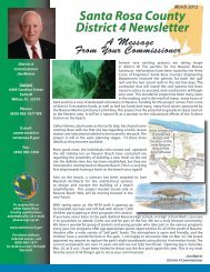
Flooding<br />
Q&A<br />
30<br />
Hurricane Ike<br />
Floods Gulf<br />
Boulevard on<br />
Navarre Beach<br />
Our local flood hazard comes from various sources. When you mention flood<br />
zones, naturally most people associate that with the Gulf of Mexico. This is not the<br />
only source of flooding in <strong>Santa</strong> <strong>Rosa</strong> <strong>County</strong>. We also have the sound, East Bay,<br />
East Bay River, Yellow River, Escambia Bay, Escambia River, Blackwater River,<br />
Coldwater Creek, Pond Creek and Pace Mill Creek. There are numerous smaller<br />
and not so well known creeks and streams that crisscross our county. Knowing if<br />
your property is within a special flood hazard area is important. This knowledge<br />
will help you make decisions about your structure, elevation of the structure,<br />
and insurance. <strong>Santa</strong> <strong>Rosa</strong> <strong>County</strong> is prepared to assist you in answering these<br />
questions.<br />
Find more information about flood protection online at<br />
www.fema.gov or www.floodsmart.gov<br />
Flooding<br />
Q: What is a Special Flood Hazard Area<br />
A: This is the land area covered by the floodwaters of the<br />
“Base Floodplain.” On the Flood Insurance Rate Maps the<br />
base floodplain is called the Special Flood Hazard Area. This<br />
is the area in which the National Flood Insurance Program’s<br />
floodplain management regulations must be enforced by <strong>Santa</strong><br />
<strong>Rosa</strong> <strong>County</strong> as a condition of participation in the National<br />
Flood Insurance Program and the area where the mandatory<br />
flood insurance purchase requirement applies. To find out if<br />
your property is in a Special Flood Hazard Area, you can go<br />
to our online flood maps at www.santarosa.fl.gov/gis or to the<br />
FEMA website at www.fema.gov and find the map in their<br />
map service center. You can even print out a FIRMETTE of<br />
your area. You can always call our Floodplain Manager at<br />
(850) 981-7029.<br />
Q: How can I find out if my property has wetlands on it<br />
A: Call the Florida Department of Environmental Protection<br />
at (850) 595-8320.<br />
Q: I need an Elevation Certificate for my house, where do<br />
I get one<br />
A: If the structure is under construction, you will need to<br />
contact a surveyor. If the structure already has a certificate of<br />
occupancy issued, you can contact our Floodplain Manager<br />
at (850) 981-7029.<br />
Q: What is substantial damage or substantial improvement<br />
A: A structure is considered substantially damaged/improved<br />
when the cost to repair/construct the structure equals or exceeds<br />
50 percent of the pre-damaged/pre-construction market value<br />
of the structure prior to the damage/improvement occurring.<br />
If you wish to repair/alter your structure, you will need to<br />
furnish an elevation certificate to the building inspection<br />
department when you apply for a permit to repair/improve<br />
your structure. If the structure does not meet or exceed the<br />
current elevation requirement, then you will be required to<br />
complete Substantial Damage/Substantial Improvement<br />
forms before a permit can be issued to insure that you are<br />
complying with the 50 percent rule.<br />
Q: How can I get a copy of the Flood Insurance Rate Map<br />
for my area<br />
A: You can visit the <strong>Santa</strong> <strong>Rosa</strong> <strong>County</strong> Building Inspection<br />
Department and ask for a photo copy of the area of interest,<br />
call our Floodplain Manager at (850) 981-7029, visit the <strong>Santa</strong><br />
<strong>Rosa</strong> <strong>County</strong> GIS Mapping system at www.santarosa.fl.gov/gis<br />
or you can visit the FEMA website at www.fema.gov and<br />
find the map in their map service center.<br />
Q: How can I protect my property<br />
A: Elevating your structure to or above the current elevation<br />
requirement is one way to protect your property. Relocation<br />
of the structure to a lot that is located in Zone X is the best<br />
way to reduce your flood risk.<br />
Q: What is the National Flood Insurance Program<br />
A: The National Flood Insurance Program makes federally<br />
backed flood insurance available to residents and business<br />
owners. Even if you do not live near water, your home still<br />
has a chance of being flooded. In fact, 25 to 30 percent of<br />
flood insurance claims are paid in low risk areas. Flood<br />
losses aren’t covered by your homeowners’ insurance policy.<br />
For more information about the National Flood Insurance<br />
Program call 1-888- CALL FLOOD, 1-800-427-5593 for<br />
TDD or visit www.floodsmart.gov.<br />
Q: What is <strong>Santa</strong> <strong>Rosa</strong>’s CRS Rating<br />
A: <strong>Santa</strong> <strong>Rosa</strong> was awarded the Class 5 CRS designation in<br />
2011 placing it in the top five percent in Florida and top six<br />
percent in the nation. A class 5 rating results in up to a 25<br />
percent discount for residents in the premium cost of flood<br />
insurance for National Flood Insurance Program policies.