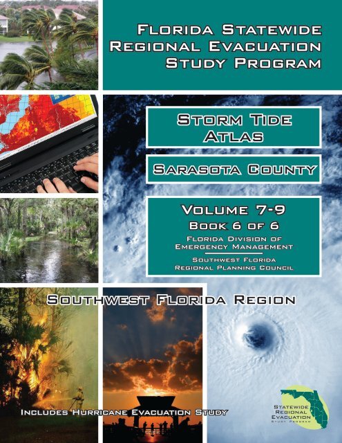
Storm Tide Atlas - Southwest Florida Regional Planning Council
Storm Tide Atlas - Southwest Florida Regional Planning Council
Storm Tide Atlas - Southwest Florida Regional Planning Council

Create successful ePaper yourself
Turn your PDF publications into a flip-book with our unique Google optimized e-Paper software.
<strong>Florida</strong> Statewide<br />
<strong>Regional</strong> Evacuation<br />
Study Program<br />
<strong>Storm</strong> <strong>Tide</strong><br />
<strong>Atlas</strong><br />
Sarasota County<br />
Volume 7-9<br />
Book 6 of 6<br />
<strong>Florida</strong> Division of<br />
Emergency Management<br />
<strong>Southwest</strong> <strong>Florida</strong><br />
<strong>Regional</strong> <strong>Planning</strong> <strong>Council</strong><br />
<strong>Southwest</strong> <strong>Florida</strong> Region<br />
Includes Hurricane Evacuation Study
Volume VII-9 <strong>Southwest</strong> <strong>Florida</strong><br />
Statewide <strong>Regional</strong> Evacuation Studies Program<br />
<strong>Southwest</strong> <strong>Florida</strong><br />
STORM TIDE ATLAS<br />
Volume VII-9<br />
Book 6<br />
Sarasota County<br />
This Book is part of Volume VII of the Statewide <strong>Regional</strong> Evacuation Study (SRES) Program<br />
and one of six county books in the <strong>Southwest</strong> <strong>Florida</strong> <strong>Storm</strong> <strong>Tide</strong> <strong>Atlas</strong> Series. Book 1 covers<br />
Charlotte County; Book 2 covers Collier County; Book 3 covers Glades County; Book 4 covers Hendry<br />
County; Book 5 covers Lee County and Book 6 covers Sarasota County. The <strong>Atlas</strong> maps identify<br />
those areas subject to potential storm tide flooding from the five categories of hurricane on the<br />
Saffir Simpson Hurricane Wind Scale as determined by NOAA’s numerical storm surge model, SLOSH<br />
(updated 2009).<br />
The <strong>Storm</strong> <strong>Tide</strong> <strong>Atlas</strong>, published in 2010, is the foundation of the hazards analysis for storm tide and<br />
a key component of the SRES. The Technical Data Report (Volume I) builds upon this analysis and<br />
includes the revised evacuation zones and population estimates, results of the evacuation behavioral<br />
data, shelter analysis and evacuation transportation analyses. The Study, which provides vital<br />
information to state and local emergency management, forms the basis for county evacuation plans.<br />
The final documents with summary information will be published and made available on the Internet<br />
(www.swfrpc.org) in June 2010.<br />
The <strong>Atlas</strong> was produced by the <strong>Southwest</strong> <strong>Florida</strong> <strong>Regional</strong> <strong>Planning</strong> <strong>Council</strong> with funding by the<br />
<strong>Florida</strong> Legislature and the Federal Emergency Management Agency through the <strong>Florida</strong> Division of<br />
Emergency Management.<br />
This <strong>Atlas</strong> was prepared and published by the <strong>Southwest</strong> <strong>Florida</strong> <strong>Regional</strong> <strong>Planning</strong><br />
<strong>Council</strong>, 1926 Victoria Ave. Fort Myers, Fl 33901 (239) 338-2550<br />
Fax: (239) 338-2560: Email: dtrescott@swfrpc.org or dcobb@swfrpc.org or<br />
kheatherington@swfrpc.org<br />
Web site: www.swfrpc.org<br />
Volume VII: <strong>Storm</strong> <strong>Tide</strong> <strong>Atlas</strong> Page 1
Volume VII-9 <strong>Southwest</strong> <strong>Florida</strong><br />
Statewide <strong>Regional</strong> Evacuation Studies Program<br />
VOLUME VII-9<br />
<strong>Southwest</strong> <strong>Florida</strong><br />
STORM TIDE ATLAS<br />
TABLE OF CONTENTS<br />
Book 6<br />
Sarasota County<br />
INTRODUCTION ....................................................................................................... 7<br />
THE SLOSH MODEL ................................................................................................... 7<br />
Hypothetical <strong>Storm</strong> Simulations .............................................................................. 8<br />
The Grid for the <strong>Southwest</strong> <strong>Florida</strong> SLOSH Model ................................................... 11<br />
<strong>Storm</strong> Scenario Determinations............................................................................. 11<br />
CREATION OF THE STORM TIDE ZONES .................................................................. 13<br />
Determining <strong>Storm</strong> <strong>Tide</strong> Height and Flooding Depth ............................................... 13<br />
<strong>Storm</strong> <strong>Tide</strong> Post-Processing .................................................................................. 14<br />
VARIATIONS TO CONSIDER .................................................................................... 16<br />
<strong>Storm</strong> tide & Wave Height .................................................................................... 16<br />
Forward Speed .................................................................................................... 16<br />
Radius of Maximum Winds ................................................................................... 16<br />
Astronomical <strong>Tide</strong>s .............................................................................................. 16<br />
Accuracy ............................................................................................................. 17<br />
POINTS OF REFERENCE .......................................................................................... 17<br />
STORM TIDE ATLAS ................................................................................................ 19<br />
LIST OF TABLES<br />
Table 1 Saffir-Simpson Hurricane Wind Scale ......................................................... 9<br />
Table 2 <strong>Southwest</strong> <strong>Florida</strong> Basin Hypothetical <strong>Storm</strong> Parameters ........................... 10<br />
Table 3 Potential <strong>Storm</strong> <strong>Tide</strong> Height (s) by County ............................................... 12<br />
Table 4 Selected Points of Reference .................................................................. 18<br />
Page 2<br />
Volume VII: <strong>Storm</strong> <strong>Tide</strong> <strong>Atlas</strong>
Volume VII-9 <strong>Southwest</strong> <strong>Florida</strong><br />
LIST OF FIGURES<br />
Statewide <strong>Regional</strong> Evacuation Studies Program<br />
Figure 1 The <strong>Southwest</strong> <strong>Florida</strong> Region ..................................................................... 7<br />
Figure 2 <strong>Southwest</strong> <strong>Florida</strong> Basin Grid ..................................................................... 11<br />
Figure 3 SLOSH Grid with Surge Values ................................................................... 11<br />
Figure 4 Digital Elevation from LIDAR ...................................................................... 13<br />
Figure 5 SLOSH Display .......................................................................................... 14<br />
Figure 6 SLOSH Display Post-Processing .................................................................. 14<br />
Figure 7 <strong>Storm</strong> <strong>Tide</strong> Limits for the <strong>Southwest</strong> <strong>Florida</strong> Region .................................... 15<br />
Figure 8 <strong>Atlas</strong> Map Index ........................................................................................ 21<br />
LIST OF MAPS<br />
Map 1 …………………………………………………………………………………………………………………………….23<br />
Map 2 …………………………………………………………………………………………………………………………….24<br />
Map 3……………………………………………………………………………………………………………………………..25<br />
Map 4……………………………………………………………………………………………………………………………..26<br />
Map 5……………………………………………………………………………………………………………………………..27<br />
Map 6……………………………………………………………………………………………………………………………..28<br />
Map 7……………………………………………………………………………………………………………………………..29<br />
Map 8……………………………………………………………………………………………………………………………..30<br />
Map 9……………………………………………………………………………………………………………………………..31<br />
Map 10……………………………………………………………………………………………………………………………32<br />
Map 11……………………………………………………………………………………………………………………………33<br />
Map 12……………………………………………………………………………………………………………………………34<br />
Map 13……………………………………………………………………………………………………………………………35<br />
Map 14……………………………………………………………………………………………………………………………36<br />
Map 15……………………………………………………………………………………………………………………………37<br />
Map 16……………………………………………………………………………………………………………………………38<br />
Map 17……………………………………………………………………………………………………………………………39<br />
Map 18……………………………………………………………………………………………………………………………40<br />
Map 19……………………………………………………………………………………………………………………………41<br />
Map 20……………………………………………………………………………………………………………………………42<br />
Map 21……………………………………………………………………………………………………………………………43<br />
Map 22……………………………………………………………………………………………………………………………44<br />
Map 23……………………………………………………………………………………………………………………………45<br />
Map 24……………………………………………………………………………………………………………………………46<br />
Map 25……………………………………………………………………………………………………………………………47<br />
Map 26……………………………………………………………………………………………………………………………48<br />
Map 27……………………………………………………………………………………………………………………………49<br />
Map 28……………………………………………………………………………………………………………………………50<br />
Map 29……………………………………………………………………………………………………………………………51<br />
Map 30……………………………………………………………………………………………………………………………52<br />
Map 31……………………………………………………………………………………………………………………………53<br />
Map 32……………………………………………………………………………………………………………………………54<br />
Volume VII: <strong>Storm</strong> <strong>Tide</strong> <strong>Atlas</strong> Page 3
Volume VII-9 <strong>Southwest</strong> <strong>Florida</strong><br />
Page 4<br />
Statewide <strong>Regional</strong> Evacuation Studies Program<br />
Map 33……………………………………………………………………………………………………………………………55<br />
Map 34……………………………………………………………………………………………………………………………56<br />
Map 35……………………………………………………………………………………………………………………………57<br />
Map 36……………………………………………………………………………………………………………………………58<br />
Map 37……………………………………………………………………………………………………………………………59<br />
Map 38……………………………………………………………………………………………………………………………60<br />
Map 39……………………………………………………………………………………………………………………………61<br />
Map 40……………………………………………………………………………………………………………………………62<br />
Map 41……………………………………………………………………………………………………………………………63<br />
Map 42……………………………………………………………………………………………………………………………64<br />
Map 43……………………………………………………………………………………………………………………………65<br />
Map 44……………………………………………………………………………………………………………………………66<br />
Map 45……………………………………………………………………………………………………………………………67<br />
Map 46……………………………………………………………………………………………………………………………68<br />
Map 47……………………………………………………………………………………………………………………………69<br />
Map 48……………………………………………………………………………………………………………………………70<br />
Map 49……………………………………………………………………………………………………………………………71<br />
Map 50……………………………………………………………………………………………………………………………72<br />
Map 51……………………………………………………………………………………………………………………………73<br />
Map 52……………………………………………………………………………………………………………………………74<br />
Map 53……………………………………………………………………………………………………………………………75<br />
Map 54……………………………………………………………………………………………………………………………76<br />
Map 55……………………………………………………………………………………………………………………………77<br />
Map 56……………………………………………………………………………………………………………………………78<br />
Map 57……………………………………………………………………………………………………………………………79<br />
Map 58……………………………………………………………………………………………………………………………80<br />
Map 59……………………………………………………………………………………………………………………………81<br />
Map 60……………………………………………………………………………………………………………………………82<br />
Map 61……………………………………………………………………………………………………………………………83<br />
Map 62……………………………………………………………………………………………………………………………84<br />
Map 63……………………………………………………………………………………………………………………………85<br />
Map 64……………………………………………………………………………………………………………………………86<br />
Map 65……………………………………………………………………………………………………………………………87<br />
Map 66……………………………………………………………………………………………………………………………88<br />
Map 67……………………………………………………………………………………………………………………………89<br />
Map 68……………………………………………………………………………………………………………………………90<br />
Map 69……………………………………………………………………………………………………………………………91<br />
Map 70……………………………………………………………………………………………………………………………92<br />
Map 71……………………………………………………………………………………………………………………………93<br />
Map 72……………………………………………………………………………………………………………………………94<br />
Map 73……………………………………………………………………………………………………………………………95<br />
Map 74……………………………………………………………………………………………………………………………96<br />
Map 75……………………………………………………………………………………………………………………………97<br />
Map 76……………………………………………………………………………………………………………………………98<br />
Map 77……………………………………………………………………………………………………………………………99<br />
Map 78………………………………………………………………………………………………………………………….100<br />
Volume VII: <strong>Storm</strong> <strong>Tide</strong> <strong>Atlas</strong>
Volume VII-9 <strong>Southwest</strong> <strong>Florida</strong><br />
Statewide <strong>Regional</strong> Evacuation Studies Program<br />
Map 79………………………………………………………………………………………………………………………….101<br />
Map 80………………………………………………………………………………………………………………………….102<br />
Map 81………………………………………………………………………………………………………………………….103<br />
Volume VII: <strong>Storm</strong> <strong>Tide</strong> <strong>Atlas</strong> Page 5
Statewide <strong>Regional</strong> Evacuation Study Program<br />
Volume 7-9 <strong>Southwest</strong> <strong>Florida</strong><br />
CREDITS & ACKNOWLEDGEMENTS<br />
Funding was authorized by the <strong>Florida</strong> Legislature through House Bill<br />
7121, as a result of the 2004 and 2005 hurricane seasons. Provisions of<br />
this bill require the Division of Emergency Management to update all<br />
<strong>Regional</strong> Evacuation Studies in the State and inexorably tied the<br />
Evacuation Studies and Growth Management. As a result, this study<br />
addresses both Emergency Management and Growth Management data<br />
needs. Funds were also provided by the Federal Emergency<br />
Management Agency (FEMA) with all money administered through the<br />
<strong>Florida</strong> Division of Emergency Management (FDEM), 2555 Shumard<br />
Oak Blvd., Tallahassee, 32399. Web site: www.floridadisaster.org.<br />
Local match was provided by the counties of Charlotte, Collier, Glades, Hendry, Lee and Sarasota.<br />
The <strong>Council</strong> acknowledges and extends its appreciation to the following agencies and people for their<br />
cooperation and assistance in the development of this document:<br />
National Oceanic and Atmospheric Administration (NOAA/TPC-NHC) for the SLOSH numerical storm<br />
surge model developed by the late Chester L. Jelesnianski, the development of the 2009 Ft Myers Basin under<br />
the management of Jamie Rhome, and for the storm tide computation and interpretation provided by the<br />
NOAA <strong>Storm</strong> Surge Modeling team. The National Weather Service, Tampa office for their coordination and<br />
support.<br />
<strong>Florida</strong> Division of Emergency Management<br />
David Halstead, Director<br />
Sandy Meyer, Hurricane Program Manager<br />
Richard Butgereit, GIS Manager<br />
Northeast <strong>Florida</strong> <strong>Regional</strong> <strong>Council</strong><br />
Jeffrey Alexander, Project Manager<br />
<strong>Southwest</strong> <strong>Florida</strong> <strong>Regional</strong> <strong>Planning</strong> <strong>Council</strong><br />
Ken Heatherington Executive Director<br />
Daniel L. Trescott, Study Manager<br />
Daniel Cobb, GIS Analyst<br />
<strong>Florida</strong> Emergency Preparedness Association<br />
For their support in this statewide effort<br />
County Emergency Management Agencies<br />
Wayne P. Sallade, Director of Charlotte County Emergency Management<br />
Dan Summers, Director of Collier County Emergency Management<br />
Angie Snow, Director of Glades County Emergency Management<br />
Lupe Taylor, Director of Hendry County Emergency Management<br />
John Wilson, Director or Lee County Emergency Management<br />
Edward McCrane, Director of Sarasota County<br />
Emergency Management<br />
Acknowledgements<br />
Volume 7: <strong>Storm</strong> <strong>Tide</strong> <strong>Atlas</strong>
Volume VII-9 <strong>Southwest</strong> <strong>Florida</strong><br />
INTRODUCTION<br />
Statewide <strong>Regional</strong> Evacuation Studies Program<br />
A comprehensive emergency management program requires attention to four (4) key inter-related<br />
components: preparedness, response, recovery and mitigation. Preparing and avoiding or reducing<br />
potential loss of life and property damage - preparedness and mitigation - requires accurate and<br />
precise hazard and vulnerability analyses. These analyses are the foundation for evacuation and<br />
disaster response planning, as well as the development of local mitigation strategies designed to<br />
reduce the community’s overall risk to disasters. This <strong>Atlas</strong> series provides information to state,<br />
county and local emergency management officials and planners for use in hurricane preparedness<br />
and coastal management in the <strong>Southwest</strong> <strong>Florida</strong> Region including Charlotte, Collier, Glades,<br />
Hendry, Lee, and Sarasota counties (Figure 1). It was part of a statewide effort to enhance our<br />
ability to respond to a hurricane threat, facilitate the evacuation of vulnerable residents to a point of<br />
relative safety and mitigate our vulnerability in the future. The Statewide <strong>Regional</strong> Evacuation<br />
Study Program provides a consistent, coordinated and improved approach to addressing the state<br />
and regional vulnerability to the hurricane threat.<br />
The specific purpose of this <strong>Atlas</strong> is to provide maps which depict<br />
storm tide heights and the extent of stillwater, storm surge<br />
coastal flooding inundation from hurricanes of five different<br />
intensities in the <strong>Southwest</strong> <strong>Florida</strong> area. The <strong>Atlas</strong> was prepared<br />
by the <strong>Southwest</strong> <strong>Florida</strong> <strong>Regional</strong> <strong>Planning</strong> <strong>Council</strong> as part of the<br />
Statewide <strong>Regional</strong> Evacuation Study Program. The Study is a<br />
cooperative effort of the <strong>Florida</strong> Department of Community Affairs,<br />
Division of Emergency Management, the <strong>Florida</strong> <strong>Regional</strong> <strong>Planning</strong><br />
<strong>Council</strong>s and the county emergency management agencies.<br />
Figure 1 The <strong>Southwest</strong> <strong>Florida</strong> Region<br />
THE SLOSH MODEL<br />
The principal tool utilized in this study for<br />
analyzing the expected hazards from<br />
potential hurricanes affecting the study<br />
area is the Sea, Lake and Overland Surges<br />
from Hurricane (SLOSH) numerical storm<br />
surge prediction model. The SLOSH<br />
computerized model predicts the storm tide heights that result from hypothetical hurricanes with<br />
selected various combinations of pressure, size, forward speed, track and winds. Originally<br />
developed for use by the National Hurricane Center (NHC) as a tool to give geographically specific<br />
warnings of expected surge heights during the approach of hurricanes, the SLOSH model is utilized<br />
in regional studies for several key hazard and vulnerability analyses.<br />
Volume VII: <strong>Storm</strong> <strong>Tide</strong> <strong>Atlas</strong> Page 7
Volume VII-9 <strong>Southwest</strong> <strong>Florida</strong><br />
Statewide <strong>Regional</strong> Evacuation Studies Program<br />
The SLOSH modeling system consists of the model source code and the model basin or grid. SLOSH<br />
model grids must be developed for each specific geographic coastal area individually incorporating<br />
the unique local bay and river configuration, water depths, bridges, roads and other physical<br />
features. In addition to open coastline heights, one of the most valuable outputs of the SLOSH<br />
model for evacuation planning is its predictions of surge heights over land into inland areas.<br />
The first <strong>Southwest</strong> <strong>Florida</strong> SLOSH model basin was completed in 1979 and represented the first<br />
application of SLOSH storm surge dynamics to a major coastal area of the United States. The model<br />
was developed by the Techniques Development Lab of the National Oceanic and Atmospheric<br />
Administration (NOAA) under the direction of the late Dr. Chester P. Jelesnianski. In December 1990<br />
the National Hurricane Center updated the SLOSH model for the <strong>Southwest</strong> basin. A major<br />
improvement to the model was the incorporation of wind speed degradation overland as the<br />
simulated storms moved inland. This duplicated the pressure "filling" and increases in the radii of<br />
maximum winds (RMW) as the hurricanes weaken after making landfall.<br />
The newest generation of the SLOSH model basin incorporated in the 2010 Statewide <strong>Regional</strong><br />
Evacuation Study reflects major improvements, including higher resolution basin data and grid<br />
configurations. Faster computer speeds allowed additional hypothetical storms to be run for creation<br />
of the MOMs 1 or the maximum potential storm tide values for each category of storm.<br />
Hypothetical <strong>Storm</strong> Simulations<br />
Surge height depends strongly on the specifics of a given storm including, forward speed, angle of<br />
approach, intensity or maximum wind speed, storm size, storm shape, and landfall location. The<br />
SLOSH model was used to develop data for various combinations of hurricane strength, wind speed,<br />
and direction of movement. <strong>Storm</strong> strength was modeled using the central pressure (defined as the<br />
difference between the ambient sea level pressure and the minimum value in the storm's center),<br />
the storm eye size and the radius of maximum winds using the five categories of hurricane intensity<br />
as depicted in the Saffir-Simpson Hurricane Wind Scale (see Table 1).<br />
1 Maximum of MEOWs<br />
Page 8<br />
Volume VII: <strong>Storm</strong> <strong>Tide</strong> <strong>Atlas</strong>
Volume VII-9 <strong>Southwest</strong> <strong>Florida</strong><br />
Statewide <strong>Regional</strong> Evacuation Studies Program<br />
Table 1<br />
Saffir-Simpson Hurricane Wind Scale<br />
Category Wind Speeds Potential Damage<br />
Category 1<br />
Category 2<br />
Category 3<br />
Category 4<br />
Category 5<br />
(Sustained winds 74-95 mph)<br />
(Sustained winds 96-110 mph)<br />
(Sustained winds 111-130 mph )<br />
(Sustained winds 131-155 mph)<br />
(Sustained winds of 156 mph and<br />
above)<br />
Very dangerous winds will produce<br />
some damage<br />
Extremely dangerous winds will cause<br />
extensive damage<br />
Devastating damage will occur<br />
Catastrophic damage will occur<br />
Catastrophic damage will occur<br />
The modeling for each tropical storm/hurricane category was conducted using the mid-range<br />
pressure difference (p, millibars) for that category. The model also simulates the storm filling<br />
(weakening upon landfall) and radius of maximum winds (RMW) increase.<br />
Ten storm track headings (WSW, W, WNW, NW, NNW, N, NNE, NE, E, ENE) were selected as being<br />
representative of storm behavior in the West Central <strong>Florida</strong> regions, based on observations by<br />
forecasters at the National Hurricane Center. And for each set of tracks in a specific direction storms<br />
were run at forward speeds of 5, 10, 15 and 25 mph. And, for each direction, at each speed, storms<br />
were run at two different sizes (20 statute mile radius of maximum winds and 35 statute miles<br />
radius of maximum winds.) Finally, each scenario was run at both mean tide and high tide. Both tide<br />
levels are now referenced to North American Vertical Datum of 1988 (NAVD88) as opposed to the<br />
National Geodetic Vertical Datum of 1929 (NGVD29) used in the previous study.<br />
A total of 12,000 runs were made consisting of the different parameters shown in Table 2.<br />
Volume VII: <strong>Storm</strong> <strong>Tide</strong> <strong>Atlas</strong> Page 9
Volume VII-9 <strong>Southwest</strong> <strong>Florida</strong><br />
Statewide <strong>Regional</strong> Evacuation Studies Program<br />
Table 2<br />
<strong>Southwest</strong> <strong>Florida</strong> Basin Hypothetical <strong>Storm</strong> Parameters<br />
Directions, speeds, (Saffir/Simpson) intensities, number of tracks and the number of runs.<br />
Direction<br />
Speeds<br />
(mph)<br />
Size (Radius of<br />
Maximum winds) Intensity <strong>Tide</strong>s Tracks Runs<br />
WSW 5,10,15,<br />
25 mph<br />
20 statute miles;<br />
35 statute miles<br />
1 through 5<br />
Mean/High<br />
18 1440<br />
W 5,10,15,<br />
25 mph<br />
20 statute miles;<br />
35 statute miles<br />
1 through 5 Mean/High<br />
14 1120<br />
WNW 5,10,15,<br />
25 mph<br />
20 statute miles;<br />
35 statute miles<br />
1 through 5 Mean/High<br />
16 1280<br />
NW 5,10,15,<br />
25 mph<br />
20 statute miles;<br />
35 statute miles<br />
1 through 5 Mean/High<br />
14 1120<br />
NNW 5,10,15,<br />
25 mph<br />
20 statute miles;<br />
35 statute miles<br />
1 through 5 Mean/High<br />
14 1120<br />
N 5,10,15,<br />
25 mph<br />
20 statute miles;<br />
35 statute miles<br />
1 through 5 Mean/High<br />
10 800<br />
NNE 5,10,15,<br />
25 mph<br />
20 statute miles;<br />
35 statute miles<br />
1 through 5 Mean/High<br />
13 1040<br />
NE 5,10,15,<br />
25 mph<br />
20 statute miles;<br />
35 statute miles<br />
1 through 5 Mean/High<br />
17 1360<br />
ENE 5,10,15,<br />
25 mph<br />
20 statute miles;<br />
35 statute miles<br />
1 through 5 Mean/High<br />
17 1360<br />
E 5,10,15,<br />
25 mph<br />
20 statute miles;<br />
35 statute miles<br />
1 through 5 Mean/High<br />
17 1360<br />
TOTAL 12,000<br />
Page 10<br />
Volume VII: <strong>Storm</strong> <strong>Tide</strong> <strong>Atlas</strong>
Volume VII-9 <strong>Southwest</strong> <strong>Florida</strong><br />
The Grid for the <strong>Southwest</strong> SLOSH Model<br />
Figure 2 illustrates the area covered by the grid for the<br />
<strong>Southwest</strong> SLOSH Model. To determine the surge values<br />
the SLOSH model uses a bipolar elliptical grid as its unit of<br />
analysis with 105 arc lengths (1< I> 105) and 99 radials<br />
(1< J> 99). Use of the grid configuration allows for<br />
individual calculations per grid square which is beneficial in<br />
two ways: (1) provides increased resolution of the storm<br />
surge at the coastline and inside the harbors, bays and<br />
rivers, while decreasing the resolution in the deep water<br />
where detail is not as important; and (2) allows economy<br />
in computation.<br />
Statewide <strong>Regional</strong> Evacuation Studies Program<br />
The grid size for the <strong>Southwest</strong> model varies from<br />
approximately 0.001 square miles or 1.08 acres closest to<br />
the pole (I = 1) to the grids on the outer edges (Gulf of<br />
Mexico) where each grid is approximately 15.5 square miles.<br />
<strong>Storm</strong> Scenario Determinations<br />
Figure 2 <strong>Southwest</strong> Basin Grid<br />
As indicated, the SLOSH model is the basis for the<br />
"hazard analysis" portion of coastal hurricane<br />
evacuation plans. Thousands of hypothetical hurricanes<br />
are simulated with various Saffir-Simpson Wind<br />
categories, forward speeds, landfall directions, and<br />
landfall locations. An envelope of high water containing<br />
the maximum value a grid cell attains is generated at<br />
the end of each model run. These envelopes are<br />
combined by the NHC into various composites which<br />
depict the possible flooding. One useful composite is the<br />
MEOW (Maximum Envelope of Water) which incorpor-<br />
Figure 3 SLOSH Grid with Surge Values<br />
ates all the envelopes for a particular category, speed, and landfall direction. Once surge heights<br />
have been determined for the appropriate grids, the maximum surge heights are plotted by storm<br />
track and tropical storm/hurricane category. These plots of maximum surge heights for a given<br />
storm category and track are referred to as Maximum Envelopes of Water (MEOWs). The MEOWs or<br />
Reference Hurricanes can be used in evacuation decision making when and if sufficient forecast<br />
information is available to project storm track or type of storm (different landfalling, paralleling, or<br />
exiting storms).<br />
Volume VII: <strong>Storm</strong> <strong>Tide</strong> <strong>Atlas</strong> Page 11
Volume VII-9 <strong>Southwest</strong> <strong>Florida</strong><br />
Statewide <strong>Regional</strong> Evacuation Studies Program<br />
The MEOWs provide information to the emergency managers in evacuation decision making.<br />
However, in order to determine a scenario which may confront the county in a hurricane threat 24-<br />
48 hours before a storm is expected, a further compositing of the MEOWs into Maximums of the<br />
Maximums (MOMs) is usually required.<br />
The MOM (Maximum of the MEOWs) combines all the MEOWs of a particular category. The MOMs<br />
represent the maximum surge expected to occur at any given location, regardless of the specific<br />
storm track/direction of the hurricane. The only variable is the intensity of the hurricane represented<br />
by category strength (Category 1-5).<br />
The MOM surge heights, which were furnished by the National Hurricane Center, have 2 values,<br />
mean tide and high tide. Mean tide has 0’ tide correction. High tide has a 1’ tide correction added<br />
to it. The <strong>Storm</strong> <strong>Tide</strong> limits include the adjustment for mean high tide. All elevations are now<br />
referenced to the NAVD88 datum.<br />
These surge heights were provided within the SLOSH grid system as illustrated on Figure 2. The<br />
range of maximum surge heights (low to high) for each scenario is provided for each category of<br />
storm (MOM) on Table 3. It should be noted again that these surge heights represent the<br />
maximum surge height recorded in the county from the storm tide analysis including<br />
inland and back bay areas where the surge can be magnified dependent upon storm<br />
parameters.<br />
Table 3 Potential <strong>Storm</strong> <strong>Tide</strong> Height (s) by County<br />
(In Feet above NAVD88)<br />
*<strong>Storm</strong> Strength Charlotte Collier Lee Sarasota Lake O 16ft Lake O 20ft<br />
TS Up to 5.2 Up to 5.8 Up to 6.1 Up to 5.6 NA NA<br />
1 Up to 7 Up to 8.2 Up to 8.7 Up to 6.9 Up to 21.1 Up to 25<br />
2 Up to 17 Up to 14.1 Up to 15.5 Up to 15.4 Up to 26.6 Up to 30.6<br />
3 Up to 26 Up to 19.5 Up to 23 Up to 26 Up to 33.2 Up to 35.5<br />
4 Up to 32.3 Up to 24.5 Up to 27.6 Up to 33.2 Up to 36.4 Up to 37.2<br />
5 Up to 37.7 Up to 41.9 Up to 41.7 Up to 35.4 Up to 38.9 Up to 40<br />
*Based on the category of storm on the Saffir-Simpson Hurricane Wind Scale<br />
** Surge heights represent the maximum values from SLOSH MOMs<br />
Page 12<br />
Volume VII: <strong>Storm</strong> <strong>Tide</strong> <strong>Atlas</strong>
Volume VII-9 <strong>Southwest</strong> <strong>Florida</strong><br />
Statewide <strong>Regional</strong> Evacuation Studies Program<br />
CREATION OF THE STORM TIDE ZONES<br />
The maps in this atlas depict SLOSH-modeled heights of storm tide and extent of flood inundation<br />
for hurricanes of five different intensities. As indicate above, the storm tide was modeled using the<br />
Maximum of Maximums (MOMs) representing the potential flooding from the five categories of storm<br />
intensity of the Saffir/Simpson Hurricane Wind Scale.<br />
Determining <strong>Storm</strong> tide Height and Flooding Depth<br />
SLOSH and SLOSH-related products reference storm tide heights relative to the model vertical<br />
datum, NAVD88. In order to determine the inundation depth of surge flooding at a particular<br />
location the ground elevation (relative to NAVD88) at<br />
that location must be subtracted from the potential<br />
surge height. 2<br />
Surge elevation, or water height, is the output of the<br />
SLOSH model. At each SLOSH grid point, the<br />
maximum surge height is computed at that point.<br />
Within the SLOSH model an average elevation is<br />
assumed within each grid square. Height of water<br />
above terrain was not calculated using the SLOSH<br />
average grid elevation because terrain height may vary<br />
significantly within a SLOSH grid square. For example,<br />
the altitude of a 1-mile grid square may be assigned a<br />
value of 1.8 meters (6 feet), but this value represents<br />
an average of land heights that may include values<br />
Figure 4 Digital Elevation from LIDAR<br />
ranging from 0.9 to 2.7 meters (3 to 9 feet). In this case, a surge value of 2.5 meters (8 feet) in this<br />
square would imply a 0.7 meters (2 feet) average depth of water over the grid’s terrain. However, in<br />
reality within the grid area portion of the grid would be “dry” and other parts could experience as<br />
much as 1.5 meters (5 feet) of inundation. Therefore, in order to determine the storm tide limits,<br />
the depth of surge flooding above terrain at a specific site in the grid square is the result of<br />
subtracting the terrain height determined by remote sensing from the model-generated storm tide<br />
height in that grid square. 3<br />
2 It is important to note that one must use a consistent vertical datum when post-processing SLOSH storm<br />
surge values<br />
3 Note: This represents the regional post-processing procedure. When users view SLOSH output within<br />
the SLOSH Display Program, the system uses average grid cell height when subtracting land.<br />
Volume VII: <strong>Storm</strong> <strong>Tide</strong> <strong>Atlas</strong> Page 13
Volume VII-9 <strong>Southwest</strong> <strong>Florida</strong><br />
Statewide <strong>Regional</strong> Evacuation Studies Program<br />
<strong>Storm</strong> <strong>Tide</strong> Post-Processing<br />
The <strong>Atlas</strong> was created using a Toolset wrapped into ESRI’s ArcGIS mapping application, ArcMap.<br />
The surge tool was developed for the Statewide <strong>Regional</strong> Evacuation Study Program by the Tampa<br />
Bay <strong>Regional</strong> <strong>Planning</strong> <strong>Council</strong>, who had used a similar tool for the previous Evacuation Study<br />
Update (2006). This tool enabled all regions within the state of <strong>Florida</strong> to process the SLOSH and<br />
elevation data with a consistent methodology.<br />
The tool basically performs the operation of translating<br />
the lower resolution SLOSH grid data into a smooth<br />
surface resembling actual storm tide and terrain;<br />
processing it with the high resolution elevation data<br />
derived from LIDAR. The image on the left represents<br />
how the data would look as it appears directly from<br />
SLOSH Model output.<br />
Processing all the data in the raster realm, the tool is able<br />
to digest large amounts of data and output detailed<br />
representations of surge inundation.<br />
Figure 5 SLOSH Display<br />
The program first interpolates the SLOSH height values for<br />
each category into a raster surface using spline interpolation.<br />
This type of interpolation is best for smooth surfaces, such<br />
as water and slow changing terrain. The result is a raster<br />
surface representing the surge height for a category that can<br />
be processed against the raster Digital Elevation Model from<br />
the LIDAR. The “dry” values (represented as 99.9 in the<br />
SLOSH Model) are replaced by an average of the inundated<br />
grids surrounding current processed grid. An algorithm<br />
performs this action utilizing the range of values in the<br />
current category of storm being processed. Figure 6 SLOSH Display Post-Processing<br />
Using this methodology, once the elevation is subtracted from the projected storm tide, the storm<br />
tide limits are determined. The output of the tool is a merged polygon file holding all the maximum<br />
inundation zones for Tropical <strong>Storm</strong> through Category 5. The output, depicted in this <strong>Storm</strong> <strong>Tide</strong><br />
<strong>Atlas</strong> is determined consistent with the coastal areas throughout the state. Figure 7 presents a<br />
compilation of the <strong>Storm</strong> <strong>Tide</strong> <strong>Atlas</strong> for the region.<br />
Page 14<br />
Volume VII: <strong>Storm</strong> <strong>Tide</strong> <strong>Atlas</strong>
Volume VII-9 <strong>Southwest</strong> <strong>Florida</strong><br />
Statewide <strong>Regional</strong> Evacuation Studies Program<br />
Figure 7 <strong>Storm</strong> Surge for the <strong>Southwest</strong> Region<br />
Volume VII: <strong>Storm</strong> <strong>Tide</strong> <strong>Atlas</strong> Page 15
Volume VII-9 <strong>Southwest</strong> <strong>Florida</strong><br />
Statewide <strong>Regional</strong> Evacuation Studies Program<br />
VARIATIONS TO CONSIDER<br />
Variations between modeled versus actual measured storm tide elevations are typical of current<br />
technology in coastal storm surge modeling. In interpreting the data emergency planners should<br />
recognize the uncertainties characteristic of mathematical models and severe weather systems such<br />
as hurricanes. The storm tide elevations developed for this study and presented in the <strong>Storm</strong> <strong>Tide</strong><br />
<strong>Atlas</strong> should be used as guideline information for planning purposes.<br />
<strong>Storm</strong> <strong>Tide</strong> & Wave Height<br />
Regarding interpretation of the data, it is important to understand that the configuration and depth<br />
(bathymetry) of the Gulf bottom will have a bearing on surge and wave heights. A narrow shelf, or<br />
one that drops steeply from the shoreline and subsequently produces deep water in close proximity<br />
to the shoreline, tends to produce a lower surge but a higher and more powerful wave. Those<br />
regions, like the <strong>Southwest</strong> Region, which have a gently sloping shelf and shallower normal water<br />
depths, can expect a higher surge but smaller waves. The reason this occurs is because a surge in<br />
deeper water can be dispersed down and out away from the hurricane. However, once that surge<br />
reaches a shallow gently sloping shelf it can no longer be dispersed away from the hurricane,<br />
consequently water piles up as it is driven ashore by the wind stresses of the hurricane. Wave<br />
height is NOT calculated by the SLOSH model and is not reflected within the storm tide delineations.<br />
Forward Speed<br />
Under actual storm conditions it may be expected that a hurricane moving at a slower speed could<br />
have higher coastal storm tides than those depicted from model results. At the same time, a fast<br />
moving hurricane would have less time to move storm surge water up river courses to more inland<br />
areas. For example, a minimal hurricane or a storm further off the coast such as Hurricane Elena<br />
(1985), which stalled 90 miles off the Tampa Bay coast for several tidal cycles, could cause<br />
extensive beach erosion and move large quantities of water into interior lowland areas. In the<br />
newest version of the <strong>Southwest</strong> SLOSH model, for each set of tracks in a specific direction, storms<br />
were run at forward speeds of 5, 10, 15 and 25 mph.<br />
Radius of Maximum Winds<br />
As indicated previously, the size of the storm or radius of maximum winds (RMW) can have a<br />
significant impact on storm surge especially in bay areas and along the Gulf of Mexico. All of the<br />
hypothetical storms were run at two different sizes, 20 mile radius of maximum winds and 35 mile<br />
radius of maximum winds.<br />
Astronomical <strong>Tide</strong>s<br />
Surge heights were provided by NOAA for both mean tide and high tide. Both tide levels are<br />
referenced to North American Vertical Datum of 1988. The storm tide limits reflect high tide in the<br />
region.<br />
Page 16<br />
Volume VII: <strong>Storm</strong> <strong>Tide</strong> <strong>Atlas</strong>
Volume VII-9 <strong>Southwest</strong> <strong>Florida</strong><br />
Statewide <strong>Regional</strong> Evacuation Studies Program<br />
Accuracy<br />
As part of the Statewide <strong>Regional</strong> Evacuation Study, all coastal areas as well as areas surrounding<br />
Lake Okeechobee were mapped using remote-sensing laser terrains mapping (LIDAR 4 ) providing the<br />
most comprehensive, accurate and precise topographic data for this analysis. As a general rule, the<br />
vertical accuracy of the laser mapping is within a 15 centimeter tolerance. However, it should be<br />
noted that the accuracy of these elevations is limited to the precision and tolerance in which the<br />
horizontal accuracy for any given point is recorded. Other factors such as artifact removal<br />
algorithms (that remove buildings and trees) can affect the recorded elevation in a particular<br />
location. For the purposes of this study, the horizontal accuracy cannot be assumed to be greater<br />
than that of a standard USGS 7 minute quadrangle map, or a scale of 1:24,000.<br />
POINTS OF REFERENCE<br />
County emergency management agency selected reference points which include key facilities or<br />
locations critical for emergency operations. The table below includes the map identification number,<br />
descriptions of the selected points and the elevation of the site. The elevation is based on the digital<br />
elevation data provided by the LIDAR. It should be noted that if the site is large, elevations may<br />
vary significantly. The table also provides the storm tide value from the SLOSH value and the depth<br />
of inundation (storm tide value minus the ground elevation) at the site.<br />
4 Light Imaging Detection and Ranging<br />
Volume VII: <strong>Storm</strong> <strong>Tide</strong> <strong>Atlas</strong> Page 17
Volume VII-9 <strong>Southwest</strong> <strong>Florida</strong><br />
Statewide <strong>Regional</strong> Evacuation Studies Program<br />
Table 4 Selected Points of Reference<br />
ID NAME SURGE BASE_ELEV TS_DEPTH C1_DEPTH C2_DEPTH C3_DEPTH C4_DEPTH C5_DEPTH<br />
1 LONGBOAT KEY 2 9.21 DRY DRY 1.61 5.94 10.16 14.53<br />
2 GOLDEN GATE POINT TS 3.86 0.97 2.09 7.39 12.11 16.10 20.84<br />
3 BIRD KEY TS 2.25 2.60 4.09 8.82 13.21 17.23 21.77<br />
4 US 41 / PANAMA DR 2 8.63 DRY DRY 2.26 7.25 11.29 16.06<br />
5 SIESTA KEY TS 3.01 1.79 3.19 7.89 12.29 16.29 20.79<br />
6 BLACKBURN POINT BRIDGE 2 7.59 DRY DRY 3.70 8.03 11.84 16.25<br />
7 VENICE BEACH 2 8.14 DRY DRY 2.57 6.74 10.89 15.31<br />
8 VENICE AVE BRIDGE 2 10.28 DRY DRY 0.72 4.75 9.10 13.65<br />
9 ALLIGATOR CREEK / US 41 2 10.37 DRY DRY 0.19 5.33 9.43 14.06<br />
10 MANASOTA BEACH 2 7.56 DRY DRY 3.41 7.43 11.25 15.87<br />
11 MANASOTA KEY RD 2 7.36 DRY DRY 3.29 7.50 11.20 15.83<br />
12<br />
STATE HWY 776 / LEMON<br />
BAY 2 8.79 DRY DRY 2.17 6.41 10.32 14.86<br />
13 SOUTH RIVER RD / 41 2 7.82 DRY DRY 3.68 9.48 14.68 19.48<br />
14 MYAKKA RIVER / I-75 2 5.41 DRY DRY 6.45 11.67 17.36 21.95<br />
Page 18<br />
Volume VII: <strong>Storm</strong> <strong>Tide</strong> <strong>Atlas</strong>
Volume VII-9 <strong>Southwest</strong> <strong>Florida</strong><br />
Statewide <strong>Regional</strong> Evacuation Studies Program<br />
STORM TIDE ATLAS<br />
The surge inundation limits (MOM surge heights minus the ground elevations) are provided as GIS<br />
shape files and graphically displayed on maps in the Hurricane <strong>Storm</strong> <strong>Tide</strong> <strong>Atlas</strong> for the <strong>Southwest</strong><br />
<strong>Florida</strong> Region. The <strong>Atlas</strong> was prepared by <strong>Southwest</strong> <strong>Florida</strong> <strong>Regional</strong> <strong>Planning</strong> <strong>Council</strong> under<br />
contract to the State of <strong>Florida</strong>, Division of Emergency Management, as part of this study effort. The<br />
maps prepared for the <strong>Atlas</strong> consist of base maps (1:24000) including topographic, hydrographic<br />
and highway files (updated using 2008 county and state highway data). Detailed shoreline and<br />
storm tide limits for each category of storm were determined using the region's geographic<br />
information system (GIS).<br />
The purpose of the maps contained in this <strong>Atlas</strong> is to reflect a worst probable scenario of the<br />
hurricane storm tide inundation and to provide a basis for the hurricane evacuation zones and study<br />
analyses. While the storm tide delineations include the addition of an astronomical mean high tide<br />
and tidal anomaly, it should be noted that the data reflects only stillwater saltwater flooding. Local<br />
processes such as waves, rainfall and flooding from overflowing rivers, are usually<br />
included in observations of storm tide height, but are not surge and are not calculated<br />
by the SLOSH model. It is incumbent upon local emergency management officials and<br />
planners to estimate the degree and extent of freshwater flooding as well as to<br />
determine the magnitude of the waves that will accompany the surge.<br />
Figure 8 provides an index of the map series.<br />
NOTES ON STORM TIDE LIMITS<br />
Historically, the SLOSH storm surge analysis had focused on “average” storm parameters (size and<br />
forward speed), although the intensity and angle of approach was modeled to include direct strikes<br />
and catastrophic intensity. In the 2010 <strong>Regional</strong> Evacuation Study Update, 12,000 hypothetical<br />
hurricanes were included in the SLOSH suite of storms modeled varying forward speeds and the<br />
radii of maximum winds to include the large storm events and different forward speeds. This<br />
allowed for the development of a truer picture of the storm surge vulnerability in the region. The<br />
five categories of hurricane reflect a “worst probable” storm tide limit for hurricanes holding the<br />
wind speed constant (consistent with the Saffir Simpson Hurricane Wind Scale) while varying storm<br />
parameters include size, forward speed, and angle of approach.<br />
This has led to some confusion regarding evacuation decision-making since hurricane evacuations<br />
are based primarily on storm surge vulnerability. The National Oceanic and Atmospheric<br />
Administration (NOAA) is working to enhance the analysis and prediction of storm surge. Direct<br />
estimates of inundation are being communicated in the NHC's Public Advisories and in the Weather<br />
Forecast Office's (WFO) Hurricane Local Statements. NHC's probabilistic storm surge product, which<br />
provides the likelihood of a specific range of storm surge values, became operational in 2009, and<br />
the NWS Meteorological Development Laboratory is providing experimental, probabilistic storm surge<br />
products for 2010. In addition, coastal weather forecast offices will provide experimental Tropical<br />
Volume VII: <strong>Storm</strong> <strong>Tide</strong> <strong>Atlas</strong> Page 19
Volume VII-9 <strong>Southwest</strong> <strong>Florida</strong><br />
Statewide <strong>Regional</strong> Evacuation Studies Program<br />
Cyclone Impacts Graphics in 2010; these include a qualitative graphic on the expected storm surge<br />
impacts. Finally, the NWS is exploring the possibility of issuing explicit <strong>Storm</strong> Surge Warnings which<br />
could be implemented in the next couple of years. In all of these efforts, the NWS is working to<br />
provide specific and quantitative information to support decision-making at the local level 1 . NOAA<br />
continues to emphasize that the hurricane forecasts are not 100% accurate and dependent upon<br />
many factors.<br />
Sarasota County<br />
Legend<br />
CATEGORY : OVERALL HGT<br />
TS: Up to 5.6 ft<br />
1 : Up to 6.9 ft<br />
2 : Up to 15.4 ft<br />
3 : Up to 26 ft<br />
4 : Up to 33.2 ft<br />
5 : Up to 35.4 ft<br />
To the left are the storm tide limits identified for Sarasota County<br />
under the five (5) categories of hurricane on the Saffir Simpson<br />
Hurricane Wind Scale. It is important to recognize the following:<br />
• The surge tide values represent the highest surge height<br />
elevation above a standard datum (NAVD88) predicted by the<br />
model in the entire county and will only be appropriate for<br />
selected areas.<br />
• Typically the highest surge tide values are NOT the surge<br />
heights predicted at the coast. The highest storm tide values<br />
are typically experienced inside bays and up rivers and inlets<br />
(water above ground).<br />
• <strong>Storm</strong> <strong>Tide</strong> ranges by category of storm are presented on<br />
Table 3 on page 12 of this document.<br />
• For surge heights at specific locations, please refer to Table 4<br />
on page 18 which provides the expected storm surge elevation at points of reference and the<br />
actual inundation (water depth) at that site.<br />
1 http://www.nhc.noaa.gov/sshws_statement.shtml<br />
Page 20<br />
Volume VII: <strong>Storm</strong> <strong>Tide</strong> <strong>Atlas</strong>
Volume VII-9 <strong>Southwest</strong> <strong>Florida</strong><br />
Statewide <strong>Regional</strong> Evacuation Studies Program<br />
Figure 8 Sarasota County <strong>Atlas</strong> Map Index<br />
Volume VII: <strong>Storm</strong> <strong>Tide</strong> <strong>Atlas</strong> Page 21
Volume VII-9 <strong>Southwest</strong> <strong>Florida</strong><br />
Statewide <strong>Regional</strong> Evacuation Studies Program<br />
This page intentionally left blank.<br />
Page 22<br />
Volume VII: <strong>Storm</strong> <strong>Tide</strong> <strong>Atlas</strong>
Oak St<br />
21<br />
25<br />
82°24'0"W<br />
Manasota Key Rd<br />
Wells Rd<br />
28<br />
82°23'0"W<br />
31<br />
Caples St<br />
Lord St<br />
Bay Vista Blvd<br />
Baybarn Ave<br />
35<br />
Osceola Blvd<br />
Lord St<br />
O hio Ct<br />
Allen Ave<br />
Ohio St<br />
Elwood Ave<br />
Curtis Blvd<br />
Olea nder St<br />
Park Place Dr<br />
61 61<br />
Texas St<br />
Kilbourne Ave<br />
Egret St<br />
Ulrey St<br />
Callan St<br />
Stewart St<br />
58 58<br />
Suncrest Ln<br />
Harvard St<br />
26°58'0"N<br />
Yale St<br />
26°58'0"N<br />
Sarasota COUNTY<br />
!( ! 11<br />
55 55<br />
51 51<br />
26°57'0"N<br />
Gnarled Oak Ln<br />
26°57'0"N<br />
County Hwy 776<br />
9 48<br />
469m.N<br />
48<br />
Charlotte COUNTY<br />
5<br />
21 960m. E<br />
US National Grid<br />
100,000-m Square ID<br />
LK<br />
Grid Zone Designation<br />
17R<br />
Datum = NAD 1983, 1,000-m USNG<br />
^<br />
GN<br />
#<br />
Diagram<br />
Not to Sc ale<br />
Mag. Declination<br />
4 0 31'W<br />
Changing by<br />
5' W per yr<br />
Date 2009<br />
This map is for reference & planning purposes only.<br />
Hurricane evacuation decision-making and growth<br />
management implementation are local responsibilities.<br />
Please consult with local authorities.<br />
25<br />
82°24'0"W<br />
28<br />
<strong>Storm</strong> <strong>Tide</strong> Zones<br />
Sarasota County, 2010<br />
Notes:<br />
1. Surge limits are based on<br />
still water storm tide height<br />
elevation above NAVD88<br />
at high tide with no wave<br />
setup.<br />
2. Total <strong>Storm</strong> <strong>Tide</strong> limits were<br />
derived from Maximum of<br />
Maximums surge heights<br />
over LIDAR based digital<br />
elevation.<br />
3. The Points of Reference are<br />
locations determined to be<br />
relevant to emergency manag-<br />
Scale - 1:24,000<br />
Feet<br />
0 2,000<br />
USNG Page 17R LK 60 80<br />
ment officials. Map Plate 2<br />
Page 23<br />
82°23'0"W<br />
31<br />
Legend<br />
!( ! Ref Point<br />
®v HOSPITAL<br />
City Limits<br />
Evacuation Route<br />
Existing Water<br />
Cat<br />
TS<br />
1<br />
2<br />
3<br />
4<br />
5<br />
35<br />
101 102 103 104 105 106 107 108 109 110 111<br />
90 91 92 93 94 95 96 97 98 99 100<br />
79 80 81 82 83 84 85 86 87 88 89<br />
68 69 70 71 72 73 74 75 76 77 78<br />
57 58 59 60 61 62 63 64 65 66 67<br />
44 45 46 47 48 49 50 51 52 53 54 55 56<br />
33 34 35 36 37 38 39 40 41 42 43<br />
22 23 24 25 26 27 28 29 30 31 32<br />
11 12 13 14 15 16 17 18 19 20 21<br />
6 7 8 9 10<br />
1 2 3 4 5<br />
Produced by <strong>Southwest</strong> <strong>Florida</strong> <strong>Regional</strong> <strong>Planning</strong> <strong>Council</strong> for <strong>Florida</strong> Division of Emergency Management, 2009-2010
Oak St<br />
35<br />
82°22'0"W<br />
38<br />
41<br />
82°21'0"W<br />
44<br />
82°20'0"W<br />
48<br />
26°58'0"N<br />
26°57'0"N<br />
Osceola Blvd<br />
Lord St<br />
Ohio Ct<br />
Allen Ave<br />
Ohio St<br />
Bartlett Ave<br />
Elwood Ave<br />
Texas St<br />
Curtis Blvd<br />
Kilbourne Ave<br />
Callan St<br />
Palm St<br />
Ulrey Ln<br />
Iowa Ave<br />
Park Place Dr<br />
Egret St<br />
Artist Ave<br />
Park Rd<br />
Harmony Ln<br />
Ulrey St<br />
Stewart St<br />
Pineapple St<br />
South St<br />
Harvard St<br />
Perry St<br />
Edwards St<br />
Van Gogh Rd<br />
Lewis St<br />
Suncrest Ln<br />
Olive St<br />
Olive St<br />
North St<br />
Old Englewood Rd<br />
Cedar Ave<br />
Blackburn St<br />
Viridian St<br />
Ochre Ln<br />
Alabama Ave<br />
Virginia Ln<br />
Artists Ave<br />
Morrison Ave<br />
Lewis St<br />
Cedar St<br />
Yale St<br />
Perry Ln<br />
Cocoanut Ave<br />
Burr Ln<br />
Winson Ave<br />
Drew Ln<br />
Wentworth St<br />
Elm St<br />
Elm Ct<br />
Magnolia Ave<br />
Gray Rd<br />
Yale St<br />
Yale Ln<br />
Orange St<br />
Mango St<br />
Cowles St<br />
Indiana Ave<br />
Wentworth Ave<br />
Green St<br />
Maple St<br />
Pine Glen Ct<br />
Perry St<br />
Cocoanut Ave<br />
McCall Rd<br />
Kluge Dr<br />
Kluge Dr<br />
South Dr<br />
Celia Ct<br />
Perry Ln<br />
Tyler Ave<br />
New York Ave<br />
Langsner St<br />
Sarasota COUNTY<br />
Fray St<br />
Virginia Ct<br />
Church Ave<br />
Sunset Dr<br />
2nd Ave<br />
Watersedge St<br />
61 61<br />
Tangerine Woods Blvd<br />
New York Ave<br />
Harvard St<br />
Alley<br />
Lime St<br />
Alta Vis<br />
1st Ave<br />
Bay St<br />
Horton Ave<br />
Knights Ln<br />
Lakeview Ln<br />
Spruce St<br />
Chestnut Ln<br />
Carroll Cir<br />
!( ! 12<br />
Wood Ave<br />
Broadway Rd<br />
Broadway<br />
Horton Ave<br />
Liberty St<br />
Elder St<br />
Foxwood Blvd<br />
Par k Forest Blvd<br />
Wentworth St<br />
Wentworth St<br />
Wentworth Cir<br />
Indian a L n<br />
Co Hwy 777 Ave Dearborn St<br />
Driveway<br />
Aspen St<br />
Indian River Ln<br />
58 58<br />
Broadway Ter<br />
Englewood Heights Rd<br />
North St<br />
Selma Ave<br />
Michigan Ave<br />
Michigan Ave<br />
Riverview Ave<br />
Harvey St<br />
Sylvania Ave<br />
Spring Ln<br />
Robin Ln<br />
Linden Dr<br />
W ekiva R<br />
High Point Dr<br />
Orchard Ln<br />
iver Ct<br />
Brighto n Ct<br />
Fray St<br />
Stratford Rd<br />
Green St<br />
Cowles St<br />
Jose G as p ar Dr<br />
Euclid Ave<br />
Warren Ave<br />
French Ave<br />
Cortes Dr<br />
Blue Springs Ct<br />
Stratford Rd<br />
Sandlor Dr<br />
San Jose Dr<br />
Duncan Pl<br />
Oxford Dr<br />
Oxford Dr<br />
Denburn Ct<br />
Rossanne Pl<br />
Lakeview Pl<br />
Bertrend St<br />
Palmetto St<br />
Pine Rd<br />
Pine St<br />
CCD<br />
Poinsettia Ave<br />
Unnamed Street County Hwy 777 River Rd<br />
55 55<br />
Abercrombie Ave<br />
Crestwood Rd<br />
Lake Victoria Ct<br />
Oxford Dr<br />
Morningside Dr<br />
51 51<br />
Clear Lake Dr<br />
Medical Blvd<br />
Unnamed Street<br />
8th St<br />
Medical Dr<br />
26°58'0"N<br />
26°57'0"N<br />
9 48<br />
469m.N<br />
48<br />
Charlotte COUNTY<br />
5<br />
35 084m. E<br />
US National Grid<br />
100,000-m Square ID<br />
LK<br />
Grid Zone Designation<br />
17R<br />
82°22'0"W<br />
Datum = NAD 1983, 1,000-m USNG<br />
^<br />
GN<br />
#<br />
Diagram<br />
Not to Sc ale<br />
Mag. Declination<br />
4 0 31'W<br />
Changing by<br />
5' W per yr<br />
Date 2009<br />
This map is for reference & planning purposes only.<br />
Hurricane evacuation decision-making and growth<br />
management implementation are local responsibilities.<br />
Please consult with local authorities.<br />
38<br />
41<br />
82°21'0"W<br />
<strong>Storm</strong> <strong>Tide</strong> Zones<br />
Sarasota County, 2010<br />
Notes:<br />
1. Surge limits are based on<br />
still water storm tide height<br />
elevation above NAVD88<br />
at high tide with no wave<br />
setup.<br />
2. Total <strong>Storm</strong> <strong>Tide</strong> limits were<br />
derived from Maximum of<br />
Maximums surge heights<br />
over LIDAR based digital<br />
elevation.<br />
3. The Points of Reference are<br />
locations determined to be<br />
relevant to emergency manag-<br />
Scale - 1:24,000<br />
Feet<br />
0 2,000<br />
USNG Page 17R LK 64 80<br />
ment officials. Map Plate 3<br />
Page 24<br />
44<br />
Legend<br />
!( ! Ref Point<br />
®v HOSPITAL<br />
City Limits<br />
Evacuation Route<br />
Existing Water<br />
Cat<br />
TS<br />
1<br />
2<br />
3<br />
4<br />
5<br />
82°20'0"W<br />
48<br />
101 102 103 104 105 106 107 108 109 110 111<br />
90 91 92 93 94 95 96 97 98 99 100<br />
79 80 81 82 83 84 85 86 87 88 89<br />
68 69 70 71 72 73 74 75 76 77 78<br />
57 58 59 60 61 62 63 64 65 66 67<br />
44 45 46 47 48 49 50 51 52 53 54 55 56<br />
33 34 35 36 37 38 39 40 41 42 43<br />
22 23 24 25 26 27 28 29 30 31 32<br />
11 12 13 14 15 16 17 18 19 20 21<br />
6 7 8 9 10<br />
1 2 3 4 5<br />
Produced by <strong>Southwest</strong> <strong>Florida</strong> <strong>Regional</strong> <strong>Planning</strong> <strong>Council</strong> for <strong>Florida</strong> Division of Emergency Management, 2009-2010
48<br />
51<br />
82°19'0"W<br />
54<br />
58<br />
82°18'0"W<br />
61<br />
61 61<br />
Unnamed Street<br />
Buckskin Dr<br />
Oxford Dr<br />
Unnamed Street<br />
County Hwy 777<br />
Driveway<br />
River Rd<br />
Floyd Potter Ave<br />
Melody Rd<br />
Palomino Trl<br />
Pinto Dr<br />
Buckskin Ct<br />
58 58<br />
26°58'0"N<br />
Rusty Marshall Dr<br />
Paul Morris Dr<br />
McLeroy St<br />
Sarasota COUNTY<br />
CITY OF NORTH PORT<br />
55 55<br />
26°58'0"N<br />
Crestwood Rd<br />
Trail<br />
26°57'0"N<br />
Unnamed Street<br />
Medical Blvd<br />
Morningside Dr<br />
51 51<br />
Doctors Dr<br />
Medical Dr<br />
®v<br />
Power Line Rd<br />
26°57'0"N<br />
C<br />
le ar L ake Dr<br />
8th St<br />
7th St<br />
Range Rd<br />
Quail Ln<br />
Davis Ln<br />
Tanager Ln<br />
Seahorse Ln<br />
Tanager Ln<br />
9 48<br />
469m.N<br />
48<br />
Charlotte COUNTY<br />
5<br />
48 207m. E<br />
US National Grid<br />
100,000-m Square ID<br />
LK<br />
Grid Zone Designation<br />
17R<br />
Datum = NAD 1983, 1,000-m USNG<br />
^<br />
GN<br />
#<br />
Diagram<br />
Not to Sc ale<br />
Mag. Declination<br />
4 0 31'W<br />
Changing by<br />
5' W per yr<br />
Date 2009<br />
This map is for reference & planning purposes only.<br />
Hurricane evacuation decision-making and growth<br />
management implementation are local responsibilities.<br />
Please consult with local authorities.<br />
51<br />
82°19'0"W<br />
54<br />
<strong>Storm</strong> <strong>Tide</strong> Zones<br />
Sarasota County, 2010<br />
Notes:<br />
1. Surge limits are based on<br />
still water storm tide height<br />
elevation above NAVD88<br />
at high tide with no wave<br />
setup.<br />
2. Total <strong>Storm</strong> <strong>Tide</strong> limits were<br />
derived from Maximum of<br />
Maximums surge heights<br />
over LIDAR based digital<br />
elevation.<br />
3. The Points of Reference are<br />
locations determined to be<br />
relevant to emergency manag-<br />
Scale - 1:24,000<br />
Feet<br />
0 2,000<br />
USNG Page 17R LK 68 80<br />
ment officials. Map Plate 4<br />
Page 25<br />
82°18'0"W<br />
58<br />
Legend<br />
!( ! Ref Point<br />
®v HOSPITAL<br />
City Limits<br />
Evacuation Route<br />
Existing Water<br />
Cat<br />
TS<br />
1<br />
2<br />
3<br />
4<br />
5<br />
61<br />
101 102 103 104 105 106 107 108 109 110 111<br />
90 91 92 93 94 95 96 97 98 99 100<br />
79 80 81 82 83 84 85 86 87 88 89<br />
68 69 70 71 72 73 74 75 76 77 78<br />
57 58 59 60 61 62 63 64 65 66 67<br />
44 45 46 47 48 49 50 51 52 53 54 55 56<br />
33 34 35 36 37 38 39 40 41 42 43<br />
22 23 24 25 26 27 28 29 30 31 32<br />
11 12 13 14 15 16 17 18 19 20 21<br />
6 7 8 9 10<br />
1 2 3 4 5<br />
Produced by <strong>Southwest</strong> <strong>Florida</strong> <strong>Regional</strong> <strong>Planning</strong> <strong>Council</strong> for <strong>Florida</strong> Division of Emergency Management, 2009-2010
61<br />
82°17'0"W<br />
64<br />
67<br />
82°16'0"W<br />
71<br />
74<br />
82°15'0"W<br />
61 61<br />
58 58<br />
26°58'0"N<br />
Sarasota COUNTY<br />
CITY OF NORTH PORT<br />
55 55<br />
Jennings Blvd Campbell St<br />
26°58'0"N<br />
51 51<br />
26°57'0"N<br />
26°57'0"N<br />
Tanager Ln<br />
Foresman Blvd<br />
9 48<br />
469m.N<br />
48<br />
Charlotte COUNTY<br />
5<br />
61 330m. E<br />
US National Grid<br />
100,000-m Square ID<br />
LK<br />
Grid Zone Designation<br />
17R<br />
Datum = NAD 1983, 1,000-m USNG<br />
^<br />
82°17'0"W<br />
GN<br />
#<br />
Diagram<br />
Not to Sc ale<br />
Mag. Declination<br />
4 0 31'W<br />
Changing by<br />
5' W per yr<br />
Date 2009<br />
This map is for reference & planning purposes only.<br />
Hurricane evacuation decision-making and growth<br />
management implementation are local responsibilities.<br />
Please consult with local authorities.<br />
64<br />
67<br />
<strong>Storm</strong> <strong>Tide</strong> Zones<br />
Sarasota County, 2010<br />
Notes:<br />
1. Surge limits are based on<br />
still water storm tide height<br />
elevation above NAVD88<br />
at high tide with no wave<br />
setup.<br />
2. Total <strong>Storm</strong> <strong>Tide</strong> limits were<br />
derived from Maximum of<br />
Maximums surge heights<br />
over LIDAR based digital<br />
elevation.<br />
3. The Points of Reference are<br />
locations determined to be<br />
relevant to emergency manag-<br />
Scale - 1:24,000<br />
Feet<br />
0 2,000<br />
USNG Page 17R LK 72 80<br />
ment officials. Map Plate 5<br />
Page 26<br />
82°16'0"W<br />
71<br />
Legend<br />
!( ! Ref Point<br />
®v HOSPITAL<br />
City Limits<br />
Evacuation Route<br />
Existing Water<br />
Cat<br />
TS<br />
1<br />
2<br />
3<br />
4<br />
5<br />
82°15'0"W<br />
74<br />
101 102 103 104 105 106 107 108 109 110 111<br />
90 91 92 93 94 95 96 97 98 99 100<br />
79 80 81 82 83 84 85 86 87 88 89<br />
68 69 70 71 72 73 74 75 76 77 78<br />
57 58 59 60 61 62 63 64 65 66 67<br />
44 45 46 47 48 49 50 51 52 53 54 55 56<br />
33 34 35 36 37 38 39 40 41 42 43<br />
22 23 24 25 26 27 28 29 30 31 32<br />
11 12 13 14 15 16 17 18 19 20 21<br />
6 7 8 9 10<br />
1 2 3 4 5<br />
Produced by <strong>Southwest</strong> <strong>Florida</strong> <strong>Regional</strong> <strong>Planning</strong> <strong>Council</strong> for <strong>Florida</strong> Division of Emergency Management, 2009-2010
08<br />
82°27'0"W<br />
12<br />
15<br />
82°26'0"W<br />
18<br />
82°25'0"W<br />
21<br />
77 77<br />
Scrub Jay Ct<br />
Ocelot Rd<br />
Osprey Rd<br />
Marigold Rd<br />
Viola Rd<br />
Macon Rd<br />
Belvidere Rd<br />
Gale St<br />
Alamander Ave<br />
Ba yshor e Dr<br />
Lemon Ave<br />
27°1'0"N<br />
F e<br />
ssler St<br />
27°1'0"N<br />
Manasota Key Rd<br />
74 74<br />
Larson St<br />
Manasota Beach Rd<br />
71 71<br />
!( ! 10<br />
Sarasota COUNTY<br />
26°59'0"N<br />
26°59'0"N<br />
27°0'0"N<br />
27°0'0"N<br />
68 68<br />
64 64<br />
9 61<br />
592m.N<br />
5<br />
08 837m. E<br />
82°27'0"W<br />
US National Grid<br />
100,000-m Square ID<br />
LK<br />
Grid Zone Designation<br />
17R<br />
Datum = NAD 1983, 1,000-m USNG<br />
^<br />
GN<br />
#<br />
Diagram<br />
Not to Sc ale<br />
Mag. Declination<br />
4 0 31'W<br />
Changing by<br />
5' W per yr<br />
Date 2009<br />
This map is for reference & planning purposes only.<br />
Hurricane evacuation decision-making and growth<br />
management implementation are local responsibilities.<br />
Please consult with local authorities.<br />
12<br />
82°26'0"W<br />
15<br />
<strong>Storm</strong> <strong>Tide</strong> Zones<br />
Sarasota County, 2010<br />
Notes:<br />
1. Surge limits are based on<br />
still water storm tide height<br />
elevation above NAVD88<br />
at high tide with no wave<br />
setup.<br />
2. Total <strong>Storm</strong> <strong>Tide</strong> limits were<br />
derived from Maximum of<br />
Maximums surge heights<br />
over LIDAR based digital<br />
elevation.<br />
3. The Points of Reference are<br />
locations determined to be<br />
relevant to emergency manag-<br />
Scale - 1:24,000<br />
Feet<br />
0 2,000<br />
USNG Page 17R LK 56 85<br />
ment officials. Map Plate 6<br />
Page 27<br />
18<br />
Legend<br />
!( ! Ref Point<br />
®v HOSPITAL<br />
City Limits<br />
Evacuation Route<br />
Existing Water<br />
Cat<br />
TS<br />
1<br />
2<br />
3<br />
4<br />
5<br />
82°25'0"W<br />
21<br />
101 102 103 104 105 106 107 108 109 110 111<br />
90 91 92 93 94 95 96 97 98 99 100<br />
79 80 81 82 83 84 85 86 87 88 89<br />
68 69 70 71 72 73 74 75 76 77 78<br />
57 58 59 60 61 62 63 64 65 66 67<br />
44 45 46 47 48 49 50 51 52 53 54 55 56<br />
33 34 35 36 37 38 39 40 41 42 43<br />
22 23 24 25 26 27 28 29 30 31 32<br />
11 12 13 14 15 16 17 18 19 20 21<br />
6 7 8 9 10<br />
1 2 3 4 5<br />
61<br />
Produced by <strong>Southwest</strong> <strong>Florida</strong> <strong>Regional</strong> <strong>Planning</strong> <strong>Council</strong> for <strong>Florida</strong> Division of Emergency Management, 2009-2010
Jack St<br />
Linda St<br />
Keyway Dr<br />
Larry St<br />
Pago Pago Ln<br />
Belle Rd<br />
Unnamed Street<br />
27°1'0"N<br />
21<br />
25<br />
Ocelot Rd<br />
Osprey Rd<br />
Marigold Rd<br />
Hudson St<br />
!( ! 10<br />
Viola Rd<br />
Orchis Rd<br />
Diana Rd<br />
Macon Rd<br />
Alamander Ave<br />
Fessler St<br />
Lemon Ave<br />
Pecan Rd<br />
Belvidere Rd<br />
Gale St<br />
Hudson St<br />
Makins Pl<br />
Fessler St<br />
Larson St<br />
Lemon Ave<br />
7th St<br />
W ater Lily D r<br />
Iris Dr<br />
5th St<br />
6th St<br />
Miami Rd<br />
Heasley Rd<br />
Heasely Rd<br />
8th St<br />
9th St<br />
Caufield Dr<br />
Shell Dr<br />
Venisota Rd<br />
Fossil Dr<br />
Wooded Way<br />
82°24'0"W<br />
Thomas St<br />
Maria St<br />
Oceania Dr<br />
Tonga Ln<br />
5th St<br />
Fiji Cir<br />
Denison Dr<br />
Unnamed Street<br />
Tahiti St<br />
Keyway Rd<br />
Bora Bora Ln<br />
State Road 776<br />
Bridge St<br />
Unnamed Street<br />
28<br />
Li ncoln Rd<br />
Englewood Rd<br />
Harrison Rd<br />
77 77<br />
Ramp<br />
Driveway<br />
Tyler Rd<br />
Overbrook Rd<br />
Pierce Dr<br />
Shane Rd<br />
Owl Dr<br />
Dolphin Dr<br />
5th St<br />
McKinley Rd<br />
Manasota Beach Rd<br />
74 74<br />
Stoner Rd<br />
Keyway Rd<br />
Le Pera Rd<br />
71 71<br />
Ramp<br />
Crest Dr<br />
Wilson Rd<br />
82°23'0"W<br />
Unnamed Street<br />
Driveway<br />
31<br />
Donovan Rd<br />
Keyway Rd<br />
Stout St<br />
Allen St<br />
Unnamed Street<br />
2nd St<br />
Keyway Rd<br />
35<br />
Unnamed Street<br />
Unnamed Street<br />
27°1'0"N<br />
Tangelo Cir<br />
Forked Creek Dr<br />
Manasota Key Rd<br />
27°0'0"N<br />
Bayshore Dr<br />
Chadwick Rd<br />
St Clair Rd<br />
Sarasota COUNTY<br />
Columbia Dr<br />
Bridge St<br />
Driveway<br />
Fox Dr<br />
Highland Ave<br />
Forest Dr<br />
Bridge St<br />
Bridge St<br />
Windsor Dr<br />
Dover Dr<br />
Dover Cir<br />
La rchmont Dr<br />
Fairview Dr<br />
Firetho<br />
Brentwood Dr<br />
Bran d yw<br />
r n Ave<br />
Leawood Rd<br />
Englewood Isles Pkwy<br />
Eden Dr<br />
Woodland Dr<br />
Buereau Rd<br />
Oakwood Dr<br />
Ardenwood Dr<br />
ine Cir<br />
Waterford St<br />
Oakwood Cir<br />
Driveway<br />
Evenintide Dr<br />
Parkway Rd<br />
Marina Plz<br />
Morningside Rd<br />
Granada Plz<br />
Brook Dr<br />
Esplanade St<br />
Hacienda Dr<br />
W h<br />
Whispering Pines Rd<br />
68 68<br />
Barbados Rd<br />
Buena Vista Ave<br />
ispering Pines Cir<br />
Golf Vie w Dr<br />
Englewood Rd<br />
Del Prado Dr<br />
County Road 775<br />
Dominica Dr<br />
27°0'0"N<br />
Lemonwood Dr<br />
Boxwood Ln<br />
9 64<br />
873m.N<br />
26°59'0"N<br />
Gladstone Blvd<br />
Bayshore Dr<br />
Oleander St<br />
Caples St<br />
Lord St<br />
Acacia St<br />
Osceola Rd<br />
Gasparilla Blvd<br />
Gillespi St<br />
Gillespie St<br />
Bay Vista Blvd<br />
Osceola Blvd<br />
Diane Cir<br />
Montana Ave<br />
Old Englewood Rd<br />
Ulrey Ln<br />
Park Place Dr<br />
Iowa Ave<br />
64<br />
26°59'0"N<br />
5<br />
21 960m. E<br />
US National Grid<br />
100,000-m Square ID<br />
LK<br />
Grid Zone Designation<br />
17R<br />
Datum = NAD 1983, 1,000-m USNG<br />
^<br />
GN<br />
#<br />
Diagram<br />
Not to Sc ale<br />
Mag. Declination<br />
4 0 31'W<br />
Changing by<br />
5' W per yr<br />
Date 2009<br />
This map is for reference & planning purposes only.<br />
Hurricane evacuation decision-making and growth<br />
management implementation are local responsibilities.<br />
Please consult with local authorities.<br />
25<br />
82°24'0"W<br />
28<br />
<strong>Storm</strong> <strong>Tide</strong> Zones<br />
Sarasota County, 2010<br />
Notes:<br />
1. Surge limits are based on<br />
still water storm tide height<br />
elevation above NAVD88<br />
at high tide with no wave<br />
setup.<br />
2. Total <strong>Storm</strong> <strong>Tide</strong> limits were<br />
derived from Maximum of<br />
Maximums surge heights<br />
over LIDAR based digital<br />
elevation.<br />
3. The Points of Reference are<br />
locations determined to be<br />
relevant to emergency manag-<br />
Scale - 1:24,000<br />
Feet<br />
0 2,000<br />
USNG Page 17R LK 60 85<br />
ment officials. Map Plate 7<br />
Page 28<br />
82°23'0"W<br />
31<br />
Legend<br />
!( ! Ref Point<br />
®v HOSPITAL<br />
City Limits<br />
Evacuation Route<br />
Existing Water<br />
Cat<br />
TS<br />
1<br />
2<br />
3<br />
4<br />
5<br />
35<br />
101 102 103 104 105 106 107 108 109 110 111<br />
90 91 92 93 94 95 96 97 98 99 100<br />
79 80 81 82 83 84 85 86 87 88 89<br />
68 69 70 71 72 73 74 75 76 77 78<br />
57 58 59 60 61 62 63 64 65 66 67<br />
44 45 46 47 48 49 50 51 52 53 54 55 56<br />
33 34 35 36 37 38 39 40 41 42 43<br />
22 23 24 25 26 27 28 29 30 31 32<br />
11 12 13 14 15 16 17 18 19 20 21<br />
6 7 8 9 10<br />
1 2 3 4 5<br />
Produced by <strong>Southwest</strong> <strong>Florida</strong> <strong>Regional</strong> <strong>Planning</strong> <strong>Council</strong> for <strong>Florida</strong> Division of Emergency Management, 2009-2010
35<br />
82°22'0"W<br />
38<br />
41<br />
82°21'0"W<br />
44<br />
82°20'0"W<br />
48<br />
77 77<br />
Manasota Beach Rd<br />
Keyway Rd<br />
27°1'0"N<br />
CITY OF NORTH PORT<br />
27°1'0"N<br />
Unnamed Street<br />
74 74<br />
Lee Rd<br />
Stratford Rd<br />
Stoner Rd<br />
Unnamed Street<br />
Keyway Rd<br />
71 71<br />
River Rd<br />
ispering Pines Cir<br />
Domin<br />
ica Dr<br />
Saint Croix Way<br />
Golf View Dr<br />
Grand Pa<br />
l ms Blvd<br />
Sarasota COUNTY<br />
W h<br />
27°0'0"N<br />
W hispering Pines Rd<br />
Barbuda Rd<br />
F a<br />
irway Dr<br />
68 68<br />
27°0'0"N<br />
Englewood Rd<br />
Del Prado Dr<br />
Coronado Dr<br />
Boca Royale B<br />
lvd<br />
Indiana Ave<br />
9 64<br />
873m.N<br />
26°59'0"N<br />
Osceola Rd<br />
Bayshore Dr<br />
Gillespi St<br />
Gillespie St<br />
Bay Vista Blvd<br />
Osceola Blvd<br />
Diane Cir<br />
Old Englewood Rd<br />
Ulrey Ln<br />
Park Place Dr<br />
Clintwood Ave<br />
Perimeter Dr<br />
Carla Dr<br />
Coral Way<br />
Iowa Ave<br />
Kansas Ave<br />
Charl eston Cir<br />
UV 776<br />
Olive St<br />
Edwards St<br />
Indiana Ave<br />
Gillespie St<br />
Blackburn St<br />
Elliot St<br />
Prudy St<br />
Leach St<br />
Cedar St<br />
Elm St<br />
Cascade Ct<br />
Newbury Ct<br />
Briar Glen Ct<br />
Tanger in e Woods Blvd<br />
Heathercrest Ct<br />
Watersedge St<br />
64<br />
26°59'0"N<br />
5<br />
35 084m. E<br />
US National Grid<br />
100,000-m Square ID<br />
LK<br />
Grid Zone Designation<br />
17R<br />
Datum = NAD 1983, 1,000-m USNG<br />
82°22'0"W<br />
^<br />
GN<br />
#<br />
Diagram<br />
Not to Sc ale<br />
Mag. Declination<br />
4 0 31'W<br />
Changing by<br />
5' W per yr<br />
Date 2009<br />
This map is for reference & planning purposes only.<br />
Hurricane evacuation decision-making and growth<br />
management implementation are local responsibilities.<br />
Please consult with local authorities.<br />
38<br />
41<br />
82°21'0"W<br />
<strong>Storm</strong> <strong>Tide</strong> Zones<br />
Sarasota County, 2010<br />
Notes:<br />
1. Surge limits are based on<br />
still water storm tide height<br />
elevation above NAVD88<br />
at high tide with no wave<br />
setup.<br />
2. Total <strong>Storm</strong> <strong>Tide</strong> limits were<br />
derived from Maximum of<br />
Maximums surge heights<br />
over LIDAR based digital<br />
elevation.<br />
3. The Points of Reference are<br />
locations determined to be<br />
relevant to emergency manag-<br />
Scale - 1:24,000<br />
Feet<br />
0 2,000<br />
USNG Page 17R LK 64 85<br />
ment officials. Map Plate 8<br />
Page 29<br />
44<br />
Legend<br />
!( ! Ref Point<br />
®v HOSPITAL<br />
City Limits<br />
Evacuation Route<br />
Existing Water<br />
Cat<br />
TS<br />
1<br />
2<br />
3<br />
4<br />
5<br />
82°20'0"W<br />
48<br />
101 102 103 104 105 106 107 108 109 110 111<br />
90 91 92 93 94 95 96 97 98 99 100<br />
79 80 81 82 83 84 85 86 87 88 89<br />
68 69 70 71 72 73 74 75 76 77 78<br />
57 58 59 60 61 62 63 64 65 66 67<br />
44 45 46 47 48 49 50 51 52 53 54 55 56<br />
33 34 35 36 37 38 39 40 41 42 43<br />
22 23 24 25 26 27 28 29 30 31 32<br />
11 12 13 14 15 16 17 18 19 20 21<br />
6 7 8 9 10<br />
1 2 3 4 5<br />
Produced by <strong>Southwest</strong> <strong>Florida</strong> <strong>Regional</strong> <strong>Planning</strong> <strong>Council</strong> for <strong>Florida</strong> Division of Emergency Management, 2009-2010
82°20'0"W<br />
48<br />
51<br />
82°19'0"W<br />
54<br />
58<br />
82°18'0"W<br />
61<br />
77 77<br />
27°1'0"N<br />
27°1'0"N<br />
74 74<br />
CITY OF NORTH PORT<br />
County Hwy 777<br />
71 71<br />
Sarasota COUNTY<br />
27°0'0"N<br />
27°0'0"N<br />
68 68<br />
Unnamed Street<br />
Unnamed Street<br />
9 64<br />
873m.N<br />
River Rd<br />
64<br />
26°59'0"N<br />
26°59'0"N<br />
5<br />
48 207m. E<br />
US National Grid<br />
100,000-m Square ID<br />
LK<br />
Grid Zone Designation<br />
17R<br />
Datum = NAD 1983, 1,000-m USNG<br />
^<br />
GN<br />
#<br />
Diagram<br />
Not to Sc ale<br />
Mag. Declination<br />
4 0 31'W<br />
Changing by<br />
5' W per yr<br />
Date 2009<br />
This map is for reference & planning purposes only.<br />
Hurricane evacuation decision-making and growth<br />
management implementation are local responsibilities.<br />
Please consult with local authorities.<br />
51<br />
82°19'0"W<br />
54<br />
<strong>Storm</strong> <strong>Tide</strong> Zones<br />
Sarasota County, 2010<br />
Notes:<br />
1. Surge limits are based on<br />
still water storm tide height<br />
elevation above NAVD88<br />
at high tide with no wave<br />
setup.<br />
2. Total <strong>Storm</strong> <strong>Tide</strong> limits were<br />
derived from Maximum of<br />
Maximums surge heights<br />
over LIDAR based digital<br />
elevation.<br />
3. The Points of Reference are<br />
locations determined to be<br />
relevant to emergency manag-<br />
Scale - 1:24,000<br />
Feet<br />
0 2,000<br />
USNG Page 17R LK 68 85<br />
ment officials. Map Plate 9<br />
Page 30<br />
58<br />
Legend<br />
!( ! Ref Point<br />
®v HOSPITAL<br />
City Limits<br />
Evacuation Route<br />
Existing Water<br />
82°18'0"W<br />
Cat<br />
TS<br />
1<br />
2<br />
3<br />
4<br />
5<br />
61<br />
101 102 103 104 105 106 107 108 109 110 111<br />
90 91 92 93 94 95 96 97 98 99 100<br />
79 80 81 82 83 84 85 86 87 88 89<br />
68 69 70 71 72 73 74 75 76 77 78<br />
57 58 59 60 61 62 63 64 65 66 67<br />
44 45 46 47 48 49 50 51 52 53 54 55 56<br />
33 34 35 36 37 38 39 40 41 42 43<br />
22 23 24 25 26 27 28 29 30 31 32<br />
11 12 13 14 15 16 17 18 19 20 21<br />
6 7 8 9 10<br />
1 2 3 4 5<br />
Produced by <strong>Southwest</strong> <strong>Florida</strong> <strong>Regional</strong> <strong>Planning</strong> <strong>Council</strong> for <strong>Florida</strong> Division of Emergency Management, 2009-2010
Kimberly D r<br />
61<br />
82°17'0"W<br />
64<br />
67<br />
82°16'0"W<br />
71<br />
74<br />
82°15'0"W<br />
Deer Ct<br />
77 77<br />
Kellogg Ln<br />
Falcon Ct<br />
River Rd<br />
Panther Pl<br />
Caloosa Dr<br />
Allapata Ln<br />
Hilolo Ln<br />
Kingfish St<br />
27°1'0"N<br />
Unnamed Street<br />
Myakka Dr<br />
74 74<br />
Unnamed Street<br />
27°1'0"N<br />
R Front Ct<br />
Riverfron t Dr<br />
71 71<br />
Sarasota COUNTY<br />
Charlotte COUNTY<br />
27°0'0"N<br />
CITY OF NORTH PORT<br />
27°0'0"N<br />
68 68<br />
9 64<br />
873m.N<br />
64<br />
26°59'0"N<br />
Jennings Blvd<br />
Campbell St<br />
26°59'0"N<br />
5<br />
61 330m. E<br />
US National Grid<br />
100,000-m Square ID<br />
LK<br />
Grid Zone Designation<br />
17R<br />
Datum = NAD 1983, 1,000-m USNG<br />
^<br />
GN<br />
82°17'0"W<br />
#<br />
Diagram<br />
Not to Sc ale<br />
Mag. Declination<br />
4 0 31'W<br />
Changing by<br />
5' W per yr<br />
Date 2009<br />
This map is for reference & planning purposes only.<br />
Hurricane evacuation decision-making and growth<br />
management implementation are local responsibilities.<br />
Please consult with local authorities.<br />
64<br />
67<br />
<strong>Storm</strong> <strong>Tide</strong> Zones<br />
Sarasota County, 2010<br />
Notes:<br />
1. Surge limits are based on<br />
still water storm tide height<br />
elevation above NAVD88<br />
at high tide with no wave<br />
setup.<br />
2. Total <strong>Storm</strong> <strong>Tide</strong> limits were<br />
derived from Maximum of<br />
Maximums surge heights<br />
over LIDAR based digital<br />
elevation.<br />
3. The Points of Reference are<br />
locations determined to be<br />
relevant to emergency manag-<br />
Scale - 1:24,000<br />
Feet<br />
0 2,000<br />
USNG Page 17R LK 72 85<br />
ment officials. Map Plate 10<br />
Page 31<br />
82°16'0"W<br />
Produced by <strong>Southwest</strong> <strong>Florida</strong> <strong>Regional</strong> <strong>Planning</strong> <strong>Council</strong> for <strong>Florida</strong> Division of Emergency Management, 2009-2010<br />
71<br />
Legend<br />
!( ! Ref Point<br />
®v HOSPITAL<br />
City Limits<br />
Evacuation Route<br />
Existing Water<br />
Cat<br />
TS<br />
1<br />
2<br />
3<br />
4<br />
5<br />
82°15'0"W<br />
74<br />
101 102 103 104 105 106 107 108 109 110 111<br />
90 91 92 93 94 95 96 97 98 99 100<br />
79 80 81 82 83 84 85 86 87 88 89<br />
68 69 70 71 72 73 74 75 76 77 78<br />
57 58 59 60 61 62 63 64 65 66 67<br />
44 45 46 47 48 49 50 51 52 53 54 55 56<br />
33 34 35 36 37 38 39 40 41 42 43<br />
22 23 24 25 26 27 28 29 30 31 32<br />
11 12 13 14 15 16 17 18 19 20 21<br />
6 7 8 9 10<br />
1 2 3 4 5
Palm Dr<br />
Dagon Rd<br />
Geneva Rd<br />
Banyan Dr<br />
Croton Dr<br />
Elm Dr<br />
Pomelo Dr<br />
Dagon Rd<br />
Myakka Rd<br />
Tern Rd<br />
08<br />
82°27'0"W<br />
12<br />
15<br />
82°26'0"W<br />
18<br />
82°25'0"W<br />
21<br />
27°4'0"N<br />
CITY OF VENICE<br />
Unn am ed Street<br />
Harbor Dr<br />
Unnamed Street<br />
Beach Rd<br />
Ocala Rd<br />
Unname d Street<br />
Primrose Rd<br />
Tinamou Rd<br />
Sussex Rd<br />
Queen Rd<br />
Piedmont Rd<br />
Ringtail Rd<br />
Senic Dr<br />
Scenic Dr<br />
Redstart Rd<br />
Olympic Rd<br />
Shamrock Dr<br />
Shamrock Rd<br />
Coleman Rd<br />
Flower Rd<br />
Dawn Rd<br />
Sunset Beach Dr<br />
Flower Dr<br />
Olympia Rd<br />
Nantucket Rd<br />
Mohawk Rd<br />
Leeward Rd<br />
Sarasota COUNTY<br />
Oriole Rd<br />
Avalon Rd<br />
Bard Rd<br />
Dogwood Dr<br />
Secor Rd<br />
Wisteria Rd<br />
Zephyr Rd<br />
Arrowhead Rd<br />
Chesnut Rd<br />
Aurora Rd<br />
Siesta Dr<br />
Sterling Rd<br />
Aus<br />
Kimball Rd<br />
Fundy Rd<br />
Jamaica Rd<br />
Hudson Rd<br />
Graham Rd<br />
Ya cht Club D r<br />
Lemon Bay Dr<br />
Argonaut Dr<br />
Dragon Rd<br />
Thistle Rd<br />
Jupiter Rd<br />
t er Dr<br />
Zep her Rd<br />
Bahama Rd<br />
Falkland Rd<br />
Saturn Rd<br />
Foxglove Rd<br />
Nautilus Rd<br />
Bluebell Rd<br />
Terrapin Rd<br />
Indus Rd<br />
Pine Rd<br />
Everest Rd<br />
Shamrock Dr<br />
Devon Rd<br />
Cumberland Rd<br />
Gentian Rd<br />
Randolph Rd<br />
Grant Rd<br />
Clematis Rd<br />
Venice Byp<br />
Poppy Rd<br />
Falcon Rd<br />
Burke Rd<br />
Mobile Rd<br />
Roanoke Rd<br />
Quincy Rd<br />
Acadia Rd<br />
Linden Rd<br />
Seafox Rd<br />
Tamiami Trl<br />
Short Rd<br />
Papaya Rd<br />
Roslyn Rd<br />
Baffin Rd Baffin Dr<br />
Venice Blvd<br />
Porpoise Rd<br />
Royal Rd<br />
Horizon Rd<br />
Oneida Rd<br />
Venice Byp<br />
Seminole Dr<br />
Unicorn Rd<br />
Orange Rd<br />
Southland Rd<br />
Lucine Rd<br />
Egret Rd<br />
Pine Tree Rd<br />
Coconut Dr<br />
Birch Dr<br />
Durian Rd<br />
Morningside Rd<br />
Englewood Rd<br />
Datura Rd<br />
Dunbar Rd<br />
Siren Rd<br />
Meridan Rd<br />
Rallus Rd<br />
Drake Rd<br />
Zenith Rd<br />
Lemon Bay Dr<br />
Rigel Rd<br />
Heron Rd<br />
Briarwood Rd<br />
Altair Rd<br />
Conrad Rd<br />
Tanager Rd<br />
Virginia Rd<br />
Azalea Rd<br />
Alligator Rd<br />
Concord Rd<br />
Cardinal Dr<br />
Poinciana Rd<br />
Hialeah Rd<br />
Tarpon Rd<br />
Pelican Rd<br />
Triton Rd<br />
Alligator Dr<br />
Rainbow Rd<br />
Sunrise Rd<br />
Odessa Rd<br />
Flamingo Rd<br />
Palmetto Dr<br />
Mangrove Rd<br />
Argyle Rd<br />
Plantation Rd<br />
!( ! 9<br />
Tamiami Trl<br />
Argus Rd<br />
Crane Rd<br />
Treasure Rd<br />
Pompano Rd<br />
Crystal Rd<br />
Clover Rd<br />
Crocus Rd<br />
Hermes Rd<br />
Magnolia Rd<br />
Citrus Rd<br />
Nectar Rd<br />
Ponderosa Rd<br />
Ed gewood Rd<br />
94 94<br />
£¤ 41<br />
91 91<br />
87 87<br />
27°3'0"N<br />
Cypress Rd<br />
Eider Rd<br />
Carmel Rd<br />
Cabana Rd<br />
Garden Rd<br />
84 84<br />
Coronado Rd<br />
D o<br />
Azure Rd<br />
lphin Rd<br />
27°4'0"N<br />
27°3'0"N<br />
Duquesne Rd<br />
27°2'0"N<br />
81 81<br />
Manasota Key Rd<br />
Hale Rd<br />
Euclid Rd<br />
Kenisco Rd<br />
Phorus Rd<br />
Citadel Rd<br />
Seneca Rd<br />
Panda Rd<br />
Plover Rd<br />
Elton Rd<br />
Oxalis Rd Drew Rd<br />
Ocelot Rd<br />
Syracuse Rd<br />
Kent Rd<br />
G ull R<br />
Colonial Rd<br />
Regent Rd<br />
d<br />
Osprey Rd<br />
Marigold Rd<br />
Viola Rd<br />
27°2'0"N<br />
9 77<br />
996m.N<br />
5<br />
08 837m. E<br />
82°27'0"W<br />
US National Grid<br />
100,000-m Square ID<br />
LK<br />
Grid Zone Designation<br />
17R<br />
Datum = NAD 1983, 1,000-m USNG<br />
^<br />
GN<br />
#<br />
Diagram<br />
Not to Sc ale<br />
Mag. Declination<br />
4 0 31'W<br />
Changing by<br />
5' W per yr<br />
Date 2009<br />
This map is for reference & planning purposes only.<br />
Hurricane evacuation decision-making and growth<br />
management implementation are local responsibilities.<br />
Please consult with local authorities.<br />
12<br />
82°26'0"W<br />
15<br />
<strong>Storm</strong> <strong>Tide</strong> Zones<br />
Sarasota County, 2010<br />
Notes:<br />
1. Surge limits are based on<br />
still water storm tide height<br />
elevation above NAVD88<br />
at high tide with no wave<br />
setup.<br />
2. Total <strong>Storm</strong> <strong>Tide</strong> limits were<br />
derived from Maximum of<br />
Maximums surge heights<br />
over LIDAR based digital<br />
elevation.<br />
3. The Points of Reference are<br />
locations determined to be<br />
relevant to emergency manag-<br />
Scale - 1:24,000<br />
Feet<br />
0 2,000<br />
USNG Page 17R LK 56 90<br />
ment officials. Map Plate 12<br />
Page 32<br />
18<br />
Legend<br />
!( ! Ref Point<br />
®v HOSPITAL<br />
City Limits<br />
Evacuation Route<br />
Existing Water<br />
Cat<br />
TS<br />
1<br />
2<br />
3<br />
4<br />
5<br />
Scrub Jay Ct<br />
82°25'0"W<br />
21<br />
101 102 103 104 105 106 107 108 109 110 111<br />
90 91 92 93 94 95 96 97 98 99 100<br />
79 80 81 82 83 84 85 86 87 88 89<br />
68 69 70 71 72 73 74 75 76 77 78<br />
57 58 59 60 61 62 63 64 65 66 67<br />
44 45 46 47 48 49 50 51 52 53 54 55 56<br />
33 34 35 36 37 38 39 40 41 42 43<br />
22 23 24 25 26 27 28 29 30 31 32<br />
11 12 13 14 15 16 17 18 19 20 21<br />
6 7 8 9 10<br />
1 2 3 4 5<br />
77<br />
Produced by <strong>Southwest</strong> <strong>Florida</strong> <strong>Regional</strong> <strong>Planning</strong> <strong>Council</strong> for <strong>Florida</strong> Division of Emergency Management, 2009-2010
Pomelo Dr<br />
Dagon Rd<br />
Geneva Rd<br />
Indra Rd<br />
Valencia Rd<br />
Valencia Dr<br />
Fiesta Dr<br />
Lobelia Rd<br />
Nocturne Rd<br />
Myakka Rd<br />
Fallow Rd<br />
Galiot Rd<br />
Sunflower Rd<br />
Carmine Rd<br />
Juno Rd<br />
Osage Rd<br />
Mohegan Rd<br />
Nocture Rd<br />
21<br />
25<br />
82°24'0"W<br />
28<br />
82°23'0"W<br />
31<br />
35<br />
27°4'0"N<br />
Rigel Rd<br />
Odessa Rd<br />
Concord Rd<br />
Alligator Dr<br />
Triton Rd<br />
Azalea Rd<br />
Alligator Dr<br />
Panda Rd<br />
Euclid Rd<br />
Kenisco Rd<br />
Argyle Rd<br />
Maness Rd<br />
Rainbow Rd<br />
Varet Rd<br />
!( ! 9<br />
Crane Rd<br />
Pelican Rd<br />
Crystal Rd<br />
Clover Rd<br />
Altair Rd<br />
Palmetto Dr<br />
Seneca Rd<br />
Morningside Rd<br />
Syracuse Rd<br />
Kent Rd<br />
Tarpon Rd<br />
Briarwood Rd<br />
Argus Rd<br />
Tanager Rd<br />
Seminole Dr<br />
Darwin Rd<br />
Constance Rd<br />
Hialeah Rd<br />
Plantation Rd<br />
Magnolia Rd<br />
Treasure Rd<br />
Drew Rd<br />
Porpoise Rd<br />
Mangrove Rd<br />
Citadel Rd<br />
Crocus Rd<br />
Hermes Rd<br />
Duquesne Rd<br />
Carmel Rd<br />
Citrus Rd<br />
Beverly Rd<br />
Bradenton Rd<br />
Cabana Rd<br />
Forest Rd<br />
Baffin Rd Baffin Dr<br />
Alligator Pl<br />
Venice Blvd<br />
Southland Rd<br />
Garden Rd<br />
Nectar Rd<br />
Ponderosa Rd<br />
Gull R<br />
Osprey Rd<br />
Park Rd<br />
Coronado Rd<br />
Dolphin Rd<br />
d<br />
Englewood Rd<br />
Valencia Dr<br />
Amber Rd<br />
Flamingo Rd<br />
Neptune Rd<br />
Nightingale Rd<br />
Marlin Rd<br />
Pompano Rd<br />
Missouri Rd<br />
Colgate Rd<br />
Hobart Rd<br />
Lehigh Rd<br />
Pratt Rd<br />
Ramp<br />
Woodmere Rd<br />
Mercury Rd<br />
Pandora Rd<br />
Palmetto Rd<br />
Mimosa Rd<br />
Yale Rd<br />
Duke Rd<br />
Brown Rd<br />
Rosedale Rd<br />
Seaboard Ave<br />
Abalone Rd<br />
Coral Rd<br />
Shell Rd<br />
Cowry Rd<br />
Periwinkle Rd<br />
Holly Rd<br />
Azure Rd<br />
Grinnell Rd<br />
Urbana Rd<br />
O sceola Rd<br />
Camb<br />
Shasta Rd<br />
Pineapple Pl<br />
C a ryl Rd<br />
Baylor Rd<br />
Travel Ln<br />
Colonial Rd<br />
Grove Rd<br />
Tortoise Rd<br />
Olivia Rd<br />
Rolla Rd<br />
ridg e Dr<br />
Boulder Dr<br />
Bal Har<br />
Bonita Rd<br />
Cypress Rd<br />
Bucknell Rd<br />
<strong>Florida</strong> Rd<br />
b our Dr<br />
Trojan Rd<br />
Albion Rd<br />
Fordham Rd<br />
Trinity Rd<br />
Cally St<br />
Harvard Rd<br />
Villanova Rd<br />
Auburn Rd<br />
Church Dr<br />
Miami Rd<br />
Colby Rd<br />
A nnex Rd<br />
Shoals Ct<br />
Oberlin Rd<br />
Tulane Rd<br />
Doral Ln<br />
Bowdoin Rd<br />
Rutgers Rd<br />
Dartmouth Rd<br />
Clemson Rd<br />
Cornell Rd<br />
Stanford Rd<br />
Loyola Rd<br />
Temple Rd<br />
Annex Rd<br />
Gondola Dr<br />
Pointe Loo p Dr<br />
State Road 776<br />
Princeton Rd<br />
Columbia Rd<br />
Ca dbury Cir<br />
Old Railroad<br />
Englewood Rd<br />
State Road 776<br />
Pebble Beach Ct<br />
Claw Ct<br />
Innisbrook Ct<br />
Jacaranda Blvd<br />
US Hwy 41<br />
Sklar Ct<br />
94 94<br />
Jacaranda Dr<br />
W odmere Park Blvd<br />
Sklar Dr<br />
Sarasota COUNTY<br />
Unnamed Street<br />
Corso Venetia Blvd<br />
Bella Terra D r<br />
Circlewood Dr<br />
A Cir<br />
Driveway<br />
Drifting Sands Dr<br />
Cove Pointe Dr<br />
Parklake Pt<br />
Appian Way<br />
Betsy Ct<br />
Belmont Ave<br />
Roosevelt Rd Roosevelt Dr<br />
Bellaire Dr<br />
Pineview Dr<br />
Landor Ct<br />
Parking Lot<br />
Via del V<br />
Hourglass Dr<br />
Kings Ct<br />
Raintre e Ln<br />
Whippoorwill Dr<br />
Mexicali Ave<br />
illetti Dr<br />
Mount Vernon Dr<br />
Capri Ave<br />
Liesl Dr<br />
Gulf B<br />
Tennyson Way<br />
Millay Ct<br />
W ords wort h Way<br />
Gange Ct<br />
Hilda Ct<br />
Olga Ct<br />
Manfield Dr<br />
Dorchester Dr<br />
r e eze Blvd<br />
Manor Rd<br />
Lorraine Ave<br />
Alsace Ave<br />
Sunnyside Dr<br />
Arno Rd<br />
Unnamed Street<br />
Parkview Dr<br />
Golf Club Ln<br />
Venice East Blvd<br />
Tamiami Trl<br />
Grassy O aks Dr<br />
Malvern Dr<br />
Woodrose Way<br />
Lak e of t he Woo d s Dr<br />
Algiers Dr<br />
Sandhurst Dr<br />
Fringed Orchid Trl<br />
Woodva<br />
Summertree Rd<br />
l<br />
e Dr<br />
Silk O ak Dr<br />
Tamarack Trl<br />
Spicetree St<br />
Lakes cene Dr<br />
Garberia Ln<br />
Waterwood Ln<br />
Laurel Hill Dr<br />
Wood Sorrel Ln<br />
Purslane Pt<br />
Ti m berlin e Blvd<br />
R o<br />
Daho o<br />
Balsam Apple Dr<br />
Pe n n yroyal Pl<br />
91 91<br />
sel<br />
Th istlelake Dr<br />
Southern Pine Cir<br />
87 87<br />
£¤ 41<br />
27°3'0"N<br />
84 84<br />
9 81<br />
277m.N 27°2'0"N<br />
n Cir<br />
i n g Cir<br />
27°4'0"N<br />
27°3'0"N<br />
27°2'0"N<br />
81<br />
Plover Rd<br />
Elton Rd<br />
Oxalis Rd<br />
Ocelot Rd<br />
Regent Rd<br />
Osprey Rd<br />
Marigold Rd<br />
Viola Rd<br />
Orchis Rd<br />
Diana Rd<br />
Water Lily Dr<br />
Iris Dr<br />
Miami Rd<br />
Venisota Rd<br />
Denison Dr<br />
Washington Dr<br />
State Road 776<br />
Monroe Rd<br />
Jackson Ln<br />
Lincoln Rd<br />
Harrison Rd<br />
Tyler Rd<br />
Buchanan Rd<br />
Garfield Rd<br />
Taylor Rd<br />
Pierce Dr<br />
Cleveland Rd<br />
McKinley Rd<br />
Wilson Rd<br />
5<br />
21 960m. E<br />
US National Grid<br />
100,000-m Square ID<br />
LK<br />
Grid Zone Designation<br />
17R<br />
Datum = NAD 1983, 1,000-m USNG<br />
^<br />
GN<br />
#<br />
Diagram<br />
Not to Sc ale<br />
Mag. Declination<br />
4 0 31'W<br />
Changing by<br />
5' W per yr<br />
Date 2009<br />
This map is for reference & planning purposes only.<br />
Hurricane evacuation decision-making and growth<br />
management implementation are local responsibilities.<br />
Please consult with local authorities.<br />
25<br />
82°24'0"W<br />
28<br />
<strong>Storm</strong> <strong>Tide</strong> Zones<br />
Sarasota County, 2010<br />
Notes:<br />
1. Surge limits are based on<br />
still water storm tide height<br />
elevation above NAVD88<br />
at high tide with no wave<br />
setup.<br />
2. Total <strong>Storm</strong> <strong>Tide</strong> limits were<br />
derived from Maximum of<br />
Maximums surge heights<br />
over LIDAR based digital<br />
elevation.<br />
3. The Points of Reference are<br />
locations determined to be<br />
relevant to emergency manag-<br />
Scale - 1:24,000<br />
Feet<br />
0 2,000<br />
USNG Page 17R LK 60 90<br />
ment officials. Map Plate 13<br />
Page 33<br />
82°23'0"W<br />
31<br />
Legend<br />
!( ! Ref Point<br />
®v HOSPITAL<br />
City Limits<br />
Evacuation Route<br />
Existing Water<br />
Cat<br />
TS<br />
1<br />
2<br />
3<br />
4<br />
5<br />
35<br />
101 102 103 104 105 106 107 108 109 110 111<br />
90 91 92 93 94 95 96 97 98 99 100<br />
79 80 81 82 83 84 85 86 87 88 89<br />
68 69 70 71 72 73 74 75 76 77 78<br />
57 58 59 60 61 62 63 64 65 66 67<br />
44 45 46 47 48 49 50 51 52 53 54 55 56<br />
33 34 35 36 37 38 39 40 41 42 43<br />
22 23 24 25 26 27 28 29 30 31 32<br />
11 12 13 14 15 16 17 18 19 20 21<br />
6 7 8 9 10<br />
1 2 3 4 5<br />
Produced by <strong>Southwest</strong> <strong>Florida</strong> <strong>Regional</strong> <strong>Planning</strong> <strong>Council</strong> for <strong>Florida</strong> Division of Emergency Management, 2009-2010
Bermuda Ct<br />
35<br />
82°22'0"W<br />
38<br />
41<br />
82°21'0"W<br />
44<br />
82°20'0"W<br />
48<br />
27°4'0"N<br />
Lakescene Dr<br />
Garberia Ln<br />
W ood Sorrel Ln<br />
Purslane Pt<br />
Dahoo<br />
Balsam Apple Dr<br />
Th istlelake Dr<br />
n Cir<br />
Harrington Lake Dr<br />
Paget Dr<br />
Carnoustie Pl<br />
Brightside Crescent Dr<br />
Woodbridge Dr<br />
C arno u stie Ter<br />
Crossfield Cir<br />
Chalmers Dr<br />
94 94<br />
Rockley Blvd<br />
Khybe r Ln<br />
G overnors G ree n Dr<br />
U nname d Street<br />
27°4'0"N<br />
W ar wic k Dr<br />
Pen n yroyal Pl<br />
Stoneca s<br />
L ake of the W oods Dr<br />
Southern Pine Cir<br />
Tim berline Blvd<br />
tle Dr<br />
R o<br />
s el<br />
i ng Cir<br />
Warwick Ln<br />
Winter R ose Way<br />
Devonshire Ln<br />
Pembroke Dr<br />
South Ln<br />
Wexford Blvd<br />
Langho<br />
Tamiami Trl<br />
lm Dr<br />
Unnam ed S<br />
Wetherby St<br />
t reet<br />
Corramar Cir<br />
91 91<br />
C errom ar D r<br />
Cerrom ar Ln<br />
W exford Cir<br />
Cardiff Rd<br />
W exford Dr<br />
Bermuda Ct<br />
Taylor Ranch Trl<br />
Mayfair Dr<br />
Sherbroo ke Ct<br />
Tremingham Way<br />
Trenwick Ln<br />
Wincanton Pl<br />
Fareham Dr<br />
Lee Rd<br />
87 87<br />
£¤ 41<br />
27°3'0"N<br />
Tamiami Trl<br />
Sarasota COUNTY<br />
Unnamed Street<br />
27°3'0"N<br />
£¤ 41 82°20'0"W<br />
CITY OF NORTH PORT<br />
84 84<br />
Unnam ed Street<br />
Unnamed Street<br />
Unnamed Street<br />
Unnamed Street<br />
9 81 27°2'0"N 277m.N<br />
Stratford Rd<br />
27°2'0"N<br />
81<br />
Lee Rd<br />
Unnamed Street<br />
Unnamed Street<br />
5<br />
35 084m. E<br />
US National Grid<br />
100,000-m Square ID<br />
LK<br />
Grid Zone Designation<br />
17R<br />
Datum = NAD 1983, 1,000-m USNG<br />
82°22'0"W<br />
^<br />
GN<br />
#<br />
Diagram<br />
Not to Sc ale<br />
Mag. Declination<br />
4 0 31'W<br />
Changing by<br />
5' W per yr<br />
Date 2009<br />
This map is for reference & planning purposes only.<br />
Hurricane evacuation decision-making and growth<br />
management implementation are local responsibilities.<br />
Please consult with local authorities.<br />
38<br />
41<br />
82°21'0"W<br />
<strong>Storm</strong> <strong>Tide</strong> Zones<br />
Sarasota County, 2010<br />
Notes:<br />
1. Surge limits are based on<br />
still water storm tide height<br />
elevation above NAVD88<br />
at high tide with no wave<br />
setup.<br />
2. Total <strong>Storm</strong> <strong>Tide</strong> limits were<br />
derived from Maximum of<br />
Maximums surge heights<br />
over LIDAR based digital<br />
elevation.<br />
3. The Points of Reference are<br />
locations determined to be<br />
relevant to emergency manag-<br />
Scale - 1:24,000<br />
Feet<br />
0 2,000<br />
USNG Page 17R LK 64 90<br />
ment officials. Map Plate 14<br />
Page 34<br />
44<br />
Legend<br />
!( ! Ref Point<br />
®v HOSPITAL<br />
City Limits<br />
Evacuation Route<br />
Existing Water<br />
Cat<br />
TS<br />
1<br />
2<br />
3<br />
4<br />
5<br />
48<br />
101 102 103 104 105 106 107 108 109 110 111<br />
90 91 92 93 94 95 96 97 98 99 100<br />
79 80 81 82 83 84 85 86 87 88 89<br />
68 69 70 71 72 73 74 75 76 77 78<br />
57 58 59 60 61 62 63 64 65 66 67<br />
44 45 46 47 48 49 50 51 52 53 54 55 56<br />
33 34 35 36 37 38 39 40 41 42 43<br />
22 23 24 25 26 27 28 29 30 31 32<br />
11 12 13 14 15 16 17 18 19 20 21<br />
6 7 8 9 10<br />
1 2 3 4 5<br />
Produced by <strong>Southwest</strong> <strong>Florida</strong> <strong>Regional</strong> <strong>Planning</strong> <strong>Council</strong> for <strong>Florida</strong> Division of Emergency Management, 2009-2010
82°20'0"W<br />
48<br />
51<br />
82°19'0"W<br />
54<br />
58<br />
82°18'0"W<br />
61<br />
Unnamed Street<br />
Fox Ln<br />
Snook Ln<br />
M<br />
My ak k a Blvd<br />
94 94<br />
isty Ln<br />
P a<br />
l m Pl<br />
Hawk Hvn<br />
Do ugl a ss Dr<br />
27°4'0"N<br />
27°4'0"N<br />
91 91<br />
87 87<br />
27°3'0"N<br />
Tamiami Trl<br />
Sarasota COUNTY<br />
27°3'0"N<br />
£¤ 41 UV 45 82°18'0"W<br />
Driveway<br />
Unnamed Street<br />
£¤ 41<br />
Tamiami Trl<br />
84 84<br />
River Rd<br />
Ramp<br />
M yakka<br />
!( ! 13<br />
Myakk a<br />
P<br />
laymore Dr<br />
Myakka Dr<br />
County Road 777<br />
Unnamed Street<br />
Edward A ve<br />
9 81 27°2'0"N 277m.N<br />
CITY OF NORTH PORT<br />
27°2'0"N<br />
81<br />
County Hwy 777<br />
82°20'0"W<br />
5<br />
48 207m. E<br />
US National Grid<br />
100,000-m Square ID<br />
LK<br />
Grid Zone Designation<br />
17R<br />
Datum = NAD 1983, 1,000-m USNG<br />
^<br />
GN<br />
#<br />
Diagram<br />
Not to Sc ale<br />
Mag. Declination<br />
4 0 31'W<br />
Changing by<br />
5' W per yr<br />
Date 2009<br />
This map is for reference & planning purposes only.<br />
Hurricane evacuation decision-making and growth<br />
management implementation are local responsibilities.<br />
Please consult with local authorities.<br />
51<br />
82°19'0"W<br />
54<br />
<strong>Storm</strong> <strong>Tide</strong> Zones<br />
Sarasota County, 2010<br />
Notes:<br />
1. Surge limits are based on<br />
still water storm tide height<br />
elevation above NAVD88<br />
at high tide with no wave<br />
setup.<br />
2. Total <strong>Storm</strong> <strong>Tide</strong> limits were<br />
derived from Maximum of<br />
Maximums surge heights<br />
over LIDAR based digital<br />
elevation.<br />
3. The Points of Reference are<br />
locations determined to be<br />
relevant to emergency manag-<br />
Scale - 1:24,000<br />
Feet<br />
0 2,000<br />
USNG Page 17R LK 68 90<br />
ment officials. Map Plate 15<br />
Page 35<br />
58<br />
Legend<br />
!( ! Ref Point<br />
®v HOSPITAL<br />
City Limits<br />
Evacuation Route<br />
Existing Water<br />
Cat<br />
TS<br />
1<br />
2<br />
3<br />
4<br />
5<br />
61<br />
101 102 103 104 105 106 107 108 109 110 111<br />
90 91 92 93 94 95 96 97 98 99 100<br />
79 80 81 82 83 84 85 86 87 88 89<br />
68 69 70 71 72 73 74 75 76 77 78<br />
57 58 59 60 61 62 63 64 65 66 67<br />
44 45 46 47 48 49 50 51 52 53 54 55 56<br />
33 34 35 36 37 38 39 40 41 42 43<br />
22 23 24 25 26 27 28 29 30 31 32<br />
11 12 13 14 15 16 17 18 19 20 21<br />
6 7 8 9 10<br />
1 2 3 4 5<br />
Produced by <strong>Southwest</strong> <strong>Florida</strong> <strong>Regional</strong> <strong>Planning</strong> <strong>Council</strong> for <strong>Florida</strong> Division of Emergency Management, 2009-2010
El Prado<br />
Madero<br />
61<br />
82°17'0"W<br />
64<br />
67<br />
82°16'0"W<br />
71<br />
74<br />
82°15'0"W<br />
Lancelot Ave<br />
U nna med S<br />
treet<br />
Florala<br />
Atmore Ave<br />
Attalla Ave<br />
Bessemer Ave<br />
94 94<br />
27°4'0"N<br />
Bewley St<br />
Selover Rd<br />
Zadrow Rd<br />
Irondale Rd<br />
Wawana Rd<br />
Stagnard Rd<br />
Bronco Ln<br />
Skile Rd<br />
27°4'0"N<br />
Toledo Rd<br />
Marco Ave<br />
Mallorca Ave<br />
Malaga Ave<br />
Madrid Ave<br />
Margarita Ave<br />
De Leon Dr<br />
Hernando Rd Hernando Ave<br />
Antonio St<br />
Loranza Ave<br />
Durango Dr<br />
Sarletto St<br />
Cerullo St<br />
Trico Rd<br />
Tomaso Rd<br />
Lemley Rd<br />
San Pablo Ave<br />
91 91<br />
Cordoba Ln<br />
Ovalando Pl<br />
CITY OF NORTH PORT<br />
Alam Ave<br />
Anador St<br />
Barcelona St<br />
Ventura St<br />
27°3'0"N<br />
9 81 27°2'0"N 277m.N<br />
County Road 777<br />
Unnamed Street<br />
Edward Ave<br />
Boardwalk<br />
Lazy Rive<br />
r Rd<br />
Falcon Ct<br />
M a rtinique Rd<br />
Wo odstork Ct<br />
Bermuda Way<br />
Rarotonga Rd<br />
Island Point Rd<br />
Volusia St<br />
Natures W ay<br />
Riverwalk Dr<br />
Soland St<br />
Sanatoah St<br />
Matanzas Ave<br />
Salt Creek D r<br />
New Pond Ct<br />
Riverview Cir<br />
De Miranda Ave<br />
San Luis St<br />
Portsi d e D<br />
Sarasota COUNTY<br />
r<br />
Amberja ck Dr<br />
Schooner St<br />
Fairmount Dr<br />
Lakeside Dr<br />
Imperial Dr<br />
San Paola St<br />
Sanibel St<br />
D Allyon D r<br />
Tamiami Trl<br />
Captains Ct<br />
Pirates Pt<br />
Sharks Pt<br />
Catamaran Ct<br />
Tampico Dr<br />
Palm Harbor Dr<br />
Anchors Way<br />
Nau<br />
Fleetwood St<br />
Ideal Pl<br />
Unnamed Street<br />
Fernandina St<br />
Clarion Pl<br />
Seaward Way<br />
Lakeview Dr<br />
l Dr<br />
tica<br />
Windsor Pl<br />
El Rio<br />
Sanchez<br />
De Soto Dr<br />
Blackburn Blvd<br />
Ortega Pl<br />
Cortez Ln<br />
Aljo Pl<br />
Trailorama Dr<br />
Blanca<br />
Sarto Ln<br />
Wolverine Ave<br />
lette Dr<br />
Ma r<br />
La Sala<br />
Sevilla St<br />
Sebastion St<br />
Santa Rosa St<br />
Corsica Ln<br />
Alvarado<br />
La Costa<br />
Estrada<br />
Robalo<br />
Los Altos<br />
Dorado Dr<br />
San Juan Dr<br />
Granada St<br />
San Carlos Ave<br />
North Hwy Dr<br />
Bravado<br />
Vivar<br />
Isabel St<br />
Capilla Pl<br />
San Marco Ave<br />
San Lorenzo Ave<br />
Ortiz Blvd<br />
Ge n oa St<br />
Madonna<br />
Majorca Pl<br />
Saragossa Ln<br />
Vis toria Dr<br />
Loma Linda<br />
Cantina<br />
Alvarado<br />
Madre<br />
Las Maria<br />
Tarde<br />
Iglesia Dr<br />
Zamora<br />
Logo Cir<br />
Del Luna Dr<br />
Santurce Ave<br />
Veneta Ave<br />
Majorca<br />
Genoa Dr<br />
Rosaro Ave<br />
Orduna Ave<br />
Espanola Dr<br />
Nervia St<br />
Calbira Ave<br />
Tamiami Trl<br />
Espanola St<br />
San Miguel Ave<br />
Urbino St<br />
Granada Dr<br />
Suarez St<br />
Capri St<br />
Grobe St<br />
Grude St<br />
Malaluka Rd<br />
Bullard St<br />
La Boca Ave<br />
Porto Bello Ave<br />
Chicopa St<br />
Los Rios St<br />
Herbison Ave<br />
La Copa St<br />
Mataro Ct<br />
Aero Ave<br />
Hoffman St<br />
M arius Rd<br />
Trionfo Ave<br />
Bayano St<br />
Dorothy Ave<br />
Fay Ave<br />
West North Dr<br />
Sydney Ave<br />
Alley<br />
Nele St<br />
Ancon St<br />
Cristobal Ave<br />
Shumock Ave<br />
Bumford Ave<br />
87 87<br />
Agress Ave<br />
Rosara Rd<br />
Pontiac Ln<br />
Mystic Cir<br />
Duck Ky<br />
South Hwy Dr<br />
Maureen Ave<br />
84 84<br />
Talbot S<br />
t<br />
Gorgas St<br />
Allen Rd<br />
Jordan St<br />
Freemont St<br />
Pan A m erican Blvd<br />
Biscayne Dr<br />
Mar Ave<br />
Sooner St<br />
Kenwood Dr<br />
Chancellor Blvd<br />
27°3'0"N<br />
27°2'0"N<br />
81<br />
£¤ 41 UV 45 82°15'0"W<br />
Deer Ct<br />
Charlotte COUNTY<br />
5<br />
61 330m. E<br />
US National Grid<br />
100,000-m Square ID<br />
LK<br />
Grid Zone Designation<br />
17R<br />
Datum = NAD 1983, 1,000-m USNG<br />
^<br />
GN<br />
#<br />
82°17'0"W<br />
Diagram<br />
Not to Sc ale<br />
Mag. Declination<br />
4 0 31'W<br />
Changing by<br />
5' W per yr<br />
Date 2009<br />
This map is for reference & planning purposes only.<br />
Hurricane evacuation decision-making and growth<br />
management implementation are local responsibilities.<br />
Please consult with local authorities.<br />
64<br />
67<br />
<strong>Storm</strong> <strong>Tide</strong> Zones<br />
Sarasota County, 2010<br />
Notes:<br />
1. Surge limits are based on<br />
still water storm tide height<br />
elevation above NAVD88<br />
at high tide with no wave<br />
setup.<br />
2. Total <strong>Storm</strong> <strong>Tide</strong> limits were<br />
derived from Maximum of<br />
Maximums surge heights<br />
over LIDAR based digital<br />
elevation.<br />
3. The Points of Reference are<br />
locations determined to be<br />
relevant to emergency manag-<br />
Scale - 1:24,000<br />
Feet<br />
0 2,000<br />
USNG Page 17R LK 72 90<br />
ment officials. Map Plate 16<br />
Page 36<br />
82°16'0"W<br />
Produced by <strong>Southwest</strong> <strong>Florida</strong> <strong>Regional</strong> <strong>Planning</strong> <strong>Council</strong> for <strong>Florida</strong> Division of Emergency Management, 2009-2010<br />
71<br />
Legend<br />
!( ! Ref Point<br />
®v HOSPITAL<br />
City Limits<br />
Evacuation Route<br />
Existing Water<br />
Cat<br />
TS<br />
1<br />
2<br />
3<br />
4<br />
5<br />
74<br />
101 102 103 104 105 106 107 108 109 110 111<br />
90 91 92 93 94 95 96 97 98 99 100<br />
79 80 81 82 83 84 85 86 87 88 89<br />
68 69 70 71 72 73 74 75 76 77 78<br />
57 58 59 60 61 62 63 64 65 66 67<br />
44 45 46 47 48 49 50 51 52 53 54 55 56<br />
33 34 35 36 37 38 39 40 41 42 43<br />
22 23 24 25 26 27 28 29 30 31 32<br />
11 12 13 14 15 16 17 18 19 20 21<br />
6 7 8 9 10<br />
1 2 3 4 5
Rue Ct<br />
Holo Ct<br />
L<br />
27°4'0"N<br />
27°3'0"N<br />
9 81 27°2'0"N 277m.N<br />
Atmore Ave<br />
Attalla Ave<br />
Bewley St<br />
Dolomite Ave<br />
Trico Rd<br />
Hoffman St<br />
Lancelot Ave<br />
Irondale Rd<br />
Wawana Rd<br />
Alam Ave<br />
Trionfo Ave<br />
Eager St<br />
Marius Rd<br />
Le mley Rd<br />
Culebra Ave<br />
Gaillard Ave<br />
Los Rios St<br />
Nele St<br />
Ancon St<br />
Cristobal Ave<br />
Herbison Ave<br />
Alley<br />
Bayano St<br />
Dorothy Ave<br />
Aero Ave<br />
Pontiac Ln<br />
Zadrow Rd<br />
Agress Ave<br />
Talbot S t<br />
Chesebro Ave<br />
Fay Ave<br />
Stagnard Rd<br />
Bronco Ln<br />
Mola St<br />
Shumock Ave<br />
Bumford Ave<br />
Maureen Ave<br />
Mystic Cir<br />
Duck Ky<br />
74<br />
San Pablo Ave<br />
La Boca Ave<br />
Porto Bello Ave<br />
Quinn Ct<br />
82°15'0"W<br />
Tomaso Rd<br />
Gorgas St<br />
Bessemer Ave<br />
Skile Rd<br />
Avanti Cir<br />
Logsdon St<br />
Hopwood Rd<br />
Sarasota COUNTY<br />
Rosara Rd<br />
South Hwy Dr<br />
Freem ont St<br />
Oklee Ct<br />
Lamar Ct<br />
Anador St<br />
Allen Rd<br />
Jordan St<br />
Lino Rd<br />
Sooner St<br />
Denali St<br />
Rocliff Ave<br />
Holster Ave<br />
San Pablo Ave<br />
Lombra Ave<br />
Gallo Ave<br />
Waltrip St<br />
Caru so L n<br />
Sydney Ave<br />
Hi gdon St<br />
Karluk St<br />
Brubeck Rd<br />
Gisela Rd<br />
Mossborger Ave<br />
La Boca Ave<br />
Porto Bello Ave<br />
Tamiami Trl<br />
Sosa St<br />
Givlic L n<br />
Mossborger Ave<br />
Mar Ave<br />
Arab Ct<br />
Trott Cir<br />
Mount Hope St<br />
North Hwy Dr<br />
Jeffery Ave<br />
Safford Ter<br />
Wexford St<br />
Floribanna St<br />
Biscayne Dr<br />
Chesbro Ave<br />
e rril S t<br />
M<br />
Natchez Ter<br />
Elmwood Rd<br />
Lyncrest St<br />
Myrtlewood Rd<br />
Glenallen Blvd<br />
Dulce Ave<br />
Humay Ave<br />
Harmony Rd<br />
Mesa St<br />
Greendale Rd<br />
Walkway<br />
Deming Ave<br />
Otis Rd<br />
Idlewood Pl<br />
Morning Ave<br />
Bolander Ter<br />
Darlene St<br />
Erie Ct<br />
Willow Creek Cir<br />
Walkway<br />
Scorpio Ave<br />
Pompey St<br />
77<br />
Fabian Rd<br />
Berwick St<br />
Palm Ct<br />
Elyton Ct<br />
Pan Ame rican Blvd<br />
Primm Pl<br />
Odom Pl<br />
Jasmine W ay<br />
Park Cir<br />
Dogwood Ct<br />
St James Ct<br />
Gurley Ct<br />
Gama Ct<br />
S<br />
Elyton Dr<br />
la de Rd<br />
Oxford Cir<br />
Nekoosa St<br />
Myakkahatchee Blvd<br />
Roslyn Ct<br />
Lullaby Rd<br />
Mara Ct<br />
Ro<br />
M<br />
North Port Blvd<br />
Java Ct<br />
Parrish St<br />
ontclair Cir<br />
x bury Cir<br />
Shenandoah St<br />
Mayberry Ave<br />
Landover Ter<br />
Port Blvd<br />
CITY OF NORTH PORT<br />
Gabo Rd<br />
Fairbrook St<br />
M unicipal Ct<br />
Hobhill Ave<br />
Oxwood St<br />
Mill Run Ct<br />
Tamiami Trl<br />
Kenwood Dr<br />
Talbrook Rd<br />
82°14'0"W<br />
Springhaven Dr<br />
Alley<br />
Carovel Ave<br />
Dennison Ave<br />
Electra Ave<br />
Stardust Ave<br />
North Hwy Dr<br />
Alley<br />
V<br />
G al<br />
ista Ln<br />
l a<br />
Concord Dr<br />
Vestridge St<br />
Rutherford Ct<br />
Sabal Trace Dr<br />
tin L n<br />
Holiday Park Blvd<br />
Sage Ln<br />
81<br />
84<br />
94 94<br />
Ryecroft St<br />
Riviera Ct<br />
Center Ln<br />
Tus cola Blvd<br />
Driveway<br />
Alani Ct<br />
Unnam e d Street<br />
Fairwa y D<br />
Greenwood Ave<br />
Holiday Pkwy<br />
State Hwy 45<br />
K<br />
i<br />
Chancellor Blvd<br />
r<br />
a<br />
F<br />
lepa Ct<br />
Kilohee Ct<br />
irway Pl<br />
Krena Ct<br />
Palena Blvd<br />
Price Blvd<br />
Whispe ring Oaks Dr<br />
US Hwy 41<br />
Kipa Ct<br />
Appomattox Dr<br />
Ha<br />
Hikina Dr<br />
Brassy Cir<br />
Fairw ay B<br />
ele Ct<br />
Hoemi Ct<br />
lvd<br />
Unnamed Street<br />
Wh<br />
Honu Ct<br />
is p ering Oa<br />
Wilton Ct<br />
Gr e enway Dr<br />
US Hwy 41<br />
Hauli Ct<br />
Pine Shadow Ln<br />
Sumter Blvd<br />
Ki n gsley Rd<br />
Heron Creek Blvd<br />
Parking Lot<br />
82°13'0"W<br />
k s Ct<br />
Tuscola Blvd<br />
Cambay St<br />
McKibben Dr<br />
Pocatella Ave<br />
White Ibi s Dr<br />
Egret Ct<br />
Batchelor Ave<br />
Abadan St<br />
Payne St<br />
Brophy<br />
Sesame St<br />
Ragen St<br />
Beeber St<br />
Sans Souci Ave<br />
Bliffert St<br />
Cam bay St<br />
Brophy St<br />
Espanola Ave<br />
Maraldo Ave<br />
Mongite Rd<br />
Ilex Ct<br />
Libby Rd<br />
Wecoma Ave<br />
Cazes Ave<br />
Arobea Ave<br />
Fontainebleau St<br />
Aladdin Ave<br />
T rekell S t<br />
Lopinto St<br />
Escalante Dr<br />
Calah St<br />
Meg Ct<br />
Eutaw<br />
Libby Ct<br />
Tollefson Ave<br />
Hartsook Ave<br />
UV 45<br />
£¤ 41<br />
Simrak St<br />
i ngle St<br />
Abernant Ave<br />
Brasher Ave<br />
Crabapple Ave<br />
91 91<br />
87 87<br />
84 84<br />
87<br />
Flamlau Ave<br />
Londel Rd<br />
Dutilly R d<br />
Aldovin Ave<br />
Abbotsford St<br />
Cunliffe Rd<br />
Pinstar Ter<br />
Barlow Ter<br />
Hadden Ter<br />
Salford Blvd<br />
27°4'0"N<br />
27°3'0"N<br />
27°2'0"N<br />
81<br />
Charlotte COUNTY<br />
82°15'0"W<br />
5<br />
74 454m. E<br />
US National Grid<br />
100,000-m Square ID<br />
LK<br />
Grid Zone Designation<br />
17R<br />
Datum = NAD 1983, 1,000-m USNG<br />
^<br />
GN<br />
#<br />
Diagram<br />
Not to Sc ale<br />
Mag. Declination<br />
4 0 31'W<br />
Changing by<br />
5' W per yr<br />
Date 2009<br />
This map is for reference & planning purposes only.<br />
Hurricane evacuation decision-making and growth<br />
management implementation are local responsibilities.<br />
Please consult with local authorities.<br />
77<br />
82°14'0"W<br />
81<br />
<strong>Storm</strong> <strong>Tide</strong> Zones<br />
Sarasota County, 2010<br />
Notes:<br />
1. Surge limits are based on<br />
still water storm tide height<br />
elevation above NAVD88<br />
at high tide with no wave<br />
setup.<br />
2. Total <strong>Storm</strong> <strong>Tide</strong> limits were<br />
derived from Maximum of<br />
Maximums surge heights<br />
over LIDAR based digital<br />
elevation.<br />
3. The Points of Reference are<br />
locations determined to be<br />
relevant to emergency manag-<br />
Scale - 1:24,000<br />
Feet<br />
0 2,000<br />
USNG Page 17R LK 76 90<br />
ment officials. Map Plate 17<br />
Page 37<br />
84<br />
Legend<br />
!( ! Ref Point<br />
®v HOSPITAL<br />
City Limits<br />
Evacuation Route<br />
Existing Water<br />
Cat<br />
TS<br />
1<br />
2<br />
3<br />
4<br />
5<br />
82°13'0"W<br />
101<br />
90<br />
79<br />
68<br />
102<br />
91<br />
80<br />
69<br />
103<br />
92<br />
81<br />
70<br />
57<br />
104<br />
93<br />
82<br />
71<br />
58<br />
44<br />
105<br />
94<br />
83<br />
72<br />
59<br />
45<br />
33<br />
22<br />
11<br />
106<br />
95<br />
84<br />
73<br />
60<br />
46<br />
34<br />
23<br />
12<br />
6<br />
1<br />
107<br />
96<br />
85<br />
74<br />
61<br />
47<br />
35<br />
24<br />
13<br />
7<br />
2<br />
108<br />
97<br />
86<br />
75<br />
62<br />
48<br />
36<br />
25<br />
14<br />
8<br />
3<br />
109<br />
98<br />
87<br />
76<br />
63<br />
49<br />
37<br />
26<br />
15<br />
9<br />
4<br />
110<br />
99<br />
87<br />
88<br />
77<br />
64<br />
50<br />
38<br />
27<br />
16<br />
10<br />
5<br />
111<br />
100<br />
89<br />
78<br />
65<br />
51<br />
39<br />
28<br />
17<br />
66<br />
52<br />
40<br />
29<br />
18<br />
67<br />
53<br />
41<br />
30<br />
19<br />
54<br />
42<br />
31<br />
20<br />
55<br />
43<br />
32<br />
21<br />
56<br />
Produced by <strong>Southwest</strong> <strong>Florida</strong> <strong>Regional</strong> <strong>Planning</strong> <strong>Council</strong> for <strong>Florida</strong> Division of Emergency Management, 2009-2010
L<br />
87<br />
90<br />
82°12'0"W<br />
94<br />
82°11'0"W<br />
97<br />
00<br />
W hite Ibis Dr<br />
Sumter Blvd<br />
Blue Ridge Dr<br />
Abbotsford St<br />
Sarasota COUNTY<br />
Blitzen Ter<br />
Salford Blvd<br />
Beachcomber Blvd<br />
Lubec Ave<br />
Ozark Ave<br />
Oasis Ave<br />
Sesame St<br />
Cuthbert Ave<br />
Libby Rd<br />
Wecoma Ave<br />
Cazes Ave<br />
Arobea Ave<br />
Aladdin Ave<br />
T rekell S t<br />
Tusc ola Blvd<br />
Lopinto St<br />
Escalante Dr<br />
Pocatella Ave<br />
Tollefson Ave<br />
Hartsook Ave<br />
Malamin Rd<br />
Simrak St<br />
Mongite Rd<br />
i ngle St<br />
Brasher Ave<br />
Tamiami Trl<br />
Flamlau Ave<br />
Londel Rd<br />
Dutilly R d<br />
Chancellor Blvd<br />
Abernant Ave<br />
Crabapple Ave<br />
Zamita Ave<br />
Prophe<br />
Caribou Ave<br />
Aldov<br />
B arlow Ter<br />
i n Av e<br />
Pinstar Ter<br />
Hadden Ter<br />
Blueridge St<br />
Alwick Ln<br />
Vermont Ln<br />
Kincord Ln<br />
t Ave<br />
Magara Ter<br />
Ridgewood Dr<br />
Pepper Ln<br />
Persian Ln<br />
Hamwood St<br />
Barbary Ln<br />
Virginia St<br />
Allure Ln<br />
Kismet Ter<br />
Asteria Ter<br />
Savery St<br />
Torino St<br />
Portage St<br />
Bula Ln<br />
Aba Ln<br />
Holin Ln<br />
Corvette Ln<br />
Maccaughey Dr<br />
Wabasso Ave<br />
Ulster Ave<br />
Targee Ave<br />
Mulgrave Ave<br />
Mocha Ave<br />
Palisades Ave<br />
Wooley Ave<br />
Windsong Ave<br />
Boeing Ln<br />
Compton Ln<br />
Doblins Rd<br />
Towton Ln<br />
Burdette Ter<br />
Worcester Ave<br />
Chastain St<br />
Okolona St<br />
Perugia St<br />
Annapolis Ter<br />
Oporto St<br />
Kessler Ter<br />
Suburban Ln<br />
Tripoli St<br />
Wall Ln<br />
Symco Ave<br />
Briant St<br />
Ida Ln<br />
Acline Ave<br />
Dekle Ave<br />
Watova Ave<br />
Savia St<br />
McCracken Ave<br />
Sandune Ave<br />
Alfa Ter<br />
Laslo Ave<br />
Lapeer Ave<br />
Nemo Ave<br />
Tonkin Dr<br />
Cranberry Blvd<br />
Alibi Ter<br />
Papillon St<br />
Petronia St<br />
Palomar St<br />
Cloras St<br />
San Luis Ter<br />
Chaplin Ter<br />
Saber Ter<br />
Sabrina Ter<br />
Crane Ave<br />
Yuma Ave<br />
Shady Ave<br />
Sargent St<br />
Pecan St<br />
Radcliff Ave<br />
Lothair Ave<br />
Champagne Ave<br />
Fairchild Ave<br />
Spice Ln<br />
Chandler Ln<br />
Velvet Ln<br />
Lundale Ave<br />
Ramrod St<br />
Town Ter<br />
Lemay Ln<br />
Oconto Ave<br />
Lorton Ave<br />
Wayward Ave<br />
Woodbridge Ave<br />
Sahara Ln<br />
Nimbus Dr<br />
Price Blvd<br />
CITY OF NORTH PORT<br />
Shalimar Ter<br />
Ca<br />
Brickell Dr<br />
Show<br />
Tooley St<br />
Pope St<br />
v<br />
e Ter<br />
Dumont Ln<br />
Soprano Ln<br />
Cir<br />
Natrona Dr<br />
Parley Ln<br />
Oscar Ter<br />
Patio Ter<br />
Pretzel Ln<br />
Sister Ter<br />
Bendix Ter<br />
Cake Ter<br />
Linda Dr<br />
Afar Ave<br />
Pebble Ave<br />
Rice Ter<br />
Nansen Ln<br />
Wyoming Ln<br />
Sally Ln<br />
Muglone Ln<br />
Twinkle Ave<br />
Senlac Ln<br />
Colfax Ln<br />
Birnam Ter<br />
Vixen Ter<br />
McCain Ln<br />
Vickers Ln<br />
Scotch Ter<br />
Sarah Ter<br />
Carmela Ave<br />
Rival Ter<br />
Moravia Ave<br />
Zoratoa Ave<br />
Tupelo Ave<br />
Morch Ln<br />
Parlay Ln<br />
Badger Ln<br />
Albenga Ln<br />
Emerald Ln<br />
Sagebloom Ter<br />
Shalimar Ter<br />
Ashland Ln<br />
Bayberry St<br />
Escobar Ln<br />
Prime Ter<br />
Gerona Ter<br />
Worthington Ave<br />
Morchester Ln<br />
Trapper Ln<br />
Calabash Ln<br />
Silk Ave<br />
Stimmel St<br />
Canoe Ln<br />
Ridley Ln<br />
Coldwater Ln<br />
Shabonne Ln<br />
Ettrick Ln<br />
Pronto Ln<br />
Parasol Ln<br />
Globe Ter<br />
Parade Ter<br />
Ronald St<br />
Cartwright Ln<br />
Redwood Ter<br />
Cornsilk Ter<br />
Easter Ter<br />
Lucaya Ave<br />
Nantucket Ter<br />
Thomas Ln<br />
Vizza Ln<br />
Yamada Ln<br />
Draper Ter<br />
Emporia Ter<br />
Lagoon Ter<br />
Marcella Ln<br />
Santonian Ter<br />
Affinity Ln<br />
Malibu Ln<br />
Oracle Ln<br />
Seagull Ln<br />
Milan St<br />
Cover Ln<br />
Wyola Ave<br />
Pascal Ave<br />
94 94<br />
27°4'0"N<br />
27°3'0"N<br />
9 81 27°2'0"N 277m.N<br />
Tuscola Blvd<br />
Meg Ct<br />
Eutaw<br />
Libby Ct<br />
Tamiami Trl<br />
Race St<br />
Powell Ave<br />
William St<br />
Asteria Ter<br />
Wakaw Ave<br />
Plant Ter<br />
Log Ln<br />
Alesio Ave<br />
Wapello St<br />
Snowflake Ln<br />
Raywood Ave<br />
Colonade Ln<br />
Vogler Ln<br />
Portago Ln<br />
Mather Ln<br />
Nanette Ln<br />
Zuber Ln<br />
Petunia Ter<br />
Mindlin Ln<br />
Cynthia Ter<br />
Ortega Ave<br />
Andalusia St<br />
Algardi L<br />
Ring St<br />
n<br />
Altoona Ave<br />
Flagami Ln<br />
Ensenada Ln<br />
Morrietta Ln<br />
Parkmount Ter<br />
Comet Ln<br />
Sheila Ln<br />
Sparkle Ln<br />
Vancouver Ln<br />
Pickard Ln<br />
Pine Cone Ter<br />
Miner Ave<br />
Pollard Ave<br />
Empress Ln<br />
Pixie Ln<br />
Utopia St<br />
Camilo Ln<br />
Appleton Ter<br />
Waffle Ter<br />
Begonia Ter<br />
Beaver Ter<br />
Heather Ter<br />
Maurbach Ter<br />
Margaret Ln<br />
Joyce Ave<br />
Talisman Ter<br />
Brandon Ter<br />
Mendavia Ter<br />
Parkins Ter<br />
Needle Ter<br />
Dakota Ter<br />
Rhumba Ter<br />
Penguin Ln<br />
Bonanza Ln<br />
Marasco Ln<br />
Sareta Ter<br />
Heaton Ter<br />
Manchester Ter<br />
Monday Ter<br />
Chamberlain Blvd<br />
Franklin Ln Oracle Ln<br />
Hillsborough Blvd<br />
Chancelor Blvd<br />
Chain Ter<br />
Step St<br />
McG innis Ter<br />
Map Ave<br />
Cod St<br />
Luau St<br />
Valkaria Ave<br />
Prairie Ter<br />
Lancaster Ln<br />
Tile Ter<br />
Nita Ter<br />
Wise Dr<br />
Ripley St<br />
Nellie Ln<br />
Blackbird Ln<br />
Music Ln<br />
Carpenter Ln<br />
Honey Ln<br />
Mistleto Ln<br />
Allegheny Ln<br />
Wurtsmith Ln<br />
Plainfield Ter<br />
Twinbush Ter<br />
Pelican Ln<br />
Gaucho Ter<br />
Low St<br />
Re b<br />
Alabelle Ln<br />
Winslow Ln<br />
Shaker Ln<br />
e<br />
Penelope Ter<br />
Feather Ter<br />
l L<br />
Mindlin Ln<br />
Wendover St<br />
n<br />
Joann Ter<br />
C ardw ell Ave<br />
Turrell St<br />
Dexter Rd<br />
Lavina St<br />
Bluebird Ave<br />
Topsy Ter<br />
Mayflower Ter<br />
Beckham St<br />
Ariton Rd<br />
Arredondo St<br />
Ruiz St<br />
Simonton Ave<br />
Sugar Ter<br />
Heath Ln<br />
Peggy Ter<br />
Scarlet Ter<br />
Mincey Ter<br />
Cascabel Ter<br />
McCrory St<br />
Manheim Ave<br />
Ribbon Ter<br />
Yankee Ter<br />
Toluca Ter<br />
Julia Ter<br />
Omela Ter<br />
Thyer St<br />
Sunnyvale Rd<br />
Kenvil Dr<br />
Creighton Blvd<br />
Jameson Ave<br />
91 91<br />
87 87<br />
84 84<br />
Tuloma Te r<br />
Arena Ln<br />
Zuyder Ter<br />
Yalta Ter<br />
Squaw Ln<br />
Purple Ln<br />
Freedom Ln<br />
Urmey Ln<br />
Woodcrest Ln<br />
Marjorie Ln<br />
Shadow Ln<br />
Melissa Ter<br />
Malinda Ter<br />
Elmore Ter<br />
Fernway Dr<br />
Oakley Rd<br />
Balmor Ter<br />
Rumson Rd<br />
Cassia St<br />
Pinson Dr<br />
27°4'0"N<br />
27°3'0"N<br />
27°2'0"N<br />
81<br />
Charlotte COUNTY<br />
5<br />
87 577m. E<br />
US National Grid<br />
100,000-m Square ID<br />
LK<br />
Grid Zone Designation<br />
17R<br />
Datum = NAD 1983, 1,000-m USNG<br />
^<br />
GN<br />
#<br />
Diagram<br />
Not to Sc ale<br />
Mag. Declination<br />
4 0 31'W<br />
Changing by<br />
5' W per yr<br />
Date 2009<br />
This map is for reference & planning purposes only.<br />
Hurricane evacuation decision-making and growth<br />
management implementation are local responsibilities.<br />
Please consult with local authorities.<br />
82°12'0"W<br />
90<br />
94<br />
<strong>Storm</strong> <strong>Tide</strong> Zones<br />
Sarasota County, 2010<br />
Notes:<br />
1. Surge limits are based on<br />
still water storm tide height<br />
elevation above NAVD88<br />
at high tide with no wave<br />
setup.<br />
2. Total <strong>Storm</strong> <strong>Tide</strong> limits were<br />
derived from Maximum of<br />
Maximums surge heights<br />
over LIDAR based digital<br />
elevation.<br />
3. The Points of Reference are<br />
locations determined to be<br />
relevant to emergency manag-<br />
Scale - 1:24,000<br />
Feet<br />
0 2,000<br />
USNG Page 17R LK 80 90<br />
ment officials. Map Plate 18<br />
Page 38<br />
82°11'0"W<br />
97<br />
Legend<br />
!( ! Ref Point<br />
®v HOSPITAL<br />
City Limits<br />
Evacuation Route<br />
Existing Water<br />
Cat<br />
TS<br />
1<br />
2<br />
3<br />
4<br />
5<br />
00<br />
101 102 103 104 105 106 107 108 109 110 111<br />
90 91 92 93 94 95 96 97 98 99 100<br />
79 80 81 82 83 84 85 86 87 88 89<br />
68 69 70 71 72 73 74 75 76 77 78<br />
57 58 59 60 61 62 63 64 65 66 67<br />
44 45 46 47 48 49 50 51 52 53 54 55 56<br />
33 34 35 36 37 38 39 40 41 42 43<br />
22 23 24 25 26 27 28 29 30 31 32<br />
11 12 13 14 15 16 17 18 19 20 21<br />
6 7 8 9 10<br />
1 2 3 4 5<br />
Produced by <strong>Southwest</strong> <strong>Florida</strong> <strong>Regional</strong> <strong>Planning</strong> <strong>Council</strong> for <strong>Florida</strong> Division of Emergency Management, 2009-2010
C<br />
Point St<br />
Kalani St<br />
ir<br />
27°4'0"N<br />
27°3'0"N<br />
9 81 27°2'0"N 277m.N<br />
Lavina St<br />
Ruiz St<br />
Topsy Ter<br />
Arredondo St<br />
Scarlet Ter<br />
McCrory St<br />
Jameson Ave<br />
Manheim Ave<br />
Simonton Ave<br />
Yankee Ter<br />
Mincey Ter<br />
Chamberlain Blvd<br />
Mayflower Ter<br />
Cascabel Ter<br />
Toluca Ter<br />
Julia Ter<br />
Alabelle Ln<br />
Thyer St<br />
00<br />
Ariton Rd<br />
Bluebird Ave<br />
Arena Ln<br />
Zuyder Ter<br />
Yalta Ter<br />
Salmista Ter<br />
Sadnet Ln<br />
Sarasota COUNTY<br />
Urmey Ln<br />
Allegheny Ln<br />
Marjorie Ln<br />
Shadow Ln<br />
r<br />
Tuloma T e<br />
Malinda Ter<br />
Fernway Dr<br />
Sunnyvale Rd<br />
Elmore Ter<br />
Creighton Blvd<br />
Yucca Ln<br />
Melissa Ter<br />
Freedom Ln<br />
Purple Ln<br />
Woodcrest Ln<br />
82°10'0"W<br />
Cassia St<br />
Evangelina Ln<br />
Oakley Rd<br />
B almor Ter<br />
Bushnell Ave<br />
Remus Ave<br />
Squaw Ln<br />
Sadigo Ter<br />
Pinson Dr<br />
Caliva St<br />
Verde Ter<br />
Rumson Rd<br />
Kenvil Dr<br />
reighton Blvd<br />
Norvell Ave<br />
Vandalia Ave<br />
Pandora Ter<br />
Westberry Ter<br />
Talhem Ave<br />
Lovett Rd<br />
Gillespie Ave<br />
Samovar Ter<br />
Music Ln<br />
Zander Ter<br />
Athena Ter<br />
Saracen Ln<br />
Nora Ln<br />
Oregon Ln<br />
Norris Ter<br />
Weatherton St<br />
I s<br />
l and C<br />
Delcris Pl<br />
Ensley Ter<br />
03<br />
Foxhall Rd<br />
lub Dr<br />
Camelot St<br />
Longbow Ave<br />
Toledo Blade Blvd<br />
Hedgewood Cir<br />
Dewberry Rd<br />
Jonquil Ter<br />
Alseir Rd<br />
Mims Ct<br />
Collingswood Blvd<br />
Price Blvd<br />
Hallmark Blvd<br />
Andris Ct<br />
Lyn<br />
x Run<br />
CITY OF NORTH PORT<br />
Phoen<br />
R oy<br />
Andris St<br />
S<br />
ilver Palm R<br />
Northland Ave<br />
Prosch Cir<br />
ix Palm Ter<br />
d<br />
al Palm Dr<br />
Fairlane Dr<br />
Overhead St<br />
B obcat Trl<br />
Braddock Ave<br />
Dabney St<br />
Kowal Ave<br />
Smyer Ave<br />
B ran cusi Ave<br />
Iota Ct<br />
C o mfo<br />
Exotic Ave<br />
Woodhaven Dr<br />
Wheeling Ave<br />
Lovoy Ct<br />
07<br />
82°9'0"W<br />
Kentia Palm Ct<br />
Hi g htower Rd<br />
Calgary Rd<br />
Crimson Ave<br />
rt Ln<br />
Gourmet Rd<br />
Roa n<br />
Cathederal Ave<br />
Geranium Ave<br />
Rufus Rd<br />
Amnesty Dr<br />
oke R d<br />
Knotty Pine Ave<br />
Rolling St<br />
Palmetto Palm Way<br />
Omega Ct<br />
Geloso Ave<br />
Harbell St<br />
Daphne R d<br />
Arley Rd<br />
Napoleon Rd<br />
Banter Cir<br />
Delwood Dr<br />
Japan St<br />
Viking Ave<br />
Kabbaby St<br />
Dinsmore St<br />
Jeannin Dr<br />
Sean R d<br />
Elias Cir<br />
Starview Ave<br />
Eugena Ave<br />
Kalsted St<br />
Nuceili Rd Nucelli Rd<br />
Gantry Rd<br />
Spaniel Ave<br />
Gascom St<br />
Caesar Rd<br />
Orchard Cir<br />
Garnet St<br />
Kriska Rd<br />
Irdell Ter<br />
Derrick St<br />
Pinewood St<br />
Nop penberg Ave<br />
Silas Ave<br />
Escambia Cir<br />
Dode Ave<br />
Glenbrooke Blvd<br />
Namatka Ave<br />
Vivian Rd<br />
Chickasaw Ave<br />
Dominic St<br />
Uriah St<br />
Hagerick Ln<br />
Edwin Ave<br />
Kenoska St<br />
Kiscoe St<br />
Hillsborough Blvd<br />
Glenan Rd<br />
Mosaic St<br />
Abbeville Rd<br />
Cyrus Ave<br />
Midland St<br />
Nordendale Blvd<br />
Lawn Ave<br />
Laredo Ave<br />
Las Vegas Ave<br />
Nekoma Ave<br />
Diamond Ave<br />
Redstone Ave<br />
Helvenston St<br />
Jerwann Ave<br />
Hallmark Blvd<br />
Jared Ave<br />
Boaz St<br />
Talwo od Ter<br />
Chartwell Ave<br />
Roscoe Ln<br />
Cocon ut Palm C<br />
Exchange Ave<br />
Delmonte St<br />
Hot Bella<br />
Hahn C<br />
Edinburgh St<br />
Jabara Ave<br />
Dellwood Ct<br />
Pomona Ave<br />
ir<br />
Burrird T er<br />
10<br />
Finlet Ave<br />
Jepsen Ct<br />
Hayseed Ave<br />
Hillock A ve<br />
Donkey Ave<br />
Dragonfly Ave<br />
Foxglove Ave<br />
Jabara Ave<br />
Clarinet Ave<br />
Nobregas Ave<br />
Thurston Ave<br />
Airv Ct<br />
Nagengast St<br />
Eustace St<br />
Newcastle St<br />
Felix Ave<br />
Gorham St<br />
Naftal Rd<br />
La Ca sa Rd<br />
Jakway Rd<br />
Pinewood St<br />
Gut<br />
cka Rd<br />
Hala<br />
Jamros Ave<br />
Numera Ave<br />
Longstroth Ave<br />
January Ave<br />
Donahue Ave<br />
d<br />
Marshall R<br />
tenburg Rd<br />
Landau Ave<br />
Fergus St<br />
La Suiza St<br />
Nagorsky Ave<br />
N a bbie Ln<br />
Hago pla n Ln<br />
82°8'0"W<br />
Hurbert Ave<br />
Kennett St<br />
Johannesberg Rd<br />
Horbart St<br />
Gideon St<br />
Maverick St<br />
Alametos Ter<br />
ldo<br />
Wa<br />
Kacerik St<br />
Latarche Ave<br />
Anniston Rd<br />
Kab at Ave<br />
Caleb Ave<br />
Laughlin R d<br />
Birmingham Ln<br />
Cecil Ave<br />
Haberland Blvd<br />
Jason St<br />
San Mateo Dr<br />
Vantage St<br />
rf Dr<br />
Lassonde St<br />
Maile St<br />
Gaspar Ave<br />
Edgar Ave<br />
Alic e v<br />
Phineas Ave<br />
Bath Ln<br />
Billingham Ln<br />
Adelaine Ave Adelaide Ave<br />
Villa Green Ave<br />
Ocala T er<br />
Jollivette Rd<br />
Albin Ln<br />
Enid Ln<br />
Watson Ter<br />
Trimble A ve<br />
Craliegh St<br />
Grandview Dr<br />
94 94<br />
Lasseter St<br />
Ja<br />
ille Rd<br />
13<br />
L ongwo rthy R d<br />
91 91<br />
87 87<br />
84 84<br />
c<br />
b y Cir<br />
o<br />
Kaayan St<br />
Ja ylene Rd<br />
Albatros Ln<br />
Boston Ter<br />
Robwo<br />
Kaba St<br />
Henn<br />
Indu stry Ave<br />
Nadell Rd<br />
Racher Rd<br />
Butterfly Ln Bath Ln<br />
Manila Ave<br />
Junction St<br />
Adolph Ave<br />
o d Te r<br />
Jablo C<br />
Imari St<br />
Union Ln<br />
ing St<br />
r<br />
i<br />
Namiot Cir<br />
i c St<br />
Kadl<br />
Jagu s<br />
Richardson St<br />
Whitman St<br />
Jade St<br />
t Rd<br />
27°4'0"N<br />
27°3'0"N<br />
27°2'0"N<br />
81<br />
Charlotte COUNTY<br />
6<br />
00 700m. E<br />
82°10'0"W<br />
US National Grid<br />
100,000-m Square ID<br />
LK<br />
Grid Zone Designation<br />
17R<br />
Datum = NAD 1983, 1,000-m USNG<br />
^<br />
GN<br />
#<br />
Diagram<br />
Not to Sc ale<br />
Mag. Declination<br />
4 0 31'W<br />
Changing by<br />
5' W per yr<br />
Date 2009<br />
This map is for reference & planning purposes only.<br />
Hurricane evacuation decision-making and growth<br />
management implementation are local responsibilities.<br />
Please consult with local authorities.<br />
03<br />
82°9'0"W<br />
07<br />
<strong>Storm</strong> <strong>Tide</strong> Zones<br />
Sarasota County, 2010<br />
Notes:<br />
1. Surge limits are based on<br />
still water storm tide height<br />
elevation above NAVD88<br />
at high tide with no wave<br />
setup.<br />
2. Total <strong>Storm</strong> <strong>Tide</strong> limits were<br />
derived from Maximum of<br />
Maximums surge heights<br />
over LIDAR based digital<br />
elevation.<br />
3. The Points of Reference are<br />
locations determined to be<br />
relevant to emergency manag-<br />
Scale - 1:24,000<br />
Feet<br />
0 2,000<br />
USNG Page 17R LK 84 90<br />
ment officials. Map Plate 19<br />
Page 39<br />
10<br />
Legend<br />
!( ! Ref Point<br />
®v HOSPITAL<br />
City Limits<br />
Evacuation Route<br />
Existing Water<br />
Cat<br />
TS<br />
1<br />
2<br />
3<br />
4<br />
5<br />
82°8'0"W<br />
13<br />
101 102 103 104 105 106 107 108 109 110 111<br />
90 91 92 93 94 95 96 97 98 99 100<br />
79 80 81 82 83 84 85 86 87 88 89<br />
68 69 70 71 72 73 74 75 76 77 78<br />
57 58 59 60 61 62 63 64 65 66 67<br />
44 45 46 47 48 49 50 51 52 53 54 55 56<br />
33 34 35 36 37 38 39 40 41 42 43<br />
22 23 24 25 26 27 28 29 30 31 32<br />
11 12 13 14 15 16 17 18 19 20 21<br />
6 7 8 9 10<br />
1 2 3 4 5<br />
Produced by <strong>Southwest</strong> <strong>Florida</strong> <strong>Regional</strong> <strong>Planning</strong> <strong>Council</strong> for <strong>Florida</strong> Division of Emergency Management, 2009-2010
Rada Ln<br />
Aiken St<br />
Nell Rd<br />
Indio St<br />
13<br />
17<br />
82°7'0"W<br />
20<br />
23<br />
82°6'0"W<br />
26<br />
W aldorf Dr<br />
Kaceri k St<br />
Jacoby Cir<br />
Maile St<br />
Edgar Ave<br />
Cecil Ave<br />
Villa Green Ave<br />
Enid Ln<br />
Bath Ln<br />
Grandview Dr<br />
Johannesberg Rd<br />
Jollivette Rd<br />
Jason St<br />
Albin Ln<br />
Boston Ter<br />
Billingham Ln<br />
Watson Ter<br />
Trimble Ave<br />
Lasseter St<br />
Jaycox St<br />
Longw orthy Rd<br />
Jaylene Rd<br />
Haberland Blvd<br />
Sarasota COUNTY<br />
Butterfly Ln Bath Ln<br />
Manila Ave<br />
Adolph Ave<br />
Adelaine Ave<br />
Nadell Rd<br />
Union Ln<br />
Richardson St<br />
Imari St<br />
Halblum St<br />
Jade St<br />
Wenona Dr<br />
Lamkin Rd<br />
Junction St<br />
San Mateo Dr<br />
Leesburg Ave<br />
Henning St<br />
Jagust Rd<br />
Racher Rd<br />
Lanai Ave<br />
Janaro Rd<br />
New Milford St<br />
Basket St<br />
Jinright Rd<br />
Pasadena Ln<br />
Inverness St<br />
Baynes Rd<br />
Hackman Rd<br />
Virgil St<br />
Koltenborn Rd<br />
Kiscoe St<br />
Quarter St<br />
Wentworth St<br />
Taggard Rd<br />
Scottish Ter<br />
Brewster Rd<br />
Merriam Ln<br />
Geary Ter<br />
J arvis St<br />
Nabatoff St<br />
Jody Ave<br />
Midla nd St<br />
Goshen Rd<br />
Nashville Ln<br />
Monterey Ln<br />
Bennington St<br />
Knowles Ln<br />
Maverick St<br />
Price Blvd<br />
Winer Rd<br />
tt Ter<br />
Garbe<br />
Hungary Rd<br />
Webster St<br />
Germany Ave<br />
Kirkwood St<br />
Zodiac St<br />
Alpina Rd<br />
Fitzgerald Rd<br />
Billberry St<br />
Delmont St<br />
Carolina St<br />
Hillman Ter<br />
Boswell St<br />
Gilbert St<br />
CITY OF NORTH PORT<br />
Abate Ave<br />
North Star Ave<br />
Atwater Dr<br />
H a der Rd<br />
Skyway Ave<br />
Sweden Ave<br />
Luther Ave<br />
Adderton Ave<br />
Italy Ave<br />
Ute Ave<br />
Fries Ave<br />
Hawlet Rd<br />
Huntsville Ave<br />
Acosta Ave<br />
Camel Ave<br />
Wilcox Ave<br />
Wilburn Ter<br />
Magenta Ave<br />
Lawyer Ter<br />
Delight Ave<br />
Kingsman Ave<br />
Cillette Ave<br />
Janus Ave<br />
Rhapsody Ave<br />
Rosette Rd<br />
Hurley Ave<br />
Snowdrop St<br />
Farmington Ave<br />
Russellville St<br />
Merced St<br />
Ananas R d<br />
Quebec St<br />
Mattox Cir<br />
Jericho Ave<br />
Reservoir St<br />
MC Carthy Blvd<br />
Merced St<br />
Sandusky St<br />
Hamburg Dr<br />
Firebrand Rd<br />
Kerman St<br />
Impala St<br />
Mojave Ave<br />
Lakeport St<br />
Cromley Rd<br />
Allamand a Ave<br />
Addley Ave<br />
87 87<br />
Gideon St<br />
Craliegh St<br />
Nordendale Blvd<br />
Gaspar Ave<br />
Alic eville Rd<br />
Ocala T er<br />
Kaayan St<br />
Albatros Ln<br />
Kaba St<br />
r<br />
i<br />
Jablo C<br />
Indu stry Ave<br />
i c St<br />
Robwo<br />
o d T er<br />
N amiot Cir<br />
Kadl<br />
Lacroix Ave<br />
Ingles Ave<br />
Lorain Ln<br />
Whitman St<br />
Quaker Ln<br />
Inland Ave<br />
Lafleur St<br />
Stairway Ave<br />
Lookout Ln<br />
Justica St<br />
Sanborn Ave<br />
Kacour Rd<br />
Isa a c Ln<br />
Congress St<br />
New London St<br />
Bayley St<br />
Wood Rose St<br />
Kaabe Ave<br />
Ikola Ave<br />
Conus Ave<br />
Bowen Ave<br />
Pluto Ave<br />
Ansley Rd<br />
Galvin Ln<br />
Holland St<br />
Kenoska St<br />
Killdeer Ter<br />
Kane St<br />
Herbert Ter<br />
Bernhard Rd<br />
Bo<br />
F res n o Rd<br />
San Pedro Ave<br />
yer Ter<br />
Bon d Rd<br />
Foliage Ct<br />
W yn wood Ln<br />
Corbett Ln<br />
Winthrop St<br />
Kukil Ct<br />
Renick Ln<br />
Crowell Ln<br />
Cummings Rd<br />
Piqua Ave<br />
Forsyth St<br />
Ashby Ln<br />
Boxer St<br />
Caputo Ave<br />
Collum Ave<br />
Palistine Rd<br />
94 94<br />
27°4'0"N<br />
27°3'0"N<br />
9 81 27°2'0"N 277m.N<br />
New Milford St<br />
Inland Ave<br />
New London St<br />
Tin Ln<br />
Annie Ln<br />
Wonderland St<br />
Kendsha St<br />
Bahnson St<br />
Fears St<br />
Pence St<br />
Caputo Rd<br />
Purdy St<br />
Waller R<br />
Aetna St<br />
d<br />
Polka St<br />
Levee St<br />
Skrip Ave<br />
Lawton Ave<br />
Troost St<br />
ia R d<br />
Polyne s<br />
Song Ave<br />
Wind y Cir<br />
Barrister St<br />
Owassa St<br />
Waycross St<br />
Purdy St<br />
Ageman Ave<br />
Laskey Ave<br />
Charmer Ln<br />
Quanah St<br />
Dozier Ter<br />
Maroon Ave<br />
Map<br />
Altus Ave<br />
Brack Ave<br />
Dunsmuir Rd<br />
Scenic Rd<br />
C arriz a<br />
Deckard Ave<br />
Bonnet Ave<br />
Carmelia St<br />
l Ter<br />
l e wood Ter<br />
Patience Ave<br />
Echo<br />
Lakeport St<br />
Greenhouse Ave<br />
Notch<br />
Kerman St<br />
Sernice St<br />
Penny Cir<br />
Dinuba Ave<br />
Winterville Cir<br />
London Cir<br />
Myrt Rd<br />
Pilgrim Rd<br />
Connie Rd<br />
§¨¦ 75<br />
Yorkshire St<br />
Hillsborough Blvd<br />
Veterans Blvd<br />
Minerva Rd<br />
Tevis Ter<br />
Vinrose Ave<br />
Cissus Ave<br />
Gilroy Ave<br />
Countess Ave<br />
91 91<br />
Blueberry R d<br />
Apricot St<br />
Youngfellow<br />
San Mateo Dr<br />
Sh eno Rd<br />
G ettysburg Ave<br />
Laven der Ave<br />
Dustin Rd<br />
Sword St<br />
Nymph Ave<br />
Centro Ave<br />
Jonesboro Ave<br />
84 84<br />
Dome Ct<br />
Unnamed Street<br />
Hanford Ln<br />
Chesley Rd<br />
Govan Rd<br />
Clattleya Ave<br />
Worrell Ln<br />
Sylacauga Ln<br />
Patriot Cir<br />
Hatteras Ave<br />
Mamet Ct<br />
B<br />
Breen<br />
Bannock Cir<br />
Littlefield Ln<br />
Prescott Rd<br />
Tevis Ter<br />
Bridge<br />
Post Ct<br />
A<br />
Joe Wood Cir<br />
Trill Ct<br />
arcella<br />
Barstow<br />
Amish Cir<br />
Cap e cod<br />
Hill Rd<br />
Baker<br />
Bartlett<br />
shbo r o Cir<br />
Beeman<br />
Berry<br />
Blackwood Cir<br />
Unity C<br />
V<br />
Genip<br />
Antique Cir<br />
ir<br />
Casco Cir<br />
Mangrove<br />
Whaling Rd<br />
ineyard Cir<br />
Cas co Cir<br />
Morrisette Ln<br />
Benjamin Ln<br />
Barcelona Dr<br />
Beatty Ave<br />
Bikas Ct<br />
Baker Rd<br />
Inkwood Dr<br />
Serris Dr<br />
Big Way<br />
Langlais Dr<br />
Baywood<br />
Bibb Ct<br />
Eastman<br />
Caseo<br />
Flav<br />
Gaskins Cir<br />
Coan<br />
Cir<br />
Earl Ct<br />
Mist Ct<br />
G<br />
Camito<br />
rover C<br />
ia Ct<br />
Camito<br />
B<br />
rolly<br />
ir<br />
Peal e Cir<br />
Jersey St<br />
Button<br />
Big Way<br />
Carrillo<br />
F airoaks<br />
Glow Ct<br />
Cole Ct<br />
Goff<br />
l e Nut<br />
Cand<br />
Guiana Dr<br />
Custer Cir<br />
Cadell<br />
Coastal<br />
Canyon<br />
Colo n ey C<br />
Cranfield Cir<br />
Faircloth St<br />
Barnsdale Cir<br />
Grenard Cir<br />
Raintree Blvd<br />
China Bay Rd<br />
Danoon Ter<br />
ir<br />
Kamain Rd<br />
Devonshire Cir<br />
Fish Ct<br />
Big Way<br />
Colony Cir<br />
Homeland Ct<br />
27°4'0"N<br />
27°3'0"N<br />
27°2'0"N<br />
81<br />
Charlotte COUNTY<br />
6<br />
13 824m. E<br />
US National Grid<br />
100,000-m Square ID<br />
LK<br />
Grid Zone Designation<br />
17R<br />
Datum = NAD 1983, 1,000-m USNG<br />
^<br />
GN<br />
#<br />
Diagram<br />
Not to Sc ale<br />
Mag. Declination<br />
4 0 31'W<br />
Changing by<br />
5' W per yr<br />
Date 2009<br />
This map is for reference & planning purposes only.<br />
Hurricane evacuation decision-making and growth<br />
management implementation are local responsibilities.<br />
Please consult with local authorities.<br />
17<br />
82°7'0"W<br />
20<br />
<strong>Storm</strong> <strong>Tide</strong> Zones<br />
Sarasota County, 2010<br />
Notes:<br />
1. Surge limits are based on<br />
still water storm tide height<br />
elevation above NAVD88<br />
at high tide with no wave<br />
setup.<br />
2. Total <strong>Storm</strong> <strong>Tide</strong> limits were<br />
derived from Maximum of<br />
Maximums surge heights<br />
over LIDAR based digital<br />
elevation.<br />
3. The Points of Reference are<br />
locations determined to be<br />
relevant to emergency manag-<br />
Scale - 1:24,000<br />
Feet<br />
0 2,000<br />
USNG Page 17R LK 88 90<br />
ment officials. Map Plate 20<br />
Page 40<br />
82°6'0"W<br />
23<br />
Legend<br />
!( ! Ref Point<br />
®v HOSPITAL<br />
City Limits<br />
Evacuation Route<br />
Existing Water<br />
Cat<br />
TS<br />
1<br />
2<br />
3<br />
4<br />
5<br />
26<br />
101 102 103 104 105 106 107 108 109 110 111<br />
90 91 92 93 94 95 96 97 98 99 100<br />
79 80 81 82 83 84 85 86 87 88 89<br />
68 69 70 71 72 73 74 75 76 77 78<br />
57 58 59 60 61 62 63 64 65 66 67<br />
44 45 46 47 48 49 50 51 52 53 54 55 56<br />
33 34 35 36 37 38 39 40 41 42 43<br />
22 23 24 25 26 27 28 29 30 31 32<br />
11 12 13 14 15 16 17 18 19 20 21<br />
6 7 8 9 10<br />
1 2 3 4 5<br />
Produced by <strong>Southwest</strong> <strong>Florida</strong> <strong>Regional</strong> <strong>Planning</strong> <strong>Council</strong> for <strong>Florida</strong> Division of Emergency Management, 2009-2010
ir<br />
26<br />
82°5'0"W<br />
30<br />
33<br />
82°4'0"W<br />
36<br />
40<br />
82°3'0"W<br />
Camito<br />
Barcelona D<br />
Inkwood Dr<br />
B<br />
Big Way<br />
Langlais Dr<br />
Camito<br />
r<br />
rolly<br />
Button<br />
le Nut<br />
C an d<br />
Guiana Dr<br />
§¨¦ 75<br />
Cole Ct<br />
Cadell<br />
Coastal<br />
China Bay Rd<br />
Danoon Ter<br />
Custer Cir<br />
Big Way<br />
Kamain Rd<br />
Dunsmore<br />
Fafton St<br />
Annatto St<br />
B ur<br />
Fa nche r Ter<br />
r Ln<br />
Baobab<br />
Dana Ct<br />
Langlais Dr<br />
Climbing Ter<br />
Shortleaf Dr<br />
Climbing Ter<br />
Whiptree Cir<br />
Cassava Rd<br />
Crab Wood Ter<br />
Oleander Dr<br />
Saraca Ter<br />
Bitterdash Rd<br />
Marlberry Rd<br />
Unnamed Street<br />
94 94<br />
27°4'0"N<br />
Big Way<br />
Kamain Rd<br />
Mitis Ct<br />
Unnamed Street<br />
Punting Cir<br />
Logan Rd<br />
Silverleaf<br />
91 91<br />
Lancewood Rd<br />
Ledum Ave<br />
Pimen t o Cir<br />
Eveningstar Ave<br />
Silverleaf Rd<br />
Dune Ct<br />
Snowbank Ter<br />
Tree Ct<br />
Afterglow<br />
Largeleaf<br />
Old Wine Rd<br />
C rimson Glory Rd<br />
Chiefton St<br />
Sn owdr<br />
New White<br />
P<br />
ift<br />
Big Flower<br />
ine Be auty<br />
Capernicus Rd<br />
Crimso n Glory Rd<br />
Lone Ct<br />
Old Wine Rd<br />
Fiveleaf Rd<br />
27°4'0"N<br />
Cottagemaid St<br />
Gully Ct<br />
27°3'0"N<br />
9 81 27°2'0"N 277m.N<br />
Coan<br />
Sarasota COUNTY<br />
Grover C<br />
Case o<br />
Flavia Ct<br />
ir<br />
Serris Dr<br />
Peal e Cir<br />
Jersey St<br />
Carrillo<br />
Canyon<br />
Fairoaks<br />
Glow Ct<br />
Goff<br />
Cranfield Cir<br />
Faircloth St<br />
Barnsdale Cir<br />
Grenard Cir<br />
Homeland Ct<br />
Colo ny<br />
Dean<br />
Idora Ln<br />
Devonshire Cir<br />
Gulf Ct<br />
Harcourt Cir<br />
Cir<br />
Price Blvd<br />
Heyman<br />
Nome Ave<br />
Dalewood<br />
Hope Ct<br />
Newman Dr<br />
Oakdell<br />
Harlan<br />
Farr<br />
Hayward<br />
Hollister<br />
Ox<br />
Hast<br />
Hello<br />
Navy<br />
Ov erlo ok<br />
Holloway<br />
Danton Ter<br />
Hark<br />
Nato<br />
Unnamed Street<br />
Oakhill<br />
Hastings<br />
CITY OF NORTH PORT<br />
J e fre<br />
Iro nsi de St<br />
Holloway<br />
Halleck<br />
Harwood<br />
NUN<br />
Peachtree Ln<br />
Legend<br />
Norton Dr<br />
Lest o ck<br />
y St<br />
Jasper T er<br />
Dellbrook Ave<br />
Lynch burg<br />
Nocturne Rd<br />
Mott Cir<br />
Wylam Dr<br />
Hampshire Cir<br />
Marlborough<br />
Nale Ct<br />
Elliot Ct<br />
Engli sh Cir<br />
Pin klad y Ln<br />
Sandal Ct<br />
Net Ct<br />
Jubile e Cir<br />
Gladview Cir<br />
Mayfair<br />
N orto<br />
Marsden<br />
Vaden Ct<br />
Fairview Rd<br />
Early Day Rd<br />
Raintree Blvd<br />
Vanover Ter<br />
Flower Ln<br />
Havermeyer St<br />
Mohegan Rd<br />
n Dr<br />
R oyal Red Ave<br />
Monument<br />
Marwood<br />
Maddy Ct<br />
Mentzler<br />
Mansfield<br />
Alder Ln<br />
Rosequeen C<br />
Cheek Ave<br />
Allison Cir<br />
Unnamed Street<br />
Trevor St<br />
Bead Ct<br />
Rutledge St<br />
Firebird<br />
Kimberly Dr<br />
Rimo Ct<br />
H a v em e yer St<br />
F<br />
Brice B<br />
Torrington St<br />
Access Rd<br />
Dyes Pl<br />
Briarcliff Ave<br />
ielders Rd<br />
lvd<br />
Vailview Ct<br />
Chevalier St<br />
Erma St<br />
Fairview<br />
Devonia Cir<br />
England Ter<br />
Tweed<br />
Blueleaf Dr<br />
Sturkeret St<br />
Axelwood St<br />
Captain St<br />
Fireglow Cir<br />
Boskoop Rd<br />
Yorkshire St<br />
Cardon St<br />
§¨¦ 75<br />
Richbriar D<br />
Sawyer Cir<br />
Chile St<br />
Raintree Blvd<br />
Fritz Ave<br />
Lisa Blvd<br />
Ewen Dr<br />
Veterans Blvd Hillsborough Blvd<br />
r<br />
Re d Oa k R d<br />
Authenon St<br />
Magellan St<br />
Fireglow Cir<br />
Damid St<br />
Autumn Leaf<br />
Nosegay St<br />
Tyrol Ct<br />
O<br />
Yvette Pl<br />
Flambeau Ave<br />
Concinna St<br />
Orlando Blvd<br />
Barr Rd<br />
Amur Ct<br />
beron Cir<br />
Blue Leaf Dr<br />
DeSoto COUNTY<br />
87 87<br />
84 84<br />
27°3'0"N<br />
27°2'0"N<br />
81<br />
Charlotte COUNTY<br />
6<br />
26 947m. E<br />
US National Grid<br />
100,000-m Square ID<br />
LK<br />
Grid Zone Designation<br />
17R<br />
Datum = NAD 1983, 1,000-m USNG<br />
82°5'0"W<br />
^<br />
GN<br />
#<br />
Diagram<br />
Not to Sc ale<br />
Mag. Declination<br />
4 0 31'W<br />
Changing by<br />
5' W per yr<br />
Date 2009<br />
This map is for reference & planning purposes only.<br />
Hurricane evacuation decision-making and growth<br />
management implementation are local responsibilities.<br />
Please consult with local authorities.<br />
30<br />
33<br />
<strong>Storm</strong> <strong>Tide</strong> Zones<br />
Sarasota County, 2010<br />
82°4'0"W<br />
Notes:<br />
1. Surge limits are based on<br />
still water storm tide height<br />
elevation above NAVD88<br />
at high tide with no wave<br />
setup.<br />
2. Total <strong>Storm</strong> <strong>Tide</strong> limits were<br />
derived from Maximum of<br />
Maximums surge heights<br />
over LIDAR based digital<br />
elevation.<br />
3. The Points of Reference are<br />
locations determined to be<br />
relevant to emergency manag-<br />
Scale - 1:24,000<br />
Feet<br />
0 2,000<br />
USNG Page 17R LK 92 90<br />
ment officials. Map Plate 21<br />
Page 41<br />
36<br />
Legend<br />
!( ! Ref Point<br />
®v HOSPITAL<br />
City Limits<br />
Evacuation Route<br />
Existing Water<br />
Cat<br />
TS<br />
1<br />
2<br />
3<br />
4<br />
5<br />
82°3'0"W<br />
40<br />
101 102 103 104 105 106 107 108 109 110 111<br />
90 91 92 93 94 95 96 97 98 99 100<br />
79 80 81 82 83 84 85 86 87 88 89<br />
68 69 70 71 72 73 74 75 76 77 78<br />
57 58 59 60 61 62 63 64 65 66 67<br />
44 45 46 47 48 49 50 51 52 53 54 55 56<br />
33 34 35 36 37 38 39 40 41 42 43<br />
22 23 24 25 26 27 28 29 30 31 32<br />
11 12 13 14 15 16 17 18 19 20 21<br />
6 7 8 9 10<br />
1 2 3 4 5<br />
Produced by <strong>Southwest</strong> <strong>Florida</strong> <strong>Regional</strong> <strong>Planning</strong> <strong>Council</strong> for <strong>Florida</strong> Division of Emergency Management, 2009-2010
95<br />
98<br />
82°29'0"W<br />
02<br />
82°28'0"W<br />
05<br />
08<br />
82°27'0"W<br />
Jetty Rd<br />
4 Bays Dr<br />
10 10<br />
Banyan Dr<br />
Sunrise Dr<br />
Anchorage Dr<br />
Ta<br />
Inlet Cir<br />
Gibbs Rd<br />
Palm<br />
rpon Cent er Dr<br />
Bayshore Dr<br />
El Dorado Dr<br />
07 07<br />
Higel Dr<br />
Madrid Ave<br />
Lagun a Dr<br />
Apalachicola Rd<br />
Cadiz Rd<br />
Orlando St<br />
Madrid St<br />
Park Blvd<br />
Parkdale Dr<br />
B C rest Dr<br />
Narvaezi St<br />
Bayside Dr<br />
Park Lane Dr<br />
The Esplanade<br />
27°6'0"N<br />
!( ! 7<br />
Armada Rd<br />
Barcelona Ave<br />
Venice Ave<br />
Granada Ave<br />
27°6'0"N<br />
Valenc<br />
ia R d<br />
Ocala St<br />
Castile St<br />
Palmetto Ct<br />
Menendez St<br />
CITY OF VENICE<br />
04 04<br />
Harbor Dr<br />
Alhambra Rd<br />
Hunter Dr<br />
Sarasota COUNTY<br />
r<br />
Ald a M a<br />
Flamingo Dr<br />
Verdi St<br />
Beatrice St<br />
Dante St<br />
Maggiore Rd<br />
Ravenna St<br />
Gulf St<br />
Gardenia Dr<br />
Villas Dr<br />
Ravenna St<br />
Everglades Dr<br />
00 00<br />
Spadaro Dr<br />
Baynard Dr<br />
Golden B e a ch Blvd<br />
Mahon Dr<br />
27°5'0"N<br />
Darling Dr<br />
Sunset Dr<br />
27°5'0"N<br />
Gulf Dr<br />
Shore Rd<br />
Beach Rd<br />
97 97<br />
9 94<br />
400m.N<br />
4<br />
95 714m. E<br />
US National Grid<br />
100,000-m Square ID<br />
LK<br />
Grid Zone Designation<br />
17R<br />
Datum = NAD 1983, 1,000-m USNG<br />
^<br />
GN<br />
#<br />
Diagram<br />
Not to Sc ale<br />
Mag. Declination<br />
4 0 31'W<br />
Changing by<br />
5' W per yr<br />
Date 2009<br />
This map is for reference & planning purposes only.<br />
Hurricane evacuation decision-making and growth<br />
management implementation are local responsibilities.<br />
Please consult with local authorities.<br />
82°29'0"W<br />
98<br />
02<br />
<strong>Storm</strong> <strong>Tide</strong> Zones<br />
Sarasota County, 2010<br />
Notes:<br />
1. Surge limits are based on<br />
still water storm tide height<br />
elevation above NAVD88<br />
at high tide with no wave<br />
setup.<br />
2. Total <strong>Storm</strong> <strong>Tide</strong> limits were<br />
derived from Maximum of<br />
Maximums surge heights<br />
over LIDAR based digital<br />
elevation.<br />
3. The Points of Reference are<br />
locations determined to be<br />
relevant to emergency manag-<br />
Scale - 1:24,000<br />
Feet<br />
0 2,000<br />
USNG Page 17R LK 52 95<br />
ment officials. Map Plate 22<br />
Page 42<br />
82°28'0"W<br />
05<br />
Legend<br />
!( ! Ref Point<br />
®v HOSPITAL<br />
City Limits<br />
Evacuation Route<br />
Existing Water<br />
Cat<br />
TS<br />
1<br />
2<br />
3<br />
4<br />
5<br />
08<br />
101 102 103 104 105 106 107 108 109 110 111<br />
90 91 92 93 94 95 96 97 98 99 100<br />
79 80 81 82 83 84 85 86 87 88 89<br />
68 69 70 71 72 73 74 75 76 77 78<br />
57 58 59 60 61 62 63 64 65 66 67<br />
44 45 46 47 48 49 50 51 52 53 54 55 56<br />
33 34 35 36 37 38 39 40 41 42 43<br />
22 23 24 25 26 27 28 29 30 31 32<br />
11 12 13 14 15 16 17 18 19 20 21<br />
6 7 8 9 10<br />
1 2 3 4 5<br />
82°27'0"W<br />
94<br />
Produced by <strong>Southwest</strong> <strong>Florida</strong> <strong>Regional</strong> <strong>Planning</strong> <strong>Council</strong> for <strong>Florida</strong> Division of Emergency Management, 2009-2010
Unnamed Street<br />
Albee Farm Rd<br />
Venice Ave<br />
Lineberry Dr<br />
B St<br />
Elm Dr<br />
Larchwood Dr<br />
Dagon Rd<br />
Pomelo Dr<br />
08<br />
82°27'0"W<br />
12<br />
15<br />
82°26'0"W<br />
18<br />
82°25'0"W<br />
21<br />
Park Blvd<br />
Villas Dr<br />
Sunrise Dr<br />
Harbor Dr<br />
Gulf Dr<br />
Nassau St<br />
Tampa Ave<br />
Riviera St<br />
®v<br />
Nokomis Ave<br />
Milan Ave<br />
Alley<br />
Beach Rd<br />
The Rialto<br />
®v<br />
Fiesole St<br />
Cockrill St<br />
8<br />
!( ®v !<br />
Field Ave<br />
Leisure<br />
Base Ave<br />
Airport Ave<br />
Carefree St Carefree<br />
Green Cir<br />
Guild Dr<br />
Bird Bay Dr<br />
Golf Dr<br />
Cypress Ave<br />
Lucaya<br />
Sarasota COUNTY<br />
CITY OF VENICE<br />
07 Karen Dr<br />
07<br />
Parkdale Dr<br />
Bayshore Dr<br />
B Crest Dr<br />
Narvaezi St<br />
Barcelona Ave<br />
Granada Ave<br />
Menendez St<br />
Armada Rd<br />
Valencia Rd<br />
Alhambra Rd<br />
Verdi St<br />
Beatrice St<br />
Dante St<br />
Gardenia Dr<br />
Gulf St<br />
Spadaro Dr<br />
Golde n B e ach Blvd<br />
Park Lane Dr<br />
Palmetto Ct<br />
Ravenna St<br />
Everglades Dr<br />
Baynard Dr<br />
Mahon Dr<br />
Colonia Ln<br />
Bayside Dr<br />
Maggiore Rd<br />
Darling Dr<br />
Shore Rd<br />
N<br />
Bay Dr<br />
Verona St<br />
San Marco Dr<br />
C<br />
Serata St<br />
ippino Trl<br />
Tarpon St<br />
Robert St<br />
irc<br />
Sarasota St<br />
Pedro St<br />
Salerno St<br />
Sorrento St<br />
Coral St<br />
Cincy St<br />
l e Dr<br />
Tamiami Trl<br />
Pensacola Rd<br />
Dawn St<br />
Pine Rd<br />
Eagle Poin<br />
Starboard Dr<br />
Port Dr<br />
Turin St<br />
Sovrano Rd<br />
Ramp<br />
Palermo Pl<br />
The Corso<br />
t Dr<br />
Erskin Dr<br />
Church St<br />
Alba Ave<br />
Bayou Dr<br />
Indian Ave<br />
Bahama St<br />
Bird Bay Way<br />
Hatchett Creek Rd<br />
Fairway Dr<br />
Bliss Rd<br />
Bay St<br />
Vista Rd<br />
Fort St<br />
Bird Bay Cir<br />
Cooper St<br />
Substation Rd<br />
Les<br />
Aurora St<br />
Alba St<br />
Davis St<br />
ie Ln<br />
l<br />
del Sol<br />
Waterway<br />
Private<br />
White Pine T re e Rd<br />
Marcus St<br />
Seaboard Ave<br />
del Circo<br />
W arfield Ave<br />
Hauser Ln<br />
Turf<br />
Grove St<br />
Spur St<br />
Bogie<br />
Amora Ave<br />
Ringling Dr<br />
de Toro<br />
Chatham Dr<br />
10 10<br />
27°6'0"N<br />
27°5'0"N<br />
5<br />
08 837m. E<br />
Ravenna St<br />
82°27'0"W<br />
Santa Maria St<br />
Riviera St<br />
Alley<br />
Venetia Bay Blvd<br />
de Oro<br />
Alley<br />
Ramp<br />
Unnamed Street<br />
Alley<br />
Aurora St<br />
Palm Hill Rd<br />
Plumosa Dr<br />
D riveway<br />
Bahama St<br />
12<br />
Pine Rd<br />
Golf Club Dr<br />
Tamiami Trl<br />
Camion St<br />
Leisure W aterway<br />
Venice Ave<br />
Rio Terra<br />
del Paradiso<br />
Cassia Dr<br />
Live Oak St<br />
Tamiami Trl<br />
Cobia<br />
Bimini<br />
Andros<br />
Allama n da Cir<br />
Ja car an d a C<br />
Alley<br />
82°26'0"W<br />
15<br />
Exuma<br />
ir<br />
Guild Dr<br />
Groveland Ave<br />
US Hwy 41<br />
Tulip Rd<br />
Scenic Dr<br />
Senic Dr<br />
F St<br />
Bonaire<br />
Antigua<br />
Ridgewood Ave<br />
Myrtle Ave<br />
Faun Rd<br />
Roma Rd<br />
Pineland Ave<br />
Gulf Coast Blvd<br />
US Highway 41 Byp<br />
Center Ct<br />
Indies Cir<br />
Zacapa Ave<br />
Ybor<br />
Windemere<br />
Trinidad St<br />
Roseau<br />
Indies Blvd<br />
Jacinto<br />
Inagua<br />
Freeport Ave<br />
Laurel Ave<br />
Tulip Rd<br />
Questa<br />
Kenoma<br />
Cayman<br />
Rutla n d Rd<br />
Maple Rd<br />
Parking Lot<br />
Xanadu<br />
Vincent<br />
Trinidad<br />
Sand Cay<br />
Questa<br />
Kenoma<br />
Eleuthera<br />
Desirade<br />
Cayman<br />
Mantua Dr<br />
Lo c ar no Dr<br />
Redfern Rd<br />
Ginger Rd<br />
Home Park Rd<br />
Home Park Rd<br />
Cono Dr<br />
Shamrock Dr<br />
Avalon Rd<br />
Bard Rd<br />
Pine Needle Rd<br />
Paradise Way<br />
Ketch Ln<br />
Inner Dr<br />
Yawl Way<br />
Gate Dr<br />
Whispering Ln<br />
Outer Dr<br />
®v<br />
1st St<br />
Via Veneto<br />
James St<br />
Gentian Rd<br />
Roberta St<br />
Corporation Way<br />
Driveway<br />
Wisteria Rd<br />
Pinebrook Way<br />
Lillian St<br />
Vastro Dr<br />
Laurel Ave<br />
Cherry St<br />
Trento<br />
Cervina Dr<br />
Ogden Rd<br />
Parking Lot<br />
Waterside Ln<br />
Lucaya Ave<br />
Venetian Pkwy<br />
Cortina Blvd<br />
Hope St<br />
Cypress Ave<br />
Jolanda Cir<br />
Nettuno Dr<br />
Tamiami Trl<br />
Driveway<br />
Banyan Dr<br />
Sleepy Hollow Rd<br />
Elaine St<br />
Mango Ave<br />
Poplar Ave<br />
Moss Ln<br />
Brookside Dr<br />
Fir Ave<br />
Bave no Dr<br />
Grado Dr<br />
Vasto Dr<br />
Aspen Rd<br />
Ashwood Dr<br />
Spruce Ave<br />
Croton Dr<br />
Peach St<br />
Palm Dr Longwood Dr<br />
Mission Trl<br />
Pinebrook Rd<br />
Terrace Dr<br />
Londra Dr<br />
Gardenia Rd<br />
Bamboo Dr<br />
Hillview Dr<br />
Shell Rd<br />
Cockatoo Cir<br />
£¤ 41 82°25'0"W<br />
18<br />
Sea Grape Rd<br />
Pine Tree Rd<br />
Birch Dr<br />
Royal Palm Rd<br />
Venice Ave<br />
Aston Dr<br />
Chickadee Dr<br />
Lake Rd<br />
Royal Palm Rd<br />
Swallow Cir<br />
D erbysh<br />
Blue C rane Dr<br />
Center Rd<br />
Glen Oak Rd<br />
Redwood Rd<br />
ir e Dr<br />
Grouse Way<br />
Peppertree Rd<br />
Tihami Rd<br />
Rams ey Rd<br />
Bailey Rd<br />
W ate<br />
Shamrock Blvd<br />
Clover Rd<br />
r S<br />
Bridle O aks Dr<br />
04 04<br />
00 00<br />
97 97<br />
9 94<br />
400m.N<br />
US National Grid<br />
100,000-m Square ID<br />
LK<br />
Grid Zone Designation<br />
17R<br />
Datum = NAD 1983, 1,000-m USNG<br />
^<br />
GN<br />
#<br />
Diagram<br />
Not to Sc ale<br />
Mag. Declination<br />
4 0 31'W<br />
Changing by<br />
5' W per yr<br />
Date 2009<br />
This map is for reference & planning purposes only.<br />
Hurricane evacuation decision-making and growth<br />
management implementation are local responsibilities.<br />
Please consult with local authorities.<br />
<strong>Storm</strong> <strong>Tide</strong> Zones<br />
Sarasota County, 2010<br />
Notes:<br />
1. Surge limits are based on<br />
still water storm tide height<br />
elevation above NAVD88<br />
at high tide with no wave<br />
setup.<br />
2. Total <strong>Storm</strong> <strong>Tide</strong> limits were<br />
derived from Maximum of<br />
Maximums surge heights<br />
over LIDAR based digital<br />
elevation.<br />
3. The Points of Reference are<br />
locations determined to be<br />
relevant to emergency manag-<br />
Scale - 1:24,000<br />
Feet<br />
0 2,000<br />
USNG Page 17R LK 56 95<br />
ment officials. Map Plate 23<br />
Page 43<br />
Produced by <strong>Southwest</strong> <strong>Florida</strong> <strong>Regional</strong> <strong>Planning</strong> <strong>Council</strong> for <strong>Florida</strong> Division of Emergency Management, 2009-2010<br />
Legend<br />
!( ! Ref Point<br />
®v HOSPITAL<br />
City Limits<br />
Evacuation Route<br />
Existing Water<br />
Cat<br />
TS<br />
1<br />
2<br />
3<br />
4<br />
5<br />
101<br />
90<br />
79<br />
68<br />
102<br />
91<br />
80<br />
69<br />
103<br />
92<br />
81<br />
70<br />
57<br />
104<br />
93<br />
82<br />
71<br />
58<br />
44<br />
105<br />
94<br />
83<br />
72<br />
59<br />
45<br />
33<br />
22<br />
11<br />
106<br />
95<br />
84<br />
73<br />
60<br />
46<br />
34<br />
23<br />
12<br />
6<br />
1<br />
107<br />
96<br />
85<br />
74<br />
61<br />
47<br />
35<br />
24<br />
13<br />
7<br />
2<br />
108<br />
97<br />
86<br />
75<br />
62<br />
48<br />
36<br />
25<br />
14<br />
8<br />
3<br />
109<br />
98<br />
87<br />
76<br />
63<br />
49<br />
37<br />
26<br />
15<br />
9<br />
4<br />
V<br />
Capri Isles Blvd<br />
Mac a w Cir<br />
110<br />
99<br />
88<br />
77<br />
64<br />
50<br />
38<br />
27<br />
16<br />
10<br />
5<br />
Shade Dr<br />
21<br />
111<br />
100<br />
89<br />
78<br />
65<br />
51<br />
39<br />
28<br />
17<br />
66<br />
52<br />
40<br />
29<br />
18<br />
67<br />
53<br />
41<br />
30<br />
19<br />
54<br />
42<br />
31<br />
20<br />
t<br />
illage Cir<br />
Ironwood Cir<br />
Kunze Rd<br />
55<br />
43<br />
32<br />
21<br />
56<br />
Kittiwake Dr<br />
Gondola Park Dr<br />
27°6'0"N<br />
27°5'0"N<br />
94
Pomelo Dr<br />
Dagon Rd<br />
Ramsey Rd<br />
Misty Pine Dr<br />
Alton Rd<br />
Sandy Ct<br />
Lakeside Ct<br />
Venice East Blvd<br />
Hawkins Ln<br />
Clermont Rd<br />
Lee Rd<br />
27°7'0"N<br />
27°6'0"N<br />
Royal Palm Rd<br />
21<br />
25<br />
Water S<br />
Bridle O aks Dr<br />
t<br />
CITY OF VENICE<br />
Capri Isles Blvd<br />
Villag e Cir<br />
Gondola Park Dr<br />
Summer Grn<br />
Gondola Park Dr<br />
Marsh Creek Rd<br />
Mossy Creek Dr<br />
Otter Creek Dr<br />
Arborview Ln<br />
Auburn Lakes Dr<br />
lv d<br />
L Pavia B<br />
S awgrass Bridge Rd<br />
Pheasant Run Ct<br />
Auburn Rd<br />
82°24'0"W<br />
Kennedy Dr<br />
Frederick Dr<br />
Oak Point Ct<br />
Guardian Dr<br />
Firetree Ln<br />
Canary Island St<br />
Venice Farm Rd<br />
Northway Dr<br />
Hermitage Blvd<br />
Underw<br />
ood Dr<br />
Venice Palms Blvd<br />
Coco Palm Dr<br />
Clermont Rd<br />
28<br />
10 10<br />
§¨¦ 75<br />
Lexington Dr<br />
Norwood Ln<br />
07 07<br />
Guilford Dr<br />
Lambeth Cir<br />
Date Palm Way<br />
Venice Ave<br />
Exit 193<br />
G<br />
Commercial Ct<br />
r a<br />
treet<br />
Unnamed S<br />
nd Oak Cir<br />
Jacaranda Blvd<br />
Pond Cypress Rd<br />
Executive Dr<br />
31<br />
82°23'0"W<br />
Comme<br />
r ce Dr<br />
§¨¦ 75<br />
Un nam ed Street<br />
Exit 193<br />
Fellsmere Rd<br />
Greencove Rd<br />
35<br />
B e a ve r C t<br />
Bonita Dr<br />
27°7'0"N<br />
27°6'0"N<br />
Aston Dr<br />
Kunze Rd<br />
Ellis Blvd<br />
Bailey Rd<br />
Fred Rd<br />
Gladesview Dr<br />
04 04<br />
Driveway<br />
E<br />
ll<br />
lvd<br />
i s B<br />
Janice Ln<br />
Brian Rd<br />
27°5'0"N<br />
Swallow Cir<br />
Blue Crane Dr<br />
Grouse Way<br />
Redwood Rd<br />
Peppertree Rd<br />
Tihami Rd<br />
Ma c aw Cir<br />
Shade Dr<br />
Willow Ln<br />
Clover Rd<br />
5<br />
21 960m. E<br />
Kittiwake Dr<br />
Derbyshire Dr<br />
Center Rd<br />
Juniper Dr<br />
Forest Rd<br />
Highla nd Gre ens Dr<br />
Hazelwood Dr<br />
Valencia Dr<br />
Fairway I s<br />
les Dr<br />
Glen Oak Rd<br />
Mount Vernon Dr<br />
Blackwood Dr<br />
Knollcrest Ct<br />
La Gorce Dr<br />
Sandlewood Dr<br />
Reserve Dr<br />
Neponsit Dr<br />
Sheridan Dr<br />
Oxford Dr<br />
Cam b<br />
Tuxedo Rd<br />
ridge Dr<br />
Unnam ed St reet<br />
Bal Harbour Dr<br />
Dogleg Dr<br />
Bac k Nine Dr<br />
Vivienda B lvd<br />
Lakeside Dr<br />
Shoals Ct<br />
Senda Plata<br />
82°24'0"W<br />
Reef Ct<br />
Sarasota COUNTY<br />
Shamrock Blvd<br />
Senda Oro<br />
San Ysidro Way<br />
San T rovaso Way<br />
San Silvestr o Dr<br />
Claw Ct<br />
Hatchett Creek Blvd<br />
Bass Ct<br />
Gondola Ct<br />
Gondola Dr<br />
r<br />
Laurel L ake D<br />
Sunset Lak e Blvd<br />
Park<br />
B ob Olink Dr<br />
Silver Lak e Dr<br />
Access<br />
ing Lot<br />
Kin gs Ct<br />
®v<br />
Blue Wing Ct<br />
Cypress Point Dr<br />
Pine Forest Ct<br />
Indian Hills Ct<br />
Viki Ct<br />
Liesl Dr<br />
Shane Ct<br />
Quail Lake Dr<br />
Beckl ey Cir<br />
Killd<br />
Indian Hills Blvd<br />
Beckley Dr<br />
eer Ct<br />
Catalina Isles Cir<br />
Deardon Dr<br />
Covey Ct<br />
Whitney Dr<br />
Sugarwood Dr<br />
Sugarwood Way<br />
Sugarwood Trl<br />
82°23'0"W<br />
lvd<br />
Venice B<br />
Harbor Town Way<br />
H a<br />
Pendleton Dr<br />
W oodingham T rl<br />
Woodingham Dr<br />
Willow Springs Dr<br />
Heron Lake Dr<br />
rbor To wn Dr<br />
Bay port C<br />
ir<br />
Wayforest Dr<br />
Meadow Run Dr<br />
Heron Shore s Dr<br />
Village Dr<br />
A u<br />
Huntrid ge D r<br />
Summ erfield W ay<br />
tum n C h ase Dr<br />
00 00<br />
9 97<br />
681m.N<br />
US National Grid<br />
100,000-m Square ID<br />
LK<br />
Grid Zone Designation<br />
17R<br />
Datum = NAD 1983, 1,000-m USNG<br />
^<br />
GN<br />
#<br />
Diagram<br />
Not to Sc ale<br />
Mag. Declination<br />
4 0 31'W<br />
Changing by<br />
5' W per yr<br />
Date 2009<br />
This map is for reference & planning purposes only.<br />
Hurricane evacuation decision-making and growth<br />
management implementation are local responsibilities.<br />
Please consult with local authorities.<br />
25<br />
28<br />
<strong>Storm</strong> <strong>Tide</strong> Zones<br />
Sarasota County, 2010<br />
Notes:<br />
1. Surge limits are based on<br />
still water storm tide height<br />
elevation above NAVD88<br />
at high tide with no wave<br />
setup.<br />
2. Total <strong>Storm</strong> <strong>Tide</strong> limits were<br />
derived from Maximum of<br />
Maximums surge heights<br />
over LIDAR based digital<br />
elevation.<br />
3. The Points of Reference are<br />
locations determined to be<br />
relevant to emergency manag-<br />
Scale - 1:24,000<br />
Feet<br />
0 2,000<br />
USNG Page 17R LK 60 95<br />
ment officials. Map Plate 24<br />
Page 44<br />
Produced by <strong>Southwest</strong> <strong>Florida</strong> <strong>Regional</strong> <strong>Planning</strong> <strong>Council</strong> for <strong>Florida</strong> Division of Emergency Management, 2009-2010<br />
31<br />
Legend<br />
!( ! Ref Point<br />
®v HOSPITAL<br />
City Limits<br />
Evacuation Route<br />
Existing Water<br />
Cat<br />
TS<br />
1<br />
2<br />
3<br />
4<br />
5<br />
101<br />
90<br />
79<br />
68<br />
Vestavia Dr<br />
Fieldstone Dr<br />
Meadow Run Cir<br />
Rich St<br />
Fallbrook Dr<br />
V en ice Golf Club Dr<br />
Stone Briar Creek Dr<br />
Woodlake Dr<br />
Fringed Orchid Trl<br />
102<br />
91<br />
80<br />
69<br />
103<br />
92<br />
81<br />
70<br />
57<br />
104<br />
93<br />
82<br />
71<br />
58<br />
44<br />
105<br />
94<br />
83<br />
72<br />
59<br />
45<br />
33<br />
22<br />
11<br />
106<br />
95<br />
84<br />
73<br />
60<br />
46<br />
34<br />
23<br />
12<br />
6<br />
1<br />
107<br />
96<br />
85<br />
74<br />
61<br />
47<br />
35<br />
24<br />
13<br />
7<br />
2<br />
108<br />
97<br />
86<br />
75<br />
62<br />
48<br />
36<br />
25<br />
14<br />
8<br />
3<br />
109<br />
98<br />
87<br />
76<br />
63<br />
49<br />
37<br />
26<br />
15<br />
9<br />
4<br />
110<br />
99<br />
88<br />
77<br />
64<br />
50<br />
38<br />
27<br />
16<br />
10<br />
5<br />
35<br />
111<br />
100<br />
89<br />
78<br />
65<br />
51<br />
39<br />
28<br />
17<br />
66<br />
52<br />
40<br />
29<br />
18<br />
Ventana Way<br />
M eadow Ter<br />
l Ln<br />
Daho o<br />
Wood S orr e<br />
67<br />
53<br />
41<br />
30<br />
19<br />
54<br />
42<br />
31<br />
20<br />
55<br />
43<br />
32<br />
21<br />
56<br />
n Cir<br />
27°5'0"N<br />
97
27°7'0"N<br />
35<br />
B<br />
eav<br />
er Ct<br />
82°22'0"W<br />
Frederick Dr<br />
38<br />
41<br />
82°21'0"W<br />
B<br />
rentwood Dr<br />
44<br />
82°20'0"W<br />
48<br />
27°7'0"N<br />
D<br />
Driveway<br />
10 10<br />
ixon Dr<br />
Havana Rd<br />
§¨¦ 75<br />
Unnamed Street<br />
Kennedy Dr<br />
Jackson Rd<br />
Bonita Dr<br />
d<br />
Le e R<br />
Exit 191<br />
Parking Lot<br />
Exit 191<br />
!( ! 14<br />
Unnamed Street<br />
§¨¦ 75<br />
Moon Dr<br />
Keystone Rd<br />
07 07<br />
Hardee Dr<br />
Unnamed Street<br />
27°6'0"N<br />
Greencove Rd<br />
Inverness Rd<br />
Venice Farm Rd<br />
Venice Ave<br />
27°6'0"N<br />
Gladesview Dr<br />
Lee Rd<br />
04 04<br />
Morgan Rd<br />
Morgan Rd<br />
Rich St<br />
Sarasota COUNTY<br />
Fallbrook D<br />
r<br />
Ve nice Golf Club Dr<br />
Pezzana Dr<br />
Weaver Bird Ln<br />
Mesic Hammock Way<br />
Stoneycree k Blv d<br />
River Rd<br />
00 00<br />
Stone Bria<br />
r Creek Dr<br />
Melrose Ct<br />
27°5'0"N<br />
9 97<br />
681m.N<br />
Woodlake Dr<br />
Ventana Way<br />
Mead o w Run Dr<br />
Cheral Dr<br />
Fieldstone Dr<br />
W<br />
L a nsbrook Dr<br />
ild Pin e Way<br />
Addington Ct<br />
Cedarbrook Ct<br />
Bramley Ct<br />
Paisley Ct<br />
Barclay Ct<br />
Tartan Dr<br />
Rockley Blvd<br />
Jackson Rd<br />
Batell o D<br />
r<br />
Masen o Dr<br />
U nnamed Str eet<br />
lo Dr<br />
l<br />
Cape<br />
Tinder Ct<br />
Danc<br />
ing R<br />
iver Dr<br />
Center Rd<br />
27°5'0"N<br />
97<br />
Wo od Sorr el Ln<br />
Dahoon Cir<br />
Wood<br />
bridge Dr<br />
Carnoustie Dr<br />
M ontrose Dr<br />
Unnamed Street<br />
Unname d Street<br />
Chalmers Dr<br />
5<br />
35 084m. E<br />
US National Grid<br />
100,000-m Square ID<br />
LK<br />
Grid Zone Designation<br />
17R<br />
Datum = NAD 1983, 1,000-m USNG<br />
82°22'0"W<br />
^<br />
GN<br />
#<br />
Diagram<br />
Not to Sc ale<br />
Mag. Declination<br />
4 0 31'W<br />
Changing by<br />
5' W per yr<br />
Date 2009<br />
This map is for reference & planning purposes only.<br />
Hurricane evacuation decision-making and growth<br />
management implementation are local responsibilities.<br />
Please consult with local authorities.<br />
38<br />
41<br />
82°21'0"W<br />
<strong>Storm</strong> <strong>Tide</strong> Zones<br />
Sarasota County, 2010<br />
Notes:<br />
1. Surge limits are based on<br />
still water storm tide height<br />
elevation above NAVD88<br />
at high tide with no wave<br />
setup.<br />
2. Total <strong>Storm</strong> <strong>Tide</strong> limits were<br />
derived from Maximum of<br />
Maximums surge heights<br />
over LIDAR based digital<br />
elevation.<br />
3. The Points of Reference are<br />
locations determined to be<br />
relevant to emergency manag-<br />
Scale - 1:24,000<br />
Feet<br />
0 2,000<br />
USNG Page 17R LK 64 95<br />
ment officials. Map Plate 25<br />
Page 45<br />
44<br />
Legend<br />
!( ! Ref Point<br />
®v HOSPITAL<br />
City Limits<br />
Evacuation Route<br />
Existing Water<br />
Cat<br />
TS<br />
1<br />
2<br />
3<br />
4<br />
5<br />
82°20'0"W<br />
48<br />
101 102 103 104 105 106 107 108 109 110 111<br />
90 91 92 93 94 95 96 97 98 99 100<br />
79 80 81 82 83 84 85 86 87 88 89<br />
68 69 70 71 72 73 74 75 76 77 78<br />
57 58 59 60 61 62 63 64 65 66 67<br />
44 45 46 47 48 49 50 51 52 53 54 55 56<br />
33 34 35 36 37 38 39 40 41 42 43<br />
22 23 24 25 26 27 28 29 30 31 32<br />
11 12 13 14 15 16 17 18 19 20 21<br />
6 7 8 9 10<br />
1 2 3 4 5<br />
Produced by <strong>Southwest</strong> <strong>Florida</strong> <strong>Regional</strong> <strong>Planning</strong> <strong>Council</strong> for <strong>Florida</strong> Division of Emergency Management, 2009-2010
82°20'0"W<br />
48<br />
51<br />
82°19'0"W<br />
54<br />
58<br />
82°18'0"W<br />
61<br />
27°7'0"N<br />
27°7'0"N<br />
10 10<br />
§¨¦ 75 §¨¦ 75<br />
Moon Dr<br />
07 07<br />
Forbes Trl<br />
27°6'0"N<br />
27°6'0"N<br />
04 04<br />
Sarasota COUNTY<br />
00 00<br />
9 97<br />
681m.N<br />
27°5'0"N<br />
27°5'0"N<br />
Center Rd<br />
97<br />
River Rd<br />
Fox Ln<br />
Palm Pl<br />
Snook Ln<br />
M yak<br />
lvd<br />
k a B<br />
82°20'0"W<br />
5<br />
48 207m. E<br />
US National Grid<br />
100,000-m Square ID<br />
LK<br />
Grid Zone Designation<br />
17R<br />
Datum = NAD 1983, 1,000-m USNG<br />
^<br />
GN<br />
#<br />
Diagram<br />
Not to Sc ale<br />
Mag. Declination<br />
4 0 31'W<br />
Changing by<br />
5' W per yr<br />
Date 2009<br />
This map is for reference & planning purposes only.<br />
Hurricane evacuation decision-making and growth<br />
management implementation are local responsibilities.<br />
Please consult with local authorities.<br />
51<br />
82°19'0"W<br />
54<br />
<strong>Storm</strong> <strong>Tide</strong> Zones<br />
Sarasota County, 2010<br />
Notes:<br />
1. Surge limits are based on<br />
still water storm tide height<br />
elevation above NAVD88<br />
at high tide with no wave<br />
setup.<br />
2. Total <strong>Storm</strong> <strong>Tide</strong> limits were<br />
derived from Maximum of<br />
Maximums surge heights<br />
over LIDAR based digital<br />
elevation.<br />
3. The Points of Reference are<br />
locations determined to be<br />
relevant to emergency manag-<br />
Scale - 1:24,000<br />
Feet<br />
0 2,000<br />
USNG Page 17R LK 68 95<br />
ment officials. Map Plate 26<br />
Page 46<br />
58<br />
Legend<br />
!( ! Ref Point<br />
®v HOSPITAL<br />
City Limits<br />
Evacuation Route<br />
Existing Water<br />
82°18'0"W<br />
Cat<br />
TS<br />
1<br />
2<br />
3<br />
4<br />
5<br />
61<br />
101 102 103 104 105 106 107 108 109 110 111<br />
90 91 92 93 94 95 96 97 98 99 100<br />
79 80 81 82 83 84 85 86 87 88 89<br />
68 69 70 71 72 73 74 75 76 77 78<br />
57 58 59 60 61 62 63 64 65 66 67<br />
44 45 46 47 48 49 50 51 52 53 54 55 56<br />
33 34 35 36 37 38 39 40 41 42 43<br />
22 23 24 25 26 27 28 29 30 31 32<br />
11 12 13 14 15 16 17 18 19 20 21<br />
6 7 8 9 10<br />
1 2 3 4 5<br />
Produced by <strong>Southwest</strong> <strong>Florida</strong> <strong>Regional</strong> <strong>Planning</strong> <strong>Council</strong> for <strong>Florida</strong> Division of Emergency Management, 2009-2010
61<br />
82°17'0"W<br />
64<br />
67<br />
82°16'0"W<br />
71<br />
74<br />
82°15'0"W<br />
27°7'0"N<br />
27°7'0"N<br />
Woodland Blvd<br />
10 10<br />
Westward Dr<br />
Van Camp St<br />
Ruff St<br />
Tropicaire Blvd<br />
07 07<br />
27°6'0"N<br />
§¨¦ 75<br />
Forbes Trl<br />
Sarasota COUNTY<br />
§¨¦ 75<br />
Stump Rd<br />
Slash Pine Dr<br />
Range Line Run<br />
Van Camp St<br />
Tyson St<br />
Botwick St<br />
Azora St<br />
Bristol Ave<br />
Olster Dr<br />
Latour Ave<br />
Tepee Ave<br />
ve<br />
S en ate A<br />
Chorley Ave<br />
Ha wksbill Ave<br />
Eggelstom Ave<br />
Elkenberry Ave<br />
04 04<br />
Edmiston Ave<br />
Larrimore Ave<br />
Laskin Ave<br />
Amendola Ave<br />
Log Cabin Rd<br />
Biscayne Dr<br />
Bisc ayne D r<br />
R e<br />
Tasco Dr<br />
Battalla Rd<br />
nault Cir<br />
27°6'0"N<br />
CITY OF NORTH PORT<br />
Galbut Av e<br />
00 00<br />
Alwood St<br />
Mambo Ave<br />
Leona Ave<br />
Lotus Rd<br />
Rockwell Ave<br />
Red Coach Ave<br />
Clovelon St<br />
27°5'0"N<br />
Amato St<br />
Drolet Ave<br />
Glover Ave<br />
Delk Ave<br />
Delong Ave<br />
Cosgrove Rd<br />
Chesapeake Ave<br />
Emrick St<br />
lo velawn Ave<br />
C<br />
27°5'0"N<br />
9 97<br />
681m.N<br />
Calera St<br />
Raoul Ave<br />
Price Blvd<br />
Osbert Ave<br />
Octavius Ave<br />
Norbert Ave<br />
Malcolm Ave<br />
Hartsdale St<br />
Lipscomb St<br />
97<br />
Leopold Ave<br />
Dolomite Ave<br />
Lancelot Ave<br />
5<br />
61 330m. E<br />
US National Grid<br />
100,000-m Square ID<br />
LK<br />
Grid Zone Designation<br />
17R<br />
Datum = NAD 1983, 1,000-m USNG<br />
^<br />
GN<br />
#<br />
Diagram<br />
Not to Sc ale<br />
Mag. Declination<br />
4 0 31'W<br />
Changing by<br />
5' W per yr<br />
Date 2009<br />
This map is for reference & planning purposes only.<br />
Hurricane evacuation decision-making and growth<br />
management implementation are local responsibilities.<br />
Please consult with local authorities.<br />
82°17'0"W<br />
64<br />
67<br />
<strong>Storm</strong> <strong>Tide</strong> Zones<br />
Sarasota County, 2010<br />
Notes:<br />
1. Surge limits are based on<br />
still water storm tide height<br />
elevation above NAVD88<br />
at high tide with no wave<br />
setup.<br />
2. Total <strong>Storm</strong> <strong>Tide</strong> limits were<br />
derived from Maximum of<br />
Maximums surge heights<br />
over LIDAR based digital<br />
elevation.<br />
3. The Points of Reference are<br />
locations determined to be<br />
relevant to emergency manag-<br />
Scale - 1:24,000<br />
Feet<br />
0 2,000<br />
USNG Page 17R LK 72 95<br />
ment officials. Map Plate 27<br />
Page 47<br />
82°16'0"W<br />
71<br />
Legend<br />
!( ! Ref Point<br />
®v HOSPITAL<br />
City Limits<br />
Evacuation Route<br />
Existing Water<br />
Cat<br />
TS<br />
1<br />
2<br />
3<br />
4<br />
5<br />
Florala<br />
Atmore Ave<br />
Attalla Ave<br />
82°15'0"W<br />
74<br />
101 102 103 104 105 106 107 108 109 110 111<br />
90 91 92 93 94 95 96 97 98 99 100<br />
79 80 81 82 83 84 85 86 87 88 89<br />
68 69 70 71 72 73 74 75 76 77 78<br />
57 58 59 60 61 62 63 64 65 66 67<br />
44 45 46 47 48 49 50 51 52 53 54 55 56<br />
33 34 35 36 37 38 39 40 41 42 43<br />
22 23 24 25 26 27 28 29 30 31 32<br />
11 12 13 14 15 16 17 18 19 20 21<br />
6 7 8 9 10<br />
1 2 3 4 5<br />
Attalla Ave<br />
Produced by <strong>Southwest</strong> <strong>Florida</strong> <strong>Regional</strong> <strong>Planning</strong> <strong>Council</strong> for <strong>Florida</strong> Division of Emergency Management, 2009-2010
t<br />
74<br />
82°15'0"W<br />
77<br />
82°14'0"W<br />
81<br />
84<br />
82°13'0"W<br />
87<br />
27°7'0"N<br />
Olster Dr<br />
Tepee Ave<br />
Latour Ave<br />
Se n ate A ve<br />
§¨¦ 75<br />
Rockwell Ave<br />
Ruff St<br />
Eggelstom Ave<br />
Elkenberry Ave<br />
Edmiston Ave<br />
Larrimore Ave<br />
Laskin Ave<br />
Amendola Ave<br />
Alwo<br />
d St<br />
o<br />
Galb ut Av<br />
Leona Ave<br />
Log Cabin Rd<br />
e<br />
Mambo Ave<br />
Red Coach Ave<br />
Drolet Ave<br />
Glover Ave<br />
Delk Ave<br />
Delong Ave<br />
Cosgrove Rd<br />
Chesapeake Ave<br />
Raoul Ave<br />
Osbert Ave<br />
Octavius Ave<br />
Norbert Ave<br />
Malcolm Ave<br />
Dolomite Ave<br />
Lancelot Ave<br />
Atmore Ave<br />
Bristol Ave<br />
Biscayne Dr<br />
Tropicaire Blvd<br />
Tidwell St<br />
Sarasota COUNTY<br />
Lotus Rd<br />
Emrick St<br />
Hartsdale St<br />
C<br />
Tasco Dr<br />
l o velawn Ave<br />
82°15'0"W<br />
Lipscomb St<br />
Zinkle St<br />
Biscayne Dr<br />
Vander Rd<br />
Taplin Ave<br />
Sontag Ave<br />
Macco Ln<br />
Renault Cir<br />
McCorkle St<br />
L<br />
Leopold Ave<br />
Loxley Ave<br />
ars R d<br />
Denali St<br />
Westcott St<br />
Evinrude Ave<br />
E instein St<br />
McLues Ave<br />
Schomer St<br />
Waltrip St<br />
Merolla Rd<br />
Battalla Rd<br />
Newmark St<br />
Biscayne Dr<br />
J<br />
Karluk St<br />
O Sh ea S<br />
ayma n Rd<br />
Jolre St<br />
Torgerson St<br />
tello Rd<br />
o<br />
B<br />
Trumpet St<br />
Br a nk St<br />
M erm ell C<br />
Ma<br />
Bessemer Ave<br />
R oyce St<br />
Minardi St<br />
Seldovia Ter<br />
Logsdon St<br />
Grafton Rd<br />
Van Eck Rd<br />
ir<br />
Embassy Rd<br />
C ottini Ter<br />
ricopa Rd<br />
Tidwell St<br />
Swiss Ave<br />
Slope Ave<br />
Tarabilla Ave<br />
Lucinda Rd<br />
Sk agwa y Ter<br />
Yakutat Rd<br />
S<br />
Lamplighter Ave<br />
Forlano Cir<br />
choen St<br />
Franzino Ave<br />
Meroni Blvd<br />
Paragon Rd<br />
Narramore St<br />
Carlin Ave<br />
W agon W heel Dr<br />
Cameo Cir<br />
Sablon Rd<br />
Lorber Rd<br />
V<br />
Rogue St<br />
Beedla St<br />
Beedla St<br />
Duar Ter<br />
Cordova Ter<br />
Perennial Rd<br />
Swartburg Rd<br />
Rockman St<br />
Americana Ave<br />
Totem Ave<br />
Manthey Ave<br />
Armour Ter<br />
Crock Ave<br />
Glenallen B<br />
Greendale Rd<br />
Salazar Ave<br />
Spisak Ave<br />
Rayfield Dr<br />
illa g e Ave<br />
Muncey Rd<br />
Bobk o Cir<br />
llaghan Ln<br />
C a<br />
Wasilla St<br />
lvd<br />
Debrita Rd<br />
Ponce de Leon Blvd<br />
CITY OF NORTH PORT<br />
Skyview Dr<br />
Ohio Rd<br />
Springhaven Dr<br />
Tibb<br />
Tower St<br />
its Rd<br />
Helliwell St<br />
Upson Ter<br />
Petal Rd<br />
Wil dgoose Dr<br />
Tib bets Rd<br />
Topeka Ln<br />
Pennsylvania Ter<br />
Rabbitt Ave<br />
Beckwith Ave<br />
Roman Ave<br />
Lacoco St<br />
Sena Rd<br />
Abady Ln<br />
<strong>Florida</strong> Ter<br />
Glacier Ave<br />
d<br />
Locher R<br />
Humkey St<br />
Ent Ter<br />
Laur St<br />
Heyward St<br />
Old Court St<br />
Hornbuckle Blvd<br />
Bodmin Ln<br />
Alhambra Ave<br />
Lenape Dr<br />
Opa Locka Dr<br />
Munsing Ave<br />
Lin Ln<br />
Abelman Rd<br />
Babbit Ave<br />
Valley Ter<br />
r<br />
Acadian T e<br />
82°14'0"W<br />
Sleep y Way<br />
Missouri Ter<br />
Abelson Ave<br />
Birdsong St<br />
Paigo Ln<br />
Ginsa Ter<br />
Amari Rd<br />
Abacot Lapidus Rd<br />
Deer Run Rd<br />
Nogal Ter<br />
Tennessee Ter<br />
Fronda Ave<br />
Gottfri e d Ln<br />
College Ter<br />
Dunde Ave<br />
Surf Ave<br />
Bob White St<br />
Balboa Ter<br />
Mayo Ave<br />
Opa Locka Ln<br />
San S a<br />
Bibia n Rd<br />
Bagnell St<br />
Aberback St<br />
Kayak R<br />
Unnamed Street<br />
Bobolink St<br />
Abstein St<br />
d<br />
Lenape Ln<br />
lvador Rd<br />
Spoonhill Rd<br />
Blackman St<br />
Hollywood Ave<br />
Abdella Ln<br />
Rentscher Ave<br />
Loffreda Ave<br />
Van Raub St<br />
Azalea Ln<br />
Price Blvd<br />
Asco t Dr<br />
Tilhal Ter<br />
Constitution Dr<br />
A be lo ve Ln<br />
Starfish Ave<br />
Notre Dame Ter<br />
Bleury Ave<br />
Bathfeld Rd<br />
Towhlen Rd<br />
Ames Ave<br />
Paso Ave<br />
Alpen Ave<br />
Buckboard St<br />
Montcalm Ave<br />
Lagmine Ave<br />
Pomeroy St<br />
Matador Rd<br />
Keating Ave<br />
Corcoran Ave<br />
Campos Ave<br />
Plamendon Ave<br />
Abe Said Ave<br />
Honeybee St<br />
Banger Ln<br />
Hamer Ter<br />
Van Ness Ave<br />
Eureka Ave<br />
Broward Ave<br />
C od y C<br />
Herm osa C<br />
ir<br />
Flagler St<br />
Gainsboro St<br />
Charland Ave<br />
Dandurand Ave<br />
Gala Ave<br />
Gravelmann Rd<br />
§¨¦ 75<br />
Stegale Rd<br />
Laratond a Dr<br />
Pa gado Ln<br />
Simca Ln<br />
April Ln<br />
Lem on Rd<br />
ir<br />
Neham St<br />
Flagler St<br />
N ybe<br />
Do St<br />
Hornbuckle Blvd<br />
C abbage Palm St<br />
Gannway St<br />
Galhouse Rd<br />
Sensation St<br />
Alva St<br />
Dunbarton St<br />
Ganyard Ave<br />
Gagnon Ter<br />
Gabr ysh Rd<br />
Orlin St<br />
Galambos St<br />
Delmar Dr<br />
Landry Ave<br />
Casanova Ave<br />
Fling Ave<br />
Welco St<br />
S<br />
Gager Ave<br />
Gadsha w Ave<br />
rg Rd<br />
Gallo p o R d<br />
G amro<br />
imberg St<br />
Caso St<br />
Gaito<br />
Shaffer Ave<br />
Irma St<br />
Taneytown St<br />
Neon Ave<br />
Kumquat Ave<br />
Landrum St<br />
Jessamine Ave<br />
McTague St<br />
r Ter<br />
G ag s tatter R<br />
Averette Ave<br />
Trapp St<br />
Griffin Ave<br />
Burwin Ave<br />
Cantor Ave<br />
Redland Ave<br />
t<br />
rg Rd<br />
Nyb e<br />
t Ave<br />
Bachmeyere St<br />
Kravitz St<br />
d<br />
Sylvania Ave<br />
Jacaranda Ave<br />
De Vore St<br />
Battersea Ave<br />
82°13'0"W<br />
Adascal St<br />
Gag hagen St<br />
Shelly St<br />
La Goy St<br />
Granito Ave<br />
Brenmar Ave<br />
De Garmo St<br />
Battersea Rd<br />
Motague<br />
Trianna St<br />
Haftel St<br />
Henrietta Ave<br />
Bagroff Ter<br />
Mandrake Ter<br />
Ocarina Rd<br />
Schuster St<br />
Alfalfa Ave<br />
Sudlow Ave<br />
Garrison Ave<br />
Gadboys Ave<br />
Ade St<br />
Ribble St<br />
H ackley R d<br />
Adina Cir<br />
Do St<br />
Yancy St<br />
Jami Ave<br />
Gola St<br />
Dongola St<br />
Pimlico St<br />
Cold Spring Ln<br />
10 10<br />
Reisterstown Rd<br />
07 07<br />
27°6'0"N<br />
27°5'0"N<br />
5<br />
74 454m. E<br />
77<br />
81<br />
Haas Ave<br />
Lady Slipper Ave<br />
Trinity St<br />
Gadshaw Ave<br />
Haddaway Ave<br />
04 04<br />
9 97<br />
681m.N<br />
84<br />
Bac kert Rd<br />
87<br />
H urdle Rd<br />
Coalingo St<br />
Sumter Blvd<br />
Tuscola Blvd<br />
Padgette St<br />
La France Ave<br />
00 00<br />
US National Grid<br />
100,000-m Square ID<br />
LK<br />
Grid Zone Designation<br />
17R<br />
Datum = NAD 1983, 1,000-m USNG<br />
^<br />
GN<br />
#<br />
Diagram<br />
Not to Sc ale<br />
Mag. Declination<br />
4 0 31'W<br />
Changing by<br />
5' W per yr<br />
Date 2009<br />
This map is for reference & planning purposes only.<br />
Hurricane evacuation decision-making and growth<br />
management implementation are local responsibilities.<br />
Please consult with local authorities.<br />
<strong>Storm</strong> <strong>Tide</strong> Zones<br />
Sarasota County, 2010<br />
Notes:<br />
1. Surge limits are based on<br />
still water storm tide height<br />
elevation above NAVD88<br />
at high tide with no wave<br />
setup.<br />
2. Total <strong>Storm</strong> <strong>Tide</strong> limits were<br />
derived from Maximum of<br />
Maximums surge heights<br />
over LIDAR based digital<br />
elevation.<br />
3. The Points of Reference are<br />
locations determined to be<br />
relevant to emergency manag-<br />
Scale - 1:24,000<br />
Feet<br />
0 2,000<br />
USNG Page 17R LK 76 95<br />
ment officials. Map Plate 28<br />
Page 48<br />
Produced by <strong>Southwest</strong> <strong>Florida</strong> <strong>Regional</strong> <strong>Planning</strong> <strong>Council</strong> for <strong>Florida</strong> Division of Emergency Management, 2009-2010<br />
Legend<br />
!( ! Ref Point<br />
®v HOSPITAL<br />
City Limits<br />
Evacuation Route<br />
Existing Water<br />
Cat<br />
TS<br />
1<br />
2<br />
3<br />
4<br />
5<br />
101<br />
90<br />
79<br />
68<br />
102<br />
91<br />
80<br />
69<br />
103<br />
92<br />
81<br />
70<br />
57<br />
104<br />
93<br />
82<br />
71<br />
58<br />
44<br />
105<br />
94<br />
83<br />
72<br />
59<br />
45<br />
33<br />
22<br />
11<br />
106<br />
95<br />
84<br />
73<br />
60<br />
46<br />
34<br />
23<br />
12<br />
6<br />
1<br />
107<br />
96<br />
85<br />
74<br />
61<br />
47<br />
35<br />
24<br />
13<br />
7<br />
2<br />
108<br />
97<br />
86<br />
75<br />
62<br />
48<br />
36<br />
25<br />
14<br />
8<br />
3<br />
109<br />
98<br />
87<br />
76<br />
63<br />
49<br />
37<br />
26<br />
15<br />
9<br />
4<br />
110<br />
99<br />
88<br />
77<br />
64<br />
50<br />
38<br />
27<br />
16<br />
10<br />
5<br />
111<br />
100<br />
89<br />
78<br />
65<br />
51<br />
39<br />
28<br />
17<br />
66<br />
52<br />
40<br />
29<br />
18<br />
67<br />
53<br />
41<br />
30<br />
19<br />
Crittendon St<br />
Gentle Way<br />
Price Blvd<br />
54<br />
42<br />
31<br />
20<br />
55<br />
43<br />
32<br />
21<br />
56<br />
27°7'0"N<br />
27°6'0"N<br />
27°5'0"N<br />
97
Frantz St<br />
87<br />
90<br />
82°12'0"W<br />
94<br />
82°11'0"W<br />
97<br />
00<br />
27°7'0"N<br />
Pimlico St<br />
Cold Spring Ln<br />
Wampee Dr<br />
10 10<br />
Salford Blvd<br />
Pitomba St<br />
Delor Ave<br />
Tropicaire Blvd<br />
27°7'0"N<br />
Garrison Ave<br />
Reisterstown Rd<br />
Hablow Ln<br />
Ulman Ave<br />
Malton St<br />
Imbe St<br />
Leryl Ave<br />
Chynn Ave<br />
Gadboys Ave<br />
Haftel St<br />
§¨¦ 75<br />
H ackley Rd<br />
Ocarina R<br />
Jami Ave<br />
Alfalfa Ave<br />
Neon Ave<br />
Ade St<br />
Ribble St<br />
Haas Ave<br />
Henrietta Ave<br />
Mandrake Ter<br />
Do St<br />
Gola St<br />
Dongola St<br />
d<br />
Lady Slipper Ave<br />
Kumquat Ave<br />
Trinity St<br />
Adina Cir<br />
Sudlow Ave<br />
Gadshaw Ave<br />
Yancy St<br />
Bac kert Rd<br />
Jessamine Ave<br />
Jacaranda Ave<br />
H urdle Rd<br />
Sarasota COUNTY<br />
Sumter Blvd<br />
Tuscola Blvd<br />
Hennessy St<br />
Padgette St<br />
Crittendon St<br />
Illan Rd<br />
Sylvania Ave<br />
Vedado St<br />
Parrot St<br />
Lace y St<br />
Acorn St<br />
Peake St<br />
City Center Blvd<br />
Price Blvd<br />
Desco Rd<br />
i Cir<br />
Lorr<br />
Jeming Rd<br />
Nutmeg Ave<br />
Hansard Ave<br />
Ibson Ln<br />
Jensley A ve<br />
Kalish Ave<br />
Dull St<br />
Flint Dr<br />
Giblin Dr<br />
La France Ave<br />
Glordano Ave<br />
La Rosa Ave<br />
Sunburst Ave<br />
Kaskin Ave<br />
Inks Ln<br />
Amanda Ave<br />
Kendall Ave<br />
Cliff St<br />
Rifkin Ave<br />
Brodel Ave<br />
Apollo Ave<br />
Cleo St<br />
Belvidere St<br />
Carso Ter<br />
Belladonna Ave<br />
Tripoli St<br />
Halkett Ter<br />
Balsey St<br />
Jaslo Ave<br />
Alger St<br />
Cherokee St<br />
Ba d o sa Rd<br />
Badali Rd<br />
Eldron Ave<br />
Myrica S t<br />
Acline Ave<br />
Dekle Ave<br />
Cobbler Ln<br />
Lanark Ave<br />
Lolly Rd<br />
Froude St<br />
Vehlin St<br />
Simkins Ave<br />
Coker Rd Corydon Ave<br />
Watova Ave<br />
Lauder Ln<br />
07 07<br />
27°6'0"N<br />
27°5'0"N<br />
Haddawa y Ave<br />
Coalingo St<br />
Exit 182<br />
Cana Rd<br />
Belladonna Ct<br />
Jaremko St<br />
82°12'0"W<br />
Noh ava Rd<br />
McMinn St<br />
Langtree Ave<br />
Winfall Ave<br />
Borger Ter<br />
LaGrange Ave<br />
Lovering Ave<br />
Sea Horse Ave<br />
Langsom Ln<br />
Fonsica Ave<br />
Oketo St<br />
Abcor Rd<br />
Donatello Ave<br />
Calatrava Ave<br />
Longwell Ln<br />
Nolting Ter<br />
Bamonte St<br />
Narcissus Ter<br />
§¨¦ 75<br />
Lamarque Ave<br />
Sardinia Ave<br />
Shawnee Ter<br />
Horace Ave<br />
CITY OF NORTH PORT<br />
Monad St<br />
Dureve Ave<br />
Mokena Ave<br />
N ahkoda Ave<br />
Bellefonte Ave<br />
Salford Blvd<br />
Marler St<br />
Killian St<br />
Colma St<br />
Markle Ave<br />
Pincushion St<br />
Roderigo Ave<br />
Weidman Ave<br />
Petro nia St<br />
Lobelia St<br />
Warrior Ave<br />
Portair Ave<br />
Oconto Ave<br />
Lundale Ave<br />
Granicus St<br />
Zambrana Ave<br />
Partridge Ave<br />
Candia Ave<br />
Massini Ave<br />
Lavilla Ave<br />
Monfero Ave<br />
Denicke St<br />
San B<br />
Cobbler Ln<br />
Natrona Dr<br />
Garlenda Ave<br />
Inagua Ave<br />
Coquina Ave<br />
Julnar Ave<br />
Kasim St<br />
run o Rd<br />
Caballero Ave<br />
Slayton Ave<br />
Ribera Ave<br />
Rohrer St<br />
Caviar St<br />
Cadiz St<br />
Viera St<br />
Hegira St<br />
Chiron Ave<br />
Spinner Ave<br />
Patio Ter<br />
Albren St<br />
Rice Ter<br />
La Rocha St<br />
Garcia St<br />
Rival Ter<br />
Pericles Ave<br />
Albin Ave<br />
Bellefonte Ave<br />
Upland S<br />
Barttgon Ave<br />
Shorewood St<br />
t<br />
Calalpa St<br />
Alcaza<br />
Sikeston Ave<br />
Stockton Ave<br />
Taunton Ave<br />
Gerona T er<br />
Pantucket St<br />
Tucson Rd<br />
Oshawa St<br />
Kinlock St<br />
Thisbe St<br />
May Ln<br />
Madagascar Ave<br />
Titan St<br />
Greynolds Ln<br />
Cran don Rd<br />
Henderson Ln<br />
Homewood Ave<br />
r T er<br />
Trojan St<br />
Vulgate St<br />
Shrimp Ln<br />
Upland St<br />
Marita Ave<br />
Vaquero St<br />
Sheboygan Ave<br />
Tishman Ave<br />
Traverse Ave<br />
M ay w ood Ln<br />
Oklahoma St<br />
Tusket Ave<br />
Yacolt Ave<br />
Bay City Ter<br />
Wyola Ave<br />
Pascal Ave<br />
Alesio Ave<br />
82°11'0"W<br />
Duma Ct<br />
Seattle St<br />
Beloit Ter<br />
Weslaco Ln<br />
Platt St<br />
Strawberry Ter<br />
Allsup Ter<br />
Alling Ter<br />
Trilby Ave<br />
Utopia St<br />
Dennis St<br />
Brui ns St<br />
Alfred Rd<br />
Scranton Ave<br />
Shaw St<br />
Cranberry Blvd<br />
Tulsa Ave<br />
Brampton Ter<br />
Beeville Ave<br />
Brockton St<br />
Luzt Rd<br />
Carver St<br />
Brownwood Ter<br />
Belleville Ter<br />
Tahiti St<br />
Culpepper Ter<br />
Raven St<br />
Moncrief Ave<br />
Waterloo Ter<br />
New St<br />
Lummas St<br />
Broad Ave<br />
Brockton Ter<br />
Ploves Rd<br />
Armenia Rd<br />
Dalhart Ave<br />
Saybrook Ave<br />
Alhaven Ter<br />
Makena St<br />
Clarke St<br />
Welland Ter<br />
Homestead<br />
Vendome Ter<br />
Wise Dr<br />
Boyd Ave<br />
Lown St<br />
Colorado Ave<br />
Baltimore St<br />
Lavina St<br />
Sultan Ave<br />
Coolidge Ave<br />
Cir<br />
Big St<br />
He reford Ave<br />
Altitude Ave<br />
Kamsler Ave<br />
Hough St<br />
Chipley Ave<br />
Antelope Ter<br />
Barry Rd<br />
Maximo Rd<br />
Wells Ave<br />
San Marino Ave<br />
Danbury Ter<br />
Apricola R<br />
Duluth Ter<br />
Everglades Ter<br />
Chamberlain Blvd<br />
Alliance Ave<br />
Snover Ave<br />
Zellwood Ter<br />
No w atney<br />
d<br />
Tallyrand Ave<br />
Courtland Ave<br />
Palo Alto Ave<br />
Burlington St<br />
Arredondo St<br />
Beff Rd<br />
Azure Rd<br />
Venetian Ave<br />
04 04<br />
00 00<br />
9 97<br />
681m.N<br />
5<br />
87 577m. E<br />
US National Grid<br />
100,000-m Square ID<br />
LK<br />
Grid Zone Designation<br />
17R<br />
Datum = NAD 1983, 1,000-m USNG<br />
^<br />
GN<br />
#<br />
Diagram<br />
Not to Sc ale<br />
Mag. Declination<br />
4 0 31'W<br />
Changing by<br />
5' W per yr<br />
Date 2009<br />
This map is for reference & planning purposes only.<br />
Hurricane evacuation decision-making and growth<br />
management implementation are local responsibilities.<br />
Please consult with local authorities.<br />
90<br />
94<br />
<strong>Storm</strong> <strong>Tide</strong> Zones<br />
Sarasota County, 2010<br />
Notes:<br />
1. Surge limits are based on<br />
still water storm tide height<br />
elevation above NAVD88<br />
at high tide with no wave<br />
setup.<br />
2. Total <strong>Storm</strong> <strong>Tide</strong> limits were<br />
derived from Maximum of<br />
Maximums surge heights<br />
over LIDAR based digital<br />
elevation.<br />
3. The Points of Reference are<br />
locations determined to be<br />
relevant to emergency manag-<br />
Scale - 1:24,000<br />
Feet<br />
0 2,000<br />
USNG Page 17R LK 80 95<br />
ment officials. Map Plate 29<br />
Page 49<br />
Produced by <strong>Southwest</strong> <strong>Florida</strong> <strong>Regional</strong> <strong>Planning</strong> <strong>Council</strong> for <strong>Florida</strong> Division of Emergency Management, 2009-2010<br />
97<br />
Legend<br />
!( ! Ref Point<br />
®v HOSPITAL<br />
City Limits<br />
Evacuation Route<br />
Existing Water<br />
Cat<br />
TS<br />
1<br />
2<br />
3<br />
4<br />
5<br />
101<br />
90<br />
79<br />
68<br />
102<br />
91<br />
80<br />
69<br />
103<br />
92<br />
81<br />
70<br />
57<br />
104<br />
93<br />
82<br />
71<br />
58<br />
44<br />
105<br />
94<br />
83<br />
72<br />
59<br />
45<br />
33<br />
22<br />
11<br />
106<br />
95<br />
84<br />
73<br />
60<br />
46<br />
34<br />
23<br />
12<br />
6<br />
1<br />
107<br />
96<br />
85<br />
74<br />
61<br />
47<br />
35<br />
24<br />
13<br />
7<br />
2<br />
108<br />
97<br />
86<br />
75<br />
62<br />
48<br />
36<br />
25<br />
14<br />
8<br />
3<br />
109<br />
98<br />
87<br />
76<br />
63<br />
49<br />
37<br />
26<br />
15<br />
9<br />
4<br />
110<br />
99<br />
88<br />
77<br />
64<br />
50<br />
38<br />
27<br />
16<br />
10<br />
5<br />
McCrory St<br />
00<br />
111<br />
100<br />
89<br />
78<br />
65<br />
51<br />
39<br />
28<br />
17<br />
66<br />
52<br />
40<br />
29<br />
18<br />
Carthage St<br />
Clearfield St<br />
Circleville St<br />
Creighton Blvd<br />
Saginaw R d<br />
Master St<br />
Anona St<br />
Conch St<br />
Eagle Pass St<br />
Cincinnati St<br />
Pond St<br />
Laird Ave<br />
Havelock Ave<br />
67<br />
53<br />
41<br />
30<br />
19<br />
54<br />
42<br />
31<br />
20<br />
55<br />
43<br />
32<br />
21<br />
56<br />
27°6'0"N<br />
27°5'0"N<br />
97
00<br />
82°10'0"W<br />
03<br />
07<br />
82°9'0"W<br />
10<br />
82°8'0"W<br />
13<br />
27°7'0"N<br />
Joejeff St<br />
Raymur St<br />
Toledo Blade Blvd<br />
10 10<br />
27°7'0"N<br />
Tropicaire Blvd<br />
Leryl Ave<br />
Chynn Ave<br />
Chamberlain Blvd<br />
Clow Ct<br />
Nestor Ct<br />
Kamsler Ave<br />
Creighton Blvd<br />
07 07<br />
May Ave<br />
27°6'0"N<br />
Boyd Ave<br />
Apricola R<br />
De Leon St<br />
Ar menia R<br />
Barry Rd<br />
No watney<br />
d<br />
Tallyrand Ave<br />
C a rthage St<br />
B eff Rd<br />
d<br />
Azure Rd<br />
Celest St<br />
Sultan Ave<br />
Venetian Ave<br />
Master St<br />
Julie St<br />
Citron Rd<br />
Gree nley R d<br />
Vilano Ave<br />
Tejon Ave<br />
Macaris Ave<br />
Sultan Ct<br />
A ncient Rd<br />
§¨¦ 75<br />
Tarpon St<br />
Ojus St<br />
Dufferin Ave<br />
Rare Ave<br />
Laramie Cir<br />
Sarasota COUNTY<br />
Cranberry Blvd<br />
Musa Rd<br />
El Prado Ave<br />
y C<br />
B ella m<br />
ir<br />
Exit 179<br />
04 04<br />
CITY OF NORTH PORT<br />
§¨¦ 75<br />
27°6'0"N<br />
Creighton Blvd<br />
Maximo Rd<br />
Pratt Ave<br />
Cin derella Rd<br />
Wells Ave<br />
Hideaway Dr<br />
Santa Ana Rd<br />
San Marino Ave<br />
Chipley Ave<br />
Conch St<br />
Falmouth Ave<br />
Courtland Ave<br />
27°5'0"N<br />
Danbury Ter<br />
Duluth Ter<br />
Everglades Ter<br />
S an<br />
Maria Cir<br />
Eagle Pass St<br />
East Point St<br />
Clearfield St<br />
Circleville St<br />
Chamberlain Blvd<br />
Hamilton Ave<br />
Cincinnati St<br />
Hempstead Ave<br />
Oceanside St<br />
Hideaway Dr<br />
Boca Chica Ave<br />
Alliance Ave<br />
Nicollett Ave<br />
Oakland Rd<br />
Madison Ave<br />
Kew Gardens Ave<br />
Lindsay Ave<br />
Greenhill Ave<br />
Haverhill Ave<br />
Hazelton Ave<br />
Innovation Ave<br />
00 00<br />
Gateway Ave<br />
Executive Ave<br />
Corporate Ave<br />
27°5'0"N<br />
9 97<br />
681m.N<br />
Palo Alto Ave<br />
Burlington St<br />
Pond St<br />
Lansdale Ave<br />
Minneapolis Ave<br />
Graymont St<br />
Lyngate Rd<br />
Moss Rock Ave<br />
Sycamore St<br />
Tara Dr<br />
Peach Cir<br />
P<br />
lantation Blvd<br />
Scarle<br />
Dixie Ln<br />
Pecan Dr<br />
tt Av e<br />
B oxwo<br />
o<br />
Savannah Dr<br />
d St<br />
97<br />
Lavina St<br />
Snover Ave<br />
Laird Ave<br />
McCrory St<br />
Havelock Ave<br />
Morenci Ter<br />
Creighton Blvd<br />
Calgary Rd<br />
Cragmont Ave<br />
Cathederal Ave<br />
Cambon Ave<br />
Napoleon Rd<br />
Amnesty Dr<br />
Exchange Ave<br />
Eugena Ave<br />
Gardenbrooke Cir<br />
Gorham St<br />
Gl e nvie w Rd<br />
Airv Ct<br />
Glenbrooke Blvd<br />
Gaugain Rd<br />
G u<br />
ttenbur g Rd<br />
Glenan Rd<br />
Grandview Dr<br />
W aldorf Dr<br />
Maile St<br />
Penfield Ter<br />
Trimble A ve<br />
Perez Ct<br />
Arredondo St<br />
6<br />
00 700m. E<br />
US National Grid<br />
100,000-m Square ID<br />
LK<br />
Grid Zone Designation<br />
17R<br />
82°10'0"W<br />
Datum = NAD 1983, 1,000-m USNG<br />
^<br />
GN<br />
#<br />
Diagram<br />
Not to Sc ale<br />
Mag. Declination<br />
4 0 31'W<br />
Changing by<br />
5' W per yr<br />
Date 2009<br />
This map is for reference & planning purposes only.<br />
Hurricane evacuation decision-making and growth<br />
management implementation are local responsibilities.<br />
Please consult with local authorities.<br />
03<br />
82°9'0"W<br />
07<br />
<strong>Storm</strong> <strong>Tide</strong> Zones<br />
Sarasota County, 2010<br />
Notes:<br />
1. Surge limits are based on<br />
still water storm tide height<br />
elevation above NAVD88<br />
at high tide with no wave<br />
setup.<br />
2. Total <strong>Storm</strong> <strong>Tide</strong> limits were<br />
derived from Maximum of<br />
Maximums surge heights<br />
over LIDAR based digital<br />
elevation.<br />
3. The Points of Reference are<br />
locations determined to be<br />
relevant to emergency manag-<br />
Scale - 1:24,000<br />
Feet<br />
0 2,000<br />
USNG Page 17R LK 84 95<br />
ment officials. Map Plate 30<br />
Page 50<br />
10<br />
Legend<br />
!( ! Ref Point<br />
®v HOSPITAL<br />
City Limits<br />
Evacuation Route<br />
Existing Water<br />
Cat<br />
TS<br />
1<br />
2<br />
3<br />
4<br />
5<br />
82°8'0"W<br />
13<br />
101 102 103 104 105 106 107 108 109 110 111<br />
90 91 92 93 94 95 96 97 98 99 100<br />
79 80 81 82 83 84 85 86 87 88 89<br />
68 69 70 71 72 73 74 75 76 77 78<br />
57 58 59 60 61 62 63 64 65 66 67<br />
44 45 46 47 48 49 50 51 52 53 54 55 56<br />
33 34 35 36 37 38 39 40 41 42 43<br />
22 23 24 25 26 27 28 29 30 31 32<br />
11 12 13 14 15 16 17 18 19 20 21<br />
6 7 8 9 10<br />
1 2 3 4 5<br />
Produced by <strong>Southwest</strong> <strong>Florida</strong> <strong>Regional</strong> <strong>Planning</strong> <strong>Council</strong> for <strong>Florida</strong> Division of Emergency Management, 2009-2010
13<br />
17<br />
82°7'0"W<br />
20<br />
23<br />
82°6'0"W<br />
26<br />
27°6'0"N<br />
27°6'0"N<br />
27°7'0"N<br />
27°7'0"N<br />
10 10<br />
07 07<br />
04 04<br />
Sarasota COUNTY<br />
CITY OF NORTH PORT<br />
§¨¦ 75<br />
§¨¦ 75<br />
00 00<br />
9 97<br />
681m.N<br />
27°5'0"N<br />
27°5'0"N<br />
97<br />
Wald orf Dr<br />
Grandview Dr<br />
Penfield Ter<br />
Trimble Ave<br />
Brewster Rd<br />
Justica St<br />
Seaport St<br />
Wood Rose St<br />
Sanborn Ave<br />
Padd<br />
oc k Ave<br />
Taggard Rd<br />
Haberland Blvd<br />
Winthrop St<br />
Wenona Dr<br />
Fitzgerald Rd<br />
P alistine Rd<br />
Collum Ave<br />
Tiare Ct<br />
Sed<br />
Maroon Ave<br />
berry A ve<br />
San Mateo Dr<br />
Cromley Rd<br />
Caper<br />
Bisbane<br />
Big Way<br />
Langlais Dr<br />
Camito<br />
Lalabh<br />
Ca n dle Nut<br />
China Bay Rd<br />
J oe Wood Cir<br />
6<br />
13 824m. E<br />
US National Grid<br />
100,000-m Square ID<br />
LK<br />
Grid Zone Designation<br />
17R<br />
Datum = NAD 1983, 1,000-m USNG<br />
^<br />
GN<br />
#<br />
Diagram<br />
Not to Sc ale<br />
Mag. Declination<br />
4 0 31'W<br />
Changing by<br />
5' W per yr<br />
Date 2009<br />
This map is for reference & planning purposes only.<br />
Hurricane evacuation decision-making and growth<br />
management implementation are local responsibilities.<br />
Please consult with local authorities.<br />
17<br />
82°7'0"W<br />
20<br />
<strong>Storm</strong> <strong>Tide</strong> Zones<br />
Sarasota County, 2010<br />
Notes:<br />
1. Surge limits are based on<br />
still water storm tide height<br />
elevation above NAVD88<br />
at high tide with no wave<br />
setup.<br />
2. Total <strong>Storm</strong> <strong>Tide</strong> limits were<br />
derived from Maximum of<br />
Maximums surge heights<br />
over LIDAR based digital<br />
elevation.<br />
3. The Points of Reference are<br />
locations determined to be<br />
relevant to emergency manag-<br />
Scale - 1:24,000<br />
Feet<br />
0 2,000<br />
USNG Page 17R LK 88 95<br />
ment officials. Map Plate 31<br />
Page 51<br />
82°6'0"W<br />
23<br />
Legend<br />
!( ! Ref Point<br />
®v HOSPITAL<br />
City Limits<br />
Evacuation Route<br />
Existing Water<br />
Cat<br />
TS<br />
1<br />
2<br />
3<br />
4<br />
5<br />
26<br />
101 102 103 104 105 106 107 108 109 110 111<br />
90 91 92 93 94 95 96 97 98 99 100<br />
79 80 81 82 83 84 85 86 87 88 89<br />
68 69 70 71 72 73 74 75 76 77 78<br />
57 58 59 60 61 62 63 64 65 66 67<br />
44 45 46 47 48 49 50 51 52 53 54 55 56<br />
33 34 35 36 37 38 39 40 41 42 43<br />
22 23 24 25 26 27 28 29 30 31 32<br />
11 12 13 14 15 16 17 18 19 20 21<br />
6 7 8 9 10<br />
1 2 3 4 5<br />
Produced by <strong>Southwest</strong> <strong>Florida</strong> <strong>Regional</strong> <strong>Planning</strong> <strong>Council</strong> for <strong>Florida</strong> Division of Emergency Management, 2009-2010
26<br />
82°5'0"W<br />
30<br />
33<br />
82°4'0"W<br />
36<br />
40<br />
82°3'0"W<br />
27°6'0"N<br />
27°6'0"N<br />
27°7'0"N<br />
27°7'0"N<br />
10 10<br />
07 07<br />
04 04<br />
Sarasota COUNTY<br />
CITY OF NORTH PORT<br />
DeSoto COUNTY<br />
00 00<br />
9 97<br />
681m.N<br />
27°5'0"N<br />
27°5'0"N<br />
97<br />
Bisbane<br />
Camito<br />
Camito<br />
Lalabh<br />
n dle Nut<br />
Ca<br />
Langlais Dr<br />
China Bay Rd<br />
Dunsmore<br />
Fafton St<br />
Annatto St<br />
Bur<br />
S ho rtl eaf Dr<br />
r Ln<br />
Batoko St<br />
Climbing Ter<br />
Kamain Rd<br />
Whiptree Cir<br />
Yorkshire St<br />
Oleander Dr<br />
Unnamed Street<br />
Lancewood Rd<br />
Ceriman R d<br />
Silverleaf Rd<br />
Ledum Ave<br />
Fiveleaf Rd<br />
6<br />
26 947m. E<br />
US National Grid<br />
100,000-m Square ID<br />
LK<br />
Grid Zone Designation<br />
17R<br />
Datum = NAD 1983, 1,000-m USNG<br />
^<br />
82°5'0"W<br />
GN<br />
#<br />
Diagram<br />
Not to Sc ale<br />
Mag. Declination<br />
4 0 31'W<br />
Changing by<br />
5' W per yr<br />
Date 2009<br />
This map is for reference & planning purposes only.<br />
Hurricane evacuation decision-making and growth<br />
management implementation are local responsibilities.<br />
Please consult with local authorities.<br />
30<br />
33<br />
<strong>Storm</strong> <strong>Tide</strong> Zones<br />
Sarasota County, 2010<br />
82°4'0"W<br />
Notes:<br />
1. Surge limits are based on<br />
still water storm tide height<br />
elevation above NAVD88<br />
at high tide with no wave<br />
setup.<br />
2. Total <strong>Storm</strong> <strong>Tide</strong> limits were<br />
derived from Maximum of<br />
Maximums surge heights<br />
over LIDAR based digital<br />
elevation.<br />
3. The Points of Reference are<br />
locations determined to be<br />
relevant to emergency manag-<br />
Scale - 1:24,000<br />
Feet<br />
0 2,000<br />
USNG Page 17R LK 92 95<br />
ment officials. Map Plate 32<br />
Page 52<br />
36<br />
Legend<br />
!( ! Ref Point<br />
®v HOSPITAL<br />
City Limits<br />
Evacuation Route<br />
Existing Water<br />
Cat<br />
TS<br />
1<br />
2<br />
3<br />
4<br />
5<br />
82°3'0"W<br />
40<br />
101 102 103 104 105 106 107 108 109 110 111<br />
90 91 92 93 94 95 96 97 98 99 100<br />
79 80 81 82 83 84 85 86 87 88 89<br />
68 69 70 71 72 73 74 75 76 77 78<br />
57 58 59 60 61 62 63 64 65 66 67<br />
44 45 46 47 48 49 50 51 52 53 54 55 56<br />
33 34 35 36 37 38 39 40 41 42 43<br />
22 23 24 25 26 27 28 29 30 31 32<br />
11 12 13 14 15 16 17 18 19 20 21<br />
6 7 8 9 10<br />
1 2 3 4 5<br />
Produced by <strong>Southwest</strong> <strong>Florida</strong> <strong>Regional</strong> <strong>Planning</strong> <strong>Council</strong> for <strong>Florida</strong> Division of Emergency Management, 2009-2010
Muril<br />
Bayshore Rd<br />
Morgan St<br />
Park Dr<br />
Sunset Ave<br />
9th St<br />
Amalfie Rd<br />
Hamlin St<br />
95<br />
98<br />
82°29'0"W<br />
02<br />
82°28'0"W<br />
05<br />
08<br />
Montana Ave<br />
M ontana Way<br />
Bayside Ln<br />
Indiana Ave<br />
Montana Dr<br />
Casa s Bonitas Dr<br />
Harbor Shore Dr<br />
Lychee Ln<br />
Palmetto St<br />
27 27<br />
Broad St<br />
Bay Ave<br />
Lychee Rd<br />
Bellini Cir<br />
Chardin Dr<br />
Tamiami Trl<br />
Goya Dr<br />
Monet Dr<br />
Giotto Dr<br />
Tamiami Trl<br />
lo Dr<br />
Degas Dr<br />
Sorrento Inlt<br />
So<br />
Monet Pl<br />
Gulf Ave<br />
Palm Ave<br />
Garden Ln<br />
Hibiscus St<br />
Lake Shore Dr<br />
Lakewood Dr<br />
South Dr<br />
Ramp<br />
UV 681<br />
Sono ma Dr<br />
Picasso Dr<br />
rrento Pl<br />
27°9'0"N<br />
23 23<br />
Seagrape Pt<br />
Waterside Ln<br />
Palm Ln<br />
Hill s Rd<br />
Highland St<br />
Dan t<br />
Cavallini Dr<br />
Hills Rd<br />
Myrtle Ave<br />
Oak St<br />
e Dr<br />
Blackburn Rd<br />
Lime Dr<br />
Pine St<br />
Citrus Dr<br />
Charles Dr<br />
Unnamed Street<br />
Access Rd 30<br />
Roberts Rd<br />
Ramp<br />
Morgan St<br />
Margaret Dr<br />
Driveway<br />
La u rel Holl o w Dr<br />
6th St<br />
5th St<br />
Village Dr<br />
7th St<br />
4th St<br />
3rd St<br />
St<br />
2nd St 2nd<br />
Lake Dr<br />
6th St<br />
5th St<br />
1st St<br />
La Costa Dr<br />
Desoto St<br />
Spanis h Lakes Dr<br />
Ca p<br />
8th St<br />
tiva St<br />
10th St<br />
San Carlos St<br />
S anib<br />
11th St<br />
el St<br />
Shady Pine Ln<br />
20 20<br />
Loblolly Ln<br />
Lakeview Dr<br />
Myrtle Dr<br />
Gayle Ave<br />
Twin Lakes Ave<br />
Astey Ln<br />
27°9'0"N<br />
Laurel Rd<br />
Sarasota COUNTY<br />
8th St<br />
Ba<br />
ll Dr<br />
Dulmer Dr<br />
Old Trl<br />
Mount Pleasant Rd<br />
Browns Rd<br />
Chandler Rd<br />
Forest St<br />
27°8'0"N<br />
Bayshore Dr<br />
Bob Hope Dr<br />
Sabal Ln<br />
Elk Inlt<br />
Bayshore Rd<br />
Shaw Ln<br />
McHill Rd<br />
Shore Rd<br />
Lindis Ln<br />
Circuit Rd<br />
Louella Ln<br />
Lychee Dr<br />
Inlets B<br />
Acacia Ln<br />
Channel Acres Rd<br />
Quail Ct<br />
Eddy Dr<br />
Pops Ln<br />
lvd<br />
Bayview Dr<br />
Fair W inds Dr<br />
Pine Cone Ln<br />
Sunaire Ter<br />
£¤ 41 £¤ 41<br />
Hanc hey Rd<br />
Estil Dr<br />
Ln<br />
Silver Spray<br />
Albee Rd<br />
Palmetto Rd<br />
Pavonia Rd<br />
Aristocrat Dr<br />
Sago Ln<br />
de la Isla<br />
Bahia<br />
la Palma<br />
Park St<br />
Bay St<br />
Pecan Ln<br />
Collins Rd<br />
Citrus Ave<br />
17 17<br />
14 14<br />
1st<br />
King St<br />
Magnolia Ave<br />
Valencia St<br />
27°8'0"N<br />
Palmetto Cres<br />
Casey Key Rd<br />
27°7'0"N<br />
Jetty Rd<br />
Lyons Bay Rd<br />
Pameto Rd<br />
Pine Rd<br />
Bay Point Ave<br />
Palm Ave<br />
Poin s ettia R d<br />
Ba yview Pkwy<br />
Sunset Dr<br />
Pocono Trl<br />
27°7'0"N<br />
10 10<br />
805m.N<br />
4<br />
95 714m. E<br />
US National Grid<br />
100,000-m Square ID<br />
LL<br />
Grid Zone Designation<br />
17R<br />
Datum = NAD 1983, 1,000-m USNG<br />
^<br />
GN<br />
#<br />
Diagram<br />
Not to Sc ale<br />
Mag. Declination<br />
4 0 31'W<br />
Changing by<br />
5' W per yr<br />
Date 2009<br />
This map is for reference & planning purposes only.<br />
Hurricane evacuation decision-making and growth<br />
management implementation are local responsibilities.<br />
Please consult with local authorities.<br />
82°29'0"W<br />
98<br />
02<br />
<strong>Storm</strong> <strong>Tide</strong> Zones<br />
Sarasota County, 2010<br />
Notes:<br />
1. Surge limits are based on<br />
still water storm tide height<br />
elevation above NAVD88<br />
at high tide with no wave<br />
setup.<br />
2. Total <strong>Storm</strong> <strong>Tide</strong> limits were<br />
derived from Maximum of<br />
Maximums surge heights<br />
over LIDAR based digital<br />
elevation.<br />
3. The Points of Reference are<br />
locations determined to be<br />
relevant to emergency manag-<br />
Scale - 1:24,000<br />
Feet<br />
0 2,000<br />
USNG Page 17R LL 52 00<br />
ment officials. Map Plate 33<br />
Page 53<br />
82°28'0"W<br />
Legend<br />
!( ! Ref Point<br />
®v HOSPITAL<br />
City Limits<br />
Evacuation Route<br />
Existing Water<br />
4 Bays Dr<br />
05<br />
Cat<br />
TS<br />
1<br />
2<br />
3<br />
4<br />
5<br />
08<br />
101 102 103 104 105 106 107 108 109 110 111<br />
90 91 92 93 94 95 96 97 98 99 100<br />
79 80 81 82 83 84 85 86 87 88 89<br />
68 69 70 71 72 73 74 75 76 77 78<br />
57 58 59 60 61 62 63 64 65 66 67<br />
44 45 46 47 48 49 50 51 52 53 54 55 56<br />
33 34 35 36 37 38 39 40 41 42 43<br />
22 23 24 25 26 27 28 29 30 31 32<br />
11 12 13 14 15 16 17 18 19 20 21<br />
6 7 8 9 10<br />
1 2 3 4 5<br />
Sunrise Dr<br />
10<br />
Produced by <strong>Southwest</strong> <strong>Florida</strong> <strong>Regional</strong> <strong>Planning</strong> <strong>Council</strong> for <strong>Florida</strong> Division of Emergency Management, 2009-2010
Pinebrook Rd<br />
Sunset Ave<br />
Amalfie Rd<br />
Ravenna St<br />
Hamlin St<br />
River Blvd<br />
Jessica St<br />
Sierra St<br />
Aquila St<br />
Venice Ave<br />
Shadylawn Ave<br />
Andros<br />
Osceola Rd<br />
Garland Ave<br />
t<br />
Albee Farm Rd<br />
Venice Ave<br />
Twin Laurel Blvd<br />
08<br />
82°27'0"W<br />
12<br />
15<br />
82°26'0"W<br />
18<br />
82°25'0"W<br />
21<br />
Muskogee T rl<br />
Ranch Rd<br />
27 27<br />
Rustic Rd<br />
T ocoba g a Ln<br />
Calusa Lake s Blvd<br />
Uppakrik Ln<br />
§¨¦ 75<br />
Sonom a D r<br />
Capistrano Dr<br />
Morgan Cir<br />
Mustang St<br />
Albino St<br />
Ewing St<br />
Mackintosh Blvd<br />
Avenue of Barons<br />
27°9'0"N<br />
11th St<br />
Shetland Cir<br />
Suffolk Cir<br />
Pacer St<br />
Trotter St<br />
Sweetland St<br />
23 23<br />
New Forest Cir<br />
Hanoverian Cir<br />
Avenue of Queens<br />
Camelot D r<br />
D uches s Av e<br />
Castle Dr<br />
27°9'0"N<br />
Lakeview Dr<br />
Old Trl<br />
Browns Rd<br />
Chandler Rd<br />
Bahia<br />
Tamiami Trl<br />
Pecan Ln<br />
Palmetto Rd<br />
Pameto Rd<br />
Pine Rd<br />
Bay view Pkwy<br />
Astey Ln<br />
Forest St<br />
Collins Rd<br />
King St<br />
1st<br />
Albee Rd<br />
Twin Lakes Ave<br />
Mount Pleasant Rd<br />
Inlets B<br />
de la Isla<br />
la Palma<br />
Park St<br />
lvd<br />
Pavonia Rd<br />
Myrtle Dr<br />
Mango Ln<br />
Citrus Ave<br />
Sunset Dr<br />
Valencia St<br />
Tamiami Trl<br />
Banya n Dr<br />
Bay St<br />
McNeal St<br />
Palamino Cir<br />
Church Rd<br />
Pocono Trl<br />
Sunrise Dr<br />
Percheron Cir<br />
Palomino Cir<br />
Patton St<br />
D<br />
Bittner Blvd<br />
Nash Ave<br />
Nip pino Trl<br />
Buena Vista Dr<br />
on a Dr<br />
Mission Valley Blvd<br />
Clydesdale Cir<br />
Church St<br />
Arabian Cir<br />
Private<br />
Private<br />
Unnamed Street<br />
Outer Loop<br />
Canal Way<br />
Private<br />
Pa<br />
lm Ave<br />
Pinto Cir<br />
Dartmoor Cir<br />
Pompano Ln<br />
Highland Cir<br />
Riverview Dr<br />
2nd<br />
Church St<br />
Shire St<br />
Coachman Rd<br />
H<br />
Padua Ct<br />
Aljohn St<br />
Suncrest Dr<br />
Truman St<br />
Marland Ct<br />
Matland St<br />
Colonia Ave<br />
Perkins Ln<br />
H oover St<br />
Eisenho wer D r<br />
Hoover St<br />
Lafitte Dr<br />
illcrest Dr<br />
Lucille Ave<br />
Vermeer Dr<br />
Derian Pl<br />
Sarasota COUNTY<br />
Ba yview D r<br />
Portia St<br />
Adriatic St<br />
Bird Bay Way<br />
Unnamed Stre et<br />
Wyeth Dr<br />
Dona Way<br />
Colonia Ln<br />
R uisdael Cir<br />
Oak Tree Ln<br />
De<br />
Florence St<br />
Heron Cove Cir<br />
Connemara Cir<br />
Gardenia St<br />
C a riss a S<br />
Sorrento W oods Blvd<br />
l a cro<br />
Dolphin St<br />
Elba Dr<br />
Wate<br />
Venice Rd Venice Rd<br />
ix Cir<br />
Albee Farm Rd<br />
Venice Rd<br />
rsid e D r<br />
Driveway<br />
Olive Ave<br />
Kings Way<br />
Lesia Dr<br />
Coral Dr<br />
Robbins Rd<br />
Pine St<br />
Maple St<br />
Pecan St<br />
Venitia St<br />
Goloonia Ave<br />
Cobia<br />
Spoonbill Dr<br />
Bimini<br />
Exuma<br />
Orange G rove Ave Old Albee Farm Rd<br />
Dona Bay Dr<br />
Pearl Ave<br />
Zacapa Ave<br />
King Way<br />
Sorrento R a nches Dr<br />
Scotties Pl<br />
Kilpatrick Rd<br />
Edmondson Rd<br />
Curry St<br />
Ybor<br />
Indies Cir<br />
King Arthur Ct<br />
Irene St<br />
King Arthur Dr<br />
Brookshire Dr<br />
Laurel Rd<br />
Privete Rd<br />
Crown Point Dr<br />
Bainbridge Dr<br />
20 20<br />
27°8'0"N<br />
17 17<br />
27°7'0"N<br />
5<br />
08 837m. E<br />
82°27'0"W<br />
12<br />
82°26'0"W<br />
15<br />
CITY OF VENICE<br />
18<br />
Bristol Ln<br />
§¨¦ 75<br />
Driveway<br />
Liscourt Dr<br />
Berkshire Cir<br />
Turnb erry Dr<br />
Berkshir e C t<br />
82°25'0"W<br />
Curry Ln<br />
Exit 195<br />
W aterford Dr<br />
14 14<br />
10 10<br />
805m.N<br />
US National Grid<br />
100,000-m Square ID<br />
LL<br />
Grid Zone Designation<br />
17R<br />
Datum = NAD 1983, 1,000-m USNG<br />
^<br />
GN<br />
#<br />
Diagram<br />
Not to Sc ale<br />
Mag. Declination<br />
4 0 31'W<br />
Changing by<br />
5' W per yr<br />
Date 2009<br />
This map is for reference & planning purposes only.<br />
Hurricane evacuation decision-making and growth<br />
management implementation are local responsibilities.<br />
Please consult with local authorities.<br />
<strong>Storm</strong> <strong>Tide</strong> Zones<br />
Sarasota County, 2010<br />
Notes:<br />
1. Surge limits are based on<br />
still water storm tide height<br />
elevation above NAVD88<br />
at high tide with no wave<br />
setup.<br />
2. Total <strong>Storm</strong> <strong>Tide</strong> limits were<br />
derived from Maximum of<br />
Maximums surge heights<br />
over LIDAR based digital<br />
elevation.<br />
3. The Points of Reference are<br />
locations determined to be<br />
relevant to emergency manag-<br />
Scale - 1:24,000<br />
Feet<br />
0 2,000<br />
USNG Page 17R LL 56 00<br />
ment officials. Map Plate 34<br />
Page 54<br />
Produced by <strong>Southwest</strong> <strong>Florida</strong> <strong>Regional</strong> <strong>Planning</strong> <strong>Council</strong> for <strong>Florida</strong> Division of Emergency Management, 2009-2010<br />
Legend<br />
!( ! Ref Point<br />
®v HOSPITAL<br />
City Limits<br />
Evacuation Route<br />
Existing Water<br />
Cat<br />
TS<br />
1<br />
2<br />
3<br />
4<br />
5<br />
101<br />
90<br />
79<br />
68<br />
102<br />
91<br />
80<br />
69<br />
103<br />
92<br />
81<br />
70<br />
57<br />
104<br />
93<br />
82<br />
71<br />
58<br />
44<br />
Brenner Park Dr<br />
Berkshire Cir<br />
105<br />
94<br />
83<br />
72<br />
59<br />
45<br />
33<br />
22<br />
11<br />
106<br />
95<br />
84<br />
73<br />
60<br />
46<br />
34<br />
23<br />
12<br />
6<br />
1<br />
107<br />
96<br />
85<br />
74<br />
61<br />
47<br />
35<br />
24<br />
13<br />
7<br />
2<br />
108<br />
97<br />
86<br />
75<br />
62<br />
48<br />
36<br />
25<br />
14<br />
8<br />
3<br />
109<br />
98<br />
87<br />
76<br />
63<br />
49<br />
37<br />
26<br />
15<br />
9<br />
4<br />
110<br />
99<br />
88<br />
77<br />
64<br />
50<br />
38<br />
27<br />
16<br />
10<br />
5<br />
111<br />
100<br />
89<br />
78<br />
65<br />
51<br />
39<br />
28<br />
17<br />
Kilruss Dr<br />
Valley Dr<br />
Colon y Pl<br />
Strada D Oro<br />
Strada D Argento<br />
21<br />
66<br />
52<br />
40<br />
29<br />
18<br />
67<br />
53<br />
41<br />
30<br />
19<br />
Belfiore<br />
Pellegrin Ave<br />
Wa ter St<br />
Capri Isle s Blvd<br />
54<br />
42<br />
31<br />
20<br />
55<br />
43<br />
32<br />
21<br />
56<br />
27°8'0"N<br />
27°7'0"N<br />
10
Haul Rd<br />
Linda Ln<br />
Jacaranda Blvd<br />
Everglades Rd<br />
21<br />
25<br />
82°24'0"W<br />
28<br />
31<br />
82°23'0"W<br />
35<br />
Unnamed Street<br />
Unnamed Street<br />
Rustic Rd<br />
27 27<br />
Unnamed Street<br />
Unnamed Street<br />
Gene Green Rd<br />
Laurel Oaks St<br />
27°9'0"N<br />
23 23<br />
27°9'0"N<br />
Knights Trail Rd<br />
Unnamed Street<br />
§¨¦ 75<br />
Technology Dr<br />
Endeavor<br />
CITY OF VENICE<br />
20 20<br />
Exit 195<br />
P recision Dr<br />
Laurel Rd<br />
Discovery Way<br />
Sarasota COUNTY<br />
Laurel Rd<br />
Unnamed Street<br />
Unnamed Str e et<br />
Haul Rd<br />
27°8'0"N<br />
Curry Ln<br />
Exit 195<br />
17 17<br />
27°8'0"N<br />
K<br />
ilruss Dr<br />
As hley Dr<br />
M o<br />
on Dr<br />
§¨¦ 75<br />
Valley Dr<br />
Jasper Ct<br />
Slate Ct<br />
Liscourt Dr<br />
27°7'0"N<br />
10 14<br />
085m.N<br />
Berks h<br />
Wa terford Dr<br />
Colon y P<br />
Edmondson Rd<br />
ire Ct<br />
l<br />
Belfiore<br />
Capri Isles Blvd<br />
Water St<br />
Clubvie w Ct<br />
Palm Villas<br />
Misty Pine Dr<br />
Glene agles Dr<br />
Powers Way<br />
Saw g<br />
rass Bridge Rd<br />
Pond Willow Ln<br />
Mossy Creek Dr<br />
Royalty Way<br />
Auburn Rd<br />
Unnamed Street<br />
Frederick Dr<br />
Xclermont Rd<br />
Ewing Dr<br />
Unna m e d Street<br />
Com me<br />
r ce Dr<br />
Snyd er Dr<br />
Border Rd<br />
Hanchey Blvd<br />
High Point Dr<br />
H igh Point D<br />
r<br />
Bea<br />
ver C<br />
t<br />
14<br />
27°7'0"N<br />
Blue Juniper Blvd<br />
5<br />
21 960m. E<br />
US National Grid<br />
100,000-m Square ID<br />
LL<br />
Grid Zone Designation<br />
17R<br />
Datum = NAD 1983, 1,000-m USNG<br />
^<br />
GN<br />
#<br />
Diagram<br />
Not to Sc ale<br />
Mag. Declination<br />
4 0 31'W<br />
Changing by<br />
5' W per yr<br />
Date 2009<br />
This map is for reference & planning purposes only.<br />
Hurricane evacuation decision-making and growth<br />
management implementation are local responsibilities.<br />
Please consult with local authorities.<br />
25<br />
82°24'0"W<br />
28<br />
<strong>Storm</strong> <strong>Tide</strong> Zones<br />
Sarasota County, 2010<br />
Notes:<br />
1. Surge limits are based on<br />
still water storm tide height<br />
elevation above NAVD88<br />
at high tide with no wave<br />
setup.<br />
2. Total <strong>Storm</strong> <strong>Tide</strong> limits were<br />
derived from Maximum of<br />
Maximums surge heights<br />
over LIDAR based digital<br />
elevation.<br />
3. The Points of Reference are<br />
locations determined to be<br />
relevant to emergency manag-<br />
Scale - 1:24,000<br />
Feet<br />
0 2,000<br />
USNG Page 17R LL 60 00<br />
ment officials. Map Plate 35<br />
Page 55<br />
82°23'0"W<br />
Legend<br />
!( ! Ref Point<br />
®v HOSPITAL<br />
City Limits<br />
Evacuation Route<br />
Existing Water<br />
31<br />
Cat<br />
TS<br />
1<br />
2<br />
3<br />
4<br />
5<br />
35<br />
101 102 103 104 105 106 107 108 109 110 111<br />
90 91 92 93 94 95 96 97 98 99 100<br />
79 80 81 82 83 84 85 86 87 88 89<br />
68 69 70 71 72 73 74 75 76 77 78<br />
57 58 59 60 61 62 63 64 65 66 67<br />
44 45 46 47 48 49 50 51 52 53 54 55 56<br />
33 34 35 36 37 38 39 40 41 42 43<br />
22 23 24 25 26 27 28 29 30 31 32<br />
11 12 13 14 15 16 17 18 19 20 21<br />
6 7 8 9 10<br />
1 2 3 4 5<br />
Produced by <strong>Southwest</strong> <strong>Florida</strong> <strong>Regional</strong> <strong>Planning</strong> <strong>Council</strong> for <strong>Florida</strong> Division of Emergency Management, 2009-2010
1st Dirt Rd<br />
35<br />
82°22'0"W<br />
38<br />
41<br />
82°21'0"W<br />
44<br />
82°20'0"W<br />
48<br />
27 27<br />
27°9'0"N<br />
23 23<br />
27°9'0"N<br />
CITY OF VENICE<br />
20 20<br />
Laurel Rd<br />
Sarasota COUNTY<br />
27°8'0"N<br />
Unnamed Street<br />
17 17<br />
27°8'0"N<br />
Baine Rd<br />
Elliot St<br />
Palm Dr<br />
Meyers Rd<br />
M abry Carlton Pkwy<br />
10 14<br />
085m.N<br />
High Point Dr<br />
Border Rd<br />
H avan a Rd<br />
Jackson Rd<br />
14<br />
Ewing Rd<br />
Moon Dr<br />
27°7'0"N<br />
B<br />
eav<br />
er Ct<br />
Frederick Dr<br />
Brentwood Dr<br />
27°7'0"N<br />
5<br />
35 084m. E<br />
US National Grid<br />
100,000-m Square ID<br />
LL<br />
Grid Zone Designation<br />
17R<br />
Datum = NAD 1983, 1,000-m USNG<br />
82°22'0"W<br />
^<br />
GN<br />
#<br />
Diagram<br />
Not to Sc ale<br />
Mag. Declination<br />
4 0 31'W<br />
Changing by<br />
5' W per yr<br />
Date 2009<br />
This map is for reference & planning purposes only.<br />
Hurricane evacuation decision-making and growth<br />
management implementation are local responsibilities.<br />
Please consult with local authorities.<br />
38<br />
41<br />
<strong>Storm</strong> <strong>Tide</strong> Zones<br />
Sarasota County, 2010<br />
82°21'0"W<br />
Notes:<br />
1. Surge limits are based on<br />
still water storm tide height<br />
elevation above NAVD88<br />
at high tide with no wave<br />
setup.<br />
2. Total <strong>Storm</strong> <strong>Tide</strong> limits were<br />
derived from Maximum of<br />
Maximums surge heights<br />
over LIDAR based digital<br />
elevation.<br />
3. The Points of Reference are<br />
locations determined to be<br />
relevant to emergency manag-<br />
Scale - 1:24,000<br />
Feet<br />
0 2,000<br />
USNG Page 17R LL 64 00<br />
ment officials. Map Plate 36<br />
Page 56<br />
Produced by <strong>Southwest</strong> <strong>Florida</strong> <strong>Regional</strong> <strong>Planning</strong> <strong>Council</strong> for <strong>Florida</strong> Division of Emergency Management, 2009-2010<br />
Legend<br />
!( ! Ref Point<br />
®v HOSPITAL<br />
City Limits<br />
Evacuation Route<br />
Existing Water<br />
44<br />
Cat<br />
!( !<br />
TS<br />
1<br />
2<br />
3<br />
4<br />
5<br />
82°20'0"W<br />
48<br />
101 102 103 104 105 106 107 108 109 110 111<br />
90 91 92 93 94 95 96 97 98 99 100<br />
79 80 81 82 83 84 85 86 87 88 89<br />
68 69 70 71 72 73 74 75 76 77 78<br />
57 58 59 60 61 62 63 64 65 66 67<br />
44 45 46 47 48 49 50 51 52 53 54 55 56<br />
33 34 35 36 37 38 39 40 41 42 43<br />
22 23 24 25 26 27 28 29 30 31 32<br />
11 12 13 14 15 16 17 18 19 20 21<br />
6 7 8 9 10<br />
1 2 3 4 5
82°20'0"W<br />
48<br />
51<br />
82°19'0"W<br />
54<br />
58<br />
82°18'0"W<br />
61<br />
Unna me d Stree t<br />
27 27<br />
27°9'0"N<br />
23 23<br />
27°9'0"N<br />
20 20<br />
Sarasota COUNTY<br />
Unnamed Street<br />
27°8'0"N<br />
17 17<br />
27°8'0"N<br />
10 14<br />
085m.N<br />
Border Rd<br />
14<br />
27°7'0"N<br />
27°7'0"N<br />
82°20'0"W<br />
5<br />
48 207m. E<br />
US National Grid<br />
100,000-m Square ID<br />
LL<br />
Grid Zone Designation<br />
17R<br />
Datum = NAD 1983, 1,000-m USNG<br />
^<br />
GN<br />
#<br />
Diagram<br />
Not to Sc ale<br />
Mag. Declination<br />
4 0 31'W<br />
Changing by<br />
5' W per yr<br />
Date 2009<br />
This map is for reference & planning purposes only.<br />
Hurricane evacuation decision-making and growth<br />
management implementation are local responsibilities.<br />
Please consult with local authorities.<br />
51<br />
82°19'0"W<br />
54<br />
<strong>Storm</strong> <strong>Tide</strong> Zones<br />
Sarasota County, 2010<br />
Notes:<br />
1. Surge limits are based on<br />
still water storm tide height<br />
elevation above NAVD88<br />
at high tide with no wave<br />
setup.<br />
2. Total <strong>Storm</strong> <strong>Tide</strong> limits were<br />
derived from Maximum of<br />
Maximums surge heights<br />
over LIDAR based digital<br />
elevation.<br />
3. The Points of Reference are<br />
locations determined to be<br />
relevant to emergency manag-<br />
Scale - 1:24,000<br />
Feet<br />
0 2,000<br />
USNG Page 17R LL 68 00<br />
ment officials. Map Plate 37<br />
Page 57<br />
Legend<br />
!( ! Ref Point<br />
®v HOSPITAL<br />
City Limits<br />
Evacuation Route<br />
Existing Water<br />
58<br />
82°18'0"W<br />
Cat<br />
TS<br />
1<br />
2<br />
3<br />
4<br />
5<br />
61<br />
101 102 103 104 105 106 107 108 109 110 111<br />
90 91 92 93 94 95 96 97 98 99 100<br />
79 80 81 82 83 84 85 86 87 88 89<br />
68 69 70 71 72 73 74 75 76 77 78<br />
57 58 59 60 61 62 63 64 65 66 67<br />
44 45 46 47 48 49 50 51 52 53 54 55 56<br />
33 34 35 36 37 38 39 40 41 42 43<br />
22 23 24 25 26 27 28 29 30 31 32<br />
11 12 13 14 15 16 17 18 19 20 21<br />
6 7 8 9 10<br />
1 2 3 4 5<br />
Produced by <strong>Southwest</strong> <strong>Florida</strong> <strong>Regional</strong> <strong>Planning</strong> <strong>Council</strong> for <strong>Florida</strong> Division of Emergency Management, 2009-2010
61<br />
82°17'0"W<br />
64<br />
67<br />
82°16'0"W<br />
71<br />
74<br />
82°15'0"W<br />
27 27<br />
23 23<br />
27°9'0"N<br />
27°9'0"N<br />
20 20<br />
Sarasota COUNTY<br />
Unnamed Street<br />
27°8'0"N<br />
17 17<br />
27°8'0"N<br />
10 14<br />
085m.N<br />
Border Rd<br />
Estates Dr<br />
14<br />
CITY OF NORTH PORT<br />
27°7'0"N<br />
Van Camp St<br />
Ruff St<br />
27°7'0"N<br />
5<br />
61 330m. E<br />
US National Grid<br />
100,000-m Square ID<br />
LL<br />
Grid Zone Designation<br />
17R<br />
Datum = NAD 1983, 1,000-m USNG<br />
^<br />
GN<br />
#<br />
Diagram<br />
Not to Sc ale<br />
Mag. Declination<br />
4 0 31'W<br />
Changing by<br />
5' W per yr<br />
Date 2009<br />
This map is for reference & planning purposes only.<br />
Hurricane evacuation decision-making and growth<br />
management implementation are local responsibilities.<br />
Please consult with local authorities.<br />
82°17'0"W<br />
64<br />
67<br />
<strong>Storm</strong> <strong>Tide</strong> Zones<br />
Sarasota County, 2010<br />
Notes:<br />
1. Surge limits are based on<br />
still water storm tide height<br />
elevation above NAVD88<br />
at high tide with no wave<br />
setup.<br />
2. Total <strong>Storm</strong> <strong>Tide</strong> limits were<br />
derived from Maximum of<br />
Maximums surge heights<br />
over LIDAR based digital<br />
elevation.<br />
3. The Points of Reference are<br />
locations determined to be<br />
relevant to emergency manag-<br />
Scale - 1:24,000<br />
Feet<br />
0 2,000<br />
USNG Page 17R LL 72 00<br />
ment officials. Map Plate 38<br />
Page 58<br />
82°16'0"W<br />
Legend<br />
!( ! Ref Point<br />
®v HOSPITAL<br />
City Limits<br />
Evacuation Route<br />
Existing Water<br />
71<br />
Cat<br />
TS<br />
1<br />
2<br />
3<br />
4<br />
5<br />
74<br />
82°15'0"W<br />
101 102 103 104 105 106 107 108 109 110 111<br />
90 91 92 93 94 95 96 97 98 99 100<br />
79 80 81 82 83 84 85 86 87 88 89<br />
68 69 70 71 72 73 74 75 76 77 78<br />
57 58 59 60 61 62 63 64 65 66 67<br />
44 45 46 47 48 49 50 51 52 53 54 55 56<br />
33 34 35 36 37 38 39 40 41 42 43<br />
22 23 24 25 26 27 28 29 30 31 32<br />
11 12 13 14 15 16 17 18 19 20 21<br />
6 7 8 9 10<br />
1 2 3 4 5<br />
Produced by <strong>Southwest</strong> <strong>Florida</strong> <strong>Regional</strong> <strong>Planning</strong> <strong>Council</strong> for <strong>Florida</strong> Division of Emergency Management, 2009-2010
74<br />
82°15'0"W<br />
77<br />
82°14'0"W<br />
81<br />
84<br />
82°13'0"W<br />
87<br />
27 27<br />
Unnamed S treet<br />
23 23<br />
27°9'0"N<br />
27°9'0"N<br />
20 20<br />
Sarasota COUNTY<br />
27°8'0"N<br />
Unnamed Street<br />
17 17<br />
27°8'0"N<br />
10 14<br />
085m.N<br />
Estates Dr<br />
14<br />
27°7'0"N<br />
Ruff St<br />
82°15'0"W<br />
5<br />
74 454m. E<br />
US National Grid<br />
100,000-m Square ID<br />
LL<br />
Grid Zone Designation<br />
17R<br />
Datum = NAD 1983, 1,000-m USNG<br />
Biscayne Dr<br />
^<br />
GN<br />
#<br />
Diagram<br />
Not to Sc ale<br />
Mag. Declination<br />
4 0 31'W<br />
Changing by<br />
5' W per yr<br />
Date 2009<br />
This map is for reference & planning purposes only.<br />
Hurricane evacuation decision-making and growth<br />
management implementation are local responsibilities.<br />
Please consult with local authorities.<br />
Tidwell St<br />
77<br />
Beedla St<br />
CITY OF NORTH PORT<br />
82°14'0"W<br />
81<br />
Old Court St<br />
<strong>Storm</strong> <strong>Tide</strong> Zones<br />
Sarasota County, 2010<br />
Notes:<br />
1. Surge limits are based on<br />
still water storm tide height<br />
elevation above NAVD88<br />
at high tide with no wave<br />
setup.<br />
2. Total <strong>Storm</strong> <strong>Tide</strong> limits were<br />
derived from Maximum of<br />
Maximums surge heights<br />
over LIDAR based digital<br />
elevation.<br />
3. The Points of Reference are<br />
locations determined to be<br />
relevant to emergency manag-<br />
Scale - 1:24,000<br />
Feet<br />
0 2,000<br />
USNG Page 17R LL 76 00<br />
ment officials. Map Plate 39<br />
Page 59<br />
Produced by <strong>Southwest</strong> <strong>Florida</strong> <strong>Regional</strong> <strong>Planning</strong> <strong>Council</strong> for <strong>Florida</strong> Division of Emergency Management, 2009-2010<br />
Abdella Ln<br />
Buckboard St<br />
Legend<br />
!( ! Ref Point<br />
®v HOSPITAL<br />
City Limits<br />
Evacuation Route<br />
Existing Water<br />
84<br />
Cat<br />
TS<br />
1<br />
2<br />
3<br />
4<br />
5<br />
Dunbarton St<br />
82°13'0"W<br />
101<br />
90<br />
79<br />
68<br />
102<br />
91<br />
80<br />
69<br />
103<br />
92<br />
81<br />
70<br />
57<br />
104<br />
93<br />
82<br />
71<br />
58<br />
44<br />
105<br />
94<br />
83<br />
72<br />
59<br />
45<br />
33<br />
22<br />
11<br />
106<br />
95<br />
84<br />
73<br />
60<br />
46<br />
34<br />
23<br />
12<br />
6<br />
1<br />
Taneytown St<br />
107<br />
96<br />
85<br />
74<br />
61<br />
47<br />
35<br />
24<br />
13<br />
7<br />
2<br />
108<br />
97<br />
86<br />
75<br />
62<br />
48<br />
36<br />
25<br />
14<br />
8<br />
3<br />
109<br />
98<br />
87<br />
76<br />
63<br />
49<br />
37<br />
26<br />
15<br />
9<br />
4<br />
110<br />
99<br />
88<br />
77<br />
64<br />
50<br />
38<br />
27<br />
16<br />
10<br />
5<br />
111<br />
100<br />
89<br />
78<br />
65<br />
51<br />
39<br />
28<br />
17<br />
87<br />
66<br />
52<br />
40<br />
29<br />
18<br />
67<br />
53<br />
41<br />
30<br />
19<br />
54<br />
42<br />
31<br />
20<br />
55<br />
43<br />
32<br />
21<br />
Pimlico St<br />
56<br />
27°7'0"N
87<br />
90<br />
82°12'0"W<br />
94<br />
82°11'0"W<br />
97<br />
00<br />
27 27<br />
23 23<br />
27°9'0"N<br />
27°9'0"N<br />
20 20<br />
Sarasota COUNTY<br />
27°8'0"N<br />
17 17<br />
27°8'0"N<br />
10 14<br />
085m.N<br />
14<br />
Estates Dr Elkrem Ave<br />
Unnamed Street<br />
27°7'0"N<br />
Taneytown St<br />
5<br />
87 577m. E<br />
Pimlico St<br />
US National Grid<br />
100,000-m Square ID<br />
LL<br />
Grid Zone Designation<br />
17R<br />
Datum = NAD 1983, 1,000-m USNG<br />
^<br />
GN<br />
#<br />
Diagram<br />
Not to Sc ale<br />
Mag. Declination<br />
4 0 31'W<br />
Changing by<br />
5' W per yr<br />
Date 2009<br />
This map is for reference & planning purposes only.<br />
Hurricane evacuation decision-making and growth<br />
management implementation are local responsibilities.<br />
Please consult with local authorities.<br />
Reisterstow n Rd<br />
82°12'0"W<br />
90<br />
CITY OF NORTH PORT<br />
Wampee Dr<br />
94<br />
<strong>Storm</strong> <strong>Tide</strong> Zones<br />
Sarasota County, 2010<br />
Notes:<br />
1. Surge limits are based on<br />
still water storm tide height<br />
elevation above NAVD88<br />
at high tide with no wave<br />
setup.<br />
2. Total <strong>Storm</strong> <strong>Tide</strong> limits were<br />
derived from Maximum of<br />
Maximums surge heights<br />
over LIDAR based digital<br />
elevation.<br />
3. The Points of Reference are<br />
locations determined to be<br />
relevant to emergency manag-<br />
Scale - 1:24,000<br />
Feet<br />
0 2,000<br />
USNG Page 17R LL 80 00<br />
ment officials. Map Plate 40<br />
Page 60<br />
Pitomba St<br />
82°11'0"W<br />
Delor Ave<br />
Legend<br />
!( ! Ref Point<br />
®v HOSPITAL<br />
City Limits<br />
Evacuation Route<br />
Existing Water<br />
97<br />
Cat<br />
TS<br />
1<br />
2<br />
3<br />
4<br />
5<br />
Malton St<br />
00<br />
101 102 103 104 105 106 107 108 109 110 111<br />
90 91 92 93 94 95 96 97 98 99 100<br />
79 80 81 82 83 84 85 86 87 88 89<br />
68 69 70 71 72 73 74 75 76 77 78<br />
57 58 59 60 61 62 63 64 65 66 67<br />
44 45 46 47 48 49 50 51 52 53 54 55 56<br />
33 34 35 36 37 38 39 40 41 42 43<br />
22 23 24 25 26 27 28 29 30 31 32<br />
11 12 13 14 15 16 17 18 19 20 21<br />
6 7 8 9 10<br />
1 2 3 4 5<br />
27°7'0"N<br />
Produced by <strong>Southwest</strong> <strong>Florida</strong> <strong>Regional</strong> <strong>Planning</strong> <strong>Council</strong> for <strong>Florida</strong> Division of Emergency Management, 2009-2010
00<br />
82°10'0"W<br />
03<br />
07<br />
82°9'0"W<br />
10<br />
82°8'0"W<br />
13<br />
27 27<br />
23 23<br />
27°9'0"N<br />
Unnamed Street<br />
27°9'0"N<br />
20 20<br />
Sarasota COUNTY<br />
27°8'0"N<br />
17 17<br />
27°8'0"N<br />
10 14<br />
085m.N<br />
14<br />
Unna me d S<br />
treet<br />
Tobia Ave<br />
27°7'0"N<br />
6<br />
00 700m. E<br />
US National Grid<br />
100,000-m Square ID<br />
LL<br />
Grid Zone Designation<br />
17R<br />
Datum = NAD 1983, 1,000-m USNG<br />
82°10'0"W<br />
^<br />
GN<br />
#<br />
Diagram<br />
Not to Sc ale<br />
Mag. Declination<br />
4 0 31'W<br />
Changing by<br />
5' W per yr<br />
Date 2009<br />
This map is for reference & planning purposes only.<br />
Hurricane evacuation decision-making and growth<br />
management implementation are local responsibilities.<br />
Please consult with local authorities.<br />
Joejeff St<br />
03<br />
Raymur St<br />
Toledo Blade Blvd<br />
CITY OF NORTH PORT<br />
82°9'0"W<br />
07<br />
<strong>Storm</strong> <strong>Tide</strong> Zones<br />
Sarasota County, 2010<br />
Notes:<br />
1. Surge limits are based on<br />
still water storm tide height<br />
elevation above NAVD88<br />
at high tide with no wave<br />
setup.<br />
2. Total <strong>Storm</strong> <strong>Tide</strong> limits were<br />
derived from Maximum of<br />
Maximums surge heights<br />
over LIDAR based digital<br />
elevation.<br />
3. The Points of Reference are<br />
locations determined to be<br />
relevant to emergency manag-<br />
Scale - 1:24,000<br />
Feet<br />
0 2,000<br />
USNG Page 17R LL 84 00<br />
ment officials. Map Plate 41<br />
Page 61<br />
Legend<br />
!( ! Ref Point<br />
®v HOSPITAL<br />
City Limits<br />
Evacuation Route<br />
Existing Water<br />
10<br />
Cat<br />
TS<br />
1<br />
2<br />
3<br />
4<br />
5<br />
82°8'0"W<br />
13<br />
101 102 103 104 105 106 107 108 109 110 111<br />
90 91 92 93 94 95 96 97 98 99 100<br />
79 80 81 82 83 84 85 86 87 88 89<br />
68 69 70 71 72 73 74 75 76 77 78<br />
57 58 59 60 61 62 63 64 65 66 67<br />
44 45 46 47 48 49 50 51 52 53 54 55 56<br />
33 34 35 36 37 38 39 40 41 42 43<br />
22 23 24 25 26 27 28 29 30 31 32<br />
11 12 13 14 15 16 17 18 19 20 21<br />
6 7 8 9 10<br />
1 2 3 4 5<br />
27°7'0"N<br />
Produced by <strong>Southwest</strong> <strong>Florida</strong> <strong>Regional</strong> <strong>Planning</strong> <strong>Council</strong> for <strong>Florida</strong> Division of Emergency Management, 2009-2010
13<br />
17<br />
82°7'0"W<br />
20<br />
23<br />
82°6'0"W<br />
26<br />
Tampen si Trl<br />
27 27<br />
23 23<br />
27°9'0"N<br />
27°9'0"N<br />
20 20<br />
Sarasota COUNTY<br />
27°8'0"N<br />
17 17<br />
Unnamed Street<br />
27°8'0"N<br />
10 14<br />
085m.N<br />
14<br />
CITY OF NORTH PORT<br />
6<br />
13 824m. E<br />
US National Grid<br />
100,000-m Square ID<br />
LL<br />
Grid Zone Designation<br />
17R<br />
Datum = NAD 1983, 1,000-m USNG<br />
^<br />
GN<br />
#<br />
Diagram<br />
Not to Sc ale<br />
Mag. Declination<br />
4 0 31'W<br />
Changing by<br />
5' W per yr<br />
Date 2009<br />
This map is for reference & planning purposes only.<br />
Hurricane evacuation decision-making and growth<br />
management implementation are local responsibilities.<br />
Please consult with local authorities.<br />
17<br />
82°7'0"W<br />
20<br />
<strong>Storm</strong> <strong>Tide</strong> Zones<br />
Sarasota County, 2010<br />
Notes:<br />
1. Surge limits are based on<br />
still water storm tide height<br />
elevation above NAVD88<br />
at high tide with no wave<br />
setup.<br />
2. Total <strong>Storm</strong> <strong>Tide</strong> limits were<br />
derived from Maximum of<br />
Maximums surge heights<br />
over LIDAR based digital<br />
elevation.<br />
3. The Points of Reference are<br />
locations determined to be<br />
relevant to emergency manag-<br />
Scale - 1:24,000<br />
Feet<br />
0 2,000<br />
USNG Page 17R LL 88 00<br />
ment officials. Map Plate 42<br />
Page 62<br />
82°6'0"W<br />
Legend<br />
!( ! Ref Point<br />
®v HOSPITAL<br />
City Limits<br />
Evacuation Route<br />
Existing Water<br />
23<br />
Cat<br />
TS<br />
1<br />
2<br />
3<br />
4<br />
5<br />
26<br />
101 102 103 104 105 106 107 108 109 110 111<br />
90 91 92 93 94 95 96 97 98 99 100<br />
79 80 81 82 83 84 85 86 87 88 89<br />
68 69 70 71 72 73 74 75 76 77 78<br />
57 58 59 60 61 62 63 64 65 66 67<br />
44 45 46 47 48 49 50 51 52 53 54 55 56<br />
33 34 35 36 37 38 39 40 41 42 43<br />
22 23 24 25 26 27 28 29 30 31 32<br />
11 12 13 14 15 16 17 18 19 20 21<br />
6 7 8 9 10<br />
1 2 3 4 5<br />
Produced by <strong>Southwest</strong> <strong>Florida</strong> <strong>Regional</strong> <strong>Planning</strong> <strong>Council</strong> for <strong>Florida</strong> Division of Emergency Management, 2009-2010
82<br />
82°32'0"W<br />
85<br />
82°31'0"W<br />
89<br />
92<br />
82°30'0"W<br />
95<br />
43 43<br />
Conrad Rd<br />
White Dr<br />
S ugar Mill Dr<br />
Sea m<br />
an Rd<br />
Palmetto Ave<br />
27°12'0"N<br />
Webb St<br />
27°12'0"N<br />
Pine Ave<br />
Bay St<br />
40 40<br />
37 37<br />
27°11'0"N<br />
Sarasota COUNTY<br />
27°11'0"N<br />
Blackburn Point Rd<br />
!( !<br />
Casey Key Rd<br />
33 33<br />
Cutlass Byu<br />
Sands p ur Ln<br />
30 30<br />
27°10'0"N<br />
27°10'0"N<br />
10 27<br />
209m.N<br />
82°32'0"W<br />
4<br />
82 590m. E<br />
US National Grid<br />
100,000-m Square ID<br />
LL<br />
Grid Zone Designation<br />
17R<br />
Datum = NAD 1983, 1,000-m USNG<br />
^<br />
GN<br />
#<br />
Diagram<br />
Not to Sc ale<br />
Mag. Declination<br />
4 0 31'W<br />
Changing by<br />
5' W per yr<br />
Date 2009<br />
This map is for reference & planning purposes only.<br />
Hurricane evacuation decision-making and growth<br />
management implementation are local responsibilities.<br />
Please consult with local authorities.<br />
85<br />
82°31'0"W<br />
89<br />
<strong>Storm</strong> <strong>Tide</strong> Zones<br />
Sarasota County, 2010<br />
Notes:<br />
1. Surge limits are based on<br />
still water storm tide height<br />
elevation above NAVD88<br />
at high tide with no wave<br />
setup.<br />
2. Total <strong>Storm</strong> <strong>Tide</strong> limits were<br />
derived from Maximum of<br />
Maximums surge heights<br />
over LIDAR based digital<br />
elevation.<br />
3. The Points of Reference are<br />
locations determined to be<br />
relevant to emergency manag-<br />
Scale - 1:24,000<br />
Feet<br />
0 2,000<br />
USNG Page 17R LL 48 05<br />
ment officials. Map Plate 44<br />
Page 63<br />
Legend<br />
!( ! Ref Point<br />
®v HOSPITAL<br />
City Limits<br />
Evacuation Route<br />
Existing Water<br />
92<br />
Cat<br />
TS<br />
1<br />
2<br />
3<br />
4<br />
5<br />
82°30'0"W<br />
101<br />
90<br />
79<br />
68<br />
102<br />
91<br />
80<br />
69<br />
103<br />
92<br />
81<br />
70<br />
57<br />
104<br />
93<br />
82<br />
71<br />
58<br />
44<br />
105<br />
94<br />
83<br />
72<br />
59<br />
45<br />
33<br />
22<br />
11<br />
106<br />
95<br />
84<br />
73<br />
60<br />
46<br />
34<br />
23<br />
12<br />
6<br />
1<br />
107<br />
96<br />
85<br />
74<br />
61<br />
47<br />
35<br />
24<br />
13<br />
7<br />
2<br />
108<br />
97<br />
86<br />
75<br />
62<br />
48<br />
36<br />
25<br />
14<br />
8<br />
3<br />
109<br />
98<br />
87<br />
76<br />
63<br />
49<br />
37<br />
26<br />
15<br />
9<br />
4<br />
110<br />
99<br />
88<br />
77<br />
64<br />
50<br />
38<br />
27<br />
16<br />
10<br />
5<br />
111<br />
100<br />
89<br />
78<br />
65<br />
51<br />
39<br />
28<br />
17<br />
66<br />
52<br />
40<br />
29<br />
18<br />
95<br />
67<br />
53<br />
41<br />
30<br />
19<br />
54<br />
42<br />
31<br />
20<br />
55<br />
43<br />
32<br />
21<br />
56<br />
27<br />
Produced by <strong>Southwest</strong> <strong>Florida</strong> <strong>Regional</strong> <strong>Planning</strong> <strong>Council</strong> for <strong>Florida</strong> Division of Emergency Management, 2009-2010
Old Venice Rd<br />
Faith Ave<br />
Shotgun Ln<br />
Columbia Ave<br />
Driveway<br />
27°12'0"N<br />
White Dr<br />
95<br />
Su gar Mill D r<br />
S e<br />
Palmetto Ave<br />
aman Rd<br />
Oak St<br />
Webb St<br />
Pine Ave<br />
Washington Ave<br />
Green St<br />
Pennsylvania Ave<br />
Patterson Ave<br />
Ogburn St<br />
Glenwood Ave<br />
98<br />
82°29'0"W<br />
Saint James Park<br />
Blue Heron O vlk<br />
Bunker Hl<br />
Walls W ay<br />
Macew en Dr<br />
Eagle W atch L n<br />
02<br />
Oriskany Ct<br />
Oak Pond Dr<br />
O ak Bay Dr<br />
82°28'0"W<br />
Pine Ranch Trl<br />
Pine Ranch East Rd<br />
05<br />
08<br />
43 43<br />
Honore Av e<br />
27°12'0"N<br />
Unnamed Street<br />
Bay Rd<br />
Bayview Dr<br />
Bayview Ln<br />
Hidden Bay Dr<br />
Bay St<br />
Bay Rd<br />
Lychee Ln<br />
L ong bo w Trl<br />
Oak Briar Ln<br />
W<br />
illow B e n d Way<br />
Park Trace B<br />
Pine Ranch Trl<br />
40 40<br />
l v d<br />
Scherer Way<br />
Bay Acres Ave<br />
Bay Ave<br />
Bayview Ave<br />
Heron Bay<br />
Sarabay Rd<br />
Harms Dr<br />
Tamiami Trl<br />
Siesta Cir<br />
Burney Rd<br />
Unnamed Street<br />
Edgewood D r<br />
Tropic Dr<br />
Unnamed Street<br />
P ython Path<br />
R<br />
Driveway<br />
ivendell Blvd<br />
Fordingbridge Way<br />
37 37<br />
Unnamed Street<br />
Foothill Ct<br />
Pla cid Lake Dr<br />
Eagle Isle Ct<br />
27°11'0"N<br />
Cutlass Byu<br />
Blackburn Point Rd<br />
Sands p<br />
ur Ln<br />
Bayfront Trail Park<br />
!( ! 6<br />
Oak Point Rd<br />
Yacht Harbor Dr<br />
Rudder Ln<br />
Flamingo Ln<br />
Sugar Hl<br />
Quail Ln<br />
Sea Anch or Dr<br />
Woodland Dr<br />
Dory Ln<br />
Southbay Dr<br />
Harbor House Dr<br />
4 Knot Ln<br />
Seafarer Dr<br />
Windward Dr<br />
Shoal Way<br />
Lookout Point Dr<br />
Ramp<br />
Bouy Ln<br />
Creek Dr<br />
Alley<br />
Habitat Blvd<br />
Landview Ln<br />
Tamiami Trl<br />
North Ln<br />
Sarasota COUNTY<br />
Shadow Bay W ay<br />
Millpond Ct<br />
M a<br />
llard M arsh Dr<br />
33 33<br />
Un n a m e d Street<br />
Oscar Scherer S tate Park<br />
D<br />
rive w ay<br />
27°11'0"N<br />
Island Way<br />
Casey Key Rd<br />
Creek Ln<br />
Park Dr<br />
Shore<br />
l and Dr<br />
Trail<br />
Cezanne Dr<br />
Renoir Dr<br />
Michelangelo Dr<br />
S hore Dr<br />
Tintoretto Dr<br />
Gaugin Dr<br />
Montana Way<br />
Tina Is<br />
Sorrento Dr<br />
Montana Ave<br />
Bayside Ln<br />
Ra p hael Pl<br />
30 30<br />
27°10'0"N<br />
10 27<br />
209m.N<br />
4<br />
95 714m. E<br />
US National Grid<br />
100,000-m Square ID<br />
LL<br />
Grid Zone Designation<br />
17R<br />
Datum = NAD 1983, 1,000-m USNG<br />
^<br />
GN<br />
#<br />
Diagram<br />
Not to Sc ale<br />
Mag. Declination<br />
4 0 31'W<br />
Changing by<br />
5' W per yr<br />
Date 2009<br />
This map is for reference & planning purposes only.<br />
Hurricane evacuation decision-making and growth<br />
management implementation are local responsibilities.<br />
Please consult with local authorities.<br />
82°29'0"W<br />
98<br />
Driveway<br />
land Dr<br />
Corot Dr<br />
Villa Dr<br />
1st Ave<br />
Montana Dr<br />
Van Dy c<br />
02<br />
D a Vinci Dr<br />
Broad St<br />
k Dr<br />
<strong>Storm</strong> <strong>Tide</strong> Zones<br />
Sarasota County, 2010<br />
Villa Park Dr<br />
2nd St<br />
1st St<br />
Notes:<br />
1. Surge limits are based on<br />
still water storm tide height<br />
elevation above NAVD88<br />
at high tide with no wave<br />
setup.<br />
2. Total <strong>Storm</strong> <strong>Tide</strong> limits were<br />
derived from Maximum of<br />
Maximums surge heights<br />
over LIDAR based digital<br />
elevation.<br />
3. The Points of Reference are<br />
locations determined to be<br />
relevant to emergency manag-<br />
Scale - 1:24,000<br />
Feet<br />
0 2,000<br />
USNG Page 17R LL 52 05<br />
ment officials. Map Plate 45<br />
Page 64<br />
2nd Ave<br />
Chardin Dr<br />
Giotto Dr<br />
Chirico Dr<br />
Degas Dr<br />
Millet Pl<br />
Leger Dr<br />
Signorelli Dr<br />
Matisse Cir<br />
Angelico Dr<br />
Botticelli Dr<br />
82°28'0"W<br />
Rossetti Dr<br />
Rubens Dr<br />
Ingres Dr<br />
Duchamp Dr<br />
Giovanni Dr<br />
Lakewood Dr<br />
Lake Shore Dr<br />
Legend<br />
!( ! Ref Point<br />
®v HOSPITAL<br />
City Limits<br />
Evacuation Route<br />
Existing Water<br />
Ross etti Dr<br />
05<br />
Cat<br />
TS<br />
1<br />
2<br />
3<br />
4<br />
5<br />
UV 681 UV 681<br />
101<br />
90<br />
79<br />
68<br />
102<br />
91<br />
80<br />
69<br />
103<br />
92<br />
81<br />
70<br />
57<br />
104<br />
93<br />
82<br />
71<br />
58<br />
44<br />
105<br />
94<br />
83<br />
72<br />
59<br />
45<br />
33<br />
22<br />
11<br />
106<br />
95<br />
84<br />
73<br />
60<br />
46<br />
34<br />
23<br />
12<br />
6<br />
1<br />
107<br />
96<br />
85<br />
74<br />
61<br />
47<br />
35<br />
24<br />
13<br />
7<br />
2<br />
108<br />
97<br />
86<br />
75<br />
62<br />
48<br />
36<br />
25<br />
14<br />
8<br />
3<br />
109<br />
98<br />
87<br />
76<br />
63<br />
49<br />
37<br />
26<br />
15<br />
9<br />
4<br />
110<br />
99<br />
88<br />
77<br />
64<br />
50<br />
38<br />
27<br />
16<br />
10<br />
5<br />
111<br />
100<br />
89<br />
78<br />
65<br />
51<br />
39<br />
28<br />
17<br />
66<br />
52<br />
40<br />
29<br />
18<br />
Timucua Trl<br />
08<br />
67<br />
53<br />
41<br />
30<br />
19<br />
54<br />
42<br />
31<br />
20<br />
55<br />
43<br />
32<br />
21<br />
56<br />
27°10'0"N<br />
27<br />
Produced by <strong>Southwest</strong> <strong>Florida</strong> <strong>Regional</strong> <strong>Planning</strong> <strong>Council</strong> for <strong>Florida</strong> Division of Emergency Management, 2009-2010
08<br />
82°27'0"W<br />
12<br />
15<br />
82°26'0"W<br />
18<br />
82°25'0"W<br />
21<br />
43 43<br />
27°12'0"N<br />
27°12'0"N<br />
40 40<br />
§¨¦ 75<br />
37 37<br />
Exit 200<br />
27°11'0"N<br />
Sarasota COUNTY<br />
27°11'0"N<br />
33 33<br />
UV 681<br />
§¨¦ 75<br />
30 30<br />
27°10'0"N<br />
Timucua Trl<br />
Tocobaga Ln<br />
W hite Feather Ln<br />
C alusa Lakes Blvd<br />
Harrier Way<br />
27°10'0"N<br />
Parking Lot<br />
Micanopy T rl<br />
Sandhill Ln<br />
Bald Eagle Ln<br />
Unnamed Street<br />
10 27<br />
209m.N<br />
5<br />
08 837m. E<br />
US National Grid<br />
100,000-m Square ID<br />
LL<br />
Grid Zone Designation<br />
17R<br />
Datum = NAD 1983, 1,000-m USNG<br />
82°27'0"W<br />
^<br />
GN<br />
#<br />
Diagram<br />
Not to Sc ale<br />
Mag. Declination<br />
4 0 31'W<br />
Changing by<br />
5' W per yr<br />
Date 2009<br />
This map is for reference & planning purposes only.<br />
Hurricane evacuation decision-making and growth<br />
management implementation are local responsibilities.<br />
Please consult with local authorities.<br />
12<br />
Muskogee T rl<br />
Ranch Rd<br />
82°26'0"W<br />
15<br />
<strong>Storm</strong> <strong>Tide</strong> Zones<br />
Sarasota County, 2010<br />
Notes:<br />
1. Surge limits are based on<br />
still water storm tide height<br />
elevation above NAVD88<br />
at high tide with no wave<br />
setup.<br />
2. Total <strong>Storm</strong> <strong>Tide</strong> limits were<br />
derived from Maximum of<br />
Maximums surge heights<br />
over LIDAR based digital<br />
elevation.<br />
3. The Points of Reference are<br />
locations determined to be<br />
relevant to emergency manag-<br />
Scale - 1:24,000<br />
Feet<br />
0 2,000<br />
USNG Page 17R LL 56 05<br />
ment officials. Map Plate 46<br />
Page 65<br />
Legend<br />
!( ! Ref Point<br />
®v HOSPITAL<br />
City Limits<br />
Evacuation Route<br />
Existing Water<br />
18<br />
Cat<br />
TS<br />
1<br />
2<br />
3<br />
4<br />
5<br />
82°25'0"W<br />
Rustic Rd<br />
21<br />
101 102 103 104 105 106 107 108 109 110 111<br />
90 91 92 93 94 95 96 97 98 99 100<br />
79 80 81 82 83 84 85 86 87 88 89<br />
68 69 70 71 72 73 74 75 76 77 78<br />
57 58 59 60 61 62 63 64 65 66 67<br />
44 45 46 47 48 49 50 51 52 53 54 55 56<br />
33 34 35 36 37 38 39 40 41 42 43<br />
22 23 24 25 26 27 28 29 30 31 32<br />
11 12 13 14 15 16 17 18 19 20 21<br />
6 7 8 9 10<br />
1 2 3 4 5<br />
27<br />
Produced by <strong>Southwest</strong> <strong>Florida</strong> <strong>Regional</strong> <strong>Planning</strong> <strong>Council</strong> for <strong>Florida</strong> Division of Emergency Management, 2009-2010
21<br />
25<br />
82°24'0"W<br />
28<br />
31<br />
82°23'0"W<br />
35<br />
43 43<br />
27°12'0"N<br />
27°12'0"N<br />
40 40<br />
37 37<br />
27°11'0"N<br />
Sarasota COUNTY<br />
27°11'0"N<br />
Knights Trail Rd<br />
33 33<br />
U nnamed S<br />
t reet<br />
Laurel Oa ks Rd<br />
27°10'0"N<br />
30<br />
490m.N<br />
Haskett Rd<br />
30<br />
27°10'0"N<br />
CITY OF VENICE<br />
Unnam ed Street<br />
Unnamed Street<br />
Unnamed Street<br />
Haul Rd<br />
Rustic Rd<br />
5<br />
21 960m. E<br />
US National Grid<br />
100,000-m Square ID<br />
LL<br />
Grid Zone Designation<br />
17R<br />
Datum = NAD 1983, 1,000-m USNG<br />
^<br />
GN<br />
#<br />
Diagram<br />
Not to Sc ale<br />
Mag. Declination<br />
4 0 31'W<br />
Changing by<br />
5' W per yr<br />
Date 2009<br />
This map is for reference & planning purposes only.<br />
Hurricane evacuation decision-making and growth<br />
management implementation are local responsibilities.<br />
Please consult with local authorities.<br />
25<br />
82°24'0"W<br />
28<br />
<strong>Storm</strong> <strong>Tide</strong> Zones<br />
Sarasota County, 2010<br />
Notes:<br />
1. Surge limits are based on<br />
still water storm tide height<br />
elevation above NAVD88<br />
at high tide with no wave<br />
setup.<br />
2. Total <strong>Storm</strong> <strong>Tide</strong> limits were<br />
derived from Maximum of<br />
Maximums surge heights<br />
over LIDAR based digital<br />
elevation.<br />
3. The Points of Reference are<br />
locations determined to be<br />
relevant to emergency manag-<br />
Scale - 1:24,000<br />
Feet<br />
0 2,000<br />
USNG Page 17R LL 60 05<br />
ment officials. Map Plate 47<br />
Page 66<br />
82°23'0"W<br />
Legend<br />
!( ! Ref Point<br />
®v HOSPITAL<br />
City Limits<br />
Evacuation Route<br />
Existing Water<br />
31<br />
Cat<br />
TS<br />
1<br />
2<br />
3<br />
4<br />
5<br />
35<br />
101 102 103 104 105 106 107 108 109 110 111<br />
90 91 92 93 94 95 96 97 98 99 100<br />
79 80 81 82 83 84 85 86 87 88 89<br />
68 69 70 71 72 73 74 75 76 77 78<br />
57 58 59 60 61 62 63 64 65 66 67<br />
44 45 46 47 48 49 50 51 52 53 54 55 56<br />
33 34 35 36 37 38 39 40 41 42 43<br />
22 23 24 25 26 27 28 29 30 31 32<br />
11 12 13 14 15 16 17 18 19 20 21<br />
6 7 8 9 10<br />
1 2 3 4 5<br />
Produced by <strong>Southwest</strong> <strong>Florida</strong> <strong>Regional</strong> <strong>Planning</strong> <strong>Council</strong> for <strong>Florida</strong> Division of Emergency Management, 2009-2010
35<br />
82°22'0"W<br />
38<br />
41<br />
82°21'0"W<br />
44<br />
82°20'0"W<br />
48<br />
43 43<br />
Unnamed Street<br />
Downs Rd<br />
27°12'0"N<br />
27°12'0"N<br />
40 40<br />
37 37<br />
27°11'0"N<br />
Sarasota COUNTY<br />
27°11'0"N<br />
33 33<br />
27°10'0"N<br />
30<br />
490m.N<br />
30<br />
27°10'0"N<br />
CITY OF VENICE<br />
5<br />
35 084m. E<br />
US National Grid<br />
100,000-m Square ID<br />
LL<br />
Grid Zone Designation<br />
17R<br />
Datum = NAD 1983, 1,000-m USNG<br />
^<br />
82°22'0"W<br />
GN<br />
#<br />
Diagram<br />
Not to Sc ale<br />
Mag. Declination<br />
4 0 31'W<br />
Changing by<br />
5' W per yr<br />
Date 2009<br />
This map is for reference & planning purposes only.<br />
Hurricane evacuation decision-making and growth<br />
management implementation are local responsibilities.<br />
Please consult with local authorities.<br />
38<br />
41<br />
<strong>Storm</strong> <strong>Tide</strong> Zones<br />
Sarasota County, 2010<br />
Notes:<br />
1. Surge limits are based on<br />
still water storm tide height<br />
elevation above NAVD88<br />
at high tide with no wave<br />
setup.<br />
2. Total <strong>Storm</strong> <strong>Tide</strong> limits were<br />
derived from Maximum of<br />
Maximums surge heights<br />
over LIDAR based digital<br />
elevation.<br />
3. The Points of Reference are<br />
locations determined to be<br />
relevant to emergency manag-<br />
Scale - 1:24,000<br />
Feet<br />
0 2,000<br />
USNG Page 17R LL 64 05<br />
ment officials. Map Plate 48<br />
Page 67<br />
82°21'0"W<br />
Produced by <strong>Southwest</strong> <strong>Florida</strong> <strong>Regional</strong> <strong>Planning</strong> <strong>Council</strong> for <strong>Florida</strong> Division of Emergency Management, 2009-2010<br />
Legend<br />
!( ! Ref Point<br />
®v HOSPITAL<br />
City Limits<br />
Evacuation Route<br />
Existing Water<br />
44<br />
Cat<br />
TS<br />
1<br />
2<br />
3<br />
4<br />
5<br />
82°20'0"W<br />
48<br />
101 102 103 104 105 106 107 108 109 110 111<br />
90 91 92 93 94 95 96 97 98 99 100<br />
79 80 81 82 83 84 85 86 87 88 89<br />
68 69 70 71 72 73 74 75 76 77 78<br />
57 58 59 60 61 62 63 64 65 66 67<br />
44 45 46 47 48 49 50 51 52 53 54 55 56<br />
33 34 35 36 37 38 39 40 41 42 43<br />
22 23 24 25 26 27 28 29 30 31 32<br />
11 12 13 14 15 16 17 18 19 20 21<br />
6 7 8 9 10<br />
1 2 3 4 5
82°20'0"W<br />
48<br />
51<br />
82°19'0"W<br />
54<br />
58<br />
82°18'0"W<br />
61<br />
43 43<br />
27°12'0"N<br />
27°12'0"N<br />
40 40<br />
Unnamed Street<br />
37 37<br />
27°11'0"N<br />
Sarasota COUNTY<br />
27°11'0"N<br />
33 33<br />
27°10'0"N<br />
30<br />
490m.N<br />
30<br />
27°10'0"N<br />
Un na med Street<br />
82°20'0"W<br />
5<br />
48 207m. E<br />
US National Grid<br />
100,000-m Square ID<br />
LL<br />
Grid Zone Designation<br />
17R<br />
Datum = NAD 1983, 1,000-m USNG<br />
^<br />
GN<br />
#<br />
Diagram<br />
Not to Sc ale<br />
Mag. Declination<br />
4 0 31'W<br />
Changing by<br />
5' W per yr<br />
Date 2009<br />
This map is for reference & planning purposes only.<br />
Hurricane evacuation decision-making and growth<br />
management implementation are local responsibilities.<br />
Please consult with local authorities.<br />
51<br />
82°19'0"W<br />
54<br />
<strong>Storm</strong> <strong>Tide</strong> Zones<br />
Sarasota County, 2010<br />
Notes:<br />
1. Surge limits are based on<br />
still water storm tide height<br />
elevation above NAVD88<br />
at high tide with no wave<br />
setup.<br />
2. Total <strong>Storm</strong> <strong>Tide</strong> limits were<br />
derived from Maximum of<br />
Maximums surge heights<br />
over LIDAR based digital<br />
elevation.<br />
3. The Points of Reference are<br />
locations determined to be<br />
relevant to emergency manag-<br />
Scale - 1:24,000<br />
Feet<br />
0 2,000<br />
USNG Page 17R LL 68 05<br />
ment officials. Map Plate 49<br />
Page 68<br />
Legend<br />
!( ! Ref Point<br />
®v HOSPITAL<br />
City Limits<br />
Evacuation Route<br />
Existing Water<br />
58<br />
82°18'0"W<br />
Cat<br />
TS<br />
1<br />
2<br />
3<br />
4<br />
5<br />
61<br />
101 102 103 104 105 106 107 108 109 110 111<br />
90 91 92 93 94 95 96 97 98 99 100<br />
79 80 81 82 83 84 85 86 87 88 89<br />
68 69 70 71 72 73 74 75 76 77 78<br />
57 58 59 60 61 62 63 64 65 66 67<br />
44 45 46 47 48 49 50 51 52 53 54 55 56<br />
33 34 35 36 37 38 39 40 41 42 43<br />
22 23 24 25 26 27 28 29 30 31 32<br />
11 12 13 14 15 16 17 18 19 20 21<br />
6 7 8 9 10<br />
1 2 3 4 5<br />
Produced by <strong>Southwest</strong> <strong>Florida</strong> <strong>Regional</strong> <strong>Planning</strong> <strong>Council</strong> for <strong>Florida</strong> Division of Emergency Management, 2009-2010
61<br />
82°17'0"W<br />
64<br />
67<br />
82°16'0"W<br />
71<br />
74<br />
82°15'0"W<br />
Sugar Bowl Rd<br />
43 43<br />
27°12'0"N<br />
27°12'0"N<br />
40 40<br />
37 37<br />
27°11'0"N<br />
Sarasota COUNTY<br />
27°11'0"N<br />
33 33<br />
Unnamed Street<br />
27°10'0"N<br />
30<br />
490m.N<br />
30<br />
27°10'0"N<br />
5<br />
61 330m. E<br />
US National Grid<br />
100,000-m Square ID<br />
LL<br />
Grid Zone Designation<br />
17R<br />
Datum = NAD 1983, 1,000-m USNG<br />
^<br />
GN<br />
#<br />
Diagram<br />
Not to Sc ale<br />
Mag. Declination<br />
4 0 31'W<br />
Changing by<br />
5' W per yr<br />
Date 2009<br />
This map is for reference & planning purposes only.<br />
Hurricane evacuation decision-making and growth<br />
management implementation are local responsibilities.<br />
Please consult with local authorities.<br />
82°17'0"W<br />
64<br />
67<br />
<strong>Storm</strong> <strong>Tide</strong> Zones<br />
Sarasota County, 2010<br />
Notes:<br />
1. Surge limits are based on<br />
still water storm tide height<br />
elevation above NAVD88<br />
at high tide with no wave<br />
setup.<br />
2. Total <strong>Storm</strong> <strong>Tide</strong> limits were<br />
derived from Maximum of<br />
Maximums surge heights<br />
over LIDAR based digital<br />
elevation.<br />
3. The Points of Reference are<br />
locations determined to be<br />
relevant to emergency manag-<br />
Scale - 1:24,000<br />
Feet<br />
0 2,000<br />
USNG Page 17R LL 72 05<br />
ment officials. Map Plate 50<br />
Page 69<br />
82°16'0"W<br />
Legend<br />
!( ! Ref Point<br />
®v HOSPITAL<br />
City Limits<br />
Evacuation Route<br />
Existing Water<br />
71<br />
Cat<br />
TS<br />
1<br />
2<br />
3<br />
4<br />
5<br />
74<br />
101 102 103 104 105 106 107 108 109 110 111<br />
90 91 92 93 94 95 96 97 98 99 100<br />
79 80 81 82 83 84 85 86 87 88 89<br />
68 69 70 71 72 73 74 75 76 77 78<br />
57 58 59 60 61 62 63 64 65 66 67<br />
44 45 46 47 48 49 50 51 52 53 54 55 56<br />
33 34 35 36 37 38 39 40 41 42 43<br />
22 23 24 25 26 27 28 29 30 31 32<br />
11 12 13 14 15 16 17 18 19 20 21<br />
6 7 8 9 10<br />
1 2 3 4 5<br />
82°15'0"W<br />
Produced by <strong>Southwest</strong> <strong>Florida</strong> <strong>Regional</strong> <strong>Planning</strong> <strong>Council</strong> for <strong>Florida</strong> Division of Emergency Management, 2009-2010
74<br />
82°15'0"W<br />
77<br />
82°14'0"W<br />
81<br />
84<br />
82°13'0"W<br />
87<br />
Sugar Bowl Rd<br />
43 43<br />
27°12'0"N<br />
27°12'0"N<br />
UV 72<br />
State Road 72<br />
40 40<br />
Unnamed Street<br />
37 37<br />
27°11'0"N<br />
Sarasota COUNTY<br />
27°11'0"N<br />
33 33<br />
27°10'0"N<br />
30<br />
490m.N<br />
30<br />
27°10'0"N<br />
82°15'0"W<br />
5<br />
74 454m. E<br />
US National Grid<br />
100,000-m Square ID<br />
LL<br />
Grid Zone Designation<br />
17R<br />
Datum = NAD 1983, 1,000-m USNG<br />
^<br />
GN<br />
#<br />
Diagram<br />
Not to Sc ale<br />
Mag. Declination<br />
4 0 31'W<br />
Changing by<br />
5' W per yr<br />
Date 2009<br />
This map is for reference & planning purposes only.<br />
Hurricane evacuation decision-making and growth<br />
management implementation are local responsibilities.<br />
Please consult with local authorities.<br />
77<br />
82°14'0"W<br />
81<br />
<strong>Storm</strong> <strong>Tide</strong> Zones<br />
Sarasota County, 2010<br />
Notes:<br />
1. Surge limits are based on<br />
still water storm tide height<br />
elevation above NAVD88<br />
at high tide with no wave<br />
setup.<br />
2. Total <strong>Storm</strong> <strong>Tide</strong> limits were<br />
derived from Maximum of<br />
Maximums surge heights<br />
over LIDAR based digital<br />
elevation.<br />
3. The Points of Reference are<br />
locations determined to be<br />
relevant to emergency manag-<br />
Scale - 1:24,000<br />
Feet<br />
0 2,000<br />
USNG Page 17R LL 76 05<br />
ment officials. Map Plate 51<br />
Page 70<br />
Legend<br />
!( ! Ref Point<br />
®v HOSPITAL<br />
City Limits<br />
Evacuation Route<br />
Existing Water<br />
84<br />
Cat<br />
TS<br />
1<br />
2<br />
3<br />
4<br />
5<br />
82°13'0"W<br />
87<br />
101 102 103 104 105 106 107 108 109 110 111<br />
90 91 92 93 94 95 96 97 98 99 100<br />
79 80 81 82 83 84 85 86 87 88 89<br />
68 69 70 71 72 73 74 75 76 77 78<br />
57 58 59 60 61 62 63 64 65 66 67<br />
44 45 46 47 48 49 50 51 52 53 54 55 56<br />
33 34 35 36 37 38 39 40 41 42 43<br />
22 23 24 25 26 27 28 29 30 31 32<br />
11 12 13 14 15 16 17 18 19 20 21<br />
6 7 8 9 10<br />
1 2 3 4 5<br />
Produced by <strong>Southwest</strong> <strong>Florida</strong> <strong>Regional</strong> <strong>Planning</strong> <strong>Council</strong> for <strong>Florida</strong> Division of Emergency Management, 2009-2010
87<br />
90<br />
82°12'0"W<br />
94<br />
Manatee COUNTY<br />
82°11'0"W<br />
97<br />
00<br />
43 43<br />
27°12'0"N<br />
27°12'0"N<br />
40 40<br />
UV 72<br />
State Road 72<br />
37 37<br />
Sarasota COUNTY<br />
27°11'0"N<br />
27°11'0"N<br />
Unnamed Street<br />
33 33<br />
U nnamed Street<br />
27°10'0"N<br />
30<br />
490m.N<br />
30<br />
27°10'0"N<br />
5<br />
87 577m. E<br />
US National Grid<br />
100,000-m Square ID<br />
LL<br />
Grid Zone Designation<br />
17R<br />
Datum = NAD 1983, 1,000-m USNG<br />
^<br />
GN<br />
#<br />
Diagram<br />
Not to Sc ale<br />
Mag. Declination<br />
4 0 31'W<br />
Changing by<br />
5' W per yr<br />
Date 2009<br />
This map is for reference & planning purposes only.<br />
Hurricane evacuation decision-making and growth<br />
management implementation are local responsibilities.<br />
Please consult with local authorities.<br />
82°12'0"W<br />
90<br />
94<br />
<strong>Storm</strong> <strong>Tide</strong> Zones<br />
Sarasota County, 2010<br />
Notes:<br />
1. Surge limits are based on<br />
still water storm tide height<br />
elevation above NAVD88<br />
at high tide with no wave<br />
setup.<br />
2. Total <strong>Storm</strong> <strong>Tide</strong> limits were<br />
derived from Maximum of<br />
Maximums surge heights<br />
over LIDAR based digital<br />
elevation.<br />
3. The Points of Reference are<br />
locations determined to be<br />
relevant to emergency manag-<br />
Scale - 1:24,000<br />
Feet<br />
0 2,000<br />
USNG Page 17R LL 80 05<br />
ment officials. Map Plate 52<br />
Page 71<br />
82°11'0"W<br />
Legend<br />
!( ! Ref Point<br />
®v HOSPITAL<br />
City Limits<br />
Evacuation Route<br />
Existing Water<br />
97<br />
Cat<br />
TS<br />
1<br />
2<br />
3<br />
4<br />
5<br />
00<br />
101 102 103 104 105 106 107 108 109 110 111<br />
90 91 92 93 94 95 96 97 98 99 100<br />
79 80 81 82 83 84 85 86 87 88 89<br />
68 69 70 71 72 73 74 75 76 77 78<br />
57 58 59 60 61 62 63 64 65 66 67<br />
44 45 46 47 48 49 50 51 52 53 54 55 56<br />
33 34 35 36 37 38 39 40 41 42 43<br />
22 23 24 25 26 27 28 29 30 31 32<br />
11 12 13 14 15 16 17 18 19 20 21<br />
6 7 8 9 10<br />
1 2 3 4 5<br />
Produced by <strong>Southwest</strong> <strong>Florida</strong> <strong>Regional</strong> <strong>Planning</strong> <strong>Council</strong> for <strong>Florida</strong> Division of Emergency Management, 2009-2010
00<br />
82°10'0"W<br />
03<br />
07<br />
82°9'0"W<br />
Manatee COUNTY<br />
10<br />
82°8'0"W<br />
13<br />
43 43<br />
27°12'0"N<br />
27°12'0"N<br />
40 40<br />
Unnamed Street<br />
UV 72<br />
82°8'0"W<br />
State Road 72<br />
Unnamed Street<br />
37 37<br />
27°11'0"N<br />
Sarasota COUNTY<br />
27°11'0"N<br />
33 33<br />
27°10'0"N<br />
30<br />
490m.N<br />
30<br />
27°10'0"N<br />
6<br />
00 700m. E<br />
US National Grid<br />
100,000-m Square ID<br />
LL<br />
Grid Zone Designation<br />
17R<br />
Datum = NAD 1983, 1,000-m USNG<br />
82°10'0"W<br />
^<br />
GN<br />
#<br />
Diagram<br />
Not to Sc ale<br />
Mag. Declination<br />
4 0 31'W<br />
Changing by<br />
5' W per yr<br />
Date 2009<br />
This map is for reference & planning purposes only.<br />
Hurricane evacuation decision-making and growth<br />
management implementation are local responsibilities.<br />
Please consult with local authorities.<br />
03<br />
82°9'0"W<br />
07<br />
<strong>Storm</strong> <strong>Tide</strong> Zones<br />
Sarasota County, 2010<br />
Notes:<br />
1. Surge limits are based on<br />
still water storm tide height<br />
elevation above NAVD88<br />
at high tide with no wave<br />
setup.<br />
2. Total <strong>Storm</strong> <strong>Tide</strong> limits were<br />
derived from Maximum of<br />
Maximums surge heights<br />
over LIDAR based digital<br />
elevation.<br />
3. The Points of Reference are<br />
locations determined to be<br />
relevant to emergency manag-<br />
Scale - 1:24,000<br />
Feet<br />
0 2,000<br />
USNG Page 17R LL 84 05<br />
ment officials. Map Plate 53<br />
Page 72<br />
Legend<br />
!( ! Ref Point<br />
®v HOSPITAL<br />
City Limits<br />
Evacuation Route<br />
Existing Water<br />
10<br />
Cat<br />
TS<br />
1<br />
2<br />
3<br />
4<br />
5<br />
13<br />
101 102 103 104 105 106 107 108 109 110 111<br />
90 91 92 93 94 95 96 97 98 99 100<br />
79 80 81 82 83 84 85 86 87 88 89<br />
68 69 70 71 72 73 74 75 76 77 78<br />
57 58 59 60 61 62 63 64 65 66 67<br />
44 45 46 47 48 49 50 51 52 53 54 55 56<br />
33 34 35 36 37 38 39 40 41 42 43<br />
22 23 24 25 26 27 28 29 30 31 32<br />
11 12 13 14 15 16 17 18 19 20 21<br />
6 7 8 9 10<br />
1 2 3 4 5<br />
Produced by <strong>Southwest</strong> <strong>Florida</strong> <strong>Regional</strong> <strong>Planning</strong> <strong>Council</strong> for <strong>Florida</strong> Division of Emergency Management, 2009-2010
Point of Rocks Cir<br />
27°15'0"N<br />
69<br />
82°34'0"W<br />
72<br />
76<br />
60 60<br />
82°33'0"W<br />
79<br />
82<br />
82°32'0"W<br />
Seaside Dr<br />
Crescent St<br />
Point of Rock s Rd<br />
56 56<br />
27°14'0"N<br />
27°14'0"N<br />
53 53<br />
Sarasota COUNTY<br />
50 50<br />
27°13'0"N<br />
27°13'0"N<br />
46 46<br />
10 43<br />
613m.N<br />
4<br />
69 467m. E<br />
US National Grid<br />
100,000-m Square ID<br />
LL<br />
Grid Zone Designation<br />
17R<br />
Datum = NAD 1983, 1,000-m USNG<br />
^<br />
GN<br />
#<br />
Diagram<br />
Not to Sc ale<br />
Mag. Declination<br />
4 0 31'W<br />
Changing by<br />
5' W per yr<br />
Date 2009<br />
This map is for reference & planning purposes only.<br />
Hurricane evacuation decision-making and growth<br />
management implementation are local responsibilities.<br />
Please consult with local authorities.<br />
82°34'0"W<br />
72<br />
76<br />
<strong>Storm</strong> <strong>Tide</strong> Zones<br />
Sarasota County, 2010<br />
Notes:<br />
1. Surge limits are based on<br />
still water storm tide height<br />
elevation above NAVD88<br />
at high tide with no wave<br />
setup.<br />
2. Total <strong>Storm</strong> <strong>Tide</strong> limits were<br />
derived from Maximum of<br />
Maximums surge heights<br />
over LIDAR based digital<br />
elevation.<br />
3. The Points of Reference are<br />
locations determined to be<br />
relevant to emergency manag-<br />
Scale - 1:24,000<br />
Feet<br />
0 2,000<br />
USNG Page 17R LL 44 10<br />
ment officials. Map Plate 57<br />
Page 73<br />
82°33'0"W<br />
Legend<br />
!( ! Ref Point<br />
®v HOSPITAL<br />
City Limits<br />
Evacuation Route<br />
Existing Water<br />
79<br />
Cat<br />
TS<br />
1<br />
2<br />
3<br />
4<br />
5<br />
82°32'0"W<br />
82<br />
101 102 103 104 105 106 107 108 109 110 111<br />
90 91 92 93 94 95 96 97 98 99 100<br />
79 80 81 82 83 84 85 86 87 88 89<br />
68 69 70 71 72 73 74 75 76 77 78<br />
57 58 59 60 61 62 63 64 65 66 67<br />
44 45 46 47 48 49 50 51 52 53 54 55 56<br />
33 34 35 36 37 38 39 40 41 42 43<br />
22 23 24 25 26 27 28 29 30 31 32<br />
11 12 13 14 15 16 17 18 19 20 21<br />
6 7 8 9 10<br />
1 2 3 4 5<br />
43<br />
Produced by <strong>Southwest</strong> <strong>Florida</strong> <strong>Regional</strong> <strong>Planning</strong> <strong>Council</strong> for <strong>Florida</strong> Division of Emergency Management, 2009-2010
Point of Rocks Cir<br />
Springfield Dr<br />
Nixon Ave<br />
82<br />
82°32'0"W<br />
85<br />
82°31'0"W<br />
89<br />
92<br />
82°30'0"W<br />
95<br />
27°15'0"N<br />
Seaside Dr<br />
Saras e a Cir<br />
Point of Roc ks Rd<br />
Crescent St<br />
Turnstone R d<br />
Peacock Rd<br />
Sea Plume Way<br />
Pine Needle Rd<br />
Basin Ln<br />
Basin Ln<br />
Midnight Pass Rd<br />
Port Ln<br />
Oyster C ove Dr<br />
Point Crisp Rd<br />
Buccaneer Ln<br />
Periwinkle Dr<br />
Caribbean Dr<br />
Upper C ove Ter<br />
Cockleshell Dr<br />
Nautilus Dr<br />
Caribb ean D r<br />
Starfish Dr<br />
Coquina Dr<br />
Pandora Dr<br />
Cass Way<br />
Mulligan St<br />
Sandalwood Dr<br />
Little Pointe Cir<br />
Cove T er<br />
Cass St<br />
Inner Cass Cir<br />
Cass Cir<br />
Southpointe Dr<br />
P<br />
Brueckner Dr<br />
P<br />
Holiday Dr<br />
Kai Dr<br />
Cardwell Way<br />
60 60<br />
Carlis<br />
ine View Cir<br />
Towhee Ln<br />
l e Pl<br />
in e Gard e ns Trl<br />
Holiday Dr<br />
Mariana D r<br />
t<br />
Ce nter S<br />
Bounty Dr<br />
Blaine Way<br />
Coventr<br />
Biltmore Dr<br />
Dickens Dr<br />
Pinehurst St<br />
r<br />
Hardee D<br />
Tuckerstown Dr<br />
y Dr<br />
Doud St<br />
Hively St<br />
Driveway<br />
Tamiami Trl<br />
Eugene St<br />
Curtiss A ve<br />
Captiva Way<br />
Cloister Dr<br />
Captiva Dr<br />
Williams Ave<br />
Parking Lot<br />
lvd<br />
Lake Pointe B<br />
Beneva Rd<br />
Fairway Woods Dr<br />
B a<br />
Gleneagle Dr<br />
Muirfield Dr<br />
Peck St<br />
l<br />
lantrae Dr<br />
Torrey Pines Way<br />
56 56<br />
Torrey Pines Blvd<br />
Tim berwood Cir<br />
27°15'0"N<br />
Questar Ln<br />
Sarasota Square Blvd<br />
Tamiami Trl<br />
San derling R d<br />
27°14'0"N<br />
Ramp<br />
27°14'0"N<br />
Brookhouse Dr<br />
53 53<br />
Sarasota COUNTY<br />
Bay Tree<br />
Unnamed Street<br />
Island Reef<br />
Pelican Point Dr<br />
Clower Creek Dr<br />
Wharf Rd<br />
50 50<br />
27°13'0"N<br />
Horizo n View Dr<br />
Tree B ay Ln<br />
Turtle Beach Rd<br />
Dunmore Dr<br />
Bayhouse Ct<br />
P el<br />
ican Cove Rd<br />
Treeh ouse Cir<br />
G<br />
Livingstone St<br />
lenhous e Dr<br />
Colleen St<br />
B ayonne St<br />
Joyce St<br />
Peggy Ave<br />
Mova St<br />
Rita St<br />
Vamo Dr<br />
Vamo Rd<br />
Marcia St<br />
Marbeth St<br />
Debbie St<br />
Livingstone St<br />
Colleen St<br />
Bayonne St<br />
Driveway<br />
Joyce St<br />
Mova St<br />
Rita St<br />
Vamo Dr<br />
Po<br />
Vamo Way<br />
int R<br />
Lake View Dr<br />
d<br />
Filson Pl<br />
Turquoise Ln<br />
Pohoy Ave<br />
Phyliss Ave<br />
27°13'0"N<br />
Blind Pass Rd<br />
46 46<br />
Bishopscourt Rd<br />
Webbs Cv<br />
O sprey Point Dr<br />
Sugar Mill Dr<br />
10 43<br />
613m.N<br />
82°32'0"W<br />
4<br />
82 590m. E<br />
US National Grid<br />
100,000-m Square ID<br />
LL<br />
Grid Zone Designation<br />
17R<br />
Datum = NAD 1983, 1,000-m USNG<br />
^<br />
GN<br />
#<br />
Diagram<br />
Not to Sc ale<br />
Mag. Declination<br />
4 0 31'W<br />
Changing by<br />
5' W per yr<br />
Date 2009<br />
This map is for reference & planning purposes only.<br />
Hurricane evacuation decision-making and growth<br />
management implementation are local responsibilities.<br />
Please consult with local authorities.<br />
85<br />
82°31'0"W<br />
89<br />
<strong>Storm</strong> <strong>Tide</strong> Zones<br />
Sarasota County, 2010<br />
Notes:<br />
1. Surge limits are based on<br />
still water storm tide height<br />
elevation above NAVD88<br />
at high tide with no wave<br />
setup.<br />
2. Total <strong>Storm</strong> <strong>Tide</strong> limits were<br />
derived from Maximum of<br />
Maximums surge heights<br />
over LIDAR based digital<br />
elevation.<br />
3. The Points of Reference are<br />
locations determined to be<br />
relevant to emergency manag-<br />
Scale - 1:24,000<br />
Feet<br />
0 2,000<br />
USNG Page 17R LL 48 10<br />
ment officials. Map Plate 58<br />
Page 74<br />
Legend<br />
!( ! Ref Point<br />
®v HOSPITAL<br />
City Limits<br />
Evacuation Route<br />
Existing Water<br />
92<br />
Cat<br />
TS<br />
1<br />
2<br />
3<br />
4<br />
5<br />
82°30'0"W<br />
Guptill Rd<br />
Conrad Rd<br />
White Dr<br />
Fer nw a lk Ln<br />
Su g a r Mill Dr<br />
95<br />
101 102 103 104 105 106 107 108 109 110 111<br />
90 91 92 93 94 95 96 97 98 99 100<br />
79 80 81 82 83 84 85 86 87 88 89<br />
68 69 70 71 72 73 74 75 76 77 78<br />
57 58 59 60 61 62 63 64 65 66 67<br />
44 45 46 47 48 49 50 51 52 53 54 55 56<br />
33 34 35 36 37 38 39 40 41 42 43<br />
22 23 24 25 26 27 28 29 30 31 32<br />
11 12 13 14 15 16 17 18 19 20 21<br />
6 7 8 9 10<br />
1 2 3 4 5<br />
43<br />
Produced by <strong>Southwest</strong> <strong>Florida</strong> <strong>Regional</strong> <strong>Planning</strong> <strong>Council</strong> for <strong>Florida</strong> Division of Emergency Management, 2009-2010
Andora Dr<br />
95<br />
98<br />
82°29'0"W<br />
02<br />
82°28'0"W<br />
05<br />
08<br />
27°15'0"N<br />
27°14'0"N<br />
27°13'0"N<br />
Fairway Woods Dr<br />
B a<br />
Glene a gle Dr<br />
T<br />
Marcia St<br />
Marbeth St<br />
Debbie St<br />
Livingstone St<br />
Colleen St<br />
Bayonne St<br />
W ebbs Cv<br />
Joyce St<br />
Rita St<br />
P<br />
Sarasota Square Blvd<br />
Wharf Rd<br />
Mova St<br />
Vamo Dr<br />
T urquo<br />
llantrae D r<br />
imbe rwood Cir<br />
o<br />
in<br />
Filson Pl<br />
ise Ln<br />
t Rd<br />
O sprey Point Dr<br />
Torrey Pines Way<br />
Pohoy Ave<br />
Estrella Ct<br />
Vamo Way<br />
Torrey Pines Blvd<br />
York Dr<br />
Lake View Dr<br />
Phyliss Ave<br />
Fremont Dr<br />
Pine Ln<br />
B ishop scourt Rd<br />
Palm Dr<br />
Tamiami Trl<br />
Morgan Dr<br />
3rd St<br />
5th St<br />
Vene<br />
Tamiami Trl<br />
tia n Dr<br />
Losillias Dr<br />
Estancia Way<br />
Potter Park Dr<br />
W<br />
P r a<br />
iri e Dunes Dr<br />
Spyglass H<br />
Boca Pointe Dr<br />
Unnamed Street<br />
G ondola Dr<br />
Piazza Dr<br />
Ca D Oro Dr<br />
Silkwood Ct<br />
Cordes St<br />
Creek Ln<br />
estbourne Cir<br />
Las Palmas Way<br />
Chez Vous Dr<br />
ill Rd<br />
Prestancia Blvd<br />
Winners Cir<br />
Wingate Dr<br />
Hearthstone Dr<br />
Glenrose Way<br />
ridge Dr<br />
Huntington Pointe Dr<br />
Hav e n<br />
Stoneybro ok Blvd<br />
Balmo ral W ay<br />
Hawksmoor L n<br />
Lytham Cir<br />
Madera<br />
S h adow Pine Way<br />
McIntosh Rd<br />
Facil<br />
Merion Ave<br />
Deer Cree k Blvd<br />
Sarasota COUNTY<br />
Grey Oaks<br />
Preymore St<br />
Regina Royale<br />
Tournament Players CLB Dr<br />
Deer Tra<br />
Serena<br />
Glen Abbey Ln<br />
Bobcat Cir<br />
il Blvd<br />
Villa D Este Dr<br />
Longspur Ln<br />
Cypres s H ollow D r<br />
Ave<br />
Las Brisas Ln<br />
High Gate Dr<br />
Palmer Ranch Pk wy<br />
60 60<br />
Mirada Way<br />
Pebble Creek Ln<br />
Tower Hill Ln<br />
Chapel Hill Dr<br />
W oodbriar Dr<br />
C<br />
Sand y Oak Ln<br />
MacGregor Ln<br />
lu b South Cir<br />
Castle Point Dr<br />
Ridge Rd<br />
Old e Hickory Ave<br />
Glen Meadow Dr<br />
Dove Pointe<br />
r<br />
Flagston e D<br />
Sabal Lake Cir<br />
Dove Tail Ct<br />
Fore s<br />
Featherstone Blvd<br />
Little Brook Ct<br />
Deerbrook Cir<br />
t Hills Cir<br />
Botan<br />
N<br />
ic a Pkwy<br />
ice Way<br />
Meadow Rush Loop<br />
Hanging Moss Ln<br />
Sweetmead ow Cir<br />
t<br />
Benchmark C<br />
Oak River Ct<br />
B ouchard Cir<br />
W<br />
Far Oak Cir<br />
Blo<br />
ildli<br />
Fernvalley Pl<br />
Bergam o Ave<br />
Eliseo St<br />
Timber Chase Way<br />
Enclave Ct<br />
Celedon Ct<br />
omfield Blvd<br />
f e L o op<br />
Davini St<br />
Farina Ct<br />
Honore Ave<br />
C antabria Crst<br />
Drum Castle P k w y<br />
56 56<br />
53 53<br />
50 50<br />
Redbriar Ct<br />
Cote du R hon e Way<br />
Sand Lake Ct<br />
Dunrobin Dr<br />
Renato Ct<br />
Quinto Dr<br />
Lucia Pl<br />
Rocky Lake Ct<br />
Pesaro Dr<br />
Cardena Ln<br />
Hunt Club Way<br />
M od e na Pl<br />
Kosteli Pl<br />
Culzean Dr<br />
Octonia Pl<br />
Novara Pl<br />
Andar Blvd<br />
Avellino Pl<br />
Bilbao Pl<br />
Carmona Pl<br />
Jesolo Ln<br />
Tristino Ln<br />
Dolce Ln<br />
Uliva Way<br />
Central Sarasota Pkwy<br />
46 46<br />
£¤ 41<br />
Wilena Pl<br />
Etera Dr<br />
C a m min are Dr<br />
Ivre a D<br />
Ithaca Way<br />
r<br />
Helicon Pl<br />
Ferrara Dr<br />
§¨¦ 75<br />
Girona Pl<br />
27°15'0"N<br />
27°14'0"N<br />
27°13'0"N<br />
10 43<br />
613m.N<br />
Suga<br />
White Dr<br />
Fe<br />
r M<br />
rn walk Ln<br />
ill Dr<br />
Sugar M ill Dr<br />
4<br />
95 714m. E<br />
US National Grid<br />
100,000-m Square ID<br />
LL<br />
Grid Zone Designation<br />
17R<br />
Datum = NAD 1983, 1,000-m USNG<br />
UV 45<br />
£¤ 41 82°29'0"W<br />
82°28'0"W<br />
Macewen Dr<br />
^<br />
GN<br />
#<br />
Diagram<br />
Not to Sc ale<br />
Mag. Declination<br />
4 0 31'W<br />
Changing by<br />
5' W per yr<br />
Date 2009<br />
This map is for reference & planning purposes only.<br />
Hurricane evacuation decision-making and growth<br />
management implementation are local responsibilities.<br />
Please consult with local authorities.<br />
M a cewen Dr<br />
98<br />
Mac ew en Dr<br />
Walls W ay<br />
Trenton Way<br />
Oriskany Ct<br />
02<br />
<strong>Storm</strong> <strong>Tide</strong> Zones<br />
Sarasota County, 2010<br />
Notes:<br />
1. Surge limits are based on<br />
still water storm tide height<br />
elevation above NAVD88<br />
at high tide with no wave<br />
setup.<br />
2. Total <strong>Storm</strong> <strong>Tide</strong> limits were<br />
derived from Maximum of<br />
Maximums surge heights<br />
over LIDAR based digital<br />
elevation.<br />
3. The Points of Reference are<br />
locations determined to be<br />
relevant to emergency manag-<br />
Scale - 1:24,000<br />
Feet<br />
0 2,000<br />
USNG Page 17R LL 52 10<br />
ment officials. Map Plate 59<br />
Page 75<br />
O ak Bay Dr<br />
Pine Ranch East Rd<br />
Oak Pond Dr<br />
Pine Ranch Trl<br />
Legend<br />
!( ! Ref Point<br />
®v HOSPITAL<br />
City Limits<br />
Evacuation Route<br />
Existing Water<br />
05<br />
Cat<br />
TS<br />
1<br />
2<br />
3<br />
4<br />
5<br />
08<br />
101 102 103 104 105 106 107 108 109 110 111<br />
90 91 92 93 94 95 96 97 98 99 100<br />
79 80 81 82 83 84 85 86 87 88 89<br />
68 69 70 71 72 73 74 75 76 77 78<br />
57 58 59 60 61 62 63 64 65 66 67<br />
44 45 46 47 48 49 50 51 52 53 54 55 56<br />
33 34 35 36 37 38 39 40 41 42 43<br />
22 23 24 25 26 27 28 29 30 31 32<br />
11 12 13 14 15 16 17 18 19 20 21<br />
6 7 8 9 10<br />
1 2 3 4 5<br />
43<br />
Produced by <strong>Southwest</strong> <strong>Florida</strong> <strong>Regional</strong> <strong>Planning</strong> <strong>Council</strong> for <strong>Florida</strong> Division of Emergency Management, 2009-2010
Wilena Pl<br />
Cabbage Palm Ct<br />
08<br />
82°27'0"W<br />
12<br />
15<br />
82°26'0"W<br />
18<br />
82°25'0"W<br />
21<br />
27°15'0"N<br />
60 60<br />
Dove Ave<br />
27°15'0"N<br />
Camminar e Dr<br />
Tristino Ln<br />
Uliva Way<br />
Unnamed Street<br />
Myrica Dr<br />
Roebelenii Ct<br />
Pindo Blvd<br />
T aeda D r<br />
Spinosa Ct<br />
Areca Blvd<br />
Shauna Ct<br />
Paurotis Ct<br />
Serenoa D r<br />
56 56<br />
Un named Street<br />
27°14'0"N<br />
Ivre a D<br />
Ithaca WayDolce Ln<br />
r<br />
Helico n Pl<br />
Ferrara Dr<br />
§¨¦ 75<br />
Girona Pl<br />
Unnamed Street<br />
53 53<br />
Ibis St Ibis Ave<br />
Sarasota COUNTY<br />
27°14'0"N<br />
Etera Dr<br />
Estepona Ct<br />
50 50<br />
§¨¦ 75<br />
27°13'0"N<br />
27°13'0"N<br />
46 46<br />
10 43<br />
613m.N<br />
5<br />
08 837m. E<br />
US National Grid<br />
100,000-m Square ID<br />
LL<br />
Grid Zone Designation<br />
17R<br />
Datum = NAD 1983, 1,000-m USNG<br />
82°27'0"W<br />
^<br />
GN<br />
#<br />
Diagram<br />
Not to Sc ale<br />
Mag. Declination<br />
4 0 31'W<br />
Changing by<br />
5' W per yr<br />
Date 2009<br />
This map is for reference & planning purposes only.<br />
Hurricane evacuation decision-making and growth<br />
management implementation are local responsibilities.<br />
Please consult with local authorities.<br />
12<br />
82°26'0"W<br />
15<br />
<strong>Storm</strong> <strong>Tide</strong> Zones<br />
Sarasota County, 2010<br />
Notes:<br />
1. Surge limits are based on<br />
still water storm tide height<br />
elevation above NAVD88<br />
at high tide with no wave<br />
setup.<br />
2. Total <strong>Storm</strong> <strong>Tide</strong> limits were<br />
derived from Maximum of<br />
Maximums surge heights<br />
over LIDAR based digital<br />
elevation.<br />
3. The Points of Reference are<br />
locations determined to be<br />
relevant to emergency manag-<br />
Scale - 1:24,000<br />
Feet<br />
0 2,000<br />
USNG Page 17R LL 56 10<br />
ment officials. Map Plate 60<br />
Page 76<br />
Legend<br />
!( ! Ref Point<br />
®v HOSPITAL<br />
City Limits<br />
Evacuation Route<br />
Existing Water<br />
18<br />
Cat<br />
TS<br />
1<br />
2<br />
3<br />
4<br />
5<br />
82°25'0"W<br />
21<br />
101 102 103 104 105 106 107 108 109 110 111<br />
90 91 92 93 94 95 96 97 98 99 100<br />
79 80 81 82 83 84 85 86 87 88 89<br />
68 69 70 71 72 73 74 75 76 77 78<br />
57 58 59 60 61 62 63 64 65 66 67<br />
44 45 46 47 48 49 50 51 52 53 54 55 56<br />
33 34 35 36 37 38 39 40 41 42 43<br />
22 23 24 25 26 27 28 29 30 31 32<br />
11 12 13 14 15 16 17 18 19 20 21<br />
6 7 8 9 10<br />
1 2 3 4 5<br />
43<br />
Produced by <strong>Southwest</strong> <strong>Florida</strong> <strong>Regional</strong> <strong>Planning</strong> <strong>Council</strong> for <strong>Florida</strong> Division of Emergency Management, 2009-2010
82°25'0"W<br />
21<br />
25<br />
82°24'0"W<br />
28<br />
31<br />
82°23'0"W<br />
35<br />
27°15'0"N<br />
60 60<br />
Driveway<br />
UV 72<br />
Saddle Creek Trl<br />
State Road 72<br />
Unnamed S<br />
tr ee t<br />
27°15'0"N<br />
Private Rd<br />
Sugar Bowl Rd<br />
rl<br />
S addle Oak T<br />
Sadd<br />
le Bow Ln<br />
56 56<br />
27°14'0"N<br />
27°14'0"N<br />
53 53<br />
Sarasota COUNTY<br />
50 50<br />
10 46<br />
894m.N<br />
27°13'0"N<br />
27°13'0"N<br />
46<br />
5<br />
21 960m. E<br />
US National Grid<br />
100,000-m Square ID<br />
LL<br />
Grid Zone Designation<br />
17R<br />
Datum = NAD 1983, 1,000-m USNG<br />
^<br />
GN<br />
#<br />
Diagram<br />
Not to Sc ale<br />
Mag. Declination<br />
4 0 31'W<br />
Changing by<br />
5' W per yr<br />
Date 2009<br />
This map is for reference & planning purposes only.<br />
Hurricane evacuation decision-making and growth<br />
management implementation are local responsibilities.<br />
Please consult with local authorities.<br />
25<br />
82°24'0"W<br />
28<br />
<strong>Storm</strong> <strong>Tide</strong> Zones<br />
Sarasota County, 2010<br />
Notes:<br />
1. Surge limits are based on<br />
still water storm tide height<br />
elevation above NAVD88<br />
at high tide with no wave<br />
setup.<br />
2. Total <strong>Storm</strong> <strong>Tide</strong> limits were<br />
derived from Maximum of<br />
Maximums surge heights<br />
over LIDAR based digital<br />
elevation.<br />
3. The Points of Reference are<br />
locations determined to be<br />
relevant to emergency manag-<br />
Scale - 1:24,000<br />
Feet<br />
0 2,000<br />
USNG Page 17R LL 60 10<br />
ment officials. Map Plate 61<br />
Page 77<br />
Legend<br />
!( ! Ref Point<br />
®v HOSPITAL<br />
City Limits<br />
Evacuation Route<br />
Existing Water<br />
82°23'0"W<br />
31<br />
Cat<br />
TS<br />
1<br />
2<br />
3<br />
4<br />
5<br />
35<br />
101 102 103 104 105 106 107 108 109 110 111<br />
90 91 92 93 94 95 96 97 98 99 100<br />
79 80 81 82 83 84 85 86 87 88 89<br />
68 69 70 71 72 73 74 75 76 77 78<br />
57 58 59 60 61 62 63 64 65 66 67<br />
44 45 46 47 48 49 50 51 52 53 54 55 56<br />
33 34 35 36 37 38 39 40 41 42 43<br />
22 23 24 25 26 27 28 29 30 31 32<br />
11 12 13 14 15 16 17 18 19 20 21<br />
6 7 8 9 10<br />
1 2 3 4 5<br />
Produced by <strong>Southwest</strong> <strong>Florida</strong> <strong>Regional</strong> <strong>Planning</strong> <strong>Council</strong> for <strong>Florida</strong> Division of Emergency Management, 2009-2010
35<br />
82°22'0"W<br />
38<br />
41<br />
82°21'0"W<br />
44<br />
48<br />
82°20'0"W<br />
27°15'0"N<br />
Unnamed Street<br />
Myakka Valley Trl<br />
60 60<br />
27°15'0"N<br />
Saddle Bow Ln<br />
Sugar Bowl Rd State Road 72<br />
Driveway<br />
UV 72<br />
56 56<br />
27°14'0"N<br />
Myakka River State Park<br />
27°14'0"N<br />
53 53<br />
Sarasota COUNTY<br />
50 50<br />
Downs Rd<br />
27°13'0"N<br />
Unnamed S<br />
treet<br />
27°13'0"N<br />
10 46<br />
894m.N<br />
46<br />
Unnamed Street<br />
5<br />
35 084m. E<br />
US National Grid<br />
100,000-m Square ID<br />
LL<br />
Grid Zone Designation<br />
17R<br />
Datum = NAD 1983, 1,000-m USNG<br />
^<br />
GN<br />
82°22'0"W<br />
#<br />
Diagram<br />
Not to Sc ale<br />
Mag. Declination<br />
4 0 31'W<br />
Changing by<br />
5' W per yr<br />
Date 2009<br />
This map is for reference & planning purposes only.<br />
Hurricane evacuation decision-making and growth<br />
management implementation are local responsibilities.<br />
Please consult with local authorities.<br />
38<br />
41<br />
<strong>Storm</strong> <strong>Tide</strong> Zones<br />
Sarasota County, 2010<br />
Notes:<br />
1. Surge limits are based on<br />
still water storm tide height<br />
elevation above NAVD88<br />
at high tide with no wave<br />
setup.<br />
2. Total <strong>Storm</strong> <strong>Tide</strong> limits were<br />
derived from Maximum of<br />
Maximums surge heights<br />
over LIDAR based digital<br />
elevation.<br />
3. The Points of Reference are<br />
locations determined to be<br />
relevant to emergency manag-<br />
Scale - 1:24,000<br />
Feet<br />
0 2,000<br />
USNG Page 17R LL 64 10<br />
ment officials. Map Plate 62<br />
Page 78<br />
82°21'0"W<br />
Produced by <strong>Southwest</strong> <strong>Florida</strong> <strong>Regional</strong> <strong>Planning</strong> <strong>Council</strong> for <strong>Florida</strong> Division of Emergency Management, 2009-2010<br />
Legend<br />
!( ! Ref Point<br />
®v HOSPITAL<br />
City Limits<br />
Evacuation Route<br />
Existing Water<br />
44<br />
Cat<br />
TS<br />
1<br />
2<br />
3<br />
4<br />
5<br />
82°20'0"W<br />
48<br />
101 102 103 104 105 106 107 108 109 110 111<br />
90 91 92 93 94 95 96 97 98 99 100<br />
79 80 81 82 83 84 85 86 87 88 89<br />
68 69 70 71 72 73 74 75 76 77 78<br />
57 58 59 60 61 62 63 64 65 66 67<br />
44 45 46 47 48 49 50 51 52 53 54 55 56<br />
33 34 35 36 37 38 39 40 41 42 43<br />
22 23 24 25 26 27 28 29 30 31 32<br />
11 12 13 14 15 16 17 18 19 20 21<br />
6 7 8 9 10<br />
1 2 3 4 5
48<br />
82°20'0"W<br />
51<br />
82°19'0"W<br />
54<br />
58<br />
82°18'0"W<br />
61<br />
27°15'0"N<br />
My<br />
a kka Valley Trl<br />
Westwood Dr<br />
W e<br />
Myakka State Park Rd<br />
60 60<br />
27°15'0"N<br />
stwood Ct<br />
M ya kka Rive r State Park<br />
Myakka R iver State Park<br />
UV 72<br />
56 56<br />
Sugar Bowl Rd State Road 72<br />
27°14'0"N<br />
27°14'0"N<br />
53 53<br />
Sarasota COUNTY<br />
Myakka State Park Rd<br />
50 50<br />
27°13'0"N<br />
10 46<br />
894m.N<br />
Unnamed Street<br />
Unnamed Street<br />
Unnamed Street<br />
27°13'0"N<br />
46<br />
82°20'0"W<br />
5<br />
48 207m. E<br />
US National Grid<br />
100,000-m Square ID<br />
LL<br />
Grid Zone Designation<br />
17R<br />
Datum = NAD 1983, 1,000-m USNG<br />
^<br />
GN<br />
#<br />
Diagram<br />
Not to Sc ale<br />
Mag. Declination<br />
4 0 31'W<br />
Changing by<br />
5' W per yr<br />
Date 2009<br />
This map is for reference & planning purposes only.<br />
Hurricane evacuation decision-making and growth<br />
management implementation are local responsibilities.<br />
Please consult with local authorities.<br />
51<br />
82°19'0"W<br />
54<br />
<strong>Storm</strong> <strong>Tide</strong> Zones<br />
Sarasota County, 2010<br />
Notes:<br />
1. Surge limits are based on<br />
still water storm tide height<br />
elevation above NAVD88<br />
at high tide with no wave<br />
setup.<br />
2. Total <strong>Storm</strong> <strong>Tide</strong> limits were<br />
derived from Maximum of<br />
Maximums surge heights<br />
over LIDAR based digital<br />
elevation.<br />
3. The Points of Reference are<br />
locations determined to be<br />
relevant to emergency manag-<br />
Scale - 1:24,000<br />
Feet<br />
0 2,000<br />
USNG Page 17R LL 68 10<br />
ment officials. Map Plate 63<br />
Page 79<br />
Legend<br />
!( ! Ref Point<br />
®v HOSPITAL<br />
City Limits<br />
Evacuation Route<br />
Existing Water<br />
58<br />
82°18'0"W<br />
Cat<br />
TS<br />
1<br />
2<br />
3<br />
4<br />
5<br />
61<br />
101 102 103 104 105 106 107 108 109 110 111<br />
90 91 92 93 94 95 96 97 98 99 100<br />
79 80 81 82 83 84 85 86 87 88 89<br />
68 69 70 71 72 73 74 75 76 77 78<br />
57 58 59 60 61 62 63 64 65 66 67<br />
44 45 46 47 48 49 50 51 52 53 54 55 56<br />
33 34 35 36 37 38 39 40 41 42 43<br />
22 23 24 25 26 27 28 29 30 31 32<br />
11 12 13 14 15 16 17 18 19 20 21<br />
6 7 8 9 10<br />
1 2 3 4 5<br />
Produced by <strong>Southwest</strong> <strong>Florida</strong> <strong>Regional</strong> <strong>Planning</strong> <strong>Council</strong> for <strong>Florida</strong> Division of Emergency Management, 2009-2010
Unnamed Street<br />
61<br />
82°17'0"W<br />
64<br />
67<br />
82°16'0"W<br />
71<br />
74<br />
82°15'0"W<br />
27°15'0"N<br />
60 60<br />
27°15'0"N<br />
Myakka State Park Rd<br />
56 56<br />
27°14'0"N<br />
27°14'0"N<br />
53 53<br />
Sarasota COUNTY<br />
Manatee COUNTY<br />
50 50<br />
27°13'0"N<br />
Sugar Bowl Rd State Road 72<br />
UV 72<br />
27°13'0"N<br />
10 46<br />
894m.N<br />
46<br />
5<br />
61 330m. E<br />
US National Grid<br />
100,000-m Square ID<br />
LL<br />
Grid Zone Designation<br />
17R<br />
Datum = NAD 1983, 1,000-m USNG<br />
^<br />
GN<br />
#<br />
Diagram<br />
Not to Sc ale<br />
Mag. Declination<br />
4 0 31'W<br />
Changing by<br />
5' W per yr<br />
Date 2009<br />
This map is for reference & planning purposes only.<br />
Hurricane evacuation decision-making and growth<br />
management implementation are local responsibilities.<br />
Please consult with local authorities.<br />
82°17'0"W<br />
64<br />
67<br />
<strong>Storm</strong> <strong>Tide</strong> Zones<br />
Sarasota County, 2010<br />
Notes:<br />
1. Surge limits are based on<br />
still water storm tide height<br />
elevation above NAVD88<br />
at high tide with no wave<br />
setup.<br />
2. Total <strong>Storm</strong> <strong>Tide</strong> limits were<br />
derived from Maximum of<br />
Maximums surge heights<br />
over LIDAR based digital<br />
elevation.<br />
3. The Points of Reference are<br />
locations determined to be<br />
relevant to emergency manag-<br />
Scale - 1:24,000<br />
Feet<br />
0 2,000<br />
USNG Page 17R LL 72 10<br />
ment officials. Map Plate 64<br />
Page 80<br />
82°16'0"W<br />
Legend<br />
!( ! Ref Point<br />
®v HOSPITAL<br />
City Limits<br />
Evacuation Route<br />
Existing Water<br />
71<br />
Cat<br />
TS<br />
1<br />
2<br />
3<br />
4<br />
5<br />
74<br />
101 102 103 104 105 106 107 108 109 110 111<br />
90 91 92 93 94 95 96 97 98 99 100<br />
79 80 81 82 83 84 85 86 87 88 89<br />
68 69 70 71 72 73 74 75 76 77 78<br />
57 58 59 60 61 62 63 64 65 66 67<br />
44 45 46 47 48 49 50 51 52 53 54 55 56<br />
33 34 35 36 37 38 39 40 41 42 43<br />
22 23 24 25 26 27 28 29 30 31 32<br />
11 12 13 14 15 16 17 18 19 20 21<br />
6 7 8 9 10<br />
1 2 3 4 5<br />
82°15'0"W<br />
Produced by <strong>Southwest</strong> <strong>Florida</strong> <strong>Regional</strong> <strong>Planning</strong> <strong>Council</strong> for <strong>Florida</strong> Division of Emergency Management, 2009-2010
74<br />
82°15'0"W<br />
77<br />
82°14'0"W<br />
81<br />
84<br />
82°13'0"W<br />
87<br />
27°15'0"N<br />
60 60<br />
27°15'0"N<br />
56 56<br />
27°14'0"N<br />
27°14'0"N<br />
53 53<br />
Manatee COUNTY<br />
50 50<br />
10 46<br />
894m.N<br />
27°13'0"N<br />
27°13'0"N<br />
46<br />
UV 72<br />
Sugar Bowl Rd<br />
Sarasota COUNTY<br />
5<br />
74 454m. E<br />
82°15'0"W<br />
US National Grid<br />
100,000-m Square ID<br />
LL<br />
Grid Zone Designation<br />
17R<br />
Datum = NAD 1983, 1,000-m USNG<br />
^<br />
GN<br />
#<br />
Diagram<br />
Not to Sc ale<br />
Mag. Declination<br />
4 0 31'W<br />
Changing by<br />
5' W per yr<br />
Date 2009<br />
This map is for reference & planning purposes only.<br />
Hurricane evacuation decision-making and growth<br />
management implementation are local responsibilities.<br />
Please consult with local authorities.<br />
77<br />
82°14'0"W<br />
81<br />
<strong>Storm</strong> <strong>Tide</strong> Zones<br />
Sarasota County, 2010<br />
Notes:<br />
1. Surge limits are based on<br />
still water storm tide height<br />
elevation above NAVD88<br />
at high tide with no wave<br />
setup.<br />
2. Total <strong>Storm</strong> <strong>Tide</strong> limits were<br />
derived from Maximum of<br />
Maximums surge heights<br />
over LIDAR based digital<br />
elevation.<br />
3. The Points of Reference are<br />
locations determined to be<br />
relevant to emergency manag-<br />
Scale - 1:24,000<br />
Feet<br />
0 2,000<br />
USNG Page 17R LL 76 10<br />
ment officials. Map Plate 65<br />
Page 81<br />
Legend<br />
!( ! Ref Point<br />
®v HOSPITAL<br />
City Limits<br />
Evacuation Route<br />
Existing Water<br />
84<br />
Cat<br />
TS<br />
1<br />
2<br />
3<br />
4<br />
5<br />
82°13'0"W<br />
87<br />
101 102 103 104 105 106 107 108 109 110 111<br />
90 91 92 93 94 95 96 97 98 99 100<br />
79 80 81 82 83 84 85 86 87 88 89<br />
68 69 70 71 72 73 74 75 76 77 78<br />
57 58 59 60 61 62 63 64 65 66 67<br />
44 45 46 47 48 49 50 51 52 53 54 55 56<br />
33 34 35 36 37 38 39 40 41 42 43<br />
22 23 24 25 26 27 28 29 30 31 32<br />
11 12 13 14 15 16 17 18 19 20 21<br />
6 7 8 9 10<br />
1 2 3 4 5<br />
Produced by <strong>Southwest</strong> <strong>Florida</strong> <strong>Regional</strong> <strong>Planning</strong> <strong>Council</strong> for <strong>Florida</strong> Division of Emergency Management, 2009-2010
Ocean Blvd<br />
S<br />
69<br />
82°34'0"W<br />
72<br />
76<br />
Roberts Point Cir<br />
CITY OF SARASOTA<br />
76 76<br />
82°33'0"W<br />
79<br />
Quail Dr<br />
Quail Dr<br />
82<br />
82°32'0"W<br />
Shell Rd<br />
Cedar Park Cir<br />
Pine Bay Dr<br />
L a k e Shore Dr<br />
Real<br />
Kenilworth St<br />
Worrington St<br />
Lake Shore Dr<br />
Westwood Ln<br />
South Lakeshore Dr<br />
Driveway<br />
Mangrove Point Rd<br />
Field Rd<br />
Siesta K e y C<br />
Woodside Rd<br />
27°17'0"N<br />
Big Pass Ln<br />
PS Key Rd<br />
Givens St<br />
d Ln<br />
Featherbe<br />
Reid St<br />
Ralph St<br />
73 73<br />
Higel Ave<br />
Waterside Way<br />
ir<br />
Venice Ln<br />
Commonwealth Ln<br />
Tropical Cir<br />
Ladue Ln<br />
Real<br />
Pine H arrier Cir<br />
Peregrine Point Dr<br />
Fiesta Dr<br />
Kestral Park Way<br />
27°17'0"N<br />
Midnight Pass Rd<br />
Landings Ct<br />
Rockwell Ln<br />
Sandy Ho ok Rd<br />
Whispe ring Sands Dr<br />
Messina<br />
Veneccia<br />
de Paradisio<br />
Minorga<br />
Leona<br />
Milano<br />
Madera<br />
!( ! 5<br />
de Cortez<br />
Treasure Boat W ay<br />
Windward Ave<br />
C de<br />
de Mayo<br />
Canal R d<br />
de l No rt e<br />
Sandy Cove Ave<br />
de P e ru<br />
Sandy Shore Ave<br />
St Albans Ave<br />
Com monwealth D<br />
Oxford Dr<br />
r<br />
Dewey Pl<br />
Idlewild Way<br />
Oakmont Pl<br />
Jungle Plum Rd<br />
Hidden Harbor R<br />
d<br />
Landings Ter<br />
La<br />
ndings Cir<br />
Hero n Way<br />
Pintail Way<br />
Landings Blvd<br />
Kestral Park Dr<br />
69 69<br />
Menorca<br />
Miramar<br />
Tenacity Ln<br />
Island Cir<br />
Sarasota COUNTY<br />
Beach Rd<br />
de<br />
l O<br />
to no<br />
Paradise W ay<br />
del Mare<br />
Cape Leyte Dr<br />
S ha d o w Lawn Dr<br />
Contento St<br />
Contento Cir<br />
Glebe Ln<br />
iesta Cove D r<br />
View Dr<br />
So uthport Dr<br />
ir<br />
Eagles Point C<br />
S<br />
ing Dr<br />
l<br />
tar<br />
Driveway<br />
Unnamed Street<br />
Southwood St<br />
27°16'0"N<br />
66 66<br />
Ramp<br />
Gulf Bay Clb<br />
North Dr<br />
Dockside Pl<br />
Siesta Bayside Dr<br />
South Dr<br />
Jamaica Royale<br />
Dolphin Bay Way<br />
Unnamed Street<br />
Windsong Ln<br />
Coquille St<br />
Derby Ln<br />
Casa Mar<br />
Driveway<br />
Solitude Ln<br />
Big Oak Ln<br />
<strong>Tide</strong>w ood Ave<br />
Driftwood Ave<br />
Meadowood St<br />
Stanford Ln<br />
Shelburne Ln<br />
R idgewood Ln<br />
27°16'0"N<br />
63 63<br />
Island Rd<br />
Driveway<br />
Crystal Sands<br />
Driveway<br />
Exc elsior<br />
Portofino Dr<br />
Midnight Cove Rd<br />
Stickney Point Rd<br />
10 60<br />
017m.N 27°15'0"N<br />
4<br />
69 467m. E<br />
US National Grid<br />
100,000-m Square ID<br />
LL<br />
Grid Zone Designation<br />
17R<br />
Datum = NAD 1983, 1,000-m USNG<br />
^<br />
GN<br />
#<br />
Diagram<br />
Not to Sc ale<br />
Mag. Declination<br />
4 0 31'W<br />
Changing by<br />
5' W per yr<br />
Date 2009<br />
This map is for reference & planning purposes only.<br />
Hurricane evacuation decision-making and growth<br />
management implementation are local responsibilities.<br />
Please consult with local authorities.<br />
82°34'0"W<br />
72<br />
76<br />
<strong>Storm</strong> <strong>Tide</strong> Zones<br />
Sarasota County, 2010<br />
Notes:<br />
1. Surge limits are based on<br />
still water storm tide height<br />
elevation above NAVD88<br />
at high tide with no wave<br />
setup.<br />
2. Total <strong>Storm</strong> <strong>Tide</strong> limits were<br />
derived from Maximum of<br />
Maximums surge heights<br />
over LIDAR based digital<br />
elevation.<br />
3. The Points of Reference are<br />
locations determined to be<br />
relevant to emergency manag-<br />
Scale - 1:24,000<br />
Feet<br />
0 2,000<br />
USNG Page 17R LL 44 15<br />
ment officials. Map Plate 70<br />
Page 82<br />
82°33'0"W<br />
Legend<br />
!( ! Ref Point<br />
®v HOSPITAL<br />
City Limits<br />
Evacuation Route<br />
Existing Water<br />
79<br />
Cat<br />
TS<br />
1<br />
2<br />
3<br />
4<br />
5<br />
Driveway<br />
Sun and Sea Dr<br />
Sarasea Cir<br />
27°15'0"N<br />
82°32'0"W<br />
82<br />
101 102 103 104 105 106 107 108 109 110 111<br />
90 91 92 93 94 95 96 97 98 99 100<br />
79 80 81 82 83 84 85 86 87 88 89<br />
68 69 70 71 72 73 74 75 76 77 78<br />
57 58 59 60 61 62 63 64 65 66 67<br />
44 45 46 47 48 49 50 51 52 53 54 55 56<br />
33 34 35 36 37 38 39 40 41 42 43<br />
22 23 24 25 26 27 28 29 30 31 32<br />
11 12 13 14 15 16 17 18 19 20 21<br />
6 7 8 9 10<br />
1 2 3 4 5<br />
60<br />
Produced by <strong>Southwest</strong> <strong>Florida</strong> <strong>Regional</strong> <strong>Planning</strong> <strong>Council</strong> for <strong>Florida</strong> Division of Emergency Management, 2009-2010
Susan Ave<br />
Portland Way<br />
Lords Ave<br />
Nash Pl<br />
Damariscotta Pl<br />
Rodgers Ave<br />
Dallas Pl<br />
Gulf G ate Pl<br />
Woodpine Dr<br />
Hymount Ave<br />
Olive Ave<br />
Olive Ave<br />
Granada Dr<br />
Nelson Ave<br />
Iola Dr<br />
Iola Ave<br />
Hunter Ridge Dr<br />
Perry Ridge Pl<br />
®v<br />
27°17'0"N<br />
27°16'0"N<br />
10 60<br />
017m.N 27°15'0"N<br />
Real<br />
Landings Ct<br />
Quail Dr<br />
Midnight Pass Rd<br />
Kenilworth St<br />
Peregrine Point Dr<br />
Hero n Way<br />
Driveway<br />
Real<br />
T<br />
Eas t b<br />
Pine Bay Dr<br />
idewood Ave<br />
Lake Shore Dr<br />
Pine Harrier Cir<br />
Pintail Way<br />
S<br />
Field Rd<br />
l<br />
tar<br />
Southwood St<br />
Driftwood Pl<br />
Exc elsior<br />
Portofino Dr<br />
rook Dr<br />
Peregrine Point Cir<br />
Eagles Point Cir<br />
Parking Lot<br />
Driveway<br />
Landings Ln<br />
82<br />
i ng Dr<br />
82°32'0"W<br />
Westwood Ln<br />
Fiesta Dr<br />
Kestral Park Dr<br />
CITY OF SARASOTA<br />
Landing s Blvd<br />
Meadowood St<br />
Stanford Ln<br />
Glengary St<br />
Ivanhoe St<br />
Worrington St<br />
Kestral P ar k Way<br />
Drive way<br />
Phillip pi Shores Dr<br />
Sherwood St<br />
Shelburne Ln<br />
Ridgewood Ln<br />
Cove II Pl<br />
Baywinds Ln<br />
Sabal Dr<br />
Old Stickney Point Rd<br />
Sun and Sea Dr<br />
N Lake Shore Dr<br />
Phillippi Shores Rd<br />
82°32'0"W<br />
4<br />
82 590m. E<br />
Sioux Trl<br />
Larchwood Ave<br />
Hollywood Blvd<br />
Tamiami Trl<br />
£¤ 41<br />
UV 45<br />
£¤ 41<br />
Hollywood Blvd<br />
Las Lo mas Dr<br />
Bay Harbor Ln<br />
Brentwood Ave<br />
Peacock Rd<br />
Beechwood Ave<br />
Palm Ter<br />
Oak Ter<br />
Pine Ter<br />
Florinda St<br />
Sandrala St<br />
Border Ln<br />
Dawn St<br />
Lee Ln<br />
Mill Ter<br />
Outer Dr<br />
Elmwood Ave<br />
Olentary St<br />
Worrington St<br />
Fiesta Dr<br />
La Salle St<br />
Shawnee St<br />
Phillippi St<br />
Carmilfra Dr<br />
Montcla<br />
Crestwood Ave<br />
Dawn St<br />
M iche<br />
C asti Ct<br />
Alice Rd<br />
Redwood St<br />
Wason Rd<br />
le Dr<br />
ir Dr<br />
Lusitania Dr<br />
Memory Ln<br />
School Ave<br />
A merica Dr<br />
Tamiami Trl<br />
Brentwood Av<br />
7th St<br />
Riverwood Ave<br />
Stickney Point Rd<br />
Dawn St<br />
e<br />
Avenue D<br />
Sandrala Dr<br />
Lynn St<br />
Cadillac St<br />
Bradford St<br />
Kalin Ln<br />
Nikla Ln<br />
4th St<br />
10th St<br />
Palm Ter<br />
Merrimac Dr<br />
1st St<br />
4th St<br />
Cheyenne St<br />
Stella Dr<br />
Pine Ter<br />
Driveway<br />
85<br />
Oak Ter<br />
Shade Ave<br />
Aubrey Ln<br />
Riverwood Cir<br />
C o nstitution Blvd<br />
Dawn St<br />
Jo an Dr<br />
Waneta Dr<br />
Couver Dr<br />
Avenue C<br />
Idle Ln<br />
Pocatello St<br />
Admiral Pl<br />
Creek Dr<br />
Rive<br />
Avenue A<br />
Avenue B<br />
Redbird Cir<br />
rb<br />
Yorkshire Dr<br />
Southwinds D r<br />
Ramp<br />
Ramp<br />
Baywo o d Ave<br />
Driveway<br />
luff Pkwy<br />
Proctor Rd<br />
Nassau St<br />
Swift Rd<br />
®v<br />
Sarasota COUNTY<br />
Britannia Rd<br />
Baywood Dr<br />
Lords Dr<br />
Portland St<br />
Arapaho St<br />
Roland St<br />
Apache St<br />
Captain Kidd Ave<br />
Windemere Pl<br />
Riverview Ct<br />
S<br />
e same St<br />
Ram Bowl Way<br />
Waterview Ct<br />
Unnamed Street<br />
Parking Lot<br />
Rexrode Rd<br />
Lords Ave<br />
Richard Pl<br />
G ulf Gate Mall<br />
Tamia mi Trl<br />
Parking Lot<br />
Monterey St<br />
Trinidad St<br />
Jamaica St<br />
Grand Cayman St<br />
Parma St<br />
Lords Ave<br />
Terry Ln<br />
Parking Lot<br />
1st St<br />
Placid Cir<br />
Ram Way<br />
82°31'0"W<br />
Mo ss Oak Dr<br />
Marlette St<br />
Oakmere St<br />
Dueby St<br />
Bismark Way<br />
G ateway Ave<br />
Hope St<br />
Austin St<br />
Fort Worth St<br />
Herwald St<br />
Albert Pl<br />
Mall Dr<br />
Champion St<br />
Reynolds St<br />
Riverbluff Cir<br />
Superior Ave<br />
Gateway Pl<br />
Detroiter St<br />
Bu ccanee r Dr<br />
Uppe<br />
Ramp<br />
Carlton Ave<br />
Bispham Rd<br />
r Cove Ter<br />
R a<br />
inbow Cir<br />
Colonial Dr<br />
Midland Rd<br />
Gypsy St<br />
Augustine Ave<br />
Ruby Ln<br />
Aston W<br />
Worcester Rd<br />
Yorktown St<br />
Camphor Ave<br />
New England St<br />
Concord St<br />
ay<br />
Williamsburg St<br />
VL Forge St<br />
Seagate Ave<br />
Gulf Gate Dr<br />
Bright Creek Dr<br />
Cass Way<br />
C<br />
Edgewood Ter<br />
76 76<br />
Driveway<br />
Parking Lot<br />
Grafton St<br />
Swift Rd<br />
Eloise St<br />
Marlette St<br />
Midland Rd<br />
Trinidad St<br />
Unnamed Street<br />
Woodp<br />
Olympic S<br />
Grafton St<br />
Maiden Ln<br />
ine Cir<br />
t<br />
Woodwind Dr<br />
Lark Ln<br />
Matthew Ct<br />
Anchor W ay<br />
Cass St<br />
ass Cir<br />
Groveland Ave<br />
Pauline Ave<br />
Groveland Ave<br />
Nutmeg Ave<br />
Nutmeg Ave<br />
Clark Rd<br />
Nutmeg Ave<br />
Murdock Ave<br />
Ashton Rd<br />
Post Rd<br />
Inner Cass Cir<br />
Murdock Ave<br />
Jamaica St<br />
Grafton St<br />
Olive Ave<br />
Mayflower St<br />
S afe Harbor Dr<br />
Olympic St<br />
Breakwater Cir<br />
Peachtree St<br />
Elmer St<br />
Lockwood Ridge Rd<br />
Regatta Dr<br />
Cactus Ave<br />
Lake P ark Ln<br />
Gypsy St<br />
Arapaho St<br />
Mohawk St<br />
Murdock Ave<br />
Spirea St<br />
®v<br />
Campbell St<br />
Abby Ln<br />
Olive Ave<br />
Cardwell Way<br />
Carlis<br />
l e Pl<br />
Maiden Ln<br />
Kalla Ln<br />
Plantation Pl<br />
Restful Ln<br />
Gulf Watch Ct<br />
Blount Ave<br />
Lexington St<br />
Yorktown St<br />
Lilac Pl<br />
Rowena St<br />
Wilkinson Rd<br />
Savage Rd<br />
Markridge Rd<br />
Mooring Ln<br />
Bounty Dr<br />
Iola Dr<br />
Westwind Ln<br />
New England St<br />
Prairie Ln<br />
Bluewater Ave<br />
Regatta Cir<br />
Bell Ave<br />
Plantation Dr<br />
Bowline Dr<br />
C has<br />
Marigold Pl<br />
Creeping Hammock Dr<br />
e Cir<br />
Lockwood Ter<br />
Coronado D<br />
Antigua Pl<br />
Gladstone St<br />
Bronx Ave<br />
Biltmore Dr<br />
Buchanan Pl<br />
r<br />
Fox Run Rd<br />
New York Ave<br />
Tre<br />
Queens St<br />
Kenm ore Dr<br />
Key stone Dr<br />
Curtiss Ave<br />
Glory Pl<br />
Southland Dr<br />
Lake Arrowhead Trl<br />
Brooklyn Ave<br />
Auburn Ct<br />
e Lin e Dr<br />
Cloister Dr<br />
Green View Dr<br />
Roxbury Dr<br />
Westford Ln<br />
Fuller St<br />
Beneva Rd<br />
Woodbirch Pl<br />
M a ceachen Blvd<br />
Egerton Cir<br />
Beneva Rd<br />
Cloister Dr<br />
B essie Dr<br />
Mirror Lake Rd<br />
Helene St<br />
Deerfield Dr<br />
Glen Ridge Ln<br />
73 73<br />
Lords Ave<br />
Midland Rd<br />
Lexington St<br />
Concord St<br />
Antigua Pl<br />
Aster Dr<br />
Lark Ridge Cir<br />
Wexford Ln<br />
Huntleigh Dr<br />
Country Place Blvd<br />
69 69<br />
66 66<br />
85<br />
82°31'0"W<br />
89<br />
89<br />
92<br />
92<br />
82°30'0"W<br />
82°30'0"W<br />
Beneva W oods Cir<br />
Clark Rd<br />
Bernice Ln<br />
K<br />
St Louis Ave<br />
Meridale Rd<br />
de Palisades<br />
W i<br />
Deer Ridge Pl<br />
in gsto n Blvd<br />
lmette Pl<br />
Easto n Dr<br />
Palmer Ranch Pkwy<br />
Watkins Ave<br />
Ferguson St<br />
Waterford Cir<br />
Pasadena Cir<br />
Beneva Oaks Dr<br />
63 63<br />
US National Grid<br />
100,000-m Square ID<br />
LL<br />
Grid Zone Designation<br />
17R<br />
Datum = NAD 1983, 1,000-m USNG<br />
^<br />
GN<br />
#<br />
Diagram<br />
Not to Sc ale<br />
Mag. Declination<br />
4 0 31'W<br />
Changing by<br />
5' W per yr<br />
Date 2009<br />
This map is for reference & planning purposes only.<br />
Hurricane evacuation decision-making and growth<br />
management implementation are local responsibilities.<br />
Please consult with local authorities.<br />
<strong>Storm</strong> <strong>Tide</strong> Zones<br />
Sarasota County, 2010<br />
Notes:<br />
1. Surge limits are based on<br />
still water storm tide height<br />
elevation above NAVD88<br />
at high tide with no wave<br />
setup.<br />
2. Total <strong>Storm</strong> <strong>Tide</strong> limits were<br />
derived from Maximum of<br />
Maximums surge heights<br />
over LIDAR based digital<br />
elevation.<br />
3. The Points of Reference are<br />
locations determined to be<br />
relevant to emergency manag-<br />
Scale - 1:24,000<br />
Feet<br />
0 2,000<br />
USNG Page 17R LL 48 15<br />
ment officials. Map Plate 71<br />
Page 83<br />
Legend<br />
!( ! Ref Point<br />
®v HOSPITAL<br />
City Limits<br />
Evacuation Route<br />
Existing Water<br />
Cat<br />
TS<br />
1<br />
2<br />
3<br />
4<br />
5<br />
101<br />
90<br />
79<br />
68<br />
102<br />
91<br />
80<br />
69<br />
103<br />
92<br />
81<br />
70<br />
57<br />
104<br />
93<br />
82<br />
71<br />
58<br />
44<br />
105<br />
94<br />
83<br />
72<br />
59<br />
45<br />
33<br />
22<br />
11<br />
106<br />
95<br />
84<br />
73<br />
60<br />
46<br />
34<br />
23<br />
12<br />
6<br />
1<br />
107<br />
96<br />
85<br />
74<br />
61<br />
47<br />
35<br />
24<br />
13<br />
7<br />
2<br />
108<br />
97<br />
86<br />
75<br />
62<br />
48<br />
36<br />
25<br />
14<br />
8<br />
3<br />
109<br />
98<br />
87<br />
76<br />
63<br />
49<br />
37<br />
26<br />
15<br />
9<br />
4<br />
110<br />
99<br />
88<br />
77<br />
64<br />
50<br />
38<br />
27<br />
16<br />
10<br />
5<br />
89<br />
Waterford Ln<br />
111<br />
100<br />
78<br />
65<br />
51<br />
39<br />
28<br />
17<br />
95<br />
Kingston Loop<br />
66<br />
52<br />
40<br />
29<br />
18<br />
Del Lago Dr<br />
Ballantrae Dr<br />
67<br />
53<br />
41<br />
30<br />
19<br />
54<br />
42<br />
31<br />
20<br />
95<br />
55<br />
43<br />
32<br />
21<br />
56<br />
27°17'0"N<br />
27°16'0"N<br />
27°15'0"N<br />
60<br />
Produced by <strong>Southwest</strong> <strong>Florida</strong> <strong>Regional</strong> <strong>Planning</strong> <strong>Council</strong> for <strong>Florida</strong> Division of Emergency Management, 2009-2010
Hunter Ridge Dr<br />
®v ®v ®v<br />
Driveway<br />
Angrila Rd<br />
Wilde Pointe Dr<br />
Halifax Dr<br />
27°17'0"N<br />
27°16'0"N<br />
10 60<br />
017m.N 27°15'0"N<br />
M a<br />
Mirror Lake Rd<br />
Helene St<br />
Deerfield Dr<br />
Glen Ridge Ln<br />
Woodbirch Pl<br />
Westford Ln<br />
Aster Dr<br />
Beneva Rdg<br />
ceachen Blvd<br />
Lark Ridge Cir<br />
Wexford Ln<br />
Be ssie Dr<br />
Huntleigh Dr<br />
Beneva W oods Cir<br />
Bernice Ln<br />
St Louis Ave<br />
Meridale Rd<br />
de Pa<br />
Country Place Blvd<br />
Be n ev a Oaks B<br />
Easto n Dr<br />
Watkins Ave<br />
Malec Cir<br />
Ferguson St<br />
Waterford Cir<br />
Pasadena Cir<br />
Warren Ridge St<br />
Beneva Oaks Dr<br />
Waterford Ln<br />
lisades<br />
Country Place Ln<br />
95<br />
lmette Pl<br />
Wi<br />
Kingst on Loop<br />
Ballantrae Dr<br />
4<br />
95 714m. E<br />
Don Meyer St<br />
W<br />
M<br />
Sloan Ave<br />
Wilsh<br />
lvd<br />
Pasadena Ct<br />
ire Blvd<br />
Violet Ave<br />
ilshir e Cir<br />
Easton St<br />
Easton Ct<br />
Violet Ave<br />
Garcia Ave<br />
Countryside Rd<br />
Wilshire Dr<br />
Warren St<br />
ira La g o Dr<br />
Sawyer Rd<br />
Countryside Ln<br />
iew Dr<br />
Cou ntry V<br />
Garcia Ave<br />
Woodrow St<br />
Jamaica St<br />
Berlin Dr<br />
S a w yer Cir<br />
Driveway<br />
Kingston Dr<br />
Ki n gston W ay<br />
Kingston Ct<br />
Kingston Blvd<br />
Sawyer Ct<br />
Unnamed Street<br />
Kathryn St<br />
Annie St<br />
Anth o ny Ln<br />
Castille<br />
Pine Meadow Ln<br />
Sawyerwood Rd<br />
Marquesa s Cir<br />
Clark Rd<br />
Losillias Dr<br />
Lawton Dr<br />
Proctor Oaks Ct<br />
Unnamed Street<br />
Pine Meadow Ter<br />
Country M anor Dr<br />
D riv e way<br />
M eadow Creek Cir<br />
Baccus Ave<br />
Green Tree Ave<br />
Unnamed Street<br />
Via Mirad a<br />
Marbella<br />
Woodward Pl<br />
Andrew Ave<br />
Derek Ave<br />
Palmer Ranch Pkwy<br />
98<br />
Meadowla n d Cir<br />
Gold e<br />
Esco ndito Cir<br />
Las Palmas Way<br />
82°29'0"W<br />
Pinkney Ave<br />
Maygog Rd<br />
Harris Ave<br />
Gypsy St<br />
r<br />
n Lake D<br />
Bryants Pond Ln<br />
Sunniland St<br />
Ramp<br />
Prestancia Blvd<br />
Hicks St<br />
Hale St<br />
Winterhaven Dr<br />
Mariotti Ct<br />
Alicante Dr<br />
Ottowa Trl<br />
Tip p ecan oe Trl<br />
Flatbush Ave<br />
Wilkinson Rd<br />
Bliss Rd<br />
Proctor Rd<br />
Sarasota COUNTY<br />
Samuel St<br />
Palmer Park Cir<br />
D eaco<br />
Shady Oaks Ct<br />
Sarah Ave<br />
n Pl<br />
Regina Royale<br />
Atlantic Ave<br />
Fallcrest Cir<br />
Eastern Pkwy<br />
Jamaica St<br />
Edgemont Ct<br />
Meadowview Cir<br />
Clark Center Ave<br />
Sa w yer Loop R d<br />
McIntosh Rd<br />
Ashton Ct<br />
O akhu<br />
Narraganset Trl<br />
Catalyst Ave<br />
Pike Ave<br />
rst Cir<br />
Gallup Ave<br />
Long Lake Dr<br />
Greenleaf Rd<br />
Dunn Dr<br />
Gre e n wich Rd<br />
Circled Oak Dr<br />
Jason Lee Pl<br />
Parking Lot<br />
Opal Ct<br />
Miriana Way<br />
Refle ctions Pk wy<br />
Diamond Cir<br />
Old Farm Rd<br />
Las Vegas Dr<br />
Reno Dr<br />
Ashton Rd<br />
UV<br />
®v 72<br />
N orthridge Rd<br />
Thames Ln<br />
Weymouth Dr<br />
Topaz Ct<br />
Old Tree Pl<br />
Summerwood Ct<br />
Colony Lake Ln<br />
Old Stone Rd<br />
Elizabeth Ave<br />
Avon Ln<br />
Bri d gehampton B<br />
Flagst one Dr<br />
Victoria Ave<br />
Buckingham S<br />
Oldha m St<br />
B oulevard Ro ses<br />
Faberge Pl<br />
Sunnydale Cir<br />
lvd<br />
Acorn Cir<br />
Rosin Way<br />
Palmer Plaza Blvd<br />
t<br />
Hollybrook Way<br />
t<br />
Sturbridge C<br />
Mead Ave<br />
Plaza Dr<br />
Abbingdon Dr<br />
Highbury Cir<br />
Honore Ave<br />
Brittany Ln<br />
Dominica Cir<br />
Palm Isles Blvd<br />
Visionary Ct<br />
Echo Ln<br />
Immo Ct<br />
Levi Ln<br />
Moeller Ave<br />
Old Ashwood D r<br />
Birch Ave<br />
Jem Ln<br />
Kelly Dr<br />
Mandarin Rd<br />
L o nghorn Dr<br />
C restlake Blvd<br />
Caicos Ct<br />
ter Gate Blvd<br />
Cen<br />
Three Oaks Blvd<br />
Carol Ann Rd<br />
Ash<br />
Eastwind Dr<br />
to n Manor Dr<br />
Clark Rd<br />
Fielding Ln<br />
Boulder Blvd<br />
Center Gate Dr<br />
Oak Grove Ct<br />
Bidwell Pkwy<br />
Onyx Dr<br />
Approa ch Rd<br />
Dunrobin Dr<br />
Bountiful Dr<br />
Cedar Oak Way<br />
Cedar Oak B<br />
Magno<br />
Rum Cay Cir<br />
lia Pond Dr<br />
Soldie r Cir<br />
Rand Blvd<br />
Dresden Ln<br />
Gantt Rd<br />
Center Pointe Ln<br />
lvd<br />
Oakshire Ave<br />
Atwood C ay Cir<br />
Center Pointe Dr<br />
76 76<br />
Unnamed Street<br />
McIntosh Rd<br />
Flatbush Ave<br />
Parking Lot<br />
Driveway<br />
Casa del Sol Blvd<br />
73 73<br />
82°29'0"W<br />
Driveway<br />
82°28'0"W<br />
Driveway<br />
82°28'0"W<br />
Driveway<br />
Driveway<br />
Lake Vista Dr<br />
Oakt o n Ct<br />
Danbury Dr<br />
Antibes St<br />
S<br />
Wood Pointe Way<br />
Camelot Dr<br />
Jeffrey Dr<br />
Loren Way<br />
Jason Dr<br />
Draw Ln<br />
Cattlemen Rd<br />
Stone Pointe Dr<br />
69 69<br />
98<br />
02<br />
02<br />
05<br />
05<br />
And ros Dr<br />
Berry Dr<br />
Doral Ct<br />
Danbury Ln<br />
to n e haven Ln<br />
Catamaran Dr<br />
Clark Rd<br />
Firestone Ct<br />
Marcott Cir<br />
08<br />
Y armouth Ln<br />
66 66<br />
63 63<br />
US National Grid<br />
100,000-m Square ID<br />
LL<br />
Grid Zone Designation<br />
17R<br />
Datum = NAD 1983, 1,000-m USNG<br />
^<br />
GN<br />
#<br />
Diagram<br />
Not to Sc ale<br />
Mag. Declination<br />
4 0 31'W<br />
Changing by<br />
5' W per yr<br />
Date 2009<br />
This map is for reference & planning purposes only.<br />
Hurricane evacuation decision-making and growth<br />
management implementation are local responsibilities.<br />
Please consult with local authorities.<br />
<strong>Storm</strong> <strong>Tide</strong> Zones<br />
Sarasota County, 2010<br />
Notes:<br />
1. Surge limits are based on<br />
still water storm tide height<br />
elevation above NAVD88<br />
at high tide with no wave<br />
setup.<br />
2. Total <strong>Storm</strong> <strong>Tide</strong> limits were<br />
derived from Maximum of<br />
Maximums surge heights<br />
over LIDAR based digital<br />
elevation.<br />
3. The Points of Reference are<br />
locations determined to be<br />
relevant to emergency manag-<br />
Scale - 1:24,000<br />
Feet<br />
0 2,000<br />
USNG Page 17R LL 52 15<br />
ment officials. Map Plate 72<br />
Page 84<br />
Produced by <strong>Southwest</strong> <strong>Florida</strong> <strong>Regional</strong> <strong>Planning</strong> <strong>Council</strong> for <strong>Florida</strong> Division of Emergency Management, 2009-2010<br />
Legend<br />
!( ! Ref Point<br />
®v HOSPITAL<br />
City Limits<br />
Evacuation Route<br />
Existing Water<br />
Cat<br />
TS<br />
1<br />
2<br />
3<br />
4<br />
5<br />
101<br />
90<br />
79<br />
68<br />
102<br />
91<br />
80<br />
69<br />
103<br />
92<br />
81<br />
70<br />
57<br />
104<br />
93<br />
82<br />
71<br />
58<br />
44<br />
105<br />
94<br />
83<br />
72<br />
59<br />
45<br />
33<br />
22<br />
11<br />
106<br />
95<br />
84<br />
73<br />
60<br />
46<br />
34<br />
23<br />
12<br />
6<br />
1<br />
107<br />
96<br />
85<br />
74<br />
61<br />
47<br />
35<br />
24<br />
13<br />
7<br />
2<br />
108<br />
97<br />
86<br />
75<br />
62<br />
48<br />
36<br />
25<br />
14<br />
8<br />
3<br />
109<br />
98<br />
87<br />
76<br />
63<br />
49<br />
37<br />
26<br />
15<br />
9<br />
4<br />
110<br />
99<br />
88<br />
77<br />
64<br />
50<br />
38<br />
27<br />
16<br />
10<br />
5<br />
111<br />
100<br />
89<br />
78<br />
65<br />
51<br />
39<br />
28<br />
17<br />
66<br />
52<br />
40<br />
29<br />
18<br />
67<br />
53<br />
41<br />
30<br />
19<br />
54<br />
42<br />
31<br />
20<br />
helley Dr<br />
S<br />
Access<br />
08<br />
55<br />
43<br />
32<br />
21<br />
56<br />
Shirley Dr<br />
Cattlemen Rd<br />
27°17'0"N<br />
27°16'0"N<br />
27°15'0"N<br />
60
Wilde Pointe Dr<br />
®v®v<br />
Carolina Ave<br />
Hackamore Rd<br />
Ibis St<br />
Ibis Ave<br />
l<br />
08<br />
82°27'0"W<br />
12<br />
15<br />
82°26'0"W<br />
18<br />
82°25'0"W<br />
21<br />
27°17'0"N<br />
Dresden Ln<br />
Gantt Rd<br />
Center Pointe Ln<br />
Center Pointe Dr<br />
Casa del Sol Blvd<br />
Wilkinson Rd<br />
La ke V<br />
Oakt on Ct<br />
Danbury Dr<br />
W ood Pointe Way<br />
Cattlemen Rd<br />
Stone Pointe Dr<br />
Camelot Dr<br />
Danbury Ln<br />
Sto n ehaven Ln<br />
Catamaran Dr<br />
Brigadoon Way<br />
Camelot Lakes Pkwy<br />
And ros Dr<br />
Berry Dr<br />
Clark Rd<br />
ista Dr<br />
Y<br />
Marcott Cir<br />
Cattlemen Rd<br />
Sandy P ointe Dr<br />
armouth Ln<br />
Access<br />
Halifax Dr<br />
Camelford Dr<br />
Post Pointe Dr<br />
Essex Ln<br />
Sussex Ln<br />
Exit 205<br />
Exit 207<br />
Baycedar Ln<br />
Sandpipe Ln<br />
Proctor Rd<br />
Wellfleet Dr<br />
Aylesbury Ln<br />
Axminst e<br />
Kingsbridge Dr<br />
r Dr<br />
Tonga Dr<br />
Molokai Dr<br />
Waikiki Dr<br />
Satinleaf Ln<br />
Hubner Cir<br />
Wakefield Ln<br />
Lichfield Ln<br />
Parking Lot<br />
Honolulu Dr<br />
Tarawa Dr<br />
Samoa Dr<br />
Jarvis Rd<br />
Baccharis Way<br />
Hoyer D r<br />
Huber Cir<br />
Brigitta Dr<br />
Scarborough Ln<br />
Seven Oaks Dr<br />
Unnamed Street<br />
Friendship Dr<br />
Lanai Dr<br />
Unnamed Street<br />
Wild Orchid Ln<br />
Brigitta Ln<br />
Jarvis Way<br />
Unnam ed Street<br />
As h<br />
ley C t<br />
Palau Dr<br />
Timor Pl<br />
Tema Ln<br />
We st m<br />
inste<br />
La ncaste r Dr<br />
76 76<br />
Longleaf Ln<br />
Malden Dr<br />
Sarasota COUNTY<br />
Underhill R d<br />
Unnamed Street<br />
Driveway<br />
r Dr<br />
Hunters Run<br />
Fiji Pl<br />
Byron Way<br />
Paota Pl<br />
Wild Horse Cir<br />
Safari Dr<br />
Parry Dr<br />
Luawma Dr<br />
Mauna Loa Blvd<br />
Lago Way<br />
Rangi Dr<br />
Lago St<br />
Hand Rd<br />
Vana Dr<br />
Hina Dr<br />
Java Dr<br />
Lago Way<br />
Unnamed Street<br />
Willow Leaf Dr<br />
Sugar Bowl Rd<br />
W ake Ave<br />
Fox Trotting Rd<br />
Clark Rd<br />
Poena Dr<br />
Ponea Dr<br />
Oa k M oss Dr<br />
Berkshire Dr<br />
Willow Leaf W ay<br />
Silver Fern Blvd<br />
Weeping Will ow Blvd<br />
Pearlbush Ln<br />
Wee p<br />
For Wood Trl<br />
ing Willo w Dr<br />
Driveway<br />
Hawkshea d Park<br />
Cherry Laurel Way<br />
Southwe<br />
l W a y<br />
Cherry L aurel Cir<br />
Bent Tree Blvd<br />
Kea t s D r<br />
Marlowe Dr<br />
Brand ywine Dr<br />
Kapok Dr<br />
Aventura Dr<br />
D ryden Cir<br />
Vaughan Ln<br />
Boswell Pl<br />
Sil v e<br />
Carriage Dr<br />
Charing Cross Rd<br />
73 73<br />
Red Cedar Ln<br />
69 69<br />
r Be<br />
l<br />
Congreve Pl<br />
l Dr<br />
27°17'0"N<br />
A pproach R d<br />
Firestone Ct<br />
Jeffrey Dr<br />
Loren Way<br />
helley Dr<br />
S<br />
Jason Dr<br />
Shirley Dr<br />
Exit 205<br />
Driveway<br />
Canary St<br />
Tanager St<br />
Caracara St<br />
Goldfinch St<br />
Hummingbird St<br />
Ibis St<br />
Ibis Ave Paurotis Ct<br />
Curlew St Curlen St Curlew Rd<br />
Hawkins Rd<br />
Dove Ave Dove St<br />
State Road 72<br />
Churchill Downs Rd<br />
Draw Ln<br />
§¨¦ 75<br />
Unnamed Street<br />
Serenoa Dr<br />
Jack<br />
Unnamed Street<br />
treet<br />
Unnamed S<br />
Erica Ln<br />
Driveway<br />
Baxley Rd Baxley Ln<br />
Dove Ave<br />
r<br />
§¨¦ 75<br />
82°27'0"W<br />
Taeda D<br />
ie Lynn Ct<br />
82°26'0"W<br />
UV 72<br />
82°25'0"W<br />
66 66<br />
27°16'0"N<br />
27°16'0"N<br />
63 63<br />
10 60<br />
017m.N 27°15'0"N<br />
5<br />
08 837m. E<br />
US National Grid<br />
100,000-m Square ID<br />
LL<br />
Grid Zone Designation<br />
17R<br />
Datum = NAD 1983, 1,000-m USNG<br />
^<br />
GN<br />
#<br />
Diagram<br />
Not to Sc ale<br />
Mag. Declination<br />
4 0 31'W<br />
Changing by<br />
5' W per yr<br />
Date 2009<br />
This map is for reference & planning purposes only.<br />
Hurricane evacuation decision-making and growth<br />
management implementation are local responsibilities.<br />
Please consult with local authorities.<br />
12<br />
15<br />
<strong>Storm</strong> <strong>Tide</strong> Zones<br />
Sarasota County, 2010<br />
Notes:<br />
1. Surge limits are based on<br />
still water storm tide height<br />
elevation above NAVD88<br />
at high tide with no wave<br />
setup.<br />
2. Total <strong>Storm</strong> <strong>Tide</strong> limits were<br />
derived from Maximum of<br />
Maximums surge heights<br />
over LIDAR based digital<br />
elevation.<br />
3. The Points of Reference are<br />
locations determined to be<br />
relevant to emergency manag-<br />
Scale - 1:24,000<br />
Feet<br />
0 2,000<br />
USNG Page 17R LL 56 15<br />
ment officials. Map Plate 73<br />
Page 85<br />
Legend<br />
!( ! Ref Point<br />
®v HOSPITAL<br />
City Limits<br />
Evacuation Route<br />
Existing Water<br />
18<br />
Cat<br />
TS<br />
1<br />
2<br />
3<br />
4<br />
5<br />
21<br />
101 102 103 104 105 106 107 108 109 110 111<br />
90 91 92 93 94 95 96 97 98 99 100<br />
79 80 81 82 83 84 85 86 87 88 89<br />
68 69 70 71 72 73 74 75 76 77 78<br />
57 58 59 60 61 62 63 64 65 66 67<br />
44 45 46 47 48 49 50 51 52 53 54 55 56<br />
33 34 35 36 37 38 39 40 41 42 43<br />
22 23 24 25 26 27 28 29 30 31 32<br />
11 12 13 14 15 16 17 18 19 20 21<br />
6 7 8 9 10<br />
1 2 3 4 5<br />
27°15'0"N<br />
60<br />
Produced by <strong>Southwest</strong> <strong>Florida</strong> <strong>Regional</strong> <strong>Planning</strong> <strong>Council</strong> for <strong>Florida</strong> Division of Emergency Management, 2009-2010
Carriage Dr<br />
Churchill Downs Rd<br />
r<br />
82°25'0"W<br />
21<br />
25<br />
82°24'0"W<br />
28<br />
31<br />
82°23'0"W<br />
35<br />
Bent Tree Blvd<br />
Southwel<br />
Kea t s Dr<br />
76 76<br />
l W a y<br />
Marlowe Dr<br />
ir<br />
Dryde n C<br />
Vaughan Ln<br />
Boswell Pl<br />
Congreve Pl<br />
Bronte Pl<br />
Charing Cross Rd<br />
Mansfield Pl<br />
Legac y C<br />
t<br />
Sam oset Dr<br />
Iona Rd<br />
Misty Creek Blvd<br />
C h a se O aks Blvd<br />
Thomas Hoby Pl<br />
Talbot Pl<br />
Wild Dunes D r<br />
Malory Pl<br />
C<br />
hase O ak s Dr<br />
27°17'0"N<br />
Ha wkshea d Park<br />
Che rry Laurel Cir<br />
Red Cedar Ln<br />
Aventura Dr<br />
Silv e<br />
r Bel<br />
l Dr<br />
Yellow Wood Pl<br />
Luster Leaf Ln<br />
Coash Rd<br />
Sweets h ade Dr<br />
P epp ermill Ct<br />
Hyland Hills A ve<br />
Hialeah Rd<br />
Bardmoor Dr<br />
Heritage Oaks Blvd<br />
73 73<br />
Mahogany Run Ave<br />
Unnamed Street<br />
Bee Ridge Road Ext<br />
Iona Rd<br />
Mareva Ln<br />
Misty Creek D<br />
Eagle Preserv e Wa y<br />
Sarasota COUNTY<br />
Flagstaff Way<br />
Turn berry Cir<br />
Eagle La ke Dr<br />
Lone Eagle Way<br />
Greenside Ct<br />
Preserve Pkwy<br />
Sadd<br />
le C<br />
Letitia Ln<br />
reek Ln<br />
Saddle Creek Way<br />
Frisco Ln<br />
Saddle Creek Cir<br />
69 69<br />
Unnamed Street<br />
27°17'0"N<br />
27°16'0"N<br />
Driveway<br />
Gator Creek Dr<br />
66 66<br />
Palomino Pl<br />
Palomino Trl<br />
27°16'0"N<br />
10 63<br />
298m.N<br />
Hawkins Rd<br />
Sugar Bowl Rd<br />
Timberland Ln<br />
State Road 72<br />
Shetland Way<br />
Salamander Dr<br />
Possum Trl<br />
UV 72<br />
Turtle Ln<br />
Rustic Acres Dr<br />
Chameleon Dr<br />
Iguana Dr<br />
Gator Creek Blvd<br />
Palomino Pl<br />
Palomino Ln<br />
Unnamed Street<br />
Saddle Creek Trl<br />
Unnamed Street<br />
S addle Oak Trl<br />
63<br />
Unnamed Street<br />
82°25'0"W<br />
5<br />
21 960m. E<br />
US National Grid<br />
100,000-m Square ID<br />
LL<br />
Grid Zone Designation<br />
17R<br />
Datum = NAD 1983, 1,000-m USNG<br />
^<br />
GN<br />
#<br />
Diagram<br />
Not to Sc ale<br />
Mag. Declination<br />
4 0 31'W<br />
Changing by<br />
5' W per yr<br />
Date 2009<br />
This map is for reference & planning purposes only.<br />
Hurricane evacuation decision-making and growth<br />
management implementation are local responsibilities.<br />
Please consult with local authorities.<br />
25<br />
82°24'0"W<br />
Driveway<br />
28<br />
<strong>Storm</strong> <strong>Tide</strong> Zones<br />
Sarasota County, 2010<br />
Notes:<br />
1. Surge limits are based on<br />
still water storm tide height<br />
elevation above NAVD88<br />
at high tide with no wave<br />
setup.<br />
2. Total <strong>Storm</strong> <strong>Tide</strong> limits were<br />
derived from Maximum of<br />
Maximums surge heights<br />
over LIDAR based digital<br />
elevation.<br />
3. The Points of Reference are<br />
locations determined to be<br />
relevant to emergency manag-<br />
Scale - 1:24,000<br />
Feet<br />
0 2,000<br />
USNG Page 17R LL 60 15<br />
ment officials. Map Plate 74<br />
Page 86<br />
Legend<br />
!( ! Ref Point<br />
®v HOSPITAL<br />
City Limits<br />
Evacuation Route<br />
Existing Water<br />
82°23'0"W<br />
31<br />
Cat<br />
TS<br />
1<br />
2<br />
3<br />
4<br />
5<br />
Unnamed Street<br />
35<br />
101 102 103 104 105 106 107 108 109 110 111<br />
90 91 92 93 94 95 96 97 98 99 100<br />
79 80 81 82 83 84 85 86 87 88 89<br />
68 69 70 71 72 73 74 75 76 77 78<br />
57 58 59 60 61 62 63 64 65 66 67<br />
44 45 46 47 48 49 50 51 52 53 54 55 56<br />
33 34 35 36 37 38 39 40 41 42 43<br />
22 23 24 25 26 27 28 29 30 31 32<br />
11 12 13 14 15 16 17 18 19 20 21<br />
6 7 8 9 10<br />
1 2 3 4 5<br />
27°15'0"N<br />
Produced by <strong>Southwest</strong> <strong>Florida</strong> <strong>Regional</strong> <strong>Planning</strong> <strong>Council</strong> for <strong>Florida</strong> Division of Emergency Management, 2009-2010
35<br />
82°22'0"W<br />
38<br />
41<br />
82°21'0"W<br />
44<br />
48<br />
82°20'0"W<br />
76 76<br />
73 73<br />
Unnamed Street<br />
27°17'0"N<br />
27°17'0"N<br />
69 69<br />
Sarasota COUNTY<br />
Vanderipe Rd<br />
66 66<br />
27°16'0"N<br />
27°16'0"N<br />
Hupa Rd<br />
S addle Oak Trl<br />
10 63<br />
298m.N<br />
Unnamed Street<br />
63<br />
27°15'0"N<br />
5<br />
35 084m. E<br />
US National Grid<br />
100,000-m Square ID<br />
LL<br />
Grid Zone Designation<br />
17R<br />
Datum = NAD 1983, 1,000-m USNG<br />
^<br />
GN<br />
#<br />
82°22'0"W<br />
Diagram<br />
Not to Sc ale<br />
Mag. Declination<br />
4 0 31'W<br />
Changing by<br />
5' W per yr<br />
Date 2009<br />
This map is for reference & planning purposes only.<br />
Hurricane evacuation decision-making and growth<br />
management implementation are local responsibilities.<br />
Please consult with local authorities.<br />
38<br />
41<br />
<strong>Storm</strong> <strong>Tide</strong> Zones<br />
Sarasota County, 2010<br />
Notes:<br />
1. Surge limits are based on<br />
still water storm tide height<br />
elevation above NAVD88<br />
at high tide with no wave<br />
setup.<br />
2. Total <strong>Storm</strong> <strong>Tide</strong> limits were<br />
derived from Maximum of<br />
Maximums surge heights<br />
over LIDAR based digital<br />
elevation.<br />
3. The Points of Reference are<br />
locations determined to be<br />
relevant to emergency manag-<br />
Scale - 1:24,000<br />
Feet<br />
0 2,000<br />
USNG Page 17R LL 64 15<br />
ment officials. Map Plate 75<br />
Page 87<br />
82°21'0"W<br />
Legend<br />
!( ! Ref Point<br />
®v HOSPITAL<br />
City Limits<br />
Evacuation Route<br />
Existing Water<br />
44<br />
Cat<br />
TS<br />
1<br />
2<br />
3<br />
4<br />
5<br />
Myakka Valley Trl<br />
82°20'0"W<br />
48<br />
101 102 103 104 105 106 107 108 109 110 111<br />
90 91 92 93 94 95 96 97 98 99 100<br />
79 80 81 82 83 84 85 86 87 88 89<br />
68 69 70 71 72 73 74 75 76 77 78<br />
57 58 59 60 61 62 63 64 65 66 67<br />
44 45 46 47 48 49 50 51 52 53 54 55 56<br />
33 34 35 36 37 38 39 40 41 42 43<br />
22 23 24 25 26 27 28 29 30 31 32<br />
11 12 13 14 15 16 17 18 19 20 21<br />
6 7 8 9 10<br />
1 2 3 4 5<br />
Produced by <strong>Southwest</strong> <strong>Florida</strong> <strong>Regional</strong> <strong>Planning</strong> <strong>Council</strong> for <strong>Florida</strong> Division of Emergency Management, 2009-2010
48<br />
82°20'0"W<br />
51<br />
82°19'0"W<br />
54<br />
58<br />
82°18'0"W<br />
61<br />
76 76<br />
Unnamed Street<br />
73 73<br />
27°17'0"N<br />
27°17'0"N<br />
Rocking Horse Ln<br />
O Bar Rd<br />
Tucumcari Trl<br />
Combee Ln<br />
Vanderipe Rd<br />
Howard Creek Rd<br />
Mya kka Valley Trl<br />
69 69<br />
Unnamed Street<br />
Sarasota COUNTY<br />
Vanderipe Rd<br />
66 66<br />
27°16'0"N<br />
Sheps Island Rd<br />
27°16'0"N<br />
Hupa Rd<br />
Driveway<br />
Acoma Rd<br />
Singletree Trl<br />
Unnamed Street<br />
10 63<br />
298m.N<br />
Myakka Valley Trl<br />
Papago Rd<br />
Prairie Junction Trl<br />
Country Rd<br />
Old Ranch Rd<br />
63<br />
Papago Rd<br />
Westwood Dr<br />
Westwood Way<br />
Myakka State Park Rd<br />
82°20'0"W<br />
5<br />
48 207m. E<br />
US National Grid<br />
100,000-m Square ID<br />
LL<br />
Grid Zone Designation<br />
17R<br />
Datum = NAD 1983, 1,000-m USNG<br />
^<br />
GN<br />
#<br />
Diagram<br />
Not to Sc ale<br />
Mag. Declination<br />
4 0 31'W<br />
Changing by<br />
5' W per yr<br />
Date 2009<br />
This map is for reference & planning purposes only.<br />
Hurricane evacuation decision-making and growth<br />
management implementation are local responsibilities.<br />
Please consult with local authorities.<br />
51<br />
82°19'0"W<br />
54<br />
<strong>Storm</strong> <strong>Tide</strong> Zones<br />
Sarasota County, 2010<br />
Notes:<br />
1. Surge limits are based on<br />
still water storm tide height<br />
elevation above NAVD88<br />
at high tide with no wave<br />
setup.<br />
2. Total <strong>Storm</strong> <strong>Tide</strong> limits were<br />
derived from Maximum of<br />
Maximums surge heights<br />
over LIDAR based digital<br />
elevation.<br />
3. The Points of Reference are<br />
locations determined to be<br />
relevant to emergency manag-<br />
Scale - 1:24,000<br />
Feet<br />
0 2,000<br />
USNG Page 17R LL 68 15<br />
ment officials. Map Plate 76<br />
Page 88<br />
Legend<br />
!( ! Ref Point<br />
®v HOSPITAL<br />
City Limits<br />
Evacuation Route<br />
Existing Water<br />
58<br />
Cat<br />
TS<br />
1<br />
2<br />
3<br />
4<br />
5<br />
82°18'0"W<br />
101<br />
90<br />
79<br />
68<br />
102<br />
91<br />
80<br />
69<br />
103<br />
92<br />
81<br />
70<br />
57<br />
104<br />
93<br />
82<br />
71<br />
58<br />
44<br />
105<br />
94<br />
83<br />
72<br />
59<br />
45<br />
33<br />
22<br />
11<br />
106<br />
95<br />
84<br />
73<br />
60<br />
46<br />
34<br />
23<br />
12<br />
6<br />
1<br />
107<br />
96<br />
85<br />
74<br />
61<br />
47<br />
35<br />
24<br />
13<br />
7<br />
2<br />
108<br />
97<br />
86<br />
75<br />
62<br />
48<br />
36<br />
25<br />
14<br />
8<br />
3<br />
109<br />
98<br />
87<br />
76<br />
63<br />
49<br />
37<br />
26<br />
15<br />
9<br />
4<br />
110<br />
99<br />
88<br />
77<br />
64<br />
50<br />
38<br />
27<br />
16<br />
10<br />
5<br />
111<br />
100<br />
89<br />
78<br />
65<br />
51<br />
39<br />
28<br />
17<br />
66<br />
52<br />
40<br />
29<br />
18<br />
67<br />
53<br />
41<br />
30<br />
19<br />
54<br />
42<br />
31<br />
20<br />
61<br />
55<br />
43<br />
32<br />
21<br />
56<br />
Produced by <strong>Southwest</strong> <strong>Florida</strong> <strong>Regional</strong> <strong>Planning</strong> <strong>Council</strong> for <strong>Florida</strong> Division of Emergency Management, 2009-2010
Unnamed Street<br />
61<br />
82°17'0"W<br />
64<br />
67<br />
82°16'0"W<br />
71<br />
74<br />
82°15'0"W<br />
Carlton Rd<br />
Hid den River Rd<br />
76 UV 780 76<br />
Turkey Hammock Rd<br />
Myakka Rd Hancock Rd<br />
73 73<br />
27°17'0"N<br />
27°17'0"N<br />
Mya kka River State Park<br />
69 69<br />
Sarasota COUNTY<br />
Manatee COUNTY<br />
66 66<br />
27°16'0"N<br />
27°16'0"N<br />
M yakk a State Park R d<br />
Myakka State Park Rd<br />
10 63<br />
298m.N<br />
Myakka River State Park<br />
63<br />
5<br />
61 330m. E<br />
US National Grid<br />
100,000-m Square ID<br />
LL<br />
Grid Zone Designation<br />
17R<br />
Datum = NAD 1983, 1,000-m USNG<br />
^<br />
GN<br />
#<br />
Diagram<br />
Not to Sc ale<br />
Mag. Declination<br />
4 0 31'W<br />
Changing by<br />
5' W per yr<br />
Date 2009<br />
This map is for reference & planning purposes only.<br />
Hurricane evacuation decision-making and growth<br />
management implementation are local responsibilities.<br />
Please consult with local authorities.<br />
82°17'0"W<br />
64<br />
67<br />
<strong>Storm</strong> <strong>Tide</strong> Zones<br />
Sarasota County, 2010<br />
Notes:<br />
1. Surge limits are based on<br />
still water storm tide height<br />
elevation above NAVD88<br />
at high tide with no wave<br />
setup.<br />
2. Total <strong>Storm</strong> <strong>Tide</strong> limits were<br />
derived from Maximum of<br />
Maximums surge heights<br />
over LIDAR based digital<br />
elevation.<br />
3. The Points of Reference are<br />
locations determined to be<br />
relevant to emergency manag-<br />
Scale - 1:24,000<br />
Feet<br />
0 2,000<br />
USNG Page 17R LL 72 15<br />
ment officials. Map Plate 77<br />
Page 89<br />
82°16'0"W<br />
Legend<br />
!( ! Ref Point<br />
®v HOSPITAL<br />
City Limits<br />
Evacuation Route<br />
Existing Water<br />
71<br />
Cat<br />
TS<br />
1<br />
2<br />
3<br />
4<br />
5<br />
74<br />
101 102 103 104 105 106 107 108 109 110 111<br />
90 91 92 93 94 95 96 97 98 99 100<br />
79 80 81 82 83 84 85 86 87 88 89<br />
68 69 70 71 72 73 74 75 76 77 78<br />
57 58 59 60 61 62 63 64 65 66 67<br />
44 45 46 47 48 49 50 51 52 53 54 55 56<br />
33 34 35 36 37 38 39 40 41 42 43<br />
22 23 24 25 26 27 28 29 30 31 32<br />
11 12 13 14 15 16 17 18 19 20 21<br />
6 7 8 9 10<br />
1 2 3 4 5<br />
82°15'0"W<br />
Produced by <strong>Southwest</strong> <strong>Florida</strong> <strong>Regional</strong> <strong>Planning</strong> <strong>Council</strong> for <strong>Florida</strong> Division of Emergency Management, 2009-2010
56<br />
82°37'0"W<br />
59<br />
82°36'0"W<br />
62<br />
66<br />
82°35'0"W<br />
69<br />
Gulf of Mexico Dr<br />
92 92<br />
Longboa<br />
t Key Club Rd<br />
TOWN OF LONGBOAT KEY<br />
Driveway<br />
27°20'0"N<br />
Longboat Club Rd<br />
Ken Thom pson Pkw y<br />
27°20'0"N<br />
Sands P oint Rd<br />
89 89<br />
Center Pl<br />
Morningside Dr<br />
Westway Dr<br />
Bowdoin Cir<br />
Ramp<br />
John Ringling Pkwy<br />
Sarasota COUNTY<br />
CITY OF SARASOTA<br />
86 86<br />
27°19'0"N<br />
Freud Ter<br />
Whittier Dr<br />
Polk Dr<br />
Thoreau Dr<br />
Madison Dr<br />
Washington D<br />
!( ! 3<br />
Monroe Dr<br />
r<br />
r<br />
Jac kson D<br />
27°19'0"N<br />
Ben Franklin Dr<br />
82 82<br />
Tyler D<br />
r<br />
Grant Dr<br />
Garfield Dr<br />
79 79<br />
27°18'0"N<br />
27°18'0"N<br />
10 76<br />
421m.N<br />
82°37'0"W<br />
4<br />
56 344m. E<br />
US National Grid<br />
100,000-m Square ID<br />
LL<br />
Grid Zone Designation<br />
17R<br />
Datum = NAD 1983, 1,000-m USNG<br />
^<br />
GN<br />
#<br />
Diagram<br />
Not to Sc ale<br />
Mag. Declination<br />
4 0 31'W<br />
Changing by<br />
5' W per yr<br />
Date 2009<br />
This map is for reference & planning purposes only.<br />
Hurricane evacuation decision-making and growth<br />
management implementation are local responsibilities.<br />
Please consult with local authorities.<br />
59<br />
82°36'0"W<br />
62<br />
<strong>Storm</strong> <strong>Tide</strong> Zones<br />
Sarasota County, 2010<br />
Notes:<br />
1. Surge limits are based on<br />
still water storm tide height<br />
elevation above NAVD88<br />
at high tide with no wave<br />
setup.<br />
2. Total <strong>Storm</strong> <strong>Tide</strong> limits were<br />
derived from Maximum of<br />
Maximums surge heights<br />
over LIDAR based digital<br />
elevation.<br />
3. The Points of Reference are<br />
locations determined to be<br />
relevant to emergency manag-<br />
Scale - 1:24,000<br />
Feet<br />
0 2,000<br />
USNG Page 17R LL 40 20<br />
ment officials. Map Plate 80<br />
Page 90<br />
Legend<br />
!( ! Ref Point<br />
®v HOSPITAL<br />
City Limits<br />
Evacuation Route<br />
Existing Water<br />
66<br />
Cat<br />
TS<br />
1<br />
2<br />
3<br />
4<br />
5<br />
82°35'0"W<br />
101<br />
90<br />
79<br />
68<br />
102<br />
91<br />
80<br />
69<br />
103<br />
92<br />
81<br />
70<br />
57<br />
104<br />
93<br />
82<br />
71<br />
58<br />
44<br />
105<br />
94<br />
83<br />
72<br />
59<br />
45<br />
33<br />
22<br />
11<br />
106<br />
95<br />
84<br />
73<br />
60<br />
46<br />
34<br />
23<br />
12<br />
6<br />
1<br />
107<br />
96<br />
85<br />
74<br />
61<br />
47<br />
35<br />
24<br />
13<br />
7<br />
2<br />
108<br />
97<br />
86<br />
75<br />
62<br />
48<br />
36<br />
25<br />
14<br />
8<br />
3<br />
109<br />
98<br />
87<br />
76<br />
63<br />
49<br />
37<br />
26<br />
15<br />
9<br />
4<br />
110<br />
99<br />
88<br />
77<br />
64<br />
50<br />
38<br />
27<br />
16<br />
10<br />
5<br />
111<br />
100<br />
89<br />
78<br />
65<br />
51<br />
39<br />
28<br />
17<br />
66<br />
52<br />
40<br />
29<br />
18<br />
67<br />
53<br />
41<br />
30<br />
19<br />
54<br />
42<br />
31<br />
20<br />
55<br />
43<br />
32<br />
21<br />
69<br />
56<br />
76<br />
Produced by <strong>Southwest</strong> <strong>Florida</strong> <strong>Regional</strong> <strong>Planning</strong> <strong>Council</strong> for <strong>Florida</strong> Division of Emergency Management, 2009-2010
Sunset Dr<br />
Lemon Ave<br />
O hio Pl<br />
Osprey Ave<br />
Flower Dr<br />
Adelia Ave<br />
Kings Ct<br />
92 3rd St<br />
92<br />
27°20'0"N<br />
W ashington Dr<br />
Adams Dr<br />
Polk Dr<br />
Ben Franklin Dr<br />
Seagull Ln<br />
John Ringling Blvd<br />
2<br />
!( !<br />
3<br />
!( !<br />
Tyl er D r<br />
Garfield Dr<br />
T aft D r<br />
Robin Dr<br />
Sarasota COUNTY<br />
Owl Way<br />
Bird Key Dr<br />
Owl Dr<br />
Meadow Lark Dr<br />
Fruitville Rd<br />
Cocoanut Ave<br />
1st St<br />
4th St<br />
2nd St<br />
Main St<br />
Alley<br />
Bamboo Ln<br />
CITY OF SARASOTA<br />
Prospect St<br />
86 86<br />
27°19'0"N<br />
Madison Dr<br />
Monroe Dr<br />
Ken Thompson Pkwy<br />
Jackson Dr<br />
69<br />
John Ringling Blvd<br />
Fillmore Dr<br />
Van Buren Pl<br />
Grant Dr<br />
Cleveland Dr<br />
Harrison Dr<br />
Drivew ay<br />
T yl er Dr<br />
McKinley Dr<br />
Roosevelt Dr<br />
82°34'0"W<br />
72<br />
Royal Flam<br />
Warbler Ln<br />
Warbler Ln<br />
ingo Dr<br />
lue Jay Pl<br />
Spoonbill Dr<br />
Bob White Way<br />
B<br />
R oyal Flamingo Dr<br />
Pheasant Dr<br />
M ournin g D ove Dr<br />
76<br />
82°33'0"W<br />
Driveway<br />
Tamiami Trl<br />
Ritz Carlton Dr<br />
Ramp<br />
Alley<br />
79<br />
82<br />
89 89<br />
Marina Plz<br />
Alley<br />
Alley<br />
Vista Ln<br />
Bayfront Dr<br />
Gulfstream Ave<br />
Ha rbor Dr<br />
Palm Ave<br />
Dr Hi<br />
Hillview<br />
Fruitville Rd<br />
Bay Point Dr<br />
llv<br />
Alley<br />
Alley<br />
Alley<br />
Burns Ct<br />
Elder Ln<br />
Rawls Ave<br />
Gulfview Dr<br />
Alderman St<br />
iew Ave<br />
Mallard Ln<br />
Cardinal Pl<br />
Oak St<br />
Mound St<br />
Colony Ter<br />
Jones Ct<br />
Citrus Ave<br />
Oriole D<br />
Morrill St<br />
Laurel St<br />
Pomelo Ave<br />
North Dr<br />
Floyd St<br />
Arlington St<br />
Hillview St<br />
Hyde Park St<br />
r<br />
5th St<br />
Goodrich Ave<br />
Dolphin Ln<br />
Cherry Ln<br />
Pine Tree Ln<br />
McClellan Pkwy<br />
Cunliff Ln<br />
Bay View Dr<br />
Bay St<br />
Alta Vista St<br />
Irving St<br />
Loma Linda St<br />
Waldemere St<br />
Hawthorne St<br />
82 82<br />
Seminole Dr<br />
Northlodge Dr<br />
Ov a<br />
3rd St<br />
Floral Ln<br />
l Dr<br />
1st St<br />
®v<br />
Harmony Ln<br />
27°20'0"N<br />
27°19'0"N<br />
®v<br />
Lodge Dr<br />
South Dr<br />
Spring Creek Dr<br />
Unnamed Street<br />
Unnamed Street<br />
Bayou Louise Ln<br />
Shell Rd<br />
Gulfmead Dr<br />
Fa ubel S t<br />
Ogden St<br />
Garden Ln<br />
Tamiami Trl<br />
Roberts Point Rd<br />
White Ln<br />
Siesta Dr<br />
Flamingo Ave<br />
Norsota Way<br />
Freelin g Dr<br />
Parking Lot<br />
San Remo Ter<br />
Ta ngi er Way<br />
Tangier Ter<br />
Old O ak Dr<br />
Flores Ave<br />
Red Rock Ln<br />
Shoreland Dr<br />
Wisconsin Ln<br />
79 79<br />
UV 758<br />
27°18'0"N<br />
Palonia Ct<br />
Real<br />
Jacinto Ct<br />
Bay Rd<br />
Crocker St<br />
Almeria Ave<br />
Hansen St<br />
27°18'0"N<br />
®v<br />
10 76<br />
421m.N<br />
4<br />
69 467m. E<br />
US National Grid<br />
100,000-m Square ID<br />
LL<br />
Grid Zone Designation<br />
17R<br />
Datum = NAD 1983, 1,000-m USNG<br />
^<br />
GN<br />
#<br />
Diagram<br />
Not to Sc ale<br />
Mag. Declination<br />
4 0 31'W<br />
Changing by<br />
5' W per yr<br />
Date 2009<br />
This map is for reference & planning purposes only.<br />
Hurricane evacuation decision-making and growth<br />
management implementation are local responsibilities.<br />
Please consult with local authorities.<br />
82°34'0"W<br />
72<br />
Higel Ave<br />
Little Pond Ln<br />
Roberts Point Cir<br />
76<br />
<strong>Storm</strong> <strong>Tide</strong> Zones<br />
Sarasota County, 2010<br />
Notes:<br />
1. Surge limits are based on<br />
still water storm tide height<br />
elevation above NAVD88<br />
at high tide with no wave<br />
setup.<br />
2. Total <strong>Storm</strong> <strong>Tide</strong> limits were<br />
derived from Maximum of<br />
Maximums surge heights<br />
over LIDAR based digital<br />
elevation.<br />
3. The Points of Reference are<br />
locations determined to be<br />
relevant to emergency manag-<br />
Scale - 1:24,000<br />
Feet<br />
0 2,000<br />
USNG Page 17R LL 44 20<br />
ment officials. Map Plate 81<br />
Page 91<br />
82°33'0"W<br />
Legend<br />
!( ! Ref Point<br />
®v HOSPITAL<br />
City Limits<br />
Evacuation Route<br />
Existing Water<br />
79<br />
Cat<br />
TS<br />
1<br />
2<br />
3<br />
4<br />
5<br />
Landings Ct<br />
Westbro ok Dr<br />
Quail Dr<br />
East b<br />
Quail Dr<br />
r ook Dr<br />
82°32'0"W<br />
82<br />
101 102 103 104 105 106 107 108 109 110 111<br />
90 91 92 93 94 95 96 97 98 99 100<br />
79 80 81 82 83 84 85 86 87 88 89<br />
68 69 70 71 72 73 74 75 76 77 78<br />
57 58 59 60 61 62 63 64 65 66 67<br />
44 45 46 47 48 49 50 51 52 53 54 55 56<br />
33 34 35 36 37 38 39 40 41 42 43<br />
22 23 24 25 26 27 28 29 30 31 32<br />
11 12 13 14 15 16 17 18 19 20 21<br />
6 7 8 9 10<br />
1 2 3 4 5<br />
76<br />
Produced by <strong>Southwest</strong> <strong>Florida</strong> <strong>Regional</strong> <strong>Planning</strong> <strong>Council</strong> for <strong>Florida</strong> Division of Emergency Management, 2009-2010
F lower Dr<br />
Bayou Pl<br />
Adelia Ave<br />
Osprey Ave<br />
Yale Ave<br />
Madison Ct<br />
Columbia Ct<br />
Laurent Pl<br />
Julia Pl<br />
Mango Ave<br />
Colt Ln<br />
Kings Ct<br />
East Ave<br />
Halton Pl<br />
Lime Ave<br />
Good Ave<br />
Bailey Rd<br />
82<br />
82°32'0"W<br />
85<br />
82°31'0"W<br />
89<br />
92<br />
82°30'0"W<br />
95<br />
Orange Ave<br />
Real<br />
Mound St<br />
Morrill St<br />
Bay Rd<br />
Laurel St<br />
®v<br />
4th St<br />
Floyd St<br />
5th St<br />
Washington Blvd<br />
®v<br />
CITY OF SARASOTA<br />
Irving St<br />
UV<br />
®v<br />
£¤ 41 UV 780<br />
®v<br />
Adams Ln<br />
12th<br />
Novus St<br />
Bay St<br />
Bay St<br />
Marko St<br />
Browning St<br />
Tamiami Trl<br />
®v<br />
®v<br />
Arlington St<br />
®v<br />
®v<br />
Siesta Dr<br />
East St<br />
®v<br />
Datura St<br />
Wisteria St<br />
Rose St<br />
Shade Ave<br />
Waldemere St<br />
Tulip St<br />
Bahia Vista St<br />
Tuttle Ave<br />
Sarasota COUNTY<br />
Jaffa Dr<br />
Grove St<br />
Valencia Dr<br />
Ringling Blvd<br />
Prospect St<br />
86 86<br />
Cardinal Pl<br />
Old O ak Dr<br />
Flores Ave<br />
Alley<br />
Rawls Ave<br />
Colony Ter<br />
Citrus Ave<br />
Oriole D<br />
Pine Pl<br />
Pomelo Ave<br />
Hillview St<br />
r<br />
Goodrich Ave<br />
Cherry Ln<br />
Lodge Dr<br />
North Dr<br />
South Dr<br />
Ohio Pl<br />
Cunliff Ln<br />
Loma Linda St<br />
Hawthorne St<br />
McClellan Pkwy<br />
Bay View Dr<br />
Shoreland Dr<br />
Wisconsin Ln<br />
Palonia Ct<br />
Jones Ct<br />
Seminole Dr<br />
Spring Creek Dr<br />
Jacinto Ct<br />
East b<br />
Quail Dr<br />
Almeria Ave<br />
Mietaw Dr<br />
Links Ave<br />
Hansen St<br />
rook Dr<br />
Golf St<br />
Lincoln Dr<br />
Boyce St<br />
Morris St<br />
Oleander St<br />
Goldenrod St<br />
Magnolia St<br />
Orchid St<br />
Tulip Dr<br />
Jasmine Dr<br />
Versailles St<br />
Nebraska St<br />
Adams Ln<br />
Glengary St<br />
Robinhood St<br />
Ivanhoe St<br />
Fletcher Ave<br />
Payne Pkwy<br />
Wallace Ave<br />
Vaughn Ave<br />
East Ave<br />
Bel Aire<br />
Clematis St<br />
Hibiscus St<br />
9th<br />
17th<br />
19th<br />
Driveway<br />
Southgate Mall<br />
Audubon Pl<br />
School Ave<br />
Olentary St<br />
Lime Ave<br />
Shopping Ave<br />
Sunnyside Ln<br />
Sunnyside Pl<br />
Alta Vista St<br />
Tamisola St<br />
Hammond Pl<br />
4th Ave<br />
Roselawn St<br />
Zito Ct<br />
Seeds Ave<br />
Main St<br />
Hatton St<br />
Temple St<br />
Tangerine Dr<br />
Haley Ln<br />
Erie Ct<br />
Bristol Ct<br />
Marshall Dr<br />
Foster Ln<br />
Hamlin Ln<br />
Parson Ln<br />
Pelican Dr<br />
Pa u<br />
Huron Ln<br />
Milmar Dr<br />
Euclid Ave<br />
Craft Pl<br />
Jaffia Dr<br />
Belvoir Blvd<br />
Briggs Ave<br />
Sunnyside St<br />
Mineola Dr<br />
Martin St<br />
Sydelle St<br />
Jeffers o n C<br />
Brookside Dr<br />
Aspinwall St<br />
92 3rd St<br />
92<br />
2nd St<br />
2nd St<br />
27°20'0"N<br />
Dolphin Ln<br />
Northlodge Dr<br />
Flores Ave<br />
Crocker St<br />
Quail Dr<br />
Oak St<br />
Alderman St<br />
5th St<br />
Pine Tree Ln<br />
3rd St 3rd St<br />
Hyde Park St<br />
Indian Pl<br />
Main St<br />
Floral Ln<br />
Bay St<br />
2nd St<br />
1st St<br />
Irving St<br />
Harmony Ln<br />
Lafayette Ct<br />
Ramp<br />
Drive way<br />
High Point Dr<br />
Driveway<br />
Ravenna St<br />
Adams Ln<br />
Liberty Ave<br />
Bowman Ct<br />
Freedom Ave<br />
East Ave<br />
Wood St<br />
Browning St<br />
Ravenna St<br />
Robinh ood St<br />
Ringling Blvd<br />
Goldenrod St<br />
East Ave<br />
Dearborn Ave<br />
Grove Pl<br />
School Ave<br />
Bay St<br />
School Ave<br />
Unnamed Street<br />
Floyd St<br />
Temple St<br />
School Ave<br />
Unnamed Street<br />
Bay St<br />
Bougainvillea St<br />
School Cir<br />
Hawthorne St<br />
Clematis Ct<br />
1st Ave<br />
M<br />
Li m e Ave<br />
Burton Ln<br />
ilford Cir<br />
Hibiscus Ct<br />
Stanley Pl<br />
Blossom Dr<br />
Redbird Cir<br />
Jefferson Ave<br />
l stan Ct<br />
Browning St<br />
Jefferson Ave<br />
Sunway Ave<br />
Suntan Ave<br />
Davis Blvd<br />
Loma Linda St<br />
Prospect St<br />
Redbird Cir<br />
Jefferson Ave<br />
H y de Park Cir<br />
Colorado St<br />
Jefferson Ave<br />
Euclid Ter<br />
Fruit Tree Dr<br />
Mockingbird Hl<br />
Euclid Ave<br />
Clematis Pl<br />
Hibiscus St<br />
Rose St<br />
Moyers Rd<br />
ay<br />
D rivew<br />
Goldenrod St<br />
Olivia Ln<br />
B<br />
Colorado St<br />
Cheryle Ln<br />
Nancy St<br />
Novus Pl<br />
ir<br />
Hib<br />
T ange<br />
Davis Blvd<br />
te ria Pl<br />
Wis<br />
lo Dr<br />
Arnold St<br />
Booth Pl<br />
Briggs Ave<br />
ryce Ln<br />
Lyle St<br />
is cus Ave<br />
S atsu m a Dr<br />
Mo ss O ak D r<br />
Briggs Ct<br />
Orchid Oaks Dr<br />
Swift Rd<br />
Allendale Ave<br />
Louise St<br />
Charlotte Ave<br />
Oak St<br />
Poplar St<br />
Wood St<br />
Pattison Ave<br />
Lynnhurst St<br />
Tuttle Ter<br />
Villa Franca Ave<br />
Sequoia Ln<br />
Michigan St<br />
Greenbriar St<br />
Bentley St<br />
Juniper Pl<br />
Alpine Ave<br />
I vo<br />
Webber St<br />
Seclusio n Dr<br />
Sterling Ln<br />
Forest Ln<br />
Rhodes Ave<br />
Upper Tangelo Dr<br />
S outhgate Cir<br />
Theresa Ln<br />
Stoneland Ln<br />
Edgewood Ln<br />
R a<br />
inbow Cir<br />
Allendale Ave<br />
Tang<br />
Midland Rd<br />
Brink Ave<br />
Fruitville Rd<br />
Courtland St<br />
r y Pl<br />
lewood Dr<br />
Brinks Ave<br />
Pinecrest St<br />
Homasassa Rd<br />
Jennings Dr<br />
Worcester Rd<br />
Duncan Ave<br />
River Ridge Dr<br />
Conrad Ave<br />
Saralake Dr<br />
Groveland Ave<br />
Novus Ct<br />
Conard Ave<br />
Saralake Blvd<br />
Vio<br />
Murdock Ave<br />
Pompano Ave<br />
l a Dr<br />
1st St<br />
Tanglewood Dr<br />
Meyer Dr<br />
3rd St<br />
Key Pl<br />
Olive Ave<br />
Tarpon Ave<br />
Wood St<br />
Joli ne Dr<br />
Rose Way<br />
Sheridan Dr<br />
Vinoy Pl<br />
Tyrone Ln<br />
Bellevue St<br />
Key Ave<br />
6th St<br />
Bigelow Dr<br />
Lockwood Ridge Rd<br />
Jolson Dr<br />
Greer Dr<br />
Dawson St<br />
F<br />
Espanola Dr<br />
Botany Ave<br />
Carter Ave<br />
Ash Ter<br />
Wood Ln<br />
Tice Ave<br />
G<br />
Croton Ave<br />
Village G reen Dr<br />
Gerhardt St<br />
Kruppa Ave<br />
ry St<br />
Bee Ridge Rd<br />
Nelson Ave<br />
Maiden Ln<br />
Searcy Ave<br />
Hyde Park St<br />
Darwin Ave<br />
Oakwood Blvd<br />
Iola Dr<br />
Graber Ave<br />
Yoder Ave<br />
Kaufman Ave<br />
Pine Valley Dr<br />
Espanola Ave<br />
Dartmouth Ln<br />
Laurel Oak Way<br />
Padgett Ave<br />
Bougainvillea St<br />
Kalla Ln<br />
White Oak Way<br />
Oakwood Ln<br />
Southfield Ln<br />
Brunswick Ln<br />
Brockton Ln<br />
Fairhaven Ln<br />
Gershwin Dr<br />
lenn a Ln<br />
Rockefeller Ave<br />
Spanish Oak Ter<br />
Overcup Oak Ter<br />
Dean Ave<br />
Bell Ave<br />
Serena St<br />
Easy St<br />
Chip Shot Ln<br />
89 89<br />
27°19'0"N<br />
Alta Vista St<br />
Rose St<br />
Magnolia St<br />
Driveway<br />
Novus St<br />
Sunnyside Ln<br />
Jefferson Ave<br />
Wood St<br />
Courtland St<br />
Wisteria St<br />
Bougainvillea St<br />
Bay St<br />
82°31'0"W<br />
5th St<br />
Temple St<br />
Datura St<br />
Swift Rd<br />
Bay St<br />
Browning St<br />
Hawthorne St<br />
Novus St<br />
Grove St<br />
t<br />
Bougainville a S<br />
Seclusion Dr<br />
Driveway<br />
Brink Ave<br />
Brink Ave<br />
Hillview St<br />
Main St<br />
Rose St<br />
Lockwood Ridge Rd<br />
Driveway<br />
Rose St<br />
Wedge Ln<br />
Alderman St<br />
Gardenia St<br />
Hines Ave<br />
Brookhav en D r<br />
Hacienda St<br />
Driveway<br />
Bimini St<br />
Schrock St<br />
Birky St<br />
Sea View St<br />
Leafy L<br />
Trotter Ave<br />
Vlge Green Dr<br />
Beneva Rd<br />
Estrada St<br />
Fairview Dr<br />
Oriente Ave<br />
Clarinda St<br />
Mid O cean Cir<br />
Brookline Dr<br />
n<br />
Pembrook Dr<br />
Glory Pl<br />
Gladstone St<br />
Schrock St<br />
t Dr<br />
Su ncres<br />
Woo d crest Dr<br />
Medford Ln<br />
82°30'0"W<br />
Bay St<br />
®v<br />
M<br />
Parkland Ave<br />
Teate Dr<br />
Collins St<br />
edford Ln<br />
Somerville Dr<br />
Maceachen Blvd<br />
R<br />
Ste w a<br />
Indianwood Dr<br />
Miguel Way<br />
Westport Ln<br />
Ben e va Ter<br />
Parking Lot<br />
White Sulphur Pl<br />
82 82<br />
79 79<br />
27°18'0"N<br />
10 76<br />
421m.N<br />
82°32'0"W<br />
4<br />
82 590m. E<br />
US National Grid<br />
100,000-m Square ID<br />
LL<br />
Grid Zone Designation<br />
17R<br />
Datum = NAD 1983, 1,000-m USNG<br />
^<br />
GN<br />
#<br />
Diagram<br />
Not to Sc ale<br />
Mag. Declination<br />
4 0 31'W<br />
Changing by<br />
5' W per yr<br />
Date 2009<br />
This map is for reference & planning purposes only.<br />
Hurricane evacuation decision-making and growth<br />
management implementation are local responsibilities.<br />
Please consult with local authorities.<br />
85<br />
89<br />
<strong>Storm</strong> <strong>Tide</strong> Zones<br />
Sarasota County, 2010<br />
Notes:<br />
1. Surge limits are based on<br />
still water storm tide height<br />
elevation above NAVD88<br />
at high tide with no wave<br />
setup.<br />
2. Total <strong>Storm</strong> <strong>Tide</strong> limits were<br />
derived from Maximum of<br />
Maximums surge heights<br />
over LIDAR based digital<br />
elevation.<br />
3. The Points of Reference are<br />
locations determined to be<br />
relevant to emergency manag-<br />
Scale - 1:24,000<br />
Feet<br />
0 2,000<br />
USNG Page 17R LL 48 20<br />
ment officials. Map Plate 82<br />
Page 92<br />
Legend<br />
!( ! Ref Point<br />
®v HOSPITAL<br />
City Limits<br />
Evacuation Route<br />
Existing Water<br />
92<br />
Cat<br />
TS<br />
1<br />
2<br />
3<br />
4<br />
5<br />
101<br />
90<br />
79<br />
68<br />
102<br />
91<br />
80<br />
69<br />
103<br />
92<br />
81<br />
70<br />
57<br />
104<br />
93<br />
82<br />
71<br />
58<br />
44<br />
105<br />
94<br />
83<br />
72<br />
59<br />
45<br />
33<br />
22<br />
11<br />
106<br />
95<br />
84<br />
73<br />
60<br />
46<br />
34<br />
23<br />
12<br />
6<br />
1<br />
Driveway<br />
107<br />
96<br />
85<br />
74<br />
61<br />
47<br />
35<br />
24<br />
13<br />
7<br />
2<br />
108<br />
97<br />
86<br />
75<br />
62<br />
48<br />
36<br />
25<br />
14<br />
8<br />
3<br />
Driveway<br />
109<br />
Village B rooke<br />
Beneva Rdg<br />
98<br />
87<br />
76<br />
63<br />
49<br />
37<br />
26<br />
15<br />
9<br />
4<br />
110<br />
99<br />
88<br />
77<br />
64<br />
50<br />
38<br />
27<br />
16<br />
10<br />
5<br />
111<br />
100<br />
89<br />
78<br />
65<br />
51<br />
39<br />
28<br />
17<br />
Hispa nia Pl<br />
Herndon Pl<br />
Hort<br />
Colorado St<br />
Riviera Dr<br />
Helene St<br />
Cornelius Cir<br />
Barlow Ave<br />
o n Cir<br />
Autumncrest Dr<br />
Glendale Cir<br />
rt Dr<br />
iviera Cir<br />
Riviera D r<br />
66<br />
52<br />
40<br />
29<br />
18<br />
67<br />
53<br />
41<br />
30<br />
19<br />
54<br />
42<br />
31<br />
20<br />
55<br />
43<br />
32<br />
21<br />
Clubhouse Dr<br />
95<br />
56<br />
Forest Lake Dr<br />
27°20'0"N<br />
27°19'0"N<br />
27°18'0"N<br />
76<br />
®v<br />
Produced by <strong>Southwest</strong> <strong>Florida</strong> <strong>Regional</strong> <strong>Planning</strong> <strong>Council</strong> for <strong>Florida</strong> Division of Emergency Management, 2009-2010
Huntington Ave<br />
Twilight Pl<br />
Pafko Dr<br />
Longhorn Dr<br />
Betty Dr<br />
Arch Dr<br />
Pine Dr<br />
Mark Dr<br />
Fairfield Ave<br />
Tara Vista Dr<br />
t<br />
Hart Way<br />
Garriott Ln<br />
Whispering O aks Ct<br />
Tree Rd<br />
Savoy Dr<br />
Bond Pl<br />
Stone Rd<br />
St<br />
Burr O ak Ct<br />
Honore Ave<br />
Wye O ak Ln<br />
Hancock Ave<br />
Scarlet Oak Ct<br />
95<br />
98<br />
82°29'0"W<br />
02<br />
82°28'0"W<br />
05<br />
08<br />
Oriente Ave<br />
Beneva Rd<br />
®v<br />
Birky St<br />
M<br />
Parkland Ave<br />
Pinecrest St<br />
Colorado St<br />
Teate Dr<br />
Collins St<br />
edford Ln<br />
Somerville Dr<br />
Hispania Pl<br />
Maceachen Blvd<br />
G<br />
CITY OF SARASOTA<br />
Riviera Dr<br />
Helene St<br />
Cornelius Cir<br />
Barlow Ave<br />
r and Blvd<br />
Clubhouse Dr<br />
Davis Blvd<br />
Forest Lake Dr<br />
Robinson Ave<br />
Midwest Pkwy<br />
Palm Dr<br />
Sweetland Ave<br />
Sable Dr<br />
Ga tew o od D r<br />
Spr<br />
Ingram Ave<br />
Pony Ln<br />
Woodview Dr<br />
Circle Dr<br />
Basswo o d Dr<br />
ingw o o d Dr<br />
Greendale Dr<br />
Bobby Jones Rd<br />
Arrow A ve<br />
McIntosh Rd<br />
Tern St<br />
M a ckintosh Rd<br />
Wells Ave<br />
Fruitville Rd<br />
Sarasota COUNTY<br />
Teal Ave<br />
Webber St<br />
Beacon Dr<br />
Parnell Dr<br />
Unnamed Street<br />
Amanda Dr<br />
Brooksdale Dr<br />
McIntosh Ln<br />
Stratford Dr<br />
Oak View Dr<br />
Linwood St<br />
Vinson Ave<br />
Keely Ln<br />
Java Plum Ave<br />
Bahia Vista St<br />
Bee Ridge Rd<br />
®v ®v ®v<br />
Sawyer Rd<br />
Prairie View Dr<br />
Oak View Ln<br />
F<br />
Pursell Cir<br />
leetwood Dr<br />
Linden Dr<br />
Radnor Pl<br />
Ea stw ood Dr<br />
Corey Rd<br />
K<br />
ing R<br />
Webber Pl<br />
Dade Ave<br />
Palmwood Dr<br />
Prescott St<br />
Mystic Dr<br />
Winthrop St<br />
Asbury Pl<br />
Dogwood Dr<br />
Belmont Blvd<br />
Cambridge Dr<br />
St Lucie Ave<br />
ichard Dr<br />
Upton Ave<br />
Dunbar Dr<br />
Larkin St<br />
Cottonwood Trl<br />
Baird St<br />
Salem Ave<br />
McIntosh Way<br />
Driveway<br />
Oak Lakes Dr<br />
McIn<br />
Hicks St<br />
Longford Dr<br />
Ferris Ln<br />
Galway Dr<br />
A rmanda Dr<br />
Hale St<br />
tosh Park Dr<br />
Friar Tuck Ln<br />
Ardale St<br />
Lake Dr<br />
Lake Cir<br />
Little John Trl<br />
Robin Hood Trl<br />
Saydy Dr<br />
Fenway Dr<br />
Busti Dr<br />
Barton Dr<br />
Simmons Ave<br />
Oakh u rst Blvd<br />
Selma St<br />
Wilder Ave<br />
Cron<br />
Spahn St<br />
in Dr<br />
Piper Pl<br />
Tucker Ave<br />
Busti Way<br />
Cristie Ave<br />
Oa<br />
k Hill Dr<br />
Maid Marian Ln<br />
Vesper Ave<br />
Papai Dr<br />
Cooper Rd<br />
Stone Ridge Trl<br />
Dunn Dr<br />
Vin so n Way<br />
Nodosa Dr<br />
Taro Pl<br />
Houle Ave<br />
Shady Pkwy<br />
Sirus Trl<br />
r<br />
B ucida D<br />
Lokai Pl<br />
Lahaina Dr<br />
Avant St<br />
Linwood Dr<br />
Lei Dr<br />
Richardson Way<br />
Bu n yan S t<br />
Pleasant Est<br />
Silk Oak Dr<br />
Bali Dr<br />
Ca m us S<br />
Hidden Oaks<br />
Lalani Blvd<br />
Lahania Dr<br />
C a m<br />
t<br />
Box Turtle Cir<br />
us W ay<br />
Aloha Dr<br />
nz Pl<br />
M a<br />
Island Date<br />
Stokes Dr<br />
Boulevard Roses<br />
Honore Ave<br />
Tyne Ln<br />
Brookmeade Dr<br />
Mesa Ave<br />
Southerly Way<br />
92 92<br />
27°20'0"N<br />
Bay St<br />
Westport Ln<br />
Puerta Ct<br />
Parking Lot<br />
White Sulphur Pl<br />
Ben e va Ter<br />
Driveway<br />
Village B rooke<br />
Miguel Ln<br />
Bene va Rdg<br />
Herndon Pl<br />
Wh<br />
Autumncrest Dr<br />
Glendale Cir<br />
Riviera C<br />
Shore cres t Dr<br />
River Dr<br />
itehea d Dr<br />
ir<br />
Badger St<br />
rest Dr<br />
La ke F o<br />
Bearded Oaks Cir<br />
Bellwood Dr<br />
Stardust Pl<br />
Corona Ln<br />
Fa ul k wood Ct<br />
Arden Dr<br />
Saw<br />
Kathryn St<br />
Kirkwood Ln<br />
yer C<br />
Unnamed Street<br />
Bahia Vista Ct<br />
Drakeswood Cir<br />
Forest Knoll Dr<br />
Belmont Blvd<br />
Woodhaven Cir<br />
Utica Dr<br />
Meadowland Cir<br />
Alna Way<br />
Ruth Way<br />
Jean Way<br />
Patty Way<br />
Ann Way<br />
Chartley Ct<br />
Sharon Way<br />
Beacon Hill Rd<br />
Tuxford Dr<br />
Loquat Ln<br />
Unnamed Street<br />
Hero ns R u n Dr<br />
Day Ln<br />
Quail Run Trl<br />
Oakhurst Dr<br />
Savoy Way<br />
Avery Ave<br />
Huntley Ln<br />
Baldwin Ave<br />
Howell Pl<br />
Liv e Oak Dr<br />
Houle Pl<br />
Ind<br />
ia n Moun d St<br />
Foxcr<br />
Turtle Creek Ln<br />
Mapleloft Rd<br />
oft C t<br />
Ray Pl<br />
Bent O ak Dr<br />
Antoinette St<br />
Sawgrass Rd<br />
89 89<br />
Driveway<br />
Riviera Dr<br />
River Dr<br />
Cambridge Dr<br />
Driveway<br />
Qu ail Ru n Ln<br />
86 86<br />
27°19'0"N<br />
27°18'0"N<br />
4<br />
95 714m. E<br />
82°29'0"W<br />
98<br />
Teal Ave<br />
Teal Ave<br />
Spahn St<br />
Oak Cir<br />
Oak Hill Way<br />
Kerry Ln<br />
Yawkey Ave<br />
Oakhurst Cir<br />
Bunyan Pl<br />
Gold Trees Way<br />
Lawn Dr<br />
Preston Way<br />
Bucida Dr<br />
Brookmeade Dr<br />
D<br />
r<br />
Menno Pl<br />
Grebel Ln<br />
ivewa y<br />
Unna med Street<br />
82°28'0"W<br />
r<br />
iIsland D ate C<br />
Potter St<br />
Dorsay St<br />
Adrian St<br />
Bowers St<br />
Rio Vista St<br />
Winewood Dr<br />
Foxwood Dr<br />
Colewood Pl<br />
Laurelwood Pl<br />
Sharondale Dr<br />
Tyne Ln<br />
Skyline Pl<br />
Cochise Ter<br />
Kelly Dr<br />
Cornish Ct<br />
Tall Oak Ct<br />
Woodmont Dr<br />
Starwood Pl<br />
Duncanwood Dr<br />
Hayden Blvd<br />
Ponder Ave<br />
Hand Ave<br />
C o rk Oa k S<br />
W<br />
Knollwood Pl<br />
Mave ri c k Ave<br />
Arcadia Ave<br />
Colonia<br />
o od O a<br />
Spainwood Dr<br />
k Dr<br />
t<br />
Boulder Blvd<br />
Albritton Ave<br />
Palmer Blvd<br />
l Oaks B<br />
Center G ate Dr<br />
lvd<br />
Electri c B<br />
Hancock Ave<br />
Alta Vista St<br />
Hand Ave<br />
Wilde Oak Way<br />
Oak Ct<br />
lvd<br />
Rollingwood Dr<br />
Homewood Dr<br />
Hancock Ave<br />
Kingswood Dr<br />
Towering Oak Dr<br />
Gantt Ave<br />
Bacon Ave<br />
Bacon Ave<br />
Mellon Way<br />
Hagerman Rd<br />
82 82<br />
10 76<br />
421m.N<br />
02<br />
05<br />
W histlewood C<br />
Coleman Ave<br />
Coleman Ave<br />
Indianwood Dr<br />
ir<br />
C ountrywood Dr<br />
79 79<br />
US National Grid<br />
100,000-m Square ID<br />
LL<br />
Grid Zone Designation<br />
17R<br />
Datum = NAD 1983, 1,000-m USNG<br />
^<br />
GN<br />
#<br />
Diagram<br />
Not to Sc ale<br />
Mag. Declination<br />
4 0 31'W<br />
Changing by<br />
5' W per yr<br />
Date 2009<br />
This map is for reference & planning purposes only.<br />
Hurricane evacuation decision-making and growth<br />
management implementation are local responsibilities.<br />
Please consult with local authorities.<br />
<strong>Storm</strong> <strong>Tide</strong> Zones<br />
Sarasota County, 2010<br />
Notes:<br />
1. Surge limits are based on<br />
still water storm tide height<br />
elevation above NAVD88<br />
at high tide with no wave<br />
setup.<br />
2. Total <strong>Storm</strong> <strong>Tide</strong> limits were<br />
derived from Maximum of<br />
Maximums surge heights<br />
over LIDAR based digital<br />
elevation.<br />
3. The Points of Reference are<br />
locations determined to be<br />
relevant to emergency manag-<br />
Scale - 1:24,000<br />
Feet<br />
0 2,000<br />
USNG Page 17R LL 52 20<br />
ment officials. Map Plate 83<br />
Page 93<br />
Produced by <strong>Southwest</strong> <strong>Florida</strong> <strong>Regional</strong> <strong>Planning</strong> <strong>Council</strong> for <strong>Florida</strong> Division of Emergency Management, 2009-2010<br />
Legend<br />
!( ! Ref Point<br />
®v HOSPITAL<br />
City Limits<br />
Evacuation Route<br />
Existing Water<br />
Cat<br />
TS<br />
1<br />
2<br />
3<br />
4<br />
5<br />
101<br />
90<br />
79<br />
68<br />
102<br />
91<br />
80<br />
69<br />
103<br />
92<br />
81<br />
70<br />
57<br />
104<br />
93<br />
82<br />
71<br />
58<br />
44<br />
105<br />
94<br />
83<br />
72<br />
59<br />
45<br />
33<br />
22<br />
11<br />
106<br />
95<br />
84<br />
73<br />
60<br />
46<br />
34<br />
23<br />
12<br />
6<br />
1<br />
107<br />
96<br />
85<br />
74<br />
61<br />
47<br />
35<br />
24<br />
13<br />
7<br />
2<br />
108<br />
97<br />
86<br />
75<br />
62<br />
48<br />
36<br />
25<br />
14<br />
8<br />
3<br />
109<br />
98<br />
87<br />
76<br />
63<br />
49<br />
37<br />
26<br />
15<br />
9<br />
4<br />
Maxfield<br />
Center Pointe Dr<br />
110<br />
99<br />
88<br />
77<br />
64<br />
50<br />
38<br />
27<br />
16<br />
10<br />
5<br />
111<br />
100<br />
89<br />
78<br />
65<br />
51<br />
39<br />
28<br />
17<br />
Antibes St<br />
66<br />
52<br />
40<br />
29<br />
18<br />
67<br />
53<br />
41<br />
30<br />
19<br />
54<br />
42<br />
31<br />
20<br />
55<br />
43<br />
32<br />
21<br />
08<br />
56<br />
Unnamed Street<br />
Briar Oak Cir<br />
27°20'0"N<br />
27°19'0"N<br />
27°18'0"N<br />
®v<br />
76
Wye O ak Ln<br />
Burr O ak Ct<br />
Brown<br />
Parking Lot<br />
Catarzi Way<br />
Otter Creek Ln<br />
Sylvan Lea Dr<br />
F Ave<br />
Albritton Ave<br />
Hancock Ave<br />
Gantt Ave<br />
Bacon Ave<br />
Coleman Ave<br />
Bahia Vista St<br />
Jakl Ave<br />
Fruitville Rd<br />
l W ay<br />
rcia<br />
C o mm e<br />
Packin g ho use Rd<br />
Porter Way<br />
Porter Rd<br />
Bell Rd<br />
te<br />
In<br />
r state Ct<br />
Sawgrass Rd<br />
Interstate Blvd<br />
Tower Ln<br />
Apex Rd<br />
Coburn R d<br />
Palmer Blvd<br />
Lake Dr<br />
92 92<br />
UV 780<br />
27°20'0"N<br />
lvd<br />
Electri c B<br />
Antoinette St<br />
Sawgrass Rd<br />
Albritton Ave<br />
Hancock Ave<br />
Bacon Ave<br />
08<br />
82°27'0"W<br />
Unnamed Str eet<br />
Celery Ln<br />
Pas c hal Pl<br />
Exit 210<br />
Colan Pl<br />
12<br />
Edgar Pl<br />
H Ave<br />
Raymond Rd<br />
River Rd<br />
Center Rd<br />
A Ave<br />
Deer Crossing Ct<br />
Shadow Ridge Cir<br />
Oak<br />
Pine St<br />
Eastwood D r<br />
P al m Cir<br />
Palme r G<br />
Hibiscus<br />
ick St<br />
R<br />
Unnamed Street<br />
East Rd<br />
len Cir<br />
M a<br />
Roxie Ln<br />
Sun<br />
Quail Rd<br />
rily n Dr<br />
Laura Dr<br />
Michigan Dr<br />
East Dr<br />
Shannon Rd<br />
Rim Rd<br />
Illinois Dr<br />
Weste rn P<br />
Tatum Ridge Rd<br />
Tatum Rd<br />
Pledger Ln<br />
Unnamed Street<br />
89 89<br />
Unnamed Street<br />
Kennedy Ln<br />
Campbell Rd<br />
86 86<br />
15<br />
82°26'0"W<br />
18<br />
Tatum Rd<br />
82°25'0"W<br />
ine C<br />
ir<br />
Fraser P<br />
21<br />
i ne Blvd<br />
Jacobs Ln<br />
27°20'0"N<br />
Firethorne Ln<br />
27°19'0"N<br />
Bent Oa k Dr<br />
Oak Ct<br />
Old Trenton Ln<br />
Rolling wood D r<br />
Kingswood Dr<br />
Colonial Oaks B<br />
Center Pointe Ln<br />
Cou n<br />
Hagerman Rd<br />
Whistl<br />
Mellon Way<br />
®v®v<br />
Unnamed Street<br />
lvd<br />
ewood Cir<br />
tryw o od Dr<br />
Maxfield<br />
Indianwood Dr<br />
Center Pointe Dr<br />
Driveway<br />
Cattlemen Rd<br />
®v<br />
Cantu Ct<br />
Cattlemen Ln<br />
Cattlemen Ln<br />
Unnamed Street<br />
Cattleridge Dr<br />
Ca ttl eri dge Blvd<br />
Katie Ln<br />
Exit 207<br />
§¨¦ 75<br />
§¨¦ 75<br />
Porter Lake Dr<br />
CT A<br />
Barber Rd<br />
Appaloosa Cir<br />
Tonga Dr<br />
Danner Dr<br />
Welch<br />
Waikiki Dr<br />
Seat<br />
Bikini Rd<br />
tle S<br />
Kaha na W ay<br />
Honolulu Dr<br />
lew Dr<br />
Driveway<br />
Bikini Way<br />
Lanai Dr<br />
Sarasota COUNTY<br />
McKown Rd<br />
Mauna L oa B<br />
Deering Cir<br />
Deer Lake Ct<br />
Kara Ct<br />
P alau Dr<br />
lvd<br />
Santo Ave<br />
Island Creek Rd<br />
82 82<br />
27°18'0"N<br />
10 76<br />
421m.N<br />
5<br />
08 837m. E<br />
Unnamed Street<br />
82°27'0"W<br />
Driveway<br />
Driveway<br />
Unnamed Street<br />
12<br />
Unnamed Street<br />
M an of W ar Cir<br />
Unnamed Street<br />
Unnamed Street<br />
Sarasota G olf Club Blvd<br />
Friendship Dr<br />
Lan caster Dr<br />
Tora Pl<br />
Allan Pl<br />
Sha d ow O aks Rd<br />
Webber Rd<br />
Tema Ln<br />
Shadow Lakes Dr<br />
W e stmi n ster Dr<br />
82°26'0"W<br />
15<br />
Misty S u nrise Trl<br />
Leewynn Pl<br />
Mira Loda Dr<br />
Sunbeam Dr<br />
Rollins P ond W ay<br />
Wald en Pond Dr<br />
Brentford Rd<br />
P alau D r<br />
Byron W ay<br />
Malden Dr<br />
Aberdeen Dr<br />
Parry Dr<br />
Coleridge Ln<br />
Niobe Rd<br />
We bber Woods<br />
Albert Tillingh ast Dr<br />
Middlesex Pl<br />
Chaucer Dr<br />
Vana Dr<br />
Hina Dr<br />
lter Travis Dr<br />
Wa<br />
A zalea Ln<br />
Eton Pl<br />
Kosten Pl<br />
Wake Ave<br />
Berkshire Dr<br />
Wake Ave<br />
Poena Dr<br />
18<br />
R olling Green Cir<br />
A<br />
Bee Ridge Rd<br />
Leewynn Dr<br />
Par Pl<br />
Donald Ross Rd<br />
li ster MacKenz<br />
Shado w Glen L n<br />
Dick Wilson Dr<br />
79 79<br />
US National Grid<br />
100,000-m Square ID<br />
LL<br />
Grid Zone Designation<br />
17R<br />
Datum = NAD 1983, 1,000-m USNG<br />
^<br />
GN<br />
#<br />
Diagram<br />
Not to Sc ale<br />
Mag. Declination<br />
4 0 31'W<br />
Changing by<br />
5' W per yr<br />
Date 2009<br />
This map is for reference & planning purposes only.<br />
Hurricane evacuation decision-making and growth<br />
management implementation are local responsibilities.<br />
Please consult with local authorities.<br />
<strong>Storm</strong> <strong>Tide</strong> Zones<br />
Sarasota County, 2010<br />
Notes:<br />
1. Surge limits are based on<br />
still water storm tide height<br />
elevation above NAVD88<br />
at high tide with no wave<br />
setup.<br />
2. Total <strong>Storm</strong> <strong>Tide</strong> limits were<br />
derived from Maximum of<br />
Maximums surge heights<br />
over LIDAR based digital<br />
elevation.<br />
3. The Points of Reference are<br />
locations determined to be<br />
relevant to emergency manag-<br />
Scale - 1:24,000<br />
Feet<br />
0 2,000<br />
USNG Page 17R LL 56 20<br />
ment officials. Map Plate 84<br />
Page 94<br />
Produced by <strong>Southwest</strong> <strong>Florida</strong> <strong>Regional</strong> <strong>Planning</strong> <strong>Council</strong> for <strong>Florida</strong> Division of Emergency Management, 2009-2010<br />
Legend<br />
!( ! Ref Point<br />
®v HOSPITAL<br />
City Limits<br />
Evacuation Route<br />
Existing Water<br />
Cat<br />
TS<br />
1<br />
2<br />
3<br />
4<br />
5<br />
101<br />
90<br />
79<br />
68<br />
102<br />
91<br />
80<br />
69<br />
103<br />
92<br />
81<br />
70<br />
57<br />
104<br />
93<br />
82<br />
71<br />
58<br />
44<br />
105<br />
94<br />
83<br />
72<br />
59<br />
45<br />
33<br />
22<br />
11<br />
ie Dr<br />
106<br />
95<br />
84<br />
73<br />
60<br />
46<br />
34<br />
23<br />
12<br />
6<br />
1<br />
Gary Player Blvd<br />
Bent Tree Blvd<br />
Kea<br />
82°25'0"W<br />
107<br />
96<br />
85<br />
74<br />
61<br />
47<br />
35<br />
24<br />
13<br />
7<br />
2<br />
108<br />
97<br />
86<br />
75<br />
62<br />
48<br />
36<br />
25<br />
14<br />
8<br />
3<br />
109<br />
98<br />
87<br />
76<br />
63<br />
49<br />
37<br />
26<br />
15<br />
9<br />
4<br />
110<br />
99<br />
88<br />
77<br />
64<br />
50<br />
38<br />
27<br />
16<br />
10<br />
5<br />
89<br />
Unnamed Street<br />
111<br />
100<br />
78<br />
65<br />
51<br />
39<br />
28<br />
17<br />
t s D r<br />
66<br />
52<br />
40<br />
29<br />
18<br />
67<br />
53<br />
41<br />
30<br />
19<br />
54<br />
42<br />
31<br />
20<br />
Leewynn Ct<br />
55<br />
43<br />
32<br />
21<br />
21<br />
56<br />
27°19'0"N<br />
27°18'0"N<br />
76
Unnamed Street<br />
Paragon Ln<br />
Carlton Rd<br />
Unnamed Street<br />
Driveway<br />
Lena Ln<br />
Hidden R<br />
Darby Rd<br />
61<br />
82°17'0"W<br />
64<br />
67<br />
82°16'0"W<br />
71<br />
74<br />
92 92<br />
Unnamed Street<br />
Verna Rd<br />
Winburn Dr<br />
Winburn Pl<br />
27°20'0"N<br />
Deer Hammock Rd<br />
Deer Praire Dr<br />
Ralph St Dirt Rd<br />
Unnamed Street<br />
Fruitville Rd<br />
12 O<br />
aks Ln<br />
Unnamed Street<br />
Unnamed Street<br />
UV 780<br />
Hidden River Rd<br />
State Hwy 780<br />
89 89<br />
Whidden Rd<br />
Unnamed Street<br />
27°20'0"N<br />
Driveway<br />
Driveway<br />
Myakka Rd<br />
Deer Park Cir<br />
Unnamed Street<br />
Unna med Street<br />
86 86<br />
Wilson Rd<br />
Sarasota COUNTY<br />
Manes s R d<br />
Jomar Rd<br />
Manatee COUNTY<br />
27°19'0"N<br />
Bel Air Star Pk w<br />
y<br />
Unn amed Street<br />
Unnamed Street<br />
Unnamed Street<br />
27°19'0"N<br />
Driveway<br />
Unnamed Street<br />
82 82<br />
Unnamed Street<br />
Unnamed Street<br />
Rawls Rd<br />
Unnamed Street<br />
Driveway<br />
Driveway<br />
Unnamed Street<br />
Unnamed Street<br />
Hancock Rd<br />
Ramp<br />
10 79<br />
702m.N<br />
Unnamed Street<br />
Hidden River Rd<br />
79<br />
27°18'0"N<br />
Unnamed Street<br />
Downer Ln<br />
Murphy Rd<br />
B Tree Rd<br />
Driveway<br />
27°18'0"N<br />
iv er Ln<br />
Carlton Rd<br />
5<br />
61 330m. E<br />
US National Grid<br />
100,000-m Square ID<br />
LL<br />
Grid Zone Designation<br />
17R<br />
Datum = NAD 1983, 1,000-m USNG<br />
^<br />
GN<br />
#<br />
Diagram<br />
Not to Sc ale<br />
Mag. Declination<br />
4 0 31'W<br />
Changing by<br />
5' W per yr<br />
Date 2009<br />
This map is for reference & planning purposes only.<br />
Hurricane evacuation decision-making and growth<br />
management implementation are local responsibilities.<br />
Please consult with local authorities.<br />
82°17'0"W<br />
64<br />
67<br />
<strong>Storm</strong> <strong>Tide</strong> Zones<br />
Sarasota County, 2010<br />
Notes:<br />
1. Surge limits are based on<br />
still water storm tide height<br />
elevation above NAVD88<br />
at high tide with no wave<br />
setup.<br />
2. Total <strong>Storm</strong> <strong>Tide</strong> limits were<br />
derived from Maximum of<br />
Maximums surge heights<br />
over LIDAR based digital<br />
elevation.<br />
3. The Points of Reference are<br />
locations determined to be<br />
relevant to emergency manag-<br />
Scale - 1:24,000<br />
Feet<br />
0 2,000<br />
USNG Page 17R LL 72 20<br />
ment officials. Map Plate 88<br />
Page 95<br />
82°16'0"W<br />
Legend<br />
!( ! Ref Point<br />
®v HOSPITAL<br />
City Limits<br />
Evacuation Route<br />
Existing Water<br />
71<br />
Cat<br />
TS<br />
1<br />
2<br />
3<br />
4<br />
5<br />
74<br />
101 102 103 104 105 106 107 108 109 110 111<br />
90 91 92 93 94 95 96 97 98 99 100<br />
79 80 81 82 83 84 85 86 87 88 89<br />
68 69 70 71 72 73 74 75 76 77 78<br />
57 58 59 60 61 62 63 64 65 66 67<br />
44 45 46 47 48 49 50 51 52 53 54 55 56<br />
33 34 35 36 37 38 39 40 41 42 43<br />
22 23 24 25 26 27 28 29 30 31 32<br />
11 12 13 14 15 16 17 18 19 20 21<br />
6 7 8 9 10<br />
1 2 3 4 5<br />
Produced by <strong>Southwest</strong> <strong>Florida</strong> <strong>Regional</strong> <strong>Planning</strong> <strong>Council</strong> for <strong>Florida</strong> Division of Emergency Management, 2009-2010
27°23'0"N<br />
43<br />
82°39'0"W<br />
46<br />
!( ! 1<br />
09 09<br />
49<br />
Unnamed Street<br />
5th St<br />
3rd St<br />
North Dr<br />
82°38'0"W<br />
7th St<br />
Fair Oak s Pl<br />
F a<br />
53<br />
ir O aks L n<br />
Fair O aks Ct<br />
Mistletoe Ln<br />
56<br />
82°37'0"W<br />
27°23'0"N<br />
1st St<br />
Byron Ln<br />
UV 789<br />
Bayou Cir<br />
Bayou Ln<br />
Sabal Cove Ln<br />
r<br />
Windi n g O aks D<br />
Fair O a ks Ln<br />
Unnamed Street<br />
Grand Bay Boulavard<br />
Gulf of Mexico Dr<br />
Bayou Soun d<br />
05 05<br />
Bayou Rd<br />
Wins<br />
Longview Dr<br />
27°22'0"N<br />
low Pl<br />
TOWN OF LONGBOAT KEY<br />
02 02<br />
Neptune Ave<br />
Bay Isles Rd<br />
Drive wa<br />
y<br />
Bay Isle s Pkwy<br />
Harbourside Golf Club Rd<br />
Harbou<br />
Harbour Court Dr<br />
Moorings Ma rina<br />
r Oaks C ir<br />
27°22'0"N<br />
Harbourside Dr<br />
Sarasota COUNTY<br />
Islan der Clb<br />
Driveway<br />
99 99<br />
Unnam ed Street<br />
27°21'0"N<br />
27°21'0"N<br />
96 96<br />
10 92<br />
825m.N<br />
92<br />
4<br />
43 220m. E<br />
US National Grid<br />
100,000-m Square ID<br />
LL<br />
Grid Zone Designation<br />
17R<br />
Datum = NAD 1983, 1,000-m USNG<br />
^<br />
GN<br />
#<br />
Diagram<br />
Not to Sc ale<br />
Mag. Declination<br />
4 0 31'W<br />
Changing by<br />
5' W per yr<br />
Date 2009<br />
This map is for reference & planning purposes only.<br />
Hurricane evacuation decision-making and growth<br />
management implementation are local responsibilities.<br />
Please consult with local authorities.<br />
82°39'0"W<br />
46<br />
<strong>Storm</strong> <strong>Tide</strong> Zones<br />
Sarasota County, 2010<br />
49<br />
Notes:<br />
1. Surge limits are based on<br />
still water storm tide height<br />
elevation above NAVD88<br />
at high tide with no wave<br />
setup.<br />
2. Total <strong>Storm</strong> <strong>Tide</strong> limits were<br />
derived from Maximum of<br />
Maximums surge heights<br />
over LIDAR based digital<br />
elevation.<br />
3. The Points of Reference are<br />
locations determined to be<br />
relevant to emergency manag-<br />
Scale - 1:24,000<br />
Feet<br />
0 2,000<br />
USNG Page 17R LL 36 25<br />
ment officials. Map Plate 90<br />
Page 96<br />
82°38'0"W<br />
Legend<br />
!( ! Ref Point<br />
®v HOSPITAL<br />
City Limits<br />
Evacuation Route<br />
Existing Water<br />
53<br />
Cat<br />
TS<br />
1<br />
2<br />
3<br />
4<br />
5<br />
82°37'0"W<br />
101 102 103 104 105 106 107 108 109 110 111<br />
90 91 92 93 94 95 96 97 98 99 100<br />
79 80 81 82 83 84 85 86 87 88 89<br />
68 69 70 71 72 73 74 75 76 77 78<br />
57 58 59 60 61 62 63 64 65 66 67<br />
44 45 46 47 48 49 50 51 52 53 54 55 56<br />
33 34 35 36 37 38 39 40 41 42 43<br />
22 23 24 25 26 27 28 29 30 31 32<br />
11 12 13 14 15 16 17 18 19 20 21<br />
6 7 8 9 10<br />
1 2 3 4 5<br />
56<br />
Produced by <strong>Southwest</strong> <strong>Florida</strong> <strong>Regional</strong> <strong>Planning</strong> <strong>Council</strong> for <strong>Florida</strong> Division of Emergency Management, 2009-2010
56<br />
82°37'0"W<br />
59<br />
82°36'0"W<br />
62<br />
66<br />
82°35'0"W<br />
69<br />
09 09<br />
27°23'0"N<br />
27°23'0"N<br />
F<br />
air Oaks Ln<br />
Grand Bay Boulavard<br />
05 05<br />
27°22'0"N<br />
Harbourside Golf Club Rd<br />
Harbour Court Dr<br />
Harbou r Oaks Cir<br />
Moo rings M arina<br />
02 02<br />
27°22'0"N<br />
Harbourside Dr<br />
Sarasota COUNTY<br />
UV 789<br />
Bay Isles B<br />
Unnamed Street<br />
lvd<br />
99 99<br />
TOWN OF LONGBOAT KEY<br />
Gulf of Mexico Dr<br />
27°21'0"N<br />
82°37'0"W<br />
Putter Ln<br />
Golf Links Ln<br />
Chipping Ln<br />
Bogey Ln<br />
Wedge Ln<br />
Birdie Ln<br />
96 96<br />
10 92<br />
825m.N<br />
4<br />
56 344m. E<br />
US National Grid<br />
100,000-m Square ID<br />
LL<br />
Grid Zone Designation<br />
17R<br />
Datum = NAD 1983, 1,000-m USNG<br />
^<br />
GN<br />
#<br />
Diagram<br />
Not to Sc ale<br />
Mag. Declination<br />
4 0 31'W<br />
Changing by<br />
5' W per yr<br />
Date 2009<br />
This map is for reference & planning purposes only.<br />
Hurricane evacuation decision-making and growth<br />
management implementation are local responsibilities.<br />
Please consult with local authorities.<br />
59<br />
Putting Green Ln<br />
Yardarm Ln<br />
Bowsprit Ln<br />
Ranger Ln<br />
Longboat Club Rd<br />
Halyard Ln<br />
Spinnaker Ln<br />
82°36'0"W<br />
Hornblower Ln<br />
Gunwale Ln<br />
Outrigger Ln<br />
Cutter Ln<br />
<strong>Storm</strong> <strong>Tide</strong> Zones<br />
Sarasota County, 2010<br />
Yawl Ln<br />
62<br />
Notes:<br />
1. Surge limits are based on<br />
still water storm tide height<br />
elevation above NAVD88<br />
at high tide with no wave<br />
setup.<br />
2. Total <strong>Storm</strong> <strong>Tide</strong> limits were<br />
derived from Maximum of<br />
Maximums surge heights<br />
over LIDAR based digital<br />
elevation.<br />
3. The Points of Reference are<br />
locations determined to be<br />
relevant to emergency manag-<br />
Scale - 1:24,000<br />
Feet<br />
0 2,000<br />
USNG Page 17R LL 40 25<br />
ment officials. Map Plate 91<br />
Page 97<br />
Schooner Ln<br />
Ketch Ln<br />
Sloop Ln<br />
Channel Ln<br />
Hoffman Ln<br />
Legend<br />
!( ! Ref Point<br />
®v HOSPITAL<br />
City Limits<br />
Evacuation Route<br />
Existing Water<br />
66<br />
Cat<br />
TS<br />
1<br />
2<br />
3<br />
4<br />
5<br />
82°35'0"W<br />
101<br />
90<br />
79<br />
68<br />
102<br />
91<br />
80<br />
69<br />
103<br />
92<br />
81<br />
70<br />
57<br />
104<br />
93<br />
82<br />
71<br />
58<br />
44<br />
105<br />
94<br />
83<br />
72<br />
59<br />
45<br />
33<br />
22<br />
11<br />
106<br />
95<br />
84<br />
73<br />
60<br />
46<br />
34<br />
23<br />
12<br />
6<br />
1<br />
107<br />
96<br />
85<br />
74<br />
61<br />
47<br />
35<br />
24<br />
13<br />
7<br />
2<br />
108<br />
97<br />
86<br />
75<br />
62<br />
48<br />
36<br />
25<br />
14<br />
8<br />
3<br />
109<br />
98<br />
87<br />
76<br />
63<br />
49<br />
37<br />
26<br />
15<br />
9<br />
4<br />
110<br />
99<br />
88<br />
77<br />
64<br />
50<br />
38<br />
27<br />
16<br />
10<br />
5<br />
111<br />
100<br />
89<br />
78<br />
65<br />
51<br />
39<br />
28<br />
17<br />
66<br />
52<br />
40<br />
29<br />
18<br />
67<br />
53<br />
41<br />
30<br />
19<br />
54<br />
42<br />
31<br />
20<br />
55<br />
43<br />
32<br />
21<br />
56<br />
69<br />
27°21'0"N<br />
92<br />
Produced by <strong>Southwest</strong> <strong>Florida</strong> <strong>Regional</strong> <strong>Planning</strong> <strong>Council</strong> for <strong>Florida</strong> Division of Emergency Management, 2009-2010
David Ave<br />
Oregon Ct<br />
Cocoanut Ave<br />
Corwood Pl<br />
Kumquat Ct<br />
Osprey Ave<br />
27°23'0"N<br />
27°22'0"N<br />
27°21'0"N<br />
69<br />
4<br />
69 467m. E<br />
82°34'0"W<br />
82°34'0"W<br />
72<br />
Sun Cir<br />
College Dr<br />
Shore Dr<br />
58th St<br />
Bay Shore Rd<br />
Eastchester Dr<br />
£¤ 41<br />
Corwood Dr<br />
Gary St<br />
41st St 41st St<br />
82°33'0"W<br />
09 09<br />
Ringling Pt<br />
Shore Dr<br />
Beverly Dr<br />
Sapphire Dr<br />
Acacia Dr<br />
Ansley Pl<br />
B<br />
ir<br />
ry will C<br />
Charles Ln<br />
Ringling Pl<br />
B<br />
e verl y Dr<br />
Mecca Dr<br />
Guava Ct<br />
Stevens Dr<br />
In d<br />
45th Ct<br />
Remington Dr<br />
42nd St<br />
Tamiami Trl<br />
47th St<br />
Leeta Ln<br />
40th St<br />
Patterson Dr<br />
Sarasota COUNTY<br />
Sarasota Ave<br />
Desoto Pl<br />
Sarasota Ave<br />
ian Beach Ln<br />
Chapel Dr<br />
Indian Beach Cir<br />
University Pkwy<br />
S unridge Dr<br />
Driveway<br />
Iroquois Dr<br />
Driveway<br />
Driveway<br />
46th St<br />
Norwood Ct<br />
Windsor Dr<br />
Royal Palm Dr<br />
Virginia Dr<br />
Rental Car Rd<br />
University Pkwy<br />
47th St<br />
Osborne Dr<br />
40th St<br />
Highland St<br />
Indian Beach Dr<br />
Alameda Ave<br />
Royal Palm Ave<br />
Hickory Ave<br />
82°33'0"W<br />
Ixora Ave<br />
Carolina Ave<br />
52nd St<br />
41st St<br />
Colleton Dr<br />
Caloosa Dr<br />
Driveway<br />
39th St<br />
38th St<br />
Winton Ave<br />
32nd St<br />
T am i a mi Cir<br />
Ramp<br />
Rilma Ave<br />
Old Bradenton Rd<br />
Bradenton Rd<br />
34th St<br />
CITY OF SARASOTA<br />
24th St<br />
22nd St<br />
53rd St<br />
S yl v a n Dr<br />
Palmetto Ln<br />
Van Wezel Way<br />
Pa rking Lot<br />
Summerwind Dr<br />
42nd St<br />
25th St<br />
23rd St<br />
44th St<br />
Driveway<br />
Lowe Dr<br />
Franklin Mnr<br />
West Pl<br />
Dr Martin Luther King Way<br />
!( ! 4<br />
Boulevard of the Arts<br />
4th St<br />
59th St<br />
48th St<br />
45th St<br />
44th St<br />
Perimeter Rd<br />
43rd St<br />
42nd St<br />
36th St<br />
35th St<br />
W alker Cir<br />
P anama Dr<br />
18th St<br />
11th St<br />
9th St<br />
5th St<br />
14th St<br />
13th St<br />
Cocoanut Ave<br />
5th Way<br />
Fruitville Rd<br />
Ramp<br />
46th St<br />
45th St<br />
Clark Dr<br />
22nd St<br />
12th St<br />
Alley<br />
17th St<br />
16th St<br />
15th St<br />
<strong>Florida</strong> Ave<br />
May Ln<br />
Alley<br />
Un named Street<br />
44th St<br />
<strong>Florida</strong> Ave<br />
43rd St<br />
18th St<br />
5th Way<br />
Central Ave<br />
39th St<br />
25th St<br />
24th St<br />
23rd St<br />
19th St<br />
Alley<br />
Central Ave<br />
Brae Burn Ave<br />
Project Ln<br />
21st St<br />
20th St<br />
Driveway<br />
Central Ave<br />
Industrial Ct<br />
Cohen Way<br />
Winged Foot Ave<br />
Sea Island Ave<br />
Boca Raton Ave<br />
Lemon Ave<br />
18th St<br />
9th St<br />
Fruitville Rd<br />
Myrtle St<br />
27th St<br />
Leon Ave<br />
Pebble Beach Ave<br />
19th St<br />
Lemon Ave<br />
4th St<br />
3rd St<br />
Tri Par Dr<br />
Blind Brook Dr<br />
Orange Ave<br />
Desoto Rd<br />
Northgate Blvd<br />
Independence Ct<br />
Alley<br />
32nd St<br />
Noble St<br />
25th St<br />
24th St<br />
22nd St<br />
21st St<br />
20th St<br />
4th St<br />
Ramp<br />
Snapper Ln<br />
Ta n g eri ne Ln<br />
Broadmoor St<br />
Palmadelia Ave<br />
Presidio St<br />
Goodrich Ave<br />
29th St<br />
27th Way<br />
3rd<br />
25th St<br />
8th St<br />
24th St<br />
23rd St<br />
22nd St<br />
18th St<br />
12th St<br />
10th Way<br />
7th St<br />
10th St<br />
9th St<br />
6th St<br />
Lo<br />
Midlothian St<br />
1st St<br />
11th St<br />
Helen Dr<br />
Old Elm St<br />
Ind ep endence B<br />
Gore Ct<br />
lvd<br />
31st St<br />
nny Rd<br />
Olympia Fields St<br />
Palmadelia Ave<br />
Adelia Ave<br />
Pa<br />
Carver Ct<br />
Brookfield Ter<br />
lm Sprin gs St<br />
05 05<br />
02 02<br />
99 99<br />
96 96<br />
10 92<br />
825m.N<br />
US National Grid<br />
100,000-m Square ID<br />
LL<br />
Grid Zone Designation<br />
17R<br />
Datum = NAD 1983, 1,000-m USNG<br />
^<br />
GN<br />
#<br />
Diagram<br />
Not to Sc ale<br />
Mag. Declination<br />
4 0 31'W<br />
Changing by<br />
5' W per yr<br />
Date 2009<br />
This map is for reference & planning purposes only.<br />
Hurricane evacuation decision-making and growth<br />
management implementation are local responsibilities.<br />
Please consult with local authorities.<br />
72<br />
<strong>Storm</strong> <strong>Tide</strong> Zones<br />
Sarasota County, 2010<br />
76<br />
76<br />
Notes:<br />
1. Surge limits are based on<br />
still water storm tide height<br />
elevation above NAVD88<br />
at high tide with no wave<br />
setup.<br />
2. Total <strong>Storm</strong> <strong>Tide</strong> limits were<br />
derived from Maximum of<br />
Maximums surge heights<br />
over LIDAR based digital<br />
elevation.<br />
3. The Points of Reference are<br />
locations determined to be<br />
relevant to emergency manag-<br />
Scale - 1:24,000<br />
Feet<br />
0 2,000<br />
USNG Page 17R LL 44 25<br />
ment officials. Map Plate 92<br />
Page 98<br />
Legend<br />
!( ! Ref Point<br />
®v HOSPITAL<br />
City Limits<br />
Evacuation Route<br />
Existing Water<br />
79<br />
79<br />
Cat<br />
TS<br />
1<br />
2<br />
3<br />
4<br />
5<br />
36th St<br />
35th St<br />
34th St<br />
33rd St<br />
32nd St<br />
21st St<br />
Gregg Ct<br />
17th St<br />
5th St 5th St<br />
101<br />
90<br />
79<br />
68<br />
102<br />
91<br />
80<br />
69<br />
103<br />
92<br />
81<br />
70<br />
57<br />
104<br />
93<br />
82<br />
71<br />
58<br />
44<br />
105<br />
94<br />
83<br />
72<br />
59<br />
45<br />
33<br />
22<br />
11<br />
106<br />
95<br />
84<br />
73<br />
60<br />
46<br />
34<br />
23<br />
12<br />
6<br />
1<br />
3rd St<br />
107<br />
96<br />
85<br />
74<br />
61<br />
47<br />
35<br />
24<br />
13<br />
7<br />
2<br />
108<br />
97<br />
86<br />
75<br />
62<br />
48<br />
36<br />
25<br />
14<br />
8<br />
3<br />
109<br />
98<br />
87<br />
76<br />
63<br />
49<br />
37<br />
26<br />
15<br />
9<br />
4<br />
110<br />
99<br />
88<br />
77<br />
64<br />
50<br />
38<br />
27<br />
16<br />
10<br />
5<br />
111<br />
100<br />
89<br />
78<br />
65<br />
51<br />
39<br />
28<br />
17<br />
66<br />
52<br />
40<br />
29<br />
18<br />
Goodrich Ave<br />
67<br />
53<br />
41<br />
30<br />
19<br />
54<br />
42<br />
31<br />
20<br />
55<br />
43<br />
32<br />
21<br />
82<br />
Osprey Ave<br />
56<br />
Osprey Ave<br />
82<br />
27°23'0"N<br />
27°22'0"N<br />
27°21'0"N<br />
92<br />
Produced by <strong>Southwest</strong> <strong>Florida</strong> <strong>Regional</strong> <strong>Planning</strong> <strong>Council</strong> for <strong>Florida</strong> Division of Emergency Management, 2009-2010
Kumquat Ct<br />
Osprey Ave<br />
Washington Blvd<br />
East St<br />
Lime Ave<br />
Newtown Blvd<br />
Rhine St<br />
Almond Ave<br />
l<br />
Northgate Ct<br />
East Ave<br />
Ashberry Dr<br />
Driveway<br />
Mango Ave<br />
Snug Harbor Pl<br />
Boyd Ave<br />
Seeds Ave<br />
Chilk Ave<br />
Brazilnut Ave<br />
Avenue D<br />
24th Cir<br />
Forester Oak Ct<br />
82<br />
82°32'0"W<br />
85<br />
82°31'0"W<br />
89<br />
92<br />
82°30'0"W<br />
95<br />
Oakland Hills Ave<br />
Tri Par Dr<br />
Noble St<br />
Orange Ave<br />
Broadmoor St<br />
Palmadelia Ave<br />
Snapper Ln<br />
Presidio St<br />
36th St<br />
35th St<br />
Goodrich Ave<br />
3rd<br />
Maple Ave<br />
10th Way<br />
Fruitville Rd<br />
L<br />
Midlothian St<br />
1st St<br />
Helen Dr<br />
Old Elm St<br />
o nny R d<br />
Desoto Rd<br />
Brookfield Ter<br />
Palm Sp rings St<br />
Olympia Fields St<br />
Indep endence B<br />
Adelia Ave<br />
Gore Ct<br />
Bettina Dr<br />
09 09<br />
27°23'0"N<br />
32nd St<br />
25th St<br />
24th St<br />
23rd St<br />
22nd St<br />
21st St<br />
20th St<br />
Tan geri ne Ln<br />
Unnamed Street<br />
Carver Ct<br />
11th St<br />
25th St<br />
Goodrich Ave<br />
lvd<br />
Church Ave<br />
23rd St<br />
Gregg Ct<br />
9th St<br />
8th St<br />
7th St<br />
34th St<br />
31st St<br />
Links Ave<br />
18th St<br />
Desoto Pkwy<br />
Innisbrook Ln<br />
Woodstock Ln<br />
Cypress Point Ln<br />
Driveway<br />
Osprey Ave<br />
22nd St<br />
24th St<br />
21st St<br />
Osprey Ave<br />
4th St<br />
3rd St 3rd St<br />
Northgate Blvd<br />
34th St<br />
Gillespie Ave<br />
20th St<br />
57th St<br />
Butler Ave<br />
33rd St<br />
32nd St<br />
Gillespie Ave<br />
Dixie Ave<br />
6th St<br />
Sanford Cir<br />
Pershing Ave<br />
Middle Ave<br />
53rd St<br />
57th St<br />
51st St<br />
47th St<br />
Golf Course Dr<br />
£¤ 301 Glouster St<br />
Sarasota COUNTY<br />
Lockwood Lake Cir<br />
25th St<br />
23rd St<br />
22nd St<br />
Bernadette Ln<br />
19th St<br />
Claude Ln<br />
18th St<br />
CITY OF SARASOTA<br />
Bruce Ln<br />
Huron Ln<br />
82°31'0"W<br />
82°30'0"W<br />
Washington Ct<br />
Dr Martin Luther King Jr Way<br />
13th St<br />
Buffalo St<br />
10th St<br />
Ramp<br />
15th St<br />
5th St<br />
Middle Ave<br />
Fruitville Rd<br />
47th St<br />
31st Wa<br />
y<br />
30th St<br />
29th St<br />
28th St<br />
16th St<br />
9th St<br />
Canel<br />
East Ave<br />
Carmichael Ave<br />
Princeton St<br />
Leonard Reid Rd<br />
Harvard St<br />
51st St<br />
13th St<br />
East Ln<br />
4th<br />
6th<br />
Cornell St<br />
2nd<br />
Audubon Pl<br />
Waterloo St<br />
Silver Maple Ct<br />
Seward Cir<br />
Ba nneker Way<br />
King Blvd<br />
Clay Cir<br />
Shade Ave<br />
Dr Martin Luther King Way<br />
Colson Ave<br />
Mango Ave<br />
Apricot Ave<br />
Seward Dr<br />
15th St<br />
Seeds Ave<br />
l Blvd<br />
Industri a<br />
Spring Oaks Cir<br />
Bunche St<br />
20th St<br />
Margaret St<br />
La C osta Cir<br />
Aspinwall St<br />
Ernie Shank Ct<br />
Driveway<br />
Vilas Ave<br />
Erie Ct<br />
Chilk Ave<br />
Bristol Ct<br />
Booker Ave<br />
22nd St<br />
11th St<br />
Jefferson Pnes<br />
10th St<br />
21st St<br />
Euclid Ave<br />
Myrtle St<br />
Stringfield Ave<br />
26th St<br />
Twin Dr<br />
24th St<br />
20th St<br />
Aspinwall St<br />
Oak Park Ave<br />
Tuttle Ave<br />
Coconut Bay Ln<br />
Hid den L ake Dr<br />
Drivew a y<br />
Rolling Green Dr<br />
6th St<br />
Aachen St<br />
Copenhagen St<br />
Allendale Ave<br />
17th St<br />
Edam St<br />
Hague Ave<br />
Guilder St<br />
B O aks Dr<br />
27th Way<br />
Dodge Ave<br />
V<br />
illa<br />
gio Cir<br />
Traylor Ave<br />
49th St<br />
Pittenger Dr<br />
Dutch Ave<br />
Freeman Ave<br />
Reinhard Ave<br />
Voorne St<br />
1st Ct<br />
3rd Ct<br />
Bay Arist ocrat Dr<br />
Rockw ood Cv<br />
Chianti Ct<br />
27th St<br />
Leisur e P<br />
59th St<br />
Lockwood M eadows Blvd<br />
Brink Ave<br />
Brink Ave<br />
Conrad Ave<br />
8th St<br />
42nd St<br />
Mackeral Ave<br />
Locust Ave<br />
44th St<br />
Eden Mills Dr<br />
Conrad Ave<br />
Walnut Ave<br />
40th St<br />
Myrtle Ave<br />
Pompano Ave<br />
Avenue A<br />
Palm Ln<br />
Tarpon Ave<br />
12th St<br />
Lake Ridge Dr<br />
Pompano Ave<br />
Lockwood Ridge Rd<br />
Circl e Dr<br />
Ridge Ave<br />
Glen Elyn Blvd<br />
6th St<br />
East Ave<br />
56th St<br />
Hamlets B<br />
Village Ln<br />
Caruso Pl<br />
51st St<br />
Sunday Ct<br />
Unnamed Street<br />
Randa Blvd<br />
Shiala Ln<br />
Origami Ln<br />
Bailey St<br />
8th St<br />
7th St<br />
lvd<br />
Fauna St<br />
Eagle St<br />
Randa Way<br />
Ramb<br />
Jolson Dr<br />
W<br />
Dante Dr<br />
Yong e Ave<br />
Wolfe Ave<br />
Dudley St<br />
Barstow St<br />
24th Pkwy<br />
Roxane Blvd<br />
Bailey Rd<br />
F o<br />
Ala mo Ln<br />
Murray Pl<br />
inston Ln<br />
Andrea St<br />
lewood Dr<br />
Gershwin Dr<br />
Be e kma n Pl<br />
Fountain Pl<br />
Tallywood Ct<br />
Banchory Ln<br />
Galleon Pl<br />
Heather Pl<br />
Monica Pkwy<br />
Melody Cir<br />
re ster Lake Dr<br />
Dorothy Ave<br />
Ha m<br />
Maple Hammock Dr<br />
lets G<br />
Dover St<br />
Chesh<br />
Bailey Ln<br />
Tallywood Cir<br />
ire Ln<br />
S an Ju<br />
Drymon Ave<br />
Elk Ave<br />
an Dr<br />
rove Dr<br />
Edinbridge Cir<br />
Tobero Ln<br />
Conservatory Dr<br />
05 05<br />
27°22'0"N<br />
Myrtle St<br />
Carmichael Ave<br />
02 02<br />
27°21'0"N<br />
10 92<br />
825m.N<br />
19th St<br />
4th St<br />
33rd St<br />
32nd St<br />
5th St<br />
Gillespie Ave<br />
82°32'0"W<br />
4<br />
82 590m. E<br />
Unnamed Street<br />
19th St<br />
20th St<br />
19th St<br />
East St<br />
Mango Ave<br />
3rd St<br />
25th St<br />
6th St<br />
85<br />
S h ade Ave<br />
8<br />
t<br />
th S<br />
24th St<br />
Driveway<br />
Driveway<br />
22nd St<br />
5th St<br />
89<br />
10th St<br />
6th St<br />
Edam St<br />
Brink Ave<br />
Brazilnut Ave<br />
Aspinwall St<br />
Pompano Ave<br />
Tarpon Ave<br />
92<br />
Driveway<br />
6th St<br />
D riveway<br />
Capitan Ave<br />
Gocio Rd<br />
Ingot Pl<br />
27th Pkwy<br />
Fern Ave<br />
Jay Pl<br />
Schwalbe Dr<br />
Oriente Ave<br />
Beneva Rd<br />
Gold Ave<br />
Angel e<br />
Big Pine Rd<br />
s Ave<br />
Ventura Ave<br />
Hidden Forest Ln<br />
Branch Creek Dr<br />
Prado Dr<br />
Prudence Dr<br />
Harley Ave<br />
Drive way<br />
Kilgore Pl<br />
Ivy Pl<br />
Mala g a Ave<br />
Lost Forest Rd<br />
Lench Pl<br />
Circus Blvd<br />
Hidden Fore s<br />
Milton Ave<br />
Melgert Pl<br />
Dover Dr<br />
Calliandra Dr<br />
t Dr<br />
Quiet Pond Ln<br />
Pond View Ln<br />
99 99<br />
96 96<br />
US National Grid<br />
100,000-m Square ID<br />
LL<br />
Grid Zone Designation<br />
17R<br />
Datum = NAD 1983, 1,000-m USNG<br />
^<br />
GN<br />
#<br />
Diagram<br />
Not to Sc ale<br />
Mag. Declination<br />
4 0 31'W<br />
Changing by<br />
5' W per yr<br />
Date 2009<br />
This map is for reference & planning purposes only.<br />
Hurricane evacuation decision-making and growth<br />
management implementation are local responsibilities.<br />
Please consult with local authorities.<br />
<strong>Storm</strong> <strong>Tide</strong> Zones<br />
Sarasota County, 2010<br />
Notes:<br />
1. Surge limits are based on<br />
still water storm tide height<br />
elevation above NAVD88<br />
at high tide with no wave<br />
setup.<br />
2. Total <strong>Storm</strong> <strong>Tide</strong> limits were<br />
derived from Maximum of<br />
Maximums surge heights<br />
over LIDAR based digital<br />
elevation.<br />
3. The Points of Reference are<br />
locations determined to be<br />
relevant to emergency manag-<br />
Scale - 1:24,000<br />
Feet<br />
0 2,000<br />
USNG Page 17R LL 48 25<br />
ment officials. Map Plate 93<br />
Page 99<br />
Produced by <strong>Southwest</strong> <strong>Florida</strong> <strong>Regional</strong> <strong>Planning</strong> <strong>Council</strong> for <strong>Florida</strong> Division of Emergency Management, 2009-2010<br />
Legend<br />
!( ! Ref Point<br />
®v HOSPITAL<br />
City Limits<br />
Evacuation Route<br />
Existing Water<br />
Cat<br />
TS<br />
1<br />
2<br />
3<br />
4<br />
5<br />
101<br />
90<br />
79<br />
68<br />
102<br />
91<br />
80<br />
69<br />
103<br />
92<br />
81<br />
70<br />
57<br />
104<br />
93<br />
82<br />
71<br />
58<br />
44<br />
105<br />
94<br />
83<br />
72<br />
59<br />
45<br />
33<br />
22<br />
11<br />
106<br />
95<br />
84<br />
73<br />
60<br />
46<br />
34<br />
23<br />
12<br />
6<br />
1<br />
107<br />
96<br />
85<br />
74<br />
61<br />
47<br />
35<br />
24<br />
13<br />
7<br />
2<br />
108<br />
97<br />
86<br />
75<br />
62<br />
48<br />
36<br />
25<br />
14<br />
8<br />
3<br />
109<br />
98<br />
87<br />
76<br />
63<br />
49<br />
37<br />
26<br />
15<br />
9<br />
4<br />
110<br />
99<br />
88<br />
77<br />
64<br />
50<br />
38<br />
27<br />
16<br />
10<br />
5<br />
111<br />
100<br />
89<br />
78<br />
65<br />
51<br />
39<br />
28<br />
17<br />
66<br />
52<br />
40<br />
29<br />
18<br />
University Pl<br />
Pin Oaks St<br />
Allenwood St<br />
Breezemont Dr<br />
67<br />
53<br />
41<br />
30<br />
19<br />
54<br />
42<br />
31<br />
20<br />
55<br />
Colby St<br />
43<br />
32<br />
21<br />
56<br />
95<br />
27°23'0"N<br />
27°22'0"N<br />
27°21'0"N<br />
92
Mink Rd<br />
Russell Ave<br />
Francis Ave<br />
Willis Ave<br />
Mink Dr<br />
Newburn Rd<br />
6th<br />
Rellim Ln<br />
Stoeber Ave<br />
95<br />
98<br />
82°29'0"W<br />
02<br />
82°28'0"W<br />
05<br />
08<br />
Conserv atory Dr<br />
San J uan Dr<br />
Captain Ave<br />
s Ave<br />
Angele<br />
Milton Av e<br />
Nogales Dr<br />
Malaga Ave<br />
Avila Ave<br />
Trentwood Pl<br />
San Luis Dr<br />
Prado Dr<br />
Tampico Dr<br />
Ravenwood Dr<br />
Asc o t Cir<br />
Longwoo d R un Blvd<br />
Marella Dr<br />
09 09<br />
27°23'0"N<br />
Maple Hollow Ct<br />
Desoto Rd<br />
Balsam Ct<br />
Rav e nwood Pl<br />
Carmen Ave<br />
Evora Ave<br />
Muriwood Ct<br />
l<br />
Fe<br />
ipi Ln<br />
Tivoli Ct<br />
San S<br />
iro Dr<br />
Longchamp Dr<br />
Beaurivag e Ave<br />
Renzo Ln<br />
Del Sol Blvd<br />
Unnam ed Street<br />
Harold Ave<br />
M<br />
ed<br />
ici C t<br />
Dee Rd<br />
Avant Ave<br />
Sacramento St<br />
Center Ring Rd<br />
Desoto Rd<br />
59th St<br />
Newburn Rd<br />
Honore Ave<br />
27°23'0"N<br />
Habana Dr<br />
Ti v oli Av e<br />
49th St<br />
Mink Rd<br />
Almanza Ave<br />
Barcelona Ave<br />
Capri Ave<br />
Delmonte Ave<br />
Elfrida Ave<br />
Habana Dr<br />
Seville Dr<br />
San Jose Dr<br />
05 05<br />
47th St<br />
Unnamed Street<br />
Windso r Park<br />
Tr a vin<br />
Bentgra ss Dr<br />
i Cir<br />
Juarez Ave<br />
27°22'0"N<br />
Edinbridge Cir<br />
Elk Ave<br />
Tobero Ln<br />
Monica Pkwy<br />
Fern Ave<br />
12th St<br />
Oriente Ave<br />
Oriente Ave<br />
Ingot Pl<br />
Beneva Rd<br />
Gold Ave<br />
Big Pine Rd<br />
Hidden Forest Ln<br />
Branch Creek Dr<br />
Jay Pl<br />
Kilgore Pl<br />
27th Pkwy<br />
Harley Ave<br />
Drive w ay<br />
Lost Forest Rd<br />
Ivy Pl<br />
Hidden Fo<br />
Gocio Rd<br />
Quiet Pond Ln<br />
Lench Pl<br />
Breezemont Dr<br />
Azinger Way<br />
re st Dr<br />
Pond View Ln<br />
Calliandra Way<br />
Melgert Pl<br />
Dover Dr<br />
G<br />
Nottingham Dr<br />
University Pl<br />
Calliandra Dr<br />
Pin Oaks St<br />
Allen wood St<br />
Mink Way<br />
Te e Ln<br />
Myrtle St<br />
Prudence Dr<br />
Melgert Ln<br />
Vera Pl<br />
Schwalbe Dr<br />
Roxane Blvd<br />
len Oaks Manor Dr<br />
Omega Ln<br />
Sugar Ln<br />
CITY OF SARASOTA<br />
Circus Blvd<br />
Tee Rd<br />
Glen Oaks Dr<br />
42nd St<br />
Feiffer Cir<br />
Hank St<br />
Chatsworth Greene<br />
Gocio Road Ext<br />
Merle Way<br />
Chisholm Dr<br />
Hammock Pl<br />
Hauri Rd<br />
Wendy Rd<br />
Hadfiel d Greene<br />
Highl an ds Bridge Rd<br />
Highland Oak Dr<br />
Woodmans Chart<br />
82°29'0"W<br />
Sarasota COUNTY<br />
Corporate Limit<br />
Oakley G reene<br />
Longmeado w<br />
17th St<br />
H adfie<br />
8th St<br />
Greenwood Rd<br />
r<br />
ld D<br />
Glebe Farm R d<br />
Arborfield Rd<br />
Simmons Ave<br />
C hand<br />
C himney Creek Dr<br />
Stable Ln<br />
Unnamed Street<br />
lers F orde<br />
Gu n Club Rd<br />
Taaga Pl<br />
O a k Hill Dr<br />
Greywood Ln<br />
Ferndell<br />
Harvest Bnd<br />
Winslow Beacon<br />
Mares Tail Cir<br />
Greencroft Rd<br />
10th St<br />
Home Pl<br />
M arsh Fie<br />
Wat erbridg e Down<br />
Country Meadows Blv d<br />
Country Meadows Dr<br />
Oak Hill Ct<br />
Oak Hill Ln<br />
Howell Pl<br />
Taywater Dell<br />
Hamilton Oaks Ln<br />
Bokhara Pl<br />
Houle Ave<br />
Meldon St<br />
Unnamed Street<br />
Rutland Gate<br />
ld Rd<br />
Richardson Way<br />
Ringwood Mdws<br />
Georgetowne Blvd<br />
Heatherwood Ln<br />
Park Club Dr<br />
G eorgetowne Cir<br />
M eldo n Cir<br />
M arsh Field Ln<br />
Georgetowne Dr<br />
82°28'0"W<br />
Willow Links<br />
Taywood Mdws<br />
Myrtl e Wood<br />
Sandleheath<br />
Unnamed Street<br />
Wrenwood Ct<br />
Wood Hollow Pl<br />
Lacy Ln<br />
W ood Ho<br />
Unnamed Street<br />
W eybridge<br />
Huntingwood Dr<br />
Eastpointe Pkwy<br />
Cliff ord Ave<br />
Southerly Way<br />
Everwood Run<br />
l<br />
lo w Dr<br />
Pipe<br />
Amberley Dr<br />
Lyndhurst Ct<br />
Chanteclaire<br />
r<br />
Long Common Cir<br />
02 02<br />
27°21'0"N<br />
s Wa ite<br />
Stratfield Dr<br />
Do wnham M dws<br />
99 99<br />
10 92<br />
825m.N<br />
4<br />
95 714m. E<br />
98<br />
02<br />
05<br />
Was a<br />
Cynthia Ln<br />
B<br />
t ch D r<br />
Long C ommon Ct<br />
riar C re e k W ay<br />
Wyndham Dr<br />
Surrey Ln<br />
Richardson Rd<br />
Alden Garden Way<br />
96 96<br />
US National Grid<br />
100,000-m Square ID<br />
LL<br />
Grid Zone Designation<br />
17R<br />
Datum = NAD 1983, 1,000-m USNG<br />
^<br />
GN<br />
#<br />
Diagram<br />
Not to Sc ale<br />
Mag. Declination<br />
4 0 31'W<br />
Changing by<br />
5' W per yr<br />
Date 2009<br />
This map is for reference & planning purposes only.<br />
Hurricane evacuation decision-making and growth<br />
management implementation are local responsibilities.<br />
Please consult with local authorities.<br />
<strong>Storm</strong> <strong>Tide</strong> Zones<br />
Sarasota County, 2010<br />
Notes:<br />
1. Surge limits are based on<br />
still water storm tide height<br />
elevation above NAVD88<br />
at high tide with no wave<br />
setup.<br />
2. Total <strong>Storm</strong> <strong>Tide</strong> limits were<br />
derived from Maximum of<br />
Maximums surge heights<br />
over LIDAR based digital<br />
elevation.<br />
3. The Points of Reference are<br />
locations determined to be<br />
relevant to emergency manag-<br />
Scale - 1:24,000<br />
Feet<br />
0 2,000<br />
USNG Page 17R LL 52 25<br />
ment officials. Map Plate 94<br />
Page 100<br />
Produced by <strong>Southwest</strong> <strong>Florida</strong> <strong>Regional</strong> <strong>Planning</strong> <strong>Council</strong> for <strong>Florida</strong> Division of Emergency Management, 2009-2010<br />
Legend<br />
!( ! Ref Point<br />
®v HOSPITAL<br />
City Limits<br />
Evacuation Route<br />
Existing Water<br />
Cat<br />
TS<br />
1<br />
2<br />
3<br />
4<br />
5<br />
101<br />
90<br />
79<br />
68<br />
102<br />
91<br />
80<br />
69<br />
103<br />
92<br />
81<br />
70<br />
57<br />
104<br />
93<br />
82<br />
71<br />
58<br />
44<br />
105<br />
94<br />
83<br />
72<br />
59<br />
45<br />
33<br />
22<br />
11<br />
106<br />
95<br />
84<br />
73<br />
60<br />
46<br />
34<br />
23<br />
12<br />
6<br />
1<br />
107<br />
96<br />
85<br />
74<br />
61<br />
47<br />
35<br />
24<br />
13<br />
7<br />
2<br />
108<br />
97<br />
86<br />
75<br />
62<br />
48<br />
36<br />
25<br />
14<br />
8<br />
3<br />
109<br />
98<br />
87<br />
76<br />
63<br />
49<br />
37<br />
26<br />
15<br />
9<br />
4<br />
110<br />
99<br />
88<br />
77<br />
64<br />
50<br />
38<br />
27<br />
16<br />
10<br />
5<br />
111<br />
100<br />
89<br />
78<br />
65<br />
51<br />
39<br />
28<br />
17<br />
66<br />
52<br />
40<br />
29<br />
18<br />
B ri ar Cre<br />
67<br />
53<br />
41<br />
30<br />
19<br />
Bay Hill Cir<br />
54<br />
42<br />
31<br />
20<br />
Deer Hollow Pl<br />
ek Pl<br />
55<br />
43<br />
32<br />
21<br />
Deer Hollow Blvd<br />
56<br />
08<br />
27°22'0"N<br />
27°21'0"N<br />
92
43<br />
82°39'0"W<br />
46<br />
49<br />
82°38'0"W<br />
53<br />
56<br />
82°37'0"W<br />
25 25<br />
22 22<br />
27°25'0"N<br />
27°25'0"N<br />
19 19<br />
Manatee COUNTY<br />
15 15<br />
27°24'0"N<br />
27°24'0"N<br />
12 12<br />
11 27°23'0"N 09<br />
230m.N<br />
Sarasota COUNTY<br />
4<br />
43 220m. E<br />
US National Grid<br />
100,000-m Square ID<br />
LL<br />
Grid Zone Designation<br />
17R<br />
Datum = NAD 1983, 1,000-m USNG<br />
^<br />
GN<br />
#<br />
Diagram<br />
Not to Sc ale<br />
Mag. Declination<br />
4 0 31'W<br />
Changing by<br />
5' W per yr<br />
Date 2009<br />
This map is for reference & planning purposes only.<br />
Hurricane evacuation decision-making and growth<br />
management implementation are local responsibilities.<br />
Please consult with local authorities.<br />
82°39'0"W<br />
46<br />
UV 789<br />
Jessmyth Dr<br />
Rountree Dr<br />
TOWN OF LONGBOAT KEY<br />
1<br />
!( !<br />
Gulf of Mexico Dr<br />
<strong>Storm</strong> <strong>Tide</strong> Zones<br />
Sarasota County, 2010<br />
Notes:<br />
1. Surge limits are based on<br />
still water storm tide height<br />
elevation above NAVD88<br />
at high tide with no wave<br />
setup.<br />
2. Total <strong>Storm</strong> <strong>Tide</strong> limits were<br />
derived from Maximum of<br />
Maximums surge heights<br />
over LIDAR based digital<br />
elevation.<br />
3. The Points of Reference are<br />
locations determined to be<br />
relevant to emergency manag-<br />
Scale - 1:24,000<br />
Feet<br />
0 2,000<br />
USNG Page 17R LL 36 30<br />
ment officials. Map Plate 101<br />
Page 101<br />
49<br />
82°38'0"W<br />
Produced by <strong>Southwest</strong> <strong>Florida</strong> <strong>Regional</strong> <strong>Planning</strong> <strong>Council</strong> for <strong>Florida</strong> Division of Emergency Management, 2009-2010<br />
Legend<br />
!( ! Ref Point<br />
®v HOSPITAL<br />
City Limits<br />
Evacuation Route<br />
Existing Water<br />
Fair Oaks P<br />
53<br />
Cat<br />
TS<br />
1<br />
2<br />
3<br />
4<br />
5<br />
l<br />
82°37'0"W<br />
101 102 103 104 105 106 107 108 109 110 111<br />
90 91 92 93 94 95 96 97 98 99 100<br />
79 80 81 82 83 84 85 86 87 88 89<br />
68 69 70 71 72 73 74 75 76 77 78<br />
57 58 59 60 61 62 63 64 65 66 67<br />
44 45 46 47 48 49 50 51 52 53 54 55 56<br />
33 34 35 36 37 38 39 40 41 42 43<br />
22 23 24 25 26 27 28 29 30 31 32<br />
11 12 13 14 15 16 17 18 19 20 21<br />
6 7 8 9 10<br />
1 2 3 4 5<br />
56<br />
09<br />
27°23'0"N
69<br />
82°34'0"W<br />
72<br />
76<br />
82°33'0"W<br />
79<br />
82<br />
25 25<br />
22 22<br />
27°25'0"N<br />
27°25'0"N<br />
19 19<br />
Manatee COUNTY<br />
15 15<br />
27°24'0"N<br />
27°24'0"N<br />
12 12<br />
27°23'0"N 11 09<br />
230m.N<br />
4<br />
69 467m. E<br />
US National Grid<br />
100,000-m Square ID<br />
LL<br />
Grid Zone Designation<br />
17R<br />
Datum = NAD 1983, 1,000-m USNG<br />
^<br />
GN<br />
#<br />
Diagram<br />
Not to Sc ale<br />
Mag. Declination<br />
4 0 31'W<br />
Changing by<br />
5' W per yr<br />
Date 2009<br />
This map is for reference & planning purposes only.<br />
Hurricane evacuation decision-making and growth<br />
management implementation are local responsibilities.<br />
Please consult with local authorities.<br />
82°34'0"W<br />
Uplands Blvd<br />
72<br />
Edwards Dr<br />
Poinciana Dr<br />
Parkview Dr<br />
Downey Rd<br />
Tamiami Trl<br />
Air port C<br />
Sarasota COUNTY<br />
58th St<br />
Unnamed S<br />
treet<br />
<strong>Storm</strong> <strong>Tide</strong> Zones<br />
Sarasota County, 2010<br />
Notes:<br />
1. Surge limits are based on<br />
still water storm tide height<br />
elevation above NAVD88<br />
at high tide with no wave<br />
setup.<br />
2. Total <strong>Storm</strong> <strong>Tide</strong> limits were<br />
derived from Maximum of<br />
Maximums surge heights<br />
over LIDAR based digital<br />
elevation.<br />
3. The Points of Reference are<br />
locations determined to be<br />
relevant to emergency manag-<br />
Scale - 1:24,000<br />
Feet<br />
0 2,000<br />
USNG Page 17R LL 44 30<br />
ment officials. Map Plate 103<br />
Page 102<br />
ir<br />
CITY OF SARASOTA<br />
76<br />
82°33'0"W<br />
Air Cargo Ave<br />
Legend<br />
!( ! Ref Point<br />
®v HOSPITAL<br />
City Limits<br />
Evacuation Route<br />
Existing Water<br />
U n named Street<br />
Perimeter Rd<br />
79<br />
Cat<br />
TS<br />
1<br />
2<br />
3<br />
4<br />
5<br />
County Line Rd<br />
University Pkwy<br />
Snapper Ln<br />
Banana Ln<br />
Old 301<br />
Arline Dr<br />
Lonny Rd<br />
Grace Dr<br />
101 102 103 104 105 106 107 108 109 110 111<br />
90 91 92 93 94 95 96 97 98 99 100<br />
79 80 81 82 83 84 85 86 87 88 89<br />
68 69 70 71 72 73 74 75 76 77 78<br />
57 58 59 60 61 62 63 64 65 66 67<br />
44 45 46 47 48 49 50 51 52 53 54 55 56<br />
33 34 35 36 37 38 39 40 41 42 43<br />
22 23 24 25 26 27 28 29 30 31 32<br />
11 12 13 14 15 16 17 18 19 20 21<br />
6 7 8 9 10<br />
1 2 3 4 5<br />
82<br />
09<br />
27°23'0"N<br />
Produced by <strong>Southwest</strong> <strong>Florida</strong> <strong>Regional</strong> <strong>Planning</strong> <strong>Council</strong> for <strong>Florida</strong> Division of Emergency Management, 2009-2010
82<br />
82°32'0"W<br />
85<br />
82°31'0"W<br />
89<br />
92<br />
82°30'0"W<br />
95<br />
25 25<br />
22 22<br />
27°25'0"N<br />
27°25'0"N<br />
19 19<br />
Manatee COUNTY<br />
15 15<br />
27°24'0"N<br />
27°24'0"N<br />
12 12<br />
County Line R d<br />
Old 301<br />
County Line Rd<br />
County Line Rd<br />
University Pkwy<br />
Bonaventure Ln<br />
Washington Blvd<br />
Conservatory Dr<br />
11 09<br />
230m.N<br />
Snapper Ln<br />
Banana Ln<br />
Arline Dr<br />
Lonny Rd<br />
Florance Dr<br />
4<br />
82 590m. E<br />
US National Grid<br />
100,000-m Square ID<br />
LL<br />
Grid Zone Designation<br />
17R<br />
Datum = NAD 1983, 1,000-m USNG<br />
Links Ct<br />
61st St<br />
82°32'0"W<br />
^<br />
GN<br />
#<br />
£¤ 301 82°30'0"W<br />
Middle Ave<br />
Diagram<br />
Not to Sc ale<br />
Mag. Declination<br />
4 0 31'W<br />
Changing by<br />
5' W per yr<br />
Date 2009<br />
This map is for reference & planning purposes only.<br />
Hurricane evacuation decision-making and growth<br />
management implementation are local responsibilities.<br />
Please consult with local authorities.<br />
Canel<br />
61st St<br />
85<br />
Sarasota COUNTY<br />
Shade Ave<br />
82°31'0"W<br />
<strong>Storm</strong> <strong>Tide</strong> Zones<br />
Sarasota County, 2010<br />
Notes:<br />
1. Surge limits are based on<br />
still water storm tide height<br />
elevation above NAVD88<br />
at high tide with no wave<br />
setup.<br />
2. Total <strong>Storm</strong> <strong>Tide</strong> limits were<br />
derived from Maximum of<br />
Maximums surge heights<br />
over LIDAR based digital<br />
elevation.<br />
3. The Points of Reference are<br />
locations determined to be<br />
relevant to emergency manag-<br />
Scale - 1:24,000<br />
Feet<br />
0 2,000<br />
USNG Page 17R LL 48 30<br />
ment officials. Map Plate 104<br />
Page 103<br />
89<br />
Tuttle Ave<br />
61st St<br />
Traylor Ave<br />
59th St<br />
Legend<br />
!( ! Ref Point<br />
®v HOSPITAL<br />
City Limits<br />
Evacuation Route<br />
Existing Water<br />
Lockwood Ridge Rd<br />
92<br />
Cat<br />
TS<br />
1<br />
2<br />
3<br />
4<br />
5<br />
101<br />
90<br />
79<br />
68<br />
102<br />
91<br />
80<br />
69<br />
103<br />
92<br />
81<br />
70<br />
57<br />
104<br />
93<br />
82<br />
71<br />
58<br />
44<br />
Pa<br />
105<br />
94<br />
83<br />
72<br />
59<br />
45<br />
33<br />
22<br />
11<br />
106<br />
95<br />
84<br />
73<br />
60<br />
46<br />
34<br />
23<br />
12<br />
6<br />
1<br />
rkrid<br />
107<br />
96<br />
85<br />
74<br />
61<br />
47<br />
35<br />
24<br />
13<br />
7<br />
2<br />
108<br />
97<br />
86<br />
75<br />
62<br />
48<br />
36<br />
25<br />
14<br />
8<br />
3<br />
r<br />
i<br />
g e C<br />
109<br />
98<br />
87<br />
76<br />
63<br />
49<br />
37<br />
26<br />
15<br />
9<br />
4<br />
110<br />
99<br />
88<br />
77<br />
64<br />
50<br />
38<br />
27<br />
16<br />
10<br />
5<br />
111<br />
100<br />
89<br />
78<br />
65<br />
51<br />
39<br />
28<br />
17<br />
66<br />
52<br />
40<br />
29<br />
18<br />
67<br />
53<br />
41<br />
30<br />
19<br />
54<br />
42<br />
31<br />
20<br />
55<br />
43<br />
32<br />
21<br />
56<br />
95<br />
09<br />
Produced by <strong>Southwest</strong> <strong>Florida</strong> <strong>Regional</strong> <strong>Planning</strong> <strong>Council</strong> for <strong>Florida</strong> Division of Emergency Management, 2009-2010