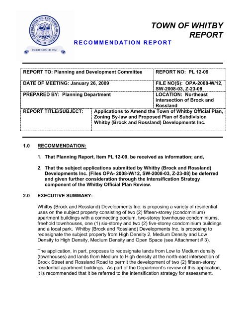
TOWN OF WHITBY REPORT
TOWN OF WHITBY REPORT
TOWN OF WHITBY REPORT

Create successful ePaper yourself
Turn your PDF publications into a flip-book with our unique Google optimized e-Paper software.
<strong>TOWN</strong> <strong>OF</strong> <strong>WHITBY</strong><br />
<strong>REPORT</strong><br />
RECOMMENDATION <strong>REPORT</strong><br />
<strong>REPORT</strong> TO: Planning and Development Committee <strong>REPORT</strong> NO: PL 12-09<br />
DATE <strong>OF</strong> MEETING: January 26, 2009<br />
FILE NO(S): OPA-2008-W/12,<br />
SW-2008-03, Z-23-08<br />
PREPARED BY: Planning Department<br />
LOCATION: Northeast<br />
intersection of Brock and<br />
Rossland<br />
<strong>REPORT</strong> TITLE/SUBJECT: Applications to Amend the Town of Whitby Official Plan,<br />
Zoning By-law and Proposed Plan of Subdivision<br />
Whitby (Brock and Rossland) Developments Inc.<br />
1.0 RECOMMENDATION:<br />
1. That Planning Report, Item PL 12-09, be received as information; and,<br />
2. That the subject applications submitted by Whitby (Brock and Rossland)<br />
Developments Inc. (Files OPA- 2008-W/12, SW-2008-03, Z-23-08) be deferred<br />
and given further consideration through the Intensification Strategy<br />
component of the Whitby Official Plan Review.<br />
2.0 EXECUTIVE SUMMARY:<br />
Whitby (Brock and Rossland) Developments Inc. is proposing a variety of residential<br />
uses on the subject property consisting of two (2) fifteen-storey (condominium)<br />
apartment buildings with a connecting podium, two-storey townhouse condominiums,<br />
freehold townhouses, one (1) six-storey and two (2) five-storey condominium buildings<br />
and a local park. Whitby (Brock and Rossland) Developments Inc. is proposing to<br />
redesignate the subject property from High Density 2, Medium Density and Low<br />
Density to High Density, Medium Density and Open Space (see Attachment # 3).<br />
The application, in part, proposes to redesignate lands from Low to Medium density<br />
(townhouses) and lands from Medium to High density at the north-east intersection of<br />
Brock Street and Rossland Road to permit the development of two (2) fifteen-storey<br />
residential apartment buildings. As part of the Department’s review of this application,<br />
it is recommended that it be referred to the intensification strategy for assessment.
Report to: Planning and Development Committee<br />
Report No.: PL 12-09 Page 2 of 9<br />
3.0 ORIGIN:<br />
The Planning Department is in receipt of applications filed by Whitby (Brock and<br />
Rossland) Developments Inc. to amend the Town of Whitby Official Plan and Zoning<br />
By-law No. 1784 to permit a development consisting of two (2) fifteen-storey<br />
condominium towers with a connecting podium, two-storey townhouse condominiums,<br />
freehold townhouses, one (1) six-storey and two (2) five-storey condominium buildings<br />
and a local park. A draft plan of subdivision has also been submitted.<br />
4.0 BACKGROUND:<br />
The subject property was occupied by a large apple orchard from the late 1940’s up to<br />
2007. From approximately 1998 to present, the subject site was occupied by Dive<br />
Source Scuba Supply and a fruit and vegetable market in the fall.<br />
The lands were subject to a previous plan of subdivision and zoning application in<br />
2002. The applications were submitted by the previous owner of the subject property<br />
(Henri Inc.) and were proposed to consist of a 3.2 hectare future development area<br />
divided into three (3) separate blocks for future high density residential uses, twentytwo<br />
(22) single detached dwelling lots, forty (40) semi-detached dwelling lots and sixtysix<br />
(66) street townhouse units (see Attachment #4).<br />
The current owners have requested that the previous subdivision and zoning files be<br />
closed without prejudice.<br />
Site Description<br />
Site Location : Part of Lot 25 and 26, Concession 3<br />
(See Attachment #1)<br />
Area of Site : 8.94 hectares (22.09 acres)<br />
Present Use : single detached dwelling (currently vacant)<br />
Proposed Use : High-rise Condominium - 397 units<br />
two residential 15-storey condominium point<br />
towers (340 units); nineteen 1-storey garden<br />
condominium units; twenty 1-storey terrace<br />
condominium units, and eighteen 2-storey<br />
townhouse/loft condominium units<br />
(approximately 180 units per net hectare)
Report to: Planning and Development Committee<br />
Report No.: PL 12-09 Page 3 of 9<br />
Low-rise Condominiums – 322 units<br />
6-storey condominium – 122 units<br />
two 5-storey buildings – 200 units<br />
(approximately 142 units per net hectare)<br />
Freehold Townhouses – 56 units<br />
(approximately 48 units per net hectare)<br />
Condominium Townhouses – 26 units<br />
(approximately 34 units per net hectare)<br />
Open Space (Park) – 1.46 ha. (3.6 ac.)<br />
Total Units - 801<br />
Overall Residential Density – Average 125<br />
units per net hectare<br />
Present OP Designation : Regional: Living Area<br />
Town: High Density Residential 2,<br />
Medium Density Residential and<br />
Low Density Residential<br />
(Rossland/Garden Major Central<br />
Area)<br />
Proposed OP Designation : High Density Residential 2 with an exception<br />
to permit a maximum 15-storeys, Medium<br />
Density Residential and Open Space.<br />
Present Zone Category : R2-Second Density Residential Zone,<br />
By-law No. 1784, as amended.<br />
Proposed Zone Category : A site specific by-law that permits the<br />
proposed development.<br />
Surrounding Land Uses: : The adjacent lands located north, south and<br />
west of the subject site are residential uses in<br />
the form of townhouses and single detached<br />
houses. The Whitby Christian Assembly, a<br />
place of worship is located directly west of the<br />
subject site, on the northwest corner of Brock<br />
Street North and Rossland Road West. To<br />
the west, northwest, and north of the subject
Report to: Planning and Development Committee<br />
Report No.: PL 12-09 Page 4 of 9<br />
Development Details<br />
site are residential uses consisting of<br />
townhouses, walk up condominium<br />
apartments, and single detached houses.<br />
Various public institutional uses are located<br />
to the east and southeast in the form of<br />
Provincial Offices including the Land Registry<br />
Office, the Durham Regional Headquarters,<br />
the Durham Region Court House, and the<br />
Whitby Municipal Offices. Recreational uses<br />
are located to the southeast in the form of the<br />
Whitby Civic Recreational Centre and Whitby<br />
Civic Gardens. Additional residential uses<br />
are located to the south and southwest of the<br />
site subject site consisting of townhouses and<br />
single detached homes.<br />
The residential densities are proposed to range from a lower scale medium density of<br />
approximately 34 units per net hectare to a high density of approximately 180 units per<br />
net hectare. On the whole, the average density of the proposed development is<br />
approximately 125 units per net hectare.<br />
In addition to the proposed residential uses, the proposal includes a local park on the<br />
east side of Vanier Street. The local park is proposed to connect to the open<br />
space/future park located to the west (currently graded and vacant), and is proposing<br />
a pedestrian connection to Rossland Road to the south.<br />
The proposed plan of subdivision includes a southern extension of Vanier Street which<br />
is proposed to extend west to Brock Street North to a proposed right-in/right-out<br />
access. The proposed development also includes a right-in/right-out direct access to<br />
the underground parking lot associated with the two 15-storey condominium towers<br />
and condominium townhouse units in the connecting podium.<br />
The proposed parking for the development includes 1.5 spaces per unit for the<br />
condominium apartment uses and 2.0 spaces per unit for the freehold and<br />
condominium townhouse units which meets the minimum requirements of the Town.<br />
The existing stone house on the property is proposed to be demolished. The Town’s<br />
records indicate that the house was constructed in 1945.<br />
Preliminary building elevations for the proposed 15-storey high-rise buildings and the<br />
5-storey buildings can be found at Attachment #5 and 6 respectively.
Report to: Planning and Development Committee<br />
Report No.: PL 12-09 Page 5 of 9<br />
5.0 DISCUSSION/OPTIONS:<br />
Below is a discussion of the relevant policy framework and direction to assist in<br />
considering the subject applications.<br />
Provincial Policy Statement, 2005<br />
The Provincial Policy Statement, 2005 (PPS, 2005) “focuses growth within settlement<br />
areas and away from significant or sensitive resources and areas which may pose a<br />
risk to public health and safety. It recognizes that the wise management of<br />
development may involve directing, promoting or sustaining growth.” (Part IV: Vision<br />
for Ontario’s Land Use Planning System, PPS, 2005). With respect to development in<br />
the form of intensification, “planning authorities shall identify and promote opportunities<br />
for intensification and redevelopment where this can be accommodated taking into<br />
account existing building stock or area, and the availability of suitable existing or<br />
planned infrastructure and public service facilities required to accommodate projected<br />
needs.” (Section 1.1.3.3, PPS, 2005).<br />
The PPS refers to the Official Plan as the most important vehicle for implementation of<br />
the Provincial Policy Statement.<br />
Places to Grow: Growth Plan for the Greater Golden Horseshoe<br />
The Growth Plan “envisages increasing intensification of the existing built-up area,<br />
with a focus on urban growth centres, intensification corridors, major transit station<br />
areas, brownfield sites and greyfields. Concentrating new development in these areas<br />
also provides a focus for transit and infrastructure investments to support future<br />
growth.” (Section 2.1, Growth Plan)<br />
The lands are currently designated by both the Regional Official Plan and the Whitby<br />
Official Plan for high density and low density residential development. Development<br />
policies for such development are outlined in these plans.<br />
Regional Official Plan<br />
The subject lands are designated as ‘Living Area’. Lands in the ‘Living Area’ shall be<br />
developed in a compact form through higher densities and by intensifying and<br />
redeveloping existing areas, particularly along arterial roads.<br />
Whitby Official Plan<br />
The lands are currently designated ‘High Density Residential 2, Medium Density<br />
Residential, and Low Density Residential’ in the Rossland/Garden Major Central Area<br />
Secondary Plan/ Whitby’s Official Plan (Schedule J, see Attachment #2). Within the
Report to: Planning and Development Committee<br />
Report No.: PL 12-09 Page 6 of 9<br />
High Density 2 designation, maximum densities currently permitted are between 110<br />
and 170 units per net hectare and the maximum height shall be up to 12 storeys.<br />
As outlined in Section 4.2.3.13 of the town’s Official Plan, new development or<br />
intensification shall be based on consideration of the following:<br />
a) capacity of municipal sanitary sewer and water;<br />
b) suitable access to existing and future major roads;<br />
c) proximity to public transit service;<br />
d) suitability of subject parcel to accommodate more intensive use;<br />
e) proximity to retail and service commercial facilities, employment opportunities,<br />
parks and open space;<br />
f) proximity to educational and community services and facilities;<br />
g) provision of adequate on-site parking, lighting and landscaping;<br />
h) impact on adjacent uses relating to height, design, and form in order to achieve<br />
an appropriate transition of height and density;<br />
i) minimizing traffic impacts on surrounding neighbourhoods;<br />
j) Provision of adequate on-site recreational amenities in multi-unit block<br />
development.<br />
Section 4.2.3.8c) addresses parking requirements for high density development,<br />
requiring a minimum of 1.5 parking spaces per unit and that such parking be<br />
encouraged to locate underground within the structures and/or otherwise enclosed in a<br />
landscaped area.<br />
Section 4.2.3.14 requires that high density residential development be developed on<br />
the basis of comprehensive site plan review of urban design, integrating the proposed<br />
development with adjacent properties as much as possible, particularly in terms of<br />
open space elements and building height.<br />
The proposed official plan amendment is seeking to increase the maximum height of<br />
a building within a High Density residential designation from 12 storeys to 15 storeys,<br />
as well as redistribute the land use designations within the subject property and to<br />
delete the low density designation (L) and add an open space (Local Park -LP)<br />
designation (see below).
Report to: Planning and Development Committee<br />
Report No.: PL 12-09 Page 7 of 9<br />
6.0 COMMUNICATION ISSUES/PLAN:<br />
N/A
Report to: Planning and Development Committee<br />
Report No.: PL 12-09 Page 8 of 9<br />
7.0 CONSIDERATIONS:<br />
A. PUBLIC<br />
The Introductory Public Information Meeting is being held in accordance with<br />
Section 10.1.4.3 of the Town of Whitby Official Plan. Notice of this meeting was<br />
mailed to all property owners within 120 metres (400 feet) of the subject property<br />
at least fourteen days prior to the meeting. In addition, public notice signs have<br />
been erected on the site in accordance with the sign notification procedures prior<br />
to the public meeting date. Notice of this meeting was also advertised in the<br />
Whitby This Week on January 7 th , 2009.<br />
B. FINANCIAL<br />
N/A<br />
C. IMPACT ON & INPUT FROM OTHER DEPARTMENTS/SOURCES<br />
The applicant has submitted a number of studies and reports in support of their<br />
applications. The reports were circulated to relevant agencies and departments<br />
and a copy of each is available in the Planning Department for review. The<br />
following reports were submitted in support of the applications:<br />
<br />
<br />
<br />
<br />
<br />
<br />
<br />
<br />
<br />
Functional Servicing Report<br />
Noise Report<br />
Traffic Impact Study<br />
Phase 1 Environmental Site Assessment<br />
Phase 2 Environmental Site Assessment<br />
Geotechnical Report<br />
Shadow Study<br />
Tree Inventory/Preservation; and<br />
Planning Rationale Report<br />
D. CORPORATE AND/OR DEPARTMENT STRATEGIC PRIORITIES<br />
N/A<br />
8.0 SUMMARY AND CONCLUSION<br />
Application OPA-2008-W/12 is proposing major changes to the density provisions and<br />
designations now established in the Rossland / Garden Major Central Area Secondary<br />
Plan. There are a number of property owners in Whitby expressing an interest in and
Report to: Planning and Development Committee<br />
Report No.: PL 12-09 Page 9 of 9<br />
making applications to change existing land use designations for higher density<br />
development. There are also a number of properties that warrant such considerations<br />
that are not attached to a planning application before the Town. All of these<br />
opportunities should be examined on a comprehensive basis to ensure such<br />
density changes are in appropriate locations within Whitby's built boundaries and that<br />
municipally led standards to which such policy decisions such developments are to be<br />
measured against can be achieved. These policy decisions should be municipally led<br />
and may vary from locale to locale due to the character of the street, neighbourhood or<br />
place. Whitby's Official Plan provides for such a review and assessment. It is<br />
therefore recommended, as part of the Town's circulation, review and assessment of<br />
this application, that this application be referred to Whitby's Official Plan Review and<br />
the Intensification Strategy for input and assessment. The consultant's report and<br />
recommendations for the intensification component are targeted for Quarter 4, 2009.<br />
9.0 ATTACHMENTS<br />
Attachment #1:<br />
Attachment #2:<br />
Attachment #3:<br />
Attachment #4:<br />
Attachment #5<br />
Attachment #6:<br />
Location Sketch<br />
Excerpt from Town of Whitby Official Plan<br />
Schedule ‘J’ – Rossland/Garden Major Central Area Secondary<br />
Plan<br />
Proposed Preliminary Site Plan / Plan of Subdivision*<br />
Previous Subdivision Application, 2000 (Henri Inc.)<br />
Proposed High-rise building elevations<br />
Proposed 5 storey building elevations<br />
* Enlargement available on 11” x 17”<br />
For further information contact:<br />
John Taylor, Ext. 2275<br />
___________________________________________<br />
Robert B. Short, Director of Planning, Ext. 4309<br />
___________________________________________<br />
Robert Petrie, Chief Administrative Officer, Ext. 2211