

Geologic Hazards in Utah - Utah Geological Survey - Utah.gov
Geologic Hazards in Utah - Utah Geological Survey - Utah.gov
Geologic Hazards in Utah - Utah Geological Survey - Utah.gov

Create successful ePaper yourself
Turn your PDF publications into a flip-book with our unique Google optimized e-Paper software.
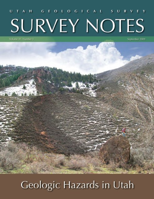
U T A H G E O L O G I C A L S U R V E Y<br />
SURVEY NOTES<br />
Volume 41, Number 3<br />
September 2009<br />
<strong>Geologic</strong> <strong>Hazards</strong> <strong>in</strong> <strong>Utah</strong>
The Director’s<br />
Perspective<br />
by Richard G. Allis<br />
This “Perspective” deals with two issues that<br />
arose dur<strong>in</strong>g the month prior to writ<strong>in</strong>g.<br />
One addresses the Logan landslide and<br />
canal collapse, and the other was triggered<br />
by a query from a county about potential<br />
sand and gravel resources near the Wasatch<br />
Front. Both issues highlight the importance<br />
of detailed geologic mapp<strong>in</strong>g, particularly<br />
that which emphasizes Quaternary geology<br />
and geologic hazards.<br />
The tragic landslide and associated canal<br />
collapse that occurred <strong>in</strong> Logan dur<strong>in</strong>g<br />
July (see page 16) highlights how it often<br />
takes a catastrophe to stimulate changes <strong>in</strong><br />
public policy to mitigate geologic hazards.<br />
Although the cause of the landslide has not<br />
been determ<strong>in</strong>ed, the event has triggered<br />
public debate about whether <strong>Utah</strong>’s canals<br />
are safe, especially where they traverse<br />
above urban areas. Many canals were<br />
built decades ago, and urban areas have<br />
Contents<br />
New <strong>Geologic</strong> <strong>Hazards</strong> Mapp<strong>in</strong>g <strong>in</strong> <strong>Utah</strong>........1<br />
Landslide Inventory Mapp<strong>in</strong>g <strong>in</strong> Twelvemile<br />
Canyon, Central <strong>Utah</strong>.................................4<br />
Second Damag<strong>in</strong>g Y Mounta<strong>in</strong> Rock Fall <strong>in</strong><br />
Four Years...................................................6<br />
Large Rock Fall Closes Highway Near Cedar<br />
City, <strong>Utah</strong>.................................................... 8<br />
Logan Landslide............................................. 10<br />
Teacher’s Corner............................................. 10<br />
GeoSights........................................................11<br />
Glad You Asked...............................................12<br />
Energy News................................................... 14<br />
<strong>Survey</strong> News....................................................15<br />
New Publications............................................17<br />
Design: Richard Aust<strong>in</strong><br />
Cover: Rock-fall boulder measur<strong>in</strong>g 20'x 15'x 13' and<br />
weigh<strong>in</strong>g approximately 250 tons, near Croydon, Morgan<br />
County, <strong>Utah</strong>, March 2004. Photo by Greg McDonald.<br />
typically expanded around them. The <strong>Utah</strong><br />
<strong>Geologic</strong>al <strong>Survey</strong> has noticed that <strong>in</strong> some<br />
urban areas the ground-water levels rise to<br />
a peak <strong>in</strong> late summer due to overwater<strong>in</strong>g<br />
of lawns, and this can make hillsides<br />
vulnerable to failure. The issue of whether<br />
canals are safe is therefore complicated, and<br />
<strong>in</strong>cludes geologic factors such as the slope,<br />
strength, and stability of the underly<strong>in</strong>g<br />
formations; hydrological factors such as<br />
temporal variations <strong>in</strong> the water levels and<br />
their causes; and eng<strong>in</strong>eer<strong>in</strong>g factors such<br />
as the canal design and ma<strong>in</strong>tenance, and<br />
slope modification that may have occurred<br />
below the canal dur<strong>in</strong>g urban growth. <strong>Utah</strong><br />
has over 5000 miles of canals, and some<br />
canals are over 100 years old. <strong>Geologic</strong><br />
maps will be an important component of<br />
assess<strong>in</strong>g which sections of canals could<br />
pose a hazard to residents liv<strong>in</strong>g downslope.<br />
Another value of geologic maps is their<br />
use <strong>in</strong> identify<strong>in</strong>g potential sand and gravel<br />
resources. <strong>Utah</strong> has many<br />
examples of where sand and<br />
60<br />
gravel pits that were once outside<br />
of towns have become surrounded<br />
50<br />
by development, and<br />
cont<strong>in</strong>ued operation of the pits<br />
40<br />
is no longer tolerated. Growth<br />
30<br />
and development require construction<br />
commodities such<br />
20<br />
as aggregate (sand, gravel, and<br />
crushed stone) so there is an<br />
ongo<strong>in</strong>g need <strong>in</strong> <strong>Utah</strong> for access<br />
10<br />
to new deposits. The historical<br />
pattern of aggregate use depicts<br />
State of <strong>Utah</strong><br />
Gary R. Herbert, Governor<br />
Department of Natural Resources<br />
Michael Styler, Executive Director<br />
UGS Board<br />
Kenneth Puchlik, Chair<br />
William Loughl<strong>in</strong> Jack Hamilton<br />
Tom Tripp Alisa Schofield<br />
Mark Bunnell Donald Harris<br />
Kev<strong>in</strong> Carter (Trust Lands<br />
Adm<strong>in</strong>istration-ex officio)<br />
UGS Staff<br />
Adm<strong>in</strong>istration<br />
Richard G. Allis, Director<br />
Kimm Harty, Deputy Director<br />
John K<strong>in</strong>gsley, Associate Director<br />
Starr Losee, Secretary/Receptionist<br />
Dianne Davis, Adm<strong>in</strong>istrative Secretary<br />
Kathi Galusha, Account<strong>in</strong>g Officer<br />
L<strong>in</strong>da Bennett, Account<strong>in</strong>g Technician<br />
Michael Hylland, Technical Reviewer<br />
Robert Ressetar, Technical Reviewer<br />
Annual Production (million metric tons/year)<br />
<strong>Utah</strong> Aggregate Production<br />
0<br />
1950 1960 1970 1980 1990 2000<br />
Year<br />
Editorial Staff Vicky Clarke<br />
Lori Douglas, Stevie Emerson,<br />
Richard Aust<strong>in</strong>, Jay Hill<br />
<strong>Geologic</strong> <strong>Hazards</strong> Steve Bowman<br />
William Lund, Barry Solomon,<br />
Francis Ashland, Richard Giraud,<br />
Greg McDonald, Chris DuRoss,<br />
Tyler Knudsen, Ashley Elliott,<br />
Corey Unger, Jessica Castleton,<br />
Lisa Brown<br />
<strong>Geologic</strong> Mapp<strong>in</strong>g Grant Willis<br />
Jon K<strong>in</strong>g, Douglas Spr<strong>in</strong>kel,<br />
Janice Hayden, J. Buck Ehler,<br />
Kent Brown, Basia Matyjasik,<br />
Don Clark, Bob Biek, Paul Kuehne<br />
<strong>Geologic</strong> Information and Outreach<br />
Sandra Eldredge<br />
William Case, Mage Yonetani,<br />
Christ<strong>in</strong>e Wilkerson,<br />
Patricia Stokes, Mark Milligan,<br />
Jim Davis, Emily Chapman,<br />
Lance Weaver, Devon Aubrey,<br />
Gentry Hammerschmid<br />
fluctuations <strong>in</strong> construction activity, <strong>in</strong>clud<strong>in</strong>g<br />
the build<strong>in</strong>g boom <strong>in</strong> 2007 and 2008<br />
and its subsequent collapse (see graph<br />
below). Dur<strong>in</strong>g this recent peak, total<br />
aggregate use reached a record 58 million<br />
metric tons/year. However, when population<br />
growth is also considered, this peak <strong>in</strong><br />
use amounted to only 20 tons per person<br />
per year <strong>in</strong> 2007–08, compared to 25<br />
tons/person/year dur<strong>in</strong>g the pre-Olympics<br />
construction boom <strong>in</strong> 1998, and 40 tons/<br />
person/year <strong>in</strong> the late 1950s when the rail<br />
causeway across Great Salt Lake was constructed.<br />
Another trend that is occurr<strong>in</strong>g<br />
is <strong>in</strong>creas<strong>in</strong>g use of crushed stone (mostly<br />
limestone) as a construction material. The<br />
cost of aggregate has rema<strong>in</strong>ed remarkably<br />
constant over the last 40 years when<br />
adjusted for <strong>in</strong>flation ($4–6/ton). The peak<br />
production <strong>in</strong> 2008 amounted to $350<br />
million <strong>in</strong> revenue at the quarry gate, so<br />
this is an important part of <strong>Utah</strong>’s economy.<br />
Great Salt Lake<br />
Causeway Construction<br />
Interstate Construction<br />
crushed stone<br />
population<br />
2007-08 Build<strong>in</strong>g Boom<br />
Pre-Olympics<br />
Interstate Expansion<br />
sand and gravel<br />
Ground Water and Paleontology<br />
Michael Lowe<br />
James Kirkland, Janae Wallace,<br />
Martha Hayden, Hugh Hurlow,<br />
Lucy Jordan, Don DeBlieux,<br />
Kim Nay, Stefan Kirby,<br />
Kev<strong>in</strong> Thomas, Rebecca Med<strong>in</strong>a,<br />
Walid Sabbah, Rich Emerson,<br />
Matt Affolter, Scott Madsen<br />
3.0<br />
2.5<br />
2.0<br />
1.5<br />
1.0<br />
0.5<br />
0.0<br />
State Energy Program Jason Berry<br />
Denise Beaudo<strong>in</strong>, Meghan Golden,<br />
Elise Brown, Chris Tallackson,<br />
Jerriann Ernsten, Brandon Malman,<br />
Alex Dalphé-Charron, Will Chatw<strong>in</strong><br />
Energy and M<strong>in</strong>erals David Tabet<br />
Robert Blackett, Craig Morgan,<br />
Thomas Chidsey, Mike La<strong>in</strong>e,<br />
Bryce Tripp, Jeff Quick, Roger Bon,<br />
Taylor Boden, J. Wallace Gwynn,<br />
Cheryl Gust<strong>in</strong>, Tom Dempster,<br />
Brigitte Hucka, Stephanie Carney,<br />
Ammon McDonald, Ken Krahulec,<br />
Valerie Davis, Brad Wolverton,<br />
Sonja Heuscher, Mike Vanden Berg<br />
Population (million)<br />
<strong>Survey</strong> Notes is published three times yearly by <strong>Utah</strong> <strong>Geologic</strong>al <strong>Survey</strong>, 1594 W. North Temple, Suite 3110, Salt Lake City, <strong>Utah</strong> 84116; (801) 537-3300. The <strong>Utah</strong> <strong>Geologic</strong>al <strong>Survey</strong> provides timely<br />
scientific <strong>in</strong>formation about <strong>Utah</strong>’s geologic environment, resources, and hazards. The UGS is a division of the Department of Natural Resources. S<strong>in</strong>gle copies of <strong>Survey</strong> Notes are distributed free of<br />
charge with<strong>in</strong> the United States and reproduction is encouraged with recognition of source. Copies are available at geology.utah.<strong>gov</strong>/surveynotes. ISSN 1061-7930
NEW GEOLOGIC HAZARDS MAPPING IN UTAH<br />
by Steve D. Bowman, Jessica J. Castleton, and Ashley H. Elliott<br />
Introduction<br />
Development <strong>in</strong> urban areas along the Wasatch Front is proceed<strong>in</strong>g<br />
at a rapid pace; <strong>in</strong> many areas geologic hazards have<br />
not been mapped to meet the needs of new and evolv<strong>in</strong>g geologic-hazard<br />
ord<strong>in</strong>ances. As land well suited for development<br />
becomes scarce <strong>in</strong> many areas, development occurs <strong>in</strong> areas<br />
with more exposure to geologic hazards. To address this issue,<br />
the <strong>Utah</strong> <strong>Geologic</strong>al <strong>Survey</strong> created the <strong>Geologic</strong> <strong>Hazards</strong> Mapp<strong>in</strong>g<br />
Initiative <strong>in</strong> 2008, with fund<strong>in</strong>g from the <strong>Utah</strong> Legislature.<br />
The need for the <strong>in</strong>itiative was highlighted dur<strong>in</strong>g meet<strong>in</strong>gs of<br />
the <strong>Geologic</strong> <strong>Hazards</strong> Work<strong>in</strong>g Group, formed <strong>in</strong> 2006 by Governor<br />
Jon M. Huntsman, Jr. as the result of numerous landslides<br />
dur<strong>in</strong>g 2005 and 2006 and related issues with the development<br />
approval process <strong>in</strong> <strong>Utah</strong>. The <strong>in</strong>itiative will provide planners,<br />
local officials, property owners, developers, eng<strong>in</strong>eers, geologists,<br />
design professionals, and the <strong>in</strong>terested public with <strong>in</strong>formation<br />
on the type and location of critical geologic hazards that<br />
may affect exist<strong>in</strong>g and future development. This <strong>in</strong>formation<br />
will be presented as geologic-hazard maps for use <strong>in</strong> land-use<br />
and development plann<strong>in</strong>g, regulation, and design <strong>in</strong> <strong>Utah</strong>.<br />
We have begun geologic-hazard mapp<strong>in</strong>g <strong>in</strong> areas of high<br />
projected growth where recent Quaternary geologic mapp<strong>in</strong>g<br />
has been completed, specifically the western part of Salt Lake<br />
Valley, where the growth rate is estimated to be 41% from 2005<br />
to 2020. <strong>Geologic</strong>-hazard mapp<strong>in</strong>g planned for 2009–2010 is<br />
anticipated to cont<strong>in</strong>ue <strong>in</strong> Salt Lake and <strong>Utah</strong> Counties. Additional<br />
hazards mapp<strong>in</strong>g is planned <strong>in</strong> Davis, Weber, Wasatch,<br />
Summit, and U<strong>in</strong>tah Counties.<br />
<strong>Geologic</strong>-Hazard Maps<br />
Our f<strong>in</strong>al product will be sets of geologic-hazard maps that are<br />
created on U.S. <strong>Geologic</strong>al <strong>Survey</strong> 7.5-m<strong>in</strong>ute quadrangle topographic<br />
base maps enhanced us<strong>in</strong>g aerial photography from the<br />
2006 National Agriculture Imagery Program and/or hillshad<strong>in</strong>g<br />
to show topographic relief. The maps are be<strong>in</strong>g prepared<br />
by compil<strong>in</strong>g a geographic <strong>in</strong>formation system (GIS) database<br />
<strong>in</strong>corporat<strong>in</strong>g available Natural Resources Conservation Service<br />
(NRCS) soil maps, previous geotechnical and/or geologic-hazard<br />
studies, geologic maps, and other field data. Depend<strong>in</strong>g upon<br />
the specific area and availability of data, the hazard map sets will<br />
<strong>in</strong>clude maps show<strong>in</strong>g earthquake, landslide, flood, problem soil<br />
and rock, <strong>in</strong>door radon, and shallow ground-water hazards. In<br />
addition, a map show<strong>in</strong>g slope angles may be <strong>in</strong>cluded for use<br />
with local ord<strong>in</strong>ances perta<strong>in</strong><strong>in</strong>g to buildable areas.<br />
The earthquake-hazard maps will address potential surface fault<br />
rupture, ground shak<strong>in</strong>g, and liquefaction. The maps illustrate<br />
these hazards by show<strong>in</strong>g areas of mapped active (Quaternary)<br />
faults (those faults with evidence of movement with<strong>in</strong> the<br />
past 1.8 million years) with applicable special-study zones, site<br />
classes for use with the International Build<strong>in</strong>g and Residential<br />
Codes, and areas where saturated sandy soils may liquefy and<br />
lose strength <strong>in</strong> an earthquake, respectively.<br />
The landslide-hazard maps del<strong>in</strong>eate areas prone to landslides<br />
and rock falls. These maps illustrate landslide and rock-fall susceptibility<br />
by tak<strong>in</strong>g <strong>in</strong>to account geology and slope angle. The<br />
maps also show areas of known, exist<strong>in</strong>g landslides and rock fall.<br />
Area not<br />
mapped<br />
Exist<strong>in</strong>g Salt Lake County Plann<strong>in</strong>g and<br />
Development Services map of surfacefault-rupture<br />
(<strong>in</strong> red) and liquefaction potential<br />
(green boundaries) special-study<br />
areas, clipped to approximate Magna<br />
quadrangle boundary.<br />
New, prelim<strong>in</strong>ary surface-fault-rupturehazard<br />
map (one of 11) of the Magna<br />
quadrangle, based upon recent geologic<br />
mapp<strong>in</strong>g by the UGS. Map shows two<br />
new surface-fault-rupture special-study<br />
zones (<strong>in</strong> red) <strong>in</strong> lower left corner. Base<br />
mapp<strong>in</strong>g <strong>in</strong>cludes 2006 NAIP imagery<br />
and USGS topographic <strong>in</strong>formation.<br />
SEPTEMBER 2009 1
Encroach<strong>in</strong>g development along the western part of Salt Lake Valley extends <strong>in</strong>to areas hav<strong>in</strong>g multiple geologic hazards, <strong>in</strong>clud<strong>in</strong>g landslides, collapsible<br />
and expansive soil, flood<strong>in</strong>g, and earthquake hazards.<br />
The flood-hazard maps show areas susceptible to flood<strong>in</strong>g by<br />
creeks, rivers, and other dra<strong>in</strong>ages; flash floods; sheetflow; and<br />
debris flows. The maps are based on the geologic conditions<br />
of various mapped units, such as depositional environment<br />
and age. For example, geologic units deposited by floods and<br />
debris flows typically have a higher flood hazard than other units.<br />
Our maps are <strong>in</strong>tended to supplement other flood-hazard maps<br />
already used <strong>in</strong> land-use plann<strong>in</strong>g and regulation. For example,<br />
Flood Insurance Rate Maps produced by the Federal Emergency<br />
Management Agency show creek and river flood<strong>in</strong>g, but they generally<br />
do not show flood<strong>in</strong>g by sheetflow and debris flows.<br />
The problem-soil-and-rock-hazard maps del<strong>in</strong>eate<br />
areas of expansive soil and rock, collapsible soil,<br />
shallow bedrock, soil pip<strong>in</strong>g and erosion, and w<strong>in</strong>dblown<br />
sand. Expansive soil and rock results from the<br />
presence of clay m<strong>in</strong>erals that undergo changes <strong>in</strong><br />
volume; these deposits shr<strong>in</strong>k/swell <strong>in</strong> response to<br />
changes <strong>in</strong> moisture content. Collapsible-soil hazards<br />
are typically present on geologically young alluvial<br />
fans near mounta<strong>in</strong> fronts that conta<strong>in</strong> soils with<br />
void spaces that may collapse when the soils become<br />
wet, result<strong>in</strong>g <strong>in</strong> the settlement of the ground surface.<br />
Conclusion<br />
While site-specific geotechnical <strong>in</strong>vestigations should be performed<br />
for all development, our new maps will identify areas<br />
where additional, specialized geologic-hazard <strong>in</strong>vestigations are<br />
necessary prior to development. In <strong>Utah</strong>, licensed Professional<br />
Geologists and Professional Eng<strong>in</strong>eers perform these <strong>in</strong>vestigations.<br />
The maps will also provide <strong>in</strong>formation that may be used<br />
for emergency plann<strong>in</strong>g and community risk assessment for<br />
exist<strong>in</strong>g home and bus<strong>in</strong>ess owners.<br />
The <strong>Utah</strong> <strong>Geologic</strong>al <strong>Survey</strong> will provide copies of the published<br />
maps to local <strong>gov</strong>ernments with<strong>in</strong> the study areas, and will work<br />
The other hazard maps will illustrate <strong>in</strong>door radon<br />
potential and shallow ground-water hazards. Indoor<br />
radon potential is a function of source materials<br />
(rock and soil) conta<strong>in</strong><strong>in</strong>g uranium, such as shale<br />
and granite, and soil permeability that allows radon<br />
gas to flow toward build<strong>in</strong>g foundations and basements.<br />
Shallow ground water may be present <strong>in</strong><br />
areas near lakes and streams, shallow bedrock, and/<br />
or low-permeability soils and can cause problems<br />
with wet crawlspaces and basements, foundation<br />
and utility excavations, or buried structures.<br />
Damage to a home <strong>in</strong> northern <strong>Utah</strong> from an active landslide. The home was constructed<br />
before geologic-hazard and geotechnical <strong>in</strong>vestigations were required by city<br />
or county <strong>gov</strong>ernments. Photo by Francis Ashland.<br />
2 SURVEY NOTES
Shallow ground water exposed with<strong>in</strong> an eng<strong>in</strong>eered bas<strong>in</strong> designed for dra<strong>in</strong>age control <strong>in</strong> the surround<strong>in</strong>g development. Identification of shallow ground<br />
water is critical <strong>in</strong> the design of structures to prevent damage from wet crawlspaces and basements.<br />
with communities as requested to help prepare geologic-hazard<br />
ord<strong>in</strong>ances. City and county <strong>gov</strong>ernment agencies will f<strong>in</strong>d the<br />
geologic-hazard maps useful <strong>in</strong> land-use plann<strong>in</strong>g and regulation,<br />
and for development of their own <strong>in</strong>frastructure. State and federal<br />
<strong>gov</strong>ernment agencies (such as the <strong>Utah</strong> School and Institutional<br />
Trust Lands Adm<strong>in</strong>istration, U.S. Forest Service, and Bureau of Land<br />
Management) will f<strong>in</strong>d the maps useful <strong>in</strong> land management activities,<br />
permit application reviews, and development of their own <strong>in</strong>frastructure.<br />
The private sector, <strong>in</strong>clud<strong>in</strong>g property owners, developers,<br />
planners, consultants, and the general public, will f<strong>in</strong>d the maps<br />
useful <strong>in</strong> development project plann<strong>in</strong>g and design, real estate transaction<br />
due-diligence, and other activities.<br />
for more <strong>in</strong>formation:<br />
<strong>Geologic</strong> <strong>Hazards</strong> Program (GHP): http://geology.utah.<strong>gov</strong>/ghp<br />
<strong>Geologic</strong> Hazard Resources for Consultants and Design Professionals:<br />
http://geology.utah.<strong>gov</strong>/ghp/consultants<br />
<strong>Geologic</strong> Hazard Resources for Homebuyers and Real Estate Agents:<br />
http://geology.utah.<strong>gov</strong>/utahgeo/hazards/realtors.htm<br />
ABOUT THE AUTHORS<br />
Steve Bowman (right) has 14 years of experience as a geological<br />
eng<strong>in</strong>eer, n<strong>in</strong>e of which were on projects throughout the western<br />
United States for geotechnical consult<strong>in</strong>g firms. He is presently<br />
the <strong>Geologic</strong> <strong>Hazards</strong> Program Manager with the UGS.<br />
Steve is a Licensed Professional Geologist <strong>in</strong> <strong>Utah</strong>, Professional<br />
<strong>Geologic</strong>al Eng<strong>in</strong>eer <strong>in</strong> Nevada, Professional Geotechnical<br />
Eng<strong>in</strong>eer <strong>in</strong> Oregon, and certified as a LEED Accredited Professional.<br />
In addition to the geologic-hazard mapp<strong>in</strong>g project<br />
described <strong>in</strong> this article, other recent projects <strong>in</strong>clude historical<br />
aerial photography compilations, landslide <strong>in</strong>ventory mapp<strong>in</strong>g,<br />
and geologic data preservation.<br />
Jessica Castleton (left) and Ashley Elliott (center) are geologists<br />
with the UGS <strong>Geologic</strong> <strong>Hazards</strong> Program. Ashley has<br />
worked for the UGS s<strong>in</strong>ce 2006. Her primary responsibilities<br />
are geologic-hazard mapp<strong>in</strong>g <strong>in</strong> western Salt Lake Valley and<br />
complet<strong>in</strong>g a landslide <strong>in</strong>ventory for <strong>Utah</strong>. In addition, she is<br />
currently <strong>in</strong>volved <strong>in</strong> several long-term landslide monitor<strong>in</strong>g<br />
projects us<strong>in</strong>g survey-grade GPS equipment. Ashley is a corecipient<br />
of the 2008 Arthur L. Crawford Award for outstand<strong>in</strong>g<br />
contributions to <strong>Utah</strong>’s geology. Jessica jo<strong>in</strong>ed the UGS <strong>in</strong><br />
2008. Her pr<strong>in</strong>cipal duties <strong>in</strong>clude geologic-hazard mapp<strong>in</strong>g<br />
and monitor<strong>in</strong>g. Jessica currently serves as the secretary/treasurer<br />
for the Intermounta<strong>in</strong> Section of the Association of Eng<strong>in</strong>eer<strong>in</strong>g<br />
Geologists and actively participates <strong>in</strong> the <strong>Geologic</strong>al<br />
Society of America and the Salt Lake Chapter of the Association<br />
of Women Geoscientists.<br />
SEPTEMBER 2009 3
y Richard E. Giraud<br />
Twelvemile Canyon, east of Mayfield, <strong>Utah</strong>, conta<strong>in</strong>s large,<br />
historically active damag<strong>in</strong>g landslides. Widespread landslid<strong>in</strong>g<br />
<strong>in</strong> 1983 resulted <strong>in</strong> road relocations, dra<strong>in</strong>age of<br />
a water reservoir, and a permanent campground closure.<br />
In 1998, a landslide deposited material <strong>in</strong> a creek caus<strong>in</strong>g<br />
a significant <strong>in</strong>crease <strong>in</strong> the creek’s sediment load. To<br />
address ongo<strong>in</strong>g problems the <strong>Utah</strong> <strong>Geologic</strong>al <strong>Survey</strong><br />
(UGS) and Manti-La Sal National Forest began a cooperative<br />
project <strong>in</strong> 2008 to prepare a landslide-<strong>in</strong>ventory map<br />
and database of the canyon. The purpose of the map and<br />
database is to show <strong>in</strong>dividual landslides and their characteristics,<br />
and to provide Manti-La Sal National Forest with<br />
<strong>in</strong>formation to manage landslide problems.<br />
a landslide 1.2 miles long traveled downslope and collided with<br />
the 1983 Twelvemile landslide. Cont<strong>in</strong>ued 1998 movement <strong>in</strong> this<br />
landslide caused the lower part to detach and travel 1.8 miles down<br />
South Fork Twelvemile Creek, deposit<strong>in</strong>g landslide material <strong>in</strong> the<br />
creek and aga<strong>in</strong> <strong>in</strong>creas<strong>in</strong>g its sediment load. In addition to these<br />
historical landslides, Twelvemile Canyon has evidence of prehistoric<br />
landslides that have blocked and deflected creeks.<br />
Our landslide <strong>in</strong>ventory mapp<strong>in</strong>g project covers 60 square miles <strong>in</strong><br />
Twelvemile Canyon on the west side of the Wasatch Plateau. The<br />
mapp<strong>in</strong>g makes use of several different dates of aerial photography;<br />
aerial photos from 1940 through 2006 provide a 66-year history<br />
The landslide <strong>in</strong>ventory map and database show landslide<br />
location and provide specific landslide <strong>in</strong>formation. We are<br />
us<strong>in</strong>g a geographic <strong>in</strong>formation system (GIS) to capture,<br />
store, analyze, and display the data collected for each<br />
mapped landslide. The GIS can show which landslides<br />
affect or threaten streams, reservoirs, and other features<br />
of <strong>in</strong>terest.<br />
Landslid<strong>in</strong>g <strong>in</strong> Twelvemile Canyon is associated with weak,<br />
landslide-prone rock, particularly the Tertiary-Cretaceous<br />
(about 65 million years old) North Horn Formation. The<br />
North Horn is composed mostly of shale that weathers<br />
to clay and produces many of the largest landslides <strong>in</strong><br />
central <strong>Utah</strong>. The North Horn is overla<strong>in</strong> by the Tertiary<br />
Flagstaff Formation and underla<strong>in</strong> by the Cretaceous Price<br />
River Formation, both of which conta<strong>in</strong> shale and produce<br />
landslides.<br />
One of the largest landslides <strong>in</strong> Twelvemile Canyon is the<br />
1983 Twelvemile landslide which is 2.5 miles long. The<br />
Twelvemile landslide temporarily blocked a creek; when<br />
ponded water eventually overtopped the landslide dam, the<br />
rapid release of water created a debris flow (a debris flow is<br />
a rapidly mov<strong>in</strong>g landslide composed of water, sediment,<br />
and rock hav<strong>in</strong>g a consistency that is similar to wet<br />
concrete). The debris flow traveled 2.4 miles down South<br />
Fork Twelvemile Creek before bury<strong>in</strong>g part of P<strong>in</strong>chot<br />
Campground. The campground was permanently closed<br />
follow<strong>in</strong>g the debris flow. Also <strong>in</strong> 1983, two other landslides<br />
were mov<strong>in</strong>g <strong>in</strong>to Twelvemile Creek. These landslides did<br />
not block the creek, but erosion of the landslides by the<br />
creek greatly <strong>in</strong>creased the creek’s sediment load. In 1998<br />
Twelvemile Canyon landslide <strong>in</strong>ventory map area east of Mayfield, <strong>Utah</strong>.<br />
4 SURVEY NOTES
View look<strong>in</strong>g up the 2.5-mile-long 1983 Twelvemile landslide (the area without trees). Landslide movement <strong>in</strong> 1983 killed most of the trees on the landslide.<br />
The upper landslide was mov<strong>in</strong>g slowly <strong>in</strong> 2008.<br />
of landslid<strong>in</strong>g <strong>in</strong> the canyon. The photography documents the<br />
approximate times of major landslide movement and shows how<br />
often some landslides move. The landslide <strong>in</strong>ventory mapp<strong>in</strong>g<br />
process <strong>in</strong>cludes mapp<strong>in</strong>g each landslide boundary and record<strong>in</strong>g<br />
landslide characteristics <strong>in</strong>clud<strong>in</strong>g:<br />
• area,<br />
• material,<br />
• movement type,<br />
• name,<br />
• movement activity,<br />
• thickness,<br />
• movement direction,<br />
• movement dates<br />
• bedrock underly<strong>in</strong>g the landslide, and<br />
• confidence <strong>in</strong> mapped landslide boundaries.<br />
All landslide <strong>in</strong>formation is stored <strong>in</strong> a GIS database. The<br />
database can be queried to show relationships between landslides<br />
and other land-management elements such as streams, reservoirs,<br />
roads, bridges, trails, campgrounds, and timber sale areas.<br />
Our mapp<strong>in</strong>g shows that most of the landslides are reactivations<br />
of pre-exist<strong>in</strong>g landslides. Some of these landslides have moved<br />
very slowly, <strong>in</strong>ches or less per year, while others have moved<br />
rapidly and traveled miles. We observed evidence that suggests at<br />
least parts of some landslides were mov<strong>in</strong>g slowly <strong>in</strong> 2008.<br />
A landslide <strong>in</strong>ventory is generally an <strong>in</strong>itial step <strong>in</strong> manag<strong>in</strong>g<br />
landslide problems <strong>in</strong> a large area like Twelvemile Canyon.<br />
S<strong>in</strong>ce most active landslides are reactivations of exist<strong>in</strong>g<br />
landslides and an <strong>in</strong>ventory map shows landslide locations, the<br />
map can be used to identify future potential landslide problem<br />
areas. Landslide susceptibility maps and landslide risk maps<br />
can also be derived from a landslide <strong>in</strong>ventory, and these derivative<br />
maps can assist <strong>in</strong> manag<strong>in</strong>g landslide problems. When<br />
completed, our landslide <strong>in</strong>ventory will benefit Manti-La Sal<br />
National Forest <strong>in</strong> manag<strong>in</strong>g forest lands, downstream water<br />
users impacted by high sediment loads, and all those who use<br />
forest resources or recreate <strong>in</strong> Twelvemile Canyon.<br />
The 1983 debris flow that partially buried P<strong>in</strong>chot Campground is the lightcolored<br />
deposit above the dark brown layer (an organic-rich soil developed<br />
on the former ground surface). A concrete post is visible <strong>in</strong> the debris-flow<br />
deposit near the upper left corner. South Fork Twelvemile Creek is at bottom<br />
of the photo.<br />
SEPTEMBER 2009 5
2 ND<br />
by Ashley H. Elliott and Richard E. Giraud<br />
For the second time <strong>in</strong> four years, a rock fall damaged a<br />
neighborhood on the eastern edge of Provo, <strong>Utah</strong>. Around<br />
11:30 a.m. on April 11, 2009, a large rock-fall boulder<br />
severely damaged a vacant house at 1496 North 1550 East,<br />
and another, smaller boulder damaged the outside of a playhouse<br />
on the adjacent lot to the north. The April 11 rock fall<br />
damaged a house one lot north of where a rock fall on May<br />
12, 2005, damaged a guest house that was later demolished.<br />
Location of the 2005 and 2009 Y Mounta<strong>in</strong><br />
rock falls.<br />
Both the 2009<br />
and 2005 rock falls<br />
occurred on the<br />
steep west face of Y<br />
Mounta<strong>in</strong>, named for<br />
the large white “Y”<br />
on its slope that has<br />
become a nationally<br />
recognized symbol<br />
of nearby Brigham<br />
Young University.<br />
The 2009 rock fall<br />
likely occurred <strong>in</strong><br />
response to recent<br />
weather<strong>in</strong>g and erosion<br />
of a limestone<br />
cliff band by freezethaw<br />
action (a process<br />
<strong>in</strong> which water<br />
seeps <strong>in</strong>to a crack<br />
and expands the<br />
crack as it freezes) and spr<strong>in</strong>g storm precipitation. One spr<strong>in</strong>g<br />
storm on April 8–9 dropped 1.5 <strong>in</strong>ches of precipitation <strong>in</strong> less<br />
than 18 hours at the nearby Cascade Mounta<strong>in</strong> climate data<br />
site (3 miles southeast of the rock-fall source area). The cliff<br />
band where the rock fall orig<strong>in</strong>ated is approximately 2500 vertical<br />
feet above the houses and consists of Mississippian-age<br />
limestone. Impact craters (bounce marks) and tracks through<br />
vegetation on the slope below the cliff band <strong>in</strong>dicate several<br />
rocks were <strong>in</strong>volved <strong>in</strong> the <strong>in</strong>itial rock-fall release. Several of<br />
these rocks traveled an estimated one mile downslope, and<br />
likely achieved high velocities as they bounced and rolled. At<br />
1496 North 1550 East, a boulder bounced over the 6-foot-high<br />
back fence and through the back of the house. Inside the<br />
house, the boulder damaged the ceil<strong>in</strong>g and crashed through<br />
a wall before fall<strong>in</strong>g through the floor <strong>in</strong>to the garage below,<br />
break<strong>in</strong>g the garage door. At 1522 North 1550 East, a boulder<br />
Limestone cliff source area for the 2005 and 2009 rock falls.<br />
bounced over the back fence and hit the edge of a playhouse before it<br />
came to rest on a fence del<strong>in</strong>eat<strong>in</strong>g the property l<strong>in</strong>e between this lot<br />
and 1496 North.<br />
Numerous boulders from prehistoric and historical rock falls scattered<br />
throughout the neighborhood and on the hillside above <strong>in</strong>dicate<br />
the high rock-fall hazard of the area. The rock-fall source area<br />
consists of tall limestone cliffs capable of produc<strong>in</strong>g large rock-fall<br />
boulders. Steep mounta<strong>in</strong> slopes below the cliffs act as an accelerator<br />
for detached boulders, send<strong>in</strong>g them speed<strong>in</strong>g to the houses<br />
below. The cliff and steep slopes are part of a dra<strong>in</strong>age bas<strong>in</strong> that<br />
funnels detached boulders toward the neighborhood. Rock-fall<br />
impact craters of vary<strong>in</strong>g ages on the hillslope above the neighborhood<br />
<strong>in</strong>dicate that the area has long been, and cont<strong>in</strong>ues to be, an<br />
active rock-fall area.<br />
Follow<strong>in</strong>g the 2005 and 2009 rock falls, the UGS provided Provo City<br />
with geologic <strong>in</strong>formation about the rock-fall hazard to the subdivision.<br />
In the study, the UGS recommended that nearby residents be<br />
<strong>in</strong>formed they are <strong>in</strong> a rock-fall-hazard area. In addition, residents<br />
may wish to hire a geotechnical consultant to <strong>in</strong>vestigate the cont<strong>in</strong>ued<br />
risk from rock falls to the neighborhood or to <strong>in</strong>dividual homes,<br />
and to recommend risk-reduction measures.<br />
6 SURVEY NOTES
Photo by Ben Crowder<br />
Above left: A rock-fall boulder hit the red pole, bend<strong>in</strong>g it, before bounc<strong>in</strong>g over the<br />
fence and <strong>in</strong>to the back of the house at 1496 North 1550 East. Photo courtesy of the<br />
Provo Fire Department.<br />
Above middle: Inside the house at 1496 North 1550 East show<strong>in</strong>g where the boulder<br />
hit the ceil<strong>in</strong>g and went through a wall. Photo courtesy of the Provo Fire Department.<br />
Bottom left: A rock-fall boulder that damaged the outside of this playhouse at 1522<br />
North 1550 East, lies on a damaged fence.<br />
Bottom right: The 2005 (blue) and 2009 (yellow) rock-fall paths, and damaged houses.<br />
Above: Boulder from the 2009 rock fall came to rest <strong>in</strong> the garage<br />
of the house at 1496 North 1550 East. Boulder is estimated<br />
to be 4 x 5 x 4 feet. Photo courtesy of the Provo Fire Department.<br />
SEPTEMBER 2009 7
large rock fall<br />
closes highway near Cedar City, <strong>Utah</strong><br />
by William R. Lund, Tyler R. Knudsen, and Keith E. Brown<br />
On Monday, January 5, 2009, at approximately 6:00 p.m., a<br />
large rock mass detached from a cliff on the south side of<br />
Cedar Canyon about 8 miles east of Cedar City, <strong>Utah</strong>. The<br />
rock mass fell, bounced, and rolled downslope while dis<strong>in</strong>tegrat<strong>in</strong>g<br />
<strong>in</strong>to tens of <strong>in</strong>dividual large boulders and hundreds of<br />
smaller ones before bury<strong>in</strong>g an approximately 750-foot-long<br />
section of <strong>Utah</strong> State Route 14 (SR-14). SR-14 is an important<br />
transportation l<strong>in</strong>k between Interstate 15 at Cedar City<br />
and U.S. Highway 89 at Long Valley Junction to the east. The<br />
trigger<strong>in</strong>g mechanism for the event was likely recurr<strong>in</strong>g freezethaw<br />
cycles and ice wedg<strong>in</strong>g <strong>in</strong> bedrock jo<strong>in</strong>ts. Fortunately,<br />
there were no motorists on the affected section of the highway<br />
when the rock fall occurred. The <strong>Utah</strong> Department of Transportation<br />
(UDOT) estimated the rock-fall volume at 60,000<br />
cubic yards. The largest boulder observed had dimensions<br />
of approximately 18 x 18 x 24 feet and weighed an estimated<br />
600 tons. SR-14 rema<strong>in</strong>ed closed while UDOT blasted the<br />
largest boulders, cleared the highway right-of-way with heavy<br />
equipment, and repaved the damaged road surface. Geologists<br />
from the <strong>Utah</strong> <strong>Geologic</strong>al <strong>Survey</strong> Southern Region Office<br />
<strong>in</strong>spected the rock fall on the morn<strong>in</strong>g of January 7, 2009,<br />
while UDOT cleanup activities were underway.<br />
south canyon wall toward the top of the Markagunt Plateau. The<br />
Tropic Shale and Dakota Formation are exposed <strong>in</strong> the lower part of<br />
the canyon wall and are susceptible to landslid<strong>in</strong>g. At the rock-fall<br />
location, SR-14 crosses a large rotational landslide, which has been<br />
<strong>in</strong>termittently active for many years and has frequently damaged the<br />
roadway. The rock fall detached from the overly<strong>in</strong>g Tibbet Canyon<br />
cliff and fell onto the landslide below. Exam<strong>in</strong>ation of the site showed<br />
no evidence of renewed movement of the landslide either prior to or<br />
Cedar Canyon <strong>in</strong>cises the western marg<strong>in</strong> of the Markagunt<br />
Plateau at the transition between the Bas<strong>in</strong> and Range Prov<strong>in</strong>ce<br />
and Colorado Plateau. Deformed Mesozoic sedimentary<br />
strata <strong>in</strong> the transition zone are exposed <strong>in</strong> the lower several<br />
miles of the canyon; however, at the rock-fall site, the canyon<br />
is <strong>in</strong> the Colorado Plateau proper, and rock units there are<br />
largely undeformed, dipp<strong>in</strong>g a few degrees to the east. The<br />
stratigraphic section at the rock-fall site <strong>in</strong>cludes the cliffform<strong>in</strong>g<br />
Tibbet Canyon Member of the Straight Cliffs Formation,<br />
which sourced the rock fall, and the underly<strong>in</strong>g slopeform<strong>in</strong>g<br />
Tropic Shale and Dakota Formation, all Cretaceous<br />
<strong>in</strong> age. The 600-foot-thick Tibbet Canyon Member is chiefly<br />
f<strong>in</strong>e- to coarse-gra<strong>in</strong>ed, limey sandstone; the 30-foot-thick<br />
Tropic Shale is sandy mudstone and muddy sandstone; and<br />
the greater than 600-foot-thick Dakota Formation is chiefly<br />
<strong>in</strong>terbedded mudstone and sandy mudstone with th<strong>in</strong> sandstone<br />
horizons.<br />
About a half mile west of the rock fall, SR-14 leaves the<br />
bottom of Cedar Canyon and beg<strong>in</strong>s climb<strong>in</strong>g the steep,<br />
Rock-fall location along SR-14, 8 miles east of Cedar City, <strong>Utah</strong>.<br />
8 SURVEY NOTES
SR-14<br />
follow<strong>in</strong>g the rock fall when the landslide surface was suddenly<br />
loaded with the weight of the fallen rock.<br />
The University of <strong>Utah</strong> Seismograph Stations (UUSS) recorded<br />
a magnitude 1.7 earthquake on January 5 at 6:04 p.m. <strong>in</strong> Cedar<br />
Canyon—11 m<strong>in</strong>utes before the Iron County Sheriff’s dispatch<br />
received notification of the rock fall from a pass<strong>in</strong>g motorist<br />
who backtracked 3 miles to make the phone call. UUSS stated<br />
that this earthquake may have been triggered by the rock fall.<br />
The seismic waveforms are atypical for a local tectonic earthquake<br />
(emergent compressional-wave arrivals and the absence<br />
of clear shear-wave arrivals), and large depth uncerta<strong>in</strong>ty allows<br />
for a surface orig<strong>in</strong>. A f<strong>in</strong>al determ<strong>in</strong>ation of the source of the<br />
earthquake will require further study. However, because of the<br />
small size of the earthquake, the available data are of marg<strong>in</strong>al<br />
quality. Other than earthquake tim<strong>in</strong>g, the only other constra<strong>in</strong>ts<br />
on tim<strong>in</strong>g of the rock fall are a UDOT snowplow that passed<br />
through the area at 5:30 p.m. prior to the event and the 911 call<br />
received at 6:15 p.m. follow<strong>in</strong>g the event.<br />
UDOT immediately began clear<strong>in</strong>g and repair of SR-14. Orig<strong>in</strong>ally<br />
estimated to require two weeks of work, UDOT reopened<br />
SR-14 six days after the event. In addition to clear<strong>in</strong>g and repair<strong>in</strong>g<br />
the roadway, remedial work <strong>in</strong>cluded <strong>in</strong>stallation of concrete<br />
Jersey barriers to reduce the potential for boulders rema<strong>in</strong><strong>in</strong>g<br />
on the slope above the road to reach the roadway <strong>in</strong> the future.<br />
UDOT plans further remedial work to reduce the rock-fall hazard<br />
from large boulders rema<strong>in</strong><strong>in</strong>g on the slope above the highway.<br />
The largest boulder to reach the canyon floor measured 18' x<br />
18' x 24' and weighed an estimated 600 tons. (Photo taken<br />
January 7, 2009.)<br />
UDOT crew clear<strong>in</strong>g rock-fall debris from the roadway on<br />
January 7, 2009. Several of the largest boulders required<br />
blast<strong>in</strong>g before they could be removed.<br />
car<br />
The source of the rock fall was the cliff-form<strong>in</strong>g Tibbet Canyon Member<br />
of the Cretaceous Straight Cliffs Formation. The Tibbet Canyon<br />
Member is underla<strong>in</strong> by the slope-form<strong>in</strong>g Tropic Shale and Dakota<br />
Formation. View look<strong>in</strong>g southeast (photo taken January 7, 2009,<br />
by Mel Aldrich).<br />
Rock-fall debris was cleared, the road surface repaired, and the highway<br />
reopened for traffic <strong>in</strong> six days. UDOT <strong>in</strong>stalled concrete Jersey<br />
barriers along the edge of the roadway to provide rock-fall protection.<br />
Slope above the roadway was orig<strong>in</strong>ally contoured as part of a landslide<br />
remediation project <strong>in</strong> 1989 (photo taken January 14, 2009).<br />
SEPTEMBER 2009 9
Deadly Landslide Along<br />
Canyon Road <strong>in</strong> Logan,<br />
July 11, 2009<br />
by Francis Ashland<br />
Shortly before noon on July 11, 2009, a landslide occurred on the lower part<br />
of the Logan bluff, directly south of <strong>Utah</strong> State University and U.S. Hwy. 89,<br />
destroy<strong>in</strong>g a house and kill<strong>in</strong>g three people—a mother and her two children.<br />
The residents were <strong>in</strong> the process of evacuat<strong>in</strong>g the house they rented along<br />
the north side of Canyon Road on the advice of their landlord, and were likely<br />
gather<strong>in</strong>g some of their belong<strong>in</strong>gs when the house collapsed and was partly<br />
overridden by landslide debris.<br />
Based on eyewitness accounts and photographs, the landslide <strong>in</strong>itially occurred<br />
between the bottom of the bluff and the Logan Northern Canal farther up the<br />
slope, rapidly destroy<strong>in</strong>g the access road along the south edge of the canal and<br />
the southern part of the canal, which caused some of the water <strong>in</strong> the canal<br />
to spill directly onto the top of the slide. With<strong>in</strong> about forty m<strong>in</strong>utes of the<br />
<strong>in</strong>itial failure, upslope enlargement of the landslide completely destroyed the<br />
rema<strong>in</strong>der of the canal. Canal water cascaded onto the east side of the landslide<br />
caus<strong>in</strong>g flood<strong>in</strong>g and sedimentation, partly bury<strong>in</strong>g a house directly to the<br />
east of the collapsed house.<br />
Above: View across the upper part of the landslide at 12:37 p.m.<br />
on July 11, 2009, about forty m<strong>in</strong>utes after the <strong>in</strong>itial movement.<br />
A section of the canal has been completely destroyed by upslope<br />
enlargement of the landslide. Photograph by Dust<strong>in</strong> Auman.<br />
Below: Ma<strong>in</strong> scarp of the landslide on July 11, 2009.<br />
The July 11 landslide is the second destructive landslide on the bluff <strong>in</strong> four<br />
years. A landslide <strong>in</strong> September 2005, just a short distance to the east,<br />
occurred on the slope directly above the canal, temporarily block<strong>in</strong>g flow <strong>in</strong> the<br />
canal, and send<strong>in</strong>g debris and water <strong>in</strong>to a house below the canal. The tim<strong>in</strong>g<br />
of both landslides <strong>in</strong> the second half of the year is not typical for landslides <strong>in</strong><br />
northern <strong>Utah</strong>, which usually occur <strong>in</strong> the spr<strong>in</strong>g.<br />
Teacher’s Corner<br />
Earth Science Week<br />
October 5 – 8 (Monday – Thursday), 2009<br />
9:30 a.m. – 3:30 p.m.<br />
Hands-on activities for school groups<br />
Come celebrate Earth Science Week with your 4th<br />
or 5th grade class. The <strong>Utah</strong> <strong>Geologic</strong>al <strong>Survey</strong> will<br />
once aga<strong>in</strong> be offer<strong>in</strong>g hands-on science activities.<br />
Earth Science Week is celebrated throughout the<br />
world to <strong>in</strong>crease public understand<strong>in</strong>g and appreciation<br />
of Earth sciences and to engage <strong>in</strong> responsible<br />
stewardship of the Earth. Launched <strong>in</strong> 1998<br />
by the American <strong>Geologic</strong>al Institute (AGI), efforts<br />
have grown on local, national, and <strong>in</strong>ternational<br />
levels to highlight the vital role Earth sciences play<br />
<strong>in</strong> society’s use of resources and <strong>in</strong>teraction with<br />
the environment.<br />
The hands-on activities <strong>in</strong>clude gold pann<strong>in</strong>g,<br />
observ<strong>in</strong>g erosion and deposition on a stream<br />
table, identify<strong>in</strong>g rocks and m<strong>in</strong>erals, and learn<strong>in</strong>g<br />
how <strong>Utah</strong>’s d<strong>in</strong>osaur discoveries are<br />
excavated and prepared. For more<br />
<strong>in</strong>formation, please visit our Web site at<br />
geology.utah.<strong>gov</strong>/teacher/esweek.htm.<br />
Call 801-537-3300 to make reservations<br />
and ask to speak with Sandy Eldredge<br />
or Jim Davis. Groups are scheduled for<br />
1 ½-hour sessions.<br />
Teachers Note! National contests, <strong>in</strong>clud<strong>in</strong>g<br />
photography, visual arts, and essay<br />
contests are conducted by the AGI. The<br />
theme of the 2009 Earth Science Week<br />
is “Understand<strong>in</strong>g Climate.” All mailed<br />
submissions must be postmarked no<br />
later than Friday, October 16, 2009,<br />
and all electronic submissions must be<br />
received by 5 p.m. EST, Friday, October<br />
16, 2009. Please visit the AGI’s Earth<br />
Science Week Web site (www.earthsciweek.org/<strong>in</strong>dex.html)<br />
to f<strong>in</strong>d out more.<br />
Investigat<strong>in</strong>g stream erosion and deposition.<br />
10 SURVEY NOTES
GeoSights<br />
utah’s belly button,<br />
upheaval dome<br />
by William Case<br />
Upheaval Dome <strong>in</strong> Canyonlands National Park, <strong>Utah</strong>, is a colorful circular<br />
“belly button,” unique among the broad mesas and deep canyons of the<br />
Colorado Plateau. The rim of Upheaval Dome is 3 miles across and over<br />
1000 feet above the core floor. The central peak <strong>in</strong> the core is 3000 feet<br />
<strong>in</strong> diameter and rises 750 feet from the floor. S<strong>in</strong>ce the late 1990s, the<br />
orig<strong>in</strong> of the Upheaval Dome structure has been considered to be either<br />
a p<strong>in</strong>ched-off salt dome or a complex meteorite impact crater; <strong>in</strong> other<br />
words the “belly button” is either an “outie” (dome) or “<strong>in</strong>nie” (crater).<br />
Both orig<strong>in</strong> hypotheses account for the overall structure of Upheaval<br />
Dome, assum<strong>in</strong>g approximately a mile of overly<strong>in</strong>g rock has been<br />
eroded. The ma<strong>in</strong> differences between the two hypotheses are the<br />
amount of time and the pressures needed to produce the structure.<br />
A salt dome is produced when a subsurface layer of salt (orig<strong>in</strong>ally<br />
deposited when a large body of sal<strong>in</strong>e water evaporated) is eventually<br />
squeezed upward because of the weight of overly<strong>in</strong>g rock. At Upheaval<br />
Dome, the upward flow would have to have been “p<strong>in</strong>ched off” by rock<br />
that fell <strong>in</strong>to voids left by salt dissolved by surface water.<br />
W<strong>in</strong>gate<br />
Sandstone<br />
<strong>Geologic</strong> formations of Upheaval Dome.<br />
<strong>Geologic</strong><br />
Formation<br />
<strong>Geologic</strong><br />
Age<br />
1mi<br />
Navajo<br />
Sandstone<br />
Kayenta<br />
Formation<br />
W<strong>in</strong>gate<br />
Sandstone<br />
JURASSIC<br />
200–145<br />
million years<br />
ago<br />
Navajo<br />
Sandstone<br />
Ch<strong>in</strong>le<br />
Formation<br />
Moenkopi<br />
Formation<br />
TRIASSIC<br />
250–200<br />
million<br />
years ago<br />
CORE<br />
Cutler<br />
Group<br />
RIM<br />
Kayenta<br />
Formation<br />
<strong>Geologic</strong> formations exposed at the<br />
surface of Upheaval Dome<br />
Moenkopi<br />
Formation<br />
Cutler Group<br />
• White Rim<br />
Sandstone<br />
• Organ Rock<br />
Shale<br />
PERMIAN<br />
300–250<br />
million<br />
years ago<br />
Ch<strong>in</strong>le<br />
Formation<br />
Subsurface geologic<br />
formation conta<strong>in</strong><strong>in</strong>g<br />
salt beds<br />
Paradox<br />
Formation<br />
PENNSYLVANIAN<br />
318–300 million<br />
years ago<br />
The p<strong>in</strong>ched-off salt dome hypothesis assumes that up to 20 million<br />
years of moderate pressures produced the feature, compared to only a<br />
few m<strong>in</strong>utes of extremely high to low pressure changes for the impact<br />
crater hypothesis.<br />
Until recently, “smok<strong>in</strong>g gun” evidence for either orig<strong>in</strong> was absent<br />
because of erosion. No remnant pieces of salt or related rocks and m<strong>in</strong>erals<br />
have been found to support the p<strong>in</strong>ched-off salt dome hypothesis;<br />
neither were formerly molten rocks, ejected and crushed rock, or m<strong>in</strong>erals<br />
altered by high pressure found to support the impact crater hypothesis.<br />
Then, <strong>in</strong> 2007, German scientists Elmar Buchner and Thomas<br />
Kenkmann reported f<strong>in</strong>d<strong>in</strong>g quartz crystals that were “shocked” by the<br />
high pressure of a meteorite impact. Many geologist now consider the<br />
mystery of Upheaval Dome’s orig<strong>in</strong> to be solved (and it’s an “<strong>in</strong>nie”!).<br />
Comparison of a geologic cross section across Upheaval Dome (top) and an<br />
idealized cartoon of a complex meteorite impact crater (bottom). Except<br />
for a few “shocked” quartz gra<strong>in</strong>s, no impact-crater-formed rocks have<br />
been found at Upheaval Dome, evidently because they were removed by<br />
erosion. <strong>Geologic</strong> profile modified from Jackson and others (1998, <strong>Geologic</strong>al<br />
Society of America Bullet<strong>in</strong>); impact crater cartoon from NASA<br />
Web site (solarsystem.nasa.<strong>gov</strong>/multimedia/display.cfmIM_ID=788).<br />
The core consists of the oldest rock formations at Upheaval Dome. The<br />
Organ Rock Shale and White Rim Sandstone of the Permian Cutler Group,<br />
and Triassic Moenkopi Formation were <strong>in</strong>jected and pushed upward <strong>in</strong> a<br />
chaotic jumble. The Triassic Ch<strong>in</strong>le Formation, Triassic-Jurassic W<strong>in</strong>gate<br />
Sandstone, and Jurassic Kayenta Formation and Navajo Sandstone are<br />
stacked, oldest to youngest, from the core to the rim.<br />
How to get there: Upheaval Dome is <strong>in</strong> Canyonlands National Park. From I-70 at Crescent<br />
Junction follow U.S. 163/191 south for 20 miles to <strong>Utah</strong> S.R. 313. Head west along<br />
S.R. 313 to the Canyonlands National Park entrance station and visitor center, cont<strong>in</strong>ue<br />
to Island <strong>in</strong> the Sky, and then bear right to Upheaval Dome, a distance of about 30 miles.<br />
Enjoy the picnic ground at Upheaval Dome and take the short but steep overlook trails,<br />
or, if you are an experienced, well-prepared hiker with about eight free hours, take the<br />
Syncl<strong>in</strong>e Valley trail. There is signage with trail directions and mileage.<br />
Green<br />
River<br />
Green River<br />
Syncl<strong>in</strong>e<br />
Trail<br />
First<br />
Overlook<br />
GLEN<br />
CANYON<br />
N.R.A.<br />
Upheaval<br />
Dome<br />
Visitors<br />
Center<br />
ISLAND<br />
IN THE<br />
SKY<br />
191<br />
Thompson<br />
Spr<strong>in</strong>gs<br />
313<br />
CANYONLANDS<br />
NATIONAL<br />
PARK<br />
70<br />
ARCHES<br />
NATIONAL<br />
PARK<br />
Colorado<br />
Moab<br />
River<br />
U T A H<br />
128<br />
0 5 Miles<br />
Castle<br />
Valley<br />
SEPTEMBER 2009 11
Glad You Asked<br />
What should you do if you f<strong>in</strong>d a fossil<br />
Can you keep it Should you report it<br />
by Carole McCalla and Sandy Eldredge<br />
Fossils—rema<strong>in</strong>s, traces, or impr<strong>in</strong>ts of past plant<br />
and animal life—are widely found throughout <strong>Utah</strong>.<br />
Depend<strong>in</strong>g on land ownership, some fossils can be<br />
collected for personal non-commercial use. However,<br />
vertebrate fossils (see description below) may not be<br />
collected on any federal or state lands. Whether you<br />
can keep a fossil or not depends on (1) the type of<br />
fossil, and (2) who owns or manages the land where<br />
the fossil was found.<br />
Types of fossils<br />
Vertebrate fossils are from animals that have a backbone.<br />
The fossils <strong>in</strong>clude bones, teeth, sk<strong>in</strong> impressions, footpr<strong>in</strong>ts,<br />
tail drags, and other traces of activity. Vertebrates<br />
found <strong>in</strong> <strong>Utah</strong> <strong>in</strong>clude d<strong>in</strong>osaurs, fish, turtles, and mammals<br />
such as mammoths and musk oxen.<br />
Leaf Impression<br />
Petrified Wood<br />
Land status <strong>in</strong> <strong>Utah</strong><br />
Federal lands are managed by a federal <strong>gov</strong>ernment<br />
agency: the Bureau of Land Management (BLM), U.S.<br />
Forest Service (USFS), National Park Service, Bureau<br />
of Reclamation, Department of Defense, U.S. Fish<br />
and Wildlife Service, or Bureau of Indian Affairs. Of<br />
these agencies, only the BLM and USFS allow some<br />
fossil collect<strong>in</strong>g.<br />
State lands are mostly managed by the School and<br />
Institutional Trust Lands Adm<strong>in</strong>istration (Trust Lands).<br />
Private lands are held by private owners (<strong>in</strong>clud<strong>in</strong>g<br />
local <strong>gov</strong>ernments and Indian tribes).<br />
D<strong>in</strong>osaur footpr<strong>in</strong>t<br />
Mammoth tusk<br />
Invertebrate fossils refer to animals that do not have<br />
a backbone, such as trilobites, ammonites, clams,<br />
snails, coral, shellfish, and <strong>in</strong>sects.<br />
Steps to take<br />
1. Determ<strong>in</strong>e ownership of the land you <strong>in</strong>tend to<br />
visit. Consult surface-management-status maps<br />
(sold by various agencies and outlets <strong>in</strong>clud<strong>in</strong>g<br />
the UGS and BLM).<br />
Ammonite<br />
Brachiopod<br />
2. Become familiar with the regulations that apply<br />
to collect<strong>in</strong>g on the various lands. Refer to the<br />
UGS flier Publication Information Series 23, Rules<br />
and Regulations Regard<strong>in</strong>g Rock, M<strong>in</strong>eral, and Fossil<br />
Collect<strong>in</strong>g <strong>in</strong> <strong>Utah</strong>, which is available at the UGS<br />
Natural Resources Map & Bookstore or onl<strong>in</strong>e at<br />
geology.utah.<strong>gov</strong>/onl<strong>in</strong>e/pdf/pi-23.pdf.<br />
Plant fossils are any rema<strong>in</strong>s or traces of ancient<br />
plants, <strong>in</strong>clud<strong>in</strong>g p<strong>in</strong>e cones, impressions of leaves<br />
and stems, and petrified wood.<br />
3. Contact the appropriate land manager/owner to<br />
<strong>in</strong>quire about any specific regulations.<br />
12 SURVEY NOTES
Some general fossil collect<strong>in</strong>g rules <strong>in</strong> <strong>Utah</strong><br />
• Vertebrate fossils may not be collected on any federal<br />
or state lands except under permits issued to<br />
accredited <strong>in</strong>stitutions.<br />
• Invertebrate and plant fossils may be collected (<strong>in</strong><br />
reasonable amounts if collection is for personal,<br />
non-commercial purposes) on BLM, USFS, and<br />
state-adm<strong>in</strong>istered Trust Lands.<br />
• Some BLM lands may be closed to collect<strong>in</strong>g for<br />
various reasons. Inquire at the appropriate local<br />
BLM office.<br />
• Collect<strong>in</strong>g permits are required on USFS lands and<br />
may vary per district. Contact the applicable USFS<br />
district.<br />
• Collect<strong>in</strong>g on state-adm<strong>in</strong>istered Trust Lands requires<br />
a permit and payment of an annual fee. Permits may<br />
be obta<strong>in</strong>ed at Trust Lands offices and at the UGS Natural<br />
Resources Map & Bookstore.<br />
• Permission is required to collect on private lands.<br />
Always check with the landowner before remov<strong>in</strong>g<br />
any fossils.<br />
Illegal fossil collect<strong>in</strong>g <strong>in</strong> <strong>Utah</strong> puts man <strong>in</strong> jail.<br />
A fossil hunter who <strong>in</strong> 2001 found a site on BLM land<br />
filled with d<strong>in</strong>osaur bones was remov<strong>in</strong>g and sell<strong>in</strong>g<br />
the bones illegally on the black market. Fortunately,<br />
once he discovered parts of a dist<strong>in</strong>ctive d<strong>in</strong>osaur<br />
neck, he turned the site over to paleontologists.<br />
The site revealed thousands of bones from babies<br />
to adults that were identified as be<strong>in</strong>g from a very<br />
significant new d<strong>in</strong>osaur species—Falcarius utahensis.<br />
Convicted of theft of <strong>gov</strong>ernment property, the<br />
<strong>in</strong>dividual served a five-month prison term and paid<br />
a $15,000 f<strong>in</strong>e.<br />
• Private landowners have the right to keep any fossils<br />
found on their property. They are urged to<br />
report any fossil f<strong>in</strong>ds to the UGS (see below).<br />
Report your fossil f<strong>in</strong>d!<br />
Many fossil f<strong>in</strong>ds end up <strong>in</strong> private collections, depriv<strong>in</strong>g<br />
the public and scientists of vital opportunities<br />
for research, education, and display. Therefore, no<br />
matter where you f<strong>in</strong>d a fossil or what the fossil is,<br />
the UGS strongly encourages you to report your f<strong>in</strong>d<br />
to the State Paleontologist or other paleontology staff<br />
at the UGS (801-537-3300). Then, the site of your discovery<br />
will be documented for scientific purposes!<br />
Couple gets a d<strong>in</strong>osaur leg bone named after<br />
them for report<strong>in</strong>g their discovery.<br />
In 2007, John and Brenda Bell stumbled across a<br />
4-foot-long fossilized bone while hik<strong>in</strong>g near Arches<br />
National Park. Although not experts, the Bells were<br />
sure the bone was from a d<strong>in</strong>osaur and wisely left it<br />
undisturbed and then notified the State Paleontologist<br />
at the UGS. The next week, they returned to the<br />
site with UGS staff and volunteer assistants. The Bells<br />
helped excavate the bone, which was identified as the<br />
tibia (sh<strong>in</strong> bone) from one of the largest (up to 90<br />
feet <strong>in</strong> length) long-necked, long-tailed d<strong>in</strong>osaurs—<br />
the Diplodocus. The couple’s discovery is unofficially<br />
named “Bell’s Bone.” Had it been a new d<strong>in</strong>osaur species,<br />
it might have been officially named after them.<br />
The fossilized skeleton of Falcarius utahensis is on display at<br />
the <strong>Utah</strong> Museum of Natural History.<br />
John and Brenda Bell with their discovery, “Bell’s Bone.”<br />
SEPTEMBER 2009 13
EnergyNews<br />
Carbon Dioxide<br />
Sequestration<br />
Demonstration<br />
Project Underway<br />
<strong>in</strong> <strong>Utah</strong>!<br />
by Stephanie Carney<br />
Climate change, caused by elevated levels<br />
of greenhouse gases such as carbon dioxide<br />
(CO2) <strong>in</strong> the atmosphere, is a grow<strong>in</strong>g<br />
national concern. The U.S. Department<br />
of Energy has established seven regional<br />
partnerships across the nation to research<br />
and develop technology, <strong>in</strong>frastructure,<br />
and regulations to store (or sequester)<br />
large volumes of CO2 that would otherwise<br />
be released <strong>in</strong>to the atmosphere.<br />
Geo-sequestration—long term storage <strong>in</strong><br />
underground geologic formations—is one<br />
proposed way to reduce CO2 levels <strong>in</strong> the<br />
atmosphere. In 2005, the <strong>Utah</strong> <strong>Geologic</strong>al<br />
<strong>Survey</strong> (UGS) jo<strong>in</strong>ed the Southwest<br />
Regional Partnership (SWP) for Carbon<br />
Dioxide Sequestration, which consists of<br />
several partners from <strong>in</strong>dustry, university,<br />
and federal and state agencies. The SWP<br />
has developed three geo-sequestration<br />
research sites, one of which is at Greater<br />
Aneth oil field <strong>in</strong> southeastern <strong>Utah</strong>.<br />
Greater Aneth oil field, which is the state’s<br />
largest, has produced over 450 million<br />
barrels of oil s<strong>in</strong>ce its discovery <strong>in</strong> the 1950s<br />
and cont<strong>in</strong>ues to produce today. As production<br />
has decl<strong>in</strong>ed over the years, operators<br />
have employed enhanced oil recovery<br />
(EOR) techniques to recover as much oil as<br />
possible from the produc<strong>in</strong>g rock layers, or<br />
reservoir. Such techniques <strong>in</strong>clude <strong>in</strong>ject<strong>in</strong>g<br />
water and gases like CO2 <strong>in</strong>to the reservoir<br />
to mobilize and push rema<strong>in</strong><strong>in</strong>g oil out<br />
of the reservoir. The Aneth Unit site, part<br />
of Greater Aneth field, was chosen by the<br />
SWP for a demonstration project because<br />
this technique was already <strong>in</strong> practice <strong>in</strong><br />
other parts of the field, and a pipel<strong>in</strong>e<br />
system was <strong>in</strong> place that supplies CO2 from<br />
a nearby, naturally occurr<strong>in</strong>g source <strong>in</strong><br />
Geologist measur<strong>in</strong>g fracture orientation <strong>in</strong> the Jurassic Morrison Formation at Aneth oil field.<br />
southwest Colorado (McElmo Dome).<br />
The goals of the demonstration project<br />
are to <strong>in</strong>ject CO2 <strong>in</strong>to an area of the<br />
reservoir where EOR has not been<br />
undertaken before, monitor where and<br />
how the gas moves, determ<strong>in</strong>e whether<br />
the reservoir at Aneth Unit and others<br />
like it are safe sequestration sites, and<br />
demonstrate that CO2 can be sequestered<br />
while <strong>in</strong>creas<strong>in</strong>g production <strong>in</strong> a<br />
mature oil field.<br />
Before <strong>in</strong>jection of CO2 began, the<br />
UGS performed several field analyses<br />
to help determ<strong>in</strong>e whether the project<br />
area was geologically suitable for<br />
sequester<strong>in</strong>g CO2. One ma<strong>in</strong> objective<br />
was to determ<strong>in</strong>e if any faults or<br />
other fractures occur <strong>in</strong> strata of the<br />
Aneth Unit area, as they can be potential<br />
migration pathways for CO2 to<br />
leak from the reservoir to the surface.<br />
First we mapped the surface geology<br />
to determ<strong>in</strong>e if any faults or fracture<br />
systems are present with<strong>in</strong> surface formations.<br />
We then mapped subsurface<br />
formations focus<strong>in</strong>g on ground-water<br />
aquifers, the oil reservoir, and the reservoir<br />
seal to determ<strong>in</strong>e if any faults<br />
are present at depth. The reservoir seal<br />
is an impermeable layer above the reservoir<br />
that keeps reservoir fluids from<br />
migrat<strong>in</strong>g to the surface. If any surface<br />
faults l<strong>in</strong>k with subsurface faults<br />
cutt<strong>in</strong>g the reservoir seal or reservoir,<br />
then CO2 could migrate or leak to the<br />
surface. Or, if any faults connect the<br />
reservoir to the ground-water aquifers,<br />
then this could lead to CO2 contam<strong>in</strong>ation<br />
of aquifers that are critically<br />
important to the local communities of<br />
Montezuma Creek and Aneth.<br />
Our work shows that no major faults<br />
occur <strong>in</strong> the area. We did, however,<br />
f<strong>in</strong>d several thousand fractures <strong>in</strong><br />
surface rocks. These fractures, called<br />
deformation bands, are small and are<br />
conf<strong>in</strong>ed to the sandstone units of the<br />
Morrison Formation. We observe no<br />
evidence of these fractures penetrat<strong>in</strong>g<br />
<strong>in</strong>to the subsurface. Based on these<br />
results, migration or leakage of CO2<br />
from the reservoir to the surface along<br />
14 SURVEY NOTES
faults is unlikely and there are no fault or fracture connections<br />
between the reservoir and ground-water aquifers, so<br />
CO2 contam<strong>in</strong>ation of the aquifers is unlikely.<br />
Injection and monitor<strong>in</strong>g at the Aneth Unit demonstration<br />
well site began February 1, 2008, but <strong>in</strong>jection for EOR elsewhere<br />
at Aneth Unit began <strong>in</strong> the fall of 2007. As of March<br />
2009, about 28 billion cubic feet (BCF) of CO2 has been<br />
<strong>in</strong>jected <strong>in</strong>to the Aneth Unit site, with approximately 0.7<br />
BCF <strong>in</strong>jected <strong>in</strong>to the SWP demonstration well. The operator<br />
at Aneth Unit, Resolute Natural Resources, reports an overall<br />
<strong>in</strong>crease <strong>in</strong> oil production at the unit <strong>in</strong>dicat<strong>in</strong>g a successful<br />
start for their EOR project, and no CO2 leak<strong>in</strong>g or contam<strong>in</strong>ation<br />
has been detected. The SWP CO2 sequestration<br />
demonstration project is on schedule, and monitor<strong>in</strong>g will<br />
cont<strong>in</strong>ue through the end of this year. Injection of CO2 for<br />
EOR will cont<strong>in</strong>ue at Aneth Unit after the SWP sequestration<br />
project ends, but from our demonstration project, we hope<br />
to ga<strong>in</strong> <strong>in</strong>sight <strong>in</strong>to the fate and long-term storage effects of<br />
CO2 <strong>in</strong> mature oil reservoirs.<br />
Location of Greater Aneth oil field and the natural CO2-produc<strong>in</strong>g McElmo<br />
Dome field with<strong>in</strong> the Paradox Bas<strong>in</strong>. Inset shows units of the Greater Aneth<br />
field and the approximate location of the SWP demonstration site.<br />
survey news<br />
Through the American Recovery and Re<strong>in</strong>vestment Act, the <strong>Utah</strong><br />
State Energy Program (USEP) was awarded a $35.5 million formula<br />
grant by the U.S. Department of Energy <strong>in</strong> late June. USEP<br />
is gear<strong>in</strong>g up by hir<strong>in</strong>g additional staff to develop and adm<strong>in</strong>ister<br />
new programs and projects. Many of the new USEP programs<br />
got under way <strong>in</strong> August 2009, with additional programs start<strong>in</strong>g<br />
soon after. For additional <strong>in</strong>formation on fund<strong>in</strong>g opportunities<br />
and updates, contact us at energyrecovery@utah.<strong>gov</strong>, or visit<br />
our Web site at geology.utah.<strong>gov</strong>/sep/stimulus.<br />
In May, the UGS received a Nevada Earthquake Safety Council<br />
(NESC) 2009 Award <strong>in</strong> Excellence for rapid field reconnaissance<br />
and assistance with post<strong>in</strong>g <strong>in</strong>formation on the Web<br />
after the 2008 Wells, Nevada, earthquake. The award was presented<br />
at a jo<strong>in</strong>t meet<strong>in</strong>g of the NESC and <strong>Utah</strong> Seismic Safety<br />
Commission <strong>in</strong> Wells.<br />
The UGS won several awards at the recent <strong>Utah</strong> Geographic<br />
Information Council conference <strong>in</strong> Midway, <strong>Utah</strong>. Congratulations<br />
to Rich Emerson for first place <strong>in</strong> the Professional Poster<br />
Competition for Evaluation of Sources of Poor Quality Ground<br />
Water, to Buck Ehler for first place <strong>in</strong> the Professional Map<br />
competition for <strong>Geologic</strong> Map of the Hite Cross<strong>in</strong>g–Lower Dirty<br />
Devil River Area, and to Tyler Knudsen and Bill Lund for an Honorable<br />
Mention <strong>in</strong> the Professional Map Competition for Natural<br />
<strong>Hazards</strong> <strong>in</strong> Zion National Park.<br />
UGS Hosts Association of American State Geologists 101st Annual Meet<strong>in</strong>g<br />
The <strong>Utah</strong> <strong>Geologic</strong>al <strong>Survey</strong> hosted the four-day conference,<br />
held <strong>in</strong> June <strong>in</strong> Park City, <strong>Utah</strong>. In attendance<br />
were many present and former state geologists from<br />
across the country. Also attend<strong>in</strong>g were over 20 scientists<br />
from the U.S. <strong>Geologic</strong>al <strong>Survey</strong> who met<br />
with the state geologists to discuss national geologic<br />
policy issues.<br />
Pre-, mid-, and post-conference fieldtrips featur<strong>in</strong>g<br />
<strong>Utah</strong>’s scenic geology were the highlight of the conference<br />
for many participants. The UGS has s<strong>in</strong>ce<br />
received numerous e-mails and letters compliment<strong>in</strong>g<br />
UGS staff for an outstand<strong>in</strong>g conference.<br />
Pictured at the<br />
Snowbird Tram Plaza<br />
are Rick Allis, current<br />
<strong>Utah</strong> State Geologist,<br />
and former <strong>Utah</strong><br />
State Geologists Lee<br />
Allison (1989–1999)<br />
and Genevieve Atwood<br />
(1981–1989).<br />
SEPTEMBER 2009 15
The new UCRC can now accommodate significantly larger workshops and<br />
classes (three times the previous capacity) as well as other geologic meetsurvey<br />
news<br />
cont<strong>in</strong>ued<br />
The Expanded <strong>Utah</strong> Core Research<br />
Center: Open for Bus<strong>in</strong>ess<br />
by Michael D. La<strong>in</strong>e, Curator<br />
The <strong>Utah</strong> <strong>Geologic</strong>al <strong>Survey</strong>’s <strong>Utah</strong> Core Research Center (UCRC) offers<br />
researchers access to <strong>Utah</strong>’s most comprehensive collection of geologic<br />
specimens for petroleum-<strong>in</strong>dustry research, workshops, and short courses;<br />
academic research; and a variety of UGS/<strong>in</strong>dustry cooperative projects. The<br />
newly remodeled UCRC now provides the benefits of the most significant<br />
improvements to the center s<strong>in</strong>ce its <strong>in</strong>itial construction <strong>in</strong> 1997. In the<br />
plann<strong>in</strong>g stage for three years, the reconstruction began with groundbreak<strong>in</strong>g<br />
<strong>in</strong> August 2008 and was completed <strong>in</strong> April 2009 with the addition of<br />
expanded and more modern laboratory, office, and classroom space.<br />
The newly remodeled UCRC offers the benefits of the most significant<br />
improvements to the center s<strong>in</strong>ce its <strong>in</strong>itial construction <strong>in</strong> 1997.<br />
The orig<strong>in</strong>al office and classroom end of the UCRC was rearranged and<br />
enlarged to improve the quality and capacity of all the <strong>in</strong>dustry and academic<br />
research operations that take place at the UCRC. Improvements <strong>in</strong>clude a<br />
new 75-seat-capacity classroom; new permanent microscopy, digital imag<strong>in</strong>g,<br />
and water-well cutt<strong>in</strong>gs laboratories; new office for the curator; and an<br />
office for visit<strong>in</strong>g scientists that also doubles as a small conference room.<br />
Other significant additions <strong>in</strong>clude a reception and geotech area, new storage<br />
room, and radiant heat for the core view<strong>in</strong>g area.<br />
To reduce construction costs, many components of the orig<strong>in</strong>al build<strong>in</strong>g,<br />
<strong>in</strong>clud<strong>in</strong>g the whole front of the build<strong>in</strong>g and most of the doors and w<strong>in</strong>dows,<br />
were reused <strong>in</strong> the new construction. Light<strong>in</strong>g fixtures, ceil<strong>in</strong>g tiles,<br />
and other structural items were also reused where possible.<br />
New digital imag<strong>in</strong>g laboratory <strong>in</strong>creases the efficiency and<br />
quality of core photography.<br />
<strong>in</strong>gs and events. In addition, the new laboratories will<br />
improve the efficiency and quality of all UGS, <strong>in</strong>dustry and<br />
academic research, imag<strong>in</strong>g, and sampl<strong>in</strong>g projects conducted<br />
at the facility.<br />
Crawford Award<br />
The <strong>Utah</strong> <strong>Geologic</strong>al <strong>Survey</strong> awarded its prestigious Crawford Award to<br />
UGS geologist Hugh Hurlow <strong>in</strong> recognition of the outstand<strong>in</strong>g geologic<br />
publication Geology and Ground-Water Chemistry, Curlew Valley, Northwestern<br />
<strong>Utah</strong> and South-Central Idaho—Implications for Hydrogeology<br />
(UGS Special Study 126). The presentation was made at the annual UGS<br />
awards picnic on July 9, 2009.<br />
Hugh’s work was a comprehensive study of the geology and hydrogeology<br />
of the Curlew Valley dra<strong>in</strong>age bas<strong>in</strong>, <strong>in</strong>clud<strong>in</strong>g new geophysical, geochemical,<br />
and isotopic data that greatly improved understand<strong>in</strong>g of the<br />
ground-water system that contributes to the flow of Locomotive Spr<strong>in</strong>gs,<br />
a large spr<strong>in</strong>g complex at the north end of Great Salt Lake. The study<br />
better del<strong>in</strong>eates the subsurface structure of the ground-water bas<strong>in</strong> and<br />
better def<strong>in</strong>es the ground-water flow systems contribut<strong>in</strong>g to Locomotive<br />
Spr<strong>in</strong>gs. The work shows that the decrease <strong>in</strong> flow at Locomotive<br />
Spr<strong>in</strong>gs can be attributed to ground-water pump<strong>in</strong>g up-gradient of the<br />
spr<strong>in</strong>gs. The Division of Water Rights has praised the study and noted<br />
that the work will help them del<strong>in</strong>eate future policy <strong>in</strong> the area.<br />
UGS geologist Hugh Hurlow, w<strong>in</strong>ner of the prestigious Crawford<br />
Award.<br />
The Crawford Award was established <strong>in</strong> 1999 to commemorate the 50-year<br />
anniversary of the <strong>Utah</strong> <strong>Geologic</strong>al <strong>Survey</strong>. The award recognizes outstand<strong>in</strong>g<br />
achievement, accomplishments, or contributions by<br />
a current UGS scientist to the understand<strong>in</strong>g of some<br />
aspect of <strong>Utah</strong> geology or earth science. The award is<br />
named <strong>in</strong> honor of Arthur L. Crawford, first director of<br />
the UGS.<br />
16 SURVEY NOTES
new publications<br />
<strong>Geologic</strong> map of the Charleston quadrangle,<br />
Wasatch County, <strong>Utah</strong>, by Robert F. Biek and Mike<br />
Lowe, CD (28 p., 2 pl., 1:24,000), ISBN 1-55791-815-5,<br />
M-236......................................................... $14.95<br />
<strong>Geologic</strong> map of the Thompson Spr<strong>in</strong>gs quadrangle,<br />
Grand County, <strong>Utah</strong>, by Hellmut H.<br />
Doell<strong>in</strong>g and Paul Kuehne, CD (2 pl., 1:24,000)<br />
ISBN 1-55791-812-0, M-239...................... $14.95<br />
<strong>Geologic</strong> map of the Sagers Flat quadrangle,<br />
Grand County, <strong>Utah</strong>, by Hellmut H. Doell<strong>in</strong>g<br />
and Paul Kuehne, CD (2 pl., 1:24,000) ISBN<br />
1-55791-811-2, M-240................................. $14.95<br />
<strong>Geologic</strong> map of the White House quadrangle,<br />
Grand County, <strong>Utah</strong>, by Hellmut H. Doell<strong>in</strong>g<br />
and Paul Kuehne, CD (2 pl., 1:24,000) ISBN<br />
1-55791-813-9, M-241................................. $14.95<br />
Rock-fall hazards <strong>in</strong> <strong>Utah</strong>, by Jessica J. Castleton,<br />
4-page brochure, PI-94...............................FREE<br />
<strong>Geologic</strong> map of the Provo 7.5' quadrangle, <strong>Utah</strong><br />
County, <strong>Utah</strong>, by Barry J. Solomon and Michael<br />
N. Machette, 2 pl., scale 1:24,000, ISBN 1-55791-<br />
799-X, M-233..............................................$11.95<br />
M<strong>in</strong>eralogy and fluid chemistry of surficial sediments<br />
<strong>in</strong> the Newfoundland Bas<strong>in</strong>, Tooele and Box<br />
Elder Counties, <strong>Utah</strong>, by Blair F. Jones, William W.<br />
White III, Kathryn M. Conko, Daniel M. Webster,<br />
and James F. Kohler, CD (53 p. + 43 p. appendices),<br />
OFR-539....................................................... 14.95<br />
Fossil environments <strong>in</strong> <strong>Utah</strong>, by Carole McCalla,<br />
1 p. (2 sided) flyer, PI-93..............................FREE<br />
<strong>Geologic</strong> map of the Goshen Valley North<br />
quadrangle, <strong>Utah</strong> County, <strong>Utah</strong>, by Donald L.<br />
Clark, Robert F. Biek, and Eric H. Christiansen,<br />
CD (2 pl., 1:24,000), ISBN 1-55791-782-5,<br />
M-230......................................................... $14.95<br />
<strong>Geologic</strong> map of part of the Lees Ferry area, Glen<br />
Canyon National Recreation Area, Cocon<strong>in</strong>o<br />
County, Arizona (digitized and modified from<br />
plate 1 of U.S. <strong>Geologic</strong>al <strong>Survey</strong> Bullet<strong>in</strong><br />
1137), by D.A. Phoenix, CD (2 pl., 1:24,000<br />
[conta<strong>in</strong>s GIS files]), ISBN 1-55791-809-0,<br />
MP-09-2DM............................................. $24.95<br />
<strong>Geologic</strong> map of the West Mounta<strong>in</strong> quadrangle,<br />
<strong>Utah</strong> County, <strong>Utah</strong>, by Donald L.<br />
Clark, 3 pl., 1:24,000, ISBN 1-55791-784-1,<br />
M-234..........................................................$15.95<br />
Interim <strong>Geologic</strong> map of the Seep Ridge 30'<br />
x 60' quadrangle, U<strong>in</strong>tah, Duchesne, and<br />
Carbon Counties, <strong>Utah</strong>, and Garfield and Rio<br />
Blanco Counties, Colorado, by Douglas A.<br />
Spr<strong>in</strong>kel, 3 pl., 1:100,000, conta<strong>in</strong>s GIS data,<br />
OFR-549DM....................on UGS Web site only<br />
<strong>Geologic</strong> map of the Soldiers Pass quadrangle,<br />
<strong>Utah</strong> County, <strong>Utah</strong>, by Robert F. Biek,<br />
Donald L. Clark, and Eric H. Christiansen,<br />
CD (3 pl., 1;24,000), ISBN 1-55791-803-1,<br />
M-235.......................................................... $14.95<br />
<strong>Geologic</strong> map of the L<strong>in</strong>coln Po<strong>in</strong>t quadrangle,<br />
<strong>Utah</strong> County, <strong>Utah</strong>, by Barry J. Solomon and<br />
Robert F. Biek, CD (2 pl., 1:24,000), ISBN<br />
1-55791-798-1, M-232................................. $14.95<br />
Strategies for <strong>in</strong> situ recovery of <strong>Utah</strong>’s heavy oil<br />
and bitumen resources, by Steven Schamel, CD<br />
(113 p.), OFR-551......................................... $14.95<br />
These and other publications are available from:<br />
Natural Resources Map & Bookstore<br />
1594 W. North Temple,<br />
Salt Lake City, UT 84116<br />
(801) 537-3320 Toll-free (888) UTAH MAP<br />
email: geostore@utah.<strong>gov</strong><br />
Web site: mapstore.utah.<strong>gov</strong><br />
Monday–Thursday 7:00 a.m.–6:00 p.m.<br />
SEPTEMBER 2009 17
UTAH GEOLOGICAL SURVEY<br />
1594 W. North Temple, Suite 3110<br />
Box 146100<br />
Salt Lake City, UT 84114-6100<br />
Address service requested<br />
<strong>Survey</strong> Notes<br />
PRSRT STD<br />
U.S. Postage<br />
PAID<br />
Salt Lake City, UT<br />
Permit No. 4728<br />
<strong>Geologic</strong> maps of the central<br />
and southern <strong>Utah</strong> Lake<br />
area, <strong>Utah</strong> County, <strong>Utah</strong><br />
The UGS has released a block of five<br />
1:24,000-scale geologic maps of the Provo,<br />
L<strong>in</strong>coln Po<strong>in</strong>t, Soldiers Pass, Goshen Valley<br />
North, and West Mounta<strong>in</strong> quadrangles.<br />
These detailed maps cover parts of <strong>Utah</strong><br />
and Goshen Valleys, the Lake Mounta<strong>in</strong>s,<br />
and West Mounta<strong>in</strong> <strong>in</strong> north-central <strong>Utah</strong>.<br />
<strong>Geologic</strong> maps are used by scientists, eng<strong>in</strong>eers,<br />
land-use planners, academics, and<br />
others, and provide basic scientific data for<br />
a multitude of derivative studies. These<br />
five maps are also the basis for part of an<br />
<strong>in</strong>termediate-scale geologic map of the<br />
Provo 30' x 60' quadrangle, which will be<br />
released by the UGS <strong>in</strong> the near future.<br />
OG!·<br />
UGS BLOG!·<br />
LOG!·<br />
UGS BLOG!·<br />
BLOG!·NEW UGS BLOG!·<br />
W UGS BLOG!·NEW UGS BLOG!·<br />
BLOG!·NEW UGS BLOG!·<br />
EW UGS BLOG!·NEW UGS BLOG·NEW U<br />
S BLOG!·NEW UGS BLOG·NEW UGS BL<br />
UGS BLOG!·NEW UGS BLOG·NEW<br />
UGS BLOG!·NEW UGS BLO<br />
·NEW UGS BLOG!·NE<br />
!·NEW UGS BL<br />
G!·NEW<br />
O<br />
West Mounta<strong>in</strong> quadrangle, Map 234<br />
Provo 7.5' quadrangle, Map 233<br />
Soldiers Pass quadrangle, Map 235<br />
Goshen Valley North quadrangle, Map 230<br />
L<strong>in</strong>coln Po<strong>in</strong>t quadrangle, Map 232<br />
Natural Resources Map & Bookstore<br />
1594 W North Temple 801-537-3320 or 1-888-UTAHMAP<br />
Salt Lake City, UT 84116<br />
mapstore.utah.<strong>gov</strong><br />
Monday–Thursday 7:00 a.m.–6:00 p.m.<br />
Visit the new UGS blog<br />
for the latest <strong>in</strong>formation from the <strong>Utah</strong> <strong>Geologic</strong>al<br />
<strong>Survey</strong> Web site, <strong>in</strong>clud<strong>in</strong>g new publications and maps,<br />
news releases, and other articles of geologic <strong>in</strong>terest.<br />
geology.utah.<strong>gov</strong>/blog<br />
See page 17 for <strong>in</strong>formation on purchas<strong>in</strong>g<br />
these maps.


