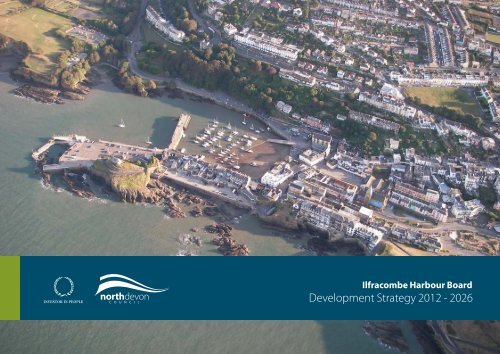
Development Strategy - North Devon District Council
Development Strategy - North Devon District Council
Development Strategy - North Devon District Council

Create successful ePaper yourself
Turn your PDF publications into a flip-book with our unique Google optimized e-Paper software.
Contents<br />
Chapter 1 - Introduction……………………………………………………………………………………………...2<br />
Chapter 2 - Understanding the Harbour……………………………………………………………………..……….4<br />
Chapter 3 - The Planning Policy Context………………………………………………………….………….….…..8<br />
Chapter 4 - Options for <strong>Development</strong> and Appraisal………………………………………………………….……..9<br />
Chapter 5 - The <strong>Development</strong> <strong>Strategy</strong> 2012-2026…………….…………………………………..….….………...16<br />
Chapter 6 - Economic Impact Assessment…………………………………………………………….……………21<br />
Chapter 7 - Conclusions and Next Steps…………………………………………………………….……………...23<br />
Annex A - Ilfracombe Harbour Studies…………………………………………………..………….…………….A-1<br />
Annex B - Key Stakeholders and Consultees…………………………………………………………….………..B-1<br />
Annex C - Planning Policy Documentation………………………………………………………………………..C-1<br />
IHB’s <strong>Development</strong> <strong>Strategy</strong> Version 1 dated 10th April 2012<br />
1
Chapter 1:<br />
1.1 Background<br />
Ilfracombe Harbour Board<br />
<strong>Development</strong> <strong>Strategy</strong> 2012 – 2026<br />
Introduction<br />
1.1.1 <strong>North</strong> <strong>Devon</strong> <strong>District</strong> <strong>Council</strong> (NDC) and the Ilfracombe Harbour<br />
Board (IHB) recognise the development and regeneration potential of<br />
Ilfracombe Harbour and this document, which will update the IHB<br />
Strategic <strong>Development</strong> Plan (2009), will scope and prioritise the<br />
options available.<br />
1.1.2 IHB are committed to ensuring the long term financial viability of the<br />
Harbour by supporting sustainable growth which will benefit the Town<br />
and the wider <strong>North</strong> <strong>Devon</strong> economy.<br />
1.1.3 Within this document IHB considers viable and deliverable<br />
development proposals. It ensures that the aspirations of stakeholders,<br />
including Ilfracombe Town <strong>Council</strong>, are taken into account and that<br />
there is a commonality of effort between decision makers.<br />
1.2 Report Structure<br />
1.2.1 This report is structured as follows:<br />
Chapter 1 Introduction Recognises the need for strategic<br />
review, determines the key principles of the review and identifies the<br />
Strategic aims and objectives.<br />
Chapter 2 Understanding the Harbour Provides an overview<br />
of the Harbour in 2012. It identifies the environmental and heritage<br />
assets and examines how they affect future development aspirations.<br />
Chapter 3 The Planning Policy Context It is important to<br />
understand how Ilfracombe Harbour fits within other planning policy<br />
documents and this chapter looks at all levels of Planning Policy that<br />
have or may have an effect on future harbour development.<br />
Chapter 4 Options for <strong>Development</strong> and Appraisal This<br />
chapter summarises the options for development and explains how and<br />
why the final development strategy has been reached.<br />
Chapter 5 The <strong>Development</strong> <strong>Strategy</strong> 2012 – 2026 Explains the<br />
final <strong>Development</strong> <strong>Strategy</strong> and sets out the details of the individual<br />
projects.<br />
Chapter 6 Economic Impacts Assessment This chapter explains<br />
the predicted economic impacts of the development options previously<br />
studied and how best to build resilience and sustainability into<br />
development proposals.<br />
Chapter 7 Conclusions and Next Steps This chapter sets out<br />
the key spatial, transport and access issues which will affect the<br />
<strong>Development</strong> <strong>Strategy</strong>. It summarises the funding, delivery and<br />
business investment approach required and looks at potential Public<br />
Funding Opportunities.<br />
1.3 Why is this review necessary<br />
1.3.1 IHB and NDC are jointly committed to testing and developing<br />
proposals for the development of the harbour which will safeguard its<br />
structure and economic viability and allow it to continue as a focal<br />
point for tourism and leisure activities in Ilfracombe and surrounding<br />
areas. There are a wide range of organisations and groups who have<br />
representation and influence in the decision making for the running of<br />
Ilfracombe Harbour. The review of IHB’s <strong>Development</strong> <strong>Strategy</strong><br />
allows these stakeholders to be involved in the production of a shared<br />
vision for the future.<br />
1.3.2 IHB’s Strategic <strong>Development</strong> Plan produced in 2009 relied on studies<br />
and information provided prior to the Board’s formation and thus the<br />
proposals put forward were heavily geared toward achieving a safe<br />
working environment and improving the tourist offer. Since 2009<br />
IHB’s <strong>Development</strong> <strong>Strategy</strong> Version 1 dated 10th April 2012<br />
2
there have been attempts to set up a ferry service to South Wales,<br />
changes to the fishing industry and increases in the range of maritime<br />
based leisure activities. In addition to these changes, during the last<br />
two years, there have been tentative approaches from organisations<br />
involved in renewable energy, in cruise liner operations and in the<br />
development of the vacant land areas within the harbour’s<br />
administrative boundaries. Increasingly, organisations have come to<br />
realise that there can be no profit in working in isolation so that one of<br />
the aims of this study is to obtain early consultation and harmony<br />
between groups that have the same ultimate objectives but could direct<br />
their efforts along narrow and uncooperative lines.<br />
1.3.3 The 2012 <strong>Development</strong> <strong>Strategy</strong> for Ilfracombe Harbour will identify<br />
projects for the immediate short term, the next five years, and for the<br />
longer term to 2026.<br />
1.3.4 It is the intention of the IHB that this <strong>Development</strong> <strong>Strategy</strong> will be<br />
kept under constant review and will be updated and re-published as<br />
necessary to take account of changing circumstances and conditions.<br />
1.4 Planning Principles<br />
1.4.1 The brief determined for the <strong>Development</strong> <strong>Strategy</strong> has the following<br />
key aims:<br />
• Prepare ambitious, viable and deliverable proposals for the<br />
development of the harbour to support related initiatives to secure its<br />
role in the local and regional economy. The proposals will reflect<br />
the joint aspirations of IHB, NDC and Ilfracombe Town <strong>Council</strong> and<br />
will include strategic plans for the medium to long term with<br />
sufficient detail for local planning authorities and eventual guidance<br />
of appointed professional planning consultants.<br />
• Ensure that development proposals are in line with local, regional<br />
and national planning policy objectives.<br />
• Identify the key developments which will offer the potential to kickstart<br />
investment and regeneration.<br />
1.5 Strategic Aim and Objectives<br />
1.5.1 The Strategic Aim and Objectives have been developed and agreed<br />
with Key Stakeholders.<br />
Strategic Aim<br />
Ilfracombe Harbour and the environs within its jurisdiction should<br />
be developed into a key strategic deepwater Maritime Gateway for<br />
<strong>North</strong>ern <strong>Devon</strong>. It will provide a successful, viable and<br />
sustainable operation that can make a measurable contribution to<br />
the physical and economic regeneration and diversification of the<br />
Local Community and wider Region.<br />
Strategic Objectives<br />
• Maintain and develop existing harbour operations and<br />
businesses.<br />
• Introduce and support appropriate new business proposals.<br />
• Support the wider economy of Ilfracombe and <strong>North</strong> <strong>Devon</strong>.<br />
• Ensure that development contributes to Ilfracombe’s ‘Curious<br />
Coastal Charm’ and respects its environmental and heritage<br />
assets.<br />
• Support operational plans for the establishment of sustainable<br />
coastal ferry and other transport services.<br />
• Regenerate the Harbour to provide a quality tourist destination.<br />
• Support and guide the development of marine leisure activities.<br />
• Engage with the South West Marine Energy Park Partnership<br />
and encourage and support the Renewable energy sector to use<br />
the Harbour as an Operations and Maintenance base.<br />
• Approach Harbour regeneration and development in order to<br />
provide maximum benefit and value for money to the local<br />
community.<br />
• Ensure the long term protection of residential and business<br />
property from tidal flooding.<br />
IHB’s <strong>Development</strong> <strong>Strategy</strong> Version 1 dated 10th April 2012<br />
3
Employment<br />
Chapter 2: Understanding the Harbour<br />
GVA (£)<br />
1 Section 6 of the Pier and Harbour Orders Confirmation (No.1) Act 1900<br />
(FTE Jobs)<br />
2.1 Introduction<br />
Harbour Authority 3.5 34,000<br />
Commercial Fishing 28.5 1,013,000<br />
2.1.1 This Chapter provides an understanding of the Harbour in 2012. It<br />
Ferry activities 15.6 353,000<br />
outlines the Harbour management process, looks at current operations<br />
Leisure Boating 4.1 127,000<br />
and considers the key spatial strengths and weaknesses.<br />
Excursion/Charter Boats 23.8 619,000<br />
2.2 Management<br />
RNLI activities 1.5 53,000<br />
Wider tourism impact 200 5,989,000<br />
2.2.1<br />
Total Harbour Impact 277 8,187,000<br />
<strong>North</strong> <strong>Devon</strong> <strong>Council</strong> (NDC) are the owners of Ilfracombe Harbour<br />
Table 1 2<br />
and as such are the legal guardians and designated Harbour Authority.<br />
The Statutory Boundary 1 of the Harbour Authority area, and additional<br />
designated land areas which make up the Administrative Boundary, is<br />
2.4 Harbour Geography<br />
shown at Figure 4 on page 9.<br />
2.3 Current Harbour Operations<br />
2.3.1 The main harbour business operations are centred around the<br />
management of the inner and outer harbours with commercial fishing<br />
activities, moorings for visiting and local leisure boats, excursion,<br />
fishing and dive charter boats, coastal ferries (the Oldenburg, Waverley<br />
and Balmoral), Cruise ship visits landing international travellers for<br />
visits to the town and local tourist attractions and the RNLI. Tourism<br />
is the dominant sector in the Town and accounts for 1 in 3 jobs and<br />
more than 40% of the businesses. These figures are greater at the<br />
Harbour where the majority of dependence is tourism centric.<br />
2.3.2 The estimated economic impacts of the current harbour activities are<br />
included in Table 1 below. The ‘wider tourism impacts’ clearly stand<br />
out because the harbour is a key attraction to the many visitors that<br />
come to the town and spend money on accommodation, food and drink<br />
and other goods and services.<br />
Figure 1 – Harbour map showing byelaw boundary(in red)<br />
IHB’s <strong>Development</strong> <strong>Strategy</strong> Version 1 dated 10th April 2012<br />
4<br />
2 GHK Economic impact Assessment 2010
2.4.1 The Range is the anchorage in the open Bristol Channel, to the <strong>North</strong><br />
visitors extensively in the Summer months. In the South Western<br />
of the harbour. It is used for large visiting vessels and cruise liners,<br />
corner of the beach is the RNLI slipway which is kept clear for<br />
which are unable to enter the harbour but are able to transfer<br />
launching and recovery operations and for harbour access.<br />
passengers to the landing stage by tender.<br />
2.4.2 The Pier and Landings were rebuilt as part of the, ‘Restoring the<br />
Heritage’ project. 3 They are used as tidal landing stages for visiting<br />
ships including the Lundy Island vessel “Oldenburg”. It is also used<br />
by anglers and forms part of the tourist area, particularly at low tide.<br />
Lantern Hill, which houses the Grade I listed St. Nicholas’s Chapel at<br />
its summit, stands on and overlooks the Pier from the <strong>North</strong>. This<br />
Nationally important structure is a significant heritage asset to the<br />
Harbour.<br />
2.4.3 Old Quay Head is a Grade II* listed structure 4 which extends into the<br />
harbour and forms the boundary between the Outer and Inner harbours.<br />
It is used as a landing point for small boats and as a temporary storage<br />
area for local commercial fishermen. As a requirement of grant<br />
funding from English Heritage the Quay remains open to public access<br />
but there is little to define it as a tourist attraction. The Quay structure<br />
is unstable and the relentless effects of tidal and wave action are having<br />
a significant detrimental affect on its material fabric.<br />
2.4.4 The Inner Harbour <strong>North</strong> Wall fronts on to Quay Road and the<br />
commercial and retail properties along its length. The quay and the<br />
area are also Grade II listed. The wall has access ladders which are<br />
used by small boat owners and extensively by tourists and visitors to<br />
the harbour. All permanent resident boat moorings are situated in the<br />
Inner Harbour, as are many of the seasonal visitors moorings. The lack<br />
of winter protection requires that the majority of resident boats are<br />
lifted out onto adjacent Car Parks from November to March.<br />
2.4.5 The Beach in the Inner harbour represents a small but valuable social<br />
asset. Being sheltered and open to the sun it is used by locals and<br />
3 NDC led project in 2000 supported by DEFRA, SWRDA, English Heritage and the Heritage<br />
Lottery Fund.<br />
Figure 2 - Ilfracombe Harbour from the air<br />
4 The pier has a medieval foundation and was enlarged and extended in 1760<br />
IHB’s <strong>Development</strong> <strong>Strategy</strong> Version 1 dated 10th April 2012<br />
5
2.4.6 The Inner Harbour South Wall and the Cove represent the commercial<br />
heart of the harbour as this area contains the re-fuelling berth and<br />
alongside berths for the resident fishing fleet. The area also houses a<br />
Car Park and is used by the many tourists and other members of the<br />
public, whilst following the South West Coast Path and generally<br />
transiting the Harbour area. In the interests of safety the leisure and<br />
working areas are segregated as much as possible given the restricted<br />
space available.<br />
Hillsborough, which drops down to the rugged coves of Rapparee 6 and<br />
Larkstone. The land to the South of the harbour rises steeply to join<br />
the main (A399) through road and the commercial and residential areas<br />
of the town. <strong>North</strong>ern <strong>Devon</strong>’s unspoilt coastline is a popular tourist<br />
attraction and this nationally important landscape is designated as both<br />
an Area of Outstanding Natural Beauty and Heritage Coast 7 . Much of<br />
the coastline is also designated as Special Areas of Conservation<br />
(SACs) 8 and Sites of Special Scientific Interest (SSSIs).<br />
2.4.7 Further to the East lie Larkstone and Rapparee Coves which have<br />
significant history 5 but are currently underused and available for<br />
development and regeneration projects. Rapparee does provide for<br />
good bathing but can be exposed in certain weather conditions.<br />
2.5 Environmental Conditions<br />
2.5.1 The Bristol Channel is recognised for its large range of tides, which<br />
results in strong tidal flows. Being open to the Atlantic the Channel is<br />
subject to frequent strong winds, oceanic swell and waves, all of which<br />
focus the need for a well protected harbour, which is accessible at all<br />
times.<br />
2.5.2 The Harbour is very exposed to weather and sea patterns from <strong>North</strong> to<br />
<strong>North</strong> East and thus many boat owners are unable to insure their boats<br />
through the winter months. This requires the majority to lift their boats<br />
out of the harbour, between November and March, for safe keeping. In<br />
particularly poor conditions the fishing fleet move their vessels to other<br />
ports for safety.<br />
2.6 Geography and Geology<br />
2.6.1 Geographical co-ordinates for the harbour are: Latitude 51 o 12.6’N<br />
Long. 004 o 06.7’W. The harbour itself is in a sandy basin protected<br />
from the open sea to the <strong>North</strong> by the rocky outcrop of Lantern Hill<br />
and overlooked to the East by the towering promontory of<br />
Figure 3 - Ilfracombe Harbour at Low Tide<br />
5 In the 18 th Century Rapparee Cove was home to a shipyard and dock<br />
6 Rapparee Cove is an important geological site, exposed faults and slips<br />
7 Heritage Coast objectives are set out in PPG20: Coastal Planning<br />
8 Ilfracombe Conservation Area, Character Appraisal 2009<br />
IHB’s <strong>Development</strong> <strong>Strategy</strong> Version 1 dated 10th April 2012<br />
6
2.7 Harbour Finances<br />
• Properly recognise all income from the designated Harbour<br />
2.7.1 Ilfracombe Harbour, as a Municipal Harbour, relies heavily on Local<br />
Area.<br />
Authority support to maintain it for the benefit of local stakeholders,<br />
visitors and the wider community. Income and expenditure will be<br />
managed through an Assured Trading Account to assist the Board in<br />
making budgetary decisions and to allow focussed auditing of the<br />
Harbour undertaking.<br />
2.7.5 The IHB will work with NDC to build adequate reserves in a<br />
contingency fund for anticipated capital projects and replacement<br />
programmes within the Harbour into the future. The information<br />
compiled in 2.7.4 above will be a key consideration in this process.<br />
2.7.2 Under the terms of the establishing Act 9 income derived from harbour<br />
operations should be ring-fenced in identifiable accounts. However, it<br />
is clear to see from the latest audited accounts that the amount of<br />
income currently generated does not cover necessary outlays. This<br />
means that the harbour will continue to rely heavily on <strong>Council</strong><br />
financial support into the future.<br />
2.7.3 The Income and Expenditure figures for the Harbour and its Car Parks<br />
for 2010/11 are:<br />
Sales of Fuel to vessels £296,260<br />
Rent £ 21,522<br />
Fees and charges on small craft £ 47,461<br />
Visiting vessels £ 13,860<br />
Miscellaneous £ 5,808<br />
Car parking £239,661<br />
Total annual income £624,572<br />
Total annual expenditure 10 £707,143<br />
Net Loss £ 82.571<br />
2.7.4 An ‘Assured Harbour Trading Account’ will:<br />
• Ensure that an accurate account of income and expenditure is<br />
maintained for the whole of the Harbour undertaking.<br />
• Aid the provision of a reserve account.<br />
9 Piers and Harbours Act 1990<br />
IHB’s <strong>Development</strong> <strong>Strategy</strong> Version 1 dated 10th April 2012<br />
7
Chapter 3<br />
Planning Policy Context<br />
3.1 Introduction<br />
3.1.2 This Chapter introduces the planning issues that have, or may in the<br />
future have, an effect on Harbour regeneration and development.<br />
There is some uncertainty caused by the fact that National and Local<br />
Planning policy is in a period of significant reform. It is changing<br />
from a top-down approach to applying increased importance on Local<br />
Authorities, through the Localism Act 2011. A new Local<br />
<strong>Development</strong> Framework and <strong>North</strong> <strong>Devon</strong> and Torridge Joint Core<br />
<strong>Strategy</strong> will eventually replace the Planning Policy currently extant in<br />
the Regional Spatial <strong>Strategy</strong> and the <strong>North</strong> <strong>Devon</strong> Local Plan.<br />
3.2 Planning Context<br />
3.2.1 Planning for the development of Ports and Harbours is complicated by<br />
the fact that Harbours are established through individual Acts of<br />
Parliament, which set out the statutory limits of the Harbour and also<br />
define and restrict the range of developments that are permitted. Any<br />
variation to these terms have to be the subject of Harbour Revision<br />
Orders (HRO’s) which have a process entirely separate from planning<br />
in general.<br />
3.2.2 For Ilfracombe Harbour the relevant Act is “Piers and Harbour Orders<br />
Confirmation (No 1) Act 1900, which provides specifically for<br />
“permitted” and “excluded” developments, which essentially preserve<br />
the harbour and its associated areas as a working entity. For any other<br />
developments within the Harbour boundary the national, regional and<br />
local planning rules apply.<br />
3.2.3 One of the key objectives within the planning regime is to facilitate<br />
development through collaborative working with adjoining authorities<br />
and stakeholders to provide viable infrastructure for sustainable<br />
economic growth, transport investment, including strategies for the<br />
development of ports. It may be that the future of <strong>North</strong> <strong>Devon</strong>’s<br />
marine related business can best be served by partnership working with<br />
adjacent authorities.<br />
3.2.4 In the <strong>North</strong> <strong>Devon</strong> area, and in Ilfracombe in particular, planning is<br />
also affected by the existence of the Coast Protection Act 1949, Marine<br />
and Coastal Access Act 2009, Areas of Outstanding Natural Beauty,<br />
Marine Conservation Zones, Heritage Coast status, Listed Buildings<br />
and Biosphere Reserves. These factors are important when working<br />
towards the overarching need to provide more housing and<br />
employment, improving transport links by all modes, and the vital need<br />
to encourage increased footfall and spend through improved tourism<br />
facilities.<br />
3.2.5 A constant theme in all the National, Regional and Local plans,<br />
important extracts of which are contained in Annex C, is the<br />
development of Ports and Harbours as part of a sustainable transport<br />
and employment focus. Ilfracombe Harbour is the only harbour open<br />
to the Bristol Channel on the <strong>North</strong> <strong>Devon</strong> coastline and has<br />
tremendous opportunities opening up for it due to potential offshore<br />
energy projects, trans-channel and trans-coastal ferry and freight<br />
services, a calling port for cruise liners and a constantly increasing<br />
demand from marine leisure activities. Plus of course the ever present<br />
volume of tourists.<br />
3.2.6 Ilfracombe Harbour has its problems, it is exposed to swell and wind<br />
waves from certain directions, the harbour dries out at low tide which<br />
restricts access, some of the built environment is weak and subject to<br />
occasional flooding and damage, access for transport is restricted and<br />
during the summer months congestion is endemic.<br />
3.2.7 This <strong>Development</strong> <strong>Strategy</strong> has been developed to respond to these<br />
weaknesses through carefully planned development projects which<br />
have been derived from study of the harbour, perusal of previous<br />
consultancy reports and extensive collaborative work with Ilfracombe<br />
Town <strong>Council</strong>, <strong>North</strong> <strong>Devon</strong> <strong>Council</strong>, as the owners and the Harbour<br />
Authority, and with all other stakeholder groups.<br />
IHB’s <strong>Development</strong> <strong>Strategy</strong> Version 1 dated 10th April 2012<br />
8
Chapter 4:<br />
Options for <strong>Development</strong> and Appraisal<br />
4.2 ‘Do Nothing’ assumptions<br />
4.1 Introduction<br />
4.1.1 This Chapter sets out a range of options for development, which have<br />
been considered for each of the 4 identified areas of the harbour (Fig.<br />
4). These areas have been selected for their distinct geographical and<br />
environmental characteristics and variety of development potential.<br />
Their boundaries are not fixed and when considering options they will<br />
inevitably overlap with adjacent areas. Each will be considered<br />
separately, but always with the understanding that any individual<br />
development must eventually contribute to the whole. Through this<br />
logical sequence the Board has carried out a robust assessment of the<br />
alternatives and arrived at a definitive <strong>Development</strong> <strong>Strategy</strong>.<br />
4.1.2 There have been many development and regeneration proposals for<br />
Ilfracombe Harbour and these are the subject of reports and studies<br />
undertaken by Independent Consultants (Annex A). All previous<br />
reports have been consulted in preparing the final preferred<br />
<strong>Development</strong> <strong>Strategy</strong>, which has been widely consulted upon with the<br />
key Stakeholders. Agreement between all parties allows the strategy to<br />
form the basis of a co-ordinated development vision. The intention of<br />
the <strong>Strategy</strong> is that all development has to be achievable, sustainable<br />
and economically viable and provide the optimum result for<br />
operational safety and the well being of stakeholders and visitors.<br />
4.1.3 An overall summary of the development areas will include:<br />
• A development appraisal giving the options for discussion.<br />
• An assessment of viable projects that contribute to the Strategic<br />
Aim and Strategic Objectives of the IHB.<br />
• A Summary of Options appraisal which considers:<br />
o<br />
o<br />
o<br />
o<br />
Economic Impact<br />
Sustainability<br />
Urban design<br />
Consultation with key stakeholders<br />
4.2.1 The baseline assessment from which development potential has been<br />
measured is that of, ‘Do Nothing’. That is that there will be no<br />
appreciable development within the Harbour Authority area and that<br />
the Harbour remains as it is in 2012. The implications of, ‘Do<br />
Nothing’ are summarised as follows:<br />
• Changes to Commercial Fishing techniques and regulation could<br />
reduce the ability of the harbour to provide a base for operations.<br />
• Maritime transport services could choose other ports for their<br />
operations.<br />
• The number of leisure craft using the Harbour remains static.<br />
• Tourist footfall increases due to economic influences and<br />
conflict between vehicles and pedestrians increases.<br />
• Marine sports activities demand more space and facilities.<br />
• The harbour is not used as an operations and maintenance base<br />
for offshore energy projects.<br />
• Cruise operators consider that the use of tenders in open sea<br />
conditions is too dangerous and stop calling.<br />
• Old Quay Head deteriorates further and has to be closed to the<br />
public and as a Working Quay.<br />
• Climate change results in seasonal flooding of quays and harbour<br />
business and residential properties.<br />
• Housing and commercial developments will use up valuable land<br />
adjacent to the Harbour further reducing options for marine<br />
development.<br />
• Unrelated development of the Bus Station site may restrict<br />
vehicular access further.<br />
IHB’s <strong>Development</strong> <strong>Strategy</strong> Version 1 dated 10th April 2012<br />
9
Figure 4 – <strong>Development</strong> Areas<br />
Figure 4 – Identified development areas<br />
IHB’s <strong>Development</strong> <strong>Strategy</strong> Version 1 dated 10th April 2012<br />
10
4.3 <strong>Development</strong> Areas<br />
The 4 development areas are:<br />
4.3.1 ‘Outer Harbour’ and approaches including Britons Rock<br />
<strong>Development</strong> in this area focuses primarily on a protecting <strong>North</strong>ern<br />
breakwater. The <strong>North</strong> <strong>Devon</strong> Local Plan (2006) gave specific<br />
support for the breakwater saying that future development stages<br />
could involve, “The creation of an outer breakwater to provide a<br />
tourist attraction and deep water berthing for passenger ferry crossing<br />
to encourage links to other locations including Wales”. Many<br />
configurations for this breakwater have been put forward over the<br />
years but each one has largely ignored the operational opportunities,<br />
which must be the primary focus in any future design planning. Any<br />
breakwater configuration must provide for ease of navigation and<br />
could result in a standalone structure extending from the current Pier,<br />
an island breakwater, a stub breakwater extending from Hillsborough<br />
or a combination of them. Britons Rock and any areas inside a<br />
protecting breakwater could be developed for new berthing and<br />
mooring facilities and could also provide the southern side position of<br />
a lock/sill for a marina development.<br />
A Southern Quay development could also be situated in this area to<br />
provide a protected, restricted access quay for renewable energy<br />
operations and maintenance<br />
4.3.2 ‘Rapparee and Larkstone’ Coves, their hinterland and<br />
approaches<br />
These two Coves are under utilised at present and both offer distinct<br />
development potential. Rapparee Cove is surrounded by steep cliffs<br />
and thus offers no more than the provision of a community leisure<br />
facility, with scope for some commercial enterprise. Larkstone has<br />
better access and more real estate to offer. It could be developed to<br />
provide a hub for leisure activity and/or provide a base for business<br />
development proposals. The Land adjoining both of the Coves and<br />
overlooking the Harbour could provide a valuable site for mixed<br />
commercial developments.<br />
4.3.3 ‘Southern Harbour’ and St James’ Park<br />
This site offers the potential for both the development of the<br />
Commercial Fishing facilities and urban design led residential and<br />
commercial growth as well as improved access for tourists.<br />
4.3.4 ‘Inner Harbour’ and Old Quay Head<br />
This site has remained unchanged for many years and is very much<br />
part of the unique charm of Ilfracombe. The main focus of any<br />
development in this area will be the protection of Old Quay Head<br />
including perhaps its inclusion in any future marina development.<br />
A widening of Quay Road and the installation of traffic lights could<br />
provide improved access and reduce congestion for local businesses<br />
and visitors.<br />
4.4 Options Appraisal<br />
In each of the identified development areas a number of ideas are<br />
listed which highlight the significant potential which could accrue to<br />
the local economy from a coordinated and sensitive approach. In<br />
pinpointing the key elements the IHB is conscious of the need to<br />
protect and enhance the natural and built environment surrounding the<br />
harbour. However, it also realises that at the same time it needs to<br />
develop the harbour as a viable economic and social focus for<br />
residents and visitors. Potential developments include:<br />
4.4.1 The Outer Harbour and approaches including Britons Rock<br />
• A protecting Outer Breakwater<br />
• A Southern Quay offering protection for Wind Farm vessels<br />
• Reclamation of land to provide Ops/Maintenance Base on Pier<br />
for renewable energy companies<br />
• Lock/Sill Gate to provide access to a marina<br />
• Ro-Ro berth for cross channel Ferry<br />
IHB’s <strong>Development</strong> <strong>Strategy</strong> Version 1 dated 10th April 2012<br />
11
• <strong>Development</strong>/Maintenance of Lantern Hill as a tourist<br />
attraction<br />
• New Commercial quay on Britons Rock<br />
• A commercially operated visitor attraction on Pier<br />
• Walking ‘Fish Trail’<br />
• Additional facilities for visiting and local sea anglers<br />
4.4.2 Rapparee and Larkstone Coves, their hinterland and approaches<br />
• Ops/Maintenance base for renewable energy companies in<br />
Larkstone Cove<br />
• Hotel development on NDC land between Larkstone and<br />
Rapparee<br />
• New slipway access to Larkstone Cove<br />
• Provision of multi use Watersports centre in Larkstone Cove<br />
• Commercial Café/Restaurant development in Larkstone Cove<br />
• Improved access for residents, visitors and walkers<br />
• Rebrand and revitalise Rapparee Cove as a tourist attraction<br />
• Improve Larkstone Lane access<br />
4.4.4 The Inner Harbour and Old Quay Head<br />
• Provide long term protection to Old Quay Head<br />
• Reduce traffic and pedestrian conflict on Quay Road<br />
• Extend width of Quay Road and/or widen pavement and<br />
install traffic control system<br />
• Provide mooring pontoons on <strong>North</strong> Wall<br />
• Move Commercial fishing operations from Old Quay Head<br />
• Widen Old Quay Head and improve visitor attraction offer<br />
• Improve pedestrian and visitor access to old Quay Head<br />
• Provide mooring pontoons on the Eastern Face of Old Quay<br />
Head<br />
• Refurbish stores for Angling/Diving Charter use<br />
• Dredge inner harbour to provide deeper water moorings<br />
• Provide raised pedestrian walkway at top of beach<br />
4.4.3 The Southern Harbour and St James’ Park<br />
• New fisherman’s stores and completion of FLAG project<br />
• Widening of the quays on the Cove to provide reclaimed land.<br />
• Extension of working quay to seawards with segregated<br />
working areas<br />
• Designated pedestrian walkways<br />
• Walking ‘Fish Trail’<br />
• Commercial land development use of St James’ Park and<br />
Marine Drive<br />
• Closing of roadway to through traffic<br />
• Provision for more dinghy storage<br />
• Improved electricity and water supply to quay<br />
• Provide footbridge from the Cove to Old Quay head for<br />
improved pedestrian circulation<br />
Figure 5 - Aerial picture of Ilfracombe Harbour from the <strong>North</strong><br />
IHB’s <strong>Development</strong> <strong>Strategy</strong> Version 1 dated 10th April 2012<br />
12
4.5 Summary of Options Appraisal<br />
4.5.1 The Options appraisal in 4.4 above highlights many potential projects<br />
and some compete with each other in terms of land and resource<br />
requirements. This summary places those conflicts in context and<br />
discusses some of the economic and urban design issues to be faced.<br />
Not all ideas have been brought forward from the appraisal, as some<br />
would be particularly difficult or unsuitable to deliver within the life<br />
of this plan.<br />
The Outer Harbour and approaches including Britons Rock<br />
4.5.2 It is well understood that the Harbour Authority would be unable to<br />
deliver an outer breakwater scheme within it’s own resources.<br />
However, there is a huge appetite for it locally and it is considered<br />
that a scheme could be viable and deliverable with grant money and<br />
public/private partnership working. An outer breakwater would be a<br />
catalyst to further regeneration and the majority of options for this<br />
zone could be realised. Benefits that would stem from the building of<br />
a breakwater would include:<br />
• Permanently afloat Lifeboats (reducing response times)<br />
• Deep water, afloat, moorings for larger visiting vessels (Large<br />
motor launches and the larger fin keel yachts generally bypass<br />
Ilfracombe on passage between Marina Berths, the ability to<br />
safely stay afloat at Ilfracombe would generate income).<br />
• Afloat Commercial berths (this would release berths in the<br />
inner harbour throughout the holiday season and provide<br />
much greater operational flexibility to local operators).<br />
• Cross Channel Ferry services would not be tidally restricted<br />
opening the way for larger more profitable vessels on cross<br />
and trans channel routes.<br />
• Smaller Cruise liners could come alongside (this would<br />
provide a significantly improved destination offer).<br />
• Permanent Operations and Maintenance facilities for the<br />
Atlantic Array and/or other offshore renewable energy<br />
operators.<br />
• A lock gate providing:<br />
a) A stable level of water in the harbour, allowing vessels<br />
to remain afloat, and the provision of improved<br />
facilities for residents and visitors.<br />
b) Flood protection to the quays, businesses and<br />
residential properties around the Harbour area.<br />
(Flooding will occur in light of predicted rising sea<br />
levels and changing weather patterns).<br />
c) Access from the Southern side of the harbour<br />
encouraging the movement of people around it<br />
(creating improved visitor circulation improves<br />
business).<br />
d) A marina with up to 280 berths (the employment<br />
generated not only from Marina operations but the<br />
‘Café culture’ generated from the created environment,<br />
would provide significant economic benefit).<br />
4.5.3 A Southern Quay development is also a possibility in this area and<br />
discussions with RWE npower renewables are currently (2012)<br />
underway to understand their needs and ascertain the viability of<br />
delivering a facility for their use. Careful consideration will need to<br />
be given to access and co-location of a Watersports Centre on the<br />
adjacent land.<br />
4.5.4 Smaller improvements such as providing a themed walking ‘Fish<br />
Trail’ around the harbour and improving the visual impact of Lantern<br />
Hill by improved management of the natural environment would<br />
improve and enhance the overall tourist experience.<br />
4.5.5 The short term impact of ‘quick win’ smaller projects should not be<br />
under estimated, however, sustainable economic growth, as reported<br />
through NDC commissioned studies, can only be achieved by the<br />
provision of a new deepwater Maritime Gateway.<br />
IHB’s <strong>Development</strong> <strong>Strategy</strong> Version 1 dated 10th April 2012<br />
13
Rapparee and Larkstone Coves, their hinterland and approaches<br />
4.5.6 There are three significant strands to development in this Area,<br />
neither of which can be approached in isolation.<br />
• The first, and operationally significant, option is to build a<br />
Southern Quay from Larkstone East to provide sheltered<br />
moorings for Atlantic Array wind farm vessels or the<br />
Commercial fishing fleet. These protected berths, situated<br />
further to seaward than anything currently available, would<br />
greatly enhance the operational capability and flexibility of<br />
operators and provide a much larger tidal operating window.<br />
If Atlantic Array operations were to be based at Ilfracombe<br />
then some landside development would be required to house<br />
stores, mess rooms, offices and parking.<br />
• The second option in this area is the building of a Watersports<br />
Centre to provide bespoke accommodation for the many<br />
activities that currently take place in and around the harbour.<br />
Merging the requirements of the Centre with the needs of a<br />
commercial operation will require careful planning.<br />
• The third strand to development in this area is governed by<br />
the value of NDC land holdings above and between Larkstone<br />
and Rapparee Coves. In 2011 NDC commissioned a Land<br />
Value Study of the harbour area and the findings of the Study<br />
report 11 offers options for development that would provide a<br />
capital receipt for further investment. This is another Harbour<br />
study that has been taken into account in the formation of this<br />
<strong>Development</strong> <strong>Strategy</strong>.<br />
4.5.7 The slipway and the access lane to Larkstone beach is in need of<br />
upgrade, repair and realignment, particularly for safe access for<br />
visitors and users of a Southern Quay and Watersports Centre.<br />
4.5.8 Rapparee Cove is a much under utilised resource and over time it is<br />
the intention to encourage local and visitor use of the beach. The need<br />
11 CB Richard Ellis - Harbour Land Value Study<br />
to improve and make safe both the approaches and surrounding cliff<br />
faces would be the first requirement before expressions of interest<br />
could potentially be sought for further development.<br />
The Southern Harbour and St James’ Park<br />
4.5.9 The provision of new fisherman’s stores including waste oil disposal<br />
point and bait storage cold room facilities is being investigated (2012)<br />
through the Fisherman’s Local Action Group (FLAG). It is hoped to<br />
deliver this project in the short term. There are some outstanding<br />
safety works required on the Cove to segregate pedestrians from the<br />
working quay and roadway this work will be undertaken when the<br />
configuration of the fishermen’s stores is known.<br />
4.5.10 <strong>Development</strong> of the St James’ Park site has also been considered as<br />
part of the Land Value Study. The IHB and NDC will consider the<br />
findings and recommendations of this study as part of the wider<br />
harbour development and potential for a capital receipt.<br />
4.5.11 In 2007 an Ilfracombe Harbour Study undertaken by Terence<br />
O’Rourke presented a design response to some of the earlier work<br />
undertaken by Halcrow. A large part of that study focussed on how<br />
the land within this Area could provide an urban design led approach<br />
to reclamation of parts of the Harbour to provide wider quays,<br />
allowing development in the area of the Cove. The study was very<br />
progressive and forward looking and provided up to 8715 sq. m. of<br />
floor space development, with a mixture of residential and<br />
commercial build. Whilst not now considered to be realistic it does<br />
nonetheless highlight the latent potential available in this part of the<br />
harbour in the right economic conditions.<br />
4.5.12 The extension of the Cove working quay to the East has been the<br />
subject of an earlier study and this option would provide much<br />
improved facilities for the commercial fishing fleet and potentially<br />
release the Cove for other uses. However, the IHB recognise that<br />
Quay space is at a premium in Ilfracombe and so needs to vigorously<br />
defend against the development of harbour side quays for residential<br />
or commercial property purposes.<br />
4.5.13 If the Cove is to develop it’s own character as a place to visit then it<br />
must become more pedestrian friendly and reduce the congestion<br />
IHB’s <strong>Development</strong> <strong>Strategy</strong> Version 1 dated 10th April 2012<br />
14
currently seen in the summer months to a minimum. This could<br />
require the closure of the Cove as a permanent through route for<br />
traffic, which would affect the Traffic and Parking Management<br />
<strong>Strategy</strong> locally. It therefore needs to be considered within the<br />
context of the wider issue of the movement of people and vehicles<br />
around the Town.<br />
4.5.14 Smaller projects in this area of the Harbour include the provision of<br />
more stowage space for resident and visitor dinghies, as very little<br />
security can currently be offered to boat owners. The building of<br />
marinas in other harbours, and the increasing sophistication of the<br />
marine leisure industry, has resulted in a new generation of sailors<br />
who demand full access to electricity, water and minor repair facilities<br />
when alongside. Although rudimentary facilities currently exist at<br />
Ilfracombe they are very much in need of upgrade.<br />
The Inner Harbour and Old Quay Head<br />
4.5.15 There is little that can be done to improve the inner area of the<br />
harbour unless it were to become part of a marina facility in a much<br />
wider development. The widening of Quay Road, by the construction<br />
of a new quay face, is seen as an excellent option to provide pontoon<br />
berths along the quay with electricity and water supplies for visiting<br />
boats. The extended Quay would also provide the potential to bring a<br />
‘café culture’ to the harbour without the significant economic and<br />
operational difficulties associated with full pedestrianisation. It is<br />
considered that reducing the conflict between pedestrians and traffic<br />
by installing traffic control measures on Quay Road would greatly<br />
improve the tourist experience. This must be done without losing car<br />
parking spaces or inhibiting vehicular access to the Pier Car Park.<br />
4.5.16 Old Quay Head is Grade II* listed and presents NDC with a heavy<br />
financial burden for its ongoing maintenance. The structure continues<br />
to be unstable and a solution for its long term protection, as a key<br />
heritage asset for the Town, needs to be implemented within the life<br />
of this plan. The options available for this include:<br />
• the building of protecting breakwaters to seaward to reduce<br />
damaging wave action<br />
• the building of a marina with lock/sill gate to equalise the<br />
water pressure in and on the quay imposed by tidal action<br />
• the encasing of the structure within a new build quay thus<br />
preserving it ‘inside’ a new structure<br />
4.5.17 Pontoons, berths and walkways could be established on the outer face<br />
of the Quay to provide further alongside berths and a safe area for<br />
visiting boat dinghy storage.<br />
4.5.18 The seabed in the Inner Harbour is in equilibrium and apart from<br />
small seasonal differences rarely changes. The bed rock in the area<br />
associated with boat moorings is between 1m and 2m below the level<br />
of the sand and it is possible, if a marina were to be built, that this<br />
could be dredged to provide moorings for deeper draft vessels.<br />
Dredging and the Maintenance Dredging, required for a non marina<br />
protected inner harbour, would be prohibitively expensive.<br />
4.6 Consultation<br />
4.6.1 In order to produce this <strong>Development</strong> <strong>Strategy</strong> it was imperative that<br />
it had credibility and Stakeholder support. In order to achieve this the<br />
Board decided to phase consultation in order to engage with the key<br />
stakeholders from the outset.<br />
4.6.2 The first consultation was to gauge reaction to and achieve agreement<br />
of the Board’s Strategic Aim and Objectives. The responses to this<br />
consultation were all positive and in full agreement with the Aim and<br />
Objectives of the Board.<br />
4.6.3 The second consultation focussed on the options for <strong>Development</strong> and<br />
appraisal to be found in Chapter 4 of this document. Once again all<br />
responses were in full agreement with direction the Board were<br />
following.<br />
IHB’s <strong>Development</strong> <strong>Strategy</strong> Version 1 dated 10th April 2012<br />
15
Chapter 5: The <strong>Development</strong> <strong>Strategy</strong> 2012-2026<br />
5.1 Introduction<br />
5.1.1 This Chapter sets out the <strong>Development</strong> <strong>Strategy</strong> for Ilfracombe<br />
Harbour. It has been divided into two main sections, which are:<br />
• Phase 1 - Projects intended to be completed by 2017 C<br />
• Phase 2 - Potential future projects<br />
E<br />
5.1.2 Not included in this chapter, or anywhere else in this document, is a<br />
detailed analysis of the economic, environmental, sustainability,<br />
design and planning effects of specific projects. These will require<br />
attention by NDC at a later date as projects come forward for<br />
implementation.<br />
B<br />
D A G<br />
F<br />
5.1.3 The rationale for developing the Harbour is the need to regenerate the<br />
Town and to provide a stimulus to an under performing local<br />
economy. The Town will be regenerated only through the provision<br />
of sustainable housing, employment growth, a revitalised tourism<br />
industry and improved access to key services and facilities. However,<br />
it is the Harbour that provides regeneration opportunities of sufficient<br />
scale to deliver the step change required to ensure the economic<br />
success for the Town and the region.<br />
5.2 Phase 1 - Projects<br />
5.2.1 Phase 1 projects are currently being investigated by NDC and plans<br />
for their implementation are at different stages of development.<br />
Projects A-E are all subject to a successful FLAG 12 bid, which is<br />
currently (2012) being drawn up. However, although the final detail<br />
of Project D is dependent on the outcome of the FLAG bid, it is part<br />
of an earlier programme of safety works which will require<br />
completion regardless of the success of the bid.<br />
Figure 6 – Summary of Phase 1 Projects<br />
A<br />
B<br />
C<br />
D<br />
E<br />
F<br />
G<br />
Fisherman’s Stores<br />
Changing use of Fisherman’s Stores on Old Quay Head<br />
Improve vessel access arrangements – Step-outs<br />
Pedestrian Walkway<br />
Fish trail<br />
Southern Quay<br />
Operations and Maintenance base and Water Sports<br />
Centre<br />
12 NDC is a member of the Fisherman’s Local Action Group which has access to<br />
funding through the European Axis scheme.<br />
IHB’s <strong>Development</strong> <strong>Strategy</strong> Version 1 dated 10th April 2012<br />
16
5.3 Phase 1 projects – The Detail<br />
5.3.1 A breakdown of each of the Phase 1 projects is summarised below:<br />
A. Fisherman’s Stores<br />
5.3.2 There has been a shortage of fit for purpose stores for fishermen at<br />
Ilfracombe Harbour for many years. This has been exacerbated by an<br />
increase in the numbers of fishermen and their equipment and has led<br />
to the situation where there are more operators than there are stores to<br />
operate from. Apart from the obvious difficulty of not having<br />
somewhere dry to work and store sensitive equipment it has led to an<br />
increase in equipment being left along quay edges and in public areas<br />
which has safety implications. The <strong>North</strong>ern <strong>Devon</strong> FLAG was<br />
formed in 2010 to deliver projects under Axis 4 of the European<br />
Fisheries Fund (EFF). The provision of Fisherman’s stores was<br />
identified early on as an infrastructure project that could benefit from<br />
EFF monies and NDC are currently pursuing this. All commercial<br />
operators at the Harbour have been consulted about their individual<br />
requirements in order to ensure that the project has utility on delivery.<br />
5.3.3 The stores would be situated at the Eastern end of the Cove in the<br />
‘Dripping Well’ site and would provide modern facilities, including<br />
electricity and water, in bespoke accommodation which will be in<br />
keeping with the Heritage aspects of the site. As well as individual<br />
stores for each fisherman there would be a cold room for the storage<br />
of bait and a waste oil disposal facility.<br />
B. Change use of Fishermen’s Stores on Old Quay Head<br />
5.3.4 Old Quay Head is an ancient unstable structure, which is in regular<br />
need of expensive maintenance and repair. The seaward and most<br />
vulnerable section of the quay is currently used for commercial<br />
potting operations. The area sees the routine movement of heavy<br />
equipment and stores and the need to regularly land catch to heavy<br />
vehicles. This activity does nothing to protect the integrity of the<br />
fabric of the quay. A sensible solution would be to move the heavy<br />
operations associated with commercial fishing to the new stores<br />
proposed for the Cove. This would then leave the Old Quay Head<br />
stores to be utilised for the lighter angling and diving charter vessels<br />
to help protect the quay from further damage.<br />
C. Improve vessel access arrangements – Step-outs<br />
5.3.5 The outer berths at Ilfracombe Harbour are called ‘East Face’ and<br />
‘Stonebench’ and they were designed to allow the safe berthing of<br />
ships alongside. This was achieved by installing vertical wooden pile<br />
fenders on rubber mounts. The gap between ship and shore was<br />
bridged by the use of ship to shore gangways. Vessels that do not use<br />
gangways, such as trawlers, have some difficulty getting ashore when<br />
they are required for operational reasons to use these berths. This<br />
problem can be eased by installing quay edge extensions, ‘Step-outs’<br />
between designated fenders, thus closing the gap over which crew<br />
have to cross to get ashore/onboard. The system has already been<br />
successful in other areas of the harbour and it is hoped that the EFF<br />
can deliver this project through the FLAG. NDC Engineers are<br />
working on the design and costing of the ‘Step-outs’.<br />
D. Pedestrian Walkway<br />
5.3.6 As part of the 2010 project to provide a segregated working area for<br />
Fishermen it was agreed to provide a painted walkway for pedestrians<br />
that led them away from the quay edge and fishing operations on<br />
shore. The uncertainty of the positioning of the new Fisherman’s<br />
Stores led to this aspect of the project being delayed to avoid incorrect<br />
positioning. It is hoped that if the FLAG project is successful then the<br />
pedestrian walkway can be installed as part of the project.<br />
E. Fish Trail<br />
5.3.7 This is another element of a FLAG bid, which will provide a themed<br />
walk around the Harbour from Lantern Hill in the <strong>North</strong> to the<br />
Fisherman’s Stores in the South. It is expected that the trail will<br />
provide a potted history of the Fishing Industry at Ilfracombe with a<br />
series of notice boards identifying not only the history but the<br />
techniques used and the species to be found in <strong>North</strong>ern <strong>Devon</strong><br />
IHB’s <strong>Development</strong> <strong>Strategy</strong> Version 1 dated 10th April 2012<br />
17
waters. The trail will merge with the South West Coast Path, which<br />
also passes through part of the Harbour.<br />
F. Southern Quay<br />
5.3.8 NDC have been in discussion with the RWE npower renewables, who<br />
intend to operate the Atlantic Array Windfarm, in order to understand<br />
their requirements for an Operations and Maintenance Base. There<br />
are currently no protected, non tidally dependent, commercial<br />
moorings available at Ilfracombe Harbour and the large semi diurnal<br />
tides of the Harbour make it totally unsuitable, in its current form, for<br />
Windfarm operations. If Ilfracombe is to be developed to<br />
accommodate them, then new infrastructure will be needed.<br />
5.3.9 Planning permission has yet to be granted for the Atlantic Array.<br />
However, early investigations have identified the area close to<br />
Larkstone to be the most suitable site for a new Quay if the expected<br />
minimum requirement is going to be met. The Quay would need to<br />
have a vertical face on its inner (West) side to allow pontoons and<br />
access bridges to be built. The outer face would need to be wave<br />
absorbing. The actual design would also need to ensure, through<br />
stringent wave modelling, that the effects of the new structure did not<br />
affect operations to the <strong>North</strong> on the Pier. It would also be imperative<br />
that any construction did not restrict any future development<br />
including the building of a lock gate/half tide sill.<br />
5.3.10 NDC will progress this project as RWE’s intentions becomes clearer.<br />
5.3.12 Larkstone Cove has also become the focus of a potential Water Sports<br />
development. The project proposes to house several local marine<br />
sports related groups under one roof and provide a safe new slipway<br />
from which to launch a variety of vessels.<br />
5.3.13 As both projects move forward careful consideration must be given to<br />
the needs of both parties and any operational clashes ‘built out’ at the<br />
design stage.<br />
5.4 Phase 2 Projects<br />
5.4.1 Phase 2 projects almost exclusively rely on attracting private<br />
investment, grant funding and Local Authority support. Realistically<br />
this will only happen when the economy starts to recover, however,<br />
much work can be done to preposition and prepare for this upturn.<br />
Once again, each project will be considered separately, but always<br />
with the understanding that any individual development must<br />
eventually contribute to the whole.<br />
L<br />
J<br />
H<br />
G. Operations and Maintenance Base and Water Sports Centre<br />
5.3.11 If a Southern Quay were to be built for the operations and<br />
maintenance of the Atlantic Array Windfarm then adjacent shore side<br />
facilities would be required. Discussions with RWE npower<br />
renewables are taking place to tease out their exact requirements.<br />
However, details are uncertain other than that they would require<br />
Storerooms, Offices, Accommodation, Drying Room and Parking.<br />
I<br />
K<br />
M<br />
N<br />
Figure 7 – Summary of Phase 2 projects<br />
IHB’s <strong>Development</strong> <strong>Strategy</strong> Version 1 dated 10th April 2012<br />
18
H<br />
I<br />
J<br />
K<br />
L<br />
M<br />
N<br />
A Protecting Outer Breakwater<br />
A Marina<br />
A new Commercial Quay on Britons Rock<br />
An extension of the Cove working quay Eastwards<br />
<strong>Development</strong> and Maintenance of Lantern Hill as a tourist<br />
attraction<br />
Hotel development<br />
Rebranding of Rapparee Cove<br />
5.5 Phae 2 projects – The Detail<br />
H. A Protecting Outer Breakwater<br />
5.5.1 This has been considered since at least the 1980s, and the cost has<br />
always been regarded by NDC as unsupportable economically.<br />
However, comparison with the not dissimilar 2008 new Brixham fish<br />
quay funded by SWERDA, and discussions with the contractor<br />
involved, indicates that previous cost estimates for Ilfracombe may be<br />
overly high.<br />
5.5.2 Although an Outer Breakwater is likely to be justifiable as a stand<br />
alone project many of the other listed Phase 2 projects can only be<br />
realised subsequent to, or in parallel with, the building of it. Accurate<br />
cost estimates would require benchmarking against comparable<br />
schemes in the last 3 years such as Brixham, Great Yarmouth and<br />
Peterhead. Some geological appreciation of the underlying Ilfracombe<br />
Slates and their integrity and capacity for driven or bored piling will<br />
have to be compiled. Visual aspects of a lower-cost design will have<br />
to be considered in the context of the overall harbour and its appeal to<br />
visitors and tourists.<br />
I. A Marina<br />
5.5.3 A Marina is an important contributor to employment, regeneration<br />
and tourism and earlier approaches from Marina developers show that<br />
a 280 berth Marina could be built at Ilfracombe. The close<br />
relationship between the Coastal Marine Sector and the wider tourism<br />
and leisure industry has shown that it provides infrastructure and<br />
services for people wishing to participate in leisure boating activities.<br />
Marinas also serve as visitor attractions in their own right. It is<br />
considered that a Marina at Ilfracombe would have the potential to<br />
play a significant role in the wider economy, facilitating regeneration<br />
and impacting on residential and commercial property values.<br />
5.5.4 Current trends within the leisure Marine sector require more protected<br />
berthing and greater access to the services, which only marinas can<br />
provide. Ilfracombe is ideally placed geographically to take<br />
advantage of this shift, being at the entrance to the Bristol Channel,<br />
mid way between the Marinas at Watchet and Padstow and the perfect<br />
‘Day Sail’ distance from Marinas on the South Wales Coast.<br />
5.5.5 Any marina design will require due consideration for lifeboat and<br />
commercial fishing operations, and the inclusion of facilities to<br />
maintain water level at lower tide states. It should be part of an<br />
integrated approach to the whole harbour area and will have to reflect<br />
the protected status of the Old Quay Head. Preliminary studies are<br />
available.<br />
J. A New Commercial Quay on Briton’s Rock<br />
5.5.6 With a protecting outer breakwater there is potential here for shore<br />
and pontoon access to commercially-driven quay facilities. Suitable<br />
investigation work could lay the foundation for collaboration with<br />
developers for further support operations for renewable energy<br />
operators, a new fish quay operations and potentially, in the long<br />
term, a Ro-Ro facility.<br />
5.5.7 Larkstone Lane is the only viable access, and this route will need<br />
improvement. The area has the picturesque natural rock shore, and<br />
sensitivity in design will need to be shown to reconcile semi-industrial<br />
use with an attractive port for visitors.<br />
5.5.8 There is a potential conflict for an industrial user with Marina boat<br />
movements and thought will have to be applied to suitable harbour<br />
regulation.<br />
IHB’s <strong>Development</strong> <strong>Strategy</strong> Version 1 dated 10th April 2012<br />
19
K. An Extension of the Cove working Quay Eastwards<br />
5.5.9 An efficient working quay environment for fishermen should allow<br />
reasonable visitor access, which is an important element of an<br />
attractive harbour for most visitors and potential investors.<br />
5.5.10 Traffic management measures allowing commercial access, while<br />
avoiding casual through traffic will have to be implemented.<br />
5.5.11 Design considerations will need to include lifeboat movements and<br />
the re-location of the harbour wall, where the geology, amongst other<br />
things, will define the design basis.<br />
stretches of Larkstone Lane, where again some degree of slope<br />
stabilisation might be needed.<br />
5.5.16 Despite the obvious engineering challenges of the area, the potential<br />
sales value will make these economically viable.<br />
N. Rebranding of Raparree Cove<br />
5.5.17 This is an underused relatively isolated area that has become so due to<br />
its pedestrian access difficulties and poor visibility from the Town due<br />
to tree over-growth. Any changes here will have to be compatible<br />
with the development outlined in 5.5.13.<br />
L. <strong>Development</strong> and Maintenance of Lantern Hill as a Tourist<br />
Attraction<br />
5.5.12 This is a low-impact proposal that could include improved and<br />
sensitive access and interpretation facilities and new seating.<br />
Extensive changes to appearance are undesirable.<br />
M. Hotel <strong>Development</strong><br />
5.5.13 The land between Larkstone and Rapparee is NDC-owned and is<br />
under-utilised. There is potential for an ambitious hotel development<br />
on this site. This would affect the aspect as viewed from the West<br />
end of the harbour, but appropriate design together with protection of<br />
some tree cover could make this a visual asset rather than an eyesore.<br />
The development would be restricted to the area below Hillsborough.<br />
There will be opposition to this sort of development, but the<br />
contribution to the overall vision and therefore to the future of the<br />
town make this defensible.<br />
5.5.14 Access will be from Larkstone Lane/Hillsborough Car Park, and will<br />
need to be suitable for the potential level of traffic.<br />
5.5.15 The Ilfracombe Slates dip to the <strong>North</strong> in the area and development<br />
will require stabilisation of the cliff and area above Rapparee.<br />
<strong>Development</strong> could also be extended to the middle and upper<br />
IHB’s <strong>Development</strong> <strong>Strategy</strong> Version 1 dated 10th April 2012<br />
20
Chapter 6: Economic Impact Assessment<br />
6.1 Introduction<br />
6.1.1 The aim of this chapter is to provide an economic appraisal of the<br />
options highlighted in the Harbour Board’s <strong>Development</strong> <strong>Strategy</strong><br />
2012-2026. This period has been chosen so that the Board’s strategy<br />
can be linked to other local and regional strategies with a similar time<br />
frame. In the current world and national economic climate long term<br />
forecasts are particularly difficult, with high uncertainty, increasing<br />
with each year, thus reducing their value and validity.<br />
6.2 Economic Impact Assessment<br />
6.2.1 In calculating the impact of the <strong>Strategy</strong> and its projects, it is<br />
important to take account of what would have happened in the<br />
absence any development. This base scenario is referred to as the ‘Do<br />
Nothing’ case but without major development the Town and its region<br />
is likely to continue to under perform. Assessment estimates of<br />
additional employment and Gross Value Added (GVA) impacts of<br />
projects are gleaned from previously commissioned reports and<br />
indicate increases in Full Time Equivalent (FTE) and GVA over the<br />
‘Do Nothing’ case.<br />
approach to regeneration and this <strong>Development</strong> <strong>Strategy</strong> follows that<br />
path. However, economic research for this new direction has yet to be<br />
taken.<br />
6.2.4 Ilfracombe Harbour should be seen as a strategic component of the<br />
local and regional economy. At the heart of its long term, sustainable<br />
development is the imperative to retain and nurture economic activity<br />
at the Port and the direct and indirect employment that it supports.<br />
6.2.5 In the current financial climate it is essential to investigate projects<br />
which return the maximum potential to unlock economic growth, as<br />
well as investigating every opportunity which requires little or<br />
minimum public funding.<br />
6.2.6 The Ilfracombe Harbour Board and its Stakeholders recognise the<br />
importance of the harbour in providing a catalyst for local<br />
employment.<br />
6.2.2 The most recent work was undertaken by GHK Consulting in 2010.<br />
“This study has identified a strong case for developing Ilfracombe<br />
Harbour to deliver regeneration impacts of a sufficient scale to drive<br />
change and act as a catalyst for growth in the local economy. Without<br />
the proposed developments, the town is likely to continue to under<br />
perform, without achieving its economic aspirations and potential”<br />
(GHK / SWERDA / DCC / NDC Report, July 2010)<br />
6.2.3 Previous research has focussed on either a ‘Do Nothing’, a ‘Southern<br />
<strong>Development</strong>’ or a ‘Full Harbour <strong>Development</strong>’ and it is these options<br />
that are referred to in this assessment. The Options Summary at<br />
para.6.3 presents the forecasts of direct FTE jobs in Ilfracombe. An<br />
integrated zoning of development options better serves a progressive<br />
Figure 8 – Prince Edward talks to Harbour businesses<br />
IHB’s <strong>Development</strong> <strong>Strategy</strong> Version 1 dated 10th April 2012<br />
21
6.2.7 The economic and employment growth objectives are:<br />
• To support existing Harbour activities and businesses, and<br />
maximise the employment opportunities they provide.<br />
• To support the local and <strong>North</strong> <strong>Devon</strong> economy in general<br />
and the fishing and tourism sectors in particular.<br />
• To identify projects that may require public sector funding<br />
support to improve the Harbour’s essential infrastructure and<br />
sustain employment growth.<br />
6.2.8 Success of this <strong>Strategy</strong> will promote a diverse range of employment<br />
activities, both within its focus of the Harbour and in the wider local<br />
economy. The GHK Economic Impact Assessment shows that the<br />
majority of new jobs could be created in the shoreside developments<br />
relating to the Harbour, with the potential for 264 FTE jobs in<br />
Ilfracombe, together with an additional 203 jobs in the <strong>North</strong> <strong>Devon</strong><br />
area, and 172 in the wider South West region.<br />
6.2.9 The <strong>Strategy</strong> must secure the retention and improvement of wharves,<br />
jetties and associated facilities for fish handling, pleasure cruise<br />
operations, bunkering and other businesses at the Harbour that support<br />
the Harbour’s primary activities. There is potential for direct<br />
employment at the Harbour to increase steadily in these sectors which<br />
will bring benefits to the wider <strong>North</strong> <strong>Devon</strong> economy through<br />
tourism, including endeavouring to increase visitor numbers arriving<br />
on cruise ships.<br />
6.2.10 The resilience of the local economy to national and global economic<br />
downturns should be improved by reducing the dependence on any<br />
one particular industry. However a balance must be struck as local<br />
industries should be provided with equal levels of support to prevent<br />
the decline of well-established and strategically important industries,<br />
such as boat repairs. The importance of ports and harbours is<br />
supported by the Draft National Policy Statement for Ports, which<br />
recommends that sufficient capacity is provided at ports enabling fast<br />
response to changing economic, emergency, and security conditions.<br />
A harbour’s resilience will make it more sustainable in the long term.<br />
6.2.11 The specific objectives for diversification and resilience are:<br />
• To increase the potential for the Harbour to support and take<br />
advantage of the technological and economic development of<br />
the renewable energy sector.<br />
• To provide accommodation for new Harbour-related activities<br />
and support the flexibility and inter-changeability of existing<br />
and future Harbour related uses and operations.<br />
• To support tourism and leisure activities in Ilfracombe and<br />
the wider <strong>North</strong> <strong>Devon</strong> area.<br />
• To ensure that Ilfracombe Harbour retains its ability to<br />
function as a viable port and fulfils its role as a Lifeboat base<br />
and the only harbour on the <strong>North</strong> <strong>Devon</strong> coast with direct<br />
access to the open sea.<br />
6.3 Options summary<br />
‘DO NOTHING’<br />
Investment £0<br />
Full Time Equivalent Jobs 277<br />
Gross Economic Contribution £8,128,000<br />
SOUTHERN DEVELOPMENT<br />
Investment £13,700,000<br />
Additional FTE Jobs 112<br />
GVA £3,700,000<br />
Return On Investment Ratio 2.8<br />
FULL HARBOUR DEVELOPMENT<br />
Investment £21,700,000<br />
Additional FTE Jobs 264<br />
GVA £8,742,000<br />
Return On Investment Ratio 4.5<br />
IHB’s <strong>Development</strong> <strong>Strategy</strong> Version 1 dated 10th April 2012<br />
22
Chapter 7: Conclusions and Next Steps<br />
7.1 Conclusions<br />
7.1.1 The Ilfracombe Harbour Board <strong>Development</strong> <strong>Strategy</strong> sets out a<br />
strong vision for a Harbour that has a significant long-term role in the<br />
economic prosperity of not only Ilfracombe but the wider area of<br />
<strong>North</strong> <strong>Devon</strong> and to seaward in the Bristol Channel. The <strong>Strategy</strong> will<br />
support existing businesses, nurture the growth of new economic<br />
sectors and - as a result - maintain and increase high-quality jobs in<br />
Ilfracombe and the local area.<br />
7.1.2 There have been ambitious plans for harbour area development since<br />
the 1980s, but none have been realised. Despite the difficult<br />
economic circumstances prevailing at the time of compilation of this<br />
strategy it is felt that this is the right time to adopt an ambitious<br />
approach. The economy will improve in the short to medium term,<br />
there is a lot of private investment funding waiting for the right time<br />
and suitable opportunities, and the shift in emphasis by the Coalition<br />
towards greater local determination as evidenced by the floating of the<br />
Community Budget Initiative indicates that there is a new mood to<br />
allow community-led development to take place.<br />
7.1.3 This change in emphasis from central to local government will not<br />
have been lost on private development funders. A significant change<br />
in approach from previous proposals will therefore require a proactive<br />
marketing approach to the private sector to set out the opportunities<br />
provided by an integrated suite of development projects in the<br />
harbour, covering residential, business, leisure and fishing interests<br />
and using a combination of private and public funds.<br />
7.1.4 This vision is based on a sound understanding of current constraints<br />
and opportunities, and has been tested through a process of appraising<br />
options. This appraisal process has informed the development of the<br />
strategy, ensuring that it balances maximising opportunities for<br />
economic growth with planning policy considerations, sustainability<br />
issues and the views of local people.<br />
7.1.5 The content and development process for the <strong>Strategy</strong> has been very<br />
positively supported by key stakeholders, particularly Ilfracombe<br />
Town <strong>Council</strong>. It is important that the momentum that has been<br />
gained through this process is maintained into the future, to turn the<br />
strategic vision into reality. The remainder of this chapter therefore<br />
sets out next steps to take the Masterplan forward in relation to:<br />
Key Issues<br />
• key issues;<br />
• design guidance for specific projects; and<br />
• funding and delivery.<br />
7.2 Introduction<br />
7.2.1 This section brings together and highlights key issues that are critical<br />
in delivering the strategy setting out, where appropriate, actions that<br />
will be required.<br />
7.2.2 The individual development area proposals are set out independently<br />
in Chapter 5, and this approach has been adopted in order to allow a<br />
focussed and phased approach to planning development. It is<br />
important to note, however, that they should not be considered as<br />
stand-alone elements, but the combination of all is necessary to allow<br />
realisation of the full economic benefits of the vision<br />
7.3 Further Consultation<br />
7.3.1 The <strong>Strategy</strong> has been developed recognising that there is a wide<br />
range of interested parties (Annex B), and notes known views on the<br />
constituent elements of the strategy. This will be continued in more<br />
detail.<br />
7.3.2 In addition, NDC Property and Technical Services and the<br />
Community and Leisure Service both have a strong supporting role to<br />
play in developing the harbour area vision, and an important role in its<br />
execution.<br />
IHB’s <strong>Development</strong> <strong>Strategy</strong> Version 1 dated 10th April 2012<br />
23
7.4 Heritage and Environmental Issues<br />
7.4.1 As individual projects are developed, any proposals that may<br />
adversely affect the evidential, historic, aesthetic or communal value<br />
of heritage assets will need to be subject to assessment.<br />
7.4.2 Similarly, as projects are developed, the environmental impacts of<br />
these projects will be subject to assessment, which may include full<br />
Environmental Impact Assessment and an appropriate assessment in<br />
relation to the Special Area for Conservation (SAC).<br />
7.5 Accessibility<br />
7.5.1 Accessibility from the south-east (Larkstone Lane) and the town<br />
centre will need to be reviewed in the light of significantly increased<br />
traffic in the case of land or marina development.<br />
7.5.2 Configuration of the quay as a parking area will be reviewed in the<br />
light of new demand and income streams, as parking fees are<br />
currently a significant source of income.<br />
7.5.3 Larger Cruise ships will continue to have to moor outside the harbour<br />
and land visitors by tender. However, it is possible that smaller<br />
vessels may be able to berth alongside a new outer breakwater.<br />
7.5.4 Success in implementing this <strong>Development</strong> <strong>Strategy</strong> will inevitably<br />
impose a construction/building regime affecting large areas of the<br />
greater harbour area. Early consultation will need to highlight this<br />
issue, but it cannot be completely defused.<br />
7.6 Next Steps: Consideration of specific projects<br />
7.6.1 Phase 1 projects are currently being developed as detailed in Chapter<br />
4. However, the IHB should continue to liase closely with NDC to<br />
ensure that they are progressed to the point of delivery.<br />
7.6.2 Phase 2 projects could be brought forward when the economy has<br />
improved sufficiently to provide public and private developers with<br />
the confidence to invest. A concerted effort should be made to<br />
identify potential partners for these projects and all leads followed<br />
through to closure.<br />
7.7 Next Steps: Funding and Delivery<br />
7.7.1 The <strong>Development</strong> <strong>Strategy</strong> has been assembled to provide a coherent<br />
overview of the vision achievable in the next 14 years. The<br />
development of the harbour has seen false dawns before, and it will<br />
only be achieved by adopting a broader and more proactive approach.<br />
7.8 Funding Approach<br />
7.8.1 <strong>Development</strong> on a scale that really benefits Ilfracombe will not come<br />
from public sector funding alone in the next decade. An approach that<br />
recognises the value of land surrounding the harbour, and its<br />
development potential will be necessary.<br />
7.8.2 The value of that land will only be realised by adopting a phased<br />
approach that recognises the attraction of a true working harbour<br />
based on fishing and leisure. A busy working fishing fleet and quay, a<br />
prosperous marina and a range of shops and restaurants are huge<br />
attractions to potential apartment-owners as well as holidaymakers.<br />
7.8.3 It is very probable that the best way to approach funding is by<br />
assembling a marketing package with which to approach a range of<br />
private developers. When some interest and traction has been gained<br />
there may be opportunities to approach public sector agencies to<br />
solicit interest for some form of match funding.<br />
7.8.4 The IHB and its NDC advisors will need to agree an initial joint plan.<br />
This might include the commissioning of a marketing pack using and<br />
building on some of the material produced by completed studies 13<br />
13 See Annex A for list completed studies<br />
IHB’s <strong>Development</strong> <strong>Strategy</strong> Version 1 dated 10th April 2012<br />
24
7.9 Delivery Principles<br />
7.9.1 Deliverability of the <strong>Development</strong> <strong>Strategy</strong> depends on the following<br />
factors:<br />
• A coherent vision of a busy working harbour with significant<br />
development to the East and South.<br />
• Investment of private funds by businesses to deliver various<br />
elements.<br />
• Commitment of public funds to support business investment<br />
and the delivery process.<br />
• Ability to obtain consents.<br />
• Continuous partnership work within NDC and with wider<br />
stakeholders such as the <strong>North</strong> <strong>Devon</strong> AONB and Biosphere<br />
Service.<br />
• Resolution of land issues to facilitate delivery.<br />
7.10 Business Investment<br />
7.10.1 Each of the businesses and funding agencies involved will need to<br />
contribute to decisions about scale, priority and timescales for<br />
investment, but the overall vision will need to be maintained.<br />
7.10.2 The total level of investment proposed within relatively short<br />
timescales will imply significant construction work around the<br />
harbour and this will certainly affect existing businesses and tourism<br />
to some degree.<br />
7.10.3 It will be important for the partners to co-ordinate with each other to<br />
minimise potential conflicts and maximise value for money in<br />
contracts.<br />
7.10.4 It will be important to achieve a credible level of commitment to each<br />
of the projects identified in the <strong>Development</strong> <strong>Strategy</strong> as soon<br />
as possible, in order to start building a funding package of support<br />
from public agencies.<br />
7.11 Public Funding<br />
7.11.1 There are several potential sources of public funding available to<br />
support investment in the greater Harbour area;<br />
• Funding by <strong>Devon</strong> <strong>Council</strong>/<strong>North</strong> <strong>Devon</strong> <strong>Council</strong>: the<br />
<strong>Council</strong>s can fund economic development projects and<br />
infrastructure projects through their own budgets and through<br />
borrowing.<br />
• Grant for Business Investment (GBI) is available for assisted<br />
areas. <strong>Devon</strong> qualifies for some public intervention.<br />
• The European Investment Bank provides loans to individual<br />
capital projects complementing EU cohesion and convergence<br />
activities.<br />
• The Local Enterprise Partnership – Heart of the South West –<br />
has been allocated funding from the Government’s Growing<br />
Places Fund, which could provide a funding avenue.<br />
• The Government’s Multi Million pound Regional Growth<br />
Fund supports projects and programmes that lever private<br />
sector investment. A further £1 billion has been allocated to<br />
this fund and bids for it will be accepted early in 2012.<br />
• The Coastal Communities Fund will become fully operative<br />
in April 2012. It is a new fund designed to support the<br />
economic development of Coastal Communities.<br />
• The Big Lottery Fund is currently under review and may<br />
provide opportunities in the future to help with funding of<br />
Community related Harbour development.<br />
IHB’s <strong>Development</strong> <strong>Strategy</strong> Version 1 dated 10th April 2012<br />
25
Ilfracombe Harbour Studies Consulted<br />
1. Beckett Rankine Partnership Consulting Engineers<br />
Bristol Channel Study<br />
dated April 1995<br />
2. Halcrow<br />
Ilfracombe Harbour <strong>Development</strong> – Harbour Protection Works –<br />
Outline Design Studies<br />
dated November 1995<br />
3. Roger Tym and Partners<br />
Ilfracombe Harbour Economic Impact Assessment<br />
dated May 2007<br />
Annex A to IHB’s <strong>Development</strong> <strong>Strategy</strong> dated 6th February 2012<br />
10. CACI – Property Consulting group<br />
Ilfracombe Economic Research Report<br />
dated July 2010<br />
11. GHK<br />
Ilfracombe Harbour Regeneration Economic Impact Assessment<br />
dated May 2010<br />
12. CB Richard Ellis<br />
Harbour Land Value Study<br />
Draft dated January 2011<br />
4. Terence O’Rourke<br />
Ilfracombe Harbour Study<br />
dated November 2007<br />
5. Scott Wilson<br />
Parking and Movement <strong>Strategy</strong><br />
dated June 2009<br />
6. Scott Wilson<br />
Utilities Report and Drainage Assessment<br />
dated June 2009<br />
7. Scott Wilson<br />
Level 1 Flood Risk Assessment Report<br />
dated June 2009<br />
8. Scott Wilson<br />
Ilfracombe Regeneration – Harbour, <strong>North</strong>ern Quay and Breakwater<br />
dated October 2009<br />
9. Alder King<br />
Ilfracombe regeneration Areas – Baseline Report<br />
dated October 2009<br />
IHB’s <strong>Development</strong> <strong>Strategy</strong> Version 1 dated 10th April 2012<br />
A-1
Key Stakeholders and Consultees<br />
Annex B to IHB’s <strong>Development</strong> <strong>Strategy</strong> dated 6th February 2012<br />
External<br />
Internal<br />
Ilfracombe Town <strong>Council</strong><br />
Ilfracombe Harbour Community Forum consisting of the following<br />
stakeholder sub groups:<br />
Boatman’s Association<br />
Commercial Fisherman’s Association<br />
Environmental Group<br />
Greener Ilfracombe<br />
Harbour <strong>Development</strong> Group<br />
Harbour Traders<br />
Ilfracombe Angling Association<br />
Ilfracombe and <strong>District</strong> Community Interest Company<br />
Ilfracombe and <strong>District</strong> Tourism Association<br />
Ilfracombe Sub Aqua Club<br />
Ilfracombe Yacht Club<br />
Harbour Licensees and Restauranteurs<br />
Pilot Gig Association<br />
RNLI<br />
Transform Neighbourhood Management<br />
Residents Association<br />
Property and Technical Services<br />
Planning<br />
Community and Leisure Services<br />
Legal and Democratic Services<br />
Financial Services<br />
IHB’s <strong>Development</strong> <strong>Strategy</strong> Version 1 dated 10 th April 2012<br />
B-1
Planning Policy Documentation<br />
1. Introduction<br />
1.1 This section looks at recent changes in Planning and Economic Policy<br />
and places harbour development within the current and proposed local<br />
planning policy context.<br />
1.2 The Government is currently pursuing proposals for reforms to the<br />
planning system to ensure that planning supports the sustainable<br />
development needed as the country emerges from recession. These<br />
include the introduction of the Localism Act 13 as the centrepiece for<br />
the new planning system. A key Government objective is to shift<br />
some planning and decision making functions to local authorities and<br />
local neighbourhood levels. As a result, the Regional <strong>Development</strong><br />
Agencies, including the South West RDA (SWRDA), are being<br />
abolished, and the Regional Spatial <strong>Strategy</strong> (RSS) for the South West<br />
is no longer to have policy status.<br />
1.3 The removal of the RSS has caused great uncertainty, as its function<br />
was to set the high level context for local authority policy and so give<br />
a coordinated direction for the region. Local authorities now have the<br />
opportunity to review the policies within the RSS for their own areas<br />
and adjust if necessary their development plans, notably their Local<br />
<strong>Development</strong> Framework (LDF) core strategies.<br />
2. Permitted <strong>Development</strong> Rights<br />
2.1 <strong>Development</strong> of operational land in respect of a dock, pier, harbour,<br />
water transport, canal or inland waterway falls under the provisions<br />
for permitted development by statutory undertakers 14 . It sets out the<br />
works that constitute permitted development and for which further<br />
planning consent from the local planning authority is not required,<br />
these must relate to:<br />
Annex C to IHB’s <strong>Development</strong> <strong>Strategy</strong> dated 6th February 2012<br />
(a)<br />
(b)<br />
shipping; or<br />
embarking, loading, discharging or transport of passengers,<br />
livestock or goods at a dock, pier or harbour.<br />
2.2 The provision specifically excludes construction, or erection of a<br />
hotel, bridge or any other building not required in connection with the<br />
handling of traffic, or of any related educational building, car park,<br />
shop, garage or petrol filling station that is not entirely within the<br />
limits of a dock, pier or harbour.<br />
2.3 Planning permission is required for any other development within the<br />
dock and harbour area that is not covered by the above permitted<br />
development rights. Applications will be determined by the local<br />
planning authority, <strong>North</strong> <strong>Devon</strong> <strong>District</strong> <strong>Council</strong>, or by the Secretary<br />
of State for Communities and Local Government in the event of an<br />
appeal or call-in.<br />
3. Draft National Planning Policy Framework (NPPF)<br />
3.1 In July 2011, the Government published, for consultation, the draft<br />
'National Planning Policy Framework' (NPPF). The Government<br />
recognises that there should be a presumption in favour of sustainable<br />
development and seek to find solutions to overcome any substantial<br />
planning objections where practical. The draft NPPF is a material<br />
planning consideration, but does not carry as much weight as policies<br />
in an up to date development plan.<br />
3.2 The key Government objective within the draft NPPF is to facilitate<br />
economic growth through collaborative working with adjoining<br />
authorities and transport providers to develop strategies for the<br />
provision of viable infrastructure necessary to support sustainable<br />
economic growth through transport investment or strategies for the<br />
growth of ports.<br />
13<br />
Localism Act 2011<br />
14<br />
Schedule 2, Part 17, Class B of the Town and Country (General permitted <strong>Development</strong>) Order<br />
1995<br />
IHB’s <strong>Development</strong> <strong>Strategy</strong> Version 1 dated 28th April 2012<br />
C-1
4. Regional Planning Guidance (RPG)<br />
4.1 Regional Planning Guidance for the South West, RPG10, was<br />
published in 2001 and is now dated in terms of policy context.<br />
However, in July 2010 the new coalition government made it clear<br />
that Regional Spatial Strategies were to be revoked and replaced with<br />
the Localism Bill to allow <strong>Council</strong>s to prepare their local plans<br />
without having to follow top-down targets. Whilst Regional Planning<br />
is still a material planning consideration when determining<br />
applications it is clear that the Government will abolish RPG10 and<br />
Regional Spatial Strategies by the end of 2012, although the evidence<br />
base to inform these strategies will remain as a material planning<br />
consideration when determining applications.<br />
5. Local Planning Policy<br />
5.1 Until the emerging Local <strong>Development</strong> Framework (LDF) for <strong>North</strong><br />
<strong>Devon</strong> <strong>Council</strong> is completed and adopted, the development plan<br />
policy framework for Ilfracombe is provided by the saved policies in<br />
the <strong>Devon</strong> Structure Plan, 2004, and the <strong>North</strong> <strong>Devon</strong> Local Plan,<br />
2006.<br />
6. <strong>Devon</strong> Structure Plan 2001 to 2016 15<br />
6.1 Saved policies within the <strong>Devon</strong> Structure Plan will be revoked once<br />
the Localism Bill is enacted. However, until such time as the<br />
document is formally abolished, it remains relevant. Some relevant<br />
Policies within the document are:<br />
Policy ST15: Area Centres. The strategy proposes that the role for<br />
Area Centres (including Ilfracombe) should be developed and<br />
supported – through investment in infrastructure, facilities,<br />
communications and employment opportunities.<br />
Policy TO1: Tourism <strong>Development</strong> in Resorts. (Ilfracombe is<br />
identified as a resort). This policy supports proposals for additional<br />
tourist accommodation and tourism facilities on a scale compatible<br />
with existing development which would not adversely impact on the<br />
environment.<br />
7. <strong>North</strong> <strong>Devon</strong> Local Plan 1995 – 2011<br />
7.1 Until the LDF becomes adopted policy the <strong>North</strong> <strong>Devon</strong> Local Plan<br />
remains extant, and contains much relevant information Which has<br />
guided the formulation of the IHB <strong>Development</strong> <strong>Strategy</strong>.<br />
7.2 Enhancement of the Harbour area is central to the regeneration of<br />
Ilfracombe. Early phases of the enhancement are now complete, but<br />
later phases to extend the Harbour and encourage more commercial<br />
and maritime interests may include:<br />
• The creation of an inner harbour with floating berths for boats<br />
and other craft with half tide access over a sill;<br />
• Additional seasonal berths in the outer harbour;<br />
• The creation of an outer breakwater with deep water berthing<br />
for passenger ferry access, to encourage links to other<br />
locations in the Bristol Channel, which will also enhance the<br />
tourist experience of the town and the harbour.<br />
• New commercial facilities to develop the fishing industry.<br />
• New commercial and/or leisure developments<br />
7.3 Proposals to improve the harbour area should take into account the<br />
biodiversity interests, particularly as it forms part of the Voluntary<br />
Marine Conservation Area (VMCA). However, such interests are not<br />
expected to prejudice any regeneration projects for the harbour.<br />
7.4 The development of the Harbour and Harbour area also includes<br />
traffic management and pedestrian priority initiatives, such as<br />
reducing traffic on the Quay and making it a more pleasant<br />
environment for walking. As part of the overall enhancement of the<br />
harbour, high quality residential flats will also be permitted in the area<br />
which will improve the townscape of the harbour. Such development<br />
15<br />
<strong>Devon</strong> Structure Plan. “<strong>Devon</strong> to 2016” (Adopted 2004)<br />
IHB’s <strong>Development</strong> <strong>Strategy</strong> Version 1 dated 10th April 2012<br />
C-2
will also be expected to include measures to facilitate the<br />
enhancement of the harbour itself, including the creation of a marina.<br />
7.5 Some relevant Policies are:<br />
Policy DVS6: Flooding and Water Quality. This policy states that<br />
planning permission will not be granted for development where it<br />
results in an unacceptable risk of flooding; it would increase the risk<br />
of flooding elsewhere; would harm the water flow or water quality of<br />
coastal, surface or ground water, or it would harm fish stocks.<br />
Policy REC7: Water Based Recreation. This policy states that a<br />
proposal for a water based activity will be permitted where:<br />
• it is well integrated with existing development, or within the<br />
developed sections of the coast;<br />
• it does not harm navigation, or conflict with the operation of<br />
commercial harbours and other existing maritime uses;<br />
• it does not harm the character, or appearance of the area, public<br />
safety, or nature conservation interests; and<br />
• any engineering or other works associated with development does<br />
not interfere with the natural movement of sediment to such an<br />
extent as to accelerate the process of coastal erosion, or deposition<br />
elsewhere.<br />
The loss of a water based facility to other uses that do not require a<br />
water side location will not be permitted where it would harm the<br />
opportunity for water based recreation, or other maritime related uses.<br />
Policy ILF7: Harbour <strong>Development</strong>. Proposals for Leisure, Tourism<br />
and/or Commercial development will be permitted in the harbour and<br />
harbour area where:<br />
• it enhances the built heritage;<br />
• it preserves or enhances the character and appearance of the<br />
AONB, Heritage Coast and Conservation Area;<br />
• it protects existing and does not prejudice new facilities for<br />
fishing vessels, pleasure cruise vessels, the lifeboat and yachts;<br />
• it does not prejudice the achievement of pedestrian priority on<br />
Broad Street, The Quay, Quayfield Road and Fore Street; and<br />
• adequate access and servicing provision is made for the<br />
development.<br />
Other policies such as those relating to the AONB, CPA, Heritage<br />
Coast, Listed Buildings and Conservation Area may be relevant for<br />
particular proposals<br />
8. The Joint <strong>North</strong> <strong>Devon</strong> & Torridge Core <strong>Strategy</strong> 2011 - 2031<br />
8.1 The main part of the Local <strong>Development</strong> Framework (LDF) will be<br />
the Core <strong>Strategy</strong> which is anticipated for formal adoption in 2013/14.<br />
A pre-publication draft core strategy was published, for consultation,<br />
in January 2010. Delays in the progress of the Core <strong>Strategy</strong> due to<br />
uncertainty, have resulted from intended revocation of the draft RSS,<br />
from implications of the Localism Bill and the publication of the draft<br />
National Planning Policy Framework during 2011. Some relevant<br />
policies within the Core <strong>Strategy</strong> are:<br />
Policy COR5(1e): Transportation <strong>Strategy</strong>. Provide good strategic<br />
connectivity by, ‘Developing enhanced harbour facilities, including at<br />
Ilfracombe, to support its passenger ferry facility’.<br />
Policy COR12(1 and 2): Key Economic Sectors.<br />
The growth of emerging or significant local economic sectors will be<br />
promoted, including, knowledge-based sectors, food and drink, retail,<br />
tourism, environmental and low-carbon technologies, marine<br />
technologies, creative industries, agriculture and land based<br />
industries, health and social care.<br />
Support for large-scale sustainable tourism proposals that improve the<br />
overall quality on offer that are located within or around the main<br />
IHB’s <strong>Development</strong> <strong>Strategy</strong> Version 1 dated 10th April 2012<br />
C-3
towns or within established coastal resorts, and are in keeping with<br />
the scale and character of the locality.<br />
Policy COR22(4, 5 and 6): Ilfracombe <strong>Development</strong> <strong>Strategy</strong>.<br />
<strong>Development</strong> in Ilfracombe during the period 2011 to 2031 will<br />
include:<br />
• Design-led regeneration and enhancement of the town centre,<br />
harbour and sea front.<br />
• Necessary infrastructure at the harbour to facilitate an operational<br />
hub for large scale off-shore renewable energy proposals.<br />
• Regeneration of Ilfracombe as a quality tourism destination and<br />
for improved access to the surrounding coast and countryside,<br />
including the enhancement of the harbour and sea front and<br />
supporting ferry links with South Wales and Ireland.<br />
9. Draft Vision for Ilfracombe within Core <strong>Strategy</strong><br />
9.1 Following community consultation in July and October 2011,<br />
stakeholder workshops sought to build upon previous public<br />
engagement and to satisfy the requirements of the new localism<br />
agenda to identify key issues for the town and to inform a draft spatial<br />
vision that is reflective of community aspirations. As a result of all the<br />
community responses, identified at the stakeholder workshop, a<br />
spatial vision for the town has been drafted. This draft vision will be<br />
included in an amended version of the joint Core <strong>Strategy</strong>:<br />
The Draft Vision: 16<br />
“Ilfracombe will be regenerated through sustainable housing and<br />
employment growth, new ferry links serving the town and <strong>North</strong>ern<br />
<strong>Devon</strong>, a revitalised tourism industry and improved access to key<br />
services and facilities. Design led regeneration of the town centre and<br />
enhancement of the Harbour and sea front will capitalise on the<br />
town’s built heritage, cultural assets, high quality landscape and<br />
16<br />
<strong>North</strong> <strong>Devon</strong> and Torridge Joint Core <strong>Strategy</strong> 2010<br />
coastal setting while safeguarding the Harbour and sea front from<br />
rising sea levels and facilitating its use as an operational port.”<br />
10. Shoreline Management Plan<br />
10.1 The objective of the SMP is to define, in general terms, the risks to<br />
people and the developed, historic and natural environment, of coastal<br />
evolution within the SMP area over the next century.<br />
10.2 Ilfracombe Harbour falls within the area ‘Morte Point to Foreland<br />
Point’ and is subject to two policy areas, 7d04 and 7d05. 17 Within the<br />
policy area 7d04 the strategy is to ‘hold the line’ and maintain or<br />
upgrade the level of protection provided by the defences whereas<br />
within the harbour the strategy is to ‘advance the line’ and build new<br />
defences seaward of the existing defence line.<br />
11. <strong>North</strong> <strong>Devon</strong> Marine Conservation Zones<br />
11.1 Mermaid’s Pool in Westward Ho! to Foreland Point in Lynmouth<br />
(including the waters to the <strong>North</strong> of Ilfracombe Harbour) has been<br />
proposed by <strong>North</strong> <strong>Devon</strong>’s Biosphere Reserve, Marine Working<br />
Group as a Marine Conservation Zone (MCZ) for its rich biodiversity<br />
and important species, especially along its seabed. There may be<br />
restrictions on activities that would have an adverse impact on the<br />
seabed and foreshore features.<br />
11.2 In consultation with ‘Finding Sanctuary’ 18 Ilfracombe Harbour has<br />
negotiated a zone in the sea area <strong>North</strong> of the Harbour, which is<br />
excluded from the MCZ to allow it to realise its future development<br />
ambitions.<br />
17<br />
<strong>North</strong> <strong>Devon</strong> and Somerset Coastal Advisory Group SMP 1/2<br />
18<br />
Finding Sanctuary are the regional body tasked with designing and implementing the network of<br />
MCZ’s in the waters around the South West<br />
IHB’s <strong>Development</strong> <strong>Strategy</strong> Version 1 dated 10th April 2012<br />
C-4
12. Other Planning Considerations<br />
12.1 Local Transport Plan 2011 – 2026<br />
LTP3 recognises that is the direct responsibility of <strong>North</strong> <strong>Devon</strong><br />
<strong>Council</strong> to maintain Ilfracombe Harbour as a transport asset.<br />
The only other recognition of Ilfracombe is as a Coastal Town, which<br />
allows bidding to the Coastal Communities Fund.<br />
12.2 Heritage and Environmental designations<br />
• Cliff Castle at Hillsborough is a major promontory fort and is<br />
a Scheduled Ancient Monument;<br />
• To the East of the Harbour, around Hillsborough, lie a<br />
number of landscape constraints including Area of<br />
Outstanding Natural Beauty, Coastal Preservation Area, and<br />
Heritage Coast;<br />
• Hillsborough is also designated as a County Wildlife Site and<br />
Local Nature Reserve.<br />
• The Harbour and surrounding coastline is within the<br />
Voluntary Marine Conservation Area.<br />
IHB’s <strong>Development</strong> <strong>Strategy</strong> Version 1 dated 10th April 2012<br />
C-5