Land East of Parsonage Lane, South Molton - North Devon District ...
Land East of Parsonage Lane, South Molton - North Devon District ...
Land East of Parsonage Lane, South Molton - North Devon District ...

Create successful ePaper yourself
Turn your PDF publications into a flip-book with our unique Google optimized e-Paper software.
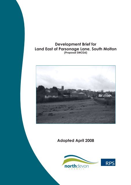
Development Brief for<strong>Land</strong> <strong>East</strong> <strong>of</strong> <strong>Parsonage</strong> <strong>Lane</strong>, <strong>South</strong> <strong>Molton</strong>(Proposal SMO2d)Adopted April 2008RPS
BackgroundUnder the Planning and Compulsory Purchase Act (2004) this Development Brief has beenadopted as a Supplementary Planning Document (SPD) within the Local DevelopmentFramework (LDF) for <strong>North</strong> <strong>Devon</strong> in order to supplement policies in the <strong>North</strong> <strong>Devon</strong> Local Plan1995-2011 (adopted July 2006).In accordance with Government guidance (PPS12: Local Development Frameworks), this briefwas prepared alongside a Sustainability Appraisal and Strategic Environmental Assessment inaccordance with the indicators from the Sustainability Appraisal Framework for <strong>North</strong> <strong>Devon</strong>identified within the sustainability scoping report for this development brief. A copy <strong>of</strong> thisdocument has been published separately.A draft development brief was subject to a six-week formal consultation period from 20 July2007 to 31 August 2007 in order to take account <strong>of</strong> the views <strong>of</strong> a wide range <strong>of</strong> organisations,individuals and other stakeholders. All representations received can be viewed by request tothe Council.All representations received on time and relevant to this development brief were consideredby the Council and changes made, where appropriate, before it was finally adopted in April2008 as a Supplementary Planning Document within the Local Development Framework for<strong>North</strong> <strong>Devon</strong>.For further information please contact:Planning Policy TeamPlanning and Development Services<strong>North</strong> <strong>Devon</strong> CouncilCivic CentreBARNSTAPLE<strong>Devon</strong>EX31 1EAldf@northdevon.gov.uk(01271) 388392 or 388409
CONTENTS1.0 IntroductionThe need for HousingThe Planning Policy Framework2.0 Site ContextCharacter <strong>of</strong> AreaSite Characteristics3.0 Planning Analysis<strong>Land</strong> Use and Development ConsiderationsSustainable DevelopmentDesignHousing DensityAffordable HousingOpen SpaceRenewable Sources <strong>of</strong> EnergyMaterial Considerations4.0 Development Objectives5.0 Development Strategy<strong>Land</strong> UseDesignTopographyImmediate SurroundingsOpen Space StrategyDetailed Design Guidance6.0 Transport StrategyVehicular AccessPedestrian and Cycle Access7.0 Ecological and <strong>Land</strong>scaping IssuesEcologyHedgerowsWatercourse<strong>Land</strong>scape8.0 Other issuesArchaeologyFlood RiskServicesSustainable BuildingIndicative Masterplan9.0 Planning Agreements10.0 Monitoring and Review11.0 Development ChecklistAppendiciesAppendix 1.Appendix 2.Appendix 3.Appendix 4.Site Location PlanPlanning Policy SummaryNational Guidance SummaryIndicative Masterplan
1.0 IntroductionS1.1 The purpose <strong>of</strong> this Development Brief is to guide the future development <strong>of</strong> land east<strong>of</strong> <strong>Parsonage</strong> <strong>Lane</strong>, <strong>South</strong> <strong>Molton</strong>. It should be used to inform the preparation <strong>of</strong> futuredetailed planning applications for the site and also as guidance by the Council whendetermining any such application.1.2 This Development Brief supplements the planning policies contained in the <strong>North</strong> <strong>Devon</strong>Local Plan and will form a Supplementary Planning Document within the emerging LocalDevelopment Framework for <strong>North</strong> <strong>Devon</strong>. In particular, this Development Brief supplementsProposal SMO2d <strong>of</strong> the <strong>North</strong> <strong>Devon</strong> Local Plan, which allocates the land east <strong>of</strong> <strong>Parsonage</strong><strong>Lane</strong>, <strong>South</strong> <strong>Molton</strong> for residential development. A plan illustrating the location and extent<strong>of</strong> the site is attached at Appendix 1.1.3 In order to ensure the Development Brief considers the aspirations <strong>of</strong> the public and inaccordance with Government guidance in PPS12: Local Development Frameworks, andthe Statement <strong>of</strong> Community Involvement for <strong>North</strong> <strong>Devon</strong>, the Brief was informed by aperiod <strong>of</strong> public consultation and was subject to a Sustainability Appraisal.The Need for Housing1.4 The <strong>Devon</strong> Structure Plan set a requirement for <strong>North</strong> <strong>Devon</strong> to provide around 4900dwellings for the period 2001-2016. A total <strong>of</strong> about 570 dwellings need to be provided in<strong>South</strong> <strong>Molton</strong> over this period. It is not possible to provide all <strong>of</strong> these dwellings on previouslydeveloped land and therefore some will have to be provided on greenfield sites. Onesuch site is at land east <strong>of</strong> <strong>Parsonage</strong> <strong>Lane</strong>, <strong>South</strong> <strong>Molton</strong>.The Planning Policy Framework1.5 The Council has adopted this Development Brief as a Supplementary Planning Documentwithin the Local Development Framework for <strong>North</strong> <strong>Devon</strong> in order to supplement policieswithin the <strong>North</strong> <strong>Devon</strong> Local Plan, particularly Proposal SMO2d that directly relates to thesite.1.6 In accordance with Government Guidance in PPS12: Local Development Frameworks, theBrief was subject to a statutory period <strong>of</strong> consultation for 6 weeks. This consultation periodenabled the views <strong>of</strong> a wide range <strong>of</strong> individuals, organisations and other stakeholders tobe considered within the Development Brief. During this period <strong>of</strong> consultation, the briefwas advertised in the local newspaper and was available for inspection on the <strong>North</strong><strong>Devon</strong> Council website, as well as in various other locations throughout the <strong>District</strong>. Apublic exhibition was also held in the <strong>South</strong> <strong>Molton</strong> Pannier Market together with a publicmeeting at the Methodist Hall to publicise the publication <strong>of</strong> the draft development brief.The Brief has also been subject to a Sustainability Appraisal.1.7 Proposal SMO2d <strong>of</strong> the Adopted <strong>North</strong> <strong>Devon</strong> Local Plan (2006) identifies the land east<strong>of</strong> <strong>Parsonage</strong> <strong>Lane</strong>, <strong>South</strong> <strong>Molton</strong> as a site for residential development <strong>of</strong> up to 150dwellings.<strong>Land</strong> <strong>East</strong> <strong>of</strong> <strong>Parsonage</strong> <strong>Lane</strong>, <strong>South</strong> <strong>Molton</strong> (Proposal SMO2d) ADOPTED DEVELOPMENT BRIEF1.8 In addition to the site-specific requirements <strong>of</strong> Proposal SMO2d, the development <strong>of</strong> landeast <strong>of</strong> <strong>Parsonage</strong> <strong>Lane</strong> will also need to comply with a range <strong>of</strong> other planning policies atthe national, regional, county and local level and ensure that the necessary physical andsocial infrastructure is provided to support the development. The fundamental planningpolicy issues applying to the site are summarised at Appendix 2.RPS PlanningApril 2008
2.0 Site Context<strong>Land</strong> <strong>East</strong> <strong>of</strong> <strong>Parsonage</strong> <strong>Lane</strong>, <strong>South</strong> <strong>Molton</strong> (Proposal SMO2d) ADOPTED DEVELOPMENT BRIEFCharacter <strong>of</strong> Area2.1 The site lies at the northern edge <strong>of</strong> the historic Market Town <strong>of</strong> <strong>South</strong> <strong>Molton</strong>. Directly southis an area <strong>of</strong> open land in mixed ownership, which has been identified as safeguardedopen space within the Local Plan. To the west <strong>of</strong> the site is an area <strong>of</strong> relatively recentsuburban-style development and to the north lies an area <strong>of</strong> Community Woodland whichis proposed within the Local Plan to be expanded southwards, towards the site.2.2 Station Road bounds the eastern boundary <strong>of</strong> the site and provides a direct roadconnection north to the Pathfields Business Park and beyond to the A361, which, in turn,gives easy access to towns such as Barnstaple and Tiverton. <strong>Parsonage</strong> <strong>Lane</strong> bounds thesite on its western side, which extends northwards towards the Community Woodland aswell as providing a link into the town centre to the south. The town centre is within an easy10-minute walk.2.3 The town <strong>of</strong> <strong>South</strong> <strong>Molton</strong> is <strong>of</strong> significant historic importance, being listed within theDoomsday Book in 1086. The town originally grew up around the churchyard, but the centreshifted in the early Middle Ages with the creation <strong>of</strong> a new market, with long and narrowburgage plots running back from the street. The centre <strong>of</strong> the town therefore consists <strong>of</strong>a tight urban fabric.© Crown Copyright. All rights reserved. Licence number AR 161462. © Getmapping. All rights reserved. Not to ScaleScale0 500 1000 1500 2000 MetersSite Location PlannApril 2008RPS Planning
Site Characteristics2.4 The site measures approximately 8.28 hectares (20.46 acres) <strong>of</strong> undulating agriculturalland made up <strong>of</strong> three main fields. Dividing the site at present are a series <strong>of</strong> hedgerowsthat are generally well established and <strong>of</strong> varying visual and ecological interest.2.5 The site slopes steeply down from the south-eastern corner and north-east <strong>of</strong> the site t<strong>of</strong>orm a valley known as Gullacombe Valley, through which a small watercourse flows. Thewestern half <strong>of</strong> the site is generally more level, but falls away around the midpoint <strong>of</strong> thesite to the valley floor.Immediate Surroundings and Boundary ConsiderationsTo the <strong>North</strong>2.6 The northern boundary has no physical distinction; it has been created to define the siteboundary. Slightly south <strong>of</strong> this, a post and wire fence runs east to west along the valley.2.7 Around 400m north is the existing Community Woodland, which is designated to beextended to the boundary <strong>of</strong> the site. There is also an existing recreational ground to thenorth-west, and a collection <strong>of</strong> dwellings (the Gunsdown Villas) abutting the north-eastboundary.Recreation GroundThe Old RectoryResidentialdevelopment atWinston Park2Hollymoor House1Nettle Barn3465 9Gullacombe10Gunsdown Villas8?Views <strong>of</strong> SiteSunnyside Bungalow7nHugh Squier AvenueView in direction <strong>of</strong>arrow point© Crown Copyright. All rights reserved. Licence number AR 161462. Not to Scale<strong>Land</strong> <strong>East</strong> <strong>of</strong> <strong>Parsonage</strong> <strong>Lane</strong>, <strong>South</strong> <strong>Molton</strong> (Proposal SMO2d) ADOPTED DEVELOPMENT BRIEFRPS PlanningApril 2008
To the West<strong>Land</strong> <strong>East</strong> <strong>of</strong> <strong>Parsonage</strong> <strong>Lane</strong>, <strong>South</strong> <strong>Molton</strong> (Proposal SMO2d) ADOPTED DEVELOPMENT BRIEF2.8 The western boundary is formed by a well-established and maintained hedge bank. Thisboundary follows <strong>Parsonage</strong> <strong>Lane</strong>, a single track lane that connects to the recreationalground and ends at the Community Woodland. From this point, pedestrian links extendfurther north to provide direct access to Pathfields Business Park.2.9 The south-west corner also has a field gate into the site. There is also an existing dwellingcalled Nettle Barn on this boundary. The residential plots <strong>of</strong> Winston Park back on to thewest side <strong>of</strong> the footpath. The Old Rectory is located on high ground just south <strong>of</strong> therecreation ground, outside <strong>of</strong> the development boundary.1Photo 1: View eastwards across site to Sunnyside Bungalow.2Photo 2: <strong>Parsonage</strong> <strong>Lane</strong>, which bounds the western side <strong>of</strong> thesite.4Photo 4: View <strong>of</strong> Nettle Barn and western Boundary.5Photo 5: View through the adjacent open space.3Photo 3: View south down <strong>Parsonage</strong> <strong>Lane</strong>, to vehicularentrance to site and entrance to Mole Ridge Way.6Photo 6: Chain link fence just south <strong>of</strong> the northernboundary.April 2008RPS Planning
To the <strong>South</strong>2.10 The southern boundary has a hedge that separates the site from private gardens. Tothe west <strong>of</strong> Forest View a substantial hedge boundary exists that links with the southernboundary <strong>of</strong> the proposal. These private gardens are designated as a safeguarded area<strong>of</strong> open space in the Local Plan. The ground rises from the southern boundary towards thehighest ridge <strong>of</strong> <strong>South</strong> <strong>Molton</strong> with a mix <strong>of</strong> different sized residential and mixed-use plots.Hollymoor House, is located close to the south west corner <strong>of</strong> the site. Another property,Gullacombe, is situated at the south-eastern corner.2.11 Running inside the site, adjacent to the field boundary, is a small ditch, which interceptsthe surface water run-<strong>of</strong>f flowing from the adjacent open space.To the <strong>East</strong>2.12 The eastern boundary is formed by a well-established and maintained hedge bank alongStation Road. At the north-eastern corner there are several mature trees. Station Road hasa public footpath that runs adjacent to the site boundary.7Photo 7:Looking southwards along Station Road.9Photo 9: Looking southwards to Gullacombe House.<strong>Land</strong> <strong>East</strong> <strong>of</strong> <strong>Parsonage</strong> <strong>Lane</strong>, <strong>South</strong> <strong>Molton</strong> (Proposal SMO2d) ADOPTED DEVELOPMENT BRIEF8Photo 8: Looking north towards the Gunsdown Villas.10Photo 10: Existing housing south east <strong>of</strong> the site.RPS PlanningApril 2008
3.0 Planning Analysis<strong>Land</strong> <strong>East</strong> <strong>of</strong> <strong>Parsonage</strong> <strong>Lane</strong>, <strong>South</strong> <strong>Molton</strong> (Proposal SMO2d) ADOPTED DEVELOPMENT BRIEF<strong>North</strong> <strong>Devon</strong> Local Plan3.1 This Development Brief has been prepared in accordance with the policies and proposalscontained within the <strong>North</strong> <strong>Devon</strong> Local Plan to 2011, adopted July 2006. Key policiesrelevant to the development <strong>of</strong> this site are listed in Appendix 2.<strong>Land</strong> Use and Development Considerations3.2 The site should be developed for housing and open space in accordance with ProposalSMO2d.3.3 “LAND EAST OF PARSONAGE LANE (SMO2d):The following site, as shown on inset map 5, is allocated for residential developmentprovided the elements identified for the site are proposed:A) up to 150 dwellings at a minimum net density <strong>of</strong> 35 units per hectare andincorporating a mix <strong>of</strong> accommodation types and sizes including at least 50affordable homes;B) a new link road from north road to serve the site together with accessfrom station road;C) extensive landscaping along all its boundaries and approximately 3.5hectares <strong>of</strong> formal and informal open space concentrated in the easternhalf <strong>of</strong> the site;D) the provision <strong>of</strong>, or contributions sought towards pedestrian and cyclelinks connecting to the recreation ground, the community woodland,pathfields industrial estate, the new infant school, the town centre andalong station road;E) the provision <strong>of</strong> a bus waiting and turning area;F) measures to retain the functioning and integrity <strong>of</strong> the biodiversity network;G) the site is not developed before april 2006 at the earliest;H) the preparation <strong>of</strong> a development brief; andI) in addition to the above elements, contributions will be sought towards:-• providing additional secondary, junior and infant school places;• the creation <strong>of</strong> the community woodlands to the north <strong>of</strong> the site.”April 2008RPS Planning
<strong>North</strong> <strong>Devon</strong> Local Plan Proposals Map<strong>Land</strong> <strong>East</strong> <strong>of</strong> <strong>Parsonage</strong> <strong>Lane</strong>, <strong>South</strong> <strong>Molton</strong> (Proposal SMO2d) ADOPTED DEVELOPMENT BRIEFScale0 50 100 150 200 250 MetersRPS PlanningApril 2008
Sustainable Design and Construction<strong>Land</strong> <strong>East</strong> <strong>of</strong> <strong>Parsonage</strong> <strong>Lane</strong>, <strong>South</strong> <strong>Molton</strong> (Proposal SMO2d) ADOPTED DEVELOPMENT BRIEF3.4 Any new development should be sustainable by utilising natural resources efficiently inits design, construction and future use, with consideration given to the sourcing <strong>of</strong> localmaterials. To ensure that new development embraces these principles, it should beaccompanied by a Sustainability Assessment in accordance with Policy DVS1A <strong>of</strong> theadopted <strong>North</strong> <strong>Devon</strong> Local Plan. In accordance with this policy, the application proposalsshould achieve a Building Research Establishment eco-homes rating <strong>of</strong> at least ‘good’and should be accompanied by a quantified assessment that demonstrates how this hasbeen achieved. To meet this requirement under the Code for Sustainable Homes, a rating<strong>of</strong> at least Code level 3 should be achieved.3.5 The development will also be required to incorporate on-site generation <strong>of</strong> renewableenergy in accordance with Policy ECN15 <strong>of</strong> the adopted <strong>North</strong> <strong>Devon</strong> Local Plan. Designachieving a sustainability rating under the Government’s Code for Sustainable Homes(adopted 2006) will be required in accordance with Policy G <strong>of</strong> the draft Regional SpatialStrategy (RSS) for the <strong>South</strong> West. This requirement will be reviewed in accordance withthis policy in the adopted version <strong>of</strong> the RSS. Where the introduction <strong>of</strong> sustainablemeasures into a scheme raises issues <strong>of</strong> financial viability, the Council will expect ‘openbook’ negotiations and may seek independent verification. Financial viability should beassessed on a ‘whole <strong>of</strong> life’ cost basis.3.6 Development proposals should accord with the Design Principles and Guidance on Aspects<strong>of</strong> Development Form set out within Policy DVS1 <strong>of</strong> the <strong>North</strong> <strong>Devon</strong> Local Plan and thedocument By Design, on which these principles are based. A summary <strong>of</strong> National DesignGuidance is included at Appendix 3.3.7 Proposals should also incorporate a comprehensive landscaping scheme that satisfiesthe <strong>Land</strong>scape Design Principles set out in Policy DVS2. In accordance with this policy,existing landscape features that contribute to the character or nature conservation <strong>of</strong> thesite should be preserved wherever possible, including hedgebanks and trees. Due to thelandscape setting <strong>of</strong> the site, successful integration <strong>of</strong> the proposal, including boundarytreatment, into the existing landscape is particularly important.April 2008RPS Planning
Housing3.8 Planning Policy Statement 3: Housing, encourages the most efficient and effective use <strong>of</strong>land for housing developments. In order to achieve this, the guidance states that residentialdevelopments should be <strong>of</strong> a minimum density <strong>of</strong> 30 dwellings per hectare with specificdensity ranges to be established by Local Planning Authorities.3.9 Proposal SMO2d sets a requirement for the development to achieve a minimum net density<strong>of</strong> 35 units per hectare. Due to the large area <strong>of</strong> Public Open Space required through thispolicy, this density requirement relates to the parcels <strong>of</strong> residential development ratherthan the site as a whole.Affordable Housing3.10 In accordance with Proposal SMO2d, the Council will require the provision <strong>of</strong> at least50 affordable units, or 35% <strong>of</strong> the total number <strong>of</strong> units proposed, subject to the overallviability <strong>of</strong> the development. The affordable housing provided will be subject to securearrangements to ensure it remains available to meet the needs <strong>of</strong> the community bothinitially and in the long term provided the need exists. In providing these affordabledwellings, the Council will:• seek to ensure that the provision <strong>of</strong> affordable housing is integrated and indistinguishable,as far as possible, from market housing;• encourage the dispersion <strong>of</strong> affordable dwellings throughout the scheme in a number <strong>of</strong>small clusters and not in a single large group;• encourage a mix <strong>of</strong> sizes, types and tenures <strong>of</strong> dwellings, to meet the needs <strong>of</strong> the LocalCommunity; and• expect at least two thirds <strong>of</strong> the affordable dwellings to be social rented units subject tocurrent need at the time <strong>of</strong> a formal planning application.3.11 The Council will expect affordable housing proposals to reflect the guidance regardingthe type <strong>of</strong> provision set out in Policy HSG7 and through the Affordable Housing Code <strong>of</strong>Practice (March 2004) or subsequent replacement documents.<strong>Land</strong> <strong>East</strong> <strong>of</strong> <strong>Parsonage</strong> <strong>Lane</strong>, <strong>South</strong> <strong>Molton</strong> (Proposal SMO2d) ADOPTED DEVELOPMENT BRIEFRPS PlanningApril 2008
10Open Space<strong>Land</strong> <strong>East</strong> <strong>of</strong> <strong>Parsonage</strong> <strong>Lane</strong>, <strong>South</strong> <strong>Molton</strong> (Proposal SMO2d) ADOPTED DEVELOPMENT BRIEF3.12 Proposal SMO2d sets a requirement for the provision <strong>of</strong> approximately 3.5 hectares <strong>of</strong>formal and informal Public Open Space (POS) concentrated in the eastern half <strong>of</strong> thesite, the majority <strong>of</strong> which will be informal or strategic open space.3.13 The Council’s own Supplementary Planning Guidance on the provision <strong>of</strong> Public OpenSpace, Sport and Recreation (adopted March 2004) sets minimum standards for theamount <strong>of</strong> different types <strong>of</strong> Public Open Space that should be provided per 1,000population. These standards should be interpreted on a pro-rata basis (set out below) forthe number <strong>of</strong> new residents expected in the development <strong>of</strong> land east <strong>of</strong> <strong>Parsonage</strong><strong>Lane</strong>.3.14 It is recognised that it may not be possible or desirable to provide certain elements <strong>of</strong>open space on site due to the topography <strong>of</strong> the site and the minimum size requirementsfor specific facilities. Overall, however, the development should provide sufficient openspace to meet the Council’s total requirements, as well as additional strategic open spacein accordance with Proposal SMO2d.April 2008RPS Planning
Renewable Sources <strong>of</strong> Energy113.15 Local Plan Policy ECN15 sets a requirement for this development to incorporate renewableenergy generation to provide at least 15% <strong>of</strong> predicted energy requirements. In accordancewith the draft RSS for the <strong>South</strong> West, the Council will require the development to achieve acarbon reduction <strong>of</strong> on-site regulated emissions in order to meet Policy RE5. This requirementwill be reviewed in accordance with this policy in the adopted version <strong>of</strong> the RSS. Thedeveloper will be required to provide the Council with a ‘Renewable Energy Statement’that should demonstrate how potential renewable energy resources would be utilised tomeet this requirement. The Council will encourage the developer to consider the use <strong>of</strong>a district heating system in order to assist in meeting this requirement.Access, Parking and Transport3.16 Local Plan Policy TRA1A promotes the provision <strong>of</strong> sustainable transport choices in newdevelopments, including walking, cycling and public transport. The Development Proposalsfor this site should therefore provide good pedestrian and cycle links north to the CommunityWoodland and Pathfields Business Park, as well as south to the town centre.3.17 Local Plan Policy TRA8 requires residential developments to provide a level <strong>of</strong> <strong>of</strong>f-streetparking appropriate to the location <strong>of</strong> the development and the requirements <strong>of</strong> the futureoccupiers. This should not generally, on average, exceed 1.5 spaces per dwelling.<strong>Land</strong> <strong>East</strong> <strong>of</strong> <strong>Parsonage</strong> <strong>Lane</strong>, <strong>South</strong> <strong>Molton</strong> (Proposal SMO2d) ADOPTED DEVELOPMENT BRIEFRPS PlanningApril 2008
124.0 Development Objectives<strong>Land</strong> <strong>East</strong> <strong>of</strong> <strong>Parsonage</strong> <strong>Lane</strong>, <strong>South</strong> <strong>Molton</strong> (Proposal SMO2d) ADOPTED DEVELOPMENT BRIEF4.1 Proposals for the residential development <strong>of</strong> <strong>Land</strong> <strong>East</strong> <strong>of</strong> <strong>Parsonage</strong> <strong>Lane</strong> should achievethe following objectives:1) Careful and sensitive planning to ensure that the development is properlyintegrated into the urban fabric <strong>of</strong> the town and to protect its landscape settingand the residential amenity <strong>of</strong> surrounding properties;2) Incorporate the distinctiveness <strong>of</strong> <strong>South</strong> <strong>Molton</strong> throughout the design – creating aplace with local identity;3) Use the characteristics <strong>of</strong> <strong>South</strong> <strong>Molton</strong> to set out an attractive, safe, secure andsuccessful development which minimises opportunities for crime;4) Create a land efficient development that preserves and respects thetopographical and landscape character <strong>of</strong> the site;5) Encourage opportunities for walking and cycling throughout the site and tosurrounding services and facilities, particularly enhancing pedestrian and cyclelinks from the town centre to Pathfields Business Park;6) Integrate with the existing infrastructure <strong>of</strong> <strong>South</strong> <strong>Molton</strong> – facilitating easy access topublic transport;7) Provide a mix <strong>of</strong> types, tenures and sizes <strong>of</strong> dwellings to promote a viable andvaried community structure;8) Deliver attractive and useable areas <strong>of</strong> Public Open Space for the town, whichpreserves or enhances the key network features and Biodiversity Network andecological value that currently exists;9) Consolidate the settlement edge with a visually attractive scheme;10) Introduce a new secondary vehicular route between Station Road and <strong>North</strong>Road, alleviating traffic on <strong>North</strong> Street and <strong>Parsonage</strong> <strong>Lane</strong> and assisting in thecirculation <strong>of</strong> traffic and public transport through <strong>South</strong> <strong>Molton</strong>;11) Improve pedestrian and vehicular access to <strong>South</strong> <strong>Molton</strong> Community InfantSchool;12) Respect the character and setting <strong>of</strong> the <strong>South</strong> <strong>Molton</strong> Conservation Areaminimising the impact <strong>of</strong> the development on the towns historic core andmaintaining views from within the site towards St. Mary Magdalene Church towerwherever possible.13) Ensure that the development will be able to withstand, and continue t<strong>of</strong>unction, during future severe weather events such as strong winds, excessive rainand prolonged hot or cold periods; and14) Deliver a proportion <strong>of</strong> housing to Joseph Rowntree Foundation LifetimeHomes Standard.April 2008RPS Planning
13overhead cableProtect and enhance boundaryhedgerowVisually prominent landWinston ParkPressurised sewer mainHedgerow to be removedAccessMole Ridge WaySchoolSteep GradientConstraints and OpportunitiesnSteep gradientMarsh areaWatercourseAccessDesignated OpenSpaceImportant view publicpointLocal FacilitiesExisting Hedgerow<strong>Land</strong> <strong>East</strong> <strong>of</strong> <strong>Parsonage</strong> <strong>Lane</strong>, <strong>South</strong> <strong>Molton</strong> (Policy SMO2d) ADOPTED DEVELOPMENT BRIEFWatermainNew Road LinkAccessMain Vehicular RoutesVisually Prominant <strong>Land</strong>WatercourseRPS PlanningApril 2008
145.0 Development Strategy<strong>Land</strong> <strong>East</strong> <strong>of</strong> <strong>Parsonage</strong> <strong>Lane</strong>, <strong>South</strong> <strong>Molton</strong> (Proposal SMO2d) ADOPTED DEVELOPMENT BRIEFUrban Design Considerations5.1 <strong>Land</strong> Use – The land use for the site has been established through its allocation within theLocal Plan (Proposal SMO2d) for a residential development <strong>of</strong> around 150 dwellings.5.2 Due to the topography <strong>of</strong> the site, and the desire to respect its natural form, it is only possibleto develop around half <strong>of</strong> the site. On these developable areas it is therefore important tomake best use <strong>of</strong> the developable land without compromising the character and setting<strong>of</strong> the site.5.3 The Council expects that the majority <strong>of</strong> dwellings will be provided as family houses,however the development will be expected to provide a range <strong>of</strong> dwelling sizes andtenures dispersed throughout the scheme to create a mixed, balanced and inclusivecommunity. At least 5 % <strong>of</strong> the proposed dwellings should meet the Joseph RowntreeFoundation Lifetime Homes standard.5.4 The development should also incorporate a significant area <strong>of</strong> Informal Open Space inthe north east <strong>of</strong> the site, which respects the topography <strong>of</strong> the site and provides a naturalfeature around which the development can focus.5.5 Design – Consideration should be given to the design and landscaping policies set out inPolicies DVS1, DVS1A and DVS2 within the adopted <strong>North</strong> <strong>Devon</strong> Local Plan, and shouldreflect the specific design principles set out through this guidance.nAConcept Masterplanextend communitywoodland to a naturalcontour linesafe pedestrian linktransition from woodlandto parkland treesprotect and enhanceexisting water courseenhance natural valleyas safe and attractivepublic realmsequence <strong>of</strong> linkedlandscaped spacesgreen linkroad aligned to acontourdevelopment formmoulded onto slopessafeguarded as OpenSpace in the adoptedLocal PlanApril 2008RPS Planning
5.6 A well-designed building form should aid in the creation <strong>of</strong> the sense <strong>of</strong> place; defining theurban form, strengthening key routes and improving legibility. The layout should respondto the topography and setting <strong>of</strong> the site to retain the character <strong>of</strong> the landscape.5.7 The design <strong>of</strong> the development should, where possible, reflect the built form andarchitectural details common to <strong>South</strong> <strong>Molton</strong> to create a development that will integrateinto the character <strong>of</strong> the area, the setting <strong>of</strong> the town and its local distinctiveness. Thedevelopment should incorporate sustainable design and construction principles. Designachieving a rating within the Code for Sustainable Homes will be required by Policy G<strong>of</strong> the draft Regional Spatial Strategy subject to any revised wording <strong>of</strong> Policy G onceadopted.5.8 The predominant building height for the site should be 2 storeys to ensure that theproposals blend with the local scale and massing <strong>of</strong> the surrounding properties. There may,however, be certain circumstances in which 2½ or 3 storey buildings may be appropriate,for example, to define spaces or create statements on focal buildings. In these cases,this should be justified through the Design and Access Statement accompanying anyapplication.5.9 In addition to considering appropriate building heights as part <strong>of</strong> the built form, therelationship between the various features <strong>of</strong> the site to be retained should be considered,such as the relationship between residential use and open space, existing and newlandscaped areas, and highways.5.10 Topography – The topography <strong>of</strong> the site also means that building on certain areas <strong>of</strong> thesite, at a higher level, would be more visually intrusive on the landscape than building onlower levels. The development proposals should therefore be constrained to proposingbuildings at the same maximum contour level as the surrounding development.Site Topography15<strong>Land</strong> <strong>East</strong> <strong>of</strong> <strong>Parsonage</strong> <strong>Lane</strong>, <strong>South</strong> <strong>Molton</strong> (Policy SMO2d) ADOPTED DEVELOPMENT BRIEFapproximate gradients steeper than 1:5napproximate gradients between 1:6 and 1:8approximate gradients flatter than 1:9RPS PlanningApril 2008
16<strong>Land</strong> <strong>East</strong> <strong>of</strong> <strong>Parsonage</strong> <strong>Lane</strong>, <strong>South</strong> <strong>Molton</strong> (Proposal SMO2d) ADOPTED DEVELOPMENT BRIEF5.11 It may be more appropriate for development on the most elevated parts <strong>of</strong> the site to beonly single storey. The Design and Access Statement accompanying any application shoulddemonstrate that the building heights proposed are appropriate for the topography.5.12 Development proposals should respect the topography <strong>of</strong> the site where possible, andrespond to the slopes <strong>of</strong> the site. Split level properties and terraces that step-down slopes,as seen elsewhere within <strong>South</strong> <strong>Molton</strong>, should be used to achieve this objective.5.13 Immediate Surroundings – The amenity <strong>of</strong> the existing dwelling on the western boundary,Nettle Barn, should be considered and protected in accordance with Policy DVS3. Dwellingsproposed around this boundary should seek to maintain its privacy through appropriatedesign and boundary planting if considered appropriate.5.14 The development proposals around the south-eastern corner <strong>of</strong> the site should adopt asimilar approach and be set back from the existing property (known as Gullacombe) asufficient distance so as to minimise the impact on the amenity <strong>of</strong> this property. Dwellingsproposed on the southern boundary should also maintain the privacy <strong>of</strong> existing propertiesaround this boundary, including Hollymoor House, through appropriate design andboundary planting.5.15 In addition the Council will expect the developer to incorporate measures to mitigatethe impact <strong>of</strong> noise and light pollution to protect the amenities <strong>of</strong> the occupants <strong>of</strong> theexisting properties and surrounding area in accordance with Policy DVS3 whilst designingout opportunities for crime. Appropriate street lighting should be provided that improvesthe safety and security <strong>of</strong> the area and promotes the use <strong>of</strong> pedestrian linkages throughthe site. Any necessary lighting should be low key, unobtrusive and directional.5.16 Due to the established hedgerow along Station Road and the difference in height betweenthe road and the site level, the hedgerow on this boundary should be maintained andenhanced where appropriate. Properties should not be designed to form a frontage onto the road at the expense <strong>of</strong> losing this hedgerow. The design <strong>of</strong> the vehicular accessonto Station Road should also seek to minimise the loss <strong>of</strong> hedgerow, whilst achievingacceptable visibility splays to the satisfaction <strong>of</strong> the Local Highways Authority.April 2008RPS Planning
5.17 Open Space Strategy – Proposal SMO2d requires the provision <strong>of</strong> approximately 3.5 hectares<strong>of</strong> formal and informal Public Open Space to be provided, concentrated in the easternhalf <strong>of</strong> the site.5.18 The Public Open Space, Sport and Recreation Supplementary Planning Guidance acceptsthat in certain circumstances it is not practical or desirable to meet the standards <strong>of</strong>provision within a scheme. At land east <strong>of</strong> <strong>Parsonage</strong> <strong>Lane</strong>, the topography <strong>of</strong> the sitedoes not allow for the provision <strong>of</strong> playing pitches on-site and developers may also havedifficulties in providing some other forms <strong>of</strong> open space that require level sites. In suchcircumstances contributions may be sought for the provision or enhancement <strong>of</strong> facilities<strong>of</strong>f-site. An equipped children’s play area for use by younger and older children, possiblyin the form <strong>of</strong> an adventure style playground, together with an area <strong>of</strong> informal openspace will be required to be provided on-site.5.19 Overall, however, the applicant is required to provide a significantly higher amount <strong>of</strong>Public Open Space than would normally be required, in line with the requirements <strong>of</strong>Proposal SMO2d. The Council will require details <strong>of</strong> how this open space will be providedwithin the development as part <strong>of</strong> a detailed planning application.5.20 The Council will expect a significant proportion <strong>of</strong> open space to be provided throughone large area <strong>of</strong> open space in the north-eastern portion <strong>of</strong> the site. At this point thesite forms a steep natural valley. Preserving this area as open space will perform multipleroles <strong>of</strong>: protecting and enhancing the existing watercourse whilst providing a significantarea <strong>of</strong> informal open space to be used by residents; conserving the prominance <strong>of</strong> theelevated landscape; and <strong>of</strong>fering the opportunity <strong>of</strong> enhancing the Biodiversity Networkthrough creating an area <strong>of</strong> wetland in accordance with Policy ENV8 <strong>of</strong> the Local Plan.nExtended communitywoodlandTransition fromwoodland toparklandLinear ParkOpen Space StrategyThe Valley17<strong>Land</strong> <strong>East</strong> <strong>of</strong> <strong>Parsonage</strong> <strong>Lane</strong>, <strong>South</strong> <strong>Molton</strong> (Policy SMO2d) ADOPTED DEVELOPMENT BRIEFPaved CoreRPS PlanningApril 2008
18<strong>Land</strong> <strong>East</strong> <strong>of</strong> <strong>Parsonage</strong> <strong>Lane</strong>, <strong>South</strong> <strong>Molton</strong> (Proposal SMO2d) ADOPTED DEVELOPMENT BRIEF5.21 The development is also expressly linked to the delivery <strong>of</strong> the extension to the CommunityWoodland. Direct pedestrian links should be provided into the Community Woodland toenable future residents to utilise this facility. The development should also act to improvepedestrian links for <strong>South</strong> <strong>Molton</strong> as a whole, from the town centre to the CommunityWoodland and onto Pathfields Business Park.5.22 All areas <strong>of</strong> open space provided on-site should be designed to be active and overlookedspaces that are safe areas to play and enjoy, as well as being easily maintained. Footpaths,low key roads and houses fronting directly on to the areas <strong>of</strong> open space should beintroduced to provide activity and surveillance. The informal open space area to the north<strong>of</strong> Hollymoor House should be designed so as to discourage the area from being usedas a formal play space to avoid conflict with traffic entering and leaving the site and toprotect the amenities <strong>of</strong> the existing dwelling.Detailed Design Guidance5.23 The following design principles should be taken into account in the detailed design forthe site:• The designers and developers will be expected to be able to demonstrate how the proposalresponds to the site context, character and local distinctiveness;• Reference should be made to the local vernacular, in particular related to layout andhow the buildings relate to spaces and streets;• Direct copying <strong>of</strong> architectural features should be avoided to prevent an undesirablepastiche;• The palette <strong>of</strong> styles and materials should be limited in order to maintain simple consistencyand local Identity;• Proposals should establish appropriate proportions and composition <strong>of</strong> architecturalelements; and• The proposal should include areas <strong>of</strong> incidental open spaces that respond to the existingfeatures <strong>of</strong> the site.April 2008RPS Planning
Phasing195.24 In order to ensure the development does not cause additional traffic on <strong>Parsonage</strong><strong>Lane</strong> and <strong>North</strong> Street during its construction, the development should be served fromStation Road until the new road link from <strong>Parsonage</strong> <strong>Lane</strong> to <strong>North</strong> Road is completed.The Council will expect the applicant to sign up to a legal agreement to ensure the newlink road between <strong>Parsonage</strong> <strong>Lane</strong> and <strong>North</strong> Road is implemented at the completion<strong>of</strong> around 50% <strong>of</strong> the development and completed prior to the construction <strong>of</strong> the final25% <strong>of</strong> the development. In order to relieve existing traffic problems on <strong>Parsonage</strong> <strong>Lane</strong>,consideration should be given to providing the proposed link from <strong>North</strong> Road earlier. Themajority <strong>of</strong> construction traffic for the development will be required to access the site fromStation Road only.<strong>Land</strong> <strong>East</strong> <strong>of</strong> <strong>Parsonage</strong> <strong>Lane</strong>, <strong>South</strong> <strong>Molton</strong> (Policy SMO2d) ADOPTED DEVELOPMENT BRIEFRPS PlanningApril 2008
206.0 Transport Strategy<strong>Land</strong> <strong>East</strong> <strong>of</strong> <strong>Parsonage</strong> <strong>Lane</strong>, <strong>South</strong> <strong>Molton</strong> (Proposal SMO2d) ADOPTED DEVELOPMENT BRIEF6.1 A Transport Assessment should be submitted with any application to analyse the impacttraffic generated by the development will have on the surrounding road network andprovide a strategy to reduce the number and length <strong>of</strong> journeys, as well as minimising thenumber <strong>of</strong> trips by car.Vehicular Access6.2 Vehicular access to the site is currently via a number <strong>of</strong> established field gates around theboundary to the site.6.3 In order to provide a development proposal that integrates into existing pedestrian, cycleand vehicular routes, two main vehicular access points should be created. The access tothe west <strong>of</strong> the site is to join <strong>Parsonage</strong> <strong>Lane</strong> at its junction with Winston Park and to theeast would join Station Road. The adopted Local Plan requires a link from the <strong>Parsonage</strong><strong>Lane</strong>/Mole Ridge Way junction through Mole Ridge Way to a junction with <strong>North</strong> Road.This link should be designed to the satisfaction <strong>of</strong> the Local Highway Authority. Some <strong>of</strong>fsite works may also be necessary to ensure adequate sight lines are provided for vehiculartraffic. The route <strong>of</strong> this link is illustrated below.n<strong>North</strong> RoadWinston ParkMole Ridge WayAccess Point<strong>Parsonage</strong> <strong>Lane</strong>Vehicular AccessStation RoadAccess PointPotential Limited Access PointWest Street<strong>North</strong> StreetApril 2008RPS Planning
6.4 Whilst the adopted Local Plan requires a through route, a main vehicular access ontoStation Road, together with an emergency route along Mole Ridge Way to <strong>North</strong> Roadwith a controlled access point would be acceptable as an alternative subject to approvedmanagement and maintenance arrangements.6.5 A further potential vehicular access point could be created at an existing gateway atthe south-eastern corner <strong>of</strong> the site, <strong>of</strong>f Station Road. It has the potential to act as anemergency access, as well as serving a limited number <strong>of</strong> properties.6.6 The development should incorporate a primary route running through the site from StationRoad to <strong>Parsonage</strong> <strong>Lane</strong>. The general alignment <strong>of</strong> the main vehicular route should respondto the topography and retention <strong>of</strong> existing landscape features. All vehicular routes withinthe development proposals should be designed to restrict traffic speeds to a maximum<strong>of</strong> 20mph. Secondary routes should be designed to passively control vehicle speeds toensure that the development gives priority to the provision <strong>of</strong> a safe cycle and pedestrianpriority realm.6.7 This includes making provision for either a bus turning area or a bus stop and pull in area, ifrequired. The way in which this bus waiting/turning area could be provided will be discussedat detailed application stage.21<strong>Land</strong> <strong>East</strong> <strong>of</strong> <strong>Parsonage</strong> <strong>Lane</strong>, <strong>South</strong> <strong>Molton</strong> (Policy SMO2d) ADOPTED DEVELOPMENT BRIEFRPS PlanningApril 2008
22Pedestrian and Cycle Access<strong>Land</strong> <strong>East</strong> <strong>of</strong> <strong>Parsonage</strong> <strong>Lane</strong>, <strong>South</strong> <strong>Molton</strong> (Proposal SMO2d) ADOPTED DEVELOPMENT BRIEF6.8 A residential travel plan should be prepared and submitted with any application in order todemonstrate how the development proposals aim to reduce congestion whilst maintainingaccessibility and encourage use <strong>of</strong> the least polluting modes <strong>of</strong> transport. The travel planshould be prepared and undertaken with appropriate reference to the County Council’semerging Local Accessibility Action Plan.6.9 The development <strong>of</strong> the site should create ease <strong>of</strong> movement through the site forpedestrians and cyclists. Wherever possible, paths should be overlooked by propertiesand features that create opportunities for crime, or a fear <strong>of</strong> crime, should be avoided.The development should ensure that paths link in to the existing cycle/pedestrian paths inorder to facilitate the development <strong>of</strong> green links/safe routes to local facilities, schools andfrom the town centre to the Pathfields Business Park to the north. The Council will expectthe new pedestrian/cycle routes to be segregated from each other where practical with aminimum width <strong>of</strong> at least 2 metres each. Where pedestrian/cycle routes are shared theyshould be designed in accordance with the principles set out in the document ‘Manualfor Streets’. Where the proposed pedestrian/cycle route terminates at the entrance to<strong>Parsonage</strong> <strong>Lane</strong>, there should be a pedestrian/cycle route bordering the southern edge<strong>of</strong> the site in order to cut <strong>of</strong>f the corner <strong>of</strong> <strong>Parsonage</strong> <strong>Lane</strong>. A safe crossing point shouldbe facilitated across <strong>North</strong> Road to the new community infant school.Route HierarchyApril 2008RPS Planning
6.10 The development should also provide a link into the Community Woodland to the north <strong>of</strong>the site, and facilitate the provision <strong>of</strong> a footpath into the area to the south, safeguardedas visual Open Space. A further pedestrian and cycle access should be provided on to<strong>Parsonage</strong> <strong>Lane</strong> from the northern part <strong>of</strong> the site.6.11 Traffic Orders may be required in order to reduce traffic speeds in Station Road and tocontrol on street parking in surrounding roads.23<strong>Land</strong> <strong>East</strong> <strong>of</strong> <strong>Parsonage</strong> <strong>Lane</strong>, <strong>South</strong> <strong>Molton</strong> (Policy SMO2d) ADOPTED DEVELOPMENT BRIEFRPS PlanningApril 2008
247.0 Ecological and <strong>Land</strong>scaping Issues<strong>Land</strong> <strong>East</strong> <strong>of</strong> <strong>Parsonage</strong> <strong>Lane</strong>, <strong>South</strong> <strong>Molton</strong> (Proposal SMO2d) ADOPTED DEVELOPMENT BRIEFEcology7.1 An Ecological Assessment <strong>of</strong> the site has identified two areas <strong>of</strong> wetland within the siteas Key Network Features that fall within a larger Network Feature, which acts as a wildlifecorridor through the site and forms part <strong>of</strong> the <strong>North</strong> <strong>Devon</strong> Biodiversity Network. The areasdesignated as Key Network Features are <strong>of</strong> moderate to high local value and should beprotected or enhanced within the development proposals. Ecological surveys for protectedspecies should be undertaken prior to development.7.2 The Council will seek to retain the Key Network Features within the development <strong>of</strong> the sitein accordance with Policy ENV8 <strong>of</strong> the Local Plan. The role <strong>of</strong> the Key Network Features, asa habitat corridor within the Biodiversity Network, should be retained as far as possible. Inorder to preserve its high ecological value, a strip <strong>of</strong> 7 metres in width where possible eitherside <strong>of</strong> the stream connecting the habitats, should be provided in future developmentproposals. In some places a reduced buffer zone <strong>of</strong> no less than 2 metres in width may beacceptable. Prior to the commencement <strong>of</strong> development, the established buffer zoneshould be protected by an agricultural grade stock pro<strong>of</strong> fence and left undisturbed bythe development and associated infrastructure works. On completion <strong>of</strong> the developmentthe fencing will be removed and the buffer zone should be incorporated into the overalllandscaping scheme.Ecological Features• 11 - Hedgehog• 12 - Sweet-briar• 13 - Common Frog• 16 - Common FrogLicence No. 100019783 <strong>Devon</strong> County Council 2005 Source: <strong>Devon</strong> Biodiversity Records CentreExtract from: Wildlife Sites and Notable SpeciesSurrounding <strong>Parsonage</strong> <strong>Lane</strong>,<strong>South</strong> <strong>Molton</strong>April 2008RPS Planning
Hedgerows257.3 The form and strength <strong>of</strong> hedgerows is a key feature <strong>of</strong> the site. Overall, they are tall andthick; most are quite species rich, containing at least five woody species, and two hedgeshave six species in a 30 metre stretch, together with associated features that classify themas important under the 1997 Hedgerows Regulations.7.4 Hedgerows within the site should be preserved wherever possible and aim to retain thegeneral field structure. A mature Oak tree exists on the southern boundary that should bepreserved. Although preferable, it recognised that it is not possible to preserve all currenthedgerows within the development <strong>of</strong> the site. It is therefore accepted that the “important”hedgerow within the south-west <strong>of</strong> the site cannot be retained, along with other sectionswhere unavoidable (for example, to provide access routes).7.5 Where areas <strong>of</strong> hedgerows are lost, the Council will seek enhancements to the ecologicalvalue <strong>of</strong> preserved hedgerows and other areas within the site to compensate for the value<strong>of</strong> the loss. New areas <strong>of</strong> planting and landscaping should use native species trees andbushes appropriate to <strong>North</strong> <strong>Devon</strong>.7.6 Hedgerows that are retained within the proposal should include a grass buffer <strong>of</strong> at least 2metres wide on each side to enable management and ensure protection and preservation<strong>of</strong> their ecological value. The Council will seek to maintain and enhance where necessarythe existing southern boundary in order to protect the private amenity space <strong>of</strong> adjoiningproperties.Watercourse7.7 A large area <strong>of</strong> informal/strategic open space should be located at the north-easternpart <strong>of</strong> the site. This should be a largely natural element <strong>of</strong> open space and should retainthe open watercourse wherever possible. The ecological and biodiversity value <strong>of</strong> thisfeature should also be preserved and enhanced where necessary.ImportantHedgerowImportant HedgerowsImportantHedgerow<strong>Land</strong> <strong>East</strong> <strong>of</strong> <strong>Parsonage</strong> <strong>Lane</strong>, <strong>South</strong> <strong>Molton</strong> (Policy SMO2d) ADOPTED DEVELOPMENT BRIEFRPS PlanningApril 2008
26<strong>Land</strong> <strong>East</strong> <strong>of</strong> <strong>Parsonage</strong> <strong>Lane</strong>, <strong>South</strong> <strong>Molton</strong> (Proposal SMO2d) ADOPTED DEVELOPMENT BRIEF7.8 There is potential to enhance the function <strong>of</strong> the watercourse by incorporating attenuationponds. It could enhance the ecological value <strong>of</strong> the watercourse, <strong>of</strong>f-setting any ecologicalloss elsewhere in the site as well as fulfilling a role within the drainage strategy. It is essentialthat the formation <strong>of</strong> the attenuation ponds does not undermine the integrity <strong>of</strong> the bankin the north-eastern corner so as to maintain the existing trees on this boundary.7.9 A small ditch runs along the southern boundary <strong>of</strong> the site, on the border <strong>of</strong> the area<strong>of</strong> open space, to the south <strong>of</strong> the site. This is a tributary <strong>of</strong> the main watercourse andintercepts flows from this open space and the existing storm water drainage from HollymoorHouse. A foul overflow also discharges into this ditch which could have implications on thepossible attenuation pond downstream from this point. Detailed proposals will thereforeneed to consider the operation <strong>of</strong> this ditch and the way in which it can be treated inorder to mitigate the impact this will have on the watercourse, whilst also facilitating thedevelopment <strong>of</strong> land directly adjacent to it.7.10 The Council will expect the applicant to take measures to remove the foul water dischargefrom the watercourse. This could be achieved by culverting a section <strong>of</strong> the southernboundary ditch, if required, and removing the foul water overflow from discharging intothe watercourse, subject to the approval <strong>of</strong> the Environmental Agency. The Council willexpect measures to be put in place to enhance the ecological value further down thewatercourse to compensate for the ecological loss <strong>of</strong> this ditch.<strong>Land</strong>scape7.11 It is important that the landscape character <strong>of</strong> the site and its capacity for change guidesits future development and integration into the landscape.7.12 The site lies within the <strong>Land</strong>scape Character Area <strong>of</strong> The Culm (Area 149), as defined bythe Character <strong>of</strong> England map, produced by the former Countryside Commission. Thesite land lies close to the northern limit <strong>of</strong> the Culm, near the border with the <strong>Land</strong>scapeCharacter Area 145, Exmoor. The site is, however, within The Culm and therefore the keylandscape characteristics relevant to the site land include:“Rolling, locally steeply-undulating open, pasture separated by many small valleys;Heavy, poorly drained soil supporting rushy pastures <strong>of</strong> low agricultural quality but highnature-conservation interest;Wide views across a remote landscape;Little tree cover except occasional wind-shaped hedgerow and farmstead trees, coniferblocks and valley woodlands;Occasional hilltop villages.”April 2008RPS Planning
27view <strong>of</strong> rushy pastures7.13 A <strong>Land</strong>scape Assessment that has been undertaken concludes that most <strong>of</strong> the site hasa high capacity to change, as the specific landscape character type (rolling, villageedge, sandstone) could be retained through a pattern <strong>of</strong> development that respectsthe topography to preserve the roll <strong>of</strong> the land. The Council will therefore seek a form <strong>of</strong>development that retains the natural form <strong>of</strong> the site wherever possible and limits the loss<strong>of</strong> the rushy pasture and the existing hedge pattern to a minimum.7.14 Development proposals should seek to preserve and where possible, enhance the visualamenity and landscape characteristics <strong>of</strong> the site. In particular, the Council will expectproposals to respect and respond to the topography <strong>of</strong> the site and retain the existinghedge pattern wherever possible. In addition, the Council will encourage the introductionand management <strong>of</strong> landscaping to incorporate measures to enhance the biodiversityon the site.<strong>Land</strong> <strong>East</strong> <strong>of</strong> <strong>Parsonage</strong> <strong>Lane</strong>, <strong>South</strong> <strong>Molton</strong> (Policy SMO2d) ADOPTED DEVELOPMENT BRIEFRPS PlanningApril 2008
288.0 Other Issues<strong>Land</strong> <strong>East</strong> <strong>of</strong> <strong>Parsonage</strong> <strong>Lane</strong>, <strong>South</strong> <strong>Molton</strong> (Proposal SMO2d) ADOPTED DEVELOPMENT BRIEFArchaeology8.1 In 1994 an area <strong>of</strong> burnt charcoal-rich clay was identified within the centre <strong>of</strong> the siteduring the monitoring <strong>of</strong> service trench excavations. As such material can <strong>of</strong>ten indicatesettlement sites, <strong>Devon</strong> County Historic Environment Service advised that, prior todevelopment, a process <strong>of</strong> archaeological investigation should be undertaken.8.2 In response to this, a full Archaeological survey <strong>of</strong> the site has been undertaken includingan area <strong>of</strong> trial trenching. No archaeological deposits <strong>of</strong> intrest were found and thereforethe development <strong>of</strong> the site will have minimal archaeological impact. Full details <strong>of</strong> theexcavation works can be made available on request.Flood Risk8.3 Although the Environment Agency flood mapping indicates there to be no floodplainwithin the site, a Flood Risk Assessment should be submitted with any future applicationto demonstrate that the development proposals can be undertaken without resulting inflooding in the 1-in-100-year event. The requirements <strong>of</strong> PPS25 should be met in relationto flood risks to the site, from all sources, and the management <strong>of</strong> surface water run<strong>of</strong>f.8.4 A preliminary Flood Risk Assessment has already been undertaken which identifies that areceiving watercourse flows through the site, generally in an easterly direction with thetopography, to a point at the north-eastern corner <strong>of</strong> the site, where the watercourse sinksinto a culvert which passes under Station Road.8.5 This culvert extends under a field and discharges into the River Mole. The developmentproposals will need to demonstrate that this culvert is in an adequate condition and hassufficient capacity to enable the discharge <strong>of</strong> the surface water run-<strong>of</strong>f via this route.8.6 It is recognised that the subsoil <strong>of</strong> many areas <strong>of</strong> the site is unsuitable for the use <strong>of</strong>soakaway features. The Council will, however, require the introduction <strong>of</strong> other forms <strong>of</strong>Sustainable Urban Drainage where possible, in accordance with Policy DVS7 <strong>of</strong> the LocalPlan. An opportunity exists to create an attenuation pond within the site to manage surfacewater run-<strong>of</strong>f. The natural location for a pond is at the upstream end <strong>of</strong> the Station Roadculvert, where the existing topography forms a bowl. If required, the structural stability <strong>of</strong>the embankment will need to be investigated, and details <strong>of</strong> the design and treatment<strong>of</strong> the attenuation pond provided. In addition to the attenuation pond, the provision <strong>of</strong>other suitable drainage features, such as a system <strong>of</strong> swales within the green corridor sewereasement strip, will be encouraged.Services8.7 A water main runs diagonally across the site. Development proposals will need toincorporate its route into the design.8.8 Overhead cables cut across the site, north to south, in two places towards the east andwestern edges <strong>of</strong> the site. It will be necessary to realign, or relocate underground, the route<strong>of</strong> these cables through any development proposal for the site. All works to the overheadlines will be carried out in association with Western Power Distribution.April 2008RPS Planning
Sustainable Building298.9 In line with Policy ECN15, at least 15% <strong>of</strong> the predicted energy requirements across thedevelopment scheme should be provided by way <strong>of</strong> renewable energy generation. Theapplicant should demonstrate through which methods the energy will be generated andhow this contributes to the overall predicted requirements across the scheme by way <strong>of</strong>on-site renewable energy generation. The Council will also require the developer to providesufficient on-site renewable energy to reduce carbon output from energy use by users<strong>of</strong> the dwellings constructed to a level that exceeds the regulated emissions to Part L <strong>of</strong>Building Regulations 2006 in accordance with Policy RE5 <strong>of</strong> the draft RSS. This requirementwill be reviewed in accordance with this policy in the adopted version <strong>of</strong> the RSS.8.10 Due to the site’s topography, it is likely that significant amounts <strong>of</strong> ground remodelling willbe required in its development. In the interests <strong>of</strong> sustainability, the Council will expect theapplicant to submit a waste audit statement and adopt a strategy to minimise the amount<strong>of</strong> material being transported <strong>of</strong>f-site, through the reuse <strong>of</strong> excavated earth elsewhereon-site. The developer will also be required to provide adequate waste managementinfrastructure within the development such as recycling centres or a community compostingscheme or provide financial contributions towards such facilities elsewhere in the <strong>South</strong><strong>Molton</strong> area.8.11 Each residential dwelling should include provision <strong>of</strong> storage for wheelie bins and recyclingcontainers, which are easily accessible for collection by refuse/recycling vehicles inaccordance with the Council’s adopted ‘Design Guide on Refuse Storage for NewResidential Properties SPD’. The developer will also be encouraged to provide a water buttfor each residential dwelling in order to recycle rainwater run<strong>of</strong>f for use in the garden.<strong>Land</strong> <strong>East</strong> <strong>of</strong> <strong>Parsonage</strong> <strong>Lane</strong>, <strong>South</strong> <strong>Molton</strong> (Policy SMO2d) ADOPTED DEVELOPMENT BRIEFRPS PlanningApril 2008
30<strong>Land</strong> <strong>East</strong> <strong>of</strong> <strong>Parsonage</strong> <strong>Lane</strong>, <strong>South</strong> <strong>Molton</strong> (Proposal SMO2d) ADOPTED DEVELOPMENT BRIEFIndicative Masterplan8.12 The Indicative Masterplan below (and included at a larger scale at Appendix 4) providesan indication as to how the development principles set out within this Brief could betransferred into a form <strong>of</strong> development that would satisfy the Council’s DevelopmentObjectives. Any future planning application will be expected to propose a developmentform that would also satisfy these objectives.Designated Open SpaceIndicative MasterplanApril 2008RPS Planning
9.0 Planning Agreements319.1 <strong>North</strong> <strong>Devon</strong> Council will seek to negotiate appropriate planning obligations with theapplicant. A draft Section 106 Agreement should be submitted with any future applicationfor the site. An indication <strong>of</strong> what may be sought by the Council through planning conditionsand the Section 106 Agreement include:• Affordable Housing Provision – Provision <strong>of</strong> at least 35% affordable housing, including amix and tenure <strong>of</strong> housing, subject to the overall viability <strong>of</strong> the scheme.• Off-Site Highway Works – As part <strong>of</strong> the development <strong>of</strong> this site, a new road should bedelivered to link through Mole Ridge Way to <strong>North</strong> Road. The applicant will be requiredto ensure the link road is delivered in advance <strong>of</strong> the completion <strong>of</strong> the development.Contributions may also be sought towards the improvement <strong>of</strong> Borners Bridge junction, iftransport modelling demonstrates it necessary. Part <strong>of</strong> any contributions sought towardsthe improvements to Borners Bridge could also contribute to upgrading the existingpedestrian/cycle route under the road if required.• Education Infrastructure – Dependent on the timing <strong>of</strong> the development and specificcircumstances within the local schools, it may be necessary to make contributions toincrease educational facilities to accommodate the population increase resulting fromthe development. The level <strong>of</strong> contributions sought will be negotiated between the CountyCouncil and developer at the planning application stage.• Maintenance <strong>of</strong> Public Open Space – Contributions will be sought in order to ensure themaintenance <strong>of</strong> any on or <strong>of</strong>f-site Public Open Space. Alternatively, the developer mayneed to make arrangements for its long-term management.• Sustainable Transport – The Council will seek to ensure the development will be servedby sustainable modes <strong>of</strong> transport, including a bus service that should serve the site.Contributions may be sought in order to facilitate this service.• Phasing – In order to ensure the development does not cause additional traffic for<strong>Parsonage</strong> <strong>Lane</strong> and <strong>North</strong> Street, the Council will expect the development to be servedfrom Station Road, until the new link road from <strong>Parsonage</strong> <strong>Lane</strong> to <strong>North</strong> Road is completed.The Council consider it to be appropriate for around 50% <strong>of</strong> the development to becompleted prior to the implementation <strong>of</strong> the new link road from <strong>Parsonage</strong> <strong>Lane</strong> to <strong>North</strong>Road. It is suggested that the new link road should be completed prior to the construction<strong>of</strong> the final 25% <strong>of</strong> the development.• The majority <strong>of</strong> construction traffic should be accessed from Station Road only.• Sewerage Capacity – Contributions will be sought towards upgrading sewerageinfrastructure resulting form the development if required.<strong>Land</strong> <strong>East</strong> <strong>of</strong> <strong>Parsonage</strong> <strong>Lane</strong>, <strong>South</strong> <strong>Molton</strong> (Policy SMO2d) ADOPTED DEVELOPMENT BRIEFRPS PlanningApril 2008
3210.0 Monitoring and Review<strong>Land</strong> <strong>East</strong> <strong>of</strong> <strong>Parsonage</strong> <strong>Lane</strong>, <strong>South</strong> <strong>Molton</strong> (Proposal SMO2d) ADOPTED DEVELOPMENT BRIEF10.1 The adoption <strong>of</strong> this Development Brief will mean that it becomes a significant materialconsideration in guiding the future development <strong>of</strong> this site. The document should provideguidance for the entirety <strong>of</strong> the lifetime <strong>of</strong> the plan and, given this, could need updatingto ensure that it remains up-to-date if circumstances change.10.2 The test <strong>of</strong> effectiveness <strong>of</strong> the Brief will be whether the objectives have been met. This willentail monitoring the development process beyond the granting <strong>of</strong> planning permissionfor this site, through to the compliance with conditions and/ or legal agreements.April 2008RPS Planning
DEVELOPMENT CHECKLIST33This Development Checklist is provided as a summary <strong>of</strong> the key points which the developmentat land east <strong>of</strong> <strong>Parsonage</strong> <strong>Lane</strong>, <strong>South</strong> <strong>Molton</strong>, will be expected to achieve.In developing the site, the Council will expect the applicant to provide:HousingDesign• A residential development <strong>of</strong> up to 150 dwellings at a minimum net density <strong>of</strong> 35dph;• At least 50 affordable dwellings or 35% <strong>of</strong> the total number <strong>of</strong> dwellings proposed,subject to the overall viability <strong>of</strong> the scheme;• Affordable housing which is indistinguishable, as far as possible, from market housingand dispersed throughout the scheme in a number <strong>of</strong> small clusters and not in onelarge group; and• A mix <strong>of</strong> dwelling types and sizes to create a mixed and balanced community.• Proposals to respond to the topography and setting <strong>of</strong> the site in order to retain thecharacter <strong>of</strong> the landscape and retain as much <strong>of</strong> the existing landscape featuresas possible;• The design <strong>of</strong> the development to reflect the character <strong>of</strong> the existing development<strong>of</strong> <strong>South</strong> <strong>Molton</strong>;• Approximately 3.5 hectares <strong>of</strong> formal and informal open space, concentrated inthe eastern half <strong>of</strong> the site; and• The predominant building height to be 2 storeys. Any proposals <strong>of</strong> over 2 storeysshould be justified within the Design and Access Statement;• Achieve a design standard that meets at least level 3 <strong>of</strong> the Code <strong>of</strong> SustainableHomes.Transport<strong>Land</strong> <strong>East</strong> <strong>of</strong> <strong>Parsonage</strong> <strong>Lane</strong>, <strong>South</strong> <strong>Molton</strong> (Policy SMO2d) ADOPTED DEVELOPMENT BRIEF• Two main vehicular access points into the site:- Junction to the west <strong>of</strong> the site to join <strong>Parsonage</strong> <strong>Lane</strong> at its junction withWinston Park. Also required to deliver a link through Mole Ridge Way toa junction with <strong>North</strong> Road;- Junction to the east to join Station Road.RPS PlanningApril 2008
34<strong>Land</strong> <strong>East</strong> <strong>of</strong> <strong>Parsonage</strong> <strong>Lane</strong>, <strong>South</strong> <strong>Molton</strong> (Proposal SMO2d) ADOPTED DEVELOPMENT BRIEF• The road layout to respect the topography <strong>of</strong> the site and designed to restrict trafficspeeds to a maximum <strong>of</strong> 20mph;• Secondary routes to passively control vehicle speeds and give priority to theprovision <strong>of</strong> safe cycle and pedestrian priority routes;• An adequate road layout to accommodate a bus route and make provision for abus lay over area;• A number <strong>of</strong> pedestrian and cycle routes that link with the existing infrastructureto provide safe routes to local facilities and to the Community Woodland to thenorth;• To make a contribution towards upgrading the junction at Borners Bridge; and• A safe crossing point across <strong>North</strong> Road to the new community infant school.Ecology and <strong>Land</strong>scaping• To protect and, where possible, enhance the areas designated as Key NetworkFeatures within the development <strong>of</strong> the site;• Undertake a full protected species survey and mitigate impact;• A habitat corridor <strong>of</strong> approximately 7 metres in width, where possible, running eitherside <strong>of</strong> the stream to be retained within the development proposals;• Make provision for an agricultural grade stock pro<strong>of</strong> fence along the establishedbuffer zone prior to the commencement <strong>of</strong> development;• Existing hedgerows on-site to be retained where possible and include a grass buffer<strong>of</strong> at least 2 metres on each side;• To make enhancements to the ecological value <strong>of</strong> existing hedgerows tocompensate for the value <strong>of</strong> those lost;• A large area <strong>of</strong> informal/strategic open space located at the north-eastern part <strong>of</strong>the site, focused around the open watercourse; and• To make a contribution to the creation <strong>of</strong> the Community Woodland to the north <strong>of</strong>the site.April 2008RPS Planning
35Sustainable Building• Provide at least 15% <strong>of</strong> the predicted energy requirements across the developmentscheme by way <strong>of</strong> renewable energy generation; and• Achieve a design standard that meets the Code for Sustainable Homes;• Achieve an agreed carbon output reduction from the development that exceedsthe current regulated emissions to Part L Building Regulations 2006;• A Waste Audit Statement should be submitted in order to demonstrate how the creation<strong>of</strong> waste will be managed and disposal managed in the construction process; and• The provision <strong>of</strong> on-site waste management facilities.<strong>Land</strong> <strong>East</strong> <strong>of</strong> <strong>Parsonage</strong> <strong>Lane</strong>, <strong>South</strong> <strong>Molton</strong> (Policy SMO2d) ADOPTED DEVELOPMENT BRIEFRPS PlanningApril 2008
36<strong>Land</strong> <strong>East</strong> <strong>of</strong> <strong>Parsonage</strong> <strong>Lane</strong>, <strong>South</strong> <strong>Molton</strong> (Proposal SMO2d) ADOPTED DEVELOPMENT BRIEFApril 2008RPS Planning
Appendix 1 Site Location Plan<strong>Land</strong> <strong>East</strong> <strong>of</strong> <strong>Parsonage</strong> <strong>Lane</strong>, <strong>South</strong> <strong>Molton</strong> (Policy SMO2d) ADOPTED DEVELOPMENT BRIEFRPS PlanningApril 2008
SITE LOCATION PLAN APPENDIX 1© Crown Copyright. All rights reserved. Licence number AR 161462.Scale 1: 3500 @ A3REF: JBR0812<strong>Land</strong> <strong>East</strong> <strong>of</strong> <strong>Parsonage</strong> <strong>Lane</strong> Development BriefDATE: April 2008STATUS: FinalJBR\0812_LAND_EAST_PARSONAGE_LANE\Illustrator\REV00\JBR0812-Site Location Plan-REV00-22.06.06.aiCHECKED BY: PRDATE CHECKED: April 2008REVISION: 00PREPARED BY: AS155 Aztec West, Almondsbury, Bristol BS32 4UB T: 01454 853000 F: 01454 858029 W: www.rpsgroup.com/pte
Appendix 2 Planning Policy Summary<strong>Land</strong> <strong>East</strong> <strong>of</strong> <strong>Parsonage</strong> <strong>Lane</strong>, <strong>South</strong> <strong>Molton</strong> (Policy SMO2d) ADOPTED DEVELOPMENT BRIEFRPS PlanningApril 2008
Appendix 2: Planning Policy SummaryDesign and the Historic EnvironmentGovernment GuidancePPS1, PPS3, PPS9 and the documents ‘By Design: Urban Design in the Planning System– Towards Better Practice’ and ‘Better Places to Live: By Design’Regional Planning Guidance for the <strong>South</strong> West (RPG10)EN3, EN4Draft RSS for the <strong>South</strong> West 2006-2026 (Panel Report)SD4, Development Policy E, ENV1<strong>Devon</strong> Structure Plan 2001 to 2016CO6, CO7, CO8, CO10<strong>North</strong> <strong>Devon</strong> Local Plan 1995-2011DVS1, DVS1A, DVS2, DVS3, ENV8, ENV11, ENV14,Sustainable DevelopmentHousingGovernment GuidancePPS1, Supplement to PPS1 (Planning for Climate Change), PPS3, PPS22 and the documentsCode for Sustainable Homes - A step-change in sustainable home building practice, andThe future <strong>of</strong> the Code for Sustainable Homes - Making a rating mandatoryRegional Planning Guidance for the <strong>South</strong> West (RPG10)RE6Draft RSS for the <strong>South</strong> West 2006-2026 (Panel Report)SD1, SD2, SD4, Development Policy G, RE5, W4<strong>Devon</strong> Structure Plan 2001 to 2016ST1, CO11<strong>Devon</strong> County Waste Local PlanWPC4, WPC5<strong>North</strong> <strong>Devon</strong> Local Plan 1995-2011DVS1A, ECN15Adopted Supplementary Planning DocumentDesign Guide on Refuse Storage for New Residential PropertiesSupplementary Planning DocumentGuidance on Use <strong>of</strong> On-site Renewable TechnologiesGovernment GuidancePPS3, and the documents Code for Sustainable Homes - A step-change in sustainablehome building practice, and The future <strong>of</strong> the Code for Sustainable Homes - Making arating mandatoryRegional Planning Guidance for the <strong>South</strong> West (RPG10)HO3, HO6Draft RSS for the <strong>South</strong> West 2006-2026 (Panel Report)Development Policy B, H1, H2<strong>Devon</strong> Structure Plan 2001 to 2016ST1, ST15, ST18, ST18a<strong>North</strong> <strong>Devon</strong> Local Plan 1995-2011HSG2, HSG5, HSG6, HSG7, SMO2dAdopted Supplementary Planning GuidanceAffordable Housing Code <strong>of</strong> Practice<strong>Land</strong> <strong>East</strong> <strong>of</strong> <strong>Parsonage</strong> <strong>Lane</strong>, <strong>South</strong> <strong>Molton</strong> (Policy SMO2d) ADOPTED DEVELOPMENT BRIEFRPS PlanningApril 2008
Travel and Transport<strong>Land</strong> <strong>East</strong> <strong>of</strong> <strong>Parsonage</strong> <strong>Lane</strong>, <strong>South</strong> <strong>Molton</strong> (Proposal SMO2d) ADOPTED DEVELOPMENT BRIEFGovernment GuidancePPG13, PPS3Regional Planning Guidance for the <strong>South</strong> West (RPG10)TRAN1, TRAN7, TRAN10Draft RSS for the <strong>South</strong> West 2006-2026 (Panel Report)SD1, SD4 , Development Policy B<strong>Devon</strong> Structure Plan 2001 to 2016TR3, TR4, TR5, TR7, TR9 and ‘<strong>Devon</strong> Local Transport Plan’,‘Emerging Local Accessibility Action Plan<strong>North</strong> <strong>Devon</strong> Local Plan 1995-2011TRA1A, TRA6, TRA8Flood RiskGovernment GuidancePPS25Regional Planning Guidance for the <strong>South</strong> West (RPG10)RE2Draft RSS for the <strong>South</strong> West 2006-2026 (Panel Report)SD2, F1<strong>Devon</strong> Structure Plan 2001 to 2016CO13<strong>North</strong> <strong>Devon</strong> Local Plan 1995-2011DVS6, DVS7Physical and Social InfrastructureGovernment GuidanceCircular 05/05Draft RSS for the <strong>South</strong> West 2006-2026 (Panel Report)SD4 , CS1, HE2, Development Policy D<strong>Devon</strong> Structure Plan 2001 to 2016ST4<strong>North</strong> <strong>Devon</strong> Local Plan 1995-2011COM1 and paragraphs 3.46 to 3.48Adopted Supplementary Planning DocumentsDeveloper Contributions Code <strong>of</strong> PracticeEducation Contributions Code <strong>of</strong> PracticePublic Open Space / Public ArtGovernment GuidancePPG17Draft RSS for the <strong>South</strong> West 2006-2026 (Panel Report)GI1, RE8<strong>North</strong> <strong>Devon</strong> Local Plan 1995-2011REC5, REC8 , paragraph 10.10AAdopted Supplementary Planning GuidanceProvision <strong>of</strong> Public Open Space, Sport and Recreation Code <strong>of</strong> PracticeApril 2008RPS Planning
Appendix 3 National Guidance Summary<strong>Land</strong> <strong>East</strong> <strong>of</strong> <strong>Parsonage</strong> <strong>Lane</strong>, <strong>South</strong> <strong>Molton</strong> (Policy SMO2d) ADOPTED DEVELOPMENT BRIEFRPS PlanningApril 2008
APPENDIX 3: National Design Guidance SummarySecured by Design (2004)Secured by Design is a guidance document that supports the principles <strong>of</strong> “designingout crime” by use <strong>of</strong> effective crime prevention and security standards. It supports one<strong>of</strong> the Governments key objectives through planning, to create safe and secure placesfor people to live and work.As such, the proposed development for the site should acknowledge and draw upon thekey principles <strong>of</strong> this guidance, which include:• Environmental quality and sense <strong>of</strong> ownership – the development should bepensively designed to:- help foster community spirit and a sense <strong>of</strong> shared ownership andresponsibility;- create a sense <strong>of</strong> place and strength in community identity; and- respond to community needs to encourage regular use <strong>of</strong> public space andlimit opportunities for crime.• Roads and footpaths – routes through the site should be designed to ensure thatthey are clear, direct and safe. Footpaths and cycleways should be generous inwidth and have a suitable landscape setting to avoid creating narrow corridorsthat could be perceived as threatening.• Natural surveillance – public and semi-private areas should benefit fromoverlooking and passive surveillance, but care is needed to ensure that privacy isnot infringed.• Parking – parking associated with new housing should be provided within thecurtilage <strong>of</strong> dwellings or close to and visible from the houses where owners live.• Dwelling boundaries – care should be taken to ensure that property boundaries,particularly those to the side and rear, as well as those that adjoin public land aresecure.• Lighting – lighting can be effective in reducing fear <strong>of</strong> crime. The proposals for thesite should provide adequate lighting to all public areas.<strong>Land</strong> <strong>East</strong> <strong>of</strong> <strong>Parsonage</strong> <strong>Lane</strong>, <strong>South</strong> <strong>Molton</strong> (Policy SMO2d) ADOPTED DEVELOPMENT BRIEFRPS PlanningApril 2008
By Design: Urban Design in the Planning System<strong>Land</strong> <strong>East</strong> <strong>of</strong> <strong>Parsonage</strong> <strong>Lane</strong>, <strong>South</strong> <strong>Molton</strong> (Proposal SMO2d) ADOPTED DEVELOPMENT BRIEFBy Design: Urban Design in the Planning System (2000) was prepared as a companionguide to PPG3: Housing and addresses specific design issues as well as promoting theoverall idea <strong>of</strong> an urban design vision. As such, the proposed development for the siteshould acknowledge and draw upon the key principles <strong>of</strong> this design guidance, whichinclude:• Character – a place with its own identity;• Continuity and enclosure – a place which <strong>of</strong>fers clear distinction between publicand private space;• Quality <strong>of</strong> the public realm – a place with attractive and successful outdoor areas;• Use <strong>of</strong> movement – a place that is easy to get to and move through;• Legibility – a place that is easy to understand and move within;• Adaptability – a place that can easily change; and• Diversity – a place with a variety and choice.Accordingly, the design and layout <strong>of</strong> this site should be creative whilst respecting thosecharacteristics that are distinctive to <strong>South</strong> <strong>Molton</strong>.By Design: Better Place to LiveThe importance <strong>of</strong> designing and creating better places to live should be an objective <strong>of</strong>any proposal for the site and should ensure that a sense <strong>of</strong> community successfully evolvesbetween both existing and future residents.Six key areas are identified within the guide, each <strong>of</strong> which should influence the evolvingdesign framework for the site:• Understanding the context – ensuring that any development respects thetownscape and landscape <strong>of</strong> <strong>South</strong> <strong>Molton</strong> and the site’s immediate surroundings;• Creating a movement framework – creating strong links for pedestrian and cyclistsinto and around the town.• Housing mix and neighbourhood – create a mixed and balanced community.• Housing layout and urban form – create a layout that considers the arrangementsand relationships <strong>of</strong> streets, houses, garden and areas <strong>of</strong> Public Open Space.• Space in and around the home – create a sense <strong>of</strong> quality and identity.• Thoroughness in design – create a scheme that considers the architecture,streetscape and relationship between public and private areas.April 2008RPS Planning
Appendix 4 Indicative Masterplan<strong>Land</strong> <strong>East</strong> <strong>of</strong> <strong>Parsonage</strong> <strong>Lane</strong>, <strong>South</strong> <strong>Molton</strong> (Policy SMO2d) ADOPTED DEVELOPMENT BRIEFRPS PlanningApril 2008
INDICATIVE MASTERPLAN APPENDIX 4n© Crown Copyright. All rights reserved. Licence number AR 161462.REF: JBR0812<strong>Land</strong> <strong>East</strong> <strong>of</strong> <strong>Parsonage</strong> <strong>Lane</strong> Development BriefDATE: April 2008STATUS: FinalJBR\0812_LAND_EAST_PARSONAGE_LANE\Illustrator\REV00\JBR0812-Site Location Plan-REV00-22.06.06.aiCHECKED BY: PRDATE CHECKED: April 2008REVISION: 00PREPARED BY: AS155 Aztec West, Almondsbury, Bristol BS32 4UB T: 01454 853000 F: 01454 858029 W: www.rpsgroup.com/pte
RPS