Independent Geologist's Report Mozambique - Syrah Resources Ltd
Independent Geologist's Report Mozambique - Syrah Resources Ltd
Independent Geologist's Report Mozambique - Syrah Resources Ltd

You also want an ePaper? Increase the reach of your titles
YUMPU automatically turns print PDFs into web optimized ePapers that Google loves.
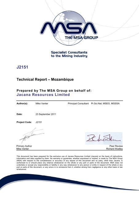
J2151<br />
Technical <strong>Report</strong> – <strong>Mozambique</strong><br />
Prepared by The MSA Group on behalf of:<br />
Jacana <strong>Resources</strong> Limited<br />
Author(s): Mike Venter Principal Consultant Pr.Sci.Nat, MSEG, MGSSA<br />
Date: 23 September 2011<br />
Project Code:<br />
J2151<br />
Primary Author<br />
Mike Venter<br />
____<br />
Peer Review<br />
Richard Wadley<br />
This document has been prepared for the exclusive use of Jacana <strong>Resources</strong> Limited (Jacana) on the basis of instructions,<br />
information and data supplied by them. No warranty or guarantee, whether expressed or implied, is made by The MSA Group<br />
(MSA) with respect to the completeness or accuracy of any aspect of this document and no party, other than Jacana, is<br />
authorised to or should place any reliance whatsoever on the whole or any part or parts of the document. MSA does not<br />
undertake or accept any responsibility or liability in any way whatsoever to any person or entity in respect of the whole or any<br />
part or parts of this document, or any errors in or omissions from it, whether arising from negligence or any other basis in law<br />
whatsoever.
EXECUTIVE SUMMARY<br />
Jacana <strong>Resources</strong> (Jacana) currently has an agreement with African Eagle <strong>Resources</strong> (AFE)<br />
to acquire two existing AFE Prospecting Licences covering two separate projects within<br />
<strong>Mozambique</strong>, both of which have been previously identified as having uranium potential.<br />
Jacana has also entered into an earn-in option agreement with North River <strong>Resources</strong> (NRR)<br />
for a single Prospecting Licence covering the old Mavuzi uranium mine in <strong>Mozambique</strong>. This<br />
report will therefore focus on the relevant Prospecting Licences that make up these three<br />
projects, viz. Mavuzi, Sena and Balama. Jacana and MSA personnel completed site visits to<br />
all of the projects following site visits in 2010 and 2011.<br />
The Mavuzi Project consists of a single Prospecting Licence granted to Omegacorp Lda and<br />
covers an area of 208km 2 . The project area is located to the north of the Zambezi River and<br />
approximately 40km northwest of the regional administrative town of Tete. The area is<br />
primarily underlain by the Upper Proterozoic-aged Tete Igneous Complex: gabbros,<br />
anorthosites and later stage dolerite dykes belonging to the Tete Complex outcrop throughout<br />
the central and northern parts of the project area. The project has had a long history of<br />
uranium development and mining, although records detailing these activities are sketchy.<br />
Jacana <strong>Resources</strong> – Technical <strong>Report</strong> - <strong>Mozambique</strong>– September 2011<br />
Page: i
Since acquiring the Licence in 2005, Omegacorp has completed a detailed exploration<br />
programme that has entailed detailed geological mapping, ground radiometric surveying,<br />
geochemical sampling, airborne geophysics and RC drilling. Despite this detail of exploration<br />
data it is apparent that significant residual potential exists at Mavuzi for the potential discovery<br />
of additional davidite mineralisation at the Inhabatoui and Castro prospects, along with<br />
untested Mo, as well as base metal (Ni-Cu and PGE) potential.<br />
The Sena Project comprises a single Prospecting Licence totalling an area of 229.8.1km 2 and<br />
is located in the lower Zambezi River Valley of Central <strong>Mozambique</strong>, with the regional centre<br />
of Tete located approximately 120km to the north west. The project area is underlain by<br />
Cretaceous Sena Formation fluvial, channelised sandstone units; and their proximity to<br />
underlying acid volcanics and sediments (which have elevated Th, U and K signatures) make<br />
these sediments an attractive exploration target. Despite this attractive geological setting - i.e.<br />
appropriate host rocks and source rocks for uranium mineralisation - uranium anomalies<br />
defined to date through airborne and ground radon cup methods have been inconclusive, and<br />
further work is required to resolve this.<br />
The Balama Project comprises of a single Prospecting Licence totalling an area of 106.4km 2<br />
located between the small towns of Balama and Montepuez in the Cabo Delgado Province in a<br />
remote part of northern <strong>Mozambique</strong>, and approximately 120km west of Pemba. Little work<br />
has been completed over Balama to date; however a well-defined uranium radiometric<br />
anomaly has been confirmed as being related to a graphite-rich schistose unit with a strike of<br />
at least 4km. It is believed that uranium has effectively mapped out exposed graphite-rich<br />
material, and that the Balama project represents more of a graphite opportunity than purely a<br />
uranium one. Further work is required to test the graphite potential of the Balama project.<br />
Jacana’s portfolio of projects in <strong>Mozambique</strong> represents a selection of grass roots graphite,<br />
uranium and base metal-focused exploration projects that have very little/no work completed<br />
on them, apart from the abandoned Mavuzi uranium mine, where there are extensive historical<br />
workings. In each case, proof of the exploration concept has been shown, through validating<br />
airborne anomalies as well as geological settings appropriate for the relevant mineralisation<br />
model. Apart from detailed work completed by Omegacorp over Mavuzi (including airborne<br />
and ground geophysics, stream sediment sampling, rock chip sampling and RC drilling), only<br />
minor validation work has been completed by Jacana personnel over these projects. The Sena<br />
and Balama project areas are considered as “early stage” or “grass roots” exploration projects<br />
and therefore carry inherent risk. However MSA is of the opinion that the projects have<br />
sufficient geological merit to warrant additional focused and results-driven work in order to<br />
delineate potential economic graphite, uranium and base metal resources.<br />
Jacana <strong>Resources</strong> – Technical <strong>Report</strong> - <strong>Mozambique</strong>– September 2011<br />
Page: ii
Table of Contents<br />
EXECUTIVE SUMMARY ............................................................................................................. I<br />
1 INTRODUCTION ............................................................................................................... 3<br />
1.1 Competent Person.................................................................................................... 4<br />
2 OVERVIEW OF THE MOZAMBICAN MINING CODE ....................................................... 4<br />
3 TENURE ........................................................................................................................... 8<br />
4 GEOLOGY AND MINERALISATION .............................................................................. 10<br />
4.1 Regional Economic Geology .................................................................................. 10<br />
5 THE MAVUZI PROJECT ................................................................................................. 13<br />
5.1 Location and tenure status ..................................................................................... 13<br />
5.2 Project Geology ...................................................................................................... 14<br />
5.2.1 The Tete Complex ...................................................................................... 14<br />
5.3 Mineralisation and Exploration model ..................................................................... 16<br />
5.3.1 Uranium ...................................................................................................... 16<br />
5.4 Historical and recent exploration............................................................................. 19<br />
5.4.1 Discovery and development of Mavuzi uranium mine ................................. 19<br />
5.4.2 Exploration completed by Omegacorp (2006 - 2008) .................................. 19<br />
5.4.2.2 Drilling......................................................................................................... 20<br />
5.4.2.3 Phase 2 Geological mapping and radiometric surveying ........................... 24<br />
5.4.2.4 Stream Sediment Sampling........................................................................ 24<br />
5.4.2.5 Airborne Geophysics .................................................................................. 25<br />
5.4.2.6 Soil Sampling ............................................................................................. 25<br />
5.4.2.7 Work completed by NRR and Jacana ........................................................ 26<br />
5.5 Conclusions and Recommendations ...................................................................... 26<br />
6 THE SENA PROJECT..................................................................................................... 28<br />
6.1 Location and mineral tenure status ......................................................................... 28<br />
6.2 Project Geology ...................................................................................................... 28<br />
6.3 Mineralisation and Exploration Model ..................................................................... 29<br />
6.4 Historical and recent exploration............................................................................. 30<br />
6.4.1 Work completed by Jacana ......................................................................... 32<br />
6.5 Conclusions and recommendations ........................................................................ 32<br />
7 THE BALAMA PROJECT ............................................................................................... 33<br />
7.1 Location and mineral tenure status ......................................................................... 33<br />
7.2 Project Geology ...................................................................................................... 33<br />
7.3 Mineralisation and Exploration Model ..................................................................... 34<br />
7.4 Historical and recent exploration............................................................................. 35<br />
7.5 Conclusions and Recommendations ...................................................................... 36<br />
8 CONCLUSIONS .............................................................................................................. 36<br />
Jacana <strong>Resources</strong> – Technical <strong>Report</strong> - <strong>Mozambique</strong>– September 2011 Page: 1
9 REFERENCES ................................................................................................................ 37<br />
List of Tables<br />
Table 3-1 Jacana <strong>Resources</strong> Mineral Assets 8<br />
List of Figures<br />
Figure 1-1 Location of Prospecting Licences 3<br />
Figure 4-1 Simplifiied Geology of <strong>Mozambique</strong> 10<br />
Figure 5-1 Location of Mavuzi Project 13<br />
Figure 5-2 Partial geology of Mavuzi Project 15<br />
Figure 5-3 Structural setting of Mavuzi Project 17<br />
Figure 5-4 Examples of Mavuzi mine workings and mineralisation 18<br />
Figure 5-5 RC Drilling at Mavuzi 21<br />
Figure 5-6 RC Drillhole MVT 032A 22<br />
Figure 5-7 Summary drilling plans Mavuzi 23<br />
Figure 5-8 Anomalous Ni-Cu geochemistry 24<br />
Figure 5-9 U and Th channel radiometrics 25<br />
Figure 5-10 PGE soil grid 26<br />
Figure 6-1 Location of Sena Project 28<br />
Figure 6-2 Geology of Sena Project 29<br />
Figure 6-3 U and Th channel radiometrics over Sena 31<br />
Figure 6-4 Radon Cup survey results 32<br />
Figure 7-1 Location of Balama Project 33<br />
Figure 7-2 Airborne U anomaly over Balama 34<br />
Figure 7-3 Example of coarse grained flake graphite 35<br />
Jacana <strong>Resources</strong> – Technical <strong>Report</strong> - <strong>Mozambique</strong>– September 2011 Page: 2
1 INTRODUCTION<br />
Mr Paul Kehoe, Managing Director of Jacana <strong>Resources</strong> (Jacana) has requested The<br />
MSA Group (MSA) to provide a Technical <strong>Report</strong> covering several Prospecting<br />
Licences in which Jacana has, or is earning, an interest.<br />
Jacana currently has an agreement with African Eagle <strong>Resources</strong> (AFE) to acquire two<br />
existing AFE Prospecting Licences covering two separate project areas within<br />
<strong>Mozambique</strong>, both of which have been previously identified as having uranium<br />
potential. Jacana has also entered into an earn-in option agreement with North River<br />
<strong>Resources</strong> (NRR) for a single Prospecting Licence covering the old Mavuzi uranium<br />
mine in <strong>Mozambique</strong>. This report will therefore focus on the relevant Prospecting<br />
Licences covering these three projects, viz. Mavuzi, Sena and Balama (Figure 1-1).<br />
Figure 1-1<br />
Location of Prospecting Licenses<br />
Although the original scope of the work was to provide an <strong>Independent</strong> Geologists’<br />
<strong>Report</strong> (IGR) for Jacana (in order to complete a proposed IPO on the ASX), the scope<br />
was subsequently changed by Jacana for MSA to provide a Technical <strong>Report</strong>. Upon<br />
request and instruction from Jacana, information relating to Mozambican geography,<br />
economy, infrastructure, political status, climate and topography have been omitted<br />
from this report. A short summary of the Mozambican Mining Act is provided. It must be<br />
Jacana <strong>Resources</strong> – Technical <strong>Report</strong> - <strong>Mozambique</strong>– September 2011 Page: 3
noted that the legal status and tenure of the various Prospecting Licences under review<br />
have not been reviewed by MSA; this is subject to an <strong>Independent</strong> Solicitor’s review.<br />
Mike Venter, Principal Consultant at MSA visited the Mavuzi Project during June 2011.<br />
1.1 Competent Person<br />
This report has been compiled by Mike Venter, who is a professional geologist with 18<br />
years’ experience in the exploration and evaluation of mineral properties within Africa.<br />
Mike Venter is a Principal Consultant with The MSA Group and a Member of the<br />
Geological Society of South Africa (GSSA), Society of Economic Geologists (SEG) and<br />
South African Council for Natural Scientific Professionals (SACNASP). Mike Venter<br />
has the appropriate relevant qualifications, experience, competence and independence<br />
to be considered a Competent Person under the definitions provided in the <strong>Report</strong>ing<br />
Code.<br />
2 OVERVIEW OF THE MOZAMBICAN MINING CODE<br />
Mining in <strong>Mozambique</strong> is governed by the Ministry of Mineral <strong>Resources</strong> and Energy.<br />
There are currently four essential pieces of legislation in force with respect to mining:<br />
<br />
<br />
Law no. 14/2002 (“Mining Law”) and Decree no. 62/2006, together with its<br />
appendixes, approving the “Mining Law Regulations”, which in turn regulate the<br />
rights of investors and the requirements and formalities related to mining,<br />
Law no. 11/2007 and Law no. 13/2007, which have changed some important<br />
aspects of tax legislation and mining sector tax incentives.<br />
Article 4 of law 14/2002 refers to the ownership of mineral resources and states that<br />
“Mineral resources found in the soil or in the subsoil, in territorial waters or on the<br />
seabed within territorial waters, in the exclusive economic zone or on the continental<br />
platform of the Republic of <strong>Mozambique</strong>, are the property of the State under the terms<br />
of the Constitution”.<br />
Mining titles and permits are granted on a first–come, first-served basis taking into<br />
account the date of receipt of the respective application by the relevant authority, in<br />
accordance with the applicable regulations. The right for reconnaissance, prospecting,<br />
and exploration and exploitation of mineral resources is granted through one of the<br />
following mining titles and permits: reconnaissance licence; exploration licence; mining<br />
concession; mining certificate; and/or mining pass.<br />
A Reconnaissance Licence can be granted to any individual(s) or legal person(s) of<br />
Mozambican or foreign origin. A reconnaissance licence cannot be issued for areas<br />
considered by law to be excluded from mining activity unless, in exceptional cases, it is<br />
deemed to be of national economic interest. The reconnaissance licence is valid for a<br />
Jacana <strong>Resources</strong> – Technical <strong>Report</strong> - <strong>Mozambique</strong>– September 2011 Page: 4
maximum of two years and is non-renewable. The licence is also non-transferrable.<br />
Should a mining title or permit be granted to an area under a reconnaissance licence,<br />
the reconnaissance licence falls away.<br />
Subject to prior notice of at least 90 days addressed to the minister in charge of mining,<br />
the licence holder may relinquish the reconnaissance licence during the validity period.<br />
The area for which the reconnaissance licence can be granted cannot exceed 100 000<br />
hectares.<br />
An Exploration Licence can be granted to any individual(s) or legal person(s) of<br />
Mozambican or foreign origin. Applications for an exploration licence should be<br />
addressed to the Minister and submitted by the applicant to the National Directorate of<br />
Mines or the Provincial Directorate of Mineral <strong>Resources</strong> with jurisdiction over the area<br />
requested for registration and processing purposes. The decision to accept or reject<br />
the application for an exploration licence shall be taken by the Minister and notified to<br />
the concerned party within a maximum period of fifteen days following the decision.<br />
An exploration licence cannot be granted for areas considered by law to be excluded<br />
from mining activities or for areas subject to other mining titles or permits. When an<br />
area is or becomes excluded from mining activity by law, it ceases to be subject to any<br />
exploration licence. An exploration licence is valid for five years, renewable for a further<br />
five years. The licence holder may request an extension of the licence within a<br />
minimum of sixty days in advance from the date of its completion. The licence holder<br />
may apply for an expansion or reduction of the licence area during the licence period.<br />
The licence is transferable under the provisions of applicable legislation. In the event of<br />
overlapping requests for the same area, the exploration licence is awarded via public<br />
tender.<br />
Subject to prior notice of at least 90 days addressed to the minister in charge of mining,<br />
the license holder may relinquish the reconnaissance licence during the validity period.<br />
The area for which the exploration licence can be granted cannot exceed<br />
25 000 hectares. The limits of an exploration area consist of vertical plans extending to<br />
underneath the points of surface demarcation. Demarcation with concrete markers is<br />
obligatory and requires the title holder to place landmarks, defined by geographic<br />
coordinates, on the land.<br />
A Mining Concession may only be granted to legal persons registered in <strong>Mozambique</strong>.<br />
This means that an investor who wishes to acquire a mining concession is obliged to<br />
establish and register a company in the Republic of <strong>Mozambique</strong>. Applications for a<br />
mining concession should be addressed to the minister in charge of mining and<br />
submitted to the National Mining Department or the Provincial Department with<br />
jurisdiction over the intended area for registration and processing.<br />
Jacana <strong>Resources</strong> – Technical <strong>Report</strong> - <strong>Mozambique</strong>– September 2011 Page: 5
The requested mining concession will be granted immediately when the application<br />
follows as a result of an exploration licence and the respective holder has fulfilled his<br />
obligations in terms of that licence. The mining concession shall be granted for a period<br />
that is based on the economic lifespan of the mine or the mining operations, but may<br />
not exceed 25 years, and is subject to renewal for a further period of up to 25 years.<br />
The application for extension of a mining concession must be submitted not less than<br />
twelve months prior to the date of its termination. The concession holder may apply for<br />
an expansion or reduction of the concession area during the licence period. The<br />
intended area may not exceed the area necessary for mining operations.<br />
The holder of the mining concession may not begin its activities before obtaining an<br />
environmental licence and a land usage and benefit permit; these must be obtained<br />
within three years of the date of issue of the mining concession.<br />
The mining concession grants the holder the right to use and occupy the land and, on<br />
an exclusive basis, to exploit the mineral resources identified in the exploration phase<br />
and undertake the necessary works; and to sell or otherwise dispose of the mineral<br />
products resulting from mining operations. The holder of the mining concession is also<br />
entitled to request and be granted the title of usage and benefit of the land in<br />
accordance with applicable land law legislation. The mining concession holder must<br />
commence the development of the mine within twenty-four months from the date that<br />
the last licence or permit was issued and must commence mineral production no later<br />
than thirty six months after the date on which the last licence or permit was issued.<br />
This title is transferable under the same terms as the exploration licence. Subject to<br />
prior notice of at least 180 days addressed to the minister in charge of mining, the<br />
concession holder may abandon part or all of the mining concession area during the<br />
validity period. Abandonment of any area under the mining concession does not<br />
exonerate the title holder from paying any tax, fee, fine or compensation due until the<br />
date of abandonment, or of fulfilling any obligations regarding environmental issues, or<br />
of fulfilling any obligation required by law or mining contract, until the date the<br />
abandonment is effective.<br />
A Mining Certificate may be granted to any individual or legal person domiciled in<br />
<strong>Mozambique</strong>, including both Mozambican nationals and foreigners having legal<br />
capacity, as well as any cooperative or family capable of undertaking operations<br />
authorised under this mining title. The mining certificate cannot be granted for any area<br />
excluded by law from mining activity or for any designated area for a Mining Pass (see<br />
below) or for any area under exploration licence or mining concession. The Mining<br />
Certificate is granted for a maximum period of 2 years, extendable for successive<br />
periods of no more than two years, provided that the mining operation underway<br />
justifies this and the area does not exceed 500 hectares. The title holder may request<br />
extension of the mining certificate within sixty days from the date of its completion.<br />
Jacana <strong>Resources</strong> – Technical <strong>Report</strong> - <strong>Mozambique</strong>– September 2011 Page: 6
Applications for an expansion of the area may be made during the certificate period.<br />
Any title holder may not hold more than four titles from adjoining areas.<br />
Small-scale mining operations are described as those that: do not exceed an annual<br />
extraction of 60 000 cubic metres from mainly alluvial deposits; or an annual extraction<br />
of 20 000 cubic metres from non-alluvial deposits using open cast methods; or an<br />
annual extraction of 10 000 cubic metres in the case of extraction in ruins and waste<br />
material and surface production; do not carry out underground works of more than 20<br />
metres deep or in galleries more than 10 metres long; and do not make intensive and<br />
regular use of toxic chemicals or any other reagent.<br />
The mining certificate application must be addressed to the National Mining<br />
Department for registration and processing or to the respective Provincial Department<br />
responsible for the intended area, according to each particular case and is transferable<br />
under the law.<br />
The mining certificate grants the respective holder the right to occupy, use the land,<br />
and undertake a small scale mining operation within the certificate area, on an<br />
exclusive basis; to sell or otherwise dispose of the products resulting from mining<br />
operations; and to apply for a mining concession. The National Directorate of Mines<br />
may, within the period of validity of the mining certificate, demand the activity of its titleholder<br />
to be subject to acquiring a mining concession if the exercise of the activity<br />
exceeds the limits established in the regulations. Subject to prior notice of at least 90<br />
days addressed to the minister in charge of mining, the certificate holder may abandon<br />
part or all of the mining certificate area during the validity period. This does not release<br />
the certificate holder from any obligations applicable.<br />
A Mining Pass can only be granted to individual persons of Mozambican nationality<br />
with legal capacity, enabling them to undertake the operations permitted by this title. A<br />
specified area of land may be declared designated area for a mining pass. A<br />
designated area for mining-pass may be declared wherever appropriate for the use of<br />
unsophisticated exploration, extraction and processing methods and takes into account<br />
the nature and characteristics of the area.<br />
The mining pass permits the holder to undertake small-scale (i.e. artisanal) mining<br />
activities. Small-scale mining operations are described as those that present the<br />
following characteristics: a rudimentary nature of the activity, using simple tools and<br />
equipment; a small volume and scale of mining operations; manual methods for<br />
processing and transportation; and operations that are carried out in mining pass<br />
designated areas. The mining pass is non-transferable. It is granted for a term of<br />
twelve months and may be renewed for the same period.<br />
Jacana <strong>Resources</strong> – Technical <strong>Report</strong> - <strong>Mozambique</strong>– September 2011 Page: 7
The mining pass allows its holder the right to carry out, on a non-exclusivity basis, in<br />
the respective designated area, any small-scale mining operations of any mineral<br />
resource as established in the pass; to store, transport and sell the mineral resources<br />
extracted; and to dispose of the waste safely. The holder of the mining pass shall only<br />
sell his production to title -holders of a commercialisation licence.<br />
The extension of a mining pass can occur at the request of the title-holder and is<br />
subject to the fulfilment of the terms and conditions established in it relative to the<br />
previous period; and the endorsement of the extension of mining pass is on condition<br />
of the payment of the respective tax.<br />
3 TENURE<br />
A summary of Jacana’s mineral assets is shown in Table 3-1 and in Figure 1-1. Each<br />
tenement comprises a Prospecting Licence granted for the following commodities:<br />
• Balama - PL3230L: Pb, Zn, Ag, Au, U and graphite and granted to Twigg<br />
Exploration e Mining Lda, a wholly-owned subsidiary of African Eagle plc.<br />
• Sena – PL3456L: Cu, Ti, U and Zn and granted to Twigg Exploration e Mining<br />
Lda, a wholly-owned subsidiary of African Eagle plc.<br />
• Mavuzi – PL890L: Bi, Cu, W, Zn, Ag, Au, PGE, Ti, Ni, U and REE and granted<br />
to Omegacorp Mineral Lda. Note that NRR is in the process of transferring this<br />
licence into the name of a local operating NRR subsidiary.<br />
Table 3-1<br />
Jacana <strong>Resources</strong> Mineral Assets<br />
Project Name<br />
Licence<br />
Number<br />
Company<br />
Date of<br />
Application<br />
Date of<br />
issue of<br />
Licence<br />
Date of<br />
Expiry<br />
Original<br />
Area<br />
Area<br />
Mavuzi 890L Omegacorp Mineral Lda** 06-May-05 05-May-15 208<br />
Sena 3456L Twigg Exploration e Mining Lda* 27-Oct-09 26-Oct-14 229.8<br />
Balama 3230L Twigg Exploration e Mining Lda* 20-Jul-10 19-Jul-15 106.4<br />
* fully ow ned subsidiaries of African Eagle <strong>Resources</strong> plc<br />
** Under transfer to NRR<br />
Jacana <strong>Resources</strong> – Technical <strong>Report</strong> - <strong>Mozambique</strong>– September 2011 Page: 8
It must be noted that the legal status and tenure of the various Prospecting Licences<br />
and transfers under review have not been verified by MSA. This is subject to an<br />
<strong>Independent</strong> Solicitor’s review.<br />
Jacana <strong>Resources</strong> – Technical <strong>Report</strong> - <strong>Mozambique</strong>– September 2011 Page: 9
4 GEOLOGY AND MINERALISATION<br />
4.1 Regional Economic Geology<br />
Almost two thirds of <strong>Mozambique</strong> is covered by Precambrian rocks (Archaean to<br />
Neoproterozoic) which occur mostly in the north and northwest of the country.<br />
Phanerozoic terrains comprise the remaining one third of the rocks and generally occur<br />
south of the Zambezi valley and along the coastal belt in the northeast (Figure 4-1).<br />
Figure 4-1<br />
Simplified Geology of <strong>Mozambique</strong> (after Lachelt, 2004)<br />
Jacana <strong>Resources</strong> – Technical <strong>Report</strong> - <strong>Mozambique</strong>– September 2011 Page: 10
The Precambrian terranes include igneous and metamorphic rocks of Archaean to<br />
Upper Proterozoic age. The Phanerozoic terranes comprise sedimentary basins and<br />
related volcanic rocks of the Karoo, Jurassic, Cretaceous, Tertiary and Quaternary<br />
ages.<br />
The Archaean terrane, comprising the eastern and northeastern part of the Zimbabwe<br />
Craton, crops out in a zone a few tens of kilometres wide and about three hundred<br />
kilometres long, along the boundary of <strong>Mozambique</strong> with Zimbabwe. The rocks are<br />
predominantly gneissic. In addition, extensions of the Archaean Odzi-Mutare-Manica<br />
Greenstone Belt (around Manica) and the Cronley-Munhinga Greenstone Belt (50 km<br />
south of Manica) are present. Palaeoproterozoic crustal rocks of the Rushinga and<br />
Gairezi Groups have been thrust or deposited on top of the craton margin in dominantly<br />
west-vergent tectonic- or lithostratigraphic units (Pekkala et al., 2008). Economic gold<br />
mineralisation is known from the Archaean and/or Palaeoproterozoic; other Archaean<br />
mineralisation includes asbestos (some economical), copper (economic), banded iron<br />
formation (magnetite and limonite) (no economic deposits reported), and nickel and<br />
cobalt (academic interest) (Lächelt, 2004).<br />
The Mesoproterozoic Irumide and <strong>Mozambique</strong> Mobile Belts dominate the geology in<br />
northern <strong>Mozambique</strong>. The Irumide Belt, comprising reworked Archaean and<br />
Palaeoproterozoic rocks (greenstones and granites), occurs along the eastern edge of<br />
the Zimbabwe craton. The Irumide orogeny peaked at around 1 350 Ma. Iron (iron<br />
quartzites) is important in the Irumide Belt. Rare copper mineralisation has been<br />
reported from quartzites (Henry & Wilson, 2006; Lächelt, 2004).<br />
The <strong>Mozambique</strong> Belt developed between approximately 1 100 and 850 Ma and<br />
underlies much of the northeastern part of <strong>Mozambique</strong>. The belt is divided into the<br />
<strong>Mozambique</strong>, Niassa and Central Zambezi provinces which are characterised by<br />
different rock assemblages. The <strong>Mozambique</strong> province is characterised by granulites<br />
and charnockites in the northwest and quartzitic marbles, schists, gneisses, migmatite,<br />
granitic and charnockitic complexes in the northeast. Quartzites, mica schists and<br />
marbles intruded by orthogneisses, syenites, gabbros and anorthosites characterise<br />
the Niassa province, in the Lake Malawi area. Schists, quartzites, migmatites and<br />
gneisses are characteristic of the Zambezi Province, which occurs to the east of the<br />
Irumide Belt and the Zambezi graben (Henry & Wilson, 2006).<br />
Mineralization of the <strong>Mozambique</strong> belt includes copper, iron, titanium (ultrabasic rocks<br />
– gabbro-anorthosite Tete Suite); iron-copper-gold (quartz and quartz sulphide veins);<br />
magnetite and apatite (carbonatites); manganese (metasediments – Tete Province);<br />
and graphite and asbestos (Lächelt, 2004).<br />
In the Neoproterozoic, the Pan-African tectonothermal event overprinted all older rocks,<br />
with the orogeny peaking at about 550 Ma. The Neoproterozoic is characterised by<br />
Jacana <strong>Resources</strong> – Technical <strong>Report</strong> - <strong>Mozambique</strong>– September 2011 Page: 11
granitic and pegmatitic intrusions. Neoproterozoic rocks are preserved southwest of<br />
Lake Malawi, in the Zambezi Graben, which trends into northern Zimbabwe. In the<br />
northwest of <strong>Mozambique</strong>, glaciogenic sediments of the Katanguiana Group can be<br />
correlated with similar rocks in the Katangan of the Central African Copperbelt (Henry<br />
& Wilson, 2006).<br />
Neoproterozoic mineralization includes well-known pegmatite mineralisation including<br />
rare metals (niobium-tantalum), beryllium, lithium minerals, and gemstones (Alto<br />
Ligonha); unzoned rare earth pegmatites (Alto Ligonha); tin pegmatites (Inchope-<br />
Doeroi); K-feldspar (amazonite) tourmaline pegmatites (Monapo-Nacala); and berylbearing<br />
pegmatites (Tete, Cabo Delgado, Niassa and Nampula Provinces). Other<br />
known mineralisation includes copper, iron and gold (Lächelt, 2004).<br />
The Carboniferous marked the onset of rifting in <strong>Mozambique</strong>, associated with<br />
sedimentation and widespread igneous activity. The Phanerozoic (Permo-<br />
Carboniferous to Lower Jurassic) sedimentary and volcanic rocks of the Karoo<br />
Supergroup were deposited in three intracratonic basins: Alto Zambezi; Rio Lumba;<br />
and Rio Lugenda. The Karoo is largely known for coal, radioactive mineral(s), and gas<br />
deposits. Rare earths, fluorite and apatite have been reported from Cretaceous and<br />
younger intrusives; kimberlites have been report from the Maniamba Graben (Henry &<br />
Wilson, 2006; Lächelt, 2004).<br />
Mid-Cenozoic sediments (continental and marine) occur in the coastal basins. Thick<br />
Plio-Quartenary cover overlies many of the older terrains. Weathering deposits and/or<br />
placer deposits are known from these sediments. Deposits formed as a result of<br />
weathering include bauxite, Al-laterites; kaolin, and bentonite. Placer deposits include<br />
heavy mineral sands, and gold. Peat, kieselguhr and guano deposits also occur<br />
(Lächelt, 2004).<br />
Jacana <strong>Resources</strong> – Technical <strong>Report</strong> - <strong>Mozambique</strong>– September 2011 Page: 12
5 THE MAVUZI PROJECT<br />
5.1 Location and tenure status<br />
The Mavuzi Project consists of a single Prospecting Licence (890L) granted to<br />
Omegacorp Lda and covers an area of 208km 2 . The project area is located to the north<br />
of the Zambezi River and approximately 40km northwest of the regional administrative<br />
town of Tete. Access is good, with the main Tete – Zambia road passing through the<br />
north eastern part of the project. The project area is hilly with the main parts of the<br />
project area being dissected by the Mavuzi River, which flows to the southwest to its<br />
confluence with the Zambezi River (Figure 5-1). The Cabora Bassa dam and<br />
hydroelectric scheme is located 95km to the west.<br />
Figure 5-1<br />
Location of the Mavuzi Project<br />
Topography of the Project area varies from narrow valley floors dominated by the<br />
Mavuzi River to rugged hilly tracts of land and undulating stony and wooded country.<br />
Topographic relief in the area is not extreme, however localised erosion (possibly due<br />
to uplift) has developed steep incised valleys and hilly landforms.<br />
The Mavuzi Project was visited by Mike Venter in June 2011.<br />
Jacana <strong>Resources</strong> – Technical <strong>Report</strong> - <strong>Mozambique</strong>– September 2011 Page: 13
5.2 Project Geology<br />
The Mavuzi Project is primarily underlain by the Upper Proterozoic-aged Tete Igneous<br />
Complex. Gabbros, anorthosites and later stage dolerite dykes belonging to the Tete<br />
Complex outcrop throughout the central and northern parts of the project area. Within<br />
the licence area, the Tete Complex appears to be tectonically emplaced upon<br />
carbonates of the Mid Proterozoic Chídué Formation. The Chídué Formation rests on<br />
Meso-Proterozoic basement gneisses called the Chacocoma Gneiss which are made<br />
up of felsic gneisses, minor felsic schists and amphibolites.<br />
Parts of the Tete Complex contain a wide variety of rock types other than those of<br />
basic igneous origin and the Mavusi River valley provides an excellent example of this<br />
variation. Here syenites, granites, pegmatites, quartz veins and carbonate and calc<br />
silicate rocks of various types are widespread. Several late stage fault/shear zones and<br />
related alteration within gabbros and anorthosites of the Tete Complex have resulted in<br />
narrow, but relatively well defined zones of brecciation and shearing that host the<br />
primary uranium mineralisation at Mavuzi. The following partial geological map shows<br />
the primary uranium targets relative to the underlying geology (Figure 5-2).<br />
5.2.1 The Tete Complex<br />
The Tete Complex, which covers a surface area of approximately 6 000km 2 , forms an<br />
elongate, sub-horizontal sheet-like layered intrusive, with an estimated maximum<br />
thickness of 2 – 3km. It is comprised predominantly of gabbro, with subordinate<br />
leucogabbro, norite and anorthosite, and widespread minor ultramafics, mostly<br />
pyroxenite. Despite the Tete Complex intrusion being considerably younger than<br />
similar layered complexes in South Africa (The Bushveld Igneous Complex) and<br />
Zimbabwe (The Great Dyke), its emplacement and associated structure is associated<br />
with the Pan African orogeny. The following igneous and tectonic history of the Tete<br />
Complex has been proposed by Westerhof et. al. (2008):<br />
• At approximately 1.05 Ga, the Tete Suite and associated smaller gabbroanorthosite<br />
bodies were emplaced into the Chidzolomondo Group granites of<br />
the Luia Terrane (approximately coeval with charnockites of the Castanho<br />
Granite).<br />
• This was followed by south to southwesterly tectonic transport of the bulk of the<br />
Tete Suite in the Pan-African, prior to late Pan-African granitoid and associated<br />
pegmatite dyke emplacement.<br />
• Subsequent late Pan-African movement and “docking” of the Pan-African<br />
terranes over the Sanangoè Shear Zone.<br />
Jacana <strong>Resources</strong> – Technical <strong>Report</strong> - <strong>Mozambique</strong>– September 2011 Page: 14
• A phase of uplift and denudation and the formation of the mid-Zambezi rift<br />
followed between approximately 300 and 180 Ma. This involved initial uplift<br />
followed by subsidence, possibly triggering thrusting in the Tete Suite.<br />
• Finally, Cretaceous-age () carbonatite and associated hydrothermal products<br />
(calc-silicate rocks and quartz bodies) were emplaced into the thrust plane<br />
below the Tete Suite footwall.<br />
Figure 5-2<br />
Partial geology of the Mavuzi Project (after Potter, 2006)<br />
Jacana <strong>Resources</strong> – Technical <strong>Report</strong> - <strong>Mozambique</strong>– September 2011 Page: 15
5.3 Mineralisation and Exploration model<br />
5.3.1 Uranium<br />
The Mavuzi Project includes the historical Mavuzi (Mavudzi) and Castro uranium<br />
mines, along with minor workings, pits, adits and trenching over the Mavuzi Airport and<br />
Kaboazi Creek occurrences. Uranium was discovered here in 1948, and mined at<br />
Mavuzi from 1950 until 1973. Mining produced 130t davidite at Mavuzi, with reported<br />
production between 1948 and 1950 of 50t U 3 O 8 . Total production for the period<br />
between 1950 and 1973 is not known. According to Lächelt (2004), 42t of davidite was<br />
produced from Castro, with an estimated reserve (presumed non-compliant) of 468t<br />
davidite calculated. The civil war in <strong>Mozambique</strong> led to the abandonment of the mine in<br />
1973. Evidence of mine houses, sports facilities, workings and existence of an airstrip<br />
are considered indicative of considerable activity during this period.<br />
Davidite (La,Ce,Ca)(Y,U)(Ti,Fe)20O 38 ) is the principal uranium ore recognised to date<br />
in the Mavuzi area and occurs in highly scapolitised and carbonatised host rocks in<br />
association with molybdenite, rutile, sphene and tourmaline. Davidite is a uranium<br />
bearing ilmenite with a nominal concentration of 9% U 3 O 8 . Rutile is observed to occur<br />
through the dolomite while davidite occurs on the quartz-dolomite margins. It occurs as<br />
crystals up to several centimetres in size and is hosted within steeply dipping and<br />
anastomosing lodes and shears (Figure 5-4). At the Mavuzi mine in particular, the<br />
orebodies were accessed via a series of adits and shafts up to 450m long and 25m<br />
deep respectively (Figure 5-4). It is envisaged that lower grade, disseminated davidite<br />
mineralisation forms a halo around these lozenge-shaped high grade lodes. Due to a<br />
lack of historical production records, the depth potential of the Mavuzi mineralisation<br />
has not been established.<br />
The so called Mavuzi Fault represents a north-north-easterly striking fault corridor that<br />
has an extent of 7km x 2km. The fault zone contains shear zone-hosted, vein style<br />
davidite mineralisation that appears to have a cross-cutting relationship to a variety of<br />
Tete Complex rocks including gabbros, anorthosites, calc-silicates and gneisses at<br />
Mavuzi and Castro as well as at other identified occurrences - Kaboazi Creek,<br />
Inhatobui and Mavuzi Airport. The davidite mineralisation occurs as late-stage potassic,<br />
carbonate silica replacements and disseminated uranium-iron oxides. Prominent<br />
clusters of coarse molybdenite (MoS 2 ) located within orangey coarse grained<br />
carbonates occur within the same structures, although not normally associated with the<br />
davidite (Figure 5-4).<br />
Geological mapping, airborne and ground radiometrics completed by Omegacorp have<br />
validated that radiometric anomalies are coincident with and are aligned along several<br />
of the structures that characterise the Mavuzi fault corridor (Figure 5-2). These<br />
lineaments may therefore represent faults and dilational zones/feeder structures for the<br />
Jacana <strong>Resources</strong> – Technical <strong>Report</strong> - <strong>Mozambique</strong>– September 2011 Page: 16
introduction of the uranium mineralisation. The principal mineralised structures appear<br />
to be concentrated near the anorthosite-gabbro contact with a possible preference for<br />
the gabbro as a host.<br />
Figure 5-3<br />
Structural Setting of Mavuzi Uranium Project (after Ruzicka & Brigden, 2005)<br />
Jacana <strong>Resources</strong> – Technical <strong>Report</strong> - <strong>Mozambique</strong>– September 2011 Page: 17
Figure 5-4<br />
Examples of Mavuzi mineralisation and old workings<br />
Davidite mineralisation<br />
Old adit at Mavuzi<br />
Davidite-bearing qtz/carbonate vein<br />
Coarse grained molybdenite<br />
Jacana <strong>Resources</strong> – Technical <strong>Report</strong> - <strong>Mozambique</strong>– September 2011 Page: 18
5.4 Historical and recent exploration<br />
5.4.1 Discovery and development of Mavuzi uranium mine<br />
A summary of the history of the regional exploration in the Mavuzi area is as follows<br />
(from Ruzicka and Brigden, 2005):<br />
• 1940-50s: prospecting for corundum in the Carvalho Corundum Lease area led<br />
to the discovery of uranium mineralisation and a subsequent pegging rush in<br />
1947-1950 at Mavuzi. Prospecting, limited mapping and prospect evaluation<br />
reports were undertaken during this period.<br />
• 1950-70s: district-scale prospecting, trenching, shaft sinking and drilling were<br />
undertaken in the Mavuzi and Mont Muande areas.<br />
• 1947-73: underground mining was undertaken at Mavuzi, Castro and Conti<br />
mines. Mining records, plans and reports are limited. By 1950, 50t of davidite<br />
had been mined at Mavuzi over a documented 500m-strike interval focused on<br />
south adits and main and north shaft extraction points.<br />
• 1950-73: undocumented production, no available reports. Davidite was<br />
apparently flown out by Americans in a very secretive operation (cold war era).<br />
The operation ceased in 1973 due to political unrest and the execution of the<br />
Mavuzi Mine Manager. Empirical observations of underground mining and<br />
camp/ administrative infrastructure at Mavuzi suggest a relatively large<br />
operation during this period. Possibly as much as a 2km strike interval mined<br />
underground between Mavuzi and Mavuzi airstrip from an interconnected series<br />
of adits and shafts.<br />
Historical workings seem to have generally focused on the westerly of two<br />
identified mineralised lodes at Mavuzi. The easterly lode appears to be of much<br />
lower mineralised tenor, and although mentioned in historical reports, has not<br />
been the subject of any serious mining.<br />
5.4.2 Exploration completed by Omegacorp (2006 - 2008)<br />
The Mavuzi Prospecting Licence (890L) formed part of a group of four contiguous<br />
Prospecting Licences granted to Omegacorp in 2005. The evaluation of the Mavuzi<br />
mine and its surrounds became the immediate focus of Omegacorp’s work<br />
programmes between 2005 and 2006, with the following being completed:<br />
Jacana <strong>Resources</strong> – Technical <strong>Report</strong> - <strong>Mozambique</strong>– September 2011 Page: 19
• Data compilation and initial field reconnaissance,<br />
• Mapping and ground radiometrics of Mavuzi Mine, Airport and Kaboazi Creek<br />
prospects (50m x 50m grid),<br />
• RC drilling of Mavuzi Mine, Airport and Kaboazi Creek prospects (47 holes /<br />
3659m),<br />
• Mapping and ground radiometrics: Mavuzi River target area (400m x 50m grid),<br />
• Infill mapping and radiometrics: Castro –Inhatobui area (100m x 50m grid),<br />
• Stream sediment sampling (2406 samples at a 1 per 2km 2 density)<br />
• Heliborne geophysics (200m line spacing)<br />
The urgency for Omegacorp to quickly delineate a uranium resource at Mavuzi was<br />
probably the reason why the RC drilling programme was fast tracked prior to<br />
completion of regional scale geological mapping, radiometric surveying and stream<br />
sediment sampling. Any future and recommended work over the Mavuzi PL during<br />
2009 was curtailed during budget restrictions applied by Omegacorp due to the global<br />
financial crisis of 2008-2009.<br />
5.4.2.1 Phase 1 detailed geological mapping and ground radiometric surveying<br />
Detailed geological grid mapping and ground radiometric surveying (50m x50m) was<br />
completed over the Mavuzi Mine, Mavuzi Airport and Kaboazi Creek prospects,<br />
resulting in the delineation of several well defined sub-parallel radiometric anomalies<br />
that confirmed the presence of the existing prospects but also potential new zones,<br />
some of which were drill tested by Omegacorp in late 2005.<br />
5.4.2.2 Drilling<br />
In December 2005, Reverse Circulation (RC) drilling was initiated over the Mavuzi<br />
Mine, Mavuzi Airport and Kaboazi Creek prospects in order to determine any strike<br />
potential between these prospects as well as to assess whether there was any<br />
significant lower grade or disseminated halo associated with the vein system. The<br />
Castro and Inhatobui prospects were not drill tested (Figure 5-5).<br />
All RC holes were angled at -60° and azimuths perpe ndicular to the strike of the vein<br />
system. Drilling confirmed 1-5m wide single and multiple vein-style davidite-carbonate<br />
calc-silicate-albite alteration along the seven kilometre long Mavuzi to Castro trends.<br />
Jacana <strong>Resources</strong> – Technical <strong>Report</strong> - <strong>Mozambique</strong>– September 2011 Page: 20
Figure 5-5<br />
RC Drilling at Mavuzi, Mavuzi Airport and Kaboazi Creek<br />
Mavuzi Mine<br />
A total of 15 holes were drilled for a total of 1375m covering a strike of 600m. Results<br />
confirmed shallow and depth extension of uranium mineralisation over 450m of the<br />
strike. Multiple zones of anomalism were identified in several of the holes, although<br />
some holes appear to have intercepted old workings, suggesting that higher-grade<br />
material (>1% U 3 O 8 ) may have been extracted historically. Highlights from the Mavuzi<br />
mine drilling were:<br />
o<br />
Drillhole MVT020A: 2 metres @ 0.078% U 3 O 8 from 5 metres<br />
Jacana <strong>Resources</strong> – Technical <strong>Report</strong> - <strong>Mozambique</strong>– September 2011 Page: 21
o<br />
Drillhole MVT024: 3 metres @ 0.046% U 3 O 8 from 27 metres<br />
o Drillhole MVT032A: 4 metres @ 0.400% U 3 O 8 from 30 metres (Figure 5-6)<br />
A detailed drilling plan showing drill traces and intersections can be found in Appendix<br />
1.<br />
Figure 5-6<br />
RC hole MVT032A collar, Mavuzi Prospect<br />
Mavuzi Airport Prospect<br />
A total of 12 RC holes were completed for a total of 637m covering a strike of 400m.<br />
Results confirmed shallow mineralisation along a strike length of 250m.<br />
A drilling plan showing drill traces and intersections can be found in Appendix 1.<br />
Kaboazi Creek<br />
At the Kaboazi Creek prospect a total of 20 holes totalling 1647m were completed<br />
covering about 300m of strike length. Despite the northern part of the target<br />
intersecting no anomalous intercepts, the southern half of the area confirmed shallow<br />
mineralisation. Drilling in this area also identified two separate mineralised zones that<br />
may suggest either a faulted extension of the Kaboazi Creek structure or a new zone of<br />
mineralisation. Highlights from the Kaboazi Creek drilling were:<br />
o<br />
Drillhole MVT016: 4 metres @ 0.039% U3O8 from 1 metre<br />
Jacana <strong>Resources</strong> – Technical <strong>Report</strong> - <strong>Mozambique</strong>– September 2011 Page: 22
o<br />
Drillhole MVT047A: 4 metres @ 0.063% U3O8 from 26 metres – this zone<br />
potential representing a faulted or new zone of mineralisation.<br />
Figure 5-7<br />
Summary drilling plans over Mavuzi Airport, Mavuzi Mine and Kaboazi Creek<br />
Jacana <strong>Resources</strong> – Technical <strong>Report</strong> - <strong>Mozambique</strong>– September 2011 Page: 23
5.4.2.3 Phase 2 Geological mapping and radiometric surveying<br />
This second phase of ground work focused on the areas outside of the main prospects<br />
evaluated during the Phase 1 work and RC drilling completed. Geological mapping and<br />
ground radiometrics on a 400m x 50m grid was completed and was followed by infill<br />
work on a 100m x 50m grid over the Inhatobui-Castro target whose radiometric<br />
anomaly has a strike length of 1.6km and a maximum width of 0.4km. According to<br />
Omegacorp, the threshold for the anomaly was 140cps (counts per second), although<br />
individual radiometric values peak at over 2000cps. Figure 5-2 shows the extent of the<br />
coverage of the mapping and radiometric work.<br />
5.4.2.4 Stream Sediment Sampling<br />
A multi-element detailed (average density 1 sample/2km 2 ) stream sediment survey<br />
totalling 2406 samples was completed over the remainder of the Mavuzi Prospecting<br />
Licence and over Omegacorp’ s PL’s to the immediate south (1054L – Boa Viseau<br />
Prospect) in order to assess additional residual potential of the licence. A brief review<br />
of this data was instrumental in delineating a well-defined Ni-Cu anomaly located in<br />
area just north of the Mavuzi River in the northern parts of the Mavuzi PL (Figure 5-8).<br />
A more thorough analysis of this data is required in order to delineate other potential<br />
coincident anomalies that are certainly worth following up.<br />
Figure 5-8<br />
Anomalous Ni-Cu stream sediment geochemistry<br />
Jacana <strong>Resources</strong> – Technical <strong>Report</strong> - <strong>Mozambique</strong>– September 2011 Page: 24
5.4.2.5 Airborne Geophysics<br />
In 2006 Omegacorp completed a high resolution helicopter borne magnetic and<br />
radiometric survey (line spacing of 200m). The survey was effective in confirming and<br />
extending ground radiometric anomalies, as well as in delineating additional “en<br />
echelon” radiometric anomalies that may represent mineralised splays related to the<br />
Mavuzi “Fault Corridor” (Figure 5-9).<br />
Figure 5-9<br />
U and Th Channel Radiometrics<br />
5.4.2.6 Soil Sampling<br />
In 2008, Omegacorp completed a small soil sampling grid (20m x 100m) over an area<br />
in an attempt to delineate the source of a rock grab sample that returned an anomalous<br />
Pt value (OMG4024 – 1.9 g/t Pt and 546 g/t Cu) from an ironstone related to a coarse<br />
grained pyroxenite. Samples were selected from the “B” Horizon at a depth of<br />
approximately 20-30cm and sieved to -180µm. Samples were sent to ALS Chemex in<br />
Johannesburg, prepared and assayed for the PGE suite as a multiple element suite.<br />
Results were very poor and failed to replicate or delineate any significant PGE<br />
anomaly. Exposures of coarse grained sulphide-bearing pyroxenites were observed by<br />
MSA near an old quarry located approximately 2.5km to the north east of this soil grid,<br />
Jacana <strong>Resources</strong> – Technical <strong>Report</strong> - <strong>Mozambique</strong>– September 2011 Page: 25
and coupled with identified anomalous Ni/Cu stream sediment results (which could be<br />
associated with PGE mineralisation), the potential of the Mavuzi area to host potential<br />
PGE/precious metal horizons is considered encouraging (Figure 5-10).<br />
Figure 5-10<br />
PGE soil grid at Mavuzi<br />
5.4.2.7 Work completed by NRR and Jacana<br />
Apart from validation and site orientation visits by Jacana and MSA, no work has been<br />
completed over the Mavuzi Project since 2008 by NRR.<br />
5.5 Conclusions and Recommendations<br />
The Mavuzi Project has had a long history of development and mining, although<br />
records detailing these activities are sketchy. Since acquiring the Licence in 2005,<br />
Omegacorp has completed a detailed exploration programme that has entailed detailed<br />
geological mapping, ground radiometric surveying, geochemical sampling, airborne<br />
geophysics and RC drilling, focusing on the Mavuzi Fault Corridor. Despite this detail of<br />
exploration data it is apparent that significant residual potential is present at Mavuzi for<br />
the potential discovery of:<br />
Jacana <strong>Resources</strong> – Technical <strong>Report</strong> - <strong>Mozambique</strong>– September 2011 Page: 26
• Additional fault-related davidite mineralisation at Inhatobui and Castro that<br />
remains to be tested, as well as other areas defined by ground and airborne<br />
radiometrics.<br />
• Follow up mapping and sampling to assess the molybdenite potential of Mavuzi<br />
Fault Corridor<br />
• Follow up work to assess the base metal and possible PGE potential over areas<br />
defined by stream sediment geochemistry.<br />
In order to achieve these objectives it is strongly recommended that all of the existing<br />
Omegacorp data is compiled, synthesised with a view to determining whether the<br />
existing prospects at Mavuzi Airport, Mavuzi Mine and Kaboazi Creek have been<br />
sufficiently tested as well as to validate existing geological mapping. It is recommended<br />
that detailed geological mapping is completed, in particular over anomalous areas<br />
defined by the stream sediment sampling located to the north of the Mavuzi River.<br />
Jacana <strong>Resources</strong> – Technical <strong>Report</strong> - <strong>Mozambique</strong>– September 2011 Page: 27
6 THE SENA PROJECT<br />
6.1 Location and mineral tenure status<br />
The Sena Project comprises a single Prospecting Licence totalling an area of<br />
229.8.1km 2 (3456L) (Table 3-1). It is located in the lower Zambezi River Valley of<br />
Central <strong>Mozambique</strong>, with the regional centre of Tete located approximately 120km to<br />
the North West (Figure 6-1). The project area occupies an area of very low relief and is<br />
located immediately south of the Zambezi River and immediately south of the small<br />
settlement of Nachalo located on the southern banks of the Zambezi River.<br />
Figure 6-1<br />
Location of the Sena Project<br />
6.2 Project Geology<br />
The Sena Project is located along the north western parts of the Cretaceous Sena<br />
basin located in the NW-SE trending Lower Zambezi Rift Structure. Ongoing Upper<br />
Jurassic and lower Cretaceous basaltic and rhyolitic volcanism resulted in the<br />
development of the Lupata Group, which is characterised by high radiometric counts<br />
and is represented as an arcuate outcrop to the west and south west of the Sena<br />
project area. The Sena Project itself is underlain by two cycles of medium to high<br />
energy fluvial sandstones and conglomerates of Lower Cretaceous age that overly the<br />
Jacana <strong>Resources</strong> – Technical <strong>Report</strong> - <strong>Mozambique</strong>– September 2011 Page: 28
Lupata Formation and are termed the Sena Sandstone Formation and lower Thorium<br />
Sandstone Member (based on its distinctive radiometric signature) respectively (Figure<br />
6-2). Most of the project area is flat lying and covered by Quaternary sediments and<br />
Mbuga soils.<br />
Figure 6-2<br />
Geology of the Sena Project<br />
6.3 Mineralisation and Exploration Model<br />
There appears to have been little work carried out on assessing the economic potential<br />
of these Cretaceous age sedimentary basins as there are few references in the<br />
literature. In most cases exploration efforts have been focused on the more well-known<br />
and exposed Zambezi Valley Karoo Super group sediments that host world class coal<br />
deposits (in particular around the Tete area) as well as small to medium uranium<br />
deposits such as the ones at Mutanga, Njame (Zambia) and Kanyemba (Zimbabwe).<br />
To date, no significant uranium resources have been identified within Cretaceous age<br />
sediments in Africa, although the late Cretaceous age Wyoming, Colorado Plateau<br />
deposits are well documented.<br />
The presence of overlying Sena Formation fluvial, channelized sandstone units and<br />
their proximity to underlying acid volcanics and sediments (which have an elevated Th,<br />
Jacana <strong>Resources</strong> – Technical <strong>Report</strong> - <strong>Mozambique</strong>– September 2011 Page: 29
U and K signatures) make these sediments an attractive exploration target (Figure 6-3).<br />
Uranium mineralisation is usually contained within medium to coarse grained<br />
sandstone horizons that have been deposited within a continental fluvial or marine<br />
sedimentary environment. Proximal and confining interbedded permeable shale or<br />
mudstone units play an important role in channelising oxidising uranium-bearing<br />
groundwaters that precipitate uranium upon encountering reducing conditions often<br />
provided by carbonaceous or organic matter. Later stage faulting may provide localised<br />
remobilisation and upgrade of uranium tenor.<br />
6.4 Historical and recent exploration<br />
Prior to 2008, no historical exploration work appears to be have been completed over<br />
the Sena project. The south eastern exposures of the Sena Formation were drill-tested<br />
in the 1970s and in 2005 by several oil companies, although the results of these holes<br />
are not known. Following review and reprocessing of regional airborne geophysical<br />
data (Huntings 1981), Twigg Exploration and Mining Lda (Twigg) completed a series of<br />
radon cup surveys aimed at testing airborne anomalies identified by Twigg. The<br />
decision to complete radon cup surveys was based on the better depth penetration of<br />
the method along with the flat terrain and development of quaternary sediments, lags<br />
and localised mbugas that would mask any ground and airborne gamma ray detection<br />
methods.<br />
It is not known what methodology was employed by Twigg in order to delineate<br />
airborne anomalies and cursory inspection of the regional airborne data does not<br />
suggest any uranium anomalism within the Sena Project area (Figure 6-3).<br />
Jacana <strong>Resources</strong> – Technical <strong>Report</strong> - <strong>Mozambique</strong>– September 2011 Page: 30
Figure 6-3<br />
U and Th Channel airborne radiometrics<br />
Radon Cup surveys were completed using an unconventional ‘EPERM” system,<br />
rather than the preferred industry standard of TrackEtch or Radon X methods. Twigg<br />
completed two 200m x 400m grids laid out over uranium anomalies delineated from<br />
Twigg reprocessing. Results of the radon cup survey appear to have validated one of<br />
the airborne anomalies (Figure 6-4); however repeat sampling completed failed to<br />
Jacana <strong>Resources</strong> – Technical <strong>Report</strong> - <strong>Mozambique</strong>– September 2011 Page: 31
epeat these results. The fact that repeat sampling was completed after onset of the<br />
rainy season probably makes these follow up results invalid due to radon fluctuations<br />
following rainfall.<br />
Figure 6-4<br />
Radon Cup Survey results on airborne U anomaly (processed by Twigg)<br />
6.4.1 Work completed by Jacana<br />
Jacana personnel visited the Sena Project in November 2010 while the first phase of<br />
Radon Cup surveying was being completed.<br />
6.5 Conclusions and recommendations<br />
Despite its attractive geological setting i.e. appropriate host rocks and source rocks for<br />
uranium mineralisation, uranium anomalies defined to date through airborne and<br />
ground radon cup methods have been inconclusive. In order to resolve this, it is<br />
recommended that the airborne data be reprocessed in order to repeat and validate the<br />
anomalies generated by Twigg. A review of the EPERM system and the results<br />
generated from the Phase 1 survey need to be carefully reviewed. If necessary a follow<br />
up survey utilising a radon cup (Radon-X or similar) methodology should be completed<br />
prior to drill testing any anomalies (if warranted).<br />
Jacana <strong>Resources</strong> – Technical <strong>Report</strong> - <strong>Mozambique</strong>– September 2011 Page: 32
7 THE BALAMA PROJECT<br />
7.1 Location and mineral tenure status<br />
The Balama Project comprises a single Prospecting Licence totalling an area of<br />
106.4km 2 (3230L) (Table 3-1). Balama is located in the Cabo Delgado province in a<br />
remote part of northern <strong>Mozambique</strong>, located between the small towns of Balama and<br />
Montepuez and approximately 120km west of Pemba. The project area is dominated<br />
by a NE-SW trending series of hills that represent the exploration target at Balama<br />
(Figure 7-1).<br />
Figure 7-1<br />
Location of Balama Project<br />
7.2 Project Geology<br />
The Balama Project is underlain by metamorphic rocks of the Neoproterozoic Luiro<br />
Group, that are included within the Xixano Complex (or more correctly ‘Terrane’).<br />
These are described as consisting of ultra metamorphites of granulite to upper<br />
amphibolite facies. High grade orthogneisses are described to intrude these<br />
paragneisses and have been dated at 735 Ma (Geological Sheet Montepuez). Within<br />
the lower parts of the sequence a number of graphitic gneisses are known, of which the<br />
Balama Project forms part.<br />
Jacana <strong>Resources</strong> – Technical <strong>Report</strong> - <strong>Mozambique</strong>– September 2011 Page: 33
What has attracted attention to the area are very well defined and prominent uranium<br />
anomalies that were generated from regional airborne geophysical programmes<br />
completed in 2006.<br />
Figure 7-2<br />
Uranium anomaly over the Balama Project<br />
7.3 Mineralisation and Exploration Model<br />
Although the combination of uranium anomalism and occurrence of graphitic<br />
gneiss/schists certainly suggests an unconformity style (albeit metamorphosed)<br />
uranium deposit (the type of mineralisation that hosts some of the world’s highest<br />
grade uranium deposits), further work is required to assess the most appropriate model<br />
for uranium mineralisation (if any). The high metamorphic grade of the graphitic<br />
gneisses and schists encountered and lack of overlying sandstone/sedimentary<br />
sequences tend to rule this style of uranium mineralisation out.<br />
Due to its extreme reductive ability, graphitic material is certainly going to act as a local<br />
“sink” for elements such as uranium. This suggests that although there is a significant<br />
uranium anomaly present, it may rather be mapping the extent of outcrop of graphitic<br />
schists in the area and that the uranium background in the area is low relative to that of<br />
the graphitic enriched material – therefore causing a high profile uranium anomaly.<br />
Jacana <strong>Resources</strong> – Technical <strong>Report</strong> - <strong>Mozambique</strong>– September 2011 Page: 34
Based on this observation, the Balama Prospect therefore represents a potential<br />
graphite target that certainly requires additional follow up.<br />
There are several graphite occurrences noted throughout the region, including the<br />
Ancuabe graphite operation (located 140km to the east) where graphite was produced<br />
from 1994 until 2000. Here Graphites de Ancuabe <strong>Ltd</strong>a. operated a sizeable mine and<br />
plant near Ancuabe from 1994 to 1999 that had an extraction capacity of 10,000 tons of<br />
graphite a year. The extraction and processing were stalled in 1999, due to a number<br />
of reasons including financial difficulties (caused by low prices) and erratic power<br />
supply. The entire district has an estimated 35Mt of graphite ore (Cilek, 1989).<br />
7.4 Historical and recent exploration<br />
Apart from the airborne survey and validation work completed by Mr Pete Siegfried<br />
(consultant to Jacana) and Jacana personnel in 2010, no modern exploration methods<br />
have been applied to the Balama Project area (Figure 7-3). Site visits by Siegfried have<br />
identified outcrops of graphite-rich seams interlaminated with graphitic schists with<br />
thickness of up to 1.5m. Limited trenching over the area has shown limited overburden<br />
and scree material.<br />
Figure 7-3<br />
Coarse grained flake graphite at Balama<br />
Jacana <strong>Resources</strong> – Technical <strong>Report</strong> - <strong>Mozambique</strong>– September 2011 Page: 35
A site visit was completed by Jacana personnel in November 2010, during which car<br />
borne and foot traverses (with a handheld spectrometer) were effective in validating the<br />
radiometric anomaly as well as the association of uranium with graphitic schists.<br />
7.5 Conclusions and Recommendations<br />
The well-defined uranium radiometric anomaly delineated over the Balama Project area<br />
has been confirmed as being related to a graphite rich schistose unit with a strike of at<br />
least 2km. It is believed that the uranium has effectively mapped out exposed graphitic<br />
rich material, and that the Balama project represents more of a graphite opportunity<br />
than purely a uranium one. Little work has been completed over Balama to date; further<br />
work is required to test the graphite as well as uranium potential of the Balama project.<br />
It is recommended that a detailed mapping and trenching/sampling programme is<br />
completed over the entire area in order to delineate the quality of graphite being<br />
exposed, as this parameter is critical to the proper development of this project. If the<br />
graphite is of a suitable quality, then it is recommended that a drilling programme is<br />
complete in order to delineate the strike and down dip () extent of the occurrence.<br />
8 CONCLUSIONS<br />
Jacana’s portfolio of projects in <strong>Mozambique</strong> represent a cross section of projects<br />
ranging from grass roots graphite, uranium as well as base metals and PGE -focused<br />
exploration projects that have had extensive/little/no work completed on them.<br />
Following uncompleted work carried out by Omegacorp and Twigg respectively and<br />
validation visits by Jacana, MSA and Siegfried, the projects still present attractive<br />
exploration targets. Based on work carried out to date and on findings detailed in this<br />
report, suggested work programmes have been provided for each of the three projects<br />
In general, the validity of the exploration concept has been demonstrated through<br />
validating airborne anomalies, ground mapping/radiometrics/drilling as well as<br />
geological settings appropriate for the relevant mineralisation models.<br />
The Sena and Balama projects areas are considered as “early stage” or “grass roots”<br />
exploration projects whilst the Mavuzi project presents a more advanced project in<br />
terms of the existing uranium mine development along with grassroots potential<br />
through possible base metal (Ni, Cu and Mo) and PGE potential that has been<br />
identified to date. All of these projects therefore carry inherent risk; however MSA is of<br />
the opinion that most of the projects have sufficient geological merit to warrant<br />
additional focused and results-driven work in order to delineate a potential economic<br />
graphite/base metal/PGE/uranium resource.<br />
Jacana <strong>Resources</strong> – Technical <strong>Report</strong> - <strong>Mozambique</strong>– September 2011 Page: 36
9 REFERENCES<br />
Cilek, V. 1989. Industrial Minerals of <strong>Mozambique</strong>, Ministry of Mineral <strong>Resources</strong>,<br />
National Geological Institute of <strong>Mozambique</strong>, 326pp.<br />
Henry, G & MGC Wilson (eds) 2006: Copper-Cobalt Deposits in the SADC Region.<br />
Council for Geoscience, Pretoria, South Africa.<br />
Investing in <strong>Mozambique</strong>, 2010. ,<br />
accessed April<br />
2011.<br />
Jacana <strong>Resources</strong>, 2011. Various webpages from the company website:<br />
, accessed August 2011.<br />
Lächelt, G., 2004. The Geology and Mineral <strong>Resources</strong> of <strong>Mozambique</strong>. DNG, Maputo,<br />
Moçambique. 515pp.<br />
Lehto, T., and Gonçalves, R., 2004. Mineral resources potential in <strong>Mozambique</strong>. In<br />
Pekkala, Y., Lehto, T., and Mäkitie, H. (Eds.), GTK Consortium Geological Surveys in<br />
Mozzambique 2002-2007, Geological Survey of Finland Special Paper 48, pp. 307-<br />
321..<br />
Mining Africa Yearbook, 2010. , accessed July 2011.<br />
North River <strong>Resources</strong>, 2011. Various webpages from the company website:<br />
, accessed August 2011.<br />
Pekkala, Y., Lehto, T., and Mäkitie, H., 2004. Introduction to GTK projects in<br />
<strong>Mozambique</strong> 2002-2007. In Pekkala, Y., Lehto, T., and Mäkitie, H. (Eds.), GTK<br />
Consortium Geological Surveys in Mozzambique 2002-2007, Geological Survey of<br />
Finland Special Paper 48, pp. 191-210.<br />
Petters, S.W., 1991. Regional Geology of Africa: Lecture Notes in Earth Sciences.<br />
Springer-Verlag, Berlin, Germany, 722pp.<br />
Potter 2006, various in house Omegacorp <strong>Report</strong>s<br />
Ruzicka & Brigden, 2005, The Mavuzi Project, <strong>Mozambique</strong> – Geology of the Mavuzi<br />
Uranium Deposits & Further exploration/resource potential. Internal <strong>Report</strong> for<br />
Omegacorp.<br />
Jacana <strong>Resources</strong> – Technical <strong>Report</strong> - <strong>Mozambique</strong>– September 2011 Page: 37
thedora.com, 2011.<br />
,<br />
accessed April 2011.<br />
Westerhof, A.B.P., Tahon, A., Koistinen, T., Lehto, T., and Åkerman, C., 2008.<br />
Igneous and tectonic setting of allochthonous Tete Gabbro-Anorthosite Suite,<br />
<strong>Mozambique</strong>. In Pekkala, Y., Lehto, T., and Mäkitie, H. (Eds.), GTK Consortium<br />
Geological Surveys in <strong>Mozambique</strong> 2002-2007, Geological Survey of Finland Special<br />
Paper 48, pp. 191-210.<br />
Wikipedia, 2011. Pages accessed include: ,<br />
,<br />
,<br />
,<br />
Yager, T..R., 2009. The Mineral Industry of <strong>Mozambique</strong>. USGS 2009 Minerals<br />
Yearbook – <strong>Mozambique</strong> [Advance Release].<br />
, accessed<br />
April 2011.<br />
Jacana <strong>Resources</strong> – Technical <strong>Report</strong> - <strong>Mozambique</strong>– September 2011 Page: 38
APPENDIX 1:<br />
Appendix Name<br />
Project - <strong>Report</strong> Title – Date. Appendix 1