DANUBEPARKS Joint navigation Strategy
DANUBEPARKS Joint navigation Strategy
DANUBEPARKS Joint navigation Strategy

You also want an ePaper? Increase the reach of your titles
YUMPU automatically turns print PDFs into web optimized ePapers that Google loves.
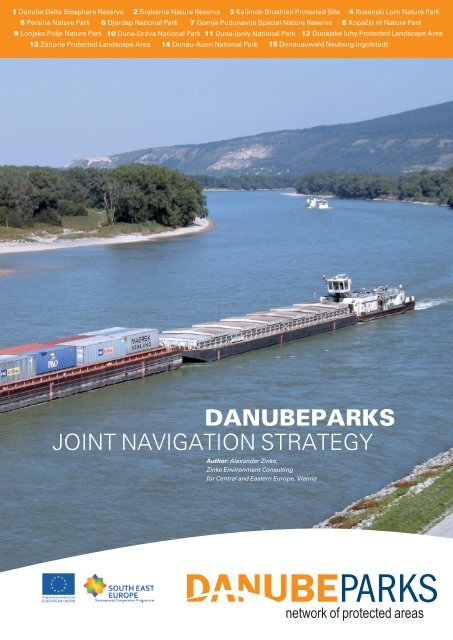
1 Danube Delta Biosphere Reserve 2 Srebarna Nature Reserve 3 Kalimok-Brushlen Protected Site 4 Rusenski Lom Nature Park<br />
5 Persina Nature Park 6 Djerdap National Park 7 Gornje Podunavlje Special Nature Reserve 8 Kopački rit Nature Park<br />
9 Lonjsko Polje Nature Park 10 Duna-Dráva National Park 11 Duna-Ipoly National Park 12 Dunajské luhy Protected Landscape Area<br />
13 Záhorie Protected Landscape Area 14 Donau-Auen National Park 15 Donauauwald Neuburg Ingolstadt<br />
<strong>DANUBEPARKS</strong><br />
<strong>Joint</strong> Navigation <strong>Strategy</strong><br />
Author: Alexander Zinke,<br />
Zinke Environment Consulting<br />
for Central and Eastern Europe, Vienna<br />
network of protected areas
<strong>Strategy</strong> on Conservation and Navigation<br />
Acknowledgements<br />
This document has been prepared under the ETC-SEE Project Danube Parks Work<br />
Package 3 (EU number SEE EoI/A/064/2.3/X), coordinated by the project manager, Mr<br />
Georg Frank – both from the National Park Danube Floodplains in Orth/Austria.<br />
The document has been drafted by Mr Alexander Zinke, Zinke Environment Consulting for<br />
Central and Eastern Europe, Vienna.<br />
Technical advise has kindly been provided by Mr Carl Manzano and Mr Christian<br />
Baumgartner (National Park Danube Floodplains), Mrs Erika Schneider (WWF Institute for<br />
Floodplains Ecology at the Karlsruhe Institute of Technology in Germany), Mr Georg Rast<br />
(WWF Germany) and Mr Helmut Habersack (Institute of Water Management, Hydrology and<br />
Hydraulic Engineering at the University of Natural Resources and Life Sciences, Vienna).<br />
Various comments on the draft document have been provided from experts of the<br />
<strong>DANUBEPARKS</strong> network during and after its ETC-SEE project Task Force meetings and<br />
international workshops in January 2010 (Bratislava/SK), November 2010 (Ingolstadt/DE)<br />
and May 2011 (Orth/AT).<br />
2
<strong>Strategy</strong> on Conservation and Navigation<br />
<strong>DANUBEPARKS</strong> Statement concerning the<br />
<strong>Strategy</strong> on Conservation & Navigation<br />
agreed at the 2 nd Steering Committee of the ETC-SEE Project, 3 rd September 2011, Orth<br />
an der Donau (Austria)<br />
As a consequence of the recent enlargement of the EU, now embracing Danube countries<br />
from the source to the delta, Danube waterway development has come in the focus of the<br />
new EU transport policy (Corridor VII, TEN-T priority project no.18, NAIADES, EU Danube<br />
Region <strong>Strategy</strong>). The removal of so-called fairway “bottlenecks” has been identified as key<br />
issue to improve inland waterway transport along the Danube. In the last years several new<br />
large-scale infrastructure projects are being discussed and prepared for all parts of the<br />
Danube.<br />
Not surprisingly these projects tend to affect the most natural, valuable and sensitive parts of<br />
the Danube river ecosystem, in particular the remaining free flowing river sections. Despite<br />
the severe alterations the Danube has undergone over some 150 years, these parts of the<br />
river and their adjacent floodplains are recognised today as an indispensable part of<br />
Europe’s natural heritage. Most are protected under national law (as national parks, nature<br />
reserves etc.) and are all subject to EU legislation such as the Habitats, Birds and Water<br />
Framework Directives, requiring no further deterioration or restoration of the local ecological<br />
status.<br />
Conflict between Inland Waterway Transport (IWT) development and conservation<br />
requirements has to be resolved and decided ”case by case” for each specific river stretch<br />
and specific project. But every single project is also to be seen and reviewed in a Danube<br />
wide context. To provide this, <strong>DANUBEPARKS</strong> experts supported by external expertise have<br />
developed this<br />
<strong>DANUBEPARKS</strong> <strong>Strategy</strong> on Conservation and Navigation.<br />
This strategy<br />
assesses and communicates the overall situation of Danube waterway development<br />
and nature conservation, providing concrete and tangible information on <strong>navigation</strong><br />
projects and conservation issues with a focus on the <strong>DANUBEPARKS</strong> areas;<br />
defines concrete nature conservation demands and requirements in the context of<br />
current IWT development planning;<br />
aims to strengthen the capacity and commitment of protected area managers in order<br />
to properly fulfil their stakeholder role in the planning and decision-making process of<br />
IWT development projects;<br />
gives guidance to protected area and waterway managers on available tools and<br />
opportunities to integrate conservation and <strong>navigation</strong>;<br />
presents common positions and actions to involve <strong>DANUBEPARKS</strong> as a distinct<br />
interest group and relevant stakeholder in river development.<br />
wants to assist the implementation of the EU Danube Region <strong>Strategy</strong> and illustrate<br />
the position of <strong>DANUBEPARKS</strong> to stakeholders.<br />
There is growing awareness and consensus within <strong>DANUBEPARKS</strong> that river hydrology and<br />
river morphology are probably the most determining and important parameters for the longlasting<br />
development of river and floodplain ecosystems. They are the key factors to reach<br />
and maintain a favourable ecological status and will need much more attention than in the<br />
past.<br />
Carl Manzano, Director of National Park Donauauen (on behalf of the Steering Committee)<br />
3
<strong>Strategy</strong> on Conservation and Navigation<br />
Table of contents<br />
1. Assessment of the river situation 5<br />
1.1. Overlapping interests along the Danube 6<br />
1.2. Current status of IWT development along the Danube 10<br />
1.3. Current status of protected areas along the Danube 13<br />
1.4. Other user interests connected with the exploitation of rivers 17<br />
2. Development needs of the altered Danube river 17<br />
3. Opportunities and available tools to integrate conservation and <strong>navigation</strong> 29<br />
3.1 <strong>Joint</strong> Statement on Inland Navigation and Environmental Protection 29<br />
3.2. The PLATINA Manual 30<br />
3.3 New guidance on IWT development related to Birds & Habitats Directives 31<br />
3.4 Stepping from conflict to opportunity 31<br />
4. Positioning of the Danube protected areas 32<br />
4.1 Protected areas as essential stakeholders 33<br />
4.2 River management positions 33<br />
5. Implementing the <strong>Strategy</strong> 35<br />
References 37<br />
Annexes<br />
Annex 1. Current status of IWT projects along the Danube 38<br />
Annex 2. Current status of <strong>DANUBEPARKS</strong> in relation to IWT projects 48<br />
Annex 3. First assessment of how the ecological problems of Danube protected areas 59<br />
could be affected by the planned local IWT project<br />
4
<strong>Strategy</strong> on Conservation and Navigation<br />
1. Assessment of the river situation<br />
Throughout European history the river Danube has been an important waterway, shaping<br />
and supporting the economical, political and cultural development of settlements, towns,<br />
regions and countries along its banks. For many centuries man had tried to secure and<br />
improve <strong>navigation</strong> conditions. But only in the 19th century progress of river engineering<br />
provided adequate means to achieve effective and lasting improvements, profoundly<br />
changing the course and morphology of the river.<br />
19th century river regulation schemes of the upper and middle Danube (providing a fixed and<br />
improved fairway and more effective flood protection), the reconstruction of the Delta arms<br />
and other river training works had a lasting and profound impact on the natural river<br />
ecosystem, resulting amongst others in a substantial decline of floodplain habitats or fish<br />
populations. The construction of hydropower dams in the 20th century resulted in an even<br />
more radical and definite change of the nature of the river. It was also partly motivated by the<br />
demand to definitely free inland <strong>navigation</strong> from the hazards of natural river dynamics.<br />
Beside direct alterations of the river bed and the floodplain, there were various indirect<br />
effects on the river’s hydromorphology, ecology and landscape, resulting in an overall<br />
deterioration or even destruction of the river’s natural functions: The dynamic natural<br />
landscape was turned into a regulated, multi-use water body. This change was even to<br />
the detriment of other human uses that depend on intact river ecology, such as drinking<br />
water use, flood retention or fisheries.<br />
Over the last years, the European environmental legal framework has much advanced and<br />
requires maintaining and restoring river ecology, while at the same time the growing freight<br />
transport produces problems on roads and gives arguments to extend waterway transport.<br />
It is particularly the river Danube that is currently subject to a parallel development of<br />
IWT, i.e. European waterway policy NAIADES and related TEN-T plans and<br />
nature protection, i.e. FFH & Birds Directives and WFD<br />
flood protection, i.e. Floods Directive<br />
The further development of transport and environmental protection are key subjects of the<br />
new EU <strong>Strategy</strong> for the Danube Region (see ch. 1.2).<br />
This situation does not have to result in confrontation of both interests but there are also<br />
examples where win-win solutions are found that improve both navigability and ecology. This<br />
requires more cross-sector cooperation and the development of smart solutions that make<br />
use of synergies and natural processes.<br />
In this chapter 1, the policy background and current planning of IWT development are<br />
summarised, and then the environment protection policy and the large protected areas<br />
directly and indirectly affected by the new Danube IWT plans are assessed in their current<br />
status and possible new deterioration.<br />
Subsequently, chapter 2 introduces the development needs of the Danube protected areas,<br />
in line with EU environment law and chapter 3 the modern opportunities created by<br />
integration policy and practises. These findings are then used to develop in chapters 4 and 5<br />
the <strong>DANUBEPARKS</strong> strategy that aims at ensuring integrated river engineering solutions<br />
that respect the needs of protected areas.<br />
5
<strong>Strategy</strong> on Conservation and Navigation<br />
1.1. Overlapping interests along the Danube<br />
The overlapping and thus conflicting interests of river protection and waterway<br />
development that should – where-ever possible – become integrated, are obvious in the<br />
following Map 1 and Table 1. They give an overview about the main protected areas and<br />
waterway projects at stake:<br />
Map 1: Highly valuable areas and priority sections for inland <strong>navigation</strong> (WWF 2009)<br />
Table 1: Main protected areas affected by IWT projects<br />
Note: This is a selection from a much longer list of sites that is still developing; for more<br />
possibly affected protected areas see e.g. pages 62-65 and 68-71 of the PLATINA Manual<br />
(ICPDR 2010).<br />
Danube<br />
rkm<br />
2,331 –<br />
2,242<br />
2,284 –<br />
2,278<br />
1,923 –<br />
1,880<br />
Protected area<br />
(protection status)<br />
Danube floodplains<br />
between Straubing<br />
and Vilshofen (SCI,<br />
SPA)<br />
Isar Mouth (SCI, SPA,<br />
nature reserve)<br />
NP Donau-Auen (SCI,<br />
SPA, national park;<br />
UNESCO biosphere<br />
reserve, Ramsar site)<br />
State<br />
DE<br />
DE<br />
Site administrator<br />
(DanubePark)<br />
to be involved in<br />
the planning<br />
German and<br />
Bavarian nature<br />
protection authorities<br />
and regional self<br />
governments<br />
IWT project<br />
(river sector)<br />
TEN-T priority<br />
project Straubing –<br />
Vilshofen (rkm<br />
2319 - 2250)<br />
AT NP Donau-Auen TEN-T Priority<br />
Project 18<br />
Integrated river<br />
engineering project<br />
on the Danube<br />
east of Vienna (rkm<br />
1921 – 1873)<br />
IWT project<br />
status<br />
(end of 2010)<br />
New feasibility<br />
study until 2012<br />
(co-funded by<br />
EU DG MOVE)<br />
Integrated planning<br />
and pilot<br />
measures done<br />
(co-funded by<br />
EU); EIA<br />
process nearly<br />
completed;<br />
testing of new<br />
6
<strong>Strategy</strong> on Conservation and Navigation<br />
Danube<br />
rkm<br />
n.a.<br />
1850 -<br />
1786<br />
1876 -<br />
1708<br />
1714 –<br />
1658<br />
(i.e.<br />
section<br />
1700 –<br />
1692 plus<br />
single<br />
spots)<br />
1786 –<br />
1566<br />
(except<br />
1657-<br />
1644)<br />
1642 -<br />
1586<br />
1565.5 –<br />
1499<br />
1499 -<br />
1433<br />
1433 –<br />
1382.5<br />
1433 -<br />
1367<br />
Protected area<br />
(protection status)<br />
Zahorie Protected<br />
Landscape (Protected<br />
landscape area,<br />
Ramsar site)<br />
Szigetköz (SCI, SPA,<br />
protected landscape<br />
area)<br />
Danube floodplains<br />
(SPA; Protected<br />
landscape area at rkm<br />
1863-1780, Ramsar<br />
site at rkm1865-1780<br />
and 9 SCIs<br />
fragmented between<br />
1879 and 1708)<br />
Danube-Ipoly NP<br />
(Danube from<br />
Esztergom to<br />
Budapest)<br />
Duna és ártere<br />
(Danube and its<br />
floodplain) (pSCI)<br />
State<br />
SK<br />
HU<br />
SK<br />
HU<br />
HU<br />
Site administrator<br />
(DanubePark)<br />
to be involved in<br />
the planning<br />
Zahorie Protected<br />
Landscape Area<br />
State Nature<br />
Conservancy<br />
Dunajske Luhy<br />
Protected Landscape<br />
Area<br />
BROZ - Regional<br />
Association f. Nature<br />
Conservation and<br />
Sustain. Developmt.<br />
Danube-Ipoly NP<br />
Ráckevei Dunaág HU<br />
(Ráckeve side-arm:<br />
58 km long) (pSCI)<br />
Tolnai Duna (SCI) HU Danube-Drava NP<br />
and Kiskunság NP<br />
Danube-Drava NP, at<br />
Gemenc, Béda, Karapancsa<br />
(SCI, SPA,<br />
NP, Ramsar site, nominated<br />
part of TBR)<br />
Kopacki Rit Nature<br />
Park (Ramsar site,<br />
scientific reserve, nominated<br />
part of TBR)<br />
Gornje Podunavlje<br />
(IBA, proposed part of<br />
TBR)<br />
HU<br />
HR<br />
RS<br />
Directorates<br />
Danube-Drava NP<br />
Kopacki Rit Nature<br />
Park<br />
Special Nature<br />
Reserve Gornje<br />
Podunavlje; Institute<br />
for Nature Conservation<br />
and Vojvodina<br />
Sume, Serbia<br />
IWT project<br />
(river sector)<br />
Navigability on the<br />
river Morava<br />
between Devínska<br />
Nová Ves and<br />
Devín (rkm 0-6)<br />
TEN-T Priority<br />
Project 18<br />
Improvement of<br />
Navigability of the<br />
<strong>Joint</strong> Slovak-<br />
Hungarian Section<br />
of the Danube (Sap<br />
– Szob: rkm 1810-<br />
1708)<br />
TEN-T Priority<br />
Project 18<br />
Improvement of<br />
the navigability of<br />
the HU section of<br />
the Danube between<br />
Szob and the<br />
southern state<br />
border (rkm 1708 –<br />
1433)<br />
Rehabilitation of<br />
the Danube sector<br />
at Apatin (rkm 1410<br />
– 1400) and<br />
beyond (up to 92<br />
engineering<br />
measures at rkm<br />
1433-1380)<br />
IWT project<br />
status<br />
(end of 2010)<br />
bed stabilisation<br />
approved<br />
Verification /<br />
definition phase<br />
Preparatory<br />
phase<br />
Detail feasibility<br />
study and EIA<br />
procedure (2008<br />
– Nov. 2011) for<br />
some 20 small<br />
sites:<br />
Environmental<br />
licensing in<br />
progress - first<br />
environmental<br />
permits granted<br />
in autumn 2010<br />
by local Environment<br />
Protection<br />
Inspectorates<br />
Project of HR<br />
Inland Waterway<br />
Agency:<br />
EIA procedure<br />
started in Sept.<br />
2011; several<br />
regulation works<br />
already built at<br />
rkm 1405-1412<br />
1433 -<br />
RS<br />
IPA project<br />
1170<br />
River training and<br />
dredging works<br />
along the Serbian<br />
Danube upstream<br />
Belgrade (18 critical<br />
sectors at rkm 1428-<br />
1198)<br />
(2011-2013):<br />
detail design<br />
and EIA for river<br />
training works at<br />
5 critical sectors<br />
(basis: Master<br />
Plan 2006 and<br />
prelim. designs)<br />
943 - 863 Djerdap NP / RS/ Djerdap NP / Re-opening fish Preparation of<br />
7
<strong>Strategy</strong> on Conservation and Navigation<br />
Danube<br />
rkm<br />
Protected area<br />
(protection status)<br />
State<br />
Site administrator<br />
(DanubePark)<br />
to be involved in<br />
the planning<br />
IWT project<br />
(river sector)<br />
Porţile de Fier NP RO Porţile de Fier NP migration at the<br />
Iron Gate I & II<br />
dams (note: This is<br />
not iWT project but<br />
could be linked with)<br />
943 - 0 Lower Danube Green<br />
Corridor<br />
RO,<br />
BG,<br />
MD,<br />
UA<br />
RO<br />
823 Gruia – Garla Mare<br />
(SPA)<br />
810 -805 Maglavit (SPA, SCI) RO<br />
802 - 799 Kutovo Island (SPA, BG<br />
SCI, protected<br />
landscape (IUCN<br />
category V))<br />
795 – 743 Calafat – Ciuperceni –<br />
Dunare (SPA),<br />
Ciuperceni Desa<br />
(SCI)<br />
722 - 708 Ibisha Island (SPA,<br />
SCI, managed<br />
reserve (IUCN<br />
category IV))<br />
720 - 630 Danube Floodplain<br />
Bistret – Jiu – Corabia<br />
(SCI)<br />
RO<br />
BG<br />
RO<br />
700 - 690 Jiu – Dunare<br />
RO<br />
confluence (SPA)<br />
672 – 660 Ostrov BG<br />
687 - 610 Karaboaz BG<br />
630 – 597 Corabia – Turnu RO<br />
Magurele (SCI)<br />
599 - 560 Persina Nature Park,<br />
Belene Islands<br />
Complex (SPA, SCI,<br />
nature park - IUCN<br />
cat. V, managed<br />
reserve - IUCN cat.<br />
IV, strict reserve -<br />
IUCN cat. I, Ramsar<br />
site)<br />
BG<br />
572 – 555 Svishtov – Belene<br />
Lowland (SPA)<br />
547 – 540 Vardim Island (SPA,<br />
SCI, managed<br />
reserve - IUCN cat.<br />
IV)<br />
540 - 495 Vedea mouth – Saica<br />
– Slobozia (SPA, SCI)<br />
532 - 516 Batin Islands and<br />
Mechka Fishpond<br />
(SPA, SCI, protected<br />
landsc. - IUCN cat. V)<br />
511 - 505 Cama – Dinu Islands<br />
(nature reserve)<br />
480 - 468 Aleko-Telikata Islands<br />
(SCI, protected<br />
landscape (IUCN<br />
category V)<br />
461 - 434 Kalimok-Brushlen PS<br />
(SPA, SCI, protected<br />
landscape - IUCN cat.<br />
BG<br />
BG<br />
RO<br />
BG<br />
RO<br />
BG<br />
BG<br />
Persina Nature<br />
Park<br />
Administration<br />
Kalimok-Brushlen<br />
Protected Site<br />
Administration<br />
TEN-T Priority<br />
Project 18<br />
IWT project at the<br />
common RO-BG<br />
sector – ISPA 2<br />
(rkm 863 – 375)<br />
IWT project<br />
status<br />
(end of 2010)<br />
feasibility study<br />
(planned measure<br />
in Danube<br />
RB District MP<br />
by 2015)<br />
Feasibility study<br />
and EIA<br />
preparatory<br />
process since<br />
2008<br />
8
<strong>Strategy</strong> on Conservation and Navigation<br />
Danube<br />
rkm<br />
Protected area<br />
(protection status)<br />
V), riparian wetlands<br />
and Danube islands)<br />
430 - 420 Dunare – Oltenita and<br />
Oltenita – Ulmeni<br />
(SPA)<br />
428 - 422 Pozharevo Island<br />
(SPA, SCI, protected<br />
landsc. - IUCN cat. V)<br />
395 - 389 Srebarna (UNESCO<br />
World Heritage<br />
Nature Site, managed<br />
reserve - IUCN cat.<br />
IV, Ramsar site, SPA,<br />
SCI)<br />
394 - 390 Dunare Ostroave and<br />
Ciocanesti Dunare<br />
(SPA, nature reserve)<br />
State<br />
RO<br />
BG<br />
BG<br />
RO<br />
Site administrator<br />
(DanubePark)<br />
to be involved in<br />
the planning<br />
Srebarna Nature<br />
Reserve<br />
Regional Institute for<br />
Environment and<br />
Water, Bulgaria<br />
IWT project<br />
(river sector)<br />
430 Danube-Bucharest<br />
Canal linking the<br />
Danube (at rkm<br />
430.5) via the river<br />
Argeş at a navigable<br />
length of 73 km<br />
(waterway class Vb,<br />
min. depth 4.5m);<br />
multipurpose system<br />
for <strong>navigation</strong>,<br />
hydro-power, irrigation,<br />
flood protecttion,<br />
including a new<br />
port and dam.<br />
370 - 239 Borcea Arm (SPA) RO<br />
240 - 160 Dunarea veche Macin RO<br />
Arm (SPA, SCI)<br />
235 - 205 Small Braila Island RO<br />
(nature reserve, Ramsar<br />
site, BR, SPA,<br />
SCI)<br />
160 - 100 Macin – Niculitel RO<br />
(SPA)<br />
nm 43 - Danube Delta (BR, RO<br />
34 UNESCO World<br />
Heritage Nature Site)<br />
nm 34 - 0<br />
Danube (BR);<br />
Kugurluy liman<br />
(Ramsar site);<br />
Izmail Islands (nature<br />
reserve, Ramsar site);<br />
Kartal Lake (Ramsar<br />
site)<br />
UA<br />
Danube Delta<br />
Biosphere Reserve<br />
Administration<br />
Administration of<br />
the Dunaiskyi<br />
Biosphere Reserve<br />
Improvement of<br />
navigability in the<br />
Călărasi - Brăila<br />
section – ISPA 1<br />
(rkm 375 – 170)<br />
Port of Tulcea<br />
sector: Improvement<br />
of <strong>navigation</strong><br />
conditions at the<br />
river bend at Tulcea.<br />
Rehabilitation and<br />
improvement of<br />
the Sulina river<br />
branch (bank<br />
protection)<br />
Ukrainian delta<br />
<strong>navigation</strong> route<br />
project (Chilia,<br />
Starostambulsk and<br />
Bystroe arms: 172<br />
km)<br />
IWT project<br />
status<br />
(end of 2010)<br />
Preparatory<br />
phase; pilot<br />
construction<br />
works stopped in<br />
1990. New<br />
feasibility study<br />
update and<br />
technical<br />
expertise started<br />
in 2009.<br />
EIA rejected by<br />
the EC –<br />
required to start<br />
pre-impact monitoring<br />
before<br />
implementation<br />
phase I<br />
Under implementation<br />
–<br />
technical feasibility<br />
study done<br />
(2009-2014)<br />
Under implementation<br />
(by<br />
2008, 71 km of<br />
bank protection<br />
had been completed;<br />
Phase 2:<br />
2011-13)<br />
Under<br />
implementation<br />
(currently<br />
suspended)<br />
Abbreviations: NP = national park, SCI = Site of Community Interest (EU Habitats Directive), SPA = Special<br />
Protection Area (EU Birds Directive), BR = Biosphere Reserve, TBR = Transboundary BR Mura-Drava-Danube;<br />
rkm = river km; cat. = category<br />
9
<strong>Strategy</strong> on Conservation and Navigation<br />
1.2. Current status of IWT development along the Danube<br />
Waterway development is usually based on a national IWT development policy (national<br />
master plans) which often corresponds to international commitments:<br />
The European Commission’s Communication NAIADES (Navigation and Inland Waterway<br />
Action and Development in Europe) is the EC action programme promoting inland waterway<br />
transport recommending actions to be taken between 2006 and 2013 by the European<br />
Community, its Member States and other parties concerned. The implementation of the<br />
programme should be carried out in close cooperation with national and regional authorities,<br />
river commissions, as well as the European inland waterway transport sector.<br />
NAIADES focuses on five strategic and equally important areas, with the fifth one relating to<br />
waterway infrastructure. This aims at improving and maintaining waterway infrastructures<br />
and transhipment facilities to make trans-European waterway transport more efficient while<br />
respecting environmental requirements. The Communication underlines that the<br />
development of waterway infrastructure should happen in a coordinated and integrated way,<br />
by fostering the mutual understanding of multi-purpose use of waterways and reconciling<br />
environmental protection and sustainable mobility.<br />
The improvement of its navigability is listed at EU level under the Trans-European Transport<br />
Networks (TEN-T) as priority project no. 18 Rhine/Meuse-Main-Danube.<br />
Providing and developing waterway transport on the Danube is the core subject of the<br />
Danube Commission, located in Budapest. It supervises the implementation of Convention<br />
on the <strong>navigation</strong> regime on the Danube (1948).<br />
At UNECE scale, the Danube is listed as the European transport Corridor VII (see Map 2<br />
below), as defined by the Pan-European Transportation Conference.<br />
Map 2: The European transport Corridor VII (source: UNECE)<br />
10
<strong>Strategy</strong> on Conservation and Navigation<br />
All Danube waterway management is closely related to this international recognition and<br />
obligations.<br />
On the practical level these policies are implemented in form of<br />
Capacity development, i.e. transport market, technical development of fleets,<br />
communication, traffic management and river information systems, crew training and<br />
education, research, development of port facilities (berths, trans-shipment facilities, waste<br />
collection stations etc.).<br />
Waterway maintenance measures, i.e. the regular clearing and improvement of the<br />
<strong>navigation</strong> route according to established parameters via dredging and engineering<br />
structures along the fairway (groynes, guiding walls, fixed banks etc.) as well as the<br />
development of ports and the lifting of bridges (such as in Deggendorf/DE and<br />
Bratislava/SK).<br />
New infrastructure projects along the Danube which improve or extend the locally<br />
given navigability. Important examples are a number of infrastructure projects currently<br />
under development (ISPA projects in Romania and along the border with Bulgaria;<br />
Hungarian project, fairway improvement in Serbia and at the sector between Croatia and<br />
Serbia, Bavarian IWT project Straubing-Vilshofen etc.).<br />
It is the maintenance and further expansion of the Danube waterway that produces a list of<br />
conflict issues with river protection. While maintenance activities along the middle and lower<br />
Danube have been neglected over the last two decades – even enhancing natural river<br />
ecology, the preparation of new, large fairway projects has become a prominent dispute<br />
issue over the last years: These planned interventions aim at altering the river bed (fairway),<br />
bed load transport and the interconnections with the floodplain.<br />
EU Danube Region <strong>Strategy</strong> (DRS)<br />
On 13 April 2011, the ministers for EU affairs of the 27 EU Member States endorsed the<br />
DRS; the European Council supported it on 24 June 2011. This document was developed<br />
during a multi-stakeholder discussion process in 2010, presented in an EC communication<br />
from 8 December 2010 and formally adopted in June 2011 at the EU Council in Budapest.<br />
The <strong>Strategy</strong> aims at reinforcing EU policies in this macro-region by addressing four main<br />
thematic pillars (Transport, Environmental Protection, Prosperity and Capacity Building).<br />
The DRS is no subsidy programme (“no money!”) but only a decision-making support<br />
instrument. For its implementation, a related Action Plan lists 11 Priority Areas, including<br />
no. 1a Inland Waterway Transport, no. 4 Water Quality and no. 6 Biodiversity.<br />
Starting in June 2011, the implementation is organised via Priority Area Coordinators and<br />
Steering Groups, each composed of representatives from government bodies and<br />
international organisations. The EC will also organise Annual Forums in the Danube Region<br />
to discuss with stakeholders the progress in implementing the <strong>Strategy</strong>.<br />
For the Main Issue Transport the DRS states:<br />
The physical capacity of the Danube and its tributaries should be improved, and existing<br />
bottlenecks removed, to ensure the proper level of navigability, implementing the NAIADES<br />
programme and respecting environmental legislation, and based on the "<strong>Joint</strong> Statement on<br />
Inland Navigation and Environmental Sustainability in the Danube River Basin".<br />
However, the <strong>Strategy</strong>’s “example target” for improving inland <strong>navigation</strong> conditions wants to<br />
Remove existing navigability bottlenecks on the river so as to accommodate type VIb vessels<br />
(according to the European Agreement on Main Inland Waterways of International<br />
11
<strong>Strategy</strong> on Conservation and Navigation<br />
Importance AGN this refers to pushed convoys and inland waterways vessels with a draught of<br />
up to 2.5m ) all year round by 2015.<br />
This target provoked public critique, as it would undermine other very important DRS goals,<br />
notably biodiversity conservation and measures to achieve “good water status” in line with<br />
EU water legislation (see chapter 2.2!). It also contradicts to the <strong>Joint</strong> Statement (2007)<br />
calling for solutions that integrate ecology.<br />
The two DRS Priority Area Coordinators for Navigation (Austria and Romania) informed in<br />
April 2011 that they will revise the targets related to improving the waterway<br />
infrastructure to be fully in line with the existing legal framework and be acceptable for the<br />
entire stretch of the Danube (taking into account the different AGN classifications of the<br />
waterway along the river). The revised and amended targets shall also refer to other action<br />
fields, such as the fleet, the ports, River Information Services.<br />
A survey among <strong>DANUBEPARKS</strong> in 2010 revealed that most parks are currently not<br />
involved into the planning of the big IWT projects along the Danube. With the exception<br />
of the Austrian IWT project at the Danube east of Vienna and some local maintenance<br />
measures also in other Danube sections, there is only limited information exchange and<br />
communication of the IWT planning teams with park administrations, and there is no<br />
integration of nature protection objectives into the IWT projects: The core management<br />
interests of most <strong>DANUBEPARKS</strong> as the largest protected river areas are no serious factor<br />
incorporated in IWT project planning: Survey results for the most important IWT projects are<br />
summarised in Annex 1.<br />
If, however, a planned IWT project cannot prove that it will prevent ecological deterioration<br />
and support the implementation of measures foreseen in river site management plans, such<br />
as required under WFD and Natura 2000, recent experience has shown that the<br />
European Commission will hardly grant its support.<br />
Consequence is an increased risk that new infrastructure projects are delayed or even<br />
blocked, as can be observed at the ISPA projects in Romania. A revised timeline of<br />
expected completion dates of the TEN-T priority axe Rhine-Danube is reflected in the Annual<br />
Report of the TEN-T coordinator Karla Peijs from July 2010 (see Map 3 below).<br />
Map 3: TEN-T priority axe no. 18 Rhine/Meuse – Main - Danube<br />
12
<strong>Strategy</strong> on Conservation and Navigation<br />
For reducing the increased planning risk for such river infrastructure projects, the European<br />
Commission (DG MOVE and DG Environment) strongly recommend applying the integrated<br />
planning method, as addressed in the <strong>Joint</strong> Statement for the Danube (2007) and specified in<br />
the PLATINA Manual on good practises in sustainable waterway planning (2010); both are<br />
presented in chapter 4. They recommend early involving interested stakeholders and<br />
integrating environmental objectives into the IWT project planning.<br />
1.3. Current status of protected areas along the Danube<br />
The important value is not only emphasized by <strong>DANUBEPARKS</strong> but also by the EU:<br />
Nature and ecosystems in the Danube area provide invaluable environmental goods and<br />
services (food, fibre and fresh water, regulation of climate and quantity of water in a territory,<br />
soil protection, nutrient recycling, waste assimilation). Moreover, diverse landscapes with<br />
intact wetlands and forests can buffer the effects of climate change. They can also absorb<br />
some of the pollution and waste. This is indispensable for the socioeconomic development and<br />
human wellbeing. It is thus a key task for society to care for environmental health. Given<br />
value and potential fragility of the Danube Region, protection and restoration of its natural<br />
assets, as well as building of green infrastructure, is a high priority. (…) The natural heritage<br />
of the Danube region is of European importance. The region contains a large share of<br />
Europe’s remaining great wilderness areas, as well as rich cultural landscapes. The Danube<br />
and its tributaries are vital to the wildlife ecosystems and indeed provide ecological<br />
connections that are essential for overall European environmental health. This unique natural<br />
asset is under growing pressure. The biodiversity and variety of ecosystems of the region are<br />
being gradually reduced - species and living spaces, wetlands and floodplain areas disappear.<br />
European Union <strong>Strategy</strong> for the Danube Region – Action Plan (COM(2010) 715) - COMMUNICATION FROM<br />
THE COMMISSION TO THE EUROPEAN PARLIAMENT, THE COUNCIL, THE EUROPEAN ECONOMIC AND<br />
SOCIAL COMMITTEE AND THE COMMITTEE OF THE REGIONS<br />
The current ecological and nature conservation status of the entire Danube is much more<br />
complex to assess than the waterway / navigability status. Recent efforts to gain a complete<br />
ecological picture of the Danube nature status are required by EU law (notable WFD) but<br />
have to compromise with the political situation (several riparian countries are no EU member<br />
states), varying databases, assessment methodologies and interpretations that still exist in<br />
Danube countries. Their urgent harmonisation is a key task of current inter-governmental<br />
discussions.<br />
Integrating environmental aspects into economic development is both an opportunity and a<br />
need: The EU Birds, Habitats and Water Framework Directives are central tools of the EU<br />
environmental policy that have to be implemented to halting the biodiversity loss and protect<br />
freshwater ecosystems. To prevent possible conflicts in EU policy implementation,<br />
environmental integration is needed: Article 6 of EC Treaty requires since 1997 the full<br />
consideration of environmental concerns in the decisions and activities of other sectors. Also,<br />
Article 8 of the EU Decision 1692/96/EC, the legal basis for the TEN-T network, obliges for<br />
waterway projects to carry out environmental impact studies pursuant to the EIA and<br />
Habitats Directives.<br />
Due to the fact that rivers are open systems, the local status of a certain river spot is<br />
subject to up- and downstream impacts. This also refers to the river sections that are part of<br />
protected areas or neighbouring them.<br />
There are basically two types of ecological assessments that have to be undertaken on a<br />
river:<br />
‣ individual ones (e.g. monitoring of one protected nature site over time; specified in<br />
nature site management plans fulfilling local or EU nature conservation law) and<br />
13
<strong>Strategy</strong> on Conservation and Navigation<br />
‣ river sections (i.e. for defined water bodies) that are part of a river and its basin; they<br />
have to achieve good status (good potential in case of HMWB) and their current<br />
status may not deteriorate. These river sections are subject to ecological water<br />
quality monitoring and management objectives (WFD), resulting in a programme of<br />
measures.<br />
Background of each site status is that the Danube riparian landcape has been subject of<br />
historic structural interventions for<br />
flood protection (building of protection dikes disconnecting the floodplain)<br />
<strong>navigation</strong> (bed straightening, fixing of banks, fairway stabilisation via dredging,<br />
guiding walls and groynes, low water regulation by closing off side-arms)<br />
power generation (impoundments, peak operation)<br />
agriculture (diking off of floodplain; irrigation)<br />
forestry (plantations of domestic and alien species)<br />
urban development (housing and industry zones; recreation activities; excavation of<br />
construction material).<br />
As an example, compared with the 19th Century, less than 19% of the former floodplain area<br />
(7,845 km² out of a once 41,605 km²) remains in the entire Danube River Basin. Since the<br />
1950s, engineering works have accounted for a total of 15-20,000 km² of Danube floodplains<br />
being cut off from the rivers.<br />
These interventions have triggered ecological deterioration (such as bed erosion, disclosure<br />
of side-arms, artificial embankments, changed hydrology etc.) and often have multi-purpose<br />
functions, combining better navigability, hydro-energy exploitation, flood protection and other<br />
floodplain uses (agriculture, urban development etc.).<br />
They affect the river ecology (ecological water quality), i.e. habitats, species, ecosystems,<br />
river hydrology (water quantity) and morphology along the entire river.<br />
Another important ecological deterioration is caused by chemical water quality changes, i.e.<br />
water pollution. The ICPDR’s Danube River Basin District Management Plan 2009 indicates<br />
as the most significant issues organic, hazardous and nutrient pollution that is spilled<br />
chronically (e.g. from urban and industrial waste waters, agricultural run-off) or at incidents<br />
into the river and can affect directly or indirectly, in acute or chronicle forms, the status of<br />
both Danube surface and groundwaters and thus river ecology (e.g. habitat conditions of<br />
protected species).<br />
The assessment of the Danube quality status under WFD, i.e. the Danube River Basin<br />
Management Plan 2009, has failed to provide a complete assessment of all water bodies.<br />
For most countries, this assessment (WFD compliant methods for the analysis of biological<br />
quality elements) was applied for the first time and the full international harmonisation and<br />
comparability of status class was not achieved. Most indicated status for Danube water<br />
bodies was “moderate” but it varied from “high” to “bad” and the designation of many Heavily<br />
Modified Water Bodies still has to be revalidated.<br />
While there is yet no overall assessment of the status of Danube ecology, there is a new<br />
assessment of the river’s hydromorphology: Within the EU PLATINA project, BOKU<br />
university prepared an “Integrative study on hydromorphological alterations on the<br />
Danube” (Habersack et al. 2010).<br />
The study results show that the Danube River, notably its sediment regime, partially<br />
features a disturbed system. This is due to the combined impacts of flood protection,<br />
<strong>navigation</strong> and hydropower measures applied over a long period of time. Today, the<br />
sediment continuum is heavily impacted, leading to a lack of bed load and suspended<br />
load in the free-flowing sections. Over the last centuries, long sections of the Danube<br />
14
<strong>Strategy</strong> on Conservation and Navigation<br />
River have been narrowed, channelized, disconnected from floodplains and<br />
morphologically degraded. This has led to<br />
‣ increased bottom shear stresses, sediment transport, a lack of lateral<br />
sediment transport and reduced morphodynamics in the non-impounded<br />
sections.<br />
‣ As a consequence of the sediment supply limitation and channelization, even<br />
the free-flowing sections are subject to various forms of river bed degradation.<br />
‣ Such degradation leads to a loss of instream structures, especially a<br />
disappearance of gravel bars, and changes of sand bars.<br />
‣ With the lack of morphodynamics the ecological status is worsening.<br />
The study recommends using the integrated planning process on various scales in<br />
order to simultaneously improve the situation for inland waterway transport and<br />
ecology at the same time (‘win-win solutions’). Then, measures to improve<br />
navigability should and can also have repairing/restoring effects on hydromorphology<br />
(e.g. stop river bed erosion).<br />
For the Upper and Middle Danube, river restoration can in many cases effectively be<br />
combined with the improvement of <strong>navigation</strong> parameters. At the Lower Danube<br />
preservation of still existing natural morphodynamics (also regarding river bed<br />
erosion) and restoration of floodplains combined with the improvement of <strong>navigation</strong><br />
should be the prime objective.<br />
The assessment of nature protection qualities is concluded in the official listing of the most<br />
important nature sites. These were identified under EU law and international conventions:<br />
The EU Natura 2000 Network is formed by the SCIs of the Habitats Directive and the SPAs<br />
of the Birds Directive:<br />
According to the EU Birds Directive (79/409/EC), Member States are obliged to<br />
define and designate sites for the protection of the birds from Annex I as so-called<br />
Special Protection Areas for Birds (SPAs). This site identification may only be done<br />
on scientific grounds, i.e. any site which scientifically qualifies should be designated.<br />
Member States are obliged to protect their SPAs against deterioration, pollution and<br />
disturbance.<br />
According to the EU Fauna-Flora-Habitats Directive (92/43/EC), Member States<br />
had to propose sites for designation (proposed Sites of Community Interest, pSCI)<br />
covering an adequate proportion of the surface area of the Annex I habitat types and<br />
of the populations of the Annex II species in their territory. After the evaluation in<br />
scientific seminars, the final list of sites was adopted and published as Sites of<br />
Community Interest (SCIs). Member States were then required to take the necessary<br />
measures (administrative, legal, technical planning) to ensure proper protection and<br />
functioning of these conservation areas as so-called Special Areas of Conservation<br />
(SACs) which must be completed within six years of the establishment of the SCI list.<br />
The purpose of the sites in the Natura 2000 Network is “to maintain or, where<br />
appropriate, restore the Favourable Conservation Status (FCS) of habitats and species”.<br />
Member States must monitor the evolution of habitats and species in their SACs and<br />
avoid deterioration and disturbance of sites. This means that all plans and projects<br />
which could have a negative impact on Favourable Conservation Status must<br />
be assessed (Nature Impact Assessment).<br />
Until October 2010, 2860 Natura 2000 sites have been designated in the Danube Basin,<br />
including 230 Natura 2000 sites along the Danube (see Figure below).<br />
15
<strong>Strategy</strong> on Conservation and Navigation<br />
In non-EU countries, the NGO BirdLife International’s list of Important Bird Areas (IBAs),<br />
i.e. sites hosting a significant part of bird populations and ensuring the survival of these<br />
species, serves as a basis for the designation of SPAs in the future Natura 2000 network in<br />
EU accession countries. Further, the Emerald Network of Areas of Special Conservation<br />
Interest (ASCIs in 1998), set up under the Convention on the conservation of European<br />
wildlife and natural habitats (Bern Convention 1979), operates alongside the EU Natura 2000<br />
programme, and represents its de facto extension to non-EU countries. Of similar relevance<br />
are the Ramsar sites, i.e. wetlands of international importance that were nationally<br />
nominated for protection under the Ramsar Convention (1971). For all these sites, Danube<br />
governments have committed themselves to maintain their ecological quality.<br />
Map 4: Designated Natura 2000 sites along the Danube<br />
From: COMMISSION GUIDANCE DOCUMENT ON: SUSTAINABLE INLAND WATERWAY DEVELOP-<br />
MENT AND MANAGEMENT IN THE CONTEXT OF THE EU HABITATS AND BIRDS DIRECTIVES<br />
(draft 1, Nov. 2010)<br />
Conclusion from these ecological status assessments is that<br />
‣ many Danube nature sites have a high ecological quality that must not<br />
deteriorate; their development objectives have to relate to the site-typical habitats<br />
and species;<br />
‣ most other Danube nature sites have been subject to a local history of human interventions<br />
and are still affected by ongoing pressures. As their status is “less than<br />
good” they are subject of legally required mitigation, rehabilitation and restoration<br />
measures in order to not further deteriorate but develop towards “good status”;<br />
‣ any other river development plan (e.g. IWT, flood protection) has to make sure that<br />
the afore-mentioned development objectives for nature sites are not undermined.<br />
16
<strong>Strategy</strong> on Conservation and Navigation<br />
1.4. Other user interests connected with the exploitation of rivers<br />
Even if nature conservation and waterway transport are central subjects of this strategy, it is<br />
emphasized that the Danube and other rivers are usually multi-use areas that are subject of<br />
many historic and ongoing activities, in particular:<br />
Flood protection<br />
Agriculture, fisheries, hunting and forestry<br />
Tourism, recreation<br />
Industry: hydro- and nuclear energy, construction (sand and gravel mining).<br />
All relevant and possibly affected user interests have to be taken into account when<br />
assessing the exploitation of a river section.<br />
2. Development needs of the altered Danube river<br />
In general, most parts of the Danube (nature sites, water bodies) are in a good ecological<br />
status. Based on the assessments indicating that nearly all stretches of the Danube are<br />
somehow (some seriously, others very little) altered and that the EU legal norms require to<br />
prevent further deterioration or to restore the good status (achieving Good Ecological Status<br />
or Good Ecological Potential), the main question for future management of Danube nature<br />
sites is which key development issues and processes have to be addressed in local sites.<br />
According to the findings of <strong>DANUBEPARKS</strong>, the main Danube development issues are:<br />
‣ Sediment dynamics / bed stability<br />
Over-arching problem is the lack of bed load that can be observed in all rivers downstream of<br />
lateral barriers (dams, weirs etc.). In a natural sediment balance, bed load transport is in a<br />
dynamic equilibrium between erosion and sedimentation; lack of bed load results in a<br />
dominance of erosive processes, i.e. an incision of the river bed, leading to a lowering of<br />
water tables and a disconnection of the main bed from the floodplain.<br />
Further alterations of the sediment balance are created from sediment extractions, be it for<br />
the exploitation of construction material or for the maintenance of the fairway (notably in case<br />
that the dredged material is not returned back into the river bed).<br />
‣ Longitudinal continuity<br />
The unhindered flow of water and the related migration of fish and other species constitute<br />
the core character of every river system.<br />
The “taming” of rivers and its wildest sections is usually achieved by dams and weirs: They<br />
not only block fish migration but also sediment transport (thus causing sedimentation<br />
upstream a dam and bed incision downstream) and alter the physico-chemical water quality.<br />
Still free-flowing rivers with white-water sections are exceptions in Europe and notably on the<br />
Danube.<br />
Restoring the longitudinal continuity across these barriers is an essential goal but difficult to<br />
achieve, as many badly functioning fish ladders show.<br />
‣ Lateral connectivity<br />
The river-floodplain system is an open network of habitats with different and changing<br />
conditions. In- and outflow of water connects the river with the diverse floodplain water<br />
bodies (channels, oxbows of various dimension and connectivity), also moving nutrients,<br />
sediments and species across a large space extending sometimes far away from the river<br />
17
<strong>Strategy</strong> on Conservation and Navigation<br />
bed. Flood waves are softened, flattened and delayed in the floodplain, groundwater bodies<br />
supplied and emptied in related intervals.<br />
Barriers at the side-arm entrances and exits (dikes, bottom sills) limit or even fully block this<br />
important exchange, thus substantially deteriorating the dynamics and qualities of floodplain<br />
habitats. Removing obsolete bank revetments is another objective to restore the lateral<br />
connectivity.<br />
‣ River and floodplain habitats<br />
Natural habitat development in riverine areas is subject to continuous dynamics, i.e. firstly<br />
hydromorphological processes which lead to repeated habitat changes (e.g. inundation and<br />
drying up periods; forming of steep banks, sand dunes, gravel bars, still waters) that create<br />
living conditions for many specialised and rare species and their varying life stages. Here,<br />
shore lines are characterised by rather young, short-living habitats, while deep water and<br />
forested zones offer more stable habitats. Many river and floodplain species depend on this<br />
geographical and seasonal habitat changes, but any habitat stabilisation worsens these living<br />
conditions.<br />
‣ Waterway-related impacts<br />
o<br />
o<br />
o<br />
Fairway adaptation according to river conditions<br />
The provision of one continuous, fixed fairway dimension for the entire navigable<br />
route, such as the 2400 km of the Danube, is a goal that ignores the natural<br />
variety of riverine landscapes and of hydro-morphological conditions to be<br />
protected and maintained under EU law (WFD, Natura2000). While it may be<br />
economically important for a competitive IWT to dispose of a reliable waterway, it<br />
is also true that no transport route offers 100% perfect conditions.<br />
Fairway adaptation to local conditions can mean several dimensions of damage to<br />
river ecology:<br />
• regulating / rectifying / cross-cutting a naturally meandering or braided river<br />
bed into one straight fairway channel;<br />
• deepening the natural river bed by capital and maintenance dredging to<br />
provide a stable fairway depth;<br />
• ecology-oriented adaptation of the traffic at difficult fairway conditions<br />
(during fog or ice periods; in shallow sections with rocks and sand) adapts<br />
transport to the natural availability: A narrower fairway or one-way traffic in<br />
certain sections or a reduced navigability (as is the case during low water<br />
periods or in sections such as the Middle Rhine) can be balanced by<br />
shippers who are using RIS (River Information Services), GPS and radar to<br />
still move their goods.<br />
Establishing low and middle water regulations<br />
This <strong>navigation</strong>-support tool uses groynes and lateral walls to maintain a deep<br />
fairway even during low water periods that pose problems especially in upstream<br />
sections. Today, these fairway-maintaining structures can be ecologically<br />
optimised (e.g. built in new design, reduced dimension and number) and then<br />
support ecological restoration efforts.<br />
Reduction of vessel-related impacts (wave splash)<br />
Beside a desired reduction of air and water emissions from the ship engine and a<br />
careful disposal of ship waste (e.g. bilge oil, solid waste), vessels trigger with their<br />
waves during their travel a major problem for the survival of species living in a<br />
splash zone of river banks.<br />
Certain types of ships cause more waves than others and should therefore be<br />
subject of ecological traffic regulations (e.g. access and speed limits in certain<br />
river areas).<br />
18
<strong>Strategy</strong> on Conservation and Navigation<br />
‣ Development of a vision / leitbild<br />
For many development plans it is important to have a vision or leitbild, before detail planning<br />
is started. A river vision or leitbild sets out a technical and scientific framework for an<br />
approach to improve the development (e.g. water or flood protection, navigability) of a river,<br />
and outlines the ecological reference conditions to be aimed for and taken into account for<br />
the future management programmes in the different sectors (economic activities, social<br />
welfare and environment protection).<br />
The principle of reference conditions is also applied in the EU Water Framework Directive<br />
that foresees the achievement of the Good Ecological and Chemical Status resp. the Good<br />
Ecological Potential of all surface water bodies. Reference conditions serve as the optimal<br />
targets to achieve this good status and they are the basis of the status assessment schemes.<br />
Reality is that for most Danube sections no leitbild or vision was ever developed. The leitbild<br />
should be developed for a large river section (e.g. few hundred rkm) and be coordinated with<br />
other adjacent (= up- and downstream) sections as well as with the vision for the entire river.<br />
It can serve experts and decision-makers at all levels as a reference for spatial planning,<br />
preparing relevant riverine environmental and infrastructure plans, programmes and projects.<br />
Therefore, it should guide and support the preparation of an IWT project which aims to<br />
establish a set of local technical measures along the Danube River.<br />
A comparison of the status of key nature processes in each DANUBEPARK with the planned<br />
infrastructure and nature management projects comes to the following simplified overview:<br />
Table 2: Main Danube development issues of selected protected areas (DANUBE-<br />
PARKS)<br />
Key nature<br />
process<br />
Sediment dynamics<br />
/ bed stability<br />
Longitudinal<br />
continuity<br />
Lateral connectivity<br />
Natural habitats and<br />
species<br />
Waterway-related<br />
impacts<br />
Leitbild / vision<br />
Sediment dynamics<br />
/ bed stability<br />
Longitudinal<br />
continuity<br />
Lateral connectivity<br />
DANUBE-<br />
PARK<br />
Straubing-<br />
Vilshofen *<br />
(Isar mouth)<br />
NP Donau-<br />
Auen<br />
Problem<br />
Bed incision downstream<br />
of the Straubing dam;<br />
strongly altered sediment<br />
dynamics at entire section<br />
Up- and downstream<br />
migration hindered by<br />
dams<br />
Bank revetments;<br />
disconnected side-arms<br />
Valuable communities are<br />
isolated; lack of pioneer<br />
habitats<br />
Bank revetments and<br />
groynes alter the riparian<br />
zones<br />
Long-years conflict to be<br />
resolved in an integrated<br />
planning process<br />
Upstream dams cause<br />
bed incision + dropped<br />
water-tables<br />
Up- and down-stream<br />
migration hindered by<br />
dams<br />
Bank revetments;<br />
disconnected side-arms<br />
Planned<br />
nature<br />
project<br />
Unclear if and<br />
how much the<br />
current IWT<br />
planning<br />
process will<br />
address these<br />
issues and<br />
restore river<br />
ecology<br />
IREP<br />
(granulometric<br />
bed<br />
stabilisation)<br />
Bypasses at<br />
the Freudenau<br />
and Cunovo<br />
dams to be<br />
improved<br />
LIFE, IREP<br />
Result<br />
Depends on IWT planning<br />
process (expected to end<br />
in 2013)<br />
Problem mitigated<br />
(innovative method to be<br />
tested and benefits to be<br />
confirmed)<br />
To be seen!<br />
Excellent effects<br />
19
<strong>Strategy</strong> on Conservation and Navigation<br />
Key nature<br />
process<br />
Natural habitats and<br />
species<br />
Waterway-related<br />
impacts<br />
Leitbild / vision<br />
Sediment dynamics<br />
/ bed stability<br />
Longitudinal<br />
continuity<br />
Lateral connectivity<br />
Natural habitats and<br />
species<br />
Waterway-related<br />
impacts<br />
Leitbild / vision<br />
DANUBE-<br />
PARK<br />
Dunajske<br />
luhy -<br />
upstream<br />
Cunovo<br />
Sediment dynamics<br />
/ bed stability Dunajske<br />
luhy -<br />
section<br />
Cunovo to<br />
Sap<br />
(“old”<br />
Danube)<br />
Problem<br />
Hybrid poplar forests, lack<br />
of pioneer habitats<br />
Re-building and reduction<br />
of groynes<br />
Long-years conflict to be<br />
resolved in an integrated<br />
planning team<br />
Excessive sedimentation<br />
in the impounded river<br />
bed: Coarse sediments<br />
(gravel) are continuously<br />
dredged (and sold), fine<br />
fractions settle in the<br />
Hrusov water reservoir<br />
Migration hindered<br />
across the Čunovo<br />
diversion weir (rkm<br />
1852) and along the old<br />
main river branches<br />
Small Danube (rkm<br />
1865; 3 HPP + 3 more<br />
planned) and Moson<br />
Danube (rkm 1852; one<br />
HPP).<br />
Bank revetments;<br />
disconnected side-arms<br />
Lack of erosion / sedimentation<br />
processes; no<br />
connections between<br />
Danube and side-arms;<br />
development of<br />
recreational facilities<br />
Impounded water body<br />
with artificial revetment<br />
Stepwise elimination of<br />
the negative impacts of<br />
the Danube impoundment<br />
at Čunovo,<br />
reconnection of river<br />
branches and removal of<br />
unnecessary revetments<br />
Sediment transport<br />
blocked at Čunovo<br />
diversion weir. The main<br />
river bed is supplied with<br />
only 20% of the Danube<br />
discharge (80% redirectted<br />
into the parallel<br />
Gabcikovo canal). The<br />
floodplain branch system<br />
Planned<br />
nature<br />
project<br />
N2000 MP,<br />
RBMP-PoM<br />
LIFE, IREP<br />
MP, IREP<br />
LIFE -<br />
creating of<br />
fishways at<br />
Cunovo and<br />
Dunakiliti<br />
weirs<br />
Re-opened<br />
side-arm at<br />
rkm 1872<br />
(2009)<br />
Plans to reopen<br />
sidearms<br />
from rkm<br />
1879 - 1858<br />
ongoing LIFE<br />
- Natura 2000<br />
in Bratislava:<br />
restoration of<br />
selected river<br />
branches<br />
(reconnection<br />
with the river),<br />
elimination of<br />
invasive<br />
plants<br />
Result<br />
Continuous improvement.<br />
To be seen!<br />
First results: excellent!<br />
Good results on paper<br />
Restoration of a fast<br />
flowing side-arm, forming<br />
of new gravel banks and<br />
two new steep banks,<br />
(e.g. in 2010 inhabited by<br />
two pairs of kingfisher)<br />
20
<strong>Strategy</strong> on Conservation and Navigation<br />
Key nature<br />
process<br />
Longitudinal<br />
continuity<br />
Lateral connectivity<br />
Natural habitats and<br />
species<br />
Waterway-related<br />
impacts<br />
Leitbild / vision<br />
Sediment dynamics<br />
/ bed stability<br />
Longitudinal<br />
continuity<br />
Lateral connectivity<br />
DANUBE-<br />
PARK<br />
Dunajske<br />
luhy –<br />
section<br />
downstrea<br />
m Sap<br />
Problem<br />
is supplied with 15-30<br />
m 3/ s and the water levels<br />
in the branches are fixed<br />
by a system of cross<br />
weirs<br />
The floodplain branch<br />
system is fragmented by<br />
12 transversal lines of<br />
weirs with water level<br />
differences of 0.5 – 1.5<br />
m. No upstream connection<br />
to the Danube<br />
No direct connections<br />
between the river bed<br />
and the floodplain<br />
branch system; some<br />
smaller branches are<br />
isolated from the main<br />
branches<br />
Lack of erosion / sedimentation<br />
processes;<br />
lack of connections<br />
between Danube and the<br />
side-arms; insufficient<br />
water discharge in the<br />
main bed<br />
No more IWT on the<br />
"old" Danube<br />
This section needs a<br />
complex solution of the<br />
water regime - unique<br />
along the entire Danube:<br />
Here, a rich system of<br />
branches is supplied with<br />
little water but not used<br />
by <strong>navigation</strong>, thus allowing<br />
a large-scale<br />
restoration. One solution<br />
could be a free flowing<br />
river within the floodplain<br />
system (the former main<br />
river bed would serve for<br />
flood protection<br />
purposes). Question is, if<br />
20% of Danube water is<br />
enough, or it needs to<br />
increase up to 50-60%.<br />
Sediment supply blocked<br />
at Čunovo diversion weir<br />
No connection to the<br />
section upstream from<br />
Čunovo / Gabčíkovo<br />
Bank revetments;<br />
disconnected side-arms<br />
Planned<br />
nature<br />
project<br />
Create a fishway<br />
at 2<br />
model sites to<br />
enable fish<br />
passing at<br />
least 2 lines<br />
of the weirs<br />
(Life+ project,<br />
in progress)<br />
Reconnecting<br />
selected isolated<br />
branches<br />
with the<br />
main branches<br />
(Life+<br />
project, in<br />
progress)<br />
Restoration of<br />
river/side-arm<br />
interconnectio<br />
ns (concepts<br />
under<br />
discussion)<br />
Theoretical<br />
solutions<br />
have been<br />
proposed<br />
Remove<br />
revetment<br />
sections at<br />
rkm 1776 –<br />
1809;<br />
reconnect<br />
Result<br />
Related works at a Life+<br />
project in 2010-2011: at<br />
rkm 1782, some 50 m of<br />
steep bank (site of sand<br />
martin breeding colony<br />
until 1988) were renewed<br />
21
<strong>Strategy</strong> on Conservation and Navigation<br />
Key nature<br />
process<br />
Natural habitats and<br />
species<br />
Waterway-related<br />
impacts<br />
Leitbild / vision<br />
Sediment dynamics<br />
/ bed stability<br />
Longitudinal<br />
continuity<br />
Lateral connectivity<br />
DANUBE-<br />
PARK<br />
Duna-Ipoly<br />
NP<br />
Problem<br />
Riverbed erosion;<br />
missing connections<br />
between Danube and the<br />
branches; intensive<br />
forestry<br />
Permanent dredging of<br />
the waterway<br />
Solution for river bed<br />
incision could be to combine<br />
adding of gravel at<br />
the Čunovo and Gabčíkovo<br />
dams with riverbed<br />
stabilization measures –<br />
variation of the project<br />
east of Vienna (at<br />
smaller bed slope).<br />
Stop commercial sediment<br />
dredging of gravel<br />
and sand; restore lateral<br />
and longitudinal<br />
continuity<br />
Upstream dams cause<br />
riverbed erosion.<br />
No<br />
At banks and<br />
disconnected side–arms<br />
Planned<br />
nature<br />
project<br />
side-arms at<br />
rkm 1774 -<br />
1809<br />
Suitable solution<br />
would be<br />
to deposit<br />
dredged material<br />
in the<br />
river bed -<br />
stop selling it<br />
Addressed in<br />
WFD planning<br />
doc. The<br />
problem is at<br />
international<br />
level, the<br />
solution<br />
should also<br />
be internatl.<br />
Officially<br />
none:<br />
According to<br />
background<br />
information,<br />
some lobby<br />
still is active<br />
to plan dams<br />
at the Danube<br />
bend and also<br />
downstream<br />
from<br />
Budapest<br />
Side-arm<br />
restoration<br />
became a<br />
popular topic,<br />
with local<br />
activities in the<br />
DINP section<br />
(Adony, Táti-,<br />
Neszmélyi and<br />
Kácsás<br />
Result<br />
In some case loss of<br />
habitats, but in other<br />
cases the NP has some<br />
influence, and habitats are<br />
kept, or even developed.<br />
22
<strong>Strategy</strong> on Conservation and Navigation<br />
Key nature<br />
process<br />
Natural habitats and<br />
species<br />
Waterway-related<br />
impacts<br />
Leitbild / vision<br />
DANUBE-<br />
PARK<br />
Problem<br />
Hybrid poplar forests<br />
New rip-raps and<br />
dredging works are<br />
planned. This may cause<br />
habitat changes/loss of<br />
protected or even<br />
endemic fish species<br />
(Zingel sp.). Impact<br />
assessment had to be<br />
done in a very short<br />
time. Huge lobby<br />
pressure on government,<br />
and also on NPs to<br />
accept EIS (too general -<br />
important parts on<br />
endemic species etc. are<br />
not well worked out).<br />
Many different interests<br />
exist along the Danube.<br />
Ecological functions<br />
come slowly into focus;<br />
important aspects are<br />
Planned<br />
nature<br />
project<br />
Islands,<br />
Baracska etc.)<br />
Planning is<br />
strongly<br />
influenced by<br />
the local<br />
government<br />
and watermanagement.<br />
Goals are not<br />
connected with<br />
ecology, but<br />
e.g. with<br />
gravel mining,<br />
building of<br />
yacht harbors,<br />
or with local<br />
recreation<br />
(swimming)<br />
interests.<br />
Side-arm<br />
restorations<br />
are also<br />
planned in the<br />
IWT project.<br />
Usually the<br />
plans are<br />
much bigger,<br />
than needed<br />
(moving huge<br />
amount of mud<br />
and gravel).<br />
On Táti<br />
Islands, tree<br />
changing just<br />
started. In<br />
other areas, it<br />
is almost<br />
impossible<br />
(land owners<br />
are forestry<br />
companies).<br />
Efforts to<br />
communicate<br />
with<br />
authorities,<br />
and planners,<br />
pointing out<br />
that correct<br />
impact<br />
assessment<br />
would take<br />
more time.<br />
DINP has<br />
projects plans<br />
for side-arm<br />
and floodplain<br />
restoration on<br />
Result<br />
To be seen, it is a long<br />
term project<br />
So far (end 2010) there<br />
are still no permits for<br />
any river-bed<br />
modification<br />
23
<strong>Strategy</strong> on Conservation and Navigation<br />
Key nature<br />
process<br />
Sediment dynamics<br />
/ bed stability<br />
Longitudinal<br />
continuity<br />
Lateral connectivity<br />
Natural habitats and<br />
species<br />
Waterway-related<br />
impacts<br />
Leitbild / vision<br />
Sediment dynamics<br />
/ bed stability<br />
Longitudinal<br />
continuity<br />
Lateral connectivity<br />
Natural habitats and<br />
species<br />
Waterway-related<br />
impacts<br />
Leitbild / vision<br />
Sediment dynamics<br />
/ bed stability<br />
Longitudinal<br />
continuity<br />
Lateral connectivity<br />
Natural habitats and<br />
species<br />
Waterway-related<br />
impacts<br />
Leitbild / vision<br />
DANUBE-<br />
PARK<br />
Duna-<br />
Drava NP<br />
Kopacki rit<br />
Nature<br />
Park*<br />
Gornje<br />
Podunavlje<br />
*<br />
Problem<br />
addressed on paper but<br />
not in practice.<br />
Significant bed erosion,<br />
sand excavation<br />
Only the small side-arms<br />
are disconnected<br />
Side-arms and channels<br />
are often closed or silted<br />
up, the water discharge of<br />
oxbows and lakes is<br />
insufficient<br />
The decreasing habitat<br />
diversity endangers waterrelated<br />
species and<br />
increases alien, invasive<br />
species<br />
See at Longitudinal<br />
Continuity<br />
Project for halting or<br />
minimizing bed erosion<br />
must be harmonised with<br />
ecological aspects<br />
Meander cut-offs result in<br />
bed erosion; sand<br />
excavation. Still dynamic<br />
section after 15 years of<br />
low fairway maintenance<br />
Only some small sidearms<br />
are disconnected<br />
Reduced by bank revetments,<br />
fairway structures<br />
Secure natural water<br />
supply (periodic flooding)<br />
Artificial river banks and<br />
fairway structures<br />
Reconcile ecological,<br />
sociological and waterway<br />
problems<br />
Rather dynamic section<br />
after 15 years of low<br />
fairway maintenance<br />
Various side-arms are<br />
disconnected<br />
Reduced by bank revetments,<br />
fairway structures<br />
Silviculture suppresses<br />
natural habitats and<br />
succession<br />
Artificial river banks and<br />
fairway structures<br />
Reconcile ecological,<br />
sociological and waterway<br />
problems<br />
Planned<br />
nature<br />
project<br />
their islands<br />
(Táti, Háros<br />
and Rácalmási)<br />
and for<br />
ecoturism at<br />
the Danube<br />
bend<br />
TEN-T project<br />
LIFE+,<br />
DANUBEPAR<br />
KS<br />
GEF-World<br />
Bank, KEOP<br />
(ERDF)<br />
No public<br />
materials<br />
Result<br />
The new groynes may<br />
reduce bed erosion, but<br />
the dredged material must<br />
be deposited in the river<br />
bed<br />
Partial opening of the<br />
check-dams and groynes<br />
Dredging arms and<br />
constructing culverts,<br />
bottom weirs or sluices to<br />
retain the water within the<br />
floodplain<br />
Halted river bed erosion,<br />
improved the water regime<br />
of the floodplain<br />
24
<strong>Strategy</strong> on Conservation and Navigation<br />
Key nature<br />
process<br />
Sediment dynamics<br />
/ bed stability<br />
Longitudinal<br />
continuity<br />
Lateral connectivity<br />
Natural habitats and<br />
species<br />
Waterway-related<br />
impacts<br />
Leitbild / vision<br />
Sediment dynamics<br />
/ bed stability<br />
Longitudinal<br />
continuity<br />
Lateral connectivity<br />
Natural habitats and<br />
species<br />
Waterway-related<br />
impacts<br />
Leitbild / vision<br />
DANUBE-<br />
PARK<br />
Persina<br />
Nature<br />
Park*<br />
Kalimok-<br />
Brushlen<br />
Protected<br />
Site*<br />
Problem<br />
River bed incision (>1m).<br />
Negative sediment<br />
balance mainly due to<br />
upstream dams (Iron<br />
Gates I and II).<br />
2nd cause is commercial<br />
extraction - often justified<br />
as waterway maintenance.<br />
3rd are dams on tributaries.<br />
Olt river was the<br />
main sediments source in<br />
the BG/RO section but<br />
after the lower and middle<br />
stretches became completely<br />
dammed the transport<br />
of coarse sediments to the<br />
Danube is negligible.<br />
Series of (existing and<br />
planned) bottom sills at<br />
the side arms (between<br />
the islands and the<br />
riverbank and between<br />
islands).<br />
Bad connectivity of the<br />
side arms.<br />
Two out of the three new<br />
sluices take water from<br />
the side-arm considered<br />
for closing within the<br />
planned waterway project<br />
Fish reproduction and<br />
migration at risk<br />
Dredging, groynes, guiding<br />
walls. Plan to partly<br />
close and disconnect<br />
lateral arms<br />
Contributions to an<br />
Ecological Visionary<br />
Reference Condition of<br />
the Lower Danube<br />
(ICPDR 2008)<br />
Similar problem as in the<br />
Persina park section<br />
Series of (existing and<br />
planned) bottom sills at<br />
the side arms (between<br />
the islands and the<br />
riverbank and between<br />
islands).<br />
Bad connectivity of the<br />
side arms.<br />
Two out of the three new<br />
sluices take water from<br />
the side-arm considered<br />
for closing within the<br />
planned waterway project<br />
Fish reproduction and<br />
migration at risk<br />
Dredging, groynes, guiding<br />
walls. Plan to partly<br />
close and disconnect<br />
lateral arms<br />
Contributions to an<br />
Planned<br />
nature<br />
project<br />
Result<br />
WB/GEF project (finalized<br />
in 2008) has improved the<br />
connectivity and flooding<br />
of the island (though only<br />
via controlled sluices)<br />
WB/GEF project for<br />
improving the connectivity<br />
and flooding of the marsh<br />
(though only via 3<br />
controlled sluices) was<br />
finalized in 2008<br />
25
<strong>Strategy</strong> on Conservation and Navigation<br />
Key nature<br />
process<br />
Sediment dynamics<br />
/ bed stability<br />
Longitudinal<br />
continuity<br />
Lateral connectivity<br />
Natural habitats and<br />
species<br />
Waterway-related<br />
impacts<br />
Leitbild / vision<br />
Sediment dynamics<br />
/ bed stability<br />
Longitudinal<br />
continuity<br />
Lateral connectivity<br />
Natural habitats and<br />
species<br />
Waterway-related<br />
impacts<br />
Leitbild / vision<br />
Sediment dynamics<br />
/ bed stability<br />
Longitudinal<br />
continuity<br />
Lateral connectivity<br />
DANUBE-<br />
PARK<br />
Srebarna*<br />
Călărasi –<br />
Brăila*<br />
Danube<br />
Delta BR<br />
(Romania)<br />
Problem<br />
Ecological Visionary<br />
Reference Condition of<br />
the Lower Danube<br />
(ICPDR 2008)<br />
Similar problem as in the<br />
Persina park section<br />
Bad connectivity (only via<br />
canal with sluice).<br />
Fish reproduction and<br />
migration at risk<br />
Indirectly (nature reserve<br />
is located away from river<br />
bed)<br />
Contributions to an<br />
Ecological Visionary<br />
Reference Condition of<br />
the Lower Danube<br />
(ICPDR 2008)<br />
Self-restored sediment<br />
dynamics conflict with<br />
fairway needs<br />
At risk at the Bala arm<br />
where a new guiding wall<br />
and bottom sill may block<br />
fish migration<br />
Plan to partly close and<br />
disconnect lateral arms as<br />
well as to enforce banks<br />
(4 km) on the river and<br />
around islands,<br />
Various valuable species<br />
at risk: birds, fish<br />
(sturgeon spawning<br />
sites!), reptiles plants etc.<br />
Risk of loss and fragmentation<br />
of riparian habitats<br />
Dredging, groynes,<br />
guiding walls<br />
Contributions to an<br />
Ecological Visionary<br />
Reference Condition of<br />
the Lower Danube<br />
(ICPDR 2008)<br />
Upstream dams and<br />
dredging works cause<br />
erosion of Romanian<br />
beaches and bed incision,<br />
sediments transported as<br />
bedload<br />
Alteration of water flows in<br />
the secondary channels<br />
(clogged with sediments,<br />
preventing lakes and other<br />
areas from receiving<br />
oxygen and nutrients)<br />
Bank revetments:<br />
disconnected side-arms,<br />
reduction of more than<br />
80% of delta wetlands<br />
Planned<br />
nature<br />
project<br />
Result<br />
Project for improving the<br />
connectivity (though only<br />
via controlled sluices) was<br />
finalized in 1994<br />
New monitoring<br />
programme started in<br />
2011<br />
26
<strong>Strategy</strong> on Conservation and Navigation<br />
Key nature<br />
process<br />
Natural habitats and<br />
species<br />
Waterway-related<br />
impacts<br />
Leitbild / vision<br />
DANUBE-<br />
PARK<br />
Problem<br />
(fishing polders and<br />
isolated/clogged meander)<br />
New types of ecosystems<br />
with different structural<br />
and functional<br />
characteristics than the<br />
original ones (the activity<br />
of bacteriobenthos<br />
increases while<br />
bacterioplankton biomass<br />
decreases)<br />
Dredging activities<br />
combined with elongation<br />
of dikes in the Sulina<br />
Channel resulted in a<br />
physical degradation of<br />
the channel. Increased<br />
pollution.<br />
Poor communication and<br />
need for a strong and<br />
accurate feasibility studies<br />
for <strong>navigation</strong> together<br />
with determination of real<br />
needs for <strong>navigation</strong><br />
The management plan<br />
and the Master Plan of the<br />
Danube Delta Biosphere<br />
Reserve are the basis for<br />
the "vision"<br />
Planned<br />
nature<br />
project<br />
Result<br />
Abbreviations & Acronyms: IWT = Inland waterway Transport; rkm = river km; IREP = Integrated River<br />
Engineering project east of Vienna; N2000 MP = management plan to be produced for Natura 2000 sites; PoM =<br />
WFD Programme of Measures. * indicates that the information received was complemented by the consultant.<br />
Photo: Disconnected side-arm at high water level of Danube. (© Baumgartner, NP Donau-Auen)<br />
27
<strong>Strategy</strong> on Conservation and Navigation<br />
3. Opportunities and available tools to integrate conservation and<br />
<strong>navigation</strong><br />
Rivers are multi-use areas (transport, nature protection, fisheries, forestry, tourism and<br />
recreation etc.) and it is clear, not only from EU legislation that no use can dominate over<br />
another one. Therefore, coordination among and integration of various uses are needed with<br />
the objective to find mutually acceptable or even beneficial (“win-win”) solutions.<br />
In spite of past interventions, the Danube is still characterised by many intact or nearly intact<br />
river sections (see the long list of protected sites in chapter 1) that need no or little<br />
investment into restoration. New infrastructure projects are not only a threat and potential<br />
damage to protected areas but, in some cases or in certain ways, can also provide<br />
opportunities for improving the status of habitats and species that are hard to cover from<br />
nature conservation budgets.<br />
In this ongoing debate there are different views, in which way and to what extent Danube<br />
inland waterway transport (IWT) development is or can be made compatible with long-lasting<br />
conservation of the Danube’s natural heritage. There are, roughly speaking, four basic<br />
positions (or rather assumptions):<br />
<br />
<br />
<br />
<br />
IWT development must not be substantially restricted by river protection<br />
requirements, as IWT is the most environmentally friendly transport mode (argument<br />
put forward by the waterway industry);<br />
Targets to substantially increase fairway depths have to be abandoned, as this would<br />
further alter and damage the Danube ecosystem (as some NGO positions suggest);<br />
The implementation of a truly integrated planning process, fairly involving all stakeholders,<br />
can ensure a balanced development of both <strong>navigation</strong> and environmental<br />
protection (as the “<strong>Joint</strong> Statement”, initiated and adopted by ICPDR and the Danube<br />
Commission, implies);<br />
Under certain favourable conditions new infrastructure projects can provide a unique<br />
chance to even improve the ecological status of the river by combining moderate<br />
fairway improvement with basic river restoration schemes overcoming negative<br />
effects of former river training, thus creating a win-win-situation for both sides (as e.g.<br />
proponents of the Integrated River Engineering Project East of Vienna argue).<br />
3.1 <strong>Joint</strong> Statement on Inland Navigation and Environmental Protection<br />
An important milestone in the cross-sector dialogue was set with the development of the<br />
<strong>Joint</strong> Statement (October 2007):<br />
The International Commission for the Protection of the Danube River (ICPDR, Vienna),<br />
together with the Danube Commission (Budapest) and the International Sava River Basin<br />
Commission (ISRBC, Zagreb), initiated an international dialogue in 2007 to create a basis for<br />
improving <strong>navigation</strong> and protecting the natural landscape and water quality of the Danube at<br />
the same time. After an intensive one year discussion process, the result was the <strong>Joint</strong><br />
Statement on Guiding Principles for the Development of Inland Navigation and<br />
Environmental Protection in the Danube River Basin. The <strong>Joint</strong> Statement provides guiding<br />
principles and criteria for the planning and implementation of waterway projects that<br />
reconcile the conflicting interests of <strong>navigation</strong> and the environment. Through the<br />
endorsement by the ICPDR, DC and ISRBC, the countries of the Danube Basin have<br />
committed to using these principles in future project planning, thus creating a new common<br />
basis for the sustainable use of the Danube River.<br />
28
<strong>Strategy</strong> on Conservation and Navigation<br />
The <strong>Joint</strong> Statement is internationally recognised as a milestone for the development of the<br />
Danube region and an example for similar areas in Europe. For the first time, a common<br />
discussion and planning platform was created to address the potential conflict between<br />
waterway development and environment protection.<br />
The practical integration of potentially conflicting interests (“win-win solutions”) can be<br />
facilitated if certain pre-conditions are favourable, as the example case (e.g. waterway<br />
project at the Danube east of Vienna) has shown:<br />
Objective pre-conditions: sufficient space and water in and outside the river bed to<br />
satisfy at the same time several user interests;<br />
Institutional pre-conditions: only few, at best public land or land use interest<br />
owners; competent administrations with pragmatic approaches for conflict resolution;<br />
Subjective pre-conditions: mutual respect and acceptance among key stakeholders;<br />
open for innovative processes and projects as well as learning experiences.<br />
3.2. The PLATINA Manual<br />
A further specification of the <strong>Joint</strong> Statement principles and criteria was provided in the<br />
PLATINA Manual on Good Practises in Sustainable Waterway Planning (July 2010). This<br />
new guide explains the needed scope, organisation and implementation of this planning<br />
process that aims at providing security for waterway planners and river protection managers<br />
at local and international levels.<br />
The four essential features for integrated planning of waterways are:<br />
Identify integrated project objectives incorporating IWT aims, environmental needs and<br />
the objectives of other uses of the river reach such as nature protection, water and flood<br />
management and fisheries;<br />
Integrate all relevant stakeholders from the initial scoping phase of a project;<br />
Carry out an integrated planning process to translate the IWT and environment objectives<br />
into concrete project measures securing, where possible, win-win results;<br />
Conduct comprehensive environmental monitoring prior, during and after the project<br />
works, enabling an adaptive planning and implementation approach as well as securing<br />
an evaluation of project success.<br />
The Manual suggests five general stages for preparing, executing and sustaining the<br />
integrated approach to be applied and interpreted in each IWT project: Scoping, organising<br />
the planning process, executing the integrated planning, monitoring and project<br />
implementation. For each stage, two to seven activities and steps are specified.<br />
29
<strong>Strategy</strong> on Conservation and Navigation<br />
Figure 1: General stages of an integrated planning process of a waterway<br />
project (ICPDR 2010)<br />
The Manual recommends setting up several types of planning bodies, including an<br />
Interdisciplinary Advisory Board, to ensure the best possible planning result (see Figure 2).<br />
The Manual was prepared as a coordinated and cross-sector effort by the PLATINA SWP 5.3<br />
partners, i.e. the ICPDR Secretariat; via donau, Vienna; the University of Natural Resources<br />
and Applied Life Sciences (BOKU) Vienna and Inland Navigation Europe (INE). Further,<br />
several workshops and commenting phases ensured the active involving of many relevant<br />
institutions such as the European Commission, transport and environment ministries from<br />
various EU countries as well as environmental NGOs.<br />
The Manual constitutes a general guidance for waterway development projects that are<br />
compatible with environmental protection requirements, creating a win-win harmony. It<br />
addresses both technical planners and other stakeholders who want to be involved in an IWT<br />
development planning process.<br />
Figure 2: Role, suggested members and their functions within the integrated<br />
planning process (ICPDR 2010)<br />
30
<strong>Strategy</strong> on Conservation and Navigation<br />
3.3 New guidance on IWT development related to Birds & Habitats Directives<br />
On the base of previous EU guidance documents on ports development (Commission Staff<br />
Working Document 2011) and on the implementation of the Birds and Habitats Directives in<br />
estuaries and coastal zones, a new “EU Working Group on Rivers” has been developing in<br />
2009-2011 a new EU Guidance Document titled “Sustainable inland waterway<br />
development and management in the context of the EU Habitats and Birds Directive”. It<br />
provides policy background on both themes, indicates the potential impacts of IWT on nature<br />
and wildlife and specific river information, stresses the importance of integrated planning and<br />
gives a step-by-step procedure for IWT plans/projects likely to affect a Natura2000 site.<br />
3.4 Stepping from conflict to win-win result<br />
When comparing the list of protected nature areas with the planning of new waterway<br />
projects along the Danube and some of its tributaries (see Table 1), and in light of the<br />
pending ecological problems still to be resolved in order to meet nature protection laws (see<br />
Table 2), the critical question emerges whether a specific IWT project constitutes a new risk<br />
of deterioration or a chance for improvement<br />
In fact a case-by-case approach is needed because the starting point in each river section<br />
varies a lot due to the local development and its exploitation history. In general, one can<br />
expect:<br />
In largely intact sections (e.g. large parts of the Lower Danube), every intervention<br />
may constitute a conflict with nature protection.<br />
In already developed and altered sections (e.g. Austrian Danube, section up- and<br />
downstream Gabcikovo) a waterway project can also create relevant ecological<br />
improvements.<br />
As explained in chapters 2.2 and 3, there is a clear need and task for better management<br />
and restoration of the existing ecological qualities along the Danube. This is independent<br />
from any other river use interest but it also means that any IWT project has to take these<br />
deficits and “repairing” needs into account. A new intervention that does not address the<br />
ecological needs but increase ecological deterioration cannot receive environmental permits.<br />
The table in Annex 3 provides a first assessment if the listed ecological problems may<br />
worsen (i.e. increase the conflict with IWT development projects) or could even contribute to<br />
a resolution and reconciliation (i.e. if properly planned and executed the IWT project could<br />
also support ecological restoration). The assessment shows that the individual situation<br />
varies a lot, both locally and with respect to the individual views. At the time of writing this<br />
document, <strong>DANUBEPARKS</strong> assessed this challenging situation as follows:<br />
31
<strong>Strategy</strong> on Conservation and Navigation<br />
4. Positioning of the Danube’s protected areas<br />
Managers of Protected Areas (PA) along the Danube River, cooperating in the framework of<br />
the <strong>DANUBEPARKS</strong> network, are particularly affected by the actual planning of IWT<br />
development and the related debate. Dealing with these infrastructure projects they are<br />
facing four main problems in terms of capacity and technical competence:<br />
<br />
<br />
<br />
<br />
Until recently many Danube PA management bodies have laid their main focus on<br />
traditional management tasks, such as forest and wildlife management or the regulation<br />
of access and recreation. Thus, there is sometimes rather limited competence,<br />
experience and capacity to deal with river engineering and IWT development. This is<br />
often explained by the narrow management assignments and management plans of<br />
these administrative bodies.<br />
Due to the lack of major river works in past decades PA managers have very limited<br />
experience with the implications of IWT projects and of the ecological impacts for their<br />
local river section as well as for other parts of the river, thus making it impossible to<br />
properly assess local planning and projects in an overall, Danube wide context.<br />
Traditionally, there is limited experience in new EU member states in cross-sector<br />
cooperation between competent administrations and in multi-interest conflict<br />
resolution. At national level, the new EU requirements are usually looked at and<br />
executed from a sector-focused perspective. There is yet no government body<br />
ensuring cross-sector cooperation and harmonised, integrated solutions. International<br />
examples of such processes on other rivers are rarely interpreted as useful for<br />
domestic projects. The same applies for innovative technical solutions which improve<br />
navigability without deteriorating river ecology.<br />
Most waterway planning bodies have neither a definite task nor serious intentions to<br />
incorporate nature conservation objectives into IWT development projects and to<br />
actively involve PA administrations from an early stage of the planning process<br />
onwards. Consequently, there is often a severe lack of relevant information and<br />
awareness on the side of PA administrations.<br />
This situation has to and will change. Purpose of this strategy is therefore to strengthen the<br />
identity of the <strong>DANUBEPARKS</strong> network and its members. On a general level<br />
<strong>DANUBEPARKS</strong> and other protected areas have the following position:<br />
4.1 Protected areas as essential stakeholders<br />
Protected areas along the Danube and its tributaries are placed in prominent and<br />
strategic locations. They have a clear mandate, specified in management tasks, that<br />
requires protected area managers to become engaged in any plans, projects or<br />
works that interfere with their protected area responsibilities.<br />
Parks are local stakeholders with legitimate interests and obligations that have to<br />
be involved in nature intervention plans directly or indirectly affecting them.<br />
This engagement implies pro-active communication with those institutions<br />
responsible for the given plans, projects or works but also with other key stakeholders<br />
(resource managers, authorities) which are also affected.<br />
Protected areas are committed to extend their capacities and competence. Related<br />
weaknesses and gaps are assessed with the objective to reduce or eliminate them.<br />
32
<strong>Strategy</strong> on Conservation and Navigation<br />
<strong>DANUBEPARKS</strong> as a network disposes of a wide knowledge and experience that is<br />
available to each member and will be activated when needed, such as a resource for<br />
a local member but also as a supporting and advisory body that will be involved in<br />
local cases that are of network importance.<br />
4.2 River management positions<br />
River infrastructure works and new development projects can be supported by protected<br />
areas if the following conditions are observed:<br />
Hydromorphology is the natural backbone of every protected river area and it is<br />
disturbed and must be restored along the entire Danube. Every infrastructure<br />
project at the Danube must address this issue and aim at improving and<br />
restoring the hydromorphological balance (i.e. stop or even revert bed erosion;<br />
dredged sediments must remain in the river bed; extraction must remain below the<br />
natural supply and be strictly controlled). Hydromorphological processes at the Upper<br />
Danube must be restored, where-ever possible, while they must be maintained at the<br />
Middle and Lower Danube.<br />
Longitudinal continuity and lateral connectivity are the essential elements of<br />
the Danube’s ecological integrity. Where-ever possible and ecologically<br />
reasonable, the river-floodplain connections must be maintained and restored (e.g.<br />
prevent resp. remove dams, underwater sills, blocked/disconnected side-arms and<br />
bank revetments). Fish habitats and migration routes (e.g. for sturgeon) are good<br />
indicators for the quality of these connections.<br />
The Danube’s protected areas host the last remnants of typical and highly<br />
valuable river ecosystem (European natural heritage), including many rare and<br />
endangered species and habitats. Their long-term protection and non-deterioration is<br />
required under EU law and the local responsibility of protected area management.<br />
Because many habitats, species and water bodies require improvement and<br />
restoration, related management plans (FFH-D, B-D) and programmes of measures<br />
(WFD) have to be realised in the coming years. These plans and works have to be<br />
taken into account in and may not be undermined by other river development plans.<br />
Nature protection aims are legal requirements that cannot be compromised.<br />
Any other intervention into the Danube river system must respect the nondeterioration<br />
principles of EU law (WFD, FFH-D). The early integration of ecological<br />
objectives into planning eases the way to achieve win-win solutions and receive<br />
environmental and water permits (i.e. pass the EIA procedures).<br />
Navigation fairway interests cannot overrule nature protection needs: The<br />
dimension (depth, width) and use (traffic rules) must respect and sustain the natural<br />
character of rivers. IWT improvements must result from the least amount of<br />
ecosystem disturbance. There is no obligation to provide continuous two-way<br />
traffic: Existing fairway narrows combined with waiting areas constitute no real<br />
bottlenecks. One-way sections in rocky fords or river bends can be good traffic<br />
solutions. Where possible, fairways should be shifted to the least conflicting bed<br />
areas. There should be no further impoundments of the Danube. Low water and<br />
mean water regulations may not disconnect side-arms and backwaters. Artificial<br />
structures (groynes, guiding walls, chevrons etc.) must be kept to a minimum;<br />
obsolete structures be removed and useless dimensions be built back. Those<br />
fairway-improving interventions that are easy to achieve should be done first.<br />
33
<strong>Strategy</strong> on Conservation and Navigation<br />
Protected area administrations support plans to restore the Danube’s natural<br />
flood retention capacities. Restoring and regularly inundating floodplains (i.e. no<br />
“dry polder”) will mitigate the flood risk and revive the former ecosystem.<br />
Rivers are often sites of political borderlines but river ecosystems are cross-border<br />
landscapes. Political borderline debates should orient towards good neighbourhood<br />
and must respect and sustain the natural dynamics (e.g. prevent fixing of banks,<br />
allow the development of islands).<br />
Integrated planning, as stipulated in the <strong>Joint</strong> Statement and as illustrated in the<br />
PLATINA Manual, is the fair, pro-active and future-oriented process to find and<br />
implement balanced solutions. This entails interdisciplinary planning teams<br />
involving protected area administrations, jointly defined planning objectives for<br />
IWT and ecology, multi-criteria evaluation of various options, alternatives and variants<br />
(including non-structural ones) as well as support from comprehensive monitoring.<br />
Consequently, the execution of river engineering and waterway maintenance must<br />
be well targeted and apply case-by-case approach, ‘working with nature’ wherever<br />
possible, an integrated design of regulation structures, the adaptive implementation of<br />
measures, and an optimal use of the potential for river restoration. This is also the<br />
most cost-efficient method.<br />
Every river engineering project should be based on regular, updated and detailed<br />
surveys (bathymetric / topographic / hydraulic / hydrologic / sediment / ecological<br />
and other, as necessary) as well as on a calibrated and validated hydromorphologic<br />
model to work out the technical design.<br />
Improved navigability must also be based on an preferred use of non-structural<br />
measures, as the most economic and least environment-impacting tool. All transport<br />
ships and fairway maintenance vessels must be equipped with modern information<br />
systems: The ECDIS system displays the information from electronic <strong>navigation</strong>al<br />
charts (ENC) and integrates position information from the Global Positioning System<br />
(GPS) and other <strong>navigation</strong>al sensors, such as radar and automatic identification<br />
systems (AIS). Every waterway administration must dispose of well-equipped and<br />
modern monitoring vessels with trained staff producing fresh (i.e. close to real-time)<br />
and reliable fairway information.<br />
ECDIS maps (Electronic Chart Display and Information System for <strong>navigation</strong>) should<br />
indicate all skippers also the sensitive ecological river bed zones (derived e.g. from<br />
Natura 2000 mapping) to be observed during sailing and fairway maintenance.<br />
34
<strong>Strategy</strong> on Conservation and Navigation<br />
5. Implementing the <strong>Strategy</strong><br />
The cooperation of <strong>DANUBEPARKS</strong> gives opportunity to develop and make use of general<br />
recommendations how protected area managers should monitor and engage – on an<br />
individual or a joint base – in infrastructure projects along rivers.<br />
The following types of actions are recommended:<br />
Active radar<br />
Protected area managers need to be well and early informed about who is lobbying and<br />
executing what type of plan or activity that may affect their nature management task.<br />
Early contacting and involvement<br />
Protected area managers need to early inform the institutions responsible for a waterway<br />
project that they need comprehensive information about the planned activities and want to<br />
possibly become involved in the preparation of decisions that may affect - directly or<br />
indirectly, positively or negatively - their nature management tasks.<br />
Competent messages<br />
Protected area managers make sure that all planning and works are based on a good and<br />
comprehensive database. Incomplete or missing information must be early identirfied and<br />
then provided before solid planning result or overall decision can be produced.<br />
There are clear nature protection needs that have to be observed, including the nondeterioration<br />
principle.<br />
Assessments of interventions must address not only the current situation but also the history<br />
of affected sites and its development trends, such as on hydromorphology and important<br />
habitats and species.<br />
Potential risks and conflicts as well as possible solutions must be assessed by a range of<br />
experts from relevant disciplines. Experience in similar cases shall be included in the<br />
assessment.<br />
<strong>Joint</strong> actions<br />
The <strong>DANUBEPARKS</strong> network prepares and provides additional aspects that strengthen the<br />
competence and position of individual members, including:<br />
‣ a regularly updated list of IWT projects and related conservation documents (studies);<br />
‣ regular communication and exchange of experiences;<br />
‣ joint actions for raising attention or stressing certain issues (e.g. lobbying at EC,<br />
ICPDR, DC, national government);<br />
‣ Increased engagement and staff capacities in order to well assess the complex issues<br />
connected with large infrastructure projects;<br />
‣ Mutual support and assistance (both within the network and with other local protected<br />
areas) in order to increase the competence that any individual park can dispose of.<br />
35
<strong>Strategy</strong> on Conservation and Navigation<br />
Photo: © Baumgartner, NP Donau-Auen<br />
36
<strong>Strategy</strong> on Conservation and Navigation<br />
References<br />
EUROPEAN COORDINATOR PP18 and PP30 (2010): TEN-T Trans-European Transport Networks<br />
Annual Activity Report 2009-2010 for Priority Project 18 Rhine/Meuse-Main-Danube Inland<br />
Waterway Axis and Priority Project 30 Inland Waterway Seine-Scheldt. By Karla Maria Henriette<br />
PEIJS, Brussels, July 2010. 15 pages.<br />
http://ec.europa.eu/transport/infrastructure/european_coordinators/2010_en.htm<br />
Gerencsér Zs. and Angelus B. 2009: Improvement of the fairway parameters in the reach of 1811-<br />
1708 of the Danube, striving for minimum river control. Study prepared for the commission of the<br />
Ministry of Environment and Water made by Enviroconsulting LP, Budapest. 106 pp.<br />
Gerencsér Zs. and Angelus B. 2011: Dunai Zöld Hajózási Stratégia (in Hungarian; Danube’s Green<br />
Navigation <strong>Strategy</strong>. Assigned by the Parliament Commissioner for Future Generations to<br />
Enviroconsulting Bt., Budapest 18 pp.<br />
Habersack H., E. Jäger, C. Hauer & U. Schwarz 2010: Integrative study on hydromorphological<br />
alterations on the Danube. PLATINA Sub-work package 5.3 Infrastructure – Support interdisciplinary<br />
dialogue in environmentally sustainable waterway development. Final, July 2010, 219<br />
pp.<br />
ICPDR, Danube Commission & ISRBC 2007: <strong>Joint</strong> Statement on Guiding Principles for the<br />
Development of Inland Navigation and Environmental Protection in the Danube River Basin.<br />
Vienna/Budapest/Zagreb. 11 pages and Annexes.<br />
ICPDR 2009: Danube River Basin District Management Plan. Final version. Vienna. 109 pp., annexes<br />
and maps. http://www.icpdr.org/icpdr-pages/river_basin_management.htm<br />
ICPDR, VIA DONAU, BOKU AND INE: Manual on Good Practices in Sustainable Waterway Planning. EU<br />
PLATINA project (SWP 5.3). 107 pp. Printed document and CD. http://www.icpdr.org/icpdrpages/item20100902092930.htm<br />
WWF 2009: Save the Danube as a lifeline! – steps towards sustainable <strong>navigation</strong>. Common NGO<br />
position on <strong>navigation</strong> in the Danube basin. 15 October 2009, 16 pages.<br />
http://assets.panda.org/downloads/ngo_danube_<strong>navigation</strong>_position_final_3.pdf<br />
37
<strong>Strategy</strong> on Conservation and Navigation<br />
ANNEXES<br />
Annex 1 Current status of IWT projects along the Danube<br />
A1.1 German IWT project Straubing – Vilshofen<br />
While the rest of the German Danube waterway has been adapted to 2.5 m water depth, the<br />
Straubing-Vilshofen section's water depth only reaches 1.6 m at low water levels. A water<br />
depth of 2.50 m can be reached only 165 days a year on average.<br />
After many years of interdisciplinary studies and intensive public debates on the needs and<br />
options for improving shipping conditions, including flood control and implementation of a<br />
regional planning procedure, there is no agreement about the variant to be used.<br />
In 2002 the German Bundestag (Federal Parliament) decided to build Variant A (only river<br />
engineering measures without a dam). The Bavarian Free State (federal province), however,<br />
continues to examine building Variant C 280 (with one dam).<br />
Affected river section: rkm 2319 - 2250<br />
Project owner: Federal Government of Germany, Government of Bavaria (State Ministry for<br />
Economic Affairs, Infrastructure, Transport and Technology)<br />
Project coordinator/planner: RMD AG<br />
Current status of the fairway structures: Groynes provide sufficient fairway depth, though not<br />
during the entire year.<br />
The IWT project<br />
38
<strong>Strategy</strong> on Conservation and Navigation<br />
The TEN-T project no. 2007-DE-18050-S (€ 33 M in total – EU support of 50% for the period<br />
Oct. 2008 to Dec. 2012) “Variant-independent research on the development of the Danube<br />
between Straubing and Vilshofen” aims to make a concrete and independent assessment on<br />
the influence of different measures on <strong>navigation</strong>, as well as on the environment. Regional<br />
environmental impacts and the benefits of an effective inland waterway network (the potential<br />
of shifting goods from road to waterways, pollution reduction) will also be taken into account.<br />
In addition, the Federal Ministry of Transport, Building and Urban Affairs (BMVBS) has set up<br />
a so-called “Monitoring Group” consisting of transport, economic and environmental experts<br />
in connection with the execution of the study. This group, however, cannot affect the scope<br />
of planned examinations by the RMD.<br />
This project is based on many years of planning and public discussion since 1987. The new<br />
feasibility study (“Variant-independent studies”) shall review previously proposed solutions<br />
(variant A and variant C280). Variant A pre-supposes river engineering works (groynes,<br />
dredging a/o). Variant C280 presupposes building of one river weir. Costs for variant A<br />
amount to 364 mEUR and for variant C280, 495 mEUR. Both variants include measures for<br />
improving environmental issues.<br />
Even if both development variants aim at compensation measures to improve the ecological<br />
status, they constitute significant interventions into the last remaining free-flowing Danube<br />
section in Bavaria (different to Variant C280, Variant A is expected to result in minor negative<br />
alterations only in terms of hydromorphology and aquatic habitats).<br />
A1.2 Austrian IWT project IREP (Integrated River Engineering Project East of Vienna)<br />
The segment of the Danube river east of Vienna is currently characterised by constant river<br />
bed erosion of +/- 2-3.5 cm per year; which has a negative impact on the water resource<br />
management and the ecological viability of the Donau-Auen (National Park) ecosystem.<br />
Inadequate conditions prevail also for <strong>navigation</strong> (the fairway is too shallow at low water),<br />
therefore requiring urgent action.<br />
Affected river section: rkm 1872 – 1921<br />
Project owner: Ministry of Transport, Innovation and Technology (BMVIT)<br />
Project coordinator/planner: via donau<br />
Current status of the fairway structures:<br />
Groynes and spur dikes should be at low water level, but due to the lowered low water table<br />
they actually reach up to the mean water level.<br />
River banks are covered by riprap at 100% of their length, but that is partly invisible because<br />
of sediment aggradations.<br />
Navigability: The legal permits cover any measures to maintain a fairway depth of 250cm at<br />
low water level. The fairway depth is maintained mainly by dredging, with dredged material<br />
kept within the active corridor.<br />
Real <strong>navigation</strong> depth at low water level is in the range of 210 - 250cm depending on the<br />
intensity of the maintenance work<br />
The IWT project<br />
The TEN-T project no. 2007-AT-18020-P (€ 156 M in total – EU support of € 36 M for the<br />
period Jan. 2007 to Dec. 2013) comprises river engineering measures such as the<br />
construction of new groynes, granulometric bed improvement, river bank restoration and side<br />
arm reconnection to reduce erosion and increase water levels in the Danube in this area.<br />
39
<strong>Strategy</strong> on Conservation and Navigation<br />
The IREP project integrates measures for the ecological improvement of the floodplain<br />
ecosystem and for the stabilisation of the degrading river bed.<br />
o From the viewpoint of the National Park it will bring an improvement for the ecological<br />
quality of the area and it will improve the long-term perspective of habitat quality<br />
development.<br />
o From the viewpoint of some NGOs the project overfullfils the needs of <strong>navigation</strong> and<br />
therefore might put pressure on other river stretches.<br />
IWT project goals:<br />
‣ Improvement of <strong>navigation</strong> depth: by traditional low water regulation the fairway depth could be raised<br />
up to 320cm at low water conditions. Of these 270/280cm should be realised by raising the low water<br />
table by 30-40cm (as it was 20 years ago).<br />
‣ Stabilisation of degrading river bed: actually there is an ongoing river bed degradation of 1.0 - 3.5 cm<br />
/year. The river bed should be raised by means of adding large amounts of gravel. The stabilisation<br />
should be realised by increasing the medium size of the gravel.<br />
‣ Reconnection of disconnected side channels: Several measures of side arm restoration have been<br />
realised during the last decade. There should be a second series of side arm restoration projects,<br />
reactivating those side arms which are still disconnected and intensifying the reconnection measures of<br />
the older projects.<br />
‣ Restoration of degraded river banks: riprap should be removed at 45 % of the river bank length.<br />
IWT project timeline: Planning: 2002 – 2006<br />
EIA (general project): 2006 - <br />
EIA (detail projects): 5 -10 years after general project EIA<br />
Implementation: 10 years<br />
Current status: EIA for the general project not yet finished;<br />
EIAs for the detailed projects have to follow<br />
December 2011: Approval by the Government of Lower Austria for the important pilot<br />
testing of the innovative granulometric bed stabilisation method (3 km river section).<br />
Main foreseen activities:<br />
40
<strong>Strategy</strong> on Conservation and Navigation<br />
<br />
<br />
<br />
<br />
Addition of 1.6 Mio m3 gravel to raise and stabilise the river bed<br />
Removal of 36 km of embankment<br />
Reconnection of side channels<br />
Reduction of the low water regulation<br />
Expected benefits for IWT:<br />
Increased depth of the <strong>navigation</strong> channel (26 – 28dm at low water level)<br />
Reduced maintenance costs<br />
Expected benefits for other interests:<br />
Stabilisation of the degrading river bed<br />
Reconnection of disconnected side channels<br />
Restoration of degraded river banks<br />
The project will propose a new standard for restoring floodplains. For downstream regions it<br />
will become apparent, that heavily intensifying river regulation is no good investment.<br />
A1.3 Improvement of Navigability of the <strong>Joint</strong> Slovak-Hungarian Section of the Danube<br />
This IWT project constitutes the upper part of the TEN-T Priority Project 18 - section<br />
"Sap/Palkovičovo-Mohács". It refers to the entire Slovak-Hungarian border section of the<br />
Danube downstream of the Gabčíkovo bypass canal near Sap (Palkovičovo) to the<br />
confluence of the Ipel river with the Danube. It addresses insufficient fairway depths at low<br />
water levels and insufficient height under bridges.<br />
The Hungarian Feasibility Study for the Improvement of the Navigability of the Danube<br />
(2007) identified 16 locations with limited fairway depth and/or width on this section of the<br />
Danube. So far there is no knowledge of any concrete activities or plans for this project in<br />
Slovakia.<br />
Affected river section: rkm 1810 - 1708<br />
Project owner: Hungarian Ministry of National Development (former Min. of Transport);<br />
Slovak Ministry of Transport, Posts and Telecommunications<br />
Current status: Preparatory phase; postponed until bilateral political agreement allows its<br />
detail planning.<br />
A1.4 Hungarian IWT project (Szob to southern border)<br />
This IWT project constitutes the lower part of the TEN-T Priority Project 18 - section<br />
"Palkovičovo-Mohács". It refers to the Hungarian section Danube downstream of the<br />
confluence of the Ipel river (town of Szob) with the Danube up to Mohacs (southern country<br />
border) currently under intensive planning. It addresses insufficient fairway depths at low<br />
water levels: Currently, the fairway does not meet UNECE VI B and C parameters for<br />
approximately half of the year. However, after the elimination of fords and bottlenecks, this<br />
limitation will happen only for 20 days as a maximum (TEN-T project fiche 2007-HU-18090-<br />
S).<br />
Affected river section: rkm 1786-1566<br />
IWT project goals: establish a 180 m width and 2.5m deep <strong>navigation</strong> route<br />
Main foreseen activities: dredging, creating rip-raps on the coasts<br />
Benefits for IWT: more predictable <strong>navigation</strong><br />
41
<strong>Strategy</strong> on Conservation and Navigation<br />
Project owner: Ministry of National Development (former Min. of Transport )<br />
Project coordinator/planner: VITUKI<br />
IWT project status:<br />
The IWT project (€ 300m for 378 km) is being planned in several steps: First phase 2005-<br />
2007 ended with a general study and EIS.<br />
The second phase since July 2009 refers to the TEN-T project no. 2007-HU-18090-S<br />
(budget: € 8 M; 50% EU-supported) that includes the detail planning (riverbed survey,<br />
technical designs and the necessary environmental studies and impact assessments,<br />
including an SEA from Jan. 2010 and several EIS for short intervention sections, along with<br />
multiple communication with local stakeholders etc. It aims to get the approval of the<br />
competent authorities, the first one being granted already in August 2010 for the Baraka site<br />
near the Croatian border. This phase was extended from Dec. 2010 until Nov. 2011.<br />
The Feasibility Study for the Improvement of the Navigability on the Danube (2007) identifies<br />
33 locations with limited fairway depth and/or width on this section of the Danube. On the<br />
basis of this study, an Intermediate Study has been finished in August 2009 which identifies<br />
31 locations in need of dredging and/or river training works (groynes and training walls).<br />
These spots are grouped into 20 construction sites with a cumulative length of some 52 km.<br />
Works are foreseen to be accomplished between Q3/2009 and Q2/2012.<br />
According to HU law, authority control (responsible for issuing the EIA) is only with the Local<br />
Environmental Inspectorates who have to deal with over 20 separate EIAs:<br />
For the first 6 local EIAs (for very short river sections between Dunaföldvár and the<br />
southern border), environmental permits were already granted since August 2010 by two<br />
Environmental Inspectorates but withdrawn again in May 2011 (by order of the State<br />
Secretary for Environment) due to lack of an approved SEA. DDNP comments were<br />
reflected in the permits. Second step will be the water management permits (will be<br />
granted usually within 6 months).<br />
Planned measures refer to 6 different kinds of groynes, the reconstruction of one groyne<br />
and the removal of another one; to the dredging of 726 m³ of sediment.<br />
42
<strong>Strategy</strong> on Conservation and Navigation<br />
Several more such small EIS between Visegrád and the Sio confluence (each for 0.5 rkm<br />
to 5 rkm sections) are to be submitted for permits.<br />
Further, in 2009 and 2011, new alternative studies (Gerencser et al.) for developing the<br />
Hungarian waterway have been prepared for the border section with Slovakia. They indicate<br />
that much less intervention by engineering structures would be needed and that a better<br />
(updated!) survey and regular monitoring of the fairway should be conducted. They claim that<br />
proposed measures, notably dredging, would not be needed but rather modern fairway<br />
scanning and information (electronic <strong>navigation</strong>al charts). This was suggested in January<br />
2011 in their “Danube’s Green Navigation <strong>Strategy</strong>” (Dunai Zöld Hajózási Stratégia).<br />
A comprehensive EIS (entire section from Ipoly to Mohacs) will only be prepared in autumn<br />
2011 at the end of the planning process.<br />
The National Environmental Inspectorate had a certain early commenting function (e.g. it<br />
critically commented the SEA in early 2010) but this may not be resulting in an overall<br />
guidance role for the Local Envir. Inspectorates who are challenged to assess such a plan<br />
and oversee the entire IWT project (probably the largest river infrastructure project ever in<br />
Hungary but which is sub-divided into small engineering sections for individual approvals).<br />
It is not clear if, when and how the Ministry of Rural Development (former Min. of<br />
Environment) with its Dept. of River Basin Management and water protection, actually<br />
responsible for the waterways, will be involved into the IWT project:<br />
Status of fairway structures (NP view): generally well maintained, made by stone. There are<br />
several big groynes along our Danube section, most of the small side-arms are blocked by<br />
check-dams (but there are projects to reopen them). Bank protection structures are common<br />
mostly on that section where the flood prevention dykes are close to the river.<br />
Navigability: Well navigable (as we know.)<br />
Integrated planning (status: July 2011):<br />
The current planning practise in Hungary reveals various planning weaknesses that<br />
indicate a lack of serious integration (preliminary findings!):<br />
<br />
<br />
<br />
<br />
<br />
<br />
Project planning is only partly transparent and there seems to be a lot of (mis)interpretation that<br />
seriously undermines the potential success of planning and integration in various ways.<br />
VITUKI organised many meetings with local stakeholders, attended by 0-200 people and experts.<br />
There, a large amount of information was presented and explained, and concerns and questions<br />
raised could be addressed. This did, however, not foresee a stakeholder involvement and serious<br />
discussion of concrete demands and proposals of outside experts. The lack of direct involvement<br />
and ownership by local stakeholders (i.e. their competent representatives) maintains public<br />
critique, such as from the parks and NGOs.<br />
At local level DDNPD has been partly involved. VITUKI invited them to the meeting of planners to<br />
discuss about the proposed works. In the environmental licensing phase the Inspectorate officially<br />
involved DDNPD as an expert organisation.<br />
Some measures have been planned to balance the possibly negative effects of fairway<br />
development (reopening and dredging of side-arms). But DDNPI had no influence on the general<br />
circumstances (size of fairway, selected implementation sites, types of regulation tools etc.).<br />
There is no engagement of competent, independent experts representing other stakeholders (e.g.<br />
NGOs) and their interests into the concrete IWT project planning. NGOs have limited information<br />
and knowledge about the local conditions and alternative options and measures.<br />
There is no balanced planning approach that integrates IWT aims with the needs and objectives of<br />
environment and other user interests): Based on the consultant’s contract from the Ministry, the<br />
IWT aims (= realise the TEN-T priority project in HU along the defined parameters) are dominating<br />
the planning work and result. E.g. ecosystem services are not part of their cost-benefit<br />
assessments nor addressed in the proposed measures.<br />
It seems that that ecology and WFD (Art. 4.7!) are insufficiently addressed; it was admitted that<br />
bed erosion problems are not much addressed; there may be little ecology-oriented reflection of<br />
43
<strong>Strategy</strong> on Conservation and Navigation<br />
alternatives, variants and measures. There was no indication that flood protection interests<br />
would yet be a planning factor, and that Croatia (national and local authorities as well as the<br />
Kopcki rit nature park) is sufficiently informed or even involved. There was no indication that<br />
modern engineering methods are used for the selection of measures.<br />
A1.5 Improvement of Navigation on the Apatin Section and beyond of the Danube<br />
Status: Project study published (2010), EIA procedure started on 16 Sept. 2011 (ending in<br />
early 2012): http://puo.mzopu.hr/UserDocsImages/Informacija_16_09_2011_1.pdf. Several regulation works<br />
have already been approved and built (4 new T-groynes and new embankment at rkm 1405-<br />
1406 in 2009 and new embankment at rkm 1412 (2011).<br />
Bilateral technical cooperation (joint HR -RS working group) has been established.<br />
Within this river reach (rkm 1433 – 1380), the Apatin section (rkm 1410 – 1400) is the<br />
most critical reach for <strong>navigation</strong>: Due to bed erosion (up to 13m), the left river bank<br />
and a channel closure at the Apatin island (protecting the port, marina and city banks<br />
of Apatin) is endangered – the main stream tends to split into two branches. Erosion<br />
of the right bank “would lead to a water breach into Kopacki rit nature park area”<br />
(quote of waterway engineers).<br />
Project owner: HR: Ministry of the Sea, Transport and Infrastructure / RS: Ministry of<br />
Infrastructure.<br />
Project coordinator/planner: HR: Inland Waterways Agency; RS: PLOVPUT<br />
Objectives:<br />
Riverbed stabilisation and <strong>navigation</strong> channel widening.<br />
Bank, flood and ice protection.<br />
The bottleneck does not meet the minimum width requirements by the Danube<br />
Commission.<br />
Proposed measures: Dredging, construction of six groynes and bank protection to increase<br />
fairway width.<br />
The section is entering a critical stage and needs to be improved as soon as possible. The<br />
implementation of joint activities also needs appropriate legal cooperation framework<br />
between the two countries which is currently missing.<br />
Reference: http://www.secinet.info/index.phpoption=com_content&view=article&id=78&Itemid=6<br />
A joint presentation of the Serbian Directorate of Inland Waterways and the Croatian Agency<br />
for IWT lobbies (ICPDR <strong>Joint</strong> Statement meeting on 5 April 2011: http://www.icpdr.org/icpdrfiles/15458),)<br />
informed about their cooperation for the financing of a shared regulation of the<br />
river reach (“harmonised technical solution”) that would also “reconcile ecological,<br />
sociological and other problems”, including WFD: Proposed measures would protect water<br />
habitats and wetlands as much as possible (revitalisation, if needed; maintenance of<br />
favourable water regime for the protection of wetlands and water dynamics – meandering,<br />
sediment movement, periodical natural flooding, interconnection of water courses) and avoid<br />
river engineering and changes in water regimes of water habitats and wetlands, unless<br />
necessary for protecting human lives and settlements; it should be avoided to use sediments<br />
from sand bars; training structures should be built at mean low water level.<br />
According to this new information several river training works were executed on the right<br />
bank: 2 T-groynes at rkm 1405 and 1406; new bank protection downstream from Vemelj<br />
canal (rkm 1406 – 1407) and a baffle pier at rkm 1406.<br />
According to new plans aimed at “preserving natural values of river habitats”, the number of<br />
planned river engineering structures can be reduced (from 57 to 19), e.g. no more T-groyne<br />
at rkm 1401-1404 to protect an ecologically valuable sandbar.<br />
44
<strong>Strategy</strong> on Conservation and Navigation<br />
In an Open Complaint to the European Commission (4 July 2011), international and local<br />
NGOs criticized that the new regulation projects contravene to EU environmental law and<br />
threaten the planned Transboundary Biosphere Reserve “Mura-Drava-Danube”, Natura 2000<br />
sites and protected areas. They stress that newly built works (see Status above) had been<br />
approved without EIA or NIA, the planning was old-fashioned (no application of the <strong>Joint</strong><br />
Statement’s planning principles) and the new EIA would be based on low quality studies.<br />
A1.6 Improvement of navigability on the Serbian Danube<br />
The fairway of the Danube river between the Serbian border with Hungary and Belgrade<br />
does not meet at 18 locations the minimum requirements of the Danube Commission<br />
regarding fairway width, depth and bend radius. Proposed measures are river training works<br />
and/or dredging. Projects are identified and the terms of reference prepared.<br />
Affected river section: rkm 1433 – 1170<br />
Project owner: Ministry of Infrastructure and Plovput (Directorate for Inland Waterways)<br />
Project coordinator: EC Delegation to Serbia<br />
Objectives: Restore and create navigability in line with the requirements of Danube<br />
Commission, EU standards and Serbian legislation.<br />
Project status:<br />
The Serbian IWT Master Plan (2006) identified 7 high priority projects out of 19 fairway<br />
bottlenecks (due to bank erosion, sediment deposition); some of these are also priority<br />
projects according to the SEETO MAP 2009-2013 and also seen as critical in the Medium-<br />
Term Development Plan for Inland Waterways and Ports of the Republic of Croatia 2009 –<br />
2016. These high priority projects are:<br />
- Apatin section;<br />
- Vermelj/Petreš section;<br />
- Staklar section;<br />
- Mohovo section (problems with variable depths);<br />
- Beška section;<br />
- Sotin section (bank erosion problems, bifurcation);<br />
- Arankina Ada section.<br />
In autumn 2010, an IPA project EuropeAid/129691/C/SER/RS was tendered, providing over<br />
2 years (2011-2012) a detail feasibility study and EIA for 5 critical sectors (rkm 1428 –<br />
1198), including economic assessment and tender dossiers for IPA application for related<br />
training structures “in accordance to the Serbian standards, the EU legislation and best<br />
practice in that field.” In summer 2011, the tender was won by a consortium lead by<br />
Witteveen & BOs (NL) – the same who prepared the master plan.<br />
In this IPA 2010 tender, it is assumed that “the preliminary designs and technical<br />
specifications from the Master Plan 2006 are inadequate and insufficient. Therefore the new<br />
services must prepare completely new designs and technical specifications for the proposed<br />
river training works (construction of training structures and any associated dredging).<br />
A sub-sequent IPA 2013-2014 project on river training works at 5 critical sections on the<br />
Serbian Danube river has a budget of € 12 million.<br />
A1.7 IWT project at the common RO-BG sector<br />
At the lower Danube, the water flows are considerably lowering in the periods of summer–<br />
autumn, so that the <strong>navigation</strong> conditions are worsening very much (the minimum depth<br />
criteria is not met). The reasons are mainly morphological and hydrological phenomena.<br />
45
<strong>Strategy</strong> on Conservation and Navigation<br />
Affected river section: ca. 490 km between rkm 863 and rkm 375<br />
Project owner: Romanian Ministry of Transport in cooperation with BG Min. Tr. and BG<br />
Agency for the maintenance of the navigable river - Rousse<br />
Project coordinator: Ministry of Transport; ISPA Implementing Agency<br />
Objectives: Improve <strong>navigation</strong> conditions on the RO-BG common sections of the Danube on<br />
the base of parameters established by the Danube Convention (recommendations by the<br />
Danube Commission):<br />
fairway depth of 25 dm below the ENR (=water level with a 94% frequency, without ice<br />
periods);<br />
fairway width of 180 m but of 150m at sandbar sections; a minimum channel radius of 1000m<br />
has resp. of 750m at unfavorable geomorphology);<br />
and by minimising works and optimally balance between dredging works and hydro-technical<br />
structures (bottom sills, guiding walls, groynes and embankment protections) with careful<br />
consideration of environmental aspects.<br />
In some critical sectors, Natura 2000 sites (SCI/SPA) are affected, such as at the Persina<br />
and Kalimok Brushlen<br />
Out of 38 critical sectors reported, engineering measures are to be applied in 21 sectors:<br />
o 5 sectors would need no measures<br />
o 5 sectors would need realignment of the <strong>navigation</strong> channel<br />
o 17 sectors would need realignment + dredging<br />
o 11 sectors would need realignment + dredging + measures<br />
Project status:<br />
Subsequent to a Phare Multi-country study (Harris 1999), a new technical assistance was<br />
contracted to a consortium (Technum – Trapec – Tractebel) in 2007 with support from ISPA<br />
(called ISPA 2 project); it aims at a feasibility study (detail design), EIA and an application of<br />
Cohesion Funds. Originally, the works were to be executed during 2010 – 2015.<br />
Feasibility study and EIA preparatory process: 05/2007 - 2010<br />
A technical draft feasibility report was finalised in September 2008, outlining 38 critical sections, of<br />
which 29 require training works and/or dredging in order to improve <strong>navigation</strong> conditions. The final<br />
technical feasibility report was foreseen for the end of 2009 / beginning of 2010. On the basis of this<br />
report the Romanian and Bulgarian authorities will decide on the technical variant to be implemented.<br />
The necessary EIA is foreseen to be carried out in parallel; BG: Batin island section: rkm 530.0 - 520.0<br />
(10 km); Belene island section: rkm 576.0 - 560.0 (16 km)<br />
Indicative interventions provided by the project foresee: groynes, bank protection, bottom sills,<br />
dredging; the two sections are considered as two lots within the common Bulgarian-Romanian<br />
infrastructure project between Iron Gate II and Călărasi, they are located in the section which is under<br />
the maintenance of Bulgaria (rkm 610 - rkm 375).<br />
A1.8 Improvement of navigability in the Călărasi - Brăila section<br />
Affected river section: rkm 375 – 170<br />
Also for this project, a new technical assistance was contracted to a consortium (Technum –<br />
Trapec – Tractebel) in 2007 with support from ISPA, here called ISPA 1 project.<br />
Project owner: Romanian Ministry of Transport in<br />
Project coordinator: Ministry of Transport; ISPA Implementing Agency<br />
Project status: The technical feasibility study and technical design (2007) outlined 10 critical<br />
sections. In the implementation phase I technical works are only foreseen in the following<br />
46
<strong>Strategy</strong> on Conservation and Navigation<br />
three critical sections: Bala and Caragheorghe (km 347-343), Epurasu Branch (km 342.7-<br />
341.6) and the Ostrovo Lupu area (km 197-195).<br />
Further works in the other seven critical sections are foreseen in a second phase, provided<br />
that the accompanying monitoring programme for phase I should prove the necessity of<br />
additional works.<br />
Construction works for phase I are foreseen to be started in 2010 (pending on the positive<br />
evaluation of the EIA) and should be finalised by 2011.<br />
A1.9 IWT development in the Danube delta<br />
There are three major IWT projects under way in the Danube delta:<br />
First is a second study area of the above mentioned ISPA 2 project is the port of Tulcea<br />
sector (nm43 Ceatal Ismail – Braila) to nm34 Ceatal Sf. Gheorghe – Sulina Channel), where<br />
<strong>navigation</strong> conditions are also hampered by sedimentation of the harbour and by a river<br />
curve with limited <strong>navigation</strong> width (R=700m).<br />
Project status: The project is under preparation (feasibility study) under ISPA (measure 2005<br />
RO 16 P PA 002).<br />
The technical feasibility study elaborated for the so called "Tulcea sector" (nm 43 – 34 on the<br />
Danube river) aims to improve the nautical situation at the river curve near Tulcea in order to<br />
increase the safety margins for sea-going vessels. This study is co-funded by the EU via the<br />
ISPA. The draft version of the Romanian General Transport Master Plan (GTMP) foresees<br />
the improvement of this sector, although works are recommended to start not before 2013.<br />
Second are Sulina Canal works (Maritime Danube): The rehabilitation and improvement of<br />
the Danube’s Sulina river banks is an ongoing project. From 1984 to 2008 nearly 71 km of<br />
bank protection was completed, of which 35.8 km in the period 2004-2008 with EIB funding.<br />
Another 35 km of bank protection is foreseen and planned. The project preparation<br />
(feasibility study) has been completed under EIB funding in 2007, but the feasibility study<br />
was rejected in 2008. The completion of works is foreseen until 2013 (also included as<br />
recommendation of the draft GTMP).<br />
Project owner: Romanian Ministry of Transport<br />
Project coordinator: Ministry of Transport - ISPA Implementing Agency<br />
Third is the Ukrainian delta <strong>navigation</strong> route project, supervised by the Ukrainian Ministry<br />
of Transport and Communications and executed by the State Enterprise "Delta-Pilot". This<br />
aims at establishing a Danube-Black Sea <strong>navigation</strong> route restoration project on Ukrainian<br />
territory via the Danube’s Chilia, Starostambulsk and Bystroe arms (172 km).<br />
The IWT project is to be implemented in two phases, including the construction of a retaining<br />
dike (length: 2.73 km) to the north of the sea access <strong>navigation</strong> channel (Bystroe arm) as<br />
well as a training wall (length: 350 m) at the bifurcation of the Starostambulsk and Bystroe<br />
arms. In addition comes dredging of 14 shallows (at a cumulative length of 31 km) in the<br />
Chilia and Starostambulsk arms and riverbank strengthening (length: 2.1 km) on the<br />
Starostambulsk and Bystroe arms.<br />
Phase 1: create fairway conditions for vessels with a draught of up to 5.85 m;<br />
Phase 2 for vessels of up to 7.2 m.<br />
Currently, construction and maintenance works are suspended and procedures go on with<br />
UNECE to comply with Espoo Convention (transboundary environmental impact assessment).<br />
By March 2009, 2.07 km of the retaining dam at the Bystroe estuary were finished.<br />
47
<strong>Strategy</strong> on Conservation and Navigation<br />
Annex 2. Current status of <strong>DANUBEPARKS</strong> in relation to IWT projects<br />
The individual situation for the <strong>DANUBEPARKS</strong> can be summarised as follows.<br />
A2.1 Floodplains Institute Neuburg (Germany)<br />
This Danube stretch became impounded in 1969 - 1971 for the purpose of a chain of<br />
hydropower plants (running mode). Because of the two barrages <strong>navigation</strong> on this part of<br />
the Danube is impossible and there is no major <strong>navigation</strong> purpose in this river section.<br />
Protected areas: The „Riparian Forest Between Neuburg And Ingolstadt“ consists of<br />
3,686 ha of Protected Landscape Area, including Natura 2000 sites (2,889 ha SAC und<br />
2,954 ha SPA.<br />
Ecosystem Quality: Partially highly degraded by dikes; river banks by riprap; side arms<br />
degraded due to the disconnection from the main river.<br />
Due to hydropower plants, the longitudinal connectivity of the river is completely blocked.<br />
The whole ecosystem is degraded by bed erosion (downstream of the power plant) and<br />
aggradation (upstream of the dam) compared to the natural water table:<br />
The river is disconnected from its floodplain, only floods above 1300 m³/s (once in 7 years!)<br />
enter the floodplains.<br />
Management objectives by implementing the project “Dynamisation of the Danube<br />
floodplains”<br />
The project management objectives include:<br />
- a new side-arm-system of 9 km (connecting upstream and downstream from the<br />
Bergheim HPP)<br />
- Reconnection of a side-arm<br />
- Ecological floodings (3-5 times per year at 30 m³/s)<br />
- Raising and lowering the water table to allow larger fluctuation of the water table.<br />
A related FFH management plan is in process.<br />
Along the German Danube waterway, there is one heavily disputed section:<br />
Straubing and Vilshofen (rkm 2330 - 2250)*<br />
Protected area status:<br />
As a result of intensive river exploitation for hydropower and <strong>navigation</strong>, this river section<br />
constitutes the last free-flowing section of the entire German Danube. This river section is<br />
still rich in its biodiversity (e.g. dynamic floodplain forests, rare fish, snails, mussels).<br />
There are several Natura 2000 sites along this stretch. Presently, there is one SCI “Danube<br />
floodplains between Straubing and Vilshofen” at rkm 2331-2242) and two Special Protection<br />
Areas (SPA) along the stretch (“Danube between Straubing and Vilshofen” at rkm 2330 –<br />
2242 and “Isar mouth” at rkm 2284-2278); they include two State Nature Reserves<br />
(“Kleinschwarzach” and “Isar Mouth”).<br />
On top a are seven Protected Landscape Areas between rkm 2318 and 2258.<br />
Affected river section (rkm 2330-2250):<br />
It is expected that river works for improving <strong>navigation</strong>, especially ensuring greater depth, will<br />
have serious impacts on habitats, fauna, and flood control. Alternatives that include one or<br />
two dams would totally destroy the river and floodplain dynamics.<br />
Indirectly affected river section:<br />
48
<strong>Strategy</strong> on Conservation and Navigation<br />
The still intact and important groundwater supply (for agricultural areas) and exchange (selfcleaning<br />
effects) are expected to be seriously affected.<br />
Other uses:<br />
The riparian landscape is subject to various agriculture. Riparian communities are worried<br />
about impacts of the IWT project on flood control.<br />
Stakeholder involvement<br />
The first regional planning for this section of the river began in the early 1990s. It was<br />
stopped due to strong public opposition because the project only considered engineering<br />
works. Since 1996, a series of public consultation meetings were held, and it was requested<br />
that other project alternatives be investigated.<br />
The last public consultation process (held in April/May 2005) received 110 formal reactions<br />
and 17,000 written statements from concerned citizens.<br />
Because of strong opposition to increase river regulation for <strong>navigation</strong>, many expert studies<br />
have been produced. The latest study process, co-funded since 2009 by the EU and<br />
involving various transport and environmental stakeholders including NGOs in form of a socalled<br />
“Monitoring Group”, is expected to end in 2012.<br />
* The information received was complemented by the consultant<br />
A2.2 Danube Floodplains NP (Austria)<br />
Protected area status:<br />
Natura 2000 (rkm 1916 to rkm 1880) and National Park 2000 (rkm 1916 to rkm 1880 with<br />
10,000 ha (incl. planned extension) of floodplain habitats, plus a few thousand ha of<br />
agricultural habitats<br />
Protected landscape & nature protection reserve (10,000 ha), Unesco Biosphere Reserve<br />
(1,500 ha), Ramsar: site (10,000 ha).<br />
Ecosystem Quality: Partially highly degraded by dikes; river banks highly degraded by<br />
riprap; side arms partially degraded by disconnection from the main river.<br />
Whole ecosystem degraded by man-made lowering of the low water table.<br />
Management objectives<br />
The management objectives are defined by the NP management plan and include:<br />
- Stop of further river bed degradation<br />
- Reconnection of side-arms<br />
- Restoration of river banks<br />
- Raise water table (low water – mean water table).<br />
The NP management plan acts as a FFH management plan at the same time.<br />
River bed degradation is partially being compensated downstream the hydropower station<br />
Vienna-Freudenau.<br />
Restoration (reconnection) of side arms has been realised for some side arms, but is getting<br />
inefficient because of losses of the water level.<br />
Current status of the river bed<br />
The Danube river bed degradation and loss of the low water table is approximately 2.5 cm /<br />
per year (EIA, Habersack 2010, Gutknecht 2010).<br />
Side arm aggradation is not clearly defined but obviously occurs at a few mm to cm per year.<br />
49
<strong>Strategy</strong> on Conservation and Navigation<br />
Fine sediment accumulation in the adjacent floodplain ranges from several cm / year in the<br />
levee area to less than 0.1cm / year in remote areas.<br />
Sediment exploitation does not occur. Dredged gravel for <strong>navigation</strong> needs is kept within the<br />
active river bed.<br />
Effects of the IWT project to the protected area<br />
The management plan of the National Park and the project measures go hand in hand. Side<br />
arm restoration and river bank restoration of the NP and of the FGP follow the very same<br />
objectives.<br />
The improvement of fairway depth is realised by raising the low water table: The <strong>navigation</strong><br />
objectives therefore are not contradicting to the NP objectives.<br />
Indirect effects of the IWT project:<br />
No upstream effect due to the hydropower plant Wien Freudenau<br />
No far-reaching downstream: effect due to the hydro power plant Gabcikovo; the hydropower<br />
reservoir of Gabcikovo will be subject to reduced input of gravel to the lake and therefore<br />
reduced needs for dredging.<br />
The protected area at the Morava River floodplains, a left riverside tributary; will be positively<br />
affected by the FGP because of stabilised Danube river bed.<br />
Adjacent floodplains will be positively affected by the FGP because of stabilised river bed,<br />
raising of the low water table, reactivation of side arms, restoration of river banks.<br />
According to several NGOs adjacent floodplains might be negatively affected by clogging of<br />
river bed (groundwater connection river – floodplain).<br />
According to several NGOs, rejuvenation of gravel habitats might be negatively affected by<br />
the FGP.<br />
Whether the project might be a positive or negative example for other river stretches should<br />
be assessed in those cases.<br />
Because the IREP will realise huge measures for floodplains restoration its overall effect is<br />
expected to be positive.<br />
Without the IREP these restoration measures would be beyond the NP powers.<br />
Other uses<br />
Within the National Park economical uses are not allowed and do not play any role for the<br />
project planning.<br />
Recreation and tourism will benefit from the project because of raising the low water table<br />
and improving the riverine landscape.<br />
In privately owned floodplain areas forestry will benefit from the improvement of low water<br />
tables. The same holds for fisheries.<br />
Agriculture is mainly present in form of meadows and will not be affected.<br />
The stabilisation of the river bed will improve the perspectives of drinking water resources.<br />
Integrated planning approach<br />
Competent experts from the NP and its scientific board as well as from the scientific board of<br />
WWF have been fully involved in the IREP Steering Committee and in the technical planning<br />
process.<br />
As a first step, the basic project objectives have been developed; they include both<br />
ecological goals and the <strong>navigation</strong> interests. Ecological needs and possibilities have been<br />
integrated to a very high degree into the project.<br />
Flood protection as well as the protection of drinking water resources were framework<br />
parameters of the project. Agriculture, forestry, hunting and fishing interests were not<br />
relevant within the NP but had to be considered for the floodplain areas outside the NP.<br />
50
<strong>Strategy</strong> on Conservation and Navigation<br />
Recreation is one of the NP objectives and was therefore part of the interest the NP took<br />
care for.<br />
Badly addressed issues are:<br />
- Gravel transportation processes: Project-induced changes of gravel transportation<br />
might have effects on the habitat structure and habitat availability (gravel structures).<br />
- River bed clogging (“colmation”): This became a major theme of the public debate and<br />
therefore there is a clear need for better scientific and technical considerations<br />
- Morphological perspective of reconnected side arms: Future morphological side-arm<br />
development should be better estimated before the project planning and should be a<br />
main aspect of the technical planning.<br />
- Wave wash: This is a major factor in the main river stem, possibilities for mitigation<br />
should be realised.<br />
Incorporation of other technical experience: As the pilot projects of side arm restoration<br />
and river bank restoration are model projects in Europe and have been published and<br />
intensively discussed within the scientific and water-engineering communities, a further<br />
involvement of external expertise seemed to be of minor importance.<br />
For riverbed stabilisation there is no experience available in Europe. Nevertheless there<br />
might be valuable expertise available especially at the BAW Karlsruhe.<br />
Stakeholder involvement<br />
Public involvement was intense before the establishment of the NP, when basic ideas of<br />
floodplain restoration were developed.<br />
Public involvement was again intense even a few years ago when the pilot projects of side<br />
arm restoration and river bank restoration were realised by the NP and via donau.<br />
WWF as an NGO has been invited to participate in the IREP Steering Committee at the very<br />
beginning, but decided to stay outside.<br />
An initiative for public participation was started when the technical planning was to be<br />
finished and included NGOs as well as individual experts.<br />
Public discussions on relevant themes were organised by the NP until the EIA was started.<br />
Public participation became intense again during the EIA (after the technical planning<br />
phase).<br />
Involved (participation) were the National Park Administration, the Scientific Board of WWF<br />
and the Scientific Board of the NP.<br />
Not involved were the local communities due to their lack of interest (beside recreational<br />
uses of the floodplains). Some NGOs (WWF) refused to participate but preferred to lobby<br />
against the project. Several public discussions on relevant themes were organised by the NP<br />
with intense participation of local stakeholders.<br />
Universities were involved into the environmental monitoring.<br />
The NP was involved in general decisions of the Technical Planning, but not in concrete<br />
planning activities.<br />
Project planning has been open to general remarks of the Steering Committee at the very<br />
beginning (evolvement of project objectives) for the NP, but became fully intransparent<br />
afterwards. Comments were not taken seriously at all at that time.<br />
Essential improvements from the NP viewpoint are described in detail in its EIA comment.<br />
Other stakeholders except <strong>navigation</strong> were not involved.<br />
Transboundary aspects: The project objectives were explained within the “Austro-Slovak<br />
Border Waters Commission (Grenzgewässerkommission) as the transboundary body for<br />
bilateral river management. But there seem to be basic differences how to manage the river:<br />
While the Slovak side pushes to build a hydro power plant at the border, this subject is not on<br />
the agenda of the Austrian side. These different interests may not be reduced by information<br />
exchange.<br />
51
<strong>Strategy</strong> on Conservation and Navigation<br />
Communication with the Slovak public was generally missing.<br />
Environmental monitoring<br />
The suggested environmental monitoring program has been developed by the involved<br />
Universities and seems to be quite intensive. Nevertheless, some aspects should be added<br />
in a few years when the EIA for the next planning step is done.<br />
Future<br />
The technical planning should become a more open process.<br />
New ecological knowledge and engineering experience has to be continuously incorporated<br />
into the project.<br />
The NP should officially participate in the planning activities on the cost of the project.<br />
The monitoring should be run by the NP, as required by the NP law.<br />
A2.3 Dunajske luhy (Slovakia)<br />
Protected area status:<br />
SPA at rkm 1876-1708 (17,000 ha)<br />
Protected Landscape Area at rkm 1863-1780 (5 fragments, total 12,000 ha)<br />
Ramsar site at rkm 1865-1780<br />
9 SCIs fragmented between rkm 1879 and 1708.<br />
Affected river section:<br />
a) rkm 1879-1871 at and upstream Bratislava: Persisting efforts for building a<br />
hydrodam (Wolfstahl, Bratislava); any dam in this section would damage the adjacent<br />
river branch (Karloveské rameno) – the last free flowing river branch in Slovakia<br />
which still preserves small-scale gravel banks, sedimentation and erosion processes.<br />
b) rkm 1851-1811 at „old Danube“: Since October 1992, this Danube section<br />
downstream Cunovo is no more <strong>navigation</strong> route. Option and need for a possible<br />
large scale restoration at 20-60% of the Danube discharge. This could simulate the<br />
situation at one main river branch prior to river regulation (usually 2-3 main branches<br />
were present in this section).<br />
c) rkm 1811-1708 border section: Strong river erosion downstream of the Gabčíkovo<br />
hydrodam (enhanced by continuous dredging). Planned increase of fairway depths<br />
could potentially worsen hydromorphological status of the river bed. Slovak water<br />
management politics still expect a 2nd dam in the area of Nagymaros which would<br />
cause large scale habitat degradation on more than 100 km of the river bed, including<br />
many river branches and tributaries of the Danube (Little Danube, Váh, Nitra, Hron<br />
and Ipeľ rivers).<br />
Indirectly affected river section:<br />
a) A new hydrodam in the section rkm 1879-1871 would have negative impacts also on<br />
the lower Morava/March river and the Austrian NP Donauauen.<br />
Other uses:<br />
- gravel and sand exploitation<br />
- hybrid poplar plantations<br />
- building of recreation facilities (cottages, houseboats, harbors for small vessels etc.)<br />
- drinking water resources<br />
Stakeholder involvement<br />
Beside the water management company, the major stakeholder in the area is the state<br />
forestry enterprise (Lesy SR). Their position in relation to river regulation is ambiguous: on<br />
one side the dams cause a reduction in wood production and an increasing need for<br />
reforestation, on the other side they usually do not agree with the restoration of river<br />
52
<strong>Strategy</strong> on Conservation and Navigation<br />
branches, because they would loose easy road access to islands or even various shortcuts<br />
crossing the river branches.<br />
Environmental monitoring<br />
In this Slovak Danube section, the following long-term or recurrent environment monitoring<br />
programs are being executed:<br />
‣ Long-term complex monitoring programs since 1991 on the impacts of the<br />
Gabčíkovo power plant (groundwater, surface water, biota, forestry etc. between<br />
rkm 1875 and 1800, with a focus on rkm 1858 - 1811.). However, the intensity of this<br />
monitoring has a varying character and currently a rather decreasing intensity.<br />
‣ Monitoring of Natura 2000 sites, carried out extensively since 2004, focused on<br />
targeted habitats and species. Due to insufficient extent of this monitoring data are<br />
often missing.<br />
‣ Monitoring of surface and ground water quality and quantity, implemented for the<br />
purpose of protection of drinking water sources, especially in the section rkm 1879 -<br />
1815.<br />
‣ Hydrological monitoring related to flood protection.<br />
A2.4 Duna-Ipoly NP (Hungary)<br />
Protected areas:<br />
Danube-Ipoly Natinal Park includes the Danube from Esztergom to Budapest ( (i.e. rkm 1700<br />
– 1692 plus single spots at rkm 1714 – 1658).<br />
Natura2000: pSCI ”Duna és ártere” (Danube and its floodplain) at rkm 1786 – 1566 (except<br />
1657-1644).<br />
Nature management needs: Protection of endemic and N2000 species (e.g. Táti islands)<br />
Water management plan (WFD).<br />
N2000: Táti islands management plan<br />
Planned: sediment supplement as habitat restoration<br />
Current status of the river bed<br />
Very strong river bed erosion, segregation of side arms, succession on gravel banks.<br />
Relevant studies: WFD documents<br />
Missing: proposals for solving the problem of strong river bed erosion without any kind of<br />
damming.<br />
Affected river section rkm 1786-1566:<br />
At DINP altogether 220 km, 11 locations (0.3 - 3.3 km long, average ca. 1.5 km)<br />
Sections of outstanding importance of N2000 species with gravel riverbed, shallow water,<br />
high velocity and gravel banks. E.g. Zingel zingel, Zingel streber, Gynocephalus schraetzer,<br />
Eudontomyzon mariae, Gobio albipinnatus, Barbus barbus)<br />
Indirectly affected river section:<br />
Neszmély islands, Táti islands, Rácalmási islands<br />
A high impact is expected on the nature sites form the direct interventions. But at the level of<br />
entire Hungarina Danube, none of the studies carried out so far evaluate the negative<br />
cumulative effects.<br />
53
<strong>Strategy</strong> on Conservation and Navigation<br />
Other uses<br />
Expect strong impact on: Fishery (spawning areas), Forestry (groundwater level), Drinking<br />
water (filter function damaged), tourism (waves).<br />
Integrated planning approach<br />
The priority of IWT planners are rather clear but not for the benefit of nature and ecology<br />
interests.<br />
In some cases side-arm restorations were done as compensation measures to <strong>navigation</strong><br />
projects.<br />
Stakeholder involvement<br />
There were relatively low efforts and only at the beginning (via the website). The opinion of<br />
nature conservation is treated highly biased.<br />
Fisheries, nature protection, recreation and tourism were insufficiently addressed so far.<br />
Future<br />
There needs to be unbiased EIAs using unbiased feasibility studies and comprehensive<br />
studies on the impacts of <strong>navigation</strong> developments. Further, there should be an assessment<br />
of the real needs of <strong>navigation</strong>.<br />
A2.5 Duna-Drava NP (Hungary)<br />
Status of the protected areas:<br />
1. Danube-Drava NP (rkm 1500 – 1430; the overlapping Natura2000 sites are named<br />
Gemenc and Béda-Karapancsa). It is Ramsar site and was nominated in 2010 as part of the<br />
Mura-Drava-Danube Transboundary Biosphere Reserve (Croatian-Hungarian-Serbian<br />
Transnational Site).<br />
2. Tolnai-Duna Natura 200 site rkm 1560 - 1500<br />
Affected main course of the Danube<br />
Habitat types and species at side-arms, shoals, softwood gallery forest.<br />
Executed measures: reopening side-arm, partial opening of groynes.<br />
Planned measures: revitalisation of side-arm by dredging, re-opening side-arm.<br />
Current status of the river bed: Bed erosion is at more than 1 cm /year.<br />
Relevant studies: hydrological and morphology data collection by the Water Management<br />
Directorate.<br />
Missing: A study assessing a halt of the bed erosion.<br />
Other uses<br />
Expect strong impact on: drinking water, fishing.<br />
Expect low impact on: recreation, forestry.<br />
Integrated planning approach<br />
There is an aid memoire about the proposed ecological interventions which could be involved<br />
into the <strong>navigation</strong> improvement project as mitigation or compensation actions.<br />
For completing the environmental impact assessment a biologist has been involved.<br />
54
<strong>Strategy</strong> on Conservation and Navigation<br />
Stakeholder involvement<br />
According to DDNP, there were public hearings in the first part of the project when the<br />
planning had started and then other public hearings during the environmental licensing<br />
procedure. There was a meeting when some elements of the technical design were<br />
presented to DDNPD, local authorities and NGO.<br />
Further, DDNPD has involved via consultation during the environmental licensing procedure.<br />
Future<br />
The <strong>navigation</strong> improvement project must harm the natural values as little as possible.<br />
Therefore, the <strong>navigation</strong> route management should follow the natural changes of the river,<br />
minimise the technical intervention works and demolish those structure that lost their<br />
function.<br />
A comprehensive study should examine all hydrology and hydro-morphology problems of the<br />
Danube. It should aim at different solutions to manage the <strong>navigation</strong> route, the river bed<br />
erosion and other problems at the same time.<br />
A2.6 Kopacki rit Nature Park (Croatia)*<br />
Protected area status:<br />
The floodplain at the mouth of the Drava river into the Danube (mosaic of side-arms, small<br />
lakes, wet grasslands, oxbows, willow groves, poplar and oak forests) is probably the most<br />
important floodplain of the entire Danube catchment. The protected area is essential for<br />
various globally and regionally threatened species (breeding site of 260 birds includes<br />
herons, cormorants, white and black storks and white-tailed eagles; 40 fish species). It is<br />
subject to extensive spring flooding and a very important site for bird migration.<br />
The Zoological Reserve was already established in the natural Baranja floodplain (eastern<br />
Croatia) in 1967 (IUCN Category I "strict nature reserve/wilderness area"). Today, this is the<br />
core zone (7,143 ha) of the Ramsar Site (1993) and entire Kopacki rit nature park (177 km²).<br />
Since 1997, a public institution administrates and manages the Nature Park.<br />
In 1999, the Nature Park was extended to 23,891 ha by adding on the right river side<br />
transitional and agricultural lands landwards of the river dykes in the floodplain.<br />
5,100 ha of the Ramsar Site, situated on the left (eastern) bank of the current Danube flow,<br />
are managed by Vojvodina Šume.<br />
In 2003, a dozen sectoral studies plus an extensive management plan and supporting<br />
documents were published.<br />
Since September 2011, this area is a core part of the nominated Mura-Drava-Danube<br />
Transboundary Biosphere Reserve (Croatian-Hungarian-Serbian Transnational Site).<br />
Affected river section:<br />
The related Danube river reach extends from rkm 1433 to 1295.<br />
Various river engineering works (including meander cut-offs and fairway regulation devices)<br />
have altered the natural river bed and its natural hydromorphological dynamics. Notably the<br />
section at Apatin (rkm 1410-1400) is subject to long-years lack of fairway maintenance and<br />
bed management due to war-related state border disputes and insufficient funding.<br />
In light of still existing erosion and sedimentation processes, this river section was<br />
provisionally identified during the ICPDR assessment as natural water body.<br />
Indirectly affected river section:<br />
Any hard engineering measure in this river section may have impacts further downstream<br />
and on areas outside the fairway, such as islands, oxbows and floodplain habitats across the<br />
entire riverine landscape.<br />
55
<strong>Strategy</strong> on Conservation and Navigation<br />
Other uses:<br />
After the armed conflicts ceased in the area in 1995, most of the area was cleaned from mine<br />
fields. Principal human activities include forestry, hunting, tourism, water management,<br />
agriculture, stock and fish farming. The area is subject to increasing siltation and nutrientenrichment.<br />
Significant improvements can result from plans to convert formerly intensively cultivated land<br />
in the new part of the Nature Park to organic farming, to install sewage treatment facilities,<br />
and to develop visitor and tourist accommodation facilities in the surrounding villages.<br />
Stakeholder involvement<br />
There was very limited stakeholder involvement in the development of the management plan.<br />
Transboundary cooperation with the Danube-Drava National Park in Hungary is progressing<br />
towards a common management approach and restoration of the most valuable ecosystems.<br />
In case that the Gornje Podunavlje protected area will be included in the Ramsar List the<br />
opportunity for trilateral cooperation would be strengthened.<br />
Environmental monitoring<br />
A Ramsar monitoring mission (2005) encouraged the Nature Park authorities to monitor<br />
hydrological works, excavations and other human interventions upstream along the Drava<br />
and Danube in order to identify possible downstream consequences in time and avoid<br />
damage to the Park's ecosystems. The Nature Park authorities, in coordination with the<br />
relevant sectoral authorities, were urged to change and improve current management<br />
practices, in order to avoid further detrimental consequences of human interventions inside<br />
the Nature Park, notably concerning water management, river regulation, wetland drainage,<br />
forest clear-cutting and plantation, and hunting activities. Finally, pragmatic and objectiveoriented<br />
cooperation with the managers of the Gornje Podunavlje Special Nature Reserve on<br />
the Serbian side of the Danube floodplain was strongly suggested.<br />
* The information received was complemented by the consultant<br />
A2.7 Special Nature Reserve Gornje Podunavlje (Serbia)*<br />
Protected area status:<br />
Special Nature Reserve is a large protected wetland in northwest Serbia (Vojvodina<br />
province).<br />
The first designation as protected area from 1955 (1000 ha of important habitat for the Whitetailed<br />
Eagle and the Black Stork) has been gradually increased up to the Special Nature<br />
Reserve (2001) with a total size of 19,648 ha. It is an Important Bird Area (1989) and a<br />
Ramsar site )2007).<br />
Within the reserve, there is a three-level zonation system (category I: 1.3%, II 24.7% and III<br />
74 %). The biodiversity of the Reserve lists more than 150 bird species (such as White-tailed<br />
Eagle, Black Stork), aquatic and semi-aquatic vegetation, wet meadows and native lowland<br />
forests composed of willow, poplar, ash and oak trees. The area is one of the most important<br />
spawning areas along the Danube River.<br />
In October 2011, Serbian institutions announced that this area shall become part of the<br />
Mura-Drava-Danube Transboundary Biosphere Reserve (Croatian-Hungarian-Serbian<br />
Transnational Site).<br />
Affected river section:<br />
The protected area comprises two big marshes (Monostor and Apatin) along 66 km of the left<br />
bank of the Danube River (rkm 1366 – 1433).<br />
there are new plans to improve the waterway which was not so well maintained over the last<br />
years. This could deteriorate some of the valuable river banks and sediment dynamics.<br />
Indirectly affected river section:<br />
56
<strong>Strategy</strong> on Conservation and Navigation<br />
Any hard engineering measure in this river section may have impacts further downstream<br />
and on areas outside the fairway, such as islands, oxbows and floodplain habitats across the<br />
entire riverine landscape.<br />
Other uses:<br />
In spite of a certain pressure from numerous human activities (in particular forestry,<br />
agriculture), this area still remains an unspoilt natural environment<br />
Stakeholder involvement<br />
Environmental monitoring<br />
The area was yet only partly monitored, the needed databases are under development.<br />
* The information received was complemented by the consultant<br />
A2.8 Persina Nature Park and Kalimok-Brushlen Protected Site<br />
Protected area status:<br />
The management plan of Persina Nature Park exists but is not approved yet.<br />
Affected river section:<br />
Persina Nature Park: rkm 560 - 600 including the reserves: Milka and Kitka islands<br />
Floodplain forests of the adjacent islands and embanked riparian areas<br />
The Park Administration believes that the <strong>navigation</strong> project will greatly harm the runoff of the<br />
river.<br />
The banks and islands will change, which in turn leads to negative effects of biodiversity and<br />
landscape.<br />
Indirectly affected river section: All marshes along the Danube – Persina, Kalimok, Srebarna<br />
Other uses in Persina<br />
Strong impact is expected on: fisheries and on the banks, islands and channels within the<br />
park boundaries.<br />
Stakeholder involvement<br />
This happened only during the scoping phase for the EIA of the IWT project.<br />
Environmental monitoring<br />
The National <strong>Strategy</strong> for Biodiversity Monitoring that began to work in 2007 must be<br />
reported to the EC in 2013.<br />
A2.9 Danube Delta Biosphere Reserve (Romania)<br />
Protected area status:<br />
- Biosphere Reserve (Romanian Law 82/1993, 580,000ha)<br />
- 45,400 ha Ukrainian Danube Delta Biosphere Reserve (cross-border protected area)<br />
- Ramsar site under the Ramsar Convention – 100% of the territory<br />
- Natura 2000 site – 100% of the territory<br />
- Protected under the UNESCO World Heritage Convention – 344,400 ha<br />
- 18 strictly protected areas (50,600ha = 8%)<br />
- 306,100 ha economic areas out of which 11,425 ha are ecological reconstruction<br />
areas<br />
The management plan of the Danube Delta Biosphere Reserve has to be approved through<br />
a Governmental Decision, as is the case for all large protected areas in Romania.<br />
57
<strong>Strategy</strong> on Conservation and Navigation<br />
Affected river section:<br />
- DDBR stretches between Cotu Pisicii (approx. km 160) and the Black Sea on Sulina<br />
Channel (km 0) and includes the Chilia Branch and the Sf. Gheorghe Branch.<br />
- The entire maritime sector of the Danube (between the towns of Sulina at the Black<br />
Sea and Braila at the lower Danube) is permanently dredged and maintained (river<br />
banks) for maritime ships traffic (minimum draught of 7m).<br />
- Some river sections can be considered as affected by pollution, both from anthropic<br />
and natural sources (e.g. heavy metals in levees);<br />
- The Danube <strong>navigation</strong> structures can produce alterations in downstream water flow<br />
and sediment transport.<br />
Indirectly affected river section:<br />
- Upper Delta (upstream from Tulcea town) – a system of lakes and channels<br />
- All ecosystems of the Danube Delta are affected by changes in water circulation and<br />
modifications of the river flow between the main branches/channels<br />
- Engineering works along the Danube course affect the wildlife<br />
- Reduction of solid bedload transported by the river into the Black Sea as a result of<br />
building the Iron Gate dams I and II caused erosion of the Romanian beaches at the<br />
Black Sea coast<br />
- Cutting off side-arms ended up in an accentuated water flow regime and sediment<br />
balance, with significant effect on water flow variations in the Danube arms.<br />
Other uses:<br />
- Impact on fish (spawning areas, water circulation and water levels)<br />
- Impact from tourist activities and routes<br />
- all economic activities must respect the legislation specific to the area (Biosphere<br />
Reserve)<br />
Stakeholder involvement:<br />
- Low level of communication between stakeholders and authorities<br />
- Biased opinions within the nature conservation sector<br />
Environmental monitoring:<br />
- DDBRA monitors environmental factors together with “Romanian Waters” National<br />
Administration<br />
- The Cross-border section of the Reserve is monitored in cooperation with the<br />
Ukrainian Danube Delta Reserve and the Department of Waters in Izmail.<br />
58
<strong>Strategy</strong> on Conservation and Navigation<br />
Annex 3<br />
First assessment of how the ecological problems of Danube protected areas could be<br />
affected by the planned local IWT project<br />
(i.e. if the ecological problems at protected Danube areas could be reduced or get worse if<br />
the IWT project in this section will be executed as currently planned)<br />
Legend: high, medium or low conflict resp. reconciliation or irrelevant o<br />
* indicates that the information received was complemented by the consultant<br />
Key nature<br />
process<br />
Sediment dynamics<br />
/ bed stability<br />
Longitudinal<br />
continuity<br />
Lateral connectivity<br />
Natural habitats and<br />
species<br />
Waterway-related<br />
impacts<br />
Sediment dynamics<br />
/ bed stability<br />
Longitudinal<br />
continuity<br />
Lateral connectivity<br />
Natural habitats and<br />
species<br />
Waterway-related<br />
impacts<br />
Sediment dynamics<br />
/ bed stability<br />
Longitudinal<br />
continuity<br />
Lateral connectivity<br />
Natural habitats and<br />
species<br />
DANUBE-<br />
PARK<br />
Straubing-<br />
Vilshofen*<br />
(Isar mouth)<br />
NP Donau-<br />
Auen<br />
Dunajske<br />
luhy -<br />
upstream<br />
Cunovo<br />
Ecological problem<br />
to be resolved<br />
Up- and downstream<br />
dams strongly altered<br />
sediment dynamics<br />
Up- and downstream<br />
migration hindered by<br />
dams<br />
Bank revetments;<br />
disconnected side-arms<br />
Valuable communities are<br />
isolated; lack of pioneer<br />
habitats<br />
Bank revetments and<br />
groynes alter the riparian<br />
zones<br />
Upstream dams cause<br />
bed incision and dropped<br />
water-tables<br />
Up- and down-stream<br />
migration hindered by<br />
dams<br />
Bank revetments;<br />
disconnected side-arms<br />
Hybrid poplar forests, lack<br />
of pioneer habitats<br />
Re-building and reduction<br />
of groynes<br />
Excessive sedimentation<br />
in the impounded river<br />
bed: Coarse sediments<br />
(gravel) are continuously<br />
dredged (and sold), fine<br />
fractions settle in the<br />
Hrusov water reservoir<br />
Migration hindered by<br />
the Čunovo diversion<br />
weir (rkm 1852) and<br />
along the old river<br />
branches Malý Dunaj<br />
(rkm 1865) and Moson<br />
Danube (rkm 1852)<br />
Bank revetments;<br />
disconnected side-arms<br />
Lack of erosion / sedimentation<br />
processes; no<br />
Planned<br />
IWT project<br />
TEN-T priority<br />
project<br />
Straubing –<br />
Vilshofen<br />
(rkm 2319 -<br />
2250)<br />
TEN-T Priority<br />
Project 18<br />
Integrated<br />
river<br />
engineering<br />
project on the<br />
Danube east<br />
of Vienna<br />
(rkm 1921 –<br />
1873)<br />
Current IWT project<br />
has POTENTIAL for<br />
conflict or for<br />
reconciliation<br />
<br />
Variant A: <br />
Variant C: <br />
<br />
<br />
<br />
<br />
<br />
<br />
<br />
()<br />
<br />
<br />
<br />
<br />
59
<strong>Strategy</strong> on Conservation and Navigation<br />
Key nature<br />
process<br />
Waterway-related<br />
impacts<br />
Sediment dynamics<br />
/ bed stability<br />
Longitudinal<br />
continuity<br />
Lateral connectivity<br />
Natural habitats and<br />
species<br />
Waterway-related<br />
impacts<br />
Sediment dynamics<br />
/ bed stability<br />
Longitudinal<br />
continuity<br />
Lateral connectivity<br />
Natural habitats and<br />
species<br />
DANUBE-<br />
PARK<br />
Dunajske<br />
luhy -<br />
section<br />
Cunovo to<br />
Sap<br />
(“old”<br />
Danube)<br />
Dunajske<br />
luhy –<br />
section<br />
downstrea<br />
m Sap<br />
Ecological problem<br />
to be resolved<br />
connections between<br />
Danube and side-arms;<br />
development of<br />
recreational facilities<br />
Impounded water body<br />
with artificial revetment<br />
Sediment transport<br />
blocked at Čunovo<br />
diversion weir. The main<br />
river bed is supplied with<br />
only 20% of the Danube<br />
discharge (80% redirectted<br />
into the parallel<br />
Gabcikovo canal). The<br />
floodplain branch system<br />
is supplied with 15-30<br />
m 3/ s and the water levels<br />
in the branches are fixed<br />
by a system of cross<br />
weirs<br />
The floodplain branch<br />
system is fragmented by<br />
12 transversal lines of<br />
weirs with water level<br />
differences of 0.5 – 1.5<br />
m. No upstream connection<br />
to the Danube<br />
No direct connections<br />
between the river bed<br />
and the floodplain<br />
branch system; some<br />
smaller branches are<br />
isolated from the main<br />
branches<br />
Lack of erosion / sedimentation<br />
processes;<br />
lack of connections<br />
between Danube and the<br />
side-arms; insufficient<br />
water discharge in the<br />
main bed<br />
No more IWT on the<br />
"old" Danube<br />
River bed incision due to<br />
sediment supply blocked<br />
at Čunovo diversion<br />
weir. Commercial sediment<br />
dredging of gravel<br />
and sand;<br />
No connection to the<br />
section upstream from<br />
Čunovo / Gabčíkovo<br />
Bank revetments;<br />
disconnected side-arms<br />
Riverbed erosion;<br />
insufficient connections<br />
between Danube and the<br />
branches; intensive<br />
forestry<br />
Planned<br />
IWT project<br />
TEN-T Priority<br />
Project 18<br />
Improvement<br />
of<br />
Navigability<br />
of the <strong>Joint</strong><br />
Slovak-<br />
Hungarian<br />
Section of the<br />
Danube (Sap<br />
– Szob: rkm<br />
1810-1708)<br />
Current IWT project<br />
has POTENTIAL for<br />
conflict or for<br />
reconciliation<br />
<br />
<br />
<br />
<br />
<br />
<br />
<br />
<br />
<br />
<br />
60
<strong>Strategy</strong> on Conservation and Navigation<br />
Key nature<br />
process<br />
Waterway-related<br />
impacts<br />
Sediment dynamics<br />
/ bed stability<br />
Longitudinal<br />
continuity<br />
Lateral connectivity<br />
Natural habitats and<br />
species<br />
Waterway-related<br />
impacts<br />
Sediment dynamics<br />
/ bed stability<br />
Longitudinal<br />
continuity<br />
Lateral connectivity<br />
Natural habitats and<br />
species<br />
Waterway-related<br />
impacts<br />
Sediment dynamics<br />
/ bed stability<br />
Longitudinal<br />
continuity<br />
Lateral connectivity<br />
Natural habitats and<br />
species<br />
Waterway-related<br />
impacts<br />
DANUBE-<br />
PARK<br />
Duna-Ipoly<br />
NP<br />
Duna-<br />
Drava NP<br />
Kopacki rit<br />
Nature<br />
Park*<br />
Ecological problem<br />
to be resolved<br />
Permanent dredging of<br />
the waterway<br />
Upstream dams cause<br />
riverbed erosion.<br />
No<br />
At banks and<br />
disconnected side–arms<br />
Gravel banks<br />
New rip-raps and<br />
dredging works are<br />
planned. This may cause<br />
habitat changes/loss of<br />
protected or even<br />
endemic fish species<br />
(Zingel sp.). Impact<br />
assessment had to be<br />
done in a very short<br />
time. Huge lobby<br />
pressure on government,<br />
and also on NPs to<br />
accept EIS (too general -<br />
important parts on<br />
endemic species etc. are<br />
not well worked out).<br />
Significant bed erosion,<br />
sand excavation<br />
Only the small side-arms<br />
are disconnected<br />
Side-arms and channels<br />
are often closed or silted<br />
up, the water discharge of<br />
oxbows and lakes is<br />
insufficient<br />
The decreasing habitat<br />
diversity endangers waterrelated<br />
species and<br />
increases alien, invasive<br />
species<br />
See at Longitudinal<br />
Continuity<br />
Meander cut-offs result in<br />
bed erosion; sand<br />
excavation. Still dynamic<br />
section after 15 years of<br />
low fairway maintenance<br />
Only some small sidearms<br />
are disconnected<br />
Reduced by bank<br />
revetments, fairway<br />
structures<br />
Secure natural water<br />
supply (periodic flooding)<br />
Artificial river banks and<br />
fairway structures<br />
Planned<br />
IWT project<br />
TEN-T Priority<br />
Project 18<br />
Improvement<br />
of<br />
Navigability<br />
of the <strong>Joint</strong><br />
Slovak-<br />
Hungarian<br />
Section of the<br />
Danube (Sap<br />
– Szob: rkm<br />
1810-1708)<br />
and<br />
TEN-T Priority<br />
Project 18<br />
Improvement<br />
of the<br />
navigability<br />
of the HU<br />
section of the<br />
Danube between<br />
Szob<br />
and the<br />
southern<br />
state border<br />
(rkm 1708 –<br />
1433)<br />
TEN-T Priority<br />
Project 18<br />
Improvement<br />
of the<br />
navigability<br />
of the HU<br />
section of the<br />
Danube between<br />
Szob<br />
and the<br />
southern<br />
state border<br />
(rkm 1708 –<br />
1433)<br />
Rehabilitation<br />
of the Danube<br />
sector at<br />
Apatin and<br />
beyond rkm<br />
1433-1380)<br />
Current IWT project<br />
has POTENTIAL for<br />
conflict or for<br />
reconciliation<br />
<br />
<br />
<br />
/ <br />
<br />
<br />
<br />
o<br />
<br />
<br />
<br />
<br />
<br />
/ <br />
<br />
<br />
61
<strong>Strategy</strong> on Conservation and Navigation<br />
Key nature<br />
process<br />
Sediment dynamics<br />
/ bed stability<br />
Longitudinal<br />
continuity<br />
Lateral connectivity<br />
Natural habitats and<br />
species<br />
Waterway-related<br />
impacts<br />
Sediment dynamics<br />
/ bed stability<br />
Longitudinal<br />
continuity<br />
Lateral connectivity<br />
Natural habitats and<br />
species<br />
Waterway-related<br />
impacts<br />
Sediment dynamics<br />
/ bed stability<br />
Longitudinal<br />
continuity<br />
Lateral connectivity<br />
DANUBE-<br />
PARK<br />
Gornje<br />
Podunavlje<br />
*<br />
Persina<br />
Nature<br />
Park*<br />
Kalimok-<br />
Brushlen<br />
Protetced<br />
Site*<br />
Ecological problem<br />
to be resolved<br />
Rather dynamic section<br />
after 15 years of low<br />
fairway maintenance<br />
Various side-arms are<br />
disconnected<br />
Reduced by bank revetments,<br />
fairway structures<br />
Silviculture suppresses<br />
natural habitats and<br />
succession<br />
Artificial river banks and<br />
fairway structures<br />
River bed incision (>1m).<br />
Negative sediment<br />
balance mainly due to<br />
upstream dams (Iron<br />
Gates I and II).<br />
2 nd cause is commercial<br />
extraction - often justified<br />
as waterway maintenance<br />
3 rd are dams on tributaries.<br />
Olt river was the<br />
main sediments source in<br />
the BG/RO section but<br />
after the lower and middle<br />
stretches became completely<br />
dammed the transport<br />
of coarse sediments to the<br />
Danube is negligible.<br />
Series of (existing and<br />
planned) bottom sills at<br />
the side arms (between<br />
the islands and the<br />
riverbank and between<br />
islands).<br />
Bad connectivity of the<br />
side arms.<br />
Two out of the three new<br />
sluices take water from<br />
the side-arm considered<br />
for closing within the<br />
planned waterway project<br />
Dredging, groynes, guiding<br />
walls. Plan to partly<br />
close and disconnect<br />
lateral arms<br />
Similar problem as in the<br />
Persina park section<br />
Series of (existing and<br />
planned) bottom sills at<br />
the side arms (between<br />
the islands and the<br />
riverbank and between<br />
islands).<br />
Bad connectivity of the<br />
side arms.<br />
Two out of the three new<br />
sluices take water from<br />
the side-arm considered<br />
for closing within the<br />
Planned<br />
IWT project<br />
River training<br />
and dredging<br />
works along<br />
the Serbian<br />
Danube<br />
upstream<br />
Belgrade (18<br />
critical sectors<br />
at rkm 1428-<br />
1198)<br />
TEN-T Priority<br />
Project 18<br />
IWT project at<br />
the common<br />
RO-BG sector<br />
– ISPA 2<br />
(rkm 863 –<br />
375)<br />
TEN-T Priority<br />
Project 18<br />
IWT project at<br />
the common<br />
RO-BG sector<br />
– ISPA 2<br />
(rkm 863 –<br />
375)<br />
Current IWT project<br />
has POTENTIAL for<br />
conflict or for<br />
reconciliation<br />
<br />
<br />
<br />
<br />
<br />
<br />
<br />
<br />
/ <br />
<br />
<br />
<br />
<br />
62
<strong>Strategy</strong> on Conservation and Navigation<br />
Key nature<br />
process<br />
Natural habitats and<br />
species<br />
Waterway-related<br />
impacts<br />
Sediment dynamics<br />
/ bed stability<br />
Longitudinal<br />
continuity<br />
Lateral connectivity<br />
Natural habitats and<br />
species<br />
Waterway-related<br />
impacts<br />
Sediment dynamics<br />
/ bed stability<br />
Longitudinal<br />
continuity<br />
Lateral connectivity<br />
Natural habitats and<br />
species<br />
Waterway-related<br />
impacts<br />
Sediment dynamics<br />
/ bed stability<br />
Longitudinal<br />
continuity<br />
Lateral connectivity<br />
Natural habitats and<br />
species<br />
DANUBE-<br />
PARK<br />
Srebarna*<br />
Călărasi –<br />
Brăila*<br />
Danube<br />
Delta BR<br />
Ecological problem<br />
to be resolved<br />
planned waterway project<br />
Fish reproduction and<br />
migration at risk<br />
Dredging, groynes, guiding<br />
walls. Plan to partly<br />
close and disconnect<br />
lateral arms<br />
Similar problem as in the<br />
Persina park section<br />
Bad connectivity (only via<br />
canal with sluice).<br />
Fish reproduction and<br />
migration at risk<br />
Indirectly (nature reserve<br />
is located away from river<br />
bed)<br />
Self-restored sediment<br />
dynamics conflict with<br />
fairway needs<br />
At risk at the Bala arm<br />
where a new guiding wall<br />
and bottom sill may block<br />
fish migration<br />
Plan to partly close and<br />
disconnect lateral arms as<br />
well as to enforce banks<br />
(4 km) on the river and<br />
around islands,<br />
Various valuable species<br />
at risk: birds, fish<br />
(sturgeon spawning<br />
sites!), reptiles plants etc.<br />
Risk of loss and fragmentation<br />
of riparian habitats<br />
Dredging, groynes,<br />
guiding walls<br />
Upstream dams and<br />
dredging works cause<br />
erosion of Romanian<br />
beaches and bed incision,<br />
sediments transported as<br />
bedload<br />
Alteration of water flows in<br />
the secondary channels<br />
(clogged with sediments,<br />
preventing lakes and other<br />
areas from receiving<br />
oxygen and nutrients)<br />
Bank revetments:<br />
disconnected side-arms,<br />
reduction of more than<br />
80% of delta wetlands<br />
(fishing polders and<br />
isolated/clogged meander)<br />
New types of ecosystems<br />
with different structural<br />
and functional<br />
characteristics than the<br />
original ones (the activity<br />
of bacteriobenthos<br />
Planned<br />
IWT project<br />
TEN-T Priority<br />
Project 18<br />
IWT project at<br />
the common<br />
RO-BG sector<br />
– ISPA 2<br />
(rkm 863 –<br />
375)<br />
Improvement<br />
of<br />
navigability in<br />
the Călărasi -<br />
Brăila section<br />
– ISPA 1 (rkm<br />
375 – 170)<br />
Rehabilitation<br />
and improvement<br />
of the<br />
Sulina river<br />
branch (bank<br />
protection)<br />
and<br />
Ukrainian<br />
delta <strong>navigation</strong><br />
route<br />
project<br />
(Chilia, Starostambulsk<br />
and<br />
Bystroe arms:<br />
172 km)<br />
Current IWT project<br />
has POTENTIAL for<br />
conflict or for<br />
reconciliation<br />
/ <br />
<br />
<br />
<br />
<br />
<br />
<br />
<br />
<br />
<br />
<br />
<br />
o<br />
o<br />
RO: / UA: o<br />
<br />
63
<strong>Strategy</strong> on Conservation and Navigation<br />
Key nature<br />
process<br />
Waterway-related<br />
impacts<br />
DANUBE-<br />
PARK<br />
Ecological problem<br />
to be resolved<br />
increases while<br />
bacterioplankton biomass<br />
decreases)<br />
Dredging activities<br />
combined with elongation<br />
of dikes in the Sulina<br />
Channel resulted in a<br />
physical degradation of<br />
the channel. Increased<br />
pollution.<br />
Poor communication and<br />
need for a strong and<br />
accurate feasibility studies<br />
for <strong>navigation</strong> together<br />
with determination of real<br />
needs for <strong>navigation</strong><br />
Planned<br />
IWT project<br />
Current IWT project<br />
has POTENTIAL for<br />
conflict or for<br />
reconciliation<br />
RO: / UA: <br />
Photo: © Baumgartner, NP Donau-Auen<br />
64
1 Danube Delta Biosphere Reserve 2 Srebarna Nature Reserve 3 Kalimok-Brushlen Protected Site 4 Rusenski Lom Nature Park<br />
5 Persina Nature Park 6 Djerdap National Park 7 Gornje Podunavlje Special Nature Reserve 8 Kopački rit Nature Park<br />
9 Lonjsko Polje Nature Park 10 Duna-Dráva National Park 11 Duna-Ipoly National Park 12 Dunajské luhy Protected Landscape Area<br />
13 Záhorie Protected Landscape Area 14 Donau-Auen National Park 15 Donauauwald Neuburg Ingolstadt<br />
c/o Donau-Auen National Park<br />
Schloss Orth, 2304 Orth an der Donau, Austria<br />
g.frank@danubeparks.org<br />
www.danubeparks.org<br />
network of protected areas