Chagrin River Park - Lake Metroparks
Chagrin River Park - Lake Metroparks
Chagrin River Park - Lake Metroparks

You also want an ePaper? Increase the reach of your titles
YUMPU automatically turns print PDFs into web optimized ePapers that Google loves.
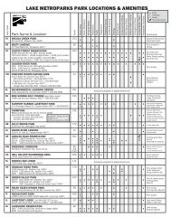
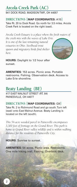
Arcola Creek <strong>Park</strong> (AC)<br />
941 DOCK ROAD, MADISON TWP., OH 44057<br />
DIRECTIONS [MAP COORDINATES: A15]<br />
Take Rt. 20 to Dock Road. Go north for 3.5 miles. Arcola<br />
Creek <strong>Park</strong> is located on the right (east).<br />
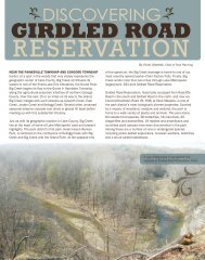
Arcola Creek Estuary is a place where the fresh waters of<br />
the creek mix with the waves of <strong>Lake</strong> Erie.<br />
It is one of the last remaining natural<br />
estuaries in Ohio. Steelhead trout<br />
spawn and migratory birds find shelter<br />
here.<br />
HOURS: Daylight to 1/2 hour after<br />
sunset.<br />
AMENITIES: 153 acres. Picnic area. Portable<br />
restrooms. Fishing. Observation deck. Access to<br />
<strong>Lake</strong> Erie shoreline.<br />
Beaty Landing (BE)<br />
417 EAST WALNUT STREET (RT. 84)<br />
PAINESVILLE, OH 44077<br />
DIRECTIONS [MAP COORDINATES: G9]<br />
Take Rt. 2 to Richmond Road and go south. Turn left<br />
(east) onto East Walnut Avenue. Beaty Landing is<br />
located on the left (south).<br />
This 54-acre wooded parcel in Painesville encompasses<br />
3,300 feet of frontage on the Grand <strong>River</strong>. This park is<br />
home to Grand <strong>River</strong> valley wildlife and is within walking<br />
distance for the residents of Painesville City.<br />
HOURS: Sunrise to sunset.<br />
AMENITIES: 54 acres. Picnic area. Restrooms.<br />
One mile hiking trail. Fishing. Overlook deck.<br />
2