Tommy Dewald - Western Governors' Association
Tommy Dewald - Western Governors' Association
Tommy Dewald - Western Governors' Association

Create successful ePaper yourself
Turn your PDF publications into a flip-book with our unique Google optimized e-Paper software.
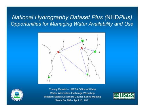
National Hydrography Dataset Plus (NHDPlus)<br />
Opportunities for Managing Water Availability and Use<br />
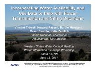
<strong>Tommy</strong> <strong>Dewald</strong> – USEPA Office of Water<br />
Water Information Exchange Workshop<br />
<strong>Western</strong> States Governors Council Spring Meeting<br />
Santa Fe, NM – April 13, 2011
NHDPlus Presentation Overview<br />
• Concepts<br />
• Noteworthy Applications<br />
• Version 2 Enhancements<br />
• Opportunities for Managing Water<br />
Availabilty and Use
NHDPlus Concepts<br />
• Why<br />
– To develop flow volume and velocity<br />
estimates for supporting pollutant fate-andtransport<br />
(dilution) modeling<br />
• What<br />
1.Additional attributes for NHD streams<br />
2.Catchments boundaries and attributes for<br />
NHD streams<br />
• How …
NHDPlus Builds Upon and Extends the<br />
Capabilities of the NHD, WBD and NED<br />
National<br />
Hydrography<br />
Dataset (NHD)<br />
Watershed<br />
Boundary<br />
Dataset (WBD)<br />
National<br />
Elevation<br />
Dataset (NED)
NHDPlus Concepts: Integration of<br />
NHD, WBD, and NED<br />
added to DEM surface in "walling"<br />
technique<br />
NHD Streams<br />
“burned”<br />
Into Elevation<br />
NHD stream cells<br />
subtracted from<br />
DEM surface in "burning"<br />
technique
NHDPlus Concepts: Integrating the<br />
Landscape with the Stream Network<br />
NHDPlus Catchments in 3D
Drainage Area Delineation<br />
Based Upon NHDPlus Catchments<br />
Drainage Area Delineation Results<br />
Total Area (Square Kilometers) - 53.61
NHDPlus Concepts: Navigation of the<br />
Linear Surface Water Network<br />
Upper Colorado River Main Stem
NHDPlus Concepts: Navigation of the<br />
Linear Surface Water Network<br />
Upper Colorado River<br />
Network
NHDPlus Concepts: Navigation of the<br />
Surface Water Network and Catchments<br />
Upper Colorado River<br />
Drainage Area
NHDPlus Concepts:<br />
Watershed Characterization<br />
Main stem name: Colorado River (Upper)<br />
Stream Order: 8<br />
Mean annual precipitation<br />
Mean annual temperature<br />
392.8 mm<br />
6.93 o C<br />
Drainage area 276153 km 2<br />
Land cover (1992)<br />
Residential & Commercial 0.2%<br />
Forest 27.7%<br />
Barren 4.3%<br />
Planted/Cultivated 2.3%<br />
Grassland/Herbaceous 15.2%<br />
Shrub 49.5%<br />
Other 0.8%
NHDPlus Concepts: Linking Waterrelated<br />
Features<br />
Upper Colorado River<br />
Stream Gages
NHDPlus Concepts: Linkage to USGS<br />
Stream Gages and Associated Data<br />
USGS<br />
National Water Information System<br />
(NWIS) Link<br />
http://waterdata.usgs.gov/nwis/nwisman/site_no=09379910
NHDPlus Concepts: Link to NWIS<br />
NWIS Link
WATERS Data Architecture<br />
(Watershed<br />
Assessment,<br />
Tracking & Environmental<br />
ResultS)<br />
(www.epa.gov/waters)<br />
GRTS<br />
WQSDB<br />
Nonpoint Source Grants<br />
Reach Address Database<br />
(RAD)<br />
Water Quality Standards<br />
National<br />
Hydrography<br />
Dataset Plus<br />
ATTAINS<br />
STORET<br />
Water Quality Assessments,<br />
Impaired Waters &<br />
Total<br />
Maximum<br />
Daily<br />
Loads<br />
Water Quality Monitoring
Data Accessible Through WATERS<br />
Public Access<br />
• Listed Impaired Waters<br />
• Assessed Waters<br />
• Beaches<br />
• Clean Watershed Needs<br />
• Combined Sewer Overflows<br />
• CWSRF Benefits Reporting<br />
• Permitted Dischargers<br />
• Fish Consumption Advisories<br />
• Fish Tissue Data<br />
• Impaired Waters with TMDLs<br />
• Sewage No Discharge Zones<br />
• Nonpoint Source Projects<br />
• Water Quality Standards<br />
• Water Quality Stations<br />
Internal Access Only<br />
• Drinking Water Intakes<br />
• Source Water Areas<br />
• Special Appropriations Projects
Co-Occurrence of<br />
Impaired Waters and FWS Properties<br />
An EPA, FWS and USGS Joint National Assessment<br />
National Wildlife Refuge System<br />
National Fish Hatchery System<br />
Impaired Waters
EPA National Aquatic Resource Surveys<br />
NHDPlus served as the basis for<br />
establishing the National Lakes<br />
Assessment sample frame – from<br />
which a representative set of<br />
sample sites (right) were<br />
randomly selected.<br />
NHDPlus is also being used to calculate<br />
drainage areas for lake sampling sites<br />
(left) to support data analysis.<br />
(www.epa.gov/owow/lakes/lakessurvey)
USGS NAWQA SPARROW Models<br />
for Major River Basins
Other Noteworthy NHDPlus<br />
Applications<br />
• First ever spatially-based national pesticide<br />
risk assessment<br />
• Clean Water Act jurisdictional analysis update<br />
• Incident Command Tool for Water (ICWater)<br />
• National Fish Habitat Action Plan<br />
• Post Fire Debri Flow Hazards<br />
• Aquatic habitat classification<br />
(Share your NHDPlus applications with others<br />
at www.epa.gov/waters > NHDPlus Quicklink)
Ehnancements to NHDPlus<br />
• Version 1<br />
• Released in 2006<br />
• NHD, WBD, NED circa 2005<br />
• Stream Flow Estimation Approaches<br />
» Vogel Regression-based<br />
» Unit Runoff Method (UROM)<br />
• Version 2<br />
• To be released in 2011<br />
• Latest NHD, WBD, NED<br />
• Stream Flow Estimation Approaches<br />
» Vogel Regression-based<br />
» Enhanced Runoff Method (EROM)
Improved Ingredient Data for<br />
Flow Estimates<br />
• PRISM Temperature and Precipitation (1971-2000)<br />
• Annual and Monthly Runoff (4km grid)<br />
• USGS NWIS Streamflow Gage Network Locations (30,000)<br />
• Divergence Fractions (major)<br />
• Water Flow Additions, Removals & Inter-basin Transfers<br />
(major)<br />
• TBD – NID Dam Network Locations
Enhanced Runoff Model (EROM) -<br />
Flow Estimation for Un-gaged Streams<br />
• Mean Flows - Monthly & Improved Annual<br />
• Divergence Fraction<br />
• Flow Volume and Velocity Estimates<br />
• Runoff<br />
• Excess Evapotranspiration<br />
• Flow Additions, Removals and Inter-basin<br />
Transfers<br />
• Stream Flow Gage Adjustments
Opportunities for Applying NHDPlus<br />
to Water Availability and Use<br />
• Common data framework – stream network and<br />
events for linking water additions and removals<br />
along with inter-basin transfers, catchments<br />
• Upstream/downstream network searches for<br />
data linked by yours and other organizations<br />
• Modeling framework, including EROM that can<br />
accommodate different flow estimation<br />
scenarios
Questions<br />
<strong>Tommy</strong> <strong>Dewald</strong>, USEPA Office of Water<br />
dewald.tommy@epa.gov<br />
(www.epa.gov/waters > NHDPlus Quicklink)