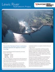
The Lewis River Hydroelectric Projects - PacifiCorp
The Lewis River Hydroelectric Projects - PacifiCorp
The Lewis River Hydroelectric Projects - PacifiCorp

You also want an ePaper? Increase the reach of your titles
YUMPU automatically turns print PDFs into web optimized ePapers that Google loves.
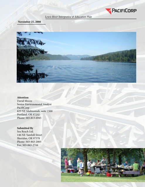
November 25, 2008<br />
<strong>Lewis</strong> <strong>River</strong> Interpretive & Education Plan<br />
Attention<br />
David Moore<br />
Senior Environmental Analyst<br />
<strong>PacifiCorp</strong><br />
825 NE Multnomah, suite 1500<br />
Portland, OR 97232<br />
Phone: 503-813-6945<br />
Submitted By<br />
Sea Reach Ltd.<br />
146 NE Yamhill Street<br />
Sheridan, OR 97378<br />
Phone: 503-843-2005<br />
Fax: 503-843-2744
<strong>Lewis</strong> <strong>River</strong> Interpretive & Education Plan<br />
Contents<br />
Content<br />
i-ii<br />
Executive Summary<br />
iii<br />
Introduction 1<br />
Parameters<br />
<strong>The</strong> Site 2<br />
<strong>The</strong> User 2<br />
Existing Interpretation and Visitor Information 4<br />
Operation and Staffing 4<br />
Vandalism and Maintenance 5<br />
Project Map 6<br />
Approach<br />
Site Visits 7<br />
Research 7<br />
Interviews with Professionals 7<br />
Interviews with the Tribes 8<br />
Interviews with Local Residents 9<br />
Public Meetings 9<br />
Stakeholder Meetings 10<br />
Audience<br />
General Audience Characteristics 11<br />
<strong>The</strong> Audience is Non-Captive 11<br />
<strong>The</strong> Audience is Disabled 13<br />
Interpretation<br />
What is Interpretation 16<br />
Interpretive <strong>The</strong>me 16<br />
Interpretive Topics 17<br />
Interpretive Components 19<br />
Overview Exhibits 19<br />
Local Welcome Exhibits 19<br />
Interpretive Exhibits 19<br />
Discovery Elements 19<br />
Docent Guide 20<br />
Brochures 20<br />
Watchable Wildlife 20<br />
Campfire Programs 21<br />
Bull Trout Regulatory Signage 21<br />
Fishing Opportunities 22<br />
Cultural Resources 22<br />
Wayfinding 23<br />
Sea Reach Ltd • 146 NE yamhill Street • Sheridan, OR<br />
draft 3 • November 2008 • page i
<strong>Lewis</strong> <strong>River</strong> Interpretive & Education Plan<br />
contents (continued)<br />
Conceptual Design<br />
Interpretive Design 24<br />
Design Elements 24<br />
Juxtaposition 24<br />
Setting the Stage 24<br />
Sustaining Interest 25<br />
Exhibit Structures 26<br />
An Element of Surprise 27<br />
Applied Design 28<br />
Logically Presentation 29<br />
Example Overview Exhibit 30<br />
Example Welcome Exhibit 31<br />
Interpretive Exhibits 32<br />
Example Interpretive Exhibit 33<br />
Existing Signage 34<br />
Consistency in Signage 35<br />
Design Standards 36<br />
Materials 37<br />
Ancillary Signage 38<br />
<strong>The</strong> Sites<br />
Eagle Island 40<br />
<strong>Lewis</strong> <strong>River</strong> Hatchery 41<br />
Merwin Hatchery 42<br />
Merwin Park 43<br />
Speelyai Bay Park 44<br />
Cresap Bay Campground 45<br />
Saddle Dam 46<br />
Yale Park 47<br />
Cougar Community Park 48<br />
Cougar Park and Campground 49<br />
Beaver Bay Campground and Day Use 50<br />
Swift Powerhouse Accessible Fishing Pier 51<br />
Swift Dam Overlook 52<br />
Swift Forest Campground and Day Use 53<br />
Eagle Cliff Park<br />
Storyline<br />
Storyline Outline 55<br />
Natural History 57<br />
Cultural History 58<br />
<strong>The</strong> Hydoelectric Story 67<br />
<strong>PacifiCorp</strong> 76<br />
References 88<br />
Stakeholders 91<br />
Appendix I : Interpretive Topics by Site,<br />
Exhibit Profiles<br />
Sea Reach Ltd • 146 NE yamhill Street • Sheridan, OR<br />
draft 3 • November 2008 • page ii
<strong>Lewis</strong> <strong>River</strong> Interpretive & Education Plan<br />
executive summary<br />
In October 2006, <strong>PacifiCorp</strong> contracted with Sea Reach, Ltd. to develop an<br />
Interpretive and Education Plan for recreational sites at its hydroelectric projects<br />
along the <strong>Lewis</strong> <strong>River</strong>, Washington (FERC Project Nos. 935, 2071, and 2111).<br />
This plan addresses section 11.2.5 of the relicensing Settlement Agreement:<br />
“Interpretation and Education Program”:<br />
• <strong>The</strong> plan includes “sufficient details, specifications, and artwork for<br />
follow-on printing, production, constructing, and installation” of<br />
recommended materials. (to be completed concurrent to this review)<br />
• <strong>The</strong> plan focuses on “recreation resources, hydro generation,<br />
natural resources and cultural resources.”<br />
• <strong>The</strong> plan provides “for the continuation and expansion of the<br />
weekend campfire programs.”<br />
• <strong>The</strong> plan includes a watchable wildlife component (education about<br />
prominent wildlife species, their habitats, and their habits).<br />
• Meetings and documents pertaining to this plan have been open to<br />
participation and comment by <strong>PacifiCorp</strong>, Cowlitz County PUD,<br />
and all project stakeholders (see stakeholders list).<br />
This plan also addresses section 5.7 of the Settlement Agreement: a directive to<br />
provide public education about bull trout through signage and flyers.<br />
<strong>The</strong> purpose of this plan is to recommend an Interpretive and Educational<br />
(I&E) program that will:<br />
Enhance the experience of visitors and residents by creating a sense of place<br />
• Establish a <strong>PacifiCorp</strong> identity at all sites.<br />
• Create anticipation of a positive experience.<br />
• Foster safety through attactive and consistant signage.<br />
Encourage participation in resource protection<br />
• Build appreciation through education about this area’s value as a watershed<br />
and wildlife habitat. Share <strong>PacifiCorp</strong>’s efforts to manage habitat and<br />
minimize negative impacts, and encourage visitors to do the same.<br />
• Build appreciation through education about this area’s rich cultural history.<br />
Encourage visitors to respect cultural resources.<br />
• Inspire in visitors a sense of responsiblity in having access to these sites,<br />
which are part of an important hydroelectric project<br />
Promote cooperative, safe behaviors to benefit project resources and visitors<br />
• Create a set of clear, approachable, safe-conduct rules<br />
• Explain consequences<br />
Sea Reach Ltd • 146 NE yamhill Street • Sheridan, OR<br />
draft 3 • November 2008 • page iii
<strong>Lewis</strong> <strong>River</strong> Interpretive & Education Plan<br />
introduction<br />
<strong>PacifiCorp</strong> is one of the West’s leading utilities, serving more than 1.6 million<br />
customers in six western states: Washington, Oregon, California, Idaho, Utah,<br />
and Wyoming. <strong>PacifiCorp</strong> operates 68 power generating plants, including<br />
hydroelectric facilities, coal-fired plants, gas-fired plants, wind facilities, and<br />
geothermal facilities. 52 of the plants are hydropower facilities which generate<br />
approximately 11 percent of the company’s annual power production. <strong>The</strong> <strong>Lewis</strong><br />
<strong>River</strong> Project is one of these. Along the <strong>Lewis</strong> <strong>River</strong>, <strong>PacifiCorp</strong> operates 304<br />
camping sites, 278 picnic sites, several boat ramps, swimming beaches, fishing<br />
access, and day use areas.<br />
Privately owned or non federal hydroelectric projects [such<br />
as the <strong>Lewis</strong> <strong>River</strong> Project ] generally operate under licenses<br />
issued by the Federal Energy Regulatory Commission (FERC).<br />
A hydroelectric license includes terms and conditions for project<br />
operations, as well as environmental protection, mitigation<br />
and enhancement measures to mitigate project impacts on the<br />
surrounding environment and natural resources.<br />
At least five years before a license expires, an owner notifies<br />
FERC of its intent to seek a new operating license for the<br />
hydroelectric project. <strong>The</strong> project, its surrounding environment<br />
and related resources are extensively studied during this process,<br />
in consultation with state and federal agencies, tribes, nongovernmental<br />
organizations and local community interests. <strong>The</strong><br />
purpose of the licensing process, which can take several years, is<br />
to determine what new license conditions will most effectively<br />
balance developmental values (electric power, flood control and<br />
water supply) with nondevelopmental values (environmental<br />
resource protection and values) and best reflect the public<br />
interest. 1<br />
<strong>PacifiCorp</strong> is currently involved in relicensing projects on the North Fork of the<br />
<strong>Lewis</strong> <strong>River</strong> (Merwin FERC No. 935, Yale FERC No. 2071, Swift No. 1, FERC<br />
No. 2111) in southwest Washington. As part of the requirement of the new<br />
license, <strong>PacifiCorp</strong> will be enhancing recreational facilities and implementing an<br />
interpretation and education plan.<br />
This document summarizes the approach, research, rationale, recommendations,<br />
and products for an interpretive and education program for the recreation sites<br />
along Merwin, Yale, and Swift Reservoirs.<br />
1 <strong>PacifiCorp</strong> website: www.pacificorp.com, “Hydro Relicensing”<br />
Sea Reach Ltd • 146 NE yamhill Street • Sheridan, OR draft 3 • November 2008 • page 1
parameters<br />
<strong>Lewis</strong> <strong>River</strong> Interpretive & Education Plan<br />
Parameters are the inherent set of circumstances within which a project must<br />
be developed—they represent conditions as they are, not as they ought to be.<br />
Identifying parameters is a necessary first step in the development of a realistic<br />
strategy. <strong>The</strong> following general parameters provide the framework for this<br />
Interpretive and Education Plan.<br />
<strong>The</strong> Site<br />
This interpretive effort encompasses a stretch of the North Fork <strong>Lewis</strong> <strong>River</strong>,<br />
in southwestern Washington, approximately thirty miles in length. <strong>The</strong>re are<br />
three reservoirs in a row: beginning down-river, they are Merwin, Yale, and<br />
Swift. Visitors arrive via interstate 5 taking the Woodland exit and continuing<br />
on highway 503, or from Chelatchie Prairie area (Amboy). <strong>The</strong>re is access<br />
upriver on forest service roads, but these roads are significantly less traveled. <strong>The</strong><br />
primary “gateway” to the <strong>PacifiCorp</strong> set of recreation sites is at Merwin Dam,<br />
although not all users will stop here.<br />
<strong>The</strong> <strong>PacifiCorp</strong> recreation sites are attractive, with good amenities. <strong>The</strong>y<br />
offer outstanding recreational opportunities, including boating, swimming,<br />
picnicking, hiking, wildlife viewing, and exploration. Many are designed with<br />
innovative wildlife habitat elements.<br />
It is currently somewhat difficult to distinguish the <strong>PacifiCorp</strong> sites from<br />
neighboring recreation sites administered by other entities; that is, the sites have<br />
no strong <strong>PacifiCorp</strong> “identity”. In addition, the dams that create the reservoirs<br />
are seldom visible from the sites, making it unclear that the recreation sites are<br />
part of a hydroelectric project.<br />
Per a survey completed by <strong>PacifiCorp</strong> and summarized in the <strong>Lewis</strong> <strong>River</strong><br />
Historic Properties Management Plan, there are archaeological sites within<br />
the project area. Due to the sensitive nature of these sites, their existence and<br />
locations should not be publicized, and interpretation of cultural resources<br />
should be general in nature.<br />
<strong>The</strong> User<br />
People visit <strong>PacifiCorp</strong>’s <strong>Lewis</strong> <strong>River</strong> recreation sites for many different reasons.<br />
Some are local residents, others have traveled from many miles away. Some<br />
arrive for water-based recreation, while others are in search of trails to hike or<br />
places to hunt. Some are “just passing through” on their way to Mt. St. Helens or<br />
the neighboring public lands.<br />
• Local Residents—<strong>The</strong>se visitors are very familiar with the sites, and<br />
return again and again to hike, camp, fish or get out on the water.<br />
<strong>The</strong>y may be very well-informed about the history of the hydroelectric<br />
project and the surrounding natural history. Some have ties to<br />
Sea Reach Ltd • 146 NE yamhill Street • Sheridan, OR draft 3 • November 2008 • page 2
<strong>Lewis</strong> <strong>River</strong> Interpretive & Education Plan<br />
<strong>Lewis</strong> <strong>River</strong> Valley pioneers, and may even have memories of the<br />
valley before the dams were built. At times, such as on busy summer<br />
weekends, they may feel overwhelmed by crowds of “outsiders”<br />
arriving to recreate in what they consider their home.<br />
• Return Visitors—<strong>The</strong>se visitors, while they do not live along the<br />
river, return year after year to “favorite” sites to recreate. <strong>The</strong>y may<br />
be very familiar with the sites, and may have a choice campsite that<br />
they reserve in advance each year for a special retreat. Return visitors<br />
include individuals, families, and even large groups.<br />
• New Visitors—<strong>The</strong>se visitors have never visited the <strong>Lewis</strong> <strong>River</strong> before.<br />
<strong>The</strong>y may have stumbled upon the recreation sites on their way to<br />
or from Mt. St. Helens, or they may have discovered the sites on the<br />
Internet or by word of mouth. <strong>The</strong>y may not spend much time at the<br />
sites on their first visit, but may well return for longer visits in the<br />
future.<br />
Within these general categories of visitors there are special interest groups:<br />
• Boaters—Power boats are the most common watercraft on the<br />
reservoirs, although sailboats, canoes, and kayaks are also used. Some<br />
boaters focus on water play (waterskiing, jet-skiing, speed boats, etc.)<br />
while others troll the lake for kokanee, trout, and other game fish.<br />
Regardless of their purpose on the lake, boaters require information<br />
on launch ramp and dock locations and protocols, restrooms, lake<br />
features, boating rules, and water safety.<br />
• Campers—<strong>The</strong> four large campgrounds along the <strong>Lewis</strong> (Cresap Bay,<br />
Beaver Bay, Cougar Park, and Swift Forest) attract campers interested<br />
in hiking, fishing the creeks and lake shore, swimming, and socializing.<br />
<strong>The</strong>se visitors require information on campsite and restroom locations,<br />
rules and regulations, lake access, and trail access.<br />
• Hikers—Visitors who enjoy hiking require information on trail<br />
locations and rules.<br />
• School Groups—On occasion school groups stop at Merwin Park.<br />
<strong>The</strong>re is a Native American lodge nearby that offers workshops on<br />
native crafts and there are three active hatcheries.<br />
• Day Use—in addition to fisherman and boaters, who are in many cases<br />
day use visitors, some folks may just like to stop for a picnic or swim.<br />
Sea Reach Ltd • 146 NE yamhill Street • Sheridan, OR draft 3 • November 2008 • page 3
<strong>Lewis</strong> <strong>River</strong> Interpretive & Education Plan<br />
Existing Interpretation and Visitor Information<br />
<strong>The</strong>re are existing interpretive signs (fish identification, wetland ecology) at<br />
some of the sites, though design standards are not consistent among them.<br />
<strong>The</strong> US Forest Service administers a campfire program in the three largest<br />
campgrounds during the peak of tourist season. This program is subject to<br />
funding and the interpretation presented is determined by the speaker.<br />
<strong>The</strong> Federal Energy Regulatory Commission (FERC) requires as part of its<br />
negotiations with <strong>PacifiCorp</strong> that specific information be posted at each<br />
recreation site:<br />
• Project Name<br />
• Company Name<br />
• Statement that this project is licensed by the Commission<br />
• <strong>The</strong> FERC project #<br />
• Directions to/map of other project recreation sites<br />
• Time of park opening/closing and available activities<br />
• Use rules<br />
• Contact information for further recreation information<br />
• Statement of nondiscrimination<br />
<strong>PacifiCorp</strong> has also chosen to address the bull trout public education<br />
requirement of the Settlement Agreement in its new Interpretive and Education<br />
Program. Currently, interpretive signs exist at boat launch ramps to educate<br />
anglers about bull trout status, identification, and conservation.<br />
Operation and Staffing<br />
Camping sites are a first-come, first-serve bases, except at Cresap Bay and<br />
Cougar campgrounds. For visitors reserving a camp site, <strong>PacifiCorp</strong> has a call<br />
in reservation system. Each person or party receives a package of information<br />
in the mail prior to their visit. This package includes a map of the site, rules<br />
and regulations, and other information pertaining to <strong>PacifiCorp</strong> sites. <strong>The</strong>se<br />
sites are also staffed at the entrances with someone checking reservations and at<br />
the campground with a campground host. <strong>The</strong> camp hosts are not <strong>PacifiCorp</strong><br />
employees.<br />
All <strong>PacifiCorp</strong> Day-Use and Campgrounds have open and closed hours.<br />
Campgrounds are only open during the summer season and each one has<br />
slightly different days of operation. Day-Use sites are open year round. <strong>The</strong><br />
“open” hours vary between the summer and winter season, opening later and<br />
closing early in the winter months. Hours are maintained on an honor basis.<br />
<strong>The</strong>se sites are not staffed.<br />
Sea Reach Ltd • 146 NE yamhill Street • Sheridan, OR draft 3 • November 2008 • page 4
<strong>Lewis</strong> <strong>River</strong> Interpretive & Education Plan<br />
At all the sites, the interpretive program is intended to be a self-guided<br />
experience. <strong>The</strong> self-guided nature of the site, however, will not preclude guided<br />
tours, presentations, or “campfire” programs conducted by volunteers.<br />
Vandalism and Maintenance<br />
Irrespective of the setting, vandalism is a fact of life—any public display will<br />
eventually face the onslaught of graffiti, destruction, or simple deterioration over<br />
time. In an attempt to minimize the opportunities for vandalism, the location,<br />
placement, and materials recommended for this project are intended to mitigate<br />
damage.<br />
Sea Reach Ltd • 146 NE yamhill Street • Sheridan, OR draft 3 • November 2008 • page 5
project map<br />
<strong>Lewis</strong> <strong>River</strong> Interpretive & Education Plan<br />
75km<br />
50mi<br />
© 2008 NAVTEQ,TeleAtlas<br />
©2008 Yah<br />
Cougar Park and<br />
Campground<br />
Beaver Bay Campground<br />
Swift Forest Campground<br />
Swift Reservoir<br />
Eagle Cliff Park<br />
Yale Park<br />
Yale Reservoir<br />
Speelyai Bay<br />
Merwin Reservoir<br />
Island <strong>River</strong> Access<br />
Merwin Park<br />
Merwin Hatchery<br />
Cresap Bay<br />
Campground<br />
Saddle Dam<br />
<strong>Lewis</strong> <strong>River</strong> Reservoirs<br />
Nestled within the Mt. St. Helens watershed basin, the <strong>PacifiCorp</strong> Hydro Project<br />
encompasses three reservoirs: Merwin, Yale, and Swift. <strong>The</strong> campgrounds and<br />
day-use sites on the map are the sites addressed in this plan.<br />
Sea Reach Ltd • 146 NE yamhill Street • Sheridan, OR draft 3 • November 2008 • page 6
approach<br />
<strong>Lewis</strong> <strong>River</strong> Interpretive & Education Plan<br />
Successful interpretation is faithful to the site—it connects the visitor to the<br />
place with site-specific stories and images. <strong>The</strong> following describes the process<br />
Sea Reach undertook to get to know the location, the audience, and the stories<br />
of the <strong>PacifiCorp</strong> sites along the <strong>Lewis</strong> <strong>River</strong>.<br />
Site Visits<br />
Sea Reach staff visited the <strong>Lewis</strong> <strong>River</strong> several times, over the course of all four<br />
seasons, to observe recreation sites both during the height of visitation and<br />
without visitors. At least four of the visits were with <strong>PacifiCorp</strong> staff. Each site<br />
was walked, photographed, and general observations were recorded regarding<br />
the visitor profile and interpretive potential. In July, two staff members spent<br />
three days camping at Cresap Bay to get a sense of the visitor demographics, to<br />
interview the host, and to observe visitors interacting with the site.<br />
Research<br />
<strong>The</strong> interpretive storyline begins with an overview of the natural and cultural<br />
history of an area. Our goal is to identify what is factual and relevant about<br />
a particular site. What is significant about the <strong>Lewis</strong> <strong>River</strong> Watershed How<br />
does this hydro project work What is available to do and see What animals<br />
are present Who lived here before, and who lives here now This research<br />
encompasses a variety of resources—beginning with <strong>PacifiCorp</strong> staff, internal<br />
documents, and library resources. As the topic areas become more and more<br />
precise or site specific, recognized experts are asked to comment and review<br />
sections of the storyline for accuracy. In this case, several <strong>PacifiCorp</strong> scientists<br />
were interviewed and asked to comment on content, and in depth interviews<br />
with several long term residents were conducted. <strong>The</strong>y were also asked to review<br />
the material before it was incorporated into this document.<br />
Interviews with Professionals<br />
A large portion of the background information and storyline deals directly with<br />
the operations, management, and general workings of the hydroelectric project.<br />
Sea Reach’s goal was to write an overview that can be shared with visitors to<br />
help them understand “what is a hydroelectric project, how does it work, how<br />
does it effect our lives” For this information, we interviewed specialists from<br />
<strong>PacifiCorp</strong>:<br />
• Kirk Naylor, wildlife biologist and environmental supervisor for<br />
<strong>PacifiCorp</strong>’s hydroelectric projects. Kirk spoke with us at length on the<br />
phone, and then provided an extensive tour of habitat management<br />
projects along the <strong>Lewis</strong>.<br />
• Frank Shrier and Erik Lesko, fish biologists, provided information on fish<br />
resources in the lakes and river, as well as fish habitat projects.<br />
Sea Reach Ltd • 146 NE yamhill Street • Sheridan, OR draft 3 • November 2008 • page 7
<strong>Lewis</strong> <strong>River</strong> Interpretive & Education Plan<br />
• Doug Bornemeier and Jennifer Kelly of the Water Resources Division<br />
provided information on flood management.<br />
• Gene Scibelli took us on a tour of Merwin Dam and provided extensive<br />
information on dam operations.<br />
• Roger Rayburn, engineer, discussed dam construction.<br />
• Jane Hills provided background information on recreational use of the<br />
campgrounds and other recreation sites.<br />
Interviews with the Tribes<br />
<strong>The</strong>re are two tribes involved in the <strong>Lewis</strong> <strong>River</strong> Valley. <strong>The</strong> Yakama Tribe, with<br />
tribal headquarters in Yakima, Washington and the Cowlitz Tribe with tribal<br />
headquarters in Longview, Washington. Sea Reach staff visited both headquarters<br />
and conducted several interviews with Tribal members. During both visits, tribal<br />
members were extremely generous with their time, answering endless questions,<br />
and also with their resources. In Yakima, Sea Reach staff was allowed to look<br />
through the photo archives for images that might be used for exhibits. <strong>The</strong> archive<br />
was impressive.<br />
In an effort to give the tribes an opportunity to tell their history and relationship<br />
to the <strong>Lewis</strong> <strong>River</strong> in their own words, Sea Reach is attempting to engage members<br />
of both the Yakama and Cowlitz tribes in a subcontract to write a portion of<br />
the storyline. Later, in one of the interviews with Johnson Meninick, Cultural<br />
Resources, Yakama Nation, Johnson explained that it is not in the Tribe’s best<br />
interest to “write it down.” In a culture rich in oral tradition, the integrity and<br />
ownership of stories is sacred. It is not customary for a tribal member to write<br />
down their particular perspective of the history of the Tribe or share information<br />
relating to the traditions, life, and values of its people. This information belongs<br />
to the Tribe. Sea Reach respects this position. Unfortunately, it means that the<br />
portion of the storyline depicting Native American historic and contemporary<br />
relationship to the <strong>Lewis</strong> <strong>River</strong> Valley is relegated exclusively to what has been<br />
written, which is very general. One way to supplement the Native American<br />
interpretation might be to discuss the contemporary pressures and constraints that<br />
the Tribes face today—maintaining their hertitage and cultural within a changing<br />
social landscape.<br />
It is best if the interpretive materials relating to Tribes are passed through the<br />
Tribal Council.<br />
Interviews were conducted with the following Tribal members:<br />
• Clifford Casseseka, Elder, Yakama Nation<br />
• George Lee, Yakama Nation<br />
• Johnson Meninick, Cultural Resources, Yakama Nation<br />
Sea Reach Ltd • 146 NE yamhill Street • Sheridan, OR draft 3 • November 2008 • page 8
<strong>Lewis</strong> <strong>River</strong> Interpretive & Education Plan<br />
• Pamela Fabela, Heritage Center Director, Yakama Nation<br />
• Marilyn Malatare, Curator, Yakama Nation<br />
• Ed Arthur, Asst.Tribal Historic Preservation Officer, Cowlitz Indian Tribe<br />
• Mike Iyall, Cowlitz Indian Tribe<br />
Interviews with Local Residents<br />
Several locally written books on the early settlement history of the <strong>Lewis</strong> <strong>River</strong><br />
Valley were very helpful in developing the cultural history portion of the storyline.<br />
Publications such as Fields of Flowers and Forests of Firs (originally written by<br />
the Woodland History Committee in 1958) and Pioneer Families of Yale Valley,<br />
Washington by Mary Helen (Laughlin) Rice. Sea Reach also conducted interviews<br />
with local residents who grew up in the Valley. Residents interviewed in person<br />
include the following:<br />
• Mrs. Margaret Colf Hepola, who was born on a homestead just above the site<br />
of Ariel Dam and who has written extensively about pioneer life in the valley.<br />
• Mr. Thomas Frasier, whose family homestead was located near present-day<br />
Yale Dam (the Saddle Dam cuts across some of their farm fields).<br />
• Mr. and Mrs. Leonard Reese, who operated a small general store at Yale in<br />
the 1930s.<br />
• Mr. and Mrs. Ralph Bozorth, whose families homesteaded in the <strong>Lewis</strong> <strong>River</strong><br />
Valley and Woodland area.<br />
• Mr. Don Stuart, whose family settled in the Yale area in the 1930s and who<br />
worked both as a logger and soil engineer for the construction of Swift Dam.<br />
• Mrs. Elva Dobbins, who was born in the valley and grew up on a homestead<br />
near Yale.<br />
In addition, Sea Reach interviewed other locals with historical knowledge, and<br />
gathered photographic resources, during public meetings (see below).<br />
Public Meetings<br />
Sea Reach and <strong>PacifiCorp</strong> conducted a public meeting near the beginning of the<br />
project to gather local information, meet with and apprise interested parties of<br />
the progress of the Interpretive and Educational plan. <strong>The</strong> meeting was publicized<br />
several weeks prior to the meeting date, inviting people to attend and requesting<br />
information and historical photographs. <strong>The</strong> meeting was very well attended and<br />
lasted several hours. Two members of <strong>PacifiCorp</strong> staff, David Moore and Jane<br />
Hills, were available to answer questions and Sea Reach presented preliminary<br />
exhibit design. Most of the meeting was devoted to talking with the attendees and<br />
scanning historic photos. Several locals had so much information to share that<br />
Sea Reach made appointments for follow-up meetings and interviewed them at a<br />
Sea Reach Ltd • 146 NE yamhill Street • Sheridan, OR draft 3 • November 2008 • page 9
<strong>Lewis</strong> <strong>River</strong> Interpretive & Education Plan<br />
later date.<br />
<strong>The</strong> following people attended the meeting:<br />
• Flores Ledford Loy<br />
• Charles Ferguson<br />
• Noel Johnson<br />
• Joann (Graham) Cummings<br />
• Dennis Frasier<br />
• Frannis (Hannah) Tangen<br />
• Steve Tangen<br />
• Tom Frasier<br />
• George Thoeny<br />
• Iris B. (Hannah) Jensen<br />
• Eulakee G. Gilbert<br />
• Janice Row<br />
• Byron Ferguson<br />
• Elva M. (Hannah) Dobbins<br />
• Judy Wilkinson Ibbs<br />
• Tsungani Smith<br />
• Julia Stoll<br />
• Lottie Stoll-Smith<br />
• Barbara Karnis<br />
• Erin Thoeny<br />
• Peggy Thoeny<br />
• Janice Fillman<br />
• Margaret Colf Hepola<br />
• Mary H. (Laughlin) Vannoy<br />
• Mariah Reese<br />
• Donnie Kelley<br />
• Dottie Johnson<br />
• Jerry Johnson<br />
• Rod Hazen<br />
Stakeholder Meetings<br />
Two stakeholders meetings were conducted: one on March 6, 2007 and one on<br />
October 2, 2007. During the first meeting, Sea Reach presented our relevant<br />
experience on similar interpretive projects, presented the conceptual design,<br />
and discussed the approach. <strong>The</strong> stakeholders assisted Sea Reach in developing<br />
a list of professionals and locals who later all proved to be valuable resources for<br />
this project. During the second meeting, Sea Reach presented first draft design<br />
layouts on two exhibits: the big picture orientation and a site specific welcome<br />
panel.<br />
Sea Reach Ltd • 146 NE yamhill Street • Sheridan, OR draft 3 • November 2008 • page 10
audience<br />
<strong>Lewis</strong> <strong>River</strong> Interpretive & Education Plan<br />
This section presents general guidelines regarding audience characteristics for<br />
interpretive and educational programs. Regardless of the specific parameters to<br />
an interpretive project, these audience characteristics are universal and need to<br />
be considered in the development of an effective program.<br />
General Audience Characteristics<br />
No matter how cleverly designed, aesthetically appealing, or accessible,<br />
interpretive experiences are meaningless unless they satisfy an audience’s needs<br />
and interests.<br />
• Users need and expect orientation information. <strong>The</strong> <strong>Lewis</strong> <strong>River</strong><br />
recreation sites are spread along 30 miles of the <strong>Lewis</strong> <strong>River</strong>’s valley.<br />
Several lie off of the primary travel routes along the river. Users will<br />
need and expect orientation information. Where are the sites that offer<br />
lake access Where can they camp Where can they park Where can<br />
they hike What are the fees<br />
• Users will need and expect to find public restroom facilities. Restroom use<br />
is obviously not the reason underlying the use of any outdoor recreation<br />
facility, but a recreation experience without access to restrooms,<br />
or without restrooms that are accessible, can create a maintenance<br />
nightmare.<br />
• Users will expect interpretation. More and more trail users benefit from<br />
and even expect to find interpretive materials, in a variety of media, that<br />
address local natural and cultural history. It is part of the experience.<br />
• Visitors will want information about other recreation activities.<br />
Surrounding public lands such as Gifford Pinchot National Forest/Mt.<br />
St. Helens National Volcanic Monument offer many outdoor recreation<br />
opportunities.<br />
Irrespective of demographics, interpretive audiences—especially trail/park<br />
users— share at least two primary characteristics: they are a non-captive<br />
audience, and they will benefit directly from any and all measures that increase<br />
physical and programmatic accessibility.<br />
<strong>The</strong> Audience is Non-Captive<br />
Interpretively speaking, trail/parks audiences are generally regarded as noncaptive.<br />
Non-captive audiences visit parks, campsites and trails of their own<br />
volition—they decide to visit, stay, and pay attention of their own free will.<br />
In contrast, visitors attending a lecture or live interpretive presentation are<br />
considered a captive audience. Captive audiences are generally compelled to<br />
stay and pay attention. Although there are many differences between these<br />
Sea Reach Ltd • 146 NE yamhill Street • Sheridan, OR draft 3 • November 2008 • page 11
<strong>Lewis</strong> <strong>River</strong> Interpretive & Education Plan<br />
two audience types, there is one overriding psychological difference: the<br />
captive audience has to pay attention, whereas the non-captive audience does<br />
not. <strong>The</strong> only reward non-captive audiences seek is internal—an intrinsic<br />
satisfaction with what they are experiencing. And, as long as the information<br />
they are receiving continues to be more interesting and entertaining than other<br />
things around them, non-captive audiences will pay attention. However, if the<br />
information is uninteresting or appears to have no entertainment value, it is too<br />
academic, or requires too much effort to understand, the non-captive audience<br />
will move on to something more gratifying.<br />
Interpretive experiences that satisfy non-captive audiences always incorporate at<br />
least the following five basic qualities:<br />
1. <strong>The</strong> experience is entertaining. Methods for achieving entertaining<br />
interpretive presentations vary depending upon the communication<br />
media. Static exhibits are, of course, the most challenging. Generally,<br />
the best interpretive experiences are those that are game-like,<br />
participatory, three-dimensional or that incorporate movement,<br />
changing scenes, or lively colors—all characteristics more commonly<br />
associated with entertainment. Interpretive experiences should elicit<br />
a “wow” reaction or a “chuckle” from the audience somewhere in the<br />
presentation, preferably as often as possible.<br />
2. <strong>The</strong> experience is relevant. Early in the development of interpretation,<br />
Tilden (1957) captured the essence of relevancy’s importance<br />
to interpretation when he exclaimed, “Any interpretation that<br />
does not somehow relate what is being displayed or described to<br />
something within the personality or experience of the visitor will<br />
be sterile.” Interpretation is only relevant to an audience when it is<br />
both meaningful and personal, that is, when concepts and messages<br />
are conveyed within a context that allows people to understand,<br />
appreciate, and care about something.<br />
3. <strong>The</strong> experience is organized. Non-captive audiences are lazy—they<br />
will lose interest quickly if they have to work too hard. This audience<br />
will not expend the effort to follow a difficult presentation. <strong>The</strong>y will<br />
decide quickly whether the benefits of paying attention are going to<br />
be worth the effort it will take to understand the information being<br />
presented—with non-captive audiences, this can happen in a matter<br />
of seconds. A major factor in this estimate is how well the message is<br />
organized and how many different ideas are presented simultaneously.<br />
Humans have definite limits in their ability to assimilate information,<br />
and if too much information is presented a non-captive audience will<br />
lose interest.<br />
Sea Reach Ltd • 146 NE yamhill Street • Sheridan, OR draft 3 • November 2008 • page 12
<strong>Lewis</strong> <strong>River</strong> Interpretive & Education Plan<br />
4. <strong>The</strong> experience accommodates diversity in learning styles through<br />
interactivity. People assimilate information in different ways. Some are<br />
“visual learners,” integrating information primarily through what they<br />
see, others rely primarily on audio input, and certain people rely on the<br />
written word. Any interpretive effort (whenever possible) should use a<br />
mix of media to convey themes and topics so that all people interacting<br />
with the materials have an equal opportunity to learn and gain insight.<br />
This approach is simply another aspect of making exhibits and displays<br />
fully accessible to all people irrespective of ability.<br />
5. Interpretation is thematic. Interpretive presentations, regardless<br />
of media, should have the qualities of a story—they should have a<br />
beginning, an end, and most important of all, a message or moral. This<br />
message, to be distinguished from the topic or subject matter, is the<br />
presentation’s theme. Interpretative presentations without themes beg<br />
the question, “so what”— they fail to offer a major point or convey a<br />
message.<br />
<strong>The</strong> Audience is Disabled<br />
<strong>The</strong> Americans with Disabilities Act (ADA; PL 101-336) defines a person with<br />
disabilities as anyone experiencing “a physical or mental impairment that<br />
substantially limits one or more of the major life activities “ (ATBCB 1990).<br />
This definition is rather vague, to say the least, and what is more, it makes it<br />
difficult to accurately identify the number of Americans with disabilities. <strong>The</strong><br />
result is that statistical estimates vary widely. Some estimates argue that 32.5<br />
million non-institutionalized people (14.1 percent of the U.S. population)<br />
experience varying degrees of limitation when performing “basic life activities”.<br />
(Krause and Stoddard 1989).<br />
When disabilities are defined in terms of the ability to perform select physical<br />
functions, an even larger segment of the population can be considered disabled:<br />
37.3 million non-institutionalized people age 15 and older. When all of these<br />
disabilities are considered in aggregate, an estimated 59.4 percent of the noninstitutionalized<br />
U.S. population experiences a physical or mental functional<br />
limitation.<br />
Taking an even broader perspective, many other groups not normally considered<br />
disabled can benefit directly from the removal of accessibility barriers: pregnant<br />
women, adults with infants, children, small people, obese people, and the 10<br />
percent of the population considered temporarily disabled due to accidents or<br />
other medical problems. Finally, when these individuals are combined with<br />
the 59.4 percent discussed above, and when the friends and families of all are<br />
considered, virtually everyone is impacted by disability.<br />
Sea Reach Ltd • 146 NE yamhill Street • Sheridan, OR draft 3 • November 2008 • page 13
<strong>Lewis</strong> <strong>River</strong> Interpretive & Education Plan<br />
Physical accessibility is only part of the accessibility issue—programmatic or<br />
intellectual accessibility must also be considered. It does little good to provide<br />
physical access to a facility, if displays, brochures, artworks and other aspects of<br />
the interpretive program preclude participation. By considering the following<br />
categories of persons with disabilities, it is possible to accommodate a very broad<br />
range of people:<br />
• People with impaired vision. Visitors, whose impairments may range<br />
from myopia to blindness, may be accommodated by presenting<br />
displays and other printed materials in larger print—fonts should be<br />
sans-serif or simple-serif. Appropriate color contrast is also important.<br />
In addition, tactile displays, Braille, and audio programs should be<br />
considered where appropriate.<br />
• People with hearing and speech impairments. Accommodating this<br />
group of site users involves the presentation of printed materials.<br />
• People with mobility impairments. Although wheelchair users are the<br />
most obvious mobility impaired group, it is important to recognize<br />
other mobility impairments—many people are elderly or overweight,<br />
may have difficulty breathing, or are simply not in good physical shape.<br />
Accommodating this group of visitors generally requires ensuring<br />
physical accessibility in compliance with ADAAG standards. Exhibits<br />
and other displays must allow physical access within appropriate space<br />
requirements and accepted reach ranges.<br />
• People with learning impairments. People with learning impairments<br />
are the most difficult to accommodate. <strong>The</strong> range of learning<br />
disabilities is vast—from severe mental retardation to dyslexia.<br />
It may be impossible to accommodate all individuals with learning impairments,<br />
but it is possible to serve a broad range of individuals by providing programs<br />
that cater to what many professional educators recognize as the four basic<br />
learning styles:<br />
1. Innovative learners—people who want to know why; who need the<br />
“big picture, and who learn by observation and intuition<br />
2. Analytical learners—people who want to know what; who need to<br />
analyze information, and who think through concepts in an organized<br />
fashion<br />
3. Common sense learners—people who want to know how; who need<br />
practical applications of the information presented (how one thing<br />
influences another), and who need to use the information<br />
Sea Reach Ltd • 146 NE yamhill Street • Sheridan, OR draft 3 • November 2008 • page 14
<strong>Lewis</strong> <strong>River</strong> Interpretive & Education Plan<br />
4. Dynamic learners—people who want to know if; who prefer direct<br />
personal involvement when learning, and who prefer a lack of<br />
structure<br />
For many interpretive specialists the audience analysis feels like “old news,” but<br />
the process of designing interpretive presentations—both the conceptual content<br />
and the physical structure on any project—require that planners and designers<br />
keep in mind the vast range of individuals we call the “visitor.”<br />
Sea Reach Ltd • 146 NE yamhill Street • Sheridan, OR draft 3 • November 2008 • page 15
interpretation<br />
<strong>Lewis</strong> <strong>River</strong> Interpretive & Education Plan<br />
What is Interpretation<br />
Journalist, playwright and philosopher Freeman Tilden, considered by many to<br />
be the founder of modern interpretation, espoused the following principles:<br />
• Any interpretation that does not somehow relate what is being displayed<br />
or described to something within the personality or experience of the<br />
visitor will be sterile.<br />
• Information, as such, is not interpretation. Interpretation is revelation<br />
based on information. But they are entirely different things. However, all<br />
interpretation includes information.<br />
• Interpretation is an art, which combines many arts, whether the materials<br />
presented are scientific, historical, or architectural.<br />
• <strong>The</strong> chief aim of interpretation is not instruction, but provocation.<br />
• Interpretation should aim to present a whole rather than a part, and must<br />
address itself to the whole man rather than any phase.<br />
• Interpretation addressed to children (say, up to the age of twelve)<br />
should not be a dilution of that presented to adults, but should follow a<br />
fundamentally different approach. To be at its best, it will require separate<br />
programs.<br />
Interpretive expert Sam Ham has defined interpretation as a distinct approach<br />
to communication that attempts to convey important messages or themes,<br />
rather than isolated facts and figures, through the use of original objects, firsthand<br />
experiences, and illustrative media.<br />
<strong>The</strong> most effective interpretation is well organized and easy to follow. <strong>The</strong> larger<br />
and more spread-out the area targeted for interpretation, the more difficult it<br />
is to create a cohesive interpretive message. <strong>PacifiCorp</strong>’s <strong>Lewis</strong> <strong>River</strong> recreation<br />
sites are spread out over a long distance. <strong>The</strong>re are multiple entry points to the<br />
“system” of sites and there is no official “gateway” or starting point. Most visitors<br />
may only visit one or two of the sites. <strong>The</strong>se factors, plus <strong>PacifiCorp</strong>’s desire to<br />
clarify its presence, demand a strong interpretive theme or message.<br />
Interpretive <strong>The</strong>me<br />
Interpretive themes embody the messages and impressions that people will<br />
take home from their interpretive experience. <strong>The</strong>se messages may be simple<br />
or complex, but they should always be important—something that potentially<br />
challenges or confirms a person’s world view, or at the very least provides food<br />
for thought.<br />
Sea Reach Ltd • 146 NE yamhill Street • Sheridan, OR draft 3 • November 2008 • page 16
<strong>Lewis</strong> <strong>River</strong> Interpretive & Education Plan<br />
<strong>PacifiCorp</strong>’s hydroelectric projects fundamentally shape the <strong>Lewis</strong> <strong>River</strong> and the<br />
surrounding lands. As part of hydroelectric operations, the company is charged<br />
with managing the surrounding lands for the benefit of wildlife and the public.<br />
This suggests the following theme:<br />
<strong>The</strong> hydroelectric projects along this stretch of the <strong>Lewis</strong> <strong>River</strong> form a key<br />
component in the power grid of the western United States. As steward of<br />
this critical resource, <strong>PacifiCorp</strong> works to balance electrical generation with<br />
protection of natural and cultural resources in the <strong>Lewis</strong> <strong>River</strong> Valley.<br />
This “interpretive theme” will be used as a vehicle for telling stories at the<br />
various sites, such as the history of pioneer families in the valley, the structure<br />
and function of different types of dams, and the recovery of bald eagles along<br />
the river.<br />
Interpretive Topics<br />
Interpretive themes embody the essence or moral of a story—they convey<br />
specific messages. Examples of topics that support the above theme include:<br />
Cultural History<br />
Site-specific stories of pioneer history<br />
Native American presence and travel along the river<br />
<strong>The</strong> construction of the dams<br />
<strong>Hydroelectric</strong> Story<br />
How dams work<br />
Dam types and functions<br />
How electricity is distributed<br />
Dams and floods<br />
Natural History<br />
Salmon and dams<br />
Hatcheries along the river<br />
Endangered/threatened species<br />
Forest management for wildlife<br />
Sea Reach Ltd • 146 NE yamhill Street • Sheridan, OR draft 3 • November 2008 • page 17
<strong>Lewis</strong> <strong>River</strong> Interpretive & Education Plan<br />
Inspiring Change<br />
Perhaps the single most important challenge to an interpreter is to inspire<br />
change. Generally speaking, interpretation is about informing one another<br />
about changes over time, environmental concerns, accomplishments of admired<br />
individuals, changes in attitudes, life histories of people, animals, and plants, etc.<br />
Behind every story, explicit or implicit, is a message that we want the reader to<br />
“learn” or “grow to appreciate.” This education, in turn, affects the way we view<br />
the world around us, how we respond, and what we share with others. One of<br />
the overriding messages in the interpretation of the <strong>PacifiCorp</strong> sites (aside from<br />
making visitors aware that they are recreating within a hydroelectric project) is<br />
stewardship. <strong>The</strong> stewardship message is apparent in all the stories—protecting<br />
and enhancing elk habitat, the balance between preserving water for power and<br />
maintaining river flow for salmon, Native American subsistence, responsible<br />
recreation.<br />
Sea Reach Ltd • 146 NE yamhill Street • Sheridan, OR draft 3 • November 2008 • page 18
interpretive components<br />
<strong>Lewis</strong> <strong>River</strong> Interpretive & Education Plan<br />
<strong>The</strong> objective of an interpretive program at <strong>PacifiCorp</strong>’s <strong>Lewis</strong> <strong>River</strong> sites is to<br />
provide visitors with a better understanding and appreciation for the natural<br />
and cultural history of the area, recognition that these sites are owned and<br />
managed by <strong>PacifiCorp</strong>, and are part of an important hydroelectric project. To<br />
meet these objectives, and to address the diverse needs and learning styles of the<br />
audience, we recommend that information be presented in a multi-level system<br />
as follows.<br />
Overview Exhibits<br />
Overview exhibits will orient the user to the project as a whole. <strong>The</strong>y will<br />
contain:<br />
• A map of all four hydro projects on the <strong>Lewis</strong>, and associated recreation<br />
sites<br />
• An introduction to <strong>PacifiCorp</strong> and its role on the river<br />
• FERC-required postings: Project name and FERC number, contact<br />
information, and non-discrimination statement.<br />
Welcome Exhibits<br />
Welcome exhibit will orient the user to each specific site. <strong>The</strong>y will contain:<br />
• A map of the campgrounds, showing amenities such as parking<br />
restrooms, boat launch, recreational oppotunities, etc.<br />
• A list of park rules (FERC required)<br />
• A sidebar with a piece of local history relevant to this site<br />
Interpretive Exhibits<br />
Interpretive exhibits will present in-depth interpretive information, chosen to<br />
suit each site:<br />
• “<strong>Hydroelectric</strong> Story” panels will contain information on dam<br />
construction, power generation, dam operations, or other hydro-related<br />
topics.<br />
• “Natural History” panels will contain information on local natural<br />
history and conservation topics—fish or wildlife biology, ecology, habitat<br />
management programs, etc.<br />
• “Bull Trout” panels will present required information on bull trout natural<br />
history and conservation at all fishing access sites (boat launch ramps).<br />
Discovery Elements<br />
Secondary interpretive elements should extend the interpretive experience<br />
beyond the primary interpretive panels. <strong>The</strong>y could include both “traditional”<br />
(interpretive panel) and non-traditional (sculptural, audio) elements. Several<br />
<strong>PacifiCorp</strong> sites offer excellent opportunities for discovery elements. For<br />
example, Cresap Bay Park could feature sandblast-etched stone relief images of<br />
local plant and wildlife species, placed near campsites, at the day-use area, or<br />
along the trail, providing tactile interpretation.<br />
Sea Reach Ltd • 146 NE yamhill Street • Sheridan, OR draft 3 • November 2008 • page 19
<strong>Lewis</strong> <strong>River</strong> Interpretive & Education Plan<br />
Docent Guide<br />
A docent guide is a reference booklet, created for campground hosts and other<br />
site staff. It will serve as a quick reference for contact information, site rules and<br />
regulations, information on other sites along the river, and statistics such as<br />
generation capacity, lake size and depth, and common plant and animal species.<br />
It will also contain information on local history, <strong>PacifiCorp</strong> company history,<br />
natural history, and hydroelectric operations. It would provide background<br />
material for campfire programs, and could include program suggestions as well.<br />
Brochures<br />
A brochure guide to the recreation sites, using the same design standards as<br />
the physical signage, will provide “portable” interpretation and orientation<br />
information that further conveys <strong>PacifiCorp</strong>’s identity. Other brochures could<br />
target specific user groups—recreational boaters, fishermen, campers—with<br />
access, rules and regulations, and interpretation.<br />
As part of its Settlement Agreement, <strong>PacifiCorp</strong> is required to provide<br />
public education about bull trout, including a brochure/flyer about bull<br />
trout conservation to be distributed to park staff and to WDFW and USFWS<br />
enforcement personnel. This brochure would be developed using the design<br />
standards of the Interpretive and Education Program.<br />
Watchable Wildlife<br />
Several state and federal agencies have some kind of formal or informal<br />
watchable wildlife program. Sites that are particularly good viewing are often<br />
indicated with a sign displaying a pair of binoculars. <strong>PacifiCorp</strong> may choose to<br />
mark some rewarding wildlife viewing sites with this “international symbol.”<br />
Wildlife viewing is a pastime that can be enjoyed in any season, in any corner of<br />
the state, by any age group. Watchable wildlife includes a wide array of animals,<br />
some as common as a familiar bird at a backyard feeder and some rarely-seen<br />
species that provide the dedicated viewer with a reward for hours of patient<br />
waiting.<br />
Along the <strong>Lewis</strong> <strong>River</strong>, reservoirs, and adjacent forestlands there is a plethora of<br />
wildlife to watch.<br />
• Saddle Dam offers year round habitat for elk. Elk are more common in<br />
the off-season, but it is possible to see them in the summer in the early<br />
morning.<br />
• Osprey can be seen throughout the <strong>Lewis</strong> <strong>River</strong> watershed. <strong>The</strong>re are<br />
several nesting sites that could be labeled as watchable wildlife sites.<br />
• <strong>The</strong> best place to see bald eagles is at Cougar Campground when the<br />
Kokanee salmon are spawning.<br />
Sea Reach Ltd • 146 NE yamhill Street • Sheridan, OR draft 3 • November 2008 • page 20
<strong>Lewis</strong> <strong>River</strong> Interpretive & Education Plan<br />
<strong>The</strong> wildlife near the campgrounds are more commonly seen when the sites are<br />
closed, but for recreationists who don’t mind hiking, there is plenty to see all<br />
year round.<br />
Campfire Programs<br />
<strong>The</strong> Settlement Agreement stipulates that existing campfire programs should<br />
be continued and augmented. Campfire programs are an effective method for<br />
reaching a diverse group of campers with important interpretive messages. <strong>The</strong><br />
programs can offer site- specific information, presentations can be varied to<br />
accommodate the interest or age of the group, and they provide an opportunity<br />
for visitors to ask questions about the area.<br />
<strong>The</strong> campgrounds offer small amphitheaters for the programs. <strong>PacifiCorp</strong><br />
currently contracts with a private organization, <strong>The</strong> Mt. St. Helens Institute,<br />
specializing in live interpretation to perform the presentations. Program topics<br />
are thematically-based involving the natural and cultural history of Mt. St.<br />
Helens’ influences on the <strong>Lewis</strong> <strong>River</strong> Valley. Example topics are biology (<strong>The</strong><br />
natural history of bats—they live in lava tubes), ecology (how streams affected<br />
by ash recover and flourish), geologic activates (what is happening with Mt. St.<br />
Helens).<br />
Collage interns often lead in the programs. <strong>The</strong> programs are education and<br />
fun—they include educational props such as photos and displays. Some props<br />
are show an analogy of a natural system, for example, to explain gas build-up<br />
inside a volcano, the program leader will a shake pop in can and threaten to<br />
open it in front of the crowd.<br />
<strong>The</strong> programs are generally scheduled for Friday and Saturdays nights.<br />
<strong>PacifiCorp</strong> advertises the campground programs at the site. Currently, Swift<br />
Forest Camp is the primary campground for these programs. It would be<br />
preferable if programs extended to include Beaver, Cougar, and Cresap<br />
Campgrounds at least for Saturday nights. <strong>The</strong>se programs can be an effective<br />
system for delivering important messages—<strong>PacifiCorp</strong> may want to include a<br />
broader topic list to include educating visitors about the hydroelectric project<br />
and the existence of the reservoir or information on the local wildlife and habitat<br />
restoration.<br />
Bull trout Regulatory Signage.<br />
Bull trout (Salvelinus confluentus), a member of the char clan of the salmon<br />
family currently inhabit Merwin, Yale, and Swift Reservoirs. Bull Trout are<br />
listed as “Threatened” under the Endangered Species Act and are illegal to<br />
keep. Each <strong>PacifiCorp</strong> recreation site has a posted sign informing visitors and<br />
residents of the status of this fish. This sign has been redesigned to follow<br />
Sea Reach Ltd • 146 NE yamhill Street • Sheridan, OR draft 3 • November 2008 • page 21
<strong>Lewis</strong> <strong>River</strong> Interpretive & Education Plan<br />
the design standards developed as part of this planning process. In addition<br />
to the permanent signage at each site, a handout is enclosed in information<br />
packages distributed to campers and other visitors requesting information about<br />
<strong>PacifiCorp</strong>’s sites. As part of the relicensing agreement, <strong>PacifiCorp</strong> is responsible<br />
for monitoring the bull trout population.<br />
Fishing Opportunities<br />
<strong>The</strong> North Fork of the <strong>Lewis</strong> <strong>River</strong> is known for the fishing. All the <strong>PacifiCorp</strong><br />
day-use and campground sites are used heavily by fishermen and the ones that<br />
are open year round, are used year round. Fishing regulations and openings can<br />
vary year to year and between reservoirs, so it is important that fishermen seek<br />
the appropriate information prior to fishing.<br />
Merwin (Lake) Reservoir (4,090 acres): Kokanee are the main target.<br />
Angling is best in early spring, with fish in the 10-inch class. Small<br />
northern pikeminnows are numerous and pesky; tiger muskies were<br />
planted in 1995 to help control their population. <strong>The</strong>re is a 36-inch<br />
minimum size limit on the muskies. <strong>The</strong> lake is open to fishing year-round.<br />
Yale Reservoir (3,802 acres): Kokanee fishing is the main attraction.<br />
Shallow fishing for kokanee is best in the spring and fall; in the summer,<br />
deep fishing is the rule. Some cutthroat trout are caught near the mouth of<br />
Siouxon Creek, and Yale also has a few bull trout. All bull trout and Dolly<br />
Varden must be released. Boat ramps are available at Saddle Dam, Yale,<br />
Cougar Camp and Beaver Bay. <strong>The</strong> lake is open to fishing year-round.<br />
Swift Reservoir (4,590 acres): Swift Reservoir is a popular among anglers<br />
for rainbow trout, cutthroat trout, whitefish, and bull trout. <strong>The</strong> shoreline<br />
is very steep, so it is mostly a boat fishery with limited access from shore.<br />
<strong>The</strong> water level, affected by annual rainfall and snowmelt runoff can<br />
postpone the opening day. <strong>The</strong> boat ramp is not usable when the water is<br />
too low. Catchable rainbow trout are stocked each season.<br />
North Fork <strong>Lewis</strong> <strong>River</strong>: <strong>The</strong> area above Eagle Cliff Bridge to the lower<br />
falls is open to catch-and-release, selective gear rules fishing with a<br />
standard June 1 opener. Including tributaries, this opens up 136 miles<br />
of potential blue-ribbon trout waters. <strong>The</strong> lower river has traditionally<br />
provided fishing opportunities for coho and chinook salmon, steelhead,<br />
and sea-run cutthroat trout, with lots of bank and boat access.<br />
Cultural Resources<br />
<strong>The</strong> protection and recording of important cultural resources is an important<br />
part of the management of the overall resources that make up the <strong>Lewis</strong> <strong>River</strong><br />
watershed and properties associated with the hydroelectric project. This includes<br />
Sea Reach Ltd • 146 NE yamhill Street • Sheridan, OR draft 3 • November 2008 • page 22
<strong>Lewis</strong> <strong>River</strong> Interpretive & Education Plan<br />
archaeological sites, artifacts, historic buildings and structures, and traditional<br />
cultural properties such as the locations of religious ceremonies or gathering<br />
places. <strong>PacifiCorp</strong> works closely with the Yakama and Cowlitz Tribes to preserve<br />
and protect these sites.<br />
<strong>PacifiCorp</strong> staff, campground hosts, and other <strong>PacifiCorp</strong> representatives<br />
are required to follow a specific protocol when culturally sensitive sites are<br />
discovered. This information will be part of the interpretive docent guide, so<br />
that camp hosts in each of the campgrounds will also be aware of how to handle<br />
discoveries appropriately.<br />
Sometimes interpretive displays and other signage post regulations and warnings<br />
regarding sensitive sites. However, this kind of posting also calls attention to the<br />
very thing that deserves to be protected. It is a delicate balance of providing the<br />
right information to the appropriate audience, and should really be discussed on<br />
a case by case basis with the stakeholders, particularly the Tribes.<br />
Wayfinding<br />
Wayfinding signage should be consistent throughout the sites. <strong>The</strong> design<br />
portion of this document features signage of various types to include<br />
wayfinding, <strong>The</strong> more consistent the signage is throughout a site, the clearer the<br />
message is to the visitor that this is a well-managed site.<br />
Sea Reach Ltd • 146 NE yamhill Street • Sheridan, OR draft 3 • November 2008 • page 23
<strong>Lewis</strong> <strong>River</strong> Interpretive & Education Plan<br />
conceptual design<br />
Interpretive Design<br />
Interpretive design involves a different process than pure graphic design.<br />
Interpretive design is about education, inspiration, and organization.<br />
Information must be presented in a way that captures the visitor’s attention.<br />
It must be easy to follow, and it must sustain the visitor’s interest long enough<br />
to deliver the most important messages. Finally, if possible, it should inspire a<br />
change in attitude, appreciation, and—ultimately—behavior.<br />
Design Elements<br />
Interpretation should be designed to fit the context. It should share a theme<br />
with the stories and the site. Sea Reach has developed a series of custom designs<br />
specific to this project.<br />
Juxtaposition<br />
This juxtaposition of industry and nature—a dam generating electricity in a<br />
natural environment—became the basis for the interpretive design. <strong>The</strong> contrast<br />
between the structure and geometric elements of an electrical tower and the<br />
natural, organic shape of a tree inspired the initial approach.<br />
Setting the Stage<br />
A large part of interpretation is creating a context in which to present a series of<br />
ideas that are designed to inform and educate the visitor, and in some cases alter<br />
his or her behavior. <strong>The</strong> <strong>PacifiCorp</strong> recreational sites are loved by resident and<br />
non-resident visitors alike. Visitors go to enjoy watersports, camping, fishing,<br />
picnicking, swimming, and even hunting. Generally speaking, visitors are either<br />
unaware or uninformed that the reservoirs on which they play are managed 24/7<br />
for power production. One of the reasons for developing a design that<br />
Sea Reach Ltd • 146 NE yamhill Street • Sheridan, OR draft 2 • January 22, 2008 • page 24
<strong>Lewis</strong> <strong>River</strong> Interpretive & Education Plan<br />
looks highly engineered and placing it in a natural setting is to set the stage for<br />
the interpretation. <strong>The</strong> themes and topics addressed at the <strong>PacifiCorp</strong>s sites<br />
are designed to inform visitors that they are recreating within a hydroelectric<br />
project. <strong>The</strong> storyline presents information about why there are fluctuations in<br />
water levels throughout the year, the valley history before the lakes were there,<br />
how Native Americans and early homesteaders lived on the river and fished<br />
for salmon, why there are areas closed to preserve habitat for wildlife, . . . etc.<br />
<strong>The</strong> interpretation along the <strong>Lewis</strong> <strong>River</strong> is the story about the balance between<br />
power production, recreation, and the natural world.<br />
Sustaining Interest<br />
Once you have captured a visitor’s attention, it is not always easy to sustain it.<br />
Once a visitor has satisfied that initial curiosity, the exhibit has to appeal to the<br />
person on a personal level. It has to be visually dynamic—presenting a mixture<br />
of elements: illustrations, photos, graphic elements, text and space. <strong>The</strong> balance<br />
between these elements is very important.<br />
Sea Reach Ltd • 146 NE yamhill Street • Sheridan, OR draft 3 • November 2008 • page 25
<strong>Lewis</strong> <strong>River</strong> Interpretive & Education Plan<br />
Exhibit Structures<br />
During the conceptual design phase, possiblities are explored without constraint:<br />
kiosks with roofs, without roofs, the use of found objects—insulators, parts of<br />
the generator, oversized hardware, Cor-ten steel, copper, etc.<br />
<strong>The</strong> exhibits are representative of the shapes and materials found in and around<br />
a hydroelectric project. <strong>The</strong> upright structures are a combination of concrete,<br />
steel and/or aluminum that look similar to power line towers. <strong>The</strong> sign faces<br />
are straight at the top and bottom with a bowed or concave edge. This shape<br />
mimics the dynamic tension in a dam holding back the water. <strong>The</strong> curved edges<br />
also soften the exhibit’s overall presence making it more compatible within the<br />
natural setting of the recreation sites.<br />
Sea Reach Ltd • 146 NE yamhill Street • Sheridan, OR draft 2 • January 22, 2008 • page 26
<strong>Lewis</strong> <strong>River</strong> Interpretive & Education Plan<br />
An Element of Surprise<br />
A classic response to material we have seen (or that we think we have already<br />
seen) is to pass it by. Visitors become programmed to ignore rules and<br />
regulations, the repetitive welcome panel, and sometimes even the standard<br />
interpretive exhibit. <strong>The</strong> <strong>PacifiCorp</strong> exhibits are designed with an element of<br />
surprise. On one side of the exhibit is a large photographic image. <strong>The</strong> image is<br />
not always immediately recognizable: it might be a close-up of an Yakama Indian<br />
basket—showing the intricate pattern of the dyed reeds, or it may be an aerial<br />
view of the dam spillway— splashing and cascading over a slick algae coated<br />
wall of concrete. In either case, the images are chosen to enhance the intrigue<br />
about the information being presented. <strong>The</strong> element of surprise is intended to<br />
draw visitors into the exhibit and get them engaged in the story.<br />
Sea Reach Ltd • 146 NE yamhill Street • Sheridan, OR draft 2 • January 22, 2008 • page 27
Welcome to Saddle Dam Park. This facility is owned Saddle Dam is an auxiliary dam that helps to form<br />
and operated by the power company <strong>PacifiCorp</strong>, which Yale Lake, which stretches some 7.5 miles northward<br />
provides public recreation opportunities along the through the scenic <strong>Lewis</strong> <strong>River</strong> Valley. <strong>The</strong> park features<br />
reservoirs of the <strong>Lewis</strong> <strong>River</strong>.<br />
a boat launch, swimming access, picnic sites, restroom<br />
and shower facilities.<br />
Summer Hours (April 1-September 30): 5 am-9 pm<br />
<strong>PacifiCorp</strong> reserves the right to change the hours without notice.<br />
Day Use Park Regulations<br />
Fees<br />
Vehicles/parking<br />
Visit the <strong>Lewis</strong> <strong>River</strong>’s many other<br />
recreation sites. For more<br />
information, call (503)813-6666<br />
or visitwww.<strong>PacifiCorp</strong>.com.<br />
Saddle Dam Recreation Area is part of Yale<br />
<strong>Hydroelectric</strong> Project, which is licensed by the Federal<br />
Energy Regulatory Commission (project #2071). It is<br />
owned and operated by <strong>PacifiCorp</strong>, an electric<br />
utility that operates the four major hydroelectric<br />
projects, and associated recreation sites, along the<br />
<strong>Lewis</strong> <strong>River</strong>.<br />
146 ne<br />
sherida<br />
oregon<br />
projec<br />
revisio<br />
<strong>Lewis</strong> <strong>River</strong> Interpretive & Education Plan<br />
client<br />
code<br />
notes<br />
Saddle Dam<br />
<strong>The</strong> <strong>Lewis</strong> <strong>River</strong> <strong>Hydroelectric</strong> <strong>Projects</strong><br />
drawi<br />
scale<br />
by<br />
date<br />
1<br />
exisiting kiosk<br />
nts<br />
2<br />
proposed kiosk<br />
nts<br />
page<br />
Applied Design<br />
Once the conceptual design begins to take shape, it has to be applied. <strong>PacifiCorp</strong><br />
must display FERC-required postings: Project name and the FERC number,<br />
contact information, and non-discrimination statement at each site. Currently,<br />
this information is posted on a bulletin-style wooden kiosk. <strong>The</strong> kiosks are<br />
different at each site.<br />
As part of this project, the FERC requirements will be become part of a<br />
permanent display designed to orient visitors to the three reservoirs, introduce<br />
them to <strong>PacifiCorp</strong>, and inform them that they are recreating within a<br />
hydroelectric project.<br />
This exhibit will be combined at each location with a site-specific welcome<br />
panel. <strong>The</strong> welcome panel introduces the visitor to the site, posts the rules<br />
and regulations and encourages visitors to explore the many recreational<br />
opportunities.<br />
Sea Reach Ltd • 146 NE yamhill Street • Sheridan, OR draft 3 • November 2008 • page 28
<strong>Lewis</strong> <strong>River</strong> Interpretive & Education Plan<br />
Welcome to Saddle Dam Park. This facility is owned Saddle Dam is an auxiliary dam that helps to form<br />
and operated by the power company <strong>PacifiCorp</strong>, which Yale Lake, which stretches some 7.5 miles northward<br />
provides public recreation opportunities along the through the scenic <strong>Lewis</strong> <strong>River</strong> Valley. <strong>The</strong> park features<br />
reservoirs of the <strong>Lewis</strong> <strong>River</strong>.<br />
a boat launch, swimming access, picnic sites, restroom<br />
and shower facilities.<br />
Saddle Dam<br />
Saddle Dam Recreation Area is part of Yale<br />
utility that operates the four major hydroelectric<br />
<strong>Hydroelectric</strong> Project, which is licensed by the Federal projects, and associated recreation sites, along the<br />
Energy Regulatory Commission (project #2071). It is <strong>Lewis</strong> <strong>River</strong>.<br />
owned and operated by <strong>PacifiCorp</strong>, an electric<br />
<strong>The</strong> <strong>Lewis</strong> <strong>River</strong> <strong>Hydroelectric</strong> <strong>Projects</strong><br />
Summer Hours (April 1-September 30): 5 am-9 pm<br />
<strong>PacifiCorp</strong> reserves the right to change the hours without notice.<br />
Day Use Park Regulations<br />
Fees<br />
Visitors entering day use sites with vehicles<br />
must pay applicable fees. Pass holders please<br />
check in with booth attendant (if staffed).<br />
Please display passes in car windows at<br />
all times. Fees are non-transferable.<br />
Vehicles/parking<br />
Keep speed 10 mph or below<br />
Stay on designated roads and paths<br />
Park only in designated areas<br />
Do not use ORVs and snowmobiles<br />
in recreation areas<br />
Please help us keep this park safe, clean, and<br />
enjoyable for everyone:<br />
Do not use or possess alcohol at this site.<br />
Keep fires confined to established<br />
fireplaces, or to manufactured grills.<br />
Do not use fireworks or other<br />
explosive materials.<br />
Do not discharge firearms or<br />
other projectile devices within<br />
or near the recreation area.<br />
Respect wildlife, habitats, and<br />
other users: do not cut or otherwise<br />
damage trees or other vegetation.<br />
Do not disturb wildlife.<br />
Keep a clean camp! Place bottles,<br />
cans, paper, garbage, and other<br />
refuse in trash receptacles.<br />
Respect your neighbors. Do not use<br />
public address systems, loud music,<br />
or any other loud noise-producing<br />
devices in the day-use area.<br />
Restrain pets at all times, on leashes<br />
of not more than 6 feet in length. Put<br />
animal waste in plastic bags and take it<br />
with you or drop it in trash receptacles.<br />
Do not use this site for commercial<br />
purposes (including vending,<br />
site rentals, equipment sales or<br />
rentals, and advertising) without prior<br />
written permission of <strong>PacifiCorp</strong>.<br />
All applicable laws regarding public safety,<br />
illegal substances, sanitation, boating, and fires<br />
will be enforced. Violators of park rules are<br />
subject to removal and prosecution. Policies<br />
are subject to change without notice.<br />
<strong>PacifiCorp</strong> does not accept responsibility for the<br />
safety or well-being of recreation area guests.<br />
Many organizations watch over <strong>PacifiCorp</strong>’s operations, including the<br />
Department of Energy’s Federal Energy Regulatory Commission, the<br />
Environmental Protection Agency, the Forest Service, the Fish and Wildlife<br />
Service, and the Washington Department of Fish and Wildlife.<br />
Visit the <strong>Lewis</strong> <strong>River</strong>’s many other<br />
recreation sites. For more<br />
information, call (503)813-6666<br />
or visitwww.<strong>PacifiCorp</strong>.com.<br />
<strong>The</strong> <strong>Lewis</strong> <strong>River</strong> flows 90 miles from<br />
the glaciers of Mt. Adams to join<br />
the Columbia <strong>River</strong> near the town<br />
of Woodland, Washington. <strong>The</strong>re<br />
are three major hydroelectric dams<br />
on the <strong>Lewis</strong>: Merwin Dam near Ariel, Yale Dam near Yale,<br />
and Swift Dam near Cougar. In addition, there is a powergeneration<br />
canal between Swift Dam and upper Yale Lake.<br />
Annually, these four projects generate<br />
over 2 million megawatt-hours of<br />
electricity—enough to power over<br />
250,000 homes. But <strong>PacifiCorp</strong>’s work<br />
in the <strong>Lewis</strong> <strong>River</strong> Valley goes beyond<br />
power generation. As a requirement<br />
of its Federal hydropower license,<br />
the company acts as a steward to<br />
the reservoirs, the river itself, and many of the surrounding<br />
lands. <strong>PacifiCorp</strong>’s goal is to balance power generation<br />
with the needs of the public and of the environment.<br />
To achieve this goal, <strong>PacifiCorp</strong><br />
Creates and maintains nine major (and several minor)<br />
recreation facilities, including campgrounds, picnic<br />
areas, swimming beaches, boat launches, and trails.<br />
Provides flood management services<br />
throughout the lower <strong>Lewis</strong> <strong>River</strong>.<br />
Operates fish hatcheries to keep <strong>Lewis</strong> <strong>River</strong><br />
salmon runs strong and healthy and to<br />
provide for sport fishing in the reservoirs.<br />
Protects and enhances wildlife<br />
habitat in and around the<br />
river and reservoirs.<br />
Logical Presentation<br />
<strong>The</strong> other aspect of the design involves the layout of information. Photos,<br />
illustrations, text, maps, and other graphic elements comprise the exhibit<br />
panel itself. Presenting the information in a logical fashion is paramount in<br />
good interpretive design. <strong>The</strong> hierarchy of primary, secondary, and tertiary<br />
information needs to be immediately recognizable. <strong>The</strong> use of color, fonts, layout<br />
grids, and repeated graphic elements guide the visitor through information that<br />
can have varying levels of complexity. If the information is confusing or too<br />
difficult to understand, the exhibit is not effective.<br />
Sea Reach Ltd • 146 NE yamhill Street • Sheridan, OR draft 3 • November 2008 • page 29
Summer Hours (April 1-September 30): 5 am-9 pm<br />
Day Use Park Regulations<br />
Fees<br />
Vehicles/parking<br />
Visit the <strong>Lewis</strong> <strong>River</strong>’s many other<br />
recreation sites. For more<br />
information, call (503)813-6666<br />
146 ne yamhill street telephone 503.843.2005<br />
sheridan<br />
facsimile 503.843.2744<br />
oregon 97378<br />
email info@seareach.com<br />
client<br />
project<br />
code<br />
notes<br />
drawing<br />
scale<br />
by<br />
revisions<br />
date<br />
page<br />
pacificorp<br />
kiosk/interpretive signs<br />
PAC-001<br />
kiosk/interpretive panels<br />
not to scale<br />
pr<br />
-<br />
<strong>Lewis</strong> <strong>River</strong> Interpretive & Education Plan<br />
Saddle Dam Recreation Area is part of Yale<br />
<strong>Hydroelectric</strong> Project, which is licensed by the Federal<br />
Energy Regulatory Commission (project #2071). It is<br />
owned and operated by <strong>PacifiCorp</strong>, an electric<br />
utility that operates the four major hydroelectric<br />
projects, and associated recreation sites, along the<br />
<strong>Lewis</strong> <strong>River</strong>.<br />
<strong>The</strong> <strong>Lewis</strong> <strong>River</strong> <strong>Hydroelectric</strong> <strong>Projects</strong><br />
Eagle Cliff Park<br />
Swift Forest Campground<br />
Swift Reservoir<br />
<strong>The</strong> <strong>Lewis</strong> <strong>River</strong> flows 90 miles from<br />
the glaciers of Mt. Adams to join<br />
the Columbia <strong>River</strong> near the town<br />
of Woodland, Washington. <strong>The</strong>re<br />
are three major hydroelectric dams<br />
on the <strong>Lewis</strong>: Merwin Dam near Ariel, Yale Dam near Yale,<br />
and Swift Dam near Cougar. In addition, there is a powergeneration<br />
canal between Swift Dam and upper Yale Lake.<br />
Beaver Bay Campground<br />
Yale Park<br />
Speelyai Bay<br />
Merwin Reservoir<br />
Yale Reservoir<br />
Saddle Dam<br />
Cresap Bay Campground<br />
Annually, these four projects generate<br />
over 2 million megawatt-hours of<br />
electricity—enough to power over<br />
250,000 homes. But <strong>PacifiCorp</strong>’s work<br />
in the <strong>Lewis</strong> <strong>River</strong> Valley goes beyond<br />
power generation. As a requirement<br />
of its Federal hydropower license,<br />
the company acts as a steward to<br />
the reservoirs, the river itself, and many of the surrounding<br />
lands. <strong>PacifiCorp</strong>’s goal is to balance power generation<br />
with the needs of the public and of the environment.<br />
To achieve this goal, <strong>PacifiCorp</strong><br />
• Creates and maintains nine major (and several minor)<br />
recreation facilities, including campgrounds, picnic<br />
areas, swimming beaches, boat launches, and trails.<br />
• Provides flood management services<br />
throughout the lower <strong>Lewis</strong> <strong>River</strong>.<br />
Merwin Park &<br />
Merwin Hatchery<br />
Island <strong>River</strong> Access<br />
• Operates fish hatcheries to keep <strong>Lewis</strong> <strong>River</strong><br />
salmon runs strong and healthy and to<br />
provide for sport fishing in the reservoirs.<br />
• Protects and enhances wildlife<br />
habitat in and around the<br />
river and reservoirs.<br />
Many organizations watch over <strong>PacifiCorp</strong>’s operations, including the<br />
Department of Energy’s Federal Energy Regulatory Commission, the<br />
Environmental Protection Agency, the Forest Service, the Fish and Wildlife<br />
Service, and the Washington Department of Fish and Wildlife.<br />
Visit the <strong>Lewis</strong> <strong>River</strong>’s many other<br />
recreation sites. For more<br />
information, call (503)813-6666<br />
or visitwww.<strong>PacifiCorp</strong>.com.<br />
Saddle Dam<br />
<strong>The</strong> <strong>Lewis</strong> <strong>River</strong> <strong>Hydroelectric</strong> <strong>Projects</strong><br />
10/01/07<br />
2.0a<br />
Sea Reach Ltd • 146 NE yamhill Street • Sheridan, OR draft 3 • November 2008 • page 30
Summer Hours (April 1-September 30): 5 am-9 pm<br />
Day Use Park Regulations<br />
Fees<br />
Vehicles/parking<br />
Visit the <strong>Lewis</strong> <strong>River</strong>’s many other<br />
recreation sites. For more<br />
information, call (503)813-6666<br />
146 ne yamhill street telephone 503.843.2005<br />
sheridan<br />
facsimile 503.843.2744<br />
oregon 97378<br />
email info@seareach.com<br />
client<br />
project<br />
code<br />
notes<br />
drawing<br />
scale<br />
by<br />
revisions<br />
date<br />
page<br />
pacificorp<br />
kiosk/interpretive signs<br />
PAC-001<br />
kiosk/interpretive panels<br />
not to scale<br />
pr<br />
-<br />
<strong>Lewis</strong> <strong>River</strong> Interpretive & Education Plan<br />
Welcome to Saddle Dam Park. This facility is owned<br />
and operated by the power company <strong>PacifiCorp</strong>, which<br />
provides public recreation opportunities along the<br />
reservoirs of the <strong>Lewis</strong> <strong>River</strong>.<br />
Saddle Dam<br />
Saddle Dam is an auxiliary dam that helps to form<br />
Yale Lake, which stretches some 7.5 miles northward<br />
through the scenic <strong>Lewis</strong> <strong>River</strong> Valley. <strong>The</strong> park features<br />
a boat launch, swimming access, picnic sites, restroom<br />
and shower facilities.<br />
Summer Hours (April 1-September 30): 5 am-9 pm<br />
<strong>PacifiCorp</strong> reserves the right to change the hours without notice.<br />
Day Use Park Regulations<br />
Fees<br />
Visitors entering day use sites with vehicles<br />
must pay applicable fees. Pass holders please<br />
check in with booth attendant (if staffed).<br />
Please display passes in car windows at<br />
all times. Fees are non-transferable.<br />
Vehicles/parking<br />
• Keep speed 10 mph or below<br />
• Stay on designated roads and paths<br />
• Park only in designated areas<br />
• Do not use ORVs and snowmobiles<br />
in recreation areas<br />
Please help us keep this park safe, clean, and<br />
enjoyable for everyone:<br />
Do not use or possess alcohol at this site.<br />
Keep fires confined to established<br />
fireplaces, or to manufactured grills.<br />
Do not use fireworks or other<br />
explosive materials.<br />
Do not discharge firearms or<br />
other projectile devices within<br />
or near the recreation area.<br />
Respect wildlife, habitats, and<br />
other users: do not cut or otherwise<br />
damage trees or other vegetation.<br />
Do not disturb wildlife.<br />
Keep a clean camp! Place bottles,<br />
cans, paper, garbage, and other<br />
refuse in trash receptacles.<br />
Restrain pets at all times, on leashes<br />
of not more than 6 feet in length. Put<br />
animal waste in plastic bags and take it<br />
with you or drop it in trash receptacles.<br />
Do not use this site for commercial<br />
purposes (including vending,<br />
site rentals, equipment sales or<br />
rentals, and advertising) without prior<br />
written permission of <strong>PacifiCorp</strong>.<br />
All applicable laws regarding public safety,<br />
illegal substances, sanitation, boating, and fires<br />
will be enforced. Violators of park rules are<br />
subject to removal and prosecution. Policies<br />
are subject to change without notice.<br />
<strong>PacifiCorp</strong> does not accept responsibility for the<br />
safety or well-being of recreation area guests.<br />
Respect your neighbors. Do not use<br />
public address systems, loud music,<br />
or any other loud noise-producing<br />
devices in the day-use area.<br />
Saddle Dam<br />
<strong>The</strong> <strong>Lewis</strong> <strong>River</strong> <strong>Hydroelectric</strong> <strong>Projects</strong><br />
10/01/07<br />
2.0a<br />
Sea Reach Ltd • 146 NE yamhill Street • Sheridan, OR draft 3 • November 2008 • page 31
<strong>Lewis</strong> <strong>River</strong> Interpretive & Education Plan<br />
Hydropower and more…<br />
<strong>The</strong> Frazier Farm<br />
along a rough-and-tumble<br />
mountain torrent<br />
At the far end of the meadows<br />
below Saddle Dam is a large<br />
chestnut tree. In front of the<br />
tree is a carefully-tended sign<br />
that reads “Frasier Homestead<br />
chestnut planted by Charles<br />
in 1914.” <strong>The</strong> grand old tree,<br />
the sign, and the surrounding<br />
meadows are reminders of a time when the <strong>Lewis</strong><br />
<strong>River</strong> was still a rough-and-tumble mountain<br />
torrent, and when pioneers worked to build<br />
homes and communities along its banks.<br />
Saddle Dam lies across lands<br />
originally homesteaded by<br />
John Frasier and his family<br />
in the 1880s. <strong>The</strong> Frasiers<br />
arrived at this site in 1888,<br />
paddling and poling up the<br />
<strong>Lewis</strong> in dugout canoes<br />
in search of land to settle.<br />
<strong>The</strong>y liked the look of this<br />
area, with its fairly level land and easy access<br />
to good fishing at the “Slide” (a site now<br />
covered by Yale Dam). <strong>The</strong>y soon established<br />
a successful cattle ranch, supplying meat to<br />
logging camps in the surrounding mountains.<br />
Eventually, three generations<br />
of Frasiers lived and farmed<br />
here. <strong>The</strong>y grew cash crops<br />
of corn and potatoes,<br />
boarded loggers, and even<br />
dabbled in gold mining. Some<br />
worked on logging crews.<br />
In the early 1950s, the<br />
farm was sold to Pacific Power for the<br />
construction of Yale Dam and Saddle Dam.<br />
Today, elk graze the old Frasier family fields<br />
just below the dam, and remnant trees of the<br />
fruit orchard still feed elk, deer, and birds.<br />
iosk rearview<br />
s<br />
Interpretive Exhibits<br />
Each campground and day-use area will feature two interpretive panels, one<br />
featuring a topic related to the hydroelectric story and one relating to the natural<br />
and cultural history of that site. At Saddle Dam, the interpretation will feature<br />
the Frasier Farm.<br />
<strong>PacifiCorp</strong> is required to post information regarding bull trout at many of the<br />
sites. This information will be incorporated into the interpretive program where<br />
needed.<br />
All the interpretive materials are thematic in presentation and content.<br />
Sea Reach Ltd • 146 NE yamhill Street • Sheridan, OR draft 3 • November 2008 • page 32
<strong>Lewis</strong> <strong>River</strong> Interpretive & Education Plan<br />
146 ne yam<br />
sheridan<br />
oregon 973<br />
client<br />
project<br />
<strong>The</strong> Frazier Farm<br />
code<br />
along a rough-and-tumble<br />
mountain torrent<br />
At the far end of the meadows<br />
below Saddle Dam is a large<br />
chestnut tree. In front of the<br />
tree is a carefully-tended sign<br />
that reads “Frasier Homestead<br />
chestnut planted by Charles<br />
in 1914.” <strong>The</strong> grand old tree,<br />
the sign, and the surrounding<br />
meadows are reminders of a time when the <strong>Lewis</strong><br />
<strong>River</strong> was still a rough-and-tumble mountain<br />
torrent, and when pioneers worked to build<br />
homes and communities along its banks.<br />
Saddle Dam lies across lands<br />
originally homesteaded by<br />
John Frasier and his family<br />
in the 1880s. <strong>The</strong> Frasiers<br />
arrived at this site in 1888,<br />
paddling and poling up the<br />
<strong>Lewis</strong> in dugout canoes<br />
in search of land to settle.<br />
<strong>The</strong>y liked the look of this<br />
area, with its fairly level land and easy access<br />
to good fishing at the “Slide” (a site now<br />
covered by Yale Dam). <strong>The</strong>y soon established<br />
a successful cattle ranch, supplying meat to<br />
logging camps in the surrounding mountains.<br />
Eventually, three generations<br />
of Frasiers lived and farmed<br />
here. <strong>The</strong>y grew cash crops<br />
of corn and potatoes,<br />
boarded loggers, and even<br />
dabbled in gold mining. Some<br />
worked on logging crews.<br />
notes<br />
drawing<br />
scale<br />
In the early 1950s, the<br />
farm was sold to Pacific Power for the<br />
construction of Yale Dam and Saddle Dam.<br />
Today, elk graze the old Frasier family fields<br />
just below the dam, and remnant trees of the<br />
fruit orchard still feed elk, deer, and birds.<br />
by<br />
revisions<br />
Sea Reach Ltd • 146 NE yamhill Street • Sheridan, OR draft 3 • November 2008 • page 33<br />
date<br />
page
<strong>Lewis</strong> <strong>River</strong> Interpretive & Education Plan<br />
existing signage<br />
identification interpretation informational directional regulatory traffic safety<br />
Sea Reach Ltd • 146 NE yamhill Street • Sheridan, OR draft 2 • January 22, 2008 • page 34
<strong>Lewis</strong> <strong>River</strong> Interpretive & Education Plan<br />
Consistency in Signage<br />
After a brief survey of existing signage, it became apparent that there is little to<br />
no consistency in the signage style. <strong>The</strong> general look and feel of the sites are very<br />
similar to other (non-<strong>PacifiCorp</strong>) recreational sites along the reservoirs, giving<br />
<strong>PacifiCorp</strong> sites no real identity other than the logo on the entrance sign. In a<br />
few cases, signage is no longer effective given its age, size, or location. Once a<br />
visitor is in the campground or using the boat ramp, the identity is diluted by<br />
signage that looks like generic and nondescript. Consistent signage establishes a<br />
sense of place. It reinforces the <strong>PacifiCorp</strong> presence at the site.<br />
Sea Reach Ltd • 146 NE yamhill Street • Sheridan, OR draft 3 • November 2008 • page 35
<strong>Lewis</strong> <strong>River</strong> Interpretive & Education Plan<br />
Design Standards<br />
When applying design standards to a family of signs—identification,<br />
interpretation, informational, directional, regulatory, traffic, and safety signs—it<br />
is important to understand the use of color, contrast, fonts, sizing and symbols.<br />
<strong>The</strong>se signs are based on MUTCD, OSHA, and ADA standards. <strong>The</strong> sign shape<br />
and upright reflect design elements consistent with the other signage and<br />
exhibits proposed for the sites.<br />
<strong>The</strong> Pacificorp logo will be posted whenever it is applicable to help maintain a<br />
presence at each site.<br />
Sea Reach Ltd • 146 NE yamhill Street • Sheridan, OR draft 3 • November 2008 • page 36
<strong>Lewis</strong> <strong>River</strong> Interpretive & Education Plan<br />
Applied Design<br />
Design standards for a family of signs can include everything from the entry<br />
to the restroom signs. <strong>The</strong> broader the spectrum and the more consistent the<br />
signage, the easier it is to establish a sense of place. But design is more than just a<br />
set of standards, it is also about communication.<br />
Good design can make complex messages more understandable. This is<br />
accomplished with a well-organized composition.<br />
<strong>The</strong> example on this page depicts the hours of operation for a <strong>PacifiCorp</strong> dayuse<br />
site. Reading from left to right and top to bottom—the information is<br />
presented in several layers: On the left—hours, extended hours, and fees. This<br />
area is accentuated with an abstract background, drawing a person’s eye to that<br />
area first. After reading this column, a visitor is prepared for the range of dates<br />
and times to follow. <strong>The</strong> next column informs the visitor that hours of operation<br />
depend on the season (winter or summer). Fridays are also in this column to<br />
alert the visitor to the fact that they are treated differently than other days during<br />
the peak season. And finally, the right columun presents specifics—the actual<br />
dates and hours of operation.<br />
Sea Reach Ltd • 146 NE yamhill Street • Sheridan, OR draft 3 • November 2008 • page 37
<strong>Lewis</strong> <strong>River</strong> Interpretive & Education Plan<br />
Materials<br />
<strong>The</strong>re are a variety of materials available for outdoor signage, but only a few can<br />
withstand the temperature extremes and wet climate of the Pacific Northwest.<br />
Powdercoated aluminum and high pressure laminates have a 10-15 year life for<br />
sign panels. <strong>The</strong> uprights can be constructed out of aluminum, steel, or cedar<br />
depending on the desired look—the metal, of course, will have a much longer<br />
life. <strong>The</strong> bases of the signs can be cast concrete or metal. <strong>The</strong>se materials require<br />
little to no maintenance.<br />
Sea Reach Ltd • 146 NE yamhill Street • Sheridan, OR draft 3 • November 2008 • page 38
<strong>Lewis</strong> <strong>River</strong> Interpretive & Education Plan<br />
the sites<br />
<strong>The</strong>re are fourteen distinct recreation sites within the broad scope of this project<br />
area. <strong>The</strong>se sites range in size from the 1000+ capacity Merwin Park to small,<br />
roadside Eagle Cliff Park. <strong>The</strong> following are brief overviews of these sites, with<br />
notes on users, facilities, and interpretive/educational opportunities. This section<br />
concludes with a summary matrix of interpretive/educational recommendations<br />
for all sites.<br />
Some sites in this section are not owned or administered by <strong>PacifiCorp</strong>, but are<br />
included in this overview because of their proximity to <strong>PacifiCorp</strong>-managed<br />
sites or because of their pertinence to project sites or to the overall theme of the<br />
Interpretive and Education program.<br />
Sea Reach Ltd • 146 NE yamhill Street • Sheridan, OR draft 2 • January 22, 2008 • page 39
eagle island<br />
<strong>Lewis</strong> <strong>River</strong> Interpretive & Education Plan<br />
site:<br />
recreation:<br />
description:<br />
notes:<br />
recommendations:<br />
Eagle Island<br />
Day use, primarily fishing.<br />
Restroom facilities, gravel parking , informal boat launch/take out area.<br />
Eagle Island is 279-acres and is owned and managed by the Washington<br />
Department of Fish and Wildlife as prime habitat for the bald eagle. It is also<br />
significant salmon habitat for steelhead, Chinook, chum, and coho. <strong>PacifiCorp</strong><br />
works with the Washington Department of Fish and Wildlife (WDFW) to<br />
provide for habitat enhancement in the <strong>Lewis</strong> <strong>River</strong> and tributaries to benefit<br />
salmon populations in the lower river. <strong>The</strong>re are two hatcheries immediately<br />
upriver from this site.<br />
Traveling upriver, Eagle Island is the first recreation site associated with the<br />
licensing . Since <strong>PacifiCorp</strong> does not own and operate this site, we do not<br />
suggest adding any interpretive elements. <strong>The</strong>re are two existing signs—an<br />
identity sign with the site<br />
name and cooperative<br />
agencies identified and an<br />
interpretive exhibit featuring<br />
fish and eagles.<br />
interpretive elements: none.<br />
Interpretive exhibit at Eagle Island.<br />
Sea Reach Ltd • 146 NE yamhill Street • Sheridan, OR draft 3 • November 2008 • page 40
lewis river fish hatchery<br />
<strong>Lewis</strong> <strong>River</strong> Interpretive & Education Plan<br />
site:<br />
recreation:<br />
description:<br />
notes:<br />
recommendations:<br />
<strong>Lewis</strong> <strong>River</strong> Hatchery<br />
Day use, fishing.<br />
A series of rearing tanks and a small visitor center<br />
Washington Department of Fish and Wildlife owns and operates this hatchery.<br />
<strong>PacifiCorp</strong> does not own and operate this site, but due <strong>PacifiCorp</strong>’s active role<br />
in hatchery operations along the Reservoirs and the large number of visitors that<br />
visit this location, it may be important to add an exhibit at this location.<br />
interpretive elements: Potential interpretive exhibit highlighting <strong>PacifiCorp</strong>’s substantial role in<br />
hatchery operations.<br />
<strong>Lewis</strong> <strong>River</strong> Hatchery Visitor Center.<br />
Sea Reach Ltd • 146 NE yamhill Street • Sheridan, OR draft 3 • November 2008 • page 41
<strong>Lewis</strong> <strong>River</strong> Interpretive & Education Plan<br />
merwin hatchery<br />
site:<br />
recreation:<br />
description:<br />
notes:<br />
recommendations:<br />
Merwin Hatchery<br />
Day use, education<br />
A fairly large complex of indoor and outdoor facilities for raising salmon. <strong>The</strong><br />
hatchery is next to Merwin Park.<br />
<strong>PacifiCorp</strong> owns the Merwin Hatchery and Washington Department of Fish and<br />
Wildlife operates it. It is a fairly large hatchery facility with an observation deck<br />
overlooking the rearing ponds. Existing interpretation is dated but adequate to<br />
explain the basic hatchery process.<br />
This facility provides visitors with the opportunity to see each aspect of<br />
hatchery operation. New interpretive exhibits would greatly enhance the visitors<br />
experience.<br />
interpretive elements: none.<br />
Interpretive exhibits at Merwin Hatchery.<br />
Sea Reach Ltd • 146 NE yamhill Street • Sheridan, OR draft 3 • November 2008 • page 42
<strong>Lewis</strong> <strong>River</strong> Interpretive & Education Plan<br />
merwin park<br />
site:<br />
recreation:<br />
description:<br />
notes:<br />
recommendations:<br />
Merwin Park<br />
Day use—picnicking, swimming<br />
April 1-Sept. 30, 5 a.m.-9 p.m.,<br />
Oct. 1-Mar. 31, 7:30 a.m.-6 p.m.<br />
<strong>The</strong> expansive, ampitheater-style picnic area at Merwin Park is the largest on the<br />
<strong>Lewis</strong> <strong>River</strong>, with a capacity for up to 1,500 people. <strong>The</strong>re are 135 picnic tables.<br />
<strong>The</strong> site has a swimming area, a large restroom facility, and potable water. Along<br />
the north shore, there is a walking trail that parallels the reservoir for a short<br />
distance and ends near a waterfall. It is a easy walk on a hard dirt surface and is<br />
intended to be wheelchair accessable.<br />
<strong>The</strong> reservation system and visitor packages are managed and disseminated<br />
from the headquarters located in this park. School groups visiting the Lelooska<br />
Center use this as a lunch and restroom stop. Families congregate here in the<br />
summers to swim and recreate.<br />
Due to the size and capacity of this<br />
site, and its proximity to headquarters,<br />
this is an important location to<br />
display orientation and interpretative<br />
information. <strong>The</strong> walking trail provides<br />
a quieter ambience for more in depth<br />
interpretation.<br />
interpretive elements: Orientation (FERC)<br />
Welcome (site specific)<br />
Interpretive Exhibits<br />
Trail (Discovery) Exhibits<br />
Trail at Merwin Park.<br />
Sea Reach Ltd • 146 NE yamhill Street • Sheridan, OR draft 3 • November 2008 • page 43
<strong>Lewis</strong> <strong>River</strong> Interpretive & Education Plan<br />
speelyai bay<br />
site:<br />
recreation:<br />
description:<br />
notes:<br />
recommendations:<br />
Speelyai Bay Park<br />
Day use—picnicking, swimming, fishing<br />
April 1-through Thursday before Memorial Day, 5 a.m.-9 p.m.,<br />
Friday before Memorial Day through Sept. 30, 5 a.m.-10 p.m.,<br />
Speelyai Bay is a protected cove along the Merwin Reservoir. <strong>The</strong> site has a<br />
swimming area, restroom facility, and potable water. A newly constructed<br />
boat ramp features two-lanes. It has a moderately-sized picnic area with 25<br />
tables. This site caters to fisherman during the week, and on the weekends—<br />
recreationists enjoying water sport activities, boating, swimming and picnicking.<br />
<strong>The</strong> facilities at Speelyai are undergoing renovation. <strong>The</strong> boat ramps are new and<br />
new restrooms are under construction. Across the bay from this site, large trees<br />
along the shoreline are often visited by eagles and osprey. <strong>The</strong>re is a large bull<br />
trout interpretive panel for fishermen.<br />
Due to the transitory nature of the<br />
users at this site (most of them are<br />
intent on getting onto the water to<br />
fish or play), the interpretation will<br />
be site specific: the history of the site,<br />
and the natural history of bald eagles<br />
and osprey. Bull trout conservation<br />
information should be posted here.<br />
interpretive elements: Orientation (FERC)<br />
Welcome (site specific)<br />
Interpretive Exhibits<br />
Exhibit featuring bull trout at Speelyia Bay Park.<br />
Sea Reach Ltd • 146 NE yamhill Street • Sheridan, OR draft 3 • November 2008 • page 44
<strong>Lewis</strong> <strong>River</strong> Interpretive & Education Plan<br />
cresap bay<br />
site:<br />
recreation:<br />
description:<br />
notes:<br />
recommendations:<br />
Cresap Bay Campground<br />
Campground and Day use—camping, picnicking, swimming, water sports<br />
Friday before Memorial Day through Sept. 30, 6 a.m.-9 p.m.<br />
Cresap Bay is the newest campground on the <strong>Lewis</strong> <strong>River</strong>. Located at the east end<br />
of Merwin Reservoir, it has 58 overnight campsites, 20 picnic tables, a swimming<br />
beach, restrooms with showers, recreational vehicle dump station, and a two lane<br />
boat ramp. <strong>The</strong>re is a large group camp facility with a covered shelter (fireplace,<br />
sink, and electricity), restroom and 15 campsites. <strong>The</strong>re is also a 23-slip marina<br />
available for overnight campground guests.<br />
This campground is important wildlife habitat, so off-season access is limited.<br />
During the summer season, it is well used. Demographics include users of all ages.<br />
<strong>The</strong> campground is nicely-designed, offering<br />
an intimate lakeshore experience. A 1.5 mile<br />
trail passes through several different plant<br />
communities.<br />
Interpretation should be varied in presentation<br />
and style to appeal to this site’s diverse<br />
audience. <strong>The</strong> campground’s habitat-friendly<br />
design is an important interpretive topic. Bull<br />
trout conservation information should be<br />
posted here.<br />
interpretive elements: Orientation (FERC)<br />
Welcome (site specific)<br />
Interpretive Exhibits<br />
Trail (Discovery) Exhibits.<br />
Forest trail.<br />
Sea Reach Ltd • 146 NE yamhill Street • Sheridan, OR draft 3 • November 2008 • page 45
<strong>Lewis</strong> <strong>River</strong> Interpretive & Education Plan<br />
saddle dam<br />
site:<br />
recreation:<br />
description:<br />
notes:<br />
recommendations:<br />
Saddle Dam<br />
Day use—picnicking, swimming, water sports<br />
Friday before Memorial Day through Labor Day, 5 a.m.-10 p.m.<br />
Saddle Dam is at the lower end of the Yale Reservoir. It is the site of the old<br />
Frasier Farm. A very large earthen dam dominates the view here; this is one<br />
of the few places where visitors can clearly see both above and below a dam.<br />
Below the dam, fields, wetlands, and tree shelter-belts provide wildlife viewing<br />
opportunities.<br />
Trees and vegetation have been<br />
cultivated to encourage and protect<br />
elk that visit this site to forage. This is<br />
a popular site for both boat-based and<br />
shore-based recreation, with access to a<br />
launch ramp and to trails.<br />
<strong>The</strong> very visible dam suggests<br />
interpretation about dam construction.<br />
<strong>The</strong> view from the top of the dam<br />
presents an excellent opportunity to<br />
tell the story of Saddle Dam Farm. Bull<br />
trout conservation information should<br />
be posted here.<br />
interpretive elements: Orientation (FERC)<br />
Welcome (site specific)<br />
Interpretive Exhibits<br />
Two lane boat ramp at Saddle Dam<br />
Sea Reach Ltd • 146 NE yamhill Street • Sheridan, OR draft 3 • November 2008 • page 46
yale park<br />
<strong>Lewis</strong> <strong>River</strong> Interpretive & Education Plan<br />
site:<br />
recreation:<br />
description:<br />
notes:<br />
recommendations:<br />
Yale Park<br />
Day use—fishing, picnicking, swimming, water sports<br />
April 1-through Thursday before Memorial Day, 5 a.m.-9 p.m.,<br />
Friday before Memorial Day through Sept. 30, 5 a.m.-10 p.m.,<br />
Oct. 1-Mar. 31, 7 a.m.-6 p.m.<br />
This large, open, day-use facility has 42 picnic tables, restrooms, water, a fourlane<br />
boat ramp, and swimming beaches.<br />
This is the site of an old homestead and orchard. Remnant fruit trees grow<br />
adjacent to the parking lot. A mill once<br />
operated near where the boat launch<br />
ramp is now.<br />
<strong>The</strong> expansive view of the lake, plus<br />
this site’s popularity as a boat launch,<br />
suggests interpretation of two primary<br />
topics: fish species of the lake and<br />
shoreline recreation and stewardship.<br />
Bull trout conservation information<br />
should be posted here.<br />
interpretive elements: Orientation (FERC)<br />
Welcome (site specific)<br />
Interpretive Exhibits<br />
Water play is popular on the reservoirs.<br />
Sea Reach Ltd • 146 NE yamhill Street • Sheridan, OR draft 3 • November 2008 • page 47
cougar community kiosk<br />
<strong>Lewis</strong> <strong>River</strong> Interpretive & Education Plan<br />
site:<br />
recreation:<br />
description:<br />
notes:<br />
recommendations:<br />
Cougar Community Kiosk<br />
Rest stop<br />
This community site features restrooms and a large, covered kiosk.<br />
None<br />
Although this is not a <strong>PacifiCorp</strong> site, it does offer a very prominent,<br />
community-based location for orientation to the <strong>Lewis</strong> <strong>River</strong> hydro projects.<br />
interpretive elements: Orientation<br />
Forest trail.<br />
Sea Reach Ltd • 146 NE yamhill Street • Sheridan, OR draft 3 • November 2008 • page 48
<strong>Lewis</strong> <strong>River</strong> Interpretive & Education Plan<br />
cougar park<br />
site:<br />
recreation:<br />
description:<br />
notes:<br />
Cougar Park and Campground<br />
Campground and Day use—camping, picnicking, swimming, water sports<br />
Friday before Memorial Day through Sept. 30, 6 a.m.-9 p.m.<br />
This small day-use and camping site has a picnic area, restrooms, water, 45 tentonly<br />
sites, a group camp site (15 tent sites and a community shelter with stove), a<br />
boat ramp, and swimming beaches.<br />
Nearby Cougar Creek hosts a run of kokanee each fall, which attracts bald eagles<br />
and other scavengers. This creates an outstanding wildlife viewing opportunity.<br />
<strong>The</strong> creek is also one of the few sites in this region suitable for spawning bull<br />
trout, a threatened species.<br />
Cougar has long been a popular camping destination; even before Yale Dam was<br />
built, there was a tourist camp in this vicinity. <strong>The</strong>re was also a sawmill nearby.<br />
recommendations:<br />
Interpretation at this site should<br />
be varied in presentation and style<br />
to appeal to a diverse audience,<br />
with particular attention to tent<br />
campers and fishermen. Bull trout<br />
conservation information should be<br />
posted here.<br />
interpretive elements: Orientation (FERC)<br />
Welcome (site specific)<br />
Interpretive Exhibits<br />
Trail (Discovery) Exhibits<br />
Campfire Programs<br />
Group camp shelter.<br />
Sea Reach Ltd • 146 NE yamhill Street • Sheridan, OR draft 3 • November 2008 • page 49
eaver bay<br />
<strong>Lewis</strong> <strong>River</strong> Interpretive & Education Plan<br />
site:<br />
recreation:<br />
description:<br />
notes:<br />
recommendations:<br />
Beaver Bay Campground and Day Use<br />
Campground and Day use—camping, picnicking, swimming, water sports<br />
Last Friday of April through Sept. 30, 6 a.m.-9 p.m.<br />
This larger camping and day use site offers 63 individual camp sites, a group<br />
camp site with 15 tent sites and a shelter with stove, picnic area, restrooms,<br />
showers, water, a single-lane boat ramp, and a swimming beach. Individual<br />
campsites can not be reserved in advance. <strong>The</strong>re is a short boardwalk trail, with<br />
interpretive signs, through an adjacent wetland.<br />
This site has a quieter, slightly more out-of-the-way feel than some of the other<br />
lake access sites. <strong>The</strong> wetland trail offers good wildlife viewing opportunities.<br />
<strong>The</strong> Swift #2 tailrace is visible from this site,<br />
suggesting interpretation of river dynamics<br />
and high water management.<br />
<strong>The</strong> site is also near the sites<br />
of some of the most remote<br />
pioneer homesteads in the<br />
valley. Bull trout conservation<br />
information should be posted<br />
here.<br />
interpretive elements: Orientation (FERC)<br />
Welcome (site specific)<br />
Interpretive Exhibits<br />
Trail (Discovery) Exhibits<br />
Campfire programs<br />
Wetland boardwalk at Beaver Bay Campground.<br />
Sea Reach Ltd • 146 NE yamhill Street • Sheridan, OR draft 3 • November 2008 • page 50
accessible fishing pier<br />
<strong>Lewis</strong> <strong>River</strong> Interpretive & Education Plan<br />
site:<br />
recreation:<br />
description:<br />
notes:<br />
recommendations:<br />
Cowlitz PUD Accessible Fishing Pier<br />
Available year-round, the accessible fishing pier provides easy access to the<br />
<strong>Lewis</strong> <strong>River</strong> below the Swift Dam.<br />
<strong>The</strong> road cross over a portion of the spillway, a channel of river that feeds a small<br />
private utility company, Cowlitz PUD, powerhouse. Just after the road crosses<br />
the bridge, there is a small parking area to the left with a concrete platform that<br />
extends over the water.<br />
This site does not have much natural appeal aside from the platform, although<br />
this would be a great place to interpret the relationship between <strong>PacifiCorp</strong> and<br />
Cowlitz PUD within this hydroelectric project.<br />
This site is not an obvious fishing site. Accessible fishing platforms are a great<br />
recreational asset. This site should be signed.<br />
interpretive elements: An interpretive display<br />
describing how the channel<br />
of water is part of a larger<br />
hydroelectric project. An<br />
interesting sidebar might<br />
feature the devastating<br />
“blowout” when water burst<br />
through a portion of the<br />
channel and knocked out the<br />
powerhouse.<br />
Its hard to keep an avid fisherman from the water.<br />
Sea Reach Ltd • 146 NE yamhill Street • Sheridan, OR draft 2 • May 28, 2008 • page 51
<strong>Lewis</strong> <strong>River</strong> Interpretive & Education Plan<br />
swift dam overlook<br />
site:<br />
recreation:<br />
description:<br />
notes:<br />
recommendations:<br />
Swift Dam Overlook<br />
N/A<br />
This is a medium-sized gravel pullout, directly beside the highway. <strong>The</strong>re is a<br />
chain-link fence directly below the pullout. From this site, the dam is prominent.<br />
This is one of the few overlooks along the <strong>Lewis</strong> <strong>River</strong> from which a dam can be<br />
directly viewed.<br />
None<br />
interpretive elements: None<br />
Sea Reach Ltd • 146 NE yamhill Street • Sheridan, OR draft 3 • November 2008 • page 52
<strong>Lewis</strong> <strong>River</strong> Interpretive & Education Plan<br />
swift forest camp<br />
site:<br />
recreation:<br />
description:<br />
notes:<br />
recommendations:<br />
Swift Forest Campground and Day Use<br />
Campground and Day use—camping, picnicking, swimming, water sports<br />
Last Friday of April through end of hunting season in November,<br />
6 a.m.-9 p.m.<br />
This is a large campground and day use site, providing 93 individual campsites,<br />
a picnic area, restrooms, water, a two-lane boat ramp, and swimming beaches.<br />
Campsites cannot be reserved in advance.<br />
Swift Forest Camp has expansive views of Swift Lake. Because it is the most<br />
remote of the <strong>PacifiCorp</strong> campgrounds, it<br />
is generally quieter, with less of a bustling<br />
feel than the others. <strong>The</strong>re is currently a<br />
large interpretive panel, designed primarily<br />
for fishermen, on bull trout.<br />
Lake level fluctuations are particularly<br />
visible on Swift Reservoir. This suggests an<br />
interpretive topic of reservoir fluctuations<br />
and how the dams work together to<br />
generate power and to sustain habitat. Bull<br />
trout conservation information should be<br />
posted here.<br />
interpretive elements: Orientation (FERC)<br />
Welcome (site specific)<br />
Interpretive Exhibits<br />
Campfire Programs<br />
weather station.<br />
Sea Reach Ltd • 146 NE yamhill Street • Sheridan, OR draft 3 • November 2008 • page 53
<strong>Lewis</strong> <strong>River</strong> Interpretive & Education Plan<br />
eagle cliff park<br />
site:<br />
recreation:<br />
description:<br />
notes:<br />
recommendations:<br />
Eagle Cliff Park<br />
Day use<br />
Year round, 24 hours<br />
This small, riverside picnic area provides 10 picnic tables, and restrooms.<br />
Eagle Cliff Park is the first opportunity for a visitor traveling up-valley from<br />
Merwin dam to see the <strong>Lewis</strong> <strong>River</strong> un-dammed. Here, the river flows swiftly<br />
through boulders and cobbles. Picturesque cliffs rise just upstream.<br />
<strong>The</strong> un-dammed <strong>Lewis</strong> <strong>River</strong>,<br />
stretching from here up the slopes of<br />
Mt. Adams, suggests interpretation<br />
centered on watersheds and their<br />
importance. <strong>The</strong> site is also along<br />
the old Klickitat Trail, providing an<br />
opportunity to tell that story.<br />
interpretive elements: Orientation (FERC)<br />
Welcome (site specific)<br />
Interpretive Exhibits<br />
Eagle Ciff.<br />
Sea Reach Ltd • 146 NE yamhill Street • Sheridan, OR draft 3 • November 2008 • page 54
<strong>Lewis</strong> <strong>River</strong> Interpretive & Education Plan<br />
storyline<br />
<strong>The</strong> storyline is the document that summarizes our interpretive research. This is the<br />
“story” of this project area, from the bedrock up. It may be used to create interpretive<br />
text, provide the foundation for a docent guide, or inspire discovery elements or<br />
campfire programs. This storyline has been reviewed by the following <strong>PacifiCorp</strong><br />
personnel: Kendel Emerson, Jane Hills, Jennifer Kelly, Erik Lesko, Kim McCune,<br />
David Moore, Kirk Naylor, Todd Olson, Frank Schrier, and Gene Scibelli.<br />
Natural History<br />
Geology<br />
Climate<br />
Vegetation<br />
Wildlife<br />
Cultural History<br />
Native American History<br />
Early Euroamerican Explorations<br />
Prospectors<br />
Homesteaders<br />
Transportation<br />
Mail<br />
Communities<br />
<strong>The</strong> Timber Industry<br />
<strong>The</strong> CCC and the Forest Service<br />
Dams and Change<br />
<strong>The</strong> Hydoelectric Story<br />
Hydro <strong>Projects</strong> of the <strong>Lewis</strong> <strong>River</strong><br />
Types of Dams<br />
Electricity<br />
Electric Generation<br />
<strong>Hydroelectric</strong>ity<br />
History of <strong>Hydroelectric</strong>ity<br />
Inside a <strong>Hydroelectric</strong> Plant<br />
<strong>Hydroelectric</strong> Transmission<br />
<strong>The</strong> “Grid”<br />
Power Economics<br />
Operating the Three-Lake Systems<br />
<strong>PacifiCorp</strong><br />
Company History<br />
Recreation<br />
Wildlife Conservation<br />
Forestry for Habitat<br />
Wetland<br />
Farm Fields and Orchards<br />
Cresap Bay<br />
Elk and Deer<br />
Other Wildlife Conservation<br />
Fish Enhancement<br />
Cougar Creek<br />
Major Tree and Shrub Species of the Project Area<br />
Major Invasive Plants Being Monitored<br />
Prominent Mammal Species of the Project Area<br />
Prominent Fish Species of the Project Area<br />
Flood Management<br />
Sea Reach Ltd • 146 NE yamhill Street • Sheridan, OR draft 3 • November 2008 • page 55
<strong>Lewis</strong> <strong>River</strong> Interpretive & Education Plan<br />
Natural History<br />
Geology<br />
[note: <strong>The</strong> <strong>Lewis</strong> <strong>River</strong> is divided into the North Fork and East Fork regions,<br />
with the division occurring at Woodland. <strong>PacifiCorp</strong>’s reservoirs, and all sites<br />
identified in this document, lie on the North Fork of the <strong>Lewis</strong>. In the interest of<br />
simplicity, for the purposes of this document, “<strong>Lewis</strong> <strong>River</strong>” will refer specifically<br />
to the North Fork].<br />
<strong>The</strong> <strong>Lewis</strong> <strong>River</strong> flows from the Cascade Range—a north-south trending range<br />
of mountains that stretches from northern California to southern British<br />
Columbia. <strong>The</strong>se rugged, geologically-rich mountains are part of the “Ring of<br />
Fire”: a great arc of volcanic mountains that rim the Pacific Ocean. Like all Ring<br />
of Fire ranges, the Cascades are the product of the slow collision of the Pacific<br />
tectonic plate against a continental plate—in this case, the North American<br />
plate.<br />
At the juncture between these two plates, the heavier Pacific plate creeps<br />
underneath the North American plate. As this happens, the sinking rocks<br />
of the oceanic plate melt under the intense heat and pressure of Earth’s deep<br />
mantle. <strong>The</strong> molten rock flows upward through complex layers of volcanic,<br />
sedimentary, and metamorphic bedrock that were formed during previous plate<br />
action. Where the molten rock returns to the surface, it has formed tall, conical<br />
volcanoes that rise prominently above their non-volcanic neighbors. Mt. St.<br />
Helens, Mt. Shasta, Mt. Hood, and Mt. Rainier are just a few of these familiar,<br />
picturesque volcanoes.<br />
<strong>The</strong> Cascades began their rise over 50 million years ago. During the Miocene<br />
epoch (13 to 25 million years ago), they reached a peak of volcanism; many<br />
of today’s volcanoes emerged during that period. In subsequent millennia,<br />
eruptions throughout the range deposited complex strata of ash, basalt, clay, and<br />
mud. Meanwhile, the action of water—in the form of glaciers and rivers—carved<br />
deeply into the rising range, creating the region’s steep valleys. <strong>The</strong> <strong>Lewis</strong> <strong>River</strong><br />
flows through—and shapes—such a valley, working its way down through layers<br />
of volcanic rock, mud, and ash, carrying away and depositing this debris in<br />
downstream regions.<br />
Although the Cascades may seem relatively quiet in our human timescale, they<br />
remain a work in progress. Eruptions continue today, with the most recent<br />
major events being the eruption of Mt. Lassen in 1914-1917 and the eruption<br />
of Mt. St. Helens in 1980. <strong>The</strong> latter eruption had a profound impact on the<br />
<strong>Lewis</strong> <strong>River</strong> Basin, as the upper portion of the basin lies on the slopes of Mt. St.<br />
Helens. Although much of the volcano’s explosive power was vented to the north<br />
and west, lahars (mudflows) did extend to the upper waters of the <strong>Lewis</strong>, and<br />
impacts reached to Swift Reservoir, where lahars descended Pine Creek, Muddy<br />
<strong>River</strong> and Swift Creek and deposited a large amount of debris in the reservoir.<br />
Sea Reach Ltd • 146 NE yamhill Street • Sheridan, OR draft 3 • November 2008 • page 56
<strong>Lewis</strong> <strong>River</strong> Interpretive & Education Plan<br />
Today, the signs of the <strong>Lewis</strong> <strong>River</strong>’s volcanic past are clearly visible, and volcanic<br />
bedrock and deposits play a large role in the valley’s hydrology and biology.<br />
Basalt outcrops occur throughout the valley (many are prominent along route<br />
503). Dense, light blue-gray embankments of volcanic mud and clay can be seen<br />
along the roadside and on hillsides. Some areas, such as the hillsides above Swift<br />
Reservoir, harbor lava tubes and channels that can create complex drainage<br />
patterns.<br />
Climate<br />
<strong>The</strong> <strong>Lewis</strong> <strong>River</strong> flows down the west slope of the Cascades, entering the<br />
Columbia <strong>River</strong> less than 100 miles from the Pacific. Moist air masses, pushing<br />
eastward from the ocean, encounter the wall of the Cascades and deflect upward.<br />
As the air rises, it cools, causing water vapor to condense into clouds that cloak<br />
the peaks—and rain and snow that inundate the valleys.<br />
Nestling like an open baseball glove in the path of Pacific rainstorms, the <strong>Lewis</strong><br />
<strong>River</strong> Basin scoops near-maximum potential precipitation from this air-land<br />
interaction. Higher elevations get the brunt of the orographic (mountaininduced)<br />
rain and snowfall. Near the mouth of the river, average annual<br />
precipitation is 37 inches, while at the higher elevations on Mt. Adams it can<br />
reach 140 inches. Most precipitation falls from November through March.<br />
<strong>The</strong> abundance of high-elevation precipitation in the <strong>Lewis</strong> <strong>River</strong> Basin translates<br />
into a massive amount of winter snow (snowfall can exceed 200 inches at<br />
elevations over 3000 feet), which has a strong influence on the hydrology of the<br />
<strong>Lewis</strong>. Snowmelt sustains the river through the dry summers, providing water<br />
for fish habitat, wetlands and wildlife. Winter warm spells and spring thaws bring<br />
rain-on-snow events that can quickly raise river levels.<br />
Temperatures in this moist land are mild. At lower elevations, average summer<br />
temperatures range from the 50s to the 70s, and average winter temperatures<br />
range from the 30s to the 40s. Temperatures are slightly cooler with increasing<br />
elevation.<br />
Vegetation<br />
Vegetation along the <strong>Lewis</strong> <strong>River</strong> varies greatly according to elevation, aspect,<br />
substrate and site history. Before the arrival of Euroamerican settlers, the<br />
valley was cloaked in dense forest of Douglas-fir, western red cedar, and<br />
western hemlock, with small “prairie” grasslands (possibly maintained by<br />
burning) and wetlands nestling in the river bottomlands. Today’s vegetation<br />
differs significantly from this original state; it is the result of over 100 years of<br />
homesteading, timber harvest, and development.<br />
Timber harvest has had an influence on the vegetation of the <strong>Lewis</strong> <strong>River</strong> Basin<br />
since the first logging companies were established in the 1890s. Today, nearly all<br />
of the forested lands along the river have been cut over at least once, and some,<br />
Sea Reach Ltd • 146 NE yamhill Street • Sheridan, OR draft 3 • November 2008 • page 57
<strong>Lewis</strong> <strong>River</strong> Interpretive & Education Plan<br />
twice. Many of these second- and third- generation forests are now at a stage<br />
where the canopy intercepts most of the light, suppressing understory growth.<br />
A significant event in the <strong>Lewis</strong> <strong>River</strong> Valley history was the great wildfire of<br />
1902: the Yacolt Burn. This huge blaze, one of the largest in Washington State<br />
history, burned thousands of acres of timber in the Yale area, destroying a<br />
number of homesteads and killing 14-17 people. Much of the logging in the<br />
early 20th century was salvage logging of Yacolt Burn wood.<br />
Wildlife<br />
<strong>The</strong> <strong>Lewis</strong> <strong>River</strong> Valley is home to a “typical” complement of northern Cascades<br />
mammals, including elk, black bear, black-tailed deer, mountain lion, bobcat,<br />
coyote, Douglas squirrel, mink, otter, bats, porcupines, shrews and small rodents<br />
such as deer mice. Prominent birds include bald eagle, osprey, herons, various<br />
woodpecker species, grouse, migratory songbirds such as thrushes, warblers<br />
and sparrows, some overwintering and nesting waterfowl such as hooded<br />
merganzers and wood ducks.<br />
Cultural History<br />
Native American<br />
History<br />
<strong>The</strong> valley of the upper <strong>Lewis</strong> <strong>River</strong> has a strong Native American history. Like<br />
all salmon-bearing rivers in the Cascades, the <strong>Lewis</strong> was an important natural<br />
resource for people who relied on salmon as their lifeblood and as a central trade<br />
item in their Columbia <strong>River</strong> trade nexus.<br />
Because of the fluid and complex nature of Native American societies, the<br />
large timescales involved, and an imperfect understanding by Euroamerican<br />
chroniclers of tribal relationships and land tenure, it is difficult to state specifics<br />
on the “boundaries” of any tribe’s homeland previous to and immediately<br />
following Euroamerican contact. <strong>The</strong> <strong>Lewis</strong> <strong>River</strong> drainage is known to<br />
have been occupied by three main ethnic groups: the Cathlapootles (upper<br />
Chinookan-speaking people), and the Taidnapam/Upper Cowlitz and the<br />
Klickitat (both of which groups spoke languages related to Yakama and<br />
Umatilla).<br />
Today, the project area spans a region considered traditional territory by the<br />
Cowlitz Tribe and the Yakama Nation. Following are brief overviews of these<br />
groups, from their own public information resources:<br />
Cowlitz<br />
“<strong>The</strong> Cowlitz Indians were originally considered to be ‘a large and powerful<br />
Salishan tribe.’ Because they were an interior tribe (that is, their territory did<br />
not open onto a large body of water), they were more cohesive than other Salish<br />
groups on the coast and Columbia <strong>River</strong> . . . Conscious of social stratification,<br />
Sea Reach Ltd • 146 NE yamhill Street • Sheridan, OR draft 3 • November 2008 • page 58
<strong>Lewis</strong> <strong>River</strong> Interpretive & Education Plan<br />
they valued cooperation and had a desire for smooth relationships with<br />
neighbors. <strong>The</strong>y have been called the blue bloods of southwest Washington, yet<br />
they were also known as warlike. One of the earliest accounts describes their<br />
swoop downriver to attack a Chinookan village at the mouth of the Cowlitz.<br />
Another account describes the unsuccessful effort of war chief Wieno and others<br />
to take slaves from a village on Vancouver Island.<br />
“Today, though the Cowlitz are scattered, many still remain. Relatively few<br />
actually live near the Cowlitz <strong>River</strong> (perhaps 30 or so families). Most of the 1,400<br />
who belong to the tribe live within the radius of a two-hour drive, a recent poll<br />
shows. <strong>The</strong> tribe’ s business office, presently in Longview, keeps track of the<br />
network of Cowlitz individuals and families living, for the most part, in western<br />
Washington. Biennial meetings in June and November on Cowlitz Prairie, the<br />
tribal heartland, bring them together to renew themselves as Cowlitz as well as<br />
to carry on the important business of fighting for their fishing rights, federal<br />
recognition and for their own reservation and a Cowlitz tribal center.”<br />
--by Judith W. Irwin, <strong>The</strong> Columbian, summer 1994<br />
Yakama<br />
<strong>The</strong> people today known as the Yakama Tribe are members of a number of<br />
historically-distinct tribes and bands that have lived in what is now known as<br />
the Cascade Mountains since “time immemorial”. <strong>The</strong>se groups include the<br />
Palouse, Pisquose, Yakama, Wenatchapam, Klinquit, Oche Chotes, Kow way<br />
saye ee, Sk’in-pah, Kah-miltpah, Klickitat, Wish ham , See ap Cat, Li ay was<br />
and Shyiks. Before 1855, these bands and tribes were separate entities, united<br />
by trade relations, and some common language elements and life ways. Over<br />
the centuries, they developed highly-refined craft and construction techniques,<br />
including basketry, hide sewing, beadwork, mat-weaving, and lodge-building.<br />
<strong>The</strong>y became master traders, exchanging such commodities as fish, oil, furs,<br />
jewelry, cosmetics, and horses with tribes along the Columbia and beyond.<br />
Salmon were (and, of course, still are) absolutely central to their lives and<br />
culture—both as food and as a trade item.<br />
In 1855, leaders of the above tribes and bands signed the Yakama Treaty of 1855,<br />
which united them into the Yakama Nation (leaders signing the treaty were<br />
Kamaiakin, Sklom, Owhi, Te-cole-kun,La-hoom, Koo-lat-toose, Sch-noo-a,<br />
Me-ni-nock, Shee-ah-cotte, Sla-kish, Elit Palmer, Tuck-quille, Wish-och-knipits<br />
and Ka-loo-as). As part of this treaty, the Yakama ceded some 9.5 million acres<br />
of their traditional lands to the US government, retaining a 1.3 million acre<br />
reservation. However, the treaty granted them use of their ceded lands for “Usual<br />
and Accustomary” fishing, hunting, and gathering—a very important right<br />
that keeps the Yakama involved in the health and welfare of fish and wildlife<br />
throughout the Cascades.<br />
Sea Reach Ltd • 146 NE yamhill Street • Sheridan, OR draft 3 • November 2008 • page 59
<strong>Lewis</strong> <strong>River</strong> Interpretive & Education Plan<br />
Today, the Yakama Nation consists of over 8,000 people. <strong>The</strong>y are a sovereign<br />
traditional Treaty tribe, with a government that consists of 14 elected Tribal<br />
Council members. <strong>The</strong>y operate a number of business enterprises, including a<br />
Cultural Center, a credit enterprise, an industrial park, a furniture factory, and<br />
an RV park.<br />
<strong>The</strong> Yakama Nation is deeply involved in stewardship of both reservation and<br />
Usual and Accustomary lands. <strong>The</strong>y have a well-developed fisheries program,<br />
and are represented in land-use and fisheries negotiations and decisions<br />
throughout the region. <strong>The</strong>y consider the lands of south-central Washington<br />
their sacred trust, given to them by the Creator to hold and protect for future<br />
generations.<br />
--from the Yakama Cultural Center and the Columbia Inter-tribal Fish<br />
Commission<br />
Before the construction of Yale and Swift dams, Pacific Power contracted with<br />
archaeologists to research and catalog sites of archaeological interest in the area.<br />
No large-scale prehistoric evidence was found, but researchers discovered a<br />
number of significant sites, including scatters of stone tools and tool flakes, and<br />
sites with ground stone tools (indicating vegetable material processing) and what<br />
appeared to be the remains of pit houses. To protect their integrity, none of these<br />
sites should be publicized.<br />
Further background on Native American use of this area and archaeological<br />
investigation of the sites of Yale and Swift Lakes is provided in <strong>PacifiCorp</strong>’s<br />
<strong>Lewis</strong> <strong>River</strong> Historic Properties Management Plan. Due to the sensitive nature<br />
of archaeological sites, specific information on the location and nature of<br />
archaeological sites is not included in this storyline.<br />
Early Euroamerican<br />
Explorations<br />
<strong>The</strong> earliest documented travel by Euroamerican explorers through the <strong>Lewis</strong><br />
<strong>River</strong> Valley occurred in the mid-1800s. <strong>The</strong>se early explorers were primarily fur<br />
traders and entrepreneurs, and, after the discovery of gold on the <strong>Lewis</strong> (then<br />
called the “Cathlapoot’l”) in the early 1850s, prospectors. Most probably traveled<br />
at least in part via the “Klickitat Trail”—a route that went from Fort Vancouver<br />
to the Yakama area, in part via the <strong>Lewis</strong> <strong>River</strong>. According to maps and notes<br />
from George B. McClellan’s 1853 railway-survey expedition, the trail probably<br />
entered the <strong>Lewis</strong> drainage from Clehatchie Prairie and crossed the <strong>Lewis</strong> in the<br />
eastern third of what is now Lake Merwin, then ran up Speelyai Creek, rejoining<br />
the <strong>Lewis</strong> near the present-day site of Yale Dam. It then continued up the north<br />
side of the <strong>Lewis</strong> past present-day Swift Lake.<br />
Sea Reach Ltd • 146 NE yamhill Street • Sheridan, OR draft 3 • November 2008 • page 60
<strong>Lewis</strong> <strong>River</strong> Interpretive & Education Plan<br />
While forging his way up the river, McClellan noted flatly that “the valley of<br />
the Cathlapoot’l above and at our crossing is utterly worthless for any purpose.”<br />
His assessment proved prophetic, as it was many years before settlers ventured<br />
to create homesteads in the lower valley—and only a few ever tried to tame the<br />
upper parts of the valley into farms or pasture lands at all.<br />
Prospectors<br />
Homesteaders<br />
In the mid-1850s, discoveries of small amounts of gold in streams north of<br />
the Chelatchie Prairie ignited gold fever—and for decades afterwards, legends<br />
and rumors sustained it: Ole Peterson used his gold to buy those fancy cars<br />
he liked… “Indian George” always paid for groceries with nuggets from a<br />
heavy buckskin bag… For a handful of prospectors in the late 19th century,<br />
the possibility of a windfall of nuggets in some obscure <strong>Lewis</strong> <strong>River</strong> tributary<br />
was enough to drive years of exhausting exploration, hunger, cold, equipment<br />
trouble, and loneliness. But despite decades of slow but steady prospecting, and<br />
the establishment of several mining claims—including one that now lies beneath<br />
the Yale Dam—gold mining never really “panned out” along the <strong>Lewis</strong>.<br />
<strong>The</strong> mid-1800s saw increasingly rapid settlement of northern Oregon and<br />
western Washington by emigrants, with an increase in response to the Donation<br />
Land Act of 1850. As the prime agricultural lands of the Columbia and<br />
Willamette regions dwindled, however, new settlers were forced to choose more<br />
marginal lands for homesteads. But even as the lowlands of the Cascades were<br />
claimed and farmed, the rugged valleys and gorges above remained empty of<br />
settlers.<br />
<strong>The</strong> first settlers within the project area arrived in the early 1860s, claiming land<br />
through pre-emption (for unsurveyed public land), or under the Homestead<br />
Act of 1862 (for surveyed public land). However, much of the settlement above<br />
present-day Merwin Dam (originally called Ariel Dam) followed in the wake of<br />
1880s and 1890s logging operations that cleared the land of the huge timber that<br />
made the area so difficult for farming. After an area was logged, “stump farmers”<br />
could set up small fields and scrape by on subsistence crops. After the economic<br />
depression of the 1890s, there were several small farms in the valley. Most of<br />
these were in the Merwin and Yale Valley regions, with very few above the site of<br />
Yale Dam and none documented above the site of Swift Dam.<br />
Homestead life along the <strong>Lewis</strong> <strong>River</strong> before the dams could be difficult, but<br />
those who experienced it often look back on their farm days as some of the best<br />
of their lives. Families lived in modest houses and farmed small plots, growing<br />
vegetables, fruits, hay, and sometimes grain. Most families had chickens and a<br />
cow or two for milk and meat; some raised pigs, some kept sheep. Meat, fruit<br />
and vegetables were preserved and stored for winter use, and excess was sold to<br />
markets in Woodland. Some families grew cash crops of potatoes, strawberries,<br />
and raspberries.<br />
Sea Reach Ltd • 146 NE yamhill Street • Sheridan, OR draft 3 • November 2008 • page 61
<strong>Lewis</strong> <strong>River</strong> Interpretive & Education Plan<br />
<strong>The</strong> harvest of wild foods and materials was also important to the homesteaders.<br />
Many fished in the <strong>Lewis</strong> <strong>River</strong> during the summer, and canned their catch<br />
for the winter. Coho and Chinook salmon, as well as smelt, were important<br />
subsistence fisheries. Most hunted deer for food, some trapped and sold furs.<br />
Wild huckleberries were popular for jams or pies. Some families made extra<br />
money cutting shake bolts or gathering medicinal plants.<br />
What homesteaders couldn’t grow, they had to buy. Flour, sugar, and cloth<br />
are examples. Some children bought their own school clothes, making money<br />
by picking strawberries (they were paid 1/4 cent per pound in the 1920s),<br />
collecting, drying and selling cascara bark (to pharmaceutical companies<br />
who packaged it as a laxative), or even picking and selling fungi (also to<br />
pharmaceutical companies).<br />
Transportation<br />
<strong>The</strong> earliest travel along the <strong>Lewis</strong> <strong>River</strong> was by foot, along the Klickitat<br />
Trail and subsequent local routes. <strong>The</strong> heavy timber made overland travel<br />
extremely difficult. As Euroamerican settlers—with their high demand for<br />
transportation—moved in, the river became increasingly important as a travel<br />
route.<br />
Below present-day Merwin Dam lies “Shirt-Tail Canyon”—a narrow stretch<br />
of river named because as boaters descended it, “their shirt-tails were flying.”<br />
This natural feature formed a kind of gateway to the upper reaches of the<br />
<strong>Lewis</strong> <strong>River</strong>. Although a number of sternwheelers plied the waters below Shirt-<br />
Tail Canyon, only two ran above, to connect the <strong>Lewis</strong> <strong>River</strong> settlers with<br />
Woodland and Portland. <strong>The</strong>se vessels were the Etna and the Speilei (sometimes<br />
spelled “Speillei”). Both vessels traveled as far upriver as Speelyai Creek, and<br />
occasionally higher. Low water presented challenges; at times the captain of the<br />
Etna would have to work his vessel through shallow riffles by tying off to trees<br />
on the bank. Both the boats served primarily the logging industry, carrying<br />
supplies, rails, and equipment, but both also carried passengers and local freight.<br />
<strong>The</strong> Etna, which served from 1906 to 1919, was owned by Lurlie Gray. It was 60<br />
feet long with a large cabin, and had a capacity of 13 tons. <strong>The</strong> Speilei, which<br />
began service in 1907 and continued to 1940, was a scow-type sternwheeler,<br />
flat and broad with a sloping bow, built specifically for the logging industry.<br />
Both the Etna and the Speilei burned cordwood for fuel. It could take several<br />
cords of wood—at a cost of $2-3 per cord—to make the round trip from the<br />
<strong>Lewis</strong> to Portland. This wood demand made for a handy source of income for<br />
enterprising settlers along the river. In 1912, the Speillei was rebuilt, and an oil<br />
engine was installed.<br />
<strong>The</strong> first wagon road into the valley led from the site of the present-day fish<br />
hatchery below Ariel Dam away from the river around Shirt-Tail Canyon,<br />
Sea Reach Ltd • 146 NE yamhill Street • Sheridan, OR draft 3 • November 2008 • page 62
<strong>Lewis</strong> <strong>River</strong> Interpretive & Education Plan<br />
then back to the river at Ariel (which was at the time upstream from its present<br />
location). From there it followed the river to Speelyai Prairie. Another road came<br />
in the “back way” from Vancouver/Battle Ground, connecting with the <strong>Lewis</strong> at<br />
Cresap Ferry. Both of these routes roughly correspond to today’s route 503.<br />
<strong>The</strong>se early wagon roads were incredibly rough. Muddy in winter, dusty in<br />
summer, fraught with fallen trees after storms, and sometimes impassible due<br />
to heavy snow, they made any wagon trip to town into a serious undertaking.<br />
In fact, even after the roads developed, most homes, farms, and camps faced the<br />
river.<br />
For early homesteaders, a wagon trip downriver to Woodland or east toward<br />
Vancouver was a major journey. A family would load the wagon with any items<br />
they might want to sell or barter (eggs, butter, berries, fruits) and make the<br />
rough, bouncing journey in about a day. In “town” they bought or traded for<br />
the few staples they might need: flour, lard, sugar, coffee (and perhaps a piece<br />
of candy for the children). <strong>The</strong>n they headed back home—a journey that might<br />
take two days.<br />
As logging and dam construction expanded in the valley, roads expanded as<br />
well, eventually extending to Cougar and branching off to various homesteads.<br />
Mail<br />
Communities<br />
Postal service reached the communities of the lower part of the project area<br />
in the 1890s. Mail was brought by wagon, horseback, or, in particularly snowy<br />
winters, by snowshoes. Mail service began at once a week, and progressed to<br />
twice or three times a week. Popular postal items included mail-order clothing<br />
(at least one postal carrier was convinced by a pretty girl to return a mail-order<br />
dress she’d worn the night before at a dance).<br />
<strong>The</strong>re were several small communities along the river, both before and after<br />
the start of the dam era. <strong>The</strong>se small towns centered around post offices,<br />
churches, and general stores. Below are short descriptions of the history of these<br />
communities.<br />
Ariel<br />
<strong>The</strong> community of Ariel was established in 1899, above where the Ariel Dam was<br />
eventually built. <strong>The</strong> post office was established, and the town named by Leander<br />
Chitty for his son, Ariel Chitty. In 1929, the town’s post office and store were<br />
moved downstream to near the dam site, and the old townsite was flooded when<br />
the dam was built. <strong>The</strong> new Ariel post office was established in 1931. <strong>The</strong> “new”<br />
Ariel was an important housing and supply center for dam workers. <strong>The</strong>re was a<br />
school at Ariel.<br />
Sea Reach Ltd • 146 NE yamhill Street • Sheridan, OR draft 3 • November 2008 • page 63
<strong>Lewis</strong> <strong>River</strong> Interpretive & Education Plan<br />
Yale<br />
<strong>The</strong> community of Yale was one of the larger towns along the river. It lies in a<br />
flat side valley, partially separated from the <strong>Lewis</strong> by a small ridge. Yale hosted<br />
one of only a handful of regional schools. Dances, magic shows, potlucks, and<br />
traveling ministers drew homesteaders from miles upriver and down to the Yale<br />
Community Hall, school, store, or churches. In the early 1930s, the town became<br />
host to the CCC Camp Speelyai, which was located just west of Harry Reese’s<br />
general store.<br />
Another landmark in the Yale area was Schmidt’s store and boarding house, run<br />
by Steve Schmidt, a German immigrant, and his wife Caroline. <strong>The</strong> boarding<br />
house operated in the 1930s and 1940s and catered to loggers and construction<br />
workers, among others. Schmidt was famous for speaking seven languages. He<br />
was well-respected in the community, although people often complained about<br />
his cattle, which he allowed to run free. <strong>The</strong> Schmidt boarding house was a local<br />
meeting place—the site of community dances and “magic lantern” shows.<br />
Although Ariel Dam was complete and generating electricity by the mid-1930s,<br />
Yale did not get electricity until 1940 and telephone service didn’t arrive until the<br />
1950s.<br />
Cougar<br />
<strong>The</strong> small town of Cougar is just east of Yale, and for many years residents of this<br />
area got their mail at Yale. In 1918, the post office was established, and Cougar<br />
became the last mail stop. Cougar was the site of a mill run by the Robbins<br />
family, who had homesteaded in the area beginning around 1880. In the 1910s,<br />
Edgar Robbins operated a “tourist camp” along Cougar Creek, catering to<br />
travelers on their way to Mt. St. Helens and other high-country adventures.<br />
A basket ferry helped adventurers cross the <strong>Lewis</strong> here, and there was a<br />
community dance hall that could get rowdy at times.<br />
<strong>The</strong> Timber<br />
Industry <strong>The</strong> timber industry has been a part of the <strong>Lewis</strong> <strong>River</strong> Valley since the 1880s,<br />
when small-scale operators began logging in the lower stretches of the river.<br />
<strong>The</strong>se early operations cleared some areas—such as the Yale Valley and some of<br />
the regions now covered by Merwin Lake—of the huge trees that had hindered<br />
settlement, opening “prairies” (clearcuts) that could be (albeit with great<br />
difficulty) farmed, and facilitating settlement of the valley.<br />
Early logging methods along the <strong>Lewis</strong> <strong>River</strong> relied solely on animal, human,<br />
and water power to muscle the big logs to mills. Trees were felled and “bucked”<br />
(divided into sections). <strong>The</strong> sections were hauled by ox team over greased skid<br />
roads to steep, muddy chutes. Down the chutes the logs rocketed, hitting the<br />
rivers below with tremendous splashes. Travelers on the wagon roads in this<br />
Sea Reach Ltd • 146 NE yamhill Street • Sheridan, OR draft 3 • November 2008 • page 64
<strong>Lewis</strong> <strong>River</strong> Interpretive & Education Plan<br />
region sometimes had to cross the log chutes, which could be hazardous—horses<br />
balked at the slippery, wet channels, and drivers had to listen carefully for the<br />
whistle signals that warned of the deadly missiles.<br />
Once or twice a year, log drives would herd the wayward timber down the river<br />
on high flows. <strong>The</strong>se drives were difficult and dangerous work, involving pike<br />
poles, peaveys and explosives for loosening logjams, taut cables, and much<br />
clambering over the unsteady timber. Log drive workers camped on shore or<br />
stayed at local farmhouses, sometimes contracting with local farm wives for<br />
home cooking—although cook shacks were also brought along on rafts. <strong>The</strong> logs<br />
were prodded, levered, blasted and cajoled down the length of the <strong>Lewis</strong> to mills<br />
at Woodland, or sometimes rafted from there to Portland.<br />
Many different companies logged along the <strong>Lewis</strong>—companies had their own<br />
distinctive log brands to identify which trees were their own in the chaos of<br />
timber that sometimes piled up at the mills.<br />
In 1881, the “steam donkey” or Dolbeer Logging Engine was invented. This<br />
simple machine—consisting of a steam engine connected to a winch—could be<br />
set up anywhere, hauling itself through the woods to a site by winching itself<br />
from tree to tree. <strong>The</strong> first steam donkey is said to have arrived on the <strong>Lewis</strong><br />
<strong>River</strong> shortly after 1900, and donkeys slowly began to replace ox teams for<br />
hauling power.<br />
A devastating fire in 1902 helped spur the timber industry in the <strong>Lewis</strong> <strong>River</strong><br />
region. On September 12 of that year, a spark caught near the small town of<br />
Stevenson. <strong>The</strong> fire approached the <strong>Lewis</strong> via Chelatchie Prairie and raged<br />
across the valley, pushed by strong winds. In all, over a dozen people were killed,<br />
some 30 homesteads were destroyed, and as many as 230,000 acres of land were<br />
burned.<br />
Where locals saw tragedy, logging operations saw opportunity to salvage the<br />
huge amount of fire-killed timber. Weyerhaeuser set up operations in nearby<br />
Yacolt, and soon modern logging railroads were snaking their way through the<br />
hillsides, providing even easier access to the wealth of wood. Other companies<br />
took advantage of the bounty of dead trees as well, and soon logging was the<br />
major industry on the <strong>Lewis</strong>. Local homesteaders mostly benefited from the new<br />
industry, selling produce and meat to the camps, boarding loggers, and working<br />
for the logging companies themselves.<br />
By the 1920s, logging technology had advanced considerably from the old<br />
ox-team and skid road days. Perhaps the most significant advance was the<br />
development of “high lead” logging. In a high lead operation, a tall central tree<br />
(the spar tree) was de-limbed, topped, and rigged with a system of guy lines and<br />
Sea Reach Ltd • 146 NE yamhill Street • Sheridan, OR draft 3 • November 2008 • page 65
<strong>Lewis</strong> <strong>River</strong> Interpretive & Education Plan<br />
pulleys. From this central point, a network of aerial cables extended out into the<br />
surrounding forest. A steam-driven skidder was then used to winch logs back to<br />
the spar tree area via the cables, with the logs bouncing and swinging—partially<br />
or completely suspended from the cables—through the trees.<br />
Combined with railroads, high lead logging made all but the most remote<br />
timberlands accessible to timber harvest. In the 1920s and 1930s, there were<br />
many logging operations—both large scale operations and small “gyppo”<br />
operations—working the slopes along the <strong>Lewis</strong>. Two railroad systems were in<br />
place: one connecting with the North Fork tie mill on Rock Creek (from which<br />
cants were railroaded down to the mouth of Speelyai Creek and sent downriver),<br />
and another connecting to a mill at Dubois.<br />
Several sawmills were established to process the timber. <strong>The</strong>re were mills at<br />
Cougar Creek, Rock Creek, Cresap Bay, and near present-day Yale Park. Much<br />
of the mill production was railroad ties, but the mills also produced shake bolts,<br />
and building and fencing lumber for local use and export. <strong>The</strong> river continued<br />
to be the primary means of export for lumber and logs until the building of the<br />
Ariel Dam (and the development of modern logging trucks) in the late 1920s<br />
and 1930s.<br />
<strong>The</strong> CCC and the<br />
US Forest Service<br />
Logging continued to be an important industry in the valley until at least the<br />
1960s. Today, logging occurs less frequently along the <strong>Lewis</strong> <strong>River</strong> Valley. Some<br />
logging occurs on <strong>PacifiCorp</strong> lands as part of wildlife management efforts.<br />
Approximate distribution of the watershed forested land is as follows: 26%<br />
is private industrial forestland, 11% is owned by the Department of Natural<br />
Resources, and 40% is USDA Forest Service.<br />
In the wake of the Yacolt burn and subsequent intense logging in the <strong>Lewis</strong> <strong>River</strong><br />
Valley, national agencies were drawn to the area. Civilian Conservation Corps<br />
crews arrived in the <strong>Lewis</strong> <strong>River</strong> Valley in the early 1930s, and continued to<br />
serve in the region until the late 1950s. Camp Speelyai, at Yale, was established<br />
to provide workers to assist with the continuing salvage of burned timber from<br />
the 1902 Yacolt Burn and a Yale Valley fire in 1933. Another CCC camp was<br />
set up near the present-day Swift Dam in the 1950s, to provide support for the<br />
construction of Swift Dam.<br />
In the 1910s, the newly-created US Forest Service did extensive work on and<br />
along the <strong>Lewis</strong> <strong>River</strong> Trail, establishing ranger stations for “forest guard” duties<br />
in the brand-new Columbia National Forest (later the Gifford Pinchot National<br />
Forest). <strong>The</strong> <strong>Lewis</strong> <strong>River</strong> Trail began at Cougar, where the wagon road from<br />
Woodland ended at that time. A ranger station at Cougar provided housing,<br />
storage, pasturage, and equipment supply services for more remote outposts.<br />
Sea Reach Ltd • 146 NE yamhill Street • Sheridan, OR draft 3 • November 2008 • page 66
<strong>Lewis</strong> <strong>River</strong> Interpretive & Education Plan<br />
<strong>The</strong> Forest Service used the <strong>Lewis</strong> <strong>River</strong> Trail as access to remote operations in<br />
the upper <strong>Lewis</strong> <strong>River</strong> and beyond. <strong>The</strong>se operations included fire prevention,<br />
fire detection (the trail was a critical access line for regional fire lookouts), and<br />
recreation development.<br />
Today, the Forest Service continues to be a player in the story of the <strong>Lewis</strong> <strong>River</strong>.<br />
Much of the river’s upper watershed lies on National Forest lands, and many<br />
recreationists are drawn to the region by the nearby Mt. St. Helens National<br />
Volcanic Monument, administered by the Forest Service.<br />
Dams and Change<br />
Plans for creation of hydroelectric plants on the <strong>Lewis</strong> <strong>River</strong> began at the turn<br />
of the 20th century. In the 1920s, surveyors from Inland Light and Power (a<br />
predecessor of Pacific Power/<strong>PacifiCorp</strong>) began photographing the lands that<br />
would eventually be flooded by the Ariel Dam. Land agents worked to buy up<br />
the properties and homesteaders gradually moved out—some took up work on<br />
dam construction or supporting the new “town” that sprang up at Ariel, others<br />
to establish new farms or enterprises elsewhere.<br />
<strong>The</strong> <strong>Hydroelectric</strong> Story<br />
<strong>The</strong> building of Ariel Dam (now Merwin Dam) was just the beginning of the<br />
“electrification” of the <strong>Lewis</strong> <strong>River</strong>. Construction of the Merwin Dam began in<br />
1929 and was completed in 1931. Yale Dam was completed in 1953, and Swift<br />
Dam was completed in 1958. Plans for two other projects further upstream were<br />
never carried out.<br />
Hydro <strong>Projects</strong> of the<br />
<strong>Lewis</strong> <strong>River</strong><br />
<strong>The</strong> three lakes of the <strong>Lewis</strong> <strong>River</strong>: Merwin, Yale, and Swift (and their associated<br />
reservoirs) are focal points of the valley. To many people, the lakes may seem<br />
like natural landscape elements; there are few places on the main roads from<br />
which the dams can be seen. For many, the lakes are seen primarily as recreation<br />
sites: great places to go waterskiing, fishing, swimming, camping, But these<br />
lakes are actually working reservoirs. All three were constructed for the primary<br />
purpose of supplying electricity. <strong>The</strong>y are all owned and operated (under a<br />
Federal Energy Regulatory Commission license) by <strong>PacifiCorp</strong> Energy, a power<br />
utility company. An additional hydroelectric facility, the Swift No. 2 Project<br />
canal between Swift Dam and Yale Lake, is owned by Cowlitz County PUD and<br />
operated by <strong>PacifiCorp</strong>.<br />
Merwin (Ariel) Project<br />
In the 1920s, Inland Light and Power (later to become Pacific Power and Light,<br />
and eventually <strong>PacifiCorp</strong>) began buying lands in the area above Shirt-tail<br />
Canyon, in the region that would eventually be flooded by Lake Merwin. This<br />
area had been settled at a medium density by homesteaders in the late 1800s;<br />
Sea Reach Ltd • 146 NE yamhill Street • Sheridan, OR draft 3 • November 2008 • page 67
<strong>Lewis</strong> <strong>River</strong> Interpretive & Education Plan<br />
several farms were purchased and their inhabitants moved to other locations.<br />
Some residents held out for several years, until the dam was nearly complete.<br />
Construction of the Ariel Dam (now called Merwin Dam) was begun in 1929.<br />
Trees were felled around the margins of what would become the lake, although<br />
the timber along the river was left standing (this was not the case with Yale and<br />
Swift Dams, where timber was harvested throughout much of the lake’s footprint<br />
before flooding).<br />
Although construction of the first unit of the Ariel Dam was not completed until<br />
1932, the tunnel that diverted water around the dam was closed as early as 1930<br />
and water began to fill the valley at that time.<br />
<strong>The</strong> lake and dam were renamed by H.J. Campbell, publisher of the Vancouver<br />
Columbian, for L. T. Merwin of the Northwestern Electric Company.<br />
Two additional projects, in 1949 and 1958, expanded the dam. Today, the<br />
Merwin Dam is a concrete-arch dam, with a total crest length of 1300 feet and a<br />
maximum height above its lowest foundation of 314 feet. Lake Merwin is about<br />
14.5 miles long, with a surface area of approximately 4000 acres at full pool<br />
level. Its maximum storage capacity is approximately 406,500 acre-feet, which is<br />
equivalent to over 137 billion gallons. Its average annual generation is 517,812<br />
Mwh, enough to power over 68,100 homes (based on an average household<br />
electric use of 7600 kwh for Pacific states).<br />
Merwin Dam and the adjacent powerhouse are on the National Register of<br />
Historic Places. Both the dam and the powerhouse were built with Art Decostyle<br />
architectural elements such as lamp-posts and building corners.<br />
Yale Project<br />
Construction of the Yale Project began in 1951, and continued until 1953. This<br />
project includes two dams: a main embankment and an auxiliary “saddle” dam<br />
that prevents spillover through a neighboring declivity.<br />
Yale Dam and Yale Lake were named for the nearby town of Yale, which,<br />
according to the Tacoma Public Library’s Washington Place Names database,<br />
was given the name Yale over the second choice Spillel (or perhaps Spillei)<br />
because of its brevity.<br />
Unlike the Merwin Dam, the Yale dams are not concrete but constructed of<br />
rock fill, with material taken from the site. <strong>The</strong> Yale Dam is a “rolled earthfill<br />
embankment” type dam with a crest length of 1305 feet and a maximum height<br />
of 323 feet above its lowest foundation. <strong>The</strong> Saddle Dam is approximately 1600<br />
feet long and 40 feet high. Yale Lake is approximately 10.5 miles long, with a<br />
surface area of approximately 3800 acres at full pool level. Its maximum storage<br />
Sea Reach Ltd • 146 NE yamhill Street • Sheridan, OR draft 3 • November 2008 • page 68
<strong>Lewis</strong> <strong>River</strong> Interpretive & Education Plan<br />
capacity is approximately 385,000 acre-feet, almost 131 billion gallons.<br />
<strong>The</strong> Yale Project’s average annual generation is 560,398 Mwh, enough to power<br />
over 73,700 homes.<br />
Swift Project No. 1<br />
<strong>The</strong> Swift Project No.1 (Swift Dam and reservoir) are the farthest-upstream of<br />
the <strong>Lewis</strong> <strong>River</strong> hydroelectric projects. Construction of the dam began in 1956<br />
and was completed by 1958.<br />
<strong>The</strong> dam and lake are named for nearby Swift Creek, which enters Swift Lake<br />
just above the dam.<br />
<strong>The</strong> Swift Dam is yet another type of dam—an earthfill dam (when constructed,<br />
Swift Dam was the tallest earthfill dam in the world, it is currently the 3rd<br />
tallest). Its maximum height above its foundation is 512 feet, and it is 2100<br />
feet long. Swift Lake is approximately 11.5 miles long with a surface area<br />
of approximately 4,680 acres at full pool. Its maximum storage capacity is<br />
approximately 692,000 acre-feet, or over 246 billion gallons. Swift Project No.1’s<br />
average annual generation is 677,555 Mwh, enough to power over 89,100 homes.<br />
Swift Project No. 2<br />
Swift Project No. 2 (owned by Cowlitz County PUD and operated under<br />
contract by <strong>PacifiCorp</strong>) was built concurrently with Swift Project No. 1. It is not<br />
a dam/reservoir system but a 3.2-mile canal. Tailrace water from the Swift Dam<br />
enters the canal at the Swift No. 1 Powerhouse. <strong>The</strong> water travels via the canal to<br />
the Swift No. 2 powerhouse, located just above Yale Lake. Swift Project <strong>The</strong> canal<br />
surface area is approximately 100 acres, and it holds approximately 2,400 acrefeet<br />
(782 million gallons) of water. No.2’s average annual generation is 277,750<br />
Mwh, enough to power over 36,500 homes.<br />
Types of Dams<br />
A dam is fundamentally just a very heavy mass, placed in a waterway to keep<br />
the water from flowing. Dams store water for many different purposes: power<br />
generation, agriculture, municipal water supplies, etc. To some extent, a dam’s<br />
construction is a reflection of its purpose, but to a greater extent it depends on<br />
the site, the conditions, and the materials available. <strong>The</strong> hydroelectric projects<br />
here on the <strong>Lewis</strong> <strong>River</strong> represent two primary types of dams: concrete arch and<br />
embankment dams.<br />
Concrete arch dam<br />
Concrete arch dams are constructed where bedrock abutments provide solid<br />
foundations between which the dam can be built—usually in narrow canyons.<br />
<strong>The</strong>ir distinctive arch/wedge shape is dictated by the properties of concrete,<br />
a material with very high compression strength but low tensile strength<br />
Sea Reach Ltd • 146 NE yamhill Street • Sheridan, OR draft 3 • November 2008 • page 69
<strong>Lewis</strong> <strong>River</strong> Interpretive & Education Plan<br />
(stretching or bending forces break it much more easily than do compressing<br />
forces). Concrete arch dams are designed to direct the force of the water outward<br />
onto the walls of the canyon and downward to the dam’s foundation.<br />
<strong>The</strong> central part of Merwin Dam is a concrete arch, chosen for this location<br />
because of the narrowness of Shirt Tail Canyon, and the exposed rock on the<br />
canyon wall and in the streambed. <strong>The</strong>re is also a small concrete arch dam<br />
included in the structure of Yale Dam.<br />
Before a dam is built, the flow of the river must be diverted to allow for<br />
construction on the riverbed. In the case of the Merwin Dam, a tunnel diverted<br />
water around the dam site. Once the water was diverted, workers cleaned<br />
the “overburden” (surface deposits) from the bedrock at all points of contact<br />
with concrete. This meant washing the surface with high-powered hoses, then<br />
“vacuuming” debris from low areas. <strong>The</strong> concrete arch was poured in several<br />
stages, using a large wooden form that was moved across the span as each<br />
section was completed. Imprints from the boards of the concrete forms are still<br />
visible on the dam’s surface.<br />
Earthen embankment dam<br />
In some dam sites, rock abutments and exposed rock streambeds are not<br />
available to support concrete arch dams. At these sites, earthen embankment<br />
dams are more appropriate. Basically, embankment dams are giant piles of earth<br />
and rock. Some are simple and homogeneous but the larger types such as Yale<br />
and Swift are quite complex—they are “zoned” dams with layers of materials<br />
within designed to impede or conduct water.<br />
If you were to slice the top from Yale or Swift dam, you would see distinct<br />
bands representing a series of different types of material within: large boulders,<br />
coarse gravels, fine clay, and mixed dirt. <strong>The</strong>se materials are arranged to provide<br />
strength, drainage, and impermeability to the structure: the heavier, more<br />
compact materials provide strength, more porous materials allow drainage, and<br />
clays form impervious barriers.<br />
Most earthen dams are built from materials on site. In the case of Yale Dam,<br />
Saddle Dam, and Swift Dam, materials include riverbed boulders and gravels,<br />
rocks and soil excavated for the bases of the dams, and rocks quarried from the<br />
surrounding hillsides. <strong>The</strong> impervious layers in these dams are made of volcanic<br />
clay taken from ancient mudflows within the valley. Materials are placed in<br />
carefully engineered patterns: water is added or subtracted to create the correct<br />
density and cohesion, and some layers are compacted with heavy machinery<br />
such as sheeps-foot rollers and special weighted containers.<br />
<strong>The</strong> base of a concrete arch dam such as Merwin interfaces directly with the<br />
Sea Reach Ltd • 146 NE yamhill Street • Sheridan, OR draft 3 • November 2008 • page 70
<strong>Lewis</strong> <strong>River</strong> Interpretive & Education Plan<br />
bedrock of the streambed, allowing for a fairly water-tight seal. However,<br />
earthen dams are built on unconsolidated foundations—while the dams<br />
themselves can be built so that they are relatively impervious to water, the soils<br />
below may be much more porous. For earthen dams, provisions must be made<br />
to slow this sub-dam leakage. In many cases, the answer is cutoff walls: vertical<br />
“curtains” of concrete that extend from the base of the dam deep into the soil<br />
(the cutoff wall under Swift Dam is some 100 feet deep). <strong>The</strong>se walls lengthen<br />
the distance that seeping water has to travel through the soil. If the distance is<br />
long, the pressure of water from behind the dam will not be great enough to<br />
push water through the soil quickly, and leakage is significantly slowed. Cutoff<br />
walls are formed by pumping concrete grout slurry deep underground through<br />
closely-spaced holes.<br />
Electricity<br />
All atoms have electrons, which are tiny charged particles that surround the<br />
atomic nuclei, held in place by forces of attraction between the electrons and the<br />
nuclei. Electrons further from the nuclei are held less strongly than those closer<br />
in. In some atoms (such as those of many metals), these distant electrons can slip<br />
from one atom to its neighbor, reversing their charge from negative to positive<br />
or visa versa. This movement of electrons is electric current.<br />
An electric current is energy, which can be made to do work: heating up a<br />
filament in a light bulb or an element on a stove, running a fan motor, causing a<br />
speaker to vibrate and produce sound... and many other tasks we rely on every<br />
day.<br />
Electric Generation<br />
Electricity does occur in nature: lightning is a spectacular example. But the<br />
natural forms of electricity are difficult to tap into. So to get the power we need<br />
to run our electric lives, we use other forms of energy (water or wind movement,<br />
combustion or nuclear heat, or solar energy) to generate electricity.<br />
Electric generation is conversion of another form of energy into electricity. For<br />
example, in a wind generation plant, the energy of the moving air turns the<br />
blades of a windmill, which spin a magnet inside a coil of wire. This process<br />
creates electric current in the wire. In a thermal generation plant, the heat of<br />
combustion of coal or oil creates pressurized steam, which is used to spin the<br />
magnet inside the wire coil for the same result. (<strong>The</strong> alternator in a car works<br />
similarly, only in reverse.)<br />
<strong>Hydroelectric</strong>ity<br />
<strong>Hydroelectric</strong>ity is electrical energy that is produced by converting the energy<br />
of moving water to the energy of moving electrons. <strong>The</strong> process begins with the<br />
sun: the sun’s radiation warms water in oceans, lakes, rivers, plants, and the soil,<br />
and evaporates it into the atmosphere. Eventually, this water vapor condenses,<br />
falls as precipitation, and makes its way downhill. Thus, like almost all energy on<br />
Earth, hydroelectricity can be traced directly back to the sun.<br />
Sea Reach Ltd • 146 NE yamhill Street • Sheridan, OR draft 3 • November 2008 • page 71
<strong>Lewis</strong> <strong>River</strong> Interpretive & Education Plan<br />
<strong>Hydroelectric</strong>ity is a “renewable” energy source. Water is always being<br />
evaporated by the sun and carried by air currents into the Cascades; it is always<br />
condensing and raining down, re-filling the reservoirs. It has been said that in<br />
the world of hydroelectricity, “it rains fuel.”<br />
History of<br />
<strong>Hydroelectric</strong>ity<br />
As early as the 1880s, just a few years after Thomas Edison demonstrated the<br />
incandescent light, hydroelectric facilities were operating in the eastern United<br />
States. As electric-generation technology improved—and more and more uses<br />
for electricity emerged—public electrification and hydropower operations began<br />
to appear across the continent. In 1889, the first commercial long-distance<br />
electric transmission lines in the world carried power from Willamette Falls<br />
to Portland. In 1891, Ellensburg, Washington inaugurated the first municipal<br />
electric system in the Northwest. By the first decade of the 20th century, plans<br />
were being made to harness the <strong>Lewis</strong> <strong>River</strong> to generate hydroelectric power.<br />
Interestingly, at the beginning of the hydroelectric era, hydroelectric generation<br />
did not necessarily mean big dams. Many early hydroelectric plants worked<br />
via waterwheels, which used small dams, or none. But to produce electricity<br />
reliably, steadily, and on a large scale, some large-scale system of water storage is<br />
needed, so flow can be regulated. As dam technology developed, hydroelectric<br />
generation was increasingly incorporated into the structures of larger dams.<br />
However, some of the Northwest’s most massive dams, including the Grand<br />
Coulee (which has a greater generation capacity than any other dam in North<br />
America), were built primarily for agricultural, not hydroelectric, purposes.<br />
Inside a<br />
<strong>Hydroelectric</strong> Plant<br />
<strong>The</strong> story of hydroelectric generation begins with water poised above a dam,<br />
ready to flow downhill. This water has potential energy—which can be thought<br />
of as the potential to flow downward and to push against something. At the<br />
base of the dam is a generating facility. <strong>The</strong> capacity of the water to generate<br />
electricity is related to the height of its surface above the generator; this is called<br />
the hydroelectric head. Water from above the dam is sent to the generator<br />
through huge tubes called penstocks. As the water descends, its potential energy<br />
becomes kinetic energy, or energy of motion.<br />
At the end of each penstock, the rushing water enters a turbine—a device<br />
that resembles a huge propeller or fan. Large louvers called wicket gates allow<br />
operators to closely regulate the rate at which water flows through the turbine.<br />
<strong>The</strong> water pushes against the blades of the turbine, spinning it at a high rate of<br />
speed and imparting kinetic energy to the turbine itself.<br />
Sea Reach Ltd • 146 NE yamhill Street • Sheridan, OR draft 3 • November 2008 • page 72
<strong>Lewis</strong> <strong>River</strong> Interpretive & Education Plan<br />
Via a shaft, the spinning turbine turns a rotor, containing an enormous mass of<br />
magnets, inside a stator that contains a stationary ring of tightly-packed copper<br />
coils. Because of the nature of magnetic fields and electrical conductors, the<br />
motion of the magnets creates a changing magnetic field that induces electrons<br />
to move within the copper coils. <strong>The</strong> motion of the electrons (switching back<br />
and forth from positive to negative) creates a moving electric field within the<br />
copper. This moving field is electrical energy.<br />
Hydraulic turbine generator units are uniquely designed to take maximize<br />
advantage of the specific site where they will be installed. Considerations in<br />
their design include the volume of water available, the height of the dam (head<br />
produced) and the variability of both of these as they typically change from<br />
season to season throughout the year.<br />
<strong>Hydroelectric</strong><br />
Transmission<br />
<strong>The</strong> amount of electricity generated in the copper wire of the generator stator<br />
can be quite large—enough to power hundreds of homes or businesses. To<br />
deliver that power efficiently, the hydroelectric plant first passes it through stepup<br />
transformers: systems of wound wires with central magnetic cores that allow<br />
the voltage, or electric potential, of the electric energy to be increased so that<br />
it can pass efficiently via conductive wires from where it’s generated to where<br />
it’s needed. <strong>The</strong>se high-voltage lines are familiar features of many American<br />
landscapes, suspended from extremely tall steel towers, zig-zagging their way<br />
across mountainsides and plains.<br />
At points where the electric power is needed, step-down transformers at<br />
electrical substations reduce the voltage of the electricity to levels suitable for<br />
everyday use. <strong>The</strong>se smaller transformers sre mounted on power poles.<br />
<strong>The</strong> “Grid”<br />
<strong>The</strong> <strong>Lewis</strong> <strong>River</strong> hydroelectric plants feed power into the “grid”—a system<br />
of interconnected power transmission and distribution lines and associated<br />
facilities throughout the American West (there is a similar grid in the East, but<br />
although the two grids are connected, they operate independently, with slightly<br />
different frequencies). Within the larger western grid there are smaller regional<br />
grids, and within these are smaller company grids.<br />
Power is fed into the grid by generation facilities (such as the North Fork <strong>Lewis</strong><br />
<strong>River</strong> Hydroelectic Project), and power is pulled from the grid by consumers.<br />
Many different power providers feed into the grid—including private companies<br />
(such as <strong>PacifiCorp</strong>) and public utilities (such as Cowlitz PUD). Many different<br />
methods of power generation are represented, including coal-fired and nuclear<br />
plants, and solar- and wind-driven facilities, and geothermal plants.<br />
Sea Reach Ltd • 146 NE yamhill Street • Sheridan, OR draft 3 • November 2008 • page 73
<strong>Lewis</strong> <strong>River</strong> Interpretive & Education Plan<br />
<strong>The</strong> grid does not store electricity. It is merely a transmission and distribution<br />
system—the supply meets the demand. Power must be continually fed in to meet<br />
continual power draw (load). <strong>The</strong> United States’ electricity-distribution system<br />
is based on alternating current at a frequency of 60 hertz (60 cycles per second).<br />
<strong>The</strong> goal is to maintain this frequency in electrical output from the grid. If<br />
more electricity is flowing into the grid than is flowing out, the input must be<br />
decreased in frequency. If output exceeds input, more power is added to prevent<br />
the frequency from falling.<br />
Power demand from the grid fluctuates constantly—primarily twice a day, in<br />
morning and afternoon peaks. This means that the rate of power input into the<br />
grid must change accordingly. Operators across the western states are constantly<br />
fine-tuning inputs into the grid, working to maintain the optimal 60 hertz. This<br />
is called “load-following” and is adjusted approximately every ten seconds.<br />
<strong>Hydroelectric</strong> power plants are important tools for keeping the grid at a steady<br />
state. Unlike coal-fired plants (which take a considerable amount of time to<br />
come online), hydro plants can begin generating at full capacity within a very<br />
short time. When they are not generating power, many hydropower facilities<br />
maintain what are called “spinning reserves” where generators are kept in<br />
motion by (drawing power from the grid rather than from flowing water, so that<br />
the generators become motors), they are ready to be switched to back to hydrodriven<br />
(generator) operation at a moment’s notice. This is particularly useful<br />
when the power demand suddenly changes or a big power plant at another site<br />
unexpectedly shuts down.<br />
<strong>The</strong> <strong>Lewis</strong> <strong>River</strong> Project is capable of maintaining spinning reserves <strong>The</strong>se<br />
reserves are required by the Federal Energy Regulatory Commission (FERC)<br />
to be able to respond to a demand for power within 15 minutes. This capability<br />
comes in handy when a thermal plant trips offline; the spinning reserve can<br />
quickly fill in the gap in power input.<br />
Power Economics<br />
Operating the<br />
Three-Lake System<br />
Electricity is a commodity, traded like other commodities, with prices<br />
fluctuating according to supply and demand. In Portland and other major cities,<br />
traders for utilities and power companies (overseen by FERC) meet in roundthe-clock<br />
energy markets to buy and sell power for projects, municipalities,<br />
and companies. <strong>The</strong>se markets set both daily and spot-market prices per unit of<br />
electricity. [Note: we may not want to discuss pricing in such specific terms on<br />
the signs; this information is included for completeness].<br />
If power generation were the only consideration, operators would run all the<br />
water that enters the uppermost <strong>Lewis</strong> <strong>River</strong> reservoir through generators at all<br />
three dams, maximizing the total power output of the river.<br />
Sea Reach Ltd • 146 NE yamhill Street • Sheridan, OR draft 3 • November 2008 • page 74
<strong>Lewis</strong> <strong>River</strong> Interpretive & Education Plan<br />
However, power generation is not the only factor. Ultimately, the operation of<br />
the <strong>Lewis</strong> <strong>River</strong> Facilities is a complex choreography of water storage, power<br />
generation, and water release. <strong>The</strong> basic needs driving the system are:<br />
• Electricity generation needs (this includes meeting the needs of the<br />
consumers via the grid, maintaining sufficient water behind the dams to<br />
support spinning reserves, and maximizing profit/minimizing loss based<br />
on fluctuating electricity costs).<br />
• Environmental needs (<strong>PacifiCorp</strong> is required as part of its license to<br />
maintain at least a minimum flow rate in the <strong>Lewis</strong> <strong>River</strong> below Merwin<br />
Dam during all times of the year for fish spawning, incubation and rearing.<br />
• Recreation needs (<strong>PacifiCorp</strong> provides recreation sites for the public, and<br />
minimum reservoir heights are required to make these recreation sites<br />
usable).<br />
• Flood management needs (this consists primarily of maintaining “storage”,<br />
or reserve space, in the reservoirs to buffer high input or “runoff ” during<br />
the winter).<br />
• Maintenance needs (the company must take into account regular and<br />
unscheduled maintenance needs in planning water releases).<br />
In addition to all these parameters, <strong>PacifiCorp</strong> water managers must also factor<br />
in the future, including weather forecasts and energy cost estimates to create<br />
daily water release schedules. <strong>The</strong>se provide hour-by-hour plans for operation of<br />
the river system and generation.<br />
Daily water release schedules are provided to the main control center (which<br />
controls facilities not only on the <strong>Lewis</strong> <strong>River</strong> but also on the Rogue, Klamath,<br />
and other rivers) which has the responsibility of operating the units to meet the<br />
schedule.<br />
Working 8-hour shifts, 24 hours per day, control room operators implement<br />
the schedules (the actual control work is done by computers, but it can be<br />
done manually if necessary). Because of constantly changing conditions and<br />
electricity demands, schedules may need to be changed, with some generators<br />
brought online earlier or later than scheduled, or some plants run that were not<br />
scheduled at all. A typical workday for a control room operator includes multiple<br />
phone calls to and from site operators, adjustment of schedules, and constant<br />
monitoring of facility readouts.<br />
Sea Reach Ltd • 146 NE yamhill Street • Sheridan, OR draft 3 • November 2008 • page 75
<strong>Lewis</strong> <strong>River</strong> Interpretive & Education Plan<br />
It takes about 6-8 months to train a control room operator to the point where<br />
s/he can operate independently. Most operators have a background in dam<br />
operations.<br />
Within the <strong>Lewis</strong> <strong>River</strong> system, the different reservoirs and dams operate<br />
under somewhat different constraints. Swift and Yale usually have the greatest<br />
fluctuations, as they are more demand-driven than Merwin is. Since Merwin<br />
reservoir is, in some ways, the “source” of the <strong>Lewis</strong> <strong>River</strong>, its level is dictated<br />
more by the need to maintain minimum flows on the river than power demands.<br />
Merwin is usually kept closer to full pool than the other reservoirs.<br />
Although schedules change, there are some general patterns to operations.<br />
In winter (the wet season), the water is kept flowing and power is generated<br />
constantly (even though prices per MW may be low), so that the flood<br />
management storage requirement is maintained. <strong>The</strong> water level must be kept<br />
at least 17-feet below capacity across the three reservoirs (though in reality<br />
the system generally operates with much more storage than this). This area is<br />
designated as storage for excess run-off or unusually high precipitation.<br />
When a large runoff is predicted, (usually winter months) more water may be<br />
released in anticipation of high input. When dry weather is predicted, (summer)<br />
water is held upstream, available to replenish Yale and then Merwin for<br />
minimum flow requirements.<br />
<strong>PacifiCorp</strong><br />
Company History<br />
<strong>PacifiCorp</strong> is one of the West’s leading utilities, serving more than 1.6 million<br />
customers in six western states. <strong>PacifiCorp</strong> was formed in 1984, when its electric<br />
utility, natural resource development and telecommunications businesses grew<br />
into full-fledged enterprises. In 1989, it merged with Utah Power & Light, and<br />
continued doing business as Pacific Power and Utah Power. <strong>The</strong> company was<br />
acquired by MidAmerican Energy Holdings Company in 2006.<br />
Pacific Power is the division of <strong>PacifiCorp</strong> that distributes electricity, and it<br />
was Pacific Power (and its predecessor Inland Power and Light) that built the<br />
dams of the <strong>Lewis</strong> <strong>River</strong>. Established in 1910, just 30 years after Thomas Edison<br />
invented the light bulb, Pacific Power & Light Company (PP&L) started from<br />
several small electric companies and served just 7,000 customers in Astoria<br />
and Pendleton in Oregon, and Yakima and Walla Walla in Washington. Once<br />
established, PP&L acquired other companies, properties and service areas. It<br />
began building transmission systems and extensions to serve rural customers<br />
in Oregon and Washington, and later, Wyoming, Montana and Northern<br />
California.<br />
Sea Reach Ltd • 146 NE yamhill Street • Sheridan, OR draft 3 • November 2008 • page 76
<strong>Lewis</strong> <strong>River</strong> Interpretive & Education Plan<br />
Recreation<br />
As part of its federal license to generate and sell power, <strong>PacifiCorp</strong> is required to<br />
provide public recreation opportunities on its <strong>Lewis</strong> <strong>River</strong> reservoirs. This isn’t<br />
at all a new concept though. Long before the requirement, the company was<br />
operating campsites, picnic areas, and swimming beaches along the shores.<br />
Today, <strong>PacifiCorp</strong> operates 15 recreation facilities along the <strong>Lewis</strong> <strong>River</strong>, below<br />
Merwin Dam and along the shores of Yale, Merwin and Swift reservoirs.<br />
Combined, these recreation areas provide the public with 304 campsites in four<br />
campgrounds, 270 picnic sites and nine boat launch locations. <strong>The</strong> facilities<br />
begin at Island Access, approximately two miles east of Woodland, Wash., on<br />
State Highway 503, and continue 45 miles upstream to Eagle Cliff Park at the<br />
east end of Swift Reservoir.<br />
Wildlife<br />
Conservation<br />
<strong>PacifiCorp</strong> owns and manages more than 10,000 acres of forest, meadow,<br />
streams, and wetlands around Merwin, Yale, and Swift Lakes. One of the<br />
primary goals of this management is to sustain diverse and healthy wildlife<br />
habitat. In some cases, that means just leaving an area alone (such as leaving<br />
buffer zones along streams, rivers, and lakeshores). In other cases, it means<br />
taking a more active approach, including:<br />
• Creating small clearcuts to encourage grasses and shrubs such as red<br />
huckleberry and hazel. <strong>The</strong>se understory plants are important food and<br />
shelter for birds and mammals.<br />
• Creating snags, which are important habitat for cavity-creating and<br />
–nesting birds such as pileated woodpeckers, and for secondary cavity<br />
nesters such as chickadees and flying squirrels. Snags are created by<br />
climbing some of the larger (>20” diameter) trees and cutting the<br />
uppermost portions off.<br />
• Augmenting the forest floor with large downed logs (usually drift logs<br />
salvaged from the reservoirs), which provide nutrients to the soil and<br />
seedbeds for sprouting trees such as western hemlock.<br />
• Using logs in wetlands as “loafing logs” for turtles or waterfowl. Many<br />
salvaged logs are laid or left in streams to shape the streambed and improve<br />
fish habitat, or in forests as drumming logs for grouse and “fungus farms”<br />
for small mammals.<br />
• Creating nesting and roosting sites for bald eagles and ospreys by topping<br />
trees, or improving access to potential roosting sites.<br />
• Placing nest boxes in and around wetlands, for species such as wood ducks,<br />
in places where there are few or no old conifer snags to serve as nest sites,<br />
and encouraging the growth of conifers around some wetlands for future<br />
habitat.<br />
Sea Reach Ltd • 146 NE yamhill Street • Sheridan, OR draft 3 • November 2008 • page 77
<strong>Lewis</strong> <strong>River</strong> Interpretive & Education Plan<br />
<strong>PacifiCorp</strong> acquired most of the lands around its reservoirs in large parcels. In<br />
general, because the land was going to be part of the hydroelectric project, the<br />
owners of the parcels logged their lands before selling them to the company,<br />
to get as much out of them as possible. <strong>The</strong>refore, the forests that <strong>PacifiCorp</strong><br />
inherited were very young, dense, dark, and poor habitat. Other purchased lands<br />
included old farms, orchards, and homesites. During relicensing of the Merwin<br />
project in the 1980s, the Merwin Wildlife Habitat Management Plan was created<br />
to help enhance this relatively poor habitat, thereby increasing and sustaining<br />
populations of local wildlife (particularly elk).<br />
Forestry for Habitat<br />
<strong>The</strong> forest lands around Lake Merwin are currently being managed under the<br />
Merwin Wildlife Habitat Management Plan. Lands around Yale and Swift are<br />
now being managed in similar patterns. A new management plan is being<br />
written for the current settlement agreement that will encompass all three<br />
reservoirs. <strong>The</strong> general thrust of the management plan is to manage the lands<br />
for the benefit of wildlife; species of particular interest include owls, elk, deer,<br />
bald eagles, osprey, wetland birds, and passerine birds. This goal means that<br />
unlike many private (and some public) lands, these lands include areas where<br />
wildlife really does come first, and certain human uses (such as ORV use in the<br />
backcountry) are precluded.<br />
When the habitat programs were instigated, <strong>PacifiCorp</strong> lands were in a<br />
patchwork of conditions: older, second-generation forests, recent clearcuts, old<br />
farm fields and pastures, quarries, abandoned construction camps, etc. For the<br />
most part, however, these lands were not particularly good habitat for wildlife:<br />
some were barren, some were choked with invasive plants such as Scotch broom,<br />
and most were overgrown with dense, dark second-generation forests that had<br />
little or no understory vegetation.<br />
In general, wild animals that rely on forests for some or all of their lives need<br />
diversity of forest structure, including multi-layered canopies, a diversity of plant<br />
species, thriving understory vegetation, and wetland/meadow openings.<br />
<strong>The</strong>se conditions are inherent to what we call “old growth” forests. But there are<br />
very few areas of the <strong>PacifiCorp</strong> lands along the <strong>Lewis</strong> <strong>River</strong> that could truly<br />
be called “old growth.” For habitat purposes, old growth does not mean old<br />
trees—it’s the structural and species diversity that’s important. <strong>The</strong>refore, the<br />
main thrust of <strong>PacifiCorp</strong>’s habitat management plan is to impart structural and<br />
species diversity to forested lands.<br />
This doesn’t mean that all the land is managed to achieve an old-growth-like<br />
state. It just means that the lands are managed to provide elements necessary to<br />
support healthy wildlife populations, and that those elements are the products of<br />
diversity.<br />
Sea Reach Ltd • 146 NE yamhill Street • Sheridan, OR draft 3 • November 2008 • page 78
<strong>Lewis</strong> <strong>River</strong> Interpretive & Education Plan<br />
About half of <strong>PacifiCorp</strong>s’ 10,000 acres of forest land around the reservoirs is<br />
basically left alone—management with a passive approach—allowing the forest<br />
to develop in its own time. But because it would take decades—or perhaps even<br />
longer—for natural succession processes to shape these forests to better support<br />
wildlife (and because, in some cases, the goal is to create even more enhanced<br />
habitat), wildlife managers for <strong>PacifiCorp</strong> practice “active management” on the<br />
other half. Active management involves many techniques of modern forestry,<br />
including:<br />
Thinning<br />
Thinning takes out some of the trees in a stand, allowing more light through the<br />
canopy to the forest floor. This promotes strong understory growth, essential<br />
for forage and cover. Several different styles of thinning are used on <strong>PacifiCorp</strong><br />
lands, including traditional thinning where individual trees are selectively<br />
logged from older forests; pre-commercial thinning (where competing conifer<br />
seedlings are removed from young forest stands), pruning, where lower branches<br />
are removed just when young trees begin to close up ranks in a planted area,<br />
which extends the time that sun-favoring forage plants can grow underneath<br />
and between them; and selectively killing (herbicide) young trees just at the<br />
crown-closure stage.<br />
Clearcuts<br />
Clearcuts provide larger areas of well-lit, clear ground for early-successional<br />
plants to grow. Many of these plants are important forage species for deer and<br />
elk; they may also be important for some birds and small mammals. Small<br />
clearcuts (10 acres or less) are commonly used on <strong>PacifiCorp</strong> lands to provide<br />
these openings. (Clearcuts are also used where a section of forest has become<br />
infested with a disease such as root rot). Usually, some of the overstory trees are<br />
left standing. After the area is cut, it is planted with grass seed in the fall, and<br />
then in spring it is replanted with conifer seedlings (usually Douglas-fir, but<br />
sometimes western red cedar, hemlock, or ponderosa pine).<br />
From an elk or deer’s perspective, for the first 2-10 years the clearcut is a source<br />
of forage: grass and new early-successional growth. After 10-12 years the earlysuccessional<br />
plants become less common and the area becomes more important<br />
for bedding and cover, while still providing forage on about 50% of the area.<br />
Habitat management on <strong>PacifiCorp</strong> lands seeks to maintain a patchwork of<br />
lands in various stages of development, a kind of mosaic in space and time, for<br />
diversity.<br />
Snag Creation<br />
One of the most visibly successful programs in terms of bird habitat is snag<br />
creation, in which live trees are topped and limbed, and the tops prepared so as<br />
to make them suitable for nest platforms. Snags are very important habitat for a<br />
Sea Reach Ltd • 146 NE yamhill Street • Sheridan, OR draft 3 • November 2008 • page 79
<strong>Lewis</strong> <strong>River</strong> Interpretive & Education Plan<br />
wide variety of wildlife, and they are rare in young, un-managed, post-clearcut<br />
forests. Someone exploring the <strong>Lewis</strong> <strong>River</strong> forest lands would have no trouble<br />
spotting these created snags; they are very distinctive. Several have osprey nests<br />
on top, and many show visible evidence of woodpecker use (holes). Bats and<br />
brown creepers roost and nest behind the flaking bark in the early stages of<br />
decomposition.<br />
Wetlands<br />
Farm Fields and<br />
Orchards<br />
Cresap Bay<br />
Elk and Deer<br />
<strong>The</strong>re are a number of significant wetland sites on <strong>PacifiCorp</strong> lands; many are<br />
near recreation sites. Like all wetlands, these areas are very important habitat for<br />
a variety of wildlife. <strong>The</strong>y perform critical water storage and filtration functions.<br />
<strong>The</strong>y may also provide excellent wildlife viewing opportunities. <strong>PacifiCorp</strong><br />
monitors wetland habitats and conducts some wetland enhancement, including<br />
installing small impoundments to create wetlands, monitoring invasive species,<br />
and protecting some wetland plants from over-browsing by elk and beavers.<br />
In several locations, <strong>PacifiCorp</strong> manages old farm fields and orchards for the<br />
benefit of elk, deer, and other wildlife. Fields are mowed annually to encourage<br />
good growth of grasses and legumes in early fall, when elk and deer are putting<br />
on fat for the winter. When nutrient values of the field plants fall too low, they<br />
are replanted with higher-nutrient varieties. Orchards are maintained to produce<br />
fruit for elk, deer, bears, birds and others.<br />
Cresap Bay Campground and Day Use Area incorporates many design elements<br />
aimed at habitat enhancement. Playfields and grass parking lot provide winter<br />
forage (the site is closed in winter to protect elk). Tall hedges and islands of<br />
native shrubs separate parking lots, roads, and campsites, providing habitat for<br />
songbirds.<br />
Elk did not begin to appear along this stretch of the <strong>Lewis</strong> <strong>River</strong> until the 1950s<br />
or so. <strong>The</strong> elk in this area are thought to be descended from transplants of Rocky<br />
Mountain Elk. <strong>The</strong> valley contains some resident elk which stay year-round,<br />
supplemented by others that move into the valley from higher elevations during<br />
the winter.<br />
Habitat elements important to elk and deer include: sufficient nutritious summer<br />
and fall forage to send the animals into winter in good condition, winter forage<br />
to sustain them, and cover from predators. This can be a challenge to offer in<br />
the <strong>Lewis</strong> <strong>River</strong> Valley, where human presence is always nearby and human<br />
populations are growing. A number of <strong>PacifiCorp</strong>’s habitat management<br />
programs, including small clearcuts that are seeded with grass, mowing<br />
established farm fields, and maintaining shelter belts, are conducted for the<br />
benefit of elk and deer.<br />
Sea Reach Ltd • 146 NE yamhill Street • Sheridan, OR draft 3 • November 2008 • page 80
<strong>Lewis</strong> <strong>River</strong> Interpretive & Education Plan<br />
Other Wildlife<br />
Conservation<br />
<strong>The</strong> face of Yale Dam has developed into a particularly interesting habitat.<br />
<strong>The</strong> moist, mossy boulders shelter several different species of reptiles and<br />
amphibians, including rubber boas, alligator lizards, western red-backed<br />
salamanders, and Larch Mountain Salamanders, a species of concern for<br />
conservation.<br />
On one of <strong>PacifiCorp</strong>’s power line right-of-ways above Swift Reservoir, there are<br />
some lava tubes that contain both a hibernaculum (a hibernation chamber) and<br />
a nursery cave for Townsend’s big-eared bats—a sensitive species. <strong>The</strong> power<br />
line clearing appears to be helping the bats by keeping their nursery cave warm.<br />
<strong>PacifiCorp</strong> is cooperating with the Nature Conservancy to conserve this area; in<br />
the vicinity of the caves, ROW clearing is done after the young bats have finished<br />
rearing, and is done with only hand tools, to minimize disturbance.<br />
Fish Enhancement<br />
<strong>The</strong> <strong>Lewis</strong> <strong>River</strong> has always been a significant river for anadromous fish.<br />
Chinook, coho, pink and chum salmon are all known to have been historically<br />
present in this system. Prior to Euroamerican settlement and commercial fish<br />
harvest, the largest fish runs in the <strong>Lewis</strong> <strong>River</strong> were chum salmon sometimes<br />
exceeding 300,000 spawners. <strong>The</strong> construction of the Merwin Dam (and later<br />
the Yale and Swift dams) presented several challenges to these fish species.<br />
All dams impede the passage of migratory fish (in the case of Merwin, the dam<br />
completely prevents salmon from migrating upstream—it is too tall for a fish<br />
ladder). Dam turbines cause mortality in outmigrating smolts. Dams slow the<br />
flow of water in the river, which can change the temperature and chemistry of<br />
the water, affecting fish. Dams also inundate former fish habitat.<br />
Since the <strong>Lewis</strong> <strong>River</strong> dams were first built, the power company that has<br />
operated them (first Inland Power and Light, then Pacific Power and Light, now<br />
<strong>PacifiCorp</strong>) has held the responsibility of mitigating those effects by supporting<br />
the supplementation of wild runs and the easing of the passage of fish to their<br />
natural spawning grounds. <strong>The</strong> company does this by funding hatchery and<br />
stocking operations, and through habitat protection and enhancement.<br />
Hatchery Operations<br />
Early efforts to supplement wild runs consisted of hatcheries combined with<br />
fish-hauling operations to physically transport migrating fish over Merwin<br />
Dam and release them into the lake above. <strong>The</strong>se efforts were not successful<br />
(escapement through dam turbines was very poor) and they were abandoned<br />
after a few years when the fish runs significantly diminished.<br />
Sea Reach Ltd • 146 NE yamhill Street • Sheridan, OR draft 3 • November 2008 • page 81
<strong>Lewis</strong> <strong>River</strong> Interpretive & Education Plan<br />
Today’s programs concentrate on artificial rearing environments: hatcheryreared<br />
smolts are trucked below the dam and released, circumventing the<br />
dangers of the turbines. Future plans call for the reinstatement of programs to<br />
bring adult fish over the dam and release them to spawn naturally in the creeks<br />
above and around the hydroprojects, with facilities to reduce turbine mortality<br />
in outmigrating smolts.<br />
<strong>The</strong> first steps toward that goal are currently being taken: annually about 2000<br />
adult fish are captured in a fish trap at the base of Merwin Dam and released into<br />
Swift Reservoir to spawn. Although these fish will not be able to establish a selfsustaining<br />
population, their presence in the tributary streams (digging redds,<br />
and ultimately decomposing) will help fertilize the streams and prepare them for<br />
future runs.<br />
Speelyai Fish Hatchery, owned and funded by <strong>PacifiCorp</strong> and Cowlitz PUD,<br />
is located on Speelyai Creek, along the road that leads to Speelyai Park. Water<br />
is supplied by springs in the lower part of Speelyai Creek (the waters of the<br />
upper creek have been diverted into Yale Lake). This clean, cold water provides<br />
excellent rearing habitat for salmonids. <strong>The</strong> Speelyai hatchery incubates and<br />
rears spring Chinook, coho, rainbow trout, and kokanee for distribution to a<br />
variety of sites, including further up the <strong>Lewis</strong> <strong>River</strong>.<br />
Merwin Hatchery, owned and funded by <strong>PacifiCorp</strong> is located at the dam.<br />
Here, young winter and summer steelhead, and rainbow trout are reared in<br />
water which is temperature-regulated according to the depth from which it’s<br />
drawn from Merwin Lake (deeper waters are colder, providing a better rearing<br />
environment for some fish life stages).<br />
Each year, Chinook, steelhead and coho are trapped as adults as they arrive at<br />
Merwin dam and trucked to holding ponds at Speelyai or Merwin Hatchery. At<br />
Speelyai Hatchery, Chinook and coho are held there and spawned in the fall; the<br />
eggs are incubated in Speelyai Creek water and the young fish are reared first in<br />
raceways and then in net pens (which can be seen seasonally in the vicinity of<br />
Speelyai Bay). When they reach smolt stage, the young salmon are trucked below<br />
the dam and released into the <strong>Lewis</strong> <strong>River</strong>. At Merwin Hatchery, steelhead<br />
adults are kept in holding ponds until the late winter. Adults are spawned and<br />
eggs incubated until the young fish are big enough to be transferred to outside<br />
ponds for rearing to release size.<br />
Kokanee are reared at the Speelyai Hatchery for release into Merwin Lake. <strong>The</strong>se<br />
landlocked sockeye salmon are not native to the <strong>Lewis</strong> <strong>River</strong> drainage, but were<br />
introduced into the reservoirs to create a sport fishery in the early 1960s. <strong>The</strong>re<br />
is no self-sustaining population of kokanee in Merwin (although neighboring<br />
Yale Lake has a self-sustaining population, there are not enough suitable<br />
Sea Reach Ltd • 146 NE yamhill Street • Sheridan, OR draft 3 • November 2008 • page 82
<strong>Lewis</strong> <strong>River</strong> Interpretive & Education Plan<br />
spawning sites for them in the streams around Merwin). In Merwin, adult fish<br />
are captured and spawned in October at Speelyai Hatchery, and the young fish<br />
are reared there and in net pens. <strong>The</strong>y are released in late spring.<br />
Some years, Speelyai hatchery rears rainbow trout. <strong>The</strong>se fish are hatched at<br />
Merwin Hatchery, then, depending on space availability, may be reared in<br />
Speelyai raceways before they are trucked up the <strong>Lewis</strong> <strong>River</strong> to stock in Swift<br />
Reservoir.<br />
Fish Habitat Enhancement<br />
<strong>PacifiCorp</strong> operates an active fish habitat enhancement program. One of the<br />
most visible components of this program is the “roundup” of floating woody<br />
debris (logs and large branches) from Swift Reservoir. Large woody debris of<br />
this sort is a very important component of stream habitat for fish; the logs and<br />
branches shape and direct streamflow, providing in-stream habitat diversity<br />
and protecting against erosion. Much of the large debris gathered from Swift<br />
reservoir is used to help enhance in-stream habitat.<br />
Fish Conservation (Bull Trout)<br />
Bull trout (Salvelinus conflentus) are members of the char clan of the salmon<br />
family. <strong>The</strong>y are a key conservation species in the Northwest, as their<br />
populations have been strongly affected by logging, dams, and other human<br />
impacts. <strong>The</strong>y have very narrow spawning requirements, which are met at<br />
Cougar Creek and two other tributaries upstream of Swift Reservoir. Bull trout<br />
require cold (temps below 10 degrees C), fast moving water with a substrate<br />
of large gravel for spawning. For successful incubation, the eggs require<br />
temperatures of less than 7 degrees C (egg development is faster in colder water).<br />
Cougar Creek, a spring-fed creek, meets those requirements. Young bull trout<br />
spend their first two years in the stream, eating aquatic insects and small fish,<br />
before heading out to the lake. <strong>The</strong>re, their primary prey are juvenile kokanee.<br />
Bull trout may live 12-15 years and may spawn several times during their lives.<br />
Bull trout are a federally protected species, and fishing for them is illegal.<br />
Anglers who accidentally catch bull trout are required to release them<br />
immediately. Unfortunately, bull trout are somewhat similar in appearance<br />
to some other species in the reservoirs, so identification information is a key<br />
resource for anglers. <strong>The</strong> presence of light-colored spots on bull trout helps<br />
distinguish them from cutthroat and rainbow trout (which have dark spots). Bull<br />
trout can be distinguished from brook trout (another light-spotted salmonid) by<br />
the lack of black markings on their dorsal fins.<br />
<strong>PacifiCorp</strong> works to conserve bull trout by protecting critical spawning habitat<br />
(such as Cougar Creek) and by providing public education to anglers who may<br />
catch bull trout.<br />
Sea Reach Ltd • 146 NE yamhill Street • Sheridan, OR draft 3 • November 2008 • page 83
<strong>Lewis</strong> <strong>River</strong> Interpretive & Education Plan<br />
Cougar Creek<br />
Cougar Creek and the surrounding forest lands are protected by the Cougar<br />
Conservation Covenant, the result of <strong>PacifiCorp</strong>’s agreement to purchase 800<br />
acres of Weyerhaeuser lands around this rich stream system and protect them<br />
in perpetuity. <strong>The</strong> covenant includes a 500-foot buffer zone around the creek to<br />
maintain the integrity of the riparian corridor, and protects virtually the entire<br />
Cougar drainage. Even if the land is transferred from <strong>PacifiCorp</strong> to another<br />
entity, the conservation easement remains.<br />
Cougar Creek is a nexus of wildlife on upper Yale Lake. It is one of several Yale<br />
Lake streams that, together, provide sufficient spawning habitat for the lake to<br />
host a self-sustaining population of kokanee (Lake Merwin kokanee populations<br />
are enhanced with hatchery fish but Yale Lake’s are not). It is also the only<br />
known bull trout spawning stream on Yale Lake.<br />
Major Tree and Shrub<br />
Species of the Project Area<br />
Douglas-fir (Pseudotsuga menziesii)<br />
western red cedar (Thuja plicata)<br />
western hemlock (Tsuga heterophylla)<br />
bigleaf maple (Acer macrophyllum)<br />
red alder (Alnus rubra)<br />
black cottonwood (Populus trichocarpa)<br />
vine maple (Acer circinatum)<br />
western hazel (Corylus cornuata)<br />
ocean spray (Holodiscus discolor)<br />
red elderberry (Sambucus racemosa)<br />
red-osier dogwood (Cornus sericea)<br />
red huckleberry (Vaccinium parvifolium)<br />
willow (Salix spp.)<br />
Oregon crabapple (Malus fusca)<br />
Major Invasive Plants<br />
Being Monitored<br />
Scotch broom (Cytisus scoparius)<br />
Japanese knotweed (Polygonum cuspidatum)<br />
tansy ragwort (Senecio jacobaea)<br />
reed canary-grass (Phalaris arundinacea)<br />
Himalayan blackberry (Rubus discolor)<br />
Sea Reach Ltd • 146 NE yamhill Street • Sheridan, OR draft 3 • November 2008 • page 84
<strong>Lewis</strong> <strong>River</strong> Interpretive & Education Plan<br />
Prominent Mammal<br />
Species of the Project Area<br />
Elk (Cervus elaphus)<br />
black-tailed deer (Odocoileus hemionus)<br />
black bear (Ursus americanus)<br />
mountain lion (Felis concolor)<br />
bobcat (Lynx rufus)<br />
coyote (Canis latrans)<br />
otter (Lontra canadensis)<br />
mink (Mustela vison)<br />
beaver (Castor canadensis)<br />
Douglas’ squirrel (Tamiasciurus hudsonianus)<br />
deer mouse (Peromyscus keeni)<br />
Prominent Fish Species<br />
of the Project Area<br />
Chinook Salmon (Oncorhynchus tschawytscha)<br />
Coho Salmon (Oncorhynchus kisutch)<br />
Chum Salmon (Oncorhynchus keta)<br />
Steelhead (Oncorhynchus mykiss)<br />
Cutthroat Trout (Oncorhynchus clarkii)<br />
Kokanee (Oncorhynchus nerka)*<br />
Bull Trout (Salvelinus conflentus)<br />
Largescale Sucker(Catostomus macrocheilus)<br />
Mountain Whitefish (Prosopium williamsoni)<br />
Northern Pikeminnow(Ptycocheilus oregonensis)<br />
Tiger Muskellunge (Esox lucius X Esox masquinongy)*<br />
Threespine Stickleback (Gasterosteus aculeatus)<br />
Sculpins (Cottus spp.)<br />
* introduced<br />
Flood Management<br />
<strong>River</strong>s are not steady systems. <strong>The</strong>ir flow changes seasonally, and in response<br />
to weather events such as droughts and heavy rains. Here in the Cascades, high<br />
water and flooding are a part of natural river cycles of flow. Winter (November<br />
through April) is the time of highest runoff, with frequent rains, and rain-onsnow<br />
events that can cause big surges in the <strong>Lewis</strong> <strong>River</strong>’s flow.<br />
Dams are a means to regulate the flow of a river. But dams can’t change the rate<br />
at which water flows into the system, they can only regulate the water flowing<br />
out of the system. At best, dams can only dampen the natural oscillations of the<br />
river’s flow—and they cannot prevent all floods.<br />
Sea Reach Ltd • 146 NE yamhill Street • Sheridan, OR draft 3 • November 2008 • page 85
<strong>Lewis</strong> <strong>River</strong> Interpretive & Education Plan<br />
As operator of the dams of the <strong>Lewis</strong> <strong>River</strong> hydroelectric projects, <strong>PacifiCorp</strong><br />
has the responsibility to provide flood management (NOT flood control; see<br />
above) for the communities below Merwin Dam. Working out the most efficient<br />
pattern of storage, release, and drawdown to control river flow and buffer<br />
water fluctuations, while still generating electricity, requires a skillful dance of<br />
meteorology and hydrology.<br />
To do this, meterologists study precipitation patterns and weather forecasts to<br />
create “flow forecasts” to support decisions regarding water levels in the three<br />
reservoirs. Higher flows and energy demand prescribe higher water release rates<br />
through turbines or spillways. When a significantly higher flow is forecasted, the<br />
reservoirs may be drawn down to provide a buffer of space to store the incoming<br />
water.<br />
In addition, as part of their flood management plan, <strong>PacifiCorp</strong> funds county<br />
agencies whose responsibiliy it is to provide emergency notification to property<br />
owners that may be affected by high water events. <strong>PacifiCorp</strong> also provides funds<br />
to these agencies for the dissemination of information about water levels in the<br />
reservoirs and flow rates at Merwin. This information is provided in several<br />
forms, including weather radio, Internet, and telephone lines with automated<br />
flow information.<br />
<strong>The</strong> Christmas Flood of 1933<br />
One dramatic example of the power of flooding on the <strong>Lewis</strong> is the Christmas<br />
Flood of 1933. At midnight, just three days before Christmas that year,<br />
inhabitants of the <strong>Lewis</strong> <strong>River</strong> floodplain at Woodland were awakened by<br />
the roar of water as a massive flood swept down the river to Woodland. <strong>The</strong><br />
following Sunday’s Oregonian breathlessly trumpeted news of the flood: “<strong>The</strong><br />
usually lazy north fork of the <strong>Lewis</strong> <strong>River</strong> suddenly became a snarly, boiling<br />
demon of destruction. Rearing four feet above its banks, it thundered down<br />
the broad valley to the fertile farm land above Woodland, tossing bridges and<br />
tractors, barns, sheds and trees before it, toppling houses, tossing them on<br />
its crest, smashing them with the impact of its advance, bowling them over,<br />
piling them in heaps, pushing through roads and railroads, ripping at piers and<br />
bursting dikes, drowning cattle and thousands of chickens, transporting tons of<br />
silt and boulders and trees on its turgid tide.”<br />
<strong>The</strong> morning before, far up the <strong>Lewis</strong>, a CCC crew of 200 had been at work<br />
on forest projects when nearby Dry Creek began to rise. Sensing trouble, the<br />
commander had ordered an evacuation. <strong>The</strong> men toppled a few large trees<br />
across the now-raging torrent and 135 men teetered across to safety as the flood<br />
rose to engulf their makeshift bridge. Within 24 hours Dry Creek had grown to<br />
enormous proportions, and a neighboring stream was flooding as well. <strong>The</strong>ir<br />
combined contributions to the <strong>Lewis</strong> <strong>River</strong> would eventually be estimated as six<br />
Sea Reach Ltd • 146 NE yamhill Street • Sheridan, OR draft 3 • November 2008 • page 86
<strong>Lewis</strong> <strong>River</strong> Interpretive & Education Plan<br />
times the <strong>Lewis</strong> <strong>River</strong>’s normal flow.<br />
<strong>The</strong> cause of the flood was discovered within two days. In a high mountain<br />
depression in the headwaters of Dry Creek (which enters the <strong>Lewis</strong> <strong>River</strong><br />
almost within sight of the Beaver Bay boat launch), rain and snowmelt had<br />
accumulated, forming a lake. <strong>The</strong> lake rested in a bowl of basalt formed by a<br />
100-year-old lava flow, which lay atop soft sediments, which in turn lay atop<br />
another basalt flow. Both lava flows were riddled with lava tubes that had been<br />
packed full of sediment. <strong>The</strong> water had worked its way through the lava, forcing<br />
sediment out of some of the tubes and causing faster and faster lake drainage as<br />
the blockages eroded away. Downstream, the increasing torrent ripped deep into<br />
the ground and surged into the <strong>Lewis</strong> <strong>River</strong>.<br />
Before it abated, the flood scoured a 600-foot-deep canyon (Christmas Canyon)<br />
adjoining the <strong>Lewis</strong> <strong>River</strong>. <strong>The</strong> surge carried trees and other debris downstream,<br />
dumping it by the ton into the newly-formed Lake Merwin. Ariel Dam operators<br />
allowed the maximum amount of water to surge through the dam’s structure,<br />
but water still rose, eventually overtopping the spillway. Flooding downstream at<br />
Woodland was extensive with flows exceeding 133,000 cfs. <strong>The</strong> island between<br />
Swift No. 2 powerhouse and Beaver Bay was created by this event.<br />
<strong>The</strong> high lake continued to drain, creating a muddy flood through Christmas<br />
Canyon, for over a month after the initial breach.<br />
Sea Reach Ltd • 146 NE yamhill Street • Sheridan, OR draft 3 • November 2008 • page 87
<strong>Lewis</strong> <strong>River</strong> Interpretive & Education Plan<br />
references<br />
Alt, David D, and Donald Hyndman. 1990. Roadside Geology of Washington.<br />
Missoula: Mountain Press Publishing Company.<br />
Architectural and Transportation Barriers Compliance Board. 1999.<br />
“Accessibility Guidelines for Outdoor Developed Areas,” Final Report: Recreation<br />
Regulatory Negotiation Committee, Washington DC: US Architectural and<br />
Transportation Barriers Compliance Board.<br />
Architectural and Transportation Barriers Compliance Board. 1990. “Americans<br />
With Disabilities Act,” (Pl 101-336). Washington DC:US Architectural and<br />
Transportation Barriers Compliance Board.<br />
Beck, Larry and Ted Cable. 1998. Interpretation for the 21st Century.<br />
Champaign, IL: Sagamore Publishing.<br />
Bornemeier, Doug (<strong>PacifiCorp</strong>). Personal Interview, July 2007.<br />
Bozorth, Frank and Shirley. Personal Interview, March 2007.<br />
Columbia <strong>River</strong> Inter-Tribal Fish Commission. Website: www.critfc.org.<br />
Clark County, Washington. “<strong>The</strong> North Fork <strong>Lewis</strong> <strong>River</strong> Watershed”<br />
(Brochure). Clark County Water Resources Division.<br />
Clark, Roger N. and George H. Stankey. 1979. <strong>The</strong> Recreation Opportunity<br />
Spectrum: A Framework for Planning, Management, and Research. Seattle: USDA<br />
Forest Service, Pacific Northwest Forest And Range Experiment Station.<br />
Compton, D. M. 1985. <strong>The</strong> Status of Recreation Participation by disabled<br />
persons in America. In Kelly, J.D. International Forum: Leisure, Sports, Cultural<br />
Arts, and employment for Persons with Disabilities. Geneva: World Health<br />
Organization.<br />
Cowlitz Indian Tribe. Website: www.cowlitz.org.<br />
Dobbins, Elva. Personal Interview, March 2007.<br />
Franklin, Jerry F., and C.T. Dyrness. 1973. Natural Vegetation of Oregon and<br />
Washington. USDA Forest Service GTR PNW-80.<br />
Frasier, Tom. Personal Interview, August, 2007.<br />
Sea Reach Ltd • 146 NE yamhill Street • Sheridan, OR draft 3 • November 2008 • page 88
<strong>Lewis</strong> <strong>River</strong> Interpretive & Education Plan<br />
Gross, Michael, Kathleen Regnier, and Ron Zimmerman. 1994. <strong>The</strong> Interpreter’s<br />
Guidebook: Techniques for Programs and Presentations. Stevens Point, WI: UW-<br />
SP Foundation Press.<br />
Ham, Sam H. 1992. Environmental Interpretation: A Practical Guide for People<br />
with Big Ideas and Small Budgets. Golden, Colorado: North American Press.<br />
Hitchcock, C. Leo and Arthur Cronquist. 1973. Flora of the Pacific Northwest:<br />
An Illustrated Manual. Seattle, WA: University of Washington Press.<br />
Hepola, Margaret Colf. Personal Interviews, March, September, and November,<br />
2007.<br />
Hepola, Margaret Colf, 2007. Historical essays on the <strong>Lewis</strong> <strong>River</strong> Valley.<br />
Kelly, Jennifer (<strong>PacifiCorp</strong>). Personal Interview, July 2007.<br />
Kraus, L.E. and S. Stoddard. 1989. Chartbook on Disability in the United States.<br />
Washington DC: National Institute on Disability and Rehabilitation Research.<br />
La Plante, M.P. 1988. Data on Disability from the National Health Interview<br />
Survey, 1983-1985: an InfoUse Report. Washington DC: US National Institute<br />
on Disability and Rehabilitation Research.<br />
Lesko, Erik (<strong>PacifiCorp</strong>). Personal Interview, March 2007.<br />
Mullins, G.W. and P.A. Wright. 1991. Public Area Recreation Visitor Survey:<br />
Recreation Participation by Special Populations (unpublished draft). Columbus,<br />
OH: Ohio State University.<br />
Naylor, Kirk (<strong>PacifiCorp</strong>). Personal Interviews, March and August 2007.<br />
NWNature.com. Website: lewisriver.com, 2007. Fields of Flowers and Forests of<br />
Firs, a History of the Woodland Community, revised by Judy Card.<br />
<strong>PacifiCorp</strong>, 2004. Draft Recreation Resource Management Plan.<br />
<strong>PacifiCorp</strong>, 2000. Initial Information Package for the <strong>Lewis</strong> <strong>River</strong> <strong>Hydroelectric</strong><br />
<strong>Projects</strong>.<br />
<strong>PacifiCorp</strong>, 2007. <strong>Lewis</strong> <strong>River</strong> Wildlife Habitat Management Plan (Draft).<br />
<strong>PacifiCorp</strong>, 2004. <strong>Lewis</strong> <strong>River</strong> Relicensing Settlement Agreement Documents—<br />
Final.<br />
Sea Reach Ltd • 146 NE yamhill Street • Sheridan, OR draft 3 • November 2008 • page 89
<strong>Lewis</strong> <strong>River</strong> Interpretive & Education Plan<br />
<strong>PacifiCorp</strong>, 2004. Historical Properties Management Plan. Prepared by Historcal<br />
Research Associates, Inc.<br />
<strong>PacifiCorp</strong> and Cowlitz PUD, 2004. Final Technical Reports—<strong>Lewis</strong> <strong>River</strong><br />
<strong>Hydroelectric</strong> Project.<br />
<strong>PacifiCorp</strong>, 2007. Website: www.pacificorp.com<br />
Pacific Power, 2007. Website: www.pacificpower.net.<br />
Rayburn, Roger (<strong>PacifiCorp</strong>). Personal Interview, June 2007.<br />
Reese, Leonard. Personal Interview, March 2007.<br />
Rice, Mary Helen, 1996. Pioneer Families of Yale Valley, Washington and<br />
Surrounding Areas. Battle Ground, Wasington: Pioneer Research/<strong>The</strong> Reflector.<br />
Scibelli, Gene (<strong>PacifiCorp</strong>). Personal Interview, July 2007.<br />
Shrier, Frank (<strong>PacifiCorp</strong>). Personal Interview, March 2007.<br />
Stuart, Don. Personal Interview, March 2007.<br />
Tilden, Freeman, 1957. Interpreting Our Natural Heritage. Chapel Hill: North<br />
Carolina Press.<br />
US Fish and Wildlife Service, 2007. Fact Sheet and Questions about Bull Trout.<br />
US Fish and Wildlife Service, 2006. Biological Opinion for the Federal Energy<br />
Regulatory Commission Relicensing of the <strong>Lewis</strong> <strong>River</strong> <strong>Hydroelectric</strong> <strong>Projects</strong><br />
(FWS Reference Number: 1-3-06-F-0177.<br />
Yakama Nation Cultural Heritage Center. Website: www.yakamamuseum.com.<br />
Sea Reach Ltd • 146 NE yamhill Street • Sheridan, OR draft 3 • November 2008 • page 90
stakeholders<br />
<strong>Lewis</strong> <strong>River</strong> Interpretive & Education Plan<br />
Bill M. Bakke<br />
<strong>The</strong> Native Fish Society<br />
P.O. Box 19570<br />
Portland, OR 97280<br />
Bob Nelson<br />
Rocky Mountain Elk Foundation, Inc.<br />
24320 122nd Avenue East<br />
Graham, WA 98338<br />
Salley Sovey<br />
Bureau of Land Management<br />
915 Walla Walla Avenue<br />
Wenatchee, WA 98801<br />
Claire Lavendel<br />
USDA Forest Service<br />
10600 NE 51st Circle<br />
Vancouver, WA 98682<br />
Katheryn Miller<br />
Trout Unlimited<br />
213 SW Ash, Suite 205<br />
Portland, OR 97204<br />
Michelle Day<br />
NMFS<br />
1201 NE Lloyd Blvd., Suite 1100<br />
Portland, OR 97232-2778<br />
Brett Swift<br />
American <strong>River</strong>s<br />
320 SW Stark Street, Suite 412<br />
Portland, OR 97204<br />
Ken S. Berg<br />
U. S. Fish and Wildlife Service<br />
510 Desmond Drive SE, Suite 102<br />
Lacey, WA 98503-1263<br />
John Clapp<br />
<strong>Lewis</strong> <strong>River</strong> Citizens-at-Large<br />
9315 NE Etna Road<br />
Woodland, WA 98674<br />
Elaine Huber<br />
City of Woodland<br />
P.O. Box 9<br />
Woodland, WA 98674<br />
Clifford Casseseka<br />
Yakama Nation<br />
P.O. Box 151<br />
Toppenish, WA 98948<br />
Ryan Lopossa<br />
Cowlitz County Dept. of Public Works<br />
207 4th Ave. North<br />
Kelso, WA 98626<br />
Ilene L. Black<br />
Cowlitz-Skamania Fire Dist. #7/<br />
North County Emergency Med. Svc.<br />
227 Frasier Road<br />
Amboy, WA 98601<br />
Darlene G. Johnson<br />
Woodland Chamber of Comerce<br />
P.O. Box 1808<br />
Woodland, WA 98674<br />
Mariah Stoll-Smith Reese<br />
<strong>Lewis</strong> <strong>River</strong> Community Council<br />
14900 <strong>Lewis</strong> <strong>River</strong> Road<br />
Ariel, WA 98603<br />
mariah_reese@excite.com<br />
360-225-9522 work<br />
360-231-4437 home<br />
Jim Eychaner<br />
WA Interagency Committee<br />
for Outdoor Recreation<br />
P.O. Box 40917<br />
Olympia, WA 98504-0917<br />
Susan Rosebrough<br />
National Park Service<br />
909 First Avenue<br />
Seattle, WA 98104-1060<br />
Curt Leigh<br />
WA Dept. Fish and Wildlife<br />
600 Capitol Way North<br />
Olympia, WA 98504-0001<br />
James Malinowski<br />
Fish First<br />
P.O. Box 127<br />
Amboy, WA 98601<br />
Al McKee<br />
Skamania County<br />
P.O. Box 790<br />
Stevenson, WA 98648<br />
Diana M. Gritten-MacDonald<br />
Cowlitz PUD<br />
P.O. Box 3007<br />
Longview, WA 98632-0307<br />
Noel Johnson<br />
<strong>Lewis</strong> <strong>River</strong> Citizens-at-Large<br />
6412 NW Amidon Road<br />
Woodland, WA 98674<br />
noel@lewisriver.com<br />
360-225-9867<br />
Betty Sue Morris, Chair<br />
Clark County<br />
1013 Franklin Street<br />
P.O. Box 5000<br />
Vancouver, WA 98666-5000<br />
Don Stuart<br />
Cowlitz-Skamania Fire Dist. #7<br />
11670 <strong>Lewis</strong> <strong>River</strong> Road<br />
Ariel, WA 98603<br />
Patrick D. Spurgin, P.S.<br />
411 North 2nd Street<br />
Yakima, WA 98901<br />
Broch Applegate<br />
Local Biologist<br />
360-902-2615<br />
John Barnett<br />
Cowlitz Indian Tribes<br />
P.O. Box 2547<br />
Longview, WA 98632<br />
Jeff Breckel<br />
<strong>The</strong> Lower Columbia <strong>River</strong><br />
Fish Recovery Board<br />
2127 8th Avenue<br />
Longview, WA 98632<br />
Sea Reach Ltd • 146 NE yamhill Street • Sheridan, OR draft 3 • November 2008 • page 91
<strong>Lewis</strong> <strong>River</strong> Interpretive & Education Plan<br />
APPENDICES<br />
Sea Reach Ltd • 146 NE yamhill Street • Sheridan, OR draft 2 • January 22, 2008 • page 92
<strong>Lewis</strong> <strong>River</strong> Interpretive & Education Plan<br />
interpretive topics<br />
Sites<br />
Native Americans<br />
Fishing<br />
Hydro-electricity<br />
Bull Trout<br />
Cultural History<br />
Natural History<br />
Restoration/Protect<br />
Merwin Park FERC<br />
Merwin Park Local Welcome<br />
Water Babies<br />
Power from the <strong>River</strong><br />
With Wildlife in Mind<br />
Speelyai Park FERC<br />
Speelyai Park Local Welcome<br />
Early Life on the <strong>River</strong><br />
Fish and Dams<br />
<strong>The</strong> Eagle and the Osprey<br />
*Help Give Bull Trout a Fighting Chance<br />
Cresap Bay Park FERC<br />
Cresap Bay Park Local Welcome<br />
Cresap’s Ferry<br />
Its Raining Fuel<br />
Wild Neighbors<br />
*Help Give Bull Trout a Fighting Chance<br />
Saddle Dam Park FERC<br />
Saddle Dam Park Local Welcome<br />
Fraisier Farm<br />
Dams Along the <strong>Lewis</strong><br />
A Homestead for Wildlife<br />
*Help Give Bull Trout a Fighting Chance<br />
Yale Park FERC<br />
Yale Park Local Welcome<br />
Homestead Orchard<br />
Living Lakes<br />
*Help Give Bull Trout a Fighting Chance<br />
Cougar Park FERC<br />
Cougar Park Local Welcome<br />
Kingdom of Giant Trees<br />
Red Salmon, Rich Resource<br />
*Help Give Bull Trout a Fighting Chance<br />
Beaver Bay FERC<br />
Beaver Bay Local Welcome<br />
Self-Reliant Living<br />
Cycles of Flow<br />
Overflow<br />
*Help Give Bull Trout a Fighting Chance<br />
Swift Forest Camp FERC<br />
Swift Forest Camp Local Welcome<br />
Wild Backyard<br />
High Water, Low Water<br />
*Help Give Bull Trout a Fighting Chance<br />
Eagle Cliff Park FERC<br />
Eagle Cliff Park Local Welcome<br />
Trails Through Time<br />
In the Watershed<br />
*Help Give Bull Trout a Fighting Chance<br />
Sea Reach Ltd • 146 NE yamhill Street • Sheridan, OR draft 3 • November 2008 • page 93
Appendix 1: <strong>Lewis</strong> <strong>River</strong> Recreation Sites<br />
Orientation and Interpretation Panel Profiles<br />
This document consists of first draft “Panel Profiles” for nine <strong>PacifiCorp</strong> recreation sites<br />
along the <strong>Lewis</strong> <strong>River</strong> in southwestern Washington. <strong>The</strong>se profiles present draft content<br />
for orientation and interpretive signs at each site.<br />
<strong>The</strong> text within these profiles is not intended to be final exhibit text; it is the content from<br />
which exhibit text will be crafted. Most of it will undergo significant rewriting<br />
(shortening, rearranging) as we draft design layouts.<br />
As of submission of this interpretive plan, this document is still in the review process. It<br />
is presented here as a working draft, to illustrate the interpretive approach.<br />
Orientation Signs<br />
Each site will have two panels whose objective is to orient the visitor. <strong>The</strong>se panels will<br />
also serve to meet FERC posting requirements.<br />
• An Overview panel introduces the visitor to the <strong>Lewis</strong> <strong>River</strong> reservoir system,<br />
provides an overview of <strong>PacifiCorp</strong>’s role in maintaining the reservoirs and<br />
operating the dams, and orients the visitor to other <strong>PacifiCorp</strong> recreation sites<br />
along the river. Note: except for site-specific information such as site name and<br />
FERC number, this panel will be the same for every site, so only one profile is<br />
presented in this document.<br />
• A Local Welcome panel provides information on the recreation site at hand,<br />
including a map, a cultural history sidebar, an overview of activities/facilities,<br />
and a listing of park rules.<br />
Interpretive Signs<br />
Interpretive panels at each site will engage and inform visitors on two broad topics:<br />
• <strong>Hydroelectric</strong> Story: <strong>The</strong>se panels will provide an overview of how hydropower<br />
works in general, and how it is produced and distributed on the <strong>Lewis</strong> <strong>River</strong>.<br />
Topics will be site-specific when possible, or will be chosen according to features<br />
of the site—for example, because the Saddle Dam site presents the best view of<br />
an actual dam of all the sites, it will contain an introduction to the different types<br />
of dams and their construction.<br />
• Natural History: <strong>The</strong>se panels will highlight some feature of natural history in<br />
the reservoirs or in the surrounding habitats. Like the hydroelectric story panels,<br />
these will be site-specific. Some sites, such as Beaver Bay, have existing natural<br />
history interpretation.<br />
• Bull Trout: will present required information on bull trout natural history and<br />
conservation at all fishing access sites (boat launch ramps).
<strong>PacifiCorp</strong> <strong>Lewis</strong> <strong>River</strong> Recreation Sites<br />
Orientation and Interpretive Exhibit Profiles<br />
Draft #2<br />
May 2008<br />
Submitted by:<br />
Sea Reach Ltd.<br />
146 NE Yamhill<br />
Sheridan, OR 97368<br />
Phone: 503-843-2005<br />
Fax: 503-843-2744
Contents<br />
Interpretive Topic Overview ....................................................................................................... 4<br />
Overview Sign................................................................................................................................ 5<br />
Bull Trout........................................................................................................................................ 7<br />
Merwin Park................................................................................................................................... 9<br />
Local Welcome<br />
Interpretive #1: <strong>Lewis</strong> <strong>River</strong> Hydro <strong>Projects</strong><br />
Interpretive #2: <strong>PacifiCorp</strong> Habitat Management<br />
Speelyai Park................................................................................................................................ 15<br />
Local Welcome<br />
Interpretive #1: Fish Enhancement<br />
Interpretive #2: Osprey and Eagles<br />
Cresap Bay Park........................................................................................................................... 22<br />
Local Welcome<br />
Interpretive #1: <strong>Hydroelectric</strong>ity<br />
Interpretive #2: Local Habitat<br />
Saddle Dam Park ......................................................................................................................... 28<br />
Local Welcome<br />
Interpretive #1: Types of Dams<br />
Interpretive #2: Saddle Dam Farm Habitat Program<br />
Yale Park ....................................................................................................................................... 34<br />
Local Welcome<br />
Interpretive #1: Fish of the Reservoirs<br />
Cougar Park.................................................................................................................................. 38<br />
Local Welcome<br />
Interpretive #1: Kokanee<br />
Beaver Bay Park ........................................................................................................................... 43<br />
Local Welcome<br />
Interpretive #1: <strong>River</strong> Cycles<br />
Swift Forest Park.......................................................................................................................... 48<br />
Local Welcome<br />
Interpretive #1: Reservoir Levels and Dams<br />
Eagle Cliff Park ............................................................................................................................ 52<br />
Local Welcome<br />
Interpretive #1: Watershed
<strong>Lewis</strong> <strong>River</strong> Sites—Topic Overview<br />
Sites<br />
Native Americans<br />
Hydro-electricity<br />
Fishing<br />
Bull Trout<br />
Cultural History<br />
Natural History<br />
Restoration/Protect<br />
Merwin Park FERC<br />
Merwin Park Local Welcome<br />
Water Babies<br />
Power from the <strong>River</strong><br />
With Wildlife in Mind<br />
Speelyai Park FERC<br />
Speelyai Park Local Welcome<br />
Early Life on the <strong>River</strong><br />
Fish and Dams<br />
<strong>The</strong> Eagle and the Osprey<br />
*Help Give Bull Trout a Fighting Chance<br />
Cresap Bay Park FERC<br />
Cresap Bay Park Local Welcome<br />
Cresap’s Ferry<br />
Its Raining Fuel<br />
Wild Neighbors<br />
*Help Give Bull Trout a Fighting Chance<br />
Saddle Dam Park FERC<br />
Saddle Dam Park Local Welcome<br />
Fraisier Farm<br />
Dams Along the <strong>Lewis</strong><br />
A Homestead for Wildlife<br />
*Help Give Bull Trout a Fighting Chance<br />
Yale Park FERC<br />
Yale Park Local Welcome<br />
Homestead Orchard<br />
Living Lakes<br />
*Help Give Bull Trout a Fighting Chance<br />
Cougar Park FERC<br />
Cougar Park Local Welcome<br />
Kingdom of Giant Trees<br />
Red Salmon, Rich Resource<br />
*Help Give Bull Trout a Fighting Chance<br />
Beaver Bay FERC<br />
Beaver Bay Local Welcome<br />
Self-Reliant Living<br />
Cycles of Flow<br />
Overflow<br />
*Help Give Bull Trout a Fighting Chance<br />
Swift Forest Camp FERC<br />
Swift Forest Camp Local Welcome<br />
Wild Backyard<br />
High Water, Low Water<br />
*Help Give Bull Trout a Fighting Chance<br />
Eagle Cliff Park FERC<br />
Eagle Cliff Park Local Welcome<br />
Trails Through Time<br />
In the Watershed<br />
*Help Give Bull Trout a Fighting Chance<br />
Appendix 1: panel profiles <strong>Lewis</strong> <strong>River</strong> Draft I&E Plan page 4
<strong>Lewis</strong> <strong>River</strong> Sites—Overview Sign<br />
Location:<br />
Size:<br />
Title:<br />
Content:<br />
Merwin Park, Speelyai Park, Cresap Bay Park, Saddle Dam Park, Yale<br />
Park, Cougar Park, Beaver Bay Camp, Swift Forest Camp, Eagle Cliff<br />
Park<br />
TBD<br />
<strong>The</strong> <strong>Lewis</strong> <strong>River</strong> <strong>Hydroelectric</strong> <strong>Projects</strong>—Hydropower and Much More<br />
[Name of Site] is owned and operated by <strong>PacifiCorp</strong>, an electric utility<br />
that operates the four major hydroelectric projects, and associated<br />
recreation sites, along the <strong>Lewis</strong> <strong>River</strong>.<br />
<strong>The</strong> <strong>Lewis</strong> <strong>River</strong> flows 90 miles from the glaciers of Mt. Adams to join the<br />
Columbia <strong>River</strong> near the town of Woodland, Washington. <strong>The</strong>re are three<br />
major hydroelectric dams on the <strong>Lewis</strong>: Merwin Dam near Ariel, Yale<br />
Dam near Yale, and Swift Dam near Cougar. In addition, there is a<br />
power-generation canal between Swift Dam and upper Yale Lake.<br />
Annually, these four projects generate over 2 million megawatt-hours of<br />
electricity—enough to power over 250,000 homes. But <strong>PacifiCorp</strong>’s work<br />
in the <strong>Lewis</strong> <strong>River</strong> Valley goes beyond power generation. As a<br />
requirement of its Federal hydropower license, the company acts as a<br />
steward to the reservoirs, the river itself, and many of the surrounding<br />
lands. <strong>PacifiCorp</strong>’s goal is to balance power generation with the needs of<br />
the public and of the environment.<br />
To achieve this goal, <strong>PacifiCorp</strong><br />
• With Cowlitz PUD, creates and maintains 15 recreation facilities,<br />
including campgrounds, picnic areas, swimming beaches, boat<br />
launches, and trails.<br />
• Provides flood management services throughout the lower <strong>Lewis</strong><br />
<strong>River</strong>.<br />
• Funds fish hatcheries to maintain <strong>Lewis</strong> <strong>River</strong> salmon runs and to<br />
provide for sport fishing in the reservoirs.<br />
• Protects and enhances wildlife habitat in and around the river and<br />
reservoirs.<br />
Many organizations watch over <strong>PacifiCorp</strong>’s operations, including the US<br />
Department of Energy’s Federal Energy Regulatory Commission, the US<br />
Environmental Protection Agency (through the Washington Department<br />
of Ecology), the Forest Service, the US Fish and Wildlife Service, the<br />
National Marine Fisheries Service, and the Washington Department of<br />
Fish and Wildlife.<br />
Additional<br />
Content<br />
[Sidebars]:<br />
Sharing these lands with the public is a particularly important<br />
commitment for <strong>PacifiCorp</strong>. Long before it was a federal requirement,<br />
Pacific Light and Power (now <strong>PacifiCorp</strong>) was operating a welldeveloped<br />
park system here along the <strong>Lewis</strong> <strong>River</strong>.<br />
Appendix 1: panel profiles <strong>Lewis</strong> <strong>River</strong> Draft I&E Plan page 5
<strong>PacifiCorp</strong> is one of the lowest-cost electricity producers in the United<br />
States, providing more than 1.6 million customers with reliable, efficient<br />
energy. <strong>PacifiCorp</strong> has more than 10,400 megawatts of generation<br />
capacity from coal, hydro, wind power, gas-fired combustion turbines,<br />
solar, and geothermal plants.<br />
Site ID:<br />
Contact<br />
Info:<br />
Non-<br />
Discrim:<br />
Images:<br />
[Name of Site] is part of [**Merwin/Yale/Swift**] <strong>Hydroelectric</strong> Project,<br />
which is licensed by the Federal Energy Regulatory Commission (project<br />
#[***]).<br />
Visit the <strong>Lewis</strong> <strong>River</strong>’s many other recreation sites. For more information,<br />
call (503)813-6666 or visit www.<strong>PacifiCorp</strong>.com.<br />
<strong>PacifiCorp</strong> Recreation Facilities are for use to all members of the public<br />
without regard to race, color, religious creed, or national origin, or any<br />
other status protected under applicable local, state, or federal law.<br />
Map showing three reservoirs and recreation facilities. Scenic images<br />
from <strong>Lewis</strong> <strong>River</strong> and reservoirs, photos of recreation (fishing, camping,<br />
boating, etc) at <strong>Lewis</strong> <strong>River</strong> facilities, photos of wildlife, photos of dams,<br />
photos of <strong>PacifiCorp</strong> workers. Historic image of recreation facilities.<br />
Appendix 1: panel profiles <strong>Lewis</strong> <strong>River</strong> Draft I&E Plan page 6
Interpretive Exhibit: Bull Trout<br />
Locations:<br />
Size:<br />
Title:<br />
Main<br />
Content:<br />
Boat launch ramps at Speelyai Bay, Cresap Bay, Saddle Dam, Yale Park,<br />
Cougar Park, Beaver Bay, Swift Forest Camp<br />
TBD<br />
Help Give Bull Trout a Fighting Chance<br />
Bull trout (Salvelinus conflentus) are salmon-like fish of the Pacific<br />
Northwest and western Canada. Unfortunately, these native fish are<br />
struggling to survive due to habitat changes associated with human<br />
development. Bull trout are a federally protected species, and fishing for<br />
them is illegal.<br />
<strong>The</strong>re are bull trout in Merwin, Yale, and Swift reservoirs. You can help<br />
these threatened fish in the <strong>Lewis</strong> <strong>River</strong>. Don’t target bull trout while<br />
fishing in the lakes or streams. Familiarize yourself with how to recognize<br />
them. If you do catch a bull trout, release it immediately so it can<br />
continue to grow and reproduce.<br />
Sidebar:<br />
Bull trout are of the genus Salvelinus (char) and are members of the<br />
salmon family. <strong>The</strong>y have very specific spawning requirements—they<br />
need streams with cold (below 10 degrees C), deep, fast moving water,<br />
and with clean gravel. For successful incubation, the eggs need<br />
temperatures of less than 7 degree Celsius or 44.6 degree Fahrenheit. This<br />
kind of consistently cold water (usually spring-fed) is relatively rare.<br />
Young bull trout spend their first one to two years in their home streams,<br />
eating aquatic insects and small fish, before heading out to the lakes.<br />
<strong>The</strong>re, their primary prey are juvenile kokanee and largescale suckers.<br />
Bull trout may live 12-15 years and may spawn several times during their<br />
lives.<br />
Caption:<br />
Caption:<br />
Bull trout are similar in appearance to other species in the reservoirs,<br />
making identification (without a good reference) difficult. <strong>The</strong> presence of<br />
light-colored spots on bull trout helps distinguish them from cutthroat<br />
and rainbow trout (which have dark spots). Bull trout can be<br />
distinguished from brook trout (another light-spotted salmonid) by the<br />
lack of black markings on their dorsal fins.<br />
Photo of bull trout spawning habitat<br />
Only a handful of creeks along the offer appropriate spawning habitat for<br />
bull trout.<br />
Photo of fisheries workers with bull trout<br />
<strong>PacifiCorp</strong> works to conserve bull trout by protecting critical spawning<br />
habitat and by providing public education to anglers who may catch bull<br />
trout.<br />
Appendix 1: panel profiles <strong>Lewis</strong> <strong>River</strong> Draft I&E Plan page 7
Illustrations of bull trout compared with similar species<br />
Bull trout are somewhat similar in appearance to some other species in<br />
the reservoirs, so learn to tell the difference! Bull trout have light colored<br />
spots on a dark background. <strong>The</strong>y can be distinguished from brook trout<br />
(another light-spotted salmonid) by the lack of black markings on their<br />
dorsal fins.<br />
Images:<br />
Photos and illustrations of bull trout, similar species, habitat. Photo of<br />
<strong>PacifiCorp</strong> workers studying bull trout<br />
Appendix 1: panel profiles <strong>Lewis</strong> <strong>River</strong> Draft I&E Plan page 8
Merwin Park—Local Welcome Sign<br />
Location:<br />
Size:<br />
Title:<br />
Main<br />
Content:<br />
Merwin Park<br />
TBD<br />
Merwin Park<br />
Welcome to Merwin Park. This facility is owned and operated by the<br />
power company <strong>PacifiCorp</strong>, which provides public recreation<br />
opportunities along the reservoirs of the <strong>Lewis</strong> <strong>River</strong>.<br />
Merwin Dam is a concrete-arch dam that helps to form Lake Merwin,<br />
which stretches some 14.5 miles eastward through the scenic <strong>Lewis</strong> <strong>River</strong><br />
Valley. Merwin Park features swimming access, picnic sites, and restroom<br />
facilities.<br />
Sidebar:<br />
<strong>The</strong>y call themselves the “Water Babies”—people who were born in the<br />
valley of the <strong>Lewis</strong> <strong>River</strong> before the dams were built, whose childhood<br />
homes now lie deep beneath reservoir waters. <strong>The</strong>y are the descendants<br />
of the <strong>Lewis</strong> <strong>River</strong> Valley’s first homesteaders.<br />
Pioneers began homesteading along the North Fork of the <strong>Lewis</strong> in the<br />
early 1860s, claiming land through pre-emption (for unsurveyed public<br />
land) or under the Homestead Act of 1862 (for surveyed public land). But<br />
the big timber and rugged slopes of the North Fork made settlement<br />
extremely difficult. Early logging in the 1880s and 1890s cleared some<br />
lands, encouraging more settlement. By the late 1920s, when Ariel (now<br />
Merwin) dam construction began, there were many small farms in the<br />
valley, between today’s Merwin Dam and Swift Creek.<br />
Although homestead life could be difficult, most “water babies” look<br />
back on their farm days as some of the best of their lives. Families lived in<br />
modest houses and farmed small plots, growing vegetables, fruits, hay,<br />
and sometimes grain. Most families had chickens and a cow or two for<br />
milk and meat; some raised pigs or sheep. <strong>The</strong>y preserved and stored<br />
meat, fruit and vegetables for winter use, sometimes selling the excess to<br />
markets in Woodland. Some families grew cash crops of potatoes, corn,<br />
strawberries, and raspberries.<br />
Many homesteaders fished in the <strong>Lewis</strong> <strong>River</strong> during the summer, and<br />
canned their catch for the winter. Most hunted deer for food, and picked<br />
wild fruits such as huckleberries for jams or pies. Children earned money<br />
for school clothes and treats by collecting and selling cascara bark.<br />
Caption: Margaret Colf Hepola, who grew up on a homestead established by her<br />
great-grandparents in 1870 just one mile above present-day Merwin Dam, recalls<br />
the valley as it once was: “Always, as I look at this beautiful, peaceful scene<br />
around Merwin Reservoir, I see so many other things of my past. I see another<br />
valley with old-growth trees, a great variety of wildlife, rich farm land,<br />
abandoned pioneer orchards with an abundance of fruit, weatherworn homes,<br />
Appendix 1: panel profiles <strong>Lewis</strong> <strong>River</strong> Draft I&E Plan page 9
arns and outbuildings, rushing streams, and many waterfalls. This picture is<br />
gone forever beneath the waters of the lake.”<br />
Park Rules:<br />
Day Use Park Regulations:<br />
Hours: 5 am-9 pm<br />
<strong>PacifiCorp</strong> reserves the right to change the hours without notice.<br />
Fees: Visitors entering day use sites with vehicles must pay applicable<br />
fees. Pass holders please check in with booth attendant (if staffed). Please<br />
display passes in car windows at all times. Fees are non-transferable.<br />
Vehicles/parking:<br />
o Keep speed 10 mph or below<br />
o Stay on designated roads and paths<br />
o Park only in designated areas<br />
o Do not use ORVs and snowmobiles in recreation areas<br />
Please help us keep this park safe, clean, and enjoyable for everyone:<br />
o<br />
o<br />
o<br />
o<br />
o<br />
o<br />
o<br />
o<br />
o<br />
Do not use or possess alcohol at this site.<br />
Keep fires confined to established fireplaces, or to manufactured<br />
grills.<br />
Do not use fireworks or other explosive materials.<br />
Do not discharge firearms or other projectile devices within or<br />
near the recreation area.<br />
Respect wildlife, habitats, and other users: do not cut or otherwise<br />
damage trees or other vegetation. Do not disturb wildlife.<br />
Keep a clean camp! Place bottles, cans, paper, garbage, and other<br />
refuse in trash or recycling receptacles.<br />
Respect your neighbors. Do not use public address systems, loud<br />
music, or any other loud noise-producing devices in the day-use<br />
area.<br />
Restrain pets at all times, on leashes of not more than 6 feet in<br />
length. Put animal waste in plastic bags and take it with you or<br />
drop it in trash receptacles.<br />
Do not use this site for commercial purposes (including vending,<br />
site rentals, equipment sales or rentals, and advertising) without<br />
prior written permission of <strong>PacifiCorp</strong>.<br />
All applicable laws regarding public safety, illegal substances, sanitation,<br />
boating, fishing/hunting seasons, and fires will be enforced. Violators of<br />
park rules are subject to removal and prosecution. Policies are subject to<br />
change without notice.<br />
<strong>PacifiCorp</strong> does not accept responsibility for the safety or well-being of<br />
recreation area guests.<br />
Images:<br />
Map of Merwin Park, showing picnic sites, restrooms, boat launch,<br />
parking, and dam. Photos of recreation. Photos of homestead life before<br />
the dams.<br />
Appendix 1: panel profiles <strong>Lewis</strong> <strong>River</strong> Draft I&E Plan page 10
Merwin Park—Interpretive sign #1 (<strong>Hydroelectric</strong> Story)<br />
Location:<br />
Size:<br />
Title:<br />
Main<br />
Content:<br />
Merwin Park<br />
TBD<br />
Power From the <strong>River</strong><br />
By the first decade of the 20 th century, plans were being made to harness<br />
the <strong>Lewis</strong> <strong>River</strong> to generate hydroelectricity for a growing industrialized<br />
Pacific Northwest. <strong>The</strong> electricity was needed to power an explosion of<br />
new technology: lights, stoves, manufacturing equipment—even<br />
locomotives. With its favorable grade, heavy precipitation, and proximity<br />
to Vancouver, Tacoma, and Seattle the <strong>Lewis</strong> <strong>River</strong> was considered an<br />
excellent source of hydropower.<br />
Between 1929 and 1958, four hydroelectric projects were constructed<br />
along the <strong>Lewis</strong> <strong>River</strong>, forming three large reservoirs. Today, the power<br />
of the <strong>Lewis</strong> <strong>River</strong>’s flow provides electricity to the Pacific Northwest and<br />
beyond. <strong>The</strong> four <strong>Lewis</strong> <strong>River</strong> projects are an important part of a electrical<br />
distribution system that stretches across the American West.<br />
Main<br />
Captions:<br />
Illustration of Thomas Edison and lightbulb<br />
Thomas Edison first demonstrated the incandescent light in the 1880s,<br />
marking the beginning of the era of public electrification. Hydropower<br />
was one of the first methods used for generating electricity on a large<br />
scale.<br />
Period illustration of electrical equipment from turn of the century<br />
In 1889, the first commercial long-distance electric transmission lines in<br />
the world carried power from Willamette Falls to Portland.<br />
Old map showing historical location of Ariel and relocated site<br />
Merwin Dam was originally called Ariel Dam, for the nearby town of<br />
Ariel. Ariel was established in 1899, a short distance upriver. When dam<br />
construction began in 1929, Pacific Light and Power moved the Ariel post<br />
office and general store below the construction site.<br />
Image of L.T. Merwin<br />
In 1948, Ariel Dam was re-named Merwin Dam, for L.T. Merwin of the<br />
Northwestern Electric Company.<br />
Sidebar:<br />
In the 1920s, Inland Light and Power (later to become Pacific Power and<br />
Light, and eventually <strong>PacifiCorp</strong>) began surveying, then buying, lands in<br />
the area above Shirt-tail Canyon, in the region that would eventually be<br />
flooded by Merwin Reservoir. This area had been settled by several<br />
homesteaders in the late 1800s. As lands were purchased, the valley’s<br />
inhabitants began to migrate to other locations.<br />
Appendix 1: panel profiles <strong>Lewis</strong> <strong>River</strong> Draft I&E Plan page 11
Crews began preparing the site of Merwin Dam in 1929. <strong>The</strong> dam, a<br />
concrete arch, was poured in sections, within a huge wooden framework<br />
that was shifted across the river as each section cured. A bypass tunnel<br />
carried water around the site.<br />
In 1930, workers shut off the bypass tunnel, allowing water to begin<br />
building up behind the dam. Slowly, over the course of many days, the<br />
water covered the homesteads and forests of the valley.<br />
Sidebar<br />
Caption:<br />
Photos of architectural elements<br />
Merwin Dam and its adjacent powerhouse are on the National Register of<br />
Historic Places. Both the dam and the powerhouse were built with Art<br />
Deco-style architectural elements.<br />
Photo of dam construction workers<br />
Many locals, as well as outsiders, found work with the dam construction<br />
crews, which included engineers, laborers, supervisors, clerks, and health<br />
care workers.<br />
Hydro-stats: <strong>Hydroelectric</strong> power icon<br />
Merwin Dam: Year completed—1932; Crest length—1300 feet; Maximum<br />
height—314 feet; Annual power generation: 517,812Mwh (enough to<br />
power over 68,000 homes).<br />
Images:<br />
Historic photos of dam construction. Photos/illustrations of Edison with<br />
lightbulb, period images of electrical equipment from the early 20 th<br />
century. Map showing “relocated” town of Ariel. Photos of Art Deco<br />
architectural elements on power house and dam.<br />
Appendix 1: panel profiles <strong>Lewis</strong> <strong>River</strong> Draft I&E Plan page 12
Merwin Park—Interpretive sign #2 (Natural History)<br />
Location:<br />
Size:<br />
Title:<br />
Main<br />
Content:<br />
Merwin Park<br />
TBD<br />
With Wildlife in Mind<br />
<strong>PacifiCorp</strong> owns and manages more than 10,000 acres of forest, meadow,<br />
streams, and wetlands around Merwin, Yale, and Swift Reservoirs. <strong>The</strong>se<br />
diverse habitats are home to many species of land animals and birds—<br />
from elk to eagles. Taking care of <strong>Lewis</strong> <strong>River</strong> lands so that wildlife can<br />
continue to thrive here is job that <strong>PacifiCorp</strong> takes very seriously. <strong>The</strong><br />
lands are managed according to a carefully-researched plan, designed by<br />
wildlife biologists to sustain diverse and healthy habitat.<br />
In some cases, that means just leaving an area alone (such as leaving<br />
buffer zones along streams, rivers, and shorelines). In other cases, it<br />
means taking a more active approach. As you travel along the <strong>Lewis</strong><br />
<strong>River</strong>, look for evidence of this hands-on style of management with<br />
wildlife in mind.<br />
Sidebar:<br />
<strong>PacifiCorp</strong> purchased most of the lands around its reservoirs in large<br />
parcels. Because the land was destined to be part of the hydro project,<br />
many sellers logged their properties before selling them to the company,<br />
to get as much out of them as possible. Over time, these logged lands<br />
grew over in dense, dark forest—poor habitat for wildlife. Other sites had<br />
been scoured by construction and were covered with invasive species<br />
such as Scotch broom.<br />
Today, <strong>PacifiCorp</strong>’s land managers work to actively shape these lands<br />
into places that are more hospitable for wildlife. Some of the techniques<br />
include:<br />
• Creating small clearcuts to allow light into the dark understory,<br />
encouraging grasses and shrubs such as red huckleberry and hazel.<br />
<strong>The</strong>se understory plants are important food and shelter for birds and<br />
mammals.<br />
• Creating snags (standing dead trees). <strong>The</strong>se gray, rotting pillars are<br />
very important habitat for cavity-creating and cavity–nesting birds<br />
such as pileated woodpeckers, and for secondary cavity nesters such<br />
as chickadees and flying squirrels.<br />
• Adding large downed logs (often drift logs from the reservoirs) to<br />
forest floors, to provide nutrients to the soil and seedbeds for young<br />
trees such as western hemlock.<br />
Sidebar<br />
Captions:<br />
During relicensing of the Merwin project in the 1980s, the Merwin<br />
Wildlife Habitat Management Plan was created to help guide land<br />
managers in enhancing habitat, thereby increasing and sustaining<br />
populations of local wildlife.<br />
Appendix 1: panel profiles <strong>Lewis</strong> <strong>River</strong> Draft I&E Plan page 13
<strong>The</strong> face of Yale Dam, built in the 1950s, has developed into a unique<br />
wildlife habitat in its own right. <strong>The</strong> moist, mossy boulders shelter<br />
several different species of reptiles and amphibians, including rubber<br />
boas, alligator lizards, western red-backed salamanders, and Larch<br />
Mountain salamanders—a species of concern for conservation.<br />
Images:<br />
Photos of local wildlife. Photos of foresters at work. Photos of the<br />
highlighted projects.<br />
Appendix 1: panel profiles <strong>Lewis</strong> <strong>River</strong> Draft I&E Plan page 14
Speelyai Park—Local Welcome Sign<br />
Location:<br />
Size:<br />
Title:<br />
Main<br />
Content:<br />
Speelyai Park<br />
TBD<br />
Speelyai Park<br />
Welcome to Speelyai Bay. This day-use park, and the salmon hatchery<br />
next door, are owned and operated by the power company <strong>PacifiCorp</strong>,<br />
which provides public recreation opportunities and protects fish and<br />
wildlife along the reservoirs of the <strong>Lewis</strong> <strong>River</strong>.<br />
This small cove is a great place to access Merwin Reservoir. Merwin<br />
stretches 14.5 miles through the scenic <strong>Lewis</strong> <strong>River</strong> Valley. Launch your<br />
boat here for a trip out on the lake, or stay at the park for a picnic or a<br />
swim.<br />
Sidebar:<br />
<strong>The</strong> blast of a steamboat whistle... the roar of falling water... the shouts of<br />
eager fishermen... During pioneer days, Speelyai Creek was a busy place,<br />
where homesteaders, fishermen, and travelers converged.<br />
Speelyai Bay is formed by a narrow canyon through which Speelyai<br />
Creek once flowed toward the <strong>Lewis</strong> <strong>River</strong>. <strong>The</strong> mouth of the bay marks<br />
the site of a tall waterfall—at the base of which Indian fishermen and<br />
pioneers alike congregated to fish for salmon and smelt. In the late 1800s<br />
and early 1900s, during salmon season, local homesteaders would<br />
sometimes bring their wagons to Speelyai Falls, pitch-forking hundreds<br />
of pounds of the valuable fish into the beds to be hauled home and<br />
canned for the winter.<br />
Sidebar<br />
Captions:<br />
Below Speelyai Falls, the creek joined the <strong>Lewis</strong> <strong>River</strong>. This point marked<br />
the farthest upstream extent of regular steamboat travel on the <strong>Lewis</strong>.<br />
Only two vessels ventured above narrow, rocky “Shirt-Tail Canyon”,<br />
which lies just below the present-day Merwin Dam, to land at Speelyai<br />
Creek. <strong>The</strong> Etna, which served from 1906 to 1919, and the Speilei, which<br />
served from 1907 to 1940, were wood-burning sternwheelers. Both served<br />
primarily the logging industry, carrying supplies for the camps, rails, and<br />
equipment—but both also carried passengers and local freight.<br />
Image of Coyote<br />
<strong>The</strong> name “Speelyai” is said to come from a Native American word for<br />
Coyote, the Trickster.<br />
Illustration of basket<br />
Salmon from the <strong>Lewis</strong> and its tributaries was an important trade item in<br />
the ancient Native American economy of the Columbia <strong>River</strong>. Because the<br />
bodies of salmon change as they make their way upriver, fish caught at<br />
different sites was valued for different purposes.<br />
Photo or illustration<br />
Appendix 1: panel profiles <strong>Lewis</strong> <strong>River</strong> Draft I&E Plan page 15
Low water on the <strong>Lewis</strong> presented challenges for sternwheelers. At times<br />
the captain of the Etna would have to work his vessel through shallow<br />
riffles by tying off to trees on the bank.<br />
Park Rules:<br />
Day Use Park Regulations:<br />
Summer Hours (April 1-September 30): 5 am-9 pm<br />
<strong>PacifiCorp</strong> reserves the right to change the hours without notice.<br />
Fees: Visitors entering day use sites with vehicles must pay applicable<br />
fees. Pass holders please check in with booth attendant (if staffed). Please<br />
display passes in car windows at all times. Fees are non-transferable.<br />
Vehicles/parking:<br />
o Keep speed 10 mph or below<br />
o Stay on designated roads and paths<br />
o Park only in designated areas<br />
o Do not use ORVs and snowmobiles in recreation areas<br />
Please help us keep this park safe, clean, and enjoyable for everyone:<br />
o<br />
o<br />
o<br />
o<br />
o<br />
o<br />
o<br />
o<br />
o<br />
Do not use or possess alcohol at this site.<br />
Keep fires confined to established fireplaces, or to manufactured<br />
grills.<br />
Do not use fireworks or other explosive materials.<br />
Do not discharge firearms or other projectile devices within or<br />
near the recreation area.<br />
Respect wildlife, habitats, and other users: do not cut or otherwise<br />
damage trees or other vegetation. Do not disturb wildlife.<br />
Keep a clean camp! Place bottles, cans, paper, garbage, and other<br />
refuse in trash or recycling receptacles.<br />
Respect your neighbors. Do not use public address systems, loud<br />
music, or any other loud noise-producing devices in the day-use<br />
area.<br />
Restrain pets at all times, on leashes of not more than 6 feet in<br />
length. Put animal waste in plastic bags and take it with you or<br />
drop it in trash receptacles.<br />
Do not use this site for commercial purposes (including vending,<br />
site rentals, equipment sales or rentals, and advertising) without<br />
prior written permission of <strong>PacifiCorp</strong>.<br />
All applicable laws regarding public safety, illegal substances, sanitation,<br />
boating, fishing/hunting seasons, and fires will be enforced. Violators of<br />
park rules are subject to removal and prosecution. Policies are subject to<br />
change without notice.<br />
<strong>PacifiCorp</strong> does not accept responsibility for the safety or well-being of<br />
recreation area guests.<br />
Images:<br />
Map of Speelyai Park, showing picnic sites, restrooms, boat launch,<br />
parking, and hatchery. Photos of recreation. Historical photos of<br />
steamboat travel. Illustration of homesteaders fishing at falls.<br />
Appendix 1: panel profiles <strong>Lewis</strong> <strong>River</strong> Draft I&E Plan page 16
Speelyai Park—Interpretive sign #1 (<strong>Hydroelectric</strong>/Natural<br />
History)<br />
Location:<br />
Size:<br />
Title:<br />
Main<br />
Content:<br />
Speelyai Park<br />
TBD<br />
Fish and Dams<br />
<strong>The</strong> <strong>Lewis</strong> <strong>River</strong> has always been a significant river for anadromous fish.<br />
Chinook, coho, pink and chum salmon are all known to have been<br />
historically present in this system. Prior to Euroamerican settlement and<br />
commercial fish harvest, the largest fish runs in the <strong>Lewis</strong> <strong>River</strong> were<br />
chum salmon sometimes exceeding 300,000 spawners. <strong>The</strong> construction<br />
of the Merwin Dam (and later the Yale and Swift dams) presented several<br />
challenges to these fish species.<br />
All dams provide challenges to migratory fish. Many dams are too tall for<br />
fish ladders. Spinning turbines can kill young fish (smolts) as they<br />
migrate downriver. Dams slow the flow of water in the river, which can<br />
change the temperature and chemistry of the water, affecting fish. Dams<br />
also inundate former fish habitat.<br />
But with careful planning and effort, fish populations can be sustained on<br />
dammed rivers. Since the <strong>Lewis</strong> <strong>River</strong> dams were first built, <strong>PacifiCorp</strong><br />
has worked to provide ways in which fish and dams can coexist.<br />
Main<br />
Caption:<br />
Sidebar:<br />
Sidebar<br />
Caption:<br />
Photo of stocking operation<br />
Each year, <strong>PacifiCorp</strong>-funded hatcheries stock Merwin and Swift<br />
reservoirs with thousands of rainbow trout and kokanee.<br />
One important way in which <strong>PacifiCorp</strong> supports fish runs on the <strong>Lewis</strong><br />
is through funding hatchery programs at Merwin Dam and here at<br />
Speelyai Bay. Each year, spring Chinook, steelhead and coho salmon are<br />
trapped as adults as they arrive at Merwin dam and trucked to holding<br />
ponds at Speelyai or Merwin Hatchery. Here at Speelyai, Chinook and<br />
coho are spawned in the fall; the eggs are incubated in Speelyai Creek<br />
water and the young fish are reared first in raceways and then in net pens<br />
(watch for them in Speelyai Bay). When they reach smolt stage, the young<br />
salmon are trucked below the dam and released into the <strong>Lewis</strong> <strong>River</strong>.<br />
<strong>The</strong> Merwin fish trap is located at the base of the dam. Imprinted on the<br />
scent of Speelyai Creek and <strong>Lewis</strong> <strong>River</strong> water flowing out from the dam,<br />
the fish cluster in a large well. From there, they are transferred by hand to<br />
a large tank and immediately put in special fish-transport trucks for their<br />
trip to the hatchery.<br />
Because hatcheries are no substitute for self-sustaining runs of fish,<br />
<strong>PacifiCorp</strong> funds programs aimed at restoring natural populations of<br />
Appendix 1: panel profiles <strong>Lewis</strong> <strong>River</strong> Draft I&E Plan page 17
salmon to the <strong>Lewis</strong>. In the future, spawning fish will be brought over the<br />
dams and released into the lakes to spawn naturally in the surrounding<br />
creeks. Dam facilities will be modified to reduce turbine mortality of<br />
smolts.<br />
Images:<br />
Photos and illustrations of hatchery operations. Photos/illustrations of<br />
fish species.<br />
Appendix 1: panel profiles <strong>Lewis</strong> <strong>River</strong> Draft I&E Plan page 18
Speelyai Park—Interpretive sign #2 (Natural History)<br />
Location:<br />
Size:<br />
Title:<br />
Main<br />
Content:<br />
Speelyai Park<br />
TBD<br />
<strong>The</strong> Eagle and the Osprey<br />
If you spend a while watching Speelyai Bay, you stand a good chance of<br />
spotting an osprey. <strong>The</strong>se large, white-breasted birds perch at the tops of<br />
trees around the bay, or dive to snatch fish from the water. And if you<br />
spot a big bird of prey that’s darker than an osprey, with a flatter-winged<br />
style of flight, take a closer look—it might be a bald eagle.<br />
Back in the 1970s and 1980s, it was rare to see an osprey or an eagle along<br />
the <strong>Lewis</strong> <strong>River</strong>. Decades of pesticide poisoning and habitat loss had<br />
reduced the populations of these magnificent fish-eating raptors to<br />
almost nothing throughout the continental US. By 1986, when <strong>PacifiCorp</strong><br />
flew the first aerial surveys for eagles and ospreys along the <strong>Lewis</strong>, there<br />
were only seven osprey nests found between Woodland and upper Swift<br />
Reservoir—and there were no eagle nests at all.<br />
Today, however, the great birds are back. In a given summer, as many as<br />
30 osprey nests may be active along the river, and there may be as many<br />
as 11 active eagle territories.<br />
What has changed America’s increasing awareness of the dangers of<br />
certain pesticides led to much stricter regulations, and fewer of the most<br />
noxious chemicals entering the birds’ food. This led to the birds’ recovery<br />
around the country. Here at the <strong>Lewis</strong> <strong>River</strong>, increased fish populations,<br />
partly due to enhancement programs, have provided better forage for the<br />
big birds. And <strong>PacifiCorp</strong> wildlife managers have worked to provide<br />
enhanced roosting, nesting, and perching sites.<br />
Main<br />
Captions:<br />
A bald eagle nest may be as big across as a king-size bed, and weigh as<br />
much as a car.<br />
Ospreys and eagles in flight can be distinguished by their silhouettes.<br />
Ospreys fly with their wings bent in a slight crook, while eagles usually<br />
soar on flatter wings.<br />
Sidebar:<br />
How do you attract an osprey Build it some furniture! One of<br />
<strong>PacifiCorp</strong>’s most visible and successful habitat enhancement programs is<br />
the creation of snags and the protection of roosting trees for bird habitat.<br />
Ospreys prefer to build their large nests on high places overlooking the<br />
water. <strong>The</strong>y like dead-topped trees with commanding views. To provide<br />
ospreys with more suitable nest sites, foresters on <strong>PacifiCorp</strong> lands<br />
selectively top some tall trees, creating standing dead trees called<br />
Appendix 1: panel profiles <strong>Lewis</strong> <strong>River</strong> Draft I&E Plan page 19
“snags.” Chainsaw cuts on the top surfaces of the snags provide the birds<br />
with crevices in which to stuff the foundation twigs for the nest.<br />
Sidebar<br />
Captions:<br />
Photo of woodpecker at hole<br />
Snags also provide important habitat for woodpeckers, chickadees, and<br />
other birds that make cavities in dead trees or rely on cavities for nesting.<br />
Photo of snag with nest and/or holes<br />
<strong>PacifiCorp</strong> has created hundreds of snags along Merwin, Yale, and Swift<br />
reservoirs. Watch for them (many are topped with osprey nests or riddled<br />
with holes) as you explore.<br />
Photo of eagle at roost<br />
Studies have shown that eagles prefer large, open-limbed trees for<br />
roosting and resting at night. <strong>PacifiCorp</strong> identifies, protects, and enhances<br />
eagle roost sites at many locations along the <strong>Lewis</strong>.<br />
Images:<br />
Photos or illustrations of eagles and osprey. Photos of foresters creating<br />
snags. Photo of eagle nest and osprey nest. Photos of snags. Photo of<br />
eagle at roost.<br />
Appendix 1: panel profiles <strong>Lewis</strong> <strong>River</strong> Draft I&E Plan page 20
Cresap Bay Park—Local Welcome Sign<br />
Location:<br />
Size:<br />
Title:<br />
Main<br />
Content:<br />
Cresap Bay Park<br />
TBD<br />
Cresap Bay Park<br />
Welcome to Cresap Bay Park. This facility is owned and operated by the<br />
power company <strong>PacifiCorp</strong>, which provides public recreation<br />
opportunities along the reservoirs of the <strong>Lewis</strong> <strong>River</strong>.<br />
Cresap Bay is a great home base for exploring 14.5-mile Merwin<br />
Reservoir—for a day or a week. Launch your boat for a fishing trip—if<br />
you’re planning to stay overnight, you can berth it at the 23-slip marina.<br />
Cool off with the kids at the swimming beach. Pitch your tent in the<br />
shadow of stately Douglas-firs. Go for a stroll along the shoreline or on<br />
the nearby Roy Wold Trail.<br />
Sidebar:<br />
Before bridges spanned the <strong>Lewis</strong>—and before the construction of<br />
Merwin Dam flooded this area with lake water—river ferries served as<br />
important transportation links for settlers along the river. Just west of<br />
today’s Cresap Bay campground, local homesteader Tom Cresap<br />
operated such a ferry, hauling passengers, livestock, and freight between<br />
the Vancouver road (today’s route 503) and the west bank of the river,<br />
where another road (roughly corresponding to today’s <strong>Lewis</strong> <strong>River</strong> Road)<br />
provided access downriver to Woodland.<br />
Cresap’s ferry, which operated from 1902 until 1920, was a sturdy, flatbottomed<br />
platform that could easily carry a loaded wagon, team, and<br />
passengers. Like most river ferries of that era, it used the river’s own<br />
power (and a dash of human muscle) to shift its loads from bank to bank.<br />
Overhead cables kept the vessel from drifting downstream, while skillful<br />
maneuvering of bow and stern cables set it at the correct angle for the<br />
current to push it across. <strong>The</strong> ferry operator (usually Cresap himself) used<br />
hand winches to maneuver and land the heavy vessel.<br />
Sidebar<br />
Captions:<br />
Photo of Cresap Ferry<br />
Cresap charged 20-50 cents per crossing, depending on how many<br />
passengers, wagons, or livestock were in the party.<br />
Photo of basket ferry<br />
For those traveling light, there were several “basket ferry” crossings over<br />
the <strong>Lewis</strong> <strong>River</strong>. To cross, passengers climbed a wooden tower on the<br />
riverbank and clambered into a small wooden “basket” that hung by<br />
pulleys from a cable, which stretched across the river to another tower.<br />
<strong>The</strong>y then rode the basket on a swooping arc above the water, hauling<br />
themselves up to the other tower by hand when momentum failed.<br />
Park Rules:<br />
Day Use Park Regulations:<br />
Appendix 1: panel profiles <strong>Lewis</strong> <strong>River</strong> Draft I&E Plan page 21
Summer Hours (April 1-September 30): 5 am-9 pm<br />
Cresap Bay is closed to the public in winter<br />
<strong>PacifiCorp</strong> reserves the right to change the hours without notice.<br />
Fees: Visitors entering day use sites with vehicles must pay applicable<br />
fees. Pass holders please check in with booth attendant (if staffed). Please<br />
display passes in car windows at all times. Fees are non-transferable.<br />
Vehicles/parking:<br />
o Keep speed 10 mph or below<br />
o Stay on designated roads and paths<br />
o Park only in designated areas<br />
o Do not use ORVs and snowmobiles in recreation areas<br />
Please help us keep this park safe, clean, and enjoyable for everyone:<br />
o<br />
o<br />
o<br />
o<br />
o<br />
o<br />
o<br />
o<br />
o<br />
Do not use or possess alcohol at this site.<br />
Keep fires confined to established fireplaces, or to manufactured<br />
grills.<br />
Do not use fireworks or other explosive materials.<br />
Do not discharge firearms or other projectile devices within or<br />
near the recreation area.<br />
Respect wildlife, habitats, and other users: do not cut or otherwise<br />
damage trees or other vegetation. Do not disturb wildlife.<br />
Keep a clean camp! Place bottles, cans, paper, garbage, and other<br />
refuse in trash or recycling receptacles.<br />
Respect your neighbors. Do not use public address systems, loud<br />
music, or any other loud noise-producing devices in the day-use<br />
area.<br />
Restrain pets at all times, on leashes of not more than 6 feet in<br />
length. Put animal waste in plastic bags and take it with you or<br />
drop it in trash receptacles.<br />
Do not use this site for commercial purposes (including vending,<br />
site rentals, equipment sales or rentals, and advertising) without<br />
prior written permission of <strong>PacifiCorp</strong>.<br />
All applicable laws regarding public safety, illegal substances, sanitation,<br />
boating, fishing/hunting seasons, and fires will be enforced. Violators of<br />
park rules are subject to removal and prosecution. Policies are subject to<br />
change without notice.<br />
<strong>PacifiCorp</strong> does not accept responsibility for the safety or well-being of<br />
recreation area guests.<br />
Images:<br />
Map of Cresap Bay Park and campground, showing campsites,<br />
restrooms, boat launch, marina, and trails. Photos of recreation. Photos of<br />
Cresap Ferry and of basket ferries.<br />
Appendix 1: panel profiles <strong>Lewis</strong> <strong>River</strong> Draft I&E Plan page 22
Cresap Bay Park—Interpretive sign #1 (<strong>Hydroelectric</strong> Story)<br />
Location:<br />
Size:<br />
Title:<br />
Main<br />
Content:<br />
Cresap Bay Park<br />
TBD<br />
It’s Raining Fuel!<br />
Merwin, and its neighbor reservoirs Yale and Swift, exist for the sake of<br />
electricity. From the four generating plants along this river comes<br />
hydroelectric energy that powers streetlights and traffic signals, bakes<br />
bread, runs computers, moves public transportation, and much more.<br />
<strong>Hydroelectric</strong>ity is electrical energy that is produced by converting the<br />
energy of moving water to the energy of moving electrons. <strong>The</strong> process<br />
begins with the sun: the sun’s radiation warms water in oceans, lakes,<br />
rivers, plants, and the soil, and evaporates it into the atmosphere.<br />
Eventually, this water vapor condenses, falls as precipitation, and makes<br />
its way downhill. On its way down, the flowing water’s energy can be<br />
used to generate electrical energy.<br />
<strong>Hydroelectric</strong>ity is a “renewable” energy source. Water is always being<br />
evaporated by the sun and carried by air currents into the Cascades; it is<br />
always condensing and raining down, re-filling the reservoirs. It has been<br />
said that in the world of hydroelectricity, “it rains fuel.”<br />
Sidebar:<br />
How, exactly, does moving water translate into moving electrons <strong>The</strong><br />
story begins with water poised above a dam, ready to flow downhill. At<br />
the base of the dam is a generating facility. Water from above the dam is<br />
piped to the generator through huge tubes called penstocks.<br />
At the end of each penstock, the rushing water enters a turbine—a device<br />
that resembles a huge propeller or fan. Large louvers called wicket gates<br />
allow operators to closely regulate the rate at which water flows through<br />
the turbine. <strong>The</strong> water pushes against the blades of the turbine, spinning<br />
it at a high rate of speed.<br />
<strong>The</strong> spinning turbine turns a rotor, containing an enormous mass of<br />
magnets, inside a stator that contains a stationary ring of tightly-packed<br />
copper coils. Because of the nature of magnetic fields and electrical<br />
conductors, the motion of the magnets creates a changing magnetic field<br />
that induces electrons to change from a positive to negative charge (and<br />
visa versa) within the copper coils. <strong>The</strong> motion of the electrons creates a<br />
moving electric field within the copper. This moving field is electrical<br />
energy.<br />
Sidebar<br />
Captions:<br />
From the generators, electricity passes through step-up transformers which<br />
allow voltage to be increased so the power can pass efficiently through<br />
high-voltage transmission lines. <strong>The</strong>se high-voltage lines, strung from tall<br />
Appendix 1: panel profiles <strong>Lewis</strong> <strong>River</strong> Draft I&E Plan page 23
steel towers and zig-zagging across the land, are familiar features of the<br />
American landscape.<br />
Electricity from the <strong>Lewis</strong> <strong>River</strong> enters the “grid”—a system of<br />
interconnected power distribution lines and facilities throughout the<br />
American West. Many companies (and even some private individuals)<br />
feed power into the grid, representing many different types of power<br />
generation, including nuclear and coal-fired, as well as hydroelectric,<br />
geothermal, wind and solar-driven facilities.<br />
Images:<br />
Photo of dam. Diagram of dam and penstocks. Diagram of hydroelectric<br />
generator. Diagram of power transmission system (grid).<br />
Appendix 1: panel profiles <strong>Lewis</strong> <strong>River</strong> Draft I&E Plan page 24
Cresap Bay Park—Interpretive sign #2 (Natural History)<br />
Location:<br />
Size:<br />
Title:<br />
Cresap Bay Park<br />
TBD<br />
Wild Neighbors<br />
Main<br />
Content: <strong>The</strong> <strong>Lewis</strong> <strong>River</strong> Valley has a long history of change. Over the past 150<br />
years, homesteading, wildfires, logging, dam construction, and housing<br />
devlopment have shaped this landscape into something quite different<br />
than it was before the first Euroamerican settlers arrived. Today, there is<br />
little left of the ancient evergreen forests that once thrived along the<br />
<strong>Lewis</strong>.<br />
But despite the changes, many native species remain—and many thrive,<br />
helped by habitat programs, on <strong>PacifiCorp</strong> lands. Watch for these wild<br />
neighbors as you explore.<br />
Douglas-fir<br />
One of the most prominent tree species in the Cascades, Douglas-firs can<br />
grow over 200 feet high. A very important timber tree, they are also a key<br />
species for wildlife habitat. Douglas-firs are planted throughout<br />
<strong>PacifiCorp</strong>’s lands as part of habitat programs.<br />
Alder<br />
On sites that have been heavily disturbed by humans, such as gravel pits<br />
and old clearcuts, alder can form thick stands that provide poor habitat.<br />
But in mixed stands, these fast-growing, vigorous trees can be important<br />
food and shelter for elk, deer, and many bird species.<br />
Elk<br />
Elk did not appear along this stretch of the <strong>Lewis</strong> <strong>River</strong> until around the<br />
1950s. <strong>The</strong> elk in this valley are thought to be descended from<br />
transplanted Rocky Mountain elk. <strong>PacifiCorp</strong> maintains elk habitat<br />
throughout the valley, by planting grass in clearcuts and along old roads,<br />
and protecting key winter range.<br />
Black bear<br />
Black bears are not common in the <strong>Lewis</strong> <strong>River</strong> valley, but they are<br />
present here. Fruiting shrubs such as huckleberry and crabapple are very<br />
important foods.<br />
Woodpeckers<br />
Many species of woodpecker—from the big pileated woodpeckers to<br />
colorful red-breasted sapsuckers—seek snags (standing dead trees) in<br />
which to mine for beetle larvae and excavate their nest cavities.<br />
Hawks<br />
Many hawks and falcons, such as red-tailed hawks and kestrels, rely on<br />
open country to hunt their preferred prey of rodents, insects, and small<br />
Appendix 1: panel profiles <strong>Lewis</strong> <strong>River</strong> Draft I&E Plan page 25
irds. Natural meadows, old farm fields, and wetlands provide habitat<br />
for these sharp-eyed birds of prey.<br />
Sidebar:<br />
Although you might think Cresap Bay Park is here strictly for human use,<br />
it was actually created with wildlife in mind! <strong>The</strong> grass parking lot, the<br />
forested campsites, and many other features were designed to provide<br />
rich wildlife habitat, along with human recreation.<br />
Before the campground was built, this site was identified as important<br />
winter range for elk, which rely on the milder climate of the valley floor<br />
when snow lies deep on the mountains above. In winter, when the<br />
campground is closed to the public, elk now graze on the large grasscovered<br />
parking area and playing field, stroll along the roads, and bed<br />
down near the forested campsites.<br />
In the campground, islands of native shrubs such as elderberry, ocean<br />
spray, and vine maple provide refuge and food for perching birds such as<br />
towhees and warblers, while helping provide a sense of privacy among<br />
the campsites.<br />
Skilled loggers selectively cut a minimal number of large trees to create<br />
the campsites and roadways, leaving tall forest habitat. Watch for birds<br />
such as woodpeckers and flycatchers, and for tree-dwelling mammals<br />
such as squirrels, as you explore the campground and trails.<br />
Images:<br />
Illustrations or photos of “wild neighbors” profiled in text. Photos of<br />
forestry activities. Map or aerial photo of campground showing wildlife<br />
habitat features for sidebar.<br />
Appendix 1: panel profiles <strong>Lewis</strong> <strong>River</strong> Draft I&E Plan page 26
Saddle Dam Park—Local Welcome Sign<br />
Location:<br />
Size:<br />
Title:<br />
Main<br />
Content:<br />
Saddle Dam<br />
TBD<br />
Saddle Dam Park<br />
Welcome to Saddle Dam Park. This facility is owned and operated by the<br />
power company <strong>PacifiCorp</strong>, which provides public recreation<br />
opportunities along the reservoirs of the <strong>Lewis</strong> <strong>River</strong>.<br />
Saddle Dam is an auxiliary dam that helps to form Yale Reservoir, which<br />
stretches some 10.5 miles northward through the scenic <strong>Lewis</strong> <strong>River</strong><br />
Valley. <strong>The</strong> park features a boat launch, swimming access, picnic sites,<br />
restroom and shower facilities.<br />
Sidebar:<br />
At the far end of the meadows below Saddle Dam is a large chestnut tree.<br />
In front of the tree is a carefully-tended sign that reads “Frasier<br />
Homestead chestnut planted by Charles in 1914.” <strong>The</strong> grand old tree, the<br />
sign, and the surrounding meadows are reminders of a time when the<br />
<strong>Lewis</strong> <strong>River</strong> was still a rough-and-tumble mountain torrent, and when<br />
pioneers worked to build homes and communities along its banks.<br />
Saddle Dam lies across lands originally homesteaded by John Frasier and<br />
his family in the 1880s. <strong>The</strong> Frasiers arrived at this site in 1888, paddling<br />
and poling up the <strong>Lewis</strong> in dugout canoes in search of land to settle. <strong>The</strong>y<br />
liked the look of this area, with its fairly level land and easy access to<br />
good fishing at the “Slide” (a site now covered by Yale Dam). <strong>The</strong>y soon<br />
established a successful cattle ranch, supplying meat to logging camps in<br />
the surrounding mountains.<br />
Eventually, three generations of Frasiers lived and farmed here. <strong>The</strong>y<br />
grew cash crops of corn and potatoes, boarded loggers, and even dabbled<br />
in gold mining. Some worked on logging crews.<br />
In the early 1950s, the farm was sold to Pacific Power for the construction<br />
of Yale Dam and Saddle Dam. Today, elk graze the old Frasier family<br />
fields just below the dam, and remnant trees of the fruit orchard still feed<br />
elk, deer, and birds.<br />
Park Rules:<br />
Day Use Park Regulations:<br />
Summer Hours (April 1-September 30): 5 am-9 pm<br />
Saddle Dam Park is closed to the public in winter<br />
<strong>PacifiCorp</strong> reserves the right to change the hours without notice.<br />
Fees: Visitors entering day use sites with vehicles must pay applicable<br />
fees. Pass holders please check in with booth attendant (if staffed). Please<br />
display passes in car windows at all times. Fees are non-transferable.<br />
Vehicles/parking:<br />
Appendix 1: panel profiles <strong>Lewis</strong> <strong>River</strong> Draft I&E Plan page 27
o<br />
o<br />
o<br />
o<br />
Keep speed 10 mph or below<br />
Stay on designated roads and paths<br />
Park only in designated areas<br />
Do not use ORVs and snowmobiles in recreation areas<br />
Please help us keep this park safe, clean, and enjoyable for everyone:<br />
o<br />
o<br />
o<br />
o<br />
o<br />
o<br />
o<br />
o<br />
o<br />
Do not use or possess alcohol at this site.<br />
Keep fires confined to established fireplaces, or to manufactured<br />
grills.<br />
Do not use fireworks or other explosive materials.<br />
Do not discharge firearms or other projectile devices within or<br />
near the recreation area.<br />
Respect wildlife, habitats, and other users: do not cut or otherwise<br />
damage trees or other vegetation. Do not disturb wildlife.<br />
Keep a clean camp! Place bottles, cans, paper, garbage, and other<br />
refuse in trash or recycling receptacles.<br />
Respect your neighbors. Do not use public address systems, loud<br />
music, or any other loud noise-producing devices in the day-use<br />
area.<br />
Restrain pets at all times, on leashes of not more than 6 feet in<br />
length. Put animal waste in plastic bags and take it with you or<br />
drop it in trash receptacles.<br />
Do not use this site for commercial purposes (including vending,<br />
site rentals, equipment sales or rentals, and advertising) without<br />
prior written permission of <strong>PacifiCorp</strong>.<br />
All applicable laws regarding public safety, illegal substances, sanitation,<br />
boating, fishing/hunting seasons, and fires will be enforced. Violators of<br />
park rules are subject to removal and prosecution. Policies are subject to<br />
change without notice.<br />
<strong>PacifiCorp</strong> does not accept responsibility for the safety or well-being of<br />
recreation area guests.<br />
Images:<br />
Map of Saddle Dam Park, showing picnic sites, boat launch, parking, and<br />
(if possible) dam and Frasier farm fields. Photos of recreation. Historical<br />
photos of Frasier Farm.<br />
Appendix 1: panel profiles <strong>Lewis</strong> <strong>River</strong> Draft I&E Plan page 28
Saddle Dam Park—Interpretive sign #1 (<strong>Hydroelectric</strong> Story)<br />
Location:<br />
Size:<br />
Title:<br />
Main<br />
Content:<br />
Saddle Dam<br />
TBD<br />
Dams Along the <strong>Lewis</strong><br />
<strong>The</strong> millions of kilowatt-hours of electricity produced by <strong>PacifiCorp</strong>’s<br />
<strong>Lewis</strong> <strong>River</strong> projects are made possible by dams, which hold and control<br />
the flow of water, using it to generate power. But take a tour of the <strong>Lewis</strong>’<br />
four major dams and you’ll see that they are quite different from each<br />
other in size, shape, and materials. Why is this so<br />
In general, dams are built to “suit the site”: what a dam looks like and<br />
what it’s made of depend on where it is built and the materials available<br />
to build it.<br />
At sites where the river narrows and bedrock is close to the surface, such<br />
as canyons, concrete arch dams are the best fit. <strong>The</strong>ir distinctive<br />
arch/wedge shapes take advantage of concrete’s enormous compression<br />
strength (ability to withstand the pressure of large forces without<br />
breaking). Concrete arch dams direct the force of water outward onto the<br />
walls of the canyon and downward to the rock of the riverbed.<br />
Where rock abutments and exposed bedrock streambeds aren’t available<br />
to support concrete arch dams, earthen embankment dams are built.<br />
Embankment dams are usually made primarily from materials found on<br />
site, with great care taken to sort and apply the layers to provide<br />
maximum strength and impermeability.<br />
Main Text<br />
Captions:<br />
Photo of Merwin Dam construction Merwin Dam, which forms Lake<br />
Merwin, is a concrete arch dam built at the top of narrow Shirt-Tail<br />
Canyon. It was created in stages, using an enormous wooden form that<br />
was moved across the span as each section was poured.<br />
Photos of Yale and/or Swift Dam construction Yale Dam, Saddle Dam, and<br />
Swift Dam are all earthen embankment dams, built from riverbed<br />
boulders and gravels, rocks, clay, and soil excavated during site<br />
preparation, and rocks quarried from the surrounding hillsides.<br />
Sidebar:<br />
Saddle Dam looks like a grassy hill—you might think it was built by<br />
simply piling up earth in a straight line. But like all <strong>Lewis</strong> <strong>River</strong> dams, it<br />
is actually a complex and specialized structure, engineered and<br />
constructed to withstand heavy water pressure.<br />
If you could slice the top from Saddle Dam, you would see distinct bands<br />
or layers of material: large boulders, coarse gravels, fine clay, and mixed<br />
dirt. <strong>The</strong>se materials are arranged to provide strength, drainage, and<br />
impermeability to the structure: big boulders and compacted earth<br />
Appendix 1: panel profiles <strong>Lewis</strong> <strong>River</strong> Draft I&E Plan page 29
provide strength, porous gravels channel rainwater safely out of the dam,<br />
and dense clay forms impervious barriers.<br />
Sidebar<br />
Caption:<br />
Extra<br />
Captions:<br />
Aerial photo showing Yale and Saddle Dams together Saddle Dam is part of a<br />
two-dam system that creates Yale Lake. Just east of here is Yale Dam—the<br />
primary dam, which contains the hydroelectric facilities. Saddle Dam has<br />
no hydroelectric facilities. It acts as an auxiliary to Yale—preventing the<br />
lake from spilling out through this low area (“saddle”) between the hills.<br />
Photo of diversion tunnel While you’re building a dam, where do you put<br />
the river Here at Yale Dam, workers diverted the river entirely around<br />
the dam site, through a 40-foot-diameter tunnel bored through the<br />
bedrock.<br />
Photo of clay embankment along roadside <strong>The</strong> impermeable layers in the<br />
<strong>Lewis</strong> <strong>River</strong>’s embankment dams are made of locally-gathered blue-gray<br />
volcanic clay. Soil scientists supervised the collecting, sifting, and drying<br />
of this clay, to ensure that it was of a consistent high quality.<br />
Hydro-stats: <strong>Hydroelectric</strong> power icon Yale Dam and Saddle Dam: Year completed—<br />
1953; Crest length—1305 feet (Yale), 1600 feet (Saddle); Maximum<br />
height—323 feet (Yale), 40 feet (Saddle); Annual power generation:<br />
560,398 Mwh (enough to power over 70,000 homes).<br />
Images:<br />
Diagrams and cutaways of concrete arch and embankment dams,<br />
showing differences (we can’t show specifics of <strong>Lewis</strong> <strong>River</strong> dams’<br />
construction, but general diagrams should be fine). Photos of Saddle Dam<br />
construction, if available.<br />
Appendix 1: panel profiles <strong>Lewis</strong> <strong>River</strong> Draft I&E Plan page 30
Saddle Dam Park—Interpretive Sign #2 (Natural History)<br />
Location:<br />
Size:<br />
Title:<br />
Main<br />
Content:<br />
Yale Park<br />
TBD<br />
A Homestead for Wildlife<br />
<strong>The</strong> fields below Saddle Dam are part of the old Frasier homestead,<br />
established in the late 1800s. Over the years, they have been pastures and<br />
hayfields, and have grown crops such as potatoes and corn. Today,<br />
<strong>PacifiCorp</strong> maintains these fields as part of Saddle Dam Farm—a<br />
homestead for wildlife.<br />
• Biologists keep the fields planted with a mixture of grasses and<br />
clover, and monitor their composition. Clover provides proteins and<br />
other nutrients that grass does not. When the percentage of clover in<br />
the fields dips too low, the fields are tilled and re-seeded.<br />
• Every year, in mid-August, the fields are mowed to provide a burst of<br />
new growth just as the fall rains begin. This tender green growth is a<br />
banquet for elk, giving them a burst of nourishment to help them<br />
enter the lean months of winter in top condition.<br />
• Three old orchards, maintained by <strong>PacifiCorp</strong>, provide fruit for elk,<br />
deer, bears, and birds.<br />
• <strong>The</strong> long, straight hedgerows you can see from the top of the dam are<br />
not part of the original farm fields. <strong>The</strong>se were planted by <strong>PacifiCorp</strong><br />
to provide cover for wildlife and to break up the line of sight between<br />
pastures, allowing elk and deer to graze the fields without being<br />
completely exposed.<br />
• Perches and nest boxes along the hedgerows attract kestrels, redtailed<br />
hawks and other raptors, which hunt the fields for rodents and<br />
insects.<br />
Sidebar:<br />
Sidebar<br />
Caption:<br />
Images:<br />
A small perennial creek that flows along the western edge of the fields is<br />
the site of a wetland-enhancement project. Several low dikes create a<br />
series of small ponds, in which water levels can be controlled by gates.<br />
<strong>The</strong>se ponds help keep high-water events on the creek from eroding the<br />
banks away. <strong>The</strong>y also provide havens for frogs, salamanders, fish, and<br />
waterfowl. Plantings of dogwood, willow, and other wetland shrubs<br />
provide cover for animals and stabilize the banks, and nest boxes offer<br />
shelter for wood ducks.<br />
Photo or illustration of fenced tree<br />
Beavers are present on this stream—and their voracious appetites for<br />
willow and cottonwood mean that plantings must sometimes be<br />
protected with wire fences!<br />
Photos of wildlife at Saddle Dam Farm. Map or diagram of farm fields<br />
showing bulleted features (orchards, hedgerows, etc). Illustration or<br />
photo of wetlands.<br />
Appendix 1: panel profiles <strong>Lewis</strong> <strong>River</strong> Draft I&E Plan page 31
Yale Park—Local Welcome Sign<br />
Location:<br />
Size:<br />
Title:<br />
Main<br />
Content:<br />
Yale Park<br />
TBD<br />
Yale Park<br />
Welcome to Yale Park. This facility is owned and operated by the power<br />
company <strong>PacifiCorp</strong>, which provides public recreation opportunities<br />
along the reservoirs of the <strong>Lewis</strong> <strong>River</strong>.<br />
This day-use park provides excellent access to fishing, swimming, and<br />
other water recreation in Yale Reservoir, which stretches some 10.5 miles<br />
northward through the scenic <strong>Lewis</strong> <strong>River</strong> Valley. <strong>The</strong> park features a<br />
boat launch, swimming access, picnic sites, and restroom facilities.<br />
Sidebar:<br />
Today’s Yale Park sits on what was once a flat bench high above the<br />
<strong>Lewis</strong> <strong>River</strong>. In the late 1800s, homesteaders established a small farm<br />
here, perhaps attracted by the relatively level land.<br />
Across Highway 503, at the base of the hill, was the house site. Today’s<br />
park area was field and pastureland. <strong>The</strong> remnants of the old homestead<br />
orchard—a cluster of apple trees—are just adjacent to the parking lot.<br />
Sadly, this farm was the site of a tragedy. In September of 1902, one of the<br />
biggest wildfires in the region’s history devastated much of the central<br />
<strong>Lewis</strong> <strong>River</strong> Valley, including this homestead.<br />
<strong>The</strong> Yacolt Burn raged for only a day, but by the time it died, it had<br />
burned over 230,000 acres. Some 30 homesteads were destroyed, and<br />
more than a dozen people were killed. Among the dead were the Reed<br />
family (parents and two children), who lived here, at the homestead at<br />
what we now call Yale Park.<br />
Sidebar<br />
Caption:<br />
Photo of fire aftermath or map of fire path<br />
<strong>The</strong> Yacolt Burn started near Stevenson, and spread to the <strong>Lewis</strong> <strong>River</strong><br />
Valley through the Chelatchie Prairie.<br />
Illustration<br />
Warned of the approaching flames by smoke and flying cinders, many<br />
homesteaders fled with their valuables to clearings and creek bottoms,<br />
trying to put distance between themselves and the dry, fire-ready forest.<br />
Park Rules:<br />
Day Use Park Regulations:<br />
Summer Hours (April 1-September 30): 5 am-9 pm<br />
<strong>PacifiCorp</strong> reserves the right to change the hours without notice.<br />
Appendix 1: panel profiles <strong>Lewis</strong> <strong>River</strong> Draft I&E Plan page 32
Fees: Visitors entering day use sites with vehicles must pay applicable<br />
fees. Pass holders please check in with booth attendant (if staffed). Please<br />
display passes in car windows at all times. Fees are non-transferable.<br />
Vehicles/parking:<br />
o Keep speed 10 mph or below<br />
o Stay on designated roads and paths<br />
o Park only in designated areas<br />
o Do not use ORVs and snowmobiles in recreation areas<br />
Please help us keep this park safe, clean, and enjoyable for everyone:<br />
o<br />
o<br />
o<br />
o<br />
o<br />
o<br />
o<br />
o<br />
o<br />
Do not use or possess alcohol at this site.<br />
Keep fires confined to established fireplaces, or to manufactured<br />
grills.<br />
Do not use fireworks or other explosive materials.<br />
Do not discharge firearms or other projectile devices within or<br />
near the recreation area.<br />
Respect wildlife, habitats, and other users: do not cut or otherwise<br />
damage trees or other vegetation. Do not disturb wildlife.<br />
Keep a clean camp! Place bottles, cans, paper, garbage, and other<br />
refuse in trash or recycling receptacles.<br />
Respect your neighbors. Do not use public address systems, loud<br />
music, or any other loud noise-producing devices in the day-use<br />
area.<br />
Restrain pets at all times, on leashes of not more than 6 feet in<br />
length. Put animal waste in plastic bags and take it with you or<br />
drop it in trash receptacles.<br />
Do not use this site for commercial purposes (including vending,<br />
site rentals, equipment sales or rentals, and advertising) without<br />
prior written permission of <strong>PacifiCorp</strong>.<br />
All applicable laws regarding public safety, illegal substances, sanitation,<br />
boating, fishing/hunting seasons, and fires will be enforced. Violators of<br />
park rules are subject to removal and prosecution. Policies are subject to<br />
change without notice.<br />
<strong>PacifiCorp</strong> does not accept responsibility for the safety or well-being of<br />
recreation area guests.<br />
Images:<br />
Map of Saddle Dam Park, showing picnic sites, boat launch, parking, and<br />
(if possible) dam and Frasier farm fields. Photos of recreation. Historical<br />
photos of Frasier Farm.<br />
Appendix 1: panel profiles <strong>Lewis</strong> <strong>River</strong> Draft I&E Plan page 33
Yale Park—Interpretive Sign #1 (Natural History)<br />
Location:<br />
Size:<br />
Title:<br />
Main<br />
Content:<br />
Yale Park<br />
TBD<br />
Living Lakes<br />
Yale Reservoir, and its neighbors Swift and Merwin, are habitat for a<br />
variety of life: ducks bob on the waves and dive for food, otters and mink<br />
swim and patter along the banks. Aquatic plants thrive in some shallow<br />
areas, and microscopic animals and algae—plankton—drift in the water,<br />
bursting in numbers during spring and summer.<br />
Perhaps the most prominent of the lake inhabitants are fish. Many species<br />
of fish swim these waters, from tiny sticklebacks to big bull trout. Some of<br />
these species are native to the <strong>Lewis</strong> <strong>River</strong>, while others are relative<br />
newcomers.<br />
Kokanee (Onchorhynchus nerka)<br />
A landlocked race of sockeye (red) salmon, kokanee are not native to the<br />
<strong>Lewis</strong> <strong>River</strong> reservoirs. <strong>The</strong>y were introduced into Yale and Merwin<br />
reservoirs in 1957, and into Swift Lake in 1961. Today, they are stocked in<br />
Lake Merwin, from <strong>PacifiCorp</strong>-funded hatcheries. Although Merwin<br />
Reservoir does not have appropriate habitat for significant self-sustaining<br />
populations of kokanee, Yale Lake does. Yale Lake does not require<br />
hatchery stock to maintain a population of kokanee.<br />
Bull trout (Salvelinus conflentus)<br />
<strong>The</strong>se large salmonid fish (they are actually not true trout, but members<br />
of the char family) are federally listed as threatened throughout the<br />
mountain west, as their populations have been strongly affected by<br />
logging, dams, fishing, and other human impacts. Bull trout are present<br />
in all three reservoirs, though they spawn only in a handful of creeks in<br />
Yale and Swift.<br />
Cutthroat trout (Oncorhynchus clarkii)<br />
True trout, cutthroats are present and common in all three reservoirs and<br />
their surrounding streams. <strong>The</strong>re are three forms of cutthroat: resident,<br />
which live their lives in small streams and their tributaries, fluvial, which<br />
live in larger streams and rivers, and adfluvial, which live and grow in<br />
the lakes but hatch and spawn in tributary streams and rivers. <strong>The</strong>re are<br />
cutthroat trout in the ocean as well. <strong>The</strong>y can survive with or without<br />
access to the sea.<br />
Northern Pikeminnow (Ptychocheilus oregonenis)<br />
Though they are native to the Pacific Northwest, it’s not likely that<br />
pikeminnow were ever abundant in the <strong>Lewis</strong> <strong>River</strong> before the dams<br />
were built. However, pikeminnows thrive in relatively still waters, and<br />
their populations have become quite large in Merwin Reservoir.<br />
Appendix 1: panel profiles <strong>Lewis</strong> <strong>River</strong> Draft I&E Plan page 34
Aggressive, voracious feeders, they can grow quite large, and can be<br />
serious threats to juvenile salmon and trout.<br />
Sculpins (Cottids)<br />
Although rarely seen by anglers—or by casual observers of the reservoirs<br />
and tributaries—sculpins are very important food fish for trout, bull<br />
trout, and pikeminnow.<br />
Caption:<br />
Sidebar:<br />
Modern image of Native American fishing<br />
<strong>The</strong> salmon of the <strong>Lewis</strong> <strong>River</strong>—and all other tributaries of the<br />
Columbia—are sacred to the Native American tribes of this region. As<br />
traditional stewards of these fish, tribal people are deeply involved in<br />
fisheries science and policy making. Tribe members fish for subsistence,<br />
commercial, and ceremonial purposes—sometimes using traditional<br />
techniques such as dip nets and spears in addition to more modern boat<br />
and line methods.<br />
Because shorelines are sensitive areas, <strong>PacifiCorp</strong> pays particular<br />
attention to their conservation. Forestry activities such as habitat clearcuts<br />
and thinning operations on <strong>PacifiCorp</strong> lands are designed so that a buffer<br />
of forest always remains between the cut and the lake. Regular shoreline<br />
monitoring helps identify areas that might be particularly vulnerable to<br />
overuse by boaters and campers, and to find sites that may be in need of<br />
restoration.<br />
<strong>PacifiCorp</strong> encourages dispersed recreational use of the shorelines it<br />
manages. <strong>The</strong> goal is for people to enjoy the shorelines with a light touch,<br />
keeping impacts to a minimum.<br />
Images:<br />
Illustrations of the featured fish. Photos of shoreline conservation<br />
activities.<br />
Appendix 1: panel profiles <strong>Lewis</strong> <strong>River</strong> Draft I&E Plan page 35
Cougar Park—Local Welcome Sign<br />
Location:<br />
Size:<br />
Title:<br />
Main<br />
Content:<br />
Cougar Park<br />
TBD<br />
Cougar Park<br />
Welcome to Cougar Park. This facility is owned and operated by the<br />
power company <strong>PacifiCorp</strong>, which provides public recreation<br />
opportunities along the reservoirs of the <strong>Lewis</strong> <strong>River</strong>.<br />
This campground and park is a great place to set out for a day on Yale<br />
Reservoir, or to pitch a tent and stay a while. Cougar Park features 45<br />
campsites (tent only), picnic area, restrooms and showers, swimming<br />
beaches, and a boat launch ramp. In early fall, watch for spawning<br />
kokanee (red salmon) in the creek—you might even spot bald eagles<br />
feasting on the fish!<br />
Sidebar:<br />
Before the late 1800s, the <strong>Lewis</strong> <strong>River</strong> Valley was a kingdom of giant<br />
trees. Vast stretches of ancient forest—dominated by enormous Douglasfir,<br />
hemlock, cedar, and spruce—blanketed the land. For the latter part of<br />
the 19 th century and most of the 20 th century, logging this great forest was<br />
the biggest industry in the <strong>Lewis</strong> <strong>River</strong> Valley.<br />
Early operations were small, relying solely on animal and human power<br />
to muscle the big logs out. After loggers felled and bucked the trees, ox<br />
teams hauled the sections over greased skid roads to steep, muddy<br />
chutes, where the logs were sent rocketing down to the river below.<br />
Dolbeer Logging Engines—also known as “steam donkeys”—were<br />
introduced to the <strong>Lewis</strong> around 1900, and along with railroads, they<br />
opened up all but the most rugged slopes to logging. By the mid-20 th<br />
century, the original forests were nearly all gone, and companies were at<br />
work cutting and processing the second generation of fast-growing<br />
timber.<br />
By 1900, several sawmills had set up shop along the upper river,<br />
including one here at Cougar Creek. Most operations produced ties and<br />
cants (partially-milled logs) that were floated downriver to mills at<br />
Woodland or on to Portland.<br />
Sidebar<br />
Captions:<br />
Photo of log drive<br />
Once or twice a year, log drives herded timber down the river on high<br />
flows. Some of the most skilled and desirable drivers were a group of<br />
Indians who hailed from Woodland; these specialists were experts at their<br />
tremendously dangerous job: balancing on logs, using pike poles, and<br />
blasting apart jams to keep the wood moving downstream.<br />
Photo of aftermath of Yacolt Burn<br />
Appendix 1: panel profiles <strong>Lewis</strong> <strong>River</strong> Draft I&E Plan page 36
<strong>The</strong> Yacolt Burn of 1902—a devastating forest fire—proved a powerful<br />
stimulus to the timber industry along the <strong>Lewis</strong> <strong>River</strong>. <strong>The</strong> aftermath of<br />
the fire drew Weyerhaeuser Corporation and other large scale logging<br />
companies to the valley, to salvage the thousands of acres of dead wood.<br />
Photo of Edgar Robbins family or of tourist camp<br />
A prominent family along the upper river, the Robbins clan settled lands<br />
in and around the town of Cougar. Family members farmed, logged, and<br />
carried mail. Edgar Robbins opened a “tourist camp” here at Cougar<br />
Creek in the 1910s.<br />
Park Rules:<br />
Day Use Park Regulations:<br />
Summer Hours (April 1-September 30): 5 am-9 pm<br />
Cougar Park is closed to the public in winter<br />
<strong>PacifiCorp</strong> reserves the right to change the hours without notice.<br />
Fees: Visitors entering day use sites with vehicles must pay applicable<br />
fees. Pass holders please check in with booth attendant (if staffed). Please<br />
display passes in car windows at all times. Fees are non-transferable.<br />
Vehicles/parking:<br />
o Keep speed 10 mph or below<br />
o Stay on designated roads and paths<br />
o Park only in designated areas<br />
o Do not use ORVs and snowmobiles in recreation areas<br />
Please help us keep this park safe, clean, and enjoyable for everyone:<br />
o<br />
o<br />
o<br />
o<br />
o<br />
o<br />
o<br />
o<br />
o<br />
Do not use or possess alcohol at this site.<br />
Keep fires confined to established fireplaces, or to manufactured<br />
grills.<br />
Do not use fireworks or other explosive materials.<br />
Do not discharge firearms or other projectile devices within or<br />
near the recreation area.<br />
Respect wildlife, habitats, and other users: do not cut or otherwise<br />
damage trees or other vegetation. Do not disturb wildlife.<br />
Keep a clean camp! Place bottles, cans, paper, garbage, and other<br />
refuse in trash or recycling receptacles.<br />
Respect your neighbors. Do not use public address systems, loud<br />
music, or any other loud noise-producing devices in the day-use<br />
area.<br />
Restrain pets at all times, on leashes of not more than 6 feet in<br />
length. Put animal waste in plastic bags and take it with you or<br />
drop it in the trash receptacles.<br />
Do not use this site for commercial purposes (including vending,<br />
site rentals, equipment sales or rentals, and advertising) without<br />
prior written permission of <strong>PacifiCorp</strong>.<br />
All applicable laws regarding public safety, illegal substances, sanitation,<br />
boating, fishing/hunting seasons, and fires will be enforced. Violators of<br />
park rules are subject to removal and prosecution. Policies are subject to<br />
change without notice.<br />
Appendix 1: panel profiles <strong>Lewis</strong> <strong>River</strong> Draft I&E Plan page 37
<strong>PacifiCorp</strong> does not accept responsibility for the safety or well-being of<br />
recreation area guests.<br />
Images:<br />
Map of Cougar Park, showing picnic sites, boat launch, parking, facilities.<br />
Photos of recreation. Historical photos of logging.<br />
Appendix 1: panel profiles <strong>Lewis</strong> <strong>River</strong> Draft I&E Plan page 38
Cougar Park—Interpretive Sign #1 (Natural History)<br />
Location:<br />
Size:<br />
Title:<br />
Main<br />
Content:<br />
Cougar Park<br />
TBD<br />
Red Salmon, Rich Resource<br />
If you visit the mouth of Cougar Creek during the early fall, you may<br />
come across a scene that wouldn’t be out of place along the coast of<br />
British Columbia or Alaska: in the shadows of tall evergreens, brick-red<br />
salmon with green heads push against the current, doggedly working<br />
their way upstream. Some pause in shallow riffles, scooping out bowlshaped<br />
depressions known as “redds” with their tails.<br />
Bald eagles perch streamside, watching the spawning fish with<br />
calculating eyes, and occasionally pouncing to drag a fish ashore and<br />
feast. Overhead, gulls wheel and cry, and descend to snatch scraps.<br />
Cutthroat trout shadow the red fish, darting in and eating wayward eggs.<br />
It’s spawning season for kokanee—a landlocked race of red salmon<br />
(Onchorhynchus nerka). Unlike their ocean-going cousins (sockeye),<br />
kokanee spend their whole lives in fresh water. <strong>The</strong>y hatch in streams at<br />
lakeside, and the tiny larvae spend their first winter buried in gravel,<br />
living off of the nutrients stored in their yolk sacs. In early spring, the<br />
small fish leave the streams to swim the waters of the lake. <strong>The</strong>re they<br />
spend about three (possibly up to seven) years feeding on plankton<br />
before returning to their home streams to spawn.<br />
Kokanee are distributed throughout the Pacific Northwest and Alaska,<br />
and in northern Asia. <strong>Lewis</strong> <strong>River</strong> kokanee, however, are not native to<br />
this river. <strong>The</strong>y were introduced in the late 1950s and early 1960s, from<br />
lakes in British Columbia.<br />
Kokanee occur in all Merwin and Yale reservoirs—partly because of<br />
stocking programs and partly because fish “leak” downstream through<br />
Yale Dam into Merwin. But the only truly self-sustaining population<br />
occurs here in Yale Reservoir, where the fish find appropriate habitat for<br />
spawning in the surrounding creeks.<br />
Caption:<br />
Sidebar:<br />
Photo of bull trout<br />
In addition to providing spawning habitat for kokanee, Cougar Creek is<br />
also one of the few streams in the <strong>Lewis</strong> <strong>River</strong> watershed that supports<br />
spawning bull trout (Salvelinus conflentus). <strong>The</strong>se large, trout-like char rely<br />
on extremely cold water and suitable gravels to spawn successfully. Bull<br />
trout are listed as a threatened species.<br />
Cougar Creek and the surrounding forest lands are protected by the<br />
Cougar Conservation Covenant, the result of <strong>PacifiCorp</strong>’s agreement to<br />
purchase 800 acres of Weyerhaeuser lands around this rich stream system<br />
and protect them in perpetuity. <strong>The</strong> covenant includes a 500-foot buffer<br />
Appendix 1: panel profiles <strong>Lewis</strong> <strong>River</strong> Draft I&E Plan page 39
zone around the creek to maintain the integrity of the riparian corridor,<br />
and protects virtually the entire Cougar drainage. Even if the land should<br />
be transferred from <strong>PacifiCorp</strong> to another entity, the conservation<br />
easement would remain.<br />
Images:<br />
Illustrations of kokanee, including life cycle. Illustration of kokanee<br />
spawning, showing other animals benefiting (eagles, gulls, cutthroat, etc).<br />
Illustration or photo of bull trout.<br />
Appendix 1: panel profiles <strong>Lewis</strong> <strong>River</strong> Draft I&E Plan page 40
Beaver Bay—Local Welcome Sign<br />
Location:<br />
Size:<br />
Title:<br />
Main<br />
Content:<br />
Beaver Bay<br />
TBD<br />
Beaver Bay Park<br />
Welcome to Beaver Bay Park. This facility is owned and operated by the<br />
power company <strong>PacifiCorp</strong>, which provides public recreation<br />
opportunities along the reservoirs of the <strong>Lewis</strong> <strong>River</strong>.<br />
This large campground and day-use site provides access to scenic Yale<br />
Reservoirs, nestled at the base of Mt. St. Helens. Launch your boat here to<br />
explore the quiet, remote shorelines of this mountain reservoir. Yale Lake<br />
provides great fishing opportunities for trout, kokanee, and other<br />
gamefish. Beaver Bay Park also features 63 campsites, a group campsite, a<br />
picnic area, a swimming beach, restrooms and showers.<br />
Sidebar:<br />
<strong>The</strong> North Fork of the <strong>Lewis</strong> <strong>River</strong> tends to draw people who enjoy the<br />
idea of living self-reliantly in a wild and beautiful place. Even in the<br />
heady days of settlement, when homesteads sprang up in the lower<br />
valley, the upper <strong>Lewis</strong> <strong>River</strong> remained almost empty of permanent<br />
residents. <strong>The</strong>re were notable exceptions, though—two of whom lived<br />
quite close to today’s Beaver Bay Campground.<br />
One of the first settlers on the upper <strong>Lewis</strong>, Joe Masters homesteaded<br />
here at what is now called Beaver Bay. He hailed from Arizona, where he<br />
had been an Indian scout for the US Army. It was said that he had<br />
recently lost his wife and children, though he rarely spoke of them.<br />
Masters was well-known and well-loved throughout the valley, and<br />
especially famous among wide-eyed children for his exciting tales of Wild<br />
West adventure. He was a consummate woodsman and a popular<br />
companion for camping adventures in the mountains, where he<br />
entertained at evening campfires with jokes, songs, and tunes on his<br />
mouth harp. He died in 1926, and is buried at Yale Cemetery.<br />
Ole Peterson arrived on the upper <strong>Lewis</strong> <strong>River</strong> around 1894. He settled<br />
about six miles east of here near Dry Creek, just downstream of today’s<br />
Swift Dam. Peterson was an entrepreneur, hermit, photographer, and<br />
iconoclast. He ran cattle and had a small orchard, sold timber and did<br />
some small-scale farming. He died in 1953, at age 85, after being injured<br />
in a fire at his homestead.<br />
Ole was well-known along the river. His colorful language, eccentricity,<br />
and staunch political views (he claimed to have thrown his radio out the<br />
window and sworn off trips to town after listening to a Roosevelt speech)<br />
made him a darling of local newspapers, and his curmudgeonly<br />
whiskered visage decorated many a story.<br />
Appendix 1: panel profiles <strong>Lewis</strong> <strong>River</strong> Draft I&E Plan page 41
Sidebar<br />
Captions:<br />
Photo of Ole at his caves<br />
Ole developed a business guiding tourists into “Ole’s Caves”—a series of<br />
lava tubes he had discovered in the hillside above his homestead.<br />
Photo of Ole Peterson<br />
Peterson loved tall tales. He claimed to have once kept a cougar as a pet,<br />
and whittled the animal a wooden leg after it was injured in an epic battle<br />
with a huge bear.<br />
Park Rules:<br />
Day Use Park Regulations:<br />
Summer Hours (April 1-September 30): 5 am-9 pm<br />
Beaver Bay Park is closed to the public in winter<br />
<strong>PacifiCorp</strong> reserves the right to change the hours without notice.<br />
Fees: Visitors entering day use sites with vehicles must pay applicable<br />
fees. Pass holders please check in with booth attendant (if staffed). Please<br />
display passes in car windows at all times. Fees are non-transferable.<br />
Vehicles/parking:<br />
o Keep speed 10 mph or below<br />
o Stay on designated roads and paths<br />
o Park only in designated areas<br />
o Do not use ORVs and snowmobiles in recreation areas<br />
Please help us keep this park safe, clean, and enjoyable for everyone:<br />
o<br />
o<br />
o<br />
o<br />
o<br />
o<br />
o<br />
o<br />
o<br />
Do not use or possess alcohol at this site.<br />
Keep fires confined to established fireplaces, or to manufactured<br />
grills.<br />
Do not use fireworks or other explosive materials.<br />
Do not discharge firearms or other projectile devices within or<br />
near the recreation area.<br />
Respect wildlife, habitats, and other users: do not cut or otherwise<br />
damage trees or other vegetation. Do not disturb wildlife.<br />
Keep a clean camp! Place bottles, cans, paper, garbage, and other<br />
refuse in trash or recycling receptacles.<br />
Respect your neighbors. Do not use public address systems, loud<br />
music, or any other loud noise-producing devices in the day-use<br />
area.<br />
Restrain pets at all times, on leashes of not more than 6 feet in<br />
length. Put animal waste in plastic bags and take it with you or<br />
drop it in trash receptacles.<br />
Do not use this site for commercial purposes (including vending,<br />
site rentals, equipment sales or rentals, and advertising) without<br />
prior written permission of <strong>PacifiCorp</strong>.<br />
All applicable laws regarding public safety, illegal substances, sanitation,<br />
boating, fishing/hunting seasons, and fires will be enforced. Violators of<br />
park rules are subject to removal and prosecution. Policies are subject to<br />
change without notice.<br />
Appendix 1: panel profiles <strong>Lewis</strong> <strong>River</strong> Draft I&E Plan page 42
<strong>PacifiCorp</strong> does not accept responsibility for the safety or well-being of<br />
recreation area guests.<br />
Images:<br />
Map of Beaver Bay Park, showing picnic sites, boat launch, parking,<br />
swimming beach, facilities. Photos of recreation. Historical photos of Joe<br />
Masters and Ole Peterson.<br />
Appendix 1: panel profiles <strong>Lewis</strong> <strong>River</strong> Draft I&E Plan page 43
Beaver Bay—Interpretive Sign #1 (<strong>Hydroelectric</strong> Story)<br />
Location:<br />
Size:<br />
Title:<br />
Main<br />
Content:<br />
Beaver Bay<br />
TBD<br />
Cycles of Flow<br />
<strong>River</strong>s are not steady systems. <strong>The</strong>ir flow changes seasonally, and in<br />
response to weather events such as droughts and heavy rains. Here in the<br />
Cascades, floods are a part of natural river cycles of flow. Winter<br />
(November through April) is the time of highest runoff, with frequent<br />
rains, and rain-on-snow events that can cause big surges in the <strong>Lewis</strong><br />
<strong>River</strong>’s flow.<br />
Dams are a means to regulate the flow of a river. But dams can’t change<br />
the rate at which water flows into the system, they can only regulate the<br />
water flowing out of the system. At best, dams can only dampen the<br />
natural oscillations of the river’s flow—and they cannot prevent floods.<br />
As operator of the dams of the <strong>Lewis</strong> <strong>River</strong> hydroelectric projects,<br />
<strong>PacifiCorp</strong> has the responsibility to provide flood management—not<br />
flood control—for the communities below Merwin Dam. Working out the<br />
most efficient pattern of storage, release, and drawdown to control river<br />
flow and buffer water fluctuations, while still generating electricity,<br />
requires a skillful dance of meteorology and hydrology.<br />
To do this, meteorologists study precipitation patterns and weather<br />
forecasts to create “flow forecasts” to help make decisions about water<br />
levels in the three reservoirs. Higher flows and higher energy demands<br />
prescribe higher water release rates through turbines or spillways. When<br />
a significantly higher flow is forecasted, the reservoirs may be drawn<br />
down to provide space to store the incoming water.<br />
Main Text<br />
Caption:<br />
Sidebar:<br />
As part of its flood management plan, <strong>PacifiCorp</strong> funds county agencies<br />
responsible for notifying property owners of sudden high water events.<br />
<strong>PacifiCorp</strong> also provides funds to the county for the dissemination of<br />
information about water levels in the reservoirs and flow rates at Merwin.<br />
This information is provided in several forms, including weather radio,<br />
Internet, and telephone lines with automated flow information).<br />
At midnight, just three days before Christmas of 1933, inhabitants of the<br />
<strong>Lewis</strong> <strong>River</strong> floodplain at Woodland were awakened by the roar of water<br />
as a massive flood swept down the river to Woodland. <strong>The</strong> following<br />
Sunday’s Oregonian breathlessly trumpeted news of the flood: “<strong>The</strong><br />
usually lazy north fork of the <strong>Lewis</strong> <strong>River</strong> suddenly became a snarly,<br />
boiling demon of destruction. Rearing four feet above its banks, it<br />
thundered down the broad valley to the fertile farm land above<br />
Woodland, tossing bridges and tractors, barns, sheds and trees before it,<br />
toppling houses, tossing them on its crest, smashing them with the<br />
Appendix 1: panel profiles <strong>Lewis</strong> <strong>River</strong> Draft I&E Plan page 44
impact of its advance, bowling them over, piling them in heaps, pushing<br />
through roads and railroads, ripping at piers and bursting dikes,<br />
drowning cattle and thousands of chickens, transporting tons of silt and<br />
boulders and trees on its turgid tide.”<br />
<strong>The</strong> cause of the flood was discovered within two days. In a high<br />
mountain depression in the headwaters of Dry Creek (which enters the<br />
<strong>Lewis</strong> <strong>River</strong> just upstream of the Beaver Bay boat launch), rain and<br />
snowmelt had accumulated, forming a lake. <strong>The</strong> lake rested in a bowl of<br />
basalt formed by a 100-year-old lava flow, which lay atop soft sediments,<br />
which in turn lay atop another basalt flow. Both lava flows were riddled<br />
with lava tubes that had been packed full of sediment. <strong>The</strong> water had<br />
worked its way through the lava, forcing sediment out of some of the<br />
tubes and causing faster and faster lake drainage as the blockages eroded<br />
away. Downstream, the increasing torrent ripped deep into the ground<br />
and surged into the <strong>Lewis</strong> <strong>River</strong>.<br />
Before it abated, the flood scoured a 600-foot-deep canyon (Christmas<br />
Canyon) adjoining the <strong>Lewis</strong> <strong>River</strong>. <strong>The</strong> surge carried trees and other<br />
debris downstream, dumping it by the ton into the newly-formed Lake<br />
Merwin. Ariel Dam operators allowed the maximum amount of water to<br />
surge through the dam’s structure, but water still rose, eventually<br />
overtopping the spillway. Flooding downstream at Woodland was<br />
extensive with flows exceeding 133,000 cfs—more than six times normal<br />
flow.<br />
<strong>The</strong> high lake continued to drain, creating a muddy flood through<br />
Christmas Canyon, for over a month after the initial breach.<br />
Sidebar<br />
Caption:<br />
<strong>The</strong> morning before the flood, far up the <strong>Lewis</strong>, a CCC crew of 200 had<br />
been at work on forest projects when nearby Dry Creek began to rise.<br />
Sensing trouble, the commander had ordered an evacuation. <strong>The</strong> men<br />
toppled a few large trees across the now-raging torrent and 135 men<br />
teetered across to safety as the flood rose to engulf their makeshift bridge.<br />
Hydro-stats: <strong>Hydroelectric</strong> power icon<br />
Swift Dam: Year completed—1958; Crest length—2100 feet feet;<br />
Maximum height—512 feet; Annual power generation: 677,555 Mwh<br />
(enough to power over 89,000 homes).<br />
Images:<br />
Graph of flow oscillations, showing how dams can dampen oscillations<br />
but not prevent them. Images of high waters. Diagram of dam and<br />
reservoir, showing how a buffer of storage space is kept. Historic photos<br />
of the Dry Creek flood.<br />
Appendix 1: panel profiles <strong>Lewis</strong> <strong>River</strong> Draft I&E Plan page 45
Swift Forest Camp—Local Welcome Sign<br />
Location:<br />
Size:<br />
Title:<br />
Main<br />
Content:<br />
Swift Forest Camp<br />
TBD<br />
Swift Forest Camp<br />
Welcome to Swift Forest Camp. This facility is owned and operated by<br />
the power company <strong>PacifiCorp</strong>, which provides public recreation<br />
opportunities along the reservoirs of the <strong>Lewis</strong> <strong>River</strong>.<br />
This remote shoreline campground and day use area is a popular spot to<br />
launch boats for fishing on 11.5 mile-long Swift Reservoir. Swift Forest<br />
Camp also features 93 campsites, a picnic area, swimming beaches, and<br />
restrooms.<br />
Sidebar:<br />
Even with all of the rough work of pioneer life, early <strong>Lewis</strong> <strong>River</strong><br />
homesteaders still had time and energy for play. And although<br />
community dances, traveling lectures, magic shows and other indoor<br />
amusements were well-attended, some of the most popular forms of<br />
recreation took the pioneers outdoors, far afield of their already “wild”<br />
back yards.<br />
Shouldering their bedrolls, rifles, cookpots, salt pork and beans, valley<br />
residents regularly set off for backcountry adventure. Some carried<br />
fishing rods, salt, and cans to pack their catch home. Others hunted deer<br />
or bear. Some were semi-serious gold prospectors, systematically<br />
investigating the hundreds of small mountain streams.<br />
Lake Merrill, in a valley above Cougar, was a popular destination for<br />
families out for a weekend of fishing, and boy scouts testing their woods<br />
skills. A wagon road was a slight improvement over the old trail, but it<br />
still took the better part of a day for a family to get to the shoreline<br />
campsites.<br />
Many early recreationists explored the slopes of Mt. St. Helens and Mt.<br />
Adams. One party of young men made their way halfway up the slopes<br />
of Mt. St. Helens completely barefoot, finally donnng their boots when<br />
the lava got too sharp. Others enjoyed summer snowslides on the upper<br />
mountain slopes.<br />
Sidebar<br />
Caption:<br />
Photo of exploring party at lava tube<br />
One popular local expedition was a trip to explore one of the many lava<br />
tubes on the slopes of Mt. St. Helens in the upper valley. Ole’s Caves,<br />
discovered by local character Ole Peterson, and Ape Cave, discovered in<br />
1950 and first explored by a troop of Boy Scouts under the leadership of<br />
Yale resident Harry Reese, were well-known. <strong>The</strong> scout troop called<br />
themselves “<strong>The</strong> Apes”—hence the name of the cove.<br />
Appendix 1: panel profiles <strong>Lewis</strong> <strong>River</strong> Draft I&E Plan page 46
Park Rules:<br />
Day Use Park Regulations:<br />
Summer Hours (April 1-September 30): 5 am-9 pm<br />
Swift Forest Camp is closed to the public in winter<br />
<strong>PacifiCorp</strong> reserves the right to change the hours without notice.<br />
Fees: Visitors entering day use sites with vehicles must pay applicable<br />
fees. Pass holders please check in with booth attendant (if staffed). Please<br />
display passes in car windows at all times. Fees are non-transferable.<br />
Vehicles/parking:<br />
o Keep speed 10 mph or below<br />
o Stay on designated roads and paths<br />
o Park only in designated areas<br />
o Do not use ORVs and snowmobiles in recreation areas<br />
Please help us keep this park safe, clean, and enjoyable for everyone:<br />
o<br />
o<br />
o<br />
o<br />
o<br />
o<br />
o<br />
o<br />
o<br />
Do not use or possess alcohol at this site.<br />
Keep fires confined to established fireplaces, or to manufactured<br />
grills.<br />
Do not use fireworks or other explosive materials.<br />
Do not discharge firearms or other projectile devices within or<br />
near the recreation area.<br />
Respect wildlife, habitats, and other users: do not cut or otherwise<br />
damage trees or other vegetation. Do not disturb wildlife.<br />
Keep a clean camp! Place bottles, cans, paper, garbage, and other<br />
refuse in trash or recycling receptacles.<br />
Respect your neighbors. Do not use public address systems, loud<br />
music, or any other loud noise-producing devices in the day-use<br />
area.<br />
Restrain pets at all times, on leashes of not more than 6 feet in<br />
length. Put animal waste in plastic bags and take it with you or<br />
drop it in trash receptacles.<br />
Do not use this site for commercial purposes (including vending,<br />
site rentals, equipment sales or rentals, and advertising) without<br />
prior written permission of <strong>PacifiCorp</strong>.<br />
All applicable laws regarding public safety, illegal substances, sanitation,<br />
boating, fishing/hunting seasons, and fires will be enforced. Violators of<br />
park rules are subject to removal and prosecution. Policies are subject to<br />
change without notice.<br />
<strong>PacifiCorp</strong> does not accept responsibility for the safety or well-being of<br />
recreation area guests.<br />
Images:<br />
Map of Swift Forest Camp, showing campground, picnic sites, facilities,<br />
boat launch, parking. Photos of recreation. Historical photos or<br />
illustrations of recreation, including photo of explorers in lava tube.<br />
Appendix 1: panel profiles <strong>Lewis</strong> <strong>River</strong> Draft I&E Plan page 47
Swift Forest Camp—Interpretive Sign #1 (<strong>Hydroelectric</strong> Story)<br />
Location:<br />
Size:<br />
Title:<br />
Main<br />
Content:<br />
Swift Forest Camp<br />
TBD<br />
High Water, Low Water<br />
Spend time along the shore of Swift Reservoir and you’ll soon notice that<br />
the lake level is not constant. Over the course of a day, the lake may fall<br />
or rise several inches. Throughout the year, the water may fluctuate many<br />
feet. <strong>The</strong>se constant changes maintain a bare zone around the shoreline—<br />
a bit like a beach at the ocean, where rising and falling reservoir levels<br />
create a unique shoreline landscape.<br />
But unlike tides, the water fluctuations on Swift Reservoir (and<br />
neighboring Yale and Merwin reservoirs) are caused by human actions.<br />
Swift is a reservoir, contained by a hydroelectric dam. Water in the<br />
reservoirs used to turn turbines at the base of the dam, which generate<br />
electricity. When more water is released than flows into the reservoir, the<br />
lake level drops. When more water flows in than is released, the reservoir<br />
rises.<br />
If power generation were the only consideration in determining how<br />
much water to release, <strong>PacifiCorp</strong> would run all the water that enters<br />
Swift through generators at all three dams, maximizing the total power<br />
output of the river.<br />
However, power generation is not the only factor. Sometimes operators<br />
must release more water than can be run through generators, or must<br />
store water when it could be used to turn the turbines. This is part of the<br />
company’s stewardship of the river and surrounding lands. Ultimately,<br />
the operation of the <strong>Lewis</strong> <strong>River</strong> dams is a complex choreography of<br />
water storage, power generation, and water release. <strong>The</strong> basic needs<br />
driving the system are:<br />
• Electricity generation needs –This includes meeting the needs of the<br />
consumers via the grid, maintaining sufficient water behind the dams<br />
to support spinning reserves, and maximizing profit/minimizing loss<br />
based on fluctuating electricity costs.<br />
• Environmental needs –<strong>PacifiCorp</strong> is required as part of its FERC license<br />
to maintain at least a minimum flow rate in the <strong>Lewis</strong> <strong>River</strong> below<br />
Merwin Dam during all times of the year for fish spawning,<br />
incubation and rearing.<br />
• Recreation needs –<strong>PacifiCorp</strong> provides recreation sites for the public,<br />
and minimum reservoir heights are required to make these recreation<br />
sites usable.<br />
Appendix 1: panel profiles <strong>Lewis</strong> <strong>River</strong> Draft I&E Plan page 48
• Flood management needs –<strong>PacifiCorp</strong> must maintain “storage”, or<br />
reserve space, in the reservoirs to buffer high input or runoff during<br />
the winter.<br />
• Maintenance needs –<strong>The</strong> company must take into account regular and<br />
unscheduled maintenance needs in planning water releases.<br />
In addition to all these parameters, <strong>PacifiCorp</strong> water managers must also<br />
factor in the future, including weather forecasts and energy cost estimates<br />
to create daily water release schedules. <strong>The</strong>se provide hour-by-hour plans<br />
for operation of the river system and generation.<br />
Images:<br />
Diagram of the three reservoirs, showing how levels might fluctuate over<br />
the course of a day, week, season. Photos of dam operations. Icons<br />
representing bullet points.<br />
Appendix 1: panel profiles <strong>Lewis</strong> <strong>River</strong> Draft I&E Plan page 49
Eagle Cliff Park—Local Welcome Sign<br />
Location:<br />
Size:<br />
Title:<br />
Main<br />
Content:<br />
Eagle Cliff Park<br />
TBD<br />
Eagle Cliff Park<br />
Welcome to Eagle Cliff Park. This facility is owned and operated by the<br />
power company <strong>PacifiCorp</strong>, which provides public recreation<br />
opportunities along the reservoirs of the <strong>Lewis</strong> <strong>River</strong>.<br />
This park and day use area provides access to the <strong>Lewis</strong> <strong>River</strong> above the<br />
uppermost hydroelectric reservoir, Swift Reservoir. You’re in the shadow<br />
of Mt. St. Helens here, with many opportunities for backcountry<br />
recreation.<br />
Sidebar:<br />
One of the oldest known travel routes through this region—the Klickitat<br />
Trail—passed close by Eagle Cliff, following the North Fork of the <strong>Lewis</strong><br />
<strong>River</strong> from Chelatchie Prairie to Yakama country. This ancient trail<br />
provided access to and from the high valleys of the Cascades for local<br />
Indian tribes, and had been a long-established trade route by the time<br />
railway surveyor George B. McClellan passed this way in 1853, noting<br />
flatly that “...the valley of the Cathlapoot’l [<strong>Lewis</strong>]...is utterly worthless<br />
for any purpose.”<br />
McClellan’s dour description notwithstanding, the next century saw<br />
increased use of the <strong>Lewis</strong> <strong>River</strong> route through the Cascades. Indians on<br />
their way to and from trading fairs and horse races in the Indian Heaven<br />
region... prospectors chasing rumors of gold in the mountain streams...<br />
Homesteaders from the lower valley headed upriver to camp, hunt, and<br />
fish... through the decades, travelers of all sorts passed by here on what<br />
was then a dusty, muddy, and rugged trail.<br />
By the 1910s, a wagon road from Woodland had reached the Cougar<br />
region—but beyond that point, only bootprints and hoofprints marked<br />
the way. <strong>The</strong> route (then called the <strong>Lewis</strong> <strong>River</strong> Trail) became the<br />
responsibility of the newly-created US Forest Service. <strong>The</strong> agency<br />
expanded, improved, and maintained the trail as access to remote<br />
operations in the upper <strong>Lewis</strong> <strong>River</strong> and beyond. <strong>The</strong>se operations<br />
included fire prevention, fire detection (the trail was a critical access line<br />
for regional fire lookouts), and recreational structures such as trail<br />
shelters.<br />
Sidebar<br />
Caption:<br />
Forest Service logo, or photo of Forest Service at work; map of FS sites upriver<br />
Today, the Forest Service continues to be a player in the story of the<br />
<strong>Lewis</strong> <strong>River</strong>. Much of the river’s upper watershed lies on National Forest<br />
lands, and many recreationists are drawn to the region by the nearby Mt.<br />
St. Helens National Volcanic Monument, administered by the Forest<br />
Service.<br />
Appendix 1: panel profiles <strong>Lewis</strong> <strong>River</strong> Draft I&E Plan page 50
Park Rules:<br />
Day Use Park Regulations:<br />
Summer Hours (April 1-September 30): 5 am-9 pm<br />
<strong>PacifiCorp</strong> reserves the right to change the hours without notice.<br />
Fees: Visitors entering day use sites with vehicles must pay applicable<br />
fees. Pass holders please check in with booth attendant (if staffed). Please<br />
display passes in car windows at all times. Fees are non-transferable.<br />
Vehicles/parking:<br />
o Keep speed 10 mph or below<br />
o Stay on designated roads and paths<br />
o Park only in designated areas<br />
o Do not use ORVs and snowmobiles in recreation areas<br />
Please help us keep this park safe, clean, and enjoyable for everyone:<br />
o<br />
o<br />
o<br />
o<br />
o<br />
o<br />
o<br />
o<br />
o<br />
Do not use or possess alcohol at this site.<br />
Keep fires confined to established fireplaces, or to manufactured<br />
grills.<br />
Do not use fireworks or other explosive materials.<br />
Do not discharge firearms or other projectile devices within or<br />
near the recreation area.<br />
Respect wildlife, habitats, and other users: do not cut or otherwise<br />
damage trees or other vegetation. Do not disturb wildlife.<br />
Keep a clean camp! Place bottles, cans, paper, garbage, and other<br />
refuse in trash or recycling receptacles.<br />
Respect your neighbors. Do not use public address systems, loud<br />
music, or any other loud noise-producing devices in the day-use<br />
area.<br />
Restrain pets at all times, on leashes of not more than 6 feet in<br />
length. Put animal waste in plastic bags and take it with you or<br />
drop it in trash receptacles.<br />
Do not use this site for commercial purposes (including vending,<br />
site rentals, equipment sales or rentals, and advertising) without<br />
prior written permission of <strong>PacifiCorp</strong>.<br />
All applicable laws regarding public safety, illegal substances, sanitation,<br />
boating, fishing/hunting seasons, and fires will be enforced. Violators of<br />
park rules are subject to removal and prosecution. Policies are subject to<br />
change without notice.<br />
<strong>PacifiCorp</strong> does not accept responsibility for the safety or well-being of<br />
recreation area guests.<br />
Images:<br />
Map of Eagle Cliff Park and this region of the <strong>Lewis</strong> <strong>River</strong>, showing<br />
picnic sites and facilities. Photos of recreation. Illustrations/photos<br />
showing Klickitat Trail. Historic photo of Forest Service operations along<br />
<strong>Lewis</strong> <strong>River</strong> Trail. Forest Service logo or other modern FS image.<br />
Appendix 1: panel profiles <strong>Lewis</strong> <strong>River</strong> Draft I&E Plan page 51
Eagle Cliff Park—Interpretive Sign #1 (Natural History)<br />
Location:<br />
Size:<br />
Title:<br />
Main<br />
Content:<br />
Eagle Cliff Park<br />
TBD<br />
Watershed<br />
<strong>The</strong> western slope of the Cascade Range is a land of rain. Here,<br />
westward-facing valleys nestle like open baseball gloves in the path of<br />
Pacific rainstorms, scooping rain and snow from the sky in staggering<br />
amounts. Tumbling through waterfalls, trickling down countless tiny<br />
tributaries, or oozing steadily downhill through the soil, all of that water<br />
gradually makes its way downhill, funneled by slopes and valleys into<br />
rivers such as the <strong>Lewis</strong>.<br />
<strong>The</strong> “funnel” of land that directs water into the North Fork of the <strong>Lewis</strong><br />
<strong>River</strong> is called its watershed. It covers some 847 square miles, extending<br />
from Woodland to the peak of Mt. Adams. Its boundaries snake their way<br />
along ridgetops including Mt. St. Helens, tracing high ground to the<br />
banks of the Columbia. A map of streams in this watershed, from the<br />
highest ridgetop streamlets to bustling torrents such as Swift Creek, looks<br />
like a map of blood vessels, branching to supply the body.<br />
Scientists gage the health of a watershed by the health of its<br />
interconnecting streams and the habitats through which they flow. In a<br />
watershed, effects move along stream pathways: a poorly-built road can<br />
wash out, choking the downstream reach with sediment. A blocked<br />
channel can close off access to an upper stream, depriving that area of<br />
fish.<br />
For the most part, the tributaries of the <strong>Lewis</strong> flow through forested land<br />
(much of the watershed is part of the Gifford Pinchot National Forest)<br />
and are quite healthy. However, increasing development along the <strong>Lewis</strong><br />
<strong>River</strong>, poor timber harvest practices, and other human activities will<br />
always pose challenges to the health of the <strong>Lewis</strong> watershed.<br />
Sidebar:<br />
<strong>The</strong> watershed of the <strong>Lewis</strong> <strong>River</strong>’s north fork is dominated by volcanic<br />
activity. Millions of years of lava flows and violent eruptions have<br />
formed the ridges and peaks, as the <strong>Lewis</strong> has tumbled through the<br />
valley below. Repeated lahars, or volcanic mudslides, have changed the<br />
course of the <strong>Lewis</strong> and its tributaries.<br />
<strong>The</strong> most recent volcanic episode occurred in 1980, with the eruption of<br />
Mt. St. Helens. This huge explosion denuded 30 square miles of the North<br />
Fork’s watershed, sending millions of tons of ash, mud, and shattered<br />
trees down into the river. Sediments pouring into Swift Lake reduced the<br />
water’s depth at the upper end of the reservoir, and for over ten years<br />
afterwards, the reservoirs were kept at lower levels in anticipation of<br />
more mudslides.<br />
Appendix 1: panel profiles <strong>Lewis</strong> <strong>River</strong> Draft I&E Plan page 52
Caption:<br />
Near the <strong>Lewis</strong>’s mouth, average annual precipitation is 37 inches, while<br />
at higher elevations it can reach 140 inches. Most of this falls between<br />
November and March, which translates at high elevation to massive<br />
amounts of snow (exceeding 200 inches in many places). Snowmelt<br />
sustains the river through the dry summers, providing water for fish<br />
habitat, wetlands and wildlife. Winter warm spells and spring thaws<br />
bring rain-on-snow events that can quickly raise river levels.<br />
Caption:<br />
Images:<br />
<strong>The</strong> health of our watersheds is critical to our health. But it’s not always<br />
easy to see (or act) from a watershed perspective. To do so, we need to<br />
look beyond our own artificial boundaries to the natural boundaries of<br />
our watersheds. What watershed do you live in What watersheds to you<br />
work or play in How do your actions affect those watersheds How can<br />
you work to keep those watersheds healthy, or to make them healthier<br />
Map of North Fork <strong>Lewis</strong> watershed. Images from St. Helens eruption.<br />
Scenics of small mountain streams, larger streams. Icons for watershed<br />
stewardship caption.<br />
Appendix 1: panel profiles <strong>Lewis</strong> <strong>River</strong> Draft I&E Plan page 53