

ARCHAEOLOGICAL EVALUATION - Mike Griffiths and Associates
ARCHAEOLOGICAL EVALUATION - Mike Griffiths and Associates
ARCHAEOLOGICAL EVALUATION - Mike Griffiths and Associates

You also want an ePaper? Increase the reach of your titles
YUMPU automatically turns print PDFs into web optimized ePapers that Google loves.
FAS_lbf01.wpd 74<br />
also evident.<br />
F2 was defined approximately 13.0m to the north of F1, <strong>and</strong> shared several characteristics. F2 had poorly<br />
defined edges but was visible as a sub-circular feature measuring 0.20m in diameter (see Figure 38). Upon<br />
excavation, this feature was found to contain a single backfill deposit (C1112) which consisted of a dark<br />
yellowish-brown fine clayey-silt with frequent flecks of charcoal <strong>and</strong> moderate inclusions of gravel <strong>and</strong> pebbles.<br />
A single fire-cracked pebble <strong>and</strong> a flint flake with edge use were recovered from C1112. F2 proved to be no<br />
more than 0.05m deep, with gently sloping sides <strong>and</strong> concave base, <strong>and</strong> was interpreted as a small heavily<br />
truncated pit.<br />
A large irregular feature was identified at the northern end of Intervention 7 (F3). This feature continued<br />
beyond both the eastern <strong>and</strong> western edges of excavation <strong>and</strong> where visible varied in width between 1.40m <strong>and</strong><br />
5.35m. A 1.0m sample of F3 was excavated at its widest point against the eastern edge of excavation. F3 was<br />
found to contain a yellowish-brown silt with frequent gravel inclusions which became gradually darker with a<br />
greater clay component at depth (C1113). C1113 shared a fairly clear interface with the surrounding gravel<br />
subsoil, but was very sterile containing only mixed gravel inclusions. The sample excavation of F3 revealed<br />
a shallow ‘v’-shaped profile with a maximum depth of c.0.70m (Figure 39). F3 was interpreted as a geological<br />
anomaly, possibly a sink hole.<br />
8.2.2 Intervention 8<br />
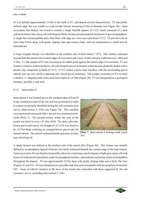
Intervention 8 was located next to the northern edge of Zone D<br />
in the southeastern part of the site <strong>and</strong> was positioned in order<br />
to contact an anomaly identified during the soil resistance area<br />
survey (Intervention 5, F45) (see Figure 36). This machine<br />
excavated trench measured 50m x 4m <strong>and</strong> was orientated northsouth<br />
(Plate 7). The ground surface within the area of the<br />
trench was fairly level at c.41.10m AOD. The dark yellowishbrown<br />
gravel <strong>and</strong> clayey silt ploughsoil (C1123) was found to<br />
be c.0.35m deep overlying an orangish-brown gravel <strong>and</strong> silt<br />
natural subsoil. The subsoil contained b<strong>and</strong>s <strong>and</strong> areas of clean<br />
grey mixed gravel.<br />
Plate 7 Intervention 8 looking south (scale<br />
2m)<br />
A single feature was defined at the northern end of the trench (F4) (Figure 40). This feature was initially<br />
defined as an amorphous deposit of brown silt which continued beneath the western edge of the intervention.<br />
Upon excavation, F4 was found to be possibly sub-oval, containing a sterile deposit of light grey clayey silt with<br />
lenses of oxidised silt immediately under the ploughsoil interface, <strong>and</strong> moderate inclusions of gravel <strong>and</strong> pebbles<br />
throughout the deposit. F4 was approximately 0.35m deep with gently sloping sides <strong>and</strong> a fairly flat base<br />
(Figures 41 <strong>and</strong> 42). F4 was interpreted as a possible sink hole <strong>and</strong> corresponds with the geophysical anomaly<br />
F45. Areas of subsoil variation in the base of the trench also coincided with those suggested by the soil<br />
resistance survey (including Intervention 5, F46).<br />
FIELD ARCHAEOLOGY SPECIALISTS


