Vernon, B.C. March 7-9, 1979 - Government of British Columbia ...
Vernon, B.C. March 7-9, 1979 - Government of British Columbia ...
Vernon, B.C. March 7-9, 1979 - Government of British Columbia ...

You also want an ePaper? Increase the reach of your titles
YUMPU automatically turns print PDFs into web optimized ePapers that Google loves.
<strong>Vernon</strong>, B.C.<br />
<strong>March</strong> 7-9, <strong>1979</strong><br />
PAPER <strong>1979</strong><br />
I<br />
BCEMPR<br />
PAPER<br />
<strong>1979</strong>-4<br />
c. 2<br />
MAI<br />
Province <strong>of</strong><br />
<strong>British</strong> Colombia<br />
EMPR<br />
Ministry <strong>of</strong><br />
Energy, Mines and<br />
Petroleum Resources<br />
INSPECTION AND<br />
ENGINEERING DIVISION<br />
SPONSORED BY<br />
TECHNICAL AND RESEARCH COMMITTEE ON RECLAMATION<br />
BRITISH COLUMBIA MINISTRY OF<br />
ENERGY, MINES AND PETROLEUM RESOURCES<br />
AND<br />
THE MINING ASSOCIATION OF BRITISH COLUMBIA
Library<br />
Energy, Minos &<br />
Petroleum Resources<br />
Victoria, B.'J.<br />
0005037596<br />
PA pee.<br />
RECLAMATION OF LANDS DISTURBED BY MINING<br />
•<br />
P R O C E E D I N G S<br />
<strong>of</strong> the<br />
THIRD ANNUAL BRITISH COLUMBIA<br />
MINE RECLAMATION SYMPOSIUM<br />
Convened at<br />
<strong>Vernon</strong> Lodge<br />
<strong>Vernon</strong>, <strong>British</strong> <strong>Columbia</strong><br />
on<br />
<strong>March</strong> 7, 8, and 9, <strong>1979</strong><br />
Sponsored by<br />
<strong>British</strong><br />
Technical and Research Committee on Reclamation<br />
<strong>Columbia</strong> Ministry <strong>of</strong> Energy, Mines and Petroleum Resources<br />
and the<br />
Mining Association <strong>of</strong> <strong>British</strong> <strong>Columbia</strong>
Canadian Cataloguing in Publication Data<br />
<strong>British</strong> <strong>Columbia</strong> Mine Reclamation Symposium, 3d,<br />
<strong>Vernon</strong>, B.C., <strong>1979</strong>.<br />
Reclamation <strong>of</strong> lands disturbed by mining.<br />
(Paper - Ministry <strong>of</strong> Energy, Mines and Petroleum<br />
Resources ; <strong>1979</strong>-4)<br />
"Sponsored by Technical and Research Committee on<br />
Reclamation, <strong>British</strong> <strong>Columbia</strong> Ministry <strong>of</strong> Energy,<br />
Mines and Petroleum Resources and the Mining<br />
Association <strong>of</strong> <strong>British</strong> <strong>Columbia</strong> 11 .<br />
ISBN 0-7719-8210-0<br />
1. Reclamation <strong>of</strong> land - <strong>British</strong> <strong>Columbia</strong> -<br />
Congresses. 2. Mineral industries - Environmental<br />
aspects - <strong>British</strong> <strong>Columbia</strong> - Congresses. 3.<br />
Tailings (Metallurgy) - Congresses. 4. Spoil<br />
banks - Congresses. 5. Revegetation - <strong>British</strong><br />
<strong>Columbia</strong> - Congresses. I. <strong>British</strong> <strong>Columbia</strong>.<br />
Ministry <strong>of</strong> Energy, Mines and Petroleum Resources.<br />
Technical and Research Committee on Reclamation.<br />
II. Mining Association <strong>of</strong> <strong>British</strong> <strong>Columbia</strong>.<br />
III. <strong>British</strong> <strong>Columbia</strong>. Mineral Resources Branch.<br />
Inspection and Engineering Division. IV. Title.<br />
V. Series: <strong>British</strong> <strong>Columbia</strong>. Ministry <strong>of</strong> Energy,<br />
Mines and Petroleum Resources. Paper - Ministry<br />
<strong>of</strong> Energy, Mines and Petroleum Resources ; <strong>1979</strong>-4.<br />
S605.2.C3B75 631.6 1 09711 C79-092157-X
PREFACE<br />
The Ministry <strong>of</strong> Energy, Mines and Petroleum Resources is pleased to have<br />
played an active role in the sponsoring and organization <strong>of</strong> the Third<br />
Annual B.C. Mine Reclamation Symposium.<br />
This year the Symposium emphasized the reclamation <strong>of</strong> metal mines and also<br />
dealt, in part, in the environmental protection, exploration disturbance<br />
and reclamation research related to metal mining. Attending participants<br />
represented all sectors <strong>of</strong> industry, government, consultants and universities<br />
concerned in reclamation. Their contributions ensured the success<br />
<strong>of</strong> the Symposium.<br />
Since the First B.C. Mine Reclamation Symposium held in 1977, communication<br />
concerning reclamation has been augmented and improved through discussions<br />
at the Second Symposium in 1978 and the Third B.C. Mine Reclamation<br />
Symposium held this year. It is evident that the symposium approach has<br />
contributed greatly to the solutions <strong>of</strong> reclamation problems and the development<br />
<strong>of</strong> reasonable programs and policy in B.C.<br />
Minister<br />
Ministry <strong>of</strong> Energy, Mines<br />
and Petroleum Resources
i<br />
TABLE OF CONTENTS<br />
Editor's Note<br />
OPENING REMARKS BY SYMPOSIUM CHAIRMAN<br />
D.M. Galbraith<br />
Page No.<br />
v<br />
v i i<br />
ENVIRONMENTAL PROTECTION AND RECLAMATION OF EXPLORATION 1<br />
DISTURBANCES<br />
Chairman: N. Carter, Senior Geologist, B.C. Ministry<br />
<strong>of</strong> Energy, Mines and Petroleum Resources<br />
RECLAMATION OF EXPLORATION DISTURBANCES AT SAGE CREEK 3<br />
M.J. Tapics, Sage Creek Coal Ltd.<br />
TRENCHING TECHNIQUES AT THE B.P. SUKUNKA PROJECT 11<br />
R.M. Redgate and W. Nyland, B.P. Exploration Canada Ltd.<br />
EFFECTIVE UTILIZATION OF HELICOPTERS IN RECONNAISSANCE DRILLING 23<br />
L.A. Smith, Pacific Petroleum Ltd.<br />
RECLAMATION OF EXPLORATION DISTURBANCES AT THE ISOLATION RIDGE 39<br />
PROPERTY FORDING COAL LIMITED<br />
A. Magnusson and D. Gaspe, Fording Coal Limited<br />
HELICOPTER SUPPORTED DRILLING PROGRAM AT THE KUTCHO CREEK 53<br />
PROJECT<br />
C. Aird, Esso Minerals Canada Ltd.<br />
EFFECTIVENESS OF THE CLIMBING BACKHOE IN COAL EXPLORATION 63<br />
K. Pomeroy, Dennison Mines Ltd.<br />
KEYNOTE ADDRESS 73<br />
Garnet T. Page, President, the Coal Association <strong>of</strong> Canada<br />
RECLAMATION OF METAL MINE WASTES - PART 1 81<br />
Chairman: A. Bellamy, Bethlehem Mining Corporation<br />
OPERATIONAL RECLAMATION EXPERIENCES AT COMINCO'S BLUEBELL 83<br />
AND PINCHI LAKE MINES<br />
J.E. Stathers and R.T. Gardiner, Cominco Ltd.<br />
RECLAMATION OF DUMP SLOPES 97<br />
J.D. Graham, Lornex Mining Corporation<br />
IRRIGATION WITH SEWAGE EFFLUENT ON THE OLD GRANBY TAILINGS<br />
AT PRINCETON, B.C.<br />
D. P. Lane, and J.D. McDonald, B.C. Ministry <strong>of</strong> Energy, Mines 109<br />
and Petroleum Resources<br />
EXPERIMENTS IN TAILINGS RECLAMATION AT GRANISLE COPPER<br />
W.F.B. Tripp and J*R. Chalmers, Zapata Granby<br />
123
i i<br />
WORKSHOP SUMMARIES - RECLAMATION OF EXPLORATION<br />
DISTURBANCES AND METAL MINES WASTES - PART 1<br />
Page Nb«<br />
131<br />
RECLAMATION OF METAL MINE WASTES - PART 2 141<br />
Chairman: B. Burge, Sage Creek Coal Ltd.<br />
GOVERNMENT FUNDED RECLAMATION PROGRAM ON PRE-LEGISLATION 143<br />
TAILINGS PONDS<br />
A.L. O'Bryan, B.C. Ministry <strong>of</strong> Energy, Mines and Petroleum<br />
Resources<br />
i<br />
RECLAMATION AT NEWMONT MINES, PRINCETON, B.C.<br />
J. McCue, Newmont Mines Ltd.<br />
REVEGETATION FOR WILDLIFE USE<br />
B. van Drimmelen, Ministry <strong>of</strong> the Environment<br />
CURRENT REVEGETATION TECHNIQUES AT CRAIGMONT MINE<br />
L. Gavelin, Craigmont Mines Ltd.<br />
RECLAMATION PRACTICES AT ISLAND COPPER MINE<br />
R. Hillis, Utah Mines Ltd.<br />
PRESENTATION OF THE THIRD ANNUAL RECLAMATION AWARD<br />
<strong>March</strong> 8, Evening Banquet<br />
RECLAMATION RESEARCH<br />
Chairman: Dr. L.M. Lavkulich, Pr<strong>of</strong>essor <strong>of</strong> Soil Science,<br />
University <strong>of</strong> <strong>British</strong> <strong>Columbia</strong><br />
PHOSPHORUS REQUISITE FOR LEGUME-DOMINATED VEGETATION ON<br />
MINE WASTES<br />
R.T. Gardiner and J.E. Stathers, Cominco Ltd.<br />
HAT CREEK RECLAMATION STUDIES, RESULTS OF THE FIRST YEAR<br />
PROGRAM<br />
F.G. Hathorn, B.C. Hydro and Power Authority and<br />
R.L. Docksteader and D.K. McQueen, Acres Consulting<br />
Services Ltd.<br />
157<br />
169<br />
179<br />
197<br />
207<br />
219<br />
221<br />
239<br />
NATURAL REVEGETATION OF DISTURBANCES IN THE PEACE RIVER 273<br />
COALFIELD<br />
D.V. Meidinger, Department <strong>of</strong> Biology, University <strong>of</strong> Victoria<br />
MIGRATION OF ACID SUBSTANCES IN SULLIVAN TAILINGS 309<br />
- A COLUMN STUDY<br />
S. Ames, Department <strong>of</strong> Soil Science, University <strong>of</strong><br />
<strong>British</strong> <strong>Columbia</strong><br />
MAINTENANCE FERTILIZER RESEARCH AT KAISER RESOURCES LTD.<br />
J.W. Fyles, Department <strong>of</strong> Biology, University <strong>of</strong> Victoria<br />
325
FOLLOW-UP OF SLOPE EXPERIMENTS AT FORDING COAL<br />
R. Berdusco and J.L. Popowich, Fording Coal Ltd,<br />
WORKSHOP SUMMARIES - RECLAMATION OF METAL - MINE WASTES<br />
PART 2, RECLAMATION RESEARCH AND SUGGESTIONS FOR<br />
FUTURE SYMPOSIA<br />
APPENDICES<br />
Appendix A - Poster Show Participants<br />
Appendix B - Symposium Program <strong>of</strong> Events<br />
Appendix C - List <strong>of</strong> Symposium Registrants and Students
V<br />
EDITOR'S NOTE<br />
These proceedings present the Symposium events in chronological order.<br />
Presented papers have received minor editing and have been typed. Time<br />
constraints prohibited final text pro<strong>of</strong>reading by individual authors, consequently,<br />
the editorial staff accept responsibility for any errors.<br />
Question and answer periods were tape recorded. Transcripts <strong>of</strong> these<br />
discussions are given at the end <strong>of</strong> each presented paper within the proceedings.<br />
Severe editing <strong>of</strong> the transcripts was sometimes necessary to<br />
curtail the length <strong>of</strong> the question and answer dialogue. The Technical and<br />
Research Committee apologizes for any unwitting alterations in meaning.<br />
Comments made during the two round-table workshop sessions have also been<br />
noted and transcribed. Findings which achieved consensus at the individual<br />
tables were read out at the conclusion <strong>of</strong> each session. There was a considerable<br />
variety <strong>of</strong> opinions expressed and, within the proceedings, an<br />
attempt has been made to include all points <strong>of</strong> view. The opinions most<br />
<strong>of</strong>ten expressed are listed first.
v i i<br />
OPENING REMARKS<br />
by the<br />
SYMPOSIUM CHAIRMAN<br />
D.M. GALBRAITH<br />
Chairman<br />
Technical and Research<br />
Committ<br />
On Reclamation
ix<br />
As Chairman and on behalf <strong>of</strong> the Technical & Research Committee on<br />
Reclamation I would like to welcome you to the <strong>1979</strong> B.C. Mine Reclamation<br />
Symposium.<br />
I would like to introduce your Committee to you. They are:<br />
Mr. Jake McDonald, B.C. Ministry <strong>of</strong> Energy, Mines and Petroleum Resources<br />
Mr. Art 0 f Bryan, B.C. Ministry <strong>of</strong> Energy, Mines and Petroleum Resources<br />
Dr. John Errington, B.C. Ministry <strong>of</strong> Energy, Mines and Petroleum Resources<br />
(Convenor <strong>of</strong> Symposium)<br />
Mr. Bob Gardiner, Cominco Ltd. (Past Chairman)<br />
Mr. Tony Milligan,<br />
Kaiser Resources Ltd. (Incoming Chairman)<br />
Pr<strong>of</strong>. Les Lavkulich, University <strong>of</strong> <strong>British</strong> <strong>Columbia</strong>, Soil Science<br />
Pr<strong>of</strong>. Marc Bell, University <strong>of</strong> Victoria, Forest Ecology<br />
Mr. Clem Pelletier, Utah Mines, Island Copper<br />
Mr. Al Bellamy, Bethlehem Copper Limited<br />
Mr. Roger Berdusco, Fording Coal Limited<br />
Mr. Nick Agnew, B.P. Exploration Ltd.<br />
Mr. Ben van Drimmelen, B.C. Ministry <strong>of</strong> the Environment, Fish & Wildlife<br />
Branch<br />
The original concept <strong>of</strong> this reclamation symposium was to bring together<br />
the people who are involved in mining and reclamation so that they could<br />
exchange their experiences and ideas.<br />
I would like to do my part in getting this dialogue started by introducing<br />
the Chairman <strong>of</strong> the first session, Dr. Nick Carter, Senior Geologist,<br />
Ministry <strong>of</strong> Energy, Mines and Petroleum Resources
1<br />
ENVIRONMENTAL PROTECTION AND RECLAMATION<br />
OF EXPLORATION DISTURBANCES<br />
Chairman <strong>of</strong> the Afternoon<br />
Wednesday, <strong>March</strong> 7, <strong>1979</strong><br />
Session<br />
N. Carter, Senior Geologist<br />
B.C. Ministry <strong>of</strong> Energy, Mines and Petroleum<br />
Victoria, B.C.<br />
Resources
3<br />
RECLAMATION OF EXPLORATION DISTURBANCES<br />
AT SAGE CREEK<br />
Paper<br />
presented<br />
by:<br />
M.J.<br />
Tapics<br />
Sage Creek<br />
Coal Ltd.
5<br />
RECLAMATION OF EXPLORATION DISTURBANCES AT SAGE CREEK<br />
INTRODUCTION<br />
Sage Creek Coal Limited was incorporated in 1970 under the Companies 1 Act<br />
<strong>of</strong> <strong>British</strong> <strong>Columbia</strong>, It is managed and 60% owned by Rio Algom Limited in<br />
Toronto and 40% owned by Pan Ocean Oil Limited in Calgary,<br />
The Sage Creek Property is located in the southeast corner <strong>of</strong> <strong>British</strong><br />
<strong>Columbia</strong>, about 10 miles west <strong>of</strong> the Alberta border and about 8 miles<br />
<strong>of</strong> the United States boundary.<br />
north<br />
Exploration work has been conducted on the property from 1970 through 1977,<br />
Approximately 200 acres <strong>of</strong> land were disturbed through the establishment <strong>of</strong><br />
30 miles <strong>of</strong> roads, 4,400 feet <strong>of</strong> trenches, 14 adits and d r i l l sites for 159<br />
holes. These disturbances were concentrated on two large hills which are<br />
separated by Cabin Creek. Throughout this paper these hills will be<br />
referred to as North Hill and South Hill. Cabin Creek is a tributary <strong>of</strong><br />
the Flathead River.<br />
Due in part to high expectations for obtaining a sales contract and, in<br />
part, to a sequence <strong>of</strong> field programs which were conducted over the same<br />
general area, seeding and fertilizing were not carried out from 1970<br />
through 1976. Rio Algom felt that there was no point in reclaiming land<br />
one year that would be redisturbed the following summer. However, erosion<br />
control was done through the use <strong>of</strong> ditches, berms on roadways and water<br />
bars; and trenches were recontoured soon after they were excavated.<br />
Reclamation <strong>of</strong> all disturbances was undertaken during the summer <strong>of</strong> 1977<br />
and 1978. Most <strong>of</strong> these disturbances occurred between the 4,300 and 5,500<br />
foot elevations.
6<br />
RECLAMATION PROGRAMS<br />
Disturbances were divided into three main areas: the north face <strong>of</strong> South<br />
H i l l , the south face <strong>of</strong> North Hill and general access roads and d r i l l<br />
sites. Reclamation was divided into two programs: A 1977 program which<br />
concentrated on the first two areas; and a 1978 program which involved<br />
general access roads, d r i l l sites and maintenance work on the previous<br />
year's reclamation.<br />
The North Face <strong>of</strong> South Hill<br />
I will concentrate on the north face <strong>of</strong> South Hill since this area<br />
posed the biggest problem. Surface erosion had occurred in the vici-*-<br />
nity <strong>of</strong> adits.<br />
Since this area was saturated with water, it was impossible to use<br />
tracked equipment without site preparation. Preliminary work involved<br />
the use <strong>of</strong> a D6C bulldozer to upgrade roads. This upgrading included<br />
cleaning out ditches and construction <strong>of</strong> water bars and diversion<br />
berms.<br />
A layer <strong>of</strong> rock rip rap was spread in the high moisture content areas<br />
in the vicinity <strong>of</strong> adits. To accomplish this, rock was dozed out <strong>of</strong><br />
nearby roadway rock cuts. This material was also pushed into washouts<br />
to stabilize slopes and to form french drains.<br />
Large trees that were undermined by erosion were cut up and removed<br />
from the site. To avoid unnecessary damage and to aid in stabilization,<br />
minor forest debris was left on the slopes. In addition, the<br />
debris acts as a heavy vegetative mulch.
7<br />
Final control measures included the construction <strong>of</strong> a cut-<strong>of</strong>f ditch<br />
along the toe <strong>of</strong> the final slope. Water and fines collected by this<br />
ditch are discharged into a small settling pond, and the excess water<br />
from this pond is discharged into dense bush for further filtering.<br />
After one year's use <strong>of</strong> this system a sediment fan was formed which<br />
contained coal fines. A second settling pond was constructed at the<br />
base <strong>of</strong> the h i l l before final discharge into Cabin Creek.<br />
Three separate seeding techniques were applied to the north face <strong>of</strong><br />
South Hill. Steep slopes were hydroseeded, mulched and fertilized<br />
using 50 pounds <strong>of</strong> grass/legume mix, 875 pounds <strong>of</strong> wood fibre mulch and<br />
200 pounds <strong>of</strong> 16-20-0 fertilizer per acre. Roads were broadcast seeded<br />
with 30 pounds <strong>of</strong> grass/legume mix and 200 pounds <strong>of</strong> 16-20-0 fertilizer<br />
per acre. Steep inaccessible areas were hand seeded with 30 pounds <strong>of</strong><br />
grass/legume mix per acre.<br />
The seed mix by weight used in all cases was:<br />
Creeping Red Fescue - 25%<br />
Kentucky Bluegrass - 20%<br />
Climax Timothy - 10%<br />
Perennial Ryegrass - 10%<br />
Vernal Alfalfa - 15%<br />
Redtop Fescue - 5%<br />
Chinook Orchardgrass - 15%<br />
After one year the seed germination results obtained were very good.<br />
The slope stabilization program proved to be quite effective with only<br />
minor slumps occurring in some <strong>of</strong> the washouts and steep road banks.<br />
Most <strong>of</strong> the downhill movement <strong>of</strong> water was restricted to the ditches<br />
and settling ponds.
8<br />
The South Face <strong>of</strong> North Hill<br />
This area is very dry and exposed, with l i t t l e or no surface water present.<br />
Reclamation was designed to restore the aesthetic values <strong>of</strong> the<br />
site and to speed up the restoration <strong>of</strong> the area to its principal land<br />
use. It was felt that establishment <strong>of</strong> a grass/legume stand on the<br />
area would achieve these objectives. Some minor road work and contouring<br />
was done using a caterpillar tractor, primarily to provide<br />
access for the seeding equipment. Seeding was confined to hydroseeding<br />
and mulching. Specifications were similar to the South H i l l , with the<br />
following seed mixture by weight being used:<br />
Magna Bromegrass - 25%<br />
Sweet Clover - 10%<br />
Crested Wheatgrass - 20%<br />
Creeping Red Fescue - 20%<br />
Sainfoin - 15%<br />
Kentucky Bluegrass - 10%<br />
In addition, 45 pounds per acre <strong>of</strong> Fall Rye Grain were sown as a cover<br />
crop. The rye germinated rapidly and helped to reduce soil temperatures<br />
and hold soil and moisture. Otherwise, seed germination on<br />
this particularly dry site was not as successful as it was on South<br />
Hill.<br />
Access Roads, Drill Sites and Maintenance <strong>of</strong> 1977 Program Work<br />
All roads were ditched, water bars were constructed as required, and<br />
the areas were seeded, fertilized and harrowed followed by application<br />
<strong>of</strong> the same seed poundage per acre and the same type <strong>of</strong> fertilizer as<br />
was used previously.
Areas from the 1977 program that experienced incomplete stands <strong>of</strong> grass<br />
were either reseeded and fertilized or were hand seeded.<br />
The seed mix used in dry areas was the same as that applied to the<br />
south face <strong>of</strong> North Hill, whereas the seed mix used in wet areas was<br />
adjusted slightly from that applied to the north face <strong>of</strong> South Hill.<br />
Since the Alfalfa did not germinate well, it was replaced by Alsike and<br />
Double Cut Red Clover in the blend. These were chosen due to our<br />
reclamation contractor's success with them at other sites.<br />
COSTS<br />
In <strong>1979</strong> dollars, the 1977 program expenditure was $36,000 for 55 acres, and<br />
included substantial dozer time. On this same dollar basis, the 1978<br />
program cost $38,000 for 145 acres. Based on these past programs, approximate<br />
<strong>1979</strong> unit costs would be $260 per acre for tractor seeding, fertilizer<br />
and harrowing; $165 per acre for hand seeding; and, $540 per acre for<br />
hydroseeding, mulching and fertilizing. The average cost per acre to-date<br />
for the program is approximately $423. However, some maintenance work will<br />
be necessary which, it is anticipated, may reach $500 per acre to completely<br />
reclaim the site.<br />
ACKNOWLEDGMENT<br />
In conclusion, I would like to thank Alan Lamb <strong>of</strong> Interior Reforestation<br />
for his considerable assistance in the preparation <strong>of</strong> this paper.
10<br />
DISCUSSION RELATED TO MIKE TAPICS 1<br />
PAPER<br />
Stan Weston, Wesago I do not recommend seed mixes which include sweet<br />
clover as it inhibits blood clotting, and causes internal and external<br />
bleeding in animals, through dicumarin production. Somebody has to be<br />
responsible for seeding an area. They may be liable to claims from cattlemen<br />
or wildlife people relating to animal mortality.<br />
Alan Lamb, Interior Reforestation Ltd. I have been working on rangelands<br />
for about fifteen years and I have never yet lost a cow to sweet clover.<br />
Stan Weston, Wesago Both Bob Duggan and I could bring in cattlemen who<br />
will not cut an animal that has been feeding exclusively on sweet clover,<br />
until it has been <strong>of</strong>f sweet clover for at least three weeks. During that<br />
time, they will feed the animals themselves. I have worked with cattle and<br />
cattlemen for over thirty years and I know a l i t t l e bit about the problem.<br />
Roger Shaneman, Manalta Coal I ' l l just rephrase that. It is sweet clover<br />
sileage that is a problem, not range sweet clover.<br />
Stan Weston, Wesago It is sweet clover that grows in the field; and I<br />
s t i l l say cattle should not eat i t .<br />
Paul Ziemkiewicz, Alberta Energy A report from Kingsbury in "Poisonous<br />
Plants <strong>of</strong> the United States and Canada" indicates that the only instances<br />
<strong>of</strong> dicumarin problems are with wetbale or from sileage sweet clover, never<br />
from field cured sweet clover and never from any animal foraging on green<br />
sweet clover.
11<br />
TRENCHING TECHNIQUES AT THE<br />
B.P.<br />
SUKUNKA PROJECT<br />
Paper prepared<br />
by:<br />
jointly<br />
R.M.<br />
Redgate<br />
and<br />
W. Nyland<br />
B.P. Exploration Canada Limited
13<br />
TRENCHING TECHNIQUES AT THEB. P. SUKUNKA PROJECT<br />
INTRODUCTION<br />
This discussion outlines the trenching programs on our Sukunka property.<br />
In addition to detailing the equipment utilized, geological information<br />
obtained, and reclamation procedures, a cost comparison <strong>of</strong> different machines<br />
will also be derived.<br />
The Sukunka property is located in northeastern B.C., approximately 60<br />
kilometres south <strong>of</strong> the village <strong>of</strong> Chetwynd (Figure 1). The lease occupies<br />
165 square kilometres and is known to contain significant reserves <strong>of</strong><br />
metallurgical coal. Located in the Inner Foothills belt, access to the<br />
property is by a logging road up the Sukunka River Valley (Figure 2).<br />
The area is in the Sub-boreal Forest Region and contains rugged terrain<br />
with diverse vegetation patterns: from the alpine tundra zone atop<br />
Bullmoose Mountain; through Sub-alpine Engelmann Spruce - Alpine Fir zones<br />
in major valleys; to Sub-boreal White Spruce - Alpine Fir zones in the<br />
Sukunka Valley. Elevations range from 725 to 2025 metres.<br />
Two mine portals, both located on outcrop, have been developed to access<br />
the reserves: the Sukunka Main Mine and the Number 1 Mine.<br />
Coal exploration has taken place on the property since 1969; however, B. P.<br />
did not actively explore the lease until the summer <strong>of</strong> 1977.
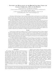
FIGURE 2<br />
TECTONIC SETTING OF<br />
NORTHEASTERN BRITISH COLUMBIA
16<br />
TRENCHING ACTIVITIES<br />
During the summer <strong>of</strong> 1978, exploration consisted <strong>of</strong> a combined program <strong>of</strong><br />
drilling, trenching and field mapping. The duration <strong>of</strong> the program was<br />
approximately four months, from mid-May through to mid-September. The<br />
majority <strong>of</strong> reclamation work associated with these activities also took<br />
place in the summer <strong>of</strong> 1978.<br />
Trenching provided valuable geological information on structure, stratigraphy<br />
and coal quality. Structural information obtained included a<br />
description <strong>of</strong> jointing, cleavage, bedding and faulting. Stratigraphic<br />
information included mainly a detailed description <strong>of</strong> ro<strong>of</strong> and floor contacts<br />
not easily observed in drill cores. In addition, although<br />
unweathered sections <strong>of</strong> outcrop are not exposed during trenching, information<br />
on raw ash, moisture, volatiles, calorific value and a qualitative<br />
assessment <strong>of</strong> coking properties was obtained.<br />
Generally, trenches were located in three types <strong>of</strong> locations. First,<br />
outcrops along roadsides were trenched to expose a physically undisturbed<br />
section. Secondly, to verify previously obtained information, old outcrop<br />
strips were trenched at 300 metre intervals, or less if warranted by the<br />
geology. And finally, areas <strong>of</strong> unknown, but inferred, outcrop were<br />
trenched to locate the exact position <strong>of</strong> seams. These trenches were<br />
largely unsuccessful due to the excessive depth <strong>of</strong> overburden.<br />
TRENCHING MACHINES<br />
Within the 1978 exploration program, considerable emphasis was placed on<br />
trenching. Therefore, relatively inexpensive and mobile trenching machines<br />
were required. This made the choice <strong>of</strong> machines critical. Six parameters<br />
were considered when evaluating the available alternatives:
17<br />
1. Mobility - the lease area contains an extensive network <strong>of</strong> roads<br />
and outcrop strips, which allows the use <strong>of</strong> fast rubber-wheeled<br />
vehicles, however, the area also contains steep and difficult<br />
terrain, necessitating the use <strong>of</strong> tracked vehicles;<br />
2. Physical size - for maximum mobility and flexibility, machinery<br />
had to be small enough to manoeuver in tight spots but large<br />
enough to trench in difficult areas;<br />
3. Depth capability - machinery had to be capable <strong>of</strong> trenching to a<br />
depth <strong>of</strong> 4 to 5 metres;<br />
4. Width <strong>of</strong> trench - to reduce surface disturbance, a bucket width <strong>of</strong><br />
just over half a metre was desirable;<br />
5. Cost - all machinery was commissioned on a per hour basis;<br />
6. Availability - it was necessary to work within the limits <strong>of</strong><br />
machines available in the Chetwynd region.<br />
In the 1978 program, two machines were utilized: a rubber-tired John Deere<br />
510 backhoe and a wide-pad Caterpillar D4. The big advantage <strong>of</strong> the 510<br />
was its mobility between trench sites, travelling at speeds <strong>of</strong> 15 to 20<br />
kilometres per hour depending on road conditions. The 510 backhoe also had<br />
an effective reach <strong>of</strong> 5 metres and a heavy boom. The disadvantage <strong>of</strong> the<br />
510 was its immobility on steep or wet terrain; this necessitated bulldozer<br />
support and elevated the cost <strong>of</strong> trenching substantially. Costs for the<br />
John Deere 510 backhoe were 48 dollars per hour.<br />
Under adverse conditions, a wide-pad Caterpillar D4 with a detachable<br />
backhoe was utilized. This machine, although slow between trenching sites,<br />
proved to be very effective on wet and steep terrain. The backhoe part <strong>of</strong><br />
the machine had a slightly shorter reach (about 4 metres) and a lighter<br />
boom than the 510; however, this was more than <strong>of</strong>fset by its ability to get<br />
into otherwise inaccessible areas. A big advantage <strong>of</strong> the D4 was that in<br />
areas where heavy bush was encountered, only a slashed trail was needed for
18<br />
access. A slashing crew went ahead and cut a trail just wide enough for<br />
the machine (about 4 metres), bucking the timber into short, 2 metre<br />
lengths. When the D4 came in to trench, it walked the bucked timber into<br />
contact with the ground. This procedure eliminated the need for road<br />
building, and prevented disturbance <strong>of</strong> the mineral soil and subsequent elaborate<br />
reclamation. Costs for the D4 when utilizing the backhoe were 38<br />
dollars per hour; however, when the backhoe was not being used, this cost<br />
was reduced to 32 dollars per hour.<br />
TRENCHING METHOD<br />
The actual technique <strong>of</strong> trenching using either the 510 or D4 was as follows.<br />
The trench sites were flagged in geologically pertinent areas as determined<br />
by field mapping and, in some cases, drilling. If a trail or road to the<br />
trench site did not exist, a trail was flagged and slashed. A 0.7 metre<br />
wide bucket was used on all equipment. The material from the trench was<br />
piled as close as possible to the trench, usually within the radius <strong>of</strong> the<br />
boom, so that backfilling could be facilitated. Close supervision was<br />
exercised during all trenching so that unnecessary work would be eliminated.<br />
The trench was usually logged directly after it was opened, so that<br />
further cleaning out would not be necessary, and it could be backfilled and<br />
levelled before the backhoe moved to the next site.<br />
Materials were immediately backfilled in the reverse order <strong>of</strong> extraction,<br />
which <strong>of</strong>fered a number <strong>of</strong> reclamation advantages. First mineral and organic<br />
components <strong>of</strong> the soil could be restored in approximately their original<br />
order. Secondly, pH and microbial activity in the soil could be<br />
retained; and, finally, soil loss through erosion could be minimized.<br />
After backfilling, the standard Mineu and Petroleum Resources seed mixture<br />
(percent by weight) for forested areas was applied and subsequently fertilized<br />
at a rate <strong>of</strong> 44 kilogrammes per hectare:
19<br />
1. Boreal Creeping Red Fescue - 40%<br />
2. Climax Timothy - 20%<br />
3. Redtop - 15%<br />
4. Alsike Clover - 25%<br />
Cost Comparison between 1977 and 1978 Programs<br />
During the 1977 exploration program, a Caterpillar D6 or D8 was used<br />
extensively for trenching. A cost comparison between this type and<br />
backhoe trenching has been made (Figure 3). All cost comparisons are<br />
based on dollar values during the respective year <strong>of</strong> operation - 1977<br />
or 1978. Costs are only a comparison between the actual trenching<br />
activities; no costs for site access have been included.<br />
In 1977, approximately 80 hours <strong>of</strong> Cat time were used to cut four<br />
trenches to a total length <strong>of</strong> 178 metres, which varied in width from 10<br />
to 15 metres. In 1978, approximately 82 hours <strong>of</strong> backhoe time were<br />
used to cut 53 trenches to a total length <strong>of</strong> 153 metres, which had a<br />
maximum width <strong>of</strong> one metre. Costs per linear metre <strong>of</strong> trench were much<br />
lower in 1978 than 1977: Cat work averaged 201 dollars (201.24<br />
dollars) per metre ; backhoe worked averaged only 23 dollars (22.53<br />
dollars) per metre.<br />
SUMMARY<br />
In summary, significant savings can be realized with the use <strong>of</strong> rubbertired<br />
or wide-track backhoes for trenching. In addition, since the area <strong>of</strong><br />
surface disturbance is greatly minimized compared to bulldozer trenches and<br />
an equal return <strong>of</strong> geologic information is obtained, the resultant environmental<br />
impacts and reclamation costs can be significantly reduced.
20<br />
FIGURE 3<br />
COST COMPARISONS OF TRENCHING<br />
USING BULLDOZER AND BACKHOE<br />
TECHNIQUES<br />
YEAR EQUIPMENT TYPE TOTAL LINEAR METRES , COST/M<br />
1977 D8 & D6 178 metres , $201.00<br />
1978 D4 Backhoe 153 metres $22.50<br />
510 Backhoe
21<br />
DISCUSSION RELATED TO BOB REDGATE<br />
AND W. NYLANDS 1<br />
PAPER<br />
There was no discussion about this paper.
23<br />
EFFECTIVE UTILIZATION OF HELICOPTERS<br />
IN RECONNAISSANCE<br />
DRILLING<br />
Paper presented<br />
by:<br />
L.A.<br />
Smith<br />
Pacific<br />
Petroleums Ltd.
25<br />
EFFECTIVE UTILIZATION OF HELICOPTERS IN RECONNAISSANCE<br />
DRILLING<br />
INTRODUCTION<br />
This paper discusses exploratory drilling for coal in remote Foothills<br />
terrain in which access is difficult and expensive. Information is based<br />
on and derived from 3 years <strong>of</strong> exploration on the Monkman Coal Project in<br />
northeastern B.C. (Figure 1). The property is located near the south end<br />
<strong>of</strong> the Peace River Coalfield. Figure 2 indicates the logistics <strong>of</strong> the property<br />
when we commenced work in 1976. This property is 75 kilometres long<br />
and stretches from Kinuseo Creek in the north to the Narraway River in the<br />
south. The road network at that time consisted <strong>of</strong> the Wapiti River Road,<br />
the Kinuseo Falls Road, the Triad Prairie Creek Road leading southwest <strong>of</strong>f<br />
the Wapiti River Road, Denison Mines 1 Quintette Road in our Five Cabin area<br />
and local access <strong>of</strong> poor quality in the Duke Mountain area. The physiography<br />
is typical <strong>of</strong> the northern foothills and varies from glacial<br />
valleys with thick t i l l and heavy forest cover to forested and poorly<br />
drained hillsides, to sub-alpine and alpine ridge tops.<br />
EXPLORATION PROGRAM 1976 TO 1978<br />
Objectives<br />
In 1976 when Pacific commenced work our objectives were typical <strong>of</strong><br />
first-phase exploration:<br />
1. Determine the extent <strong>of</strong> coal measures on and adjoining the property.<br />
2. Determine the rank, quality and extent <strong>of</strong> development <strong>of</strong> the coal<br />
seams.<br />
3. Determine those areas most favourable for follow-up work.
27<br />
9J-I-JS,* -<br />
•<br />
FIGURE 2<br />
PHVSIOGRAPHY OF THE MONKMAN COAL PROJECT
28<br />
In subsequent years the objectives became definitive and included<br />
reference to the development <strong>of</strong> blocks <strong>of</strong> mineable coal. Thus, over a<br />
three-year period, our information base increased and we became more<br />
selective with our drill targets and decreased the area to be explored.<br />
1976 Program<br />
A field camp was set up on the Wapiti River and geologic mapping commenced<br />
in late spring. The helicopter diamond drilling started in<br />
early July, and by early September we had completed 11 helicopter drill<br />
holes and one road-access drill hole. The equipment used initially was<br />
as follows:<br />
1 only 206B helicopter<br />
2 only Longyear 38 drills with NQ rods<br />
1 only portable logging unit split into<br />
2 sections <strong>of</strong> 900 pounds each<br />
We decided to use small diamond drills in order to allow mobility with<br />
a 206B helicopter, thus we felt we were restricted to NQ core size. It<br />
did not take long to find out that the costs <strong>of</strong> rig moves were inordinately<br />
high in terms <strong>of</strong> helicopter and rig time. Therefore medium<br />
turbines (205A f s and S-58T f s) were ferried in for many <strong>of</strong> the long<br />
moves. We found that the ferry costs from Prince George were not a<br />
major factor and that the overall cost saving with these larger machines<br />
was significant.<br />
The 206B was used to ferry the logging unit from site to site. The<br />
large dots labelled 1976 in Figure 3 show the drill holes completed on<br />
this program.
30<br />
1977 Program<br />
This program was all land-supported and all holes were drilled on the<br />
Duke Mountain Block. The construction <strong>of</strong> a new 13.3 kilometre road<br />
allowed access to eight drill sites.<br />
1978 Program<br />
In 1978, 46 diamond and rotary holes and 2 adit sites were located on<br />
the Duke Mountain Block. They are shown as small black dots and small<br />
circles in Figure 3. All <strong>of</strong> these sites were reached by poor quality<br />
roads. Additionally four helicopter-access drill holes and two roadaccess<br />
holes were put in the Western area (large dots labelled 1978 in<br />
Figure 3).<br />
Cost Effectiveness and Means <strong>of</strong> Access, 1976, 1977 and 1978 Programs<br />
The first noteworthy item is that none <strong>of</strong> the helicopter-accessed drill<br />
sites cost more than 500 dollars to slash and reclaim, whereas, the<br />
roadbuilding program required nearly 1,500 dollars per kilometre direct<br />
cost for slashing, revegetation and erosion control. Table 1 shows the<br />
breakdown <strong>of</strong> the combined drill move and support costs. These figures<br />
do not include rig costs for drill moves, and trucking costs that were<br />
increased because <strong>of</strong> required changeover <strong>of</strong> a diamond drill and a<br />
logging unit to portable units. However, Table 1 does indicate the<br />
effectiveness <strong>of</strong> helicopter transport for long distance moves.<br />
Road building costs for 1977 and 1978, which included all site preparation,<br />
roadbuilding, road maintenance, cleanup and reclamation costs,<br />
averaged 7,440 dollars per kilometre. The reason for this high cost<br />
was heavy timber and muddy conditions.
31<br />
TABLE 1<br />
COST OF HELICOPTER DRILL MOVES<br />
MOVE COST SUPPORT TOTAL COST LENGTH COST SUPPORT COST/<br />
YEAR NO. HOLES PER HOLE COST/HOLE PER HOLE OF MOVE (km) ($/km) METRE DRILLED<br />
1976 11 3600 6300 9900 12 825 34<br />
1978 7600 9400 17,000 26 650 42<br />
AVERAGE 15 4700 7100 11,800 705 37<br />
COST OF ROAD DRILL MOVES<br />
TOTAL ROAD COST LENGTH OF SUPPORT COST/<br />
YEAR NO. HOLES COSTS PER HOLE MOVE (km) COST ($/km) METRE DRILLED<br />
1977 66,000 8250 1.7 4850 32.20<br />
1978 48 181,000 3770 0.8 4700 17.50<br />
AVERAGE 56 4410 4740 19.90
32<br />
Figure 4 consists <strong>of</strong> two charts which compare the cost <strong>of</strong> road access<br />
versus helicopter access. The left hand chart shows the cost in<br />
dollars per kilometre for various moves over varying distances. Three<br />
different road costs are presented, which are plotted as horizontal<br />
lines. The helicopter costs for the 1976 and the 1978 programs are<br />
plotted, and a third point has been calculated for a 1 kilometre move.<br />
The helicopter access curve has been developed on this framework. It<br />
is immediately obvious that the incremental helicopter costs decrease<br />
dramatically with increasing distance to a certain point. The helicopter<br />
curve crosses the current Monkman road cost line at the 1.7<br />
kilometre mark. It is noted that, even if we were able to reduce road<br />
costs to 3,000 dollars per kilometre, we would only supply 3.5 kilometres<br />
<strong>of</strong> road access before helicopter moves became more economical.<br />
At the unrealistically low road cost <strong>of</strong> 1,000 dollars per kilometre,<br />
the breakeven point between road and helicopter access would be 11.2<br />
kilometres.<br />
The righthand chart shows total costs versus distance. The helicopter<br />
move curve is obviously shallower than the road access curve. At present<br />
Monkman costs, the break-even point is, as we saw on the other<br />
chart, 1.7 kilometres.<br />
These figures have been generated for the Monkman property with its own<br />
peculiar set <strong>of</strong> logistics. However, there is no reason to expect that<br />
on another property the figures would change by more than 50 percent.<br />
I will now mention a series <strong>of</strong> constraints that must be considered when<br />
evaluating method <strong>of</strong> access:<br />
1. Weather and climate<br />
2. Physiography <strong>of</strong> the area to be drilled<br />
3. Local environmental sensitivity<br />
4. Reclamation costs<br />
5. Drilling equipment requirements<br />
6. Availability <strong>of</strong> equipment
FIGURE 4<br />
COSTS OF ROAD VERSUS HELICOPTER<br />
ACCESS
34<br />
7. Availability <strong>of</strong> suitable aircraft<br />
8. Length <strong>of</strong> move<br />
9. Certainty <strong>of</strong> follow-up drilling<br />
In conclusion I wish to reiterate the following points:<br />
1. Get the right drilling and logging equipment to do the job.<br />
Equipment is <strong>of</strong>ten expensive so do not sacrifice quality for quantity<br />
unless circumstances dictate. Know your equipment weights<br />
(Table 2) and use contractors who also know them.<br />
2. For short moves by air a small turbine may suffice, but if distances<br />
are 6 kilometres or longer and medium turbines are available,<br />
use them. Try to match the helicopter to the equipment and the<br />
distances concerned.<br />
3. For preliminary exploration consider flying a rig to isolated<br />
drillsites that require a move <strong>of</strong> more than 2 kilometres.<br />
4. If you are certain that the total follow-up work will result in<br />
less than 2 kilometres <strong>of</strong> road/drillsite, plan access roads as soon<br />
as is practical. This will allow more flexibility in choosing<br />
equipment, which can significantly lower overall costs.
35<br />
TABLE 2<br />
SUPER 38 LONGYEAR DIAMOND DRILL<br />
HELICOPTER PORTABLE WEIGHTS<br />
Item Weight (pounds)<br />
20-foot Aluminum Tower 900<br />
Tabular Skids, fuel tanks and bunks 1200<br />
Folding Drill Shack 700<br />
Super 38 d r i l l with H chuck 3180<br />
353 diesel motor 1230<br />
10-foot HQ rod 77<br />
10-foot HQ casing 113<br />
Portable mud tanks 1000<br />
435 mud pump 1400<br />
Supply pump 820<br />
1000 feet <strong>of</strong> water line 650<br />
Floor planks 1400<br />
Mud mixer and tank 650<br />
Rod rack and slide 100<br />
Basket 180<br />
Hydraulic cylinder for tower 110<br />
Stiff legs 250<br />
Core barrel with tubes 220<br />
Tidy tank 110<br />
1 HQ core box 12<br />
1 bag mud 50<br />
4 tool boxes 800<br />
100 ft. high pressure hose 100<br />
5 wooden sills 650<br />
Blocks for sills 400
36<br />
DISCUSSION RELATED TO LES SMITH'S PAPER<br />
Greg Jones, Ministry <strong>of</strong> Lands, Parks and Housing. You said that you were<br />
worried about contractors not knowing the weight <strong>of</strong> the equipment that they<br />
were lifting. Well, previously I was involved with helicopter logging on<br />
the Island, and the co-pilot would watch a weight gauge. If it indicated<br />
over 20,000 pounds, which was the weight limit for the big bird they were<br />
using, the co-pilot could just press the k i l l button and it would drop<br />
everything.<br />
ANS.<br />
Lovely.<br />
Greg Jones. I was just pointing out that that's an alternative to having<br />
to know exactly what your weight should be, if you have no scale handy.<br />
ANS. Yes, some operators use them. We used a 205 for a couple <strong>of</strong> moves<br />
this summer where we had them on. They had to install scales because there<br />
were several crashes with the 205 last summer and they had to put the<br />
weights on the machines so that they could delift down to 3,000 from 3,500<br />
pounds.<br />
Neil Duncan, Energy Resources Conservation Board. What was the reason for<br />
the four-kilometre spacing <strong>of</strong> the drill holes, which didn't seem to match<br />
into the geology <strong>of</strong> the place. It seemed like a rather strange type <strong>of</strong><br />
program.<br />
ANS. No comment.<br />
Jim Meyer, Byron Creek Collieries. Did the d r i l l crew travel back and<br />
forth in a helicopter every night, as well.
37<br />
ANS. Yes. In 1976 and 1978 we used the light turbines for support <strong>of</strong> the<br />
rig.<br />
Jim Meyer. Basically you're saying that you have few roads and therefore<br />
the helicopter drilling is cheaper. What if you plan to do more drilling<br />
in there Your exploration costs will get lower each time, if you have the<br />
roads to start with.<br />
ANS. Yes. My seminar paper was designed to discuss preliminary exploration<br />
and during this past summer we did build 39 kilometres <strong>of</strong> road to provide<br />
access. Our experience on this road gave me a lot <strong>of</strong> the cost<br />
derivation that I have used here. Once you know that you are going into an<br />
area and you are sure you have something, then it's worth building the<br />
road. All I am pointing out is that when you have a property with difficult<br />
access, don't start planning on building 20 kilometres <strong>of</strong> road. It<br />
can produce some problems for you.<br />
Marv Mitchell, Range Oil Ltd. How many man shifts did you lose on the rigs<br />
due to inclement flying weather.<br />
ANS. In 1976 we lost quite a few shifts but in 1978 very few. I would say<br />
that helicopter drilling raises your drilling costs, particularly your<br />
direct drill contract costs, by 15 to 20 percent. This is mainly due to<br />
lost time and to night-time equipment failures in the field when you can't<br />
do anything about them.
39<br />
RECLAMATION OF EXPLORATION DISTURBANCES<br />
AT THE ISOLATION RIDGE PROPERTY<br />
FORDING COAL LIMITED<br />
Paper<br />
presented<br />
by:<br />
A. Magnusson<br />
and<br />
D. Gaspe<br />
Fording Coal Limited
41<br />
RECLAMATION OF EXPLORATION DISTURBANCES AT THE ISOLATION RIDGE PROPERTY<br />
FORDING COAL LIMITED<br />
INTRODUCTION<br />
During the summer <strong>of</strong> 1978, Fording Coal Limited completed an important<br />
reclamation project at Isolation Ridge in the Headwaters <strong>of</strong> the Oldman<br />
River. The property is located in the Rocky Mountains some 40 road miles<br />
north <strong>of</strong> Coleman, Alberta or 16 miles as the crow flies, east <strong>of</strong> Elkford,<br />
B.C.<br />
Fording's predecessor, CanPac Minerals Limited, acquired coal leases to the<br />
area in 1969 and spent the next three years exploring for metallurgical<br />
coal. In 1973 the property was optioned to the Granby Mining Corporation<br />
Limited, <strong>of</strong> Vancouver, B.C., who performed more exploration work the<br />
following year. All work was suspended in 1975 because the Alberta<br />
<strong>Government</strong> was formulating its Eastern Slopes Policy and Granby could not<br />
obtain exploration permits. The Policy was issued in 1976 and it<br />
classified the Isolation Ridge area as part <strong>of</strong> Category Two. This category<br />
prohibits surface mining and the Granby Corporation did not exercise its<br />
option to purchase the property. Isolation Ridge reverted back to Fording<br />
Coal in 1978.<br />
PROJECT OBJECTIVE<br />
This reclamation program was undertaken by Fording Coal Limited, as successor<br />
to CanPac Minerals Limited, to reclaim disturbed areas which would<br />
not be required for exploration purposes in the foreseeable future.<br />
All <strong>of</strong> the work was to be performed to the satisfaction <strong>of</strong> the Alberta<br />
Forest Service. Regulations required that disturbed areas be brought back<br />
to approximate original contour and reseeded to prevent erosion and to<br />
establish growth.
42<br />
Early in 1978, areas requiring restoration and those to be left open for<br />
future access were identified by the Land Use Office, Alberta Forest<br />
Service in co-operation with Fording Coal Limited personnel.<br />
PROJECT SIZE<br />
Up to the end <strong>of</strong> 1974, some 56 miles <strong>of</strong> trails, 82 drill sites, 91 trenches<br />
and six adit sites had been constructed. During the fall <strong>of</strong> 1974, all the<br />
adit sites were reclaimed along with some <strong>of</strong> the larger drill sites.<br />
The 1978 reclamation project was concerned with 43.5 miles <strong>of</strong> trails and<br />
approximately 50 drill sites associated with these roads.<br />
To best utilize the short work period available to the project, it was<br />
decided to establish a temporary camp near the work site rather than have<br />
the crew commute from Coleman. A camp consisting <strong>of</strong> seven 30' x 10'<br />
trailers was established near the Oldman River. This served as base <strong>of</strong><br />
operations for the 11 man crew.<br />
Elevations on the property ranged from 5450 feet at the Oldman River campsite<br />
up to +8300 feet on Isolation Ridge.<br />
RECLAMATION EQUIPMENT<br />
Some <strong>of</strong> the initial reclamation work conducted by Granby and CanPac<br />
Minerals involved the use <strong>of</strong> a small crawler dragline, a Gradall 880 excavator<br />
and tracked bulldozers. The work carried out in 1974 showed that<br />
the Gradall 880 performed satisfactorily in restoring exploration trails.<br />
Subsequent restoration work carried out at the company's Fording River<br />
Operations showed that the Caterpillar 225 backhoes also performed satisfactorily<br />
under this type <strong>of</strong> field work.
43<br />
The backhoes could reach between trees, to salvage soils displaced by the<br />
road building process. The safety consideration <strong>of</strong> better gradeability and<br />
a lower centre <strong>of</strong> gravity led to a choice <strong>of</strong> Caterpillar 225 backhoes for<br />
this<br />
project.<br />
Two Caterpillar 225 backhoes with 1 cubic yard buckets were used on the<br />
project with a D7E bulldozer employed to open access roads and put in cross<br />
drains.<br />
Drain Brothers Construction Limited <strong>of</strong> Blairmore was chosen as the<br />
contractors.<br />
TRAIL<br />
RESTORATION<br />
Restoration <strong>of</strong> the exploration trails consisted <strong>of</strong> using the bulldozer to<br />
establish adequate working width on the old trails. Next the backhoes were<br />
used to pull back the material dozed downslope by the road building process.<br />
The material ranged in composition from thin soils and coal bloom,<br />
to straight rock and various combinations there<strong>of</strong>.<br />
Machine productivities varied considerably due to material being moved,<br />
and width <strong>of</strong> the working area. In rock, productivity ranged from 600 to<br />
800 feet <strong>of</strong> resloped road per 9 hour day. In soil-like material, productivity<br />
was as high as 1800 feet <strong>of</strong> resloped road per 9 hour day.<br />
Generally productivity averaged 131 feet <strong>of</strong> trail per backhoe operating<br />
hour.<br />
Switchbacks on road and drill sites could take up to four hours to recontour<br />
because <strong>of</strong> the size <strong>of</strong> the site or nature <strong>of</strong> the material being moved.<br />
Several sites required rehandling <strong>of</strong> the material to reslope the area to<br />
the approximate original contour.<br />
The two backhoes on the job were assigned to portions <strong>of</strong> the property which<br />
allowed them to work independent <strong>of</strong> each other.
44<br />
A crew <strong>of</strong> two men was assigned to each backhoe to carry out fertilizing and<br />
seeding <strong>of</strong> the recontoured<br />
areas.<br />
Typically the crew would cache bags <strong>of</strong> fertilizer and seed above the<br />
working area ahead <strong>of</strong> the backhoe and retrieve the material once the recontouring<br />
was done. This eliminated the arduous chore <strong>of</strong> packing bags <strong>of</strong><br />
fertilizer and seed over recontoured ground.<br />
All seed spreading was done the same day as the recontouring. Past<br />
experience showed that upon exposure to the sun for a few days, the soils<br />
formed a crust which adversely affected seed retention. By seeding immediately<br />
after recontouring, this problem was minimized.<br />
Some trails were comprised chiefly <strong>of</strong> rock talus and no attempts were made<br />
to seed those areas.<br />
On roads that were not recontoured, the fertilizer and seed were spread on<br />
the cut bank and side slope, as well as the crown <strong>of</strong> the trail. These<br />
trails were cross ditched to minimize erosion caused by surface water<br />
running down the roads.<br />
Another technique used on approximately 3/4 <strong>of</strong> a mile <strong>of</strong> flat road, was to<br />
rip the road surface with the blade <strong>of</strong> the dozer. By tilting the dozer<br />
blade, the operator was able to loosen the packed road surface to a depth<br />
<strong>of</strong> 18 inches. This furrowed, reclaimed surface was then seeded and<br />
fertilized.<br />
A steep adit site was resloped by using a combination <strong>of</strong> the D7 bulldozer<br />
and the backhoe. The bulldozer was used to winch the backhoe down the slope<br />
and then anchor the backhoe in position while it resloped the lower<br />
area. The backhoe was then winched to a new position up the slope, to<br />
repeat the process.
45<br />
FERTILIZING AND<br />
SEEDING<br />
The fertilizer formulation employed on the project comprised <strong>of</strong> a 13-16-10<br />
mix applied at a rate <strong>of</strong> 200 pounds per acre plus an additional 20 pounds<br />
per acre <strong>of</strong> 46-0-0 (urea). This combination provided 35 pounds N, 32<br />
pounds P2^5» a n d 20 pounds K2O per acre. These nutrient values will provide<br />
both grasses and legumes with a basis for good growth.<br />
The seed mixtures employed on the project were <strong>of</strong> two types. At the outset<br />
<strong>of</strong> the project, an order was placed for mix No. 1, described below, but at<br />
the end <strong>of</strong> the project, additional seed, mix No. 2, was obtained from the<br />
Fording River Operations. Time constraints prevented the Isolation project<br />
from obtaining mix No. 1 and the second mix should provide a comparison<br />
between the two.<br />
The second mix has proven equally effective at the company's operations and<br />
is best suited for low altitude, less than 7000 feet elevation.<br />
Component Mix #1 Mix #2<br />
Roamer Alfalfa 15%<br />
Rhizoma Alfalfa - 35%<br />
Sainfoin 20%<br />
Alsike Clover 10% 9%<br />
Timothy 10% 17%<br />
Slender Wheatgrass 8% -<br />
Streambank Wheatgrass 7%<br />
Creeping Red Fescue 25% 26%<br />
Redtop 5% 4%<br />
Canada Bluegrass - 9%<br />
100% 100%<br />
All<br />
legumes were inoculated.<br />
Application rates were 80 pounds per acre. Spreading was accomplished<br />
using hand<br />
spreaders.
46<br />
Project timing resulted in Mix #1 being spread at the higher elevations,<br />
starting the first week <strong>of</strong> July. The work continued down to the lower ele<br />
vations and Mix #2 was spread chiefly in the last week <strong>of</strong> August and the<br />
first two weeks <strong>of</strong> September.<br />
PROJECT STATISTICS<br />
1) Backhoes resloped 27.8 miles <strong>of</strong> trails<br />
approximately 50 d r i l l<br />
1 major adit site<br />
sites<br />
2) Roads seeded and fertilized but available for future access 15.7 miles<br />
3) Supplies used 18 3/4 tons <strong>of</strong> fertilizer<br />
4.0 tons <strong>of</strong> seed<br />
6,800 gallons <strong>of</strong> diesel fuel<br />
2,650 gallons <strong>of</strong> gasoline<br />
4) Crew Size<br />
Reclamation<br />
1 Field Supervisor<br />
5 Labourers<br />
Contractor<br />
1 Foreman<br />
2 Backhoe Operators<br />
1 Bulldozer Operator<br />
Camp Catering 1 Cook<br />
1 Bullcook<br />
Total 12 People<br />
5) Project Completion Time = 78 Days
47<br />
COSTS<br />
I. Average cost per reclaimed mile <strong>of</strong> trail = $4,430.00<br />
or $0.84 per linear foot <strong>of</strong> resloped trail.<br />
II. Breakdown <strong>of</strong> Project Costs<br />
Item Costs *<br />
A. Equipment rental;<br />
backhoes, dozer, rental vehicles,<br />
mobilization & demobilization 47%<br />
B. Supplies<br />
seed, fertilizer, fuel, miscellaneous 13%<br />
C. Camp Costs<br />
trailer rentals, transportation to and<br />
from camp 9%<br />
D. Catering Costs<br />
cook & helper, propane, delivery charges 15%<br />
E. Labour & Supervision<br />
crew & supervisor 16%<br />
Total Project 100%<br />
* Does not include administrative charges<br />
ADDENDUM<br />
During the summer <strong>of</strong> 1978, 48,300 feet (9.1 miles) <strong>of</strong> exploration roads<br />
were resloped at the Fording River Operations <strong>of</strong> Fording Coal Limited us<br />
a similar reclamation technique.
48<br />
ACKNOWLEDGMENTS ,<br />
I would like to thank the following for their co-operation in the com<br />
tion <strong>of</strong> the Isolation Ridge Reclamation<br />
Project.<br />
Harold Ganske Land Use Office Alberta Forestry Servic<br />
Drain Brothers Construction Limited Blairmore, Alberta<br />
Roger Berdusco Reclamation Administrator Fording Coal Limited
49<br />
DISCUSSION RELATED TO ANTON MAGNUSSON"S PAPER<br />
Jake McDonald, B.C. Ministry <strong>of</strong> Energy, Mines and Petroleum Resources<br />
With regards to Alberta regulations, what is their criteria compared to<br />
<strong>British</strong> <strong>Columbia</strong> and our reclaimed roads. We have looked at reclaimed rock<br />
piles where you have moved rock from one place to another. Is it the regulations<br />
in Alberta that say you have to return the material back to its<br />
place <strong>of</strong> origin, or is there some guideline to help decide that there is no<br />
point in reclaming certain areas because no vegetation will grow there.<br />
For example, in some areas <strong>of</strong> B.C. where we have wildlife habitat on the<br />
southeast facing grassy slopes in such places as the East Kootenay, it pays<br />
to reclaim these roads and return them to their natural state. Is there<br />
any criteria in Alberta, or do they just say this is the way it's going to<br />
be.<br />
Ans. The discussion we had on the project was with the Alberta Forestry<br />
Service. They are the people in Alberta that you actually deal with on<br />
reclamation. In <strong>British</strong> <strong>Columbia</strong>, <strong>of</strong> course, it is the Ministry <strong>of</strong> Energy,<br />
Mines and Petroleum Resources. We had some discussions with the Alberta<br />
people, but I was dealing with it third-hand because they were carried on<br />
in the Calgary <strong>of</strong>fice with the Forestry Service. Essentially, the guideline<br />
which I worked under was that Alberta would like all the roads that we<br />
disturbed restored to natural ground topography. The extreme examples I<br />
showed you with the rocks were actually rather limited in area. We had<br />
about five or six miles <strong>of</strong> what you would call major rock falls, that we<br />
resloped. A neighbouring project to the south <strong>of</strong> us also had extremely<br />
rocky conditions and they were doing the same work. All we had to guide us<br />
was a general guideline set down by the Alberta Forestry Service, which we<br />
followed to recontour.
50<br />
Jake McDonald, B.C. Ministry <strong>of</strong> Energy, Mines and Petroleum Resources<br />
If you just move rock from one place to the other, is it worth i t .<br />
ANS. I don't wish to discuss the government policy <strong>of</strong> a neighbouring<br />
province.<br />
Jake McDonald, B.C. Ministry <strong>of</strong> Energy, Mines and Petroleum Resources<br />
We do things on a site-specific basis in B.C. We are getting to a point<br />
where on one side <strong>of</strong> the border you can do this and on the other side you<br />
can do that. I think people on both sides <strong>of</strong> the border would like to get<br />
together and mutually discuss policy with a view to recognizing site-specific<br />
conditions. I think it will come in time, but I am interested in the<br />
standpoint <strong>of</strong> whether we should be doing work which is not very important.<br />
It costs money, and it's not for a good purpose.<br />
ANS. I would be inclined to question some <strong>of</strong> the decisions made, but I<br />
know we seeded many areas <strong>of</strong> the property in 1974 and we had really<br />
excellent growth. It seemed a shame to take a dozer and backhoe in and<br />
recontour them, but that's actually what we did during the 1978 program.<br />
Stan Weston, Wesago. Up in Alaska we had exploration roads on a coal property<br />
near Mt. McKinley. This was a very tough area which was crossed by<br />
about 300 acres <strong>of</strong> roads. Comparing what we did in Alaska to what happened<br />
in Alberta, we took in our Cats, then straightened the roads and<br />
followed right in with the aircraft. Using fixed-wing aircraft, we seeded<br />
in five days, two <strong>of</strong> which were too windy for aerial seeding. It seems to<br />
me that under the regulations you work with, you are compelled to disturb a<br />
lot more soil than necessary without any real reason except to bring it<br />
back to contour.
51<br />
Jake McDonald, Ministry <strong>of</strong> Energy, Mines and Petroleum Resources<br />
I just would like to point out that I am not criticizing what they do in<br />
Alberta. I think that they are doing a fantastic job. I wanted to mention<br />
that in <strong>British</strong> <strong>Columbia</strong>, we take a slightly different approach because <strong>of</strong><br />
the site-specific conditions <strong>of</strong> altitude, mountains and rainfall. I think<br />
that the work that they have done in the foothills is remarkable and I<br />
would like to congratulate them.<br />
Neil Duncan, Energy Resources Conservation Board. Perhaps I could shed a<br />
l i t t l e light on Jake's (McDonald) question. This is Category 2 Land. By<br />
the way, this ridge is also known as Grand Ridge because when Granby came<br />
along and decided it would never produce any mine it was called Isolation<br />
Ridge. Category 2 means "underground mining only" so there would be no<br />
real reason to leave any <strong>of</strong> these roads for access to open pit mining.<br />
There is, if I remember rightly, about 80% <strong>of</strong> the reserves in Grand Ridge<br />
or Isolation Ridge that are for underground mining. So really, returning<br />
it to its original contour means it will be there for good, because if<br />
mining takes place it will be underground. Another reason for totally<br />
reclaiming, <strong>of</strong> course, is the number <strong>of</strong> recreational vehicles, 4 x 4's and<br />
that sort <strong>of</strong> thing. Therefore, the Forestry Service would like to see a<br />
road completely returned to discourage people from wandering <strong>of</strong>f the road<br />
into the adjacent wilderness areas. We do try to completely reclaim the<br />
road where we'd like to stop any further access. That might shed a little<br />
light on the case.
53<br />
HELICOPTER SUPPORTED DRILLING PROGRAM<br />
AT THE KUTCHO CREEK PROJECT<br />
Paper<br />
presented<br />
by:<br />
C. Aird<br />
Esso Minerals Canada Ltd.
55<br />
HELICOPTER SUPPORTED DRILLING PROGRAM<br />
AT THE KUTCHO CREEK PROJECT<br />
INTRODUCTION<br />
The Kutcho Creek copper, zinc, and silver massive sulphide deposit is<br />
situated in the Omineca Mining Division in northwestern B.C., 210 kilometres<br />
south <strong>of</strong> Watson Lake, Y.T. and 105 kilometres southeast <strong>of</strong> Dease<br />
Lake, B.C. Ownership <strong>of</strong> the deposit is shared by Esso Resources Canada<br />
Limited and Sumac Mines Ltd., a consortium <strong>of</strong> Japanese companies. Work on<br />
Esso's portion is managed by Esso Minerals Canada and on Sumac's portion by<br />
Sumitomo Metal Mining Canada Ltd.<br />
The mineral claims lie within the Mackenzie watershed on the south side <strong>of</strong><br />
a westerly flowing tributary <strong>of</strong> Kutcho Creek. The tributary, known locally<br />
as Andrea Creek enters Kutcho Creek, 15 kilometres above Rainbow Lake.<br />
Elevations on the property range from 1200 metres in the valleys to 2000<br />
metres in the mountains south <strong>of</strong> the deposit. The drilling area is at the<br />
1500 metre elevation.<br />
TRANSPORTATION<br />
Originally, the property was serviced by float planes from Watson Lake to<br />
Rainbow Lake and the remainder <strong>of</strong> the distance by helicopter. In 1976, an<br />
airstrip was built in the Kutcho Creek valley and extended to a length <strong>of</strong><br />
1200 metres in 1977. The cost <strong>of</strong> the airstrip was borne by the B.C.<br />
Ministry <strong>of</strong> Energy, Mines and Petroleum Resources, and construction was<br />
done by Cry Lake Jade Limited whose camp is located at the airstrip.<br />
Heavy air freight is usually flown in by Twin Otter from Dease Lake.<br />
Personnel and small freight shipments are normally flown on B.C. Yukon Air<br />
Services scheduled flights from Watson Lake. During the summer <strong>of</strong> 1978<br />
these flights operated three times a week at a cost <strong>of</strong> 48 dollars per head<br />
or 24 cents per pound.
56<br />
A helicopter is used to service the drilling operations which lie four to<br />
five miles east <strong>of</strong> the airstrip.<br />
In the event <strong>of</strong> production, it is anticipated that concentrates would be<br />
trucked to Stewart, a distance <strong>of</strong> approximately 450 kilometres.<br />
HISTORICAL AND GEOLOGICAL BACKGROUND<br />
A regional geochemical anomaly was first noted in 1967 but lack <strong>of</strong> mineral<br />
showings precluded further work. Sumac later acquired claims on a surface<br />
showing <strong>of</strong> disseminated sulphides in a creek bed. In 1973, Paul Ziebart,<br />
an Imperial Oil prospector, located a boulder <strong>of</strong> high-grade copper and zinc<br />
sulphides downslope from a small gossan. Airborne and ground geophysical<br />
surveys by both companies, followed by diamond drilling, led to the discovery<br />
<strong>of</strong> a large body <strong>of</strong> massive sulphides.<br />
Since that time approximately 90,000 feet <strong>of</strong> diamond drilling has been<br />
completed by both<br />
companies.<br />
The massive sulphide bodies occupy a specific horizon within a group <strong>of</strong><br />
epiclastic and pyroclastic volcanic rocks <strong>of</strong> acid to intermediate composition.<br />
The group is overlain by a thick bed <strong>of</strong> conglomerate followed by<br />
limestone and argillite. The limestone has been correlated with the Upper<br />
Triassic Sinwa Formation by the Geological Survey <strong>of</strong> Canada. All the above<br />
rocks strike westerly to northwesterly and dip at 50° to the north.<br />
Folding and metamorphism to lower green schist facies has produced varying<br />
degrees <strong>of</strong> schistosity and foliation in the rocks hosting the deposit.<br />
Foliation is commonly parallel to bedding. Schistosity appears to be a<br />
mixture <strong>of</strong> fracture cleavage and axial plane cleavage, which is generally<br />
perceived to be subparallel to the regional dip, except in the apices <strong>of</strong><br />
minor folds where it is normal to bedding and intensified.<br />
The sulphides are enclosed in and underlain by a finely laminated sericite<br />
schist, popularly called "paper schist", a core splitter's nightmare. The<br />
hanging wall consists <strong>of</strong> a thick mass <strong>of</strong> quartz feldspar crystal tuff
57<br />
overlain by a series <strong>of</strong> intermediate tuffs and argillite containing irregular<br />
bodies <strong>of</strong> metagabbro.<br />
Mineralization consists <strong>of</strong> massive pyrite containing varying amounts <strong>of</strong><br />
sphalerite, chalcopyrite and bornite. Silver is also present but no silver<br />
mineral has yet been identified. Drilling has identified two or more tabular,<br />
massive sulphide bodies occupying the same stratigraphic position over<br />
a strike length <strong>of</strong> 3500 metres. At its easterly end, the deposit<br />
approaches to within a few feet <strong>of</strong> the surface; whereas, on the westerly<br />
end, its presently explored depth is at 500 metres. (Figure 1).<br />
DRILLING PROGRAM<br />
All drilling on the property has been performed by Arctic Diamond Drilling<br />
Ltd. who have three drills (two Longyear 38's and a Longyear Super 38) on<br />
the property at present.<br />
All drill core is BQ size and drilling depths have progressed from one or<br />
two hundreds <strong>of</strong> metres on the east end <strong>of</strong> the deposit to six or seven<br />
hundred metres on the west end. Holes are surveyed with the Sperry-Sun<br />
magnetic single-shot instrument.<br />
As depths increased, project geologist Dane Bridge initiated the drilling<br />
<strong>of</strong> branch holes using wedging techniques. By this method two or more<br />
intersections are obtained with one pilot d r i l l hole. This produces a<br />
major saving in both distance drilled and in moving time.<br />
The heterogeneous nature <strong>of</strong> the hanging wall rocks, plus the foliation and<br />
schistosity, causes strong deviation <strong>of</strong> drillholes to the south.<br />
Controlled bit pressures and frequent bit changes somewhat reduce the<br />
amount <strong>of</strong> deviation; however, acting upon the suggestion <strong>of</strong> Don Coates <strong>of</strong><br />
D.W. Coates Enterprises Ltd., a significant reduction in deviation was<br />
obtained using the Mini-Deve (registered trademark) reaming shell system.<br />
The additional cost <strong>of</strong> using the Mini-Deve system was more than <strong>of</strong>fset by<br />
the saving in drilling distance which amounted to 14% for a target 500<br />
metres deep.
59<br />
Drilling<br />
Costs<br />
Drilling costs in 1978 were 24.82 dollars per foot, excluding <strong>of</strong>fice<br />
overhead.<br />
Freight costs are best indicated by the cost <strong>of</strong> a barrel <strong>of</strong> Turbo B jet<br />
fuel delivered on-site versus costs at Terrace, B.C. This figure<br />
includes the costs <strong>of</strong> the drum which is returnable at some future date.<br />
Terrace<br />
Kutcho Creek<br />
88.62 dollars 165.20 dollars<br />
Costs mentioned here refer specifically to Esso's work; however, the<br />
diamond drilling and helicopter are contracted jointly by the two companies<br />
.<br />
ENVIRONMENTAL BASELINE STUDIES<br />
As mineral reserves were added it seemed appropriate that baseline studies<br />
should be undertaken to the specifications <strong>of</strong> a Stage 1 level. B.C.<br />
Research was awarded the contract. However, Esso's Dr. Uly Vagners mapped<br />
the surficial geology and reported on the distribution <strong>of</strong> soils.<br />
Vegetation was assessed as falling into two basic categories; sprucewillow-birch<br />
in stream valleys, and alpine-tundra above 1600 metres elevation.<br />
The following conclusions can be drawn from this study <strong>of</strong> the Kutcho Creek<br />
environment:<br />
- It is wilderness area.<br />
- It is a good caribou and moose habitat.<br />
It lies at the head <strong>of</strong> an unpolluted watershed.<br />
- Trout, char and whitefish inhabit the creeks.<br />
- Trapping and hunting are conducted in the area.
60<br />
The chief environmental concern is the detrimental effect that could occur<br />
from highly acidic and heavy-metal-contaminated waste waters escaping into<br />
the watershed from the mine and tailings area. An additional concern is<br />
the reduced flow <strong>of</strong> water into the Kutcho Creek system that would be<br />
entailed by the use <strong>of</strong> water for milling purposes. With these concerns<br />
identified, they can be eliminated in the eventual design <strong>of</strong> a future<br />
mining operation.<br />
CONCLUSIONS<br />
Some advantages <strong>of</strong> a helicopter-supported drilling operation are:<br />
- No capital equipment outlay.<br />
- Little environmental disturbance.<br />
- Quick transportation in the event <strong>of</strong> accidents.<br />
Some disadvantages are:<br />
- High hourly cost <strong>of</strong> operation.<br />
- Sensitivity to bad weather conditions.<br />
- Limited lifting capability for large drills.<br />
There is l i t t l e doubt that the Kutcho airstrip has been a significant factor<br />
in keeping down the cost <strong>of</strong> this helicopter-drilling project.
61<br />
DISCUSSION RELATED TO CHARLIE AIRD' S PAPER<br />
John Errington, Ministry <strong>of</strong> Energy, Mines and Petroleum Resources.<br />
Did you say 28.00 dollars per foot to d r i l l .<br />
ANS. Yes. 24.82 dollars.<br />
John Errington. How does that compare with southern exploration.<br />
ANS. Well, we are doing exploration with Newmont south <strong>of</strong> Revelstoke and<br />
our drilling costs there are well over 50.00 dollars per foot. Mind you<br />
that is high. I think our costs four years ago were about 27.50 dollars<br />
per foot, and the reduction is, in part, due to the airstrip shortening our<br />
ferrying time in a helicopter. Also we are now flying in practically<br />
everything that we use on the property. A barrel <strong>of</strong> turbo B jet fuel costs<br />
88.62 dollars in Terrace and if it is delivered on the property at the<br />
d r i l l , it costs 165.20 dollars. Recent quotes that we had to take stuff in<br />
this winter by Cat train were three times as much.
63<br />
EFFECTIVENESS OF THE CLIMBING BACKHOE<br />
IN COAL<br />
EXPLORATION<br />
Paper presented<br />
by:<br />
K. Pomeroy<br />
Denison Mines Ltd.
65<br />
EFFECTIVENESS OF THE CLIMBING BACKHOE IN COAL EXPLORATION<br />
INTRODUCTION<br />
This paper reviews the experience <strong>of</strong> Denison Mines Limited in testing the<br />
effectiveness <strong>of</strong> the climbing backhoe in coal trenching and reclamation<br />
activities on the Saxon license area <strong>of</strong> the Northeast Coal Block in <strong>British</strong><br />
<strong>Columbia</strong>. The experiment is followed from the planning phase (outlining<br />
the objectives <strong>of</strong> the trenching program, the environmental considerations,<br />
and the specifications <strong>of</strong> the climbing backhoe which made it attractive)<br />
through to evaluation <strong>of</strong> on-site performance.<br />
LOCATION<br />
The Saxon property encompasses approximately 13,700 hectares <strong>of</strong> coal licences<br />
in the southern portion <strong>of</strong> the Peace River Coal Block in <strong>British</strong><br />
<strong>Columbia</strong>. It is located some 170 kilometres south <strong>of</strong> Dawson Creek and<br />
stretches from the B.C.-Alberta boundary in a Northwestern direction along<br />
the eastern foothills <strong>of</strong> the Rocky Mountains. Elevations within the property<br />
boundary range from 1,100 to 2,000 metres.<br />
The main environmental parameters <strong>of</strong> the site considered in formulating the<br />
trenching program were:<br />
1. topographic relief - as a factor restricting road building and<br />
tracked vehicle access;<br />
2. variable depth <strong>of</strong> overburden - which meant variable effectiveness<br />
<strong>of</strong> trenching techniques;<br />
3. presence or absence <strong>of</strong> seepage - as it limited load-bearing capacity<br />
and vehicle access;<br />
4. vegetation types - as they affected vehicle mobility, slashing<br />
requirements, and revegetation problems;<br />
5. climatic factors - which dictated a short field season and placed<br />
high premium on efficiency.
66<br />
EQUIPMENT<br />
SPECIFICATIONS OF THE MENZI MUCK EH3000 CLIMBING BACKHOE<br />
Two important, somewhat unique, specifications <strong>of</strong> the Menzie Muck made it<br />
a potentially valuable piece <strong>of</strong> equipment for use in the trenching program<br />
on Saxon, First, the Menzie Muck has two rear-mounted, wide-tired wheels,<br />
and two forward feet, all fully hydraulic. The two feet can be moved<br />
independently in both the vertical and horizontal planes; and the back<br />
wheels can be hydraulically raised or lowered, plus the wheels feature a<br />
gauge-widening <strong>of</strong> 2 metres allowing expansion <strong>of</strong> the wheel base from 1 3/4<br />
to 3 3/4 metres. The result is that the backhoe can achieve increased stability<br />
in difficult slope locations, working effectively on 1:1 slopes.<br />
Consequently, it <strong>of</strong>fered a potential solution to allow mechanical trenching<br />
on steep areas where constructing a road access would have meant significant<br />
erosion problems.<br />
Secondly, the machine is light weight, with a total weight <strong>of</strong> approximately<br />
4.5 tonnes, and it can be disassembled for air lifting by helicopter - a<br />
potential solution for machine-trenching alpine areas without the need to<br />
build roads which, in that vegetation zone, become serious reclamation<br />
problems. The machine's light weight means that it exerts very low ground<br />
pressures, only 0.68 psi with standard equipment, or half that value if<br />
equipped with special swamp pads. Thus it is suitable for use on ground<br />
with low load-bearing capacity, including seepage slopes and swamps.<br />
Because <strong>of</strong> these advantages, the Menzie Muck was considered a viable means<br />
<strong>of</strong> trenching while maximizing environmental protection.<br />
Other<br />
specifications to note are:<br />
i) On the ground, the Menzie Muck pulls itself along by maneuvering<br />
both the hydraulic feet and the bucket, and it moves very slowly<br />
at a rate estimated to be under 1 mile per hour. For moving<br />
longer distances, it can easily be loaded on a truck bed, or<br />
pulled as a trailer.<br />
ii) Maximum lifting capacity is 1.8 tonnes; maximum reach, 6 metres;<br />
maximum digging depth, 4 metres; all <strong>of</strong> which are were adequate<br />
for the planned trenching operations.
67<br />
EXPLORATION PROGRAM OBJECTIVES<br />
The primary objective <strong>of</strong> any field exploration program is to acquire sufficient<br />
information on stratigraphy, coal seam thickness and variability,<br />
and coal quality to allow an assessment, with an acceptable level <strong>of</strong> confidence,<br />
<strong>of</strong> the exact location, quantity and quality <strong>of</strong> available coal<br />
reserves and the resultant feasibility <strong>of</strong> mine development. Each <strong>of</strong> the<br />
four main types <strong>of</strong> exploration techniques used on Saxon, namely geological<br />
mapping, trenching, drilling, and adit construction, supply certain types<br />
<strong>of</strong> information critical in increasing the confidence with which reserve<br />
assessments can be made.<br />
Trenching <strong>of</strong> surface coal seams, the exploration technique for which the<br />
climbing backhoe was tested, is relied upon primarily to provide information<br />
on the variability <strong>of</strong> coal seam thickness and on the presence <strong>of</strong><br />
rock splits in the seam. Use <strong>of</strong> surface seam data is important in linking<br />
surface mapping to the detailed but widely scattered data points available<br />
from drill cores. Information derived from the trenching program is a<br />
function <strong>of</strong> both the number <strong>of</strong> trenches and their spacing on the seam, and<br />
the quality <strong>of</strong> trenches constructed. The choice <strong>of</strong> trenching technique<br />
therefore is a function not only <strong>of</strong> the constraints imposed by the environment,<br />
but also <strong>of</strong> the information required from trenching at a given stage<br />
in the exploration program.<br />
Two main techniques have been used in trenching on Denison properties; hand<br />
trenching and mechanical trenching by bulldozer or cat-mounted backhoe.<br />
Experience with both techniques has shown that, in general, trenching<br />
operations conducted by mechanical equipment requiring road access to the<br />
site, resulted in comparatively large areas <strong>of</strong> surface disturbance at high<br />
cost. Hand trenching, where field crew support is provided by helicopter,<br />
dramatically reduces the amount <strong>of</strong> surface disturbance, associated reclamation<br />
requirements, and overall program cost. Thus, hand trenching has been<br />
favoured whenever it can satisfy the information requirements <strong>of</strong> the<br />
exploration program. For example, in 1976 some 60 hand trenches were<br />
constructed in alpine areas <strong>of</strong> Saxon South, yielding good information that<br />
greatly increased the knowledge <strong>of</strong> seam thickness and confidence in reserve<br />
calculations. Only 3 mechanically dug trenches were constructed.
68<br />
Hand trenching however is much less effective in providing good quality<br />
trenches in some locations. It has been found that hand trenches must<br />
penetrate in excess <strong>of</strong> 1 metre <strong>of</strong> coal, to give consistent and reliable<br />
measurements <strong>of</strong> seam thickness and characteristics. Since in almost all<br />
locations below the treeline, and in some areas above the treeline, a relatively<br />
thick cover <strong>of</strong> soil and colluvium must be excavated; and, since the<br />
maximum practical hand-trenching depth is limited by the height <strong>of</strong> the<br />
trenches, few successful hand trenches are possible in forested areas.<br />
Boulders in overburden also limit effectiveness in some hand trenching<br />
operations.<br />
CASE STUDY<br />
In 1977, the exploration program on Saxon was at a stage where surface seam<br />
information was required from two locations which could not be practically<br />
hand trenched due to overburden depth. The areas were:<br />
1. Saxon East: high elevation alpine ridges in a location covered<br />
with moderately thick colluvial deposits in an area<br />
without existing road access. Road access for mechanical<br />
trenching would prove expensive and cause major<br />
environmental problems.<br />
2. Saxon East: a forested hillside <strong>of</strong> low elevation and with deep<br />
colluvium cover. Part <strong>of</strong> the area was in a seepage<br />
area downslope <strong>of</strong> a major swamp. The bearing capacity<br />
<strong>of</strong> these soils was too low to permit bulldozer<br />
crossing.<br />
It was felt that the characteristics <strong>of</strong> the specialized Menzie Muck<br />
climbing backhoe outlined earlier would make it an effective tool at this<br />
stage in the exploration program, by achieving a trench depth impossible<br />
with hand trenching, negotiating difficult terrain, yet meeting the objective<br />
<strong>of</strong> relatively low surface disturbance and reclamation cost. In addition,<br />
the backhoe could be used for additional trenching planned for the<br />
alpine area <strong>of</strong> Saxon South, and it would also be useful in road ditching<br />
and culverting along the Saxon South exploration road.
69<br />
Based on the previously discussed factors, the decision was made to lease<br />
the Menzie Muck EH 3000 for the summer program from an Edmonton firm at a<br />
cost <strong>of</strong> 3,000 dollars per month.<br />
On-site<br />
Performance<br />
1. Trench Quality<br />
The climbing backhoe proved equal to other backhoes in effectively<br />
excavating deep, clean trenches up to 4 metres in depth, achieving<br />
complete exposure <strong>of</strong> seam ro<strong>of</strong> to floor and providing a good section<br />
for the geologist to log. An additional operational consideration<br />
(as with all deep trenches) was the need to provide a<br />
safety cage for the geologist to stand in while logging the<br />
trench. A specially constructed steel cage was lowered into the<br />
trench by the backhoe, and moved along as the geologist logged the<br />
trench.<br />
2. Efficiency in trenching<br />
The machine was able to quickly excavate a trench, but suffered<br />
serious maintenance problems (largely with the hydraulic system)<br />
which dramatically lowered overall efficiency.<br />
3. Mobility<br />
Transportation problems proved to be major factors and they<br />
limited the effectiveness <strong>of</strong> the machine in many applications.<br />
For example, the plan to airlift the backhoe to the proposed<br />
alpine trenching locations at Saxon East was abandoned when a Bell<br />
205 helicopter could not l i f t the heaviest section <strong>of</strong> the<br />
disassembled Menzie Muck. Altitude and warm afternoon temperatures<br />
limited the lifting capacity <strong>of</strong> the 205. Success might<br />
have been possible with a lighter model backhoe, and this should<br />
be evaluated by potential users; but a helicopter with a greater<br />
lifting capacity was impractical due to excessive costs associated<br />
with the use <strong>of</strong> a helicopter larger than the 205.
70<br />
On the ground, the backhoe was towed between widely spaced<br />
trenching locations with a skidder, a solution which introduced<br />
two major problems. Firstly, it meant that the backhoe could be<br />
used only in areas near existing road access (the alternative <strong>of</strong><br />
new road construction to provide access was not considered); and<br />
secondly, the cost <strong>of</strong> trenching operations was escalated due to<br />
the cost <strong>of</strong> skidder rental and operation.<br />
4• Effectiveness as a technique for minimizing surface disturbance<br />
and slashing requirements in trenching operations<br />
In on-site use the Menzie Muck did result in less surface disturbance<br />
than a tracked vehicle—the wheels and feet made only minor<br />
indentations on most surfaces and it was judged almost as effective<br />
as hand trenching in reducing the impact in alpine areas.<br />
Slashing was also minimized as a result <strong>of</strong> the machine's<br />
maneuverability. The Menzie Muck can rotate through a complete<br />
circle, thereby minimizing turning area requirements; and in places<br />
where turning was required, it could be accomplished by a<br />
skilled operator in very small areas. Also, the slashing requirement<br />
was reduced by the ability <strong>of</strong> the backhoe to walk over many<br />
small trees by just bending them over.<br />
5. Availability and Cost<br />
The Menzie Muck is a highly specialized piece <strong>of</strong> equipment, and<br />
not widely available. Equipment rental cost (1977 figures) on the<br />
Saxon project were 3,000 dollars per month for the backhoe, and<br />
30.00 dollars per hour for the skidder required to move i t .<br />
6. Operator Skill<br />
The skill level <strong>of</strong> the operator is very important in extending or<br />
limiting the effectiveness <strong>of</strong> the machine. On Saxon, the lack <strong>of</strong><br />
experience with the machine was considered to have limited both<br />
the working efficiency <strong>of</strong> the machine and its ability to negotiate<br />
difficult terrain.
71<br />
SUMMARY<br />
In conclusion, our experience with the climbing backhoe on Saxon underlined<br />
the need for a careful evaluation <strong>of</strong> site factors which could limit the<br />
effectiveness <strong>of</strong> the specialized equipment.<br />
The backhoe did meet the objectives <strong>of</strong> 1) working well on swampy ground,<br />
2) minimizing slashing requirements in forested areas, and 3) minimizing<br />
surface disturbance in alpine areas. However, the failure to airlift it to<br />
important alpine trenching locations, the requirements for a skidder to<br />
transport it on the ground, and the maintenance and operator problems combined<br />
to make the climbing backhoe program a poor investment when considered<br />
in relation to the useful information we wanted to acquire on this<br />
specific project.
72<br />
DISCUSSION RELATED TO KATHY POMEROY'S PAPER<br />
Question: What maximum steepness <strong>of</strong> slope can the backhoe operate on.<br />
ANS. It depends on the type <strong>of</strong> overburden. We had quite a lot <strong>of</strong> trouble<br />
using it in any area where a tracked vehicle couldn't operate if there was<br />
a fair amount <strong>of</strong> loose colluvium over the rocks. The specifications say a<br />
1:1 incline, but again that depends a lot on the skill <strong>of</strong> the operator that<br />
you have. I think that a lack <strong>of</strong> operator skill was part <strong>of</strong> the problem on<br />
the Saxon project. He was trained particularly for the project, but he had<br />
never operated one before and he had some trouble.<br />
Garth Mayhew, University <strong>of</strong> Victoria. How much would this machine cost to<br />
buy.<br />
ANS. The purchase cost we figured a year ago was 39,000 dollars, fully<br />
equipped.
73<br />
KEYNOTE ADDRESS<br />
<strong>of</strong> the<br />
THIRD<br />
ANNUAL<br />
MINE RECLAMATION<br />
SYMPOSIUM<br />
<strong>March</strong> 7, <strong>1979</strong><br />
Garnet T. Page<br />
President<br />
The Coal Association <strong>of</strong> Canada<br />
"Keeping Nature in Business - Part Two"
75<br />
KEEPING NATURE IN BUSINESS - PART<br />
TWO<br />
"Keeping Nature in Business" was the title <strong>of</strong> the Keynote Address which I<br />
had the pleasure <strong>of</strong> presenting at the Coal Industry Reclamation Symposium,<br />
sponsored by The Coal Association <strong>of</strong> Canada in Banff, in February, 1977.<br />
Some <strong>of</strong> you were present, and I trust that you will understand why I have<br />
retained the same title for this address. My reason for doing so is tw<strong>of</strong>old.<br />
First, the original paper dealt mainly with the challenges <strong>of</strong> land<br />
reclamation to the coal industry; this evening, as suits the occasion, I<br />
want to present my philosophy to representatives <strong>of</strong> both the government and<br />
the mining industry <strong>of</strong> <strong>British</strong> <strong>Columbia</strong>. I believe that this philosophy is<br />
supported by the Canadian coal industry in particular, and the mining<br />
industry<br />
in general.<br />
Second, I have not wavered in my own belief that it is essential for all <strong>of</strong><br />
us - coal miners and all miners - to "keep nature in business" to the maximum<br />
extent possible, in all <strong>of</strong> our operations.<br />
We know that we do not have all the answers. We know that there is no one<br />
standard recipe for all reclamation, because <strong>of</strong> greatly differing soils,<br />
topographies, climates and desired uses. We know the serious dangers <strong>of</strong><br />
making superficial comparisons between problems in one area or country and<br />
another. And we know that a sufficient range <strong>of</strong> technology exists to carry<br />
out successful reclamation for almost any specific mining situation in this<br />
country. That technology is continually being improved, in every annual<br />
cycle <strong>of</strong> nature. Even in the two years since Part I, we can see marked<br />
progress.<br />
The environment is what is all around us and is where everything happens.<br />
Where it all happens is not just air, land and water, but all <strong>of</strong> nature.<br />
Environment is defined more formally as the surrounding conditions,<br />
influences, or forces which influence or modify. Within this context there<br />
is a host <strong>of</strong> physical, biological, physiosocial, biosocial and psychosocial<br />
factors. The term environment encompasses every aspect <strong>of</strong> life and living<br />
- every aspect <strong>of</strong> nature.
76<br />
The environment undergoes and adjusts to change caused by natural phenomena.<br />
Man has added to these changes because <strong>of</strong> his own activities. He<br />
has overgrazed pastures, cleared steep slopes, blocked rivers, over-farmed<br />
land, over-killed wildlife, felled too many trees, built roads and communities,<br />
drained swamps - and has surface and underground mined many commodities.<br />
In order to adjust to the man-made changes, nature needs man's<br />
assistance.<br />
In the past, relatively little concern was given to the impact <strong>of</strong> man's<br />
actions upon the environment. However, in recent years, many people have<br />
insisted that we become aware <strong>of</strong> air and water pollution, soil erosion,<br />
stream siltation and mutilated landscapes as major obstacles to both the<br />
quality <strong>of</strong> the environment and man's future condition on earth. Perhaps<br />
man has been greedy, thoughtless, careless or just plain ignorant; and he<br />
is just now learning that he must keep nature in business because it is<br />
necessary for his own continued happy existence. He is learning, and<br />
learning fast, that to stay in business, he_ must help to keep nature in<br />
business.<br />
It is clear that we are on the threshold <strong>of</strong> a great mining expansion on<br />
this continent. As the world economy grows, and what we now call developing<br />
nations evolve into more or less developed countries and regions, so<br />
will grow the demand for all minerals: minerals for metals; minerals for<br />
fertilizers; minerals for energy.<br />
Many <strong>of</strong> the new mines will be operated on the surface rather than<br />
underground, for many good reasons. And they will be operated by a mining<br />
industry that recognizes and accepts its responsibilities to preserving the<br />
environment; and that when the environment must be disturbed, the industry<br />
must restore it to an acceptable standard and make it suitable for whatever<br />
land use has been agreed in advance by all concerned.<br />
As well as employing the best technologies to produce larger amounts <strong>of</strong><br />
coal and minerals, the industry must also employ the best technologies to<br />
protect the environment.
77<br />
Surface mining is the safest and most efficient method <strong>of</strong> removing coal<br />
from its bed. In the past it has had undesirable effects. But new awareness,<br />
and new technologies arising from research and experiments in many<br />
countries now enable coal operators to mine and reclaim so that the land is<br />
restored - and very <strong>of</strong>ten improved - in a relatively short time. This work<br />
must continue, so that some damages we now think <strong>of</strong> as inevitable can be<br />
minimized.<br />
It is clear that disturbance <strong>of</strong> the environment to meet man's energy needs<br />
can no longer be allowed to leave behind a heritage <strong>of</strong> devastation. The<br />
alternative course which we must follow is expensive and demanding. It is<br />
the course <strong>of</strong> planned and effective land reclamation, <strong>of</strong> continuous<br />
striving to explore and develop improved methods, and <strong>of</strong> educating and<br />
training people in their effective application.<br />
For the reclamation <strong>of</strong> surface mined land, feasible criteria should be<br />
established by governments in consultation with the coal industry and with<br />
all concerned citizens. The criteria should recognize that each surface<br />
mining operation and locality has its own unique characteristics, and that<br />
the criteria will probably be more effective if they are stated in terms <strong>of</strong><br />
results and objectives.<br />
Having referred to governments, perhaps a few words would be in order<br />
regarding their role in keeping nature in business. The provincial government<br />
departments charged with the responsibility for mines and for the<br />
environment have a special contribution to make in reclamation. For this<br />
is not an issue which lends itself to pontification by an effete mandarin<br />
in a distant capital for its solution. Rather, it calls for reclamation<br />
experts and engineers in these departments with the same qualifications and<br />
skills as those working in the mining industry itself, who are not too<br />
proud to put on their waterpro<strong>of</strong> boots and go sloshing in the mud with<br />
their industrial counterparts, looking for the most practical way <strong>of</strong> doing<br />
things, recognizing that each mining situation is unique, and that no one<br />
imposed set <strong>of</strong> standards can possibly apply to even one mine. Flexibility
78<br />
and good pr<strong>of</strong>essional common sense, based on the best available technologies<br />
and applied specifically to each mine, are the essentials <strong>of</strong> good<br />
reclamation.<br />
With coal's renaissance there has been some fear and speculation that<br />
environmental concerns would fall by the way-side. This is far from<br />
reality. In recent years the nation's awareness <strong>of</strong> its many-sided dependence<br />
on energy has sharpened. Over the same period, Canadians have grown<br />
increasingly conscientious in respect to their unparalleled environment.<br />
Can these concerns be reconciled I think they can. A synthesis seems to<br />
be developing which could result in a new concept - an energy-environmental<br />
balance. The coal industry - and I am sure the same can be said for the<br />
mining industry - recognizes its role in creating and maintaining this<br />
balance, and will continue its programs for the improvement and application<br />
<strong>of</strong> environmental safeguards and the reclamation <strong>of</strong> disturbed lands.<br />
What we have witnessed over the last few years in the resurgence <strong>of</strong> coal as<br />
a major source <strong>of</strong> energy is relatively insignificant compared to the<br />
requirements for this commodity in the not too distant future. The experts<br />
who predict coal demand to the end <strong>of</strong> this century and beyond put different<br />
numbers in their forecasts. What these numbers have in common is that<br />
they are all very large. I do not intend to become involved in a guessing<br />
game, but merely wish to point out that if you take the most conservative<br />
<strong>of</strong> predictions, you will conclude that by the year 2000, the annual production<br />
<strong>of</strong> coal will be in the order <strong>of</strong> four to five times its present level;<br />
and that may well double by 2025.<br />
That is a lot <strong>of</strong> coal, and it means a lot <strong>of</strong> land will have to be disturbed<br />
in order to win i t , and that land will have to be reclaimed. The conventional<br />
mining industry is more cyclical than coal, and it might not expand<br />
as dramatically as the coal industry must. But expand it will. Obviously,<br />
in total, we are talking about mining and consequent land reclamation on a<br />
scale never before dreamed <strong>of</strong> in Canada.
79<br />
Those <strong>of</strong> you attending this Symposium are, for the most part, pr<strong>of</strong>essionals<br />
in the field <strong>of</strong> reclamation. You represent several sciences, all <strong>of</strong> which<br />
have a specific and essential contribution to make to the complex mixture<br />
<strong>of</strong> knowledge, skills and experience which results in reclamation. Your<br />
future responsibilities will be very closely tied to the various commitments<br />
the mining industry must meet. You have a big load to shoulder.<br />
That load is not merely quantitative, although the expansion T have<br />
referred to does indicate large quantities, but also you are going to have<br />
to do your share in raising the state-<strong>of</strong>-the-art <strong>of</strong> reclamation from its<br />
present relative infancy to that <strong>of</strong> a mature technology in a matter <strong>of</strong> a<br />
few years only.<br />
Your pr<strong>of</strong>essional competence must be maintained and improved. Today's<br />
students; and I am so pleased that they are represented at this Symposium,<br />
have chosen a career which <strong>of</strong>fers them a tremendous future. If I were a<br />
young Canadian, I know exactly what I would be doing today to develop a<br />
satisfying career, and that is what you are doing.<br />
Man is supposed to manage his activities in relation to nature so that his<br />
needs may be met with least harm to nature. Because there are many people<br />
and they all want different things at different times, but <strong>of</strong>ten in the<br />
same place, it is important to have a good criteria and guidelines. If we<br />
know what we want, we should be able to know how we are to get i t , making<br />
sure that we don't upset nature or our communities. How we do this should<br />
be discussed with all concerned and after agreement, should be written<br />
down. These are the "rules <strong>of</strong> the game", as people should play i t .<br />
Discussing reclamation, agreeing on some rules, recommending what should be<br />
done by whom, how, when and where, and seeing that it gets done fairly and<br />
properly; this is what governments and the mining industry must do to meet<br />
our needs and keep nature in business.<br />
The mining industry has a real concern with discharging its responsibilities.<br />
It is prepared to do the things that it can believe in as
80<br />
fair, clear, practical, reasonable and necessary. It is prepared to work<br />
with governments in deciding what these things should be.<br />
All <strong>of</strong> this implies that we are going to have to work hard, perhaps I<br />
should say we are going to have to work harder and work together, to keep<br />
nature in business. But it will be worth all our efforts.<br />
I hope that in say 1994, my successor, or somebody else who cares deeply<br />
about the environment, will come to this annual Symposium and deliver Part<br />
III <strong>of</strong> this paper. I hope it will be possible for him to say that in the<br />
fifteen years since Garnet Page spoke on Keeping Nature in Business, Part<br />
II, more than half a billion tons <strong>of</strong> coal have been taken out <strong>of</strong> the ground<br />
in Western Canada, scores <strong>of</strong> metal mines have been added to those already<br />
in operation, and no matter where the coal miners and the hard rock miners<br />
have worked, the land they once disturbed is available for Canadians to<br />
enjoy in perpetuity, be it for forestry, agriculture, recreation or for<br />
nature herself. No one has been a loser: the coal and minerals were<br />
fairly won with skill and hard work; and nature was properly restored with<br />
skill and hard work.<br />
Ladies and gentlemen, it all depends on your skills, your mutual cooperation,<br />
and your hard work. I wish you well!
81<br />
RECLAMATION OF METAL MINE WASTES - PART<br />
Chairman <strong>of</strong> the Morning<br />
Thursday, <strong>March</strong> 8, <strong>1979</strong><br />
Session<br />
A. Bellamy<br />
Bethlehem Mining Corporation
83<br />
OPERATIONAL RECLAMATION EXPERIENCE AT COMINCO 1<br />
BLUEBELL AND PINCHI LAKE MINES<br />
Paper prepared jointly<br />
by:<br />
J.E. Stathers and<br />
R.T. Gardiner<br />
Cominco Ltd.
85<br />
OPERATIONAL RECLAMATION EXPERIENCE AT COMINCO'S BLUEBELL<br />
PINCHI LAKE MINES<br />
AND<br />
INTRODUCTION<br />
Operational reclamation experience at Cominco's lead-zinc and Pinchi Lake<br />
mercury properties will be described. The history <strong>of</strong> mining, ecological<br />
setting, land use capability, and the nature and extent <strong>of</strong> land disturbance<br />
will be briefly summarized. The objectives, approach, and method <strong>of</strong> implementing<br />
the reclamation plan including short-term results and costs will be<br />
discussed in more detail.<br />
BLUEBELL MINE<br />
Location and History<br />
Bluebell is located within the village <strong>of</strong> Riondel on the east shore <strong>of</strong><br />
Kootenay Lake, about 50 kilometres east <strong>of</strong> Nelson. The property has<br />
had a colourful mining history. Over a century ago Indians were<br />
reported to have smelted crude musket bullets using ore from the<br />
Bluebell outcrop (1). At the turn <strong>of</strong> the century about 8300 tons <strong>of</strong><br />
ore were mined and treated in the nearby Pilot Bay mill and smelter.<br />
Before 1927 when Cominco acquired the property, about 560,000 tons <strong>of</strong><br />
ore were mined and shipped to the Trail Smelter by barge and railway<br />
(2). During 1952-71 Bluebell produced about 4.8 million tons <strong>of</strong> ore<br />
grading about 5 percent lead and 6 percent zinc (3). Ore was mined by<br />
underground methods from sulphide replacements in limestone located<br />
under Kootenay Lake.<br />
Ecological Setting and Land Use Capability<br />
Bluebell is situated on Galena Bay at 560 metres elevation. The<br />
moderating climatic influence <strong>of</strong> Kootenay Lake provides more than 150
86<br />
frost-free days per year and about 2 centimetres <strong>of</strong> precipitation per<br />
month during the growing season. Total annual precipitation is 90 centimetres<br />
(4). The mine is located within the Interior Western Hemlock<br />
Zone on a southern exposure (5). The soils have developed on colluvium<br />
from the bedrock outcrop and shallow glacial t i l l . Forests are dominated<br />
by Douglas f i r , white pine, cedar, larch, birch, and cottonwood.<br />
Riondel land has a best physical capability for outdoor recreation and<br />
agriculture according to the Canada Land Inventory (6). Deer winter on<br />
the south-facing slopes in the area.<br />
Nature and Extent <strong>of</strong> Land Disturbance<br />
Total land disturbance at Bluebell was 13 acres. About 11 acres were<br />
occupied by the industrial site and a small waste rock dump. The<br />
remainder consisted <strong>of</strong> a small tailings spill, an open pit, and a mill<br />
site remaining from earlier mining activity. Tailings containing<br />
limestone, quartzite, schist, and smaller amounts <strong>of</strong> sulphides were<br />
deposited in Galena Bay.<br />
During 1972-76, equipment was removed from the property, and buildings<br />
were levelled to concrete foundations. Mine portals were sealed and<br />
the open pit and industrial site were fenced.<br />
Reclamation<br />
Plan<br />
Objectives. The objectives <strong>of</strong> revegetation were to stabilize disturbed<br />
land surfaces against erosion, discourage refuse disposal, enhance<br />
lakeshore recreation potential, and improve the appearance <strong>of</strong> the site.<br />
Approach. Plant species and fertilizer programs were selected for the<br />
reclamation plan based on the results <strong>of</strong> a modest field study program<br />
carried out during 1976-77. Chemical and physical properties <strong>of</strong> waste<br />
rock and disturbed soils were characterized using conventional soil
87<br />
tests. The main plant growth limiting factors were deficiency <strong>of</strong> organic<br />
matter, lack <strong>of</strong> the essential plant nutrients nitrogen and<br />
phosphorus, compaction, and moisture deficiency. Species selection<br />
trials showed that grasses such as Timothy, Canada Bluegrass, Orchardgrass,<br />
and Redtop established themselves satisfactorily with fall<br />
seeding. Spring seeding was necessary for the establishment <strong>of</strong> legumes<br />
such as Alfalfa, Birdsfoot Trefoil, and Alsike Clover. Short-term fertilizer<br />
experiments showed that incorporation <strong>of</strong> the equivalent <strong>of</strong> 56<br />
kilograms per hectare N, 112 kilograms per hectare p 2°5' a n d<br />
kilograms per hectare K 2 0 before seeding, resulted in satisfactory<br />
establishment <strong>of</strong> a grass-legume mixture.<br />
Implementation. Operational reclamation was initiated in November 1977<br />
based on a reclamation plan submitted to the Ministry <strong>of</strong> Mines and<br />
Petroleum<br />
Resources.<br />
Site preparation was carried out using a D8 Caterpillar with rippers<br />
and a 3 cubic yard Caterpillar 950 Payloader. Waste dumps were<br />
resloped to 10° slope angle and graded to blend with the lakeshore<br />
terrain. Cemented tailings and, where possible, concrete foundations<br />
were buried with a 45 centimetre depth <strong>of</strong> overburden. Metal objects,<br />
timber, and garbage were either removed from the site, burned or<br />
buried. The Payloader removed larger rocks exposed in ripping dump<br />
surfaces and left a tidy surface appearance. Site preparation was<br />
carried out in 7 days (21 man-days).<br />
After resloping, ammonium phosphate fertilizer was broadcast on waste<br />
surfaces at 407 kilogrammes per hectare using an "Erocon" air applicator.<br />
Fertilizer was incorporated to a 15-30 centimetre depth by backblading<br />
with the Cat's brush blade, or by dragging back the teeth <strong>of</strong><br />
the payloader bucket. Compact surfaces were scarified in two directions<br />
before applying the seed mixture. Creeping Red Fescue (40<br />
percent), Canada Bluegrass (27 percent), Timothy (26 percent), and<br />
Redtop (7 percent) were surface broadcast at • 34 kilograms per hectare
88<br />
using Erocon applicator and cyclone spreaders. Seed was incorporated<br />
by payloader bucket leaving contour furrows for trapping moisture on<br />
the dump surface. Seed and fertilizer were applied in one day (27<br />
man-hours).<br />
In April 1978, Rambler Alfafa (50%) and Birdsfoot Trefoil (50%) were<br />
surface broadcast on all areas at 22 kilograms per hectare using<br />
cyclone spreaders. Later in June and September 1978, split maintenance<br />
fertilizer applications were broadcast at 224 kilograms per hectare in j<br />
the form <strong>of</strong> a complete fertilizer (13-16-10). During the initial<br />
growing season the grass-legume mixture established and grew satisfactorily<br />
on areas having sufficient fines and was dominated by Creeping<br />
Red Fescue and Timothy.<br />
About 1800 trees and shrubs were planted in April 1977-78 to screen the<br />
open pit and concrete foundations. Bare root 2+0 Douglas Fir,<br />
Ponderosa and Lodgepole Pine, and Paper Birch seedlings were supplied by<br />
the B.C. Forest Service in Nelson. Arnot Bristly Locust, a spiny acidtolerant<br />
nitrogen fixing shrub, and Black Cottonwood were planted to<br />
restrict access to the open pit. A local resident donated 28 four-year<br />
old Eastern Maple trees. Trees were planted by hand, using picks.<br />
Costs Reclamation costs since 1972 have totalled 35,000 dollars<br />
including 8,000 dollars spent on research and administration and 27,000<br />
dollars spent on planning and implementing operational reclamation<br />
(Table 1).<br />
Reclamation planned for <strong>1979</strong> will include application <strong>of</strong> maintenance<br />
fertilizer and additional tree planting. Total costs are projected at<br />
45,000 dollars or 3,500 dollars per acre.<br />
Although future plans for the property are currently undecided, revegetation<br />
has made the Bluebell compatible with neighbouring residential<br />
areas and has discouraged refuse disposal on the site.
89<br />
TABLE 1<br />
OPERATIONAL RECLAMATION COSTS AT COMINCO LTD.<br />
BLUEBELL AND PINCHI LAKE OPERATIONS DURING 1978<br />
Property Task $ $/acre %<br />
BlueBell<br />
Site Preparation<br />
(including supervision)<br />
15,000 1154 56<br />
Vegetation Establishment and Main 9,000 692 33<br />
tenance<br />
(materials, labour*, travel expenses<br />
Administration<br />
(reclamation plan, reporting results)<br />
3,000 230 11<br />
Total 27,000 2,076 100<br />
Pinchi<br />
Lake<br />
Materials<br />
(including<br />
transportation)<br />
12,600 166 41<br />
Administration<br />
(Planning, reporting, and analysis)<br />
8,600 113 28<br />
Labour* 4,200 55 13<br />
Helicopter 2,900 38 9<br />
Travel Expenses 2,700 36 9<br />
Total 31,000 408 100<br />
Note: *Cominco labour rates include overhead, vacation/sick leave, and<br />
administration levy costs.<br />
Bluebell costs were incurred in 1977 and 1978.
90<br />
PINCHI LAKE OPERATIONS<br />
Location and<br />
History<br />
Pinchi Lake Operations is located on the north shore <strong>of</strong> Pinchi Lake,<br />
about 50 kilometres northwest <strong>of</strong> Fort St. James and 160 kilometres<br />
northwest <strong>of</strong> Prince George. The mine was first operated by Cominco<br />
during 1940-44 and produced 53,000 flasks <strong>of</strong> mercury from 700,000 tons<br />
<strong>of</strong> ore (1 flask=76 pounds). The mine was re-built in 1968 and produced<br />
close to 21/2 million tons <strong>of</strong> ore and 176,000 mercury flasks before<br />
shutdown in 1975 (7). Cinnabar ore was mined by open pit and<br />
underground methods from the Pinchi limestone outcrop and treated in a<br />
concentrator and roaster.<br />
Ecological Setting and Land Use Capability<br />
The mine is situated within the Sub-Boreal Spruce Zone at an elevation<br />
<strong>of</strong> 716-814 metres (5). The climate is characterized by cold winters<br />
and a short growing season. Annual precipitation averages 46 centimetres<br />
with 2.5-5 centimetres per month during the growing season<br />
(4). Forests on the Pinchi outcrop are dominated by Lodgepole Pine,<br />
Trembling Aspen, and scattered White Spruce, Black Spruce, Douglas Fir,<br />
Cottonwood, Birch, and Alder trees. Soil parent materials vary from<br />
fine-textured glacio-1acustrine silts near the lakeshore to shallow<br />
coarse-textured glacial t i l l and colluvium at higher elevations (8).<br />
The Pinchi Lake area is reported to have moderately high outdoor<br />
recreation capability near the lakeshore and is an important winter<br />
range for moose (9). Forest capability on the Pinchi outcrop is low.<br />
Nature and Extent <strong>of</strong> Land Disturbance<br />
The total land disturbance at Pinchi Operations is 200 acres consisting<br />
<strong>of</strong> about 34 acres <strong>of</strong> open pits and waste rock dumps, a 60 acre tailings
91<br />
disposal area, and 106 acres <strong>of</strong> other disturbances such as roads, the<br />
industrial site, lagoons, portals, etc. Twenty-five percent <strong>of</strong> the<br />
disturbance consists <strong>of</strong> tailings, 25% <strong>of</strong> waste rock, and about 50% <strong>of</strong><br />
disturbed<br />
soils.<br />
During mine shutdown, hazardous chemicals were removed from the property,<br />
mine portals were blocked, the West Zone Pit was fenced, the<br />
tailings dyke was raised, and a spillway was constructed to control<br />
drainage overflow from the tailings pond. A watchman-caretaker<br />
currently resides at the site.<br />
Reclamation<br />
Plan<br />
Objectives. The objectives <strong>of</strong> revegetation were to improve plant<br />
growth conditions on disturbed mined-land to encourage succession <strong>of</strong><br />
self-sustaining native and naturalized plant communities. An initial<br />
vegetative cover <strong>of</strong> suitably adapted grasses and legumes were<br />
established using commercial fertilizer. This was intended to rapidly<br />
stabilize waste surfaces against erosion and improve the appearance <strong>of</strong><br />
the site.<br />
Approach. The revegetation approach was based on a laboratory growth<br />
room and field research studies conducted since 1970, in accordance<br />
with the surface work permit. Pertinent results will be briefly summarized.<br />
Disturbed soils and parent materials were revegetated naturally within<br />
2-5 years following disturbance. Natural regeneration was unsatisfactory<br />
on waste rock and tailings. Application <strong>of</strong> the plant nutrients<br />
nitrogen and phosphorus as commercial fertilizer was essential for<br />
establishment and growth <strong>of</strong> both native and commercial plant species on<br />
waste rock and tailings.<br />
Rambler Alfalfa, Alsike Clover, Canada Bluegrass, Creeping Red Fescue,<br />
Timothy, Hard Fescue, and Crested Wheatgrass were established and grew
92<br />
satisfactorily on waste rock and tailings, and produced seed during<br />
seven growing seasons <strong>of</strong> evaluation. Grasses and legumes were<br />
established by broadcast application <strong>of</strong> seed and fertilizer with no<br />
site preparation. Legumes and legume-grass mixtures have provided<br />
satisfactory vegetative cover, biomass, and seed production for four<br />
growing seasons, since the discontinuation <strong>of</strong> maintenance fertilizer<br />
applications.<br />
During the first few growing seasons, invasion <strong>of</strong> dense legume-grass<br />
cover by native plants was limited by competition. Eventually as cover<br />
decreased, invasion <strong>of</strong> native plants accelerated.<br />
The mercury content <strong>of</strong> grasses and legumes grown on waste rock and<br />
tailings was slightly elevated compared to values reported for the same<br />
species grown on normal soils; but was lower than values for vegetation<br />
growing in the vicinity <strong>of</strong> mercury mineralization in B.C. (10, 11).<br />
Implementation. Reclamation at Pinchi has been on-going for a number<br />
<strong>of</strong> years. In 1971, roadcuts, a borrow pit, and portal entrances<br />
totalling 15 acres were hydroseeded. Mulch, ammonium nitrate-phosphate<br />
fertilizer (24-24-0), and a seed mixture were broadcast at 1120, 233<br />
and 84 kilograms per hectare respectively.<br />
In 1973, the 4-acre West Zone Pit waste dump was revegetated using a<br />
pull-type fertilizer applicator and pick-up truck. Before seeding<br />
ammonium phosphate, ammonium nitrate and muriate <strong>of</strong> potash<br />
fertilizer<br />
were surface broadcast to supply 56 kilograms per hectare N, 112<br />
kilograms per hectare ^2^5'<br />
seed mixture was<br />
anc<br />
* kilograms P er hectare K^O. The<br />
surface broadcast at 112 kilograms per hectare.<br />
I Maintenance fertilizer applications <strong>of</strong> 466 and 233 kilograms per<br />
tare applied as 24-24-0 were surface broadcast using<br />
cyclone spreaders in May 1974 and 1975.<br />
hand-operated<br />
In May 1978, 76 acres consisting <strong>of</strong> the tailings disposal area, open<br />
pits, waste rock dumps, and areas not<br />
likely to be disturbed during
93<br />
removal <strong>of</strong> surface structures were revegetated using a Jet Ranger helicopter.<br />
Saturated tailings conditions in spring limited access <strong>of</strong> conventional<br />
seeding equipment.<br />
Materials were broadcast on waste surfaces without site preparation. A<br />
complete fertilizer (13-16-10) was broadcast on waste rock and tailings<br />
at 431 and 862 kilograms per hectare respectively. A Rambler Alfalfa<br />
(30%), Alsike Clover (20%), Creeping Red Fescue (25%), Redtop (10%),<br />
and Canada Bluegrass (15%) mixture was broadcast at 56 kilograms per<br />
hectare.<br />
Fertilizer and seed were applied as follows:<br />
a) at the staging area a 4—man crew loaded 700 pounds <strong>of</strong> fertilizer<br />
or 300 pounds <strong>of</strong> seed in 30 seconds into two 45-gallon barrels<br />
attached to each side <strong>of</strong> the helicopter.<br />
b) a fifth person lined up the flight path <strong>of</strong> the helicopter to<br />
control material application.<br />
c) application rates were controlled by the helicopter engineer by<br />
sliding a metal plate to vary the size <strong>of</strong> opening on the bottom <strong>of</strong><br />
each barrel, and by varying altitude and speed. At 200 feet a l t i <br />
tude and 25 miles per hour, materials covered a 25-foot wide<br />
strip.<br />
d) the total time required to load, fly to the site, apply materials,<br />
and return to the staging area varied from 4 1/2 to 5 minutes.<br />
e) the staging area was generally about one half mile from the point<br />
<strong>of</strong> material application.<br />
Twenty-five tons <strong>of</strong> fertilizer and 2.2 tons <strong>of</strong> seed were applied by<br />
helicopter in 7 hours; 1.6 hours were required to fly the helicopter to<br />
and from Prince George.
94<br />
Seed and fertilizer applications were uneven in some areas. To improve<br />
coverage on these areas, cyclone spreaders were used. This will be<br />
remedied in the future by using two people to align the helicopter and<br />
by using proper cyclone applicators mounted on the helicopters.<br />
By late October 1978, waste rock and tailings were covered with relatively<br />
uniform seedling populations. Seedlings did not establish satisfactorily<br />
on waste rock left at the natural angle <strong>of</strong> repose, or where<br />
seed and fertilizer applications were uneven. Fertilizer accelerated the<br />
regeneration <strong>of</strong> native conifer and deciduous seedlings on waste rock.<br />
On tailings, the invasion <strong>of</strong> native Nuttall's Alkaligrass was promoted<br />
by fertilizer. Establishment <strong>of</strong> Creeping Red Fescue and Redtop was<br />
satisfactory on portions <strong>of</strong> the tailings pond; but legume establishment<br />
was poor and confined to cracks. Relatively poor establishment <strong>of</strong><br />
legumes on tailings was attributed to a drier than normal summer.<br />
Costs. Reclamation costs since 1970 have totalled 108,000 dollars,<br />
including 69,000 dollars spent on research and administration and<br />
39,000 dollars spent on operational reclamation. Reclamation costs<br />
during 1978 totalled 31,000 dollars or 408 dollars per acre (see Table<br />
1).<br />
The <strong>1979</strong> reclamation program will include helicopter application <strong>of</strong><br />
maintenance fertilizer to areas seeded in 1978 and tree planting in<br />
selected locations.<br />
Dismantling and removal <strong>of</strong> tailings and surface structures will begin<br />
in <strong>1979</strong>. Reclamation <strong>of</strong> the remaining land disturbance will be carried<br />
out when site clean-up is completed.
95<br />
REFERENCES<br />
1. Cominco Ltd., The Cominco Story.<br />
2. Canadian Mining Journal, 1954, The Bluebell Mine, Chapter 10, pp 31-37,<br />
Part two, The Story <strong>of</strong> The Consolidated<br />
Mining and Smelting Company <strong>of</strong><br />
Canada Ltd.<br />
3. Cominco Ltd., Cetral Mines, personal communication.<br />
4. B.C. Dept. <strong>of</strong> Agriculture, 1971, Climate <strong>of</strong> <strong>British</strong> <strong>Columbia</strong>, Climatic<br />
Normals 1941-70, Data compiled by<br />
Atmospheric Environment Service.<br />
5. Krajina, V.J. 1969, Ecology <strong>of</strong> Western North America, Volume 2, No. 1<br />
Dept. <strong>of</strong> Botany, University <strong>of</strong> <strong>British</strong><br />
<strong>Columbia</strong>.<br />
6. Canada Land Inventory, 1975, Land Capability Analysis for West Kootenay<br />
Area.<br />
7. Engineering and Mining Journal, 1973, Pinchi Lake: Canada's only mercury<br />
mine, pp 134-135.<br />
8. Cotic, I. 1974, Soils <strong>of</strong> the Nechako-Francois Lake Area, Soils Branch,<br />
B.C. Dept. <strong>of</strong> Agriculture.<br />
9. Canada Land Inventory, 1970, Land Capability Analysis: Bulkley Area,<br />
Dept. <strong>of</strong> Regional Economic Expansion,<br />
Queen's Printer.<br />
10. Warren, H.V.; Delevalt, R.E. and Barasko, J. 1966, Some Observations on<br />
the Geochemistry <strong>of</strong> Mercury as Applied<br />
to Prospecting, Econ. Geol., Vol. 61,<br />
No. 6.<br />
11. U.S. Geological Survey, 1970, Mercury in the Environment, Pr<strong>of</strong>essional<br />
Paper 713, U.S. <strong>Government</strong> Printing<br />
Office.
96<br />
DISCUSSION RELATED TO ERIC STATHEFS AND R.T. GARDINERS' PAPER<br />
Neil Duncan, Energy Resources Conservation Board, Why did you leave the<br />
concrete foundations at the Bluebell mining site.<br />
ANS. The land use for the area had not been decided, and it was felt by<br />
some people that the foundations may possibly be used for future buildings.<br />
Also, the cost <strong>of</strong> hauling materials away would have been quite high.<br />
Kerry Clark, Arcon Associates. I wonder if the vegetation that grows on<br />
these sites is suitable as a crop or does it contain metal residue.<br />
ANS. Yes, the vegetation contains metal residue. We have monitored the<br />
vegetation annually for nutrient content and metal content and have<br />
reported the results to the Ministry <strong>of</strong> Energy, Mines and Petroleum<br />
Resources. In the case <strong>of</strong> the reclaimed vegetation grown at the Pinchi<br />
operations, the metal content is elevated compared to agricultural species<br />
grown elsewhere, but is similar in level to native shrubs and trees growing<br />
on the Pinchi rock outcrop.<br />
Kerry Clark. Does that mean that it would be unsuitable as a forage crop.<br />
ANS. I don't know, as I am not an expert in the area. All I am saying is<br />
that it's similar to the native vegetation growing in the area.
97<br />
RECLAMATION OF DUMP SLOPES<br />
Paper<br />
presented<br />
by:<br />
J.D.<br />
Graham<br />
Lornex Mining Corp.
99<br />
RECLAMATION OF DUMP SLOPES<br />
INTRODUCTION<br />
In past meetings we have heard a number <strong>of</strong> good papers describing what is<br />
being done with dumps at various coal mines. I would like to discuss the<br />
reclamation <strong>of</strong> dump slopes, dwelling particularly on the underlying philosophy<br />
<strong>of</strong> reclamation. In addition, I will briefly review experiences at<br />
several mines.<br />
RECLAMATION<br />
Reclamation is the first word in the title <strong>of</strong> my paper. But what does it<br />
mean Vast sums are spent in the name <strong>of</strong> reclamation. It employs the<br />
energies <strong>of</strong> many people; those in environmental groups, in government,<br />
industry and in universities. Yet its definition remains unclear.<br />
It is obvious that there is no consensus on the meaning <strong>of</strong> reclamation.<br />
The organizers <strong>of</strong> this Symposium made this discovery in 1977. In response<br />
to a questionnaire, they received 105 definitions <strong>of</strong> reclamation. The<br />
definition varied, I suspect, depending upon the primary interest <strong>of</strong> the<br />
individual.<br />
Let me review two <strong>of</strong> the more popular definitions derived from the<br />
questionnaire, namely:<br />
1. Return the land to a useful state; and<br />
2. Return the land to its natural state.<br />
We must reject the latter definition in a literal sense. Taken literally,<br />
it means back-fill the excavations and reslope the dumps to the original<br />
contour. The costs <strong>of</strong> this would be staggering.<br />
Taken in a more liberal context, these two definitions combine to become<br />
"return land to the useful state existing before disturbance".
100<br />
Is this a reasonable definition <strong>of</strong> reclamation When viewed from an economic<br />
standpoint the definition breaks down. The fact is that mining renders<br />
the land vastly more valuable than the original use. Let me use Lornex as<br />
an example. The original economic base <strong>of</strong> this mine site was a forest.<br />
The value <strong>of</strong> this renewable resource on a 100 year cycle is 1/4 million<br />
dollars over all the disturbed area. This amounts to one hundred and<br />
thirty dollars per disturbed acre. I would like to compare this with the<br />
new economic base, mining. In 6 years the mine has paid out in wages,<br />
taxes and purchases over 470 million dollars. I might add that Lornex is<br />
s t i l l in debt. These payments have rendered the land over 1000 times more<br />
valuable than the 100 year forest. Is it therefore realistic to further<br />
burden this enterprise with the cost <strong>of</strong> re-establishing a forest Does it<br />
make economic sense to spend 300 dollars per acre to create a 130 dollar<br />
per acre forest<br />
While reclamation may be difficult to describe in an economic sense, it can<br />
be defined in the environmental context. Simply stated, mine sites should<br />
not be left in a state dangerous to the environment. In terms <strong>of</strong> dump<br />
faces, reclamation should render the slope environmentally stable.<br />
Specifically, dump faces should not be subject to rapid erosion. Slow erosion<br />
on a geological scale cannot be avoided; however, rapid erosion silts<br />
lakes and streams through wind and water action. Reclamation must prevent<br />
silting.<br />
Under this definition there is no intent to spend millions in rapidly<br />
changing the visual impact <strong>of</strong> a dump. Many people feel dumps <strong>of</strong>fer no more<br />
visual <strong>of</strong>fence than a talus slope. See Figures 1 and 2.<br />
I suggest that it is misuse <strong>of</strong> our precious economic resources if the sole<br />
purpose <strong>of</strong> a reclamation project is to change the aspect <strong>of</strong> a dump face<br />
from multi-coloured rock to grass green.
101
102<br />
STRUCTURE OF MINE DUMPS<br />
Before dealing with the techniques <strong>of</strong> dump face reclamation, let us examine<br />
the<br />
form and construction <strong>of</strong> dumps.<br />
Most open pit mines in B.C. are developed into the side <strong>of</strong> a h i l l in a<br />
series <strong>of</strong> benches 30 to 50 feet high. Every effort is made to haul the<br />
waste from these benches on level roads in order to avoid the up and down<br />
hauls which are generally more expensive than the level haul.<br />
The result <strong>of</strong> level haul roads is a dump face height roughly equal to the<br />
bench height. The dumps so formed may be termed "contour dumps". However,<br />
as the mine matures the dumps become higher. When haul distances reach a<br />
certain length, attempts are made to find shorter routes. One technique is<br />
to dump out into the valley, thus creating a higher dump face. These<br />
higher dumps, while more economical to build, are more difficult to<br />
reclaim.<br />
RECLAMATION OF DUMP SLOPES<br />
Techniques for reclamation <strong>of</strong> dump slopes depend on the characteristics <strong>of</strong><br />
the slope face material. If the material is coarse and resistant to<br />
weathering the dump is environmentally safe. Reclamation may be as simple<br />
as localized trenching and sloping to ensure that seasonal run<strong>of</strong>f does not<br />
attack sensitive areas. I would suspect that Craigmont, Bethlehem and many<br />
small underground metal mine dumps would fall within this classification.<br />
Some dumps will need a mantle <strong>of</strong> vegetation to prevent rapid erosion.<br />
Material requiring this treatment would be overburden, and rapidly eroding<br />
sedimentary rock. Dumps in high rainfall areas such as Island Copper may<br />
also need a protective cover.<br />
One important economic aspect <strong>of</strong> reclamation <strong>of</strong> these dumps is the face<br />
angle. What face angle will support an anti-erosion cover A study <strong>of</strong><br />
papers presented at previous Symposiums indicates that 26° was the first<br />
recommended angle. Milligan and Berdusco <strong>of</strong> Kaiser reported in their 1977<br />
and 1978 papers that some dumps could be left at 30°. They pointed to the
103<br />
considerable cost savings <strong>of</strong> the steeper angles. Popowich also commented<br />
on dump face angles in his 1978 description <strong>of</strong> the Fording dumps. He<br />
questioned resloping to 26°, "when natural areas in the Fording Valley support<br />
vegetation growth on slopes in excess <strong>of</strong> 30°".<br />
Popowich quotes costs <strong>of</strong> 1,000 to 5,000 dollars per acre for resloping.<br />
Mine developers studying new projects would therefore be wise to determine<br />
the degrees <strong>of</strong> resloping, if any, that is required for their future dumps.<br />
At these costs, dump resloping can have an important economic impact on a<br />
production decision.<br />
Turning from the coal mines, other operations have shown success in<br />
planting at the angle <strong>of</strong> repose. Jim McCue will describe in his paper<br />
tomorrow, the very visible planting carried out at Similkameen. Lornex has<br />
several 37° planted test slopes. Bethlehem has made extensive use <strong>of</strong> steep<br />
slope planting with hydroseeding, and the Ministry <strong>of</strong> Highways has had success<br />
at the angle <strong>of</strong> repose when planting the flanks <strong>of</strong> f i l l sections.<br />
Mother Nature gives perhaps the best example <strong>of</strong> a l l , illustrating that<br />
planting can be successful at the angle <strong>of</strong> repose. These examples <strong>of</strong><br />
naturally vegetated talus slopes can be seen throughout the province<br />
(Figure 3).<br />
CONCLUSIONS<br />
To conclude this paper I would like to review the main points:<br />
1. The cost <strong>of</strong> returning most B.C. mining land to the natural state is<br />
prohibitive.<br />
2. The primary objective in dump face reclamation should be protection <strong>of</strong><br />
the<br />
environment.<br />
3. Visual impacts <strong>of</strong> dumps are in the eye <strong>of</strong> the beholder. Clean rock<br />
dumps are comparable to the natural talus slopes that decorate many<br />
B.C. valleys.
104
105<br />
4. If planting is necessary for environmental protection, the face<br />
planting angle depends on the material, climate and dump dimensions.<br />
The dump angle need not be as flat as 26° and can <strong>of</strong>ten be at the<br />
angle <strong>of</strong> repose.<br />
If reclamation is viewed in this context, society will be able to maintain<br />
a common sense balance between a strong mineral based economy and meaningful<br />
environmental protection.
106<br />
DISCUSSION RELATED TO DON GRAHAM'S PAPER<br />
John Dick, B.C. Ministry <strong>of</strong> the Environment. You have dealt a lot with<br />
slope, and <strong>of</strong> course the most important relationship is between the degree<br />
<strong>of</strong> slope and the slope length. In fact, just about every one <strong>of</strong> the slopes<br />
that you have shown at the angle <strong>of</strong> repose was less than 100 feet long.<br />
Have you done anything to look at the relationship between degree <strong>of</strong> slope<br />
and slope length<br />
ANS. I know that this question has come up before and we are endeavouring<br />
to do some hand seeding on longer slopes at Lornex. I think they were<br />
actually seeded last fall so it will be a year before we really know how<br />
well they germinate. The only thing I can say, is in relation to some <strong>of</strong><br />
these natural slopes. You have probably got quite a bit <strong>of</strong> experience in<br />
the coal mines in the south, but in the metal mines we just don't have that<br />
much experience, yet.<br />
Dave Poster, Techman Ltd. Regarding your comment on the natural slopes. I<br />
studied talus slopes a while ago and found that when vegetation was<br />
obtained at the top when the dump material is fine and at the bottom where<br />
there is moisture so that it's probably a moisture related thing. In the<br />
middle where you have coarse material and where little moisture exists, is<br />
where you will have difficulty getting vegetation.<br />
ANS. That would seem to make sense. Certainly there is a segregation due<br />
to the gravity, and generally you get the coarser material on the bottom.<br />
One <strong>of</strong> the points in my thesis is that if it's environmentally stable, that<br />
is, if the coarse rock isn't breaking down, you don't really have a threat<br />
to the environment from a silting aspect.<br />
Neil Duncan, Energy Resources Conservation Boards. In the kinds <strong>of</strong> things<br />
you refer to, you may have some success in establishing vegetation on the<br />
benches between the slopes <strong>of</strong> the natural angle <strong>of</strong> repose. Have you done<br />
any work in that quarter in the hope that the vegetation would establish<br />
itself on the bench and then spread upwards and downwards from the benches.
107<br />
ANS. Well, we have done test work for a number <strong>of</strong> years on plots on the<br />
flat <strong>of</strong> the dump, but unforutnately these dumps are active and we have had<br />
a heck <strong>of</strong> a time keeping the test plots from being covered over by the next<br />
year's operations. So we just haven't been able to get into that aspect.<br />
You have raised an interesting point, though, Neil. Of course, if we don't<br />
reslope these dumps, and if we could leave them at the angle <strong>of</strong> repose,<br />
then that leaves a substantial flat area. In other words, instead <strong>of</strong> going<br />
for a compromise <strong>of</strong> a long steep slope, you are left with a very steep<br />
slope plus the flat areas and we are hoping that the flat areas will be<br />
much more productive. It depends on what your objectives are <strong>of</strong> course,<br />
but if you are interested in producing a productive crop area or forest, I<br />
really think you have a much better chance on the flat areas <strong>of</strong> the dump.
109<br />
IRRIGATION WITH SEWAGE EFFLUENT ON THE<br />
OLD GRANBY TAILINGS AT PRINCETON, B.C.<br />
Paper presented<br />
by:<br />
jointly<br />
J.D. McDonald and D.P. Lane<br />
Ministry <strong>of</strong> Energy, Mines and Petroleum Resources
Ill<br />
IRRIGATION WITH SEWAGE EFFLUENT<br />
THE OLD GRANBY TAILINGS AT PRINCETON, B.C.<br />
ON<br />
INTRODUCTION AND<br />
BACKGROUND<br />
During 1978, the Ministry <strong>of</strong> Energy, Mines and Petroleum Resources obtained<br />
funding under the Accelerated Mineral Development Program to revegetate<br />
mining areas that were not covered by present reclamation legislation.<br />
Under this program, several areas were treated. This talk discusses the<br />
program conducted on the old Granby Tailings at Princeton, B.C.<br />
The tailings at Princeton were produced by the Allenby concentrator, which<br />
processed the ore mined at Copper Mountain. The mine was active intermittently<br />
from 1919 to 1957. The ore mined at Copper Mountain consisted <strong>of</strong><br />
basaltic and andesitic breccia, which had been intensely altered by biotization,<br />
foliation and fracturing. Copper was removed from the ore as a<br />
concentrate by crushing and flotation methods. Total production from<br />
Copper Mountain was 39,774,902 tons <strong>of</strong> ore, which produced approximately<br />
1,043,247 tons <strong>of</strong> concentrate that averaged 33% copper. Approximately<br />
33,731,655 tons <strong>of</strong> tailings were produced, the majority <strong>of</strong> which were deposited<br />
in the tailings ponds adjacent to Princeton.<br />
The main tailings pond covers approximately 300 acres and was purchased by<br />
the Village <strong>of</strong> Princeton when mining operations terminated at Copper<br />
Mountain. Dust from the pond is <strong>of</strong>ten a source <strong>of</strong> irritation to the residents<br />
<strong>of</strong> Princeton during the summer months. This dust nuisance has<br />
resulted in many attempts at revegetation during the past twenty years.<br />
Treatments over small portions <strong>of</strong> the pond have included disposal <strong>of</strong> woodwaste<br />
on the surface, surface dressing <strong>of</strong> a portion <strong>of</strong> the pond with gravel,<br />
planting <strong>of</strong> trees and seeding <strong>of</strong> grass. Although most <strong>of</strong> these<br />
treatments met with some success, the funding necessary for an overall<br />
reduction <strong>of</strong> dust has never been available.<br />
In 1960, the Village <strong>of</strong> Princeton constructed a sewage disposal system<br />
which terminates in sewage lagoons located immediately adjacent to the<br />
Princeton tailings pond. With the opening <strong>of</strong> new primary industrial plants
112<br />
in the area since 1960, the population has grown, with consequent increases<br />
in input to the Village's sewage system. The larger volume <strong>of</strong> effluent has<br />
decreased the efficiency <strong>of</strong> the lagoon system and eventually it may reach<br />
levels in the future which will not meet pollution control requirements.<br />
Given the foregoing conditions, the Village <strong>of</strong> Princeton Council realized<br />
that proper use <strong>of</strong> the tailings pond might permit simultaneous abatement <strong>of</strong><br />
the dust nuisance and provide low cost disposal <strong>of</strong> sewage lagoon effluent.<br />
In 1976, the Village <strong>of</strong> Princeton commissioned Shultz International Ltd. to<br />
prepare a study on the feasibility <strong>of</strong> a sewage spray irrigation program on<br />
the tailings ponds. The report entitled "Revegetation <strong>of</strong> the Princeton<br />
Tailings Pond Using Sewage Lagoon Effluent for Spray Irrigation, 1976 Pilot<br />
Project", proved that:<br />
1. Commercial species <strong>of</strong> legumes, cereals and grasses can be<br />
established as ground cover for control <strong>of</strong> dust and surface erosion.<br />
2. The sewage lagoon effluent is a good source <strong>of</strong> irrigation water,<br />
but the quality and quantity <strong>of</strong> effluent are unknown for heavy<br />
demands.<br />
With this information, the Ministry began its program to reclaim the<br />
tailings pond by engaging the pr<strong>of</strong>essional services <strong>of</strong> R.A. Nelson,<br />
P. Eng., to design a pumping and irrigation system.<br />
The sewage pumping records for Princeton indicated that the average availability<br />
<strong>of</strong> effluent was about 12,928,000 U.S. gallons per month (or about<br />
300 U.S. gallons per minute). Soil samples <strong>of</strong> the tailings pond were taken<br />
across the field in a diagonal transect to determine the maximum water<br />
application rate for irrigation. The samples were sent to the Kelowna Soil<br />
Testing Laboratory for analysis.<br />
The results <strong>of</strong> the soil tests showed that there was considerable variation<br />
in surface textures and variable contents <strong>of</strong> silts and clays in subsoil<br />
layers with very fine categories <strong>of</strong> sands. Tests also indicated a general<br />
absence <strong>of</strong> organic matter.
113<br />
PROJECT DESIGN<br />
On the basis <strong>of</strong> soil sample results and sewage effluent availability, 40<br />
acres <strong>of</strong> the 70-acre lower tailings bench will be supplied with water by<br />
the irrigation system. Of these 40 acres, 33 acres are the main portion <strong>of</strong><br />
the field, 2.5 acres the sloping embankment bordering the sewage lagoons,<br />
and 4.4 acres the elbow on the northeast end <strong>of</strong> the tailings pond. (Figure<br />
1).<br />
Site Preparation<br />
The surface <strong>of</strong> the tailings pond was levelled with a 966 front-end<br />
loader and a grader equipped with front-mounted rippers.<br />
After recontouring, a Ministry <strong>of</strong> Highways' survey crew surveyed the<br />
tailings pond to define the mainline layout and mark the 60-foot set<br />
intervals <strong>of</strong> the irrigation laterals.<br />
Fencing was constructed, where necessary, around the tailings pond area<br />
and sewage lagoons, to prevent access by cattle, all terrain vehicles<br />
and snow mobiles. The non-irrigated portion <strong>of</strong> the tailings pond was<br />
included in the fenced area to enable future expansion <strong>of</strong> the irrigation<br />
system.<br />
Seeding<br />
Program<br />
In September, the levelled portion <strong>of</strong> the field was seeded with Fall<br />
Rye. The Rye was used as it exhibits hardiness to low fall temperatures<br />
and can be expected to grow until the first snowfall. The<br />
ground cover established by the Rye will help to slow down the movement<br />
<strong>of</strong> the tailings by wind and provide some organic matter which can be<br />
incorporated into the soil for the Alfalfa crop in the following<br />
spring.<br />
Before seeding the Rye,the field was fertilized with 300 pounds per<br />
acre <strong>of</strong> 13-16-10 and harrowed to a depth <strong>of</strong> one foot. The fertilizer
115<br />
was spread with a 10-foot fertilizer spreader and the field harrowed<br />
with a 10-foot vibra-shank cultivator. A 10-foot seed d r i l l was used to<br />
seed the Fall Rye at a rate <strong>of</strong> 50 pounds per acre.<br />
In the spring <strong>of</strong> <strong>1979</strong>, the level area <strong>of</strong> the tailings pond will be<br />
seeded with Vernal Alfalfa at a rate <strong>of</strong> 30 pounds per acre. An additional<br />
fertilizer application will be made with 300 pounds per acre <strong>of</strong><br />
13-16-10 and 300 pounds per acre <strong>of</strong> 11-48-0.<br />
In late September, the sloping embankment bordering the sewage lagoons<br />
was fertilized with 300 pounds per acre <strong>of</strong> 13-16-10 and seeded with 30<br />
pounds per mire <strong>of</strong> the following seed mix:<br />
Species % <strong>of</strong> mix by weight<br />
Creeping Red Fescue 20<br />
Crested Wheatgrass 50<br />
Drylander Alfalfa 15<br />
Sainfoin 7<br />
Sweet Clover 8<br />
Both the seed and the fertilizer were spread, using a broadcasting unit<br />
mounted on the back <strong>of</strong> a tractor.<br />
IRRIGATION SYSTEM<br />
The main portion <strong>of</strong> the field will be irrigated with two 980-foot wheelmove<br />
lateral sprinkler systems, each with 24 5/32 inch x 3/32 inch<br />
sprinklers on a 40 foot x 60 foot spacing (Figure 1). The elbow on the<br />
northeast end <strong>of</strong> the tailings pond will be irrigated with a 640 foot handmove<br />
lateral with 17 3/16 inch x 1/8 inch sprinklers mounted on 18-inch<br />
risers on a 40 foot x 60 foot spacing. The hand-move lateral is variable<br />
in length, due to the triangular shape <strong>of</strong> the elbow.<br />
Irrigation on the sloping embankment bordering the sewage lagoons will be<br />
applied through a fixed system <strong>of</strong> twenty-four 75 foot x 3/4 inch diameter<br />
plastic pipes, each with two Rainbird #20 x 7.64 inch sprinklers mounted on<br />
stands with a sprinkler spacing <strong>of</strong> 40 foot x 60 foot. Water is supplied by<br />
one-inch gate valves that are attached to the hydrants supplying the wheelmove<br />
laterals.
116<br />
The sewage effluent is pumped by a 25 horsepower vertical turbine with a<br />
pumping capacity <strong>of</strong> 300 U.S. gallons per minute. The water mainline is<br />
made from 20-foot sections <strong>of</strong> 6 inch diameter lightweight steel pipe<br />
coupled with victaulic fittings. Hydrants are spaced every 120 feet along<br />
the mainline supplying the wheel-move laterals and every 80 feet along the<br />
mainline supplying the hand-move lateral (Figure 1). The hydrants for the<br />
wheel-move laterals serve two successive settings through a 30-foot length<br />
<strong>of</strong> aluminum pipe and a 6-foot length <strong>of</strong> high pressure flex hose. The<br />
hand-move lateral has a centre connection to the hydrants which serve a<br />
single setting.<br />
The pumping system has been designed for daily non-supervised pumping.<br />
There is a low pressure cut-out switch to prevent bank erosion by mainline<br />
pipe breaks, a high pressure cut-out switch to protect the motor from<br />
overloads arising from human error, and a liquid level regulator to prevent<br />
water from dropping to a level, in the lagoon, which could lower the<br />
effluent retention time to less than 30 days.<br />
PROJECT COSTS<br />
The total expenditure for the Princeton Reclamation Project was 52,000<br />
dollars, creating a total <strong>of</strong> 1340 man-hours <strong>of</strong> employment. The cost per<br />
acre for the project was 1,300 dollars.<br />
The largest portion <strong>of</strong> the cost is represented by irrigation which was 52%<br />
<strong>of</strong> the total (Figure 2). The rest <strong>of</strong> the cost was divided as follows:<br />
supervisory and pr<strong>of</strong>essional services - 24%, seeding and fertilizing - 13%,<br />
fencing - 6%, and site preparation - 5%. The labour portion <strong>of</strong> each category<br />
represents a much smaller fraction <strong>of</strong> the cost than materials<br />
(Table 1).<br />
OPERATIONAL ECONOMICS<br />
The Ministry <strong>of</strong> Energy, Mines and Petroleum Resources will be signing<br />
ownership <strong>of</strong> the irrigation system over to the Village <strong>of</strong> Princeton, who<br />
have decided to lease the field to a local rancher. The rancher will be<br />
responsible for the care and harvesting <strong>of</strong> the crop. The Village will pay
117<br />
FIGURE 2<br />
COST BREAKDOWN OF B.C. M.E.M.P.R. RECLAMATION<br />
PROJECT ON THE<br />
PRINCETON TAILINGS POND.
119<br />
power and maintenance and recover these costs by charging the rancher a fee<br />
on a per-ton-<strong>of</strong>-hay-produced basis.<br />
The power cost per year for the irrigation system has been estimated at 800<br />
dollars. The maintenance cost may run as high as 1,100 dollars per year.<br />
Total yearly production <strong>of</strong> hay should be about 110 tons when the field<br />
becomes established. Using these figures, the Village <strong>of</strong> Princeton would<br />
charge 20 dollars per ton <strong>of</strong> hay.<br />
Future expansion <strong>of</strong> the irrigation system on the tailings pond may be<br />
possible as the soil conditions in the irrigated area improve.
120<br />
DISCUSSIONS RELATED TO D.P. LANE AND J.D. McDONALDS' PAPER<br />
Garth Mayhew, University <strong>of</strong> Victoria. Could you explain a little more<br />
about the kind <strong>of</strong> effluent that is being used. Are you putting on raw<br />
sewage at Princeton or are you taking effluent from the treatment centre.<br />
ANS. Well, Princeton doesn't have a treatment plant. They have an old<br />
type <strong>of</strong> system that was used by a lot <strong>of</strong> small towns starting in the<br />
1960's. It is just a system <strong>of</strong> two lagoons that are essentailly settling<br />
ponds. The volume is worked out so that it takes about 30 days for water<br />
coming in at the inlet to get to the outlet and then into the evaporation<br />
channels. I might add that this type <strong>of</strong> lagoon system is rather old<br />
fashioned and I don't think they are permitted anymore. We are just taking<br />
water straight out <strong>of</strong> the lagoons.<br />
Dave Polster, Techman Ltd. What about heavy metal content in the effluent.<br />
I seem to recall reading that that might be a problem in the future.<br />
ANS. That's right. There is no industrial effluent in the sewage lagoon,<br />
the effluent is strictly municipal. The system is set up and will be in<br />
operation, so we are going to have to test the vegetation over time to<br />
find out if there will be any future i l l effects from heavy metal contamination.<br />
Ross McDonald, University <strong>of</strong> Victoria. Can you tell me something about the<br />
bacteria<br />
counts.<br />
ANS. <strong>Vernon</strong> has a large sewage irrigation project, and we discussed this<br />
with them. They assured us that there would be very l i t t l e to worry about<br />
in terms <strong>of</strong> diseases when people handled the equipment. As a matter <strong>of</strong><br />
fact, they said that they have found that personnel who presently handle<br />
the sewage equipment are much healthier than those who don't.<br />
Tony Schori, Techman Ltd. Maybe there is no problem with sewage but what<br />
about contamination from the tailings. Is there any problem there in utilizing<br />
the Alfalfa grown for cattle feed. Has that been looked into.<br />
Generally when sewage is used it is put on natural soils.
121<br />
ANS. Right. No, we didn't examine that but, once again, will look at that<br />
when we test the vegetation. You must remember that the tailings are quite<br />
old. They have been around now since 1957, and we hope that there has been<br />
enough time to wash out the heavy metals.<br />
Terry Rollerson, University <strong>of</strong> <strong>British</strong> <strong>Columbia</strong>. Did you do any analysis<br />
on these soils to test for the metal content.<br />
ANS,. No, we only did an analysis for growth potential. The system was<br />
going to go ahead anyhow and it was considered to be an added benefit if<br />
the Alfalfa could be used for a crop. As I mentioned before, there are<br />
three things involved: dust, getting rid <strong>of</strong> the sewage effluent, and producing<br />
a crop.<br />
Terry Rollerson. University <strong>of</strong> <strong>British</strong> <strong>Columbia</strong>. What about the heavy<br />
metals.<br />
ANS. Well, the tailings pond is not being used right now and it does present<br />
really bad dust nuisance. If you have ever driven through Princeton<br />
in the summer time when there is a heavy wind, it is like going through a<br />
snow storm. So even if all that is accomplished is getting rid <strong>of</strong> the dust<br />
problem and the sewage effluent, then our project has done its job.<br />
John Rail ton, Calgary Power Ltd. Could you tell me about the parameters<br />
you used to measure growth potential, also what was the pH <strong>of</strong> your tailings<br />
material. If the pH was too high, it wouldn't leach out the heavy metals,<br />
and they would remain intact at higher alkaline pH's.<br />
ANS. I don't remember exactly what the pH readings were, but I remember<br />
there were no severe restrictions from the soil analysis results, except<br />
for the lack <strong>of</strong> organic matter and <strong>of</strong> course water retention.<br />
Stan Weston, Wesago. We have done some work on tailings <strong>of</strong> the new operations<br />
in that area. They are highly basic, and some run up to pH 8.7. We<br />
did run pH's on the Old Granby tailings pond in 1970 and we tested the<br />
sewage material. We were given a figure for a typical sewage outflow<br />
material <strong>of</strong> 45 parts per million <strong>of</strong> nitrogen and 25 parts per million <strong>of</strong><br />
phosphate, and that is indicative <strong>of</strong> what we were looking at in 1970, but<br />
the tailings pond didn't belong to the mine at that time. It sounds like<br />
the Ministry <strong>of</strong> Mines has carried out an excellent program.
123<br />
EXPERIMENTS IN TAILINGS RECLAMATION AT<br />
GRANISLE COPPER<br />
Paper prepared<br />
by:<br />
jointly<br />
W.F.B. Tripp<br />
and<br />
J.R. Chalmers<br />
Zapata Granby
125<br />
EXPERIMENTS IN TAILINGS RECLAMATION<br />
AT GRANISLE COPPER<br />
INTRODUCTION<br />
Zapata Granby Corporation's Granisle Copper Division is located in North<br />
Central <strong>British</strong> <strong>Columbia</strong>. The property itself is located on McDonald<br />
Island in Babine Lake, which is the largest natural lake in the province.<br />
All traffic to and from the island is by means <strong>of</strong> a 1 1/3 mile barge<br />
crossing.<br />
The mine began production in 1966. At present we are mining at a budgeted<br />
tonnage <strong>of</strong> 50,000 tons per day, processing 14,000 tons <strong>of</strong> ore per day. The<br />
porphyry ore deposit is low grade with the present cut-<strong>of</strong>f grade at 0.20% Cu<br />
The tailings disposal system is rather unique in that the tailings are<br />
dumped into a portion <strong>of</strong> the lake that has been totally enclosed by dams<br />
constructed <strong>of</strong> pit waste rock and cycloned sands.<br />
The tailings sands on the dormant No. 1 pond range from medium to very fine<br />
in soil texture with an average pH <strong>of</strong> 8.1, potassium 179 pounds per acre,<br />
phosphorus 4.3 pounds per acre, and nitrogen 1.4 pounds per acre.<br />
RECLAMATION PROGRAMS<br />
Our tailings reclamation objectives to date have been mainly <strong>of</strong> an experimental<br />
nature with the transplanting <strong>of</strong> native species common to the area.<br />
In 1977, an eleven acre area was transplanted with Common Horsetail on a<br />
staggered 50 foot x 50 foot pattern. The clumps <strong>of</strong> Horsetail used for the<br />
program were obtained from a nearby area <strong>of</strong> natural growth in soil similar<br />
in composition to the tailings pond. In October <strong>of</strong> 1977, three areas <strong>of</strong><br />
natural invasion <strong>of</strong> Horsetail on the southern end <strong>of</strong> the tailings pond were
126<br />
staked out to monitor their growth rate. In the late spring <strong>of</strong> 1978, it<br />
was found that the circular patches <strong>of</strong> Horsetail had spread about two<br />
feet. This increase in the diameter represents an increase <strong>of</strong> approximately<br />
21%. This along with the 95% success we realized from the 1977<br />
transplanting led to the transplanting <strong>of</strong> the balance <strong>of</strong> the pond as part<br />
<strong>of</strong> the 1978 program.<br />
Also as part <strong>of</strong> the 1978 program, we established seven test plots where<br />
various native species were transplanted. The species tested were:<br />
Fireweed (Epilobi.um angus11 fo 1 iurn)<br />
Thimbleberry (Rubus parviflorus)<br />
Common Wild Roses (Rosa gpp)<br />
Red Raspberry (Rubus l.daeus)<br />
Solomons Seal (Similacina amp1exicaulis)<br />
Flat Top Spirea (Spiraea lucida)<br />
Purple and White Pea (Lathyrus nevadensis)<br />
Lodgepole Pine (P r i_nus contorta lati.folia)<br />
Black Spruce (Pice.a mariana)<br />
Northern Black Cottonwood (Populus trichocarpa)<br />
Each test plot was halved with one half being lightly fertilized with 34-0¬<br />
0 chemical fertilizer. The monitoring <strong>of</strong> these test plots and success<br />
ratios will be an integral part <strong>of</strong> the <strong>1979</strong> Reclamation Program.<br />
At the suggestion <strong>of</strong> the Reclamation Branch <strong>of</strong> the B.C. Ministry <strong>of</strong> Energy,<br />
Mines and Petroleum Resources, three test plots were established on the south<br />
side <strong>of</strong> the No. 1 pond. The plots were treated with 34-0-0 fertilizer at<br />
various rates <strong>of</strong> concentration.<br />
The Reclamation Branch felt that the fertilization alone would enhance the<br />
natural invasion <strong>of</strong> indigenous species. The plots were therefore located<br />
in the vicinity <strong>of</strong> the previously reclaimed No. 1 dam face.
127<br />
The major thrust <strong>of</strong> the tailing portion <strong>of</strong> the 1978 program was the seeding<br />
<strong>of</strong> the No. 1 pond.<br />
This aspect <strong>of</strong> our program, although experimental in nature, could provide<br />
Granisle with a successful basic formula for future work on the No. 2 and<br />
No. 3 tailings impoundments.<br />
Prior to the actual seeding <strong>of</strong> the pond, an attempt was made to scarify the<br />
surface. A John Deere 410 backhoe was used to drag a custom made scarifier<br />
over the sands. The attempt was considered unsuccessful due to the fact<br />
that the machine was too heavy to negotiate the extremely fine textured,<br />
dry tailings. Consequently, the majority <strong>of</strong> the 28 acres was hand-raked<br />
before seeding.<br />
Richardsons' "R.S. Tailings Pond Mix" was chosen for the pond seed mixture.<br />
The mixture breakdown was as follows:<br />
Creeping Red Fescue 20%<br />
Alfalfa Blend 10%<br />
Crested Wheatgrass 10%<br />
Orchardgrass 10%<br />
Slender Wheatgrass 10%<br />
Smooth Bromegrass 10%<br />
Sweet Clover 10%<br />
Birdsfoot Trefoil 5%<br />
Canada Bluegrass 5%<br />
Redtop 5%<br />
Tall Wheatgrass 5%<br />
In early October, four wedges were cut from a fallen Cottonwood. These<br />
wedges had sprouts growing from them ranging from 18 to 30 inches in<br />
length. The wedges were soaked in water for two days and planted approximately<br />
8 to 10 inches deep and about 15 feet apart in the No. 1 pond.<br />
The rapid decaying <strong>of</strong> the water-soaked wedges should hopefully provide the<br />
sprouts with sufficient nutrients to sustain initial growth.<br />
As a result <strong>of</strong> the unusually hot, dry summer experienced throughout most <strong>of</strong><br />
the province, an attempt was made to irrigate the No. 1 pond. A 2 1/2 inch
128<br />
plastic line was tapped into our mill reclaim water supply and run to the<br />
edge <strong>of</strong> the pond (approximately 100 yards). At this point the line was<br />
reduced to a 1 inch diameter perforated plastic line that ran approximately<br />
375 yards out onto the pond. Due to low head and friction losses, the<br />
system was ineffective after the first 200-300 feet.<br />
FUTURE RECLAMATION PLANS<br />
Our <strong>1979</strong> reclamation program for the No. 1 tailings pond hinges a great<br />
deal on the success <strong>of</strong> last years' transplanting. Hopefully some <strong>of</strong> the<br />
native species will indicate a reasonable survival rate warranting further<br />
transplanting, as was the case for the Horsetail transplanting. Also for<br />
the upcoming season, plans have been made for more test plots on the No. 1<br />
pond. These plots will be seeded with a variety <strong>of</strong> legumes and fertilized<br />
at various concentrations.<br />
The area on the west side <strong>of</strong> the pond that was seeded and fertilized in<br />
1972 will be harrowed, re-seeded and fertilized. It is felt that turning<br />
under the existing sod would hasten the natural decaying process and provide<br />
a more desireable base for a new crop <strong>of</strong> legumes.<br />
CONCLUDING STATEMENT<br />
At the time when the public is taking a more serious interest in the<br />
environment, we as industry are being put in the spotlight more and more.<br />
I would like to think that through Symposiums such as this one and through<br />
concentrated efforts in the field, that mining will set the standards for<br />
industry in surface reclamation.
129<br />
DISCUSSION RELATED TO BARRY TRIP AND<br />
J.R. CHALMERS' PAPER<br />
Ben van Drimmelen, Ministry <strong>of</strong> the Environment. I was wondering about the<br />
use <strong>of</strong> these native transplants. Are you looking for a species that will<br />
grow on a tailings pond.<br />
ANS. Yes, during the last year's program the idea was to encourage the<br />
native species for the tailings area.<br />
Dave Polster, Techman Ltd. Have you any ideas <strong>of</strong> what the cost effectiveness<br />
is <strong>of</strong> transplanting onto the tailings on that sort <strong>of</strong> scale.<br />
ANS. No. Not really. I'm sorry I haven't got any figures on that.
131<br />
WORKSHOP SUMMARIES<br />
RECLAMATION OF EXPLORATION DISTURBANCES AND<br />
METAL MINE WASTES - PART I<br />
Thursday, <strong>March</strong> 8, <strong>1979</strong><br />
Following completion <strong>of</strong> the first two Technical Sessions <strong>of</strong> the Symposium,<br />
participants entered into workshop groups to debate a series <strong>of</strong> workshop<br />
questions. This section <strong>of</strong> the Symposium Proceedings summarizes their<br />
findings.
133<br />
WORKSHOP - THURSDAY MORNING<br />
Discussion topics should consider environmental protection and reclamation<br />
<strong>of</strong> exploration disturbances and reclamation <strong>of</strong> metal mine wastes. Please<br />
feel free to discuss any topic <strong>of</strong> interest. The following four questions<br />
should initiate discussion:<br />
ARE PRESENT REGULATIONS GOVERNING COAL AND MINERAL EXPLORATION TOO<br />
STRICT OR TOO LAX<br />
TO WHAT LEVEL SHOULD GOVERNMENT DICTATE THE TYPE OF EXPLORATION<br />
TECHNIQUE<br />
WHAT DO YOU FEEL ARE THE MAJOR ENVIRONMENTAL PROBLEMS ASSOCIATED WITH<br />
EXPLORATION<br />
WHAT SHOULD BE CONSIDERED IN DEVELOPING STANDARDS FOR RECLAMATION OF<br />
METAL MINE WASTES
134<br />
WORKSHOP 1<br />
QUESTION 1 - ARE PRESENT REGULATIONS GOVERNING COAL AND MINERAL EXPLORATION<br />
TOO STRICT OR TOO LAX.<br />
Findings Related to Question 1<br />
- <strong>Government</strong> guidelines should be flexible to accommodate sitespecific<br />
needs, so the guidelines should remain guidelines and not<br />
become regulations.<br />
- <strong>Government</strong> at the management level should dictate objectives and<br />
policy, however, on-site reclamation must be site-specific.<br />
- Regulations should remain flexible at this stage <strong>of</strong> development,<br />
as the industry is s t i l l in the process <strong>of</strong> learning how to deal<br />
with reclamation problems.<br />
The relationship between government and industry should not be<br />
antagonistic, rather, government should set broad expectations and<br />
provide general information and guidance. Industry must be unhindered<br />
in developing its own solutions to specific reclamation<br />
problems. Guidelines must be flexible to allow this.<br />
- Present requirements for reclamation "to the satisfaction <strong>of</strong> the<br />
Minister" probably are better than standardized regulations, since<br />
this allows for site-specific interpretation.<br />
- Guidelines must allow for site-specific interpretations.<br />
- Too many government agencies are involved. <strong>Government</strong> policy<br />
should be determined by dealing with one agency.
135<br />
- Present regulations are generally reasonable and flexible, and<br />
therefore are acceptable.<br />
- Individual reclamation proposals should become an agreement between<br />
the company and the government.<br />
- Problems vary between different types <strong>of</strong> mines (i.e. - coal and<br />
metal). This should be recognized by government.<br />
QUESTION 2 - TO WHAT LEVEL SHOULD GOVERNMENT DICTATE THE TYPE OF<br />
EXPLORATION TECHNIQUE<br />
Findings Related to Question 2<br />
- <strong>Government</strong> should specify goals <strong>of</strong> reclamation rather than techniques.<br />
This encourages company initiative.<br />
- Stress importance <strong>of</strong> pre-exploration planning to avoid sensitive<br />
areas.<br />
- Exploration reclamation should reflect levels <strong>of</strong> potential land<br />
use.<br />
QUESTION 3 - WHAT DO YOU FEEL ARE THE MAJOR ENVIRONMENTAL PROBLEMS<br />
ASSOCIATED WITH EXPLORATION<br />
Findings Related to Question 3<br />
- Wildlife problems associated with access. These areas could be<br />
closed to hunting without closing them to the public.<br />
- Dump face stability.<br />
Minimize the area used, so as to minimize disturbance.<br />
Maintaining high water quality against pollution, siltation, etc.
136<br />
QUESTION 4 - WHAT SHOULD BE CONSIDERED IN DEVELOPING STANDARDS<br />
RECLAMATION OF METAL MINE WASTES<br />
FOR<br />
Findings Related to Question 4<br />
- The potential future use (i.e. - reprocessing) <strong>of</strong> "waste"<br />
materials must be considered before the reclamation plan is finalized.<br />
A balance must be found between total reclamation and<br />
leaving an area completely open.<br />
- Acid drainage from tailings waste dumps must be considered in<br />
reclamation.<br />
- Chemical stabilizers should be studied more for use in neutralizing<br />
tailings.<br />
- If toxic metal concentrations build up in plants grown on<br />
tailings, tests with unpalatable species should be tried.<br />
OTHER FINDINGS<br />
Uniform<br />
Standards<br />
- Uniform reclamation standards should be applied to all resource<br />
users and industries.<br />
Other industries and agencies disturbing the land surface should<br />
be subject to similar reclamation regulations as the mining<br />
industry.<br />
- Mining access roads should be treated like other access roads<br />
(e.g. forestry), and used as emergency access roads.<br />
The Forest Industry and B.C. Hydro should be responsible for the<br />
damage done to the environment.
137<br />
Information and Research<br />
A centralization <strong>of</strong> research developments in reclamation is<br />
required, to eliminate duplication <strong>of</strong> effort,<br />
- A need exists for dissemination <strong>of</strong> information by government and<br />
industry. This information must be updated yearly,<br />
- Methods and results <strong>of</strong> experiments, tests, and actual reclamation<br />
are not recorded accurately enough or in enough detail.<br />
- <strong>Government</strong> should provide information to industry on reclamation<br />
practices,<br />
Pre-legislation<br />
Sites<br />
All old mine shafts should be sealed for public safety, however,<br />
the sites should be left for natural revegetation.<br />
- <strong>Government</strong> funds should be used for reclamation <strong>of</strong> abandoned mine<br />
sites.<br />
Industry and government should both contribute to a fund for<br />
reclamation <strong>of</strong> pre-legislation<br />
sites.<br />
- Industry should be taxed to help pay for reclamation <strong>of</strong> old mine<br />
sites.<br />
Communication,<br />
<strong>Government</strong>-Industry-Public<br />
- Communication between government and mine operators is improving<br />
daily, which is a positive thing.
138<br />
- The government and industry interaction is fairly clear now.<br />
Public involvement and education is now <strong>of</strong> greater importance.<br />
- Public input into guidelines should be encouraged by government<br />
agencies.<br />
- The public areas around mines should be notified <strong>of</strong> the mines<br />
intended<br />
operations and plans.<br />
- It is important for industry to inform the public <strong>of</strong> reclamation<br />
technology and successes. Positive information about reclamation<br />
activities should be conveyed to the public.<br />
Helicopter Supported Drilling<br />
Should<br />
be encouraged where applicable.<br />
Miscellaneous<br />
Topics<br />
- Economics will ultimately dictate final land use, which may or may<br />
not correspond to the original land use. The land should be made<br />
productive, but only if it is economically feasible.<br />
- Proper planning for long-term use is essential, so the long-term<br />
use must be determined early in the planning stages.<br />
- Short-term goals in both exploration and production phases are<br />
primarily <strong>of</strong> an environmental<br />
protection nature.<br />
- The long-term reclamation goals (for post-operational phase) are<br />
primarily protection <strong>of</strong> the environment and transformation <strong>of</strong> the<br />
land to some predetermined use.<br />
- Long-term stability <strong>of</strong> dump faces is <strong>of</strong> paramount importance in<br />
long-term<br />
planning.
139<br />
Public access should be restricted on access roads. The develo<br />
ment company should be responsible for any damage caused by the<br />
increased access.<br />
Sewage effluent irrigation is good if a source <strong>of</strong> effluent is<br />
readily<br />
available.
141<br />
RECLAMATION OF METAL MINE WASTES - PART 2<br />
Chairman <strong>of</strong> the Afternoon<br />
Thursday, <strong>March</strong> 8, <strong>1979</strong><br />
Session<br />
B. Burge<br />
Sage Creek Coal Ltd.
143<br />
GOVERNMENT FUNDED RECLAMATION PROGRAM ON<br />
PRE-LEGISLATION<br />
TAILINGS PONDS<br />
Paper presented<br />
by:<br />
A.L. O'Bryan<br />
B.C. Ministry <strong>of</strong> Energy, Mines and Petroleum Resources
145<br />
GOVERNMENT FUNDED RECLAMATION PROGRAM<br />
ON PRE-LEGISLATION TAILINGS PONDS<br />
INTRODUCTION<br />
Not until 1969 did public reaction against possible damage <strong>of</strong> the wilderness<br />
areas bring about provincial regulations for reclamation, specifically<br />
Section 8 <strong>of</strong> the Coal Mines Regulation Act and Section 11 <strong>of</strong> the Mines<br />
Regulation Act. Disturbances in existence before this date were not<br />
covered and generally remain unreclaimed. In 1978, the provincial government,<br />
through the Ministry <strong>of</strong> Energy, Mines and Petroleum Resources,<br />
established a fund to finance the reclamation <strong>of</strong> pre-legislation tailings<br />
ponds. The overall aim <strong>of</strong> this <strong>Government</strong> program is to provide financial<br />
assistance in order to return the disturbed areas to a state <strong>of</strong> use and<br />
appearance that will be compatible with the surrounding areas. In 1978,<br />
the Ministry <strong>of</strong> Energy, Mines and Petroleum Resources inititated programs<br />
on tailings ponds at Princeton (see paper by Lane and McDonald), Phoenix<br />
and at Salmo. This paper discusses work undertaken on three tailings ponds<br />
near Salmo, B.C.<br />
EMERALD MINE TAILING IMPOUNDMENTS<br />
The Emerald Mine began production in 1906 and was in operation sporadically<br />
until 1972. Originally lead and zinc ores were mined, but in 1942 i t began<br />
production <strong>of</strong> tungsten. The workings over the years left behind three<br />
tailing impoundments <strong>of</strong> various sizes, most <strong>of</strong> which were pre-legislation.<br />
These ponds, known as the Salmo Tailings ponds are situated on and at the<br />
foot <strong>of</strong> Iron Mountain at Latitude 49°N. and Longtitude 117°W. (Figure 1).<br />
The ponds are named Tungsten Pond, Hiemstra Pond, and the Canax Speedway<br />
Pond, and all three are subjected to the climatic conditions in the area,<br />
which are typical <strong>of</strong> the Southeastern Interior. The frost-free period is<br />
only 71 days with an extreme minimum temperature <strong>of</strong> -35°C and an extreme<br />
maximum <strong>of</strong> 42°C. Annual precipitation averages 25 inches (63 centimetres)<br />
with approximately one-third falling as snow.
146
147<br />
Soil<br />
Analysis<br />
From the soil analysis report undertaken during the initial reclamation<br />
survey, it was determined that the average pH <strong>of</strong> the three pond areas<br />
was 7.5 and that the material was extremely deficient in nitrogen,<br />
phosphorus and potassium, with phosphorus as the main limiting mineral<br />
nutrient in all samples examined. The tailings material is easily<br />
eroded by wind and water, but was found to have fair to good moisture<br />
retention. It was also felt that once vegetation is established on the<br />
tailings, the moisture retention will increase, permitting the plants<br />
to survive on natural precipitation.<br />
Previous Reclamation Program, 1973<br />
Two <strong>of</strong> the three tailings ponds were seeded and fertilized in 1973.<br />
The Tungsten Pond was broadcast seeded and harrowed and the Hiemstra<br />
Pond was seeded and fertilized by aerial means. No reclamation work<br />
was done on the Canax Speedway Pond. A local farmer has built a house<br />
and has planted a large lawn and garden on the Hiemstra Pond. Mr.<br />
Hiemstra claims that he built the soil up by mulching and working the<br />
ground as only a farmer can do, and that commercial fertilizer was<br />
used. During the initial aerial seeding <strong>of</strong> the Hiemstra tailing pond,<br />
much <strong>of</strong> the seed was lost due to a combination <strong>of</strong> hard ground surface<br />
and surface wind. However, some seed remained and germinated which<br />
resulted in approximately 30% <strong>of</strong> the pond being covered with excellent<br />
vegetation. This is the area in which we will use the "green manure"<br />
approach, to build up humus and nutrients in the tailings.<br />
RECLAMATION PLANNING AND METHODS<br />
After a visit to the sites in the summer <strong>of</strong> 1978 with Mr. Lloyd Gavelin, <strong>of</strong><br />
Craigmont Mines and Mr. George Efan<strong>of</strong>f, long time Placer employee, it was<br />
decided to carry out a general clean up <strong>of</strong> the three ponds.
148<br />
The first step involved the removal <strong>of</strong> all old lumber and trestles as well<br />
as the standing dead trees. This rubbish was then piled and burned.<br />
Step number two was the grading and shaping <strong>of</strong> the pond surfaces in order<br />
to make the land usable for all types <strong>of</strong> equipment in the future. This was<br />
a problem when our first try, which employed a grader, ended in failure.<br />
The grader was unable to operate on the loose tailings and in the moist<br />
areas in the centre <strong>of</strong> the ponds. Next we tried a 450 John Deere Crawler<br />
Tractor with a hydraulic blade and were more successful. It was fast and<br />
we had little difficulty in smoothing out the irregularities.<br />
Step number three was to mark out the area in one-acre plots and apply fertilizer<br />
with a hand-operated cyclone spreader. The fertilizer, 13-16-10,<br />
was applied at a rate <strong>of</strong> 300 pounds per acre. A six-acre area was fertilized<br />
using 70 pounds <strong>of</strong> nitrogen, 200 pounds <strong>of</strong> phosphorus and 30 pounds<br />
<strong>of</strong> potassium per acre. The fertilizer was then worked down into the<br />
tailings to a depth <strong>of</strong> 8 to 10 inches, or in some areas as deep as<br />
possible. For this we used a two-way agricultural disc, pulled by the John<br />
Deere 450. This worked very well except for the area that had the<br />
excellent vegetation cover. On this area we had hoped to use the "green<br />
manure" approach, in order to, build up humus and nutrients in the tailings<br />
to a point where vegetation would be self sustaining. This area should<br />
have been deep plowed, but when a plow was not available, we disced the<br />
fertilizer and vegetation into the ground by going over the area as many as<br />
four times.<br />
The ponds were then harrowed with a light spike-tooth harrow, pulled by a<br />
small rubber-tired tractor. The harrowing left the ground in a fairly<br />
smooth condition which made it easy to walk on when seeding, but the most<br />
important part was that little trenches about 1 - 1-1/2 inches deep were<br />
formed. Seed was applied by the use <strong>of</strong> hand-operated Cyclone Seeders. The<br />
rate <strong>of</strong> application was 40 pounds per acre and was a customer-specified<br />
mix, with all legumes inoculated.<br />
Crested Wheatgrass - 15%<br />
Creeping Red Fescue - 15%<br />
Orchardgrass - 15%
149<br />
Smooth Bromegrass 15%<br />
Alfalfa 15%<br />
Sainfoin 15%<br />
Alsike 10%<br />
The entire area was then floated using the harrows in the inverted position.<br />
This left the seed with approximately 1 to 1-1/2 inches <strong>of</strong> cover.<br />
<strong>1979</strong> PROGRAM<br />
In the spring, as soon as work is possible on the tailings ponds, 100<br />
pounds per acre <strong>of</strong> 21-0-0 fertilizer will be applied to the entire 70<br />
acres. It is anticipated that adequate self-sustaining growth will be<br />
established in 4 - 5 years.<br />
During the previous programs, no reclamation was undertaken on the tailings<br />
dam benches; however, if funds are available, reforestation <strong>of</strong> these areas<br />
could be undertaken successfully considering the excellent natural revegetation<br />
<strong>of</strong> Poplar and Cottonwood on the surrounding area.<br />
COSTS OF THE RECLAMATION PROGRAM<br />
Total costs for the site general clean up, conditioning <strong>of</strong> the tailings,<br />
seed, fertilizer and equipment rental can be broken down as follows:<br />
Labour - 775 manhours @ $85.00 per acre.<br />
Equipment Rental 51.00<br />
Seed and Fertilizer 72.00<br />
Miscellaneous Expenses 6.00<br />
Total $214.00<br />
Total cost for 63 acres <strong>of</strong> level ground and 7 acres <strong>of</strong> sloped ground<br />
including some recontouring, amounted to 214 dollars per acre and Figure 2<br />
shows the proportions <strong>of</strong> expenditure in relation to total costs, and Table<br />
1 provides a more detailed analysis <strong>of</strong> costs on an acre and hectare basis.
150<br />
FIGURE 2<br />
COST BREAKDOWN OF B.C. M.E.M.P.R. REVEGETATION<br />
PROGRAM ON THE SALMO TAILINGS POND<br />
TOTAL COST- $214/acre
151<br />
TABLE 1<br />
DETAILED BREAKDOWN OF COSTS ON 70 ACRES OF THE<br />
SALMO TAILINGS POND RECLAMATION PROGRAM<br />
LABOUR<br />
773.5 manhours at 8.16 dollars (average) per hour<br />
= 85.27 dollars per acre (35.53 dollars per hectare)<br />
EQUIPMENT RENTAL<br />
Half-ton pick up 2 weeks<br />
J.D. 450 tractor (Cat) 141.5 hours<br />
Massey Harris tractor 94.0 hours<br />
Harrows<br />
70.0 hours<br />
Disc (two-way) 70.0 hours<br />
Total rental: 3,572.37 dollars = 51.03 dollars per acre<br />
(21.26 dollars per hectare)<br />
SEED AND FERTILIZER<br />
Seed 2,744.00 dollars<br />
Fertilizer 2,308.07 dollars<br />
Total 5,152.07 dollars<br />
= 72.17 dollars per acre (30.07 dollars per hectare)<br />
MISCELLANEOUS EXPENSES<br />
Freight charges 308.20 dollars<br />
Supplies and material 123.98 dollars<br />
Total 432.18 dollars<br />
= 6.17 dollars per acre (2.57 dollars per hectare)
152<br />
CONCLUSIONS<br />
The <strong>1979</strong> follow-up work will include fertilization in the spring, and a<br />
program to evaluate vegetation growth with respect to plant species will be<br />
started.<br />
It has been my experience that the first attempt at a project is most difficult,<br />
if one has no significant previous experience but wishes to do a<br />
good job. Reclamation, however, is a long-term proposition and time is the<br />
essential element in determining our success or failure.
153<br />
DISCUSSION<br />
RELATED TO ART O f BRYAN'S PAPER<br />
Stan Weston, Wesago. Mr. Chairman, I would like to correct a few things.<br />
In 1969 I seeded the Tungsten pond. Nothing further was done there, but<br />
tailings were dumped on top <strong>of</strong> this area when the mine started up again. I<br />
don't know what happened after the three years that I had worked there.<br />
The No. 1 pond was seeded and fertilized at that time and was not covered<br />
up. We tried to use hand seeders but they did not work. We used aircraft,<br />
and the seed did not blow away. It seems that you are inventing the wheel,<br />
because you are going backwards and ending up with the bucket method. My<br />
concern from the industry point <strong>of</strong> view is that your techniques are<br />
somewhat expensive. I am sure that the results that you get will not<br />
improve over what we did at the start. The problems you have had are well<br />
known, so I don't know if the intent was just to spend money. If you are<br />
spending money and putting it"down the drain", you should be accountable<br />
for i t , and I don't think you are under this program.<br />
ANS. Well, I hope that we would be Stan. We are all learning and part <strong>of</strong><br />
the problem that has developed is that some <strong>of</strong> the previous work that has<br />
been done wasn't correctly documented. The area had had some work done on<br />
it before and we were just continuing along those lines. Allan Lamb, I<br />
believe, did some work for Placer on the Tungsten Pond after you. I wasn't<br />
aware that you had done any work in 1969, Stan, but then as you stated<br />
nothing had been done on the Number 2 Pond, which I now call the Canex<br />
Speedway Pond. That's originally where we started, and we just expanded to<br />
the other two ponds to try and enhance them. We hope to keep the 30% vegetative<br />
cover on the No. 1 pond going. After talking to the farmer who had<br />
been doing a lot <strong>of</strong> little farming methods there such as going out in the<br />
fall to spread the seed and trying to keep growth going, we just hope that<br />
in the end this money wasn't wasted.<br />
Jake McDonald, Ministry <strong>of</strong> Energy, Mines and Petroleum Resources. This is<br />
not a question, Mr. Chairman, but I would like to make an overview <strong>of</strong> this<br />
program. The money was spent on these tailing ponds which are prelegislation.<br />
At that time, some <strong>of</strong> the ponds had no vegetation. It was our
154<br />
mandate as the Ministry <strong>of</strong> Mines to go in and try to revegetate these ponds<br />
for a useful purpose. The method which we chose is a relatively cheap one<br />
and it creates employment. We, as a Ministry, are not saying this is the<br />
total answer but we have done this and we hope to get some answers to many<br />
<strong>of</strong> the problems. I think that it's a step in the right direction and, that<br />
in the next couple <strong>of</strong> years, we are going to derive a lot <strong>of</strong> answers and we<br />
hope that this will continue and benefit the mining industry.<br />
ANS. Thank you Jake. Just one other point, we did use more modern methods<br />
on the 45-acre Tremblay pond near Grand Forks at the Phoenix mine. We used<br />
more up-to-date methods because the equipment was available. But during<br />
the Emeralds Mine project the equipment was not available and we wanted to<br />
create some employment as well as get some results.<br />
Stan Weston, Wesago. Well, Mr. Chairman, let me make one point in regards<br />
to the remarks made by Jake (McDonald), who talked about the program being<br />
cheap. Now, I don't know what is being paid to the help that is used, but<br />
to the mining companies, (I think this is true and the people here can<br />
verify it) the cost <strong>of</strong> a labourer in the field is going to be something<br />
like 100 dollars a day, and that is a fairly recent figure. Now that gets<br />
to be quite expensive. In addition, as soon as you put a piece <strong>of</strong><br />
equipment—ground rig equipment—onto this type <strong>of</strong> land your costs <strong>of</strong><br />
reclamation are going to go up from maybe a few hundred dollars to a few<br />
thousand dollars. That's about what's happening today, what the costs<br />
will be a l i t t l e further down the line should make interesting comparison.<br />
So I am concerned with what I have heard on the tailings pond here and at<br />
the tailings pond near Princeton. We have worked on the tailings pond and<br />
we feel we have the answers, furthermore, the Department has actually<br />
inspected it and yet there is no reference to the work that has been done.<br />
I thought that these reports were filed in Victoria and were available. I<br />
am rather surprised that they were not available to you and that I would<br />
have been asked about i t , because if we could have been helpful we certainly<br />
would have been glad to have been so.<br />
ANS. Thank you. Any further questions.
155<br />
John Dick, Ministry <strong>of</strong> the Environment. I have looked at quite a few projects<br />
around the province where techniques varying from broadcast seeding<br />
to seeding with harrowing, and aircraft seeding have been used; and I say<br />
my experience is that in good conditions, broadcast seeding gives equally<br />
good results as seeding with harrowing. When the conditions become more<br />
adverse, for a given level <strong>of</strong> results, you have got to go to the more<br />
expensive methods. You may have to broadcast three or four times to get a<br />
given level <strong>of</strong> ground cover and you may only have to seed once to the same<br />
level <strong>of</strong> ground cover by seeding with harrowing. As long as we talk only<br />
about the techniques, the cost <strong>of</strong> techniques without relating those to a<br />
given level <strong>of</strong> results, our discussions are meaningless.
157<br />
RECLAMATION AT NEWMONT MINES, PRINCETON, B.C.<br />
Paper<br />
presented<br />
by:<br />
J. McCue<br />
Newmont Mines Ltd.
159<br />
RECLAMATION AT NEWMONT MINES, PRINCETON, B.C.<br />
INTRODUCTION AND BACKGROUND<br />
Mining commenced at the Newmont property near Princeton, in December, 1970,<br />
in the Ingerbelle pit, with the first concentrate production in early 1972.<br />
Present planning foresees production until the late 1990's.<br />
For open pit mining, disturbance <strong>of</strong> the original surface is necessary to<br />
extract the metallic content <strong>of</strong> the ore body. To date, at Newmont's<br />
Ingerbelle pit, about 1.8 pounds (0.8 kilogram ) <strong>of</strong> copper have been<br />
recovered for every ton (0.9 tonnes) <strong>of</strong> rock removed. In other words,<br />
about 0.09% <strong>of</strong> the material removed has value. This waste material consists<br />
<strong>of</strong> about 34% finely ground rock or tailings from which about 7 pounds<br />
(3.2 kilograms) <strong>of</strong> copper per ton is recovered, the remaining 66% is<br />
waste rock ranging from fine to very coarse material that has to be removed<br />
to get at the ore.<br />
This waste material is stored on nearby areas giving a new surface configuration<br />
that has to be reclaimed to a useful, stable state. Tailings<br />
and waste rock each <strong>of</strong>fer a slightly different reclamation challenge.<br />
Climate<br />
Climatic conditions control growth and determine the scope <strong>of</strong> the<br />
reclamation that can be expected.<br />
Near Princeton, the following weather data summary is for the last 10<br />
years:<br />
Precipitation: 35 centimetres average, with extremes <strong>of</strong> 20<br />
to 46 centimetres<br />
Snowfall: 62% average <strong>of</strong> precipitation, with extremes <strong>of</strong><br />
36 to 81%<br />
Temperature:<br />
Mean 5°, extremes <strong>of</strong> +38 to -41°C<br />
The climate is semi-arid with wide ranging variations.
160<br />
Chemical and<br />
Physical Environment<br />
Vegetation requires a limiting minimum <strong>of</strong> moisture, nutrients,<br />
microorganisms, and pH range for germination and self-sustaining<br />
growth.<br />
In the Ingerbelle mine area, humus derived soil ranges from an inch<br />
(2 centimetres) or so to being entirely absent. Glacial sand and gravel<br />
alluvium covers some <strong>of</strong> the rock surface. Testing <strong>of</strong> the rock and<br />
alluvium materials show that they are sterile, non-phytotoxic, contain<br />
no available nitrogen or potash, and have a minute trace <strong>of</strong> phosphorus,<br />
possibly from apatite. The pH averages about 8.4.<br />
Physically, the sizes <strong>of</strong> material range from sand to very coarse. The<br />
tops <strong>of</strong> waste dumps usually develop a fairly fine surface material due<br />
to preparation, and operation <strong>of</strong> the haul trucks. Roughening <strong>of</strong> the<br />
harder packed portions can be done prior to seeding.<br />
RECLAMATION OBJECTIVES<br />
Given the relatively restrictive conditions <strong>of</strong> the area, the reclamation<br />
program had to be directed to revitalizing the new host surface, and, using<br />
the existing climate, setting an eventual target <strong>of</strong> self-sustaining perpetual,<br />
useful growth. Experimentation with grass seed types, inoculated<br />
legumes, and varying fertilizer nutrients was essential.<br />
Experimental Test Plot<br />
In 1971, a one acre (0.4 hectare) level test plot was constructed with<br />
pit waste rock. As only limited amounts <strong>of</strong> alluvium would be<br />
available, only half <strong>of</strong> the plot surface was covered with alluvium.<br />
While irrigation would obviously have advantages in accelerating<br />
growth, natural precipitation would be the norm, hence only half <strong>of</strong><br />
each <strong>of</strong> the above areas were set up for irrigation. Two seed mixtures<br />
were used, with one to take advantage <strong>of</strong> the irrigation. One hundred
161<br />
each <strong>of</strong> four types <strong>of</strong> coniferous seedlings were planted—because the<br />
surface was difficult to dig, a tank d r i l l with a large bit was used to<br />
prepare the seedling holes.<br />
This plot was maintained and studied until October, 1972, when production<br />
requirements turned it into part <strong>of</strong> a large waste dump. The test<br />
was valuable by showing that, while alluvium cover and irrigation aided<br />
more rapid growth, satisfactory seed growth progressed on both the<br />
alluvium and waste rock without irrigation. The seedling test was not<br />
conclusive but indicated that tree growth could be a problem.<br />
Highway<br />
Safety Berm<br />
A decision was made to place a protective barrier beside the newly<br />
constructed highway to prevent any future dump waste rock from reaching<br />
the highway and to provide a "greenbelt" along this publicly prominent<br />
portion <strong>of</strong> the operation. This berm is about 4000 feet (1200 metres)<br />
long, up to 100 feet (30 metres) wide at the top, some 15 feet<br />
(5 metres) above the highway surface, and contains over two million<br />
tons <strong>of</strong> waste rock.<br />
As the objective was to obtain rapid growth, the berm was coated with<br />
alluvium and the top surface covered with a layer <strong>of</strong> imported "soil"<br />
that turned out to be predominately sand. An irrigation system was<br />
installed. Seeding, fertilizing, and the planting <strong>of</strong> 4600 mixed deciduous<br />
and coniferous seedlings was done in 1972, with good growth<br />
apparent in the fall <strong>of</strong> 1972.<br />
The winter <strong>of</strong> 1972-73 "graciously" provided one <strong>of</strong> the infrequent<br />
"winterkill" conditions and less than 10% <strong>of</strong> the Green Ash and Siberian<br />
Elm were the only partial survivors. Some sprouted from their base in<br />
1973; at present, there are only a few Siberian Elms remaining from<br />
this original planting. The grass and legumes survived the winter<br />
satisfactorily.
162<br />
Irrigation ceased after the 1974 growing season and resulted in a<br />
change in the growth patterns. The drought resistant plant types<br />
became predominant while moisture dependent types receded. Numerous<br />
transplantings <strong>of</strong> indigenous seedlings were carried out, but none have<br />
survived—Forestry <strong>of</strong>ficials believe that the pH is too high for coniferous<br />
adaptation. In 1977, 600 Siberian Elm seedlings were planted<br />
and appeared to be doing well in 1978.<br />
Some losses are expected from deer and elk stripping <strong>of</strong>f the succulent<br />
small<br />
leaves.<br />
Waste dumps against the berm are nearly completed. The "greenbelt" has<br />
been provided and results <strong>of</strong> this reclamation phase have been qui^e<br />
useful for other areas.<br />
PROGRESS<br />
Several other waste dump surfaces are being reclaimed without alluvium or<br />
irrigation. There are usually good patches <strong>of</strong> growth after the initial<br />
seeding and these spread to areas <strong>of</strong> poorer growth from natural reseeding.<br />
The slopes in front <strong>of</strong> the concentrator are irrigated to keep them green<br />
throughout most <strong>of</strong> the growing season. Each spring, there are sections<br />
here to re-do as the result <strong>of</strong> snow removal which usually dumps a new layer<br />
<strong>of</strong> road gravel on portions <strong>of</strong> the face.<br />
Waste Dump<br />
Slopes<br />
The main Ingerbelle waste dump is built up in a series <strong>of</strong> lifts ranging<br />
from 100 feet (30 metres) to 200 feet (60 metres) high. The toe <strong>of</strong><br />
each l i f t is set back 100 (30 metres) to 150 (45 metres) feet from the<br />
crest <strong>of</strong> the l i f t upon which it is being built as a safety feature,<br />
resulting in an overall face slope <strong>of</strong> 26° or less. The actual face <strong>of</strong><br />
each l i f t is sloped at the angle <strong>of</strong> repose—about 37°. As the waste<br />
rock is dumped over the face, it tends to segregate with finer material<br />
at the top to very coarse at the bottom. Because <strong>of</strong> this natural<br />
segregation, most <strong>of</strong> the face has fairly coarse rock that is not
163<br />
suitable for seeding. To overcome this, alluvium from production or<br />
from stockpiles is dumped over the face from the top, filling in most<br />
<strong>of</strong> the spaces between the coarser rock, and providing a better surface<br />
upon which seed can take hold. The alluvium settles somewhat after<br />
placement and is usually left unseeded for a year.<br />
Seeding and fertilizing is done with a special aircraft, as are all the<br />
larger areas. As with the flat dump surfaces, growth is preferential<br />
but spreads each year. Growth in other portions <strong>of</strong> the face is not as<br />
obvious, but sparse growth is evident over most <strong>of</strong> the faces. The<br />
areas <strong>of</strong> more concentrated growth are outlined in the snow as deer<br />
graze on these in the winter.<br />
The dump slopes have remained stable with the lowest 180 foot high<br />
(55 metres) face now 6 years old. The first slope seeding was done in<br />
1974.<br />
Mine<br />
Tailings<br />
The tailings dams are being constructed by a downstream method which<br />
adds new material each year, precluding any major reclamation until<br />
near the end <strong>of</strong> the property life.<br />
In 1974, a test plot <strong>of</strong> tailings about 50 feet (15 metres) square and<br />
3 feet (1 metre) deep was prepared and seeded. Analysis indicated that<br />
the tailings were similar to the waste rock in that it was sterile,<br />
non-phytotoxic, and lacking any available plant nutrients.<br />
Good grass growth was immediate with legumes becoming apparent in 1977,<br />
and well established now. This plot was not irrigated, and was only<br />
refertilized in 1975 and 1976.<br />
These results suggest eventual good growth potential for the tailings<br />
surface. Cattle have twice eaten the growth down to the surface on the<br />
plot.
164<br />
Princeton<br />
Tailings<br />
Newmont acquired some 70 acres (30 hectares) <strong>of</strong> old Granby tailings<br />
with its purchase <strong>of</strong> the Copper Mountain property in 1967. These are<br />
immediately west <strong>of</strong> the tailings owned by the Town <strong>of</strong> Princeton, where<br />
the Ministry <strong>of</strong> Mines is doing some experimental reclamation.<br />
Early concern about the dust from these tailings resulted in some<br />
locally inspired small-scale experiments by Dr. L.H. Burr, a local<br />
medical practitioner, but these were abandoned. As a dust control<br />
measure, arrangements were made with Northwood Mills to dump wood waste<br />
materials on the. tailings, which stopped the spreading <strong>of</strong> dust and<br />
helped to reduce the local smoke pollution.<br />
In 1976, Newmont decided to seed these tailings. Unfortunately, a considerable<br />
number <strong>of</strong> waste logs were included with the wood waste cover<br />
so these had to be bulldozed into windrows before seeding, leaving a<br />
cover <strong>of</strong> fine wood waste on the tailings. The seeding has taken fairly<br />
well. Cattle got in and ate the first growth so the area has been<br />
fenced to permit the growth to become well established before allowing<br />
cattle to harvest the growth.<br />
SEEDING AND<br />
FERTILIZATION<br />
Seeding<br />
Seed mixtures have been gradually modified from experience through a<br />
series <strong>of</strong> 12 combinations, mostly as a result <strong>of</strong> performance, but also<br />
due to the lack <strong>of</strong> availability <strong>of</strong> some seeds and excessive cost<br />
increases. All seed is minimum Canada No. 1 grade.<br />
Because <strong>of</strong> their obviously successful adaptability, five inoculated<br />
legumes are in the current seed mixes together with primarily drought<br />
resistant grasses, including short lived fast rooting types to give<br />
initial control <strong>of</strong> the surface. Sweet Clover is avoided because <strong>of</strong> the<br />
potential danger from its anti-coagulant properties.
165<br />
, Original seedings were at 80 pounds to the acre (90 kilograms per<br />
hectare) with a subsequent increase to 120 pounds to the acre (135<br />
kilograms per hectare). Seeding is usually done in late summer or<br />
early<br />
fall.<br />
Fertilization<br />
Initially, the commercially available fertilizers contained about AO to<br />
50 units <strong>of</strong> usable plant nutrients. We now use specially prepared mixtures<br />
containing more than 60 units <strong>of</strong> nutrients, nutrient proportions<br />
being dependent on the growth stage at which the fertilizer is applied.<br />
Nitro prills (blasting agent) were used in some spring fertilizing, but<br />
for a cost differential <strong>of</strong> about 1 cent a pound, fertilizers containing<br />
more available nitrogen as well as other nutrients can be used and<br />
nitro prills are no longer necessary. Application rates started at 300<br />
pounds per acre (340 kilograms per hectare) but have been increased<br />
to 500 pounds per acre (550 kilograms per hectare) with initial<br />
seedings. Fertilizer application is planned for twice a year over<br />
three years by which time the areas are expected to become selfsustaining.<br />
The spring application is frequently done while snow<br />
remains on the ground to take advantage <strong>of</strong> the moisture it will provide.<br />
Aircraft<br />
Application<br />
In 1974, aerial application <strong>of</strong> seed and fertilizer was commenced as<br />
larger areas became available for reclamation. The specially adapted,<br />
single-seat, low-wing monoplane carries 1000 pounds (450 kilograms)<br />
<strong>of</strong> seed or fertilizer per trip in a bin located in the nose <strong>of</strong> the<br />
aircraft. Flying this aircraft is not for amateurs as very precise<br />
navigation is required at heights ranging from 50 to 150 feet (15 to 45<br />
metres).<br />
The bin in the aircraft is loaded with a special truck driven up to the<br />
aircraft. The aircraft bin has a spreader plate at its base which<br />
gives positive deposition in a 30 foot (9 metres) wide strip with
166<br />
reduced deposition for 10 feet (3 metres) on either side so that full<br />
coverage requires careful overlapping <strong>of</strong> the flight strips. If a very<br />
precise limit to seeding is required, the spreader plate is removed and<br />
a tightly confined 25 foot (8 metres) strip can be placed. Seed<br />
application requires relatively calm conditions to accomplish the precision<br />
desired. Fertilizing is usually done at a greater height as<br />
precision is not quite so critical. The bin opening is varied to provide<br />
the rate <strong>of</strong> application requested.<br />
Precision is excellent with an experienced pilot, and distribution is<br />
very uniform as indicated by one foot (0.3 metre) square heavily<br />
greased boards placed in an area being seeded.<br />
The Princeton airport is used as a base for flying the nearby tailings<br />
and a good air strip has been prepared on the surface <strong>of</strong> a completed<br />
waste dump at the mine. Usually two days are sufficient for each<br />
application program.<br />
Fertiliser placement costs about three times as much as seeding due to<br />
the heavier application rate. Current costs for 100 pounds <strong>of</strong> seed,<br />
400 pounds <strong>of</strong> fertilizer, and placement is about 220 dollars per acre<br />
(494 dollars per hectare)<br />
Arnot Bristly Locust<br />
In 1971, Mr. Peck <strong>of</strong> the, then, Department <strong>of</strong> Mines suggested that the<br />
Arnot Bristly Locust had proven an excellent hardy bush for reclamation<br />
projects in parts <strong>of</strong> the U.S. and might be worth trying. Some seed was<br />
finally obtained and, in 1973, 5700 seedlings were planted on the property.<br />
To my knowledge, there were none left in 1978 because<br />
Princeton's climate is just too tough.<br />
'iydroseeding<br />
In 1975, a 10-acre (4-hectare) hydroseeding experiment was carried out<br />
on a dump face with the operator using his own formulation. Growth was
167<br />
no more effective than with the aerial seeding and was excessively<br />
costly at 785 dollars per acre (1,900 dollars per hectare) compared to<br />
the total cost <strong>of</strong> aerial application at 135 dollars per acre (335<br />
dollars per hectare) at that time. The cost comparison is undoubtedly<br />
biased by the size <strong>of</strong> the test, but even large area hydroseeding could<br />
not provide a satisfactory cost comparison.<br />
PHOTOGRAPHS<br />
A comprehensive photographic record has been kept throughout the program<br />
and, after considerable justifiable persuasion, photo targets were set up<br />
in 1977. These consisted <strong>of</strong> an angle-iron fence post with a permanent<br />
number. A company sign with the applicable date was placed on the post for<br />
identification on the photographs. The objective is to obtain "before and<br />
after" photos to record progress.<br />
Only a very limited number <strong>of</strong> transparencies have been taken for slide projection.<br />
CONCLUSIONS<br />
Although growth can be sustained under almost any conditions with water and<br />
plant nutrients, the key to successful and economical reclamation is to<br />
develop, through experience, a program for the existing local conditions in<br />
order to reach self-sustaining growth as soon as possible.<br />
ACKNOWLEDGEMENTS<br />
I wish to thank Newmont Mines Limited for permission to present this paper<br />
and to express my sincere appreciation for the conscientious and expert<br />
guidance provided by Mr. Stanley Weston since the inception <strong>of</strong> our reclamation<br />
program.
168<br />
DISCUSSION RELATED TO JIM McCUE 1 S PAPER<br />
There was no discussion about this paper.
169<br />
REVEGETATION FOR WILDLIFE USE<br />
Paper presented<br />
by:<br />
B. van Drimmelen<br />
Ministry <strong>of</strong> the Environment
171<br />
REVEGETATION FOR WILDLIFE USE<br />
INTRODUCTION<br />
For this year's Symposium, I was requested to provide a short ten-minute<br />
instructional talk on how I, as an employee <strong>of</strong> the Wildlife Branch, would<br />
like to see an area revegetated for wildlife. The above title can be subtitled,<br />
"Once more with feeling", for reasons which will become apparent.<br />
First, let me put revegetation into its proper perspective. Obviously,<br />
revegetation for wildlife use is only a small aspect <strong>of</strong> reclamation for<br />
wildlife. Before such revegetation is considered, one must consider<br />
whether reclamation for wildlife is necessary and, if so, what wildlife<br />
species are to be considered. Then, some large-scale habitat manipulation<br />
or landscaping is usually required, such as resloping, re-shaping for<br />
hydrological or cold-air drainage considerations in order to provide the<br />
necessary variability in microclimatic conditions.<br />
Finally, after the previous processes have been completed it is time to<br />
revegetate your newly created habitat base to suit the desired wildlife<br />
species. Here then is where this talk really begins. Incidentally, for<br />
those <strong>of</strong> you who may be anticipating a series <strong>of</strong> "Wild Kingdom" photos, I<br />
should apologize for our Information Section who were unable to supply very<br />
many good photos.<br />
In the next few minutes, I shall endeavour to serve up a "cook-book"<br />
prescription for the creation <strong>of</strong> habitat for six representative species,<br />
including Rocky Mountain Elk, Mule Deer, Bighorn Sheep, Mountain Goat,<br />
Moose, and Caribou. Unfortunately, it will be necessary to discuss these<br />
specie requirements in generalities, as my time at the podium is very<br />
short.
172<br />
ELK<br />
We have two sub-species in B.C., each with very different habitat needs.<br />
One <strong>of</strong> these, the Roosevelt Elk, is however limited to Vancouver Island,<br />
I will deal here with the more abundant Rocky Mountain Elk. This animal<br />
much more adaptable and prefers habitat <strong>of</strong> mid-successional stages.<br />
Habitat for Elk is relatively easy to define, because a great deal <strong>of</strong><br />
investigation has been done in the United States. Clumps <strong>of</strong> coniferous<br />
cover are required to provide shelter, and these shelter stands should be<br />
interspersed among deciduous groves with an understory <strong>of</strong> shrubs, grasses<br />
and forbes.<br />
Revegetation for Elk should, therefore, involve the following:<br />
a) Where possible, plan "islands" <strong>of</strong> coniferous timber to be left<br />
intact, composed <strong>of</strong> Lodgepole Pine, Larch, White Spruce, and/or<br />
Douglas Fir, as site conditions dictate.<br />
b) Plant deciduous trees such as Black Cottonwood, Birch, Trembling<br />
Aspen, and especially<br />
Willow.<br />
c) Add a shrub layer <strong>of</strong> Red Osier Dogwood, Silverberry, Chokecherry<br />
Wild Rose, and/or Thimbleberry, to provide browse foods.<br />
d) Plant forbes including Aster, Bead Lily, Columbine, Dandelion,<br />
Fireweed, Goldenrod, Fleabane, Marsh Marigold, Clover, and<br />
Vetches.<br />
e) In open areas and through the deciduous timber, plant grasses<br />
which are palatable and nutritious to Elk, including Bluegrass,<br />
Brome, Wheatgrass, June Grass and Sedge.
173<br />
MULE DEER<br />
Mule deer are primarily browsers (that is, shrub eaters) rather than grazers.<br />
Good mule deer range is similar to that for elk, but with greater<br />
emphasis on shrubs and trees and correspondingly less concern with the forb<br />
and grass layers. Provision <strong>of</strong> food and shelter are <strong>of</strong> primary concern.<br />
Therefore, revegetation to favour Mule Deer should involve the following:<br />
a) Retention <strong>of</strong> islands <strong>of</strong> natural forest is a big asset. If shelter<br />
stands must be planted, Douglas Fir and/or Ponderosa Pine are<br />
preferred.<br />
b) As for Elk, the shelter stands should be scattered throughout a<br />
deciduous forest, but for Mule Deer, a heavy shrub layer is<br />
required. Therefore, revegetation should concentrate on Aspen,<br />
Birch, Willow and Douglas Maple, with an understory <strong>of</strong> Ceanothus,<br />
Salal, Red Osier Dogwood, Bitterbrush, Serviceberry, and<br />
Vaccinium.<br />
BIGHORN SHEEP<br />
The Bighorn Sheep is primarily a grazing animal found on climax grassland<br />
habitats on dry sidehills. Their grazing habits necessitate shallow<br />
snowdepths to permit access to grasses in winter.<br />
Another habitat requirement for sheep is a proximity to steep, rugged<br />
escape terrain. Such a feature is, however, achieved during the<br />
"landscaping" phase <strong>of</strong> reclamation to which I referred earlier, and is<br />
beyond the terms <strong>of</strong> reference <strong>of</strong> this presentation which relates particularly<br />
to revegetation for wildlife.<br />
Food species which sheep prefer include Wheatgrass, Bluegrass, and<br />
Junegrass, as well as some browse species such as Alpine Willows.
174<br />
Scattered thickets <strong>of</strong> coniferous cover <strong>of</strong> a type to be determined by local<br />
site conditions should fringe the grass ranges.<br />
Because Bighorn sheep occupy very small, discrete winter ranges, the<br />
creation <strong>of</strong> such ranges should be considered a very feasible and desirable<br />
outcome <strong>of</strong> mining reclamation work.<br />
MOUNTAIN GOATS<br />
Mountain goats differ from Bighorn sheep as they demand proximity to very<br />
steep, rough rock bluffs or crags which constitute escape terrain, rather<br />
than selecting a habitat by the more typical variables <strong>of</strong> food and cover.<br />
If such mountainous terrain is present, Mountain goats will derive nourishment<br />
from almost any grasses, herbs, shrubs, or trees which are available,<br />
however they prefer grasses and sedges.<br />
Based on these considerations, the topic <strong>of</strong> revegetation for goats becomes<br />
inconsequential during reclamation, as the creation <strong>of</strong> habitat for goats<br />
would depend almost entirely upon the "landscaping" phase.<br />
MOOSE<br />
I regret that I was unable to get a satisfactory photo <strong>of</strong> this common species,<br />
but I think we are all familiar with its appearance. Moose are less<br />
dependent upon shelter than most other native ungulates, and can withstand<br />
snowdepths <strong>of</strong> up to one metre. Revegetation for moose should, therefore,<br />
concentrate upon the provision <strong>of</strong> food.<br />
During the critical winter season, Moose feed almost exclusively on twigs<br />
and small branches <strong>of</strong> trees and shrubs, consequently, vegetation species<br />
for Moose should include Willow, Serviceberry, Maple, Birch, Red Osier<br />
Dogwood, False Box, Aspen, and Poplar.<br />
Although the animal's diet changes rather drastically in other seasons,<br />
vegetation for non-winter ranges is available naturally, therefore, it is
175<br />
unlikely that revegetation for such non-winter ranges will be requested by<br />
the Wildlife Branch.<br />
CARIBOU<br />
The caribou is a very nomadic and wild-ranging species with a highly specialized<br />
food source <strong>of</strong> Lichens and Forbes. These two factors make it virtually<br />
impossible to artificially create habitat for the species. It is in<br />
cases where areas are heavily utilized by such "unmitigable" species that<br />
the Wildlife Branch will be seen to strongly resist any efforts to explore<br />
for, develop, or produce minerals. When revegetation and reclamation will<br />
not serve to mitigate a disturbance, the only way to ensure the maintenance<br />
<strong>of</strong> a viable wildlife population is simply to stay out <strong>of</strong> the area.<br />
SELECTION OF VEGETATION SPECIES<br />
During the preparation <strong>of</strong> this presentation, I re-read my previous statements<br />
concerning the types <strong>of</strong> vegetation preferred by the B.C. wildlife and<br />
tried to assess its usefulness to the mining industry. And it is here that<br />
the subtitle <strong>of</strong> my talk, "Once more with feeling" becomes appropriate.<br />
The preceding discussion <strong>of</strong> the habitat requirements <strong>of</strong> the wildlife utilizing<br />
native species, and not the commonly used agronomics, leads to an<br />
important question: Can anyone here specify the precise horticultural<br />
requirements for native species such as Red Osier Dogwood, Gooseberry,<br />
Paper Birch, Vetches, or even the native grasses<br />
While recognizing that some good pioneer work has been done by companies<br />
such as Cominco and Kaiser Resources, it is evident that the mining<br />
companies; The Ministry <strong>of</strong> Energy, Mines and Petroleum Resources, and the<br />
Ministry <strong>of</strong> Environment have generally ignored a significant presentation<br />
made at the 1977 Symposium by Mark Bell and Del Meidinger <strong>of</strong> the University<br />
<strong>of</strong> Victoria. Their talk dealt with the use <strong>of</strong> native species in the reclamation<br />
<strong>of</strong> disturbed lands, and several vital points were made.
178<br />
DISCUSSION RELATED TO BEN VAN DRIMMELEN'S PAPER<br />
Jake McDonald, Ministry <strong>of</strong> Energy, Mines and Petroleum Resources, Having<br />
just come back from F i j i , I want to ask you how the wildlife was in Fiji<br />
ANS. No comment.<br />
Doug Christie, Reid Collins & Associates. I think one problem that we have<br />
had is simply this: we grow new plants but when the mining company comes to<br />
us and says we would like to order a thousand Red Osier Dogwood and two<br />
thousand Paper Birch, then we cannot supply them. The simple reason is<br />
that there isn't much sense in growing a certain plant if you are hoping<br />
that that plant will maintain itself in that area. Therefore, the demand<br />
has to be a planned operation where there is lead time allowed for the commercial<br />
person to get out and collect proper material and grow it for that<br />
particular area. It just isn't practical for a commercial supplier to keep<br />
stock <strong>of</strong> all the different provenances <strong>of</strong> these plants available. But the<br />
capability to grow these plants does exist.<br />
ANS. Okay, I'm not talking here <strong>of</strong> reclamation <strong>of</strong> exploration roads or<br />
d r i l l sites. If reclamation were to be done for wildlife, and I don't<br />
think that it would be in that many cases, it would be done over fairly<br />
large areas after a mine has ceased production. I think that along with<br />
the planning that goes into the raining, there should be proper planning for<br />
reclamation. If this planning is done, then you should have all the lead<br />
time you need.
179<br />
CURRENT REVEGETATION TECHNIQUES AT CRAIGMONT MINE<br />
Paper<br />
presented<br />
by:<br />
L. Gavelin<br />
Craigmont Mines Ltd.
181<br />
CURRENT REVEGETATION TECHNIQUES AT CRAIGMONT MINE<br />
INTRODUCTION AND HISTORICAL BACKGROUND<br />
Reclamation at Craigmont commenced in 1969. Dormant pit waste dumps and<br />
completed sections <strong>of</strong> the tailings toe dam were seeded and fertilized by<br />
aerial spraying; the method considered most economical and expedient at<br />
that time. A sprinkler irrigation system was installed on the tailings toe<br />
dam to maintain optimum moisture conditions during the dry period to sustain<br />
plant growth. The continuing reclamation program from 1969 to 1977, as<br />
outlined in Appendix I, basically consisted <strong>of</strong> maintenance <strong>of</strong> seeded areas<br />
as well as new seedings and fertilization as areas became available,<br />
including a test plot <strong>of</strong> hydroseeding on the dump slopes to determine if<br />
plant growth could be enhanced in this difficult area. The success <strong>of</strong> the<br />
reclamation program up to this time is best described as marginal, due to<br />
(1) the hit and miss nature <strong>of</strong> aerial spraying; (2) the compaction <strong>of</strong> the<br />
waste dump berms where either the seed was blown away or root development<br />
was impossible; and (3) overgrazing by cattle <strong>of</strong> the new plant life and<br />
subsequent loss <strong>of</strong> seed production. Very reasonable results were obtained<br />
on the tailings toe dam under irrigated conditions.<br />
In 1978, a complete review <strong>of</strong> our program was undertaken and modifications<br />
made to hopefully improve and accelerate the results which would be conducive<br />
to returning the disturbed land to an economic use. The outcome was<br />
an intensified program to provide answers for our final reclamation program<br />
prior to our pending closure.<br />
RECLAMATION IN 1978<br />
The 1978 reclamation program consisted <strong>of</strong>:<br />
1. the use <strong>of</strong> land-borne equipment to provide a more consistent plant<br />
cover.
182<br />
2. Scarification <strong>of</strong> the compacted surface to enhance seed germination<br />
and plant growth,<br />
3. Fence construction around the pit waste dumps to keep the cattle<br />
from grazing the area.<br />
4. The setting up <strong>of</strong> five large test plots on the tailings impoundment<br />
area to test possible economic use and methods <strong>of</strong><br />
establishing a self-sustaining plant growth.<br />
Comparisons and results <strong>of</strong> the 1978 reclamation program with respect to<br />
past practices will indicate that our re-evaluation and revised procedures<br />
have been well founded by the initial results obtained. However, a total<br />
assessment will require 2 to 3 years <strong>of</strong> follow up.<br />
Technical details regarding the tailings impoundment test plots is attached<br />
as Appendix II, as well as various seeding application costs relative to<br />
work done at Craigmont which is attached as Appendix III.
183<br />
APPENDIX I<br />
Seed and Fertilizer Mixtures and Application Rates<br />
for<br />
Reclamation Program to Date<br />
(a) October 1969<br />
Seeding and fertilization <strong>of</strong> 100 acres <strong>of</strong> south pit waste dump, 107<br />
acres <strong>of</strong> north pit waste dumps and 14 acres <strong>of</strong> tailings dam (bottom 4<br />
benches).<br />
Seed mixture applied aerially at 76.6 pounds per acre<br />
Annual Ryegrass - 15%<br />
Boreal Fescue - 20%<br />
Crested Wheatgrass - 20%<br />
Streambank Wheatgrass - 8%<br />
Slender Wheatgrass - 10%<br />
Pubescent Wheatgrass - 7%<br />
White Clover (double inoculated) - 8%<br />
Rhizoma Alfalfa - 12%<br />
Fertilizer<br />
10-30-10 applied at 289 pounds per acre.<br />
(b) April 1970<br />
Re-fertilization <strong>of</strong> areas seeded in October 1969.<br />
Fertilizer 20-20-10 applied at 200 pounds per acre.<br />
(c) August 1970<br />
Re-seeding and re-fertilization <strong>of</strong> 14 acres <strong>of</strong> tailings dam (bottom 4<br />
benches) and 24 acres <strong>of</strong> south pit waste dumps previously<br />
seeded.
184<br />
Seed mixture - as above applied aerially at 64 pounds per acre.<br />
Fertilizer 10-30-11 applied at 211 pounds per acre.<br />
(d) September 1971<br />
Re-seeding and re-fertilization <strong>of</strong> 14 acres <strong>of</strong> tailings<br />
(bottom 4 benches) and re-fertilization <strong>of</strong> 207 acres <strong>of</strong><br />
initially seeded in 1969.<br />
dam benches<br />
pit waste dumps<br />
Seed mixture - applied aerially at 36 pounds per acre.<br />
Creeping Red Fescue - 19%<br />
Annual Ryegrass - 16%<br />
Crested Wheatgrass - 32%,<br />
White Clover (double inoculated) - 16%<br />
Rhizoma Alfalfa (double inoculated) - 16%<br />
Fertilizer<br />
13-16-10 applied at 200 pounds per acre,<br />
(e) September 1972<br />
Seeding and fertilization <strong>of</strong> 100 acres <strong>of</strong> north pit waste dumps.<br />
Seeding mixture applied aerially at 70 pounds per acre.<br />
Tetraploid Perennial Rye - 5%<br />
Annual Ryegrass - 5%<br />
Perennial Ryegrass - 3%<br />
Creeping Red Fescue - 15%<br />
Crested Wheatgrass - 10%<br />
Pubescent Wheatgrass - 15%<br />
Tall Wheatgrass - 15%<br />
Intermediate Wheatgrass - 5%
185<br />
Sainfoin - 5%<br />
Trefoil - 7%<br />
Rhizoma Alfalfa - 15%<br />
Fertilizer 19-19-19 applied at 200 pounds per acre.<br />
(f) 1976<br />
Based on results <strong>of</strong> tailings dam soil samples, the 14 acres (bottom 4<br />
benches) were re-seeded, re-fertilized and the remaining 6 acres (the<br />
two top benches) <strong>of</strong> the tailings dam were seeded and fertilized.<br />
Seed mixture applied by broadcasting with a hand cyclone seeder at 80<br />
pounds per<br />
acre.<br />
Creeping Red Fescue - 19%<br />
Annual Ryegrass - 16%<br />
Crested Wheatgrass - 33%<br />
White Clover (double inoculated) - 16%<br />
Rhizoma Alfalfa (double inoculated) - 16%<br />
Fertilized 19-19-19 at 210 pounds per acre.<br />
(g) 1977<br />
Hydroseeded four test plots totalling 5 acres <strong>of</strong> pit waste dumps.<br />
Seed mixture applied by hydroseeding at 85 pounds per acre.<br />
Fall Rye<br />
41%<br />
Nordan Crested Wheatgrass<br />
12%<br />
Streambank Wheatgrass<br />
12%<br />
Creeping Red Fescue<br />
12%<br />
Hard Fescue 5.5%
186<br />
Cicer Milkvetch - 5.5%<br />
Sweet Clover - 12%<br />
Fertilizer 12-15-15 applied at 200 pounds per acre.<br />
1977 seeding and fertilizing <strong>of</strong> the two top benches <strong>of</strong> the tailings<br />
dam:<br />
Seed mixture applied by range drill 50 pounds per acre on one bench and<br />
100 pounds per acre on the other.<br />
Sainfoin - 20%<br />
Roamer Alfalfa - 20%<br />
Cicer Milkvetch - 20%<br />
Crested Wheatgrass - 15%<br />
Slender Wheatgrass - 10%<br />
Streambank Wheatgrass - 5%<br />
Annual Ryegrass - 10%<br />
Fertilizer 28-16-10 at 300 pounds per acre.<br />
Seeding <strong>of</strong> test plots on bench <strong>of</strong> tailings dam:<br />
Plots 1-7 - Seed applied by broadcasting with a hand Cyclone Seeder at<br />
100 pounds per acre.<br />
7 plots each seeded with one <strong>of</strong> the seeds comprising the<br />
above<br />
mixture.<br />
Fertilizer 28-16-10 at 300 pounds per acre.<br />
Plot 8 - Seed mixture as above at 100 pounds per acre.<br />
Fertilizer<br />
- none
187<br />
APPENDIX II<br />
Tailings Impoundment Test Plots<br />
This report details the sequence <strong>of</strong> work done with the results to-date from<br />
the test plots on the west side <strong>of</strong> the tailings disposal, outlines the work<br />
for <strong>1979</strong>, and sets out the objectives <strong>of</strong> the test program.<br />
I. Green Manure Plots - Three, 1-acre plots<br />
These plots will determine which combination <strong>of</strong> fast growing plants<br />
provides a good green manure for improved soil texture and, in conjunction<br />
with the barley test plots, will determine the most appropriate<br />
method <strong>of</strong> establishing a permanent crop. The green manure plots were<br />
irrigated as required (except for a dry period at the start <strong>of</strong> the<br />
growing season that may have inhibited growth) to provide optimum<br />
moisture conditions for the growing season. For the purpose <strong>of</strong> this<br />
report, the green manure plots will be identified as follows:<br />
Gl - Cereal and legume mix - 86% Oats, 14% Austrian Peas.<br />
G2 - Legume mix - 72% Sweet Clover, 28% Red Clover<br />
G3 - Grass and legume mix - 48% Annual Tetraploid Ryegrass, 18% Sweet<br />
Clover, 40% Spring Vetch.<br />
The following sequence <strong>of</strong> work was done to each plot:<br />
- 150 pounds <strong>of</strong> 20-24-15 fertilizer applied to each Gl and G3<br />
- 175 pounds <strong>of</strong> 8-20-20 fertilizer applied to G2.<br />
- The ground plowed.<br />
- 150 pounds <strong>of</strong> 20-24-15 fertilizer applied to each <strong>of</strong> Gl and G2.<br />
- 175 pounds <strong>of</strong> 8-20-20 fertilizer applied to G2.
188<br />
The ground harrowed twice.<br />
The Cereal-Legume mix seed at 100 pounds per acre in plot Gl.<br />
The Legume mix seeded at 16 pounds per acre in plot G2.<br />
The Grass-Legume mix seeded at 45 pounds per acre in plot G3.<br />
The ground compacted.<br />
July<br />
(Plot Gl only)<br />
- 125 pounds <strong>of</strong> 21-0-0 fertilizer applied.<br />
- The growth plowed under.<br />
- 425 pounds <strong>of</strong> 13-16-10 fertilizer applied.<br />
- The ground harrowed.<br />
- The Cereal-Legume mix again seeded at 100 pounds per acre.<br />
September<br />
- The growth on plots Gl, G2, and G3 were plowed under.<br />
October<br />
- The plowed ground harrowed twice.<br />
- Each plot divided in half and seeded at 15 pounds per acre with<br />
a permanent seed mix.<br />
- Fall barley seeded at 65 pounds per acre to half <strong>of</strong> each plot<br />
seeded with permanent seed mix.<br />
Observations to Date<br />
1. The Red Clover died out in the Legume mix <strong>of</strong> plot G2.<br />
2. The most dense growth and sod formation was achieved by the<br />
grass and legume mix <strong>of</strong> plot G3.
189<br />
3. The strongest individual plant growth was achieved in the<br />
Sweet Clover <strong>of</strong> plots G2 and G3 - averaging +3-1/2 feet in<br />
height.<br />
4. A strong growth <strong>of</strong> nitrogen fixing bacteria nodules developed<br />
on the Legume roots <strong>of</strong> all three<br />
plots.<br />
5. The soil texture has improved from the turning under <strong>of</strong> the<br />
first<br />
planting <strong>of</strong> Oats and Austrian Peas in plot Gl.<br />
6. The Oats and Austrian Pea mix <strong>of</strong> plot Gl was the only mix that<br />
grew quickly enough to allow a second planting in one growing<br />
season.<br />
Program for <strong>1979</strong><br />
1. Seeding the remaining half <strong>of</strong> the plots in the spring <strong>of</strong> <strong>1979</strong>.<br />
2. Apply additional fertilizer if soil samples indicate a lack <strong>of</strong><br />
nutrients.<br />
3. Supply irrigation in varying amounts to determine what additional<br />
moisture is necessary to establish growth.<br />
Objectives for <strong>1979</strong><br />
To<br />
determine:<br />
1. Which seeding program will give the best results.<br />
2. If a cover crop is necessary to establish growth.
190<br />
4. The irrigation requirements to establish permanent growth.<br />
5. The fertilizer requirements necessary to establish growth.<br />
The special permanent seed mix recommended by Bob Donaldson <strong>of</strong><br />
Buckerfield's consists <strong>of</strong> 5% Alfalfa, 10% Sainfoin, 5% Cicer Milkvetch,<br />
25% Crested Wheatgrass, 25% Russian Wild Ryegrass, 25%<br />
Streambank Wheatgrass and 5% Troy Kentucky Bluegrass.<br />
11a Barley Plots (Ploughed) Two - 1-acre plots<br />
These plots were established to see if a commercial crop could be<br />
grown, to compare growth obtained by irrigation versus natural moisture<br />
conditions, and to determine if a cover crop would assist the growth <strong>of</strong><br />
a permanent grass and legume mix. Irrigation was applied to maintain<br />
optimum moisture conditions on the one plot for the growing season.<br />
The following sequence <strong>of</strong> work was done on each plot:<br />
April<br />
- 150 pounds <strong>of</strong> 13-16-10 fertilizer applied to each plot.<br />
- The ground plowed.<br />
- 150 pounds <strong>of</strong> 13-16-10 fertilizer again applied to each plot.<br />
- The ground harrowed twice.<br />
- Craigmont //5 mix seeded on half <strong>of</strong> each plot at 35 pounds per<br />
acre.<br />
- Spring barley seeded in each plot at 75 pounds per acre.<br />
- The ground compacted.<br />
June<br />
- 21-0-0 fertilizer applied at 50 pounds per acre to half <strong>of</strong> each<br />
section in both plots.
191<br />
September<br />
- Craigmont #5 mix seeded at 30 pounds per acre to the half <strong>of</strong> the<br />
plots not seeded in April with Craigmont #5 mix.<br />
October<br />
- Fall barley seeded at 65 pounds per acre to the half seeded with<br />
Craigmont #5 mix<br />
in September.<br />
Observations to Date<br />
1. Water is a major factor limiting growth in the dryland plot.<br />
The Legumes established fairly well, but the Grasses showed<br />
minimal growth.<br />
2. The over-all Barley growth was good but could have used additional<br />
fertilizer.<br />
3. The grass and legume mix did establish growth under dryland<br />
and irrigated conditions.<br />
4. A stronger grass and legume growth was established with i r r i <br />
gation.<br />
5. The fertilizer application and Barley seeding rate would have<br />
to be greatly increased for a commercial crop.<br />
6. The Barley growth did provide protective cover for the<br />
seedling<br />
growth <strong>of</strong> the grass and legume mix.<br />
lib. Barley Plots (Harrowed) Six plots totalling 7 acres<br />
The purpose <strong>of</strong> these plots is to determine tillage requirements, optimum<br />
time <strong>of</strong> seeding, and the necessity <strong>of</strong> irrigation to establish a<br />
permanent grass and legume forage crop.<br />
The following sequence <strong>of</strong> work has been completed on 31/2 acres.
192<br />
October<br />
- 13-16-10 fertilizer applied at 300 pounds per acre<br />
- The ground harrowed<br />
- Craigmont # 5 mix seeded at 24 pounds per acre.<br />
- Fall barley seeded at 65 pounds per acre.<br />
Program for <strong>1979</strong><br />
1. Fertilize, harrow and seed the remaining 3 1/2 acre test area in<br />
spring <strong>1979</strong>.<br />
2. Provide irrigation to approximately half <strong>of</strong> the fall 1978 and<br />
spring <strong>1979</strong> "harrowed" Barley plots.<br />
3. Sub-divide the "ploughed" and "harrowed" Barley plots to test<br />
the effect on plant growth <strong>of</strong> varying amounts <strong>of</strong> fertilizer.<br />
4. Provide irrigation to part <strong>of</strong> the "ploughed" Barley plot i r r i <br />
gated in 1978.<br />
Test Program Objectives<br />
To<br />
determine:<br />
1. Which seeding program will give the best results.<br />
2. The effect <strong>of</strong> tillage and fertilizer placement.<br />
3. The amount <strong>of</strong> irrigation required.<br />
4. The fertilizer requirements necessary.<br />
5. If growth can be established and maintained without using "green<br />
manures".
193<br />
6. The effect <strong>of</strong> the previous year's growth as a mulch.<br />
7. If irrigation is required only for one year to establish permanent<br />
growth.<br />
The Craigmont #5 seed mix consists <strong>of</strong> 5% Hard Fescue, 10% Tall<br />
Wheatgrass, 20% Creeping Fescue, 20% Crested Wheatgrass, 20% Alfalfa<br />
and 25% Sainfoin.
APPENDIX III<br />
1978 RECLAMATION COST COMPARISON FOR VARIOUS SEEDING METHODS<br />
Helicopter<br />
Aircraft<br />
Dept. <strong>of</strong> Ag.<br />
Heavy Duty<br />
Range Drill<br />
Tractor<br />
Cyclone<br />
Spreader<br />
Tractor<br />
Cyclone<br />
Spreader<br />
& Harrow<br />
Hand<br />
Cyclone<br />
1 a/day<br />
Hand<br />
Cyclone<br />
& Rake<br />
(Seed & Fert.)<br />
Application<br />
$19/a<br />
$17/a<br />
$45/a<br />
$12.50/a<br />
$15/a<br />
$60/a<br />
$120/a<br />
Seed Rate<br />
& $<br />
100/a<br />
$91<br />
100/a<br />
$91<br />
20#/a<br />
$18<br />
20#/a<br />
$18<br />
20#/a<br />
$18<br />
40#/a<br />
$36<br />
40#/a<br />
$ 36<br />
Fert. Rate<br />
300#/a<br />
$24<br />
400#/a<br />
$32<br />
100#/a<br />
$8<br />
100#/a<br />
$8<br />
100#/a<br />
$8<br />
200#/a<br />
$16<br />
200#/a<br />
$16<br />
Total $<br />
$134<br />
$140<br />
$71<br />
$38.50<br />
$41<br />
$112<br />
$172<br />
Additional<br />
Fert. with<br />
Tractor and<br />
Cyclone<br />
Spreader<br />
$13/a<br />
$13/a<br />
$13/a<br />
TOTAL $ $134 $140 $84 $51.50 $54 $112 $172
195<br />
DISCUSSION RELATED TO LLOYD<br />
GAVELIN'S PAPER<br />
Frank Pells, Brenda Mines Ltd. Have you used any reclaim water for<br />
irrigation.<br />
ANS. The water used for irrigation on the toe dam was the reclaim water.<br />
The water used on the test<br />
plots was the cooling water from the<br />
compressors.<br />
Question:<br />
Have you encountered Knapweed.<br />
ANS. Well the Nicola valley is a major Knapweed infested area <strong>of</strong> B.C. and<br />
we are surrounded with it. It is encroaching on some <strong>of</strong> the toe dams at<br />
the present time.<br />
well on disturbed<br />
Looking at Knapweed as a cover crop, it certainly does<br />
lands.<br />
Harry Quesnel, University <strong>of</strong> <strong>British</strong> <strong>Columbia</strong>. I was wondering what frequency<br />
<strong>of</strong> irrigation you were using and approximately how much water per<br />
acre you applied.<br />
ANS. We had six lines on the test plots and we ran them on an eight-hour<br />
cycle; however, if I felt that it was not necessary to irrigate we omitted<br />
it for a period <strong>of</strong> time. So in general, I would say that in a 10 to 14-day<br />
cycle the total water applied per acre would be about one acre-foot.<br />
I<br />
would hazard a guess that if you calculated out the moisture requirements<br />
for the area it would work out to about three acre-feet.
197<br />
RECLAMATION PRACTICES AT ISLAND COPPER MINE<br />
Paper<br />
presented<br />
by:<br />
R. Hillis<br />
Utah Mines Ltd.
199<br />
RECLAMATION PRACTICES AT ISLAND COPPER MINE<br />
INTRODUCTION<br />
Island Copper Mine is located approximately 10 miles south <strong>of</strong> Port Hardy on<br />
the<br />
north end <strong>of</strong> Vancouver Island and is the largest open pit operation<br />
located on coastal <strong>British</strong> <strong>Columbia</strong>. The mineral reserves indicate<br />
approximately 280 million tons <strong>of</strong> ore with a grade <strong>of</strong> 0.52% copper and<br />
0.018% molybdenum.<br />
The mine is capable <strong>of</strong> moving 160,000 tons <strong>of</strong> rock per day using the conventional<br />
truck and shovel method.<br />
The milling operation has the ability to process up to 50,000 tons <strong>of</strong> ore<br />
per day, producing 1000 tons <strong>of</strong> copper concentrate and 15 tons <strong>of</strong> molybdenum<br />
concentrate. By-products found in the concentrates are gold, silver<br />
and rhenium. The mine has its own deep sea dock and transports its copper<br />
concentrate<br />
directly to Japan.<br />
The mining operation will develop a single pit with final dimensions <strong>of</strong><br />
8000 feet long x 4000 feet wide x 1200 feet deep. The estimated average<br />
stripping ratio for the twenty year operation is 2.4 tons <strong>of</strong> waste for each<br />
ton <strong>of</strong> ore.<br />
Island Copper's low grade mining<br />
operation requires the removal and disposal<br />
<strong>of</strong> large volumes <strong>of</strong> waste material in an environmentally<br />
acceptable<br />
manner.<br />
At Island Copper, the mill tailings are treated and subsequently<br />
discharged, 165 feet below the surface, into the adjacent marine environment<br />
(Rupert Inlet). A portion <strong>of</strong> the waste rock is deposited as a landf<br />
i l l along the shore contiguous to the pit and acts as a berm protecting<br />
the open pit from potential seawater inflow.
200<br />
Reclamation<br />
Plan<br />
A reclamation plan was developed at the mine with both short-term and<br />
long-term objectives. The short-term objectives <strong>of</strong> the reclamation<br />
program are to reduce erosion through soil stabilization using vegetation,<br />
and to maintain aesthetic quality around the minesite.<br />
The long-term objectives and land use consideration for the area are<br />
wildlife habitat, recreation and forestry. The present land uses in<br />
the area other than the mine operations are wildlife habitat and<br />
forestry. The area surrounding the mine is designated as a prime<br />
forest yield region.<br />
Before the mine operations, the topographic relief in the pit area was<br />
moderate with elevations ranging from sea level to slightly more than<br />
400 feet above sea level. The area was covered by second growth<br />
hemlock. These trees were 15 to 25 inches in diameter and 100 to 150<br />
feet tall.<br />
The ore body was overlain with glacial t i l l which ranged in thickness<br />
from 15 feet in the centre <strong>of</strong> the pit to 300 feet on the east and west<br />
sides.<br />
Research<br />
Prior to Reclamation<br />
The initial reclamation research was to assess the materials overlaying<br />
the ore body. Precipitation <strong>of</strong> 80 inches per year and the moderate<br />
temperatures year round in the area, increases the weathering <strong>of</strong> soil<br />
materials. Research indicated that soil materials within the pit had a<br />
high calcium content coupled with a fairly alkaline pH (8.5).<br />
The organic soils associated with the relatively flat land which has a<br />
water table at or near the surface, had an acid pH. Nutrient analysis<br />
<strong>of</strong> both types <strong>of</strong> material revealed low levels <strong>of</strong> major plant nutrients.<br />
Considerable fertility amendments would be required if these materials<br />
were to be used for reclamation purposes.
201<br />
RECLAMATION OPERATION<br />
As mentioned earlier, the short-term objectives <strong>of</strong> the reclamation program<br />
are to stabilize the disturbed areas and to prevent erosion. In an area <strong>of</strong><br />
high rainfall where 3 inches in a day is not uncommon, erosion is a serious<br />
problem.<br />
In the spring <strong>of</strong> 1971, approximately 50 acres <strong>of</strong> the construction site area<br />
and 10 acres <strong>of</strong> road allowance were seeded by aircraft and hand-operated<br />
Cyclone Seeders. The areas covered did not receive any special preparation<br />
prior to the seed and fertilizer application. A mixture <strong>of</strong> grasses and<br />
legumes was applied at a rate <strong>of</strong> 60 pounds per acre. Fertilizer (20-20-10)<br />
was applied at a rate <strong>of</strong> 300 pounds per acre at the time <strong>of</strong> seeding. After<br />
one year <strong>of</strong> growth, grasses with a well developed root system were firmly<br />
established in the area.<br />
The areas seeded in 1971 have been monitored to evaluate the success <strong>of</strong><br />
this form <strong>of</strong> reclamation. An area above the plant site had no growth in<br />
April 1971. Two months after planting, growth to a height <strong>of</strong> 4 to 6 inches<br />
was evident. By July 1972, one year after the initial planting and after a<br />
second application <strong>of</strong> fertilizer in August 1971, the area had an excellent<br />
cover <strong>of</strong> grasses which were producing seed. In August 1976, five years<br />
after the initial seeding and with no tending, the same area was predominantly<br />
legumes. Alder seeds from the surrounding forest had germinated successfully<br />
and seedlings from 6 to 18 inches in height had developed. The<br />
most recent survey <strong>of</strong> the area in August 1978 documents extensive Alder<br />
growth with trees over eight feet tall, with Conifer Hemlock growing among<br />
the Alder. In only two years this area has demonstrated the ability <strong>of</strong><br />
Alder to grow rapidly once it has become established.<br />
Other areas seeded in 1971 have grown successfully. One area with a road<br />
cut has a well developed grass cover with Hemlock and Alder covering 25% <strong>of</strong><br />
the area. Where the soils are nutrient deficient naturally seeded Hemlock<br />
and Spruce are present. Some areas have developed shrubs such as Elder and<br />
Salmonberry. These reclaimed areas have become excellent habitats for<br />
deer.
202<br />
In early 1971, prestripping <strong>of</strong> the pit area started. An attempt was made at<br />
stockpiling the organic soils from the lower region <strong>of</strong> the pit. Stockpiling<br />
proved to be impractical due to the water retentive character <strong>of</strong> the material.<br />
A test plot was developed to establish the potential <strong>of</strong> t i l l as a growth medium.<br />
The t i l l used was representative <strong>of</strong> the material that would eventually cover<br />
dump surfaces. The test plot was divided into nine equal areas and treated with<br />
varying amounts <strong>of</strong> seeds and fertilizer. After 5 years and no tending, plots<br />
without fertilizer did not produce a good vegetation cover. Good plant growth<br />
was evident in plots that were fertilized.<br />
Since organic soils cannot be stockpiled, it is the practice at Island Copper to<br />
place these materials on areas which are available for immediate reclamation.<br />
In such cases, the organic soils from the stripping operations are loaded and<br />
transported by truck to an area prepared for reclamation. The soil is then<br />
spread by bulldozer to a depth <strong>of</strong> 6 to 12 inches.<br />
In 1975, several areas on the beach waste dump were treated in this fashion. A<br />
6-acre plot was levelled by bulldozer and covered with a layer <strong>of</strong> overburden<br />
from a stripping operation. In June 1976 the area was treated with 50 pounds<br />
per acre <strong>of</strong> seed and 200 pounds per acre <strong>of</strong> fertilizer (20-18-9). This area was<br />
hand seeded and patchy. In the spring <strong>of</strong> 1977, the bare patches were treated<br />
with additional seed and a fertilizer. The area flourished. During the 1978<br />
season, plant growth was reduced as the nutrients were consumed. White Dutch<br />
Clover became the dominant species by July 1978.<br />
Another 5-acre plot was levelled and spread with overburden in 1977. This plot<br />
was planted with Rambler Alfalfa at 100 pounds per acre <strong>of</strong> seed and 400 pounds<br />
per acre <strong>of</strong> fertilizer (21-18-9). The seed germinated well. Dry weather during<br />
the summer killed <strong>of</strong>f many plants and, by f a l l , the cover was quite sparse. The<br />
plot was untended after seeding, but by the summer <strong>of</strong> 1978 growth had improved.<br />
Samples <strong>of</strong> the Alfalfa roots were examined and found to be nodulating<br />
successfully.
203<br />
In September 1976, a haul truck ramp with a side slope <strong>of</strong> up to 35° was spread<br />
with overburden. This area was treated with 100 pounds per acre <strong>of</strong> seed and 400<br />
pounds per acre <strong>of</strong> fertilizer (27-18-9). The area was the first attempt at fall<br />
planting and was successful. In January <strong>of</strong> 1977, 100 Red Alders (Alnus rubra)<br />
were transplanted onto the slope. Survival was 78% after the first year.<br />
The north side <strong>of</strong> the pit reached its final limits in 1978 and became available<br />
for reclamation. This area included the south side <strong>of</strong> the north waste dump and,<br />
as such, presents a challenge in terms <strong>of</strong> stabilization. The preparation <strong>of</strong><br />
this area started in April 1978. Using a D8 bulldozer and trainee operators,<br />
unnecessary ditches were filled, roads recontoured and the area generally<br />
levelled. Soil stripped from the west side <strong>of</strong> the pit was spread 6 to 12 inches<br />
thick.<br />
The reclamation operation using the operator trainee was quite successful in two<br />
ways: we received steady use <strong>of</strong> equipment, and the new operators who normally<br />
would be doing other work were introduced to reclamation practices.<br />
After ground preparation, the area was hand seeded at a rate <strong>of</strong> 100 pounds per<br />
acre. Seeding was followed by application <strong>of</strong> 400 pounds per acre <strong>of</strong> fertilizer<br />
(27-18-9). The area was left untended and, by October 1978, a good cover had<br />
developed.<br />
A major consideration <strong>of</strong> Island Copper's land reclamation policy in addition to<br />
the reclamation <strong>of</strong> the surface and slope <strong>of</strong> the land waste dump, is the development<br />
and implementation <strong>of</strong> a program to reclaim the shore <strong>of</strong> the marine landf<br />
i l l . In the spring <strong>of</strong> 1978, a small portion <strong>of</strong> the beach dump foreshore was<br />
set aside for the study <strong>of</strong> reclamation methods. A 200-foot wide section <strong>of</strong> the<br />
dump was resloped to establish a beach with a grade <strong>of</strong> approximately 10%. After<br />
grading, the area was left to natural colonization. The rate <strong>of</strong> colonization<br />
was monitored and both plants and animals were found on the test area seven<br />
weeks after resloping. In <strong>1979</strong>, a research program will be initiated to determine<br />
the diversity and abundance <strong>of</strong> species on the test plot.
204<br />
It has been demonstrated at Island Copper that planting grasses is an effective<br />
means <strong>of</strong> controlling erosion in the short-terra, but it extends the time required<br />
for natural reforestation <strong>of</strong> an area. In time, the grasses are invaded by<br />
native species and the process <strong>of</strong> natural succession is initiated.<br />
In summary, the objective <strong>of</strong> the reclamation program at Island Copper is to<br />
reduce erosion in the disturbed areas by stabilization with grasses followed by<br />
the promotion <strong>of</strong> native species.
205<br />
DISCUSSION RELATED TO RON HILLIS'S PAPER<br />
Ken Crane, Luscar Stereo Ltd. You have had no problems in handling the topsoil.<br />
Why couldn't you stock pile it for later use.<br />
ANS. Well, you can't pile i t . It must be spread right away, because it flows.<br />
Neil Duncan, Energy Resources Conservation Board. You showed a very brief slide<br />
<strong>of</strong> the tailings being dumped into the bay or the sea. Oceanographer Jacques<br />
Cousteau has given a lot <strong>of</strong> bad publicity to mining operations which have done<br />
this in the tropical latitudes. Have you been visited by Cousteau or have<br />
you had divers or anyone interested in what is happening to the tailings being<br />
discharged into the bay.<br />
ANS. No, Mr. Cousteau hasn't shown up. They wouldn't have much chance in<br />
diving anyway, because the turbidity would prevent them from seeing too much.<br />
B i l l Burge, Sage Creek Coal Limited. I would like to remark on how quickly the<br />
old ocean is recovering that beach area that Island Copper has.<br />
ANS. There doesn't appear to be any reduction in growth rate. The test plot we<br />
have there is bounded on one side by our discharge <strong>of</strong> tailings and on the other<br />
side by our waste dumping. There is some evidence now that shows that our<br />
growth plates located there are growing better than the normal area. I don't<br />
think we are adding any nutrients there, but it does seem to be doing quite<br />
well, and we'll know better how we are doing next year when we do our program.<br />
There's going to be a large foreshore developed as a result <strong>of</strong> that marine dump<br />
and a lot <strong>of</strong> people are concerned about what's going to happen to it when we<br />
have finished our operations.<br />
Dave Polster, Techman Ltd. Have you given any thought to adding small amounts<br />
<strong>of</strong> Alder seed to your grass and legume mix.
206<br />
ANS. Yes. The first plot that we did on the beach in 1976 had Alder seeds in<br />
the mix, but they couldn't compete. It may work if we plant Alder shoots or<br />
seedlings.<br />
Kerry Clarke, Arcon Associates. Why plant Alder. Why not Conifers.<br />
ANS. Alders supply nitrogen to the soil.
207<br />
PRESENTATION OF THE THIRD ANNUAL<br />
RECLAMATION AWARD<br />
<strong>March</strong> 8, <strong>1979</strong>
209<br />
MINE RECLAMATION AWARDS<br />
TERMS OF REFERENCE<br />
Under the auspices <strong>of</strong> the <strong>British</strong> <strong>Columbia</strong> Ministry <strong>of</strong> Energy, Mines and<br />
Petroleum Resources, and the Mining Association <strong>of</strong> <strong>British</strong> <strong>Columbia</strong>, a<br />
Reclamation Award has been established to recognize outstanding achievement<br />
in mine reclamation in <strong>British</strong> <strong>Columbia</strong>. In addition to this award, two<br />
citations are given to recognize merit in mining reclamation. The guidelines<br />
for these awards are as follows:<br />
1. Nominations will be solicited from Ministry <strong>of</strong> Energy, Mines and<br />
Petroleum Resources' Inspectors. In addition, nominations may be<br />
made by companies with respect to their own work, or work done by<br />
individuals or organizations familiar with the goals <strong>of</strong><br />
reclamation.<br />
Nominations should be submitted in writing to:<br />
Chairman, Awards Subcommittee<br />
c/o Technical and Research Committee<br />
Ministry <strong>of</strong> Energy, Mines and<br />
Petroleum Resources<br />
Minerals Resources Branch<br />
525 Superior Street<br />
Victoria, B.C.<br />
V8V 1T7<br />
In the nomination, documentation <strong>of</strong> the reclamation achievement<br />
must be outlined and reasons proposed why the project or program<br />
merits recognition.<br />
2. The reclamation project may be major or minor in extent and may be<br />
the result <strong>of</strong> one person's activities.<br />
3. The Technical and Research Committee will decide the winner <strong>of</strong> the<br />
Reclamation Award and the two<br />
Citations.
210<br />
4. The Reclamation Award and Citations will be awarded each year at<br />
the annual Mine Reclamation<br />
Symposium.<br />
5. The Reclamation Award cannot be won by a mining company two years<br />
in succession - Citations may be won in two successive years.<br />
6. Deadline for receipt <strong>of</strong> nominations for the awards is January 31<br />
<strong>of</strong> the year the award will be given.
211<br />
REPORT OF THE AWARDS SUBCOMMITTEE<br />
TECHNICAL AND RESEARCH COMMITTEE<br />
BRITISH COLUMBIA MINISTRY OF ENERGY,<br />
MINES AND PETROLEUM RESOURCES<br />
AND<br />
THE MINING ASSOCIATION OF BRITISH COLUMBIA<br />
This year two Citations and the Reclamation Award and a special citation<br />
were presented by the Hon. James J. Hewitt, Minister, Ministry <strong>of</strong> Energy,<br />
Mines and Petroleum Resources from the nominations received from individuals<br />
involved in the mining industry. This year the selection committee<br />
had a particularly difficult task in determining the recipients <strong>of</strong> the<br />
awards because <strong>of</strong> the number <strong>of</strong> excellent nominations. This is surely a<br />
sign that the industry is serious about its reclamation programs.<br />
Before presenting the Citations and the Reclamation Award, honourable mention<br />
for achievements in reclamation was awarded to:<br />
1. Bluebell Mine- for reclaiming the mine site and maintaining the<br />
Riondel<br />
community.<br />
2. Pacific Petroleum- for an excellent reclamation program in the<br />
Northeast Coal Block.<br />
3. Coleman Collieries - for reclamation <strong>of</strong> exploration disturbances<br />
in the Southeast Coal Block.
212<br />
1978 RECLAMATION AWARD<br />
This year the Reclamation Award was presented to Kaiser Resources Ltd.,<br />
Sparwood B. C.<br />
Kaiser Resources has continued its overall commitment to reclamation. Not<br />
only have they reclaimed large areas, but they have also increased their<br />
nursery by twenty acres for their tree and shrub programs, continued their<br />
nutrient-cycling studies, established a soil analytical facility, and are<br />
conducting wildlife studies.<br />
Kaiser continues to produce results and lead the industry in the development<br />
<strong>of</strong> facilities and techniques for the propagation <strong>of</strong> native woody<br />
plants for operational scale reclamation.
213<br />
RECLAMATION AWARD<br />
PRESENTED TO<br />
KAISER RESOURCES LTD.<br />
Tony Milligan (right) and Lou Cherene (left) receive the<br />
978 Reclamation Award, from Hon. James J. Hewitt, Minister <strong>of</strong><br />
nergy, Mines and Petroleum Resources, on behalf <strong>of</strong> Kaiser<br />
.esources Limited.
214<br />
CITATIONS<br />
The First Citation was presented to Craigmont Mines Ltd. at Merritt, B.C.<br />
Craigmont is currently phasing out their operations and the company has<br />
filed their final reclamation plan. The mine area will be restored to a<br />
state <strong>of</strong> use and appearance that will be compatible with the surrounding<br />
environment.<br />
The Second Citation was presented to Fording Coal Limited at Elkford, B.C.<br />
The present management and staff are dedicated to reclamation excellence.<br />
They have applied today's technology for rehabilitation <strong>of</strong> disturbed areas<br />
for fish and wildlife habitat. They are conducting research on slope stability<br />
<strong>of</strong> spoil piles, and are experimenting with seed mixtures, fertilizers<br />
and use <strong>of</strong> glacial t i l l and other materials for ultimate<br />
reclamation applications. Their new laboratory, and their new twenty-acre<br />
nursery and greenhouse should make Fording a leader in environmental protection<br />
and reclamation.
CITATIONS PRESENTED TO<br />
CRAIGMONT MINES LTD.<br />
Lloyd Gavelin (right) receiving Citation from Hon. James J. Hewitt<br />
Minister <strong>of</strong> Energy, Mines and Petroleum Resources, on behalf <strong>of</strong><br />
Craigmont Mines Ltd.<br />
AND<br />
FORDING COAL LTD.<br />
Roger Berdusco (right) and Jim Popowich (left) receiving Citation<br />
from Hon. James J. Hewitt, Minister <strong>of</strong> Energy, Mines and Petroleum<br />
Resources on behalf <strong>of</strong> Fording Coal Ltd.
216<br />
SPECIAL<br />
CITATION<br />
This year a Special Citation was presented to Mr. J.D. McDonald, Senior<br />
Reclamation Inspector, Ministry <strong>of</strong> Energy, Mines and Petroleum Resources<br />
This citation was given with unanimous support <strong>of</strong> the Technical and<br />
Research Committee on Reclamation. The Citation recognizes an individua<br />
who has demonstrated his dedication, foresight and objective assessments<br />
mine reclamation.
217<br />
SPECIAL CITATION<br />
PRESENTED TO<br />
JAKE<br />
MCDONALD<br />
Jake McDonald (right) receiving the special<br />
Hewitt, Minister <strong>of</strong> Energy, Mines and Petroleum Resources.<br />
citation from the Hon. James J
219<br />
RECLAMATION RESEARCH<br />
Chairman <strong>of</strong> the Morning<br />
Friday, <strong>March</strong> 9, <strong>1979</strong><br />
Session<br />
Dr. L.M. Lavkulich<br />
Pr<strong>of</strong>essor, Soil Science<br />
University <strong>of</strong> <strong>British</strong> <strong>Columbia</strong>
221<br />
PHOSPHORUS REQUISITE FOR LEGUME-DOMINATED<br />
VEGETATION ON MINE WASTES<br />
Paper Prepared<br />
by:<br />
Jointly<br />
R.T. Gardiner,<br />
and<br />
H.E. Stathers<br />
Cominco Ltd.
223<br />
PHOSPHORUS REQUISITE FOR<br />
LEGUME-<br />
DOMINATED VEGETATION ON MINE WASTES<br />
INTRODUCTION<br />
Two nutrients essential for sustaining plant life on mine waste are nitrogen<br />
and phosphorus. Whereas undisturbed soils generally have adequate nitrogen<br />
and phosphorus in forms used by plants to sustain life, this is not generally<br />
true for mine rock, tailings or, in some cases, overburden. In order for<br />
vegetation on mine waste to be self-sustaining and <strong>of</strong> sufficient quality and<br />
quantity to achieve revegetation objectives, nitrogen and phosphorus must be<br />
available to plants in quantities necessary to sustain growth and reproduction.<br />
Rocks and minerals from which soils are formed, and which constitute the content<br />
<strong>of</strong> rock dumps and tailings ponds, contain very l i t t l e nitrogen; so to<br />
satisfy plant requirements, nitrogen must be added; either in the form <strong>of</strong>:<br />
a) fertilizer<br />
b) by biological N Fixation or<br />
c) as plant residues, with subsequent conversion <strong>of</strong> organic<br />
N to inorganic forms used by plants.<br />
Phosphorus in soil comes largely from weathering <strong>of</strong> the mineral apatite<br />
which breaks down very slowly releasing phosphorus which subsequently forms a<br />
variety <strong>of</strong> compounds including the orthophosphate forms used by plants.<br />
Some plants develop a symbiotic association with certain soil micro-organisms<br />
which improve utilization <strong>of</strong> soil P; however, it has been our experience<br />
that the most effective method <strong>of</strong> providing phosphorus for vegetation on mine<br />
waste is by application <strong>of</strong> a phosphorus containing fertilizer.<br />
Currently, fertilizers are the main source <strong>of</strong> N and P added during revegetation<br />
<strong>of</strong> mine waste. The usual approach is to apply fertilizer, generally containing<br />
N, P, and K at a somewhat arbitrarily selected amount prior to seeding in<br />
order to promote vegetation establishment; and, then, sustain growth by annual
224<br />
maintenance applications over a period <strong>of</strong> years. Once maintenance is discontinued,<br />
vegetation <strong>of</strong>ten deteriorates because the nutrient supplying<br />
capacity <strong>of</strong> the waste has not been increased to a level necessary to sustain<br />
growth. This is particularly true <strong>of</strong> vegetation dominated by grasses<br />
which are dependent upon maintenance applications <strong>of</strong> nitrogen to satisfy<br />
their requirements for growth and reproduction. In contrast, vegetation dominated<br />
by nitrogen-fixing legume species can sustain growth and produce substantial<br />
quantities <strong>of</strong> organic matter for several years after maintenance<br />
fertilizer has been discontinued; primarily, because <strong>of</strong> their ability to<br />
satisfy N requirements by utilizing atmospheric N. The advantages <strong>of</strong> establishing<br />
legume-dominated vegetation on mine waste are obvious; by eliminating<br />
the need for annual applications <strong>of</strong> nitrogen, maintenance costs can be<br />
reduced or even eliminated, and at the same time, substantial quantities <strong>of</strong><br />
nitrogen can be added to the system in organic form for subsequent re-use by<br />
plants. However, phosphorus, which must be added to the system as fertilizer<br />
must be available in sufficient quantity and in a form utilized by plants, if<br />
legume growth and N fixation are to be sustained at a level necessary to<br />
achieve revegetation objectives.<br />
A study was initiated at Fording Coal in May 1977 to determine the phosphorus<br />
requirement <strong>of</strong> waste rock and overburden for establishing legume-dominated<br />
vegetation and for maximizing organic matter production and biological N<br />
fixation over an extended period <strong>of</strong> time, in this case a minimum <strong>of</strong> eight<br />
years. During this period, there would be no maintenance fertilizer applied.<br />
In other words, we are attempting to increase the phosphorus supplying capacity<br />
<strong>of</strong> the waste to a level necessary to sustain maximum legume growth over<br />
the long term. This would be achieved by applying the total phosphorus requirement<br />
in a single application prior to seeding and, at the same time, determine<br />
how much phosphorus fertilizer must be applied to achieve this object<br />
ive. Since relatively large quantities <strong>of</strong> phosphorus fertilizer may be required,<br />
and since soluble fertilizer phosphorus reverts to less soluble forms<br />
following application, it was considered prudent to investigate various<br />
frequencies <strong>of</strong> application and the resultant effects on efficiency <strong>of</strong>
225<br />
phosphorus use. On adjacent areas, equivalent total amounts <strong>of</strong> phosphorus<br />
were applied in equal increments, either annually or biennially, throughout<br />
the study period.<br />
EXPERIMENTAL DESIGN<br />
The study is being conducted at Fording Coal, at an elevation <strong>of</strong> 1700<br />
metres and on two types <strong>of</strong> growth media, waste rock and overburden. Waste<br />
rock is a mixture <strong>of</strong> sandstone and shale; overburden is a calcareous glacial<br />
t i l l . Table 1 shows the chemical and physical characteristics <strong>of</strong> the<br />
waste rock and glacial t i l l .<br />
Phosphorus was applied at rates ranging from 0 to 1600 kilograms <strong>of</strong><br />
P2O5 per hectare, and in the form <strong>of</strong> treble superphosphate. The fertilizer<br />
was broadcast prior to seeding and incorporated throughout the surface's 15<br />
centimetres <strong>of</strong> waste using a rototiller.<br />
Rambler Alfalfa and Boreal Creeping Red Fescue were seeded, as a mixture,<br />
at 30 kilograms per hectare. The legume comprised two-thirds <strong>of</strong> the mixture<br />
by weight and was appropriately inoculated. Nitrogen and potassium<br />
were applied at 50 kilograms per hectare each to promote seedling<br />
establishment and growth during the first growing season. We subsequently<br />
learned from another study that addition <strong>of</strong> potassium does not improve<br />
legume seedling establishment and growth on these two types <strong>of</strong> mine waste.<br />
Two growing seasons have passed since the study was initiated. During the<br />
first growing season the effect <strong>of</strong> phosphorus on legume establishment was<br />
assessed by evaluating:<br />
a) legume seedling populations<br />
b) seedling height<br />
c) seedling phosphorus content.
226<br />
TABLE 1<br />
CHEMICAL AND PHYSICAL PROPERTIES OF FORDING<br />
COAL WASTE ROCK AND GLACIAL TILL OVERBURDEN<br />
CHARACTERISTICS<br />
WASTE<br />
GLACIAL<br />
1. CHEMICAL PROPERTIES ROCK TILL<br />
CaCO Equivalent (%) 5.3 26.0<br />
C.E.C. (me/lOOg) 2.4 1.5<br />
Exch. Cations (me/lOOg)<br />
Ca 20.2 42.8<br />
Mg 2.6 2.0<br />
K 0.5 0.4<br />
Na 0.2 0.1<br />
Fe 5.6 5.6<br />
Total N (%) 0.4 0.1<br />
Total P (ppm) 850 1000<br />
Extractable P (ppm) 1 1<br />
Non-Exch. K (ppm) 800 1120<br />
pH 8 8<br />
ECe (mmhos/cm) 1.8 0.5<br />
2. PHYSICAL PROPERTIES<br />
Clay (%) 11 16<br />
Silt (7„) 25 36<br />
Sand (7 0<br />
) 64 48<br />
Texture si 1<br />
Moisture Retention (7o)<br />
1/3 atm 17 14<br />
15 atm 4 4<br />
A.W«S.C. 13 10
227<br />
During the second growing season, the effect <strong>of</strong> phosphorus on legume growth<br />
and nitrogen fixation was assessed by evaluating:<br />
a) legume content<br />
b) biomass<br />
c) nitrogen yield, and<br />
d) phosphorus content.<br />
Waste rock and overburden were sampled each growing season to determine<br />
extractable phosphorus<br />
levels.<br />
RESULTS AND<br />
DISCUSSION<br />
As indicated earlier, this study is planned to continue for a minimum <strong>of</strong><br />
eight years. Results reported at this time will deal only with the effect<br />
<strong>of</strong> phosphorus applied over a wide range <strong>of</strong> rates on Alfalfa establishment<br />
during the first growing season, and Alfalfa and Creeping Red Fescue growth<br />
during the second growing season. The effects <strong>of</strong> varying application rates<br />
and frequency on phosphorus use efficiency will not be discussed at this<br />
time.<br />
First Growing Season Results<br />
Legume Seedling Populations, Phosphorus did not affect Alfalfa seedling<br />
populations on either type <strong>of</strong> waste (Figure 1). However, seedling populations<br />
were significantly higher on waste rock than on overburden.<br />
Overburden forms a hard surface crust on drying and this may account for<br />
reduced seedling emergence.<br />
A minimum <strong>of</strong> 10 seedlings per 0.1 square metres has been suggested as<br />
necessary for optimum forage production in agriculture; our experience<br />
suggests 3 to 5 legume seedlings per 0.1 square metres will generally<br />
produce a satisfactory stand on mine waste. Although these numbers will<br />
vary with the plant species, it would appear that Alfalfa seedling
228<br />
25 -<br />
WASTE ROCKo o<br />
OVERBURDEN + +<br />
20 -<br />
15 -<br />
LEGUME<br />
POPULATION<br />
(N/0.1 M 2 )<br />
— +<br />
5 B<br />
100 200 400 800 1600<br />
(KGP 2 0 5 /HA)<br />
APPLIED<br />
PHOSPHORUS<br />
Figure 1 • Effect <strong>of</strong> Phosphorus on Legume<br />
Seedling Population
229<br />
populations were adequate on both types <strong>of</strong> mine waste without addition<br />
<strong>of</strong><br />
phosphorus.<br />
Legume Seedling Growth, The effect <strong>of</strong> phosphorus is more evident when<br />
related to Alfalfa seedling growth (Figure 2). Seedling height was<br />
increased significantly by addition <strong>of</strong> phosphorus. On waste rock, near<br />
maximum height was produced by 400 kilograms <strong>of</strong> 2°5 p e r hectare. At<br />
the lower phosphorus rates, seedlings were significantly taller on waste<br />
rock than on overburden.<br />
In regions <strong>of</strong> severe climate, seedling height has been correlated with<br />
winter survival and seed production during the second growing season.<br />
Legume Seedling Phosphorus Content. The phosphorus content <strong>of</strong> Alfalfa<br />
seedlings was increased significantly by phosphorus fertilizer, and was<br />
significantly higher in seedlings grown on waste rock than on overburden<br />
(Figure 3) . One hundred kilograms <strong>of</strong> ^ e r ^ e c t a r e added to waste<br />
rock, increased phosphorus content <strong>of</strong> seedlings to within the "critical<br />
P range" for Alfalfa (1) ; while 400 kilograms <strong>of</strong> P 2 0 per hectare<br />
increased phosphorus content to 0.26%, a level reported necessary for<br />
maximum Alfalfa yield. On overburden, however, 800 kilograms <strong>of</strong><br />
P2O5 per hectare was required to increase seedling phosphorus content<br />
to within the critical range. The term critical level is referred to<br />
as the plant composition below which growth may be expected to be<br />
limited by a low supply <strong>of</strong> a nutrient (1).<br />
Second Growing Season Results<br />
Legume Content. Legume content describes the percentage <strong>of</strong> the total<br />
vegetative cover <strong>of</strong> a grass-legume stand which was due to the legume<br />
•*
230<br />
25-<br />
20-<br />
WASTE ROCK o o<br />
OVERBURDEN + +<br />
SEEDLING<br />
HEIGHT<br />
(CM)<br />
15<br />
10 -<br />
100 200 400 800<br />
(KG P 2 0 5 /HA)<br />
APPLIED<br />
PHOSPHORUS<br />
1600<br />
Figure 2 '• Effect <strong>of</strong> Phosphorus on Legume<br />
Seedling Growth
231<br />
100 200 400 800 1600<br />
(KG P 2 0 5 /HA)<br />
APPLIED PHOSPHORUS<br />
Figure 3 : Effect <strong>of</strong> Phosphorus on P Content <strong>of</strong><br />
Legume Seedlings
232<br />
species present. To have a legume-dominated stand, the legume content<br />
should exceed 50%.<br />
Phosphorus was essential for establishment <strong>of</strong> legume-dominated vegetation<br />
on both waste rock and overburden (Figure 4). However, substantially<br />
more phosphorus was required to achieve legume dominance on<br />
overburden than on waste rock.<br />
As you will recall from our discussion <strong>of</strong> first growing season results,<br />
Alfalfa seedlings growing on overburden fertilized with 400 kilograms<br />
<strong>of</strong> ^2^5 P e r hectare and less, were small relative to those growing on<br />
waste rock, and contained less than the critical level <strong>of</strong> phosphorus<br />
for Alfalfa. Alfalfa seedlings on overburden may have suffered a<br />
higher mortality during the first winter than did the larger, more<br />
vigorous seedlings growing on waste rock.<br />
Organic Matter Production. As indicated earlier, one objective <strong>of</strong> revegetation<br />
was to produce organic matter. A significant correlation was<br />
observed between biomass, expressed as tonnes per hectare, and phosphorus<br />
applied on both waste rock and overburden (Figure 5). Biomass ranged<br />
from 0.2 tonnes per hectare with no phosphorus, to between 4 and 5<br />
tonnes per hectare with 800 kilograms <strong>of</strong> ^2^5 P e r<br />
hectare.<br />
The difference in biomass between waste rock and overburden was less than<br />
might be anticipated if the much wider differences in legume content are<br />
considered, particularly at phosphorus rates <strong>of</strong> 800 kilograms per hectare<br />
and less. The growth response to phosphorus by Creeping Red Fescue,<br />
which dominated vegetation on overburden fertilized with less than 800<br />
kilograms <strong>of</strong> ^2^5 P e r<br />
hectare, accounted for the relatively high production<br />
<strong>of</strong> organic matter on overburden.<br />
Biological Nitrogen Fixation. Nitrogen yield was used as an indicator <strong>of</strong><br />
biological nitrogen fixation (Figure 6). Nitrogen yield, expressed as<br />
kilograms <strong>of</strong> N per hectare, is the product <strong>of</strong> biomass times the nitrogen<br />
content <strong>of</strong> the vegetation. Significant correlations were observed between
233<br />
90 -i<br />
75 -<br />
60<br />
LEGUME<br />
CONTENT<br />
%<br />
45<br />
+<br />
/<br />
/<br />
/<br />
/<br />
WASTE ROCK o o<br />
OVERBURDEN + +<br />
30 -<br />
15 -<br />
i i<br />
100 200 400 800<br />
1600<br />
(KG P 2 0 5 /HA)<br />
APPLIED PHOSPHORUS<br />
Figure 4 • Effect <strong>of</strong> Phosphorus on Legume Cont
234<br />
6 n<br />
5 "<br />
BIOMASS<br />
TONNE<br />
PER HA<br />
4 -<br />
3 -<br />
WASTE ROCK o o<br />
OVERBURDEN + +<br />
1 TONNE = 1000 KG<br />
1 -<br />
100 200 400<br />
800<br />
(KG P 2 0 5 /HA)<br />
1600<br />
APPLIED<br />
PHOSPHORUS<br />
Figure 5 : Effect <strong>of</strong> Phosphorus on Organic<br />
Matter Production
235<br />
150 i<br />
120 -<br />
90 -<br />
NITROGEN<br />
YIELD<br />
KG/HA<br />
60 -<br />
WASTE ROCKo o<br />
OVERBURDEN + +<br />
/ / N YIELD = BIOMASS X<br />
N CONTENT<br />
30-<br />
100 200 400 800 1600<br />
(KG P 2 0 5 /HA)<br />
APPLIED<br />
PHOSPHORUS<br />
Figure 6: Effect <strong>of</strong> Phosphorus on<br />
Biological Nitrogen Fixation
236<br />
N yield and applied phosphorus for both types <strong>of</strong> mine waste.<br />
Biological N fixation was significantly higher on waste rock than on<br />
overburden and is a reflection <strong>of</strong> both a higher legume content and<br />
higher organic matter production.<br />
On waste rock N yield ranged from 3 kilograms <strong>of</strong> N per hectare with<br />
no phosphorus, to 123 kilograms <strong>of</strong> N per hectare with 800 kilograms<br />
<strong>of</strong> 2°5 P p e r hectare, a difference <strong>of</strong> 120 kilograms per hectare <strong>of</strong><br />
nitrogen. Current retail price for nitrogen fertilizer is in the order<br />
<strong>of</strong> 41 cents per kilogram <strong>of</strong> N; therefore, the value <strong>of</strong> nitrogen<br />
fixed during one growing season ranged from 23 dollars per hectare (9<br />
dollars per acre) at the 100 kilograms per hectare phosphorus rate,<br />
to 49 dollars per hectare (20 dollars per acre) at the 800 kilograms<br />
per hectare phosphorus rate. I might add that transportation and<br />
application costs were not included in the above. Depending on how<br />
remote a mine is relative to a fertilizer dealer, transportation costs<br />
can be significant, as much as 24 cents per kilogram <strong>of</strong> N, which<br />
would increase the value <strong>of</strong> biologically fixed nitrogen by another 60%.<br />
Phosphorus Content <strong>of</strong> Vegetation. As suggested earlier the critical<br />
phosphorus content for Alfalfa is in the range <strong>of</strong> 0.2% to 0.25%, and at<br />
levels below 0.2% Alfalfa growth and reproduction would be limited<br />
because <strong>of</strong> an insufficient supply <strong>of</strong> phosphorus. In addition to optimizing<br />
growth and reproduction, the phosphorus content <strong>of</strong> plant residues<br />
is considered an important factor in determining whether net<br />
mineralization or immobilization <strong>of</strong> phosphorus occurs during decomposition<br />
<strong>of</strong> residues by micro-organisms. The critical level above<br />
which mineralization or the release <strong>of</strong> organic P in a form which can be<br />
utilized by plants takes place is above 0.2% (2). On waste rock, these<br />
critical P levels in vegetation were not achieved until 800 kilograms<br />
<strong>of</strong> P2O5 per hectare was applied (Figure 7). On overburden, 1600<br />
kilograms <strong>of</strong> ^2^5 P e r hectare w a s required to produce vegetation<br />
with 0.2%<br />
phosphorus.
237<br />
0.30 n<br />
i i i i i<br />
100 200 400 800 1600<br />
(KGP 2 0 5 /HA)<br />
APPLIED PHOSPHORUS<br />
Figure 7 Effect <strong>of</strong> Phosphorus on P Content<br />
<strong>of</strong> Vegetation
238<br />
SUMMARY AND CONCLUSIONS<br />
The principle objective <strong>of</strong> this study was to determine if a maintenancefree<br />
plant community can be established on mine waste. Experimentation<br />
included using legume species to add nitrogen to the system, and increasing<br />
the phosphorus supplying capacity <strong>of</strong> the waste to a level capable <strong>of</strong><br />
sustaining growth and reproduction over the long term, by applying the<br />
total phosphorus requirement as fertilizer prior to seeding. Other important<br />
objectives include determining the phosphorus requirement <strong>of</strong> two types<br />
<strong>of</strong> mine waste at Fording Coal and the most efficient method for applying<br />
phosphorus to these mine wastes.<br />
The study will be monitored for a minimum <strong>of</strong> eight growing seasons during<br />
which period no maintenance fertilizer will be applied. Preliminary<br />
results after two growing seasons were reported.<br />
Phosphorus has been confirmed as the only nutrient which limits the growth<br />
<strong>of</strong> nitrogen-fixing legume species on mine rock and overburden at Fording<br />
Coal. By supplying adequate phosphorus, legume-dominated vegetation produced<br />
large quantitities <strong>of</strong> plant residues, in the order <strong>of</strong> 4 to 5 tonnes<br />
per hectare, and fixed significant amounts <strong>of</strong> nitrogen, up to 125 kilograms<br />
<strong>of</strong> N per hectare per year.<br />
To achieve the above levels <strong>of</strong> organic matter and nitrogen production,<br />
large quantities <strong>of</strong> phosphorus were required, in the order <strong>of</strong> 800 kilograms<br />
<strong>of</strong> ^2^5 P e r hectare for waste rock and 1600 kilograms <strong>of</strong> ^2^5 P e r hectare<br />
for glacial t i l l overburden.<br />
REFERENCES<br />
1. Walsh, L.M. and J.D. Beaton. 1973. Soil Testing and Plant Analysis.<br />
Soil Sci. Soc. <strong>of</strong> America Inc.<br />
Madison Wisconsin.<br />
2. Dalai, A.C. 1977. Soil Organic Phosphorus. Advances in Agronomy 29:<br />
83-118. Academic Press. New York.
239<br />
HAT CREEK RECLAMATION STUDIES'<br />
RESULTS OF THE FIRST YEAR PROGRAM<br />
Paper Prepared<br />
by:<br />
Jointly<br />
F.G. Hathorn,<br />
B.C. Hydro and Power<br />
Authority<br />
and<br />
R.L.<br />
Docksteader and D.K. McQueen<br />
Acres Consulting Services Limited
241<br />
HAT CREEK RECLAMATION STUDIES<br />
RESULTS OF THE FIRST YEAR PROGRAM<br />
SUMMARY<br />
Test plots to evaluate the revegetation <strong>of</strong> waste materials expected from the<br />
proposed Hat Creek coal mine and powerplant have been established in the<br />
Hat Creek Valley. These plots were seeded with three different seed mixes<br />
<strong>of</strong> four species each during the fall <strong>of</strong> 1977. At the same time two additional<br />
tests were undertaken to evaluate the revegetation <strong>of</strong> typical waste embankments<br />
at slopes <strong>of</strong> 22°, 26° and 30°.<br />
During the late summer <strong>of</strong> 1978 the vegetation on these test plots was counted<br />
and harvested to determine the progress <strong>of</strong> the experiments in the first<br />
year following seeding. This paper describes the sampling program and presents<br />
and discusses the results in the context <strong>of</strong> short-term revegetation<br />
goals, namely the establishment <strong>of</strong> vegetation for the prevention <strong>of</strong> wind and<br />
waterborne erosion.<br />
The principal conclusion are as follows:<br />
Revegetation <strong>of</strong> surficial materials such as colluvium, gravel and<br />
t i l l was readily achieved. The sodic materials, gritstone and<br />
bentonitic clay proved more difficult to revegetate. The carbonaceous<br />
wastes would require a cover <strong>of</strong> suitable material in order<br />
to be revegetated in the first year. Fly ash, because <strong>of</strong> its fine<br />
and uniform texture would likewise benefit from a thin surface<br />
cover if vegetation for erosion control is to be established in<br />
the short term.<br />
The effect <strong>of</strong> topsoil was to increase emergence success and<br />
biomass on carbonaceous soils, gritstone and bentonitic clay,<br />
while on colluvium and gravel a decrease was observed. It is<br />
suggested that the retention <strong>of</strong> surficial materials such as
242<br />
colluvium and gravel with topsoil for the future surfacing <strong>of</strong><br />
waste dumps would be beneficial.<br />
Several vegetation species suitable for short-term revegetation<br />
practices have been identified. Of the grasses, Fall Ryegrass,<br />
Streambank and Slender Wheatgrasses performed particularly well<br />
while Sainfoin was the most successful legume.<br />
- Revegetation <strong>of</strong> 15 metre high embankments with up to 30° slopes<br />
constructed <strong>of</strong> t i l l or gravel was readily achieved. Erosion in<br />
the first year was not apparent.<br />
INTRODUCTION<br />
Over the past several years B.C. Hydro has been examining the possibilities<br />
<strong>of</strong> developing the Hat Creek coal deposits to fuel a coal-fired powerplant.<br />
As part <strong>of</strong> the environmental planning for this project, a program was<br />
undertaken to examine the reclamation potential <strong>of</strong> the various waste<br />
materials expected from the proposed open pit mine, and to determine<br />
suitable vegetation species for this purpose. Details <strong>of</strong> the rationale for<br />
this program, preparation <strong>of</strong> test sites and species used, have been<br />
described previously (1).<br />
In the summer <strong>of</strong> 1977, following the extraction <strong>of</strong> a bulk sample <strong>of</strong> coal,<br />
seven different waste materials, typical <strong>of</strong> those expected from a f u l l -<br />
scale mine, were selected for reclamation testing. In addition, a bulk<br />
sample <strong>of</strong> fly-ash was returned from a large-scale combustion test. These<br />
eight materials were arranged in field test plots located in an open area<br />
near Aleece Lake at Hat Creek. Half <strong>of</strong> each plot was capped with a thin<br />
layer <strong>of</strong> topsoil. Three different seed mixes <strong>of</strong> four species each were<br />
sown on each plot in the fall <strong>of</strong> 1977.<br />
Additional testing <strong>of</strong> revegetation practices was undertaken at two other<br />
locations at Hat Creek, where typical waste retaining embankments were<br />
constructed and reclamation at slopes <strong>of</strong> 22°, 26° and 30° was examined.
243<br />
In July and August <strong>of</strong> 1978, a counting and harvesting program was undertaken<br />
to determine the progress <strong>of</strong> these experiments. This paper describes<br />
the methods <strong>of</strong> sampling and analysis and discusses the results obtained within<br />
the context <strong>of</strong> short-term revegetation goals.<br />
SAMPLING PROGRAM<br />
Aleece<br />
Lake<br />
The waste material test plots at Aleece Lake measured approximately<br />
15 metres square by 1 metre deep. Half <strong>of</strong> each plot was covered with<br />
a layer <strong>of</strong> topsoil about 5 centimetres deep. Three seed mixes (Table 1)<br />
were used, such that each mix was applied to equal areas <strong>of</strong> both the<br />
topsoiled and non-topsoiled portions <strong>of</strong> each plot. Two seed mixes only,<br />
were used on the fly-ash plot since it was smaller and could not accommodate<br />
all three. Thus there were 46 vegetation populations at the<br />
Aleece Lake test area made up <strong>of</strong> seven materials with two surface treatments<br />
and three seed mixes, plus the fly-ash plot with two surface<br />
treatments and two seed mixes. Each material plot had six populations<br />
except the smaller fly-ash plot, which had four.<br />
Sample Locations. Each population was sampled at eighteen locations,<br />
selected as follows:<br />
Three transects, 1 metre apart, were marked lengthwise across each population<br />
(Figure 1). Twenty equidistant points, 31.7 centimetres apart,<br />
were set out along each transect, an allowance being made for edge<br />
effects. Thus sixty potential sampling points were located on each<br />
population. Of these, 18 were randomly selected using the method described<br />
by Zar (2).<br />
A wooden quadrat 31.7 centimetres x 31.7 centimetres<br />
(0.1 square<br />
metres) within which all samplings were carried out, was centred on each
244<br />
TABLE 1<br />
SEED MIXES USED AT ALEECE LAKE<br />
GRASS OR LEGUME (VARIETY)<br />
% BY NUMBER OF SEEDS<br />
SEED MIX I<br />
CRESTED WHEATGRASS (NORDAN)<br />
CANADA BLUEGRASS<br />
ALFALFA (DRYLANDER)<br />
FALL RYEGRASS<br />
41<br />
29<br />
26<br />
4<br />
APPLICATION RATE<br />
5 KG/HA<br />
SEED MIX II<br />
RUSSIAN WILD RYEGRASS<br />
SLENDER WHEATGRASS<br />
SAINFOIN (MELROSE)<br />
SWEET CLOVER<br />
39<br />
18<br />
25<br />
18<br />
APPLICATION RATE<br />
108 KG/HA<br />
SEED MIX III<br />
SMOOTH BROMEGRASS (MANCHAR)<br />
STREAMBRANK WHEATGRASS<br />
CANADA BLUEGRASS (RUBENS)<br />
DOUBLE CUT RED CLOVER<br />
19<br />
39<br />
14<br />
28<br />
APPLICATION RATE<br />
48 KG/HA
245<br />
IM<br />
r<br />
IM<br />
20 40 60<br />
15M APPROX.<br />
T<br />
21 41 ><br />
21 41<br />
O<br />
X<br />
20, 40, 60,<br />
SEED MIX NO. I SEED MIX NO. 2 SEED MIX NO. 3<br />
FIGURE I<br />
LEGEND<br />
Transect<br />
line<br />
BRITISH COLUMBIA HYDRO AND POWER AUTHORITY<br />
HAT CREEK PROJECT<br />
ALEECE LAKE PLOTS<br />
TRANSECT & SAMPLING POINT<br />
LOCATIONS<br />
FEB <strong>1979</strong> FIG. 1 IR<br />
OWN c y<br />
REPORT No.<br />
OWO No.
246<br />
<strong>of</strong> the selected sampling points. The area covered in sampling each<br />
population was therefore approximately five percent <strong>of</strong> the total area<br />
<strong>of</strong> that population.<br />
Sampling Method. Data recorded at each quadrat included: the total<br />
number <strong>of</strong> each vegetation species present, their approximate height and<br />
the percent ground cover. A general note on the condition <strong>of</strong> the vegetation<br />
was also made. Vegetation was harvested for biomass production<br />
analysis. Samplers wearing plastic gloves clipped vegetation at ground<br />
level (i.e. only the aerial portion was collected) using acid-washed<br />
(10% HNO^) stainless steel scissors. Each <strong>of</strong> the agronomic species<br />
collected was bagged separately in bleached white paper bags. Sampling<br />
was carried out when the plants were relatively dry. Native species<br />
(invaders) were identified and collectively bagged in one bag per<br />
population.<br />
Biomass production was determined by drying and weighing the bagged<br />
samples at B.C. Hydro Research and Development Laboratories. Drying was<br />
carried out in a forced circulation oven at 100°C for 24 hours.<br />
Slope Test Plots<br />
Test slopes at Houth Meadows and Medicine Creek were approximately<br />
15 metres wide and varied in length depending on the slope angle. Half<br />
the width <strong>of</strong> each plot at Houth Meadows was coveied with approximately<br />
5 centimetres <strong>of</strong> topsoil. The upper and lower halves <strong>of</strong> each test plot<br />
were sampled, thus 12 populations existed at Houth Meadows and 6 at<br />
Medicine Creek<br />
Two transect lines were run across each slope, one was a quarter <strong>of</strong> the<br />
slope length from the top, and the other a quarter <strong>of</strong> the slope length<br />
from the bottom (see Figure 2). Five sampling points were arbitrarily<br />
located at approximately equal distances along each transect line, care<br />
being exercised to avoid areas previously disturbed.
247<br />
26° SLOPE<br />
CO<br />
WITH<br />
TOPSOIL<br />
WITHOUT<br />
TOPSOIL<br />
20 1 d<br />
1 20<br />
ro<br />
20 20<br />
2<br />
00<br />
LEGEND<br />
7.6M 7.6M<br />
— Population boundaries<br />
Transect<br />
line<br />
FIGURE 2<br />
BRITISH COLUMBIA HYDRO AND POWER AUTHORITY<br />
HAT CREEK PROJECT<br />
TYPICAL SLOPED PLOTS<br />
TRANSECT k SAMPLING POINT<br />
LOCATIONS<br />
DATE<br />
^<br />
FEB <strong>1979</strong> FI6. 2 IR<br />
OWN<br />
_<br />
CY<br />
OWO No.
248<br />
Sampling was carried out as indicated previously for the Aleece Lake<br />
plots except at Medicine Creek, where the vegetation was not retained<br />
for biomass determination.<br />
RESULTS FROM ALEECE LAKE PLOTS<br />
Soil characteristics <strong>of</strong> the eight waste materials at Aleece Lake exhibited a<br />
wide variation. The success <strong>of</strong> the revegetation trials is discussed in the<br />
light <strong>of</strong> these characteristics. The performance <strong>of</strong> the twelve vegetation<br />
species tested is discussed separately.<br />
Soils<br />
as Growth Media<br />
Based on their chemical and physical properties (Table 2) the eight<br />
waste materials may conveniently be grouped into four categories: carbonaceous,<br />
sodic, alkaline and fly-ash materials. Results <strong>of</strong> biomass and<br />
plants produced per unit area are given in Tables 3 and 4.<br />
Carbonaceous Materials. Both the coaly waste and carbonaceous shale<br />
exhibited low pH and a moderately high soluble boron concentration.<br />
Their dark colour would be expected to cause high surface temperatures<br />
and surface drying. In addition, the shale is somewhat water repellent<br />
and moisture does not easily penetrate the surface.<br />
In terms <strong>of</strong> biomass produced and seedling emergence, neither material<br />
proved to be a successful growth medium (Tables 3 and 4). The chemical<br />
characteristics <strong>of</strong> the materials appear to be less deterrent to plant<br />
growth than do their physical properties, particularly their dark colour<br />
and the hydrophobic nature <strong>of</strong> the shale. The poor plant emergence on<br />
these materials may be attributed to unsuitably low soil moisture conditions<br />
during the period <strong>of</strong> potential germination. Average biomass<br />
production per plant was low compared with that in other soils (Table 5).<br />
Plants rarely progressed beyond the seedling stage.
TABLE 2<br />
ANALYSIS OF SOIL MATERIALS AT ALEECE LAKE<br />
Texture<br />
>2mm<br />
%<br />
TABLE 3<br />
TOTAL BIOMASS PRODUCED ON ALEECE LAKE PLOTS<br />
Plot<br />
2<br />
Biomass Produced In g/m<br />
Seed Mix 1 Seed Mix 2 Seed Mix 3 Average<br />
No Topsoil Topsoil No Topsoil Topsoil No Topsoil Topsoil No Topsoil Topsoil<br />
Carbonaceous Shale 5 81 0 22 0 23 1.7 42<br />
Coal Waste 6 71 3 17 6 29 5 39<br />
Bentonitic Clay 41 120 20 35 11 41 24 65<br />
Gritstone 56 152 21 33 16 32 31 72<br />
Colluvium 506 486 139 125 171 127 272 246<br />
Baked Clay 320 322 104 74 88 52 171 149<br />
Glacial Gravels 260 236 62 62 67 32 130 110<br />
Fly-Ash 142 144 4 103 - - 73 124<br />
Average 167 202 44 59 51 48
TABLE 4<br />
NUMBER OF PLANTS PRODUCED ON ALEECE LAKE PLOTS<br />
Plot<br />
Average Number <strong>of</strong> Plants Per 2<br />
m<br />
Seed Mix 1 Seed Mix 2 Seed Mix 3 Average<br />
No Topsoil Topsoil No Topsoil Topsoil No Topsoil Topsoil No Topsoil Topsoil<br />
Carbonaceous Shale 30 380 0 400 20 360 17 380<br />
Coal Waste 120 240 110 490 210 270 147 333<br />
Bentonitic Clay 140 230 400 530 270 330 270 363<br />
Gritstone 190 390 430 510 260 240 293 380<br />
Colluvium 310 240 600 450 650 520 520 403<br />
Baked Clay 170 230 520 480 360 520 350 410<br />
Glacial Gravels 300 270 490 490 390 190 393 317<br />
Fly- Ash 310 140 370 500<br />
- -<br />
340 320<br />
Average 200 270 370 480 310 350
TABLE 5<br />
NUMBER OF PLANTS AND BIOMASS PRODUCTION AT ALEECE LAKE PLOTS<br />
Without Topsoil<br />
With Topsoil<br />
Material Number <strong>of</strong> Biomass Biomass Biomass Biomass Number <strong>of</strong><br />
2 , 2<br />
2<br />
Plants/m<br />
g/m g/Plant g/Plant g/m 2 Plants/m<br />
Carbonaceous shale 17 1.7 0.10 0.11 42 380<br />
Coal Waste 147 5 0.03 0.12 39 333<br />
Bentonitic Clay 270 24 0.09 0.18 65 363<br />
Gritstone 293 31 0.11 0.19 72 380<br />
Colluvium 520 272 0.52 0.56 224 403<br />
Baked Clay 350 171 0.49 0.36 149 410<br />
Glacial Gravel 393 130 0.33 0.35 110 317<br />
Fly -Ash 340 73 0.21 0.39 124 320
253<br />
The addition <strong>of</strong> topsoil markedly increased the emergence success and<br />
total biomass production. Biomass per plant increased sharply for the<br />
coal waste, but remained essentially unchanged on the shale.<br />
In general terms, plants appeared stunted (Table 5) and suffered from<br />
chlorosis. Most <strong>of</strong> the grasses showed only limited spike development<br />
while the legumes were devoid <strong>of</strong> any signs <strong>of</strong> maturity.<br />
Sodic Materials. The materials in this category, bentonitic clay and<br />
gritstone, exhibited high concentrations <strong>of</strong> sodium. Field observations<br />
indicated that the soil structure was poor under extreme conditions <strong>of</strong><br />
moisture, that is gel-like and swollen when saturated, and severely<br />
shrunken and cracked when dry.<br />
Results (Tables 3 and 4) indicated that those soils were moderately<br />
successful in terms <strong>of</strong> seedling emergence but biomass production was<br />
relatively low. This may have been due to the high concentration <strong>of</strong><br />
sodium which contributed to poor soil structure and nutrient imbalances.<br />
The effect <strong>of</strong> topsoil was to increase substantially the emergence<br />
success and to double the individual plant size.<br />
Plants on the bentonitic clay and gritstone were stunted (Table 5) and<br />
generally exhibited leaf tip chlorosis. Grasses showed up to 20%<br />
inflorescence formation except for Fall Ryegrass which exhibited a<br />
greater, almost 100%, degree <strong>of</strong> maturity. None <strong>of</strong> the legumes showed<br />
flower development.<br />
Alkaline Materials. These materials, colluvium, baked clay and glacial<br />
gravels, exhibited moderately good soil characteristics. There did not<br />
appear to be any potentially adverse constituents to inhibit plant<br />
growth although, as with most other materials tested, they were low in<br />
nitrogen. Physically they were relatively coarse. Their water holding
254<br />
capacity would therefore be low and thus they were expected to be dry<br />
during periods <strong>of</strong> low rainfall.<br />
Biomass production and seedling emergence confirmed the good soil characteristics<br />
<strong>of</strong> these materials as growth media (Tables 3 and 4). Although<br />
quantitative data showed less overall vegetative growth on baked<br />
clay and glacial gravel as compared to the colluvium plot, qualitatively<br />
they appeared similar (Table 5). Growth in all three cases was most<br />
abundant. Plants appeared healthy with l i t t l e sign <strong>of</strong> chlorosis.<br />
The effect <strong>of</strong> topsoil on these materials was inconsistent. The glacial<br />
gravels and colluvium exhibited similar results in that overall emergence<br />
success and biomass production decreased with topsoil. The baked clay<br />
did not show a consistent trend; whilst a greater emergence success<br />
yielded more plants per square metre with topsoil, they were smaller in<br />
size resulting in a decrease in overall biomass production.<br />
Fly-Ash. The fly-ash is discussed separately because it is anthropogenic.<br />
It exhibits a high pH and a high soluble boron concentration which<br />
might be sufficient to be detrimental to plant growth. This material<br />
was a uniform silty loam which makes it susceptible to wind erosion in<br />
the absence <strong>of</strong> a vegetation cover.<br />
The plant emergence data suggests that the fly-ash provided a good environment<br />
for seed germination. However, total biomass production was<br />
low and individual plants were stunted (Tables 3 and 4). It is suggested<br />
that metabolic interference due to boron may have occurred. Plants<br />
appeared dried out and exhibited chlorotic conditions.<br />
The topsoil treatment had a positive effect on average plant size.<br />
Biomass production was approximately doubled yet the number <strong>of</strong> plants<br />
that emerged was approximately the same.
255<br />
Effect <strong>of</strong> Topsoil<br />
The practice <strong>of</strong> stripping and stockpiling topsoil or other suitable<br />
surface material during initial mining for subsequent surfacing <strong>of</strong><br />
waste materials is being widely recommended as a method <strong>of</strong> improving<br />
the success <strong>of</strong> revegetation programs. As a preliminary examination<br />
<strong>of</strong> this practice, half <strong>of</strong> each plot at Aleece Lake was covered with a<br />
5 centimetre layer <strong>of</strong> topsoil. Results <strong>of</strong> plant emergence and biomass<br />
production are given in Tables 3 and 4 for both topsoiled and nontopsoiled<br />
portions <strong>of</strong> the plots.<br />
Considering first the effect <strong>of</strong> topsoil on plant emergence: On the<br />
least successful materials, the carbonaceous soils, the presence <strong>of</strong> topsoil<br />
dramatically increased the number <strong>of</strong> plants per square metre. A<br />
smaller but nevertheless substantial increase also occurred with the<br />
gritstone and bentonitic clay materials, whereas, there was a marked<br />
decrease in overall emergence success on the colluvium and glacial<br />
gravels. The baked clay and fly-ash showed variable responses among the<br />
seed mixes with the former showing a net increase and the latter a<br />
slight overall decrease.<br />
Emergence on the topsoiled portions <strong>of</strong> the plots showed an average value<br />
<strong>of</strong> 363 plants per square metre over all materials, with a range <strong>of</strong> values<br />
from 317 to 410 plants per square metre. This consistency would be expected<br />
for vegetation germinating in the same medium. The micro-enviroment<br />
presented to the seeds was clearly improved in the topsoil as compared<br />
with the carbonaceous materials, bentonitic clay and gritstone,<br />
where such adverse factors as soil pH, and soil structure as i t affects<br />
the movement <strong>of</strong> gases and moisture, and salinity existed.<br />
Surprisingly, the glacial gravel and colluvium provided a more suitable<br />
micro-environment than the topsoil. It would appear that the separate<br />
stripping and stockpiling <strong>of</strong> only topsoil horizons at Hat Creek need to
256<br />
be evaluated further. It may be beneficial to include suitable subsurface<br />
materials such as gravels and colluvium, if soil for future surfacing<br />
<strong>of</strong> dumps is to be retained.<br />
Biomass results and emergence data showed similar trends (Tables 3 and<br />
5). However, although major improvements were noted on the coal waste,<br />
carbonaceous shale, bentonitic clay and gritstone, the yields were<br />
substantially less than those obtained on other materials at Aleece<br />
Lake. The reasons for these effects cannot be defined precisely with<br />
data presently available. Nevertheless, it seems clear that the plant<br />
seedling, as its root system penetrated the thin topsoil layer, encountered<br />
the poorer material where further root development was inhibited.<br />
Thus the continued uptake <strong>of</strong> nutrients and consequently, plant growth,<br />
was retarded. The net result was that plants were stunted with a<br />
higher incidence <strong>of</strong> chlorosis than those grown on the better materials<br />
(Table 5). It did not appear that acute toxic conditions, e.g. due to<br />
boron, existed, since vegetation continued to develop on the topsoiltreated<br />
side throughout the first year <strong>of</strong> growth.<br />
Invader Species. Invader (weed) species were identified, counted and<br />
their biomass determined from all plots at Aleece Lake. These data are<br />
shown in Table 6.<br />
As may be seen, there were substantially more invaders present on the<br />
topsoiled portions <strong>of</strong> the plots than on the non-topsoiled areas. From<br />
this it may be inferred that the seeds <strong>of</strong> these species were<br />
transported to the test site in the topsoil.<br />
Comparisons between the total numbers <strong>of</strong> weeds produced and the numbers<br />
<strong>of</strong> agronomic species present would indicate that, for all but the flyash<br />
and gritstone plots, the invaders did not present a threat. On the<br />
gritstone and particularly the fly-ash where invaders amounted to<br />
approximately 36% <strong>of</strong> the total plants produced, competition probably<br />
occurred to a limited extent.
TABLE 6<br />
AVERAGE NUMBERS AND BIOMASS OF INVADERS AT ALEECE LAKE TEST PLOTS<br />
With Topsoil Without Topsoil<br />
Average<br />
Number <strong>of</strong>^<br />
Invaders/m<br />
%<br />
<strong>of</strong> Total<br />
Plants<br />
Average<br />
Invader<br />
Biomgss<br />
g/m<br />
%<br />
<strong>of</strong> Total<br />
Biomass<br />
Average<br />
Number <strong>of</strong>^<br />
Invaders/m<br />
%<br />
<strong>of</strong> Total<br />
Plants<br />
Average<br />
Invader<br />
Biomgss<br />
%<br />
<strong>of</strong> Total<br />
Biomass<br />
Carbonaceous Shale 14 4 6 13 0 0 0 0<br />
Coal Waste 12 3 5 11 2 1 0.4 6<br />
Bentonitic Clay 14 3 12 16 3 1 0.6 -2<br />
Gritstone 41 10 17 19 4 1 3 9<br />
Colluvium 6 1 16 7 3 < 1 8 3<br />
Baked Clay 10 2 9 6 2 < 1 1
258<br />
The invader species were generally quite large compared to the agronomics<br />
planted. The invaders exhibited rapid early growth and matured<br />
earlier than the agronomics. This behaviour is presumably indicative<br />
<strong>of</strong> their adaption to the climatic conditions at Hat Creek.<br />
The most prevalent weed species were Flixweed (Descurainia sophia),<br />
Prostrate Knotweed (Polygonum aviculare), Downy Bromegrass (Bromus<br />
tectorum) and Blueburr (Lappula echinata). These accounted for 70%<br />
<strong>of</strong> the weeds present. None <strong>of</strong> the invaders were toxic to either wildlife<br />
or other vegetation. However, Foxtail Barley when young does<br />
exhibit very sharp spikes which have been known to lacerate the mouths<br />
<strong>of</strong> cattle. In total this species represented only 1% <strong>of</strong> the weed<br />
population.<br />
Individual Vegetation Species<br />
Twelve plant species were tested at Aleece Lake; eight grasses and four<br />
legumes. These species were originally selected on the basis <strong>of</strong> their suitability<br />
for use on the soil materials available and their adaption to the<br />
climate <strong>of</strong> the Hat Creek Valley. Individual species were examined, counted<br />
and their biomass production determined. These are reported in Tables 7 and<br />
8. Results are discussed for each species and collectively for the three<br />
seed mixes.<br />
Seed Mix I. This mixture comprised Crested Wheatgrass, Fall Ryegrass,<br />
Canada Bluegrass, and Alfalfa. Each species is discussed below.<br />
Crested Wheatgrass showed an overall emergence success <strong>of</strong> 17% on untreated<br />
soils and ranked fifth among the eight grasses. Its performance<br />
on the carbonaceous materials was relatively good. Although it showed<br />
consistent results on the other materials its performance was not particularly<br />
noteworthy. The plants showed varied spike development depending<br />
on the soil material. Little or no development was evident on
TABLE 7<br />
EMERGENCE SUCCESS RATIO - AVERAGE NUMBER OF PLANTS PRODUCED AS A PERCENT OF SEED SOWN<br />
CARBONACEOUS BENTONITIC GLACIAL<br />
PLANT SHALE COAL WASTE CLAY , GRITSTONE COLLUVIUM BAKED CLAY GRAVELS FLY ASH AVERAGE<br />
GRASSES<br />
NT T NT T NT T NT T NT T NT T NT T NT T NT T<br />
Crested Wheatgrass 3 36 11 21 12 20 18 37 26 21 12 18 24 24 29 11 17 24<br />
Canada Bluegrass 0 0 0 0 0 0 0 0 . 5 1 0 0 0 1 0 0 0 0 0<br />
Fall Ryegrass 4 45 23 42 15 24 26 38 36 38 58 42 53 36 39 14 32 35<br />
Russian Wild Ryegrass 0 30 8 27 34 39 33 40 43 30 33 35 38 35 40 34 29 34<br />
Slender Wheatgrass 0 16 9 49 14 16 22 17 33 21 27 9 21 22 5 21 16 21 Oi<br />
Smooth Bromegrass 0 23 9 22 16 27 16 22 62 45 34 48 40 15 - 25 29<br />
Streambank Wheatgrass 2 30 20 21 25 22 24 16 41 35 19 32 18 12 - 21 24<br />
Canada<br />
Bluegrass<br />
(Rubens) 0 2 0 1 0 3 0 3 1 4 8 5 6 4 - - 2 3<br />
LEGUMES<br />
Drylander Alfalfa 0 4 0 4 4 7 2 7 9 5 2 6 8 5 3 5 4 5<br />
Sainfoin 0 13 1 12 10 21 12 16 16 20 20 25 14 16 2 21 9 18<br />
Sweet Clover 0 2 1 2 2 4 1 5 4 3 7 3 5 6 0 4 2 4<br />
Red Clover 0 1 0 1 0 4 0 1 9 6 6 8 9 3 - - 3 3<br />
NT<br />
T<br />
- No Topsoil<br />
- With Topsoil
TABLE 8<br />
AVERAGE SIZE OF PLANTS PRODUCED IN GRAMS/PLANT<br />
Plant<br />
Carbonaceous<br />
Shale Coal Waste<br />
Bentonitic<br />
Clay Gritstone Colluvium Baked Clay<br />
Glacial<br />
Gravels Fly Ash Average<br />
NT T NT T NT T NT T NT T NT T NT T NT T NT T<br />
GRASSES<br />
Crested Wheatgrass 0.02 0.02 0.01 0.04 0.05 0.13 0.3 0.7 0.24 0.20 0.11 0.12 0.08 0.12 0.13 0.18 0.084 0.110<br />
Canada Bluegrass 0 0.01 0 0 0 0.02 0 0.11 0.02 0 0 0 0.03 0.07 0 0 0.006 0.026<br />
Fall Rye 1.17 1.82 0.27 1.67 2.73 4.64 2.25 3.77 14.1 15.2 5.90 8.12 5.12 6.67 3.10 9.08 4.33 6.37<br />
Russian Wild Ryegrass 0 0.01 0.02 0.02 0.02 0.04 0.02 0.04 0.12 0.13 0.11 0.08 0.08 0.07 0.01 0.13 0.048 0.065<br />
Slender Wheatgrass 0 0.21 0.04 0.12 0.18 0.22 0.11 0.16 0.66 0.90 0.52 0.84 0.34 0.35 0.02 0.44 0.233 0.405<br />
Smooth Bromegrass 0 0.09 0.03 0.21 0.04 0.14 0.04 0.14 0.20 0.19 0.22 0.20 0.18 0.18 - - 0.101 0.114<br />
Streambank Wheatgrass 0 0.06 0.03 0.06 0.04 0.13 0.07 0.14 0.35 0.31 0.30 0.22 0.22 0.19 - - 0.144 0.160<br />
Canada Bluegrass<br />
(Rubens) 0 0.03 0 0.07 0 0.07 0 0.04 0.03 0.08 0.27 0.11 0.04 0.05 - - 0.049 0.064<br />
LEGUMES<br />
Drylander Alfalfa 0 0.03 0 0.01 0.02 0.02 0.01 0.02 0.02 0.03 0.01 0.02 0.01 0.01 0.02 0.06 0.011 0.025<br />
Sainfoin 0 0.08 0.03 0.05 0.05 0.06 0.07 0.08 0.09 0.13 0.16 0.13 0.11 0.11 0.02 0.23 0.066 0.109<br />
Sweet Clover 0 0.02 0.01 0.02 0.07 0.03 0.05 0.04 0.10 0.18 0.13 0.13 0.07 0.08 0 0.29 0.054 0.099<br />
Red Clover 0 0.03 0 0.02 0.04 0.06 0.02 0.05 0.03 0.08 0.07 0.15 0.09 0.04 - - 0.036 0.061<br />
NT - No Topsoil<br />
T - With Topsoil
261<br />
the untreated carbonaceous and bentonitic clay materials; maximum inflorescence<br />
(20 to 25%) was noted on the glacial gravels. Toward the<br />
edge <strong>of</strong> the plots the Crested Wheatgrass appeared to be more fully developed<br />
due to less competition from Fall Ryegrass.<br />
Fall Ryegrass is a vigorous, tall-growing annual which developed rapidly.<br />
In overall emergence success it was superior to all other species. The<br />
presence <strong>of</strong> Fall Ryegrass may have contributed to the reduced growth<br />
<strong>of</strong> other species sown with it in Seed Mix I by outcompeting them for the<br />
available moisture, sunlight and nutrients. Biomass production per plant<br />
was far in excess <strong>of</strong> other species tested. Spike development was apparent<br />
on all plots with between 90 - 100% <strong>of</strong> plants having spikes. The<br />
spikes ranged from 8 to 12 centimetres in length on carbonaceous shale<br />
and baked clay, respectively. Although lodging was common on all plots<br />
it was noted that the root systems were s t i l l intact with the soil,<br />
allowing growth to continue. From these results it appeared the Fall<br />
Ryegrass would be most useful in short-term reclamation activities<br />
such as erosion control on temporary stockpiles.<br />
Canada Bluegrass had the poorest emergence success <strong>of</strong> all species studied,<br />
failing to appear on three <strong>of</strong> the untreated soils. Plants that did<br />
exist showed only rudimentary development, and few possessed panicles4<br />
The presence <strong>of</strong> topsoil generally improved success though it remained<br />
very low. These results are surprising since this species is widely<br />
recommended for revegetation on poor soils and in dry climates. Whilst<br />
it is speculated that either low seed viability or lack <strong>of</strong> compatibility<br />
with the other species with which it was sown may be responsible for its<br />
poor performance, it will continue to be monitored to see if it develops<br />
in subsequent years.<br />
Alfalfa showed only a 4% emergence success. Plants were generally<br />
stunted and exhibited rudimentary, i.e. no flower, development. Seedlings<br />
never attained a height <strong>of</strong> greater than about 9 centimetres,
262<br />
consequently biomass production was low. Alfalfa was seeded with<br />
Fall Ryegrass which appeared to outcompete other species in the mix for<br />
available moisture and/or nutrients. There is evidence elsewhere that<br />
when competition is reduced the Alfalfa was much more successful.<br />
Seed Mix I (Table 1) produced the greatest quantity <strong>of</strong> biomass, primarily<br />
as a result <strong>of</strong> the Fall Ryegrass. This species was included to<br />
provide early revegetation. However, its size and vigour is suspected<br />
to have inhibited the development <strong>of</strong> at least two <strong>of</strong> the other species,<br />
Alfalfa and Crested Wheatgrass, by outcompeting them for the available<br />
moisture and nutrients. The Canada Bluegrass performed so poorly, it is<br />
suspected that, in addition to any competition effects, the seed itself<br />
may not have been viable. The competition provided by Fall Ryegrass<br />
notwithstanding, it would obviously be <strong>of</strong> considerable value in any<br />
short-term revegetation program.<br />
Seed Mix II. This seed mixture comprised Russian Wild Ryegrass, Slender<br />
Wheatgrass, Sainfoin, and Sweet Clover. Each species is discussed below.<br />
Russian Wild Ryegrass with its overall emergence success <strong>of</strong> 29% on untreated<br />
soils showed excellent results on all but the carbonaceous<br />
materials. Of particular note is its performance on the bentonitic clay<br />
and gritstone soils where it would appear to be a most useful species.<br />
Whilst the number <strong>of</strong> plants per square metre was high, the plants themselves<br />
were small and did not show any signs <strong>of</strong> spike development. This<br />
species is characteristically slow to develop which would explain the<br />
observations. It remains to be seen whether it will continue to develop<br />
into large plants and thus f u l f i l l , in the long term, its short-term<br />
promise.
263<br />
The average emergence success <strong>of</strong> Slender Wheatgrass was similar to that<br />
<strong>of</strong> Crested Wheatgrass, but a substantially greater percentage <strong>of</strong> plants<br />
showed spike development. The plants themselves were generally quite<br />
large, as shown by the high biomass production and thus the species<br />
should be useful in short-term revegetation programs designed for erosion<br />
control. The high emergence success on topsoiled coaly waste is<br />
noteworthy.<br />
Sainfoin showed good emergence success on all materials except the carbonaceous<br />
soils and fly-ash. It clearly outperformed all other legume<br />
species tested. On average, about 5% <strong>of</strong> the plants were mature. The<br />
addition <strong>of</strong> topsoil improved both emergence success and plant size<br />
substantially.<br />
The overall germination success <strong>of</strong> Sweet Clover was lowest <strong>of</strong> all legumes.<br />
Sweet Clover is a biennial which was expected to develop rapidly in the<br />
first year. This did-not occur except along the periphery <strong>of</strong> the plot<br />
where, presumably, competition from other species was less.<br />
Seed Mix II (Table 1) produced the greatest number <strong>of</strong> plants per square<br />
metre overall even though its performance on the carbonaceous materials<br />
was poor. The species in the mix appeared to be compatible. Neither <strong>of</strong><br />
the grasses provide Sainfoin with excessive competition. The Sweet<br />
Clover did appear to suffer competition from the other species, collectively,<br />
since i t was found to do well only along the periphery <strong>of</strong> the plots<br />
where competition was least.<br />
Seed Mix III. This seed mixture comprised Smooth Bromegrass, Streambank<br />
Wheatgrass , Canada Bluegrass (Rubens), and Double Cut Red Clover.<br />
Each species is discussed below.<br />
Overall, the Smooth Bromegrass, a long-lived sod grass, ranked third in<br />
emergence success on untreated soils. However, its average success was
264<br />
enhanced by a particularly good showing on the "better" soils, colluvium,<br />
baked clay and glacial gravels. It showed only average success on the<br />
bentonitic clay and gritstone. The particularly good productivity on<br />
the topsoiled coaly waste is noteworthy. Plants generally had not<br />
reached the reproductive stage at the time <strong>of</strong> sampling in early August.<br />
Although Streambank Wheatgrass ranked only fourth overall, its emergence<br />
success on the carbonaceous materials, bentonitic clay and gritstone<br />
suggested that it is a valuable species for reclamation. Second and<br />
subsequent years growth needs to be followed carefully before this is<br />
clearly established, since the plants on these plots had not progressed<br />
beyond the seedling stage. It is interesting to note that on the coaly<br />
waste, bentonitic clay and gritstone, the addition <strong>of</strong> topsoil had l i t t l e<br />
effect on emergence success while the biomass produced per plant always<br />
showed an increase. Characteristically it has a vigorous rhizomatous<br />
rooting system which should enable the grass to spread rapidly in subsequent<br />
years to form a good ground cover and enhancing soil stabilization.<br />
Canada Bluegrass (Rubens) showed very poor success and was only marginally<br />
better than the common variety. It may yet develop in subsequent<br />
years; however, it does not appear suitable for short-term revegetation<br />
programs in the present seed mix.<br />
Double Cut Red Clover showed approximately the same germination success<br />
as Alfalfa. Growth was particularly successful around the perimeter <strong>of</strong><br />
the plot where plants became quite large. Flower development was evident<br />
on approximately 5% <strong>of</strong> those species within the. plot proper, while<br />
those plants along the perimeter were more prolific.<br />
Seed Mix III (Table 1) had an overall biomass production similar to that<br />
<strong>of</strong> Seed Mix II. However, the average number <strong>of</strong> plants per square metre<br />
produced was slightly lower, due mainly to the poor emergence success <strong>of</strong>
265<br />
Rubens and Red Clover. Although the Streambank Wheatgrass has a characteristically<br />
vigorous rooting system, this did not appear to have<br />
any effect on the performance <strong>of</strong> the Smooth Bromegrass. The Red<br />
Clover would seem to have suffered some competition since it was found<br />
mostly along the edges <strong>of</strong> the plots.<br />
Additional<br />
Factors in Plant Growth<br />
Climate. The Hat Creek region receives on average 317 millimetres <strong>of</strong><br />
precipitation annually, about half falling in the form <strong>of</strong> snow. Summers<br />
are typically hot and dry resulting in a short growing period when moisture<br />
is available. This low rainfall is a major factor in revegetation.<br />
The effect <strong>of</strong> a lack <strong>of</strong> moisture is noted in those areas where shallow<br />
pools <strong>of</strong> water collected; the vegetation is markedly more successful<br />
both in abundance and size compared with adjacent areas outside the<br />
"pools". Surface preparations designed to retain surface moisture should<br />
be beneficial and are being studied further.<br />
A greater than average rainfall during the growing season (May -<br />
September), 157 millimetres compared with 139 millimetres average, was<br />
precipitated in 1977. The results presented here should be viewed in this<br />
light. The greater than average rainfall was partially <strong>of</strong>fset by the<br />
greater than average daily temperatures.<br />
RESULTS FROM SLOPE TEST PLOTS<br />
Slope plots <strong>of</strong> 22°, 26° and 30°were prepared at two locations, Houth Meadows<br />
and Medicine Creek, to examine the relationship between slope and revegetation<br />
success. At Houth Meadows, half the plots were covered with topsoil. Seed<br />
Mix I was used on all plots. Results <strong>of</strong> plant counts and biomass production<br />
are given in Tables 9, 10 and 11.<br />
Considering first the data for the upper and lower slopes at Houth Meadows
266<br />
(Table 9), the number <strong>of</strong> plants per square metre on the upper slopes was<br />
consistently less than on the lower slopes. These plots were hydroseeded<br />
using a truck-mounted sprayer from the base <strong>of</strong> the plots. These plots<br />
were all 15 metres high and varied in length between 30.5 and 40.5 metres,<br />
depending on slope angle. It is suspected that because <strong>of</strong> the rather long<br />
distances over which the seed/fertilizer/mulch was sprayed, the upper slopes<br />
received less than the lower areas. This suspicion is borne out by<br />
qualitative field observations which indicated that mulch density at the<br />
top <strong>of</strong> the plots was less than on the lower portions. At Medicine Creek<br />
where hydroseeding was carried out from a truck located at the top <strong>of</strong> the<br />
plots and on foot, using a hose, the upper and lower slopes show approximately<br />
the same catch (Table 11).<br />
Comparing the number <strong>of</strong> plants produced on plots <strong>of</strong> different slope angle,<br />
Tables 9 and 11 show that the greatest number <strong>of</strong> plants per square metre<br />
were located on the steepest slope, 30°. At Medicine Creek, the average<br />
difference between the 22° and 26° slopes and the 30° slope amounted to a<br />
factor <strong>of</strong> 2. At Houth Meadows, the difference is not as great but the<br />
30° is s t i l l the most successful. As mentioned above it is difficult to<br />
obtain consistent application rates when hydroseeding. It may be that the<br />
30° slopes received a greater seed application than other plots. In any<br />
event it would be unwise to infer from these data that slopes <strong>of</strong> 30° are<br />
actually more suitable for plant growth than those less steep. However, it<br />
would seem reasonable to conclude that there are no major deterrents to<br />
growth, at slopes as steep as 30°. Examination <strong>of</strong> the slopes indicated that<br />
waterborne erosion was minimal in the first year. This is noteworthy<br />
since rainfall received at Hat Creek during 1977 was above the average.<br />
Effect <strong>of</strong> Topsoil<br />
Half <strong>of</strong> each plot at Houth Meadows was covered with approximately 5<br />
centimetres <strong>of</strong> topsoil. Results <strong>of</strong> plant counts and biomass production<br />
are shown in Tables 9 and 10. As found on the glacial gravel at
267<br />
TABLE 9<br />
AVERAGE NUMBER OF PLANTS PRODUCED AT HOUTH MEADOWS<br />
—<br />
Plot<br />
Average Number <strong>of</strong><br />
l<br />
Plants per m<br />
Upper Slope Lower Slope<br />
No Topsoil Topsoil No Topsoil Topsoil<br />
Average<br />
Agronomic 100 28 223 174 131<br />
Invaders 0 84 0 40<br />
2^o Agronomic 94 106 214 130 136<br />
Invaders 0 40 0 22<br />
^QO Agronomic 168 138 212 200 180<br />
Invaders 0 28 0 40<br />
Average<br />
Agronomic<br />
121 91 216 168<br />
Invaders 0 51 0 34<br />
TABLE 10<br />
TOTAL BIOMASS PRODUCED AT HOUTH MEADOWS (g/m 2 )<br />
Plot<br />
Upper Slope Lower Slope<br />
No Topsoil Topsoil No Topsoil Topsoil<br />
Average<br />
22°<br />
26°<br />
30°<br />
Agronomic 83 54 245 249 158<br />
Invaders 0 47 0 59 n/a<br />
Agronomic 65 161 327 202 189<br />
Invaders 0 22 0 15 n/a<br />
Agronomic 208 442 306 144 275<br />
Invaders 0 56 0 15 n/a<br />
Average<br />
Agronomic<br />
Invaders<br />
119<br />
0<br />
219<br />
42<br />
293<br />
0<br />
198<br />
30
268<br />
TABLE 11<br />
AVERAGE NUMBER OF PLANTS PRODUCED AT<br />
MEDICINE CREEK<br />
Plot Upper Slope<br />
Number Of^<br />
Plants /m<br />
Lower Slope<br />
Number Of^<br />
Plants* /m<br />
Average<br />
Number Of^<br />
Plants /m<br />
22° 138 60 99<br />
26° 76 100 88<br />
30° 176 186 181<br />
Average 130 115
269<br />
Aleece Lake, there was a reduction in plants per square metre on the<br />
topsoiled portions <strong>of</strong> the plots. The topsoil in this case came from a<br />
different location from that used at Aleece Lake and contained greater<br />
quantities <strong>of</strong> weed seeds. The number <strong>of</strong> invaders on topsoiled portions<br />
<strong>of</strong> the Houth Meadows plots was appreciable and, as a result, may have<br />
caused competition contributing to the lower number <strong>of</strong> plants per square<br />
metre. On average, 42 invaders per square metre were found on the<br />
Houth Meadows plots compared to 9 per square metre on the gravel plot at<br />
Aleece Lake.<br />
Weed species diversity was not as great as at Aleece Lake. Three species,<br />
Flixweed (Descurainia sophia), Blueburr (Lappula echinata) and Stinkweed<br />
(Thalspi arvense) made up 86% <strong>of</strong> all invaders.<br />
CONCLUSIONS<br />
The revegetation test results presented here relate only to vegetation success<br />
in the first season following a fall seeding. The detailed examinations have<br />
been carried out to determine the degree to which vegetation may be established<br />
on the waste materials in the short-term. This aspect refers to B.C. Hydro 1<br />
major short-term goal in the overall reclamation effort, namely the rapid<br />
establishment <strong>of</strong> vegetation to prevent wind and/or waterborne erosion. The<br />
primary conclusions <strong>of</strong> these studies may be summarized as follows:<br />
1. Vegetation is readily established on surficial materials, colluvium,<br />
glacial and recent gravels and baked clay.<br />
2. Although vegetation cover on the bentonitic clay and gritstone was<br />
substantially less than on the surficials, the effect was most notice<br />
able in terms <strong>of</strong> plant size rather than seedling abundance. The<br />
nature <strong>of</strong> these clayey materials in forming a surface crust when<br />
dry would mitigate against wind erosion even in the absence <strong>of</strong><br />
vegetation.
270<br />
3. The carbonaceous materials would be the most difficult to revegetate<br />
<strong>of</strong> all materials examined. A surface capping would be necessary<br />
if successful revegetation is required in the short-term.<br />
4. Plant growth on fly-ash was stunted although there were a large<br />
number <strong>of</strong> individual seedlings. Some problems due to the relatively<br />
high boron content may be expected. A surface capping <strong>of</strong><br />
surficial soil would be beneficial if vegetation for short-term<br />
erosion control is to be established.<br />
5. The addition <strong>of</strong> topsoil to the carbonaceous materials, bentonitic<br />
clay and gritstone resulted in improved seedling emergence and<br />
biomass production. On the colluvium and gravels the converse<br />
was observed. These results indicated that the materials selected<br />
for stripping and stockpiling as surface growth media, may comprise<br />
gravel, colluvium, t i l l and topsoil either separately or in combination.<br />
6. Short-term revegetation <strong>of</strong> dump faces comprised <strong>of</strong> either colluvium/<br />
t i l l or gravel with an overall height <strong>of</strong> 15 metres and with slopes<br />
up to 30° was readily achieved without serious waterborne erosion<br />
problems during the first year.<br />
7. Several grass and legume species suitable for short-term revegetation<br />
<strong>of</strong> waste materials at Hat Creek have been identified. Among the<br />
grasses Fall Ryegrass, Streambank Wheatgrass and Slender Wheatgrass<br />
were <strong>of</strong> particular note, while Sainfoin was the most successful<br />
legume.
271<br />
REFERENCES<br />
1. Hathorn, F.G. and McQueen, D.K., Proceedings <strong>of</strong> the Second Annual<br />
<strong>British</strong> <strong>Columbia</strong> Mine Reclamation Symposium, <strong>Vernon</strong>, B.C.,<br />
<strong>March</strong> 1978, P. 109.<br />
2. Zar, J.R., 1974, Biostatistical Analysis, Prentice-Hall, Inc.,<br />
Englewood<br />
Cliffs, N.J.
273<br />
NATURAL REVEGETATION OF DISTURBANCES<br />
IN THE PEACE RIVER COALFIELD<br />
Paper<br />
presented<br />
by:<br />
D.V. Meidinger<br />
Dept. <strong>of</strong> Biology<br />
University <strong>of</strong> Victoria
275<br />
NATURAL REVEGETATION OF DISTURBANCES<br />
IN THE PEACE RIVER COALFIELD<br />
INTRODUCTION<br />
Knowledge <strong>of</strong> the environmental factors influencing the natural revegetation<br />
<strong>of</strong> man-made disturbances can provide valuable information which can be<br />
applied to reclamation procedures. The environmental factors influencing<br />
natural revegetation were examined on areas disturbed by coal exploration<br />
in the Peace River Coalfield. The factors found to be significantly correlated<br />
with the total vascular plant cover on a site (used as a measure <strong>of</strong><br />
revegetation success) are discussed and suggestions are made regarding how<br />
this information may be <strong>of</strong> use to those responsible for reclamation.<br />
DESCRIPTION OF STUDY AREA<br />
The Peace River Coal Block is located on the eastern slope <strong>of</strong> the Rocky<br />
Mountains and runs in a northwest to southeast band within the Rocky<br />
Mountain Foothills Physiographic Region (Void, 1977) and extends from<br />
Williston Lake in the north to the Alberta border in the south. The<br />
topographic relief within this region ranges from about 600 metres in some<br />
valley bottoms, to approximately 1900 metres at the top <strong>of</strong> some foothills.<br />
The foothills are underlain by faulted and folded sandstones, shales,<br />
conglomerates, and <strong>of</strong> course, coal.<br />
Natural vegetation in the area can be classified into four biogeoclimatic<br />
zones (Krajina, 1965). The Boreal White and Black Spruce Zone to the west<br />
and the Subboreal Spruce Zone to the east occur in the valley bottoms and<br />
extend in height to approximately 1,000 metres. The Engelmann Spruce -<br />
Sub-alpine Fir Zone is located between about 1,000 metres and 1,600 metres,<br />
while the Alpine Tundra Zone occurs at highest elevations. At the upper<br />
levels <strong>of</strong> the treeline, where the Engelmann Spruce - Sub-alpine Fir Zone<br />
meets the Alpine Tundra Zone, there is an area where stunted Engelmann
276<br />
Spruce and/or Sub-alpine Fir patches are found in mosaic with alpine vegetation.<br />
This area is referred to as the krummholz, due to the straggling,<br />
krummholz form <strong>of</strong> the trees, and is given a subzone designation by Harcombe<br />
(1978) in his biophysical treatment <strong>of</strong> the vegetation in the area. Coal<br />
exploration has occurred in all four biogeoclimatic zones, but has been con<br />
centrated in the Englemann Spruce - Sub-alpine Fir Zone and the Alpine<br />
Tundra Zone, Thus, the sampling sites were concentrated in these two zones<br />
STUDY METHODS<br />
Data<br />
Collection<br />
Data for this study were collected during the summers <strong>of</strong> 1977 and 1978<br />
in conjunction with a study <strong>of</strong> the native species invasion <strong>of</strong> disturbances<br />
in the Peace River Coalfield. The main sampling areas were<br />
Bullmoose Mountain, Mount Chamberlain, Babcock Mountain, McAllister<br />
Creek - Carbon Creek, and Mount Johnson, which were selected because <strong>of</strong><br />
the wide range <strong>of</strong> disturbances found in these areas and their relative<br />
ease <strong>of</strong><br />
access.<br />
Sampling sites were chosen on disturbances that had been left to revegetate<br />
naturally. Plots were located in sections <strong>of</strong> disturbances where<br />
there was uniformity in species composition, community physiognomy,<br />
parent material, and adjacent vegetation, as well as consistency in<br />
such physical factors as slope and aspect. Plot size varied from 25 to<br />
40 square metres depending upon the site dimensions. For each plot, in<br />
addition to an estimate <strong>of</strong> the total vascular plant cover, a list <strong>of</strong><br />
all species with an estimate <strong>of</strong> their individual cover was made.<br />
Information recorded included the date <strong>of</strong> the observation; plot<br />
location; year <strong>of</strong> site abandonment; and the physical environmental para<br />
meters such as slope, aspect, elevation, moisture condition, microrelief,<br />
exposure type and magnitude, and position on slope. In<br />
addition features <strong>of</strong> the soil such as texture, colour, pH, drainage,<br />
compaction, degree <strong>of</strong> erosion and origin <strong>of</strong> surficial material were<br />
noted, as were the features <strong>of</strong> the adjacent undisturbed vegetation community<br />
including slope, aspect, dominant plants in each layer, and the<br />
biogeoclimatic zone. At all sites during 1978, a soil sample was
277<br />
collected which was analyzed to determine the levels <strong>of</strong> nitrate,<br />
phosphorus, notassiurn, magnesiurn and calcium concentration, per cent<br />
organic matter and electrical conductivity by the B.C. Ministry <strong>of</strong><br />
Agriculture, Soils Lab, Kelowna.<br />
Data Analysis<br />
Total vascular plant cover in a plot was used as a measure <strong>of</strong> the<br />
"revegetation success" on a particular site which within the age range<br />
<strong>of</strong> the sites sampled, was considered to be a valid approach. The relationship<br />
<strong>of</strong> the environmental variables to the "revegetation success"<br />
on a site was determined by calculating correlation coefficients between<br />
each <strong>of</strong> the environmental variables and the total vascular plant<br />
cover (expressed as per cent cover).<br />
Product-moment correlationcoefficients(Zar, 1974) were calculated to<br />
determine the relationship between total cover and the continuous<br />
variables <strong>of</strong> age, elevation, site slope, adjacent site slope, site<br />
exposure, adjacent site exposure, pH, nitrates, phosphorus, potassium,<br />
calcium, magnesium, organic matter content, salt level per cent erosion,<br />
compaction, and the texture <strong>of</strong> coarse fragments (Table 1).<br />
Spearman rank correlation coefficients (Zar, 1974) were calculated to<br />
determine the relationship between total cover and the ordinal variables<br />
<strong>of</strong> magnitude <strong>of</strong> wind exposure, heat index, site moisture regime,<br />
degrees <strong>of</strong> compaction, erosion intensity index, extent erosion, texture<br />
index, and soil colour (Table 2).<br />
To determine if there were any different factors affecting revegetation<br />
above and below the treeline, the data set was divided into two subsets<br />
and the previously described analysis was performed on each subset.<br />
The rates <strong>of</strong> revegetation on identifiable subsets <strong>of</strong> the data were<br />
determined by performing linear regression analysis (Zar, 1974) using<br />
the variable <strong>of</strong> age versus cover for each subset. The subsets chosen<br />
were similar to the vegetation units described in the <strong>British</strong> <strong>Columbia</strong><br />
Ministry <strong>of</strong> Mines and Petroleum Resources, Reclamation Program,
278<br />
TABLE 1<br />
EXPLANATION OF CONTINUOUS VARIABLES MEASURED<br />
Variable<br />
Units <strong>of</strong><br />
Measurement<br />
Explanation<br />
Age<br />
Elevation<br />
Years<br />
metres<br />
Years since site was abandoned<br />
Elevation above sea level.<br />
Site<br />
slope<br />
degrees<br />
Slope <strong>of</strong> road or d r i l l site sampled.<br />
Adjacent<br />
slope<br />
site<br />
degrees<br />
Slope <strong>of</strong> natural site adjacent to the disturbance.<br />
Site<br />
exposure<br />
degrees<br />
Exposure <strong>of</strong> road or d r i l l site measured<br />
as 180° - (exposure °true)<br />
Adjacent site<br />
exposure<br />
pH<br />
Nitrates<br />
Phosphorus<br />
Potassium<br />
degrees<br />
pounds/acre<br />
pounds/acre<br />
pounds/acre<br />
Exposure <strong>of</strong> natural site adjacent to its disturbance<br />
measured as above.<br />
Soil reaction using Hellige-Truog Soil<br />
Reaction Kit.<br />
Measured using colorimetric method<br />
utilizing phenoldisulfonic acid.<br />
Measured using Bray P-l colorimetric method.<br />
Measured using atomic absorption spectrophotometer.<br />
Calcium<br />
pounds/acre<br />
Measured using atomic<br />
absorption spectrophotometer.<br />
Magnesium<br />
pounds/acre<br />
Measured using atomic<br />
absorption spectrophotometer.<br />
Salts<br />
Mmhos/<br />
centimetre<br />
Electrical<br />
conductance.<br />
Organic Matter<br />
Content<br />
per<br />
cent<br />
Measured using modified Wakely Black Method.<br />
Per centerosion<br />
Compaction<br />
Texture <strong>of</strong> coarse<br />
fragments<br />
per cent<br />
kilogrammes/<br />
centimetre^<br />
per cent<br />
Visual estimate <strong>of</strong> per cent <strong>of</strong> plot eroded.<br />
Estimated using pocket penetrometer (Soil Test<br />
Inc., Chicago)<br />
Volume <strong>of</strong> coarse fragments (
279<br />
TABLE 2:<br />
EXPLANATION OF CODING OF ORDINAL VARIABLES<br />
VARIABLE<br />
Wind exposure<br />
magnitude<br />
EXPLANATION<br />
0 - Wind exposure not important<br />
1 - strong wind exposure<br />
2 - very strong wind exposure<br />
3 - extreme wind exposure<br />
Heat<br />
index<br />
Exposure <strong>of</strong> site determines "heat index" as<br />
follows:<br />
11<br />
Site moisture 1 - very xeric 6 - subhygric<br />
regime 2 - xeric 7 - hygric<br />
3 - subxeric 8 - subhygric<br />
4 - submesic 9 - hygric<br />
5 - mesic<br />
Compaction 0 - material on site less compacted than<br />
magnitude<br />
adjacent natural site<br />
1 - material on site compacted about the same as<br />
adjacent site<br />
2 - moderately compac ted relative to adjacent<br />
site<br />
3 - highly compacted relative to adjacent site<br />
Erosion<br />
index<br />
intensity<br />
Number <strong>of</strong> channels in plot times the depth <strong>of</strong> the<br />
channels in centimetres<br />
Erosion magnitude 0 - no visible erosion<br />
1 - sheet erosion<br />
2 - r i l l erosion<br />
3 - gully erosion<br />
Texture index 1 - sand, loamy-sand<br />
2 - sandy-loam<br />
3 - loam, silt-loam<br />
4 - s i l t , sandy-clay-loam, clay-loam, silty-clayloam<br />
5 - sandy-clay, clay, silty-clay, heavy clay<br />
6 - organic<br />
Soil colour Value plus chroma using 10YR Munsell Colour Chart
280<br />
Northeast Coal Block, 1977 report. The units are based on broad<br />
physiognomic and edaphic criteria, and include Dry Alpine, Mesic<br />
Alpine, Wet Alpine, Dry Forest, Mesic Forest, and Wet Forest. The<br />
regressions were forced through zero, as there was not adequate<br />
sampling on the young sites, and it was assumed that the cover would<br />
be zero at time zero.<br />
RESULTS<br />
Environmental Factors Affecting Natural Revegetation<br />
Summary statistics for both the continuous and ordinal variables are<br />
shown in Tables 3 and 4, respectively. The maximum and minimum values<br />
recorded for the continuous variables give some idea <strong>of</strong> the range <strong>of</strong><br />
sites sampled. As can be seen, cover varied from 0 to 100% on sites<br />
ranging in age from one to nine years. Almost the entire possible<br />
range for the variables <strong>of</strong> slope, exposure, compaction, and texture<br />
<strong>of</strong> coarse fragments were sampled. The elevation <strong>of</strong> the sites sampled<br />
ranged from 632 metres to 1935 metres. Although the erosion on a site<br />
varied from 0 to 35%, the mean value was quite low (2.6%), as most<br />
sites had very l i t t l e erosion. All <strong>of</strong> the macronutrients sampled<br />
covered a good range <strong>of</strong> possible values from low to high except the<br />
nitrate concentration, which was very low at all sites. The variables<br />
<strong>of</strong> pH, compaction, and organic matter content cover a wide range <strong>of</strong><br />
possible values. All the measured values for electrical conductivity<br />
(salts) were quite low.<br />
All <strong>of</strong> the ordinal variables covered the full range <strong>of</strong> possible values<br />
with the exception <strong>of</strong> the Erosion Intensity Index. Since most sites<br />
had no r i l l or gully erosion, there were a lot <strong>of</strong> zeros for this measure.<br />
The maximum value was ninety-nine.<br />
The correlation coefficients for the relationship between total
281<br />
TABLE 3<br />
SUMMARY STATISTICS FOR CONTINUOUS VARIABLES<br />
MEASURED AT ALL SITES<br />
VARIABLE SAMPLE MEAN STANDARD MIN. MAX. COEFFICIEI<br />
SIZE DEVIATION OF VARIATK<br />
%<br />
Cover (%) 141 41.1 27.55 0.0 100 67.09<br />
Age (years) 141 6.1 1.78 1.0 9 29.03<br />
Elevation (metres) 141 1423.2 290.87 632.0 1935 20.44<br />
Site Slope (degrees) 141 7.4 6.87 0.0 39 93.11<br />
Adjacent Site Exposure •<br />
(degrees) 141 12.6 9.23 0.0 38 73.20<br />
Site Exposure (degrees) 141 88.0 55.00 0.0 180 62.52<br />
Adjacent Site Exposure<br />
(degrees 141 92.0 53.01 0.0 180 57.63<br />
pH 141 6.3 1.22 4.5 8 19.32<br />
Nitrate (pounds/acre) 103 2.0 1.34 1.0 9 65.84<br />
Phosphorus (pounds/acre) 103 36.3 43.74 2.0 258 120.45<br />
Potassium (pounds/acre) 103 53.5 43.16 25.0 335 80.65<br />
Calcium (pounds/acre) 103 2881.4 2532.99 500.0 10,000 87.91<br />
Magnesium (pounds/acre) 103 346.7 255.78 25.0 1,000 73.77<br />
Salts (mmhos/centimetre) 103 0.1 0.07 0.1 0.3 58.67<br />
Organic Matter (%) 103 4.9 5.09 0.5 30 103.10<br />
Erosion (%) 103 2.6 5.64 0.0 35 215.86<br />
Compaction (Kilograms/<br />
centimetre^) 103 1.9 1.11 0.1 4.5 57.87<br />
Coarse Fragment Texture (%) 141 31.1 18.89 0.0 95 60.68
282<br />
TABLE 4<br />
SUMMARY STATISTICS FOR ORDINAL VARIABLES<br />
MEASURED AT ALL SITES<br />
VARIABLE<br />
SAMPLES<br />
SIZE<br />
MEAN<br />
STANDARD<br />
DEVIATION<br />
Wind Exposure<br />
Magnitude<br />
141<br />
0.61<br />
0.87<br />
Heat Index<br />
141<br />
2.9<br />
1.30<br />
Site<br />
Moisture Regime<br />
141<br />
4.8<br />
1.12<br />
Compacting<br />
Magnitude<br />
141<br />
1.8<br />
0.76<br />
Erosion Intensity Index<br />
141<br />
5.7<br />
15.06<br />
Erosion<br />
Magnitude<br />
141<br />
0.8<br />
0.89<br />
Texture<br />
Index<br />
141<br />
2.8<br />
0.84<br />
Soil<br />
Colour<br />
141<br />
7.6<br />
1.95
283<br />
vascular plant cover and the continuous and ordinal environmental<br />
variables are given in Tables 5 and 6. These are the correlation coefficients<br />
for the maximum number <strong>of</strong> sites sampled for each variable.<br />
Significant positive correlations, at the 99% level <strong>of</strong> significance<br />
occur with the variables <strong>of</strong> age, site moisture, and texture. Negative<br />
correlations are significant with the variables <strong>of</strong> elevation, texture<br />
<strong>of</strong> coarse fragments, wind exposure, and compaction as measured by two<br />
methods•<br />
Due to the major macroclimatic difference between the forested zones<br />
and the alpine zone, the data were divided into these two categories to<br />
determine if the environmental factors influencing natural revegetation<br />
would be the same.<br />
Forested Zones. The summary statistics for the continuous and ordinal<br />
variables measured from sites in the forested zones are shown in Tables<br />
7 and 8, respectively. The range <strong>of</strong> values measured for each variable<br />
was very close to the ranges found when all the sites sampled were<br />
included in the analysis. The main differences occurred with elevation,<br />
which now ranged from 632 metres to only 1745 metres and site<br />
slope, which had a maximum <strong>of</strong> 24°. The mean values were very similar,<br />
except for elevation and wind exposure, which were both lower in the<br />
forested zones.<br />
The correlation coefficients for total cover versus the various<br />
environmental variables are shown in Tables 9 and 10. Highly significant<br />
positive correlations occur with the variables age, magnesium concentration,<br />
site moisture and texture and negative correlations are<br />
found with the variables compaction, compaction magnitude and texture<br />
<strong>of</strong> coarse fragments.<br />
Alpine Zone. The statistics for the continuous and ordinal variables<br />
measured from sites sampled in the Alpine Zone are summarized in Tables<br />
11 and 12. The mean cover was much lower in the Alpine Zone and, as<br />
expected, the mean elevation was higher. Of the nutrients sampled, the
284<br />
TABLE 5<br />
CORRELATION COEFFICIENTS FOR TOTAL COVER<br />
VERSUS CONTINUOUS ENVIRONMENTAL<br />
VARIABLES AT ALL SITES MEASURED<br />
PRODUCT-MOMENT<br />
DEGREES OF<br />
VARIABLE CORRELATION COEFFICIENT FREEDOM SIGNIFICANCE<br />
Age (years) 0.331 140 *<br />
Elevation (metres) -0.247 140 *<br />
Site Slope (degrees) 0.072 140 N.S.<br />
Adjacent Site Slope<br />
(degrees) 0.076 140 N.S.<br />
Site Exposure (degrees) -0.005 140 N.S.<br />
Adjacent Site Exposure<br />
(degrees) 0.035 140 N.S.<br />
pH 0.145 140 N.S.<br />
Nitrates (pounds/acre) -0.050 102 N.S.<br />
Phosphorus (pounds/acre) -0.120 102 N.S.<br />
Potassium (pounds/acre) 0.075 102 N.S.<br />
Calcium (pounds/acre) 0.095 102 N.S.<br />
Magnesium (pounds/acre) 0.187 102 N.S.<br />
Salts (mmhos/centimetre) 0.091 102 N.S.<br />
Organic Matter (%) 0.207 102 N.S.<br />
Erosion (%) -0.041 102 N.S.<br />
Compaction (Kilograms/<br />
centimetre^) -0.299 102 *<br />
Coarse Fragment Texture (%) -0.261 140 *<br />
* correlation significant at probability
285<br />
TABLE 6<br />
CORRELATION COEFFICIENTS FOR TOTAL COVER<br />
VERSUS ORDINAL ENVIRONMENTAL VARIABLES<br />
MEASURED AT ALL SITES<br />
VARIABLE<br />
SAMPLES SPEARMAN RANK<br />
SIZE CORRELATION COEFFICIENT SIGNIFICANCE<br />
Wind Exposure<br />
Magnitude<br />
141<br />
-0.304<br />
Heat Index<br />
141<br />
-0.002<br />
N.S.<br />
Site<br />
Moisture Regime<br />
141<br />
0.574<br />
Compaction<br />
Magnitude<br />
141<br />
-0.331<br />
Erosion Intensity Index<br />
141<br />
-0.003<br />
N.S.<br />
Erosion<br />
Magnitude<br />
141<br />
-0.096<br />
N.S.<br />
Texture<br />
Index<br />
141<br />
0.379<br />
*<br />
Soil<br />
Colour<br />
141<br />
0.147<br />
N.S.<br />
* correlation significant at Probability < 0.01<br />
N.S. not significant
286<br />
TABLE 7<br />
SUMMARY STATISTICS FOR CONTINUOUS VARIABLES<br />
MEASURED AT SITES IN FORESTED ZONES<br />
SAMPLE STANDARD COEFFICIENT OF<br />
VARIABLE SIZE MEAN DEVIATION MIN. MAX. VARIATION<br />
Cover (%) 102 45.0 27.63 0 100 61.39<br />
Age (years) 102 6.3 1.68 2 9 26.81<br />
Elevation (metres) 102 1328.1 281.85 632 1745 21.22<br />
Site Slope (degrees) 102 6.8 5.15 • 0 24 75.56<br />
Adjacent Site Slope<br />
(degrees) 102 11.6 8.54 0 37 73.91<br />
Site Exposure (degrees) 102 87.6 55.43 0 180 63.27<br />
Adjacent Site Exposure<br />
(degrees) 102 88.5 55.10 0 180 62.24<br />
pH 102 6.1 1.18 4.5 8.0 19.17<br />
Nitrates (pounds/acre) 78 1.7 0.95 1.0 6.0 54.82<br />
Phosphorus (pounds/acre) 78 42.2 47.84 2.0 258.0 113.39<br />
Potassium (pounds/acre) 78 53.0 47.20 25.0 335.0 89.08<br />
Calcium (pounds/acre) 78 2482.2 2245.19 500.0 10,000 90.45<br />
Magnesium (pounds/acre) 78 290.3 213.79 25.0 1000 73.65<br />
Salts (mmhos/centimetre) 78 0.11 0.07 0.1 0.32 62.12<br />
Organic Matter (%) 78 4.2 3.99 0.5 30 94.73<br />
Erosion (%) 78 2.7 5.98 0.0 35 225.24<br />
Compaction (Kilograms/<br />
centimetre^) 78 2.0 1.10 0.1 4.5 54.65<br />
Coarse Fragment Texture (%) 102 31.2 19.62 0 95 62.83
287<br />
TABLE 8<br />
SUMMARY STATISTICS FOR ORDINAL VARIABLES<br />
MEASURED AT SITES IN FOREST ZONES<br />
STANDARD<br />
VARIABLES MEAN DEVIATION N<br />
Wind Exposure Magnitude 0.2 0.515 102<br />
Heat Index 3.0 1.27 102<br />
Site Moisture Regime 4.9 1.05 102<br />
Compaction Magnitude 1.8 0.75 102<br />
Erosion Intensity Index 5.0 13.95 102<br />
Erosion Magnitude 0.8 0.92 102<br />
Texture 2.9 0.89 102<br />
Soil Colour 7.9 1.85 102
288<br />
TABLE 9<br />
CORRELATION COEFFICIENTS FOR TOTAL COVER<br />
VERSUS CONTINUOUS ENVIRONMENTAL VARIABLES<br />
MEASURED AT SITES IN FORESTED ZONES<br />
PRODUCT-MOMENT<br />
DEGREES OF<br />
VARIABLE CORRELATION COEFFICIENT FREEDOM SIGNIFICANCE<br />
Age (years) 0.283 101 *<br />
Elevation (metres) -0.147 101 N.S.<br />
Site Slope (degrees) 0.026 101 N.S.<br />
Adjacent Site Slope N.S.<br />
(degrees) 0.048 101 N.S.<br />
Site Exposure (degrees) 0.008 101 N.S.<br />
Adjacent Site Exposure<br />
(degrees) 0.098 101 N.S.<br />
pH 0.201 101 N.S.<br />
Nitrates (pounds/acre) -0.124 77 N.S.<br />
Phosphorus (pounds/acre) -0.223 77 N.S.<br />
Potassium (pounds/acre) 0.096 77 N.S.<br />
Calcium (pounds/acre) 0.156 77 N.S.<br />
Magnesium (pounds/acre) 0.299 77<br />
Salts (mmhos/centimetre) 0.126 77 N.S.<br />
Organic Matter (%) 0.212 77 N.S.<br />
Erosion (%) 0.011 77 N.S.<br />
Compaction (Kilograms/<br />
centimetre^) -0.325 77 *<br />
Coarse Fragment Texture (%) 0.299 101 *<br />
* correlation significant at p
289<br />
TABLE 10<br />
CORRELATION COEFFICIENTS FOR TOTAL COVER<br />
VERSUS ORDINAL ENVIRONMENTAL VARIABLES<br />
MEASURED AT SITES IN THE FORESTED ZONES<br />
VARIABLE<br />
SAMPLES SPEARMAN RANK<br />
SIZE CORRELATION COEFFICIENT SIGNIFICANCE<br />
Wind Exposure<br />
Magnitude<br />
102<br />
-0.167<br />
N.S.<br />
Heat Index<br />
102<br />
0.008<br />
N.S.<br />
Site<br />
Moisture Regime<br />
102<br />
0.602<br />
Compaction<br />
Magnitude<br />
102<br />
-0.326<br />
Erosion Intensity Index<br />
102<br />
-0.191<br />
N.S.<br />
Erosion<br />
Magnitude<br />
102<br />
0.023<br />
N.S.<br />
Texture<br />
Index<br />
102<br />
0.412<br />
*<br />
Soil<br />
Colour<br />
102<br />
0.241<br />
N.S.<br />
* correlation significant at p
290<br />
TABLE 11<br />
SUMMARY STATISTICS FOR CONTINUOUS VARIABLES<br />
MEASURED AT SITES IN THE ALPINE ZONE<br />
SAMPLE STANDARD COEFFICIENT OF<br />
VARIABLE SIZE MEAN DEVIATION MIN. MAX. VARIATION (%)<br />
Cover (%) 39 30.8 24.87 3 80 80.75<br />
Age (years) 5.8 2.00 1 9 34.54<br />
Elevation (metres) 39 1672.0 112.81 1480 1935 6.75<br />
Site Slope (degrees) 39 8.9 10.02 0 39 112.99<br />
Adjacent Site Slope<br />
(degrees) 39 15.3 10.44 3 38 68.10<br />
Site Exposure (degrees) 39 88.9 54.70 8 180 61.52<br />
Adjacent Site Exposure<br />
(degrees) 39 101.0 46.57 10 180 46.11<br />
pH 39 6.7 1.24 4.5 8.0 18.59<br />
Nitrates (pounds/acre) 25 3.0 1.87 1.0 9 62.36<br />
Phosphorus (pounds/acre) 25 18.0 17.99 2 68 100.19<br />
Potassium (pounds/acre) 25 55.2 27.67 25 112 50.16<br />
Calcium (pounds/acre) 25 4127.2 2993.45 500 9728 72.53<br />
Magnesium (pounds/acre) 25 522.8 297.94 25 1000 56.99<br />
Salts (mmhos/centimetre) 25 0.1 0.06 0.1 0. 26 48.46<br />
Organic Matter (%) 25 7.2 7.21 1.5 29 100.14<br />
Erosion (%) 25 2.5 4.52 0 15 182.24<br />
Compaction (Kilograms/<br />
centimetre^) 25 1.6 1.10 0.2 4. 2 68.27<br />
Coarse Fragment Texture (%) 39 30.9 17.09 5 80 55.30
291<br />
TABLE 12<br />
SUMMARY STATISTICS FOR ORDINAL VARIABLES<br />
MEASURED AT ALL SITES<br />
(Alpine Zone)<br />
VARIABLE<br />
SAMPLES<br />
SIZE<br />
MEAN<br />
STANDARD<br />
DEVIATION<br />
Wind Exposure<br />
Magnitude<br />
39<br />
1.5<br />
0.82<br />
Heat Index<br />
39<br />
2.9<br />
1.38<br />
Site<br />
Moisture Regime<br />
39<br />
4.3<br />
1.18<br />
Compaction<br />
Magnitude<br />
39<br />
1.8<br />
0.78<br />
Erosion<br />
Intensity Index<br />
39<br />
7.6<br />
17.70<br />
Erosion<br />
Magnitude<br />
39<br />
0.9<br />
0.83<br />
Texture<br />
Index<br />
39<br />
2.7<br />
0.686<br />
Soil<br />
Colour<br />
39<br />
6.9<br />
2.04
292<br />
mean phosphorus concentration was much lower in the alpine, whereas the<br />
calcium and magnesium mean concentrations were higher than in the<br />
forested zones. The range <strong>of</strong> values was less for potassium, although<br />
the mean was about the same. The mean values for nitrates concentration<br />
and organic matter content were slightly higher in the<br />
alpine. Of course, the mean value for the wind exposure was much<br />
higher in the Alpine Zone. The other variables showed similar trends<br />
to those observed in the forested zones.<br />
The correlation coefficients shown in Tables 13 and 14 are for the<br />
relationship between total cover and the environmental variables<br />
measured. In the Alpine Zone, only the variables <strong>of</strong> age and site<br />
moisture showed siginificant positive correlations, and the Erosion<br />
Intensity Index was the only variable displaying a significant negative<br />
correlation.<br />
Rates <strong>of</strong> Revegetation<br />
The linear regressions showing the rate <strong>of</strong> revegetation in the different<br />
broad vegetation units are shown in Figures 1 to 6. Figures 1,<br />
2 and 3 show the revegetation rate for the first nine years in the Dry<br />
Forest, Mesic Forest, and Wet Forest units respectively, and Figures<br />
4, 5 and 6 show the same for the Dry Alpine, Mesic Alpine and Wet<br />
Alpine units. All regressions were significant at P
293<br />
TABLE 13<br />
CORRELATION COEFFICIENTS FOR TOTAL COVER<br />
VERSUS CONTINUOUS ENVIRONMENTAL VARIABLES<br />
MEASURED AT SITES IN THE ALPINE ZONE<br />
PRODUCT-MOMENT<br />
DEGREES OF<br />
VARIABLE CORRELATION COEFFICIENT FREEDOM SIGNIFICANCE<br />
Age (years) 0.391 38 *<br />
Elevation (metres) -0.222 38 N.S.<br />
Site Slope (degrees) 0.250 38 N.S.<br />
Adjacent Site Slope<br />
(degrees) 0.311 38 N.S.<br />
Site Exposure (degrees) 0.013 38 N.S.<br />
Adjacent Site Exposure<br />
(degrees) -0.065 38 N.S.<br />
pH 0.204 38 N.S.<br />
Nitrates (pounds/acre) 0.325 24 N.S.<br />
Phosphorus (pounds/acre) 0.215 24 N.S.<br />
Potassium (pounds/acre) 0.001 24 N.S.<br />
Calcium (pounds/acre) 0.176 24 N.S.<br />
Magnesium (pounds/acre) 0.296 24 N.S.<br />
Salts (mmhos/centimetre) 0.072 24 N.S.<br />
Organic Matter (%) 0.430 24 N.S.<br />
Erosion (%) -0.302 24 N.S.<br />
Compaction (Kilograms/<br />
centimetre^) -0.396 24 N.S.<br />
Coarse Fragment Texture (%) -0.173 38 N.S.<br />
* correlation significant at P < 0.001<br />
N.S. not significant
2 94<br />
TABLE 14<br />
CORRELATION COEFFICIENTS FOR TOTAL COVER<br />
VERSUS ORDINAL ENVIRONMENTAL VARIABLES<br />
MEASURED AT SITES IN<br />
THE ALPINE ZONE<br />
VARIABLE<br />
SAMPLE SPEARMAN RANK<br />
SIZE CORRELATION COEFFICIENT SIGNIFICANCE<br />
Wind Exposure<br />
Magnitude<br />
39<br />
- 0.277<br />
N.S.<br />
Heat Index<br />
39<br />
-0.048<br />
N.S.<br />
Site<br />
Moisture Regime<br />
39<br />
0.418<br />
*<br />
Compaction<br />
Magnitude<br />
39<br />
-0.389<br />
N.S.<br />
Erosion Intensity Index<br />
39<br />
- 0.420<br />
*<br />
Erosion<br />
Magnitude<br />
39<br />
-0.391<br />
N.S.<br />
Texture<br />
Index<br />
39<br />
0.238<br />
N.S.<br />
Soil<br />
Colour<br />
39<br />
-0.145<br />
N.S.<br />
* correlation significant at Probability
295<br />
FIGURE 1<br />
AGE (YRS)
296<br />
FIGURE 2<br />
REVEGETATION RATE - MESIC FOREST<br />
Y=6.111 X<br />
r= 0.868<br />
n= 37<br />
4 5 6<br />
AGE (YRS)<br />
9<br />
10
297<br />
FIGURE 3<br />
REVEGETATION RATE - WET FOREST<br />
Y=9.997<br />
r=0.948<br />
X<br />
AGE<br />
(YRS)
298<br />
FIGURE 4<br />
REVEGETATION RATE - DRY ALPINE<br />
Y=4.238<br />
r= 0.745<br />
n= 15<br />
X<br />
4 5 6<br />
AGE<br />
(YRS)<br />
10
299<br />
FIGURE 5<br />
REVEGETATION RATE - MESIC ALPINE<br />
Y = 4.672<br />
r = 0.816<br />
n = 19<br />
X<br />
4 5 6<br />
9 10<br />
AGE<br />
(YRS)
300<br />
AGE<br />
(YRS)
301<br />
DISCUSSION<br />
Environmental Factors Affecting Natural Revegetation<br />
Table 15 provides a summary <strong>of</strong> the significant correlations found between<br />
total cover on a site and the measured environmental variables.<br />
Age <strong>of</strong> a site was found to be positively correlated with total cover in<br />
all three analysis. This result was expected and has been confirmed.<br />
Increasing elevation results in decreasing cover when all sites are<br />
considered, but when the data set is divided into the two zones, the<br />
relationship is not significant. Therefore, elevation is not as important<br />
a factor within a zone as it is between the two zones.<br />
Magnesium was the only macronutrient measured which showed a significant<br />
relationship with cover. This occurred only in the forested zones,<br />
such that increasing magnesium concentrations correlated with<br />
increasing cover. The reason that none <strong>of</strong> the other nutrients showed a<br />
relationship with cover may have been due to the very low nitrate concentrations<br />
in the soils, in conjunction with the principle <strong>of</strong> limiting<br />
factors. That is, the other nutrients were not allowed to "express"<br />
themselves because <strong>of</strong> the very low nitrate levels limiting the growth.<br />
Increasing compaction <strong>of</strong> a site was correlated with decreasing cover<br />
both when all sites were considered and when only sites in the forested<br />
zone were analyzed. There was also a fairly strong negative correlation<br />
between compaction and total cover for the Alpine Zone, but it was<br />
only significant at the 95% level, consequently it was not included in<br />
the summary table. Highly compacted soils would primarily influence<br />
plant establishment by inhibiting root penetration. Compaction also<br />
results in decreased pore space for a particular soil, and this<br />
decreases the porosity <strong>of</strong> the soil to air and water, which could also<br />
affect growth.
302<br />
TABLE 15<br />
SUMMARY TABLE OF SIGNIFICANT CORRELATIONS*<br />
VARIABLE ALL SITES FORESTED ZONES ALPINE ZONES<br />
Age + + +<br />
Elevation ~<br />
Magnesium +<br />
Compaction -<br />
Compaction Magnitude -<br />
Texture <strong>of</strong> coarse<br />
fragments - -<br />
Texture Index + +<br />
Wind Exposure<br />
Magnitude -<br />
Site Moisture Regime + + +<br />
Erosion Intensity Index -<br />
* Only variables with at least one significant correlation are summarized in<br />
this table.<br />
+ Significant positive correlation (P
303<br />
Both the texture <strong>of</strong> the coarse fragments (2 millimetres) and the fine<br />
fragments were significantly correlated with cover. As the volume <strong>of</strong><br />
coarse fragments in a soil increased, the cover decreased. As the texture<br />
<strong>of</strong> the fine fragments changed from coarse to fine textured<br />
materials, the cover increased. Therefore, in both cases, the coarse<br />
textured soils were correlated with lower cover. Coarse textured soils<br />
have a relatively low water holding capability and do not have the<br />
capacity to absorb nutrients as well as finer textured soils. Thus,<br />
they tend to show reduced potential for plant growth compared to finer<br />
soils.<br />
Magnitude <strong>of</strong> wind exposure was only significant when all the sites were<br />
considered. It was thought that this factor would be important within<br />
the Alpine Zone even if elevation was not important, but apparently it<br />
is not. When all the sites are pooled together, this variable could be<br />
considered as just another measure <strong>of</strong> elevation.<br />
Site moisture regime was consistently and significantly correlated with<br />
the total cover on a site. Moisture regime is a composite index which<br />
takes into account a number <strong>of</strong> site factors such as the position on<br />
slope, drainage characteristics, texture and depth <strong>of</strong> the parent<br />
material, and the slope and exposure. Increasing moisture is highly<br />
correlated with increasing cover in all cases. This would indicate<br />
that moisture is a limiting factor for revegetation on some sites in the<br />
Peace River Coalfield.<br />
Although three different measurements <strong>of</strong> erosion on a site were used<br />
in this study, only the Erosion Intensity Index showed any significant<br />
correlation. As erosion increased in the Alpine Zone, as measured by<br />
the index, the cover increased. This resulted basically from the<br />
direct removal <strong>of</strong> a "habitable" ground. In r i l l s and gullies i t is<br />
very difficult for young plants to become established after they have<br />
formed, due to the continuous erosion which occurs in such topography.<br />
The lack <strong>of</strong> any relationship between erosion and cover in the forested<br />
regions was probably because very few sites had a large amount <strong>of</strong> erosion.<br />
Most <strong>of</strong> the road samples had erosion bars installed, even though<br />
they had not been seeded.
304<br />
All the other variables measured did not show a significant correlation<br />
with the cover on a site. In some cases, this could have been the<br />
result <strong>of</strong> only a narrow range <strong>of</strong> possible values being sampled due to<br />
the geographical area <strong>of</strong> the study and the nature <strong>of</strong> the sites, but in<br />
other cases, there may not be a simple relationship between the<br />
variables and total cover.<br />
In considering the variables found to be correlated with cover, only<br />
two can be practicably managed in the reclamation <strong>of</strong> coal-exploration<br />
disturbances in the Peace River Coalfield. These are the compaction<br />
magnitude and the magnesium levels. By "ripping" any roads or d r i l l<br />
sites that have become compacted after abandoning an area, the success<br />
<strong>of</strong> revegetation on that site can be enhanced. Also, if soil samples<br />
are taken on some <strong>of</strong> the disturbances in the forested zones, those<br />
sites which have low magnesium levels may be identified and then limed<br />
using a dolomitic limestone. Organic matter content on a site was also<br />
very important.''" The methods and problems <strong>of</strong> adding organic matter to<br />
a site are too numerous to be expanded upon in this paper, but they<br />
could include adding wood chips or wood fibre to large areas, or sewage<br />
sludge or manure to smaller areas.<br />
Rates <strong>of</strong> Revegetation<br />
The rates <strong>of</strong> revegetation <strong>of</strong> the broad vegetation units sampled during<br />
the first nine years following abandonment <strong>of</strong> the site, showed that<br />
moisture seemed to be more important than elevation. The regression<br />
coefficient for Mesic Alpine was less than that for the Mesic Forest -<br />
Wet Alpine pairs were very close. It may be that revegetation occurs<br />
at about the same rate in the Alpine Zone as it does in the forested<br />
zones on sites having similar moisture conditions.<br />
Organic matter content was consistent significantly at the 95% level<br />
<strong>of</strong> significance, but the 99% level was chosen for this study in order<br />
to reduce the alpha- error (Zar, 1074).
305<br />
The revegetation rates for the Alpine units were based on small samples<br />
- very small in the case <strong>of</strong> the Wet Alpine unit - so more data will be<br />
required before a strong conclusion can be made. Also, a close inspection<br />
<strong>of</strong> the Dry Alpine and Mesic Alpine graphs showed that there were<br />
more points clustered below the line than above, so that if more sampling<br />
is undertaken the rates could be somewhat lower than that determined<br />
during this study. Therefore, these results must be considered<br />
preliminary.<br />
Two more observations must be made regarding the revegetation graphs.<br />
The wide scatter <strong>of</strong> points about the line in all <strong>of</strong> the graphs is a<br />
result <strong>of</strong> the nature <strong>of</strong> the areas sampled. As discussed previously,<br />
moisture, age and elevation are not the only factors that influence<br />
revegetation on a site. For example, variations in compaction and texture<br />
<strong>of</strong> the sites within a broad vegetation unit are also going to<br />
influence revegetation. The rates <strong>of</strong> revegetation in these graphs may<br />
be considered as representative <strong>of</strong> the "average" site, with considerable<br />
variability occurring on individual sites. Also, no attempt<br />
has been made to predict when 100% cover would occur on the "average"<br />
site in each unit. A prediction <strong>of</strong> cover beyond the range <strong>of</strong> ages<br />
which were measurable would produce invalid results, as the relationship<br />
between total cover and age may change. The total cover predicted<br />
at the end <strong>of</strong> nine years for the "average" site within each<br />
broad vegetation unit is summarized in Table 16. As the table indicates,<br />
the "average" Wet Forest and Wet Alpine sites were almost totally<br />
revegetated after nine years <strong>of</strong> growth. An inspection <strong>of</strong> Figure 3<br />
shows that some Wet Forest sites had greater than 90% cover as early as<br />
six years after site abandonment, and that some sites had a cover <strong>of</strong><br />
only 50% after nine years. Therefore, although the revegetation graphs<br />
now approximate relative rates <strong>of</strong> revegetation on different sites, it<br />
should be recognized that the rate <strong>of</strong> revegetation on an individual<br />
site can vary considerably, depending on the growth limiting factors <strong>of</strong><br />
a particular site.
306<br />
TABLE 16<br />
PREDICTED TOTAL COVER ON "AVERAGE" SITE AFTER NINE YEARS GROWTH<br />
BROAD VEGETATION UNIT REGRESSION EQUATION TOTAL COVER (%) IN NINE YEARS<br />
ON "AVERAGE" SITE<br />
Dry Forest Y = 4.283 X 39<br />
Mesic Forest Y = 6.111 X 55<br />
Wet Forest Y = 9.997 X 90<br />
Dry Alpine Y = 4.238 X 38<br />
Mesic Alpine Y = 4.672 X 42<br />
Wet Alpine Y = 9.071 X 82
307<br />
CONCLUSION<br />
The results <strong>of</strong> this study indicate that a number <strong>of</strong> factors are important<br />
influences on the potential success <strong>of</strong> revegetation on a particular site.<br />
The most important factors include elevation, age, moisture, texture and<br />
compaction <strong>of</strong> the site. Of the site factors found to be significantly<br />
correlated with cover, only the compaction and the magnesium level can be<br />
modified easily. Although the rate <strong>of</strong> revegetation <strong>of</strong> an individual site<br />
may vary, these relative rates <strong>of</strong> revegetation within broad vegetation<br />
units may be compared. From the comparisons, it appears that moisture is<br />
more important than elevation in determining the revegetation rate.
308<br />
LITERATURE CITED<br />
Harcombe, A.P., 1978.<br />
Vegetation Resources <strong>of</strong> the Northeast Coal Study<br />
Area 1976-77.<br />
Resource Analysis Branch, Ministry <strong>of</strong> the Environment<br />
Report,<br />
approx. 175 pp.<br />
Krajina, V.J., 1965. Biogeoclimatic Zones and Classification <strong>of</strong> <strong>British</strong><br />
<strong>Columbia</strong>. Ecology <strong>of</strong> Western North America 1:1-17.<br />
Void, T., 1977. Biophysical Soil Resources and Land Evaluation <strong>of</strong> the<br />
Northeast Coal Study Area, 1976-77. Volume One. Resource Analysis<br />
Branch, Ministry <strong>of</strong> the Environment Report,<br />
69 pp.<br />
Zar, J.H., 1974. Biostatistical Analysis. Prentice-Hall Inc.,<br />
New Jersey. 620 pp.
309<br />
MIGRATION OF ACID SUBSTANCES IN SULLIVAN TAILINGS<br />
A COLUMN STUDY<br />
Paper<br />
presented<br />
by:<br />
S. Ames<br />
Dept. <strong>of</strong> Soil Science<br />
University <strong>of</strong> <strong>British</strong> <strong>Columbia</strong>
311<br />
MIGRATION OF ACID SUBSTANCES IN SULLIVAN TAILINGS<br />
- A COLUMN STUDY<br />
INTRODUCTION<br />
Reclamation <strong>of</strong> the tailings pond at the Sullivan Mine, at Kimberley,<br />
<strong>British</strong> <strong>Columbia</strong>, involves some unique problems. Although the pond is<br />
s t i l l active, procedures are being developed for the ultimate reclamation<br />
<strong>of</strong> the pond. Attempts at establishing vegetation directly on the tailings<br />
pond have met with little success because <strong>of</strong> the high acid production<br />
potential and the high salt content <strong>of</strong> the soil. This is because the<br />
reduced pyritic tailings are weathered in an oxidizing environment which<br />
converts sulfides to sulfates.<br />
Several procedures for reclamation have been considered. One procedure<br />
involved covering the tailings with overburden or soil to some depth and<br />
the establishment <strong>of</strong> vegetative cover on this material. The question<br />
raised is: Will the acid produced by the oxidizing tailings slowly rise<br />
through the overburden and, with time, contaminate the overburden with<br />
acids, soluble salts and heavy metals to make the overburden ultimately<br />
ineffective To test this, a laboratory study was initiated in cooperation<br />
with Cominco Ltd. at the Department <strong>of</strong> Soil Science, University<br />
<strong>of</strong> <strong>British</strong> <strong>Columbia</strong>.<br />
The objectives <strong>of</strong> the study were:<br />
(1) To test whether an overburden that is applied directly onto the<br />
surface <strong>of</strong> the Sullivan Mine iron tailings would become severely<br />
contaminated with time, contamination occurring as a function <strong>of</strong><br />
the potential upward migration <strong>of</strong> acids and toxic materials from<br />
the tailings, and<br />
(2) To test whether a barrier, in this case a layer <strong>of</strong> gravel, would<br />
provide "insulation" to the overburden from the iron tailings,<br />
thus inhibiting potential contamination.
312<br />
METHODS AND MATERIALS<br />
The oxidized iron tailings used in the study were collected from the surface<br />
<strong>of</strong> the iron tailings pond at Sullivan Mine. The tailings were taken<br />
to the laboratory, dried, and crushed for uniform packing in plexi-glass<br />
columns. The chemical composition <strong>of</strong> the reduced tailings (unoxidized) is<br />
given in Table 1. Some chemical and physical properties for the unoxidized<br />
and oxidized tailings are given in Table 2.<br />
Overburden (glacial till) was removed from a ditch north <strong>of</strong> the iron<br />
tailings pond. The overburden was felt to be representative <strong>of</strong> the type <strong>of</strong><br />
material that would be used if overburden were to be placed over the<br />
tailings. Routine chemical and physical analyses were conducted on the<br />
tailings material and overburden.<br />
The<br />
study was designed as a nine-month project which consisted <strong>of</strong> two<br />
treatments. Nine plexi-glass columns, 190 centimetres in height, with an<br />
inside<br />
diameter <strong>of</strong> approximately 15 centimetres were constructed for each<br />
treatment. Treatment 1 consisted <strong>of</strong> 45 centimetres <strong>of</strong> overburden placed<br />
directly onto the surface <strong>of</strong> a 30 centimetre deep layer <strong>of</strong> iron tailings<br />
(Figure 1). Treatment 2 consisted <strong>of</strong> 45 centimetres <strong>of</strong> overburden<br />
separated from a 30 centimetre deep layer <strong>of</strong> tailings by a 5 centimetre<br />
layer <strong>of</strong> coarse gravel. The gravel layer had two functions in this study:<br />
(1) To provide a hydrologic barrier between the tailings and the overburden<br />
from the tailings.<br />
The upward movement <strong>of</strong> acids and toxic<br />
materials was considered to be a function <strong>of</strong> capillary<br />
rise<br />
through a uniform pore continuum. The gravel would break this<br />
continuum and therefore effectively act as a barrier under unsaturated<br />
water<br />
flow conditions, and
313<br />
TABLE 1<br />
Chemical composition <strong>of</strong> Unoxidized Iron Tailings 3<br />
Mineral % Chemical Formula<br />
Pyrrhotite 85 Fey Sg<br />
Pyrite 5 Fe S 2<br />
Sphalerite 1 Zn S<br />
Galena 1 Pb S<br />
Quartz 5 Si 0 2<br />
a<br />
From Gardiner and Stathers (3).<br />
TABLE 2<br />
Physical and Chemical Properties <strong>of</strong> Iron Tailings* 5<br />
Property<br />
Unoxidized<br />
Tailings<br />
Iron<br />
Oxidized Iron<br />
Tailings<br />
Total S(%)<br />
34<br />
7.3<br />
CEC (Milli equivalents/<br />
100 grams)<br />
pH<br />
EC (mmhos/centimetre)<br />
1.1<br />
6.0<br />
2.6<br />
5.1<br />
2.2<br />
18.0<br />
Colour<br />
(Munsell)<br />
5Y3/1<br />
10YR5/6<br />
b<br />
Modified from Gardiner and Stathers (3).
314<br />
F I G U R E 1<br />
COLUMN<br />
DESIGN<br />
TREATMENT<br />
. • V .<br />
TREATMENT<br />
OVERBURDEN<br />
BARRIER<br />
TAILINGS<br />
FINE<br />
COARSE<br />
SAND<br />
SAND
315<br />
(2) To provide a means <strong>of</strong> reclaiming the waste rock dump. The<br />
mining process at Sullivan Mine produces waste rock. This could<br />
be used as a source <strong>of</strong> coarse material for the hydrologic<br />
barrier.<br />
In order for upward migration to occur, water must move up through the<br />
columns by capillary rise. Thus, each column is equipped with a water<br />
table located at a height halfway up in the tailings material. Four sampling<br />
portals are specifically located to include sampling areas below and<br />
above the water table in the tailings material, at levels A and B, respectively;<br />
and, a sampling area in the overburden fairly proximate to the<br />
tailings overburden boundary at level C. A fourth portal is located near<br />
the top <strong>of</strong> the columns in the overburden, at level D (Figure 1). Solutions<br />
were extracted each month from each sampling portal for chemical analyses.<br />
The upward movement <strong>of</strong> acids and toxic materials was promoted by accelerating<br />
evaporation at the surface <strong>of</strong> the columns. This accelerated evaporation<br />
was imposed by placing the columns in a wooden growth chamber constructed<br />
in the laboratory. The wooden structure is approximately 1.8 metres x<br />
2.1 metres and is roughly 2.5 metres in height. It was equipped with a<br />
heater, insulation and a thermostat. The temperature was maintained at<br />
approximately 32°C. Arid conditions were mandatory for the success <strong>of</strong> this<br />
project. In an environment <strong>of</strong> room temperature and pressure the rate <strong>of</strong><br />
reaction would be minimal.<br />
The experimental approach <strong>of</strong> evaporation processes as opposed to leaching<br />
processes is justified by considering the climatic zone in which the mine<br />
site is located. Kimberley has been described as in the 'dry belt' <strong>of</strong><br />
<strong>British</strong> <strong>Columbia</strong>. It receives approximately 378 millimetres <strong>of</strong> precipitation<br />
annually <strong>of</strong> which roughly 229 millimetres are allocated to rainfall.<br />
The climatic data for Kimberley is given in Table 3. With summer temperatures<br />
reaching a maximum <strong>of</strong> 32°C and a relatively long (181 day) growing<br />
season, evaporation is considered to be the dominant process as opposed to<br />
leaching.
316<br />
TABLE 3<br />
Climatic<br />
Data for th<br />
Kimberley<br />
Area c<br />
Precipitation<br />
(mm)<br />
Mean<br />
annual<br />
377.6<br />
Mean annual<br />
rainfall<br />
228.8<br />
Maximum<br />
rainfall<br />
51.8 (June)<br />
Mean annual<br />
snowfall<br />
154.5<br />
Maximum<br />
snowfall<br />
42.4 (December)<br />
Temperatures<br />
(°C)<br />
Maximum<br />
Minimum<br />
32 (August)<br />
-21.1 (<strong>March</strong>)<br />
Growing Season (days)<br />
181<br />
Frost<br />
free<br />
95<br />
c<br />
From Canada Dept.<br />
<strong>of</strong> Transport (1) and (2).
317<br />
Chemical Analyses<br />
Standard pH measurements were carried out on the solutions to monitor<br />
changes in acidity. Electrical conductivity is important as it indicates<br />
soluble salt content. Iron, aluminum, zinc, and copper were analysed<br />
by atomic absorption spectrophotometry as these elements were in<br />
relatively high concentrations in the iron tailings and were considered<br />
toxic to vegetation when in large amounts. Data is presented for the<br />
solutions extracted from the overburden at levels C and D. The experiment<br />
has been in operation for six months.<br />
RESULTS AND<br />
DICUSSION<br />
Preliminary analyses indicated that the gravel barrier was effective in<br />
preventing the upward movement <strong>of</strong> salts, acids, and other toxic materials<br />
into the overburden from the tailings material. The overburden material<br />
placed in direct contact with the tailings became contaminated by these<br />
substances. The extent <strong>of</strong> the chemical changes occurring in Treatment 2 in<br />
comparison to Treatment 1 can be effectively discussed if each type <strong>of</strong> analysis<br />
is considered separately.<br />
Analysis <strong>of</strong> pH<br />
As noted previously the most intense reactions were predicted to occur<br />
at level C in the columns. The barrier in Treatment 1 was effective in<br />
preventing acid movement (Figure 2). Changes in pH did not occur in<br />
this treatment during the experimental period. However changes in pH<br />
occurred in Treatment 2. The pH dropped from an initial basic reaction<br />
to a very acid condition at level C. The absence <strong>of</strong> a barrier resulted<br />
in a pore continuum between the tailings and overburden providing a<br />
direct path into the overburden. Indications that acids moved up to<br />
the D level in the columns became apparent as measurements decreased 1<br />
pH unit during the sampling period. The reaction was much more extreme<br />
at level C, as movement to the sampling portal at level C took place<br />
over a distance <strong>of</strong> 7 centimetres (from the tailings-overburden
318<br />
FIGURE 2<br />
pH vs TIME<br />
LEVEL<br />
D<br />
TR-2<br />
i i i 1 1 —r<br />
LEVEL<br />
C<br />
TR-2<br />
T 1 1 1 1 r<br />
I 2 3 4 5 6<br />
TIME<br />
(MONTHS)<br />
TR=TREATMENT
319<br />
boundary). The optional pH range for vegetation success is roughly pH<br />
6.5-7.0. The levels <strong>of</strong> acidity persisting at level C in Treatment 2<br />
would pose serious problems to the growth and maintenance <strong>of</strong><br />
vegetation.<br />
Variation in pH measurements in the overburden at time "0", between the<br />
two treatments, was the result <strong>of</strong> rapid migration <strong>of</strong> some acid substances<br />
immediately after the columns had been packed.<br />
Soluble<br />
Salts<br />
Electrical conductivity measurements reflecting soluble salts are<br />
plotted in Figure 3. Treatment 1 proved to be a successful means <strong>of</strong><br />
preventing the movement <strong>of</strong> salts. Measurements <strong>of</strong> soluble salts fall<br />
below those levels considered deleterious to vegetation-set at 4<br />
millimhos per centimetre or lower. Unsuitably high concentrations <strong>of</strong><br />
salts moved into the overburden at level C in Treatment 2. The short<br />
distance <strong>of</strong> 7 centimetres from the tailings boundary resulted in<br />
"rapid" contamination <strong>of</strong> the overburden at this level. Such high salt<br />
levels persisted in the overburden, illustrating the potential source<br />
<strong>of</strong> salts from the tailings.<br />
The salts in Treatment 2 migrated in a linear manner due to the greater<br />
distance (roughly 40 centimetres) before reaching the sampling portal<br />
at level D. High salt contents appeared to be "long-term". Future<br />
analysis will verify this.<br />
Elemental<br />
Analysis<br />
Elemental analysis was carried out in the solutions extracted from the<br />
overburden at level C, which indicated that the acids and salts moving<br />
into the overburden in Treatment 2 were accompanied by concentrations<br />
<strong>of</strong> iron, aluminum, zinc, and copper (Figures 4 and 5). Therefore, elements<br />
did not migrate into the overburden in Treatment 1. The barrier<br />
resulted in effectively insulating the overburden from the tailings
320<br />
ELECTRICAL<br />
FIGURE 3<br />
CONDUCTIVITY vs TIME<br />
LEVEL<br />
C<br />
~i 1 1 1 1<br />
2 3 4 5 6<br />
TIME<br />
(MONTHS)
321<br />
ELEMENTAL<br />
800CL,<br />
IRON<br />
F I G U R E 4<br />
CONCENTRATION<br />
vs TIME<br />
CONC.<br />
(ppm)<br />
4000.<br />
6000-<br />
2000-<br />
CONC.<br />
(ppm)<br />
TIME<br />
4 5<br />
(MONTHS)
322<br />
material. However, Treatment 2 was not effective as a reclamation procedure,<br />
as the overburden was contaminated. Relatively high concentrations<br />
<strong>of</strong> iron migrated upwards (Figure 4). This was attributed<br />
to the formation <strong>of</strong> soluble iron salts in the tailings when oxidation<br />
<strong>of</strong> the iron pyrite occurred. Data from two columns, arbitrarily numbered<br />
13 and 15, indicated differential movement. This may give an<br />
indication <strong>of</strong> the kinds <strong>of</strong> variation that may occur in a field<br />
situation. The concentrations <strong>of</strong> iron, aluminum and zinc, rise and<br />
fall through the sampling period. This was attributed to precipitation<br />
and dissolution <strong>of</strong> precipitates under extreme acid conditions. Total<br />
analysis carried out on the overburden will verify this, or provide an<br />
alternate explanation for this pattern. As noted, this data is plotted<br />
from solutions extracted from the columns.<br />
Aluminum and zinc concentrations were also relatively high. These high<br />
concentrations are predictable if a source is available, as these<br />
metals are soluble under acid conditions. On completion <strong>of</strong> the experiment,<br />
total analysis on the overburden will indicate whether the concentrations<br />
<strong>of</strong> these elements will be at a level toxic to vegetation.<br />
Copper concentrations did not follow the same peak-depression pattern<br />
as the other three metals, iron, aluminum, and zinc. Explanation for<br />
this change in pattern may be attributed to the comparatively low concentrations<br />
<strong>of</strong> this element in the tailings. Higher concentrations may<br />
be required for precipitation.<br />
CONCLUSIONS<br />
The results <strong>of</strong> this study indicated that the overburden in Treatment 2 was<br />
contaminated by the migration <strong>of</strong> acids, soluble salts, iron, aluminum, zinc<br />
and copper. The barrier in Treatment 1 was effective because the pH<br />
remained high and the electrical conductivity remained low. Detectable<br />
iron, aluminum, zinc, and copper did not migrate up into the overburden.<br />
This data indicates the progress <strong>of</strong> the experiment to date. As was formerly<br />
noted, this data was plotted from analysis <strong>of</strong> solutions extracted<br />
from the overburden material. It is predicted that total analysis on the
323<br />
FIGURE 5<br />
ELEMENTAL CONCENTRATION vs TIME<br />
3 0 0 . ,<br />
CONC.<br />
(ppm)<br />
CONC.<br />
(ppm)<br />
TIME<br />
(MONTHS)
324<br />
overburden will confirm that the reclamation <strong>of</strong> Sullivan Mine iron tailings<br />
may be successful if a barrier is placed between the tailings material and<br />
the overburden. It is also predicted that overburden if placed directly<br />
onto the tailings pond may become contaminated in time.<br />
ACKNOWLEDGMENT<br />
The author wishes to thank Cominco Ltd. for providing a Grant-in-Aid for<br />
this<br />
research.<br />
BIBLIOGRAPHY<br />
1. Canada Department <strong>of</strong> Transport, Meteorological Branch. 1968.<br />
Climatic Normals, Precipitation, Vol. 11.<br />
2. Canada Department <strong>of</strong> Transport, Meteorological Branch. 1968.<br />
Climatic Normals, Temperature, Vol. 1.<br />
3. Gardiner, R.T. and J.E. Stathers. 1975. Mined Land Reclamation<br />
Research at Cominco Ltd., Sullivan Operations, Kimberley, B.C.<br />
Progress Report.
325<br />
MAINTENANCE FERTILIZER RESEARCH AT KAISER RESOURCES LTD.<br />
Paper<br />
presented<br />
by:<br />
J.W.<br />
Fyles<br />
Department <strong>of</strong> Biology<br />
University <strong>of</strong> Victoria
327<br />
MAINTENANCE FERTILIZER RESEARCH AT KAISER RESOURCES LTD.<br />
INTRODUCTION<br />
Research into the use <strong>of</strong> maintenance fertilization in operational reclamation<br />
at Kaiser Resources Ltd. has, over the past few years, centered on the<br />
following questions. What application rate should be used to obtain optimum<br />
growth per kilogramme <strong>of</strong> fertilizer What combination <strong>of</strong> elements in<br />
the fertilizer should be used to obtain best results How many years<br />
should maintenance fertilization continue to ensure a self-sustaining cover<br />
<strong>of</strong> vegetation on reclaimed areas During 1978, fertilizer trials were<br />
established on two sites near Sparwood to investigate the first two <strong>of</strong><br />
these questions. Phosphorus requirements were <strong>of</strong> specific interest because<br />
<strong>of</strong> the high cost <strong>of</strong> phosphorus fertilizers in comparison to nitrogen fertilizer,<br />
which, because <strong>of</strong> its use in blasting operations, is readily<br />
available.<br />
METHODS<br />
Two study sites were located on reclaimed areas which supported a high<br />
cover <strong>of</strong> vegetation. Both sites had received maintenance fertilizer for<br />
several years, with the latest application taking place several weeks<br />
before the initiation <strong>of</strong> the study. The Harmer study area, at an elevation<br />
<strong>of</strong> approximately 2,000 metres, and representative <strong>of</strong> many high elevation<br />
reclaimed sites, was dominated by Orchardgrass, Timothy and Creeping Red<br />
Fescue. The Erickson study area (elevation 1,500 metres) was dominated by<br />
Intermediate and Crested Wheatgrasses and Canada Bluegrass and is typical<br />
<strong>of</strong> many dry reclaimed areas at low elevation.<br />
Four levels each <strong>of</strong> urea and treble superphosphate yielded sixteen treatments<br />
which were randomly arrayed in treatment blocks prior to on-site<br />
layout. Three replicate blocks were established on each site. The details<br />
<strong>of</strong> each treatment are given in Table 1• Block and treatment layout at each<br />
site are given in Figures 1 and 2.
328<br />
TABLE 1<br />
FERTILIZER TREATMENTS<br />
N P 2 0 46-0-0 0-45-0<br />
Treatment<br />
No. ' Kilogram/hectare Kilogram/hectare<br />
1<br />
2<br />
3<br />
4<br />
0<br />
28<br />
56<br />
112<br />
0<br />
0<br />
0<br />
0<br />
0<br />
61<br />
122<br />
243<br />
0<br />
0<br />
0<br />
0<br />
5<br />
6<br />
7<br />
8<br />
0<br />
28<br />
56<br />
112<br />
56<br />
56<br />
56<br />
56<br />
0<br />
61<br />
122<br />
243<br />
124<br />
124<br />
124<br />
124<br />
9<br />
10<br />
11<br />
12<br />
0<br />
28<br />
56<br />
112<br />
112<br />
112<br />
112<br />
112<br />
0<br />
61<br />
122<br />
243<br />
248<br />
248<br />
148<br />
248<br />
13<br />
14<br />
15<br />
16<br />
0<br />
28<br />
56<br />
112<br />
224<br />
224<br />
224<br />
224<br />
0<br />
61<br />
122<br />
234<br />
496<br />
496<br />
496<br />
496
329<br />
FIGURE 1<br />
ERICKSON REPLICATE BLOCK AND TREATMENT LAYOUT<br />
6 1 2 4<br />
8 3 10 5<br />
11 7 4 12<br />
14 15 13 16<br />
RER 3<br />
1 3 10 11<br />
13 4 8 7<br />
14 9 12 15<br />
6 5 2 16<br />
15 1 5 13<br />
10 14 11 6<br />
9 7 4 3<br />
8 16 12 2<br />
RER 2 RER 1<br />
ERICKSON<br />
LOWER ROAD<br />
FIGURE 2<br />
HARMER H REPLICATE BLOCK AND TREATMENT LAYOUT<br />
1 2 3 4<br />
5 6 7 8<br />
9 10 11 12<br />
13 14 15 16<br />
RER 1<br />
15 11 16 12<br />
8 14 5 13<br />
7 6 2 4<br />
10 9 3 1<br />
RER 2<br />
2 8 7 15<br />
3 1 12 5<br />
10 6 14 16<br />
13 4 11 9<br />
RER 3<br />
HARMER H ROAD
330<br />
Treatments were evaluated in late August according to the dry weight <strong>of</strong><br />
aerial biomass clipped from 50 centimetre square frames. Two samples were<br />
clipped from each treatment. The data were analysed using standard<br />
Analysis <strong>of</strong> Variance methods to evaluate the effect <strong>of</strong> nitrogen and<br />
phosphorus levels (fixed treatments) and site differences reflected in the<br />
three replicate blocks (random treatment). In all analyses, significance<br />
was tested using an alpha level <strong>of</strong> 0.05.<br />
RESULTS<br />
The results <strong>of</strong> the analysis <strong>of</strong> the data obtained from the Erickson trials<br />
are given in Table 2. Since all <strong>of</strong> the probabilities derived are greater<br />
than 0.05 it can be concluded that none <strong>of</strong> the factors tested had a<br />
significant effect on growth. This conclusion is somewhat surprising<br />
because <strong>of</strong> the general belief that reclaimed areas are very nutrient deficient<br />
and require fertilization to support growth. The observed results<br />
can, however, be explained in two ways. Firstly, it is possible that,<br />
through previous maintenance fertilization and the residual effects <strong>of</strong><br />
nutrient additions, the soil nutrient status has been raised to such a<br />
level as to be non-limiting to growth. This does not seem to be a reasonable<br />
explanation, however, since fertilization <strong>of</strong> even highly fertile<br />
agricultural soils will produce increased crop production and it is unlikely<br />
that the soils <strong>of</strong> the study site would have higher fertility. A more<br />
plausible explanation would be that although the nutrient levels in the<br />
soil are low, it may be the lack <strong>of</strong> moisture on the site which is the<br />
limiting factor. This is the most likely explanation <strong>of</strong> the observed<br />
results even though the summer <strong>of</strong> 1978 was not particularly dry. In any<br />
case, it is apparent that fertilization <strong>of</strong> dry, low elevation sites does<br />
not produce the desired results <strong>of</strong> increasing vegetative production and is<br />
therefore not a viable investment <strong>of</strong> reclamation dollars.<br />
The results <strong>of</strong> the analysis <strong>of</strong> data from the Harmer site are given in<br />
Table 3. In this analysis two <strong>of</strong> the sources <strong>of</strong> variation proved significant.
331<br />
TABLE 2<br />
ANALYSIS OF VARIANCE OF ERICKSON<br />
FERTILIZER DATA<br />
SOURCE DF F_ _P % VAR<br />
N 3 0.26 0.85<br />
P 3 1.82 0.24<br />
REP 2 0.64 0.53<br />
N*P 9 1.92 0.11<br />
N*REP 6 1.77 0.13<br />
P*REP 6 0.64 0.70<br />
N*P*REP 18 0.72 0.77<br />
TABLE 3<br />
ANALYSIS OF VARIANCE OF HARMER FERTILIZER DATA<br />
SOURCE DF F P % VAR<br />
N 3 2.30 0.177<br />
P 3 2.87 0.162<br />
REP 2 8.40 0.001 5.770<br />
N*P 9 1.29 0.306<br />
N*REP 6 1.72 0.134<br />
P*REP 6 2.19 0.060<br />
N*P*REP 18 5.69 0.000 35.182
332<br />
The differences between replicate blocks (REP) accounted for almost six<br />
per cent <strong>of</strong> the variation while the three way interaction between nitrogen<br />
and phosphorus levels and replicate block accounted for approximately<br />
thirty-five per cent <strong>of</strong> the variation. These data suggest that the soil<br />
condition varied greatly among replicate blocks. To eliminate this<br />
variation and to gain a better understanding <strong>of</strong> the three way interaction<br />
the data from each replicate block were analysed separately as shown in<br />
Table 4. From these results it can be seen that both nitrogen and phosphorus<br />
had a significant influence on growth but that the effect varied<br />
from one replicate to the next. In Replicate 1, the levels <strong>of</strong> both nutrients<br />
and their interaction were significant while in Replicate 2, phosphorus<br />
was non-significant and in Replicate 3 nitrogen was non-significant.<br />
CONCLUSIONS<br />
In relation to the original objectives <strong>of</strong> the study, therefore, it can be<br />
concluded that, in most areas, phosphorus is a required fertilizer component.<br />
Unfortunately, further analysis could not determine the optimum<br />
application rate <strong>of</strong> either nutrient. Because <strong>of</strong> their inconclusive nature,<br />
these analyses have not been included in this paper.<br />
Perhaps the most important conclusion to be drawn from the analysis <strong>of</strong> the<br />
Harmer data is in regard to the high variability in the soils <strong>of</strong> the study<br />
site. Bearing in mind that the blocks were placed less than three metres<br />
apart, this gross variation has significant ramifications toward present<br />
research and management practices. At the outset <strong>of</strong> the study it was<br />
hoped that an overall fertilization strategy could be devised for application<br />
to all elevation sites. In reality, however, a different strategy<br />
would be required to satisfy the requirement <strong>of</strong> each replicate block.<br />
When extended to include the numerous hectares <strong>of</strong> reclaimed areas i t<br />
becomes obvious, than an accurate, overall fertilization strategy is an<br />
impossibility. Instead, it appears that the best approach may well be<br />
the present "seat <strong>of</strong> the pants" method in which a complete fertilizer is
333<br />
TABLE 4<br />
ANALYSIS OF VARIANCE OF HARMER FERTILIZER<br />
DATA BY REPLICATE<br />
SOURCE<br />
DF<br />
F P % VAR<br />
REP 1 N 3<br />
P 3<br />
N*P 9<br />
6.29 0.005 20.055<br />
5.52 0.009 17.600<br />
4.74 0.003 45.327<br />
REP 2 N 3<br />
P 3<br />
N*P 9<br />
4.35 0.020 19.961<br />
1.22 0.336<br />
3.63 0.012 49.998<br />
REP 3 N 3<br />
P 3<br />
N*P 9<br />
0.19 0.905<br />
4.41 0.019 12.109<br />
8.83 0.000 72.740
334<br />
applied at some arbitrary rate with repeated application when necessary.<br />
ACKNOWLEDGMENTS<br />
Kaiser Resources Ltd. wishes to gratefully acknowledge the Cominco Lfd.<br />
for supplying the fertilizer and experimental design for this study.
FOLLOW-UP SLOPE EXPERIMENTS<br />
AT FORDING COAL LIMITED<br />
Paper prepared<br />
by:<br />
jointly<br />
R.J. BERDUSCO<br />
and<br />
J.L. POPOWICH<br />
FORDING COAL LIMITED
337<br />
FOLLOW-UP OF SLOPE EXPERIMENTS<br />
AT FORDING COAL LIMITED<br />
INTRODUCTION<br />
Fording Coal Limited operates the Fording River Coal Mine in southeastern<br />
<strong>British</strong><br />
<strong>Columbia</strong>.<br />
Fording Coal ownership is 60 percent Canadian Pacific Investments and 40<br />
percent Cominco Limited. The operation produces 3 million long tons <strong>of</strong><br />
metallurgical coal annually primarily for export to Japan.<br />
Coal extraction involves the use <strong>of</strong> both truck-shovel and dragline mining<br />
during which some 25 million bank cubic yards <strong>of</strong> waste are handled<br />
annually.<br />
This paper discusses a study initiated in 1977 which was designed to<br />
investigate optimal resloping techniques used in waste dump reclamation.<br />
Waste dumps at an elevation <strong>of</strong> 1700 metres were resloped from 37 degrees to<br />
a range <strong>of</strong> slope angles from 24 to 34 degrees with various aspects. Dump<br />
material consisted <strong>of</strong> carbonaceous mudstones, siltstones and sandstone.<br />
A 15 to 30 centimetre layer <strong>of</strong> calcareous glacial t i l l was placed over por<br />
tions <strong>of</strong> the 26, 28 & 30 degree areas to compare relative stability and<br />
revegetation potential with waste rock. Hydroseeding with a grass legume<br />
mixture followed.<br />
This paper summarizes the conclusions <strong>of</strong> the 1977 observations which<br />
discussed equipment limitations, stability and costs and discusses 1978<br />
follow-up work mainly with respect to revegetation.
338<br />
REVIEW OF STUDY OBJECTIVES<br />
Specific<br />
Study Objectives Were:<br />
1. To establish resloped areas with varying slope angles, exposure and<br />
base materials to allow field reclamation research to determine vegetation<br />
growth on slope angles with varying conditions.<br />
2. To evaluate equipment performance, safety, planning and operating<br />
guidelines when resloping waste dumps at various<br />
angles.<br />
3. To establish field reclamation research in locations representative <strong>of</strong><br />
principal mining methods.<br />
4. To initiate full scale reclamation work in areas <strong>of</strong> final spoiling.<br />
The underlying theme <strong>of</strong> this research is the optimizing <strong>of</strong> available<br />
spoiling areas and reclamation efforts. This is particularly important at<br />
the Fording River Operation as available spoiling areas are limited,<br />
because <strong>of</strong> the narrow valley and proximity to streams and support<br />
facilities.<br />
SUMMARY OF 1977 CONCLUSIONS<br />
Observations<br />
<strong>of</strong> Work Carried out in 1977 Can be Summarized as Follows:<br />
1. Equipment used (D-8, D-9 and D-6 Crawler Dozers) worked most effectively<br />
on slopes up to 28 to 30 degrees. This equipment had a natural<br />
tendency to cut slopes to 28 degrees. Slopes from 30 to 34 degrees<br />
resulted in cross pushing with low productivity and deep track<br />
markings.<br />
2. At angles above 28 degrees, the dozers would climb effectively in a<br />
forward position only. Reverse climb was possible but resulted in low<br />
productivity.
339<br />
3. Total resloping costs encountered ranged from 1890 to 4350 dollars per<br />
plan acre worked with an average <strong>of</strong> 3270 dollars per acre. Total<br />
resloping costs expressed per loose cubic yard moved ranged from 28 to<br />
41 cents with an average <strong>of</strong> 37 cents per loose cubic yard. Slopes<br />
ranged from 27 to 49 metres in length.<br />
4. Stability and drainage appeared adequate on all slopes from 24 to 34<br />
degrees. Small circular failures were encountered on 32 to 34 degree<br />
slopes but appeared to be related to isolated areas <strong>of</strong> fine wet<br />
material.<br />
5. Generally it appears that from an operational point <strong>of</strong> view, waste dump<br />
slopes can be worked to 28 to 30 degrees. Operator safety, drainage,<br />
and surface stability appear to-be adequate.<br />
DISCUSSION OF<br />
1978 FOLLOW-UP WORK<br />
From an Assessment <strong>of</strong> the Study Area Conducted in 1978, the Following<br />
Observations can be made:<br />
1. Seedling populations were similar for all slope angles, aspects and<br />
positions. Seedling density on all slopes was adequate to provide<br />
dense vegetations during subsequent growing seasons.<br />
2. Grass seedling density was significantly greater on waste rock than on<br />
glacial t i l l covering waste rock. However, seedlings grown on waste<br />
rock were very small and severely chlorotic relative to seedlings grown<br />
on glacial t i l l .<br />
3. Glacial t i l l placed on 26, 28, and 30 degree slopes eroded readily and<br />
large amounts <strong>of</strong> fines collected at the toe <strong>of</strong> slopes. Waste rock slopes<br />
did not erode.
340<br />
4. Data collected during the first growing season indicated that grasses<br />
will establish satisfactorily on waste rock slopes with angles ranging<br />
up to 34 degrees provided there are sufficient fines on a stable surface.<br />
Additional time is required to evaluate long-terra effects <strong>of</strong><br />
slope angle and aspect on plant growth and surface stability.<br />
REFERENCES<br />
1. Popowich, J., Spoil dump resloping at Fording River Operations.<br />
2. Stathers, J.E. & Gardiner, R.T., Annual Reclamation Research Report.<br />
1978/<strong>1979</strong>.
341<br />
WORKSHOP SUMMARIES<br />
RECLAMATION OF METAL MINE WASTES - PART 2<br />
RECLAMATION RESEARCH,<br />
AND SUGGESTIONS FOR FUTURE SYMPOSIA<br />
Friday, <strong>March</strong> 9, <strong>1979</strong><br />
Following completion <strong>of</strong> the Third and Fourth Technical Sessions <strong>of</strong> the<br />
Symposium, participants entered into a second set <strong>of</strong> workshop groups to<br />
debate a series <strong>of</strong> workshop questions. This Section <strong>of</strong> the proceedings<br />
summarizes their findings.
343<br />
WORKSHOP - FRIDAY MORNING<br />
Discussion topics should consider reclamation <strong>of</strong> metal mine wastes and<br />
research. Please feel free to discuss any topic arising out <strong>of</strong> the previous<br />
day's talks. The following four questions should initiate<br />
discussion:<br />
DO YOU HAVE ANY RECOMMENDATIONS ON THE FORMAT AND CONTENT FOR FUTURE<br />
SYMPOSIA<br />
WHAT ARE THE MAJOR PROBLEMS IN RECLAMATION OF METAL MINE WASTES<br />
WHAT ARE THE CRITERIA THAT SHOULD BE USED TO DECIDE WHEN AN AREA CAN BE<br />
CONSIDERED RECLAIMED<br />
WHAT DO YOU SEE AS THE CURRENT RESEARCH PRIORITIES IN BRITISH COLUMBIA<br />
WHO SHOULD UNDERTAKE THIS RESEARCH
344<br />
WORKSHOP 2<br />
QUESTION 1 - DO YOU HAVE ANY RECOMMENDATIONS ON THE FORMAT AND CONTENT FOR<br />
FUTURE SYMPOSIA.<br />
Findings Related to Question 1<br />
Locations and Time:<br />
- The Interior is the best location for the Symposium, with <strong>Vernon</strong> as a<br />
good place. <strong>March</strong> is the best time.<br />
Introductions:<br />
- The Symposium should begin with a general speaker to discuss reclamation<br />
in general, covering briefly the jargon used and techniques to be<br />
discussed. This applies to the Awards Banquet as well. The history <strong>of</strong><br />
the Award and its terms <strong>of</strong> reference should be explained. This might<br />
be achieved by a printed program to be given out at the Awards Banquet.<br />
Workshops:<br />
- Only one workshop should be held, and the topic <strong>of</strong> discussion should be<br />
more<br />
definitive.<br />
- A more structured workshop session should be attempted, involving more<br />
technical aspects, utilizing experts from various fields. This might<br />
be best achieved through a seminar format.<br />
Papers:<br />
- Topics become repetitive so only new topics should be presented and a<br />
strict quality control should be maintained. More variety is needed.<br />
- Fewer but longer, more in-depth talks should be presented.
345<br />
Vary the order <strong>of</strong> papers so that all the similar reports don't occur<br />
together.<br />
- Mine tailings ponds should be treated as a separate topic next year,<br />
since associated problems are quite different from those encountered in<br />
dealing with reclamation <strong>of</strong> rock dumps.<br />
Speakers from areas outside B.C. should be invited to present their<br />
approaches to similar problems.<br />
- People from other industries should be invited to attend, e.g. B.C.<br />
Hydro,<br />
Forestry.<br />
- Input from the government as to what is required for satisfactory<br />
reclamation on a few specific representative sites.<br />
- More breaks between papers.<br />
- Abstracts should be distributed prior to each session.<br />
- Speakers should clearly state their objectives.<br />
Suggestions for Next Year's Topics:<br />
- Uranium waste.<br />
- Ministry <strong>of</strong> Highways to give a summary <strong>of</strong> their problems and successes<br />
with highway cuts.<br />
Effect <strong>of</strong> the All Terrain Vehicle Act.<br />
- Exploration disturbance reclamation.<br />
- Use <strong>of</strong> native species in reclamation.
346<br />
- Potential <strong>of</strong> nitrate pollution.<br />
Clarification <strong>of</strong> policy on artesian flows in <strong>British</strong> <strong>Columbia</strong><br />
QUESTION 2 - WHAT ARE THE MAJOR PROBLEMS IN RECLAMATION OF METAL MINE<br />
WASTES<br />
Findings Related to Question 2<br />
- Revegetation <strong>of</strong> acid tailings ponds is probably not a long-term solution<br />
in terms <strong>of</strong> environmental pollution. Contamination <strong>of</strong> ground<br />
water with heavy metals is the real threat.<br />
- Tailings ponds must be designed to minimize problems <strong>of</strong> leaching <strong>of</strong><br />
toxic elements into the ground water.<br />
- The effect <strong>of</strong> leaching <strong>of</strong> nitrates due to fertilization should also be<br />
considered.<br />
QUESTION 3 - WHAT ARE THE CRITERIA THAT SHOULD BE USED TO DECIDE WHEN AN<br />
AREA<br />
CAN BE CONSIDERED RECLAIMED.<br />
Findings Related to Question 3<br />
- A site may be considered reclaimed when (a) a cover is established that<br />
doesn't need maintenance or (b) when it is <strong>of</strong> use to other resource<br />
management programs.<br />
The objectives must be evaluated before it can be determined whether a<br />
site has been adequately<br />
reclaimed.<br />
- The area must be left chemically, mechanically and biologically stable,<br />
consistent with a predetermined use which may vary from an industrial<br />
site to wildlife range.<br />
As little as possible to get it past Jake McDonald.
347/348<br />
- Deleterious effects to the environment must be stopped. This is sitespecific.<br />
QUESTION 4 - WHAT DO YOU SEE AS THE CURRENT RESEARCH PRIORITIES IN BRITISH<br />
COLUMBIA. WHO SHOULD UNDERTAKE THIS RESEARCH.<br />
Findings Related to Question 4<br />
- Native species use.<br />
- Research in this area should be carried out in co-operation with<br />
Industry. University research must be more practical and be tied to<br />
the objectives <strong>of</strong> Industry.<br />
- Universities should do the detailed research with financial aid from<br />
Industry.<br />
- Current research should include work on slope, angles and tailings<br />
ponds<br />
that appear homogeneous but are not.
349<br />
APPENDICES<br />
APPENDIX A Poster Show Participants<br />
APPENDIX B Symposium Agenda<br />
APPENDIX C<br />
List <strong>of</strong> Symposium Registrants and Students
350<br />
APPENDIX<br />
A<br />
POSTER SHOW PARTICIPANTS<br />
Acres Consulting Services Ltd.<br />
9th Floor<br />
850 West Hastings Street<br />
Vancouver, B.C.<br />
V6C 1E1<br />
Active Machinery<br />
Kelowna, B.C.<br />
Axel Johnson Ltd.<br />
1475 Boundary Road<br />
Vancouver, B.C.<br />
V5K 4V2<br />
B.C. Research<br />
3650 Westbrook Crescent<br />
Vancouver, B.C.<br />
V65 2L2<br />
Buckerfields<br />
Pearson Road<br />
R.R. #5<br />
<strong>Vernon</strong>, B.C.<br />
Ltd.<br />
Canadian Forestry Equipment Ltd.<br />
(Greenpark)<br />
11004 - 166A Street<br />
Edmonton, Alberta<br />
T5P 4H6<br />
Erocon<br />
P.O. Box 11062<br />
Tacoma, Washington 98411<br />
U.S.A.<br />
Mr. K. Holmsen<br />
Industrial Forestry Consultant<br />
540 Shannon Way<br />
Delta, B.C.<br />
V4M 2W5<br />
I.E.C.<br />
202 - 5600 Cedarbridge Way<br />
Richmond, B.C.<br />
V6X 2A7<br />
Interior Reforestation<br />
P.O. Box 487<br />
Cranbrook, B.C.<br />
VIC 4J1<br />
Kingsley and Keith (Canada) Ltd.<br />
789 West Pender Street<br />
Vancouver, B.C.<br />
V6C 1H2<br />
Klohn Leon<strong>of</strong>f Consultants<br />
10180 Shellbridge Way<br />
Richmond, B.C.<br />
V6X 2W7<br />
McElhanney Surveying and Engineering<br />
200 - 1200 West Pender Street<br />
Vancouver, B.C.<br />
V6E 2T3<br />
Ministry <strong>of</strong> the Environment<br />
Map and Air Photo Sales<br />
Parliament Buildings<br />
Victoria, B.C.<br />
Montreal Engineering Ltd.<br />
Resources Department<br />
900 One Palliser Square<br />
125 Nineth Avenue S.E.<br />
Calgary, Alberta<br />
T2G 0P6<br />
Multi Turf Specialists Ltd.<br />
6455 - 64 Street<br />
Delta, B.C.<br />
V4K 3N3<br />
Norwest Soils Research Ltd.<br />
6788 - 99 Street<br />
Edmonton, Alberta<br />
T6E 5B8<br />
Pedology Consultants<br />
P.O. Box 5626<br />
Edmonton, Alberta<br />
T6E 5A6<br />
Richardson Seed Co.<br />
7342 Winston Street<br />
Burnaby, B.C.<br />
V5A 4J1<br />
Reid, Collins and Associates Ltd.<br />
1178 West Pender Street<br />
Vancouver, B.C.<br />
V6E 3X4
351<br />
R.M. Hardy and Associates<br />
205 Fifth Avenue S.W.<br />
910 Valley Square 2<br />
Calgary, Alberta<br />
T2P 2W5<br />
Techman Ltd.<br />
6th floor<br />
320 - 7th Avenue S.W.<br />
Calgary, Alberta<br />
T2P 2M7<br />
Terrasol Revegetation Erosion<br />
Box 2092<br />
Vancouver, B.C.<br />
V6B 3T2<br />
Wesago<br />
1850 Southwest Marine Drive<br />
Vancouver, B.C.<br />
V6P 6P2
352<br />
THIRD ANNUAL<br />
BRITISH COLUMBIA<br />
MINE RECLAMATION<br />
SYMPOSIUM<br />
SPONSORED BY<br />
Technical and Research Committee<br />
on Reclamation<br />
<strong>of</strong> the<br />
B.C. Ministry <strong>of</strong> Energy,<br />
Mines and Petroleum Resources<br />
and<br />
The<br />
Mining Association <strong>of</strong><br />
<strong>British</strong> <strong>Columbia</strong><br />
<strong>March</strong> 7-9, <strong>1979</strong><br />
VERNON LODGE<br />
VERNON, B.C.
353<br />
APPENDIX B<br />
AGENDA<br />
12:00 AM - 2:00 PM Registration<br />
WEDNESDAY, MARCH 7, <strong>1979</strong><br />
AFTERNOON SESSION - ENVIRONMENTAL PROTECTION AND RECLAMATION OF EXPLORATION<br />
DISTURBANCES<br />
2:00 Opening Remarks by Chairman - D. M. Galbraith<br />
2:10 Opening <strong>of</strong> Session by Session Chairman - N. Carter<br />
2:15 Reclamation <strong>of</strong> exploration disturbances at Sage Creek -<br />
M.J. Tapics, Sage Creek Coal Ltd.<br />
2:30 Trenching techniques at the BP Sukunka Project -<br />
B. Redgate, BP Exploration Canada<br />
2:45 Effective utilization <strong>of</strong> helicopters in reconnaisance drilling -<br />
L.A. Smith, Pacific Petroleums Ltd.<br />
3:00 C<strong>of</strong>fee<br />
3:30 Reclamation <strong>of</strong> exploration disturbances at Fording Coal -<br />
R. Berdusco, A. Magnusson, Fording Coal Limited<br />
3:45 Helicopter suported drilling program at the Kutcho Creek property<br />
- C. Aird, Esso Minerals Canada Ltd.<br />
4:00 Effectiveness <strong>of</strong> the Climbing backhoe in coal exploration -<br />
K. Pomeroy, Denison Mines Ltd.<br />
4:15 End <strong>of</strong> Session<br />
6:00 Refreshments<br />
7:00 Dinner and Guest Speaker -<br />
Mr. G. Page, Coal Association <strong>of</strong> Canada
354<br />
THURSDAY, MARCH 8, <strong>1979</strong><br />
MORNING SESSION - RECLAMATION OF METAL MINE WASTES.<br />
8:30 Opening <strong>of</strong> session by Chairman - A. Bellamy<br />
8:35 Operational reclamation experiences at Cominco's Bluebell and<br />
Pinchi Lake Mines - R.T. Gardiner, J.E. Stathers, Cominco Ltd.<br />
9:00 Reclamation <strong>of</strong> Dump Slopes - J.D. Graham, Lornex Mining Corp.<br />
9:20 Irrigation with Sewage Effluent on the old Granby Tailings at<br />
Princeton, B.C. - J.D. McDonald, D.P. Lane, Ministry <strong>of</strong> Energy,<br />
Mines and Petroleum Resources.<br />
9:40 Experiments in Tailings Reclamation at Granisle Copper -<br />
J.R. Chalmers, B. Tripp, Granisle Copper Ltd.<br />
10:00 C<strong>of</strong>fee at Workshop<br />
11:30 Workshop Summaries<br />
11:45 Chairman's Summary<br />
12:00 Lunch (ad hoc)
355<br />
AFTERNOON SESSION - RECLAMATION OF METAL MINE WASTES<br />
1:15 Opening <strong>of</strong> Session by Chairman - B. Burge<br />
1:20 <strong>Government</strong> funded reclamation program on pre-legislation tailings<br />
ponds - A.L. 0'Bryan, Ministry <strong>of</strong> Energy, Mines and Petroleum<br />
Resources,<br />
1:40 Reclamation at Newmont Mines, Princeton, B.C. -<br />
J. McCue, Newmont Mines Ltd.<br />
2:00 Revegetation for Wildlife use - B. van Drimmelen, Ministry <strong>of</strong> the<br />
Environment<br />
2:20 Current Revegetation Techniques at Craigmont Mine -<br />
L. Gavelin, Craigmont Mines Limited.<br />
2:40 Reclamation practices at Island Copper Mine -<br />
C. Pelletier, R. Hillis, Utah Mines Ltd.<br />
3:00 C<strong>of</strong>fee and introduction to the Poster Session<br />
5:00 End <strong>of</strong> Poster Session<br />
6:00 Refreshments<br />
7:00 Banquet and Presentation <strong>of</strong> the Annual Reclamation Award by the<br />
Hon. J.J. Hewitt, Minister, Ministry <strong>of</strong> Energy, Mines and<br />
Petroleum Resources
356<br />
FRIDAY, MARCH 9, <strong>1979</strong><br />
MORNING SESSION - RECLAMATION RESEARCH<br />
8:30 Opening <strong>of</strong> Session by Chairman - Dr. L.M. Lavkulich<br />
8:35 Phosphorus requisite for legume dominated vegetation on mine<br />
wastes - R.T. Gardiner, J.E. Stathers, Cominco Ltd.<br />
8:50 Hat Creek Reclamation Studies - Results <strong>of</strong> first year program -<br />
F.G. Hathorn, B.C. Hydro and Power Authority and<br />
R.L. Docksteader, D.K. McQueen, Acres Consulting Services Ltd.<br />
9:05 Natural revegetation <strong>of</strong> disturbances in the Peace River Coal Field<br />
- D.V. Meidinger, Dept. <strong>of</strong> Biology, U. <strong>of</strong> Victoria<br />
9:20 Migration <strong>of</strong> Acid Substances in Sullivan Tailings -<br />
S. Ames, Dept. <strong>of</strong> Soil Science, U.B.C.<br />
9:35 Maintenance Fertilizer Research at Kaiser Resources Ltd. -<br />
J.W. Fyles, Dept. <strong>of</strong> Biology, University <strong>of</strong> Victoria<br />
9:50 Follow-up <strong>of</strong> slope experiments at Fording Coal - J. Popowich, R.<br />
Berdusco, Fording Coal Ltd.<br />
10:05 C<strong>of</strong>fee at Workshops<br />
11:30 Workshop Summaries<br />
11:45 Chairman's Summary
357<br />
NOTICE TO<br />
LADIES<br />
Welcome to the <strong>Vernon</strong> Symposium, Please feel free to attend any <strong>of</strong> the<br />
speaker sessions you wish. You are also welcome to attend both banquets<br />
and tickets ($10.00) will be available at the door.<br />
We have organized two daytime events which we hope will be <strong>of</strong> interest.<br />
Distillery<br />
Tour<br />
A tour <strong>of</strong> the Hiram Walker Distillery at Winfield has been arranged for<br />
Thursday morning.<br />
Coach to leave at 8:45 a.m. from the <strong>Vernon</strong> Lodge.<br />
Lunch to be served at Woods Lake.<br />
Return to <strong>Vernon</strong> Lodge by 1:15 p.m.<br />
PLEASE NOTIFY BETH STONER AT THE SYMPOSIUM REGISTRATION COUNTER BY<br />
WEDNESDAY EVENING IF YOU PLAN TO ATTENT THIS FUNCTION.<br />
C<strong>of</strong>fee<br />
Session<br />
An informal c<strong>of</strong>fee session will be held at "pool side" at 10:00 a.m.<br />
Friday. A short demonstration <strong>of</strong> flower arranging will be given.
358<br />
APPENDIX C<br />
List<br />
<strong>of</strong> Symposium Registrants<br />
Name<br />
Adamson, T.J.<br />
Aird, C.<br />
Address<br />
Cyprus Anvil Mining Corp., 330 - 355 Burrard St.,<br />
Vancouver B.C. V6G 2G8<br />
Esso Minerals Canada, 314 - 1281 West Georgia<br />
Vancouver, B.C. V6C 3J7<br />
Allen,<br />
I.V.F.<br />
B.C. Research, 3650 Westbrook<br />
Vancouver, B.C. V6S 2L2<br />
Mall,<br />
Ames, Susan E.<br />
Baase, B.<br />
Barnes, B.<br />
Bell, M.<br />
Bellamy, A.<br />
Berdusco, R.J.<br />
Soil Science, University <strong>of</strong> B.C.<br />
Vancouver, B.C.<br />
Craigmont Mines Ltd., Box 3000,<br />
Merritt, B.C. VOK 2B0<br />
Sukunka Coal Mines Ltd., Box 30<br />
Chetwynd, B.C.<br />
Biology Dept., University <strong>of</strong> Victoria,<br />
Victoria, B.C. V8W 2Y2<br />
Bethlehem Copper Corp.<br />
Box 520, Ashcr<strong>of</strong>t, B.C. VOK 1A0<br />
Fording Coal Ltd., Box 100<br />
Elkford, B.C. V0B 1H0<br />
Bergey,<br />
W.R.<br />
Teck Corporation Ltd., 1199 West Hastings<br />
Vancouver, B.C.<br />
Bik, M.J.<br />
Biggs, W.<br />
Bodie, D.<br />
Bodnarchuk, A.J.<br />
Brett, S. A.<br />
Bull, G.<br />
Elco Mining Ltd., P.O. Box 1993, Stn. "M"<br />
Calgary, Alberta T2P 2M2<br />
Entech Environmental Consultants Ltd.<br />
5284 Parker Avenue, Victoria, B.C.<br />
Kaiser Resources Ltd., Box 2000<br />
Sparwood, B.C. VOB 2G0<br />
Ministry <strong>of</strong> Highways, Parliament Buildings<br />
Victoria, B.C.<br />
Buckerfields Ltd., P.O. Box 7000<br />
Vancouver, B.C. V6B 4E1<br />
Willis Cunliffe Tait & Co. Ltd.<br />
301 - 1575 Fifth Avenue, Prince George, B.C.<br />
V2L 3L9
359<br />
Burge, B.<br />
Carter, N.<br />
Chalmers, J.<br />
Cherene, L.J.<br />
Sage Creek Coal Ltd., #510 - 580 Granville<br />
Vancouver, B.C. V6C 1W8<br />
B.C. Ministry <strong>of</strong> Mines and Petroleum Resources,<br />
Parliament Buildings, Victoria, B.C.<br />
Zapata Granby, Granisle, B.C. VOJ 1W0<br />
Kaiser Resources Ltd., 1500 West Georgia<br />
Vancouver, B.C. V6G 2Z8<br />
Christie,<br />
Clark, K.<br />
Cobban, G.<br />
W.D.<br />
Reid, Collings & Associates, 1178 West Pender,<br />
Vancouver, B.C. V6E 3X4<br />
Arcon Associated Resource Consultants,<br />
130 Lonsdale Avenue, North Vancouver, B.C.<br />
The Western Miner/The Northern Miner<br />
#305 - 1200 West Pender, Vancouver, B.C. V6E 2T4<br />
Crane,<br />
Crepin,<br />
K.G.<br />
J.M.<br />
Luscar Ltd., 800 Royal Trust Tower, Edmonton Centre<br />
Edmonton, Alberta T5J 2Z2<br />
Norwest Soil Research Ltd., 6788 - 99th Street,<br />
Edmonton, Alberta T6E 5B8<br />
Crisafio, R.<br />
Crook, R.<br />
Crows Nest Industries Ltd., P.O. Box 250,<br />
Fernie, B.C. V0B 1M0<br />
ELUC Secretariat, Parliament Buildings,<br />
Victoria, B.C., V8V 1X4<br />
Dai,<br />
T.S.<br />
Syncrude Canada Ltd., 10030 - 107th<br />
Edmonton, Alberta T5J 3E5<br />
Street,<br />
Davy, T.<br />
Coal Association <strong>of</strong> Canada, 355 - 4th Avenue S.W.,<br />
Calgary, Alberta T2P 0J1<br />
Day,<br />
Dean,<br />
A.A.<br />
P.M.<br />
Ker, Priestman & Assoc. Ltd., 2659 Douglas Street,<br />
Victoria, B.C. V8T 4M3<br />
Cyprus Anvil Mining Corp., 330 - 355 Burrard St.<br />
Vancouver, B.C.<br />
Densmore, B.<br />
Dick, J.<br />
1618 Ross Street, Victoria, B.C.<br />
ELUC Secretariat, Ministry <strong>of</strong> the Environment,<br />
Parliament Buildings, Victoria, B.C.<br />
Diggon,<br />
Doan,<br />
G.C.<br />
H.M.<br />
Ideal Basic Industries Rock Products, Box 160,<br />
Vananda, B.C.<br />
Kingley & Keith (Canada) Ltd., #1000 - 789 West<br />
Pender, Vancouver, B.C. V6C 1H2<br />
Docksteader, R.<br />
Acres Consulting Services Ltd., 9th Floor,<br />
850 West Hastings, Vancouver, B.C. V6C 1E1
360<br />
Domich, G.<br />
Donaldson, R.E,<br />
Dudas, B.<br />
Duncan, N.J.<br />
Errington, J.<br />
Espenant, L.<br />
Farenholtz, W.<br />
Multi Turf Specialists, 6455 - 64th Street,<br />
Delta, B.C. V4K 3N3<br />
Buckerfields Ltd., Pearson Road, R.R.//5,<br />
<strong>Vernon</strong>, B.C. V1T 6L8<br />
Inspector <strong>of</strong> Mines & Resident Engineer,<br />
2747 East Hastings, Vancouver, B.C. V5K 1Z8<br />
Energy Resources Conservation Board,<br />
603 - 6th Avenue, Calgary, Alberta T2P 0T4<br />
B.C. Ministry <strong>of</strong> Energy, Mines and Petroleum<br />
Resources, 525 Superior Street, Victoria, B.C.<br />
B.C.F.C. Prince George, 1600 - 3rd Avenue,<br />
Prince George, B.C.<br />
Kootenay Tractor & Supplies, 323 <strong>Vernon</strong> Street,<br />
Nelson, B.C. VIL 4E3<br />
Finkle, D.<br />
Active Machines, 356 Cawston<br />
Kelowna, B.C. VIY 6Y9<br />
Avenue,<br />
Fyles, J.T.<br />
Senior Associate Deputy Minister, Ministry <strong>of</strong><br />
Energy, Mines and Petroleum Resources, Parliament<br />
Buildings, Victoria, B.C. V8W 2Y2<br />
Fyles, J.W.<br />
Biology Dept.,<br />
Victoria, B.C.<br />
University <strong>of</strong> Victoria,<br />
V8W 2Y2<br />
Galbraith, M.<br />
Gardiner, R.T.<br />
Gavelin, L.<br />
B.C. Ministry <strong>of</strong> Energy, Mines and Petroleum<br />
Resources, Parliament Buildings, Victoria, B.C.<br />
Cominco Ltd., Trail, B.C. VIR 4L8<br />
Craigmont Mines Ltd., P.O. BOX 3000<br />
Merritt, B.C. VOK 2B0<br />
Gibson, G.<br />
Gilbertson, J.<br />
Cominco Ltd., #22 - 200 Granville<br />
Vancouver, B.C. V6C 2R2<br />
Erocon, P.O. Box 11062,<br />
Tacoma, Washington 89411, U.S.A.<br />
Square,<br />
Gilliland, J.C,<br />
Glover, F.<br />
Climax Molybdenum, 13949 West Colfax,<br />
Building #1, Golden, CO 80401 U.S.A.<br />
Climax Molybdenum, 13949 West Colfax,<br />
Building #1, Golden, CO 80401 U.S.A.<br />
Goetting, B.<br />
Teck<br />
Corporation Ltd., Beaverdell, B.C. VOH 1A0<br />
Graham, J.D.<br />
Lornex Mining Corp., Box 1500,<br />
VOK 1W0<br />
Logan Lake, B.C.
361<br />
Groenevelt, J.C.<br />
Guarnaschelli, C.<br />
Guild, N.I.<br />
Hall, T.<br />
Hathorn, F.G.<br />
McElhanney Survey & Engineering, 200 - 1200 West<br />
Pender Street, Vancouver, B.C. V6E 2T3<br />
Hardy Associates Ltd., 4052 Graveley St.,<br />
Burnaby, B.C. V5C 3T6<br />
Ker, Priestman & Assoc. Ltd., 2659 Douglas Street<br />
Victoria, B.C. V8T 4M3<br />
Ministry <strong>of</strong> Energy, Mines and Petroleum Resources<br />
Box 7438, Fort St. John, B.C. VIJ 4M9<br />
B.C. Hydro & Power Authority, 2863 West 38 Avenue<br />
Vancouver, B.C.<br />
Hermesh, R.<br />
Montreal Engineering, 9001 Palliser Square<br />
Calgary, Alberta<br />
East,<br />
Hewitt, J.J.<br />
Minister, Ministry <strong>of</strong> Energy, Mines and Petroleum<br />
Resources, Parliament Buildings, Victoria, B.C.<br />
H i l l , R.<br />
Afton Mines, Box 937, Kamloops,<br />
B.C. V2C 5N4<br />
Hillis, R.<br />
Holmsen, K.<br />
Howie, H.<br />
Hutter, J.F.<br />
Jones C.<br />
Jones, D.J.,<br />
Jones, G.<br />
Utah Mines Ltd., Island Copper, P.O. Box 370,<br />
Port Hardy, B.C. VON 2P0<br />
Industrial Forestry Consultant, 540 Shannon Way,<br />
Delta, B.C. V4M 2W5<br />
Pollution Control Board, Ministry <strong>of</strong> the<br />
Environment, Parliament Buildings, Victoria, B.C.<br />
Inspector <strong>of</strong> Mines & Resident Engineer, Box 877,<br />
Smithers, B.C. VOJ 2N0<br />
17403 - 101 Avenue, Surrey, B.C.<br />
I.E.C., #202 - 5600 Cedarbridge Way, Richmond,<br />
B.C. V6X 2A7<br />
B.C. Land Management Branch, Parliament Buildings<br />
Victoria, B.C.<br />
Jones, J.<br />
Bethlehem Copper<br />
VOK 1A0<br />
Corp. Box 520, Ashcr<strong>of</strong>t, B.C.<br />
Karlsen, E.<br />
Kerr, K.R.<br />
Kind, R.<br />
ELUC Secretariat, Parliament Buildings,<br />
Victoria, B.C. V8V 1X4<br />
Kerr, Wood Leidal Assoc., 144B West 16<br />
North Vancouver, B.C.<br />
T.M. Thomson & Assoc., 1006 <strong>Government</strong><br />
Victoria, B.C. V8W 1X7<br />
Street,<br />
Street,
362<br />
Kustan, E.H. Canadian Superior Oil Ltd., Three Calgary Place,<br />
355 Fourth Avenue S.W., Calgary, Alta. T2P 0J3<br />
King, W. Canadian Forestry Equipment Ltd., 11004 - 166A St.<br />
Edmonton, Alberta, T5P 4H6<br />
Lamb, A. Interior Reforestation Ltd., Box 487,<br />
Cranbrook, B.C. VIC 4JI<br />
Lane, D.<br />
B.C. Ministry <strong>of</strong> Energy, Mines and Petroleum<br />
Resources, 525 Superior Street, Victoria, B.C.<br />
Langevin, A. Syncrude Canada Ltd., P.O. Box 4009,<br />
Fort McMurray, Alberta T9H 3L1<br />
Lant, J. Coleman Collieries Ltd., Box 640,<br />
Coleman, Alberta TOK 0M0<br />
Lavkulich, L.M. Dept. <strong>of</strong> Soil Sciences, U.B.C. Vancouver, B.C.<br />
V6T 1W5<br />
Leskiw, L.A. Pedology Consultants, P.O. Box 5626,<br />
Edmonton, Alberta T6E 5A6<br />
Love, R.<br />
Lulman, P.D.<br />
B.C. Ministry <strong>of</strong> Energy, Mines and Petroleum<br />
Resources, 525 Superior Street, Victoria, B.C.<br />
LGL Limited, 10110 - 124 Street,<br />
Edmonton, Alberta T5N 1P6<br />
Lunn, S. Pan Canadian Petroleum, Box 2850,<br />
Calgary, Alberta T2P 2S5<br />
McCue, J.<br />
Newmont Mines Limited, Box 520, Princeton, B.C.<br />
VOX IWO<br />
MacCulloch, J.P. Inspector <strong>of</strong> Mines & Resident Engineer,<br />
101 - 2985 Airport Drive, Kamloops, B.C. V2B 7W8<br />
McDonald, J.<br />
B.C. Ministry <strong>of</strong> Energy, Mines and Petroleum<br />
Resources, 525 Superior Street, Victoria, B.C.<br />
MacLean, D. DRG Packaging, 85 Laird Drive, Toronto, Ontario<br />
M4G 3T8<br />
MacCullum, S.Y.D. Sibbald Group<br />
Magnusson, A. Fording Coal Ltd, Box 100, Elkford, B.C. VOB IHO<br />
Mahony, P. Montreal Engineering Co. Ltd., 535 Thurlow Street,<br />
Vancouver, B.C. V6E 3L2<br />
Marty, W. Byron Creek Collieries, Box 270,<br />
Blairmore, Alberta
363<br />
Meidinger,<br />
D.V.<br />
Dept. <strong>of</strong> Biology, University <strong>of</strong> Victoria,<br />
Victoria, B.C. V8W 2Y2<br />
Meier,<br />
J.J.<br />
Byron Creek Collieries, Box 270,<br />
Blairmore, Alberta TOK 0E0<br />
Mihajlovich, M.<br />
Milligan, T.<br />
Alberta Forest Service, 11th Floor, Petroleum<br />
Plaza, South Tower, 9915 - 108 Street,<br />
Edmonton, Alberta T5K 2C9<br />
Kaiser Resources Ltd., Box 2000, Sparwood, B.C.<br />
VOB 2G0<br />
Mitchell,<br />
Mitchell,<br />
Morris, D.<br />
L.C.<br />
M.A.<br />
Noranda Mines Ltd., Hendrix Lake, B.C. VOK IRO<br />
Ranger Oil (Canada) Ltd., 50 - 200 Granville,<br />
Vancouver, B.C. V6C 1S4<br />
Westcoast Transmission, 1333 West Georgia,<br />
Vancouver, B.C.<br />
Murdoch, D.<br />
Fallis Equipment Ltd., 5811 No. 3 Road,<br />
Richmond, B.C.<br />
Newson,<br />
A.C.<br />
Norcen, 715 - 5th Avenue S.W., Calgary, Alberta<br />
T2P 2X7<br />
Nicholson,<br />
Noble, B.<br />
Nyland, W.<br />
T.R.<br />
The Mining Association <strong>of</strong> B.C., #104 - 1075<br />
Melville Street, Vancouver, B.C. V6E 2W4<br />
Esso Resources (Canada) Ltd., 500 - 6th Avenue S.W.<br />
Calgary, Alberta T2P OSI<br />
BP Exploration, 335 - 8th Avenue S.W.,<br />
Calgary, Alberta T2P 1C9<br />
O'Bryan,<br />
O'Neill,<br />
A.L.<br />
R.H.<br />
Ministry <strong>of</strong> Energy, Mines and Petroleum Resources,<br />
310 Ward Street, Nelson, B.C. VIL 5S4<br />
Axel Johnson Industries Ltd., 1475 Boundary Road,<br />
Vancouver, B.C. V5K 4V2<br />
O'Toole, M.<br />
Page, G.<br />
Parmar, S.<br />
Cardinal River Coal, Box 2570,<br />
Hinton, Alberta TOE ICO<br />
Coal Association <strong>of</strong> Canada, 355 - 4th Avenue S.W.<br />
Calgary, Alberta T2P OJI<br />
B.C. Research, 3650 Wesbrook Mall,<br />
Vancouver, B.C. V6S 2L2<br />
Pearson,<br />
D.F.<br />
Ministry <strong>of</strong> the Environment, Rm. 143, 553 Superior<br />
Street, Parliament Buildings, Victoria, B.C.
364<br />
Pells, F.<br />
Polster, D.<br />
Pomeroy, K.<br />
Popowich, J.<br />
Portfors, E.<br />
Railton, J.<br />
Redgate, B.<br />
Richardson, A.<br />
Robbins, G.<br />
Robertson, J.<br />
Brenda Mines Ltd., P.O. Box 420,<br />
Peachland, B.C. VOH 1X0<br />
Techman Ltd., 6th Floor, 320 - 7th Avenue S.W.<br />
Calgary, Alberta T2P 2M7<br />
Dennison Mines Ltd., Coal Div., P.O. Box 11575,<br />
Vancouver, B.C. V6N 4N7<br />
Fording Coal Ltd., P.O. Box 100, Elkford, B.C.<br />
VOB IHO<br />
Klohn Leon<strong>of</strong>f Consultants Ltd., 10180 Shellbridge<br />
Way, Richmond, B.C. VOX 2W7<br />
Calgary Power Ltd., 110 - 12th Avenue S.W.,<br />
Box 1900, Calgary, Alberta<br />
BP Exploration, 335 - 8th Avenue S.W.,<br />
Calgary, Alberta T2P IC8<br />
Richardson Seed Company Ltd., Rear <strong>of</strong> 7342 Winston<br />
Street, Burnaby, B.C. V5A 2H1<br />
Luscar Stereo Ltd., 800 Royal Trust Tower,<br />
Edmonton Centre, Edmonton, Alberta<br />
Acres Consulting Services, 9th Floor,<br />
850 West Hastings, Vancouver, B.C. V6C 1E1<br />
Robertson,<br />
Robinson,<br />
J.D.<br />
J.W.<br />
Afton Mines Ltd., P.O. Box 937, Kamloops, B.C.<br />
V2G 5N4<br />
Inspector <strong>of</strong> Mines & Resident Engineer,<br />
2226 Brotherstone Road, Nanaimo, B.C. V9S 3M8<br />
Robinson, B.<br />
Ryder, D.<br />
Sadar, E.<br />
Sahlstrom, P.<br />
Chief Inspector <strong>of</strong> Mines, B.C. Ministry <strong>of</strong> Energy,<br />
Mines and Petroleum Resources, Parliament<br />
Buildings, Victoria, B.C.<br />
Cardinal River Coal, Box 2570,<br />
Hinton, Alberta TOE ICO<br />
Inspector <strong>of</strong> Mines & Resident Engineer,<br />
101 - 2985 Airport Drive, Kamloops, B.C. V2B 7W8<br />
Terrasol Revegetation Erosion, Box 2092,<br />
Vancouver, B.C. V6B 3T2<br />
Schori,<br />
A.,<br />
Techman Ltd., P.O. Box 2840,<br />
Calgary, Alberta T2P 2M7<br />
Schaneman, R.<br />
Manalta Coal Ltd., P.O. Box 2880,<br />
Calgary, Alberta T2P 2M7<br />
\
365<br />
Sharpe, M.<br />
Lornex Mining Corp. Ltd., 10 Beryl Drive,<br />
P.O. Box 35, Logan Lake, B.C. VOK 1W0<br />
Sims,<br />
H.P.<br />
Alberta Environment, Oxbridge Place, 12th Floor,<br />
9820 - 106th Street, Edmonton, Alberta T5K 2J6<br />
Singleton, G.<br />
Singleton, J.<br />
Smith, E.<br />
R.M. Hardy Consultants, 205 - 5th Avenue S.W.<br />
Calgary, Alberta T2P 2W5<br />
4 - 2161 <strong>Columbia</strong> Avenue, Trail, B.C. VIR IK8<br />
B.C. Forest Service, Parliament Buildings,<br />
Victoria, B.C.<br />
Smith,<br />
L.A.<br />
Pacific Petroleums Ltd., Box 6666,<br />
Calgary, Alberta T3A 1R7<br />
Speer, R.<br />
Stathers, E.<br />
Stoner, B.<br />
Tapics, M.<br />
Montreal Engineering Ltd., 125 - 9th Avenue S.W.<br />
900 One Palliser Square, Calgary, Alberta<br />
T2G 0P6<br />
Cominco Ltd., Trail, B.C. VIR 4L8<br />
B.C. Ministry <strong>of</strong> Energy, Mines and Petroleum<br />
Resources, 525 Superior Street, Victoria, B.C.<br />
Sage Creek Coal Ltd., #2600 - 120 Adelaide Street,<br />
Toronto, Ontario M5H 1W5<br />
Taylor,<br />
Tidsbury,<br />
M.S.<br />
A.D.<br />
Cassiar Asbestos Corp., Cassiar, B.C. VOC 1E0<br />
Inspector <strong>of</strong> Mines & Resident Engineer,<br />
1652 Quinn Street, Prince George, B.C. V2N 1X3<br />
Trasolini, G.<br />
Tripp, B.<br />
Vaartnou, M.<br />
van Drimmelen, B.<br />
Vaughan-Thomas, T.<br />
Environment Canada, EPS, Kapilano 100, Park Royal,<br />
West Vancouver, B.C.<br />
Zapata Granby, Granisle, B.C. VOJ IWO<br />
Vaartnou & Sons Enterprise Ltd., 7125 - 77 Avenue,<br />
Edmonton, Alberta T6B 0B5<br />
Fish & Wildlife Branch, Ministry <strong>of</strong> the Environment<br />
Parliament Buildings, Victoria, B.C.<br />
Inspector <strong>of</strong> Mines - Coal, 1652 Quinn Street,<br />
Prince George, B.C. V2N 1X3<br />
Walmsley,<br />
Warner, B.<br />
J.R.<br />
Bethlehem Copper Corp., P.O. Box 520, Ashcr<strong>of</strong>t,<br />
B.C. VOK 1A0<br />
Ministry <strong>of</strong> Energy, Mines and Petroleum Resources,<br />
1652 Quinn Street, Prince George, B.C. V2N 1X3
366<br />
Weston, S.<br />
Wesago, 1850 S.W. Marine Drive, Vancouver, B.C.<br />
V6P 6B2<br />
Willox,<br />
R.J.<br />
Westroc Industries Ltd., P.O. Box 217,<br />
Invermere, B.C.<br />
Wright, M.<br />
Younkin, W.<br />
Ziemkiewicz, P<br />
Zamluck, J.<br />
Gulf Canada Resources, Inc., 8th Floor,<br />
715 - 5th Avenue S.W., Calgary, Alberta<br />
R.M. Hardy Consultants, 910 Bow Valley Square II,<br />
205 Fifth Avenue S.W., Calgary, Alberta T2P 2W5<br />
Energy & Natural Resources, Petroleum Plaza -<br />
South Tower, 9915 - 108 Street,<br />
Edmonton, Alberta T5K 2C9<br />
Arcon Assoc. Resource Consultants,<br />
130 Lonsdale Avenue, North Vancouver, B.C.
367<br />
List <strong>of</strong> Student<br />
Participants<br />
University <strong>of</strong> Victoria<br />
Billingley, Walter<br />
Bredesen, Dede<br />
Dow, Duncan<br />
Gray, Barbara<br />
Lawrence, Joanne<br />
Lehner, Myrna<br />
Macdonald, Ross<br />
MacKenzie, Sheelagh<br />
Mayhew, Garth<br />
Perks, Steve<br />
Simmerling, Haraid<br />
Woodland, Heather<br />
University <strong>of</strong> <strong>British</strong> <strong>Columbia</strong><br />
Giudici, Mary<br />
Macadam, Anne<br />
Milne, Helen<br />
Murphy, Kevin<br />
Natsukoshi, Karen<br />
Quesnel, Harry<br />
Rollerson, Terry<br />
Rouse, Clayton<br />
Suttie, Kathleen
Queen's Primer lor Briiisli <strong>Columbia</strong> ©<br />
Victoria, <strong>1979</strong><br />
Province <strong>of</strong><br />
<strong>British</strong> <strong>Columbia</strong><br />
Ministry <strong>of</strong><br />
Energy, Mines and<br />
Petroleum Resources