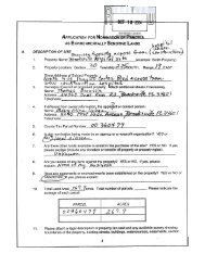
Southwest Florida - Hernando County
Southwest Florida - Hernando County
Southwest Florida - Hernando County
- No tags were found...

You also want an ePaper? Increase the reach of your titles
YUMPU automatically turns print PDFs into web optimized ePapers that Google loves.
Floodplain Justification Report<br />
Centralia Watershed (B206)<br />
<strong>Hernando</strong> <strong>County</strong>, <strong>Florida</strong> Page 8 of 31<br />
_____________________________________________________________________________<br />
area for each location. The accepted percolation areas were<br />
then included in the basin hydrology as impervious areas.<br />
<br />
Impervious and Directly Connected Impervious Area Determination<br />
o<br />
Impervious area determination of the watershed was based on<br />
the processing of <strong>County</strong> Tax Assessor information and paved<br />
areas. Percent impervious area on a lot-by-lot basis was<br />
determined for <strong>Hernando</strong> <strong>County</strong> and then applied to the<br />
watershed. Directly Connected Impervious Areas (DCIA)<br />
percentages were calculated using equations derived from<br />
studies throughout the United States. The percent DCIA was<br />
calculated from the impervious areas and type. It was decided to<br />
use this method rather than build upon the FDOT fluccscode.<br />
DCIA percentages for the percolation areas were set to 100 to<br />
turn-off the Green-Ampt infiltration calculations and just use the<br />
percolation component of the model.<br />
<br />
<br />
Time of Concentration (Tc) based on the determination of the longest<br />
flow path for each catchment using GIS tools and the TR-55<br />
methodology. The flow paths were intersected with the District's<br />
Landuse layer to determine whether paved or unpaved areas were<br />
encountered.<br />
The unit hydrograph method was applied to the time series rainfall<br />
excess to simulate runoff from the individual catchments. A 256 peak<br />
factor unit hydrograph was used per the G&S. A 256 peak or shape<br />
factor represents gently sloping terrains.<br />
• Hydraulic Parameterization<br />
<br />
<br />
<br />
Storage representation for depressions at ICPR junctions was based on<br />
the DTM of the watershed and extracted using the ESRI ArcHydro tools<br />
at specified elevation intervals.<br />
Channel storage is directly accounted for in the ICPR model during the<br />
routing process based on cross section data. Junction storage was not<br />
applied to catchments that had channel conveyance features other than<br />
some minor storage to help maintain model stability.<br />
Irregular cross-sections were determined from the DTM and the LiDAR<br />
data of the watershed.<br />
o<br />
Cross-sections for overland flow weirs were based on the<br />
intersection of DTM and shared catchment boundaries, and the<br />
use of the ET-GEOWIZARD to extract the sequenced xyz points.<br />
SAS Loess smoothing techniques were applied to both the xy<br />
and z data to reduce the number of data points used to represent<br />
the cross-section. Smoothing of the xy data was necessary due<br />
to the artifact of using a DEM grid. Weir lengths were more<br />
correctly estimated with the application of the smoothing.<br />
Lengths were typically 20-30% shorter than representation from<br />
the DEM grid with artifact kinks.<br />
________________________________________________________________<br />
<strong>Southwest</strong> <strong>Florida</strong> Water Management District December 2, 2009