

The Rural Water Livelihoods Index - FAO
The Rural Water Livelihoods Index - FAO
The Rural Water Livelihoods Index - FAO

You also want an ePaper? Increase the reach of your titles
YUMPU automatically turns print PDFs into web optimized ePapers that Google loves.
32<br />
<strong>The</strong> <strong>Rural</strong> <strong>Water</strong> <strong>Livelihoods</strong> <strong>Index</strong><br />
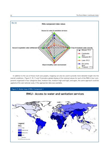
Box 4b<br />
In addition to the use of these multi-axis graphs, mapping can also be used to provide more detailed insight into the<br />
overall conditions. Figure 9, 10, 11 and 12 provide a global display of the national values for each of the RWLI’s four components<br />
organized in four categories (low, medium-low, medium-high and high), and again, the same approach could be<br />
applied at the sub-national scale, if the appropriate data was available.<br />
Figure 9: Global map of RWLI Component 1


