How Do Disaster Paths Affect People's Lives? - Mission Geography
How Do Disaster Paths Affect People's Lives? - Mission Geography
How Do Disaster Paths Affect People's Lives? - Mission Geography

Create successful ePaper yourself
Turn your PDF publications into a flip-book with our unique Google optimized e-Paper software.
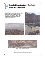
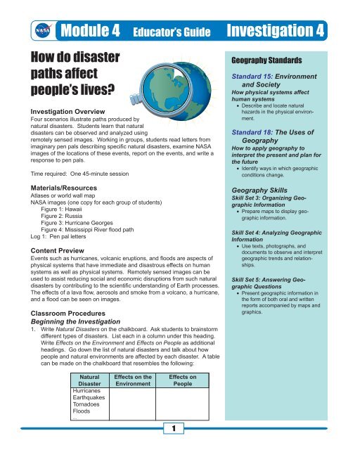
Module 4 Educator’s Guide Investigation 4<br />
<strong>How</strong> do disaster<br />
paths affect<br />
people’s lives<br />
Investigation Overview<br />
Four scenarios illustrate paths produced by<br />
natural disasters. Students learn that natural<br />
disasters can be observed and analyzed using<br />
remotely sensed images. Working in groups, students read letters from<br />
imaginary pen pals describing specific natural disasters, examine NASA<br />
images of the locations of these events, report on the events, and write a<br />
response to pen pals.<br />
Time required: One 45-minute session<br />
Materials/Resources<br />
Atlases or world wall map<br />
NASA images (one copy for each group of students)<br />
Figure 1: Hawaii<br />
Figure 2: Russia<br />
Figure 3: Hurricane Georges<br />
Figure 4: Mississippi River flood path<br />
Log 1: Pen pal letters<br />
Content Preview<br />
Events such as hurricanes, volcanic eruptions, and floods are aspects of<br />
physical systems that have immediate and disastrous effects on human<br />
systems as well as physical systems. Remotely sensed images can be<br />
used to assist reducing social and economic disruptions from such natural<br />
disasters by contributing to the scientific understanding of Earth processes.<br />
The effects of a lava flow, aerosols and smoke from a volcano, a hurricane,<br />
and a flood can be seen on images.<br />
Classroom Procedures<br />
Beginning the Investigation<br />
1. Write Natural <strong>Disaster</strong>s on the chalkboard. Ask students to brainstorm<br />
different types of disasters. List each in a column under this heading.<br />
Write Effects on the Environment and Effects on People as additional<br />
headings. Go down the list of natural disasters and talk about how<br />
people and natural environments are affected by each disaster. A table<br />
can be made on the chalkboard that resembles the following:<br />
<strong>Geography</strong> Standards<br />
Standard 15: Environment<br />
and Society<br />
<strong>How</strong> physical systems affect<br />
human systems<br />
• Describe and locate natural<br />
hazards in the physical environment.<br />
Standard 18: The Uses of<br />
<strong>Geography</strong><br />
<strong>How</strong> to apply geography to<br />
interpret the present and plan for<br />
the future<br />
• Identify ways in which geographic<br />
conditions change.<br />
<strong>Geography</strong> Skills<br />
Skill Set 3: Organizing Geographic<br />
Information<br />
• Prepare maps to display geographic<br />
information.<br />
Skill Set 4: Analyzing Geographic<br />
Information<br />
• Use texts, photographs, and<br />
documents to observe and interpret<br />
geographic trends and relationships.<br />
Skill Set 5: Answering Geographic<br />
Questions<br />
• Present geographic information in<br />
the form of both oral and written<br />
reports accompanied by maps and<br />
graphics.<br />
Natural<br />
<strong>Disaster</strong><br />
Hurricanes<br />
Earthquakes<br />
Tornadoes<br />
Floods<br />
...<br />
Effects on the<br />
Environment<br />
Effects on<br />
People<br />
1
Module 4 Educator’s Guide Investigation 4<br />
Developing the Investigation<br />
2. Tell students that they will see pathways that can<br />
best be seen from above Earth. Talk about ways to<br />
view natural disasters from different levels and the<br />
advantages and disadvantages of each (airplane,<br />
Space Shuttle, satellites). (Refer back to the list of<br />
natural disasters and talk about why it is important<br />
to see the disasters from above:<br />
• helps to see how large an area the disaster is<br />
affecting.<br />
• helps to predict the direction of the disaster or<br />
the pathway that it is taking.<br />
• helps to warn people before the disaster<br />
reaches them.)<br />
3. Talk about NASA’s mission in studying natural<br />
disasters. (See Background.)<br />
4. Share with students that they will see four images<br />
of disaster pathways. Project transparencies of<br />
Figures 1-4 (or distribute copies) and ask students<br />
to try to identify what they are seeing. Spend time<br />
on the images; talk about possible locations for the<br />
images, any outstanding features in the landscape<br />
that they see, and any other observations that<br />
students want to share.<br />
5. Tell students that they will read letters from imaginary<br />
students in other parts of the world who have<br />
experienced a natural disaster that was shown in<br />
one of the images. Tell students that the imaginary<br />
letter writers would like to have a response from<br />
students in this class.<br />
6. Have the students work in groups and give each<br />
group a page from Log 1 (letter) and a copy of the<br />
image that goes with their letter, and an atlas (or<br />
use a wall map). In a small class, this can be done<br />
with four groups of students, each group with a<br />
different image and letter. A larger class would<br />
require eight groups, with two groups receiving the<br />
same pen pal letter and image. Ask students to<br />
read their letters and to use both the image and<br />
their atlases (or a wall map) to respond to their pen<br />
pal with one letter from the group (or individual<br />
letters from the groups’ members). Encourage<br />
students to be sure that each member of the group<br />
contributes to the project.<br />
Concluding the Activity<br />
7. Bring the class back together and have each group<br />
• read the original pen pal letter,<br />
• show their image,<br />
• trace the pathway on the image and point out<br />
any important features,<br />
• locate the disaster event on the world map,<br />
and<br />
• read the letter or letters they are sending to<br />
their pen pals.<br />
8. Project Figure 3: Hurricane Georges and talk<br />
about possible paths that could be used for evacuation.<br />
Look at the other images and have students<br />
talk about possible ways to escape the disaster. If<br />
students are in a geographic area that experiences<br />
natural disasters, locate regional maps showing<br />
pathways for evacuation purposes.<br />
9. Review how images from space can help people<br />
deal with natural disasters.<br />
Background<br />
Natural hazards are inevitable manifestations of Earth<br />
processes but need not be inevitable disasters. Images<br />
from space can assist society in reducing social<br />
and economic disruptions from future natural disasters<br />
by contributing to the scientific understanding of Earth<br />
processes and conditions that lead to natural disasters.<br />
Figure 1: Hawaii In this radar<br />
image, produced by a sensor on the Space Shuttle,<br />
the city of Hilo is seen at the top. Different types of<br />
lava flows around the crater Pu’u O’o are evident.<br />
Ash deposits which erupted in 1790 from the<br />
summit of Kilauea volcano show up as dark in this<br />
image, and fine details associated with lava flows<br />
which erupted in 1919 and 1974 can be seen to the<br />
south of the summit in an area called the Ka’u<br />
Desert. In addition, the other historic lava flows<br />
created in 1881 and 1984 from Mauna Loa volcano<br />
(out of view to the left of this image) can be easily<br />
seen despite the fact that the surrounding area is<br />
covered by forest. This information is used to map<br />
the extent of the lava flows which can pose a<br />
hazard to the subdivisions of Hilo. Highway 11 is<br />
the linear feature running from Hilo to the Kilauea<br />
volcano. The Kilauea volcano has been almost<br />
continuously active for more than 11 years. Field<br />
teams that were on the ground specifically to<br />
support these radar observations report that there<br />
was vigorous surface activity about 400 meters<br />
inland from the coast. A moving lava flow about<br />
200 meters in length was observed at the time of<br />
the shuttle overflight, raising the possibility that<br />
subsequent images will show changes in the<br />
landscape.<br />
2
Module 4 Educator’s Guide Investigation 4<br />
Figure 2: Russia Shortly after the launch<br />
of the Space Shuttle on September 30, 1994, the<br />
crew reported thick black smoke over the<br />
Kamchatka Peninsula in northeast Russia. On the<br />
next orbital pass, the crew took photographs of the<br />
eruption of Klyuchevskaya. This is the most active<br />
volcano on the peninsula, and this eruption has<br />
been its largest in 40 years. The eruption cloud<br />
reached 19,000 meters above sea level, and the<br />
winds carried the volcanic ash as far as 1025<br />
kilometers southeast from the volcano. The ash<br />
cloud interfered with the heavily traveled north<br />
Pacific air routes for 48 hours, diverting up to<br />
70 flights carrying about 10,000 passengers per<br />
day.<br />
Figure 3: Hurricane Georges <br />
This satellite image shows Hurricane Georges at<br />
three different times on its path toward the Gulf of<br />
Mexico. During late September 1998, Hurricane<br />
Georges cut a path of destruction through Puerto<br />
Rico. Its strong winds, heavy rains, storm surge,<br />
and tornadoes resulted in an estimated $2 billion in<br />
damage on the island. The hurricane’s powerful<br />
thunderstorms spawned tornadoes, flooded hotels,<br />
and exploded shop and car windows. Georges<br />
forced tens of thousands of people into shelters<br />
and left hundreds of thousands without water or<br />
power. The hurricane prevented rescuers from<br />
immediately responding to calls for help. The<br />
center of the storm passed just south of the Puerto<br />
Rican capital of San Juan. Georges unleashed a<br />
landslide in Tao Alta, near San Juan, that killed<br />
three people. As it moved westward across<br />
southern Puerto Rico, Georges spawned tornadoes.<br />
Wind gusts reached 287 kph. More than 80<br />
percent of Puerto Rico’s 3.8 million people lost<br />
electricity, and more than 70 percent had no water.<br />
Countless roads and highways were choked by<br />
fallen trees and poles, dangling power lines,<br />
antennas, awnings, tin roofs, and other debris.<br />
More than 20,000 people huddled in shelters in<br />
San Juan, Arecibo, Mayaguez, and other Puerto<br />
Rican cities, and President Clinton declared Puerto<br />
Rico and the U.S. Virgin Islands disaster areas,<br />
authorizing immediate release of federal recovery<br />
aid.<br />
Figure 4: Mississippi River flood path<br />
These Space Shuttle<br />
photographs, with river and state boundaries<br />
overlaid, show the Midwestern United States during<br />
the flood of 1993. The Mississippi, Illinois, and<br />
Missouri Rivers converge just north of St. Louis.<br />
For over a month torrential rains, which had begun<br />
in the spring of 1993, began again in June and<br />
continued to fall on the already saturated fields.<br />
The waters of the Mississippi, Missouri, and Illinois<br />
Rivers and their tributaries soon spilled over onceprotective<br />
levees, causing billions of dollars in<br />
damage and destruction. Tens of thousands of<br />
acres of farmland and crops were destroyed, water<br />
treatment plants were closed, roads and bridges<br />
were severely damaged or destroyed, and entire<br />
communities were inundated, leaving many thousands<br />
homeless.<br />
Related Resources<br />
Students as scientists<br />
http://dns.kilauea.k12.hi.us/sas/<br />
Images and information on hurricanes<br />
http://rsd.gsfc.nasa.gov/rsd/images/<br />
Hurricane and extreme weather impact studies<br />
http://coastal.er.usgs.gov/hurricanes/<br />
Hurricane and other storms information<br />
http://www.aomi.noaa.gov/hrd/Storm_pages/<br />
Japan, good images of lava flows<br />
http://observe.ivv.nasa.gov/nasa/ootw/1999/ootw_990512/<br />
ob990512_more7.html<br />
The Weather Dude, The Weather Channel<br />
http://www.wxdude.com<br />
Hurricane basins<br />
http://www.usatoday.com/weather/whurbasn.htm<br />
3
Module 4, Investigation 4: Log 1a<br />
Pen pal letters<br />
Dear students in the United States,<br />
I am so glad that I will be your pen pal. I would like to learn more about your<br />
country, and I will tell you more about mine. My name is Olga, and I am 10 years old. I<br />
know that you are studying about pathways, so I wanted to share an experience with<br />
you.<br />
I live on a peninsula in northeast Russia. <strong>Do</strong> you know what a peninsula is It is<br />
a stretch of land that juts out into water and is nearly surrounded by water. <strong>Do</strong> you have<br />
any peninsulas in the United States In September of 1994, a volcano erupted near my<br />
town. The name of the volcano was Klyuchevskaya. This volcano is our peninsula’s<br />
most active volcano. This was the biggest eruption in 40 years. I am very glad that I<br />
live to the west of the volcano and farther north on the peninsula.<br />
A huge amount of volcanic ash erupted from the top of the volcano. The snow on<br />
the volcano and on the nearby mountains turned blackish brown. Winds were blowing<br />
toward the southeast, and the volcanic ash covered the ground from the volcano to<br />
places over 960 kilometers (600 miles) to the southeast. We are very lucky that the<br />
winds blew the ash away from us.<br />
Write back and tell me more about yourself and your country. <strong>Do</strong> you have any<br />
active volcanoes in the United States<br />
Your friend,<br />
Olga from Russia<br />
P.S. You can find out more about what happened in my country by visiting , , or .<br />
Your jobs:<br />
1. Write back to Olga and answer her questions about peninsulas and active volcanoes.<br />
2. Send her a map of the United States, labeling the peninsulas and active volcanoes.<br />
3. Visit the web sites that Olga mentioned and let her know what you found out about<br />
the eruption. Mention at least three facts.<br />
4. Draw a map of the Kamchatka peninsula, locate the volcano, and draw a picture of<br />
the path that the ash clouds took.<br />
1<br />
4
Module 4, Investigation 4: Log 1b<br />
Pen pal letters<br />
Dear students on the “mainland,”<br />
I am so glad that I will be your pen pal. My name is Kuloo, and I am 10 years<br />
old. I would like to learn more about the U.S. mainland. The mainland, as my family<br />
calls the continental United States, seems so far away.<br />
I heard that you are studying about pathways, and I want to share an experience<br />
with you. It is an experience that my family and I had. It was very frightening. But we<br />
are all OK. We just had to move.<br />
My family and I live in the state of Hawaii. All of our islands have their own<br />
names, beautiful Hawaiian names. My island is called Hawaii. So I really live on the<br />
island of Hawaii in the state of Hawaii. People often call our island The Big Island, and<br />
that makes it less confusing.<br />
We live on the newest island of all the islands here, on the slopes of the Kilauea<br />
volcano. Our island sometimes shakes, rattles, and pours out lava. We lived in a place<br />
called Royal Gardens, but we had to move. In 1998, the volcano began pouring out<br />
lava from its side. The lava came down the slopes in a path toward Royal Gardens.<br />
We had plenty of time to pack up and leave our homes. It was sad to watch our houses<br />
burn. This path was called a flow from Pu’u O’o. (The Hawaiian language only has 13<br />
letters in it.)<br />
Write and tell me about the place where you live.<br />
Your pen pal,<br />
Kuloo from Hawaii<br />
P.S. You can find out more about the lava path on or<br />
.<br />
Your jobs:<br />
1. Visit the web sites that Kuloo mentioned.<br />
2. Write back to Kuloo and let him know what you found out about the lava flow on the<br />
web site.<br />
3. Draw a map of the island of Hawaii that shows the Kilauea volcano. If you can find<br />
the location of Royal Gardens, show it on your map, and draw the laval flow that<br />
reached the town.<br />
2<br />
5
Module 4, Investigation 4: Log 1c<br />
Pen pal letters<br />
Dear pen pals,<br />
I am so glad that I will be your pen pal. My name is Elizabeth, and I am 10 years<br />
old. I would like to learn more about your part of the United States.<br />
I heard that you were studying about pathways. Did you know that some paths<br />
change a lot In my state, Missouri, we talk a lot about the paths of the rivers around<br />
us. Sometimes the paths get very wide because of heavy rain. And that is when we<br />
have floods. <strong>Do</strong> you have floods where you live Please write and tell me if you have<br />
streams, rivers, or lakes where you live. I like to find out about other places. I want to<br />
be a geographer when I grow up.<br />
Back to my story . . . My family and I had to move from our house in St. Louis<br />
when the River Des Peres began to overflow its banks. I was only four years old then.<br />
We waited until the last minute to leave. The water was already covering the living<br />
room floor. When we returned, after the waters went down, our house was filled with<br />
mud. My family is very lucky because no one was hurt. Our pets are fine too. But<br />
cleaning up that mud was TERRIBLE.<br />
Goodbye for now.<br />
Your pen pal,<br />
Elizabeth from Missouri<br />
P.S. You can find out more about the flooded river path at and .<br />
Your jobs:<br />
1. Visit the web sites that Elizabeth mentioned.<br />
2. Write back to Elizabeth. Let her know what you found out about the flood of 1993<br />
from the web site.<br />
3. Send her a map of your state. Label any rivers, lakes, and waterways, and tell her<br />
about them.<br />
4. Draw a map of Missouri and the river system, and label the rivers.<br />
3<br />
6
Module 4, Investigation 4: Log 1d<br />
Pen pal letters<br />
Dear pen pals,<br />
I am so glad that I will be your pen pal. My name is José, and I am 10 years old.<br />
I would like to learn more about your part of the United States since I have never visited<br />
there.<br />
I heard that you were studying about pathways. Did you know that some paths<br />
are huge The path of a hurricane can start off the western coast of Africa and continue<br />
across the Atlantic Ocean and north along the coast of the United States. There<br />
are many islands that can be in the hurricane path, and my island is sometimes one of<br />
them. I live in Puerto Rico. It is a beautiful island.<br />
My family and I watch the weather on television very closely when a hurricane is<br />
coming. If it is heading toward Puerto Rico, we cover our windows with boards. We<br />
take our bikes, swings, and porch furniture inside so that they won’t get blown away.<br />
The winds can get very strong. In 1998, a hurricane hit my island, and our house was<br />
flooded. The winds were very strong. It was very scary. The hurricane was called<br />
“Georges.” Most of us lost our electricity. The president said that the U.S. government<br />
would send help to the people in Puerto Rico because of the damage.<br />
Have you ever tracked a hurricane’s pathway <strong>Do</strong> you get hurricanes where you<br />
live If you don’t get hurricanes, do you get other strong winds<br />
Goodbye for now.<br />
Your pen pal,<br />
José from Puerto Rico<br />
P.S. You can find out more about hurricanes at and .<br />
Your jobs:<br />
1. Visit the web sites that José mentioned.<br />
2. Write back to José and let him know what you found out about hurricanes. Answer<br />
his questions about your state.<br />
3. Send him a map of your state labeling important features or places.<br />
4. Draw a map of Puerto Rico and label the water around it.<br />
5. Research the definitions of “hurricanes.”<br />
6. Search for more images of hurricanes in other places.<br />
7 4
Module 4, Investigation 4: Figure 1<br />
Hawaii<br />
Source: http://southport.jpl.nasa.gov/imagemaps/html/srl-kilauea.html<br />
8 5
Module 4, Investigation 4: Figure 2<br />
Russia<br />
Source: http://images.jsc.nasa.gov/images/pao/STS68/10117628.jpg<br />
9 6
Module 4, Investigation 4: Figure 3<br />
Hurricane Georges<br />
Source: http://rsd.gsfc.nasa.gov/rsd/images/Georges/GeorgesThree_md.jpg<br />
10 7
Module 4, Investigation 4: Figure 4<br />
Mississippi River flood path<br />
Before<br />
After<br />
Source: http://observe.ivv.nasa.gov/nasa/exhibits/flood/flood_2.html (before)<br />
http://observe.ivv.nasa.gov/nasa/exhibits/flood/flood_3.html (after)<br />
11 8