How Do Disaster Paths Affect People's Lives? - Mission Geography
How Do Disaster Paths Affect People's Lives? - Mission Geography
How Do Disaster Paths Affect People's Lives? - Mission Geography

You also want an ePaper? Increase the reach of your titles
YUMPU automatically turns print PDFs into web optimized ePapers that Google loves.
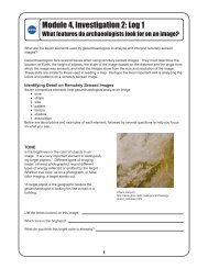
Module 4 Educator’s Guide Investigation 4<br />
Figure 2: Russia Shortly after the launch<br />
of the Space Shuttle on September 30, 1994, the<br />
crew reported thick black smoke over the<br />
Kamchatka Peninsula in northeast Russia. On the<br />
next orbital pass, the crew took photographs of the<br />
eruption of Klyuchevskaya. This is the most active<br />
volcano on the peninsula, and this eruption has<br />
been its largest in 40 years. The eruption cloud<br />
reached 19,000 meters above sea level, and the<br />
winds carried the volcanic ash as far as 1025<br />
kilometers southeast from the volcano. The ash<br />
cloud interfered with the heavily traveled north<br />
Pacific air routes for 48 hours, diverting up to<br />
70 flights carrying about 10,000 passengers per<br />
day.<br />
Figure 3: Hurricane Georges <br />
This satellite image shows Hurricane Georges at<br />
three different times on its path toward the Gulf of<br />
Mexico. During late September 1998, Hurricane<br />
Georges cut a path of destruction through Puerto<br />
Rico. Its strong winds, heavy rains, storm surge,<br />
and tornadoes resulted in an estimated $2 billion in<br />
damage on the island. The hurricane’s powerful<br />
thunderstorms spawned tornadoes, flooded hotels,<br />
and exploded shop and car windows. Georges<br />
forced tens of thousands of people into shelters<br />
and left hundreds of thousands without water or<br />
power. The hurricane prevented rescuers from<br />
immediately responding to calls for help. The<br />
center of the storm passed just south of the Puerto<br />
Rican capital of San Juan. Georges unleashed a<br />
landslide in Tao Alta, near San Juan, that killed<br />
three people. As it moved westward across<br />
southern Puerto Rico, Georges spawned tornadoes.<br />
Wind gusts reached 287 kph. More than 80<br />
percent of Puerto Rico’s 3.8 million people lost<br />
electricity, and more than 70 percent had no water.<br />
Countless roads and highways were choked by<br />
fallen trees and poles, dangling power lines,<br />
antennas, awnings, tin roofs, and other debris.<br />
More than 20,000 people huddled in shelters in<br />
San Juan, Arecibo, Mayaguez, and other Puerto<br />
Rican cities, and President Clinton declared Puerto<br />
Rico and the U.S. Virgin Islands disaster areas,<br />
authorizing immediate release of federal recovery<br />
aid.<br />
Figure 4: Mississippi River flood path<br />
These Space Shuttle<br />
photographs, with river and state boundaries<br />
overlaid, show the Midwestern United States during<br />
the flood of 1993. The Mississippi, Illinois, and<br />
Missouri Rivers converge just north of St. Louis.<br />
For over a month torrential rains, which had begun<br />
in the spring of 1993, began again in June and<br />
continued to fall on the already saturated fields.<br />
The waters of the Mississippi, Missouri, and Illinois<br />
Rivers and their tributaries soon spilled over onceprotective<br />
levees, causing billions of dollars in<br />
damage and destruction. Tens of thousands of<br />
acres of farmland and crops were destroyed, water<br />
treatment plants were closed, roads and bridges<br />
were severely damaged or destroyed, and entire<br />
communities were inundated, leaving many thousands<br />
homeless.<br />
Related Resources<br />
Students as scientists<br />
http://dns.kilauea.k12.hi.us/sas/<br />
Images and information on hurricanes<br />
http://rsd.gsfc.nasa.gov/rsd/images/<br />
Hurricane and extreme weather impact studies<br />
http://coastal.er.usgs.gov/hurricanes/<br />
Hurricane and other storms information<br />
http://www.aomi.noaa.gov/hrd/Storm_pages/<br />
Japan, good images of lava flows<br />
http://observe.ivv.nasa.gov/nasa/ootw/1999/ootw_990512/<br />
ob990512_more7.html<br />
The Weather Dude, The Weather Channel<br />
http://www.wxdude.com<br />
Hurricane basins<br />
http://www.usatoday.com/weather/whurbasn.htm<br />
3