Zoning By Law - Town of Ashburnham, Massachusetts
Zoning By Law - Town of Ashburnham, Massachusetts
Zoning By Law - Town of Ashburnham, Massachusetts

Create successful ePaper yourself
Turn your PDF publications into a flip-book with our unique Google optimized e-Paper software.
<strong>Massachusetts</strong> State Building Code dealing with construction in flood plains.<br />
The Flood Plain District includes all special flood hazard areas designated as<br />
Zone A, A1-19 on the <strong>Ashburnham</strong> Flood Insurance Rate Maps (FIRM) and<br />
the Flood Boundary and Floodway Maps dated June 15, 1984 on file with the<br />
<strong>Town</strong> Clerk, Planning Board and Building Inspector. Where the above maps<br />
are inadequate for the detail required, detailed Flood Plain plans shall be<br />
prepared by a registered pr<strong>of</strong>essional engineer with costs to be borne by the<br />
applicant. These maps, as well as the accompanying Flood Insurance Study <strong>of</strong><br />
<strong>Ashburnham</strong> are incorporated herein by reference.<br />
2.24 The <strong>Zoning</strong> Map, Water Supply Protection, Watershed Boundary Map, Flood<br />
Insurance Rate Maps, and Flood Boundary and Flood Maps, with all<br />
explanatory matter thereon, are hereby made part <strong>of</strong> this <strong>By</strong>-<strong>Law</strong>.<br />
2.25 Boundary Identification<br />
a. Where a boundary is shown as following a street, railroad, or utility,<br />
the boundary shall be the center line there<strong>of</strong>, unless otherwise<br />
indicated.<br />
b. Where a boundary is shown outside <strong>of</strong> a street, railroad, or utility and<br />
approximately parallel thereto, the boundary shall be deemed parallel<br />
to the nearest line there<strong>of</strong>, and the figure placed on the zoning map<br />
between the boundary and such line shall be the distance in feet<br />
between them, as measured at a right angle from such line unless<br />
otherwise indicated.<br />
c. Where a boundary is shown as following a watercourse, the boundary<br />
shall coincide with the center line there<strong>of</strong> as said line existed at the<br />
date <strong>of</strong> the <strong>Zoning</strong> Map.<br />
d. Where a boundary shall include a numerical figure followed by the<br />
letters, M.S.L., it is at that number <strong>of</strong> feet above Mean Sea Level. The<br />
basic source for determining such a line shall be the United Stated<br />
Geological Survey as interpreted by the <strong>Zoning</strong> Enforcement Officer<br />
or subsequent field surveys.<br />
e. Where the location <strong>of</strong> a boundary is otherwise uncertain, the <strong>Zoning</strong><br />
Enforcement shall determine its position in accordance with the<br />
distance in feet from other lines or bounds as given on the <strong>Town</strong> <strong>of</strong><br />
<strong>Ashburnham</strong> <strong>Zoning</strong> Map and good engineering practice. Where the<br />
bounds <strong>of</strong> the Water Supply Protection District, as referenced in<br />
Section 2.22, are in doubt or dispute, the burden <strong>of</strong> pro<strong>of</strong> shall be upon<br />
the owner(s) <strong>of</strong> the land in question, who may engage a registered<br />
pr<strong>of</strong>essional engineer/pr<strong>of</strong>essional registered land surveyor to<br />
determine more accurately the location and extent <strong>of</strong> watershed lands.<br />
______________________________________________________________________________<br />
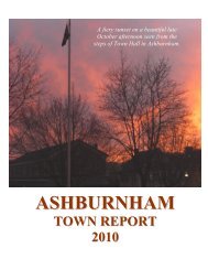
ASHBURNHAM ZONING BY-LAWS<br />
Pg. 9