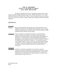
Zoning By Law - Town of Ashburnham, Massachusetts
Zoning By Law - Town of Ashburnham, Massachusetts
Zoning By Law - Town of Ashburnham, Massachusetts

You also want an ePaper? Increase the reach of your titles
YUMPU automatically turns print PDFs into web optimized ePapers that Google loves.
ZONING BY-LAWS<br />
TOWN OF<br />
ASHBURNHAM, MASSACHUSETTS<br />
A TRUE COPY, ATTEST:<br />
REVISED MAY 5, 2012<br />
LINDA A. RAMSDELL<br />
TOWN CLERK
TABLE OF CONTENTS<br />
SECTION 1. GENERAL ................................................................................................................................. 1<br />
1.1 PURPOSE .................................................................................................................................................. 1<br />
1.2 BASIC REQUIREMENTS ............................................................................................................................. 1<br />
1.3 NON-CONFORMING USES ......................................................................................................................... 1<br />
1.4 NON-CONFORMING BUILDINGS AND STRUCTURES .................................................................................. 2<br />
1.5 DEFINITIONS ............................................................................................................................................ 2<br />
SECTION 2. USE DISTRICTS ...................................................................................................................... 7<br />
2.1 TYPES OF DISTRICTS ................................................................................................................................ 7<br />
2.2 LOCATION OF DISTRICTS .......................................................................................................................... 8<br />
SECTION 3. USE REGULATIONS ............................................................................................................ 10<br />
3.1 BASIC REQUIREMENTS ........................................................................................................................... 10<br />
3.2 SCHEDULE OF USE REGULATIONS .......................................................................................................... 11<br />
3.3 SPECIAL CONDITIONS............................................................................................................................. 18<br />
SECTION 4. DIMENSIONAL REGULATIONS ........................................................................................... 24<br />
4.1 BASIC REQUIREMENTS ........................................................................................................................... 24<br />
4.2 TABLE 1 (SEE PAGE 115) ........................................................................................................................ 24<br />
4.3 SPECIAL CONDITIONS............................................................................................................................. 24<br />
SECTION 5. SPECIAL REGULATIONS ....................................................................................................... 26<br />
5.1 ACCESSORY BUILDINGS ......................................................................................................................... 26<br />
5.2 SIGNS ..................................................................................................................................................... 26<br />
5.3 OFF-STREET PARKING AND LOADING REQUIREMENTS .......................................................................... 30<br />
5.4 MINIMUM RESIDENTIAL FLOOR AREA ................................................................................................... 32<br />
5.5 WIRELESS COMMUNICATIONS FACILITIES AND TOWERS ....................................................................... 32<br />
5.6 SOIL, VEGETATION, ROCK, AND GRAVEL REMOVAL ............................................................................. 45<br />
5.7 MOBILE HOME PARKS ........................................................................................................................... 52<br />
5.8 TEMPORARY MOBILE HOME LOCATION ................................................................................................. 54<br />
5.10 SITE PLAN REVIEW AND APPROVAL ...................................................................................................... 54<br />
5.11 DEVELOPMENTAL RATE LIMITATION ..................................................................................................... 61<br />
5.12 ADULT ENTERTAINMENT ESTABLISHMENTS .......................................................................................... 63<br />
5.13 OPEN SPACE RESIDENTIAL DEVELOPMENT ............................................................................................ 65<br />
5.14 COMMON DRIVEWAYS ........................................................................................................................... 78<br />
5.15 MAJOR RESIDENTIAL DEVELOPMENT .................................................................................................... 81<br />
5.16 ACCESSORY DWELLING UNITS ............................................................................................................ 82<br />
5.17 LARGE WIND ENERGY FACILITIES ....................................................................................................... 85<br />
5.18 SMALL WIND ENERGY SYSTEMS ......................................................................................................... 96<br />
5.19 PLANNED UNIT DEVELOPMENT ......................................................................................................... 101
SECTION 6. ADMINISTRATION ............................................................................................................ 111<br />
6.1 ENFORCEMENT ..................................................................................................................................... 111<br />
6.2 BUILDING OR USE PERMIT ................................................................................................................... 111<br />
6.3 CERTIFICATE OF OCCUPANCY .............................................................................................................. 112<br />
6.4 BOARD OF APPEALS ............................................................................................................................. 112<br />
6.5 REPETITIVE PETITIONS ......................................................................................................................... 113<br />
6.6 AMENDMENT ....................................................................................................................................... 114<br />
6.7 PENALTY .............................................................................................................................................. 114<br />
6.8 VALIDITY ............................................................................................................................................. 114<br />
6.9 PLANNING BOARD ASSOCIATE MEMBER ............................................................................................. 114<br />
6.10 EFFECTIVE DATE ................................................................................................................................. 115
SECTION 1. GENERAL<br />
1.1 Purpose<br />
ZONING BY-LAWS<br />
TOWN OF ASHBURNHAM, MASSACHUSETTS<br />
The purpose <strong>of</strong> this <strong>By</strong>-law is to promote the health, safety and general welfare <strong>of</strong> the<br />
inhabitants <strong>of</strong> the <strong>Town</strong> <strong>of</strong> <strong>Ashburnham</strong>, to lessen the danger <strong>of</strong> fire and congestion<br />
and to protect and preserve the surface and groundwater resources <strong>of</strong> the <strong>Town</strong> and<br />
the region from any use <strong>of</strong> land or buildings which may reduce the quality and<br />
quantity <strong>of</strong> its water resources, and further to conserve the natural resources <strong>of</strong><br />
<strong>Ashburnham</strong>, to prevent temporary and permanent contamination <strong>of</strong> the environment<br />
and to improve the <strong>Town</strong> under the provisions <strong>of</strong> Chapter 40A, General <strong>Law</strong>s.<br />
1.2 Basic Requirements<br />
1.21 All buildings or structures herein erected, reconstructed, altered, enlarged, or<br />
moved and used <strong>of</strong> premises in the <strong>Town</strong> <strong>of</strong> <strong>Ashburnham</strong> shall be in<br />
conformity with the provisions <strong>of</strong> this <strong>By</strong>-<strong>Law</strong>. Any building, structure or<br />
land shall not be used for any purpose or in any manner other than is<br />
permitted within the district in which such building, structure or land is<br />
located. Any use not specifically enumerated in a district herein shall be<br />
deemed prohibited. In accordance with Chapter 40A, General <strong>Law</strong>s, and<br />
notwithstanding any provisions to contrary, this <strong>By</strong>-<strong>Law</strong> shall not prohibit or<br />
limit the use <strong>of</strong> land for any church or other religious purpose or for any<br />
educational purpose which is religious, sectarian denominational, or public, or<br />
for any municipal purpose. This <strong>By</strong>-<strong>Law</strong> shall not repeal, annul or in any way<br />
impair or remove the necessity <strong>of</strong> compliance with any rule, regulation, bylaw,<br />
permit or provision <strong>of</strong> law. Where this <strong>By</strong>-<strong>Law</strong> imposes a greater<br />
restriction upon the use <strong>of</strong> land, buildings or structures, the provisions <strong>of</strong> this<br />
<strong>By</strong>-<strong>Law</strong> shall control.<br />
1.22 No building shall be erected except on a lot fronting on a street, way or road<br />
(as defined by this <strong>By</strong>-<strong>Law</strong>), and there shall be not more than one principal<br />
building on any lot, except as allowed in this <strong>By</strong>-<strong>Law</strong>.<br />
1.3 Non-Conforming Uses<br />
1.31 Continuation – the lawful use <strong>of</strong> any land existing at the time <strong>of</strong> the enactment<br />
or subsequent amendment <strong>of</strong> this <strong>By</strong>-<strong>Law</strong> may be continued although such<br />
use did not conform with the provisions <strong>of</strong> the <strong>By</strong>-<strong>Law</strong> as adopted or<br />
amended.<br />
______________________________________________________________________________<br />
ASHBURNHAM ZONING BY-LAWS<br />
Pg. 1
1.32 Extension – except for agricultural, horticultural or floricultural uses, the<br />
extent <strong>of</strong> non-conforming use <strong>of</strong> land not covered by a building or structure<br />
may not be increased by more than twenty-five (25) percent <strong>of</strong> the land area in<br />
non-conforming use at the time the <strong>By</strong>-<strong>Law</strong> is adopted or amended except by<br />
special permit from the Board <strong>of</strong> Appeals after a finding that such extension<br />
will not be detrimental or injurious to the neighborhood.<br />
1.33 Abandonment – all non-conforming uses which have been abandoned or<br />
discontinued for more than two (2) years shall not be re-established except by<br />
special permit from the Board <strong>of</strong> Appeals after a public hearing and a finding<br />
that such re-establishment will not be detrimental or injurious to the<br />
neighborhood.<br />
1.34 Changes – once changed to a conforming use, no land shall be permitted to<br />
revert to a non-conforming use.<br />
1.4 Non-Conforming Buildings and Structures<br />
1.41 Continuation – the lawful use <strong>of</strong> any building or structure existing at the time<br />
<strong>of</strong> the enactment or subsequent amendment <strong>of</strong> this <strong>By</strong>-<strong>Law</strong> may be continued<br />
although such building or structure did not conform with the provisions <strong>of</strong> the<br />
<strong>By</strong>-<strong>Law</strong> as adopted or amended.<br />
1.42 Alteration and Enlargement – a non-conforming building may be altered or<br />
enlarged provided that such alteration or enlargement conforms to applicable<br />
yard, building height and lot coverage requirements, but a non-conforming<br />
extension or alteration <strong>of</strong> a non-conforming structure may be permitted by<br />
special permit and only if there is a finding by the <strong>Zoning</strong> Board <strong>of</strong> Appeals<br />
that such extension or alteration shall not be substantially more detrimental to<br />
the neighborhood than the existing non-conforming structure. In no case may<br />
the height <strong>of</strong> a permitted non-conforming alteration or extension <strong>of</strong> a nonconforming<br />
structure exceed that <strong>of</strong> the applicable schedule <strong>of</strong> dimensional<br />
regulations except by a variance.<br />
1.43 Restoration – a non-conforming building or structure which has been damaged<br />
or destroyed may be repaired or rebuilt, subject to the provisions <strong>of</strong> Section<br />
1.32, 1.33 and 1.42.<br />
1.5 Definitions<br />
In this <strong>By</strong>-<strong>Law</strong>, the following terms shall have the following meanings unless a<br />
contrary meaning is required by the context or is specifically prescribed.<br />
Accessory Building – A building devoted exclusively to a use subordinate to and<br />
customarily incidental to the principal use.<br />
______________________________________________________________________________<br />
ASHBURNHAM ZONING BY-LAWS<br />
Pg. 2
Accessory Dwelling Unit – An Accessory Dwelling Unit is a self-contained housing<br />
unit that is clearly a subordinate part <strong>of</strong> the single-family dwelling and complies with<br />
Section 5.16 <strong>of</strong> this <strong>By</strong>law.<br />
Accessory Use – A use subordinate to and customarily incidental to the principal use.<br />
Assisted Elderly Housing – Private or private nonpr<strong>of</strong>it elderly housing comprised <strong>of</strong><br />
individual studio, one bedroom, and two bedroom dwelling units for residents over<br />
the age <strong>of</strong> sixty-five (65). On-site services and facilities such as meals, cleaning,<br />
laundry, recreation, fitness, transportation, and social activities are an integral part <strong>of</strong><br />
the development. Medical services may be <strong>of</strong>fered but no long-term hospital or<br />
nursing home care is provided within the assisted elderly housing development.<br />
<strong>Town</strong> water and sewer must serve assisted elderly housing unit(s).<br />
Bed & Breakfast – Private, owner-occupied building with no more than five (5) guest<br />
rooms which includes a breakfast in the room rate and which serves meals to<br />
overnight guests only.<br />
Building – Any structure built for the support, shelter or enclosure <strong>of</strong> person, animals,<br />
goods or property <strong>of</strong> any kind.<br />
Conforming Use – Use <strong>of</strong> buildings, structures or land which complies with all the<br />
use and dimensional requirements <strong>of</strong> the zoning district in which the use is located.<br />
Customary Home Occupation – An occupation engaged in by a resident <strong>of</strong> the<br />
premises including but not limited to carpentry, cooking, dressmaking, electrical<br />
work, handicrafts, interior decorating, masonry work, painting, plumbing, repairs <strong>of</strong><br />
appliances or other small items and other similar activities but not including the<br />
display or sale <strong>of</strong> goods not produced on the premises.<br />
Dwelling – Any fixed structure, not a mobile home, containing one or more dwelling<br />
units.<br />
Dwelling Unit – A room or group <strong>of</strong> rooms designed and equipped exclusively for<br />
use as living quarters for only one family including provisions for living, sleeping,<br />
cooking and eating.<br />
Family – One or more persons occupying a dwelling unit and living as a single, nonpr<strong>of</strong>it,<br />
housekeeping unit.<br />
Family Type Camp Grounds – An area used for a range <strong>of</strong> overnight<br />
accommodations, from tenting to serviced trailer sites, including accessory facilities<br />
which support the use, such as administration <strong>of</strong>fices, laundry facilities, washrooms,<br />
support recreational facilities, but not including the use <strong>of</strong> mobile homes, trailers or<br />
other forms <strong>of</strong> moveable shelter on a permanent year-round basis.<br />
Groundwater – All water found beneath the surface <strong>of</strong> the ground.<br />
______________________________________________________________________________<br />
ASHBURNHAM ZONING BY-LAWS<br />
Pg. 3
Gross Floor Area – The sum, in square feet, <strong>of</strong> the floor areas <strong>of</strong> all ro<strong>of</strong>ed portions <strong>of</strong><br />
a building, as measured from the interior faces <strong>of</strong> the exterior walls.<br />
Hazardous Materials – Material including but not limited to, any material, in<br />
whatever form, which, because <strong>of</strong> its quantity, concentration, chemical, corrosive,<br />
flammable, reactive, toxic, infectious or radioactive characteristics, either separately<br />
or in combination with any substance or substances, constitutes a present or potential<br />
threat to human health, safety, welfare, or the environment, when improperly stored,<br />
treated, transported, disposed <strong>of</strong>, or otherwise managed. The term shall not include<br />
oil.<br />
Hazardous Waste – Those wastes and materials designated as hazardous in the<br />
Regulations <strong>of</strong> the <strong>Massachusetts</strong> Hazardous Waste Management Act, <strong>Massachusetts</strong><br />
General <strong>Law</strong>s, Chapter 21C (310 CMR 30.00)<br />
Height <strong>of</strong> Building – The vertical distance <strong>of</strong> the highest point <strong>of</strong> the ro<strong>of</strong> above the<br />
mean grade <strong>of</strong> the ground adjoining the building.<br />
Impervious Surfaces – Materials or structures on or above the ground that do not<br />
allow precipitation or surface water to penetrate directly into the soil.<br />
Living Space – The floor area used or intended to be used for living, sleeping,<br />
cooking or eating purposes, excluding bathroom, toilet, laundry and storage spaces,<br />
communicating corridors, stairways, spaces with less than four (4) feet clear<br />
headroom, garages, breezeways and carports.<br />
Lot – A single area <strong>of</strong> land in one ownership with definite boundaries as described on<br />
a recorded deed or recorded plan.<br />
Lot Line – A property boundary separating a lot from a street or adjoining lots; for<br />
example, street, side and rear lot lines.<br />
Mobile Homes – A structure designed as a dwelling unit for living purposes, capable<br />
<strong>of</strong> being moved on its own wheels by a motor vehicle whether retained on wheels or<br />
fixed to a permanent foundation.<br />
Non-Conforming Use – Use <strong>of</strong> buildings, structures or land which does not comply<br />
with all the use and dimensional requirements <strong>of</strong> the zoning district in which the use<br />
is located, but which was in existence at the time the use regulation became effective<br />
and was lawful at the time it was established.<br />
Overnight Cabin – A building containing only one or two habitable rooms, which is<br />
adapted and used to provide transient sleeping accommodations for hire to not exceed<br />
four (4) persons but not adapted or used for cooking or preparing meals or for<br />
residence by the same person for more than 90 days.<br />
______________________________________________________________________________<br />
ASHBURNHAM ZONING BY-LAWS<br />
Pg. 4
Premises – One or more lots in the same ownership, contiguous or separated only by<br />
a road, including all buildings, structures and improvements thereon.<br />
Primary Residence – A building in which is conducted the principal use <strong>of</strong> the lot on<br />
which it is located. For residentially zoned lots, such a building would be a dwelling.<br />
Principal Building – A building in which is conducted the principal use <strong>of</strong> the lot on<br />
which it is located.<br />
Principal Use – The Main or primary purpose for which a structure or lot is designed,<br />
arranged or intended, or for which it may be used, occupied or maintained under this<br />
<strong>By</strong>-<strong>Law</strong>.<br />
Pushcart – any wagon, cart, trailer or similar wheeled container, not a self-propelled<br />
“motor vehicle” as defined in M.G.L., Chapter 90, Section 1, from which food or<br />
beverage is <strong>of</strong>fered for sale to the public.<br />
Recreational Vehicle – A vehicle or vehicular attachment with or without motive<br />
power designed for temporary sleeping or living quarters for one or more persons,<br />
which is not a dwelling and which may include a pick-up camper, travel trailer, tent<br />
trailer, beach buggy and motor home.<br />
Seasonal Farm Stand Non-exempt - Facility for the sale <strong>of</strong> produce, wine and dairy<br />
products on property non-exempted by M.G.L. Chapter 40A, Section 3, operated on a<br />
non year round basis.<br />
Street, Way or Road – An accepted town way, or a way established by or maintained<br />
under county, state or federal authority, or a way established by a subdivision control<br />
law, or a way determined by the Planning Board to have sufficient width, suitable<br />
grades, and adequate construction to provide for the needs <strong>of</strong> vehicular traffic in<br />
relation to the proposed use <strong>of</strong> the land, and for the installation <strong>of</strong> municipal services<br />
to serve such land and the buildings erected or to be erected thereon.<br />
Supportive Housing – Facilities comprising personal and other supportive services<br />
with a non-medical focus, limited to persons 55 years and older, including but not<br />
limited to, assisted living, congregate care and independent living and should<br />
specifically exclude skilled nursing facilities, intermediate care facilities, nursing<br />
facilities, custodial care facilities and continuing care retirement communities, or such<br />
facilities which provide multiple levels <strong>of</strong> care within a single facility. <strong>Town</strong> water<br />
and sewer must serve supportive housing facility(ies).<br />
Surface Water – Any lake, stream, spring, impoundment, or pond as determined by<br />
the <strong>Massachusetts</strong> geographic information service based upon the United States<br />
Geological Survey one to twenty five thousand scale quadrangle maps. Surface water<br />
shall include the land located thereunder and the banks thereto. Surface water shall<br />
exclude all reservoirs, aquifers, ground waters and man-made farm ponds used for<br />
______________________________________________________________________________<br />
ASHBURNHAM ZONING BY-LAWS<br />
Pg. 5
irrigation, as well as all so-called great ponds <strong>of</strong> the Commonwealth which do not<br />
drain into any lake, stream, spring or pond as described above.<br />
Trailer – A vehicle without motive power, designed to be towed by a passenger<br />
automobile but not designed for human occupancy and which may include a utility<br />
trailer, boat trailer and horse trailer.<br />
Watershed – Lands lying adjacent to water courses and surface water bodies which<br />
create the catchment or drainage areas <strong>of</strong> such water courses and bodies.<br />
This space intentionally left blank.<br />
______________________________________________________________________________<br />
ASHBURNHAM ZONING BY-LAWS<br />
Pg. 6
SECTION 2. USE DISTRICTS<br />
2.1 Types <strong>of</strong> Districts<br />
For the purpose <strong>of</strong> this <strong>By</strong>-<strong>Law</strong> the <strong>Town</strong> <strong>of</strong> <strong>Ashburnham</strong> is hereby divided into the<br />
following districts:<br />
R-A<br />
R-B<br />
B<br />
Residential<br />
Residential<br />
Business<br />
VC-C Village Center Commercial<br />
VC-R Village Center Residential<br />
I<br />
W<br />
Industrial<br />
Wetland and Watershed Protection<br />
WSP Water Supply Protection (Overlay) District<br />
F<br />
Flood Plain District<br />
LI-A Light Industrial<br />
LI-B<br />
G-B<br />
Light Industrial<br />
Green Business<br />
The Village Center Commercial (VC-C) and Village Center Residential (VC-R)<br />
Districts are intended to foster appropriate reuse <strong>of</strong> existing structures and new<br />
construction within the downtown area in harmony with the historic character and<br />
dense development pattern <strong>of</strong> the downtown.<br />
The Water Supply Protection District is an overlay district encompassing all lands<br />
within the <strong>Town</strong> <strong>of</strong> <strong>Ashburnham</strong>, lying within the watershed <strong>of</strong> the Upper Naukeag<br />
Lake Reservoir, which now provides public water supply. This overlay district is<br />
superimposed on the zoning districts and shall apply to all new construction,<br />
reconstruction, or expansion <strong>of</strong> existing buildings and/or expanded uses. Applicable<br />
activities or uses which fall within the Water Supply Protection District must comply<br />
with the requirements <strong>of</strong> this district as well as with the underlying zoning. All<br />
regulations <strong>of</strong> the <strong>Town</strong> <strong>of</strong> <strong>Ashburnham</strong> <strong>Zoning</strong> <strong>By</strong>-<strong>Law</strong>s shall remain in effect.<br />
______________________________________________________________________________<br />
ASHBURNHAM ZONING BY-LAWS<br />
Pg. 7
The LI-A and LI-B Light Industrial districts shall include light manufacturing, retail,<br />
business, and <strong>of</strong>fice as allowed in the Schedule <strong>of</strong> Use Regulations. The purpose <strong>of</strong><br />
this district is to provide areas for industrial and commercial uses in an open setting<br />
that will not have objectionable influences on adjacent residential and commercial<br />
districts and are not dangerous by reason <strong>of</strong> fire or explosion, nor injurious or<br />
detrimental to the neighborhood by reason <strong>of</strong> dust, odor, fumes, wastes, smoke, glare,<br />
noise, vibration or other noxious or objectionable feature as measured at the nearest<br />
property line.<br />
The Green Business is intended to foster businesses that will support tourism and<br />
passive and outdoor recreation while preserving the natural beauty and ecological<br />
significance <strong>of</strong> the area.<br />
2.2 Location <strong>of</strong> Districts<br />
2.21 Districts R-A, R-B, B, VC-C, VC-R, I, G-B, LI-A, LI-B, W and WSP are<br />
located and bounded as shown on a map entitled “<strong>Zoning</strong> Map <strong>of</strong><br />
<strong>Ashburnham</strong>, <strong>Massachusetts</strong>”, dated May 2009, and on file as subsequently<br />
amended in the <strong>of</strong>fices <strong>of</strong> the <strong>Town</strong> Clerk and the <strong>Zoning</strong> Enforcement<br />
Officer.<br />
G-B: Route 119 from the Ashby town line to the New Hampshire state line<br />
2000 feet on either side <strong>of</strong> the road, excluding the existing business district<br />
already designated at Route 119 and Route 101, as depicted on the map<br />
referenced above.<br />
LI-A: Light industrial use from South Pleasant Street to the Gardner line on<br />
the south side <strong>of</strong> Route 101 and southwest <strong>of</strong> the railroad bed on the north side<br />
<strong>of</strong> Route 101 overlaying the already established industrial zone, but excluding<br />
any residentially zoned parcels in this area, as depicted on the zoning map.<br />
LI-B: Light industrial use along Route 12, starting 1000 feet beyond Hunter<br />
Avenue on the north side <strong>of</strong> Route 12 and continuing along Route 12 to the<br />
Winchendon town line and on the south side <strong>of</strong> Route 12 as depicted on the<br />
map referenced above.<br />
2.22 The WSP District is located and bounded as shown on a map entitled<br />
“Watershed Boundary for Public Water Supply”, <strong>Ashburnham</strong>, MA prepared<br />
by the Office <strong>of</strong> the Planning Coordinator, City <strong>of</strong> Fitchburg, for the<br />
Montachusett Regional Planning Commission, dated November, 1992, and on<br />
file with in the <strong>of</strong>fices <strong>of</strong> the <strong>Town</strong> Clerk, <strong>Zoning</strong> Enforcement Officer and<br />
the Water Department in the <strong>Town</strong> <strong>of</strong> <strong>Ashburnham</strong>.<br />
2.23 The Flood Plain District is hereby established as on overlay district. The<br />
underlying permitted uses are allowed provided that they meet the Flood Plain<br />
District additional requirements as well as those contained in the<br />
______________________________________________________________________________<br />
ASHBURNHAM ZONING BY-LAWS<br />
Pg. 8
<strong>Massachusetts</strong> State Building Code dealing with construction in flood plains.<br />
The Flood Plain District includes all special flood hazard areas designated as<br />
Zone A, A1-19 on the <strong>Ashburnham</strong> Flood Insurance Rate Maps (FIRM) and<br />
the Flood Boundary and Floodway Maps dated June 15, 1984 on file with the<br />
<strong>Town</strong> Clerk, Planning Board and Building Inspector. Where the above maps<br />
are inadequate for the detail required, detailed Flood Plain plans shall be<br />
prepared by a registered pr<strong>of</strong>essional engineer with costs to be borne by the<br />
applicant. These maps, as well as the accompanying Flood Insurance Study <strong>of</strong><br />
<strong>Ashburnham</strong> are incorporated herein by reference.<br />
2.24 The <strong>Zoning</strong> Map, Water Supply Protection, Watershed Boundary Map, Flood<br />
Insurance Rate Maps, and Flood Boundary and Flood Maps, with all<br />
explanatory matter thereon, are hereby made part <strong>of</strong> this <strong>By</strong>-<strong>Law</strong>.<br />
2.25 Boundary Identification<br />
a. Where a boundary is shown as following a street, railroad, or utility,<br />
the boundary shall be the center line there<strong>of</strong>, unless otherwise<br />
indicated.<br />
b. Where a boundary is shown outside <strong>of</strong> a street, railroad, or utility and<br />
approximately parallel thereto, the boundary shall be deemed parallel<br />
to the nearest line there<strong>of</strong>, and the figure placed on the zoning map<br />
between the boundary and such line shall be the distance in feet<br />
between them, as measured at a right angle from such line unless<br />
otherwise indicated.<br />
c. Where a boundary is shown as following a watercourse, the boundary<br />
shall coincide with the center line there<strong>of</strong> as said line existed at the<br />
date <strong>of</strong> the <strong>Zoning</strong> Map.<br />
d. Where a boundary shall include a numerical figure followed by the<br />
letters, M.S.L., it is at that number <strong>of</strong> feet above Mean Sea Level. The<br />
basic source for determining such a line shall be the United Stated<br />
Geological Survey as interpreted by the <strong>Zoning</strong> Enforcement Officer<br />
or subsequent field surveys.<br />
e. Where the location <strong>of</strong> a boundary is otherwise uncertain, the <strong>Zoning</strong><br />
Enforcement shall determine its position in accordance with the<br />
distance in feet from other lines or bounds as given on the <strong>Town</strong> <strong>of</strong><br />
<strong>Ashburnham</strong> <strong>Zoning</strong> Map and good engineering practice. Where the<br />
bounds <strong>of</strong> the Water Supply Protection District, as referenced in<br />
Section 2.22, are in doubt or dispute, the burden <strong>of</strong> pro<strong>of</strong> shall be upon<br />
the owner(s) <strong>of</strong> the land in question, who may engage a registered<br />
pr<strong>of</strong>essional engineer/pr<strong>of</strong>essional registered land surveyor to<br />
determine more accurately the location and extent <strong>of</strong> watershed lands.<br />
______________________________________________________________________________<br />
ASHBURNHAM ZONING BY-LAWS<br />
Pg. 9
The boundary final determination to be made by the <strong>Zoning</strong><br />
Enforcement Officer. Any and all fees shall be at the owners expense.<br />
f. Where a district boundary other than a Wetland and Watershed<br />
Protection District boundary divides a lot, a use permitted as a matter<br />
<strong>of</strong> right or by exception in the less restricted district may be extended<br />
not more than fifty (50) feet into the more restricted portion <strong>of</strong> the lot.<br />
g. The Water Supply Protection District is herein established to include<br />
all lands within the <strong>Town</strong> <strong>of</strong> <strong>Ashburnham</strong>, lying within the watershed<br />
<strong>of</strong> the Upper Naukeag Lake reservoir, which now provides public<br />
water supply. The map entitled “Water Supply Protection District,<br />
<strong>Town</strong> <strong>of</strong> <strong>Ashburnham</strong>,” on file with the <strong>Town</strong> Clerk and Water<br />
Commission, delineates the boundaries <strong>of</strong> the district.<br />
SECTION 3. USE REGULATIONS<br />
3.1 Basic Requirements<br />
No building, structure, or land shall be used for any purpose or in any manner other<br />
than as permitted and set forth in Section 3.2, Schedule <strong>of</strong> Use Regulations, <strong>of</strong> this<br />
<strong>By</strong>-<strong>Law</strong> and in accordance with the following notation:<br />
Y (Yes) - User permitted as a matter <strong>of</strong> right.<br />
Sp (Special Permit) - Use allowed as an exception under Special Permit<br />
by the Board <strong>of</strong> Appeals or Planning Board as<br />
provided hereafter.<br />
N (No) - Use prohibited.<br />
Uses permitted as a matter <strong>of</strong> right and uses allowed by the Board <strong>of</strong> Appeals shall be<br />
in conformity with all dimensional requirements, <strong>of</strong>f-street parking requirements, and<br />
any other pertinent requirements <strong>of</strong> this <strong>By</strong>-<strong>Law</strong>.<br />
The Planning Board is designated as the Special Permit Granting Authority (SPGA)<br />
for all Special Permits requiring Site Plan Review under section 5.10 <strong>of</strong> this bylaw<br />
and any Special Permits being granted in conjunction with a Planned Unit<br />
Development (PUD) Special Permit under Section 5.19 <strong>of</strong> this bylaw.<br />
The <strong>Zoning</strong> Board <strong>of</strong> Appeals is designated as the Special Permit Granting Authority<br />
(SPGA) for all Special Permits that also require a variance from the <strong>Zoning</strong> Board <strong>of</strong><br />
Appeals.<br />
(Revision approved by ATM 5-5-12, approved by Attorney General 8-30-12)<br />
______________________________________________________________________________<br />
ASHBURNHAM ZONING BY-LAWS<br />
Pg. 10
3.2 Schedule <strong>of</strong> Use Regulations<br />
Use R-A R-B G-B LI-A LI-B B VC-C VC-R I W WSP<br />
3.21 Public, Semi Public and<br />
Institutional<br />
a. Church or other place <strong>of</strong> Y Y Y Y Y Y Y Y Y Y Y<br />
worship, parish house, rectory,<br />
convent, and other religious<br />
institutions.<br />
b. Schools, public, private, Y Y Y Y Y Y Y Y Y Y Y<br />
religious, sectarian, or<br />
denomination.<br />
c. Colleges or junior colleges and Y Y Y Y Y Y Y Y Y Y Y<br />
buildings accessory thereto.<br />
d. Nursery school or other use Y Y Y Y Y Y Y Y Y Y Y<br />
for the care <strong>of</strong> children or a<br />
privately organized camp.<br />
e. Library, Museum or civic SP SP SP N N SP Y Y N N N<br />
center.<br />
f. Public buildings and premises Y Y Y Y Y Y Y Y Y Y Y<br />
for government use.<br />
g. Public utility buildings and Y Y Y Y Y Y Y Y Y Y Y<br />
structures.<br />
h. Hospital, sanitarium, nursing, SP SP N N N Y SP N N N N<br />
rest or convalescent home,<br />
charitable institution or other<br />
non-correctional use.<br />
i. Flood control or water supply Y Y Y Y Y Y Y Y Y Y Y<br />
use.<br />
j. Country or tennis club, or other SP SP SP N SP SP SP N SP SP SP<br />
non-pr<strong>of</strong>it social, civic, or<br />
recreational lodge or club, but<br />
not including any use, the<br />
principal activity <strong>of</strong> which is<br />
one customarily conducted as a<br />
business.<br />
k. Conservation or preservation Y Y Y Y Y Y Y Y Y Y Y<br />
<strong>of</strong> land or water-bodies in an<br />
essentially natural condition.<br />
l. Cemetery. SP SP SP N N N N N N N N<br />
m. Road and/or railroad. Y Y SP Y Y Y Y Y Y SP SP<br />
3.22 Residence<br />
a. Single-family detached<br />
dwelling other than a mobile<br />
home.<br />
Y Y Y N N SP N Y SP N Y<br />
______________________________________________________________________________<br />
ASHBURNHAM ZONING BY-LAWS<br />
Pg. 11
Use R-A R-B G-B LI-A LI-B B VC-C VC-R I W WSP<br />
b. Conversion <strong>of</strong> a single-family SP SP SP SP SP SP Y SP SP N SP<br />
dwelling existing prior to the<br />
adoption <strong>of</strong> this <strong>By</strong>-<strong>Law</strong> to<br />
accommodate not more than<br />
two (2) families.<br />
c. Cellar hole or basement area Y Y N N N N N N SP N SP<br />
used as a dwelling for not<br />
more than two (2) years.<br />
d. Two (2) family or semidetached<br />
SP SP N N N SP N SP SP N SP<br />
dwelling.<br />
e. Mobile home park not<br />
N SP N N N N N N N N N<br />
including mobile home sales<br />
except to renters <strong>of</strong> lots within<br />
the park.<br />
f. Family type campground. N SP SP N N N N N N N N<br />
g. Mobile home used as a<br />
N Y N N N N N N N N N<br />
dwelling within a mobile<br />
home park.<br />
h. Renting <strong>of</strong> one (1) or two (2) Y Y N N N SP SP SP SP N SP<br />
rooms with or without the<br />
furnishing <strong>of</strong> board by a<br />
resident family to not more<br />
than three (3) non-transient<br />
persons.<br />
i. Pr<strong>of</strong>essional <strong>of</strong>fice or studio <strong>of</strong> Y Y Y SP SP Y Y Y Y N SP<br />
a resident physician, dentist,<br />
attorney, architect, artist,<br />
musician, engineer, or other<br />
member <strong>of</strong> a recognized<br />
pr<strong>of</strong>ession.<br />
j. Customary home occupation Y Y Y SP SP Y Y Y SP N SP<br />
conducted on the premises by<br />
a resident <strong>of</strong> the premises<br />
provided that not more than<br />
one (1) full-time employee, or<br />
equivalent there<strong>of</strong>, excluding<br />
immediate family, is<br />
employed therein in<br />
connection with such use and<br />
that there is no exterior<br />
storage <strong>of</strong> material or<br />
equipment and no display <strong>of</strong><br />
products visible from the<br />
street.<br />
k. Accessory use. Y Y Y Y Y Y Y Y Y SP SP<br />
l. Assisted Elderly or<br />
Supportive Housing.<br />
SP SP N N N SP SP SP N N N<br />
______________________________________________________________________________<br />
ASHBURNHAM ZONING BY-LAWS<br />
Pg. 12
Use R-A R-B G-B LI-A LI-B B VC-C VC-R I W WSP<br />
m. Accessory Dwelling Unit SP SP SP N N N SP SP N N N<br />
within an existing or new<br />
owner-occupied, singlefamily<br />
dwelling when the<br />
conditions outlined in §5.16.3,<br />
a, 1-9 have been met.<br />
n. Accessory Dwelling Unit in a SP SP SP N N N SP SP N N N<br />
detached structure on a singlefamily<br />
home lot only when<br />
the conditions outlined<br />
in§5.16.3, a, 1-9 have been<br />
met.<br />
o. Multi-Family Dwellings N N N N N Y Y N N N N<br />
above non-residential use (up<br />
to 3 dwelling units).<br />
p. Multi-Family Dwellings N N N N N SP SP N N N N<br />
above non-residential use (4<br />
or more dwelling units)<br />
q. Three-Family Homes (Except N N N N N N SP N N N N<br />
as allowed under section 5.13,<br />
Open Space Residential<br />
Development)<br />
r. Multi-Family Dwellings (4 or<br />
more dwellings, except as<br />
allowed under section 5.13,<br />
Open Space Residential<br />
Development).<br />
N N N N N N SP N N N N<br />
3.23 Agriculture<br />
a. Farm-Including cultivation<br />
and tillage <strong>of</strong> the soil; the<br />
production, cultivation,<br />
growing, harvesting, and<br />
preparation for market or<br />
storage <strong>of</strong> any agricultural,<br />
floricultural, or horticultural<br />
commodities; the keeping <strong>of</strong><br />
bees; and forestry or<br />
lumbering operations.<br />
Parcels less than five (5) acres<br />
SP<br />
SP<br />
SP<br />
Y<br />
Y<br />
SP<br />
N<br />
N<br />
Y<br />
Y<br />
SP<br />
Parcels <strong>of</strong> five acres (5) or larger<br />
Y<br />
Y<br />
Y<br />
Y<br />
Y<br />
Y<br />
Y<br />
Y<br />
Y<br />
Y<br />
SP<br />
______________________________________________________________________________<br />
ASHBURNHAM ZONING BY-LAWS<br />
Pg. 13
Use R-A R-B G-B LI-A LI-B B VC-C VC-R I W WSP<br />
b. Farm – Including dairying, the<br />
raising, breeding, keeping and<br />
preparing for market or storage<br />
<strong>of</strong> livestock, cattle, poultry,<br />
swine, and other domesticated<br />
animals used for food purposes,<br />
and fur-bearing animals.<br />
Parcels less than five (5) acres<br />
SP<br />
SP<br />
SP<br />
Y<br />
Y<br />
SP<br />
N<br />
N<br />
Y<br />
Y<br />
SP<br />
Parcels <strong>of</strong> five (5) acres or larger<br />
Y<br />
Y<br />
Y<br />
Y<br />
Y<br />
Y<br />
Y<br />
Y<br />
Y<br />
Y<br />
SP<br />
c. Sales room or stand for the<br />
display or sale <strong>of</strong> agricultural or<br />
horticultural products, the<br />
major portion <strong>of</strong> which is<br />
grown or produced on the<br />
premises by a resident<br />
proprietor.<br />
d. Seasonal Farm Stand, nonexempt.<br />
3.24 Business<br />
a. Retail store distributing<br />
merchandise to the general<br />
public.<br />
a.(1) Adult Entertainment<br />
Establishments, as defined in<br />
Section 5.12<br />
b. Craft, consumer, pr<strong>of</strong>essional,<br />
personal or commercial<br />
service establishment dealing<br />
directly with the general<br />
public.<br />
c. Office or agency for nonresident<br />
business or<br />
pr<strong>of</strong>essional use.<br />
d. Bank or other financial<br />
institution.<br />
e. Drive-up bank or other<br />
financial institution.<br />
f. Restaurant, tavern or other<br />
establishment providing food<br />
and beverage within a<br />
building.<br />
Y Y Y Y Y Y Y Y Y Y SP<br />
SP SP SP SP SP SP N N SP N N<br />
N N SP Y Y Y Y SP SP N N<br />
SP SP SP SP SP SP N N SP SP SP<br />
N N SP Y Y Y Y Y SP N N<br />
SP N Y Y Y Y Y Y SP N N<br />
N N N Y Y Y Y N SP N N<br />
N N N SP SP SP SP N SP N N<br />
SP SP SP Y Y Y Y SP SP N N<br />
______________________________________________________________________________<br />
ASHBURNHAM ZONING BY-LAWS<br />
Pg. 14
Use R-A R-B G-B LI-A LI-B B VC-C VC-R I W WSP<br />
g. Outdoor seating associated SP SP SP Y Y Y Y N SP N N<br />
with restaurants, taverns or<br />
other establishment providing<br />
food or beverage (Subject to<br />
applicable licensing<br />
requirements).<br />
h. Restaurant or other<br />
N N SP SP SP SP SP N N N N<br />
establishment providing food,<br />
beverages, and live<br />
entertainment within a building.<br />
i. Pushcart food vendor N N N N N Y Y N N N N<br />
j. Drive-in or open-air<br />
N SP SP Y Y SP SP N SP N N<br />
restaurant or other<br />
establishment providing food<br />
and beverages with no live or<br />
mechanical entertainment. No<br />
drive-through restaurants<br />
allowed in VC-C District<br />
k. Sales facility for motor<br />
N N N SP SP Y N N SP N N<br />
vehicles, trailers, mobile<br />
homes, boats, farm implements<br />
or machinery with repair<br />
services and storage permitted.<br />
l. Service station and/or repair N N SP Y Y SP N N SP N N<br />
garage for motor vehicles, not<br />
including auto body, welding<br />
or soldering shop.<br />
m. Gas station with convenience N N SP Y Y SP N N SP N N<br />
store<br />
n. Auto body, welding or<br />
N N N SP SP SP N N SP N N<br />
soldering shop.<br />
o. Commercial greenhouse. SP Y SP Y Y SP N SP SP N N<br />
p. Undertaking establishment or SP N N SP SP Y SP SP N N N<br />
funeral home.<br />
q. Animal or veterinary hospital. N SP N Y Y SP N N N N N<br />
r. Commercial sale, care,<br />
SP SP SP SP SP Y N N SP N N<br />
breeding or boarding <strong>of</strong> dogs,<br />
cats, or other domestic pets.<br />
s. Drive-in or open-air business N N SP SP SP SP SP SP N N N<br />
other than a restaurant and<br />
appurtenant buildings or<br />
structures.<br />
t. Storage <strong>of</strong> construction SP SP N Y Y SP N N Y N N<br />
equipment and building<br />
material.<br />
u. Bed & Breakfast SP SP SP SP SP SP SP SP N N N<br />
v. Hotel, motel, or overnight<br />
cabins.<br />
N SP SP SP SP Y SP SP N N N<br />
______________________________________________________________________________<br />
ASHBURNHAM ZONING BY-LAWS<br />
Pg. 15
Use R-A R-B G-B LI-A LI-B B VC-C VC-R I W WSP<br />
w. Commercial indoor<br />
N N N SP SP SP SP N N N N<br />
amusement or recreation<br />
place, or place <strong>of</strong> assembly. A<br />
maximum <strong>of</strong> two movie<br />
screens shall be allowed in the<br />
VC-C District.<br />
x. Commercial outdoor<br />
N N SP SP SP SP N N N N N<br />
amusement or recreation<br />
place not including an outdoor<br />
movie theatre.<br />
y. Wireless Communication SP SP SP SP SP SP SP SP SP SP N<br />
Facilities & Towers.<br />
z. Self-Storage Facilities. With no N N N SP SP SP N N SP N N<br />
outdoor storage allowed.<br />
aa. Art Galleries Y Y Y Y Y Y Y Y Y N N<br />
bb. Outdoor Farmers Market Y Y Y Y Y Y Y Y Y N N<br />
3.25 Wholesale and Industry<br />
a. Freight and terminal or storage N N N Y Y N N N Y N N<br />
warehouse.<br />
b. Wholesale warehouse<br />
N N N Y Y N N N Y N N<br />
including <strong>of</strong>fice or showroom<br />
facilities.<br />
c. Passenger station. N N N SP SP Y Y N SP N N<br />
d. Airport or heliport. N SP N SP SP N N N SP N N<br />
e. Light industrial use including N N N Y Y SP N N Y N N<br />
manufacturing, processing,<br />
fabrication, assembly,<br />
packaging and storage.<br />
f. Excavation, processing and N SP N SP SP N N N SP SP SP<br />
storage <strong>of</strong> soil, loam, sand,<br />
gravel, rock and other mineral<br />
deposits.<br />
g. Reclamation, processing,<br />
storage and sale <strong>of</strong> scrap<br />
materials.<br />
N N N Y SP N N N Y N N<br />
3.26 Scientific Research and<br />
Development<br />
a. Activities connected with<br />
scientific research or<br />
scientific development or<br />
related production.<br />
b. Accessory use necessary in<br />
connection with scientific<br />
research, scientific<br />
development, or related<br />
production.<br />
SP SP N Y Y Y SP SP Y N SP<br />
SP SP N Y Y Y SP SP Y N SP<br />
______________________________________________________________________________<br />
ASHBURNHAM ZONING BY-LAWS<br />
Pg. 16
Use R-A R-B G-B LI-A LI-B B VC-C VC-R I W WSP<br />
3.27 Wind Energy<br />
Facilities<br />
a. Large Wind Energy Facilities,<br />
only when the requirements and<br />
conditions <strong>of</strong> §5.17 have been<br />
met.<br />
b. Small Wind Energy Systems.<br />
* Allowed by-right (Y) only when<br />
the criteria and requirements <strong>of</strong><br />
§5.18 have been met.<br />
Otherwise such systems shall<br />
be allowed only by a Special<br />
Permit, per §5.18.3(B).<br />
SP SP SP SP SP SP SP SP SP SP SP<br />
Y* Y* Y* Y* Y* Y* Y* Y* Y* Y* Y*<br />
This space intentionally left blank.<br />
______________________________________________________________________________<br />
ASHBURNHAM ZONING BY-LAWS<br />
Pg. 17
3.3 Special Conditions<br />
3.31 Prohibited Uses in the Wetlands and Watershed Protection District and the<br />
Water Supply Protection District:<br />
a. Solid waste landfills, dumps, auto recycling, auto graveyards, junk and<br />
salvage yards, landfilling or storage <strong>of</strong> sludge and septage, with the<br />
exception <strong>of</strong> the disposal <strong>of</strong> brush or stumps;<br />
b. Outdoor storage <strong>of</strong> salt, de-icing materials, pesticides, or herbicides;<br />
c. Stockpiling and disposal <strong>of</strong> snow or ice removed from highways and streets<br />
located outside <strong>of</strong> the Water Supply Protection District or the Wetlands and<br />
Watershed District that contain sodium chloride, calcium chloride,<br />
chemically treated abrasives or other chemicals used for snow and ice<br />
removal;<br />
d. Dumping or disposal on the ground, in water bodies, or in residential septic<br />
systems <strong>of</strong> any toxic chemical, including but not limited to septic systems<br />
cleaners which contain toxic chemicals such as methylene chloride and 1-1-<br />
1 trichloroethane, or other household hazardous wastes. (See list <strong>of</strong><br />
prohibited chemicals at the Board <strong>of</strong> Health <strong>of</strong>fice);<br />
e. Wastewater treatment works subject to 314 CMR 5.00 (those works which<br />
discharge over 15,000 gallons per day to the ground), except the following:<br />
1.) The replacement or repair <strong>of</strong> an existing system(s) or <strong>of</strong> an existing<br />
subsurface sewage disposal system with wastewater treatment works,<br />
which will not result in an increase in design capacity greater than the<br />
design capacity <strong>of</strong> the existing system(s);<br />
2.) Treatment works approved by Mass. Department <strong>of</strong> Environmental<br />
Protection and designed in accordance with 314 CRM 5.00 for the<br />
treatment <strong>of</strong> contaminated ground or surface waters;<br />
f. Storage <strong>of</strong> liquid petroleum products <strong>of</strong> any kind, except for storage which<br />
is incidental to:<br />
1.) Normal household use and outdoor maintenance or the heating <strong>of</strong> a<br />
structure;<br />
2.) Emergency generators required by statute, rule or regulation, or;<br />
3.) Waste oil retention facilities required by M.G.L. C.21, S.52A, and;<br />
______________________________________________________________________________<br />
ASHBURNHAM ZONING BY-LAWS<br />
Pg. 18
4.) Treatment works approved by Mass. Department <strong>of</strong> Environmental<br />
Protection and designed in accordance with 314 CMR 5.00 for the<br />
treatment <strong>of</strong> contaminated ground or surface waters;<br />
Provided that such storage shall be in a free standing, above ground<br />
container, within a diked, impermeable area sufficient to contain the volume<br />
<strong>of</strong> the tank plus 10% to prevent spills or leaks from reaching groundwater,<br />
and provided that the storage tank and piping must comply with all<br />
applicable provisions <strong>of</strong> 527 CMR 9.00 <strong>Massachusetts</strong> Board <strong>of</strong> Fire<br />
Prevention regulations.<br />
g. Uses, not agricultural, which generate, use, treat, process, store, or dispose<br />
<strong>of</strong> hazardous wastes, except for the following:<br />
1.) Very small quantity generators <strong>of</strong> hazardous waste, as defined by 310<br />
CMR 30.00 which generate less than 100 kilograms or less than 27<br />
gallons <strong>of</strong> hazardous waste per month may be allowed by Special<br />
Permit;<br />
2.) Household hazardous waste collection centers or events operated<br />
pursuant to 310 CMR 30.390;<br />
3.) Waste oil retention facilities required by M.G.L. C.21, S. 52A, and;<br />
4.) Treatment works approved by Mass. Department <strong>of</strong> Environmental<br />
Protection and designed in accordance with 314 CMR 5.00 for the<br />
treatment <strong>of</strong> contaminated ground or surface waters;<br />
h. Individual sewage disposal systems that are designed to receive more than<br />
100 gallons <strong>of</strong> sewage per quarter acre per day or 440 gallons <strong>of</strong> sewage per<br />
acre per day, whichever is greater, provided that:<br />
1.) The replacement or repair <strong>of</strong> an existing system, which will not result in<br />
an increase in design capacity above the original design, shall be<br />
exempted;<br />
2.) In calculating the maximum sewage disposal system density, it shall be<br />
assumed that each residential bedroom will generate 110 gallons <strong>of</strong><br />
sewage;<br />
3.) Maximum sewage disposal system density shall be calculated on an<br />
individual per lot basis (i.e. a 3-bedroom house generates 330 gallons <strong>of</strong><br />
sewage per day requiring a ¾ acre minimum lot area);<br />
______________________________________________________________________________<br />
ASHBURNHAM ZONING BY-LAWS<br />
Pg. 19
4.) In addition to meeting the standards above, all lots shall also conform to<br />
any applicable minimum lot size requirements contained in the <strong>Town</strong> <strong>of</strong><br />
<strong>Ashburnham</strong> <strong>Zoning</strong> <strong>By</strong>-<strong>Law</strong>.<br />
3.32 Prohibited Uses in the Wetlands and Watershed Protection District<br />
No building or structure intended for human occupancy shall be constructed.<br />
Continuation, alteration, extension, restoration and abandonment shall be as<br />
provided in Section 1.3, Non-Conforming Uses and 1.4, Non-Conforming<br />
Buildings and Structures.<br />
3.33 Special Conditions in the Wetlands and Watershed Protection District and the<br />
Water Supply Protection District.<br />
a. Sodium chloride for ice control shall be used at the minimum salt to sand<br />
ration which is consistent with highway public safety requirements, and its<br />
use shall be eliminated on roads which may be closed to the public in<br />
winter.<br />
b. The storage <strong>of</strong> sodium chloride, calcium chloride, chemically treated<br />
abrasives or other chemicals used for the removal <strong>of</strong> ice and snow shall be<br />
covered and located on a paved surface with berms, or within a structure<br />
designed to prevent the generation and escape <strong>of</strong> contaminated run-<strong>of</strong>f.<br />
c. Fertilizers, pesticides, herbicides, lawn care chemicals, or other leachable<br />
materials shall be used in accordance with the <strong>Law</strong>n Care Regulations <strong>of</strong> the<br />
<strong>Massachusetts</strong> Pesticide Board, 333 CMR 10.03 as amended, with<br />
manufacturer’s label instructions and all other necessary precautions to<br />
minimize adverse impacts on surface and groundwater.<br />
d. The storage <strong>of</strong> commercial fertilizers and soil conditioners shall be within<br />
structures designed to prevent the generation and escape <strong>of</strong> contaminated<br />
run-<strong>of</strong>f or leachate.<br />
e. To the extent feasible, all new permanent animal manure storage areas shall<br />
be covered and/or contained to prevent the generation and escape <strong>of</strong><br />
contaminated run<strong>of</strong>f or leachate.<br />
f. All liquid hazardous materials, as defined in M.G.L. Chapter 21E, must be<br />
stored either in a free standing container within a building, or in a free<br />
standing container above ground level with protection to contain a spill the<br />
size <strong>of</strong> the container’s total storage capacity.<br />
g. To the extent feasible, run-<strong>of</strong>f from impervious surfaces shall be recharged<br />
on the site by being diverted toward areas covered with vegetation for<br />
surface infiltration. Such run-<strong>of</strong>f shall not be discharged directly to surface<br />
______________________________________________________________________________<br />
ASHBURNHAM ZONING BY-LAWS<br />
Pg. 20
water bodies. Dry wells shall be used only where other methods are<br />
infeasible, and shall be preceded by oil, grease, and sediment traps to<br />
facilitate removal <strong>of</strong> contamination. All recharge areas shall be permanently<br />
maintained in full working order by the owner.<br />
h. A Special Permit shall be required for the rendering impervious <strong>of</strong> more<br />
than 15%, or 2,500 square feet <strong>of</strong> any lot, provided that a system for<br />
artificial recharge <strong>of</strong> precipitation to groundwater is developed, which shall<br />
not result in degradation <strong>of</strong> groundwater.<br />
3.34 Flood Plain District Regulations<br />
a. In the Floodway, designated on the Flood Boundary and Floodway Map, the<br />
following provisions shall apply:<br />
1.) All encroachments, within the Floodway, including fill, new<br />
construction, substantial improvements to existing structures, and other<br />
development are prohibited unless certification by a registered<br />
pr<strong>of</strong>essional engineer or architect is provided by the applicant<br />
demonstrating that an equal amount <strong>of</strong> compensatory flood storage area,<br />
having an unrestricted hydraulic connection to the same waterway or<br />
water body, is provided within the same property bounds.<br />
Compensatory storage shall mean a volume not previously used for<br />
flood storage on the same property and shall be incrementally equal to<br />
the theoretical volume <strong>of</strong> flood water at each elevation, up to and<br />
including the 100-year flood elevation, which would be displaced by the<br />
proposed project.<br />
2.) Any encroachment meeting the above standard shall comply with the<br />
flood plain requirements <strong>of</strong> the State Building Code.<br />
Except for structures designed for flood control or water storage<br />
purposes, allowed or permitted uses shall not substantially reduce<br />
natural water storage capacities nor substantially affect natural stream<br />
flow.<br />
Septic tanks, cesspools and leaching fields shall not be permitted.<br />
Driveways and roads are permitted where alternative means <strong>of</strong> access<br />
are impractical.<br />
b. Subdivision Standards for the Flood Plain District<br />
All subdivision proposals and other proposed new development shall be<br />
reviewed by the Planning Board’s engineer at the applicants expense to<br />
determine whether such proposals will be reasonably safe from flooding. If<br />
______________________________________________________________________________<br />
ASHBURNHAM ZONING BY-LAWS<br />
Pg. 21
any part <strong>of</strong> a subdivision proposal or other new development is located<br />
within the Flood Plain District established under the <strong>Zoning</strong> <strong>By</strong>-<strong>Law</strong> it shall<br />
be reviewed to assure that:<br />
1.) The proposal is designed consistent with the need to minimize flood<br />
damage, and<br />
2.) All public utilities and facilities, such as sewer, gas, electrical and water<br />
systems shall be located and constructed to minimize or eliminate flood<br />
damage, and<br />
3.) Adequate drainage systems shall be provided to reduce exposure to<br />
flood hazards, and<br />
4.) Base flood elevation (the level <strong>of</strong> the 100 year flood) data shall be<br />
provided for proposals greater than 50 lots or 5 acres, whichever, is the<br />
lesser, for that portion within the Flood Plain District.<br />
c. Health Regulation Pertaining to the Flood Plain District<br />
The Board <strong>of</strong> Health, in reviewing all proposed water and sewer facilities to<br />
be located in the Flood Plain District established under the <strong>Zoning</strong> <strong>By</strong>-<strong>Law</strong>s,<br />
shall require that:<br />
1.) New and replacement water supply systems shall be designed to prevent<br />
infiltration <strong>of</strong> flood waters in the system, and<br />
2.) New and replacement sanitary sewage systems be designed to prevent<br />
infiltration <strong>of</strong> flood waters into the systems and discharges from the<br />
systems into flood waters.<br />
d. Flood Plain District Regulations for Mobile Homes<br />
1.) Within Zone A1-19, all mobile homes shall provide that:<br />
a.) Stands or lots are elevated on compacted fill or on pilings so that the<br />
lowest floor <strong>of</strong> the mobile home will be at or above the base flood<br />
level and<br />
b.) Adequate surface drainage and access for a hauler are provided, and<br />
c.) In the instance <strong>of</strong> elevation on pilings, lots are large enough to<br />
permit steps, piling foundations are placed in stable soil no more<br />
than 10 feet apart, and reinforcement is provided for piers more than<br />
six feet above ground level.<br />
______________________________________________________________________________<br />
ASHBURNHAM ZONING BY-LAWS<br />
Pg. 22
2.) The placement <strong>of</strong> mobile homes, except in an existing mobile home park<br />
or mobile home subdivision, are prohibited in the floodway (or coastal<br />
high hazard area or V-zone.<br />
3.35 Village Center<br />
a. Retail operations with more than ten thousand (10,000) square feet <strong>of</strong><br />
gross floor area on any individual floor shall be prohibited in the Village<br />
Center - Commercial and Village Center-Residential <strong>Zoning</strong> Districts.<br />
b. More than one principle building shall be allowed on any lot located in the<br />
Village Center - Commercial and Village Center - Residential <strong>Zoning</strong><br />
Districts, subject to issuance <strong>of</strong> a Special Permit by the Planning Board<br />
that such buildings would be in keeping with the purpose <strong>of</strong> the Village<br />
Center <strong>Zoning</strong> District(s), per Section 2.1 <strong>of</strong> the <strong>Zoning</strong> <strong>By</strong>law, and the<br />
following findings:<br />
1. No principal building shall be located in relation to another principal<br />
building on the same lot, or on adjacent lot, so as to cause danger from<br />
fire;<br />
2. All principal buildings on the lot shall be served by access ways<br />
suitable for fire, police, and emergency vehicles;<br />
3. All <strong>of</strong> the multiple principal buildings on the same lot shall be<br />
accessible via pedestrian walkways connected to the required parking<br />
for the premises, and to each principal building.<br />
3.36 Open Space Residential Development<br />
(Deleted by ATM 5-5-12, approved by Attorney General 8-30-12)<br />
______________________________________________________________________________<br />
ASHBURNHAM ZONING BY-LAWS<br />
Pg. 23
SECTION 4. DIMENSIONAL REGULATIONS<br />
4.1 Basic Requirements<br />
No building, structure or use in any district shall be built, located, enlarged or<br />
permitted which does not conform to the applicable Dimensional Regulations as set<br />
forth in Sections 4.2 and 4.3 and the Special Regulations as set forth in Section 5.1,<br />
5.2, 5.3 and 5.4 <strong>of</strong> this <strong>By</strong>-<strong>Law</strong>.<br />
4.2 Table 1 (see page 106)<br />
4.3 Special Conditions<br />
4.31 Recorded Lots – A lot or parcel <strong>of</strong> land in a Residential District having an area<br />
or width less than that required by this Section may be developed for a single<br />
residential use provided that such lot or parcel complies with the specific<br />
exemptions <strong>of</strong> Chapter 40A, General <strong>Law</strong>s.<br />
4.32 Frontage – The frontage <strong>of</strong> a lot shall be measured as the straight line distance<br />
between the points <strong>of</strong> intersection <strong>of</strong> the side lot lines and the street line. Corner<br />
lots shall meet the frontage requirement on at least one (1) street. In all<br />
residential districts, with the exception <strong>of</strong> Open Space Residential<br />
Developments, seventy-five (75%) percent <strong>of</strong> the required frontage shall be<br />
maintained for a minimum depth <strong>of</strong> fifty (50) feet measured at a ninety-degree<br />
angle from the front lot line towards the back lot line.<br />
4.33 Corner lots – A corner lot shall maintain front yard requirements for each street<br />
frontage; at least one <strong>of</strong> the remaining yards shall be a rear yard.<br />
4.34 Visual Corner Clearance – In any district no structure, fence, planting, or <strong>of</strong>fstreet<br />
parking (except a transparent fence in which the solid area is not more<br />
than five percent (5%) <strong>of</strong> the total area) shall be maintained between horizontal<br />
parallel planes two and one-half (2 1/1) feet and seven (7) feet above street<br />
level, within the triangular area prescribed by the two street lines and a straight<br />
line connecting points on such lines twenty-five (25) distant from the point <strong>of</strong><br />
intersection.<br />
4.35 Projections – Nothing herein shall prevent the projection <strong>of</strong> steps, stoops (not<br />
exceeding thirty (30) square feet in area), caves, cornices, window sills or belt<br />
courses into any required yard.<br />
4.36 Height Limitation – The limitation on height <strong>of</strong> buildings and structures in the<br />
schedule shall not apply in any district to chimneys, ventilators, towers, spires,<br />
or other ornamental features <strong>of</strong> buildings, which features are in no way used for<br />
living purposes.<br />
______________________________________________________________________________<br />
ASHBURNHAM ZONING BY-LAWS<br />
Pg. 24
4.37 Fences and Walls – A fence or wall <strong>of</strong> not more than four (4) feet in height is<br />
permitted along any lot line (except on corner lots as modified above) and six<br />
(6) feet in height along any rear yard line. Fences or walls <strong>of</strong> greater height are<br />
permitted if they are set back a distance equal to two-thirds (2/3) their height.<br />
4.38 Swimming Pool Fence – Outdoor swimming pools having a capacity <strong>of</strong> 4,000<br />
gallons or more shall be completely surrounded at all times by a fence or wall<br />
not less than four feet in height above grade. With regard to above ground<br />
pools, the pool wall itself may serve as a fence. All gates or doors opening<br />
through such enclosure shall be <strong>of</strong> not less than four feet in height and shall be<br />
equipped with a self-closing and self-latching device located at least four feet<br />
above the underlying ground and inaccessible from the outside to small<br />
children. Every such gate or door shall be kept locked at all times and any<br />
ladders serving above ground pools shall be removed when the swimming pool<br />
is not in use.<br />
This space intentionally left blank.<br />
______________________________________________________________________________<br />
ASHBURNHAM ZONING BY-LAWS<br />
Pg. 25
SECTION 5. SPECIAL REGULATIONS<br />
5.1 Accessory Buildings<br />
No detached accessory building or structure shall be located closer to any principal<br />
building than a distance equal to the height <strong>of</strong> such accessory building or structure. No<br />
accessory building or structure shall be located within the required front yard area nor<br />
shall it be located in any side yard nearer to the lot line than ten (10) feet, or in the rear<br />
yard area nearer to the lot line than five (5) feet. In no case shall accessory buildings<br />
cover more than thirty percent (30%) <strong>of</strong> the total required rear yard area.<br />
5.2 Signs<br />
5.21 General – The following provisions shall apply to signs in all districts:<br />
a. Any sign not expressly permitted or exempted under this Section 5.2 is<br />
prohibited.<br />
b. No sign shall be erected adjacent to any public or private way in such a manner<br />
as to obstruct clear and fee vision or where, by reason <strong>of</strong> its position, shape,<br />
color, illumination or wording the sign may interfere with, obstruct the view <strong>of</strong><br />
or be confused with any authorized traffic sign, signal or device or otherwise<br />
constitute a hazard to pedestrian or vehicular traffic.<br />
c. Flashing, moving or animated signs are prohibited.<br />
d. No free-standing sign shall exceed twenty (20) feet in height.<br />
e. No sign shall be located within three (3) feet <strong>of</strong> a street line or other lot line.<br />
f. No sign shall be permitted within a public way without the written permission<br />
<strong>of</strong> the Board <strong>of</strong> Selectmen.<br />
5.22 Residential Districts – In Residential Districts the following signs only are<br />
permitted.<br />
a. Two (2) non-flashing signs, not over two (2) square feet in area per sign, on the<br />
premises indicating the name, or name and pr<strong>of</strong>ession or occupation, <strong>of</strong> the<br />
owner or occupant.<br />
b. Two (2) non-flashing signs, not over six (6) square feet in area per sign,<br />
pertaining to a permitted accessory use on the premises.<br />
c. Two (2) temporary unlighted signs, not over six (6) square feet in area per sign,<br />
which advertise the sale, rental or lease <strong>of</strong> the premises or any part there<strong>of</strong><br />
______________________________________________________________________________<br />
ASHBURNHAM ZONING BY-LAWS<br />
Pg. 26
which shall be removed promptly after such sale, rental or lease has been<br />
effected.<br />
d. Not more than one (1) temporary unlighted sign per building trade, not to<br />
exceed six (6) square feet in area per sign, which advertises the construction,<br />
improvement, removal, demolition, landscaping or tree work on the premises<br />
which shall be removed promptly on completion <strong>of</strong> said work.<br />
e. Two (2) non-flashing signs, not over six (6) square feet in area, pertaining to<br />
any religious, educational, other public or semi-public use on the premises.<br />
5.23 Business and Industrial Districts – In Business and Industrial Districts the<br />
following signs only are permitted in addition to those permitted in Residential<br />
Districts.<br />
a. Two (2) non-flashing building signs per establishment, not over thirty (30)<br />
square feet in area per sign, attached to a wall and not projecting more than two<br />
(2) feet from the face <strong>of</strong> the wall nor extending beyond the face <strong>of</strong> said wall<br />
vertically or horizontally which advertise an establishment within the building.<br />
b. Two (2) non-flashing free-standing directory signs, not over ten (10) square<br />
feet per establishment and not to exceed one hundred (100) square feet in area<br />
per sign, indicating the establishments located on the premises.<br />
c. One (1) double-sided, free-standing, illuminated sign, not over seventy-five<br />
(75) square feet in area per side, indicating the owner and/or oil company<br />
operating the automotive service station on the premises.<br />
Village Center Districts – In Village Center Districts, the following signs only are<br />
permitted in addition to those permitted in Residential Districts.<br />
a. Two (2) non-flashing signs per establishment. Such signs may include any <strong>of</strong><br />
the following:<br />
(1) Wall sign, attached parallel to the exterior surface <strong>of</strong> a building or<br />
structure and projecting not more than fifteen (15) inches from the<br />
building surface. Such sign shall not exceed thirty (30) square feet in<br />
area; shall not obscure architectural features <strong>of</strong> the building, not limited<br />
to features such as arches, sills, mouldings, cornices, and transoms, and<br />
shall not extend above the lowest point <strong>of</strong> the ro<strong>of</strong>, nor beyond the ends<br />
<strong>of</strong> the wall to which it is attached.<br />
(2) Projecting sign, mounted to a wall and perpendicular to the building<br />
surface. Such sign shall be flat, shall not exceed ten (10) square feet in<br />
area on each side, and shall have a minimum clearance <strong>of</strong> eight (8) feet<br />
above grade when located adjacent to or projecting over a pedestrian<br />
______________________________________________________________________________<br />
ASHBURNHAM ZONING BY-LAWS<br />
Pg. 27
way, and thirteen (13) feet when projecting over an alley or driveway.<br />
A sign which overhangs a public way (including a sidewalk) shall not<br />
project closer than two (2) feet to the curb line and shall be covered by<br />
a public liability insurance policy which names the <strong>Town</strong> as the insured<br />
party.<br />
(3) Awning sign painted on or attached to the cover <strong>of</strong> a moveable metallic<br />
frame, <strong>of</strong> the hinged, roll or folding type <strong>of</strong> awning. Such sign must be<br />
painted on or attached flat against the surface <strong>of</strong> the awning, but not<br />
extend beyond the valance or be attached to the underside; and shall<br />
have a minimum clearance <strong>of</strong> eight (8) feet above grade for pedestrian<br />
clearance. Lettering on an awning sign shall not extend ten (10) inches<br />
in height, and the total area <strong>of</strong> an awning sign shall not exceed twenty<br />
(20) square feet.<br />
(4) Window sign, painted or mounted onto a windowpane, or hung directly<br />
inside the window, with the purpose or effect <strong>of</strong> identifying any<br />
premises from the sidewalk or street. The area <strong>of</strong> such signs shall not<br />
exceed thirty per cent (30%) <strong>of</strong> the window area in which they are<br />
displayed.<br />
(5) Non-flashing, freestanding sign not to exceed 10 square feet in area.<br />
The building must have a 25 ft. setback from the street for the<br />
allowance <strong>of</strong> this type <strong>of</strong> sign. Placement shall not be less than 10 feet<br />
from the street’s edge.<br />
b. One (1) wall-mounted, non-flashing directory sign per building, not exceeding<br />
twelve (12) square feet, plus one (1) square foot for the name <strong>of</strong> each<br />
establishment in the building.<br />
c. Notwithstanding the above, the total area <strong>of</strong> all signs on any building or parcel<br />
shall not exceed one and one-half square feet (1.5 sq. ft.) per linear foot <strong>of</strong><br />
storefront.<br />
d. All signs shall be made <strong>of</strong> wood or metal or other natural material. Colors<br />
should be chosen to complement the façade color <strong>of</strong> the building and dark<br />
backgrounds with light-colored lettering shall be preferred.<br />
e. Signs shall be illuminated only with steady, stationary, shielded light sources<br />
directed solely onto the sign without causing glare. Internal illumination <strong>of</strong><br />
signs is prohibited. Signs shall not be illuminated directly or indirectly<br />
between the hours <strong>of</strong> 11:00 p.m. and 7:00 a.m. unless the premises are open<br />
during such hours.<br />
5.24 Exempted Signs – The following signs are exempted from provisions <strong>of</strong> Section<br />
5.21, 5.22, and 5.23.<br />
______________________________________________________________________________<br />
ASHBURNHAM ZONING BY-LAWS<br />
Pg. 28
a. Any sign which is required or authorized by any law, rule, regulation or permit<br />
<strong>of</strong> the federal or state governments or any agency there<strong>of</strong> or any public<br />
authority created thereby.<br />
b. Any sign erected or placed on any <strong>Town</strong> premises under the provisions <strong>of</strong> any<br />
<strong>Town</strong> <strong>By</strong>-<strong>Law</strong> or Building Code or by direction or order <strong>of</strong> the <strong>Town</strong> Board or<br />
Committee having lawful jurisdiction over such premises.<br />
c. Any sign not exceeding four (4) square feet in area, limited solely to directing<br />
traffic within a parking area or indicating parking restrictions in the use <strong>of</strong> such<br />
parking area.<br />
d. Any sign, not exceeding one (1) square foot in area, marking or identifying<br />
privately-owned land.<br />
e. Any temporary, unlighted signs, not exceeding two (2) <strong>of</strong> not more than two (2)<br />
square feet in area each, advertising the sale or <strong>of</strong>fering <strong>of</strong> pets, personal or<br />
household articles and a vehicle, trailer or boat belonging to the owner or<br />
occupant <strong>of</strong> the premises, which shall be removed promptly following the sale<br />
or disposal <strong>of</strong> said articles.<br />
f. Customary signs on gasoline pumps, indicating in usual size and form the name<br />
and type <strong>of</strong> gasoline and the price there<strong>of</strong>.<br />
g. Holiday decorations and lights when in season.<br />
5.25 Non-Conforming Signs – Signs not in conformance with other provisions <strong>of</strong> the<br />
Section 5.2 shall be subject to the following provisions:<br />
a. Any non-conforming sign legally erected prior to the adoption <strong>of</strong> this <strong>By</strong>-<strong>Law</strong><br />
may continue to be maintained for a period <strong>of</strong> not longer than five (5) years<br />
after the effective date <strong>of</strong> this <strong>By</strong>-<strong>Law</strong>; provided however, that during said five<br />
(5) year period no such sign be enlarged, redesigned or altered except in<br />
accordance with the provisions <strong>of</strong> this <strong>By</strong>-<strong>Law</strong> and provided further than any<br />
such sign which has not been destroyed or damaged to such an extent that the<br />
cost <strong>of</strong> restoration would exceed thirty-five (35) percent <strong>of</strong> the replacement<br />
value <strong>of</strong> the sign at the time <strong>of</strong> the destruction or damage, shall not be repaired<br />
or rebuilt or altered except in accordance with the provisions <strong>of</strong> this <strong>By</strong>-<strong>Law</strong>.<br />
b. The exemption herein granted shall terminate with respect to any sign which<br />
(1) shall have been abandoned; (2) advertises or calls attention to any products,<br />
businesses or activities which are no longer carried on or sold for at least sixty<br />
(60) days; or (3) shall not have been repaired or properly maintained within<br />
sixty (60) days after notice to that effect has been given by the Board <strong>of</strong><br />
Selectmen.<br />
______________________________________________________________________________<br />
ASHBURNHAM ZONING BY-LAWS<br />
Pg. 29
5.3 Off-Street Parking and Loading Requirements<br />
5.31 Basic Requirement – In any district where permitted, no use <strong>of</strong> premises shall be<br />
authorized or extended, and no building or structure shall be erected or enlarged<br />
unless there is provided for such extension, erection, or enlargement, <strong>of</strong>f-street<br />
automobile parking space within three hundred (300) feet <strong>of</strong> the principal building,<br />
structure, or use <strong>of</strong> the premises, in accordance with the following minimum<br />
specifications. An area <strong>of</strong> two hundred (200) square feet <strong>of</strong> appropriate dimensions<br />
for the parking <strong>of</strong> an automobile, exclusive <strong>of</strong> drives or aisles, shall be considered<br />
as one <strong>of</strong>f-street parking space.<br />
5.32 Schedule <strong>of</strong> Minimum Off-Street Parking Requirements<br />
a. Two (2) spaces per dwelling unit in all housing except that constructed for<br />
elderly persons <strong>of</strong> low income which shall have one and a quarter (1.25)<br />
spaces per dwelling unit.<br />
b. One (1) space for each sleeping room in a tourist home, boarding or lodging<br />
house, motel or hotel, plus required spaces for facilities used for eating,<br />
drinking, and assembly, as outlined in section h below<br />
c. One (1) space for each campsite in family type campgrounds.<br />
d. One (1) space for each two (2) beds in a hospital or sanitarium.<br />
e. One (1) space for each four (4) beds for other institutions devoted to the board,<br />
care or treatment <strong>of</strong> humans.<br />
f. One (1) space for each two hundred (200) square feet or fraction there<strong>of</strong>, <strong>of</strong><br />
floor area <strong>of</strong> any retail, retail/wholesale, wholesale, or service establishment.<br />
g. One (1) space for each eight hundred (800) square feet, or fraction there<strong>of</strong>, <strong>of</strong><br />
floor area <strong>of</strong> any wholesale establishment, but not less than five (5) spaces per<br />
enterprise.<br />
h. One (1) space for each two (2) employees and one (1) space for three (3) seats,<br />
permanent or otherwise, for patron use for restaurants, and other places<br />
servicing food or beverage.<br />
i. One (1) space for each two (2) persons employed or anticipated to be employed<br />
on the largest shift for all types <strong>of</strong> business, industrial, pr<strong>of</strong>essional or other<br />
permitted uses.<br />
______________________________________________________________________________<br />
ASHBURNHAM ZONING BY-LAWS<br />
Pg. 30
j. One (1) space for each two hundred fifty (250) square feet, or fraction there<strong>of</strong>,<br />
<strong>of</strong> floor area <strong>of</strong> any <strong>of</strong>fice or pr<strong>of</strong>essional building; except that one (1) space<br />
per one hundred fifty (150) square feet shall be provided for medical <strong>of</strong>fices.<br />
k. One (1) space for each one hundred fifty (150) square feet, or fraction there<strong>of</strong>,<br />
<strong>of</strong> floor area <strong>of</strong> any bank, plus one (1) space for each two hundred fifty (250)<br />
square feet <strong>of</strong> area not devoted to customer service.<br />
l. One (1) space for each eight hundred (800) square feet <strong>of</strong> floor area, or one (1)<br />
space per employee, whichever is greater, for any industrial use.<br />
m. One (1) space for each four (4) persons capacity for any theater, auditorium or<br />
other place <strong>of</strong> amusement or assembly.<br />
n. Adequate spaces to accommodate customers, patrons and employees <strong>of</strong> other<br />
business and pr<strong>of</strong>essional uses not specified, but not less than one (1) space per<br />
two hundred (200) square feet <strong>of</strong> area devoted to customer service.<br />
o. Adequate spaces to accommodate customers, patrons, and employees at<br />
automobile service stations, drive-in establishments, open air retail business<br />
and amusements and other permitted uses not specifically enumerated herein<br />
shall be provided.<br />
5.33 Off-Street Loading – In any district where permitted or allowed, business,<br />
wholesale or industry uses as listed in Section 3.2, Schedule <strong>of</strong> Use Regulations,<br />
shall be provided as necessary with adequate <strong>of</strong>f-street loading facilities located<br />
entirely on the same lot as the building or use to be served so that trucks, trailers<br />
and containers shall not be located for loading, unloading or storage upon any<br />
public way.<br />
5.34 Parking in the Village Center <strong>Zoning</strong> District District and in a Planned Unit<br />
Development (PUD)<br />
The standards <strong>of</strong> Section 5.32 must be met for the additional parking demand<br />
created by new buildings, additions or changes <strong>of</strong> use unless, in performing a Site<br />
Plan Review and Approval under Section 5.10 or issuing a Special Permit under<br />
the provisions <strong>of</strong> Section 5.19, Planned Unit Development (PUD), the Planning<br />
Board determines that special circumstances dictate a different provision in order<br />
to meet all parking needs. In performing a Site Plan Review and issuing a PUD<br />
Special Permit, the Planning Board may authorize a smaller number <strong>of</strong> parking<br />
spaces because <strong>of</strong> staggered hours <strong>of</strong> use or other circumstances. The Planning<br />
Board shall determine all parking space calculations based on information in the<br />
most recent edition <strong>of</strong> the Parking Generation manual by the Institute <strong>of</strong><br />
Transportation Engineers (ITE), on studies and surveys done by qualified persons<br />
regarding parking, on parking requirements and use for similar facilities in the<br />
Montachusett region and/or other appropriate information.<br />
(Revision approved by ATM 5-5-12, approved by Attorney General 8-30-12)<br />
______________________________________________________________________________<br />
ASHBURNHAM ZONING BY-LAWS<br />
Pg. 31
5.4 Minimum Residential Floor Area<br />
No multi-family dwelling shall be erected, reconstructed, remodeled or altered so that<br />
the floor area <strong>of</strong> living space shall be less than four hundred fifty (450) square feet per<br />
apartment <strong>of</strong> one (1) bedroom or less and six hundred (600) square feet per apartment <strong>of</strong><br />
two (2) bedrooms or more.<br />
5.5 Wireless Communications Facilities and Towers<br />
5.5.1 General Purpose<br />
The purpose <strong>of</strong> this section shall be to regulate the placement, design,<br />
construction, removal, and modifications <strong>of</strong> wireless communication facilities and<br />
towers so as to promote the economic viability <strong>of</strong> <strong>Ashburnham</strong> and to protect its<br />
historic, cultural, natural, and aesthetic resources. To accomplish the purpose <strong>of</strong><br />
this bylaw, no permit for the installation <strong>of</strong> a wireless communications facility or<br />
wireless communications tower shall be granted by the <strong>Town</strong> <strong>of</strong> <strong>Ashburnham</strong><br />
Building Inspector until a Special Permit has been issued by the <strong>Town</strong> <strong>of</strong><br />
<strong>Ashburnham</strong> <strong>Zoning</strong> Board <strong>of</strong> Appeals (ZBA).<br />
5.5.2 Special Permit Review Criteria<br />
(a) No wireless communications facility shall be erected, constructed, or installed<br />
without first obtaining a special permit from the <strong>Town</strong> <strong>of</strong> <strong>Ashburnham</strong> <strong>Zoning</strong><br />
Board <strong>of</strong> Appeals. A special permit is required for new tower construction (or<br />
major modification <strong>of</strong> a preexisting tower) and for new wireless<br />
communications facilities (or major modification <strong>of</strong> a preexisting facilities) to<br />
be mounted on a tower or structure.<br />
(b) Exemptions: The following types <strong>of</strong> wireless communications facilities and<br />
towers are exempt:<br />
(1) Amateur radio tower – construction or use <strong>of</strong> an antenna structure by a<br />
federally licensed amateur radio operator as exempted by M.G.L. Chapter<br />
40A, Section 3.<br />
(2) A tower or antenna erected by the <strong>Town</strong> exclusively for municipal public<br />
safety communications purposes.<br />
5.5.3 Consistency With Federal <strong>Law</strong><br />
______________________________________________________________________________<br />
ASHBURNHAM ZONING BY-LAWS<br />
Pg. 32
These regulations are intended to be consistent with Section 704 <strong>of</strong> the 1996<br />
Telecommunications Act. Accordingly, they shall not prohibit or have the effect<br />
<strong>of</strong> prohibiting the provision <strong>of</strong> wireless communication services; shall not<br />
unreasonably discriminate among providers <strong>of</strong> functionally equivalent services;<br />
shall not regulate wireless services based on the environmental effects <strong>of</strong> radio<br />
frequency emissions to the extent that these facilities comply with the Federal<br />
Communications Commission Regulations concerning such emissions.<br />
5.5.4 Definitions:<br />
Abandoned Tower: A tower not being used for the purpose it was permitted for a<br />
period <strong>of</strong> twelve months.<br />
Adequate Coverage: Coverage is adequate within that area surrounding a base<br />
station where the predicted or measured median field strength <strong>of</strong> the transmitted<br />
signal is such that the majority <strong>of</strong> the time, transceivers properly installed and<br />
operated will be able to communicate with the base station without objectionable<br />
noise (or excessive bit-error-rate for digital) and without calls being dropped. In<br />
the case <strong>of</strong> cellular communications in a rural environment, this would be signal<br />
strength <strong>of</strong> at least 90 dBm. It is acceptable for there to be minor temporary loss<br />
<strong>of</strong> signal within the area <strong>of</strong> adequate coverage. The outer boundary <strong>of</strong> the area <strong>of</strong><br />
adequate coverage is that location past which the signal does not regain<br />
uniformly.<br />
Antenna: A device used to transit and/or receive electromagnetic waves, which<br />
is attached to a tower or other structure.<br />
Antenna Support Structure: Any pole, telescoping mast, tower tripod, or any<br />
other structure which supports a device used in the transmitting and/or receiving<br />
<strong>of</strong> electromagnetic waves.<br />
Available Space: The space on a tower or structure to which antennas <strong>of</strong> a<br />
telecommunications provider is both structurally able and electromagnetically<br />
able to be attached.<br />
Base Station: The primary sending and receiving site in a telecommunications<br />
facility network. More than one base station and/or more than one variety <strong>of</strong><br />
telecommunications provider may be located on a single tower or structure.<br />
Building-Mounted Antenna Support Structure: Any antenna support structure<br />
mounted on, erected on, or supported in whole or part by a building or structure<br />
occupied and/or used for purposes other than wireless telecommunications.<br />
Building For Equipment Shelter: An enclosed structure used to contain<br />
batteries, electrical equipment, telephone lines, transmitters, etc. used by the<br />
carriers on the towers.<br />
______________________________________________________________________________<br />
ASHBURNHAM ZONING BY-LAWS<br />
Pg. 33
Channel: The segment <strong>of</strong> the radiation spectrum to or from an antenna, which<br />
carries one signal. An antenna may radiate on many channels simultaneously.<br />
Colocation: Locating the wireless communications equipment <strong>of</strong> more than one<br />
provider on a single tower.<br />
Communication Tower: A monopole or self-supporting tower, constructed as a<br />
free-standing structure or in association with a building, other permanent structure<br />
or equipment, containing one or more antennas intended for transmitting and/or<br />
receiving wireless communications.<br />
Consultant: Certified expert engineer licensed by the Commonwealth <strong>of</strong><br />
<strong>Massachusetts</strong>, hired at the expense <strong>of</strong> the applicant to review the application and<br />
verify that the new tower is necessary at the proposed site, or any other review<br />
required under this bylaw.<br />
Carrier: A company that provides wireless service as defined by Section 704 <strong>of</strong><br />
the 1996 Telecommunications Act.<br />
dBm: Unit <strong>of</strong> measure <strong>of</strong> the power level <strong>of</strong> a signal expressed in decibels above<br />
one milliwatt.<br />
dBu: Unit <strong>of</strong> measure <strong>of</strong> the electric field strength <strong>of</strong> a signal, expressed in an<br />
absolute measure for describing service areas and comparing different<br />
transmitting facilities independent <strong>of</strong> the many variables (see dBm above)<br />
introduced by different receiver configurations.<br />
EA: See Environmental Assessment<br />
Emergency Power: Electrical Generators usually powered by propane gas or<br />
diesel fuel so as to provide uninterrupted service in the case <strong>of</strong> electrical utility<br />
failure, provided that any generators used may not emit more than 50 decibels<br />
over the ambient noise level at the property line.<br />
Environmental Assessment: An EA is the document required by the FCC and<br />
NEPA when a personal wireless facility is placed in certain designated areas.<br />
FAA: Federal Aviation Administration.<br />
Facility Site: A property, or any part there<strong>of</strong>, which is owned or leased by one or<br />
more wireless communications facility(s) and where required landscaping is<br />
located.<br />
______________________________________________________________________________<br />
ASHBURNHAM ZONING BY-LAWS<br />
Pg. 34
Fall Zone: The area on the ground within a prescribed radius from the base <strong>of</strong> a<br />
tower, typically the area within which there is a potential hazard from falling<br />
debris, or collapsing material.<br />
FCC: Federal Communications Commission<br />
Frequency: The number <strong>of</strong> cycles completed each second by an electromagnetic<br />
wave, measured in hertz (Hz), megahertz (MHz, or one million hertz), or<br />
gigahertz (GHz, one billion hertz).<br />
Hertz: One hertz (Hz) is the frequency <strong>of</strong> an electric or magnetic field which<br />
reverses polarity once each second, or one cycle per second.<br />
Lattice Towers: A type <strong>of</strong> mount that is self-supporting with multiple legs and<br />
crossbracing <strong>of</strong> structural steel.<br />
Major Modifications: The changing or alteration <strong>of</strong> any portion <strong>of</strong> a tower from<br />
its description in a previously approved permit, including any addition that<br />
increases the height <strong>of</strong> the tower size <strong>of</strong> the building for equipment shelter.<br />
Monitoring: The measurement, by the use <strong>of</strong> instruments in the field, <strong>of</strong> nonionizing<br />
radiation exposure from wireless communications facilities, towers,<br />
antennas, or repeaters.<br />
Monopole: A type <strong>of</strong> tower that is self-supporting with a single shaft <strong>of</strong> wood,<br />
steel, or concrete.<br />
NEPA: National Environmental Policy Act.<br />
Preexisting Towers and Antennas: Any tower or antenna which was lawfully<br />
erected before the effective date <strong>of</strong> these regulations.<br />
Repeater: A small receiver/relay transmitter and antenna <strong>of</strong> relatively low power<br />
output designed to provide service to areas which are not able to receive adequate<br />
coverage directly from a base or primary station.<br />
RFI: Radio Frequency Interference.<br />
RFR: Radio Frequency Radiation.<br />
Scenic View: A scenic view is a wide angle or panoramic field <strong>of</strong> sight and may<br />
include natural and/or manmade structures and activities which may be seen from<br />
a stationary viewpoint or as one travels along a roadway, waterway, or path, and<br />
may be to an object in the distance such as a mountain, or an object nearby such<br />
as an historic building or a pond.<br />
______________________________________________________________________________<br />
ASHBURNHAM ZONING BY-LAWS<br />
Pg. 35
Self-Supporting Tower: A communications tower that is constructed without<br />
guy wires.<br />
Special Permit: As defined by Section 6.42 <strong>of</strong> the <strong>Town</strong> <strong>of</strong> <strong>Ashburnham</strong> <strong>Zoning</strong><br />
<strong>By</strong>laws.<br />
Spectrum: Relating to any transmissions or reception <strong>of</strong> electromagnetic waves.<br />
Stealth Tower: A structure designed to blend with or be hidden by surrounding<br />
terrain, architectural design, or buildings.<br />
Structurally Able: The determination that a tower or structure is capable <strong>of</strong><br />
carrying the load imposed by the proposed new antenna(s) under all reasonable<br />
predictable conditions as determined by pr<strong>of</strong>essional structural engineering<br />
analysis.<br />
Tower: A vertical structure for antenna(s) that provide wireless communications<br />
services.<br />
Tower Height: The vertical distance measured from the base <strong>of</strong> the tower<br />
support structure to the highest point <strong>of</strong> the structure. If the support structure is<br />
on a sloped grade, then the average between the highest and lowest grades shall<br />
be used in calculating the tower height.<br />
<strong>Town</strong>: <strong>Ashburnham</strong>, <strong>Massachusetts</strong> and/or its elected or appointed <strong>of</strong>ficials.<br />
Wireless Communications Facility: All equipment, buildings and locations <strong>of</strong><br />
equipment (real estate) with which a wireless communications provider transmits<br />
and receives the waves which carry their services. This facility may be owned<br />
and permitted by the provider or another owner or entity.<br />
Wireless Communications Provider: An entity licensed by the FCC to provide<br />
telecommunications services to individuals or institutions.<br />
Wireless Services: Commercial mobile services, unlicensed wireless exchange<br />
access services, including cellular services, personal communications services,<br />
specialized mobile radio services, and paging services.<br />
5.5.5 Permit Application Requirements:<br />
(A) An applicant for a wireless communications tower or facility permit must be a<br />
wireless communications provider or must provide a copy <strong>of</strong> its executed<br />
contract to provide land or facilities to an existing wireless communications<br />
provider at the time that an application is submitted. A permit shall not be<br />
granted for a tower or facility to be built on speculation.<br />
______________________________________________________________________________<br />
ASHBURNHAM ZONING BY-LAWS<br />
Pg. 36
(B) Applicants for wireless communications towers or facilities shall include the<br />
following supplemental information in their filings for special permit<br />
approval:<br />
(1) Location Map. The location <strong>of</strong> the proposed structure on the most recent<br />
United States Geological Survey Quadrangle map, showing the area<br />
within at least a three-mile radius <strong>of</strong> the proposed tower site.<br />
(2) A map or sketch <strong>of</strong> the property proposed to be developed, pr<strong>of</strong>essionally<br />
drawn to scale and with the area to be developed clearly indicated.<br />
(3) A report from qualified and licensed pr<strong>of</strong>essional engineers (consultants)<br />
that:<br />
a) Describes the facility height, design, and elevation.<br />
b) Documents the height above grade for all proposed mounting<br />
positions for antennas to be colocated on a wireless<br />
communications tower or facility and the minimum separation<br />
distances between antennas.<br />
c) Describes the tower’s proposed capacity, including the number,<br />
height, and types(s) <strong>of</strong> antennas that the applicant expects the<br />
tower to accommodate.<br />
d) Documents steps the applicant will take to avoid interference with<br />
any established public safety wireless communications, and<br />
includes both an intermodulation study that predicts no likely<br />
interference problems and certification that the study has been<br />
provided to the appropriate public safety agencies. Towers utilized<br />
by <strong>Ashburnham</strong> Public Safety channels will not locate conflicting<br />
frequencies on same tower.<br />
e) Describes existing and proposed coverage. In the case <strong>of</strong> new<br />
tower proposals, the applicant shall demonstrate that existing<br />
wireless communications facility sites and other existing structures<br />
within <strong>Ashburnham</strong>, in abutting towns, and within a 10 mile radius<br />
<strong>of</strong> the proposed site cannot reasonably be modified to provide<br />
adequate coverage and/or adequate capacity to the <strong>Town</strong> <strong>of</strong><br />
<strong>Ashburnham</strong>.<br />
f) Describes potential changes to those existing facilities or sites in<br />
their current state that would enable them to provide adequate<br />
coverage, and provides a detailed computer generated Actual<br />
Received Level propagation model that describes coverage <strong>of</strong> the<br />
existing and proposed facilities.<br />
g) Describes the output frequency, number <strong>of</strong> channels and power<br />
output per channel for each proposed antenna.<br />
______________________________________________________________________________<br />
ASHBURNHAM ZONING BY-LAWS<br />
Pg. 37
h) Includes a written five-year plan for use <strong>of</strong> the proposed wireless<br />
communications facility, including reasons for seeking capacity in<br />
excess <strong>of</strong> immediate needs if applicable, as well as plans for<br />
additional development and coverage within the <strong>Town</strong> <strong>of</strong><br />
<strong>Ashburnham</strong>.<br />
i) Demonstrates the tower’s compliance with the municipality’s<br />
setbacks for towers and support structures.<br />
j) Provides pro<strong>of</strong> that at the proposed site the applicants will be in<br />
compliance with all FCC regulations, standards, and requirements,<br />
and includes a statement that the applicant commits to continue to<br />
maintain compliance with all FCC regulations, standards, and<br />
requirements regarding both radio frequency interference (RFI)<br />
and radio frequency radiation (RFR). The <strong>Town</strong> <strong>of</strong> <strong>Ashburnham</strong><br />
may hire independent engineers to perform evaluations <strong>of</strong><br />
compliance with the FCC regulations, standards, and requirements<br />
on an annual basis at unannounced times. The <strong>Town</strong> may allocate<br />
to the applicant any reasonable expenses incurred or authorized by<br />
it in retaining independent engineers to perform these evaluations.<br />
(4) Commitment to Share Space. A letter <strong>of</strong> intent committing the tower<br />
owner and his or her successors to permit shared use <strong>of</strong> the tower if the<br />
additional user agrees to meet reasonable terms and conditions for shared<br />
use, including compliance with all applicable FCC regulations, standards<br />
and requirements and the provision <strong>of</strong> this bylaw.<br />
(5) Existing Structures: For wireless services to be installed on an existing<br />
structure, a copy <strong>of</strong> the applicant’s executed contract with the owner <strong>of</strong> the<br />
existing structure must be submitted.<br />
(6) Environmental Assessment: To the extent required by the National<br />
Environmental Policy Act (NEPA) and as administered by the FCC, a<br />
complete Environmental Assessment (EA) draft <strong>of</strong> final report describing<br />
the probable impacts <strong>of</strong> the proposed facility shall be submitted to the<br />
Building Inspector prior to the issuance <strong>of</strong> a building permit.<br />
(7) Vicinity Map: A topography priority resource map showing the entire<br />
vicinity within a 1000 foot radius <strong>of</strong> the tower site, including the wireless<br />
communications facility or tower, public and private roads and buildings<br />
and structures, water bodies, wetlands, landscape features and historic<br />
sites. The map shall show the property lines <strong>of</strong> the proposed tower site<br />
parcel and all easements or rights <strong>of</strong> way needed for access from a public<br />
way to the tower.<br />
(8) Proposed site plans <strong>of</strong> the entire wireless communications facility,<br />
pr<strong>of</strong>essionally drawn to scale, showing all improvements including<br />
landscaping, utility lines, screening and roads.<br />
______________________________________________________________________________<br />
ASHBURNHAM ZONING BY-LAWS<br />
Pg. 38
(9) Elevations showing all facades and indicating all exterior materials and<br />
color <strong>of</strong> towers, buildings and associated facilities.<br />
(10) Where the proposed site is forested, the approximate average height <strong>of</strong><br />
the existing vegetation within 200 feet <strong>of</strong> the tower base.<br />
(11) Construction sequence and estimated time schedule for completion <strong>of</strong><br />
each phase <strong>of</strong> the entire project.<br />
(12) Any additional information requested by the <strong>Ashburnham</strong> ZBA.<br />
(C) Plans shall be drawn at a minimum at the scale <strong>of</strong> one (1) inch equals fifty<br />
(50) feet. The permit application shall be signed under the penalties <strong>of</strong><br />
perjury.<br />
5.5.6 Tower and Antenna Design Requirements<br />
(a) Protection <strong>of</strong> Scenic Character: Proposed facilities shall not unreasonably<br />
interfere with any scenic views, paying particular attention to such views from<br />
the downtown business area, public parks, natural scenic vistas or historic<br />
buildings or districts. Towers shall, when possible, be sited <strong>of</strong>f ridge lines and<br />
where their visual impact is least detrimental to scenic views and areas.<br />
Height and mass <strong>of</strong> facilities shall not exceed that which is essential to their<br />
intended use. In determining whether the proposed tower will have an undue<br />
adverse impact on the scenic beauty <strong>of</strong> a ridge <strong>of</strong> hillside, the <strong>Town</strong> shall<br />
consider, among other things, the following:<br />
(1) The period <strong>of</strong> time during which the proposed tower will be viewed by the<br />
traveling public on a public highway, public trail, or public body <strong>of</strong> water;<br />
(2) The frequency <strong>of</strong> the view <strong>of</strong> the proposed tower by the traveling public;<br />
(3) The degree to which the view <strong>of</strong> the tower is screened by existing<br />
vegetation, the topography <strong>of</strong> the land, and existing structures;<br />
(4) Background features in the line <strong>of</strong> sight to the proposed tower that obscure<br />
the facility or make it more conspicuous;<br />
(5) The distance <strong>of</strong> the tower from the viewing vantage point and the<br />
proportion <strong>of</strong> the facility that is visible above the skyline;<br />
(6) The number <strong>of</strong> travelers or vehicles traveling on a public highway, public<br />
trail, or public body <strong>of</strong> water at or near the critical vantage point, and<br />
(7) The sensitivity or unique value <strong>of</strong> the particular view affected by the<br />
proposed tower.<br />
To assist the <strong>Town</strong> in its review, it may require the applicant to fly or raise a<br />
three-foot diameter balloon at the maximum height <strong>of</strong> the proposed facility at a<br />
location within fifty (50) horizontal feet <strong>of</strong> the center <strong>of</strong> the proposed facility.<br />
______________________________________________________________________________<br />
ASHBURNHAM ZONING BY-LAWS<br />
Pg. 39
The applicant shall provide photographs <strong>of</strong> the balloon test taken from at least<br />
four vantage points previously designated by the ZBA.<br />
Only self-supporting monopoles and stealth towers are acceptable. The ZBA<br />
may, at its sole discretion, waive any <strong>of</strong> the requirements <strong>of</strong> Section 5.5.6 for the<br />
purpose <strong>of</strong> approving the development <strong>of</strong> a wireless communications facility<br />
utilizing innovative siting techniques that camouflage or conceal the presence <strong>of</strong><br />
antennas or towers.<br />
(b) Lighting, Bulk, Height, Glare: All wireless communications facilities,<br />
including towers and antennas, shall be designed and constructed so as to<br />
minimize the visual impact <strong>of</strong> height and mass <strong>of</strong> said tower. Materials utilized<br />
for the exterior <strong>of</strong> any structure shall be <strong>of</strong> a type, color, and style so as to<br />
minimize glare and blend into the environment. Towers shall not be artificially<br />
illuminated. Tower sites will not be allowed if the FAA or other federal or state<br />
authority require lighting at proposed site unless required in the future by the<br />
FAA.<br />
(c) Transmitter Building: Facilities buildings shall be built to accommodate all<br />
anticipated tenants on a tower, one building per site. Buildings seen from the road<br />
must be consistent with the historic colonial character <strong>of</strong> the <strong>Town</strong>.<br />
(d) Landscaping and Screening: Base <strong>of</strong> tower as well as the building accessory to<br />
the tower shall be screened from view by a suitable vegetation screen that is<br />
consistent with existing vegetation. A planted or existing vegetative screen shall<br />
be maintained. Existing on-site vegetation outside the immediate site for the<br />
wireless facility shall be preserved or improved. Disturbance to existing<br />
topography shall be minimized unless disturbance is demonstrated to result in less<br />
visual impact on the facility from surrounding properties and other vantage points.<br />
(e) Height Limitations: In order to protect public safety and to preserve the scenic,<br />
rural character and appearance <strong>of</strong> <strong>Ashburnham</strong>, antennas and all related facilities<br />
shall not exceed the lesser <strong>of</strong> 90 feet above the average height <strong>of</strong> the tree line<br />
within 200 feet <strong>of</strong> the base <strong>of</strong> the tower, or 170 feet total tower height. However,<br />
additional height may be approved upon finding by the ZBA that the additional<br />
height is required in order to provide adequate coverage up to and including 190<br />
or to eliminate the need for other towers in the <strong>Town</strong>. Additional height must not<br />
have an undue visual impact on the scenic character or appearance <strong>of</strong> the area.<br />
(f) Fencing and Signage: The area around the tower shall be completely fenced for<br />
security to a height <strong>of</strong> 8 feet and gated. Use <strong>of</strong> multiple strands <strong>of</strong> barbed wire is<br />
required. A painted sign no greater than two square feet stating the name <strong>of</strong> the<br />
facility’s owner and a 24 hours emergency number shall be posted on the entry<br />
gate. In addition, “No Trespassing” and any other mandated warning signs shall<br />
be posted and maintained at the site. No commercial signs or lettering shall be<br />
placed on a tower. If possible the tower will be equipped with an anti-climbing<br />
______________________________________________________________________________<br />
ASHBURNHAM ZONING BY-LAWS<br />
Pg. 40
device. The wireless communications facility owner shall maintain adequate<br />
insurance on all wireless communications facilities.<br />
(g) Utilities: All utilities must be routed underground via conduit from public road to<br />
site where feasible.<br />
(h) Access Road: Vehicle access to site shall be required and shall conform to all<br />
Conservation Commission guidelines and be at least eighteen feet wide. A sturdy,<br />
posted swinging, lockable gate must be installed which is more than 15 feet and<br />
less than 30 feet <strong>of</strong>f the public road upon which said access is situated, a KNOX<br />
box or keys shall be provided to a designated town <strong>of</strong>ficial for municipal access.<br />
(i) Removal <strong>of</strong> Abandoned Antennas and Towers:<br />
(1) The owner <strong>of</strong> a facility/tower shall annually, by January 15, file a declaration<br />
with the <strong>Town</strong> <strong>of</strong> <strong>Ashburnham</strong> Land Use Clerk certifying the continuing safe<br />
operation <strong>of</strong> said facility/tower installed subject to these regulations. Failure<br />
to file a declaration shall mean that the facility/tower is no longer in use and<br />
shall be considered abandoned.<br />
(2) A facility/tower shall also be considered abandoned when it has not been used<br />
for the purpose for which it was permitted, for a period <strong>of</strong> twelve months.<br />
(3) The applicant or subsequent owners shall provide and maintain a financial<br />
surety bond in the amount <strong>of</strong> $25,000.00 (twenty-five thousand dollars)<br />
payable to the <strong>Town</strong> <strong>of</strong> <strong>Ashburnham</strong> to cover the costs <strong>of</strong> removal <strong>of</strong> each<br />
wireless communications facility applied for and the remediation <strong>of</strong> the<br />
landscape, should the facility be deemed abandoned. The bond shall not limit<br />
the applicant’s financial liability to the <strong>Town</strong> for said facility/tower removal.<br />
(A) The owner <strong>of</strong> a facility/tower shall have 90 (ninety) days to remove said<br />
tower from the date it is deemed abandoned as stated above.<br />
(B) The town may exercise its option to remove said facility/tower at its own<br />
discretion upon notification <strong>of</strong> owner, anytime after the 90 (ninety) day<br />
waiting period.<br />
(j) Emergency Power: Emergency power shall emit no more than 50 decibels over<br />
ambient noise level at all property lines.<br />
(k) Noise: Noise at the site perimeter from the operation <strong>of</strong> any machinery or<br />
equipment shall be minimized.<br />
(l) Property Consideration: An applicant shall demonstrate that all municipallyowned<br />
property in the geographic area was considered.<br />
______________________________________________________________________________<br />
ASHBURNHAM ZONING BY-LAWS<br />
Pg. 41
(m) Electric Power: Power to the site shall be provided by <strong>Ashburnham</strong> Municipal<br />
Light Plant.<br />
(n) Distance <strong>of</strong> Tower or Repeaters:<br />
(1) No repeater shall be located closer than 50 feet to an existing residential<br />
dwelling unit. No repeater shall be located less than 25 feet, nor more than 70<br />
feet above ground.<br />
(2) No tower or personal wireless service facility with the exception <strong>of</strong> repeaters<br />
shall be located:<br />
(A) Within any <strong>of</strong> the following prohibited areas:<br />
a. <strong>Massachusetts</strong> or Federally regulated wetlands.<br />
b. A <strong>Massachusetts</strong> Certified Vernal Pool<br />
(B) Within 100 feet horizontally <strong>of</strong> any <strong>Massachusetts</strong> regulated wetland.<br />
(C) Within 200 feet horizontally <strong>of</strong> the Outer Riparian Zone measured<br />
horizontally from any river or perennial stream.<br />
(D) Within 300 feet <strong>of</strong> any existing permanently occupied residential dwelling<br />
for monopoles.<br />
(E) Within the overall height <strong>of</strong> the stealth or camouflaged facilities to the<br />
property line unless incorporated within an existing building, tower or<br />
steeple.<br />
(o) Documentation: Engineering and Environmental Assessment impact as well as<br />
FAA notice <strong>of</strong> determination <strong>of</strong> no hazard <strong>of</strong> flight zone shall be submitted with<br />
any application.<br />
(p) Colocation Requirements: An application for a new (non-colocated) wireless<br />
communications tower shall not be approved unless the <strong>Zoning</strong> Board <strong>of</strong> Appeals<br />
finds that the wireless communications facility planned for the proposed tower<br />
cannot be accommodated on an existing or approved tower or structure due to one<br />
<strong>of</strong> the following reasons:<br />
(1) The proposed antennas and equipment would exceed the structural or spatial<br />
capacity <strong>of</strong> the existing or approved tower or facility, as documented by a<br />
qualified engineer (consultant) licensed to practice in the Commonwealth <strong>of</strong><br />
<strong>Massachusetts</strong>, and the existing or approved tower cannot be reinforced,<br />
modified or replaced to accommodate planned or equivalent equipment, at a<br />
reasonable cost, to provide coverage and capacity comparable to that <strong>of</strong> the<br />
proposed facility.<br />
______________________________________________________________________________<br />
ASHBURNHAM ZONING BY-LAWS<br />
Pg. 42
(2) The proposed antennas and equipment would cause interference materially<br />
impacting the usefulness <strong>of</strong> other existing or permitted equipment at the<br />
existing or approved tower or facility as documented by a qualified engineer<br />
(consultant) licensed to practice in the Commonwealth <strong>of</strong> <strong>Massachusetts</strong> and<br />
such interference cannot be prevented at a reasonable cost.<br />
(3) The proposed antennas and equipment, along or together with existing<br />
facilities, equipment or antennas, would create RFI in violation <strong>of</strong> federal<br />
standards or requirements.<br />
(4) The proposed antennas and equipment, alone or together with existing<br />
facilities, equipment or antennas, would create RFR in violation <strong>of</strong> federal<br />
standards or requirements.<br />
(5) Existing or approved towers and structures cannot accommodate the planned<br />
equipment at a height necessary to function, or are too far from the area <strong>of</strong><br />
needed coverage to function reasonably, as documented by a qualified<br />
engineer (consultant) licensed to practice in the Commonwealth <strong>of</strong><br />
<strong>Massachusetts</strong>.<br />
(6) Aesthetic considerations make it unreasonable to locate the planned wireless<br />
communications equipment upon an existing or approved tower or building.<br />
(7) There is no existing or approved tower in the area in which coverage is<br />
sought.<br />
(8) Other unforeseen specific reasons make it unreasonable to locate the planned<br />
wireless communications equipment upon existing or approved tower or<br />
building.<br />
(q) Towers shall be designed to allow for future rearrangement <strong>of</strong> antennas upon the<br />
tower and to accept antennas mounted at varying heights when overall permitted<br />
height allows. Towers shall be designed structurally, electrically and in all<br />
respects to accommodate both the applicant’s and additional antennas when<br />
overall permitted height allows.<br />
(r) Wireless communication towers shall be a minimum distance <strong>of</strong> two and one half<br />
(2.5) miles from each other unless it is determined by a qualified engineer<br />
(consultant) licensed to practice in the Commonwealth <strong>of</strong> <strong>Massachusetts</strong> that a<br />
closer proximity is needed for “Adequate Coverage” as defined in Section 5.5.4.<br />
Under no circumstances shall any wireless communications tower be within a<br />
distance <strong>of</strong> one (1) mile to each other unless such tower is a stealth tower and the<br />
applicant’s technology cannot be used on an existing tower as determined by a<br />
qualified engineer (consultant) licensed to practice in the Commonwealth <strong>of</strong><br />
<strong>Massachusetts</strong>.<br />
______________________________________________________________________________<br />
ASHBURNHAM ZONING BY-LAWS<br />
Pg. 43
5.5.7 Modifications to Existing Wireless Communications Facilities Special Permit:<br />
An alternation or addition to a previously approved wireless communications<br />
facility shall require an additional special permit when any <strong>of</strong> the following are<br />
proposed:<br />
(a) A change in the number <strong>of</strong> buildings or facilities permitted on the site;<br />
(b) Changes in technology used by the wireless communications facility;<br />
(c) An addition or change <strong>of</strong> any external equipment or an increase in the height <strong>of</strong><br />
the tower, including pr<strong>of</strong>ile <strong>of</strong> additional antennas, not specified in the original<br />
application; or<br />
(d) Change in ownership.<br />
5.5.8 Continuing Obligations:<br />
Upon receiving a permit, the permittee shall annually, by January 15, document that<br />
the facility is in compliance with all FCC standards and at the same time the<br />
permittee shall provide a list <strong>of</strong> the most recent RFR readings at the site, their<br />
distances from the tower/transmitter, dates <strong>of</strong> the readings and the name <strong>of</strong> the person<br />
or company who took readings.<br />
5.5.9 Fees:<br />
The <strong>Town</strong> shall establish a schedule <strong>of</strong> fees to cover permitting and monitoring costs.<br />
Fees may include the reasonable costs <strong>of</strong> an independent technical assessment <strong>of</strong> the<br />
application by a consultant.<br />
5.6.0 Severability:<br />
If a court <strong>of</strong> competent jurisdiction holds any portion <strong>of</strong> this bylaw unconstitutional or<br />
invalid, the remainder <strong>of</strong> this bylaw shall not be affected.<br />
5.6.1 Conflicts:<br />
If any definition or term as used in this bylaw is inconsistent with or would result in a<br />
conflict with an applicant’s compliance with any FCC regulation or licensing<br />
requirement, the FCC regulation or licensing requirement shall control.<br />
______________________________________________________________________________<br />
ASHBURNHAM ZONING BY-LAWS<br />
Pg. 44
5.6 Soil, Vegetation, Rock, and Gravel Removal<br />
5.61 Purpose<br />
The purpose <strong>of</strong> this section is to prevent the degradation <strong>of</strong> the town’s natural<br />
resources including its soil, surface and groundwater and naturally occurring<br />
vegetation due to the improper or uncontrolled removal or redisposition <strong>of</strong> soils,<br />
vegetation and earth materials. Unless otherwise provided for in this by-law, this<br />
section shall not apply to the removal <strong>of</strong> less than 19 cubic yards <strong>of</strong> material from a<br />
lot for non-commercial purposes for maintenance or improvement <strong>of</strong> the lot or: the<br />
removal or alteration <strong>of</strong> existing vegetation upon a lot for non-commercial purposes<br />
related to the routine maintenance or improvement <strong>of</strong> the lot.<br />
5.62 General Provisions<br />
a. Excavation, removal, stripping, or mining <strong>of</strong> any earth material, soil and<br />
vegetation except as hereinafter permitted on any parcel <strong>of</strong> land, public or<br />
private, in <strong>Ashburnham</strong> is prohibited.<br />
b. Exclusion jurisdiction to issue Earth removal Permits shall be with the Board<br />
<strong>of</strong> Appeals.<br />
c. The Building Inspector shall have the authority to enforce all conditions <strong>of</strong><br />
any Permit issued under this Section <strong>of</strong> the <strong>Zoning</strong> <strong>By</strong>-<strong>Law</strong>.<br />
d. All earth removal operations in existence in <strong>Ashburnham</strong> on the effective date<br />
<strong>of</strong> this section shall be subject to the requirements stated herein. However, all<br />
Earth Removal Permits issued prior to the effective date <strong>of</strong> this Section shall<br />
remain in effect until their expiration date. At such time, said operation shall<br />
be subject to the provisions <strong>of</strong> this Section, unless otherwise allowed by the<br />
Board <strong>of</strong> Appeals for a period not to exceed six (6) months.<br />
e. An annual fee shall be required for an earth removal permit as established by<br />
the Board <strong>of</strong> Appeals.<br />
5.63 Application for Soil, Vegetation, Rock and Gravel Removal<br />
Materials for Submission<br />
All applicants for a Soil, Vegetation, Rock and Gravel Removal Permit must, at<br />
a minimum, submit the following materials to the Board <strong>of</strong> Appeals.<br />
a. A plan or plans to scale, (1” = 4’) prepared and stamped by a Registered<br />
Engineer and a Registered Land Surveyor, and subdivided into five acre lots<br />
showing the property lines <strong>of</strong> the parcel <strong>of</strong> land under consideration along<br />
with all abutters to the property, existing and final contours in two foot (2)<br />
______________________________________________________________________________<br />
ASHBURNHAM ZONING BY-LAWS<br />
Pg. 45
elevation increments, existing and proposed final drainage <strong>of</strong> the site,<br />
including all culverts, streams, ponds, swamps, and siltation basins, and all<br />
wetlands pursuant <strong>of</strong> MG. Ch. 131, Sec. 40, means <strong>of</strong> entrance and egress<br />
from the property, locus map, and any other pertinent data deemed necessary<br />
by the Board <strong>of</strong> Appeals.<br />
b. A plan, study, or report showing the proposed ultimate use <strong>of</strong> the land<br />
conforming with the existing zoning by-law. Proper planning for future land<br />
use shall be a primate consideration affecting the issuance <strong>of</strong> Soil, Vegetation,<br />
Rock and Gravel Removal Permit.<br />
c. A complete list <strong>of</strong> the names and addresses <strong>of</strong> the current abutters <strong>of</strong> the<br />
property where such removal is proposed.<br />
d. An operation schedule showing the active area (not to exceed five (5) acres)<br />
where the removal will begin and also how the total parcel will be developed<br />
in progressive five (5) acres increments.<br />
e. A log <strong>of</strong> soil borings taken to the depth <strong>of</strong> the proposed excavation with a<br />
minimum <strong>of</strong> five borings per five acre section. Additional borings may be<br />
requested by the Board <strong>of</strong> Appeals if necessary.<br />
f. A plan showing all refuse and debris burial sites on or <strong>of</strong>f the property. (May<br />
be shown on plan as required in (a) above.)<br />
g. The full legal name and address <strong>of</strong> the owner <strong>of</strong> record, the operator <strong>of</strong> the<br />
removal operation and <strong>of</strong> the applicant.<br />
5.64 Within ten (10) days <strong>of</strong> receipt <strong>of</strong> application and plan, the Board <strong>of</strong> Appeals<br />
shall furnish the Planning Board with a copy <strong>of</strong> said plan. The Planning Board<br />
may investigate the case and make a written report <strong>of</strong> its recommendations to<br />
the Board <strong>of</strong> Appeals. The Board <strong>of</strong> Appeals shall not take final action on such<br />
application until it has received a report thereon from the Planning Board or<br />
until thirty (30) days have elapsed since the Planning Board’s receipt <strong>of</strong> such<br />
plan without submission <strong>of</strong> a report.<br />
5.65 Permit for Soil, Vegetation, Rock and Gravel Removal<br />
a. General. The Board <strong>of</strong> Appeals may issue Soil, Vegetation, Rock and Gravel<br />
Removal Permits for R-B, I, W districts, complete with conditions imposed,<br />
for areas not to exceed twenty (20) acres. All permits shall conform to the<br />
minimum restoration and operating standards contained herein and such other<br />
conditions as the Board <strong>of</strong> Appeals may deem necessary. Said permit shall<br />
allow the working <strong>of</strong> only five (5) acres at any one time. Upon completion <strong>of</strong><br />
the earth removal operation on a five (5) acre parcel, or a part there<strong>of</strong>, and<br />
substantial restoration <strong>of</strong> said parcel as determined by the Board <strong>of</strong> Appeals,<br />
______________________________________________________________________________<br />
ASHBURNHAM ZONING BY-LAWS<br />
Pg. 46
according to the restoration standards and the permit conditions, application<br />
may then be made to the Board <strong>of</strong> Appeals for a permit renewal. Such permit<br />
renewal shall allow the removal <strong>of</strong> earth on another five (5) acre section, as<br />
shown by the operating schedule submitted with the permit application. This<br />
procedure shall be followed until the operation is completed. No soil being<br />
removed under Special Permit may take place within 300 feet <strong>of</strong> a street or<br />
way, nor within 100 feet <strong>of</strong> the high water mark <strong>of</strong> any natural water course,<br />
nor within 100 feet <strong>of</strong> a lot line. Soil may be disturbed within these<br />
established boundaries if it is considered part <strong>of</strong> the site restoration work and<br />
has received prior approval by the Board <strong>of</strong> Appeals.<br />
Removal <strong>of</strong> soils shall not take place below a level that would be considered<br />
an undesirable grade for the future development <strong>of</strong> the area, or to an elevation<br />
within six (6) feet <strong>of</strong> the springtime high water table unless such elevation has<br />
been approved by the Board <strong>of</strong> Appeals as a desirable improvement that will<br />
enhance the future development <strong>of</strong> the area. A monitoring well shall be<br />
installed by the property owner to verify groundwater elevations.<br />
The Board <strong>of</strong> Appeals may specify engineering review <strong>of</strong> the application and<br />
plan. The registered pr<strong>of</strong>essional engineer shall be specified by the Board <strong>of</strong><br />
Appeals and fees to be bourn by the applicant.<br />
b. Accuracy <strong>of</strong> Information. The permit shall be considered a non-transferable<br />
revocable permit to remove earth materials. If it is found that incorrect<br />
information was submitted in the application, or that conditions <strong>of</strong> the permit<br />
are being violated, or that the governing regulations are not being followed,<br />
the permit shall be suspended until all provisions have been met and promises<br />
made to conform. Failure <strong>of</strong> the permit holder to comply within the time<br />
specified by the Board <strong>of</strong> Appeals for correction <strong>of</strong> violations shall cause the<br />
permit to be revoked, forfeiture <strong>of</strong> the security <strong>of</strong> the town, and the imposition<br />
<strong>of</strong> all fines.<br />
c. Compliance Review. The Board <strong>of</strong> Appeals shall discuss and review the<br />
permit periodically, and at a minimum, annually. Written progress reports<br />
showing conformance with regulations and permit conditions shall be<br />
submitted to the Board <strong>of</strong> Appeals by the Building Inspector or his designated<br />
agent every three (3) months at a minimum, or when otherwise deemed<br />
appropriate by the Board <strong>of</strong> Appeals. The Building Inspector may employ a<br />
registered pr<strong>of</strong>essional engineer to act as his agent in the inspection <strong>of</strong> the<br />
work to insure compliance with this section <strong>of</strong> the zoning by-law and to report<br />
to the Building Inspector his recommendations as to the approval or<br />
disapproval <strong>of</strong> the work. In the event that the Board <strong>of</strong> Appeals employs an<br />
engineer under section 5.65a <strong>of</strong> this by-law for plan review, then the Building<br />
Inspector will, if possible, employ the same engineer for site inspection.<br />
Inspection fees to be at the permittee’s expense.<br />
______________________________________________________________________________<br />
ASHBURNHAM ZONING BY-LAWS<br />
Pg. 47
d. Effective Date. A Soil, Vegetative, Rock and Gravel Removal Permit shall<br />
not be in effect until the applicant has filed the proper security as required in<br />
Paragraph 5.69, paid the required fees as required by Paragraph 5.62e.<br />
recorded the special permit at the Registry <strong>of</strong> Deeds, and paid for an<br />
engineering review under 5.65a.<br />
5.66 Removal Incidental to Development, Construction or Improvement<br />
This by-law shall not be deemed to prohibit the removal <strong>of</strong> sod, loam, soil, clay, sand,<br />
gravel or stone as may be required to be excavated for the purpose <strong>of</strong> constructing<br />
ways and services in accordance with a plan approved or endorsed by the Planning<br />
Board in accordance with the Subdivision Control <strong>Law</strong> and the Subdivision<br />
Regulations and Procedural Rules <strong>of</strong> the Planning Board.<br />
Where soil is to be removed in connection with the preparation <strong>of</strong> a specific site for<br />
building, removal may take place only after the issuance <strong>of</strong> a building permit by the<br />
Building Inspector. Removal will be allowed only from the area for the building,<br />
driveways, parking areas, and from areas where removal is specifically required by<br />
the Board <strong>of</strong> Health in connection with disposal systems.<br />
5.67 Operation Standards for Removal and Restoration<br />
All soil, vegetation, rock and gravel removal activities controlled by this section shall<br />
be subject to the following standards:<br />
a. Time <strong>of</strong> Operation.<br />
1. Excavation and site maintenance may be carried on from 8:00 A.M. until<br />
4:30 P.M., Monday through Saturday.<br />
2. Trucking from the site may be carried on from 7:30 A.M. through 6:00<br />
P.M., Monday through Saturday.<br />
b. Site Preparation.<br />
1. Only the active area described in the permit application may be made<br />
ready for earth removal.<br />
2. No standing trees are to be bulldozed over, or slashed and bulldozed into<br />
piles. All trees must be cut down. All wood and brush must be piled for<br />
removal or chipping. Wood chips may remain on the site. No trees are to<br />
be buried on the site.<br />
3. Stumps shall be buried in predesignated areas as shown on application<br />
plans.<br />
______________________________________________________________________________<br />
ASHBURNHAM ZONING BY-LAWS<br />
Pg. 48
4. Any change in stump burial must be submitted to the Board <strong>of</strong> Appeals for<br />
approval.<br />
5. All topsoil removed from the active, removal area shall be piled and<br />
adequately protected from erosion for future site restoration.<br />
6. No topsoil shall be removed from the site until all areas have been restored<br />
and permission has been granted by the Board <strong>of</strong> Appeals and as detailed<br />
in the <strong>Town</strong> <strong>By</strong>-laws under Chapter XIII, Soil Removal.<br />
7. Prior to any excavation <strong>of</strong> earth removal, adequate siltation basins shall be<br />
constructed to prevent the run-<strong>of</strong>f <strong>of</strong> silted water from the site.<br />
8. All excavation shall be done so as to create contours to channel run-<strong>of</strong>f<br />
waters into the siltation basins.<br />
9. No siltation basin shall exceed seven (7) feet in depth.<br />
10. Siltation basins must be cleaned when sediment deposits are within<br />
eighteen (18) inches <strong>of</strong> the outfall invert.<br />
c. Site Maintenance.<br />
1. No open face excavation shall exceed twenty-five (25) feet in height.<br />
2. No excavation shall be closer than one hundred (100) feet to a property<br />
line unless approved by the Board <strong>of</strong> Appeals.<br />
3. No slope shall exceed a two (2) foot horizontal to a one (1) foot vertical<br />
(2:1) grade.<br />
4. No earth removal operation shall create excessive amounts <strong>of</strong> dust or<br />
allow roads leading into or from a site to become excessively dust<br />
producing.<br />
5. Proper dust control methods shall be employed and approved by the Board<br />
<strong>of</strong> Appeals.<br />
d. Screening and Access.<br />
1. An immediate program <strong>of</strong> site screening shall start when site preparation<br />
begins.<br />
______________________________________________________________________________<br />
ASHBURNHAM ZONING BY-LAWS<br />
Pg. 49
2. All entrances shall be screened with existing vegetation, evergreens, or<br />
other suitable natural methods, so as to prevent a direct view into the earth<br />
removal area.<br />
3. All areas within fifty (50) feet <strong>of</strong> a traveled way or abutting property lines<br />
shall be reforested immediately upon completion <strong>of</strong> the earth removal<br />
operation <strong>of</strong> that area. Said reforestation shall be done in accordance with<br />
the standard as stated in 5.68 <strong>of</strong> this section paragraph b through g<br />
inclusive.<br />
4. A minimum <strong>of</strong> one hundred-fifty (150) trees per acre shall be used for this<br />
reforestation.<br />
5. All access roads shall be level with intersecting streets for a distance <strong>of</strong><br />
sixty (60) feet.<br />
6. A STOP sign shall be installed so as to warn any vehicle entering onto a<br />
town street.<br />
7. All access roads shall be equipped with a suitable locking gate to prevent<br />
unauthorized entry.<br />
8. The Board <strong>of</strong> Appeals may prescribed routes for transporting materials in<br />
and out <strong>of</strong> the site within the town boundaries.<br />
9. The permittees shall be responsible for the cleaning, repair and/or<br />
resurfacing <strong>of</strong> streets used in removal activity which have been adversely<br />
affected by such activities.<br />
e. Temporary Buildings.<br />
1. All temporary structures shall be specified in the special permit<br />
application and shown on the plan.<br />
2. Any structure erected on the premises for use by personnel or storage <strong>of</strong><br />
equipment shall be located at least forty (40) feet from any existing<br />
roadway and at least thirty (30) feet from any lot line.<br />
3. Any temporary structure will be removed no later than ninety (90) days<br />
after the expiration date <strong>of</strong> the permit.<br />
f. Mechanical Crushing and Screening.<br />
1.) All crushing and screening permits shall be granted for a period not to<br />
exceed six (6) months.<br />
______________________________________________________________________________<br />
ASHBURNHAM ZONING BY-LAWS<br />
Pg. 50
2.) Said permits shall be granted as a cleanup procedure only.<br />
3.) Washing <strong>of</strong> processed materials will not be allowed.<br />
4.) Operation <strong>of</strong> crushing or screening equipment shall be from 7:30 a.m.<br />
until 5:00 p.m., Monday through Friday.<br />
5.) All crushing and screening equipment shall be equipped with suitable dust<br />
and noise control devices.<br />
6.) Under no conditions shall the crushing and screening cause a nuisance<br />
beyond the property line.<br />
5.68 Restoration Standards<br />
a. All restoration must be completed with sixty (60) days after the termination <strong>of</strong><br />
a Soil, Vegetation, Rock and Gravel Removal Permit or by the first <strong>of</strong> June if<br />
the permit terminates between December first through March thirty-first.<br />
b. No slope shall be left with a grade steeper than a two (2) foot horizontal to a<br />
one (1) foot vertical (2:1)<br />
c. All siltation basins shall be filled with earth, and a natural drainage pattern<br />
must be re-established. No area upon the site which will collect water shall<br />
remain unless approval is granted by the Board <strong>of</strong> Appeals or unless the area<br />
was shown on the original application plans.<br />
d. All topsoil which was on the site prior to earth removal operations shall be<br />
replaced to a minimum depth <strong>of</strong> six (6) inches on all disturbed areas. Sites<br />
that had less than six (6) inches <strong>of</strong> topsoil shall be restored with a minimum <strong>of</strong><br />
four (4) inches over the entire area.<br />
e. Seeding – The entire area shall be seeded with grass or legume which contains<br />
at least sixty percent (60%) perennials. The planted area shall be protected<br />
from erosion during the establishment period using good conservation<br />
practices. Areas which wash out shall be repaired immediately.<br />
f. Reforestation – All areas which are disturbed in the earth removal operation<br />
shall be reforested with fifty percent (50%) coniferous and fifty percent (50%)<br />
deciduous trees planted at the rate <strong>of</strong> one hundred fifty (150) trees per acre.<br />
All trees used are to be a minimum <strong>of</strong> two (2) year transplants. Areas which<br />
are to be used for agricultural purposes after earth removal operations are<br />
completed may be reforested in the following manner:<br />
______________________________________________________________________________<br />
ASHBURNHAM ZONING BY-LAWS<br />
Pg. 51
1.) Trees shall be planted twenty-five (25) feet deep from a public road or<br />
property line.<br />
2.) The remaining area shall immediately be planted with grass or other<br />
suitable agricultural planting material.<br />
g. Within ninety (90) days <strong>of</strong> completion <strong>of</strong> operations, all equipment, accessory<br />
buildings, structures, and unsightly evidence <strong>of</strong> operation shall be removed<br />
from the premises.<br />
5.69 Security Requirements<br />
There shall be filed with the <strong>Town</strong> Treasurer, a continuous bond or deposit <strong>of</strong> money<br />
in a form approved by the Board <strong>of</strong> Appeals and <strong>Town</strong> Counsel in the minimum<br />
amount <strong>of</strong> one thousand dollars ($1,000) per acre to be excavated, or other amount as<br />
deemed appropriate by the Board <strong>of</strong> Appeals and shall be <strong>of</strong> a sufficient amount to<br />
cover ten (10) acres, or the total parcel, whichever is smaller, as determined by and<br />
satisfactory to the Board <strong>of</strong> Appeals. After completion <strong>of</strong> the total project, and at the<br />
applicant’s written request, the Board <strong>of</strong> Appeals may grant a partial release <strong>of</strong> any<br />
security posted by the applicant. One (1) year after such a partial release is granted<br />
and if in the opinion <strong>of</strong> the Board <strong>of</strong> Appeals no damage or deterioration to the<br />
finished project has developed, the Board <strong>of</strong> Appeals will issue a final release <strong>of</strong> the<br />
security. If, during the year following the date <strong>of</strong> a partial release, slumping,<br />
gullying, erosion or any other unsatisfactory condition appears, the applicant shall be<br />
responsible for, and shall make any necessary repairs, before final release <strong>of</strong> security<br />
is granted. The bonding agent shall be required to give the Board <strong>of</strong> Appeals, by<br />
Registered or Certified Mail, a sixty (60) day notice prior to any termination or<br />
cancellation <strong>of</strong> the bond.<br />
5.7 Mobile Home Parks<br />
5.70 Mobile Home Parks, Application for Permit – Application for a permit from<br />
the Board <strong>of</strong> Appeals for a mobile home park shall be accompanied by a plan, in<br />
duplicate, prepared by a Registered Pr<strong>of</strong>essional Engineer, Registered Architect or<br />
Registered Land Surveyor which shall show:<br />
a. The boundaries <strong>of</strong> the lot or lots for which the permit is requested;<br />
b. The existing and proposed contour <strong>of</strong> the land at intervals not to exceed ten<br />
(10) feet referred to Mean Sea Level;<br />
c. The location <strong>of</strong> all proposed driveways parking areas and mobile home sites;<br />
d. The location and size <strong>of</strong> all proposed public facilities;<br />
e. The proposed provisions for drainage, including drainage calculations;<br />
______________________________________________________________________________<br />
ASHBURNHAM ZONING BY-LAWS<br />
Pg. 52
f. The proposed sanitary sewer system;<br />
g. The proposed landscaping plan; and<br />
h. Other information necessary to indicate the physical characteristics <strong>of</strong> the<br />
proposed mobile home park.<br />
5.72 Reference to Planning Board – Within ten (10) days <strong>of</strong> receipt <strong>of</strong> the application and<br />
plan, the Board <strong>of</strong> Appeals shall transmit to the Planning Board a copy <strong>of</strong> said plan.<br />
The Planning Board may investigate the proposed plan and make a written report <strong>of</strong><br />
its recommendations to the Board <strong>of</strong> Appeals. The Board <strong>of</strong> Appeals shall not take<br />
final action on such application until it has received a report thereon from the<br />
Planning Board or until thirty (30) days have elapsed since the Planning Board’s<br />
receipt <strong>of</strong> such plan without submission <strong>of</strong> a report.<br />
5.73 Conditions <strong>of</strong> Permit – The Board <strong>of</strong> Appeals may issue a permit for a mobile home<br />
park providing the following conditions shall be met:<br />
a. The owner or operator <strong>of</strong> the mobile home park shall have a valid license to<br />
operate said park issued by the Board <strong>of</strong> Health under the authority <strong>of</strong> Chapter<br />
140, Section 32B, General <strong>Law</strong>s.<br />
b. The total area <strong>of</strong> land included within the park shall be six (6) acres or more;<br />
c. There shall be a minimum <strong>of</strong> six thousand (6,000) square feet <strong>of</strong> lot area, <strong>of</strong><br />
appropriate dimensions, for each mobile home, <strong>of</strong> which, one thousand<br />
(1,000) square feet per mobile home shall be provided for common open<br />
space and active recreation, exclusive <strong>of</strong> paved areas;<br />
d. No mobile home shall be placed within thirty (30) feet <strong>of</strong> any other mobile<br />
home;<br />
e. There shall be a maximum <strong>of</strong> fifty (50) mobile homes in a single park;<br />
f. No mobile home lots shall have frontage on any existing public road;<br />
g. No mobile home shall be placed closer than fifty (50) feet to any exterior lot<br />
line;<br />
h. The mobile home park shall be connected to the public water system at no<br />
expense to the <strong>Town</strong>; and<br />
i. A continuous landscaped area not less than eight (8) feet in width containing<br />
evergreen shrubs, trees, fences, walls or any combination there<strong>of</strong> forming an<br />
effective visual barrier <strong>of</strong> not less than six (6) feet in height shall be located on<br />
______________________________________________________________________________<br />
ASHBURNHAM ZONING BY-LAWS<br />
Pg. 53
all exterior lot lines <strong>of</strong> the park, except that driveways shall be kept open to<br />
provide visibility for vehicles entering and leaving the park.<br />
5.8 Temporary Mobile Home Location<br />
a. The provisions <strong>of</strong> Section 1.2 and 3.2 notwithstanding, a mobile home may be located<br />
and occupied for a period not to exceed twelve months by the owner <strong>of</strong> a lot for the<br />
purpose <strong>of</strong> rebuilding and existing residence which has been damaged or destroyed by<br />
a disaster and made uninhabitable.<br />
b. The provisions <strong>of</strong> section 1.2 and 3.2 notwithstanding, a mobile home may be located<br />
and occupied for a period not to exceed twelve months by the owner <strong>of</strong> a lot for the<br />
purpose <strong>of</strong> constructing a new residence.<br />
c. No mobile home shall be located or occupied for the above purposes until the owner<br />
<strong>of</strong> the lot has obtained a building permit for the proposed construction and has<br />
installed a septic system and a water supply. The permitted period <strong>of</strong> occupancy shall<br />
being upon compliance with the provisions <strong>of</strong> this sub-section.<br />
d. An extension <strong>of</strong> the permitted period <strong>of</strong> occupancy may be granted by the Board <strong>of</strong><br />
Appeals after an application and public hearing. Such extension shall be for not more<br />
than twelve months, and no more than one such extension may be granted.<br />
e. The rights <strong>of</strong> location and occupancy <strong>of</strong> a mobile home granted under this section<br />
shall cease upon the expiration <strong>of</strong> the permitted period <strong>of</strong> location and occupancy or<br />
upon the issuance <strong>of</strong> a certificate <strong>of</strong> occupancy according to the provisions <strong>of</strong> Section<br />
6.3, whichever occurs first, and the provisions <strong>of</strong> Section 1.2 and 3.22 with respect to<br />
mobile home shall than apply forthwith.<br />
5.10 Site Plan Review<br />
5.101 Introduction<br />
A. General Purpose. To accomplish the purposes set forth in Section 1 <strong>of</strong> this<br />
(<strong>Zoning</strong>) <strong>By</strong>law including but not limited to facilitating traffic flow and control,<br />
assuring adequate drainage <strong>of</strong> surface water and protecting the environment, property<br />
values, abutting properties and visual amenities. To facilitate the administration <strong>of</strong><br />
this section, no permit for any <strong>of</strong> the activities and uses under Section 5.101.B shall<br />
be granted until the provisions <strong>of</strong> this <strong>By</strong>law have been met.<br />
B. Applicability. The following types <strong>of</strong> activities and uses require site plan<br />
review:<br />
1. Construction, exterior alteration or exterior expansion <strong>of</strong>, or change <strong>of</strong> use<br />
within, a municipal, institutional, recreational, commercial, or industrial<br />
structure and/or use.<br />
2. Construction or expansion <strong>of</strong> a parking lot for a municipal, institutional,<br />
recreational, commercial, industrial, or multi-family structure or purpose.<br />
______________________________________________________________________________<br />
ASHBURNHAM ZONING BY-LAWS<br />
Pg. 54
3. Under Section 5.106, Waiver <strong>of</strong> Technical Compliance and Site Plan<br />
Review Level, the Planning Board may waive the applicability <strong>of</strong> site plan<br />
review under these provisions if the Board makes a written determination that<br />
the proposed changes to the site are minimal and do not require site plan<br />
review.<br />
4. There shall be three levels <strong>of</strong> Site Plan Review under this bylaw based on<br />
the extent <strong>of</strong> the proposed use. New construction greater than 500 square feet<br />
but not greater than 2,000 square feet shall be reviewed as a “Minor Site Plan”<br />
and any new construction greater than 2,000 square feet shall be reviewed as a<br />
“Major Site Plan”, as set forth in Section 5.106(A). A change <strong>of</strong> use or new<br />
construction <strong>of</strong> up to 500 square feet shall be reviewed by the Building<br />
Inspector under an ”Abbreviated Plan Review” procedure as set forth in<br />
Section 5.106.C.<br />
5.102 Procedures. The Applicant for Site Plan Review approval shall submit 18<br />
copies <strong>of</strong> the application and plans to the Planning Board for review. The Planning<br />
Board, following the procedures in Section 5.103, shall solicit input and comments<br />
from other <strong>Town</strong> Departments, Board and Committees.<br />
The Planning Board shall review and render its decision, upon the site plan, within<br />
sixty (60) days <strong>of</strong> its receipt The Planning Board shall take the following action upon<br />
each application: approve, approve with conditions or disapprove. Any site plan<br />
approval issued by the Planning Board, with or without conditions, shall require a<br />
concurring vote <strong>of</strong> a majority <strong>of</strong> the Board and shall be in writing. No Building<br />
Permit or Certificate <strong>of</strong> Occupancy shall be issued by the Building Inspector until the<br />
written approval <strong>of</strong> the Site Plan has been issued by the Planning Board, or unless 60<br />
days lapse from the date <strong>of</strong> the submittal <strong>of</strong> the site plan without action by the<br />
Planning Board.<br />
A. Application for Building Permit. An application for a Building Permit to<br />
perform work as set forth in Section 5.101.B (Applicability) available as a matter <strong>of</strong><br />
right in the <strong>Ashburnham</strong> <strong>Zoning</strong> <strong>By</strong>law, as denoted in Section 3.2, Schedule <strong>of</strong> Use<br />
Regulations, by the letter “Y”, shall be accompanied by an approved site plan.<br />
B. Application for Special Permit or Variance. An application for a Special<br />
Permit, as denoted in Section 3.2, Schedule <strong>of</strong> Use Regulations, by the letters “SP” or<br />
a Variance, approved subject to Section 6.43 <strong>of</strong> the <strong>Ashburnham</strong> <strong>Zoning</strong> <strong>By</strong>law, to<br />
perform work as set forth in Section 5.101.B shall be accompanied by an approved<br />
Site Plan; in the alternative, any Special Permit or Variance granted for work set forth<br />
in Section 5.101.B shall contain the following condition: The work described herein<br />
requires the approval <strong>of</strong> a site plan by the Planning Board pursuant to Section 5.10 <strong>of</strong><br />
the <strong>Ashburnham</strong> <strong>Zoning</strong> <strong>By</strong>law. Any conditions imposed in such site plan approval<br />
shall also be conditions <strong>of</strong> this Special Permit/Variance.<br />
C. Where the Planning Board approves a site plan “with conditions”, and said<br />
approved Site Plan accompanies a Special Permit or Variance application to the<br />
Board <strong>of</strong> Appeals, the conditions imposed by the Planning Board shall also be<br />
incorporated into any Special Permit or Variance granted by the Board <strong>of</strong> Appeals.<br />
______________________________________________________________________________<br />
ASHBURNHAM ZONING BY-LAWS<br />
Pg. 55
D. Where the Planning Board serves as the Special Permit Granting Authority for<br />
proposed work, it shall consolidate its Site Plan Review and Special Permit<br />
procedures.<br />
E. The Applicant may request, and the Planning Board may grant, an extension<br />
<strong>of</strong> the time limits set forth therein.<br />
F. No deviation from an approved site plan shall be permitted without<br />
modification there<strong>of</strong>. Modifications may be requested and shall be processed in the<br />
same manner as an original application for site plan review in accordance with this<br />
bylaw.<br />
5.103 Coordination with Other Boards.<br />
Upon receipt <strong>of</strong> the Site Plan Review application, the Planning Board shall transmit a<br />
copy <strong>of</strong> the Application and Plan to the Selectmen, Fire Department, Water and<br />
Sewer Commission, Board <strong>of</strong> Health, DPW Director, Conservation Commission,<br />
Building Inspector, Historical Commission, Police Department, Light Department<br />
and the Planning Board’s Consulting Engineer for their written recommendation.<br />
Failure to respond to the Planning Board within 14 days shall indicate approval by<br />
said agencies. The Planning Board decision shall address any departure from the<br />
recommendations <strong>of</strong> the other town agencies.<br />
5.104 Presubmission Review.<br />
Prior to investing in extensive pr<strong>of</strong>essional design efforts for Site Plans, it will <strong>of</strong>ten<br />
prove useful to review the proposed development/use <strong>of</strong> land with the Planning<br />
Board, in order that general approaches and potential problems can be freely<br />
explored. The Planning Board encourages Applicants to meet with the <strong>Town</strong> Planner<br />
to review their development proposals and/or Applicants are invited to submit a Pre-<br />
Application Sketch <strong>of</strong> the proposed project to the Planning Board at the Public<br />
Comment period at a regular meeting <strong>of</strong> the Planning Board. Sketches, which need<br />
not be pr<strong>of</strong>essionally prepared, will assist the discussion and might show some but<br />
not all <strong>of</strong> the information required to be shown on a site plan. At this review, the<br />
Board may vote to waive the applicant’s need to submit an application for site plan<br />
review under this provision (Section 5.10) or may waive certain submission<br />
requirements, as provided for under Section 5.106.<br />
5.105 Contents <strong>of</strong> the Site Plan.<br />
A. Five (5) separate plans prepared at a scale <strong>of</strong> one (1) inch equals forty (40)<br />
feet (1”=40’) or such other scale as may be approved by the Planning Board. Of the<br />
18 required plan copies, four (4) <strong>of</strong> the following Site Plans shall be submitted on 24”<br />
by 36” sheets and 14 (fourteen) shall be submitted on 11” by 17” sheets. Site Plans<br />
shall be prepared by a Registered Pr<strong>of</strong>essional Engineer, Registered Land Surveyor,<br />
Architect, or Landscape Architect, as appropriate. Dimensions and scales shall be<br />
adequate to determine that all requirements are met and to make a complete analysis<br />
and evaluation <strong>of</strong> the proposals. The plans are as follows:<br />
1. Site layout, which shall contain the boundaries <strong>of</strong> the lot(s) in the proposed<br />
development, proposed structures, drives, parking, fences, walls, walks, outdoor<br />
lighting, loading facilities, and areas for snow storage after plowing. The first<br />
______________________________________________________________________________<br />
ASHBURNHAM ZONING BY-LAWS<br />
Pg. 56
sheet in this Plan shall be a locus plan, at a scale <strong>of</strong> one (1) inch equals one<br />
hundred (100) feet, showing the entire project and its relation to existing areas,<br />
buildings and roads for a distance <strong>of</strong> one thousand (1,000) feet from the project<br />
boundaries or such other distance as may be approved or required by the Planning<br />
Board.<br />
2. Topography and drainage plan, which shall contain the existing and proposed<br />
final topography at two-foot intervals and plans for handling storm water<br />
drainage.<br />
3. Utility and public safety plan, which shall include all facilities for refuse and<br />
sewerage disposal or storage <strong>of</strong> all wastes, the location <strong>of</strong> all hydrants, fire alarm<br />
and fire fighting facilities on and adjacent to the site.<br />
4. Architectural plan, which shall include the ground floor plan and architectural<br />
elevations <strong>of</strong> all proposed buildings and a color rendering.<br />
5. Landscape plan, showing the limits <strong>of</strong> work, existing tree lines, and all<br />
proposed landscape features and improvements including screening, planting<br />
areas with size and stock <strong>of</strong> each shrub or tree, proposed erosion control<br />
measures, all proposed recreation facilities and open space areas, and all wetlands,<br />
as defined under the Wetlands Protection Act, M.G.L. Chapter 131, Section 40,<br />
within 100 feet <strong>of</strong> any proposed construction, including floodplain areas. The Site<br />
Plan shall be designed to meet the additional Landscaping Requirements, as<br />
outlined in Section 5.107.3.<br />
B. The site plan shall be accompanied by a written statement indicating the<br />
estimated time required to complete the proposed project and any and all phases<br />
there<strong>of</strong>. There shall be submitted a written estimate, showing in detail the costs <strong>of</strong> all<br />
site improvements planned.<br />
C. A written summary <strong>of</strong> the contemplated projects shall be submitted with the<br />
site plan indicating evidence <strong>of</strong> compliance with parking and <strong>of</strong>f street loading<br />
requirements, the forms <strong>of</strong> ownership contemplated for the property and a summary<br />
<strong>of</strong> the provisions <strong>of</strong> any ownership or maintenance there<strong>of</strong>, identification <strong>of</strong> all land<br />
that will become common or public land, and any other evidence necessary to<br />
indicate compliance with this bylaw.<br />
D. A Table with the following information:<br />
1. Area <strong>of</strong> lot.<br />
2. Area and size <strong>of</strong> building.<br />
3. Maximum area <strong>of</strong> building to be used for selling <strong>of</strong>fices, business, industrial or<br />
other uses if applicable.<br />
4. Maximum number <strong>of</strong> employees where applicable.<br />
5. Maximum seating capacity where applicable.<br />
6. Maximum sleeping capacity where applicable.<br />
7. Number <strong>of</strong> parking spaces required for the intended use, based on Section 5.3.<br />
8. Number <strong>of</strong> parking spaces existing at the site (including street parking adjacent to<br />
site).<br />
______________________________________________________________________________<br />
ASHBURNHAM ZONING BY-LAWS<br />
Pg. 57
E. A Site Plan Review application complete with name <strong>of</strong> owner and/or<br />
Applicant. Where any Site Plan Review is submitted by an individual or agency<br />
other than the owner <strong>of</strong> the affected land, the applicant must provide an original letter<br />
from the owner authorizing the applicant to submit the Site Plan Review with an<br />
original notarized signature. A copy <strong>of</strong> any Purchase and Sales agreement, along<br />
with evidence <strong>of</strong> the owner’s rightful ownership <strong>of</strong> the land, such as a deed must be<br />
submitted with all applications. Where the owner is a corporation, corporate<br />
documents must be submitted indicating who has signed authority to enter into<br />
agreements on behalf <strong>of</strong> the corporation. Applications shall include a Municipal Lien<br />
Certificate, or similar document, indicating no outstanding taxes or assessments are<br />
due on the property.<br />
F. The site plan shall be accompanied by drainage calculations by a registered<br />
pr<strong>of</strong>essional engineer. Storm drainage design must conform to the <strong>Town</strong> <strong>of</strong><br />
<strong>Ashburnham</strong> Planning Board Subdivision Rules and Regulations, the <strong>Massachusetts</strong><br />
Storm Water Policy as well as any other storm water design requirements <strong>of</strong> the<br />
<strong>Town</strong> <strong>of</strong> <strong>Ashburnham</strong>.<br />
G. The Planning Board may require a narrative statement detailing the impact <strong>of</strong><br />
the proposed use on municipal services and the environment. Such statement shall<br />
conform to Section 4.3.6, Development Impact Statements, <strong>of</strong> the <strong>Town</strong> <strong>of</strong><br />
<strong>Ashburnham</strong> Planning Board Subdivision Rules and Regulations.<br />
H. Certification that the proposal is in compliance with the provisions, if<br />
applicable, <strong>of</strong> the American with Disabilities Act (ADA) and the <strong>Massachusetts</strong><br />
Architectural Access Board. Applicants shall show compliance with 521 CMR 21.00<br />
and 22.00.<br />
I. All Site Plan Review Applications shall include all Administrative Fees, as<br />
required under the Planning Board’s Regulations Governing Fees and Fee Schedule.<br />
No site plan review application shall be considered complete until and unless all such<br />
fees are paid.<br />
5.106 Waiver <strong>of</strong> Technical Compliance and Site Plan Review Level.<br />
A. The Planning Board may, upon written request <strong>of</strong> the Applicant, waive any <strong>of</strong><br />
the requirements <strong>of</strong> Section 5.10, where the project involves relatively simple<br />
development plans or constitutes a Minor Site Plan. An application for permits to<br />
build, alter or expand any nonresidential building, structure or use in any district<br />
where such construction will exceed a total gross floor areas <strong>of</strong> 500 square feet but<br />
not exceed a total gross floor area <strong>of</strong> 2000 square feet, or an application which will<br />
not generate the need for more than 5 parking spaces shall be deemed as a “Minor<br />
Site Plan.” Any application for permits to build, alter or expand any nonresidential<br />
building, structure or use in any district where such construction will exceed 2,000<br />
square feet, or generates the need for more than 5 parking spaces shall be deemed a<br />
“Major Site Plan.” For the purposes <strong>of</strong> computing the total gross floor area <strong>of</strong> a Minor<br />
Site Plan, the Planning Board shall aggregate all such applications made within the<br />
five (5) previous calendar years.<br />
______________________________________________________________________________<br />
ASHBURNHAM ZONING BY-LAWS<br />
Pg. 58
B. Minor Site Plans shall set forth all <strong>of</strong> the information required by Section<br />
5.105; provided, however, that the scale <strong>of</strong> the Site Plan may be 1” = 80’, and the<br />
plan may depict topographical contours at intervals available on maps provided by the<br />
United States Geological Survey, unless the Planning Board waives any other <strong>of</strong> the<br />
requirements, as authorized by this Section.<br />
C. In addition, for Site Plan Review applications that involve a change <strong>of</strong> use or<br />
for new construction that is less than or equal to 500 square feet, the Applicant shall<br />
submit a request for a Plan Review to the Building Inspector on an application form<br />
determined by the Building Inspector, along with sufficient plans and documentation<br />
to fully describe the proposed use and/or structure and its site. Upon submission <strong>of</strong> an<br />
application the Building Inspector deems complete, the Building Inspector shall<br />
transmit copies <strong>of</strong> such application, plans and documentation to those <strong>Town</strong> Officials<br />
as specified in Section 5.103 as well as the Planning Board. The Building Inspector<br />
shall have thirty (30) days from time <strong>of</strong> completed application to review and make<br />
determination on such Plan Review Applications.<br />
5.107 Approval and Review Objectives.<br />
Site Plan approval shall be granted upon determination by the Planning Board that the<br />
plan meets the following objectives. Site Plan Review applications located in the<br />
<strong>Ashburnham</strong> Village Center <strong>Zoning</strong> District shall also meet the Center Village<br />
District Site Plan Review Principles in Section 7 <strong>of</strong> the Planning Board’s Subdivision<br />
Rules and Regulations and those in Section 5.107.2. Any new building construction<br />
or other site alternation shall provide adequate access to each structure for fire and<br />
service equipment and adequate provision for utilities and storm water drainage<br />
consistent with the functional requirements <strong>of</strong> the Planning Board’s Subdivision<br />
Rules and Regulations. New building construction or other site alteration shall be<br />
designed in the Site Plan, after considering the qualities <strong>of</strong> the specific location, the<br />
proposed land use, the design <strong>of</strong> building form, grading, egress points, and other<br />
aspects <strong>of</strong> the development so as to the Objectives in Section 5.107.1 below.<br />
5.107.1 General Review Objectives<br />
A. Minimize the volume <strong>of</strong> cut and fill, the number <strong>of</strong> removed trees 10” caliper<br />
or larger, the length <strong>of</strong> removed stone walls, the area <strong>of</strong> wetland vegetation displaced,<br />
the extent <strong>of</strong> storm water flow increase from the site, soil erosion, and the threat <strong>of</strong> air<br />
and water pollution.<br />
B. Maximize pedestrian and vehicular safety both on the site and exiting from it.<br />
C. Minimize obstruction <strong>of</strong> scenic views from publicly accessible locations.<br />
D. Minimize visual intrusion by controlling the visibility <strong>of</strong> parking, storage, or<br />
other outdoor service areas viewed from public ways or premises residentially used or<br />
zoned.<br />
E. Minimize glare from headlights and lighting intrusion.<br />
F. Minimize unreasonable departure from the character, materials, and scale <strong>of</strong><br />
buildings in the vicinity, as viewed from public ways and places.<br />
______________________________________________________________________________<br />
ASHBURNHAM ZONING BY-LAWS<br />
Pg. 59
G. Minimize contamination <strong>of</strong> groundwater from onsite wastewater disposal<br />
systems or operations on the premises involving the use, storage, handling, or<br />
containment <strong>of</strong> hazardous substances.<br />
H. Ensure compliance with the provisions <strong>of</strong> this <strong>Zoning</strong> Ordinance, including<br />
parking and landscaping.<br />
5.107.2 Village Center Review Objectives.<br />
In addition the following review objectives shall be applicable for any Site Plan<br />
Review applications located within the <strong>Ashburnham</strong> Village Center <strong>Zoning</strong> District:<br />
A. No <strong>of</strong>f-street parking area, except for one required driveway, shall be located<br />
between the street line and the front line <strong>of</strong> the building.<br />
B. All <strong>of</strong>f-street parking areas shall be screened from adjacent properties by<br />
provision within the required side and/or rear yard with:<br />
· Dense plantings with a minimum height <strong>of</strong> four feet; or<br />
· Appropriate low fencing as permitted by Section 4.37 <strong>of</strong> the <strong>By</strong>laws.<br />
The Planning Board may establish and adopt design review principles and standards,<br />
beyond those outlined for the Village Center, intended to guide the applicant in the<br />
development <strong>of</strong> site and building design and consider these principles and standards<br />
in its review <strong>of</strong> proposed actions. These principles and standards shall not be<br />
regarded as inflexible requirements and they are not intended to discourage creativity,<br />
invention or innovation. The Planning Board is specifically precluded from<br />
mandating any <strong>of</strong>ficial aesthetic style for <strong>Ashburnham</strong> or for imposing the style <strong>of</strong><br />
any particular historical period.<br />
5.107.3 Landscaping Requirements<br />
A. Required landscaping shall be provided as set forth in Table A.<br />
B. Buffers along street lines and other landscaped areas required by Table A (other<br />
than buffers protecting residential uses and/or districts) shall be reserved exclusively<br />
for plantings, pedestrian facilities such as benches and walkways, required fences,<br />
necessary traffic control signs and those free standing signs which conform to the<br />
requirements <strong>of</strong> Section 5.2 <strong>of</strong> this <strong>By</strong>law. Required buffers protecting residential<br />
uses and/or districts shall be reserved exclusively for plantings and fences.<br />
The Site Plan Review application shall include a chart showing the following<br />
information:<br />
1. Number <strong>of</strong> trees and/or shrubs required.<br />
2. Number <strong>of</strong> trees and/or shrubs shown on plan.<br />
______________________________________________________________________________<br />
ASHBURNHAM ZONING BY-LAWS<br />
Pg. 60
Requirement by<br />
Lot Area<br />
Up To & Including<br />
15,000 Sq. Ft.<br />
15,001 to 30,000<br />
Sq. Ft.<br />
30,001 to 43,560<br />
Sq. Ft.<br />
43,561 to 100,000<br />
Sq. Ft.<br />
100,001 Sq. Ft. Up<br />
To But Not<br />
Including 217,800<br />
Sq. Ft (5 Acres)<br />
TABLE A<br />
REQUIRED LANDSCAPING<br />
Percent <strong>of</strong> Total<br />
Automobile Parking<br />
and Circulation Area<br />
To Be Landscaped<br />
Depth <strong>of</strong> Buffer Along<br />
Street Lines<br />
Width <strong>of</strong> Buffer<br />
For Abutting<br />
Residential Uses<br />
and/or Districts<br />
No requirements 5 Feet 5 Feet<br />
4 Percent 5 Feet 5 Feet<br />
5 Percent 10 Feet Front Yard<br />
Street Line. 5 Ft. All<br />
Other Street Lines<br />
6 Percent 10 Feet Front Yard<br />
Street Line. 5 Ft. All<br />
Other Street Lines<br />
7 Percent 15 Feet Front Yard<br />
Street Line. 17 Ft. All<br />
Other Street Lines<br />
5 Acres or More 8 Percent 25 Feet Front Yard<br />
Street Line. 20 Ft. All<br />
Other Street Lines<br />
10 Feet<br />
10 Feet<br />
15 Feet<br />
20 Feet<br />
5.108 Lapse. Site Plan Approval shall lapse after two (2) year(s) from the grant<br />
there<strong>of</strong> if a substantial use has not sooner commenced except for good cause. Such<br />
approval may, for good cause, be extended in writing by the Planning Board upon the<br />
written request <strong>of</strong> the applicant.<br />
5.109 Regulations. The Planning Board may adopt and from time to time amend<br />
reasonable regulations for the administration <strong>of</strong> these site plan requirements.”<br />
5.11 Developmental Rate Limitation<br />
Intent: To avoid large year-to-year variations in development rates in <strong>Ashburnham</strong> while<br />
allowing development consistent with history average rates.<br />
5.11.1 - Single-family and two-family conversion limitation.<br />
a. The Building Inspector shall issue no more than thirty-six (36) building<br />
permits for the construction <strong>of</strong> new residential dwelling units per calendar<br />
year. All completed applications will be signed and dated upon receipt. For<br />
the purpose <strong>of</strong> this section, an application shall be accepted for review only if<br />
it conforms to all applicable building and zoning requirements and has<br />
received all necessary approvals from pertinent town boards, including the<br />
Board <strong>of</strong> Health, Planning Board, <strong>Zoning</strong> Board <strong>of</strong> Appeals, and Conservation<br />
______________________________________________________________________________<br />
ASHBURNHAM ZONING BY-LAWS<br />
Pg. 61
Commission. After thirty-six (36) permits have been issued for that year,<br />
applications will no longer be accepted until the start <strong>of</strong> the following calendar<br />
year. No permits shall be carried over from one calendar year to the next.<br />
Building permits for no more than six (6) dwelling units shall be issued to any<br />
one applicant within a calendar year, unless the development schedule in<br />
Section 5.11.1(b) allows a greater number.<br />
b. Development Schedule:<br />
Building permits for new dwelling units in a development shall be authorized<br />
in accordance with the following schedule, only if the town wide limit<br />
referred to in section 5.11.1(a) has not been reached. Dwelling units shall be<br />
considered as part <strong>of</strong> a single parcel or contiguous parcels <strong>of</strong> land which have<br />
been in the same ownership at any time subsequent to the date <strong>of</strong> adoption <strong>of</strong><br />
this section.<br />
Number <strong>of</strong> New Units<br />
In Development<br />
Dwelling Units Allowed<br />
Per Year<br />
1 – 4 100%<br />
5 – 12 40%<br />
13 – 20 33%<br />
21+ 20%<br />
In computing the number <strong>of</strong> dwelling units authorized under a schedule, the<br />
figure shall be rounded to the nearest whole number. This yearly schedule<br />
shall commence on the date <strong>of</strong> the issuance <strong>of</strong> the first building permit in a<br />
development.<br />
c. Special Development. A Special Permit may be granted by the <strong>Zoning</strong> Board<br />
<strong>of</strong> Appeals authorizing more rapid development than allowed under paragraph<br />
(b), for housing development determined by that Board to have unusually low<br />
impact on public services because <strong>of</strong> its location, occupancy, or design, and to<br />
serve an important unmet housing need <strong>of</strong> <strong>Ashburnham</strong> residents without over<br />
burdening town services.<br />
5.11.2 <strong>Zoning</strong> Change Protection.<br />
The protection against subsequent zoning changes granted by General <strong>Law</strong>s Chapter<br />
40A, Section 6 to land in sub-division shall, in case <strong>of</strong> a development whose<br />
completion has been constrained by Section 5.11.1, be extended to the minimum time<br />
for completion allowed under Section 5.11.<br />
5.11.3 Review<br />
This section shall be reviewed by the Planning Board five years after its approval and<br />
may be amended or deleted in accordance with G.L., c. 40A, Sec. 5.<br />
______________________________________________________________________________<br />
ASHBURNHAM ZONING BY-LAWS<br />
Pg. 62
5.11.4 Validity<br />
The invalidity <strong>of</strong> any section or provision <strong>of</strong> this by-law shall not invalidate any other<br />
section or provision there<strong>of</strong>.<br />
5.12 Adult Entertainment Establishments<br />
5.12.1 Purpose<br />
It is the intent and purpose <strong>of</strong> this section to regulate adult entertainment<br />
establishments to promote the health, safety and general welfare <strong>of</strong> the citizens <strong>of</strong><br />
<strong>Ashburnham</strong> and to guard against adverse secondary effects on the youth <strong>of</strong> the town.<br />
Furthermore, it is the intent and purpose to establish reasonable and uniform<br />
regulations to prevent any deleterious location and concentration <strong>of</strong> adult<br />
entertainment establishments within the town, thereby reducing the adverse secondary<br />
effects from such adult entertainment establishments. The provisions <strong>of</strong> this chapter<br />
have neither the purpose nor effect <strong>of</strong> imposing limitations or restrictions on the<br />
content <strong>of</strong> any communicative materials. Similarly, it is not the intent nor effect <strong>of</strong><br />
this chapter to condone or legitimize the distribution <strong>of</strong> obscene material.<br />
5.12.2 Definitions<br />
Adult Entertainment Uses: Shall include the following uses:<br />
(1) Adult Bookstores, as defined by G.L., Ch. 40A, Sec. 9A;<br />
(2) Adult Motion Picture Theaters, as defined by G.L., Ch. 40A, Sec. 9A;<br />
(3) Adult Paraphernalia Store, as defined by G.L., Ch. 40A, Sec.9A;<br />
(4) Adult Video Store, as defined by G.L., Ch. 40A, Sec. 9A;<br />
(5) Establishment Which Displays Live Nudity for Its Patrons, as defined by G.L. Ch.<br />
40A, Sec. 9A.<br />
5.12.3 Adult Entertainment Overlay District<br />
The Adult Entertainment Overlay District is established over all the zoning districts<br />
<strong>of</strong> the <strong>Town</strong> <strong>of</strong> <strong>Ashburnham</strong>, except for the Village Center – Commercial and Village<br />
Center – Residential zoning districts. The Adult Entertainment Overlay District use<br />
regulations shall be as herein described in the Adult Entertainment District.<br />
5.12.4 Spacing Requirements<br />
A. Special permits shall not be granted for an adult entertainment establishment<br />
if it is to be located less than 1,000 feet from the following uses.<br />
Measurement <strong>of</strong> distances shall be from the lot line <strong>of</strong> any <strong>of</strong> the uses<br />
described herein.<br />
______________________________________________________________________________<br />
ASHBURNHAM ZONING BY-LAWS<br />
Pg. 63
(1) Another adult entertainment establishment.<br />
(2) Residential users.<br />
(3) Public or private nursery schools.<br />
(4) Public or private day-care centers.<br />
(5) Public or private kindergartens.<br />
(6) Public or private elementary schools.<br />
(7) Public or private secondary schools.<br />
(8) Playgrounds, parks, or athletic fields.<br />
(9) Religious institutions.<br />
(10) Governmental buildings.<br />
B. Reduction <strong>of</strong> spacing requirement: The Board <strong>of</strong> Appeals may waive the onethousand<br />
foot restriction contained in subsection A by special permit;<br />
provided, however, that the Board <strong>of</strong> Appeals shall not, under any<br />
circumstances, grant a special permit for an adult entertainment establishment<br />
which shall be closer than 750 feet to any <strong>of</strong> the uses listed in subsection A.<br />
To grant a special permit reducing the spacing requirement, the Board shall<br />
find that:<br />
(1) The proposed use will not be contrary to the public intent or injurious to<br />
nearby properties and that the spirit <strong>of</strong> this chapter will be observed;<br />
(2) The proposed use will not enlarge or encourage the development <strong>of</strong> a<br />
“skid row” area;<br />
(3) The establishment <strong>of</strong> an additional regulated use in that area will not be<br />
contrary to any program <strong>of</strong> neighborhood conservation nor will it interfere<br />
with any program or urban renewal;<br />
(4) All applicable regulations <strong>of</strong> this chapter will be observed; and<br />
(5) No portion <strong>of</strong> the establishment shall be located on the ground level <strong>of</strong> any<br />
building.<br />
5.12.5 Special Permit Required; Conditions<br />
A. Special Permit: No adult entertainment establishment shall commence<br />
operations without first applying for and receiving a special permit from the<br />
Board <strong>of</strong> Appeals.<br />
B. Conditions: The following conditions shall be attached to any special permit<br />
for adult entertainment establishments:<br />
(1) Adult entertainment establishments shall not be allowed within a<br />
building containing other retail, consumer or residential users.<br />
______________________________________________________________________________<br />
ASHBURNHAM ZONING BY-LAWS<br />
Pg. 64
(2) No adult entertainment establishment shall be located within 60 feet <strong>of</strong><br />
a public or private way.<br />
(3) Any adult entertainment establishment shall cease its operations<br />
between the hours <strong>of</strong> 11:00 p.m. and 11:00 a.m. each day.<br />
(4) No adult entertainment establishments may have visible from the<br />
exterior <strong>of</strong> the premises any flashing lights.<br />
(5) At all times when an adult entertainment establishment is open for<br />
business, the entire area <strong>of</strong> the premises must be continually<br />
illuminated to the degree <strong>of</strong> not less than one foot candle (measured 30<br />
inches from the floor), except those portions <strong>of</strong> the room covered by<br />
furniture.<br />
C. Statutory prohibition. No special permit for an adult use shall be issued to any<br />
person convicted <strong>of</strong> violating MGL Ch. 119, Section 63 or MGL Ch. 272,<br />
Section 28.<br />
5.13 Open Space Residential Development<br />
5.13.1 Introduction<br />
“Open Space Residential Development” (OSRD) in accordance with this bylaw shall be<br />
allowed by right as a type <strong>of</strong> subdivision in the RA, RB and GB zones, on one or more<br />
parcels <strong>of</strong> land in common ownership, except for parcels located in the Flood Plain District.<br />
OSRD may consist <strong>of</strong> any combination <strong>of</strong> single family and two-family structures in which<br />
the buildings are clustered together in one or more groups in accordance with this by-law.<br />
Multifamily structures <strong>of</strong> not more than four (4) units may also be permitted by the Planning<br />
Board if they serve the purpose <strong>of</strong> the OSRD <strong>By</strong>law, as stated in § 5.13.2. The land not<br />
included in the building lots shall be preserved as Open Space.<br />
5.13.2 Purpose<br />
The purpose <strong>of</strong> an OSRD is to encourage the preservation <strong>of</strong> open land by providing<br />
an alternative pattern <strong>of</strong> development through which the following objectives are<br />
likely to be met:<br />
A. Greater flexibility and creativity in the design <strong>of</strong> residential subdivisions<br />
provided that the overall density <strong>of</strong> the development is no greater than that<br />
which is normally allowed in the district;<br />
B. The permanent preservation <strong>of</strong> open space, agricultural lands, forest lands,<br />
and other natural resources and to encourage a less sprawling form <strong>of</strong><br />
development that consumes less open land;<br />
______________________________________________________________________________<br />
ASHBURNHAM ZONING BY-LAWS<br />
Pg. 65
C. Maintain the traditional New England rural character and land use pattern in<br />
which small villages contrast with open space and farm land;<br />
D. The construction <strong>of</strong> street(s), utilities and public services in a more<br />
economical and efficient manner;<br />
E. Respect for the natural features <strong>of</strong> the land, including wetlands, watercourses,<br />
forests, prime agricultural land, steep slopes, plants, wildlife, historic sites,<br />
scenic areas, and rural character;<br />
F. Promote alternatives to strip residential development lining the roadsides in<br />
the town to preserve the unobstructed natural views from roadways;<br />
G. Promote the development <strong>of</strong> housing affordable to low and moderate-income<br />
families;<br />
H. Provide wildlife corridors connecting open spaces, needed by wildlife to<br />
ensure their survival;<br />
I. To protect and enhance the value <strong>of</strong> real property;<br />
J. To provide for a diversified housing stock.<br />
5.13.3 Definitions<br />
Affordable Units - shall mean any combination <strong>of</strong> dwelling units restricted in<br />
perpetuity as affordable to persons or families qualifying as an income eligible<br />
household. The affordable restriction shall be approved as to form by the town<br />
counsel, and a right <strong>of</strong> first refusal upon transfer <strong>of</strong> such restricted units shall be<br />
granted to the <strong>Town</strong> or its designee for a period <strong>of</strong> not less than 120 days after notice<br />
there<strong>of</strong>.<br />
Basic Maximum Number – The number <strong>of</strong> dwelling units that would be allowed<br />
under the <strong>Ashburnham</strong> <strong>Zoning</strong> <strong>By</strong>law.<br />
Common Open Space - shall mean any Open Space set aside, dedicated, designated<br />
or reserved for use as passive, recreation, conservation, agriculture, forestry, natural<br />
buffers, and active recreation as permitted by this by-law. Common Open Space shall<br />
be Contiguous Open Space wherever possible and shall not include roadways,<br />
parking areas or private yards.<br />
Income Eligible Household – shall mean a household <strong>of</strong> one or more persons whose<br />
maximum income does not exceed 80% <strong>of</strong> the area median income, adjusted for<br />
household size, or as otherwise established by the <strong>Massachusetts</strong> Department <strong>of</strong><br />
Housing and Community Development in guidelines.<br />
______________________________________________________________________________<br />
ASHBURNHAM ZONING BY-LAWS<br />
Pg. 66
Open Space - shall mean any parcel or area <strong>of</strong> land or water essentially unimproved<br />
or set aside, dedicated, designated or reserved for public or private use and enjoyment<br />
<strong>of</strong> the owners and occupants <strong>of</strong> an OSRD as permitted by this by-law.<br />
5.13.4 Authority<br />
The Planning Board shall act as the approving authority for OSRD applications. The<br />
Planning Board may adopt, and from time to time amend, Rules and Regulations<br />
consistent with the provisions <strong>of</strong> this bylaw and G.L. c. 40A and other provisions <strong>of</strong><br />
the General <strong>Law</strong>s, including Rules and Regulations Governing the Subdivision <strong>of</strong><br />
Land, and shall file a copy <strong>of</strong> said Rules and Regulations with the <strong>Town</strong> Clerk.<br />
5.13.5 Applicability<br />
A. An Open Space Residential Development (OSRD) may be proposed in<br />
accordance with this bylaw within the RA, RB, and GB zoning districts.<br />
B. Subsection A above applies only to subdivisions <strong>of</strong> land as defined in MGL<br />
Ch. 41, §81L, and not to construction <strong>of</strong> homes or businesses on individual lots that<br />
existed prior to (<strong>Town</strong> Meeting Date) or to lots created through the “Approval Not<br />
Required” process with frontage on public ways existing as <strong>of</strong> May 5, 2012 described<br />
in the <strong>Ashburnham</strong> Planning Board Rules and Regulations Governing the Subdivision<br />
<strong>of</strong> Land. However, if a subdivision approval is not required because a new roadway<br />
is not proposed; an applicant may nevertheless apply for an Open Space Residential<br />
Development under this Section 5.13. In such a case, the application shall be subject<br />
to Site Plan Review as described in Section 5.10.<br />
5.13.6 Design Process<br />
At the time <strong>of</strong> the application for an OSRD, applicants are required to demonstrate to<br />
the Planning Board that the following Design Process was performed by a<br />
multidisciplinary team <strong>of</strong> which one member must be a certified Landscape Architect<br />
and considered in determining the layout <strong>of</strong> proposed streets, house lots, unit<br />
placement if treated as a condominium, including designation <strong>of</strong> all common areas<br />
and open space.<br />
A. Identifying Conservation Areas. Identify preservation land by two steps. First,<br />
Primary Conservation Areas (such as wetlands, riverfront areas, and floodplains<br />
regulated by state or federal law) and Secondary Conservation Areas (including<br />
unprotected elements <strong>of</strong> the natural landscape such as steep slopes, mature<br />
woodlands, prime farmland, meadows, wildlife habitats and cultural features such as<br />
historic and archaeological sites and scenic views) shall be identified and delineated.<br />
Second, the Potentially Developable Area shall consist <strong>of</strong> land outside identified<br />
Primary and Secondary Conservation Areas.<br />
______________________________________________________________________________<br />
ASHBURNHAM ZONING BY-LAWS<br />
Pg. 67
B. Locating House Sites. Locate the approximate sites <strong>of</strong> individual houses<br />
within the Potentially Developable Area and include the delineation <strong>of</strong> private yards<br />
and shared amenities, so as to reflect an integrated community.<br />
C. Aligning the Streets and Trails. Align streets in order to access the house lots<br />
or units. Additionally, new trails should be laid out to create internal and external<br />
connections to existing and/or potential future streets, sidewalks, and trails.<br />
D. Lot Lines. Draw in the lot lines using assumed lot lines if the ownership is in<br />
condominium, cooperative or other similar form <strong>of</strong> common ownership.<br />
5.13.7 Design Standards<br />
The following Generic and Site Specific Design Standards shall apply to all OSRD<br />
Plans and shall govern the development and design process:<br />
A. Generic Design Standards<br />
1. The landscape shall be preserved in its natural state, ins<strong>of</strong>ar as<br />
practicable, by minimizing tree and soil removal. Any grade changes<br />
shall be in keeping with the general appearance <strong>of</strong> the neighboring<br />
developed areas. The orientation <strong>of</strong> individual building sites shall be<br />
such as to maintain maximum natural topography and cover.<br />
Topography, tree cover, surface water buffers, and natural drainage<br />
ways shall be treated as fixed determinants <strong>of</strong> road and lot<br />
configuration rather than as malleable elements that can be changed to<br />
follow a preferred development scheme.<br />
2. Streets shall be designed and located in such a manner as to maintain<br />
and preserve natural topography, significant landmarks, and trees; to<br />
minimize cut and fill; and to preserve and enhance views and vistas on<br />
or <strong>of</strong>f the subject parcel.<br />
3. All open space (landscaped and usable) shall be designed to add to the<br />
visual amenities <strong>of</strong> the area by maximizing its visibility for persons<br />
passing the site or overlooking it from nearby properties.<br />
4. The removal or disruption <strong>of</strong> historic, traditional or significant uses,<br />
structures, or architectural elements shall be minimized ins<strong>of</strong>ar as<br />
practicable, whether these exist on the site or on adjacent properties.<br />
B. Site Specific Design Standards<br />
1. Parking. Each dwelling unit shall be served by two (2) <strong>of</strong>f-street<br />
parking spaces. Parking spaces in front <strong>of</strong> garages may count in this<br />
computation. Calculations for parking spaces in these developments<br />
______________________________________________________________________________<br />
ASHBURNHAM ZONING BY-LAWS<br />
Pg. 68
5.13.8 Design Criteria<br />
shall be rounded up to the nearest integer where necessary. The<br />
Planning Board may choose to modify these requirements during the<br />
review process in response to conditions specific to an individual<br />
proposal.<br />
2. Drainage. The Planning Board shall encourage the use <strong>of</strong> Low Impact<br />
Development techniques that reduce impervious surface and enable<br />
infiltration where appropriate.<br />
3. Screening and Landscaping. All structural surface stormwater<br />
management facilities shall be accompanied by a conceptual landscape<br />
plan.<br />
4. On-site Pedestrian and Bicycle Circulation. Walkways, trails and<br />
bicycle paths shall be provided to link residences with recreation<br />
facilities (including parkland and open space) and adjacent land uses<br />
where appropriate.<br />
5. Additional Criteria for Multi-family Development:<br />
(a)<br />
The design and location <strong>of</strong> the structure(s) on the site shall be<br />
consistent with the visual scale and character <strong>of</strong> single-family<br />
development.<br />
(b) No more than three (3) bedrooms shall be permitted per multifamily<br />
dwelling unit.<br />
A. Where the proposed development abuts a body <strong>of</strong> water, a portion <strong>of</strong> the<br />
shoreline, as well as reasonable access to it, shall be part <strong>of</strong> the common open space.<br />
B. Residences shall be grouped so that the greatest number <strong>of</strong> units can be<br />
designed to take advantage <strong>of</strong> solar heating opportunities; so that scenic views and<br />
long views remain unobstructed, particularly those seen from roads; so that habitat<br />
areas and species listed as endangered, threatened, or <strong>of</strong> special concern by the<br />
<strong>Massachusetts</strong> Natural Heritage Program shall be protected; and so that historic and<br />
prehistoric sites and their environs shall be protected.<br />
C. In areas greater than twenty (20%) percent slope or upon hilltops and<br />
ridgelines, lots shall be laid out, to the greatest extent possible, to achieve the<br />
following objectives;<br />
1. Building sites shall be located so that the silhouettes <strong>of</strong> structures will<br />
be below the ridgeline or hilltop or, if the site is heavily wooded, the<br />
______________________________________________________________________________<br />
ASHBURNHAM ZONING BY-LAWS<br />
Pg. 69
uilding silhouettes shall be at least ten (10) feet lower than the<br />
average canopy height <strong>of</strong> the trees on the ridge or hilltop.<br />
2. Where public views will be unavoidably affected by the proposed use,<br />
architectural and landscaping measures shall be employed so as to<br />
minimize significant degradation <strong>of</strong> the scenic or aesthetic qualities <strong>of</strong><br />
the site.<br />
3. The removal <strong>of</strong> native vegetation shall be minimized.<br />
4. Any grading or earthmoving operation in conjunction with the<br />
proposed development shall be planned and executed in such a manner<br />
that the final contours are consistent with the existing terrain, both on<br />
and adjacent to the site.<br />
5. Safeguards shall be employed where needed to mitigate against<br />
environmental degradation from erosion, sedimentation, water<br />
pollution, or flooding.<br />
5.13.9 Roads<br />
The principal roadway(s) serving the site shall be designed to conform to the<br />
standards <strong>of</strong> the Rules and Regulations <strong>of</strong> the Planning Board. OSRDs shall have<br />
access on a public way, a way approved by the Planning Board or a way approved<br />
under the Subdivision Control <strong>Law</strong>.<br />
5.13.10 Open Space Requirements<br />
A. A minimum <strong>of</strong> fifty percent (50%) <strong>of</strong> the site shall be open space. The percentage<br />
<strong>of</strong> this open space that can be wetland shall not exceed the percentage <strong>of</strong> wetland for<br />
the entire site under existing conditions as shown on the OSRD Plan. Percentage is<br />
calculated by dividing the total wetland acres by the total site acres. A sample<br />
calculation is provided below:<br />
Sample Calculation<br />
Existing Conditions:<br />
12-acre site with 3 acres <strong>of</strong> wetland<br />
3 ÷ 12 = 25% wetland coverage<br />
Open Space Requirements:<br />
50% Open Space = 6 acres<br />
Wetland Allowance:<br />
6 acres * 25% wetland coverage = 1.5 acres<br />
______________________________________________________________________________<br />
ASHBURNHAM ZONING BY-LAWS<br />
Pg. 70
Open Space can be 4.5 acres <strong>of</strong> upland and 1.5 acres <strong>of</strong> wetland<br />
B. Description <strong>of</strong> Restriction on Open Space<br />
Further subdivision <strong>of</strong> open space, or its use for other than conservation, agriculture,<br />
forestry, or non-commercial recreation shall be prohibited, and the approved plan<br />
shall be so endorsed in writing. These restrictions shall be granted in a Conservation<br />
Restriction in accordance with G.L. c. 184 Sec. 31 and 32 in perpetuity, to a grantee<br />
approved by the Planning Board, a copy <strong>of</strong> which is filed with the <strong>Massachusetts</strong><br />
Executive Office <strong>of</strong> Environmental Affairs recorded in the Northern District<br />
Worcester County Registry <strong>of</strong> Deeds, shall be enforceable by the <strong>Town</strong> <strong>of</strong><br />
<strong>Ashburnham</strong>, and shall provide that such land shall be kept in an open or natural state<br />
and not built upon for residential use or developed for accessory uses including<br />
parking or roadways.<br />
1. At least seventy (70%) percent <strong>of</strong> the Common Open Space shall be<br />
Contiguous Open Space, unless otherwise approved by the Planning<br />
Board.<br />
2. The open space shall be used for wildlife habitat and conservation and<br />
the following additional purposes: historic preservation, outdoor<br />
education, passive recreation, aquifer protection, agriculture,<br />
horticulture, forestry, a combination <strong>of</strong> these uses, and shall be served<br />
by suitable access for such purposes. The Planning Board may permit<br />
a small portion <strong>of</strong> the open space to be paved or built upon for<br />
structures accessory to the dedicated use or uses <strong>of</strong> such open space<br />
(i.e., pedestrian walks and bike paths) so long as it supports the<br />
primary and secondary purposes <strong>of</strong> the OSRD and is consistent with<br />
state and local level environmental protections.<br />
3. Limited access to common open space may be allowed in the form <strong>of</strong> a<br />
walking or hiking/biking path, the total area <strong>of</strong> which must be no more<br />
than two (2%) percent <strong>of</strong> the total common open space area.<br />
4. If the OSRD is located in an area currently in agricultural use or<br />
containing agricultural soils as determined by the U.S. Soil<br />
Conservation Service, the landowner is not required to sell that part <strong>of</strong><br />
the property, which is to become permanent agricultural open space.<br />
Said owner shall, however, convey the development rights <strong>of</strong> that open<br />
space in a Conservation Restriction pursuant to G.L. c. 184, Sec. 31 &<br />
32, et. seq. filed with the <strong>Massachusetts</strong> Executive Office <strong>of</strong><br />
Environmental Affairs and enforceable by the <strong>Town</strong> <strong>of</strong> <strong>Ashburnham</strong>,<br />
prohibiting future development <strong>of</strong> the property.<br />
5. Any wastewater and stormwater management systems serving the<br />
OSRD may be located within the open space. Surface systems, such as<br />
______________________________________________________________________________<br />
ASHBURNHAM ZONING BY-LAWS<br />
Pg. 71
5.13.11 Ownership <strong>of</strong> the Open Space<br />
retention and detention ponds, shall not qualify towards the minimum<br />
open space required unless approved by the Planning Board. Open<br />
space serving such systems is required to be under the<br />
control/ownership <strong>of</strong> either the developer or homeowners association<br />
to allow for maintenance.<br />
The open space shall be conveyed to:<br />
A. To the <strong>Town</strong> <strong>of</strong> <strong>Ashburnham</strong>, for a park or open space use if accepted by the<br />
<strong>Town</strong>; or,<br />
B. A nonpr<strong>of</strong>it organization, the principal purpose <strong>of</strong> which is the conservation<br />
<strong>of</strong> open space; or,<br />
C. A corporation, trust, or association owned by the owners <strong>of</strong> the lots or<br />
residential units within the development; or,<br />
D. Remain under ownership <strong>of</strong> the original property owner, who has conveyed<br />
the development rights to this part <strong>of</strong> the parcel to the developer who in turn has<br />
conveyed an undivided equal interest in these rights to each new homeowner in the<br />
development; or,<br />
E. A new owner, subject to the conditions in §5.13.11 (D), above; or any<br />
combination <strong>of</strong> the above, subject to approval <strong>of</strong> the Planning Board.<br />
F. Where applicable, a nonpr<strong>of</strong>it incorporated homeowner’s association shall be<br />
established requiring membership <strong>of</strong> each lot owner in the OSRD. The Homeowner’s<br />
Association shall be responsible for the permanent maintenance <strong>of</strong> all commonly<br />
owned water and septic systems, open space, recreational and thoroughfare facilities,<br />
including but not limited to private ways and common driveways. A Homeowner’s<br />
Association agreement or covenant shall be submitted with the OSRD application<br />
guaranteeing continuing maintenance <strong>of</strong> such common land and facilities, and<br />
assessing each lot a share <strong>of</strong> maintenance expenses. Such agreement shall be subject<br />
to the review and approval <strong>of</strong> the <strong>Town</strong> Counsel and the Planning Board.<br />
G. In any case when the Common Open Space is not to be conveyed to the <strong>Town</strong>,<br />
the application for an OSRD shall include a description <strong>of</strong> how and when the<br />
Common Open Space shall be preserved in perpetuity. The applicant shall also<br />
provide as part <strong>of</strong> this description, a proposal agreement authorizing and empowering<br />
the <strong>Town</strong> to perform any and all maintenance <strong>of</strong> the Common Open Space, and any<br />
other facilities in common ownership in the event <strong>of</strong> a failure to comply with<br />
Common Open Space preservation plan or agreement and/or any other agreement<br />
whether a homeowner’s agreement or otherwise, to maintain the Common Open<br />
Space and/or any facilities in common ownership, and providing that, if the <strong>Town</strong> is<br />
______________________________________________________________________________<br />
ASHBURNHAM ZONING BY-LAWS<br />
Pg. 72
equired to perform any maintenance work, the owners <strong>of</strong> the lots within the OSRD<br />
shall pay the costs there<strong>of</strong> and that these costs shall constitute a lien upon those lots<br />
until such costs have been paid in full.<br />
5.13.12 Common Driveways<br />
A. Common driveways serving no more than five (5) residential units may be<br />
allowed in the OSRD, provided that they meet one <strong>of</strong> the following:<br />
The provision <strong>of</strong> individual driveways to the lots to be served by the proposed<br />
common driveway would require curb cuts which are separated by less than<br />
sixty (60) feet along the exterior street line;<br />
The provision <strong>of</strong> individual driveways to the lots to be served by the proposed<br />
common driveway would allow no alternative but to cross a “Wetland<br />
Resource Area”, as defined by G.L. c. 131 Sec. 40, and/or the <strong>Town</strong> <strong>of</strong><br />
<strong>Ashburnham</strong> Wetlands Protection <strong>By</strong>-law, or to cross any land in the Flood<br />
Plain District as described in § 2 <strong>of</strong> the <strong>Town</strong>’s <strong>Zoning</strong> <strong>By</strong>-laws;<br />
One or more alternate individual driveways which would be necessary in the<br />
absence <strong>of</strong> the proposed common driveway would intersect the roadway at a<br />
point <strong>of</strong> insufficient traffic sight distance, as determined by the Planning<br />
Board;<br />
The provision <strong>of</strong> individual driveways to the lots to be served by the proposed<br />
common driveway would adversely affect a significant natural feature or<br />
vista.<br />
B. The common driveway shall access the property over the frontage <strong>of</strong> at least<br />
one <strong>of</strong> the lots being served by the driveway.<br />
C. The common driveway shall not be in excess <strong>of</strong> five hundred (500) feet in<br />
length.<br />
D. The owners <strong>of</strong> the properties to be served by the common driveway shall<br />
provide evidence to the Planning Board that they have a deeded right to the<br />
common driveway.<br />
E. The common driveway shall provide adequate access and turnaround for<br />
vehicles including moving vans, snowplows, ambulances, fire, and police<br />
vehicles. To provide such adequate access, the common driveway shall be<br />
built to meet standards as outlined in the <strong>Town</strong> <strong>of</strong> <strong>Ashburnham</strong> Planning<br />
Board Rules & Regulations, as amended.<br />
F. All installation <strong>of</strong> utilities shall meet the requirements as outlined in the <strong>Town</strong><br />
<strong>of</strong> <strong>Ashburnham</strong> Planning Board Rules & Regulations, as amended.<br />
______________________________________________________________________________<br />
ASHBURNHAM ZONING BY-LAWS<br />
Pg. 73
G. Permanent signs indicating the street number address assigned to each lot<br />
served by the common driveway shall be installed within ten (10) feet <strong>of</strong> the<br />
intersection <strong>of</strong> the common driveway with the street, as well as within ten (10)<br />
feet <strong>of</strong> the intersection <strong>of</strong> an individual lot driveway with the common<br />
driveway. Numbered signs shall be placed in a manner that will not cause<br />
them to be blocked during heavy snow pack and/or snow removal.<br />
H. Approval <strong>of</strong> a common driveway(s) in an OSRD shall be subject to a covenant<br />
by and between the developer and the Planning Board recorded in the chain <strong>of</strong><br />
title and running with the land, on a form approved by the Planning Board,<br />
acknowledging that the common driveway approval was granted in<br />
consideration <strong>of</strong> the conditions contained within the decision <strong>of</strong> an OSRD and<br />
the grant <strong>of</strong> covenant, and that the owner, his heirs, executors, successors and<br />
assigns, agree that the common driveway shall never be submitted to <strong>Town</strong><br />
Meeting for a vote to have it become an accepted street. This paragraph<br />
authorizes the Planning Board to accept the covenant on behalf <strong>of</strong> the <strong>Town</strong>.<br />
I. A lot in an OSRD may be served by a Common Driveway only if it meets the<br />
requirements <strong>of</strong> § 5.13.13 <strong>of</strong> this by-law, and the ownership <strong>of</strong> the lot provides<br />
mandatory membership in an owners’ association responsible for annual and<br />
long term maintenance, including, but not limited to, removal <strong>of</strong> ice and snow<br />
from the common drive. The plan required under § 5.13.15 shall identify all<br />
land that is to be held and administered by the mandatory owners’<br />
association. It shall bear restrictions satisfactory to the Planning Board, to run<br />
with the land, restricting the way shown to remain private property and not to<br />
be extended, and any other restrictions and easements that are required for<br />
common driveway development by these by-laws. It shall incorporate by<br />
reference the document(s), satisfactory to the <strong>Town</strong> Counsel and the Planning<br />
Board, creating the mandatory owners’ association and setting forth restrictive<br />
covenants and easements binding present and future owners <strong>of</strong> all the lots<br />
served by the common driveway. Such document(s) must include, at a<br />
minimum the following:<br />
1. Specific standards for the maintenance <strong>of</strong> all structures designed to be<br />
requirements <strong>of</strong> a common driveway, including, but not limited to the<br />
travel way, drainage system, and signage;<br />
2. Provisions for allocating responsibility for snow removal, maintenance,<br />
repair, or reconstruction <strong>of</strong> the common driveway, drainage system,<br />
and signage;<br />
3. Text <strong>of</strong> proposed easement including the metes and bounds<br />
description;<br />
4. A procedure for the resolution <strong>of</strong> disagreements.<br />
______________________________________________________________________________<br />
ASHBURNHAM ZONING BY-LAWS<br />
Pg. 74
5.13.13 Reduction <strong>of</strong> Dimensional Requirements<br />
Applicant may propose to modify lot size, unit placement, shape, and other<br />
dimensional requirements for lots within an OSRD, subject to the following<br />
limitations:<br />
A. Frontage. Lots having reduced area or frontage shall not have frontage on a<br />
street other than a street created by the OSRD; provided, however, that the<br />
Planning Board may waive this requirement where it is determined that such<br />
reduced lot(s) will further the goals <strong>of</strong> this bylaw. The minimum frontage may<br />
be reduced from the frontage otherwise required in the zoning district;<br />
provided, however, that no lot shall have less than 50 feet <strong>of</strong> frontage.<br />
B. Setbacks. Every dwelling fronting on the proposed roadways shall be set back<br />
a minimum <strong>of</strong> 20 feet from the roadway right-<strong>of</strong>-way, and 10 feet from any<br />
rear or side lot line. In no event shall structures be closer than 20 feet to each<br />
other. Where structures containing three to four dwelling units are being<br />
proposed, the side lot lines between units may be 0 feet, however the distance<br />
between structures shall be a minimum <strong>of</strong> 20 feet.<br />
5.13.14 Increases in Permissible Density.<br />
The Planning Board may award a density bonus to increase the number <strong>of</strong> dwelling<br />
units beyond the Basic Maximum Number for an OSRD Plan. The density bonus for<br />
the OSRD shall not, in the aggregate, exceed thirty percent (30%) <strong>of</strong> the Basic<br />
Maximum Number. Computations shall be rounded down to the next whole number.<br />
A density bonus may be awarded in the following circumstances:<br />
A. For each additional ten percent (10%) <strong>of</strong> the site (over and above the required<br />
50%) set aside as open space, a bonus <strong>of</strong> one (1) additional dwelling unit<br />
beyond the Basic Maximum Number may be awarded.<br />
B. For every two (2) dwelling units restricted in perpetuity to occupancy by<br />
persons or families that qualify as income eligible households, one (1)<br />
dwelling unit may be added as a density bonus beyond the Basic Maximum<br />
Number. Affordable housing units may be used toward density bonuses only<br />
if they can be counted toward the <strong>Town</strong>’s affordable housing inventory as<br />
determined by the <strong>Massachusetts</strong> Department <strong>of</strong> Housing and Community<br />
Development. The applicant shall provide documentation demonstrating that<br />
the unit(s) shall count toward the community’s affordable housing inventory<br />
to the satisfaction <strong>of</strong> the Planning Board.<br />
Additional lots allowed under § 5.13.14.B will become buildable as additional<br />
dwelling unit(s) upon completion and sale <strong>of</strong> said deed-restricted home, or upon<br />
donation <strong>of</strong>, and recording <strong>of</strong> a deed to, the lot set aside for such deed-restricted home<br />
______________________________________________________________________________<br />
ASHBURNHAM ZONING BY-LAWS<br />
Pg. 75
to the <strong>Town</strong> or to a public or non-pr<strong>of</strong>it housing agency or trust. The permanently<br />
deed-restricted affordable home or lot shall not be subject to the growth management<br />
provisions <strong>of</strong> § 5.11.<br />
C. For every historic structure preserved and subject to a historic preservation<br />
restriction, one (1) dwelling unit may be added to the Basic Maximum<br />
Number.<br />
5.13.15 Administration<br />
A. Relation to Subdivision Control <strong>Law</strong>. To facilitate timely processing,<br />
promote better communication and avoid misunderstanding, applicants are<br />
encouraged to submit a preliminary subdivision plan. This plan should<br />
include alternative OSRD designs and must include how a non-OSRD, or<br />
conventional, subdivision design would appear. Such plan shall show the<br />
basic maximum number <strong>of</strong> dwelling units that would be allowed under<br />
<strong>Ashburnham</strong> <strong>Zoning</strong> <strong>By</strong>law via conventional residential subdivision.<br />
B. Submission requirements<br />
(1) Each OSRD application and plan shall be prepared in accordance with<br />
the requirements <strong>of</strong> the <strong>Ashburnham</strong> Planning Board Rules and<br />
Regulations Governing the Subdivision <strong>of</strong> Land as adopted from time<br />
to time by the Planning Board.<br />
(2) Each OSRD application and plan shall provide the following additional<br />
information:<br />
(a) The location and acreage <strong>of</strong> areas to be devoted to specific<br />
uses.<br />
(b) The proposed location <strong>of</strong> parks, open spaces, and other public<br />
and community uses.<br />
(c) Developments on municipal sewer systems: written approval<br />
certifying tie-in to municipal sewage from the <strong>Ashburnham</strong><br />
Water and Sewer Commission.<br />
(d) On-site septic development: a sanitary survey sewage<br />
feasibility report by a Registered Pr<strong>of</strong>essional Civil Engineer<br />
licensed in <strong>Massachusetts</strong>. The purpose <strong>of</strong> the report is to<br />
evaluate the feasibility <strong>of</strong> the ground for subsurface disposal <strong>of</strong><br />
septic tank effluents, based on soil characteristics and test<br />
borings, water table, natural drainage patterns and other<br />
observation by the engineer.<br />
[1] The report shall take into consideration the following<br />
factors: location <strong>of</strong> deep holes, to be shown on the<br />
appropriate map; topographic and ground level conditions;<br />
natural drainage patterns; flood heights <strong>of</strong> nearby<br />
waterways; underlying soil characteristics, absorption<br />
______________________________________________________________________________<br />
ASHBURNHAM ZONING BY-LAWS<br />
Pg. 76
qualities, maximum groundwater elevations and distances<br />
to bedrock; and location and dimensions <strong>of</strong> abutting <strong>of</strong>f-site<br />
sewage disposal systems if within 100 feet <strong>of</strong> property lines<br />
to be shown on an appropriate map.<br />
[2] The report shall contain a statement by the civil engineer <strong>of</strong><br />
why the septic system design and location is the most<br />
suitable <strong>of</strong> considered alternatives for on-site sanitary<br />
sewage disposal systems as indicated in Title V, the State<br />
Environmental Code. The <strong>Ashburnham</strong> Board <strong>of</strong> Health<br />
has final jurisdiction over all on-site septic systems.<br />
(e) The organization the applicant proposes to own and maintain<br />
the open space land, in accordance with Section 5.13.11.<br />
(f) Draft copies <strong>of</strong> all proposed covenants, agreements, and other<br />
restrictions the applicant proposes and is required to provide in<br />
accordance with this bylaw.<br />
(g) Proposed gross density <strong>of</strong> entire development tract, amount <strong>of</strong><br />
open space required in accordance with Section 5.13.10, and<br />
amount <strong>of</strong> open space retained.<br />
(h) A Yield Plan shall also be provided showing the basic<br />
maximum number <strong>of</strong> dwelling units that could be created for<br />
residential purposes via a conventional residential subdivision.<br />
(i) Any and all other information from the definitive subdivision<br />
regulations <strong>of</strong> the <strong>Town</strong> <strong>of</strong> <strong>Ashburnham</strong> that the Planning<br />
Board may require to assist in determining whether the<br />
proposed OSRD meets the objectives and standards as set forth<br />
in this bylaw.<br />
C. Review and approval process<br />
D. Fees<br />
Applications under this bylaw shall be processed and reviewed in accordance<br />
with the subdivision control law including but not limited to Planning Board<br />
review <strong>of</strong> the reports and recommendations <strong>of</strong> the Conservation Commission,<br />
Board <strong>of</strong> Health and <strong>Town</strong> Engineer.<br />
See Planning Board Rules Governing Fees and Fee Schedule<br />
5.13.16 No endorsement <strong>of</strong> a plan will be made until the Conservation Commission has<br />
completed an Order <strong>of</strong> Conditions and has been registered with the Northern<br />
Worcester County Registry <strong>of</strong> Deeds and made part <strong>of</strong> the plans. Any further<br />
changes required by the Conservation Commission shall meet the approval <strong>of</strong> the<br />
Planning Board’s consulting engineer prior to endorsement.<br />
5.13.17 The OSRD Plan shall show compliance with the requirements <strong>of</strong> this by-law and<br />
shall show any other particular features <strong>of</strong> the OSRD as requested by the Planning<br />
______________________________________________________________________________<br />
ASHBURNHAM ZONING BY-LAWS<br />
Pg. 77
Board or required by the applicable Rules and Regulations to enable the Planning<br />
Board to determine compliance with this by-law.<br />
5.13.18 Waiver <strong>of</strong> Compliance<br />
The Planning Board may waive strict compliance with such requirements <strong>of</strong> this<br />
section, where such action is in the public interest and not inconsistent with the<br />
purpose and intent <strong>of</strong> the <strong>Zoning</strong> Act or this section.<br />
5.13.19 Validity<br />
The invalidity <strong>of</strong> any section or provision <strong>of</strong> this by-law shall not invalidate any other<br />
section or provision there<strong>of</strong>.”<br />
(Revision approved by ATM 5-5-12, approved by Attorney General 8-30-12)<br />
5.14 Common Driveways<br />
Introduction<br />
Common driveways may be allowed by Special Permit in accordance with the<br />
provisions <strong>of</strong> this section.<br />
5.14.1 Purpose<br />
The purpose <strong>of</strong> allowing access to no more than three (3) lots in any zoning districts,<br />
except in an Open Space Residential Development, over a common driveway is:<br />
5.14.1.1 to enhance public safety by reducing the number and frequency <strong>of</strong><br />
points at which vehicles may enter upon the ways used by the<br />
public, particularly arterial streets as defined in the Rules and<br />
Regulations Governing the Subdivision <strong>of</strong> Land in <strong>Ashburnham</strong>,<br />
<strong>Massachusetts</strong>;<br />
5.14.1.2 to preserve, protect, and enhance environmentally sensitive land,<br />
such as well discharge areas, wetlands and flood plains, by<br />
reducing the area <strong>of</strong> land that is cleared, excavated, filled and/or<br />
covered with impervious material;<br />
5.14.1.3 to encourage the protection and preservation <strong>of</strong> significant<br />
features and vistas.<br />
5.14.2 Applicability and Requirements<br />
The Planning Board may grant a Special Permit for Common Driveways serving no<br />
more than three (3) lots, except as specified in Section 5.139 for Open Space<br />
______________________________________________________________________________<br />
ASHBURNHAM ZONING BY-LAWS<br />
Pg. 78
Residential Developments, each with approved frontage on a public way or a way<br />
approved by the Planning Board, upon receipt <strong>of</strong> an application and a site plan<br />
prepared by a registered engineer and showing that such Common Driveway meets<br />
the following requirements:<br />
5.14.2.1 The common driveway shall not be in excess <strong>of</strong> five hundred (500)<br />
feet in length;<br />
5.14.2.2 The common driveway shall not enter any roadway at a point<br />
separated by less than one hundred (100) feet from an intersection.<br />
On a state-numbered highway, the common driveway shall not<br />
enter the roadway at a point separated by less than one hundred<br />
(100) feet from any other driveway, curb cut, or intersection;<br />
5.14.2.3 The common driveway shall not be allowed if it would serve as the<br />
primary means <strong>of</strong> access to property which is publicly controlled or<br />
which serves a public purpose;<br />
5.14.2.4 Permanent signs indicating the street number address assigned to<br />
each lot served by the common driveway shall be installed within<br />
ten (10) feet <strong>of</strong> the intersection <strong>of</strong> the common driveway with the<br />
street, as well as within ten (10) feet <strong>of</strong> the intersection <strong>of</strong> an<br />
individual lot driveway with the common driveway.<br />
Numbered signs shall be placed in a manner so that they will not be<br />
blocked during heavy snow pack and/or the driveway;<br />
5.14.2.5 The common driveway shall access the property over the frontage<br />
<strong>of</strong> either or both <strong>of</strong> the lots served by the driveway;<br />
5.14.2.6 The applicant shall provide evidence to the Planning Board that the<br />
owners <strong>of</strong> the properties to be served by the common driveway have<br />
a deeded right to the common driveway;<br />
5.14.2.7 The common driveway shall have an easement width <strong>of</strong> not less<br />
than twenty-four (24) feet and the travel portion shall be no less<br />
than fourteen (14) feet in width and shall be treated with an allweather<br />
surface. The width requirement shall apply only to that<br />
portion <strong>of</strong> a driveway, which is used in common by more than one<br />
(1) lot. The maximum grade shall be 10%. The minimum grade<br />
shall be 1%, with a 3% maximum grade within fifty (50) feet <strong>of</strong> its<br />
intersection with a street right <strong>of</strong> way.<br />
5.14.2.8 No common driveway shall be accepted as a public road nor shall<br />
the town under any circumstances be held liable for construction,<br />
______________________________________________________________________________<br />
ASHBURNHAM ZONING BY-LAWS<br />
Pg. 79
econstruction, maintenance, or snow removal on any common<br />
driveway.<br />
5.14.2.9 A lot may be served by a common driveway only if the ownership<br />
<strong>of</strong> the lot provides mandatory membership in an owners’<br />
association responsible for annual and long term maintenance,<br />
including, but not limited to, removal <strong>of</strong> ice and snow from the<br />
common drive. The site plan shall identify all land that is to be held<br />
and administered by the mandatory owners’ association. It shall<br />
bear restrictions satisfactory to the Planning Board and the <strong>Town</strong><br />
Counsel, to run with the land, restricting the way shown to remain<br />
private property and not to be extended, and any other restrictions<br />
and easements that are required for common driveway development<br />
by these by-laws. It shall incorporate by reference the document(s),<br />
satisfactory to the Planning Board and the <strong>Town</strong> Counsel, creating<br />
the mandatory owners’ association and setting forth restrictive<br />
covenants and easements binding present and future owners <strong>of</strong> all<br />
the lots served by the common driveway. Such document(s) shall<br />
include, at a minimum the following:<br />
a. Specific standards for the maintenance <strong>of</strong> all structures designed<br />
to be requirements <strong>of</strong> a common driveway Special Permit,<br />
including, but not limited to, the travel way, drainage system,<br />
and signage;<br />
b. Provisions for allocating responsibility for snow removal,<br />
maintenance, repair, or reconstruction <strong>of</strong> the common driveway,<br />
drainage system, and signage;<br />
c. Text <strong>of</strong> proposed easement including the metes and bounds<br />
description;<br />
d. A procedure for the resolution <strong>of</strong> disagreements.<br />
Said document(s) shall be recorded along with the site plan and<br />
public utility and drainage easements in the Northern Worcester<br />
County Registry <strong>of</strong> Deeds and shall also be recited in and attached<br />
to every deed to every lot served by the common driveway.<br />
5.14.3 Adoption <strong>of</strong> Rules and Regulations<br />
The Planning shall adopt an application form and rules and regulations in accordance<br />
with the provisions <strong>of</strong> this by-law. Rules and regulations shall specify the application<br />
process, type and number <strong>of</strong> required plans, and general requirements in order to<br />
assist the developer in complying with the intent <strong>of</strong> this by-law.<br />
______________________________________________________________________________<br />
ASHBURNHAM ZONING BY-LAWS<br />
Pg. 80
5.14.4 Waiver <strong>of</strong> Compliance<br />
The Planning Board, acting as the Special Permit granting authority under this<br />
section, may waive strict compliance with any requirements <strong>of</strong> this section, where<br />
such action is in the public interest and not inconsistent with the purpose and intent <strong>of</strong><br />
the <strong>Zoning</strong> Act or this section.<br />
5.14.5 Validity<br />
The invalidity <strong>of</strong> any section or provision <strong>of</strong> this by-law shall not invalidate any other<br />
section or provision there<strong>of</strong>.<br />
5.15 Major Residential Development (MRD)<br />
(Deleted by ATM 5-5-12, approved by Attorney General 8-30-12)<br />
5.16 Accessory Dwelling Units<br />
5.16.1 Purpose and Intent:<br />
The intent <strong>of</strong> permitting accessory dwelling units (ADU) is to:<br />
a. Provide older homeowners with a means <strong>of</strong> obtaining rental income,<br />
companionship, security, and services, thereby enabling them to stay more<br />
comfortably in homes and neighborhoods they might otherwise be forced to leave;<br />
b. Add moderately priced rental units to the housing stock to meet the needs <strong>of</strong><br />
smaller households and make housing units available to moderate income households<br />
who might otherwise have difficulty finding housing;<br />
c. Develop housing units in single-family neighborhoods that are appropriate for<br />
households at a variety <strong>of</strong> stages in their life cycle;<br />
d. Provide housing units for persons with disabilities;<br />
e. Protect stability, property values, and the residential character <strong>of</strong> a neighborhood.<br />
5.16.2 Procedural Requirements:<br />
a. Review Procedure:<br />
1. The Planning Board, acting as the Special Permit Granting Authority, (SPGA),<br />
shall grant a Special Permit for an accessory dwelling unit as provided for in this<br />
bylaw.<br />
2. The Planning Board shall adopt an application form and rules and regulations in<br />
accordance with the special permit provisions <strong>of</strong> this section <strong>of</strong> the bylaw. Rules<br />
and regulations shall specify the application process, type and number <strong>of</strong> required<br />
plans, and general requirements in order to assist the applicant in complying with<br />
the intent <strong>of</strong> this bylaw.<br />
______________________________________________________________________________<br />
ASHBURNHAM ZONING BY-LAWS<br />
Pg. 81
5.16.3 Use and Dimensional Regulations:<br />
a. The Planning Board shall issue a Special Permit authorizing the installation and<br />
use <strong>of</strong> an accessory dwelling unit within an existing or new owner-occupied, singlefamily<br />
dwelling when the conditions outlined in §5.16.3, a, 1-9 have been met or the<br />
Planning Board may issue a Special Permit authorizing the installation and use <strong>of</strong> an<br />
accessory dwelling unit in a detached structure on a single-family home lot only when<br />
the conditions outlined in §5.16.3, a, 1-9 have been met:<br />
1. The unit shall be a complete, separate housekeeping unit containing both<br />
kitchen, sleeping quarters, and bath.<br />
2. Only one accessory dwelling unit may be created within a single-family house<br />
or lot.<br />
3. The owner(s) <strong>of</strong> the residence in which the accessory dwelling unit is created<br />
must continue to occupy at least one <strong>of</strong> the dwelling units as their primary<br />
residence, except for bona fide temporary absences.<br />
4. Any new, separate, outside entrance serving an accessory dwelling unit shall be<br />
located on the side or in the rear <strong>of</strong> the building and shall not be visible from the<br />
way providing primary access to the lot.<br />
5. The gross floor area <strong>of</strong> an accessory dwelling unit (including any additions)<br />
shall not be less than three hundred (300) square feet or more than forty percent<br />
(40%) <strong>of</strong> the gross floor area <strong>of</strong> the main structure on the date the application is<br />
filed.<br />
6. Once an accessory dwelling unit has been added to a single-family structure or<br />
lot, the accessory dwelling unit shall never be enlarged beyond the area allowed in<br />
§5.16.3, a, 5. without approval <strong>of</strong> the Planning Board.<br />
7. An accessory dwelling unit shall not be occupied by more than three (3) people<br />
nor have more than two bedrooms.<br />
8. The construction <strong>of</strong> any accessory dwelling unit shall be in conformity with the<br />
State Building Code, Title V <strong>of</strong> the State Sanitary Code and other local bylaws<br />
and regulations.<br />
9. At least one (1) <strong>of</strong>f-street parking space shall be provided for the accessory<br />
dwelling unit in addition to any other <strong>of</strong>f-street parking requirements in §5.32 <strong>of</strong><br />
the <strong>Zoning</strong> <strong>By</strong>law.<br />
b. In order to encourage the development <strong>of</strong> housing units for disabled and<br />
handicapped individuals and persons with limited mobility, the SPGA may allow<br />
reasonable deviation from the stated conditions where necessary to install features<br />
that facilitate access and mobility for disabled persons.<br />
c. Approval for an ADU requires that the owner shall occupy one <strong>of</strong> the dwelling<br />
units. The approval and the notarized letters required in §5.16.3, d & e below must be<br />
recorded in the Worcester Northern Registry <strong>of</strong> Deeds or Land Court, as appropriate,<br />
______________________________________________________________________________<br />
ASHBURNHAM ZONING BY-LAWS<br />
Pg. 82
in the chain <strong>of</strong> title to the property, with documentation <strong>of</strong> the recording provided to<br />
the Building Commissioner, prior to the occupancy <strong>of</strong> the accessory dwelling unit.<br />
d. When a structure, which has received a Special Permit for an accessory dwelling<br />
unit, is sold, the new owner(s), if they wish to continue to exercise the Permit, must,<br />
within thirty (30) days <strong>of</strong> the sale, submit a notarized letter to the Building<br />
Commissioner stating that the owner(s) will occupy one <strong>of</strong> the dwelling units on the<br />
premises as the owner(s) primary residence, except for bona fide temporary absences.<br />
e. Prior to issuance <strong>of</strong> a Special Permit, the owner(s) must send a notarized letter<br />
stating that the owner will occupy one <strong>of</strong> the dwelling units on the premises as the<br />
owner’s primary residence, except for bona fide temporary absences.<br />
f. Prior to issuance <strong>of</strong> a Special Permit, a floor plan must be submitted showing the<br />
proposed interior and exterior changes to the building.<br />
5.16.4 Administration and Enforcement<br />
a. It shall be the duty <strong>of</strong> the Building Commissioner to administer and enforce<br />
the provisions <strong>of</strong> this bylaw.<br />
b. No building shall be constructed or changed in use or configuration, until the<br />
Planning Board has issued a Special Permit and the Building Commissioner has<br />
issued a building permit. No Special Permit shall be issued until a sewage disposal<br />
works permit, when applicable, has first been obtained from the Board <strong>of</strong> Health and<br />
the proposed building and location there<strong>of</strong> conform with the <strong>Town</strong>’s laws and<br />
bylaws. Any new building or structure shall conform to all State and <strong>Town</strong> laws,<br />
bylaws, codes and regulations. No ADU permitted under this bylaw shall be occupied<br />
until a certificate <strong>of</strong> occupancy has been issued by the Building Commissioner.<br />
c. The Building Commissioner shall refuse to issue any permit, which would result in<br />
a violation <strong>of</strong> any provision <strong>of</strong> this section or in a violation <strong>of</strong> the conditions or terms<br />
<strong>of</strong> any Special Permit granted by the SPGA.<br />
d. The Building Commissioner shall issue a cease and desist order on any work in<br />
progress or on the use <strong>of</strong> any premises, either <strong>of</strong> which are in violation <strong>of</strong> the<br />
provisions <strong>of</strong> §5.16.<br />
e. Construction or use according to a Special Permit shall conform to any subsequent<br />
amendment <strong>of</strong> this chapter unless the construction or use is begun within a period <strong>of</strong><br />
not more than six months after the issuance <strong>of</strong> a Special Permit granted under this<br />
bylaw before the effective date <strong>of</strong> the amendment.<br />
f. The SPGA specified in this section may, upon making findings <strong>of</strong> fact supporting<br />
said waiver or modification, approve a waiver or modification to the dimensional<br />
standards <strong>of</strong> this bylaw, provided that such waiver or modification is not greater than<br />
ten (10) percent <strong>of</strong> the dimensional standards.<br />
5.16.5 Waiver <strong>of</strong> Compliance<br />
The Planning Board, acting as the SPGA under this bylaw, may waive strict<br />
compliance with any requirements <strong>of</strong> this bylaw, where the SPGA makes a finding<br />
______________________________________________________________________________<br />
ASHBURNHAM ZONING BY-LAWS<br />
Pg. 83
such waiver is in the public interest and not inconsistent with the purpose and intent<br />
<strong>of</strong> the <strong>Zoning</strong> Act or this section.<br />
5.16.6 Validity<br />
The invalidity <strong>of</strong> any section or provision <strong>of</strong> this by-law shall not invalidate any other<br />
section or provision there<strong>of</strong>.<br />
5.17 Large Wind Energy Facilities<br />
5.17.1 Purpose<br />
The purpose <strong>of</strong> this bylaw is to provide by special permit for the construction and<br />
operation <strong>of</strong> wind facilities and to provide standards for the placement, design,<br />
construction, monitoring, modification and removal <strong>of</strong> wind facilities that address<br />
public safety, minimize impacts on scenic, natural and historic resources <strong>of</strong> the <strong>Town</strong><br />
<strong>of</strong> <strong>Ashburnham</strong> and provide adequate financial assurance for decommissioning.<br />
5.17.1(A) Applicability<br />
This section applies to all utility-scale and on-site wind facilities with capacity greater<br />
than 60Kw proposed to be constructed after the effective date <strong>of</strong> this section. It does<br />
not apply to single stand-alone turbines under 60 kilowatts <strong>of</strong> rated nameplate(s)<br />
capacity.<br />
Any physical modifications to existing wind facilities that materially alters the type or<br />
increases the size <strong>of</strong> such facilities or other equipment shall require a special permit.<br />
5.17.2 Definitions<br />
Utility-Scale Wind Facility: A commercial wind facility, where the primary use <strong>of</strong><br />
the facility is electrical generation to be sold to the wholesale electricity markets.<br />
On-Site Wind Facility: A wind project, which is located at a commercial, industrial,<br />
agricultural, institutional, or public facility that will consume more than 50% <strong>of</strong> the<br />
electricity generated by the project on-site.<br />
Height: The height <strong>of</strong> a wind turbine measured from natural grade to the tip <strong>of</strong> the<br />
rotor blade at its highest point, or blade-tip height.<br />
Large Wind Energy Facilities: Any utility-scale wind facility or on-site wind facility<br />
that generates 60 kilowatts <strong>of</strong> rated nameplate(s) capacity or greater on a lot.<br />
Rated Nameplate Capacity: The maximum rated output <strong>of</strong> electric power production<br />
equipment. This output is typically specified by the manufacturer with a “nameplate”<br />
on the equipment.<br />
______________________________________________________________________________<br />
ASHBURNHAM ZONING BY-LAWS<br />
Pg. 84
Special Permit Granting Authority: The Planning Board, acting as the Special Permit<br />
Granting Authority, (SPGA), shall grant a Special Permit for large wind energy<br />
facilities as provided for in this bylaw.<br />
Substantial Evidence: Such evidence as a reasonable mind might accept as adequate<br />
to support a conclusion.<br />
Wind Facility: All equipment, machinery and structures utilized in connection with<br />
the conversion <strong>of</strong> wind to electricity. This includes, but is not limited to,<br />
transmission, storage, collection and supply equipment, substations, transformers,<br />
service and access roads, and one or more wind turbines.<br />
Wind Monitoring or Meteorological Tower: A temporary tower equipped with<br />
devices to measure wind speeds and direction, used to determine how much wind<br />
power a site can be expected to generate.<br />
Wind Turbine: A device that converts kinetic wind energy into rotational energy that<br />
drives an electrical generator. A wind turbine typically consists <strong>of</strong> a tower, nacelle<br />
body, and a rotor with two or more blades.<br />
5.17.3. General Requirements<br />
5.17.3(A) Special Permit Granting Authority<br />
No wind facility over 60 kilowatts <strong>of</strong> rated nameplate(s) capacity shall be erected,<br />
constructed, installed or modified as provided in this section without first obtaining a<br />
permit from the special permit granting authority. The construction <strong>of</strong> a wind facility<br />
over 60 kilowatts <strong>of</strong> rated nameplate(s) capacity shall be permitted within the Large<br />
Wind Energy Facility <strong>Zoning</strong> Overlay District subject to the issuance <strong>of</strong> a Special<br />
Permit and provided that the use complies with all requirements set forth in sections<br />
5.17, 3, 4, 5 and 6. All such wind energy facilities shall be constructed and operated<br />
in a manner that minimizes any adverse visual, safety, and environmental impacts.<br />
No special permit shall be granted unless the special permit granting authority finds<br />
in writing that:<br />
(1) the specific site is an appropriate location for such use;<br />
(2) the use is not expected to adversely affect the neighborhood;<br />
(3) there is not expected to be any serious hazard to pedestrians or vehicles from the<br />
use;<br />
(4) no nuisance is expected to be created by the use; and<br />
(5) adequate and appropriate facilities will be provided for the proper operation <strong>of</strong> the<br />
use.<br />
______________________________________________________________________________<br />
ASHBURNHAM ZONING BY-LAWS<br />
Pg. 85
Such permits may also impose reasonable conditions, safeguards and limitations on<br />
time and use and may require the applicant to implement all reasonable measures to<br />
mitigate unforeseen adverse impacts <strong>of</strong> the wind facility, should they occur.<br />
Wind monitoring or meteorological towers shall be permitted in all zoning districts<br />
subject to issuance <strong>of</strong> a building permit for a temporary structure.<br />
5.17.3(B) Large Wind Energy Facility Overlay District<br />
The Large Wind Energy Facility Overlay District is established over all the zoning<br />
districts <strong>of</strong> the <strong>Town</strong> <strong>of</strong> <strong>Ashburnham</strong>, except the following parcels: Map 28 Parcels 1<br />
& 2 and Map 29 Parcels 8-13. The Large Wind Energy Facility Overlay District is<br />
located and bounded as shown on a map entitled “Large Wind Energy Facility <strong>Zoning</strong><br />
Overlay District”, <strong>Ashburnham</strong>, MA prepared by the <strong>Town</strong> Planner, dated<br />
November13, 2008¸ and on file with the <strong>of</strong>fices <strong>of</strong> the <strong>Town</strong> Clerk, <strong>Zoning</strong><br />
Enforcement Officer and <strong>Town</strong> Planner.<br />
5.17.3(C) Compliance with <strong>Law</strong>s, <strong>By</strong>laws and Regulations<br />
The construction and operation <strong>of</strong> all such proposed wind facilities shall be consistent<br />
with all applicable local, state and federal requirements, including but not limited to<br />
all applicable safety, construction, environmental, electrical, communications and<br />
aviation requirements.<br />
5.17.3(D) Pro<strong>of</strong> <strong>of</strong> Liability Insurance<br />
The applicant shall be required to provide evidence <strong>of</strong> liability insurance in an<br />
amount and for a duration sufficient to cover loss or damage to persons and structures<br />
occasioned by the failure <strong>of</strong> the facility.<br />
5.17.3(E) Site Control<br />
At the time <strong>of</strong> its application for a special permit, the applicant shall submit<br />
documentation <strong>of</strong> actual or prospective control <strong>of</strong> the project site sufficient to allow<br />
for installation and use <strong>of</strong> the proposed facility. Documentation shall also include<br />
pro<strong>of</strong> <strong>of</strong> control over setback areas and access roads, if required. Control shall mean<br />
the legal authority to prevent the use or construction <strong>of</strong> any structure for human<br />
habitation within the setback areas.<br />
5.17.4 General Siting Standards<br />
5.17.4(A) Freestanding Large Wind Energy Facility Height<br />
Wind facilities shall be no higher than 400 feet above the current grade <strong>of</strong> the land,<br />
provided that wind facilities may exceed 400 feet if:<br />
______________________________________________________________________________<br />
ASHBURNHAM ZONING BY-LAWS<br />
Pg. 86
(1) the applicant demonstrates by substantial evidence that such height reflects<br />
industry standards for a similarly sited wind facility;<br />
(2) such excess height is necessary to prevent financial hardship to the applicant, and<br />
(3) the facility satisfies all other criteria for the granting <strong>of</strong> a special permit under the<br />
provisions <strong>of</strong> this section.<br />
5.17.4(B) Ro<strong>of</strong>top Large Wind Energy Facility Height.<br />
Ro<strong>of</strong>top Large Wind Energy Facilities shall not extend more than ten (10) feet above<br />
the ridgeline <strong>of</strong> the structure to which it is attached.<br />
5.17.4(C) Setbacks<br />
Wind turbines shall be set back a distance equal to 1 times the overall blade tip height<br />
<strong>of</strong> the wind turbine from the nearest existing abutting residential or commercial<br />
structure and 100 feet from the nearest property line and private or public way.<br />
5.17.4(C)(1) Setback Waiver<br />
The special permit granting authority may reduce the minimum setback distance as<br />
appropriate based on site-specific considerations, if the project satisfies all other<br />
criteria for the granting <strong>of</strong> a special permit under the provisions <strong>of</strong> this section.<br />
5.17.5 Design Standards<br />
5.17.5(A) Color and Finish<br />
The special permit granting authority shall have discretion over the turbine color,<br />
although a neutral, non-reflective exterior color designed to blend with the<br />
surrounding environment is encouraged.<br />
5.17.5(B) Lighting and Signage<br />
5.17.5(B)(1) Lighting<br />
Wind turbines shall be lighted only if required by the Federal Aviation<br />
Administration. Lighting <strong>of</strong> other parts <strong>of</strong> the wind facility, such as appurtenant<br />
structures, shall be limited to that required for safety and operational purposes, and<br />
shall be reasonably shielded from abutting properties.<br />
5.17.5(B)(2) Signage<br />
Signs on the wind facility shall comply with the requirements <strong>of</strong> the town’s sign<br />
regulations, and shall be limited to:<br />
______________________________________________________________________________<br />
ASHBURNHAM ZONING BY-LAWS<br />
Pg. 87
(a) Those necessary to identify the owner, provide a 24-hour emergency<br />
contact phone number, and warn <strong>of</strong> any danger.<br />
(b) Educational signs providing information about the facility and the benefits<br />
<strong>of</strong> renewable energy.<br />
5.17.5(B)(3) Advertising<br />
Wind turbines shall not be used for displaying any advertising except for reasonable<br />
identification <strong>of</strong> the manufacturer or operator <strong>of</strong> the wind energy facility.<br />
5.17.5(B)(4) Utility Connections<br />
Reasonable efforts shall be made to locate utility connections from the wind facility<br />
underground, depending on appropriate soil conditions, shape, and topography <strong>of</strong> the<br />
site and any requirements <strong>of</strong> the utility provider. Electrical transformers for utility<br />
interconnections may be above ground if required by the utility provider.<br />
5.17.5(C) Appurtenant Structures<br />
All appurtenant structures to such wind facilities shall be subject to reasonable<br />
regulations concerning the bulk and height <strong>of</strong> structures and determining yard sizes,<br />
lot area, setbacks, open space, parking and building coverage requirements. All such<br />
appurtenant structures, including but not limited to, equipment shelters, storage<br />
facilities, transformers, and substations, shall be architecturally compatible with each<br />
other and shall be contained within the turbine tower whenever technically and<br />
economically feasible. Structures shall only be used for housing <strong>of</strong> equipment for this<br />
particular site. Whenever reasonable, structures should be shaded from view by<br />
vegetation and/or located in an underground vault and joined or clustered to avoid<br />
adverse visual impacts.<br />
5.17.5(D) Support Towers<br />
Monopole towers are the only type <strong>of</strong> support for the Wind Facilities that shall be<br />
approved.<br />
5.17.6 Safety, Aesthetic and Environmental Standards<br />
5.17.6(A) Emergency Services<br />
The applicant shall provide a copy <strong>of</strong> the project summary and site plan to the local<br />
emergency services entity, as designated by the special permit granting authority.<br />
Upon request the applicant shall cooperate with local emergency services in<br />
developing an emergency response plan.<br />
5.17.6(A)(1) Unauthorized Access<br />
______________________________________________________________________________<br />
ASHBURNHAM ZONING BY-LAWS<br />
Pg. 88
Wind turbines or other structures part <strong>of</strong> a wind facility shall be designed to prevent<br />
unauthorized access.<br />
5.17.6(B) Shadow/Flicker<br />
Wind facilities shall be sited in a manner that minimizes shadowing or flicker<br />
impacts. The applicant has the burden <strong>of</strong> proving that this effect does not have<br />
significant adverse impact on neighboring or adjacent uses through either siting or<br />
mitigation.<br />
5.17.6(C) Noise<br />
The wind facility and associated equipment shall conform with the provisions <strong>of</strong> the<br />
Department <strong>of</strong> Environmental Protection’s, (DEP) Division <strong>of</strong> Air Quality Noise<br />
Regulations (310 CMR 7.10), unless the Department and the Special Permit Granting<br />
Authority agree that those provisions shall not be applicable. A source <strong>of</strong> sound will<br />
be considered to be violating these regulations if the source:<br />
(a) Increases the broadband sound level by more than 10 dB(A) above<br />
ambient, or<br />
(b) Produces a “pure tone” condition – when an octave band center frequency<br />
sound pressure level exceeds the two adjacent center frequency sound<br />
pressure levels by 3 decibels or more.<br />
These criteria are measured both at the property line and at the nearest inhabited<br />
residence. Ambient is defined as the background A-weighted sound level that is<br />
exceeded 90% <strong>of</strong> the time measured during equipment hours. The ambient may also<br />
be established by other means with consent from DEP. An analysis prepared by a<br />
qualified engineer shall be presented to demonstrate compliance with these noise<br />
standards.<br />
The special permit granting authority, in consultation with the DEP, shall determine<br />
whether such violations shall be measured at the property line or at the nearest<br />
inhabited residence.<br />
5.17.6(D) Land Clearing, Soil Erosion and Habitat Impacts<br />
Clearing <strong>of</strong> natural vegetation shall be limited to that which is necessary for the<br />
construction, operation and maintenance <strong>of</strong> the wind facility and is otherwise<br />
prescribed by applicable laws, regulations, and bylaws.<br />
5.17.6(E) Ro<strong>of</strong>top Wind Energy Facilities Installation<br />
Wind facilities sited on top <strong>of</strong>, attached to and extending above the ridge line <strong>of</strong>, an<br />
existing structure shall comply with all applicable provisions <strong>of</strong> the latest version <strong>of</strong><br />
______________________________________________________________________________<br />
ASHBURNHAM ZONING BY-LAWS<br />
Pg. 89
the Uniform Building Code. Certification by an Engineer Licensed by the State <strong>of</strong><br />
<strong>Massachusetts</strong> shall be required.<br />
5.17.7 Monitoring and Maintenance<br />
5.17.7(A) Facility Conditions<br />
The applicant shall maintain the wind facility in good condition. Maintenance shall<br />
include, but not be limited to, painting, structural repairs, and integrity <strong>of</strong> security<br />
measures. Site access shall be maintained to a level acceptable to the local Fire Chief<br />
and Emergency Medical Services. The project owner shall be responsible for the cost<br />
<strong>of</strong> maintaining the wind facility and any access road, unless accepted as a public way,<br />
and the cost <strong>of</strong> repairing any damage occurring as a result <strong>of</strong> operation and<br />
construction.<br />
5.17.7(B) Modifications<br />
All material modifications to a wind facility made after issuance <strong>of</strong> the special permit<br />
shall require approval by the special permit granting authority as provided in this<br />
section.<br />
5.17.8 Abandonment or Decommissioning<br />
5.17.8(A) Removal Requirements<br />
Any wind facility which has reached the end <strong>of</strong> its useful life or has been abandoned<br />
shall be removed. When the wind facility is scheduled to be decommissioned, the<br />
applicant shall notify the town by certified mail <strong>of</strong> the proposed date <strong>of</strong> discontinued<br />
operations and plans for removal. The owner/operator shall physically remove the<br />
wind facility no more than 150 days after the date <strong>of</strong> discontinued operations. At the<br />
time <strong>of</strong> removal, the wind facility site shall be restored to the state it was in before the<br />
facility was constructed or any other legally authorized use. More specifically,<br />
decommissioning shall consist <strong>of</strong>:<br />
5.17.8(B) Abandonment<br />
(1) Physical removal <strong>of</strong> all wind turbines, structures, equipment, security<br />
barriers and transmission lines from the site.<br />
(2) Disposal <strong>of</strong> all solid and hazardous waste in accordance with local and<br />
state waste disposal regulations.<br />
(3) Stabilization or re-vegetation <strong>of</strong> the site as necessary to minimize erosion.<br />
The special permit granting authority may allow the owner to leave<br />
landscaping or designated below-grade foundations in order to minimize<br />
erosion and disruption to vegetation.<br />
______________________________________________________________________________<br />
ASHBURNHAM ZONING BY-LAWS<br />
Pg. 90
Absent notice <strong>of</strong> a proposed date <strong>of</strong> decommissioning, the facility shall be considered<br />
abandoned when the facility fails to operate for more than one year without the<br />
written consent <strong>of</strong> the special permit granting authority. The special permit granting<br />
authority shall determine in its decision what proportion <strong>of</strong> the facility is inoperable<br />
for the facility to be considered abandoned. If the applicant fails to remove the wind<br />
facility in accordance with the requirements <strong>of</strong> this section within 150 days <strong>of</strong><br />
abandonment or the proposed date <strong>of</strong> decommissioning, the town shall have the<br />
authority to enter the property and physically remove the facility.<br />
5.17.8(C) Financial Surety<br />
The special permit granting authority may require the applicant for utility scale wind<br />
facilities to provide a form <strong>of</strong> surety, either through escrow account, bond or<br />
otherwise, to cover the cost <strong>of</strong> removal in the event the town must remove the facility,<br />
<strong>of</strong> an amount and form determined to be reasonable by the special permit granting<br />
authority, but in no event to exceed more than 125 percent <strong>of</strong> the cost <strong>of</strong> removal and<br />
compliance with the additional requirements set forth herein, as determined by the<br />
applicant. Such surety will not be required for municipally or state-owned facilities.<br />
The applicant shall submit a fully inclusive estimate <strong>of</strong> the costs associated with<br />
removal, prepared by a qualified engineer. The amount shall include a mechanism for<br />
Cost <strong>of</strong> Living Adjustment. The Planning Board may require an Annual Report on<br />
the working and operating condition <strong>of</strong> the wind energy facility(ies).<br />
5.17.9 Term <strong>of</strong> Special Permit<br />
A special permit issued for a wind facility shall be valid for 25 years, unless extended<br />
or renewed. The time period may be extended or the permit renewed by the special<br />
permit granting authority upon satisfactory operation <strong>of</strong> the facility. Request for<br />
renewal must be submitted at least 180 days prior to expiration <strong>of</strong> the special permit.<br />
Submitting a renewal request shall allow for continued operation <strong>of</strong> the facility until<br />
the special permit granting authority acts. At the end <strong>of</strong> that period (including<br />
extensions and renewals), the wind facility shall be removed as required by this<br />
section.<br />
The applicant or facility owner shall maintain a phone number and identify a<br />
responsible person for the public to contact with inquiries and complaints throughout<br />
the life <strong>of</strong> the project.<br />
5.17.10 Application Process & Requirements<br />
5.17.10(A) Application Procedures<br />
5.17.10(A)(1) General<br />
The Planning Board shall adopt an application form, fee schedule and rules and<br />
regulations in accordance with the provisions <strong>of</strong> this bylaw. Rules and regulations<br />
______________________________________________________________________________<br />
ASHBURNHAM ZONING BY-LAWS<br />
Pg. 91
shall specify the application process, type and number <strong>of</strong> required plans, and general<br />
requirements in order to assist the developer in complying with the intent <strong>of</strong> this<br />
bylaw.<br />
5.17.10(A)(2) Application<br />
Each application for a special permit shall be filed by the applicant with the <strong>Town</strong><br />
Clerk pursuant to section 9 <strong>of</strong> chapter 40A <strong>of</strong> the <strong>Massachusetts</strong> General <strong>Law</strong>s.<br />
5.17.10(B) Required Documents<br />
5.17.10(B)(1) General<br />
The applicant shall provide the special permit granting authority with 17 copies <strong>of</strong> the<br />
application, plans and documents. All plans and maps shall be prepared, stamped and<br />
signed by a pr<strong>of</strong>essional engineer licensed to practice in <strong>Massachusetts</strong>. Included in<br />
the application shall be:<br />
5.17.10(B)(2)<br />
Name, address, phone number and signature <strong>of</strong> the applicant, as well as all coapplicants<br />
or property owners, if any.<br />
5.17.10(B)(3)<br />
The name, contact information and signature <strong>of</strong> any agents representing the applicant.<br />
5.17.10(B)(4)<br />
Documentation <strong>of</strong> the legal right to use the wind facility site, including the<br />
requirements set forth in 5.17.10(C)(2) <strong>of</strong> this section.<br />
5.17.10(C) Siting and Design<br />
The applicant shall provide the special permit granting authority with a description <strong>of</strong> the<br />
property which shall include:<br />
5.17.10(C)(1) Location Map<br />
Copy <strong>of</strong> a portion <strong>of</strong> the most recent USGS Quadrangle Map, at a scale <strong>of</strong> 1:25,000,<br />
showing the proposed facility site, including turbine sites, and the area within at least<br />
two miles from the facility. <strong>Zoning</strong> district designation for the subject parcel should<br />
be included; however a copy <strong>of</strong> a zoning map with the parcel identified is suitable.<br />
5.17.10(C)(2) Site Plan<br />
______________________________________________________________________________<br />
ASHBURNHAM ZONING BY-LAWS<br />
Pg. 92
A one-inch equals 200 feet (1”=200’) plan <strong>of</strong> the proposed wind facility site, with<br />
contour intervals <strong>of</strong> no more than 10 feet, showing the following:<br />
(A) Property lines for the site parcel and adjacent parcels within 300 feet.<br />
(B) Outline <strong>of</strong> all existing buildings, including purpose (e.g. residence, garage,<br />
etc.) on site parcel and all adjacent parcels within 500 feet. Include distances<br />
from the wind facility to each building shown.<br />
(C) Location <strong>of</strong> all roads, public and private on the site parcel and adjacent<br />
parcels within 300 feet, and proposed roads or driveways, either temporary or<br />
permanent.<br />
(D) Existing areas <strong>of</strong> tree cover, including average height <strong>of</strong> trees, on the site<br />
parcel and adjacent parcels within 300 feet.<br />
(E) Proposed location and design <strong>of</strong> wind facility, including all turbines,<br />
ground equipment, appurtenant structures, transmission infrastructure, access,<br />
fencing, exterior lighting, etc.<br />
(F) Location <strong>of</strong> viewpoints referenced below in 5.17.10(C)(3) <strong>of</strong> this section.<br />
5.17.10(C)(3) Visualizations<br />
The special permit granting authority shall select between three and six sight lines,<br />
including from the nearest building with a view <strong>of</strong> the wind facility, for pre- and postconstruction<br />
view representations. Sites for the view representations shall be selected<br />
from populated areas or public ways within a 2-mile radius <strong>of</strong> the wind facility. View<br />
representations shall have the following characteristics:<br />
5.17.10(D) Landscape Plan<br />
(A) View representations shall be in color and shall include actual preconstruction<br />
photographs and accurate post-construction simulations <strong>of</strong> the<br />
height and breadth <strong>of</strong> the wind facility (e.g. superimpositions <strong>of</strong> the wind<br />
facility onto photographs <strong>of</strong> existing views).<br />
(B) All view representations will include existing, or proposed, buildings or<br />
tree coverage.<br />
(C) Include description <strong>of</strong> the technical procedures followed in producing the<br />
visualization (distances, angles, lens, etc…).<br />
A plan indicating all proposed changes to the landscape <strong>of</strong> the site, including<br />
temporary or permanent roads or driveways, grading, vegetation clearing and<br />
planting, exterior lighting, other than FAA lights, screening vegetation or structures.<br />
______________________________________________________________________________<br />
ASHBURNHAM ZONING BY-LAWS<br />
Pg. 93
Lighting shall be designed to minimize glare on abutting properties and except as<br />
required by the FAA be directed downward with full cut-<strong>of</strong>f fixtures to reduce light<br />
pollution.<br />
5.17.10(E) Operation & Maintenance Plan<br />
The applicant shall submit a plan for maintenance <strong>of</strong> access roads and storm water<br />
controls, as well as general procedures for operational maintenance <strong>of</strong> the wind<br />
facility. The Applicant shall attempt to implement Low Impact Development<br />
Techniques to manage stormwater, in accordance with the Low Impact Development<br />
General <strong>By</strong>law.<br />
5.17.10(F) Compliance Documents<br />
If required under previous sections <strong>of</strong> this bylaw, the applicant will provide with the<br />
application:<br />
(1) a description <strong>of</strong> financial surety that satisfies 5.17.8(C) <strong>of</strong> this section,<br />
(2) pro<strong>of</strong> <strong>of</strong> liability insurance that satisfies Section 5.17.3(B) <strong>of</strong> this section,<br />
(3) certification <strong>of</strong> height approval from the FAA,<br />
(4) a statement that satisfies Section 5.17.6(C), listing existing and maximum<br />
projected noise levels from the wind facility.<br />
5.17.10(G) Independent Consultants<br />
Upon submission <strong>of</strong> an application for a special permit, the special permit granting<br />
authority will be authorized to hire outside consultants, pursuant to section 53G <strong>of</strong><br />
chapter 44 <strong>of</strong> the <strong>Massachusetts</strong> General <strong>Law</strong>s.<br />
5.17.11 Waiver <strong>of</strong> Compliance<br />
The Planning Board, acting as the Special Permit Granting Authority under this<br />
section, may waive strict compliance with such requirements <strong>of</strong> this section, where<br />
such action is in the public interest and not inconsistent with the purpose and intent <strong>of</strong><br />
the <strong>Zoning</strong> Act or this section.<br />
5.17.12 Validity<br />
The invalidity <strong>of</strong> any section or provision <strong>of</strong> this bylaw shall not invalidate any other<br />
section or provision there<strong>of</strong>.<br />
(Approved by Attorney General March 11, 2009)<br />
5.18 Small Wind Energy Systems<br />
______________________________________________________________________________<br />
ASHBURNHAM ZONING BY-LAWS<br />
Pg. 94
5.18.1 Purpose<br />
The purpose <strong>of</strong> this <strong>By</strong>law is to provide criteria which will help the <strong>Town</strong> <strong>of</strong><br />
<strong>Ashburnham</strong> evaluate a small wind project. The criteria will be utilized by Building<br />
Inspectors charged with issuing building permits for small wind energy systems. Any<br />
proposed non-conforming small wind energy systems will be addressed through a<br />
special permit process under the review <strong>of</strong> the special permit granting authority.<br />
The small wind energy systems bylaw should provide cities and towns with a<br />
streamlined and efficient administrative permitting process to allow for responsibly<br />
sited small wind systems.<br />
5.18.1(A) Applicability<br />
This section applies to small wind systems no greater than 60 kilowatts in total to the<br />
lot <strong>of</strong> rated nameplate(s) capacity proposed to be constructed after the effective date<br />
<strong>of</strong> this section.<br />
5.18.2 Definitions<br />
Building Inspector: The inspector <strong>of</strong> buildings, building commissioner or local<br />
inspector, or, if there are none in a town, the Board <strong>of</strong> Selectmen, or person or board<br />
designated by local ordinance or bylaw charged with the enforcement <strong>of</strong> the <strong>Zoning</strong><br />
<strong>By</strong>law.<br />
Building Permit: A building permit is a required approval <strong>of</strong> a project by the building<br />
inspector which is consistent with the local, state and federal building codes. In<br />
addition, the permit must meet the criteria set forth under the local zoning bylaws<br />
regarding small wind energy systems.<br />
Height: The height <strong>of</strong> a wind turbine measured from natural grade to the tip <strong>of</strong> the<br />
rotor blade at its highest point, or blade-tip height.<br />
Special Permit: A permit provided by the special permitting authority for<br />
nonconforming small wind systems (e.g. a small wind system that does not meet the<br />
criteria for small wind systems set forth by the Building Inspector).<br />
Special Permit Granting Authority: The Special Permit Granting Authority shall be<br />
the Planning Board, by this section for the issuance <strong>of</strong> special permits to construct<br />
and operate small wind energy systems.<br />
Rated Nameplate Capacity: The maximum rated output <strong>of</strong> electric power production<br />
equipment. This output is typically specified by the manufacturer with a “nameplate”<br />
on the equipment.<br />
______________________________________________________________________________<br />
ASHBURNHAM ZONING BY-LAWS<br />
Pg. 95
Small Wind Energy System: All equipment, machinery and structures utilized in<br />
connection with the conversion <strong>of</strong> wind to electricity. This includes, but is not limited<br />
to, storage, electrical collection and supply equipment, transformers, service and<br />
access roads, and one or more wind turbines, which has a rated nameplate capacity <strong>of</strong><br />
60 kW or less.<br />
Wind Turbine: A device that converts kinetic wind energy into rotational energy that<br />
drives an electrical generator. A wind turbine typically consists <strong>of</strong> a tower, nacelle<br />
body, and a rotor with two or more blades.<br />
5.18.3 General Requirements<br />
5.18.3(A) Building Inspector Issued Permit<br />
No small wind energy system shall be erected, constructed, installed or modified as<br />
provided in this section without first obtaining a building permit from a licensed<br />
building inspector from the <strong>Town</strong> <strong>of</strong> <strong>Ashburnham</strong>. All such wind energy systems<br />
shall be constructed and operated in a manner that minimizes any adverse visual,<br />
safety, and environmental impacts.<br />
Such permits may also impose safeguards and limitations on time and use and may<br />
require the applicant to implement all reasonable measures to mitigate unforeseen<br />
adverse impacts <strong>of</strong> the small wind energy system, should they occur.<br />
5.18.3(B) Special Permit Granting Authority<br />
If the proposed small wind energy system does not satisfy the criteria <strong>of</strong> the building<br />
permit set forth under the adopted bylaws then the applicant must seek review and<br />
petition the Special Permit Granting Authority for a Special Permit. The Special<br />
Permit will provide for a variance from the prescribed bylaw requirements. This<br />
variance from the building permit criteria will only be applicable to that specific nonconforming<br />
project.<br />
5.18.3(C) Compliance with <strong>Law</strong>s, <strong>By</strong>laws and Regulations<br />
The construction and operation <strong>of</strong> all such proposed small wind energy systems shall<br />
be consistent with all applicable local, state and federal requirements, including but<br />
not limited to all applicable safety, construction, environmental, electrical,<br />
communications, and FAA aviation requirements.<br />
5.18.3(D) Utility Notification<br />
No small wind energy system shall be installed until evidence has been given that the<br />
utility company has been informed <strong>of</strong> the customer’s intent to install an<br />
interconnected customer-owned generator. Off-grid systems shall be exempt from this<br />
requirement.<br />
______________________________________________________________________________<br />
ASHBURNHAM ZONING BY-LAWS<br />
Pg. 96
5.18.3(E) Temporary Meteorological Towers (Met Towers)<br />
Met towers shall be permitted under the same standards as a small wind system,<br />
except that the requirements apply to a temporary structure. A permit for a temporary<br />
met tower shall be valid for a maximum <strong>of</strong> 3 years after which an extension may be<br />
granted.<br />
Wind monitoring shall be permitted in all zoning districts subject to issuance <strong>of</strong> a<br />
building permit for a temporary structure.<br />
5.18.4 General Siting Standards<br />
5.18.4(A) Freestanding Small Wind Energy System Height<br />
Small Wind Energy Facilities shall be no higher than 160 feet, provided that such<br />
wind energy facilities may exceed 160 feet if granted a Special Permit from the<br />
Planning Board based on:<br />
(1) the applicant demonstrating by substantial evidence that such height<br />
reflects industry standards for a similar sited wind facility.<br />
(2) demonstration that such excess height is necessary to prevent financial<br />
hardship to the applicant, and<br />
(3) the facility satisfies all other criteria for the granting <strong>of</strong> a Building Permit,<br />
or for a Special Permit, if required.<br />
5.18.4(B) Ro<strong>of</strong>top Small Wind Energy System Height<br />
Ro<strong>of</strong>top Small Wind Energy Facilities shall not extend more than ten (10) feet above<br />
the ridgeline <strong>of</strong> the structure to which it is attached.<br />
5.18.4(C) Setbacks<br />
Wind turbines shall be set back a distance equal to the total height <strong>of</strong> the wind turbine<br />
from all abutting inhabited structures, overhead utility lines, public road or right <strong>of</strong><br />
way and at least 5 feet from property boundaries.<br />
5.18.4(C)(1) Setback Waiver<br />
The Building Inspector may reduce the minimum setback distance if written<br />
permission is granted by the entity with care and control over the affected asset.<br />
5.18.5 Design Standards<br />
5.18.5(A) Appearance, Color and Finish<br />
______________________________________________________________________________<br />
ASHBURNHAM ZONING BY-LAWS<br />
Pg. 97
The wind generator and tower shall remain painted or finished the non-reflective<br />
color or finish that was originally applied by the manufacturer, unless approved in the<br />
building permit.<br />
5.18.5(B) Lighting and Signage<br />
5.18.5(B)(1) Lighting<br />
Wind turbines shall be lighted only if required by the Federal Aviation<br />
Administration.<br />
Lighting <strong>of</strong> other parts <strong>of</strong> the small wind energy system, such as appurtenant<br />
structures, shall be limited to that required for safety and operational purposes, and<br />
shall be reasonably shielded from abutting properties.<br />
5.18.5(B)(2) Signage and Advertising<br />
Signs and advertising shall be restricted to reasonable identification <strong>of</strong> the<br />
manufacturer or operator <strong>of</strong> the small wind energy facility and shall defer to the<br />
requirements <strong>of</strong> the <strong>Town</strong> <strong>of</strong> <strong>Ashburnham</strong> sign regulations.<br />
5.18.6 Safety, Aesthetic and Environmental Standards<br />
5.18.6(A) Unauthorized Access<br />
Wind turbines or other structures part <strong>of</strong> a small wind energy system shall be<br />
designed to prevent unauthorized access.<br />
5.18.6(B) Noise<br />
The small wind energy system and associated equipment shall conform to the<br />
provisions <strong>of</strong> the Department <strong>of</strong> Environmental Protection’s, Division <strong>of</strong> Air Quality<br />
Noise Regulations (310 CMR 7.10), unless the Department and the Permit Granting<br />
Authority agree that those provisions shall not be applicable.<br />
5.18.6(C) Land Clearing, Soil Erosion and Habitat Impacts<br />
Clearing <strong>of</strong> natural vegetation shall be limited to that which is necessary for the<br />
construction, operation and maintenance <strong>of</strong> the small wind energy system and is<br />
otherwise prescribed by applicable laws, regulations, and bylaws.<br />
5.18.6(D) Ro<strong>of</strong>top Wind Energy Facilities Installation.<br />
Wind facilities sited on top <strong>of</strong>, attached to and extending above the ridge line <strong>of</strong>, an<br />
existing structure shall comply with all applicable provisions <strong>of</strong> the latest version <strong>of</strong><br />
______________________________________________________________________________<br />
ASHBURNHAM ZONING BY-LAWS<br />
Pg. 98
the Uniform Building Code. Certification by an Engineer Licensed by the State <strong>of</strong><br />
<strong>Massachusetts</strong> shall be required.<br />
5.18.7 Monitoring and Maintenance<br />
5.18.7(A) System Conditions<br />
The applicant shall maintain the small wind energy system in good condition.<br />
Maintenance shall include, but not be limited to, painting, structural repairs, and<br />
security measures.<br />
5.18.8 Abandonment or Decommissioning<br />
5.18.8(A) Removal Requirements<br />
Any small wind energy system which has reached the end <strong>of</strong> its useful life or has<br />
been abandoned shall be removed.<br />
A small wind energy system shall be considered abandoned when it fails to operate<br />
for one year. Upon a Notice <strong>of</strong> Abandonment issued by the Building Inspector, the<br />
small wind energy system owner will have 30 days to provide sufficient evidence that<br />
the system has not been abandoned or the <strong>Town</strong> <strong>of</strong> <strong>Ashburnham</strong> shall have the<br />
authority to enter the owner’s property and remove the system at the owner’s<br />
expense.<br />
5.18.9 Permit Process, Requirements & Enforcement<br />
5.18.9(A) Permit Requirements<br />
5.18.9(A)(1) Documents<br />
The building permit application shall be accompanied by deliverables including the<br />
following:<br />
5.18.9(A)(1)(a) A plot plan showing:<br />
(i) Property lines and physical dimensions <strong>of</strong> the subject property within 2<br />
times the total height from the tower location.<br />
(ii) Location, dimensions, and types <strong>of</strong> existing major structures on the<br />
property<br />
(iii) Location <strong>of</strong> the proposed wind system tower, foundations, guy anchors<br />
and associated equipment.<br />
(iv) The right-<strong>of</strong>-way <strong>of</strong> any public road that is contiguous with the property;<br />
(v) Any overhead utility lines;<br />
5.18.9(A)(1)(b)<br />
______________________________________________________________________________<br />
ASHBURNHAM ZONING BY-LAWS<br />
Pg. 99
Wind system specifications, including manufacturer and model, rotor<br />
diameter, tower height, tower type (freestanding or guyed)<br />
5.18.9(A)(1)(c)<br />
Tower foundation blueprints or drawings signed by a Pr<strong>of</strong>essional Engineer<br />
licensed to practice in the Commonwealth <strong>of</strong> <strong>Massachusetts</strong>.<br />
5.18.9(A)(1)(d)<br />
Tower blueprint or drawing signed by a Pr<strong>of</strong>essional Engineer licensed to<br />
practice in the Commonwealth <strong>of</strong> <strong>Massachusetts</strong>.<br />
5.18.9(A)(2) Fees<br />
The application for a building permit for a small wind energy system must be<br />
accompanied by the fee required by the Building Commissioner.<br />
5.18.9(A)(3) Expiration<br />
A permit issued pursuant to this bylaw shall expire if:<br />
(a) The small wind energy system is not installed and functioning within 24-months<br />
from the date the permit is issued; or,<br />
(b) The small wind energy system is abandoned.<br />
5.18.9(B) Violations<br />
It is unlawful for any person to construct, install, or operate a small wind energy<br />
system that is not in compliance with this bylaw or with any condition contained in a<br />
building permit issued pursuant to this bylaw. Small wind energy systems installed<br />
prior to the adoption <strong>of</strong> this bylaw are exempt.<br />
5.18.9(C) Administration and Enforcement<br />
(a) This bylaw shall be administered and enforced by the Building Commissioner, or<br />
his/her designee.<br />
(b) The Building Commissioner may enter any property for which a building permit<br />
has been issued under this bylaw to conduct an inspection to determine whether<br />
the conditions stated in the permit have been met.<br />
5.18.9(D) Penalties<br />
Any person who fails to comply with any provision <strong>of</strong> this bylaw or a building permit<br />
issued pursuant to this bylaw shall be subject to enforcement and penalties as allowed<br />
by applicable law.<br />
5.18.10 Waiver <strong>of</strong> Compliance<br />
______________________________________________________________________________<br />
ASHBURNHAM ZONING BY-LAWS<br />
Pg. 100
The Planning Board, when acting as the Special Permit Granting Authority under this<br />
section, may waive strict compliance with such requirements <strong>of</strong> this section, where<br />
such action is in the public interest and not inconsistent with the purpose and intent <strong>of</strong><br />
the <strong>Zoning</strong> Act or this section.<br />
5.18.11 Severability<br />
The provisions <strong>of</strong> this bylaw are severable, and the invalidity <strong>of</strong> any section,<br />
subdivision, paragraph, or other part <strong>of</strong> this bylaw shall not affect the validity or<br />
effectiveness <strong>of</strong> the remainder <strong>of</strong> the bylaw.<br />
(Approved by Attorney General March 11, 2009)<br />
5.19 Planned Unit Development<br />
5.19.1 Purpose and Intent/Introduction<br />
The purpose and intent <strong>of</strong> the Planned Unit Development (PUD) provision is to allow via Special<br />
Permit an alternative use and pattern <strong>of</strong> land development for large tracts and for redevelopment<br />
<strong>of</strong> smaller parcels in built-up areas by allowing single-family and multi-family clustered<br />
residential development along with a mix <strong>of</strong> nonresidential uses as permitted in this Section,<br />
while encouraging the conservation <strong>of</strong> open space within the PUD.<br />
The PUD is a flexible zoning tool designed to meet the following objectives:<br />
A. Encourage innovation in commercial and residential development so that the growing<br />
demand for more and varied housing may be met by a greater variety in type and<br />
design <strong>of</strong> living units;<br />
B. Encourage a less sprawling form <strong>of</strong> community development which makes more<br />
efficient use <strong>of</strong> land, requires shorter networks <strong>of</strong> streets and utilities and which<br />
fosters more economical development and less consumption <strong>of</strong> developable land;<br />
C. The permanent preservation <strong>of</strong> open space, agricultural lands, forest lands, and other<br />
natural resources;<br />
D. Maintain the traditional New England rural character and land use pattern in which<br />
small villages contrast with open space and farm land;<br />
E. Respect for the natural features <strong>of</strong> the land, including wetlands, watercourses, forests,<br />
prime agricultural land, steep slopes, plants, wildlife, historic sites, scenic areas, and<br />
rural character;<br />
F. Encourage historic preservation, infill development and adaptive re-use <strong>of</strong> historic<br />
structures in applicable zoning districts;<br />
G. Provide opportunities to allow greater density and intensity <strong>of</strong> residential<br />
development than would normally be allowed provided that the land usage can be<br />
shown to be in the public good;<br />
H. Provide wildlife corridors connecting open spaces, needed by wildlife to ensure their<br />
survival;<br />
______________________________________________________________________________<br />
ASHBURNHAM ZONING BY-LAWS<br />
Pg. 101
I. To protect and enhance the value <strong>of</strong> real property;<br />
5.19.2 Definitions<br />
Developable Land: All land located within the PUD exclusive <strong>of</strong> wetlands as said terms are<br />
defined in the Wetlands Protection Act (Chapter 131, Section 40 <strong>of</strong> <strong>Massachusetts</strong> General<br />
<strong>Law</strong>s).<br />
Floor Area Ratio: As used in this Section, the floor area ratio is the ratio <strong>of</strong> the gross floor area<br />
<strong>of</strong> all buildings within a PUD to the area <strong>of</strong> developable land within the PUD provided, however,<br />
that the gross floor area <strong>of</strong> garages and attics, which are not designed to be used or occupied as<br />
living areas, shall be excluded.<br />
5.19.3 Applicability<br />
Any development under the PUD provisions <strong>of</strong> this Section <strong>of</strong> the <strong>Ashburnham</strong> <strong>Zoning</strong> <strong>By</strong>law<br />
requires a Special Permit approval from the <strong>Ashburnham</strong> Planning Board.<br />
Planned Unit Developments (PUDs) shall be allowed within parcels included in the Planned Unit<br />
Development (PUD) Overlay District subject to the issuance <strong>of</strong> a Special Permit and provided<br />
that the use complies with all requirements set forth in this Section. The minimum size <strong>of</strong> any<br />
PUD shall be a parcel or contiguous parcels <strong>of</strong> land having an area <strong>of</strong> at least four (4) acres<br />
within the PUD Overlay District. The Planning Board may allow a PUD on a parcel or<br />
contiguous parcels <strong>of</strong> land smaller than 4 acres upon a finding that the proposed development is<br />
consistent with the objectives <strong>of</strong> this section and Section 1.1 <strong>of</strong> the <strong>Zoning</strong> <strong>By</strong>law.<br />
The PUD Overlay District is established over all the zoning districts <strong>of</strong> the <strong>Town</strong> <strong>of</strong><br />
<strong>Ashburnham</strong>, except the following parcels: Map 28 Parcels 1 & 2 and Map 29 Parcels 8-13. The<br />
PUD <strong>Zoning</strong> Overlay District is located and bounded as shown on a map entitled “Planned Unit<br />
Development <strong>Zoning</strong> Overlay District”, <strong>Ashburnham</strong>, MA prepared by the Montachusett<br />
Regional Planning Commission, dated May 5, 2012¸ and on file with the <strong>of</strong>fices <strong>of</strong> the <strong>Town</strong><br />
Clerk, <strong>Zoning</strong> Enforcement Officer and Planning Board.<br />
5.19.4 Permitted Uses<br />
A. Any use allowed by-right (Y) or by special permit (SP) in at least one <strong>of</strong> the<br />
underlying zoning districts within which the PUD is located, shall also be allowed<br />
by-right or allowable by special permit, as the case may be, in any location within<br />
that PUD, including within underlying districts where such use is not otherwise<br />
allowed, with the following exceptions:<br />
______________________________________________________________________________<br />
ASHBURNHAM ZONING BY-LAWS<br />
Pg. 102
i. Dwelling units are allowed by right within all PUDs without limitation on<br />
form <strong>of</strong> tenure or structure type, including single-family, two-family, multifamily,<br />
Assisted Elderly, or Supportive Housing. A maximum <strong>of</strong> twenty (20)<br />
dwelling units shall be allowed in any one building.<br />
ii. Retail operations with more than ten thousand (10,000) square feet <strong>of</strong> gross<br />
floor area on any individual floor shall be prohibited within any PUD.<br />
iii. Hotel, motel or inn, and commercial indoor amusement or recreational place<br />
or place <strong>of</strong> assembly, are allowed uses within all PUDs.<br />
B. Residential uses shall comprise not less than 25% and not more than 75% <strong>of</strong> the<br />
gross floor area planned within any PUD.<br />
5.19.5 Dimensional and Area Regulations<br />
A. Applicability<br />
The dimensional and area regulations set forth in this Section shall apply to the total area<br />
<strong>of</strong> developable land within the PUD and shall not regulate individual lots therein.<br />
B. Maximum Allowable Density<br />
i. The Planning Board shall have the discretion to reduce or suspend the<br />
minimum requirements otherwise applicable under Section 4 (Dimensional<br />
Regulations) <strong>of</strong> the <strong>Zoning</strong> <strong>By</strong>law for a Planned Unit Development, provided<br />
that the Planning Board finds that the conditions present on the site are<br />
adequate to support the proposed development, protect the surrounding<br />
neighborhood, and meet the purposes and objectives <strong>of</strong> this section, and<br />
further provided to meet the following requirements:<br />
(a) There shall be at least 10,000 square feet <strong>of</strong> developable land for<br />
each bedroom created in a PUD.<br />
(b) Meet the Floor Area Ratio, Ground Coverage and Setback<br />
requirements as specified within this section.<br />
(c) Residential uses are limited to the overall gross floor area<br />
limitations specified in Section 4(B) <strong>of</strong> this <strong>By</strong>law.<br />
ii.<br />
Increases in Permissible Density.<br />
The Planning Board may award a density bonus to increase the number <strong>of</strong> dwelling<br />
units beyond the base density <strong>of</strong> dwelling units based on subsection (i) above. The<br />
density bonus for the PUD shall not, in the aggregate, exceed thirty percent (30%) <strong>of</strong><br />
the Basic Maximum Number. Computations shall be rounded down to the next whole<br />
number. A density bonus may be awarded in the following circumstances:<br />
(a)<br />
For each additional five percent (5%) <strong>of</strong> the site (over and above<br />
the required 25%) set aside as common open space, a bonus <strong>of</strong> one<br />
______________________________________________________________________________<br />
ASHBURNHAM ZONING BY-LAWS<br />
Pg. 103
(b)<br />
(1) additional dwelling unit beyond the base density may be<br />
awarded.<br />
For every two (2) dwelling units restricted in perpetuity to<br />
occupancy by persons or families that qualify as income eligible<br />
households, one (1) dwelling unit may be added as a density bonus<br />
beyond the base number. Affordable housing units may be used<br />
toward density bonuses only if they can be counted toward the<br />
<strong>Town</strong>’s affordable housing inventory as determined by the<br />
<strong>Massachusetts</strong> Department <strong>of</strong> Housing and Community<br />
Development. The applicant shall provide documentation<br />
demonstrating that the unit(s) shall count toward the community’s<br />
affordable housing inventory to the satisfaction <strong>of</strong> the Planning<br />
Board.<br />
Additional housing units allowed under this subsection will become<br />
buildable as additional dwelling unit(s) upon completion and sale <strong>of</strong> said<br />
deed-restricted home, or rental <strong>of</strong> such affordable housing unit, or upon<br />
donation <strong>of</strong>, and recording <strong>of</strong> a deed to, the lot set aside for such deedrestricted<br />
home to the <strong>Town</strong> or to a public or non-pr<strong>of</strong>it housing agency or<br />
trust.<br />
iii. Developments on municipal sewer systems: written approval certifying tie-in<br />
to municipal sewage from the <strong>Ashburnham</strong> Water and Sewer Commission<br />
indicating that the proposed density is feasible.<br />
iv. On-site septic development: a sanitary survey sewage feasibility Report by a<br />
Registered Pr<strong>of</strong>essional Civil Engineer licensed in <strong>Massachusetts</strong>, indicating<br />
that the proposed density is feasible. The purpose <strong>of</strong> the report is to evaluate<br />
the feasibility <strong>of</strong> the ground for subsurface disposal <strong>of</strong> septic tank effluents,<br />
based on soil characteristics and test borings, water table, natural drainage<br />
patterns and other observation by the engineer.<br />
[1] The report shall take into consideration the following factors:<br />
location <strong>of</strong> deep holes, to be shown on the appropriate map;<br />
topographic and ground level conditions; natural drainage patterns;<br />
flood heights <strong>of</strong> nearby waterways; underlying soil characteristics,<br />
absorption qualities, maximum groundwater elevations and distances<br />
to bedrock; and location and dimensions <strong>of</strong> abutting <strong>of</strong>f-site sewage<br />
disposal systems if within 100 feet <strong>of</strong> property lines to be shown on an<br />
appropriate map.<br />
[2] The report shall contain a statement by the civil engineer <strong>of</strong> why<br />
the septic system design and location is the most suitable <strong>of</strong> considered<br />
alternatives for on-site sanitary sewage disposal systems as indicated<br />
in Title V, the State Environmental Code. The <strong>Ashburnham</strong> Board <strong>of</strong><br />
Health has final jurisdiction over all on-site septic systems.<br />
______________________________________________________________________________<br />
ASHBURNHAM ZONING BY-LAWS<br />
Pg. 104
C. Floor Area Ratio Requirement<br />
The ratio <strong>of</strong> the gross floor area <strong>of</strong> all buildings, residential and commercial, within<br />
the PUD, to the total area <strong>of</strong> developable land within the PUD shall not exceed 32%<br />
(0.32).<br />
D. Ground Coverage Requirement<br />
The ground coverage <strong>of</strong> all residential and commercial buildings, and parking lots and<br />
impervious landscaping within the PUD shall not exceed 40% <strong>of</strong> the total area <strong>of</strong><br />
developable land within the PUD. The ground coverage <strong>of</strong> all roadway areas and<br />
associated sidewalks shall be excluded from this requirement.<br />
E. Setback Requirements<br />
Setbacks within a PUD shall conform to the following requirements; provided however<br />
that the Planning Board may reduce the setback requirements or may require greater<br />
setbacks to provide additional buffers to residences abutting the PUD or to enhance the<br />
aesthetic appearance or planning objectives <strong>of</strong> this <strong>By</strong>law.<br />
i. Perimeter Setbacks<br />
All structures within a PUD shall have a minimum setback requirement <strong>of</strong> 50 feet<br />
from the PUD boundary line.<br />
ii.<br />
Front Setback Requirements<br />
All structures within a PUD shall have a minimum setback from any lot line or any<br />
street line <strong>of</strong> 20 feet.<br />
iii.<br />
Separation <strong>of</strong> Buildings<br />
All buildings within the PUD shall have a setback <strong>of</strong> at least 20 feet from any other<br />
building therein.<br />
F. Maximum Height Requirement<br />
No buildings in the PUD shall exceed the height allowed by the underlying zoning<br />
district.<br />
G. Solar Orientation <strong>of</strong> Buildings.<br />
Spacing <strong>of</strong> buildings and landscaping, wherever possible and practical, shall be<br />
oriented to optimize solar exposure for buildings located within the PUD.<br />
______________________________________________________________________________<br />
ASHBURNHAM ZONING BY-LAWS<br />
Pg. 105
H. Flexible Design and Orientation <strong>of</strong> Buildings.<br />
More than one principle building shall be allowed on any lot located in the Planned<br />
Unit Development, subject to issuance <strong>of</strong> the PUD Special Permit by the Planning<br />
Board, along with a finding that such buildings would be in keeping with the purpose<br />
<strong>of</strong> the Village Center <strong>Zoning</strong> District(s), per Section 2.1 <strong>of</strong> the <strong>Zoning</strong> <strong>By</strong>law, and the<br />
additional findings:<br />
5.19.6 Open Land/Open Space<br />
i. No principal building shall be located in relation to another principal<br />
building on the same lot, or on adjacent lot, so as to cause danger from fire;<br />
ii. All principal buildings on the lot shall be served by access ways suitable<br />
for fire, police, and emergency vehicles;<br />
iii. All <strong>of</strong> the multiple principal buildings on the same lot shall be accessible<br />
via pedestrian walkways connected to the required parking for the premises,<br />
and to each principal building.<br />
A. Basic Requirement<br />
Open space shall be provided within a PUD in accordance with the requirements <strong>of</strong> this<br />
section.<br />
B. Public Open Space<br />
Significant areas <strong>of</strong> land within the PUD which are not developable and are classified as<br />
wetlands in accordance with the Mass. Wetlands Protection Act (M.G.L. Ch. 131 Section<br />
40) and the DEP Regulations promulgated thereunder, including the wildlife protection<br />
regulations, shall be designated as “Public Open Space.” Said areas shall be preserved as<br />
open space in perpetuity and either conveyed to the <strong>Town</strong> <strong>of</strong> <strong>Ashburnham</strong> Conservation<br />
Commission, or to a nonpr<strong>of</strong>it organization, the principal purpose <strong>of</strong> which is the<br />
conservation <strong>of</strong> open space, or shall be protected as a means <strong>of</strong> a conservation restriction<br />
imposed on the land pursuant to M.G.L. Ch. 184, Section 31.<br />
C. Common Open Space<br />
A minimum <strong>of</strong> 25% <strong>of</strong> the total developable land within the PUD, exclusive <strong>of</strong> the land<br />
set aside for streets, shall be designated “Common Open Space.” Common Open Space<br />
shall include all developable land not dedicated to roads, parking areas, buildings and<br />
structures. At least 50% <strong>of</strong> the required common open space maybe used for recreational<br />
facilities; and for passive open space and buffer areas. Common open space shall have a<br />
shape, dimension, character and location suitable to assure its use for park, recreation,<br />
conservation or agricultural purposes by residents <strong>of</strong> the PUD; and, where possible, be<br />
located such that significant areas <strong>of</strong> continuous open space are distributed throughout the<br />
______________________________________________________________________________<br />
ASHBURNHAM ZONING BY-LAWS<br />
Pg. 106
PUD. There shall also be significant areas <strong>of</strong> common open space near areas containing<br />
high concentrations <strong>of</strong> housing units.<br />
The approximate location <strong>of</strong> major areas <strong>of</strong> Public Open Space and Common Open Space<br />
shall be identified as part <strong>of</strong> the Preliminary Development Plan. The granting <strong>of</strong> a<br />
Special Permit shall include as a condition that the large areas <strong>of</strong> open space identified on<br />
the Preliminary Development Plan be preserved approximately as shown, with the<br />
understanding that the precise definition <strong>of</strong> such open space might be altered with the<br />
submittal and approval <strong>of</strong> Definitive Development Plans.<br />
D. Ownership <strong>of</strong> Common Open Space, Restrictions Thereon<br />
The required open land shall be conveyed to a non-pr<strong>of</strong>it corporation or trust comprising<br />
a condominium or homeowner’s association. In order to ensure that the association will<br />
properly maintain the land deeded to it under this section, the developer shall cause to be<br />
recorded at the Northern Worcester District Registry <strong>of</strong> Deeds a Declaration <strong>of</strong><br />
Covenants and Restrictions which shall, at a minimum, provide for the following:<br />
i. Mandatory membership in an established association, as a requirement <strong>of</strong><br />
ownership <strong>of</strong> any condominium unit, rental unit, building or lot in the tract.<br />
ii. Provisions for maintenance, assessments <strong>of</strong> the owners <strong>of</strong> all<br />
condominium units, rental units, buildings or lots in order to ensure that the<br />
open land is maintained in a condition suitable for the users approved by the<br />
homeowner’s association. Failure to pay assessment shall create a lien on the<br />
property assessed, enforceable by the association.<br />
iii. Provisions which, so far as possible under the existing law, will ensure<br />
that the restrictions place on the use <strong>of</strong> the open land will not terminate by<br />
operations <strong>of</strong> law.<br />
iv. Provisions for limited easements to significant areas <strong>of</strong> open space and<br />
natural resources for recreational use by residents <strong>of</strong> the <strong>Town</strong>, and to provide<br />
linkages to open space <strong>of</strong> abutting properties.<br />
The developer shall be responsible for the maintenance <strong>of</strong> the common land<br />
and any other facilities to be held in common until such time as the<br />
association is capable <strong>of</strong> assuming such responsibility.<br />
5.19.7 Design Standards, Off-street Parking and Loading Requirements<br />
A. Basic Requirements<br />
The PUD shall be designed and constructed in accordance with the Design Standards and<br />
Specifications set forth in Section 5 <strong>of</strong> the <strong>Town</strong> <strong>of</strong> <strong>Ashburnham</strong> Planning Board Rules<br />
and Regulations Governing the Subdivision <strong>of</strong> Land.<br />
______________________________________________________________________________<br />
ASHBURNHAM ZONING BY-LAWS<br />
Pg. 107
B. Off-Street Parking<br />
Off-street parking facilities for structures and uses within a PUD shall conform to all<br />
regulations and design standards as set forth in Section 5.3 <strong>of</strong> the <strong>Zoning</strong> <strong>By</strong>law.<br />
However, the Planning Board is given flexibility for provision <strong>of</strong> <strong>of</strong>f-street parking<br />
facilities as provided for under Section 5.34 <strong>of</strong> the <strong>Ashburnham</strong> <strong>Zoning</strong> <strong>By</strong>law<br />
Off-street parking areas within any PUD shall meet the screening standards as specified<br />
within Section 5.107.2 <strong>of</strong> the <strong>Zoning</strong> <strong>By</strong>law.<br />
C. Off-Street Loading<br />
Off-street loading facilities for structures and uses within a PUD shall conform to all<br />
regulations and design standards as set forth in Section 5.33 <strong>of</strong> the <strong>Zoning</strong> <strong>By</strong>law.<br />
D. Garages<br />
The construction <strong>of</strong> individual garages attached to or within housing units is encouraged<br />
where feasible, taking into consideration the topography, layout, type, architectural<br />
design and price <strong>of</strong> the unit. The location <strong>of</strong> such garages is encouraged where feasible to<br />
be located to the rear <strong>of</strong> townhome and/or apartment units.<br />
5.19.8 Contents and Scope <strong>of</strong> Application and Review Procedure<br />
A. Pre-Application Conference<br />
Prior to investing in extensive pr<strong>of</strong>essional design efforts for a Planned Unit<br />
Development, it will <strong>of</strong>ten prove useful to review the proposed development/use <strong>of</strong> land<br />
with the Planning Board, in order that general approaches and potential problems can be<br />
freely explored. The Planning Board encourages Applicants to meet with the Planning<br />
Board Chairman to review their development proposals and/or Applicants are invited to<br />
submit a Pre- Application Sketch <strong>of</strong> the proposed project to the Planning Board at the<br />
Public Comment period at a regular meeting <strong>of</strong> the Planning Board. Sketches, which need<br />
not be pr<strong>of</strong>essionally prepared, will assist the discussion and might show some but not all<br />
<strong>of</strong> the information required to be shown on a site plan.<br />
B. Preliminary Plan<br />
The Applicant may file a preliminary plan accompanied by the form “Form B<br />
Preliminary Subdivision Application” and the “Form B Preliminary Subdivision<br />
Application Check List” to the Planning Board. The Applicant shall include any required<br />
filing fee as established in the Planning Board Rules Governing Fees and Fee Schedule.<br />
The Planning Board shall upon receipt <strong>of</strong> the complete preliminary plan application and<br />
supporting documents follow the requirements <strong>of</strong> Section 4.2 <strong>of</strong> the Planning Board<br />
______________________________________________________________________________<br />
ASHBURNHAM ZONING BY-LAWS<br />
Pg. 108
Rules and Regulations Governing the Subdivision <strong>of</strong> Land related to the review and<br />
decision <strong>of</strong> such Preliminary Plan.<br />
The Planning Board may suggest modifications and changes to the preliminary plan in<br />
anticipation <strong>of</strong> filing <strong>of</strong> the final plan. If the Planning Board fails to act within 45 days <strong>of</strong><br />
receipt <strong>of</strong> a complete preliminary plan and application, the applicant may proceed to file<br />
a final plan.<br />
C. Final Plan Application:<br />
i. The application for Planned Unit Development (PUD) Special Permit shall<br />
be made in accordance with Section 5.105 <strong>of</strong> the <strong>Ashburnham</strong> <strong>Zoning</strong> <strong>By</strong>law.<br />
ii. Coordination with Other Boards. Upon receipt <strong>of</strong> the PUD Final Plan<br />
application, the Planning Board shall transmit a copy <strong>of</strong> the Application and<br />
Plan to the Selectmen, Fire Department, Water and Sewer Commission, Board<br />
<strong>of</strong> Health, Highway Department, Conservation Commission, Building<br />
Inspector, Historical Commission, Police Department, Light Department and<br />
the Planning Board’s Consulting Engineer for their written recommendation.<br />
Failure to respond to the Planning Board within 30 days shall indicate<br />
approval by said agencies. The Planning Board decision shall address any<br />
departure from the recommendations <strong>of</strong> the other town agencies.<br />
iii. The Applicant shall provide a narrative Development Impact Statement<br />
detailing the impact <strong>of</strong> the proposed use on municipal services and the<br />
environment. Such statement shall conform to Section 4.3.6, Development<br />
Impact Statements, <strong>of</strong> the <strong>Town</strong> <strong>of</strong> <strong>Ashburnham</strong> Planning Board Subdivision<br />
Rules and Regulations.<br />
iv. Public Hearing: The Planning Board shall hold a public hearing on any<br />
properly completed application within 65 days after filing <strong>of</strong> a complete<br />
application, shall properly serve notice <strong>of</strong> such hearing, and shall render its<br />
decision within 90 days <strong>of</strong> the close <strong>of</strong> said hearing. The hearing and notice<br />
requirements set forth herein shall comply with the requirements <strong>of</strong> G.L. c.<br />
40A, Sections 9 and 11.<br />
v. Review <strong>of</strong> applications for any use-related special permits may be<br />
consolidated into the Planned Unit Development Special Permit process,<br />
while being voted on separately.<br />
D. The Planning Board shall grant the Special Permit only if it finds the application<br />
satisfies the objectives <strong>of</strong> a PUD as defined in Section 1.<br />
E. A PUD Special Permit granted pursuant to this Section shall establish and regulate the<br />
following as conditions <strong>of</strong> approval:<br />
______________________________________________________________________________<br />
ASHBURNHAM ZONING BY-LAWS<br />
Pg. 109
i. Location <strong>of</strong> all primary streets and ways within the development, including<br />
access to existing public ways, with the layout, design, construction and other<br />
relevant standards for such streets and ways to confirm to the <strong>Town</strong> <strong>of</strong><br />
<strong>Ashburnham</strong> Planning Board Rules and Regulations Governing the<br />
Subdivision <strong>of</strong> Land.<br />
ii. Locations <strong>of</strong> significant areas <strong>of</strong> public open space and common open<br />
space.<br />
iii. Boundaries <strong>of</strong> lots to be created within the development, if any.<br />
iv. Overall project density, including the distribution <strong>of</strong> housing units to<br />
avoid undue concentration <strong>of</strong> development, as well as maximum number <strong>of</strong><br />
housing units that may be built within the development, including maximum<br />
number <strong>of</strong> building permits that may be issued within any twelve month<br />
period.<br />
v. Location and boundaries <strong>of</strong> each development phase.<br />
vi. Location <strong>of</strong> non-residential establishments.<br />
vii. Development timetable.<br />
viii. Off-site traffic improvements and environmental mitigation measures, if<br />
any to be performed by the Applicant, including timetables and procedures for<br />
implementation <strong>of</strong> the same.<br />
ix. Requirements for instruments to be executed by the owners <strong>of</strong> the land<br />
and recorded with the Registry <strong>of</strong> Deeds waiving all rights to previously<br />
issued permits and approvals for residential or non-residential buildings and<br />
uses for the land, if any, and to future uses <strong>of</strong> the land which would otherwise<br />
be otherwise permitted by the zoning district in which it is located, except as<br />
specifically allowed under this PUD Special Permit.<br />
x. Such other terms, conditions or restrictions as the Planning Board may<br />
deem appropriate.<br />
5.19.9 Relation to Subdivision Control <strong>Law</strong><br />
In the event the Applicant seeks subdivision approval for streets and lots within the PUD<br />
pursuant to the Subdivision Control <strong>Law</strong> M.G.L. Chapter 41, Section 81, the Applicant shall<br />
file an “Application for a Definitive Plan” pursuant to Section 4.3 <strong>of</strong> the <strong>Town</strong> <strong>of</strong><br />
<strong>Ashburnham</strong> Planning Board Rules and Regulations Governing the Subdivision <strong>of</strong> Land. In<br />
order to facilitate the processing the Planning Board shall consider said application<br />
simultaneously with the application for a PUD Special Permit, and may adopt regulations<br />
establishing procedures for the simultaneous submission and consideration <strong>of</strong> the<br />
______________________________________________________________________________<br />
ASHBURNHAM ZONING BY-LAWS<br />
Pg. 110
applications; provided however, that nothing contained herein shall be deemed to require<br />
approval <strong>of</strong> streets and ways within a PUD under the Subdivision Control <strong>Law</strong>. Any<br />
subdivision <strong>of</strong> land within the PUD shall in no way diminish the effect <strong>of</strong> any conditions,<br />
agreements or covenants imposed or made as part <strong>of</strong> the grant <strong>of</strong> the PUD Special Permit.<br />
5.19.10 Administration<br />
A. The Planning Board may adopt, and from time to time amend, Rules and Regulations<br />
relating to the administration <strong>of</strong> this Planned Unit Development <strong>Zoning</strong> provision<br />
consistent with the provisions <strong>of</strong> this bylaw and G.L. c. 40A and other provisions <strong>of</strong> the<br />
General <strong>Law</strong>s, including Rules and Regulations Governing the Subdivision <strong>of</strong> Land, and<br />
shall file a copy <strong>of</strong> said Rules and Regulations with the <strong>Town</strong> Clerk.<br />
B. Fees – See <strong>Town</strong> <strong>of</strong> <strong>Ashburnham</strong> Planning Board Rules Governing Fees and Fee<br />
Schedule.<br />
C. Waiver <strong>of</strong> Compliance<br />
The Planning Board may waive strict compliance with such requirements <strong>of</strong> this section,<br />
where such action is in the public interest and not inconsistent with the purpose and intent<br />
<strong>of</strong> the <strong>Zoning</strong> Act or this section.<br />
D. Separability<br />
The invalidity <strong>of</strong> one or more provisions or clauses <strong>of</strong> this Section shall not invalidate or<br />
impair the Section as a whole or any other part here<strong>of</strong>.<br />
(Approved by ATM 5-5-12, approved by Attorney General 8-30-12)<br />
SECTION 6. ADMINISTRATION<br />
6.1 Enforcement<br />
This <strong>By</strong>-<strong>Law</strong> shall be enforced by the Board <strong>of</strong> Selectmen or by a Building Inspector<br />
appointed by them.<br />
6.2 Building or Use Permit<br />
No building permit for any lot shall be issued except to the owner <strong>of</strong> record there<strong>of</strong>,<br />
or an authorized agent, until the construction or alteration <strong>of</strong> a building or structure,<br />
as proposed, shall comply in all respects with the provisions <strong>of</strong> this <strong>By</strong>-<strong>Law</strong> or with a<br />
decision rendered by the Board <strong>of</strong> Appeals. Any application for such a permit shall be<br />
accompanied by a plan, accurately drawn, showing the actual shape and dimensions<br />
<strong>of</strong> the lot to be built upon , the exact location and size <strong>of</strong> all buildings or structures<br />
______________________________________________________________________________<br />
ASHBURNHAM ZONING BY-LAWS<br />
Pg. 111
already on the lot, the location <strong>of</strong> new buildings to be constructed, together with the<br />
lines within which all buildings or structures are to be erected, the existing and<br />
intended use <strong>of</strong> each building or structure and such other information as may be<br />
necessary to provide for the execution and enforcement <strong>of</strong> this <strong>By</strong>-<strong>Law</strong>. Applications<br />
for permits with their accompanying plans and building permits shall be maintained<br />
as a permanent record by the Board <strong>of</strong> Selectmen or a Building Inspector appointed<br />
by them.<br />
6.3 Certificate <strong>of</strong> Occupancy<br />
No land shall be occupied or used, and no building or structure hereinafter erected or<br />
structurally altered shall be occupied or used unless a certificate <strong>of</strong> occupancy has<br />
been issued by the Building Inspector or Board <strong>of</strong> Selectmen. Such certificate shall<br />
state that the structure and the use <strong>of</strong> the structure and land comply in every respect<br />
with the provisions <strong>of</strong> this <strong>By</strong>-<strong>Law</strong> in effect at the time <strong>of</strong> issuance or with a decision<br />
<strong>of</strong> the Board <strong>of</strong> Appeals.<br />
A certificate <strong>of</strong> occupancy shall be conditional on the maintenance <strong>of</strong> full compliance<br />
with the provisions <strong>of</strong> this <strong>By</strong>-<strong>Law</strong> in effect at the time <strong>of</strong> issuance or with<br />
restrictions imposed in a decision <strong>of</strong> the Board <strong>of</strong> Appeals, and shall lapse if such<br />
compliance fails. A copy <strong>of</strong> each certificate <strong>of</strong> occupancy shall be maintained as a<br />
permanent record by the Board <strong>of</strong> Selectmen or a Building Inspector appointed by<br />
them.<br />
6.4 Board <strong>of</strong> Appeals<br />
There is hereby established a Board <strong>of</strong> Appeals which shall be the Special Permit<br />
Granting Authority under this <strong>By</strong>-<strong>Law</strong>, and which shall consist <strong>of</strong> five (5) members<br />
and two (2) associate members to be appointed by the Board <strong>of</strong> Selectmen as<br />
provided in chapter 40A, General <strong>Law</strong>s. The Board shall annually elect a chairman<br />
and a clerk from its own membership. A member can only be removed for cause by<br />
the appointing authority and only after written charges have been filed and a public<br />
hearing has been held. Vacancies shall be filled in the same manner as appointments.<br />
The Board <strong>of</strong> Appeals shall establish written procedures consistent with the<br />
provisions <strong>of</strong> this <strong>By</strong>-<strong>Law</strong> and with the provisions <strong>of</strong> Chapter 40A or other applicable<br />
provisions <strong>of</strong> the General <strong>Law</strong>s, and shall file a copy there<strong>of</strong> with the <strong>Town</strong> Clerk.<br />
The issuance <strong>of</strong> special permits and the granting <strong>of</strong> variances shall require a public<br />
hearing with due notice given in accordance with the General <strong>Law</strong>s. The Board <strong>of</strong><br />
Appeals shall have the following powers and duties.<br />
6.41 Appeals – to hear and decide appeals taken by any person aggrieved by reason<br />
<strong>of</strong> his inability to obtain a permit from the Building Inspector or Board <strong>of</strong><br />
Selectmen under the provisions <strong>of</strong> Chapter 40A, General <strong>Law</strong>s, or by any<br />
<strong>of</strong>ficer or board <strong>of</strong> the <strong>Town</strong> <strong>of</strong> <strong>Ashburnham</strong> or by any person aggrieved by<br />
______________________________________________________________________________<br />
ASHBURNHAM ZONING BY-LAWS<br />
Pg. 112
any order or decision <strong>of</strong> the Building Inspector or Board <strong>of</strong> Selectmen in<br />
violation <strong>of</strong> any provision <strong>of</strong> Chapter 40A, General <strong>Law</strong>s, or <strong>of</strong> this <strong>By</strong>-<strong>Law</strong>.<br />
6.42 Special Permits – To hear and decide applications for special permits for<br />
exceptions as provided in this <strong>By</strong>-<strong>Law</strong>, subject to any general or specific rules<br />
therein contained and subject to any appropriate conditions and safeguards<br />
imposed by the Board.<br />
a. A special permit shall be issued only after a public hearing which must be<br />
held within sixty-five days after the effective date <strong>of</strong> filing <strong>of</strong> a special<br />
permit application. The effective date <strong>of</strong> filing is the date the application<br />
is filed with the <strong>Town</strong> Clerk. Upon receipt <strong>of</strong> such application, the <strong>Town</strong><br />
Clerk shall forthwith transmit the same to the Board <strong>of</strong> Appeals.<br />
b. A special permit shall lapse at the end <strong>of</strong> two years from the date <strong>of</strong> issue,<br />
unless substantial use there<strong>of</strong> has been commenced, except for good cause,<br />
or if the permit is for construction, if construction has not begun by such<br />
date, except for good cause.<br />
c. Construction or operations under a building or special permit shall<br />
conform to any subsequent amendment to these <strong>By</strong>-<strong>Law</strong>s unless the use or<br />
construction is commenced within a period <strong>of</strong> one year after the issuance<br />
<strong>of</strong> the permit, and in cases involving construction, unless such<br />
construction is carried through to completion as continuously and<br />
expeditiously as possible.<br />
6.43 Variances – To authorize upon appeal, or upon petition in cases where a<br />
particular use is sought for which no permit is required, with respect to a<br />
particular parcel <strong>of</strong> land or to an existing building thereon, a variance from the<br />
terms <strong>of</strong> this <strong>By</strong>-<strong>Law</strong> where, owing to conditions especially affecting such<br />
parcel or such building but not affecting generally the zoning district in which<br />
it is located, a literal enforcement <strong>of</strong> the provisions <strong>of</strong> this <strong>By</strong>-<strong>Law</strong> would<br />
involve substantial hardship, financial or otherwise, to the appellant and where<br />
desirable relief may be granted without substantial detriment to the public<br />
good and without nullifying or substantially derogating from the intent or<br />
purpose <strong>of</strong> this <strong>By</strong>-<strong>Law</strong>, but not otherwise.<br />
6.5 Repetitive Petitions<br />
a. The Board <strong>of</strong> Appeals is authorized to grant a variance for use not<br />
otherwise permitted in the district in which the land or structure is located.<br />
b. If the rights authorized by a variance are not exercised within one year<br />
from the date <strong>of</strong> grant <strong>of</strong> such variance, they shall lapse and may be reestablished<br />
only after notice and a new hearing.<br />
______________________________________________________________________________<br />
ASHBURNHAM ZONING BY-LAWS<br />
Pg. 113
No proposed changes in this <strong>By</strong>-<strong>Law</strong> which has been unfavorably acted upon by the<br />
<strong>Town</strong> Meeting shall be considered on its merits by the <strong>Town</strong> Meeting within two (2)<br />
years after the date <strong>of</strong> such unfavorable action unless adoption <strong>of</strong> the proposed<br />
change is recommended in the final report <strong>of</strong> the Planning Board. No appeal,<br />
application or petition which has been unfavorably and finally acted upon by the<br />
Board <strong>of</strong> Appeals shall be acted favorably upon within two years after the date <strong>of</strong><br />
final unfavorable action unless the Board <strong>of</strong> Appeals, finds, by a vote <strong>of</strong> not less than<br />
four members, specific and material changes in the conditions upon which the<br />
previous unfavorable action was based, and described such changes in the record <strong>of</strong><br />
its proceedings, and unless all but one <strong>of</strong> the members <strong>of</strong> the Planning Board consents<br />
thereto and after notice is given to the parties in interest <strong>of</strong> the time and place <strong>of</strong> the<br />
proceedings when the question <strong>of</strong> such consent will be considered.<br />
6.6 Amendment<br />
This <strong>By</strong>-<strong>Law</strong> may be amended from time to time in accordance with the provision <strong>of</strong><br />
Chapter 40A, Section 5, General <strong>Law</strong>s. A proposal to amend this <strong>By</strong>-<strong>Law</strong> may be<br />
made by the Board <strong>of</strong> Selectmen or by one <strong>of</strong> the following by submitting the<br />
proposed amendment to the Board <strong>of</strong> Selectmen.<br />
a. The Planning Board<br />
b. The <strong>Zoning</strong> Board <strong>of</strong> Appeals<br />
c. An individual owning land to be affected by the amendment.<br />
d. The registered voters <strong>of</strong> the <strong>Town</strong> pursuant to the provisions <strong>of</strong><br />
<strong>Massachusetts</strong> General <strong>Law</strong>s, Chapter 39, Section 10.<br />
The Board <strong>of</strong> Selectmen shall submit a proposed amendment within fourteen (14) days <strong>of</strong> its<br />
receipt to the Planning Board for review, public hearing, and report with recommendations to<br />
the <strong>Town</strong> Meeting.<br />
6.7 Penalty<br />
Any person, firm or corporation violating any section or provisions <strong>of</strong> this <strong>By</strong>-<strong>Law</strong><br />
shall be fined not more than fifty ($50) dollars for each <strong>of</strong>fense. Each day that willful<br />
violation continues shall constitute a separate <strong>of</strong>fense.<br />
6.8 Validity<br />
The invalidity <strong>of</strong> any section or provision <strong>of</strong> this <strong>By</strong>-<strong>Law</strong> shall not invalidate any<br />
other section or provision there<strong>of</strong>.<br />
6.9 Planning Board Associate Member<br />
______________________________________________________________________________<br />
ASHBURNHAM ZONING BY-LAWS<br />
Pg. 114
The Planning Board and the Board <strong>of</strong> Selectmen jointly may appoint an associate<br />
member as provided for under MG.L. c. 40A, §9. The Planning Board chairperson<br />
may designate an associate member to sit on the board for the purposes <strong>of</strong> acting on<br />
special permit applications in the case <strong>of</strong> absence on the part <strong>of</strong> any Planning Board<br />
member, or in the event <strong>of</strong> vacancy on the board. The term <strong>of</strong> an associate member<br />
shall be three years. Associate members may be removed for cause by the Planning<br />
Board upon written charges and after a public hearing. Vacancies shall be filled for<br />
unexpired terms in the same manner as in the case <strong>of</strong> original appointments.<br />
6.10 Effective Date<br />
The effective date <strong>of</strong> these <strong>By</strong>-<strong>Law</strong>s and amendments thereto shall be the date <strong>of</strong> their<br />
adoption or amendment by a town meeting, subject to the requirement <strong>of</strong> publication<br />
set forth in Chapter 40, Section 32 <strong>of</strong> the General <strong>Law</strong>s.<br />
Chapter 808 <strong>Zoning</strong> Amendments added in August 1, 1979<br />
TABLE 1<br />
4.2 SCHEDULE OF DIMENSIONAL REGULATIONS<br />
Minimum Lot<br />
Dimension<br />
Minimum Yard<br />
Dimensions (3) (feet)<br />
Maximum Building<br />
Height<br />
Maximum<br />
Lot Coverage<br />
(4) Area Frontage Front Side Rear (stories) (feet) (%)<br />
District (sq. ft.) (feet)<br />
* R-A *45,000 *150 20 10 10 2 ½ 35 25<br />
**R-B **60,000 *200 40 25 25 2½ 35 20<br />
G-B 60,000 200 40 25 25 2½ 40 20<br />
LI-A 60,000 150 40 25 25 3 40 40<br />
LI-B 60,000 150 40 25 25 3 40 40<br />
*B *25,000 *125 20 10 10 3 40 40<br />
VC-C 0 20 0 (5) 0 0 3 40 50<br />
______________________________________________________________________________<br />
ASHBURNHAM ZONING BY-LAWS<br />
Pg. 115
VC-R 10,000 75 20 10 10 2 1/2 35 50<br />
I 60,000 150 40 25 25 3 40 30<br />
W (1) (2) (2) (2) (2)<br />
**WSP **90,000<br />
(1) The portion <strong>of</strong> any lot in the Wetland and Watershed Protection District may be used<br />
to meet the area and yard requirements for the Residential District in which the<br />
remainder <strong>of</strong> the lot is situated provided not less than twenty thousand (20,000)<br />
square feet <strong>of</strong> said lot is outside the Wetland and Watershed Protection District. Land<br />
in the Wetland and Watershed Protection District may not be used to meet area<br />
requirements in the Business and Industrial Districts.<br />
(2) Not applicable.<br />
(3) The yards defined herein shall, except for customary walks and driveways, be kept<br />
open and/or landscaped and shall not be used for the parking or storage <strong>of</strong><br />
automobiles, trucks, recreational vehicles, trailers and boats.<br />
(4) Includes accessory buildings.<br />
(5) In the Village Center Commercial District (VC-C), the following additional front yard<br />
provisions shall apply:<br />
(a) The maximum front yard setback permitted shall be twenty (20) feet.<br />
(b) The Planning Board may, by Special Permit increase the required size <strong>of</strong> a front<br />
yard setback in the Village Center Commercial (VC-C) and Village Center<br />
Residential (VC-R) Districts.<br />
*EFFECTIVE DATE Minimum Lot Dimensions July 19, 1973<br />
Boston, <strong>Massachusetts</strong><br />
The foregoing amendment to <strong>Zoning</strong> <strong>By</strong>-<strong>Law</strong>s adopted under Article 10 is hereby approved.<br />
Robert H. Quinn, Attorney General<br />
** Minimum Lot Dimensions Amended – July 1, 1986, - Francis X. Bellotti, Attorney General<br />
______________________________________________________________________________<br />
ASHBURNHAM ZONING BY-LAWS<br />
Pg. 116