South Britain Historic District - Town of Southbury, Connecticut
South Britain Historic District - Town of Southbury, Connecticut
South Britain Historic District - Town of Southbury, Connecticut

You also want an ePaper? Increase the reach of your titles
YUMPU automatically turns print PDFs into web optimized ePapers that Google loves.
<strong>South</strong> <strong>Britain</strong> <strong>Historic</strong> <strong>District</strong><br />
<strong>South</strong> <strong>Britain</strong> is a self-contained section <strong>of</strong> the <strong>Town</strong> <strong>of</strong> <strong>South</strong>bury<br />
situated along the picturesque Pomperaug River. The <strong>Historic</strong><br />
<strong>District</strong>, which was placed on the National Register <strong>of</strong> <strong>Historic</strong><br />
Places in 1991, extends from the bridge across the Pomperaug<br />
River north along <strong>South</strong> <strong>Britain</strong> Road (Route 172) and contiguous<br />
streets to the Burying Ground. The <strong>District</strong> encompasses 700<br />
acres and 43 buildings, including some <strong>of</strong> the earliest buildings<br />
in the <strong>Town</strong> <strong>of</strong> <strong>South</strong>bury,18th and 19th century residences in the<br />
major architectural styles <strong>of</strong> their day, two historic churches, civic<br />
and commercial structures, and traces <strong>of</strong> <strong>South</strong> <strong>Britain</strong>’s industrial<br />
prominence in the 19th century.<br />
1<br />
<strong>South</strong> <strong>Britain</strong> Burying Ground<br />
831 <strong>South</strong> <strong>Britain</strong> Road<br />
The Burying Ground contains the graves <strong>of</strong> many families<br />
associated with the development <strong>of</strong> <strong>South</strong> <strong>Britain</strong>, some dating<br />
from the 18th century. Among the earliest is a set <strong>of</strong> distinctive<br />
grave stones in a plot associated with the Downs family that<br />
feature death’s heads. There are also prominent monuments<br />
typical <strong>of</strong> the Victorian era. The graves vary in their design and<br />
their materials – marble, metal, granite, schist, and brownstone<br />
-- reflecting changing gravestone and monument styles over more<br />
than 300 years.<br />
3<br />
Mitchell House<br />
709 <strong>South</strong> <strong>Britain</strong> Road<br />
Built in the 1880’s, this decorative residence is one <strong>of</strong> <strong>South</strong>bury’s<br />
best examples <strong>of</strong> the Italianate style, which became popular<br />
after 1850 as a romantic alternative to the predominant Greek<br />
Revival style. In sharp contrast to its more restrained neighbors,<br />
the Mitchell House displays many Italianate elements: a lowpitched<br />
ro<strong>of</strong>, wide overhanging eaves supported by decorative<br />
brackets, a round-arched double window with prominent molded<br />
hoods, an asymmetrical T-shaped plan, a wide porch supported<br />
by chamfered columns, and a bay window.<br />
Settled early in the 18th century as a part <strong>of</strong> <strong>South</strong>bury, <strong>South</strong><br />
<strong>Britain</strong> was recognized as a separate parish, or ecclesiastical<br />
society, in 1766. The settlement soon became a center for<br />
water-powered industries made possible by the damming <strong>of</strong> the<br />
Pomperaug River. Prior to the Revolution, <strong>South</strong> <strong>Britain</strong> had<br />
a grist mill, sawmill and fulling mill, and by 1798 a three-story<br />
mill to make carpet yarns. In the mid-19th century <strong>South</strong> <strong>Britain</strong><br />
prospered as a flourishing village with many industries and trades,<br />
including a tannery, carriage shop, three hat manufacturers and<br />
the Curtis woolen mill with 50 employees. The <strong>South</strong> <strong>Britain</strong><br />
Water Power Company was formed in 1853 to create additional<br />
power, with a plan to divert water from the river to supply a huge<br />
reservoir. These plans did not materialize, and as steam power<br />
overtook water power, <strong>South</strong> <strong>Britain</strong> was eclipsed by other<br />
industrial centers.<br />
Evidence <strong>of</strong> <strong>South</strong> <strong>Britain</strong>’s former importance as an industrial center<br />
may be seen in the remnants <strong>of</strong> the dam and bridge abutments over the<br />
Pomperaug River, located west <strong>of</strong> <strong>South</strong> <strong>Britain</strong> Road, and in the extant<br />
sections <strong>of</strong> a diversion canal along the riverbank near the former Hawkins<br />
Factory.<br />
<strong>South</strong> <strong>Britain</strong> rivaled <strong>South</strong>bury proper as the town center<br />
up through the middle <strong>of</strong> the 20th century. Not long after the<br />
Revolution there were two schools and numerous small trades.<br />
A post <strong>of</strong>fice was established in 1827, the first <strong>Town</strong> Hall was<br />
constructed in 1873, and the town’s first library was built in<br />
1904. With its distinctive mix <strong>of</strong> historic structures and landscape<br />
elements the <strong>South</strong> <strong>Britain</strong> <strong>Historic</strong> <strong>District</strong> <strong>of</strong>fers residents and<br />
visitors a visual record <strong>of</strong> village life over the course <strong>of</strong> more than<br />
three centuries. We hope you will use the following landmarks as<br />
starting points for exploring the rich legacy <strong>of</strong> <strong>South</strong> <strong>Britain</strong>.<br />
2<br />
Wheeler House (aka Cassidy Saltbox)<br />
715 <strong>South</strong> <strong>Britain</strong> Road<br />
One <strong>of</strong> several pre-revolutionary buildings in the <strong>Historic</strong> <strong>District</strong>,<br />
this was the home <strong>of</strong> <strong>South</strong> <strong>Britain</strong>’s first physician, Dr. Wheeler,<br />
around 1750. From 1807-1822 it was owned by Rev. Bennett<br />
Tyler, who later became president <strong>of</strong> Dartmouth College. It is a<br />
classic 18th century homestead <strong>of</strong> wood-frame construction with<br />
a gable-ro<strong>of</strong>, balanced five-bay façade, simple paneled entrance<br />
door with a rectangular transom, and a central chimney. The house<br />
was known historically as a “saltbox” due to the distinctive sloping<br />
extension <strong>of</strong> the ro<strong>of</strong> line.<br />
4<br />
<strong>South</strong> <strong>Britain</strong> Congregational Church<br />
683 <strong>South</strong> <strong>Britain</strong> Road (cover)<br />
The Congregational Church,<br />
built in 1825, was originally the<br />
Meeting House <strong>of</strong> the <strong>South</strong> <strong>Britain</strong><br />
Ecclesiastical Society. The cost for<br />
construction was $2006. It is an<br />
exceptional example <strong>of</strong> the Federal<br />
style, with beautifully balanced<br />
proportions, a front pavilion, fine<br />
detailing and an elegant three-story<br />
steeple. In 1869 the interior was<br />
remodeled, and two <strong>of</strong> the pediments<br />
over the three paneled front doors<br />
were changed from semi-circular to<br />
triangular. The Church provides a<br />
visual focal point and a commons<br />
for the <strong>Historic</strong> <strong>District</strong> and the<br />
community.<br />
5<br />
Downs House<br />
32 East Flat Hill Road<br />
A small “saltbox” home, built into the side <strong>of</strong> a bank, sits just west<br />
<strong>of</strong> the Congregational Church. It was bought in 1791 by the<br />
minister <strong>of</strong> the church, but may have been constructed before<br />
that date. In the 1870’s a “School for Young Ladies” was held in<br />
the house. The lower level was once a tavern.<br />
<strong>South</strong>bury, <strong>Connecticut</strong><br />
350 Years <strong>of</strong> History<br />
Welcome to <strong>South</strong>bury, a town rich in history and historic<br />
architecture, with five <strong>Historic</strong> <strong>District</strong>s and many individual<br />
structures listed on the National Register <strong>of</strong> <strong>Historic</strong> Places.<br />
These landmarks document more than 350 years <strong>of</strong> historical<br />
development.<br />
Originally the home <strong>of</strong> the Pootatuck Indians, the first European<br />
settlers were religious dissenters who came to <strong>South</strong>bury<br />
from Stratford and established what was then known as the<br />
Pomperaug Plantation. <strong>South</strong>bury was incorporated in 1787.<br />
Stone marker near the banks<br />
<strong>of</strong> the Pomperaug River<br />
where, in 1673, European<br />
settlers established Woodbury,<br />
a portion <strong>of</strong> which was to<br />
become <strong>South</strong>bury in 1787.<br />
Following the Civil War<br />
the industrial capacity <strong>of</strong><br />
<strong>South</strong>bury was surpassed<br />
by other towns in the region<br />
and it remained primarily<br />
agricultural for the next 100<br />
years. The population was<br />
stable at approximately 2000<br />
up until the early 1960’s, when<br />
construction <strong>of</strong> I-84 brought<br />
with it new development and<br />
a rise in population to today’s<br />
20,000.<br />
The landmarks we see today<br />
reflect <strong>South</strong>bury’s early<br />
During its first hundred years <strong>South</strong>bury<br />
evolved as a quiet agricultural center<br />
situated along the fertile Pomperaug<br />
River, which provided a favorable<br />
environment for crops and furnished<br />
power for local mills. During the late<br />
18th century and up through the Civil<br />
War the town gained in prosperity,<br />
with water-powered industries and<br />
prosperous mercantile enterprises.<br />
Manufacturing was located primarily in<br />
<strong>South</strong> <strong>Britain</strong>, on the Pomperaug River,<br />
and in <strong>South</strong>ford, on Eight Mile Brook,<br />
both <strong>of</strong> which produced goods for major<br />
urban markets. The New York and New<br />
England Railroad ran a line through<br />
<strong>South</strong>bury, with three local stations.<br />
<strong>South</strong>bury played a role in the American<br />
Revolution, when, in 1781, General Count<br />
de Rochambeau and his troops marched<br />
through the town to join General George<br />
Washington at Yorktown, Virginia.<br />
phases <strong>of</strong> growth, from the pre-<br />
Revolutionary period through the mid-19th century.<br />
Despite many recent changes in the town, a significant<br />
number <strong>of</strong> historic structures remain, some <strong>of</strong> which are<br />
prime examples <strong>of</strong> their style and period. Clustered in the<br />
Main Street <strong>Historic</strong> <strong>District</strong>, along Main Street North, and in<br />
the <strong>South</strong> <strong>Britain</strong> <strong>Historic</strong> <strong>District</strong>, along and adjacent to <strong>South</strong><br />
<strong>Britain</strong> Road, they tell the story <strong>of</strong> the people and events that<br />
shaped the town and gave it the special character that attract<br />
so many today. We hope you will look, learn and linger as you<br />
explore <strong>Historic</strong> <strong>South</strong>bury.<br />
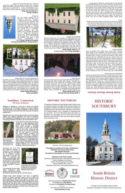
HISTORIC SOUTHBURY<br />
This guide to <strong>South</strong>bury’s <strong>South</strong> <strong>Britain</strong> <strong>Historic</strong> <strong>District</strong> and<br />
a companion guide to the Main Street <strong>Historic</strong> <strong>District</strong> are<br />
designed to introduce residents and visitors to <strong>South</strong>bury’s<br />
architectural and historical assets. Because <strong>of</strong> the town’s<br />
rich historical legacy, only a sampling <strong>of</strong> individual sites<br />
can be listed. For more information about the history <strong>of</strong><br />
<strong>South</strong>bury we encourage you to visit the Old <strong>Town</strong> Hall<br />
Museum in <strong>South</strong> <strong>Britain</strong> or the <strong>Town</strong> <strong>of</strong> <strong>South</strong>bury website:<br />
www.southbury-ct.org<br />
Platt Farm, 538 Flood Bridge Road<br />
This guide is a project <strong>of</strong> the <strong>Town</strong> <strong>of</strong> <strong>South</strong>bury<br />
Certified Local Government (CLG)<br />
with support from the<br />
<strong>Connecticut</strong> Commission on Culture and Tourism.<br />
Members <strong>of</strong> the CLG include:<br />
<strong>South</strong>bury <strong>Historic</strong>al Society • www.historicsouthbury.org<br />
<strong>Historic</strong> Buildings Commission<br />
<strong>Historic</strong> Tree Restoration Committee<br />
<strong>Historic</strong> <strong>District</strong>s Nos 1 and 2<br />
<strong>South</strong>bury Land Trust • www.southburylandtrust.org<br />
Brochure prepared by Diantha Dow Schull<br />
Photography by John Munno<br />
Produced by <strong>South</strong>bury Printing Center<br />
Edition 2010<br />
You may view this brochure online at:<br />
www.southbury-ct.org<br />
HISTORIC<br />
SOUTHBURY<br />
<strong>South</strong> <strong>Britain</strong><br />
<strong>Historic</strong> <strong>District</strong><br />
A Guide to the <strong>South</strong> <strong>Britain</strong> <strong>Historic</strong> <strong>District</strong><br />
<strong>South</strong>bury, <strong>Connecticut</strong>, a Preserve America Community
Bradley, Hoyt & Co<br />
624 Hawkins Road<br />
Congregational Church Parsonage ( “The Parsonage” )<br />
10639 <strong>South</strong> <strong>Britain</strong> Road<br />
Built approximately 1785 by Moses Downs, this structure served<br />
for many years as home for the Congregational Minister. It is<br />
characteristic <strong>of</strong> the Colonial era, with a balanced, five-bay front<br />
façade, central chimney, twelve-over-twelve windows, and gable<br />
ro<strong>of</strong>. The house was updated in the 1830’s or 40’s with a Greek<br />
Revival door surround.<br />
Curtis House<br />
17584-586 <strong>South</strong> <strong>Britain</strong> Road<br />
The former Hawkins Factory, situated on the east bank <strong>of</strong> the<br />
Pomperaug River, is the major extant industrial structure in <strong>South</strong><br />
<strong>Britain</strong>. The main, four-story section <strong>of</strong> the Factory was built<br />
in 1866; two two-story sections were added later. The building<br />
started life as a textile mill. In 1901 it was taken over by the<br />
Hawkins Company, a manufacturer <strong>of</strong> animal traps. Aside from<br />
traps, there were numerous other items produced in the building,<br />
including woolens, tacks, buttons, and plastic assemblies. Factory<br />
operations stopped in the 1960’s.<br />
Judson Manville House<br />
724 Hawkins Road<br />
One <strong>of</strong> two brick Greek Revival residences in the <strong>Historic</strong> <strong>District</strong>,<br />
this home was built in 1835 for hat manufacturer Judson Manville.<br />
Both this and No. 9 below are constructed <strong>of</strong> native bricks and<br />
have limestone sills and lintels. The wrap-around porch dates<br />
from the early 20th century Colonial Revival period. The building<br />
was used for decades as the company <strong>of</strong>fice for the Hawkins<br />
Factory.<br />
Mitchell-Williams Store<br />
8667 <strong>South</strong> <strong>Britain</strong> Road<br />
This large commercial building in the “picturesque vernacular”<br />
style has served the community as a general store continuously<br />
since construction in 1904. It replaced an earlier store on the<br />
same site. With apartments over the large retail area, this eclectic<br />
structure stands out in a community where most structures are<br />
more restrained in their design. The store has an unusual pair <strong>of</strong><br />
gables joined by a circular segmental ro<strong>of</strong> section and pressed tin<br />
pillasters on the front facade.<br />
Benjamin Downs House<br />
9657 <strong>South</strong> <strong>Britain</strong> Road<br />
Built <strong>of</strong> native brick in the Greek Revival style, c.1825, this house<br />
was constructed for local carriage-maker Benjamin Downs. The<br />
simple, rectilinear lines, and the fluted Ionic columns supporting<br />
the shed-ro<strong>of</strong>ed portico are typical <strong>of</strong> the period. It is associated<br />
with the formation <strong>of</strong> the first library in <strong>South</strong> <strong>Britain</strong>, in 1791,<br />
which may have occurred in an earlier building on the site. A<br />
similar house is at 24 Hawkins Road (No 7 above).<br />
Smith-Pierce House<br />
11583 <strong>South</strong> <strong>Britain</strong> Road<br />
Local merchant Samuel Smith constructed this residence<br />
sometime between 1800 and 1825. It is a transitional building,<br />
including elements <strong>of</strong> both the Federal and Greek Revival styles.<br />
Federal elements include the entry at the gable end, a pedimented<br />
facade embellished with modillions, and a doorway with sidelights<br />
and a leaded transom. Some moldings, the six-over-six windows<br />
and the simplicity <strong>of</strong> design are Greek Revival.<br />
Mitchell Double House<br />
12545-547 <strong>South</strong> <strong>Britain</strong> Road<br />
This unusual structure, a double residence, was constructed<br />
about 1752. A later owner, Deacon Mitchell, left the house to his<br />
two sons. Over time the house has <strong>of</strong>ten had two owners rather<br />
than one. The two sections <strong>of</strong> the house have similar plans. Each<br />
is generous in size, with multiple fireplaces. Despite the early<br />
date the house has Federal era features including a balanced<br />
five bay façade, end chimneys, central entry with sidelights, and<br />
a simple Palladian-type window above the entrance way. Even the<br />
side entrance has a semicircular transom and pediment. At one<br />
time there was also a grist mill on the property, built in c. 1796.<br />
Canfield House<br />
13524 <strong>South</strong> <strong>Britain</strong> Road<br />
Built approximately 1810, this Federal structure is notable for<br />
its elegant proportions, twelve-over-twelve windows, three<br />
story height, twin chimneys located in from the end walls, and<br />
a doorway with leaded side lights and transom. The pedimented<br />
entrance porch is a Greek Revival addition.<br />
The Old <strong>South</strong> <strong>Britain</strong> Library<br />
14576 <strong>South</strong> <strong>Britain</strong> Road<br />
In 1904 a local private industry raised funds for the <strong>South</strong> <strong>Britain</strong><br />
Library Association building, which functioned as the town<br />
library until 1969. It is a small, one story Shingle Style structure.<br />
Completely sheathed in shingles, it has the long sloping eaves,<br />
hipped ro<strong>of</strong>, square shape, integral porch and Colonial Revival<br />
detailing characteristic <strong>of</strong> the style. The Library is now maintained<br />
by the <strong>Historic</strong> Buildings Commission and operated by the<br />
<strong>South</strong>bury <strong>Historic</strong>al Society as a local history and genealogy<br />
research center. It is one <strong>of</strong> the few preserved historic libraries in<br />
the state, and as such expresses the importance <strong>of</strong> the library as<br />
a civic function in New England communities.<br />
Cunningham-Davis House<br />
1517 Library Road<br />
The two-story frame Cape at<br />
17 Library Road is considered<br />
one <strong>of</strong> the oldest structures in<br />
the <strong>Historic</strong> <strong>District</strong>, said to have<br />
been constructed between 1736<br />
and 1776. <strong>Historic</strong>ally the house<br />
served as a two family dwelling.<br />
With a central chimney, early<br />
twelve-over-twelve windows, and<br />
a simple plank doorway, it reflects<br />
the simplicity <strong>of</strong> most mid-18th<br />
century farmhouses in the region.<br />
The building is on two levels, with<br />
a later single story extension on<br />
the upper level.<br />
Platt Farm (rear cover)<br />
16538 Flood Bridge Road<br />
The Platt Farm is one <strong>of</strong> the last remaining operating farms in<br />
<strong>South</strong>bury. The complex includes an Italianate residence, built<br />
in the 1860’s, with a typical asymmetrical plan, low hipped ro<strong>of</strong><br />
and bay window. With a cluster <strong>of</strong> barns, outbuildings and sheds,<br />
some dating from the mid 19th century, and situated overlooking<br />
open fields and rolling hills, the Platt Farm is an exceptional visual<br />
and environmental asset for <strong>South</strong>bury. Some <strong>of</strong> the land that<br />
was once the Platt Farm is now maintained by the <strong>South</strong>bury<br />
Land Trust.<br />
Some local historians consider the Curtis House to be the oldest<br />
residence in <strong>South</strong> <strong>Britain</strong>, possibly built as early as 1740. It<br />
has typical features <strong>of</strong> the mid-18th century, including a handhewn<br />
timber frame, gambrel ro<strong>of</strong>, simple central entry, and large<br />
central chimney that supported several fireplaces.<br />
Old <strong>Town</strong> Hall<br />
18624 <strong>South</strong> <strong>Britain</strong> Road<br />
The importance <strong>of</strong> <strong>South</strong> <strong>Britain</strong><br />
within the larger town is reflected<br />
in the construction <strong>of</strong> <strong>South</strong>bury’s<br />
first town hall in <strong>South</strong> <strong>Britain</strong><br />
in 1873. The simple two-story<br />
building in the “Picturesque<br />
Vernacular” style served as the<br />
center <strong>of</strong> town government until<br />
1964. It accommodated all town<br />
functions and also served at one<br />
point as a private school. It is<br />
now one <strong>of</strong> three historic buildings<br />
maintained by the <strong>Historic</strong><br />
Buildings Commission and is<br />
operated as a museum by the<br />
<strong>South</strong>bury <strong>Historic</strong>al Society.<br />
Perry House (aka Moses Downs House)<br />
19662 <strong>South</strong> <strong>Britain</strong> Road<br />
One <strong>of</strong> the oldest houses in the <strong>District</strong>, this was said to have<br />
been build by Downs c. 1755. It was originally a saltbox <strong>of</strong> post<br />
and beam construction with a central chimney. The house was<br />
later enlarged to two full stories and in the 1850’s updated with<br />
Greek features including a bold pilastered frontispiece.<br />
The Methodist Episcopal Church<br />
20698 <strong>South</strong> <strong>Britain</strong> Road<br />
Constructed in 1832 by the Methodist Society, and enlarged<br />
in 1851, this church has classic Greek Revival features: a<br />
flush sided facade, a central double leaf four panel door, Doric<br />
pilasters that divide the front into bays, high narrow windows and<br />
a square belfry. The simplicity <strong>of</strong> design contrasts with the more<br />
elaborate Congregational Church directly opposite. Although the<br />
building is in disrepair it remains an excellent example <strong>of</strong> mid-<br />
19th century ecclesiastical architecture and a reminder <strong>of</strong> the<br />
challenges faced by small communities committed to preserving<br />
their architectural legacy.<br />
The <strong>South</strong> <strong>Britain</strong> Academy<br />
21698 <strong>South</strong> <strong>Britain</strong> Road<br />
The “Academy” served as a<br />
school from about 1820 to<br />
1860. It was also a “place<br />
<strong>of</strong> higher learning,” with a<br />
library and an Institute for<br />
Elocution and Debating. It<br />
has a simple gable-end plan,<br />
six-over-six windows, and a<br />
triangular pedimented ro<strong>of</strong><br />
typical <strong>of</strong> the Greek Revival<br />
era. The porch and entrance<br />
door were changed to reflect<br />
later Italianate tastes.