Open Space and Public Place Plan - City of West Torrens - SA.Gov.au
Open Space and Public Place Plan - City of West Torrens - SA.Gov.au
Open Space and Public Place Plan - City of West Torrens - SA.Gov.au

Create successful ePaper yourself
Turn your PDF publications into a flip-book with our unique Google optimized e-Paper software.
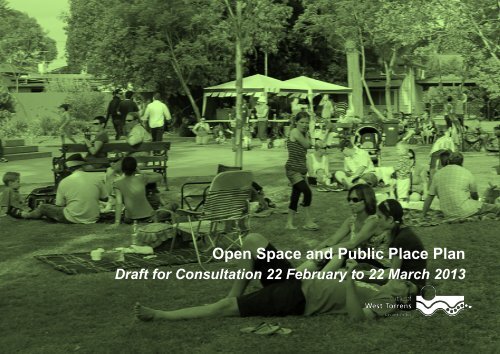
<strong>Open</strong> <strong>Space</strong> <strong>and</strong> <strong>Public</strong> <strong>Place</strong> <strong>Plan</strong><br />
Draft for Consultation 22 February to 22 March 2013<br />
Page 1 <strong>of</strong> 46
Access to Document<br />
This document has been prepared by the <strong>City</strong><br />
<strong>of</strong> <strong>West</strong> <strong>Torrens</strong>. You may access copies <strong>of</strong><br />
this document from Council's website at<br />
www.westtorrens.sa.gov.<strong>au</strong>. You may<br />
download <strong>and</strong> print this document in unaltered<br />
form, only for your personal use or use by your<br />
organisation.<br />
Copyright<br />
This document is based on work by Council<br />
<strong>and</strong> other <strong>au</strong>thors as cited. Apart from any<br />
permitted uses under the Copyright Act 1968,<br />
the work may be reproduced for study or<br />
training purposes, provided the source is<br />
acknowledged. Reproduction for commercial<br />
use requires prior written permission <strong>of</strong> the<br />
Council <strong>and</strong> the various sources cited.<br />
Document History<br />
Version Date Details Author Approver<br />
1.0 9.10.12 Draft for internal Council Review URPS/WAX Project<br />
Manager<br />
1.1 05.02.13 Draft for Council endorsement for public<br />
consultation<br />
URPS/WAX Project<br />
Manager<br />
1.2 22.02.13 Draft for public consultation URPS/WAX Council<br />
2.0 Amended post public consultation <strong>and</strong> adopted as<br />
strategic document<br />
Project<br />
Manager<br />
Council<br />
Disclaimer<br />
While reasonable efforts have been made to<br />
ensure that the contents <strong>of</strong> this document are<br />
factually correct, the <strong>City</strong> <strong>of</strong> <strong>West</strong> <strong>Torrens</strong> does<br />
not accept responsibility for its accuracy or<br />
currency. As information is subject to change,<br />
the <strong>City</strong> <strong>of</strong> <strong>West</strong> <strong>Torrens</strong> shall not be liable for<br />
any loss or damage that may be occur through<br />
the use <strong>of</strong>, or reliance on, the contents <strong>of</strong> this<br />
document.<br />
Front Cover (<strong>and</strong> Part Covers):<br />
Summer Festival held at the <strong>City</strong> <strong>of</strong> <strong>West</strong><br />
<strong>Torrens</strong> Memorial Gardens (2012).<br />
Page 2 <strong>of</strong> 46
Production Acknowledgment<br />
This document was produced by the <strong>City</strong> <strong>of</strong> <strong>West</strong> <strong>Torrens</strong>.<br />
With valuable assistance from:-<br />
• Post public consultation - insert recognition <strong>of</strong> the community's participation,<br />
• Consultants URPS <strong>and</strong> WAX Design in researching, analysing, developing this document, <strong>and</strong> the<br />
• Department <strong>of</strong> <strong>Plan</strong>ning, Transport <strong>and</strong> Infrastructure, <strong>Open</strong> <strong>Space</strong> Grant which made this work possible.<br />
K<strong>au</strong>rna Acknowledgement<br />
The <strong>City</strong> <strong>of</strong> <strong>West</strong> <strong>Torrens</strong> acknowledges the K<strong>au</strong>rna Aboriginal people <strong>and</strong> their descendants are still <strong>and</strong> will always be<br />
the first peoples <strong>of</strong> the l<strong>and</strong>. The <strong>City</strong> <strong>of</strong> <strong>West</strong> <strong>Torrens</strong> commits to valuing <strong>and</strong> supporting the K<strong>au</strong>rna people’s inherent<br />
relationship to the l<strong>and</strong>.<br />
Page 3 <strong>of</strong> 46
Message from the Mayor<br />
With its central metropolitan location <strong>and</strong> its<br />
proximity to the coast, <strong>West</strong> <strong>Torrens</strong> is an<br />
appealing place to live, <strong>and</strong> this will inevitably<br />
lead to a future <strong>of</strong> population growth <strong>and</strong> <strong>of</strong> infill<br />
development.<br />
It is important that we plan for this future <strong>and</strong><br />
thus ensure that the environmental, social,<br />
economic <strong>and</strong> community qualities that create<br />
our city’s appeal are not just maintained but are<br />
also enhanced during that growth.<br />
In serving our diverse community, Council is<br />
committed to strive for excellence. Indeed, it is<br />
my personal hope that the broader Adelaide<br />
community eventually refers to our district as<br />
being ‘the leafy western suburbs’.<br />
This <strong>Open</strong> <strong>Space</strong> <strong>and</strong> <strong>Public</strong> <strong>Place</strong> <strong>Plan</strong> helps<br />
deliver the Community <strong>Plan</strong>'s aspirations by<br />
providing open space <strong>and</strong> public places which<br />
not only improve the built <strong>and</strong> natural<br />
environments, but also create opportunities for<br />
a healthy community life.<br />
Hon. John Trainer<br />
Mayor<br />
Page 4 <strong>of</strong> 46
Table <strong>of</strong> Contents<br />
Message from the Mayor ............................................................................................................................................................................................................................... 4<br />
Executive summary ........................................................................................................................................................................................................................................ 6<br />
1 Introduction .......................................................................................................................................................................................................................................... 7<br />
2 State Strategic Context ........................................................................................................................................................................................................................ 10<br />
3 Issues Impacting Upon <strong>Open</strong> <strong>Space</strong> <strong>and</strong> <strong>Public</strong> <strong>Place</strong> ........................................................................................................................................................................... 11<br />
4 Existing Supply <strong>and</strong> Condition <strong>of</strong> <strong>Open</strong> <strong>Space</strong> ...................................................................................................................................................................................... 14<br />
5 Dem<strong>and</strong> for <strong>Open</strong> <strong>Space</strong> ...................................................................................................................................................................................................................... 18<br />
6 Strategy ............................................................................................................................................................................................................................................... 22<br />
7 Draft Action <strong>Plan</strong> ................................................................................................................................................................................................................................. 35<br />
Appendix ..................................................................................................................................................................................................................................................... 46<br />
List <strong>of</strong> Tables<br />
Table 1: <strong>Open</strong> <strong>Space</strong> Type <strong>and</strong> Area ............................................................................................................................................................................................................. 15<br />
Table 2: <strong>Open</strong> <strong>Space</strong> Provision Comparison with other Council Areas.......................................................................................................................................................... 15<br />
Table 3: Population Growth Scenarios for the <strong>City</strong> <strong>of</strong> <strong>West</strong> <strong>Torrens</strong> ............................................................................................................................................................. 20<br />
List <strong>of</strong> Figures<br />
Figure 1: Connection with Corporate <strong>Plan</strong>ning Framework ............................................................................................................................................................................ 9<br />
Figure 2: <strong>Public</strong> <strong>Open</strong> <strong>Space</strong> Provision 12.5% Development Site Contrasted with 3 Hectares/1000 People ................................................................................................. 19<br />
List <strong>of</strong> Maps<br />
Map 1: Council <strong>Open</strong> <strong>Space</strong> ......................................................................................................................................................................................................................... 16<br />
Map 2: Non Council <strong>Open</strong> <strong>Space</strong>, Connections <strong>and</strong> Flood Prone L<strong>and</strong> .......................................................................................................................................................... 17<br />
Map 3: <strong>Open</strong> <strong>Space</strong> Provision ...................................................................................................................................................................................................................... 24<br />
Map 4: <strong>Open</strong> <strong>Space</strong> Hierarchy ...................................................................................................................................................................................................................... 26<br />
Page 5 <strong>of</strong> 46<br />
Kings Park
Executive summary<br />
Population growth <strong>and</strong> urban development will have a significant<br />
bearing on how open space <strong>and</strong> public place is planned for <strong>and</strong><br />
used in the <strong>City</strong> <strong>of</strong> <strong>West</strong> <strong>Torrens</strong>. <strong>Plan</strong>ned growth will increase<br />
dem<strong>and</strong>s on existing open space <strong>and</strong> public place. New forms <strong>of</strong><br />
housing have smaller areas <strong>of</strong> private open space, while mixing<br />
l<strong>and</strong> uses might activate streets in certain locations, <strong>and</strong> encourage<br />
more pedestrian activity <strong>and</strong> street life.<br />
The changing patterns <strong>of</strong> urban development <strong>and</strong> increased<br />
densities means that public places such as squares, malls, streets<br />
<strong>and</strong> laneways, where people move through <strong>and</strong> gather, will be <strong>of</strong> as<br />
much importance as open space.<br />
Projected population growth with no additional provision <strong>of</strong> open<br />
space is conceivable but would result in a significant open space<br />
deficit. This scenario would have significant implications for the<br />
provision <strong>and</strong> management <strong>of</strong> open space in <strong>West</strong> <strong>Torrens</strong> as well<br />
as impacting directly on the community's quality <strong>of</strong> life.<br />
The <strong>Open</strong> <strong>Space</strong> <strong>and</strong> <strong>Public</strong> <strong>Place</strong> <strong>Plan</strong> outlines a vision to provide<br />
an equitable distribution <strong>of</strong> quality open space <strong>and</strong> public place that<br />
will benefit residents, workers <strong>and</strong> visitors, <strong>and</strong> responds to existing<br />
<strong>and</strong> future community needs. It includes opportunities to improve<br />
existing open space facilities <strong>and</strong> public place to achieve active,<br />
vibrant <strong>and</strong> connected communities.<br />
This <strong>Plan</strong> provides strategic direction <strong>and</strong> supporting actions to<br />
deliver an open space <strong>and</strong> public place network that responds to<br />
community needs. This includes identifying opportunities to<br />
increase <strong>and</strong> enhance open space provision.<br />
<strong>Public</strong> open space is the most visible indicator <strong>of</strong> the<br />
health <strong>and</strong> vitality <strong>of</strong> our cities <strong>and</strong> by the same token the<br />
health <strong>of</strong> our communities. The future planning <strong>and</strong><br />
delivery <strong>of</strong> quality open space is critical.<br />
Warwick Keates (2011), WAX Design<br />
Page 6 <strong>of</strong> 46
1 Introduction<br />
1.1 Glossary<br />
This <strong>Plan</strong> uses the following definitions:<br />
<strong>Open</strong> space<br />
<strong>Public</strong> place<br />
Refers to l<strong>and</strong> that is either owned or under the<br />
control <strong>of</strong> Council <strong>and</strong> which is publically accessible<br />
<strong>and</strong> provided for community benefit (recreation park,<br />
linear trail, sportsground).<br />
Refers to publically accessible places that are part <strong>of</strong><br />
the urban fabric (main streets, jetties, waterfronts,<br />
building edges plazas, squares) alternatively referred<br />
to as the public place.<br />
1.2 Purpose <strong>of</strong> Document<br />
Council owns, maintains <strong>and</strong> facilitates the provision <strong>of</strong> open space<br />
for the community's benefit. Since 1997 Council has had, in one<br />
form or another, an <strong>Open</strong> <strong>Space</strong> Strategy to identify <strong>and</strong><br />
strategically address open space issues. Given expected infill<br />
development growth pressures the need for quality public place has<br />
been incorporated into this document. The provision <strong>of</strong> open space<br />
<strong>and</strong> quality public place also forms a key component <strong>of</strong> the<br />
community's long term vision outlined in the Council's Community<br />
<strong>Plan</strong>; <strong>and</strong> this <strong>Plan</strong> contributes to delivering that vision.<br />
This <strong>Plan</strong> outlines a vision to provide an equitable distribution <strong>of</strong><br />
quality open space <strong>and</strong> public place that will benefit residents,<br />
workers <strong>and</strong> visitors, <strong>and</strong> responds to existing <strong>and</strong> future<br />
community needs. This includes opportunities to improve existing<br />
open space facilities <strong>and</strong> public place to achieve active, vibrant <strong>and</strong><br />
connected communities.<br />
This <strong>Plan</strong> will aid in directing infrastructure <strong>and</strong> service provision<br />
planning, asset management <strong>and</strong> supporting funding requests.<br />
While a public document, the primary <strong>au</strong>diences <strong>of</strong> this <strong>Plan</strong> include<br />
but are not limited to;<br />
• All open space <strong>and</strong> public place users, pr<strong>of</strong>essionals,<br />
leasees <strong>and</strong> providers (governmental, commercial <strong>and</strong><br />
community),<br />
• State <strong>and</strong> Local <strong>Gov</strong>ernment <strong>of</strong>ficers involved in physical<br />
<strong>and</strong> social infrastructure provision,<br />
• Pr<strong>of</strong>essionals who impact upon the built environment<br />
including; planners, development assessment <strong>of</strong>ficers,<br />
builders, engineers, <strong>and</strong><br />
• Pr<strong>of</strong>essionals involved in community development.<br />
1.3 Structure <strong>of</strong> <strong>Plan</strong><br />
This <strong>Plan</strong> provides strategic direction <strong>and</strong> supporting actions to<br />
deliver an open space <strong>and</strong> public place network that responds to<br />
community needs. The components <strong>of</strong> the <strong>Plan</strong> are;<br />
• State Strategic Context<br />
• Issues Impacting Upon <strong>Open</strong> <strong>Space</strong> <strong>and</strong> <strong>Public</strong> <strong>Place</strong><br />
• Existing Supply <strong>and</strong> Condition <strong>of</strong> <strong>Open</strong> <strong>Space</strong><br />
• Dem<strong>and</strong> for <strong>Open</strong> <strong>Space</strong><br />
• Strategies, <strong>and</strong><br />
• Actions.<br />
Page 7 <strong>of</strong> 46
1.4 Delivering the Community <strong>Plan</strong>'s Vision<br />
The <strong>City</strong> <strong>of</strong> <strong>West</strong> <strong>Torrens</strong> Community <strong>Plan</strong> represents the<br />
community's long term vision <strong>and</strong> aspirations. With regard open<br />
space <strong>and</strong> public place the Community <strong>Plan</strong> states;<br />
<strong>Open</strong> space is a valuable part <strong>of</strong> the urban environment, catering for<br />
a range <strong>of</strong> active <strong>and</strong> passive recreational uses by the community, as<br />
well as enhancing the character <strong>of</strong> the area. Currently, about six per<br />
cent <strong>of</strong> the total l<strong>and</strong> area within the city is dedicated to public open<br />
space, including the River <strong>Torrens</strong> Linear Park, local <strong>and</strong><br />
neighbourhood parks, public ovals <strong>and</strong> sporting grounds. Access to<br />
quality open space is recognised as an extremely important issue to<br />
the community <strong>and</strong> facilitating this remains a Council priority.<br />
Future challenges facing the Council include dem<strong>and</strong> for new <strong>and</strong><br />
affordable residential housing <strong>and</strong> higher <strong>and</strong> better use <strong>of</strong> l<strong>and</strong>, while<br />
protecting areas <strong>of</strong> high character value. There will also be pressure<br />
to provide quality public open spaces as the size <strong>of</strong> private backyards<br />
diminishes. Council is also likely to face significant <strong>and</strong> increasing<br />
requirements for effective infrastructure such as good road networks,<br />
safe walking paths <strong>and</strong> bikeways, increased accessibility to public<br />
transport <strong>and</strong> effective stormwater management.<br />
This <strong>Plan</strong> delivers upon the following Community <strong>Plan</strong> aspirations,<br />
Aspiration - A community that embraces diversity.<br />
Strategy;<br />
• Facilitate opportunities for people from diverse social backgrounds<br />
to come together.<br />
• Foster a sense <strong>of</strong> identity <strong>and</strong> pride within the <strong>West</strong> <strong>Torrens</strong><br />
community.<br />
• Encourage <strong>and</strong> facilitate art in public spaces including community<br />
buildings, streetscapes <strong>and</strong> open spaces.<br />
Aspiration - Enhanced natural environment<br />
Strategy;<br />
• Create green streetscapes <strong>and</strong> open spaces.<br />
• Design streetscapes to maximise opportunities for greening.<br />
• Incorporate native <strong>and</strong> local indigenous drought resistant plant<br />
species into streetscapes <strong>and</strong> open spaces.<br />
• Develop water-smart open spaces.<br />
Aspiration - An attractive <strong>and</strong> functional open space network<br />
Strategy;<br />
• Facilitate equitable access to open spaces.<br />
• Develop a network <strong>of</strong> open spaces across Council, based on a<br />
balance <strong>of</strong> environmental, social <strong>and</strong> economic factors.<br />
• Establish a hierarchy <strong>of</strong> maintenance for Council’s open spaces in<br />
accordance with identified priorities.<br />
Aspiration - Healthy <strong>and</strong> learning communities<br />
Strategy;<br />
• Encourage all members <strong>of</strong> the community to pursue active <strong>and</strong><br />
creative lifestyles.<br />
• Support sporting leaders to engage with the local community <strong>and</strong><br />
encourage greater participation.<br />
• Enhance recreational facilities to provide a range <strong>of</strong> activities for all<br />
ages <strong>and</strong> capabilities.<br />
To ensure delivery <strong>of</strong> this vision <strong>and</strong> aspirations, the <strong>City</strong> <strong>of</strong> <strong>West</strong><br />
<strong>Torrens</strong> has adopted a Corporate <strong>Plan</strong>ning Framework to aid<br />
strategic management <strong>and</strong> the translation <strong>of</strong> the vision into<br />
operational outcomes. This <strong>Plan</strong>'s association within the Corporate<br />
<strong>Plan</strong>ning Framework is outlined in Figure 1.<br />
Within the Corporate <strong>Plan</strong>ning Framework;<br />
• The Community <strong>Plan</strong> is Council's overarching strategic<br />
management plan.<br />
• This <strong>Plan</strong> outlines strategies <strong>and</strong> actions that are<br />
incorporated into Council Departments' Service <strong>Plan</strong>s.<br />
• Service <strong>Plan</strong>s, adopted each financial year, outline what<br />
projects will be budgeted for <strong>and</strong> delivered. Service <strong>Plan</strong>s<br />
are thus key instruments in the focusing <strong>of</strong> resources<br />
towards the delivery <strong>of</strong> the Community <strong>Plan</strong>.<br />
Page 8 <strong>of</strong> 46
Community <strong>Plan</strong><br />
Figure 1: Connection with Corporate <strong>Plan</strong>ning Framework<br />
Long Term Vision <strong>and</strong> Aspirations<br />
<strong>Open</strong> <strong>Space</strong> <strong>and</strong> <strong>Public</strong><br />
<strong>Place</strong> <strong>Plan</strong><br />
Strategies <strong>and</strong> Actions<br />
Annual Service <strong>Plan</strong>s<br />
Council Budgeted Projects <strong>and</strong> Actions<br />
The Corporate <strong>Plan</strong>ning Framework ensures connectivity from the<br />
Community <strong>Plan</strong>'s long term vision into the Annual Budget <strong>and</strong><br />
Departmental Service <strong>Plan</strong>s.<br />
The research <strong>and</strong> investigations that informed the Issues <strong>and</strong><br />
Opportunities Paper (see Appendix) provides the basis for the<br />
objectives, strategies <strong>and</strong> actions contained within this <strong>Plan</strong>.<br />
1.5 Implementation<br />
Focus <strong>of</strong> Council<br />
Resources<br />
To implement this <strong>Plan</strong> the following will be applied.<br />
Delivery <strong>of</strong><br />
Community Vision<br />
Corporate <strong>Plan</strong>ning Framework<br />
This <strong>Plan</strong> will be incorporated into the <strong>City</strong> <strong>of</strong> <strong>West</strong> <strong>Torrens</strong><br />
Corporate <strong>Plan</strong>ning Framework to ensure all strategic documents<br />
(which direct the use <strong>of</strong> resources) have regard for the strategic<br />
direction.<br />
Annual Service <strong>Plan</strong>s<br />
The priorities, strategies, <strong>and</strong> actions contained within this <strong>Plan</strong> will<br />
be incorporated into the <strong>City</strong> <strong>of</strong> <strong>West</strong> <strong>Torrens</strong>' annual service plan<br />
<strong>and</strong> budget. This will ensure the use <strong>of</strong> Council resources is<br />
focussed on delivering strategic priorities outlined in Council's<br />
strategic documents.<br />
Review <strong>of</strong> <strong>Plan</strong><br />
The <strong>City</strong> <strong>of</strong> <strong>West</strong> <strong>Torrens</strong> will review this <strong>Plan</strong> ideally after the next<br />
review <strong>of</strong> the Community <strong>Plan</strong>, anticipated in 2016/17.<br />
Advocacy <strong>and</strong> Collaboration<br />
This <strong>Plan</strong> will aid in determining those matters Council needs to<br />
advocate to the State <strong>and</strong> Commonwealth <strong>Gov</strong>ernments, private<br />
sector <strong>and</strong> developers to enlist their collaboration to ensure<br />
priorities are actioned.<br />
Regional Implementation Strategy<br />
The State <strong>Gov</strong>ernment's 30 Year <strong>Plan</strong> for Greater Adelaide requires<br />
Regional Implementation Strategies to be developed through<br />
Regional Partnership Forums. This <strong>Plan</strong> will aid in determining<br />
those matters the Regional Implementation Strategy should<br />
address <strong>and</strong> will thus ensure priorities are actioned.<br />
Funding Opportunities<br />
This <strong>Plan</strong> provides a framework <strong>and</strong> direction to assist in sourcing<br />
external funds to deliver the identified outcomes for the community.<br />
Asset Management <strong>and</strong> Provision<br />
To ensure community needs are met, this <strong>Plan</strong> provides a<br />
framework for the management <strong>and</strong> provision <strong>of</strong> open space <strong>and</strong><br />
public place cared for by the <strong>City</strong> <strong>of</strong> <strong>West</strong> <strong>Torrens</strong>.<br />
Page 9 <strong>of</strong> 46
2 State Strategic Context<br />
2.1 Seven Strategic Priorities<br />
In early 2012 the Premier outlined seven immediate priorities for the<br />
state’s future, stating they would deliver the focused action needed<br />
to achieve the visions, goals <strong>and</strong> targets outlined in South<br />
Australia’s Strategic <strong>Plan</strong>. The seven priorities are:<br />
• Creating a vibrant city<br />
• Safe communities, healthy neighbourhoods<br />
• An affordable place to live<br />
• Every chance for every child<br />
• Growing advanced manufacturing<br />
• Realising the benefits <strong>of</strong> the mining boom for all<br />
• Premium food <strong>and</strong> wine from our clean environment.<br />
This <strong>Plan</strong> will guide the improvement <strong>of</strong> residential neighbourhoods<br />
so that it’s easy for people to lead healthy lives <strong>and</strong> feel safe in their<br />
communities, contributing to “safe communities, healthy<br />
neighbourhoods”.<br />
2.2 State Strategic <strong>Plan</strong><br />
South Australia’s Strategic <strong>Plan</strong> sets the broad objectives <strong>and</strong><br />
targets for the State for which all other plans should have regard.<br />
This <strong>Plan</strong> has regard for the following State Strategic <strong>Plan</strong>'s specific<br />
goals <strong>and</strong> targets:<br />
Goal: We are committed to our towns <strong>and</strong> cities being well<br />
designed, generating great experiences <strong>and</strong> a sense <strong>of</strong><br />
belonging.<br />
Target 1: Urban spaces - Increase the use <strong>of</strong> public spaces<br />
by the community<br />
Goal: New developments are people friendly, with open spaces<br />
<strong>and</strong> parks connected by public transport <strong>and</strong> bikeways.<br />
Target 2: Cycling - Double the number <strong>of</strong> people cycling in<br />
South Australia by 2020<br />
Goal: We are physically active.<br />
Target 83: Sport <strong>and</strong> recreation - Increase the proportion <strong>of</strong><br />
South Australians participating in sport or physical recreation<br />
at least once per week to 50% by 2020.<br />
2.3 30 Year <strong>Plan</strong> for Greater Adelaide<br />
The 30 Year <strong>Plan</strong> for Greater Adelaide: A volume <strong>of</strong> the South<br />
Australian <strong>Plan</strong>ning Strategy provides the spatial l<strong>and</strong> use<br />
framework to support the achievement <strong>of</strong> the following targets<br />
across the Greater Adelaide region over its 30 year time frame:<br />
• Population growth <strong>of</strong> 560,000 people<br />
• The construction <strong>of</strong> 280,000 additional homes<br />
• Economic growth <strong>of</strong> $127.7 billion<br />
• The creation <strong>of</strong> 282,000 additional jobs.<br />
This <strong>Plan</strong> has regard for the 30 Year <strong>Plan</strong>'s direction by:<br />
• Providing “a net contribution <strong>of</strong> active <strong>and</strong> passive open<br />
space” in corridors <strong>and</strong> other infill areas.<br />
• Promoting the development <strong>of</strong> walkways <strong>and</strong> greenways<br />
along transit corridors <strong>and</strong> a well-designed network <strong>of</strong> linked<br />
open spaces.<br />
• Emphasising the importance <strong>of</strong> good urban design in<br />
promoting safe, healthy <strong>and</strong> attractive neighbourhoods <strong>and</strong><br />
community participation.<br />
Page 10 <strong>of</strong> 46
3 Issues Impacting Upon <strong>Open</strong> <strong>Space</strong> <strong>and</strong> <strong>Public</strong> <strong>Place</strong><br />
State, Local <strong>Gov</strong>ernment <strong>and</strong> Council's own strategic plans identify<br />
a range <strong>of</strong> issues that impact upon open space <strong>and</strong> public place<br />
which this <strong>Plan</strong> responds to. These include;<br />
• Growth <strong>and</strong> public places<br />
• <strong>Open</strong> space corridors <strong>and</strong> linkages<br />
• Biodiversity<br />
• Stormwater management <strong>and</strong> water sensitive urban design<br />
• Health <strong>and</strong> wellbeing<br />
• Climate change adaptation.<br />
3.1 Growth <strong>and</strong> <strong>Public</strong> <strong>Place</strong>s<br />
Population growth <strong>and</strong> urban development will have a significant<br />
bearing on how open space <strong>and</strong> public place is planned for <strong>and</strong><br />
used in the <strong>City</strong> <strong>of</strong> <strong>West</strong> <strong>Torrens</strong>.<br />
The <strong>City</strong> <strong>of</strong> <strong>West</strong> <strong>Torrens</strong> Community <strong>Plan</strong> supports sustainable<br />
population growth <strong>and</strong> providing a range <strong>of</strong> housing types <strong>and</strong><br />
densities. Council’s 2008 Strategic Directions Report, which<br />
predates the State <strong>Gov</strong>ernment's 30 Year <strong>Plan</strong> for Greater<br />
Adelaide, identifies the areas in <strong>West</strong> <strong>Torrens</strong> that are well suited<br />
for an increased residential population in the form <strong>of</strong> high density,<br />
medium density <strong>and</strong> mixed use precincts.<br />
In order to meet the population targets in South Australia’s Strategic<br />
<strong>Plan</strong>, the 30 Year <strong>Plan</strong> for Greater Adelaide outlines how population<br />
growth will be accommodated across Greater Adelaide. This will<br />
involve denser infill development within <strong>West</strong> <strong>Torrens</strong> to maximise<br />
the use <strong>of</strong> existing infrastructure <strong>and</strong> services, such as bus <strong>and</strong><br />
tram services. The 30 Year <strong>Plan</strong> for Greater Adelaide also seeks to<br />
‘provide a net contribution <strong>of</strong> active <strong>and</strong> passive open space’ in<br />
corridors <strong>and</strong> other infill areas, recognising the importance <strong>of</strong> open<br />
space in a dense urban environment.<br />
The <strong>City</strong> <strong>of</strong> <strong>West</strong> <strong>Torrens</strong> is in the process <strong>of</strong> amending its planning<br />
controls to provide the necessary statutory framework to support<br />
the urban infill development envisaged by the Council <strong>and</strong> State<br />
<strong>Gov</strong>ernment.<br />
Projected population growth <strong>and</strong> infill urban development will<br />
increase dem<strong>and</strong>s on existing open space <strong>and</strong> public place. New<br />
forms <strong>of</strong> housing have smaller areas <strong>of</strong> private open space, while<br />
mixing l<strong>and</strong> uses might activate streets in certain locations, <strong>and</strong><br />
encourage more pedestrian activity <strong>and</strong> street life. This changing<br />
pattern <strong>of</strong> urban development <strong>and</strong> increased densities means that<br />
public places such as squares, malls, streets <strong>and</strong> laneways, where<br />
people move through <strong>and</strong> gather, will be <strong>of</strong> as much importance as<br />
open space.<br />
Council’s Community <strong>Plan</strong> <strong>and</strong> 2008 Strategic Directions Report<br />
draw attention to the importance <strong>of</strong> streetscapes <strong>and</strong> open space as<br />
we plan for population growth <strong>and</strong> urban development. In a similar<br />
vein, the 30-Year <strong>Plan</strong> for Greater Adelaide talks about excellence<br />
in design <strong>and</strong> liveable public places. This includes tree lined streets,<br />
spaces that are safe, inviting, facilitate social interaction <strong>and</strong><br />
support community activities <strong>and</strong> cultural expression.<br />
3.2 <strong>Open</strong> <strong>Space</strong> Corridors <strong>and</strong> Linkages<br />
There is renewed focus on the development <strong>of</strong> open space<br />
corridors <strong>and</strong> linkages between individual sites. Council’s 2008<br />
Strategic Directions Report also draws attention to open space<br />
linkages, <strong>and</strong> its Community <strong>Plan</strong> commits to 'develop a network <strong>of</strong><br />
open spaces across Council, based on a balance <strong>of</strong> environmental,<br />
social <strong>and</strong> economic factors' as a five-year strategy. South<br />
Australia’s Strategic <strong>Plan</strong> contains the goal that “new developments<br />
are people friendly, with open spaces <strong>and</strong> parks connected by<br />
public transport <strong>and</strong> bikeways”.<br />
Page 11 <strong>of</strong> 46
Similarly, the 30-Year <strong>Plan</strong> for Greater Adelaide seeks the<br />
development <strong>of</strong> walkways <strong>and</strong> greenways. Greenways, are<br />
connected areas <strong>of</strong> open space along transit corridors,<br />
watercourses <strong>and</strong> linear parks which link open space areas, public<br />
facilities, provide local biodiversity corridors <strong>and</strong> support walking<br />
<strong>and</strong> cycling. The 30-Year <strong>Plan</strong> for Greater Adelaide also identifies<br />
a goal <strong>of</strong> creating open corridors along the flood lines which<br />
traverse the Council area to reinforce other corridors, such as the<br />
<strong>Torrens</strong> Linear Park <strong>and</strong> the <strong>West</strong>side Bikeway.<br />
These directions are supported by the State <strong>Gov</strong>ernment's Draft<br />
Inner Metro Rim Structure <strong>Plan</strong> which identifies Keswick <strong>and</strong><br />
Brownhill Creeks as ‘greenway’ corridors that might provide<br />
pedestrian/cyclist connections with the surrounding neighbourhood.<br />
3.3 Biodiversity<br />
An important function <strong>of</strong> open space is biodiversity conservation<br />
<strong>and</strong> enhancement. Urban areas can support a diversity <strong>of</strong> plant<br />
<strong>and</strong> animal species, <strong>and</strong> provide essential links between otherwise<br />
isolated ecological communities.<br />
Council’s Community <strong>Plan</strong> contains strategies to improve the<br />
condition <strong>of</strong> local biodiversity, participate in local environmental<br />
projects <strong>and</strong> incorporate native <strong>and</strong> local indigenous plants into<br />
streetscapes <strong>and</strong> open spaces. This is supported by the 30-Year<br />
<strong>Plan</strong> for Greater Adelaide which notes that the region is biologically<br />
diverse, <strong>and</strong> re-establishing biodiversity throughout urban areas is a<br />
priority. The 30-Year <strong>Plan</strong> for Greater Adelaide considers open<br />
spaces, greenways <strong>and</strong> streetscapes as pivotal to the enhancement<br />
<strong>of</strong> urban biodiversity <strong>and</strong> connection <strong>of</strong> different ecological<br />
communities. The 30-Year <strong>Plan</strong> for Greater Adelaide also seeks to<br />
develop urban forests, restore watercourses <strong>and</strong> use <strong>of</strong> local<br />
indigenous species.<br />
The Draft Inner Metro Rim Structure <strong>Plan</strong> identifies Keswick <strong>and</strong><br />
Brownhill Creeks as ‘greenways’ where there is opportunity to<br />
restore biodiversity. The Draft Adelaide <strong>and</strong> Mount L<strong>of</strong>ty Region<br />
Natural Resources Management <strong>Plan</strong> also acknowledges the<br />
importance <strong>of</strong> the River <strong>Torrens</strong>, <strong>and</strong> emphasises that "the urban<br />
l<strong>and</strong>scape is highly modified, which makes all natural resource<br />
areas highly valuable. Within Metropolitan Adelaide valuable natural<br />
areas include watercourses, beaches <strong>and</strong> parks."<br />
3.4 Stormwater Management <strong>and</strong> Water Sensitive Urban<br />
Design<br />
In largely developed places like <strong>West</strong> <strong>Torrens</strong>, greater attention is<br />
needed to foster positive stormwater management outcomes.<br />
Council’s Community <strong>Plan</strong> contains strategies aimed at increasing<br />
the amount <strong>of</strong> stormwater captured <strong>and</strong> reused including; identifying<br />
potential sites for local catchment storage, developing alternate<br />
water resources, <strong>and</strong> improving the quality <strong>of</strong> stormwater. <strong>Open</strong><br />
space can play an important role in stormwater management.<br />
Increasingly, water sensitive urban design (WSUD) techniques are<br />
being applied to the design <strong>and</strong> management <strong>of</strong> streets <strong>and</strong> open<br />
space. WSUD is an approach to water management that restores,<br />
where possible, the natural water cycle in built up areas. This<br />
means using streets <strong>and</strong> open space to reduce the flow <strong>of</strong>, treat<br />
<strong>and</strong> capture stormwater, minimising <strong>and</strong> improving the quality <strong>of</strong><br />
water run-<strong>of</strong>f into stormwater infrastructure networks.<br />
The State <strong>Gov</strong>ernment is committed to the widespread application<br />
<strong>of</strong> WSUD. The State’s Water for Good strategy outlines WSUD as<br />
a key way to securing the State’s long term water future, while the<br />
30 Year <strong>Plan</strong> for Greater Adelaide contains a number <strong>of</strong> policies<br />
<strong>and</strong> targets regarding the incorporation <strong>of</strong> WSUD across Adelaide<br />
<strong>and</strong> in planning processes, including a target to achieve<br />
independence from mains water supplies for public open spaces in<br />
transit corridors.<br />
Page 12 <strong>of</strong> 46
3.5 Health <strong>and</strong> Wellbeing<br />
<strong>Open</strong> space plays an important role in facilitating opportunities for<br />
recreation, social interaction <strong>and</strong> cultural activities, which together<br />
underpin active lifestyles <strong>and</strong> improved physical <strong>and</strong> mental health<br />
<strong>and</strong> wellbeing.<br />
The Council's Community <strong>Plan</strong> emphasises the need for embracing<br />
diversity, encouraging healthy <strong>and</strong> learning communities, as well as<br />
interaction <strong>and</strong> engagement. <strong>Open</strong> space <strong>and</strong> public places aid in<br />
delivering these by serving as venues for numerous formal cultural<br />
events <strong>and</strong> community celebrations, as well as informal activities.<br />
The <strong>City</strong> <strong>of</strong> <strong>West</strong> <strong>Torrens</strong> participates in the OPAL (Obesity<br />
Prevention <strong>and</strong> Lifestyle) program which works with communities to<br />
increase opportunities to eat well <strong>and</strong> be active locally.<br />
South Australia’s Strategic <strong>Plan</strong> has a target to “increase the<br />
proportion <strong>of</strong> South Australians participating in sport or physical<br />
recreation at least once per week to 50% by 2020”. It also includes<br />
a goal that “New developments are people friendly, with open<br />
spaces <strong>and</strong> parks connected by public transport <strong>and</strong> bikeways”,<br />
linked to the target to “double the number <strong>of</strong> people cycling in South<br />
Australia by 2020”.<br />
To help achieve these targets, the State <strong>Gov</strong>ernment's Eat Well Be<br />
Active Strategy outlines goals <strong>and</strong> actions for supporting healthy<br />
lifestyles. The Strategy notes that open space <strong>and</strong> trails networks,<br />
underpin physical activity, social inclusion <strong>and</strong> healthy lifestyles.<br />
The 30-Year <strong>Plan</strong> for Greater Adelaide contains polices <strong>and</strong> targets<br />
aimed at ensuring pedestrian <strong>and</strong> cyclist links are established to<br />
support active <strong>and</strong> inclusive lifestyles, along with ensuring that<br />
residential density, l<strong>and</strong> use mix <strong>and</strong> urban design create the<br />
conditions that are conducive for physical <strong>and</strong> mental wellbeing.<br />
3.6 Climate Change Adaptation<br />
The potential impacts <strong>of</strong> Climate change upon the <strong>City</strong> <strong>of</strong> <strong>West</strong><br />
<strong>Torrens</strong> include;<br />
• Sea level rises <strong>and</strong> potential loss <strong>of</strong> coastal reserves <strong>and</strong><br />
inundation <strong>of</strong> low lying areas,<br />
• Reduced rainfall resulting in reduced amenity, maintenance<br />
<strong>and</strong> loss <strong>of</strong> flora <strong>and</strong> f<strong>au</strong>na,<br />
• Longer <strong>and</strong> hotter summers with increased heat isl<strong>and</strong> effect<br />
with higher density urban form,<br />
• Increased peak rainfall events resulting in stormwater<br />
inundation from greater urban run<strong>of</strong>f.<br />
The Council's Community <strong>Plan</strong> endeavours to actively respond to<br />
the challenges <strong>of</strong> climate change, <strong>and</strong> a range <strong>of</strong> strategies <strong>and</strong><br />
actions are being implemented through Council's Water<br />
Management Action <strong>Plan</strong> <strong>and</strong> Climate Change Action <strong>Plan</strong>.<br />
<strong>Open</strong> space <strong>and</strong> public place will helps serve to mitigate <strong>and</strong><br />
manage climate change affects, by providing sites that allow for the<br />
management <strong>of</strong> resources including flora, f<strong>au</strong>na, stormwater <strong>and</strong><br />
even wind or solar power generation.<br />
Page 13 <strong>of</strong> 46
4 Existing Supply <strong>and</strong> Condition <strong>of</strong> <strong>Open</strong> <strong>Space</strong><br />
4.1 Setting the Scene<br />
The character <strong>of</strong> a local government area can have a substantial<br />
influence on the value <strong>and</strong> use <strong>of</strong> open space <strong>and</strong> public place.<br />
Therefore, it is important to consider the character <strong>and</strong> quality <strong>of</strong><br />
existing open space to provide a context for future planning <strong>and</strong><br />
enhancement. The main features <strong>and</strong> the potential implications for<br />
open space <strong>and</strong> the public place in <strong>West</strong> <strong>Torrens</strong> are:<br />
• Total Council area <strong>of</strong> 36 square kilometres, roughly bounded<br />
by the <strong>City</strong> <strong>of</strong> Adelaide Parkl<strong>and</strong>s to the east, the River<br />
<strong>Torrens</strong> to the north, Anzac Highway <strong>and</strong> the Adelaide -<br />
Glenelg tramline to the south, <strong>and</strong> the Gulf <strong>of</strong> St Vincent to<br />
the west<br />
• Predominantly suburban in character having experienced<br />
urban development for the majority <strong>of</strong> European occupation<br />
<strong>of</strong> South Australia, resulting in limited remaining areas <strong>of</strong><br />
indigenous habitat<br />
• Industry is a significant l<strong>and</strong> use, particularly in the eastern<br />
<strong>and</strong> central portion <strong>of</strong> the Council area<br />
• Adelaide Airport is a dominant feature <strong>of</strong> the region – the<br />
large area <strong>of</strong> l<strong>and</strong> <strong>and</strong> associated infrastructure is managed<br />
independently, creating a planning hole within the Council<br />
which affects open space provision <strong>and</strong> connections<br />
• Many suburbs' (especially in the central <strong>and</strong> eastern<br />
portions <strong>of</strong> the <strong>City</strong>) useable public open space is located<br />
greater than 400m from many houses<br />
• The <strong>City</strong> contains the River <strong>Torrens</strong> Linear Park <strong>and</strong><br />
<strong>West</strong>side Bikeway which provide east to west connectivity<br />
• Low quality public places given existing streetscapes<br />
(Henley Beach Road, Sir Donald Bradman Drive <strong>and</strong> Anzac<br />
Highway) predominance for vehicle movement, however<br />
potential good access via a traditional grid street network<br />
• The urban fabric <strong>of</strong> the <strong>City</strong> is extremely segmented with<br />
private l<strong>and</strong>, administrative boundaries or transport corridors<br />
separating the residential population from access to open<br />
space, <strong>and</strong> inhibiting connections between open space<br />
• Large areas <strong>of</strong> commercial l<strong>and</strong> <strong>of</strong>fering potential for urban<br />
regeneration <strong>and</strong> increased residential density<br />
• Good distribution <strong>of</strong> district sports <strong>and</strong> recreation reserves<br />
<strong>and</strong> facilities<br />
• Good distribution <strong>of</strong> open space <strong>and</strong> playgrounds to the<br />
Council's western suburbs, particularly Fulham <strong>and</strong> Novar<br />
Gardens.<br />
4.2 Provision <strong>of</strong> <strong>Open</strong> <strong>Space</strong> in <strong>West</strong> <strong>Torrens</strong><br />
Table 1 indicates that the <strong>City</strong> <strong>of</strong> <strong>West</strong> <strong>Torrens</strong> currently has 150.27<br />
hectares <strong>of</strong> open space that is either owned or under the care <strong>and</strong><br />
control <strong>of</strong> Council. With a residential population <strong>of</strong> 56,960 1 people,<br />
this equates to 2.63 hectares per 1,000 people. Other forms <strong>of</strong> open<br />
space, such as golf courses <strong>and</strong> school ovals are excluded from<br />
this equation as they are generally not freely available to the public<br />
<strong>and</strong>, generally, are beyond the scope <strong>of</strong> Council’s influence.<br />
1 Australian Bure<strong>au</strong> <strong>of</strong> Statistics (2011) Regional Population Growth, Australia<br />
(3218.0)<br />
Page 14 <strong>of</strong> 46
Table 1: <strong>Open</strong> <strong>Space</strong> Type <strong>and</strong> Area<br />
<strong>Open</strong> <strong>Space</strong> Type Hectares (Ha) Ha/1,000 People<br />
Linear Parks 67.34 1.18<br />
All other Parks, Reserves <strong>and</strong> Gardens 42.30 0.74<br />
Sportsgrounds 40.63 0.71<br />
Total 150.27 2.63<br />
Source: WAX Design <strong>and</strong> URPS (2012)<br />
A large proportion <strong>of</strong> the open space includes the River <strong>Torrens</strong><br />
Linear Park <strong>and</strong> the <strong>West</strong>side Bikeway which serve as regional<br />
connections, followed by sportsgrounds. Consequently, in terms <strong>of</strong><br />
an open space hierarchy, the <strong>City</strong> <strong>of</strong> <strong>West</strong> <strong>Torrens</strong> is reasonably<br />
well serviced at the regional <strong>and</strong> district level, but lacks open space<br />
at a neighbourhood <strong>and</strong> local level.<br />
Table 2 indicates that, the <strong>City</strong> <strong>of</strong> <strong>West</strong> <strong>Torrens</strong> does not have a<br />
high provision <strong>of</strong> open space when compared with a number <strong>of</strong><br />
other local government areas.<br />
Table 2: <strong>Open</strong> <strong>Space</strong> Provision Comparison with other Council Areas<br />
Local <strong>Gov</strong>ernment<br />
<strong>Open</strong> <strong>Space</strong><br />
(hectares)<br />
Population<br />
(2011)<br />
Hectares Per<br />
1,000 People<br />
<strong>City</strong> <strong>of</strong> Mitcham 468.00 61,853 7.57<br />
<strong>City</strong> <strong>of</strong> Norwood<br />
Payneham & St Peters<br />
180.00 33,729 5.34<br />
<strong>City</strong> <strong>of</strong> Burnside 199.43 41,175 4.84<br />
<strong>City</strong> <strong>of</strong> Campbelltown 160.00 46,160 3.47<br />
<strong>City</strong> <strong>of</strong> Charles Sturt 343.24 106,995 3.23<br />
<strong>City</strong> <strong>of</strong> <strong>West</strong> <strong>Torrens</strong> 150.27 56,960 2.63<br />
<strong>City</strong> <strong>of</strong> Holdfast Bay 68.00 33,229 2.04<br />
<strong>City</strong> <strong>of</strong> Unley 44 .00 35,998 1.22<br />
Source: WAX Design <strong>and</strong> URPS (2012)<br />
Contemporary planning thinking suggests, ideally, that residents<br />
should not need to walk more than 300 to 400 metres to access a<br />
local level park, <strong>and</strong> 250 to 300 metres to access a playground.<br />
Map 1 displays the spatial distribution <strong>of</strong> open space <strong>and</strong><br />
playgrounds either owned by or under the care <strong>and</strong> control <strong>of</strong> the<br />
<strong>City</strong> <strong>of</strong> <strong>West</strong> <strong>Torrens</strong>. Map 1 also indicates significant gaps in the<br />
distribution where residents currently need to;<br />
• walk more than 400 metres to access open space, <strong>and</strong><br />
• walk more than 250 metres to access a playground.<br />
This lack <strong>of</strong> access to open space <strong>and</strong> play opportunities is<br />
compounded by the quality <strong>of</strong> many spaces. This also reinforces<br />
the significance the <strong>Torrens</strong> Linear Park <strong>and</strong> <strong>West</strong>side Bikeway<br />
serve, further demonstrating the need for strategic planning that<br />
enhances their regional status.<br />
Map 2 displays the spatial distribution <strong>of</strong> non-council open space<br />
(including schools, commercial businesses, et cetera), currently or<br />
potentially available to meet community needs. Map 2 also displays<br />
connections <strong>and</strong> flood prone areas which present opportunities to<br />
improve the provision <strong>and</strong> connectedness <strong>of</strong> open space.<br />
Page 15 <strong>of</strong> 46
Page 16 <strong>of</strong> 46
Page 17 <strong>of</strong> 46
5 Dem<strong>and</strong> for <strong>Open</strong> <strong>Space</strong><br />
5.1 Current <strong>Plan</strong>ning St<strong>and</strong>ard<br />
Section 50 <strong>of</strong> the Development Act 1993 states;<br />
Where an application ...provides for the division <strong>of</strong> l<strong>and</strong> into more than<br />
20 allotments, <strong>and</strong> one or more allotments is less than one hectare in<br />
area [the relevant planning <strong>au</strong>thority] may require—<br />
(c) that up to 12.5 per cent in area <strong>of</strong> the relevant area be vested in the<br />
council or the Crown (as the case requires) to be held as open space...<br />
Historically, the 12.5% provision <strong>of</strong> open space has worked<br />
effectively in providing open space to the low-density pattern <strong>of</strong><br />
settlement in South Australia.<br />
Also, the State <strong>Gov</strong>ernment's South Australian <strong>Plan</strong>ning Policy<br />
Library includes an open space <strong>and</strong> recreation module which<br />
recommends an open space hierarchy based on:<br />
• District level parks <strong>of</strong> at least 3 hectares in size located<br />
within 2 kilometres <strong>of</strong> all households.<br />
• Neighbourhood level parks <strong>of</strong> at least 0.5 hectares in size<br />
located within 500 metres <strong>of</strong> all households.<br />
• Local level parks <strong>of</strong> at least 0.2 hectares in size <strong>and</strong> located<br />
within 300 metres <strong>of</strong> all households.<br />
5.2 Alternative <strong>Plan</strong>ning St<strong>and</strong>ard<br />
Another common st<strong>and</strong>ard applied to the provision <strong>of</strong> public open<br />
space is 2.83 hectares per 1,000 people. This figure, which is <strong>of</strong>ten<br />
rounded up to 3 hectares per 1,000 people, is derived from the<br />
early 1900’s British st<strong>and</strong>ard <strong>of</strong> 7 acres per 1,000 people (2.83<br />
hectares per 1,000 people), based on the concept that this provides<br />
adequate space for play <strong>and</strong> gymnastics for children.<br />
Figure 2 contrasts the impacts <strong>of</strong> open space provision by the<br />
current 12.5% development site st<strong>and</strong>ard <strong>and</strong> the alternative 3<br />
hectares per 1,000 people. Figure 2 demonstrates that the current<br />
12.5% st<strong>and</strong>ard means you get more open space in less dense <strong>and</strong><br />
less populated urban areas. Conversely the 3 hectares per 1,000<br />
people st<strong>and</strong>ard provides a framework to enable more open space<br />
to be provided where there are larger populations <strong>and</strong> more<br />
potential users.<br />
5.3 Population Projections<br />
The rate <strong>of</strong> infill development within the <strong>City</strong> <strong>of</strong> <strong>West</strong> <strong>Torrens</strong> is<br />
estimated to be between 4,000 <strong>and</strong> 8,000 new dwellings in the<br />
medium to long term, accommodating population growth in the<br />
order <strong>of</strong> 9,000 to 15,000 people.<br />
The actual rate <strong>of</strong> development <strong>and</strong> population growth will depend<br />
upon a range <strong>of</strong> factors, such as the State’s fertility <strong>and</strong> migration<br />
rates, investment in infrastructure (such as public transport), the<br />
amount <strong>of</strong> l<strong>and</strong> released for housing on the urban fringe, market<br />
dem<strong>and</strong> for medium <strong>and</strong> high density housing <strong>and</strong> disparate<br />
l<strong>and</strong>owners making larger redevelopment opportunities more<br />
difficult.<br />
Page 18 <strong>of</strong> 46
Figure 2: <strong>Public</strong> <strong>Open</strong> <strong>Space</strong> Provision 12.5% Development Site Contrasted with 3 Hectares/1000 People<br />
Page 19 <strong>of</strong> 46
5.4 Applying the <strong>Plan</strong>ning St<strong>and</strong>ards<br />
Table 3 illustrates population growth scenarios for <strong>West</strong> <strong>Torrens</strong><br />
along with estimated open space provision utilising the<br />
Development Act 1993 st<strong>and</strong>ard <strong>of</strong> 12.5% <strong>of</strong> development sites as<br />
well as the st<strong>and</strong>ard <strong>of</strong> 3 hectares per 1,000 people.<br />
It is estimated that a ‘worst case’ scenario, based on population<br />
growth <strong>of</strong> 18,728 <strong>and</strong> no additional open space, could result in a<br />
potential deficit <strong>of</strong> approximately 73 hectares <strong>of</strong> open space.<br />
Projected population growth with no additional provision <strong>of</strong> open<br />
space is conceivable <strong>and</strong> would result in a significant open space<br />
deficit. This scenario would have significant implications for the<br />
provision <strong>and</strong> management <strong>of</strong> open space in <strong>West</strong> <strong>Torrens</strong> as well<br />
as impacting directly on the community's quality <strong>of</strong> life.<br />
Table 3: Population Growth Scenarios for the <strong>City</strong> <strong>of</strong> <strong>West</strong> <strong>Torrens</strong><br />
Population Scenario<br />
Projected<br />
Growth<br />
Total<br />
Population<br />
Required<br />
Dwelling<br />
(approx)<br />
Potential<br />
L<strong>and</strong><br />
Required<br />
12.5% <strong>Open</strong><br />
<strong>Space</strong><br />
(hectares)<br />
Total <strong>Space</strong><br />
Provision**<br />
3 Hectares<br />
per 1000<br />
<strong>Open</strong> <strong>Space</strong><br />
Provision<br />
(hectares)<br />
<strong>Open</strong> <strong>Space</strong><br />
Deficit<br />
(hectares)***<br />
Ratio <strong>of</strong><br />
<strong>Open</strong> <strong>Space</strong><br />
to People<br />
(hectares)****<br />
1. Existing situation - 56,960 - - -<br />
2. Modelling <strong>of</strong> Development<br />
Potential Across Council<br />
3. Long Term Realistic<br />
Maximum Growth Corridor<br />
Capacity<br />
4. Worst case scenario based<br />
on no delivery <strong>of</strong> open space<br />
<strong>and</strong> maximum population<br />
growth<br />
150.27 ha<br />
(existing)<br />
166.86 ha (16.61) 2.60 ha/1000<br />
14,967 70,587 7,484 136 ha 17 167.27 ha 211.76 ha (44.50) 2.37 ha/1000<br />
18,728 74,348 9,363 170 ha 21.25 171.52 ha 223.04 ha (51.52) 2.31 ha/1000<br />
18,728 74,348 9,363 170 ha Nil 150.27 ha 223.04 ha (72.77) 2.00 ha/1000<br />
Source:<br />
1. Existing situation: Australian Bure<strong>au</strong> <strong>of</strong> Statistics (2011) Regional Population Growth,<br />
Australia (3218.0)<br />
2. Pr<strong>of</strong>ile ID Consulting (2010)<br />
3. Department <strong>of</strong> <strong>Plan</strong>ning, Transport <strong>and</strong> Infrastructure (2010)<br />
4. Urban <strong>and</strong> Regional <strong>Plan</strong>ning Solutions (2012)<br />
Notes<br />
* Based on a gross yield <strong>of</strong> 55 dwellings per hectare<br />
** Based on 12.5 % development site St<strong>and</strong>ard<br />
*** Deference between 12.5% St<strong>and</strong>ard <strong>and</strong> recommend 3 hectares per 1000 people<br />
St<strong>and</strong>ard<br />
**** Based on Total Population divided by Total <strong>Open</strong> <strong>Space</strong> provision under 12.5%<br />
St<strong>and</strong>ard.<br />
Page 20 <strong>of</strong> 46
5.5 Recommended <strong>Plan</strong>ning St<strong>and</strong>ard<br />
<strong>Public</strong> open space provides opportunities for:<br />
• Recreation – a variety <strong>of</strong> structured <strong>and</strong> unstructured<br />
activities.<br />
• Conservation – protection, integration <strong>and</strong> restoration <strong>of</strong><br />
natural features <strong>and</strong> cultural sites.<br />
• Amenity – greening <strong>of</strong> the urban environment <strong>and</strong> a spatial<br />
setting for housing.<br />
• Utility – stormwater management, buffers between different<br />
l<strong>and</strong> uses, repair <strong>of</strong> degraded l<strong>and</strong>, biodiversity <strong>and</strong> climate<br />
change adaptation.<br />
The design <strong>and</strong> function <strong>of</strong> open space should aim to meet user<br />
requirements for outdoor recreational <strong>and</strong> social activities, <strong>and</strong> for<br />
l<strong>and</strong>scaping that contributes to the identity <strong>and</strong> environmental<br />
health <strong>of</strong> the community.<br />
Figure 2 indicates that to meet user requirements as urban<br />
densities increase, it is more appropriate to link open space<br />
provision to the number <strong>of</strong> people within an area, rather than a<br />
percentage <strong>of</strong> the overall l<strong>and</strong>. This is particularly the case as the<br />
current 12.5% st<strong>and</strong>ard within higher density development areas<br />
will continue to deliver an under provision <strong>of</strong> open space, especially<br />
as it cannot be applied if the development provides for the division<br />
<strong>of</strong> l<strong>and</strong> into less than 20 allotments.<br />
While a st<strong>and</strong>ard <strong>of</strong> 3 hectares per 1,000 people better addresses<br />
users needs in higher density developments, it is important that<br />
these st<strong>and</strong>ards are not applied too strictly, without due regard to<br />
the needs <strong>of</strong> a particular community, as the quality or ‘usability’ <strong>of</strong><br />
open space is just as critical a factor in planning for open space.<br />
The principles that guide open space planning should include the<br />
provision <strong>of</strong> areas <strong>of</strong> high-quality open space, that <strong>of</strong>fer a variety <strong>of</strong><br />
experiences through diverse settings, equity <strong>of</strong> access, efficient<br />
resource management <strong>and</strong> preservation for future generations.<br />
In order to provide 3 hectares <strong>of</strong> open space per 1,000 people, an<br />
additional 16.61 hectares <strong>of</strong> open space may be required to serve<br />
the current population. Clearly, to purchase <strong>and</strong> develop this<br />
additional open space would be expensive <strong>and</strong> beyond the financial<br />
ability <strong>of</strong> the Council alone.<br />
Critically, as the Council progresses towards a more dense urban<br />
form it will more difficult to provide 3 hectares <strong>of</strong> open space per<br />
1,000 people unless significant new areas or ways <strong>of</strong> delivering<br />
open space are provided. Importantly, this shortfall will continue to<br />
grow even if new residential development is able to dedicate 12.5%<br />
to open space.<br />
Clearly, the provision <strong>of</strong> open space is easier in a ‘greenfield’<br />
scenario where open space can be provided in a holistic manner to<br />
achieve equitable distribution <strong>and</strong> access for all new households.<br />
However, in the case <strong>of</strong> <strong>West</strong> <strong>Torrens</strong>, the challenge <strong>of</strong> retr<strong>of</strong>itting is<br />
much greater - but not impossible - through infill redevelopment.<br />
It is recommended that;<br />
• A st<strong>and</strong>ard <strong>of</strong> 3 hectares per 1,000 people for open space<br />
provision be used to address the recreation, play <strong>and</strong><br />
sporting requirements <strong>of</strong> <strong>West</strong> <strong>Torrens</strong>,<br />
• The strategies <strong>and</strong> actions within this <strong>Plan</strong> are pursued to<br />
ensure the equitable provision <strong>and</strong> distribution <strong>of</strong> open<br />
space,<br />
• Consideration is given to other urban spaces, streets,<br />
natural areas <strong>and</strong> connections that provide places for<br />
people, <strong>and</strong><br />
• A hierarchy <strong>and</strong> framework are adopted to maintain the<br />
quality or ‘usability’ <strong>of</strong> open space <strong>and</strong> public place.<br />
Page 21 <strong>of</strong> 46
6 Strategy<br />
The objectives, strategies <strong>and</strong> actions contained within this <strong>Plan</strong><br />
help to deliver the <strong>West</strong> <strong>Torrens</strong> Community <strong>Plan</strong>'s vision for open<br />
space. The five key objectives are;<br />
These objectives are supported by strategies outlined within this<br />
section which are designed to addresses open space <strong>and</strong> public<br />
place issues. These strategies are further supported by an Action<br />
<strong>Plan</strong> which details more specific actions needing to be undertaken.<br />
The Action <strong>Plan</strong> is not absolute, as further actions will emerge<br />
during the implementation <strong>of</strong> this <strong>Plan</strong>. However, in addressing<br />
open space <strong>and</strong> public place, the objectives <strong>and</strong> general direction <strong>of</strong><br />
the strategies should remain steady.<br />
Page 22 <strong>of</strong> 46
Rationale<br />
The open space network within the <strong>City</strong> <strong>of</strong> <strong>West</strong> <strong>Torrens</strong> does not<br />
meet many <strong>of</strong> the st<strong>and</strong>ards in terms <strong>of</strong> supply or distribution. This<br />
situation is likely to be exacerbated by the anticipated population<br />
growth over the next 30 years. Therefore, it is important for Council<br />
to establish a recognised hierarchy <strong>of</strong> provision across the Council<br />
area that addresses existing <strong>and</strong> future needs. In addition Council<br />
will need to work with developers <strong>and</strong> the State <strong>Gov</strong>ernment to<br />
ensure that future areas <strong>of</strong> open space are provided while also<br />
improving the facilities available on existing areas <strong>of</strong> open space.<br />
The strategies proposed under this objective seek to address the<br />
issues identified in section 3.1. In particular, they seek to ensure<br />
that open space is provided in appropriate locations to serve an<br />
increased residential population in the form <strong>of</strong> high density, medium<br />
density <strong>and</strong> mixed use precincts.<br />
<strong>Open</strong> <strong>Space</strong> Provision<br />
Strategy 1.1 – In accordance with Map 3, address Council wide<br />
<strong>and</strong> localised open space deficiencies through shared use<br />
agreements for non Council open space, <strong>and</strong> providing <strong>and</strong><br />
negotiating improved open space <strong>and</strong> public place provision.<br />
<strong>Open</strong> <strong>Space</strong> Target<br />
Strategy 1.2 - Adopt an open space target <strong>of</strong> 3 hectares per 1,000<br />
people <strong>and</strong> ensure that new areas <strong>of</strong> open space are identified<br />
within development areas <strong>and</strong> growth corridors to achieve this<br />
target.<br />
Future <strong>Plan</strong>ning<br />
Strategy 1.3 – Prepare detailed concept designs for open space<br />
identified through Council <strong>and</strong> State <strong>Gov</strong>ernment structure planning<br />
processes, <strong>and</strong> incorporate into relevant management plans.<br />
New <strong>Open</strong> <strong>Space</strong><br />
Strategy 1.4 – Increase the provision <strong>of</strong> open space in order to<br />
deliver reserves within walking 400 metres <strong>of</strong> dwelling. Seek to<br />
provide additional, innovative areas <strong>of</strong> open space in strategic<br />
locations within local road reserves to create informal gathering<br />
spaces <strong>and</strong> promote unstructured recreational activities.<br />
Shared <strong>Open</strong> <strong>Space</strong><br />
Strategy 1.5 – Explore the potential to deliver increased open<br />
space provision across the Council area by partnering with other<br />
Councils, schools <strong>and</strong> other private open space areas.<br />
Rationalisation <strong>of</strong> <strong>Open</strong> <strong>Space</strong><br />
Strategy 1.6 – Explore the potential to rationalise open space that<br />
does not contribute to the open space hierarchy <strong>and</strong> facilitates<br />
opportunities to improve the delivery <strong>of</strong> the hierarchy.<br />
Page 23 <strong>of</strong> 46
Page 24 <strong>of</strong> 46
<strong>Open</strong> <strong>Space</strong> Hierarchy<br />
Strategy 1.7 – In accordance with Map 4 adopt an <strong>Open</strong> <strong>Space</strong><br />
Hierarchy which responds to the varying purpose, function <strong>and</strong><br />
characteristics <strong>of</strong> open space.<br />
Regional Destination<br />
Strategy 1.8 – Establish regional parks <strong>and</strong> play spaces that<br />
reinforce <strong>and</strong> enhance the open space hierarchy <strong>and</strong> ensure an<br />
equitable distribution <strong>of</strong> facilities that support community needs as<br />
well as providing open space destinations that attract visitors.<br />
District <strong>Open</strong> <strong>Space</strong><br />
Strategy 1.9 – Ensure that District level open space caters for<br />
sport, recreation, play <strong>and</strong> other community needs.<br />
Neighbourhood Reserves<br />
Strategy 1.10 – Improving the provision <strong>and</strong> quality <strong>of</strong> open space<br />
at a neighbourhood level to compensate for the lack <strong>of</strong> open space<br />
within certain areas, <strong>and</strong> the segmentation across the Council due<br />
to main roads <strong>and</strong> other barriers.<br />
Local <strong>Open</strong> <strong>Space</strong><br />
Strategy 1.11 – Improve the quality <strong>of</strong> local open space particularly<br />
in areas <strong>of</strong> low open space provision by providing shade, seating,<br />
l<strong>and</strong>scape amenity <strong>and</strong> paths.<br />
Page 25 <strong>of</strong> 46
Page 26 <strong>of</strong> 46
<strong>Open</strong> <strong>Space</strong> Quality<br />
Strategy 2.1 - Ensure that planning, design, maintenance <strong>and</strong><br />
implementation reinforce the open space hierarchy in Map 4 <strong>and</strong><br />
there is an equitable spread <strong>of</strong> regional, district, neighbourhood <strong>and</strong><br />
local open space.<br />
Building for the Future<br />
Strategy 2.2 – Identify, monitor <strong>and</strong> provide for the cultural, sport,<br />
recreation <strong>and</strong> health needs <strong>of</strong> a growing community <strong>and</strong> urban<br />
population in accordance with Map 4.<br />
Supporting <strong>Open</strong> <strong>Space</strong> in Growth Corridors<br />
Strategy 2.3 – Increase the provision <strong>of</strong> open space associated<br />
with growth corridors in order to address the potential dem<strong>and</strong> for<br />
cultural, recreation <strong>and</strong> sports facilities<br />
Objective 2: Recreation Quality <strong>and</strong> Function<br />
Rationale<br />
<strong>Open</strong> space has an important role to play in meeting the recreation,<br />
sporting <strong>and</strong> health needs <strong>of</strong> the community. This can be achieved<br />
through the provision <strong>of</strong> high quality recreational, cultural <strong>and</strong><br />
sporting facilities. Enhancements to existing areas <strong>of</strong> open space<br />
<strong>and</strong> through improvements to facilities <strong>and</strong> amenity will be required<br />
to a number <strong>of</strong> reserves within the Council.<br />
The strategies proposed under this objective seek to address the<br />
issues identified in section 3.1 <strong>and</strong> 3.5. In particular, they seek to<br />
ensure that open space is designed <strong>and</strong> developed to provide a<br />
range <strong>of</strong> facilities to meet the recreation, sporting, cultural <strong>and</strong><br />
health needs <strong>of</strong> the community.<br />
Sports Facilities<br />
Strategy 2.4 – Ensure that existing <strong>and</strong> future dem<strong>and</strong>s for sports<br />
facilities are addressed through the continued management <strong>and</strong><br />
development <strong>of</strong> sportsgrounds within the Council area.<br />
Play Destinations<br />
Strategy 2.5 – In Regional <strong>and</strong> District open spaces maintain <strong>and</strong><br />
enhance their attraction as play destinations through the provision<br />
<strong>of</strong> equipment, nature based play elements, public art <strong>and</strong><br />
l<strong>and</strong>scaped area to create a range <strong>of</strong> play opportunities.<br />
Enhanced Child Development<br />
Strategy 2.6 – Promote <strong>and</strong> enhance child development by<br />
progressively providing all Neighbourhood <strong>and</strong> Local open spaces<br />
with nature play spaces that afford a range <strong>of</strong> sensory experiences.<br />
Page 27 <strong>of</strong> 46
Universally Accessible <strong>Open</strong> <strong>Space</strong><br />
Strategy 2.7 – Comply with the spirit <strong>and</strong> principles <strong>of</strong> the Disability<br />
Discrimination Act 1992, to apply access <strong>and</strong> mobility st<strong>and</strong>ards<br />
that ensure equality <strong>of</strong> access.<br />
Enhanced Natural L<strong>and</strong>scapes<br />
Strategy 2.8 – Preserve <strong>and</strong> enhance the quality <strong>and</strong> biodiversity <strong>of</strong><br />
natural l<strong>and</strong>scapes <strong>and</strong> waterways, in balance with retaining<br />
recreational <strong>and</strong> cultural activities which add to the social fabric <strong>of</strong><br />
<strong>West</strong> <strong>Torrens</strong>, <strong>and</strong> limiting activities which denigrate <strong>and</strong> pollute.<br />
Integrated Design<br />
Strategy 2.9 – Adopt a strategic <strong>and</strong> integrated planning <strong>and</strong><br />
design process to improve the function <strong>and</strong> amenity (facilities <strong>and</strong><br />
visual appearance) <strong>of</strong> open space.<br />
Urban Food Production<br />
Strategy 2.13 – Promote community interaction, healthy eating,<br />
alternative forms <strong>of</strong> recreation, food security, <strong>and</strong> urban food<br />
production within reserves <strong>and</strong> streetscapes.<br />
Valuing K<strong>au</strong>rna Heritage<br />
Strategy 2.14 – Acknowledge <strong>and</strong> celebrate the K<strong>au</strong>rna heritage in<br />
the l<strong>and</strong>scape.<br />
Dog Parks<br />
Strategy 2.15 – Establish a dog park that meets the developing<br />
need for <strong>of</strong>f-leash dog destinations.<br />
Infrastructure<br />
Strategy 2.10 – Encourage the integration <strong>of</strong> infrastructure <strong>and</strong><br />
facilities to limit physical <strong>and</strong> visual impact <strong>and</strong> maximise open<br />
space value <strong>and</strong> function.<br />
Stormwater Management<br />
Strategy 2.11 - Given Council's flood risk (as shown on Map 2)<br />
acknowledge that open space has a role to play in stormwater<br />
management <strong>and</strong> utilise the flood prone areas as tools to negotiate<br />
open space provision outcomes with developers which address<br />
open space deficiencies.<br />
Water efficiency<br />
Strategy 2.12 - Develop water-smart open spaces, <strong>and</strong> ensure use<br />
<strong>of</strong> Water Sensitive Urban Design principles.<br />
Page 28 <strong>of</strong> 46
9.3 O<br />
Connected <strong>Open</strong> <strong>Space</strong><br />
Strategy 3.1 – Increase open space <strong>and</strong> public place connectivity<br />
in accordance with Map 3 through the use <strong>of</strong> bicycle lanes,<br />
appropriately located pedestrian crossings <strong>and</strong> clear directional<br />
signage, which establish walking <strong>and</strong> cycling links between existing<br />
<strong>and</strong> proposed areas <strong>of</strong> open space.<br />
River <strong>Torrens</strong> Linear Park<br />
Strategy 3.2 – Enhance <strong>and</strong> maintain the River <strong>Torrens</strong> as a<br />
significant regional <strong>and</strong> State wider linear connection.<br />
<strong>West</strong>side Bikeway<br />
Strategy 3.3 – Increase <strong>and</strong> develop the significance <strong>of</strong> the<br />
<strong>West</strong>side Bikeway as a regional linear connection between<br />
Adelaide CBD <strong>and</strong> the coast.<br />
Rationale<br />
The open space network in the <strong>City</strong> <strong>of</strong> <strong>West</strong> <strong>Torrens</strong> benefits from<br />
two major linear reserves – the River <strong>Torrens</strong> Linear Park <strong>and</strong> the<br />
<strong>West</strong>side Bikeway. These corridors provide considerable<br />
opportunity to link open space <strong>and</strong> build upon existing assets to<br />
create a truly connected network across the <strong>City</strong> <strong>and</strong> adjoining<br />
councils.<br />
The strategies proposed under this objective seek to address the<br />
issues identified in section 3.2. In particular, they seek to ensure<br />
that a network <strong>of</strong> connected open space is provided with a focus on<br />
linear parks that link to important destinations <strong>and</strong> facilities.<br />
Connections to the Coast<br />
Strategy 3.4 – Establish stronger connections to the coast<br />
capitalising on the open space provision <strong>of</strong> Coast Park <strong>and</strong><br />
Adelaide Shores<br />
Waterways<br />
Strategy 3.5 – Encourage the planning <strong>and</strong> development <strong>of</strong><br />
waterways, creeks <strong>and</strong> drainage channels as green infrastructure<br />
assets that deliver recreational <strong>and</strong> environmental benefit.<br />
Connecting Growth Corridors<br />
Strategy 3.6 – Through the structure planning process, ensure that<br />
designated connections are provided between growth corridors <strong>and</strong><br />
nearby open space.<br />
Page 29 <strong>of</strong> 46
Greenways<br />
Strategy 3.7 – Continue to support alternative modes <strong>of</strong> transport<br />
such as cycling through the development <strong>of</strong> Greenways as<br />
described in the 30 Year <strong>Plan</strong> for Greater Adelaide.<br />
Accessibility<br />
Strategy 3.8 – Improve walking <strong>and</strong> cycling connections within<br />
existing areas <strong>of</strong> open space such as Plympton Green through the<br />
establishment <strong>of</strong> ‘all accessible’ pathways that form part <strong>of</strong> a<br />
consistent <strong>and</strong> legible network.<br />
Page 30 <strong>of</strong> 46
9.4<br />
Growth Corridors <strong>and</strong> Road Corridors<br />
Strategy 4.1 – Incorporate public place making into structure<br />
planning for growth corridors <strong>and</strong> increase the public place<br />
significance <strong>of</strong> certain road corridors within the Council.<br />
Creating a Civic Heart<br />
Strategy 4.2 – Reinforce the open space <strong>and</strong> public place<br />
associated with the civic centre <strong>and</strong> seek to increase the open<br />
space provision in order to provide a strong community centre.<br />
Gateways to the <strong>City</strong><br />
Strategy 4.3 – Reinforce Sir Donald Bradman Drive as the<br />
entrance to South Australia from the Airport through the<br />
development <strong>of</strong> ‘gateway’ statements.<br />
Objective 4 <strong>Public</strong> Realm<br />
Rationale<br />
While public place within the <strong>City</strong> <strong>of</strong> <strong>West</strong> <strong>Torrens</strong> is limited, there<br />
are opportunities for improvement, largely to the streets <strong>and</strong> road<br />
corridors. The public space within the urban fabric <strong>of</strong> the <strong>City</strong><br />
requires careful planning <strong>and</strong> design in order to maximise the<br />
potential for place making, which in turn leads to vibrancy <strong>and</strong><br />
diversity.<br />
The strategies proposed under this objective seek to address the<br />
issues identified in section 3.1. In particular, they seek to ensure<br />
that public places are designed <strong>and</strong> developed to encourage more<br />
pedestrian activity <strong>and</strong> active street life, local prosperity <strong>and</strong><br />
expression <strong>of</strong> cultural identity <strong>and</strong> heritage, as well as engendering<br />
a sense <strong>of</strong> community pride.<br />
Productive L<strong>and</strong>scapes<br />
Strategy 4.4 – Investigate <strong>and</strong> promote opportunities for public<br />
place to contribute towards food security via productive street tree<br />
plantings <strong>and</strong> community gardens.<br />
Movement <strong>and</strong> <strong>Place</strong><br />
Strategy 4.5 – Integrate public place outcomes for the <strong>City</strong> <strong>of</strong> <strong>West</strong><br />
<strong>Torrens</strong> with strategic movement outcomes.<br />
Local Character <strong>and</strong> Identity<br />
Strategy 4.6 – Promote <strong>and</strong> enhance the unique <strong>and</strong> special<br />
qualities that reinforce the character <strong>and</strong> identity <strong>of</strong> local places.<br />
Urban Design<br />
Strategy 4.7 – Promote well-designed, multi-functional urban<br />
environments which encourage active street life <strong>and</strong> use <strong>of</strong> public<br />
place.<br />
Page 31 <strong>of</strong> 46
<strong>Public</strong> art <strong>and</strong> cultural expression<br />
Strategy 4.8 – Encourage <strong>and</strong> facilitate art <strong>and</strong> cultural expression<br />
in public places including opportunities for public art, festivals <strong>and</strong><br />
cultural events.<br />
Culture <strong>and</strong> Heritage<br />
Strategy 4.9 – Promote cultural diversity <strong>and</strong> the recognition <strong>of</strong><br />
cultural heritage, <strong>and</strong> create greater public awareness <strong>of</strong> heritage<br />
sites, events <strong>and</strong> people <strong>of</strong> local significance.<br />
Street Furniture<br />
Strategy 4.10 – Develop a street furniture guide to consider factors<br />
such as function, purpose, location, visual impact <strong>and</strong> asset<br />
renewal to achieve a consistent approach to the provision <strong>of</strong> street<br />
furniture across the Council area.<br />
Prosperity<br />
Strategy 4.11 – Support thriving local business through the<br />
development <strong>of</strong> attractive, well-frequented public spaces.<br />
Page 32 <strong>of</strong> 46
9.5<br />
Community Engagement<br />
Strategy 5.1 – Encourage active community participation in open<br />
space, including in planning, development, design <strong>and</strong> ongoing use.<br />
Collaborative Approach<br />
Strategy 5.3 – Create formal linkages between the planning,<br />
implementation <strong>and</strong> asset delivery sections <strong>of</strong> Council <strong>and</strong> with<br />
external partners to ensure that a coordinated approach is adopted<br />
in relation to the identification, design, consultation <strong>and</strong> installation<br />
<strong>of</strong> open space facilities.<br />
Rationale<br />
In order to improve the design, function <strong>and</strong> management <strong>of</strong> open<br />
space, it is important that the planning <strong>and</strong> implementation roles <strong>of</strong><br />
Council be closely aligned. It is also important that open space be<br />
maintained according to its purpose, <strong>and</strong> that the community is<br />
engaged, <strong>and</strong> made aware <strong>of</strong> the existing facilities within the<br />
Council area.<br />
The strategies proposed under this objective seek to establish a<br />
governance framework which will ensure that Council’s decision<br />
making <strong>and</strong> management processes are consistent with <strong>and</strong> deliver<br />
the <strong>Plan</strong>'s priorities.<br />
L<strong>and</strong> Management <strong>Plan</strong>s<br />
Strategy 5.4 – Develop an Asset Management <strong>Plan</strong> – <strong>Open</strong> <strong>Space</strong><br />
which will consolidate Council’s requirements under Section 122<br />
<strong>and</strong> 196 <strong>of</strong> the Local <strong>Gov</strong>ernment Act (1999) <strong>and</strong> aid in the effective<br />
management <strong>and</strong> maintenance <strong>of</strong> Council’s open space assets in<br />
line with strategic directions.<br />
Management Guidelines<br />
Strategy 5.6 – Develop management guidelines built upon<br />
maintenance <strong>and</strong> development principles that ensure open space<br />
<strong>and</strong> public places are responsive to the community; <strong>and</strong> establish<br />
maintenance st<strong>and</strong>ards based on the open space hierarchy.<br />
Irrigation Management<br />
Strategy 5.8 – Irrigate in accordance with the open space hierarchy<br />
<strong>and</strong> the South Australian Water Code <strong>of</strong> Practice for Irrigated <strong>Public</strong><br />
<strong>Open</strong> <strong>Space</strong>.<br />
Promoting <strong>Open</strong> <strong>Space</strong><br />
Strategy 5.9 – Encourage community engagement with the <strong>City</strong> <strong>of</strong><br />
<strong>West</strong> <strong>Torrens</strong> open space through promotion <strong>and</strong> marketing<br />
Page 33 <strong>of</strong> 46
<strong>Open</strong> <strong>Space</strong> Design<br />
Strategy 5.10 – For open space design including Council's<br />
playground upgrade <strong>and</strong> renewal programme separate the strategic<br />
planning responsibilities for identification, consultation <strong>and</strong> design<br />
from the operation responsibilities <strong>of</strong> construction <strong>and</strong> installation.<br />
Page 34 <strong>of</strong> 46
7 Draft Action <strong>Plan</strong><br />
The draft Action <strong>Plan</strong> outlines operational activities designed to<br />
deliver the strategy. All Actions are subject to operational,<br />
budgetary <strong>and</strong> community consultation requirements.<br />
.<br />
Action<br />
Objective 1: The open space we need<br />
Action 1.1.1<br />
Indentify opportunities for new areas <strong>of</strong> open space within the following growth corridors as part <strong>of</strong> the structure planning process:<br />
• Anzac Highway<br />
• Sir Donald Bradman Drive<br />
• Henley Beach Road<br />
• Port Road<br />
Action 1.5.1<br />
Future planning should address:<br />
• the provision <strong>and</strong> purpose <strong>of</strong> the open space<br />
• the intended user groups<br />
• community <strong>and</strong> stakeholder engagement processes<br />
• function <strong>of</strong> open space<br />
• types <strong>of</strong> facilities within open space such as playgrounds, shelters <strong>and</strong> pathways<br />
• l<strong>and</strong>scape treatment including significant plantings<br />
• stormwater management (WSUD)<br />
• opportunities to support biodiversity<br />
Action 1.5.2<br />
Work with the Urban Renewal Authority, developers <strong>and</strong> l<strong>and</strong> owners to ensure that identified areas <strong>of</strong> additional open space within growth<br />
corridors are developed in accordance with detailed concept designs.<br />
Action 1.5.3<br />
Prepare <strong>and</strong> incorporate concept designs for open space into Council's Community L<strong>and</strong> Management <strong>Plan</strong>s <strong>and</strong> Asset Management <strong>Plan</strong>s.<br />
Page 35 <strong>of</strong> 46
Action 1.5.4<br />
Undertake a cost benefit analysis to determine whether or not additional l<strong>and</strong> for open space should be acquired in the following locations to<br />
address the existing shortfall:<br />
• North <strong>and</strong> south <strong>of</strong> Richmond Road between Marion Road <strong>and</strong> Brooker Terrace<br />
• <strong>West</strong>ern edge <strong>of</strong> Brooklyn Park along May Terrace<br />
• North <strong>of</strong> Henley Beach Road between Holbrooks Road <strong>and</strong> South Road<br />
• North <strong>and</strong> South <strong>of</strong> Henley Beach Road between South Road <strong>and</strong> James Congdon Drive<br />
• North <strong>of</strong> Sir Donald Bradman Drive between South Road <strong>and</strong> Halifax Street<br />
Action 1.5.5<br />
Explore the potential for local road closures <strong>and</strong> street widening programmes that provide additional open space within areas lacking open<br />
space as indicated in Action 1.5.4.<br />
Action 1.6.1<br />
Establish formal agreements with the following schools to provide access for structured <strong>and</strong> unstructured recreation opportunities for the<br />
wider community:<br />
• Underdale High School<br />
• <strong>Torrens</strong>ville Primary School<br />
• Cow<strong>and</strong>illa Junior School<br />
• Lockelys North School<br />
• Plympton Primary School<br />
Action 1.6.2<br />
Explore the potential <strong>of</strong> utilising <strong>and</strong> increasing access to areas <strong>of</strong> private <strong>and</strong> semi-private open space in relation to the following:<br />
• Santos Stadium<br />
• ET<strong>SA</strong> Park Netball Stadium<br />
• Adelaide Shore<br />
• Adelaide Airport<br />
• Local golf courses<br />
Action 1.6.3<br />
Establish a Memor<strong>and</strong>um <strong>of</strong> Underst<strong>and</strong>ing with adjoining Councils in relation to the future development <strong>of</strong> parks located near Council<br />
boundaries:<br />
• <strong>City</strong> <strong>of</strong> Charles Sturt (Breakout Reserve, Toledo Reserve, Mountbatten Reserve, Flinders Park, George Jones Reserve)<br />
• <strong>City</strong> <strong>of</strong> Holdfast Bay (Anderson Reserve, Fordham Reserve)<br />
• <strong>City</strong> <strong>of</strong> Adelaide (Adelaide Park L<strong>and</strong>s – Bonython Park)<br />
Page 36 <strong>of</strong> 46
Action 1.8.1<br />
Undertake feasibility <strong>and</strong> masterplaning for a regional playspace facility as part <strong>of</strong> the ongoing development <strong>of</strong> Lockleys Oval <strong>and</strong> Kings Park<br />
Action 1.9.1<br />
<strong>Plan</strong>, manage <strong>and</strong> develop the following reserves as district open space:<br />
• Kings Park <strong>and</strong> Thebaton Oval<br />
• Lockleys Oval<br />
• Weigall Oval<br />
• Richmond Oval<br />
• <strong>West</strong>ern Youth Reserve<br />
• Camden Oval<br />
Action 1.10.1<br />
Increase the function <strong>and</strong> amenity <strong>of</strong> existing open space to provide high quality neighbourhood destinations. Focus on the following<br />
upgrades:<br />
• Mellor Reserve<br />
• Ashburn Reserve<br />
• Golfl<strong>and</strong>s Reserve<br />
• Lindfield Reserve<br />
• Pacific Reserve<br />
• Peake Gardens<br />
• Dove Street Reserve<br />
• Mile End Common<br />
• Keswick Reserve<br />
• Joe Wells Reserve<br />
• Cromer Reserve<br />
• Rex Jones Reserve<br />
• Jubilee Reserve<br />
• George Avenue<br />
Page 37 <strong>of</strong> 46
Action 1.10.2<br />
Maintain the following reserves as quality neighbourhood open space<br />
• Andrews Reserve<br />
• Britton Street Reserve<br />
• Carolyn Reserve<br />
• Weetunga<br />
• College Grove Park<br />
• Frank Norton Reserve<br />
• Mulga Street Reserve<br />
Action 1.11.1<br />
For all open spaces not listed as regional, district or neighbourhood; plan, manage <strong>and</strong> develop them as local open space.<br />
Action 1.12.1<br />
Consider the potential to rationalise irregular or underutilised open space:<br />
• Helenslea Avenue Reserve.<br />
• Lindsay Reserve<br />
Action<br />
Objective 2: Healthy spaces <strong>and</strong> place<br />
Action 2.2.1<br />
Use Council powers under Section 52 <strong>of</strong> the Tobacco Products Regulation Act (1997) to ban smoking within all open spaces <strong>and</strong> significant<br />
public places.<br />
Action 2.3.1<br />
Prepare detailed concept designs for the following reserves which are located close to growth corridors <strong>and</strong> could accommodate additional<br />
facilities <strong>and</strong> l<strong>and</strong>scape treatments such as playgrounds, improved pathways, picnic settings, playing fields, fitness equipment, shelters for<br />
shade, public/community art, walking/cycling/running trails <strong>and</strong> l<strong>and</strong>scape amenity:<br />
• Kings Park/Thebarton Oval<br />
• Richmond Oval<br />
• Cow<strong>and</strong>illa/<strong>West</strong>ern Youth Reserve<br />
• Weigall Oval<br />
Page 38 <strong>of</strong> 46
Action 2.4.1<br />
Establish high quality sportsgrounds that build on Council’s approach to district level community hubs. Focus on the following:<br />
• Kings Park/Thebarton Oval<br />
• Lockleys Oval<br />
• Richmond Oval<br />
• Camden Oval<br />
Action 2.4.2<br />
Ensure Council's Community L<strong>and</strong> Management <strong>Plan</strong>s <strong>and</strong> Asset Management <strong>Plan</strong> include projected dem<strong>and</strong> scenario to aid facility<br />
planning.<br />
Action 2.5.1<br />
As part <strong>of</strong> the continuing upgrade <strong>and</strong> renewal <strong>of</strong> playgrounds across the Council area (to ensure compliance with relevant st<strong>and</strong>ards),<br />
consider the following design factors:<br />
• Demographic needs – i.e. the provision <strong>of</strong> age appropriate playgrounds in suitable locations<br />
• The impact <strong>of</strong> fencing around playgrounds which may restrict the integration <strong>of</strong> play spaces with the wider open space<br />
• The introduction <strong>of</strong> shade <strong>and</strong> shelter (including trees <strong>and</strong> structures) in association with playgrounds<br />
Action 2.5.2<br />
Introduce natural play spaces (to encourage the exploration <strong>of</strong> natural settings) as part <strong>of</strong> the playground upgrade <strong>and</strong> renewal programme.<br />
Adopt a benefit-risk management model which utilises the Australian Early Development Index in the needs assessment <strong>and</strong> design. Seek to<br />
exploit the natural context <strong>of</strong> reserve such as:<br />
• <strong>Torrens</strong> Linear Park<br />
• Apex Park<br />
Page 39 <strong>of</strong> 46
Action 2.5.3<br />
Provide additional play opportunities or improve the quality <strong>of</strong> reserves to ensure that the number <strong>of</strong> households within 250m to 300m walking<br />
distance <strong>of</strong> a playspace is increased. Focus on the following suburbs:<br />
• Underdale (southeast)<br />
• <strong>Torrens</strong>ville (south)<br />
• Brooklyn Park (northeast)<br />
• Mile End<br />
• Hilton<br />
• Richmond<br />
• Marleston<br />
• Keswick<br />
• Ashford<br />
• Gl<strong>and</strong>ore<br />
• Plympton<br />
Action 2.5.4<br />
Develop regional playspace destinations as part <strong>of</strong> Kings Park <strong>and</strong> Lockleys Oval upgrades.<br />
Action 2.6.1<br />
As part <strong>of</strong> the playground upgrade <strong>and</strong> maintenance programme replace all play equipment in neighbourhood <strong>and</strong> local open spaces with<br />
nature based l<strong>and</strong>scapes, including the provision <strong>of</strong> promotional signage about the benefits <strong>of</strong> nature based play to child development.<br />
Action 2.7.1<br />
Undertake an accessibility <strong>au</strong>dit <strong>of</strong> existing open space in accordance with the principles <strong>of</strong> universal access <strong>and</strong> the requirements <strong>of</strong> the<br />
Disability Discrimination Act (1992).<br />
Action 2.7.2 Ensure Council's Community L<strong>and</strong> Management <strong>Plan</strong>s <strong>and</strong> Asset Management <strong>Plan</strong>s has regard for its Disability Action <strong>Plan</strong>.<br />
Action 2.8.1<br />
Maintain <strong>and</strong> enhance the natural l<strong>and</strong>scape value <strong>and</strong> biodiversity in the following reserves<br />
• <strong>Torrens</strong> Linear Park Reserves<br />
• Apex Park<br />
• Lockleys Oval<br />
Action 2.8.2<br />
Increase the l<strong>and</strong>scape treatments <strong>and</strong> potential biodiversity <strong>of</strong> the <strong>West</strong>side Bikeway<br />
Action 2.8.3<br />
Investigate <strong>and</strong> implement management techniques to enhance water quality along the River <strong>Torrens</strong> while retaining equestrian activities<br />
within the <strong>City</strong> <strong>of</strong> <strong>West</strong> <strong>Torrens</strong>.<br />
Page 40 <strong>of</strong> 46
Action 2.9.1<br />
Undertake master planning <strong>of</strong> open space <strong>and</strong> reserve in accordance with the <strong>Open</strong> <strong>Space</strong> Framework.<br />
Action 2.9.2<br />
Increase shade provision within open spaces in relation to facilities <strong>and</strong> seating areas <strong>and</strong> balance the use <strong>of</strong> constructed shade structure <strong>and</strong><br />
tree planting<br />
Action 2.9.3<br />
Provide additional shade for the recreation <strong>and</strong> gym equipment on the <strong>West</strong>side Bikeway<br />
Action 2.11.1<br />
Ensure all Community L<strong>and</strong> Management <strong>Plan</strong>s <strong>and</strong> Asset Management <strong>Plan</strong>s incorporate planning <strong>and</strong> design which considers stormwater<br />
management <strong>and</strong> climate change adaptation including revegetation.<br />
Action 2.11.2<br />
Amend Development <strong>Plan</strong> policy to improve Council's capacity to negotiate with developers for open space, public place <strong>and</strong> stormwater<br />
outcomes which are consistent with the <strong>Open</strong> <strong>Space</strong> <strong>and</strong> <strong>Public</strong> <strong>Place</strong> Strategy.<br />
Action 2.11.3<br />
Design open space within flood prone areas to accommodate stormwater inundation while maintaining open space function <strong>and</strong> l<strong>and</strong>scape<br />
amenity. Consider specific stormwater design response in relation to:<br />
• Richmond Oval<br />
• <strong>West</strong>ern Youth Reserve<br />
• Frank Norton Reserve<br />
Action 2.11.4<br />
Consider the flooding impact <strong>of</strong> Brownhill <strong>and</strong> Keswick Creeks on the function <strong>and</strong> design <strong>of</strong> open space<br />
Action 2.13.1<br />
Recognise <strong>and</strong> maintain the unique open space function <strong>and</strong> character <strong>of</strong> certain reserve within the Council, in particular:<br />
• Tennis at Peake Gardens<br />
Action 2.13.2<br />
Provide observation facilities at the following locations to take advantage <strong>of</strong> views <strong>of</strong> the Adelaide Airport:<br />
• Kitt Street Reserve<br />
• Britton Street Reserve<br />
• Watson Lewis Reserve<br />
Page 41 <strong>of</strong> 46
Action 2.13.3<br />
Promote <strong>and</strong> maintain the heritage character <strong>and</strong> cultural significance <strong>of</strong> the following reserves:<br />
• Aroona <strong>Place</strong> Reserve<br />
• S<strong>and</strong>ison Reserve<br />
• Cummins House<br />
Action 2.13.1<br />
Develop community gardens within open spaces. Consider the following locations:<br />
• Clifford Street Reserve<br />
• <strong>West</strong> Side Bikeway<br />
Action 2.13.2<br />
Investigate productive street plantings within a trial site via engaging the community to increase ownership, <strong>and</strong> review merits for roll out<br />
across Council.<br />
Action 2.14.1<br />
Determine the extent <strong>and</strong> location <strong>of</strong> open space <strong>of</strong> K<strong>au</strong>rna cultural significance <strong>and</strong> work with the K<strong>au</strong>rna people to acknowledge <strong>and</strong><br />
respect their heritage in the l<strong>and</strong>scape.<br />
Action 2.15.1<br />
Undertake analysis, including community consultation, into the establishment <strong>of</strong> a dog park(s) at the following locations:<br />
• Weigall Oval<br />
Objective 3: Making connections<br />
Action 3.2.1<br />
Working in partnership with the <strong>City</strong> <strong>of</strong> Charles Sturt, the Adelaide <strong>City</strong> Council <strong>and</strong> the State <strong>Gov</strong>ernment, continue to implement the River<br />
<strong>Torrens</strong> Linear Park Management <strong>Plan</strong> while also establishing or reinforcing a series <strong>of</strong> ‘destination’ playspaces, natural habitats <strong>and</strong> other<br />
recreation opportunities at regular intervals along the Linear Park.<br />
Page 42 <strong>of</strong> 46
Action 3.3.1<br />
With the State <strong>Gov</strong>ernment, prepare a Structure <strong>Plan</strong> for the <strong>West</strong>side Bikeway which provides clear direction in relation to:<br />
• promotion as a key cycling connection between Adelaide <strong>City</strong> Council <strong>and</strong> the <strong>City</strong> <strong>of</strong> Holdfast Bay<br />
• the continuation <strong>of</strong> the Bikeway into the Adelaide <strong>City</strong> Council <strong>and</strong> <strong>City</strong> <strong>of</strong> Holdfast Bay as a key cycling connection for the <strong>West</strong>ern<br />
Region<br />
• increased housing densities <strong>and</strong> improved urban design which respect, reinforce <strong>and</strong> improve the bikeway as a public space<br />
connection<br />
• improved linkages to surrounding suburbs <strong>and</strong> areas <strong>of</strong> open space through the use <strong>of</strong> signage <strong>and</strong> cycle lanes<br />
• the provision <strong>of</strong> opportunities for associated activities including community gardens as well as additional facilities such as fitness<br />
equipment, shade, trees, shelters, barbecues etc<br />
• consistent approaches to the treatment <strong>of</strong> road crossings, path width/design, lighting <strong>and</strong> signage.<br />
Action 3.4.1<br />
Explore the potential to increase connection to the coast through agreement with Cities <strong>of</strong> Charles Sturt <strong>and</strong> Holdfast Bay <strong>and</strong> Adelaide<br />
Shores to increase east/west connections<br />
Action 3.4.2<br />
Increase natural l<strong>and</strong>scape qualities <strong>of</strong> the coastline to increase habitat connections <strong>and</strong> biodiversity<br />
Action 3.5.1<br />
Prepare concept designs for the development <strong>of</strong> linear reserves with associated environmental rehabilitation initiatives along the following<br />
waterways:<br />
• Keswick Creek<br />
• Sturt Creek<br />
• Brownhill Creek<br />
• Adelaide Airport ring-route<br />
Action 3.7.1<br />
Review Council's Strategic Bicycle <strong>Plan</strong> <strong>and</strong> Transport Strategy to provide better integration with open space <strong>and</strong> public place planning.<br />
Objective 4: Vibrant public place<br />
Action 4.1.1<br />
Implement the recommendations <strong>of</strong> the <strong>West</strong> <strong>Torrens</strong> Corridor Structure <strong>Plan</strong> Report for Sir Donald Bradman, Henley Beach Road <strong>and</strong><br />
Airport Road.<br />
Action 4.1.2<br />
Undertake structure planning projects for Anzac Highway, Port Road <strong>and</strong> the <strong>West</strong>side Bikeway.<br />
Page 43 <strong>of</strong> 46
Action 4.1.3<br />
Lobby/with the State <strong>Gov</strong>ernment to manage the potential impact <strong>of</strong> the South Road upgrade on the associated public place <strong>of</strong> the corridor<br />
<strong>and</strong> develop design responses that mitigate the effect <strong>of</strong> traffic on the surrounding suburbs<br />
Action 4.1.4<br />
Increase the public place <strong>and</strong> l<strong>and</strong>scape amenity <strong>of</strong> the following roads to improve public space within the <strong>City</strong>:<br />
• Sir Donald Bradman Drive<br />
• Henley Beach Road<br />
• Anzac Highway<br />
• Port Road<br />
• Airport Road<br />
• Brooker Terrace<br />
• Bagot Avenue<br />
Action 4.3.1<br />
In association with the recommendations <strong>of</strong> the <strong>West</strong> <strong>Torrens</strong> Corridor Structure <strong>Plan</strong>, develop a gateway statement at Mulga Street Reserve<br />
at the intersection <strong>of</strong> Sir Donald Bradman Drive <strong>and</strong> Marion Road.<br />
Action 4.5.1<br />
Review Council's Transport Strategy <strong>and</strong> Asset Management <strong>Plan</strong>s to incorporate link <strong>and</strong> place assessment <strong>of</strong> corridors.<br />
Objective 5: Caring for our open space<br />
Action 5.1.1<br />
Establish a cross departmental working group within Council to progress opportunities to increase the provision <strong>of</strong> accessible open space<br />
through:<br />
• Developer contributions<br />
• Formal access agreements with schools, church owned <strong>and</strong> private open space<br />
• Agreements with adjoining Councils<br />
• Access to parts <strong>of</strong> golf courses for informal recreational opportunities such as walking <strong>and</strong> cycling<br />
Action 5.1.2<br />
Develop an Asset Management <strong>Plan</strong> – <strong>Open</strong> <strong>Space</strong> which will consolidate Council’s requirements under Section 122 <strong>and</strong> 196 <strong>of</strong> the Local<br />
<strong>Gov</strong>ernment Act (1999) <strong>and</strong> aid in the effective management <strong>and</strong> maintenance <strong>of</strong> Council’s open space assets in line with this Strategy’s<br />
direction.<br />
Action 5.1.3<br />
Develop management guidelines built upon maintenance <strong>and</strong> development principles that ensure open space <strong>and</strong> public places are<br />
responsive to the community; <strong>and</strong> establish maintenance st<strong>and</strong>ards based on the open space hierarchy.<br />
Page 44 <strong>of</strong> 46
Action 5.2.1<br />
Develop an asset renewal <strong>and</strong> depreciation programme for open space that includes vegetation, paths, street furniture, recreational facilities,<br />
irrigation, toilets, lighting <strong>and</strong> play equipment.<br />
Action 5.5.1<br />
Update the ‘Parks <strong>and</strong> Playgrounds’ section <strong>of</strong> Council’s website to include photos <strong>of</strong> the reserve, additional information about the available<br />
facilities <strong>and</strong> an ‘electronic suggestion box’ to encourage community feedback.<br />
Action 5.5.2<br />
Develop a map <strong>of</strong> the Council area which identifies areas <strong>of</strong> open space.<br />
Action 5.5.3<br />
Introduce way finding – directional signage to ensure consistent promotion <strong>of</strong> open space across the Council area for pedestrians <strong>and</strong><br />
cyclists.<br />
Page 45 <strong>of</strong> 46
Appendix<br />
Page 46 <strong>of</strong> 46