Integrated Ecosystem Model for Alaska - Arctic LCC
Integrated Ecosystem Model for Alaska - Arctic LCC
Integrated Ecosystem Model for Alaska - Arctic LCC
Create successful ePaper yourself
Turn your PDF publications into a flip-book with our unique Google optimized e-Paper software.
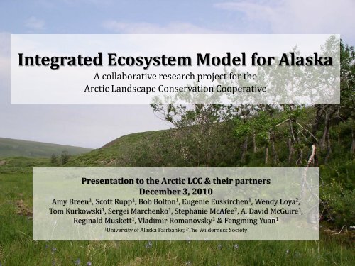
<strong>Integrated</strong> <strong>Ecosystem</strong> <strong>Model</strong> <strong>for</strong> <strong>Alaska</strong><br />
A collaborative research project <strong>for</strong> the<br />
<strong>Arctic</strong> Landscape Conservation Cooperative<br />
Presentation to the <strong>Arctic</strong> <strong>LCC</strong> & their partners<br />
December 3, 2010<br />
Amy Breen 1 , Scott Rupp 1 , Bob Bolton 1 , Eugenie Euskirchen 1 , Wendy Loya 2 ,<br />
Tom Kurkowski 1 , Sergei Marchenko 1 , Stephanie McAfee 2 , A. David McGuire 1 ,<br />
Reginald Muskett 1 , Vladimir Romanovsky 1 & Fengming Yuan 1<br />
1<br />
University of <strong>Alaska</strong> Fairbanks; 2 The Wilderness Society
Presentation Outline<br />
I. Introduction to the study system<br />
II.<br />
Conceptual model framework<br />
III. Coupling exercises<br />
IV. Data streams & spatial layers<br />
V. Broader impacts & significance
Climate change in <strong>Alaska</strong>
Climate change in <strong>Alaska</strong><br />
Slope Mountain in the northern foothills<br />
of the Brooks Range in late winter
Climate change in <strong>Alaska</strong><br />
Projected climate changes <strong>for</strong> terrestrial landscapes in <strong>Alaska</strong> will affect:<br />
• temperatures<br />
• rate of snowfall during winter<br />
• frequency of rain on snow events<br />
• length of ice-free season<br />
• length of the growing season<br />
• permafrost integrity<br />
• stream flow patterns<br />
• wildfire patterns<br />
• coastal erosion<br />
• glaciers<br />
Musk ox herd on a hillslope near Nome, <strong>Alaska</strong>
Climate change in <strong>Alaska</strong><br />
One of the recommendations of the interagency and partnership WildREACH<br />
workshop was to develop predictive models of habitat change, including:<br />
Fire regime as a function of interactions among<br />
climate, permafrost and vegetation<br />
Anaktuvuk River Fire<br />
September 2007<br />
Photo courtesy of Ben Jones/USGS
IEM <strong>for</strong> <strong>Alaska</strong>: Phase 1<br />
Objectives:<br />
Conceptual model framework<br />
To develop a conceptual framework <strong>for</strong> integrating important components of<br />
an ecosystem model <strong>for</strong> <strong>Alaska</strong> including: fire, vegetation succession,<br />
permafrost dynamics and hydrology<br />
Coupling exercises<br />
To conduct initial static coupling exercises between some model components<br />
as a proof-of-concept <strong>for</strong> this approach<br />
Deliverables:<br />
Data streams & spatial layers<br />
Produce and deliver data streams and spatial layers to be made available to<br />
the broader research and management communities <strong>for</strong> use in their research<br />
ef<strong>for</strong>ts
Presentation Outline<br />
I. Introduction to the study system<br />
II.<br />
Conceptual model framework<br />
III. Coupling exercises<br />
IV. Data streams & spatial layers<br />
V. Broader impacts & significance
<strong>Integrated</strong> <strong>Ecosystem</strong> <strong>Model</strong> <strong>for</strong> <strong>Alaska</strong><br />
Fire<br />
Permafrost<br />
Vegetation<br />
Hydrology<br />
Climate
IEM <strong>for</strong> <strong>Alaska</strong> Conceptual Framework<br />
<strong>Integrated</strong> <strong>Ecosystem</strong> <strong>Model</strong><br />
Climate<br />
Change<br />
Fire<br />
Vegetatio<br />
n<br />
Permafrost<br />
Hydrology
IEM <strong>for</strong> <strong>Alaska</strong> Conceptual Framework<br />
Impact <strong>Model</strong>s<br />
<strong>Integrated</strong> <strong>Ecosystem</strong> <strong>Model</strong><br />
model output x<br />
model output y<br />
Hypothetical<br />
<strong>Model</strong><br />
canopy cover<br />
Climate<br />
Change<br />
Fire<br />
Vegetatio<br />
n<br />
Permafrost<br />
Hydrology<br />
probability of thermokarst<br />
species composition<br />
probability of fire<br />
vegetation cover<br />
probability of fire<br />
surface hydrology<br />
Habitat<br />
Change<br />
<strong>Model</strong>s<br />
Fire<br />
Management<br />
<strong>Model</strong>s<br />
vegetation cover<br />
biomass productivity<br />
surface hydrology<br />
Animal<br />
Per<strong>for</strong>mance<br />
<strong>Model</strong>s
IEM <strong>for</strong> <strong>Alaska</strong> Conceptual Framework<br />
Impact <strong>Model</strong>s<br />
Other<br />
stakeholder<br />
groups<br />
<strong>Integrated</strong> <strong>Ecosystem</strong> <strong>Model</strong><br />
model output x<br />
model output y<br />
Hypothetical<br />
<strong>Model</strong><br />
Climate<br />
Change<br />
Fire<br />
Vegetatio<br />
n<br />
Permafrost<br />
Hydrology<br />
canopy cover<br />
probability of thermokarst<br />
species composition<br />
probability of fire<br />
vegetation cover<br />
probability of fire<br />
surface hydrology<br />
Habitat<br />
Change<br />
<strong>Model</strong>s<br />
Fire<br />
Management<br />
<strong>Model</strong>s<br />
Conservation<br />
& Resource<br />
Management<br />
Decisions<br />
vegetation cover<br />
biomass productivity<br />
surface hydrology<br />
Animal<br />
Per<strong>for</strong>mance<br />
<strong>Model</strong>s<br />
Communication of Needs
ALFRESCO<br />
<strong>Alaska</strong> Frame-Based <strong>Ecosystem</strong> Code<br />
• State-transition type vegetation succession model<br />
• Developed to simulate the response of subarctic and boreal vegetation to<br />
climate change<br />
• Focuses on system interactions and feedbacks<br />
• <strong>Model</strong> assumptions reflect the hypothesis that fire regime and climate are the<br />
primary drivers of landscape-level changes in the distribution of vegetation<br />
• <strong>Model</strong> simulates five major ecosystem types
ALFRESCO<br />
Example Output<br />
Time since last fire<br />
Observed<br />
1950-2007 2008-2099<br />
Projected
ALFRESCO<br />
Example Output<br />
Simulated changes in the distribution of vegetation types
TEM-DVM<br />
Terrestrial <strong>Ecosystem</strong> <strong>Model</strong>-Dynamic Vegetation Module<br />
• Calculates the pools and fluxes of carbon and nitrogen <strong>for</strong> a given set of plant<br />
functional types<br />
• Developed specifically to take into account high-latitude vegetation and<br />
processes (e.g., permafrost dynamics)<br />
• Includes competition among the plant functional types <strong>for</strong> light and nitrogen<br />
• Can be used at different spatial scales<br />
• <strong>Model</strong> simulates three major ecosystem types
TEM-DVM<br />
Example Output<br />
Changes in productivity of arctic vegetation<br />
Looking west toward the Sadlerochit Mountains
GIPL<br />
Geophysical Institute Permafrost Lab Permafrost Dynamics <strong>Model</strong><br />
• Assesses the effects of a changing climate on<br />
permafrost<br />
• Quasi-transitional, spatially distributed,<br />
equilibrium model <strong>for</strong> calculating active<br />
layer thickness and mean annual ground<br />
temperature<br />
• Input parameters to the model are spatial<br />
datasets of mean monthly air temperature<br />
and precipitation, vegetation, soil thermal<br />
properties and water content
GIPL<br />
Example Output<br />
Simulated ground temperatures at 1 m depth<br />
2000-2009<br />
2000-2009<br />
2090-2099 2090-2099
Hydrology<br />
Soil Moisture<br />
Link among the ALFRESCO, TEM and GIPL models and controls:<br />
• land-atmosphere interactions<br />
‣ surface energy balance by partitioning of available energy into<br />
sensible/latent heat<br />
‣ distribution of vegetation<br />
• soil respiration<br />
‣ CO 2<br />
vs. CH 4<br />
• permafrost distribution / active layer thickness<br />
‣ thermal conductivity of water<br />
• Wildfire<br />
‣ distribution, frequency and severity
Presentation Outline<br />
I. Introduction to the study system<br />
II.<br />
Conceptual model framework<br />
III. Coupling exercises<br />
IV. Data streams & spatial layers<br />
V. Broader impacts & significance
Initial Coupling Exercise<br />
• First set of simulations is underway to develop the IEM <strong>for</strong> <strong>Alaska</strong><br />
• Designed coupling exercise to clarify issues related to:<br />
‣ <strong>for</strong>cing data<br />
‣ exchange of data between models<br />
‣ potential confounding variables that more than one model<br />
simulates
Simulation Protocol<br />
Initial Coupling Exercise<br />
Boundary:<br />
Yukon River Basin within <strong>Alaska</strong><br />
Spatial resolution:<br />
2 km x 2 km <strong>for</strong> all models<br />
Historical extent of model outputs: 1950-2006<br />
Future extent of model outputs: 2007-2100<br />
Temporal resolution of outputs: Monthly<br />
Driving data include, but are not limited to:<br />
CO 2 record, monthly temperature, monthly precipitation,<br />
monthly radiation, elevation, soil texture, vegetation<br />
type, fire occurrence, fire severity
Simulation Series<br />
Initial Coupling Exercise<br />
• Series requires coordination of driving data sets, data exchange <strong>for</strong>mat and<br />
output variables between models<br />
• Each stage of the simulation in the initial coupling exercise depends upon the<br />
previous stage in the following order:<br />
Stage 1: ALFRESCO fire scenarios drive<br />
Stage 2: TEM which will produce soil organic layer thickness outputs to drive<br />
Stage 3: GIPL-1
Presentation Outline<br />
I. Introduction to the study system<br />
II.<br />
Conceptual model framework<br />
III. Coupling exercises<br />
IV.<br />
Data streams & spatial layers<br />
V. Broader impacts & significance
Spatial layer data products<br />
Deliverables Group Temporal Resolution<br />
Historical evaporative demand SNAP Jan 1901 - Dec 2006<br />
Historical burned area SNAP Jan 1950 - Dec 2006<br />
Projected mean annual ground temperature GIPL Jan 2007 - Dec 2099<br />
Projected active layer thickness GIPL Jan 2007 - Dec 2099<br />
Projected burned area SNAP Jan 2007 - Dec 2099<br />
Projected evaporative demand TWS-SNAP Jan 2007 - Dec 2099<br />
Historical snow water equivalent GIPL Jan 2005 - May 2010<br />
Historical snow water equivalent GIPL Jan 2000 - May 2007<br />
Historical land surface temperature GIPL March 2000 - May 2010<br />
Projected growing season length TEM Jan 2007 - Dec 2099<br />
Projected plant productivity (NPP/NEP) TEM Jan 2007 - Dec 2099<br />
Projected snow cover duration (snow melt/return) TEM Jan 2007 - Dec 2099
Protocol<br />
• Statewide data<br />
Spatial layer data products<br />
• Will deliver historical period and all decades: 2010’s, 2020’s … 2090’s<br />
• Geotiff <strong>for</strong>mat<br />
‣ Standardized <strong>for</strong>mat which can be directly used in most<br />
analytical/GIS programs<br />
• Served as a web mapping service (WMS) <strong>for</strong> use on web<br />
• Monthly data made available as needed
Spatial layer data products<br />
Example Deliverable
Presentation Outline<br />
I. Introduction to the study system<br />
II.<br />
Conceptual model framework<br />
III. Coupling exercises<br />
IV. Data streams & spatial layers<br />
V. Broader impacts & significance
IEM <strong>for</strong> <strong>Alaska</strong> Conceptual Framework<br />
Impact <strong>Model</strong>s<br />
Other<br />
stakeholder<br />
groups<br />
<strong>Integrated</strong> <strong>Ecosystem</strong> <strong>Model</strong><br />
model output x<br />
model output y<br />
Hypothetical<br />
<strong>Model</strong><br />
Climate<br />
Change<br />
Fire<br />
Vegetatio<br />
n<br />
Permafrost<br />
Hydrology<br />
canopy cover<br />
probability of thermokarst<br />
species composition<br />
probability of fire<br />
vegetation cover<br />
probability of fire<br />
surface hydrology<br />
Habitat<br />
Change<br />
<strong>Model</strong>s<br />
Fire<br />
Management<br />
<strong>Model</strong>s<br />
Conservation<br />
& Resource<br />
Management<br />
Decisions<br />
vegetation cover<br />
biomass productivity<br />
surface hydrology<br />
Animal<br />
Per<strong>for</strong>mance<br />
<strong>Model</strong>s<br />
Communication of Needs
Broader Impacts & Significance<br />
The <strong>Integrated</strong> <strong>Ecosystem</strong> <strong>Model</strong> <strong>for</strong> <strong>Alaska</strong> will<br />
provide a decision support tool which will:<br />
• Improve our understanding of the potential<br />
response of ecosystems to climate change<br />
• Identify processes by which climate change will<br />
most likely affect species and habitats<br />
• Serve to in<strong>for</strong>m the structure and design of<br />
inventory and monitoring activities<br />
• Serve to broadly in<strong>for</strong>m societal issues that will be<br />
affected by climate change such as human health,<br />
agriculture, engineering and subsistence<br />
sustainability


