2003: Volume 16, Issue 24 - Historic Jeffco
2003: Volume 16, Issue 24 - Historic Jeffco
2003: Volume 16, Issue 24 - Historic Jeffco

Create successful ePaper yourself
Turn your PDF publications into a flip-book with our unique Google optimized e-Paper software.
<strong>Volume</strong> <strong>16</strong>, <strong>Issue</strong> <strong>24</strong>, <strong>2003</strong><br />
HI STORICA L LY<br />
J E F F CO
CONTENTS<br />
HI STOR<br />
Traceries<br />
First Place Winner<br />
Writer’s Award Contest<br />
Prohibition in<br />
Republican County<br />
Moonshiners, Robbers<br />
and Frontier Law<br />
Preserving Your<br />
Family’s Heirlooms<br />
Jefferson County<br />
<strong>Historic</strong> Hall of Fame<br />
Lois Cunniff Lindstrom Kennedy<br />
George Morrison Sr.<br />
An <strong>Historic</strong> Setting on a Stop<br />
of the Leyden Rail Route<br />
The Leyden Mine<br />
Lingering Along the Lariat Loop<br />
Scenic and <strong>Historic</strong> Byway<br />
Golden’s Endangered Sites List<br />
Lost Places in Jefferson County<br />
<strong>Historic</strong> Sites Designated in<br />
Jefferson County<br />
JCHC News & Members<br />
2<br />
8<br />
14<br />
18<br />
22<br />
<strong>24</strong><br />
30<br />
32<br />
36<br />
40<br />
43<br />
44<br />
J E F F CO<br />
JCHC Publications Committee<br />
Erlene Hulsey-Lutz, Chair,<br />
Milly Roeder, Vice Chair,<br />
Lee Heideman, Editor,<br />
Larry Lotito, Norm Meyer, Mark McGoff<br />
Published by The Jefferson County<br />
<strong>Historic</strong>al Commission (JCHC)<br />
<strong>Volume</strong> <strong>16</strong>, <strong>Issue</strong> 34, <strong>2003</strong><br />
ISSN 1532-6047<br />
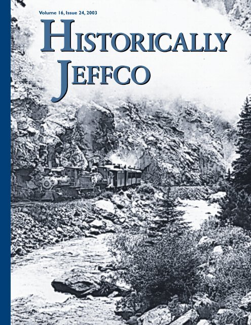
Cover Photo: C&S Train that ran up the<br />
South Platte River to Buffalo and beyond.<br />
Photo courtesy of Colorado Railroad Museum<br />
Design & Layout<br />
FinePrint, Golden, CO<br />
C & S Train leaving Golden, 1941<br />
Photo by Otto Perry, Courtesy of<br />
Colorado Railroad Museum
ICA L LY<br />
-1-
Traceries<br />
Colorado Central #585, 1855<br />
Photos courtesy of Colorado Railroad Museum<br />
The web of railroads that swept around the Table Mountains, up the watercourses,<br />
and to the mineral digs in productive Jefferson County over a century ago<br />
First Place, Writer’s Award Contest<br />
By Jerry Grunska<br />
An 1888 U.S. Geological<br />
Survey map of western<br />
Jefferson County looks<br />
like a jewelry display case, with<br />
necklaces festooned around those<br />
twin volcanic mesas, with thorny<br />
spurs sticking out toward the<br />
hogback. These are the railroads,<br />
with flashes of long forgotten<br />
names, each of them representing<br />
a dream of prosperity and most of<br />
-2-<br />
them long gone, their scruffy<br />
roadbeds today either drowned or<br />
looking like natural embankments<br />
in the creases between and alongside<br />
the hills.<br />
They followed the watercourses<br />
for the most part - Leyden Creek,<br />
Ralston Creek, Bear Creek - where<br />
2 to 4 percent grades could be<br />
managed. Only a trio of them<br />
stuck their tendrils into the heart<br />
of the Rockies beyond the county.<br />
One is still there, the Burlington<br />
Northern Amtrak line plowing<br />
through Arvada, up South Boulder<br />
Creek, and through the Moffat<br />
Tunnel all the way to San Francisco<br />
Bay. (It doesn’t cross the bay but<br />
terminates in Emeryville just<br />
outside of Oakland.) This line,<br />
David Moffat’s burning ambition,<br />
started as the Denver Northwestern<br />
& Pacific in 1903 with Pacific in its<br />
name but with hopes only to reach<br />
Salt Lake City. It made it to Craig,<br />
Colorado, after negotiating perilous<br />
Rollins Pass on the Continental<br />
Divide 25 years before the tunnel
was completed to Winter Park.<br />
The Denver South Park &<br />
Pacific was the first railroad to<br />
try penetrating the interior of the<br />
Rockies. In 1874 Territorial Governor<br />
John Evans led a consortium<br />
of investors who were determined<br />
to send rails up Bear Creek. The<br />
object was to reach the gold diggings<br />
in South Park and beyond.<br />
Hope included going over Hoosier<br />
Pass into Breckenridge. How the<br />
rails would go over the mountains<br />
to South Park was uncertain,<br />
and the line went from Sheridan<br />
Junction only as far as George<br />
Morrison’s homestead where Bear<br />
Creek slides through the hogback.<br />
Sheridan Junction was near the<br />
confluence of Bear Creek with the<br />
South Platte River, and the line<br />
west to Morrison followed largely<br />
where Hampden Avenue is today<br />
(as far as Kipling), all remnants<br />
rare and mostly obliterated by<br />
development.<br />
The settlement at the terminus<br />
was called Jefferson, but a post<br />
office was established in that same<br />
year with the name changed to<br />
Morrison. It took the first train<br />
1 1/2 hours to reach Morrison,<br />
with 150 people aboard from<br />
Evans’s First Street Methodist<br />
Episcopal Church in Denver. In<br />
Morrison the outing was festive,<br />
with family picnics featuring<br />
lemonade and ice cream, some<br />
people fishing and others hiking<br />
up both Bear Creek and Turkey<br />
Creek canyons.<br />
When regular service was<br />
inaugurated - $1.50 for a round<br />
trip from Denver - two trains<br />
operated daily and six-horse<br />
stagecoaches met the trains in<br />
Morrison, for a one-day trip to<br />
Fairplay, up Turkey Creek and<br />
over Kenosha Pass.<br />
Evans’s group then decided to<br />
aim up Waterton Canyon on the<br />
South Platte in 1878, and that’s<br />
where the line went (reaching<br />
Webster, west of Bailey and Grant<br />
in 1879), eventually going over<br />
three Continental Divide passes to<br />
Gunnison. The present hiking trail<br />
up Waterton Canyon in Jefferson<br />
County is the roadbed of this<br />
route, the rails and ties of which<br />
were pulled up in the 1930s.<br />
The Denver South Park &<br />
Pacific utilized an unusual rail<br />
spacing, three feet in width, called<br />
narrow gauge. The “squeezed”<br />
width (regular gauge is 4 feet,<br />
8 1/2 inches) permitted sharper<br />
turns than regular width, and<br />
the smaller engines and relatively<br />
light cars could move up inclines<br />
that were steeper than standard<br />
gauge could handle. At the time<br />
when Evans’s group installed the<br />
rails, this was a novel conception.<br />
Rails themselves could be lighter<br />
too - 30-40 lbs. per foot as<br />
opposed to 60-90 lbs. for<br />
standard gauge. Virtually all<br />
railroads into the mountains<br />
thereafter were narrow gauge.<br />
Incidentally, Governor Evans had<br />
an interesting past as a promoter<br />
before he ever came to Colorado.<br />
A medical doctor from Indiana, he<br />
never practiced medicine. Instead,<br />
he gathered a group of investors<br />
in Chicago and founded Northwestern<br />
University, although none<br />
of the other original five trustees<br />
had a college education. The<br />
town north of Chicago on Lake<br />
Michigan where the university is<br />
located was named in his honor,<br />
Evanston, just as a Weld County<br />
town, a Denver street, and a Front<br />
Range mountain bear his name<br />
in Colorado.<br />
Once Planted, They<br />
Proliferated Westward<br />
The “stem” from which almost<br />
all Colorado railroads sprang was<br />
the Denver Pacific connection to<br />
the Union Pacific cross-country<br />
railroad at Cheyenne, Wyoming, in<br />
1869. A year later the line from<br />
Kansas met this railroad in Denver,<br />
View of the Colorado Central grade just north of Tucker Lake/Golden, Colorado,<br />
April 1977. Some ties are still in place along this stretch of track.View looking southwest.<br />
-3-
and then the first rails into the<br />
mountains up Clear Creek<br />
Canyon out of Golden were<br />
laid in 1872. U.S. Highway 6<br />
essentially follows this roadbed at<br />
present, up the canyon almost to<br />
Idaho Springs. Again, great plans<br />
preceded development. This road,<br />
called Colorado Central, was<br />
slated to climb over the pass<br />
named for businessman Edward<br />
Berthoud, ending at Hot Sulfur<br />
Springs in Middle Park. It never<br />
made it. It did reach the gold<br />
mines in Blackhawk and Central<br />
City, however, and it forked off up<br />
South Clear Creek to the Gregory<br />
Gulch diggings at Idaho Springs,<br />
on to Georgetown and Silver<br />
Plume, and as far as Graymont<br />
(the right of way can still be seen<br />
above I-70 toward the Eisenhower<br />
Tunnel). Its ambition in this<br />
direction was to inch up over<br />
Loveland Pass into Summit<br />
County, but it stopped beyond<br />
the famous Georgetown Loop, and<br />
track up there past Silver Plume to<br />
Colorado Central silver ore train travelling up Clear Creek Canyon. C. 1875.<br />
Graymont was removed in 1898<br />
after the mines were depleted.<br />
This 65-mile railroad hauled<br />
ore for three decades to the half<br />
dozen or so smelters in Golden,<br />
and with crude wagon roads<br />
carrying people over the<br />
Continental Divide from the<br />
end of the line, Jefferson County<br />
clearly became the Gateway to<br />
the West.<br />
In addition to hauling freight,<br />
precious metal ores, and other<br />
extraction such as coal, limestone,<br />
sandstone, soda ash, sulfur, and<br />
brick-making clay, these railroads<br />
into the canyons carried people,<br />
church congregations on picnic<br />
and flower-collection outings,<br />
and fraternal organizations on<br />
campouts. A group of Jesuit<br />
priests summered in Morrison for<br />
several years before 1900. The line<br />
became known as “The Sunday<br />
School Line” after 1900.<br />
Author Bob Griswold’s book,<br />
“The Morrison Branch of the<br />
South Park Line,” said that a<br />
crowd of 774 individuals from the<br />
Brotherhood of Railroad Firemen<br />
took two excursion trains to a<br />
picnic in Morrison in 1881. The<br />
Morrison line always had more<br />
revenue from passengers than<br />
freight, with John Brisben<br />
Walker’s 1909 funicular railway<br />
to the top of Mount Morrison<br />
(above what is now Red Rocks<br />
Amphitheater) being a strong<br />
attraction.<br />
Comical things happened on<br />
the railroads from time to time.<br />
Early traveler Isabel Bird called<br />
Clear Creek “Toughcuss Creek”<br />
because rude railroad workers<br />
wouldn’t let her sit down on a<br />
trip up the canyon until the<br />
conductor finally pried a<br />
bewhiskered churl off his seat.<br />
The railroad specifically asked<br />
-4-
C & S train passing through Golden.<br />
passengers not to shoot Rocky<br />
Mountain bighorn sheep from<br />
the train windows.<br />
One time on the Morrison line<br />
a rider’s hat flew out the window,<br />
and he pulled the emergency<br />
cord to stop the train. Panicked<br />
passengers thought a bridge had<br />
washed out - spans did from time<br />
to time in spring and summer<br />
floods - and everyone piled out<br />
of the coaches, only to be told<br />
to search for a fedora. They never<br />
found it.<br />
It Wa s n’t All Frolic and Fre i g h t<br />
Ordinarily, one wouldn’t think<br />
of railroads as sinister, but in fact<br />
at least one of them was. The<br />
names of the usual suspects<br />
resonate in the annals of early state<br />
entrepeneurship: Evans, Loveland,<br />
and Berthoud. W.A.H. Loveland<br />
was determined to elevate Golden<br />
beyond its status as Territorial<br />
Capitol. He received a franchise<br />
from the territorial authorities in<br />
1867 to string tracks around the<br />
east side of North Table Mountain,<br />
angling northeast from there to<br />
connect with the Kansas Pacific<br />
tracks north of Denver. This route<br />
lay east of the present Quaker<br />
Street alignment. Shortly afterward<br />
it was moved to the west side of<br />
North Table, allowing it to aim<br />
directly into Golden, away from<br />
Denver (1878).<br />
This route headed for<br />
Broomfield but it swung northwest<br />
past 120th Avenue, and along the<br />
way it went through what is now<br />
Tucker Lake - north of 70th Avenue<br />
and west of Quaker Street. It also<br />
ducked through the southeast<br />
corner of current Standley Lake.<br />
Then Loveland had another<br />
novel idea. He would bend his<br />
route southeast around South Table<br />
Mountain and past Green<br />
Mountain to connect with the<br />
Denver & South Park at the South<br />
Platte River near Chatfield. This<br />
would provide a complete halfcircle<br />
around Denver, permitting<br />
trains to reach all the way from<br />
Cheyenne to the Gulf of Mexico<br />
(theoretically) without ever entering<br />
Denver. A roadbed was started, but<br />
only a few rails were ever laid.<br />
Golden gave up its favored role as<br />
Territorial Capitol when Colorado<br />
became a state in 1876.<br />
On the Spur of the Moment<br />
Two things must be kept in mind<br />
when looking back on conditions<br />
in the pioneering past. One,<br />
nobody could foresee the advent<br />
of the internal combustion engine<br />
and motive wheels before the turn<br />
of the century. Steam and the iron<br />
rails were the enthralling mode of<br />
conveyance. In the first place,<br />
mules, oxen, and donkeys tugging<br />
wagons were poor comparisons to<br />
ample ore gondolas and boxcars<br />
when it came to hauling bulk<br />
materials dug from the ground.<br />
Two, uplift of the Rocky<br />
Mountains, faulting, and<br />
subsequent erosion also resulted in<br />
deposits of gravel and placer gold.<br />
-5-
The large fill used by the Colorado Central to climb out of the North side of Ralston Creek valley.<br />
View looking south. 70th Avenue & McIntyre streets.Arvada, CO February, 1975<br />
Coal was discovered early, and<br />
homes, trains, smelters, and other<br />
industries devoured it as fuel. Coal<br />
seams near the hogbacks are nearly<br />
vertical and only about 5 to 10 feet<br />
in thickness. At depths of nearly<br />
700 feet these beds and those of<br />
the hogbacks curve gently eastward.<br />
Then too there were limestone<br />
and sulfur deposits at the Soda<br />
Lakes - and a short spur was run<br />
from the Morrison line to gather<br />
those products. Some marble was<br />
also carved out of the cliffs nearby.<br />
Another line ran north from<br />
Morrison along what is now the<br />
east side of C-470 to a coal mine<br />
and sandstone quarries near present<br />
Alameda Parkway. Rock was<br />
extracted for building materials in<br />
Denver, and it was crushed for<br />
road gravel. Limestone was baked<br />
-6-<br />
in kilns (calcined) to form lime,<br />
which was principally used as<br />
mortar for brick and buildingstone<br />
construction, before the<br />
development of commercial<br />
Portland Cement. Oddly enough,<br />
the coal mine north of Morrison<br />
was first called the Satanic.<br />
A southern spur ran from the<br />
Denver & South Park main line<br />
out of Kassler, at the mouth<br />
of Waterton Canyon, down to<br />
Roxbury (present Roxborough)<br />
where there was another lime kiln.<br />
Branches north of the Table<br />
Mountains wound like frayed lassos<br />
all over the place. First of all, the<br />
original Union Pacific (Evans’s<br />
transcontinental dream) was<br />
surveyed up through present<br />
Standley Lake, and another, the<br />
Denver Utah and Pacific swung<br />
into an elaborate S-curve north of<br />
present 100th Avenue, and moved<br />
on through the later Rocky Flats<br />
plant up to Eldora Springs in<br />
Boulder County. DUP rails were<br />
never laid, but the old roadbed<br />
is easily spotted on present air<br />
photos. A faint remnant exists in<br />
a field north of 100th Avenue,<br />
cuts and fills east of Alkire. The<br />
fill actually holds an artificial<br />
pond for runoff.<br />
An 8 1/2-mile spur line also<br />
went up from Golden to the now<br />
submerged community of Glencoe,<br />
at the base of the hogback, under<br />
Ralston Reservoir. It lasted only<br />
14 years, from 1884 till 1898.<br />
The Denver Water Department’s<br />
reservoir filled about 65 years later.<br />
This line serviced the Murphy<br />
Mine and claystone quarries along
the north side of Ralston Creek.<br />
The Tindale Coal Mine along the<br />
south side of the Ralston Creek<br />
valley was served by the Denver<br />
Lakewood and Golden RR. That’s<br />
as far as the tracks stretched,<br />
but original plans were grandiose<br />
indeed. They included a route<br />
up Ralston Creek all the way to<br />
California. Railroad chronicler<br />
Robert Ormes said that there<br />
were over 400 “paper railways”<br />
in Colorado, plans that never<br />
saw a spike driven in earnest.<br />
Clay was a vital product for<br />
Denver brick companies. One<br />
purpose was for firebrick - home<br />
furnaces and manufacturers’<br />
boilers - and common brick was<br />
for road surfaces and buildings.<br />
Another spur extended up<br />
Leyden Creek to the coal mines<br />
along that valley. Along with the<br />
Denver City tramways, whose lines<br />
pierced Golden between the Table<br />
Mountains and around South<br />
Table, these spurs that didn’t<br />
penetrate the hogback had long<br />
forgotten names:<br />
•Denver Northwestern & Pacific<br />
•Denver Utah & Pacific<br />
•Denver & Middle Park<br />
•Denver Lakewood & Golden<br />
They all had ambitions to go<br />
someplace exotic. Instead, they<br />
paused and served useful purposes,<br />
taking the practical minerals from<br />
points near present Golden and<br />
along present state Highway 93<br />
toward Boulder. The interurban<br />
tramways lasted until after WWII,<br />
but the rails only served mines<br />
and quarries until the 1930s.<br />
Today the remaining lines are the<br />
C & S serving the Coors Brewery<br />
Complex and minor other<br />
industrial sites, while the UPSP<br />
passing through Arvada and<br />
snaking up South Boulder Creek<br />
is the lone transcontinental rail<br />
artery. A spur line off this curling<br />
railroad also serves the now-named<br />
Rocky Flats Environmental<br />
Technology site.<br />
A re All Traces Comp l ete ly Era s e d ?<br />
You’ll have to step into the<br />
meadows around Golden,<br />
Lakewood, and Arvada where there<br />
are horses neighing and donkeys<br />
braying, and even then all you’ll<br />
see are faint rises and gentle<br />
depressions in the undergrowth.<br />
And you won’t recognize those<br />
either without an expert guide.<br />
Besides, there is really only one<br />
guide. His name is Lynn Yehle,<br />
a retired Surficial Geologist of<br />
the U.S. Geological Survey,<br />
headquartered on the Colorado<br />
School of Mines campus in<br />
Golden. Lynn is adept at reading<br />
aerial maps and analyzing surface<br />
features of terrain. He has<br />
identified many of the memorable<br />
elevations and depressions where<br />
the railroads once ran, even the<br />
short lines that were long on<br />
promise and short on funding.<br />
“Hawthorns - thorny, yellowbranched,<br />
bushy trees - tend to<br />
grow on the ballast of roadbeds.<br />
I don’t know why,” Yehle says. So<br />
he goes looking for hawthorns in<br />
regular lines. He found one such<br />
berm - and a narrow-gauge spike<br />
too - near the southwest shore of<br />
the Arvada Reservoir. He has put<br />
yellow tape on barbed wire fences<br />
to remind himself where the<br />
roadbed crosses Highway 93,<br />
curving northwest to the Ralston<br />
Springs Coal Mine on the Dakota<br />
Hogback.<br />
Do you cycle?<br />
Part of the bike path near 56th<br />
Avenue and Quaker is on the old<br />
roadbed of the Colorado Central.<br />
The fill leading north to a ghost<br />
bridge across Van Bibber Creek<br />
is nearby. A horse grazes on the<br />
elevated edge of a lovely pond<br />
west of Indiana Street near 75th<br />
Avenue. The elevated ridge here<br />
is a portion of the old Union<br />
Pacific roadbed.<br />
About a mile north of Golden,<br />
a few yards east of Highway 93<br />
next to the flank of North Table<br />
Mountain, is a gentle dip in an<br />
empty field: the railroad cut and<br />
divide between drainages of Clear<br />
Creek and Van Bibber Creek.<br />
Golfing Anyone?<br />
The cart path in front of the<br />
clubhouse on the new Fossil<br />
Trace Course between Golden’s<br />
<strong>24</strong>th Street and the Jefferson<br />
County Jail is on the roadbed<br />
of the Golden City and South<br />
Platte, Loveland’s route intended<br />
to sweep around the Table<br />
Mountains and west of Green<br />
Mountain to bypass Denver. As<br />
mentioned before, few rails were<br />
laid but much of the roadbed<br />
was prepared.<br />
North of the jail, north also of<br />
10th Avenue and west of Johnson<br />
Street is a corral with burros. A<br />
gentle hillock angling past those<br />
hee-hawing animals is also the<br />
bed of that never-never road.<br />
Jerry Grunska is a retired English<br />
teacher and sports referee, author<br />
of sports officiating books.<br />
Sources:<br />
Forrest, Kenton, Librarian, Colorado Railroad<br />
Museum, Golden, interview March 18, <strong>2003</strong><br />
Griswold, P.R., “The Morrison Branch<br />
of the Denver South Park & Pacific Railroad,”<br />
Sherm Connors Publishing, Brighton, CO,<br />
<strong>2003</strong><br />
Ormes, Robert M., “Colorado’s Ghost<br />
Railroads,” Sage Books, Denver, 1978<br />
Ormes, Robert M., “Railroads and the<br />
Rockies,” Sage Books, Denver, 1963<br />
Wilkins, Tivis E., “Colorado’s Railroads:<br />
Chronological Development,” Pruett<br />
Publishing Co., Boulder, Colorado, 1974<br />
Yehle, Lynn, Lakewood, CO, interview and<br />
field trip, March 18-April 12, <strong>2003</strong><br />
-7-
The Coors Outlet Store<br />
Photos courtesy of the Denver Public Library.<br />
Prohibition in Republican County<br />
Writer’s Award Honorable Mention<br />
by Martha Martin<br />
The United States government<br />
first imposed an alcohol and<br />
tobacco tax in the early 1790s.<br />
Enforcement of tax laws proved difficult<br />
in Southern states under the<br />
Reconstruction Government after<br />
the Civil War. Resistance led to<br />
bootleggers outwitting and killing<br />
a number of federal agents and the<br />
federal government’s support for<br />
total prohibition movements targeting<br />
the bootlegger, consumers and<br />
suppliers. In Western states, miners<br />
drank away their paychecks at the<br />
local saloons leaving families without<br />
food or reliable income.<br />
Jefferson County’s western<br />
boundary foothills and canyons are<br />
the basis for the motto “The Gateway<br />
to the Rockies.” Deer Creek,<br />
Bear Creek, Mount Vernon, Clear<br />
Creek, Coal Creek, Golden Gate,<br />
and Ralston Canyons were commonly<br />
identified in news reports<br />
during the dry years as still locations<br />
and distribution centers<br />
hidden under many guises in the<br />
ravines and along the pioneer<br />
wagon roads leading to neighboring<br />
counties and western states.<br />
Several pioneer toll roads originating<br />
in Jefferson, Gilpin, and Boulder<br />
counties led to Rollinsville,<br />
considered a major distillery<br />
and transportation center. It’s<br />
location on the railroad near<br />
the Continental Divide crossing<br />
at Rollins Pass made it a practical<br />
stop for bootleggers.<br />
From the mountain communities,<br />
Carole Lomond, editor of<br />
“City and Mountain Views,”<br />
reports the historic church located<br />
behind the Little Bear in Evergreen<br />
to be the “…most lucrative pointof-sale<br />
for bootleggers during<br />
Prohibition….” The establishment<br />
was known as Prince McCracken’s<br />
-8-
Drugstore and the Round Up<br />
Dance Hall. A later and more<br />
familiar name was the Red Ram.<br />
Lomond cites Chief Hosa ran a<br />
gambling hall-bordello during its<br />
heyday before becoming a historic<br />
landmark and event center.<br />
Another large operation in the<br />
Evergreen area was a mile east of<br />
town along Bear Creek near the<br />
Old Gulch road intersection. The<br />
lawbreakers were quite ingenious in<br />
covering their tracks through deep<br />
snow and it took several weeks of<br />
investigation before bringing the<br />
scoundrels to justice. To avoid leaving<br />
tracks, the still proprietors<br />
accessed its hidden location by<br />
pole vaulting over the snow drifts.<br />
Colorado voluntarily promoted<br />
movements towards the prohibition<br />
of alcohol late in the 19 th Century.<br />
“Anti-Saloon League” legislation<br />
passed by Populist Party Governor<br />
Waite in 1893 coincided with<br />
women’s suffrage and their voice<br />
in the Temperance Movement. The<br />
18 th Amendment to the United<br />
States Constitution, ratified January<br />
19, 1919, prohibited the manufacture,<br />
sale, or transportation of<br />
intoxicating liquor for beverage<br />
purposes. A leader in upholding<br />
and enforcing the 18 th Amendment<br />
was Jefferson County’s republican<br />
political machine boss, John<br />
F. Vivian.<br />
As Golden Mayor for three<br />
terms in the early 1900s, Vivian<br />
enforced existing temperance sentiment<br />
by keeping saloons closed on<br />
Sundays. His immediate political<br />
influence included the towns of<br />
Golden and Arvada, the latter<br />
rumored to have kept dry laws on<br />
the books until the 1960s. Vivian’s<br />
zeal for this cause received recognition<br />
with his leading role as secretary<br />
to republican Governor Carlson<br />
in drafting strict statewide<br />
prohibition laws in 1914 enacted<br />
at the state level in 19<strong>16</strong> as the<br />
state’s “Dry Laws.”<br />
In 1923 John F. Vivian was<br />
appointed Federal Prohibition<br />
Administrator for the state of<br />
Colorado, and by the late 1920s<br />
was regional administrator for<br />
Colorado, Utah, and New Mexico.<br />
He served in this capacity for a<br />
decade until Prohibition was<br />
repealed by the 21 st Amendment<br />
in 1933. Vivian held federal<br />
appointments under six presidents,<br />
four during the Prohibition Era.<br />
The Volstead Act, passed in<br />
conjunction with the 18 th Amendment,<br />
outlined legal definitions<br />
of violations and provided for<br />
enforcement under the United<br />
States Treasury Department of<br />
Revenue. This act made allowances<br />
for alcohol to be used for religious<br />
purposes and limited home consumption.<br />
It also targeted the necessary<br />
agricultural products for<br />
alcohol production and many raids<br />
involved destroying the finished<br />
product along with large quantities<br />
of sugar and various grains. Seized<br />
vehicles and property suffered forfeiture<br />
and public auction.<br />
Representing law enforcement at<br />
the federal level, Vivian was personally<br />
involved in raids outside of Jefferson<br />
County including a Grand<br />
County raid at Tabernash in early<br />
1923. Newspapers chronicled the<br />
era; however, few pictures of raids<br />
come to light eighty years later.<br />
Vivian’s legal arm was long. He<br />
appointed the state’s special federal<br />
agents, most staunch republicans<br />
like himself. His office had the<br />
support of law enforcement in Jefferson<br />
County under Sheriffs Kerr<br />
and Johnson. The county commissioner’s<br />
sessions frequently covered<br />
News articles on Prohibition shown<br />
above and on subsequest pages were<br />
carried in the Jefferson County<br />
Republican. 1923.<br />
-9-
prohibition legislation and implementation<br />
of penalties for violators.<br />
1920s news reports of his<br />
office’s successes were front page<br />
news. City and county officials<br />
called on Vivian as a professional<br />
witness for cases spanning the<br />
state. His powerful oratory skills<br />
made him a<br />
requested<br />
speaker at<br />
local churches<br />
and political<br />
events. One<br />
such address<br />
commended<br />
the successes<br />
of the Volstead<br />
Act in local<br />
communities<br />
in Jefferson<br />
County. He<br />
frequently<br />
traveled from<br />
Golden to<br />
Washington<br />
D.C. for training<br />
or official<br />
business trips<br />
with other “G-<br />
Men.”<br />
His office<br />
received additional<br />
support<br />
under republican<br />
Governor<br />
Morley who<br />
created a special<br />
police force for prohibition<br />
enforcement. Vivian ran in the<br />
gubernatorial race in 1926, one<br />
filled with intrigue and controversy.<br />
Although he lost in the primaries<br />
due to a Republican Party<br />
split directly attributed to the<br />
statewide stand against the political<br />
influence of the Ku Klux Klan,<br />
Jefferson County backed their man<br />
at the polls.<br />
Speak easy type establishments,<br />
-10-<br />
One photograph catalogued at the Denver Public Library may be the Tabernash<br />
raid of 1923. It shows wooden cases of moonshine dumped from a horse drawn<br />
wagon along a roadside. Blue Valley Distillery,Tabernash, Grand County. c. 1920.<br />
oftentimes called roadhouses, operated<br />
illegally across Jefferson<br />
County. The Volstead Act padlock<br />
laws allowed closure and seizure of<br />
establishments in violation of the<br />
prohibition statutes. Recorded<br />
under courthouse releases, the<br />
petition of Mike Caveleiri prompted<br />
the following proclamation<br />
after a county commissioner’s<br />
board meeting:<br />
“The petition of Mike Caveleiri<br />
for license to operate a roadhouse<br />
at Perrin, near Lakeside, was denied<br />
on the recommendation of the dis -<br />
trict attorney and sheriff. The sher -<br />
iff was further instructed to place<br />
under arrest any and all persons<br />
found operating such places in<br />
Jefferson County without license.”<br />
Twilight Gardens, off West Colfax<br />
below the Golden Hill Cemetery<br />
in the Daniel’s Gardens area,<br />
petitioned a number of times for a<br />
license to operate a soft drink parlor.<br />
Each petition was denied and<br />
Twilight<br />
Gardens<br />
portrayed as<br />
a public nuisance<br />
when<br />
open. The<br />
establishment<br />
drew<br />
the attention<br />
of the local<br />
PTA and<br />
upscale<br />
Wide Acre<br />
residents<br />
leading to<br />
several raids<br />
and convictions<br />
for<br />
prohibition<br />
violations<br />
and lewd<br />
exhibitionism<br />
of scantily<br />
clothed<br />
ladies hanging<br />
out the<br />
upper windows.<br />
In<br />
June of<br />
1925 the<br />
Republican reported law enforcement<br />
officials had been requested<br />
to watch Twilight Gardens with<br />
authority under the<br />
policy of keeping Jefferson County<br />
clean.<br />
The illegal production and sale<br />
of alcohol was lucrative business<br />
for the bootlegger and the county<br />
courts. An average fine assessed by<br />
the Jefferson County courts<br />
ranged from two to three hundred
dollars and often<br />
carried a mandatory<br />
jail sentence of thirty<br />
to sixty days.<br />
Jefferson County<br />
recorded hundreds<br />
of bootlegging raids<br />
involving law<br />
enforcement<br />
officials and<br />
special agents at<br />
the federal, state<br />
and local levels<br />
of government.<br />
Fines were considered<br />
ineffective as<br />
a bootlegger’s profits<br />
were ten times<br />
the amount of<br />
court costs and<br />
fines. Jail time was<br />
recommended for<br />
first offenses, and<br />
time in the penitentiary<br />
for repeat<br />
offenders. In 1926<br />
the Republican<br />
reported Jefferson<br />
County’s 1925 revenues<br />
enforcing the<br />
dry laws exceeded<br />
$12,000. About<br />
one-third of the<br />
revenues paid the<br />
salaries of prosecuting<br />
Judge McCall<br />
and his assistants.<br />
Fines increased in<br />
accordance with the<br />
level of the prosecuting<br />
governmental<br />
departments. The<br />
state revenues in<br />
Right: Jefferson County<br />
Republican newspaper<br />
articles on Vivian’s<br />
appointment as Federal<br />
Prohibition Administrator<br />
for Colorado. June 1923.<br />
1926 of $83,000<br />
indicated a progressive<br />
increase<br />
over the previous<br />
three years.<br />
Prohibition<br />
enforcement at<br />
the local level<br />
wasn’t a high<br />
priority in neighboring<br />
Gilpin<br />
County. To the<br />
contrary, the catacombs<br />
of mine<br />
shafts provided<br />
cool storage for<br />
the illegal commodity.<br />
According<br />
to his descendents<br />
and Golden<br />
Gate Canyon<br />
State Park placards,<br />
William<br />
Kriley ran a distillery<br />
out of one<br />
of his two homes<br />
in Golden Gate<br />
Canyon. He<br />
grew his mash<br />
in his potatoe<br />
patch, and<br />
because it couldn’t<br />
be cleaned<br />
up, it was converted<br />
to one of<br />
the property’s<br />
ponds. Italian<br />
fruit and vegetable<br />
vendors<br />
used Kriley’s<br />
ranch as a transfer<br />
point. He’d<br />
transport the<br />
agricultural products<br />
and his<br />
homemade<br />
hooch to Black<br />
Hawk and Central<br />
City. These<br />
-11-
The Coors marquis proudly displays the Coors name with flowers grown on site.<br />
The Coors mansion and greenhouses are pictured.<br />
vendors wouldn’t have made the<br />
return trip with empty wagons or<br />
trucks; jars of intoxicating mash<br />
would’ve replaced fruits and vegetables<br />
for sale to consumers in<br />
Jefferson County and Denver.<br />
A second bootlegger’s cabin<br />
-12-<br />
identified in Golden Gate Canyon<br />
State Park straddles the Jefferson<br />
and Gilpin county western boundary<br />
on former Tolman Ranch<br />
property. It is located on Ralston<br />
Creek near an abandoned road<br />
running into Boulder County. A<br />
period truck sits near the cabin<br />
stirring the imagination to follow<br />
its run careening up and down the<br />
narrow canyon roads transporting<br />
supplies and the fermented finished<br />
product. Plans are underway<br />
to stabilize the structure and reveal<br />
its mysteries to park historians and<br />
the public. Golden Gate Canyon<br />
State Park Historian, Malcolm<br />
Stevenson, acknowledges the area’s<br />
local residents remain hesitant<br />
today to talk about the dry years<br />
and their forefathers’ involvement<br />
in law breaking activities.<br />
Golden’s Coors Brewing Company<br />
survived Colorado’s lengthy<br />
prohibition through product diversification.<br />
Some alcohol was produced<br />
for special purposes and<br />
kept under federal guard for limited<br />
distribution to pharmacies and<br />
others with a prescription. Malted<br />
milk, produced from many of the<br />
same raw materials as beer, and the<br />
chemical porcelain division found<br />
markets allowing the business to<br />
sustain itself and resume beer production<br />
in 1933, one of the few<br />
nationwide to survive the dry<br />
years. Coors continued to supply<br />
malted milk for candy production<br />
until the 1950s. Late in the era, a<br />
call was made to produce a beer<br />
containing 3.7% alcohol. Coors<br />
was considered for this trial, but<br />
wisely declined the offer.<br />
Jefferson County is historically<br />
considered a conservative republican<br />
county. The Coors family’s<br />
political leanings followed this<br />
powerful political alliance. The<br />
Federal Prohibition Director, the<br />
State Attorney General, and many<br />
higher level county officials, all<br />
Republicans, lived in Golden’s<br />
“Court House Hill” affluent<br />
neighborhood within a mile of the<br />
Coors facility.<br />
The brewery’s founder, Adolph<br />
Coors, kept a low profile during<br />
this time frame and suffered belittlement<br />
directed by the media.<br />
One commentary in the Republi -<br />
can, February 17, 1923, under the<br />
“Choice Bits from Other Pens”<br />
column poked fun at Zangs and
Coors breweries:<br />
“To faller vat haf lifed around<br />
Colorado for tirty yar, et sem kind<br />
of fonny to read advertisements of<br />
Zang’s Ice Cream an Coors Malted<br />
Milk.”<br />
-Ole Yohnson in Craig Empire.<br />
Members of the Coors family left<br />
Colorado during the 1920s on<br />
extended vacations and permanent<br />
moves. The Herman Coors family<br />
sold their stately mansion on 19th<br />
Street in Golden and moved to California<br />
in the mid 1920s. Adolph<br />
Coors, Sr. died in Virginia Beach,<br />
Virginia in 1929, before seeing his<br />
company’s triumphant rise from the<br />
dry years to become one of the<br />
nation’s largest beer producers.<br />
The 18th Amendment’s repeal<br />
by the 21 st Amendment proved its<br />
failure at nationwide prohibition.<br />
Taxation was more effective and in<br />
line with public opinion. American<br />
history marks the Prohibition<br />
Era as a time of corrupt politicians<br />
influenced by special interest<br />
groups such as the Ku Klux Klan<br />
movement of the 1920s. Colorado<br />
had the nation’s second highest<br />
Klan enrollment following Indiana<br />
during the mid 1920s. In Colorado<br />
the terms of Governor<br />
Clarence Morley (1925-27) and<br />
Denver Mayor Ben Stapleton<br />
(1923-25) are remembered with<br />
shame and disdain for their special<br />
interest ties with that organization.<br />
Morley’s stand on prohibition<br />
and the creation of an aggressive<br />
special police force to uphold the<br />
18th Amendment left a sour taste<br />
in the public’s mouth.<br />
Jefferson County represents<br />
itself as a formidable republican<br />
political entity in state politics.<br />
The county seat in Golden, a long<br />
time Denver rival, and the men<br />
who lived there and commuted to<br />
state and federal offices in Denver<br />
during the Prohibition Era have<br />
escaped periodic witch hunts,<br />
which focus on the corruption of<br />
elected officials and law enforcement.<br />
Prominent Jefferson County<br />
men, associated law enforcement<br />
corruption, and Klan ties are<br />
buried; peacefully forgotten without<br />
the degradation inflicted on<br />
their constituents. For a time in<br />
the early to mid 20th Century,<br />
Golden was Colorado’s capital in<br />
a sense, as republican politicians<br />
holding offices at the higher<br />
levels of state government were<br />
descendents and followers of<br />
Golden’s founders. John F. Vivian<br />
and his republican cronies defined<br />
the Prohibition Era in Jefferson<br />
County, and the state of<br />
Colorado.<br />
Martha Martin is a previous Writer’s<br />
Award winner and published author.<br />
Sources:<br />
Colorado Scenario Magazine. Brief History<br />
of Rollinsville. www.scenariousa.com/<br />
co/gilpin/rollinsville.html. Scenario Partner<br />
Publications: 1992-<strong>2003</strong>.<br />
Colorado State Archives. Jason Brockman,<br />
James O. Chipman, and Erin McDanal: State<br />
Archivists. Colorado State Governor<br />
Biographies: Governor George A. Carlson<br />
(1915-17), Governor Clarence J. Morley (1925-<br />
27), and Governor Davis H. Waite (1893-95).<br />
www.archives.state.co.us. Spring <strong>2003</strong>.<br />
Denver Public Library Western History<br />
Collection. Call Number: X-10050, Coors<br />
Outlet Store, 1900-1910 (?). Call Number: Rh-<br />
1158, Prohibition Bust, Harry Mellon Rhoads,<br />
photographer, 1920 (?). Call Number: X-10045,<br />
Adolph Coors Company, Rocky Mountain<br />
Photo Company, 1928. www.photoswest.org.<br />
Glassmann, Michelle. Personal Interview:<br />
Grandfather William Kriley’s Ranch. Feb. <strong>2003</strong>.<br />
Jefferson County Republican [Golden], selected<br />
prohibition articles 1923-32.<br />
Lomond, Carole. A Brief History: The Heart<br />
of Evergreen. www.citymntviews.com. Mar.<br />
<strong>2003</strong>.<br />
Lomond, Carole. Genesee Park: Genesee.<br />
www.citymntviews.com/neighborhood.asp Mar.<br />
<strong>2003</strong>.<br />
Stevenson, Malcolm. Golden Gate Canyon State<br />
Park Historian. Phone interviews: Bootlegger’s<br />
cabin GGCSP. Jan. <strong>2003</strong>.<br />
-13-
The train that Burgdorf shipped his booze on. Green’s store was built from granite after the fire.<br />
Photo courtesy of Colorado Railroad Museum<br />
Moonshiners, Robbers,<br />
and Frontier Law<br />
By Lee Heideman<br />
Jack Antweiler, whose great<br />
grandparents and grandparents<br />
first settled the Blue Creek<br />
Valley, told of the remnants of<br />
stills his father and grandfather<br />
had come across. No one seemed<br />
inclined to talk about them if they<br />
knew they were there, but gullies<br />
and caves with empty barrels and<br />
old vandalized “monkey stoves”<br />
were found years later.<br />
Charles Arnett also told of some<br />
fellows who wanted to rent some<br />
land from his mother after his<br />
father had passed away. She asked<br />
them what they wanted it for. Well,<br />
Charles said, “She was a Southern<br />
Baptist woman, so she just said ‘go<br />
away.’” But later, across the road<br />
and farther north, up on a hill, his<br />
daughter and some friends found a<br />
cave with a monkey stove and<br />
-14-<br />
some barrels in it, while hiking.<br />
So apparently they found a place<br />
to produce their whiskey after all.<br />
Some were successful though,<br />
and others were left to tell about<br />
it. Like Bud Hill, who was<br />
postmaster in Pine for many years.<br />
He said, “George (Burgdorf) was<br />
a character. Well-liked, but a<br />
character just the same.” He was<br />
the local provider of whiskey in<br />
the area, and was said to have a<br />
still in about every gully in the<br />
Foxton/Pine/Buffalo area. One<br />
story says that when John G.<br />
Green and his father were stringing<br />
the telephone lines, John was<br />
hesitant to enter a gulch because<br />
one of George’s stills was in<br />
operation there and he was afraid<br />
of the dog, but Burgdorf assured<br />
him he would be safe. Well they<br />
did string that line but when<br />
they went to find the other end<br />
A member of the Reynolds Gang
going back, they found three<br />
or four barrels of brew “just<br />
heaving away.”<br />
Some of Bud’s favorite stories<br />
about George Burgdorf were when<br />
the government agents were after<br />
him, to crack down on him several<br />
times, destroying his stills, but he<br />
would just move them or build<br />
a new one. One day George<br />
Burgdorf and his wife went to<br />
Denver with a load of wood on<br />
his Model T truck. The agents had<br />
been warned that he had whiskey<br />
with him, so they stopped him<br />
just outside of Morrison. They<br />
said, “Well, George, we got you<br />
this time. We know you had some<br />
whiskey when you left Pine,” and<br />
they told him to take the wood<br />
off of the truck. He refused, so<br />
they unloaded it. They searched<br />
the truck, but didn’t find<br />
anything, even after they searched<br />
under the hood of the truck. So<br />
they made George get out while<br />
they searched inside it. His wife<br />
was with him and she was a<br />
very large woman “who dressed<br />
severely.” They didn’t even ask<br />
her to get out of the truck.<br />
The revenuers told George that<br />
they would get him next time and<br />
he could load the wood up. He<br />
refused and told them that he<br />
wouldn’t budge until they reloaded<br />
it. When they arrived in Denver,<br />
he got out of the car and said,<br />
“All right, Ma. I’ll take the<br />
whiskey.” She had been hiding a<br />
five-gallon jug of whiskey between<br />
her legs under her long skirt all<br />
of the time.<br />
Another story was told that the<br />
railroad men “were not adverse<br />
to sampling his wares,” so one<br />
morning revenue men boarded the<br />
mountain-bound train, intending<br />
to catch him. When the train<br />
pulled into Sheridan, the<br />
conductor wired<br />
the message to<br />
Buffalo that they<br />
were on board.<br />
When they arrived,<br />
the revenue men<br />
got off the train at<br />
Buffalo where the<br />
conductor pointed<br />
out the still on the<br />
hill. By that time,<br />
Burgdorf had<br />
dismantled it and<br />
moved it. While<br />
the revenuers were<br />
checking out the<br />
location, the brew<br />
was loaded on the<br />
baggage car. John<br />
Green had a load<br />
of bread in there<br />
and when he went<br />
to retrieve it, it was soaked. He<br />
complained to the conductor, but<br />
Burgdorf stuck his head in and<br />
said, “I’m on the run. Keep your<br />
mouth shut!” John said okay, and<br />
the booze traveled on, most likely<br />
up to the mines.<br />
George Burgdorf borrowed a<br />
saddle from Bud and Bud couldn’t<br />
get it back. He sat up on Elephant<br />
rock one day, and watched until<br />
George came down a gully<br />
carrying something heavy, which<br />
he ditched in some bushes. Then<br />
George’s son came by and picked<br />
him up. Bud knew they would<br />
come back after dark to retrieve<br />
the whiskey, so he waited until<br />
they were gone and put the<br />
whiskey in his truck. He and his<br />
friends had a great old time with<br />
that and one day George came to<br />
a party at Bud’s. He said, “Boy<br />
this sure is good whiskey. Wish<br />
I knew who made it. ”<br />
Bud finally told George that it<br />
was his whiskey. He accused Bud<br />
of stealing his whiskey, but Bud<br />
Typical keg George Burgdorf<br />
used to ship his whiskey.<br />
told him that he was just getting<br />
his money back for the saddle<br />
George stole. George told him the<br />
whiskey was worth twice what the<br />
saddle was, but he let it go at that.<br />
George went to jail in Golden<br />
and they say he even made booze<br />
in the kitchen. Then he was<br />
transferred to Cañon City for a<br />
short time. When he got out and<br />
came back, he strutted around<br />
Buffalo and Pine showing off<br />
his new suit “the government<br />
bought me.”<br />
Now, a little way further up the<br />
highway, down Deer Creek Road,<br />
Charlie Royal lived. He was a bit<br />
of a moonshiner and the revenuers<br />
heard about his still. So they paid<br />
Charlie a visit. Well, Charlie wasn’t<br />
home, so they followed his dog.<br />
Sure enough, there was Charlie at<br />
his still. One revenuer said, “Well,<br />
Charlie, that’s two. We only<br />
knew about one.”<br />
Then there were the robbers and<br />
gangs. There were always the gangs<br />
and marauders who tried to escape<br />
to the mountains. One such was<br />
-15-
the one who was wounded and<br />
tried to hole up in Bailey.<br />
According to May Long,<br />
stagecoach robberies were common<br />
in those days, because gold dust<br />
was transported to banks, and mail<br />
often carried money (gold dust)<br />
from miners to their families<br />
elsewhere. She said that “Dad<br />
Long” lost his horses to robbers,<br />
and were never recovered.<br />
According to Dwight Nucholls,<br />
Dan Berrian, his uncle, told him<br />
that the Reynolds Gang holed up<br />
in the rocks on the east side of<br />
North Turkey Creek for a few<br />
weeks, waiting for Jesse James to<br />
meet them. Then they rode off<br />
in pairs to Georgetown, where<br />
they purchased provisions. The<br />
Veterinary clinic above the “S”<br />
curve on Highway 73, going into<br />
Evergreen, belonged to Hezekiah<br />
James, an uncle of Jesse James. It<br />
is called James Hill.<br />
Dwight also told of knowing<br />
Al Bobbitt, who said that he was<br />
thrown out of the Reynolds Gang<br />
for being too mean. He said that<br />
the Gang holed-up in Hall Valley.<br />
One day Al gave Dwight two<br />
dollars to take him and his gear to<br />
the head of Geneva Creek in<br />
Dwight’s l927 Chevrolet, and told<br />
Green’s store, train tracks and station before the<br />
1897 fire that destroyed that side of Buffalo.<br />
him to come back in two weeks<br />
time to pick him up. He said he<br />
wanted to do some prospecting.<br />
When Dwight returned for Al, he<br />
started loading Al’s gear in his car,<br />
but one sack was too heavy to pick<br />
up. When he left Al gave him an<br />
octagon or hexagon gold piece.<br />
Later Dwight went by Al’s<br />
house on the way to Field’s<br />
Trading Post to get his mail, and<br />
saw a lot of cars around his house.<br />
That was very unusual in those<br />
days, so he stopped to see if Al<br />
was sick. Al said, “Go away. I’ll<br />
talk to you later.”<br />
When Dwight went back, Al said<br />
that government had found out<br />
about the treasure he had dug up<br />
and took 65 percent of it.<br />
When Al Bobbitt was ninetyseven<br />
years old, he was interviewed<br />
by Mary Helen Crain at the Pine<br />
Haven Nursing home in Morrison.<br />
He was dressed as a cowboy from<br />
head to foot. Christmas day when<br />
he was 102 years old, he dressed up<br />
in his cowboy outfit: Stetson hat,<br />
cowboy boots and all, went out<br />
on the porch and died.<br />
The Reynolds Gang ran until<br />
they reached Hamilton, Colorado<br />
(close to the present Como), in<br />
1864. They held up the Spotswood<br />
Courtesy of Jefferson County <strong>Historic</strong>al Society.<br />
and McClellan Stage and the<br />
amount they got varied from<br />
$5,000 to $10,000, depending<br />
on who was telling the story.<br />
Under the leadership of Jack<br />
Sparks, a posse caught up with<br />
the bandits where they camped in<br />
Handcart Gulch. The gang broke<br />
up and ran in different directions<br />
under the cover of fog. One sorry<br />
bandit, by the name of Owen<br />
Singleterry, was caught in the<br />
crossfire. One member of the<br />
posse, Dr. Cooper, severed<br />
Singleterry’s head, presenting<br />
this trophy to the town of Alma.<br />
Most of the Gang was captured<br />
and put to death. In 1871<br />
John Reynolds, Jim’s brother,<br />
was caught stealing horses on his<br />
return to Colorado to recover<br />
the treasure, and he was hung.<br />
His last words were:<br />
“You go up there a little ways<br />
(along Geneva Creek) and find<br />
where one of our horses mired in<br />
the swamp. On up at the head of<br />
the gulch we turned to the right<br />
and followed the mountain around<br />
a little farther and just above the<br />
head of Deer Creek we found<br />
an old prospect hole at about<br />
timberline. There was $40,000 in<br />
greenbacks, wrapped in a silk<br />
oilcloth, and three cans of gold<br />
dust. We filled the mouth of the<br />
hole up with stones and ten steps<br />
below we stuck an old butcher<br />
knife in a tree, about four feet from<br />
the ground, broke the handle off<br />
and left it pointing to the mouth<br />
of the hole.”<br />
Verne Crow said he found<br />
the knife but not the loot.<br />
George Harriman built the<br />
Kenosha House on Kenosha Pass<br />
and spent about three and a half<br />
years there with his wife. His<br />
-<strong>16</strong>-
daughter Hattie was born there<br />
and a son Charles, who died and<br />
was buried in the gulch behind<br />
the house.<br />
While they were there the<br />
Espinosa gang came through,<br />
killing six men for no reason.<br />
The Reynolds Gang stopped in<br />
Kenosha House in 1864, robbing<br />
them of their money and taking<br />
food before leaving for Denver in<br />
their quest to take the country for<br />
the South. This must have been<br />
before they reached Handcart<br />
Gulch, where some were said to<br />
have met their end.<br />
In a manner of speaking,<br />
the way the Reynolds gang, or<br />
at least one member, was hung<br />
could be called frontier law,<br />
meaning when folks took the<br />
law into their own hands.<br />
Another case was the case of<br />
the Standrings. In the article The<br />
Old Bradford Hill Road, by Noah<br />
LeGault, the author said that when<br />
he was working for Jack Webb and<br />
old man Duncan he heard a cow<br />
bawling. He rode out to see what<br />
was wrong, and found a mother<br />
cow bawling as a coyote was trying<br />
to kill her newborn calf.<br />
He carried the calf to the ranch,<br />
and both its ears had been torn<br />
up. He nursed the calf back to<br />
health. Then, a few years later,<br />
Duncan found the same calf with<br />
the torn ears, at Bob Standrings<br />
ranch with Standring’s brand on<br />
it. He said Bob Standring was<br />
“plumb careless with his brand.”<br />
One day in 1882, Bob and his<br />
wife were found mysteriously shot<br />
to death, and no one ever found<br />
out who did it. It seems he had<br />
been “plumb careless” with his<br />
brand on several of his cows.<br />
Of course there were fights, but<br />
Joe Nichols took it too far one<br />
night. As Bud Hill told it, “Well,<br />
we had a<br />
character here,<br />
Joe Nichols.<br />
Joe was, I<br />
guess, an<br />
alcoholic and<br />
a war veteran<br />
and he was<br />
shell shocked.<br />
But Joe, he<br />
would get<br />
soused…”<br />
Bud said,<br />
“Joe would<br />
never pick a<br />
fight when he<br />
was sober, but<br />
one night, at<br />
the dance,<br />
the brakey<br />
(the train<br />
brakeman)<br />
kept cutting<br />
in on Joe and<br />
his girlfriend<br />
and Joe got<br />
jealous.<br />
“He wanted<br />
to get Warner<br />
and tried to<br />
get him<br />
outside. But<br />
Joe was a big<br />
man and<br />
Warner didn’t<br />
want any part of Joe, so he<br />
(Warner) locked himself in the<br />
caboose. That made Joe that much<br />
more determined to clean up on<br />
Warner. So Joe went to the front<br />
of the train and lay down on the<br />
tracks. He said the train wasn’t<br />
leaving town that night unless it<br />
was over ‘my dead body. ’<br />
“Several men tried to get him<br />
to get up so the train could go<br />
on, because it was due back in<br />
Denver, but he wouldn’t move.<br />
Joe’s brother, Bill, who was also<br />
a big man, decided he’d had<br />
Denver South Park & Pacific’s engine No. 9 ran through Buffalo.<br />
It is now awaiting renovation to be put back into<br />
service on the Georgetown Loop Railroad.<br />
enough and tried to pull him<br />
off. But Joe just beat the tar out<br />
of him and threw him off the<br />
tracks. Finally, someone went<br />
and found me (Bud) at the<br />
dance, and I went down and<br />
talked him into going home.”<br />
Bud said that half an hour later,<br />
Joe was back at the dance and<br />
everything was fine.<br />
There are more of these stories,<br />
too many to tell here. Most of<br />
them can be found in my book<br />
Homesteaders, Moonshiners and<br />
Frontier Law.<br />
-17-
Protecting Your Family Heirlooms<br />
By Angela M. Rayne<br />
My family is getting on in<br />
years. As such, they have<br />
begun to pass things along<br />
that they deem important to preserving<br />
the family history. They also<br />
have decided that I should be the<br />
official keeper of family heirlooms.<br />
Sound familiar? I thought so. Now<br />
just how do you decide on the best<br />
care for such precious antiques?<br />
At the Hiwan Homestead<br />
Museum, as with most museums,<br />
artifacts (heirlooms) are cared for<br />
by a collections manager or a curator,<br />
which happens to be me. But<br />
at home, you are the conservator<br />
and deciding on the best care may<br />
often be a mystery. I would like to<br />
help. I should begin by saying that<br />
-18-<br />
enjoying family heirlooms and preserving<br />
them is always a balancing<br />
act. For fragile objects like crystal<br />
or clothing, the tradeoffs are easy<br />
to see – the more you handle<br />
them the greater the risk. But<br />
exposing almost any heirloom to<br />
everyday changes in light, heat<br />
and humidity will eventually cause<br />
damage. The advice offered in this<br />
article should help you decide<br />
where to draw the line.<br />
There are five enemies of your<br />
heirloom: light, temperature,<br />
relative humidity, air borne<br />
pollutants, and pests.<br />
LIGHT<br />
Colorado boasts of having over<br />
300 days of sunshine per year.<br />
While this is great for you and me,<br />
it is terrible for your heirlooms.<br />
Light can permanently damage<br />
paintings, photographs, paper, and<br />
especially textiles. Typical symptoms<br />
of light damage include fading<br />
of colors, yellowing of varnish,<br />
bleaching of paper, and fading and<br />
weakening of textiles. However,<br />
good lighting is necessary to see<br />
your heirlooms, so a balance must<br />
be achieved between the need to<br />
see and the need to avoid damage.<br />
Remember, you are the one<br />
responsible for preserving the family<br />
history and passing the heirlooms<br />
along.<br />
Methods for Controlling Light<br />
Ultraviolet light (UV) is the<br />
most energetic form of radiation.<br />
It causes sunburn not only in<br />
humans, but on heirlooms too.
Therefore, it is important to eliminate<br />
ultraviolet radiation entirely.<br />
This can be accomplished by the<br />
use of a UV filter placed either on<br />
the source of light or in front of<br />
the heirloom.<br />
Infrared light (IR) causes damage<br />
by heating up the surface of an<br />
heirloom. The primary method<br />
of minimizing heat buildup is to<br />
avoid direct light. This can be<br />
accomplished by using a plastic<br />
film on windows and by moving<br />
lamps away from heirlooms.<br />
Sunlight and fluorescent lamps<br />
also cause damage similar to UV.<br />
The key to minimizing damage<br />
from visible light is to use<br />
warm fluorescent lamps and<br />
to use light in an efficient<br />
manner. Turn the lights off<br />
when not viewing the heirloom,<br />
reduce the amount<br />
of daylight in the room,<br />
and rotate light sensitive<br />
items.<br />
TEMPERATURE<br />
Changes in temperature as<br />
little as 10 to 20 degrees can<br />
affect the stability of an heirloom.<br />
Temperature causes<br />
objects to expand and contract.<br />
Think about a thermometer.<br />
The mercury expands as the<br />
temperature rises and contracts<br />
as the temperature lowers. This<br />
same process acts on your family<br />
heirlooms. Some art materials<br />
can soften and actually flow at<br />
a temperature of 100 degrees<br />
Fahrenheit. Objects that have<br />
multiple layers of different material,<br />
such as pottery. are subject<br />
to cracking. The different materials<br />
move at different rates with<br />
changes in temperature, which<br />
causes cracks. Temperature is<br />
also important in the way that<br />
it affects relative humidity.<br />
Methods for Controlling<br />
Temperature<br />
Central heat and air conditioning<br />
with a filtration system are critical<br />
in stabilizing heirlooms.<br />
Remember, what you are striving<br />
for is stability; changes of less than<br />
10 degrees. Ideally the temperature<br />
range should be 66 to 70 degrees.<br />
Heirlooms stored in basements<br />
and attics should be monitored<br />
with thermometers independent of<br />
the system’s thermostats, to assure<br />
that the system is capable of reaching<br />
these locations too.<br />
THE RELATIVE-HUMIDITY<br />
PROBLEM<br />
People notice “relatively” small<br />
changes in temperature, but rarely<br />
notice even large changes in humidity<br />
(commonly noted as RH).<br />
Therefore, residential and office<br />
spaces are controlled to maintain a<br />
comfort range without consideration<br />
for humidity. The dimensional stability<br />
of objects is just the opposite.<br />
While large changes in temperature<br />
have little direct dimensional effect,<br />
small changes in relative humidity<br />
can cause a significant change in<br />
dimension of an object. So, the<br />
control of relative humidity should<br />
be a primary concern, considering<br />
humidity’s effect on family heirlooms.<br />
Humidity refers to water vapor in<br />
the air. Air can hold more moisture<br />
at a higher temperature than at a<br />
low one. Absolute humidity refers<br />
to the actual amount of water in<br />
air independent of temperature.<br />
Relative humidity is based on<br />
the percentage of water vapor<br />
in air, compared to what air<br />
can hold at 100 percent at a<br />
given temperature. Thus,<br />
materials will expand as their<br />
moisture content increases in<br />
direct response to an increase<br />
in relative humidity.<br />
Controlling Humidity<br />
Here in the West, high<br />
humidity is usually not a problem.<br />
Ideally you should try to<br />
keep RH within a range of 30 to<br />
70 percent. However, it is important<br />
to choose a range based on<br />
what is practical to maintain given<br />
the conditions within our geographical<br />
region and the limitations<br />
of humidification control within<br />
your dwelling. The important thing<br />
to remember is to minimize fluctuations<br />
by choosing a realistic RH<br />
range.<br />
The simplest solution is to add a<br />
humidifier to the central ductwork<br />
of a forced-air-heating unit or use a<br />
freestanding humidifier. An alternative<br />
approach is to create a microclimate<br />
that is capable of providing<br />
an environment different from that<br />
of the surrounding space. This<br />
approach, however, requires specific<br />
-19-
knowledge and skill, and a conservator<br />
should be consulted before<br />
construction.<br />
PARTICULATE POLLUTION<br />
Within a normal residential environment,<br />
it is very difficult (and<br />
expensive) to control airborne<br />
pollutants. Accumulation of<br />
oily soot on surfaces and<br />
formation of tarnish on silver<br />
are two examples, all<br />
too familiar to everyone.<br />
However, particulate pollution<br />
comes in a variety of<br />
sizes and forms. It can<br />
be generated within the<br />
household or brought in<br />
from the outdoors. Regular<br />
vacuuming best controls<br />
pollutants from<br />
fibers such as carpet,<br />
clothing, etc. Other forms<br />
from smoke and kitchen<br />
cooking are especially dangerous<br />
because they tend to be<br />
greasy and difficult to remove.<br />
Try to minimize smoke and<br />
cooking by venting the areas<br />
or limiting the number of heirlooms<br />
in areas prone to this<br />
type of exposure.<br />
Dust<br />
Dust from the outdoors can<br />
be minimized by filtering<br />
outdoor air. Unfortunately,<br />
most filters used on residential air<br />
conditioners and heating systems<br />
only remove large particles. Because<br />
high-efficiency filters impede the<br />
passage of air, the fans in these<br />
units may be too weak to push air<br />
through a fine-grade filter. A local<br />
contractor should provide<br />
information about the possibilities<br />
for increasing filtration efficiency.<br />
For residential purposes, a grade of<br />
filtration around 65 to 85 percent<br />
Dust Spot Efficiency provides a<br />
reasonable level of protection.<br />
-20-<br />
Gaseous Pollutants<br />
Gaseous pollutants are<br />
generated from indoor sources<br />
such as fresh carpeting and new<br />
paint. Often materials used in<br />
furniture making may give off<br />
acidic gases that can cause<br />
corrosion and deterioration. One<br />
notorious example is oak. Various<br />
types of metal, especially those<br />
containing lead, have seriously<br />
corroded as a result of exposure<br />
to the acid fumes given off by<br />
oak. Outdoor gaseous pollutants<br />
are difficult to filter using<br />
residential systems. Most air filters<br />
are made to filter particulate<br />
pollutants, not gaseous pollutants.<br />
Therefore, the best strategy is<br />
again to reduce the amount of<br />
outside air.<br />
PESTS<br />
The average household is beset by a<br />
wide variety of pests, ranging from<br />
small insects to rodents. And, of<br />
course, you can’t avoid foodstuff in<br />
the house like we can at the Museum.<br />
Protection against pest problems<br />
requires constant vigilance,<br />
careful monitoring and<br />
good housekeeping. Unfortunately,<br />
many objects are constructed<br />
of organic materials<br />
that serve as food source<br />
for a wide variety of pests.<br />
Excellent housekeeping is<br />
the best defense here,<br />
along with keeping pet<br />
food on the balcony or<br />
in the garage and checking<br />
newly purchased<br />
treasures before bringing<br />
them into your home.<br />
Elimination<br />
The only way to truly<br />
protect heirlooms is to eliminate<br />
current pest populations<br />
and to prevent re-infestation.<br />
Elimination can be a difficult<br />
problem because the method<br />
of extermination itself may<br />
cause damage. For example,<br />
many sprays contain solvents<br />
that can blister paint if directed<br />
on the object. Fumigation<br />
also is a choice but should be<br />
done by qualified personnel.<br />
And, if the extermination procedure<br />
requires direct handling of the<br />
object, a conservator should be<br />
consulted for advice on the safest<br />
approach.<br />
Prevention<br />
The best method, of course, is to<br />
prevent infiltration in the first<br />
place. This approach emphasizes<br />
two activities; monitoring for the<br />
presence of pests, and closing<br />
off points of access. Monitoring<br />
requires careful and regular<br />
inspection of the heirloom. Make
note of any evidence of activity<br />
using sticky traps that provides<br />
visible evidence of insect activity.<br />
Closing off points of access<br />
requires careful detective work. It<br />
is necessary to determine where<br />
the pests are hiding within the<br />
house in order to assure total<br />
elimination. It is also important<br />
to know how the pests entered<br />
the house in order to figure out<br />
how to deny them future access.<br />
SIX SIMPLE STEPS<br />
TO REMEMBER<br />
1. Display or store your heirlooms<br />
in a stable, clean environment.<br />
Temperature of 72<br />
or lower, humidity between 45<br />
and 55 percent and try to<br />
avoid dramatic changes.<br />
2. Location, location, location.<br />
Display and store your heirlooms<br />
away from heat sources,<br />
outside walls, basements and<br />
attics.<br />
3. Shun the sun. Light fades and<br />
discolors most treasures and is<br />
especially dangerous to fabrics<br />
and paper.<br />
4. Check for signs of pests.<br />
Holes in furniture or textiles,<br />
wood shavings and any droppings.<br />
5. Heirlooms can be harmed<br />
by: abrasive cleaners; dry-cleaner’s<br />
bags; glues, adhesive taps<br />
and labels; pins and paper<br />
clips; acidic wood, cardboard<br />
or paper; and pens and markers.<br />
6. Even if it is broken,<br />
don’t fix it!<br />
A smudged painting, torn photograph<br />
or broken vase may<br />
seem easy to fix. They aren’t.<br />
Well-intended but amateur<br />
repairs usually do more harm<br />
than good. See a conservator.<br />
SAFE MATERIALS FOR THE<br />
DISPLAY AND STORAGE OF<br />
HEIRLOOMS<br />
The types of materials that<br />
come into contact with your heirlooms<br />
is the next area of discussion.<br />
Only “stable” or “safe” materials<br />
should touch heirlooms. The<br />
terms stable and safe usually refer<br />
to the acid content in materials.<br />
Acid is found naturally in many<br />
kinds of paper and wood. It is<br />
acid that makes newspapers yellow<br />
and brittle so quickly. Only acidfree<br />
products and certain plastics<br />
are recommended for display and<br />
storage because they will not harm<br />
your family heirlooms. Acid-free<br />
materials may be buffered to help<br />
counteract the effects of acids.<br />
Buffered materials are safe for<br />
most heirlooms, but unbuffered<br />
materials may be used for blueprints,<br />
photographs, fabrics, or<br />
any organic materials. Several<br />
kinds of plastics are useful in preserving<br />
your heirlooms. Polyethylene,<br />
polypropylene, polyester,<br />
polycarbonate and acrylic products<br />
are all stable materials that can<br />
help protect your heirlooms.<br />
PRESERVING YOUR PAST<br />
The last thing to consider is<br />
documenting your heirloom.<br />
This written information is the<br />
memory of the heirloom. Long<br />
after you and yours have come<br />
and gone, the records of the<br />
heirloom will speak for you.<br />
Make sure to identify, photograph<br />
and maintain records of<br />
your heirlooms. Describe the history<br />
and condition of each<br />
object; note who made, purchased<br />
or used it; and tell what<br />
it means to your family. Always<br />
try to identify individuals in a<br />
family photograph and the time<br />
and place it was taken. You will<br />
find that getting the details<br />
down on paper is rewarding in<br />
itself. It also may suggest how<br />
your family history fits into the<br />
larger story of the community<br />
and nation.<br />
The best advice I can give is,<br />
“When in doubt, consult a conservator.”<br />
Sometimes there is no<br />
substitute for expert help. Professional<br />
conservators understand<br />
what causes the deterioration of<br />
many different materials, and<br />
how to slow or prevent it. They<br />
master their subject through<br />
years of apprenticeship, university<br />
programs, or both, and usually<br />
have a specialty, such as paintings<br />
or textiles.<br />
Know that by taking care of<br />
your family’s precious heirlooms,<br />
you give three gifts to your<br />
descendents: the treasures themselves,<br />
your dedication in preserving<br />
them and a richer understanding<br />
of your family’s history<br />
for decades to come.<br />
-21-
JEFFERSON COUNTY<br />
Lois Cunniff Lindstrom Kennedy<br />
Teacher & Historian<br />
After attending Trinidad Junior<br />
College in 1940-42 Lois began a<br />
teaching career in rural Trinidad,<br />
Colorado. Later she taught in<br />
Lamar, Colorado Springs,<br />
Pueblo and first grade at<br />
Secrest Elementary in<br />
Jefferson County until her<br />
retirement in 1985. In<br />
1984 she received the<br />
Distinguished Teacher<br />
Award.<br />
Lois is the Historian of<br />
Arvada. She is respected<br />
for her insistence on<br />
accuracy in documenting<br />
history topics. While<br />
enrolled in a Masters level<br />
history course in 1972 she<br />
began research on the Arvada<br />
area. This sparked an interest in<br />
the Louis Ralston discovery of<br />
gold in 1850. After extensive<br />
research and two applications for<br />
historic designation, the<br />
Colorado <strong>Historic</strong>al Commission<br />
gave approval on Dec. 1, 1995<br />
designating the Louis Ralston<br />
Gold Site of June 22, 1850<br />
as the first documented gold<br />
find in Colorado.<br />
In 1972 she was the founder<br />
and first president of the Arvada<br />
<strong>Historic</strong>al Society. She and her<br />
husband developed the<br />
application to place the<br />
Arvada Flour Mill on the<br />
National Register in 1975.<br />
They also organized efforts<br />
to restore the Mill, which<br />
opened as a Museum in<br />
1980. In 1973 she chaired<br />
the Arvada Cultural<br />
Committee that secured<br />
the passage of a $3.6<br />
million bond issue to<br />
establish the Arvada Center.<br />
She also chaired the Society<br />
committee for the Museum at<br />
the Center and devoted many<br />
hours to establish the History<br />
Museum.<br />
Lois provides positive<br />
leadership to accomplish the<br />
projects she undertakes. She was<br />
elected to the Jefferson County<br />
Hall of Fame in <strong>2003</strong>.<br />
-22-
HALL OF FAME<br />
George Morrison, Sr.<br />
Businessman & Politician<br />
George Morrison, a stonemason,<br />
immigrated to the<br />
Mount Vernon area in 1859<br />
and became a United States<br />
Citizen on May 22, 1862. He<br />
helped found the Town of<br />
Mt. Vernon and built the Mt.<br />
Vernon House, seat of the<br />
territorial government under<br />
Robert Steele. He later moved<br />
south to Bear Creek, where he<br />
founded the Morrison Lime<br />
and Town Co. In 1874 he<br />
platted the town that became<br />
known as Morrison, and with<br />
Governor John Evans was<br />
instrumental in bringing the<br />
Denver, South Park and Pacific<br />
Railroad to Morrison.<br />
As a quarryman, Morrison<br />
developed the building stone<br />
and other industrial stone<br />
(lime, gypsum) of the<br />
Morrison, Mt. Vernon area,<br />
bringing fame to the region for<br />
its high-quality dimension stone.<br />
Two of the three stone buildings<br />
he built in Morrison, as well as<br />
the Mt. Vernon House are still<br />
standing and are listed on the<br />
National Register of <strong>Historic</strong><br />
Places. The original Evergreen<br />
Hotel served as the first home of<br />
Sacred Heart College (now Regis<br />
University), and later as the Mt.<br />
Morrison Casino. The Morrison<br />
Schoolhouse he built serviced the<br />
town’s educational needs from its<br />
construction in 1875 until 1955,<br />
and now serves as a private<br />
residence. The Cliff House, built<br />
as the Morrison family home in<br />
1873, provides guest lodging.<br />
Stone for these structures was<br />
quarried in his “red sandstone<br />
quarry” at the end of the Dakota<br />
Hogback near Morrison.<br />
Building stone was also shipped<br />
to Denver where it comprises<br />
parts of the Brown Palace Hotel,<br />
Union Station, and many of<br />
Denver’s early day mansions.<br />
Mt. Morrison behind Red<br />
Rocks Park is also named after<br />
George Morrison. In the late<br />
1800s an important regional<br />
geologic layer of Late Jurassic<br />
age, the Morrison Formation,<br />
was also named after the small<br />
town of Morrison, and is today<br />
famous as the first discovery<br />
site of three 150-million-year-old<br />
dinosaurs, Apatosaurus, Diplodocus,<br />
and the Colorado state<br />
fossil, Stegosaurus. This discovery<br />
brought world recognition to the<br />
Morrison area, and is still celebrated<br />
today at the nearby Dinosaur<br />
Ridge and the Morrison Natural<br />
History Museum.<br />
George Morrison was elected<br />
to the Jefferson County Hall of<br />
Fame in <strong>2003</strong>.
An <strong>Historic</strong> Setting on a Stop<br />
of the Leyden Rail Route<br />
The old DAV building near I-70 and Harlan in Wheat Ridge, once a popular stop along the Leyden Rail Route, is now the Copper<br />
Fields Events Chateau.The Gemini-era space capsule that was once part of the old DAV grounds can now be seen at the Wings<br />
Over the Rockies Museum at Lowry Field. Lower right is a memorial to George G. Klumker for whom the chapter was named.<br />
Photo courtesy Dick Samuelson, past post commander<br />
By Judith Allison<br />
The rails on the old 83 line<br />
of the Denver Interurban<br />
Loop have long since been<br />
sold for scrap, but there is a place<br />
where the tramway once stopped<br />
that still echoes melodies from<br />
the past. Over the decades, it has<br />
been named many things. With<br />
a recent renovation, it is now<br />
Copper Fields Events Chateau,<br />
near Highway I-70 and Harlan<br />
in Wheat Ridge.<br />
Many people remember the big<br />
white building as “the old DAV”<br />
where, for safety’s sake, the county<br />
constabulary would wait by the<br />
exit road to sniff the breath of<br />
-<strong>24</strong>-<br />
patrons leaving late on Saturday<br />
nights. Besides imbibing, dancing<br />
had been the other main activity<br />
at that site for nearly 75 years.<br />
And how did folks originally get<br />
to that remote yet popular spot?<br />
Thanks to the coalmines at<br />
Leyden and the need for railroads<br />
to carry the coal back to Denver,<br />
the Denver and Northwestern<br />
Railway (D&NW) built a tramway<br />
service along Clear Creek between<br />
the two points. In l904, a rail line<br />
linking Arvada to Golden was<br />
built. The junction, at Clear Creek<br />
east of Wadsworth, was called “the<br />
wishbone” for the way the tracks<br />
configured. The D&NW issued<br />
publicity folders to increase<br />
passenger travel on the line since<br />
Sunday excursions were a favorite<br />
way to while away an afternoon.<br />
The literature extolled the<br />
“beautiful countryside, the<br />
interesting mining operation<br />
at Leyden, of course, Lookout<br />
Mountain, reached by a funicular<br />
railway from Golden- all via the<br />
“Wishbone Route.” (1)<br />
Once a route into the country<br />
opened, civilization followed. By<br />
1920, the D&NW line had built a<br />
stop east of Clear Creek junction<br />
at a pretty little patch near the<br />
river called Jefferson Park, which<br />
was named after the Jefferson<br />
Gold Mining Company. It was a<br />
lively landing zone for weekend
ecreation. Picnics and dances<br />
sponsored by groups such as the<br />
Arvada American Legion were<br />
often held in the grassy expanses<br />
along the creek. A trailer park by<br />
the same name was also located<br />
near the Jefferson Park stop.<br />
By 1930, a group of Swedish-<br />
Americans acquired the Jefferson<br />
Park property from A. C. Reordon<br />
and John Moore. The Vasa Lodge<br />
of Denver (local chapter of the<br />
international Association) quickly<br />
set to work making improvements<br />
to the area. They constructed a<br />
dance pavilion whose size reflected<br />
the wide-open spaces around it.<br />
The roof was held aloft by heavy<br />
hardwood trusses and beams, while<br />
the paneled walls were built to<br />
slide open in the summer and<br />
closed in winter. The new dance<br />
pavilion was, according to the<br />
Arvada Enterprise, “…said to be<br />
one of the best in this part of the<br />
country and has many other beautiful<br />
features.” Numerous other<br />
improvements have been made in<br />
the park grounds by the lodge.<br />
The entrance to the park is on the<br />
Arvada-Denver paved road, just<br />
south of Clear Creek Bridge. (2)<br />
Known from that point as Vasa<br />
Park it gained wide notoriety for<br />
its summertime season. Sporting<br />
events, organized by the Vasa<br />
Lodge tested athletic skills with<br />
Olympic-style games. Dances at<br />
the impressive new pavilion were<br />
said to have drawn crowds<br />
numbering into the thousands.<br />
And why not? The denials imposed<br />
on everyday life by prohibition<br />
and the Great Depression could<br />
be swept away for a bit with some<br />
lively music and friendly companyalong<br />
with any bathtub products<br />
that may also have circulated.<br />
Governor (Big) Ed Johnson (of<br />
Swedish decent) was reputedly a<br />
frequent visitor to the park. He<br />
once planted a commemorative<br />
tree on the grounds, but the tree<br />
and plaque have disappeared. (3)<br />
While throwing its own parties<br />
such as the annual Midsummer<br />
Celebration and the annual<br />
Swedish Picnic, the Vasa Lodge<br />
also made Vasa Park available<br />
to others wishing to mark their<br />
special occasions.<br />
During the early<br />
1940s, picnics and<br />
dances were held by<br />
groups such as the<br />
Arvada American<br />
Legion, the Arvada<br />
Junior chamber of<br />
Commerce, the<br />
Greek Orthodox<br />
Community Church<br />
of Denver, and the<br />
Arvada Harvest<br />
Festival planning<br />
committee.<br />
Throughout<br />
World War II, Vasa<br />
Park proved to be a<br />
good spot to sell<br />
war bonds. Hugo<br />
Swanson (also of<br />
Swedish decent)<br />
managed to sell<br />
nearly $12,000 in<br />
bonds and stamps<br />
during the summer<br />
of 1942.<br />
Fundraising dances<br />
were also held<br />
at Vasa Park to<br />
benefit groups such<br />
as softball leagues,<br />
and the Arvada<br />
Jaycees. (4)<br />
With so much<br />
change resulting<br />
from WWII, even<br />
the bit of the world<br />
called Vasa Park was<br />
affected. A group of<br />
local veterans, including Mike<br />
Caupe and Ernie Shepherd, filed<br />
papers in partnership to purchase<br />
Vasa Park for $60,000 in 1946.<br />
Another veteran, Bogos Sgatalian,<br />
mortgaged his nearby farm<br />
for $4,000 to help cover the<br />
transaction, which resulted in<br />
the transition from the Vasa Park<br />
dance pavilion to the Disabled<br />
-25-
American Veterans (DAV) George<br />
G. Klumker Chapter #22. There<br />
were thirty-seven charter members,<br />
and membership increased to over<br />
-26-<br />
1,000 by the 1980s. In 1949, the<br />
Women’s Auxiliary was founded<br />
with thirty-six charter members,<br />
among them George Klumker’s<br />
mother, Ida. His sisters were<br />
also members.<br />
The George G. Klumker chapter<br />
was named for the 19-year-old
navy pharmacist’s mate, one of<br />
the first known war casualties<br />
from Arvada. Klumker was<br />
captured during the battle of<br />
Corregidor, and was aboard a<br />
Japanese prison ship. The ship was<br />
sunk by allied forces. The bronze<br />
plaque dedicating the building in<br />
Klumker’s honor remains at<br />
the entrance to Copper Fields.<br />
To help pay off the facility,<br />
the DAV finance officer, Charley<br />
-27-
-28-
Taylor, installed slot machines in a<br />
back room. Auxiliary members<br />
Bonnie Newell and Pauline Wright<br />
recall that the slots would<br />
disappear for a time after tips<br />
came from someone who knew<br />
when the sheriff was planning to<br />
stop by. The slots were played so<br />
often that the DAV’s debt was<br />
briskly reduced and a mortgageburning<br />
party was held in July<br />
1950. (5) In June of that year,<br />
the tramlines ceased operations.<br />
Interstate 70 follows the same<br />
sweeping curve as the tracks<br />
once did.<br />
Newell, who had visited Vasa<br />
Park with her father as he attended<br />
company picnics for Leyden coal<br />
miners, remembers rowdy times at<br />
the DAV. “Saturday nights, we<br />
really packed ‘em in. Our dance<br />
hall was better than the Rainbow<br />
Ballroom. The band was called The<br />
Naturals. For a time, there was a<br />
hole in the middle of the dance<br />
floor and there was a light that<br />
was pointed to shine up the ladies’<br />
skirts. Early on, they got a lot of<br />
men to come around because of<br />
the strip tease act they had on<br />
Friday nights.”<br />
Pauline Wright, who has<br />
performed legendary service in the<br />
Auxiliary, including as a National<br />
Commander, remembers the DAV<br />
grounds as a notable spot for<br />
picnics during the ‘50s, 60s and<br />
70s. “We had a little train running<br />
on tracks around the property, and<br />
some carnival rides. Lots of groups<br />
held their summer picnics here;<br />
Public Service, Gates Rubber<br />
Company, a lot of clubs.”<br />
Even with all the revelry, the<br />
DAV tended to serious business.<br />
Dating from its inception, the<br />
Disabled American Veterans<br />
organization has raised funds to<br />
assist those veterans disabled by<br />
their service in the military.<br />
Wright, who has volunteered over<br />
11,000 hours in 53 years, says<br />
many of the funds raised by the<br />
DAV go to programs in veterans<br />
hospitals, as well as to programs<br />
that promote “Americanism,”<br />
and youth programs.<br />
Over the years, the DAV<br />
building was also used as a<br />
meeting site for groups such as<br />
the Sons of Italy, Knights of<br />
Columbus, Cub Scout troops,<br />
motorcycle clubs, bagpipe bands<br />
and others. The tradition of<br />
community gathering continues as<br />
Copper Fields hosts several civic<br />
groups such as the Kiwanis and<br />
local business associations.<br />
Alas, all parties conk out at<br />
some point. The DAV, which was<br />
renowned for decades as a place<br />
where dancing, laughter and<br />
camaraderie were always on tap,<br />
was merged with another chapter,<br />
and the building was sold in 2000.<br />
More than one generation amid<br />
thousands of people enjoy their<br />
own special memories of the place.<br />
Those concerned about the fate of<br />
the Gemini-era space capsule that<br />
was once part of the old DAV<br />
grounds can see it at the Wings<br />
Over the Rockies Museum at<br />
Lowry Field.<br />
In 2001, the latest incarnation<br />
of the dance hall opened as<br />
Copper Fields Events Chateau.<br />
Once remodeling was begun, an<br />
old treasure was discovered. The<br />
magnificent truss and beam system<br />
first built by the Vasa Swedes,<br />
hidden behind a false ceiling for<br />
years, was exposed. Now restored,<br />
the trusses and original dance<br />
floor are dominant features, giving<br />
graceful testimony to the<br />
craftsmanship of days gone by.<br />
Owners Cheryl and John Wise,<br />
of Lakewood, have also restored<br />
the wrap-around bar originally<br />
installed by The DAV, while<br />
updating and upgrading other<br />
features. Numerous antiques and<br />
gilding give the building a feel of<br />
historic elegance along with the<br />
wide-open freedom that really<br />
good dances require.<br />
Besides a ballroom dance one<br />
Sunday a month, open to the<br />
public, Copper Fields is available<br />
for receptions, reunions, holiday<br />
parties, graduation parties, and<br />
community functions. “We’re just<br />
incredibly lucky to be able to keep<br />
the social traditions of this<br />
building alive,” Cheryl Wise says.<br />
“We appreciate all those lives that<br />
have come through here. It’s like<br />
we’re recapturing some of that<br />
history. Plus, traditions are all<br />
about the future. We believe in<br />
passing those traditions along to<br />
new generations.”<br />
The old Vasa Park Station may<br />
be gone, but at Copper Fields,<br />
the old melodies linger.<br />
SOURCES<br />
(1) “Mile-High Trolleys,” William C. Jones,<br />
F. Hol Wagner, Jr., Gene C. McKeever;<br />
Intermountain Chapter National Railway<br />
<strong>Historic</strong>al Society, Inc.; 1965.<br />
(2) Arvada Enterprise, courtesy Colorado<br />
<strong>Historic</strong>al Society<br />
(3) Oral notes, Roland Nilsson, Vasa<br />
Society of Denver, <strong>2003</strong><br />
(4) Arvada Enterprise, courtesy Arvada<br />
<strong>Historic</strong>al Society<br />
(5) Written notes, Bob Wilson, Chapter 22<br />
Commander, 1980; oral notes Paulin Wright<br />
and Bonnie Newell, Women’s Auxiliary, <strong>2003</strong><br />
-29-
The Leyden Mine<br />
The Leyden Mine site.<br />
Photo courtesy of Denver Public Library<br />
By Lawrence Lotito<br />
Coal was discovered in<br />
Colorado by accident as<br />
pioneers searched for gold.<br />
Prospectors scrambled north and<br />
south of Clear Creek seeking the<br />
yellow color that meant gold. But<br />
they were to find, not the precious<br />
metal which brought them west,<br />
but an unromantic dirty black<br />
substance-coal-which was to yield<br />
far more wealth than the gold they<br />
sought.<br />
More Than Gold, a 1870-1904<br />
Arvada History published by the<br />
Arvada <strong>Historic</strong>al Society in 1976<br />
details the discovery of a coal seam<br />
at Leyden in 1865 by three gold<br />
prospector brothers from Ireland,<br />
Michael, Martin and Patrick Leyden.<br />
By 1869, the mine was in<br />
-30-<br />
working order; the brothers had<br />
completed a road to the mine, and<br />
were selling coal at $3. per ton.<br />
This same year, Michael was<br />
murdered near the mine site.<br />
Tragedy struck again the<br />
following year. Martin and two<br />
other men were found dead in the<br />
mine, overcome by “fire damp”<br />
(methane gas). The mine closed.<br />
In early 1871, the mine caught<br />
fire; probably from spontaneous<br />
combustion.<br />
In January 1876, the mine was<br />
again in operation. About 1885,<br />
the mine was sunk to the Leyden<br />
vein and this mine operated<br />
until 1911 when a second mine<br />
was opened. It had a shaft 825<br />
feet deep, which in l941 was still<br />
the deepest lignite shaft in the<br />
United States.<br />
In 1902, the Leyden Coal<br />
Company was incorporated by<br />
Charles Hughes, Jr., Albert Smith,<br />
and Clyde Turnbull. The same<br />
year, the Denver and Northwestern<br />
Railroad began building track<br />
through Arvada in order to bring<br />
coal from Leyden to Denver.<br />
The mine and railroad were both<br />
owned by the same people who<br />
controlled the Denver Tramway<br />
Company.<br />
The coal company used the<br />
electric lines of the tramway and<br />
established a large coal yard at<br />
38 th Avenue and Tennyson, across<br />
from Elitch Gardens. The first load<br />
of coal hauled by trolley from<br />
Leyden was delivered on January 6,<br />
1903. Thirty 15-ton dump cars<br />
were fitted with electric motors<br />
and trolleys were used to haul
the coal from Leyden to the West<br />
End Yards.<br />
A minimum of 300 tons per<br />
day was needed to run the Denver<br />
Tramway system. By working the<br />
mine <strong>24</strong> hours about 1,000 tons<br />
of coal could be mined per day<br />
and in order to produce the<br />
amount of coal, about 200 miners<br />
were employed. Most commuted<br />
from Arvada by streetcar, some<br />
from Denver.<br />
The company built small homes<br />
for some of the workers, and in<br />
1903, Robert Perry, who was the<br />
manager of the mines, named the<br />
town “Leyden” after the three<br />
brothers who had first discovered<br />
and worked the mine. This is the<br />
basis of the “Centennial Year”<br />
for Leyden.<br />
On the night of December 14<br />
1910, a fire that had been burning<br />
for several years, and had been<br />
sealed off, managed to work<br />
through the cavern walls and flared<br />
up in the working area. Ten miners<br />
were suffocated by the smoke and<br />
fumes, and the disaster was horrifying<br />
to the citizens of Colorado. A<br />
full report of the disaster was printed<br />
in the 1994 edition of <strong>Historic</strong>al -<br />
ly <strong>Jeffco</strong>. The mine was closed for a<br />
year after the disaster, but the damage<br />
was repaired and the mining<br />
operations continued.<br />
In the Arvada <strong>Historic</strong>al Society<br />
publication Arvada – Just Between<br />
You and Me, 1985, it is noted<br />
that in 1932, despite the<br />
depression, the Leyden Mine<br />
greatly increased its business. The<br />
mine had 85 employees with the<br />
average annual wage of $2,085.<br />
The mine closed in 1950.<br />
Nothing much happened until<br />
September 1959, when the mine<br />
became an underground storage<br />
for natural gas – one of three such<br />
facilities in the nation. The caverns<br />
left after digging out the coal were<br />
air tight, and huge. They held<br />
three billion cubic feet of gas at<br />
the pressure of 300 pounds to the<br />
inch. To give an idea of the<br />
volume, 1.9 billion cubic feet of<br />
gas will supply 12,000 homes for<br />
a year. The volume of the mine<br />
caverns can also be expressed as<br />
3,300 acre feet of water.<br />
The gas storage was used to<br />
shore up gas supplies for Denver<br />
during unexpected peak periods<br />
of consumption.<br />
In November 1999. natural gas<br />
was found about 800 feet below<br />
the surface and 175 feet outside<br />
of the edge of the coal mine area.<br />
The city of Arvada expressed<br />
concern about public safety, given<br />
the migration of the gas outside of<br />
the mine. Public Service Company<br />
then agreed to decommission the<br />
storage facility.<br />
Currently, plans are proceeding<br />
for converting the mine into a<br />
water storage facility for a growing<br />
Arvada requirement.<br />
What would the Leyden<br />
brothers have thought of these<br />
changes?<br />
The Leyden Coalmine Tram.<br />
Courtesy of Denver Public Library<br />
-31-
y Carole Lomond<br />
An impressive variety of<br />
world-class scenic vistas,<br />
cultural and ecological<br />
characteristics, education and<br />
research institutions and historical<br />
sites are easily accessed along the<br />
40-mile Lariat Loop Scenic Circle<br />
Drive that was popular during<br />
the 1920s. It was designated as<br />
a Colorado Scenic & <strong>Historic</strong><br />
Byway in 2002.<br />
Of twenty-four designated<br />
Colorado Scenic and <strong>Historic</strong><br />
Byways, the Lariat Loop is the<br />
only drive within minutes of the<br />
Denver Metropolitan area. Community<br />
volunteers worked for<br />
three years to gain designation<br />
-32-<br />
Climbing Lookout Mountain before the Lariat Trail was built<br />
Lingering Along Lariat Loop<br />
Scenic and <strong>Historic</strong> Byway<br />
of the Lariat Loop Mountain<br />
Gateway Heritage Area in 2000.<br />
Citizen-initiated land preservation<br />
from 1912 to the 1990s prevented<br />
development of nearly one-third<br />
of the land within the 150-squaremile<br />
Colorado Heritage Area<br />
from Clear Creek Canyon to Bear<br />
Creek Canyon, Golden and<br />
Morrison to Evergreen.<br />
Trails and roadways in the<br />
“Gateway to the Rockies” have<br />
connected people with natural<br />
splendors, historic treasures, recreation<br />
pleasures and geologic wonders<br />
since the 1800s. Only <strong>16</strong>,000<br />
of the 50,000 Heritage Area<br />
population live in two municipalities.<br />
Today, most of the area<br />
(93%) remains unincorporated,<br />
Photo courtesy of Golden Pioneer Museum<br />
governed by Jefferson County,<br />
Colorado special districts and<br />
dedicated community volunteers.<br />
Railroads supported industrial<br />
booms in Golden and Morrison<br />
in the 1870s. Both municipalities<br />
have maintained authentic historical<br />
identities.<br />
Pioneer settlements in the<br />
foothills began to benefit from<br />
visitors who came to fish, hike,<br />
and camp by the 1880s. Investors<br />
attempted to sell summer cabin<br />
lots in 1890 at the City on the<br />
Hill on Lookout Mountain<br />
(designed by Frederick Law Olmsted),<br />
Troutdale in Evergreen (J.D.<br />
Babcock) and Eden Park in Indian<br />
Hills. Lack of city water systems<br />
and unreliable wagon roads
caused most resort ventures to fail.<br />
During the American Progressive<br />
Era (1896-19<strong>16</strong>), Denver businessmen<br />
scouted the pristine<br />
foothills for scenic treasures for<br />
recreation and conservation to<br />
attract tourists. Members of Denver’s<br />
Real Estate Exchange, Motor<br />
Club and Chamber of Commerce<br />
convinced Mayor<br />
Speer to promote<br />
their unique plan<br />
for a Mountain<br />
Park System. It<br />
was “Denver’s<br />
chance to open<br />
a gateway into the<br />
mountains and…<br />
make Colorado<br />
more attractive to<br />
tourists than<br />
Switzerland.”<br />
After Denver voters<br />
approved<br />
funding in 1912,<br />
the city built<br />
roads for motor<br />
vehicles to access<br />
the Mountain<br />
Parks from 1914-<br />
1930.<br />
The historic<br />
Scenic Circle<br />
began at Golden<br />
(Lariat Trail) or<br />
Morrison (Bear<br />
Creek Canyon) to<br />
access Lookout<br />
Mountain, Evergreen,<br />
and Mount<br />
Evans.<br />
The Mountain Park System was<br />
admired worldwide, but the Denver<br />
Parks Commission fought and<br />
won many political and legal battles<br />
to protect 14,000 acres (9,000<br />
within Lariat Loop Heritage area)<br />
from 1914 to 1928.<br />
JeffCo’s mountain villages benefited<br />
from tourism until the Great<br />
Depression and World War II. A<br />
second surge of foothills “settlers”<br />
began arriving in the 1950s. Water<br />
and fire districts were established<br />
and second-stage schoolhouses<br />
were joined into a consolidated<br />
county school district. By 1970,<br />
many Jefferson County citizens<br />
were alarmed by the chaos of<br />
“unmanaged growth.”<br />
Citizens formed “PLAN <strong>Jeffco</strong>”<br />
in 1972 to support a one-half<br />
cent sales tax to fund an Open<br />
Space Program that gained voter<br />
approval. Like Denver’s Mountain<br />
Parks Committee, 60 years earlier,<br />
PLAN <strong>Jeffco</strong> leaders fought many<br />
political and legal battles from<br />
1978 to 1990 to protect Open<br />
Space revenues from being raided<br />
by county commissioners.<br />
By <strong>2003</strong>, <strong>Jeffco</strong> had preserved<br />
more than 52,000 acres (20,000<br />
acres within the Lariat Loop Heritage<br />
Area) through acquisition,<br />
joint-ventures with cities and leases<br />
of federal land. Jefferson County<br />
Open Space (JCOS) is the most<br />
successful program<br />
of its kind<br />
in the United<br />
States. Like Denver’s<br />
mission in<br />
1912, JCOS aims<br />
“to provide a living<br />
resource of<br />
open space lands<br />
and waters… for<br />
the physical, psychological,<br />
recreational,<br />
and social<br />
enjoyment of present<br />
and future<br />
generations.” Denver<br />
and Jefferson<br />
County are now<br />
coordinating a<br />
future plan of<br />
trail connections.<br />
The most treasured<br />
legacy of<br />
the Lariat Loop<br />
Heritage Area is<br />
45,000 acres of<br />
native land and<br />
wildlife habitat<br />
preserved by government<br />
agencies,<br />
developers and<br />
land conservancies. A variety of<br />
recreation opportunities are available,<br />
including 80 miles of trails<br />
for hikers, bicycles, and equestrians.<br />
Further recreation activities<br />
are available, such as fishing, boating,<br />
kayaking, rollerbladeing,<br />
paragliding, ice skating, and cross<br />
country skiing.<br />
The mystical nature of Colorado<br />
Photo courtesy of Golden Pioneer Museum<br />
Photo courtesy of Denver Parks and Recreation<br />
Top: Climbing Lookout Mountain after the Lariat Trail was built<br />
Bottom: Picnic in Mt.Vernon Canyon, 1915<br />
-33-
Along the<br />
Lariat Loop...<br />
Photo courtesy of Boettcher Mansion<br />
Lookout Mountain<br />
Charles Boettcher built a beautifully<br />
crafted summer home at an elevation of<br />
7500 feet on Lookout Mountain in 1917.<br />
The exquisite “Lorraine Lodge,” carriage<br />
house, well house, gazebo, and entrance<br />
gate are of American Arts and Crafts<br />
architecture designed by Fisher & Fisher.<br />
Genesee<br />
The “Sculptured House” designed by<br />
Architect Charles Deaton was initially<br />
built in 1963-66 east of Genesee Park at<br />
7800 feet elevation. Clearly visible from<br />
I-70, it became known as the “Sleeper<br />
House” from Woody Allen’s 1973 movie.<br />
It was nominated for the National<br />
Register of <strong>Historic</strong> Places in 2002.<br />
El Rancho<br />
El Rancho restaurant has provided<br />
extraordinary views of the Continental<br />
Divide for millions of visitors at the top<br />
of Mount Vernon Canyon at I-70 and<br />
Evergreen Parkway since 1947.<br />
-34-
Photo courtesy Denver Public Library,Western History<br />
Photo courtesy Denver Public Library,Western History<br />
Photo by M. Goldman, courtesy Denver Theatres & Arenas<br />
is evident within the Lariat Loop.<br />
Most residents and visitors are 30<br />
minutes from Denver (elevation<br />
5,283) or Mount Evans (elevation<br />
14,265), 7 minutes from a pristine<br />
nature trail, 5 minutes from a<br />
nineteenth century historical site<br />
and 3 minutes from an inspirational<br />
city or mountain view.<br />
They can view dinosaurs tracks<br />
and the geologic formations of<br />
the Rockies. They can also<br />
explore, archaeology and pioneer<br />
culture, railroad history or the latest<br />
renewable energy research and<br />
a wide variety of museums and<br />
sites along the <strong>Historic</strong> & Scenic<br />
Lariat Loop.<br />
Of <strong>16</strong>,000 mountain backdrop<br />
preserved acres, 10,000 may be<br />
viewed from the I-70 “Gateway to<br />
the Rockies.” There are 25 trail<br />
miles within the historic backdrop<br />
for hikers, bikers, equestrians,<br />
wildlife watchers, naturalists, dog<br />
walkers, and geology-archaeologyhistory<br />
buffs. Denver metro residents<br />
benefit from scenic preservation<br />
of Windy Saddle, Apex,<br />
Matthews-Winters, Red Rocks,<br />
and Mount Falcon parks.<br />
For a list of historic sites, with<br />
histories and explanations of each<br />
site, along this area see the book<br />
“Lariat Loop, Scenic & <strong>Historic</strong><br />
Byway,” by Carol Lomond, editor<br />
of City and Mountain Views.<br />
Top Photo: Echo Lake, 1926<br />
2nd Photo: Evergreen Lake, 1930<br />
3rd Photo: Hiwan Homestead Museum<br />
4th Photo: Concert at Red Rocks<br />
Amphitheatre<br />
-35-
South Table Mountain is the farthest eastern extent of the Rockies in the Denver area and provides<br />
an historical backdrop for Golden’s skyline. It is rich in archaeology and human history.<br />
Golden’s Endangered Sites List<br />
Photo by Milly Roeder<br />
By Milly Ro e d e r<br />
In 2002, at the sugge stion of<br />
some Golden residents and<br />
e l e c ted officials, the Golden<br />
H i sto ric Pre s e rvation Board<br />
(GHPB) initiated a pro a c t i ve eff o rt<br />
to aid in the pre s e rvation of<br />
h i sto ric st ru c t u re and vistas of th e<br />
c i t y. Pa t te rned after the sta te - w i d e<br />
“ M o st Endange red Places List”<br />
of Colorado Pre s e rvation, Inc.,<br />
G H P B ’s Endange red Sites List<br />
is designed to identify and<br />
help save Golden’s th re a te n e d<br />
h i sto ric places.<br />
Some of Golden’s histo ric places<br />
a re incre a s i n gly th re a tened by<br />
p re s s u res from development and<br />
d ete ri o ration. To bring attention to<br />
those places not prote c ted by<br />
-36-<br />
h i sto ric designation, and to<br />
e n c o u ra ge a gre a ter pre s e rva t i o n<br />
e ff o rt, GHPB will annually identify<br />
the city’s most endange re d<br />
l a n d m a r ks and landscapes with th e<br />
a s s i stance of all inte re sted part i e s<br />
in the community.<br />
T h ree sites, according to a number<br />
of fa c to rs the Golden Histo ri c<br />
P re s e rvation Board set up, we re<br />
s e l e c ted for designation as Endange<br />
red Sites for <strong>2003</strong>. All th ree site s<br />
re f lect the exc e ptional role th e<br />
e nv i ronment played in the histo ry<br />
of Golden. People came here, settled<br />
here and stayed here because<br />
of the proximity to Ameri c a’s most<br />
m aj e stic mountains. Golden<br />
e n j oyed ex p a n s i ve vistas of th e<br />
f o othills and was the stepping<br />
o ff place for adve n t u res into th e<br />
ru g ged Ro cky Mountains. Golden<br />
was the closest place where people<br />
could ex p e rience these inspiri n g<br />
landscapes in a short exc u rs i o n<br />
f rom Denve r.<br />
1. S o u th Table Mountain is th e<br />
fa rth e st easte rn ex tent of th e<br />
Ro ckies in the Denver area and<br />
p rovides an histo rical back d ro p<br />
for Golden’s skyline. It is ri ch in<br />
a rchaeology and human histo ry.<br />
2 . We l ch Ditch was one of the fi rst<br />
man-made controls to wa ter and<br />
became the home of many large ,<br />
l o n g - standing trees that helped<br />
d i stinguish Golden as a “Tre e<br />
City USA.”<br />
3 . Golden To u ri st Park was one<br />
of the fi rst places in Ameri c a<br />
w h e re 20th century city dwe l l e rs
could camp and enjoy th e<br />
m o u n tain vistas up close and<br />
under the shelte ring canopy<br />
of maj e st i c a l ly spre a d i n g<br />
c ot to nwood tre e s .<br />
These th ree places stand out as<br />
places that helped us to define and<br />
continue to remind us to d ay of<br />
our env i ro n m e n tal heri ta ge. All<br />
th ree are endange red. All th re e<br />
d e s e rve continued vigilance lest<br />
th ey be lost to the rava ges of<br />
d evelopment and decay. Wi th<br />
c a re and attention th ey can all<br />
be pre s e rve d .<br />
Ad a pted with permission fro m<br />
G o l d e n’s Endange red Sites List.<br />
GOLDEN HISTORIC<br />
SITE DESIGNAT I O N S<br />
T h ree histo ric st ru c t u res in<br />
Golden have re c e i ved histo ric<br />
s i te designation in recent ye a rs .<br />
Two neighboring st ru c t u res on<br />
Wa s h i n g ton Avenue, Nu m b e rs 1211<br />
and 1213, not only shared<br />
a wall, but also shared ow n e rs for<br />
some time. Charles Garbareno and<br />
his brother Louis we re immigra n t s<br />
f rom Monte Bruno, Ita ly and had<br />
l i ved in Pe o ria, Illinois and St .<br />
Louis before coming to Golden in<br />
1866. The broth e rs acqu i re d<br />
p ro p e rty to gether and over time,<br />
became we l l - k n own in Golden’s<br />
I talian population.<br />
The two - sto ry Avenue Hotel at<br />
1211 Wa s h i n g ton Avenue began as<br />
the City Re sta u rant. It was built by<br />
C h a rles Garbareno in early 1870 of<br />
ye l l ow bri ck with darker decora t i ve<br />
b ri ck work to which an elabora te<br />
b a l u st rade adorning the balcony<br />
and bra cketed porch we re added in<br />
1871. The façade was modern i z e d<br />
twice, once in 19 31 and then in<br />
1962. To d ay, the roof is flat with a<br />
corbelled cornice and a ga b l e d<br />
pediment. A re sta u rant was on th e<br />
fi rst floor and the hotel on th e<br />
second fl o o r. Rich a rd J. Gard n e r<br />
d e s c ribed the establish-ment as<br />
s e rving Italian cuisine and ice<br />
c ream, and having the fi rst soda<br />
f o u n tain in Golden. Archie M.<br />
D e France and Charles Garbare n o<br />
o p e ra ted the hotel and re sta u ra n t<br />
f rom 1878 to 18 84, the year of<br />
C h a rl e s’ death, when Italian fri e n d<br />
John Chiovenda took ove r. The<br />
building had ch a n ged hands and<br />
names seve ral times until 1906, and<br />
William H. and son Clyde L.<br />
A s h wo rth bought the pro p e rt y.<br />
Then by 1910 the dete ri o ra te d<br />
b a l c o ny and porch we re re m ove d<br />
a fter Golden citizen Wa l te r<br />
S we etser had fallen th rough th e<br />
fl o o r. Prohibition closed th e<br />
saloon in 1914 and H. Hough<br />
bought and managed the hotel and<br />
The two-story Avenue Hotel at 1211 Washington Avenue began as the City Restaurant. It was built by Charles<br />
Garbareno in early 1870.Although the original, elaborate façade of the Avenue Hotel was demolished, it was replaced<br />
by remarkable Depression-era design and remains one of the few intact storefronts of that kind on Washington Street.<br />
The Avenue Hotel was designated a historic structure by the City of Golden on September 10, 2001.<br />
Photos courtesy of Golden <strong>Historic</strong> Preservation Board<br />
-37-
Welch Ditch was one of the first man-made controls to<br />
water and became the home of many large, long-standing<br />
trees that helped distinguish Golden as a “Tree City<br />
USA.”<br />
Golden Tourist Park was one of the first places in America<br />
where 20th century city dwellers could camp and enjoy<br />
the mountain vistas up close and under the sheltering<br />
canopy of majestically spreading cottonwood trees.<br />
The Arthur D. Quaintance home at 1800 Washington Avenue was built in 19<strong>24</strong>. It is a good example of Craftsman<br />
style with a red-tile roof, clipped gable ends with stucco, half timbering, shaped false beams, and decorative<br />
brickwork. It was designated as a historic structure by the City of Golden on February 4, <strong>2003</strong>.<br />
-38-
e sta u rant in 19<strong>16</strong>. J. Rose bought<br />
the pro p e rty soon after that and<br />
remodeled the sto re f ront with<br />
b ri ck and turned the inte rior to<br />
“ Ro s e’s Paint Sto re” in 19 31. Fi ve<br />
ye a rs late r, the building’s nex t<br />
ow n e r, J. E. Clute, turned it into<br />
“ G a m b l e’s Department Sto re .” A<br />
ch a n ge occurred on the fi rst fl o o r<br />
in 1962, when a canopy, plate gl a s s<br />
d i s p l ay windows and a centra l<br />
recessed entrance with a tra n s o m<br />
a b ove the door tota l ly tra n s f o rm e d<br />
the previous front. Although th e<br />
o riginal, elabora te façade of th e<br />
Avenue Hotel was demolished, it<br />
was replaced by re m a r ka b l e<br />
D e p re s s i o n - e ra design and re m a i n s<br />
one of the few intact sto re f ronts of<br />
that kind on Wa s h i n g ton St re et .<br />
The Avenue Hotel was designated a<br />
h i sto ric st ru c t u re by the City of<br />
Golden on September 10, 2001.<br />
In 1870, Charles Garbareno built<br />
the servants house next to the City<br />
Re sta u rant hotel. Two ye a rs late r, a<br />
second st ru c t u re was added to th e<br />
f ront of the tract with two large<br />
f o u r-pane windows and a centra l<br />
door for a saloon.<br />
When Clyde L. Ashwo rth and<br />
his son bought the Avenue Hote l<br />
at 1211 Wa s h i n g ton Avenue in<br />
1906, th ey also acqu i red th e<br />
adjacent saloon at 1213<br />
Wa s h i n g ton Avenue, to re down th e<br />
o n e - sto ry building of 1873 and<br />
c o n st ru c ted a two - sto ry fra m e<br />
st ru c t u re instead, the pre s e n t<br />
A s h wo rth Building Saloon. Un t i l<br />
1914, when Prohibition shut dow n<br />
the saloon, it had seen th re e<br />
d i ffe rent ow n e rs. H. Hough<br />
bought and owned it since 19<strong>16</strong> ,<br />
when Fred Reimer acqu i red th e<br />
building in 1930. He cove red th e<br />
f ront with gray bri ck. insta l l e d<br />
d i s p l ay windows and turned th e<br />
saloon into a gro c e ry sto re th e<br />
n ext ye a r. He also separa ted th e<br />
second floor from the Ave n u e<br />
H otel next door. The two pairs of<br />
double-hung windows have<br />
d e c o ra t i ve bri ck surrounds. Since<br />
19 31, a paneled doorway to the left<br />
p rovides access to the upper fl o o rs<br />
of both buildings. The pre s e n t<br />
a n gled sto re f ront was const ru c te d<br />
in 1962. A corbelled bri ck corn i c e<br />
c rowns the st ru c t u re. Re i m e r<br />
ret i red in 1955 and the new ow n e r<br />
ch a n ged the gro c e ry sto re into a<br />
book sto re, which continued until<br />
the early 1970s. The space has<br />
since been used by Image Hair<br />
D e s i g n e rs. The Ashwo rth Building<br />
Saloon was designated as a histo ri c<br />
st ru c t u re of the City of Golden on<br />
O c tober 10, 2001 and now awa i t s<br />
re sto ration.<br />
A rthur D. Quaintance built his<br />
house at 1800 Wa s h i n g ton Ave n u e<br />
in 19 <strong>24</strong>. It is a good exa mple of<br />
C ra ftsman st yle with a red-tile ro o f ,<br />
clipped gable ends with st u c c o ,<br />
half timbering, shaped false beams,<br />
and decora t i ve bri ck wo r k. The<br />
m a te rials are similar to those used<br />
to const ruct some of the buildings<br />
of the Colorado School of Mines.<br />
In 1993, the house was awa rded a<br />
c e rt i f i c a te of merit by the GHPD.<br />
As a grandson of “Jesse”<br />
Q u a i n tance, who had built th e<br />
fi rst flour mill in Golden in 187 0 ,<br />
A rthur D. was a member of one of<br />
the founding families of Golden.<br />
A rth u r’s daughte r, Pat, grew up<br />
and was married to Leo Bra d l ey in<br />
this house. Seve ral other Golden<br />
couples also we re married here .<br />
Thus the site port rays th e<br />
e nv i ronment of a group of people<br />
of the post Wo rld War I era<br />
b et ween 1920 and 1940. The<br />
A rthur D. Quaintance House wa s<br />
d e s i g n a ted as a histo ric st ru c t u re<br />
by the City of Golden on Fe b ru a r y<br />
4, <strong>2003</strong>.<br />
KEN-CARYL<br />
ARCHAEOLOGICAL<br />
DISTRICT<br />
In this archaeological<br />
district, multiple sites,<br />
including camps and<br />
specialized activity sites,<br />
indicate an occupation<br />
period of about 4000<br />
years from about 3000<br />
B.C. through 1000 A.D.<br />
People may have lived<br />
here year-round, but<br />
winter and spring were<br />
probably the most favored<br />
seasons.The district has<br />
yielded and can continue<br />
to yield important<br />
information about<br />
settlement strategies and<br />
subsistence patterns of<br />
prehistoric groups who<br />
inhabited the hogbacks<br />
and foothills of eastern<br />
Colorado.The district can<br />
also address questions<br />
regarding chronology and<br />
palaeo-environmental<br />
conditions. Much of the<br />
information gathered is<br />
the result of 30 years of<br />
surveying, testing, and<br />
excavation by the Denver<br />
Chapter of the Colorado<br />
Archaeological Society.<br />
The district was listed in<br />
the National Register in<br />
April <strong>2003</strong>.<br />
-39-
Lost Places<br />
in Jefferson County<br />
This century-old house and outbuildings on Falcon Wing Road near Mt. Falcon<br />
Open Space are slated for demolition to make way for new homes.<br />
Photos by Milly Roeder<br />
By Milly Roeder<br />
<strong>Historic</strong> places in Jefferson<br />
County tell of the people<br />
who have lived there.<br />
They may have been businessmen,<br />
engineers, farmers, hotel keepers or<br />
have pursued any other occupation.<br />
Not all buildings erected during<br />
the early times of the county<br />
were architectural marvels or harbored<br />
a significant person. Some<br />
sheltered families out of which<br />
grew remarkable people. All contributed<br />
their part to the social<br />
fabric and deserve to be preserved<br />
as a tribute to our heritage. Here<br />
are a few of those buildings and<br />
their stories that may stimulate the<br />
minds of readers.<br />
We don’t know much about the<br />
property on Falcon Wing Road on<br />
the way to Mt. Falcon Open Space<br />
Park in Indian Hills, except that<br />
-40-<br />
the house, built in 1901, and<br />
outbuildings are slated for<br />
demolition. They will be replaced<br />
with magnificent new homes.<br />
The idyllic, rolling land is now<br />
covered with meadow grasses and<br />
ponderosa pines and is cut by an<br />
intermittent stream that still<br />
provides shrubs on its edges with<br />
essential moisture for growth. The<br />
gradual enlargement of the tiny<br />
L-shaped house with a combination<br />
of a pyramidal and<br />
hipped roof tells the story of an<br />
emerging family. The corner space<br />
was filled out by a room with a<br />
very shallow sloped roof. Was<br />
the small window added for a<br />
bathroom? The big windows of<br />
the closed porch in back to the<br />
south provided warm space in<br />
cold winters. Plantings in front<br />
indicate a change of entrance from<br />
the north to the south side. Could<br />
the disproportionate large dormer<br />
window have lit up a room in the<br />
attic for an older child? What can<br />
be seen as added to the west may<br />
have been a bigger kitchen. From<br />
there a modern wooden deck<br />
invited family and friends to<br />
enjoy the sunset on late summer<br />
evenings. The stone fireplace in<br />
the corner was broken long ago<br />
and left unfit for safe use. A<br />
cinderblock pumphouse near<br />
the stream had a pyramidal roof.<br />
Water needs for house and<br />
outbuildings may have been taken<br />
care of here. Space for modern<br />
style physical workout was offered<br />
in a one-room house in the<br />
southwest corner of the property.<br />
A massive garage with four large<br />
doors higher up on the hill and<br />
close to the road could have<br />
housed all kinds of farming<br />
machinery. Ten new large homes
are planned here to cover the land<br />
on which horses may have grazed<br />
or galloped, strong-armed men<br />
may have baled hay and kids<br />
may have caught crawdads in<br />
the stream.<br />
The Dickerson Farm at the<br />
southeast corner of South Kipling<br />
Boulevard and Quincy Avenue<br />
was not allowed to pass on its<br />
rich history. Its destruction in<br />
December 2000, before it could<br />
have been professionally<br />
documented, caught this<br />
preservationist by surprise.<br />
The growth of this property<br />
and its occupiers and their habits<br />
over time could be read by the<br />
construction dates of two homes<br />
built across from each other in<br />
1910 and 1930. One side of a<br />
small historic barn with a cupola<br />
on the roof closed the east side of<br />
the space between them to form a<br />
courtyard. Some of its story could<br />
be read from the birdcage that the<br />
owners had built there. What kind<br />
of birds may have so intrigued the<br />
owners? Did an exotic cockatoo<br />
greet family members or visitors<br />
with a shrieking “How are you?”<br />
Or when you asked it, “Do you<br />
talk?” did it sternly answer, “No!”<br />
Did a handful of chirping birds<br />
sing about the county’s plains?<br />
Imagine sitting there on a mild<br />
summer evening in light breeze,<br />
listening to the birds or yourself<br />
singing with your friends. In the<br />
living room near the bird cage,<br />
once flourished a now shriveled<br />
shrub in a corner filled with dry<br />
soil. Numerous flower pot rings<br />
on deep sills in the bay window<br />
revealed a creative, plant loving<br />
person. Crushed musical records<br />
were strewn around in the deserted<br />
house and a book on ancient<br />
Mexico lay rain-soaked in the yard.<br />
A box full of Christmas greetings<br />
of many years ago lay flung open<br />
on the perfect hard-wood floor of<br />
the barn. Did the ladder with a<br />
stoop on top on the outside of<br />
one the houses lead up to the<br />
small attic refuge of a young<br />
person? The historian’s dream is<br />
gone and nothing was left but a<br />
huge, bulldozed raw field, a vast<br />
desert of brown earth, ready for<br />
conspicuous housing.<br />
The bridge at Idledale that<br />
crossed Sawmill Gulch on Highway<br />
74 was built during the Great<br />
Depression in 1935 by members<br />
of the Civilian Conservation Corps<br />
(CCC). It was deemed eligible to<br />
the State Register of <strong>Historic</strong> Properties.<br />
Sixty-five years of use and<br />
neglect required improvement – as<br />
did other bridges along Bear Creek.<br />
By the end of the year 2000, the<br />
bridge was buried under infill. The<br />
gulch was “gullied,” the widened<br />
road was stripped of its sidewalks,<br />
The Dickerson Farm at the southeast corner of South Kipling Boulevard and Quincy Avenue was not<br />
allowed to pass on its rich history. It was demolished in December 2000, before it could be documented.<br />
-41-
The bridge at Idledale that<br />
crossed Sawmill Gulch on<br />
Highway 74 was built during<br />
the Great Depression in 1935<br />
by members of the Civilian<br />
Conservation Corps (CCC). It<br />
was deemed eligible to the<br />
State Register of <strong>Historic</strong><br />
Properties.<br />
the concrete guard rails were<br />
replaced with those according to<br />
code, and the 1935 construction<br />
marker was gone. Also eliminated<br />
for drivers coming through the<br />
hamlet was the sense of landscape,<br />
the joy to curve across the valley<br />
of a small stream.<br />
Some historic sites were saved<br />
from total eradication, some were<br />
about to be saved, others were lost<br />
or about to be lost, all<br />
-42-<br />
irretrievable structures and<br />
landscapes. Destroyed and<br />
permanently gone. Lost are not<br />
only the physical remains, lost is<br />
also the history and the stories<br />
that give this county its life. And<br />
what about the artifacts, such as a<br />
wickiup, a grinding stone or<br />
carved trees left by thousands of<br />
years of Ute, Cheyenne and<br />
Arapahoe life?<br />
If destruction is unavoidable, let<br />
us document and record the artifacts<br />
and structures. Let us<br />
describe the landscapes and let us<br />
tell the stories. Leave something<br />
for your kids and the kids of our<br />
newcomers so they will know<br />
where they are growing up.<br />
Jefferson County’s new Landmark<br />
Program allows us to preserve<br />
our heritage in its historic<br />
sites and commemorate its prehistoric<br />
life. Let’s do it.
New Landmark Program<br />
<strong>Historic</strong> Sites Designated in Jefferson County<br />
On October 18, <strong>2003</strong>, Jefferson County <strong>Historic</strong>al Commission (JCHC) will present the first Jefferson County<br />
Landmark Certificates of Designation to eleven properties. This will culminate the many hours of hard work and<br />
dedication by the volunteers on the Preservation Committee and the Landmark Committee in co-operation with<br />
the Planning and Zoning Department. See JCHC Highlights page 44 for details of the program.<br />
Romano Family Residence<br />
Big Chief Cabin<br />
John Antweiler Residence<br />
Bear’s Inn Bed and Breakfast<br />
Governor Vivian Mansion<br />
Sampson School<br />
(Continued on back cover)<br />
-43-
JEFFCO HISTORICAL COMMISSION MEMBERS (Year Appointed, <strong>2003</strong> Committees and Bio)<br />
Deborah Andrews,<br />
2000 – Chair <strong>Historic</strong><br />
Preservation,<br />
Landmark<br />
Designation, Grants.<br />
Founder Andrews &<br />
Anderson<br />
Architecture. <strong>Historic</strong><br />
restoration specialist<br />
since 1983; lives on<br />
Lookout Mountain.<br />
Lucy Bambrey, 2002<br />
– <strong>Historic</strong><br />
Preservation.<br />
Teaches<br />
Anthropology,<br />
Archaeology, Earth<br />
Sciences,<br />
Environmental Law,<br />
and Property Law;<br />
lives in Conifer.<br />
Viona “Vi” Hader,<br />
1985 – Hall or<br />
Fame, Publication<br />
Distribution, Liaison<br />
to Festival of the<br />
West. Past Manager<br />
Golden Chamber of<br />
Commerce, Curator<br />
Astor House &<br />
Foothills Art Center;<br />
lives in Golden.<br />
Max Haug, 1997 –<br />
<strong>2003</strong> Chair., serves<br />
as ex-officio on all<br />
committees.<br />
Liaison to Rocky<br />
Flats Hist. Group,<br />
Past President<br />
Olde Town Arvada<br />
Assoc.& Arvada<br />
<strong>Historic</strong>al Society;.<br />
lives in Arvada.<br />
Lee Heideman, 2002 –<br />
Corresponding<br />
Secretary, Publication,<br />
Writers’ Award,<br />
Lankmarks Designation<br />
Former writer/editor<br />
at NPS, taught history<br />
in JR/SR high, writes<br />
history column<br />
in “Mountain<br />
Connection.” Author;<br />
lives in Conifer.<br />
Erlene Hulsey-Lutz,<br />
1986 – Chair<br />
Publication, <strong>Historic</strong><br />
Preservation,<br />
Landmark Designation.<br />
Member Wheat Ridge<br />
<strong>Historic</strong>al Society.<br />
4th generation<br />
Coloradoan. Real<br />
Estate Broker. Active<br />
in numerous civic<br />
organizations; lives in<br />
Wheat Ridge.<br />
Carole Lomond,<br />
1997 – Hall of<br />
Fame, History,<br />
liaison Lariat Loop.<br />
Publisher/Editor<br />
“City & Mountain<br />
Views” newsmagazine<br />
and<br />
guidebook “Lariat<br />
Loop <strong>Historic</strong><br />
Scenic Circle”;<br />
lives in Mt.Vernon<br />
Canyon.<br />
JCHC HIGHLIGHTS<br />
Jefferson County<br />
<strong>Historic</strong>al Commission<br />
CULTURAL RESOURCE SURVEY<br />
Phase II has been completed and Phase III will begin in the fall of <strong>2003</strong> with a grant from the State<br />
<strong>Historic</strong>al Fund and Jefferson County. This phase will concentrate on the North Fork <strong>Historic</strong> District.<br />
HISTORIC LANDMARK PROGRAM<br />
We are excited that we now have a way for property owners to identify and designate their historic<br />
home, barn, landscape, or any other property, as significant to Jefferson County’s heritage. Until now, the<br />
only means of recognition were the National Register of <strong>Historic</strong> Places and the State <strong>Historic</strong> Register.<br />
Many historic places in the county have been listed in one of these two registers. While these<br />
structures have a widespread significance, it is often hard to meet their criteria. However, local<br />
designation allows for a variety of criteria that are more specific to places in the county. Take examples<br />
such as the Coney Island hot dog restaurant in Aspen Park on Highway 285, the “Sculptured House” on<br />
I-70 near Genesee, the site of Arapahoe City near Golden, or an historic quartz quarry. Let’s not forget<br />
the old mill sites or the many old building in the mountains; all properties unique to our local area and<br />
to our heritage.<br />
These alone are great reasons to pursue listing of your property, but what other benefits are there?<br />
And how does this affect your privacy and property rights? Not to worry, the Landmark Program is a<br />
fully voluntary program with no interference with property rights. A property can only be nominated<br />
and designated with an owner’s written permission. There are no mandatory restrictions on the use or<br />
disposal of one’s property. However, once designated, and to retain its status as a historic property,<br />
alterations can only be made if they are compatible with and sympathetic to their past. The Landmark<br />
Committee will help owners review their plans and advise them on intended changes to their property.<br />
JCHC MEMBERS (continued)<br />
NOT PICTURED:<br />
New Members <strong>2003</strong>:<br />
George Hurst and<br />
Burdette Weare<br />
On leave of absence:<br />
Donald E. Ebner and<br />
Lorre Gibson.<br />
COMMISSION STAFF<br />
Angela M. Rayne,<br />
<strong>2003</strong> – <strong>Historic</strong><br />
Preservation, Landmark<br />
Designation.<br />
Archaeologist,<br />
Preservationist,<br />
Curator. Currently<br />
Curator for Hiwan<br />
Homestead Museum,<br />
Jefferson County Open<br />
Space, lives in Golden.<br />
Richard Simmons,<br />
1997 – Vice Chair,<br />
Chair Procedure and<br />
Bylaws, Budget &<br />
Finance,Writers’<br />
Award. Pilot, flight<br />
instructor, Manager<br />
& Principal<br />
Sunamerica<br />
Securities; lives in<br />
Arvada.<br />
Joyce Weedon, 2001 –<br />
Recording Secretary, Hall<br />
of Fame, <strong>Historic</strong><br />
Preservation, Landmark<br />
Designation. Former<br />
member <strong>Historic</strong>al &<br />
Architectural Sites<br />
Commission and other<br />
community organizations<br />
in Decatur, Ill.; lives in<br />
South <strong>Jeffco</strong>.<br />
Duncan<br />
McCollum,<br />
Jefferson County<br />
Archives &<br />
Records<br />
Management<br />
Director since<br />
1993.<br />
Susan Casteleneto,<br />
Archives &<br />
Records<br />
Management<br />
secretary since<br />
1995.<br />
Signy Mikita, liaison<br />
from Planning and<br />
Zoning<br />
Department<br />
-44-
Larry Lotito, 1999 –<br />
Publication,<br />
Education, Hall<br />
of Fame. 3rd<br />
generation<br />
Coloradoan (1887),<br />
retired Air Force<br />
officer, meteorology<br />
career, knighted by<br />
Italian Government,<br />
lives in Arvada.<br />
Norman Meyer, 1986<br />
– Publication and<br />
Distribution,Writers’<br />
Award, Place Names<br />
Directory. Pilot,<br />
rancher, journalist,<br />
developer. Much of<br />
Meyer family ranch<br />
now “<strong>Jeffco</strong> Open<br />
Space Park.<br />
Colorado native; lives<br />
near Conifer<br />
Mark McGoff, <strong>2003</strong> –<br />
Grants, Publication.<br />
Retired, Colorado<br />
Department of<br />
Corrections; Past<br />
Chair, Colorado<br />
Endowment for the<br />
Humanities; Past<br />
President,Arvada<br />
<strong>Historic</strong>al Society.<br />
Lives in Arvada.<br />
Tim Montgomery, 2001<br />
– Treasurer, Chair<br />
Budget and Finance,<br />
Procedure and Bylaws..<br />
Active in many Arvada<br />
charitable & public<br />
organizations, including<br />
Arvada City Planning &<br />
Zoning Commission.<br />
Public Accountant &<br />
Management<br />
Consultant; lives in<br />
Arvada.<br />
Rita Peterson, 1981 –<br />
Chair Hall of Fame,<br />
Education,Writers’<br />
Award, Landmark<br />
Designation.<br />
Secretary American<br />
Cancer Society Rocky<br />
Mountain Division<br />
Board and Chair<br />
Senior Resource<br />
Center Board; lives in<br />
Lakewood.<br />
Jack Raven, 1997 –<br />
Chair Education,<br />
Publication<br />
Distribution, Past<br />
President Arvada<br />
<strong>Historic</strong>al Society,<br />
Arvada Lions Club,<br />
Arvada Cemetery<br />
Association. Retired<br />
Safeway Manager;<br />
lives in Arvada.<br />
Milly Roeder, 1995 –<br />
Chair Writers’<br />
Award, <strong>Historic</strong><br />
Preservation,<br />
Publication, Landmark<br />
Designation. English-<br />
German translator,<br />
Consultant for Urban<br />
Design; historical<br />
researcher; grants<br />
writer; lives in<br />
Lakewood.<br />
Owners of historic property are encouraged to think about nominating it for<br />
designation. We believe that researching the history of your building or land will<br />
raise your pride in your property. It will become infectious and you will want to<br />
know more as you continue to investigate. Just imagine how family, visitors,<br />
customers or clients would love to see and hear about the history of your<br />
building or landscape.<br />
An added benefit to property owners, planning a commercial or non-profit<br />
business on their historic property, is that designation may make them eligible to<br />
receive grants from the State <strong>Historic</strong>al Fund. In some cases state or federal tax<br />
credit may apply. Another benefit of owning an historic property may be increased<br />
property value, because of its historic significance.<br />
The Jefferson County <strong>Historic</strong>al Commission will now award owners of locally<br />
designated historic sites with a Certificate of Designation at its annual Hall of Fame<br />
ceremony. The process to designate your historic property is simple and<br />
straightforward. Just do some research into the history of your home or land. Many<br />
applications have already been received as a result of information gathered during<br />
the JCHC’s Cultural Resource Survey, conducted between 1999 and <strong>2003</strong>, which has<br />
helped property owners in their research.The Landmark Committee eagerly awaits<br />
your applications and the opportunity to guide you to the appropriate resources.<br />
To receive an information packet on Jefferson County’s Landmark Program, call<br />
Signy Mikita, at (303) 271-8734.<br />
DISCLAIMER<br />
The information in this magazine is solely<br />
provided by the authors. JCHC, the Board of<br />
County Commissioners and the <strong>Historic</strong>ally <strong>Jeffco</strong><br />
committee are not responsible for the opinions of<br />
authors and the content of their articles.<br />
OBTAINING COPIES<br />
Copies can be purchased for $5 at the Department<br />
of Archives and Records Management.The<br />
magazine is available free of charge to members<br />
of Jefferson County <strong>Historic</strong>al Societies.<br />
FOR MORE INFORMATION<br />
The Archives and Records Management<br />
Department has further information for<br />
those interested in history and historic<br />
preservation in Jefferson County, plus<br />
applications for Commission membership.<br />
Call Duncan McCollum at 303-271-8446.<br />
COUNTY COMMISSIONERS<br />
The Jefferson County <strong>Historic</strong>al Commission members<br />
are appointed by the Board of County Commissioners.<br />
The current County Commissioners are (from left):<br />
Richard Sheehan, Michelle Lawrence and Pat Holloway.<br />
JEFFCO WRITERS<br />
AWARD CONTEST<br />
Jefferson County <strong>Historic</strong>al Commission<br />
invites writers of all ages to participate<br />
in its Writers’ Award Contest. All topics<br />
must relate directly to the factual history<br />
of Jefferson County. For new contest<br />
rules and application forms, please<br />
contact Duncan McCollum at Archives<br />
and Records Management Department<br />
at 303-271-8446.<br />
-45-
<strong>Historic</strong> Sites in Jefferson County’s<br />
Landmark Program<br />
Duplex Cabin<br />
Alex Anderson Residence<br />
See Landmark Program stories pages 43 and 44.<br />
Patricia Hunt Residence<br />
The Yellow Barn<br />
Jefferson County <strong>Historic</strong>al Commission<br />
Archives & Records Management, Rm 1500<br />
100 Jefferson County Parkway<br />
Golden, CO 80419<br />
The Little Chapel in the Hills<br />
Prsrt Std<br />
U.S. Postage<br />
PAID<br />
Permit #148<br />
Golden, CO<br />
ISSN 153-6047-4<br />
5 0 5 0 0<br />
9 771536 047005