2003 Progress Report - The Center for Coastal and Ocean Mapping
2003 Progress Report - The Center for Coastal and Ocean Mapping
2003 Progress Report - The Center for Coastal and Ocean Mapping

Create successful ePaper yourself
Turn your PDF publications into a flip-book with our unique Google optimized e-Paper software.
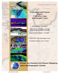
Per<strong>for</strong>mance <strong>and</strong> <strong>Progress</strong> <strong>Report</strong>:<br />
UNH/NOAA Joint Hydrographic <strong>Center</strong><br />
NOAA Ref No.: NA970G0241<br />
NOAA Ref No: NA17OG2285<br />
<strong>Report</strong> Period: 01/01/<strong>2003</strong> – 12/31/<strong>2003</strong><br />
Project Title: Joint Hydrographic <strong>Center</strong><br />
Principal Investigator: Larry A. Mayer
NOTE: This report serves as the <strong>Progress</strong> <strong>Report</strong> <strong>for</strong> the period 01/01/<strong>2003</strong> –<br />
12/31/<strong>2003</strong> <strong>for</strong> NOAA Ref No.: NA970G0241 as well as the Final <strong>Report</strong> <strong>for</strong><br />
NOAA Ref No.: NA970G0241. It is also the <strong>Progress</strong> <strong>for</strong> NOAA Ref.<br />
NA170G2285 <strong>for</strong> the period 01/01/<strong>2003</strong> – 12/31/<strong>2003</strong><br />
JHC Per<strong>for</strong>mance <strong>Report</strong> 2 30 January 2004
Per<strong>for</strong>mance <strong>and</strong> <strong>Progress</strong> <strong>Report</strong><br />
UNH/NOAA Joint Hydrographic <strong>Center</strong><br />
NOAA Ref No.: NA970G0241<br />
NOAA Ref No: NA17OG2285<br />
<strong>Report</strong> Period: 01/01/<strong>2003</strong> – 12/31/<strong>2003</strong><br />
Principal Investigator: Larry A. Mayer<br />
INTRODUCTION:<br />
On 4 June 1999 the Administrator of NOAA <strong>and</strong> the President of the University<br />
of New Hampshire signed a cooperative agreement describing a Joint Hydrographic<br />
<strong>Center</strong> (JHC) at the University of New Hampshire. On 1 July 1999 a grant was awarded<br />
to the University of New Hampshire providing the initial funding <strong>for</strong> the establishment of<br />
the Joint Hydrographic <strong>Center</strong>. This center, the first of its kind to be established in the<br />
United States, was <strong>for</strong>med as a national resource <strong>for</strong> the advancement of research <strong>and</strong><br />
education in the hydrographic <strong>and</strong> ocean mapping sciences. <strong>The</strong> activities of the center<br />
are focused on two major themes: 1- a research theme aimed at developing <strong>and</strong><br />
evaluating a wide range of state-of-the-art hydrographic <strong>and</strong> ocean mapping technologies,<br />
<strong>and</strong>; 2- an educational theme aimed at establishing a learning center that will promote <strong>and</strong><br />
foster the education of a new generation of hydrographers <strong>and</strong> ocean mapping scientists<br />
to meet the growing needs of both government agencies <strong>and</strong> the private sector. In concert<br />
with the Joint Hydrographic <strong>Center</strong>, the <strong>Center</strong> <strong>for</strong> <strong>Coastal</strong> <strong>and</strong> <strong>Ocean</strong> <strong>Mapping</strong> was also<br />
<strong>for</strong>med in order to provide a mechanism whereby a broader base of support (from the<br />
private sector <strong>and</strong> other government agencies) could be established <strong>for</strong> ocean mapping<br />
activities.<br />
This report is the eighth in a series of what were until, December 2002, bi-annual<br />
progress reports. Since December, 2002, the reports have been produced annually; this<br />
report highlights the activities of the Joint Hydrographic <strong>Center</strong> during the period<br />
between 1 January <strong>and</strong> 31 December, <strong>2003</strong>.<br />
REVIEW OF RECENT PROGRESS:<br />
Infrastructure:<br />
Personnel:<br />
<strong>The</strong> key to the success of any center will be the skills <strong>and</strong> talents of the<br />
individuals that make it up. Thus the primary task in establishing the Joint Hydrographic<br />
<strong>Center</strong> was to ensure that an appropriate team of people would be brought to the<br />
University of New Hampshire. This has been accomplished, <strong>and</strong> with the arrival of Dr.<br />
Christian de Moustier in January 2002, all positions outlined in the original <strong>Center</strong><br />
proposal have been filled. We added to our staff this year with the addition Dr. James V.<br />
Gardner, a world-renowned marine geologist <strong>and</strong> leader of the USGS Pacific <strong>Mapping</strong><br />
Group, who has retired from the U.S.G.S. <strong>and</strong> joined the <strong>Center</strong> as a Research Faculty<br />
member <strong>and</strong> Nathan Paquin, a part-time system manager. Funding from external<br />
sources has continued to allow us to exp<strong>and</strong> our staff to include a laboratory manager<br />
JHC Per<strong>for</strong>mance <strong>Report</strong> 3 30 January 2004
(Andy McLeod) supported by ONR <strong>and</strong> NSF, three new Research Scientists (Gareth<br />
Elston, Luciano Fonseca <strong>and</strong> Barbara Kraft) supported by the USGS, ONR, <strong>and</strong><br />
industrial sources, <strong>and</strong> a GIS specialist (Pam McLeod) supported by ONR as well as<br />
several hourly employees <strong>and</strong> Ben Smith who maintains our research vessel. Finally<br />
NOAA has seconded two more employees, Dr. John Kelly <strong>and</strong> LCDR Dave Cole, to the<br />
<strong>Center</strong>, providing valuable expertise in oceanographic <strong>and</strong> atmospheric modeling <strong>and</strong><br />
database development.<br />
Faculty:<br />
Larry Mayer, Director of the <strong>Center</strong> <strong>for</strong> <strong>Coastal</strong> <strong>and</strong> <strong>Ocean</strong> <strong>Mapping</strong> <strong>and</strong> Co-Director of<br />
the Joint Hydrographic <strong>Center</strong>. Dr. Mayer’s position is split between the <strong>Ocean</strong><br />
Engineering <strong>and</strong> Earth Science Departments. Dr. Mayer has a background in marine<br />
geology <strong>and</strong> geophysics with an emphasis on seafloor mapping <strong>and</strong> the remote<br />
identification of seafloor properties from acoustic data. Be<strong>for</strong>e coming to New<br />
Hampshire he was the NSERC Chair of <strong>Ocean</strong> <strong>Mapping</strong> at the University of New<br />
Brunswick where he led a team that developed a worldwide reputation <strong>for</strong> innovative<br />
approaches to ocean mapping problems.<br />
Colin Ware, member of the <strong>Center</strong> <strong>for</strong> <strong>Coastal</strong> <strong>and</strong> <strong>Ocean</strong> <strong>Mapping</strong> <strong>and</strong> Director of the<br />
Data Visualization Research Lab. Dr. Ware’s position is split between the <strong>Ocean</strong><br />
Engineering <strong>and</strong> Computer Science Departments. Dr. Ware has a background in<br />
human/computer interaction (HCI) <strong>and</strong> has been instrumental in developing a number of<br />
innovative approaches to the interactive 3-D visualization of large data sets. As a<br />
member of the UNB <strong>Ocean</strong> <strong>Mapping</strong> Group, Dr. Ware was the developer of many of the<br />
algorithms that were incorporated into CARIS HIPS, the most commonly used<br />
commercial hydrographic processing package.<br />
Christian de Moustier is the newest addition to the faculty of the Joint Hydrographic<br />
<strong>Center</strong>/<strong>Center</strong> <strong>for</strong> <strong>Coastal</strong> <strong>and</strong> <strong>Ocean</strong> <strong>Mapping</strong>. His position is split between the <strong>Ocean</strong><br />
Engineering <strong>and</strong> Electrical Engineering Departments. He is a world-renowned expert in<br />
the theory <strong>and</strong> engineering aspects of advanced sonar systems <strong>for</strong> ocean mapping.<br />
Christian comes to us from the Scripps Institution of <strong>Ocean</strong>ography where he was<br />
responsible <strong>for</strong> the installation <strong>and</strong> operation of a number of multibeam <strong>and</strong> other sonar<br />
systems. His research interests focus on development of innovative sonar processing<br />
techniques <strong>and</strong> acoustic seafloor characterization.<br />
Jim Gardner has been a senior marine geologist with the U.S. Geological Survey in<br />
charge of the Western Region’s marine mapping program. He was been responsible <strong>for</strong><br />
the multibeam sonar mapping of a number of areas off Cali<strong>for</strong>nia <strong>and</strong> Hawaii <strong>and</strong> has<br />
pioneered innovative approaches to the dissemination <strong>and</strong> interpretation of these data.<br />
Jim has had a long <strong>and</strong> illustrious career making important contributions in a number of<br />
areas of marine geology <strong>and</strong> geophysics including leading the U.S. ef<strong>for</strong>t to map its EEZ<br />
with the GLORIA long-range side-scan sonar. Jim retired from the USGS <strong>and</strong> joined the<br />
<strong>Center</strong> as a Research Professor in the late summer of <strong>2003</strong>.<br />
JHC Per<strong>for</strong>mance <strong>Report</strong> 4 30 January 2004
Lloyd Huff has over 37 years in private industry <strong>and</strong> the federal government, working<br />
with acoustic instrumentation <strong>and</strong> oceanographic equipment. He received his Doctorate<br />
in <strong>Ocean</strong> Engineering in 1976 from the University of Rhode Isl<strong>and</strong> <strong>and</strong> was one of the<br />
lead professionals in the Office of Coast Survey (OCS) working to bring multibeam side<br />
scan sonars <strong>and</strong> multibeam bathymetric sonars into st<strong>and</strong>ard practice <strong>for</strong> shallow water<br />
hydrography. He was Chief of the OCS Hydrographic Technology Programs from 1988-<br />
1999. Dr. Huff is working on new approaches <strong>for</strong> a range of hydrographic activities<br />
including the application of RTK techniques. Lloyd is now a Research Professor in<br />
<strong>Ocean</strong> Engineering.<br />
Brian Calder with a Ph.D. in Computing <strong>and</strong> Electrical Engineering has changed his<br />
status from Research Scientist to Research Asst. Professor with an appointment shared<br />
between the <strong>Center</strong> <strong>and</strong> the Dept. of Electrical Engineering.. Dr. Calder also comes with<br />
a wide range of high-level computing skills. His work has focused on developing<br />
methods <strong>for</strong> textural analysis of seafloor sonar data, as well as exploring innovative<br />
approaches to target detection <strong>and</strong> seafloor property extraction. More recently, Brian is<br />
focusing on statistically robust automated data cleaning approaches <strong>and</strong> tracing<br />
uncertainty in hydrographic data. Brian has begun to take a very active role in teaching<br />
<strong>and</strong> advising students prompting the change in position title.<br />
Lee Alex<strong>and</strong>er is a Research Associate Professor actively involved in applied research,<br />
development, test <strong>and</strong> evaluation (RDT&E) projects related to the implementation of<br />
electronic chart-related technologies. Lee chairs or participates on a number of<br />
international committees defining electronic chart st<strong>and</strong>ards, <strong>and</strong> serves as a technical<br />
advisor to U.S. Navy, U.S. Army, U.S. Coast Guard, <strong>and</strong> Coast Survey-NOAA.<br />
NOAA has demonstrated its commitment to the new <strong>Center</strong> by assigning five NOAA<br />
employees to the <strong>Center</strong>:<br />
Capt. Andrew Armstrong, Co-Director of the JHC, Captain Armstrong recently retired<br />
as an officer in the National <strong>Ocean</strong> <strong>and</strong> Atmospheric Administration Commissioned<br />
Corps <strong>and</strong> is now assigned to the <strong>Center</strong> as a civilian NOAA employee. Captain<br />
Armstrong has specialized in hydrographic surveying <strong>and</strong> served on several NOAA<br />
hydrographic ships, including the NOAA Ship Whiting where he was Comm<strong>and</strong>ing<br />
Officer <strong>and</strong> Chief Hydrographer. Be<strong>for</strong>e his appointment as Co-Director of the<br />
NOAA/UNH Joint Hydrographic <strong>Center</strong>, Captain Armstrong was the Chief of NOAA's<br />
Hydrographic Surveys Division, directing all of the agency's hydrographic survey<br />
activities. Captain Armstrong has a B.Sc., in Geology from Tulane University <strong>and</strong> a M.S.<br />
in Technical Management from the Johns Hopkins University. Capt. Armstrong is<br />
overseeing the hydrographic training program at UNH <strong>and</strong> organized our successful<br />
certification submission to the International Hydrographic Organization.<br />
LCDR Dave Cole joined the <strong>Center</strong> to assist with the United Nations Law of the Sea<br />
(UNCLOS) Project. He is assisting with database development <strong>and</strong> architecture <strong>for</strong><br />
existing bathymetric data, as well as research <strong>and</strong> planning <strong>for</strong> future data acquisition to<br />
support U.S. sovereignty claims under UNCLOS Article 76. This project integrates with<br />
JHC Per<strong>for</strong>mance <strong>Report</strong> 5 30 January 2004
other <strong>Center</strong> <strong>and</strong> NOAA-wide ocean mapping programs. Previously, Dave served as<br />
Manager of the Bathymetric Acquisition Program at NOAA's National Geophysical Data<br />
<strong>Center</strong> in Boulder, Colorado, <strong>and</strong> was the comm<strong>and</strong>ing officer of the NOAA Ship Rude<br />
during the execution of NOAA's first in-house shallow water multibeam surveys,<br />
conducted in the approaches to Portsmouth Harbor, New Hampshire.<br />
Cdr. Gerd Glang is at the <strong>Center</strong> in two roles. He has been the NOAA Navigation<br />
Advisor <strong>for</strong> the Northeast Region, serving as an ambassador to the maritime community<br />
<strong>and</strong> directly supporting the NOAA strategic goal to "promote safe navigation” by helping<br />
to resolve charting <strong>and</strong> navigation questions, educating constituents on emerging<br />
charting technologies, <strong>and</strong> soliciting feedback on NOAA's navigation products <strong>and</strong><br />
services. He is also a full-time graduate student. Cdr. Glang comm<strong>and</strong>ed the NOAA ship<br />
Whiting during its successful search <strong>for</strong> the wreckage of Egypt Air Flight 990 <strong>and</strong> John F.<br />
Kennedy, Jr.'s, downed Piper Saratoga.<br />
Dr. John G.W. Kelley: John is a research meteorologist <strong>and</strong> coastal modeler<br />
with NOAA/National <strong>Ocean</strong> Service's Marine Modeling <strong>and</strong> Analysis Programs within<br />
the Coast Survey Development Lab. John has a Ph.D. in Atmospheric Sciences from<br />
Ohio State Univ. <strong>and</strong> a M.S. in Meteorology from Penn State Univ. He is involved in the<br />
development <strong>and</strong> implementation of NOS' operational numerical ocean <strong>for</strong>ecast models<br />
<strong>for</strong> estuaries, the coastal ocean, <strong>and</strong> the Great Lakes. He is also PI <strong>for</strong> nowCOAST, a<br />
NOAA Web mapping portal to real-time coastal observations <strong>and</strong> <strong>for</strong>ecasts. John will be<br />
working with CCOM/JHC personnel on developing the capability to incorporate NOAA's<br />
real-time gridded digital atmospheric <strong>and</strong> oceanographic <strong>for</strong>ecast into the next generation<br />
of NOS nautical charts.<br />
Carl Kammerer, is an <strong>Ocean</strong>ographer with the National <strong>Ocean</strong> Services’ <strong>Center</strong> <strong>for</strong><br />
Operational <strong>Ocean</strong>ographic Products <strong>and</strong> Services (CO-OPS) now seconded to the<br />
<strong>Center</strong>. He is a specialist in estuarine <strong>and</strong> near-shore currents <strong>and</strong> presently the project<br />
lead or manager <strong>for</strong> two projects; a traditional current survey in Southeast Alaska, <strong>and</strong> a<br />
more robust survey to ascertain the effects of large bulk cargo ships in Las Mareas,<br />
Puerto Rico. Working out of the Joint Hydrographic <strong>Center</strong>, he acts as a liaison between<br />
CO-OPS <strong>and</strong> the JHC <strong>and</strong> provides expertise <strong>and</strong> assistance in the analysis <strong>and</strong> collection<br />
of tides. He has a B.S. in <strong>Ocean</strong>ography from the University of Washington <strong>and</strong> is an<br />
MBA c<strong>and</strong>idate at the University of Maryl<strong>and</strong>.<br />
Other Affiliated Faculty:<br />
Dave Wells: world-renown in hydrographic circles, Dave Wells is an expert in GPS <strong>and</strong><br />
other aspects of positioning, providing geodetic science support to the <strong>Center</strong>. Along<br />
with his time at UNH, Dave also spends time at the University of New Brunswick <strong>and</strong><br />
time at the University of Southern Mississippi where he is participating in their new<br />
hydrographic program. Dave also helps UNH in its continuing development of the<br />
curriculum in hydrographic training <strong>and</strong> contributed this spring to a UNH course in<br />
Geodesy.<br />
JHC Per<strong>for</strong>mance <strong>Report</strong> 6 30 January 2004
Visiting Scholars:<br />
Jorgen Eeg (Oct – Dec, 2000) is a senior researcher with the Royal Danish<br />
Administration of Navigation <strong>and</strong> Hydrography <strong>and</strong> was selected as our first visiting<br />
scholar. Jorgen brought a wealth of experience applying sophisticated statistical<br />
algorithms to problems of outlier detection <strong>and</strong> automated cleaning techniques <strong>for</strong><br />
hydrographic data.<br />
Donald House (Jan – July 2001) spent his sabbatical with our visualization group. He is<br />
a professor at Texas A&M University where he is part of the TAMU Visualization<br />
Laboratory. He is interested in many aspects of the field of computer graphics, both 3D<br />
graphics <strong>and</strong> 2D image manipulation. Recently his research has been in the area of<br />
physically based modeling. He is currently working on the use of transparent texture<br />
maps on surfaces.<br />
Rolf Doermer (March – September 2002) worked on techniques <strong>for</strong> creating sel<strong>for</strong>ganizing<br />
data sets using methods from behavioral animation. <strong>The</strong> method, called<br />
“Anaytic Stimulus Response Animation”, has objects operating according to simple<br />
behavioral rules that cause similar data objects to seek one <strong>and</strong> other <strong>and</strong> dissimilar<br />
objects to avoid one another.<br />
Ron Boyd (July – December <strong>2003</strong>) spent his sabbatical at the <strong>Center</strong>. Ron is a professor<br />
of marine geology at the University of Newcastle in Australia <strong>and</strong> an internationally<br />
recognized expert on coastal geology <strong>and</strong> processes. Ron ef<strong>for</strong>ts at the <strong>Center</strong> focused on<br />
helping us interpret the complex, high-resolution repeat survey data collected off<br />
Martha’s Vineyard as part of the ONR Mine Burial Experiment.<br />
John Hall (August <strong>2003</strong> – Oct 2004) is also spending his sabbatical from the Geological<br />
Survey of Israel with the <strong>Center</strong>. John has been a major player in the IBCM <strong>and</strong> GEBCO<br />
compilations of bathymetric data in the Mediterranean, Red, Black <strong>and</strong> Caspian Seas <strong>and</strong><br />
is working with the <strong>Center</strong> on numerous data sets including multibeam sonar data<br />
collected in the high Arctic in support of our Law of the Sea work. He is also archiving<br />
the 1962 – 1974 data collected from Fletcher’s Ice Isl<strong>and</strong> (T-3).<br />
Research Scientists <strong>and</strong> Staff:<br />
Yuri Rzhanov, with a Ph.D. in Physics <strong>and</strong> Mathematics, is a Senior Research Scientist<br />
in the <strong>Center</strong>. He has a very wide range of computing skills <strong>and</strong> has built a number of<br />
applications <strong>for</strong> higher education that are presently in use at universities around the<br />
world. Most importantly Dr. Rzhanov has been developing models <strong>for</strong> sonar-seabed<br />
interaction <strong>for</strong> bathymetric <strong>and</strong> sidescan sonars (including the Klein 2000/5000 systems)<br />
as well as software <strong>for</strong> automatic mosaicing of video imagery <strong>and</strong> sidescan sonar data.<br />
Semme Dijkstra recently received a Ph.D. in <strong>Ocean</strong> <strong>Mapping</strong> from the University of<br />
New Brunswick. He is a certified (Cat A) hydrographer from the Netherl<strong>and</strong>s who has<br />
several years of hydrographic experience with both the Dutch Navy <strong>and</strong> industry. From<br />
1996 to 1999 he worked at the Alfred Wegner Institute where he was in charge of their<br />
JHC Per<strong>for</strong>mance <strong>Report</strong> 7 30 January 2004
multibeam sonar processing. He is an experienced CARIS user. His thesis work<br />
involved artifact removal from multibeam sonar data <strong>and</strong> development of an echosounder<br />
processing <strong>and</strong> sediment classification system. He is now focusing on<br />
applications of single beam sonars <strong>for</strong> seafloor characterization <strong>and</strong> fisheries habitat.<br />
Tianhang Hou was a Research Associate with the UNB <strong>Ocean</strong> <strong>Mapping</strong> <strong>for</strong> six years<br />
be<strong>for</strong>e coming to UNH. He has significant experience with the UNB/OMG multibeam<br />
processing tools <strong>and</strong> has taken part in several offshore surveys. In addition to his work as<br />
a research associate Mr. Hou has also begun a Ph.D in which he is looking at the<br />
application of wavelets <strong>for</strong> artifact removal <strong>and</strong> seafloor classification in multibeam sonar<br />
sonar data as well as developing algorithms <strong>for</strong> determining the “foot of the slope” <strong>for</strong><br />
Law of the Sea issues <strong>and</strong> developing new techniques <strong>for</strong> sidescan sonar processing.<br />
Rol<strong>and</strong> Arsenault was an M.Sc. student <strong>and</strong> part-time research assistant with Human<br />
Computer Interaction Lab of the Dept. of Computer Sciences, UNB be<strong>for</strong>e coming to<br />
UNH. His expertise is in 3-D graphics, <strong>for</strong>ce-feedback <strong>and</strong> other input techniques <strong>and</strong><br />
networking. He is currently working on the development of the GeoZui3D realtime 3-D<br />
environment.<br />
Gareth Elston joined the <strong>Center</strong> as a Research Scientist in the fall of 2001. He has a<br />
background in sonar signal processing <strong>and</strong> recently received a Ph.D. from Heriot-Watt<br />
University where he developed sophisticated computer algorithms to simulate <strong>and</strong><br />
visualize the interaction of sonars with the seafloor. Gareth is supported by the U.S<br />
Geological Survey <strong>and</strong> the Office of Naval Research <strong>and</strong> is focusing his ef<strong>for</strong>ts on the<br />
continued development of sonar models as well as exploring the applicability of LIDAR<br />
data <strong>for</strong> seafloor characterization.<br />
Martin Jakobsson joined the group in August of 2000 as a Post-Doctoral Fellow.<br />
Martin completed a Ph.D. at the University of Stockholm where he combined modern<br />
multibeam sonar data with historical single beam <strong>and</strong> other data to produce an exciting<br />
new series of charts <strong>for</strong> the Arctic <strong>Ocean</strong>. Martin has been developing robust techniques<br />
<strong>for</strong> combining historical data sets <strong>and</strong> tracking uncertainty as well as working on<br />
developing approaches <strong>for</strong> distributed database management <strong>and</strong> Law of the Sea issues.<br />
Rick Komerska joined the Data Visualization Research Lab in March 2001. His<br />
background includes degrees in Aerospace <strong>and</strong> Civil Engineering. Rick has worked on a<br />
wide range of systems engineering projects spanning several disciplines. Recently, he has<br />
been involved in the development of a simulation/visualization tool in support of<br />
cooperating AUVs. He is now investigating techniques <strong>for</strong> using haptic feedback in<br />
carrying out various generic <strong>and</strong> application-specific tasks, with the goal of transitioning<br />
these results into tools used by the ocean community.<br />
Barbara Kraft (TYCO FELLOW) received a Ph.D. in Mechanical Engineering at the<br />
University of New Hampshire. Her dissertation research used optical tomography <strong>and</strong><br />
interferometry to spatially resolve 3-D density fields of turbulent jets. She has taught<br />
several courses including digital signal processing <strong>and</strong> experimental measurement <strong>and</strong><br />
JHC Per<strong>for</strong>mance <strong>Report</strong> 8 30 January 2004
data analysis. Most recently she has worked on the demodulation of voice <strong>and</strong> data<br />
transmissions <strong>for</strong> digital radio communications. At CCOM she is working on the<br />
GEOCLUTTER program analyzing in situ measurements of seafloor acoutstic properties.<br />
Pam McLeod received a B.Sc. in Electrical Engineering from the University of<br />
Wyoming <strong>and</strong> an M.S.Eng. in Geomatics/Civil Engineering from Purdue University. Her<br />
area of expertise is Geographic In<strong>for</strong>mation Systems (GIS), <strong>and</strong> she holds a joint<br />
appointment at UNH between CCOM <strong>and</strong> the Climate Change Research <strong>Center</strong> (CCRC).<br />
She is currently working on internet in<strong>for</strong>mation visualization with ArcIMS, GeoMedia,<br />
XML, <strong>and</strong> ColdFusion; geodatabase design with Oracle <strong>and</strong> ArcSDE; <strong>and</strong> application<br />
development with ArcObjects/VB <strong>and</strong> Avenue.<br />
Luciano Fonseca received an undergraduate degree in University of Brasilia <strong>and</strong> his<br />
Ph.D. from the University of New Hampshire (he was the first PhD produced by the<br />
<strong>Center</strong>). Luciano’s research is focused on developing tools <strong>for</strong> extracting quantitative<br />
seafloor property in<strong>for</strong>mation from multibeam backscatter <strong>and</strong> on database support. He<br />
is supported by the ONR Geoclutter Program a project aimed at underst<strong>and</strong>ing how<br />
multibeam backscatter may be used to remotely predict seafloor properties. <strong>The</strong> work is<br />
focused on local sites (Portsmouth Harbor <strong>and</strong> Great Bay) where we can take advantage<br />
of the Shallow Survey 2001 “common data set” <strong>and</strong> easily collect ground truth data.<br />
Andy McLeod Andy is our <strong>Ocean</strong> Engineering Lab manager. Andy spent nine years in<br />
the U.S. Navy as a leading sonar technician <strong>and</strong> then earned a B.Sc. in the Dept. of <strong>Ocean</strong><br />
Studies at Maine Maritime. He is just finishing his Masters degree in Marine Geology<br />
from the University of North Carolina. At UNH, Andy is responsible <strong>for</strong> maintenance<br />
<strong>and</strong> upgrading of the major laboratory facilities including the test tanks, small boat<br />
operations, local network administration <strong>and</strong> assistance with some courses.<br />
Nathan Paquin joined the <strong>Center</strong> towards the end of the year taking responsibility <strong>for</strong><br />
the daily maintenance <strong>and</strong> upkeep of our ever-growing computer facilities. Nathan<br />
comes from a strong background in computing initially gained while serving in the U.S.<br />
Army <strong>and</strong> being responsible <strong>for</strong> providing secure servers <strong>and</strong> clients. This experience<br />
was exp<strong>and</strong>ed through work in the industrial sector <strong>for</strong> numerous small <strong>and</strong> large IT<br />
companies.<br />
In addition to the academic staff, Abby Archila is our full-time program administrator<br />
<strong>and</strong> keeper of order <strong>and</strong> Ellen Barrows is our accounting assistant.<br />
Facilities <strong>and</strong> Equipment:<br />
With the startup of the <strong>Center</strong>, the University provided a new 8000 square foot<br />
building. Given the very rapid growth of the <strong>Center</strong>, space became the limiting factor in<br />
our ability to take on new projects. This past year we have been able to exp<strong>and</strong> into the<br />
second floor of the new building providing greatly needed additional office, graduate<br />
student <strong>and</strong> meeting space all cabled <strong>for</strong> gigabyte Ethernet. We have added two<br />
dedicated Dell servers <strong>and</strong> additional Network Attached Storage (NAS) <strong>and</strong> RAID to our<br />
4-processor Origin 2100 Silicon Graphic server with fiber channel disk stripe bringing<br />
JHC Per<strong>for</strong>mance <strong>Report</strong> 9 30 January 2004
our online storage capacity to more than 6 Terabytes. We also have an SGI Octane<br />
workstation, 3 SGI O2 workstations, 99 high-end NT <strong>and</strong> Linux workstations <strong>and</strong><br />
laptops, <strong>and</strong> several Mac G4’s. We have added We also have a full suite of printers <strong>and</strong><br />
plotters including both 48 <strong>and</strong> 60-inch large-<strong>for</strong>mat color plotters. All computers <strong>and</strong><br />
peripherals are operational <strong>and</strong> fully integrated into both <strong>Center</strong> <strong>and</strong> University networks.<br />
All systems are interoperable regardless of host operating system <strong>and</strong> files are shareable<br />
between all systems.<br />
A robust daily backup system is in place, with tapes held in a fire-safe. Our tape<br />
backup system has been improved with the installation of a robotic tape changer in the<br />
Dell server rack. This unit can h<strong>and</strong>le up to 20 320GB tapes, while writing to 2<br />
simultaneously. We have implemented a real-time log monitoring, filtering, <strong>and</strong><br />
<strong>for</strong>warding system to insure an audit trail is available. We have also acquired a full suite<br />
of commercial software packages <strong>for</strong> both data processing <strong>and</strong> presentation. In addition,<br />
we are developing a great deal of in house software (see Research <strong>The</strong>me discussions<br />
below). For this software development, a cooperative code development environment is<br />
in place (CVS), which allows concurrent development on different plat<strong>for</strong>ms with<br />
multiple users.<br />
We now have seven dedicated servers consolidated into a Dell rack with dual<br />
UPS monitored across the network. Network attached storage servers (Dell Powervault<br />
770N with attached Powervault 220S drive housings) now provide an additional 4,380GB<br />
beyond our configuration of last year. External services have been move to a new Dell<br />
Poweredge 650 server, which provides FTP, mail, web <strong>and</strong> CVSservices. Interface<br />
between our internal gigabit network <strong>and</strong> the external world is also h<strong>and</strong>led by a Dell<br />
Poweredge 650. A full suite of peripherals (4mm, 8mm, DLT <strong>and</strong> DVD-R) are available<br />
so that we can re-distribute the data on a range of media. We are outfitting <strong>and</strong> upgrading<br />
an electronics lab <strong>and</strong> have acquired a range of high-end test equipment. We have also<br />
built data acquisition systems <strong>and</strong> associated software in support of several research<br />
projects (see below). Arrangements have been made with the Research Computing<br />
<strong>Center</strong> to h<strong>and</strong>le routine system maintenance <strong>and</strong> backup <strong>and</strong> system security has been<br />
increased significantly.<br />
With funding shared between NOAA <strong>and</strong> the National Science Foundation, we<br />
have upgraded the acoustic test tank facilities at the Chase <strong>Ocean</strong> Engineering Lab,<br />
installing a motorized, rigid steel bridge <strong>and</strong> trolley system that allows a plat<strong>for</strong>m to be<br />
precisely positioned anywhere over the tank. We have also acquired <strong>and</strong> installed a<br />
computer-controlled rotary turntable that is mounted on the plat<strong>for</strong>m <strong>and</strong> used <strong>for</strong> sonar<br />
testing <strong>and</strong> calibration. With these upgrades, UNH has one of the largest <strong>and</strong> most<br />
advanced sonar calibration facilities in the Northeast. We have collaborated with<br />
researchers from several institutions <strong>and</strong> successfully used this facility to calibrate<br />
various sonars.<br />
We have outfitted <strong>and</strong> put into service a very shallow draft pontoon boat <strong>for</strong><br />
survey work in the local waters of Great Bay <strong>and</strong> received a very generous gift of a 40<br />
foot, purpose-built survey vessel (<strong>The</strong> <strong>Coastal</strong> Surveyor) from C&C Technologies of<br />
JHC Per<strong>for</strong>mance <strong>Report</strong> 10 30 January 2004
Lafayette, LA. This past year C&C Technologies also kindly donated a C-Nav<br />
commercial GPS correction system to the <strong>Center</strong>. <strong>The</strong> <strong>Coastal</strong> Surveyor has seen heavy<br />
use supporting both research <strong>and</strong> class work, in each of the three field seasons we have<br />
had the vessel. In support of these research programs we have acquired several state-ofthe-art<br />
positioning systems (Ashtech <strong>and</strong> Trimble), a Seabird CTD system, a Digibar<br />
sound speed calibration system, <strong>and</strong> Vitel <strong>and</strong> A<strong>and</strong>era tide gauges. We have also<br />
acquired a Knudsen 50 <strong>and</strong> 200 kHz chirp sounder, a POS-MV320 inertial motion sensor.<br />
In addition TSS has kindly donated a TS-335B motion sensor <strong>and</strong> ODOM has donated a<br />
MKIII survey echosounder. We have also been busy building a range of specialized<br />
survey equipment including underwater videography capabilities using a Sea Sciences<br />
Inc. controllable tow body <strong>and</strong> pole camera techniques (Huff <strong>and</strong> Cutter).<br />
Finally, we have completed construction <strong>and</strong> initial outfitting of both an<br />
electronics workshop under the supervision of Andy McLeod <strong>and</strong> a complete machine<br />
shop under the supervision under the supervision of Paul LaVoie.<br />
Educational Program:<br />
<strong>The</strong> <strong>Center</strong> has, under the guidance of Capt. Armstrong, developed oceanmapping<br />
specific curricula that have now been approved by the University. We now<br />
offer both M.S. <strong>and</strong> PhD degrees with a specialization in <strong>Ocean</strong> <strong>Mapping</strong> through either<br />
the Dept. of <strong>Ocean</strong> Engineering or through the Dept. of Earth Sciences (now exp<strong>and</strong>ed to<br />
include the School of Natural Resources) <strong>and</strong> the Institute <strong>for</strong> the Study of Earth, <strong>Ocean</strong>s<br />
<strong>and</strong> Space. <strong>The</strong> path chosen depends on the background of the student with physical<br />
scientists typically entering through the <strong>Ocean</strong>ography program <strong>and</strong> engineers entering<br />
through the <strong>Ocean</strong> Engineering program.<br />
We have also established a post-graduate certificate program in <strong>Ocean</strong> <strong>Mapping</strong>.<br />
This one-year program has a minimum set of course requirements that can be completed<br />
in one year <strong>and</strong> allows post-graduate students who cannot spend the two years necessary<br />
to complete a master’s degree a means of upgrading their education <strong>and</strong> receiving a<br />
certification of completion of the course work. <strong>The</strong> first student (from NIMA – now<br />
NGA) started in the certificate program this past September.<br />
With the establishment of these programs we will now turn to our longer-term<br />
goal of establishing the training <strong>and</strong> certification programs that can serve both<br />
undergraduates <strong>and</strong> industry people. We have already begun by offering the <strong>Center</strong> as a<br />
venue <strong>for</strong> industry <strong>and</strong> government training courses <strong>and</strong> meetings (e.g., CARIS, Triton-<br />
Elics, GEBCO, IBCAO, IVS, the Seabottom Surveys Panel of the U.S./Japan<br />
Cooperative Program in Natural Resources (UJNR), FIG/IHO, NAVO, NOAA, USGS).<br />
This has proven very useful as our students are allowed to attend <strong>and</strong> are thus exposed to<br />
a range of state-of-the-art systems <strong>and</strong> important issues. Particularly important was the<br />
visit to the <strong>Center</strong> by a number of members of NOAA’s <strong>Coastal</strong> Development Lab (in<br />
order to explore research paths of mutual interest) <strong>and</strong> the visit of 40 NOAA scientists to<br />
JHC Per<strong>for</strong>mance <strong>Report</strong> 11 30 January 2004
discuss NOAA priorities <strong>for</strong> multibeam sonar systems <strong>and</strong> surveys as part of a NOAA<br />
Multibeam Workshop.<br />
Finally <strong>and</strong> most importantly, our submission to the FIG/IHO International<br />
Advisory Board of St<strong>and</strong>ard of Competence <strong>for</strong> Hydrographic Surveyors has been<br />
accepted <strong>and</strong> our program was given a Category A certification by the FIG/IHO<br />
Advisory Board at their annual meeting in May 2001.<br />
While our students have had a range of existing courses to take as part of the<br />
<strong>Ocean</strong> <strong>Mapping</strong> Program the <strong>Center</strong> now teaches several new courses specifically<br />
designed to support the <strong>Ocean</strong> <strong>Mapping</strong> Program.<br />
JHC – originated Courses<br />
Course<br />
Introduction to <strong>Ocean</strong> <strong>Mapping</strong><br />
Hydrographic Field Course<br />
Marine Geology <strong>and</strong> Geophysics<br />
Array Processing<br />
Data Structures<br />
Data Visualization<br />
Seafloor Characterization<br />
Marine Geodesy<br />
Instructors___________________________<br />
Armstrong, de Moustier, Mayer<br />
Armstrong<br />
Mayer<br />
de Moustier<br />
Ware<br />
Ware<br />
Mayer, Calder, de Moustier<br />
Wells, Dijkstra, Huff<br />
Dave Wells <strong>and</strong> Semme Dijkstra are now working on a web-based version of the<br />
Geodesy course <strong>for</strong> distance education.<br />
We have 14 students enrolled in the ocean mapping program, including two NOAA<br />
Corps officers <strong>and</strong> a NOAA physical scientist; we have already produced two Ph.D.s<br />
(Luciano Fonseca (2001) <strong>and</strong> Anthony Hewitt (2002). Shep Smith received his M.Sc.<br />
degree in May of 1993 – the first of our NOAA Corps Officers to graduate.<br />
Student Program Advisor<br />
Rick Brennan (NOAA) M. S. OE TBD<br />
Daniel Brogan M. S. EE de Moustier<br />
R<strong>and</strong>y Cutter PhD, E. Sci. Mayer<br />
Gerd Glang (NOAA) M.S., OE Huff<br />
Caleb Gostnell (NOAA) M.S. E. Sci. TBD<br />
Tianhang Hou Ph.D. OE Mayer, Huff<br />
Mike Leo, Ph.D. E. Sci. Mayer, Calder, Huff<br />
Malik Mashkoor M. S. OE Mayer<br />
Karthikeyan Natham M. S. Comp. Sci. Ware<br />
Matthew Plumlee Ph.D. Comp Sci Ware<br />
Richard Raymond M.S., E.Sci Mayer<br />
JHC Per<strong>for</strong>mance <strong>Report</strong> 12 30 January 2004
Brianna Sullivan M.S. Comp.Sci, Ware<br />
Shep Smith (NOAA) M.S, OE (received May03) Mayer<br />
Arsen Zoksimovski M.S. EE de Moustier<br />
Status of Research: 2002 - <strong>2003</strong>:<br />
In our initial proposal (1999) we identified five research programs, each of which<br />
combines long-range research goals designed to make fundamental contributions to the<br />
fields of hydrography <strong>and</strong> ocean mapping with short-term objectives designed to address<br />
immediate concerns of the hydrographic community in the United States. We outlined<br />
each of these programs, describing the major focus of each research task <strong>and</strong> identifying<br />
what resources (both in terms of people, including collaborators, <strong>and</strong> equipment) will be<br />
required to complete these tasks. Here, we briefly review the progress made on these<br />
tasks over the past year as well as describe progress made in several new initiatives.<br />
Innovative sonar design <strong>and</strong> processing <strong>for</strong> enhanced resolution <strong>and</strong> target<br />
recognition<br />
While this is the least active of our themes, we are seeing growing activity with the<br />
development of our sonar calibration facilities <strong>and</strong> our involvement in the development of<br />
new sonar systems. This facility (funded in part by NSF) is now one of the best of its<br />
kind in New Engl<strong>and</strong> with a rigid x, y positioning system, computer controlled transducer<br />
rotor (with resolution of 0.025 degree) <strong>and</strong> custom built data acquisition system. In past<br />
years the new calibration facility was used to better underst<strong>and</strong> the characteristics of the<br />
Simrad SM2000 mid-water multibeam sonar (in collaboration with researchers from<br />
Woods Hole <strong>Ocean</strong>ographic Institution) as well as Reson 8101 multibeam sonar (in<br />
collaboration with researchers from the University of New Brunswick <strong>and</strong> Pennsylvania<br />
State University. We have also used the facility to calibrate hydrophones to be used <strong>for</strong><br />
the acoustic conditioning of fish (in conjunction with Dr. Ken Baldwin of the <strong>Ocean</strong><br />
Engineering Dept. <strong>and</strong> the New Engl<strong>and</strong> Aquarium). Reson is expected to bring a new<br />
generation of dynamically focused sonar to our facility so that we can carefully measure<br />
its characteristics <strong>and</strong> ability be used to simultaneously map both the seafloor <strong>and</strong> midwater<br />
targets. <strong>The</strong> capability to simultaneously map both the seafloor <strong>and</strong> water column<br />
is an important concern of NOAA with respect to the capabilities of their fishery research<br />
vessels.<br />
Two of our faculty members have been involved with the development of new <strong>and</strong><br />
innovative sonar systems. Lloyd Huff has taken the lead in the test <strong>and</strong> evaluation of the<br />
Klein 5410, the interferometric version (capable of measuring depth as well as<br />
backscatter) of Klein’s very successful 5000 series sidescan sonar. <strong>The</strong>se tests, including<br />
a field trial in August <strong>2003</strong>, have resulted in significant enhancements to both the<br />
hardware <strong>and</strong> software. Chris DeMoustier <strong>and</strong> graduate student Dan Brogan have<br />
worked with NRL on the development of a toroidal (360 degree) volume search sonar<br />
JHC Per<strong>for</strong>mance <strong>Report</strong> 13 30 January 2004
(with NRL). Chris has also worked with Scripps Institution of <strong>Ocean</strong>ography on<br />
improving their EM120 multibeam sonar <strong>and</strong> with Electronics Navigation Ltd. Of New<br />
Zeal<strong>and</strong> on the development of a new 160kHz multibeam sonar targeted towards the<br />
fishing industry.<br />
New approaches to multibeam <strong>and</strong> sidescan sonar data processing:<br />
Improved Bathymetric Processing:<br />
One of the major ef<strong>for</strong>ts of the <strong>Center</strong> has been to develop improved data processing<br />
methods that would provide hydrographers with the ability to very rapidly <strong>and</strong> accurately<br />
process the massive amounts of data collected with modern multibeam systems. This<br />
data processing step is one of the most serious bottlenecks in the hydrographic “data<br />
processing pipeline” at NOAA, the NAVY, <strong>and</strong> hydrographic agencies <strong>and</strong> industries<br />
worldwide. We have explored a number of different approaches <strong>for</strong> automated data<br />
processing (see earlier progress reports <strong>for</strong> descriptions of these approaches) <strong>and</strong>, in the<br />
past year focused our ef<strong>for</strong>t on a technique developed by Brian Calder that is both very<br />
fast (10’s to 100’s of times faster than the st<strong>and</strong>ard processing approaches) <strong>and</strong><br />
statistically robust. <strong>The</strong> technique, known as CUBE (Concurrent Uncertainty <strong>and</strong><br />
Bathymetric Estimator), is an error-model based, direct DTM generator that estimates the<br />
depth plus a confidence interval directly on each node point. Most importantly, the<br />
technique produces an estimate of uncertainty associated with each grid node, <strong>and</strong>, when<br />
the automated editing technique fails to make a statistically conclusive decision, it will<br />
present multiple hypotheses to the operator <strong>for</strong> a subjective decision. <strong>The</strong> key is that the<br />
operator interacts only with that small subset of data <strong>for</strong> which there is some ambiguity<br />
rather than going through the current process of subjectively examining all data points.<br />
Last year CUBE was subjected to detailed verification studies in a cooperative<br />
research ef<strong>for</strong>t with NOAA that compared the automated output of CUBE to equivalent<br />
products (smooth sheets) produced through the st<strong>and</strong>ard NOAA processing pipeline.<br />
Verification studies were done in three very different environments (Snow Passage<br />
Alaska, Woods Hole, Mass., <strong>and</strong> Valdez, Alaska) involving surveys in various states of<br />
completion <strong>and</strong> comparisons done by NOAA cartographers. In each case the CUBEprocessed<br />
data agreed with the NOAA processed data within IHO limits. Cube<br />
processing took from 30 to 50 times less time than the st<strong>and</strong>ard NOAA procedures. <strong>The</strong><br />
past year CUBE’s capabilities were extended to include the implementation of a tracking<br />
filter that improves per<strong>for</strong>mance in areas of steep slopes, restructuring of the code to<br />
allow it to easily facilitate future developments, <strong>and</strong> the implementation of an interface to<br />
flag data in HDCS <strong>for</strong>mat so that it can be fed immediately back into CARIS. CUBE<br />
was further tested when it was used to process all multibeam sonar data collected in<br />
support of Shallow Survey <strong>2003</strong>, the international conference on shallow water surveying<br />
that alternates between Sydney Australia <strong>and</strong> Portsmouth New Hampshire. During this<br />
exercise, it was demonstrated that CUBE can provide a very powerful method to identify<br />
even subtle problems in data quality.<br />
Based on these verification trials <strong>and</strong> careful evaluation, Capt. Roger Parsons,<br />
director of NOAA’s Office of Coast Survey has notified NOAA employees as well as<br />
JHC Per<strong>for</strong>mance <strong>Report</strong> 14 30 January 2004
other major hydrographic organizations in the U.S. (NAVO <strong>and</strong> NIMA) of NOAA’s<br />
intent to implement CUBE as part of st<strong>and</strong>ard NOAA data processing protocols. As<br />
described by Capt. Parsons in his letter to NAVO <strong>and</strong> NIMA, CUBE <strong>and</strong> its sister<br />
development <strong>The</strong> Navigation Surface (see below) “…promise considerable efficiencies<br />
in processing <strong>and</strong> managing large data sets that result from the use of modern surveying<br />
technologies such as multibeam sonar <strong>and</strong> bathymetric lidar. <strong>The</strong> expected efficiency<br />
gains will reduce cost, improve quality by providing processing consistency <strong>and</strong><br />
quantification of error, <strong>and</strong> allow us to put products in the h<strong>and</strong>s of our customers<br />
faster.”<br />
In support of the exciting news that NOAA (<strong>and</strong> others, e.g. NAVO) will be<br />
officially adopting CUBE as an essential component of their approach to hydrographic<br />
data processing, Dr. Calder has been working with a number of commercial software<br />
vendors who provide hydrographic processing software to NOAA <strong>and</strong> NAVO (CARIS,<br />
IVS, SAIC, SIMRAD) to ensure that they will properly implement the CUBE algorithms<br />
in their products. He has also been working closely with NOAA, including participating<br />
in a field program on the NOAA vessel THOMAS JEFFERSON to develop simplified<br />
interfaces <strong>for</strong> CUBE <strong>and</strong> sharing data acquisition strategies.<br />
Another aspect of the data processing-related research being conducted at the <strong>Center</strong><br />
involves rethinking of the final output products of a hydrographic survey. We strongly<br />
believe that the st<strong>and</strong>ard chart product of selected soundings <strong>and</strong> contours does not at all<br />
do justice to the in<strong>for</strong>mation content of high-resolution multibeam <strong>and</strong> sidescan sonar<br />
data. We are working on a series of new products that will better serve the mariner as<br />
well as many other constituencies. In this context, Lt. Smith has developed the concept<br />
of the “Navigation Surface” as part of his thesis work. <strong>The</strong> Navigation Surface is a<br />
database that maintains bathymetric data sets at full resolution <strong>and</strong> thus can be used to<br />
display a series of derived products. Thus a single database can be the source <strong>for</strong><br />
hydrographic (safety of navigation) products as well as products <strong>for</strong> fisheries habitat or<br />
other studies that require full-resolution data. CUBE-processed data can be a component<br />
of the Navigation Surface <strong>and</strong> thus the verification exercise described above also<br />
involved the navigation surface <strong>and</strong> tested (positively) the veracity of the navigation<br />
surface as a source of hydrographic products. <strong>The</strong> combination of CUBE <strong>and</strong> the<br />
Navigation Surface set the stage <strong>for</strong> a new research ef<strong>for</strong>t “<strong>The</strong> Chart of the Future”<br />
described later.<br />
With the completion of his Master’s <strong>The</strong>sis in May, Lt. Smith was assigned to the<br />
NOAA vessel THOMAS JEFFERSON, where he has been developing protocols <strong>for</strong> the<br />
implementation of both CUBE <strong>and</strong> the Navigation Surface. This work has directly led to<br />
the acceptance of CUBE <strong>and</strong> the Navigation Surface as new st<strong>and</strong>ards <strong>for</strong> NOAA<br />
processing.<br />
In support of the new adoption of CUBE <strong>and</strong> the Navigation Surface into<br />
processing protocols, the <strong>Center</strong> will be organizing <strong>and</strong> hosting a workshop amongst<br />
industry, government <strong>and</strong> academic researchers to define an open <strong>for</strong>mat <strong>for</strong> Navigation<br />
Surface products in order to ensure interoperability amongst the various vendors <strong>and</strong><br />
JHC Per<strong>for</strong>mance <strong>Report</strong> 15 30 January 2004
agencies. As a focal point <strong>for</strong> the broad interest in CUBE <strong>and</strong> the Navigation Surface<br />
amongst the government <strong>and</strong> the private sector, the <strong>Center</strong> is fulfilling one of its prime<br />
m<strong>and</strong>ates of serving as a national center of focus <strong>for</strong> ocean mapping activities. In<br />
bringing these groups together we become the focal point <strong>for</strong> more efficient <strong>and</strong><br />
collaborative research ef<strong>for</strong>ts aimed at solving a national need.<br />
In another ef<strong>for</strong>t to push the limits of bathymetric resolution, Lloyd Huff <strong>and</strong> Yuri<br />
Rzhanov have been working to use the algorithms developed <strong>for</strong> image correlation (see<br />
Seafloor Characterization section below) to correlate spatial patterns derived from<br />
overlapping lines of high-resolution multibeam bathymetry. Through the correlation, it is<br />
possible to re-navigate one of the two survey lines such that the internal details of its<br />
bathymetry spatially overlay those of similar details in the reference line. <strong>The</strong> technique<br />
not only holds promise <strong>for</strong> “correcting” navigation data, it can also provide an estimate of<br />
the precision of the survey navigation.<br />
We have also been developing new approaches to improve the bottom detection<br />
capability of Reson 8111 sonar. Kraft, DeMoustier <strong>and</strong> Calder participated in the ONRsponsored<br />
Kauai High Frequency Experiment. During the course of this experiment<br />
deficiencies were noted in the robustness of the bottom detection algorithm of the Reson<br />
8111 multibeam sonar. Also as part of this experiment, Calder, Kraft <strong>and</strong> deMoustier<br />
examined the potential <strong>for</strong> using ocean models (from SSI in Nashua New Hampshire) as<br />
input <strong>for</strong> the sound speed profile needed <strong>for</strong> multibeam sonar work. <strong>The</strong> team examined<br />
the quality of the depth in<strong>for</strong>mation produced from EM120, <strong>and</strong> Reson 8111 when an<br />
isospeed (1500 m/sec) ocean was assumed; when sound speed was derived from the SSI<br />
ocean model <strong>and</strong>; when the full suite of CTD measurements were used. Results show<br />
that the model did a good job in capturing the detail of the sound speed structure in the<br />
area.<br />
Improved Backscatter Processing:<br />
In concert with our activities related to improving the processing of multibeam<br />
sonar bathymetry, we also have been involved with several projects aimed at improving<br />
the processing of multibeam backscatter. <strong>The</strong>se developments are in support of our<br />
seafloor characterization ef<strong>for</strong>ts <strong>and</strong> the hope of using remotely collected backscatter to<br />
better define seafloor properties (much of this work is funded by ONR). Ef<strong>for</strong>ts include<br />
the work of Fonseca, Kraft <strong>and</strong> Elston to develop techniques <strong>for</strong> correcting multibeam<br />
backscatter <strong>for</strong> local slope. In addition, Fonseca has developed a software tool suite that<br />
includes these corrections, carries through the full calculation of backscatter as a function<br />
of angle of incidence, <strong>and</strong> provides tools to visualize the seafloor response. <strong>The</strong>se<br />
projects will be discussed in greater detail in the Seafloor Characterization section below.<br />
Improved Sidescan Sonar Processing:<br />
In another data processing research program, Lloyd Huff <strong>and</strong> Tianhang Hou have<br />
been developing algorithms <strong>and</strong> software to clean <strong>and</strong> remove artifacts from Klein 5000<br />
sidescan sonar data collected by the Alaska Fisheries Research <strong>Center</strong> in the Bering Sea.<br />
<strong>The</strong> techniques developed allow the removal of beam pattern <strong>and</strong> roll effects, pre-<br />
JHC Per<strong>for</strong>mance <strong>Report</strong> 16 30 January 2004
whitening, slant-range corrections <strong>and</strong> recalculation of tow fish position. After this<br />
processing, the sonar images show, much more clearly, trawl marks <strong>and</strong> other seafloor<br />
targets. Huff <strong>and</strong> Hou have been able to begin to develop techniques to quantify the<br />
impact of fishing gear on the seafloor. In the current year, Huff <strong>and</strong> Hou have extended<br />
this research to Klein 5410 data collected during the Trawlex-02 project, processing<br />
another 5 gigabytes of data. For these data they developed new calculations of TVG,<br />
attenuation, beam pattern, etc. had to be made.<br />
New approaches to data visualization <strong>and</strong> presentation:<br />
We continue a very strong focus on the development of innovative approaches to<br />
data visualization <strong>and</strong> the application of these approaches to ocean mapping problems.<br />
<strong>The</strong> visualization team (Arsenault, Plumlee, Komerska, Sullivan, <strong>and</strong> Natham) under the<br />
supervision of Lab Director Colin Ware has been actively developing a novel <strong>and</strong><br />
innovative 3-D visualization environment, GeoZui3D. GeoZui3D is a highly interactive<br />
3-D visualization system designed to support a number of different research projects <strong>and</strong><br />
ocean mapping applications. GeoZui3D was described in detail in previous progress<br />
reports; during the current reporting period, GeoZUI3D has continued to develop <strong>and</strong><br />
grow. It is has been made available to the public <strong>and</strong> more than 40 groups have<br />
downloaded the software. It is being used as a display <strong>and</strong> QC tool both on board NOAA<br />
survey vessels <strong>and</strong> in NOAA labs.<br />
During this reporting period the user interface <strong>for</strong> GeoZui3D has been updated multiple<br />
window features that support scale changes have been added. An important development<br />
has been the support <strong>for</strong> real-time <strong>and</strong> time-varying data sets. In particular has been the<br />
support <strong>for</strong> time-varying terrain models, moving objects (e.g. AUV’s or ROV’s) <strong>and</strong> flow<br />
fields. <strong>The</strong> incorporation of time-varying data sets also has allowed us to explore the<br />
feasibility of creating “tide aware” 3-D bathymetric charts, laying the groundwork <strong>for</strong> the<br />
“Chart of the Future” discussed later.<br />
<strong>The</strong> incorporation of flow visualization models into the GeoZUI-3D environment has<br />
opened of a range of applications <strong>and</strong> interest from ocean <strong>and</strong> current modelers both<br />
inside <strong>and</strong> outside of NOAA. Collaboration with modeling teams at Dartmouth <strong>and</strong> with<br />
NOAA’s Coast Survey Development Lab is currently underway. A particular challenge<br />
being addressed is the development of methods to visualize multiple layer flows.<br />
GeoZUI-3D has become the basis <strong>for</strong> a prototype museum exhibit <strong>for</strong> Seacoast<br />
Science <strong>Center</strong> (GeoExplorer) <strong>and</strong> a very effective outreach mechanism demonstrating<br />
the importance of seafloor mapping. As part of the thesis work of Briana Sullivan, the<br />
prototype exhibit underwent multiple evaluation phases at the Seacoast Science <strong>Center</strong><br />
<strong>and</strong> the New Engl<strong>and</strong> Aquarium. This prototype exhibit allows visitors to pilot<br />
themselves in an immersive 3-D environment up <strong>and</strong> under the Piscataqua River,<br />
stopping at interesting sights along the way. <strong>The</strong> exhibit has been augmented with two<br />
extra journeys, one to the open ocean aquaculture site off the Isle of Shoals <strong>and</strong> the other<br />
to the George’s Bank.<br />
JHC Per<strong>for</strong>mance <strong>Report</strong> 17 30 January 2004
Force-feedback (haptic) interfaces have also been developed <strong>for</strong> GEOZUI-3D. <strong>The</strong>se<br />
interfaces are being used <strong>for</strong> the exploration of the usefulness of clickless menus <strong>and</strong> 3D<br />
drawing in the haptic environment. In addition, haptic techniques <strong>for</strong> creating <strong>and</strong> editing<br />
AUV mission paths (using in situ haptic pie menues <strong>and</strong> haptic state surfaces) have been<br />
developed<br />
Finally, a series of theoretical studies of perceptual <strong>and</strong> task-related frames of<br />
reference have been carried out that look at the mismatch between visual <strong>and</strong> haptic<br />
images of an object. Additionally, models are being developed to predict the likelihood<br />
that an individual will make an error in discriminating between two visual patterns. <strong>The</strong>se<br />
theoretical studies <strong>for</strong>m the basis <strong>for</strong> the development of user interfaces <strong>for</strong> things like the<br />
Chart of the Future. This has been supported with NSF funding.<br />
Seafloor Characterization:<br />
We have a number of inter-connected research programs underway aimed at<br />
exploring the ability of our mapping systems to provide quantitative in<strong>for</strong>mation on the<br />
make-up <strong>and</strong> character of the seafloor as well as its depth. <strong>The</strong>se programs deal with a<br />
range of sensors (single beam, multibeam <strong>and</strong> sidescan sonars, lidar, video, etc.) <strong>and</strong><br />
involve theoretical studies, the collection of remotely sensed data, <strong>and</strong> “ground-truth”<br />
samples.<br />
Single beam sonar <strong>and</strong> <strong>Mapping</strong> <strong>and</strong> Characterization:<br />
In general support of our seafloor characterization ef<strong>for</strong>ts, Semme Dijkstra has<br />
continued the development of several software tools. <strong>The</strong> TracEd tool provides a robust<br />
means of tracking, editing <strong>and</strong> parsing returns from single beam echosounders. This tool,<br />
which has the potential to be a very useful aid to single-beam hydrographic data<br />
processing, has now been ported to the Windows environment. <strong>The</strong> Lassoo tool which is<br />
used <strong>for</strong> comparing multivariate data sets to imagery data sets in both geographic <strong>and</strong><br />
multivariate feature space has now been implemented in the R environment, a public<br />
domain computer language <strong>for</strong> statistical processing.<br />
Sidescan sonar:<br />
As discussed above, Lloyd Huff <strong>and</strong> Tianhang Hou are working with the Alaska<br />
Fisheries Science <strong>Center</strong> of NOAA/NMFS on a major Klein 5000 <strong>and</strong> 5410-sidescan<br />
sonar survey in the East Bering Sea. Once the records have been corrected, an automated<br />
classification technique, developed by Rzhanov <strong>and</strong> Hou is being applied. In this<br />
technique the surveyed area is divided into small squares (typically 20 x 20 m). For each<br />
square the mean backscatter-vs-beamnumber "signature" is calculated. After application<br />
of corrections, a Chebyshev polynomial is fitted to the signature, <strong>and</strong> the polynomial<br />
coefficients are used as data vector <strong>for</strong> the clustering algorithm. When the clustering is<br />
per<strong>for</strong>med, the mean signature <strong>for</strong> each cluster is calculated <strong>and</strong> then fed into an<br />
optimization algorithm <strong>for</strong> inversion <strong>for</strong> the seafloor property parameters. This<br />
technology development has the potential <strong>for</strong> a variety of sonar processing applications.<br />
JHC Per<strong>for</strong>mance <strong>Report</strong> 18 30 January 2004
Multibeam <strong>and</strong> interferometric sonars:<br />
We have made substantial progress in developing approaches to multibeam<br />
classification on a number of fronts. <strong>The</strong>se developments have been made using the EM<br />
300, 1000, 1002 <strong>and</strong> EM3000 <strong>and</strong> Reson 8101 data collected in support of the ONR- <strong>and</strong><br />
USGS- <strong>and</strong> Icel<strong>and</strong>ic sponsored programs, as well multibeam sonar data collected by<br />
NOAA <strong>and</strong> others in Portsmouth Harbor as part of the Shallow Water Survey 2001<br />
“Common Data Set” (see previous progress reports). With the availability of these data<br />
sets, much of our recent ef<strong>for</strong>t in terms of seafloor characterization has focused on the<br />
enhancing our ability to extract quantitative in<strong>for</strong>mation from our sonars (through better<br />
processing <strong>and</strong> modeling) <strong>and</strong> improving our ground-truthing abilities.<br />
If we are to use sonar backscatter data to correctly characterize seafloor<br />
properties, we want the backscatter that we measure to represent changes in the seafloor<br />
rather than instrumental changes or changes in the geometry of insonification. While<br />
many system <strong>and</strong> geometric corrections are applied by the manufacturers in their data<br />
collection process, a very important parameter – correction <strong>for</strong> local slope – is not. We<br />
have thus embarked on research ef<strong>for</strong>t aimed at using the detailed bathymetric data<br />
provided by multibeam sonar to calculate local incidence angles <strong>and</strong> correct backscatter<br />
<strong>for</strong> local slope. Once such corrections are made the resulting backscatter should be<br />
much more representative of true sea floor variability.<br />
Luciano Fonseca has begun a focused ef<strong>for</strong>t aimed at underst<strong>and</strong>ing the<br />
relationship of multibeam backscatter to seafloor properties in the well-controlled <strong>and</strong><br />
easily accessible environment of Portsmouth Harbor <strong>and</strong> Great Bay. This work, funded<br />
<strong>for</strong> the most part through ONR’s Geoclutter program has involved the establishment of a<br />
GIS-based database of all existing data in the region (existing data includes all the data<br />
collected in support of Shallow Survey 2001, as well as data collected as part of our<br />
<strong>Ocean</strong> <strong>Mapping</strong> field course), the reanalysis of multibeam sonar-derived backscatter data<br />
(particularly data from the Simrad EM3000 sonar) to correct <strong>for</strong> true backscatter values<br />
(including local slope) <strong>and</strong> the calculation of AVO (Amplitue Versus Offset). In support<br />
of this study we are also collecting samples <strong>and</strong> making in situ measurements of sound<br />
speed, attenuation, <strong>and</strong> resistivity using the ISSAP (In Situ Sound Speed Attenuation <strong>and</strong><br />
Porosity) Probe, also developed under ONR funding. Luciano is also doing a similar<br />
analysis on EM300 data collected off Icel<strong>and</strong> in collaboration with the Icel<strong>and</strong>ic<br />
Hydrographic Bureau. <strong>The</strong> analysis of these data is specifically to see if there are<br />
indicators of near-surface gas.<br />
Over the past two years a new approach to seafloor characterization based on the<br />
automated segmentation of multibeam sonar bathymetric data into regions of common<br />
geomorphology has been implemented by R<strong>and</strong>y Cutter <strong>and</strong> Yuri Rzhanov. <strong>The</strong><br />
technique uses texture-based segmentation techniques (local Fourier trans<strong>for</strong>ms <strong>and</strong> local<br />
Fourier histograms (LFH)). <strong>The</strong> technique is fully automated, except <strong>for</strong> the choice of the<br />
number of classes produced by cluster analysis of LFH results. <strong>The</strong> technique, which<br />
appears to be quite robust <strong>and</strong> repeatable, has been applied to several of the Portsmouth<br />
Harbor data sets as well as regions of the well-studied Stellwagen National Marine<br />
Sanctuary. <strong>The</strong> LFH appears to separate the morphology into regions that have<br />
JHC Per<strong>for</strong>mance <strong>Report</strong> 19 30 January 2004
significance in terms of the habitat of several species. This past year Cutter has<br />
supplemented these analyses with the development of applications to also calculate<br />
l<strong>and</strong>scape metrics <strong>and</strong> spectral parameters <strong>for</strong> the segmented seafloor <strong>and</strong> integrated these<br />
tools with GeoZui3D (see above) <strong>for</strong> image feature selection <strong>and</strong> extraction. In support<br />
of these studies as Cutter is also developing innovative approaches to ground-truthing the<br />
sonar with samples <strong>and</strong> video data. <strong>The</strong>se will be discussed more below.<br />
In order to better underst<strong>and</strong> the relationship between remotely measured<br />
backscatter (with a sonar) <strong>and</strong> the physical properties of the seafloor, we have also<br />
developed (with ONR funding) an instrument system designed to make in situ<br />
measurements of sound-speed, sound attenuation, <strong>and</strong> resistivity (along with video of the<br />
seafloor -- ISSAP). In the past year, Barbara has upgraded the user control of the ISSAP<br />
hardware. In addition, new, 47kHz transducers have been added <strong>and</strong> allowing in situ<br />
measurements to be made at 47, 65 <strong>and</strong> 100 kHz. Beam pattern measurements were<br />
made <strong>for</strong> all probes <strong>and</strong> the resistivity probes were calibrated. <strong>The</strong> new additions were<br />
tested in Portsmouth Harbor as part of the Geoclutter work there. Using these<br />
measurement as well as analyses of seafloor samples done by other investigators, TYCO<br />
Fellow Barbara Kraft has been exploring both the empirical <strong>and</strong> theoretical relationships<br />
between physical <strong>and</strong> acoustic properties <strong>and</strong> between these properties <strong>and</strong> backscatter.<br />
This theoretical <strong>and</strong> empirical work, feeds directly back into our attempts to interpret<br />
backscatter in terms of seafloor character or habitat.<br />
Finally, Gareth Elston, with funding from USGS <strong>and</strong> ONR, has been looking at<br />
the wave<strong>for</strong>m characteristic of LIDAR as a possible means <strong>for</strong> identifying seafloor<br />
properties. Gareth has implemented a lidar pulse characterization algorithm that<br />
determines the peak value <strong>and</strong> pulse width from the zeros of the first <strong>and</strong> second<br />
derivatives of the (low-pass filtered) wave<strong>for</strong>m. Classes have been defined to hold the<br />
lidar wave<strong>for</strong>ms (with their supporting metadata) <strong>and</strong> methods to implement the pulse<br />
characterization. <strong>The</strong>se classes rely on a flexible binary file parsing class <strong>for</strong> importing<br />
the lidar data from multiple binary files. In collaboration with Semme Dijkstra, these<br />
classes are being ported <strong>for</strong> use in his Trace-Ed <strong>and</strong> Lasso tools (see description in Single<br />
Beam Characterization section). <strong>The</strong>se tools will <strong>for</strong>m the basis of our bottom<br />
segmentation <strong>and</strong> classification work.<br />
Initial work on matching the overlapping data from the two lidar sensors used<br />
during surveys of Lake Tahoe (shallow APD <strong>and</strong> deep PMT) revealed that the two<br />
clusters in the peak value vs. depth plot have different slopes indicating that these may<br />
reflect changes in the optical properties of the overlying water. Dijkstra is developing<br />
algorithms to eliminate this effect so that differences in bottom reflectivity can be<br />
addressed. LIDAR data is now also available from Portsmouth Harbor. <strong>The</strong> DTMs from<br />
the two survey days, although individually self-consistent, show a vertical offset. <strong>The</strong><br />
cause is unknown, even to SHOALS. Initial investigations have revealed some minor<br />
anomalies in the tide data applied <strong>and</strong> in the scanning pattern of the lidar shot positions,<br />
but more research is required to determine their effects, if any, on the DTMs.<br />
Video/photo image mosaicing <strong>and</strong> quantification:<br />
JHC Per<strong>for</strong>mance <strong>Report</strong> 20 30 January 2004
Yuri Rzhanov, Lloyd Huff <strong>and</strong> R<strong>and</strong>y Cutter have been quite active in the<br />
collection of seafloor video data as well as in developing sophisticated algorithms <strong>for</strong><br />
processing these data. <strong>The</strong> team has developed a means of remotely controlling a digital<br />
camcorder <strong>and</strong> of recording positional in<strong>for</strong>mation from a GPS <strong>and</strong> an attitude sensor on<br />
the audio track of the video tape to provide fully georeferenced video imagery that can<br />
then be digitally mosaiced. Huff has been particularly active with the development of<br />
the “Hubbard Camera” a towed video camera system with a diesel-powered st<strong>and</strong>-alone<br />
winch, which has been used in support of a number of habitat mapping ef<strong>for</strong>ts in<br />
Portsmouth Harbor (Cutter) <strong>and</strong> Jeffries Ledge (Malik <strong>and</strong> Grizzle). A video camera<br />
system <strong>and</strong> strobes were also integrated with a SEA SCIENCES lightweight tow body <strong>for</strong><br />
imaging through schools of fish. Components of this same system were also used to<br />
support archaelogical surveys off Morocco.<br />
Cutter has demonstrated the applicability of Rzhanov’s mosaicing algorithms to both<br />
seafloor video <strong>and</strong> “continuous profiling camera” video (a camera that collects video of a<br />
side view of the sediment water interface). He has developed a new methodology <strong>for</strong><br />
collecting diver-deployed overlapping video transects with extended areal coverage<br />
called “Arc Video.” With this technique a diver uses a dive-reel attached to a temporary<br />
mooring to trace out arcs downstream. Each new arc is defined by lengthening the reel<br />
line <strong>and</strong> growing the radius. <strong>The</strong> arc sector imaged spans the 5 to 10 m radii from the<br />
mooring. This method facilitates medium-area (approx. 30 m 2 ) video mosaic coverage<br />
<strong>and</strong> overcomes some of the problems associated with diving <strong>and</strong> imaging in high-current<br />
waters. During arc video acquisition, the buddy diver makes counts of all megafaunal<br />
invertebrates <strong>and</strong> fish in the area, <strong>and</strong> can collect samples if desired.<br />
Rzhanov has extended his mosaicing algorithms to include the combination of<br />
images from non-planer 3D objects. This approach was elegantly demonstrated when<br />
Rzhanov took 700 photos from an Alvin dive on the Rosebud hydrothermal vent site on<br />
the Galapagos Spreading center <strong>and</strong> created a mosaic with mm-scale resolution that<br />
represented a 50 x 60 m area of the seafloor. Mayer texture mapped this mosaic on 1-m<br />
lateral resolution bathymetry <strong>and</strong> then created an interactive 3-D fly-through along the<br />
path of the Alvin navigation. This fly-through can be viewed in stereo with appropriate<br />
projectors <strong>and</strong> glasses <strong>and</strong> has created a sensation amongst those studying ridge-crest<br />
processes.<br />
Finally, Huff has continued the development of a Swath Video Camera system.<br />
<strong>The</strong> objective of this system is to increase the usable width of imagery acquired on any<br />
single pass of underwater video. <strong>The</strong> electronic components (embedded computer, <strong>and</strong><br />
LED impulse drivers) have been built <strong>and</strong> bench tested. <strong>The</strong> housing should be arriving at<br />
JHC the second week of January 2004. <strong>The</strong> final internal mounting details will be<br />
determined soon after the housing is received. It is anticipated that the system will be<br />
finally assembled <strong>and</strong> tested by May 2004.<br />
We have begun to use the tools that we have developed <strong>for</strong> ground-truthing sonar<br />
data in support of seafloor characterization <strong>for</strong> serious studies of seafloor habitat. <strong>The</strong>se<br />
studies include R<strong>and</strong>y Cutter’s examination of the habitat of Portsmouth Harbor <strong>and</strong><br />
JHC Per<strong>for</strong>mance <strong>Report</strong> 21 30 January 2004
Stellwagen Bank <strong>and</strong> Mashkoor Malik’s ef<strong>for</strong>ts to analyze Reson 8101, 8125, EM1002,<br />
<strong>and</strong> Klein 5000 data from Jeffrey’s Bank. <strong>The</strong> Jeffrey’s Bank study is part of a major<br />
inter-disciplinary ecosystem level project funded by the Northeast Consortium <strong>and</strong> aimed<br />
at underst<strong>and</strong>ing the effectiveness of the Western Gulf of Maine Clusure Area. <strong>The</strong> area<br />
targeted <strong>for</strong> this work encompasses both a closed area <strong>and</strong> an area still open to fishing.<br />
Mashkoor is studying the range of acoustic data collected in both areas to see if<br />
differences can be found <strong>and</strong> if the effect of trawling in the non-closed area can be<br />
quantified.<br />
Data Mining, Blending <strong>and</strong> Fusion:<br />
<strong>The</strong> last of our original research themes is aimed at developing robust approaches<br />
to combining historical bathymetric data sets of varying quality <strong>and</strong> to tracking<br />
uncertainty in bathymetric data sets. To develop this approach the Arctic <strong>Ocean</strong><br />
bathymetry database used by Jakobsson to generate the recently published International<br />
Bathymetric Chart of the Arctic <strong>Ocean</strong>, (IBCAO) was used. <strong>The</strong> details of this approach<br />
were described in earlier progress reports; a paper describing the technique has been<br />
published in <strong>The</strong> Journal of Geophysical Research. <strong>The</strong> same approach was to predicting<br />
uncertainty <strong>for</strong> historical data was applied to a more controlled, local database collected<br />
in Great Bay, New Hampshire. As part of a CICEET project in which the <strong>Center</strong> is<br />
involved, we have compiled all soundings collected over the last 100 years in Great Bay<br />
New Hampshire. Working with Armstrong, Alex<strong>and</strong>er <strong>and</strong> Leo, Jakobbson has<br />
combined data sets from 1913, 1953 <strong>and</strong> 1954 into a single database <strong>and</strong>, after tracking<br />
the uncertainty associated with each data set, has concluded that real changes in the<br />
estuary channels can be seen. We have also produced a new, much more realistic,<br />
composite bathymetric chart of Great Bay that will be used <strong>for</strong> modeling flow <strong>and</strong><br />
sediment transport within the estuary.<br />
In support of these <strong>and</strong> other mapping <strong>and</strong> database ef<strong>for</strong>ts, Jakobsson <strong>and</strong><br />
Fonseca have developed a graphical user interface (GUI) that makes the functionality of<br />
the GMT (Generic <strong>Mapping</strong> Tools) available in a windows GIS environment<br />
(Geomedia). At present this interface h<strong>and</strong>les all GMT gridding algorithms <strong>and</strong> pre-grid<br />
filtering.<br />
NEW PROJECTS:<br />
<strong>The</strong> <strong>Center</strong> tries to be as responsive as possible to national needs <strong>and</strong> thus we<br />
begin new projects that go beyond the scope of our initial themes as the need dem<strong>and</strong>s.<br />
Several of these new ef<strong>for</strong>ts are currently underway:<br />
Arctic <strong>Ocean</strong> bathymetry <strong>and</strong> Law of the Sea Issues:<br />
Growing recognition that implementation of United Nations Convention on the<br />
Law of the Sea Article 76 could confer jurisdiction <strong>and</strong> management authority over large<br />
(<strong>and</strong> potentially resource-rich) areas of the seabed beyond our current 200 nautical mile<br />
(nmi) limit has renewed interest in the potential <strong>for</strong> a U.S. claim. In this context,<br />
Congress (through NOAA) funded University of New Hampshire’s Joint Hydrographic<br />
JHC Per<strong>for</strong>mance <strong>Report</strong> 22 30 January 2004
<strong>Center</strong> to evaluate the content <strong>and</strong> completeness of the nation’s bathymetric <strong>and</strong><br />
geophysical data holdings in areas surrounding the nation’s EEZ with emphasis on<br />
assuring their usefulness <strong>for</strong> substantiating the extension of resource or other national<br />
jurisdictions beyond the present 200 nmi limit. <strong>The</strong> initial portion of this complex study<br />
was carried out in less than 6 months <strong>and</strong> a report submitted to Congress on 31 May 2002<br />
(http://www.ccom.unh.edu/unclos).<br />
Following up on the recommendations made in the UNH study, Congress funded the<br />
<strong>Center</strong> (through NOAA) to collect new multibeam sonar data in support of a potential<br />
claim under UNCLOS Article 76. <strong>Center</strong> staff participated in two separate cruises to<br />
collect data in support of a potential law of the sea claim. For the first cruise, under the<br />
supervision of Dr. Jim Gardner, NOAA contracted with Thales GeoSolutions Inc. to<br />
per<strong>for</strong>m the surveys of portions of Bowers Ridge <strong>and</strong> the Beringian margin that may be<br />
claimed <strong>for</strong> an extension of US territory. <strong>The</strong> survey which took place in July <strong>2003</strong>, with<br />
Thales GeoSolutions Inc. using a 175-ft, 833-ton research vessel with a hull-mounted<br />
Reson 8150 MBES to conduct the surveys. <strong>The</strong> planned schedule <strong>for</strong> the so-called<br />
"UNCLOS cruise" had 6 days <strong>for</strong> transits to <strong>and</strong> from Dutch Harbor, AK <strong>and</strong> 15 days <strong>for</strong><br />
operations.<br />
<strong>The</strong> operations commenced with a transit from Dutch Harbor, AK to the survey<br />
area on the north flank of Bowers Ridge. Once that survey was completed, the ship<br />
transited to the Beringian margin where operations continued until completion. <strong>The</strong> total<br />
survey time used 15 days <strong>for</strong> operations <strong>and</strong> 6 transit days <strong>and</strong> completed 3438.42 km of<br />
MBES lines, mapping a total area of ~21,000 km. In the course of these surveys the<br />
complex nature of both margins was clearly delineated by the multibeam data. Using<br />
these new data the U.S. will be able to significantly add to the area claimed under Article<br />
76. Details of this cruise can be found at<br />
http://www.ccom.unh.edu/unclos/html/report_beringsea.htm.<br />
<strong>The</strong> second cruise in support of a potential Law of the Sea claim focused on the<br />
high Arctic where permanent ice cover makes the collection of detailed bathymetry very<br />
difficult. In an ef<strong>for</strong>t to evaluate the feasibility of collecting Law of the Sea-relevant<br />
multibeam sonar data from a surface vessel in ice-covered areas, <strong>Center</strong> personnel<br />
(Armstrong, Brennen, Calder, Hall, Jakobsson, Kraft, <strong>and</strong> Mayer) collaborated with<br />
scientists from NOAA, NRL, <strong>The</strong> Arctic Submarine Lab, Denmark, <strong>and</strong> Sweden on a 10-<br />
day expedition aboard the U.S. Coast Guard Cutter HEALY. In the course of the cruise<br />
we were able to collect more than 1500 nm of Seabeam 2112 multibeam sonar data <strong>and</strong><br />
3.5 kHz subbottom profiling data on the Northwind <strong>and</strong> Chukchi Plateau <strong>and</strong> Borderl<strong>and</strong><br />
demonstrating that critical bathymetric targets can be mapped even in 9/10’s ice cover.<br />
<strong>The</strong> new data revealed a very complex <strong>and</strong> detailed structure of the 2500 m contour that<br />
will result in significant additions to a potential claim. <strong>The</strong> cruise also mapped numerous<br />
ice-grounding features (which are of great importance to models of past climate<br />
conditions) <strong>and</strong> discovered a new seamount (named HEALY Seamount), which rose from<br />
4000 m depths to less than 900 m in an region that previously showed a simple 2000 m<br />
contour. Details can be found at http://www.ccom.unh.edu/healy/index.html. <strong>The</strong><br />
success of this cruise has led us to plan a longer cruise next summer.<br />
JHC Per<strong>for</strong>mance <strong>Report</strong> 23 30 January 2004
In further support of our Law of the Sea ef<strong>for</strong>ts, Martin Jakobsson has continued<br />
to update <strong>and</strong> support the International Chart of the Arctic <strong>Ocean</strong> (IBCAO). Several new<br />
data sets have been included into IBCAO, including AMORE multibeam data covering<br />
most of the Gakkel Ridge, Hydrosweep data covering large areas in the Fram Strait <strong>and</strong><br />
east of Greenl<strong>and</strong>, <strong>and</strong> USGS data in the Canadian Basin <strong>and</strong> over the Chukchi<br />
Borderl<strong>and</strong>. In addition, the full Fletcher Ice Isl<strong>and</strong> T3 data set has been provided by<br />
John Hall to supersede the previously included sub-sampled version.<br />
Electronic Chart of the Future:<br />
In FY<strong>2003</strong>, we began our “Chart of the Future” an evolution of the Navigation<br />
Surface concept that also takes advantage of our expertise in visualization. We are taking<br />
a two-pronged approach at trying to define the electronic chart of the future. One track is<br />
an evolutionary approach to see how additional, non-st<strong>and</strong>ard layers (i.e. the navigation<br />
surface bathymetric grid, real-time tide in<strong>for</strong>mation, etc.) can be added to existing<br />
electronic charts. This approach requires careful attention to present day st<strong>and</strong>ards <strong>and</strong><br />
the very restrictive constraints of today’s electronic charts. This work is being done in<br />
conjunction with the st<strong>and</strong>ards committees (represented by <strong>Center</strong> faculty member Lee<br />
Alex<strong>and</strong>er) <strong>and</strong> the electronic chart manufacturers <strong>and</strong> is intended to provide short-term<br />
solutions <strong>for</strong> the need to see updated electronic charts. In concert with this evolutionary<br />
development we also have embarked on a revolutionary development with researchers in<br />
our Visualization Lab exploring new paradigms in electronic chart design, unconstrained<br />
by existing st<strong>and</strong>ards or concepts. This exercise is taking full advantage of the<br />
psychology-based human-computer interaction expertise of our visualization researchers<br />
to explore optimal designs <strong>for</strong> displays, the role of 3-D, flow-visualization, stereo,<br />
multiple windows, etc. From this research we hope to establish a new approach to<br />
electronic charts that will set the st<strong>and</strong>ards <strong>for</strong> the future. Throughout this project (both<br />
the evolutionary <strong>and</strong> revolutionary ef<strong>for</strong>ts) our experienced NOAA mariners are playing<br />
a key role, ensuring that everything that is developed will be useful <strong>and</strong> functional. An<br />
initial focus <strong>for</strong> this project will be Hampton Roads, an extremely active harbor that is of<br />
great importance to both NOAA, in their support of maritime commerce, <strong>and</strong> the Navy,<br />
in their national <strong>and</strong> homel<strong>and</strong> defense mission.<br />
Within the context of the “evolutionary” approach Lee Alex<strong>and</strong>er <strong>and</strong> Rick Brennan<br />
are working in collaboration with industrial consortium member SevenC’s to investigate<br />
various tools <strong>and</strong> processing steps required to use the Navigation Surface database to<br />
produce a high-density bathymetric ENC. “Grid Manipulator” (prototype software<br />
developed at CCOM by Shep Smith) was first used <strong>for</strong> “defocusing” <strong>and</strong> generalizationto-scale.<br />
IVS Fledermaus was then used to generate contours from the optimized gridded<br />
dataset. Finally, SevenCs ENC Designer tools were used to produce prototype,<br />
bathymetric ENCs. Using this approach, two basic types bathymetric ENC data have<br />
been produced: 1) a static ENC with high density contours con<strong>for</strong>ming to existing IHO<br />
S-57 3.1 ENC Product Specification, <strong>and</strong> a dynamic ENC capable of generating<br />
JHC Per<strong>for</strong>mance <strong>Report</strong> 24 30 January 2004
numerous user-defined depth areas based on a DEM model that is adjusted with respect<br />
to the actual water level.<br />
Two different options were investigated <strong>for</strong> combining high-density, bathymetric<br />
ENC data into a st<strong>and</strong>ard ENC:<br />
1) Nautical in<strong>for</strong>mation not contained in bathymetric ENC (e.g., navigation aids,<br />
traffic separation schemes, etc.) is extracted (i.e., copied) from the existing ENC or other<br />
sources (e.g., a nautical database), <strong>and</strong> then inserted into the new bathymetric ENC.<br />
2) <strong>The</strong> bathymetric ENC data is interleaved (i.e., incorporated) into the existing ENC.<br />
It is then the ECDIS or ECS application that deals with the supplemental capability<br />
provided by the bathymetric ENC.<br />
Further research is planned to test <strong>and</strong> evaluate the functional capability of each option in<br />
existing/new ECDIS <strong>and</strong> electronic chart systems.<br />
Rick Brennan <strong>and</strong> Lee Alex<strong>and</strong>er are also working to organize a Demonstration Project<br />
in Hampton Roads, VA to investigate the challenges <strong>and</strong> opportunities of developing the<br />
“Next Generation ENC” <strong>and</strong> “Electronic Chart of the Future.” In particular, a threephase<br />
ef<strong>for</strong>t is being planned:<br />
1. Compile test datasets from existing <strong>and</strong> new hydrographic surveys using advanced<br />
data processing <strong>and</strong> compilation procedures (i.e., CUBE <strong>and</strong> Navigation Surface).<br />
2. Investigate innovative approaches to produce an interactive time- <strong>and</strong> tide-aware<br />
navigation display, <strong>and</strong> to evaluate such a display onboard commercial <strong>and</strong> government<br />
vessels.<br />
3. Integrate real-time/<strong>for</strong>ecast water depth in<strong>for</strong>mation <strong>and</strong> port in<strong>for</strong>mation services<br />
transmitted via an Automated Identification System (AIS) communications broadcast.<br />
<strong>The</strong> overall goal of this project is to fully utilize the high-resolution multibeam data<br />
<strong>and</strong> leverage the existing ENC <strong>and</strong> ECDIS technology to provide the mariner with a more<br />
advanced navigational tool capable of dealing with time-dependent nature of the waters<br />
they transit (e.g. tides, currents, wind, etc.). It is anticipated that the outcome of this<br />
research will contribute the 4th edition the IHO Transfer St<strong>and</strong>ard <strong>for</strong> Digital<br />
Hydrograhic Data (IHO S-57) planned <strong>for</strong> 2006.<br />
Within the context of the “revolutionary” ef<strong>for</strong>t, Colin Ware, Matt Plumlee <strong>and</strong><br />
Rol<strong>and</strong> Arsenault have been extending the capabilities of GeoZui3D to incorporate a<br />
range of data types that will be particularly valuable <strong>for</strong> the chart of the future. <strong>The</strong>se<br />
include:<br />
1) Use of photographic imagery <strong>for</strong> navigation support. We are taking advantage of<br />
our video mosaicing capability (see above) to integrate video mosaics of the<br />
shoreline <strong>and</strong> <strong>for</strong>ward-looking camera imagery into an interactive 3-D scene.<br />
Initial work on per<strong>for</strong>med by Arsenault while on the THOMAS JEFFERSON<br />
allowed the input of S-57 objects <strong>and</strong> real-time navigation. This will now be<br />
extended to also h<strong>and</strong>le imagery.<br />
2) Tide-aware chart. GeoZui3-D has been modified to h<strong>and</strong>le real-time tide input<br />
<strong>and</strong> display changes in bathymetry as a function of tidal data. It can also be used<br />
as a planning tool <strong>for</strong> entrance into areas where bottom clearance at certain points<br />
JHC Per<strong>for</strong>mance <strong>Report</strong> 25 30 January 2004
in the tidal cycle is a problem. We now have the ability to trans<strong>for</strong>m the NOAA<br />
hydrographic model of Chesapeake Bay <strong>and</strong> load it into GeoZui3D. NOAA is<br />
now st<strong>and</strong>ardizing on the same data <strong>for</strong>mat so that we will be able to h<strong>and</strong>le other<br />
models. What remains to be done is (a) a task analysis to determine how a tide<br />
aware 3D chart should be used, <strong>and</strong> (b) the design of a proper user interface<br />
suitable <strong>for</strong> the end users to carry out those tasks. Also, more work is needed to<br />
define how a system might be built to transmit tide model in<strong>for</strong>mation to the<br />
working vessel.<br />
3) Multiple views. <strong>The</strong> display of tides, currents, weather as well as conventional<br />
electronic chart in<strong>for</strong>mation is beyond the capacity of a single data view. We are<br />
planning to continue to explore ways of visually linking multiple views (e.g.<br />
radar, <strong>and</strong> AIS).<br />
4) Currents. <strong>The</strong> issue of how to display currents to the mariner is almost<br />
completely unexplored. Although there may be potential benefits to giving<br />
mariners access to tidal flow models there are also pitfalls. Flow models only<br />
show large-scale flow patterns <strong>and</strong> not local eddies <strong>and</strong> may there<strong>for</strong>e be<br />
misleading. Also, showing flow everywhere is likely to be cluttering. Some<br />
simplifying method of display is needed. Flow visualization tools are also being<br />
developed <strong>for</strong> estuarine <strong>and</strong> coastal zone modelers. New interpolation tools enable<br />
irregular sigma-coordinate models to be converted to regular gridded sigmacoordinate<br />
models. It is now possible to load multi-layer data into GeoZui3D.<br />
In addition to studies are currently underway to identify key roles <strong>and</strong> tasks that the<br />
Chart of the Future must support. Finally, Ware <strong>and</strong> Arsenault are assembling four<br />
CPU’s <strong>and</strong> two 9.2 Megapixel monitors (Ultra high-resolution) in order to create a<br />
stereo capable display that has the resolution of a paper chart.<br />
Ancillary Programs:<br />
One of the goals of the JHC is, through its partner organization, the <strong>Center</strong> <strong>for</strong><br />
<strong>Coastal</strong> <strong>and</strong> <strong>Ocean</strong> <strong>Mapping</strong>, to establish collaborative arrangements with private sector<br />
<strong>and</strong> other government organizations. CCOM has already established liaisons with the<br />
private sector including Tyco, Klein Associates, C&C Technologies, AUSI, Interactive<br />
Visualization Systems, Triton-Elics, Reson <strong>and</strong> ODOM. Our involvement with Tyco has<br />
been instrumental in the University securing a 5 million dollar endowment; 1 million<br />
dollars of this endowment has been earmarked <strong>for</strong> support of post-doctoral fellows at the<br />
<strong>Center</strong> <strong>for</strong> <strong>Coastal</strong> <strong>and</strong> <strong>Ocean</strong> <strong>Mapping</strong>. Our interaction with the private sector has now<br />
been <strong>for</strong>malized into an Industrial Associates Program. At present members of the<br />
Industrial Associates Program are:<br />
C&C Technologies<br />
CARIS Inc.<br />
Interactive Visualization Systems Inc.<br />
Klein Associates<br />
JHC Per<strong>for</strong>mance <strong>Report</strong> 26 30 January 2004
Kongsberg Simrad<br />
ODOM<br />
SAIC<br />
SevenC’s<br />
Quester Tangent<br />
Triton-Elics<br />
Tyco<br />
In addition, grants are in place with the Office of Naval Research, <strong>The</strong> Naval<br />
Research Lab, <strong>The</strong> National Science Foundation, CICEET <strong>and</strong> the U.S. Geological<br />
Survey (see Appendix D). <strong>The</strong> USGS supports collaborative projects involving<br />
multibeam sonar mapping as well as a post-doctoral fellow at the <strong>Center</strong>. Funding from<br />
non-NOAA grant sources this past year is on the order of $1.7M from a total commitment<br />
of non-NOAA sources of approximately $5M.<br />
JHC Per<strong>for</strong>mance <strong>Report</strong> 27 30 January 2004
Appendix A:<br />
<strong>Coastal</strong> Surveyor<br />
R/V <strong>Coastal</strong> Surveyor - <strong>The</strong> <strong>Coastal</strong> Surveyor is a purpose built vessel designed<br />
specifically <strong>for</strong> coastal multibeam hydrography. It is integrated with a robust, motordriven<br />
ram system that provides <strong>and</strong> ideal mount <strong>for</strong> a range of multibeam <strong>and</strong> other<br />
sonar systems. <strong>The</strong> vessel incorporates an active roll stabilization feature to limit vessel<br />
motions detrimental to multibeam operations.<br />
Dimensions: 40’ x 12’ x 3.7’<br />
USCG:<br />
Designated Research Vessel, subchapter “C”<br />
Flag:<br />
U.S.<br />
Registry:<br />
U.S. Coastwise <strong>and</strong> Registry<br />
Official Number: 999206<br />
Tonnage:<br />
16 GRT<br />
11 DWT<br />
Lab space: 9’ x 11’<br />
6’ x 10’<br />
Speed:<br />
10 knots<br />
Minimum speed <strong>for</strong> full<br />
roll stabilization:<br />
5 knots<br />
Minimum survey speed:<br />
2.5 knots<br />
Propulsion:<br />
1 x Cat 3116; 205 shp cont.”A”; 2.57:1 reduction<br />
Auxiliary:<br />
1 x Isuzu/Lima 20 kw; 240/120 V; 60 Hz;<br />
Power distribution: 38 ea. 115 volt receptacles<br />
2 ea. 230 volt receptacles<br />
1 ea. 12 volt receptacles<br />
7 ea. 24 volt receptacles<br />
Fuel capacity:<br />
400 gallons<br />
Potable water:<br />
60 U.S. gallons<br />
Roll stabilization:<br />
Niad 173 active fins<br />
Loran:<br />
Micrologic Mariner<br />
DGPS:<br />
Magellan 1200XL GPS w/ Magellan 19019 DBR<br />
Magnetic compass: Ritchie 5”<br />
Fluxgate compass: Robertson RFC 300<br />
Radar: Furuno 1930<br />
Depth sounder: St<strong>and</strong>ard DS 50<br />
Autopilot:<br />
Robertson AP 300DL<br />
VHF:<br />
St<strong>and</strong>ard Omni 25 watt<br />
Side B<strong>and</strong>: Sea 222<br />
Cellular phone:<br />
Motorola 5 watt<br />
Air conditioning:<br />
3 x 1.25 tons<br />
Heating:<br />
3 x 16,000 BTU<br />
JHC Per<strong>for</strong>mance <strong>Report</strong> 28 30 January 2004
Weather Tolerance:<br />
Multibeam:<br />
Sidescan:<br />
Beau<strong>for</strong>t 6; SS3<br />
Beau<strong>for</strong>t 5; SS2<br />
Work completed on the COASTAL SURVEYOR this season included:<br />
Stripped aged nonskid matting from outside surfaces <strong>and</strong> replaced it with<br />
non-skid impregnated epoxy <strong>and</strong> paint<br />
Replaced malfunctioning conventional (sanitary) head with vacuum<br />
head Repaired holding tank <strong>and</strong> installed pump-out fitting<br />
Rebuilt prop-shaft strutt <strong>and</strong> replaced cutlass bearing<br />
Replaced worn <strong>and</strong> missing fixed fenders<br />
Ran diagnositics <strong>and</strong> tuned up main engine (Catapillar)<br />
Removed excess wiring<br />
Replace tackle <strong>and</strong> pendant of mooring at Jackson Lab<br />
Installed KVH gyro-fluxgate compass<br />
Installed buffered multiplexor <strong>for</strong> distributing data from GPS<br />
Receivers<br />
Completed connection between survey data resources <strong>and</strong> ships autopilot<br />
Improved dual control of ship's computer so that it can be<br />
operated both in the lab <strong>and</strong> at the helm<br />
Built transducer mounts <strong>for</strong> single beam <strong>and</strong> multibeam<br />
Improved automatic bilge pump switches <strong>and</strong> sensors<br />
Completed vessel documentation <strong>and</strong> licensing<br />
JHC Per<strong>for</strong>mance <strong>Report</strong> 29 30 January 2004
APPENDIX B:<br />
Graduate Degrees in <strong>Ocean</strong> <strong>Mapping</strong><br />
<strong>The</strong> University of New Hampshire offers <strong>Ocean</strong> <strong>Mapping</strong> options on the Master of<br />
Science <strong>and</strong> Doctor of Philosophy degrees in <strong>Ocean</strong> Engineering <strong>and</strong> in Earth Sciences.<br />
<strong>The</strong>se interdisciplinary degree programs are provided through the <strong>Center</strong> <strong>and</strong> the<br />
respective academic departments of the College of Engineering <strong>and</strong> Physical Sciences.<br />
<strong>The</strong> University has been awarded recognition as a Category A hydrographic education<br />
program by the International Federation of Surveyors (FIG)/International Hydrographic<br />
Organization (IHO).Requirements <strong>for</strong> the Ph.D. in Earth Sciences <strong>and</strong> Engineering are<br />
described in the respective sections of the UNH Graduate School catalog. M.S. degree<br />
requirements are described below.<br />
Requirements <strong>for</strong> Master of Science in <strong>Ocean</strong> Engineering<br />
<strong>Ocean</strong> <strong>Mapping</strong> Option<br />
Core Requirements:<br />
Credit hours<br />
ESCI 858, Physical <strong>Ocean</strong>ography 3<br />
OE 990, 991, <strong>Ocean</strong> Engineering Seminar I, II 2<br />
OE 810, <strong>Ocean</strong> Measurements Lab 4<br />
OE 885, Underwater Acoustics 4<br />
OE/ESCI 870 Introductory Hydrography 4<br />
OE/ESCI 871 Geodesy <strong>and</strong> Geomatics 3<br />
OE/ESCI 972, Hydrographic Field Course 4<br />
<strong>The</strong>sis - in addition to required coursework 6<br />
At least 6 additional credits from the electives below:<br />
OE 854, <strong>Ocean</strong> Waves <strong>and</strong> Tides 4<br />
ESCI 859, Geological <strong>Ocean</strong>ography 4<br />
ESCI 959, Data Analysis Methods in <strong>Ocean</strong> <strong>and</strong> Earth Sciences 4<br />
OE 954, <strong>Ocean</strong> Waves <strong>and</strong> Tides II 4<br />
OE/EE 985, Special Topic (Sonar Signal <strong>and</strong> Image Processing) 3<br />
ESCI 907, Geostatistics 3<br />
OE/ESCI 973, Seafloor Characterization 3<br />
OE/CS 895, Special Topic (Interactive Data Visualization) 3<br />
EOS 824, Introduction to <strong>Ocean</strong> Remote Sensing 3<br />
NR 857, Photo Interpretation <strong>and</strong> Photogrammetry 4<br />
NR 860 Geographic In<strong>for</strong>mation Systems in Natural Resources 4<br />
OE 995, Graduate Special Topics 2 - 4<br />
OE 998, Independent Study 1 - 4<br />
Other related courses with approval<br />
Where a course of equivalent content has been successfully completed as an<br />
undergraduate, an approved elective may be substituted.<br />
JHC Per<strong>for</strong>mance <strong>Report</strong> 30 30 January 2004
JHC Per<strong>for</strong>mance <strong>Report</strong> 31 30 January 2004
Requirements <strong>for</strong> Master of Science in Earth Sciences<br />
<strong>Ocean</strong> <strong>Mapping</strong> option<br />
Required:<br />
Credit Hours<br />
ESCI 858, Introductory Physical <strong>Ocean</strong>ography 3<br />
ESCI 859, Geological <strong>Ocean</strong>ography 4<br />
OE 810, <strong>Ocean</strong> Measurements Laboratory 4<br />
ESCI/OE 870, Introductory Hydrography 3<br />
ESCI/OE 871, Geodesy <strong>and</strong> Geomatics 3<br />
ESCI /OE 972, Hydrographic Field Course 4<br />
ESCI 997, 998, Seminar in Earth Sciences 1-2<br />
<strong>The</strong>sis - in addition to required coursework 6<br />
At least 6 additional credits from the electives below:<br />
ESCI 907, Geostatistics 3<br />
ESCI 8yy, Seafloor Characterization 4<br />
EOS 854, <strong>Ocean</strong> Waves <strong>and</strong> Tides 4<br />
OE 885, Underwater Acoustics 4<br />
OE/CS 895, Special Topic (Interactive Data Visualization) 3<br />
OE/EE 995, Special Topic (Sonar Signal <strong>and</strong> Image Processing) 3<br />
NR 857, Photo Interpretation <strong>and</strong> Photogrammetry 4<br />
NR 860, Geographic In<strong>for</strong>mation Systems in Natural Resources 4<br />
ESCI 8??, Nearshore Processes 3 or 4<br />
EOS 824, Introduction to <strong>Ocean</strong> Remote Sensing 3<br />
ESCI 895, 896, Topics in Earth Sciences 1 - 4<br />
ESCI 959, Data Analysis Methods in <strong>Ocean</strong> <strong>and</strong> Earth Sciences 4<br />
ESCI 996, Advanced Topics in Earth Sciences 1 - 4<br />
Where a course of equivalent content has been successfully completed as an<br />
undergraduate, an approved elective may be substituted.<br />
JHC Per<strong>for</strong>mance <strong>Report</strong> 32 30 January 2004
Specific Coursework Required to Complete FIG/IHO Category A Certified<br />
Program<br />
(Either Degree Option)<br />
University Academic Courses:<br />
Credit Hours<br />
ESCI 858, Introductory Physical <strong>Ocean</strong>ography 3<br />
ESCI 859, Geological <strong>Ocean</strong>ography 4<br />
OE 990, 991, <strong>Ocean</strong> Engineering Seminar I, II 2<br />
OE 810, <strong>Ocean</strong> Measurements Lab 4<br />
OE/ESCI 870 Introductory Hydrography 3<br />
OE/ESCI 871 Geodesy <strong>and</strong> Geomatics 3<br />
OE/ESCI 972, Hydrographic Field Course 4<br />
Non-credit classes:<br />
Classroom Hours<br />
CARIS HIPS-SIPS Training Course 40<br />
U.S. Power Squadrons/Joint Hydrographic <strong>Center</strong> Seamanship Class* 20<br />
*For students who have not completed NOAA (or equivalent national service) Officer<br />
Training Class<br />
JHC Per<strong>for</strong>mance <strong>Report</strong> 33 30 January 2004
Appendix C:<br />
Field Programs<br />
Toledo Bend Reservoir, TX, 10-12 March <strong>2003</strong>, R/V Inl<strong>and</strong> Surveyor. Advise <strong>and</strong><br />
provide software to aid in data processing in the search <strong>for</strong> remains of the Space Shuttle<br />
Columbia (Calder, Mayer).<br />
UNH TECH 797, 18 April <strong>2003</strong>, R/V Gulf Challenger, Field Testing of Stabilization <strong>for</strong><br />
Electric Boat Capsule, (Huff).<br />
Lobster mesocosm video mosaic mapping, May - June <strong>2003</strong>. R/V Galen, Diver collection<br />
of seafloor video, (Cutter <strong>and</strong> Watson).<br />
Joint Germany-Singapore-Canada-USA AIS-ECDIS Display Trials, 5-9 May <strong>2003</strong>,<br />
Centre <strong>for</strong> Marine Simulation (Full Mission Ship Simulator), St. Johns, Newfoundl<strong>and</strong><br />
(Alex<strong>and</strong>er).<br />
NOAA Support, 14 May <strong>2003</strong>, R/V Gulf Challenger, Field Testing of Klein 5410, (Huff).<br />
Piscataqua River ground-truth sediment profile imagery, 19 May <strong>2003</strong>, R/V Gulf<br />
Challenger, collection of sediment profile imagery (SPI), (Cutter).<br />
Magnetic Gradiometer Survey May 20-June 6, R/V <strong>Coastal</strong> Surveyor, Dissertation Field<br />
Work, (Leo).<br />
EM120 sea tests, 29 May- 8 June <strong>2003</strong>, R/V Roger Revelle, (deMoustier).<br />
Target Deployment, 30 May <strong>2003</strong>, R/V Little Bay, dissertation Field Work, (Leo, Gibney,<br />
Elston, Arsenault <strong>and</strong> Jackobsson).<br />
Piscataqua River ground-truth sediment-water interface (SWI) roughness measurement,<br />
22 May <strong>2003</strong>, collect imagery of device designed to measure SWI profiles (Cutter).<br />
Hubbard Camera, 2 <strong>and</strong> 6 June <strong>2003</strong>, M/V Karen Lynn, Field Testing of Winch<br />
Installation <strong>and</strong> Integrated System, (Huff).<br />
Great Bay, NH. 3-6 June <strong>2003</strong>, R/V <strong>Coastal</strong> Surveyor. Installation <strong>and</strong> testing of Coda<br />
Octopus F-180 IMU in support of Summer Hydro Field Course (Calder).<br />
Summer Hydro, Multibeam Survey, 6- 27 June <strong>2003</strong>, R/V <strong>Coastal</strong> Surveyor, Dissertation<br />
Field Work, (Brennan, Malik, Armstrong, Leo).<br />
Mike Leo’s Dissertation Research, 9 June <strong>2003</strong>, R/V <strong>Coastal</strong> Surveyor, Magnetic<br />
Gradient Survey, (Huff).<br />
Calibration of Hubbard Camera system, 13 June, <strong>2003</strong>, R/V Gulf Challenger, diver<br />
deployment of targets <strong>for</strong> lens distortion <strong>and</strong> color corrections, <strong>and</strong> testing light diffuser<br />
materials (Huff, Grizzle, Ward).<br />
JHC Per<strong>for</strong>mance <strong>Report</strong> 34 30 January 2004
Piscataqua River ground-truth video, 13 June <strong>2003</strong>, R/V Gulf Challenger, collection of<br />
seafloor video using Hubbard Camera system (Cutter).<br />
UNH Open Aquaculture Site 17-18 June <strong>2003</strong>, R/V Gulf Challenger, Full bottom<br />
multibeam survey (Brennan).<br />
Testing Hubbard Camera system, 27 June <strong>2003</strong>, M/V Karen Lynn, reassembly <strong>and</strong><br />
testing diffusers on Hubbard Camera video strobes (Huff, Grizzle, Ward).<br />
Kaua’i, HI, 21 June – 01 July <strong>2003</strong>, R/V Roger Revelle, <strong>Mapping</strong> of HFX experimental<br />
area bathymetry in support of HFX’03, SBIR project with SSI <strong>and</strong> ONR Uncertainty DRI.<br />
(Calder, Kraft, de Moustier).<br />
Common Data Set, Portsmouth Harbor, NH, June 30-July 1, <strong>2003</strong>, R/V <strong>Coastal</strong><br />
Surveyor,<br />
Map Portsmouth harbor using QTC View Series V, (Dijkstra).<br />
NOAA/CCOM LOTS Bering Sea, 7-28 July, R/V Davidson, Law of the Sea mapping.<br />
(Gardner)<br />
Hubbard Camera, 8 days in July <strong>and</strong> August <strong>2003</strong>, M/V Karen Lynn, Field Operations.<br />
(Huff)<br />
Isl<strong>and</strong> (Húsavik Sound), 1-10 August <strong>2003</strong>, S/V Baldur Surveys of Húsavik-Flatey Fault<br />
offshore extension in conjunction with Hydrographic Service of Isl<strong>and</strong>, University of<br />
Reykjavik <strong>and</strong> Woods Hole <strong>Ocean</strong>ographic Institute. (Calder, Mayer)<br />
NOAA Support, 12 August <strong>2003</strong>, R/V Gulf Challenger, Field Testing of Klein 5410. (Huff)<br />
Chart of <strong>The</strong> Future Project, 18-29 August <strong>2003</strong>, NOAA Ship Thomas Jefferson,<br />
Familiarizing with Bridge operations <strong>and</strong> Chart of <strong>The</strong> Future related development.<br />
(Arsenault)<br />
NOAA, Stellwagon Bank, 19 – 29 August <strong>2003</strong>, NOAA Thomas Jefferson, Stellwagon<br />
Bank mapping. (Malik)<br />
Arctic <strong>Ocean</strong> (Barrow to Barrow), 28 August – 13 September <strong>2003</strong>, USCGC Healy<br />
Survey of the Chuchki Borderl<strong>and</strong>s in support of the US UNCLOS mapping mission.<br />
(Calder, Mayer, Jakobsson, Kraft, Brennan, Armstrong, Hall)<br />
Arc video imaging, 29 Aug. <strong>2003</strong>, R/V Gulf Challenger, 10 Sep. <strong>2003</strong>, 26 Sep. <strong>2003</strong>, 3<br />
Oct. <strong>2003</strong>, R/V <strong>Coastal</strong> Surveyor. (Cutter)<br />
Piscataqua habitat ground-truth imaging. 02 Sep. <strong>2003</strong>, 07 Sep. <strong>2003</strong>, 18 Oct. <strong>2003</strong>, 21<br />
Nov. <strong>2003</strong>, 09 Dec. <strong>2003</strong>; R/V Gulf Challenger. (Cutter, Ward, Huff, Grizzle)<br />
Mike Leo’s Dissertation Research, 9 September <strong>2003</strong>, R/V <strong>Coastal</strong> Surveyor, 8125<br />
Bathymetric Survey. (Huff)<br />
JHC Per<strong>for</strong>mance <strong>Report</strong> 35 30 January 2004
Multibeam Survey, Reson 8125, Sep 12 – 22, R/V <strong>Coastal</strong> Surveyor, Dissertation Field<br />
Work. (Leo)<br />
ONR Mine Burial Program Survey, 28 Sept – 08 Oct, Martha’s Vineyard, Multibeam<br />
survey following initial placement of mines in test area. First of three target surveys.<br />
(Raymond, Glang, Mayer)<br />
NOAA / CCOM, Jeffrey’s Ledge / Stellwagon Bank, 29 September – 3 October <strong>2003</strong>,<br />
NOAA Thomas Jefferson, Collection of supplemental data <strong>for</strong> Jeffrey ledge SAIC survey<br />
2002/<strong>2003</strong>. (Malik)<br />
ONR Geoclutter (Portsmouth Harbor) 25-29 October <strong>and</strong> 4 November, R/V Gulf<br />
Challenger, in-situ geoacoustic measurements with ISSAP. (Kraft)<br />
Long Isl<strong>and</strong> Sound (Newport, RI to Norfolk, VA), 28 October – 7 November <strong>2003</strong>, NOAA<br />
Ship Thomas Jefferson. Modifications, implementation, installation of a custom CUBE<br />
system tuned <strong>for</strong> the ship’s processing systems. Training <strong>for</strong> crew in operation of<br />
software. (Calder)<br />
Little Bay <strong>and</strong> Portsmouth Harbor, October 17 through October 18, <strong>2003</strong>, R/V <strong>Coastal</strong><br />
Surveyor, Sediment Sampling, Choose sampling sites based on maps of AVO attributes<br />
of multibeam backscatter. (Fonseca)<br />
Little Bay <strong>and</strong> Portsmouth Harbor ISSAP Survey 15,25,26,27 & 29 October, <strong>2003</strong> R/V<br />
Gulf Challenger, Choose sampling sites based on maps of AVO attributes of multibeam<br />
backscatter. (Fonseca)<br />
Little Bay <strong>and</strong> Portsmouth Harbor, 4 November, Gulf Challenger, ISSAP Measurements.<br />
(Zoksimovski)<br />
ENL's WASSP sea trials in Auckl<strong>and</strong> Bay NZ, November 25, <strong>2003</strong>. (de Moustier)<br />
ONR Mine Burial Program Survey, 24 Nov – 04 Dec, Martha’s Vineyard Multibeam<br />
survey be<strong>for</strong>e mine repositioning in test area. Second of three target surveys.<br />
(Raymond, Glang)<br />
JHC Per<strong>for</strong>mance <strong>Report</strong> 36 30 January 2004
APPENDIX D:<br />
Other Funding<br />
Grant PI Grantor FY Award Total Award Length<br />
Alaska Fjords Mayer NSF $57,471.00 $57,471.00 3 years<br />
Collaborative High Resolution <strong>Mapping</strong> Mayer USGS $50,000.00 $1,771,979.25 5 years<br />
Collection of Bathymetry on Healy Mayer USGS $25,000.00 $25,000.00 1 year<br />
ECDIS Laboratory <strong>for</strong> Naval Operations Alex<strong>and</strong>er University of Miss. $55,000.00 $70,600.00 3 years<br />
Electronic Chart <strong>for</strong> OCS-NOAA Alex<strong>and</strong>er OCS-NOAA $50,600.00 $50,600.00 1 year<br />
Electronic Chart Imitative Alex<strong>and</strong>er USACE $31,608.00 $31,608.00 2 years<br />
Electronic Charting Alex<strong>and</strong>er NOAA $25,101.00 $100,404.00 4 years<br />
Electronic Charting <strong>for</strong> Naval Operations Alex<strong>and</strong>er NAVOCEANO $16,000.00 $63,800.00 3 years<br />
Geoclutter Program Mayer ONR $135,005.00 $450,478.00 4 years<br />
Inl<strong>and</strong> Waterways <strong>for</strong> Electronic Charting Alex<strong>and</strong>er USACE $49,640.00 $71,400.00 2 years<br />
Intergraph <strong>Mapping</strong> Jakobbson Geo Media Research $2000.00 $2000.00 1 year<br />
<strong>Mapping</strong> Sea Floor off MA Mayer USGS $169,300.00 $169,300.00 1 year<br />
Mine Burial/<strong>Coastal</strong> Program Thru Web-Site Mayer ONR $10,939.00 $128,572.00 3 years<br />
Multibeam Swath Bathymetry de Moustier SCRIPPS $20,088.00 $40,314.00 2 years<br />
Multi-Scale Interaction w/3D Data Environment Ware & Mayer NSF $169,213.00 $499,152.00<br />
Navigation Surface to Multiple Electronics<br />
Products Alex<strong>and</strong>er NAVOCEANO $49,640.00 $49,640.00 1 year<br />
ONR Mine Burial Proposal <strong>for</strong> FY02 & FY03 Mayer ONR $100,798.00 $339,840.00 3 years<br />
Perceptual Optimization <strong>for</strong> Data Ware NSF $316,658.00 $316,658.00 2 years<br />
Porting of Video Moasaicing Mayer USGS $8294.00 $8294.00 6 months<br />
Score Acoustic Survey Data Processing de Moustier SCRIPPS $25,100.00 $25,100.00 1 year<br />
Seacoast Science <strong>Center</strong> Ware & Mayer SSC $45,468.00 2 years<br />
Seafloor Sounding in Polar Regions Mayer NSF $17,939.00 $17,939.00 1 year<br />
St. Lawrence Seaway AIS-ECDIS Alex<strong>and</strong>er DOT $20,000.00 $20,000.00 2 years<br />
Surveying Midwater Fish Mayer & Baldwin NSF $111,526.00 $342,946.00 3 years<br />
TYCO Endowment interest from perpetuity N/A TYCO $23,148.00 $23,148.00 Perpetuity<br />
Uncertainty Mayer ONR $26,632.00 $256,586.00 2 years<br />
Total $1,642,003.00 $4,978,297.25<br />
JHC Per<strong>for</strong>mance <strong>Report</strong> 37 30 January 2004
APPENDIX E: Visitors January 1, <strong>2003</strong>- December 31, <strong>2003</strong><br />
Name Date From Visiting Purpose of Visit<br />
Peter Simpkin 1/1/<strong>2003</strong> IKB Technologies<br />
Barbara Kraft,<br />
Mayer<br />
ISSAP probe<br />
Harry Maxfield 1/7/<strong>2003</strong> RDI Inc CCOM/JHC Collaboration discussions<br />
Masc Parent 1/7/<strong>2003</strong> RDI Inc CCOM/JHC Collaboration discussions<br />
Masc Parent 1/7/<strong>2003</strong> RDI Inc CCOM/JHC Collaboration discussions<br />
Fran Roe 1/7/<strong>2003</strong> RDI Inc CCOM/JHC Collaboration discussions<br />
Changli Fang 1/7/<strong>2003</strong> RDI Inc CCOM/JHC Collaboration discussions<br />
Paul Igo 1/7/<strong>2003</strong> Electronic Sales of New Engl<strong>and</strong> CCOM/JHC Collaboration discussions<br />
Rob Morton 1/7/<strong>2003</strong> SAIC CCOM/JHC Collaboration discussions<br />
Dan Jagoe 1/7/<strong>2003</strong> SAIC CCOM/JHC Collaboration discussions<br />
Shannon Byrne 1/7/<strong>2003</strong> SAIC CCOM/JHC Collaboration discussions<br />
Paul Buttrose 1/7/<strong>2003</strong> Loughridge Research CCOM/JHC Collaboration discussions<br />
Edgar 1/7/<strong>2003</strong> Loughridge Research CCOM/JHC Collaboration discussions<br />
Bob Rowl<strong>and</strong> 1/8/<strong>2003</strong> USGS-ret CCOM/JHC Collaboration discussions<br />
Richard Bates 1/9/<strong>2003</strong> St. Andrews Univ. Scotl<strong>and</strong> Mayer, Cutter Collaboration <strong>and</strong> visiting scholar<br />
Bill Schwab 1/9/<strong>2003</strong> USGS Woods Hole Mayer Collaboration on paper<br />
Jane Denny 1/9/<strong>2003</strong> USGS Woods Hole Mayer Collaboration on paper<br />
Denise Crimmins 1/10/<strong>2003</strong> NUWC Newport<br />
Mayer, Armstrong,<br />
De Moustier<br />
Collaboration<br />
Tracy Fredericks 1/13/<strong>2003</strong> Seacoast Science <strong>Center</strong> Plumlee Update progress of exhibit<br />
Tracy Fredericks 1/24/<strong>2003</strong> Seacoast Science <strong>Center</strong> Plumlee<br />
Set up second exhibit machine, train her in the use<br />
of the exhibit creation tools<br />
Discussions - Magnetic Fusion/Open<br />
Doug Hrovic 1/30/<strong>2003</strong> Marine Magnetics Mike Leo<br />
Talk/SeaQuest<br />
Gary Kozak 1/30/<strong>2003</strong> Klein Paul Pelletier Talk of Shipwrecks <strong>and</strong> Technology<br />
Jim Jalbert 2/4/<strong>2003</strong> Falmouth Scientific Inc. Komerska Use of GeoZui3DE in Solar AUV data analysis<br />
Charles Benton 2/5/<strong>2003</strong> TSI Mayer AV Meeting<br />
David A. Patch 2/5/<strong>2003</strong> TSI Mayer, Ware AV Meeting<br />
Tracy Fredericks 2/6/<strong>2003</strong> Seacoast Science <strong>Center</strong> Plumlee Update progress of exhibit<br />
Mark Amend 2/7/<strong>2003</strong> NOAA Fisheries, Santa Cruz Lab Rzhanov Discussion of Laser Line Scan data processing<br />
David O'Brien <strong>and</strong> Tracy Fredericks 2/12/<strong>2003</strong><br />
Mystic Scenic Studios Inc. <strong>and</strong><br />
Seacoast Science <strong>Center</strong><br />
Plumlee, Ware, <strong>and</strong><br />
Arsenault<br />
Update progress of exhibit<br />
Chris Ward 3/4/<strong>2003</strong> SONTEK/YSI Glang, Huff Presentation on SONTEK ADCP Product Line<br />
Kevin J. McClurg 3/4/<strong>2003</strong> SONTEK/YSI Glang, Huff Presentation on SONTEK ADCP Product Line<br />
JHC Per<strong>for</strong>mance <strong>Report</strong> 38 30 January 2004
Todd Mudge 3/4/<strong>2003</strong> SONTEK/YSI Glang, Huff Presentation on SONTEK ADCP Product Line<br />
Dennis Hill 3/5/<strong>2003</strong> NOAA (PHB) Calder <strong>and</strong> Smith Discussion of Snow Passage (H10949) Processing<br />
Cathleen Barry 3/5/<strong>2003</strong> NOAA (PHB) Calder, Smith Discussion of Snow Passage (H10949) Processing<br />
LT John Longenecker 3/7/<strong>2003</strong> NOAA Office of Coast Survey<br />
UNH VP &<br />
CCOM/JHC<br />
(Armstrong) Status of NOAA Swath Vessel Procurement<br />
Mr. Geoffrey Fuller 3/7/<strong>2003</strong> NOAA Office of Coast Survey<br />
UNH VP &<br />
CCOM/JHC<br />
(Armstrong) Status of NOAA Swath Vessel Procurement<br />
Mr. John Kelly 3/13/<strong>2003</strong><br />
NOAA Coast Survey Development<br />
Lab<br />
CCOM/JHC<br />
(Armstrong)<br />
Introduction to CCOM/JHC<br />
Bart Buelens 4/3/<strong>2003</strong> Sonar Data- Tasmania Australia Mayer/ CCOM Discuss midwater fish mapping, give seminar<br />
Friedhelm Moggert 4/7-4/11 SevenCs Alex<strong>and</strong>er Visiting Specialist/Industrial<br />
David O'Brien 4/24/<strong>2003</strong> Mystic Scenic Studios Inc.<br />
Plumlee, Ware, <strong>and</strong><br />
Arsenault<br />
Receive modified control yoke <strong>for</strong> exhibit <strong>and</strong><br />
discuss logistics<br />
Nigel Calder 4/30/<strong>2003</strong> Author<br />
Smith, Alex<strong>and</strong>er,<br />
Brennen, & Ware<br />
Author of books <strong>and</strong> popular magazine articles on<br />
chart reading <strong>and</strong> boat operations<br />
Shannon Byrne, Joanne Wiggin 5/9/<strong>2003</strong> SAIC Newport<br />
Calder, Mayer &<br />
CCOM staff<br />
Implementation of CUBE & SAIC future product<br />
plans<br />
Terje Pedersen 5/13/<strong>2003</strong> Kongsberg Simrad<br />
Calder, Mayer &<br />
CCOM staff<br />
Implementation of CUBE <strong>and</strong> Simrad processing<br />
methods <strong>for</strong> the future.<br />
David Lane 5/15/<strong>2003</strong> Heriot-Watt University Mayer & Elston Tour of <strong>Center</strong><br />
Tracy Fredericks 5/15/<strong>2003</strong> Seacoast Science <strong>Center</strong> Plumlee, Ware<br />
update progress of exhibit, more training <strong>for</strong> exhibit<br />
creation<br />
Dave Switzer 5/20/<strong>2003</strong><br />
NH State Marine Archaeologist,<br />
Plymouth State College Leo Discussion of potential wreck sites in region<br />
Costa Rican national parks officials <strong>and</strong><br />
students 6/2/<strong>2003</strong> Costa Rica<br />
Komerska <strong>and</strong><br />
Plumlee<br />
Demos of GeoZui3D <strong>and</strong> Haptic-GeoZui3D<br />
B. Collins<br />
K. Rhynas 6/30/<strong>2003</strong>-7/1/<strong>2003</strong> Quester Tangent Corporation Dijkstra<br />
Fieldwork <strong>and</strong> discussions, Vertical incidence<br />
echosounder <strong>and</strong> LIDAR seafloor characterization<br />
M. Amend 7/7/<strong>2003</strong> NOAA Fisheries Rzhanov Laser line-scan processing<br />
L. Whitcomb 7/22/<strong>2003</strong> Johns Hopkins University Visualization Lab Discussions on collaborative ef<strong>for</strong>ts<br />
K. Niewiadomska 7/27/<strong>2003</strong> Webb Research McLeod Engineering Tank<br />
F. Moggert 7/30/<strong>2003</strong>- 8/30/<strong>2003</strong> SevenCs Alex<strong>and</strong>er<br />
Visiting Specialist/Industrial Consortium<br />
(Navigation Surface-> ENC)<br />
D. Chu 8/1/<strong>2003</strong> WHOI<br />
McLeod<br />
Baldwin<br />
SM2000 Calibration<br />
F. Spickler 8/12/<strong>2003</strong> Photo Science Alex<strong>and</strong>er Moggert Navigation Surface-> Inl<strong>and</strong> ENC<br />
H. Danley 8/25/<strong>2003</strong> NOA/OCS/NSD CCOM NOAA <strong>Progress</strong> Presentation<br />
JHC Per<strong>for</strong>mance <strong>Report</strong> 39 30 January 2004
M. Gibson 8/25/<strong>2003</strong> NOAA/OCS/HSD CCOM NOAA <strong>Progress</strong> Presentation<br />
S. Gill 8/25/<strong>2003</strong> NOAA/NOS/CO-OPS CCOM NOAA <strong>Progress</strong> Presentation<br />
J. Hall 8/25/<strong>2003</strong> UNG/GEOL SURV ISRAEL CCOM NOAA <strong>Progress</strong> Presentation<br />
G. Noll 8/25/<strong>2003</strong> NOSS/OCS/HSD CCOM NOAA <strong>Progress</strong> Presentation<br />
B. Parker 8/25/<strong>2003</strong> NOAA/NOS/OCS/CSOL CCOM NOAA <strong>Progress</strong> Presentation<br />
R. Parsons 8/25/<strong>2003</strong> NOAA/OCS CCOM NOAA <strong>Progress</strong> Presentation<br />
K. Ries 8/25/<strong>2003</strong> NOAA/OCS CCOM NOAA <strong>Progress</strong> Presentation<br />
J. Riley 8/25/<strong>2003</strong> NOAA/CSDL HSTP CCOM NOAA <strong>Progress</strong> Presentation<br />
B. Taggart 8/25/<strong>2003</strong> NOAA/NAS/RSD CCOM NOAA <strong>Progress</strong> Presentation<br />
B. Barr 9/15/<strong>2003</strong><br />
C. Alex<strong>and</strong>er 9/15/<strong>2003</strong><br />
NOAA National Marine Sanctuaries<br />
Program Mayer Discuss NMSP <strong>and</strong> CCOM joint work<br />
NOAA National Marine Sanctuaries<br />
Program Mayer Discuss NMSP <strong>and</strong> CCOM joint work<br />
J. Ressler,<br />
J. Henderson 10/16/<strong>2003</strong>- 10/18/<strong>2003</strong> University of Rhode Isl<strong>and</strong><br />
Kraft, Mayer,<br />
Fonseca, Smith<br />
Geoclutter Field Experiment (Portsmouth Harbor)<br />
P. Simpkin 10/23/<strong>2003</strong>- 10/29/<strong>2003</strong> IKB Technologies Kraft, Mayer<br />
ONR Geoclutter Field Experiment (Portsmouth<br />
Harbor)<br />
J. Weirich 10/12/<strong>2003</strong> NOAA, <strong>Ocean</strong> Exploration Rzhanov "Titanic" photomosaic<br />
D. Cole 10/28/<strong>2003</strong> OCS/CCOM/JHC CCOM/JHC<br />
B. White 10/28/<strong>2003</strong> NMAO/Program Services CCOM/JHC<br />
M. Yoklavich 10/28/<strong>2003</strong> NOAA Fisheries CCOM/JHC<br />
M. Webb 10/28/<strong>2003</strong> OMAO/EED CCOM/JHC<br />
R. Fields 10/28/<strong>2003</strong> NMAO CCOM/JHC<br />
B. Barr 10/28/<strong>2003</strong> ONMS CCOM/JHC<br />
K. Nadeau 10/28/<strong>2003</strong> NMAO CCOM/JHC<br />
A. Shepard 10/28/<strong>2003</strong> OAR/NURP CCOM/JHC<br />
A. David 10/28/<strong>2003</strong> NMFS-SEFSC CCOM/JHC<br />
J. Weirich 10/28/<strong>2003</strong> OE CCOM/JHC<br />
K. Heron 10/28/<strong>2003</strong> OE CCOM/JHC<br />
J. Meehan 10/28/<strong>2003</strong> NMFS-Ofc. Science &Tech. CCOM/JHC<br />
B. McConnaughey 10/28/<strong>2003</strong> NMFS-AFSC CCOM/JHC<br />
S. Ferguson 10/28/<strong>2003</strong> NMFS-PIFSC CCOM/JHC<br />
NOAA Multibeam Sonar/<strong>Ocean</strong> <strong>Mapping</strong><br />
Workshop II<br />
NOAA Multibeam Sonar/<strong>Ocean</strong> <strong>Mapping</strong><br />
Workshop II<br />
NOAA Multibeam Sonar/<strong>Ocean</strong> <strong>Mapping</strong><br />
Workshop II<br />
NOAA Multibeam Sonar/<strong>Ocean</strong> <strong>Mapping</strong><br />
Workshop II<br />
NOAA Multibeam Sonar/<strong>Ocean</strong> <strong>Mapping</strong><br />
Workshop II<br />
NOAA Multibeam Sonar/<strong>Ocean</strong> <strong>Mapping</strong><br />
Workshop II<br />
NOAA Multibeam Sonar/<strong>Ocean</strong> <strong>Mapping</strong><br />
Workshop II<br />
NOAA Multibeam Sonar/<strong>Ocean</strong> <strong>Mapping</strong><br />
Workshop II<br />
NOAA Multibeam Sonar/<strong>Ocean</strong> <strong>Mapping</strong><br />
Workshop II<br />
NOAA Multibeam Sonar/<strong>Ocean</strong> <strong>Mapping</strong><br />
Workshop II<br />
NOAA Multibeam Sonar/<strong>Ocean</strong> <strong>Mapping</strong><br />
Workshop II<br />
NOAA Multibeam Sonar/<strong>Ocean</strong> <strong>Mapping</strong><br />
Workshop II<br />
NOAA Multibeam Sonar/<strong>Ocean</strong> <strong>Mapping</strong><br />
Workshop II<br />
NOAA Multibeam Sonar/<strong>Ocean</strong> <strong>Mapping</strong><br />
Workshop II<br />
JHC Per<strong>for</strong>mance <strong>Report</strong> 40 30 January 2004
J. Miller 10/28/<strong>2003</strong> NMFS-PIFSC CCOM/JHC<br />
D. Chu 10/28/<strong>2003</strong> WHOI CCOM/JHC<br />
M. Jech 10/28/<strong>2003</strong> NMFS-NEFSC CCOM/JHC<br />
W. Michaels 10/28/<strong>2003</strong> NMFS-NEFSC CCOM/JHC<br />
L. Hufangle 10/28/<strong>2003</strong> NOAA-F NWFSC CCOM/JHC<br />
J. Swallo 10/28/<strong>2003</strong> NOAA CCOM/JHC<br />
D. Perry 10/28/<strong>2003</strong> NMAO/MOC/EED CCOM/JHC<br />
T. Loi 10/28/<strong>2003</strong> NMAO/MOC/EED CCOM/JHC<br />
J. Hotaling 10/28/<strong>2003</strong> NMFS S+T CCOM/JHC<br />
D.Renart 10/28/<strong>2003</strong> NMAO/Program Services CCOM/JHC<br />
C. Fox 10/28/<strong>2003</strong> NESDIS/NGDC CCOM/JHC<br />
S. Fromm 10/28/<strong>2003</strong> NMFS EPD CCOM/JHC<br />
S. DeBow 10/28/<strong>2003</strong> NOAA/DYS Formally NOAA OCS CCOM/JHC<br />
F. Colohan 10/28/<strong>2003</strong> NMAO/MOC CCOM/JHC<br />
J. Thomas 10/28/<strong>2003</strong> NMFS/HC CCOM/JHC<br />
R. Parsons 10/28/<strong>2003</strong> NOS/Office of Coast Survey CCOM/JHC<br />
C, McLean 10/28/<strong>2003</strong> NOAA <strong>Ocean</strong> Exploration CCOM/JHC<br />
G. Noll 10/28/<strong>2003</strong> NOS/Coast Survey CCOM/JHC<br />
M. Gibson 10/28/<strong>2003</strong> NOS/Coast Survey CCOM/JHC<br />
H. Pizzamiglio 10/28/<strong>2003</strong> NMAO CCOM/JHC<br />
NOAA Multibeam Sonar/<strong>Ocean</strong> <strong>Mapping</strong><br />
Workshop II<br />
NOAA Multibeam Sonar/<strong>Ocean</strong> <strong>Mapping</strong><br />
Workshop II<br />
NOAA Multibeam Sonar/<strong>Ocean</strong> <strong>Mapping</strong><br />
Workshop II<br />
NOAA Multibeam Sonar/<strong>Ocean</strong> <strong>Mapping</strong><br />
Workshop II<br />
NOAA Multibeam Sonar/<strong>Ocean</strong> <strong>Mapping</strong><br />
Workshop II<br />
NOAA Multibeam Sonar/<strong>Ocean</strong> <strong>Mapping</strong><br />
Workshop II<br />
NOAA Multibeam Sonar/<strong>Ocean</strong> <strong>Mapping</strong><br />
Workshop II<br />
NOAA Multibeam Sonar/<strong>Ocean</strong> <strong>Mapping</strong><br />
Workshop II<br />
NOAA Multibeam Sonar/<strong>Ocean</strong> <strong>Mapping</strong><br />
Workshop II<br />
NOAA Multibeam Sonar/<strong>Ocean</strong> <strong>Mapping</strong><br />
Workshop II<br />
NOAA Multibeam Sonar/<strong>Ocean</strong> <strong>Mapping</strong><br />
Workshop II<br />
NOAA Multibeam Sonar/<strong>Ocean</strong> <strong>Mapping</strong><br />
Workshop II<br />
NOAA Multibeam Sonar/<strong>Ocean</strong> <strong>Mapping</strong><br />
Workshop II<br />
NOAA Multibeam Sonar/<strong>Ocean</strong> <strong>Mapping</strong><br />
Workshop II<br />
NOAA Multibeam Sonar/<strong>Ocean</strong> <strong>Mapping</strong><br />
Workshop II<br />
NOAA Multibeam Sonar/<strong>Ocean</strong> <strong>Mapping</strong><br />
Workshop II<br />
NOAA Multibeam Sonar/<strong>Ocean</strong> <strong>Mapping</strong><br />
Workshop II<br />
NOAA Multibeam Sonar/<strong>Ocean</strong> <strong>Mapping</strong><br />
Workshop II<br />
NOAA Multibeam Sonar/<strong>Ocean</strong> <strong>Mapping</strong><br />
Workshop II<br />
NOAA Multibeam Sonar/<strong>Ocean</strong> <strong>Mapping</strong><br />
Workshop II<br />
J. Frederickson 11/14/<strong>2003</strong> NUWC<br />
Komerska,<br />
Visualization lab<br />
Discussions on collaborative ef<strong>for</strong>ts using haptics<br />
<strong>and</strong> GeoZui3D <strong>for</strong> AUV mission planning<br />
R. Grizzle 12/4/<strong>2003</strong> JEL UNH CCOM/JHC<br />
Discussion of observable effects of fishing in<br />
Jeffrey Ledge<br />
JHC Per<strong>for</strong>mance <strong>Report</strong> 41 30 January 2004
Appendix F:<br />
Papers, <strong>Report</strong>s, Abstracts <strong>and</strong> Talks<br />
From January <strong>2003</strong> to December <strong>2003</strong><br />
Publications:<br />
Alex<strong>and</strong>er, L. <strong>and</strong> R. W. Ward, <strong>2003</strong>, We Visited You – 2 nd International ECDIS<br />
Conference, Hydro International, Vol. 7, No. 10, p.38.<br />
Arsenault, R. <strong>and</strong> C. Ware, (in press) <strong>The</strong> Importance of Stereo, Eye Coupled<br />
Perspective <strong>and</strong> Touch <strong>for</strong> Eye-H<strong>and</strong> Coordination. Presence: Teleoperators <strong>and</strong> Virtual<br />
Environments.<br />
Barnes, P., Fleisher, G., Gardner, J.V., <strong>and</strong> Lee, K., <strong>2003</strong>, Bathymetry <strong>and</strong> selected<br />
perspective views of 6 reef <strong>and</strong> coastal areas in northern Lake Michigan. US Geological<br />
Survey Open-File <strong>Report</strong> 03-120 (http://geopubs.wr.usgs.gov/open-file/of03-120).<br />
Bartram, L., C. Ware <strong>and</strong> T. Calvert, <strong>2003</strong>, Moticons: Detection, Distraction <strong>and</strong> Task,<br />
Human-Computer Studies, special issue on Notifications <strong>and</strong> Interruptions, 58(5), pp.<br />
515-545.<br />
Calder, B. R., <strong>2003</strong>, Automatic Statistical Processing of Multibeam Echosounder Data,<br />
Int. Hydro. Review, 4/1, 1-16.<br />
Calder, B. R. <strong>and</strong> L. A. Mayer, <strong>2003</strong>, Automatic Processing of High-Density, High-Rate<br />
Multibeam Echosounder Data, Geochemistry, Geophysics, Geosystems, (DID<br />
10.1029/2002GC000486) 4.<br />
Cutter, G. R., Y. Rzhanov, L. A. Mayer, <strong>2003</strong>, Automated segmentation of seafloor<br />
bathymetry from multibeam echosounder data using local Fourier histogram texture<br />
features. Experimental Marine Biology <strong>and</strong> Ecology, 285/286, 355-370.<br />
Dartnell, P., J. V. Gardner, J. E. Hughes Clarke, L. A. Mayer, <strong>2003</strong>, Bathymetry <strong>and</strong><br />
acoustic backscatter of the mid <strong>and</strong> outer continental shelf, head of De Soto Canyon,<br />
northeastern Gulf of Mexico data, images, <strong>and</strong> GIS, U.S. Geological Survey Open-File<br />
<strong>Report</strong> OF03-007 (DVD).<br />
Diaz R. J., G. R. Cutter Jr. <strong>and</strong> D. M. Dauer, <strong>2003</strong>, A comparison of two methods <strong>for</strong><br />
estimating the status of benthic habitat quality in the Virginia Chesapeake Bay.<br />
Experimental Marine Biology <strong>and</strong> Ecology, 285/286, 371-381.<br />
Diaz R. J., G. R. Cutter Jr. <strong>and</strong> K. W. Able, <strong>2003</strong>, the importance of physical <strong>and</strong><br />
biogenic structure to juvenile fishes on the shallow inner continental shelf. Estuaries, 26<br />
(1), 12-20.<br />
JHC Per<strong>for</strong>mance <strong>Report</strong> 42 30 January 2004
Gardner, J. V., P. Dartnell, L. A. Mayer <strong>and</strong> J. E. Hughes Clarke, <strong>2003</strong>, Geomorphology,<br />
acoustic backscatter, <strong>and</strong> processes in Santa Monica Bay from multibeam mapping.<br />
Marine Environmental Research, v. 56, p. 15-46.<br />
Gardner, J. V., in press, Predicting seafloor facies from multibeam bathymetry <strong>and</strong><br />
backscatter data, Photogrammetric Engineering <strong>and</strong> Remote Sensing.<br />
Goff, J. A., B. J. Kraft, L. A. Mayer, S.G. Schock, C.K. Sommerfield, H. C. Olson, S. P.<br />
Gulick <strong>and</strong> S. Nordfjord, <strong>2003</strong>, Seabed characterization on the New Jersey middle <strong>and</strong><br />
outer shelf: Correlability <strong>and</strong> spatial variability of seafloor sediment properties, in press<br />
Marine Geology.<br />
Irani, P. <strong>and</strong> C. Ware, <strong>2003</strong>, Diagramming In<strong>for</strong>mation Structures using 3D Perceptual<br />
Primitives. ACM Transactions on CHI. ACM Press. 1-19.<br />
Jakobsson, M., J. Backman, A. Murray <strong>and</strong> R. Løvlie, <strong>2003</strong>, Optically stimulated<br />
luminescence dating supports central Arctic <strong>Ocean</strong> cm-scale sedimentation rates,<br />
Geochemistry Geophysics Geosystems, 4(2), 1-11.<br />
Jakobsson, M., L. A. Mayer <strong>and</strong> A. Armstrong, <strong>2003</strong>, Analysis of data relevant to<br />
establishing outer limits of a continental shelf under Law of the Sea Article 76,<br />
International Hydrographic Review, 4(1), 36-52.<br />
Jakobsson, M., A. Grantz, Y. Kristoffersen <strong>and</strong> R. Macnab, <strong>2003</strong>, Physiographic<br />
provinces of the Arctic <strong>Ocean</strong>, GSA Bulletin, 115 (12), 1443-1455.<br />
Kosara, R., C.G. Healey, V. Interrante, D.H. Laidlaw <strong>and</strong> C. Ware, (in press) Thoughts<br />
on User Studies: Why, How <strong>and</strong> When. IEEE Computer Graphics <strong>and</strong> Applications.<br />
Kraft, B. J., L. A. Mayer, P.G. Simpkin <strong>and</strong> J. A. Goff, <strong>2003</strong>, In-situ measurement of<br />
geoacoustic sediment properties: An example from the ONR Mine Burial Program,<br />
Martha’s Vineyard <strong>Coastal</strong> Observatory, J. Acoust. Soc. Am. 113, No. 4, 2318.<br />
Lee, H. J., R. E. Kayen, J.V. Gardner <strong>and</strong> J. Locat, <strong>2003</strong>, Characteristics of several<br />
tsunamigenic submarine l<strong>and</strong>slides, in Locat, J. <strong>and</strong> Mienert, J., (eds.), Submarine mass<br />
movements <strong>and</strong> their consequences, Kluwer Academic Publishers, Amsterdam, p. 357-<br />
366.<br />
Ramsey, D. W., P. Dartnell, C.R. Bacon, J.E. Robinson <strong>and</strong> J.V. Gardner, <strong>2003</strong>, Crater<br />
Lake Revealed. U. S. Geological Survey Investigations I-2790.<br />
Smith, D.H., L. Alex<strong>and</strong>er, <strong>and</strong> M.F. van Norden, <strong>2003</strong>, A world class ECDIS Laboratory,<br />
Hydro International, Vol. 7, No. 5, p.7-9.<br />
Sternlicht, D. S. <strong>and</strong> C. de Moustier, "Time dependent seafloor acoustic backscatter<br />
(10-100 kHz)", J. Acoust. Soc. Am., 114(5), 2709-2725, <strong>2003</strong>.<br />
Sternlicht, D. S. <strong>and</strong> C. de Moustier, "Remote sensing of sediment characteristics<br />
by optimized echo-envelope matching", J. Acoust. Soc. Am., 114(5), 2727-2743, <strong>2003</strong>.<br />
JHC Per<strong>for</strong>mance <strong>Report</strong> 43 30 January 2004
Books or Book Chapters:<br />
Grizzle, R. E., J. R. Adams, S. J. Dijkstra, B. Smith <strong>and</strong> L. G. Ward, <strong>2003</strong>, <strong>Mapping</strong> <strong>and</strong><br />
Characterizing Subtidal Oyster Reefs Using Acoustic Techniques, Underwater<br />
Videography, <strong>and</strong> Quadrat Counts, Benthic habitats <strong>and</strong> the effects of fishing, P. Barnes<br />
<strong>and</strong> J. Thomas, American Fisheries Society, Bethesda, MD, in press.<br />
Hinckley, K., R. J. K. Jacob <strong>and</strong> C. Ware, Input/output Devices <strong>and</strong> Interaction Techniques<br />
In press. <strong>The</strong> Computer Science <strong>and</strong> Engineering H<strong>and</strong>book. Alan Tucker (Ed) CRC Press<br />
<strong>and</strong> ACM.<br />
Jakobsson, M., A. Grantz, Y. Kristoffersen <strong>and</strong> R. Macnab, <strong>2003</strong>, Bathymetry <strong>and</strong><br />
physiography of the Arctic <strong>Ocean</strong> <strong>and</strong> its constituent seas, in Arctic <strong>Ocean</strong> Organic<br />
Carbon Cycle: Present <strong>and</strong> Past, edited by Stein, R., <strong>and</strong> R.W. Macdonald, R.W.,<br />
Springer Publisher, Berlin, Heidelberg, New York, in press.<br />
Ware C., Design as Applied Perception, John Carroll Ed. HCI Models, <strong>The</strong>ories<br />
& Frameworks, pp 10-26, Morgan Kaufman.<br />
Conference Proceedings (Papers):<br />
Alex<strong>and</strong>er, L. <strong>2003</strong>, Marine In<strong>for</strong>mation Objects (MIOs) <strong>and</strong> ECDIS: Content <strong>and</strong><br />
Practice. Proceedings: U.S. Hydrographic Conference, Biloxi, MS.<br />
Alex<strong>and</strong>er, L. <strong>and</strong> R.T. Brennan, <strong>The</strong> Next Generation ENC: Dealing with X, Y, Z <strong>and</strong><br />
Time. Conference Proceedings: 2 nd International ECDIS Conference, Singapore, 7-9 Oct<br />
<strong>2003</strong>.<br />
Alex<strong>and</strong>er, L. <strong>and</strong> M.J. Casey, <strong>The</strong> Rise <strong>and</strong> Stall of ECDIS: Where Are We Heading?<br />
Conference Proceedings: 2 nd International ECDIS Conference, Singapore, 7-9 Oct <strong>2003</strong>.<br />
Arsenault, R., S. Smith, C. Ware, L. A. Mayer <strong>and</strong> M. Plumlee, <strong>2003</strong>. Fusing In<strong>for</strong>mation<br />
in a 3D Chart-of-the-Future Display. U.S. Hydro <strong>2003</strong>, CD-ROM Proceedings<br />
Alex<strong>and</strong>er, L. <strong>and</strong> P. Klutenaar, Harmonization of European <strong>and</strong> North American Inl<strong>and</strong><br />
ECDIS St<strong>and</strong>ards, Conference Proceedings: 2 nd International ECDIS Conference,<br />
Singapore, 7-9 Oct <strong>2003</strong>.<br />
Brennan, R., C. Ware, L. Alex<strong>and</strong>er, A. Armstrong, L. A. Mayer, L. Huff, B. R. Calder,<br />
S. Smith, M. Plumlee, R. Arsenault <strong>and</strong> G. Glang, <strong>2003</strong>, Electronic Chart of the Future:<br />
<strong>The</strong> Hampton Roads Project. Proceedings: U. S. Hydrographic Conference, Biloxi, MS.<br />
Calder, B. R., Comparison <strong>and</strong> Combination of Shallow Survey <strong>2003</strong> Datasets.<br />
Proceeding: 3 rd Int. Conf. On High-Resolution Surveys in Shallow Water, Sydney,<br />
Australia, Nov. <strong>2003</strong><br />
Elston, G. R., Lidar Wave<strong>for</strong>m Characterization <strong>for</strong> Bottom Classification, 4 th Annual<br />
Airborne Hydrography Workshop, Fort Lauderdale, FL, 27-29 Aug <strong>2003</strong>.Proceedings to<br />
be published on CDROM.<br />
Gallaudet, T.C. <strong>and</strong> C. de Moustier, "High-frequency volume <strong>and</strong> boundary acoustic<br />
JHC Per<strong>for</strong>mance <strong>Report</strong> 44 30 January 2004
ackscatter fluctuations in shallow water", J. Acoust. Soc. Am., 114(2), 707-725, <strong>2003</strong>.<br />
Jakobsson, M., M. Siegert <strong>and</strong> M. Paton, <strong>2003</strong>.<strong>The</strong> grounding of an ice shelf in the<br />
central Arctic <strong>Ocean</strong>: A modeling experiment, ICAM-IV Meeting, Halifax, Sep 30-Oct 3<br />
<strong>2003</strong>.<br />
Komerska, R. <strong>and</strong> C. Ware, <strong>2003</strong>, Haptic Task Constraints <strong>for</strong> 3D Interaction,<br />
Proceedings <strong>2003</strong> IEEE Virtual Reality - Haptics Symposium, 270-277.<br />
Komerska, R. <strong>and</strong> C. Ware, Haptic-GeoZui3D: Exploring the Use of Haptics in AUV Path<br />
Planning, CD ROM Proceeding: 13th International Symposium on Unmanned<br />
Untethered Submersible Technology (UUST'03), Durham, NH, 24-27 August <strong>2003</strong>.<br />
Macnab, R., M. Jakobsson <strong>and</strong> H. Varma, <strong>The</strong> International Bathymetric Chart of the<br />
Arctic <strong>Ocean</strong> (IBCAO) – A new direction <strong>for</strong> ocean mapmaking, paper presented at<br />
celebration of 100 years of GEBCO, Monaco, 14-16 April <strong>2003</strong>, Conference<br />
proceedings.<br />
Mayer, L. A., B. R., Calder, J. S., Schmidt, <strong>and</strong> C. Malzonne, <strong>2003</strong>, Providing the third<br />
dimension: High-resolution multibeam sonar as a tool <strong>for</strong> archaeological investigations –<br />
an example from the D-Day beaches of Norm<strong>and</strong>y, in, Proceedings of the U.S.<br />
Hydrographic Conference, Technical Papers CD<br />
Monahan, D., J. Chance, P. Dare, S. Dijkstra, D. Dodd, S. Howden, J. Richer,<br />
M. Santos, D. Wells <strong>and</strong> D. Wiesenburg, <strong>2003</strong>, Hydrographic Learning 24/7. United<br />
States Hydrographic Conference <strong>2003</strong>, Paper 4B.4 CD-ROM.<br />
Paton, M., L. Gee, B. R. Calder <strong>and</strong> L. A. Mayer, <strong>The</strong> Integrated Seafloor: Efficient Multi-<br />
Sensor Processing <strong>and</strong> Visualization Techniques <strong>for</strong> Seafloor <strong>Mapping</strong> Data.<br />
Proceedings: 4 th Australasian Hydrographic Symposium, Nov <strong>2003</strong>, Christchurch, NZ.<br />
Paton, M., B. R. Calder <strong>and</strong> S. Sebastian, Automated <strong>and</strong> Visual Inspection Tools <strong>for</strong><br />
Multibeam Quality Assurance <strong>and</strong> Data Analysis. Proceedings: 3 rd Int. Conference on<br />
High-Resolution Surveys in Shallow Water, Sydney, Australia, Nov <strong>2003</strong>.<br />
Plumlee, M. <strong>and</strong> C. Ware, <strong>2003</strong>, An Evaluation of Methods <strong>for</strong> Linking 3D Views.<br />
Proceedings of ACM SIGGRAPH <strong>2003</strong> Symposium on Interactive 3D Graphics,<br />
Monterey, Cali<strong>for</strong>nia, ACM Press, New York, p. 193-201.<br />
Rzhanov, Y., G.R. Cutter <strong>and</strong> L. A. Mayer, Seafloor segmentation based on bathymetric<br />
measurements from multibeam echosounder data, Proceedings: 7 th International<br />
Symposium on Signal processing <strong>and</strong> its Applications, Paris, France, July <strong>2003</strong>.<br />
Schmahl, G., E. Hickerson, D. Weaver <strong>and</strong> J. V. Gardner, <strong>2003</strong>, High-resolution<br />
multibeam mapping <strong>and</strong> habitat characterization of topographic features in the northwest<br />
Gulf of Mexico (abs.). U.S. Hydro conference, Biloxi, MS<br />
Smith, D. H., L. Alex<strong>and</strong>er <strong>and</strong> M. F. van Norden, Joint USM – NAVOCEANO ECDIS<br />
Laboratory, Proceedings: 2 nd International ECDIS Conference, Singapore, 7-9 Oct <strong>2003</strong>.<br />
JHC Per<strong>for</strong>mance <strong>Report</strong> 45 30 January 2004
Conference Proceedings (Abstracts):<br />
Alex<strong>and</strong>er, L., R.T. Brennan <strong>and</strong> F. Moggert, Converting High-Density Bathymetry into<br />
the ‘Next Generation’ ENC, paper presented at Shallow Survey <strong>2003</strong> Conference,<br />
Sydney, Australia 17-20 Nov <strong>2003</strong>.<br />
Anderson, R.M., D. Chayes, M. Rognstad <strong>and</strong> L. A. Mayer, <strong>2003</strong>, Seafloor Sounding in<br />
Polar <strong>and</strong> Remote Regions. EOS Transactions, AGU 84 (46) Abstract OS42A-0831.<br />
Backman, J., M. Jakobsson, R. Løvlie, L. Polyak, L. A. Febo, Central Arctic <strong>Ocean</strong><br />
sedimentation: mm/ka-scale or cm/ka-scale rates? XVI INQUA Congress, Reno, Nevada<br />
23-30 July <strong>2003</strong>.<br />
Backman, J., M. Jakobsson, R. Lovlie, L. Polyak <strong>and</strong> L. Febo, Is the central Arctic <strong>Ocean</strong><br />
a sediment-starved basin? Paper presented at EGS-AGU-AUG Joint Assembly, Nice,<br />
France, 6-11 April <strong>2003</strong>, Abstract CL25-1TH1P-1038.<br />
Bransdsottir, B., P. Einarsson, R. S. Detrick, L. A. Mayer, B. R. Calder, N. Driscoll <strong>and</strong><br />
B. Richter, <strong>2003</strong>, Lost in Icel<strong>and</strong>? Fracture Zone Complications Along the Mid-Atlantic<br />
Plate Boundary. EOS Transactions, AGU 84 (46), Abstract, T22A-0504.<br />
Detrick, R. S., B. Br<strong>and</strong>sottir, N. Driscoll, B. Richter, L. A. Mayer, D. Fornari, B. R. Calder<br />
<strong>and</strong> G. Kent, <strong>2003</strong>, <strong>The</strong> Tectonic Evolution of the Tj \“{o}rnes Fracture Zone, offshore<br />
Northern Icel<strong>and</strong>-Ridge Jumps <strong>and</strong> Rift Propagation. EOS Transactions, AGU 84 (46),<br />
Abstract, T21E-03.<br />
Huff, L., Y. Rzhanov, G. Glang, R. Raymond, M. Malik, <strong>2003</strong>, Maintaining Intra-Line<br />
Details In A Multi-line DEM. Shallow Survey <strong>2003</strong>, Sydney, Australia, 19 Nov <strong>2003</strong>.<br />
Jakobsson, M., M. Siegert <strong>and</strong> M. Paton, A modeling experiment on the grounding of an<br />
ice shelf in the central Arctic <strong>Ocean</strong> during MIS 6, EOS Transactions, American<br />
Geophysical Union Fall Meeting, v. 84(46), Abstract PP31D-06, Dec <strong>2003</strong>.<br />
Jakobsson, M. et al., Huge ice-dammed lakes in Russia during the last glaciation, XVI<br />
INQUA Congress, Reno, Nevada 23-30 July <strong>2003</strong>.<br />
Jakobsson, M., R. Macnab, A. Grantz <strong>and</strong> Y. Kristoffersen, Hypsometry, volume <strong>and</strong><br />
physiography of the Arctic <strong>Ocean</strong> <strong>and</strong> their paleoceanographic implications, paper<br />
presented at EGS-AGU-AUG Joint Assembly, Nice, France, 6-11 April <strong>2003</strong>, Abstract no<br />
CL25-1TH4O-004.<br />
Krinner, G., M. Mangerud, M. Jakobsson, M. Crucifix, C. Ritz, J. I. Svendsen <strong>and</strong><br />
C. Genthon, Impact of ice-dammed lakes on the Early Weichselian climate of Northern<br />
Eurasia. XVI INQUA Congress, Reno, Nevada 23-30 July <strong>2003</strong>.<br />
Lewis, C. F.M., S. M. Blasco, D. A. Forsyth, L. A. Mayer, S. Dijkstra, R. D. Jacobi,<br />
JHC Per<strong>for</strong>mance <strong>Report</strong> 46 30 January 2004
B. J. Todd, J. P. Coakley <strong>and</strong> J. W. King, <strong>2003</strong>, Do Quaternary sediments register<br />
paleoseismicity or neotectonic rejuvenation of ancient faults beneath Lake Ontario?,<br />
Geol. Soc. Amer. NE Section 38 Annual Meeting.<br />
Løvlie, R., M. Jakobsson <strong>and</strong> J. Backman, Paleomagnetic chronology of Arctic <strong>Ocean</strong><br />
sediment cores; reversals <strong>and</strong> excursions – the conundrum, paper presented at EGS-<br />
AGU-AUG Joint Assembly, Nice France, 6-11 April <strong>2003</strong>, Abstract CL25-1TH4O-008.<br />
Macnab, R. <strong>and</strong> M. Jakobsson, <strong>The</strong> International Bathymetric Chart of the Arctic <strong>Ocean</strong><br />
(IBCAO): an improved morphological framework <strong>for</strong> oceanographic investigations, paper<br />
presented at EGS-AGU-AUG Joint Assembly, Nice, France, 6-11 April <strong>2003</strong>, Abstract<br />
CL25-1TH1P-1047.<br />
Mayer, L. A., B. R. Calder, R. Brennan, L. Gee, S. Smith, C. Ware, L. Alex<strong>and</strong>er,<br />
A. Armstrong, R. Arsenault, M. Jurley, F. Mogger, M. Paton <strong>and</strong> M. Plumlee, New<br />
Paradigms <strong>for</strong> Hydrographic Data Processing <strong>and</strong> Products (invited), Proceedings: 3 rd<br />
Int. Conference. On High-Resolution Surveys in Shallow Water, Sydney, Australia, Nov.<br />
<strong>2003</strong>.<br />
Mayer, L. A., B. R. Calder <strong>and</strong> J. S. Schmidt, <strong>2003</strong>, High Resolution Multibeam Sonar<br />
Survey <strong>and</strong> Interactive 3-D Exploration of the D-Day Wrecks off Norm<strong>and</strong>y. EOS<br />
Transactions, AGU 84 (46) Abstract, ED31E-02.<br />
Rzhanov, Y., L. A. Mayer, D. Fornari, T. Shank, S. Humphris, D. Scheirer, J. Kinsey <strong>and</strong><br />
L. Whitcomb, <strong>2003</strong>, High-Resolution Photo-Mosaicing of the Rosebud Hydrothermal<br />
Vent Site <strong>and</strong> Surrounding Lava Flows, Galapagos Rift 86W: Techniques <strong>and</strong><br />
Interpretation. EOS Transactions, AGU 84 (46), Abstract, OS32A-0231.<br />
<strong>Report</strong>s:<br />
Alex<strong>and</strong>er, L. <strong>2003</strong>, A Synopsis of Electronic Charting St<strong>and</strong>ards <strong>and</strong> Organizations,<br />
with Recommendations <strong>for</strong> U.S. Army Corps of Engineers Involvement, 14pp, USACE<br />
Topographic Engineering <strong>Center</strong>, Fort Belvoir, MD.<br />
Calder, B. R., <strong>2003</strong>, Constructing Composite Chart/Bathymetry Hybrids with<br />
Fledermaus, CCOM internal report, 4pp., CCOM/JHC, Durham, NH.<br />
Calder, B. R., <strong>2003</strong>, Development Notes: the CCOM Implementation of CUBE. CCOM<br />
internal report, 23pp., CCOM/JHC, Durham, NH.<br />
Calder, B. R., <strong>2003</strong>, How to run CUBE (with the baseline CCOM/JHC Implementation),<br />
CCOM internal report, 8pp. CCOM/JHC, Durham, NH.<br />
Calder, B. R., <strong>2003</strong>, Development Notes: the CCOM Implementation of CUBE.CCOM<br />
internal report, 23pp. CCOM/JHC, Durham, NH.<br />
Calder, B. R., <strong>2003</strong>, How to Run CUBE (Server Processing Installation). CCOM Internal<br />
<strong>Report</strong>, 12pp. CCOM/JHC, Durham, NH<br />
JHC Per<strong>for</strong>mance <strong>Report</strong> 47 30 January 2004
Calder, B. R., <strong>2003</strong>, On Variable Resolution Grids in R. CCOM Internal <strong>Report</strong>, 12pp.<br />
CCOM/JHC, Durham, NH.<br />
Gardner, J. V., <strong>2003</strong>, <strong>Report</strong> on the LOTS cruise to map foot of the slope <strong>and</strong> 2500-m<br />
isobath of Bowers Ridge <strong>and</strong> Beringian margin, Bering Sea, CCOM/JHC <strong>Report</strong>, 48pp,<br />
Univ. of New Hampshire, Durham, NH.<br />
Huff, L. <strong>and</strong> T. Hou, <strong>2003</strong>, Processing Klein 5410 data from Trawlex-01, Contract report<br />
<strong>for</strong> the U. S. National Marine Fisheries Services (NMFS), Alaska Fisheries Science<br />
<strong>Center</strong>, NOAA.<br />
Talks:<br />
Alex<strong>and</strong>er, L., “Availability of Electronic Chart Data <strong>and</strong> Services in the Caribbean – Gulf<br />
of Mexico Region”, Marine Press Seminar Series - North American Cruise Ship Industry,<br />
Miami, FL, 1 April <strong>2003</strong>.<br />
Alex<strong>and</strong>er, L., “Current Plight of ECDIS Implementation” <strong>and</strong> “Next Generation<br />
ENC”, Seminar presentation: Univ. of New Brunswick, Fredericton, 21 October <strong>2003</strong>.<br />
Alex<strong>and</strong>er, L., “Reality of ECDIS Implementation” <strong>and</strong> “Next Generation ENC”, Seminar<br />
presentation: Univ. of Southern Mississippi, Stennis Space <strong>Center</strong>, 3 December <strong>2003</strong>.<br />
Arsenault, R., “<strong>The</strong> Challenges of Data Visualization”, Seminar presentation: UNH<br />
Retired Faculty, 18 October <strong>2003</strong>.<br />
Calder, B. R., On Error Models of MBES Systems, <strong>and</strong> their use in Hydrographic Data<br />
Processing, University of New Hampshire, <strong>Center</strong> <strong>for</strong> <strong>Coastal</strong> <strong>and</strong> <strong>Ocean</strong> <strong>Mapping</strong>,<br />
Durham, NH, <strong>2003</strong>.<br />
Cutter, G. R., Benthic Habitat Characterization of the Lower Piscataqua River Estuary<br />
Doctoral Proposal Presentation, Dept. of Earth Sciences, University of New Hampshire,<br />
<strong>Center</strong> <strong>for</strong> <strong>Coastal</strong> <strong>and</strong> <strong>Ocean</strong> <strong>Mapping</strong>, Durham, NH, 5 May <strong>2003</strong>.<br />
Calder, B. R., “ <strong>The</strong> CUBE Method <strong>and</strong> Implementation Plans”. Seminar presentation:<br />
NAVO visitors, NOAA staff <strong>and</strong> visiting scholars. CCOM/JHC, 14 July <strong>2003</strong>.<br />
Calder, B. R., <strong>2003</strong>, “CUBE: What, How, When, Where”. Seminar presentation: NOAA<br />
Ship Thomas Jefferson, 30 October <strong>2003</strong>.<br />
de Moustier, C., Water column assessment with a 68 kHz toroidal multibeam sonar<br />
NOAA Multibeam Sonar/ <strong>Ocean</strong> <strong>Mapping</strong> Workshop II, UNH-CCOM/JHC, October 29,<br />
<strong>2003</strong><br />
de Moustier, C., T.C. Gallaudet <strong>and</strong> D.S. Brogan, " Three dimensional acoustic<br />
backscatter measurements in the water column with hull-mounted <strong>and</strong> towed multibeam<br />
echo-sounders",J. Acoust. Soc. Am., 114(5-2), Nov <strong>2003</strong> - (invited talk).<br />
de Moustier, C., Overview of the <strong>Center</strong> <strong>for</strong> <strong>Coastal</strong> <strong>and</strong> <strong>Ocean</strong> <strong>Mapping</strong>,<br />
NOAA/UNH Joint Hydrographic <strong>Center</strong>, NH Sea Grant College Status site visit,<br />
JHC Per<strong>for</strong>mance <strong>Report</strong> 48 30 January 2004
24 March <strong>2003</strong>.<br />
de Moustier, C., Acoustical Society of America Fall meeting, Nov 10-11, <strong>2003</strong>. Austin,<br />
TX. (invited talk in special session on multibeam sonar applications in the water column)<br />
Fonseca, L., “AVO Analysis of Acoustic Remote Sensing Data <strong>for</strong> Detection of<br />
Hydrocarbon Seepages on the Seafloor”, Seminar presentation: CCOM/NOAA, 26<br />
August <strong>2003</strong>.<br />
Gardner, J. V., “Deep-water reefs in the Northern Gulf of Mexico?” What are these<br />
things?” Seminar Presentation: Marine Sciences Univ. of Cali<strong>for</strong>nia Santa Cruz, 20<br />
August <strong>2003</strong>.<br />
Hou, T., ”Techniques of Multibeam Surveying, Data Processing <strong>and</strong> Backscatter<br />
data Interpretation” Seminar presentation: Guangzhou Marine Geological Survey,<br />
Ministry of L<strong>and</strong> & Resources, P. R. China, 24-25 November <strong>2003</strong>.<br />
Jakobsson, M., 3D-visualization of geophysical <strong>and</strong> geological data sets, Seminar/<br />
presentation at Bjerknes, Centre <strong>for</strong> Climate Research, University of Bergen, 17 January<br />
<strong>2003</strong>.<br />
Jakobsson, M., CCOM/JHC database compilation in preparation <strong>for</strong> a U.S. claim under<br />
the United Nations Law of the Sea (UNCLOS) Article 76, Seminar presentation at<br />
Instituto Hidrografia, Lisbon Portugal, 23 April <strong>2003</strong>.<br />
Kraft, B. J., In-situ determination of the variability of seafloor acoustic properties: An<br />
example from the ONR Geoclutter area, NRL, Stennis Space <strong>Center</strong>, MS, 28 March,<br />
<strong>2003</strong>.<br />
Mayer, L. A., Martha’s Vineyard Multibeam Surveys, ONR Mine Burial Workshop, St.<br />
Petersberg FL, 28 Jan. <strong>2003</strong><br />
Mayer, L. A., Fundamentals of Multibeam <strong>Mapping</strong>, NOAA Multibeam Workshop, Silver<br />
Springs MD, 12 Feb. <strong>2003</strong><br />
Mayer, L. A., Future Directions in Seafloor <strong>Mapping</strong>, NOAA Multibeam Workshop, Silver<br />
Springs, MD. 12 Feb. <strong>2003</strong><br />
Mayer, L.A., Visualization Tools <strong>for</strong> Seafloor <strong>Mapping</strong>, Invited presentation at workshop,<br />
U.S. Hydrographic Conference, Biloxi MS, 27 March <strong>2003</strong><br />
Mayer, L. A., <strong>The</strong> Future of Seafloor <strong>Mapping</strong>, Invited Presentation GEBCO Centenary<br />
Celebration, Monaco, 17 April <strong>2003</strong><br />
Mayer, L. A., Jakobbson, M, <strong>and</strong> Armstrong, A., Evaluating U.S. Holdings Relevant to<br />
Definition of the Limits of the Continental Shelf, Invited Presentation, Intl. Symposium on<br />
Legal <strong>and</strong> Scientific Aspects of Continental Shelf Limits, Reykjavik Icel<strong>and</strong>, 26 June<br />
<strong>2003</strong><br />
Mayer, L. A., Visualization of Geophysical Data Sets, Invited Lecture, Darling Marine<br />
<strong>Center</strong> Summer Institute <strong>for</strong> Geospatial Data Analysis, 22 July <strong>2003</strong>.<br />
JHC Per<strong>for</strong>mance <strong>Report</strong> 49 30 January 2004
Mayer, L. A., Evaluating U.S. Holdings Relevant to Definition of the Limits of the<br />
Continental Shelf, U.S. Senate Forum on Law of the Sea, Washington D.C., 1 October<br />
<strong>2003</strong>.<br />
Mayer, L. A., New Paradigms <strong>for</strong> Multibeam Data Processing, Keynote Lecture, Shallow<br />
Survey <strong>2003</strong>, Sydney, Australia, 18 Oct. <strong>2003</strong>.<br />
Mayer, L. A., Overview of NOAA Technical Needs <strong>for</strong> Multibeam <strong>Mapping</strong>, NOAA<br />
Multibeam Workshop, Durham, N.H., 27 October.<br />
Mayer, L. A., Jeffries Ledge Multibeam Surveys, Marine Closed Area Working Group,<br />
Brown <strong>Center</strong>, Durham N.H. 30 Oct. <strong>2003</strong>.<br />
Mayer, L. A., New Directions in Seafloor <strong>Mapping</strong> <strong>and</strong> Visualization, Deep Submergence<br />
Lab Lecture Series, Woods Hole <strong>Ocean</strong>ographic Inst. Woods Hole MA, 3-4 Nov.<br />
Mayer, L. A. <strong>and</strong> M. Jakobsson, CCOM/JHC database, Seminar/presentation, given at<br />
NOAA Silver Springs, MD, 3 June <strong>2003</strong>.<br />
Plumlee, M., GeoZui3D Scripting Tutorial, University of New Hampshire, <strong>Center</strong> <strong>for</strong><br />
<strong>Coastal</strong> <strong>and</strong> <strong>Ocean</strong> <strong>Mapping</strong>, 20 June <strong>2003</strong>.<br />
Raymond, R., “Remote Sensing of Sediment Transport in Glaciated <strong>Coastal</strong> Zone<br />
Environments.” Seminar presentation: Sedimentology Class, University of New<br />
Hampshire.12 Dec <strong>2003</strong>.<br />
Rzhanov, Y., “Galapagos Mosaic: Lessons Learned”,<br />
Seminar presentation: Woods Hole Hydrographic Institution, MA 4 November <strong>2003</strong>.<br />
Taylor, R. Interrante, V., Ware, C., SIGGRAPH Full-day Tutorial Perceptually-base<br />
visualization design. 30 July <strong>2003</strong>.<br />
Ware, C., In<strong>for</strong>mation Seeking <strong>and</strong> the Objects of Visual Attention. Arthur M Sackler<br />
Colloquium of the National Academy of Sciences, Irvine CA, 9-11 May <strong>2003</strong>.<br />
Ware, C., Visual Space <strong>and</strong> the Cost of Knowledge, University of Toronto, 28 February <strong>2003</strong>.<br />
Alex<strong>and</strong>er, L., Availability of Electronic Chart Data <strong>and</strong> Services in the Caribbean – Gulf<br />
of Mexico Region, Marine Press Seminar Series - North American Cruise Ship Industry,<br />
Miami, FL, 1 April <strong>2003</strong>.<br />
Ware, C., Visual Space <strong>and</strong> the Cost of Knowledge, University of Toronto, 28 February<br />
<strong>2003</strong>.<br />
Ware, C., “Thinking with Visualizations.” VISSOFT Workshop on Software Visualization,<br />
Amsterdam, 22 September <strong>2003</strong>.<br />
Ware, C., “Thinking with Visualizations.” Seminar presentation: InfoVis. Seattle, 20 October.<br />
Ware, C., “Thinking with Visualizations.” Seminar presentation: Advanced Research<br />
Development Activity. (ARDA). GI2Vis Phase II: Meeting. Mitre Corp.Washington.27 October<br />
JHC Per<strong>for</strong>mance <strong>Report</strong> 50 30 January 2004
<strong>2003</strong>.<br />
Ware, C., ” Thinking with Visualizations.” Seminar presentation: Brown University Computer<br />
Science Seminar. Providence RI, 27 October <strong>2003</strong>.<br />
Ware, C., “Distinguished Lecture Series. “Thinking with Visualizations.” York University,<br />
Toronto, 19 December <strong>2003</strong>.<br />
Ware, C. <strong>and</strong> R. Arsenault, ”GeoZui3D.” Seminar presentation: Wood’s Hole<br />
<strong>Ocean</strong>ographic Institution. Wood’s Hole, 4 November <strong>2003</strong>.<br />
Datasets:<br />
Jakobsson, et al., <strong>2003</strong>, Bathymetric contours <strong>and</strong> grid models above 64°N contributed<br />
to the General Bathymetric Chart of the <strong>Ocean</strong>s (GEBCO) Digital Atlas (GDA), CD-ROM<br />
is available through the British <strong>Ocean</strong>ographic Data Centre (BODC):<br />
(http://www.bodc.ac.uk/frames/index2.html?../projects/gebco/index.html&2 )<br />
Demos:<br />
Plumlee, M., Demos of GeoZui3D given to Vice Admiral Lautenbacher on 8/20/<strong>2003</strong>.<br />
Plumlee, M., Demos given to participants from NOAA Coast Survey in Planning meeting<br />
8/25/<strong>2003</strong>.<br />
Plumlee, M., Demos given to visitor from Mexican Hydrographic Program on 11/13/<strong>2003</strong>.<br />
Plumlee, M., Talk <strong>and</strong> demos given to high school students at GIS day at UNH on<br />
11/19/<strong>2003</strong><br />
JHC Per<strong>for</strong>mance <strong>Report</strong> 51 30 January 2004
Appendix G:<br />
Meetings <strong>and</strong> Conferences Attended:<br />
Alex<strong>and</strong>er, L., U.S. Navy Electronic Chart Tactical Display Workshop, NAVOCEANO,<br />
Stennis Space <strong>Center</strong>, MS, 13-14 February <strong>2003</strong>.<br />
Alex<strong>and</strong>er, L., MesoAmerican – Caribbean Sea Hydrographic Commission – Electronic<br />
Chart Working Group Meeting, Biloxi, MS, 24 March <strong>2003</strong>. (Technical Coordinator)<br />
Alex<strong>and</strong>er, L., Marine In<strong>for</strong>mation Object (MIO) <strong>and</strong> Additional Military Layer (AML)<br />
Workshop, Biloxi, MS, 28 March <strong>2003</strong>.<br />
Alex<strong>and</strong>er, L., IHO Transfer St<strong>and</strong>ard Maintenance <strong>and</strong> Application Development<br />
(TSMAD) – ENC Extension Sub-Working Group 2 nd Meeting, Canadian Hydrographic<br />
Service, Ottawa, Ontario, 12-16 May <strong>2003</strong>.<br />
Alex<strong>and</strong>er, L., IHO Colours <strong>and</strong> Symbols Maintenance Working Group (C&WMWG) 14 th<br />
Meeting, Canadian Hydrographic Service, Ottawa, Ontario, 18-20 May <strong>2003</strong>.<br />
Alex<strong>and</strong>er, L., IEC Technical Committee 80, Working Group 13 (Navigation Display) 7 th<br />
Meeting, St. Petersburg, FL, 21-24 May <strong>2003</strong>.<br />
Alex<strong>and</strong>er, L., IHO Committee on Hydrographic Resource <strong>and</strong> In<strong>for</strong>mation Systems<br />
(CHRIS) 15 th Meeting, IHB, Monaco, 10-13 June <strong>2003</strong>.<br />
Alex<strong>and</strong>er, L., North American – European Inl<strong>and</strong> ECDIS Workshop, Nijmegen, <strong>The</strong><br />
Netherl<strong>and</strong>s, 30 June – 3 July <strong>2003</strong>. (Technical Coordinator <strong>and</strong> Rapporteur)<br />
Alex<strong>and</strong>er, L., 8 th Meeting of IEC Technical Committee 80, Working Group 13<br />
(Navigation Display), Portsmouth, UK, 22-24 September <strong>2003</strong>. (Task Group Leader)<br />
Alex<strong>and</strong>er, L., North American Inl<strong>and</strong> ENC Ad Hoc Working Group Meeting, Pittsburg,<br />
PA, 4-6 November <strong>2003</strong>. (Technical Coordinator <strong>and</strong> Rapporteur)<br />
Alex<strong>and</strong>er, L., IHO-IEC Harmonization Group on Marine In<strong>for</strong>mation Objects (HGMIO)<br />
2 nd Meeting. IHB, Monaco, 14 June <strong>2003</strong>.<br />
Alex<strong>and</strong>er, L., IHO Industry-Stakeholder Days, IHB, Monaco, 16-17 June <strong>2003</strong>.<br />
Arsenault, R., SIGGRAPGH <strong>2003</strong>, San Diego, Cali<strong>for</strong>nia, 27 July - 1 Aug <strong>2003</strong>.<br />
Calder, B. R., ONR Uncertainty DRI Science Meeting, Crystal City, Washington, D.C.,<br />
April <strong>2003</strong>.<br />
de Moustier, C., UNH-BAE collaboration workshop, BAE, Nashua, NH, 4 February,<br />
<strong>2003</strong>.<br />
de Moustier, C., IEEE <strong>Ocean</strong>ic Engineering Society Administrative Committee meeting<br />
JHC Per<strong>for</strong>mance <strong>Report</strong> 52 30 January 2004
22 September <strong>2003</strong>, San Diego CA (elected member)<br />
de Moustier, C., NOAA Multibeam Sonar/ <strong>Ocean</strong> <strong>Mapping</strong> Workshop II, UNH-<br />
CCOM/JHC, October 28-29, <strong>2003</strong><br />
de Moustier, C., IEEE <strong>Ocean</strong>ic Engineering Society Administrative Committee meeting,<br />
Houston, TX, 3-4 May, <strong>2003</strong>, (elected member).<br />
Elston, G., 3rd International Lidar <strong>Mapping</strong> Forum, New Orleans, LA, 27-28 January<br />
<strong>2003</strong>.<br />
Gardner, J. V., Morphology <strong>and</strong> Geological Nature of Deep Seabed <strong>and</strong> Submarine<br />
Elevations in the Arctic Basin: Controversial Scientific Issues in context of<br />
UNCLOS/Article 76, St Petersburg, RU, 9 June-5 July, <strong>2003</strong>.<br />
Gardner, J. V., American Geophysical Union Fall Meeting, San Francisco, 5-14,<br />
December <strong>2003</strong>.<br />
Jakobsson, M., JEODI Workshop, Copenhagen Denmark, 13-14 January <strong>2003</strong>.<br />
Komerska, R., Virtual Reality <strong>2003</strong> Conference, Los Angeles, CA, 22-26 March <strong>2003</strong>.<br />
Komerska, R., Solar AUV Design Review, AUSI, Lee, NH, 3 Feb <strong>2003</strong>.<br />
Komerska, R., AUSI / NUWC AUV Common Control Language Meeting, AUSI, Lee, NH,<br />
16 July <strong>2003</strong>.<br />
Komerska, R, AUSI / Rensselaer Polytechnic Institute RiverNet Project Meeting, Lee,<br />
NH, 3 October <strong>2003</strong>.<br />
Komerska, R., AUSI / Technology Systems, Inc. AusNet Project Meeting, Lee, NH,<br />
21 November <strong>2003</strong>.<br />
Komerska, R., AUSI / Falmouth Scientific, Inc. / Technology Systems, Inc. Solar AUV<br />
Project Meeting, Lee, NH, 18 December <strong>2003</strong>.<br />
Kraft, B. J., US Hydro Conference, Biloxi, MS, 24-27 March <strong>2003</strong>.<br />
Kraft, B. J., ONR Uncertainty DRI Scientific Workshop, Arlington, VA, 8-10 April <strong>2003</strong>.<br />
Kraft, B. J., ONR Uncertainty DRI Meeting, Providence, RI, 18-19 June <strong>2003</strong>.<br />
Kraft, B. J., 146 th Meeting of the Acoustical Society of America, Austin, TX,<br />
10-14, November <strong>2003</strong>.<br />
Malik, M., <strong>2003</strong> Hydro Conference, Biloxi, MS, 24-27 March <strong>2003</strong>.<br />
Mayer, L. A., JEODI Workshop, Copenhagen Denmark, 13-14 January <strong>2003</strong><br />
Mayer, L. A., National Academy of Sciences <strong>Coastal</strong> <strong>Mapping</strong> Wkshop, 16-17 Jan <strong>2003</strong><br />
JHC Per<strong>for</strong>mance <strong>Report</strong> 53 30 January 2004
Mayer, L. A., <strong>Ocean</strong> Drilling Program Science Planning Committee, Austin TX 17-20 Mar<br />
<strong>2003</strong><br />
Mayer, L. A., ONR Uncertainty Meeting, Arlington VA, 8-10 April <strong>2003</strong><br />
Mayer, L. A., NSF <strong>Ocean</strong> In<strong>for</strong>mation Technology Steering Committee Wasthington DC<br />
30 April <strong>2003</strong><br />
Mayer, L. A., NSF <strong>Ocean</strong> In<strong>for</strong>mation Technology Steering Committee, Skamania WA<br />
21-23 May <strong>2003</strong><br />
Mayer, L. A., Chair, NRL External Review Team Meetings Stennis, MS, 29 – 31 July<br />
<strong>2003</strong><br />
Mayer, L. A., NSF <strong>Ocean</strong> In<strong>for</strong>mation Technology Steering Comm. San Diego CA 27-29<br />
August <strong>2003</strong><br />
Mayer, L. A., NSF In<strong>for</strong>mation Technology Workshop, Washington DC 11-12 Nov. <strong>2003</strong><br />
Plumlee, M., <strong>for</strong>Use <strong>2003</strong>, (Second International Conference on Usage-<strong>Center</strong>ed<br />
Design), Portsmouth, NH, 18-22 October <strong>2003</strong>.<br />
Rzhanov, Y. <strong>Ocean</strong>s <strong>2003</strong>, San Diego, CA, 22-26 September <strong>2003</strong>.<br />
Sullivan, B., <strong>for</strong>Use <strong>2003</strong>, (Second International Conference on Usage-<strong>Center</strong>ed Design)<br />
Portsmouth, NH 18-22 October <strong>2003</strong>.<br />
Ware, C., SIGGRAPH’2004 San Diego, July 27-30.<br />
Ware, C., ACM Conference on Human-Computer Interaction, Fort Lauderdale, Florida<br />
5-10 April <strong>2003</strong>.<br />
Ware, C., Graphics Interface Conference, Halifax, Nova Scotia. 11-13 June <strong>2003</strong>.<br />
JHC Per<strong>for</strong>mance <strong>Report</strong> 54 30 January 2004