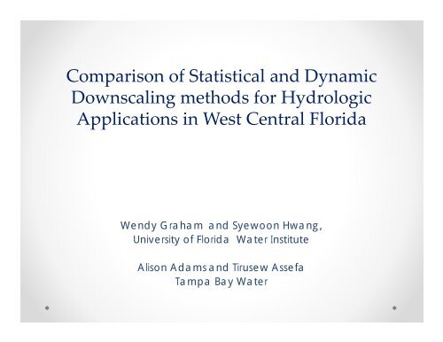
Comparison of Statistical and Dynamic Downscaling methods for ...
Comparison of Statistical and Dynamic Downscaling methods for ...
Comparison of Statistical and Dynamic Downscaling methods for ...

You also want an ePaper? Increase the reach of your titles
YUMPU automatically turns print PDFs into web optimized ePapers that Google loves.
<strong>Comparison</strong> <strong>of</strong> <strong>Statistical</strong> <strong>and</strong> <strong>Dynamic</strong><br />
<strong>Downscaling</strong> <strong>methods</strong> <strong>for</strong> Hydrologic<br />
Applications in West Central Florida<br />
Wendy Graham <strong>and</strong> Syewoon Hwang,<br />
University <strong>of</strong> Florida Water Institute<br />
Alison Adams <strong>and</strong> Tirusew Assefa<br />
Tampa Bay Water
Goal <strong>of</strong> the research<br />
• To compare the ability <strong>of</strong> three statistical downscaling <strong>methods</strong> <strong>and</strong> one<br />
dynamic downscaling to generate precipitation fields at hydrologically<br />
relevant space-time scales over the Tampa Bay region <strong>of</strong> west-central<br />
Florida.<br />
In this research we…<br />
• quantitatively evaluate the skills <strong>of</strong> existing <strong>methods</strong> in terms <strong>of</strong> both temporal <strong>and</strong><br />
spatial precipitation patterns.<br />
• develop a new stochastic downscaling technique which improves over the existing<br />
statistical downscaling <strong>methods</strong> in reproducing observed spatiotemporal variability <strong>of</strong><br />
daily precipitation<br />
• evaluate hydrologic implications <strong>of</strong> differences in downscaled climate scenarios over the<br />
study area using an existing integrated hydrologic model.<br />
2
General circulation models<br />
200~300km resolution<br />
reanalysis data<br />
1 GCM<br />
4 GCMs<br />
RCM (Misra et al)<br />
10 km resolution<br />
BCSD,SDBC,<br />
BCSA<br />
12 km resolution<br />
Evaluation <strong>of</strong><br />
climate in<strong>for</strong>mation<br />
Integrated Hydrologic Model<br />
Applications<br />
The impact assessment<br />
3
Data<br />
GCMs used in this study<br />
Modeling Group, Country<br />
Bjerknes Centre <strong>for</strong> Climate<br />
Research, Norway<br />
US Dept. <strong>of</strong><br />
Commerce/NOAA/Geophy<br />
sical Fluid <strong>Dynamic</strong>s<br />
Laboratory, USA<br />
Canadian Centre <strong>for</strong><br />
Climate Modeling &<br />
Analysis, Canada<br />
WCRP<br />
CMIP3*<br />
I.D.<br />
BCCR-<br />
BCM2.0<br />
GFDL-<br />
CM2.0<br />
CGCM3.1<br />
Primary<br />
Reference<br />
Furevik et<br />
al., 2003<br />
Delworth et<br />
al., 2006<br />
Flato <strong>and</strong><br />
Boer, 2001<br />
National Center <strong>for</strong><br />
Atmospheric Research, USA CCSM Collins et<br />
al., 2006<br />
* WCRP CMIP3: World Climate Research Programme's<br />
Coupled Model Inter-comparison Project phase 3<br />
Latitude<br />
31<br />
30<br />
29<br />
28<br />
27<br />
26<br />
25<br />
BCCR, 2.8 o x 2.8 o<br />
GFDL, 2.0 o x2.5 o<br />
CGCM3, 2.8 o x2.8 o<br />
CCSM, 1.4 o x1.4 o<br />
24<br />
-88 -87 -86 -85 -84 -83 -82 -81 -80<br />
Longitude<br />
Gridded observations<br />
12x12km 2 , 1/8 degree resolution: Maurer et al., 2002<br />
4
Method<br />
Schematic representation<br />
<strong>of</strong> the methodology<br />
5
Temporal Statistics<br />
Mean daily precipitation<br />
Std Dev daily precipitation<br />
Averaged daily preciptiation<br />
10<br />
8<br />
6<br />
4<br />
2<br />
Gobs<br />
R2+RCM<br />
CCSM+RCM<br />
CCSM+BCSD<br />
CCSM+SDBC<br />
CCSM+BCSA<br />
avg. std. <strong>of</strong> daily precipitation<br />
18<br />
14<br />
10<br />
6<br />
Gobs<br />
R2+RCM<br />
CCSM+RCM<br />
CCSM+BCSD<br />
CCSM+SDBC<br />
CCSM+BCSA<br />
0<br />
Jan Feb Mar Apr May Jun<br />
Jul Aug Sep Oct Nov Dec<br />
2<br />
Jan Feb Mar Apr May Jun<br />
Jul Aug Sep Oct Nov Dec
Transition Probability<br />
Wet to Wet<br />
Dry to Wet<br />
1<br />
0.8<br />
0.6<br />
Gobs<br />
R2+RCM<br />
CCSM+RCM<br />
CCSM+BCSD<br />
CCSM+SDBC<br />
CCSM+BCSA<br />
1<br />
0.8<br />
0.6<br />
Gobs<br />
R2+RCM<br />
CCSM+RCM<br />
CCSM+BCSD<br />
CCSM+SDBC<br />
CCSM+BCSA<br />
P11<br />
P01<br />
0.4<br />
0.4<br />
0.2<br />
0.2<br />
0<br />
Jan Feb Mar Apr May Jun<br />
Jul Aug Sep Oct Nov Dec<br />
0<br />
Jan Feb Mar Apr May Jun<br />
Jul Aug Sep Oct Nov Dec
Variograms (spatial variability analysis)<br />
Wet season (Jun.‐Sep.)<br />
Dry season (Oct.‐May)<br />
Variogram (mm 2 )<br />
400<br />
300<br />
200<br />
Gobs<br />
R2+RCM<br />
CCSM+RCM<br />
CCSM+BCSD<br />
CCSM+SDBC<br />
CCSM+BCSA<br />
Variogram (mm 2 )<br />
400<br />
300<br />
200<br />
Gobs<br />
R2+RCM<br />
CCSM+RCM<br />
CCSM+BCSD<br />
CCSM+SDBC<br />
CCSM+BCSA<br />
100<br />
100<br />
0<br />
0 100 200 300 400 500<br />
Separation distance (km)<br />
0<br />
0 100 200 300 400 500<br />
Separation distance (km)
General circulation models<br />
200~300km resolution<br />
reanalysis data<br />
1 GCM<br />
4 GCMs<br />
RCM (Misra et al)<br />
10 km resolution<br />
BCSD,SDBC,<br />
BCSA<br />
12 km resolution<br />
Evaluation <strong>of</strong><br />
climate in<strong>for</strong>mation<br />
Integrated Hydrologic Model<br />
Applications<br />
The impact assessment<br />
9
Method<br />
Integrated Hydrologic Model<br />
• TBW <strong>and</strong> SWFWMD commissioned the development <strong>and</strong> application <strong>of</strong> an integrated surface<br />
water/groundwater model <strong>for</strong> the Tampa Bay Region.<br />
• The Integrated Hydrologic Model (IHM) was developed which integrates the EPA Hydrologic<br />
Simulation Program-Fortran <strong>for</strong> surface-water modeling with the US Geological Survey<br />
MODFLOW96 <strong>for</strong> groundwater modeling.<br />
Ross et al., 2004 (IHM theory manual)<br />
10
Method<br />
Study domain<br />
11
Monthly average streamflow<br />
12<br />
0<br />
5<br />
10<br />
15<br />
20<br />
25<br />
Jan<br />
Feb<br />
Mar<br />
Apr<br />
May<br />
Jun<br />
Jul<br />
Aug<br />
Sep<br />
Oct<br />
Nov<br />
Dec<br />
Streamflow (m3/s)<br />
BCSD_GCMs<br />
Obs.<br />
Cal.<br />
Jan<br />
Feb<br />
Mar<br />
Apr<br />
May<br />
Jun<br />
Jul<br />
Aug<br />
Sep<br />
Oct<br />
Nov<br />
Dec<br />
SDBC_GCMs<br />
Obs.<br />
Cal.<br />
Jan<br />
Feb<br />
Mar<br />
Apr<br />
May<br />
Jun<br />
Jul<br />
Aug<br />
Sep<br />
Oct<br />
Nov<br />
Dec<br />
BCSA_GCMs<br />
Obs.<br />
Cal.<br />
0<br />
2<br />
4<br />
6<br />
8<br />
10<br />
Jan<br />
Feb<br />
Mar<br />
Apr<br />
May<br />
Jun<br />
Jul<br />
Aug<br />
Sep<br />
Oct<br />
Nov<br />
Dec<br />
Streamflow (m3/s)<br />
BCSD_GCMs<br />
Obs.<br />
Cal.<br />
Jan<br />
Feb<br />
Mar<br />
Apr<br />
May<br />
Jun<br />
Jul<br />
Aug<br />
Sep<br />
Oct<br />
Nov<br />
Dec<br />
SDBC_GCMs<br />
Obs.<br />
Cal.<br />
Jan<br />
Feb<br />
Mar<br />
Apr<br />
May<br />
Jun<br />
Jul<br />
Aug<br />
Sep<br />
Oct<br />
Nov<br />
Dec<br />
BCSA_GCMs<br />
Obs.<br />
Cal.<br />
Alafia River<br />
Cypress Creek<br />
BCSD SDBC BCSA<br />
BCSD SDBC BCSA
Mean <strong>of</strong> errors <strong>for</strong> monthly average streamflow<br />
Mean <strong>of</strong> errors (simulated-calibrated) <strong>for</strong> monthly average<br />
streamflow over four GCM results <strong>for</strong> each target station<br />
8<br />
Alafia River<br />
BCSD<br />
4<br />
Cypress Creek<br />
BCSD<br />
SDBC<br />
SDBC<br />
4<br />
BCSA<br />
2<br />
BCSA<br />
mean error (m 3 /s)<br />
0<br />
mean error (m 3 /s)<br />
0<br />
‐4<br />
‐2<br />
‐8<br />
‐4
Mean errors <strong>for</strong> daily streamflow st<strong>and</strong>ard deviation<br />
Mean <strong>of</strong> errors (simulated-calibrated) <strong>for</strong> daily streamflow<br />
st<strong>and</strong>ard deviation over four GCM results <strong>for</strong> each target<br />
station<br />
20<br />
Alafia River<br />
BCSD<br />
4<br />
Cypress Creek<br />
BCSD<br />
SDBC<br />
SDBC<br />
10<br />
BCSA<br />
2<br />
BCSA<br />
mean error (m 3 /s)<br />
0<br />
mean error (m 3 /s)<br />
0<br />
‐10<br />
‐2<br />
‐20<br />
‐4<br />
14
Frequency <strong>of</strong> daily streamflow events<br />
# <strong>of</strong> events per year<br />
# <strong>of</strong> events per year<br />
1000<br />
100<br />
10<br />
1<br />
0.1<br />
0.01<br />
1000<br />
100<br />
10<br />
1<br />
0.1<br />
0.01<br />
Streamflow (m3/s)<br />
Alafia River<br />
Obs.<br />
Cal.<br />
BCSD_GCMs<br />
SDBC_GCMs<br />
BCSA_GCMs<br />
0 100 200 300 400 500 600<br />
Streamflow (m3/s)<br />
Cypress Creek<br />
Obs.<br />
Cal.<br />
BCSD_GCMs<br />
SDBC_GCMs<br />
BCSA_GCMs<br />
0 10 20 30 40 50 60 70<br />
• The frequency <strong>of</strong> daily streamflow was not reproduced by SDBC as closely as <strong>for</strong> the BCSA results.<br />
• Comparing the , it is evident that the under/overestimations <strong>of</strong> extreme events is canceled out when<br />
evaluating only the monthly mean streamflow.
Conclusions<br />
• Commonly used BCSD method underestimates spatial <strong>and</strong> temporal variability <strong>of</strong><br />
rainfall, <strong>and</strong> over estimates number <strong>of</strong> low precipitation days. These errors<br />
propagate into hydrologic predictions producing higher ET <strong>and</strong> lower<br />
streamflow predictions in summer months<br />
• SDBC method improves estimates <strong>of</strong> day-to-day temporal variability at fine gridscale,<br />
but underestimates spatial variability <strong>of</strong> rainfall <strong>and</strong> thus overestimates<br />
temporal variability <strong>of</strong> spatially averaged rainfall. As a result SDBC successfully<br />
reproduces mean monthly streamflow, but significantly overestimates<br />
magnitude <strong>of</strong> peak streamflow events.<br />
• BCSA method reproduces spatial <strong>and</strong> temporal variability <strong>of</strong> rainfall accurately<br />
<strong>and</strong> successfully reproduces mean monthly streamflow. However BCSA slightly<br />
overestimates magnitude <strong>of</strong> peak streamflow events <strong>for</strong> the larger river.<br />
16
Conclusions<br />
• <strong>Dynamic</strong>ally downscaled results show promise, especially<br />
when driven by reanalysis data. Hydrologic implications <strong>of</strong><br />
higher than observed spatial variability <strong>and</strong> temporal<br />
variability <strong>of</strong> local rainfall will be investigated.<br />
• <strong>Dynamic</strong>ally downscaled retrospective GCM predictions are<br />
way <strong>of</strong>f! Does it make sense to both dynamically downscale<br />
AND bias-correct these results?<br />
17
Future work<br />
• Evaluate the utility <strong>of</strong> using various downscaling <strong>methods</strong> with<br />
seasonal GCM predictions <strong>and</strong> long-term projections <strong>of</strong><br />
climate change scenarios in the Tampa Bay region.<br />
• Assess the potential to use downscaled seasonal predictions to<br />
reduce risk <strong>for</strong> water management operations in the Tampa<br />
Bay region.<br />
• Assess potential future climate change impacts on the<br />
hydrologic system in west-central Florida.<br />
18