Use of Rational and Modified Rational Method for ... - CTR Library
Use of Rational and Modified Rational Method for ... - CTR Library
Use of Rational and Modified Rational Method for ... - CTR Library

Create successful ePaper yourself
Turn your PDF publications into a flip-book with our unique Google optimized e-Paper software.
NOTICE<br />
The United States Government <strong>and</strong> the State <strong>of</strong> Texas do not endorse products or manufacturers.<br />
Trade or manufacturers’ names appear herein solely because they are considered essential to the<br />
object <strong>of</strong> this report.<br />
i
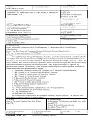
Technical Report Documentation Page<br />
1. Report No.:<br />
2. Government Accession No.: 3. Recipient’s Catalog No.:<br />
FHWA/TX–08/0–6070–1<br />
4. Title <strong>and</strong> Subtitle:<br />
<strong>Use</strong> <strong>of</strong> the <strong>Rational</strong> <strong>and</strong> <strong>Modified</strong> <strong>Rational</strong> <strong>Method</strong> <strong>for</strong> Hydraulic Design<br />
5. Report Date:<br />
February 28, 2011<br />
6. Per<strong>for</strong>ming Organization Code:<br />
7. Author(s):<br />
Theodore G. Clevel<strong>and</strong>, David B. Thompson, <strong>and</strong> Xing Fang<br />
9. Per<strong>for</strong>ming Organization Name <strong>and</strong> Address:<br />
Texas Tech University<br />
College <strong>of</strong> Engineering<br />
Box 41023<br />
Lubbock, Texas 79409-1023<br />
12. Sponsoring Agency Name <strong>and</strong> Address<br />
Texas Department <strong>of</strong> Transportation<br />
Research <strong>and</strong> Technology Implementation Office<br />
P. O. Box 5080<br />
Austin, TX 78763-5080<br />
8. Per<strong>for</strong>ming Organization<br />
Report No. 0–6070–1<br />
10. Work Unit No. (TRAIS):<br />
11. Contract or Grant No. :<br />
Project 0–6070<br />
13. Type <strong>of</strong> Report <strong>and</strong> Period<br />
Cover:<br />
Technical Report: September 2007–<br />
August 2010<br />
14. Sponsoring Agency Code:<br />
15. Supplementary Notes:<br />
This study was conducted in cooperation with the Texas Department <strong>of</strong> Transportation <strong>and</strong> the Federal Highway<br />
Administration.<br />
16. Abstract:<br />
This report examines the rational <strong>and</strong> modified rational methods using rainfall-run<strong>of</strong>f datasets developed from<br />
Texas watersheds <strong>for</strong> application to Texas Department <strong>of</strong> Transportation hydraulic design problems.<br />
A unified rational method <strong>for</strong> Texas (URAT) is proposed as an alternative to the conventional method in current<br />
use. URAT substitutes l<strong>and</strong>-use specification, slope influence, <strong>and</strong> probability adjustments to run<strong>of</strong>f coefficients by<br />
a simple area-weighted coefficient based on functional impervious cover. URAT incorporates the effect <strong>of</strong> slope<br />
<strong>and</strong> probability adjustments in the specification <strong>of</strong> the watershed time <strong>of</strong> equivalence, a characteristic time that<br />
makes rational peak discharges <strong>and</strong> regression equation peak discharges equal at some specified recurrence interval.<br />
An extended application (example) is presented to illustrate how to use the URAT method <strong>for</strong> both peak discharge<br />
<strong>and</strong> hydrograph estimation. Several appendices document various approaches examined, <strong>and</strong> provide an extensive<br />
examination into the run<strong>of</strong>f coefficient.<br />
17. Key Words<br />
Hydrology, hydraulics, rational method, modified<br />
rational method<br />
19. Security Classif. (<strong>of</strong> this report)<br />
Unclassified<br />
Form DOT F 1700.7 (8-72)<br />
20. Security Classif. (<strong>of</strong> this page)<br />
Unclassified<br />
18. Distribution Statement<br />
No restrictions. Document available to public<br />
through National Technical In<strong>for</strong>mation Service,<br />
Springfield, VA 22161, www.ntis.gov<br />
21. No. Pages<br />
157<br />
22. Price
This page intentionally left blank.<br />
iii
<strong>Use</strong> <strong>of</strong> the <strong>Rational</strong> <strong>and</strong> <strong>Modified</strong> <strong>Rational</strong> <strong>Method</strong>s <strong>for</strong> TxDOT Hydraulic Design<br />
by<br />
Theodore G. Clevel<strong>and</strong><br />
David B. Thompson<br />
Xing Fang<br />
with select contributions by<br />
William H. Asquith<br />
Research Report Number 0‐6070‐1<br />
Project Number 0‐6070<br />
<strong>Use</strong> <strong>of</strong> the <strong>Rational</strong> <strong>and</strong> <strong>Modified</strong> <strong>Rational</strong> <strong>Method</strong>s <strong>for</strong> TxDOT Hydraulic Design<br />
Sponsored by the Texas Department <strong>of</strong> Transportation<br />
in cooperation with the<br />
U.S. Department <strong>of</strong> Transportation Federal Highway Administration<br />
Texas Tech Center <strong>for</strong> Multidisciplinary Research in Transportation<br />
TechMRT<br />
Texas Tech University<br />
Box 41023<br />
Lubbock, TX 79409‐1023<br />
February 2011
AUTHOR’S DISCLAIMER<br />
The contents <strong>of</strong> this report reflect the views <strong>of</strong> the authors who are responsible <strong>for</strong> the facts <strong>and</strong> the<br />
accuracy <strong>of</strong> the data presented herein. The contents do not necessarily reflect the <strong>of</strong>ficial view <strong>of</strong><br />
policies <strong>of</strong> the Texas Department <strong>of</strong> Transportation or the Federal Highway Administration. This<br />
report does not constitute a st<strong>and</strong>ard, specification, or regulation.<br />
PATENT DISCLAIMER<br />
There was no invention or discovery conceived or first actually reduced to practice in the course<br />
<strong>of</strong> or under this contract, including any art, method, process, machine, manufacture, design or<br />
composition <strong>of</strong> matter, or any new useful improvement there<strong>of</strong>, or any variety <strong>of</strong> plant which<br />
is or may be patentable under the patent laws <strong>of</strong> the United States <strong>of</strong> America or any <strong>for</strong>eign<br />
country.<br />
ENGINEERING DISCLAIMER<br />
This document is not intended <strong>for</strong> construction, bidding, or permit purposes.<br />
TRADE NAMES AND MANUFACTURERS’ NAMES<br />
Neither the United States Government nor the State <strong>of</strong> Texas endorse products or manufacturers.<br />
Trade or manufacturers’ names appear herein solely because they are considered essential to the<br />
object <strong>of</strong> this report.<br />
v
This page intentionally left blank.<br />
vi
Acknowledgements<br />
A project <strong>of</strong> the magnitude <strong>of</strong> TxDOT Project 0–6070 cannot be completed without the contributions<br />
<strong>of</strong> a large number <strong>of</strong> individuals beyond the principal investigators. The service <strong>of</strong> TxDOT engineers<br />
David Stolpa <strong>and</strong> George “Rudy” Herrmann began early in the conceptual stages <strong>of</strong> the project<br />
be<strong>for</strong>e a problem statement was even developed. Their contributions were supplemented by other<br />
TxDOT advisors, including Chuck Steed (Project Director), Amy Ronnfeldt, Elie Alkhoury, Kathy<br />
Dyer, Mark Mikulenka, Jaime Villena-Morales, <strong>and</strong> David Zwernemann.<br />
vii
Contents<br />
1 Background 1<br />
1.1 Introduction . . . . . . . . . . . . . . . . . . . . . . . . . . . . . . . . . . . . . . . . . 1<br />
1.2 Objectives . . . . . . . . . . . . . . . . . . . . . . . . . . . . . . . . . . . . . . . . . . 2<br />
1.3 Organization . . . . . . . . . . . . . . . . . . . . . . . . . . . . . . . . . . . . . . . . 3<br />
2 Technical Aspects <strong>of</strong> the <strong>Rational</strong> <strong>Method</strong> 4<br />
2.1 The <strong>Rational</strong> <strong>Method</strong> . . . . . . . . . . . . . . . . . . . . . . . . . . . . . . . . . . . 4<br />
2.1.1 The Run<strong>of</strong>f Coefficient . . . . . . . . . . . . . . . . . . . . . . . . . . . . . . . 4<br />
2.1.2 The Drainage Area . . . . . . . . . . . . . . . . . . . . . . . . . . . . . . . . . 6<br />
2.1.3 The Characteristic Time . . . . . . . . . . . . . . . . . . . . . . . . . . . . . . 7<br />
2.1.4 Summary <strong>and</strong> Important Implications <strong>for</strong> the <strong>Rational</strong> <strong>Method</strong> . . . . . . . . 8<br />
2.2 The <strong>Modified</strong> <strong>Rational</strong> <strong>Method</strong> . . . . . . . . . . . . . . . . . . . . . . . . . . . . . . 9<br />
2.2.1 <strong>Modified</strong> <strong>Rational</strong> <strong>Method</strong> Run<strong>of</strong>f Coefficient . . . . . . . . . . . . . . . . . . 13<br />
2.2.2 <strong>Modified</strong> <strong>Rational</strong> <strong>Method</strong> Characteristic Time . . . . . . . . . . . . . . . . . 16<br />
2.2.3 Summary <strong>and</strong> Important Implications <strong>for</strong> the <strong>Modified</strong> <strong>Rational</strong> <strong>Method</strong> . . . 17<br />
3 A Proposed Unified <strong>Rational</strong> <strong>Method</strong> <strong>for</strong> Texas<br />
Some Research Contributions by William H. Asquith 18<br />
3.1 Run<strong>of</strong>f Coefficient <strong>for</strong> the Unified <strong>Rational</strong> <strong>Method</strong> <strong>for</strong> Texas . . . . . . . . . . . . . 19<br />
3.2 Example Computations <strong>and</strong> Discussion <strong>for</strong> Unified <strong>Rational</strong> <strong>Method</strong> <strong>for</strong> Texas . . . 23<br />
3.2.1 Statewide Watershed Time <strong>of</strong> Equivalence in Texas . . . . . . . . . . . . . . . 23<br />
3.2.2 Spatial Influence on 10-year T-star . . . . . . . . . . . . . . . . . . . . . . . . 24<br />
3.2.3 Relative Influence <strong>of</strong> Recurrence Interval on T-star <strong>for</strong> Two Low-Slope Settings 25<br />
3.2.4 Comparison <strong>of</strong> Unified <strong>Rational</strong> <strong>Method</strong> <strong>for</strong> Houston Metropolitan Area<br />
(Harris County) to Harris County Flood Control District Site-Run<strong>of</strong>f Curves 26<br />
3.2.5 Using the Unified <strong>Rational</strong> <strong>Method</strong> <strong>for</strong> Computation <strong>of</strong> Peak-Streamflow<br />
Frequency . . . . . . . . . . . . . . . . . . . . . . . . . . . . . . . . . . . . . . 26<br />
3.2.6 Computation <strong>of</strong> Upper Bound <strong>of</strong> Streamflow Estimates . . . . . . . . . . . . 29<br />
3.3 Summary <strong>of</strong> a Proposed Unified <strong>Rational</strong> <strong>Method</strong> <strong>for</strong> Texas . . . . . . . . . . . . . . 29<br />
4 Example Applications 59<br />
4.1 Example Application <strong>for</strong> Peak Discharge Estimation (Forward Modeling) . . . . . . 59<br />
4.1.1 Using a Conventional <strong>Rational</strong> <strong>Method</strong> . . . . . . . . . . . . . . . . . . . . . 59<br />
4.1.2 Using the Unified <strong>Rational</strong> <strong>Method</strong> <strong>for</strong> Texas . . . . . . . . . . . . . . . . . . 62<br />
4.1.3 Comparison <strong>and</strong> Contrast <strong>of</strong> the Two <strong>Method</strong>s . . . . . . . . . . . . . . . . . 63<br />
viii
4.2 Application <strong>of</strong> the <strong>Modified</strong> <strong>Rational</strong> <strong>Method</strong> Parameterized by the Unified <strong>Rational</strong><br />
<strong>Method</strong> . . . . . . . . . . . . . . . . . . . . . . . . . . . . . . . . . . . . . . . . . . . 63<br />
4.2.1 Non-Uni<strong>for</strong>m Rainfall . . . . . . . . . . . . . . . . . . . . . . . . . . . . . . . 68<br />
4.2.2 Characteristic Time Assessment . . . . . . . . . . . . . . . . . . . . . . . . . 69<br />
4.3 Regression Equation Adjustments . . . . . . . . . . . . . . . . . . . . . . . . . . . . . 70<br />
5 Summary <strong>and</strong> Conclusions 74<br />
5.1 Summary . . . . . . . . . . . . . . . . . . . . . . . . . . . . . . . . . . . . . . . . . . 74<br />
5.2 Conclusions . . . . . . . . . . . . . . . . . . . . . . . . . . . . . . . . . . . . . . . . . 75<br />
5.3 Further Work . . . . . . . . . . . . . . . . . . . . . . . . . . . . . . . . . . . . . . . . 76<br />
5.3.1 Additional Research . . . . . . . . . . . . . . . . . . . . . . . . . . . . . . . . 76<br />
5.3.2 Implementation <strong>of</strong> Results . . . . . . . . . . . . . . . . . . . . . . . . . . . . . 77<br />
A Literature Review 84<br />
A.1 Introduction . . . . . . . . . . . . . . . . . . . . . . . . . . . . . . . . . . . . . . . . 84<br />
A.2 Background . . . . . . . . . . . . . . . . . . . . . . . . . . . . . . . . . . . . . . . . 85<br />
A.2.1 <strong>Modified</strong> <strong>Rational</strong> <strong>Method</strong> — Background . . . . . . . . . . . . . . . . . . . . 87<br />
A.3 <strong>Rational</strong> <strong>Method</strong> Studies . . . . . . . . . . . . . . . . . . . . . . . . . . . . . . . . . . 88<br />
A.3.1 <strong>Modified</strong> <strong>Rational</strong> <strong>Method</strong> . . . . . . . . . . . . . . . . . . . . . . . . . . . . . 91<br />
A.3.2 Concluding Remarks . . . . . . . . . . . . . . . . . . . . . . . . . . . . . . . . 92<br />
A.4 Characteristic Time . . . . . . . . . . . . . . . . . . . . . . . . . . . . . . . . . . . . 93<br />
A.5 The Run<strong>of</strong>f Coefficient . . . . . . . . . . . . . . . . . . . . . . . . . . . . . . . . . . . 95<br />
A.5.1 St<strong>and</strong>ard <strong>Rational</strong> Run<strong>of</strong>f Coefficients . . . . . . . . . . . . . . . . . . . . . . 95<br />
A.5.2 Run<strong>of</strong>f Coefficients Based on Water Budgets <strong>and</strong> Long-Term Basin Scale Studies 99<br />
A.6 Summary <strong>and</strong> Conclusions . . . . . . . . . . . . . . . . . . . . . . . . . . . . . . . . . 100<br />
B Basin Development Factor 102<br />
C The iPar Program <strong>and</strong> Parsing <strong>of</strong> Rainfall <strong>and</strong> Run<strong>of</strong>f Events 106<br />
C.1 Inverting the <strong>Rational</strong> <strong>Method</strong> . . . . . . . . . . . . . . . . . . . . . . . . . . . . . . 106<br />
C.1.1 The <strong>Rational</strong> <strong>Method</strong> <strong>for</strong> Real Storms . . . . . . . . . . . . . . . . . . . . . . 107<br />
C.1.2 Regression <strong>of</strong> Time-R (Lag Time) . . . . . . . . . . . . . . . . . . . . . . . . 111<br />
C.1.3 Distribution <strong>of</strong> C R <strong>and</strong> Relation between C R <strong>and</strong> Drainage Area <strong>and</strong> Basin-<br />
Development Factor . . . . . . . . . . . . . . . . . . . . . . . . . . . . . . . . 119<br />
C.2 Algorithms <strong>of</strong> the Unified <strong>Rational</strong> <strong>Method</strong> Appendix . . . . . . . . . . . . . . . . . 121<br />
D <strong>Modified</strong> <strong>Rational</strong> <strong>Method</strong> 130<br />
D.1 <strong>Modified</strong> <strong>Rational</strong> <strong>Method</strong> <strong>for</strong> Texas Watersheds . . . . . . . . . . . . . . . . . . . . 130<br />
D.2 Run<strong>of</strong>f Coefficients <strong>and</strong> Time <strong>of</strong> Concentration . . . . . . . . . . . . . . . . . . . . . 130<br />
D.3 Estimated Run<strong>of</strong>f Hydrographs Using the MRM . . . . . . . . . . . . . . . . . . . . 132<br />
D.4 Comparison <strong>of</strong> MRM Results <strong>and</strong> Other Unit Hydrograph <strong>Method</strong>s . . . . . . . . . . 137<br />
ix
List <strong>of</strong> Tables<br />
3.1 Countywide values <strong>of</strong> mean-annual precipitation <strong>and</strong> OmegaEM parameter. . . . . . 30<br />
3.2 Countywide values <strong>of</strong> scale factor <strong>for</strong> unified rational method in Texas. . . . . . . . . 34<br />
3.3 Countywide values <strong>of</strong> exponent on drainage area <strong>for</strong> unified rational method. . . . . 41<br />
3.4 Countywide values <strong>of</strong> exponent on dimensionless main-channel slope. . . . . . . . . . 48<br />
3.5 Comparison <strong>of</strong> Dickens County example peak streamflow frequency estimates. . . . . 54<br />
A.1 <strong>Rational</strong> method run<strong>of</strong>f coefficients <strong>for</strong> various l<strong>and</strong> uses (St<strong>and</strong>ard C std ). . . . . . . 96<br />
D.1 Run<strong>of</strong>f coefficients used in the modified rational method. . . . . . . . . . . . . . . . . 133<br />
x
List <strong>of</strong> Figures<br />
2.1 The MRM hydrograph when duration <strong>of</strong> rainfall is equal to T c , from Wanielista<br />
<strong>and</strong> others (1997a). . . . . . . . . . . . . . . . . . . . . . . . . . . . . . . . . . . . . 9<br />
2.2 The MRM hydrograph when duration <strong>of</strong> rainfall is greater than T c . . . . . . . . . . 10<br />
2.3 The MRM hydrograph when duration <strong>of</strong> rainfall is less than T c . . . . . . . . . . . . . 11<br />
2.4 The instantaneous unit hydrograph <strong>of</strong> the rational method (Singh <strong>and</strong> Cruise, 1992). 12<br />
2.5 The D-hour unit hydrograph <strong>of</strong> the rational method <strong>for</strong> D < T c (Singh <strong>and</strong> Cruise,<br />
1992). . . . . . . . . . . . . . . . . . . . . . . . . . . . . . . . . . . . . . . . . . . . . 12<br />
2.6 Cumulative distributions <strong>of</strong> the run<strong>of</strong>f coefficients Cv bc (solid) <strong>and</strong> Cv lit (dashed). . . 15<br />
2.7 Modeled <strong>and</strong> observed peak discharge from Cv<br />
bc (solid triangle) <strong>and</strong> Cv<br />
lit (open circle)<br />
with timing parameters derived from the Kerby-Kirpich method. . . . . . . . . . . . 15<br />
2.8 Modeled <strong>and</strong> observed time to peak from Cv<br />
bc (blue) <strong>and</strong> Cv<br />
lit (black) with timing<br />
parameters from the Kerby-Kirpich method. . . . . . . . . . . . . . . . . . . . . . . . 16<br />
3.1 Intercept <strong>of</strong> regression by county <strong>for</strong> unified rational method in Texas . . . . . . . . 55<br />
3.2 Exponent on drainage area <strong>for</strong> unified rational method in Texas . . . . . . . . . . . . 56<br />
3.3 Exponent on dimensionless main-channel slope <strong>for</strong> unified rational method in Texas 57<br />
3.4 Estimated peak-streamflow frequency curves <strong>of</strong> Unified <strong>Rational</strong> <strong>Method</strong> <strong>for</strong> Texas<br />
<strong>for</strong> the Dickens county example . . . . . . . . . . . . . . . . . . . . . . . . . . . . . . 58<br />
4.1 Subdivision X Drainage to a Highway Culvert . . . . . . . . . . . . . . . . . . . . . . 60<br />
4.2 Depth-Duration diagram <strong>for</strong> Harris County <strong>for</strong> the application example. Values are<br />
from maps in Asquith <strong>and</strong> Roussel (2004). Dashed line is used to extrapolate mapped<br />
values to unmapped durations. . . . . . . . . . . . . . . . . . . . . . . . . . . . . . . 62<br />
4.3 <strong>Modified</strong> rational method run<strong>of</strong>f hydrograph <strong>for</strong> example drainage area. Applied<br />
storm duration is equal to the watershed characteristic time. . . . . . . . . . . . . . 65<br />
4.4 <strong>Modified</strong> rational method run<strong>of</strong>f hydrograph <strong>for</strong> example drainage area. Applied<br />
storm duration is equal to the watershed characteristic time T ∗ = 10 minutes. The<br />
peak discharge is Q p = 57.1 cfs; the same as the URAT peak estimate. . . . . . . . . 66<br />
4.5 <strong>Modified</strong> rational method run<strong>of</strong>f hydrograph <strong>for</strong> example drainage area. Applied<br />
storm duration T D = 60 minutes is six times the watershed characteristic time <strong>of</strong><br />
T ∗ = 10 minutes. . . . . . . . . . . . . . . . . . . . . . . . . . . . . . . . . . . . . . . 67<br />
4.6 <strong>Modified</strong> rational method run<strong>of</strong>f hydrograph <strong>for</strong> example drainage area. Applied<br />
storm duration T D = 60 minutes is six times the watershed characteristic time <strong>of</strong><br />
T ∗ = 10 minutes. The peak discharge is Q p = 23.1 cfs <strong>and</strong> is sustained <strong>for</strong> 50 minutes. 68<br />
4.7 <strong>Modified</strong> rational method run<strong>of</strong>f hydrograph <strong>for</strong> example drainage area. Applied<br />
storm is non-uni<strong>for</strong>m. Q p = 71.4 cfs at 35 minutes. . . . . . . . . . . . . . . . . . . 69<br />
xi
4.8 <strong>Modified</strong> rational method run<strong>of</strong>f hydrograph <strong>for</strong> example drainage area. Applied<br />
storm is non-uni<strong>for</strong>m. Watershed characteristic time increased to T ∗ = 15 minutes.<br />
Q p = 47.6 cfs at 35 minutes. . . . . . . . . . . . . . . . . . . . . . . . . . . . . . . . 70<br />
4.9 Flowchart <strong>of</strong> application <strong>of</strong> Unified <strong>Rational</strong> <strong>Method</strong> <strong>for</strong> Texas. . . . . . . . . . . . . 71<br />
4.10 Unified <strong>Rational</strong> <strong>Method</strong> – Forward Modeling Pathway. Result is a peak discharge<br />
estimate <strong>for</strong> a location in Texas <strong>for</strong> a specified frequency. . . . . . . . . . . . . . . . . 72<br />
4.11 Unified <strong>Rational</strong> <strong>Method</strong> – Regression Equation Adjustment. Result is an adjusted<br />
peak discharge to reflect potential infrastructure additions in Texas <strong>for</strong> a specified<br />
frequency. . . . . . . . . . . . . . . . . . . . . . . . . . . . . . . . . . . . . . . . . . . 73<br />
A.1 Run<strong>of</strong>f generation in rational model. . . . . . . . . . . . . . . . . . . . . . . . . . . . 86<br />
A.2 <strong>Modified</strong> <strong>Rational</strong> Formula Hydrographs by Poertner (1974). Adapted from Thompson<br />
(2006). . . . . . . . . . . . . . . . . . . . . . . . . . . . . . . . . . . . . . . . . . 88<br />
A.3 <strong>Modified</strong> <strong>Rational</strong> Formula Hydrographs by Aron <strong>and</strong> Kibler (1990). Adapted from<br />
Thompson (2006). . . . . . . . . . . . . . . . . . . . . . . . . . . . . . . . . . . . . . 92<br />
A.4 Run<strong>of</strong>f Coefficients <strong>for</strong> Texas from Ward (2005). . . . . . . . . . . . . . . . . . . . . 100<br />
B.1 Schematic <strong>of</strong> typical drainage basin shapes <strong>and</strong> subdivision into basin thirds. . . . . 103<br />
C.1 Overview <strong>of</strong> the rainfall- <strong>and</strong> run<strong>of</strong>f-parsing process using the iPAR program inclusive<br />
<strong>of</strong> definitions <strong>of</strong> selected metrics <strong>and</strong> computational verses conceptual availability<br />
with a specific focus on the square-root-<strong>of</strong>-area rule <strong>for</strong> first order estimation <strong>of</strong> time<br />
<strong>of</strong> concentration . . . . . . . . . . . . . . . . . . . . . . . . . . . . . . . . . . . . . . . 109<br />
C.2 Screenshot <strong>of</strong> the iPAR program used to parse a historically significant flood event on<br />
May 24, 1981 at U.S. Geological Survey streamflow-gaging station 08156800 Shoal<br />
Creek at 12th Street, Austin, Texas, which has a drainage area <strong>of</strong> about 12.3 square<br />
miles. . . . . . . . . . . . . . . . . . . . . . . . . . . . . . . . . . . . . . . . . . . . . 110<br />
C.3 Screenshot <strong>of</strong> output <strong>for</strong> the parsed storm in Figure C.2 depicting the relation between<br />
the run<strong>of</strong>f coefficient <strong>of</strong> rational method computed in hind-casting mode <strong>and</strong> rainfall<br />
duration (characteristic time) <strong>for</strong> each successively incremented <strong>and</strong> aggregated,<br />
5-minute window, which has been swept through the parsed rainfall (white window in<br />
top plot <strong>of</strong> figure C.2) to determine maximum rainfall intensity <strong>for</strong> indicated duration.112<br />
C.4 St<strong>and</strong>ard residual <strong>and</strong> diagnostic plots from the R environment using the plot.lm()<br />
function <strong>for</strong> the T R regression equation. . . . . . . . . . . . . . . . . . . . . . . . . . 115<br />
C.5 Relation between Time-R <strong>and</strong> drainage area <strong>and</strong> basin-development factor by watershed<br />
type <strong>for</strong> observed (median, plot A) values <strong>and</strong> those estimated by regression<br />
(plot B). . . . . . . . . . . . . . . . . . . . . . . . . . . . . . . . . . . . . . . . . . . . 118<br />
C.6 Relation between C R <strong>and</strong> drainage area <strong>and</strong> basin-development factor (BDF ) by<br />
watershed type <strong>for</strong> median observed values. . . . . . . . . . . . . . . . . . . . . . . . 120<br />
D.1 Cumulative distributions <strong>of</strong> the run<strong>of</strong>f coefficients Cv<br />
bc (red) <strong>and</strong> Cv lit (black). . . . . 132<br />
D.2 Modeled <strong>and</strong> observed peak discharge from Cv bc <strong>and</strong> different timing parameters. . . 134<br />
D.3 Modeled <strong>and</strong> observed time to peak <strong>for</strong> Cv bc <strong>and</strong> different timing parameters. . . . . 134<br />
D.4 Modeled <strong>and</strong> observed time to peak <strong>for</strong> Cv lit <strong>and</strong> different timing parameters. . . . . 135<br />
xii
D.5 Modeled <strong>and</strong> observed peak discharge from Cv<br />
bc (green) <strong>and</strong> Cv<br />
lit (black) with timing<br />
parameters derived from the Kerby-Kirpich method. . . . . . . . . . . . . . . . . . . 136<br />
D.6 Modeled <strong>and</strong> observed time to peak from Cv<br />
bc (blue) <strong>and</strong> Cv<br />
lit (black) with timing<br />
parameters from the Kerby-Kirpich method. . . . . . . . . . . . . . . . . . . . . . . . 136<br />
D.7 Cumulative distribution <strong>of</strong> deviations (modeled Q p - observed Q p ) from Q p, obs <strong>for</strong><br />
Q p, bc using Kerby-Kirpich <strong>and</strong> C vbc (black curve), Q p, lit using Kerby-Kirpich <strong>and</strong><br />
C lit (blue curve), Q p, bc using square-root-area <strong>and</strong> C v, bc (green curve) <strong>and</strong> Q p, lit<br />
using square root <strong>of</strong> the drainage area <strong>and</strong> C lit (red curve). . . . . . . . . . . . . . . 137<br />
D.8 Unit hydrographs <strong>for</strong> USGS Streamflow-gaging Station 08048600. . . . . . . . . . . . 139<br />
D.9 Hyetographs <strong>and</strong> hydrographs <strong>for</strong> USGS Streamflow-gaging Stations 08048500 <strong>and</strong><br />
08139000. . . . . . . . . . . . . . . . . . . . . . . . . . . . . . . . . . . . . . . . . . . 140<br />
D.10 Hyetographs <strong>and</strong> hydrographs <strong>for</strong> USGS Streamflow-gaging Station 08139000. . . . . 141<br />
D.11 Modeled <strong>and</strong> observed peak discharge from modified rational method (green) <strong>and</strong><br />
HEC-1 unit hydrograph method (black). . . . . . . . . . . . . . . . . . . . . . . . . 141<br />
D.12 Modeled <strong>and</strong> observed peak discharge from modified rational method (green) <strong>and</strong><br />
gamma unit hydrograph method (black). . . . . . . . . . . . . . . . . . . . . . . . . 142<br />
D.13 Cumulative distributions <strong>of</strong> differences <strong>of</strong> simulated Q p between different methods.<br />
The green curve is <strong>for</strong> differences <strong>of</strong> simulated Q p between Clark <strong>and</strong> MRM unit<br />
hydrographs, <strong>and</strong> the red curve is <strong>for</strong> differences <strong>of</strong> simulated Q p between gamma<br />
<strong>and</strong> MRM unit hydrographs. . . . . . . . . . . . . . . . . . . . . . . . . . . . . . . . 142<br />
xiii
1. Background<br />
The purpose <strong>of</strong> this report is to document TxDOT Research Project 0–6070 <strong>and</strong> to present guidelines<br />
to assist TxDOT designers in application <strong>of</strong> the rational method <strong>for</strong> development <strong>of</strong> design discharges<br />
<strong>and</strong> design hydrographs <strong>for</strong> small watersheds. This section <strong>of</strong> the report summarizes background<br />
in<strong>for</strong>mation relevant to the research <strong>and</strong> explains the organization <strong>of</strong> the report.<br />
1.1. Introduction<br />
Texas Department <strong>of</strong> Transportation (TxDOT) analysts design roadways <strong>and</strong> proximal infrastructure.<br />
Each year, billions <strong>of</strong> dollars are spent on new construction 1 . The infrastructure must accommodate<br />
storm-water drainage <strong>and</strong> conveyance.<br />
The rational method (Mulvaney, 1850; Kuichling, 1889) is a tool <strong>for</strong> estimating peak (maximum)<br />
discharge from relatively small drainage areas. It [the rational method] predates the automobile<br />
age. TxDOT guidance is that the rational method should be applied to watersheds with drainage<br />
areas <strong>of</strong> 200 acres or less 2 . The rational method relates peak discharge to contributing drainage<br />
area, average rainfall intensity <strong>for</strong> a duration equal to a watershed response time (typically the<br />
time <strong>of</strong> concentration), <strong>and</strong> a coefficient that represents hydrologic abstractions <strong>and</strong> hydrograph<br />
attenuation. The coefficient is generally termed the run<strong>of</strong>f coefficient <strong>and</strong> has a range from 0 (no<br />
peak discharge or run<strong>of</strong>f produced <strong>for</strong> a given rainfall intensity) to 1 (perfect conversion <strong>of</strong> rainfall<br />
intensity to a peak discharge). Equation 1.1 is representative <strong>of</strong> the rational method.<br />
Q p = CiA (1.1)<br />
In equation 1.1, C is the run<strong>of</strong>f coefficient (dimensionless if all other terms are in consistent length<br />
<strong>and</strong> time units) that relates the ratio <strong>of</strong> input volume rate (the product iA) to the output volume<br />
rate Q p (peak discharge). The various assumptions <strong>of</strong> the method are listed in the TxDOT design<br />
manual, <strong>of</strong> particular note is that the run<strong>of</strong>f coefficient can vary with rainfall intensity i. The rainfall<br />
intensity i is, by originating arguments, the rainfall rate when the duration <strong>of</strong> rainfall equals the<br />
time <strong>of</strong> concentration.<br />
1 As described by George “Rudy” Herrmann, TxDOT, on March 10, 2006, approximately 40 percent <strong>of</strong> construction<br />
dollars are spent on drainage-related facilities.<br />
2 Hydraulic Design Manual, p. 5–29, TxDOT 3/2004, located electronically at http://manuals.dot.state.tx.us/<br />
dynaweb/colbridg/hyd at the time <strong>of</strong> this writing.<br />
1
The modified rational method extends the idea to parameterize simple run<strong>of</strong>f hydrographs (typically<br />
triangular), where the peak <strong>of</strong> the hydrograph is the peak discharge estimated by application <strong>of</strong><br />
the rational method, <strong>and</strong> the time base <strong>of</strong> the hydrograph (start-to-finish) is twice the time <strong>of</strong><br />
concentration.<br />
Because the rational method remains in common use by TxDOT as well as the broader waterresources<br />
community, TxDOT research supervisory personnel issued a problem statement titled<br />
<strong>Use</strong> <strong>of</strong> the rational <strong>and</strong> modified rational methods <strong>for</strong> TxDOT hydraulic design in the spring <strong>of</strong><br />
2007.<br />
A number <strong>of</strong> issues are associated with use <strong>of</strong> the rational method <strong>for</strong> estimating peak discharges<br />
<strong>for</strong> design <strong>of</strong> drainage structures, <strong>and</strong> when the modified rational method is used to estimate inflow<br />
hydrographs <strong>for</strong> design <strong>of</strong> best management practices. From the problem statement,<br />
“<strong>Use</strong> <strong>of</strong> either method depends on the analyst’s estimate <strong>of</strong> the time <strong>of</strong> concentration<br />
<strong>and</strong> the run<strong>of</strong>f coefficient. Both <strong>of</strong> these estimates can vary substantially depending on<br />
watershed conditions. There<strong>for</strong>e, research to document appropriate values is needed.”<br />
In addition to estimates <strong>of</strong> both time <strong>of</strong> concentration <strong>and</strong> run<strong>of</strong>f coefficient, design-rainfall intensity<br />
has substantial impact on computations using the rational method. An initial investigation <strong>of</strong> the<br />
rational method, in the context <strong>of</strong> watershed scale, was reported by Thompson (2007). That work<br />
was done using data from about 20 Texas watersheds, mostly rural (undeveloped). Thompson (2007)<br />
reported<br />
“For simple watersheds, the rational method may be applied when only an estimate <strong>of</strong><br />
the peak discharge from the run<strong>of</strong>f hydrograph is required. Watershed drainage area<br />
does not seem to be an important consideration 3 . However, this observation must be<br />
tempered with a caveat that only 20 watersheds were examined. Furthermore, watershed<br />
complexity was not examined as part <strong>of</strong> this research. Because the rational method is a<br />
simple procedure, application <strong>of</strong> the method to a complex watershed would be an error<br />
<strong>of</strong> judgment <strong>and</strong> may result in substantial errors in estimated design discharge. Further<br />
study through expansion <strong>of</strong> the study database also is in order.”<br />
This research project exp<strong>and</strong>ed along these various themes — the estimate <strong>of</strong> time, the run<strong>of</strong>f<br />
coefficient, <strong>and</strong> scale.<br />
1.2. Objectives<br />
The project objectives (from the problem statement) are:<br />
“ . . . to evaluate the appropriateness <strong>of</strong> using both rational <strong>and</strong> modified rational methods<br />
<strong>for</strong> small watershed design, evaluate the tabulated values <strong>of</strong> the run<strong>of</strong>f coefficient, <strong>and</strong><br />
construct guidelines <strong>for</strong> TxDOT analysts <strong>for</strong> selection <strong>of</strong> appropriate parameter values<br />
<strong>for</strong> Texas watershed conditions. ”<br />
3 The area <strong>of</strong> course matters in producing a correct volume balance, but areas far larger than typically used had no<br />
apparent ill effect on the method <strong>for</strong> estimating peak discharge.<br />
2
There<strong>for</strong>e, using the database developed by Asquith <strong>and</strong> others (2004), supplemented with data<br />
added after publication <strong>of</strong> Asquith <strong>and</strong> others (2004) <strong>for</strong> the Houston, Texas, region, an evaluation<br />
<strong>of</strong> the rational method <strong>and</strong> the modified rational method was made.<br />
1.3. Organization<br />
The report is organized into a technical review <strong>of</strong> the method <strong>and</strong> application <strong>of</strong> the method. A<br />
considerable ef<strong>for</strong>t at unification <strong>and</strong> simplification is represented in this report. Additionally,<br />
a collection <strong>of</strong> appendices are included that examine in more detail much <strong>of</strong> the actual analysis<br />
per<strong>for</strong>med in the research.<br />
The appendices document the various research paths that were examined during the course <strong>of</strong> the<br />
project. Some <strong>of</strong> these paths represent considerable ef<strong>for</strong>t that later was incorporated into other<br />
parts <strong>of</strong> the project. Inclusion <strong>of</strong> these paths <strong>of</strong> research is important to establish an archival<br />
documentation <strong>of</strong> the research methods, mostly <strong>for</strong> the sake <strong>of</strong> completeness, but also as guide posts<br />
to future researchers. Furthermore, the appendices add to the technical support <strong>for</strong> the applications,<br />
but by moving the research details out <strong>of</strong> the main report body, the authors feel the report is more<br />
useable.<br />
The report itself is a tool to be used; the appendices are intended as supplemental reading <strong>and</strong><br />
technological back-up <strong>for</strong> the methods suggested in the report.<br />
3
2. Technical Aspects <strong>of</strong> the <strong>Rational</strong> <strong>Method</strong><br />
2.1. The <strong>Rational</strong> <strong>Method</strong><br />
The rational method dates to as far back as Mulvaney (1850), but Kuichling (1889) presents a<br />
more comprehensive treatment <strong>of</strong> the method. Another early recognized “author” <strong>of</strong> the method<br />
is Lloyd-Davies (1906). Much <strong>of</strong> the work in this research independently, <strong>and</strong> quite unexpectedly,<br />
validates Kuichling (1889) — his treatise is recommended historical reading!<br />
The rational method conceptualizes the run<strong>of</strong>f process using the following plausibility argument. If<br />
the product <strong>of</strong> rainfall intensity <strong>and</strong> area is constant over the time interval required to completely<br />
drain a watershed (or longer), then the run<strong>of</strong>f rate would be equal to this product <strong>of</strong> rainfall intensity<br />
<strong>and</strong> area — a statement <strong>of</strong> rate equilibrium [ I ˙ = Ȯ]. A mass balance relating the input <strong>and</strong> output<br />
(under such equilibrium) is indeed the familiar rational run<strong>of</strong>f <strong>for</strong>mula, Q p = CiA, where C is the<br />
run<strong>of</strong>f coefficient (dimensionless if all other terms are in consistent length <strong>and</strong> time units) that<br />
relates the ratio <strong>of</strong> input volume rate, iA, to the output volume rate, Q p .<br />
Some assumptions historically associated with this <strong>for</strong>mula <strong>for</strong> practical application are<br />
1. Rainfall intensity is constant <strong>for</strong> a time period at least as long as the characteristic time <strong>of</strong><br />
the watershed.<br />
2. The run<strong>of</strong>f maximum occurs when the rainfall intensity lasts at least as long as the characteristic<br />
time.<br />
3. The contributing area is constant during the storm.<br />
4. The run<strong>of</strong>f coefficient, C, is constant during the input event.<br />
In practice the run<strong>of</strong>f coefficient is typically estimated from tabular data or from run<strong>of</strong>f studies that<br />
relate the volume <strong>of</strong> run<strong>of</strong>f to the volume <strong>of</strong> precipitation (Wanielista <strong>and</strong> others, 1997a). The latter<br />
approach (use <strong>of</strong> run<strong>of</strong>f <strong>and</strong> rainfall ratios) is the conceptual source <strong>of</strong> the concept <strong>of</strong> the volumetric<br />
run<strong>of</strong>f coefficient.<br />
2.1.1. The Run<strong>of</strong>f Coefficient<br />
The run<strong>of</strong>f coefficient is a value between zero <strong>and</strong> one that relates the input rate, iA, to the peak<br />
discharge rate, Q p . The rainfall intensity is governed by the characteristic time <strong>of</strong> the watershed.<br />
Determination <strong>of</strong> a run<strong>of</strong>f coefficient from analysis <strong>of</strong> rainfall <strong>and</strong> run<strong>of</strong>f data logically proceeds<br />
4
along two distinct lines <strong>of</strong> thought. The first is to invert the rational method equation <strong>and</strong> solve <strong>for</strong><br />
the coefficient value. The second is to determine the coefficient value as the ratio <strong>of</strong> run<strong>of</strong>f volume<br />
to precipitation volume — a volumetric run<strong>of</strong>f coefficient.<br />
The inverted run<strong>of</strong>f coefficient, C k , is uniquely a function <strong>of</strong> peak discharge, Q k p, <strong>and</strong> rainfall intensity,<br />
I k . C k is defined <strong>for</strong> the kth event as<br />
C k =<br />
Q k p<br />
I k (t d ) × A<br />
(2.1)<br />
where I k (t d ) is the maximum average rainfall intensity 1 <strong>for</strong> a rainfall duration <strong>of</strong> t d . The selection<br />
<strong>of</strong> t d is non-trivial <strong>and</strong> is discussed in greater detail later in this chapter.<br />
The volumetric coefficient, C k v , is defined <strong>for</strong> the kth event as<br />
C k v ≡<br />
total run<strong>of</strong>f <strong>for</strong> event, P k<br />
total rainfall <strong>for</strong> the event, R k<br />
(2.2)<br />
The Cv<br />
k coefficient is alluded to in Wanielista <strong>and</strong> others (1997a) <strong>and</strong> certainly in many other<br />
other sources, although it [the coefficient] is not usually qualified as “volumetric.” Other sources<br />
where a volumetric concept is implied (<strong>and</strong> logically could serve as a basis <strong>for</strong> run<strong>of</strong>f coefficient<br />
estimation) are maps <strong>of</strong> annual precipitation depths <strong>and</strong> run<strong>of</strong>f depths (at basin scale) Moody<br />
<strong>and</strong> others (1986). The ratio <strong>of</strong> these maps (run<strong>of</strong>f depth to rainfall depth <strong>for</strong> a location) is a<br />
volumetric run<strong>of</strong>f coefficient. An example <strong>of</strong> such a map <strong>of</strong> volumetric run<strong>of</strong>f coefficients is presented<br />
in Appendix A.<br />
The researchers emphasize that the “run<strong>of</strong>f coefficient” <strong>of</strong> the rational method is not phenomenologically<br />
consistent with the concept <strong>of</strong> the “volumetric run<strong>of</strong>f coefficient” yet the two seem to be used<br />
interchangeably in the literature. Probably the most plausible origin <strong>of</strong> the two types <strong>of</strong> coefficients<br />
stems from literature on the modified rational method where the usual definition <strong>of</strong> run<strong>of</strong>f coefficient<br />
is “a dimensionless ratio <strong>of</strong> the total volume <strong>of</strong> run<strong>of</strong>f to the total volume <strong>of</strong> rainfall.”<br />
The run<strong>of</strong>f coefficient conventionally exists on the interval (0, 1] yet if rainfall averaging time is<br />
too large then coefficients greater than 1 may be computed when applying Equation 2.1 to recover<br />
coefficients from observations. One interpretation is the coefficient is a survival probability a unit<br />
rainfall rate <strong>for</strong> meaningful averaging times. Another interpretation, initially articulated by Kuichling<br />
(1889) <strong>and</strong> repeated in various contexts by subsequent authors, is that the coefficient is a proportion<br />
<strong>of</strong> total drainage area that is functionally impervious during the event <strong>of</strong> interest (contributing<br />
area concept). In either interpretation, <strong>and</strong> as a practical matter <strong>for</strong> use, the upper bound <strong>of</strong> the<br />
coefficient is unity, <strong>and</strong> because run<strong>of</strong>f has been produced, the lower limit is nonzero.<br />
The concept <strong>of</strong> functionally impervious is introduced here as yet another way to conceptually<br />
underst<strong>and</strong> the run<strong>of</strong>f coefficient. A functionally impervious surface is a surface, perhaps permeable,<br />
that functions as if impermeable An example would be fully saturated soil horizon in the watershed<br />
whose infiltration capacity is already exceeded; further precipitation on these surfaces produces only<br />
1 In this work, units are inches per hour.<br />
5
un<strong>of</strong>f, with a negligible amount <strong>of</strong> additional infiltration. In this context, the run<strong>of</strong>f coefficient<br />
represents a composite value (Kuichling, 1889, p. 41–42) <strong>of</strong> the balance between pervious, functionally<br />
impervious surfaces, <strong>and</strong> functionally pervious “impervious surfaces.” In practice, the run<strong>of</strong>f<br />
coefficient could be estimated simply from the percent impervious cover <strong>of</strong> the watershed with<br />
appropriate upper <strong>and</strong> lower bound restrictions. Kuichling (1889, p. 41–42) uses just this sort <strong>of</strong><br />
composite C value with C base = 0.15 <strong>and</strong> C impervious = 1 <strong>and</strong> prorated by area weighting.<br />
The run<strong>of</strong>f coefficient in the engineering literature also is conventionally used to account <strong>for</strong> watershed<br />
losses, consider <strong>for</strong> example<br />
“. . . the run<strong>of</strong>f coefficient can vary with soil moisture conditions <strong>and</strong> the period <strong>of</strong> time<br />
<strong>and</strong> volume <strong>of</strong> run<strong>of</strong>f (Wanielista <strong>and</strong> others, 1997a).”<br />
The quote suggests the idea <strong>of</strong> composited C values to reflect behavior <strong>of</strong> different parts <strong>of</strong> the<br />
watershed to the overall run<strong>of</strong>f signal. Composite C values, where different portions <strong>of</strong> a watershed<br />
are assigned different run<strong>of</strong>f coefficients, exists as early as Kuichling (1889, p. 21). Many tabulated<br />
run<strong>of</strong>f coefficients associated with l<strong>and</strong> use distinctions available in the engineering hydrology<br />
literature are reported in Appendix A. While these tabulated values are consistent with backcomputed<br />
values the unified rational method described herein dispenses with such tables in favor <strong>of</strong><br />
an adaptation <strong>of</strong> the area weighted functionally impervious approach <strong>of</strong> Kuichling (1889). Much <strong>of</strong><br />
the variability implied in the coefficient tables is instead transferred into the estimation <strong>of</strong> time in<br />
the unified rational method.<br />
2.1.2. The Drainage Area<br />
The rational method lacks a firm physical loss model, yet initial abstraction exists <strong>and</strong> increases<br />
with watershed size (Asquith <strong>and</strong> Roussel, 2007, p. 23). The general phenomenological argument is<br />
that depression storage <strong>and</strong> channel storage, both in particular, increases as watershed drainage area<br />
increases. The implication <strong>for</strong> the rational method is that there is a watershed size limit beyond<br />
which the initial abstraction <strong>of</strong> the watershed can no longer be ignored — that is there is some<br />
upper bound <strong>of</strong> size <strong>for</strong> rational method applicability.<br />
The evidence that the researchers have amassed from processing <strong>of</strong> more than 10,000 storms from<br />
nearly 200 watersheds <strong>of</strong> considerable size variation 2 is that observed run<strong>of</strong>f coefficients are smaller<br />
than those in literature. Some <strong>of</strong> this difference is attributable to satisfaction <strong>of</strong> abstractions, storage,<br />
<strong>and</strong> infiltration. Kuichling (1889, p. 24) states “should the solid surface be at all absorbent, the rain<br />
has to furnish the quantity <strong>of</strong> water necessary to saturate it.” (At saturation, initial abstraction <strong>and</strong><br />
arguably infiltration losses are negligible; but it could take considerable time on larger watersheds<br />
to reach this equilibrium.)<br />
The typical recommended upper bound <strong>for</strong> drainage area <strong>for</strong> use in the rational method is typically<br />
on the order <strong>of</strong> 200 – 300 acres. A justification <strong>for</strong> this bound is that watershed size should be<br />
small enough to ensure a mass balance <strong>for</strong> the run<strong>of</strong>f coefficient, in the absence <strong>of</strong> a loss model, to<br />
faithfully capture any loss processes functioning within the watershed. An additional supporting<br />
2 Many <strong>of</strong> these watersheds are admittedly larger than usually recommended <strong>for</strong> rational method application.<br />
6
justification is that watersheds with long travel times (large characteristic times) are unlikely to<br />
ever have constant intensity over that time period, hence the favoring <strong>of</strong> smaller watersheds <strong>for</strong><br />
use <strong>of</strong> the method. Depression storage on even a small watershed could influence this justification,<br />
but typically <strong>for</strong> the watersheds <strong>of</strong> the scale intended <strong>for</strong> the rational method many are engineered<br />
watersheds in which depression storage is <strong>of</strong>ten graded out.<br />
Another interpretation is that the suggested size also is a lower limit on other techniques <strong>of</strong> run<strong>of</strong>f<br />
estimation. The Asquith <strong>and</strong> Roussel (2007, p. 27) gamma unit hydrographs are inherently 5-minute<br />
unit hydrographs because <strong>of</strong> the time step chosen in the analysis. If hydrograph shape is not<br />
adjusted such that the hydrograph peak occurs on an integer multiple <strong>of</strong> the computational time<br />
step, then 5 to 16 multiples <strong>of</strong> the time step are needed <strong>for</strong> reliable computation <strong>of</strong> peak discharge.<br />
For sake <strong>of</strong> argument, suppose 8 multiples are appropriate to use — there are 8 time steps (ordinates<br />
<strong>of</strong> the unit hydrograph) prior to peak. There<strong>for</strong>e, the approximate time to peak is 40 minutes.<br />
Using the square-root-<strong>of</strong>-area rule, then the equivalent area <strong>of</strong> 40 minutes is (40/60) 2 × 640 = 280<br />
acres. There<strong>for</strong>e, unit hydrograph methods dependent on fixed hydrograph shape are problematic<br />
in practice <strong>for</strong> watersheds less than about 0.3 square miles — use <strong>of</strong> rational method instead is<br />
appropriate.<br />
The previous paragraph suggests that the apparently arbitrary limit <strong>of</strong> 200 acres from “engineering<br />
consensus” is in fact a reasonable guideline based on the nature <strong>of</strong> the discrete mathematics (noninstantaneous<br />
hydrograph modeling) <strong>of</strong> unit hydrograph computation in practice. However, the<br />
paragraph also suggests that there is considerable flexibility in the upper limit. Watersheds beyond<br />
1 square mile could be deemed amenable to rational method application in certain circumstances,<br />
<strong>and</strong> rigid adherence to a 200 acre limit is unnecessary.<br />
2.1.3. The Characteristic Time<br />
The rational method requires an estimate <strong>of</strong> watershed characteristic time, typically the “time<br />
<strong>of</strong> concentration”, that establishes the duration <strong>of</strong> a rainfall input required <strong>for</strong> the system to<br />
reach equilibrium. The characteristic time is also used in computing the rainfall intensity from<br />
depth-duration-frequency in<strong>for</strong>mation. The observation that time is intertwined was not lost in the<br />
early manifestations <strong>of</strong> the rational method; (Kuichling, 1889, p. 40) states:<br />
“The element <strong>of</strong> time, there<strong>for</strong>e, enters twice into the determination <strong>of</strong> flood-volume, <strong>and</strong><br />
from the relation between duration <strong>and</strong> maximum intensity <strong>of</strong> rainfall in this locality<br />
heret<strong>of</strong>ore established, we may accordingly find the duration <strong>of</strong> that particular rainfall<br />
<strong>for</strong> which the sewer discharge becomes an absolute maximum.”<br />
The watershed slope affects characteristic time <strong>and</strong> has no substantial influence on run<strong>of</strong>f coefficients;<br />
hence the dependence <strong>of</strong> run<strong>of</strong>f coefficients on slope that appears in the literature is artificial <strong>and</strong><br />
confounding. The statement that slope does not affect run<strong>of</strong>f coefficients is not to say that peak<br />
discharge is not affected by watershed slope — indeed steeper slopes yield smaller times <strong>and</strong> a<br />
proportionate increase in rainfall intensity <strong>for</strong> a given rainfall frequency.<br />
7
2.1.4. Summary <strong>and</strong> Important Implications <strong>for</strong> the <strong>Rational</strong> <strong>Method</strong><br />
Application <strong>of</strong> the rational method in practice requires evaluation <strong>of</strong> the intensity-duration-frequency<br />
(IDF) in<strong>for</strong>mation <strong>for</strong> the watershed characteristic response time. An underlying implication is that<br />
the relative frequency (probability) <strong>of</strong> run<strong>of</strong>f is the same as the relative frequency (probability) <strong>of</strong><br />
the rainfall used in the rational method. The structure <strong>of</strong> the intensity equation used by TxDOT<br />
designers 3 is<br />
b<br />
i =<br />
(T c + d) e , (2.3)<br />
where i is the average rainfall rate (L/T ) <strong>for</strong> the rainfall averaging time, T c , (L/T ), <strong>and</strong> b, d, <strong>and</strong> e<br />
are parameters used to calibrate Equation 2.3 <strong>for</strong> a specific locale. The terms <strong>of</strong> Equation 2.3 are<br />
identical to those in the TxDOT Hydraulics Design Manual (page 5–31). The term T c in the Design<br />
Manual is referred to as the time <strong>of</strong> concentration. The event duration or averaging time is in fact<br />
a watershed characteristic <strong>and</strong> not a rainfall characteristic; yet it [T c ] is required to determine an<br />
intensity — exactly the double appearance <strong>of</strong> time Kuichling (1889) alluded to in his extensive<br />
treatise on the method.<br />
Current application <strong>of</strong> the method, as per the TxDOT Hydraulic Design Manual 4 , is<br />
1. Determine drainage area,<br />
2. Determine time <strong>of</strong> concentration,<br />
3. Verify that the rational method assumptions are applicable <strong>for</strong> the situation (particularly<br />
storage <strong>and</strong> watershed size),<br />
4. Determine e, b, <strong>and</strong> d values <strong>for</strong> desired design frequency. Alternatively use Asquith <strong>and</strong><br />
Roussel (2004) to determine the rainfall depth <strong>for</strong> the time <strong>of</strong> concentration <strong>and</strong> desired design<br />
frequency,<br />
5. Compute rainfall intensity,<br />
6. Select run<strong>of</strong>f coefficients, <strong>and</strong><br />
7. Calculate estimated peak discharge.<br />
Steps 1, 3, 4, <strong>and</strong> 7 are straight<strong>for</strong>ward. Steps 2, 5, <strong>and</strong> 6 are the crucial steps in the method,<br />
especially with the following considerations: The determination <strong>of</strong> the time <strong>of</strong> concentration is<br />
non-trivial. Determination <strong>of</strong> the time <strong>of</strong> concentration ultimately selects the rainfall intensity.<br />
The selection <strong>of</strong> run<strong>of</strong>f coefficients also is non-trivial; in part because <strong>of</strong> what these coefficients<br />
really represent, <strong>and</strong> in part because <strong>of</strong> the overall effect on the outcome their numerical value may<br />
have.<br />
The research analyzed thous<strong>and</strong>s <strong>of</strong> storms in examining the behavior <strong>of</strong> rainfall-run<strong>of</strong>f. The vast<br />
majority <strong>of</strong> the storms processed are storms having comparatively high frequency (less than 2-year<br />
3 The TxDOT Hydraulic Design Manual is available on the internet at the uni<strong>for</strong>m resource locator <strong>of</strong> http:<br />
//onlinemanuals.txdot.gov/txdotmanuals/hyd/index.htm at the time <strong>of</strong> this writing.<br />
4 http://onlinemanuals.txdot.gov/txdotmanuals/hyd/the_rational_method.htm<br />
8
annual recurrence intervals). Recurrence intervals <strong>for</strong> most infrastructure design dependent on peak<br />
streamflow criteria are larger. Hence, the rainfall intensities processed by the researchers are likely<br />
to be comparatively small relative to the needs <strong>of</strong> a designer.<br />
2.2. The <strong>Modified</strong> <strong>Rational</strong> <strong>Method</strong><br />
The modified rational method (MRM) is a method to parameterize simple run<strong>of</strong>f hydrographs. The<br />
MRM produces a run<strong>of</strong>f hydrograph (<strong>and</strong> volume) while the original rational method produces<br />
only the peak design discharge. The rational method was originally developed <strong>for</strong> estimating<br />
peak discharge <strong>for</strong> sizing drainage structures, such as storm drains <strong>and</strong> culverts. The MRM,<br />
which has found widespread use in engineering practices since the 1970s, is typically used to size<br />
detention/retention facilities <strong>for</strong> a specified recurrence interval <strong>and</strong> allowable outflow rate.<br />
The MRM was developed (Poertner, 1974) with the intent <strong>of</strong> using the rational method <strong>for</strong> hydraulic<br />
structures involving storage on small watersheds. The term “modified rational method analysis”<br />
refers to “a procedure <strong>for</strong> manipulating the basic rational method techniques to reflect the fact that<br />
storms with durations greater than the normal time <strong>of</strong> concentration <strong>for</strong> a basin will result in a<br />
larger volume <strong>of</strong> run<strong>of</strong>f even though the peak discharge is reduced” (Poertner, 1974, p. 54). Under<br />
this concept, the basic hydrograph is a triangle (Figure 2.1) generated by a rainfall duration D<br />
equal to the time <strong>of</strong> concentration T c , <strong>and</strong> with a base equal to 2T c .<br />
Figure 2.1: The MRM hydrograph when duration <strong>of</strong> rainfall is equal to T c , from Wanielista <strong>and</strong> others<br />
(1997a).<br />
The MRM is based largely on the same assumptions used in the conventional rational method <strong>and</strong><br />
is a conceptual extension <strong>of</strong> the rational method <strong>for</strong> development <strong>of</strong> run<strong>of</strong>f hydrographs (Viessman<br />
<strong>and</strong> Lewis, 2003). For the MRM a stormwater run<strong>of</strong>f hydrograph from a design storm intensity is<br />
approximated as either a triangular or trapezoidal hydrograph (depending on the relation between<br />
storm duration <strong>and</strong> time <strong>of</strong> concentration) with the peak (or plateau) discharge less than or equal<br />
to CiA, where C, i, <strong>and</strong> A have their conventional meaning.<br />
<br />
9
If the storm duration is equal to time <strong>of</strong> concentration, the resulting hydrograph is triangular in<br />
shape (Figure 2.1) with a peak discharge <strong>of</strong> Q p = CiA. If the storm duration is greater than<br />
the watershed time <strong>of</strong> concentration, the resulting hydrograph is trapezoidal in shape (Figure 2.2)<br />
with a uni<strong>for</strong>m maximum (plateau) discharge determined from the conventional rational method<br />
(Q p = CiA) <strong>for</strong> the difference between the time <strong>of</strong> concentration <strong>and</strong> storm duration. The linear<br />
rising <strong>and</strong> falling limbs each have duration <strong>of</strong> T c (Walesh, 1989; Viessman <strong>and</strong> Lewis, 2003).<br />
If the storm duration is less than the watershed time <strong>of</strong> concentration, then the resulting hydrograph<br />
is trapezoidal in shape with a maximum uni<strong>for</strong>m plateau discharge being some fraction <strong>of</strong> Q p = CiA<br />
from the end <strong>of</strong> rainfall to the time <strong>of</strong> concentration. This value is denoted as Q ′ p. The linear rising<br />
<strong>and</strong> falling portions <strong>of</strong> the hydrograph each has duration <strong>of</strong> D < T c as shown in Figure 2.3. Smith<br />
<strong>and</strong> Lee (1984) <strong>and</strong> Walesh (1989) reported the MRM hydrograph <strong>for</strong> the case when the storm<br />
duration is less than the time <strong>of</strong> concentration <strong>of</strong> the drainage area <strong>and</strong> stated that Q ′ p can be<br />
calculated using Equation 2.4,<br />
Q ′ p = CiA D T c<br />
. (2.4)<br />
The value i in Equation 2.4 is identical in meaning <strong>and</strong> interpretation as in Equation 2.3, <strong>and</strong> like<br />
in the rational method, T c is a watershed property.<br />
<br />
Figure 2.2: The MRM hydrograph when duration <strong>of</strong> rainfall is greater than T c .<br />
Smith <strong>and</strong> Lee (1984) examined the rational method as a unit hydrograph. They noted that if the<br />
rate <strong>of</strong> change <strong>of</strong> the contributing area is constant so that the accumulated tributary area increases<br />
<strong>and</strong> decreases linearly <strong>and</strong> symmetrically with the time, then the instantaneous unit hydrograph<br />
10
Figure 2.3: The MRM hydrograph when duration <strong>of</strong> rainfall is less than T c .<br />
<br />
(IUH) response function, u(t), is <strong>of</strong> rectangular shape (Figure 2.4),<br />
u(t) = dA<br />
dt = A T c<br />
. (2.5)<br />
Using the rectangular response function presented as Equation 2.5 in conjunction with uni<strong>for</strong>m<br />
rainfall intensity, Smith <strong>and</strong> Lee (1984) derived the resulting direct run<strong>of</strong>f hydrographs, Q(t) (in<br />
watershed depth per time), by convolution as,<br />
Q(t) =<br />
∫ t<br />
0<br />
i e (τ)u(t − τ)dτ, (2.6)<br />
where τ is the time used <strong>for</strong> integration <strong>and</strong> i e (τ) = Ci is the excess rainfall intensity (averaged<br />
as in the rational method). The decoupling <strong>of</strong> rainfall into excess rainfall by use <strong>of</strong> i e (τ) = Ci is<br />
fundamental in the interpretation <strong>of</strong> the MRM as a special case <strong>of</strong> unit hydrograph theory. Of<br />
importance, because mass must be preserved, C in this context is a volumetric run<strong>of</strong>f coefficient.<br />
Two types <strong>of</strong> outflow hydrographs, either triangular (Figure 2.1) or trapezoidal (Figures 2.2 <strong>and</strong> 2.3)<br />
shape, were obtained by Smith <strong>and</strong> Lee from Equation 2.6 depending upon the duration <strong>of</strong> rainfall.<br />
Chien <strong>and</strong> Saigal (1974) used a similar approach to derive three run<strong>of</strong>f hydrographs depending on<br />
rainfall duration <strong>and</strong> time <strong>of</strong> concentration although there was an error <strong>for</strong> the case <strong>of</strong> D < T c as<br />
reported by Walesh (1975).<br />
Wanielista <strong>and</strong> others (1997a) discussed the rational hydrograph in context <strong>of</strong> the contributing area<br />
<strong>and</strong> assumed that the contributing area varies linearly with time. Wanielista <strong>and</strong> others derived the<br />
11
Figure 2.4: The instantaneous unit hydrograph <strong>of</strong> the rational method (Singh <strong>and</strong> Cruise, 1992).<br />
Figure 2.5: The D-hour unit hydrograph <strong>of</strong> the rational method <strong>for</strong> D < T c (Singh <strong>and</strong> Cruise,<br />
1992).<br />
<br />
triangular hydrograph (Figure 2.1) when D = T c <strong>and</strong> the trapezoidal hydrograph (Figure 2.2) when<br />
D > T c from the rational method, similar to results presented by Chien <strong>and</strong> Saigal (1974); Walesh<br />
(1975).<br />
Guo (2000, 2001) proposed <strong>and</strong> developed a rational hydrograph method (RHM) that can be applied<br />
<strong>for</strong> continuous nonuni<strong>for</strong>m rainfall events. Furthermore, Guo applied the RHM to extract both the<br />
run<strong>of</strong>f coefficient <strong>and</strong> the time <strong>of</strong> concentration from observed run<strong>of</strong>f events through optimization.<br />
Guo considered the time <strong>of</strong> concentration as the system memory (Singh <strong>and</strong> Cruise, 1992) <strong>and</strong> used<br />
a moving average window to estimate uni<strong>for</strong>m rainfall intensity <strong>for</strong> the application <strong>of</strong> the rational<br />
method to determine hydrograph ordinates. If the rainfall is uni<strong>for</strong>m, the RHM will result triangular<br />
or trapezoidal hydrographs, similar to those shown in Figures 2.1 <strong>and</strong> 2.2. Guo’s RHM was used by<br />
Hayes <strong>and</strong> Young (2005) to estimate peak discharge, time <strong>of</strong> concentration, <strong>and</strong> run<strong>of</strong>f coefficient<br />
<strong>for</strong> small basins in central Virginia with observed nonuni<strong>for</strong>m rainfall data.<br />
12
The RHM developed by Guo (2000, 2001) is not strictly a unit hydrograph because it violates the<br />
mass conservation principle when applied to nonuni<strong>for</strong>m rainfall distributions. In contrast, the<br />
MRM unit hydrograph is mass conservative. However, the RHM is a practical procedure to compute<br />
the moving average rainfall intensity <strong>for</strong> the application <strong>of</strong> rational <strong>for</strong>mula, <strong>and</strong> indirectly links the<br />
modified rational approaches to unit hydrograph theory.<br />
Singh <strong>and</strong> Cruise (1992) present a systems-based approach <strong>for</strong> the analysis <strong>of</strong> the rational <strong>for</strong>mula.<br />
Like Smith <strong>and</strong> Lee (1984), they assumed the watershed is represented as a linear, time-invariant<br />
system whose instantaneous unit hydrograph (IUH) is a uni<strong>for</strong>m rectangular distribution <strong>of</strong> base<br />
time equal to the time <strong>of</strong> concentration <strong>of</strong> the basin (Figure 2.4). They used the convolution to<br />
derive the S-hydrograph <strong>and</strong> D-hour unit hydrograph <strong>for</strong> the rational method as shown in Figure 2.5.<br />
The unit hydrograph shown on Figure 2.5 represents the unit hydrograph that results from the<br />
modified rational method. This unit hydrograph has a symmetric trapezoidal shape when the<br />
duration is less than the time <strong>of</strong> concentration (D < T c ).<br />
Extending the original rational method <strong>for</strong> computing the peak discharge to the modified rational<br />
method <strong>for</strong> developing run<strong>of</strong>f hydrographs only assumes an ideal watershed with equal time-area<br />
histogram <strong>and</strong> no watershed storage or hydrograph attenuation. Chien <strong>and</strong> Saigal (1974) state,<br />
In all cases, linear variation in the rising limb <strong>and</strong> the receding limb <strong>of</strong> the subhydrograph<br />
<strong>for</strong> a sufficiently small drainage basin is assumed. It is recognized that these variations<br />
are, in fact, curvilinear; however, in review <strong>of</strong> the crudeness in predicting the curvilinear<br />
variations <strong>and</strong> linear approximation in observed experimental hydrographs (Morgali<br />
1970; Schreiber <strong>and</strong> Bender 1972), the assumption <strong>of</strong> linear variations is considered<br />
practical.<br />
The linear channel or constant time-area histogram as basic assumption <strong>for</strong> the modified rational<br />
method UH is a simplistic approximation <strong>for</strong> watersheds, especially when the drainage area becomes<br />
large. Watersheds with a nonuni<strong>for</strong>m time-area histogram (those that cannot be represented by a<br />
linear channel approximation) will not produce the same unit hydrographs predicted by the MRM<br />
even <strong>for</strong> the uni<strong>for</strong>m rainfall condition. With these caveats in mind, the MRM is a useful tool<br />
<strong>for</strong> appropriately sized watersheds, with the implicit underst<strong>and</strong>ing that the run<strong>of</strong>f coefficient is a<br />
volumetric run<strong>of</strong>f coefficient, <strong>and</strong> simply serves to convert rainfall into excess rainfall.<br />
Many authors suggest the rational method, <strong>and</strong> especially the modified rational method, requires a<br />
uni<strong>for</strong>m rainfall distribution <strong>for</strong> application. This requirement is incorrect based on the interpretation<br />
<strong>of</strong> the MRM as a unit hydrograph method. The MRM can be used to generate run<strong>of</strong>f hydrographs <strong>for</strong><br />
any nonuni<strong>for</strong>m rainfall events using unit hydrograph convolution. The conclusion that the modified<br />
rational method is a unit hydrograph (UH) method is fundamentally important <strong>and</strong> this linkage<br />
establishes a continuity <strong>of</strong> methodology from very small watershed to rather large watersheds.<br />
2.2.1. <strong>Modified</strong> <strong>Rational</strong> <strong>Method</strong> Run<strong>of</strong>f Coefficient<br />
The precise definition <strong>and</strong> subsequent interpretation <strong>of</strong> the run<strong>of</strong>f coefficient in the MRM varies.<br />
The value can be defined either as the ratio <strong>of</strong> total depth <strong>of</strong> run<strong>of</strong>f to total depth <strong>of</strong> rainfall or as<br />
13
the ratio <strong>of</strong> peak rate <strong>of</strong> run<strong>of</strong>f to rainfall intensity <strong>for</strong> the time <strong>of</strong> concentration (Wanielista <strong>and</strong><br />
Yousef, 1993). However, because the MRM generates a hydrograph <strong>and</strong> should preserve volumes,<br />
the method implies that the run<strong>of</strong>f coefficient is conceptually a volumetric run<strong>of</strong>f coefficient.<br />
The research examined two volumetric run<strong>of</strong>f coefficients <strong>for</strong> the application <strong>of</strong> the modified rational<br />
method. The first is a watershed composite literature-based coefficient ( Cv<br />
lit ), derived using the<br />
l<strong>and</strong>-use in<strong>for</strong>mation <strong>for</strong> the watershed <strong>and</strong> published Cv<br />
lit values <strong>for</strong> various l<strong>and</strong>-uses. Details <strong>of</strong><br />
the examination are presented in Appendix D.<br />
The composite Cv<br />
lit<br />
grid-cell values, using,<br />
value assigned to a watershed is the area-weighted mean value <strong>of</strong> individual<br />
∑ n<br />
Cv lit i=1<br />
= ∑ C iA i<br />
n<br />
i=1 A , (2.7)<br />
i<br />
where i = i th sub-area with a particular l<strong>and</strong>-use type, n is the number <strong>of</strong> l<strong>and</strong>-use classes in the<br />
watershed, C i is the literature-based run<strong>of</strong>f coefficient <strong>for</strong> the i th l<strong>and</strong>-use class, <strong>and</strong> A i is the area <strong>of</strong><br />
the i th l<strong>and</strong>-use class in the watershed. This run<strong>of</strong>f coefficient may not necessarily preserve observed<br />
run<strong>of</strong>f volumes from observed rainfall.<br />
The second run<strong>of</strong>f coefficient is a back-computed volumetric run<strong>of</strong>f coefficient, Cv bc , determined<br />
by preserving the run<strong>of</strong>f volume <strong>and</strong> using observed rainfall <strong>and</strong> run<strong>of</strong>f data. Cv<br />
bc is estimated<br />
by the ratio <strong>of</strong> total run<strong>of</strong>f depth to total rainfall depth <strong>for</strong> individual observed storm events.<br />
The determination <strong>and</strong> comparison <strong>of</strong> Cv<br />
lit <strong>and</strong> Cv<br />
bc are presented elsewhere (Dhakal <strong>and</strong> others,<br />
2010).<br />
These values were determined <strong>for</strong> watersheds taken from a larger dataset accumulated by the<br />
researchers <strong>and</strong> used in a series <strong>of</strong> past TxDOT research projects (Asquith <strong>and</strong> others, 2004). The<br />
dataset comprised about 90 USGS streamflow-gaging stations located in the central part <strong>of</strong> Texas.<br />
The drainage area <strong>of</strong> study watersheds ranged from approximately 0.8–440.3 km 2 (0.3–170 mi 2 ).<br />
The majority <strong>of</strong> the watersheds exceed the conventional limit <strong>of</strong> applicability <strong>for</strong> rational method<br />
application; however the method, being a subset <strong>of</strong> the unit hydrograph method was deemed suitable<br />
with some caveats. The rainfall-run<strong>of</strong>f dataset was comprised <strong>of</strong> about 1,600 rainfall-run<strong>of</strong>f events<br />
recorded during the period from 1959–1986. The number <strong>of</strong> events available <strong>for</strong> each watershed<br />
varied: <strong>for</strong> some watersheds only a few events were available whereas <strong>for</strong> some others as many as 50<br />
events were available.<br />
The cumulative frequency distributions <strong>of</strong> C lit<br />
v<br />
Figure 2.6. The dashed curve is the distribution <strong>of</strong> C lit<br />
v<br />
distribution <strong>of</strong> C lit<br />
v<br />
the solid curve. Values <strong>of</strong> C bc<br />
v<br />
is 0.49; the median value <strong>of</strong> C bc<br />
v<br />
<strong>and</strong> Cv<br />
bc developed <strong>for</strong> the study are shown on<br />
values. Of particular interest is that the<br />
is limited, ranging from 0.3–0.7. The distribution <strong>of</strong> Cv<br />
bc values is depicted by<br />
comprise the theoretical domain <strong>of</strong> 0.0–1.0. The median value <strong>for</strong> Cv<br />
lit<br />
is 0.29. If the Cv<br />
bc values are assumed to be representative <strong>of</strong> actual<br />
watershed behavior, then values <strong>of</strong> Cv<br />
lit from the literature are about two times greater than they<br />
should be. While this finding alone is <strong>of</strong> interest, the bias in the results is <strong>of</strong> greater interest.<br />
The peak discharges simulated <strong>for</strong> real storms were biased high towards the end <strong>of</strong> the distribution<br />
where the rational method would be anticipated to be valid, that is <strong>for</strong> the smaller watersheds —<br />
the fact that the bias is reduced <strong>for</strong> larger watersheds is suggestive that many tabulated run<strong>of</strong>f<br />
14
100.0<br />
Cumulative Distribution (%)<br />
80.0<br />
60.0<br />
40.0<br />
20.0<br />
0.0<br />
0 0.2 0.4 0.6 0.8 1<br />
Run<strong>of</strong>f Coefficient<br />
Figure 2.6: Cumulative distributions <strong>of</strong> the run<strong>of</strong>f coefficients Cv bc (solid) <strong>and</strong> Cv<br />
lit (dashed).<br />
coefficients may indeed be volumetric based, but the researchers have no way to verify or refute this<br />
conjecture.<br />
10000<br />
Modeled Q p (cfs)<br />
1000<br />
100<br />
1:1 line Cvbc Clit<br />
10<br />
10 100 1000 10000<br />
Observed Q p (cfs)<br />
Figure 2.7: Modeled <strong>and</strong> observed peak discharge from Cv<br />
bc (solid triangle) <strong>and</strong> Cv<br />
lit<br />
with timing parameters derived from the Kerby-Kirpich method.<br />
(open circle)<br />
Figure 2.7 is illustrative <strong>of</strong> the bias behavior. The solid triangle markers represent Q p using the<br />
back-computed values <strong>of</strong> run<strong>of</strong>f coefficient — the volume match is <strong>for</strong>ced, thus the run<strong>of</strong>f coefficient<br />
15
in these cases strictly converts the incoming rainfall signal into excess rainfall. The open circle<br />
markers represent Q p using the <strong>for</strong>ward-specified literature values. The solid triangle marker cloud<br />
is uni<strong>for</strong>mly distributed about the equal value line with no particular bias. The open circle marker<br />
cloud is taller on the left side than on the right, <strong>and</strong> biased high at least in the left two-thirds <strong>of</strong> the<br />
distribution — the portion that represents smaller watersheds.<br />
2.2.2. <strong>Modified</strong> <strong>Rational</strong> <strong>Method</strong> Characteristic Time<br />
As in the rational method, the watershed characteristic time is an exceedingly important value. The<br />
characteristic time in the MRM exercises great influence on the convolution integral (it establishes<br />
the kernel time window width). Because the MRM is designed to produce a hydrograph from either<br />
a uni<strong>for</strong>m or non-uni<strong>for</strong>m rainfall distribution, the characteristic time plays a less important role in<br />
the specification <strong>of</strong> rainfall intensity.<br />
The time <strong>of</strong> concentration (the watershed characteristic time) was estimated <strong>for</strong> MRM application<br />
using the combination <strong>of</strong> the Kerby (1959) equation <strong>and</strong> the Kirpich (1940) equation as suggested in<br />
TxDOT research project 0–6496 (Roussel <strong>and</strong> others, 2005) <strong>for</strong> estimating the time <strong>of</strong> concentration<br />
on Texas watersheds.<br />
100<br />
Modeled T p (hr)<br />
10<br />
1<br />
1:1 line Cvbc Clit<br />
0.1<br />
0.1 1 10 100<br />
Observed T p (hr)<br />
Figure 2.8: Modeled <strong>and</strong> observed time to peak from Cv<br />
bc<br />
parameters from the Kerby-Kirpich method.<br />
(blue) <strong>and</strong> C lit<br />
v<br />
(black) with timing<br />
Figure 2.8 is a plot <strong>of</strong> the time to peak using back-computed, Cv bc <strong>and</strong> <strong>for</strong>ward-computed run<strong>of</strong>f<br />
coefficients, Cv<br />
lit . There is no difference between the times to peak using two different run<strong>of</strong>f<br />
coefficients, a consequence <strong>of</strong> T p being entirely independent <strong>of</strong> the run<strong>of</strong>f generation process (in the<br />
unit hydrograph method).<br />
16
2.2.3. Summary <strong>and</strong> Important Implications <strong>for</strong> the <strong>Modified</strong> <strong>Rational</strong> <strong>Method</strong><br />
Application <strong>of</strong> the modified rational method in practice requires specification <strong>of</strong> the watershed<br />
characteristic time, a feature shared by the rational method (<strong>and</strong> by all synthetic hydrologic<br />
methods). Conversion <strong>of</strong> rainfall into excess rainfall in the MRM is through application <strong>of</strong> the run<strong>of</strong>f<br />
coefficient. That is, excess rainfall (run<strong>of</strong>f) is a simple fraction <strong>of</strong> incoming rainfall. There<strong>for</strong>e, the<br />
run<strong>of</strong>f coefficient used in the MRM is a volumetric run<strong>of</strong>f coefficient <strong>and</strong> represents a conceptual<br />
process substantially different from the rate-based run<strong>of</strong>f coefficient used <strong>for</strong> estimating only peak<br />
discharge via the conventional rational method.<br />
The modified rational method, being a special case unit hydrograph, can be applied to non-uni<strong>for</strong>m<br />
rainfall events <strong>and</strong> <strong>for</strong> watersheds with drainage areas which exceed that typically used <strong>for</strong> the<br />
rational method (a few hundred acres). The MRM per<strong>for</strong>ms about as well as other unit hydrograph<br />
methods, such as the gamma <strong>and</strong> Clark methods, in prediction <strong>of</strong> peak discharge <strong>of</strong> the direct<br />
run<strong>of</strong>f hydrograph when the same loss model is used to compute excess precipitation. Given that<br />
observation, the MRM is intended <strong>for</strong> use on the same watershed scale as the conventional rational<br />
method. Other than careful consideration <strong>of</strong> the value <strong>and</strong> meaning <strong>of</strong> the run<strong>of</strong>f coefficient, the<br />
MRM can likely be parameterized in the same fashion as the conventional rational method.<br />
Issues associated with run<strong>of</strong>f coefficient specification, timing, <strong>and</strong> the implied probability matching<br />
<strong>of</strong> the run<strong>of</strong>f <strong>and</strong> run<strong>of</strong>f-generating precipitation are addressed in the following chapter. Material<br />
developed in the following chapter is specifically developed to be a substitute <strong>for</strong> the conventional<br />
rational method. However, material presented should behave favorably when used with the modified<br />
rational method. Based on MRM research, use <strong>of</strong> tabulated values, such as those presented in<br />
Appendix A <strong>and</strong>/or D, might result in overestimates <strong>of</strong> run<strong>of</strong>f volume in small systems, in part<br />
because <strong>of</strong> the fundamental change in the meaning <strong>of</strong> the run<strong>of</strong>f coefficient when applied in the<br />
MRM (in comparison to the meaning <strong>of</strong> the run<strong>of</strong>f coefficient when applied in the conventional<br />
rational method).<br />
17
3. A Proposed Unified <strong>Rational</strong> <strong>Method</strong> <strong>for</strong><br />
Texas<br />
Some Research Contributions by William H. Asquith<br />
Suggested Citation: Asquith, W.H., 2011, A proposed unified rational method <strong>for</strong> Texas in Clevel<strong>and</strong>, T.G.,<br />
Fang, X., <strong>and</strong> Thompson, D.B., 2011, <strong>Use</strong> <strong>of</strong> the <strong>Rational</strong> <strong>and</strong> <strong>Modified</strong> <strong>Rational</strong> <strong>Method</strong>s <strong>for</strong> TxDOT<br />
Hydraulic Design: Texas Department <strong>of</strong> Transportation Research Report 0–6070–1, section 3, pp. 18–57.<br />
The rational method <strong>for</strong> estimating peak streamflow “is a simple model to express a complex<br />
hydrologic system” (Viessman <strong>and</strong> Lewis, 1996). A unique rendition <strong>of</strong> the rational method to<br />
address small watershed flood hydrology throughout Texas, referred to as the “Unified <strong>Rational</strong><br />
<strong>Method</strong> <strong>for</strong> Texas,” (URAT) is proposed in this section. The method was developed by the author<br />
with substantial contributions from the authors <strong>of</strong> this report (Clevel<strong>and</strong>, Fang, <strong>and</strong> Thompson).<br />
The method developed in this section is loosely dependent on results in Appendix C <strong>and</strong> mainly<br />
those results associated with the run<strong>of</strong>f coefficient; these dependencies are identified accordingly in<br />
this section.<br />
The URAT <strong>for</strong> Texas is termed “unified” because the method combines: (1) a simplified specification<br />
<strong>of</strong> the run<strong>of</strong>f coefficient based on statistical analysis <strong>of</strong> observed rainfall intensities <strong>and</strong> associated<br />
peak streamflow <strong>for</strong> discrete storm events from small, undeveloped Texas watersheds; (2) the spatial<br />
interplay between statistically regionalized annual peak streamflow in Texas (Asquith <strong>and</strong> Roussel,<br />
2009) <strong>and</strong> depth-duration frequency (DDF) <strong>of</strong> rainfall in Texas (Asquith <strong>and</strong> Roussel, 2004); (3)<br />
the general compatibility with Kuichling’s vision <strong>for</strong> the rational method (Kuichling, 1889), <strong>and</strong> (4)<br />
an explicit computational <strong>for</strong>cing <strong>of</strong> equivalency between frequency (recurrence interval) <strong>of</strong> peak<br />
streamflow <strong>and</strong> frequency <strong>of</strong> the rain event. The last component (frequency equivalence) is in strong<br />
contrast to the usual need to make assumptions <strong>of</strong> frequency equivalence—such assumptions are<br />
established practice in the hydrologic-engineering pr<strong>of</strong>ession. Finally, the proposed method takes<br />
into account (1) the influence <strong>of</strong> annual recurrence interval, location in the state, drainage area, <strong>and</strong><br />
main-channel slope on watershed time <strong>and</strong> (2) the amount <strong>of</strong> pervious <strong>and</strong> impervious parts <strong>of</strong> a<br />
watershed.<br />
In the URAT <strong>for</strong> Texas, the run<strong>of</strong>f coefficient is denoted as C ⋆ <strong>and</strong> watershed time as T ⋆ . The T ⋆<br />
is by intent not conceptually associated with time-<strong>of</strong>-concentration T c , as will become evident, but<br />
like T c , the T ⋆ will continue to represent a critical storm duration <strong>for</strong> the computation <strong>of</strong> average<br />
rainfall intensity. Values <strong>for</strong> C ⋆ are determined uniquely by the fraction <strong>of</strong> impervious cover in the<br />
18
watershed. Systematic tuning <strong>of</strong> the URAT method to generalized flood hydrology in Texas is made<br />
solely through T ⋆ . This tuning is in the <strong>for</strong>m <strong>of</strong> a regression equation with coefficient lookup tables<br />
that account <strong>for</strong> annual recurrence interval F , spatial location (by county), drainage area A, <strong>and</strong><br />
dimensionless main-channel slope S. For URAT, the intensity-duration frequency (IDF) <strong>of</strong> rainfall<br />
I ⋆ is computed from the depth-duration frequency (DDF) <strong>of</strong> rainfall D(T ⋆ , F ) by D(T ⋆ , F )/T ⋆ . The<br />
D(T ⋆ , F ) are estimated from Asquith <strong>and</strong> Roussel (2004). The Asquith <strong>and</strong> Roussel (2004) atlas is<br />
a complete source <strong>for</strong> the DDF <strong>of</strong> rainfall in Texas <strong>for</strong> storm durations suitable in the application <strong>of</strong><br />
any rational method manifestation inclusive <strong>of</strong> URAT. The peak streamflow Q ⋆ in cubic feet per<br />
second <strong>for</strong> URAT is in the <strong>for</strong>m <strong>of</strong> the usual rational method <strong>and</strong> computed by<br />
Q ⋆ = 1.008 C ⋆ I ⋆ A, (3.1)<br />
where 1.008 is a usually ignored unit conversion factor but retained in the computational algorithms<br />
used here, C ⋆ is the run<strong>of</strong>f coefficient (dimensionless), I ⋆ is design rainfall intensity in inches per<br />
hour, <strong>and</strong> A is drainage area in acres. <strong>Method</strong>s to estimate C ⋆ <strong>and</strong> T ⋆ are <strong>for</strong>mally described in<br />
sections that follow <strong>and</strong> example computations are provided.<br />
3.1. Run<strong>of</strong>f Coefficient <strong>for</strong> the Unified <strong>Rational</strong> <strong>Method</strong> <strong>for</strong> Texas<br />
The “base-run<strong>of</strong>f coefficient” C b <strong>for</strong> pervious surfaces ranges from about 0.15 to 0.20 with a median<br />
<strong>of</strong> about 0.17. The C b range is based on generalization <strong>of</strong> C R values <strong>of</strong> run<strong>of</strong>f coefficient described<br />
in Appendix C. The C R are rate-based, back-computed run<strong>of</strong>f coefficients <strong>of</strong> the rational method<br />
with a specific definition <strong>of</strong> critical storm duration <strong>and</strong> are a derived from about 80 undeveloped to<br />
slightly developed small watersheds in Texas. The C b value range is consistent with a C = 0.15<br />
used by Kuichling (1889, p. 42) more than 120 years ago. Kuichling also considered the fraction<br />
<strong>of</strong> impervious cover in the watershed. There<strong>for</strong>e, in the absence <strong>of</strong> watershed-specific data, the<br />
author suggests that the expression <strong>of</strong> the run<strong>of</strong>f coefficient <strong>of</strong> URAT <strong>for</strong> Texas (C ⋆ ) be prorated by<br />
impervious area <strong>and</strong> expressed as<br />
C ⋆ = IMP × C imp + (1 − IMP ) × C b , (3.2)<br />
where IMP is impervious cover as a fraction <strong>of</strong> watershed area. For URAT, it is suggested <strong>for</strong> general<br />
application that C imp = 1, where C imp is the “impervious-run<strong>of</strong>f coefficient.” Upon substitution <strong>of</strong><br />
C b = 0.15 <strong>and</strong> C imp = 1, the equation yields<br />
C ⋆ = 0.85 × IMP + 0.15. (3.3)<br />
In URAT, C ⋆ is assumed to be independent <strong>of</strong> rainfall intensity as rainfall intensity is affected by F<br />
<strong>and</strong> county. Also, C ⋆ is not affected by A <strong>and</strong> S. The factors F , county, A, <strong>and</strong> S are important<br />
components in the T ⋆ <strong>of</strong> URAT. The factor F is storm frequency expressed in conventional notation<br />
<strong>for</strong> nonexceedance probabilities but also used interchangeably with recurrence intervals to maintain<br />
consistent terminology with Asquith <strong>and</strong> Roussel (2004) <strong>and</strong> Asquith <strong>and</strong> Roussel (2009).<br />
Eq. 3.3 produces C ⋆ values that are reasonably consistent with established tables <strong>of</strong> the run<strong>of</strong>f<br />
coefficient C <strong>of</strong> the rational method <strong>for</strong> undeveloped watersheds. For example, C b = 0.15 is consistent<br />
19
with the middle <strong>of</strong> the C-value ranges (Viessman <strong>and</strong> Lewis, 1996, p. 313) suitable <strong>for</strong> 5- to 10-year<br />
annual recurrence interval <strong>for</strong> watersheds described by Viessman <strong>and</strong> Lewis as parks, cemeteries,<br />
unimproved areas, lawns or s<strong>and</strong>y soil with average slope (2–7 percent), lawns or s<strong>and</strong>y soil with<br />
steep slope (7 percent), <strong>and</strong> lawns or heavy soil with flat slope (2 percent). As further justification <strong>of</strong><br />
C ⋆ , consider eq. 3.4 by Schaake <strong>and</strong> others (1967, p. 367):<br />
C [5] = 0.14 + 0.65 × IMP + 5 × S † (3.4)<br />
where C [5] is the run<strong>of</strong>f coefficient <strong>for</strong> the 5-year recurrence interval, IMP is impervious cover, <strong>and</strong><br />
S † is the dimensionless slope <strong>of</strong> the main channel. The author acknowledges that eq. 3.4 <strong>for</strong> C is a<br />
regression equation, in contrast to the largely heuristic method <strong>for</strong> C ⋆ presented here.<br />
The C ⋆ values are constrained by the interval 0.15 to 1. The lower limit is reasonably consistent<br />
with the highly pervious or flood water retaining surfaces in the literature. The upper limit <strong>of</strong> this<br />
interval is consistent with the steady-state idealization <strong>of</strong> the rational method in that the inequality<br />
C ≤ 1 must hold. Further, C ⋆ are not derived from volumetric analysis <strong>of</strong> rainfall <strong>and</strong> run<strong>of</strong>f totals<br />
(volumes) but are derived from conceptualization <strong>of</strong> the run<strong>of</strong>f coefficient C as a constant <strong>of</strong> rate<br />
proportionality.<br />
Although additional refinement <strong>of</strong> the C ⋆ might be possible, such as the inclusion <strong>of</strong> annual recurrence<br />
interval, the author suggests that tuning to the effect <strong>of</strong> watershed time on the rational method<br />
computations is preferable. The suggestion is reasonable because, as described by Hayes <strong>and</strong> Young<br />
(2005, p. 9) “The run<strong>of</strong>f coefficient <strong>and</strong> time <strong>of</strong> concentration are controlled by some <strong>of</strong> the same<br />
storm <strong>and</strong> basin characteristics, <strong>and</strong> there<strong>for</strong>e, are not independent.” The C can not be decoupled<br />
from T c in the same way that C ⋆ can not be decoupled from T ⋆ , <strong>and</strong> refinement <strong>of</strong> time after locking<br />
down (fixing) C is the author’s preference. This preference is made because time is an identifiable<br />
<strong>and</strong> semi-measurable characteristic <strong>of</strong> a watershed. Further, the preference is made because T c > 0<br />
<strong>and</strong> there<strong>for</strong>e is conceptually unconstrained by an upper limit—unlike the upper bounds <strong>of</strong> C. At<br />
this point, the concept <strong>of</strong> T c is dropped <strong>and</strong> replaced entirely with a concept <strong>of</strong> “watershed time <strong>of</strong><br />
equivalence” <strong>and</strong> denoted as T ⋆ <strong>for</strong> the critical storm duration.<br />
<strong>Rational</strong> method applications require IDF, which can be derived from DDF in Asquith <strong>and</strong> Roussel<br />
(2004). Conversely, Asquith <strong>and</strong> Roussel (2009, table 3) provide statewide equations <strong>for</strong> estimation<br />
<strong>of</strong> peak streamflow <strong>for</strong> selected annual recurrence intervals <strong>for</strong> undeveloped watersheds—those<br />
watersheds with effectively zero impervious cover <strong>and</strong> unregulated flood flow in Texas. The<br />
equations are based on analysis <strong>of</strong> observed peak streamflow, are independent <strong>of</strong> IDF/DDF relations,<br />
<strong>and</strong> are dependent on a spatially distributed parameter known as OmegaEM (Asquith <strong>and</strong> Roussel,<br />
2009, see figs. 3–5). The DDF values <strong>and</strong> peak-streamflow equations (the OmegaEM equations)<br />
provide a means to develop estimates <strong>for</strong> watershed time T ⋆ under the assumption that eq. 3.3 is<br />
correct <strong>for</strong> IMP = 0.<br />
To further refine or correct T ⋆ <strong>for</strong> each <strong>of</strong> 254 counties in Texas <strong>and</strong> <strong>for</strong> selected annual recurrence<br />
intervals, a complex analysis (briefly summarized here) was conducted. The description <strong>of</strong> the<br />
analysis implies familiarity with Asquith <strong>and</strong> Roussel (2004) <strong>and</strong> Asquith <strong>and</strong> Roussel (2009).<br />
The highly-specialized, single-purpose computer algorithms used are contained in Appendix C.2.<br />
Succinctly, the following procedure was followed to derive T ⋆ :<br />
20
1. The OmegaEM parameter <strong>of</strong> Asquith <strong>and</strong> Roussel (2009) was determined <strong>for</strong> the center<br />
<strong>of</strong> each county in Texas by bi-linear interpolation <strong>of</strong> the 1-degree latitude <strong>and</strong> longitude<br />
OmegaEM maps (the values OmegaEM are listed in table 3.1, which is located at the end<br />
<strong>of</strong> Section 3 <strong>and</strong> starting on page 30);<br />
2. The mean annual precipitation P in inches by county in Texas was provided by Donnie<br />
L. Brooks (USGS, written commun., 2010) obtained from the PRISM Climate Group (Oregon<br />
State University, 2010) web application using 1961–90 climatological data <strong>for</strong> the approximate<br />
center <strong>of</strong> each county. For the URAT method, any authoritative source <strong>of</strong> P<br />
would be appropriate <strong>for</strong> application (the values P are listed in table 3.1, which is located<br />
at the end <strong>of</strong> Section 3 <strong>and</strong> starting on page 30);)<br />
3. The 2-, 5-, 10-, 25-, 50-, <strong>and</strong> 100-year depths <strong>of</strong> rainfall <strong>for</strong> durations <strong>of</strong> 15 <strong>and</strong> 30 minutes<br />
<strong>and</strong> 1, 2, 3, 6, <strong>and</strong> 12 hours from Asquith <strong>and</strong> Roussel (2004) <strong>for</strong> the center <strong>of</strong> each county<br />
in Texas were determined from digital files processed by Lucia Barbato (Texas Tech University,<br />
written commun., 2005);<br />
4. A sequence (vector) <strong>of</strong> drainage area A values from 10 to 10,000 acres by half-log cycles<br />
was created. (The mean <strong>of</strong> the sequence is about 2,090 acres.) This sequence was used<br />
to numerically assess the interplay between peak-streamflow estimates from Asquith <strong>and</strong><br />
Roussel (2009) <strong>and</strong> IDF/DDF estimates from Asquith <strong>and</strong> Roussel (2004);<br />
5. A sequence (vector) <strong>of</strong> dimensionless main-channel slope S values from 0.1 to 10 percent by<br />
half-log cycles was created. (The mean <strong>of</strong> the sequence is about 2.9 percent.) This sequence<br />
also was used to numerically assess the interplay between peak-streamflow estimates from<br />
Asquith <strong>and</strong> Roussel (2009) <strong>and</strong> IDF/DDF estimates from Asquith <strong>and</strong> Roussel (2004);<br />
6. For each recurrence interval <strong>and</strong> each county, using OmegaEM <strong>and</strong> P <strong>for</strong> each county <strong>and</strong><br />
using each unique pairing <strong>of</strong> the sequences <strong>of</strong> A <strong>and</strong> S, peak-streamflow values from the<br />
“OmegaEM equations” in Asquith <strong>and</strong> Roussel (2009, table 3) were computed <strong>and</strong> are referred<br />
to as the “OmegaEM Q” values;<br />
7. For each recurrence interval <strong>and</strong> each county, vectors <strong>of</strong> A <strong>and</strong> OmegaEM Q were used to<br />
compute Ĩ or “rainfall intensities <strong>of</strong> equivalence” by Ĩ = Q/(1.008 C⋆ A) or Ĩ = 6.6Q/A<br />
where C ⋆ = 0.15 (eq. 3.3) <strong>and</strong> IMP = 0;<br />
8. For each Ĩ, <strong>and</strong> using log-log linear interpolation (or extrapolation to as small as 0.6 minutes<br />
or to as large as 18 hours) <strong>of</strong> the IDF relation <strong>for</strong> each county <strong>and</strong> recurrence interval,<br />
the times corresponding to the intensities were computed <strong>and</strong> visualized. These times are<br />
jointly referred to as “watershed times <strong>of</strong> equivalence” <strong>and</strong> denoted as T ⋆ ;<br />
9. The T ⋆ are recurrence interval dependent <strong>and</strong> also scale with (are dependent on) A <strong>and</strong> S<br />
because <strong>of</strong> the interplay <strong>of</strong> A <strong>and</strong> S within step 6 <strong>and</strong> the physical manifestation <strong>of</strong> travel<br />
time with watershed size <strong>and</strong> inclination (slope). For each county <strong>and</strong> recurrence interval,<br />
an ordinary least-squares regression between the base-10 logarithms <strong>of</strong> run<strong>of</strong>f coefficients<br />
<strong>of</strong> equality <strong>and</strong> base-10 logarithms <strong>of</strong> S was computed <strong>and</strong> visualized. A total <strong>of</strong> 1,524<br />
regressions (6 recurrence intervals × 254 counties) thus were computed; <strong>and</strong> finally<br />
21
10. The intercepts <strong>of</strong> β <strong>and</strong> exponents on A <strong>and</strong> S <strong>of</strong> the equations by recurrence interval were<br />
tabulated by county <strong>and</strong> are listed in tables 3.2, 3.3, <strong>and</strong> 3.4, respectively (located at end<br />
<strong>of</strong> Section 3 <strong>and</strong> starting on page 34). The 1,524 β values are listed (table 3.2) after 10 B<br />
conversion, <strong>and</strong> the 1,524 S-exponent values were multiplied by −1 (table 3.4).<br />
The enumerated steps produce the equation ensemble <strong>for</strong> T ⋆ . The equations show that the effects<br />
<strong>of</strong> recurrence interval on time are contained in the three regression coefficients <strong>and</strong> are spatially<br />
dependent. The representation <strong>of</strong> the time ensemble by county <strong>and</strong> by recurrence interval is:<br />
β 2 A<br />
⎧⎪ α 2<br />
S −κ 2<br />
<strong>for</strong> 2-year recurrence interval<br />
β 5 A α 5<br />
S −κ 5<br />
<strong>for</strong> 5-year recurrence interval<br />
⎨<br />
county = β 10 A α 10<br />
S −κ 10<br />
<strong>for</strong> 10-year recurrence interval<br />
β 25 A α 25<br />
S −κ 25<br />
<strong>for</strong> 25-year recurrence interval<br />
⎪ ⎩<br />
T ⋆[·]<br />
β 50 A α 50<br />
S −κ 50<br />
<strong>for</strong> 50-year recurrence interval<br />
β 100 A α 100<br />
S −κ 100<br />
<strong>for</strong> 100-year recurrence interval<br />
(3.5)<br />
where T ⋆[·]<br />
county is in minutes <strong>for</strong> an optionally identified annual recurrence interval shown by [·], A is<br />
drainage area in acres, <strong>and</strong> S is dimensionless main-channel slope. The regression coefficients β,<br />
α, <strong>and</strong> κ are listed in tables 3.2, 3.3, <strong>and</strong> 3.4, respectively. The subscripts (2, 5, 10, 25, 50, <strong>and</strong> 100)<br />
represent annual recurrence interval. The values listed in table 3.2 are multiplied by 60 to yield a<br />
time estimate in minutes <strong>for</strong> eq. 3.5 (the source algorithms used hours). The values listed in table 3.4<br />
are negated; there<strong>for</strong>e multiplication by −1 (re-negation) is shown in eq. 3.5. (The negation was<br />
made to avoid using the “−” sign in table 3.4.)<br />
Graphical depiction <strong>of</strong> the β T , α T , <strong>and</strong> κ T values is shown in figures 3.1, 3.2, <strong>and</strong> 3.3, respectively<br />
(located at end <strong>of</strong> Section 3 <strong>and</strong> starting on page 55). The figures show that systematic spatial<br />
variation in the coefficients <strong>for</strong> T ⋆ estimation exists. Precise interpretation <strong>of</strong> the magnitudes <strong>and</strong><br />
patterns is difficult to provide. However <strong>and</strong> in particular, the systematic variation <strong>of</strong> the α T , <strong>and</strong><br />
κ T shown in figures 3.2 <strong>and</strong> 3.3 emphasizes the semi-independent interplay between the DDF, P ,<br />
<strong>and</strong> OmegaEM across the state.<br />
Finally, an expression <strong>for</strong> a statewide T ⋆ generalization based on the median values 1 <strong>of</strong> the by-county<br />
regression coefficients is:<br />
⎧<br />
0.228 A 0.519 S −0.430 <strong>for</strong> 2-year recurrence interval<br />
0.113 A 0.384 S −0.628 <strong>for</strong> 5-year recurrence interval<br />
⎪⎨<br />
TTEXAS ⋆ 0.099 A 0.315 S −0.693 <strong>for</strong> 10-year recurrence interval<br />
=<br />
0.104 A 0.218 S −0.757 <strong>for</strong> 25-year recurrence interval<br />
0.137 A 0.150 S −0.780 <strong>for</strong> 50-year recurrence interval<br />
⎪⎩<br />
0.150 A 0.095 S −0.837 <strong>for</strong> 100-year recurrence interval<br />
where TTEXAS ⋆ is in minutes, A is drainage area in acres, <strong>and</strong> S is dimensionless main-channel slope.<br />
These equations are intended <strong>for</strong> generalized description <strong>of</strong> watershed time or critical storm duration<br />
<strong>for</strong> comparison to county-specific values.<br />
1 The sample size <strong>for</strong> each median computation is 254 because there are 254 counties in Texas.<br />
(3.6)<br />
22
3.2. Example Computations <strong>and</strong> Discussion <strong>for</strong> Unified <strong>Rational</strong> <strong>Method</strong> <strong>for</strong><br />
Texas<br />
Several example computations are provided in this section to communicate a perspective on<br />
potential results as well as a springboard <strong>for</strong> additional discussion concerning interpretation <strong>of</strong><br />
URAT results.<br />
3.2.1. Statewide Watershed Time <strong>of</strong> Equivalence in Texas<br />
The statewide TTEXAS ⋆ are used in this section <strong>for</strong> illustration, but the discussion can be generalized<br />
<strong>for</strong> other Tcounty. ⋆ Suppose that a watershed has A = 3 acres <strong>and</strong> S = 0.006, time <strong>for</strong> the 2-year<br />
annual recurrence interval is T ⋆[2]<br />
TEXAS = 0.228 × (3)0.519 × (0.006) −0.430 = 3.6 minutes <strong>and</strong> the time<br />
<strong>for</strong> the 100-year annual recurrence interval is T ⋆[100]<br />
TEXAS = 0.150 × (3)0.095 × (0.006) −0.837 = 12 minutes<br />
when rounded to the nearest minute. A potentially confusing fact is that the TTEXAS ⋆ equations<br />
estimate longer watershed time as recurrence interval increases. (Such a situation might also<br />
occur <strong>for</strong> some counties <strong>and</strong> certain combinations <strong>of</strong> A <strong>and</strong> S.) This observation is at first counter<br />
intuitive because the expectation is that watersheds respond faster as rainfall intensity increases.<br />
The author explicitly acknowledges that such inversion <strong>of</strong> expectation <strong>of</strong> time <strong>and</strong> recurrence<br />
interval will be <strong>of</strong> concern to the hydrologic-engineering community. Mitigation <strong>for</strong> circumstances<br />
in which time contracts with increasing recurrence interval is suggested as part <strong>of</strong> general URAT<br />
implementation.<br />
The author stresses that T ⋆ is a time-<strong>of</strong>-equivalence <strong>and</strong> should not be strictly interpreted as a<br />
watershed response time in the way that time concepts such as T c or time-to-peak are interpreted.<br />
However, T ⋆ should be on the same order as watershed response times. The T ⋆ are mostly interpreted<br />
as critical storm durations that <strong>for</strong>ce statistical congruence <strong>of</strong> Asquith <strong>and</strong> Roussel (2004) <strong>and</strong><br />
Asquith <strong>and</strong> Roussel (2009) as manifested through the mathematical <strong>for</strong>m <strong>of</strong> the rational equation.<br />
The increasing time with annual recurrence interval in these computations, which has the general<br />
effect <strong>of</strong> relative lowering <strong>of</strong> rainfall intensity, indicates that the peak-streamflow increase with<br />
recurrence interval that is predicted by the peak-streamflow equations is lower than seen <strong>for</strong> the<br />
IDF <strong>for</strong> a fixed duration.<br />
Although the preceding example using a 3-acre watershed resulted in TTEXAS ⋆ = 3.6 minutes <strong>for</strong> a<br />
2-year recurrence interval, the author suggests that T ⋆ values <strong>for</strong> URAT are to be truncated to 10<br />
minutes or longer. A benefit <strong>of</strong> this suggestion is that estimation <strong>of</strong> IDF <strong>for</strong> less than 10 minutes<br />
is a problematic extrapolation because the shortest analyzed duration in Asquith <strong>and</strong> Roussel<br />
(2004) is 15 minutes. The extrapolation from 15 minutes to less than 10 minutes thought by the<br />
author (as investigator <strong>of</strong> record <strong>for</strong> URAT <strong>and</strong> (Asquith <strong>and</strong> Roussel, 2004)) to be unreliable <strong>for</strong><br />
design purposes. The TxDOT hydraulic-design manual (Texas Department <strong>of</strong> Transportation, 2009,<br />
p. 5-21 (item 5)) calls <strong>for</strong> a minimum time <strong>of</strong> 10 minutes <strong>for</strong> the T c (the analog <strong>of</strong> T ⋆ ) in design<br />
computations.<br />
23
Limits <strong>of</strong> the Unified <strong>Rational</strong> <strong>Method</strong> <strong>for</strong> Texas<br />
There are several major conceptual limits to URAT. First, as identified in the previous paragraph,<br />
T ⋆ < 10 minutes is to be truncated at 10 minutes; the equivalent drainage area <strong>for</strong> such a time<br />
is difficult to express because <strong>of</strong> interplay between predictive variables on T ⋆ . Second, an upper<br />
limit <strong>of</strong> T ⋆ also is difficult to identify. Third, from Appendix C, the author interprets the general<br />
time-area linearity in figure C.5 <strong>and</strong> the run<strong>of</strong>f coefficient-area relation in figure C.6 to indicate<br />
that the rational method might be suitable <strong>for</strong> larger upper limits <strong>of</strong> drainage area than <strong>of</strong>ten used.<br />
The hydrologic-engineering community <strong>of</strong>ten uses upper limits <strong>for</strong> the rational method at a quarter<br />
to half a square mile. The computational elements producing the URAT provide no additional<br />
insight into what the upper drainage area limit should be. In practice, the steady-state assumption<br />
<strong>of</strong> the watershed <strong>for</strong> the rational method <strong>and</strong> anticipated importance <strong>of</strong> routing <strong>and</strong> storage are<br />
keys to guiding the engineer in judging applicability <strong>of</strong> URAT (<strong>and</strong> other <strong>for</strong>ms <strong>of</strong> the rational<br />
method).<br />
3.2.2. Spatial Influence on 10-year T-star<br />
The statewide equations in eq. 3.6 <strong>for</strong> Texas do not accommodate the substantial changes in flood<br />
hydrology across Texas. In an ef<strong>for</strong>t to accommodate spatial differences in flood hydrology across<br />
Texas, URAT takes into account the influence <strong>of</strong> spatial location by county. The influence <strong>of</strong><br />
spatial location manifests in the development <strong>of</strong> T ⋆ through P , OmegaEM, <strong>and</strong> county-specific IDF<br />
curves. This spatial influence is represented in URAT by the regression coefficients by county in<br />
tables 3.2–3.4.<br />
To provide example computations concerning influence <strong>of</strong> location in Texas, suppose that six<br />
640-acre watersheds with half-percent slopes exist in Brewster (far-west Texas), Brooks (south<br />
Texas), Borden (southern Texas Panh<strong>and</strong>le), Baylor (north-central Texas), Blanco (central Texas),<br />
<strong>and</strong> Bowie (northeast Texas) counties. What are the estimated values <strong>of</strong> watershed time or storm<br />
duration using T ⋆ TEXAS <strong>and</strong> T ⋆ county <strong>for</strong> the 10-year annual recurrence interval <strong>for</strong> each <strong>of</strong> these<br />
counties? The statewide estimated value is<br />
<strong>and</strong> the individual county values are<br />
T ⋆[10]<br />
TEXAS = 0.099 × 6400.315 × 0.005 −0.693 = 30 minutes, (3.7)<br />
T ⋆[10]<br />
Brewster = 2.822 × 6400.218 × 0.005 −0.488 = 153 minutes,<br />
T ⋆[10]<br />
Brooks = 0.496 × 6400.308 × 0.005 −0.655 = 117 minutes,<br />
T ⋆[10]<br />
Borden = 0.384 × 6400.287 × 0.005 −0.657 = 80 minutes,<br />
T ⋆[10]<br />
Baylor = 0.084 × 6400.336 × 0.005 −0.751 = 39 minutes,<br />
T ⋆[10]<br />
Blanco = 0.070 × 6400.318 × 0.005 −0.694 = 22 minutes, <strong>and</strong><br />
T ⋆[10]<br />
Bowie = 0.052 × 6400.317 × 0.005 −0.700 = 16 minutes.<br />
24
These times vary greatly; relative to the the statewide estimate, the time <strong>for</strong> Bowie county is about<br />
half <strong>and</strong> the time <strong>for</strong> Brewster county is about 5 times longer. How can these times be interpreted?<br />
As the general aridity <strong>of</strong> the county increases (consider arid Brewster county compared to humid<br />
Bowie county), the effective rainfall duration increases substantially. The author suggests that<br />
this is attributed in part to the generally lower antecedent moisture conditions <strong>and</strong> higher initial<br />
abstraction potential in the semi-arid to arid counties <strong>of</strong> central to western Texas. Longer duration<br />
rainfall (<strong>and</strong> hence more total rainfall depth <strong>for</strong> flood-producing rainfall) is generally required to<br />
initially saturate soil <strong>and</strong> fill depressions <strong>of</strong> the surface <strong>of</strong> watersheds in western Texas compared<br />
to watersheds in other parts <strong>of</strong> the State. General hydrologic knowledge <strong>of</strong> Texas indicates that<br />
the thin soils <strong>and</strong> limestone geologic setting <strong>of</strong> Blanco county would result in some <strong>of</strong> the smallest<br />
watershed times in Texas—the previous computations show this to be the case.<br />
3.2.3. Relative Influence <strong>of</strong> Recurrence Interval on T-star <strong>for</strong> Two Low-Slope Settings<br />
An S <strong>of</strong> 0.002 is representative <strong>of</strong> a low-slope setting. A comparison <strong>of</strong> T ⋆ results <strong>for</strong> the essentially<br />
flat (low-slope topography) <strong>of</strong> Harris <strong>and</strong> Lubbock counties in Texas is made. For Harris county,<br />
the time ensemble <strong>of</strong> URAT <strong>for</strong> a 200-acre watershed is<br />
T ⋆[2]<br />
Harris = 0.135 × 2000.542 × 0.002 −0.445 = 38 minutes,<br />
T ⋆[5]<br />
Harris = 0.068 × 2000.405 × 0.002 −0.665 = 36 minutes,<br />
T ⋆[10]<br />
Harris = 0.074 × 2000.326 × 0.002 −0.715 = 35 minutes,<br />
T ⋆[25]<br />
Harris = 0.075 × 2000.229 × 0.002 −0.807 = 38 minutes,<br />
T ⋆[50]<br />
Harris = 0.068 × 2000.169 × 0.002 −0.882 = 40 minutes, <strong>and</strong><br />
T ⋆[100]<br />
Harris = 0.090 × 2000.102 × 0.002 −0.907 = 43 minutes.<br />
<strong>and</strong> <strong>for</strong> Lubbock county, the time ensemble is<br />
T ⋆[2]<br />
Lubbock = 0.885 × 2000.449 × 0.002 −0.400 = 115 minutes,<br />
T ⋆[5]<br />
Lubbock = 0.505 × 2000.347 × 0.002 −0.571 = 110 minutes,<br />
T ⋆[10]<br />
Lubbock = 0.378 × 2000.292 × 0.002 −0.658 = 106 minutes,<br />
T ⋆[25]<br />
Lubbock = 0.402 × 2000.203 × 0.002 −0.737 = 115 minutes,<br />
T ⋆[50]<br />
Lubbock = 0.411 × 2000.148 × 0.002 −0.789 = 121 minutes, <strong>and</strong><br />
T ⋆[100]<br />
Lubbock = 0.395 × 2000.092 × 0.002 −0.853 = 129 minutes.<br />
For the time ensembles T ⋆ <strong>for</strong> Harris <strong>and</strong> Lubbock counties, the computations show a non-monotonic<br />
pattern <strong>of</strong> time. This non-monotonicity is important <strong>and</strong> is extensively considered in later discussion.<br />
For now, it is observed that watershed times <strong>of</strong> equivalence T ⋆ in Harris (Houston area) are systematically<br />
about 33 percent less than the times <strong>for</strong> Lubbock county. Although direct interpretation <strong>of</strong><br />
25
T ⋆ as a “travel time” is tenuous, the shorter time in Harris county relative to Lubbock county is<br />
entirely consistent with several watershed characteristics. Harris county is located on the Texas coast<br />
with substantially larger IDF <strong>and</strong> P <strong>and</strong> in an area <strong>for</strong> which watersheds need to be considered as<br />
typically having higher antecedent moisture conditions compared to those in Lubbock county. These<br />
characteristics suggest that the rainfall-run<strong>of</strong>f conversion process is more efficient (or more recurrent)<br />
in Harris county compared to Lubbock county <strong>and</strong> thus larger peak discharges are expected (because<br />
in part <strong>of</strong> much shorter T ⋆ ) even though the undeveloped run<strong>of</strong>f coefficient <strong>of</strong> the URAT is C ⋆ = 0.15<br />
<strong>for</strong> both counties.<br />
3.2.4. Comparison <strong>of</strong> Unified <strong>Rational</strong> <strong>Method</strong> <strong>for</strong> Houston Metropolitan Area (Harris<br />
County) to Harris County Flood Control District Site-Run<strong>of</strong>f Curves<br />
The Harris County Flood Control District “Site-Run<strong>of</strong>f Curves” are used (Storey <strong>and</strong> others,<br />
2004, p. 3-3) “to determine peak flows <strong>for</strong>: onsite detention facilities, overl<strong>and</strong> flow[s] (extreme<br />
event[s]), storm sewer systems or overl<strong>and</strong> swales [intended to accommodate] the overl<strong>and</strong> flow[s],<br />
<strong>and</strong> closed conduits.” It is difficult to compare URAT to the Harris County Flood Control District<br />
(HCFCD) “site-run<strong>of</strong>f curves” (Storey <strong>and</strong> others, 2004, p. 3-3 <strong>and</strong> 3-4) because the curves do<br />
not explicitly utilize watershed slope. However, <strong>for</strong> a comparison <strong>of</strong> sorts, an equivalent slope<br />
can be back computed by starting with solutions <strong>for</strong> a 200-acre watershed from the HCFCD site<br />
curves <strong>for</strong> the 10-year recurrence interval with zero impervious cover (C ⋆ = 0.85 × 0 + 0.15 = 0.15)<br />
is Q 10 = 2.1(200) 0.823 = 164 cubic feet per second <strong>and</strong> with 85 percent impervious cover is<br />
Q 10 = 5.9(200) 0.823 = 462 cubic feet per second. Solving the IDF relation 2 <strong>for</strong> Harris county within<br />
URAT <strong>for</strong> Q = 164 cubic feet per second with zero impervious cover (C ⋆ = 0.85×0.85+0.15 = 0.873),<br />
results in T ⋆[10] = 19 minutes; solving <strong>for</strong> S in 19 = 0.075 × 200 0.326 S −0.715 yields S = 0.0049.<br />
Again solving the IDF relation 3 <strong>for</strong> Harris county within URAT <strong>for</strong> Q = 462 cubic feet per second<br />
with 85 percent impervious cover, one determines that T ⋆[10] = 70 minutes, which solving <strong>for</strong> S by<br />
70 = .075 × 200 0.326 S −0.715 yields S = 0.0008. Both slope values are representative <strong>of</strong> low-slope<br />
topography, which is consistent with the general low-slope conditions <strong>of</strong> the Houston metropolitan<br />
area <strong>for</strong> which the site-run<strong>of</strong>f curves were developed.<br />
3.2.5. Using the Unified <strong>Rational</strong> <strong>Method</strong> <strong>for</strong> Computation <strong>of</strong> Peak-Streamflow Frequency<br />
The following example illustrates implementation <strong>of</strong> URAT. Suppose that a watershed in Dickens<br />
county has C ⋆ = 0.15, A = 40 acres, S = 0.001, P = 22 inches, <strong>and</strong> OmegaEM = −0.088 (the<br />
values <strong>for</strong> P <strong>and</strong> OmegaEM are from table 3.1, which is located at the end <strong>of</strong> Section 3 <strong>and</strong> starting<br />
on page 30). How do the OmegaEM Q values from Asquith <strong>and</strong> Roussel (2009) compare to the Q<br />
2 The applicable 10-year recurrence interval intensities are 6.20 <strong>and</strong> 4.20 inches per hour <strong>for</strong> respective durations <strong>of</strong><br />
15 <strong>and</strong> 30 minutes. Log-log linear interpolation using an intensity I ⋆ = 164/(0.15 × 200) = 5.47 inches per hour will<br />
yield a duration <strong>of</strong> T ⋆ = 19 minutes.<br />
3 The applicable 10-year recurrence interval intensities are 2.90 <strong>and</strong> 1.93 inches per hour <strong>for</strong> respective durations <strong>of</strong> 1<br />
<strong>and</strong> 2 hours. Log-log linear interpolation using an intensity I ⋆ = 463/(0.873 × 200) = 2.65 inches per hour will yield<br />
a duration <strong>of</strong> T ⋆ = 70 minutes.<br />
26
values computed from the URAT? Solving <strong>for</strong> OmegaEM Q produces 7.30, 8.34, 9.70, 10.2, 10.5, <strong>and</strong><br />
10.9 cubic feet per second <strong>for</strong> the recurrence intervals <strong>of</strong> 2, 5, 10, 25, 50, <strong>and</strong> 100 years, respectively.<br />
Solving <strong>for</strong> the T ⋆ <strong>for</strong> Dickens county from tables 3.2, 3.3, <strong>and</strong> 3.4 produces<br />
T ⋆[2]<br />
Dickens = 0.739 × 400.463 × 0.001 −0.385 = 58 minutes,<br />
T ⋆[5]<br />
Dickens = 0.368 × 400.361 × 0.001 −0.583 = 78 minutes,<br />
T ⋆[10]<br />
Dickens = 0.246 × 400.314 × 0.001 −0.674 = 82 minutes,<br />
T ⋆[25]<br />
Dickens = 0.230 × 400.218 × 0.001 −0.786 = 117 minutes,<br />
T ⋆[50]<br />
Dickens = 0.208 × 400.160 × 0.001 −0.862 = 145 minutes, <strong>and</strong><br />
T ⋆[100]<br />
Dickens = 0.150 × 400.098 × 0.001 −0.984 = 193 minutes.<br />
<strong>and</strong> these durations are used to compute I ⋆ by recurrence interval from Asquith <strong>and</strong> Roussel (2004).<br />
The values I ⋆ are 1.40, 1.82, 1.70, 1.66, 1.65, <strong>and</strong> 1.54 inches per hour <strong>for</strong> the 2-, 5-, 10-, 25-, 50-,<br />
<strong>and</strong> 100-year recurrence interval, respectively. The resulting Q from URAT are thus<br />
Q ⋆[2]<br />
Dickens<br />
= 1.008 × 0.15 × 1.40 × 40 = 8.47 cubic feet per second,<br />
Q ⋆[5]<br />
Dickens<br />
= 1.008 × 0.15 × 1.82 × 40 = 10.9 cubic feet per second,<br />
Q ⋆[10]<br />
Dickens<br />
= 1.008 × 0.15 × 1.70 × 40 = 10.2 cubic feet per second,<br />
Q ⋆[25]<br />
Dickens<br />
= 1.008 × 0.15 × 1.66 × 40 = 9.96 cubic feet per second,<br />
Q ⋆[50]<br />
Dickens<br />
= 1.008 × 0.15 × 1.65 × 40 = 9.98 cubic feet per second, <strong>and</strong><br />
Q ⋆[100]<br />
Dickens<br />
= 1.008 × 0.15 × 1.54 × 40 = 9.24 cubic feet per second.<br />
These values are not monotonically increasing, which is a physical requirement. The cause is the<br />
complex interplay <strong>of</strong> the relative growth by recurrence interval <strong>of</strong> OmegaEM Q <strong>and</strong> D <strong>and</strong> the<br />
coupling <strong>of</strong> the watershed time <strong>of</strong> equivalence along with other sources <strong>of</strong> uncertainty. A somewhat<br />
similar condition is recognized in Asquith <strong>and</strong> Slade (1997, p. 11) in context <strong>of</strong> peak-streamflow<br />
equations prior to those in Asquith <strong>and</strong> Roussel (2009) <strong>and</strong> mitigation <strong>for</strong> non-monotonicity is<br />
needed as part <strong>of</strong> the design process. Such mitigation is a necessary component to implement URAT<br />
<strong>of</strong> Texas.<br />
The following procedure is suggested to ensure monotonicity <strong>of</strong> Q ⋆ ; the procedure also results in an<br />
expression <strong>of</strong> Q ⋆ uncertainty by computation <strong>of</strong> lower <strong>and</strong> upper bounds.<br />
1. Sort the T ⋆ values in ascending order; however, <strong>for</strong> the example, this step is not necessary;<br />
2. Determine a TL ⋆ (“lower T-star”) by computing the mean <strong>of</strong> the two shortest T ⋆ ; <strong>for</strong> the<br />
example, TL ⋆ = (58 + 78)/2 = 68 minutes;<br />
3. Determine a T ⋆ (“bar T-star”) by computing the mean <strong>of</strong> the two middle T ⋆ ; <strong>for</strong> the example,<br />
T ⋆ = (82 + 117)/2 = 100 minutes;<br />
4. Determine a T ⋆ U (“upper T-star”) by computing the mean <strong>of</strong> the two longest T ⋆ ; <strong>for</strong> the<br />
example, T ⋆ = (145 + 193)/2 = 169 minutes;<br />
27
5. Determine IU ⋆ using T L ⋆ by recurrence interval from Asquith <strong>and</strong> Roussel (2004); <strong>for</strong> the example,<br />
IU ⋆ is 1.17, 1.61, 1.94, 2.39, 2.79, <strong>and</strong> 3.22 inches per hour <strong>for</strong> the respective recurrence intervals<br />
<strong>of</strong> 2, 5, 10, 25, 50, <strong>and</strong> 100 years. (These rainfall intensities will result in the largest discharges<br />
<strong>of</strong> URAT, <strong>and</strong> note that the IU ⋆ <strong>and</strong> T L ⋆ nomenclature is correct.)<br />
6. Determine I ⋆ using T ⋆ by recurrence interval from Asquith <strong>and</strong> Roussel (2004); <strong>for</strong> the example,<br />
I ⋆ is 0.88, 1.23, 1.47, 1.85, 2.18, <strong>and</strong> 2.54 inches per hour <strong>for</strong> the respective recurrence intervals<br />
<strong>of</strong> 2, 5, 10, 25, 50, <strong>and</strong> 100 years.<br />
7. Determine IL ⋆ using T U ⋆ by recurrence interval from Asquith <strong>and</strong> Roussel (2004); <strong>for</strong> the example,<br />
IL ⋆ is 0.56, 0.81, 0.97, 1.23, 1.45, <strong>and</strong> 1.71 inches per hour <strong>for</strong> the respective recurrence intervals<br />
<strong>of</strong> 2, 5, 10, 25, 50, <strong>and</strong> 100 years. (These rainfall intensities will result in the smallest discharges<br />
<strong>of</strong> URAT, <strong>and</strong> note that the IL ⋆ <strong>and</strong> T U ⋆ nomenclature is correct.)<br />
8. Compute Q ⋆ U by rational method equation using C⋆ <strong>and</strong> IU ⋆ ; <strong>for</strong> the example, Q⋆ U<br />
is 7.08, 9.74,<br />
11.7, 14.5, 16.9, <strong>and</strong> 19.5 cubic feet per second;<br />
9. Compute Q ⋆ by rational method equation using C ⋆ <strong>and</strong> I ⋆ ; <strong>for</strong> the example, Q ⋆ is 5.32, 7.44,<br />
8.89, 11.2, 13.2, <strong>and</strong> 15.4 cubic feet per second;<br />
10. Compute Q ⋆ L by rational method equation using C⋆ <strong>and</strong> IL ⋆; <strong>for</strong> the example, Q⋆ L<br />
is 3.39, 4.90,<br />
5.87, 7.44, 8.77, 10.3 cubic feet per second;<br />
11. Plot the three curves <strong>of</strong> Q ⋆ U , Q⋆ , <strong>and</strong> Q ⋆ L<br />
as shown in figure 3.4 (located at the end <strong>of</strong> Section 3<br />
on page 58) <strong>and</strong> declare Q ⋆ as the best estimate <strong>and</strong> Q ⋆ U <strong>and</strong> Q⋆ L<br />
as respective upper <strong>and</strong><br />
lower bounds.<br />
The values <strong>for</strong> Q ⋆ L , Q⋆ , <strong>and</strong> Q ⋆ U<br />
along with the OmegaEM Q estimates are listed in table 3.5 (located<br />
at the end <strong>of</strong> Section 3 on page 54). The table shows, <strong>for</strong> this county <strong>and</strong> watershed characteristics,<br />
streamflow compatibility between the two methods as expected.<br />
The example is now extended. Suppose the watershed is to be developed with 53-percent impervious<br />
cover. The C ⋆ = 0.85 × 0.53 + 0.15 is C ⋆ = 0.60. The Q ⋆[100]<br />
Dickens <strong>for</strong> C⋆ = 0.60 conditions is about<br />
44 cubic feet per second [(0.60/0.15) × 10.9]. The quantity 0.60/0.15 = 4 is independent <strong>of</strong> annual<br />
recurrence interval. There<strong>for</strong>e, the estimated peak streamflows <strong>for</strong> a development with 53-percent<br />
impervious cover is 4 times larger than the values listed in column 4 <strong>of</strong> table 3.5.<br />
The previous computations show that URAT strictly h<strong>and</strong>les watershed development by impervious<br />
cover <strong>and</strong> does not accommodate contraction in watershed time attributable to enhanced flow<br />
efficiency by development features such as curb <strong>and</strong> gutters <strong>and</strong> drainage inlets, channels, <strong>and</strong><br />
conduits—this is a valid criticism <strong>of</strong> URAT. Another criticism <strong>of</strong> URAT is that development is<br />
treated the same throughout Texas. However, the author recognizes that watershed development<br />
is only partially accommodated by impervious cover in URAT <strong>and</strong> <strong>for</strong> a given fraction <strong>of</strong> impervious<br />
development practices (designs) <strong>and</strong> concomitant watershed response to rainfall can differ<br />
substantially between municipalities across Texas.<br />
28
3.2.6. Computation <strong>of</strong> Upper Bound <strong>of</strong> Streamflow Estimates<br />
The C ⋆ values <strong>for</strong> undeveloped IMP = 0 to fully developed IMP = 1 (100-percent impervious<br />
cover) are 0.15 <strong>and</strong> 1, respectively. The ratio 1/0.15 = 6.67, which means that the upper limit <strong>of</strong><br />
C ⋆ <strong>for</strong> developed watersheds is about 6 2 3<br />
larger than undeveloped watersheds. Because the ratio<br />
can be expressed as the integer ratio 20/3, the author suggests that the upper-bounds streamflow<br />
estimate <strong>of</strong> URAT be referred to as the “twenty-thirds rule.” However, C ⋆ is not dependent on<br />
other development conditions such as curb <strong>and</strong> gutter sections <strong>and</strong> other flow-concentrating features<br />
that are known to generally contract watershed response time <strong>and</strong> increase peak discharge. This<br />
observation is accommodated by a specific suggestion that the twenty-thirds rule be thought <strong>of</strong><br />
as the lower-support <strong>of</strong> an unknown upper-bound multiplier or “on the low end <strong>of</strong> the range <strong>of</strong><br />
the unknown multiplier” <strong>for</strong> fully developed watersheds that lack storm-water retention systems.<br />
(Retention systems, such as storm-water retention ponds, are likely to weaken the assumption <strong>of</strong><br />
steady-state watershed conditions needed to justify the application <strong>of</strong> the rational method.)<br />
3.3. Summary <strong>of</strong> a Proposed Unified <strong>Rational</strong> <strong>Method</strong> <strong>for</strong> Texas<br />
The proposed Unified <strong>Rational</strong> <strong>Method</strong> (URAT) <strong>for</strong> Texas represents a unique rendition <strong>of</strong> the<br />
venerable rational method with detailed adjustments <strong>for</strong> each <strong>of</strong> 254 counties in the State <strong>for</strong><br />
selected annual recurrence intervals <strong>of</strong> 2, 5, 10, 25, 50, <strong>and</strong> 100 years. URAT was developed by<br />
the author with substantial contributions from the authors <strong>of</strong> this report (Clevel<strong>and</strong>, Fang, <strong>and</strong><br />
Thompson). The run<strong>of</strong>f coefficient C ⋆ <strong>for</strong> URAT is largely based on heuristic arguments <strong>and</strong> includes<br />
the generalized effects <strong>of</strong> impervious cover on peak streamflow. URAT yields run<strong>of</strong>f coefficients<br />
that are consistent with those originally proposed by Kuichling (1889), individual storm analysis<br />
using Texas data, <strong>and</strong> other values seen elsewhere in the literature. The watershed time T ⋆ <strong>of</strong><br />
URAT is known as a watershed time-<strong>of</strong>-equivalence <strong>and</strong> serves as the critical storm duration. The<br />
T ⋆ is founded on statistical congruence by-county between depth-duration frequency <strong>of</strong> rainfall<br />
<strong>for</strong> Texas by Asquith <strong>and</strong> Roussel (2004) <strong>and</strong> regionalized peak-streamflow estimates <strong>for</strong> Texas by<br />
Asquith <strong>and</strong> Roussel (2009) using the OmegaEM equations. Intensity-duration frequency <strong>of</strong> rainfall<br />
(IDF) <strong>for</strong> URAT from Asquith <strong>and</strong> Roussel (2004) is suggested <strong>for</strong> URAT; however, other sources<br />
<strong>of</strong> IDF are expected to be applicable. Regression equations developed <strong>for</strong> URAT to estimate T ⋆<br />
use drainage area A in acres <strong>and</strong> dimensionless main-channel slope S <strong>and</strong> are tabulated by county<br />
<strong>and</strong> annual recurrence interval. In practice, URAT is not expected to produce peak streamflows by<br />
recurrence interval equal to those from equations in Asquith <strong>and</strong> Roussel (2009), but users might<br />
be assured that the two methods (URAT <strong>and</strong> OmegaEM equations) should provide compatible<br />
<strong>and</strong> semi-independent estimates <strong>of</strong> peak-streamflow frequency <strong>for</strong> undeveloped watersheds in Texas.<br />
Unlike the methods <strong>of</strong> Asquith <strong>and</strong> Roussel (2009), URAT extends peak streamflow estimation from<br />
undeveloped to developed watersheds. Also, the URAT implementation as suggested here includes<br />
the capacity <strong>for</strong> an estimated lower <strong>and</strong> upper bounds <strong>of</strong> peak streamflow. The twenty-thirds rule<br />
<strong>of</strong> URAT indicates that the lower-support <strong>of</strong> an unknown upper-bounds multiplier <strong>of</strong> undeveloped<br />
peak streamflow to adjust <strong>for</strong> fully developed conditions as represented by impervious cover is about<br />
6.7 times larger than that <strong>for</strong> zero-impervious cover conditions.<br />
29
Table 3.1: Countywide values <strong>of</strong> mean-annual precipitation <strong>and</strong> OmegaEM parameter.<br />
County<br />
name<br />
Meanannual<br />
precipitation<br />
(inches)<br />
County<br />
name<br />
OmegaEM<br />
(dimensionless)<br />
Meanannual<br />
precipitation<br />
(inches)<br />
OmegaEM<br />
(dimensionless)<br />
Anderson 41 −0.045 Karnes 31 0.083<br />
Andrews 15 −.133 Kaufman 40 .105<br />
Angelina 47 −.144 Kendall 32.6 .194<br />
Aransas 36 .088 Kenedy 27 −.176<br />
Archer 28 .015 Kent 21.7 −.087<br />
Armstrong 20 −.101 Kerr 29 .31<br />
Atascosa 27 −.091 Kimble 26 .312<br />
Austin 41 .054 King 24 −.063<br />
Bailey 18 −.139 Kinney 23 .238<br />
B<strong>and</strong>era 31 .293 Kleberg 29 −.116<br />
Bastrop 36 .121 Knox 26 −.025<br />
Baylor 26.5 0 Lamar 44.5 .152<br />
Bee 33 .068 Lamb 17.7 −.122<br />
Bell 34 .144 Lampasas 30 .009<br />
Bexar 31 .171 LaSalle 23 −.338<br />
Blanco 32 .131 Lavaca 39 .147<br />
Borden 20 −.102 Lee 37 .08<br />
Bosque 33 .133 Leon 41 .059<br />
Bowie 48 −.021 Liberty 52 −.149<br />
Brazoria 49.1 −.114 Limestone 38 .245<br />
Brazos 40 .05 Lipscomb 22 −.04<br />
Brewster 15.7 −.263 Liveoak 28 −.108<br />
Briscoe 20 −.127 Llano 29 .108<br />
Brooks 25 −.208 Loving 11 −.181<br />
Brown 28 −.043 Lubbock 20 −.105<br />
Burleson 39 .027 Lynn 20 −.106<br />
Burnet 31 .077 Madison 41 .042<br />
Caldwell 35 .143 Marion 47 −.174<br />
Calhoun 39.9 .17 Martin 17 −.097<br />
Callahan 26.5 −.112 Mason 27 .225<br />
Cameron 26.8 −.232 Matagorda 44.2 .047<br />
Camp 44 −.032 Maverick 22 −.211<br />
Carson 20 −.061 McCulloch 26 .124<br />
Cass 47 −.114 McLennan 35 .188<br />
Castro 18 −.143 McMullen 25 −.275<br />
Chambers 49.8 −.157 Medina 30 .184<br />
Cherokee 44 −.112 Menard 25 .203<br />
Childress 22 −.051 Midl<strong>and</strong> 16 −.032<br />
Clay 31 .042 Milam 36 .108<br />
30
Table 3.1: Countywide values <strong>of</strong> mean-annual precipitation <strong>and</strong> omegaem parameter—Continued<br />
County<br />
name<br />
Meanannual<br />
precipitation<br />
(inches)<br />
County<br />
name<br />
OmegaEM<br />
(dimensionless)<br />
Meanannual<br />
precipitation<br />
(inches)<br />
OmegaEM<br />
(dimensionless)<br />
Cochran 18 −.114 Mills 28 −.088<br />
Coke 23 −.03 Mitchell 21 −.069<br />
Coleman 26 .002 Montague 33 .061<br />
Collin 39 .193 Montgomery 47 .023<br />
Collingsworth 22 −.03 Moore 18 −.095<br />
Colorado 39 .125 Morris 46 −.046<br />
Comal 34.3 .161 Motley 22 −.089<br />
Comanche 30 −.082 Nacogdoches 46 −.131<br />
Concho 24 .089 Navarro 37 .176<br />
Cooke 37.8 .114 Newton 56 −.254<br />
Coryell 31 .086 Nolan 25 −.067<br />
Cottle 23 −.059 Nueces 33.2 −.037<br />
Crane 13 .031 Ochiltree 20.3 −.073<br />
Crockett 18 .143 Oldham 18 −.09<br />
Crosby 21 −.103 Orange 58 −.252<br />
Culberson 14.6 −.219 Palo Pinto 31.5 −.005<br />
Dallam 16 −.116 Panola 48 −.204<br />
Dallas 37 .15 Parker 33 .088<br />
Dawson 18 −.119 Parmer 17 −.157<br />
Deaf Smith 18 −.118 Pecos 15.5 .003<br />
Delta 43.7 .148 Polk 48 −.139<br />
Denton 38 .136 Potter 19 −.077<br />
DeWitt 34 .166 Presidio 15 −.266<br />
Dickens 22 −.088 Rains 42 .081<br />
Dimmit 22 −.392 R<strong>and</strong>all 19 −.113<br />
Donley 22 −.06 Reagan 18 .045<br />
Duval 25 −.24 Real 27.5 .325<br />
Eastl<strong>and</strong> 28 −.086 Red River 46.6 .085<br />
Ector 14 −.047 Reeves 12.3 −.221<br />
Edwards 23.4 .294 Refugio 37 .143<br />
Ellis 37 .151 Roberts 20 −.045<br />
El Paso 11.4 −.102 Robertson 37 .142<br />
Erath 31 −.002 Rockwall 40 .156<br />
Falls 35 .178 Runnels 25 −.016<br />
Fannin 42.5 .196 Rusk 46 −.153<br />
Fayette 38 .112 Sabine 52.2 −.168<br />
Fisher 24.3 −.082 San Augustine 49 −.148<br />
Floyd 20 −.122 San Jacinto 48 −.044<br />
Foard 25 −.032 San Patricio 32 .06<br />
31
Table 3.1: Countywide values <strong>of</strong> mean-annual precipitation <strong>and</strong> omegaem parameter—Continued<br />
County<br />
name<br />
Meanannual<br />
precipitation<br />
(inches)<br />
County<br />
name<br />
OmegaEM<br />
(dimensionless)<br />
Meanannual<br />
precipitation<br />
(inches)<br />
OmegaEM<br />
(dimensionless)<br />
Fort Bend 44 −.08 San Saba 28 .031<br />
Franklin 43.7 .05 Schleicher 23 .126<br />
Freestone 41 .113 Scurry 22 −.089<br />
Frio 25 −.126 Shackel<strong>for</strong>d 27 −.115<br />
Gaines 16 −.149 Shelby 49 −.169<br />
Galveston 45.8 −.133 Sherman 18 −.129<br />
Garza 21 −.099 Smith 43 −.072<br />
Gillespie 30 .223 Somervell 32 .105<br />
Glasscock 18 −.023 Starr 22 −.232<br />
Goliad 34 .187 Stephens 29 −.07<br />
Gonzales 34.5 .149 Sterling 20 −.021<br />
Gray 22.3 −.03 Stonewall 24 −.075<br />
Grayson 40.2 .196 Sutton 23 .21<br />
Gregg 46 −.161 Swisher 20 −.151<br />
Grimes 43 .044 Tarrant 34 .146<br />
Guadalupe 33 .163 Taylor 26 −.096<br />
Hale 19 −.129 Terrell 14.6 .21<br />
Hall 21 −.078 Terry 18 −.11<br />
Hamilton 31 .005 Throckmorton 28 −.043<br />
Hans<strong>for</strong>d 17.7 −.123 Titus 46 .015<br />
Hardeman 24 −.034 Tom Green 21 .022<br />
Hardin 54 −.24 Travis 32.5 .128<br />
Harris 46.8 −.091 Trinity 45 −.093<br />
Harrison 47.5 −.228 Tyler 51 −.223<br />
Hartley 16 −.098 Upshur 45 −.087<br />
Haskell 26.3 −.062 Upton 16 .043<br />
Hays 33 .141 Uvalde 26 .229<br />
Hemphill 22 −.018 Val Verde 20.2 .301<br />
Henderson 40 .026 Van Z<strong>and</strong>t 41 .04<br />
Hidalgo 25 −.232 Victoria 38 .171<br />
Hill 35 .176 Walker 45 .027<br />
Hockley 19 −.099 Waller 42 .013<br />
Hood 32 .096 Ward 11 −.079<br />
Hopkins 43.7 .1 Washington 39 .045<br />
Houston 41.7 −.095 Webb 23 −.273<br />
Howard 19 −.078 Wharton 41.7 .07<br />
Hudspeth 13.6 −.115 Wheeler 22 −.006<br />
Hunt 41 .15 Wichita 27 .026<br />
Hutchinson 19 −.083 Wilbarger 26.5 −.003<br />
32
Table 3.1: Countywide values <strong>of</strong> mean-annual precipitation <strong>and</strong> omegaem parameter—Continued<br />
County<br />
name<br />
Meanannual<br />
precipitation<br />
(inches)<br />
County<br />
name<br />
OmegaEM<br />
(dimensionless)<br />
Meanannual<br />
precipitation<br />
(inches)<br />
OmegaEM<br />
(dimensionless)<br />
Irion 20 .047 Willacy 26.8 −.232<br />
Jack 32 .027 Williamson 33 .125<br />
Jackson 40.6 .157 Wilson 30 .091<br />
Jasper 53 −.245 Winkler 13 −.115<br />
Jeff Davis 17.4 −.457 Wise 35 .078<br />
Jefferson 51.7 −.207 Wood 43 .01<br />
Jim Hogg 23 −.232 Yoakum 18 −.133<br />
Jim Wells 28 −.146 Young 30 −.018<br />
Johnson 33 .169 Zapata 21 −.232<br />
Jones 24 −.109 Zavala 23 −.135<br />
33
Table 3.2: Countywide values <strong>of</strong> scale factor <strong>for</strong> unified rational method in Texas.<br />
County<br />
name<br />
2<br />
year<br />
Scale factor β T<br />
5<br />
year<br />
by T -year recurrence interval<br />
10 25 50<br />
year year year<br />
100<br />
year<br />
Anderson 0.114 0.070 0.066 0.137 0.177 0.155<br />
Andrews 2.243 1.800 1.329 1.334 1.361 1.385<br />
Angelina .140 .101 .070 .066 .056 .052<br />
Aransas .113 .049 .034 .029 .028 .025<br />
Archer .267 .107 .063 .043 .026 .025<br />
Armstrong 1.100 .635 .553 .471 .522 .564<br />
Atascosa .845 .509 .402 .405 .430 .434<br />
Austin .089 .067 .092 .083 .112 .142<br />
Bailey 1.269 .948 .826 .799 .890 .897<br />
B<strong>and</strong>era .084 .043 .042 .048 .094 .085<br />
Bastrop .080 .055 .061 .080 .096 .170<br />
Baylor .347 .139 .084 .045 .028 .022<br />
Bee .227 .100 .075 .068 .074 .075<br />
Bell .043 .049 .043 .052 .110 .139<br />
Bexar .189 .121 .099 .132 .189 .201<br />
Blanco .156 .091 .070 .058 .072 .056<br />
Borden .816 .502 .384 .354 .341 .256<br />
Bosque .096 .077 .085 .078 .142 .173<br />
Bowie .052 .040 .052 .077 .100 .146<br />
Brazoria .098 .056 .059 .063 .046 .064<br />
Brazos .078 .058 .064 .110 .178 .211<br />
Brewster 4.864 3.334 2.822 2.335 2.005 1.722<br />
Briscoe 1.125 .677 .562 .457 .474 .465<br />
Brooks 1.081 .603 .496 .473 .439 .454<br />
Brown .168 .140 .145 .212 .260 .260<br />
Burleson .082 .069 .080 .109 .191 .231<br />
Burnet .188 .098 .078 .084 .146 .092<br />
Caldwell .106 .064 .066 .078 .111 .167<br />
Calhoun .045 .027 .019 .025 .023 .025<br />
Callahan .335 .234 .211 .247 .255 .278<br />
Cameron 1.315 .877 .681 .724 .634 .539<br />
Camp .070 .053 .057 .091 .133 .155<br />
Carson .812 .568 .552 .533 .682 .624<br />
Cass .069 .051 .068 .089 .116 .172<br />
Castro 1.279 .949 .828 .767 .818 .838<br />
Chambers .106 .052 .046 .041 .035 .079<br />
Cherokee .119 .082 .072 .112 .135 .151<br />
Childress .741 .429 .348 .234 .199 .139<br />
Clay .157 .082 .057 .039 .030 .031<br />
Cochran 1.239 .811 .702 .691 .801 .840<br />
Coke .448 .223 .159 .103 .087 .075<br />
34
Table 3.2: Countywide values <strong>of</strong> scale factor <strong>for</strong> unified rational method in Texas—Continued<br />
County<br />
name<br />
2<br />
year<br />
Scale factor β T<br />
5<br />
year<br />
by T -year recurrence interval<br />
10 25 50<br />
year year year<br />
100<br />
year<br />
Coleman .228 .167 .141 .168 .177 .200<br />
Collin .051 .031 .035 .042 .075 .058<br />
Collingsworth .654 .451 .440 .434 .498 .392<br />
Colorado .074 .061 .058 .078 .086 .115<br />
Comal .117 .072 .061 .072 .117 .090<br />
Comanche .163 .115 .137 .227 .318 .324<br />
Concho .335 .138 .107 .105 .081 .087<br />
Cooke .082 .048 .052 .039 .081 .082<br />
Coryell .082 .064 .055 .103 .180 .155<br />
Cottle .662 .306 .225 .139 .104 .085<br />
Crane 2.423 1.469 1.058 .910 .865 .858<br />
Crockett .753 .321 .171 .122 .093 .092<br />
Crosby .772 .423 .289 .323 .306 .265<br />
Culberson 3.572 2.504 2.226 2.031 1.918 1.804<br />
Dallam 2.302 1.593 1.330 1.481 1.511 1.611<br />
Dallas .072 .032 .041 .056 .092 .100<br />
Dawson 1.148 .784 .670 .657 .668 .610<br />
Deaf Smith 1.401 .884 .874 .808 .776 .763<br />
Delta .053 .036 .035 .049 .092 .057<br />
Denton .080 .042 .053 .038 .083 .091<br />
DeWitt .107 .060 .037 .079 .105 .150<br />
Dickens .739 .368 .246 .230 .208 .150<br />
Dimmit 4.282 3.226 2.497 2.530 2.460 2.302<br />
Donley .654 .441 .423 .375 .463 .409<br />
Duval 1.175 .803 .614 .600 .524 .457<br />
Eastl<strong>and</strong> .263 .172 .175 .237 .324 .349<br />
Ector 2.147 1.461 1.101 .987 1.061 1.046<br />
Edwards .134 .064 .056 .052 .092 .104<br />
Ellis .075 .032 .042 .048 .088 .101<br />
El Paso 2.436 2.593 2.459 1.869 1.669 1.496<br />
Erath .182 .112 .135 .151 .243 .289<br />
Falls .054 .044 .065 .071 .168 .209<br />
Fannin .046 .032 .035 .040 .070 .054<br />
Fayette .066 .051 .061 .091 .118 .174<br />
Fisher .480 .248 .173 .144 .124 .066<br />
Floyd 1.086 .622 .450 .403 .434 .368<br />
Foard .512 .212 .145 .075 .047 .036<br />
Fort Bend .151 .094 .098 .104 .088 .100<br />
Franklin .061 .049 .048 .074 .121 .110<br />
Freestone .065 .031 .038 .084 .128 .104<br />
Frio 1.164 .657 .537 .519 .542 .513<br />
35
Table 3.2: Countywide values <strong>of</strong> scale factor <strong>for</strong> unified rational method in Texas—Continued<br />
County<br />
name<br />
2<br />
year<br />
Scale factor β T<br />
5<br />
year<br />
by T -year recurrence interval<br />
10 25 50<br />
year year year<br />
100<br />
year<br />
Gaines 1.932 1.391 1.158 1.101 1.349 1.313<br />
Galveston .143 .057 .057 .040 .031 .082<br />
Garza .637 .407 .291 .308 .306 .223<br />
Gillespie .113 .061 .053 .047 .061 .057<br />
Glasscock .930 .472 .328 .304 .253 .180<br />
Goliad .102 .043 .032 .042 .042 .066<br />
Gonzales .108 .073 .051 .102 .139 .192<br />
Gray .610 .423 .452 .466 .635 .542<br />
Grayson .046 .034 .041 .036 .063 .056<br />
Gregg .106 .083 .078 .114 .120 .155<br />
Grimes .078 .060 .059 .090 .136 .179<br />
Guadalupe .139 .095 .078 .118 .151 .173<br />
Hale 1.214 .706 .557 .523 .583 .572<br />
Hall .828 .489 .407 .328 .306 .249<br />
Hamilton .145 .085 .110 .156 .242 .222<br />
Hans<strong>for</strong>d 1.544 1.308 1.176 1.293 1.404 1.490<br />
Hardeman .542 .261 .192 .088 .062 .050<br />
Hardin .129 .072 .061 .091 .090 .096<br />
Harris .135 .068 .074 .075 .068 .090<br />
Harrison .115 .085 .085 .096 .098 .110<br />
Hartley 2.033 1.385 1.147 1.266 1.251 1.252<br />
Haskell .449 .220 .160 .093 .074 .039<br />
Hays .124 .072 .062 .067 .089 .083<br />
Hemphill .681 .503 .506 .637 .767 .713<br />
Henderson .075 .041 .050 .106 .157 .142<br />
Hidalgo 1.441 .953 .783 .733 .633 .565<br />
Hill .076 .041 .057 .051 .097 .123<br />
Hockley .922 .631 .479 .514 .555 .538<br />
Hood .157 .101 .118 .089 .154 .191<br />
Hopkins .052 .036 .040 .054 .111 .078<br />
Houston .167 .117 .088 .117 .152 .147<br />
Howard .802 .542 .379 .352 .304 .228<br />
Hudspeth 2.443 1.773 1.381 1.453 1.224 1.300<br />
Hunt .046 .031 .036 .047 .095 .058<br />
Hutchinson 1.126 .882 .778 .839 1.010 .991<br />
Irion .645 .293 .174 .102 .084 .050<br />
Jack .173 .110 .102 .089 .108 .135<br />
Jackson .045 .031 .023 .033 .036 .040<br />
Jasper .150 .100 .070 .098 .078 .076<br />
Jeff Davis 4.900 4.544 3.645 3.702 3.221 2.962<br />
Jefferson .115 .055 .048 .056 .050 .084<br />
36
Table 3.2: Countywide values <strong>of</strong> scale factor <strong>for</strong> unified rational method in Texas—Continued<br />
County<br />
name<br />
2<br />
year<br />
Scale factor β T<br />
5<br />
year<br />
by T -year recurrence interval<br />
10 25 50<br />
year year year<br />
100<br />
year<br />
Jim Hogg 1.523 .917 .704 .697 .632 .647<br />
Jim Wells .632 .322 .254 .248 .229 .182<br />
Johnson .127 .068 .082 .057 .109 .128<br />
Jones .578 .346 .249 .182 .184 .133<br />
Karnes .270 .136 .095 .127 .173 .227<br />
Kaufman .058 .031 .036 .065 .092 .108<br />
Kendall .107 .063 .059 .060 .091 .062<br />
Kenedy .889 .503 .416 .379 .339 .285<br />
Kent .646 .357 .254 .251 .232 .127<br />
Kerr .066 .033 .034 .038 .068 .072<br />
Kimble .084 .035 .035 .034 .043 .041<br />
King .600 .258 .199 .125 .120 .067<br />
Kinney .268 .133 .108 .107 .159 .158<br />
Kleberg .518 .244 .194 .167 .165 .138<br />
Knox .430 .177 .124 .063 .046 .029<br />
Lamar .056 .036 .037 .047 .086 .064<br />
Lamb 1.252 .899 .737 .719 .713 .773<br />
Lampasas .185 .109 .104 .139 .230 .148<br />
LaSalle 2.802 2.089 1.767 1.535 1.490 1.366<br />
Lavaca .067 .044 .032 .068 .095 .113<br />
Lee .073 .057 .064 .098 .138 .177<br />
Leon .093 .048 .047 .092 .121 .110<br />
Liberty .098 .056 .052 .066 .062 .088<br />
Limestone .054 .026 .039 .068 .122 .113<br />
Lipscomb .685 .535 .535 .729 .813 .824<br />
Liveoak .771 .429 .329 .310 .294 .232<br />
Llano .247 .113 .092 .088 .109 .084<br />
Loving 6.101 4.789 3.546 3.367 3.569 3.169<br />
Lubbock .885 .505 .378 .402 .411 .395<br />
Lynn .830 .532 .384 .440 .408 .389<br />
Madison .092 .065 .055 .100 .125 .122<br />
Marion .091 .069 .077 .100 .111 .153<br />
Martin 1.194 .910 .720 .692 .675 .641<br />
Mason .176 .061 .055 .050 .059 .051<br />
Matagorda .054 .034 .033 .034 .039 .034<br />
Maverick 2.247 1.316 1.100 1.052 1.063 1.055<br />
McCulloch .229 .101 .099 .098 .100 .084<br />
McLennan .033 .042 .046 .051 .115 .168<br />
McMullen 2.068 1.253 1.023 .967 .916 .767<br />
Medina .189 .107 .102 .100 .154 .156<br />
Menard .166 .065 .062 .045 .044 .039<br />
37
Table 3.2: Countywide values <strong>of</strong> scale factor <strong>for</strong> unified rational method in Texas—Continued<br />
County<br />
name<br />
2<br />
year<br />
Scale factor β T<br />
5<br />
year<br />
by T -year recurrence interval<br />
10 25 50<br />
year year year<br />
100<br />
year<br />
Midl<strong>and</strong> 1.350 .833 .657 .563 .552 .511<br />
Milam .068 .052 .066 .076 .136 .166<br />
Mills .258 .186 .203 .270 .347 .272<br />
Mitchell .549 .337 .248 .209 .148 .096<br />
Montague .128 .074 .066 .056 .088 .089<br />
Montgomery .072 .050 .049 .068 .079 .099<br />
Moore 1.402 1.019 .848 .893 1.090 1.051<br />
Morris .058 .048 .055 .085 .117 .153<br />
Motley .806 .395 .295 .240 .209 .170<br />
Nacogdoches .120 .071 .060 .046 .045 .038<br />
Navarro .057 .025 .034 .061 .099 .098<br />
Newton .142 .094 .065 .093 .068 .074<br />
Nolan .355 .192 .130 .111 .089 .055<br />
Nueces .275 .124 .095 .071 .068 .052<br />
Ochiltree .878 .744 .713 .842 1.001 1.001<br />
Oldham 1.354 .921 .747 .757 .762 .738<br />
Orange .094 .056 .044 .069 .067 .077<br />
Palo Pinto .199 .137 .134 .135 .180 .242<br />
Panola .117 .067 .063 .051 .044 .041<br />
Parker .136 .091 .105 .078 .124 .163<br />
Parmer 1.971 1.195 1.046 1.091 1.054 1.105<br />
Pecos 1.984 1.211 .759 .648 .585 .597<br />
Polk .127 .083 .066 .091 .094 .102<br />
Potter 1.104 .700 .605 .597 .642 .629<br />
Presidio 4.660 3.582 2.851 2.613 2.159 1.871<br />
Rains .054 .033 .041 .066 .127 .102<br />
R<strong>and</strong>all 1.098 .731 .615 .574 .610 .647<br />
Reagan .819 .411 .274 .205 .145 .107<br />
Real .067 .039 .037 .042 .083 .097<br />
Red River .059 .043 .041 .063 .090 .095<br />
Reeves 5.333 4.505 3.282 3.204 3.119 2.838<br />
Refugio .083 .035 .026 .027 .027 .029<br />
Roberts .856 .687 .661 .744 .881 .874<br />
Robertson .075 .046 .056 .098 .162 .164<br />
Rockwall .048 .027 .031 .048 .085 .071<br />
Runnels .351 .185 .147 .139 .124 .160<br />
Rusk .103 .075 .065 .079 .075 .088<br />
Sabine .141 .092 .064 .049 .032 .034<br />
San Augustine .138 .086 .053 .048 .032 .031<br />
San Jacinto .086 .057 .050 .075 .081 .098<br />
San Patricio .231 .095 .068 .054 .052 .037<br />
38
Table 3.2: Countywide values <strong>of</strong> scale factor <strong>for</strong> unified rational method in Texas—Continued<br />
County<br />
name<br />
2<br />
year<br />
Scale factor β T<br />
5<br />
year<br />
by T -year recurrence interval<br />
10 25 50<br />
year year year<br />
100<br />
year<br />
San Saba .278 .122 .123 .145 .188 .127<br />
Schleicher .345 .129 .088 .059 .051 .032<br />
Scurry .510 .325 .252 .230 .192 .114<br />
Shackel<strong>for</strong>d .416 .242 .210 .185 .182 .160<br />
Shelby .122 .069 .048 .035 .028 .030<br />
Sherman 1.598 1.255 1.170 1.252 1.320 1.419<br />
Smith .085 .065 .073 .130 .157 .191<br />
Somervell .158 .104 .121 .092 .165 .199<br />
Starr 1.890 1.262 1.120 .982 .804 .830<br />
Stephens .303 .171 .153 .185 .222 .214<br />
Sterling .608 .322 .202 .159 .101 .076<br />
Stonewall .540 .268 .206 .147 .147 .071<br />
Sutton .199 .094 .065 .054 .049 .031<br />
Swisher 1.109 .675 .572 .530 .605 .635<br />
Tarrant .121 .058 .070 .049 .105 .122<br />
Taylor .356 .221 .180 .158 .177 .175<br />
Terrell 1.228 .508 .260 .226 .167 .168<br />
Terry 1.186 .787 .625 .663 .728 .724<br />
Throckmorton .327 .165 .105 .082 .059 .035<br />
Titus .053 .046 .047 .071 .107 .129<br />
Tom Green .660 .282 .182 .139 .115 .092<br />
Travis .115 .075 .078 .064 .098 .090<br />
Trinity .131 .092 .065 .080 .092 .102<br />
Tyler .161 .110 .076 .099 .094 .087<br />
Upshur .071 .063 .068 .108 .135 .177<br />
Upton 1.302 .735 .501 .395 .404 .368<br />
Uvalde .223 .110 .098 .107 .149 .134<br />
Val Verde .263 .111 .065 .062 .069 .066<br />
Van Z<strong>and</strong>t .064 .036 .048 .091 .130 .139<br />
Victoria .055 .034 .024 .036 .037 .047<br />
Walker .084 .060 .045 .076 .097 .113<br />
Waller .115 .073 .088 .089 .110 .121<br />
Ward 4.732 3.152 2.670 2.383 2.360 2.224<br />
Washington .079 .072 .087 .096 .166 .232<br />
Webb 2.372 1.320 1.130 1.018 .947 .785<br />
Wharton .076 .052 .044 .058 .066 .071<br />
Wheeler .650 .471 .439 .531 .673 .567<br />
Wichita .290 .113 .070 .035 .025 .021<br />
Wilbarger .368 .144 .095 .048 .027 .026<br />
Willacy 1.298 .869 .634 .631 .592 .447<br />
Williamson .078 .064 .066 .047 .102 .091<br />
39
Table 3.2: Countywide values <strong>of</strong> scale factor <strong>for</strong> unified rational method in Texas—Continued<br />
County<br />
name<br />
2<br />
year<br />
Scale factor β T<br />
5<br />
year<br />
by T -year recurrence interval<br />
10 25 50<br />
year year year<br />
100<br />
year<br />
Wilson .292 .173 .127 .181 .237 .302<br />
Winkler 3.588 2.356 1.943 1.859 1.966 1.887<br />
Wise .119 .082 .081 .048 .099 .124<br />
Wood .059 .046 .055 .095 .147 .159<br />
Yoakum 1.264 .972 .803 .794 .936 .990<br />
Young .233 .119 .092 .096 .081 .076<br />
Zapata 2.196 1.362 1.015 .977 .876 .828<br />
Zavala 1.542 .916 .735 .660 .691 .683<br />
40
Table 3.3: Countywide values <strong>of</strong> exponent on drainage area <strong>for</strong> unified rational method in Texas.<br />
County<br />
name<br />
2<br />
year<br />
Exponent α T by T -year recurrence interval<br />
5 10 25 50<br />
year year year year<br />
100<br />
year<br />
Anderson 0.555 0.408 0.336 0.214 0.151 0.092<br />
Andrews .421 .287 .263 .187 .142 .076<br />
Angelina .541 .387 .335 .244 .177 .114<br />
Aransas .561 .423 .360 .257 .181 .104<br />
Archer .506 .401 .350 .251 .188 .112<br />
Armstrong .432 .333 .272 .205 .144 .086<br />
Atascosa .458 .339 .294 .203 .147 .090<br />
Austin .562 .392 .304 .220 .153 .094<br />
Bailey .439 .321 .266 .193 .131 .085<br />
B<strong>and</strong>era .557 .404 .326 .226 .150 .095<br />
Bastrop .571 .405 .322 .220 .155 .091<br />
Baylor .491 .388 .336 .260 .193 .121<br />
Bee .512 .393 .328 .238 .170 .104<br />
Bell .621 .409 .334 .229 .151 .094<br />
Bexar .514 .368 .306 .208 .143 .085<br />
Blanco .527 .382 .318 .233 .160 .105<br />
Borden .458 .346 .287 .208 .152 .097<br />
Bosque .553 .382 .305 .217 .146 .085<br />
Bowie .583 .409 .317 .218 .150 .092<br />
Brazoria .568 .418 .339 .239 .180 .113<br />
Brazos .568 .402 .323 .212 .145 .084<br />
Brewster .355 .265 .218 .163 .125 .079<br />
Briscoe .439 .334 .276 .210 .150 .100<br />
Brooks .467 .357 .308 .218 .159 .096<br />
Brown .554 .392 .315 .209 .147 .092<br />
Burleson .576 .396 .316 .217 .142 .089<br />
Burnet .514 .384 .320 .224 .146 .100<br />
Caldwell .549 .397 .320 .225 .149 .089<br />
Calhoun .608 .430 .359 .236 .163 .100<br />
Callahan .528 .379 .309 .216 .153 .096<br />
Cameron .456 .343 .292 .199 .148 .097<br />
Camp .576 .403 .326 .218 .147 .094<br />
Carson .465 .339 .271 .198 .125 .082<br />
Cass .585 .417 .327 .223 .158 .089<br />
Castro .446 .326 .268 .199 .136 .088<br />
Chambers .574 .431 .360 .262 .186 .106<br />
Cherokee .554 .399 .332 .225 .156 .099<br />
Childress .463 .343 .289 .225 .163 .114<br />
Clay .536 .393 .340 .253 .182 .109<br />
Cochran .434 .329 .267 .192 .133 .081<br />
Coke .489 .376 .314 .237 .172 .108<br />
41
Table 3.3: Countywide values <strong>of</strong> exponent on drainage area <strong>for</strong> unified rational method in Texas—<br />
Continued<br />
County<br />
name<br />
2<br />
year<br />
Exponent α T by T -year recurrence interval<br />
5 10 25 50<br />
year year year year<br />
100<br />
year<br />
Coleman .530 .379 .316 .218 .156 .095<br />
Collin .575 .408 .319 .217 .148 .094<br />
Collingsworth .464 .340 .269 .193 .133 .092<br />
Colorado .571 .394 .320 .219 .155 .091<br />
Comal .538 .385 .318 .224 .150 .097<br />
Comanche .557 .404 .320 .209 .144 .083<br />
Concho .488 .383 .322 .221 .165 .104<br />
Cooke .553 .398 .317 .232 .153 .095<br />
Coryell .586 .408 .335 .220 .148 .090<br />
Cottle .462 .364 .304 .235 .179 .118<br />
Crane .398 .303 .254 .185 .135 .082<br />
Crockett .453 .352 .317 .235 .167 .103<br />
Crosby .474 .353 .312 .206 .149 .094<br />
Culberson .376 .282 .227 .167 .118 .073<br />
Dallam .392 .300 .250 .173 .126 .078<br />
Dallas .565 .421 .328 .222 .148 .090<br />
Dawson .452 .336 .270 .195 .140 .087<br />
Deaf Smith .424 .325 .254 .189 .136 .085<br />
Delta .564 .394 .319 .215 .142 .095<br />
Denton .550 .404 .317 .229 .150 .090<br />
DeWitt .554 .404 .344 .222 .153 .090<br />
Dickens .463 .361 .314 .218 .160 .098<br />
Dimmit .402 .286 .264 .174 .125 .078<br />
Donley .470 .342 .277 .205 .141 .094<br />
Duval .470 .344 .295 .213 .158 .104<br />
Eastl<strong>and</strong> .530 .394 .317 .217 .142 .087<br />
Ector .421 .306 .263 .190 .137 .083<br />
Edwards .549 .407 .332 .239 .156 .096<br />
Ellis .561 .422 .328 .227 .149 .090<br />
El Paso .393 .269 .212 .158 .120 .071<br />
Erath .534 .392 .305 .214 .146 .087<br />
Falls .589 .402 .308 .217 .138 .082<br />
Fannin .572 .393 .313 .215 .145 .087<br />
Fayette .586 .406 .318 .217 .150 .088<br />
Fisher .485 .371 .311 .225 .167 .118<br />
Floyd .442 .337 .291 .210 .149 .100<br />
Foard .472 .372 .318 .247 .188 .121<br />
Fort Bend .542 .393 .321 .224 .167 .100<br />
Franklin .572 .396 .323 .215 .142 .092<br />
Freestone .568 .420 .331 .210 .143 .095<br />
42
Table 3.3: Countywide values <strong>of</strong> exponent on drainage area <strong>for</strong> unified rational method in Texas—<br />
Continued<br />
County<br />
name<br />
2<br />
year<br />
Exponent α T by T -year recurrence interval<br />
5 10 25 50<br />
year year year year<br />
100<br />
year<br />
Frio .446 .348 .291 .209 .149 .096<br />
Gaines .430 .314 .267 .196 .136 .088<br />
Galveston .555 .430 .350 .263 .194 .112<br />
Garza .490 .352 .308 .208 .146 .095<br />
Gillespie .544 .396 .322 .236 .159 .103<br />
Glasscock .448 .350 .302 .205 .151 .098<br />
Goliad .554 .418 .351 .235 .171 .099<br />
Gonzales .552 .393 .333 .213 .145 .088<br />
Gray .461 .338 .263 .188 .127 .084<br />
Grayson .579 .399 .311 .220 .148 .094<br />
Gregg .563 .398 .328 .222 .163 .099<br />
Grimes .560 .393 .317 .217 .146 .089<br />
Guadalupe .534 .380 .315 .206 .145 .090<br />
Hale .442 .335 .281 .204 .139 .087<br />
Hall .464 .351 .287 .215 .146 .098<br />
Hamilton .548 .404 .312 .213 .146 .088<br />
Hans<strong>for</strong>d .428 .303 .247 .172 .123 .075<br />
Hardeman .480 .361 .314 .248 .188 .120<br />
Hardin .561 .415 .351 .235 .175 .108<br />
Harris .542 .405 .326 .229 .169 .102<br />
Harrison .563 .407 .334 .234 .166 .100<br />
Hartley .401 .302 .252 .178 .127 .085<br />
Haskell .482 .370 .315 .241 .179 .121<br />
Hays .538 .391 .324 .229 .160 .096<br />
Hemphill .453 .327 .258 .175 .120 .080<br />
Henderson .580 .421 .334 .214 .143 .093<br />
Hidalgo .453 .335 .281 .207 .151 .101<br />
Hill .562 .407 .315 .224 .148 .088<br />
Hockley .451 .334 .281 .199 .141 .093<br />
Hood .529 .376 .301 .218 .145 .091<br />
Hopkins .576 .404 .322 .221 .140 .094<br />
Houston .536 .383 .328 .222 .156 .101<br />
Howard .463 .339 .290 .206 .155 .099<br />
Hudspeth .382 .274 .244 .154 .113 .060<br />
Hunt .587 .410 .323 .220 .145 .095<br />
Hutchinson .432 .310 .257 .180 .124 .079<br />
Irion .464 .360 .311 .236 .170 .114<br />
Jack .528 .387 .314 .226 .159 .097<br />
Jackson .606 .424 .350 .234 .164 .097<br />
Jasper .545 .397 .343 .235 .176 .106<br />
43
Table 3.3: Countywide values <strong>of</strong> exponent on drainage area <strong>for</strong> unified rational method in Texas—<br />
Continued<br />
County<br />
name<br />
2<br />
year<br />
Exponent α T by T -year recurrence interval<br />
5 10 25 50<br />
year year year year<br />
100<br />
year<br />
Jeff Davis .368 .258 .233 .172 .136 .090<br />
Jefferson .574 .433 .362 .252 .184 .108<br />
Jim Hogg .439 .342 .298 .212 .154 .096<br />
Jim Wells .491 .375 .316 .223 .165 .107<br />
Johnson .528 .388 .302 .223 .146 .091<br />
Jones .486 .360 .309 .233 .168 .114<br />
Karnes .502 .378 .323 .221 .146 .089<br />
Kaufman .582 .423 .334 .217 .150 .091<br />
Kendall .548 .392 .319 .229 .153 .103<br />
Kenedy .469 .366 .302 .224 .168 .112<br />
Kent .478 .364 .306 .213 .158 .102<br />
Kerr .580 .418 .333 .233 .156 .098<br />
Kimble .563 .423 .336 .237 .163 .099<br />
King .465 .364 .301 .235 .168 .116<br />
Kinney .506 .382 .316 .226 .156 .093<br />
Kleberg .497 .391 .328 .235 .170 .110<br />
Knox .477 .381 .320 .250 .192 .119<br />
Lamar .557 .389 .313 .213 .140 .093<br />
Lamb .446 .326 .271 .195 .142 .086<br />
Lampasas .531 .395 .318 .217 .140 .097<br />
LaSalle .423 .317 .267 .204 .152 .085<br />
Lavaca .579 .409 .341 .221 .150 .095<br />
Lee .584 .403 .325 .217 .150 .089<br />
Leon .549 .409 .331 .214 .149 .097<br />
Liberty .566 .416 .345 .235 .175 .102<br />
Limestone .563 .413 .313 .205 .136 .086<br />
Lipscomb .456 .330 .260 .172 .122 .080<br />
Liveoak .461 .354 .302 .211 .156 .099<br />
Llano .495 .378 .314 .223 .151 .102<br />
Loving .374 .264 .234 .175 .119 .082<br />
Lubbock .449 .347 .292 .203 .148 .092<br />
Lynn .454 .343 .291 .199 .146 .092<br />
Madison .555 .395 .329 .214 .152 .095<br />
Marion .576 .408 .328 .226 .161 .098<br />
Martin .456 .326 .269 .191 .142 .088<br />
Mason .511 .400 .325 .233 .160 .104<br />
Matagorda .606 .433 .349 .243 .172 .106<br />
Maverick .415 .323 .276 .192 .135 .088<br />
McCulloch .504 .386 .310 .221 .162 .102<br />
McLennan .626 .401 .320 .223 .145 .088<br />
44
Table 3.3: Countywide values <strong>of</strong> exponent on drainage area <strong>for</strong> unified rational method in Texas—<br />
Continued<br />
County<br />
name<br />
2<br />
year<br />
Exponent α T by T -year recurrence interval<br />
5 10 25 50<br />
year year year year<br />
100<br />
year<br />
McMullen .415 .324 .276 .196 .142 .095<br />
Medina .518 .378 .306 .220 .149 .090<br />
Menard .527 .409 .328 .243 .177 .107<br />
Midl<strong>and</strong> .442 .329 .269 .201 .145 .091<br />
Milam .583 .409 .317 .222 .148 .090<br />
Mills .528 .387 .307 .210 .140 .091<br />
Mitchell .494 .366 .305 .219 .169 .105<br />
Montague .539 .394 .324 .236 .162 .099<br />
Montgomery .566 .399 .327 .225 .163 .097<br />
Moore .425 .309 .261 .187 .121 .082<br />
Morris .591 .410 .327 .219 .149 .093<br />
Motley .457 .358 .305 .220 .163 .097<br />
Nacogdoches .551 .406 .341 .253 .181 .117<br />
Navarro .581 .430 .333 .218 .144 .093<br />
Newton .542 .394 .343 .232 .179 .111<br />
Nolan .516 .380 .326 .231 .170 .116<br />
Nueces .515 .399 .332 .247 .182 .116<br />
Ochiltree .458 .313 .257 .178 .116 .075<br />
Oldham .420 .310 .265 .190 .137 .086<br />
Orange .577 .428 .359 .247 .179 .115<br />
Palo Pinto .522 .378 .306 .218 .153 .088<br />
Panola .558 .415 .343 .250 .185 .113<br />
Parker .536 .385 .304 .220 .149 .091<br />
Parmer .409 .321 .264 .191 .140 .089<br />
Pecos .390 .294 .262 .189 .138 .087<br />
Polk .553 .401 .340 .233 .162 .099<br />
Potter .429 .321 .267 .191 .137 .084<br />
Presidio .362 .259 .214 .155 .119 .077<br />
Rains .584 .420 .329 .219 .143 .091<br />
R<strong>and</strong>all .443 .329 .275 .205 .145 .089<br />
Reagan .464 .351 .303 .223 .167 .112<br />
Real .584 .414 .334 .231 .153 .096<br />
Red River .556 .387 .314 .211 .146 .092<br />
Reeves .368 .254 .232 .167 .119 .077<br />
Refugio .569 .428 .357 .242 .172 .101<br />
Roberts .457 .326 .258 .178 .124 .072<br />
Robertson .562 .402 .320 .208 .143 .088<br />
Rockwall .587 .422 .331 .220 .148 .093<br />
Runnels .501 .382 .318 .228 .159 .096<br />
Rusk .567 .403 .339 .233 .172 .105<br />
45
Table 3.3: Countywide values <strong>of</strong> exponent on drainage area <strong>for</strong> unified rational method in Texas—<br />
Continued<br />
County<br />
name<br />
2<br />
year<br />
Exponent α T by T -year recurrence interval<br />
5 10 25 50<br />
year year year year<br />
100<br />
year<br />
Sabine .525 .385 .334 .247 .193 .114<br />
San Augustine .535 .392 .349 .251 .184 .112<br />
San Jacinto .563 .405 .336 .226 .167 .098<br />
San Patricio .519 .402 .341 .247 .173 .114<br />
San Saba .501 .386 .311 .218 .147 .094<br />
Schleicher .489 .384 .332 .240 .173 .109<br />
Scurry .496 .367 .309 .215 .160 .100<br />
Shackel<strong>for</strong>d .507 .375 .308 .223 .161 .103<br />
Shelby .541 .403 .348 .262 .189 .120<br />
Sherman .419 .301 .244 .171 .124 .074<br />
Smith .573 .407 .329 .214 .154 .089<br />
Somervell .526 .372 .297 .214 .142 .090<br />
Starr .434 .330 .270 .200 .154 .094<br />
Stephens .511 .383 .316 .218 .154 .091<br />
Sterling .480 .364 .317 .234 .180 .120<br />
Stonewall .474 .368 .304 .225 .164 .116<br />
Sutton .531 .395 .338 .238 .174 .110<br />
Swisher .447 .337 .284 .204 .140 .086<br />
Tarrant .532 .399 .312 .226 .148 .092<br />
Taylor .519 .377 .312 .227 .159 .100<br />
Terrell .425 .333 .294 .209 .153 .099<br />
Terry .445 .331 .272 .191 .135 .086<br />
Throckmorton .499 .382 .332 .241 .182 .120<br />
Titus .584 .399 .325 .219 .148 .091<br />
Tom Green .459 .361 .309 .227 .164 .106<br />
Travis .553 .393 .313 .231 .155 .100<br />
Trinity .548 .391 .339 .234 .169 .098<br />
Tyler .541 .390 .339 .235 .170 .102<br />
Upshur .584 .406 .327 .216 .154 .091<br />
Upton .427 .322 .282 .200 .139 .090<br />
Uvalde .515 .381 .314 .218 .150 .098<br />
Val Verde .506 .383 .333 .235 .171 .101<br />
Van Z<strong>and</strong>t .584 .425 .333 .213 .147 .089<br />
Victoria .597 .423 .353 .238 .164 .102<br />
Walker .555 .393 .336 .224 .156 .097<br />
Waller .542 .395 .310 .221 .157 .092<br />
Ward .362 .283 .228 .164 .117 .070<br />
Washington .579 .392 .313 .218 .142 .084<br />
Webb .414 .333 .276 .206 .148 .106<br />
Wharton .574 .409 .340 .231 .161 .099<br />
46
Table 3.3: Countywide values <strong>of</strong> exponent on drainage area <strong>for</strong> unified rational method in Texas—<br />
Continued<br />
County<br />
name<br />
2<br />
year<br />
Exponent α T by T -year recurrence interval<br />
5 10 25 50<br />
year year year year<br />
100<br />
year<br />
Wheeler .456 .328 .264 .180 .122 .083<br />
Wichita .504 .391 .343 .259 .183 .114<br />
Wilbarger .486 .384 .329 .259 .195 .125<br />
Willacy .452 .341 .294 .204 .150 .099<br />
Williamson .581 .401 .320 .240 .152 .099<br />
Wilson .499 .368 .311 .209 .140 .086<br />
Winkler .382 .286 .234 .163 .112 .070<br />
Wise .538 .384 .310 .237 .154 .094<br />
Wood .591 .410 .327 .212 .146 .088<br />
Yoakum .439 .318 .265 .189 .135 .082<br />
Young .520 .394 .332 .227 .170 .108<br />
Zapata .426 .330 .286 .208 .154 .099<br />
Zavala .437 .337 .282 .206 .137 .082<br />
47
Table 3.4: Countywide values <strong>of</strong> exponent on dimensionless main-channel slope <strong>for</strong> unified rational<br />
method in Texas.<br />
County<br />
name<br />
2<br />
year<br />
Exponent κ T by T -year recurrence interval<br />
5 10 25 50<br />
year year year year<br />
100<br />
year<br />
Anderson 0.459 0.661 0.729 0.739 0.762 0.848<br />
Andrews .346 .502 .547 .623 .664 .736<br />
Angelina .448 .638 .740 .848 .951 1.029<br />
Aransas .466 .704 .796 .920 .991 1.081<br />
Archer .423 .645 .767 .928 1.069 1.149<br />
Armstrong .383 .551 .619 .716 .762 .813<br />
Atascosa .384 .569 .632 .724 .771 .826<br />
Austin .458 .641 .658 .750 .766 .788<br />
Bailey .369 .521 .581 .665 .713 .758<br />
B<strong>and</strong>era .458 .662 .709 .778 .742 .813<br />
Bastrop .470 .661 .707 .764 .802 .772<br />
Baylor .413 .635 .751 .928 1.073 1.173<br />
Bee .423 .645 .737 .834 .886 .944<br />
Bell .500 .656 .721 .793 .747 .760<br />
Bexar .426 .600 .670 .712 .718 .766<br />
Blanco .430 .614 .694 .804 .840 .932<br />
Borden .408 .573 .657 .747 .808 .914<br />
Bosque .459 .625 .661 .750 .723 .750<br />
Bowie .480 .662 .700 .735 .768 .764<br />
Brazoria .474 .688 .744 .833 .942 .952<br />
Brazos .472 .652 .698 .722 .711 .750<br />
Brewster .305 .436 .488 .570 .632 .698<br />
Briscoe .385 .554 .627 .731 .788 .843<br />
Brooks .393 .594 .655 .755 .836 .893<br />
Brown .475 .642 .691 .731 .758 .813<br />
Burleson .468 .651 .693 .737 .724 .750<br />
Burnet .431 .626 .703 .777 .767 .881<br />
Caldwell .452 .645 .698 .762 .784 .773<br />
Calhoun .498 .708 .806 .881 .953 .994<br />
Callahan .432 .623 .695 .756 .813 .855<br />
Cameron .386 .546 .625 .712 .788 .865<br />
Camp .476 .666 .719 .747 .760 .789<br />
Carson .371 .540 .595 .677 .714 .777<br />
Cass .479 .674 .705 .771 .796 .806<br />
Castro .372 .525 .586 .673 .730 .774<br />
Chambers .470 .705 .783 .901 1.004 .954<br />
Cherokee .457 .656 .734 .776 .823 .866<br />
Childress .378 .568 .633 .771 .862 .976<br />
Clay .437 .657 .748 .893 1.007 1.076<br />
Cochran .372 .528 .598 .681 .716 .763<br />
48
Table 3.4: Countywide values exponent on dimensionless main-channel slope <strong>for</strong> unified rational<br />
method in Texas—Continued<br />
County<br />
name<br />
2<br />
year<br />
Exponent κ T by T -year recurrence interval<br />
5 10 25 50<br />
year year year year<br />
100<br />
year<br />
Coke .414 .613 .712 .852 .945 1.029<br />
Coleman .448 .623 .688 .752 .804 .842<br />
Collin .472 .671 .716 .783 .758 .849<br />
Collingsworth .390 .551 .606 .691 .729 .816<br />
Colorado .469 .638 .696 .744 .790 .805<br />
Comal .443 .626 .697 .758 .752 .847<br />
Comanche .479 .667 .703 .726 .734 .797<br />
Concho .412 .628 .702 .799 .893 .934<br />
Cooke .450 .655 .705 .825 .793 .849<br />
Coryell .485 .669 .739 .742 .722 .802<br />
Cottle .387 .590 .681 .836 .942 1.035<br />
Crane .330 .481 .558 .643 .701 .748<br />
Crockett .385 .588 .691 .814 .926 .981<br />
Crosby .378 .586 .668 .761 .827 .908<br />
Culberson .322 .462 .516 .584 .653 .705<br />
Dallam .334 .467 .530 .587 .634 .677<br />
Dallas .463 .692 .726 .775 .766 .811<br />
Dawson .385 .538 .614 .692 .741 .813<br />
Deaf Smith .362 .518 .577 .658 .722 .780<br />
Delta .461 .643 .703 .749 .725 .838<br />
Denton .453 .663 .692 .822 .778 .825<br />
DeWitt .459 .664 .773 .768 .790 .794<br />
Dickens .385 .583 .674 .786 .862 .984<br />
Dimmit .322 .501 .553 .659 .720 .781<br />
Donley .386 .564 .615 .711 .744 .818<br />
Duval .383 .571 .649 .739 .823 .901<br />
Eastl<strong>and</strong> .455 .634 .693 .735 .761 .804<br />
Ector .341 .497 .561 .649 .688 .742<br />
Edwards .460 .668 .725 .815 .805 .844<br />
Ellis .461 .691 .720 .795 .773 .810<br />
El Paso .342 .428 .484 .573 .630 .689<br />
Erath .448 .638 .678 .738 .727 .760<br />
Falls .478 .659 .665 .737 .675 .698<br />
Fannin .462 .646 .688 .758 .745 .835<br />
Fayette .477 .664 .706 .737 .765 .763<br />
Fisher .413 .610 .708 .822 .905 1.057<br />
Floyd .387 .563 .643 .746 .798 .874<br />
Foard .387 .608 .702 .889 1.025 1.138<br />
Fort Bend .442 .640 .688 .774 .855 .904<br />
Franklin .472 .644 .703 .740 .736 .798<br />
49
Table 3.4: Countywide values exponent on dimensionless main-channel slope <strong>for</strong> unified rational<br />
method in Texas—Continued<br />
County<br />
name<br />
2<br />
year<br />
Exponent κ T by T -year recurrence interval<br />
5 10 25 50<br />
year year year year<br />
100<br />
year<br />
Freestone .464 .692 .733 .732 .731 .808<br />
Frio .381 .552 .630 .719 .774 .836<br />
Gaines .348 .500 .557 .640 .665 .722<br />
Galveston .460 .711 .774 .916 1.027 .949<br />
Garza .392 .590 .666 .758 .823 .929<br />
Gillespie .444 .635 .702 .797 .827 .892<br />
Glasscock .397 .577 .656 .766 .846 .954<br />
Goliad .458 .689 .776 .841 .899 .898<br />
Gonzales .455 .642 .735 .742 .760 .759<br />
Gray .391 .552 .600 .672 .682 .760<br />
Grayson .466 .649 .685 .784 .774 .841<br />
Gregg .465 .653 .728 .774 .828 .857<br />
Grimes .464 .643 .704 .730 .736 .752<br />
Guadalupe .436 .610 .683 .724 .743 .771<br />
Hale .377 .555 .630 .721 .772 .825<br />
Hall .376 .557 .634 .749 .837 .922<br />
Hamilton .463 .662 .693 .725 .720 .792<br />
Hans<strong>for</strong>d .358 .490 .546 .607 .643 .686<br />
Hardeman .381 .601 .674 .879 .997 1.104<br />
Hardin .457 .684 .768 .828 .895 .956<br />
Harris .445 .665 .715 .807 .882 .907<br />
Harrison .470 .661 .728 .816 .889 .943<br />
Hartley .343 .485 .549 .603 .661 .707<br />
Haskell .403 .608 .696 .861 .961 1.122<br />
Hays .450 .639 .701 .784 .803 .882<br />
Hemphill .384 .536 .584 .629 .656 .717<br />
Henderson .475 .701 .744 .739 .749 .814<br />
Hidalgo .369 .550 .622 .705 .796 .860<br />
Hill .458 .669 .683 .781 .752 .773<br />
Hockley .393 .552 .634 .706 .751 .806<br />
Hood .430 .619 .645 .763 .746 .764<br />
Hopkins .472 .655 .707 .757 .724 .821<br />
Houston .440 .631 .719 .788 .816 .878<br />
Howard .410 .574 .657 .752 .824 .930<br />
Hudspeth .326 .473 .516 .602 .668 .704<br />
Hunt .479 .672 .716 .773 .736 .857<br />
Hutchinson .380 .521 .572 .641 .666 .720<br />
Irion .393 .594 .703 .858 .951 1.085<br />
Jack .435 .621 .691 .793 .832 .859<br />
Jackson .497 .694 .786 .844 .896 .941<br />
50
Table 3.4: Countywide values exponent on dimensionless main-channel slope <strong>for</strong> unified rational<br />
method in Texas—Continued<br />
County<br />
name<br />
2<br />
year<br />
Exponent κ T by T -year recurrence interval<br />
5 10 25 50<br />
year year year year<br />
100<br />
year<br />
Jasper .449 .652 .756 .819 .922 1.007<br />
Jeff Davis .327 .442 .479 .527 .592 .651<br />
Jefferson .468 .713 .796 .888 .977 .973<br />
Jim Hogg .393 .568 .636 .730 .814 .868<br />
Jim Wells .403 .620 .702 .797 .871 .969<br />
Johnson .432 .627 .658 .788 .756 .784<br />
Jones .407 .596 .681 .805 .869 .975<br />
Karnes .419 .623 .713 .762 .788 .794<br />
Kaufman .478 .698 .743 .765 .772 .804<br />
Kendall .451 .641 .697 .775 .781 .890<br />
Kenedy .406 .581 .664 .753 .830 .917<br />
Kent .399 .586 .682 .774 .842 1.006<br />
Kerr .476 .684 .730 .802 .785 .831<br />
Kimble .463 .681 .732 .818 .851 .908<br />
King .389 .608 .693 .835 .911 1.060<br />
Kinney .429 .621 .689 .771 .773 .839<br />
Kleberg .420 .628 .712 .830 .900 .989<br />
Knox .400 .613 .712 .896 1.002 1.155<br />
Lamar .451 .635 .686 .746 .730 .814<br />
Lamb .374 .531 .601 .684 .740 .784<br />
Lampasas .445 .635 .702 .744 .740 .853<br />
LaSalle .346 .503 .575 .667 .729 .822<br />
Lavaca .471 .669 .762 .762 .780 .803<br />
Lee .476 .668 .706 .743 .757 .781<br />
Leon .451 .668 .732 .745 .769 .835<br />
Liberty .469 .685 .756 .829 .900 .923<br />
Limestone .461 .672 .688 .711 .686 .744<br />
Lipscomb .383 .526 .578 .616 .652 .699<br />
Liveoak .391 .574 .652 .754 .820 .915<br />
Llano .406 .608 .683 .771 .808 .892<br />
Loving .305 .442 .494 .562 .615 .667<br />
Lubbock .400 .571 .658 .737 .789 .853<br />
Lynn .406 .564 .654 .724 .789 .853<br />
Madison .456 .643 .718 .741 .770 .833<br />
Marion .472 .671 .722 .786 .839 .853<br />
Martin .381 .532 .608 .690 .741 .805<br />
Mason .416 .649 .711 .803 .846 .917<br />
Matagorda .492 .702 .774 .870 .918 .993<br />
Maverick .358 .535 .595 .697 .756 .798<br />
McCulloch .424 .637 .690 .766 .821 .901<br />
51
Table 3.4: Countywide values exponent on dimensionless main-channel slope <strong>for</strong> unified rational<br />
method in Texas—Continued<br />
County<br />
name<br />
2<br />
year<br />
Exponent κ T by T -year recurrence interval<br />
5 10 25 50<br />
year year year year<br />
100<br />
year<br />
McLennan .505 .653 .695 .769 .712 .705<br />
McMullen .370 .534 .603 .700 .767 .844<br />
Medina .427 .615 .670 .747 .747 .805<br />
Menard .432 .658 .717 .837 .900 .981<br />
Midl<strong>and</strong> .370 .535 .610 .697 .754 .817<br />
Milam .476 .657 .690 .763 .741 .772<br />
Mills .451 .620 .668 .711 .745 .835<br />
Mitchell .408 .591 .682 .794 .899 1.041<br />
Montague .450 .653 .723 .828 .834 .897<br />
Montgomery .461 .651 .709 .753 .787 .819<br />
Moore .359 .509 .567 .635 .671 .719<br />
Morris .478 .663 .710 .751 .773 .786<br />
Motley .378 .577 .658 .784 .867 .975<br />
Nacogdoches .456 .671 .754 .889 .975 1.068<br />
Navarro .478 .709 .741 .759 .754 .803<br />
Newton .443 .649 .753 .817 .930 .989<br />
Nolan .411 .628 .725 .843 .943 1.073<br />
Nueces .435 .655 .746 .876 .946 1.054<br />
Ochiltree .365 .525 .564 .617 .656 .703<br />
Oldham .359 .516 .576 .652 .708 .769<br />
Orange .477 .697 .800 .847 .930 .974<br />
Palo Pinto .444 .620 .680 .754 .775 .794<br />
Panola .457 .677 .753 .890 .986 1.079<br />
Parker .442 .621 .659 .782 .777 .792<br />
Parmer .349 .502 .563 .633 .695 .738<br />
Pecos .334 .485 .568 .658 .724 .765<br />
Polk .453 .654 .739 .799 .874 .927<br />
Potter .380 .542 .600 .683 .725 .788<br />
Presidio .294 .421 .484 .549 .619 .673<br />
Rains .482 .682 .722 .754 .724 .809<br />
R<strong>and</strong>all .379 .545 .606 .694 .745 .796<br />
Reagan .377 .572 .659 .778 .888 .986<br />
Real .479 .680 .730 .803 .769 .800<br />
Red River .457 .631 .689 .727 .736 .780<br />
Reeves .311 .445 .490 .556 .617 .672<br />
Refugio .471 .711 .799 .901 .959 1.015<br />
Roberts .369 .517 .572 .636 .661 .726<br />
Robertson .462 .660 .692 .713 .697 .752<br />
Rockwall .477 .687 .734 .775 .754 .835<br />
Runnels .421 .615 .694 .789 .881 .894<br />
52
Table 3.4: Countywide values exponent on dimensionless main-channel slope <strong>for</strong> unified rational<br />
method in Texas—Continued<br />
County<br />
name<br />
2<br />
year<br />
Exponent κ T by T -year recurrence interval<br />
5 10 25 50<br />
year year year year<br />
100<br />
year<br />
Rusk .463 .665 .744 .827 .903 .950<br />
Sabine .434 .624 .728 .863 .990 1.071<br />
San Augustine .438 .640 .754 .873 1.016 1.095<br />
San Jacinto .464 .657 .734 .777 .825 .867<br />
San Patricio .433 .661 .750 .876 .954 1.065<br />
San Saba .411 .632 .681 .738 .769 .884<br />
Schleicher .412 .640 .721 .870 .954 1.086<br />
Scurry .414 .593 .670 .779 .866 1.019<br />
Shackel<strong>for</strong>d .415 .618 .695 .797 .862 .941<br />
Shelby .452 .665 .777 .917 1.033 1.095<br />
Sherman .351 .492 .543 .605 .646 .690<br />
Smith .479 .663 .713 .735 .768 .807<br />
Somervell .429 .613 .638 .757 .731 .751<br />
Starr .371 .535 .597 .691 .782 .835<br />
Stephens .435 .632 .701 .760 .794 .869<br />
Sterling .401 .593 .694 .809 .936 1.039<br />
Stonewall .405 .602 .690 .822 .886 1.051<br />
Sutton .439 .650 .729 .847 .918 1.048<br />
Swisher .379 .557 .617 .719 .764 .811<br />
Tarrant .436 .644 .679 .814 .766 .798<br />
Taylor .420 .624 .703 .808 .858 .915<br />
Terrell .351 .549 .664 .755 .854 .893<br />
Terry .374 .534 .618 .691 .729 .782<br />
Throckmorton .422 .626 .733 .861 .972 1.121<br />
Titus .473 .652 .702 .744 .752 .779<br />
Tom Green .393 .601 .700 .817 .909 .996<br />
Travis .453 .638 .690 .797 .806 .873<br />
Trinity .446 .638 .732 .814 .860 .921<br />
Tyler .444 .643 .747 .817 .897 .986<br />
Upshur .480 .656 .713 .751 .778 .801<br />
Upton .368 .533 .606 .722 .778 .834<br />
Uvalde .426 .629 .683 .756 .768 .834<br />
Val Verde .421 .636 .734 .821 .858 .932<br />
Van Z<strong>and</strong>t .482 .696 .730 .744 .752 .799<br />
Victoria .487 .699 .792 .840 .907 .929<br />
Walker .458 .639 .725 .753 .785 .822<br />
Waller .451 .636 .673 .752 .780 .834<br />
Ward .330 .449 .506 .587 .637 .690<br />
Washington .472 .646 .674 .747 .738 .743<br />
Webb .355 .532 .606 .698 .774 .847<br />
53
Table 3.5: Comparison <strong>of</strong> annual peak streamflow frequency estimates <strong>for</strong> the Dickens county<br />
example.<br />
[ cfs, cubic feet per second ]<br />
Unified <strong>Rational</strong> <strong>Method</strong><br />
OmegaEM Lower<br />
Best<br />
Upper<br />
Recurrence<br />
peak estimate estimate estimate<br />
interval<br />
streamflow Q ⋆ L<br />
Q ⋆<br />
Q ⋆ U<br />
(years) (cfs) (cfs) (cfs) (cfs)<br />
2 7.30 3.39 5.32 7.08<br />
5 8.34 4.90 7.44 9.74<br />
10 9.70 5.87 8.89 11.7<br />
25 10.2 7.44 11.2 14.5<br />
50 10.5 8.77 13.2 16.9<br />
100 10.9 10.3 15.4 19.5<br />
Table 3.4: Countywide values exponent on dimensionless main-channel slope <strong>for</strong> unified rational<br />
method in Texas—Continued<br />
County<br />
name<br />
2<br />
year<br />
Exponent κ T by T -year recurrence interval<br />
5 10 25 50<br />
year year year year<br />
100<br />
year<br />
Wharton .477 .662 .735 .794 .842 .889<br />
Wheeler .389 .545 .600 .654 .676 .751<br />
Wichita .414 .652 .756 .950 1.077 1.175<br />
Wilbarger .406 .634 .734 .918 1.073 1.150<br />
Willacy .384 .544 .631 .726 .794 .892<br />
Williamson .478 .652 .703 .828 .793 .859<br />
Wilson .417 .596 .681 .719 .747 .755<br />
Winkler .332 .478 .540 .619 .664 .708<br />
Wise .444 .624 .683 .832 .800 .825<br />
Wood .480 .668 .711 .734 .729 .779<br />
Yoakum .369 .517 .585 .669 .693 .743<br />
Young .430 .640 .729 .820 .910 .981<br />
Zapata .359 .534 .609 .699 .779 .846<br />
Zavala .364 .535 .614 .711 .782 .838<br />
54
LATITUDE, IN DEGRESS<br />
26 30 34<br />
2−year recurrence interval<br />
LATITUDE, IN DEGRESS<br />
26 30 34<br />
25−year recurrence interval<br />
−106 −104 −102 −100 −98 −96 −94<br />
−106 −104 −102 −100 −98 −96 −94<br />
LONGITUDE, IN DEGRESS<br />
LONGITUDE, IN DEGRESS<br />
LATITUDE, IN DEGRESS<br />
26 30 34<br />
5−year recurrence interval<br />
LATITUDE, IN DEGRESS<br />
26 30 34<br />
50−year recurrence interval<br />
−106 −104 −102 −100 −98 −96 −94<br />
−106 −104 −102 −100 −98 −96 −94<br />
LONGITUDE, IN DEGRESS<br />
LONGITUDE, IN DEGRESS<br />
LATITUDE, IN DEGRESS<br />
26 30 34<br />
10−year recurrence interval<br />
LATITUDE, IN DEGRESS<br />
26 30 34<br />
100−year recurrence interval<br />
−106 −104 −102 −100 −98 −96 −94<br />
−106 −104 −102 −100 −98 −96 −94<br />
LONGITUDE, IN DEGRESS<br />
LONGITUDE, IN DEGRESS<br />
Figure 3.1: Intercept <strong>of</strong> regression by county <strong>for</strong> unified rational method in Texas. Increasing size<br />
<strong>and</strong> hue towards black indicates relatively higher values.<br />
55
LATITUDE, IN DEGRESS<br />
26 30 34<br />
2−year recurrence interval<br />
LATITUDE, IN DEGRESS<br />
26 30 34<br />
25−year recurrence interval<br />
−106 −104 −102 −100 −98 −96 −94<br />
−106 −104 −102 −100 −98 −96 −94<br />
LONGITUDE, IN DEGRESS<br />
LONGITUDE, IN DEGRESS<br />
LATITUDE, IN DEGRESS<br />
26 30 34<br />
5−year recurrence interval<br />
LATITUDE, IN DEGRESS<br />
26 30 34<br />
50−year recurrence interval<br />
−106 −104 −102 −100 −98 −96 −94<br />
−106 −104 −102 −100 −98 −96 −94<br />
LONGITUDE, IN DEGRESS<br />
LONGITUDE, IN DEGRESS<br />
LATITUDE, IN DEGRESS<br />
26 30 34<br />
10−year recurrence interval<br />
LATITUDE, IN DEGRESS<br />
26 30 34<br />
100−year recurrence interval<br />
−106 −104 −102 −100 −98 −96 −94<br />
−106 −104 −102 −100 −98 −96 −94<br />
LONGITUDE, IN DEGRESS<br />
LONGITUDE, IN DEGRESS<br />
Figure 3.2: Exponent on drainage area <strong>for</strong> unified rational method in Texas. Increasing size <strong>and</strong><br />
hue towards black indicates relatively higher values.<br />
56
LATITUDE, IN DEGRESS<br />
26 30 34<br />
2−year recurrence interval<br />
LATITUDE, IN DEGRESS<br />
26 30 34<br />
25−year recurrence interval<br />
−106 −104 −102 −100 −98 −96 −94<br />
−106 −104 −102 −100 −98 −96 −94<br />
LONGITUDE, IN DEGRESS<br />
LONGITUDE, IN DEGRESS<br />
LATITUDE, IN DEGRESS<br />
26 30 34<br />
5−year recurrence interval<br />
LATITUDE, IN DEGRESS<br />
26 30 34<br />
50−year recurrence interval<br />
−106 −104 −102 −100 −98 −96 −94<br />
−106 −104 −102 −100 −98 −96 −94<br />
LONGITUDE, IN DEGRESS<br />
LONGITUDE, IN DEGRESS<br />
LATITUDE, IN DEGRESS<br />
26 30 34<br />
10−year recurrence interval<br />
LATITUDE, IN DEGRESS<br />
26 30 34<br />
100−year recurrence interval<br />
−106 −104 −102 −100 −98 −96 −94<br />
−106 −104 −102 −100 −98 −96 −94<br />
LONGITUDE, IN DEGRESS<br />
LONGITUDE, IN DEGRESS<br />
Figure 3.3: Exponent on dimensionless main-channel slope <strong>for</strong> unified rational method in Texas.<br />
Increasing size <strong>and</strong> hue towards black indicates relatively higher values.<br />
57
PEAK DISCHARGE, IN CFS<br />
0 5 10 15 20<br />
●<br />
●<br />
●<br />
●<br />
●<br />
●<br />
●<br />
●<br />
●<br />
●<br />
●<br />
●<br />
●<br />
●<br />
●<br />
●<br />
●<br />
●<br />
0.0 0.5 1.0 1.5 2.0<br />
STANDARD NORMAL VARIATE<br />
Figure 3.4: Estimated peak discharge frequency curves <strong>of</strong> Unified <strong>Rational</strong> <strong>Method</strong> <strong>for</strong> Texas <strong>for</strong><br />
the Dickens county example. The thick line represents the Q ⋆ <strong>and</strong> is considered the best estimate <strong>of</strong><br />
the peak-streamflow frequency curve. The dashed lines represent the upper <strong>and</strong> lower boundaries <strong>of</strong><br />
the estimate by Q ⋆ U <strong>and</strong> Q⋆ L , respectively. 58
4. Example Applications<br />
The purpose <strong>of</strong> this chapter is to present an illustrative application <strong>of</strong> results from the variety <strong>of</strong><br />
tasks undertaken as part <strong>of</strong> this research project.<br />
4.1. Example Application <strong>for</strong> Peak Discharge Estimation (Forward Modeling)<br />
An illustrative example is presented to demonstrate an application <strong>of</strong> the conventional rational<br />
method <strong>and</strong> the URAT method. Figure 4.1 is a subdivision that drains into a conveyance that is to<br />
flow underneath a highway, a development situation common to Texas. The portion <strong>of</strong> flow that is<br />
derived from the subdivision is the subject <strong>of</strong> this example. The culvert location is indicated at<br />
the top <strong>of</strong> the figure. The solid black line at the bottom <strong>of</strong> the figure represents a distance <strong>of</strong> 903<br />
feet 1 .<br />
4.1.1. Using a Conventional <strong>Rational</strong> <strong>Method</strong><br />
1. Determine the drainage area. In Figure 4.1 the drainage area is 20 acres.<br />
2. Determine the time <strong>of</strong> concentration. The figure depicts a short “overl<strong>and</strong> flow” component<br />
(A 2 to B 2 ), then shallow concentrated flow in the street (B 2 to C 2 ), <strong>and</strong> then open channel flow<br />
in an 18-inch concrete storm sewer (C 2 to D 2 ), <strong>and</strong> finally open channel flow in a vegetated<br />
swale (D 2 to the culvert). Regardless <strong>of</strong> method, the analyst will generally estimate travel<br />
times in different components, then sum the times. Additionally, the analyst is expected to<br />
try several paths <strong>and</strong> choose the path that produces the longest time.<br />
(a) Overl<strong>and</strong> flow component. Dense grass, slope = 0.005. Using Figure 5-4 <strong>of</strong> the 2009<br />
TxDOT hydraulic manual, a travel speed <strong>for</strong> this component is 0.5 feet/second. The<br />
distance on the map is roughly 150 feet, <strong>for</strong> a travel time <strong>of</strong> 5 minutes.<br />
(b) Shallow concentrated flow component. The surface is paved, slope = 0.005. The travel<br />
speed <strong>for</strong> the roughly 150 feet using Figure 5-4 <strong>of</strong> the 2009 TxDOT hydraulic manual is<br />
1.5 feet/second, <strong>for</strong> a travel time <strong>of</strong> 1.67 minutes.<br />
1 This drawing is adapted from the Iowa Stormwater Management Manual. In that manual, the drawing is not<br />
dimensioned. The approximate dimensioning was used by report authors to estimate travel distances <strong>for</strong> conventional<br />
rational method application. The drawing itself was used by report authors to infer fraction <strong>of</strong> drainage area that is<br />
functionally impervious as ratios <strong>of</strong> total area (as reported in the Iowa manual).<br />
59
Figure 4.1: Subdivision X Drainage to a Highway Culvert<br />
(c) Open channel flow component — storm sewer. The sewer is an 18-inch concrete sewer<br />
laid on a slope <strong>of</strong> 0.01, the Manning’s roughness coefficient is selected as 0.015. We will<br />
assume the sewer will operate at 3/4 full <strong>for</strong> the purpose <strong>of</strong> the example. The hydraulic<br />
radius <strong>for</strong> this segment is 0.374 feet. Manning’s equation to estimate travel velocity is<br />
V = 1.49<br />
n R2/3 h<br />
S 1/2<br />
0 . In this example, the velocity is V = 1.49<br />
0.015 (0.374)2/3 (0.01) 1/2 = 5.15<br />
feet/second. The sewer is about 800 feet long, <strong>for</strong> a travel time <strong>of</strong> 2.58 minutes.<br />
(d) Open channel flow component — vegetated swale. The swale is assumed to be an 8-foot<br />
wide trapezoidal channel with 4:1 side slope, <strong>and</strong> longitudinal slope <strong>of</strong> 0.01. Assuming<br />
a flow depth <strong>of</strong> about 0.6 feet in the swale, the hydraulic radius is 0.653 feet. In this<br />
60
example, the velocity is V = 1.49<br />
0.035 (0.653)2/3 (0.01) 1/2 = 3.20 feet/second. The swale is<br />
about 300 feet long, <strong>for</strong> a travel time <strong>of</strong> 1.56 minutes.<br />
(e) T c estimate as sum <strong>of</strong> individual component times. In this example the sum <strong>of</strong> the travel<br />
times is 5.0 + 1.67 + 2.58 + 1.56 = 10.81 minutes.<br />
3. Verify the method application is appropriate with the stated assumptions in the design manual<br />
(particularly storage <strong>and</strong> watershed size). In this example there is no implied storage, <strong>and</strong> the<br />
watershed size is well within the conventional use guideline.<br />
4. Determine rainfall depth values <strong>for</strong> desired design frequency, project location, <strong>and</strong> storm<br />
duration. Suppose <strong>for</strong> this example the subdivision is located in Harris County, <strong>and</strong> we are<br />
concerned with the 4 percent chance (25-year) run<strong>of</strong>f from this subdivision. The rainfall depth<br />
is determined from Asquith <strong>and</strong> Roussel (2004).<br />
(a) The T c <strong>for</strong> this example is 10.81 minutes, which is a smaller time value than the smallest<br />
time value mapped in Asquith <strong>and</strong> Roussel (2004), thus extrapolation is required. An<br />
extrapolation technique is to plot several values <strong>of</strong> depth <strong>and</strong> duration <strong>for</strong> a prescribed<br />
frequency on log-log graph <strong>and</strong> extend the relationship to the desired time value 2 .<br />
(b) Figure 4.2 is such a plot <strong>for</strong> this example. In the figure, the duration <strong>and</strong> depth in<strong>for</strong>mation<br />
<strong>for</strong> Harris County are shown to the right <strong>of</strong> the log-log plot. These values are taken from<br />
the maps in Asquith <strong>and</strong> Roussel (2004). The values are plotted as solid markers. A<br />
dashed line is passed through these markers, this line is strictly a “visual” fit.<br />
(c) The desired duration is located on the horizontal axis, in this example, 10.81 minutes is<br />
selected. The designer then projects a segment upward to the extrapolated (dashed) line.<br />
(d) From the intersection <strong>of</strong> the upward segment <strong>and</strong> the extrapolated line, the designer<br />
then extends a horizontal line from the intersection to the depth axis <strong>and</strong> reads the<br />
corresponding depth value. In this case, the value is ≈ 1.5 inches.<br />
5. Compute rainfall intensity. Intensity is computed from the depth <strong>and</strong> duration value. In this<br />
1.5 inches 60 minutes<br />
example, the intensity is<br />
10 minutes 1 hour<br />
= 9.0 inches/hour.<br />
6. Select run<strong>of</strong>f coefficients. This step requires proportioning the map (if composite numbers are to<br />
be used) or some judgement <strong>of</strong> the type <strong>of</strong> area being examined. In this example, the subdivision<br />
is clearly a residential subdivision <strong>and</strong> the middle <strong>of</strong> the range <strong>for</strong> such a l<strong>and</strong> use from a<br />
typical tabulation (e.g., Table A.1) would be reasonable, C = 0.4. Alternatively, additional<br />
in<strong>for</strong>mation such as knowledge that 80 percent <strong>of</strong> the drainage area is actually residential, <strong>and</strong><br />
20 percent <strong>of</strong> the drainage area is grass/common area could be used to establish a composite<br />
run<strong>of</strong>f coefficient (also selecting values from Table A.1) such as C = 0.8×0.4 + 0.2×0.25 = 0.37.<br />
The composite value is used in the remainder <strong>of</strong> this example, but any defendable approach<br />
(tabular l<strong>and</strong> use, or tabular composite) is anticipated to produce essentially similar values.<br />
2 Extension to less than 10 minutes is not suggested, although some municipal drainage manuals do provide guidance<br />
<strong>for</strong> durations as small as 5 minutes.<br />
61
Figure 4.2: Depth-Duration diagram <strong>for</strong> Harris County <strong>for</strong> the application example. Values are<br />
from maps in Asquith <strong>and</strong> Roussel (2004). Dashed line is used to extrapolate mapped values to<br />
unmapped durations.<br />
7. Calculate estimated peak discharge. This step is the actual application <strong>of</strong> the rational equation.<br />
Q p = 0.37 × 9.0 × 20 = 66.6 cfs<br />
4.1.2. Using the Unified <strong>Rational</strong> <strong>Method</strong> <strong>for</strong> Texas<br />
1. Determine drainage area; determine proportion that is (or will be) functionally impervious. In<br />
Figure 4.1 the drainage area is 20 acres, the area <strong>of</strong> the 51 home footprints, driveways, streets,<br />
<strong>and</strong> cul-de-sacs is about 4.57 acres. The remaining area is comprised <strong>of</strong> yards <strong>and</strong> other open<br />
areas. The overall slope <strong>of</strong> the drainage area to the outlet is also required, in this example the<br />
arithmetic mean value <strong>of</strong> the surface slopes <strong>and</strong> the sewer slopes are used (S = 0.0075), but<br />
any reasonable, defendable value <strong>for</strong> the representative slope would suffice.<br />
2. Find values <strong>for</strong> α T , β T , κ T from Tables 3.3, 3.2, <strong>and</strong> 3.4. The values <strong>for</strong> this example <strong>for</strong><br />
Harris County are α 25 = 0.229, β 25 = 0.075, <strong>and</strong> κ 25 = 0.807.<br />
3. Compute T ∗ = β 25 × A α 25<br />
× S −κ 25<br />
. The value <strong>for</strong> the example is T ∗ = 0.075 × 20 0.229 ×<br />
62
0.0075 −0.807 = 7.7 minutes. The URAT method authors suggest that values smaller than 10<br />
minutes are truncated to 10 minutes <strong>and</strong> used in such instances, thus 10 minutes will be used<br />
in the next steps <strong>for</strong> this example.<br />
4. Compute I ∗ using T ∗ <strong>and</strong> Asquith <strong>and</strong> Roussel (2004). As in the conventional example,<br />
extrapolation is required <strong>and</strong> the same extrapolation procedure would be applied. The<br />
extrapolated depth at 10 minutes is ≈ 1.44 inches. The resulting values <strong>for</strong> this example are<br />
I ∗ = 1.4/ 10<br />
60<br />
= 8.4 inches per hour.<br />
5. Compute C ∗ = 0.15+0.85×IMP . The value <strong>for</strong> the example is C ∗ = 0.15+0.85× 4.57<br />
20 = 0.34.<br />
6. Compute Q p = C ∗ I ∗ A. The value <strong>for</strong> the example is Q p = (0.34) × (8.4) × 20 = 57.1 cfs.<br />
4.1.3. Comparison <strong>and</strong> Contrast <strong>of</strong> the Two <strong>Method</strong>s<br />
As a comparison <strong>of</strong> the two methods, the results differ by less than 15 percent, <strong>and</strong> the URAT result<br />
is known to adhere to the requisite run<strong>of</strong>f probability. That is, the URAT result is an estimate<br />
<strong>of</strong> the 4-percent chance run<strong>of</strong>f. The ef<strong>for</strong>t in the conventional method in determining the time <strong>of</strong><br />
concentration from distance <strong>and</strong> velocity estimates is exchanged <strong>for</strong> the ef<strong>for</strong>t in determining T ∗<br />
from a regression equation involving three tables. The ef<strong>for</strong>t in computation <strong>of</strong> intensity is equal<br />
using Asquith <strong>and</strong> Roussel (2004). The ef<strong>for</strong>t in composite run<strong>of</strong>f coefficients <strong>and</strong> some judgement<br />
<strong>of</strong> l<strong>and</strong> use is exchanged <strong>for</strong> the ef<strong>for</strong>t in determining the fraction <strong>of</strong> functionally impervious cover<br />
over a contributing area.<br />
4.2. Application <strong>of</strong> the <strong>Modified</strong> <strong>Rational</strong> <strong>Method</strong> Parameterized by the Unified<br />
<strong>Rational</strong> <strong>Method</strong><br />
Extending the example above, suppose that a hydrograph estimate is desired from the drainage<br />
area instead <strong>of</strong> just a peak flow estimate. The watershed characteristics already determined are<br />
used to parameterize the modified rational method hydrograph.<br />
The modified rational method will require the drainage area, characteristic time, <strong>and</strong> the run<strong>of</strong>f<br />
coefficient; these are already computed from the previous example. In addition a hyetograph is<br />
convienent to apply the MRM as a special-case unit hydrograph computation. The hyetograph<br />
can either be a uni<strong>for</strong>m hyetograph or non-uni<strong>for</strong>m. The uni<strong>for</strong>m hyetograph can be applied <strong>for</strong> a<br />
duration less than, equal to, or greater than the characteristic time.<br />
To simulate a hydrograph from the example watershed the analyst generates a time series <strong>of</strong> rainfall<br />
at an appropriate time step which should be less than the characteristic time. In this example 5<br />
minutes is chosen as appropriate. One-minute would work; a time step greater than the characteristic<br />
time would cause aliasing (a kind <strong>of</strong> error) <strong>of</strong> the response. This time series will become the input<br />
hyetograph. This time series can contain zeroes. We will call this time series P (t).<br />
From the hyetograph P (t), construct the excess hyetograph as the product <strong>of</strong> P (t) <strong>and</strong> the run<strong>of</strong>f<br />
63
coefficient C as in Equation 4.1. We will call this time series XS(t).<br />
XS(t) = C × P (t) (4.1)<br />
From the URAT coefficients, the analyst then constructs a kernel function f(t) from Equation<br />
4.2.<br />
⎧<br />
⎪⎨ 0 <strong>for</strong> t ≤ 0<br />
f(t) = 1<br />
T<br />
<strong>for</strong> 0 < t ≤ T ∗<br />
(4.2)<br />
⎪⎩<br />
∗<br />
0 <strong>for</strong> t > T ∗<br />
The kernel function is then normalized so that it integrates to unity (e.g. sum the values, then<br />
divide each value by the sum) as in Equation 4.3.<br />
u(t) =<br />
f(t)<br />
∫ ∞<br />
0<br />
f(τ)dτ<br />
The normalized kernel u(t) is a modified rational method unit hydrograph <strong>for</strong> the particular area.<br />
Next the analyst computes the response from the value in the input hyetograph at time τ as the<br />
product <strong>of</strong> the normalized kernel <strong>and</strong> the excess rainfall rate associated with that input as in<br />
Equation 4.4.<br />
q(t, τ) = XS(τ) × u(t − τ) (4.4)<br />
These responses are added together (convolved) <strong>and</strong> multiplied by the drainage area to produce the<br />
total response from the drainage area as in Equation 4.5<br />
(4.3)<br />
Q(t) = Area ×<br />
τ∑<br />
q(t, τ) (4.5)<br />
0<br />
Figure 4.3 illustrates these various computational steps. The drainage area parameters are estimated<br />
using the URAT procedure already examined <strong>and</strong> appear at the top <strong>of</strong> the worksheet <strong>for</strong> use in<br />
other computations.<br />
The time series <strong>of</strong> rainfall input appears in the figure as the fifth <strong>and</strong> sixth rows in the worksheet.<br />
In this example 85 minutes <strong>of</strong> rainfall are considered. The choice <strong>of</strong> 85 minutes is arbitrary to<br />
illustrate the method, a time series long enough to have substantial portions <strong>of</strong> zero rainfall was<br />
desired in the illustration to accommodate different input hyetographs. Furthermore, time need not<br />
begin at t = 0 minutes <strong>for</strong> the MRM to function.<br />
P (t) is constructed as follows; at t = 0 minutes rainfall begins at intensity 8.4 inches per hour<br />
<strong>and</strong> proceeds <strong>for</strong> ten minutes, at t = 10 minutes rainfall begins at intensity 0 inches per hour <strong>and</strong><br />
continue at this rate <strong>for</strong> the remainder <strong>of</strong> the time series. The associated start times are in the fifth<br />
row <strong>of</strong> the worksheet, <strong>and</strong> the associated start intensities are the sixth row <strong>of</strong> the worksheet. The<br />
method assumes that the intensity is maintained at a constant value <strong>for</strong> each time increment (hence<br />
the choice <strong>of</strong> time interval is not trivial). The rainfall excess XS(t) is computed by Equation 4.1<br />
<strong>and</strong> is the seventh row <strong>of</strong> the worksheet.<br />
64
Figure 4.3: <strong>Modified</strong> rational method run<strong>of</strong>f hydrograph <strong>for</strong> example drainage area. Applied storm<br />
duration is equal to the watershed characteristic time.<br />
The kernel function f(t) appears as columns starting at row 9 in the table. Each column is shifted<br />
in time by one time increment (∆τ = 5 minutes), <strong>and</strong> appear to the right <strong>of</strong> the indicated kernel<br />
function column. The sum <strong>of</strong> each these rows appears in Row 27; this sum is the normalization<br />
constant.<br />
The response to each rainfall input is the product <strong>of</strong> the kernel function, the normalization constant<br />
65
(Row 27) <strong>and</strong> the excess rainfall intensity (Row 7). These responses appear as columns beneath<br />
the kernel function array. The total run<strong>of</strong>f <strong>for</strong> the particular time is the sum across rows <strong>of</strong> the<br />
response function, multiplied by the watershed area.<br />
Figure 4.4 is a plot <strong>of</strong> the 10-minute rainfall hyetograph (solid trace) applied to the example<br />
watershed <strong>and</strong> the corresponding direct run<strong>of</strong>f hydrograph (dashed trace). The peak discharge<br />
occurs at T ∗ time units after the start <strong>of</strong> the rainfall (in this case 10 minutes). The peak discharge<br />
value is Q p = 57.1 cfs; exactly the same value as in the unified rational method — an anticipated<br />
result.<br />
The total volume <strong>of</strong> run<strong>of</strong>f (area under the dashed trace) is 34, 272 cfs. The total volume <strong>of</strong> rainfall<br />
into the watershed (area under the solid trace) is 101, 640 ft 3 . In this example, <strong>and</strong> <strong>for</strong> modified<br />
rational methods in general, the run<strong>of</strong>f coefficient is a volumetric concept; that is the run<strong>of</strong>f to<br />
rainfall ratio is the run<strong>of</strong>f coefficient ( 34,272<br />
101,640<br />
= 0.337 ≈ 0.34)<br />
Figure 4.4: <strong>Modified</strong> rational method run<strong>of</strong>f hydrograph <strong>for</strong> example drainage area. Applied storm<br />
duration is equal to the watershed characteristic time T ∗ = 10 minutes. The peak discharge is<br />
Q p = 57.1 cfs; the same as the URAT peak estimate.<br />
The modified rational method is not limited to storms that equal the watershed characteristic<br />
time. It can be applied <strong>for</strong> storms that are longer than the characteristic time (or shorter). As<br />
an illustration, the assume that a 60-minute, 25-year rainfall occurs over the area <strong>of</strong> interest. The<br />
input rainfall rate is 3.4 inches/hour as per Asquith <strong>and</strong> Roussel (2004). This rate is smaller than<br />
the 10-minute rate because <strong>of</strong> the longer duration <strong>of</strong> the storm. The resulting computations are<br />
presented in Figure 4.5 <strong>and</strong> the corresponding hydrograph is shown in Figure 4.6.<br />
66
Figure 4.5: <strong>Modified</strong> rational method run<strong>of</strong>f hydrograph <strong>for</strong> example drainage area. Applied storm<br />
duration T D = 60 minutes is six times the watershed characteristic time <strong>of</strong> T ∗ = 10 minutes.<br />
Without any other changes in the underlying parameters the peak discharge <strong>for</strong> this longer duration<br />
storm (but lower intensity as per Asquith <strong>and</strong> Roussel (2004)) is Q p = 23.1 cfs. This peak is<br />
sustained <strong>for</strong> 50 minutes time. The total volume <strong>of</strong> run<strong>of</strong>f is 83, 232 ft 3 , the total input rainfall<br />
is 246, 840 ft 3 , the run<strong>of</strong>f ratio is 83,232<br />
246,840<br />
= 0.337 ≈ 0.34. As in the prior example the run<strong>of</strong>f<br />
coefficient is again a volumetric concept in the modified rational method hydrograph generation<br />
procedure.<br />
67
Figure 4.6: <strong>Modified</strong> rational method run<strong>of</strong>f hydrograph <strong>for</strong> example drainage area. Applied storm<br />
duration T D = 60 minutes is six times the watershed characteristic time <strong>of</strong> T ∗ = 10 minutes. The<br />
peak discharge is Q p = 23.1 cfs <strong>and</strong> is sustained <strong>for</strong> 50 minutes.<br />
These two hyetograph-hydrograph examples both share common probability — that is they all<br />
represent run<strong>of</strong>f from a 25-year storm. The different storm durations are adjusted according to the<br />
depth-duration frequency <strong>of</strong> rainfall to produce the appropriate intensity; the 10-minute storm has<br />
a high instantaneous intensity (8.4 inches per hour), the 60-minute storm a lesser instantaneous<br />
intensity (3.4 inches per hour).<br />
4.2.1. Non-Uni<strong>for</strong>m Rainfall<br />
Another value <strong>of</strong> the modified rational method is in exploring cases beyond the application <strong>of</strong><br />
the rational method. The first useful application is to apply the modified rational method to<br />
non-uni<strong>for</strong>m rainfall time series. As in unit hydrograph analysis, the responses to different rainfall<br />
inputs are convolved to produce a run<strong>of</strong>f hydrograph. The modified method is simply a subset <strong>of</strong><br />
this concept <strong>and</strong> arguably does not constitute an ef<strong>for</strong>t savings, however, parameterizing might be<br />
considerably simpler.<br />
The same example watershed with a non-uni<strong>for</strong>m storm applied is illustrated in Figure 4.7. The<br />
only computational change is in the applied hyetograph, the remaining computational elements are<br />
unchanged. The example is contrived, but the meaning is clear; a complicated input hyetograph<br />
68
can be h<strong>and</strong>led by the method. In this particular illustration the peak discharge is Q p = 71.4 cfs<br />
caused by the 5-minute long, 18 inch per hour rainfall pulse.<br />
Figure 4.7: <strong>Modified</strong> rational method run<strong>of</strong>f hydrograph <strong>for</strong> example drainage area. Applied storm<br />
is non-uni<strong>for</strong>m. Q p = 71.4 cfs at 35 minutes.<br />
4.2.2. Characteristic Time Assessment<br />
The other powerful component <strong>of</strong> the modified rational method is assessing engineering impacts<br />
on the response time. In our example, the characteristic time <strong>of</strong> the watershed is 10 minutes by<br />
either the conventional or unified rational method. Suppose however, we can implement stormwater<br />
control practices that increase this time, say 50-percent. That is, we start with the watershed as-is,<br />
<strong>and</strong> then through certain practices extend the response time a bit.<br />
This idea is illustrated using the last non-uni<strong>for</strong>m storm. The only change is we assume is that the<br />
response time is increased from 10 to 15 minutes. All other components remain the same.<br />
The example illustrates the effect that engineering practices that lengthen time can have on a design.<br />
In this example the peak discharge estimate is reduced 30 percent by practices that extend the<br />
characteristic time by 5 minutes. The requirements to add 5 minutes to the time <strong>of</strong> concentration<br />
may be non-trivial; but <strong>for</strong> a small system swales or berms that <strong>for</strong>ce longer flow paths might<br />
achieve such a result.<br />
69
Figure 4.8: <strong>Modified</strong> rational method run<strong>of</strong>f hydrograph <strong>for</strong> example drainage area. Applied storm<br />
is non-uni<strong>for</strong>m. Watershed characteristic time increased to T ∗ = 15 minutes. Q p = 47.6 cfs at 35<br />
minutes.<br />
4.3. Regression Equation Adjustments<br />
The Unified <strong>Rational</strong> <strong>Method</strong> (URAT) is thoroughly described in Section 3. An illustrative example<br />
<strong>of</strong> direct application <strong>of</strong> URAT was presented above, comparing both conventional analysis as<br />
well as the URAT method <strong>for</strong> Texas. The example was extended to illustrate URAT as a way<br />
to parameterize the modified rational method <strong>for</strong> hydrograph generation, <strong>and</strong> several different<br />
hydrographs were developed.<br />
A flowchart depicting the application <strong>of</strong> URAT is shown in Figure 4.9. The figure shows an entry<br />
point <strong>of</strong> watershed characteristics. This section extends the presentation by Asquith in Section 3,<br />
<strong>and</strong> in the illustrative example by recognizing that two semi-distinct estimates <strong>of</strong> peak-streamflow<br />
frequency can be acquired from URAT.<br />
First, the URAT method through conventional computations <strong>of</strong> the rational equation provide<br />
estimates <strong>of</strong> peak-streamflow <strong>for</strong> a selected frequency — this approach to use <strong>of</strong> the tool is already<br />
presented in the examples above. Figure 4.10 depicts the analysis pathway <strong>of</strong> this <strong>for</strong>ward (<strong>and</strong><br />
most anticipated) model use.<br />
The analyst enters the tool with watershed properties <strong>of</strong> area (in acres), slope, location (in Texas),<br />
<strong>and</strong> an estimate <strong>of</strong> functionally impervious fraction. The analyst then uses the tables provided in<br />
70
Watershed Properties Q = C I F<br />
Application Nomenclature <strong>of</strong> Unified <strong>Rational</strong> <strong>Method</strong> in Texas<br />
Ω Ω<br />
Ω F ≡ F Recurrence interval(s)—F might implies a vector <strong>of</strong> values;<br />
A ≡ Drainage area, in acres or square miles as context dictates;<br />
α<br />
S<br />
<br />
≡<br />
) S Main-channel<br />
−κ<br />
slope, dimensionless;<br />
P ≡ Mean annual precipitation, in inches;<br />
IMP<br />
Q<br />
F =<br />
A[miles = I I F 2 A<br />
Ω<br />
2 F =<br />
] Ω Ω Ω<br />
P Ω X Ω Ω<br />
P Ω Ω X S Ω Ω<br />
A C A[ F ( T<br />
α κ<br />
β β α β κ<br />
A[acres] Ω S Q Ω α α κ<br />
κ<br />
F<br />
β<br />
β<br />
QΩ F<br />
0.85IMP<br />
+0.15 = C<br />
X ≡ County in Texas;<br />
Ω Ω<br />
Ω ≡ OmegaEM parameter <strong>for</strong> study location, dimensionless;<br />
β 15 A α F X S κ<br />
IMP ≡ Fraction <strong>of</strong> watershed with impervious cover;<br />
C ≡ Run<strong>of</strong>f coefficient <strong>of</strong> unified rational method <strong>of</strong> Texas ();<br />
Peak streamflow Q Ω Q Ω F = from C Ω<br />
F = Q Ω<br />
β Q Ω X F A α κ Ω<br />
OmegaEM Q equations <strong>of</strong><br />
Q Ω F F<br />
= = C C Q Ω F Q 0 F 0 0 5 1<br />
USGS SIR 2009–5087<br />
Ω Ω<br />
Ω Ω<br />
I F ≡ Rainfall intensity, in inches per hour;<br />
C Ω F 15<br />
Ω<br />
T X F ≡ Time <strong>of</strong> equivalence (a duration) <strong>for</strong> F in county X , in hours;<br />
Ω<br />
Ω Ω<br />
α κ<br />
Ω Ω<br />
β<br />
PF (X , T ) ≡ Rainfall P <strong>of</strong> F <strong>for</strong> duration T in county X , in inches;<br />
β(F, X ) ≡ Coefficient <strong>for</strong> T equation <strong>of</strong> F in county X ;<br />
T F<br />
Ω Ω<br />
α(F, X ) ≡ Coefficient on A <strong>for</strong> T equation <strong>of</strong> F in county X ;<br />
15 X = β(F, C X )A α(FX ) S −κ(FX )<br />
κ(F, X ) ≡ Coefficient on S <strong>for</strong> T equation <strong>of</strong> F in county X ;<br />
Q Ω F ≡ Peak streamflow by OmegaEM equations <strong>of</strong> F <strong>for</strong> study location;<br />
Ω Ω<br />
Q Ω<br />
F ≡ Peak streamflow by OmegaEM equations <strong>of</strong> F <strong>for</strong> study location adjusted by IMP ;<br />
C I F A = C A[PF (T X , F )/T X ] = Q F<br />
Q F ≡ Peak streamflow <strong>of</strong> Unified <strong>Rational</strong> <strong>Method</strong> in Texas <strong>of</strong> F in county X ;<br />
Peak streamflow by Unified<br />
<strong>Rational</strong> <strong>Method</strong> in Texas<br />
Ω Ω<br />
Ω Ω Ω<br />
Ω Rainfall depth-duration<br />
frequency <strong>of</strong><br />
α κ<br />
β α USGS SIR κ 2004–5084<br />
β<br />
Peak streamflow from<br />
OmegaEM equations within<br />
Unified <strong>Rational</strong> <strong>Method</strong><br />
in Texas<br />
C Q Ω Q<br />
F /0.15 Ω C<br />
= Q Ω Q Ω<br />
F<br />
Figure 4.9: Flowchart <strong>of</strong> application <strong>of</strong> Unified <strong>Rational</strong> <strong>Method</strong> <strong>for</strong> Texas.<br />
71
this report to estimate T ∗ . With this estimate, the analyst then determines a depth <strong>for</strong> a specified<br />
frequency from the DDF Atlas (Asquith <strong>and</strong> Roussel (2004)) or similar tool, applies T ∗ to determine<br />
an intensity <strong>and</strong> the result is a peak discharge.<br />
Figure 4.10: Unified <strong>Rational</strong> <strong>Method</strong> – Forward Modeling Pathway. Result is a peak discharge<br />
estimate <strong>for</strong> a location in Texas <strong>for</strong> a specified frequency.<br />
This <strong>for</strong>ward modeling is the most anticipated use <strong>of</strong> URAT, with extension into the modified<br />
method where hydrographs are needed.<br />
Second, the peak-streamflow from the OmegaEM equations <strong>of</strong> Asquith <strong>and</strong> Roussel (2009) could be<br />
adjusted by the run<strong>of</strong>f coefficient <strong>of</strong> URAT as shown in the diagram — this component has value in<br />
planning <strong>for</strong> growth using impervious cover as a surrogate <strong>for</strong> development. Figure 4.11 illustrates<br />
the analysis pathway <strong>for</strong> this application <strong>of</strong> the research.<br />
The analyst enters the tool with watershed properties <strong>of</strong> area (in square miles), main channel slope,<br />
mean annual precipitation, <strong>and</strong> OmegaEM as described in Asquith <strong>and</strong> Roussel (2009). The result<br />
is a peak discharge <strong>for</strong> a specified frequency. Next, the value <strong>of</strong> C ∗ is computed from the fraction <strong>of</strong><br />
impervious cover to adjust the peak discharge <strong>for</strong> increased infrastructure. The premise here is that<br />
the OmegaEM estimates are reflective <strong>of</strong> comparatively unimproved conditions, <strong>and</strong> the adjustment<br />
is to help anticipate effects <strong>of</strong> infrastructure addition.<br />
72
Figure 4.11: Unified <strong>Rational</strong> <strong>Method</strong> – Regression Equation Adjustment. Result is an adjusted<br />
peak discharge to reflect potential infrastructure additions in Texas <strong>for</strong> a specified frequency.<br />
73
5. Summary <strong>and</strong> Conclusions<br />
This section <strong>of</strong> the report summarizes the research activities <strong>and</strong> contributions. The conclusions<br />
contain specific findings as well as suggestions <strong>for</strong> application <strong>of</strong> the rational <strong>and</strong> modified rational<br />
methods. Suggestions <strong>for</strong> future work are listed because the process <strong>of</strong> research <strong>of</strong>ten uncovers<br />
additional questions that cannot be addressed within the given time <strong>and</strong> budgetary limits. Possible<br />
implementation <strong>of</strong> the research to efficiently use the tools presented are also presented.<br />
5.1. Summary<br />
The researchers examined the rational <strong>and</strong> modified rational method <strong>for</strong> drainage infrastructure<br />
design to control storm water from small watersheds.<br />
The researchers developed the Unified <strong>Rational</strong> <strong>Method</strong> <strong>for</strong> Texas (URAT) as a viable alternative<br />
to the conventional rational method. The principal features <strong>of</strong> the URAT are that the run<strong>of</strong>f<br />
coefficient specification is simplified, <strong>and</strong> the entire “probability” component is assigned to the<br />
computation <strong>of</strong> rainfall intensity. Thus, probability adjustments to run<strong>of</strong>f coefficients are eliminated.<br />
Furthermore, the URAT analysis explicitly associates run<strong>of</strong>f probabilities with rainfall probabilities<br />
so that the implicit assumption that a T -year rainfall produces a T -year run<strong>of</strong>f event is rendered<br />
irrelevant.<br />
A set <strong>of</strong> tables, by county, <strong>for</strong> estimating three components <strong>of</strong> an adjusted time equation replace<br />
the conventional approach <strong>of</strong> estimating time <strong>of</strong> concentration by various applications <strong>of</strong> time <strong>and</strong><br />
distance computations — yet produces results consistent with such procedures.<br />
Several application examples are presented to illustrate the URAT method, extend the method to a<br />
modified rational hydrograph method, <strong>and</strong> to adjust regional regression equations when desired. The<br />
ef<strong>for</strong>t required to implement the URAT as compared to the conventional is about the same, perhaps<br />
reduced slightly because less ef<strong>for</strong>t in the specification <strong>of</strong> the run<strong>of</strong>f coefficient is required.<br />
A set <strong>of</strong> appendices that documents various lines <strong>of</strong> investigation that were attempted during<br />
the research are included to provide interested readers insight into what the report authors were<br />
thinking at different times during the research. These appendices are somewhat st<strong>and</strong>-alone, <strong>and</strong><br />
represent both successful paths <strong>and</strong> unsuccessful paths. The appendices are likely to be <strong>of</strong> value to<br />
future researchers <strong>and</strong> designers as background materials, but are not vital to the URAT method<br />
per-se.<br />
74
5.2. Conclusions<br />
The original project objectives were to:<br />
1. Evaluate the appropriateness <strong>of</strong> using both rational <strong>and</strong> modified rational methods <strong>for</strong> small<br />
watershed design<br />
2. Evaluate the tabulated values <strong>of</strong> the run<strong>of</strong>f coefficient, <strong>and</strong><br />
3. Construct guidelines <strong>for</strong> TxDOT analysts <strong>for</strong> selection <strong>of</strong> appropriate parameter values <strong>for</strong><br />
Texas watershed conditions.<br />
These objectives are explicitly satisfied by the following conclusions in sequel to the remainder <strong>of</strong><br />
this report:<br />
1. In their basic structural mathematical <strong>for</strong>ms, the rational <strong>and</strong> modified rational methods remain<br />
appropriate models <strong>of</strong> small watershed Texas hydrology when used with careful consideration<br />
<strong>of</strong> uncertainties. The most important source <strong>of</strong> uncertainty is the specification <strong>of</strong> characteristic<br />
time (a watershed property). The URAT methodology is a defendable attempt to mitigate<br />
this uncertainty.<br />
2. The drainage area limit <strong>for</strong> application <strong>of</strong> the rational method appears unidentifiable from<br />
analysis <strong>of</strong> observed rainfall <strong>and</strong> run<strong>of</strong>f. Further, the clever equivalence <strong>of</strong> time used to develop<br />
the Unified <strong>Rational</strong> <strong>Method</strong>, provides no additional insight in the upper drainage area limit.<br />
The authors suspect that <strong>for</strong> simple watersheds the upper limit could be extended from the<br />
community accepted value <strong>of</strong> 200 acres to 640 acres. The critical assumption <strong>for</strong> applicability<br />
<strong>of</strong> the rational method is whether the steady-state assumption can hold <strong>for</strong> multi-hundred<br />
acre watersheds.<br />
3. The granularity or resolution suggested in tabulated ensembles <strong>of</strong> the run<strong>of</strong>f coefficient from<br />
the literature is difficult to justify. The literature coefficients are conceptually inverted run<strong>of</strong>f<br />
coefficients, although there are some volumetric coefficients in the run<strong>of</strong>f coefficient database.<br />
4. The authors suggest that it unnecessary to break a watershed into subbasins <strong>for</strong> purposes <strong>of</strong><br />
computing a run<strong>of</strong>f coefficient, as there is not much precision in the coefficient in light <strong>of</strong> the<br />
previous comment, <strong>and</strong> composite run<strong>of</strong>f coefficient values <strong>for</strong> a watershed are an obfuscation.<br />
A caveat is that C ∗ in its strictest sense is a composite coefficient <strong>of</strong> two types <strong>of</strong> run<strong>of</strong>f<br />
contribution areas, the authors suggest that should composite values be used two or three<br />
run<strong>of</strong>f contribution areas should be more than sufficient.<br />
5. The modified rational method can use tabulated coefficients <strong>and</strong> generate run<strong>of</strong>f hydrographs.<br />
Conceptually, the modified rational method is a unit hydrograph method, <strong>and</strong> hence the run<strong>of</strong>f<br />
coefficients are conceptually volumetric coefficients. Analysis <strong>of</strong> rainfall-run<strong>of</strong>f data in Texas<br />
indicated that when the modified rational method is employed, the run<strong>of</strong>f coefficients derived<br />
from the literature are on average too large by a factor <strong>of</strong> about 2.<br />
6. An alternative to the conventional rational method was developed; the Unified <strong>Rational</strong><br />
<strong>Method</strong>. The method eliminates probability adjusted run<strong>of</strong>f coefficients (<strong>and</strong> l<strong>and</strong>-use based<br />
75
coefficients entirely). The method collapses all probability estimation into the specification <strong>of</strong><br />
time <strong>and</strong> consequently intensity.<br />
7. The Unified <strong>Rational</strong> <strong>Method</strong> provides the first tuned version <strong>of</strong> the rational method <strong>for</strong> the<br />
intensity-duration frequency <strong>and</strong> flood-flow frequency equations in Texas.<br />
8. The run<strong>of</strong>f coefficient <strong>of</strong> the Unified <strong>Rational</strong> <strong>Method</strong> is comparable to other incarnations <strong>of</strong><br />
the rational method. However, how to adjust this coefficient <strong>for</strong> watershed slope <strong>and</strong> intensity<br />
<strong>of</strong> rainfall (recurrence interval) is unknown, <strong>and</strong> instead these considerations are included by<br />
having watershed time dependent on slope <strong>and</strong> recurrence interval.<br />
9. Example applications illustrate how to use the unified rational method <strong>for</strong> design application.<br />
10. Where possible, additional methods <strong>for</strong> estimation <strong>of</strong> peak discharge be consulted as part <strong>of</strong><br />
st<strong>and</strong>ard design practice — this theme is the point <strong>of</strong> the regression equation adjustments.<br />
The researchers suggest that the Unified <strong>Rational</strong> <strong>Method</strong> is a substitute <strong>for</strong> the conventional<br />
rational method. URAT substitutes considerable l<strong>and</strong>-use specification subjectivity, slope influence,<br />
<strong>and</strong> probability adjustments to run<strong>of</strong>f coefficients by a simple area-weighted coefficient based on<br />
functional impervious cover <strong>and</strong> pervious cover. URAT incorporates the effect <strong>of</strong> slope <strong>and</strong> probability<br />
adjustments in the specification <strong>of</strong> the watershed time <strong>of</strong> equivalence — a characteristic time that<br />
makes rational peak discharges <strong>and</strong> regression equation peak discharges equal at some specified<br />
recurrence interval — a tuning that eliminates the implicit probability equivalence assumption in<br />
the conventional rational method.<br />
The researchers suggest that URAT minimum characteristic time be limited to 10 minutes <strong>for</strong><br />
essentially the same reasons as in conventional rational method — to prevent unrealistically large<br />
intensities.<br />
The modified rational method is unchanged except <strong>for</strong> the use <strong>of</strong> the URAT approach to parameterize<br />
the hydrograph generation model.<br />
5.3. Further Work<br />
Suggestions <strong>for</strong> further work are divided into additional research, <strong>and</strong> possible implementation<br />
activities.<br />
5.3.1. Additional Research<br />
The concept <strong>of</strong> probability equivalence was solved comparatively late in the research. It was a very<br />
challenging problem indeed to scientifically evaluate the effect <strong>of</strong> recurrence interval in the equality<br />
between the left <strong>and</strong> right h<strong>and</strong> sides <strong>of</strong> the rational equation. The researchers are com<strong>for</strong>table with<br />
the material presented in this report, but some <strong>of</strong> the ideas are somewhat novel <strong>and</strong> bear evaluation<br />
as time permits.<br />
76
The run<strong>of</strong>f coefficient based on impervious cover is not unique to this research <strong>and</strong> other instances <strong>of</strong><br />
a similar structure (but different numerical values) exist. For example (Schueler, 1987) is identical<br />
in structure, but with different values <strong>for</strong> the asymptotic (IMP = 0 <strong>and</strong> IMP = 1) conditions <strong>of</strong><br />
the watershed. The best structure <strong>for</strong> current <strong>and</strong> near-future Texas conditions would be a desirable<br />
follow-up research project.<br />
5.3.2. Implementation <strong>of</strong> Results<br />
The implementation <strong>of</strong> URAT is contained in this report. There would be some value in coding<br />
the county-by-county tables into an environment like the EBDLKUP.xls spreadsheet supplied in the<br />
Hydrology appendix <strong>of</strong> the 2009 TxDOT Hydraulic Design Manual, but the method as presented is<br />
available <strong>for</strong> immediate application. Likewise, there may be some value into coding a modified rational<br />
method hydrograph generator into such a computational environment as an added convenience.<br />
77
Bibliography<br />
Akan, A. O. (2002). <strong>Modified</strong> rational method <strong>for</strong> sizing infiltration structures. Canadian Journal<br />
<strong>of</strong> Civil Engineering 29, 539–542.<br />
American Society <strong>of</strong> Civil Engineers (1996). Hydrology H<strong>and</strong>book (2nd ed.). American Society <strong>of</strong><br />
Civil Engineers.<br />
Aron, G. <strong>and</strong> D. F. Kibler (1990). Pond sizing <strong>for</strong> rational <strong>for</strong>mula hydrographs. Water resources<br />
bulletin 26 (2), 255–258.<br />
Aron, G. <strong>and</strong> E. White (1982). Fitting a gamma distribution over a synthetic unit hydrograph.<br />
Water Resources Bulletin 18 (1), 95–98.<br />
ASCE (1992). Design <strong>and</strong> Construction <strong>of</strong> Urban Stormwater Management Systems. New York,<br />
NY: American Society <strong>of</strong> Civil Engineers.<br />
Asquith, W. H. <strong>and</strong> M. C. Roussel (2004). Atlas <strong>of</strong> depth-duration frequency <strong>of</strong> precipitation annual<br />
maxima <strong>for</strong> Texas. Scientific Investigations Report 2004–5041, U.S. Geological Survey, Austin,<br />
Texas.<br />
Asquith, W. H. <strong>and</strong> M. C. Roussel (2007). An initial abstraction, constant-loss model <strong>for</strong> unit<br />
hydrograph modeling <strong>for</strong> applicable watersheds in Texas. Scientific Investigations Report 2007–<br />
5243, U.S. Geological Survey, Austin, Texas 78754.<br />
Asquith, W. H. <strong>and</strong> M. C. Roussel (2009). Regression equations <strong>for</strong> estimation <strong>of</strong> annual peakstreamflow<br />
frequency <strong>for</strong> undeveloped watersheds in Texas using an L-moment-based, PRESSminimized,<br />
residual-adjusted approach. Scientific Investigations Report 2009–5087, U.S. Geological<br />
Survey, Austin, Texas 78754.<br />
Asquith, W. H. <strong>and</strong> R. M. Slade (1997). Regional equations <strong>for</strong> estimation <strong>of</strong> peak-streamflow frequency<br />
<strong>for</strong> natural basins in Texas. Water-Resources Investigation Report 96–4307, U.S. Geological<br />
Survey, Austin, Texas. (In PDF).<br />
Asquith, W. H., D. B. Thompson, T. G. Clevel<strong>and</strong>, <strong>and</strong> X. Fang (2004). Synthesis <strong>of</strong> rainfall <strong>and</strong><br />
run<strong>of</strong>f data used <strong>for</strong> Texas Department <strong>of</strong> Transportation research projects 0–4193 <strong>and</strong> 0–4194.<br />
Open-File Report 2004–1035 (TxDOT Reports 0–4193–2 <strong>and</strong> 0–4194–2), U.S. Geological Survey,<br />
Austin, Texas.<br />
Bedient, P. <strong>and</strong> W. Huber (2002). Hydrology <strong>and</strong> floodplain analysis. Upper Saddle River, NJ 07458:<br />
Prentice Hall.<br />
78
Bengtsson, L. <strong>and</strong> J. Niemczynowicz (1998). Using the rational method <strong>for</strong> design in complex urban<br />
basins. Nordic Hydrology 29 (2), 73–90.<br />
Calder, I., R. Hall, R. Harding, <strong>and</strong> et al. (1984). The use <strong>of</strong> a wet-surface weighing lyimeter sysetm<br />
in rainfall interception studies <strong>of</strong> heather. Journal <strong>of</strong> Climate <strong>and</strong> Applied Meterology Vol. 23 (No.<br />
3), 461–473.<br />
Caspany, H. (1990). An ecohydroligical framework <strong>for</strong> water yield changes <strong>of</strong> <strong>for</strong>ested catchments<br />
due to <strong>for</strong>est decline <strong>and</strong> soil acidification. WATER RESOURCES RESEARCH Vol. 26 (No. 6),<br />
1121–1131.<br />
Chen, C. <strong>and</strong> T. Wong (1989). Development <strong>of</strong> the rational method <strong>for</strong> flood design <strong>for</strong> small rural<br />
basins in australia. In Proceedings <strong>of</strong> the International Conference <strong>for</strong> Centennial <strong>of</strong> Mannings<br />
Formula <strong>and</strong> Kuichling’s <strong>Rational</strong> Formula, pp. 61–70. Department <strong>of</strong> Civil Engineering, University<br />
<strong>of</strong> Virginia, Charlottesville, VA.<br />
Chien, J. <strong>and</strong> K. Saigal (1974). Urban run<strong>of</strong>f by linearized subhydrograph method. Journal <strong>of</strong> the<br />
Hydraulics Division 100 (HY8), 1141–1157.<br />
Chui, P. C., T. S. W. Wong, <strong>and</strong> S. H. Poon (1994). Development <strong>of</strong> the rational method <strong>for</strong> flood<br />
design <strong>for</strong> small rural basins in Australia. In Proceedings <strong>of</strong> the International Conference <strong>for</strong><br />
Centennial <strong>of</strong> Manning’s Formula <strong>and</strong> Kuichling’s <strong>Rational</strong> Formula, Charlottesville, Virginia,<br />
pp. 61–70. Department <strong>of</strong> Civil Engineering, University <strong>of</strong> Virginia.<br />
Clark, C. (1943). Storage <strong>and</strong> the unit hydrograph. Transactions: American Society <strong>of</strong> Civil<br />
Engineers 69, 1419–1488.<br />
Dhakal, N., X. Fang, T. G. Clevel<strong>and</strong>, D. B. Thompson, W. H. Asquith, <strong>and</strong> L. Marzen (2010).<br />
Estimation <strong>of</strong> run<strong>of</strong>f coefficients <strong>for</strong> Texas watersheds using l<strong>and</strong>-use <strong>and</strong> rainfall-run<strong>of</strong>f data. In<br />
Challenges <strong>of</strong> Change: Proceedings <strong>of</strong> the World Environmental <strong>and</strong> Water Resources Congress<br />
2010.<br />
Dingman, S. L. (2002). Physical hydrology (2 nd edition ed.). Upper Saddle River, NJ 07458:<br />
Prentice-Hall.<br />
Dooge, J. (1957). The rational method <strong>for</strong> estimating flood peaks. Engineering, London (184),<br />
311–374.<br />
Fang, X. <strong>and</strong> D. Su (2006). An integrated one-dimensional <strong>and</strong> two-dimensional urban stormwater<br />
flood simulation model. Journal <strong>of</strong> the American water resources association 42 (3), 713–724.<br />
Fang, X., D. B. Thompson, T. G. Clevel<strong>and</strong>, <strong>and</strong> P. Pradhan (2007). Variations in time <strong>of</strong><br />
concentration estimates using the NRCS velocity method. Journal <strong>of</strong> Irrigation <strong>and</strong> Drainage<br />
Engineering 133 (4), 314–322.<br />
FHWA (1980). Underground Disposal <strong>of</strong> Stormwater Run<strong>of</strong>f. Report No. FHWA-TS-80-218.<br />
Washington, D.C.: Federal Highway Administration.<br />
79
FHWA (1983). Urban Highway Storm Drainage Model. Report No. FHWA/RD-83/043. Washington,<br />
D.C.: Federal Highway Administration.<br />
Guo, J. C. (2000). Storm hydrographs from small urban catchments. Water international 25 (3),<br />
481–487.<br />
Guo, J. C. (2001). <strong>Rational</strong> hydrograph method <strong>for</strong> small urban watersheds. Journal <strong>of</strong> hydrologic<br />
engineering 6 (4), 352–356.<br />
Haan, C. T., B. J. Barfield, <strong>and</strong> J. C. Hayes (1994). Design hydrology <strong>and</strong> sedimentology <strong>for</strong> small<br />
catchments. Academic Press.<br />
Hayes, D. C. <strong>and</strong> R. L. Young (2005). Comparison <strong>of</strong> peak discharge <strong>and</strong> run<strong>of</strong>f characteristic<br />
estimates from the rational method to field observations <strong>for</strong> small basins in Central Virginia.<br />
Scientific Investigations Report 2005–5254, U.S. Geological Survey, Reston, Virginia.<br />
Hershfield, D. M. (1961). Rainfall frequency atlas <strong>of</strong> the United States <strong>for</strong> durations <strong>of</strong> 30 minutes<br />
to 24 hours <strong>and</strong> return periods from 1 to 100 years. Technical Paper 40, U.S. Department <strong>of</strong><br />
Commerce, Weather Bureau, Washington, D.C.<br />
Hydrologic Engineering Center (1998). HEC-1 Flood Hydrograph Package, <strong>Use</strong>r’s Manual. 609<br />
Second Street, Davis, CA 95616-4687: U.S. Army Corps <strong>of</strong> Engineers.<br />
Hydrology, I. (1976). Water balance <strong>of</strong> the headwaters oin catchemnts wye <strong>and</strong> severen. 1970-1975.<br />
Report No. 33, Institute <strong>of</strong> Hydrology, UK.<br />
Kerby, W. (1959). Time <strong>of</strong> concentration <strong>for</strong> overl<strong>and</strong> flow. Civil Engineering 29 (3), 60.<br />
Kirby, C., M. Newson, <strong>and</strong> K. Gillman (1991). Plynlimon research – the first two decades. Report<br />
No. 109, Institute <strong>of</strong> Hydrology, UK.<br />
Kirpich, Z. (1940). Time <strong>of</strong> concentration <strong>of</strong> small agricultural watersheds. Civil Engineering 10 (6),<br />
362. The original source <strong>for</strong> the Kirpich equation. (In PDF).<br />
Kuichling, E. (1889). The relation between the rainfall <strong>and</strong> the discharge <strong>of</strong> sewers in populous<br />
districts. Transactions, American Society <strong>of</strong> Civil Engineers 20, 1–56.<br />
Law, F. (1956). The effect <strong>of</strong> af<strong>for</strong>estation upon the yield <strong>of</strong> water catchment areas. Technical<br />
report, British Association <strong>for</strong> Advancement <strong>of</strong> Science, Sheffield, Engl<strong>and</strong>.<br />
Leopold, L. B. <strong>and</strong> T. Dunne (1978). Water in Environmental Planning. New York, NY: W.H.<br />
Freeman <strong>and</strong> Company.<br />
Lloyd, C., J. Gash, Shuttleworth, <strong>and</strong> others. (1988). The measurement <strong>and</strong> modeling <strong>of</strong> rainfall<br />
interception by amazonian rain-<strong>for</strong>est. Agricultural <strong>and</strong> Forest Meterology Vol. 43 (No. 3-4),<br />
277–294.<br />
Lloyd-Davies, D. E. (1906). The elimination <strong>of</strong> storm-water from sewerage systems. Minutes <strong>of</strong><br />
proceedings, Institution <strong>of</strong> Civil Engineers, Great Britain 164, 41–67.<br />
80
Madramootoo, C. (1989). Some observations on the rational method <strong>for</strong> peak flow prediction on<br />
flat rural watersheds in Quebec. Canadian Water Resources 15 (1), 5–11.<br />
Maidment, D. R. (Ed.) (1993). H<strong>and</strong>book <strong>of</strong> hydrology. New York, NY: McGraw-Hill.<br />
McCuen, R. H. (1998). Hydrologic analysis <strong>and</strong> design. (Second ed.). Upper Saddle River, NJ 07458:<br />
Prentice-Hall, Inc.<br />
McDonnell, J. (1990). A rationale <strong>for</strong> old water discharge through macropores in a steep, humid<br />
catchment. Water Resources Research Vol. 26 (No. 11), 2821–2832.<br />
McPherson, M. B. (1969). Some notes in the rational method <strong>of</strong> storm drain design., Chapter<br />
Technical Memor<strong>and</strong>um No. 6. New York, NY: American Society <strong>of</strong> Civil Engineers.<br />
Moody, D. W., E. B. Chase, <strong>and</strong> D. A. Aronson (1986). National water summary 1985 — hydrologic<br />
events <strong>and</strong> surface-water resources. Water-supply paper 2300, U. S. Geological Survey, Washington,<br />
D.C.<br />
Mulholl<strong>and</strong> PJ, Wilson GV, J. P. (1990). Hydrogeochemical response <strong>of</strong> a <strong>for</strong>ested watershed<br />
to storms - effects <strong>of</strong> preferential flow along shallow <strong>and</strong> deep pathways. Water Resources<br />
Research 26 (12), 3021–3036.<br />
Mulvaney, T. (1850). On the use <strong>of</strong> self-registering rain <strong>and</strong> flood gauges. Proceedings <strong>of</strong> the Institute<br />
<strong>of</strong> Civil Engineers, Dublin, Irel<strong>and</strong> 4 (2), 1–8.<br />
National Oceanic <strong>and</strong> Atmospheric Administration (1977, June). Five- to 60-minute precipitation<br />
frequency <strong>for</strong> the eastern <strong>and</strong> central united states. NOAA Technical Memor<strong>and</strong>um NWS<br />
HYDRO-35, Silver Spring, MD.<br />
Nouh, M. (1989). The use <strong>of</strong> the rational <strong>for</strong>mula in infiltrating mountainous catchments. In<br />
Proceedings <strong>of</strong> the International Conference <strong>for</strong> Centennial <strong>of</strong> Mannings Formula <strong>and</strong> Kuichling’s<br />
<strong>Rational</strong> Formula, pp. 226–237. Department <strong>of</strong> Civil Engineering, University <strong>of</strong> Virginia,<br />
Charlottesville, VA.<br />
Pilgrim, D. H. <strong>and</strong> I. Cordery (1993). H<strong>and</strong>book <strong>of</strong> hydrology, Chapter Flood run<strong>of</strong>f, chapter 9.<br />
McGraw-Hill, Inc.<br />
Pilgrim, D. H., G. E. McDermott, <strong>and</strong> G. E. Mittelstadt (1992). The rational method <strong>for</strong> flood<br />
design <strong>for</strong> small rural basins. In B. C. Yen (Ed.), Catchment run<strong>of</strong>f <strong>and</strong> rational <strong>for</strong>mula, pp.<br />
16–26. Littleton, Colorado 80161: Water Resources Publications.<br />
Poertner, H. (1974). Practices in Detention <strong>of</strong> Urban Stormwater Run<strong>of</strong>f. APWA Special Report<br />
No. 43. Washington, D.C.: American Public Works Association.<br />
R Development Core Team (2007). R—A language <strong>and</strong> environment <strong>for</strong> statistical computing.<br />
Number ISBN 3–900051–07–0. Vienna, Austria http://www.R-project.org: R Foundation <strong>for</strong><br />
Statistical Computing.<br />
81
Roussel, M. C., D. B. Thompson, X. Fang, T. G. Clevel<strong>and</strong>, <strong>and</strong> A. C. Garcia (2005). Timing parameter<br />
estimation <strong>for</strong> applicable Texas watersheds. Final Project Report 0–4696–2, TxDOT, Lubbock, Texas<br />
79409.<br />
Sauer, V., W. Thomas, Jr., V. Stricker, <strong>and</strong> K. Wilson (1983). Flood characteristics <strong>of</strong> urban watersheds in<br />
the United States. Water-supply paper 2207, U.S. Geological Survey, Denver, Colorado.<br />
Schaake, J. C., J. C. Geyer, <strong>and</strong> J. W. Knapp (1967). Experimental examination <strong>of</strong> the rational method.<br />
Journal <strong>of</strong> the Hydraulics Division, ASCE 93 (6), 353–370.<br />
Schueler, T. (1987). Controlling Urban Run<strong>of</strong>f, A Practical Manual <strong>for</strong> Planning <strong>and</strong> Designing Urban BMPs.<br />
Metropolitan Washington Council <strong>of</strong> Governments.<br />
Schwab, G. O. <strong>and</strong> R. K. Frevert (1993). Elementary Soil <strong>and</strong> Water Engineering. Krieger Publishing<br />
Company.<br />
Singh, V. <strong>and</strong> J. Cruise (1989). A note on the rational method. In Proceedings <strong>of</strong> the International Conference<br />
<strong>for</strong> Centennial <strong>of</strong> Mannings Formula <strong>and</strong> Kuichling’s <strong>Rational</strong> Formula, pp. 78–87. Department <strong>of</strong> Civil<br />
Engineering, University <strong>of</strong> Virginia, Charlottesville, VA.<br />
Singh, V. <strong>and</strong> J. Cruise (1992). Analysis <strong>of</strong> the rational <strong>for</strong>mula using a systems approach. In B. C. Yen<br />
(Ed.), Catchment run<strong>of</strong>f <strong>and</strong> rational <strong>for</strong>mula, pp. 39–51. Littleton, Colorado 80161: Water Resources<br />
Publications.<br />
Smith, A. A. <strong>and</strong> K.-B. Lee (1984). The rational method revisited. Canadian Journal <strong>of</strong> Civil Engineering 11,<br />
854–862.<br />
Storey, A., M. Talbott, <strong>and</strong> S. Fitzgerald (2004). Policy criteria <strong>and</strong> procedure manual — <strong>for</strong> approval <strong>and</strong><br />
acceptance <strong>of</strong> infrastructure. Policy manual, Harris County Flood Control District.<br />
Texas Department <strong>of</strong> Transportation (2009). Hydraulic design manual (2009 Revision ed.). Austin, Texas:<br />
Texas Department <strong>of</strong> Transportation.<br />
Thompson, D. B. (2006). The rational method, regional regression equations, <strong>and</strong> site-specific flood-frequency<br />
relations. Final Project Report 0–4405–1, TechMRT, Texas Tech University, Lubbock, Texas 79409.<br />
Thompson, D. B. (2007). The rational method, regional regression equations, <strong>and</strong> site-specific flood-frequency<br />
relations. Final Project Report 0–4405–4, Texas Tech University, Lubbock, Texas 79409.<br />
U.S. Army Corps <strong>of</strong> Engineers (2006). Hydrologic modeling system HEC-HMS — version 3.1.0. <strong>Use</strong>r’s manual<br />
CPD–74A, Hydrologic Engineering Center, Davis, Cali<strong>for</strong>nia.<br />
Viessman, W. <strong>and</strong> G. L. Lewis (1996). Introduction to hydrology (Fourth ed.). New York: HarperCollins.<br />
Viessman, W. <strong>and</strong> G. L. Lewis (2003). Introduction to hydrology (Fifth ed.). Prentice-Hall.<br />
Virginia Department <strong>of</strong> Transportation (2002). Drainage Manual. Richmond, VA.: Commonwealth <strong>of</strong><br />
Virginia.<br />
Walesh, S. (1975). Discussion <strong>of</strong> Chien <strong>and</strong> Saigal (1975). Journal <strong>of</strong> the Hydaulics Division 101 (HY11),<br />
1447–1449.<br />
Walesh, S. (1989). Urban water management. New York, NY: John Wiley & Sons, Inc.<br />
82
Wanielista, M., R. Kersten, <strong>and</strong> R. Eaglin (1997a). Hydrology: Water quality <strong>and</strong> quality control. New York,<br />
NY: John Wiley & Sons, Inc.<br />
Wanielista, M., R. Kersten, <strong>and</strong> R. Eaglin (1997b). Hydrology: Water quality <strong>and</strong> quality control (2nd ed.).<br />
New York, NY: John Wiley & Sons, Inc.<br />
Wanielista, M. P. <strong>and</strong> Y. A. Yousef (1993). Stormwater management. New York: Wiley-Interscience.<br />
Ward, G. (2005). Texas water at the century’s turn. In J. Norwine, J. Giardino, <strong>and</strong> S. Krishnamurthy<br />
(Eds.), Water <strong>for</strong> Texas. Texas A <strong>and</strong> M Press.<br />
Whipple, W. <strong>and</strong> others. (1983). Stormwater Management in Urbanizing Areas. New Jersey: Prentice-Hall.<br />
WPCF (1969). Design <strong>and</strong> Construction <strong>of</strong> Sanitary <strong>and</strong> Storm Sewers. (Manual <strong>of</strong> Practice 9 ed.). Washington,<br />
D.C.: Water Pollution Control Federation.<br />
83
A. Literature Review<br />
The rational method is used by hydraulic engineers to estimate design discharge <strong>for</strong> sizing a variety<br />
<strong>of</strong> drainage structures. The method is relatively simple: The peak discharge, Q p , is equal to the<br />
product <strong>of</strong> the drainage area, A, the rainfall intensity, I, <strong>and</strong> a run<strong>of</strong>f coefficient C. The last two<br />
terms, I <strong>and</strong> C, depend on analyst estimates <strong>of</strong> time-<strong>of</strong>-concentration <strong>and</strong> watershed conditions.<br />
Furthermore, there is evidence that the run<strong>of</strong>f coefficient, C, depends on rainfall depth. Thus, the<br />
two terms might be correlated <strong>and</strong> the simple model becomes non-linear.<br />
The modified rational method is an extension <strong>of</strong> the rational method used to generate a run<strong>of</strong>f<br />
hydrograph <strong>for</strong> applications where peak discharge is insufficient to execute a design. The peak<br />
discharge <strong>for</strong> a modified rational method hydrograph is the peak discharge produced by application<br />
<strong>of</strong> the rational method. The hydrograph is created using the time <strong>of</strong> concentration <strong>for</strong> the time to<br />
peak discharge <strong>and</strong> using twice the time <strong>of</strong> concentration <strong>for</strong> the time base <strong>of</strong> run<strong>of</strong>f.<br />
The objective <strong>of</strong> the project is to evaluate appropriate conditions <strong>for</strong> use <strong>of</strong> the rational <strong>and</strong><br />
modified-rational methods <strong>for</strong> design on small watersheds, evaluate <strong>and</strong> refine, if necessary, current<br />
tabulated values <strong>of</strong> the run<strong>of</strong>f coefficient, <strong>and</strong> construct guidelines <strong>for</strong> TxDOT analysts <strong>for</strong> the<br />
selection <strong>of</strong> appropriate parameter values <strong>for</strong> Texas conditions.<br />
This appendix, a component <strong>of</strong> the overall project, represents a brief literature review <strong>of</strong> the rational<br />
method organized into three primary themes: the rational method, the characteristic time, <strong>and</strong> the<br />
run<strong>of</strong>f coefficient. These three principal elements are interrelated in the application <strong>of</strong> the method<br />
<strong>for</strong> design.<br />
A.1. Introduction<br />
The rational method is a tool <strong>for</strong> estimating peak (maximum) instantaneous discharge from relatively<br />
small drainage areas. The original developer <strong>of</strong> the rational method is somewhat unclear (Singh<br />
<strong>and</strong> Cruise, 1989, 1992). Kuichling (1889) in the United States <strong>and</strong> Lloyd-Davies (1906) in Great<br />
Britain are thought to be the first to develop the rational method, although Dooge (1957) remarked<br />
that Mulvaney (1850) might have been the first to propose this method.<br />
Small drainage area calculations are important because <strong>of</strong> the pragmatic need <strong>for</strong> small basin<br />
drainage design. They are also important because run<strong>of</strong>f estimation techniques <strong>for</strong> large basins are<br />
based on summation <strong>of</strong> small basins acting together. There<strong>for</strong>e, in this sense, the foundation <strong>for</strong> all<br />
run<strong>of</strong>f models is small basin response <strong>and</strong> the rational method is a common tool in such response<br />
estimation.<br />
84
A.2. Background<br />
The rational method is expressed as,<br />
Q p = C std iA,<br />
(A.1)<br />
where Q p is peak discharge (L 3 /T ), C std is a rational run<strong>of</strong>f coefficient (dimensionless) determined<br />
by the l<strong>and</strong>-use characteristics in the watershed, A is drainage area (L 2 ), <strong>and</strong> i is average intensity<br />
<strong>of</strong> rainfall (L 2 /T ) <strong>of</strong> a specified frequency (probability) <strong>for</strong> a duration equal to the characteristic<br />
time, T c (T ), <strong>of</strong> the drainage area. In the U.S., the customary units <strong>for</strong> the rational method are<br />
cubic feet per second (cfs) <strong>for</strong> Q, inches per hour (in/hr) <strong>for</strong> i, <strong>and</strong> acres <strong>for</strong> A. To be dimensionally<br />
consistent, a conversion factor <strong>of</strong> 1.0083 should be included to convert acre-inches per hour to cubic<br />
feet per second; however, this factor is generally neglected 1 .<br />
In this document, C std is the st<strong>and</strong>ard rational run<strong>of</strong>f coefficient 2 that relates the ratio <strong>of</strong> input<br />
volume rate iA to the output volume rate Q p .<br />
For development <strong>of</strong> the rational method, it is assumed that:<br />
1. The rainfall is uni<strong>for</strong>m over the drainage area,<br />
2. The peak rate <strong>of</strong> run<strong>of</strong>f can be reflected by the rainfall intensity averaged over a time period<br />
equal to the characteristic time 3 <strong>of</strong> the drainage area,<br />
3. The relative frequency (probability) <strong>of</strong> run<strong>of</strong>f is the same as the relative frequency (probability)<br />
<strong>of</strong> the rainfall used in the equation 4 ,<br />
4. The above <strong>for</strong>mula implies that the peak discharge occurs when the entire area is contributing<br />
flow to the drainage outlet, that is, the peak flow will occur at the characteristic time T c after<br />
the start <strong>of</strong> uni<strong>for</strong>m rainfall. A uni<strong>for</strong>m rainfall <strong>of</strong> a longer duration than T c will not produce<br />
a greater peak flow but will only lengthen the discharge period, <strong>and</strong><br />
5. All run<strong>of</strong>f generation processes are incorporated into the run<strong>of</strong>f coefficient.<br />
The run<strong>of</strong>f generation mechanism is illustrated in Figure A.1 <strong>for</strong> a continuous rainfall where discharge<br />
at the watershed outlet increases until an equilibrium value is reached where the excess rainfall<br />
rate <strong>and</strong> the discharge per unit area are equal. This figure in particular illustrates the fourth, [D],<br />
assumption, that is that rainfall over a period longer than T c has no effect on the discharge in the<br />
rational method model.<br />
For small urban drainage designs, such as storm drains, the rational method is the common<br />
method <strong>for</strong> peak flow estimation in the United States (McPherson, 1969), despite criticism <strong>for</strong><br />
over-simplified assumptions. The widespread use <strong>of</strong> the rational method can be explained by its<br />
1 At most neglecting this dimensional conversion introduces less than 1-percent error in a calculation based on terms<br />
with considerable variability.<br />
2 The notation C std is unique to this research project, <strong>and</strong> is intended to indicate “st<strong>and</strong>ard” values <strong>of</strong> the rational<br />
run<strong>of</strong>f coefficient as in current use by the engineering hydrology community. Later in the memor<strong>and</strong>um the idea <strong>of</strong><br />
adjusted coefficients is visited in the context <strong>of</strong> a unique characteristic time <strong>for</strong> a watershed.<br />
3 Typically the time <strong>of</strong> concentration, T c.<br />
4 Thus rare run<strong>of</strong>f only occurs during rare rainfall events.<br />
85
Intensity (in/hr)<br />
0 1 2 3 4 5<br />
0 20 40 60 80 100<br />
Time,t<br />
Discharge (cfs)<br />
0.0 0.4 0.8<br />
0 20 40 60 80 100<br />
Time,t<br />
Figure A.1: Run<strong>of</strong>f generation in rational model. The red line in the upper panel is the excess<br />
rainfall intensity, the product <strong>of</strong> C std , <strong>and</strong> the raw rainfall intensity. The run<strong>of</strong>f in the lower panel<br />
reaches equilibrium at about 20 time units. The rational method only identifies the equilibrium<br />
discharge <strong>and</strong> does not necessarily produce the shape leading to equilibrium in this diagram.<br />
simplicity, entrenchment in practice, extensive coverage in the literature, <strong>and</strong> lack <strong>of</strong> comparable<br />
simple-to-use alternatives (Haan <strong>and</strong> others, 1994).<br />
The applicable area (over which the method can be applied) is generally restricted to less than one<br />
square mile (e.g. FHWA (1980)), <strong>and</strong> in urban areas to less than 20 acres (Poertner, 1974), yet the<br />
idea <strong>of</strong> a run<strong>of</strong>f coefficient can certainly be extended to large basins 5 . General TxDOT guidance<br />
is that the rational method should be applied to watersheds with drainage areas <strong>of</strong> 200 acres or<br />
smaller 6 . The intent <strong>of</strong> this project is not to examine this particular limitation, although there will<br />
5 In this context these run<strong>of</strong>f coefficients are not the same numerically as the rational run<strong>of</strong>f coefficient, hence the use<br />
<strong>of</strong> the modifier “rational” in this document.<br />
6 Hydraulic Design Manual, pg. 5–29, TxDOT 3/2004, located at ftp://ftp.dot.state.tx.us/pub/txdot-info/<br />
gsd/manuals/hyd.pdf at the time <strong>of</strong> this writing.<br />
86
e ancillary references to applicable area throughout this literature review. Such issues <strong>of</strong> scale were<br />
addressed in part in TxDOT Project 0–4405.<br />
The rainfall intensity, i, is defined to be the average rainfall rate when the rainfall duration is equal<br />
to the time <strong>of</strong> concentration <strong>of</strong> the drainage area. In some references the run<strong>of</strong>f coefficient varies<br />
with rainfall intensity i. In Equation A.1, the rainfall intensity is a value selected based on a desired<br />
exceedence probability 7 , while the run<strong>of</strong>f coefficient is a constant property <strong>of</strong> the watershed. An<br />
alternative equation structure is to place probability effects into a frequency correction factor (C f )<br />
as in Equation A.2 (Whipple <strong>and</strong> others., 1983) that incorporates probability into both the intensity<br />
selection as well as the rational run<strong>of</strong>f coefficient,<br />
Q p = C std C f i A.<br />
(A.2)<br />
Both structures are common in the literature <strong>and</strong> the TxDOT design manual contained a set <strong>of</strong><br />
frequency corrections in the circa 2002 manual.<br />
The run<strong>of</strong>f coefficient is a value intended to represent hydrologic abstractions <strong>and</strong> hydrograph<br />
attenuation. The range <strong>of</strong> the run<strong>of</strong>f coefficient is [0,1]. When equal to 0, no run<strong>of</strong>f occurs <strong>and</strong> when<br />
equal to 1, all rainfall is run<strong>of</strong>f. The run<strong>of</strong>f coefficient is thought to be a property <strong>of</strong> the watershed,<br />
neverless the idea <strong>of</strong> adjustments to explain circumstances beyond original use are important in the<br />
context <strong>of</strong> this project <strong>and</strong> an equation similar in structure to Equation A.2 may result from this<br />
study 8 .<br />
The watershed characteristic response time is an essential component <strong>of</strong> the rational method. Issues<br />
<strong>of</strong> timing were examined in detail in TxDOT project 0–4696, although at a larger spatial scale<br />
than considered applicable <strong>for</strong> the rational method. Of great importance <strong>for</strong> small watershed<br />
behavior is the observation that the characteristic time, being in the denominator <strong>of</strong> the intensity<br />
calculation, exerts considerable influence on the sensitivity (change in Q p <strong>for</strong> a unit change in T c )<br />
<strong>of</strong> the calculated peak discharge <strong>and</strong> especially <strong>for</strong> smaller watersheds where T c itself is relatively<br />
small.<br />
A.2.1. <strong>Modified</strong> <strong>Rational</strong> <strong>Method</strong> — Background<br />
The rational method was not developed <strong>for</strong> design problems involving run<strong>of</strong>f volume, but was<br />
originally proposed <strong>for</strong> estimating peak flowrate <strong>for</strong> sizing hydraulic structures, such as storm drains<br />
<strong>and</strong> culverts. The modified rational method extends the idea <strong>of</strong> the rational method to parameterize<br />
simple run<strong>of</strong>f hydrographs (typically triangular), in which the peak <strong>of</strong> the hydrograph is the peak<br />
discharge estimated by application <strong>of</strong> the rational method <strong>and</strong> the time base <strong>of</strong> the hydrograph<br />
(start-to-finish <strong>of</strong> the hydrograph) is twice the time <strong>of</strong> concentration.<br />
With the intent <strong>of</strong> using the rational method <strong>for</strong> hydraulic structures involving storage, the modified<br />
rational method was developed (Poertner, 1974). The term “modified rational method analysis”<br />
refers to “a procedure <strong>for</strong> manipulating the basic rational method techniques to reflect the fact that<br />
7 Exceedence probability is the probability that a particular event will be equalled or exceeded.<br />
8 In fact such a result is the case in Section 3.<br />
87
storms with durations greater than the normal time <strong>of</strong> concentration <strong>for</strong> a basin will result in a<br />
larger volume <strong>of</strong> run<strong>of</strong>f even though the peak discharge is reduced” (Poertner, 1974, p. 54). Under<br />
this concept, the basic hydrograph is a triangle generated by a rainfall duration D equal to the time<br />
<strong>of</strong> concentration T c , <strong>and</strong> with a base equal to 2T c .<br />
Figure A.2: <strong>Modified</strong> <strong>Rational</strong> Formula Hydrographs by Poertner (1974). Adapted from Thompson<br />
(2006).<br />
Three inflow hydrograph examples resulting from different rainfall durations are shown on Figure A.2.<br />
The peak run<strong>of</strong>f rate, Q p , <strong>for</strong> each hypothetical hydrograph is equal to CiA. The rainfall intensity, i,<br />
could be taken from the intensity-duration-frequency curves 9 or from methods reported in (Asquith<br />
<strong>and</strong> others, 2004). The lengths along the abscissa <strong>of</strong> the rising limb <strong>and</strong> falling limb <strong>of</strong> the hydrograph<br />
are set equal to T c <strong>for</strong> the drainage basin. If the allowable outflow rate from the detention facility<br />
is known (e.g., the pre-development outflow rate), then the critical storage volume is obtained<br />
by calculating the area between the inflow <strong>and</strong> outflow hydrographs, shown as the hatched area<br />
in Figure A.2. The example shown in Figure A.2 indicates that the maximum storage required<br />
(hatched area) occurs when the rainfall duration is D 2 , which illustrates the importance <strong>of</strong> the<br />
characteristic response time.<br />
A.3. <strong>Rational</strong> <strong>Method</strong> Studies<br />
The American Society <strong>of</strong> Civil Engineers (ASCE) Manual <strong>of</strong> Practice No. 77 (ASCE, 1992) <strong>and</strong><br />
the Water Pollution Control Federation Manual <strong>of</strong> Practice No. 9 (WPCF, 1969) appear to be the<br />
most cited documents on the rational method. The tables <strong>of</strong> rational run<strong>of</strong>f coefficients in most<br />
textbooks trace their origin to these two documents.<br />
Despite its common use, the rational method has many limitations <strong>and</strong> shortcomings some <strong>of</strong> which<br />
9 Commonly called IDF curves.<br />
88
were mentioned in the introduction <strong>of</strong> this document. These limitations are summarized by FHWA<br />
(1980) as follows:<br />
The maximum acceptable size <strong>of</strong> the watershed varies from 200 to 500 acres (0.90 to<br />
1.422 km 2 ) depending upon the degree <strong>of</strong> urbanization. The APWA Special Report<br />
No. 43 (Poertner, 1974) recommends that urban drainage areas should be limited to<br />
less than 20 acres (0.284 km 2 ) in size, such as ro<strong>of</strong>tops <strong>and</strong> parking lots. As drainage<br />
areas become larger <strong>and</strong> more complex, the C std coefficient cannot account <strong>for</strong> the many<br />
natural hydrological abstractions, surface routing, <strong>and</strong> antecedent moisture conditions.<br />
In addition to the limitation associated with run<strong>of</strong>f coefficient, the assumption <strong>of</strong> same exceedance<br />
frequency <strong>for</strong> both rainfall <strong>and</strong> run<strong>of</strong>f is criticized. The storm duration <strong>and</strong> time <strong>of</strong> concentration<br />
are not necessarily equal in actual hydrologic practice. For small urban drainage basins, the<br />
storm duration is normally longer than the time <strong>of</strong> concentration, <strong>and</strong> <strong>for</strong> large watersheds, the<br />
time <strong>of</strong> concentration usually exceeds the storm duration (Singh <strong>and</strong> Cruise, 1989). As such,<br />
using the unaltered rational method <strong>for</strong> urban drainage design <strong>and</strong> large, complex watersheds is<br />
questionable 10 .<br />
The rational method has also been evaluated <strong>for</strong> infiltrating mountainous basins, that is, basins<br />
with high infiltration rate in mountainous areas. Nouh (1989) tested the rational method in small<br />
(4000 km 2 ) infiltrating mountainous basins in Saudi Arabia <strong>and</strong> concluded<br />
that the rational method is not appropriate <strong>for</strong> application in such basins, particularly if the<br />
rational method is used <strong>for</strong> predicting flows having return periods exceeding two years. The rational<br />
method overestimated flowrates <strong>and</strong> its accuracy varied widely with both catchment <strong>and</strong> rainfall<br />
characteristics.<br />
Over the past century, researchers attempted several innovative approaches evolving from the rational<br />
method — the principal goal <strong>of</strong> these approaches is to retain the simplicity <strong>of</strong> the rational method<br />
while faithfully reproducing observed behavior. A selected review <strong>of</strong> such studies follows.<br />
Pilgrim <strong>and</strong> others (1992) used observed flood data to apply the probabilistic approach (Horner <strong>and</strong><br />
Flynt, 1936) <strong>of</strong> the rational method <strong>for</strong> small to medium sized basins in Australia. Equation A.3 is<br />
the probabilistic model <strong>of</strong> the rational method,<br />
Q (Y ) = C (Y ) I (Tc,Y )A,<br />
(A.3)<br />
where Q is peak discharge, C (Y ) is a rational run<strong>of</strong>f coefficient (dimensionless) associated with a<br />
particular recurrence interval (probability), A is drainage area, I (Tc,Y ) is average intensity <strong>of</strong> rainfall<br />
<strong>for</strong> a duration <strong>of</strong> T c , the time <strong>of</strong> concentration, <strong>and</strong> Y is the average recurrence interval (ARI). In<br />
this model, Pilgrim <strong>and</strong> others asserted that run<strong>of</strong>f coefficient <strong>and</strong> rainfall intensity are no longer a<br />
fixed value in a given rainfall event <strong>for</strong> a specific watershed 11 .<br />
10 In the introduction, the concept that large watersheds are comprised <strong>of</strong> interconnected small watersheds is discussed.<br />
However, in this context with appropriate spatial <strong>and</strong> temporal trans<strong>for</strong>mations a rational method approach could<br />
be aggregated into a collective response <strong>and</strong> thus be appropriate. The authors warn that such an exercise is<br />
non-trivial <strong>and</strong> beyond the conventional meaning <strong>of</strong> the rational method.<br />
11 Equation A.3 is structurally identical to Equation A.2 with C (Y ) = C std C f<br />
89
The intent is to estimate the discharge that would be given <strong>for</strong> this ARI by a frequency analysis<br />
<strong>of</strong> observed floods if gaging data were available at the site. With this probabilistic interpretation,<br />
Pilgrim <strong>and</strong> others claimed the approach can be valid <strong>for</strong> basin sizes up to 250 km 2 . An algorithm <strong>for</strong><br />
deriving required data <strong>for</strong> the probabilistic rational method is detailed in Maidment (1993).<br />
Chen <strong>and</strong> Wong (1989) used the kinematic wave approach to evaluate the rational method. They<br />
asserted that the run<strong>of</strong>f coefficient is a function <strong>of</strong> the rainfall intensity <strong>and</strong> infiltration <strong>and</strong> T c is<br />
correlated to physical characteristics <strong>of</strong> watershed <strong>and</strong> rainfall intensity. A re-evaluation <strong>of</strong> the<br />
rational method using the kinematic wave approach <strong>and</strong> rainfall data from Singapore demonstrated<br />
that the conventional approach yields greater peak flow rates than the kinematic wave approach.<br />
Similarly, Madramootoo (1989) tested the applicability <strong>of</strong> the rational method to an 8.1 km 2<br />
watershed in the Quebec, Canada. Madramootoo reported that the run<strong>of</strong>f coefficient was not<br />
constant but varied seasonally; the rational method tended to overestimate peak flows.<br />
Bengtsson <strong>and</strong> Niemczynowicz (1998) used the time-area method <strong>and</strong> statistically-derived design<br />
storms to calculate the peak flow <strong>for</strong> complex hypothetical urban drainage systems. Bengtsson <strong>and</strong><br />
Niemczynowicz reported that the design flow is underestimated using the rational method unless a<br />
reduced time <strong>of</strong> concentration is used. This finding is different from most other studies, in which<br />
overestimating peak flow by the rational method is almost a consensus. The hypothetical drainage<br />
systems included pipelines in the system, <strong>and</strong> these hydraulic elements could explain the peak flow<br />
overestimation.<br />
A hybrid rational-unit hydrograph method was developed by Chui <strong>and</strong> others (1994) to simulate<br />
storm run<strong>of</strong>f. They developed a hydrograph simulation method combining the run<strong>of</strong>f coefficient <strong>and</strong><br />
the time <strong>of</strong> concentration in the rational method with the Soil Conservation Service 12 synthetic<br />
triangular unit hydrograph. By comparing simulated <strong>and</strong> observed data <strong>for</strong> two drainage basins<br />
sized 4.4 km 2 <strong>and</strong> 6.4 km 2 , Chui <strong>and</strong> others reported that this hybrid method predicted the observed<br />
hydrographs with reasonable accuracy.<br />
Hayes <strong>and</strong> Young (2005), in cooperation with the Virginia Department <strong>of</strong> Transportation (VDOT),<br />
investigated the reliability <strong>of</strong> the rational method <strong>for</strong> estimation <strong>of</strong> peak streamflow from design<br />
storms. At the time <strong>of</strong> Hayes <strong>and</strong> Young, the rational method was recommended in the Drainage<br />
Manual (Virginia Department <strong>of</strong> Transportation, 2002) to estimate run<strong>of</strong>f from small basins with<br />
areas up to 200 acres in Virginia. For the study, eight small basins located in central Virginia with<br />
drainage areas that ranged from 2.5 to 52.7 acres were instrumented with monitoring devices to<br />
measure streamflow <strong>and</strong> rainfall. These data, in conjunction with l<strong>and</strong> use conditions, were analyzed<br />
to estimate times <strong>of</strong> concentration 13 <strong>and</strong> run<strong>of</strong>f coefficients <strong>for</strong> individual storms to be compared<br />
with design estimates made <strong>for</strong> each basin.<br />
Design estimates <strong>of</strong> time <strong>of</strong> concentration were generally longer <strong>and</strong> considered less conservative than<br />
estimates derived directly from observed data, whereas design estimates <strong>of</strong> run<strong>of</strong>f coefficients were<br />
generally greater <strong>and</strong> considered more conservative than estimates derived directly from observed<br />
data. Design estimates <strong>of</strong> peak streamflow were considered more conservative than estimates derived<br />
12 Now Natural Resources Conservation Service (NRCS).<br />
13 Hayes <strong>and</strong> Young considered three computational definitions <strong>of</strong> time <strong>of</strong> concentration in their analysis. It is unclear<br />
how or whether these definitions were used in the computation <strong>of</strong> run<strong>of</strong>f coefficients.<br />
90
directly from observed data at seven <strong>of</strong> the eight sites. However, rainfall intensities <strong>and</strong> durations<br />
measured at the eight sites generally had less than a 2-year recurrence interval <strong>and</strong> did not provide<br />
a good comparison <strong>for</strong> less frequent events. Hayes <strong>and</strong> Young (2005) concluded that application<br />
<strong>of</strong> the rational method results in overestimates <strong>of</strong> peak streamflow because <strong>of</strong> overestimation <strong>of</strong><br />
the run<strong>of</strong>f coefficient (larger peak) without an <strong>of</strong>fsetting overestimate <strong>of</strong> the time <strong>of</strong> concentration<br />
(smaller peak).<br />
Hayes <strong>and</strong> Young (2005) conclude that there is continued disagreement between researchers regarding<br />
the validity <strong>of</strong> the rational method. The assumptions most disputed with the rational method<br />
are uni<strong>for</strong>m precipitation <strong>and</strong> negligible basin storage. These assumptions become less valid as<br />
drainage area increases. Data collected <strong>and</strong> analyzed <strong>for</strong> the Hayes <strong>and</strong> Young study confirm the<br />
nonuni<strong>for</strong>mity <strong>of</strong> precipitation in time <strong>and</strong> space, <strong>and</strong> also suggest that unsteady run<strong>of</strong>f conditions<br />
are generated from time-varying rainfall, overl<strong>and</strong> flow, <strong>and</strong> subsurface stormflow. However, run<strong>of</strong>f<br />
characteristics determined using different methods from multiple storms validate, to a small degree,<br />
use <strong>of</strong> the rational method <strong>for</strong> peak streamflow estimation <strong>for</strong> design storms. Further validation<br />
would require a flood-frequency analysis <strong>of</strong> annual peak streamflow.<br />
A.3.1. <strong>Modified</strong> <strong>Rational</strong> <strong>Method</strong><br />
The rational method was not developed <strong>for</strong> design problems involving run<strong>of</strong>f volume, but was<br />
originally proposed <strong>for</strong> estimating peak flowrate <strong>for</strong> sizing hydraulic structures such as storm drains<br />
<strong>and</strong> culverts. With the intent <strong>of</strong> using the rational method <strong>for</strong> hydraulic structures involving volume<br />
control, the modified rational method was developed by Poertner (1974), <strong>and</strong> already discussed in<br />
the introduction to this report. A scale limitation <strong>of</strong> 20 acres <strong>for</strong> using the modified rational method<br />
was suggested by Poertner (1974).<br />
Following the modified rational method concept, Aron <strong>and</strong> Kibler (1990) changed the assumption <strong>of</strong><br />
determining the maximum storage volume. They assumed that the maximum storage volume will<br />
be reached on the rising limb <strong>of</strong> outflow hydrograph at the intersection with the recession side <strong>of</strong> the<br />
corresponding inflow hydrograph (Figure A.3). The pond volume can then be computed as<br />
V = Q p D − Q 0<br />
( D + Tc<br />
2<br />
)<br />
, (A.4)<br />
where D is the duration <strong>of</strong> rainfall, Q p is the peak run<strong>of</strong>f rate <strong>for</strong> D duration, <strong>and</strong> Q 0 is the maximum<br />
allowable discharge. To determine the volume, an iterative process <strong>of</strong> changing the rainfall duration<br />
is required.<br />
Later, Akan (2002) extended the Aron <strong>and</strong> Kibler (1990) procedure <strong>for</strong> sizing infiltration basins by<br />
combining the rational method with a hypothetical hydrograph. A trapezoidal hydrograph with the<br />
peak flow calculated from the rational method was used to estimate the run<strong>of</strong>f volume required by<br />
an infiltration basin. Akan (2002) demonstrated the design process <strong>and</strong> suggested that this method<br />
be used <strong>for</strong> basin areas less than 8–12 hectares (20–30 acres).<br />
91
Figure A.3: <strong>Modified</strong> <strong>Rational</strong> Formula Hydrographs by Aron <strong>and</strong> Kibler (1990). Adapted from<br />
Thompson (2006).<br />
A.3.2. Concluding Remarks<br />
The TxDOT guidelines <strong>for</strong> the maximum drainage area <strong>for</strong> application <strong>of</strong> the rational method is<br />
200 acres, which is also suggested by FHWA (1980) <strong>and</strong> ASCE (1992). Although the 200-acre<br />
drainage area limit seems to be adopted by state or federal agencies, many researchers applied the<br />
rational method to watersheds with drainage areas exceeding 200 acres (see Table A.1) <strong>and</strong> claim to<br />
obtain reasonable results. It is notable that several studies <strong>of</strong> the rational method on watersheds<br />
with drainage areas exceeding 200 areas in fact modified the traditional rational method <strong>for</strong> design<br />
dealing with volume storage, which broadens the use <strong>of</strong> the rational method beyond the peak rate<br />
estimate.<br />
The simplicity <strong>of</strong> the method <strong>and</strong> the minimal time/data required make the rational method the<br />
most used approach <strong>for</strong> estimating peak flow in small urban drainage design despite problems<br />
associated with the assumptions <strong>of</strong> the rational method. The modified rational method evolved to<br />
treat design problems dealing with volume control. This modified rational method remains easy to<br />
apply <strong>and</strong> may be useful <strong>for</strong> TxDOT simply to retr<strong>of</strong>it existing flood control facilities as stormwater<br />
quality-control basins. The modified rational method allows iterative but simple calculation <strong>for</strong> the<br />
maximum volume storage required <strong>for</strong> small drainage watersheds.<br />
Another modified approach <strong>for</strong> the rational method is the probabilistic model. Application <strong>of</strong> this<br />
method requires observed flood data <strong>and</strong> more ef<strong>for</strong>t to develop probabilistic run<strong>of</strong>f coefficients <strong>for</strong><br />
drainage areas up to 250 km 2 (96.5 mi 2 ). Isolines <strong>of</strong> run<strong>of</strong>f coefficients can then be drawn, which in<br />
turn can become an applicable product <strong>for</strong> TxDOT.<br />
92
A.4. Characteristic Time<br />
Fundamental to the rational method is a characteristic time 14 . Mulvaney (1850) introduced the<br />
term concentration time as a means to specify an appropriate rainfall-averaging interval <strong>for</strong> peak<br />
discharge prediction. At the time (circa 1850) rainfall gages were, <strong>for</strong> all practical purposes, total<br />
depth devices that measured rainfall depth over an entire storm. Without doubt engineers at the<br />
time sat through storms <strong>and</strong> monitored rainfall gages at short intervals (say 15 minutes), but there<br />
was no practical means to obtain the temporal rainfall resolution available today. The time <strong>of</strong><br />
concentration concept was established, at least in part, to choose a time period over which to read<br />
rainfall gages <strong>for</strong> prediction <strong>of</strong> peak discharge.<br />
Schaake <strong>and</strong> others (1967) considered the issue <strong>of</strong> a characteristic time.<br />
work:<br />
Quoting from their<br />
An assumption <strong>of</strong> the time required <strong>for</strong> run<strong>of</strong>f to flow from the farthest point in the<br />
drainage area is presently used in design practice. However, there is no known way to<br />
determine this time <strong>of</strong> flow, either from measurements in the field during storms or from<br />
records <strong>of</strong> rainfall <strong>and</strong> run<strong>of</strong>f.<br />
Except <strong>for</strong> steady state conditions, which rarely, if ever are reached during a thunderstorm,<br />
there is no good reason to believe that the time <strong>of</strong> flow from the farthest point in a<br />
drainage area should necessarily be the best rainfall averaging time to use in the <strong>Rational</strong><br />
<strong>Method</strong>. A study, there<strong>for</strong>e, was made to find <strong>for</strong> each area the averaging time giving<br />
the best correlation between average rainfall intensity <strong>and</strong> peak run<strong>of</strong>f rates.<br />
This concept that times other than the time-<strong>of</strong>-concentration can be used is an important degree <strong>of</strong><br />
freedom <strong>for</strong> the rational method research <strong>and</strong> is the linkage between the rational method, modified<br />
rational method, <strong>and</strong> methods appropriate <strong>for</strong> larger watersheds. The researchers speculate that<br />
the limit <strong>of</strong> 200 acres <strong>for</strong> rational method application is as much a rainfall averaging-time issue<br />
as a l<strong>and</strong> use (C std ) issue. This drainage area specification restricts the rainfall-averaging time no<br />
greater than one-half hour. This choice <strong>of</strong> maximum averaging-time is in the region where intensity<br />
duration curves from Hershfield (1961) <strong>and</strong> National Oceanic <strong>and</strong> Atmospheric Administration<br />
(1977) are treated as relatively flat 15 .<br />
Guo (2000) used the concept that any catchment can be converted into an equivalent rectangular<br />
watershed (FHWA, 1983) <strong>and</strong> a moving average procedure applied to simulate run<strong>of</strong>f hydrographs. He<br />
examined 44 storms in the Denver, Colorado region <strong>and</strong> used regression analysis to identify catchment<br />
parameters, specifically the requisite characteristic time, T c . Equation A.5 is the relationship <strong>of</strong><br />
Guo, rewritten using fractional exponents,<br />
T c = m × ( L2<br />
S ) 1 3 ,<br />
(A.5)<br />
14 The characteristic time is used by the writers <strong>of</strong> this review to distinguish from specific definitions in the literature.<br />
Time-<strong>of</strong>-concentration, time-to-peak, <strong>and</strong> basin lag time are all characteristic times — they attempt to relate the<br />
response <strong>of</strong> a watershed to a rainfall input in the time domain.<br />
15 Relatively flat is a subjective observation by the writers. The IDF curves exhibit curvature <strong>for</strong> all durations, but<br />
intensity declines rapidly as duration is increased<br />
93
where L is a characteristic length 16 , S is dimensionless slope (along that path), m is a constant,<br />
thought to be related to l<strong>and</strong> use, <strong>and</strong> dimensionally it is a reciprocal velocity to the one third<br />
power. The structure <strong>of</strong> this equation is diagnostic — time <strong>of</strong> concentration scales to the cube-root<br />
<strong>of</strong> area. Guo concludes that the rational method is a special case <strong>of</strong> a kinematic wave solution — a<br />
model strongly dependent on the definition <strong>of</strong> travel time.<br />
Roussel <strong>and</strong> others (2005) <strong>and</strong> Fang <strong>and</strong> Su (2006) developed similar equations <strong>for</strong> relating characteristic<br />
times to watershed characteristics. Their focus was at spatial scales greater than those<br />
<strong>for</strong> rational method application. Regardless, the structure <strong>of</strong> their equations is quite similar to<br />
Guo (2000), with the exception that the exponent on slope is nearly 1 2<br />
. This result is probably<br />
reflective <strong>of</strong> the geomorphic differences <strong>of</strong> the eastern slopes <strong>of</strong> the Rocky Mountains in comparison<br />
to central Texas. In fact Schaake <strong>and</strong> others (1967) also attempted to relate their characteristic<br />
time to watershed physical properties <strong>and</strong> also arrive at similar structured models.<br />
Hayes <strong>and</strong> Young (2005) considered three computational definitions <strong>of</strong> time <strong>of</strong> concentration in<br />
their analysis. It is unclear how or whether these definitions were used in the computation <strong>of</strong> run<strong>of</strong>f<br />
coefficients.<br />
Clearly the characteristic time specification is a crucial issue <strong>and</strong> methods already in existence can<br />
be used; whether the characteristic time is the time-<strong>of</strong>-concentration as we know it, or some other<br />
computable time is to be further clarified in the present research.<br />
16 Main channel length in the current authors’ usage.<br />
94
A.5. The Run<strong>of</strong>f Coefficient<br />
The rational run<strong>of</strong>f coefficient is the constant <strong>of</strong> proportionality that relates rainfall input to discharge<br />
output. This portion <strong>of</strong> the literature review was focused on finding original sources <strong>of</strong> run<strong>of</strong>f<br />
coefficients in current use from the literature. In the search, two “kinds” <strong>of</strong> run<strong>of</strong>f coefficients appear<br />
to be in use. The first kind is a run<strong>of</strong>f coefficient based on small scale <strong>and</strong> short duration studies<br />
— in the present work these are called rational run<strong>of</strong>f coefficients. The second kind is a coefficient<br />
based on water-budgets either over long time periods <strong>and</strong>/or large spatial scales.<br />
A.5.1. St<strong>and</strong>ard <strong>Rational</strong> Run<strong>of</strong>f Coefficients<br />
A list <strong>of</strong> rational run<strong>of</strong>f coefficients (in contrast to run<strong>of</strong>f coefficients <strong>for</strong> large basins) along with<br />
the literature source <strong>of</strong> the values are is presented in Table A.1. Most <strong>of</strong> the values originate from<br />
a single source, the ASCE/WEF manual <strong>of</strong> practice. Additional values from other sources that<br />
appear to be unique are included in the table. There is a considerable range <strong>of</strong> variability in the<br />
undeveloped portion <strong>of</strong> the table <strong>and</strong> l<strong>and</strong> use description in the absence <strong>of</strong> location <strong>and</strong> other<br />
conditions is insufficient. For example, grassl<strong>and</strong>s in the United Kingdom appear to be much better<br />
producers <strong>of</strong> run<strong>of</strong>f than similar l<strong>and</strong> use in the United States – certainly reflecting geographical<br />
differences as well as likely soil <strong>and</strong> other differences.<br />
Table A.2 lists values <strong>of</strong> rational run<strong>of</strong>f coefficients from studies in Baltimore, Maryl<strong>and</strong> adapted<br />
from Schaake <strong>and</strong> others (1967). Schaake <strong>and</strong> others related the characteristic time as well as<br />
the rational run<strong>of</strong>f coefficient to physical characteristics (length, slope, impervious fraction). The<br />
structure <strong>of</strong> their relationship is that their rational run<strong>of</strong>f coefficient regression model is shown in<br />
Equation A.6,<br />
C urban = β 0 + β 1 IMP COV + β 2 SLOP E.<br />
(A.6)<br />
Interpretation <strong>of</strong> this equation by the writers <strong>of</strong> this report is that Schaake <strong>and</strong> others considered<br />
the rational run<strong>of</strong>f coefficient to be a constant, possibly related to soil type in the pervious area <strong>of</strong><br />
their study watersheds, weighted by contribution from impervious cover, <strong>and</strong> weighted again by the<br />
drainage slope.<br />
This approach appears to have been integrated into the C std values in (ASCE, 1992) where the<br />
values are associated with typical l<strong>and</strong> use <strong>and</strong> descriptive slope ranges.<br />
95
Table A.1: <strong>Rational</strong> method run<strong>of</strong>f coefficients <strong>for</strong> various l<strong>and</strong> uses (St<strong>and</strong>ard C std ).<br />
[LAND USE is a predominant l<strong>and</strong> coverage, percentages are longitudinal slopes; C std is<br />
the st<strong>and</strong>ard rational run<strong>of</strong>f coefficient; SOURCE is the literature citation from which the numerical<br />
values are obtained.<br />
HSG is NRCS hydrologic Soil Group (where indicated); PCP is poor conservation practice;<br />
GCP is good conservation practice; IMP COV is impervious cover (fraction or percent).]<br />
LAND USE C std SOURCE<br />
Developed Areas<br />
Business:<br />
downtown areas 0.70-0.95 ASCE (1992)<br />
neighborhood areas 0.30-0.70 ASCE (1992)<br />
Residential:<br />
single-family areas 0.30-0.50 ASCE (1992)<br />
multi-units, detached 0.40-0.60 ASCE (1992)<br />
multi-units, attached 0.60-0.75 ASCE (1992)<br />
suburban 0.35-0.40 ASCE (1992)<br />
apartment dwelling areas 0.30-0.70 ASCE (1992)<br />
30% IMP COV, HSG A 0.30 Schwab <strong>and</strong> Frevert (1993)<br />
30% IMP COV, HSG B 0.40 Schwab <strong>and</strong> Frevert (1993)<br />
30% IMP COV, HSG C 0.45 Schwab <strong>and</strong> Frevert (1993)<br />
30% IMP COV, HSG D 0.50 Schwab <strong>and</strong> Frevert (1993)<br />
70% IMP COV, HSG A 0.50 Schwab <strong>and</strong> Frevert (1993)<br />
70% IMP COV, HSG B 0.60 Schwab <strong>and</strong> Frevert (1993)<br />
70% IMP COV, HSG C 0.70 Schwab <strong>and</strong> Frevert (1993)<br />
70% IMP COV, HSG D 0.80 Schwab <strong>and</strong> Frevert (1993)<br />
Industrial:<br />
light areas 0.30-0.80 ASCE (1992)<br />
heavy areas 0.60-0.90 ASCE (1992)<br />
Parks, cemeteries 0.10-0.25 ASCE (1992)<br />
Playgrounds 0.30-0.40 ASCE (1992)<br />
Railroad yards 0.30-0.40 ASCE (1992)<br />
Unimproved areas:<br />
s<strong>and</strong> or s<strong>and</strong>y loam soil, 0-3% 0.15-0.20 ASCE (1992)<br />
s<strong>and</strong> or s<strong>and</strong>y loam soil, 3-5% 0.20-0.25 ASCE (1992)<br />
black or loessial soil, 0-3% 0.18-0.25 ASCE (1992)<br />
Continued on next page<br />
96
Table A.1: <strong>Rational</strong> method run<strong>of</strong>f coefficients <strong>for</strong> various l<strong>and</strong> uses (St<strong>and</strong>ard C std ). — Continued<br />
LAND USE C std SOURCE<br />
black or loessial soil, 3-5% 0.25-0.30 ASCE (1992)<br />
black or loessial soil,> 5% 0.70-0.80 ASCE (1992)<br />
deep s<strong>and</strong> area 0.05-0.15 ASCE (1992)<br />
steep grassed slopes 0.7 ASCE (1992)<br />
Lawns:<br />
s<strong>and</strong>y soil, flat 2% 0.05-0.10 ASCE (1992)<br />
s<strong>and</strong>y soil, average 2-7% 0.10-0.15 ASCE (1992)<br />
s<strong>and</strong>y soil, steep 7% 0.15-0.20 ASCE (1992)<br />
heavy soil, flat 2% 0.13-0.17 ASCE (1992)<br />
heavy soil, average 2-7% 0.18-0.22 ASCE (1992)<br />
heavy soil, steep 7% 0.25-0.35 ASCE (1992)<br />
Streets:<br />
asphaltic 0.85-0.95 ASCE (1992)<br />
concrete 0.90-0.95 ASCE (1992)<br />
brick 0.70-0.85 ASCE (1992)<br />
Drives <strong>and</strong> walks 0.75-0.95 ASCE (1992)<br />
Ro<strong>of</strong>s 0.75-0.95 ASCE (1992)<br />
Undeveloped Areas<br />
Forests<br />
Beech Forest (New Zeal<strong>and</strong>) 0.43-0.61 McDonnell (1990)<br />
Rain<strong>for</strong>est (Amazon) 0.47 Lloyd <strong>and</strong> others (1988)<br />
Decidious Forest (Tennessee) 0.52 Mulholl<strong>and</strong> PJ (1990)<br />
Forest (UK) 0.28-0.68 Law (1956), Hydrology (1976)<br />
Forest (Germany) 0.33-0.59 Caspany (1990)<br />
Woodl<strong>and</strong>, s<strong>and</strong>y & gravel soils 0.10 Leopold <strong>and</strong> Dunne (1978)<br />
Woodl<strong>and</strong>, loam soils 0.30 Leopold <strong>and</strong> Dunne (1978)<br />
Woodl<strong>and</strong>, heavy clay soils 0.40 Leopold <strong>and</strong> Dunne (1978)<br />
Woodl<strong>and</strong>, shallow soil on rock 0.40 Leopold <strong>and</strong> Dunne (1978)<br />
Woods, no grazing , HSG A 0.06 Schwab <strong>and</strong> Frevert (1993)<br />
Woods, no grazing, HSG B 0.13 Schwab <strong>and</strong> Frevert (1993)<br />
Woods, no grazing , HSG C 0.16 Schwab <strong>and</strong> Frevert (1993)<br />
Woods, no grazing , HSG D 0.20 Schwab <strong>and</strong> Frevert (1993)<br />
Clearings<br />
Heather (UK) 0.63-0.72 Law (1956),Calder <strong>and</strong> others (1984)<br />
Grassl<strong>and</strong> (UK) 0.70-0.89 Kirby <strong>and</strong> others (1991)<br />
Pasture, s<strong>and</strong>y & gravel soils 0.15 Leopold <strong>and</strong> Dunne (1978)<br />
Continued on next page<br />
97
Table A.1: <strong>Rational</strong> method run<strong>of</strong>f coefficients <strong>for</strong> various l<strong>and</strong> uses (St<strong>and</strong>ard C std ). — Continued<br />
LAND USE C std SOURCE<br />
Pasture, loam soils 0.35 Leopold <strong>and</strong> Dunne (1978)<br />
Pasture, heavy clay soils 0.45 Leopold <strong>and</strong> Dunne (1978)<br />
Pasture, shallow soil on rock 0.45 Leopold <strong>and</strong> Dunne (1978)<br />
Pasture, grazing, HSG A 0.10 Schwab <strong>and</strong> Frevert (1993)<br />
Pasture, grazing, HSG B 0.20 Schwab <strong>and</strong> Frevert (1993)<br />
Pasture, grazing, HSG C 0.25 Schwab <strong>and</strong> Frevert (1993)<br />
Pasture, grazing, HSG D 0.30 Schwab <strong>and</strong> Frevert (1993)<br />
Cultivated, s<strong>and</strong>y & gravel soils 0.20 Leopold <strong>and</strong> Dunne (1978)<br />
Cultivated, loam soils 0.40 Leopold <strong>and</strong> Dunne (1978)<br />
Cultivated, heavy clay soils 0.50 Leopold <strong>and</strong> Dunne (1978)<br />
Cultivated, shallow soil on rock 0.50 Leopold <strong>and</strong> Dunne (1978)<br />
Row Crop, PCP, HSG A 0.55 Schwab <strong>and</strong> Frevert (1993)<br />
Row Crop, PCP , HSG B 0.65 Schwab <strong>and</strong> Frevert (1993)<br />
Row Crop, PCP , HSG C 0.70 Schwab <strong>and</strong> Frevert (1993)<br />
Row Crop, PCP , HSG D 0.75 Schwab <strong>and</strong> Frevert (1993)<br />
Row Crop, GCP , HSG A 0.50 Schwab <strong>and</strong> Frevert (1993)<br />
Row Crop, GCP , HSG B 0.55 Schwab <strong>and</strong> Frevert (1993)<br />
Row Crop, GCP , HSG C 0.65 Schwab <strong>and</strong> Frevert (1993)<br />
Row Crop, GCP , HSG D 0.70 Schwab <strong>and</strong> Frevert (1993)<br />
Small grain, PCP , HSG A 0.35 Schwab <strong>and</strong> Frevert (1993)<br />
Small grain, PCP , HSG B 0.40 Schwab <strong>and</strong> Frevert (1993)<br />
Small grain, PCP , HSG C 0.45 Schwab <strong>and</strong> Frevert (1993)<br />
Small grain, PCP , HSG D 0.50 Schwab <strong>and</strong> Frevert (1993)<br />
Small grain, GCP , HSG A 0.20 Schwab <strong>and</strong> Frevert (1993)<br />
Small grain, GCP , HSG B 0.22 Schwab <strong>and</strong> Frevert (1993)<br />
Small grain, GCP , HSG C 0.25 Schwab <strong>and</strong> Frevert (1993)<br />
Small grain, GCP , HSG D 0.30 Schwab <strong>and</strong> Frevert (1993)<br />
Meadow, HSG A 0.30 Schwab <strong>and</strong> Frevert (1993)<br />
Meadow, HSG B 0.35 Schwab <strong>and</strong> Frevert (1993)<br />
Meadow, HSG C 0.40 Schwab <strong>and</strong> Frevert (1993)<br />
Meadow, HSG D 0.45 Schwab <strong>and</strong> Frevert (1993)<br />
98
Table A.2: <strong>Rational</strong> Run<strong>of</strong>f Coefficients <strong>for</strong> Baltimore, MD Urban Watersheds. From Schaake<br />
<strong>and</strong> others (1967).<br />
[SITE is the watershed location; AREA is area in acres; IMP COV is impervious cover fraction; MCL is<br />
main channel length in feet; S is dimensionless slope; C std is the st<strong>and</strong>ard rational run<strong>of</strong>f coefficient.]<br />
SITE AREA IMP COV MCL S C std<br />
Gray Haven 23.3 0.52 1,868 0.0091 0.56-71<br />
Newark 9 0.636 1.00 575 0.0335 0.85-1.00<br />
Newark 12 0.955 1.00 917 0.0068 0.83-1.00<br />
Northwood 47.4 0.68 2,264 0.0287 0.66-0.80<br />
Swansea 47.1 0.44 2,000 0.0306 0.51-0.67<br />
Yorkwood South 10.4 0.41 1,041 0.0351 0.53-0.60<br />
A.5.2. Run<strong>of</strong>f Coefficients Based on Water Budgets <strong>and</strong> Long-Term Basin Scale Studies<br />
One interpretation <strong>of</strong> the run<strong>of</strong>f coefficient is that the coefficient represents the ratio <strong>of</strong> run<strong>of</strong>f<br />
produced to rainfall input. Under this interpretation a valid approach to estimating a run<strong>of</strong>f<br />
coefficient is to use results from water-budget studies.<br />
Moody <strong>and</strong> others (1986) presents maps <strong>of</strong> annual precipitation depths <strong>and</strong> annual run<strong>of</strong>f depths<br />
<strong>for</strong> Texas based on long-term rainfall-run<strong>of</strong>f records <strong>for</strong> watersheds in the state. The ratio <strong>of</strong> these<br />
maps (run<strong>of</strong>f depth to rainfall depth <strong>for</strong> a particular location) is a run<strong>of</strong>f coefficient. Per<strong>for</strong>ming<br />
such a computation would produce a map similar to Figure A.4, a map <strong>of</strong> run<strong>of</strong>f as rainfall fraction<br />
<strong>for</strong> Texas (Ward, 2005).<br />
The coefficients expressed in these maps are <strong>for</strong> basin scale (100’s <strong>of</strong> square miles) <strong>and</strong> are based on<br />
long-term water balances (that is, long times) <strong>and</strong> should not be used at small spatial <strong>and</strong> temporal<br />
scales. However, the run<strong>of</strong>f coefficients are valuable as a check <strong>of</strong> aggregated behavior.<br />
99
Figure A.4: Run<strong>of</strong>f Coefficients <strong>for</strong> Texas from Ward (2005). Warning: This figure is not appropriate<br />
<strong>for</strong> drainage design using the rational method at a small spatial or temporal scale — it [the figure]<br />
is constructed from basin-scale water budget studies.<br />
A.6. Summary <strong>and</strong> Conclusions<br />
Based on review <strong>of</strong> the technical literature, a number <strong>of</strong> findings are reported.<br />
1. The rational method is used extensively <strong>for</strong> estimating peak discharge <strong>for</strong> small drainage basin<br />
design. This is in part <strong>for</strong> its simplicity <strong>of</strong> application <strong>and</strong> its widespread acceptance, despite<br />
disagreements about its use. The modified rational method extends the method to generate<br />
hydrographs <strong>for</strong> cases where entire hydrographs are needed, such as in detention basin design.<br />
The method requires specification <strong>of</strong> drainage area, a rainfall depth, a characteristic time, <strong>and</strong><br />
a rational run<strong>of</strong>f coefficient. Drainage area <strong>and</strong> to a lesser extent rainfall depth are the least<br />
controversial components <strong>of</strong> the method. The characteristic time used to compute the rainfall<br />
intensity (usually from estimates <strong>of</strong> rainfall depth <strong>for</strong> a particular duration) <strong>and</strong> the rational<br />
run<strong>of</strong>f coefficient are, however, the subject <strong>of</strong> much controversy <strong>and</strong> uncertainty in application<br />
<strong>of</strong> the method.<br />
100
2. The original source <strong>of</strong> C std values (ASCE, 1992) is unclear at the time <strong>of</strong> this writing. However,<br />
the values are consistent with other sources that are traceable to field studies. The research<br />
team recognizes the need to collect additional values <strong>of</strong> C std , but only in a collateral fashion<br />
as the project proceeds. The researchers tabulated values from sources <strong>for</strong> rural upl<strong>and</strong><br />
areas 17 . The rational run<strong>of</strong>f coefficient is strongly dependent on l<strong>and</strong> use <strong>and</strong> to a lesser extent<br />
watershed slope as suggested by both Schaake <strong>and</strong> others (1967) <strong>and</strong> ASCE (1992).<br />
3. The specification <strong>of</strong> characteristic time is essential <strong>for</strong> the intensity calculation <strong>and</strong> probably<br />
as important as C std because it is this time that defines the rainfall averaging interval <strong>for</strong><br />
computing discharge.<br />
4. The modified rational method shares the C std <strong>and</strong> the need <strong>for</strong> a specification <strong>of</strong> a characteristic<br />
time, but generates entire hydrographs. It appears simpler than unit hydrograph methods,<br />
but is in fact a special case <strong>of</strong> a unit hydrograph, at least in the context that it [modified<br />
rational] convolves run<strong>of</strong>f in<strong>for</strong>mation. There is convincing evidence in the literature that<br />
properly parameterized <strong>and</strong> interpreted the rational method is a special case <strong>of</strong> kinematic<br />
wave modeling <strong>and</strong> hence the agreement in several studies cited here with rational <strong>and</strong> other<br />
run<strong>of</strong>f models is not surprising.<br />
In conclusion, the rational method cannot be applied in absence <strong>of</strong> a characteristic time. Times<br />
other than the conventional time-<strong>of</strong>-concentration were occasionally reported in the literature,<br />
thus a characteristic time other than time-<strong>of</strong>-concentration may be appropriate. The researchers<br />
believe that the literature <strong>and</strong> their own preliminary ef<strong>for</strong>ts supports the need to establish a unique<br />
<strong>and</strong> defendable characteristic time. In analysis <strong>of</strong> well over 10,000 storms (not all within Texas)<br />
they found that <strong>for</strong> many, but not all, there exists a characteristic time where a run<strong>of</strong>f coefficient<br />
computed on intensity <strong>and</strong> volume ratios are equal. In their opinion, these cases represent situations<br />
where the equilibrium conditions <strong>for</strong> that watershed were satisfied (e.g. the right part <strong>of</strong> Figure<br />
A.1). Interestingly this characteristic time is usually close to a time determined from the square<br />
root <strong>of</strong> drainage area, <strong>and</strong>, in the absence <strong>of</strong> other measures, this value <strong>of</strong> time is considered a good<br />
first-order estimate <strong>of</strong> the appropriate time <strong>for</strong> rational method analysis.<br />
Once a time base is established, then the specification <strong>of</strong> the rational run<strong>of</strong>f coefficient is needed.<br />
Run<strong>of</strong>f coefficients can be specified at large scales, but are water-budget based <strong>and</strong> will likely result<br />
in underestimates at an event time scale <strong>and</strong> small watershed spatial scale. Nevertheless the idea<br />
<strong>of</strong> a map <strong>of</strong> lower <strong>and</strong> upper range <strong>of</strong> coefficients is appealing, <strong>and</strong> may be a useful result <strong>of</strong> this<br />
research 18 . Limited small watershed studies may provide insight on the rational run<strong>of</strong>f coefficient,<br />
but there are comparatively few studies in the literature from small watersheds aimed at rational<br />
run<strong>of</strong>f coefficient specification. Again, the researchers are pursuing the idea <strong>of</strong> a st<strong>and</strong>ardized value<br />
<strong>for</strong> different l<strong>and</strong> coverage conditions, with adjustments <strong>for</strong> slope, drainage features, <strong>and</strong> other<br />
physical changes — along the lines <strong>of</strong> Schaake <strong>and</strong> others (1967). One useful outcome <strong>of</strong> this exercise<br />
will be to populate the literature with at least one study where the use <strong>of</strong> rainfall-run<strong>of</strong>f data was<br />
directly applied to the specification <strong>of</strong> rate-based <strong>and</strong> volume-based run<strong>of</strong>f coefficients.<br />
17 These are marginally useful in Texas. The climates <strong>for</strong> the rural non-U.S. studies receive more precipitation than<br />
all areas <strong>of</strong> Texas with the exception <strong>of</strong> the eastern portion <strong>of</strong> the state. However, the values reported probably add<br />
to the useful range <strong>of</strong> estimates<br />
18 Such a thought from early in the research is manifested in Section 3<br />
101
B. Basin Development Factor<br />
The basin-development factor BDF is a factor used to classify, with a seemingly semi-continuous<br />
variable, the degree <strong>of</strong> watershed development with out direct inclusion <strong>of</strong> impervious cover. This<br />
Appendix describes the BDF as use in Appendix C. In general, BDF does not contribute to <strong>for</strong>mal<br />
conclusions presented in the body <strong>of</strong> the report.<br />
The BDF is conceptualized as a measure <strong>of</strong> run<strong>of</strong>f transport efficiency <strong>of</strong> a watershed containing<br />
interconnections <strong>of</strong> various drainage systems (constructed or otherwise). The BDF is a 0–12 point,<br />
categorical variable that is a scored representation <strong>of</strong> the presence <strong>of</strong> various development conditions<br />
(scored 1 through 3) on each third <strong>of</strong> a watershed. Although a categorical variable, the BDF is<br />
treated as a continuous variable in a multi-linear regression context herein. Values <strong>for</strong> BDF are<br />
defined by dividing the watershed into thirds (Figure B.1) <strong>and</strong> evaluating each third with respect to<br />
four indices <strong>of</strong> urbanization.<br />
The BDF is considered by Sauer <strong>and</strong> others (1983) in the context <strong>of</strong> estimation <strong>of</strong> urban flooding<br />
potential <strong>and</strong> is shown to be a useful predictive variable <strong>for</strong> that purpose. The BDF description<br />
that follows is a near verbatim quote by Sauer <strong>and</strong> others (1983, p. 8), who state:<br />
The most significant index <strong>of</strong> urbanization that resulted from [the 1983] study is a basin-development<br />
factor (BDF ), which provides a measure <strong>of</strong> the efficiency <strong>of</strong> the drainage system. This parameter,<br />
which proved to be highly significant in the regression equations [<strong>of</strong> the 1983 report], can be easily<br />
determined from drainage maps <strong>and</strong> field inspections <strong>of</strong> the drainage basin. The basin is first divided<br />
into thirds as [shown in Figure B.1]. Then, within each third, four aspects <strong>of</strong> the drainage<br />
system are evaluated <strong>and</strong> each assigned a code as follows:<br />
1. Channel improvements — If channel improvements such as straightening, enlarging,<br />
deepening, <strong>and</strong> clearing are prevalent <strong>for</strong> the main drainage channels <strong>and</strong> principal<br />
tributaries (those that drain directly into the main channel), then a code <strong>of</strong> 1 is assigned.<br />
Any or all <strong>of</strong> these improvements would qualify <strong>for</strong> a code <strong>of</strong> 1. To be considered prevalent,<br />
at least 50 percent <strong>of</strong> the main drainage channels <strong>and</strong> principal-tributaries must be improved<br />
to some degree over natural conditions. If channel improvements are not prevalent, then a<br />
code <strong>of</strong> zero is assigned.<br />
2. Channel linings — If more than 50 percent <strong>of</strong> the length <strong>of</strong> the main drainage channels<br />
<strong>and</strong> principal tributaries has been lined with an impervious material, such as concrete, then<br />
a code <strong>of</strong> 1 is assigned to this aspect. If less than 50 percent <strong>of</strong> these channels is lined, then<br />
a code <strong>of</strong> zero is assigned. The presence <strong>of</strong> channel linings would obviously indicate the<br />
presence <strong>of</strong> channel improvements as well. There<strong>for</strong>e, this is an added factor <strong>and</strong> indicates a<br />
more highly developed drainage system.<br />
102
Drainage Divide<br />
Upper<br />
third<br />
Upper<br />
third<br />
Drainage Divide<br />
Middle<br />
third<br />
Lower<br />
third<br />
Middle<br />
third<br />
Lower<br />
third<br />
Outlet<br />
Outlet<br />
(A) Long, narrow basin<br />
(B) Fan-shaped basin<br />
Drainage Divide<br />
Middle<br />
third<br />
Upper<br />
third<br />
Lower<br />
third<br />
Outlet<br />
(C) Short, narrow basin<br />
Figure B.1: Schematic <strong>of</strong> typical drainage basin shapes <strong>and</strong> subdivision into basin thirds.<br />
103
3. Storm drains, or storm sewers — Storm drains are defined as enclosed drainage<br />
structures (usually pipes), frequently used on the secondary tributaries where the drainage is<br />
received directly from streets or parking lots. Many <strong>of</strong> these drains empty into open<br />
channels; however, in some basins they empty into channels enclosed as box or pipe culverts.<br />
When more than 50 percent <strong>of</strong> the secondary tributaries within a subarea (third) consists <strong>of</strong><br />
storm drains, then a code <strong>of</strong> 1 is assigned to this aspect; if less than 50 percent <strong>of</strong> the<br />
secondary tributaries consists <strong>of</strong> storm drains, then a code <strong>of</strong> zero is assigned. It should be<br />
noted that if 50 percent or more <strong>of</strong> the main drainage channels <strong>and</strong> principal tributaries are<br />
enclosed, then the aspects <strong>of</strong> channel improvements <strong>and</strong> channel linings would also be<br />
assigned a code <strong>of</strong> 1.<br />
4. Curb-<strong>and</strong>-gutter streets — If more than 50 percent <strong>of</strong> a subarea (third) is urbanized<br />
(covered by residential, commercial, <strong>and</strong>/or industrial development), <strong>and</strong> if more than 50<br />
percent <strong>of</strong> the streets <strong>and</strong> highways in the subarea are constructed with curbs <strong>and</strong> gutters,<br />
then a code <strong>of</strong> 1 would be assigned to this aspect. Otherwise, it would receive a code <strong>of</strong> zero.<br />
Drainage from curb-<strong>and</strong>-gutter streets frequently empties into storm drains.<br />
The above guidelines <strong>for</strong> determining the various drainage-system codes are not intended to be<br />
precise measurements. A certain amount <strong>of</strong> subjectivity will necessarily be involved. Field checking<br />
should be per<strong>for</strong>med to obtain the best estimate. The basin-development factor (BDF ) is the<br />
sum <strong>of</strong> the assigned codes; there<strong>for</strong>e, with three subareas (thirds) per basin, <strong>and</strong> four drainage<br />
aspects to which codes are assigned in each subarea, the maximum value <strong>for</strong> a fully developed<br />
drainage system would be [BDF = 12]. Conversely, if the drainage system were totally undeveloped,<br />
then a BDF <strong>of</strong> zero would result. Such a condition does not necessarily mean that the basin<br />
is unaffected by urbanization. In fact, a basin could be partially urbanized, have some impervious<br />
area, have some improvement <strong>of</strong> secondary tributaries, <strong>and</strong> still have an assigned BDF <strong>of</strong> zero. As<br />
is discussed later in [the 1983 report], such a condition still frequently causes peak discharges to<br />
increase.<br />
The BDF is a fairly straight<strong>for</strong>ward index to estimate <strong>for</strong> an existing urban basin. The 50-percent<br />
guideline will usually not be difficult to evaluate because many urban areas tend to use the same<br />
design criteria, <strong>and</strong> there<strong>for</strong>e have similar drainage aspects, throughout. Also, the BDF is convenient<br />
<strong>for</strong> projecting future development. Obviously, full development <strong>and</strong> maximum urban effects<br />
on peaks would occur when BDF = 12. Projections <strong>of</strong> full development or intermediate stages <strong>of</strong><br />
development can usually be obtained from city engineers.<br />
A basin-development factor was evaluated <strong>for</strong> each <strong>of</strong> the 269 sites used in [the 1983] study. Approximately<br />
30 people were involved in making these evaluations, using guidelines similar to the<br />
ones described in the preceding paragraphs but somewhat less explicit. Tests have not been made<br />
to see how consistently two or more people can estimate the BDF <strong>for</strong> a basin. However, this<br />
study indicates that fairly consistent estimates can be made by different people. A relatively large<br />
group <strong>of</strong> individuals made the estimates <strong>for</strong> this study <strong>and</strong> the parameter was statistically very<br />
significant in the regression equations. If the results obtained by various individuals had not been<br />
consistent, it is doubtful that the statistical results [reported in the 1983 study] would be so significant.<br />
The authors note that values <strong>of</strong> the BDF change with urbanization, <strong>and</strong> there<strong>for</strong>e BDF values likely<br />
should be redefined whenever significant changes take place within a watershed. Further, because<br />
two <strong>of</strong> the authors (Asquith <strong>and</strong> Clevel<strong>and</strong>) recently participated in a study focused on watersheds<br />
in the Houston, Texas, metropolitan area, select modifications to the method <strong>of</strong> BDF computation<br />
104
y Sauer <strong>and</strong> others (1983) were needed 1 . Modifications to the method were deemed important in<br />
order to account <strong>for</strong> conditions commonly encountered in the Houston metropolitan area. These<br />
modifications consider: (1) the presence <strong>of</strong> enclosed channels <strong>and</strong> (2) the prevalence <strong>of</strong> roadside<br />
ditch drainage in a particular watershed.<br />
The following discussion presents suggested modifications to the BDF method previously described.<br />
These modifications were used <strong>for</strong> the Houston-area watersheds considered <strong>for</strong> this investigation.<br />
The four “aspects” <strong>of</strong> Sauer <strong>and</strong> others (1983) are summarized <strong>and</strong> the modification shown in italic<br />
type.<br />
1. Channel Improvements — If channel improvements such as straightening, enlarging,<br />
deepening, <strong>and</strong> clearing are prevalent <strong>for</strong> the main drainage channels <strong>and</strong> principal tributaries,<br />
then a code <strong>of</strong> 1 is assigned. Otherwise, a code <strong>of</strong> 0 is assigned unless one <strong>of</strong> the<br />
following applies:<br />
◦ If 50 percent or more <strong>of</strong> the main drainage channel <strong>and</strong>/or principal tributaries are enclosed<br />
(<strong>for</strong> example by storm sewers), then a code <strong>of</strong> 1 should be assigned.<br />
◦ For areas with roadside ditch drainage that satisfy the 50 percent or more criteria, a code<br />
<strong>of</strong> 0.5 is assigned. in lieu <strong>of</strong> the normal value <strong>of</strong> 1.<br />
2. Channel Linings — If more than 50 percent <strong>of</strong> the length <strong>of</strong> the main drainage channel<br />
<strong>and</strong> principal tributaries has been lined with an impervious material such as concrete, a<br />
code <strong>of</strong> 1 is assigned. Otherwise, a code <strong>of</strong> 0 is assigned unless one <strong>of</strong> the following applies:<br />
◦ If 50 percent or more <strong>of</strong> the main drainage channel <strong>and</strong>/or principal tributaries are enclosed<br />
(<strong>for</strong> example by storm sewers), then a code <strong>of</strong> 1 should be assigned.<br />
◦ For areas with roadside ditch drainage that satisfy the 50 percent or more criteria, a code<br />
<strong>of</strong> 0.5 is assigned. in lieu <strong>of</strong> the normal value <strong>of</strong> 1.<br />
3. Storm Sewers — If more than 50 percent <strong>of</strong> the main channel <strong>and</strong> secondary tributaries<br />
are enclosed as storm sewers, a code <strong>of</strong> 1 is assigned. Otherwise, a code <strong>of</strong> 0 is assigned.<br />
◦ In the absence <strong>of</strong> channels (conventional open-channels), the main trunk <strong>of</strong> the storm<br />
sewer system is treated as a “lined” channel <strong>for</strong> the purposes <strong>of</strong> scoring the Channel<br />
Linings aspect.<br />
◦ In the absence <strong>of</strong> channels (conventional open-channels), the main trunk <strong>of</strong> the storm<br />
sewer system is scored as Channel Improvement.<br />
4. Curb-<strong>and</strong>-Gutter Streets — If more than 50 percent <strong>of</strong> a third is urbanized, <strong>and</strong> if<br />
more than 50 percent <strong>of</strong> the streets <strong>and</strong> roads within the area are constructed with curbs<br />
<strong>and</strong> gutters, a code <strong>of</strong> 1 is assigned. Otherwise, a code <strong>of</strong> 0 is assigned.<br />
1 Fred Liscum, written commun., 2008.<br />
105
C. The iPar Program <strong>and</strong> Parsing <strong>of</strong> Rainfall <strong>and</strong><br />
Run<strong>of</strong>f Events<br />
A computer program is described in this Appendix that was used to provide <strong>for</strong> large-scale stormby-storm<br />
solution <strong>of</strong> the rational method equation <strong>for</strong> run<strong>of</strong>f coefficient. The results <strong>of</strong> the program<br />
are described <strong>and</strong> the terminal points <strong>of</strong> the analysis are described be<strong>for</strong>e the leap to the analysis<br />
described in Section 3. In particular, the core result <strong>of</strong> this program is eq. 3.3. This analysis is part<br />
<strong>of</strong> the broader research into the rational method. It was conducted to develop underst<strong>and</strong>ing <strong>of</strong> the<br />
statistical structure <strong>of</strong> run<strong>of</strong>f coefficients <strong>for</strong> the development <strong>of</strong> guidance in the use <strong>of</strong> the rational<br />
method by design engineers.<br />
C.1. Inverting the <strong>Rational</strong> <strong>Method</strong><br />
The rational method can be inverted <strong>and</strong> a solution <strong>for</strong> the run<strong>of</strong>f coefficient derived, provided<br />
appropriate rainfall-run<strong>of</strong>f data are available. If rates are used to represent the discharge <strong>and</strong> rainfall,<br />
then the resulting estimates <strong>of</strong> the run<strong>of</strong>f coefficient are rate based. This approach provides a run<strong>of</strong>f<br />
coefficient which is consistent with the manner in which the method is applied — namely that an<br />
average rainfall rate over a specific duration is used to estimate the peak discharge, which is a run<strong>of</strong>f<br />
rate.<br />
The rational method was inverted <strong>and</strong> was applied to selected Texas watersheds <strong>and</strong> small agricultural<br />
watersheds located outside Texas. The exp<strong>and</strong>ed Texas watersheds includes paired rainfall-run<strong>of</strong>f<br />
data from the Houston region (lower slope, coastal plains) <strong>and</strong> paired rainfall-run<strong>of</strong>f data obtained<br />
from the Agricultural Research Service (ARS) archives representing events observed on generally<br />
small field-scale watersheds. The ARS data were selected by the research team based on availability<br />
<strong>of</strong> time series that could be parsed into sub-hourly data, research watersheds smaller than one<br />
square mile in drainage area, <strong>and</strong> with average watershed slopes comparable to Texas.<br />
In addition to these rainfall-run<strong>of</strong>f data, certain watershed characteristics also were estimated, <strong>and</strong><br />
these characteristics include:<br />
1. Total Drainage area (TDA) in square miles (<strong>and</strong> other units by appropriate conversions),<br />
2. Main Channel Length (MCL) in miles,<br />
3. Dimensionless slope (SLOPE),<br />
4. Basin Development Factor (BDF),<br />
106
5. Percent Impervious Cover (PERCENT IMPCOV),<br />
6. Percent Developed (PERCENT DEVL),<br />
7. Channels (CHANNELS) (a binary variable),<br />
8. Channel Score (CHANNEL SCORE) (a categorical variable), <strong>and</strong><br />
9. Location.<br />
These characteristics were used in a statistical analysis to examine what explanatory value they<br />
possess to estimate run<strong>of</strong>f coefficients 1 . USGS personnel constructed the iPAR (interactive PARser)<br />
program to facilitate the analyst-directed inversion <strong>of</strong> real storms to generate run<strong>of</strong>f coefficients.<br />
Using the iPAR program allows the analyst to select subsets <strong>of</strong> the time series in the individual data<br />
files to be treated as separate episodes (events).<br />
C.1.1. The <strong>Rational</strong> <strong>Method</strong> <strong>for</strong> Real Storms<br />
The rational method implemented in <strong>and</strong> studied using the iPAR program is<br />
Q [cfs]<br />
p = CI [iph] A [acre] , (C.1)<br />
where Q [cfs]<br />
p is peak discharge in cubic feet per second (cfs), C is the rational coefficient, I [iph] is<br />
rainfall intensity in inches per hour (iph), <strong>and</strong> A [acre] is drainage area in acres. The equation is<br />
deceptively simple, but subtleties exist in interpretation <strong>of</strong> the equation when used in a hind-casting<br />
mode — that is, the equation is fit to observed time series <strong>of</strong> rainfall <strong>and</strong> run<strong>of</strong>f data (real storms).<br />
A “fit rational method” means that the equation is solved <strong>for</strong> the C value:<br />
C = Q p<br />
IA .<br />
The equation is elementary: Q p <strong>and</strong> A are known quantities, but what about I?<br />
(C.2)<br />
Rainfall intensity is defined as the ratio between total rainfall P <strong>and</strong> a characteristic duration t (an<br />
unknown quantity) or<br />
I = P/t.<br />
(C.3)<br />
For application <strong>of</strong> the rational method, conventionally the “time <strong>of</strong> concentration” T C <strong>of</strong> the<br />
watershed is used (t d ≡ T C ), <strong>and</strong> this time is defined as the time required <strong>for</strong> a parcel <strong>of</strong> water<br />
to travel from the most hydraulically distal point <strong>of</strong> the watershed to the output. The outlet is a<br />
known location, but <strong>of</strong>ten the “most hydraulically distal point” is not known or otherwise obvious.<br />
Even if the length <strong>of</strong> the flow path can be reliably estimated, the travel speed is not.<br />
The authors observe that I is dependent on time when calculated from known P (perhaps a design<br />
storm), but in a hind-casting mode total rainfall is itself dependent on time. There<strong>for</strong>e, because<br />
adjustments in t result in presumable changes in I, the C computed is itself dependent on t. The<br />
authors observe that:<br />
1 The location in<strong>for</strong>mation would also allow the use <strong>of</strong> a GIS-type analysis in the same manner as in the modified<br />
rational method <strong>of</strong> the previous section.<br />
107
The values <strong>for</strong> C can not be decoupled from values <strong>for</strong> t.<br />
Because storms do not last <strong>for</strong>ever <strong>and</strong> water exits real watersheds, that is, some run<strong>of</strong>f does not<br />
contribute to peak streamflow <strong>for</strong> t ≫ T c , it is logical to conclude that as estimates <strong>of</strong> t → ∞<br />
that I → 0. Hence <strong>for</strong> the equality <strong>of</strong> equation C.2 to remain, the C as a function <strong>of</strong> t results in<br />
C(t) → ∞ as I → ∞.<br />
A necessary step in using the rational method in a hind-casting mode is to “parse” the individual time<br />
series <strong>of</strong> rainfall <strong>and</strong> run<strong>of</strong>f into “discrete” events. The rainfall- <strong>and</strong> run<strong>of</strong>f-parsing process generally<br />
requires the judgment <strong>of</strong> the analyst, <strong>and</strong> <strong>for</strong> the results reported here, analyst judgment was used.<br />
The parsing process was made by William Asquith <strong>and</strong> Meghan Roussel 2 using a custom-built <strong>and</strong><br />
highly specific interactive parsing s<strong>of</strong>tware program iPAR written by Joseph Vrabel. 3<br />
Typically the parsing <strong>of</strong> the run<strong>of</strong>f event is slightly easier than parsing the rainfall event. The run<strong>of</strong>f<br />
event from small watersheds typically starts from zero or effectively zero streamflow <strong>and</strong> returns<br />
to similar flow conditions during relatively short intervals (hours). For convenience, straight-line<br />
baseflow separation commonly was made <strong>for</strong> this investigation after the run<strong>of</strong>f was parsed. Further,<br />
the rainfall-signal integration process per<strong>for</strong>med by the watershed results in a considerably smoother<br />
signal (the hydrograph) than the unrestricted pulses or periods <strong>of</strong> rainfall.<br />
Depiction <strong>of</strong> the rainfall- <strong>and</strong> run<strong>of</strong>f-parsing process in the context <strong>of</strong> a hind-casting mode <strong>of</strong> the<br />
rational method is shown in figure C.1 illustrated by William Asquith (USGS, written commun. 2008).<br />
In the figure, the “event” windows <strong>of</strong> t P iP AR <strong>and</strong> t RiP AR <strong>for</strong> the rainfall <strong>and</strong> run<strong>of</strong>f, respectively,<br />
are shown. The analyst <strong>for</strong> both rainfall <strong>and</strong> run<strong>of</strong>f has over-selected or buffered the event <strong>of</strong><br />
interest—see the lengths t zp1 <strong>and</strong> t zp2 (zero-depth padding on rainfall) <strong>and</strong> t zq1 <strong>and</strong> t zq2 (lengths<br />
perhaps beyond the run<strong>of</strong>f hydrograph). The authors explicitly show some over-selection error so as<br />
to draw contrast with idealized rainfall <strong>and</strong> run<strong>of</strong>f relations shown in textbooks. (The authors also<br />
acknowledge in many parsing operations that under-selection error also can occur.) This idealized<br />
relation is commonly shown as excess rainfall <strong>and</strong> baseflow-separated run<strong>of</strong>f (quickflow) in textbooks<br />
(Dingman, 2002, p. 400). The parsing <strong>of</strong> real rainfall <strong>and</strong> run<strong>of</strong>f time series <strong>of</strong>ten is an ambiguous<br />
process. Recalling the over-selection error, readers are encouraged to compare figure C.1 with<br />
figure C.2. Figure C.2 shows the parsing <strong>of</strong> a selected event from data files <strong>of</strong> rainfall (top plot) <strong>and</strong><br />
run<strong>of</strong>f (bottom plot) from the database described by Asquith <strong>and</strong> others (2004). The white windows<br />
on each time series shows the analyst parsing <strong>of</strong> the event. Emphasis is made that the rainfall<br />
depicted in figure C.1 is distinguished between effective <strong>and</strong> noneffective (loss) rainfall.<br />
To continue, following the parsing run<strong>of</strong>f data, the extraction <strong>of</strong> the peak discharge Q p <strong>and</strong> time-<strong>of</strong>peak<br />
t(Q p ) is comparatively straight<strong>for</strong>ward. Because the drainage area A is a given quantity, the<br />
conceptual hurdle remaining with the hind-casting mode <strong>of</strong> the rational method is the computation<br />
<strong>of</strong> maximum rainfall intensity I(t d ) as function <strong>of</strong> a characteristic time t d .<br />
A long-st<strong>and</strong>ing rule-<strong>of</strong>-thumb within the Texas infrastructure design community is that the square<br />
root <strong>of</strong> drainage area in square miles estimates a characteristic watershed time in hours. The<br />
square-root-<strong>of</strong>-area rule provided a critical starting point <strong>for</strong> an investigation <strong>of</strong> the rational method.<br />
2 USGS, written commun., 2009.<br />
3 USGS, written commun., 2008.<br />
108
Rainfall<br />
t zp1<br />
= square root <strong>of</strong> area<br />
[square miles]<br />
Rainfall loss<br />
Effective rainfall<br />
Window <strong>of</strong> width t R<br />
is swept<br />
through larger window <strong>of</strong><br />
t PiPAR<br />
to find the maximum<br />
average rainfall intensity I R<br />
<strong>for</strong> a duration <strong>of</strong> t R<br />
.<br />
t R<br />
T LP<br />
Q P<br />
Run<strong>of</strong>f<br />
t PiPAR<br />
t zp2<br />
Time<br />
T ?<br />
EW<br />
T ?<br />
C<br />
T ?<br />
T ?<br />
C C<br />
t(i R<br />
)<br />
Not computed value<br />
T ? Uncomputable value<br />
C<br />
T R<br />
T <br />
LC<br />
?<br />
t(Q<br />
T ?<br />
p<br />
)<br />
LR<br />
T?<br />
time <strong>of</strong> run<strong>of</strong>f<br />
P<br />
centroid<br />
t?<br />
zq1 ?<br />
T B<br />
Dingman (2002); T C<br />
Pilgrim <strong>and</strong> Cordery<br />
(1993); T C<br />
, both<br />
shown, if t d<br />
> T C<br />
<strong>of</strong><br />
watershed <strong>and</strong> each<br />
are idealized as<br />
having equal length.<br />
?<br />
t zq2<br />
t RiPAR<br />
Time<br />
Figure C.1: Overview <strong>of</strong> the rainfall- <strong>and</strong> run<strong>of</strong>f-parsing process using the iPAR program inclusive<br />
<strong>of</strong> definitions <strong>of</strong> selected metrics <strong>and</strong> computational verses conceptual availability with a specific<br />
focus on the square-root-<strong>of</strong>-area rule <strong>for</strong> first order estimation <strong>of</strong> time <strong>of</strong> concentration.<br />
109
Figure C.2: Screenshot <strong>of</strong> custom-built iPAR program used to parse a historically significant flood<br />
event at U.S. Geological Survey streamflow-gaging station 08156800 Shoal Creek at 12th Street,<br />
Austin, Texas, May 24, 1981, which has a drainage area <strong>of</strong> about 12.3 square miles. The top plot<br />
shows the incremental rainfall <strong>and</strong> the bottom plot shows the resultant run<strong>of</strong>f hydrograph.<br />
The modified rational method analysis presented in section 2.2.2 independently <strong>and</strong> unintentionally<br />
supports the use <strong>of</strong> this rule-<strong>of</strong>-thumb. The unit hydrograph results whether using a curvilinear<br />
unit hydrograph or rational unit hydrograph parameterized by the Kerby-Kirpich or √ A [sqmi]<br />
(square-root-<strong>of</strong>-area rule; sqmi, square miles) estimates were barely distinguishable in the holistic<br />
sense. In mathematical notation is square-root-<strong>of</strong>-area rule <strong>for</strong> t d <strong>and</strong> T R in hours (hrs) is:<br />
√<br />
t d ≡ t [hrs]<br />
R<br />
= A [sqmi] .<br />
(C.4)<br />
This time window is shown in Figure C.1 as t R (note lower case t). This window has been swept<br />
through the large window T P iP AR as the maximum average intensity has been computed. The<br />
center <strong>of</strong> the t R window is at time t(I R ). The difference between this time <strong>and</strong> the time-<strong>of</strong>-peak<br />
t(Q p ) is the length T R (Time-R), which represents a conventional definition <strong>of</strong> watershed lag time.<br />
110
Conceptually, T R represents a fundamental, measurable, <strong>and</strong> unambiguous 4 timing parameter as<br />
opposed to the other time metrics shown in figure C.1, which each are problematic to compute in<br />
the hind-casting mode <strong>of</strong> the rational method. T R is not theoretically the only time metric that can<br />
be computed; the lag-to-centroid T LC could ideally be computed, but the time-<strong>of</strong>-run<strong>of</strong>f centroid<br />
can be ambiguous because <strong>of</strong> dependency on the reliability <strong>of</strong> the run<strong>of</strong>f hydrograph being properly<br />
parsed.<br />
A conclusion is made that T R is the most numerically identifiable time in contrast application <strong>of</strong><br />
more complex unit-hydrograph methods (Asquith <strong>and</strong> Roussel, 2007) to the rational method that<br />
involve temporally distributed rainfall losses. In unit-hydrograph methods, the metrics <strong>of</strong> time base<br />
T B or T P <strong>of</strong> the unit hydrograph can be computed. Furthermore, other common time metrics <strong>of</strong><br />
the rainfall <strong>and</strong> run<strong>of</strong>f process such as time-width <strong>of</strong> effective rainfall T EW , lag-response T LR , <strong>and</strong><br />
lag-to-peak T LP are dependent on knowledge <strong>of</strong> the beginning (<strong>and</strong> end) <strong>of</strong> effective rainfall. Such<br />
knowledge is nonexistent with the hind-casting mode <strong>of</strong> the rational method. Finally, the figure<br />
also shows three definitions <strong>of</strong> T C . The fact that at least three definitions <strong>of</strong> T c exists shows the<br />
ambiguity <strong>of</strong> computing T c from observed hydrographs.<br />
No mathematically tractable definition <strong>of</strong> T c seems evident within the hind-casting<br />
mode <strong>of</strong> the rational method.<br />
Although the researchers consider T R as fundamental characteristic time, it nevertheless is dependent<br />
on the assumption that the square-root-<strong>of</strong>-area rule provides a first-order approximation to the<br />
unknown T c <strong>of</strong> the watershed. The authors observe that within the window t P iP AR that there are<br />
many other c<strong>and</strong>idate rainfall durations from a minimum step ∆t (typically 5 minutes <strong>for</strong> this<br />
investigation) up to a duration equal to t P iP AR . Each window was swept in increments <strong>of</strong> ∆t<br />
through the parsed rainfall to determine the maximum intensity <strong>for</strong> the given duration, <strong>and</strong> the<br />
rational method was solved <strong>for</strong> the run<strong>of</strong>f coefficient. Example results <strong>of</strong> these computations <strong>for</strong> the<br />
parsed event in figure C.2 are shown in figure C.3.<br />
The C(t d ) (C as a function <strong>of</strong> t d , notationally C i ) in Figure C.2 shows that in general as t d increases<br />
that C(t d ) also increases. The figure also distinguishes between C V (volumetric run<strong>of</strong>f coefficient)<br />
<strong>and</strong> C W (run<strong>of</strong>f coefficient <strong>for</strong> full width <strong>of</strong> parsing window). The C R value (upside down triangle<br />
at 3.5 hours) represents the run<strong>of</strong>f coefficient <strong>for</strong> the square-root-<strong>of</strong>-area rule.<br />
C.1.2. Regression <strong>of</strong> Time-R (Lag Time)<br />
Analysis <strong>of</strong> the statistical relation between the median T R (lag time, Time-R) by watershed <strong>and</strong><br />
selected watershed characteristics was made. The T R values were derived, using the square-root<strong>of</strong>-area<br />
rule, from a large application <strong>of</strong> the rainfall- <strong>and</strong> run<strong>of</strong>f-parsing process. Because precise<br />
interpretation <strong>of</strong> the rational method is highly dependent on timing, statistical regionalization <strong>of</strong><br />
T R is an important objective. The purpose <strong>of</strong> regionalization is to provide an easy-to-use equation<br />
<strong>for</strong> estimation <strong>of</strong> T R at small ungaged watersheds in Texas.<br />
For the goal <strong>of</strong> regionalizing T R , a total <strong>of</strong> 11,041 storms were parsed <strong>for</strong> selected 185 watersheds<br />
4 Unambiguous to the extent that the rainfall duration or characteristic time t d is justifiable.<br />
111
Figure C.3: Screenshot <strong>of</strong> output <strong>for</strong> parsed storm in Figure C.2 that shows the relation between run<strong>of</strong>f<br />
coefficient <strong>of</strong> rational method computed in hind-casting mode <strong>and</strong> rainfall duration (characteristic<br />
time) <strong>for</strong> each successively-incremented <strong>and</strong> aggregated, 5-minute window, which has been slid<br />
through the parsed rainfall (white window in top plot <strong>of</strong> figure C.2) to determine maximum rainfall<br />
intensity <strong>for</strong> indicated duration. Notice that run<strong>of</strong>f coefficient increases as duration increases. Of<br />
particular interest <strong>for</strong> this study are the volumetric run<strong>of</strong>f coefficient (dashed line) <strong>and</strong> the run<strong>of</strong>f<br />
coefficient C R (t R ) based on t R = √ A [sqmi] (square-root-<strong>of</strong>-area rule; sqmi, square miles). For this<br />
parsed event, C V = 0.49, C R = 1.09, T R = 2.21 hours (Time-R, lag time, a time not shown on the<br />
plot).<br />
112
gaged by U.S. Geological Survey (primarily <strong>and</strong> all in Texas) or Agricultural Research Service (most<br />
outside <strong>of</strong> Texas). A summary <strong>of</strong> basic statistics <strong>of</strong> drainage area A <strong>and</strong> dimensionless main-channel<br />
slope S watershed characteristics <strong>for</strong> the 185 watersheds is:<br />
Summary <strong>of</strong> Drainage Area in square miles<br />
Minimum 1 stQuartile Median Mean 3 rdQuartile Maximum<br />
0.0032 0.4270 3.5800 11.6500 11.5000 182.0000<br />
Summary <strong>of</strong> dimensionless main - channel slope<br />
Minimum 1 stQuartile Median Mean 3 rdQuartile Maximum<br />
0.0005 0.0024 0.0069 0.0158 0.0126 0.2058<br />
For each <strong>of</strong> the 185 watersheds, the station-specific, median T R value was computed, <strong>and</strong> these 185<br />
values were used as the response variable in subsequent linear regression analysis described in the<br />
remainder <strong>of</strong> this section.<br />
Extensive exploratory analysis, evaluation <strong>of</strong> various trans<strong>for</strong>mations <strong>and</strong> regression configurations,<br />
<strong>and</strong> experimentation with both generalized linear <strong>and</strong> generalized additive models were conducted.<br />
The analyses were made with the purpose <strong>of</strong> developing a parametric, algebraic equation <strong>for</strong><br />
estimation <strong>of</strong> T R from readily available watershed characteristics. The analysis was not conducted<br />
in a linear (start to finish) fashion <strong>and</strong> considerable iterations were required in order to develop the<br />
equation reported in this section.<br />
Conceptually the basin-development factor (BDF ) is a factor variable <strong>and</strong> prior to developing the<br />
equation reported here, a structurally similar regression was developed using BDF as a factor. The<br />
thirteen regression coefficients on BDF were extracted <strong>and</strong> an ordinary-least squares regression<br />
between the coefficients <strong>and</strong> BDF was made. The regression resulted in a coefficient on BDF <strong>of</strong><br />
BDF =−0.0401, which states that “on average” T R decreases by about 4 percent <strong>of</strong> a log-cycle per<br />
unit increase in BDF . The product BDF × BDF was subsequently used as a continuous variable (a<br />
non-factor variable) in the final regression.<br />
The final weighted-least squares regression, using weight factors derived from the number <strong>of</strong> storms<br />
per station, on base-10 logarithm <strong>of</strong> T R , base-10 logarithm <strong>of</strong> A, a right-h<strong>and</strong>-only, broken-stick<br />
regression (piecewise linear regression) on S at S=0.002, a continuous variable <strong>for</strong> BDF , <strong>and</strong> factor<br />
variables <strong>for</strong> Houston-area <strong>and</strong> Agricultural Research Service watersheds is shown along with selected<br />
diagnostics in the following R output (R Development Core Team, 2007):<br />
Call :<br />
lm( <strong>for</strong>mula = log10 (TR) ~ log10 (A) + logSrhs + BDFgrowthB +<br />
isHouston + isARS ,<br />
data = STATION , weights = MLRweights (W))<br />
Residuals :<br />
Minimum 1 stQuartile Median 3 rdQuartile Maximum<br />
-0.484118 -0.071043 -0.003039 0.066285 0.404551<br />
Coefficients :<br />
Estimate Std . Error t- value Pr ( >|t|)<br />
( Intercept ) -1.64753 0.08381 -19.658 < 2e -16 ***<br />
log10 (A) 0.54221 0.01707 31.763 < 2e -16 ***<br />
113
logSrhs 0.26969 0.04056 6.650 3.44e -10 ***<br />
BDFgrowthB 1.04860 0.17138 6.119 5.80e -09 ***<br />
isHoustonyes houston 0.39135 0.05615 6.969 5.89e -11 ***<br />
isARSyes ars 0.32591 0.05369 6.070 7.46e -09 ***<br />
---<br />
Signif . codes : 0 "***" 0.001 "**" 0.01 "*" 0.05 "." 0.1 " " 1<br />
Residual st<strong>and</strong>ard error : 0.1424 on 179 degrees <strong>of</strong> freedom<br />
Multiple R- squared : 0.8773 , Adjusted R- squared : 0.8739<br />
F- statistic : 256 on 5 <strong>and</strong> 179 DF , p- value : < 2.2e -16<br />
# Abbreviations<br />
# Std . Error = St<strong>and</strong>ard error<br />
# t- value = The t- statistic <strong>of</strong> the regression<br />
# Pr ( >|t|) = Probability level <strong>of</strong> absolute value <strong>of</strong> t- value<br />
# Signif . = Significance<br />
Summary statistics <strong>of</strong> the residuals in base-10 logarithm units are reported in the output. The<br />
statistics show that the residuals are symmetrically distributed at least through the interquartile<br />
range, but are heavy-tailed in the distal regions <strong>of</strong> the distribution. Residuals <strong>and</strong> selected other<br />
diagnostic plots <strong>of</strong> the regression are shown in Figure C.4. The tail-heaviness <strong>of</strong> the residuals is<br />
shown in the plot in the upper right <strong>of</strong> the figure. The residuals (upper <strong>and</strong> lower left plots) also<br />
show some slight curvature but extensive iterations in the model-building process failed to develop<br />
demonstratively better <strong>and</strong> easy-to-use models.<br />
Finally, to augment the reporting <strong>of</strong> the regression, an analysis <strong>of</strong> variable table (ANOVA) <strong>for</strong> the<br />
final T R regression equation follows:<br />
Response : log10 (TR)<br />
Df Sum Sq Mean Sq F- value Pr(>F)<br />
log10 (A) 1 19.6441 19.6441 969.354 < 2.2e -16 ***<br />
logSrhs 1 3.4478 3.4478 170.135 < 2.2e -16 ***<br />
BDFgrowthB 1 1.0890 1.0890 53.736 7.615e -12 ***<br />
isHouston 1 1.0083 1.0083 49.754 3.670e -11 ***<br />
isARS 1 0.7466 0.7466 36.843 7.463e -09 ***<br />
Residuals 179 3.6275 0.0203<br />
---<br />
Signif . codes : 0 "***" 0.001 "**" 0.01 "*" 0.05 "." 0.1 " " 1<br />
# Abbreviations<br />
# Std . Error = St<strong>and</strong>ard error<br />
# Df = Degrees <strong>of</strong> freedom<br />
# Sum Sq = Sum <strong>of</strong> squares<br />
# Mean Sq = Mean square<br />
# F- value = The F- statistic <strong>of</strong> ANOVA<br />
# Pr(>F) = Probability level <strong>of</strong> F- value<br />
# Signif . = Significance<br />
Direct interpretation (use) <strong>of</strong> the regression as reported in the R output is difficult. Thus, an<br />
appropriately typeset version <strong>of</strong> the equation is provided in equation C.5 using a “ternary hook”<br />
operator 5 <strong>and</strong> is “〈test〉 ? yes : no” or “〈test〉 ? 1 : 0” <strong>for</strong> substitution into the equation. The ternary<br />
5 Search on the Internet <strong>for</strong> terms such as “ternary logic” or “ternary hook”<br />
114
Residuals vs Fitted<br />
Normal Q−Q<br />
Residuals<br />
−0.5 0.0 0.5<br />
●183<br />
●171<br />
●<br />
●●<br />
●<br />
● ●<br />
●<br />
●<br />
●<br />
●<br />
●<br />
●<br />
●<br />
●●<br />
● ●<br />
● ● ●<br />
●<br />
● ●<br />
●<br />
●<br />
●<br />
●<br />
●<br />
● ●<br />
● ●<br />
●<br />
●●<br />
● ●<br />
●<br />
● ●●<br />
●<br />
●<br />
●<br />
●<br />
●<br />
●<br />
●<br />
● ●<br />
●<br />
●<br />
●<br />
●<br />
●<br />
● ●<br />
● ● ● ●<br />
●<br />
●●<br />
●<br />
●<br />
●<br />
●<br />
● ●<br />
●<br />
●<br />
●<br />
● ● ●<br />
● ●<br />
●<br />
●<br />
● ●<br />
●<br />
● ● ●<br />
● ●●<br />
●●<br />
●<br />
●<br />
●<br />
● ● ● ●<br />
●<br />
●<br />
●<br />
●<br />
177●<br />
St<strong>and</strong>ardized residuals<br />
−3 −1 0 1 2 3<br />
● ●<br />
●<br />
●<br />
●<br />
●●<br />
●●<br />
●●<br />
●<br />
●<br />
●<br />
●●●<br />
●<br />
●● ●● ●●<br />
●<br />
●<br />
● ● ●<br />
●<br />
●<br />
●<br />
●<br />
●<br />
●●<br />
●<br />
●<br />
●<br />
●<br />
●<br />
●<br />
●<br />
3339 ● ●<br />
●31<br />
●<br />
−0.5 0.0 0.5 1.0<br />
Fitted values<br />
−3 −2 −1 0 1 2 3<br />
Theoretical Quantiles<br />
St<strong>and</strong>ardized residuals<br />
0.0 0.5 1.0 1.5<br />
Scale−Location<br />
●31<br />
●33 39<br />
● ● ● ●<br />
●<br />
●<br />
●<br />
● ●<br />
● ●<br />
●<br />
● ●<br />
●<br />
●<br />
● ● ●●<br />
● ●<br />
●<br />
● ●<br />
●●<br />
●<br />
●<br />
● ●<br />
● ●<br />
● ● ●<br />
●●<br />
● ● ●<br />
●<br />
●<br />
●<br />
● ●<br />
●<br />
●<br />
●<br />
●<br />
●<br />
●●<br />
●<br />
●<br />
●<br />
●<br />
● ●<br />
● ●<br />
● ●<br />
●<br />
●<br />
●<br />
●<br />
● ● ● ● ●<br />
●<br />
●<br />
●<br />
● ●<br />
●<br />
● ● ●●<br />
● ●<br />
●<br />
●<br />
● ●<br />
●<br />
●<br />
●<br />
●<br />
●<br />
●<br />
●<br />
●<br />
● ●<br />
●<br />
● ●<br />
● ●<br />
● ● ●<br />
●<br />
● ● ●<br />
●<br />
●<br />
●<br />
● ● ● ●<br />
● ●<br />
●<br />
St<strong>and</strong>ardized residuals<br />
−4 −2 0 2<br />
Residuals vs Leverage<br />
●<br />
●<br />
●<br />
●<br />
●<br />
●<br />
●<br />
●<br />
●<br />
●<br />
● ●<br />
●<br />
●<br />
●<br />
●<br />
●<br />
● ●<br />
● ●<br />
●<br />
●<br />
●<br />
●<br />
● ● ●<br />
●<br />
●<br />
●<br />
●<br />
●<br />
● ●● ●<br />
●●●<br />
●<br />
●<br />
● ●<br />
●<br />
● ●<br />
● ●<br />
●<br />
●<br />
●●<br />
● ●74<br />
●<br />
●<br />
● ●<br />
33●<br />
●31<br />
Cook's distance<br />
●<br />
0.5<br />
0.5<br />
1<br />
−0.5 0.0 0.5 1.0<br />
Fitted values<br />
0.00 0.05 0.10 0.15 0.20 0.25<br />
Leverage<br />
Figure C.4: St<strong>and</strong>ard residual <strong>and</strong> diagnostic plots from the R environment using the plot.lm()<br />
function <strong>for</strong> the T R regression equation.<br />
115
hook operator provides a compact notation <strong>for</strong> an if-else test:<br />
log 10 (T [hrs]<br />
R<br />
) ±0.142 = −1.648 + 0.542 × log 10 (A [acre] ) − 0.042 × BDF<br />
+ 0.391 × (〈isHouston〉 ? 1 : 0)<br />
+ 0.326 × (〈isARS〉 ? 1 : 0)<br />
+ 0.270 × (〈log 10 (S) ≤ −2.7〉 ? 0 : log 10 (S) + 2.7)<br />
RSE=0.142; Radj 2 =0.87; df=185 stations<br />
(C.5)<br />
where RSE is residual st<strong>and</strong>ard error in base-10 logarithms, Radj 2 is adjusted R-squared (coefficient<br />
<strong>of</strong> determination), <strong>and</strong> df is the degrees <strong>of</strong> freedom <strong>of</strong> the equation. The equation shows the proper<br />
sign <strong>and</strong> magnitude <strong>of</strong> the coefficient on BDF after substitution <strong>of</strong> BDF =−0.0401 multiplied by<br />
the reported coefficient <strong>of</strong> the regression. As a result, users can directly substitute the integer value<br />
<strong>of</strong> BDF into the equation. A note on use <strong>of</strong> the equation is needed—the nature <strong>of</strong> the analysis <strong>and</strong><br />
database make the simultaneous condition <strong>of</strong> the variables isHouston = 1 <strong>and</strong> isARS = 1 impossible.<br />
The following list <strong>of</strong> R code represents a function that is capable <strong>of</strong> implementing eq. C.5.<br />
# acre = Watershed area in acres<br />
# slope = main - channel slope ( dimensionless )<br />
# bdf = basin - development factor<br />
# isHouston = yes /no , true / false state variable taking on 1 or 0, respectively<br />
# isARS = yes /no , true / false state variable taking on 1 or 0, respectively<br />
" estTdagger4rooting "
characteristics—in fact, the data show this to be true by about 33 percent <strong>of</strong> a log 10 -cycle<br />
compared to the other undeveloped <strong>and</strong> non-Houston-area watersheds. The authors suggest<br />
that the design purposes <strong>of</strong> transportation infrastructure engineers are needed at stream<br />
crossings (culverts <strong>and</strong> small bridges over substantial channels) <strong>for</strong> watersheds that would<br />
generally not be classified (isARS = 0) as similar to the Agricultural Research Servicegaged<br />
watersheds.<br />
2. Houston-area <strong>and</strong>, by extension, coastal-plain watersheds in Texas, (red region in fig. C.5,<br />
the factor variable isHouston=0) potentially show the greatest range in increase <strong>of</strong> T R from<br />
undeveloped BDF =0 conditions to fully developed as represented by BDF =12—the increase<br />
is approximately 80 percent <strong>of</strong> a log 10 -cycle. Also, the authors observe that the undeveloped<br />
Houston-area watersheds show some overlap with the Agricultural Research<br />
Service-gaged watersheds, which is consistent with the field nature <strong>and</strong> low slope <strong>of</strong> undeveloped<br />
watersheds in the region. Furthermore, the least developed watersheds in the<br />
Houston-area have slower T R by about 40 percent <strong>of</strong> a log 10 -cycle.<br />
3. The undeveloped <strong>and</strong> non-Houston-area watersheds (blue region in fig. C.5) have shorter<br />
T R than the undeveloped <strong>and</strong> lower-sloped Houston-area watersheds. Furthermore, the<br />
T R values scatter about the √ A [sqmi] line, which is consistent with a long-st<strong>and</strong>ing, but<br />
unreferenced, rule-<strong>of</strong>-thumb within the Texas infrastructure design community that square<br />
root <strong>of</strong> drainage area in square miles estimates a characteristic watershed time in hours.<br />
4. The developed (BDF >0) <strong>and</strong> non-Houston area watersheds (purple region in fig. C.5)<br />
have shorter T R than undeveloped (BDF =0) watersheds <strong>and</strong> is logically consistent with the<br />
expected results <strong>of</strong> watershed development, which is typically manifested by short circuiting<br />
<strong>of</strong> flow paths in the watershed by hydraulic elements such as curbs, gutters, <strong>and</strong> lined<br />
channels.<br />
5. The coefficient on S is 0.270 <strong>and</strong> is positive, which means that <strong>for</strong> other variables being<br />
equal, T R increases with increasing slope. This relation is opposite <strong>of</strong> that expected<br />
based on hydraulic principles. The cause is related strongly to the co-variation <strong>of</strong> A<br />
<strong>and</strong> S: larger watersheds are associated with smaller slopes <strong>and</strong> perhaps related to the general<br />
distribution <strong>of</strong> available watersheds <strong>for</strong> analysis. Extensive analysis could not yield a<br />
model with the desired relation with slope without contracting the range <strong>of</strong> A included in<br />
the modeling. This would result in selective choice <strong>of</strong> stations to <strong>for</strong>ce a model to match<br />
inherent physical constraints <strong>of</strong> watershed response to rainfall. The authors reached a stopping<br />
point because <strong>of</strong> concerns over implementing a T R equation that yields smaller (larger)<br />
time <strong>for</strong> larger (smaller) S.<br />
Analysis <strong>of</strong> C R <strong>for</strong> pervious surfaces, depending upon interpretation <strong>of</strong> small BDF <strong>and</strong> watersheds<br />
in Texas (about 80), shows a central tendency <strong>of</strong> about C R ≈ 0.15–0.20 with a median <strong>of</strong> about<br />
0.17. This median is important in the development <strong>of</strong> eq. 3.3.<br />
117
20<br />
MEDIAN TIME-R (LAG TIME), IN HOURS<br />
10<br />
8<br />
6<br />
5<br />
4<br />
3<br />
2<br />
1<br />
0.8<br />
0.6<br />
0.5<br />
0.4<br />
0.3<br />
0.2<br />
0.1<br />
(A)<br />
Effect (decreasing) on time-R (lag time) <strong>for</strong>:<br />
(1) increasing basin-development factor <strong>and</strong><br />
(2) increasing main-channel slope<br />
SQUARE ROOT OF AREA LINE<br />
TIME-R (LAG TIME) FROM REGRESSION, IN HOURS<br />
20<br />
10<br />
8<br />
6<br />
5<br />
4<br />
3<br />
2<br />
1<br />
0.8<br />
0.6<br />
0.5<br />
0.4<br />
0.3<br />
0.2<br />
(B)<br />
Error b<strong>and</strong> (both directions) <strong>for</strong> the<br />
regression model that represents<br />
the residual st<strong>and</strong>ard error <strong>of</strong><br />
approximately 0.142 base-10<br />
logarithm <strong>of</strong> time-R in hours.<br />
Small field-like agricultural watersheds<br />
SQUARE ROOT OF AREA LINE<br />
Houston-area (coastal-plain) watersheds<br />
Developed watersheds outside <strong>of</strong> Houston area<br />
Undeveloped watersheds as exhibited at highway crossings<br />
0.1<br />
0.002 0.004 0.01 0.02 0.04 0.1 0.2 0.4 0.6 1 2 4 6 10 20 40 60 100 200<br />
DRAINAGE AREA, IN SQUARE MILES<br />
EXPLANATION<br />
Time-R <strong>for</strong> selected Agricultural Research Service-gaged watersheds in Texas <strong>and</strong> other states<br />
Time-R <strong>for</strong> selected U.S. Geological Survey-gaged watersheds in Texas excluding those in Houston area—<br />
Size <strong>of</strong> symbol increases with increasing basin-development factor.<br />
Time-R <strong>for</strong> selected U.S. Geological Survey-gaged (primarily) watersheds in Houston area—<br />
Size <strong>of</strong> symbol increases with increasing basin-development factor.<br />
Figure C.5: Relation between Time-R <strong>and</strong> drainage area <strong>and</strong> basin-development factor by watershed<br />
type <strong>for</strong> observed (median, plot A) values <strong>and</strong> those estimated by regression (plot B).<br />
118
The mean C tex <strong>for</strong> watersheds throughout Texas outside <strong>of</strong> Houston, Texas area are<br />
⎧<br />
⎨<br />
0.18 <strong>for</strong> BDF < 6<br />
C tex =<br />
⎩<br />
0.32 <strong>for</strong> BDF ≥ 6<br />
The mean C hou <strong>for</strong> watersheds in the Houston, Texas, area are<br />
⎧<br />
⎨<br />
0.13 <strong>for</strong> BDF < 6<br />
C hou =<br />
⎩<br />
0.28 <strong>for</strong> BDF ≥ 6<br />
(C.6)<br />
(C.7)<br />
The mean C ars <strong>for</strong> rural <strong>and</strong> non-highway watersheds are<br />
C ars = 0.09 <strong>for</strong> BDF = 0 (C.8)<br />
C.1.3. Distribution <strong>of</strong> C R <strong>and</strong> Relation between C R <strong>and</strong> Drainage Area <strong>and</strong> Basin-<br />
Development Factor<br />
A generalized Pareto distribution having a quantile function <strong>of</strong> ξ+α[1−(1−F ) κ ]/κ <strong>for</strong> nonexceedance<br />
probability F was fit to the distribution <strong>of</strong> median C R by station <strong>for</strong> the 185 stations. The distribution<br />
was fit by the method <strong>of</strong> L-moments <strong>and</strong> has parameters <strong>of</strong> ξ = 0.042, α = 0.272, <strong>and</strong> κ = 0.299.<br />
The distribution reduces to the following quantile function<br />
C R (F ) = 0.95 − 0.91(1 − F ) 0.3 ,<br />
(C.9)<br />
where C R (F ) is the distribution <strong>of</strong> the C R values <strong>for</strong> nonexceedance probability F . The limits <strong>of</strong><br />
C R (F ) are 0.04 <strong>and</strong> 0.95 <strong>for</strong> F = 0 <strong>and</strong> F = 1, respectively. Finally, the relation between C R <strong>and</strong><br />
A is shown in figure C.6. The figure also depicts, by varying the size <strong>of</strong> the symbols, the relative<br />
magnitude <strong>of</strong> BDF . It is seen in the figure that C R ≈ 0.15 is an ad hoc, but reasonable, location <strong>of</strong><br />
central tendency <strong>for</strong> undeveloped to lightly developed watersheds (the smallest <strong>of</strong> the symbols, not<br />
including the square symbols <strong>for</strong> ARS-gaged watersheds).<br />
119
1<br />
0.9<br />
0.8<br />
0.7<br />
MEDIAN CR<br />
0.6<br />
0.5<br />
0.4<br />
0.3<br />
0.2<br />
0.1<br />
0<br />
0.002 0.004 0.01 0.04 0.1 0.4 1 4 10 40 100 200<br />
DRAINAGE AREA, IN SQUARE MILES<br />
EXPLANATION<br />
C R <strong>for</strong> selected Agricultural Research Service-gaged watersheds in Texas <strong>and</strong> other states<br />
C R <strong>for</strong> selected U.S. Geological Survey-gaged watersheds in Texas excluding those in Houston area—<br />
Size <strong>of</strong> symbol increases with increasing basin-development factor.<br />
C R <strong>for</strong> selected U.S. Geological Survey-gaged (primarily) watersheds in Houston area—<br />
Size <strong>of</strong> symbol increases with increasing basin-development factor.<br />
Figure C.6: Relation between C R <strong>and</strong> drainage area <strong>and</strong> basin-development factor (BDF ) by<br />
watershed type <strong>for</strong> median observed values.<br />
120
C.2. Algorithms <strong>of</strong> the Unified <strong>Rational</strong> <strong>Method</strong> Appendix<br />
This section lists fundamental algorithms written in R that were used during the development <strong>of</strong><br />
the Unified <strong>Rational</strong> <strong>Method</strong> in Texas (URAT) as described in Section 3. These algorithms are not<br />
meant <strong>for</strong> st<strong>and</strong>-alone application <strong>and</strong> essential files documenting the depth-duration frequency <strong>of</strong><br />
rainfall by county in Texas from Asquith <strong>and</strong> Roussel (2004) are not included in this report. The<br />
purpose <strong>of</strong> this appendix is provide a means <strong>of</strong> archival <strong>of</strong> particularly significant “units” <strong>of</strong> analysis<br />
in case the task <strong>of</strong> reviewing, reproducing, revising, <strong>and</strong> extending URAT is ever undertaken.<br />
This listing imports a library <strong>and</strong> sets <strong>of</strong> some constants.<br />
library ( RTexasFFQ ); # need the flood - frequency<br />
# equations <strong>of</strong> Asquith <strong>and</strong> Roussel (2009)<br />
isCrop
# print ( DDF .at.F);<br />
# print ( IDF .at.F);<br />
my. lowess
my.new . min
the .I
COUNTY .B
eturn ( get (x, COUNTY_NAMES ))),<br />
MAP2 = round ( rat2yr$P [(254/2+1) :254] , digits =1) ,<br />
OMEGAEM2 = round ( rat2yr$O [(254/2+1) :254] , digits =3) );<br />
write . table (x, " mapomegaem_countywide_values . tex ", sep =" & ",<br />
eol =" \\ tabularnewline \n", quote = FALSE , row . names = FALSE );<br />
x
mycol25
mycol25
pdf (" scalefactor_noem . pdf ");<br />
layout ( matrix (1:6 , ncol =2) )<br />
plot (x, y, col = rgb (1 - mycol2 , 0, 0, 0.5) , pch =16 ,<br />
xlab =" LONGITUDE , IN DEGRESS ",<br />
ylab =" LATITUDE , IN DEGRESS ", cex =1+2* mycol2 );<br />
mtext ("2 - year recurrence interval ");<br />
plot (x, y, col = rgb (1 - mycol5 , 0, 0, 0.5) , pch =16 ,<br />
xlab =" LONGITUDE , IN DEGRESS ",<br />
ylab =" LATITUDE , IN DEGRESS ", cex =1+2* mycol5 );<br />
mtext ("5 - year recurrence interval ");<br />
plot (x, y, col = rgb (1 - mycol10 , 0, 0, 0.5) , pch =16 ,<br />
xlab =" LONGITUDE , IN DEGRESS ",<br />
ylab =" LATITUDE , IN DEGRESS ", cex =1+2* mycol10 );<br />
mtext ("10 - year recurrence interval ");<br />
plot (x, y, col = rgb (1 - mycol25 , 0, 0, 0.5) , pch =16 ,<br />
xlab =" LONGITUDE , IN DEGRESS ",<br />
ylab =" LATITUDE , IN DEGRESS ", cex =1+2* mycol25 );<br />
mtext ("25 - year recurrence interval ");<br />
plot (x, y, col = rgb (1 - mycol50 , 0, 0, 0.5) , pch =16 ,<br />
xlab =" LONGITUDE , IN DEGRESS ",<br />
ylab =" LATITUDE , IN DEGRESS ", cex =1+2* mycol50 );<br />
mtext ("50 - year recurrence interval ");<br />
plot (x, y, col = rgb (1 - mycol100 , 0, 0, 0.5) , pch =16 ,<br />
xlab =" LONGITUDE , IN DEGRESS ",<br />
ylab =" LATITUDE , IN DEGRESS ", cex =1+2* mycol100 );<br />
mtext ("100 - year recurrence interval ");<br />
dev . <strong>of</strong>f ();<br />
129
D. <strong>Modified</strong> <strong>Rational</strong> <strong>Method</strong><br />
The purpose <strong>of</strong> this appendix is to present development <strong>and</strong> results from analysis <strong>of</strong> the modified<br />
rational method. The modified rational method is an extension <strong>of</strong> the rational method <strong>for</strong> those cases<br />
where a hydrograph is required <strong>and</strong> not simply an estimate <strong>of</strong> the peak discharge. This situation<br />
arises during design <strong>of</strong> small detention facilities <strong>and</strong> other settings that require a hydrograph, but<br />
where application <strong>of</strong> the unit hydrograph method is not warranted.<br />
D.1. <strong>Modified</strong> <strong>Rational</strong> <strong>Method</strong> <strong>for</strong> Texas Watersheds<br />
The modified rational method (MRM) is a unit hydrograph method with simplified trapezoidal unit<br />
hydrograph shown in Figure 2.5. The MRM unit hydrograph with duration <strong>of</strong> D hrs (Figure 2.5)<br />
results from a uni<strong>for</strong>m excess (net) rainfall intensity <strong>of</strong> 1/D in/hr over D hrs, <strong>and</strong> it has a peak<br />
discharge <strong>of</strong> A/T c cfs <strong>for</strong> a drainage area A in acres <strong>and</strong> T c in hours. T c is the time <strong>of</strong> concentration<br />
<strong>of</strong> the watershed. The application <strong>of</strong> the MRM involves two steps: (1) determination <strong>of</strong> rainfall loss<br />
using rational method concept, that is, using rational run<strong>of</strong>f coefficient, <strong>and</strong> (2) determination the<br />
MRM unit hydrograph using T c as the input parameter, in addition to applying the procedure <strong>of</strong><br />
unit hydrograph convolution. In this appendix, results from application <strong>of</strong> the MRM to selected<br />
Texas watersheds is reported. The objectives were to evaluate (1) the applicability <strong>of</strong> the method if<br />
blindly applied to Texas watersheds with drainage greater than the st<strong>and</strong>ard 200-acre limit, (2) to<br />
study the effects <strong>of</strong> a <strong>for</strong>ward-specified run<strong>of</strong>f coefficient (C lit ) <strong>and</strong> back-computed run<strong>of</strong>f coefficients<br />
(C vbc ) on the prediction <strong>of</strong> run<strong>of</strong>f hydrograph using MRM, <strong>and</strong> (3) to compare MRM with other<br />
unit hydrograph methods on prediction <strong>of</strong> peak discharges.<br />
D.2. Run<strong>of</strong>f Coefficients <strong>and</strong> Time <strong>of</strong> Concentration<br />
The watershed dataset was taken from a larger dataset accumulated by researchers <strong>and</strong> used in a<br />
series <strong>of</strong> research projects funded by TxDOT (Asquith <strong>and</strong> others, 2004). The dataset comprised 90<br />
USGS streamflow-gaging stations located in the central part <strong>of</strong> Texas. The drainage area <strong>of</strong> study<br />
watersheds ranged from approximately 0.8–440.3 km 2 (0.3–170 mi 2 ). Of this dataset, the drainage<br />
area <strong>of</strong> 80 watersheds is less than 65 km 2 (25 mi 2 ). The rainfall-run<strong>of</strong>f dataset was comprised <strong>of</strong><br />
about 1,600 rainfall-run<strong>of</strong>f events recorded during the period from 1959–1986. The number <strong>of</strong> events<br />
available <strong>for</strong> each watershed varied: <strong>for</strong> some watersheds only a few events were available whereas<br />
<strong>for</strong> some others as many as 50 events were available.<br />
130
Time <strong>of</strong> concentration is a required parameter <strong>of</strong> the MRM unit hydrograph. It was estimated<br />
using two methods: (1) the combination <strong>of</strong> the Kerby (1959) equation <strong>and</strong> the Kirpich (1940)<br />
method <strong>and</strong> (2) the square root <strong>of</strong> watershed drainage area. The first method was recommended<br />
by researchers to TxDOT <strong>for</strong> estimating time <strong>of</strong> concentration in Texas watersheds through the<br />
project 0–4796 (Roussel <strong>and</strong> others, 2005). T c values <strong>for</strong> the 90 watersheds were estimated using<br />
the Kerby-Kirpich method by three research groups: LU (Lamar University), UH (University <strong>of</strong><br />
Houston), <strong>and</strong> USGS, <strong>and</strong> were developed <strong>for</strong> TxDOT project 0–4696. For the second method, T c<br />
values in hours were estimated as the square root <strong>of</strong> watershed drainage area in square miles. This<br />
is an ad hoc method <strong>and</strong> considered to be an engineering rule-<strong>of</strong>-thumb, which can be used to check<br />
other methods (Fang <strong>and</strong> others, 2007). T c estimated as the square root <strong>of</strong> drainage area passes<br />
through the generalized center <strong>of</strong> the data values <strong>of</strong> T c derived from observed rainfall-run<strong>of</strong>f data<br />
analysis (Roussel <strong>and</strong> others, 2005; Fang <strong>and</strong> others, 2007).<br />
The rainfall loss determination was accomplished using the volumetric interpretation <strong>of</strong> the rational<br />
run<strong>of</strong>f coefficient. The precise definition <strong>and</strong> subsequent interpretation <strong>of</strong> C varies. The C <strong>of</strong> a<br />
watershed can be defined either as the ratio <strong>of</strong> total depth <strong>of</strong> run<strong>of</strong>f to total depth <strong>of</strong> rainfall or as<br />
the ratio <strong>of</strong> peak rate <strong>of</strong> run<strong>of</strong>f to rainfall intensity <strong>for</strong> the time <strong>of</strong> concentration (Wanielista <strong>and</strong><br />
Yousef, 1993). Figure 2.1 (Wanielista <strong>and</strong> others, 1997b, from ) shows that rainfall loss <strong>for</strong> a uni<strong>for</strong>m<br />
rainfall input (intensity <strong>of</strong> i) is equal to (1 − C)iDA (D is rainfall duration <strong>and</strong> A is drainage area)<br />
<strong>and</strong> rainfall excess is equal to CiDA. The rational rainfall loss method is the constant fractional<br />
loss model; it assumes that the watershed immediately converts a constant fraction (proportion) <strong>of</strong><br />
each rainfall input into an excess rainfall fraction that subsequently contributes to run<strong>of</strong>f (McCuen,<br />
1998). This method was successfully implemented by University <strong>of</strong> Houston researchers <strong>for</strong> TxDOT<br />
projects 0–4193 <strong>and</strong> 0–4194, <strong>and</strong> the rainfall loss faction were optimized using observed rainfall <strong>and</strong><br />
run<strong>of</strong>f events.<br />
Two run<strong>of</strong>f coefficients were examined <strong>for</strong> the application <strong>of</strong> the modified rational method. The first<br />
is a watershed composite literature-based coefficient ( Cv<br />
lit ), derived using the l<strong>and</strong>-use in<strong>for</strong>mation<br />
<strong>for</strong> the watershed <strong>and</strong> published Cv<br />
lit values <strong>for</strong> various l<strong>and</strong>-uses. The numerical values assigned<br />
to different l<strong>and</strong> use categories are listed in Table D.1; it includes sources <strong>and</strong> references <strong>for</strong> the<br />
selected C values. The composite C value assigned to a watershed is the area-weighted mean value<br />
<strong>of</strong> individual grid-cell values, using,<br />
∑ n<br />
Cv lit i=1<br />
= ∑ C iA i<br />
n<br />
i=1 A , (D.1)<br />
i<br />
where i = i th sub-area with a particular l<strong>and</strong>-use type, n is the number <strong>of</strong> l<strong>and</strong>-use classes in the<br />
watershed, C i is the literature-based run<strong>of</strong>f coefficient <strong>for</strong> the i th l<strong>and</strong>-use class, <strong>and</strong> A i is the area <strong>of</strong><br />
the i th l<strong>and</strong>-use class in the watershed. This run<strong>of</strong>f coefficient will not necessarily preserve observed<br />
run<strong>of</strong>f volumes from observed rainfall.<br />
The second run<strong>of</strong>f coefficient is a back-computed volumetric run<strong>of</strong>f coefficient, Cv bc , determined<br />
by preserving the run<strong>of</strong>f volume <strong>and</strong> using observed rainfall <strong>and</strong> run<strong>of</strong>f data. Cv<br />
bc is estimated by<br />
the ratio <strong>of</strong> total run<strong>of</strong>f depth to total rainfall depth <strong>for</strong> individual observed storm events. The<br />
determination <strong>and</strong> comparison <strong>of</strong> Cv lit <strong>and</strong> Cv<br />
bc are presented elsewhere (Dhakal <strong>and</strong> others,<br />
2010).<br />
131
100.0<br />
Cumulative Distribution (%)<br />
80.0<br />
60.0<br />
40.0<br />
20.0<br />
0.0<br />
0 0.2 0.4 0.6 0.8 1<br />
Run<strong>of</strong>f Coefficient<br />
Figure D.1: Cumulative distributions <strong>of</strong> the run<strong>of</strong>f coefficients C bc<br />
v<br />
(red) <strong>and</strong> C lit<br />
v<br />
(black).<br />
The cumulative frequency distributions <strong>of</strong> C lit<br />
v<br />
Figure D.1. The black curve is the distribution <strong>of</strong> C lit<br />
v<br />
distribution <strong>of</strong> C lit<br />
v<br />
the red curve. Values <strong>of</strong> C bc<br />
v<br />
is 0.49; the median value <strong>of</strong> C bc<br />
v<br />
<strong>and</strong> Cv<br />
bc developed <strong>for</strong> the study are shown on<br />
values. Of particular interest is that the<br />
is limited, ranging from 0.3–0.7. The distribution <strong>of</strong> Cv<br />
bc values is depicted by<br />
comprise the theoretical domain <strong>of</strong> 0.0–1.0. The median value <strong>for</strong> Cv<br />
lit<br />
is 0.29. If it can be assumed that Cv<br />
bc values are representative<br />
<strong>of</strong> actual watershed behavior, then values <strong>of</strong> Cv<br />
lit<br />
than they should be.<br />
from the literature are about two times greater<br />
D.3. Estimated Run<strong>of</strong>f Hydrographs Using the MRM<br />
To predict or estimate the direct run<strong>of</strong>f hydrographs <strong>for</strong> a particular rainfall-run<strong>of</strong>f event using unit<br />
hydrograph convolution, the unit hydrograph (UH) needs to be developed <strong>for</strong> each watershed. In<br />
this study, observed rainfall hyetograph <strong>and</strong> run<strong>of</strong>f hydrograph data were organized using a time<br />
interval <strong>of</strong> 5 minutes. The modified rational method was used to develop the 5-minute trapezoidal<br />
unit hydrograph. For all watersheds used in the study, the rainfall duration or unit hydrograph<br />
duration (5 minutes) is less than the time <strong>of</strong> concentration. The peak discharge (Q p ) <strong>of</strong> the UH is<br />
estimated by<br />
Q p = A T c<br />
(D.2)<br />
The time interval used <strong>for</strong> unit hydrograph convolution was 5 minutes. Ordinates from the predicted<br />
<strong>and</strong> observed discharge hydrographs were reported <strong>and</strong> compared using the same 5-minute time<br />
interval. Once the unit hydrograph is obtained, the excess rainfall or the net rainfall is obtained<br />
from the product <strong>of</strong> the incremental rainfall <strong>and</strong> C. Finally the lagging method or convolution <strong>of</strong><br />
the unit hydrographs with the rainfall excess was applied to obtain the direct run<strong>of</strong>f hydrograph <strong>for</strong><br />
132
Table D.1: Run<strong>of</strong>f coefficients used in the modified rational method. [NLCD = NLCD Classification<br />
Grid Code; DESC = Description from 2001 NLCD website; C GIS = Run<strong>of</strong>f coefficient used in GIS<br />
analysis; C std = representative literature ranges used to develop C GIS values; SOURCE = source<br />
document <strong>for</strong> specific l<strong>and</strong> use value.]<br />
NLCD DESC C GIS C std SOURCE<br />
11 Open Water 1.00 – –<br />
21 Developed, Open Space 0.40 0.30–0.50 ASCE (1992)<br />
22 Developed, Low Intensity 0.55 0.55 Schwab <strong>and</strong> Frevert (1993)<br />
23 Developed, Medium Intensity<br />
0.65 0.65 Schwab <strong>and</strong> Frevert (1993)<br />
24 Developed, High Intensity 0.83 0.70–0.95 Texas Department <strong>of</strong> Transportation<br />
(2009)<br />
31 Barren L<strong>and</strong> 0.65 0.50–0.80 Schwab <strong>and</strong> Frevert (1993)<br />
41 Deciduous Forest 0.52 0.52 Mulholl<strong>and</strong> PJ (1990)<br />
42 Evergreen Forest 0.48 0.28–0.68 Law (1956); American Society<br />
<strong>of</strong> Civil Engineers (1996)<br />
43 Mixed Forest 0.48 0.28–0.68 Law (1956); American Society<br />
<strong>of</strong> Civil Engineers (1996)<br />
52 Shrub/Scrub 0.30 0.10–0.40 Leopold <strong>and</strong> Dunne (1978)<br />
71 Grassl<strong>and</strong>/Herbaceous 0.22 0.10–0.30 Schwab <strong>and</strong> Frevert (1993)<br />
81 Pasture/Hay 0.35 0.15–0.45 Leopold <strong>and</strong> Dunne (1978)<br />
82 Cultivated Crops 0.40 0.20–0.50 Leopold <strong>and</strong> Dunne (1978)<br />
90 Woody Wetl<strong>and</strong>s 1.00 – –<br />
95 Emergent Herbaceous Wetl<strong>and</strong><br />
1.00 – –<br />
each storm event. Different combinations <strong>of</strong> C <strong>and</strong> T c were tested to get different simulated results<br />
<strong>of</strong> the direct run<strong>of</strong>f hydrographs to check the sensitivity <strong>of</strong> the results to the timing parameters <strong>and</strong><br />
the run<strong>of</strong>f coefficients.<br />
Figure D.2 is a plot <strong>of</strong> the observed <strong>and</strong> computed peak discharges using back-computed run<strong>of</strong>f<br />
coefficient ( Cv bc ) <strong>and</strong> four different timing parameters. It is observed that all the results overlap<br />
each other <strong>and</strong> there is not much change in the results <strong>for</strong> the change in time <strong>of</strong> concentration<br />
method. <strong>Use</strong> <strong>of</strong> Cv<br />
bc results in preservation <strong>of</strong> event run<strong>of</strong>f volume. Ideally, computed <strong>and</strong> observed<br />
peaks should plot precisely along the equal value line (red line in Figure D.2). However, the unit<br />
hydrograph is a mathematical model that is an incomplete description <strong>of</strong> the complexity <strong>of</strong> the<br />
combination <strong>of</strong> the rainfall-run<strong>of</strong>f process <strong>and</strong> run<strong>of</strong>f dynamics. There<strong>for</strong>e, the relatively simple<br />
approach cannot capture the nuances <strong>of</strong> watershed dynamics, there are deviations from this ideal<br />
(the equal-value line).<br />
Figure D.3 is a plot <strong>of</strong> the observed <strong>and</strong> computed time to peak (T p ) using back-computed run<strong>of</strong>f<br />
133
10000<br />
Modeled Q p (cfs)<br />
1000<br />
100<br />
1:1 line<br />
Tc = SQRT (A)<br />
Tc (LU)<br />
Tc (UH)<br />
Tc (USGS)<br />
10<br />
10 100 1000 10000<br />
Observed Q p (cfs)<br />
Figure D.2: Modeled <strong>and</strong> observed peak discharge from C bc<br />
v<br />
<strong>and</strong> different timing parameters.<br />
100<br />
1:1 line<br />
Tc = SQRT(A)<br />
Tc (LU)<br />
Tc (UH)<br />
Tc (USGS)<br />
Mo odeled T p (hr)<br />
10<br />
1<br />
0.1<br />
0.1 1 10 100<br />
Observed T p (hr)<br />
Figure D.3: Modeled <strong>and</strong> observed time to peak <strong>for</strong> C bc<br />
v<br />
<strong>and</strong> different timing parameters.<br />
coefficient ( C bc<br />
v ) <strong>and</strong> four different timing parameters. It is observed that most <strong>of</strong> the data are<br />
along the equal value line.<br />
Figure D.4 is similar to Figure D.2, constructed using observed <strong>and</strong> computed peak discharges based<br />
on Cv<br />
lit <strong>and</strong> various timing parameters. It is observed that most <strong>of</strong> the values in this case is above<br />
the equal value line. A conclusion, based on these observations, is that the use <strong>of</strong> literature based<br />
values ( Cv<br />
lit ), applied in a reasonably systematic fashion, will tend to generate estimates <strong>of</strong> peak<br />
discharge that exceed expected values (observations) when the values are interpreted as volumetric<br />
134
10000<br />
odeled Q p (cfs)<br />
Mo<br />
1000<br />
100<br />
1:1 line<br />
Tc=SQRT (A )<br />
Tc (LU)<br />
Tc (UH)<br />
Tc (USGS)<br />
10<br />
10 100 1000 10000<br />
Observed Q p (cfs)<br />
Figure D.4: Modeled <strong>and</strong> observed time to peak <strong>for</strong> C lit<br />
v<br />
<strong>and</strong> different timing parameters.<br />
coefficients. Furthermore, literature-based estimates ( Cv<br />
lit ) <strong>of</strong> the run<strong>of</strong>f coefficient yield results<br />
that do not preserve run<strong>of</strong>f volume when applied to measured rainfall-run<strong>of</strong>f events.<br />
Figure D.5 is a plot <strong>of</strong> the observed <strong>and</strong> computed peak discharges using back-computed ( Cv bc )<br />
<strong>and</strong> <strong>for</strong>ward-computed run<strong>of</strong>f coefficients ( Cv<br />
lit ) when T c values estimated using the Kerby-Kirpich<br />
method with estimates derived by USGS researchers. Visual inspection suggests about one-third <strong>of</strong><br />
the black markers are quite far from the green-marker cloud. Figure D.6 is a plot <strong>of</strong> the time to<br />
peak using back-computed ( Cv bc ) <strong>and</strong> <strong>for</strong>ward-computed run<strong>of</strong>f coefficients ( Cv<br />
lit ). There is not<br />
any difference between the times to peak using two different run<strong>of</strong>f coefficients, <strong>and</strong> this is because<br />
T p is controlled by input <strong>of</strong> T c <strong>and</strong> the same T c values were used. Hence the simulation results <strong>of</strong><br />
peak discharge are more sensitive to the choice <strong>of</strong> the run<strong>of</strong>f coefficients <strong>and</strong> the time to peak results<br />
are not.<br />
A useful examination <strong>of</strong> errors (in this application, deviations between observed <strong>and</strong> predicted<br />
peak discharges) is the cumulative distribution <strong>of</strong> sorted deviations between the estimates <strong>of</strong> peak<br />
discharge <strong>and</strong> the equal-value line (vertical distance between the markers <strong>and</strong> the equal value line).<br />
The distribution <strong>of</strong> such errors provides insight into the magnitude <strong>and</strong> dispersion <strong>of</strong> errors in<br />
predictions constructed using the approaches discussed in the previous paragraphs <strong>of</strong> this report. If<br />
the model reproduces observed peak discharges reasonably well, then a median value <strong>of</strong> zero <strong>and</strong> a<br />
steep distribution is expected. These conditions indicate that the model is reproducing the observed<br />
peak discharge (on the average) <strong>and</strong> that errors between predicted <strong>and</strong> observed peak discharges<br />
are small (as measured by the variance between predicted <strong>and</strong> observed peak discharges).<br />
Such a plot is depicted on Figure D.7 <strong>for</strong> the two run<strong>of</strong>f coefficients ( Cv<br />
bc <strong>and</strong> Cv<br />
lit ) <strong>and</strong> the two<br />
estimates timing parameter used <strong>for</strong> this study (Kerby-Kirpich <strong>and</strong> square root <strong>of</strong> drainage area<br />
Fang <strong>and</strong> others, 2007). The theoretical best shape <strong>of</strong> this plot would be a step function centered at<br />
135
10000<br />
Modeled Q p (cfs)<br />
1000<br />
100<br />
1:1 line Cvbc Clit<br />
10<br />
10 100 1000 10000<br />
Observed Q p (cfs)<br />
Figure D.5: Modeled <strong>and</strong> observed peak discharge from Cv<br />
bc<br />
parameters derived from the Kerby-Kirpich method.<br />
(green) <strong>and</strong> C lit<br />
v<br />
(black) with timing<br />
100<br />
Modeled T p (hr)<br />
10<br />
1<br />
1:1 line Cvbc Clit<br />
0.1<br />
0.1 1 10 100<br />
Observed T p (hr)<br />
Figure D.6: Modeled <strong>and</strong> observed time to peak from Cv<br />
bc<br />
parameters from the Kerby-Kirpich method.<br />
(blue) <strong>and</strong> C lit<br />
v<br />
(black) with timing<br />
136
1.0<br />
0.8<br />
Cumulative Frequency<br />
0.6<br />
0.4<br />
0.2<br />
0.0<br />
-6000 -4000 -2000 0 2000 4000 6000<br />
Deviation from Q p<br />
Figure D.7: Cumulative distribution <strong>of</strong> deviations (modeled Q p - observed Q p ) from Q p, obs <strong>for</strong><br />
Q p, bc using Kerby-Kirpich <strong>and</strong> C vbc (black curve), Q p, lit using Kerby-Kirpich <strong>and</strong> C lit (blue curve),<br />
Q p, bc using square-root-area <strong>and</strong> C v, bc (green curve) <strong>and</strong> Q p, lit using square root <strong>of</strong> the drainage<br />
area <strong>and</strong> C lit (red curve).<br />
zero on the horizontal axis. Any other shape would occur if errors were present in the modeling<br />
results. The green <strong>and</strong> black curves represent deviations derived from back- computed run<strong>of</strong>f<br />
coefficients ( Cv bc ). The red <strong>and</strong> blue curves represent deviations derived from <strong>for</strong>ward-computed<br />
run<strong>of</strong>f coefficients ( Cv lit ). Although the green <strong>and</strong> black curves are not a step function, nearly 40<br />
percent <strong>of</strong> the deviations are approximately zero. In contrast, almost none <strong>of</strong> the deviations from<br />
the literature-based run<strong>of</strong>f coefficients are zero.<br />
D.4. Comparison <strong>of</strong> MRM Results <strong>and</strong> Other Unit Hydrograph <strong>Method</strong>s<br />
In addition to application <strong>of</strong> the MRM <strong>for</strong> 90 Texas watersheds, two other unit hydrograph models<br />
— unit hydrograph developed from the HEC1 generalized basin approach <strong>and</strong> the gamma unit<br />
hydrograph <strong>for</strong> Texas watersheds — were also used to develop the direct run<strong>of</strong>f hydrograph <strong>for</strong> each<br />
rainfall-run<strong>of</strong>f event in the 90 Texas watersheds. The objective was to compare MRM with these<br />
unit hydrograph methods. Gamma UH used in this study was developed by researchers at Lamar<br />
University <strong>for</strong> TxDOT project 0-4193 “Regional Characteristics <strong>of</strong> Unit Hydrographs.” Linear<br />
programming was used to develop unit hydrographs from observed rainfall hyetographs <strong>and</strong> run<strong>of</strong>f<br />
hydrographs, <strong>and</strong> Gamma UH was fitted to each derived unit hydrograph. Regression equations<br />
were developed <strong>for</strong> 5-minute Gamma UH parameters: peak discharge Qp (in cfs) <strong>and</strong> time to peak<br />
Tp (in hours) (Fang <strong>and</strong> others, 2007),<br />
T p = 0.55075A 0.26998 L 0.42612 S −0.06032 ,<br />
Q p = 93.22352A 0.83576 L −0.326 S 0.5 ,<br />
(D.3)<br />
(D.4)<br />
137
where A is the drainage area in square miles, L is the main channel length in miles, <strong>and</strong> S is the<br />
main channel slope in ft/mile. The ordinates <strong>for</strong> the gamma unit hydrograph are<br />
( ) t α “ ”<br />
1−<br />
Q = Q p e<br />
t α Tp ,<br />
T p<br />
(D.5)<br />
where Q is the discharge ordinate <strong>of</strong> the gamma unit hydrograph at time t <strong>and</strong> α is the shape<br />
parameter. The three gamma unit hydrograph parameters (Q p , T p , <strong>and</strong> α) are not independent.<br />
The shape factor can be determined from Q p <strong>and</strong> T p (Aron <strong>and</strong> White, 1982).<br />
The Clark (1943) instantaneous unit hydrograph (IUH) method is one unit hydrograph included in<br />
the both the HEC-1 (Hydrologic Engineering Center, 1998) <strong>and</strong> HEC-HMS (U.S. Army Corps <strong>of</strong><br />
Engineers, 2006) general hydrologic modeling s<strong>of</strong>tware systems. If a watershed specific time-area<br />
histogram is not available <strong>for</strong> a watershed <strong>of</strong> interest, a “st<strong>and</strong>ard” or synthetic time-area histogram<br />
is embedded within the s<strong>of</strong>tware. The <strong>for</strong>m <strong>of</strong> the synthetic time-area histogram is<br />
A t<br />
A = ⎧<br />
⎨<br />
⎩<br />
√<br />
2<br />
(<br />
t<br />
1 − √ 2<br />
T c<br />
) 1.5<br />
(<br />
1 − t<br />
T c<br />
) 1.5<br />
t ≤ Tc<br />
2<br />
t > Tc<br />
2<br />
(D.6)<br />
where A t /A is the fraction <strong>of</strong> the watershed contributing flow to the outlet at time t. These<br />
equations are applicable to most basins (Bedient <strong>and</strong> Huber, 2002). The resulting unit hydrograph is<br />
a translation hydrograph <strong>and</strong> no accounting <strong>for</strong> watershed storage is included. The st<strong>and</strong>ard Clark<br />
approach (also implemented in HEC-1 <strong>and</strong> HEC-HMS) is to route the resulting translation unit<br />
hydrograph through a linear reservoir (with a parameter to be determined by watershed storage)<br />
be<strong>for</strong>e applying the result to convolution. In the following, the translation unit hydrograph was<br />
used without the linear reservoir routing.<br />
Three unit hydrographs developed using the above methods are depicted on Figure D.8 <strong>for</strong> USGS<br />
streamflow-gaging station 08048600. The shape <strong>of</strong> the UH from MRM (pink) is trapezoidal, in<br />
contrast to those from the Clark method (blue) <strong>and</strong> from the gamma unit hydrograph method<br />
(green), which are smooth curves. The peak discharge (Q p ) <strong>of</strong> UH estimated by three different<br />
models are different but the area under the curves is the same corresponding to 1 watershed inch <strong>of</strong><br />
excess rainfall.<br />
Gamma, MRM, <strong>and</strong> Clark unit hydrographs developed <strong>for</strong> each watershed were applied to recorded<br />
rainfall events to generate direct run<strong>of</strong>f hydrographs. The constant fraction rainfall loss method (the<br />
rational method) was used to estimate the rainfall excess hyetograph <strong>for</strong> each rainfall event. The<br />
run<strong>of</strong>f coefficient determined <strong>for</strong> each event was used <strong>for</strong> this portion <strong>of</strong> the study. Both the<br />
MRM <strong>and</strong> Clark unit hydrograph methods require watershed time <strong>of</strong> concentration (T c ) as an input<br />
parameter. There<strong>for</strong>e, T c determined using the Kerby-Kirpich method was used. The observed <strong>and</strong><br />
simulated direct run<strong>of</strong>f hydrographs <strong>for</strong> three rainfall events by the three models are displayed on<br />
Figures D.9 <strong>and</strong> D.10. For these computations, base flow was assumed to be zero.<br />
C bc<br />
v<br />
The unit hydrographs generated by three methods differ because they are based on different<br />
assumptions. For the event on 4/16/1969 (Figure D.9), run<strong>of</strong>f hydrographs simulated differ because<br />
they are resulted from only three rainfall impulses. There are an insufficient number <strong>of</strong> convolution<br />
138
1600.0<br />
1400.0<br />
1200.0<br />
HEC-1 UH MRM UH Gamma UH<br />
1000.0<br />
Discharge (cfs)<br />
800.0<br />
600.0<br />
400.0<br />
200.0<br />
0.0<br />
0.0 1.0 2.0 3.0 4.0 5.0 6.0 7.0 8.0<br />
Time (hour)<br />
Figure D.8: Unit hydrographs <strong>for</strong> USGS Streamflow-gaging Station 08048600. The unit hydrographs<br />
are: MRM (pink), gamma (green) <strong>and</strong> Clark (blue).<br />
intervals to produce the smooth curves expected from unit hydrograph/hyetograph convolution. For<br />
the event on 9/14/1966 (Figure D.9), simulated run<strong>of</strong>f hydrographs result from a greater number <strong>of</strong><br />
convolution intervals (17 impulses over an 85-minute period).<br />
Simulated run<strong>of</strong>f hydrographs <strong>for</strong> the 85-hour rainfall event starting on 9/14/1966 at the USGS<br />
streamflow-gaging station 08139000 (Deep Creek, Colorado Basin, Texas) are displayed on Figure<br />
D.10. Although there are differences between the methods <strong>and</strong> between the simulated <strong>and</strong><br />
observed hydrographs, the impact <strong>of</strong> unit hydrograph method is absorbed into the hydrograph/hyetograph<br />
convolution process <strong>and</strong> the results are indistinguishable regardless <strong>of</strong> the unit hydrograph<br />
model used. The four distinct rainfall episodes resulted in four distinct discharge peaks that are<br />
resasonably represented by results from three unit hydrograph models. For time to peak discharge,<br />
simulated ones using three methods agree reasonably well with observed one. Simulated peak<br />
discharges by three methods are similar. Additionally, the area under three simulated hydrographs is<br />
the same matching well with the observed curve because event Cv<br />
bc was used. Finally, the drainage<br />
area <strong>of</strong> these two watersheds is greater than that usually accepted <strong>for</strong> rational method application,<br />
yet results from the modified rational method reasonably approximate watershed behavior.<br />
Unit hydrographs <strong>for</strong> all 90 watersheds in the study database were developed using the three unit<br />
hydrograph approaches, gamma, Clark, <strong>and</strong> MRM. The resulting unit hydrographs were applied to<br />
approximately 1,600 observed rainfall events. The Cv<br />
bc run<strong>of</strong>f coefficient was used to model the<br />
rainfall-run<strong>of</strong>f process <strong>for</strong> each event. The Kerby-Kirpich method was used to estimate time <strong>of</strong><br />
concentration <strong>for</strong> the Clark <strong>and</strong> MRM unit hydrograph approaches. Modeled <strong>and</strong> observed peak<br />
discharges are displayed on Figure D.11. The green triangles represent results from the MRM unit<br />
hydrograph model <strong>and</strong> the black circles are the results from the Clark unit hydrograph model.<br />
There is negligible difference in the results; they almost overlap each other. Similarly, Figure D.12<br />
is a plot <strong>of</strong> computed <strong>and</strong> observed peak discharges using the MRM unit hydrograph model (green<br />
139
500<br />
Station: 08048550 DryBranch Fortworth<br />
Event: 04/16/1969<br />
0.0<br />
Discharge (cfs)<br />
400<br />
300<br />
200<br />
100<br />
Incremental Rainfall<br />
Observed<br />
Simulated (MRM)<br />
Simulated (HEC-1)<br />
Simulated (Gamma)<br />
0.4<br />
0.8<br />
1.2<br />
1.6<br />
Incremental Rainfall (inch)<br />
0<br />
500<br />
20 21 22 23 24 25 26<br />
Time (hr)<br />
Station: 08139000 Deep Colorado Basin<br />
Event: 09/14/1966<br />
2.0<br />
0.0<br />
Discharge (cfs)<br />
400<br />
300<br />
200<br />
100<br />
Incremental Rainfall<br />
Observed<br />
Simulated(MRM)<br />
Simulated (HEC-1)<br />
Simulated (Gamma)<br />
0.1<br />
0.2<br />
0.3<br />
0.4<br />
0.5<br />
Incremental Rainfall (inch)<br />
0<br />
17 18 19 20 21 22 23<br />
Time (hr)<br />
0.6<br />
Figure D.9: Incremental rainfall hyetographs <strong>and</strong> observed (red) <strong>and</strong> simulated run<strong>of</strong>f hydrographs<br />
using the modified rational method (black), gamma unit hydrograph (purple) <strong>and</strong> Clark unit<br />
hydrograph (green). Upper panel is <strong>for</strong> the event on 4/16/1969 at the USGS streamflow-gaging<br />
station 08048500 Dry Branch, Fort Worth, Texas. Lower panel is <strong>for</strong> the event on 9/14/1966 at the<br />
USGS streamflow-gaging station 08139000 Deep Creek, Colorado Basin, Texas.<br />
triangles) <strong>and</strong> the gamma unit hydrograph model (black circles). The cumulative distributions <strong>of</strong><br />
differences <strong>of</strong> simulated Q p from different methods indicates that simulated peak discharges are very<br />
similar regardless <strong>of</strong> the choice <strong>of</strong> unit hydrograph as shown on Figure D.13.<br />
General conclusions <strong>for</strong> the modified rational method is:<br />
1. The modified rational method is a special case <strong>of</strong> the unit hydrograph,<br />
2. The modified rational method, being a unit hydrograph, can be applied to non-uni<strong>for</strong>m rainfall<br />
events <strong>and</strong> <strong>for</strong> watersheds with drainage areas that exceed that typically used <strong>for</strong> the rational<br />
method (a few hundred acres), <strong>and</strong><br />
3. The modified rational method per<strong>for</strong>ms about as well as other unit hydrograph methods,<br />
140
Station: 08139000 Deep Colorado Basin<br />
Event: 09/14/1966<br />
0.0<br />
500<br />
Discharge (cfs)<br />
400<br />
300<br />
200<br />
100<br />
Incremental Rainfall<br />
Observed<br />
Simulated(MRM)<br />
Simulated (HEC-1)<br />
Simulated (Gamma)<br />
0.1<br />
0.2<br />
0.3<br />
0.4<br />
Incremental Rainfall (inch)<br />
0<br />
20 30 40 50 60 70 80 90 100 110 120<br />
Time (hr)<br />
0.5<br />
Figure D.10: Incremental rainfall hyetographs <strong>and</strong> observed (red) <strong>and</strong> simulated run<strong>of</strong>f hydrographs<br />
using the modified rational method (black), gamma unit hydrograph (purple) <strong>and</strong> HEC unit<br />
hydrograph (green) <strong>for</strong> USGS streamflow-gaging station 08139000 Deep Creek, Colorado Basin,<br />
Texas.<br />
10000<br />
Modeled Q p (cfs)<br />
1000<br />
100<br />
MRM HEC-1 1:1 line<br />
10<br />
10 100 1000 10000<br />
Observed Q p (cfs)<br />
Figure D.11: Modeled <strong>and</strong> observed peak discharge from modified rational method (green) <strong>and</strong><br />
HEC-1 unit hydrograph method (black).<br />
141
10000<br />
MRM<br />
Gamma<br />
1:1 line<br />
Modeled Q p (cfs)<br />
1000<br />
100<br />
10<br />
10 100 1000 10000<br />
Observed Q p (cfs)<br />
Figure D.12: Modeled <strong>and</strong> observed peak discharge from modified rational method (green) <strong>and</strong><br />
gamma unit hydrograph method (black).<br />
1.0<br />
Cumulative Frequency<br />
0.8<br />
0.6<br />
0.4<br />
0.2<br />
(HEC-1 - MRM)<br />
(Gamma - MRM)<br />
0.0<br />
-6000 -4000 -2000 0 2000 4000 6000<br />
Difference <strong>of</strong> Qp<br />
Figure D.13: Cumulative distributions <strong>of</strong> differences <strong>of</strong> simulated Q p between different methods.<br />
The green curve is <strong>for</strong> differences <strong>of</strong> simulated Q p between Clark <strong>and</strong> MRM unit hydrographs, <strong>and</strong><br />
the red curve is <strong>for</strong> differences <strong>of</strong> simulated Q p between gamma <strong>and</strong> MRM unit hydrographs.<br />
142
such as the gamma <strong>and</strong> Clark methods, in prediction <strong>of</strong> peak discharge <strong>of</strong> the direct run<strong>of</strong>f<br />
hydrograph, when the same loss model is used to compute effective precipitation.<br />
143