Dam Synchronisation and Flood Releases - agriwaterpedia.info
Dam Synchronisation and Flood Releases - agriwaterpedia.info
Dam Synchronisation and Flood Releases - agriwaterpedia.info

You also want an ePaper? Increase the reach of your titles
YUMPU automatically turns print PDFs into web optimized ePapers that Google loves.
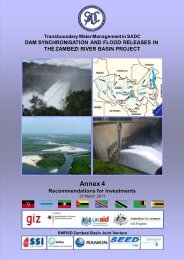
DAM SYNCHRONISATION AND FLOOD RELEASES IN THE ZAMBEZI RIVER BASIN PROJECT: ANNEX 1 OF FINAL REPORT<br />
4.3 Maps<br />
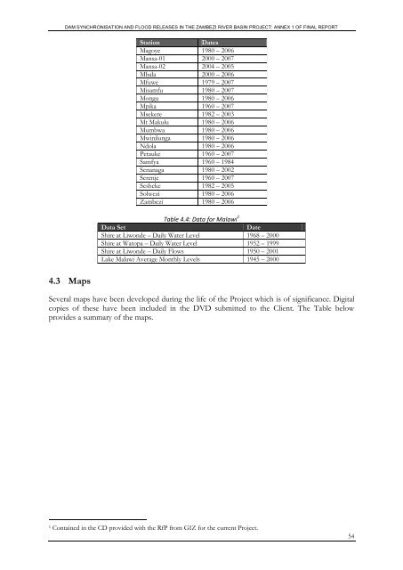
Station<br />
Dates<br />
Magoye 1980 – 2006<br />
Mansa-01 2000 – 2007<br />
Mansa-02 2004 – 2005<br />
Mbala 2000 – 2006<br />
Mfuwe 1979 – 2007<br />
Misamfu 1980 – 2007<br />
Mongu 1980 – 2006<br />
Mpika 1960 – 2007<br />
Msekere 1982 – 2003<br />
Mt Makulu 1980 – 2006<br />
Mumbwa 1980 – 2006<br />
Mwinilunga 1980 – 2006<br />
Ndola 1980 – 2006<br />
Petauke 1960 – 2007<br />
Samfya 1960 – 1984<br />
Senanaga 1980 – 2002<br />
Serenje 1960 – 2007<br />
Sesheke 1982 – 2005<br />
Solwezi 1980 – 2006<br />
Zambezi 1980 – 2006<br />
Table 4.4: Data for Malawi 1<br />
Data Set<br />
Date<br />
Shire at Liwonde – Daily Water Level 1968 – 2000<br />
Shire at Watopa – Daily Water Level 1952 – 1999<br />
Shire at Liwonde – Daily Flows 1950 – 2001<br />
Lake Malawi Average Monthly Levels 1945 – 2000<br />
Several maps have been developed during the life of the Project which is of significance. Digital<br />
copies of these have been included in the DVD submitted to the Client. The Table below<br />
provides a summary of the maps.<br />
1 Contained in the CD provided with the RfP from GIZ for the current Project.<br />
54