Sweetwater Creek Watershed Mgmt. Plan 2007 Update--Part 2
Sweetwater Creek Watershed Mgmt. Plan 2007 Update--Part 2
Sweetwater Creek Watershed Mgmt. Plan 2007 Update--Part 2

Create successful ePaper yourself
Turn your PDF publications into a flip-book with our unique Google optimized e-Paper software.
CHAPTER 8<br />
Upland coniferous forest (410)<br />
Upland coniferous forest is a general category defined by FLUCFCS as any natural upland<br />
forest having a 66% canopy closure of coniferous species. In the <strong>Sweetwater</strong> <strong>Creek</strong> watershed,<br />
this community currently (2004) occupies only 0.02% of the watershed, having been largely<br />
replaced by agriculture.<br />
Upland hardwood forest (420)<br />
Upland hardwood forest is a general category defined by FLUCFCS as natural upland forest<br />
having 66% crown canopy dominated by hardwood tree species. This community was not<br />
identified on the 1950 or 2004 mapping.<br />
Hardwood conifer mixed forest (434)<br />
In a hardwood-conifer mixed forest, neither upland conifers nor hardwoods attain more than<br />
66% dominance in the canopy. By definition, these areas typically occur on well-drained but<br />
non-droughty soils and are often the result of fire suppression in pine flatwoods, and are often<br />
successional to the flatwoods community on drier soils. This community has the same species<br />
as the longleaf pine-xeric community (FLUCFCS 412) except that neither the pines nor the oaks<br />
dominate. The percent coverage of this community increased from 0.01% to 1.7% between<br />
1950 and 2004, probably as a result of natural successional activity.<br />
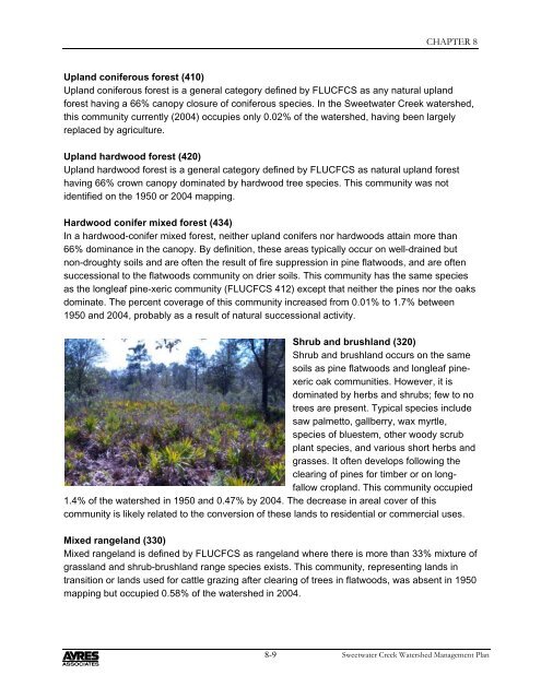
Shrub and brushland (320)<br />
Shrub and brushland occurs on the same<br />
soils as pine flatwoods and longleaf pinexeric<br />
oak communities. However, it is<br />
dominated by herbs and shrubs; few to no<br />
trees are present. Typical species include<br />
saw palmetto, gallberry, wax myrtle,<br />
species of bluestem, other woody scrub<br />
plant species, and various short herbs and<br />
grasses. It often develops following the<br />
clearing of pines for timber or on longfallow<br />
cropland. This community occupied<br />
1.4% of the watershed in 1950 and 0.47% by 2004. The decrease in areal cover of this<br />
community is likely related to the conversion of these lands to residential or commercial uses.<br />
Mixed rangeland (330)<br />
Mixed rangeland is defined by FLUCFCS as rangeland where there is more than 33% mixture of<br />
grassland and shrub-brushland range species exists. This community, representing lands in<br />
transition or lands used for cattle grazing after clearing of trees in flatwoods, was absent in 1950<br />
mapping but occupied 0.58% of the watershed in 2004.<br />
8-9<br />
<strong>Sweetwater</strong> <strong>Creek</strong> <strong>Watershed</strong> Management <strong>Plan</strong>