New Aviation Weather Formats: METAR/TAF
New Aviation Weather Formats: METAR/TAF
New Aviation Weather Formats: METAR/TAF
Create successful ePaper yourself
Turn your PDF publications into a flip-book with our unique Google optimized e-Paper software.
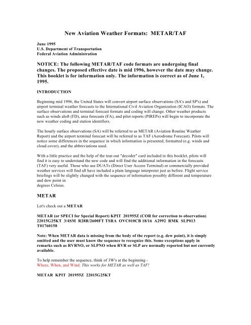
<strong>New</strong> <strong>Aviation</strong> <strong>Weather</strong> <strong>Formats</strong>: <strong>METAR</strong>/<strong>TAF</strong><br />
June 1995<br />
U.S. Department of Transportation<br />
Federal <strong>Aviation</strong> Administration<br />
NOTICE: The following <strong>METAR</strong>/<strong>TAF</strong> code formats are undergoing final<br />
changes. The proposed effective date is mid 1996, however the date may change.<br />
This booklet is for information only. The information is correct as of June 1,<br />
1995.<br />
INTRODUCTION<br />
Beginning mid 1996, the United States will convert airport surface observations (SA's and SP's) and<br />
airport terminal weather forecasts to the International Civil <strong>Aviation</strong> Organization (ICAO) formats. The<br />
surface observations and terminal forecast formats and coding will change. Other weather products<br />
such as winds aloft (FD), area forecasts (FA), and pilot reports (PIREPs) will begin to incorporate the<br />
new weather coding and station identifiers.<br />
The hourly surface observations (SA) will be referred to as <strong>METAR</strong> (<strong>Aviation</strong> Routine <strong>Weather</strong><br />
Report) and the airport terminal forecast will be referred to as <strong>TAF</strong> (Aerodrome Forecast). Pilots will<br />
notice some differences in the sequence in which information is presented, formatted (e.g. winds and<br />
cloud cover), and the abbreviations used.<br />
With a little practice and the help of the tear-out "decoder" card included in this booklet, pilots will<br />
find it is easy to understand the new code and will find the additional information in the forecasts<br />
(<strong>TAF</strong>) very useful. Those who use DUATs (Direct User Access Terminal) or commercially provided<br />
weather services will find all have included a plain language interpreter just as before. Flight service<br />
briefings will be slightly changed with the sequence of information possibly different and temperature<br />
and dew point in<br />
degrees Celsius.<br />
<strong>METAR</strong><br />
Let's check out a <strong>METAR</strong><br />
<strong>METAR</strong> (or SPECI for Special Report) KPIT 201955Z (COR for correction to observation)<br />
22015G25KT 3/4SM R28R/2600FT TSRA OVC010CB 18/16 A2992 RMK SLP013<br />
T01760158<br />
Note: When <strong>METAR</strong> data is missing from the body of the report (e.g. dew point), it is simply<br />
omitted and the user must know the sequence to recognize this. Some exceptions apply in<br />
remarks such as RVRNO, or SLPNO when RVR or SLP are normally reported but not currently<br />
available.<br />
To help remember the sequence, think of 3W's at the beginning -<br />
Where, When, and Wind. This works for <strong>METAR</strong> as well as <strong>TAF</strong>!<br />
<strong>METAR</strong> KPIT 201955Z 22015G25KT
Where<br />
KPIT is the ICAO station identifier. The usual 3 letter identifiers we are all familiar with are now<br />
preceded by a "K" for the contiguous United States. Alaska and Hawaii will use 4 letter identifiers<br />
beginning with "PA" and "PH" respectively. Changes are planned to incorporate alphabetic identifiers<br />
for those weather reporting stations where numbers and letters are now used (e.g., W10 to HEF).<br />
When<br />
201955Z is the 20th day of the month.<br />
201955Z at 1955Z time<br />
Wind<br />
22015G25KT is reported as the 3 digit direction to the nearest 10 degrees.<br />
22015G25KT next is the 2 or 3 digit speed.<br />
22015G25KT a "G" comes next if the wind is gusting.<br />
22015G25KT followed by the 2 or 3 digit maximum speed and units (KT).<br />
00000KT for calm winds.<br />
20015KT 180V260 When wind direction varies 60 degrees or more and wind is greater than 6 knots.<br />
VRB Used when wind direction is variable and speed is less than or equal to 6 knots.<br />
RMK Peak wind data shall be reported in the remarks section whenever the maximum instantaneous<br />
speed is greater than 25 knots. 22030/15 means a maximum instantaneous wind at 30 knots occurred<br />
15 minutes past the hour from 220 degrees.<br />
Visibility<br />
3/4SM meaning 3/4 statue mile visibility. Miles and fractions are also reported (e.g., 2 3/4SM for 2<br />
and 3/4 statute miles visibility).<br />
R28R/2600FT Means Runway Visual Range (RVR). Signifies that the runway visual range for<br />
runway 28 Right is 2600 feet. The format is R(XXX)Runway Designator including (L)eft (C)enter or<br />
(R)ight (XXXX) 4 digit visibility in feet.<br />
Some coding pilots may also see for RVR include:<br />
M Indicates that RVR is less than lowest reportable sensor value(e.g. M600FT)<br />
P Indicates RVR greater than highest reportable sensor value (e.g.P6000FT).<br />
V Variable If the RVR is variable between 2000 and 4000 feet for runway 6L:<br />
R06L/2000V4000FT).
Significant Present <strong>Weather</strong><br />
TSRA: Thunderstorm/Moderate Rain Format is a two character descriptor (e.g. TS, SH, DR)<br />
followed by a two character weather phenomenon (e.g.RA, SN, FG). (See Abbreviations Section)<br />
Intensity values include:<br />
"-" Light<br />
"+" Heavy<br />
"no sign" Moderate<br />
Clouds<br />
OVC010CB: Specifies cloud amount, height, and type. Overcast clouds are present at 1000 feet<br />
consisting of cumulonimbus clouds.<br />
Cloud height is reported in hundreds of feet. When clouds are composed of towering cumulus or<br />
cumulonimbus TCU or CB will follow cloud height.<br />
The clouds are categorized based on eighths (octas) of the sky:<br />
SKC Sky Clear<br />
FEW 1-2 octas<br />
SCT 3-4 octas<br />
BKN 5-7 octas<br />
OVC 8 octas<br />
VV may be listed here for indefinite ceiling such as "VV004" for Vertical Visibility 400 feet.<br />
"VV///" means indefinite ceiling, height not available.<br />
18/16 Temperature/Dew Point listed in degrees Celsius. When temperatures are below zero degrees<br />
Celsius, they are preceded by "M" for Minus (e.g., 10/M06 for temperature 10 degrees C, dew point<br />
Minus 6 degrees C).<br />
A2992 Altimeter Setting "A" indicates setting in inches of mercury for United States. Consists of 4<br />
digits: inches and hundredths.<br />
RMK SLP013 T01760158<br />
RMK SLP013 T01760158. Remarks come last.<br />
RMK SLP013 T01760158. Selected stations will contain SLP for Sea Level Pressure reported as the<br />
last three digits in hectoPascals (milibars) (e.g., 1013 is reported as SLP013).<br />
RMK SLP013 T01760158. Also, at selected stations, the 9 character code (T01760158) breaks down<br />
the temperature and dew point to the nearest 1/10th of a degree Celsius. The "T" stands for temperature<br />
and the "0" means positive temperature. A "1" in place of the "0" stands for negative temperature. At<br />
selected stations, other temperature codes, such as 10142, 20012, or 401120084, may appear to<br />
document temperatures not related to aviation.
<strong>METAR</strong> ON ASOS/AWOS<br />
Pilots will notice the <strong>METAR</strong>/SPECI code and sequence replaces the format on automated weather<br />
observations (AWOS/ASOS). Also when a <strong>METAR</strong>/SPECI is supplied by an automated source, the<br />
notation "AUTO" for automated observation will appear in the report. The Remarks(RMK) will then<br />
contain an abbreviation for the type and number of sensors(AO1, AO2). If the site is attended, the<br />
<strong>METAR</strong> may contain information that has been manually provided by the observer, as in the case of<br />
some weather phenomena. The observer's comments will appear in the RMK section.<br />
An example of a fully automated AWOS/ASOS <strong>METAR</strong> without human intervention contains the<br />
word AUTO:<br />
<strong>METAR</strong> KOFP 251955Z AUTO 30008KT 10SM CLR 22/10 A3010 RMK<br />
AO2 SLP138 T02180096<br />
When AWOS/ASOS reported sky condition is clear (CLR) it means no clouds at or below 12,000 feet.<br />
<strong>TAF</strong><br />
Let's try a <strong>TAF</strong><br />
<strong>TAF</strong> contains a definitive forecast for specific time periods and will replace the terminal forecast.<br />
<strong>TAF</strong> (<strong>TAF</strong> AMD is Amended Forecast when included) KPIT 091720Z<br />
091818 22020KT 3SM -SHRA BKN020<br />
FM2030 30015G25KT 3SM SHRA OVC015 PROB40 2022 1/2SM TSRA OVC008CB<br />
FM2300 27008KT 5SM -SHRA BKN020 OVC040 TEMPO 0407 00000KT 1SM -RA FG<br />
FM1000 22010KT 5SM -SHRA OVC020 BECMG 1315 20010KT P6SM NSW SKC<br />
Once you know how to pick out the <strong>TAF</strong> forecast time periods, the same logical sequence that we saw<br />
in <strong>METAR</strong> will follow. Below, a <strong>TAF</strong> is broken down to highlight its individual segments. Key words,<br />
and their definitions, indicating a new time period has started are highlighted in red.<br />
<strong>TAF</strong> KPIT 091720Z 091818 22020KT 3SM -SHRA BKN020<br />
FM2030 30015G25KT WS015/30045KT 3SM SHRA OVC015<br />
PROB40 2022 1/2SM TSRA OVC008CB<br />
FM2300 27008KT 5SM -SHRA BKN020 OVC040 TEMPO 0407<br />
00000KT 1SM -RA FG<br />
FM1000 22010KT 5SM -SHRA OVC020 BECMG 1315 20010KT<br />
P6SM NSW SKC<br />
The Where, When, and Wind trick works with <strong>TAF</strong>, too. There's a little twist with the "when,"<br />
however.<br />
<strong>TAF</strong> KPIT 091720Z 091818 22020KT<br />
Where
KPIT is the ICAO station identifier. The usual 3 letter identifiers we are all familiar with preceded by a<br />
"K" for the contiguous United States. Alaska and Hawaii will use 4 letter identifiers beginning with<br />
"PA" and "PH" respectively. Changes are planned to incorporate three letter identifiers for those<br />
weather reporting stations where numbers and letters are now used (e.g., W10 to HEF).<br />
When<br />
After KPIT, we see<br />
091720Z This is the forecast for the 9th day of the month with an issuance time of 1720 Z or UTC.<br />
This is a 2 digit date and 4 digit time.<br />
091818 is the valid period with the first two digits containing the day of the month (09).<br />
091818 the second two digits specify the hour beginning the forecast period (1800Z).<br />
091818 the last two digits are the hour ending the forecast period (1800Z on the next day, (the 10th).<br />
Wind<br />
22020KT<br />
See description under <strong>METAR</strong><br />
WS015/30045KT means at 1500 feet we expect wind to be 300 degrees at 45 KT. This indicates low<br />
level wind shear, not associated with convective activity.<br />
Time Periods, Etc.<br />
FM2030 From 2030Z or UTC time. Indicates hours and minutes.<br />
PROB40 2022 There is a 40 percent probability of this condition occurring between 2000Z and<br />
2200Z.<br />
FM2300 FROM 2300Z.<br />
TEMPO 0407 Temporary changes expected between 0400Z and 0700Z.<br />
FM1000 FROM 1000Z.<br />
BECMG 1315 Conditions Becoming as described between 1300Z and 1500Z.<br />
Once the specific time periods can be discerned, the sequence of wind, visibility, significant weather,<br />
cloud cover and cloud height follows and is repeated for each time block. The only exception is<br />
after qualifiers such as PROB40, TEMPO, and BECMG, some of the components may be omitted if<br />
these are not expected to change. Notice after PROB40 2022, there is no wind given and after<br />
TEMPO0407, there is no cloud cover listed. <strong>TAF</strong>'s will also contain wind shear information not<br />
associated with convective activity.<br />
It's BECMG CLR now, isn't it?
International Differences<br />
Pilots and operators who fly to international destinations are cautioned to be alert to differences<br />
between U.S. <strong>METAR</strong>/<strong>TAF</strong> and international <strong>METAR</strong>/<strong>TAF</strong>. Some key differences follow.<br />
Altimeter Setting<br />
The United States reports the altimeter setting in inches of mercury (e.g., A2992) and internationally it<br />
will be reported in hectoPascals (milibars) (e.g., Q1013).<br />
Wind<br />
Internationally wind may be reported in knots (KT), kilometers per hour (KMH) or meters per second<br />
(MPS). Appropriate units are indicated on both <strong>METAR</strong> and <strong>TAF</strong>.<br />
Wind Shear<br />
Low level wind shear, not associated with convective activity (e.g., WS015/30045KT, see <strong>TAF</strong>) will<br />
appear in <strong>TAF</strong>s in the United States, Canada, and Mexico only.<br />
Visibility<br />
Internationally, visibility is reported in 4 digits using meters with the direction of the lowest visibility<br />
sector (e.g., 6000SW - meaning visibility is lowest at 6000 meters to the southwest). In the United<br />
States, we use prevailing visibility, in statue miles, not the lowest visibility, so the same conditions<br />
would be reported differently.<br />
International visibility reports also contain a trend such as:<br />
D<br />
U<br />
N<br />
V<br />
Down<br />
Up<br />
No change<br />
Variable<br />
Other<br />
Remarks (RMK) included in U.S. <strong>METAR</strong> are transmitted to only Canada and Mexico and no other<br />
international stations.<br />
Pilots may also see the notation on International <strong>METAR</strong>/<strong>TAF</strong>: CAVOK. This means ceiling and<br />
visibility OK and is used to replace weather and clouds if visibility is 10 kilometers or more, there are<br />
no clouds below 1500 meters (5000 feet) or below the highest minimum air traffic control sector<br />
altitude, whichever is greater. Also, there must be no other significant weather. NSC means no<br />
significant clouds.<br />
International <strong>TAF</strong>s may include temperature, turbulence, and icing forecasts.
Abbreviations<br />
AO1<br />
Automated Observation without precipitation discriminator (rain/snow)<br />
AO2<br />
Automated Observation with precipitation discriminator (rain/snow)<br />
AMD<br />
Amended Forecast (<strong>TAF</strong>)<br />
BECMG<br />
Becoming (expected between 2 digit beginning hour and 2 digit ending hour)<br />
BKN<br />
Broken<br />
CLR<br />
Clear at or below 12,000 feet (AWOS/ASOS report)<br />
COR<br />
Correction to the observation<br />
FEW<br />
1 or 2 octas (eighths) cloud coverage<br />
FM<br />
From (4 digit beginning time in hours and minutes)<br />
LDG<br />
Landing<br />
M<br />
In temperature field means "minus" or below zero<br />
M In RVR listing indicates visibility less than lowest reportable sensor value (e.g. M600)<br />
NO<br />
Not available (e.g. SLPNO, RVRNO)<br />
NSW<br />
No Significant <strong>Weather</strong><br />
OVC<br />
Overcast<br />
P<br />
in RVR indicates visibility greater than highest reportable sensor value (e.g. P6000FT)<br />
P6SM<br />
Visibility greater than 6 SM (<strong>TAF</strong> only)<br />
PROB40<br />
Probability 40 percent<br />
R<br />
Runway (used in RVR measurement)<br />
RMK<br />
Remark<br />
RY/RWY Runway<br />
SCT<br />
Scattered<br />
SKC<br />
Sky Clear<br />
SLP Sea Level Pressure (e.g., 1013 reported as 013)<br />
SM<br />
Statute mile(s)<br />
SPECI<br />
Special Report<br />
TEMPO<br />
Temporary changes expected (between 2 digit beginning hour and 2 digit ending hour)<br />
TKOF<br />
Takeoff<br />
T01760158, 10142, 20012 and 401120084<br />
In Remarks - examples of temperature information<br />
V<br />
VC<br />
VRB<br />
VV<br />
WS<br />
Varies (wind direction and RVR)<br />
Vicinity<br />
Variable wind direction when speed is less than or equal to 6 knots<br />
Vertical Visibility (Indefinite Ceiling)<br />
Wind shear (In <strong>TAF</strong>s, low level and not associated with convective activity)<br />
Descriptors<br />
BC Patches FZ Supercooled/freezing SH Showers<br />
BL Blowing MI Shallow TS Thunderstorms<br />
DR Low Drifitng PR Partial<br />
<strong>Weather</strong> Phenomena<br />
BR Mist GS Small Hail/Snow Pellets SN Snow<br />
DS Dust Storm HZ Haze SQ Squall<br />
DU Widespread Dust IC Ice Crystals SS Sandstorm<br />
DZ Drizzle PE Ice Pellets UP Unknown Precipitation (Automated Observations)<br />
FC Funnel Cloud PO Dust/Sand Whirls VA Volcanic Ash<br />
+FC Tornado/Water Spout PY Spray<br />
FG Fog RA Rain<br />
FU Smoke SA Sand<br />
GR Hail<br />
SG Snow Grains<br />
Cloud Types<br />
CB<br />
TCU<br />
Cumulonimbus<br />
Towering Cumulus
<strong>METAR</strong> (SPECI or Special Report)<br />
Note: When <strong>METAR</strong> data is missing (e.g. dew point), it is simply omitted and the user must know the sequence to recognize this.<br />
Some exceptions apply in remarks such as RVRNO, or SLPNO when RVR or SLP are normally reported but not currently available.<br />
<strong>METAR</strong> KPIT 201955Z 22015G25KT 3/4SM R28R/2600FT TSRA OVC010CB 18/16 A2992 RMK SLP013 T01760158<br />
Where:<br />
KPIT<br />
When:<br />
201955Z 20th day of month at 1955Z<br />
Wind:<br />
22015G25KT 220 degrees at 15 gusting to 25 knots<br />
V: Variable direction e.g., 20015KT 220V280<br />
VRB:<br />
Variable direction when speed is less than or equal to 6 knots<br />
Visibility: 3/4SM 3/4 statute miles, typical: 2 3/4SM, 1SM,<br />
RVR R28R/2600FT Runway 28 Right visibility 2600 feet<br />
M: Used for RVR less than lowest reportable sensor value (e.g. M600FT)<br />
P: Used for RVR greater than highest reportable sensor value (e.g. P6000FT)<br />
V: Variable<br />
Significant <strong>Weather</strong>: TSRA thunderstorm/moderate rain (See Abbreviations)<br />
Sky Condition: OVC010CB overcast clouds at 1000 feet consisting of cumulonimbus<br />
Typical: SKC, FEW, SCT, BKN, VV004indefinite ceiling (Vertical Visibility)<br />
400 feet or V V///indefinite ceiling height not available<br />
Temperature/Dew Point: 18/16 18 degrees Celsius/dew point 16 degrees Celsius<br />
M = Minus (below zero)<br />
Altimeter: A2992 inches of mercury and preceded by an "A"<br />
RMK SLP013 T01760158 10142 20012 401120084At selected stations, Sea Level Pressure is reported as the last three digits in<br />
hectoPascals (milibars) (e.g., 1013 is reported as SLP013). Codes such as T01760158 10142 20012 and 401120084 are climate<br />
temperature information.<br />
<strong>TAF</strong> (<strong>TAF</strong> AMD is Amended Forecastwhen included)<br />
KPIT 091720Z 091818 22020KT WS015/30045KT 3SM -SHRA BKN020<br />
FM2030 30015G25KT 3SM SHRA OVC015 PROB40 2022 1/2 TSRA OVC008CB<br />
FM2300 27008KT 5SM -SHRA BKN020 OVC040 TEMPO 0407 00000KT 1SM -RA FG<br />
FM1000 22010KT 5SM -SHRA OVC020 BECMG 1315 20010KT P6SM NSW SKC<br />
Where: KPIT<br />
When: 091720Z issuance day and time: 9th day at 1720Z<br />
091818 valid period: 9th day at 1800Z to next day (10th) at 1800Z<br />
Wind: 22020KT WS015/30045KT220 degrees at 20 knots with low level wind shear at 1500 feet forecast to be 300 degrees at<br />
45 knots (only nonconvective, low level, wind shear is forecast)<br />
Visibility: 3SM 3 statute miles, typical - 2 3/4SM, 1SM,<br />
P6SM: Greater than 6 statute miles<br />
Significant Wx: -SHRA light rain showers (See Abbreviations)<br />
Sky Condition: BKN020 broken clouds at 2000 feet.<br />
Typical: FEW, SCT, BKN, OVC.<br />
VV004 indefinite ceiling (Vertical Visibility) 400 feet or VV///. Indefinite ceiling height not available CB and TCU<br />
clouds noted when present.<br />
Sequence of Wind, Visibility, Significant <strong>Weather</strong> and Sky Condition repeats preceded by:<br />
FM2030: rom 2030Z<br />
PROB40 2022: here is a 40 percent probability between 2000Zand 2200Z.<br />
FM2300: From 2300Z<br />
TEMPO 0407: Temporarily between 0400Z and 0700Z<br />
FM1000:<br />
From 1000Z<br />
BECMG 1315: Becoming between 1300Z and 1500Z<br />
Note: <strong>Weather</strong> conditions such as wind and sky condition may be omitted after PROB40, TEMPO, and BECMGif no change is<br />
expected from those same conditions given in the previous time block.


