data reduction cruise summary r/v maurice ewing - Marine ...
data reduction cruise summary r/v maurice ewing - Marine ...
data reduction cruise summary r/v maurice ewing - Marine ...

Create successful ePaper yourself
Turn your PDF publications into a flip-book with our unique Google optimized e-Paper software.
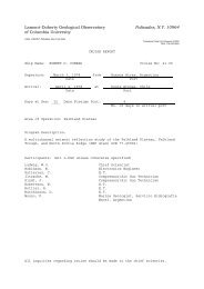
DATA REDUCTION CRUISE SUMMARY<br />
EW-9702<br />
A study of continental shelf and slope<br />
stability along the east coast of the United States<br />
Savannah, GA - P. Canaveral, Fla.<br />
05/03/97 (JD 123) - 05/16/97 (JD 136)<br />
CHIEF SCIENTISTS:<br />
Jim Turcotte, NAVOCEANO<br />
SCIENCE OFFICER:<br />
Chris Leidhold (cpl@ldeo.columbia.edu)<br />
DATA REDUCTION:<br />
S. Budhypramono (dared@ldeo.columbia.edu)<br />
R/V MAURICE EWING
Participants:<br />
Science Party:<br />
Jim Turcotte, NAVOCEANO, Chief Scientist<br />
Randy White, NAVOCEANO, Scientist<br />
Cecil Pettway, NAVOCEANO, Scientist<br />
Guy Seale, NAVOCEANO, Scientist<br />
Dunny Green, NAVOCEANO, Scientist<br />
Bruce Rumish, NAVOCEANO, Scientist<br />
Brian Campbell, NAVOCEANO, Electronics Engineer<br />
Dan McGovern, NAVOCEANO, Electronics Engineer<br />
Tim Cashion, NAVOCEANO, Mechanical Electrical Engineer<br />
Corey Smith, NAVOCEANO, Electronic Technician<br />
George Curvin, NAVOCEANO, Electronic Technician<br />
John Suslavage, NAVOCEANO, Scientist<br />
Science Crew:<br />
Joseph N. Stennett, L-DEO, Science Officer<br />
Chris Leidhold, L-DEO, Science Officer<br />
Ropate Maiwiriwiri, L-DEO, Core Bosun<br />
Chuck Donaldson, L-DEO, Electronic Tech.<br />
Tom Jackson, L-DEO, Electronic Tech.<br />
Elizabeth Jackson, L-DEO, Hydrosweep Data Processor<br />
Stefanus Budhypramono, L-DEO, System Manager<br />
R/V Ewing Crew:<br />
Ian Young - Master R/V EWING<br />
Stephen Pica- Chief Engineer R/V EWING<br />
EW-9702 CRUISE SUMMARY
SCIENCE OVERVIEW:<br />
The U.S. Navy is continuing to evaluate continental shelf and slope stability<br />
along the east coast of the United States. Three study areas have been<br />
chosen along the eastern margin to observe variations in seafloor stability<br />
that occur along different slope environments over short time periods (approx.<br />
2 wks.). The survey objectives are to (1) collect detailed geologic and<br />
oceanographic measurements across three differing slope environments, (2)<br />
assess the interaction of shelf and slope oceanographic and sedimentary<br />
processes on the seafloor stability over short time periods, (3) identify any<br />
resultant seafloor features and conditions and (4) determine potentially<br />
unstable or hazardous seafloor slopes.<br />
TRUE TIME CLOCK:<br />
Instrument: Kinemetric/TrueTime Division Model GPS-DC GPS Synchronized<br />
Clock<br />
Logging: 1 minute intervals<br />
NOTE: The True Time clock is used to adjust the CPU clock of the logging<br />
computer. The logging computer captures the continuous time records from the<br />
clock and provides these as a service to the rest of the network via a UDP<br />
broadcast. This enables the computers on the network to adjust their CPU times<br />
to UTC time.<br />
DAY TIME COMMENTS<br />
123 2000 start of <strong>cruise</strong>, started logging/processing<br />
136 1200 end of <strong>cruise</strong>, stopped logging/processing<br />
SPEED AND HEADING:<br />
Instrument: Furuno CI-30 2-axis Doppler speed log, Sperry MK-27 gyro<br />
Logging: 3 second intervals<br />
Checking: visual check of plot of <strong>data</strong><br />
Smoothing: mean value of all good values within the same minute<br />
DAY TIME COMMENTS<br />
123 2000 start of <strong>cruise</strong>, started logging/processing<br />
136 1200 end of <strong>cruise</strong>, stopped logging/processing<br />
EW-9702 CRUISE SUMMARY
GPS SATELLITE FIXES:<br />
Instrument: Magnavox MX-4200 Global Positioning System receiver 1 & 2<br />
GPS Trimble NT200D receiver<br />
Logging: 10 second intervals on all four receivers<br />
Checking: (GPS-MX 4200 1 & 2, GPS Trimble NT200D receiver)<br />
minimum number of SATs: 3<br />
dilution of precision maximum: north = 4.0, east = 4.0<br />
speed maximum: 20.0<br />
compared GPS speed and course with Furuno smooth speed and heading<br />
reject fixes with high drifts in navigation<br />
reject fixes producing Eotvos correction errors in gravity larger than 5 mGals<br />
Interpolation: interpolated positions at 00, 30 seconds of each minute<br />
Smoothing: smoothed interpolated positions with 9 point running average.<br />
Note:<br />
The Selective Availability (SA) enforced by the Department of Defense (DoD) causes us<br />
to take a GPS fix every twenty minutes, and DR in between.<br />
DAY TIME COMMENTS<br />
123 2000 start of <strong>cruise</strong>, started logging/processing<br />
136 1200 end of <strong>cruise</strong>, stopped logging/processing<br />
NAVIGATION:<br />
A "1 minute navigation" is produced from the above sources. Acceptable fixes are<br />
merged at 1 per minute with priority given to GPS. The smooth speed and heading <strong>data</strong><br />
is used to fill any gaps of 2 minutes or longer between fixes by computing 1 minute<br />
DR'ed positions corrected for set and drift between fixes. The DR'ed positions are<br />
produced at 00 seconds of each minute.<br />
Chief scientist's final <strong>data</strong>: 1 minute navigation.<br />
FORMAT: n.ddd<br />
yy+ddd:hh:mm:ss.mmm N 12 12.1234 E 123 12.1234 id 123.1 12.1<br />
yr. day time lat. lon id set drift<br />
Lamont <strong>data</strong>base: 1 minute navigation, in NetCDF format.<br />
DAY TIME COMMENTS<br />
123 2000 start of <strong>cruise</strong>, started logging/processing<br />
136 1200 end of <strong>cruise</strong>, stopped logging/processing<br />
EW-9702 CRUISE SUMMARY
SEA TEMPERATURE:<br />
Instrument: Omega DP10 Series<br />
Logging: 1 minute intervals<br />
Checking: none<br />
Smoothing: none<br />
Chief scientist's final <strong>data</strong>: none.<br />
Lamont <strong>data</strong>base: one minute <strong>data</strong>, merged with navigation.<br />
FORMAT: ct.nddd<br />
yy+ddd:hh:mm:ss:mmm N 12 12.1234 E 123.1234 26.3<br />
yr day time lat lon sea_temp (in o C)<br />
DAY TIME COMMENTS<br />
123 2000 start of <strong>cruise</strong>, started logging/processing<br />
136 1200 end of <strong>cruise</strong>, stopped logging/processing<br />
BATHYMETRY:<br />
Instrument: Krupp Atlas Hydrosweep Center Beam<br />
Logging: At each ping of Hydrosweep, <strong>data</strong> is being broadcast real time to<br />
the network, which is received by <strong>data</strong> logger. The logger computer then<br />
extracted the center beam depth.<br />
Checking: Visual checking aided by graphic editor to remove major spikes.<br />
Chief scientist's final <strong>data</strong>: final calibrated and cleaned center beam <strong>data</strong>, two<br />
nearest point to the minute interpolated to even minute.<br />
Merged with final navigation. Depth is in meters.<br />
FORMAT: hb.nddd<br />
yy+ddd:hh:mm:ss:mmm N 12 12.1234 E 123 12.1234 2222.0<br />
yr. day time lat. lon depth_in_meters<br />
Lamont <strong>data</strong>base: final calibrated and cleaned <strong>data</strong>, interpolated to even minute.<br />
Merged with final navigation. NetCDF format. Depth is in meters.<br />
DAY TIME COMMENTS<br />
123 2242 start of <strong>cruise</strong>, started logging/processing<br />
136 1200 end of <strong>cruise</strong>, stopped logging/processing<br />
EW-9702 CRUISE SUMMARY
MAGNETIC:<br />
Instrument: Varian V75 magnetometer<br />
Logging: 6 second intervals<br />
Checking: visual check of plot of <strong>data</strong><br />
Reference field: International Geomagnetic Reference Field 1990<br />
( IGRF 1990 ) model of the main field at 1985.0 and a predictive model of<br />
the secular variation for adjusting to dates between 1990.0 and 1995.0.<br />
Residual field: Applied by bi-linear interpolation across a 1 degree square.<br />
Chief Scientist's final <strong>data</strong>: interpolated total intensity value at 00 second of each<br />
minute.<br />
FORMAT: mg.nddd<br />
yr+ddd:hh:mm:ss.mmm N 12 12.1234 E 123 12.1234 41200.8 -367.1<br />
yr. day time lat lon total_intensity anomaly<br />
Lamont Database: interpolated total intensity value at 00 second of each minute<br />
NetCDF format.<br />
NOTE:<br />
DAY TIME COMMENTS<br />
124 1000 maggie in the water<br />
126 2142 maggie out of the water ; end of survey<br />
EW-9702 CRUISE SUMMARY
WEATHER STATION:<br />
Instrument: R.M./. Young Precision Meteorological Instruments 26700 Series<br />
Logging: 1 minute interval<br />
Checking: none<br />
Chief scientist's final <strong>data</strong>: none.<br />
Lamont <strong>data</strong>base: as is.<br />
FORMAT: wx.rddd<br />
Port bird is bird #1; starboard bird is bird #2.<br />
94+022:00:00:00.244 3.4 231 9.3 15.4 13.2 21.1 271 261<br />
date time tspd tdir wsi1 wss1 wsm1 wsx1 wdc1 wds1<br />
6 12.6 15.9 15.6 20.7 261 253 6 66.7 66.7<br />
wdm1 wsi2 wss2 wsm2 wsx2 wdc2 wds2 wdm2 tcur tavg<br />
66.5 67.0 66 58 68 1016.8<br />
tmin tmax rh rhn rhx baro<br />
tspd = true speed<br />
tdir = true wind direction<br />
wsi1/2 = wind speed, instantaneous, bird #1/#2<br />
wss1/2 = wind speed, 60 second average, bird #1/#2<br />
wsm1/2 = wind speed, 60 minute average, bird #1/#2<br />
wsx1/2 = wind speed, 60 minute maximum, bird #1/#2<br />
wdc1/2 = wind direction, current, bird #1/#2<br />
wds1/2 = wind direction, 60 second average, bird #1/#2<br />
wdm1/2 = wind direction, 60 minute average, bird #1/#2<br />
tcur<br />
tavg<br />
tmin<br />
tmax<br />
rh<br />
rhn<br />
rhx<br />
baro<br />
= temperature, current<br />
= temperature, 60 minute average<br />
= temperature, 60 minute minimum<br />
= temperature, 60 minute maximum<br />
= relative humidity<br />
= relative humidity, 60 minute minimum<br />
= relative humidity, 60 minute maximum<br />
= barometric pressure<br />
DAY TIME COMMENTS<br />
123 2000 start of <strong>cruise</strong>, started logging/processing<br />
136 1200 end of <strong>cruise</strong>, stopped logging/processing<br />
EW-9702 CRUISE SUMMARY