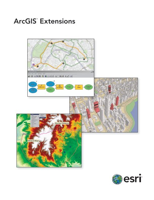
ArcGIS Extensions - Esri Portugal
ArcGIS Extensions - Esri Portugal
ArcGIS Extensions - Esri Portugal

Create successful ePaper yourself
Turn your PDF publications into a flip-book with our unique Google optimized e-Paper software.
®<br />
<strong>ArcGIS</strong><br />
<strong>Extensions</strong>
<strong>ArcGIS</strong> <strong>Extensions</strong><br />
Specialized GIS Tools for Enhanced Productivity and Advanced Analysis<br />
<strong>Esri</strong> offers a wide range of optional extensions that can dramatically expand the capabilities of <strong>ArcGIS</strong> ® . While all these<br />
extensions are available for <strong>ArcGIS</strong> Desktop, many are offered for <strong>Esri</strong>’s server (<strong>ArcGIS</strong> Server) and developer (<strong>ArcGIS</strong><br />
Engine) environments as well. This common architecture gives you the flexibility to operate the same <strong>ArcGIS</strong> extensions<br />
across the full <strong>ArcGIS</strong> system, significantly reducing your acquisition, training, and operating costs.<br />
Analysis Key Benefits Page<br />
<strong>ArcGIS</strong> Spatial<br />
Analyst<br />
Derive answers from your data using<br />
advanced spatial analysis.<br />
3<br />
<strong>ArcGIS</strong> 3D Analyst <br />
Manage and analyze your data in a<br />
realistic 3D perspective.<br />
4<br />
<strong>ArcGIS</strong><br />
Geostatistical<br />
Analyst<br />
Use advanced statistical tools to<br />
investigate your data.<br />
5<br />
<strong>ArcGIS</strong> Network<br />
Analyst<br />
Solve sophisticated vehicle routing,<br />
closest facility, service area, and<br />
location-allocation problems.<br />
6<br />
Use three-dimensional models and symbols with <strong>ArcGIS</strong><br />
3D Analyst to enhance the display and realism of your data.<br />
<strong>ArcGIS</strong> Schematics<br />
Represent and understand your<br />
networks to shorten decision cycles.<br />
7<br />
<strong>ArcGIS</strong> Tracking<br />
Analyst<br />
Visualize and analyze your assets and<br />
resources in time and space.<br />
8<br />
Productivity Key Benefits Page<br />
<strong>ArcGIS</strong> Publisher<br />
Freely share your maps and data with a<br />
wide range of users.<br />
9<br />
<strong>ArcGIS</strong> Data<br />
Interoperability<br />
Eliminate format barriers to data use<br />
and distribution.<br />
10<br />
Maplex ® for<br />
<strong>ArcGIS</strong>*<br />
Create maps that communicate more<br />
clearly using automatically positioned<br />
text and labels.<br />
11<br />
Improve the data review process using a systematic approach<br />
to inspect your data.<br />
<strong>ArcGIS</strong> Data<br />
Reviewer<br />
Automate, simplify, and improve<br />
management of data quality control.<br />
12<br />
<strong>ArcGIS</strong> Workflow<br />
Manager<br />
Better manage GIS tasks and resources. 13<br />
* Included with ArcInfo ® licenses<br />
Solution Based Key Benefits Page<br />
<strong>Esri</strong> ® Production<br />
Mapping*<br />
Standardize and optimize your GIS data<br />
and cartographic production.<br />
14<br />
* Requires ArcEditor or ArcInfo<br />
Use the built-in reporting<br />
feature within <strong>ArcGIS</strong><br />
Workflow Manager to<br />
track resources and<br />
assigned tasks.<br />
2
<strong>ArcGIS</strong> Spatial Analyst<br />
Derive Answers from Your Data Using Advanced Spatial Analysis<br />
<strong>ArcGIS</strong> Spatial Analyst provides a broad range of powerful<br />
spatial modeling and analysis tools. You can create,<br />
query, map, and analyze cell-based raster data; perform<br />
integrated raster/vector analysis; derive new information<br />
from existing data; query information across multiple<br />
data layers; and fully integrate cell-based raster data<br />
with traditional vector data sources. Integrated with the<br />
geoprocessing framework, <strong>ArcGIS</strong> Spatial Analyst offers<br />
easy access to numerous functions in ModelBuilder , a<br />
graphic modeling tool.<br />
The Spatial extension is also available for <strong>ArcGIS</strong> Server<br />
and <strong>ArcGIS</strong> Engine.<br />
With <strong>ArcGIS</strong> Spatial Analyst, you can<br />
• Convert features (point, line, or polygon) to rasters.<br />
• Create raster buffers based on distance from or<br />
proximity to features or rasters.<br />
• Generate density maps and continuous surfaces<br />
from point features.<br />
• Derive contour, slope, viewshed, aspect, and<br />
hillshades of these surfaces.<br />
• Perform map algebra (Boolean queries and<br />
algebraic calculations).<br />
• Conduct neighborhood and zone analyses.<br />
• Carry out discrete cell-by-cell analysis.<br />
• Perform grid classification and display.<br />
Perform raster geoprocessing and modeling with ModelBuilder.<br />
Perform density analysis.<br />
Model and analyze raster and vector data.<br />
esri.com/spatialanalyst<br />
3
<strong>ArcGIS</strong> 3D Analyst<br />
Manage and Analyze Your Data in a Realistic 3D Perspective<br />
<strong>ArcGIS</strong> 3D Analyst provides powerful and advanced<br />
visualization, analysis, and surface generation tools.<br />
Using <strong>ArcGIS</strong> 3D Analyst, you can seamlessly view<br />
extremely large sets of data in three dimensions from<br />
multiple viewpoints, query a surface, and create a realistic<br />
perspective image that drapes raster and vector data over<br />
a surface.<br />
The 3D extension is also available for <strong>ArcGIS</strong> Server and<br />
<strong>ArcGIS</strong> Engine.<br />
With <strong>ArcGIS</strong> 3D Analyst, you can<br />
• Create spherical 3D visualization, fly-throughs, and<br />
animations.<br />
• Build and visualize surface, subsurface, terrain, and<br />
draped features.<br />
• Manage 3D GIS data by editing in a 3D view.<br />
• Perform viewshed, corridor, line-of-sight, and<br />
3D volumetric analysis; spot height interpolation<br />
profiling; and steepest path determination.<br />
• View and create KML and view lidar data.<br />
• Create contours and terrains.<br />
• Import Collaborative Design Activity (COLLADA),<br />
SketchUp, 3D Studio, and OpenFlight files.<br />
• Use free 3D globes and imagery from <strong>ArcGIS</strong> SM<br />
Online Services.<br />
• Calculate surface area, volume, slope, aspect,<br />
hillshade, and contours.<br />
Terrain and Subsurface<br />
Modeling<br />
Volumetric Shadow Analysis<br />
esri.com/3danalyst<br />
Whole-Earth Visualization<br />
4
<strong>ArcGIS</strong> Geostatistical Analyst<br />
Use Advanced Statistical Tools to Investigate Your Data<br />
<strong>ArcGIS</strong> Geostatistical Analyst provides a powerful<br />
suite of statistical models and tools for spatial data<br />
exploration and optimal surface generation. It allows you<br />
to create a statistically valid prediction surface, along<br />
with prediction uncertainties, from a limited number<br />
of data measurements. From determining whether an<br />
environmental safety threshold has been exceeded to<br />
locating mineral deposits, <strong>ArcGIS</strong> Geostatistical Analyst<br />
lets you model spatial data in a reliable and intelligent<br />
way. <strong>ArcGIS</strong> Geostatistical Analyst enables you to take<br />
advantage of these tools and techniques in an interactive<br />
graphical user interface (GUI) and as web services.<br />
The Geostatistical extension is also available for <strong>ArcGIS</strong><br />
Server.<br />
With <strong>ArcGIS</strong> Geostatistical Analyst, you can<br />
• Explore data variability and spatial relationships,<br />
look for unusual data values, and examine global<br />
and local trends.<br />
• Utilize multivariate analysis to create optimal<br />
statistical models to produce reliable maps of<br />
predictions, prediction errors, quantiles, and<br />
probabilities for improved decision making.<br />
• Modify model parameters interactively, or<br />
automatically optimize them using cross validation.<br />
• Determine optimal locations to create or update a<br />
monitoring network.<br />
• Prepare for worst-case scenarios by simulating<br />
many possible realizations of an environmental<br />
process.<br />
Kriging Predictions for Silt Thickness in Powers Lake,<br />
North Dakota<br />
Semivariogram Modeling<br />
Interpolation with<br />
Barriers<br />
esri.com/geostatisticalanalyst<br />
5
<strong>ArcGIS</strong> Network Analyst<br />
Solve Sophisticated Vehicle Routing, Closest Facility, Service Area,<br />
and Location-Allocation Problems<br />
<strong>ArcGIS</strong> Network Analyst provides network-based spatial<br />
analysis, such as routing, fleet routing, travel directions,<br />
closest facility, service area, and location-allocation. Using<br />
a sophisticated network data model, users can easily build<br />
networks from their GIS data.<br />
<strong>ArcGIS</strong> Network Analyst enables users to dynamically<br />
model realistic network conditions, including one-way<br />
streets, turn restrictions, height restrictions, speed limits,<br />
and variable travel speeds based on traffic.<br />
The Network extension is also available for <strong>ArcGIS</strong> Server<br />
and <strong>ArcGIS</strong> Engine.<br />
With <strong>ArcGIS</strong> Network Analyst, you can<br />
• Find shortest routes.<br />
• Produce the most efficient routes for a fleet of<br />
vehicles that must visit many locations.<br />
• Use time windows to limit when vehicles can arrive<br />
at locations.<br />
• Locate closest facilities.<br />
• Determine optimal locations for facilities by<br />
performing a location-allocation analysis.<br />
• Define service areas based on travel time or<br />
distance.<br />
• Use your existing GIS data to quickly create a<br />
network.<br />
• Generate a matrix of network travel costs from<br />
each origin to all destinations.<br />
Analyze service areas.<br />
Choose the best facility locations<br />
(location-allocation).<br />
Generate efficient routes for<br />
vehicles given dynamic traffic<br />
speeds.<br />
esri.com/networkanalyst<br />
6
<strong>ArcGIS</strong> Schematics<br />
Represent and Understand Your Networks to Shorten Decision Cycles<br />
<strong>ArcGIS</strong> Schematics is an innovative solution for the<br />
automation of schematic representations of <strong>ArcGIS</strong><br />
geodatabases. <strong>ArcGIS</strong> Schematics allows you to better<br />
manage and visualize virtually any linear physical and<br />
logical network including social and economic networks.<br />
With <strong>ArcGIS</strong> Schematics, any kind of network, including<br />
electric power, traffic lights, delivery rounds, and<br />
computers, can be represented.<br />
<strong>ArcGIS</strong> Schematics lets you rapidly check network<br />
connectivity, quickly understand network architecture,<br />
and shorten the decision cycle by presenting synthetic<br />
and focused views of the network.<br />
With <strong>ArcGIS</strong> Schematics, you can<br />
• Automatically generate schematics from complex<br />
networks.<br />
• Perform quality control of network data.<br />
• Optimize network design and analysis.<br />
• Conduct forecasting and planning (modeling,<br />
simulation, comparative analysis).<br />
• Dynamically interact with GIS through a schematic view.<br />
The Schematics extension is also available for <strong>ArcGIS</strong><br />
Server and <strong>ArcGIS</strong> Engine.<br />
Quickly understand network architecture.<br />
Automatically generate and visualize<br />
schemata from network data.<br />
Dynamically check the connectivity of any network.<br />
esri.com/schematics<br />
7
<strong>ArcGIS</strong> Tracking Analyst<br />
Visualize and Analyze Your Assets and Resources in Time and Space<br />
<strong>ArcGIS</strong> Tracking Analyst extends the time-aware<br />
capabilities of <strong>ArcGIS</strong> with advanced functions to let<br />
you view, analyze, and understand spatial patterns and<br />
trends in the context of time. By providing tools for<br />
time-dependent symbolization and time-based analysis,<br />
Tracking Analyst automates and enables the tracking and<br />
discovery of time-related trends and patterns.<br />
When combined with Tracking Server, <strong>ArcGIS</strong> Tracking<br />
Analyst can be used to create a real-time GIS tracking<br />
system.<br />
The Tracking extension is also available for <strong>ArcGIS</strong> Engine.<br />
With <strong>ArcGIS</strong> Tracking Analyst, you can<br />
• Create geofences to detect when people, assets,<br />
or vehicles go outside an allowable area or enter a<br />
restricted area.<br />
• Be notified of important events and report on<br />
patterns related to time and space based on rules<br />
you define.<br />
• Monitor your mobile resources and visualize<br />
patterns in their movement.<br />
• Identify trends over time and make better<br />
decisions with advanced time-based symbols and<br />
analysis tools.<br />
<strong>ArcGIS</strong> Tracking Analyst allows you to visualize and analyze<br />
the movement of resources. This example shows a geofence<br />
event for a vehicle arriving at a location.<br />
<strong>ArcGIS</strong> Tracking Analyst maps paths of people, assets, vehicles, or events. In this<br />
case, hurricane tracks in the Atlantic Ocean are visualized. Current locations are<br />
easily distinguished from past locations, allowing you to see where the hurricanes<br />
have traveled from, and directional vectors (arrows) show their likely paths.<br />
esri.com/trackinganalyst<br />
8
<strong>ArcGIS</strong> Publisher<br />
Freely Share Your Maps and Data with a Wide Range of Users<br />
<strong>ArcGIS</strong> Publisher gives you the freedom to easily share and<br />
distribute your GIS maps, globes, and data with anyone.<br />
<strong>ArcGIS</strong> Publisher converts <strong>ArcGIS</strong> map and globe<br />
documents to Published Map Files (PMFs). PMFs are<br />
viewable through <strong>ArcGIS</strong> Desktop products including<br />
ArcReader , a free downloadable product from <strong>Esri</strong>.<br />
PMFs contain instructions about the location and<br />
symbology of data layers (rendering rules, scale<br />
dependencies, etc.) so you can quickly, easily, and securely<br />
share dynamic electronic maps locally, over networks,<br />
or via the Internet. <strong>ArcGIS</strong> Publisher also enables you to<br />
easily package PMFs together with their data, if desired.<br />
Developers can use the <strong>ArcGIS</strong> Publisher extension’s<br />
ArcReaderControl to create and distribute royalty-free,<br />
customized ArcReader application 2D or 3D maps.<br />
With <strong>ArcGIS</strong> Publisher, you can<br />
• Easily provide interactive maps and 3D globes to<br />
your users.<br />
• Protect your maps and data from inappropriate use.<br />
• Create rich, interactive maps that meet your users’<br />
needs.<br />
• Provide efficient and controlled access to<br />
enterprise GIS data.<br />
• Easily package the required data and maps for<br />
distribution.<br />
• Build custom viewers for your maps with<br />
ArcReaderControl.<br />
Easily package data and maps for distribution<br />
within your organization.<br />
Publish map files for use with the free<br />
ArcReader application.<br />
esri.com/publisher<br />
9
<strong>ArcGIS</strong> Data Interoperability<br />
Eliminate Format Barriers to Data Use and Distribution<br />
<strong>ArcGIS</strong> Data Interoperability eliminates barriers to<br />
data sharing by providing state-of-the-art direct data<br />
access; data translation tools; and the ability to build<br />
complex spatial extraction, transformation, and loading<br />
(ETL) processes. Jointly developed by <strong>Esri</strong> and Safe<br />
Software—an <strong>Esri</strong> corporate alliance—this extension<br />
is built on Safe Software’s industry-standard FME<br />
technology. <strong>ArcGIS</strong> Data Interoperability allows you to use<br />
any standard GIS data, regardless of format, within the<br />
<strong>ArcGIS</strong> Desktop environment for mapping, visualization,<br />
and analysis. The Workbench application, included with<br />
the extension, enables you to build complex spatial ETL<br />
tools for data validation, migration, and distribution.<br />
The Data Interoperability extension is also available for<br />
<strong>ArcGIS</strong> Server and <strong>ArcGIS</strong> Engine.<br />
With <strong>ArcGIS</strong> Data Interoperability, you can<br />
• Directly read more than 100 spatial data formats,<br />
including GML, XML, WFS, Autodesk ® , DWG /DXF ,<br />
MicroStation ® Design, MapInfo ® , MID/MIF and<br />
TAB, Oracle ® and Oracle Spatial, and Intergraph ®<br />
GeoMedia ® Warehouse, and export to more than<br />
70 spatial data formats.<br />
• Perform automated conversion between source<br />
and destination formats.<br />
• Create, manipulate, and convert geometry and<br />
attributes using spatial ETL tools built with the<br />
Workbench application.<br />
• Enjoy full integration with the <strong>ArcGIS</strong><br />
geoprocessing environment including the<br />
ModelBuilder framework.<br />
Spatial ETL Process Using Workbench<br />
Directly use data in many formats within the <strong>ArcGIS</strong> Desktop environment.<br />
Work directly with more than 100 data formats.<br />
esri.com/datainteroperability<br />
10
Maplex for <strong>ArcGIS</strong><br />
Create Maps That Communicate More Clearly with Automatically Positioned Text and Labels<br />
Maplex for <strong>ArcGIS</strong> is an advanced cartographic text<br />
placement extension for <strong>ArcGIS</strong> Desktop. Using a<br />
comprehensive set of placement options, Maplex for<br />
<strong>ArcGIS</strong> automatically positions text to a high cartographic<br />
standard. Maplex for <strong>ArcGIS</strong> generates clear, well-placed<br />
labels that minimize or eliminate the need for manual<br />
editing. The text is placed quickly, without overlap or<br />
ambiguity, and with the best aesthetic quality, reducing<br />
the time and cost associated with map production.<br />
Maplex for <strong>ArcGIS</strong> is included with ArcInfo, and it can be<br />
licensed for ArcView ® and ArcEditor.<br />
With Maplex for <strong>ArcGIS</strong>, you can<br />
• Generate and place high-quality labels.<br />
• Fit the maximum number of labels into the<br />
available space without conflict.<br />
• Reduce or eliminate time spent manually<br />
positioning text.<br />
• Produce clearer maps that communicate better.<br />
The Maplex extension is also available for <strong>ArcGIS</strong> Engine.<br />
Create advanced cartographic labels for maps and atlases.<br />
Reduce manual labeling with automatic text placement.<br />
Control where labels are placed on your maps.<br />
esri.com/maplexforarcgis<br />
11
<strong>ArcGIS</strong> Data Reviewer<br />
Automate, Simplify, and Improve Management of Data Quality Control<br />
<strong>ArcGIS</strong> Data Reviewer allows you to automate and simplify<br />
your data quality control process to lower the total cost of<br />
data management and create higher-quality data. You can<br />
centrally manage the error life cycle process by reviewing<br />
your data for errors through automated or visual means<br />
and managing the correction and verification processes.<br />
<strong>ArcGIS</strong> Data Reviewer provides 40 out-of-the-box checks<br />
with the ability to develop and apply hundreds of<br />
additional, customized checks to better manage tasks<br />
such as identifying the location of geometry and attribute<br />
errors, missing features, data anomalies, and extraneous<br />
features.<br />
With <strong>ArcGIS</strong> Data Reviewer, you can<br />
• Significantly reduce the error tracking time<br />
by managing data review information in a<br />
geodatabase.<br />
• Configure unlimited checks to meet your<br />
requirements and run them individually or as a<br />
group in a batch job.<br />
• Implement a consistent data review process by<br />
sharing batch jobs throughout the organization or<br />
with contractors.<br />
• Minimize your production resources via a<br />
simplified data review process with tools for error<br />
identification, logging, correction, and verification.<br />
Store and rerun QC tests and<br />
distribute them throughout the<br />
organization for consistent validation.<br />
Log, group, and categorize<br />
review results easily and<br />
accurately in the Reviewer<br />
table and use it to manage<br />
the life cycle of errors.<br />
esri.com/datareviewer<br />
12
<strong>ArcGIS</strong> Workflow Manager<br />
Better Manage GIS Tasks and Resources<br />
<strong>ArcGIS</strong> Workflow Manager lets you develop and<br />
enforce standard, repeatable GIS workflows<br />
throughout the enterprise, ensuring that the right<br />
work is completed correctly by the right person or<br />
team at the right time. This greatly improves the<br />
efficiency of your GIS operations and the productivity<br />
of your teams, including contractors. By organizing<br />
and automating the relationships between the<br />
activities in a GIS project, including non-GIS activities<br />
that are required, <strong>ArcGIS</strong> Workflow Manager helps<br />
you reduce errors and optimize staff time.<br />
The Workflow Manager extension is also available for<br />
<strong>ArcGIS</strong> Server.<br />
With <strong>ArcGIS</strong> Workflow Manager, you can<br />
• Improve user productivity by automating common<br />
activities and reducing repetition of production procedures.<br />
• Ensure standardization and consistency in operations by<br />
creating workflows using simple visual tools.<br />
• Centralize, automate, and simplify workflow management<br />
using out-of-the-box, user-configurable tools.<br />
• Use reports to easily track workflow status.<br />
• Integrate your GIS and other business applications by<br />
incorporating non-GIS activities into your GIS workflows.<br />
• Manage a dispersed workforce, including contractors, and<br />
assign activities by geography.<br />
Create, manage, and<br />
execute work flows using<br />
simple visual tools.<br />
Expose management and reporting<br />
functionality via the Workflow Manager<br />
extension for <strong>ArcGIS</strong> Server.<br />
esri.com/workflowmanager<br />
13
2ND<br />
G<br />
26TH<br />
31ST<br />
41ST<br />
27TH<br />
30TH<br />
42ND<br />
AB Acrylonitrile-Butadiene-Styrene<br />
AC Asbestos Concrete<br />
CC Concrete Cylinder<br />
CI Cast Iron<br />
CM Corrugated Metal<br />
CN Concrete<br />
CU Copper<br />
DI Ductile Iron<br />
GI Galvanized Iron<br />
MLC Mortar Lined Concrete<br />
PE Polyethylene<br />
PLNT In Plant Flow Channels<br />
PV Polyvinylchloride<br />
RC Reinforced Concrete<br />
RE Relined<br />
RP Techite<br />
ST Steel<br />
TN Tunnel<br />
UNK Unknown<br />
VC Vitrified Clay<br />
WS Wood Stave<br />
WSP Welded Steel<br />
NP No Print<br />
* Private System<br />
0 150 300 600<br />
21ST<br />
DAWSON<br />
W 36TH AVE<br />
D<br />
EIDE<br />
34TH<br />
EIDE<br />
C ST<br />
Feet<br />
Map Created: 12/21/2007<br />
22ND<br />
24T H<br />
38TH<br />
B<br />
BARROW<br />
BARROW<br />
CORDOVA<br />
23RD<br />
E BENSON BLVD<br />
34TH<br />
EAGLE<br />
EAGLE<br />
22ND<br />
FAIRBANKS<br />
TELEPHONE<br />
GAMBE L<br />
42ND<br />
OLD SEWARD HWY<br />
INGRA<br />
38TH<br />
26TH<br />
27TH<br />
28TH<br />
LATOUCHE S T<br />
35TH<br />
26TH<br />
27TH<br />
E 36TH AVE<br />
SPRUCEWOOD<br />
ZARVIS<br />
W NORTHERN LIGHTS BLVD<br />
W 32ND AVE<br />
166<br />
W 31ST AVE<br />
W 34TH AVE<br />
172<br />
101<br />
186<br />
180<br />
3000<br />
W 36TH AVE<br />
100<br />
106<br />
A ST<br />
192<br />
3101<br />
8AC<br />
3333<br />
200<br />
100<br />
E 36TH AVE<br />
150<br />
202<br />
201<br />
8DI<br />
207<br />
206<br />
2706<br />
2708<br />
301<br />
16AC<br />
CORDOVA ST<br />
308<br />
301<br />
301<br />
301<br />
8AC<br />
CALAIS DR<br />
300<br />
310<br />
2900<br />
3300<br />
DENALI ST<br />
2805<br />
10AC<br />
3111<br />
3131<br />
3135<br />
3137<br />
3141<br />
3209<br />
3211<br />
3221<br />
12AC<br />
3401<br />
440<br />
12AC<br />
440<br />
401<br />
500<br />
501<br />
8AC<br />
521<br />
500<br />
520<br />
E 32ND AVE<br />
521<br />
EAGLE ST<br />
550<br />
501<br />
551<br />
505<br />
507<br />
511<br />
517<br />
8DI<br />
EAGLE ST<br />
8DI<br />
561<br />
545<br />
3301<br />
600<br />
545<br />
570<br />
2706<br />
600<br />
E 33RD AVE<br />
FAIRBANKS ST<br />
E 34TH AVE<br />
600<br />
600<br />
625<br />
E 36TH AVE<br />
601<br />
10AC<br />
8DI<br />
GAMBELL ST<br />
3317<br />
3327<br />
3331<br />
3333<br />
3335<br />
3337<br />
3339<br />
3341<br />
3343<br />
701<br />
700<br />
8DI<br />
702<br />
8PV<br />
704<br />
FAMILY<br />
PARTNERSHIP<br />
CHARTER SCHOO<br />
751<br />
717<br />
717<br />
717<br />
H I G H<br />
L I N E<br />
3002<br />
12AC<br />
8AC<br />
3606<br />
SEWARD HWY<br />
OLD SEWARD HWY<br />
800<br />
802<br />
811<br />
50904<br />
51004<br />
50905<br />
50806<br />
51005 51006 51007 51008 51009<br />
51105 51106 51107 51108 51109<br />
Cleanout, AWWU<br />
50706<br />
50707 50708<br />
50808<br />
50906 50907 50908 50909<br />
51206<br />
Cleanout terminates at MH, AWWU<br />
Cleanout, Private<br />
Manhole, AWWU<br />
Manhole, Private<br />
Plug, Municipal<br />
Plug, Private<br />
Trunk and Interceptor Tap, AWWU<br />
Trunk and Interceptor Tap, Private<br />
Constructed, Municipal<br />
Design, Municipal<br />
Constructed, Private<br />
Design, Private<br />
Abandoned, All Owners<br />
Sewer Force Main<br />
50807<br />
51207<br />
51307<br />
51208<br />
51308<br />
50709<br />
50809<br />
51209<br />
51309<br />
51408 51409<br />
Pressure relief, AWWU<br />
Outfall, AWWU<br />
Septage receiving station, AWWU<br />
Metering Station, AWWU<br />
Lift Station, AWWU<br />
Lift Station, Private<br />
Pump Station, AWWU<br />
Pump Station, Private<br />
Sewer Treatment Plant, AWWU<br />
Sewer Basin<br />
MOA Grid<br />
INFORMATION AND DATA CONTAINED ON THIS DOCUMENT<br />
IS NOT TO BE CONSIDERED ACCURATE AND THE<br />
MUNICIPALITY OF ANCHORAGE ASSUMES NO LIABILITY<br />
FOR DAMAGES OCCURING AS A RESULT OF USING<br />
THIS DOCUMENT. FOR THE LATEST AND MOST UP TO DATE<br />
INFORMATION YOU ARE URGED TO CALL THE<br />
ANCHORAGE WATER AND WASTEWATER UTILITY<br />
AT (907) 564-2725 BEFORE STARTING OPERATIONS.<br />
50610<br />
50710<br />
<strong>Esri</strong> Production Mapping<br />
Standardize and Optimize Your GIS Data and Cartographic Production<br />
<strong>Esri</strong> Production Mapping helps organizations that produce<br />
authoritative geospatial content achieve economies of<br />
scale by managing and publishing accurate GIS data and<br />
cartographic products with fewer resources. It provides a<br />
shared work environment for teams of any size to improve<br />
the quality and value of geospatial data and cartographic<br />
products through standardization, repeatability, and<br />
configuration of your production processes.<br />
For organizations in the aeronautical, nautical, and<br />
defense communities, the following solutions are available<br />
to help you manage data; produce maps, charts, and<br />
databases; and streamline quality control and workflow<br />
management processes that adhere to industry- and<br />
organization-specific requirements.<br />
• <strong>Esri</strong> Aeronautical Solution: esri.com/aeronauticalsolution<br />
• <strong>Esri</strong> Defense Mapping: esri.com/defensemapping<br />
• <strong>Esri</strong> Nautical Solution: esri.com/nauticalsolution<br />
C A L A I S<br />
BERING<br />
Municipality of Anchorage<br />
SW1530<br />
BLUEBERRY<br />
SW1630<br />
SW1730<br />
Pipe Types<br />
A L P I N E G A R D E N S<br />
Grid Number<br />
SW1631<br />
A ST<br />
SW1531<br />
SW1631<br />
SW1731<br />
3 6 T H A N D C<br />
C A L A I S<br />
U S P O S T A L S E R V I C E<br />
S M I T H<br />
F i r s t A d d i t i o n t o A d d i t i o n 1<br />
Powerful cartographic tools let you generate<br />
map products that adhere to industry- and<br />
organization-specific standards.<br />
SEWARD HWY<br />
INGRA<br />
SW1532<br />
SW1632<br />
SW1732<br />
39<br />
VASSAR<br />
LOCA R NO<br />
03B<br />
8AC<br />
W BENSON BLVD<br />
3340<br />
*16624<br />
44<br />
A ST<br />
*20639<br />
4<br />
2<br />
3<br />
87<br />
*9199<br />
*19217<br />
08B<br />
51<br />
50<br />
8DI<br />
*19338<br />
23727<br />
52<br />
5<br />
BARROW ST BARROW ST<br />
38<br />
*19954<br />
12457<br />
34<br />
33<br />
32<br />
46<br />
17814<br />
45<br />
8DI<br />
44<br />
*16812<br />
6<br />
3340<br />
8AC<br />
1374<br />
Z . J . L O U S S A C L I B R A R Y<br />
84<br />
E NORTHERN LIGHTS BLVD<br />
*21107<br />
1434<br />
7660<br />
*4592<br />
*19373<br />
8DI<br />
10AC<br />
1441<br />
10AC<br />
14AC<br />
14DI<br />
12611<br />
24<br />
47<br />
30<br />
8AC<br />
1237<br />
23<br />
22<br />
21<br />
7<br />
DENALI ST<br />
12AC<br />
1<br />
31<br />
31<br />
35<br />
36<br />
8AC<br />
1378<br />
*3145<br />
27968<br />
L A M P E R T<br />
74<br />
21392<br />
25<br />
H I G H L I N E<br />
*31471<br />
2<br />
*21998<br />
08C<br />
8<br />
41<br />
20<br />
*PSN8161<br />
*20067-68<br />
*9015<br />
48<br />
*9663<br />
72<br />
1217<br />
A d d i t i o n 1<br />
39<br />
10<br />
11<br />
S L M<br />
11981<br />
*PSN6709<br />
40<br />
26<br />
21393<br />
3350<br />
Wastewater Collection System<br />
9<br />
19<br />
C O U N T R Y V I L L A G E<br />
S A U N D E R S<br />
49<br />
1377<br />
*22598-9<br />
70<br />
12<br />
8AC<br />
42<br />
27<br />
FAIRBANKS ST<br />
18<br />
*19929<br />
43<br />
68<br />
*9875<br />
8AC<br />
28<br />
29<br />
37<br />
17<br />
16<br />
3595<br />
3335<br />
5371<br />
C O V E N V I L L A G E<br />
15<br />
*27193<br />
14<br />
M O O S E ' S T O O T H<br />
12AC<br />
C O V E N V I L L A G E<br />
23718<br />
11981<br />
*PSN4125 *29558<br />
13<br />
2<br />
2385<br />
9<br />
3<br />
3190<br />
1<br />
990123<br />
02D<br />
576<br />
21<br />
3<br />
52<br />
*19619<br />
E BENSON BLVD<br />
G R E G S O N<br />
*16516<br />
1218<br />
ANCHORAGE BOWL<br />
K n i k A r m<br />
T u r n a g a i n A r m<br />
Legend<br />
With <strong>Esri</strong> Production Mapping, you can<br />
• Centralize GIS workflow creation and management<br />
to ensure consistency throughout operations.<br />
• Enhance user productivity by standardizing feature<br />
collection and validation, cartography, workflows,<br />
and data management.<br />
• Streamline database development with additional<br />
templates, construction tools, and on-the-fly<br />
feature attribution and validation.<br />
• Implement an efficient and consistent review process<br />
by automating tasks for spatial data quality control.<br />
• Standardize and centralize detailed cartographic<br />
production with tools for creating and maintaining<br />
derived data, symbology, page elements, and maps.<br />
S O U T H R I D G E<br />
C E N T R A L C I T Y<br />
esri.com/productionmapping<br />
14
Try <strong>ArcGIS</strong> Desktop <strong>Extensions</strong> Free for 60 Days<br />
Evaluate <strong>ArcGIS</strong> Desktop <strong>Extensions</strong><br />
You can evaluate any <strong>ArcGIS</strong> Desktop extension* at no cost<br />
and with no obligation for 60 days. Follow the instructions<br />
below based on the software you have.<br />
*To evaluate <strong>ArcGIS</strong> Data Reviewer, <strong>ArcGIS</strong> Workflow<br />
Manager, <strong>Esri</strong> Production Mapping, <strong>Esri</strong> Aeronautical<br />
Solution, <strong>Esri</strong> Defense Mapping, or <strong>Esri</strong> Nautical Solution,<br />
visit their respective web pages as listed in this brochure<br />
and click the Free 60-Day Trial button.<br />
Existing Customers<br />
Single Use License (ArcView or ArcEditor 9.3.1 or older)<br />
1. Go to Start a All Programs a <strong>ArcGIS</strong> a Desktop<br />
Administrator.<br />
Select Register Single Use and <strong>Extensions</strong> and follow<br />
the instructions.<br />
2. After installation, go to ArcMap a Tools a <strong>Extensions</strong>.<br />
Check the box next to the extension name.<br />
Single Use License (ArcView, ArcEditor, or ArcInfo 10)<br />
1. Go to Start a All Programs a <strong>ArcGIS</strong> a <strong>ArcGIS</strong><br />
Administrator.<br />
Make sure you have the appropriate desktop single use<br />
product selected, click Authorize Now, and follow the<br />
instructions.<br />
Select Register Single Use and <strong>Extensions</strong> and follow<br />
the instructions.<br />
<strong>ArcGIS</strong> <strong>Extensions</strong><br />
Available as<br />
an <strong>ArcGIS</strong><br />
Desktop<br />
Extension<br />
Available as<br />
an <strong>ArcGIS</strong><br />
Server<br />
Extension<br />
Available as<br />
an <strong>ArcGIS</strong><br />
Engine<br />
Extension<br />
<strong>ArcGIS</strong> Spatial Analyst x x x<br />
<strong>ArcGIS</strong> 3D Analyst x x x<br />
<strong>ArcGIS</strong> Geostatistical<br />
Analyst<br />
<strong>ArcGIS</strong> Network Analyst x x x<br />
<strong>ArcGIS</strong> Schematics x x x<br />
<strong>ArcGIS</strong> Tracking Analyst x x<br />
<strong>ArcGIS</strong> Publisher<br />
<strong>ArcGIS</strong> Data<br />
Interoperability<br />
x<br />
x<br />
x<br />
x x x<br />
Maplex for <strong>ArcGIS</strong> x x<br />
<strong>ArcGIS</strong> Data Reviewer<br />
<strong>ArcGIS</strong> Workflow<br />
Manager<br />
<strong>Esri</strong> Production<br />
Mapping<br />
<strong>Esri</strong> Aeronautical<br />
Solution<br />
<strong>Esri</strong> Defense Mapping<br />
<strong>Esri</strong> Nautical Solution<br />
x<br />
x<br />
x<br />
x<br />
x<br />
x<br />
x<br />
2. After installation, go to ArcMap a Customize a<br />
<strong>Extensions</strong>.<br />
Check the box next to the extension name.<br />
Concurrent Use License (ArcView, ArcEditor, or ArcInfo,<br />
all versions)<br />
Visit esri.com/customerfeedback to request a 60-day<br />
evaluation code.<br />
New Customers<br />
If you do not have <strong>ArcGIS</strong> Desktop software (ArcView,<br />
ArcEditor, or ArcInfo), visit esri.com/evaluate to request a<br />
download or DVD trial. You will receive a full copy of <strong>ArcGIS</strong><br />
Desktop at the ArcEditor license level and selected <strong>ArcGIS</strong><br />
extensions at no cost for 60 days.<br />
15
About <strong>Esri</strong><br />
Our Focus<br />
Contact <strong>Esri</strong><br />
Since 1969, <strong>Esri</strong> has been helping<br />
organizations map and model our<br />
world. <strong>Esri</strong>’s GIS software tools<br />
and methodologies enable these<br />
organizations to effectively analyze<br />
and manage their geographic<br />
information and make better<br />
decisions. They are supported by our<br />
experienced and knowledgeable staff<br />
and extensive network of business<br />
partners and international distributors.<br />
A full-service GIS company, <strong>Esri</strong><br />
supports the implementation of GIS<br />
technology on desktops, servers,<br />
online services, and mobile devices.<br />
These GIS solutions are flexible,<br />
customizable, and easy to use.<br />
<strong>Esri</strong> software is used by hundreds<br />
of thousands of organizations that<br />
apply GIS to solve problems and<br />
make our world a better place to<br />
live. We pay close attention to our<br />
users to ensure they have the best<br />
tools possible to accomplish their<br />
missions. A comprehensive suite of<br />
training options offered worldwide<br />
helps our users fully leverage their<br />
GIS applications.<br />
<strong>Esri</strong> is a socially conscious business,<br />
actively supporting organizations<br />
involved in education, conservation,<br />
sustainable development, and<br />
humanitarian affairs.<br />
1 800 GIS XPRT (1 800 447 9778)<br />
t 909 793 2853<br />
f 909 793 5953<br />
info@esri.com<br />
esri.com<br />
Offices worldwide<br />
esri.com/locations<br />
380 New York Street<br />
Redlands, California 92373-8100 usa<br />
Copyright © 2011 <strong>Esri</strong>. All rights reserved. <strong>Esri</strong>, the <strong>Esri</strong> globe logo, <strong>ArcGIS</strong>, 3D Analyst, ArcMap, ArcInfo, ArcView, ArcEditor, ModelBuilder, Maplex, ArcReader, ArcSDE, @esri.com,<br />
and esri.com are trademarks, registered trademarks, or service marks of <strong>Esri</strong> in the United States, the European Community, or certain other jurisdictions. Other companies and<br />
products mentioned herein may be trademarks or registered trademarks of their respective trademark owners.<br />
121795<br />
INLD5M3/11tk<br />
Printed in USA