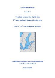
GREIFSWALDER GEOGRAPHISCHE ARBEITEN - Ernst-Moritz ...
GREIFSWALDER GEOGRAPHISCHE ARBEITEN - Ernst-Moritz ...
GREIFSWALDER GEOGRAPHISCHE ARBEITEN - Ernst-Moritz ...

You also want an ePaper? Increase the reach of your titles
YUMPU automatically turns print PDFs into web optimized ePapers that Google loves.
<strong>GREIFSWALDER</strong> <strong>GEOGRAPHISCHE</strong> <strong>ARBEITEN</strong><br />
___________________________________________________________________________<br />
Geographisches Institut der <strong>Ernst</strong>-<strong>Moritz</strong>-Arndt-Universität Greifswald<br />
Band 27<br />
Holocene Evolution of the South-Western Baltic Coast<br />
– Geological, Archaeological and Palaeo-environmental Aspects<br />
Field meeting of INQUA Subcommission V<br />
Sea-level Changes and Coastal Evolution. Western Europe<br />
September 22 – 27, 2002<br />
Editor<br />
Reinhard Lampe<br />
GREIFSWALD 2002<br />
_______________________________________________________________________<br />
ERNST-MORITZ-ARNDT-UNIVERSITÄT GREIFSWALD
Impressum<br />
ISBN: 3-86006-196-8<br />
<strong>Ernst</strong>-<strong>Moritz</strong>-Arndt Universität Greifswald<br />
Editor: Reinhard Lampe<br />
Layout: Brigitta Lintzen<br />
Drawings: Petra Wiese, Brigitta Lintzen<br />
Production: Vervielfältigungsstelle der Universität Greifswald<br />
KIEBU-Druck Greifswald<br />
Contact: Prof. Dr. Reinhard Lampe<br />
Greifswald University, Institute of Geography<br />
F.-L.-Jahn-Str. 16<br />
D – 17487 Greifswald, Germany<br />
e-mail: lampe@uni-greifswald.de<br />
The authors are responsible for the content of their contributions
Contents<br />
Preface<br />
R. LAMPE<br />
A Overview<br />
1. Regional geology of the south-western Baltic coast<br />
G. HOFFMANN<br />
2. Post-glacial water-level variability along the south Baltic coast – a short overview<br />
R. LAMPE<br />
B Rügen Island<br />
1. Glacial and coastal geomorphology of eastern Rügen Island<br />
W. JANKE<br />
2. The early medieval trading site of Ralswiek and the development of the depression<br />
TH. TERBERGER<br />
3. Late Mesolithic settlement and sea level development at the Littorina coast - sites<br />
Ralswiek-Augustenhof and Lietzow-Buddelin<br />
B. GRAMSCH<br />
4. New evidence on the Ertebølle Culture on Rügen and neighbouring areas<br />
H. LÜBKE, TH. TERBERGER<br />
5. Coastal evolution of the Schaabe spit and the shoreline displacement curve for<br />
Rügen Island<br />
W. SCHUMACHER<br />
6. Quaternary development of Tromper Wiek, Rügen Island<br />
W. LEMKE, K. SCHWARZER, M. DIESING<br />
7. The Jasmund cliff section<br />
H. SCHNICK<br />
8. The Late glacial/Holocene evolution of a barrier spit and related lagoonary waters<br />
- Schmale Heide, Kleiner Jasmunder Bodden and Schmachter See/Rügen<br />
R. LAMPE, W. JANKE, H. MEYER, R. ZIEKUR, R. SCHURICHT<br />
C Usedom Island<br />
1. The geological evolution of Usedom Island<br />
G. HOFFMANN<br />
2. Peatlands in ice marginal valleys and their relation to sea level changes<br />
D. MICHAELIS, H. JOOSTEN<br />
3. The development of the river valleys from the Uecker to the Warnow<br />
W. JANKE<br />
6<br />
9<br />
13<br />
21<br />
27<br />
37<br />
47<br />
55<br />
61<br />
69<br />
75<br />
89<br />
95<br />
101
4. Palaeogeography and palaeoecology of the Szczecin Lagoon<br />
R. K. BORÓWKA, M. LATAŁOWA, A. OSADCZUK, J. ŚWIĘTA, A. WITKOWSKI<br />
5. Pollen and diatom analyses from sediment cores of the Szczecin Lagoon<br />
W. JANKE<br />
6. Evolution of the Świna barrier spit<br />
K. OSADCZUK<br />
7. Late Quaternary evolution of coastal lakes on Usedom Island<br />
U. KERSTAN, P. VOSS, W. JANKE, R. LAMPE<br />
8. Coastal dynamics and coastal protection of the Isle of Usedom<br />
W. SCHUMACHER<br />
9. Morphogenesis of the Gnitz peninsula<br />
G. HOFFMANN<br />
10. The Peenemünde-Zinnowitz area – the Holocene evolution of a coastal lowland<br />
G. HOFFMANN, R. LAMPE, R. ZIEKUR, R. SCHURICHT<br />
11. Basin sands and inland dunes of the Lubminer Heide<br />
W. JANKE<br />
12. Late Quaternary Sedimentation and Depositional History of the Greifswalder<br />
Bodden (southern Baltic Sea)<br />
R.-O. NIEDERMEYER, G. VERSE, H. BAUERHORST<br />
D Fischland – Darss – Zingst Pensinsula<br />
1. Holocene evolution and coastal dynamics of the Fischland-Darss-Zingst peninsula<br />
R. LAMPE<br />
2. Coastal evolution of the Darss Peninsula<br />
W. SCHUMACHER<br />
3. The High Cliff of the Fischland<br />
R. LAMPE, W. JANKE<br />
4. The Darss Sill and the Ancylus Lake drainage<br />
W. LEMKE, J. B. JENSEN, O. BENNIKE, R. ENDLER, A. WITKOWSKI, A. KUIJPERS<br />
5. Coastal dynamics and coastal protection of the Fischland-Darss-Zingst peninsula<br />
R. LAMPE<br />
6. Salt meadow evolution and Holocene sea-level rise - the examples Kooser Wiesen<br />
and Ribnitzer Wiesen<br />
R. LAMPE, W. JANKE<br />
E Poel Island<br />
1. The western cliff of Poel Island<br />
W. SCHULZ<br />
107<br />
115<br />
119<br />
127<br />
131<br />
135<br />
137<br />
145<br />
147<br />
155<br />
165<br />
169<br />
175<br />
183<br />
187<br />
199
2. Submarine Stone Age Settlements as Indicators of Sea Level Changes and the<br />
Coastal Evolution of the Wismar Bay Area.<br />
H. LÜBKE<br />
3. The Rustwerder spit - structural sediment features as water level marks<br />
W. SCHUMACHER<br />
4. The proto-historic sea-trading port at Groß Strömkendorf – the “emporium reric“ of<br />
the Royal Frankish Annals<br />
H. JÖNS<br />
5. Storm floods of the southern Baltic Sea<br />
W. SCHUMACHER<br />
List of Contributers 223<br />
203<br />
211<br />
213<br />
219
Preface<br />
From September 23 – 27, 2002 the INQUA Sub-commission V “Western European Shorelines”<br />
conducted a field meeting entitled “Holocene Evolution of the South-Western Baltic<br />
Coast – Geological, Archaeological and Palaeo-environmental Aspects”. Forty scientists from<br />
nine countries took part in the conference and the four subsequent excursions which were<br />
organized by the University of Greifswald, the Institute of Baltic Research, Warnemünde, the<br />
State Agency for Protection of Archaeological Heritage of Mecklenburg-Vorpommern, Lübstorf,<br />
and the State Geological Survey of Mecklenburg-Vorpommern, Güstrow.<br />
In 2000, when the idea of the field meeting was first discussed with Antony Long, President<br />
of the Subcommission V, one main reason existed for inviting those associated with the<br />
commission to Greifswald. The last time a comparable meeting was held in North-East Germany<br />
was in 1967, when the late Otto Kolp, Warnemünde, guided an INQUA commission<br />
and presented the state-of-the-art regarding the Holocene sea-level development and the<br />
related coastal evolution and morphodynamics. After that, scientific and personal exchange<br />
with colleagues from Western Europe was broken off due to the political circumstances and<br />
until 1990 only very few personal contacts were possible. However, throughout this period<br />
the few geoscientists working on coastal evolutionary problems in what is now Mecklenburg<br />
– West Pomerania gathered a lot of new data, ideas and hypotheses as well as discovering<br />
new problems. Some of those remain unresolved and are the subject of a variety of current<br />
geoscientific investigations. The rather small circle of colleagues who could be brought together<br />
in a field meeting seemed us to be the best frame to present and discuss both the results<br />
of these investigations and the problems still open.<br />
A second reason for holding the field meeting arose in the last few months with the successful<br />
application to launch the interdisciplinary research unit “Sinking Coasts: Geosphere, Ecosphere<br />
and Anthroposphere of the Holocene Southern Baltic Sea (SINCOS)” which will be<br />
supported by the Deutsche Forschungsgemeinschaft in the next few years. Along the entire<br />
coast of Mecklenburg – West Pomerania, geoscientists and archaeologists, together with<br />
geophysicists, experts in dating, and palaeo-botanists, will investigate the interplay between<br />
eustasy, neotectonics and material supply during the main Littorina transgression stage and<br />
the consequences of the transgression and fast landscape changes for the ancient human society<br />
living at the coast. The meeting provides the chance to present the project to a wider<br />
international audience and to encourage the scientific discussion.<br />
Among the most important topics to be addressed during the meeting are:<br />
- Facies architecture and morphological development of barrier spits and beach ridge<br />
plains and the problem of neotectonic movements<br />
- Holocene sedimentation in the West Pomeranian coastal waters – the evolution from<br />
open sea bays to isolated lagoons<br />
- The Late Holocene sea-level record in coastal peat sequences<br />
- Drowned Mesolithic settlement sites off the coast of Mecklenburg - West Pomerania<br />
- Recent morphodynamics and implications for future coastal management.<br />
The volume of the Greifswalder Geographische Arbeiten presented herewith is the product<br />
of many of the SINCOS project members and their collaborators. It has been designed firstly<br />
as an excursion guide and provides the morphological, stratigraphical and archaeological<br />
background to the sites to be visited in the order of the excursions routes on Rügen, Usedom,<br />
Darss-Zingst and Poel. It is also a first compilation regarding the present state of our knowl-<br />
6
edge about the sea-level evolution and the related formation of the coastal Holocene deposits<br />
in the south Baltic area, although not all sites of interest could be described and presented.<br />
Finally, the editor wishes to express his gratitude to all the authors for their contributions, to<br />
the draughts(wo)men B. Lintzen and P. Wiese for careful drawing and final design, to the<br />
translators M. Pater and A. Zühr who took care of the proof reading and language revision<br />
and, last not least, to the management of the Institute of Geography for financial support.<br />
Reinhard Lampe<br />
7
Greifswalder Geographische Arbeiten 27 A 1: 9-12 Greifswald 2002<br />
Regional geology of the south-western Baltic coast<br />
GÖSTA HOFFMANN<br />
In a tectonic sense the Baltic Sea basin covers parts of the East European (EEP) and West<br />
European Platform (WEP). Different tectonic conditions allow a subdivision of the EEP into<br />
the Fennoscandian Shield, the Russian Plate and the Baltic Syneclise (Fig. 1).<br />
Fig. 1: Structural outline of the pre-Permian basement in Central Europe (KATZUNG 2001).<br />
BM - Brabanter Massif; CB - Cracovian Belt; ED - Else duplex; EM - East Elbian Massif; HM -<br />
Harz Mts.; HCM - Holy Cross Mts.; KU - Kielce Unit; LM - Lüneburg Massif; LU - Lysogory<br />
Unit; MPB - Malopolska Block; SSU - Strelasund-Szcecinek Uplift; TEF - Trans European<br />
Fault; USB - Upper Silesian Block; ADF - Alpine Deformation Front; CDF - Caledonian Deformation<br />
Front; VDF - Variscan Deformation Front<br />
The Fennoscandian Shield is dominated by Precambrian crystalline rocks; the Russian Plate<br />
is covered by Phanerozoic sediments. Palaeozoic sediments fill the Baltic Syneclise (HARFF et<br />
al. 2001). BERTHELSEN (1992) named the SW-border of the EEP Trans-European Fault (TEF).<br />
As a structural-geological element it extends in the subsurface of the coastal area of West<br />
Pomerania through the Strelasund, Greifswalder Bodden and Usedom. Strike direction is<br />
NW-SE to WNW-ESE. Further towards the east it is approaching the Tornquist-Teisseyre-<br />
Zone (TTZ) following it in SE direction. KATZUNG (2001) describes the Caledonian Deformation<br />
Front on the southern margin of the Eastern European Craton. Thus the TTZ represents<br />
9
a complex zone, which was tectonically superimposed several times. The first tectonic stress<br />
is due to the Caledonian deformation followed by an extensional phase in Palaeozoic to<br />
Mesozoic, and finally an inversional phase in Late Mesozoic to Cenozoic. According to<br />
KATZUNG (2001) the TTZ stretches from NW Poland in SE direction parallel to the Caledonian<br />
Deformation Front. To the NW the TTZ and the Sorgenfrei-Tornquist Zone (STZ),<br />
which is dislocated dextral at the Rønne-Graben, extending in same direction across the East<br />
European Craton, whereas the Caledonian Deformation Front runs further to the south. As a<br />
result, the coastal area of West Pomerania is situated on the NE margin of the WEP which is<br />
upthrusted onto the EEP.<br />
The subsurface of the southern Baltic Sea as well as the bordering areas are characterized by<br />
block faulting (KRAUSS, MÖBUS 1981). The structural character is dominated by an orthogonally<br />
(E-W, N-S) and a diagonally (NW-SE, NE-SW) direction system. Tectonic activities<br />
at deep reaching fractures influencing the geomorphologic evolution of the area are discussed<br />
by KRAUSS & MÖBUS (1981). According to these authors the course of ice marginal<br />
zones of the Brandenburg and Pomeranian stages of the Weichselian glaciation reflects NE-<br />
SW striking faults in the subsurface. According to MÖBUS (1996) the NE-SW orientated<br />
course of today’s coastline from Rügen Island to Lübeck Bay as well as the NW-SE orientated<br />
course from Rügen Island to the Oder estuary reflect the subsurface fault system.<br />
Because the coast in Mecklenburg-Vorpommern mostly consists of unconsolidated Pleistocene<br />
sediments it is difficult to identify the formation of faults (MÖBUS 1996). Normally it is<br />
not possible to determine whether faults are endogenous or a result of glacial tectonics. To<br />
verify recent crust movements, i.e. neotectonic processes, Holocene deposits have to be investigated.<br />
Most of these formations are not easily accessible, because they are situated below<br />
the present sea level. For this reason an attempt is made to reconstruct the Holocene sea<br />
level rise for different areas along the south-west Baltic coast. If significant differences appear,<br />
neotectonic processes have to be taken into account.<br />
Most important for the recent geomorphologic setting of the coast of the south-western Baltic<br />
Sea as well as for the rest of Mecklenburg-Vorpommern are glacial dynamics during the<br />
Pleistocene (Fig. 2). During this period different glaciations affected the area. The positive<br />
landforms of Mecklenburg-Vorpommern forming the cliff sections, for instance, consist of<br />
deposits associated with the last, the Weichselian glaciation (DUPHORN, KLIEWE 1995). From<br />
the island of Rügen in the North to the south-western part of Mecklenburg-Vorpommern<br />
three major pleniglacial ice advances can be reconstructed. Due to missing biostratigraphical<br />
indicators subdivision within the glacial deposits is problematic (MÜLLER et al. 1995). Morphostratigraphical<br />
evidence combined with lithostratigraphical methods as described in the<br />
TGL standard of the GDR (TGL 25 232/01-06) are used to separate and link the different deposits<br />
within the area of former glaciations.<br />
MÜLLER et al. (1995) subdivided the Weichselian glaciation into several phases (see Fig. 2).<br />
The lowest till sheet together with proglacial outwash deposits belong to the Brandenburg<br />
stage W1b). The W1 - end moraine is also the southernmost marginal zone. The later course of<br />
the Weichselian is characterized by ice decay and readvances. The Frankfurt marginal zone<br />
(W1F) possibly represents the border of such an oscillation (MÜLLER et al. 1995). No ground<br />
moraine could be found for the W1F–advance (RÜHBERG et al. 1995). The Pomeranian stage<br />
(W2) is subdivided into two phases (W2u, W2o in Fig. 2) by RÜHBERG et al. (1995). Ice dynamics<br />
are described as strongly scouring. During this phase the thickest and most widely spread<br />
bed of ground moraine was deposited. Eskers are characteristic for the W2 ground moraine.<br />
The W3 till of the Mecklenburg stage covers the older units only sporadically. There is no<br />
10
continuous end moraine. Only in some parts, as in the west of Stralsund and the southern<br />
part of Usedom Island (Velgast marginal zone, W3V in Fig 2) the deposits demonstrate the<br />
character of an end moraine. It is believed that this marginal zone belongs to an ice advance<br />
(RÜHBERG et al. 1995).<br />
Fig. 2: Geological map of the Quaternary of Mecklenburg-Vorpommern (RÜHBERG et al.<br />
1995).<br />
1 - marginal zones, 2 - marginal zone, supposed, 3 - glacitectonic compression zone, 4 - outwash<br />
plain, 5 - ice-marginal valley, 6 - Esker, 7 - basin, 8 - Saalian flat upland area, W3 -<br />
ground moraine of the Mecklenburg stage, subdivided by W3R: Rosenthal marginal zone and<br />
W3V: Velgast marginal zone; W2max and W2 - Pomeranian marginal zone and ground moraine;<br />
W1F: Frankfurt stage; W1B: Brandenburg stage;<br />
Because of rapid ice decay, melt-out of dead-ice and the rapid dispersion of ground vegetation<br />
the shape of the young moraine area is well preserved. The hydrographical system is<br />
still fragmentary. Although there are stratigraphical problems, making it difficult to correlate<br />
the different Pleistocene deposits, the glacial processes provided the clastic material the coast<br />
consists of. Due to coastal dynamics their reworking and redeposition is still going on.<br />
References<br />
BERTHELSEN, A. (1992): From Precambrian to Variscan Europe. – In: BLUNDELL, D.; FREEMAN,<br />
R.; MULLER, S. (eds.): A Continent Revealed: The European Geotraverse:153-164. Cambridge.<br />
11
DUPHORN, K.; KLIEWE, H. (1995): 3. Geologische Entwicklung im Pleistozän. – In: DUPHORN,<br />
K., KLIEWE, H., NIEDERMEYER, R.O., JANKE, W.; WERNER, F.: Sammlung Geologischer<br />
Führer 88: 20-31.<br />
HARFF, J.; FRISCHBUTTER, A.; LAMPE, R.; MEYER, M. (2001): Sea-level Change in the Baltic Sea:<br />
Interrelation of Climatic and Geological Processes. – In: GERHARD, L. C.; HARRISON, W.E.;<br />
HANSON, B.M. (eds): Geological Perspectives of Global Climate Change. - The America<br />
Association of Petroleum Geologists 47: 231-250.<br />
KATZUNG, G. (2001): The Caledonides at the southern margin of the East European Craton. -<br />
Neues Jahrbuch Geologisch Paläontologischer Abhandlungen 222(1/2): 3-53.<br />
KRAUSS, M.; MÖBUS, G. (1981): Korrelation zwischen der Tektonik des Untergrunds und den<br />
geomorphologischen Verhältnissen im Bereich der Ostsee. - Zeitschrift für geologische<br />
Wissenschaften 9(3): 255-267.<br />
MÖBUS, G. (1996): Tektonische Erbanlagen im Quartär des südlichen Ostseeraumes - eine<br />
Richtungsanalyse. - Zeitschrift für geologische Wissenschaften 24(3/4): 325-334.<br />
MÜLLER, U.; RÜHBERG, N.; KRIENKE, H.D. (1995): The Pleistocene sequence in Mecklenburg-<br />
Vorpommern.. – In: EHLERS, J.; KOZARSKI, S.; GIBBARD, P. (ed): Glacial Deposits in North-<br />
East Europe: 501-516<br />
RÜHBERG, N.; SCHULZ, W.; V.BÜLOW, W.; MÜLLER, U.; KRIENKE, H.D.; BREMER, F.; DANN, T.<br />
(1995): V. Mecklenburg-Vorpommern. – In: BENDA, L.: Das Quartär Deutschlands: 95-115.<br />
12
Greifswalder Geographische Arbeiten 27 A 2: 13-19 Greifswald 2002<br />
Post-glacial water-level variability along the south Baltic coast<br />
– a short overview<br />
REINHARD LAMPE<br />
The water-level evolution which occurred in the area of the southern Baltic mainland after<br />
the retreat of the Weichsel-III ice sheet was characterized by some remarkable fluctuations.<br />
The reasons were the formation of the postglacial drainage system and – later – the arrival of<br />
the Holocene sea-level transgression in the area off the recent coast.<br />
The oldest and simultaneously highest water level marks, located between 25 – 3 m above<br />
mean sea level (msl), are terraces, mostly of erosive but sometimes of accumulative nature<br />
too (JANKE 1978, cf. C-3 this volume), which are connected with the existence of a pre-Bölling<br />
meltwater lake (“Haffstausee”) in the region of the Ueckermünder Heide, the Puzszcza Goleniowska<br />
as well as the Puszcza Wkrzanska, both located in westernmost Poland. The primary<br />
drainage occurred to the northwest through the Grenztal valley. The opening of additional<br />
drainage channels towards the northwest (Peene, Peenestrom-Ziese-Strelasund system)<br />
led to the first water table degradations. Associated with the ice retreat to the northern<br />
edge of today’s Pomeranian Bight, the drainage direction changed more and more to a<br />
northerly direction and led to the accumulation of fluvio- and limno-glacial sediments in the<br />
inner bight, probably as a delta or braided river plain. With further degradation of the water<br />
table the delta area largely dried out. The Late glacial lacustrine sediments of the Oder Bight<br />
are located at depths of –12 m (KRAMARSKA 1998: 281), along the western shore they can be<br />
found at –14 m (SCHMIDT 1957/58: 270). The lowering of the base level was accompanied by<br />
an incision phase of the rivers. Among others, the lowermost river bed level of the lower<br />
Oder river at –45 to –65 m (BROSE 1972: 60, DOBRACKA 1982: 114) is believed to be due to this<br />
process. Because, according to recent knowledge, this very low level cannot be traced to the<br />
Oder Bight, additional processes have to be considered to explain how it was formed .<br />
The earliest phases of the Baltic Ice Lake (BIL), which came into being about 13,000 BP (BJÖRK<br />
1995a) , can be demonstrated by warve clays at Kriegers Flak in waters depths of about –25<br />
m (LEMKE 1998: 137). In the Older Dryas the replenishment of the valleys started initially<br />
with periglacial flowsheets. Simultaneously, a water level rise is to be observed, which<br />
reached its maximum at the end of the Alleröd and in the Younger Dryas. Throughout the<br />
Alleröd there was widespread accumulation of muds and peats, the altitude of which<br />
spread over a wide range – depending on the elevation of the depressions. It is not clear if<br />
the peats located in the Szczecin Lagoon at –11 m (cf. C-4) or in the Oder Bight at –16 m<br />
(KRAMARSKA 1998: 282,) represent the maximum water table in the Lower Oder Valley or in<br />
the Baltic basin at that time because, at least until this period, inactive ice blocks were melting<br />
and causing shifts of the sediments formed at the same time. LEMKE (1998: 156) indicates<br />
that, during the Alleröd/Younger Dryas period, the water table of the Baltic Ice Lake east of<br />
the Darss sill rose from –40 m to –20 m (see also BENNIKE, JENSEN 1998, cf. curve A in Fig. 1).<br />
SCHWARZER et al. (2000: 72) even suspect the maximum height of the BIL reached –9 m according<br />
to the results of seismic investigations in the inner part of the Tromper Wiek/Rügen<br />
(cf. B-6); this is substantiated by a neotectonic uplift of about 6m according to SCHUMACHER<br />
& BAYERL (1999: 112, cf. B-5). If this elevation can be proved, we have to imagine at least the<br />
western part of the Oder Bight as a wide Late Pleistocene delta-like sedimentation area,<br />
13
characterized by braided rivers and many small local waters. The accumulation of sandy and<br />
silty sediments would then have led to an extensive levelling of the former relief. The areas<br />
not drowned then would have been subjected to substantial deflation and the evolution of<br />
aeolian sand sheets and dunes (KAISER 2001: 154).<br />
Fig. 1: The Postglacial water table variations in the south Baltic area<br />
A - Relative shoreline displacement in the Arkona basin after BENNIKE & JENSEN (1998)<br />
B1 - relative shoreline displacement along the West Pomeranian coast after KLIEWE & JANKE<br />
(1982)<br />
B2 - relative sea-level variations along the West Pomeranian coast after JANKE & LAMPE (2000)<br />
C - the shoreline displacement curve of Rügen Island according to SCHUMACHER (this volume,<br />
see B-5)<br />
D – water level course as revealed from the distribution of carbonate-bearing sandy sediments<br />
in the vicinity of the Oder Bight, related to the Ancylus Lake by KLIEWE &<br />
REINHARD (1960)<br />
E – water table of coastal rivers and inland waters after JANKE (1978, see C-3)<br />
OD1, OD2 – two stages of water table rise according to the distribution of sandy sediments<br />
preliminary related to an ancient Oder delta, assumed due to current surveys<br />
14<br />
A<br />
Depth (m below sea level)<br />
0<br />
10<br />
20<br />
30<br />
40<br />
50<br />
11<br />
BIL Y A<br />
E<br />
OD1? OD2?<br />
D C<br />
L - I L - II L - III PL NT<br />
B 2<br />
12 10 8 6 4 2 0<br />
10<br />
8<br />
6<br />
B 1<br />
A<br />
4<br />
Age (cal. ka BP)<br />
2<br />
14<br />
Age (conv C ka BP)<br />
0
The transgression of the BIL ended with the retreat of the Scandinavian ice sheet from the<br />
southern Swedish mountains. The opening of the gap at Billingen in about 10,300 BP caused<br />
the final regression of the BIL (Björk 1995: 27) and the degradation of the water table to about<br />
–40 m. Hence, in the valleys the early Holocene incision phase started and in the basins further<br />
peat aggradation and desiccation took place, which comprised the Preboreal and Boreal<br />
period. However, the very low lying areas experienced a water level rise again. According to<br />
BJÖRK (1995), in the Baltic basin in 9,500 BP the Ancylus phase had already started as an<br />
freshwater body isolated from the ocean. The views regarding the maximum level of the<br />
Ancylus transgression differ widely in the scientific literature. KLIEWE (1960: 230, 1995: 183)<br />
and KLIEWE & REINHARD (1960: 166f) assumed an elevation of –8 m due to their findings of<br />
fine sandy freshwater sediments on Usedom (cf. C-10) and eastern Rügen (cf. B-8); KOLP<br />
(1975: 38) initially supposed a level not higher than –20 m. KLIEWE & JANKE (1982: 68f, curve<br />
B1 in Fig. 1) again determined the maximum at –8 m and dated it to 8,800 – 8,700 BP. Finally<br />
KOLP (1986: 90) accepted this view and identified the Darss sill as a natural dam, the breaching<br />
of which caused the Ancylus regression and the origin of the Kadet Channel in about<br />
8,800 BP. BJÖRK (1995b: 31) considers earlier estimations of –20 m possible and specifies the<br />
onset of the regression in 9,200 BP. Recent investigations in the Mecklenburg Bight and the<br />
Arkona Basin carried out by LEMKE (1998: 148ff) and LEMKE et al. (1999: 69) led them to state<br />
that the Darss sill could not have been a dam barrier and therefore east of the sill the Ancylus<br />
Lake could not have been higher than –18 m (cf. D-4). In fact, the freshwater sands found by<br />
KLIEWE and REINHARD and determined as Preboreal/Boreal accumulations seem to be restricted<br />
to the region between Jasmund/Rügen and Usedom.<br />
The investigation of the Schaabe by SCHUMACHER & BAYERL (1997) was not able to verify the<br />
existence of corresponding accumulations, and the findings near Zingst, like those from the<br />
Bug/NW Rügen area, could also be interpretated as local lake deposits (KLIEWE, JANKE 1991:<br />
6f; LEMKE 1998: 150; LEMKE et al. 1999: 69). BENNIKE & JENSEN (1998: 30) argue that all of<br />
these higher freshwater sediments, formerly related to the Ancylus Lake, are accumulations<br />
of smaller freshwater basins.<br />
Summarizing everything stated above about the Ancylus Lake level, three competing hypotheses<br />
result, namely<br />
a) a large Preboreal/Boreal Ancylus Lake, stretching fjord-like in the south into the<br />
deep ice-excavated basins of Rügen and Usedom during its maximum height of –8<br />
m,<br />
b) a freshwater body with a level of –8 m (the primary Oder Lagoon) covering at least<br />
the western part of the recent Oder Bight and a short steep outflow of the Oder down<br />
to the Ancylus Lake in the Arkona Basin with a level of –18 m (from the geomorphological<br />
point of view rather unlikely), or<br />
c) the reinterpretation of the above mentioned freshwater sands as accumulations of an<br />
end-Pleistocene/Early Holocene delta, intervening between the Oder river and the<br />
Baltic Ice Lake or the Ancylus Lake, with sustained desiccation and river incision during<br />
the base level fall and remediation during its rise (Fig. 1, curve sections OD1 and<br />
OD2). The fluvio-limnic depression filling occurred until the Boreal and even the earliest<br />
Atlantic. With the arrival of the Littorina transgression the area was finally<br />
flooded. This latter assumption results from current surveys not yet finished. Until<br />
these investigations are completed and new radiocarbon data are available, this<br />
enigma of the Ancylus Lake (HURTIG 1958) will remain unresolved.<br />
All the water level data mentioned above are related to their current position in respect of<br />
the sea-level, without a consideration of any subsequent isostatic movement or compaction<br />
15
that has caused an unknown relocation of sediment layers to another height than primarily<br />
deposited. This ignorance about such post-sedimentary movements finally makes the fluviolimnic<br />
deposits “uncorrelatable” (KAISER 2001: 164).<br />
The first precursors of the Littorina transgression are marine-brackish diatom assemblages<br />
found in deposits of the Mecklenburg Bight which are 8,500 to 8,000 radiocarbon years old<br />
(ERONEN et al. 1990). Over the depth interval of –30 to –20 m LEMKE (1998: 153) found indications<br />
of a rapid transition to marine conditions for the period between 7,500 and 7,000 BP.<br />
Closer to the coast the oldest limnic-telmatic sediments, which were overlaid by marine deposits,<br />
were found at about –15m and dated to c. 8,000 BP. The initial rise of the water table<br />
occurred rapidly and reached –2 m in about 6,000 BP (JANKE, LAMPE 2000: 587, cf. B-3, D-6, ).<br />
Recently an end-Mesolithic settlement site with three dug-out boats has been excavated in<br />
the city of Stralsund; they had been preserved in a former coastal area of the Littorina Sea<br />
now located at about - 2 m. Preliminary observations suggest a dating of c. 5,400 to c. 4,000<br />
cal. BC (cf. B-4), which corresponds to c. 6,400 to c. 5,200 BP. This agrees with the previously<br />
stated level. However, for the Wismar Bight a noticeably lower sea-level has to be assumed,<br />
as demonstrated by findings from end-Mesolithic sites at depths of -7 m (6,200-6,300 BP) and<br />
-2.5 to - 3.5 m (5,500-5,300 BP, LÜBKE 2000: 31, cf. E-2); this correlates better with the sealevel<br />
curve for the southern Baltic described by KLUG (1980).<br />
The following period until about 5,300 BP, which is believed to have been a retardation or<br />
regression phase (RL-I, KLIEWE, JANKE 1982: 70), became the subject of discussion due to the<br />
investigations of SCHUMACHER & BAYERL (1997, 1999) and JANKE & LAMPE (2000). The authors<br />
believe they found hints of a neotectonic uplift of some meters in that period (Fig. 1,<br />
curves B2 and C, cf. B-5). They found peats and soils intercalated in marine sediments which<br />
have been dated by means of pollen analysis and radiocarbon measurements. Attempts to<br />
verify these findings at other sites have not yet been successful. However, the problem of<br />
neotectonic movements is not out of the discussion for this reason. Moreover, it remains the<br />
key to explain the cause of the West Pomeranian sea-level curve running higher than the<br />
curves for adjacent regions (Fig. 1). For instance, in comparison with contiguous areas, the 1 st<br />
Littorina phase (L-I) reached the –2 m level about 1,500 years earlier (KLUG 1980: 242). Also,<br />
older sediments like the deposits of the BIL are located in exceptionally high positions in<br />
northern Rügen (SCHWARZER et al. 2000: 72, cf. B-6).<br />
The continuation of the sea-level rise just after 5,000 BP may be traced mainly by investigations<br />
of the coastal peat lands as well as archaeological findings, because siliciclastic sediments<br />
of barrier spits and beach ridge plains contain very little datable material. After the<br />
RL-I, which attracts attention by a peat oxidation horizon and a hiatus in the peat profiles,<br />
the sea-level rose slowly to about –0.6 m msl until 3,000 BP. The period of the Urnfield<br />
Bronze Age, which is known from the inland as a dry period (JÄGER, LOZEK 1978: 217), is<br />
characterized by slight peat degradation in the coastal mires. Whether a (minor) sea-level<br />
fall occurred simultaneously is still under discussion. MÖRNER (1999: 81) argued such a relationship<br />
between drought und sea-level fall, in line with changes in regional air pressure<br />
and river runoff.<br />
The transgression throughout the Roman Age (L-III) raised the water table only marginally<br />
to –0.5 m msl. The subsequent regression caused by the climate deterioration during the period<br />
of the German Tribes Migration might also have been only slight. Perhaps it constitutes<br />
a retardation or cessation of the transgression. In contrast, during or just after the medieval<br />
climate optimum, a remarkable sea-level rise to –0.25 m occurred about 1,000 to 600 BP.<br />
16
LANGE et al. (1986: 14) used Slavonic findings from Ralswiek/Rügen even to reconstruct a<br />
water table of 0.25 – 1 m msl (cf. B-2). However, evidence for such a high water level cannot<br />
be found in the coastal peat lands and it must be argued that traces of a surge have been confused<br />
with evidence of a secular sea-level variation.<br />
The striking subsequent regression, which is indicated by the widespread appearance of a<br />
prominent peat oxidation horizon in the coastal peat lands, has been related to the Little Ice<br />
Age between 450 to 150 BP. According to current knowledge, such sea-level variations over a<br />
range of about ± 20 cm coincide by all means with the average margin of error in respect of<br />
sea-level determinations and are therefore difficult to detect. As a result of the minor natural<br />
variations, the available data base for the period younger than 5,000 BP must be assessed as<br />
still uncertain.<br />
It was stated above that at least in the past 5,000 years the sea-level raised on a rather<br />
smoothed course which was interrupted only by some few minor regression stages (Fig. 1,<br />
curves B1, B2). But in the light of other investigations it remains still open whether or not the<br />
sea-level has experienced more frequent oscillations of an order of about a meter.<br />
SCHUMACHER assumes that such oscillations, he detected in sediment sequences from the<br />
Schaabe barrier spit (SCHUMACHER, ENDTMANN 2000) and from Poel Island (SCHUMACHER<br />
1990), are related to periodic climate fluctuations (Fig. 1, curve C, cf. B-5). He refers to similar<br />
findings described by TOOLEY (1974), MÖRNER (1978) and others.<br />
Since the onset of regular gauge records in the middle of the 19 th century, the sea-level along<br />
the southern Baltic (e.g. in Warnemünde) has risen on average by another 18 cm (DIETRICH,<br />
LIEBSCH 2000: 616). Here a notable spatial differentiation in the rate of the rise may be observed<br />
(Fig. 2), which can only be ascribed to non-eustatic, endogenic causes. The extent to<br />
which this spatial pattern is temporally stable will be the subject of future investigations<br />
(HARFF, SINCOS-project members 2002).<br />
Fig. 2: Recent relative sea-level movements in the area of the south Baltic Sea, calculated from<br />
gauge records by DIETRICH & LIEBSCH (2000)<br />
17
References<br />
BENNIKE, O. ;JENSEN, J. B. (1998): Late- and postglacial shore level changes in the southwestern<br />
Baltic Sea. - Bulletin of the Geological Society of Denmark 45: 27 - 38.<br />
BJÖRK, S. (1995a): A review of the history of the Baltic Sea 13.0-8.0 ka BP. - Quaternary International<br />
27: 19 - 40.<br />
BJÖRK, S. (1995b): Late Weichselian to early Holocene development of the Baltic Sea - with<br />
implications for coastal settlements in the southern Baltic region. - In: FISCHER, A. (ed.):<br />
Man and sea in the Mesolithic. Oxford, Oxbow Books: 23 - 34.<br />
BROSE, F. (1972): Die spätglaziale Laufentwicklung der Unteren Oder. - Wissenschaftliche<br />
Zeitschrift der Universität Greifswald, math.-nat. Reihe 21: 59 - 62.<br />
DIETRICH, R.; LIEBSCH, G. (2000): Zur Variabilität des Meeresspiegels an der Küste von Mecklenburg-Vorpommern.<br />
- Zeitschrift f. Geologische Wissenschaften 28: 615 - 624.<br />
DOBRACKA, E. (1983): Development of the lower Odra valley and the Wkra Forest (Ueckermünder<br />
Heide) lowland in the Late-glacial and the Holocene. - Petermanns<br />
Geographische Mitteilungen, Erg.-H. 282: 108 - 117.<br />
ERONEN, M.; RISTANIEMI, O.; LANGE, D. (1990): Analysis of a sediment core from the Mecklenburg<br />
Bay, with a discussion on the early Holocene history of the southern Baltic Sea. -<br />
Geologiska Föreningens i Stockholm Förhandlingar 112: 1 - 8.<br />
HARFF, J.; SINCOS-project members (2002): Sinking Coasts: Geosphere, Ecosphere and Anthroposphere<br />
of the Holocene Southern Baltic Sea (SINCOS). Application for a DFG Research<br />
Unit.<br />
HURTIG, T. (1958): Zum "Rätsel des Ancylussees". Petermanns Geographische Mitteilungen<br />
102: 244 - 250.<br />
JÄGER, K.-D.; LOZEK, V. (1978): Umweltbedingungen und Landesausbau während der Urnenfelderbronzezeit<br />
in Mitteleuropa. - Mitteleuropäische Bronzezeit. Berlin: 211 - 229.<br />
JANKE, W. (1978): Schema der spät- und postglazialen Entwicklung der Talungen der spätglazialen<br />
Haffstauseeabflüsse. - Wiss. Z. Univ. Greifswald 27: 39 - 41.<br />
JANKE, W.; LAMPE, R. (2000): Zu Veränderungen des Meeresspiegels an der vorpommerschen<br />
Küste in den letzten 8000 Jahren. - Zeitschrift f. geologische Wissenschaften 28: 585 - 600.<br />
KAISER, K. (2001): Die spätpleistozäne bis frühholozäne Beckenentwicklung in Mecklenburg-<br />
Vorpommern. - Greifswalder Geogr. Arb. 24: 208 S.<br />
KLIEWE, H. (1960): Die Insel Usedom in ihrer spät- und nacheiszeitlichen Formenentwicklung.<br />
- Neuere Arbeiten zur mecklenburgischen Küstenforschung. Berlin, Dt. Verl. Wissenschaften;<br />
V, 277 S.<br />
KLIEWE, H. (1995): Zeit- und Klimamarken in Sedimenten der südlichen Ostsee und ihrer<br />
vorpommerschen Boddenküste. - J. Coast. Res., Spec. Iss. 17: 181 - 186.<br />
KLIEWE, H.; JANKE, W. (1978): Zur Stratigraphie und Entwicklung des nordöstlichen Küstenraumes<br />
der DDR. - Petermanns Geographische Mitteilungen 122: 81 - 91.<br />
KLIEWE, H.; JANKE, W. (1982): Der holozäne Wasserspiegelanstieg der Ostsee im nordöstlichen<br />
Küstengebiet der DDR. - Petermanns Geographische Mitteilungen 126: 65 - 74.<br />
KLIEWE, H.; JANKE, W. (1991): Holozäner Küstenausgleich im südlichen Ostseegebiet bei besonderer<br />
Berücksichtigung der Boddenausgleichsküste Vorpommerns. - Petermanns<br />
Geographische Mitteilungen 135: 1 - 15.<br />
KLIEWE, H.; REINHARD, H. (1960): Zur Entwicklung des Ancylus-Sees. - Petermanns Geographische<br />
Mitteilungen 104: 163 - 172.<br />
KLUG, H. (1980): Der Anstieg des Ostseespiegels im deutschen Küstenraum seit dem Mittelatlantikum.<br />
Eiszeitalter und Gegenwart 30: 237 - 252.<br />
KOLP, O. (1975): Die submarinen Terrassen der südlichen Ost- und Nordsee und ihre Beziehungen<br />
zum eustatischen Meeresanstieg. - Beitr. Meereskd. 35: 48 S.<br />
18
KRAMARSKA, R. (1998): Origin and development of the Odra Bank in the light of geologic<br />
structure and radiocarbon dating. - Geological Quarterly 442: 277 - 288.<br />
LANGE, E.; JESCHKE, L.; KNAPP, H. D. (1986): Ralswiek und Rügen. Landschaftsentwicklung<br />
und Siedlungsgeschichte der Ostseeinsel. Teil 1. Die Landschaftsgeschichte der Insel Rügen<br />
seit dem Spätglazial. - Schriften zur Ur- und Frühgeschichte 38: 175 S.<br />
LEMKE, W. (1998): Sedimentation und paläogeographische Entwicklung im westlichen Ostseeraum<br />
(Mecklenburger Bucht bis Arkonabecken) vom Ende der Weichselvereisung bis<br />
zur Litorinatransgression. - Habilitationsschrift, math.-nat.Fak. Univ. Greifswald, 186 S.<br />
LEMKE, W.; JENSEN, J. B.; BENNIKE, O.; WITKOWSKI, A.; KUIJPERS, A. (1999): No indication of a<br />
deeply incised Dana River between Arkona Basin and Mecklenburg Bay. - BALTICA 12:<br />
66 - 70.<br />
LÜBKE, H. (2000): Timmendorf-Nordmole und Jäkelberg-Nord. Erste Untersuchungsergebnisse<br />
zu submarinen Siedlungsplätzen der endmesolithischen Ertebölle-Kultur in der<br />
Wismar-Bucht, Mecklenburg-Vorpommern. - Nachrichtenblatt Arbeitskreis Unterwasserarchäologie<br />
7: 17 - 35.<br />
MÖRNER, N.-A. (1978): Late Quaternary sea-level changes in northwestern Europe:a synthesis.-<br />
Geol. För. Stockholm Förh. 100(4): 381-400.<br />
MÖRNER, N.-A. (1999): Sea-level and climate: rapid regressions at local warm phases. - Quaternary<br />
International 60: 75 - 82.<br />
SCHMIDT, H. (1957/58): Zur Geomorphologie des Naturschutzgebietes " Steinfelder auf der<br />
Schmalen Heide ". - Wissenschaftliche Zeitschrift der Universität Greifswald, math.-nat.<br />
Reihe 7 (3/4): 267 - 276.<br />
SCHUMACHER, W. (1990): Hinweise auf eine Klimarhythmik im Holozän Mittel- und Nordeuropas.<br />
Schr. Naturwiss. Ver. Schlesw.-Holst. 60: 1 - 10.<br />
SCHUMACHER, W.; BAYERL, K.-A. (1997): Die Sedimentationsgeschichte der Schaabe und der<br />
holozäne Transgressionsverlauf auf Rügen (Südliche Ostsee). - Meyniana 49: 151 - 168.<br />
SCHUMACHER, W. ;BAYERL, K.-A. (1999): The shoreline displacement curve of Rügen Island<br />
(Southern Baltic Sea). - Quaternary International 56: 107 - 113.<br />
SCHUMACHER,W.; ENDTMANN, E. (2000): Chronostratigraphische Korrelation terrestrischer<br />
und litoraler Sedimentabfolgen NO-Rügens - Darstellung des Wandels der Geo- und Biosphäre<br />
seit dem Spätpleistozän. – Project Final Report, Greifswald, 14 pp.<br />
SCHWARZER, K.; DIESING, M. ;TRIESCHMANN, B. (2000): Nearshore facies of the southern shore<br />
of the Baltic Ice Lake - example from Tromper Wiek (Rügen Island). - BALTICA 13: 69 -<br />
76.<br />
TOOLEY, M. (1974): Sea-level changes during the last 9000 years in North-West England.-<br />
Geogr. J. 140: 18-42<br />
19
Greifswalder Geographische Arbeiten 27 B 1: 21-25 Greifswald 2002<br />
Glacial and coastal geomorphology of eastern Rügen Island<br />
WOLFGANG JANKE<br />
From a genetical viewpoint, Rügen Island is an archipelago comprising more than a dozen<br />
larger and smaller Pleistocene isles, which were connected by barrier spits during the<br />
younger Holocene to form only one island. The largest among them is the central Rügen isle,<br />
c. 700 km² in size, which stretches between the Strelasund, Greifswalder Bodden, the North<br />
Rügen (Großer and Kleiner Jasmunder Bodden) and West Rügen (Kubitzer und Schaproder<br />
Bodden) Bodden waters and the Granitz hills. It consists of two sections. The westerly section<br />
– mainly west of the highway B96 – is characterized by flat or gently undulating ground<br />
moraines and coastal lowlands seawards of them. The easterly section possesses a wavy or<br />
hilly relief (around Bergen/Rugard, Granitz) with frequent alternations of wavy ground moraines,<br />
sand areals, kames, channels, basins and coastal lowlands. Most of the other isles of<br />
the former archipelago are located in front of the northern and eastern edge of the central<br />
island and are connected by barrier spits. In the North and the East these are the spits Bug,<br />
Schaabe and Schmale Heide and the Pleistocene corelands Wittow, Jasmund and Granitz. On<br />
SE Rügen, southwards of the Granitz and located between the Greifswalder Bodden and the<br />
Pomeranian Bight, the Baaber Heide and the Göhren coreland and, on the Mönchgut peninsula,<br />
the corelands Lobbe, Gager, Thiessow and Klein Zicker and their connecting barrier<br />
spits are located.<br />
The Pleistocene corelands on Rügen are widely covered by the boulder clay of the Mecklenburg<br />
stage (Fig. 1). Sands appear frequently too, such as basin and valley sands which are<br />
located on top of the ground moraine or in incised depressions. Sands are also located in<br />
higher elevated areas with a stronger relief where the youngest ground moraine has already<br />
been removed.<br />
About the Late Pleistocene, particular the Late Weichselian formation of the island, two<br />
opinions exist. According to KLIEWE (1975), the glacial relief and landform inventory are determined<br />
mainly by three glacial marginal zones. These are 1. the Velgast marginal zone located<br />
in the very South between Poseritz, Rothenkirchen and Altefähr, 2. the Central Rügen<br />
marginal zone stretching in a strip from the Zudar peninsula across Garz, Sehlen, Gingster<br />
Heide, Kluis, Ganschvitz to Ummanz Island and 3. the North Rügen (or Coastal) marginal<br />
zone which is divided into five sub-zones.<br />
On the other hand RÜHBERG (1987) and RÜHBERG et al. (1995) are of the opinion that no end<br />
moraines exist on Rügen. This position is stated also in the Geological Map of Mecklenburg –<br />
West Pomerania (1994). The morphological high areas (Jasmund peninsula, Bergen/Rugard<br />
and Granitz) are characterized as “positive landforms (predominantly of glacitectonic origin);<br />
older protrusions”. Unfortunately newer investigations about the structure and formation<br />
of the Granitz and the Bergen/Rugard area are missing. Due to many personal investigations<br />
in different areas of West Pomerania (JANKE 1987, 1992 u. 1995), the author of this<br />
contribution, who once advocated the opinion of KLIEWE (KLIEWE, JANKE 1972, 1978), now<br />
shares the view of RÜHBERG. The uppermost boulder clay, covering almost all areas of<br />
Rügen, is the till of the Mecklenburg stage. The Velgast marginal zone as defined by ELBERT<br />
21
(1907) and RICHTER (1933) and the sub-stage II, which can be traced in the SW of Rügen<br />
(KLIEWE 1975), are basically ground moraines.<br />
Fig. 1: Section from the Geological Map of Mecklenburg – West Pomerania, 1 : 500,000, simplified<br />
1 – peatland, 2 – limnic deposits, 3 – sand and gravel, 4 – loam and clay, 5 – aeolian deposits,<br />
6 – basin and valley deposits, 7 – positive landforms (predominantly of glacitectonic origin);<br />
older protrusions), 8 – outwash plain, 9 - esker<br />
At the cliffs along the Rügen coast three to four ground moraines can be observed, mostly<br />
only fragmentarily, one Saalian and the moraines from the Brandenburg, Pomeranian and<br />
Mecklenburg stage of the Weichselian glaciation. The M3-till from SE Rügen – analogous to<br />
Usedom Island – covers thick fine sands, widely deposited in the period between the decay<br />
of the Pomeranian and the advance of the Mecklenburg ice sheet. In other areas the M3-till is<br />
located directly on top of the Pomeranian ground moraine or discordantly above glacitectonic<br />
destruction structures (cf. B-7, this volume). However, in many areas – particularly<br />
where there is a strong relief - the till has already been removed due to its limited thickness.<br />
On the NW slopes of the peninsulas Jasmund and Wittow glacitectonic piling structures are<br />
exposed, discordantly covered by the M3 of the Mecklenburg stage. Their formation was<br />
probably caused by this youngest advance of the Weichselian glaciation. At the Jasmund east<br />
coast the hangingwall till has been completely reworked and redeposited as flow debris.<br />
22
Below, interbedded strata of steep dipping glacial and Cretaceous clods crop out. Ideally,<br />
the first comprises a M1-I1-M2-I2-sequence. Here, the M1 is the Saalian while the M2 and M3<br />
are the Weichselian tills (cf. B-7). The numeration differs spatially: on SE Rügen the tills of<br />
the Brandenburg and the Pomeranian stages are called M1 and M2 respectively (KRIENKE<br />
2001).<br />
On Rügen as in the entire area of West Pomerania the water-table development since the<br />
Pleniglacial is characterized by some high-level intervals interrupted by low-level stages. The<br />
high-levels correspond to the stages of the Baltic Ice Lake and the Ancylus Lake, which<br />
reached approximately the same level (cf. A-2) The low-level stages are linked to the melting<br />
of the inland ice sheet and the decay of the permafrost at the end of the Dryas I, to the Yoldia<br />
Sea stage and to the regression of the Ancylus Lake. The Littorina Sea reached the Rügen<br />
area about 7,200 BP. The initial phase was connected with an extremely fast sea-level rise,<br />
which changed the area into an archipelago. In place of the Bodden waters, bays and sounds<br />
of different depths existed at that period, to which fossil cliffs on the present day Bodden<br />
coast testify.<br />
Temporarily, the pace of the rise amounted to more than 2.5 mm per year (cf. A-2). Since<br />
6,000 BP, with the decreasing velocity of the transgression, the transition to a phase of coastal<br />
smoothing occurred. The first stage was characterized by a filling of the submarine basins,<br />
whereas in the second stage, which began at about 5,000 BP, the barrier spits grew above the<br />
mean water level. Due to the exposure of large, dry, sandy areas, the dune formation started<br />
where four generations can be differentiated (cf. B-8).<br />
The first colonization of Rügen Island is related to the end-Mesolithic Ertebölle-Lietzow culture<br />
(c. 6,000 – 5,000 BP; cf. B-3, B-4). Sheltered coves and creek mouths were the favoured<br />
settlement sites of the fishermen, hunters and gatherers, e.g. near Augustenhof and at Buddelin<br />
near Lietzow. KRAMM (1968) reported findings of more than 30,000 flint artefacts from<br />
the Lietzow site alone (arrowheads, scrapers, blades, flakes and axes). For the area further<br />
inland no settlements sites are known from that period. The Lietzow culture layers are interlocked<br />
with marine sediments from the Littorina Sea and were covered later by beach sands<br />
(see GRAMSCH 1978, B-3). Therefore important hints about the sea-level history may be revealed<br />
by excavations of these sites.<br />
From 5,000 – 4,500 BP agriculture is known on Rügen Island and from then onwards settlement<br />
– albeit very sparse - spread out over the entire island. The same is true for the Iron<br />
Age, Roman Age and the period of the German Tribes’ Migration. The Neolithic Megalith<br />
tombs (5,000 – 3,800 BP), the Bronze Age tumulus tombs and the ring walls and tombs from<br />
the Slavonic Age are conspicuous in this landscape. During the latter period (700 – 1300 AD),<br />
a higher population density was reached for the first time, which in some places was even<br />
higher than during the German Colonization in the 13 th century.<br />
References<br />
ANDERS, T. (1990): Zur Genese der M3-Decke auf Jasmund (Rügen). - Diss. Univ. Greifswald.<br />
BREMER, F.; RÜHBERG, N. (1995): Mecklenburg-Vorpommern – Morphostratigraphie und<br />
Genese. - In: BENDA, L. (Hrsg): Das Quartär Deutschlands: 107-111. Borntraeger; Stuttgart.<br />
DIETRICH, R.; LIEBSCH, G. (2000): Zur Variabilität des Meeresspiegels an der Küste von<br />
Mecklenburg-Vorpommern. - Zeitschrift für geologische Wissenschaften 28: 615-623.<br />
23
DUPHORN, K.; KLIEWE, H.; NIEDERMEYER, R.-O.; JANKE, W.; WERNER, F. (1995): Die deutsche<br />
Ostseeküste. - Sammlung geol. Führer 88. Borntraeger; Berlin, Stuttgart.<br />
Geologische Karte von Mecklenburg-Vorpommern. Übersichtskarte 1 : 500.000. Geol. Landesamt<br />
Mecklenburg-Vorpommen, 1994.<br />
GRAMSCH, B. (1978): Die Lietzow-Kultur Rügens und ihre Beziehungen zur Ostseegeschichte.<br />
-Petermanns Geographische Mitteilungen 123: 155-164.<br />
HERRMANN J. (1997): Ralswiek auf Rügen. Die slawisch-wikingischen Siedlungen und deren<br />
Hinterland I. Die Hauptsiedlung. - Beiträge zur Ur- u. Frühgeschichte Mecklenburg-<br />
Vorpommerns, 32.<br />
HURTIG, TH. (1961): Der große Bergrutsch 1958 an dem Kreidesteilufer nördlich Saßnitz auf<br />
Rügen. -Geographische Berichte 6: 1-9.<br />
JAEKEL, O. (1911): Über den Kreidehorst von Jasmund und seine Tektonik. - Mitt. naturwiss.<br />
Verein Neuvorpommern u. Rügen 42: 43-70.<br />
JANKE, W. (1987): Landschaftsgenetisch-reliefstrukturelle Bautypen des küstennahen Jungmoränengebietes<br />
und der Boddenküsten (Raum Barth) sowie ausgewählte Aspekte seiner<br />
jung-weichselglazialen und holozänen Landschaftsentwicklung. - Wiss. Zeitschr. E.-<br />
M.-Arndt-Univ. Greifswald, Math.-nat. Reihe, 36 (2-3): 122-126.<br />
JANKE, W. (1992): Ausgewählte Aspekte der jungweichselzeitlichen Entwicklung in Vorpommern.<br />
- In: BILLWITZ, K.; JÄGER, K.-D.; JANKE, W. (Hrsg.): Jungquartäre Landschaftsräume.<br />
Aktuelle Forschungen zwischen Atlantik und Tienschan: 3-15. Springer;<br />
Berlin.<br />
JANKE, W. (1995): Glazial- und Küstenmorphologie des Ostteils der Insel Rügen. - Deutscher<br />
Arbeitskreis für Geomorphologie . Deutscher Arbeitskreis für Hydrologie. - Abbildung<br />
von Prozessen und Strukturen in Geosystemen. Gemeinsame Jahrestagung vom 25. 09.<br />
bis 01. 10. 1995 in Greifswald. Exkursionsführer: 15-31. Greifswald.<br />
JANKE, W. (1996): Landschaftsentwicklung und Formenschatz Mecklenburg-Vorpommerns<br />
seit der Weichsel-Eiszeit. - Zeitschrift für den Erdkundeunterricht 48: 495-505.<br />
JANKE, W.; LAMPE, R. (1982): Zur Holozänentwicklung von Ausgleichsküsten, dargestellt am<br />
Beispiel einer Nehrung und ihres Strandsees bei Binz/Rügen. - Petermanns Geographische<br />
Mitteilungen 126: 75-83.<br />
JANKE, W.; LAMPE, R. (2000): Zu Veränderungen des Meeresspiegels an der vorpommerschen<br />
Küste in den letzten 8000 Jahren. – Zeitschrift für geologische Wissenschaften 28: 585-600.<br />
KALÄHNE, M. Die Entwicklung des Waldes auf dem Nordkranz der Inselkerne von Rügen. -<br />
Petermanns Geographische Mitteilungen, Erg.-Heft Nr. 254.<br />
KLIEWE, H. (1965): Zum Litorinamaximum aus südbaltischer Sicht. - Wiss. Zeitschr. Univ.<br />
Jena, 14, Math.-nat. Reihe 4: 85-94.<br />
KLIEWE, H. (1975): Spätglaziale Marginalzonen auf der Insel Rügen. Untersuchungsergebnisse<br />
und Anwendungsbereiche. - Petermanns Geographische Mitteilungen 119: 261-269.<br />
KLIEWE, H. (1998): Etappen der Ostseegeschichte und ihre Wirksamkeit bei der Landformung<br />
der Insel Rügen. - Rugia Journal: 60-65.<br />
KLIEWE, H.; KLIEWE, H. (1999): Dünenbildung an Rügens Flachküsten als Wechselwirkung<br />
von Natur und Mensch. Rugia Journal: 75-81.<br />
KLIEWE, H. (2001): Zusammenhänge zwischen Küstenentwicklung und Lietzow-Kultur sowie<br />
Slawensiedlung Ralswiek auf Rügen. Rugia Journal: 58-65.<br />
KLIEWE, H.; JANKE, W. (1972): Verlauf und System der Marginalzonen der letzten Vereisung<br />
auf dem Territorium der DDR. –Wiss. Zeitschr. Univ. Greifswald, Math.-nat. Reihe 21 (1):<br />
31-37.<br />
KLIEWE, H.; JANKE, W. (1978): Zur Stratigraphie und Entwicklung des nordöstlichen Küstenraumes<br />
der DDR. – Petermanns Geographische Mitteilungen 122: 81-91.<br />
KLIEWE, H.; JANKE, W. 1982: Der holozäne Wasserspiegelanstieg der Ostsee im nordöstlichen<br />
Küstengebiet der DDR. – Petermanns Geographische Mitteilungen 126: 65-74.<br />
24
KLIEWE, H.; JANKE, W. (1991): Holozäner Küstenausgleich im südlichen Ostseegebiet bei besonderer<br />
Berücksichtigung der Boddenausgleichsküste Vorpommerns. - Petermanns<br />
Geographische Mitteilungen 135: 1-15.<br />
LANGE, E., JESCHKE, L. & KNAPP, H. D. (1986): Die Landschaftsgeschichte der Insel Rügen seit<br />
dem Spätglazial. - Schriften zur Ur- u. Frühgeschichte 38. Akademie-Verlag; Berlin.<br />
LUDWIG, A.; NESTLER, H. (1958):Exkursion Steilküste der Halbinsel Jasmund zwischen Saßnitz<br />
und Königsstuhl. Exkursionsführer zur Frühjahrstagung der Geologischen Gesellschaft<br />
in der DDR. 24.-27. April 1958: 13-23. Akademie-Verlag; Berlin.<br />
MALMKOPF, O. (1938/1939): Steinzeitliche Werkzeuge in den „Steinfeldern“ von Mucran auf<br />
Rügen. – Mannus: 31.<br />
NIEDERMEYER, R.-O.; SCHUMACHER, W. (1988): Das Quartär der Halbinsel Mönchgut (Südostrügen).<br />
Genese und Sedimentologie. 35. Jahrestagung der GGW vom 31. 8.-3. 9. 1988<br />
in Greifswald. Exkursionsführer. Probleme und Ergebnisse der geologischen Grundlagenforschung:<br />
41-51. Berlin.<br />
ROLL, H.; ZILLMANN, R. (1985): Untersuchungen des Aufbaus und der Genese von Haken. -<br />
Dip-lomarbeit Univ. Greifswald.<br />
RÜHBERG, N. (1987): Die Grundmoräne des jüngsten Weichselvorstoßes im Gebiet der DDR. -<br />
Zeitschrift für geologische Wissenschaften 15: 759-767.<br />
SCHMIDT, H. (1957/58): Zur Geomorphologie des Natuerschutzgebietes „Steinfelder auf der<br />
Schmalen Heide“. - Wiss. Zeitschr. Univ. Greifswald, Math.-nat. Reihe 7 (3/4): 267-276.<br />
SCHMIDT, H. (1977): Zur historisch-geographischen Entwicklung des Nordteils der Schmalen<br />
Heide auf Rügen. - Greifswald-Stralsunder Jahrbuch 11: 7-16.<br />
SCHWARZER, K., DIESING, M.; TRIESCHMANN, B. (2000): Nearshore facies of the southern<br />
shore of the Baltic Ice Lake – example from Tromper Wiek (Rügen Island). - Baltica 13:<br />
69-76.<br />
SCHULZ, W. (1989): Stratigraphie und Lagerungsverhältnisse des Pleistozäns an den Steilufern<br />
von Usedom und Mönchgut. - Schriftenreihe Wasser- u. Grundbau 54: 90-91.<br />
SCHUMACHER, R.; BAYERL, K.-A. (1997): Die Sedimentationsgeschichte der Schaabe und der<br />
holozäne Transgressionsverlauf auf Rügen (Südliche Ostsee). - Meyniana 49: 151-168.<br />
SCHUMACHER, R.; BAYERL, K.-A. (1999): The shoreline displacement curve of Rügen Island<br />
(Southern Baltic Sea). - Quaternary International 56: 107-113.<br />
STEINICH, G. (1972): Endogene Tektonik in den Unter-Maastricht-Vorkommen auf Jasmund<br />
(Rügen). -Geologie 20: 1-207.<br />
STEINICH, G. (1992): Die stratigraphische Einordnung der Rügen-Warmzeit. – Zeitschrift für<br />
geologische Wissenschaften 20: 115-145.<br />
TERBERGER, TH. (1999): Aspekte zum Endmesolithikum der Insel Rügen (Mecklenburg-<br />
Vorpommern). - Beiträge zur Ur- u. Frühgeschichte Mitteleuropas 20: 221-234.<br />
WARNKE, D. (1975): Das frühgeschichtliche Hügelgräberfeld in den „Schwarzen Bergen“ bei<br />
Ralswiek, Kreis Rügen. – Zeitschrift Archäologie 9: 89-127.<br />
WASMUND, CH. (1939): Sedimentationsgeschichte des Großen Jasmunder Boddens (Insel Rügen).<br />
-Geologie der Meere und Binnengewässer 3: 506-526.<br />
25
Greifswalder Geographische Arbeiten 27 B 2: 27-35 Greifswald 2002<br />
The early medieval trading site of Ralswiek and the development of<br />
the depression<br />
THOMAS TERBERGER<br />
Sea trading sites are of special importance for the Slavonic period (7 th -12 th century AD). They<br />
are characterized by their protected position, their remarkable size and evidence for craftsmen<br />
production and trading activities. The sites generally consist of a settlement, at least one<br />
grave field and a harbour. Regular evidence of Scandinavian find material is a another typical<br />
feature. Without doubt Scandinavians had an important influence on the development of<br />
the trading sites and we have indications that these people stayed at Ralswiek and comparable<br />
sites for a longer time (see i. e. SCHOKNECHT 1977). At present some of these early city<br />
like trading sites with a distance of about one day sailing are known at the southern Baltic<br />
coast (i. e. JÖNS et al. 1997).<br />
Castle<br />
Settlement<br />
Hoard<br />
ground moraine<br />
permanent mixed<br />
agriculture as revealed from<br />
permant pasture use pollen analysis<br />
discontinuity<br />
Pleistocene sand<br />
fluvial sand<br />
end moraine<br />
Holocene lowlands<br />
dunes<br />
marine sands<br />
Fig. 1. Position of the early medieval sea trading site of Ralswiek, island of Rügen, on the<br />
geological map. The medieval connections to the sea are marked by interrupted lines (after<br />
HERRMANN 1997: 8 with modifications).<br />
27
20<br />
NN 0<br />
(m)<br />
-5<br />
-10<br />
10<br />
20<br />
41<br />
-2<br />
+<br />
+ +<br />
-4<br />
-6<br />
40<br />
10<br />
0 50 100m<br />
-8<br />
24<br />
-6<br />
41<br />
40<br />
24 10<br />
?<br />
39 ?<br />
A<br />
?<br />
?<br />
?<br />
B<br />
?<br />
?<br />
?<br />
?<br />
?<br />
E<br />
W E<br />
10<br />
Großer<br />
?<br />
?<br />
Jasmunder<br />
B4<br />
?<br />
B1-3<br />
Bodden<br />
39<br />
20<br />
100m XII<br />
200m<br />
A<br />
XI<br />
X<br />
IX<br />
VIII b<br />
9725 -+100<br />
N<br />
10<br />
B<br />
Pollen zones acc. to Overbeck<br />
Fig. 2. The Holocene evolution of the Ralswiek lowland and the settlement complex with the<br />
settlement size in phase A/B (9 th to 10 th century). The entrance to the lake south of the settlement<br />
is uncertain (modified after HERRMANN 1980, 1998: 585, LAUSCHKE 1978, KLIEWE,<br />
LANGE 1976, GOMOLKA 1980, draft: LAMPE)<br />
B – ship wrecks, + - graves, – grave mounds<br />
28<br />
A<br />
E<br />
6000 BP<br />
1450 -+<br />
120<br />
IX<br />
VIII<br />
VI<br />
V<br />
IV?<br />
4000 BP<br />
2000 BP<br />
today<br />
Alleröd?
The trading site of Ralswiek was founded in the 2 nd half of the 8 th century. The site belongs to<br />
the more important sites of this type, although – in contrast to Haithabu, Wollin or Groß<br />
Strömkendorf („Reric“) (see i.e. JÖNS 1999, E-4) – the site has never been mentioned in the<br />
written sources of that time. The site is situated on a c. 500 m long beach ridge at the SWcoast<br />
of the Großer Jasmunder Bodden (Fig. 1). Excavations headed by P. HERFERT and J.<br />
HERRMANN were conducted since the 1960es to 1989 and modern construction works at the<br />
village document that the site is still not exhausted. With the excavations of more than 5000<br />
m 2 it was possible to investigate parts of the main settlement (with phases A-D) and the harbour.<br />
Of special interest was the documentation of four ship wrecks (fig. 2). The most spectacular<br />
find was a big silver hoard detected under a house floor. Excavations headed by D.<br />
WARNKE on the grave field east of the settlement with more than 400 grave mounds derives<br />
special interest (HERRMANN 1989, 588). The archaeological excavations were accompanied by<br />
a natural scientific program to investigate the landscape development on the island of Rügen<br />
(LANGE et al. 1986).<br />
Topographic situation and geo-scientific evidence<br />
In general the sea trading sites have a protected position and the Ralswiek site situated in the<br />
inner part of Rügen can be taken as a typical example. Northwest of the site sailing to the sea<br />
was possible through the Großer Jasmunder Bodden and the waters between Hiddensee and<br />
Rügen. Geological investigations suggest that there was a second connection to the sea in<br />
early medieval times at the Schaabe near Glowe. Ideas of HERRMANN (1997: 26) that a further<br />
sailing possibility existed from Ralswiek following the Kleiner Jasmunder Bodden and the<br />
Wostevitz Lakes to the Southeast of the island have to be rejected. Geo-scientific investigations<br />
by RUDNITZKI (1979) and pollen and diatomeen evidence of a profile analysed by W.<br />
JANKE suggest an early isolation of the Wostevitz Lakes by beach ridges of the 1 st Littorina<br />
transgression (cf. B-8, Fig. 3). The connections to the sea did offer sailing possibilities to the<br />
Ralswiek site and at the same moment it was possible to pass the dangerous Arkona promontory.<br />
However, small depths of the Bodden waters limited navigation possibilities in the<br />
inner waters of Rügen. Because we can not expect larger water construction works to improve<br />
the conditions at that time, it seems plausible that ships with a maximum load of 5-10 t<br />
could reach Ralswiek harbour.<br />
The natural development of the Ralswiek area was summarized by HERRMANN (1997: 24 ff.).<br />
The Großer Jasmunder Bodden is a result of shaping by the Weichselian ice sheet. Some meters<br />
South and West of the site the end moraines rise up to more than 30 m a.s.l.. Natural<br />
filling of the Ralswiek depression started with the sedimentation of sandy muds in the Postglacial<br />
(Fig. 2). In the Preboreal we can observe the beginning of turf development. The<br />
beach ridge that was used for settlement ground in the medieval period was formed in the<br />
Littorina transgression at a shallow position. The separation of the small depression behind<br />
the beach ridge favoured the process of sedimentation.<br />
For the Subatlantic period the investigations suggest a wetter phase and layers of beach<br />
sediment were found above the shore sediments of the lake. At the same moment we can<br />
observe an elevation of the beach ridge. In early medieval times only a small lake survived,<br />
but small rivers coming down from the end moraines gave fresh water.<br />
Indications for possible water level changes during the settlement phases at Ralswiek are of<br />
special interest here. It is suggested that at 800 AD the beach ridge lay about 1 – 2.5 m above<br />
the water level. The houses of settlement phase A-B were situated on sandy ground above<br />
29
1.1 m a.s.l. Buildings of the younger settlement phase (C-D) were constructed on turf or<br />
waste layers lying above turf down to c. 0.8 m a.s.l. At the same time we can observe a growing<br />
of the settlement area. This find layer was covered by sandy sediments, that are interpreted<br />
as evidence for transgression during the settlement period (HERRMANN 1997: 27). But<br />
it is possible that the sand layers do only reflect flood events.<br />
beach ridge<br />
beach ridge<br />
Fig. 3. Profile on the eastern part of the settlement with rests of a wooden construction to<br />
protect the beach (P).<br />
2,77m<br />
2,27m<br />
1,77m<br />
1,27m<br />
0,77m<br />
0,27m<br />
msl<br />
-0,23m<br />
-0,83m<br />
clearing horizons<br />
clearing horizon<br />
entrance 262 A<br />
catwalk<br />
ascending trench bottom<br />
entrance 252, 233 A<br />
catwalk<br />
ascending trench bottom<br />
entrance 189 A-B<br />
outbound settlement C, debris<br />
trench bottom<br />
entrance 233 B<br />
catwalk<br />
trench bottom<br />
entrance 252 B<br />
catwalk<br />
trench bottom<br />
entrance 262 B<br />
catwalk<br />
trench bottom<br />
objects related to water table<br />
Lane incision S 5<br />
lane incision<br />
well 185/21<br />
settlement C<br />
sediment<br />
wood<br />
house remnant 148/46<br />
settlement debris C<br />
sand fill<br />
sand fill above<br />
ship 4<br />
peat<br />
siltation<br />
sand fill<br />
well 156/33<br />
house base D<br />
debris C<br />
wood<br />
well 148/35<br />
settlement C<br />
sediment<br />
wood<br />
beach surface while ship4 was deposited<br />
beach conditions at the location of ship 4<br />
settlement A settlement B settlement C<br />
well 188/33<br />
settlement C<br />
sediment<br />
wood<br />
well 163/28<br />
wood<br />
alluvial sand in and<br />
above culture layer<br />
deposited on surface/ different depth<br />
northernchannel S 23<br />
sand, mud (open water) beach ridge<br />
transgression<br />
house base 156/33<br />
house base D<br />
settlement D<br />
cellar base 169/6<br />
drainage ditch 148/55<br />
wood<br />
drainage ditch 268/40<br />
wood<br />
Middle Age<br />
beach<br />
settlement horizon<br />
settlement A-B<br />
settlement C-D<br />
deducible variations of<br />
water table in the<br />
settlement area<br />
water level 11.8.1978 in S 2<br />
at N 270, W 38<br />
Fig. 4. Reconstruction of the water level at Ralswiek on the basis of archaeological evidence<br />
(after HERRMANN 1997: 30).<br />
30<br />
beach
A typical profile is characterized by a basic layer of charcoal that is interpreted by<br />
HERRMANN as evidence of human forest clearance by burning. In phase A-B and D the settlement<br />
was partly protected against floods by wooden constructions filled with earth (Fig.<br />
3). The profile at ship wreck 4 (Fig. 2) gives clear evidence of sandy sediments formed during<br />
phase B, that elevated the outer beach ridge 30 - 40 cm. Sandy layers (10 - 15 cm) on large<br />
parts of the settlement up to 2.17 m a.s.l. argue for heavy flooding during settlement phase<br />
D. This event lead to the closing of the northern entrance to the Bodden and can probably be<br />
dated to the end of the 12 th/ beginning of the 13 th century. The flooding is interpreted as the<br />
result of a supraregional water level rise. However, evidence of the younger settlement<br />
phase D proofs that soon after this high water level new houses on c. 1 m a.s.l. were erected.<br />
Observations like depth measurements at the ship landing places and the position of the<br />
small landing bridges form the basis for some general interpretations on the water level development<br />
(Fig. 4). In settlement phase B a water level of c. 0.6 to 0.3 m a.s.l. is suggested.<br />
The idea of falling water levels in settlement phase C partly relies on the construction of<br />
wells behind the houses at that time. On the basis of settlement phase D with evidence for<br />
high water levels and flooding of the settlement a tendency of rising water levels is concluded.<br />
Pollen analyses does roughly confirm this interpretation.<br />
But it has to be emphazised that the interpretation of the sand layers of phase D as the result<br />
of a general transgressional period is only a possible explanation. These layers can also be<br />
interpreted as evidence for short heavy flood events. Therefore the conclusion of a general<br />
water level rising during the settlement has to be questioned.<br />
Overview on the settlement structures<br />
It is possible to divide the development of the settlement into three major periods: A/B, C/D<br />
and E (Fig. 5; HERRMANN 1997: 33 ff.).<br />
The first settlement period (A/B) with an extension of c. 350 x 100 m was limited in the<br />
North by the water entrance into the lake. On the southern part of the beach ridge no houses<br />
were built at that time (Fig. 2). In phase A about 12 – 17 house sites were founded. The buildings<br />
with an extension of 25 m 2 to 90 m 2 were erected as timber post and rail constructions<br />
(Fig. 6). Cellars and pits for housing purposes were dug into the sandy ground. 15 ship landing<br />
places were connected with the house sites. Their purpose as ship landing places was<br />
indicated by clear traces of ship careens in the profiles. The earthern moles were fastened<br />
with wooden planks and interlacing. Natural scientific dates indicate the foundation of the<br />
settlement in the last third of the 8 th century. Settlement A burnt down before the mid of the<br />
9 th century. New houses were built in settlement phase B while the use of the ship landing<br />
places continued. The silver hoard that represents one of the largest treasure hoards of the<br />
Baltic area was found in house 157/16. The youngest coin was produced in 844 AD and argues<br />
for the burning of the house around mid of the 9 th century. It looks as if some houses<br />
have been destroyed at that time, but probably phase B lasted into the 10 th century. It is possible<br />
that phase B ended with the raids of the Danes in the 2 nd half of the 10 th century.<br />
The second major period (C/D) was characterized by a growing of the settlement to a maximum<br />
of c. 450 x 120 m (ca. 3.5 – 4 ha). In the northern part the settlement extended over the<br />
former water entrance and in the southern part the cult place was settled over. At the same<br />
time the ship landing places were given up. Parallel to the main settlement a small southern<br />
settlement was founded in phase C (Fig. 2). Although the settlement area was extended, the<br />
limited number of houses indicates that we are not dealing with a situation of population<br />
growth. Alternatively we have to consider possible changes in the spatial organization of the<br />
31
settlement at that time (see HERRMANN 1997: 33). This interpretation is supported by evidence<br />
of pollen analyses where elements of farming activities are decreasing at that time.<br />
Phase C probably started in the 2 nd half of the 10 th century and continues to phase D without<br />
interruption. We get some idea on the dating of phase D by the sandy layer that was formed<br />
around 1100 AD. On the basis of late Slavonic ceramics (Teterow and Vipperow type) and<br />
first sherds of grey-blue German ceramics we can date the end of phase D to the period<br />
around 1200 AD.<br />
main period find layer character and dating number of objects<br />
3 rd main period E foundation of castle and houses 7 trenches<br />
construction of border trenches<br />
2 nd main period D2/3 Late Slavonic settlements 24 objects<br />
12 th century<br />
silting up of Ds sand layer, transgression at<br />
ship entrances about 1100<br />
D1 Late Slavonic settlement 15 objects<br />
11 th century<br />
C Late Slavonic settlement 42 objects<br />
1 st main period B settlement(s) and ship entrances 39 objects<br />
since the 1 st half of the 9 th century cult hall B<br />
hoard house destroyed at about 850<br />
deposition of ship 4 and probably<br />
of the ships 1-3<br />
A settlement and ship entrances 53 objects<br />
3 rd quarter of the 8 th until 1 st half cult hall A<br />
of the 9th century cult site on beach<br />
R forest clearing horizon<br />
at about 775 preparations to found<br />
the settlement<br />
Fig. 5. Overview on the settlement phases of Ralswiek (after HERRMANN 1997: 37).<br />
The third period (E) is characterized by high and late medieval settlements, that led to some<br />
destructions of the earlier settlements in the ground. It seems likely that the castel of renaissance<br />
period that can be seen nowadays was founded on the basis of a medieval castle. In the<br />
high medieval time the site must still have had some importance because we know from<br />
written sources, that after the conquer of Rügen by the Danes in 1168 the represent of the<br />
Danish diocese Roskilde lived at Ralswiek.<br />
32
Fig. 6. Part of settlement phase A with houses and smaller buildings near the ship landing<br />
places in the habour (after HERRMANN 1997: 41).<br />
Find material<br />
It is only possible to give some general comments on the find material here. A large amount<br />
of finds consist of Slavonic pottery sherds and faunal remains. More important are finds indicating<br />
craftsmen production like metallic ingots of lead, copper and bronze. Melting pots<br />
give clear evidence for metal processing. Numerous antler waste material point to the systematic<br />
manufacturing of antler and comb production. On the other hand the widespread<br />
distribution of amber indicates home work processing of that raw material.<br />
Some finds underline the character of Ralswiek as a trading site. Fragments of a Norwegian<br />
soapstone bowl can be mentioned here as well as a fibula from Gotland. The most important<br />
evidence for supraregional trading is represented by a silver hoard with a weight of c. 2750<br />
g. (Fig. 7). Persian Drachmen and numerous Arabic Dirhems indicate strong connections to<br />
the orient and the Kalifat area of the 9 th century (fig. 8). We can conclude that Arabic people<br />
played an important role in the trading activities. At the same moment grave goods and a<br />
burial of Nordic tradition with ship rivets clearly indicate the presence of Scandinavians for<br />
longer time periods. In summary besides normal people the elite of the Ralswiek society and<br />
sometimes foreign traders were buried on the grave field (WARNKE 1989). The four ship<br />
wrecks of Ralswiek belong to the few examples of direct navigation evidence at the southern<br />
Baltic coast. The ships were finally excavated in the 1990es and will give some new information<br />
on slavonic ship construction after their conservation (HERRMANN 1998: 109 ff.).<br />
33
34<br />
Fig. 7.<br />
The silver hoard of<br />
Ralswiek (2750 g )<br />
(after HERFERT o.J.).<br />
Fig. 8.<br />
Production sites of<br />
the silver coins from<br />
the treasure hoard of<br />
Ralswiek (after HER-<br />
FERT o.J.).
Acknowledgements<br />
I would like to thank F. Biermann and R. Lampe, Greifswald, for discussion and advice.<br />
References<br />
HERFERT, P. (o. J.): Tausendjähriges Ralswiek.<br />
HERRMANN, J. (1989): Ralswiek, Kr. Rügen. - In: J. Herrmann (ed.), Archäologie in der DDR 2.<br />
Denkmale und Funde: 584-588. Leipzig.<br />
HERRMANN, J. (1997): Ralswiek auf Rügen. Die slawisch-wikingischen Siedlungen und deren<br />
Hinterland I. Die Hauptsiedlung. - Beiträge zur Ur- und Frühgeschichte Mecklenburg-<br />
Vorpommerns 32. Lübstorf.<br />
HERRMANN, J.: (1998): Ralswiek auf Rügen. Die slawisch-wikingischen Siedlungen und deren<br />
Hinterland II. Kultplatz, Boot 4, Hof, Propstei, Mühlenberg, Schloßberg und Rugard.<br />
- Beiträge zur Ur- und Frühgeschichte Mecklenburg-Vorpommerns 33. Lübstorf 1998.<br />
JÖNS, H.; LÜTH, F.; MÜLLER-WILLE, M. (1997): Ausgrabungen auf dem frühgeschichtlichen<br />
Seehandelsplatz von Groß Strömkendorf, Kr. Nordwestmecklenburg. - Germania 75: 193-<br />
221.<br />
JÖNS, H. (1999): War das emporicum Reric der Vorläufer Haithabus? - Bodendenkmalpflege in<br />
Mecklenburg-Vorpommern 47: 201-213.<br />
LANGE, E.; JESCHKE, L.; KNAPP, H.D. (1986): Die Landschaftsgeschichte der Insel Rügen seit<br />
dem Spätglazial. Berlin.<br />
RUDNITZKI, H.-J. (1979): Die Wostevitzer Seen - Versuch einer Deutung von Genese und<br />
Ökologie. - Thesis, Univ. Greifswald: 99 pp.<br />
SCHOKNECHT, U. (1977): Menzlin. Ein frühgeschichtlicher Handelsplatz an der Peene. Berlin.<br />
WARNKE, D. (1989): Ralswiek, Kr. Rügen. - In: J. Herrmann (ed.): Archäologie in der DDR 2.<br />
Denkmale und Funde: 588-591. Leipzig.<br />
35
Greifswalder Geographische Arbeiten 27 B 3: 37-55 Greifswald 2002<br />
Late Mesolithic settlement and sea level development at the Littorina<br />
coastal sites of Ralswiek-Augustenhof and Lietzow-Buddelin<br />
BERNHARD GRAMSCH<br />
From 1964 to 1967 archaeological excavations were conducted by the author in cooperation<br />
with H. KLIEWE (Greifswald University) on two Late Mesolithic settlement sites on Rügen<br />
Island - Ralswiek-Augustenhof and Lietzow-Buddelin (for site locations see Lübke, Terberger,<br />
this volume) - which were situated immediately on the Littorina coast of the Rügen<br />
archipelago in later Atlantic times (5th millenium cal BC). The following geomorphological<br />
and sedimentological descriptions and data, as well as the stratigraphical-chronological<br />
conclusions, are the results of the combined archaeological and geological treatment,<br />
evaluations and discussions in the field and afterwards between the author and KLIEWE and<br />
his working group.<br />
The sites are representative of the Lietzow facies of the Ertebölle culture of the West Baltic<br />
region distributed along the coasts and fjords/firths of Denmark, Scania, Schleswig-Holstein,<br />
Mecklenburg and western Pomerania (BRÖNSTED 1961; GRAMSCH 1963; CLARK 1975;<br />
SCHWABEDISSEN 1994; ANDERSEN 2001). The Ertebölle populations were the last Stone Age<br />
hunters/-gatherers/-fishermen in the region. They maintained their existence very effectively<br />
and successfully by hunting red-deer, roe-deer, wild boar and sea-mammals and by fishing<br />
salt-water fish along the Danish coasts and fjords at the Skagerrak and the Kattegat and also by<br />
collecting huge amounts of sea molluscs such as oysters. Their mode of settlement was<br />
somewhat residential for longer times in places which were ecologically and economically<br />
favourable. They had sporadic contacts with contemporary early Neolithic farmer groups in<br />
the Lower Elbe and Oder regions through which they were probably incorporated later into<br />
the world of Neolithic farmers and herdsmen.<br />
Ralswiek - Augustenhof<br />
The site of Ralswiek-Augustenhof - discovered and first crudely excavated by the local<br />
forester WIESE before 1914 (later investigations by PERNICE, KLINGHARDT and PETZSCH in<br />
1922/23 and by WERTH in 1928) - is situated on a low peninsula or island in a peat-bog area<br />
which formerly was a small bay of the Littorina sea (KLIEWE 1965; GRAMSCH 1971; KLIEWE,<br />
JANKE 1978). A fresh water brook runs down from an end moraine area in the hinterland and<br />
flows into the bay. In the subground the island is preformed by a low hill of glacial till, which<br />
later and also in the settlement time was covered by marine sands (Fig. 1) on which Mesolithic<br />
man settled. The site sediments were then covered by a beach ridge consisting of sands,<br />
gravels and stones (including water-rolled flint artefacts) produced by a high sea-level period<br />
in later Littorina times. A sandy 'Anmoor' layer with unrolled flint artefacts below the beach<br />
ridge sediments has been RC-dated to 3,150 +/- 100 uncal BP (Bln) = 1395 +/- 135 cal BC<br />
(information: J. GÖRSDORF of the Berlin Laboratory, 2002), but the dated material was roots of<br />
trees growing after the Stone Age and before the formation of the beach ridge. Since its<br />
formation the beach ridge has separated the bay finally from the seaside area.<br />
The marine sands are divided into two layers (Fig. 1), each having a lower stratum of<br />
fine/medium sand and an upper stratum of fine/medium sand with humus representing<br />
37
anker horizons of former soil surfaces. The lower humus layer is clearly eroded by the upper<br />
sand complex. This stratigraphy has been interpreted as the result of two events of marine<br />
sand deposition with subsequent growth of vegetation connected with humus production.<br />
The marine sand accumulations of the pre-beach ridge time rise to about 1.6 m above the<br />
present sea-level.<br />
38<br />
Fig. 1:<br />
Ralswiek-Augustenhof:<br />
Profile of trench I (meter 6 - 8).<br />
1 - boulder clay,<br />
2 - sand,<br />
3 - sand with humus,<br />
4 - sand,<br />
5 - sand with humus,<br />
6 - sand and gravel of beach<br />
ridge,<br />
7 - humus soil on the beach<br />
ridge.<br />
Fig. 2:<br />
Ralswiek-Augustenhof:<br />
Profile of trench III.<br />
1 - boulder clay,<br />
2 - sand,<br />
3 - sand with humus,<br />
4 - peaty sand ('Anmoor'),<br />
5 - peat,<br />
6 - peaty sand (Anmoor'),<br />
7 - sand and gravel of beach<br />
ridge,<br />
8 - humus soil on the beach<br />
ridge.
At Ralswiek-Augustenhof both layers of marine sands contain flint artefacts and tools of the<br />
Ertebölle culture in autochthonous position; this means that they were accumulated in the<br />
layers during the presence of Stone Age man. Around the settlement site on the hill or island a<br />
refuse area with flint waste and animal bone fragments of their prey/diet reaches into the<br />
sandy 'Anmoor' layer and organic mud of the subaquatic shore zone of the Littorina sea (Fig.<br />
2), situated a few decimeters above the present sea level and about 1 m below the marine sands<br />
with the artefacts. The marine sand layers of the site and the surrounding 'Anmoor' and sandy<br />
organic mud also contained pieces of charcoal from the fire-places of the settlers, particularly<br />
in the humus layers, the 'Anmoor' and the sandy organic mud. The latter layer has been dated<br />
by pollen analysis (LANGE, JESCHKE, KNAPP 1986) to the later Atlantic period (pollen-zone<br />
VIIIb sensu OVERBECK) and by radiocarbon measurement (Bln-562) to 5,455 +/- 100 uncal PB<br />
= 4,328 +/- 110 cal BC (GRAMSCH 1978; information J. GÖRSDORF of the Berlin Laboratory,<br />
2002). Recent radiocarbon measurements on bones from the subaquatic layer have confirmed<br />
the respective time span of the fifth millenium cal BC (kind information from the<br />
Archäologisches Landesmuseum Mecklenburg-Vorpommern 2002).<br />
Fig. 3: Ralswiek-Augustenhof: Flint tools of the Lietzow-facies of Ertebölle-culture.<br />
a, b, e core axes, c 'zinken', d knife with terminal retouche. 1 : 2.<br />
39
It is not possible here to give detailed information about the archaeological finds from the<br />
excavations and cuttings. They can only be listed: many flint artefacts (cores, flakes, blades,<br />
debris, fragments) and tools (e.g. core axes, 'picks', flake axes, retouched blades and flakes,<br />
scrapers, borers, large backed knives, 'Grobzinken'. - Fig. 3; see also PETZSCH 1928; GRAMSCH<br />
1971; WECHLER 1993); bone and red deer antler artefacts and tools (e. g. antler T-axes, antler<br />
tools with cutting ends, bone hooks, bone 'knives' and 'daggers' - see PETZSCH 1928; GRAMSCH<br />
1973); few sherds of ceramic vessels; two 'imported' Neolithic objects (an ornamented bone<br />
plate and a fragment of a perforated stone axe from the Danubian cultures - TERBERGER 1999).<br />
The fauna list comprises domesticated dog, horse, aurochs, red deer, roe deer, wild boar, fox,<br />
otter, two genera of seal, swan (TEICHERT 1989).<br />
It is of great interest to examine the position of the Ralswiek-Augustenhof settlement- site in<br />
relation to sea level changes in the younger Holocene and to the estimated sea level at the time<br />
of the Ertebölle settlement. The recent sea level would have been good for living near to the<br />
shore in our days, but at the time of the Ertebölle settlement on the site, around 6,300 sun-years<br />
before the present - according to KOLP (1979), KLIEWE, JANKE (1978), NIEDERMEYER, KLIEWE,<br />
JANKE (1987) and JANKE, LAMPE (2000), the absolute sea-level in the Baltic region of Rügen was<br />
about 2 m below the present level. But the sandy organic mud of the refuse area of the site<br />
could never have developed at that time because of being situated c. 2 m above the sea level<br />
and ground water level of the Ertebölle times. A reasonable explanation is the assumption of<br />
an isostatic uprise of the earth crust in the Rügen region of about 2 m and more over the past<br />
6,000 years, as is assumed by geophysicists (BANKWITZ 1965; see also KOLP 1979). This<br />
assumption is supported by similar results at the other Ertebölle site investigated on Rügen<br />
island, namely Lietzow-Buddelin. But in the Ertebölle settlement periods at Augustenhof the<br />
sea level must have been already somewhat below the highest level of the transgression<br />
causing the marine sand sedimentation. The humus horizons of the sands give proof of a<br />
retreat of the sea resulting in vegetation growth and humus accumulations in the soil.<br />
Therefore the Ertebölle-settlement took place during regression events after the transgressive<br />
phases of the Littorina period (Figs. 7 and 8).<br />
Lietzow - Buddelin<br />
The Ertebölle site Lietzow-Buddelin is situated at the mouth of a fresh water brook running<br />
into the Kleiner Jasmunder Bodden which at the time of settlement was part of the open<br />
Littorina sea. The site was discovered by an amateur archaeologist soon after 1900, but after<br />
having been forgotten it was rediscovered in 1930 by CARL UMBREIT, a teacher in Berlin and<br />
PhD archaeologist. Between 1936 and 1941 UMBREIT undertook systematic archaeological<br />
excavations on the site. The results of the excavations have been published in part (UMBREIT<br />
1939, 1940); we have additional information from hand written records, plans/profiles and<br />
inventories which were found around 1960 in UMBREIT'S home. Our investigations in 1964 and<br />
1965 were mainly undertaken in order to understand this documentation better.<br />
The site of Lietzow-Buddelin is located on the shallow slope of the westernmost part of an end<br />
moraine ridge reaching from this area in the west to the Baltic Sea in the east. UMBREIT<br />
excavated parts of the site on the slope but not in the transition zone from the site to the sea<br />
shore and also not in the littoral zone. In his excavation areas not only were Mesolithic<br />
Ertebölle artefacts distributed but also archaeological remains of a Middle Neolithic settlement<br />
period of the second 4th millennium cal BC. Therefore UMBREIT mainly excavated layers with<br />
mixed objects of chronologically far distant periods, also because of the fact that in this slope<br />
area of the Buddelin hill colluvial processes took place in and since Stone Age times.<br />
40
Our main excavation trench (GRAMSCH 1966) ran down from the afore-mentioned slope and<br />
reached 11 m into the adjacent meadow area where UMBREIT had already found a layer with<br />
artefacts below peat in a trial pit. The following stratigraphy was recorded (Fig. 4, the layer<br />
numbers of the following descriptions are related to this Figure). Below subrecent artificial<br />
sand deposition with humus above (layers 8, 9) sand with humus (layer 7) and peat (layer 6)<br />
were deposited, the age of which age was determined by pollen analysis (LANGE, JESCHKE,<br />
KNAPP 1986) as zone XI sensu OVERBECK, i. e. Subatlantic times. Down there a sand layer with<br />
pebbles follows including more than a few rolled Ertebölle flint artefacts (layer 5). This layer<br />
has not been dated but a few unrolled artefacts and ceramic sherds of the Upper Neolithic<br />
culture mentioned above point to an age of about the second half of 4th millennium cal BC.<br />
Further down a real cultural layer was found (layer 4) consisting of sandy peat with extremely<br />
many unrolled flint artefacts and tools of Ertebölle style plus a few animal bone fragments and<br />
pieces of charcoal; sometimes the impression was that a layer of artefacts was laden with<br />
sediment but not conversely. This (Lietzow culture upper) layer is RC-dated to 5,190 +/- 120<br />
uncal BP (Bln-560) = 4,057 +/- 158 cal BC (information from J. GÖRSDORF, 2002, Berlin<br />
laboratory) and by pollen analysis to zone VIIIb sensu OVERBECK, i. e. Upper Atlantic time<br />
(LANGE, JESCHKE, KNAPP 1986); the same pollen determination was given to the underlying<br />
peat layer 3 containing some Ertebölle flint artefacts too. Below the peat layer marine sands -<br />
layer 2 = medium-coarse sand and layer 1 = coarse sand with pebbles - contained Ertebölle<br />
flint artefacts and tools as well as animal bone fragments and charcoal pieces (= Lietzow<br />
culture lower layer). Layer 1 is RC-dated to 5,815 +/- 100 uncal BP (Bln 561) = 4,658 +/- 119 cal<br />
BC (information from J. GÖRSDORF 2002, Berlin Laboratory) and pollen analysis resulted again<br />
in pollen zone VIIIb sensu OVERBECK (LANGE, JESCHKE, KNAPP 1986).<br />
Fig. 4: Lietzow-Buddelin: Profile of the trench 1965 (meter 16 - 18).<br />
1 - coarse sand with pebbles, 2 - middle sand, 3 peat, 4 - peaty cultural layer, 5 - fine sand with<br />
pebbles and rolled artefacts, 6 - peat, 7 - sand with humus, 8 -colluvial sand, 9 - sand with<br />
humus.<br />
41
The basal marine sand (layers 1/2) lying at the most at about the present sea level represents a<br />
transgressive Littorina phase at about 4,600 cal BC, in which time Ertebölle settlement on the<br />
site first happened - as is seems - directly in the shore area, resulting in intrusions of man made<br />
objects and refuse materials in the marine sand. As at the Augustenhof site, the question again<br />
arises whether the Littorina sea level of that time really reached the recent sea level. Assuming<br />
an isostatic uplift of the earth´s crust of c. 2 m since the earlier Ertebölle settlement on the<br />
Buddelin site there seems to be good agreement with the picture of Littorina sea levels around<br />
Rügen island (KOLP 1979; KLIEWE, JANKE 1978), as given above for the Augustenhof site. The<br />
upper Ertebölle layer 4 at Lietzow-Buddelin with its organic contents reaching about 0.4 m<br />
above present sea level represents a regression phase (after another transgression later than the<br />
transgression connected with layers 1/2) associated with peat/mud formation in a coastal<br />
lake which possibly developed at the back of a (presumed but at the moment not provable)<br />
sand barrier in the subground resulting from a Littorina transgression event. In a discussion on<br />
the site, the late STEN FLORIN (Uppsala University) expressed the opinion that layer 4 resulted<br />
from beach meadows as usually found in some coastal areas of the Baltic with its very slight<br />
tidal lift; man could live directly on such meadows which would explain the high numbers of<br />
artefacts in the layer itself. - Layer 5 was deposited some time after the formation of layer 4 as<br />
the result of another transgression phase in the area. This layer amounts at its highest point to<br />
0.6 m above the present sea level. The many rolled Ertebölle artefacts again provide evidence<br />
of strong abrasive impacts on the original younger Ertebölle layer 4.<br />
New RC-datings for bones from the different layers of Buddelin correspond quite well to the<br />
above-mentioned datation for the lower horizon (layer 1/2), but the new datation results for<br />
bones from the upper horizon fall outside of the presumed limits and need to be explained<br />
(kind information from Archäologisches Landesmuseum Mecklenburg-Vorpommern 2002).<br />
42<br />
Fig. 5: Lietzow-Buddelin: Flint tools of the Lietzow-facies of Ertebölle-culture.<br />
1 - 7 transverse arrowheads, 8 - borer, 9 - 13 scrapers, 14 - tanged knife with<br />
terminal retouche, 15 - 16 knifes with terminal retouche, 17 - 20 blades and<br />
flakes with lateral retouches. 1 : 2.
The archaeological contents of the lower Ertebölle layer (1/2) mainly comprises silex artefacts<br />
including core and flake axes, one stag antler fragment with shaft-hole, one worked piece of<br />
wood, as well as animal bone fragments representing the animal food of the settlers. The main<br />
cultural layer 4 contained many thousands of worked flints including many flint tools (Fig. 5)<br />
such as transverse arrowheads, scrapers on flakes and blades, blades with end-retouche,<br />
laterally retouched flakes and blades, many flake axes and extremely numerous core axes. A<br />
number of small bone points seem to have been arrowheads, a type which is usual in Ertebölle<br />
culture. One ceramic sherd derives from a vessel of the Ertebölle type.<br />
The animal bones from the excavations of 1964/65 represent the following genera (TEICHERT<br />
1989): Red deer, roe deer, wild boar and sea mammals and several genera of seal; these were<br />
the main animals hunted; then there are domesticated dog, sheep/goat, badger, otter, marten<br />
species and water fowl. The birds hunted were swan, several genera of duck and sea eagle,<br />
while the fishes caught were sturgeon, pike, roach, codfish, perch and perch-pike, namely sea<br />
and freshwater fishes.<br />
General remarks<br />
The sequence of transgressive and regressive Littorina phases in the 5th millennium cal BC<br />
seem to be clear at the Lietzow-Buddelin site, and there is good correspondence in this respect<br />
between Augustenhof and Lietzow. Fig. 6 shows the picture in the 1970s (KLIEWE, GRAMSCH)<br />
but it seems that since that time there is no new evidence for another, more modern picture.<br />
Fig. 6:<br />
Comparative table of sea level<br />
oscillations, RC-dates and<br />
results of pollen analyses and<br />
archaeological horizons (after<br />
GRAMSCH, KLIEWE, and LANGE).<br />
43
The summarizing table of LANGE, JESCHKE, KNAPP (1986, Fig. 7) may well represent the general<br />
picture as well as our view. It is important that sediments and layers connected with Stone<br />
Age Ertebölle sites on Rügen island are situated near to the present sea level. If there are<br />
geomorphological and hydrographical reasons for new or better knowledge about the<br />
development of the absolute sea level in the Baltic Sea since the middle Holocene, they could<br />
not change the picture given here based on sediments from the sites mentioned above. Only<br />
the absolute values in terms of plus/minus meters could change. The latter is not a problem<br />
for archaeology but merely for natural sciences engaged in these problems. If<br />
geological/hydrographical data and reasons demand new figures for the sea level<br />
development in later Atlantic times, it must always be considered that the Ertebölle inhabitants<br />
of the sites of Augustenhof and Buddelin had their camps more or less above the<br />
contemporary sea level - and did not live with their feet in the water, and that some sediments<br />
on and near to their camps are produced by marine transgression events or resulted from<br />
humus accumulation and peat formation in lakes/ponds. The origin of which was connected<br />
again with sea level changes at that time.<br />
Fig. 7: Table of the development of landscape on Rügen Island, in parts for development of<br />
the Baltic sea, for sea level changes and transgressive/regressive phases, settlement periods<br />
and pollen zones sensu FIRBAS (after LANGE, JESCHKE, KNAPP 1986, simplified).<br />
References<br />
ANDERSEN, S. H. (2001): Danske kökkenmöddinger anno 2000. - In: Danmarks<br />
jaegerstenalder - status og perspektiver. 21-41. Hörsholm.<br />
BANKWITZ, P. (1965): Geologische Interpretation der vorläufigen Karte der rezenten vertikalen<br />
Krustenbewegungen in der DDR. - Petermanns Geographische Mitteilungen 109: 143-151.<br />
BRÖNSTED, J. (1961): Nordische Vorzeit, Bd. 1. Neumünster.<br />
CLARK, G. (1975): The Earlier Stone Age Settlement of Scandinavia. Cambridge.<br />
GRAMSCH, B. (1966): Neue Ausgrabungen auf dem spätmesolithischen Siedlungsplatz<br />
"Buddelin" bei Lietzow, Kr. Rügen. - Ausgrabungen und Funde 11: 179-183.<br />
44
GRAMSCH, B. (1971): Sondierungen auf dem steinzeitlichen Siedlungsplatz in der<br />
Augustenhofer Niederung bei Ralswiek, Kr. Rügen. - Bodendenkmalpflege in<br />
Mecklenburg, Jahrbuch 1970 (1971): 7-17.<br />
GRAMSCH, B. (1973): Das Mesolithikum im Flachland zwischen Elbe und Oder, T. 1. Berlin.<br />
GRAMSCH, B. (1978): Die Lietzow-Kultur Rügens und ihre Beziehungen zur Ostseegeschichte. -<br />
Petermanns Geographische Mitteilungen 122: 155-164.<br />
JANKE, W.; LAMPE, R. (1999): The Sea-Level Rise on the South Baltic Coast over the past 8000<br />
Years. New Results and New Questions. - Terra Nostra 4/1999: 126-128.<br />
KLIEWE, H. (1965): Zum Litorinamaximum aus südbaltischer Sicht. - Wissenschaftliche<br />
Zeitschrift der Friedrich-Schiller-Universität Jena, Math.-Nat. Reihe 14 (4): 85-94.<br />
KLIEWE, H.; LANGE, E. (1968): Ergebnisse geomorphologischer, stratigraphischer und<br />
vegetationsgeschichtlicher Untersuchungen zur Spät- und Postglazialzeit auf Rügen. -<br />
Petermanns Geographische Mitteilungen 112: 241-255.<br />
KLIEWE, H.; JANKE, W. (1978): Zur Stratigraphie und Entwicklung des nordöstlichen<br />
Küstenraumes der DDR. - Petermanns Geographische Mitteilungen 122: 81-93.<br />
KOLP, O. (1979): Eustatische und isostatische Veränderungen des südlichen Ostseeraumes im<br />
Holozän. - Petermanns Geographische Mitteilungen 123: 177-187.<br />
LANGE, E.; JESCHKE, L.; KNAPP, H. D. (1986): Die Landschaftsgeschichte der Insel Rügen seit<br />
dem Spätglazial. Berlin.<br />
NIEDERMEYER, R.-O.; KLIEWE, H.; JANKE, W. (1987): Die Ostseeküste zwischen Boltenhagen<br />
und Ahlbeck. Gotha.<br />
PETZSCH, W. (1928): Die Steinzeit Rügens. - Mitteilungen aus der Sammlung vaterländischer<br />
Altertümer der Universität Greifswald 3.<br />
SCHWABEDISSEN, H. (1994): Die Ellerbek-Kultur in Schleswig-Holstein und das Vordringen des<br />
Neolithikums über die Elbe nach Norden. - Untersuchungen und Materialien zur Steinzeit<br />
Schleswig-Holsteins 1: 361-401. Neumünster.<br />
TEICHERT, L. (1989): Das Tierknochenmaterial der erteböllezeitlichen Fundorte von Ralswiek-<br />
Augustenhof un Lietzow-Buddelin, Kr. Rügen. - Veröffentlichungen des Museums für Ur-<br />
und Frühgeschichte Potsdam 23: 59-74.<br />
TERBERGER, Th. (1999): Aspekte zum Endmesolithikum der Insel Rügen (Mecklenburg-<br />
Vorpommern). In: CZIESLA, E.; KERSTING, TH.; PRATSCH, S. (Hrsg.): Den Boden spannen ...<br />
Festschrift für Bernhard Gramsch zum 65. Geburtstag. - Beiträge zur Ur- und<br />
Frühgeschichte Mitteleuropas 20: 221-234; Weissbach.<br />
UMBREIT, C. (1939): Buddelin, ein mittelsteinzeitlicher Wohn- und Werkplatz bei Lietzow auf<br />
Rügen. - Mannus 31: 255-294.<br />
UMBREIT, C. (1940): Zur Chronologie der Lietzow-Kultur. - Mitteilungen aus dem<br />
vorgeschichtlichen Seminar der Universität Greifswald 11-12: 30-61.<br />
WECHLER, K.-P. (1993): Mesolithikum - Bandkeramik - Trichterbecherkultur; Lübstorf.<br />
45
Greifswalder Geographische Arbeiten 27 B 4: 47-53 Greifswald 2002<br />
New evidence on the Ertebølle Culture on Rügen<br />
and neighbouring areas<br />
HARALD LÜBKE, THOMAS TERBERGER<br />
Since the excavations of B. GRAMSCH and H. KLIEWE in the 1960es (see GRAMSCH this volume)<br />
no further systematic field work has been conducted on the Rügen Ertebølle sites. But<br />
new information was obtained by the accidentally detected coastal sites of Prohn and Parow<br />
situated at the Strelasund southwest of Rügen (Fig. 1) (LÜBKE et al. 2000). Together with<br />
some Ertebølle finds which were discovered in the 1930es by sand dredging near Drigge,<br />
these sites give evidence of the importance of the Strelasund and the Jasmunder Bodden area<br />
on Rügen for the final Mesolithic hunter-gatherer-fisher settlements. This view point was<br />
confirmed by rescue excavations of the Landesamt für Bodendenkmalpflege Mecklenburg-<br />
Vorpommern at Stralsund in spring 2002, where three final Mesolithic/early Neolithic dugouts<br />
were discovered at the southern Baltic coast for the first time. There are some less important<br />
sites in the Rügen area which have only been documented by surface finds (Fig. 1).<br />
3<br />
4<br />
5 6<br />
Stralsund<br />
Rügen<br />
1 2<br />
0 10 20 30km<br />
Fig. 1:<br />
Location of final Mesolithic<br />
and early Neolithic<br />
sites in the Rügen area<br />
1 – Augustenhof,<br />
2 – Buddelin, 3 - Prohn ,<br />
4 - Parow, 5 - Stralsund,<br />
6 - Drigge<br />
Besides the discovery of new sites helpful information was obtained by sample series for<br />
radiocarbon dating conducted by the Landesamt für Bodendenkmalpflege in the last years.<br />
In the following we will briefly present some of the new results, but we will not discuss evidence<br />
and development of the material culture and the character of the Lietzow Group here<br />
(see GRAMSCH 1978; HARTZ u.a. 2000; LÜBKE et al. 2000; TERBERGER 1998; 1999).<br />
47
Absolute dating<br />
The early radiocarbon dates of Ralswiek-Augustenhof and Lietzow-Buddelin were measured<br />
on charcoal and charred wood samples that were not necessarily linked to human activity.<br />
New samples were initiated by the authors on processed bone or antler material, some<br />
charred food remains from pottery and on human remains to get more reliable results. Animal<br />
species like seals and cattle were preferred for selection to gather information on the<br />
subsistence strategy. Samples taken from seal, human and dog can be influenced by the marine<br />
reservoir effect and their results can appear somewhat older than contemporaneous terrestrial<br />
samples (see i.e. BARRETT et al. 2000). It is not intended to discuss this topic here in<br />
detail. But it should be mentioned that under the human remains only the calvarium from<br />
Ralswiek-Augustenhof with a δ 13C-value of -17,1 ‰ seems to be somewhat influenced by<br />
this effect. This is more the case with five seal samples from Lietzow-Buddelin, Ralswiek-<br />
Augustenhof and Prohn with δ 13C-values from -14,0 ‰ to -17,3 ‰. It is interesting to notice<br />
that at Ralswiek-Augustenhof there is another seal sample with a much lower δ 13C-value of -<br />
19,3 ‰. The dates are presented on the calibrated time scale using the program Calpal by O.<br />
JÖRIS (Neuwied) and B. WENINGER (Köln) based on Intcal98 for correction (compare<br />
www.calpal.de).<br />
Fig. 2: Calibrated radiocarbon dates of the final Mesolithic and early Neolithic coastal sites.<br />
Calibration was conducted with the program Calpal by JÖRIS/ WENINGER; (www.calpal.de).<br />
A summarizing calibration of the data demonstrates that the majority of the results fall into<br />
the period from 4,700 – 3,900 cal. B.C. (Fig. 2). Within the time range of the selected calibration<br />
curve we realize some plateaus especially in the periods from 4,350 to 4,050 cal. B.C. and<br />
after 3,350 cal. B.C. The latter one is not of relevance here but the older one is important for<br />
the dating of the Mesolithic/Neolithic transition in the southwestern Baltic.<br />
48
The earliest evidence for the Ertebølle culture is connected with finds from Drigge (Fig. 1).<br />
Two dates place this site to the time around 5,200 – 4,950 cal. B.C. (Tab. 1; Fig. 3). They are<br />
comparable to datings for the early Ertebølle culture at the Jäckelberg site in Wismar Bay and<br />
in Schleswig-Holstein (cf. E-2 this volume; HARTZ et al. 2000). The Drigge finds were<br />
dredged out and so we have no further information on the find layer. But because the archaeological<br />
material is of quite homogenous character, we can expect a limited time range<br />
for the development of the find layer (TERBERGER 1998).<br />
Tab. 1 List of radiocarbon dates of final Mesolithic and early Neolithic sites in the Rügen<br />
area.<br />
Sample-No. Age BP Age calBC δC13 Object<br />
Drigge<br />
UZ-4093 6250±80 5188±106 -19,7 human skull<br />
UtC-6938 6070±60 4967±91 antler, red deer<br />
Lietzow-Buddelin<br />
Bln-560 5190±120 4007±167 Charcoal<br />
Bln-561 5815±100 4662±115 charred wood<br />
KIA-12048 5927±35 4791±51 -19,1 animal bone, dog, ob. Hor. B2<br />
KIA-12049 4441±59 3134±144 -17,3 animal bone, seal, ob. Hor. B2<br />
KIA-12050 5603±33 4419±45 -22,8 animal bone, red deer, unt. Hor. B1<br />
KIA-12051 5767±33 4618±55 -15,3 animal bone, seal, unt. Hor. B1<br />
Ralswiek-Augustenhof<br />
Bln-562 5455±100 4261±129 charcoal<br />
UtC-7452 5471±41 4305±47 -17,1 human skull<br />
KIA-12053 5395±42 4227±82 -18,1 animal bone, wild boar, ob. Hor. A2<br />
KIA-12055 5248±33 4090±92 -15,7 animal bone, seal, unt. Hor. A1<br />
KIA-12129 5269±39 4101±87 -19,9 animal bone, seal, Altgrabung<br />
KIA-12130 4766±37 3559±56 -24,7 animal bone, cattle, Altgrabung<br />
KIA-12473 5196±32 4006±36 -23,2 animal bone, wild boar, unt. Hor. A1<br />
KIA-12474 2123±50 172±96 -32,2 animal bone, wild boar, ob. Hor. A2<br />
Prohn<br />
UtC-8108 4720±39 3503±100 -21,1 human skull<br />
UtC-9612 4609±47 3353±132 -15,0 animal bone, seal<br />
UtC-9730 4751±45 3515±96 -14,0 animal bone, seal<br />
UtC-9731 868±40 1147±69 AD -23,4 animal bone, goat<br />
UtC-9732 5753±46 4604±65 -23,8 animal bone, aurochs scapulae<br />
Parow<br />
UtC-8109 5158±43 3934±82 -27,6 charred food crust, TRB-rimsherd<br />
UtC-8110 5138±43 3907±76 -28,0 charred food crust, base sherd<br />
UtC-8111 5088±47 3876±64 -25,9 charred food crust, body sherd<br />
UtC-8112 5170±60 3950±95 -26,2 charred food crust, body sherd<br />
UtC-9611 621±44 1349±40 AD -19,9 human skull<br />
On first sight the new results for Lietzow-Buddelin seem to confirm an early settlement<br />
phase that is indicated by the older date of the Berlin laboratory (Fig. 2). But because the new<br />
samples were taken from the upper find layer Lietzow-Buddelin B they can not be linked<br />
with the Berlin result for the lower find layer A. The new dates point to a settlement phase of<br />
the middle Ertebølle culture from around 4,800 to 4,400 cal. B.C. at the site. Due to reservoir<br />
effects minor corrections for this time range have to be expected (Tab. 1). A second much<br />
younger settlement phase of the middle Neolithic funnel beaker culture at Lietzow-Buddelin<br />
is suggested by another sample of the new series. This date can probably be connected with<br />
some stray finds identified in the excavation area (see GRAMSCH, Fig. 7). The new results do<br />
49
not confirm a find layer of the earliest Neolithic (c. 4,000 cal. B.C.) as suggested by the earlier<br />
charcoal sample measured at the Berlin laboratory.<br />
Mesolithic Neolithic<br />
Ertebølle culture Funnel beaker culture<br />
calibrated B.C.<br />
Fig. 3: Calibrated radiocarbon dates of the final Mesolithic and early Neolithic grouped by<br />
sites (see Fig. 2).<br />
The new radiocarbon dates raise some doubt on the earlier dating evidence of Lietzow-<br />
Buddelin (see GRAMSCH this volume; 1978: 159). If we accept the new results as the more<br />
reliable information the following preliminary conclusions can be drawn. The lower find<br />
layer Buddelin A with some (partly redeposited) artefacts, faunal remains, charcoal fragments<br />
and used stone slabs (but with no ceramics) was separated from the upper find layer<br />
(Buddelin B) by a 0.1 – 0.15 m thick peat layer. So Buddelin A should be somewhat older<br />
than the upper find layer (> 4,800 cal. B.C.). Because B. GRAMSCH recognized some typical<br />
Ertebølle elements layer A can probably be linked to the early Ertebølle culture (c. 5,200 –<br />
4,800 cal. B.C.). On the basis of the new radiocarbon datings the richer layer Buddelin B with<br />
50
numerous stone artefacts, faunal remains, worked bone material and some Ertebølle pottery<br />
should correspond to a middle phase of the Ertebølle culture (c. 4,800 – 4,400 cal. B.C.). We<br />
can observe a marked change in the stratigraphy above find layer B. The overlying sandy<br />
layer is interpreted as a transgression sediment with some redeposited finds of Ertebølle and<br />
funnel beaker character. The younger Neolithic date for Lietzow-Buddelin can probably be<br />
connected with some reworked Neolithic material of this layer. The fact that the oldest and<br />
youngest date of Lietzow-Buddelin both belong to the upper part of layer B (B2) points to<br />
some mixture and contact to the overlying sediments. It should be mentioned that the correlation<br />
of the sandy layer with a transgression phase has to be taken with some caution, because<br />
this layer can possibly be interpreted as well as the result of a short flood event (pers.<br />
communication R. Lampe).<br />
Prohn is another site with evidence for the middle phase of the Ertebølle culture where a<br />
date of c. 4,600 cal. B.C. was obtained on a worked scapula of an aurochs (Fig. 3). This result<br />
is in agreement with the typological evidence: The scapula with a cut out rectangular section<br />
finds its parallels in the Danish Ertebølle culture (LÜBKE et al. 2000). A possibly more important<br />
settlement phase of the younger early Neolithic (c. 3,550 – 3,350 cal. B.C.) at Prohn is<br />
indicated by three samples of a human calvarium and two seal bones (LEHMKUHL 1992). The<br />
Neolithic seal bones of Prohn and Lietzow-Buddelin illustrate that marine resources were<br />
still of some importance for the subsistence strategy in that period. Finally the Middle Age<br />
date for a goat bone from Prohn has to be mentioned (Tab. 1). This result underlines that we<br />
have to expect mixing of find material at the site.<br />
For Ralswiek-Augustenhof the new radiocarbon dates are in good accordance with the result<br />
of the Berlin laboratory. They form a cluster of dates in the period from about 4,300 to 4,000<br />
cal. B.C.; the oldest date refers to a human calvarium that may be slightly influenced by the<br />
reservoir effect and the settlement might start a bit later. So we have probably evidence for a<br />
younger Ertebølle to early Neolithic settlement, but the situation is somewhat influenced by<br />
the plateau effect at that time (Fig. 2). So future work has to demonstrate whether we can<br />
support an early Neolithic period with the find material. One date of the new sample series<br />
points to a second clearly younger Neolithic settlement phase (c. 3,500 cal. B.C.). The sample<br />
was taken from a cattle bone of the early excavations at Ralswiek-Augustenhof and so we<br />
have no clear information on the find circumstances. At the same moment speculations on<br />
early domesticated animals in the Ertebølle culture in the Rügen area have to be rejected.<br />
Although sites in Schleswig-Holstein like Grube-Rosenhof show isolated evidence for the use<br />
of cattle and possibly grain in the middle to younger phase of the Ertebølle culture (see<br />
HARTZ et al. 2000, 134 ff.) no finds of this character were detected until now in the eastern<br />
Ertebølle territory at the southern Baltic coast. Finally there is a much younger iron age date<br />
for a wild boar bone from Ralswiek-Augustenhof (Tab. 1). The sample KIA-12474 had a very<br />
low collagen value and the laboratory raised some doubt on the reliability of the sample (letter<br />
P. GROOTES 8.6.2001). Therefore the authors suggest to reject this date.<br />
Four dates from Parow obtained on charred food remains from early Neolithic ceramics with<br />
a cluster of dates from about 4,000 to 3,900 cal. B.C. point to a beginning of the Neolithic period<br />
in the Rügen area before 4,000 cal. B.C. This is in accordance with results for Schleswig-<br />
Holstein, where at 4,100 cal. B.C. a change in the economy and material culture towards a<br />
Neolithic way of life can be observed. So Parow is the most important complex of the earliest<br />
Neolithic in West Pomerania. The radiocarbon date for a human skull points to some mixture<br />
with medieval material at Parow (Tab. 1).<br />
51
For the new Stralsund site reliable dating information are not yet available. But some big<br />
trees that were found directly underneath the find layer will give the chance for dendrochronological<br />
dating of that period. Preliminary observations suggest a dating of the lower find<br />
layer with two dug-out boats to c. 5,400 to 5,000 cal. B.C and for the upper layer with another<br />
ca. 11 m long dug-out boat to c. 4,000 cal. B.C.<br />
The new radiocarbon evidence is an important step to a more reliable chronological framework<br />
of the Ertebølle culture in the Rügen area. At the same time it becomes apparent that<br />
we have to expect mixture of different occupation phases at some sites. As a consequence a<br />
critical revision of the material basis for the definition of the Lietzow group seems necessary.<br />
Evidence for sea level development<br />
On the basis of the archaeological sites in the Rügen area we get some more or less reliable<br />
information on former sea levels which will be summarized in the following. The problem of<br />
eustatic and isostatic uplift will not be discussed here. According to the available information<br />
the find layer of the early Ertebølle culture at Drigge in the Strelasund (c. 5,200 – 5,000 cal.<br />
B.C.) was situated in c. -5m under sea level. Because the material has been found by sand<br />
dredging this evidence has to be treated with caution. The sandy layer of the early Ertebølle<br />
culture at Lietzow-Buddelin (layer 1/2 or Buddelin A) which is now dated to > 4,800 cal. B.C.<br />
was found at maximum at present sea level. The sandy peat layer 4 (Buddelin B; c. 4,800 –<br />
4,400 cal. B.C.) was documented from c. –0.5 m under sea level to 0.4 m above sea level (see<br />
GRAMSCH this volume). At Ralswiek-Augustenhof the „anmoor“ layer of the subaquatic shore<br />
zone with the archaeological material (c. 4,300 – 4,000 cal. B.C.) was documented a few<br />
decimetre above present sea level (cf. B-3). For Prohn and Parow there are only vague information.<br />
We can expect more reliable data for the Stralsund site. The lower refuse layer<br />
which is only preliminary dated to the end of the 6 th millenium cal. B.C. so far, was situated<br />
c. –2 m under sea level (kindly personal communication by P. Kaute and R. Lampe, Greifswald).<br />
In conclusion we realize a remarkable discrepancy of the find layer positions at the Jasmunder<br />
Bodden sites and the Strelasund sites. We hope that in near future investigations of the<br />
research unit “SINCOS” supported by the Deutsche Forschungsgemeinschaft at the sites in<br />
the Rügen area will help to better understand the reasons for these differences in a distance<br />
of c. 33 km.<br />
References<br />
BARRETT, J.H.;. Beukens, R.P; Brothwell, D.R. (2000): Radiocarbon dating and marine reservoir<br />
correction of Viking Age Christian burials from Orkney. – Antiquity 74: 537-543.<br />
GRAMSCH, B: (1978): Die Lietzow-Kultur Rügens und ihre Beziehungen zur Ostseegeschichte.<br />
- Petermanns Geographische Mitteilungen 122: 155-164.<br />
HARTZ, S.; HEINRICH, D.; LÜBKE, H. (2000): Frühe Bauern an der Küste. Neue 14C-Daten und<br />
aktuelle Aspekte zum Neolithisierungsprozeß im norddeutschen Ostseeküstengebiet.<br />
- Prähistorische Zeitschrift 75: 129-152.<br />
LEHMKUHL, U. (1992): Das Tierknochenmaterial der ertebölle-ellerbekzeitlichen Fundplatzes<br />
von Prohn, Kreis Stralsund. - Jahrbuch Bodendenkmalpflege in Mecklenburg-<br />
Vorpommern 40: 7-18.<br />
52
LÜBKE, H.; SCHACHT, S.; TERBERGER, T. (2000): Final Mesolithic and Early Neolithic Coastal<br />
Settlements on the Island of Rügen and in Northern Vorpommern. - In: Schutz des<br />
Kulturerbes unter Wasser. Veränderungen europäischer Lebenskultur durch Fluß-<br />
und Seehandel. Internationler Kongreß für Unterwasserarchäologie Sassnitz 1999.<br />
Beiträge zur Ur- und Frühgeschichte Mecklenburg-Vorpommerns 35: 439-449.<br />
TERBERGER, T. (1998): Endmesolithische Funde vonn Drigge, Lkr. Rügen - Kannibalen auf<br />
Rügen? -Jahrbuch Bodendenkmalpflege in Mecklenburg-Vorpommern 46: 7-44.<br />
TERBERGER, T. (1999): Aspekte zum Endmesolithikum der Insel Rügen (Mecklenburg-<br />
Vorpommern). – In: CZIESLA, E.; KERSTING, TH.; PRATSCH, ST. (Hrsg.): Den Bogen<br />
spannen ... Festschrift GRAMSCH, Weissbach: 221-234.<br />
53
Greifswalder Geographische Arbeiten 27 B 5: 55-60 Greifswald 2002<br />
Coastal evolution of the Schaabe spit and the shoreline displacement<br />
curve for Rügen Island<br />
WALTER SCHUMACHER<br />
The eological, stratigraphical and palaeoecological evidence collected from the „Schaabe“<br />
spit in northeast Rügen include 167 cores and about 70 radiocarbon dates resulting in a local<br />
shoreline displacement curve (SCHUMACHER, BAYERL 1997,1999a, b). Most of the radiocarbon<br />
dated profiles are supported by pollen analysis. The stratigraphical base is the master profile<br />
“Herthamoor” with 34 absolute dates from the Alleröd to the present (SCHUMACHER,<br />
ENDTMANN 2000). The palaeoecological events of Northeast Germany and their age (Tab. 1)<br />
were derived from this profile in close vicinity to the Schaabe and Tromper Wiek. The important<br />
borings and their data are shown in Figs. 1, 2 and 3 as well as the reconstruction of<br />
the shoreline displacement curve since 8,300 conv. 14C-years.<br />
Fig.1: Selected transgression and regression contacts of the borings from NE Rügen, their<br />
dating and the shoreline displacement curve for the interval of 8,000-5,000 conv. 14C-years<br />
(symbols see Fig. 2)<br />
55
56<br />
Fig 2: Selected transgression and regression contacts of the borings from<br />
NE Rügen, their dating and the shoreline displacement curve fo rthe<br />
interval of 5,800-2,000 conv. 14C-years<br />
Fig. 3: Selected transgression and regression contacts of the borings from<br />
NE Rügen, their dating and the shoreline displacement curve for the interval<br />
of 3,000-0 conv. 14C-years
Fig. 4: Shoreline displacement curve for Rügen during the last 13,000 calibrated years (cyclicity<br />
of the sea level changes over 550 years; similar changes in mixed oak forest trees derived<br />
from the littoral sediments of NE Rügen; general conformity to the phases in the Kattegat<br />
from MÖRNER (1978), in NW England from TOOLEY (1974) and in Estonia from KESSEL &<br />
RAUKAS (1979); phases of the development of the Baltic Sea)<br />
Fig. 4 is a synthesis of all useful data concerning the shoreline displacement of Rügen in calibrated<br />
form (SCHUMACHER, ENDTMANN 2000). The older development of the Baltic Sea (in<br />
excess of 9,000 calendar years: Baltic Ice Lake, Yoldia/Echeneis, Ancylus and Mastogloia<br />
Phase) was derived from investigations in the Tromper Wiek, Arkona basin and the Pomeranian<br />
Bay (published data of LEMKE (1998), LEMKE et al. (1998), KOLP (1976,1983); GROMOLL<br />
(1994) and unpublished data of MOROS (1999) and SCHUMACHER, ENDTMANN (2000). The<br />
important results are:<br />
1. Our date for the drainage of the Baltic Ice Lake (Mt. Billingen event) is in conformity<br />
with the Swedish varve age for this event - about 10,740 cal. years ago.<br />
2. The marine influence of the Yoldia Phase on the coast of the southern Baltic Sea was<br />
very weak. It is difficult to identify.<br />
3. The rise of the water level in the Ancylus Lake was about 6-7 metres per century and<br />
must be related to the uplift of the Närke Strait in central Sweden. The water level<br />
rise stopped at the level of the Darss- Sill. There is no significant evidence of an Ancylus<br />
high-level or an Ancylus regression.<br />
4. Higher salt content can be dated in Northeast Rügen at about 8,500 cal. years. But the<br />
ocean level has controlled the level of the Baltic Sea for about 9,500 cal. years. Between<br />
9,500 and 8,500 cal. years the change from fresh to brackish water (Mastogloia<br />
Phase?) occurred.<br />
57
58<br />
5. The shoreline displacement curve for Rügen is a strongly undulating curve with 17<br />
regression and transgression phases since the connection occurred between the ocean<br />
and the Baltic Sea at about 9,500 cal. years. These phases are in general conformity<br />
with the phases in the Kattegat (MÖRNER 1978), in NW England (TOOLEY 1974) and in<br />
Estonia (KESSEL, RAUKAS 1979).<br />
6. The span of these sea level fluctuations could be dated to about 500 to 600 years. The<br />
fluctuations must be related to world-wide climatic changes. Seventeen phases in<br />
9,400 cal. years suggest a climatic cycle of 550 years. Cyclicity over such an interval of<br />
time is confirmed by investigations of the North Atlantic circulation pattern (CHAP-<br />
MAN, SHACKLETON 2000).<br />
7. The relation to climatic changes can be seen in the variations of mixed oak trees in<br />
the area studied. It seems that the climatic fluctuations influenced the behaviour of<br />
human beings too (Fig. 5).<br />
Fig. 5: Relationships between regression phases and the intensity of the settlement of Rügen<br />
derived from pollen analysis of the coastal profiles and of the Herthamoor profile<br />
The problem of this shoreline displacement curve is the strong regression from 6,800 up to<br />
6,000 cal. years. That period is indeed known to have been a cooling phase (elm/lime decline)<br />
after the Holocene climatic optimum. But other shoreline displacement curves in the<br />
world do not show such strong regression. The comparison between the local shoreline displacement<br />
curves for Blekinge (Southeast Sweden, BERGLUND 1964) and Rügen shows the<br />
relative crustal behaviour of the two areas (Fig. 6). The behaviour is similar (2.4 metres per<br />
thousand years) from 8,000 to 6,800 and from 6,000 to 1,200 cal. years. A significant break<br />
exists between 6,800 and 6,000 cal. years. This break is interpreted as land upheaval on<br />
Rügen Island. The upheaval amounts to 8 metres. There are more indications of such an<br />
event along the whole coast of Mecklenburg - West Pomerania. However the reason, mecha-
nism and regional extension of this upheaval are not clear. It is necessary to plot new detailed<br />
local shoreline displacement curves.<br />
Fig. 6:<br />
Relative crustal behaviour<br />
between the coastal areas<br />
of Blekinge (Southeast<br />
Sweden) and Rügen. SRÜ -<br />
shoreline displacement<br />
curve for Rügen; SBLE -<br />
shoreline displacement<br />
curve for Blekinge (BER-<br />
GLUND 1964); Ir - relative<br />
crustal behaviour.<br />
Fig. 7:<br />
Holocene eustatic curve<br />
derived from the shore<br />
line displacement curve<br />
for Rügen by reduction of<br />
a tectonic uplift of 8.2 metres<br />
(solid line). Comparison<br />
with the eustatic<br />
curve from FAIRBANKS<br />
(1989, dashed line) and<br />
the sea level curve for the<br />
Netherlands from JEL-<br />
GERSMA (1966, dotted<br />
line).<br />
59
The reduction of this uplift produces the solid curve of Fig. 7. This curve correlates very well<br />
to the eustatic curve of FAIRBANKS (1989, dashed line) and to the sea level curve of the Netherlands<br />
(JELGERSMA 1966, dotted line). In addition, the solid curve should be corrected to<br />
take account of a modern uplift in Northeast Rügen of 0.24 mm/yr (SCHUMACHER 2001).<br />
References<br />
BERGLUND, B.E.(1964): The post-glacial shore displacement in eastern Blekinge, SE Sveden. -<br />
Sverig. Geol. Unders., C599: Stockholm, 0-47<br />
CHAPMAN, M.R.; SHACKLETON, N.J. (2000): Evidence of 550-year and 1000-year cyclicities in<br />
North Atlantic circulation patterns during the Holocene. - The Holocene 10 (3): 287-291<br />
FAIRBANKS, R.G.(1989): A 17.000-year glacio-eustatic sea level record: influence of glacial<br />
melting rates on the Younger Dryas event and deep ocean circulation.- Nature 342: 637-<br />
642<br />
GROMOLL, L. (1994): Fossile Küstenlinien als Wasserstandsmarken in der südlichen Ostsee -<br />
Effekte von Isostasie, Eustasie und Neotektonik. - Zeitschrift für Geologische Wissenschaften<br />
22: 287-304<br />
JELGERSMA, S. (1966): Sea-level changes during the last 10 000 years. - Proc. Intern. Symp.<br />
„World climate from 8000 to 0 B.C.“: 54-71. London.<br />
KESSEL, H.; RAUKAS, A. (1979): The Quaternary History of the Baltic Estonia.- In: V. Gudelis;<br />
Königsson, L.-K. (ed): The Quaternary History of the Baltic.- Uppsala 1979: 127-146<br />
KOLP, O. (1976): Submarine Uferterrassen der südlichen Ostsee und Nordsee als Marken des<br />
holozänen Meeresanstiegs und der Überflutungsphasen der Ostsee. - Petermanns Geographische<br />
Mitteilungen 120: 1-23<br />
KOLP, O. (1983): Die schrittweise Verlagerung der Odermündung von der Bornholmmulde<br />
bis in die Oderbucht infolge holozäner Wasserstandsänderungen im südlichen Ostseeraum.<br />
- Petermanns Geographische Mitteilungen 127: 73-87<br />
LEMKE, W. (1998): Sedimentation und paläogeographische Entwicklung im westlichen Ostseeraum<br />
(Mecklenburger Bucht bis Arkonabecken) vom Ende der Weichselvereisung bis<br />
zur Litorinatransgression. - Meereswissenschaftliche Berichte 31: 1-156. Warnemünde.<br />
LEMKE, W.; ENDLER, R.; TAUBER, F.; JENSEN, J.B.; BENNIKE, O. (1998): Late and postglacial<br />
sedimentation in the Tromper Wiek northeast of Rügen (western Baltic). - Meyniana 50:<br />
155-175.<br />
MÖRNER, N.A. (1978): Late Quaternary sea-level changes in northwestern Europe:a synthesis.-<br />
Geol. För. Stockholm Förh. 100(4): 381-400.<br />
MOROS, M. (1999): Spätquartäre Sedimentation am Reykjanes Rücken und in der Westlichen<br />
Ostsee - Rekonstruktion anhand hochauflösender sedimentphysikalischer Eigenschaften.<br />
– Diss. Universität Greifswald, 100 pp.<br />
SCHUMACHER, W.; BAYERL, K.A. (1996): Die Sedimentations-geschichte der Schaabe und der<br />
holozäne Transgressionsverlauf auf Rügen (Südliche Ostsee). - Meyniana 49: 151-168.<br />
SCHUMACHER, W.; BAYERL, K.A. (1999): The shoreline displacement curve of Rügen Island<br />
(Southern Baltic Sea). - Quaternary International 56: 107-113.<br />
SCHUMACHER, W.; BAYERL, K. (1999): Fazieswechsel im Küstenholozän Nordostrügens als<br />
Faziesindikatoren für den Klimawandel und die Wasserspiegelentwicklung im südlichen<br />
Ostseeraum.- Küste 61: 1-20<br />
SCHUMACHER,W.; ENDTMANN, E. (2000): Chronostratigraphische Korrelation terrestrischer<br />
und litoraler Sedimentabfolgen NO-Rügens - Darstellung des Wandels der Geo- und Biosphäre<br />
seit dem Spätpleistozän. – Project Final Report, Greifswald, 14 pp.<br />
TOOLEY, M. (1974): Sea-level changes during the last 9000 years in North-West England.-<br />
Geogr. J. 140: 18-42<br />
60
Greifswalder Geographische Arbeiten 27 B 6: 61-67 Greifswald 2002<br />
55.00<br />
54.90<br />
54.80<br />
54.70<br />
54.60<br />
54.50<br />
54.40<br />
54.30<br />
Quaternary development of Tromper Wiek, Rügen Island<br />
WOLFRAM LEMKE, KLAUS SCHWARZER, M. DIESING<br />
The Tromper Wiek is a semi-enclosed headland bay situated in the north-eastern part of<br />
Rügen Island. It is exposed to the Baltic Sea towards east to north-east and extends in a<br />
south-westerly direction between the morphologically high Pleistocene areas of Jasmund<br />
and Wittow, which are connected by the Holocene spit “Schaabe” (see Fig. 1). The Tromper<br />
Wiek forms a transitional area between the onshore outcrops at Wittow, Jasmund and<br />
Schaabe and the recent mud accumulation area of the Arkona Basin. Both Jasmund and Wittow<br />
are characterised by a complicated pattern of glaciotectonically deformed Cretaceous<br />
and Pleistocene deposits (cf. B-1, B-7 this volume).<br />
Wittow<br />
Rügen<br />
Tromper<br />
Wiek<br />
Jasmund<br />
54.20<br />
13.00 13.20 13.40 13.60 13.80 14.00 14.20<br />
Fig. 1:<br />
Regional setting; bathymetry<br />
according to SEIFERT &<br />
KAYSER (1995)<br />
Between Jasmund and Wittow, which are both characterized by coastal erosion, the Holocene<br />
spit of Schaabe developed after the Littorina Transgression. Up to the early middle ages<br />
there was a navigable connection between the Tromper Wiek and the Jasmunder Bodden<br />
south of Glowe. This inlet started to close in the 12 th century (DUPHORN et al. 1995). The water<br />
depth in the central part of the Tromper Wiek is in the range of 20 m below present sea<br />
level (b.s.l.). North of Jasmund there is a steep bathymetric gradient, while off the Schaabe<br />
spit the gradient is much more gentle. In the north-western part of the Tromper Wiek a<br />
steeper bathymetric gradient is found where the water depth increases from 12 m to 18 m<br />
b.s.l. over a horizontal distance of 400 m (STEPHAN et al. 1989).<br />
61
PLEWE (1940) was the first to report on surficial sediment types from the Tromper Wiek. The<br />
latest results of sediment distribution patterns based on sidescan sonar data were published<br />
by SCHWARZER et al. (2000) and are shown in Fig. 2. In front of the Wittow and Jasmund cliff<br />
coasts the seafloor is covered with heterogeneous sediment comprising grain sizes from<br />
coarse sand to boulders. Small-scale patches of rippled sand are observed in these areas. This<br />
sediment type is interpreted as lag deposits caused by the selective marine abrasion of the<br />
glacial till underlying the lag deposit areas. Adjacent to these lag deposits the seafloor is covered<br />
with gravel at water depths between 8-14 m b.s.l. Prominent morphological ridges occur<br />
within the gravel fields. Observations by scuba divers revealed that the ridges are composed<br />
of well-rounded pebbles and cobbles up to 25 cm in diameter. The gravel deposits<br />
form the submarine cliff reported above. In front of the Schaabe spit fine sands are located in<br />
water depths down to 10 m b.s.l. and in excess of 14 m b.s.l. in the central part of the bay.<br />
Towards the deeper water the fine sands grade into muddy fine sands and finally (sandy)<br />
muds which form the seafloor of the Arkona Basin. They are the product of the brackishmarine<br />
environment which has prevailed in the area since the Littorina transgression.<br />
Based on the interpretation of shallow seismic sections, five seismo-stratigraphic units have<br />
been identified (Fig. 3, 4). Following JENSEN (1992), JENSEN & STECHER (1992) and JENSEN et<br />
al. (1997, 1999) they are called E1 to E5. For further details see LEMKE et al. (1998).<br />
62<br />
Fig. 2:<br />
Sediment distribution<br />
patterns and<br />
location of the<br />
drowned beach<br />
ridges within the<br />
Tromper Wiek<br />
(SCHWARZER et al.<br />
2000).
Fig. 3: Interpreted boomer section with seismo-stratigraphic units according to JENSEN (1992)<br />
(LEMKE, 1998)<br />
Fig. 4:<br />
Seismic profile TW5-3/97 (for<br />
locations see Fig. 2)<br />
A: In the morphological profile<br />
two ridges are visible<br />
B: The sidescan sonar image<br />
shows that the morphological<br />
ridges are built up<br />
by gravel deposits<br />
C: Boomer profile without<br />
interpretation<br />
D: Interpreted seismic profile:<br />
The outer beach ridge and<br />
an associated lagoon are<br />
clearly visible. The inner<br />
beach ridge is located on<br />
top of lagoonal deposits.<br />
Sediments of sequence E3a<br />
terminate onlap on the<br />
beach ridge.<br />
(SCHWARZER et al. 2000)<br />
63
Unit E1<br />
The till is defined as unit E1 regardless of its stratigraphic position. Generally it is grey,<br />
partly clayey with numerous chalk fragments. It crops out in many places near the coast line<br />
and is usually overlain by thin lag deposits as described above. Towards the central part of<br />
the Tromper Wiek its surface dips steeply, reaching a level of more than 40 m b.s.l.<br />
Unit E2<br />
In the nearshore area the till surface exhibits irregular morphology with deeply incised<br />
channels. The fillings of these channels show parallel to wavy reflections in the seismic record.<br />
These fillings grade upwards into a widespread complex which has a distinct boundary<br />
with the overlying Unit E3. The thickness of the E2 deposits varies between 0 and 15 m.<br />
Their seismic facies suggests that they may consist of silty to sandy material. However, because<br />
of their depth below the sea bottom no coring of these deposits was possible.<br />
Unit E3<br />
The boundary between units E2 and E3 is marked by a major inconformity. Unit E3 is bipartite<br />
in the Tromper Wiek. The older of the two sub-units (unit E3a) consists of up to 12 m<br />
thick silt. The upper unit comprises olive grey, fine laminated silts with a high carbonate<br />
content usually containing small plant remains as well as remains of freshwater fauna. Ostracods<br />
like Limnocythere sp. and Cytherissa lacustris point to a larger freshwater lake. In their<br />
upper part AMS 14C-ages of 10,100 ± 120 and 10,570 ± 150 years BP were obtained on reworked<br />
rootlets of terrestrial plants (lab. no. AAR 1921 and AAR 1920). In the seismic records<br />
the sub-unit shows distinct parallel internal reflections. Both the upper and lower<br />
boundaries of the sub-unit are discordant. Locally, the sediments of sub-unit E3a form the<br />
present-day sea floor. Sub-unit E3b is superposed on sub-unit E3a in the deeper part of the<br />
Tromper Wiek discordantly, wedging out at a depth of 35 m b.s.l. This unit is up to 10 m<br />
thick, shows subparallel to irregular internal seismic reflections and a discordant upper<br />
boundary. Lithologically, sub-unit E3b, which is accessible at least in the upper regions by<br />
vibrocoring, consists of silty fine sands. The transition from the marginal to the basinal facies<br />
of units E2 and E3 could not be observed in the seismic records due to gas enrichment in the<br />
overlying sediments.<br />
Unit E4<br />
Unit E4 is not present everywhere in the Tromper Wiek. In the inner part of the bay it occurs<br />
in isolated localities with a thickness up to 4 m. Further north-east extensive E4 deposits with<br />
similar thickness are found. Here, they turn into the well known grey silts and clays of the<br />
Arkona Basin (NEUMANN 1981). Below 32 m b.s.l. unit E4 is represented mainly by grey silts<br />
with admixtures of humous material. In some of the cores, which encountered unit E4 at this<br />
depth, brown peat gyttjas are found. The marginal facies of unit E4 was discovered in an<br />
isolated occurrence in the central part of the Tromper Wiek. Here, on top of the silty sub-unit<br />
E3 a peat was dated by conventional 14C to 9,590 ± 140 years BP (lab. no. K 6339). This sedge<br />
peat contains numerous rootlets, seeds of Menyanthes trifoliata and fruits of Carex. Directly on<br />
top of the peat layer fragments of Phragmites are found. The peat is overlain by well-sorted<br />
fine sand which contains numerous chitinuous shells and head shields of Cladoceras and<br />
some cocoons of Piscicola geometra in its lower part. The upper part of the sand is barren with<br />
no indication of any marine influence.<br />
Unit E5<br />
Below 25 m b.s.l. deposits of unit E5 are widespread. They consist of olive grey sandy muds<br />
and muddy units with thin silty intercalations and some remains of marine shells. The thickness<br />
of unit E5 increases to more than 5 m in a clearly distinguishable SE-NW striking structure<br />
at the northeastern margin of the Tromper Wiek. Towards the Arkona Basin the thick-<br />
64
ness of E5 is more than 10 m. In accordance with increasing water depth and thickness, the<br />
E5-muds contain an increasing amount of gas. This is evident by audible degassing of sediment<br />
cores. Furthermore, the high gas content results in a substantial attenuation of the<br />
seismo-acoustic signals with no reflections back from the subsurface. An example of this can<br />
be seen in the north-eastern part of the seismic section in Fig. 3. Another mud occurrence<br />
with a thickness of up to 3 m is found directly north of Jasmund.<br />
Using these new dates, the sequence-stratigraphic units described above may be assigned to<br />
specific evolutionary stages of the Baltic Sea. The results are not completely satisfactory,<br />
however, for units E1 and E2. The stratigraphic position of the uppermost till referred to as<br />
E1 is not known for reasons described above. According to STEINICH (1992) it might be stated<br />
that it is a deposit of the last Weichselian glaciation.<br />
Unit E2 is outside the range of the available sampling devices. According to its position in<br />
the stratigraphic succession, and its morphological and seismo-acoustical features, it might<br />
be correlated with unit 2 in the Faxe Bay north of Møn island (JENSEN 1992). Unit E2 is interpreted<br />
as a glacio-lacustrine sequence formed immediately after the final deglaciation of the<br />
area investigated. The deposits of sub-unit E3a clearly dip towards the Arkona Basin. Considering<br />
their depth from the transition area to the basin, they are expected to correspond to<br />
the late glacial clays of the Arkona Basin described by NEUMANN (1981). Thus, they are regarded<br />
as the products of sedimentation processes in the Baltic Ice Lake. The dates reported<br />
above indicate a Younger Dryas age, i.e. at least the upper part of unit E3 was formed in the<br />
Late Baltic Ice Lake. According to JENSEN (1992), LEMKE et al. (1997) and JENSEN et al. (1997),<br />
the final phase of the Baltic Ice Lake was characterised by a transgression in its southern part.<br />
JENSEN (1992) reported a water level of the Baltic Ice Lake in the Faxe Bay in the range of 13-<br />
15 m b.s.l. before its final drainage. Results of SCHWARZER et al. (2000) show that unit E3a<br />
extends up to a water depth of 9 m b.s.l. (see Figs. 2 and 4) where an associated beach ridge -<br />
lagoon system was detected. This level is considerably higher than that reported before by<br />
LEMKE et al. (1998). SCHWARZER et al. (2000) interpret this difference in connection with the<br />
results of SCHUMACHER & BAYERL (1999), who found indications of an additional uplift in the<br />
range of 6 m between 7,000 and 5,000 years BP for Rügen Island. Taking this into account,<br />
the maximum water level of the Baltic Ice Lake during its final transgression was around 13-<br />
14 m b.s.l. which corresponds to the level of Faxe Bay as reported by JENSEN (1992). In turn<br />
this would mean that no differential isostatic rebound between these two areas existed from<br />
the early Holocene onwards.<br />
The facies of this sub-unit is distinctly different from the distal clays of the Arkona Basin and<br />
sandy deposits of the same age further to the west. The reasons for these differences are a<br />
more proximal position of the Tromper Wiek compared to the basin and a larger distance<br />
from the main sediment source areas in relation to the Darss Sill area.<br />
Sub-unit E3b is interpreted to be either of fluvial or coastal origin because of its facies characteristics.<br />
It was deposited near the early Holocene Oder valley mouth at a time when the sea<br />
level in the Arkona Basin was extremely deep. Such a deep base level was only possible immediately<br />
after the final drainage of the Baltic Ice Lake. BJÖRCK (1995) showed that the water<br />
level drop after this drainage was about 25 m. This order of magnitude agrees with the data<br />
presented here. A highlevel of the Baltic Ice Lake at about 15 m b.s.l. corresponds to a water<br />
level of 45 m b.s.l. after its drainage. The base of sub-unit E3b is in the range of 50 m b.s.l. and<br />
corresponds to the surface of the late glacial clays in the Arkona Basin. If the water level in<br />
the Arkona Basin had been lower than 50 m b.s.l. for a substantial time span, erosional features<br />
in the clays would be expected, especially in the area between Cape Arkona and Born-<br />
65
holmsgat. Their absence points to an early Holocene water level between 45 and 50 m b.s.l. in<br />
the Arkona Basin.<br />
On account of their facies and fossil content, the sediments of unit E4 are regarded as freshwater<br />
lake deposits. Their position in the stratigraphic succession and the available data relate<br />
them to the development of the Ancylus Lake. The isolated sands in the central part of<br />
the Tromper Wiek are interpreted as representing nearshore deposits accumulated during<br />
the maximum height of the Ancylus Lake. Therefore, the height of the level is assumed to<br />
have been about 18 - 20 m b.s.l. This is in good agreement with the data of JENSEN et al.<br />
(1999), LEMKE et al. (1997) and LEMKE (1998) which indicate a similar level of the Ancylus<br />
Lake for the Mecklenburg Bay. The subsequent regressive phase of the Ancylus Lake is reflected<br />
by the incomplete record of E4-deposits down to a level of 32 m b.s.l. E4-sediments<br />
are widely distributed only below this level. This is possibly an indication of the Ancylus<br />
lake level in the area east of the Darss Sill after its maximum height. Preserved peat gyttja<br />
deposits at 30.5 m b.s.l. in a submarine valley northwest of Hiddensee island, which have<br />
been dated to 9,150 ± 135 years BP (lab. no. K 6342), support this assumption. KOLP (1986)<br />
also concludes a water level of 32 m b.s.l. at that time. NIELSEN et al. (subm.) provided evidence<br />
for a lowstand sand wedge that developed south-east of the Rønne Bank – Adler<br />
Ground shoal, corresponding to the low level after the Ancylus Lake's regression. According<br />
to KOLP (1986), this level was controlled by the Dana river draining the Ancylus Lake via the<br />
area between the Mecklenburg Bay and the Arkona Basin, the Fehmarn Belt and the Great<br />
Belt to the Kattegat. This concept would require a channel incised in the sand area between<br />
the Mecklenburg Bay and the Arkona Basin at a level of at least 32 m b.s.l. However, as reported<br />
by LEMKE et al. (1999) and JENSEN et al. (1999), such a channel does not exist in the<br />
predicted area east of the Darss Sill. Considering that there was no further major pre-<br />
Littorina transgression, it has to be concluded that another connection between the Ancylus<br />
Lake and the Kattegat is likely to have existed elsewhere.<br />
The partly sandy muds of unit E5 are typical deposits of the post-Littorina brackish marine<br />
Baltic Sea. Their coarser grain sizes in comparison to the muds of the Arkona Basin are due<br />
to their more proximal position. The remarkable increase in thickness at the northeastern<br />
edge of the Tromper Wiek might be a result of (sub-)recent hydrodynamic processes. The<br />
increased mud thickness north of Jasmund is correlated with the palaeo-connection between<br />
the Tromper Wiek and the Großer Jasmunder Bodden (see DUPHORN et al. 1995). The E-Wstriking<br />
zone of increased mud thickness might be regarded as a continuation of the ancient<br />
inlet at the southeastern end of the Schaabe spit.<br />
References<br />
BJÖRCK, S. (1995): A review of the history of the Baltic Sea, 13.0 - 8.0 ka BP. - Quaternary<br />
International 27: 19-40.<br />
DUPHORN, K.; KLIEWE, H.; NIEDERMEYER, R.-O.; JANKE, W.; WERNER, F. (1995): Die deutsche<br />
Ostseeküste. - Sammlung Geologischer Führer, 88, Gebrüder Borntraeger, Berlin, Stuttgart,<br />
281 pp.<br />
JENSEN, J.B. (1992): Late Pleistocene and Holocene depositional evolution in the shallow waters<br />
near the island of Møn, SE Denmark. - Ph.D. Thesis, cCopenhagen, Geological Survey of<br />
Denmark, 160 pp.<br />
JENSEN, J.B.; STECHER, O. (1992): Paraglacial barrier-lagoon development in the Late Pleistocene<br />
Baltic Ice Lake, southwestern Baltic.- Marine Geology 107: 81-101.<br />
66
JENSEN, J.B.; BENNIKE, O.; WITKOWSKI, A.; LEMKE, W.; KUIJPERS, A. (1997): The Baltic Ice Lake in<br />
the south-western Baltic: Mecklenburg Bay - Arkona Basin. - Boreas 26: 217-236.<br />
JENSEN, J.B.; BENNIKE, O.; WITKOWSKI, A.; LEMKE, W.; KUIJPERS, A. (1999): Early Holocene<br />
history of the southwestern Baltic Sea: the Ancylus Lake stage. - Boreas 28: 437-453.<br />
KOLP, O. (1986): Entwicklungsphasen des Ancylus-Sees. - Petermanns Geographische<br />
Mitteilungen 130: 79-94.<br />
LEMKE, W. (1998): Sedimentation und paläogeographische Entwicklung im westlichen<br />
Ostseeraum (Mecklenburger Bucht bis Arkonabecken) vom Ende der Weichselvereisung<br />
bis zur Litorinatransgression. - Meereswissenschaftliche Berichte, Institut für<br />
Ostseeforschung Warnemünde 31, 156 pp.<br />
LEMKE, W.; JENSEN, J.B.; BENNIKE, O.; WITKOWSKI, A. (1997): Sequence stratigraphy of submarine<br />
Late Pleistocene and Holocene deposits in Mecklenburg Bay, southwestern Baltic. -<br />
Sveriges Geologiska Undersökning Ser. Ca 86: 117-122.<br />
LEMKE, W.; ENDLER, R.; TAUBER, F.; JENSEN, J.B.; BENNIKE, O. (1998): Late- and postglacial<br />
sedimentation in the Tromper Wiek northeast of Rügen (western Baltic). - Meyniana 50:<br />
155-173.<br />
LEMKE, W.; JENSEN, J.B.; BENNIKE, O.; WITKOWSKI, A.; KUIJPERS, A. (1999): No indication of a<br />
deeply incised Dana River between Arkona Basin and Mecklenburg Bay. - Baltica 12: 66-<br />
70.<br />
NIELSEN, P.E.; JENSEN, J.B.; BINDERUP, M.; LOMHOLT, S.; KUIJPERS, A. (subm.): Marine<br />
aggregates in the Danish sector of the Baltic Sea: Geological setting, exploitation<br />
potential and environmental assessment. - Zeitschrift für angewandte Geologie.<br />
NEUMANN, G. (1981): Lagerungsverhältnisse spät- und postglazialer Sedimente im Arkona-<br />
Becken. - Unpublished Ph.D. Thesis, Institut für Meereskunde Warnemünde, 164 pp.<br />
PLEWE, E. (1940): Küste und Meeresboden der Tromper Wiek (Insel Rügen). - Geologie der<br />
Meere und Binnengewässer 4: 1-41.<br />
SCHWARZER, K.; DIESING, M.; TRIESCHMANN, B. (2000): Nearshore facies of the southern shore of<br />
the Baltic Ice Lake – example from Tromper Wiek (Rügen Island). - Baltica 13: 69-76.<br />
SCHUMACHER, W.; BAYERL, K.A. (1999): The shoreline displacement curve of Rügen Island<br />
(Southern Baltic Sea). - Quaternary International 56: 107-113.<br />
SEIFERT, T.; KAYSER, B. (1995): A high resolution spherical grid topography of the Baltic Sea. -<br />
Meereswissenschaftliche Berichte, Institut für Ostseeforschung Warnemünde 9: 73-88.<br />
STEINICH, G. (1992): Quartärgeologie der Ostseeküste Mecklenburg-Vorpommerns (Rügen,<br />
Fischland, Stoltera, Klein-Klütz-Höved). – In: GRUBE, F.; MATTHESS, G.; FRÄNZLE, O. (Hrsg.),<br />
DEUQUA '92, Exkursionsführer, Kiel (GLA), 5-46.<br />
STEPHAN, W.; WEHNER, K.; SEILER, M.; STAMM, C. (1989): Höffigkeitseinschätzung Kiessande<br />
Ostseeschelf V; Vorratsberechnung Tromper Wiek. - Unpublished report, Zentrales<br />
Geologisches Institut, Berlin/Reinkenhagen, 47 pp.<br />
SCHWARZER, K., DIESING, M., TRIESCHMANN, B. (2000): Nearshore facies of the southern shore of<br />
the Baltic Ice Lake - example from Tromper Wiek (Rügen Island). - BALTICA 13: 69 - 76.<br />
67
Greifswalder Geographische Arbeiten 27 B 7: 69-73 Greifswald 2002<br />
Quarternary<br />
Tertiary<br />
Holocene<br />
Weichselian<br />
Saalian<br />
Elsterian<br />
Campanian<br />
Upper<br />
Cretaceous<br />
Upper<br />
Maastrichtian<br />
Lower<br />
M3<br />
I2<br />
M2<br />
I1<br />
M1<br />
Rügen<br />
Chalk<br />
The Jasmund cliff section<br />
max. max. 90 90 mm chalk chalk profile profile with with 66 66 flint flint layers layers and and 77 allochthonous allochthonous units units („L-layers“)<br />
(„L-layers“)<br />
tills / tilloid units sensu PANZIG (1996)<br />
late Lower Maastrichtian<br />
HILMAR H. SCHNICK<br />
The impressive and famous Rügen chalk cliff is located along the eastern coast of the Jasmund<br />
peninsula. The approximately 12 km long cliff section is the longest and with 118 m on<br />
top of the Königsstuhl the highest in Mecklenburg-Vorpommern, as well as the largest geological<br />
exposure of north Germany. Not only the Cretaceous chalk, its palaeontology and<br />
sedimentology, but also the Pleistocene sediments and the deformation have been the subject<br />
of scientific investigations for about two hundred years. Today, the Rügen chalk coast and<br />
the 500 m broad strip of the shallow water zone belong to the Jasmund National Park serving<br />
the general purpose to protect natural processes from human impacts. This offers the possibility<br />
to study the natural development of an extremely exposed Baltic coast including abrasion<br />
processes, sedimentary dynamics, and biological responses. A short excursion can not<br />
cover all aspects of the Jasmund geology but it will focus on (1.) The Rügen Chalk; (2.) The<br />
Quarternary Sediments; and (3.) Some aspects of the coastal dynamics. The southern chalk<br />
coast cliff, 2.5 km between Sassnitz and the prospect “<strong>Ernst</strong>-<strong>Moritz</strong>-Arndt-Sicht”, was selected<br />
for the excursion to introduce into the genesis of the Jasmund peninsula.<br />
The Rügen Chalk<br />
Rügen is an important type locality of the European Lower Maastrichtian (Upper Cretaceous,<br />
Fig. 1) in pelagic sedimentary facies. Approximately 1.400 fossil plant and animal species<br />
are known from the chalk sequence (NESTLER 2002, REICH & FRENZEL 2002).<br />
TL: 55 – 19 ka BP<br />
Belemnella (P.) sumensis - Belemnella (P.) cimbrica - Belemnella (B.) (B.) fastigata<br />
5 brachiopod zones sensu STEINICH (1965)<br />
4 ostracod zones sensu (HERRIG 1966)<br />
C14: 40 – 29 ka BP<br />
4 foraminifer zones sensu FRENZEL (1998)<br />
Fig. 1:<br />
Stratigraphic correlation of<br />
the Jasmund sediments after<br />
PANZIG (1996) and REICH &<br />
FRENZEL (2002)<br />
69
The Rügen chalk is a soft, weakly cemented biomicritic mudstone to wakestone and occasionally<br />
a floatstone (according to DUNHAMS extended classification by EMBRY & KLOVAN<br />
1971). The major fraction of the chalk consists of microscopic, low-Mg-calcite skeletons of<br />
pelagic coccolithophorids (coccoliths). In addition there are varying amounts of other carbonate<br />
skeletons and skeletal debris. Planctonic foraminifers and calcispheres are other particles<br />
of pelagic origin. The total amount of benthic fossils is relatively low, important fossil<br />
groups are bryozoans, benthic foraminifers, echinoderms, brachiopods and molluscs. Representatives<br />
of the fossil nekton are belemnites, ammonites and nautilids as well as fishes and<br />
rare reptiles. The preservation of fossils mainly depends on its original mineral composition<br />
(calcitic, aragonitic, composite calcitic/aragonitic, siliceous, organic, Ca-phosphatic)<br />
and on the rather high compaction rate. Because of the diagenetic overprint only the<br />
calcitic components, i.e. echinoderms, foraminifers, ostracodes etc., are preserved in<br />
an excellent state, i.e. only with a low degree of calcitic cementation. Most of the aragonitic<br />
and siliceous skeletons or skeletal parts had been dissolved diagenetically or<br />
substituted by other minerals. The amount of non-carbonate minerals in the chalk<br />
varies between 2 and 5 % (MÜNZBERGER 1997, cit. in REICH, FRENZEL 2002).<br />
Black flint concretions are very common in the chalk consisting of micro- to kryptocrystalline<br />
quartz. Several types of predominant early diagenetic flint have to be distinguished:<br />
(1.) Flint nodules of the horizontal flint layers sometimes representing silicified decapodan<br />
burrow systems (trace fossil genus Thalassinoides). The degree of silicification in such layers<br />
varies from isolated single-nodules to networks and massive plates of flint.<br />
(2.) Flint as internal silification of bigger fossils (echinoids, bivalves, sponges) outside the<br />
flint layers.<br />
(3.) Cylindrical paramoudra flints (local term: ”Sassnitz flowerpot”): The vertically orientated<br />
trace fossil Bathichnus paramudrae typically occurs in unsilicified chalk but is encircled<br />
by the ring-like paramoudra flint concretion.<br />
(4.) Flint fillings of non-horizontal fissures.<br />
The Rügen Chalk was deposited as pelagic shelf sediment under moderately warm but nontropical<br />
conditions in the intracratonic Danish Polish Basin. That was situated in the central<br />
part of a sea way between Britain and south-east Europe. The sediment composition reflects<br />
the high productivity of the calcareous plankton and the reduced terrigenous influx caused<br />
by the extreme high sea-level stands during the Maastrichtian stage. Sedimentation took<br />
place below storm wave base and below the photic zone at a bathymetrical position deeper<br />
than 100 m.<br />
The Rügen chalk profile comprises authochthonous as well as allochthonous units recognized<br />
by STEINICH (1972). Ichnofabrics of some layers document intervals of nonsedimentation<br />
(omission). Truly pelagic autochtonous chalk contains a complex, tiered<br />
ichnofabric that is undisturbed by transport processes. The Rügen chalk ichnocoenoses are<br />
dominated by the ichnogenera Thallasinoides, Zoophycos, Chondrites, Planolithes and Thaenidium.<br />
During the deposition of the Rügen chalk superficial sheets of bioturbated, pelagic ooze had<br />
been mobilized prior to final lithification and redeposited as allochthonous units. Several of<br />
such “avalanche-like” redeposited layers of up to several metres thickness exist in the profile.<br />
Most of them can be traced in the same stratigraphical level over a distance of several<br />
kilometres. The final textures and fabrics depending upon the thickness of the layer (destructive<br />
overprint by bioturbation), the degree of firmness (dewatering) of the initial sediment,<br />
70
its fluidization (rewatering) under transport, and removal of fines, which is largely controlled<br />
by the distance and speed of travel (BROMLEY, EKDALE 1987). Generally chalk clasts as<br />
well as concentrations of bigger fossil skeletons characterize the proximal parts of these<br />
units. Its basal contact is sharp and erosive. Underneath the distal parts there is a non-erosive<br />
contact and an impregnation of the basal chalk by fine disperse pyrite. Another type of allochthonous<br />
units are slumps indicated by plastic deformation of flint layers and trace fossils.<br />
The Quarternary Sediments<br />
Fig. 2: Tectonically preformed units of Maastrichtian chalk carrying a sequence of quasiconcordant<br />
Saalian M1 sediments and Weichselian I1, M2 and I2 sediments had been deformed<br />
glaciotectonically. Now, these units represent inclined synclines with overthrusted<br />
upper limbs. M1- to I2-sediments are preserved only in the cores of the synclines. The<br />
Weichselian M3-sequence is absent locally due to solifluction (after STEINICH 1972, simplified).<br />
71
The Rügen-typical chalk coast is developed in the excursion area north of Sassnitz: steep<br />
chalk cliffs alternating with more shallow inclined slopes that are covered with vegetation.<br />
This superficial pattern is produced by the alternating of Maastrichtian chalk (“chalk complexes”)<br />
and Pleistocene sediments (“Pleistocene strips”). KEILHACK (1912) first counted and<br />
numbered these units starting from Sassnitz to enable the discussion of the complicated geology.<br />
Detailed mapping, sedimentological and stratigraphical investigations especially of<br />
LUDWIG (1954/55), STEINICH (1972, cf. Fig. 2, 1992) and PANZIG (1995) had been necessary to<br />
interpret the cliff sections. These display the internal structure of the two basic units: the<br />
lower glaciotectonic complex and above a discordance the upper covering sediments. The<br />
lower glaciotectonic complex consists of more or less intensive deformed and displaced<br />
thrust sheets. Generally these comprise Maastrichtian chalk in the stratigraphically lower<br />
part and a succession of older Pleistocene sediments on top of the chalk, i.e. the “classical”<br />
till-sequences “M1” (Saalian) and “M2” (Weichselian), and the inter-till-sediments “I1” and<br />
“I2” (Weichselian) containing sands, gravel, silt and clay. Tertiary sediments do not occur in<br />
between. As second unit the upper diamicton sheet “M3” (Weichselian) covers the lower<br />
glaciotectonic complex. Because of intensive solifluction it is not present in steep top areas.<br />
More than 100, down to 20 m deep depressions on top of the East Jasmund plateau are filled<br />
with organic sediments representing nearly the whole postglacial development (LANGE et al.<br />
1986, STRAHL 1999, ENDTMANN 2002). Holocene travertine is formed in springs of the cliff<br />
area having a maximum thickness of 2 m.<br />
Some aspects of the coastal dynamics<br />
The 5 km broad sea floor between the eastern Jasmund cliff and the erosional valley produced<br />
by the Oder (Odra) river during Latest Pleistocene / Early Holocene is a shallow inclined<br />
ramp. It was formed by marine abrasion processes since the Littorina-transgression<br />
(7,500 – 5,000 years BP). The Recent sediment dynamics is controlled by the exposed position<br />
of Jasmund in the Baltic Sea.<br />
The abrasion rate of the cliff varies significantly between a few centimetres and several meters<br />
per year depending on the sediment composition, the degree of glaciotectonic deformation,<br />
the steepness of the cliff and the local water supply. For example, the shape of the<br />
Königsstuhl has not changed significantly compared with the 200 years old, excellent drawings<br />
of Caspar David Friedrich. On the other hand, occasionally, landslide events produce<br />
abrasion of several dekametres. In this case giant amounts of water saturated sediments<br />
breaking down to the beach and flowing up to 100 m into the sea where the material is reworked<br />
in turbulent shallow water by storm weaves, storm-induced currents and pack ice. A<br />
pavement of flint nodules and erratic boulders forms a residual layer that is the substrate of a<br />
epifaunal hard- and shellground assemblage dominated by the epi-byssate bivalve Mytilus<br />
edulis and different algae. The amount of gravel and sand increases with the water depth. In<br />
deeper regions these sediments cover the boulder pavement forming shoals and large ripples<br />
up to several decimetres height above the sea floor. Sedimentary structures as well as erosional<br />
channels cutting down into the chalk basement document events of storm-generated<br />
erosion and sediment transport down to water depths of at least 18 m.<br />
In the mid 19 th century the chalk was quarried and shipped directly at the cliff by the famous<br />
Pomeranian naturalist Friedrich von HAGENOW for the production of whiting. In 1929 quarrying<br />
was forbidden there and goes now in the hinterland of Sassnitz.<br />
72
The construction of the Sassnitz port began in 1889. It became necessary to get a starting<br />
point for the regular ship and train-ferry-traffic to the Swedish Trelleborg that was established<br />
in 1897 and in 1909 respectively, and to serve as a storm protection for the local fishing<br />
boats. In 1912 the mole was finished having a length of 1.450 meters. According to the great<br />
demand for rock material Jasmund fishermen supplied boulders from the beaches and the<br />
shallow waters around Sassnitz. Very soon vessels from the whole Pomeranian coast and<br />
even from Danzig came to Sassnitz to participate in the lucrative business. They used special<br />
cranes and pincer facilities to obtain boulders from deeper sites off the coast. In this time it<br />
became obvious that the boulders had been very important in the coastal balance as natural<br />
wave breakers. Within a very short time the abrasion increased dramatically. At some places<br />
a broad beach had been lost completely. Therefore, in a first reaction the government prohibited<br />
the removal of boulders from the sea floor shallower than two meters. Furthermore artificial<br />
mole-like wave breakers were built north of Sassnitz parallel to the coast line (KOCH<br />
1934).<br />
References<br />
BROMLEY, R.G.; EKDALE, A.A. (1987): Mass transport in European Cretaceous chalk; fabric<br />
criteria for its recognition. – Sedimentology 34: 1079-1092.<br />
EMBRY, A.F.; KLONOVAN, J.E. (1971): A Late Devonian reef tract on northeastern Banks Island,<br />
North-west Territories. – Can. Petrol. Geology Bull. 19: 730-781.<br />
ENDTMANN, E. (2002): Paläoökologie, Tephrostratigraphie und Sedimentologie des Hertamoores<br />
auf Rügen. – In: KAISER, K.: Jungquartäre Fluß- und Seegenese in Nordostdeutschland.<br />
Materialien zur Tagung. Geographisches Institut der <strong>Ernst</strong>-<strong>Moritz</strong>-Arndt-<br />
Universität Greifswald. 22<br />
HERRIG, E. (1995): Die Kreide und das Pleistozän von Jasmund, Insel Rügen (Ostsee). – Terra<br />
nostra 6: 91-113.<br />
KEILHACK, K. (1912): Die Lagerungsverhältnisse des Diluviums in der Steilküste in Jasmund<br />
auf Rügen. – Jb. Preuß. Geol. Landesanst. 33: 114-158.<br />
KOCH, M. (1934): Zur Geschichte von Saßnitz. – Saßnitz im Selbstverlag<br />
LANGE, E.; JESCHKE, L.; KNAPP, H.D. (1986): Ralswiek und Rügen. Landschaftsentwicklung<br />
und Siedlungsgeschichichte der Ostseeinsel. Teil 1: Die Landschaftsgeschichte der Insel<br />
Rügen seit dem Spätglazial. – Schriften zur Ur- und Frühgeschichte 38: 1-174.<br />
LUDWIG, A.O. (1954/55): Eistektonik und echte Tektonik in Ost-Rügen (Jasmund). – Wiss. Z.<br />
Univ. Greifswald: Math.-nat. Reihe 4: 251-288.<br />
NESTLER, H. (2002): Die Fossilien der Rügener Schreibkreide. – Die Neue Brehm-Bücherei<br />
486: 3-108.<br />
PANZIG, W.-A. (1995): Zum Pleistozän Nordost-Rügens. - Terra nostra 6: 177-200<br />
REICH, M.; FRENZEL, P. (2002): Die Fauna und Flora der Rügener Schreibkreide. – Archiv für<br />
Geschiebekunde 3 (2/4): 73-284.<br />
STEINICH, G. (1972): Endogene Tektonik in den Unter-Maastricht-Vorkommen auf Jasmund<br />
(Rügen). – Geologie 20 (Beiheft 71/72): 1-207.<br />
STEINICH, G. (1992): Quartärgeologie der Ostseeküste Mecklenburg-Vorpommerns (Rügen,<br />
Fischland, Stoltera, Klein-Klütz-Höved). – In: GRUBE, F.; MATTHEß, G.; FRÄNZLE, O.:<br />
DEUQUA `92, Exkursionsführer. Deutsche Quartärvereinigung e.V.: 5-46.<br />
STRAHL, J. (1999): Die Vegetationsgeschichte des Herthamoores in der Stubnitz (Halbinsel<br />
Jasmund, Rügen). – Greifswalder Geowissenschaftliche Beiträge 6: 437-477.<br />
73
Greifswalder Geographische Arbeiten 27 B 8: 75-88 Greifswald 2002<br />
The Late glacial/Holocene evolution of a barrier spit and related<br />
lagoonary waters – Schmale Heide, Kleiner Jasmunder Bodden<br />
and Schmachter See<br />
REINHARD LAMPE, WOLFGANG JANKE, REGINE ZIEKUR, ROLF SCHURICHT<br />
HINRICH MEYER, GÖSTA HOFFMANN<br />
The Kleiner Jasmunder and the Schmachter See, in the Late glacial and Early Holocene both<br />
single fresh waters became open marine bays in the course of the Littorina transgression and<br />
were cut-off from the Baltic by the barrier spit Schmale Heide (Figs. 1, 2, 3) due to longshore<br />
transport processes. The study of their sedimentary sequences by means of drillings, palaeoecological<br />
investigations and GPR - measurements reveals new insights concerning the<br />
stratigraphy, facies architecture and coastal process rates. Altogether eight new boreholes<br />
have been drilled, which – together with older data – enables us to reconstruct the evolution<br />
of the barrier more detailed.<br />
Ralswiek<br />
Bergen<br />
Pulitz<br />
Lietzow<br />
Thiessow<br />
Buhlitz<br />
N<br />
Prora<br />
Fig. 1: Geographic setting and location of profile lines<br />
Neu Mukran<br />
Binz<br />
75
0<br />
5<br />
10<br />
15<br />
20<br />
25<br />
recent<br />
lagoonal<br />
facies<br />
lagoonal<br />
facies<br />
limnic<br />
facies<br />
fluviatil<br />
terrestrial<br />
facies<br />
76<br />
Kleiner Jasm. Bodden Schmale Heide<br />
Prorer Wiek<br />
?<br />
?<br />
dune<br />
and<br />
beach<br />
facies<br />
barrier<br />
and<br />
inlet facies<br />
limno-fluvial facies<br />
recent marine<br />
shellow water<br />
facies<br />
50 40 60 70<br />
Fig. 2: Geological cross section from the Kleiner Jasmunder Bodden to the Prora Bight<br />
Fig. 3: Geological cross section from the Kleiner Jasmunder Bodden to the Wostewitz Lakes<br />
( )
Pollen and diatom analyses of two sediment cores from the Kleiner Jasmunder<br />
Bodden<br />
The pollen and diatom diagrams of the boreholes KJB2a and KJB3 (Figs 4, 5) differ due to<br />
different location in the water and varying length of the profiles. Whereas KJB3 depicts the<br />
entire period from the Late Glacial Hippophae phase (Meiendorf Interstadial) to modern<br />
times, the spectrum of KJB2a comprises only the period from the Early Atlantic until the<br />
early Subboreal. The muddy sediments of these periods comprise only 97cm. Sediments<br />
from the later Subboreal and Subatlantic were not deposited.<br />
In the profile KJB3, the upper boundary of the basin clay at 968cm corresponds to the Late<br />
Glacial/Holocene transition. At the end of a hiatus, a calcareous mud follows (968-930 cm),<br />
which was deposited in the period from the Younger Boreal until the Early Atlantic. After a<br />
water-level fall, the lake marl was replaced by an organic mud (930-875 cm) which corresponds<br />
palynologically to the very Early Atlantic (alder forest, rich in Polypodiaceae, high<br />
Pinus values). Between 875 and 865 cm the transition from a limnic to a marine evolution<br />
occurred at about 7,000 BP, characterized mainly by a strongly decreasing complete-Pinus<br />
curve, a slight decrease of the AP-percentage and the onset of permanent Artemisia and<br />
Chenopodiaceae curves.<br />
The mud sediment, 875 cm thick, can be divided into three sections. At about 560 cm the<br />
transition between Atlantic/Subboreal (5,000 BP) is located, palynologically characterized by<br />
the onset of permanent Fagus and Carpinus curves as well as by the Ulmus decline. Particularly<br />
striking is the transition IXb/Ixc at a depth of 195 cm (about 1250 AD), which coincides<br />
with the onset of the German Colonization. This transition also demonstrates the time, when<br />
the Kleiner Jasmunder Bodden was cut off from the open Baltic, and the environmental<br />
changes which were the results of this process. Among the most important parameters emphasizing<br />
these changes are the decrease of Operculodinium centrocarpum and a rapid increase<br />
in Pediastrum and Botryococcus and the re-advance of the complete-Pinus curve at the<br />
same time.<br />
From the point of view of diatom analysis, the marine section of the core depicts 8 stages,<br />
whereby one has to consider that the content of brackish water diatoms in the calcareous<br />
mud and in the organomud must be explained by infiltration and re-deposition. Furthermore,<br />
it must be emphasized that only the most robust species, which have resisted Sisolution<br />
and mechanical stress, have been preserved.<br />
0 - 80 cm predominance of small Fragilaria species due to freshening and eutrophication,<br />
typical accompanying species are Epithemia adnata and Mastogloia<br />
braunii. highest content of oligohalobic species, sponge needles scarce<br />
80–165 cm predominance of Campylodiscus clypeus and Diploneis smithii and increasing<br />
number of Fragilaria: further decreasing salinity<br />
165-188 cm predominance of Campylodiscus clypeus and Diploneis smithii-Diploneis didyma<br />
with Grammatophora oceanica: phase of strong coastal smoothing and<br />
beginning of freshening<br />
188-240 cm predominance of Campylodiscus echeneis and Paralia sulcata, high percentage<br />
of sponge needles, youngest salinity maximum<br />
77
240-595 cm predominance of epiphytic species, such as Synedra crystallina, Cocconeis<br />
scutellum, Epithemia turgida, small Fragilaria species and others; high quantity<br />
of sponge needles, Campylodiscus species appear only subordinately; the individual<br />
numbers of mesohalobic and oligohalobic species are equal, polyhalobic<br />
species are less frequent. The section reveals a lower salinity than in<br />
the hangingwall and footwall layers, maybe the water exchange with the<br />
Baltic was reduced. A rich underwater vegetation existed.<br />
595-785 cm lower salinity maximum with Paralia sulcata predominance, accompanied by<br />
Synedra crystallina, Diploneis didyma, Campylodiscus clypeus, Actinocyclus octonarius<br />
and others; sponges are rare.<br />
785-865 cm increasing salinity and formation of a bay, the individual numbers of oligo-,<br />
meso- and polyhalobic species are similar, main species are oligohalobic<br />
epiphytic species, such as Paralia sulcata, Synedra crystallina, Campylodiscus<br />
clypeus and Diploneis didyma.<br />
865-963cm Campylodiscus clypeus-Epithemia turgida flora with high sponge share, predominance<br />
of oligohalobic-halophilic species, ± similar individual number<br />
of oligo- and mesohalobic species, polyhalobic species appear subordinately,<br />
additional appearance of freshwater species such as Ellerbeckia<br />
arenaria, Cymbella cf. silesiaca, Cocconeis placentula and Amphora ovalis<br />
The profile KJB2a can be divided into four lithological sections (from the footwall to the<br />
hanging-wall: fine sand, organomud, fine sand, mud) and into seven palynological and diatomological<br />
sections. The two lowermost pollen sections are located in the lower fine sand<br />
and are related to the pine rich part of the Early Atlantic. The basal part reveals a remarkably<br />
high share of NAP and re-deposited pollen grains and also the first Campylodiscus clypeus<br />
maximum. The second section shows particularly high AP pollen density connected with<br />
decreasing salinity. The following organomud (270-241 cm) is characterized by high pollen/spores<br />
density and a second Campylodiscus clypeus peak and shows characteristics of a<br />
black layer (see Lampe this volume). The layer depicts a higher share of wetness indicators,<br />
NAP and alder to the expense of Pinus, Quercus and Corylus. The hangingwall molluscsbearing<br />
fine sand (241-97 cm) was probably deposited in the same period as the molluscsbearing<br />
fine sands of the barrier spit Schmale Heide which were deposited directly below the<br />
flint pebble beach ridges of the Feuersteinfelder. The complete-Pinus number remains high<br />
and the salinity is still low as revealed by the small percentage of polyhalobic diatom species.<br />
The hangingwall mud body (97 – 0 cm) consists of two sections. From the point of view of<br />
pollen analysis, the mud comprises parts of the Younger Atlantic and the Early Subboreal.<br />
The elm decline (c. 5,000 BP) is located at a depth of 58cm. The entire deposit is characterized<br />
by low complete-Pinus numbers and by a higher salinity than before. The latter roughly corresponds<br />
to the salinity demonstrated by the borehole KJB3 and is particularly proved by<br />
Paralia sulcata, Rhabdonema sp. and Diploneis didyma.<br />
Fig. 6 shows the distribution of main and rare elements in the core KJB3. The single evolution<br />
stages are clearly traceable by the parameter variations. The clastic input caused by forest<br />
clearing at the onset of the PZ IXc and the subsequently starting eutrophication process as<br />
evident from increasing phosphorus and organic carbon content are particularly striking.<br />
78
Fig. 4: Pollen and diatom diagram, core KJB 3<br />
79
80<br />
Fig. 5: Pollen and diatom diagram, core KJB 2a
Fig. 6: Distribution of geochemical parameters, core KJB 3<br />
81
The barrier spit Schmale Heide<br />
The Schmale Heide is a flat, forest-covered sandy barrier spit, stretching from the Pleistocene<br />
headland near Neu-Mukran (Bakenberg 35m) in the north to the Granitz hills near Binz in<br />
the south. In the west it borders some further Pleistocene hills, which steeply rise from the<br />
spit: Thiessow (Schifferberg 58m) in the central part, Buhlitz (Schanzenberg 60m) and Dollahner<br />
Berge (Moorberg 50m) in the south. The spit is 0.8 to 1.5 km wide and approximately<br />
9.5 km long.<br />
Until now only some drillings, which have been investigated stratigraphically, exist from<br />
that area. The first attempt was made by SCHMIDT (1957/58), who reached a depth of -25 m<br />
msl, KLIEWE & REINHARD (1960) drilled near Prora down to -18m msl. In the Binz area and in<br />
and around the Schmachter See some drillings were done by KLIEWE &, JANKE (1982) and<br />
JANKE &, LAMPE (1982). Some short mire profiles were published by LANGE et al. (1986) and<br />
JANKE (1995). Further drillings exist from lakes in the vicinity: Wostevitzer Seen (RUDNITZKI<br />
1979), Großer Jasmunder Bodden (WASMUND 1939, MÜLLER 1998) and from the Kleiner Jasmunder<br />
Bodden and the Baltic bay Prorer Wiek (see below) as well.<br />
The largest (eastern) part of the Schmale Heide consists of a forested dune belt with a wide<br />
beach at the Prorer Wiek. In the central part, flint-pebble beach ridges with varying vegetation<br />
are found. Their northernmost third forms a landscape feature, unique in the whole of<br />
Germany, which is called “Feuersteinfelder” (“fields of flints”). They have been protected as<br />
a nature reserve since 1935 , and, with a length of approximately 2 km and a width of 200 m,<br />
they cover an area of about 40 ha. The average thickness is 4 m according to GPR measurements.<br />
The material consists to 90 % of well rounded, fist-large flint and to 10% of mainly<br />
crystalline pebbles.<br />
From the morphological viewpoint, the Feuersteinfelder are a system of beach ridges. In the<br />
northern part the ridges are higher, narrower and more numerous (approx. 18 ridges, up to<br />
3.5 m) than in the south, where they are wider and gentler (5-6 ridges). The ridges located in<br />
the east are higher than those in the west. The size of the pebbles decreases from north to<br />
south. The eastern ridges are more or less covered by dunes (brown dunes, grey dunes,<br />
white dunes). According to previous opinions, the brown dunes (named after the colour of<br />
the eluvial horizon of their soils) were formed during the Littorina-II-transgression (4,500 –<br />
2,800 BP). But an earlier formation could be possible, as remains to be shown. The grey<br />
dunes (named after the colour of the uppermost humus horizon) came into being around<br />
1250 (onset of the Medieval clearings) to 1820 (begin of the reforestation). The western part<br />
consists of shallow coastal peat land covering marine sand. According to pollen analysis, the<br />
peat land started to grow in the younger Subatlantic (JANKE 1995). Particularly in the 19th<br />
century larger amounts of flints were gathered for use within ball mills in the ceramic industry<br />
(1882 - 1884 c. 1000 m³).<br />
A first comprehensive explanation of the formation was given by SCHÜTZE (1931)<br />
- The Littorina-submergence (at that time rather a submergence than a sea-level rise<br />
was presumed) led to a detachment of the Jasmund and Granitz hill areas and the<br />
formation of a bay<br />
- A beach ridge system grew from north to south due to the predominant direction of<br />
the longshore sediment transport and cut off the bay (formation of the Kleiner Jasmunder<br />
Bodden, the Schmachter See and the Schmale Heide)<br />
- The source of the flint pebbles was related to abrasion of cretaceous chalk outcrops<br />
north of the Schmale Heide (Truper Tannen)<br />
82
- The beach ridges came into being in the aftermath of the Littorina transgression.<br />
The Kranichbruch drilling (SCHMIDT 1957/58) provided further insights:<br />
- the boulder clay appears unusually deep (c. 26 m)<br />
- on top of the boulder clay are carbonate bearing silts, clay and sands, which have<br />
been interpreted as Late glacial deposits, covered by a peat at a depth of 13.5 m<br />
- the following layer consists of marine sands with marine molluscs (Cerastoderma,<br />
Mytilus, Macoma)<br />
- the upper three metres are rich in flints; on the surface of the ridges silex artefacts<br />
were found, possibly from the Ertebölle culture<br />
- a beach ridge formation until 300 – 1,000 AD is considered possible.<br />
The drillings in the area of Prora and Binz – which demonstrated a similar sequence – have<br />
been interpreted differently by the investigators:<br />
- the carbonate-bearing sands overlying the boulder clay contain freshwater molluscs<br />
(Valvata sp., Pisidium sp. Ancylus fluviatilis) and are interpreted as sediments of the<br />
Ancylus Lake<br />
- the following lake marls/calcareous muds and peats are indicators of the Ancylus regression<br />
and have been covered partly by transgression peats of the Littorina sea<br />
- the sandy marine sequence is evidence for the fast formation of the Schmale Heide<br />
until c. 5,800 BP (KLIEWE, REINHARD 1960).<br />
In a subsequent interpretation KLIEWE (1965, 1995 in DUPHORN et al.) determined the formation<br />
of the Feuersteinfelder as connected to the 2nd Littorina phase, “the water level of<br />
which, about four thousand years ago, was somewhat higher than the recent one”. Temporally<br />
they are related to the generation of the older brown dunes of other barrier spits.<br />
A new drilling west of the Feuersteinfelder generally confirms the sequence described by<br />
SCHMIDT. The profile starts with fine and medium sands (16 – 10.2 m). The carbonate-bearing<br />
sands below 12 m contain no diatoms. The 12..10.2m section bear freshwater diatoms (mainly<br />
Ellerbeckia arenaria, Diploneis domblittensis). The age can only be determined as pre-Atlantic.<br />
The peat lying above (10.2 – 9.95 m) is an Early Atlantic regression deposit, covered by c. 2 m<br />
thick freshwater sand. According to GPR - measurements (see below), the bedding dips towards<br />
the west. (Fig. 7). The diatom assemblage of the sands and the peat between 12 – 8 m<br />
is similar to the Melosira flora, typical for the Ancylus Lake. Characteristic cold-water species<br />
are missing. Up until 4-5 m horizontally bedded fine and medium sands with marine molluscs<br />
are situated. They are covered by sands containing numerous flint pebbles revealing a<br />
beach facies (4.5 – 2 m). Their beds dip towards the east. Above follow finer beach and dune<br />
sands with a thin soil cover (2 – 0 m). The sediment complex between 3.5 and 0.6 m is coloured<br />
brown or black-brown due to iron-humus compounds. This is believed to point to a<br />
gley oxidation horizon which grew parallel to a rising sea level.<br />
The facies architecture of the Feuersteinfelder has been investigated by means of ground<br />
penetrating radar (ZIEKUR 2000). Fig. 7 shows two 500m-GPR records. The upper plot runs<br />
perpendicularly across the pebble ridges and depicts - from the top to the footwall beds -<br />
aeolian sand sheets (more or less parallel bedded), eastwards dipping beach ridges (2-4,5m,<br />
the ridge facies ceases out at about 600m), horizontally bedded shallow water sands (4,5-8m).<br />
Between 400m and 700m westwards dipping strata can be identified between 8 to 10m. The<br />
peat layer of about 20cm known from the borehole at 675m (see above) cannot be detected in<br />
83
the GPR record. Below westwards dipping strata are demonstrated again. The GPR record<br />
running parallel to the pebble ridges (lower figure) depicts their base at about 4,5..5m, some<br />
steep dipping structures at 350m which cannot be interpreted and a strata boundary rising<br />
from S (>11m) to N (c. 8m). Because no borehole could be drilled in that area until now the<br />
interpretation is rather vague. It is believed that the rising boundary corresponds likely to<br />
the transition between Holocene and Late glacial sands.<br />
Fig. 7: Facies architecture of the southern part of the Schmale Heide, as revealed from drilling<br />
and GPR - measurements<br />
The pollen diagram 1b from the Heidemoor, located northwest of the Feuersteinfelder, reveals<br />
that in the period of pollen zone VIII a marine shallow water existed, characterized by<br />
the typical Campylodiscus clypeus/echeneis flora. After a regressive stage the development of a<br />
coastal mire started above the sand. The pollen spectrum additionally contains a large number<br />
of Chenopodiaceae, which points to shoreline vicinity. The peat deposit is interrupted by a<br />
sandy tempestit, but altogether demonstrates a moderate sea-level rise, with which the peat<br />
accumulation kept pace (PZ IXa + b). A black layer is situated between 40-57 cm below<br />
ground surface. According to the pollen diagram, the layer was formed before the onset of<br />
the German Colonization. Therefore it can hardly be related to the Little Ice Age.<br />
The age and the formation mechanism of the Feuersteinfelder are not yet satisfyingly determined.<br />
Abrasion of nearby chalk clods (STEINICH 1977) cannot explain the amount of pebbles<br />
contained in the ridges. More probable is the assumption, that pre-accumulated fluvioglacial<br />
gravel located in the vicinity was the source (HERRIG 1995: 110). This gravel must<br />
have been the only source over a long time, because no hint for a remarkable sand deposition<br />
in the beach-ridge fan has been identified. The dislocated artefacts (MALMKOPF 1939), found<br />
on its surface point to a “terminus post quem” but are so heavily rolled that they cannot be<br />
related to the Lietzow-culture without any doubts (p.c. TERBERGER). Therefore, the formation<br />
period can be determined only vaguely as the interval from 5,800 to 3,000 BP.<br />
84
Schmachter See<br />
The Schmachter See is located in the southern part of the Schmale Heide behind the barrier<br />
spit. The investigation of the sediments involved not only the spit, the constituents of which<br />
are similar to those of the Feuersteinfelder though including less flint, but also the lake and<br />
the surrounding lowlands (Fig. 8). Radiocarbon datings, pollen, diatom and chemical analyses<br />
led to a detailed description of the pre-Atlantic evolution, the onset of the Littorina transgression,<br />
the cutting-off of the cove and the development into a coastal lake, the freshening<br />
rate, and the sedimentation rates (JANKE, LAMPE 1982).<br />
Fig. 8: Sediment cores drilled in the vicinity of the Schmachter See (after JANKE, LAMPE 1982)<br />
85
In the area of the Prorer Wiek/Schmachter See the transgression started – depending on the<br />
topography - between 7,800 and 6,000 BP. About 3,600 – 3,200 years ago, the barrier spit was<br />
completely formed, and the separate evolution of the coastal lake started. The process of<br />
freshening was finished in the course of only some centuries. For almost 2,000 years the lake<br />
possessed mesotrophic state with Bithynia tentaculata and a diatom assemblage with Campylodiscus<br />
hibernicus, Cymbella ehrenbergii, and Navicula scutelloides. Since the early Middle Ages,<br />
the underwater vegetation and the share of epiphytic diatoms have increased because the<br />
lake has become shallower. In the past decades the water quality deteriorated due to wastewater<br />
inflow and intensified agriculture. The lake sediment changed from a carbonate bearing<br />
to a calcareous and finally to a sandy detritus mud. The sedimentation rate increased<br />
markedly. The average sediment accretion of the Schmachter See amounted to 0.1 cm/yr but<br />
rose to 0.8 cm/yr in the uppermost 50 cm. The single evolution stages are particularly well<br />
demonstrated by the chemical parameters which were examined (Figs. 9, 10). The following<br />
stages can be clearly distinguished due to differences in the distribution of the chemical parameters:<br />
calcareous mud of the Boreal, basal peat of the Early Atlantic, deposits of the Littorina<br />
transgression, and the increasing sand-bearing detritus mud, which has been deposited<br />
since the medieval clearings.<br />
Fig. 9: Distribution of chemical parameters in a sediment core from the Schmachter See (after<br />
JANKE, LAMPE 1982)<br />
86
Fig. 10: Matter accumulation rates throughout different periods as revealed from Schmachter<br />
See sediments (after JANKE, LAMPE 1982)<br />
SedR – sedimentation rate, OrgM, CaM, SiM – organic matter, carbonate matter and siliciclastic<br />
matter; the concentrations in % and the accumulation rates in g/m²year are depicted.<br />
References<br />
DUPHORN, K.; KLIEWE, H.; NIEDERMEYER, R.-O.; JANKE, W. ;WERNER, F. (1995): Die deutsche<br />
Ostseeküste. - Sammlung geologischer Führer 88: 281pp. Berlin, Stuttgart.<br />
HERRIG, E. (1995): Die Kreide und das Pleistozän von Jasmund, Insel Rügen (Ostsee). – In:<br />
KATZUNG, G.; HÜNECKE, H.; OBST, K. (ed.): Geologie des südlichen Ostseeraumes – Umwelt<br />
und Untergrund. - Terra Nostra. 6: 91 - 113.<br />
JANKE, W. (1995): Exkursion E 1. Glazial und Küstenmorphologie des Ostteils der Insel Rügen.<br />
– In: Exkursionsführer zur Gemeinsamen Tagung der Deutschen Arbeitskreise<br />
Geomorphologie und Hydrologie: 15 – 31. Greifswald.<br />
JANKE, W. LAMPE, R. (1982): Zur Holozänentwicklung von Ausgleichsküsten, dargestellt am<br />
Beispiel einer Nehrung und ihres Strandsees bei Binz/Rügen.- Petermanns Geographische<br />
Mitteilungen 126: 75 - 83.<br />
KLIEWE, H. (1965): Zum Litorinamaximum aus südbaltischer Sicht. Wissenschaftliche Zeitschrift<br />
Univ. Jena 14: 85 - 94.<br />
KLIEWE, H. ;JANKE, W. (1982): Der holozäne Wasserspiegelanstieg der Ostsee im nordöstlichen<br />
Küstengebiet der DDR. - Petermanns Geographische Mitteilungen 126: 65 - 74.<br />
87
KLIEWE, H.;REINHARD, H. (1960): Zur Entwicklung des Ancylus-Sees. - Petermanns Geographische<br />
Mitteilungen 104: 163 - 172.<br />
LANGE, E.; JESCHKE, L. ;KNAPP, H. D. (1986): Ralswiek und Rügen. Landschaftsentwicklung<br />
und Siedlungsgeschichte der Ostseeinsel. Teil 1. - Die Landschaftsgeschichte der Insel<br />
Rügen seit dem Spätglazial. - Schriften zur Ur- und Frühgeschichte 38: 175.<br />
MÜLLER, A. (1998): Zur postglazialen Sedimentationsgeschichte des Großen Jasmunder Boddens,<br />
südliche Ostsee. - Eiszeitalter u. Gegenwart 48: 118 - 132.<br />
RUDNITZKI, H.-J. (1979): Die Wostevitzer Seen - Versuch einer Deutung von Genese und Ökologie.<br />
- Diplomarb., Univ. Greifswald: 99 S.<br />
SCHMIDT, H. (1957/58): Zur Geomorphologie des Naturschutzgebietes " Steinfelder auf der<br />
Schmalen Heide ". - Wissenschaftliche Zeitschrift der Universität Greifswald, math.-nat.<br />
Reihe. 7: 267 - 276.<br />
SCHÜTZE, H. (1931): Die Haken und Nehrungen der Außenküste von Rügen. - Beiheft Jahrbuch.<br />
d. Pommerschen Geographischen Gesellschaft (1931/32). 49/50: 1 - 155.<br />
STEINICH, G. (1977): Probleme der Kreide und des Quartärs auf Nordrügen. - Exkursionsführer<br />
24. Jahrestagung "Grundprobleme der Geologie" d. GGW in Greifswald. Berlin: 69 -<br />
84.<br />
WASMUND, C. (1939): Sedimentationsgeschichte des Großen Jasmunder Boddens (Insel Rügen).<br />
– Geologie der Meere und Binnnengewässer 3: 506 - 526.<br />
MALMKOPF, O. (1939): Steinzeitliche Werkzeuge in den "Steinfeldern" von Mucran auf Rügen.<br />
Mannus: 31.<br />
ZIEKUR, R. (2000): Georadar in der Bodenkunde. – Geologisches Jahrbuch E 52: 9 - 34.<br />
88
Greifswalder Geographische Arbeiten 27 C 1: 89-94 Greifswald 2002<br />
The geological evolution of Usedom Island<br />
GÖSTA HOFFMANN<br />
Usedom covers an area of approximately 406 km 2 and is the second largest island along the<br />
German Baltic coast. To the west it is separated from the mainland by the Peenestrom. To the<br />
south and south-west it borders lagoonary basins of the Oderhaff, the Achterwasser and the<br />
Krumminer Wiek. The north-eastern boundary is made up of an arched to straight lined<br />
stretch of the coast line, 42 km long. To the east, the Swine-river (pol. Šwina) separates Usedom<br />
and Wolin.<br />
A description of the morphological relief displays the dependency of genesis and form. Narrow<br />
hills like the Gnitz peninsula (cf. C-9), the Streckelsberg near Koserow (cf. C-8) as well as<br />
the wide scattered hills in the south-eastern part of the island consist of glacial and lateglacial<br />
sediments (KLIEWE 1960). Three large adjoining lowlands, the Peenemünde-<br />
Zinnowitz, the Pudagla and the Swine lowland are build up of Holocene deposits. Bedded<br />
into the moraine-landscape and the Holocene lowlands lies the so called Westusedomlagoon-system<br />
comprising the Achterwasser, Krumminer Wiek the Peenestrom and the<br />
Oderhaff. Numerous lakes, in most cases without outflows, belong to the geomorphologic<br />
inventory (cf. C-7).<br />
The base of the Quaternary sediments of Usedom Island are Cretaceous deposits, which can<br />
be found in depths of 50 to 100 meters (GEOLOGICAL MAP OF MV). There is no evidence for<br />
autochthonous Tertiary sediments. WERNICKE (1931) points out that the surface of prequaternary<br />
deposits is supposed to be even with no connections to the present relief.<br />
The cliffs of the island provide insight in the succession of glacial sediments (Fig. 1). From<br />
bottom to top glaciofluvial and glaciolacustrine melt water deposits follow on top of an underlying<br />
till. The overlying upper sediment layer is interpreted as a till as well (SCHUMACHER<br />
1995). This diamicton unit is present only sporadically. In some cases the uppermost sediments<br />
on the cliff are fine to medium sands of aeolian deposition (dunes), sometimes underlain<br />
by an organic horizon (MALMBERG-PERSSON 1999).<br />
The lower till which crops out only on a few places at the base of the cliffs is strongly folded.<br />
It is a blue-grey, clay rich and massive diamicton. The grain-size distribution as well as the<br />
petrographic composition varies. The main part of the coastal cliff sections is formed by melt<br />
water deposits (fine to medium sand). They reach a thickness of up to 50 m. MALMBERG-<br />
PERSSON (1999) recognised cross lamination, planar parallel lamination and planar cross<br />
lamination. According to SCHUMACHER (1995) the lower section of the unit demonstrates<br />
large-scale cross bedding partly replaced by ripple and horizontal bedding. In the upper section<br />
large-scale cross bedding dominates again. Flow channel structures are common in the<br />
whole unit. Silt and diamicton occur in layers. Typical for the upper diamicton is a browngrey<br />
colour and a sandy composition. The thickness varies between 0 and 4 m. According to<br />
MALMBERG-PERSSON (1999) this bed is thick where the cliffs are low. On topographically high<br />
areas it is missing.<br />
89
Fig. 1: Overview of the Pleistocene sediments of Usedom Island (cliff sections), SCHUMACHER<br />
1995<br />
90
Because no organic material can be found within the glacial deposits the stratigraphy is not<br />
completely understood. MÜLLER et al. (1995) correlate the lower till to the Saalian stage. Correlation<br />
to the deposits on Rügen Island where at least five Weichselian deposits have been<br />
recognised (PANZIG 1995) seems to be difficult. KRIENKE (2001) correlates the two diamictons<br />
of Usedom to tills found on Rügen but he emphazise that the older diamicton of Usedom<br />
possibly represents some tills of different stratigraphic ages. According to KRIENKE (2001) the<br />
upper diamicton is a deposit of the last readvance of Weichselian glaciers (W3 – Mecklenburg<br />
stage; >14 14C ka BP). MALMBERG-PERSSON (1999) points to connections between the<br />
Usedom and Wolin deposits.<br />
Due to the stratigraphical problems the reconstruction of glacial dynamics is difficult.<br />
KLIEWE (1960, 1987) described the morphology of the landforms as a result of a Late Weichselian<br />
ice re-advance. He reconstructed a push end moraine running from northern Rügen to<br />
eastern Usedom. RUCHHOLZ (1979) interpreted the deformations within the glacial deposits<br />
as a result of gravitational and loading processes caused by density-inversion (till kinematics).<br />
RÜHBERG (1987) considers a combination of glacial-tectonics due to a readvance of the<br />
glacier and melt out processes of older ice. MALMBERG-PERSSON (1999) provides the latest<br />
reconstruction of the environmental development during the late phases of Weichselian glaciations<br />
in the southern Baltic area. The underlying till was possibly deposited as a push moraine.<br />
Melt- out and flow processes are responsible for the accumulation of the thick bed of<br />
fine to medium sand. It is interpreted as a proglacial outwash, deposited on a braided plain.<br />
For some parts ice-dammed lakes were considered as well. The dislocation within these beds<br />
is due to collapse when buried ice melted. The upper, sandy diamicton was deposited by<br />
debris flow (flow till). There is no explicit difference in the petrographical composition of the<br />
two diamictons, so that it is believed that both units have been deposited during the same<br />
glacial event.<br />
During the deglaciation stage, several melt water lakes developed. In the central part of the<br />
Baltic depression the Baltic Ice Lake came into existence. BJÖRCK (1995) dates this first stage<br />
of the evolution of the Baltic Sea from 12.6 to 10.3 ka BP. The relationship between local meltwater<br />
lakes and the Baltic Ice Lake is not completely determined (KAISER 2001).<br />
KAISER (2001) describes the evolution of the so called „Haffstausee“, a freshwater reservoir<br />
which developed south of today’s Usedom in the “Ueckermünder Heide” probably during<br />
the Older Dryas (12,900-12,400 BP).The water level reached + 30 m. Fine to medium sand<br />
was deposited during the existence of the lake in glaciofluvial to glaciolacustrine facies. The<br />
deposits are homogenous and the sedimentation is supposed to have been uninterrupted.<br />
The sedimentary basin was flown through by several rivers like Odra, Randow, Uecker and<br />
Ina. The northern boundary of the lake is uncertain. A barrier of glacial ice in the Pomeranian<br />
Bight is discussed by KAISER (2001). Following this hypothesis similar deposits should be<br />
found on and around Usedom which have not yet been described.<br />
The Odra mouth as an important place of freshwater and sediment input moved southward<br />
during the Holocene. There is a close connection between the different evolutionary stages of<br />
the river valley and the Baltic Sea. KOLP (1983) recognised terraces in different depths of the<br />
Baltic Sea basin. He connected them to the Odra river and describes the stepwise shifting of<br />
the river mouth (Fig. 2). The reconstruction of the river’s course reveals the changing level of<br />
the sea.<br />
In postglacial, early Holocene time, Usedom and adjoining areas were mostly onshore. In<br />
Pleistocene depressions minor lakes existed. If these lakes were connected with the<br />
91
precursors of the Baltic Sea (Baltic Ice Lake, Yoldia Sea, Ancylus Lake) is still unknown<br />
(SCHUMACHER 1995).<br />
92<br />
Fig. 2:<br />
Stepwise shifting of the Odra<br />
river mouth in the Baltic Sea<br />
(according to KOLP 1983, simplified).<br />
Recent mappings of the sedimentary structure of the Holocene lowlands (barrier spits) revealed<br />
limnic phases during the Preboreal/Boreal (HOFFMANN, LAMPE 2002, HOFFMANN<br />
2000, cf. C-10). These deposits, which are up to several meters thick, mostly consist of fine<br />
sand. Molluscs are very rare, some species of Valvate cristata, Valvata piscinalis, Sphaerium<br />
cornium and Pisidium spp. could be found. Unidentified plant remains were found only sporadically.<br />
With the beginning of the Littorina transgression sedimentation in the lowlands continued<br />
under marine/marine-brackish conditions. The normal sequence starts with peat: initiated<br />
by a rising ground-water table, due to rising sea level, accumulation of plant material took<br />
place. In the area of the Zinnowitz sand flat the marine sequence starts at around –10 m<br />
(HOFFMANN 2000). In the Pudagla lowland similar depths were determined. Sedimentation<br />
continues with detritus-rich, organic and fine clastic material (mud). Different species of molluscs<br />
such as Mytilus edulis, Scrobicularia plana, Macoma balthica, Theodoxus fluviatilis, Hydrobia<br />
spp. Littorina littorea occur. Cerastoderma spp. is the dominating species.<br />
These deposits are interpreted as deep-water or slack-water sediments. In the beginning of<br />
the Littorina-Transgression (8,000-6,000 conv. 14C years) the water level was rising fast with
velocities of more than 0.25 m/100 years (SCHUMACHER, BAYERL 1997, 1999, JANKE, LAMPE<br />
2000). Due to this rapid rise the landscape “drowned”. Although there are still uncertainties<br />
about the following development of the sea level, it is believed that there were only minor<br />
oscillations leading to present sea-level. The sediment cores from Usedom (about 150) reveal<br />
no significant fall of the water level. In most cases the mud is overlain by fine sand containing<br />
the same assemblage of molluscs. There are different sub-facies types within this unit<br />
such as beach-ridge facies, “Windwatt” facies (shallow water areas, which becomes sometimes<br />
dry due to wind-generated water-level fluctuations) etc. The main geomorphologic<br />
effect of the rising sea-level is the formation of cliffs, transport of eroded material along the<br />
coast and redeposition as sand bars and beach ridges. Along the shoreline dunes can be<br />
found on top of the barrier spits (cf. C-6). The ages of the dunes vary. According to PRUS-<br />
INKIEWICZ & NORYSKIEWICZ (1966) the oldest dunes in the Swine lowland are 4,810+/- 300<br />
years (conv. 14C) old.<br />
References<br />
BJÖRCK, S. (1995): A review of the history of the Baltic Sea, 13.0-8.0 ka BP. - Quaternary International<br />
27: 19-40.<br />
HOFFMANN, G.; LAMPE, R. (2002): Sedimentationsmodell eines holozänen Seegatts an der<br />
südlichen Ostseeküste (Bannemin, Insel Usedom) auf der Grundlage neuer Wasserstandsmarken.<br />
– Rostocker Meeresbiologische Beiträge. In press.<br />
HOFFMANN, G. (2000). Modell der holozänen Entwicklung eines Seegatts (Trassenheide-<br />
Zinnowitzer Seesandebene/Usedom). – Thesis, Greifswald, Institut für Geologische Wissenschaften,<br />
75 S.<br />
JANKE, W.; LAMPE, R. (2000): Zur Veränderung des Meeresspiegels an der vorpommerschen<br />
Küste in den letzten 8000 Jahren. - Zeitschrift für Geologische Wissenschaften 28(6): 585-<br />
600.<br />
KAISER, K. (2001): Die spätpleistozäne bis frühholozäne Beckentwicklung in Mecklenburg-<br />
Vorpommern - Untersuchungen zur Stratigraphie, Geomorphologie und Geoarchäologie.<br />
- Greifswalder Geographische Arbeiten 24: 1-208.<br />
KLIEWE, H. (1960): Die Insel Usedom in ihrer spät- und nacheiszeitlichen Formenentwicklung.<br />
- Berlin.<br />
KLIEWE, H. (1987): Genetische und stratigraphische Merkmale von Küstenniederungen im<br />
Bereich der südbaltischen Boddenausgleichsküste. - Petermanns Geographische Mitteilungen<br />
131(2): 73-8.<br />
KOLP, O. (1983): Die schrittweise Verlagerung der Odermündung von der Bornholmmulde<br />
bis in die Oderbucht infolge holozäner Wasserstandsänderungen im südlichen Ostseeraum.<br />
- Petermanns Geographische Mitteilungen 127: 73-87.<br />
KRIENKE, K. (2001): Südostrügen im Weichsel-Hochglazial Lithostratigraphische, lithofazielle,<br />
strukturgeologische und landschaftsgenetische Studien im Küstenraum Vorpommerns.<br />
– PhD thesis Greifswald, Institut für Geologische Wissenschaften, 181 S.<br />
MALMBERG-PERSSON, K. (1999): Lithostratigraphy and palaeoenvironmental development<br />
recorded in the coastal cliffs of SE Usedom, Germany. - Eiszeitalter und Gegenwart 49:<br />
71-83.<br />
MÜLLER, U., RÜHBERG, N. & KRIENKE, H.D. (1995): The pleistocene sequence in Mecklenburg-<br />
Vorpommern. – In: EHLERS, J., KOZARSKI, S. & GIBBARD, P.: Glacial Deposits in North-East<br />
Europe: 501-516. Balkema<br />
PANZIG, W. A. (1995): The tills of NE Rügen - lithostratigraphy, gravel composition and relative<br />
deposition directions in the southwestern Baltic region. – In: EHLERS, J., KOZARSKI, S.<br />
& GIBBARD, P.: Glacial Deposits in North-East Europe: 521-533. Balkema.<br />
93
PRUSINKIEWICZ, Z.; NORYSKIEWICZ, B. (1966): Zagadnienie wieku bielic na wydmach brunatnych<br />
mierzei swiny w swielte analisy palynologicznej i datowania radioweglem 14 C. -<br />
Geografia 14: 75-88.<br />
RUCHHOLZ, K. (1979): Zur geologischen Entwicklung der Insel Usedom im Quartär. - Gesellschaft<br />
für geologische Wissenschaften der DDR, Kurzreferate und Exkursionsführer,<br />
Geologie und Küstenschutz: 44-67.<br />
RÜHBERG, N. (1987): Die Grundmoräne des jüngsten Weichselvorstoßes im Gebiet der DDR. -<br />
Zeitschrift für geologische Wissenschaften 15(6): 759-767.<br />
SCHUMACHER, W. (1995): Zur geologischen Entwicklung der Insel Usedom im Quartär. – In:<br />
KATZUNG, G.; HÜNEKE, H.; OBST, K. (eds.): Geologie des südlichen Ostseeraumes - Umwelt<br />
und Untergrund. - Terra Nostra 6/95: 157-175.<br />
SCHUMACHER, W.; BAYERL, K.A. (1997): Die Sedimentationsgeschichte der Schaabe und der<br />
holozäne Transgressionsverlauf auf Rügen (Südliche Ostsee). - Meyniana 49: 151-168.<br />
SCHUMACHER, W.; BAYERL, K.-A. (1999): The shoreline displacement curve of Rügen Island<br />
(Southern Baltic Sea). - Quaternary International 56: 107-113.<br />
WERNICKE, W. (1931): Zur Lagerung des präquartären Untergrundes der Inseln Usedom und<br />
Wollin. - Dohrniana 11: 1-9.<br />
94
Greifswalder Geographische Arbeiten 27 C 2: 95-99 Greifswald 2002<br />
Peatlands in ice marginal valleys and their relation<br />
to sea level changes<br />
DIERK MICHAELIS, HANS JOOSTEN<br />
Mecklenburg – West Pomerania, the north-eastern part of the Federal Republic of Germany,<br />
is characterised by an extensive system of former ice marginal valleys (Urstromtäler), that are<br />
largely filled by peatlands (Fig. 1). These peatlands are largely fed by spring water, coming<br />
from the valley sides, and showed a typical pattern of spring mires at the valley margins,<br />
percolation mires in the valley extent, and fluvial transgression mires near the central river<br />
(SUCCOW, LANGE 1984, SUCCOW, JOOSTEN 2001) (fig. 2). Characteristic for these valleys are the<br />
percolation mires. Percolation mires were the dominant mire type of the temperate forest<br />
zone, but currently belong to the most threatened mire types of the World. In the whole of<br />
Europe (incl. European Russia), large parts of North America, and the eastern part of Eurasia<br />
(notably Japan), these mires have largely been destroyed by drainage because of their suitability<br />
for agriculture.<br />
50 km<br />
Fig. 1: Distribution of peatlands in Mecklenburg – West Pomerania (after SUCCOW, JOOSTEN<br />
2001, simplified).<br />
95
96<br />
0<br />
250<br />
Minerogeneous peat<br />
Pure organic mud<br />
Calcareous mud<br />
Boulder clay<br />
Underlaying boulder sand<br />
500<br />
river<br />
750<br />
1000m<br />
Groundwater stream in the peat<br />
Surface run-off water<br />
Inundating water<br />
Confined groundwater<br />
Water exceeding from the peat<br />
Fig. 2: Idealized transect through a valley mire in Northeast Germany<br />
(after SUCCOW, LANGE 1984, simplified).<br />
Percolation mires (“Durchströmungsmoore”) are found in landscapes where water supply is<br />
large and very evenly distributed over the year. As a result, the water level in the mire<br />
hardly ever drops. The dead plant material soon reaches the permanently waterlogged zone,<br />
is therefore only subjected to fast aerobic decay for a short time, and the peat remains weakly<br />
decomposed and elastic (“schwammsumpfig”). Because of the large pores and the related<br />
high hydraulic conductivity, a substantial water flow occurs through the whole peat body.<br />
The peat‘s capability to oscillate makes conditions for peat formation at the surface more and<br />
more stable. Whereas at the start percolation mires are susceptible to water level fluctuations,<br />
with growing peat thickness any fluctuations in water supply are more and more compensated<br />
by mire oscillation (“Mooratmung”).<br />
Mire development in the wide and deeply incised ice marginal valleys has always been<br />
decisively influenced by Holocene Baltic Sea water levels changes, as is apparent from the<br />
increase of indicators of brackish and open water conditions, changes in peat types, and<br />
alterations between peats and lake sediments. The peats and gyttjas reflect long-term<br />
minimum water levels.<br />
An often overlooked complication when reconstructing former sea levels from peat deposits<br />
is, that various mire types (incl. percolation mires) raise their water level and that of their<br />
surroundings autogenously (JOOSTEN. SUCCOW 2001). The development of percolation mires<br />
in ice marginal valleys, for example, may lead to a relocation of seepage mires and sloping<br />
fens to progressively higher positions on the valley margin slope (MICHAELIS 2002). Such<br />
rising water levels result in the gradual paludification of hitherto dry upland depressions<br />
(COUWENBERG et al. 2001) and may even reverse water flow from groundwater recharge to<br />
groundwater discharge conditions (BARTHELMES 2000, MICHAELIS 2000).<br />
1<br />
5<br />
10m
Furthermore some mire types (including percolation mires) become in the course of their<br />
development increasingly more resilient and may obtain a virtual independence from<br />
climatic and hydrologic changes (COUWENBERG, JOOSTEN 1999, COUWENBERG et al. 2001).<br />
They only change their character (and their resulting stratigraphy) when certain hydrological<br />
thresholds are crossed, the exact magnitude of these thresholds being dependent on the stage<br />
of mire development<br />
A correct discrimination between external forcing (sea level rise, climate change, upland<br />
forest composition and evapotranspiration change, deforestation, beaver activity) and<br />
autonomous water level changes therefore requires the identification of hydrologically<br />
effective changes in upland vegetation, climate, and land use and the reconstruction of the<br />
hydrogenetic mire types involved (cf. SUCCOW, JOOSTEN 2001).<br />
These aspects are clearly shown in the development of the Recknitz valley peatlands. Detailed<br />
palynological and macrofossil analysis– with adequate time control – enabled the reconstruction<br />
of their peat-forming vegetation, hydrology, micro topography, nutrient availability,<br />
pH, and salinity. It was possible to identify deposits of terrestrialization mires,<br />
paludification mires, spring mires, marine and fluvial transgression mires, surface flow<br />
mires, percolation mires, and raised bogs (MICHAELIS 2002), illustrating the complex development<br />
of the valley mires. Fig. 3 shows the development in a cross-section through the<br />
Recknitz valley near Bad Sülze.<br />
3<br />
2<br />
1<br />
0<br />
-1<br />
-2<br />
-3<br />
-4<br />
Altitude in m above sea level<br />
2800 BP<br />
BSG<br />
3000 BP<br />
4500 BP<br />
5000 BP<br />
6500 BP<br />
BSF<br />
8200 BP<br />
BSS<br />
9300 BP<br />
BSE<br />
2,5 m<br />
9600 BP<br />
BSD<br />
20 60<br />
40 80<br />
1,5 m<br />
strongly humified<br />
radicell peat<br />
with mosses<br />
Cladium-radicell peat<br />
1,2 m<br />
D strongly humified<br />
2800 BP radicell peat with<br />
D<br />
Betula, Sphagnum<br />
D(R ?)<br />
Drepanocladus-radicell peat D<br />
Characeae-radicell peat<br />
Drepanocladus-radicell peat<br />
D<br />
4200 BP<br />
D<br />
4500 BP<br />
Characeae-radicell peat D<br />
radicell peat with<br />
Phragmites and mosses<br />
radicell peat with<br />
Betula and mosses<br />
Q<br />
5000 BP<br />
5850 BP<br />
Q<br />
radicell peat with<br />
Schoenoplectus<br />
Characeae-radicell peat<br />
R ?<br />
D<br />
radicell peat with Pinus<br />
fine sand<br />
VS ?<br />
8200 BP<br />
radicell peat with Chara<br />
and Schoenoplectus<br />
brown moss-radicell peat<br />
R<br />
D<br />
BSB<br />
radicell peat with<br />
calcareous tuff<br />
Q<br />
BSC<br />
120<br />
10200 BP<br />
radicell peat<br />
with moluscs<br />
radicell-moss peat<br />
Scorpidium peat with sand<br />
Q<br />
Q<br />
VL<br />
BSA<br />
strongly humified<br />
0,9 m<br />
Characeae-radicell peat<br />
brown moss-radicell peat D<br />
Characeae-radicell peat<br />
Phragmites-Phase<br />
Characeae-radicell peat<br />
Cladium peat with Chara<br />
calcareous mud with<br />
ostracods<br />
radicell peat with Schoenoplectus<br />
radicell peat<br />
250 500 800 m<br />
Distance to present peatland margin<br />
Legend<br />
B – surface flow mire<br />
D – percolation mire<br />
G – open water<br />
Q – spring mire<br />
R – transgression mire<br />
VL – terrestrialization mire<br />
VS – paludification mire<br />
iD – initial percolation mire<br />
D<br />
3900 BP<br />
R ? Litorina 2<br />
4200 BP<br />
D<br />
4500 BP<br />
VL<br />
5000 BP<br />
G Litorina 1<br />
R<br />
2800 BP<br />
6150 BP<br />
B/iD<br />
8200 BP<br />
Cladium-radicell peat VL<br />
9300 BP<br />
Calliergonella peat VL<br />
sandy mud with Characeae<br />
G<br />
BSH<br />
10200 BP<br />
Fig. 3: Cross-section through the Recknitz valley near Bad Sülze (after MICHAELIS 2002).<br />
97
Mire development at BSH and BSA started as open water, that terrestrialized by the sedimentation<br />
of sand gyttjas during the Late Glacial and by brownmoss peats at the beginning<br />
of the Holocene. Subsequently at BSA calcareous peats with both hummock (Homalothecium)<br />
and wet hollow (Calliergon) moss species were deposited, that must be interpreted as resulting<br />
from a spring mire. The growing spring mire provided a continuous water supply to the<br />
mire down slope at BSH, that is an initial percolation mire, that at first must have had the<br />
characteristics of a surface flow mire. Carex rostrata and C. limosa expanded at the end of this<br />
initial phase. This filling up of the lower valley parts with peat caused a decreased groundwater<br />
recharge (infiltration) at the mineral ridge of BSB, with a consequent paludification by<br />
acid radicell peats with Pinus and Calluna. Somewhat later, BSB changed into spring mire<br />
with calcareous peats that are more strongly decomposed but similar to the BSA spring<br />
peats. Probably, spring mire development at BSB was caused by the increasing peat thickness<br />
in the lower parts of the valley, forcing groundwater to pass through the higher but<br />
more permeable mineral ridge. Simple hydrological modelling with FLOWNET supports<br />
this hypothesis.<br />
The interpretation of brown moss-radicell peats as peats originating from percolation mires<br />
follows from the presence of low competitive species like Carex limosa and Meesia triquetra.<br />
They require loose, water saturated, rather nutrient poor substrates, which are nowadays<br />
largely restricted to floating mats (Schwingmoor). While the spring mire at BSA was growing<br />
upwards rather rapidly, the accumulation and expansion capacity of peat in the initial percolation<br />
mire at BSH could not keep pace with the rising water level around 7,000 BP, when the<br />
first Littorina transgression (and consequent damming up) flooded the Recknitz valley with<br />
slightly brackish water (as indicated by the presence of the diatom Campylodiscus clypeus).<br />
Calcareous gyttjas with ostracods and seeds of Najas marina clearly illustrate this development.<br />
No gyttja sedimentation following the Littorina transgression was observed at BSA,<br />
but a phase with Schoenoplectus and Chara was interpreted as a wetting phase. Its top part can<br />
be related to the final terrestrialization of the water at BSH during a regression phase of the<br />
Baltic Sea. The first Littorina transgression did not leave any traces at BSB.<br />
After the phasing out of the first Littorina trangression, sedge reeds with Carex rostrata and<br />
C. limosa expanded over large areas. At BSB, these contained more brown mosses, while at<br />
BSA and BSH Characeae were abundant. This phase can be interpreted as a percolation mire.<br />
The spring mire at BSB apparently had also changed into a percolation mire, possibly fed by<br />
newly originated spring mires higher up the valley margin.<br />
All cores show a peat layer that may result from a wetting phase, indicated at BSH by a<br />
Phragmites phase, at BSA by the presence of Schoenoplectus, and at BSB by the expansion of<br />
Chara. This phase is interpreted as an effect of the second Litorina transgression around 4,000<br />
BP, who’s effect was the weakest at the highest situated site BSB. An inundation of the sites<br />
probably did not occur.<br />
Subsequently, sedge reeds with Carex rostrata and C. limosa expanded. The Cladium-radicell<br />
peat at BSB possibly reflects the formation of a deep hollow, independent of the transgression<br />
events. The brown moss rich peats overlaying the Chara-Carex peats indicate a somewhat<br />
drier percolation mire. Around 2,000 BP, the palaeo-record stops as a result of recent<br />
drainage and agricultural use, leading to rapidly progressing peat oxidation.<br />
The effects of the Littorina transgressions in the Recknitz valley can be observed up to a distance<br />
of 18 km inland the present Baltic Sea coast. They show as depositions of brackish<br />
Phragmites-peats, partly brackish calcareous muds, and Cladium-peats, with the saltwater<br />
98
influence decreasing with increasing distance to the sea. Whether a concrete mire site was<br />
flooded depended on its altitude a.s.l. and on the relation between the rate of sea level rise<br />
and the rate of peat accumulation at that site.<br />
References<br />
BARTHELMES, A. (2000): Paläoökologische Untersuchungen zur Entstehung von Erlenbruchwaldtorfen.<br />
- Diplomarbeit Greifswald.<br />
COUWENBERG, J., DE KLERK, P. ; ENDTMANN, E.; JOOSTEN, H.; MICHAELIS, D. (2001): Hydrogenetische<br />
Moortypen in der Zeit – eine Zusammenschau. - In: Succow, M.; Joosten, H. (ed):<br />
Landschaftsökologische Moorkunde (2nd ed.), Schweizerbart, Stuttgart: 399 – 403.<br />
JOOSTEN, H.; SUCCOW, M. (2001): Hydrogenetische Moortypen. _ In: Succow, M.; Joosten, H.<br />
(ed): Landschaftsökologische Moorkunde (2nd ed.), Schweizerbart, Stuttgart: 234 – 240.<br />
SUCCOW, M.; JOOSTEN, H. (Hrsg.) (2001): Landschaftsökologische Moorkunde (2nd ed.),<br />
Schweizerbart, Stuttgart: 622 p.<br />
99
Greifswalder Geographische Arbeiten 27 C 3: 101-106 Greifswald 2002<br />
The development of the river valleys from the Uecker to the Warnow<br />
WOLFGANG JANKE<br />
The first valleys came into being during the destruction phase of the inland ice in the partly<br />
criss-crossing fissures of the melting ice bodies. These small valleys were used by flowing<br />
water only in this short evolution phase, although they are still a characteristic landscape<br />
element particularly of the flat ground moraines. Already during this melting phase, before<br />
the river-mouth area of the Oder became ice free in the NE, a large melt-water lake (called<br />
Haffstausee) was formed, discharging in northwest direction to what is today the Recknitz<br />
mouth. This process had no effects on the Warnow valley. Immediately after the coastal area<br />
became ice free, the runoff direction was changed to north to the Oder Bight, intermittently<br />
accompanied by valley incision. Further destruction of the permafrost, melting of the deadice<br />
and increasing temperature led to a rising ground-water and surface-water tabel.<br />
After completion of this valley evolution phase, at the end of the Weichselian pleniglacial,<br />
the main configuration of the coastal river valleys of Mecklenburg – West Pomerania was<br />
already finished. The younger, particularly the Holocene evolution only modified the relief,<br />
and also the development of the periglacial slope slacks was completed no later than in the<br />
Younger Dryas. All larger rivers of the coastal lowland possess wide valleys, but they were<br />
not able to form those under the hydrological circumstances of the younger Late glacial<br />
(since the end of the Dryas I) or the Holocene. They are the result of subglacial and subaerial<br />
drainage processes during the period of the final destruction of the inland ice sheet.<br />
Further, due to their additional dependence on the sea level, the Holocene evolution of the<br />
lowland rivers, and of the lakes they flowed through (perimarine waters sensu HAGEMAN &<br />
KLIEWE 1969, mainly located below 10m msl) was temporarily different from the development<br />
of the inland waters, which depend only on the groundwater level and the evaporation/precipitation<br />
relationship. The data about the Holocene inland water-level variations<br />
are still contradictory, as shown by KAISER (1996) who compared water-level curves of lakes<br />
from different authors.<br />
Altogether ten Late and Postglacial stages of the valley evolution – among them two incision<br />
phases are to be discussed. They draw on investigations from JANKE (1978) and show many<br />
similarities with the evolution phases of the surface relief and the drainage net provided by<br />
KAISER (2000).<br />
The Late glacial and Holocene river valley evolution stages<br />
1. stage: First meltwater channels with NW directed sediment bodies came into being (ice<br />
sheet decay of the Pomeranian stage?). The corresponding sediments in the area of the West<br />
Pomeranian channels are sand deposits located directly below the boulder clay of the Mecklenburgian<br />
stage e.g. near Sandhagen, east of Ramelow and Brook in the Grenztal, near Unnode<br />
in the Kuckucksgraben and near Jarmen and Pensin in the Peene valley as well (partly<br />
depicted in Fig. 1, see also JANKE, REINHARD 1968).<br />
101
Peene<br />
102<br />
Trebel<br />
Demmin<br />
Siebeneichen<br />
Zachariae<br />
Peene<br />
Pensin<br />
Sanzkow<br />
Teusin<br />
Mean dip direction of terrace beds, small dispersion<br />
Mean dip direction of terrace beds, large dispersion<br />
Mean dip direction of plateau sediments, small dispersion<br />
Mean dip direction of plateau sediments, large dispersion<br />
Valleys<br />
Plateau sands<br />
Stone layer<br />
Boulder clay<br />
Loitz<br />
Kuckucks-Gr.<br />
Schmarsow<br />
Roidin<br />
Broock<br />
Hohenbüssow<br />
Seltz<br />
Unnode<br />
Zarrenthin<br />
Siedenbüssow<br />
Tollense<br />
Jarmen<br />
Gramzow<br />
Klempenow<br />
Neuendorf<br />
?<br />
Janow<br />
Gr. Landgraben<br />
Peene<br />
Krusenfelde<br />
Gützkow<br />
Kagenow<br />
Kl. Below<br />
Gr. Abzugs - Gr.<br />
Japenzin<br />
Ramelow<br />
Fig. 1: Mean dip directions in terrace and plateau sediments which border outlet channels of<br />
the Haffstausee (after JANKE, REINHARD 1968, modified)<br />
2. stage: The area was covered again by an advancing ice sheet (Mecklenburg stage). In the<br />
basins and valleys to the south melt-water lakes emerged: Bützow and Güstrow basin, upper<br />
Tollense valley (RÜHBERG 1998).<br />
3. stage: decay of the Mecklenburg inland ice sheet and formation of melt-water channels of<br />
all sizes and, in some places, of melt-water lakes. The main spillways discharged to the<br />
Mecklenburg Bay. Already before the final ice decay in the Oder mouth area, this way was<br />
also used by the waters draining the Haffstausee, particularly through the Grenztal (Fig. 1).<br />
In valley bends and extensions erosion terraces came into existence (particularly the 20 mterrace)<br />
often characterised by complete reworking and redeposition of the Mecklenburg<br />
ground moraine. Accumulation occurred only in larger basins and connected tributary valleys.<br />
It was the stage, were braided rivers were developed, mostly on permafrost. The Warnow<br />
valley did not belong to the Haffstausee outflows. At the close of this stage, the formation<br />
of the valleys, far too wide for the Late glacial and Holocene rivers, was finished.<br />
4. stage: The Late Glacial incision phase occurred during the younger period of the Oldest<br />
Dryas. Until now, the stage has been investigated only in the V-shaped valley sections of the<br />
Grenztal near Klempenow and the lower Peene valley near Görke, where basin sediments<br />
exist intercalated with Alleröd deposits. This early incision stage appears plausible due to<br />
the increasing melt-water masses, the thinning-out of the permafrost, particularly in the
channels, and finally by the very low-lying base level in what is today the Baltic basin. The<br />
pollen diagram Görke 1 (Fig. 2) from the lower Peene valley west of Anklam depicts in its<br />
basal part (Pollen zones II and III) the upper section of such a younger basin fill, consisting of<br />
clay and fine sand. The lower sections – not shown in the diagram – contained almost only<br />
re-deposited pollen grains from warmer periods.<br />
Fig. 2: Pollen diagram Görke 1, abridged version (the results of arboreal pollen are given in<br />
per cent; the others relate to 100 arboreal pollen in each case). The drilling point is situated in<br />
the lower Peene valley, approximately 50 m southwards of the river and northwards of the<br />
village Görke<br />
5. stage: During the Meiendorf interstadial (Hippophae stage) until the Younger Dryas the<br />
water level rose again due to the final melting of the permafrost and the decay of dead-ice.<br />
The landscape´s surface was changed, lakes came into being and the drainage network was<br />
reorganized. With the growth of the melt-water basins retrograde erosion was intensified<br />
and many basins were taped by river channels. In the course of the Younger Dryas the runoff<br />
was probably reduced and slowed down (due to long lasting frost or permafrost) and<br />
widespread calm water sediments (silt, fine sand) were deposited, partly above Alleröd.<br />
6. stage: In the period of the closure of the Younger Dryas until the Younger Boreal, a second<br />
time a strong river incision occurred (Early Holocene incision stage). V-shaped profiles came<br />
into being in all valleys, smaller flowing waters dried out. During the Boreal the valleys were<br />
almost free of mires and therefore, in the pollen diagram Görke 1 (Fig. 2), the pollen zones IV<br />
and V are missing. In the areas of what are today the river mouths, the valley bottoms were<br />
located 6 – 13m below the current sea level.<br />
7. stage: This is the climate optimum stage, characterized by a fast rising ground and surfacewater<br />
table due to a strong climate change at the transition Boreal/Atlantic and, sometimes<br />
later, in the coastal areas due to the rising sea level (Littorina-I transgression). In the initial<br />
stage, the relief of the valley bottoms was very uneven, and in numerous places shallow<br />
lakes came into existence, depositing calcareous and organic mud. Parallel to the rising sea<br />
level the gradient of the rivers decreased. At the same time, the run-off and the river width<br />
increased, and meander and oxbow-lake evolution occurred. A spacious mire development<br />
took place in the valleys, and the shallow waters silted up very fast. The further away from<br />
the coast, the later the valley-mire development started; south of the Pomeranian Terminal<br />
Moraine partly as late as during the Subatlantic.<br />
103
The less steep valley bottoms of the main Baltic tributaries got a more or less closed peat<br />
cover already at the end of the Atlantic. The forests persisted near valley slopes. Due to decreasing<br />
nutrition supply from the mineral subsoil, the swampy forest peat and the regression<br />
peat of the shallow waters, deposited in the lower parts of the sediment sequence, were<br />
displaced by transgression peats. At least rudimentarily, the genetic/hydrologic mire types<br />
(SUCCOW, JESCHKE 1986) such as spring mire, percolation mire and transgression mire came<br />
into being. In 6,500 to 5,000 BP, the sea penetrated the funnel-shaped estuaries of the rivers<br />
Warnow, Ryck, Ziese, Peene and Uecker, which is evident from mollusc- or diatom-bearing<br />
sediments above –5m msl (Warnow, Ryck, Ziese, see GEINITZ 1902, V. BÜLOW 1933, Peenetal<br />
near Görke and Anklam, Uecker valley near Ueckermünde, see JANKE 1983 and BRAMER<br />
1978). According to BRINKMANN (1958) the sea ingressed into the Warnow valley at least 15<br />
km landward.<br />
8. stage: Due to reduced or interrupted sea-level rise and climate changes between 5,300-<br />
5,000 and 3,000-2,700 BP the growth of the peat has been reduced or – near the valley slopes<br />
- even stopped. Generally, the organic deposits in the valleys, formed during 5,300 and 2,500<br />
BP (Late Atlantic and Subboreal with the Urnfield Bronce Age) are less thick than those<br />
formed in the main periods of the Atlantic and Subatlantic. At the West Pomeranian coast<br />
the sea level had reached approximately –1m msl between 5,600 and 5,000 BP (KLIEWE,<br />
JANKE 1978, JANKE, LAMPE 2000) and was therefore much higher located than in the Kiel Bay<br />
and the North Sea. A glacio-isostatic effect is assumed. How far inland the phenomenon had<br />
effects is still unknown. The low-lying river-mouth areas were still under strong marine influence<br />
during the first half of the Subboreal (Littorina-II transgression). In the lower Peene<br />
valley this is evident from a Campylodiscus-clypeus diatom assemblage found in sediments<br />
near Görke.<br />
9. stage: Permanent, at times stronger peat growth took place in this stage, particularly in the<br />
Roman Age and throughout the younger Subatlantic transgression. The water budget of the<br />
valley mires was anthropogenically influenced only locally. In the higher located peripheral<br />
parts of the valleys, the peat evolution only started in the Slavonic period. In the main valleys<br />
percolation mires predominated. The thicker the mires and the larger the distance to the<br />
valley slopes, the more the percolation mires suffered from lacking nutrition. Therefore, in<br />
the central places of some mires, raised bogs started to grow. The Subatlantic peat growth<br />
(stages 9 and 10) amounts to 1.5 – 2.5 m in some larger valleys (see profile Görke 1, Fig. 2)<br />
10a stage: The stage is characterized by further increasing anthropogenic influence, such as<br />
different land use (meadows and pastures), peat digging and the first construction of drainage<br />
ditches, particularly since the medieval German Colonisation. Until now, the “black<br />
layer”, a dark peat degradation horizon occurring mainly 30-60 cm below the ground surface,<br />
is known only from coastal mires (JANKE, LAMPE 2000). The mineralization had affect<br />
not only the peat of the Subatlantic transgression, but also parts of lower-lying, older deposits.<br />
The formation of the black layer is connected with the changed climate conditions in the<br />
Little Ice Age (long, cool winters and short, hot summers)<br />
10b stage: Since the 18 th century the valleys are influenced by intensive land use, such as<br />
drainage and river regulation. Many bifurcations – for instance in the valleys of Recknitz-<br />
Augraben, Ibitzgraben, Großer Kuckuckusgraben and Ziese – are probably man-made. In<br />
coastal mires, not influenced by dikes and drainage, the latest transgression stage, occurring<br />
since about 1850 is traceable by a 8-15cm peat column (JANKE, LAMPE 2000).<br />
104
The perimarine valley sections which build the transition between the marine and terrestrial<br />
Holocene facies are only poorly investigated. They are characterized by an indirect interaction<br />
of the sea level, the ground water table and the sediment accumulation. The perimarine<br />
sections reach a height of up to 10m msl and comprise all coastal valleys with a very small<br />
gradient, e.g. the Peene valley up the Malchin Lake. REINHARD (1963) and RICHTER (1968)<br />
argued that the alternating sequence of peat and calcareous mud found in the Grenztal, the<br />
Kummerow Lake, the Teterow Lake and the Dahmer Moor was caused by 3 - 4 regression<br />
and transgression phases. The latter have been related to the Atlantic, the transitions between<br />
the Atlantic/Subboreal and Subboreal/Subatlantic and to the Subatlantic and connected<br />
to transgression phases in the Baltic. The origin of the two younger limnic intercalations<br />
is doubtful and needs further investigations, because they appear only locally and in<br />
different depths and do not cover the entire width of the valley or basin. In the Grenztal, for<br />
instance, the formation of the calcareous mud could also have happened as an accumulation<br />
in oxbow lakes.<br />
References<br />
BRAMER, H. (1978): Über Transgressionsvorgänge am Südrand des Kleinen Haffs.- Wissenschaftliche<br />
Zeitschrift Univ. Greifswald, Math.-nat. R. 27 (1/2): 11-15.<br />
BRINKMANN, R. (1958): Zur Entstehung der Nordöstlichen Heide Mecklenburgs. - Geologie 7<br />
(3-6): 751-756.<br />
BÜLOW, K. V. (1933): Ein neuer Fund von Litorina-Ablagerungen und der Zeitpunkt der Litorinatransgression<br />
in Pommern. - Dohrniana 9: 103-114.<br />
GEINITZ, E. (1902): Die geologischen Aufschlüsse (Litorina-Ablagerungen) des neuen Warnemünder<br />
Hafenbaus. - Mitteilungen a. d. Großherzoglich-Mecklenburgischen Geologischen<br />
Landesanstalt 14: 3-33.<br />
HAGEMAN, B. P.; KLIEWE, H. (1969): Neue Forschungen zur Stratigraphie mariner und perimariner<br />
Holozänsedimente in den Niederlanden. - Petermanns Geographische Mitteilungen<br />
113: 125-129.<br />
HALLIK, R. (1943): Pollenanalytische Untersuchungen im Postglazial Westpommerns. - Neues<br />
Jahrbuch f. Mineralogie, Geologie u. Paläontologie, B 88: 40-84.<br />
JANKE, W. (1978): Schema der spät- und postglazialen Entwicklung der Talungen der spätglazialen<br />
Haffstauseeabflüsse. - Wissenschaftliche Zeitschrift Univ. Greifswald, Math.nat.<br />
R. 27 (1/2): 39-43.<br />
JANKE, W. (1983): Natürliche Ausstattung, Nutzung und jüngere Landschaftsveränderungen<br />
im unteren Peenetal bei Anklam. - Wissenschaftliche Zeitschrift Univ. Greifswald, Math.nat.<br />
R. 32 (1/2): 57-69.<br />
JANKE, W.; LAMPE, R. (2000) : Zu Veränderungen des Meeresspiegels an der vorpommerschen<br />
Küste in den letzten 8000 Jahren. - Zeitschrift f. Geologische Wissenschaften 28: 585-600.<br />
JANKE, W.; REINHARD, H. (1968): Zur spätglazialen Gletscherdynamik und Entwicklungsgeschichte<br />
der großen Talungen im Nordosten Mecklenburgs. - Wissenschaftliche<br />
Zeitschrift Univ. Greifswald, Math.-nat. R. 17 (1/2): 1-20.<br />
KAISER, K. (1996): Zur hydrologischen Entwicklung mecklenburgischer Seen im jüngeren<br />
Quartär. - Petermanns Geographische Mitteilungen 140: 323-342.<br />
KAISER, K. (2000): Geomorphologische und geoarchäologische Untersuchungen zur<br />
spätpleistozänen bis frühholozänen Beckenentwicklung in Mecklenburg-Vorpommern. -<br />
Diss. Math.-nat. Fak. Univ. Greifswald.<br />
KLIEWE, H.; JANKE, W. (1978): Zur Stratigraphie und Entwicklung des nordöstlichen Küstenraumes<br />
der DDR. - Petermanns Geographische Mitteilungen 122: 81-91.<br />
105
KLOSE, H. (1905): Die alten Stromtäler Vorpommerns, ihre Entstehung, ursprüngliche Gestalt<br />
und hydrographische Entwicklung im Zusammenhang mit der Litorinasenkung. - IX.<br />
Jahresbericht d. Geographische Gesellschaft zu Greifswald f. 1904: 5-88.<br />
REINHARD, H. (1963): Beitrag zur Entwicklungsgeschichte des Grenztales (NE-Mecklenburg)<br />
und seine Beziehungen zur Litorina-Transgression. - Geologie 12(1): 94 - 117.<br />
RICHTER, G. (1968): Fernwirkung der litorinen Ostseetransgression auf tiefliegende Becken<br />
und Flußtäler. - Eiszeitalter u. Gegenwart 19: 48 - 72.<br />
RÜHBERG, N. (1998): Die eiszeitliche Schichtenfolge und Entwicklung im Gebiet um Neubrandenburg.<br />
Geologie der Region Neubrandenburg. – In: Granitzki, K. H. (ed): Geologie<br />
der Region Neubrandenburg: 31-40. Neubrandenburg.<br />
SUCCOW, M.; JESCHKE, L. (1986): Moore in der Landschaft. Leipzig.<br />
106
Greifswalder Geographische Arbeiten 27 C 4: 107-113 Greifswald 2002<br />
Abstract<br />
Palaeogeography and palaeoecology of Szczecin Lagoon<br />
RYSZARD K. BORÓWKA, MAŁGORZATA LATAŁOWA, ANDRZEJ OSADCZUK,<br />
JOANNA ŚWIĘTA, ANDRZEJ WITKOWSKI<br />
The studies revealed that during the Late Glacial and Holocene this area developed in several<br />
stages. In the Late Glacial the whole area studied constituted a low alluvial plain. At the<br />
transition from Younger Dryas to Holocene the alluvial plain was divided by the Odra river<br />
at the level of 10-11 m below sea level (b.s.l.). Along with the first phases of the Holocene<br />
marine transgression along the southern Baltic Sea coasts, the accumulation of the limnicswampy<br />
deposits characteristic of anastomosing rivers began in this part of the Odra valley.<br />
At c. 6-6.5 ka BP, transgressive Littorina Sea waters flooded the area. At that time the<br />
Szczecin Lagoon constituted a marine bay in which a series of sands partly rich in malacofauna<br />
was deposited. The development of the Swina barrier resulted in the isolation of the<br />
embayment from the direct inflow of Baltic Sea water. The barrier is composed of two parts<br />
which developed from the sides of Wolin and Usedom Islands respectively. The process of<br />
this barrier development was rather fast.<br />
Introduction<br />
The present paper is based on the results of a large versatile project, supported by the State<br />
Committee for Scientific Research (6PO4E 00216), which was preceded by a geophysical<br />
survey of the Great Lagoon (Grosses Haff). In the first phase the research was focused on the<br />
possible recognition of the whole depositional sequence of the area studied during the time<br />
span from Late Glacial to today. This served as a basis to typify several key profiles in which<br />
almost all the series of the Szczecin Lagoon sedimentary infill are represented. Lithostratigraphic<br />
investigations of sediment cores taken from the bottom of the Szczecin Lagoon allowed<br />
the reconstruction of the main stages of the Baltic Sea’s coastal sedimentary basin<br />
development from the end of the Late Glacial until recent times.<br />
Methods<br />
Seismo-acoustic recognition of the Szczecin Lagoon bottom was conducted by means of the<br />
sub-bottom profiler "Seabed Oretech 3010-S" (5 kHz) on board the R/V „Doktor Lubecki”.<br />
Altogether 18 seismo-acoustic profiles, 200 km in length, were produced. Based on the results<br />
of the seismo-acoustic profiling, 27 sites were chosen for vibrocoring (Fig. 1). Particular<br />
cores of 3-4 meters in length were cut into 1 m segments and stored at a temperature of 3-4<br />
oC. Under laboratory conditions, all the cores were documented photographically and their<br />
lithology was described macroscopically. Sub-sampling for the following analyses was done:<br />
granulometric, diatomological, palynological, malacological, geochemical and for 14C dating.<br />
107
108<br />
Karsibor<br />
Nowe<br />
Warpno<br />
34/99<br />
31/99<br />
32/99<br />
24/99<br />
25/99<br />
21/99<br />
22/99<br />
46/99<br />
48/99<br />
26/99<br />
29/996<br />
33/99<br />
30/99<br />
35/99 36/99 27/99<br />
28/99<br />
seismoacoustic profiles<br />
vibrocores<br />
42/99<br />
Lubin<br />
2/98<br />
47/99<br />
3/98<br />
37/99<br />
39/99<br />
43/99<br />
Trzebiez<br />
0 5 km<br />
38/99<br />
1/98<br />
Odra River<br />
Depth<br />
m b.s.l.<br />
Late Glacial and Holocene stages of the Szczecin Lagoon development<br />
3/96<br />
The analysis of stratigraphical and spatial variability of the Great Lagoon sedimentary infilling<br />
made it possible to distinguish several stages of the development of this depositional<br />
basin (Fig. 2). Their preliminary chronostratigraphic position was based on numerous radiocarbon<br />
datings of limnic-swampy deposits (BORÓWKA et al. 2001).<br />
The pre-Alleröd stage is represented by a series of fluvial sediments, the origin of which is<br />
related to the development of the lower Odra River valley from the end of last glaciation to<br />
the distinct climate amelioration during Alleröd. Within this period a complex of six terrace<br />
levels in the area of the recent Odra River valley and the Szczecin Lagoon was formed. The<br />
highest of them reaches c. 20 m a.s.l., whereas the lowest lies at c. 10 m b.s.l. (KARCZEWSKI<br />
1968; DUDA 1999). The age of particular terraces has not yet been determined. However, it<br />
has already been documented that at a height of c. 8 m b.s.l., within fluvial deposits, thin<br />
intercalations of limnic-swampy deposits appear, which have been dated to Alleröd. It cannot<br />
be excluded that we are dealing with sediments deposited on the surface of the flood<br />
terrace of the contemporary Odra River.<br />
Nowadays, it is hard to reconstruct the contemporary bottom of the Odra River Valley and<br />
the spread of the river bed itself. Based on the palaeohydrological studies (KOZARSKI & ROT-<br />
NICKI 1977; KOZARSKI 1983; ROTNICKI 1983, 1991) conducted for the Odra River’s catchment<br />
area and some of its tributaries, it is known that during the Late Glacial, at the bottom of<br />
some contemporary valleys, large meandering channels were formed. Compared with the<br />
Early and Middle Holocene period, they discharged several-fold higher magnitudes of water<br />
-2<br />
-4<br />
-6<br />
-8<br />
-12<br />
Fig. 1.<br />
Position of vibrocores and<br />
seismoacoustic profiles in<br />
the eastern part of Szczecin<br />
Lagon (Grosses Haff)
(ROTNICKI 1983, 1991). However, it cannot be excluded that at the same time the lower Odra<br />
was a braided river, similar to the other rivers draining the northern slope of Pomerania<br />
(FLOREK 1991). This problem remains unsolved and its resolution will only be possible after<br />
detailed studies of all the fluvial sediments deposited during that period.<br />
HOLOCENE<br />
LATE GLACIAL<br />
SUBATLANTIC<br />
SUBBOREAL<br />
ATLANTIC<br />
BOREAL<br />
PREBOREAL<br />
DR 3<br />
AL + BÖ<br />
Lagoonary deposits<br />
‘white<br />
dunes’<br />
‘yellow<br />
dunes’<br />
Marine deposits<br />
Swampy and<br />
Barrier deposits<br />
‘brown<br />
dunes’<br />
limnic deposits<br />
Fluvial deposits<br />
Limnic and<br />
swampy deposits<br />
Fluvial deposits<br />
after Prusinkiewicz & Noryskiewicz (1966)<br />
Fig. 2.<br />
Late Glacial and Holocene<br />
stages the Szczecin<br />
Lagon development<br />
109
The Alleröd stage is still poorly documented. It is already known that during this period<br />
some parts of the Szczecin Lagoon were filled in with shallow water bodies and covered by<br />
bogs and swamps. At that time, in the surroundings of the Szczecin Lagoon pine birch and<br />
pine forests developed. Patches of heliophilous vegetation were rather common and included<br />
tundra elements. This is evidenced not only by the results of palaeobotanical analyses<br />
(LATAŁOWA 1989, 1999; LATAŁOWA, ŚWIĘTA 2001), but also by well developed and widely<br />
distributed covers of fossil soils on Wolin Island (BORÓWKA et al. 1982, 1986).<br />
The Younger Dryas stage is marked in the area of the Great Lagoon by a distinct acceleration<br />
of fluvial processes, and particularly by the aggradation of sandy deposits at earlier developed<br />
covers of Alleröd limnic-swampy deposits. In cores 36/99 and 37/99 the post-Alleröd<br />
fluvial deposits attain thicknesses exceeding 1.5 m. This situation was probably related to a<br />
deterioration of climatic conditions in the Younger Dryas. At that time, open-land vegetation<br />
spread at the cost of forest communities, soil erosion processes accelerated (LATAŁOWA 1999)<br />
and periglacial and aeolian processes also became more intensified (BORÓWKA et al. 1999a,<br />
b). Probably during that period the quantity of sediment load transported in traction and in<br />
suspension by Odra River showed a distinct increase. At the present stage of research it is<br />
not known how these processes affected the middle part of the Great Lagoon, where the Late<br />
Glacial fluvial deposits are recognised to a very limited extent.<br />
The Early and Middle Holocene stage encompasses the time span from the beginning of the<br />
Preboreal to the second half of the Atlantic period (~10,250 – 6,200 yr BP). The Great Lagoon<br />
area was predominantly filled in with limnic-swampy deposits (Fig. 3). In large areas<br />
swamps with Thelypteris palustris and Cladium mariscus developed. Patches of water plants<br />
with nympheides as the dominant component commonly occured (LATAŁOWA, ŚWIĘTA<br />
2001). It is very likely that during that time the Pre-Odra was an anastomosing river which<br />
flowed through swamps and reedy areas, similar to the recent lower Odra near Szczecin. In<br />
such cases one can observe a distinct stability of river beds and the limnic-swampy deposits<br />
are accumulated on the swampy flood terrace (GRADZIŃSKI et al. 2000).<br />
The Late Atlantic stage marked the Great Lagoon area with a large marine transgression<br />
(the Littorina transgression). Almost the whole Great Lagoon at that time constituted an<br />
open marine bay extending southward into the lower Odra River valley up to where<br />
Szczecin is located (BORÓWKA, DUDA 2001). It also penetrated the mouth areas of small valleys<br />
reaching the Szczecin Lagoon - e.g. Uecker Valley in the area of Ueckermünde (BRAMER<br />
1975). The contemporaneous water salinity was higher than in the recent Pomeranian Bay, as<br />
indicated by preserved shells of Cerastoderma glaucum, reaching a size characteristic of waters<br />
with salinity values higher than 6-7 ‰ (BORÓWKA et al. 2000). At the lagoon margins water<br />
plants with Salvinia natans, Nymphea alba and Nuphar luteum formed vegetation belts (LATA-<br />
ŁOWA, ŚWIĘTA 2001).<br />
The duration and the rate of this transgression in the area of the Pomeranian Bay and the<br />
Szczecin Lagoon has not yet been satisfactorily identified. It cannot be excluded that it was a<br />
disastrous event as was suggested by ROSA (1963). It may have been that during extremely<br />
strong storms a sandy bar existing in the area of the Odra Bank and extending further eastward<br />
up to the region of Kołobrzeg was disrupted and destroyed (MOJSKI, ed. 1995;<br />
KRAMARSKA 1999). Radiocarbon datings of limnic-swampy deposits from the Pomeranian<br />
Bay (KRAMARSKA 1999) and from the Szczecin Lagoon (WYPYCH 1980; BORÓWKA et.al. 2001)<br />
show very similar ages for the deposits in both areas and indicate a relatively fast rate of<br />
transgression.<br />
110
Fig. 3.<br />
Core log 35/99<br />
The Late Holocene stage, encompassing the Subboreal and Subatlantic periods, began together<br />
with the isolation of the Szczecin Lagoon from direct marine influences. Intensified<br />
abrasion processes on the high morainic shores of the Uznam and Wolin Islands caused<br />
rapid growth of spits and the development of a sand barrier in the area of the recent Świna<br />
Barrier (KEILHACK 1911; PRUSINKIEWICZ, NORYŚKIEWICZ 1966). Simultaneously, the Świna<br />
back-delta began to develop behind the barrier formation. Its submerged part (the Wyskok<br />
Krzecki) extends far into the lagoon´s interior and dips with a relatively steep slope to the<br />
depth of 6.5 - 7 meters.<br />
The isolation of the Great Lagoon from direct marine influences resulted in a change in the<br />
deposition processes. The content of organic matter rose, and marine molluscs were replaced<br />
by freshwater taxa (BORÓWKA et al. 2000). Lagoon series deposited during that time<br />
also contain predominantly freshwater diatom flora and a large quantity of green and bluegreen<br />
algae remains (BORÓWKA et al. 1999, LATAŁOWA, ŚWIĘTA 2001). The accumulation of<br />
this type of deposits has continued in the Great Lagoon until today. However, its sedimentation<br />
rate is highly variable and ranges from c. 20 cm during the last century in the Little Lagoon<br />
(LEIPE et al. 1995) to c. 50 cm in the eastern part of the Great Lagoon (BORÓWKA 2000).<br />
MÜLLER et al. (1996) consider that the sedimentation rate of lagoon series can amount to 80-<br />
110 cm per century in some parts of the lagoon. The lowest deposition rate, and perhaps<br />
even its lack, is characteristic for the regions adjoining the western coast of the Great Lagoon,<br />
which are located on a distinct elevation of the fluvial series top.<br />
111
References<br />
BORÓWKA R. K. (2000): Stratygraficzna zmienność składu chemicznego osadów wypełniających<br />
Zalew Szczeciński i Jezioro Dąbie. - IV Konferencja “Geologia i geomorfologia<br />
Pobrzeża i Południowego Bałtyku”.<br />
BORÓWKA, R. K., DUDA, T. (2001): Stanowisko holoceńskich osadów morskich na Międzyodrzu<br />
w Szczecinie.<br />
BORÓWKA, R. K.; BELCZYŃSKA, A.; TOMKOWIAK, J. (1999): Cechy morfologiczne i wybrane<br />
właściwości chemiczne gleb kopalnych rozwiniętych na piaskach eolicznych w okolicach<br />
Świętoujścia i Grodna. - In: BORÓWKA, R. K.; MŁYNARCZYK, Z.; WOJCIECHOWSKI, A. (ed.):<br />
Ewolucja geosystemów nadmorskich Południowego Bałtyku. Bogucki Wydawnictwo<br />
Naukowe: 37-42. Poznań-Szczecin.<br />
BORÓWKA, R. K.; BELCZYŃSKA, A.; DUDA, T.; BABSKI, K. (1999): Postglacjalny rozwój wolińskiej<br />
moreny czołowej w świetle litostratygraficznej analizy osadów pokrywowych. - In:<br />
BORÓWKA, R. K. (ed.): Problemy geologii, hydrogeologii i ochrony środowiska wybrzeża<br />
morskiego Pomorza Zachodniego. LXX Zjazd Naukowy Polskiego Towarzystwa geologicznego:<br />
133-140. Szczecin.<br />
BORÓWKA, R. K.; GONERA, P.; KOSTRZEWSKI, A.; ZWOLIŃSKI, Z. (1982): Origin, age and palaeogeographical<br />
significance of cover sands in the Wolin end moraine area, North West<br />
Poland. - Quaestiones Geographicae 8: 19-36.<br />
BORÓWKA, R. K.; GONERA, P.; KOSTRZEWSKI, A.; NOWACZYK, B.; ZWOLIŃSKI,Z. (1986): Stratigraphy<br />
of eolian deposits in Wolin Island and the surrounding area, North-West Poland.<br />
- Boreas 15: 301-309.<br />
BORÓWKA, R. K.; WITKOWSKI, A.; TOMKOWIAK, J.; OLAS, M.; GUSAR, K.; LISZKIEWICZ, E. (1999):<br />
Stratygraficzna i przestrzenna zmienność litologiczna i geochemiczna osadów wypełniających<br />
Zalew Szczeciński i baseny przyległe. - In: BORÓWKA, R. K.; MŁYNARCZYK, Z.; WO-<br />
JCIECHOWSKI, A. (ed.): Ewolucja geosystemów nadmorskich Południowego Bałtyku.<br />
Bogucki Wydawnictwo Naukowe: 55-62. Poznań-Szczecin.<br />
BORÓWKA, R. K.; OSADCZUK, A.; DUDA, T.; PAZDUR, A.; PAWLYTA, J. (2001): Lithostratigraphy<br />
and chronostratigraphy of the infilling deposits the Szczecin Lagoon, Northwestern Poland.<br />
- 6th International Conference “Methods of Absolute Chronology” 23-26 th April<br />
2001, Ustroń, Poland. Book of Abstracts: 71-72.<br />
BORÓWKA, R. K.; WAWRZYNIAK-WYDROWSKA, B.; WITKOWSKI, A.; WOZIŃSKI, R. (2000): Holoceńskie<br />
zespoły mięczaków w osadach Zalewu Szczecińskiego. - XVI Krajowe Sympozjum<br />
Malakologiczne: 9-10.<br />
BRAMER, H. (1975): Über ein Vorkommen von Allerödtorf in Sedimenten der Ueckermünder<br />
Heide. - Wiss. Ztschr. d. E.-M.-Arndt-Univ. Greifswald, Math.-nat. R. 24 (3/4): 183- 187.<br />
DUDA, T. (1999): Osady fitogeniczne w dolinie dolnej Odry: miąższość, wykształcenie litologia<br />
i wiek. - In: BORÓWKA, R. K.; MŁYNARCZYK, Z.; WOJCIECHOWSKI, A. (ed.): Ewolucja<br />
geosystemów nadmorskich Południowego Bałtyku. Bogucki Wydawnictwo Naukowe:<br />
73-78. Poznań-Szczecin<br />
FLOREK, W. (1996): Late Vistulian and Holocene development of the North Pomeranian river<br />
valleys and the influence of South Baltic neotectonics. - Zeitschrift für Geomorphologie,<br />
Suppl.- Bd. 102: 169-183.<br />
GRADZIŃSKI, R.; BARYŁA, J.; DOKTOR, M.; GMUR, D.; GRADZIŃSKI, M.; KĘDZIOR, A.; PASZ-<br />
KOWSKI, M.; SOJA, R.; ZIELIŃSKI, T.; ŻUREK, S. (2000): Holoceński system anastomozujący<br />
w południkowym odcinku górnej Narwi. - In: KLIMEK, K.; KOCEL, K. (ed.): Transformacja<br />
dolin plejstoceńskich w holocenie – strefowość i piętrowość zjawiska. Uniwersytet Śląski,<br />
Sympozjum 13-14 kwietnia 2000: 35-39.<br />
KEILHACK, K. (1911/12): Die Verlandung der Swineporte. - Jahrb. Königlich-Preuss. Geol.<br />
Landesanst. 32 (2): 209 – 244.<br />
112
KARCZEWSKI, A. (1968): Wpływ recesji lobu Odry na powstanie i rozwój sieci dolinnej Pojezierza<br />
Myśliborskiego i Niziny Szczecińskiej. - Poznańskie Towarzystwo Przyjaciół Nauk,<br />
Prace Komisji Geograficzno-Geologicznej 8 (3).<br />
KOZARSKI, S. (1983): River channel adjustment to climatic change in west central Poland. - In:<br />
K.J. Gregory (ed.) Background to palaeohydrology: A perspective. J. Wiley & Sons.<br />
KOZARSKI, S.; ROTNICKI. K. (1977): Valley floors and changes of river channel patterns in the<br />
North Polish Plain during the Late Würm and Holocene. - Quaestiones Geographicae, 4:<br />
51-93.<br />
KRAMARSKA, R. (1999): Zarys geologii czwartorzędu południowo-zachodniej części Bałtyku.<br />
- In: BORÓWKA, R. K. (ed.): Problemy geologii, hydrogeologii i ochrony środowiska<br />
wybrzeża morskiego Pomorza Zachodniego. LXX Zjazd Naukowy Polskiego Towarzystwa<br />
geologicznego: 43-52. Szczecin.<br />
LATAŁOWA, M. (1989): Type region P-u: Baltic Shore, W part Wolin Island. - Acta Palaeobotanica<br />
29 (2): 115-120.<br />
LATAŁOWA, M. (1999): Late Vistulian vegetation on Wolin Island (NW Poland) – the preliminary<br />
results. - Quaternary Studies in Poland, Special Issue: 147- 156.<br />
LATAŁOWA, M.; ŚWIĘTA, J. (2001): Pollen and macrofossil content of the selected profiles from<br />
Szczecin Lagoon. - 25 th Bog Excursion, 1-4 September 2001, Excursion Guide, University<br />
of Gdańsk.<br />
LEIPE, T.; NEUMANN, T.; EMEIS, K.-CH. (1995): Schwermetallverteilung in holozänen Ostseesedimenten.<br />
- Geowissenschaften 13: 470-478.<br />
MÜLLER, A.; JANKE, W.; LAMPE, R. (1996): Zur Sedimentationsgeschichte des Oderhaffs. -<br />
Bodden 3: 167-172.<br />
MOJSKI, J. E., (ed.) (1995): Atlas Geologiczny Południowego Bałtyku. Państwowy Instytut<br />
Geologiczny.<br />
PRUSINKIEWICZ, Z.; NORYŚKIEWICZ, B. (1966): Zagadnienie wieku bielic na wydmach brunatnych<br />
Mierzei Świny w świetle analizy palinologicznej i datowania radiowęglem. - Studia<br />
Societatis Scientiarum Torunensis, Geografia 5: 75 – 88.<br />
ROSA; B. (1963): O rozwoju morfologicznym wybrzeża Polski w świetle dawnych form brzegowych.<br />
- Studia Societatis Scientiarum Torunensis, 5.<br />
ROTNICKI, K. (1983): Modelling past discharges of meandering rivers in the North Polish<br />
Plain in the Late Glacial and Holocene. - In: GREGORY, K. J. (ed.) Background to palaeohydrology:<br />
A Perspective. Wiley & Sons.<br />
ROTNICKI, K. (1991): Retrodiction of palaeodischarges of meandering and sinuous alluvial<br />
rivers and its palaeohydroclimatic implications. - In: STARKEL, L.; GREGORY, K. J.; THOR-<br />
NES, J. B. (eds.): Temperate paleohydrology: 431-471. Wiley & Sons,<br />
WYPYCH, K. (1980): Osady denne Zalewu Szczecińskiego. - In: MAJEWSKI, A. (ed.) Zalew<br />
Szczeciński: 54-72. Instytut Meteorologii i Gospodarki Wodnej, Wydawnictwa Komunikacji<br />
i Łączności, Warszawa.<br />
113
Greifswalder Geographische Arbeiten 27 C 5: 115-117 Greifswald 2002<br />
Pollen and diatom analyses from sediment cores<br />
of the Szczecin Lagoon<br />
WOLFGANG JANKE<br />
The cores - mainly 4m long and taken between 1994 and 1999 from the Szczecin Lagoon -<br />
depict very distinct differences due to their location on a differentiated pre-Atlantic relief<br />
and to their relation to the Baltic and the Oder river. The oldest sediments which have been<br />
found are sands from the Late glacial Haffstausee. In higher located basin areas Alleröd<br />
peats were widespread deposited above them, in lower lying areas diatom bearing muds<br />
from the Alleröd and the Younger Dryas. These lake sediments are sometimes superimposed<br />
by peats from the Preboreal and the Boreal. In the boreholes 222100 (53° 43.025´N 14°<br />
23.293´E) and 214220 (53° 48.94´N 14° 00.79´E) these peat show no visible transition to the<br />
overlying peats of the Early Atlantic. Due to a permanent rising water table a lake came into<br />
being covering almost the entire lagoon. The diatom bearing sands and calcareous muds<br />
deposited throughout this stage are located in an depth interval of –10,7 to –7,3 m.<br />
The Atlantic carbonate bearing mud demonstrates a meso- to eutrophic diatom flora rich in<br />
species. In the borehole 18120 (53° 42.456´N, 14° 30.0´E, in the western part of the Großes<br />
Haff) a peat-like sediment was found (-8,1 to -7,9 m msl) showing copious development of<br />
Thelypteris phegopteris accompanied by Lycopodium inundatum and the epiphytic diatom Epithemia<br />
turgida. This layer corresponds already to the onset of the pollen zone VII.<br />
In the middle and younger Atlantic the freshwater sediments are replaced by marine deposits,<br />
which are exclusively muds. Only some borings show thin sand bodies at the transgression<br />
contacts, which are located in the central part of the lagoon between 10-7m below sea<br />
level. Due to the diatom assemblage and the size and frequency of marine molluscs the salinity<br />
was at its maximum in the lowermost quarter or third of the marine sequence.<br />
Due to the remarkable distance of the boreholes from the shoreline the pollen diagrams show<br />
less species and are less differentiated and resolvable than those from the mainland. In the<br />
following the diagram from the borehole 214220 (Kleines Haff, south of the Borkenhaken)<br />
are described (Fig. 1). The diatom diagram is the only one of all cores investigated which<br />
shows an uninterrupted distribution of brackish water diatoms up to the sediment surface<br />
and for the period before the closure of the barrier spit a permanent curve of Operculodinium.<br />
In all other cores Si-solution led to a more or less complete diatom disappearance and only<br />
the uppermost sediments representing the past 1,000 years at maximum contains a well preserved<br />
diatom assemblage, predominated by Aulacoseira granulata.<br />
The interpretation of the pollen and diatom diagrams of sediment cores from the Kleines and<br />
Großes Haff reveal some discrepancies: while in the core 214220 the transgression contact is<br />
in about –8.65 m msl according to pollen analyses, the lower boundary from where brackish<br />
water diatoms appear is located at –9.25m msl in the Preboreal. As in the core KJB3 from the<br />
Kleiner Jasmunder Bodden we have to imagine, that at the onset of the transgression the diatom<br />
flora of the marine water was admixed to an older, hardly consolidated sediment in a<br />
very (?) short time, but without an corresponding admixture of pollen grains. Therefore<br />
these older sediments contain the diatoms brought by the Littorina Sea but not the pollen<br />
signal of the transgression period.<br />
115
116<br />
Fig. 1: Pollen and diatom diagram from the site 214220, Kleines Haff, Szczecin Lagoon (water depth 5,55 m)
From the investigator the complete-Pinus curve (complete Pinus = total Pinus – (incomplete<br />
Pinus/2)) has been introduced as an indicator for the hydrodynamic of the waters, in which<br />
the pollen grains were deposited. The value demonstrates the percentage of complete pollen<br />
grains – having two windsleeves – on the total number of the counted windsleeves. In the<br />
core sections, most strongly influenced by the Littorina Sea throughout the period while the<br />
barrier spits were still not closed, the complete-Pinus value is particularly low. The decrease<br />
in the middle and younger Atlantic and the subsequent increase between c. 2,000 and 800 BP<br />
are clearly shown by all diagrams. The complete-Pinus curve shows also relatively high values<br />
in the entire Late Glacial – even in the Younger Dryas – and in the younger Subatlantic.<br />
Parallel to the youngest increase of the complete-Pinus curve in the Subatlantic (not later<br />
than the onset of the German Colonization) an increase of Pediastrum is evident. Increasing<br />
eutrophication reveals also from the appearance of Stephanodiscus rotula, Cyclostephanos<br />
dubius and certain small Fragilaria species in the diatom flora.<br />
117
Greifswalder Geographische Arbeiten 27 C 6: 119-125 Greifswald 2002<br />
Evolution of the Świna barrier spit<br />
KRYSTYNA OSADCZUK<br />
The Świna barrier spit is situated in the Odra river mouth. It is a barrier between the two<br />
Pleistocene push moraines of Usedom (Uznam in Polish) and Wolin (Wollin in German) islands.<br />
This barrier separates the waters of the Szczecin Lagoon from the Baltic Sea and consists<br />
of two sandy spits adjoining the morainic cores of those islands. The barrier origins are<br />
related to processes accompanying the Littorina transgression. It is a classical example of the<br />
gradual growth of sand spits in a lateral and longitudinal direction by the successive accretion<br />
of beach ridges or dune chains, thereby filling in an open bay between two opposed<br />
marginal basement cores.<br />
The Świna barrier spit is composed of marine, fluvial and aeolian sand as well as swamp<br />
peat similar to the other spits. The spit marine basement is covered by a system of dune<br />
ridges which form the most characteristic relief of the barrier (Fig. 1). A detailed analysis of a<br />
computer-processed topographic map has revealed the existence of four morphologically<br />
distinct dune complexes. Apart from the three complexes distinguished by KEILHACK (1912,<br />
1914), of so-called “brown”, “yellow” and “white” dunes, an additional generation was distinguished<br />
within the last group which was termed “white dunes I”. These four dune complexes<br />
differ in size, orientation, morphological axes and extent of soil cover (Figs. 2, 3).<br />
The oldest dunes, called “brown” due to their brown illuvial horizon, form long and narrow<br />
ridges from 1 to 8 m in height and of a generally meridional orientation. They are straight<br />
and free-ending on the Uznam spit and curved on the Wolin spit. The brown dunes represent<br />
a succession of parallel beach ridges transformed into coastal foredunes. Peat-filled hollows<br />
separate particular ridges of the brown dunes. The radiocarbon dates on bottom peat<br />
deposits as well as palynological data indicated that the brown dunes were formed during<br />
the Subboreal and the earlier part of the Subatlantic period, at about 5,000 to 1,800 years BP<br />
(PRUSINKIEWICZ, NORYŚKIEWICZ 1966).<br />
The second generation of dunes, called “yellow”, reflects the next stage of the Świna barrier<br />
spit development. The “yellow dunes” are formed as parallel ridges, too, but they discordantly<br />
abut on the brown dunes. The parallel-oriented yellow dunes from 3 to 10 m in height<br />
are covered by weakly developed podzols with a yellow illuvial horizon.<br />
The third type of dunes is represented by a formation of transgressive dunes (called “white<br />
I”) invading the “yellow dunes”. They are the highest dunes, up to 22 m high. As opposed to<br />
previously described generally straight ridges, they are sinuous in shape. These dunes are<br />
only about 300 years old. KEILHACK (1912, 1914) determined their age by studying of Swedish<br />
maps of 1694. The youngest coastal dunes (“white II”) reflect the most recent and contemporary<br />
stage of the Świna barrier spit development. The relative height of these forms is<br />
about 7 m.<br />
A detailed geomorphologic analysis as well as sedimentologic analyses of deposits building<br />
the dunes that have developed on the Świna barrier made it possible to reconstruct the conditions<br />
under which the spits were formed. The geological development of the Świna barrier<br />
119
spit had four stages, probably closely connected with the successive stages of marine transgression<br />
and regression (Fig. 4).<br />
120<br />
Fig. 1: Geomorphological map of the Swina Barrier with sampling stations<br />
1 – Pleistocene morainic plateau, 2 – barrier sands, 3 – back delta sands,<br />
4 – marshes, 5 – anthropogenic deposits, 6 – sandy beach, 7 – dunes,<br />
8 – sampling stations
Fig. 2:<br />
Shaded relief map of the<br />
Swina Barrier<br />
B – brown dunes,<br />
Y – yellow dunes,<br />
W1 – white dunes I,<br />
W2 – white dunes II,<br />
D – back delta,<br />
1 – border between brown<br />
and yellow dunes,<br />
2 – border between yellow<br />
and white dunes I,<br />
3 – border between white<br />
dunes I and white dunes II,<br />
4 – old border between<br />
brown and yellow dunes<br />
(according to KEILHACK,<br />
1912), P1 and P2 – morphological<br />
profiles<br />
Fig. 3:<br />
Morphological profiles (location see Fig. 2)<br />
P1 – profile from Wolin spit, P2 – profile from<br />
Usedom spit<br />
121
122<br />
Fig. 4:<br />
Evolution of the Swina barrier spit
Stage 1<br />
As a result of the advancing Littorina transgression, about 6,200 years ago, the sand barrier<br />
between the Oder Bank and the eastern coast of the Pomeranian Bay becomes disrupted. The<br />
sea inundates the low-lying area between the uplands of Wolin and Usedom. An extensive<br />
bay formed which soon started to be cut off from the open sea: with the steadily rising sealevel<br />
and accelerated coastal abrasion, two spits started to be accreted to the abraded morainic<br />
plateaus of Wolin and Usedom islands. With the growth of those forms, ridges of foredunes<br />
parallel to the coastline developed on their surface, reflecting the successive phases of<br />
spit accumulation. The predominance of winds from the west made the Usedom spit develop<br />
faster than the Wolin spit. The shape of the Usedom spit and its rectilinear, free-ending<br />
dune ridges are evidence that this feature developed in an open body of water. In turn, the<br />
bends in the ridges on the Wolin spit are probably the result of its accumulation having been<br />
blocked by the Usedom spit which had formed earlier. As the Wolin spit lengthened, its initial<br />
dune ridges were gradually undercut, with the resultant destruction of their cliff sections.<br />
The westward elongation of the Wolin spit and the formation of the youngest ridges of<br />
“brown dunes” forced the water from the lagoon being closed by the spits to follow a different<br />
flow route. The readily visible erosional undercutting of the Usedom spit that disrupts<br />
the continuity of the long ridges of “brown dunes” is probably the effect of this forced water<br />
circulation.<br />
Stage 2<br />
The next stage of the Świna Barrier development is likely to have started when the sea-level<br />
had stabilised after the transgression. It is another period of accretion, connected with the<br />
development of the next generation of dunes, called “yellow”. However, there are no welldocumented<br />
data on the basis of which an exact starting date for this stage in the Świna Barrier<br />
formation could be established. An altered orientation of this generation of dunes, as<br />
well as the fact that the lithology of the sands that compose them is clearly different from<br />
that of “brown dunes”, are evidence that the processes that led to the development of those<br />
sets of dunes were somewhat different. The morphological and lithological characteristics of<br />
“yellow dunes” show them to have been forming under the conditions of a gradual marine<br />
regression. This stage of the development of the Świna barrier can probably be associated<br />
with a lowering of the sea level in the Subatlantic period: 2,000-1,100 BP (KLIEWE, JANKE<br />
1982), 2,000 - ? BP (ROSA 1994), 2,390 - ? BP (WOJCIECHOWSKI 1990), ? – 1,000 BP (TOMCZAK,<br />
1995) or 2,900 - 400 BP (ROTNICKI 1999).<br />
Stage 3<br />
The third stage of the development of the Świna Barrier involves its further widening northward<br />
and the accumulation of dune ridges parallel to the coastline. Its specific feature is the<br />
appearance of a completely new formation of transgressive dunes called in this article “white<br />
dunes I”. They formed as a result of the remobilization of the first ridges of foredunes and<br />
took the shape of a very high ridge (up to 22 m) with an irregular morphological axis. This<br />
encroaches upon the area occupied by yellow dunes and, where they are abraded away, directly<br />
upon brown dunes. The internal structure of “white dunes I” confirms their transgressive<br />
nature. They usually display large-scale, tabular cross-stratification. Their sands contain<br />
a predominance of fine fractions (usually in excess of 70%) and are the best-sorted of all the<br />
dunes of the Świna Barrier. Their appearance can be associated with the stage of a rising sealevel,<br />
as argued by COOPER (1958), PYE & BOWMAN (1984), SHEPARD (1987), HESP & THOM<br />
123
(1990) and others. If this conception is right, the third stage of the Świna Barrier formation<br />
might have been initiated by another marine transgression. Apart from this initiating factor,<br />
i.e. rising sea-level, a significant condition that intensified aeolian processes leading to the<br />
development of those landforms was a depletion or even total disappearance of vegetation.<br />
It might have been brought about by man. The 14C age (210 BP) of a bough found at the foot<br />
of a “white dune I” corroborates KEILHACK'S (1912, 1914) earlier assumptions about the initial<br />
date of the formation of white dunes.<br />
Stage 4<br />
In the final stage of the development of the Świna Barrier, a series of foredune ridges parallel<br />
to the coastline have been formed. This stage embraces the present time and is represented<br />
by “white dunes II”. A decisive role in the present-day accumulation of spit material is<br />
played by the longshore transport of sediment, as indicated by the gradual fining of sand<br />
grains forming the ridges from the base of both spits to their tips.<br />
Remote-sensing studies carried out in the 1990s made it possible to compare present-day and<br />
archival photographs of the Świna barrier area (MUSIELAK et al. 1991). While Poland's western<br />
coast has been generally observed to retreat at a rate of 0.35 - 1.2 m per year, the only<br />
fragment that has demonstrated a constant dominance of accumulation over the years is the<br />
Świna River mouth region. The widening of the spit occurs at a rate of up to 2 m per year<br />
(MUSIELAK, OSADCZUK 1995; ZAWADZKA-KAHLAU 1999).<br />
In the hinterland of the spit, on the Szczecin Lagoon side, there a back delta of the Świna has<br />
formed, indicating intensive surges of sea water through the inlet during violent storms. Its<br />
basic pattern developed in the 17 th and 18 th centuries. Its further development seems to have<br />
been halted by the construction of a ship channel in the late 19 th century. This is confirmed<br />
by a comparative analysis of aerial photos from the 1930s and the present time.<br />
References<br />
COOPER, W. (1958): Coastal sand dunes of Oregon and Washington. - Mem. Geol. Soc. Am.<br />
72.<br />
HESP, P.; THOM, B. (1990): Geomorphology and evolution of active transgressive dunefields. -<br />
In: NORDSTROM, K.; PSUTY, N.; CARTER, B. (eds.): Coastal Dunes - Form and Process: 253-<br />
283. Wiley & Sons, Chichester.<br />
KEILHACK, K. (1912): Die Verlandung der Swinepforte. - Jahrbuch der Königlich-<br />
Preussischen Geologischen Landesanstalt. XXXII (2): 209-244. Berlin.<br />
KEILHACK, K. (1914): Erläuterungen zur Geologischen Karten von Preussen und benachbarten<br />
Bundesstaaten. Blatt Swinemunde, Berlin.<br />
KLIEWE, H.; JANKE, W. (1982): Der holozäne Wasserspiegelanstieg der Ostsee im nordöstlichen<br />
Küstengebiet der DDR. - Petermanns Geographische Mitteilungen 135: 1-14.<br />
MUSIELAK, S.; FURMAŃCZYK, K.; PRAJS, J.; OSADCZUK, K. (1991): Fotointerpretacyjny Atlas<br />
Dynamiki Strefy Brzegu Morskiego. - Odcinek Świnoujście - Pogorzelica (lata 1958-<br />
1989). OPGK Szczecin, Uniwersytet Szczeciński.<br />
MUSIELAK, S.; OSADCZUK, K. (1995): Evolution of the Świna Gate. - In: ROTNICKI, K. (ed.): Polish<br />
Coast - Past, Present and Future. Journal of Coastal Research, Special Issue 22: 305-<br />
308.<br />
PRUSINKIEWICZ, Z.; NORYŚKIEWICZ, B. (1966): Zagadnienie wieku bielic na wydmach<br />
brunatnych Mierzei Świny w świetle analizy palynologicznej i datowania radiowęglem<br />
124
C 14 . - Zeszyty Naukowe Uniwersytetu Mikołaja Kopernika w Toruniu, Geografia 5: 75<br />
– 88..<br />
PYE, K.; BOWMAN, G. M. (1990): The Holocene Marine Transgression as a forcing function in<br />
episodic dune activity on the eastern Australia coast. - In: THOM, B.G. (ed.): Coastal<br />
Geomorphology in Australia: 179-196. Academic Press, Sydney.<br />
ROSA, B. (1994): Geologia. - In: MAJEWSKI, A.; LAUER, Z. (eds): Atlas Morza Bałtyckiego: 47-59.<br />
Instytut Meteorologii i Gospodarki Wodnej, Warszawa.<br />
ROTNICKI, K. (1999): Problem holoceńskich transgresji Bałtyku południowego na wybrzeżu<br />
środkowym Polski w świetle nowych danych z obszaru Niziny Gardnieńsko-Łebskiej. -<br />
In: BORÓWKA, R. K.; MŁYNARCZYK, Z.; WOJCIECHOWSKI, A. (eds.): Ewolucja geosystemów<br />
nadmorskich południowego Bałtyku: 121-139. Bogucki Wydawnictwo Naukowe,<br />
Poznań-Szczecin.<br />
SHEPARD, M. J. (1987): Holocene alluviation and transgressive dune activity in the lower<br />
Mawnawatu Valley, New Zealand. - N. Z. J. Geol. Geophys. 39: 175-187.<br />
TOMCZAK, A. (1995): Geological structure and Holocene evolution of the Polish coastal zone.<br />
- Prace Państwowego Instytutu Geologicznego CXLIX. Proceedings of the Third Marine<br />
Geological Conference “The Baltic”: 90-102.<br />
WOJCIECHOWSKI, A. (1990): Analiza litofacjalna jeziora Gardno. - Wydawnictwo Naukowe<br />
Uniwersytetu im. Adama Mickiewicza w Poznaniu. Seria Geografia, 49: 5-118.<br />
ZAWADZKA-KAHLAU, E. (1999): Tendencje rozwojowe polskich brzegów Bałtyku: 1-147.<br />
Gdańskie Towarzystwo Naukowe, Gdańsk.<br />
125
Greifswalder Geographische Arbeiten 27 C 7: 127-129 Greifswald 2002<br />
Late Quaternary evolution of coastal lakes on Usedom Island<br />
ULRIKE KERSTAN, PETER VOSS, WOLFGANG JANKE, REINHARD LAMPE,<br />
Sediment cores from different lakes (Fig. 1) have been analysed to reconstruct their Holocene<br />
evolution, particularly the marine influenced stages due to sea-level variations of the Baltic.<br />
Fig. 1: The coastal lakes on Usedom Island and the positions of<br />
the drilling sites<br />
Direct marine influences were only detected in the Lake Schmollensee where cores from both<br />
the southern and the northern basin were analysed (Fig. 2). The oldest sediment in the cores<br />
investigated was a peat deposited in the Boreal and the Early Atlantic. Later, in the southern<br />
basin a lake existed in which lake marl was deposited. The next evolution stage was mainly<br />
influenced by the Littorina Sea, which transformed the area into a sea cove. The silty muds,<br />
rich in organic carbon and shell remains (e.g. Cerastoderma sp.) were deposited in the period<br />
from the Late Atlantic (c. 7,000 – 5,000 BP) to the Subboreal and the Roman Age. The youngest<br />
sediment layer is a limnic fine detritus mud, which deposition started around the Slavonic<br />
Age (c. 1,300 – 800 BP). This corresponds roughly with the cutting-off of the cove from<br />
the Baltic and its transformation into a lagoon and, later, a lake.<br />
127
Fig. 2: : Stratigraphy of two sediment cores from the Schmollensee<br />
Fig. 3: Pollen and diatom zones as revealed from the core GS4/Gothensee and their relation<br />
to the sea-level curve according to JANKE, LAMPE 2000.<br />
The sediments from the Gothensee comprise together the time interval from the Alleröd to<br />
the earlier Subatlantic, whereby the older sediments are contained in the core GS3 and the<br />
younger in the core GS4 (Fig. 3). Middle and Late Holocene evolution stages characterized<br />
by different salinities are particularly striking. A stage of higher salinity (diatom zone 7) corresponds<br />
to the Littorina-I stage in the Early and partly in the Late Atlantic. The stages 6 and<br />
128
5 show a lower salinity and a wide freshening respectively. The prevailing diatom species<br />
are Aulacoseira granulata, Cyclotella radiosa and Stephanodiscus rotula. Again, a more brackish<br />
environment reveals from the diatom zone 4 in the Early Subatlantic, which could be related<br />
to the Littorina-III stage.<br />
For the coastal lake Kölpinsee a continous limnic sedimentation could be proved interrupted<br />
by short marine influences, probably caused by flood events. Unfortunately, missing time<br />
markers prevent an unambiguous stratigraphic correlation.<br />
References<br />
JANKE, W. & LAMPE, R. (2000) : Zu Veränderungen des Meeresspiegels an der vorpommerschen<br />
Küste in den letzten 8000 Jahren. - Zeitschrift für Geologische Wissenschaften 28:<br />
585–600.<br />
KERSTAN, U. (2001): Zur Widerspiegelung der holozänen Landschaftsgenese in Sedimenten<br />
Usedomer Seen (Schmollensee, Kölpinsee). -Thesis, Universität Greifswald.<br />
VOSS, P. (2001): Zur Widerspiegelung der holozänen Landschaftsgenese in Sedimenten Usedomer<br />
Seen (Schmollensee, Kölpinsee). – Thesis, Universität Greifswald.<br />
129
Greifswalder Geographische Arbeiten 27 C 8: 131-134 Greifswald 2002<br />
Coastal dynamics and coastal protection<br />
of the Island of Usedom<br />
WALTER SCHUMACHER<br />
The outer coast of Usedom is a simplified coast about 40 kilometres long. The whole middle<br />
part is characterized by abrasion (Fig. 1). The highest amounts of abrasion are found in the<br />
area of the Streckelsberg. This is shown by comparing the old Swedish map of 1695 with a<br />
map of 1986. The maximum coastal retreat amounts here to 300 metres. The Streckelsberg is a<br />
projection and the highest point (60 metres) on the outer shoreline of Usedom. Therefore its<br />
cliff has supplied most of the calculated sediment of Usedom in the past 300 years. A total<br />
amount of sediment of 40.7 . 10 6 m³ was eroded over this period (Fig. 1), which corresponds<br />
to a sediment supply of approximately 14 . 10 4 m³/year.<br />
Fig. 1: Sediment movement along the open (outer) shoreline of Usedom Island over the past<br />
300 years based on historical and modern maps.<br />
Usedom Island reveals two main accumulation areas: the Peenemünde spit in the NW and<br />
the Swina gate in the SE reflecting an intense bi-directional longshore transport pattern. The<br />
calculated subaerial sediment accumulation amounts 11.5 . 10 6 m³ in the Swina gate and 13.8 .<br />
10 6 m³ in the area of the Peenemünde spit for the past 300 years. Approximately 15.4 . 10 6 m³<br />
sediment was available for submarine accumulation (SCHWARZER et al. in press).<br />
131
The comparison between the older accumulation areas of Usedom shows the bi-directional<br />
longshore transport pattern too (Table 1). Computations for the area of brown, yellow and<br />
grey dunes show similar amounts (45-55 percent) to the north-west and to the south-east of<br />
the Streckelsberg. There is a slight trend towards an increase in the intensity of accumulation<br />
in the northwest from the past to the present. The recent energy flow is directed to the NW<br />
with 55-60 percent and to the SE with 40-45 percent.<br />
Table 1: Comparision of tendencies to accumulation in NW and SE Usedom for different<br />
time spans (calculations of the dunes based on the works of WERNICKE 1929/30 and<br />
BOROWKA et al. 1986; calculation of the coastal accumulation 1700-1980 based on the work of<br />
ROMOND 1993; calculation of the distribution of wave energy based on the work of<br />
SCHÖNFELD 1993)<br />
132<br />
brown dune phase<br />
4700-1600 cal.BP<br />
yellow dune phase<br />
1600-700 cal.BP<br />
grey dune phase<br />
700- 0 cal.BP<br />
coastal accumulation<br />
1700-1980<br />
distribution of wave<br />
energy: 1992/1993<br />
accumulation in %<br />
NW-Usedom SE-Usedom<br />
45<br />
48<br />
49<br />
54<br />
55-60<br />
55<br />
52<br />
51<br />
46<br />
40-45<br />
area of accumulation<br />
per millennium<br />
13,9 km 2<br />
13,9 km 2<br />
13,9 km 2<br />
This accumulation trend could suggest a change in exogenous agents. But this is not<br />
necessarily the case. The stronger retreat of the main source area „Streckelsberg“ can lead to<br />
another angle between the coast line and the product of the exogenous agents (Fig. 2). The<br />
effect could be a stronger NW transport without a change in the result. Similar rates (13.9<br />
km 2/millennium: Table 1) of dune development suggest similar exogenous conditions over<br />
the past 5000 years as well.<br />
The development of the coast line of Usedom is directed to a concave graded shoreline with<br />
fundamental abrasion of the projecting point of the Streckelsberg (Fig. 2). A retrograding<br />
Streckelsberg endangers the southerly and northerly adjacent flat coastal areas to the south<br />
and north, especially their infrastructure. The old coastal engineers were always aware of<br />
this. Therefore they constructed a cliff rampart at the end of the 19 th century. The protection<br />
of a navigation mark on the Streckelsberg and the diminution of sand silting in the harbour<br />
of Swinoujcie were further reasons. The cliff rampart was partly destroyed during the first<br />
major storm floods (1904 and 1913/14). It was not tended or repaired during or after the<br />
Second World War because there were many unfavourable circumstances like lee erosion<br />
and deepening of the shore platform (SCHWARZER et al. 1996). The old construction became a<br />
disturbance .<br />
-<br />
-
Fig. 2: The development of the coastal dynamics of Usedom Island in principle.<br />
Therefore new measures of coastal protection were necessary. A complex system was<br />
constructed to provide a projecting point (Fig. 3B). The system is composed of three offshore<br />
water breakers, a beach nourishment and groins to the north and south of the Streckelsberg.<br />
The dangerous breach places along the flat coast also underwent new measures of coastal<br />
protection (Fig. 3A). From the sea to the land they comprise groins, beach nourishment,<br />
strengthening of dunes, coastal protection forest and elevation of the dykes.<br />
133
134<br />
Fig. 3: Measures of coastal protection along the cliff coast (3B) and the flat coast (3A)<br />
of the Streckelsberg.<br />
References<br />
BOROWKA, R.K.; GONERA, P.; KOSTRZEWSKI, A.; NOWACZYK, B.; ZWOLINSKI, Z. (1986):<br />
Stratigraphy of eolian deposits in Wolin Island and the surrounding area, Noth-West-<br />
Poland. - Boreas 15:301-309<br />
ROMOND, B. (1993): Aerogeologische Analyse der Strand- und Vorstrandzone von Usedom<br />
und Südostrügen.- Thesis, Universität Greifswald, 71 pp.<br />
SCHÖNFELD, H.J. (1993): Seegangsbelastung der Außenküste von Usedom.- Unpubl. report,<br />
Landesamt für Umwelt und Natur - Außenstelle Rostock.<br />
SCHWARZER, K.; RICKLEFFS, K., SCHUMACHER, W., ATZLER, R. (1996): Beobachtungen zur<br />
Vorstranddynamik und zum Küstenschutz sowie zum Sturmereignis vom 3./4.11.1995<br />
vor dem Streckelsberg/Usedom. - Meyniana 48: 49-68.<br />
SCHWARZER, K.; DIESING, M.; LARSON, M.; NIEDERMEYER, R.-O.; SCHUMACHER, W.;<br />
FURMANCZYK, K. (2002): Coastline evolution in different time scales - examples from the<br />
southern Baltic Sea. - Marine Geology (in press)<br />
WERNICKE, W. (1929/30): Die Küste der Inseln Usedom und Wollin vom Peenemünder<br />
Haken bis zum Swinehöft.- In: Jahrbuch der Pommerschen Geographischen Gesellschaft,<br />
1. Beiheft, 47/48, Greifswald, 87 pp.
Greifswalder Geographische Arbeiten 27 C 9: 135-137 Greifswald 2002<br />
N S<br />
UGM<br />
OGM<br />
Morphogenesis of the Gnitz peninsula<br />
50 m 100 m<br />
GÖSTA HOFFMANN<br />
The Gnitz peninsula consists mostly of Pleistocene sediments. Strike direction of the subdued<br />
ridges is NNE-SSW. Cliffs, exposing the sedimentary sequence, developed at the coast<br />
which borders the Krumminer Wiek because westerly winds prevail. On the east coast of the<br />
peninsula the terrain is sloping gently towards the lagoonary basin of the Achterwasser.<br />
Holocene deposits cover the Pleistocene/Late-Pleistocene formations. The southerly tip<br />
(“Möwenort”) is a small spit, formed by longshore transport processes during the Holocene.<br />
There are two different scenarios of Pleistocene evolution. KLIEWE (1960) and NIEDERMEYER<br />
(1995) interpret the glacial deposits as part of a boulder belt formed by a Late-Weichselian ice<br />
advance (“Velgaster Staffel” of the Mecklenburg stage). RÜHBERG (1995), MÜLLER et al. (1995)<br />
consider deposition of the sands in ice rifts and as fillings between vast dead-ice fields. In<br />
this case the deposits were not related to moving glacier ice. According to HAACK (1960) an<br />
ice-dammed lake developed in the Achterwasser. Due to melting (dead-) ice a centripetal<br />
drainage pattern generated. Terraces in elevations of 1-5 m in the surrounding of the lake led<br />
to the conclusion that the water level reached 5 meters. During this period erosion formed<br />
the first cliff sections which were partly reactivated during the Littorina-transgression.<br />
SM KD<br />
Fig. 1: Gnitz peninsula – schematic profile of the cliff section<br />
Pleistocene sediments: UGM - till (diamicton), SWT - melt water deposits (clay), SWS - melt<br />
water deposits (silty fine sand), SWMS - melt water deposits (medium sand), R - channel cast<br />
(coarse sand), OGM - upper diamicton (till), SM - solifluction mass (diamicton), Holocene<br />
sediments: KD - cliff top dune (fine sand)<br />
The Pleistocene sediments the peninsula consists of are exposed at the cliff facing the Krumminer<br />
Wiek. At the bottom (Fig. 1) the sequence starts with a grey-brown, jointed, solid, clayrich<br />
till. In parts gravel and sand cover this unit, sometimes demonstrating a remarkable<br />
layer of erratic boulders. It is interpreted as an erosion surface. Macroscopic unfossiliferous,<br />
planar parallel laminated clay and silt interbeddings superpose the till locally. Obviously,<br />
the deposition took place in a calm, deep melt-water lake. The stratigraphy is not known.<br />
Towards the top an increase in grain size can be observed, which points to slowly intensified<br />
fluvial processes within the lake. Finally, the top of the sequence consists of medium to<br />
coarse sand. Gravel can be observed as channel-casts fillings. Allochthonous Tertiary remnants<br />
of brown coal and amber are enriched in layers. A second till is overlying the glacio-<br />
SWMS<br />
SWS<br />
R<br />
OGM<br />
SWT<br />
20 m<br />
10 m<br />
0 m<br />
135
lacustrine to glacio-fluvial unit. It is a diamicton as the older till but with less clay. It is not<br />
jointed, has a brown colour and is only sporadically present. Whether it is a till in the traditional<br />
sense, deposited by moving glacier ice or a proglacial solifluction mass deposited during<br />
periglacial conditions is not completely understood. Water escape structure can be observed<br />
in the underlying sand and gravel bed, piercing through the upper diamicton. Often<br />
the top of the cliff section is made up of cliff top dunes and solifluction masses.<br />
The same sequence of Pleistocene to Late Pleistocene sediments can be observed on the east<br />
coast of the peninsula (Fig. 2). Here these formations are covered by Holocene deposits. Peat,<br />
fine sand and mud represent the filling-up process, due to Holocene sea-level rise. The bordering<br />
lagoonary basins Achterwasser and Krumminer Wiek are still linked to the Baltic Sea.<br />
HOFFMANN & MUSOLFF (2000) give a detailed overview of the Pleistocene and Holocene evolution<br />
of the east coast. The sediment sequence starts with a flat lying, solid, clay-rich till. The<br />
overlying fine to medium sands, more or less homogenous, carbonate bearing and unfossiliferous,<br />
reach a thickness of up to 13 meters. Locally this unit is lignite-bearing. Comparable<br />
to the cliff section, the upper diamicton is sandy, unconsolidated and only sporadically<br />
present.<br />
136<br />
Anlage 2.a:<br />
Profil 1: S1 - WL3<br />
W m NN<br />
Zissberg<br />
E NW SE<br />
13<br />
S1 HKd<br />
12<br />
11<br />
10<br />
9<br />
8<br />
7<br />
6<br />
5<br />
4<br />
3<br />
2<br />
1<br />
0<br />
-1<br />
-2<br />
-3<br />
-4<br />
-5<br />
-6<br />
-7<br />
-8<br />
-9<br />
-10<br />
-11<br />
-12<br />
-13<br />
-14<br />
-15<br />
-16<br />
-17<br />
-18<br />
-19<br />
Straße<br />
0 100 200 300 m<br />
500<br />
Pleistocene sediments<br />
UGM: lower diamicton, till<br />
UPS: lower melt water sand<br />
OGM: upper diamicton, till<br />
OPS: upper melt water sand<br />
OGM<br />
L7<br />
UPS<br />
Holocene sediments<br />
HT: peat<br />
HSm: fine sands, molluscs<br />
HM: mud<br />
HTv: peat<br />
HKd: cliff dune<br />
L9<br />
UGM<br />
L10<br />
HM<br />
HSm<br />
L11<br />
OPS<br />
HTv<br />
HT<br />
L8<br />
Achterwasser<br />
m NN<br />
Deich<br />
1<br />
Graben<br />
WL3 0<br />
Fig. 2: Cross-section through Quaternary deposits on the east coast of the Gnitz peninsula<br />
A unit of fine to medium sand up to 10 meter thick is bedded in between the upper diamicton<br />
and the marine deposits. Accessory constituents are silt, coarse sand and gravel. The colour<br />
varies between grey and grey-green. A slight calcium carbonate content can be realised.<br />
Plant remnants occur quite often, charcoal was noticed sporadically. The sedimentary conditions,<br />
described as late glacial melt-out accumulations by HOFFMANN & MUSOLFF (2000)<br />
which matched with the ice-dammed lake of HAACK (1960) are supplemented by the idea of<br />
a greater sedimentary basin with input from the Odra river. The marine deposits show a<br />
shifting of the shoreline facies in place and time. Analyses of the mollusc assemblage contained<br />
reveal a decreasing salt water influence. Peat is the most common deposit at the surface<br />
of the east coast sediments. Today, dikes prevent the area from flooding so that stock<br />
farming is possible.<br />
-1<br />
-2<br />
-3<br />
-4<br />
-5<br />
-6<br />
-7<br />
-8<br />
-9<br />
-10<br />
-11<br />
-12<br />
-13<br />
-14<br />
-15<br />
-16<br />
-17<br />
-18<br />
-19
References<br />
HAACK, E. (1960): Das Achterwasser. Eine geomorphologische und hydrographische Untersuchung.<br />
- Neuere Arbeiten zur mecklenburgischen Küstenforschung IV: 1-106. Berlin<br />
HOFFMANN, G.; MUSOLFF, A. (2000): Geologische Kartierung des oberflächennahen Grundwasserstockwerkes<br />
im Nordosten der Halbinsel Gnitz (Usedom/Mecklenburg-<br />
Vorpommern). – Report, Greifswald, Institut für Geologische Wissenschaften, 50 pp.<br />
KLIEWE, H. (1960): Die Insel Usedom in ihrer spät- und nacheiszeitlichen Formenentwicklung.<br />
- Berlin.<br />
MÜLLER, U., RÜHBERG, N. & KRIENKE, H.D. (1995): The pleistocene sequence in Mecklenburg-<br />
Vorpommern. – In: EHLERS, J., KOZARSKI, S. & GIBBARD, P.: Glacial Deposits in North-East<br />
Europe: 501-516. Balkema.<br />
NIEDERMEYER, R.O. (1995): E 16: Nordwest-Usedom.- In: DUPHORN, K., KLIEWE, H., NIEDER-<br />
MEYER, R.O., JANKE, W. & WERNER, F.: Sammlung Geologischer Führer 88: 208-214.<br />
RÜHBERG, N. (1995): Landschaftsformung beim Inlandeisabbau auf Insel Usedom und<br />
Mönchgut/Rügen. - Nachrichten der Deutschen Geologischen Gesellschaft 54: 156.<br />
137
Greifswalder Geographische Arbeiten 27 C 10: 139-144 Greifswald 2002<br />
The Peenemünde-Zinnowitz area – the Holocene evolution<br />
of a coastal lowland<br />
GÖSTA HOFFMANN, REINHARD LAMPE, REGINE ZIEKUR, ROLF SCHURICHT<br />
The Peenemünder-Zinnowitzer lowland covers the northeastern part of Usedom Island. It is<br />
one of the three large Holocene lowlands of the island (cf. C-1).<br />
KLIEWE (1960) determined the size as 51,7 km 2. Characteristic is a plane relief with elevations<br />
of no more than 1 m, partly lying beneath the water level. An exception is a dune belt covering<br />
the lowland on the outer coast. Large parts of the lowland consists of meadow bog soil.<br />
There are two watercourses running from the lagoonary basin of Krumminer Wiek in northerly<br />
direction. The smaller Kleiner Strumminsee is drained nowadays. In order to enable<br />
agriculture the whole area is drained by ditches, the water is pumped into the Krumminer<br />
Wiek. The bedding conditions of the sediments deposited here during Late Pleistocene and<br />
Holocene reflect different phases of accumulation and erosion. Two channels, incised into<br />
early Holocene deposits have been detected (HOFFMANN 2000). A total of seven evolutionary<br />
stages could be reconstructed, controlled by different water levels during the palaeohydrological<br />
evolution.<br />
The Late glacial and Holocene sequence starts at the bottom with a cohesive, calcareous grey<br />
till. According to LANGER & KRIENKE (1983) it is either the basal till of the Pomeranian or the<br />
Mecklenburg advance of the Weichselian glaciation. The surface of this unit is more or less<br />
even in depths of -18 m. Only to the west it is ascending and finally forming the terrain surface.<br />
Fig. 1:<br />
Columnar section of the<br />
Peenemünde-Zinnowitz lowland<br />
139
The till is overlain by coarse clastic deposits which pass into glacio-fluvial, unfossiliferous,<br />
slightly carbonate bearing fine to medium sands. Their thickness reaches up to 8 meters. Locally<br />
limnic calcareous mud has been found situated above the sands. Pollen analysis revealed<br />
sedimentation during Younger Dryas/Preboreal. Similar to the glacio-fluvial sands in<br />
respect to their lithological composition is the overlying bed of calcareous fine to medium<br />
sands (Fig. 1). Sporadically Valvata piscinalis, Sphaerium corneum and Pisidium spp. can be<br />
observed within this bed. According to LOŽEK (1964) they would tolerate a maximal salinity<br />
of 4 ‰. The habitat is described as calm to slow floating waters. Because of erosive processes<br />
this bed is preserved only locally. Missing lithological differences between the sand beds do<br />
not allow a definite classification of samples. The age of an overlying peat could be determined<br />
as 9,200 ± 50 years BP (conv. 14C). Peat-growth points to a falling water level, therefore<br />
it is believed that the water-level reached – 5,50 m at this time and the depression was accumulated<br />
up to this height.<br />
140<br />
W<br />
peat<br />
fine sand, silty, molluscans, marine<br />
till<br />
9205+/-50 a BP<br />
5965 +/-60 a BP<br />
silt-mud<br />
calcareous mud<br />
Fig. 2: Evolutionary stages of the Bannemin area<br />
E<br />
1: glacial<br />
2: Late glacial<br />
3: Early Holocene<br />
4: Boreal<br />
5: Atlantic<br />
6: Atlantic<br />
7: modern times<br />
fine sand, molluscans, limnic<br />
fine and medium sand
Afterwards the landscape was eroded. Two channels were incised into the late glacial and<br />
early Holocene deposits (Fig. 2). At the bottom of the channels deposition continued with<br />
fine clastic material. Outside the channels terrestrial conditions without sedimentation are to<br />
be noted. According to pollen analysis the oldest sediments at the base of the channels (calcareous<br />
and silty muds) were deposited during Boreal. The ostracod association revealed a<br />
limnic environment. Marine deposits (detritus- and mollusc-rich muds) follow. Dominating<br />
species of molluscs are: Cerastoderma spp. Subordinated Mytilus edulis, Scrobicularia plana,<br />
Macoma balthica, Theodoxus fluviatilis and Hydrobia spp. occur. Sporadically Littorina littorea<br />
was registered.<br />
Layered organic beds, 10-40 cm thick, were found locally. Especially in depths of around – 5<br />
m a wide distribution of this alluvial peat occurs. Radiocarbon dating points to deposition<br />
during early Atlantic 5,956 ± 60 years BP (conv. 14C).<br />
Within the marine deposits different sub-facies types can be defined. Most notable are variations<br />
in grain size and molluscs distribution. Most hydrodynamically influenced are the<br />
channels. As a result, coarse-grained sediments (medium to coarse sands), were deposited<br />
here. Wind-generated flats (Windwatt), as described by LEHFELDT & BARTHEL (1998), are believed<br />
to be the paleoenvironmental conditions under which most of the silty fine sands were<br />
deposited. The process of alluviation ends with peat in the hinterland of the Peenemünde-<br />
Zinnowitz lowland. Locally open waters still exist, such as the Kleiner and Großer Strumminsee.<br />
In historical times these have been reactivated as storm surge channels (BURKHARDT<br />
1909). Fig. 3 depicts a cross section from the Krumminer Wiek to the Baltic.<br />
Fig. 3: Cross section through the Zinnowitz-Trassenheide lowland from the Krumminer<br />
Wiek to the Baltic<br />
141
On the outer coast a system of dune belts is situated on top of the marine sediments. Apart<br />
from landward winds the preconditions of dune formation are the sufficient supply of fine to<br />
medium sands and a more or less constant sea level. According to the recent shorelinedisplacement<br />
curve of JANKE & LAMPE (2000, cf. A-2), the latter condition existed since the<br />
Subboreal. The sufficient supply of fine to medium sands is regulated by erosion of Pleistocene<br />
material on the one hand and reworking of older marine deposited material on the<br />
other hand. The most important process of sand supply on the coast is longitudinal transport<br />
along the coast line. Storm surges are responsible for the forming of beach ridges whereby<br />
the material is deposited above the mean sea level.<br />
Due to different age of their formation and therefore different stages of podzolization, three<br />
main stages of dune evolution can be differentiated: brown, yellow and white dunes (BILL-<br />
WITZ 1997). PRUSINKIEWICZ & NORYZKIEWICS (1966) determined the ages of the dunes in the<br />
Swine lowland by 14C-analysis and concluded that the brown dunes developed from 4,800 -<br />
1,600 years BC, the yellow dunes from 500 - 1,500 AD and the white dunes from 400 AD until<br />
today. As to be seen on maps, on aerial views and described by JANKE (1971) there is a shifting<br />
of the dunes´ course. The older ones are running in N-S direction, the younger ones parallel<br />
to the present coast line in NW-SE direction.<br />
Fig. 4: Section from a GPR profile across the beach ridges between Karlshagen cemetery and<br />
Karlshagen camping site.<br />
142
Recent ground penetrating radar (GPR) mappings revealed the internal structure of the dune<br />
system. Fig. 4 depicts a 250m section from a longer GPR record. Correlation of the GPR signals<br />
to different sedimentary units was done by comparison with results from drillings (Fig.<br />
5). The GPR - profile runs perpendicularly across the beach ridges and depicts - from the top<br />
to the footwall beds - aeolian sand sheets (more or less parallel bedded), eastwards dipping<br />
beach ridge and shoreface layers and parallel bedded shallow water sands with a transition<br />
to silty fine sands in the lower part. At the boundary to silty muds in a depth of about 11m<br />
the GPR-signal vanishes probably due to higher conductivity. The boundary between the<br />
eastwards dipping sand layers and the underlying parallel bedded sand strata rises slightly<br />
from about 150 to 50 profile meter. The dip of the beach ridge strata decreases in the same<br />
way. This is interpreted as indices for increasing sand deposition in shallow water facies,<br />
gradual filling of the shallow bight off the shoreline and the onset of the formation of the<br />
Peenemünde shoal.<br />
NE SW<br />
fs,ms/m<br />
mud/m<br />
KH 5 KH 4 KH 3 KH 2 KH 1 KH 9 KH 8 KH 7 KH 6<br />
peat/l-m<br />
GPR-profile<br />
s,g/gl: sand, gravel/glacial<br />
fs/l: fine sands/limnic<br />
fs, u/m: fine sands, silty/marine<br />
fs,ms/m: fine to medium sands/marine<br />
fs/d: fine sands/dune<br />
fs/d peat/m-l<br />
fs/l<br />
fs,u/m<br />
Fig. 5: Geological cross section across Usedom Island at Karlshagen<br />
References<br />
s,g/gl<br />
500 m<br />
BILLWITZ, K. (1997): Überdünte Strandwälle und Dünen und ihr geoökologisches Inventar an<br />
der vorpommerschen Ostseeküste. - Zeitschrift für Geomorphologie N.F. Suppl.-Bd.111:<br />
161-173.<br />
BURKHARDT, R. (1909): Chronik der Insel Usedom. - Fritzsche.<br />
HOFFMANN, G. (2000). Modell der holozänen Entwicklung eines Seegatts (Trassenheide-<br />
Zinnowitzer Seesandebene/Usedom). – Thesis, Greifswald, Institut für Geologische Wissenschaften,<br />
75 pp.<br />
JANKE, W. (1971): Beitrag zu Entstehung und Alter der Dünen der Lubminer Heide sowie der<br />
Peenemünde-Zinnowitzer Seesandebene. - Wissenschaftliche Zeitschrift der Universität<br />
Greifswald, math.-nat. R. 20(1/2): 39-54.<br />
0 m<br />
-4 m<br />
-8 m<br />
-12 m<br />
-16 m<br />
143
JANKE, W. & LAMPE, R. (2000): Zur Veränderung des Meeresspiegels an der vorpommerschen<br />
Küste in den letzten 8000 Jahren. - Zeitschrift für Geologische Wissenschaften 28(6): 585-<br />
600.<br />
KLIEWE, H. (1960): Die Insel Usedom in ihrer spät- und nacheiszeitlichen Formenentwicklung.<br />
- Berlin.<br />
LANGER, H. & KRIENKE, H.D. (1983): Lihofazieskarte Quartär, Greifswalder Oie/Ahlbeck<br />
1269/1369. - Berlin.<br />
LEHFELDT, R. & BARTHEL, V. (1998): Numerische Simulation der Morphogenese von Windwatten.<br />
- Küste 60: 257-276.<br />
LOŽEK, V. (1964): Quartärmollusken der Tschechoslowakei. – Prag.<br />
PRUSINKIEWICZ, Z., NORYSKIEWICZ, B. (1966): Zagadnienie wieku bielic na wydmach brunatnych<br />
mierzei swiny w swielte analisy palynologicznej i datowania radioweglem 14 C. -<br />
Geografia 14: 75-88.<br />
144
Greifswalder Geographische Arbeiten 27 C 11: 145-146 Greifswald 2002<br />
Basin sands and inland dunes of the Lubminer Heide<br />
WOLFGANG JANKE<br />
The Lubminer Heide, covering 2.5 km², is a Late glacial basin area, which borders the southeast<br />
coast of the Greifswalder Bodden. It is approximately 3.5 km long and 400-900 m wide.<br />
The surface is covered with inland dunes which came into being during the period from 1250<br />
to 1830 AD. Near the bluff, cliff top dunes and sand sheets exist, too. The current surface of<br />
the dune-covered area reaches heights between 2 and 13 m amsl. In the south and west the<br />
area borders the ground moraine of the Mecklenburg stadium. In the central part the basin<br />
sand has a thickness of more than 3 – 4 m. Near the seaside resort, the underlying boulder<br />
clay emerges above the sea level while the thickness of the overlying basin sands decreases<br />
to 1 – 2 m. The question, if the sands of the Lubminer Heide correspond in terms of origin<br />
and stratigraphy to similar sand areas of the Ueckermünder Heide, Barther Heide,<br />
Rostocker Heide and the Altdarss, is still unresolved and requires further investigations.<br />
The grain size of the basin sands and the inland-dune sands differs only insignificantly. In<br />
both features very well-sorted fine sands predominate. The main fraction (0.1 – 0.2 mm)<br />
reaches an average of 50.2 % in the basin sands, in the inland dunes 57.9 %; the fraction 0.06 -<br />
0.3 mm amounts to 82 – 98 %. The sands of the cliff top dunes are coarser (predominantly 0.3<br />
– 0.7 mm) and less well sorted. The border between the basin sands and the inland dunes is<br />
formed by a soil which is visible at the cliff. The soil is predominantly a podzol, which, in the<br />
lower-lying eastern part, shows transitions to a gley with an iron-enriched oxidation horizon<br />
(meadow ore). The inland dunes are often partitioned by humus layers or regosols. The soils<br />
on their top are regosols and initial podzols.<br />
During the surveys of the Swedish Matrikel Maps in 1694 and 1704 the Lubminer Heide consisted<br />
almost entirely of “sand hills and pits” and of Calluna - heathland. Investigations of<br />
the buried humus layers carried out by means of pollen analysis confirmed this description.<br />
For every 100 arboreal pollen grains there were – depending on location - 600 Calluna, 220<br />
Cyperceae and up to 100 Graminaeae pollen grains (JANKE 1971). The reforestation of the<br />
drifting dunes occurred in the period of 1804 to 1880.<br />
In 1980, Alleröd sediments were found in the area of the former nuclear power plant (block<br />
5). They were situated 1.5 to 1.9 m below the surface in 3.2 m thick fine sands. At the base the<br />
Alleröd sediments consisted of alternating moss-peat layers and fine sands with Epithemia<br />
turgida, in the upper part of sandy peat with pine stumps. The peat revealed an age between<br />
11,850±150 and 11,200±150 conv. 14C-years BP. The upper sand sequence was 1.5 m thick,<br />
probably of aeolian origin and could possibly correspond to the Younger Dryas. The base of<br />
the sand sequence consisted of boulder clay.<br />
References<br />
JANKE,W. (1971): Beitrag zu Entstehung und Alter der Dünen der Lubminer Heide sowie der<br />
Peenemünde-Zinnowitzer Seesandebene. Wiss. Ztsch. Univ. Greifswald, 20, Math.-nat.<br />
Reihe 1/2, 39-54.<br />
145
REIFFERSCHEID, A. (1898 u. 1900): Aus der Geschichte zweier Dörfer in Pommern. Ein Beitrag<br />
zur pommerschen Heimatkunde. VI. Jahresbericht, 2. Teil u. VII. Jahresbericht der Geogr.<br />
Ges. zu Greifswald.<br />
146
Greifswalder Geographische Arbeiten 27 C 12: 147-153 Greifswald 2002<br />
Late Quaternary Sedimentation and Depositional History of the Greifswalder<br />
Bodden (southern Baltic Sea)<br />
RALF-OTTO NIEDERMEYER, GUIDO VERSE, HAGEN BAUERHORST<br />
The study area Greifswalder Bodden represents a shallow coastal basin which has the following<br />
bathymetric and hydrographic features (Fig. 1): east-west-extension 25 km, northsouth-extension<br />
24 km, surface 510.2 km 2 , medium water depth 5.8 m, maximum water<br />
depth 13.5 m, volume of water 2,960 x 10 6 m 3 , medium salt content 6.85 + 1.03 PSU, medium<br />
oxygen content of the Bodden water 10.16 mg O2/l. It can be seen that the depositional basin<br />
is subdivided into two parts: a flat ground moraine area in the west and a more reliefied area<br />
in the east. The latter shows some local deeps (in maximum 13.5 m bsl (below sea level), obviously<br />
being part of an ancient channel system of Late Pleistocene/Early Holocene times.<br />
On the other hand, there are morphological highs, some of which less than 2 m bsl, which are<br />
interpreted as ice-decay deposits, mainly due to dead ice and meltwater activities. Former<br />
assumed end moraine formations are no longer justified by the sedimentological results (cf.<br />
VERSE et al. 1998, VERSE 2001).<br />
Fig. 1: Location of the study area Greifswalder Bodden (western Pomeranian Bight)<br />
Fig. 2 shows the modern surface sediment distribution. The sedimentary patterns reflect the<br />
bathymetrical/morphological features: Muddy and organic rich deposits in the flat western<br />
subbasin and sands of different granulometrical compositions in the eastern subbasin, with<br />
the latter showing high-lying till complexes. Fig. 3 shows the mud thicknesses of the Greifswalder<br />
Bodden ranging in maximum up to 4 m. From both maps evidence can be obtained<br />
that there is an ancient channel system marked on the bottom which had linked the lagoonal<br />
bodden area with the open sea area of the Pomeranian Bight further east.<br />
147
At first, results are presented of studies on seabed architecture and palaeo-relief of the Greifswalder<br />
Bodden during the Late Pleistocene/Holocene (Figs. 4, 5). On the basis of seismic<br />
and vibrocore data the depositional system was subdivided into four major lithofacies types:<br />
148<br />
Fig. 2:<br />
Map of mud thickness<br />
of the Greifswalder<br />
Bodden according to<br />
seismic data<br />
Fig. 3:<br />
Map of surface sediment<br />
distribution of<br />
the Greifswalder Bodden
Weichselian till, sand, mud, and gas-rich/organic sediments/peat. These sediments were<br />
characterized by seismostratigraphic units as follows (Fig. 5): SS1: Weichselian till of the<br />
Pomeranian/Mecklenburgian Stages (Weichselian 2 and 3); SS2: Glaciofluvial and glaciolimnic<br />
sand and gravel; SS3: Limnic-lacustrine silts, sands and organic sediments (peat) including<br />
marine-brackish mud and sand (SS4). On top the sequence is covered by marinebrackish<br />
mud and sand deposits (SS5). Stratigraphically, these lithotypes encompass the time<br />
period of the last 15 ka: SS1/SS2 are classified as High- to Late Weichselian (Pleistocene: 15 –<br />
10 ka BP), and SS3/SS4/SS5 as Preboreal/Boreal to Subatlantic (Holocene: last 10 – 9 ka). In<br />
Figs. 4 and 5, selected profiles of the geological seabed architecture based on the seismic<br />
measurements and interpretations of vibrocores are shown. Seismostratigraphically, in Fig. 4<br />
a basin- and channel-like seabed structure with gas-rich organic mud reveals part of the<br />
abovementioned ancient channel system. A core succession (GB-VC-37) has been studied in<br />
high sedimentological detail showing sedimentary units from the Holocene Ancylus Stage to<br />
the Littorina Stage. Obviously, a marine flooding surface (MaFS) could be detected representing<br />
from a sequence-stratigraphic point of view a “transgressional systems tract”. The<br />
sedimentary structures, such as planar/bi-directional cross bedding including pebbles, suggest<br />
a sea level rise including high sediment mobilization (sediment supply). The westward<br />
dipping laminae in the seismic profile 21 (Fig. 4) are interpreted as a prograding sedimentary<br />
body which is controlled by sea level rise (i.e. transgression).<br />
Moreover, in the seismic profile 22 (A; Fig. 5) a buried palaeo-relief is marked by incised<br />
channels which were evidently eroded into Weichselian tills and glaciofluvial deposits during<br />
both Late Pleistocene and Holocene times. The vibro-core succession (GB-VC-38) shows a<br />
similar sedimentological and stratigraphical composition as that of core succession GB-VC-<br />
37 with the exception that the former outcrops Late Weichselian meltwater sands below a<br />
strongly condensed Ancylus unit. Comparing both core succession it has to be stated that<br />
there are great facies changes close to each other.<br />
The coastal evolution period of 15 ka can be classified into three stages (VERSE et al. 1998,<br />
1999; BAUERHORST 1999; NIEDERMEYER et al. 1995, 1999; CRUSET 2000, VERSE 2001):<br />
- High-Weichselian to Late Weichselian (Late Pleistocene)<br />
- Preboreal/Boreal to Early Atlantic (Early Holocene)<br />
- Early Atlantic to Subatlantic (Middle to Late Holocene).<br />
Late Pleistocene:<br />
The formation of the bodden basin was controlled by exarative and glacio-dynamical processes<br />
of the Pomeranian ice advance (W2-glacier/Pomeranian Stage). This was superimposed<br />
by the latest short ice advance of the Mecklenburgian Stage (W3-glacier). The melting<br />
of ice, mainly dead ice blocks, initiated the formation of meltwater channels and lakes. Such<br />
local ice lakes showed lake level differences of few meters (up to 4 m) which were controlled<br />
by damned morainic swells. This took place mainly during Alleröd times. Glacial lake deposits<br />
were found at following locations: Deeps around Vilm Island (“südliche Vilm-<br />
Gründe”), on top of swells (“großer Stubber”). Obviously, during the Younger Dryas a water<br />
level rise took place which flooded the high-lying areas and rhythmites overlay palaeosoils.<br />
From Younger Dryas to Early Preboreal the landscape was formed by periglacial processes<br />
which is reflected by solifluction, ice wedge casts and cryoturbational deformations<br />
(“Tropfenböden”). Moreover, periglacial-pedogenetic diamictites are widespread during that<br />
time.<br />
149
Fig. 4. Seismic transect (profile 21) and core location (GB-VC-37) showing subbottom architecture and stratigraphy of the northeastern part of the<br />
Greifswalder Bodden<br />
150
Fig. 5: Seismic transect (profile 22 A) and core location (GB-VC-38)showing subbottom architecture and stratigraphy of the northeastern<br />
part of the Greifswalder Bodden<br />
151
Early Holocene:<br />
Climatically controlled redepositional processes including the formation of colluvial deposits<br />
dominated in this phase. Permafrost was less important and fluvio-glacial processes were of<br />
widespread dimensions. For the Greifswalder Bodden these processes are shown in prograding<br />
meltwater sand deposits in the mouth areas of the Ryck and the Strelasund. Palaeogeographically,<br />
the landscape was characterized by an extended water net showing water<br />
level differences of few meters. The average water depth of lakes amounted to 4 – 7 m.<br />
Probably, dammed lakes were filled by delta-like sand deposits originating from breaking<br />
through moranic dams. At the lake shores fine sands of low thickness, sand muds, detritus<br />
layers and, locally, rhythmites form the proximal facies including Equisetum-Cyperaceaenswamps.<br />
By sedimentological evidences a general lake lowstand at –12 to –14 m msl is assumed<br />
for this time (Ancylus-Stage).<br />
Moreover, a channel system dewatered the Greifswalder Bodden in the vicinity of the present<br />
Ruden island into the Pomeranian Bight (open Baltic Sea). Evidence for that was<br />
abovementioned by the existence of an ancient channel system (Figs. 4, 5). Silt deposits in<br />
deeper bathymetrical (distal) positions give evidence for that (for example, Greifswalder Oie;<br />
channels). At that time the Mönchgut peninsula was separated by inlets linking Bodden and<br />
open sea area (Hagensche Wiek, Having).<br />
Middle to Late Holocene:<br />
According to SCHUMACHER & BAYERL (1999) the sea level rise of the southern Baltic coastal<br />
area (Littorina-transgression) took place between 8.0 and 5.8 ka BP with the sea level rising<br />
from –15 to –1.5 m msl. This transgression resulted in drastical environmental and depositional<br />
changes from a semiterrestrial/terrestrial to a marine-brackish landscape character.<br />
The transgression took place in different phases which, for the Greifswalder Bodden, is suggested<br />
to have started at levels of –13 to –10 m msl (initial phase). These deeper parts (channels,<br />
lakes) were successively flooded which can be shown by diatoms associations evidencing<br />
salinities around 8 – 10 PSU. During the transgessional highstand a maximum salinity of<br />
19 – 21 PSU is suggested (SAMTLEBEN, NIEDERMEYER 1999). The initial ingressions should<br />
have taken place via a “flood gate” in the area beteween Ruden and Usedom. Bottom morphology<br />
and seismostratigraphy in the vicinity of Ruden/Usedom strongly suggest this assumption.<br />
First marine-brackish sand and mud deposition is assumed to have occurred at 7.5<br />
ka BP. The salinity increses up to 17 PSU indicated by the diatom species Paralia sulcata,<br />
Grammatophora oceanica and Rhabdonema minutum. For the Littorina-maximum (about 5.8 ka<br />
BP) a sea level at –1 to –1.5 m msl is assumed (SCHUMACHER, BAYERL 1999). Additional ingression<br />
pathways were the Strelasund, Having and Hagensche Wiek (BAUERHORST 1999).<br />
The ancient Littorina shoreline of the Greifswalder Bodden is characterized by fossil cliffs<br />
(among other, northern Having, <strong>Moritz</strong>dorf, west of Göhren, southeast Having near Alt-<br />
Reddevitz, Groß Zicker east of Gager, east of Klein Zicker).<br />
The post-Littorina phases of the Greifswalder Bodden (Lymnaea-, Mya-phases; Subboreal to<br />
Subatlantikum) quite often are marked by storm-controlled (tempestitic) beds within the<br />
mud deposits. In many sequences shell beds have been found which occurrences fit a 200 –<br />
300 years periodicity/cyclicity of severe storms. Moreover, these tempestitic layers are not<br />
widespread but of local importance showing ancient storm-exposed shorelines.<br />
152
References<br />
CRUSET, M. (2000): Holozäne Sedimentationsgeschichte des Greifswalder Boddens (südliche<br />
Ostsee) unter besonderer Berücksichtigung von Korn-, Mineral- und Elementspektren in<br />
Bohrkernen. - Dissertation Univ. Greifswald, Math.-Nat. Fak.: 114 pp.<br />
NIEDERMEYER, R.-O.; SCHOLLE, T.; FLEMMING, B.W.; HERTWECK, G. (1995): Holocene Sediments<br />
and Basin Development of a Pomeranian Coastal Lagoon (Greifswalder Bodden;<br />
Southern Baltic). - Prace Panstwowego Instytutu Geologicznego, 149: 117-121.<br />
NIEDERMEYER, R.-O.; KATZUNG, G.; PESCHEL, G. (1999): Klassifizierung eines glaziofluviatilen<br />
Schüttungskörpers auf der Insel Rügen mit geoelektrischen und geologischen<br />
Methoden. – Zeitschrift für angewangewandte Geologie 45 (3): 153-163.<br />
SAMTLEBEN, K.; NIEDERMEYER, R.-O. (1999): Stabile Isotope (δ 18O/δ 13C) von karbonatischen<br />
Mikrofossilien eines Sedimentkerns aus dem Greifswalder Bodden (südliche Ostsee) und<br />
zur Paläo-Salinität des Littorina-Meeres. - Greifswalder Geowissenschaftliche Beiträage<br />
6: 429-436.<br />
SCHUMACHER, W.; BAYERL, K.-A. (1999): The shoreline displacement curve of Rügen Island<br />
(Southern Baltic Sea). - Quaternary International, 56: 107-113.<br />
VERSE, G.; NIEDERMEYER, R.-O.; FLEMMING, B.W.; STRAHL, J. (1998): Seismostratigraphie, Fazies<br />
und Sedimentationsgeschichte des Greifswalder Boddens (südliche Ostsee, NE-<br />
Deutschland) seit dem Weichsel-Spätglazial. - Meyniana 50: 213 - 236.<br />
VERSE, G.; NIEDERMEYER, R.-O.; STRAHL, J. (1999): Kleinskalige holozäne Meeresspiegelschwankungen<br />
an Überflutungsmooren des NE-deutschen Küstengebietes (Greifswalder<br />
Bodden, südliche Ostsee).- Meyniana 51: 153-180.<br />
VERSE, G. (2001): Sedimentation und paläogeographische Entwicklung des Greifswalder<br />
Boddens und des Seegebietes der Greifswalder Oie (südliche Ostsee) seit dem Weichsel-<br />
Spätglazial. - Dissertation Univ. Greifswald, Math.-Nat. Fak.: 135 pp.<br />
153
Greifswalder Geographische Arbeiten 27 D 1: 155-163 Greifswald 2002<br />
Holocene evolution and coastal dynamics<br />
of the Fischland-Darss-Zingst peninsula<br />
REINHARD LAMPE<br />
The peninsula Fischland-Darss-Zingst, together with the Darss-Zingst Bodden chain, forms<br />
the westernmost part of the West Pomeranian Bodden coast (Figs. 1 and 2). It is composed of<br />
headlands built of Late Pleistocene sediments with Holocene lowlands in between and depicts<br />
an obtuse angled triangle with an opening of c. 120° to the Bodden waters. The western<br />
angle leg between Dierhagen and Darsser Ort is c. 25km long and the leg between Darsser<br />
Ort and Pramort c. 29km. The eastern sequel of the peninsula consists of some islands<br />
(Großer Werder, Kleine Werder, Bock), separated by inlets and is altogether c. 9km long.<br />
The latter island is separated from the southernmost tip of Hiddensee Island by the Gellenstrom,<br />
which must be often dredged (60 – 70.000 m³/yr) due to its location in the accumulation<br />
area between Zingst and Hiddensee. Along 39.75 km of the Baltic coast abrasion predominates,<br />
at 15.75km accumulation. The lagoon Bodden coast is widely characterised by<br />
spacious reed belts and stagnating shorelines.<br />
Fig. 1: Geological map of the Fischland – Darss – Zingst peninsula<br />
155
Fig. 2: Geological cross sections<br />
The Holocene evolution of the entire peninsula was investigated by OTTO (1913), SCHÜTZE<br />
(1939), HURTIG 1954) and JANKE, LAMPE (1998), an analysis of the Late glacial/Early Holocene<br />
deposits was conducted by KAISER (2001). Contributions to the recent coastal dynamics<br />
and flooding endangerment were derived from KOLP (1955), TIEPOLT (1993), TIEPOLT,<br />
SCHUMACHER (1999), DETTE (2000) and SCHUMACHER (2000). Further important investigations<br />
dealt with the genesis of particular sections such as the Neudarss (GROBA 1954, 1957,<br />
FUKAREK 1961, KOLP 1978, 1982, KRBETSCHEK 1995, TIARKS 1999) and the Fischland (LUDWIG<br />
1963, 1964, SCHULZ, PETERSS 1989, PIETSCH 1991, PÖSEL 1996, KAISER 2001). Descriptions of<br />
the coastal dynamics were provided by GEINITZ (1910), SCHUBERT (1955/56), BENTHIEN<br />
(1957), WEIß (1979) and GURWELL, WEIß (1989) which concentrated on the Fischland cliff.<br />
Numerical models concerning the coastal dynamics have been described by STEPHAN &<br />
SCHÖNFELDT (1999), WEILBEER & ZIELKE (1999); the submarine forefront has been investigated<br />
by KOLP (1956), LEMKE (1992, 1998) TAUBER & LEMKE (1995) and KRAUSE (1996). The<br />
historical development of the coastal protection in that area was depicted by REINHARD<br />
(1953), CORDSHAGEN (1964) und WEIß (in KRAMER, ROHDE 1992).<br />
The forefront of the Fischland (also called Lower Fischland) between Dierhagen and Wustrow<br />
is a low lying peatland area (Ribnitzer Stadtwiesen) with a narrow dune belt in front<br />
on the sea side. Late glacial sands and gravels build the subground which is overlain with<br />
marine mud, peat and sand, deposited since the onset of the Littorina transgression (excursion<br />
point Körkwitz). HURTIG (1954) assumed the Late Pleistocene/Early Holocene mouth of<br />
the Recknitz river to have been in the area south of Wustrow and near Dierhagen. During the<br />
156
Littorina transgression these areas were the inlets through which the sea penetrated into the<br />
depression of the recent Saaler Bodden. In the area of the Permin until the end of the 14 th<br />
century a navigable channels existed, which was closed due to sinking of three ships. A durable<br />
protection of the section endangered by numerous breakthroughs was achieved in<br />
1877 by endiking. Substantial coastal protection measures today defend the entire Lower<br />
Fischland from flooding and shoreline retreat.<br />
Fig. 3: The cuspate foreland Darss, its landforms and cross sections through the beach ridge<br />
plain (after HURTIG 1954, modified)<br />
157
The Fischland proper (also called Upper Fischland) consists of the Pleistocene headland of<br />
Wustrow-Ahrenshoop. The 3.2 km long western coast of this hilly area is called Hohes Ufer<br />
(= High Cliff). The active cliff reaches up to 8 - 12 m, then the surface dips gently to the<br />
Saaler Bodden in the east. At the cliff Weichselian tills and sandy sediments crop out and are<br />
covered partly by discordant fine sands, which have been called “Heidesand” (heath sand)<br />
by GEINITZ due to its similarity to sands in the Rostocker and Barther Heide. High loads by<br />
waves and currents in connection with a steep shore profile lead over the centennial average<br />
to an above average cliff retreat rate of 0.75 m/yr (JANKE, LAMPE 1998) and were the reason<br />
for protecting the northern and southern cliff ends and the transition to the neighbouring<br />
lowlands with wave breakers.<br />
The continuation to the north is a Holocene lowland (Vordarss) which connects the Pleistocene<br />
headlands Fischland and Altdarss (Fig. 3). In its composition it corresponds to a large<br />
extent to the Lower Fischland, but the Holocene base is situated much deeper. Numerous<br />
channels, now silted-up, and flat sand fans point to frequent flooding and overwashes in the<br />
past. In the northernmost part the Rehberge form the transition to the Neudarss. They are the<br />
remnants of the oldest Holocene spit system, which (probably) started in the Upper<br />
Fischland and grew from there to the Altdarss in the northeast. The water exchange between<br />
the Littorina sea and the Bodden took place through the inlet in the area of the Josaarsbruch,<br />
which was divided into two forks by the Ibenhorst Island. On the lagoon side of the inlet a<br />
back delta was formed (area of the Werre), which is now diked and drained. Only after the<br />
closure of this inlet an accretionary beach ridges plain could develop which led to the formation<br />
of the Neudarss.<br />
The Altdarss is the second large Late Pleistocene unit of the peninsula (Fig. 3). It consists<br />
mainly of basin sediments (KAISER 2001): above a basal W3-till follow thin glacilimnic clay<br />
and silt beds, then glacilimnic sands. The thickness of the late glacial basin deposits reaches<br />
up to 20-25 m. Compared with the basin deposits in the southern vicinity, the higher position<br />
points to a basin limitation by subaerial dead-ice. On the surface of the glacilimnic sands<br />
(whose transport direction is still unknown) there is frequent evidence of late glacial muds,<br />
peats and soils (arenic Regosols, sometimes with poorly developed spodic properties, and<br />
Gleysols in groundwater influenced areas). Above them aeolian sand sheets have been deposited<br />
during the Younger Dryas; another aeolian activity phase has been proven for the<br />
Younger Holocene (Middle Ages to modern times) andwas caused by forest deterioration.<br />
The northern edge of the Altdarss is formed by a prominent fossil cliff, stretching along the<br />
Mecklenburg Trail. It came into being with the arrival of the Littorina transgression at the<br />
Altdarss and was active probably only for a few hundred years.<br />
The Holocene marine sequence of the Neudarss (see Fig. 3) consists of monotonous mollusc<br />
bearing, upward coarsing fine and medium sands. They are deposited above late glacial silts<br />
and clays (proved by pollen analysis) which crop out c. 10-12 m below sea level (TIARKS<br />
1999). The deposition of the marine sequence started about 3,000 years BP (FUKAREK 1961)<br />
and was connected with the development of two coastal sediment transport systems. At first,<br />
the separation into a westerly (Rehberge) and an easterly (Prerow-Zingst) route of transport,<br />
which both showed a predominant eastward transport direction, was rather indistinct. Later,<br />
the western spit dislocated its deposition centre faster nordwards, due to the more extensive<br />
sediment supply and the backward advance of the western spit´s starting-point. Thus the<br />
northwards facing tip of the cuspate foreland developed. The central part in front of the Altdarss<br />
cliff occupied a certain lee position, into which material was poured in the case of<br />
northerly or easterly winds but could not be transported back under the influence of the prevailing<br />
westerly winds. Thereby the area in front of the cliff changed to an accumulation area<br />
158
and pushed the abrasion centre more to the east. Contemporarily the foreland´s tip evolved<br />
into a dividing line between two coastal cells with convergent transport directions. The<br />
beach ridges heaped to the cuspate foreland from both east and west interlocked along a line<br />
which was shifted sometimes more westward and at other times more eastward (PÖSEL<br />
1995). These deflections seem to have been caused by differences in the wind distribution<br />
and therefore in the sediment supply. Similarly, at times numerous, low, narrow-spaced<br />
beach ridges emerged, whereas in other periods less, higher and wide-spaced ridges were<br />
formed (Fig. 2); HURTIG had already linked this with sea level fluctuation (1954). However,<br />
because the available data concerning their chronostratigraphical position (FUKAREK 1961,<br />
reinterpretated by COUWENBERG et al. 1998, KRBETSCHEK 1995) are inconsistent, further investigations<br />
are needed.<br />
The shoreline of the Prerow Bay perfectly fits the line of a zeta-bay, the same is true for the<br />
course of almost all the older beach ridges (Fig. 4). Their course can be approximated by<br />
curves of logarithmic spirals, whose pivot point is located in the vicinity of the Darsser Ort.<br />
The curves converge in the area of the former Prerowstrom mouth. The variation in the position<br />
of the pivot point demonstrates the same fluctuations as the beach ridge interlocking<br />
bend, i.e. the shoreline of the bay runs sometimes more lengthwise and at other times it is<br />
more contorted.<br />
Fig. 4:<br />
Approximation of the course of<br />
beach ridges and the shoreline by<br />
logarithmic spirals. The locations<br />
of the pivot-points are related to<br />
the accretion intensity and the<br />
prevailing wind direction.<br />
The Prerowstrom forms the eastern border of the Darss. Until its artificial closure in 1884 this<br />
inlet formed the natural link between the Bodstedter Bodden and the Baltic. The relocation of<br />
159
its mouth in a westward direction and the formation of the high dunes on its east bank reveal<br />
a sediment transport to the west. The dividing line between the coastal cell of the Prerow<br />
Bay and the subsequent Zingst coastal cell to the east is recently located at the sharp<br />
bend north of the Butterwiek. The area of maximal abrasion is located around Zingst, the<br />
associated accumulation area starts at about coast kilometre 218 and stretches until the Gellen<br />
channel.<br />
The formation of the Zingst peninsula might be explained – in contrast to the Neudarss – not<br />
only by the longshore transport of sand and the formation of a beach ridge plain. The origin<br />
of a sand plain must be interpreted as the result not of seaward accretion but rather of landward<br />
overwash. The early phase – starting at about 4,000 BP – was still characterised by islands<br />
located seaward, from which spits grew southwards, perpendicular to the modern<br />
coastline. Their remnants are still preserved in the beach ridges of the Osterwald. Between<br />
them inlets and back-deltas existed, leading to a straighter stretching coastline on the Baltic<br />
side and spacious shallow water areas on the Bodden side. With the final abrasion of the<br />
islands and the old spits, the small-scale alternation between abrasion and accumulation areas<br />
vanished and – not later than 1,000 BP – a sand flat emerged with a more W-E oriented<br />
sediment transport at its northern edge. However, in case of surges sediment laden water<br />
was transported across the flat in a southward direction, leading to a gentle relief slighty<br />
dipping towards the south. Small circular isles similar to the recent Werder islands were<br />
built on the flat, probably around temporary beach ridge remains. Coming from the west a<br />
narrow dune belt has been poured in front of the isles, whereby the largest dunes have been<br />
built at the distal, eastern tip and their height decreased to the west. Due to the eastward<br />
displacement of the dune belt the inlets between the isles have successively been closed. In<br />
the belt´s shelter – and also driven by the slow transgression – the formation of a coastal<br />
peatland started. Finally, as the dune belt migrates far enough to the east ( and under slighter<br />
contemporary shift to the south), the peatland borders directly on the sea and becomes the<br />
object of abrasion (Zingst coastal mire). The main course of the evolution of the entire peninsula<br />
is summarized in Fig. 5.<br />
Fig. 5: The evolutionary stages of the Fischland-Darss-Zingst peninsula (after JANKE, LAMPE<br />
1998, Kaiser 2001, modified)<br />
160
Today the accumulation process around the Werder isles and the Bock island appears heavily<br />
accelerated due to voluminous beach nourishment off Zingst. According to map analyses<br />
in the area east of Pramort, about 6200 m³/km had been accumulated annually since 1835.<br />
This corresponds quite accurately to the amount which has accumulated off Zingst since<br />
1965/66 in 5-year intervals on average. Therefore, in the past 40 years the amount of sediment<br />
which can be accumulated has doubled. An overview about the secular tendencies of<br />
abrasion and accumulation – calculated for the period 1835 to 1988/91 – is provided by Fig.<br />
6.<br />
Fig. 6: Average accretion and abrasion rates along the coastline of the Fischland-Darss-Zingst<br />
peninsula, depicted as 100-year mean values (after JANKE, LAMPE 1998, simplified)<br />
References<br />
Benthien, B. (1957): Der Landverlust am Hohen Ufer des Fischlandes von 1903 - 1952. - Arch.<br />
Freunde. Naturgesch. Mecklenburg. 3: 11 - 31.<br />
Cordshagen, H. (1964): Der Küstenschutz in Mecklenburg. - Veröffentlichungen des Mecklenburgischen<br />
Landeshauptarchivs; III: 258 pp. Schwerin<br />
Dette, H.-H. (2000): Der Schutzbedarf sandiger Küsten am Beispiel der Westküste des Fischlandes.-<br />
Zeitschrift f. geologische Wissenschaften. 28: 647 - 660.<br />
Fukarek, F. (1961): Die Vegetation des Darß und ihre Geschichte. - Pflanzensoziologie. 12: 1 -<br />
321.<br />
Geinitz, E. (1910): Das Uferprofil des Fischlandes. - Mitt. Großherzogl. Mecklenburg. Geol.<br />
Landesanst. 21: 1 - 11.<br />
Groba, E. (1954): Beitrag zur Entstehung des Neu-Darß und die Entwicklung der hohen Dünen<br />
auf dem Darß und Zingst. - Wasserwirtschaft, Wassertechnik. 4: 210 - 214.<br />
Groba, E. (1957): Neue geologische Ergenisse vom Fischland-Darß und Zingst (Bohrungen<br />
1954/55). - Geologie. 6: 664 - 673.<br />
161
Gurwell , B. R., Weiss, D. (1989): Probleme des Litoralbreiches und des Küstenschutzes des<br />
Fischlandes. - FA Schiffart , Wasser- , Grundbau. 54: 214 - 221.<br />
Hurtig, T. (1954): Die mecklenburgische Boddenlandschaft und ihre entwicklungsgeschichtlichen<br />
Probleme. Ein Beitrag zur Küstengeschichte der Ostsee. - Neuere Arbeiten zur<br />
mecklenburgischen Küstenforschung 1: 148 pp. Berlin<br />
Janke, W., Lampe, R. (1998): Die Entwicklung der Nehrung Fischland - Darß - Zingst und<br />
ihres Umlandes seit der Litorina-Transgression und die Rekonstruktion ihrer subrezenten<br />
Dynamik mittels historischer Karten. - Z. Geomorph. N.F., Suppl. 112: 177 - 194.<br />
Kaiser, K. (2001): Die spätpleistozäne bis frühholozäne Beckenentwicklung in Mecklenburg-<br />
Vorpommern. - Greifswalder Geographische Arbeiten 24: 208 pp.<br />
Kolp, O. (1955): Sturmflutgefährdung der deutschen Ostseeküste zwischen Trave und Swine.<br />
- Seehydrographischer Dienst der DDR, Stralsund. 170 S.<br />
Kolp, O. (1956): Ein Beitrag zur Methodik der Kartierung küstennaher Sandgebiete anhand<br />
des Seegebietes zwischen Darßer Ort und Hiddensee. - Annalen für Hydrographie. 7: 1-8.<br />
Kolp, O. (1978): Das Wachstum der Landspitze Darßer Ort. - Petermanns Geographische<br />
Mitteilungen 122: 103 - 111.<br />
Kolp, O. (1982): Entwicklung und Chronologie des Vor- und Neudarßes. - Petermanns Geographische<br />
Mitteilungen 126: 85 - 94.<br />
Kramer, J., Rohde, H. (1992): Historischer Küstenschutz. Deichbau, Inselschutz und Binnenentwässerung<br />
an Nord- und Ostsee. - Stuttgart, Verl. Konrad Wittwer.<br />
Krause, G. (1996): Geomorphologie des Küstenvorfeldes von Fischland, Darß und Zingst als<br />
Grundlage eines integrierten Küstenzonenmanagements. - Univ. Kiel, Dipl.-Arb., 143 S.<br />
Krbetschek, M. K. (1995): Lumineszenz-Datierung quartärer Sedimente Mittel-, Ost- und<br />
Nordostdeutschlands. - Diss., Fakultät f. Geowissenschaften, Geotechnik u. Bergbau. TU<br />
Bergakademie. Freiberg, 179 pp.<br />
Lemke, W. (1992): Zur Korngrößenverteilung psammitische Sedimente im Bereich der Darßer<br />
Schwelle. – Zeitschrift für Geologische Wissenschaften 20: 485 - 942.<br />
Lemke, W. (1998): Sedimentation und paläogeographische Entwicklung im westlichen Ostseeraum<br />
(Mecklenburger Bucht bis Arkonabecken) vom Ende der Weichselvereisung bis<br />
zur Litorinatransgression. – Habil., Math.-nat.Fak. Greifswald. Greifswald, 186 pp.<br />
Ludwig, A. O. (1963): Ein belebtes spätglaziales Becken im Fischland. - Arch. Freunde Naturgesch.<br />
Mecklenb. 9: 81 - 87.<br />
Ludwig, A. O. (1964): Stratigraphische Untersuchungen des Pleistozäns der Ostseeküste von<br />
der Lübecker Bucht bis Rügen. - Geologie. 13: 143.<br />
Otto, T. (1913): Der Darß und Zingst: Ein Beitrag zur Entwicklungsgeschichte der vorpommerschen<br />
Küste. - 13. Jahresber. Geogr. Ges. Greifswald 1911-1912: 237 - 485.<br />
Pietsch, M. (1991): Lithologische Untersuchungen im Steilküstenprofil des Hohen Ufers am<br />
Fischland. Institut für Geologische Wissenschaften. - Thesis, Universität Greifswald, 80<br />
pp.<br />
Pösel, T. (1995): Untersuchungen zur Oberflächenstrukturierung geologisch junger Sedimentkörper<br />
des Neudarß mit Mitteln der digitalen Bildverarbeitung. – Thesis, Geol.Paläontol.Inst.<br />
Univ. Greifswald, 59 pp.<br />
Reinhard, H. (1953): Der Bock: Entwicklung einer Sandbank zur neuen Ostseeinsel. - Petermanns<br />
Geographische Mitteilungen, Erg.-H. 251: 128 pp.<br />
Schubert, G. (1955/56): Das Uferprofil des Fischlandes. - Wiss. Zeitschr. Univ. Rostock,<br />
Math.-Nat. R. 5: 255 - 267.<br />
Schulz, W., Peterss, K. (1989): Geologische Verhältnisse im Steiluferbereich des Fischlandes<br />
sowie zwischen Stoltera und Kühlungsborn. - Mitt. FA Schiffahrt, Wasser-, Grundbau.<br />
54.<br />
162
Schumacher, W. (2000): Zur geomorphologischen Entwicklung des Darsses - ein Beitrag zur<br />
Küstendynamik und zum Küstenschutz an der südlichen Ostseeküste. - Zeitschrift f. geologische<br />
Wissenschaften. 28: 601 - 614.<br />
Schütze, H. (1939): Morphologischer Beitrag zur Entstehung des Darß und Zingst. - Geologie<br />
der Meere und Binnengewässer. 3: 173 - 200.<br />
Stephan, M., Schönfeldt, H.-J. (1999): Küstenentwicklungsmodell zur langfristigen Berechnung<br />
des Sedimenttransports in Abhängigkeit von Windverteilung und welleninduziertem<br />
Brandungsstrom an der Ostseeküste Mecklenburg-Vorpommerns zwischen Warnemünde<br />
und Hiddensee. - Küste 61: 149 - 176.<br />
Tauber, F., Lemke, W. (1995): Karte der Meeresbodensedimente in der westlichen Ostsee (<br />
1:100.000) , Blatt Darß. - Deutsche Hydrographische Zeitschrift 47: 171 - 178.<br />
Tiarks, H. (1999): Modellierung der Küstenentwicklung des Neudarß unter besonderer Berücksichtigung<br />
der Massenbilanz. - Thesis, Inst. Geol. Wiss. Univ. Greifswald, 54 pp.<br />
Tiepolt, L. (1993): Untersuchungen zur landeskulturellen Entwicklung auf dem Fischland/Darß/Zingst<br />
seit der Aufnahme der schwedischen Matrikelkarten 1692 - 1697. -<br />
Rostocker Agrar-, Umweltwiss. Beitr.<br />
Tiepolt, L., Schumacher, W. (1999): Historische bis rezente Küstenveränderungen im Raum<br />
Fischland-Darss-Zingst-Hiddensee anhand von Karten-, Luft und Satellitenbildern. -<br />
Küste. 61: 21 - 46.<br />
Weilbeer, H., Zielke, W. (1999): Modellierung großräumiger hydrodynamischer und morphologischer<br />
Prozesse an den Außenküsten von Fischland, Darß und Zingst. - Küste. 61:<br />
177 - 194.<br />
Weiss, D. (1979): Der Küstenabschnitt Fischland - Darß und seine Küstenschutzanlagen. Geologie<br />
und Küstenschutz (Exkursionstagung): 35 - 43.<br />
163
Greifswalder Geographische Arbeiten 27 D 2: 165-168 Greifswald 2002<br />
Coastal evolution of the Darss Peninsula<br />
WALTER SCHUMACHER<br />
The strong water level rise of the Littorina period led to the flooding of the former mainland.<br />
It produced an archipelago. The bays and basins were nearly filled up with silty/sandy material<br />
from the eroded cliffs in the neighbourhood. The subsequent gradual shallowing of the<br />
basins and a decreasing water level rise was connected with the development of spits and<br />
barrier spits (“Haken” and ”Nehrungen”) between the Pleistocene islands. This process of<br />
straightening the coast line filled up the remaining parts of the old bays and isolated them<br />
from the open sea, forming Haken and Nehrungen with their systems of beach ridges and<br />
dunes at the front and peatlands at the back.<br />
Figs. 1 - 8: Coastal development of the Darss Peninsula in 8 phases from 3,500 conv. 14C-years<br />
up today (map by OTTO 1913). Diagonal hatching: Pleistocene island; crossed hatching:<br />
abraded Pleistocene island; thick dots: beach/dune ridge areas; thin dots: sands of the shore<br />
platform; scattered hatching: alluvium; hatched line: coast line from 1913; numbers:<br />
beach/dune ridges of the different phases; arrows: main direction of sediment transport at<br />
the different phases.<br />
The palaeogeographical development of the Darss Peninsula is an excellent example of the<br />
evolution from a Pleistocene ingression coast to the Bodden equilibrium coast (Bodden-<br />
Ausgleichsküste). This development is illustrated in 8 stages (Fig. 1 - 8, SCHUMACHER 2000)<br />
165
ased on the former works of OTTO (1913), SCHÜTZE (1939), HURTIG (1954), FUKAREK (1961),<br />
KOLP (1982) and KRBETSCHEK (1995); the morphological analysis of the lines of the beach<br />
ridges and the new results for sea level variations (SCHUMACHER, ENDTMANN 2000).<br />
Fig. 9: Principle of the coastal dynamics of the Darss-Zingst Peninsula (numbers 7-8: situation<br />
of the spit of the Darsser Ort at the end of the relevant phase; numbers 7-2 to 7-8: abrasion<br />
maxima at the relevant phase).<br />
Fig. 10: Principle of the coastal dynamics of the Darss-Zingst Peninsula. Shifting of the different<br />
storm flood inlets on the westerly and northerly coast (see Figs. 1-8).<br />
166
The basic principle of coastal dynamics is derived from this area. The westerly exposed coast<br />
of the Darss is characterized by strong abrasion of the cliff coast of the Fischland and of the<br />
flat coast of the Vordarss, as well as by a quick accumulation at the Darsser Ort in the northeast<br />
caused by the predominant westerly winds (Fig. 9). The development of stationary<br />
storm flood inlets is the consequence on the flat coast of the Vordarss (Fig. 10). The northerly<br />
exposed coast of the Darss is characterized by an easterly shift of the abrasion maxima and<br />
therefore of the storm flood inlets (Fig. 5 and 6). The evolution shows the predominance of<br />
westerly winds for the last 4000 years.<br />
This basic principle of the coastal dynamics can be used to forecast the coastal configuration<br />
during the 21st century assuming a rising sea level and without human influence (Fig. 11).<br />
The coastal settlements of Ahrenshoop and Zingst would have to been abandoned.<br />
Fig. 11: Hypothetical coastal situation of the Darss-Zingst Peninsula at the end of the 21 st<br />
century without measures of coastal protection and assuming a water level rise of 0.5 metre.<br />
References<br />
FUKAREK, F. (1961): Die Vegetation des Darß und ihre Geschichte. - Pflanzensoziologie. 12: 1<br />
- 321.<br />
HURTIG, T. (1954): Die mecklenburgische Boddenlandschaft und ihre entwicklungsgeschichtlichen<br />
Probleme. Ein Beitrag zur Küstengeschichte der Ostsee. - Neuere Arbeiten zur<br />
mecklenburgischen Küstenforschung 1: 148 pp. Berlin<br />
KOLP, O. (1982): Entwicklung und Chronologie des Vor- und Neudarßes. - Petermanns Geographische<br />
Mitteilungen 126: 85 - 94.<br />
KRBETSCHEK, M. K. (1995): Lumineszenz-Datierung quartärer Sedimente Mittel-, Ost- und<br />
Nordostdeutschlands. - Diss., Fakultät f. Geowissenschaften, Geotechnik u. Bergbau. TU<br />
Bergakademie. Freiberg, 179 pp.<br />
167
OTTO, T. (1913): Der Darß und Zingst: Ein Beitrag zur Entwicklungsgeschichte der vorpommerschen<br />
Küste. - 13. Jahresber. Geogr. Ges. Greifswald 1911-1912: 237 - 485.<br />
SCHUMACHER, W. (2000): Zur geomorphologischen Entwicklung des Darsses - ein Beitrag zur<br />
Küstendynamik und zum Küstenschutz an der südlichen Ostseeküste. - Zeitschrift f. geologische<br />
Wissenschaften. 28: 601 - 614.<br />
SCHUMACHER, W.; E. ENDTMANN (2000). Chronostratigraphische Korrelation terrestrischer<br />
und litoraler Sedimentabfolgen NO-Rügens - Darstellung des Wandels der Geo- und Biosphäre<br />
seit dem Spätpleistozän. – Report, Institut für Geologische Wissenschaften,<br />
Greifswald: 14 pp.<br />
SCHÜTZE, H. (1939): Morphologischer Beitrag zur Entstehung des Darß und Zingst. - Geologie<br />
der Meere und Binnengewässer. 3: 173 - 200.<br />
168
Greifswalder Geographische Arbeiten 27 D 3: 169-174 Greifswald 2002<br />
The High Cliff of the Fischland<br />
REINHARD LAMPE, WOLFGANG JANKE<br />
The Cliff of Fischland – about 3.5km long and running nearly N-S – is one of the most interesting<br />
sections of the German Baltic coast in terms of geomorphology and geology as well.<br />
Both the composition of the cliff and the considerable land loss have stimulated detailed investigations.<br />
For the first time the cliff was geologically surveyed by GEINITZ (1910). He also<br />
determined the retreat rate and estimated the volume of the abraded mass. After further investigations<br />
by BENTHIEN (1957) and SCHULZ & AHRENS (1985) the cliff was mapped in detail<br />
again by SCHUBERT (1955/56), LEMBKE (1980) and PIETSCH (1991) creating the base for smallscale<br />
comparisons.<br />
Fig. 1: Geological profile along the High Cliff of the Fischland (after KAISER 2001, modified)<br />
Concordantly the cliff is dissected into several parts, well-defined in terms of their geology<br />
and morphology. According to GURWELL (1985) the following sections can be distinguished<br />
from N to S (Fig. 1)<br />
1. Northern Althagen Sand Bowl (NASB)<br />
2. Northern Althagen Loam Cliff (NALC)<br />
3. Southern Althagen Sand Bowl (SASB)<br />
4. Niehagen Sand Hill (NSH)<br />
169
In the composition of the cliff five stratigraphic units of different thickness are involved<br />
- dune sands up to 6 m<br />
- “Heidesand” at the top supporting an up to 0.6 m gleyic podzol up to 5 m<br />
- basin sands up to 5 m<br />
- Upper Till up to 3,5 m<br />
- Lower Till up to 16 m<br />
The tills can be distinguished statistically by higher numbers of Palaeozoic Chalks and Palaeozoic<br />
Shales in the Upper Till and very high numbers of Mesozoic Chalks in the Lower<br />
Till. PIETSCH associated the Upper Till with the W3 = Mecklenburg stage, and the Lower Till<br />
with the W2 = Pomeranian stage. The main strike of the joint system is more or less parallel<br />
to the coast (Fig. 2)<br />
170<br />
Fig. 2:<br />
Distribution of fissure strike directions<br />
along the High Cliff (after<br />
PETERSS)<br />
The basin sands appear in the areas of the SASB and NASB in bowl-like depressions immersed<br />
in the till surface (Fig. 3, 4). Numerous diamictic intercalations, bedding destructions<br />
as well as single stones and stone layers are present as solifluction debris and colluvial materials<br />
which filled dead-ice depressions. Partly with inconformity, an obliquely bedded and<br />
partly laminated mud from silty sand is attached, from which a number of plant and animal<br />
remains have been separated, at first by LUDWIG (1963) and later by other investigators too<br />
(Plants: Potamogeton filiformis, P. perfoliatus, Selaginella selaginoides, Chara sp., Dryas octopetala,<br />
Nitella sp., Carex aquatilis; Molluscs: Radix peregra, Gyraulus laevis, Armiger crista, Galpa truncatula,<br />
Pisidium pulchellum, P. pseudosphaerium, P. subtruncatum; Ostracods: Ilyocypris gibba, Limnocythere<br />
inopinata, Candona candida, Herpetocypris reptans, Cyclocypris cf. ovum, Cypris pubera,<br />
Cypridopsis vidua). They point to a small, limnic, cold, clear, stagnating or slowly running<br />
water under boreal or subarctic conditions. For the mud a pollen analysis proves Oldest<br />
Dryas to Allerød and a 14C-date confirms that (11,543 ± 200, Bln-392, KAISER 2001).
Fig. 3: Geological profile along the South Althagen Sand Bowl (after KAISER 2001, modified)<br />
Fig. 4: Chrono-, biostratigraphy and characteristic parameters of the sediments of the South<br />
Althagen Sand Bowl (after KAISER 2001, modified)<br />
171
Partly with inconformity, silty fine sands follow above, up to 5m thick. Primarily they have<br />
been called “Heidesand” (heath sand). Heidesands are sediments of a fluvial-limnic melt<br />
water basin, which once covered an area of more than 700 km² comprising the Rostocker<br />
Heide, Barther Heide, Altdarss, some parts of Fischland and Zingst and also areas now submarine.<br />
The very different altitude of the heidesand´s surface is attributed to its deposition<br />
above dead-ice, which melted later. The level of this pleniglacial melt water lake, located in<br />
distal position to the ice edge, must have been about 15 to 20m the today’s sea level if no<br />
subsequent vertical movements of the earth´s crust are considered. The onset of the Heidesand´s<br />
accumulation dates – as far as is known – to the Oldest Dryas (KAISER 2001). During<br />
the Allerød peats and thin soils developed over a wide areaon the meanwhile desiccated<br />
sands and were covered by aeolian sand sheets and dunes in the succeeding Younger Dryas.<br />
The Heidesand accumulation during a fluvial-limnic phase (D-I to D-II) was followed by<br />
interstadial limnic and terrestrial deposits (A) and an aeolian redeposition and accumulation<br />
phase (D-III)<br />
From structural and stratigraphic view points, the “Heidesands” from the Fischland cliff<br />
cannot be related to both the pleniglacial fluvial-limnic Heidesands in the surroundings and<br />
to the aeolian deposits of the Younger Dryas (KAISER (2001). In addition to parallel, oblique<br />
and ripple bedding, numerous load casts are traceable which indicate an aquatic environment.<br />
Microfossils, such as epiphytic diatoms, point to a limnic accumulation environment<br />
too. Late Palaeolithic and Mesolithic artefacts found in the range of the iron-humus pan of<br />
the podzol and the underlying mud lead to a temporal placement between Allerød and<br />
Younger Dryas. They came into being due to local deflation of vicinal older fine sands and<br />
their subsequent accumulation in a water basin. An additional sand supply from shoreline<br />
erosion seems to be possible due to a remarkable admixture of redeposited older pollen<br />
grains from former interstadials, interglacials and the Tertiary. However, the pollen diagram<br />
(Fig. 5) reveals that the accumulation in the basin has continued until the Early Atlantic<br />
without any interruption. E.g. the Boreal Corylus maximum was found 1.5 m below the hangingwall<br />
soil. The upper 65 cm of the sand sequence demonstrates a diatom assemblage typical<br />
for an oligotrophic water with some submerse plants.<br />
At the top of these sands a buried gleyic podzol up to 0.6 m thick exists (according to FAO<br />
1998). The upper horizons are truncated due to strong deflation but the iron-humus pan resisted<br />
the blow-out and forms a barn floor-like plane area. The cliff top dunes formed due to<br />
deflation of the sands outcropping at the cliff show a rugged relief and are heavily dissected<br />
in consequence of trampling.<br />
All sections of the Fischland cliff are subject to strong shoreline retreat, which markedly exceeds<br />
the average value of all cliffs amounting to 0.34 m/yr. GEINITZ already gave a figure of<br />
0.5 m/yr (1885-1903), which is equivalent to an annual abrasion of 24,000 m³. ZANDER (1934)<br />
estimated an average value of 0.65 m/yr, BENTHIEN (1957) of 0.62 m/yr and points to big<br />
spatial differences. SCHUBERT (1955/56) also proves big temporal distinctions. For instance,<br />
the maxima of the annual shoreline retreat scatter between 0.1 and 17.6 m (GURWELL 1985). A<br />
long-term average (1835-1988/91) of about 0.75 m/yr was provided by JANKE & LAMPE<br />
(1998). The strong deviations in the retreat rate indicate the importance of single events. As a<br />
predominant principle a cyclicity of the retreat can be stated, which is characterised by sudden<br />
slope failures, caused by snowmelts or surges, which are connected with the building of<br />
large debris heaps at the cliff´s toe. The rate of its reworking determines the time at which<br />
the next slope failure may occur. Due to the numerous factors on which the heap abrasion<br />
process depends, the period between two failure events varies considerably.<br />
172
173
References<br />
BENTHIEN, B. (1957): Der Landverlust am Hohen Ufer des Fischlandes von 1903 - 1952. -<br />
Arch. Freunde. Naturgesch. Mecklenburg. 3: 11 - 31.<br />
FAO (1998): World reference base for soil resources. - World Soil Resources Reports, 84,3; 88<br />
pp.; Rome.<br />
GEINITZ, E. (1903): Der Landverlust der mecklenburgischen Küste. - Mitt. Großherzogl.<br />
Mecklenburg. Geol. Landesanst. 15: 3 - 25.<br />
GEINITZ, E. (1910): Das Uferprofil des Fischlandes. - Mitt. Großherzogl. Mecklenburg. Geol.<br />
Landesanst. 21: 1 - 11.<br />
GURWELL, B. R. (1985): Komplexe Bearbeitung der Steiluferproblematik und erste Ergebnisse<br />
vom Hohen Ufer des Fischlandes. - Wiss. Z. Greifsw., math.-nat. R. 34: 33 - 36.<br />
JANKE, W. ;LAMPE, R. (1998): Die Entwicklung der Nehrung Fischland - Darß - Zingst und<br />
ihres Umlandes seit der Litorina-Transgression und die Rekonstruktion ihrer subrezenten<br />
Dynamik mittels historischer Karten. - Z. Geomorph. N.F., Suppl. 112: 177 - 194.<br />
KAISER, K. (2001): Die spätpleistozäne bis frühholozäne Beckenentwicklung in Mecklenburg-<br />
Vorpommern. Greifswalder Geographische Arbeiten 24: 208 pp.<br />
LEMBKE, W. (1980): Das Kliffprofil des Hohen Ufers auf dem Fischland. - Thesis, Universität<br />
Greifswald.<br />
LUDWIG, A. O. (1963): Ein belebtes spätglaziales Becken im Fischland. - Arch. Freunde Naturgesch.<br />
Mecklenb. 9: 81 - 87.<br />
PIETSCH, M. (1991): Lithologische Untersuchungen im Steilküstenprofil des Hohen Ufers am<br />
Fischland. Thesis, Universität. Greifswald, 80 pp.<br />
SCHUBERT, G. (1955/56): Das Uferprofil des Fischlandes. - Wiss. Zeitschr. Univ. Rostock,<br />
Math.-Nat. R. 5: 255 - 267.<br />
SCHULZ, W. ;AHRENS, W. (1985): Ingenieurgeologisches Gutachten zur Steilufersicherung des<br />
Hohen Ufers (Fischland), Kreis Ribnitz-Damgarten, Bezirk Rostock. Report, WWD Küste<br />
Warnemünde,: 50 pp.<br />
ZANDER, R. (1934): Die rezenten Änderungen der mecklenburgischen Küste. - Mitt. Geogr.<br />
Ges. Rostock: 1 - 78.<br />
174
Greifswalder Geographische Arbeiten 27 D 4: 175-182 Greifswald 2002<br />
The Darss Sill and the Ancylus Lake drainage<br />
WOLFRAM LEMKE, JÖRN BO JENSEN, OLE BENNIKE,<br />
RUDOLF ENDLER, ANDRZEJ WITKOWSKI, ANTON KUIJPERS<br />
The Late and post-glacial history of the Baltic Sea is characterised by a succession of isolation<br />
and inundation stages. During the Late Weichselian the Øresund functioned as the main<br />
outlet for Baltic Ice Lake freshwater discharge (BERGSTEN, NORDBERG 1992). A short interruption<br />
occurred in the Late Allerød, when drainage shifted and took place via the Mt. Billingen<br />
area (BJÖRCK 1995). For the Late Weichselian, no evidence of any brackish water ingression<br />
into the Baltic basin can be found in the geological records.<br />
Abrupt warming at the Pleistocene/Holocene boundary caused accelerated deglaciation in<br />
Scandinavia. When the ice margin receded from the Mt. Billingen area, the final drainage of<br />
the Baltic Ice Lake resulted in a 25 m water level drop. An open connection between the Kattegat<br />
and the Baltic was established through the south central Swedish lowlands. However,<br />
it took more than 200 years before brackish waters could enter the western Gotland Basin,<br />
and the duration of this brackish event is supposed to be in the order of 100-200 years<br />
(STRÖMBERG 1989, WASTEGÅRD et al. 1995). Due to the rapid isostatic uplift of Scandinavia<br />
the straits to the Kattegat and Skagerrak were gradually closed, which resulted in a renewed<br />
decoupling from the open sea and a rising water level in the Baltic. This marks the beginning<br />
of the Ancylus Transgression at 9,500 14C years BP (BJÖRCK 1995). The higher isostatic<br />
uplift in the north caused a transgression in the southern part of the dammed up Baltic.<br />
KLIEWE & JANKE (1982, 1991) suggested a maximum Ancylus Lake level at 8 m below the<br />
present sea level (bsl) based on findings of Ancylus fluviatilis shells and freshwater diatoms in<br />
borings along the Northeast German coast. According to KOLP (1986) the maximum level<br />
was about 12 m bsl while BJÖRCK (1995) suppested this level lay in the range of 20 m bsl.<br />
Recent investigations indicate a maximum Ancylus Lake level in the southwestern Baltic of<br />
19 m bsl (JENSEN et al., 1999).<br />
According to KOLP (1986) and ERONEN (1988) the succeeding regression lowered the level of<br />
the Ancylus Lake by 20 m, while SVENSSON (1991) and BJÖRCK (1995) found indications of 8-<br />
10 m lowering in south-eastern Sweden. KESSEL & RAUKAS (1979) reported an Ancylus Lake<br />
level lowering of 25 m in Estonia. A figure of 13-15 m was suggested by ALHONEN (1979) for<br />
Finland and by GUDELIS (1979) for Lithuania.<br />
The crucial question in this context is the location of the final Ancylus Lake threshold.<br />
A preliminary solution to this problem was provided by KOLP (1986) and BJÖRCK (1995), who<br />
proposed the Darss Sill as the threshold. They suggested a more or less catastrophic overflow<br />
of the sill between the German Darss peninsula and the Danish island of Falster. As a<br />
consequence of this overflow and associated gradual erosion of the sill, a river was formed<br />
which drained the Ancylus Lake via the Fehmarn Belt and Great Belt into the Kattegat for a<br />
period of about 1,000 years. VON POST (1929) named this hypothetical river Dana River. Deep<br />
channels in the western Baltic with a present water depth of 32 m (Kadet Channel) or more<br />
(Fehmarn Belt, Windsgrav Channel, Langeland Channel) were interpreted as having been<br />
parts of the Dana River.<br />
175
Fig. 1: Geographical setting, bathymetry according to SEIFERT & KAYSER (1995) The thick solid line marks the course of Dana River as proposed by<br />
KOLP (1986) and BJÖRCK (1995). Contour intervals are 4 m. The dashed lines outline the Darss Sill in geological terms as introduced by KOLP (1965)<br />
The white boxes mark critical thresholds referred to in the text: 1- Falster-Rügen sand plain, 2 - Central part of Kadet Channel, 3 - Triple junction of<br />
Langeland Channel, Vejsnaes Channel and Winds Grave Channel at the southern entrance of Langeland Belt<br />
176
In this context not much attention was paid, however, to the present sills between the channels.<br />
So, KOLP (1986) assumed a buried north-eastward continuation of the Kadet Channel to<br />
the Arkona Basin, maintaining a drainage pathway for the Ancylus Lake at a level of 32 m<br />
bsl until the onset of the Littorina transgression. Joint Danish, Swedish, German and Polish<br />
investigations carried out recently in three of the critical threshold areas along the course of<br />
the hypothetical Dana River (Fig. 1) have produced new information about their Early Holocene<br />
palaeogeography.<br />
In order to provide evidence that the suggested Dana River valley was to be found in the<br />
area between the Arkona Basin and Mecklenburg Bay, a grid of shallow seismic lines was<br />
run in the area of the Falster-Rügen sand plain. Instead of the expected valley structure, a<br />
shallow subbottom reflector was identified over nearly the entire area. Usually, this reflector<br />
is located some decimetres below the sea bottom. Locally, the overlying bed thins out completely<br />
so that the reflector forms the seabed surface. Vibrocoring confirmed that the seismic<br />
reflector marks the boundary between two different lithotypes.<br />
Fig. 2:<br />
Surface of Pleistocene<br />
deposits at the Darss Sill<br />
in m below present sea<br />
level. Contour intervals<br />
are 2 m. Solid lines indicate<br />
the course of shallow<br />
channels<br />
177
Lithologically, the upper bed consists of fine to medium sand with marine shells. Another<br />
fine sand below the boundary is rich in dispersed carbonate and does not contain any marine<br />
fossils. Fine humous particles are common. Shallow channels partly filled by organic<br />
detritus are incised in this lower sand body to a maximum depth of 23 m bsl.<br />
The minimum age of the non-marine sand was determined by dating organic infillings<br />
within the shallow channels. A detritus gyttja was dated to 9,660 ± 145 years BP by conventional<br />
radiocarbon dating. Plant remains (Menyanthes trifoliata, Scirpus lacustris, Pinus sylvestris)<br />
within such a layer gave an age of 9,810 ± 75 years BP using the AMS technique. Within<br />
the fine sand itself, two dates for remains of Betula nana and Salix polaris yielded ages of<br />
12,180 ± 100 years BP and 12,700 ± 110 years BP. Together with findings in the Arkona Basin<br />
and Mecklenburg Bay (JENSEN et al. 1997; JENSEN et al. 1999), these dates confirm a Late glacial<br />
age for the sand below the fragmentary thin marine sediment cover. It was possible to<br />
show that the sand belongs to a Late glacial deltaic outbuilding system, fed by meltwater<br />
from glacial valleys in the south west (JENSEN et al. 1997; LEMKE 1998; LEMKE et al. 1999).<br />
A map of the upper boundary of the late glacial sand and till (Fig. 2) clearly shows a Pleistocene<br />
threshold instead of the expected 32 m deep river valley east of the Kadet Channel. As<br />
described above, the deepest incisions in the Pleistocene sand do not go beyond 23 m bsl.<br />
Actually, Boreal deposits were found in these channel structures. They consist, however, of<br />
calcareous gyttja reflecting a quiet lacustrine or paludal rather than a fluvial depositional<br />
environment. Similar Boreal deposits of local lake, mire or swamp origin are found at several<br />
places in the Darss Sill area and were dated by radiocarbon and pollen analysis (BENNIKE et<br />
al. 1998).<br />
Kadet Channel<br />
The Kadet Channel is incised into the Darss Sill and has a present maximum water depth of<br />
32 m bsl. Considering the 20 m depth contour shown on nautical charts, it appears to be an<br />
elongated valley with a length of about 35 kilometres and a width of c. 5 kilometres. Based<br />
on available information, KOLP (1965) interpreted it as a large glacial valley ("Urstromtal").<br />
A detailed re-examination of existing bathymetric data proved the existence of a sill within<br />
the Kadet Channel at a level of only 23-24 m bsl (box 2 in Fig.1, Fig. 3). Provided the Kadet<br />
Channel is a glacial valley with typical U-shaped morphology, the threshold within it must<br />
be younger than the final deglaciation. If the Kadet Channel was part of the Dana River, the<br />
threshold must have been formed even after the Ancylus Lake drainage, i.e. it should be<br />
younger than 9,200 14C years BP.<br />
Boomer sections across the threshold indicate the uniform presence of well-consolidated<br />
deposits (Fig. 3). Core data and diver observations prove that they consist of till and associated<br />
lag deposits. Thus, a glacial origin of the threshold is very likely. This indicates that the<br />
Kadet Channel with its complicated bathymetric structure might be a succession of kettle<br />
holes rather than a large glacial valley. Moreover, we have to conclude that water exchange<br />
via the Kadet Channel at levels deeper than 24 m bsl has not occurred since the Late Weichselian.<br />
The concept of a Dana River draining the Ancylus Lake via the Darss Sill, Fehmarn Belt and<br />
Great Belt at a level of 32 m bsl as proposed by KOLP (1986) is in obvious contradiction to the<br />
results presented here. As all the threshold areas are situated close to the isostatic zero-line<br />
(KOLP 1986, WINN 1974), it may be assumed that seabed fluctuations have been negligible<br />
here since the last deglaciation.<br />
178
Fig. 3: Detail of the Kadet Channel bathymetry with boomer sections across the sill (23-24 m bsl) found within the Kadet Channel. Stars mark sites<br />
sampled by divers or box corer.<br />
179
Since the beginning of the Holocene, at least two different thresholds have prevented water<br />
exchange at depths below 24 m bsl between the Arkona Basin and Mecklenburg Bay. The<br />
sedimentary infill of the shallow channels incised in the Pleistocene sands of the Falster-<br />
Rügen sand plain reflects a depositional environment characterised by local lakes, bogs and<br />
swamps after the regression of the Ancylus Lake at about 9,200 years BP (BENNIKE et al.<br />
1998). According to BJÖRCK (1995), the Ancylus Lake became level with the sea after the regression.<br />
Present data from the Tromper Wiek, northeast of Rügen island, indicate a postregressional<br />
level of the Ancylus Lake at about 32 m bsl (Lemke et al. 1998).<br />
This necessarily implies a connection between the Kattegat and the Ancylus Lake. As the<br />
Pleistocene thresholds allow a maximum of 5 m drainage down to a level of 24 m bsl via the<br />
Darss Sill, the outlet must be sought in another place. Without such a connection in a different<br />
locality, a new transgression in the Darss Sill area would have occurred. However, there<br />
is no indication of this. Furthermore, if the Dana River had drained the Ancylus Lake via<br />
the Kadet Channel for a time span of several hundreds of years, a prograding (progressive?)<br />
system would have been likely to develop at the southwestern Kadet Channel exit. Interpretations<br />
of seismic data from this area show no indications of such a prograding (progressive?)<br />
system.<br />
According to our data, the Mecklenburg Bay was separated from the Ancylus Lake east of<br />
the Darss Sill until the Littorina transgression which inundated the Darss Sill between 7,000<br />
and 7,500 years BP (JENSEN et al. 1996; LEMKE et al. 1997). If the Darss Sill is ruled out as the<br />
drainage area for the Ancylus Lake, only the Øresund or the Lake Vänern area are left,<br />
though this would contradict most current publications by Scandinavian authors (e.g.<br />
BJÖRCK 1995). On the other hand, to assume an initial Littorina transgression via the Øresund<br />
at 8,200 years BP as proposed by Björck (1995) implies that at the end of the Boreal<br />
chronozone the sill depth must have been lower here than in the Darss Sill / Langeland areas.<br />
In this case, the Øresund has to be regarded as a possible drainage pathway for the<br />
Ancylus Lake.<br />
However, then the present depth difference between 7 m bsl in the Øresund and 23 m bsl at<br />
the Darss Sill cannot be explained by differential glacio-isostatic uplift as measured today for<br />
these two areas. According to KOLP (1986) and Striggow & Till (1987), the difference in uplift<br />
rate between the Øresund and Darss Sill is about 1 mm per year. Using this as a constant for<br />
the Holocene back to 9,000 14C years BP (10,240 cal years BP according to STUIVER et al. 1998),<br />
the Darss Sill would still be 5-6 m below the elevation of the Øresund threshold.<br />
Therefore, if the Øresund is regarded as a possible drainage pathway for the Ancylus Lake<br />
and a gateway for the initial Littorina transgression, we have to invoke additional uplift in<br />
the course of the Holocene. In this context, the finding of extraordinarily high Late glacial<br />
uplift rates on the Kullen Peninsula compared to the surrounding area (SANDGREN et al.<br />
1999) gives rise to speculations about local or regional deviations from the general large scale<br />
glacio-isostatic pattern. Further investigations are needed to tackle this problem.<br />
After the Ancylus Lake regression, the Mecklenburg Bay remained an isolated lake which<br />
probably drained via the Great Belt into the Kattegat. The dimensions of the channel system<br />
south of Langeland correspond well to such a regional drainage pattern.<br />
180
References<br />
ALHONEN, P. (1979): The Quaternary history of the Baltic. Finland.- In: GUDELIS, V.; KÖNIGS-<br />
SON, L.-K. (ed.): The Quaternary history of the Baltic. Acta Universitatis Upsaliensis,<br />
Uppsala, 101-113.<br />
BENNIKE, O.; LEMKE, W.; JENSEN, J. B. (1998): Fauna and Flora in submarine lake marl deposits<br />
from the southwestern Baltic.- The Holocene 8: 353-358.<br />
BERGSTEN, H.; NORDBERG, J. (1992): Late Weichselian marine stratigraphy of the southern<br />
Kattegat, Scandinavia: Evidence for drainage of the Baltic Ice Lake between 12,700 and<br />
10,300 years BP. - Boreas 21: 223-252.<br />
BJÖRCK, S. (1995): A review of the history of the Baltic Sea.- Quaternary International 27: 19-<br />
40.<br />
ERONEN, M. (1988): A Scrutiny of the Late Quaternary History of the Baltic Sea.- Geological<br />
Survey of Finland, Special Paper 6: 11-18.<br />
GUDELIS, V. (1979). The Quaternary History of the Baltic. Lithuania- In: GUDELIS, V.; KÖNIGS-<br />
SON, L.-K. (ed.): The Quaternary history of the Baltic. Acta Universitatis Upsaliensis,<br />
Uppsala, 159-173.<br />
JENSEN, J. B.; BENNIKE, O.; WITKOWSKI, A.; LEMKE, W.: KUIJPERS, A. (1997): The Baltic Ice Lake<br />
in the south-western Baltic: Mecklenburg Bay - Arkona Basin.- Boreas 26: 217-236.<br />
JENSEN, J. B.; BENNIKE, O.; WITKOWSKI, A.; LEMKE, W.; KUIJPERS, A. (1999): Early Holocene<br />
history of the southwestern Baltic Sea: the Ancylus Lake stage.- Boreas 28: 437-453.<br />
JENSEN, J. B.; KUIJPERS, A.; LEMKE, W. (1996): Fehmarn Belt - Arkonabecken - Spätquartäre<br />
Sedimente.- Geological Survey of Denmark, DGU Map Series no. 52, Copenhagen.<br />
KESSEL, H.; RAUKAS, A. (1979): The Quaternary history of the Baltic. Estonia.- In: GUDELIS, V.;<br />
KÖNIGSSON, L.-K. (ed.): The Quaternary history of the Baltic. Acta Universitatis Upsaliensis,<br />
Uppsala, 127-146.<br />
KLIEWE, H.; JANKE, W. (1982): Der holozäne Wasserspiegelanstieg der Ostsee im nordöstlichen<br />
Küstengebiet der DDR.- Petermanns Geographische Mitteilungen 126: 65-74.<br />
KLIEWE, H.; JANKE, W. (1991): Holozäner Küstenausgleich im südlichen Ostseegebiet bei besonderer<br />
Berücksichtigung der Boddenausgleichsküste Vorpommerns.- Petermanns<br />
Geographische Mitteilungen 135: 1-14.<br />
KOLP, O. (1965): Paläogeographische Ergebnisse der Kartierung des Meeresgrundes der<br />
westlichen Ostsee zwischen Fehmarn und Arkona.- Beiträge zur Meereskunde 12-14: 1-<br />
58.<br />
KOLP, O. (1986): Entwicklungsphasen des Ancylus-Sees.- Petermanns Geographische Mitteilungen<br />
130: 79-94.<br />
LEMKE, W. (1998): Sedimentation und paläogeographische Entwicklung im westlichen<br />
Ostseeraum (Mecklenburger Bucht bis Arkonabecken) vom Ende der Weichselvereisung<br />
bis zur Litorinatransgression.- Meereswissenschaftliche Berichte, Institut für<br />
Ostseeforschung Warnemünde 31, 156 pp.<br />
LEMKE, W.; ENDLER, R.; TAUBER, F.; JENSEN, J. B.; BENNIKE, O. (1998): Late- and postglacial<br />
sedimentation in the Tromper Wiek northeast of Rügen..- Meyniana 50: 155-173.<br />
LEMKE, W.; JENSEN, J. B.; BENNIKE, O.; WITKOWSKI, A. (1997): Sequence stratigraphy of submarine<br />
Late Pleistocene and Holocene deposits in Mecklenburg Bay, southwestern Baltic.-<br />
Sveriges Geologiska Undersökning Ser. Ca 86: 117-122.<br />
LEMKE, W.; JENSEN, J. B.; BENNIKE, O.; WITKOWSKI, A.; KUIJPERS, A. (1999): No indication of a<br />
deeply incised Dana River between Arkona Basin and Mecklenburg Bay.- Baltica 12: 66-<br />
70.<br />
LEMKE, W.; KUIJPERS, A. (1995): Early Holocene paleogeography of the Darss Sill.- Prace<br />
Państwowego Instytutu Geologicznego CXLIX: 109-116.<br />
POST, V. L. (1929): Svea, Göta och Dana älvar.- Ymer 49: 1-33.<br />
181
SANDGREN, P.; SNOWBALL, I. F.; RISBERG, J.; HAMMARLUND, D. (1999): Stratigraphic evidence<br />
of a high marine shore-line during the Late Weichselian deglaciation on the Kullen Peninsula,<br />
southern Sweden.- Journal of Quaternary Science 14: 223-237.<br />
SEIFERT, T.; KAYSER, B. (1995): A high resolution spherical grid topography of the Baltic Sea.-<br />
Meereswissenschaftliche Berichte, Institut für Ostseeforschung Warnemünde 9: 73-88.<br />
STRIGGOW, K.; TILL, K. H. (1987): Einhundertjährige Pegelregistrierungen des südwestlichen<br />
Ostseeraumes.- Zeitschrift für geologische Wissenschaften 15: 225-241.<br />
STRÖMBERG, B. (1989): Late Weichselian deglaciation and clay-varve chronology in eastcentral<br />
Sweden.- Sveriges Geologiska Undersökning, Ser. Ca 73, 70 pp.<br />
STUIVER, M.; REIMER, P.J.; BARD, E.; BECK, J.W.; BURR, G.S.; HUGHEN, K.A.; KROMER, B.; MC<br />
CORMACK, F.G.; PLICHT, J.V.D.; SPURK, M. (1998): INTCAL98 Radiocarbon Age Calibration,<br />
24,000-0 cal. BP.- Radiocarbon 40: 1041-1083.<br />
Svensson, N.-O. (1991): Late Weichselian and Early Holocene shore displacement in the Central<br />
Baltic Sea.- Quaternary International 9: 7-26.<br />
WASTEGÅRD, S.; ANDRÉN, T.; SOHLENIUS, G.; SANDGREN, P. (1995): Different phases of the<br />
Yoldia Sea in the Northwestern Baltic proper.- Quaternary International 27: 121-129.<br />
WINN, K. (1974): Present and Postglacial Sedimentation in the Great Belt Channel (Western<br />
Baltic ).- Meyniana 26: 63-101.<br />
182
Greifswalder Geographische Arbeiten 27 D 5: 183-186 Greifswald 2002<br />
Coastal dynamics and coastal protection of the<br />
Fischland-Darss-Zingst peninsula<br />
REINHARD LAMPE<br />
The demand for coastal protection has been caused globally by the ongoing development in<br />
the past centuries. The importance of coastal protection increases with increasing population<br />
density and the expansion of development. The need for protection means for a sandy coast<br />
that more sand has been lost in the coastal section than has been gathered, i.e. the material<br />
budget is negative. By different methods, which range from compensating for losses by<br />
beach filling to the complete concreting of the coast, abrasion can be reduced or even prevented.<br />
With recently available technology the land can be protected without any problems,<br />
for instance by a resistant wall. The protection of a natural beach is much more difficult. The<br />
tasks of modern coastal management are<br />
- ensuring surge protection according to the flood design<br />
- stabilisation of the shoreline even including adjustment of the infrastructure<br />
- preservation of the natural scenery<br />
- maintenance of the beach as a factor of the tourist economy<br />
- minimisation of the costs<br />
Fig. 1: Variability of the mean annual sediment transport potential<br />
along the Fischland coast (after DETTE 2000, redrawn)<br />
183
The coast between the Warnow mouth and Darsser Ort constitutes a section which is composed<br />
of three flat bays (Fig. 1). The entire section is battered by prevailing waves from the<br />
westerly sector, which cause a net sediment transport directed to the northeast. Connected<br />
with changes of the coastal strike direction there are alterations of the hydrodynamic conditions<br />
and longshore energy flux. Of particular importance is the decrease in the mean annual<br />
transport potential of 69,000 m³/yr off Graal-Müritz to 27,000 m³/yr off Wustrow. For<br />
reasons of continuity, the difference of 40,000 m³/yr can only be dislocated in a seaward direction.<br />
Due to the steep shore slope (see the course of the 10m-isobath), a higher wave setup<br />
develops off Wustrow, which amplifies the compensating undertow in the surf zone and<br />
initiates a seaward material transport. A comparison of the nautical maps of 1952 and 1979<br />
thus demonstrates that the 5m-isobath has been shifted landward, while the 10m isobath was<br />
displaced seaward. Because the transport potential increases again off Ahrenshoop, an intensified<br />
erosion tendency exists in that area. Additionally, disturbances in the bar morphology<br />
in the transition area between the lowland and the cliff coast off Wustrow and off the Brake<br />
near Ahrenshoop (Fig. 2) lead to further wave and current energy concentrations. These difficult<br />
conditions regarding both hydro- and sediment dynamics have to be considered in<br />
coastal protection measures for the area of Dierhagen-Darss.<br />
Fig. 2: Wave energy load, sediment transport directions, bar topography and breakwater<br />
positions off the Fischland (after WEISS 1986, redrawn)<br />
Before 1872 the flat Lower Fischland stretching from Dierhagen to Wustrow was protected<br />
against surges only by dunes. During the heavy flood of 1872, a breakthrough and subsequent<br />
flooding demonstrated their insufficiency. Consequently, in 1875/78 a dike was<br />
erected between the sufficiently massive dunes near Dierhagen and the cliff near Wustrow.<br />
The dike´s foreland had widely disappeared by 1930, so 10 groynes made of wooden piles<br />
have been build to improve the sediment budget. The groyne construction proceeded in 1949<br />
184
and by 1955 a system of more than 100 single-row groynes had been finished. However,<br />
around Wustrow the shoreline retreat proceeded in the faint zone at the transition from the<br />
lowland to the cliff (0,5m/yr). It was decided to move the dike backwards and this was done<br />
over a 1.1km section in 1967/70. At the southern end a reserve storage was built between the<br />
old and the new dike (230,000 m³) for the purpose of repairing destroyed dunes. In 1974/75<br />
in the extension of the new line the dike was strengthened and in 1978/79 a beach nourishment<br />
(c. 148,000 m³ ) was carried out. However, the extremely difficult conditions in the section<br />
off the Fischland-Café could not be solved. Therefore in the area of the highest energy<br />
load two coast parallel wave breakers (150 m long each, 120 m from the shoreline, Fig. 2))<br />
were constructed to attenuate the wave energy. Further in 1985/87 14 groynes with successively<br />
wider distances between the piles were built to control the sediment transport. In 1986<br />
155,000m³ and again in 1990 135,000 m³ were added to the deficient sediment budget; in 1997<br />
the dunes were strengthened with another 318,000 m³.<br />
The efforts to prevent the retreat of the High Cliff go back to the 18 th century. The operations<br />
were particularly intensive in the second half of the 19 th century: beginning in 1865 9 groyne<br />
systems (two groynes each at 14m distance) with a clearance of 380m and altogether 16<br />
smaller groynes in between have been built. Only the effects of the northern system were<br />
satisfactory. In 1876 the building started of a shore parallel measure of piles and hurdles<br />
which reached a length of c. 1900m in 1883. Ongoing retreat, scours and destructions led in<br />
about 1900 to a strategy change again back to groyne construction. Up until 1940 more than<br />
100 groynes and 875m fascine revetment were built, which were not maintained during the<br />
war and were finally destroyed by the storm flood in 1954. The remains were removed in<br />
1967/68. Since then no further protection measures have been introduced in the central part<br />
of the High Cliff.<br />
In the northern part of the cliff a prominent sharp bend in the shoreline is located, the so<br />
called “Brake”. Particularly high retreat rates since 1978 have also endangered this section,<br />
which is important for the stability of the cliff stretching from there to Ahrenshoop<br />
(Grenzweg). This section acts as the hanger for the Vordarss Lowland on which the dike is<br />
located, protecting Ahrenshoop against flooding. Because a dike withdrawal is not possible<br />
due to shortage of space, the shoreline must be kept in place ultimately. In 1986 a wavebreaker<br />
(180 m long, 120 m clearance from the shoreline, Fig. 2) was built to attenuate the<br />
waver power and to stabilise the Brake. The reduction of the natural sediment supply compulsorily<br />
connected with this measure was countered by the construction of 13 multi-row<br />
pile groynes and repeated beach fills and dune reinforcements (1987: 325,000 m³, 1991:<br />
219,000 m³, 1997: 280,000m³). The cliff at the Grenzweg was additionally protected by a 100<br />
m long rip rap revetment.<br />
Already in 1887 seven groynes had been built north of the Brake. In 1932/33 this system was<br />
extended to the northern edge of Ahrenshoop. After that in 1937/38 24 sheet piling groynes<br />
were constructed, some more than 100 m long, which showed a good accumulation effect,<br />
but in the following 10 years caused strong coast retreat at their northern end near the Rehberge.<br />
Over a length of about 900 m the dune was completely destroyed. Therefore between<br />
1949-53 a further 47 groynes were erected, whereby the retreat was reduced but it went on<br />
unhampered farther north. The sheet pilings were destroyed soon by the marine forces; in<br />
1963-65 their remains were removed and replaced by single-row pile groynes. Already in<br />
1956-59 a new dike was constructed between Ahrenshoop and the Rehberge to prevent a<br />
breakthrough from the Baltic to the Saaler Bodden.<br />
185
On the c. 7 km long west coast of the Darss no flood protection measures are under construction<br />
or being maintained. In the core zone of the national park natural hydrography conditions<br />
and coastal dynamics are supposed to be sufficient. However, to protect Prerow, a dike<br />
is in preparation on the west side from the north coast to the higher bank of the Altdarss.<br />
The north coast of the Darss is protected sufficiently by wide dunes. Only in the area of the<br />
High Dune east of Prerow the protection system begins, consisting of dune, protective forest<br />
and dike. The sea-dike Prerow-Zingst was reconstructed in 1965-74. Since the early sixties of<br />
the last century more than 100 pile groynes have been erected at this 11 km long section. To<br />
compensate for the increasing negative sediment budget to the east, sand was repeatedly<br />
filled into the groyne system. In the sixties 70,000 m³ were carried by trucks and 56,000 m³<br />
were dredged at the Bodden side and hydraulically transported. Since 1976 6 voluminous<br />
nourishments have been carried out off Zingst, whereby 1.3 million m³ sand have been filled<br />
on 13 km coastline (1965/66: 56 Tm³, 1971: 202 Tm³, 1978/79: 602 Tm³, 1983: 156 Tm³, 1984:<br />
152 Tm³, 1992: 123 Tm³). In the section Zingst/Stramminke a sea-dike was erected, which<br />
was equipped over 800m length with massive seaward protection (stony revetment on geotextile)<br />
due to the missing foreland.<br />
References<br />
Dette, H.-H. (2000): Der Schutzbedarf sandiger Küsten am Beispiel der Westküste des Fischlandes.<br />
- Zeitschrift f. geologische Wissenschaften. 28: 647 - 660.<br />
Generalplan Küsten- und Hochwasserschutz Mecklenburg-Vorpommern. Schwerin 1994: 108<br />
pp.<br />
Weiss, D. (1986): Küstenschutzmaßnahmen im Bereich Fischland - Darss - Zingst. - Greifswalder<br />
physisch-geographische Studienmaterialien 3: 55 - 60.<br />
Weiss, D. (2000): Das Küstenschutzkonzept von Mecklenburg-Vorpommern. - Zeitschrift f.<br />
geologische Wissenschaften 28: 635 - 646.<br />
186
Greifswalder Geographische Arbeiten 27 D 6: 187-198 Greifswald 2002<br />
Salt meadow evolution and Holocene sea-level rise<br />
- the examples Kooser Wiesen and Ribnitzer Wiesen<br />
REINHARD LAMPE, WOLFGANG JANKE<br />
Mires are archives of landscape development, because vegetation remnants are preserved in<br />
an anoxic environment for a long time and hardly removed or changed after sedimentation.<br />
Therefore highly resolved and selective stratigraphies can be obtained from peat profiles.<br />
Moreover, coastal grass peats depend in respect to their vertical growth totally on the sea<br />
level, are witnesses of its variations and, furthermore, preserve remnants of organisms which<br />
permit conclusions about the nutrient content and salinity of the flood water and thus of the<br />
surrounding sea.<br />
Coastal peatlands develop if, on coastal sections with minor hydrodynamical stress (located<br />
widely on the inner lagoon coastal waters locally called “Bodden”), reeds come into being in<br />
place of a beach. Their extension in the landward direction depends on the increasing distance<br />
from the groundwater and, in the seaward direction, on the increasing mechanical<br />
power of waves, currents and drifting ice. As the dominant species, firstly Phragmites australis<br />
appears, and more seawards Bolboschoenus maritimus, too (SLOBODDA 1992). All coastal<br />
mires, which have a sufficient thickness possess such a reed/sedge peat base, the growth of<br />
which has been induced by the rising sea and whose development started in the middle Atlantic<br />
to the Subboreal depending on the elevation of the mineral subground.<br />
A rising sea level causes a landward shift and a growing thickness of the, whereas a sea-level<br />
fall leads to superficial desiccation and mineralisation (development of black layers, see below)<br />
and, accordingly, a lowering of its surface. The dependence of the Phragmites peat surface<br />
on the vicinal sea level is quite marked and is restricted to an interval of about +20 to –<br />
20 cm around the mean sea level (KRISCH 1978, SLOBODDA 1992). The peat of the coastal<br />
reeds is characterized by low to high losses on ignition (up to 90%) depending on the distance<br />
from the shoreline and small dry bulk densities (about 0.1 g/cm³). In the seaward direction,<br />
the peat is replaced successively by silicate muds and finally sand from the shallow<br />
water areas.<br />
Typically, in their upper section the peat profiles of the salt grass meadows change into black<br />
muds, poorer in organic carbon (black layers), and finally into grass peats rich in mineral<br />
matter. The starting point of this alteration is a failure of the Phragmites reeds at about the<br />
closure of the pollen zone Xa due to a sea level regression (JESCHKE, LANGE 1992). The dried<br />
areas were then used by Slavonic and German settlers as cattle pasture without much effort.<br />
Connected with the continuation of the sea level rise during the pollen zone Xb, the development<br />
of the grass peat started. The strongly competing reed was repressed due to the<br />
grazing cattle, whereas halophilic grasses and herbs were encouraged. Resulting from 800<br />
years of interplay between flooding with material supply from the lagoons, accumulation of<br />
organic matter (predominantly of grass roots) and zoogenic densification with prevention of<br />
oxygenation and mineralization, the coastal peatlands have the potential to grow to a higher<br />
elevation above sea level than any other peats (JESCHKE, LANGE 1992; KLIEWE, JANKE 1982;<br />
LANGE et al. 1983). Typical levels are between 20 to 50 cm above mean sea level (msl).<br />
187
The black layers developed due to peat oxidation caused by a groundwater or sea level fall.<br />
Such a fall could have been triggered by eustatic sea level variations, by climate changes to<br />
warmer and drier vegetation periods with intensified evapotranspiration and, in the past<br />
some hundred years, by anthropogenic drainage measures. Apart from their more or less<br />
intensive colour, the black layers can be identified macroscopically by their amorphoussmeary<br />
structure and the lack of synchronously built plant remains. The latter have been<br />
more or less totally mineralised, but younger roots from the layers above may have penetrated<br />
into the deposit and been preserved.<br />
At the margin to the layer above, a hiatus is usually found and can be proved only by means<br />
of pollen analysis or absolute dating. An important palynological criterion is the high pollen<br />
and spore density as a result of their relative enrichment during the degradation of the organic<br />
peat substance. Nonetheless, the ignition loss of the black layers amounts to about 40-<br />
65%, demonstrating that a strong peat accumulation must have preceded the subsequent<br />
degradation. In the upper section of the black layer a zone exists where Pinnularia diatoms<br />
are enriched. They point to an increase in subaerial conditions and a decreasing salinity during<br />
the turning period between the transgression and the following regression. Sedimentologically/geochemically<br />
the black layers are characterized by a density too high for the<br />
organic carbon content, by high degrees of humification and partly by enrichments of pedogenic<br />
iron.<br />
Kooser Wiesen<br />
The profile emanates from a coastal mire about 1m thick on the southwestern shore of the<br />
Greifswalder Bodden, which covers a flat, late glacial sand plain with only minor surface<br />
undulations. The investigation site is located directly on the southern bank of the Kooser See,<br />
a shallow bay which probably has been enlarged or even came into being due to heavy<br />
surges during the 14 th century. With a ground surface of around 50 cm above msl, this site is<br />
located higher than any other coastal peatlands and therefore it was reached later by the<br />
transgression. In contrast to the Karrendorfer Wiesen site on the northern bank of the water,<br />
the Kooser Wiesen has never been diked and has been preserved as a nearly natural, undisturbed<br />
salt grassland. To the east it borders on the Greifswalder Bodden with its wide opening<br />
to the Oder Bight, and therefore the site is significantly exposed to surges which are<br />
mostly caused by northeasterly gales. Today the Greifswalder Bodden is a eutrophic water<br />
with a salinity of c. 7.5 PSU. The profile investigated has a length of 87cm and comprises the<br />
mire body and the underlying sand.<br />
From the viewpoint of pollen analysis only the upper 83cm can be analysed (Fig. 1).<br />
Section 1(87-83cm): the uppermost sample of the medium sand normally without pollen<br />
grains attracts attention with its extremely high Ulmus and Tilia and yet low Polypodiales<br />
pollen share. The number of Chenopodiaceae is also noticeable, as well as pollen of the Aster<br />
type.<br />
Section 2 (81-72 cm): A mire comes into being, surrounded by alder together with oak mixed<br />
forests rich in limes and elms. The higher content of monolete Polypodiales and Sphagnum<br />
points to a fast rise of the groundwater level, and the high content of non-arboreal pollen<br />
(above all Poaceae and Cyperaceae) and the appearance of Chenopodiaceae and Compositae (Aster<br />
type) reveal an environment close to a shore. A 14C-date gives an age of 5,155 ± 285 cal<br />
BP. The sediment still contains no diatoms.<br />
188
Fig 1.: Pollen and diatom diagram, profile Kooser Wiesen – Seeufer (KWS)<br />
189
Section 3 (72-64cm): The mire, located close to the shore now develops into coastal peat land<br />
with oak mixed forests, rich in elms, limes and alders in the vicinity inland. In the final<br />
stage, a massive occurrence of Thelypteris, Umbelliferae and Lythrum is observable, accompanied<br />
by the appearance of Hydrocotyle-, Menyanthes-, Valeriana dioica-, Lycopus-, Succisa-,<br />
Calystegia- and Filipendula-type pollen grains. The existence of some brackish water diatoms<br />
demonstrates occasional flooding. A 14C-date provides an age of 4,080 ± 140 cal BP.<br />
Section 4 (64-60cm) is characterised by the lower black layer. The pollen distribution is still<br />
determined by quercetum mixtum with elm and lime and a high Pinus fraction. Chenopodiaceae<br />
appear only sporadically. Monolete Polypodiales increase which prefer an environment<br />
not influenced by brackish water. Pollen grains pointing to tillage and pastures are not yet<br />
observable.<br />
Section 5 (60-46cm): In the basal part, mud of the L-III transgression with intercalated humous<br />
layers appears. The terrestrial vicinity was cover with forests; no cereal pollen has<br />
been observed. Chenopodiaceae increase again. Later continuous but minor cultivation of cereals;<br />
first continuous appearance of Plantago maritima; very high density of pollen grains<br />
and spores; remains of a Campylodiscus echeneis flora, poor species diversity due to post<br />
sedimentary opal solution, also species appear which tolerate subaeric conditions such as<br />
Diploneis interrupta. 14C-AMS-dated charcoal points to 2,099±46 BP and 1,920±75 BP (terminus<br />
ante quem).<br />
Section 6 (46-42): The upper black layer is the result of the mineralisation of a peat which<br />
developed during the Post-Littorina transgression. A 14C-date shows 1,335 ± 55 cal BP.<br />
Probably the mineralisation occurred during the culmination of the Little Ice Age, characterised<br />
by a climate with hot, dry summers and long cold winters. The pollen diagram is characterised<br />
by a high Pinus fraction and strong increase in some NBP components (such as<br />
Poaceae and Cyperaceae) and of Polypodiaceae. Further, only minor agricultural land use, a<br />
strong decrease in Chenopodiaceae and Plantago maritima, as well as a low pollen/spore density<br />
were observed. The section reveals the strongest deviation from the normal diatom assemblage.<br />
Section 7 (42-28cm) is characterised by very clayey mud, poor in humus. The pollen assemblage<br />
is indicated by the increasing usage of cereals and the first increase in Botryococcus and<br />
Pediastrum. A sharp decline in the curve depicting complete Pinus pollen grains points to<br />
increasing sediment transport and mixing. The increase in Betula, Quercus and Carpinus and<br />
the Calluna maximum between 38 and 33cm are probably related to the 30 years war. Above<br />
33cm, the maxima of Poaceae, Chenopodiaceae, Plantago lanceolata and Plantago maritima have<br />
been observed and the agricultural use has been intensified.<br />
Section 8 (28-12cm): In this section the youngest increase in the Pinus curve was caused by<br />
the introduction of forestry and reveals high values until today. The convergent shoreline<br />
causes a higher sand content in the sediment and a lower pollen density. The still ascending<br />
cereal curve indicates the intensification of agricultural land use.<br />
Section 9 (12-0cm): is equivalent to the uppermost, more sandy and humus grass peat. It<br />
was probably accumulated only after the surge of 1872, which caused the prominent sand<br />
layer 14-15cm below the surface. The farther approaching shoreline led to the deposition of<br />
tempestites and an admixture of older and reworked sediments. Consequently the pollen<br />
assemblage can change so markedly that it no longer corresponds to the true pollen assemblage<br />
recently observed on salt meadows.<br />
190
Körkwitz<br />
The profile is located on the Ribnitzer Wiesen south of the village Dändorf. The mire is about<br />
4-5m deep and consists predominantly of fenwood and Phragmites peat and peat muds. The<br />
assumption that the depression now filled by the mire, was built by the Recknitz before and<br />
during the Littorina period (Hurtig 1954) has not yet been proved conclusively. The vicinity<br />
is characterised by flat undulating sand plains, formerly used as arable land and recently<br />
covered with Pinus forests and pastures. The profile is located c. 200m away from the recent<br />
shoreline of the Saaler Bodden, from which resuspended sediment material can hardly reach<br />
the location due to the dense reed belt. Since the Middle Ages, the salinity of the Saaler Bodden<br />
has decreased explicitly due to the ongoing coastal change and amounts today to between<br />
0.5 and 2 PSU. At the same time, the nutrient content increased to a polytrophic/hypertrophic<br />
degree, causing high mud sedimentation rates primarily in the southern<br />
part of the water. The section investigated chemically starts only at 108cm, the palynological/diatomological<br />
investigation starts at 410cm below the surface.<br />
The basal sands between 410 and 390 cm below the ground surface (bgs) contain freshwater<br />
diatoms. Their age is difficult to determine due to only less preserved pollen grains, among<br />
them QM species and Alnus, but is likely Early Atlantic (pollen zone VI). They are covered<br />
by a Gleysol (390 – 350 cm bgs), which passes onwards into a peat. With the onset of the Littorina-I<br />
transgression the site becomes a wet meadow with Diploneis interrupta as the main<br />
species (350 – 344 cm bgs, Fig. b). The hangingwall section (344 – 325 cm) depicts a bi-peaky<br />
Campylodiscus echeneis maximum, accompanied by high sponge needle values. (From the<br />
Littorina-I period a similar diatom flora with Campylodiscus echeneis predominance is known<br />
from the salt meadow site Struck (southeasterly coast of the Greifswalder Bodden) – but<br />
there already at a depth of 140 – 145 cm bgs.) As the only section it contains Operculodinium<br />
centrocarpum and demonstrates low values of the complete-Pinus curve. Towards the end of<br />
the stage the contact to the open sea was gone lost.<br />
The next section reveals a marsh-like area with shallow waters in the vicinity and drift lines<br />
around (Chenopodiaceae). Among the diatoms Diploneis interrupta predominates, whereas in<br />
the pollen diagram a high NAP share has to be stated, particularly from plants growing in<br />
underwater, beach and drift line habitats (Typha, Potamogeton-type, Cyperaceae, Chenopodiaceae).<br />
This and the next section up to 170 cm bgs consist of organic mud and peat with an<br />
ignition loss of c. 80% and came into being in the Late Atlantic. Upwards the clastic material<br />
increases slowly, above 170 cm faster to 40…70%.<br />
A peat sample, taken at 137cm bgs reveals a conventional 14C-age of 4,490 +/- 100 BP. In the<br />
section up to 80cm, the pollen diagram depicts a closed oak mixed forest, rich in Corylus, Tilia<br />
and Ulmus and some alder habitats. Fagus/Carpinus and cereals appear regularly. In the<br />
lower part some indicators for higher salinity have been proved (Chenopodiaceae, aster-type,<br />
fenestrate Compositae). The section is related to pollen zone VIIIa. The diatom flora – as far as<br />
preserved - consists only of Diploneis interrupta and Campylodiscus echeneis. The only slight<br />
increase in Na, Q4/6, C and C/N in the lowermost 10cm is related to a transgression (which<br />
can only be the L-II) and the subsequent stagnation of the sea level.<br />
191
192
193
194<br />
Fig. 3: Main element distribution in the profiles KWS and Körkwitz
In the succeeding layer up to 69cm the peat is black coloured. In this prominent layer Fe, Mn<br />
and P are enriched and the bulk density is increased. In the lower part between 75 and 80cm<br />
the organic substance seems to be more or less amorphous – except the later permeated<br />
roots. The pollen diagram shows an alder rich, oak mixed forest, salinity indicators are lacking,<br />
and the diatom assemblage is dominated by Diploneis interrupta. In the upper part Pinus<br />
increases and wetness indicators too. At the upper boundary an abrupt change in favour of<br />
NBP and Cyperaceae occurs. The layer is apparently bipartite, which is confirmed also by the<br />
distribution of Fe and Mn. The peat oxidation horizon which points to desiccation and mineralsation<br />
is at located about 75cm. The upper part is influenced by the peat reconstitution,<br />
whereby older material is admixed into the growing younger layer. At its upper boundary<br />
the pollen zone IXa starts, which is confirmed by a 14C-date of 2,510 +/- 90.<br />
Until 65cm in the pollen diagram the Littorina-III-transgression is recognisable due to the<br />
change to NBP and Cyperaceae, a slight increase of Chenopodiaceae and the occurrence of Plantago<br />
maritima and Triglochin. The diatom assemblage is dominated by the Campylodiscus<br />
echeneis flora. The chemical parameters depict an increase in Q4/6, C/N and Na as well as<br />
decreasing concentrations of Fe and Mn. However, the marine influence could be only of<br />
minor intensity because, at least from 65cm onwards, all parameters again show a tendency<br />
to forest closure (German Tribes´ Migration) and peat growths under freshwater conditions.<br />
About at 58cm the transition to pollen zone IXb occurs.<br />
Until 48cm a successive change at the location happens. The accumulation of organic carbon<br />
decreases due to stronger clastic inputs (increase of Si, Fe, DBD), which point to the following<br />
mud sedimentation. In the vicinity grows an oak mixed forest rich in pines. Minor but<br />
regular cultivation of cereals can be proved. A phase of more frequent flooding is evident<br />
from a Botryococcus maximum, the first density maximum and a C-minimum at 48cm. The<br />
diatom assemblage remains unchanged.<br />
Directly above, the upper black layer is located (36-46cm), for which a bipartite evolution can<br />
be demonstrated. The growth of the peat was initiated by a water level rise, as revealed by<br />
wetness indicators such as Succisa, Valeriana, Malva althea, Lysimachia, Lycopus, Lythrum and<br />
Sphagnum. The high BP-values point to a widely forest covered landscape initially, although<br />
continuous cereal cultivation is traceable. Pinus decreases strongly in favour of<br />
Fagus/Carpinus, and the NBP increase rapidly. At 40cm the pollen zone IXc is reached, and at<br />
35cm the Fagus/Carpinus maximum of the Slavonic period. At 36cm NBP and cereals show<br />
particular high values and mark the onset of the German colonisation (a 14C-date at 32-34cm<br />
provides 595 +/- 65 BP and is in good agreement). Salinity indicators are not yet found. In<br />
the diatom assemblages Pinnularia species dominate, Diploneis interrupta, Cymbella aspera and<br />
others are also detectable. The second phase comprises the surface lowering and mineralsation<br />
of these layers, changes their properties and produces a hiatus. The C/N-values decreases<br />
due to peat degradation and nitrogen release; pedogenic Fe and Ca are enriched secondarily.<br />
The pollen/spores density increases markedly .<br />
During the following period characterized by a lower water level, which probably rises<br />
slowly, a very muddy grass peat starts to grow (above 36 cm). It is characterised by an extremely<br />
high NBP content caused by the medieval clear cuttings and a corresponding maximum<br />
of Plantago maritima , secondarily of Chenopodiaceae too. The salinity in the Bodden waters<br />
still seems to be high. But the curves for Botryococcus and Pediastrum ascend fast and<br />
indicate a first eutrophication episode caused by water isolation and desalinisation. The<br />
maximum coverage with forests during the second half of the 17 th century due to the 30<br />
years war and the contemporary low cereal cultivation was found at 23-29 cm. A 14C-date<br />
195
(355 +/- 85 BP) at 21-22 cm confirms this interpretation. The diatom flora is still dominated<br />
by Diploneis interrupta, supplemented by some robust brackish water diatom species<br />
Above 18cm the sedimentation milieu changes. The high number of complete Pinus pollen<br />
grains demonstrates a sedation of the accumulation area; redepositions and inputs of resuspended<br />
material become less important. The mud deposition ceases and a grass peat very<br />
rich in organic carbon is accumulated. Contemporarily P increases as an eutrophication indicator<br />
and above 12 cm Zn as an industrialisation indicator. Due to the successive desalinisation<br />
of the vicinal water the C/S-relation depicts a limnic milieu. A durable fixation of sulphides<br />
does not occur. The sedimentation succeeds fast (low pollen density) and humus<br />
compounds achieve only minor degrees of polymerisation. In the pollen diagram the BP decreases<br />
in favour of grasses, and cereal pollen grains are also found in lesser number. In the<br />
diatom assemblage, generally poor in species, Pinnularia dominates, accompanied by species<br />
which tolerate subaerial conditions and low salinity.<br />
It has to be stated that the diatom flora of the profile is poor in species. However, their distribution<br />
indicates salinity variations which have happened during the mire evolution in the<br />
Younger Holocene: The sections predominated by the Diploneis interrupta or the Pinnularia<br />
flora alternate with sections characterised by the predominance of Campylodiscus echeneis (173<br />
– 140, 107 – 90 and 66 – 43 cm). It is assumed, that these variations correspond to alternating<br />
transgressive and regressive stages (e.g. the Subboreal L-II transgression between 173 and<br />
140 cm). This assumption has to be corroborated by further investigations.<br />
The radiocarbon data available from both profiles as well as from a similar coastal peat sequence<br />
located on Struck Island/Greifswalder Bodden and from tree stumps found in their<br />
vicinity are depicted in Fig. 4. The sea-level curve which can be determined form their distribution<br />
in the depth-time diagram reveals that periodical sea-level fluctuations of a range of<br />
1m or more cannot be detected in the deposits. In fact, the rather indistinct black layers demonstrate,<br />
that throughout the past 5,000 to 6,000 years the sea level moved only in the range<br />
of some decimetre. Also, the placement of the particular transgression/regression stages<br />
could be determined with a higher accuracy than before and demonstrate a strong correlation<br />
to climate oscillations such as the Late Bronze Age dry period or the Little Ice Age climate<br />
deterioration. Uncertainties still remain in regard to the regression magnitudes and to<br />
the length of the hiatuses in the peat sequences. Due to the different response of the mires<br />
concerning the releasing sea-level fall the hiatus lengths determined will probably be of only<br />
local validity. A comparison of the height position of the black layers in respect to the recent<br />
sea level displays that different relative post-depositional movements occurred hardly during<br />
the past 3,000 years. But for the times before the curves diverges which lead to the assumption,<br />
that the pattern of movement behaviour of the Earth´s crust was another one than<br />
after 3,000 BP. However, no firm statements can be made without further investigations to<br />
decode the amount and the causes of the differences.<br />
196
Fig. 4: Radiocarbon data from peat samples and tree stumps from the two profiles investigated, as well as from sites in their vicinities. Marine<br />
influenced peats and tree stumps trace the course of the rising sea level, whereas the position of black layers points to regression stages.<br />
197
References<br />
JESCHKE, L.; LANGE, E. (1992): Zur Genese der Küstenüberflutungsmoore im Bereich der vorpommerschen<br />
Boddenküste. - In: BILLWITZ, K.; JÄGER, K.-D. ;JANKE, W. (eds.): Jungquartäre<br />
Landschaftsräume - aktuelle Forschungen zwischen Atlantik und Tienschan: 208 -<br />
215. Berlin, Springer<br />
KLIEWE, H.; JANKE, W. (1982): Der holozäne Wasserspiegelanstieg der Ostsee im nordöstlichen<br />
Küstengebiet der DDR. - Petermanns Geographische Mitteilungen 126: 65 - 74.<br />
Lange, E. J., L.; Knapp, H. D. (1986): Ralswiek und Rügen. Landschaftsentwicklung und Siedlungsgeschichte<br />
der Ostseeinsel. Teil 1. Die Landschaftsgeschichte der Insel Rügen seit<br />
dem Spätglazial. - Schriften zur Ur- und Frühgeschichte 38: 175 pp.<br />
KRISCH, H. (1978): Die Abhängigkeit der Phragmites-Röhrichte am Greifswalder Bodden von<br />
edaphischen Faktoren und von der Exponiertheit des Standortes. - Archiv Naturschutz u.<br />
Landschaftsforsch. 18: 121 - 140.<br />
SLOBODDA , S. (1992): Grundzüge der Kennzeichnung und landschaftsökologischen Typisierung<br />
von Boddenufern mit Verlandungssäumen. - In: BILLWITZ, K.; JÄGER, K.-D.; JANKE,<br />
W. (eds.): Jungquartäre Landschaftsräume - aktuelle Forschungen zwischen Atlantik und<br />
Tienschan: 200 - 207. Berlin, Springer.<br />
JANKE, W.; LAMPE, R. (2000): Zu Veränderungen des Meeresspiegels an der vorpommerschen<br />
Küste in den letzten 8000 Jahren. - Zeitschrift f. geologische Wissenschaften 28: 585 - 600.<br />
HURTIG, T. (1954): Die mecklenburgische Boddenlandschaft und ihre entwicklungsgeschichtlichen<br />
Probleme. Neuere Arbeiten zur mecklenburgischen Küstenforschung; 1. Berlin,<br />
Dtsch. Verl. Wiss. 148 S.<br />
198
Greifswalder Geographische Arbeiten 27 E 1: 199-202 Greifswald 2002<br />
The western cliff on Poel Island<br />
WERNER SCHULZ<br />
The western cliff on Poel Island extends from the port of Timmendorf (lighthouse) about 1.5<br />
km to the south. Due to its exposal to the predominant westerly winds, the cliff retreat<br />
amounts to 0.3 to 0.5 m/year, somewhat more than the average for the Mecklenburg-West<br />
Pomeranian coast. The sedimentary sequence which built the cliff was mapped by N.<br />
RÜHBERG 1 (1969) in his diploma (Fig. 1). In a further diploma, M. LÜCKSTEDT (1987) described<br />
the orientation of boulders and joint systems in the 3 boulder clays of the cliff.<br />
1 RÜHBERG died on 20.2.2002 as a consequence of an accident after a long disease. He had particular<br />
merit in the foundation of the State Geological Survey of Mecklenburg-West Pomerania in 1991.<br />
The normal profile of the cliff consists of (see Fig. 1):<br />
Fig. 1: Geological profile from the western cliff on Poel Island (vertical scale 2 : 1), acc. to<br />
RÜHBERG (1992).<br />
1 – Kolluvium (humous sand), 2 – Mo, Upper Till, 3 – Mm, Middle Till, 4 – Mu, Lower Till, 5<br />
– stone line between Mo and Mm, 6 – fine sand, 7 – silt, fine sandy, 8 – silt, clayey (6 – 8 are<br />
described in the normal profile as fine sand), 9 – red clay with Lymnocythere baltica, 10 – debris<br />
199
Upper Till (Mo): 0 - 3m, nearly without textures, few boulders, more palaeozoic limestones<br />
than crystalline boulders, horizontal bedding; deposited during an ice advance which<br />
caused disturbances in the lower parts of the profile, orientation of boulders: NE-SW; belongs<br />
to the Mecklenburg Stage = Rosenthaler Staffel = Fehmarn Advance in Schleswig-<br />
Holstein<br />
(indistinct hiatus, local sand lenses and several bigger boulders)<br />
Middle Till (Mm): 3 - 10 m, distinct joint system: 120°/90° and 25°/90°, polyedric breaking;<br />
more crystalline boulders than palaeozoic limestones; in the northern area rich in cretaceous<br />
boulders, orientation of boulders: NE-SW to NNE-SSW, in the northern and<br />
southern area of the cliff horizontal and concordant bedding related to the Mo boulder<br />
clay; in the middle part of the cliff incorporated in the glacigenic disturbances, belongs<br />
to the Pomeranian Stage<br />
Fine grained sands: Number 6 - 8 in Fig. 1; 8 m, in the central part of the cliff the sands rises<br />
up to + 11 m NN, ± very silty, folded<br />
Red clay: Number 9 in Fig. 1; 0.5 - 1.0 m, red coloured due to redeposition of the red clay of<br />
Lower Eocene 3, silty, containing the ostracod species Limnocythere baltica DIEBEL 1965,<br />
which prefers cool water, indicating a melt water basin in front of the Pomeranian ice<br />
margin; the clay is easy to fold, therefore forms of disturbances from saddles to imbricate<br />
structures in W-E direction and verging to the south.<br />
Lower Till (Mu): 3 - 5 m, very sandy and with sandy strips, orientation of boulders NNE to<br />
SSW, belongs to the Frankfurt-Brandenburg Stage, probably no true glacigenic boulder<br />
clay but a subaquatic pseudotill<br />
Altogether the cliff shows the outcrop of a bending fold, reaching up to + 12 m NN, and in<br />
the plateau behind up to + 16 m NN. In its the northern part the easily folded red clay crops<br />
out in repeated saddles and imbricate structures, caused by the Mo - ice advance. On both<br />
sides of the clay deformations the fine sands and the Mm-boulder clay have been dragged.<br />
The orientation of the glacitectonic structures is W-E to WNW-ESE verging to the south.<br />
The Mo - ice advance, which runs over the disturbed layers on Poel Island, reached nearly to<br />
the main marginal line of the Pomeranian Stage (W 3 in Fig. 2) according to the opinion of N.<br />
Rühberg. In the geological map of Mecklenburg-West Pomerania,<br />
1 : 500,000, all of such isolated push moraine complexes behind the main line of the Pomeranian<br />
Stage have been connected and called "Mecklenburg Stage". That ground moraine<br />
should have a higher content of limestones from the outcropping Palaeozoic in the present<br />
depression of the Baltic Sea.<br />
200
Fig. 2: The Wismar lobe of the Pomeranian Stage with the marginal zone W3 as proposed by<br />
RÜHBERG (1987), after MÜLLER et al. (1997).<br />
References<br />
Lückstedt, M (1987): Glazialgeologische Lagerungsverhältnisse im Gebiet der Insel<br />
Poel/Mecklenburg. – Thesis, Univ. Greifswald.<br />
Müller, U.; Rühberg, N.; Schulz, W. (1997): Die Wismar-Bucht und das Salzhaff – geologische<br />
Entwicklung und Küstendynamik. – Meer und Museum 3: 17 – 24. Stralsund.<br />
201
Rühberg, N. (1969): Die Geologie der pleistozänen Schichtenfolge am Westkliff von Poel. –<br />
Geologie 18 (5): 626 – 637.<br />
Rühberg, N. (1987): Die Grundmoräne des jüngsten Weichselvorstoßes im Gebiet der DDR. –<br />
Zeitschrift f. Geologische Wissenschaften 15: 759 – 767.<br />
Landesamt für Umwelt, Natur und Geologie Mecklenburg-Vorpommern (ed): Geologische<br />
Karte von Mecklenburg-Vorpommern 1 . 500,000. Oberfläche.<br />
202
Greifswalder Geographische Arbeiten 27 E 2: 203-210 Greifswald 2002<br />
Submarine Stone Age settlements as indicators of sea-level changes<br />
and the coastal evolution of the Wismar Bay area.<br />
HARALD LÜBKE<br />
One of the main aspects of the underwater archaeological work in Mecklenburg-West Pomerania<br />
is the research on stone age settlements and cultures along the Baltic coast. Most of the<br />
coastal sites were flooded during the post-glacial sea level rise. Surveys of those settlements<br />
allow deeper insights into the strategies of subsistence and into the material culture of prehistoric<br />
societies. In addition they help to gather more reliable geological data about the Littorina<br />
transgression to reconstruct the development of the Baltic coast.<br />
Special emphasis is put on investigations in the Wismar Bay in the western part of Mecklenburg<br />
- West Pomerania. Since 1998 the State Agency for Protection of Archaeological Heritage<br />
(LBD – Landesamt für Bodendenkmalpflege Mecklenburg-Vorpommern) has been conducting<br />
surveys of submerged Stone Age settlements in this area. A close cooperation between<br />
the State Agency and the Baltic Sea Research Center Warnemünde (IOW – Institut für<br />
Ostseeforschung Warnemünde) arose within the framework of the German Research Council<br />
(DFG – Deutsche Forschungsgemeinschaft) Project "Modellierung der Küstenentwicklung in<br />
der südwestlichen Ostsee", which has been carried out by the IOW in conjunction with the<br />
University of Greifswald since 1999 (HARFF et al. 1995; HARFF et al. 1999; HARFF et al. 2001;<br />
LEMKE 1998). The IOW and the LBD have been undertaking expeditions in the outer area of<br />
the Wismar Bay with the research vessel "Professor Albrecht Penck" since October 1999. During<br />
these investigations several submerged settlements dating back from the Late Mesolithic<br />
up to the Early Neolithic were discovered in the Wismar Bay (Fig. 1). In general, organic remains<br />
are in an excellent state of preservation (LÜBKE 2000; LÜBKE in press).<br />
Since 2001 the investigations are part of the geo-archaeological research project „Ökologie<br />
und Ökonomie submariner Fundstellen aus der Zeit der Neolithisierung in der Wismarbucht“<br />
founded by the German Research Council (DFG). Three sites (Poel 16 – Jäckelberg-<br />
Nord; Poel 12 – Timmendorf-Nordmole; Poel 15 – Timmendorf-Tonnenhaken) with exceptional<br />
conditions for the preservation of cultural remains were investigated. The objectives<br />
were to examine the degree of preservation of spatial structures of the settlements and to<br />
gain sample material for further studies in archaeology and science, thereby exploring the<br />
potential for detailed interdisciplinary research in cultural ecology and economic archaeology.<br />
Poel 16 –Jäckelberg-Nord<br />
The oldest sites up to now are situated around 1.5 nm north of Poel (Fig. 1). Poel 16 (“Jäckelberg-Nord”)<br />
was discovered during a survey with the research vessel “Prof. Albrecht Penck”<br />
in October 1999. Using a Side-Scan-Sonar and a Video-Sledge-System a peat sediment outcrop<br />
was located in 6.5 – 7.0 m deep water on the northern edge of the “Jäckelberg”, a<br />
ground-moraine ridge off the Island of Poel. A high number of oak trunks are buried within<br />
the sediment. While the stratum below the trunks consists of limnic gyttja, the layer above is<br />
already a marine mud with numerous embedded shells. The coastal wood seems to have<br />
been flooded during the Littorina transgression.<br />
203
Fig. 1: The location of submarine Stone Age sites in Wismar Bay<br />
1 – Jäckelberg - Nord, 2 – Timmendorf - Nordmole, 3 – Timmendorf - Tonnenhaken. No scale.<br />
H. LÜBKE del.<br />
Remains of Stone Age settlements were discovered in the surroundings. According to today’s<br />
knowledge parts of the former refuse zone, situated off the shore in shallow water are<br />
still preserved. The former settlement site and the immediate shore were destroyed by erosion.<br />
Up to one meter long wooden poles were discovered in the sediment. Taking into account<br />
Danish research work (PEDERSEN 1995), those poles may have been part of fishing<br />
fences. Among the bone and antler remains found are simple bone points and different antler<br />
tools. The stone artefacts include numerous blade implements. Nearly all of them show<br />
typical traces of a soft hammer production technique which is characteristic for the Late and<br />
Final Mesolithic. Implements found on the site include flake borers (Fig. 2; 4-5), different<br />
burins (Fig. 2; 10-12), truncated blades with oblique or straight distal retouches (Fig. 2; 6-8)<br />
and several partially retouched blades and flakes (Fig. 2; 9). Worth noticing are the burned<br />
fragment of a transverse arrowhead (Fig. 2; 3) and five core axes (Fig. 2; 1-2). No flake axes<br />
have been found up to now.<br />
The zoo-archaeological material consists mainly of remains of land mammals like red deer,<br />
wild boar and roe deer. The existence of sea mammals on the site is not proven up to now.<br />
The few fish remains belong to fresh water species as well as to salt water species.<br />
204
Fig. 2:<br />
Jäckelberg - Nord<br />
(Poel 16, Ostsee II).<br />
Stone implements.<br />
1-2 - Core axes,<br />
3 - Transverse arrowhead,<br />
4-5 – Borer,<br />
6-8 - Truncated blades,<br />
9 - Edge retouched blade,<br />
10-12 - Burins.<br />
Scale 1:2. J. FREIGANG del.<br />
Fig. 3:<br />
Timmendorf - Nordmole (Poel<br />
12, Ostsee II). Stone implements.<br />
1-2 - Flake axes,<br />
3-4 - Flake borers,<br />
5-6 - Flake scrapers,<br />
7-12 - Transverse arrowheads,<br />
13-14 - Edge retouched blades,<br />
15 - Blade scraper,<br />
16-17 - Blade burins,<br />
18-21 - Truncated blades,<br />
Scale 1:2. J. FREIGANG del.<br />
205
According to the 14C dates (Fig. 4), Jäckelberg-Nord dates back to 5,100-5,600 cal BC, and can<br />
thus be assigned to the early Ertebølle period. Even the formal analysis of recovered finds<br />
confirms the dates, because they show similarities with the artefacts from contemporary sites<br />
in the interior of Schleswig-Holstein (HARTZ 1997).<br />
Sample-No. Age BP Age calBC δC13 Artefakt<br />
Jäckelberg-Nord<br />
KIA-10401 6201±41 5115±62 -27,1 wooden post<br />
KIA-10402 6325±35 5283±42 -20,0 animal bone, wild boar<br />
KIA-11616 6253±39 5210±67 -22,6 animal bone, red deer<br />
KIA-11617 6353±46 5326±61 -27,5 wooden post<br />
KIA 16024 6494±33 5411±58 -27,7 wooden tool shaft<br />
KIA 16025 6673±28 5539±28 -21,3 animal bone, wild boar<br />
KIA 16026 6377±30 5340±56 -16,8 animal bone, wild boar<br />
KIA 16027 6620±34 5525±40 -20,4 animal bone, indeterminate<br />
Timmendorf-Nordmole<br />
KIA-8443 5604±29 4404±40 -13,8 animal bone, seal<br />
KIA-8444 5621±29 4431±47 -11,0 animal bone, dog<br />
KIA-8445 5362±39 4237±75 -24,3 charred food crust, body sherd<br />
KIA-8446 5380±30 4268±58 -27,3 charred food crust, body herd<br />
KIA-8447 5335±29 4156±65 -26,7 charred food crust, body sherd<br />
KIA-9496 5420±42 4279±42 -23,5 charred food crust, pointed base<br />
KIA-9497 5560±40 4389±41 -23,8 charred food crust, body sherd<br />
KIA-9498 5323±35 4147±64 -31,7 leister prong<br />
KIA-9499 5456±37 4287±41 -22,8 animal bone, red deer<br />
KIA-9500 5791±39 4624±63 -19,8 charred food crust, lamp rimsherd<br />
KIA-9501 5536±32 4384±43 -27,0 charred food crust, body sherd<br />
KIA-9825 5543±43 4387±44 -24,5 charred food crust, decorated<br />
rimsherd<br />
KIA-11170 5580±35 4396±39 -17,3 animal bone, seal<br />
KIA-11615 5692±35 4502±40 -24,5 wooden implement<br />
KIA-11618 5343±34 4173±71 -26,2 leister prong<br />
KIA-11619 5505±37 4379±56 -27,6 leister prong<br />
KIA-11620 5327±39 4156±69 -28,2 log boat fragment<br />
KIA-12475 5418±22 4282±38 -28,4 elm bow fragment<br />
KIA-12476 5388±28 4270±51 -24,0 log boat fragment<br />
KIA-16019 5443±36 4282±37 -28,9 wooden bowl<br />
KIA-16020 5613±29 4419±43 -24,6 charred food crust, decorated<br />
rimsherd<br />
Timmendorf-Tonnenhaken<br />
KIA-16021 4544±29 3174±86 -22,8 animal bone, indeterminate<br />
KIA-16022 5076±36 3867±57 -21,9 animal bone, cattle<br />
KIA-16023 4111±26 2631±78 -23,3 animal tooth, cattle<br />
Fig. 4: List of radiocarbon dates of Jäckelberg - Nord (Poel 16, Ostsee II), Timmendorf -<br />
Nordmole (Poel 12, Ostsee II) and Timmendorf - Tonnenhaken (Poel 15, Ostsee II). Calibration<br />
after B. WENINGER, Cologne (calibrated age ± 1 stdv. B.C.).<br />
206
In the neighbourhood of Jäckelberg-Nord three more sites (Poel 5; 40; 42, Ostsee II) were<br />
found during surveys with the research vessel “Prof. A. Penck” in autumn 2001 and spring<br />
2002 (Fig. 1). They are situated on the little moraine hill Jäckelgrund, separated from the<br />
Jäckelberg by a small channel. During the period of settlement it must have been a small island<br />
in front of a peninsula and thus a typical location for Late Mesolithic settlements<br />
(SØRENSEN 1983, 111; FISCHER 1995, 374). Due to their depth of –7 up to – 8 m msl, they<br />
seemed to be slightly older than Jäckelberg-Nord, but no 14C-results are available up to now.<br />
Poel 12 – Timmendorf-Nordmole<br />
The most important site discovered up to now is “Timmendorf-Nordmole” (Poel 12, Ostsee<br />
II) which is located off the west coast of the Island of Poel (Fig. 1). The large Final Mesolithic<br />
site is situated about 200 m from the small village of Timmendorf in 2.5 – 4 m deep water<br />
and has excellent conditions for the preservation of artefacts. Cultural layers in varying<br />
states of preservation were located. The area has a length of more than 250 m and is up to<br />
100 m wide. To be able to work effectively, a grid with an extension of 210 x 80 m had to be<br />
established on the site. Iron measuring posts were put in every ten meters. Afterwards the<br />
conditions of the cultural layers in different parts of the settlement were analysed by sounding-trenches.<br />
The survey showed that large parts of the former settlement surface in 2.5 m deep water<br />
were destroyed by erosion, as an abraded marl layer appeared directly below a 20 cm thick<br />
surface layer consisting of gravel with numerous eroded stone artefacts. But entrenched settlement<br />
features are preserved in this area, as e.g. a pit, which was excavated in summer<br />
2001. It was 3.5 m long and 1.8 m wide at the surface with a remaining depth of 0.9 m. The<br />
basis had a pear-shaped outline with a narrow entry at one side and an extended utilization<br />
area at the other. Numerous tall logs and poles of a covering- or roof-construction have broken<br />
down into the pit. Thus it was not a simple waste pit, but a purposely entrenched construction.<br />
The precise function is still unclear. Due to the small size it seems improbable that<br />
the building was used as a hut. It might have been a storeroom. The pit contained a very<br />
heterogeneous sediment which consists of shares of clay, sand and organic material. In the<br />
sediment numerous important archaeological artefacts were found. The most remarkable<br />
artefact is a truncated blade with a preserved handle made of hazelwood and a binding of<br />
lime baste (LÜBKE 2001).<br />
In deeper water the former border of the settlement and the organogenic shore zone are preserved.<br />
In some areas the occupation layer could be traced directly below a thin sand layer<br />
on the sea bottom. These layers contain unpatinated flint artefacts, large pottery fragments,<br />
bone or antler tools as well as wooden implements. A trench in the shore zone proved that<br />
the upper part of the stratum consists of gravely sand. Some thin layers of organic substratum<br />
are enclosed in the sand. They contain countless remains of plants, wooden particles,<br />
smaller vertebrate animals like fish, birds, etc. and numerous archaeological artefacts. The<br />
sandy layers are followed by a marine mud which contain reed and wood remains as well as<br />
many artefacts. Under the mud are a reed peat layer and finally the glacial moraine underground.<br />
The wooden artefacts from Timmendorf-Nordmole are especially remarkable. Numerous<br />
side prongs and a shaft of a fishing leister, a broken elm bow, parts of log boats and countless<br />
pieces of sharpened sticks, maybe parts of fishing fences, were found. Hitherto a few<br />
bone and antler remains like small bone points, an elbow dagger, a harpoon fragment, antler<br />
strikers, an antler pendant and wild boar tusk knifes were recovered. The pottery consists<br />
207
predominantly of thick-walled potsherds belonging to vessels with pointed bottoms and Sprofiles.<br />
Some rim potsherds are decorated with simple stamps. Stone implements and their<br />
preparation waste form the largest group of artefacts. The amount of irregular blades, manufactured<br />
in the plain hard hammer blade technique is almost 50 percent, much higher than at<br />
Jäckelberg-Nord. Still the majority of the blade implements are slim pieces made in the soft<br />
hammer blade technique. Among those are truncated blades with straight or concave retouch<br />
(Fig. 3; 18-21), scrapers (Fig. 3;15), burins (Fig. 3; 16-17) and tools with edge retouch<br />
(Fig. 3; 13-14). Among the flake implements are scrapers (Fig. 3; 5-6) and various borers (Fig.<br />
3; 3-4). The most frequently found flint artefacts are flake axes. At present more than 150 axes<br />
were found (Fig. 3; 1-2). Core axes are very rare on this site, but appear in irregular forms.<br />
Transverse arrowheads, usually very typical on Stone Age sites, were also discovered (Fig. 3;<br />
7-12).<br />
Numerous bones of small mammals and fish as well as floral remains were collected from<br />
the dredged material. The excellent state of preservation allows supplementary scientific<br />
studies. According to the preliminary results of the zoo-archaeological material seals and sea<br />
birds were hunted besides land mammals such as red deer and wild boar (HEINRICH 2001).<br />
Except for dogs the existence of domesticated animals could not be proven. The large<br />
amount of fish remains is remarkable. Most frequently represented is eel, followed by cod<br />
and other species. Taking into account the analysed artefacts, the inhabitants primarily subsisted<br />
on marine resources. Hunting played a secondary role.<br />
At present twenty-one AMS dating results of different artefact groups confirm the archaeotypological<br />
dating of Timmendorf-Nordmole (Fig. 4). The dates give proof of the existence of<br />
a younger phase of the Final Mesolithic Ertebølle Culture on the Northern German Baltic<br />
coast dating from 4,500 – 4,100 BC (LÜBKE 2000; HARTZ et al. 2000).<br />
Poel 15 – Timmendorf-Tonnenhaken<br />
The site “Timmendorf-Tonnenhaken” (Poel 15, Ostsee II) was discovered about 1,000 m to<br />
the north of Timmendorf-Nordmole 8, Fig. 1). It is situated on a former peninsula completely<br />
eroded by the sea today. An open peat layer in 2 m deep water contained a stone age occupation<br />
layer with preserved stone-, bone-, antler implements and potsherds, characteristic for<br />
the Early Neolithic Funnel Beaker Culture. Three small test-trenches were excavated in 2001.<br />
Only small parts of a cultural layer are preserved. This indicates a minor temporary occupation<br />
of the place. The few faunal remains are from domesticated animals like cattle or pig. In<br />
contrast to the Final Mesolithic site Timmendorf-Nordmole the Early Neolithic site Timmendorf-Tonnenhaken<br />
was not situated by the open sea, but by a small lagoon east of the former<br />
peninsula. Therefore both sites are completely different in settlement structure and economy<br />
despite of their neighbouring position.<br />
The AMS dating results (Fig. 4) of the site are still incomparable to the archaeological results.<br />
The three samples taken from animal bones collected from the surface of the peat layer gave<br />
completely different dates. If the samples were not contaminated with younger carbon, the<br />
site was occupied more than one time. Further research has to prove this point.<br />
Archaeological sites as indicators for sea level changes in Wismar Bay<br />
The conducted research not only extended our knowledge of the archaeological settlement<br />
history, it was also important for the marine geological research concerning the Littorina<br />
208
transgression in this region. The results changed the former transgression curve for Wismar<br />
Bay (SCHUMACHER 1991). This curve was based on sea level markers of a morphological and<br />
sedimentological analysis of the Rustwerder beach wall system in the south west of the Island<br />
of Poel. It was dated through a correlation with transgression dates from Schleswig-<br />
Holstein (KLUG 1980; KÖSTER 1967). For the time before 4,000 BC a sea level below –7 m msl<br />
was assumed. The –3 m msl level was supposed to have been reached around 2,000 BC. The<br />
new research showed that at the site Jäckelberg-Nord the –7 m msl level was already reached<br />
around 5,100 BC. The results from Timmendorf-Nordmole showed that between 4,400 and<br />
4,100 BC the sea level must have been –3 m msl. Thus the sea level rise in Wismar Bay corresponds<br />
more closely to the situation in Eastern Holstein and Kieler Bay, than estimated earlier<br />
on (Fig. 5).<br />
Fig. 5: Local RSL-curves of the Mecklenburg and Kieler Bay (after KLUG 1980; SCHUMACHER<br />
1991). Dates and water depth (msl) of Stone Age sites in the Wismar Bay. M. WAGNER del.<br />
Future research conducted by the interdisciplinary research unit “SINCOS” founded by the<br />
German Research Council (DFG) will hopefully extend our knowledge of the geological development<br />
and the settlement history of the south-western Baltic Coast.<br />
References<br />
FISCHER, A. (1995): An entrance to the Mesolithic world below the ocean. Status of ten year's<br />
work on the Danish sea floor. - In: FISCHER, A.(ed.), Man & Sea in the Mesolithic. Coastal<br />
settlement above and below present sea level. Proceedings of the International Symposium,<br />
Kalundborg 1993. Oxbow Monographs 53: 371-384.<br />
209
HARFF, J.; LEMKE, W.; TAUBER, F.; EMELYANOV, E. (1995): Geologische Kartierung der Ostsee. -<br />
Geowissenschaften 13 (11): 442-447.<br />
HARFF, J.; BOHLING, G. C.; ENDLER, R.; DAVIS, J. C.; OLEA, R. A. (1999): Gliederung holozäner<br />
Sedimente nach physikalischen Eigenschaften. - Petermanns Geographische Mitteilungen<br />
143: 50-57.<br />
HARFF, J.; FRISCHBUTTER, A.; LAMPE, R.; MEYER, M. (2001): Sea Level Change in the Baltic Sea -<br />
Interrelation of Climatic and Geological Processes. - In: GERHARD, J.; HARRISON, W.E.;<br />
HANSON, B.M. [eds.]: Geological Perspectives of Climate Change. Amer. Ass. Petrol. Geol.<br />
Bull., Special Publ.: 231-250; Tulsa, Oklahoma.<br />
HARTZ, S. (1997): Ertebøllekultur im Travetal. Ausgrabungen auf dem Fundplatz Travenbrück<br />
LA 5 (Gemarkung Schlamersdorf), Kreis Stormarn. Ein Vorbericht. - Denkmalpflege<br />
in Stormarn III, Stormarner Hefte 20: 171 - 186.<br />
HARTZ S.; HEINRICH, D.; LÜBKE, H. (2000): Frühe Bauern an der Küste. Neue 14C-Daten und<br />
Aspekte zum Neolithisierungsprozess im norddeutschen Ostseeküstengebiet. -<br />
Prähistorische Zeitschrift 75: 129-152.<br />
HEINRICH, D. (2001): Bemerkungen zu den Tierknochenfunden von den submarinen Siedlungsplätzen<br />
der Ertebølle-Kultur bei Timmendorf/Poel und bei Neustadt (Marienbad)<br />
– ein Vorbericht. Beiträge zur Archäozoologie und Prähistorischen Anthropologie III, 39-<br />
43.<br />
KLUG, H. (1980): Der Anstieg des Ostseespiegels im deutschen Küstenraum seit dem Mittelatlantikum.<br />
- Eiszeitalter und Gegenwart 30: 237-252.<br />
KÖSTER, R. (1967): Postglacial sea-level-changes on the German North Sea and Baltic Shoreline.<br />
- Quaternaria 14: 97-100.<br />
LEMKE, W. (1998): Sedimentation und paläogeographische Entwicklung im westlichen Ostseeraum<br />
(Mecklenburger Bucht bis Arkonabecken) vom Ende der Weichselvereisung bis<br />
zur Littorinatransgression. - Meereswissenschaftliche Berichte (Marine Science Reports)<br />
31. Warnemünde.<br />
LÜBKE, H. (2000): Jäckelberg-Nord und Timmendorf-Nordmole. Erste Untersuchungsergebnisse<br />
zu submarinen Siedlungsplätzen der endmesolithischen Ertebølle-Kultur in der<br />
Wismar-Bucht, Mecklenburg-Vorpommern. - NAU - Nachrichtenblatt Arbeitskreis Unterwasserarchäologie<br />
7: 17-35.<br />
LÜBKE, H. (2001): Eine hohlendretuschierte Klinge mit erhaltener Schäftung vom endmesolithischen<br />
Fundplatz Timmendorf-Nordmole, Wismarbucht, Mecklenburg-Vorpommern.<br />
- NAU - Nachrichtenblatt Arbeitskreis Unterwasserarchäologie 8: 46-51.<br />
LÜBKE, H. (in press): New Investigations on Submarine Stone Age Settlements in the Wismar<br />
Bay Area. - In: KINDGREN, H.; KNUTSSON, K.; LARSSON, L.; LOEFFLER, D.; ÅKERLUND, A.<br />
(eds.): Mesolithic on the Move. - Proceedings of the 6th International Conference on the<br />
Mesolithic in Europe, Stockholm 2000. Oxbow Monograph Series (in press).<br />
PEDERSEN, L. (1995): 7000 years of fishing: stationary fishing structures in the Mesolithic and<br />
afterwards. - In: A. Fischer (ed.): Man & Sea in the Mesolithic. Coastal settlement above<br />
and below present sea level. Oxbow Monographs 53: 75-86.<br />
SCHUMACHER, W. (1991): Das Strandwallsystem des Rustwerder (Insel Poel) und seine Aussagen<br />
für die Isostasie und Eustasie im südlichen Ostseeraum. – Meyniana 43: 137-150.<br />
SØRENSEN, S. A. (1983): Stenalderfund ved Roskilde Fjord. Fortidsminder og Bygningsbevaring.<br />
- Antikvariske Studier 6: 111-119.<br />
210
Greifswalder Geographische Arbeiten 27 E 3: 211-212 Greifswald 2002<br />
The Rustwerder spit - structural sediment features<br />
as water level marks<br />
WALTER SCHUMACHER<br />
The Rustwerder is a small spit to the southwest of the Island of Poel. This spit adjoins the<br />
Pleistocene cliff in the western part (source area) and its beach ridges separate the lagoonal<br />
system of the “Fauler See” from the Wismar Bay. The Rustwerder mainly consists of 5 stratigraphic<br />
complexes (Fig.1A, A-E). About 80 percent of the accumulated sediment is deposits<br />
of the shore platform (A) and of the beach (B). The aeolian deposits are mixed with washover<br />
sediments (E), whereas the separation of the lagoonal sediments (C) is clear. Peat (D) covers<br />
these deposits.<br />
Fig. 1: Reconstruction of a beach/shore platform interface (1A) of the Rustwerder<br />
spit (Poel Island) based on the beach profile (1B) and the grain size distributions of<br />
the sediments sampled on the shore (1C).<br />
211
The morphodynamic and sediment-dynamic results provide some correlation between the<br />
sedimentary complex and the topographic unit (Fig.1B and C). There is a strongly defined<br />
granulometrical differentiation between the beach (middle and coarse sand) and the shore<br />
platform (silty fine sand), separated by the small area of the plunge step (poorly sorted, unimodal<br />
sediment from gravel to silt). These sediment changes can be found vertically in the<br />
Rustwerder spit. Thus it is possible to reconstruct a beach/shore platform interface within<br />
the system of the beach ridges. The importance of this interface is related to the fact that it is<br />
possible to derive a relationship to the height of the mid-water sea level at the time of the<br />
formation of the beach ridges (SCHUMACHER 1985).<br />
The derived heights of the mid-water sea level, from the oldest beach ridge to the youngest,<br />
are: 2.5; 1.2; 2.0; 0.7; 1.0 and 0.4 metres below sea level. In regard to the youngest part of the<br />
shoreline displacement curve of the Schaabe spit, this means a relative difference in the behaviour<br />
of the earth crust of approximately 0.8 mm/year. This amount agrees well with the<br />
relative difference in the gauging between Wismar and Sassnitz for the past one hundred<br />
years (DIETRICH, LIEBSCH 2000).<br />
References<br />
SCHUMACHER, W. (1985): Strukturelle Sedimentmerkmale als Seespiegelindikatoren. - Wissenschaftliche<br />
Zeitschrift Univ. Greifswald, math.-nat. R. 34(4): 30 - 32.<br />
DIETRICH, R.; LIEBSCH, G. (2000): Zur Variabilität des Meeresspiegels an der Küste von Mecklenburg-Vorpommern.<br />
- Zeitschrift f. Geologische Wissenschaften 28(6): 615 - 624.<br />
212
Greifswalder Geographische Arbeiten 27 E 4: 213-217 Greifswald 2002<br />
The proto-historic sea-trading port at Groß Strömkendorf –<br />
the “emporium reric” of the Royal Frankish Annals<br />
HAUKE JÖNS<br />
At the beginning of the 8 th century AD, the area around the south western Baltic Sea became<br />
a contact zone between Scandinavian kingdoms, the Slavonic region/kingdoms of East Holstein<br />
and Mecklenburg/ West Pomerania, as well as the Frankish kingdom which was<br />
dominant in Central Europe at that time. This emerging heterogeneous area in terms of ethnicity,<br />
religion and economy offered seafaring merchants and specialised craftsmen excellent<br />
conditions to develop new markets for their products. Settlements, which were founded in<br />
the entire coastal area of the Baltic Sea from the early 8 th century, mostly in sheltered bays or<br />
on river courses close to the coast, played a predominant role in the distribution of goods.<br />
They were economic centres which produced considerable profit, not only for the resident<br />
merchants and craftsmen but also for the ruling power (summary of CALLMER 1994). Up to<br />
now, archaeological investigations have been carried out in four of these central trading<br />
places along the coast of Mecklenburg - West Pomerania : at Rostock-Dirkow, Ralswiek,<br />
Menzlin and Groß Strömkendorf. Referring to written sources, archaeological finds as indicators<br />
and theoretical considerations, some additional sites can be assumed in the area of the<br />
Barther Bodden and on the island of Usedom.<br />
Fig. 1:<br />
Geographic setting of the Groß<br />
Strömkendorf excavation site<br />
213
The site of Groß Strömkendorf near Wismar became the centre of attention for research in the<br />
last few years (Fig. 1). At the beginning, numerous isolated finds were made a, so that limited<br />
investigations were carried out in the 1980’s on some fields close to the Wismar Bay.<br />
They confirmed that a trading centre of national importance from the early Slavonic period<br />
once existed at this place. It was then discussed whether those were the remains of the “emporium<br />
reric” mentioned in the Royal Frankish Annals (WIETRZICHOWSKI 1993). The annals of<br />
the year 808 state that the Danish king, Godofrid, had destroyed the trading centre located at<br />
the seacoast. This happened before his retreat at the end of the campaign against the<br />
Obodrites. The trading centre was called Reric in Danish and Godofrid´s kingdom benefited<br />
a lot from it because of the tax income. It is said that Godofrid took the merchants away and<br />
sailed with them and his whole army to a harbour called Sliesthorp (ABEL 1940, 115). The<br />
same source names Reric in the following year 809, and says that Dražko, the duke of the<br />
Obodrites, was killed there by Godofrid’s men in a crafty way (ABEL 1940, 118). After that,<br />
Reric was never mentioned again in any source; presumably, the once flourishing trade centre<br />
no longer existed.<br />
Extensive excavations were carried out at Groß Strömkendorf in the years 1995 to 1999; they<br />
were the centre of an interdisciplinary research project launched by the German Research<br />
Council. On one side, it was necessary to first find out the extension and structure of the site,<br />
but the question was also to be answered, as far as possible, if reric could really be localised<br />
at Groß Strömkendorf.<br />
The use of aerial photography in combination with archaeological and geophysical methods,<br />
as well as systematic surveys and small-scale investigations, made the delimitation of the<br />
area inhabited in the early Middle Ages possible. Extensive excavations were carried out in<br />
the area of the early medieval trading centre and at a cemetery which spread out over an<br />
area north of the settlement. The excavations were supplemented by large-scale geological,<br />
palaeo-botanical, archaeo-zoological and anthropological investigations (JÖNS 1998a; 1998b;<br />
1999a, 1999b; 2000). The results obtained will be described here briefly.<br />
The remains of numerous wells of the former settlement were detected, which delivered<br />
many samples for dendrochronological analysis. The results show, that the settlement was<br />
established during the first third of the 8 th century and abandoned at the beginning of the 9 th<br />
century already. During these approximately 100 years, the occupied area was more than<br />
20 ha, which, as far as we know up to now, is much bigger than the size of early Haithabu<br />
(JANKUHN 1986) or Ribe on the western coast of Jutland (FEVEILE 1994).<br />
The built-up area of Groß Strömkendorf consisted of single “Grubenhäuser” with store pits<br />
and wells until the middle of the 8 th century. They were built without any apparent order in<br />
direct proximity to the coast as well as on the northern adjoining flat crest (TUMMUSCHEID<br />
2002). Crafts and trade constituted the economic base of the settlement; this is shown by diverse<br />
production waste like remains of iron working, non-ferrous metal, bone, antler, amber<br />
and glass as well as typical commodities like grindstone-basalt, whetstone-slate, Frankish<br />
glass and pottery, tesserae etc. from the fillings of the features. Probably in the Sixties of the<br />
8 th century a reorganisation of the settlement area occurred. The area in direct proximity to<br />
the coast had “Grubenhäuser” and annexes built in a row, so that a structured “development<br />
plan” can be identified for this building phase. Production related to crafts and international<br />
exchange of goods continued to play a predominant role in the economic life of the settlement.<br />
214
At the same time, the northern part of the settlement was given up and a cemetery was laid<br />
out on the flat crest. The burials which took place there then show a wide variation in rites.<br />
Women, children and men are buried there equally, so the presence of families can be deduced.<br />
Although a detailed analysis of grave forms is still underway , it can be said that the<br />
burial traditions of the entire northern Central Europe are discernible. It seems certain that<br />
the population residing at Groß Strömkendorf was of various origins. The use of boats in<br />
funeral customs, built in the Scandinavian tradition, is found mainly in Denmark and Sweden<br />
(MÜLLER-WILLE 1995). Therefore, an important Scandinavian share of the population can<br />
be deduced for Groß Strömkendorf (JÖNS 1998b). Besides, graves of dogs and horses were<br />
found, which suggest that people from Saxon and Frisian areas were also resident at Groß<br />
Strömkendorf (HORNIG 1993,84 pp.). The quality of the grave assemblages (e.g. Scandinavian<br />
disc brooches, Frisian textiles, millefiori beads) shows that there were quite prosperous persons<br />
at the site, who had far reaching connections especially to Scandinavia and the North<br />
Sea area.<br />
Fig. 2: Aerial view of the harbour of Groß Strömkendorf<br />
The position of the former harbour was reconstructed by evaluating satellite and aerial images<br />
(Fig. 2) as well as geophysical and geological-palynological investigations. The harbour<br />
was situated at a small bay orientated north-south approx. 80 m in front of the present-day<br />
coastline. This bay was formed by draining meltwater during the late glacial phase. It is<br />
separated from the deeper waters of the Wismar Bay by a ridge formerly some hundreds of<br />
metres wide. The bay offered excellent conditions for the construction of a harbour protected<br />
against the influences of the weather. Maybe the convenient location was the decisive factor<br />
in founding the trading centre at Groß Strömkendorf. Geological and palaeo-botanical investigations<br />
in the harbour basin led to calculations of the water level in the early Middle Ages<br />
(personal comment of W. DÖRFLER, Univ. Kiel). The peat exposed from –1.86 m NN almost<br />
215
certainly lies in situ whereas the layers above consist of transferred material. The depth of<br />
the basin would have been approx. 1.09 m in the case of a postulated water level of approx. –<br />
0.75 m NN in the 8 th century AD (cf. HOFFMANN 1998). Theoretically, early medieval ships<br />
with a maximum draught of 1 m, as e.g. Skuldelev 3 or Ralswiek 2, could have berthed in the<br />
harbour of Groß Strömkendorf. Further geophysical investigations will have to show if remains<br />
of wooden piers, or maybe also of boats, have been preserved in the sediment.<br />
Although the evaluation of the excavation results is not yet finished, it can be stated that the<br />
trading centre of Groß Strömkendorf has amazingly many characteristics associated with the<br />
destroyed reric on the basis of written sources. This concerns both the topographic situation<br />
and extension and the dating and the economic structure. Therefore, it must be assumed<br />
that reric and Groß Strömkendorf are identical, particularly because no other comparable site<br />
in the region of the Wismar Bay has come to light as yet.<br />
References<br />
ABEL, O. (1940): Einhards Jahrbücher. - Die Geschichtsschreiber der Deutschen Vorzeit, 17.<br />
Leipzig.<br />
CALLMER, J. (1994): Urbanization in Scandinavia and the Baltic Region ca. AD 700-1100: Trading<br />
Places, Centres and Early Urban Sites. - In: Ambrosiani, B.; Clarke, H. (eds.): Developments<br />
Around the Baltic Sea in the Viking Age. Birka Studies 3: 50-90.<br />
FEVEILE, C. (1994): The Latest News from Viking Age Ribe: Archaeological Excavations 1993. -<br />
In: Ambrosiani, B.; Clarke, H. (eds.): Developments Around the Baltic Sea in the Viking Age.<br />
Birka Studies 3: 91-99.<br />
HOFFMANN, D. (1998): Wasserspiegelveränderungen an der schleswig-holsteinischen Ostseeküste<br />
im 1. Jahrtausend n. Chr. - In: WESSE, A. (ed.): Studien zur Archäologie des Ostseeraums<br />
von der Eisenzeit bis zum Mittelalter: 111-116.<br />
HORNIG, C. (1993): Das spätsächsische Gräberfeld von Rullstorf, Ldkr. Lüneburg. - Internationale<br />
Archäologie 14.<br />
JANKUHN, H. (1986): Haithabu, ein Handelsplatz der Wikingerzeit. Neumünster.<br />
JÖNS, H.; MÜLLER-WILLE, M. (2002): Der Ostseehandel. - In: Verband der Landesarchäologen<br />
(ed.): Menschen. Zeiten. Räume – Archäologie in Deutschland. Ausstellungskatalog Berlin<br />
und Bonn.<br />
JÖNS, H. (1998a). Der frühgeschichtliche Seehandelsplatz von Groß Strömkendorf. - In: C. LÜBKE<br />
(ed.): Struktur und Wandel im Früh- und Hochmittelalter. Eine Bestandsaufnahme der Forschungen<br />
zur Germania Slavica: 127-143. Leipzig.<br />
JÖNS, H. (1998b): Groß Strömkendorf handelspladsen ved Wismar - et exempel på urbaniseringens<br />
tidlige fase i det vestslaviske område. - In: MEIER, D. (ed.): Beretning fra syttende<br />
tværfaglige vikingesymposium: 29-52. Århus.<br />
JÖNS, H. (1999a): Schuby und Süderschmedeby - Zwei spätkaiserzeitliche Eisengewinnungszentren<br />
am Heerweg. - Offa 55: 67-80.<br />
JÖNS, H. (1999b): War das „emporium Reric“ der Vorläufer von Haithabu? - Jahrbuch Bodendenkmalpflege<br />
in Mecklenburg-Vorpommern 47: 201-213.<br />
JÖNS, H. (2000): Handel und Handwerk im westslawischen Siedlungsgebiet am Beispiel des<br />
Handelsplatzes von Groß Strömkendorf bei Wismar. - Beitr. Ur- und Frühgeschichte<br />
Mecklenburg-Vorpommerns 35: 399-404.<br />
MÜLLER-WILLE, M. (1995): Boat-Graves, Old and New Views. - In: CRUMLIN-PEDERSEN O.;<br />
MUNCH THYE, B. (eds.): The ship as symbol in Prehistoric and Medieval Scandinavia: 101-<br />
110. Copenhagen.<br />
216
TUMMUSCHEIT, A. (2002): Groß Strömkendorf - a market site of the eighth century on the Baltic<br />
Sea coast.- Proceedings of the productive sites conference. Oxford.<br />
WIETRZICHOWSKI, F. (1993): Untersuchungen zu den Anfängen des frühmittelalterlichen Seehandels<br />
im südlichen Ostseeraum unter besonderer Berücksichtigung der Grabungsergebnisse<br />
von Groß Strömkendorf. - Wismarer Studien zur Archäologie und Geschichte 3. Wismar.<br />
217
Greifswalder Geographische Arbeiten 27 E 5: 219-222 Greifswald 2002<br />
Storm floods of the southern Baltic Sea<br />
WALTER SCHUMACHER<br />
Storm floods are hydrological and geological events of short duration but of strong effect<br />
(Fig. 1). They can be identified in the coastal deposits over the whole time of the Baltic Sea.<br />
They are indicated by erosion discordances, gravel layers, storm flood channels and so on.<br />
The well-known flintstone beach ridges of Mukran (Feuersteinfelder, cf. B-8) as well the<br />
storm flood shells of the Greifswalder Bodden (cf. C-12) are impressive geological references<br />
to the storm flood history of the southern Baltic. The interpretation of the historical information<br />
of the past one thousand years and of the measured data of about the past one hundred<br />
years (SCHUMACHER 2001) shows following:<br />
Fig. 1: The Ladies’ bath of Heiligendamm, destroyed by the storm flood on 30.12.1913.<br />
1. There are four factors influencing storm flood events inthe southern Baltic Sea - the<br />
abundance of water in the Baltic basin produced by an inflow of water from the North Sea<br />
(0.5 metres sea level rise); hydrodynamical oscillations (1.0-1.5 metres sea level rise); rising of<br />
the water level caused by the wind (1.5-2.0 metres sea level rise) and local effects, especially<br />
the effect of bays (0.5 metres sea level rise).<br />
2. There are three main meteorological origins of storm floods (Fig. 2) - the Vb-type, the NWtype<br />
and the W-type. They are differentiated by the source area and the direction of the cyclones,<br />
as well as by the behaviour of the winds.<br />
219
3. The different behaviour of the wind leads to different variations inthe water level rise<br />
along the southern Baltic Sea (Fig. 3). The Vb-type causes the highest water level rise in<br />
Schleswig-Holstein, especially in Lübeck-Travemünde. The water level rise is successively<br />
decreasing from west to east. The NW-type shows a balanced water level rise from west to<br />
east. The highest amounts appear in Wismar and/or Greifswald (bay effect). The W-type<br />
gives the maximum figures in Wismar and on the Polish Baltic coast.<br />
4. The strongest flood of the past one thousand years was the flood on 10.02.1625 (Fig. 4).<br />
About 3600 persons were drowned. This flood was of the NW-type. The abundance of water<br />
and a hydrodynamical oscillation led to a water level rise of approximately 1.5 metres without<br />
storm. The mean water level rise amounted to about 3.6 metres. The flood on 13.11.1872<br />
was the strongest in the past 130 years and the flood on 03.11.1995 was the strongest in the<br />
past 45 years.<br />
220<br />
Fig. 2:<br />
Meteorological types<br />
of storm floods on<br />
the southern Baltic<br />
Sea and their wind<br />
behaviour.
Fig. 3: Variations in the water level rise along the southern Baltic coast from the West to the<br />
East for different meteorological types (localities: w.Tr. – westwards of Travemünde, Tr. -<br />
Travemünde, Wi. - Wismar, Wa. - Warnemünde, e.Wa. –eastwards of Warnemünde, Gr. -<br />
Greifswald, Sa. - Saßnitz, Sw. - Swinoujscie, e.Sw. – eastwards of Swinoujscie; Vb-type: flood<br />
of the 13.11.1872, NW-type: floods of the 31.12.1904/30.12.1913, W-type: flood of the<br />
07.11.1921).<br />
Fig. 4: Comparison of the heights of the storm floods of the 10.02.1625, 13.11.1872 and<br />
03.11.1995 (localities see Fig. 3).<br />
221
5. The average frequency amounts to strong storm floods (> 1.5 metres) every 14 years and to<br />
extreme floods (> 2.5 metres) every 138 years (Table 1). The frequency is different for different<br />
localities. The highest frequency is observed for the locality of Lübeck - Travemünde.<br />
The next extreme flood event can be expected in 2010 on the basis of statistical calculations.<br />
Table 1: Average frequency of storm floods on the southern Baltic Sea and average frequency<br />
of an event > 2.5 m for different localities.<br />
average height<br />
of the flood<br />
average<br />
frequency<br />
222<br />
locality<br />
last<br />
event<br />
average<br />
frequency<br />
next<br />
event<br />
>3,5m<br />
1000a<br />
>3,0m<br />
500a<br />
>2,5m<br />
138a<br />
event > 2.5 m for the different localities<br />
Travemünde<br />
1872<br />
92a<br />
1964<br />
Wismar/<br />
Greifswald<br />
1872<br />
110a<br />
1982<br />
>2,0m<br />
43a<br />
average/<br />
Warnemünde<br />
1872<br />
138a<br />
2010<br />
>1,5m<br />
14a<br />
Saßnitz/<br />
Swinoujscie<br />
1625<br />
276a<br />
1901<br />
6. There are some indications that the storm flood history of the southern Baltic Sea is cyclic<br />
too. The strongest floods of the Vb-type have an interval of about 550 years (1320 up to 1872<br />
= 552 years; 1134 up to 1694 = 560 years). The strongest floods of the NW-type also occur<br />
about every 550 years ( 521 up to 1625 = 1104 years = 2 x 552 years; 1044 up to 1596 = 552<br />
years; 906 up to 1449 = 543 years).<br />
7. It is very interesting that the NW-floods (the source area of cyclones is located to the north<br />
of Iceland) dominated in the warming phases of the last climatic cycle (17 th and 20 th century).<br />
The W-floods (the source area of cyclones is located to the west of Ireland) seem to be more<br />
frequent in the main cold phase of the last cycle (Little Ice Age with the expansion of the<br />
North Atlantic ice drift in the 15 th/16 th century). The Vb-floods (source area of the cyclones<br />
over the Alps) seem to be more frequent at the moment (19 th century) when the glaciers of<br />
the Alps had reached their maximum expansion after the last Ice Age.<br />
8. If the cyclicity of the floods is true, than we can make the following prognosis: The next<br />
extreme flood of the NW-type can be expected in 2010 (906 + 1104 years). This is in good<br />
agreement with the statistical calculations. The strongest W-flood of the last 550 years could<br />
appear in 2049 (1497 + 552 years). The strongest NW- and Vb-floods could occur in 2148<br />
(1044 + 1104 years) and in 2138 (1134 + 552 years).<br />
References<br />
SCHUMACHER, W. (2001): Untersuchung historischer Sturmfluten der letzten 1000 Jahre, insbesondere<br />
aus der Zeit vor der instrumentellen Messung von Wasserständen sowie deren<br />
wissenschaftliche Bewertung. - In: DIETRICH, G.: Statistische Untersuchungen zur<br />
Häufigkeit von Extremsturmfluten in Mecklenburg-Vorpommern - Methodik zur Erarbeitung<br />
von Bemessungsganglinien für Küstenschutzanlagen.- Unpubl. Project final report<br />
36-2-99, Staatliches Amt für Umwelt und Natur Rostock, 36 pp.
List of Contributors<br />
Bauerhorst, Hagen Greifswald University, Institute of Geological Sciences,<br />
F.-L.-Jahn-Str. 17 a, D - 17489 Greifswald, Germany;<br />
Bennike, Ole Geological Survey of Denmark and Greenland,<br />
Øster Voldgade 10, DK-1350 Copenhagen K;<br />
Borówka, Ryszard K. Szczecin University, Institute of Marine Sciences,<br />
Felczaka 3a, 71-412 Szczecin, Poland;<br />
Diesing, M. Kiel University, Institute of Geosciences,<br />
Olshausenstr. 40, D-24105 Kiel, Germany;<br />
Endler, Rudolf Baltic Sea Research Institute,<br />
Seestr. 15, D-18119 Warnemünde, Germany;<br />
Gramsch, Bernhard Wielandstr. 21, D-14471 Potsdam, Germany;<br />
Hoffmann, Gösta Greifswald University, Institute of Geological Sciences,<br />
F.-L.-Jahn-Str. 17 a, D - 17489 Greifswald, Germany;<br />
Janke, Wolfgang Institute of Geography<br />
F.-L.-Jahn-Str. 16, D – 17487 Greifswald, Germany;<br />
Jensen, Jörn Bo Geological Survey of Denmark and Greenland,<br />
Øster Voldgade 10, DK-1350 Copenhagen K;<br />
Jöns, Hauke State Agency for Protection of Archaeological Heritage of<br />
Mecklenburg-Vorpommern<br />
Schloß Wiligrad, D - 19069 Lübstorf, Germany;<br />
Joosten, Hans Botanical Institute<br />
Grimmer Strasse 88, D-17487 Greifswald, Germany;<br />
Kerstan, Ulrike Institute of Geography<br />
F.-L.-Jahn-Str. 16, D – 17487 Greifswald, Germany;<br />
Kujpers, Anton Geological Survey of Denmark and Greenland,<br />
Øster Voldgade 10, DK -1350 Copenhagen K;<br />
Lampe, Reinhard Institute of Geography<br />
F.-L.-Jahn-Str. 16, D – 17487 Greifswald, Germany;<br />
Latałowa, Małgorzata Gdańsk University, Dept. of Plant Ecology,<br />
ul. Legionów 9, 80 - 441 Gdańsk, Poland;<br />
Lemke, Wolfram Baltic Sea Research Institute,<br />
Seestr. 15, D -18119 Warnemünde, Germany;<br />
223
Lübke, Harald State Agency for Protection of Archaeological Heritage of<br />
Mecklenburg-Vorpommern<br />
Schloß Wiligrad, D - 19069 Lübstorf, Germany<br />
Meyer, Hinrich Institute of Geography<br />
F.-L.-Jahn-Str. 16, D – 17487 Greifswald, Germany;<br />
Michaelis, Dierk Botanical Institute<br />
Grimmer Strasse 88, D -17487 Greifswald, Germany;<br />
Niedermeyer, Ralf-Otto State Geological Survey of Mecklenburg-Vorpommern,<br />
Goldberger Str. 12, D -18273 Güstrow, Germany;<br />
Osadczuk, Andrzej Szczecin University, Institute of Marine Sciences,<br />
Felczaka 3a, 71-412 Szczecin, Poland;<br />
Osadczuk, Krystyna Szczecin University, Institute of Marine Sciences,<br />
Felczaka 3a, 71-412 Szczecin, Poland;<br />
Schnick, Hilmar National Park Rügen<br />
Blieschow 7a, D - 18586 Lancken-Granitz, Germany;<br />
Schulz, Werner Joseph-Herzfeld-Str. 12, D – 19057 Schwerin<br />
Schumacher, Walter Greifswald University, Institute of Geological Sciences,<br />
F.-L.-Jahn-Str. 17 a, D - 17489 Greifswald, Germany;<br />
Schuricht, Rolf Leibniz Institute for Applied Geosciences<br />
Stilleweg 2, D - 30655 Hannover, Germany<br />
Schwarzer, Klaus Kiel University, Institute of Geosciences,<br />
Olshausenstr. 40, D - 24105 Kiel, Germany;<br />
Święta, Joanna Gdańsk University, Dept. of Plant Ecology,<br />
ul. Legionów 9, 80 - 441 Gdańsk, Poland;<br />
Terberger, Thomas Greifswald University, Institute of Archaeology,<br />
Domstr. 11, D – 17487 Greifswald, Germany<br />
Verse, Guido Greifswald University, Institute of Geological Sciences,<br />
F.-L.-Jahn-Str. 17 a, D - 17489 Greifswald, Germany;<br />
Voss, Peter Institute of Geography<br />
F.-L.-Jahn-Str. 16, D – 17487 Greifswald, Germany;<br />
Witkowski, Andrzej Szczecin University, Institute of Marine Sciences,<br />
Felczaka 3a, 71- 412 Szczecin, Poland;<br />
Ziekur, Regine Leibniz Institute for Applied Geosciences<br />
Stilleweg 2, D - 30655 Hannover, Germany<br />
224