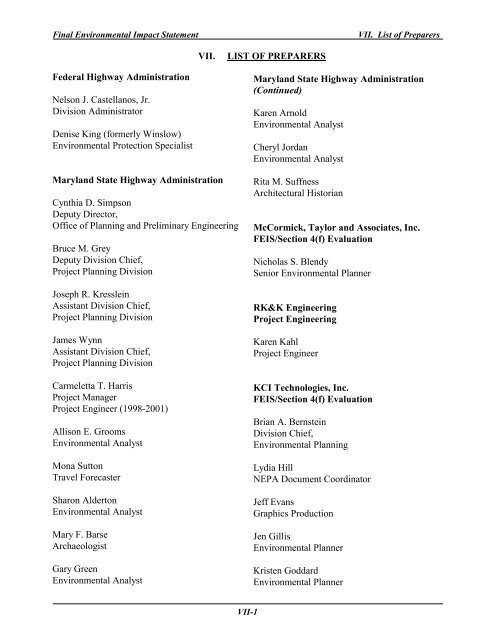
VII. LIST OF PREPARERS Federal Highway Administration Nelson J ...
VII. LIST OF PREPARERS Federal Highway Administration Nelson J ...
VII. LIST OF PREPARERS Federal Highway Administration Nelson J ...

Create successful ePaper yourself
Turn your PDF publications into a flip-book with our unique Google optimized e-Paper software.
Final Environmental Impact Statement<br />
<strong>VII</strong>. List of Preparers<br />
<strong>VII</strong>.<br />
<strong>LIST</strong> <strong>OF</strong> <strong>PREPARERS</strong><br />
<strong>Federal</strong> <strong>Highway</strong> <strong>Administration</strong><br />
<strong>Nelson</strong> J. Castellanos, Jr.<br />
Division Administrator<br />
Denise King (formerly Winslow)<br />
Environmental Protection Specialist<br />
Maryland State <strong>Highway</strong> <strong>Administration</strong><br />
Cynthia D. Simpson<br />
Deputy Director,<br />
Office of Planning and Preliminary Engineering<br />
Bruce M. Grey<br />
Deputy Division Chief,<br />
Project Planning Division<br />
Joseph R. Kresslein<br />
Assistant Division Chief,<br />
Project Planning Division<br />
James Wynn<br />
Assistant Division Chief,<br />
Project Planning Division<br />
Carmeletta T. Harris<br />
Project Manager<br />
Project Engineer (1998-2001)<br />
Allison E. Grooms<br />
Environmental Analyst<br />
Mona Sutton<br />
Travel Forecaster<br />
Sharon Alderton<br />
Environmental Analyst<br />
Mary F. Barse<br />
Archaeologist<br />
Gary Green<br />
Environmental Analyst<br />
Maryland State <strong>Highway</strong> <strong>Administration</strong><br />
(Continued)<br />
Karen Arnold<br />
Environmental Analyst<br />
Cheryl Jordan<br />
Environmental Analyst<br />
Rita M. Suffness<br />
Architectural Historian<br />
McCormick, Taylor and Associates, Inc.<br />
FEIS/Section 4(f) Evaluation<br />
Nicholas S. Blendy<br />
Senior Environmental Planner<br />
RK&K Engineering<br />
Project Engineering<br />
Karen Kahl<br />
Project Engineer<br />
KCI Technologies, Inc.<br />
FEIS/Section 4(f) Evaluation<br />
Brian A. Bernstein<br />
Division Chief,<br />
Environmental Planning<br />
Lydia Hill<br />
NEPA Document Coordinator<br />
Jeff Evans<br />
Graphics Production<br />
Jen Gillis<br />
Environmental Planner<br />
Kristen Goddard<br />
Environmental Planner<br />
<strong>VII</strong>-1
Final Environmental Impact Statement<br />
<strong>VII</strong>. List of Preparers<br />
URS Greiner, Inc. (Noise Analysis)<br />
Ray Moravec<br />
Project Manager<br />
Wilson T. Ballard (Air Analysis)<br />
Mike Kelly,<br />
Manager,<br />
Technical Air Quality<br />
R. Christopher Goodwin and Associates, Inc.<br />
(Archeology)<br />
April Fehr,<br />
Historian<br />
Senior Archaeologist<br />
<strong>VII</strong>-2
Final Environmental Impact Statement<br />
<strong>VII</strong>I. Distribution List<br />
<strong>VII</strong>I. DISTRIBUTION <strong>LIST</strong><br />
A. <strong>Federal</strong> Agencies<br />
Mr. Davis P. Doss<br />
State Conservationist<br />
Natural Resources Conservation Service<br />
U.S. Department of Agriculture<br />
339 Busch’s Frontage Road, Suite 301<br />
Annapolis MD 21401<br />
Mr. Willie Taylor, Director<br />
Office of Environmental Policy and Compliance<br />
U.S. Department of the Interior<br />
Main Interior Building, MS 2340<br />
18th and C Streets, NW<br />
Washington, D.C. 20240<br />
Ms. Denise Rigney<br />
NEPA Program Manager (3ES30)<br />
Office of Environmental Programs<br />
U.S. Environmental Protection Agency<br />
1650 Arch Street<br />
Philadelphia PA 19103-2029<br />
Attention: Ms. Barbara Rudnick<br />
U.S. Environmental Protection Agency<br />
EIS Filing Section<br />
Mail Code 2252-A, Room 7241<br />
Ariel Rios Building (South Oval Lobby)<br />
1200 Pennsylvania Avenue, NW<br />
Washington D.C. 20460<br />
Mr. Timothy E. Goodger<br />
National Marine Fisheries Service<br />
Habitat and Protected Resources<br />
Oxford Laboratory<br />
Oxford, MD 21650<br />
Attention: Mr. John Nichols<br />
Mr. Bill Schultz<br />
U.S. Department of the Interior<br />
Fish and Wildlife Service<br />
Chesapeake Bay Field Office<br />
177 Admiral Cochrane Drive<br />
Annapolis MD 21401<br />
Mr. Paul Wettlaufer<br />
Transportation Program Manager<br />
U.S. Army Corps of Engineers<br />
Baltimore District (CENAB-OP-R)<br />
P.O. Box 1715<br />
10 S. Howard Street<br />
Baltimore MD 21201<br />
Commander<br />
U.S. Coast Guard, 5 th District<br />
431 Crawford Street<br />
Portsmouth, VA 23730<br />
Mr. Eugene Keller<br />
National Capital Planning Commission<br />
401 Ninth Street NW<br />
Suite 500 North<br />
Washington D.C. 20576<br />
Mr. Gene Gruber<br />
Regional Environmental Officer<br />
<strong>Federal</strong> Emergency Management Agency<br />
Region III<br />
615 Chestnut Street<br />
Philadelphia PA 19106-4404<br />
B. State Agencies<br />
Ms. Linda Janey, Chief<br />
State Clearinghouse<br />
Maryland Office of Planning<br />
301 West Preston Street, Room 1104<br />
Baltimore MD 21201<br />
<strong>VII</strong>I-1
Final Environmental Impact Statement<br />
B. State Agencies (Continued)<br />
Maryland Department of Planning<br />
Department of Natural Resources<br />
Department of Budget and Fiscal Planning<br />
Department of General Services<br />
Department of Housing and Community<br />
Development<br />
Department of Education<br />
Department of Health and Mental Hygiene<br />
Interagency Committee for School Construction<br />
Maryland Historical Trust<br />
Department of Public Safety and Correctional<br />
Service<br />
Mr. Ray Dintaman, Director<br />
Environmental Review Unit<br />
Maryland Department of Natural Resources<br />
Tawes State Office Building, B-3<br />
Annapolis MD 21401<br />
Mr. Elder Ghigiarelli<br />
Maryland Department of the Environment<br />
Wetlands and Waterways Program<br />
2500 Broening <strong>Highway</strong><br />
Baltimore MD 21224<br />
Maryland Department of Natural Resources<br />
Greenways and Resource Planning<br />
Tawes State Office Building, D-3<br />
Annapolis MD 21401<br />
Attention: Mr. Arnold Norden<br />
Depository Libraries for Maryland<br />
Publications<br />
<strong>VII</strong>I. Distribution List<br />
Ms. Lynda Davis, Director<br />
Maryland Department of Legislative Services<br />
Library<br />
90 State Circle<br />
Annapolis MD 21401<br />
Ms. Christine Alvey<br />
Maryland State Archives<br />
350 Rowe Boulevard<br />
Annapolis MD 21401<br />
Ms. Ruth Hodgson<br />
Maryland State Law Library<br />
Court of Appeals Building<br />
361 Rowe Boulevard<br />
Annapolis MD 21401<br />
Mr. Jeff Korman<br />
State Library Resource Center<br />
Enoch Pratt Free Library<br />
Maryland Department<br />
400 Cathedral Street<br />
Baltimore MD 21201<br />
C. Maryland Department of<br />
Transportation<br />
Director<br />
Public Affairs<br />
Maryland Department of Transportation<br />
BWI Airport<br />
Ms. Marsha Kaiser, Director<br />
Office of Systems Planning and Evaluation<br />
Maryland Department of Transportation<br />
BWI Airport<br />
<strong>VII</strong>I-2
Final Environmental Impact Statement<br />
D. County/Local Agencies<br />
Montgomery County<br />
Mr. Charles H. Loehr, Director<br />
Montgomery County<br />
Department of Planning<br />
8787Georgia Avenue<br />
Silver Spring, MD 20910<br />
Mr. Gordon Aoyagi, Director<br />
Montgomery County<br />
Fire and Rescue Service<br />
101 Monroe Street, 12 th Floor<br />
Rockville, MD 20850<br />
Mr. William O’Toole<br />
Acting Chief of Police<br />
Montgomery County<br />
Department of Police<br />
2350 Research Boulevard<br />
Rockville, MD 20850<br />
Mr. Albert J. Genetti, Director<br />
Montgomery County<br />
Department of Public Works and Transportation<br />
101 Monroe Street<br />
Rockville, MD 20850<br />
Ms. Ellen Scavia, Chief<br />
Montgomery County<br />
Division of Environmental Policy and<br />
Compliance<br />
Department of Environmental Protection<br />
255 Rockville Pike, Suite 120<br />
Rockville, MD 20850<br />
Maryland-National Capital Park and Planning<br />
Commission<br />
Mr. Robert Arciprete, Chief<br />
Park Planning and Development Division<br />
Department of Parks and Recreation<br />
Maryland-National Capital Parks and<br />
Planning Commission<br />
6600 Kenilworth Avenue<br />
Riverdale MD 20737<br />
<strong>VII</strong>I. Distribution List<br />
Maryland-National Capital Park and Planning<br />
Commission (Cont’d)<br />
Ms. Patricia Willard<br />
Maryland National Capital Parks and<br />
Planning Commission<br />
8787 Georgia Avenue<br />
Silver Spring, MD 20904<br />
Town of Brookeville<br />
Mr. Richard Allan<br />
President of Commissioners<br />
P.O. Box 67<br />
Brookeville, MD 20833<br />
Mr. Christopher Scanlon, Chairman<br />
Brookeville Planning Commission<br />
P.O. Box 67<br />
Brookeville, MD 20833<br />
E. Citizen Groups<br />
Montgomery County Citizens<br />
Bicycle Commission<br />
4000 Wexford Drive<br />
Kensington, MD 20895<br />
F. Others<br />
Maryland State Law Library<br />
Upper Level Court of Appeal Building<br />
361 Rowe Boulevard<br />
Annapolis MD 21401<br />
Mr. Michael Clifford<br />
MWCOG<br />
777 N. Capitol Street, NE<br />
Suite 300<br />
Washington DC 2007-4226<br />
<strong>VII</strong>I-3
Final Environmental Impact Statement<br />
IX. References<br />
IX.<br />
REFERENCES<br />
Allan, Richard. 2001. Brookeville Planning Commission. Personal Communication.<br />
Bartigis, Rodney, and Wiegand, Richard. 1993. “Inventory of Rare, Threatened, and Endangered<br />
Plant Populations and Significant Habitats on Select Park Lands of the M-NCPPC in Montgomery<br />
County, Maryland.” Annapolis, Maryland: Maryland Natural Heritage Program, Maryland<br />
Department of Natural Resources.<br />
Brookeville Planning Commission. 1994. Brookeville 2000 Planning for the Future Providing<br />
Continuity with the Past. Silver Spring, Maryland: Brookeville Planning Commission.<br />
Brush, G.S., Link, C., and Smith, J. 1977. The Natural Forests of Maryland: An Explanation of the<br />
Vegetation Map of Maryland. The Johns Hopkins University, Department of Geography and<br />
Environmental Engineering, Baltimore, Maryland. Maryland Power Plant Siting Program.<br />
Carpenter, David H. 1983. Report of Investigations No. 35-Characteristics of Streamflow in<br />
Maryland. Baltimore, Maryland: Maryland Geological Survey.<br />
Code of <strong>Federal</strong> Regulations (CFR) Title 36, Parks, Forest, and Public Property; Part 60, National<br />
Register of Historic Places; Section 4, Criteria for Evaluation.<br />
Code of Maryland Regulations (COMAR) Title 26, Department of the Environment; subtitle 08,<br />
Water Pollution; Chapter 02, Water Quality; 03, Surface Water Quality Criteria.<br />
Environmental Laboratory, Waterways Research Program of the US Army. 1987. Corps of<br />
Engineers Wetland Delineation Manual. Vicksburg, Mississippi. Engineer Waterway Experiment<br />
Station.<br />
Environmental Protection Agency. STORET System Summary Section. Retrieval of Surface Water<br />
Quality Data from a Database of Sampling Sites.<br />
Environmental Protection Agency. 1989. Rapid Bioassessment Protocol Level II (RBP II).<br />
<strong>Federal</strong> <strong>Highway</strong> <strong>Administration</strong>. 1981. Visual Impact Assessment for <strong>Highway</strong> Projects.<br />
Washington, DC: <strong>Federal</strong> <strong>Highway</strong> <strong>Administration</strong>.<br />
Fricke, Craig. February, 2001. Washington Sanitary & Sewer Commission. Personal<br />
Communication.<br />
Fritz, John. 1997. Brookeville Farms Nursery. Personal Communication.<br />
Gapinko, Marina. 1997. Maryland Department of the Environment, Water Rights Division.<br />
Personal Communication.<br />
Goodwin, R. Christopher, and Associates, Inc. 1997. Phase IB Archeological Identification Survey<br />
for MD 97: Brookeville Study, Montgomery County, Maryland.<br />
IX-1
Final Environmental Impact Statement<br />
IX. References<br />
Goodwin, R. Christopher, and Associates, Inc. 2000. Phase IB Archeological Identification Survey<br />
for Additional Alternates Proposed for MD 97: Brookeville Bypass, Montgomery County,<br />
Maryland.<br />
Greis, William. September 1997 through 2001. Maryland-National Capital Park and Planning<br />
Commission. Personal Communication.<br />
Hilsenhoff, W.L. 1998. Rapid field assessment of organic pollution with a family-level biotic<br />
index. Journal of the North American Benthological Society. 7(1):65-68.<br />
Hoey, Chaplain Steve. February 2001. Marian Fathers Novitiate. Personal Communication.<br />
James, R.W., Simmons, R.H., and Helinsky, B.M. US Geological Survey Water-Data Report MD-<br />
DE-95-1. Water Resources Data Maryland and Delaware Water Year 1995. Volume 1 - Surface-<br />
Water Data.<br />
KCI Technologies, Inc. November 1995. Significant Tree Report - MD 97 Brookeville Bypass.<br />
Hunt Valley, Maryland. KCI Technologies, Inc.<br />
KCI Technologies, Inc. November 1995. Wetland Identification and Delineation Report - MD 97<br />
Brookeville Bypass. Hunt Valley, Maryland. KCI Technologies, Inc.<br />
KCI Technologies, Inc. December 1995. Wetland Identification and Delineation Report Addendum<br />
- MD 97 Brookeville Bypass. Hunt Valley, Maryland. KCI Technologies, Inc.<br />
Love, Beverly. 2001. Montgomery County Public Schools Transportation Division. Personal<br />
Communication.<br />
Maryland Compensatory Mitigation Guidance. August, 1994. Interagency Mitigation Task Force.<br />
Baltimore, MD.<br />
Maryland Department of Business & Economic Development. 1996. “Montgomery County,<br />
Maryland - Brief Economic Facts”. Baltimore, Maryland: Maryland Department of Business &<br />
Economic Development, Division of Marketing.<br />
Maryland Department of the Environment. 1996. Biological Reference for the Patuxent Piedmont.<br />
Maryland Department of Natural Resources, Maryland Geological Survey. 1964. The Geology of<br />
Howard and Montgomery Counties. Baltimore, MD.<br />
Maryland Department of Natural Resources. 1993. DNR Wetland Inventory, digital file. Chesapeake<br />
and Coastal Watershed Services, 1” = 1000.’<br />
Maryland Department of Natural Resources. 2000. SHED1997 Digital Watershed Boundary File.<br />
Chesapeake and Coastal Watershed Services. 1” = 2000.’<br />
IX-2
Final Environmental Impact Statement<br />
IX. References<br />
Maryland Department of Natural Resources. 2002. Rural Legacy Areas, digital file, Chesapeake and<br />
Coastal Watershed Services, 1” = 2000.’<br />
Maryland Geological Survey. 1968. Geologic Map of Maryland. Baltimore, Maryland.<br />
Maryland Historical Trust. 1999. Collections and Conservation Standards.<br />
Maryland Historical Trust. 2000. Standards and Guidelines for Architectural and Historical<br />
Investigations in Maryland.<br />
Maryland-National Capital Park and Planning Commission. 1980. Olney Master Plan. Silver<br />
Spring, Maryland: M-NCPPC.<br />
Maryland-National Capital Park and Planning Commission. 1980, updated 1988. Functional<br />
Master Plan for the Preservation of Agriculture and Rural Open Space.<br />
Maryland-National Capital Park and Planning Commission. 1993. “Population Diversity -<br />
Demographic and Immigration Trends in Montgomery County”. Silver Spring, Maryland: M-<br />
NCPPC, Montgomery County Planning Department Research & Information Systems Division.<br />
Maryland-National Capital Park and Planning Commission. 1993. “The Asian Community of<br />
Montgomery County”. Silver Spring, Maryland: M-NCPPC, Montgomery County Planning<br />
Department Research & Information Systems Division.<br />
Maryland-National Capital Park and Planning Commission. 1993. “The Hispanic Community of<br />
Montgomery County”. Silver Spring, Maryland: M-NCPPC, Montgomery County Planning<br />
Department Research & Information Systems Division.<br />
Maryland-National Capital Park and Planning Commission. 1993. “The Black Community of<br />
Montgomery County”. Silver Spring, Maryland: M-NCPPC, Montgomery County Planning<br />
Department Research & Information Systems Division.<br />
Maryland-National Capital Park and Planning Commission. 1994. 1994 Census Update Survey:<br />
Planning Area Profiles - Demographic Data By Area and Structure Type. Silver Spring, Maryland:<br />
M-NCPPC, Montgomery County Planning Department.<br />
Maryland-National Capital Park and Planning Commission. 1997. 1997 Census Update Survey:<br />
Planning Area Profiles - Demographic Data By Area and Structure Type. Silver Spring, Maryland:<br />
M-NCPPC, Montgomery County Planning Department.<br />
Maryland-National Capital Park and Planning Commission. 2003. Economic Forces That Shape<br />
Montgomery County, Update 2002.<br />
Maryland Office of Planning. 1973. Land Use, Land Cover paper maps. (1” = 2000’)<br />
Maryland Office of Planning, Planning Data Services. 1991. “Selected Population and Housing<br />
Characteristics for Maryland: 1990”.<br />
IX-3
Final Environmental Impact Statement<br />
IX. References<br />
Maryland Office of Planning. 1997. Land Use, Land Cover digital maps. Scale 1” = 2000.’<br />
Maryland Save Our Streams (MD-SOS). 1994. Project Heartbeat Sampling Procedures.<br />
Maryland Save Our Streams (MD-SOS). 1996. Fax communication on Project Heartbeat<br />
macroinvertebrate functional feeding groups and Modified Hilsenhoff ratings.<br />
Metropolitan Washington Council of Governments. 1991. Forest Conservation Manual: Guidance<br />
for the Conservation of Maryland’s Forests During Land Use Changes, Under the 1991 Forest<br />
Conservation Act. Washington, DC. Council of Governments.<br />
Montgomery County –Department of Environmental Protection. 1998. Countywide Stream<br />
Protection Strategy. MC-DEP in cooperation with M-NCPPC.<br />
Montgomery County Department of Finance. 2002. 2002 Levy Year Real Property Tax Rate<br />
Schedule. Available at:www.montgomerycountymd.gov/mc/services/finance/pdf_finInfo/<br />
LevyYear2002Sched/02txrtrp.pdf<br />
Montgomery County Department of Recreation. 2001. Sophia Randolf. Recreation Specialist II.<br />
Personal Communication.<br />
Montgomery County Planning Board, Research Division. 1983. “Selected 1980 Census Data By<br />
Tract”.<br />
Montgomery Soil Conservation District. 1997. Personal Communication. Derwood, MD.<br />
National Park Service. 1983. Archeology and Historic Preservation: Secretary of the Interior’s<br />
Standards and Guidelines.<br />
National Register Bulletin No. 15. How to Apply the National Register Criteria for Evaluation.<br />
1990, revised 1997.<br />
Perry, D., 1994. Forest Ecosystems. Johns Hopkins University Press.<br />
Prenger and Brook. 1990. The Big Tree Champions of Maryland. Maryland Department of Natural<br />
Resources, Forest, Park and Wildlife Service, Annapolis, Maryland.<br />
Robbins, 1989. Habitat Area Requirements of Breeding Forest Birds of the Middle Atlantic States.<br />
Wildlife Monographs 103. Robbins, C.S., D.K. Dawson, and B.A. Dowell. The Wildlife Society.<br />
Bethesda, MD. 1989.<br />
Rosgen, David L. 1994. A Classification of Natural Rivers, Catena (22) (1194): 169-199.<br />
Rutter, J., 1997. Howard County Department of Planning and Zoning. Personal Communication.<br />
Shaffer and Cole. 1994. Standards and Guidelines for Archeological Investigations in Maryland.<br />
IX-4
Final Environmental Impact Statement<br />
IX. References<br />
Smith, Marsha. 2001. Maryland Department of the Environment, Water/Waste-water Permits.<br />
Personal Communication.<br />
Stephens, R.L. 2001. Montgomery County Department of Permitting Services. Written<br />
Correspondence.<br />
Unglesbee, Clyde. 1997. Brookeville Town Commissioners. Personal Communication.<br />
US Army Corps of Engineers New England Division. 1993. The <strong>Highway</strong> Methodology<br />
Workbook Supplement. Wetlands Functions and Values: A Descriptive Approach.<br />
US Bureau of the Census. 1990. “Income and Poverty Status in 1989: 1990 Washington, DC-<br />
MD-VA MSA”.<br />
US Department of Agriculture. Farmland Conversion Impact Rating Form (USDA Form AD-<br />
1006).<br />
US Department of Agriculture, Natural Resources Conservation Service. 1990. Montgomery<br />
County, Maryland Soil Survey Interim Report. Soil Maps, Volume II. Washington, DC.<br />
US Department of Agriculture, Natural Resources Conservation Service. July 1995. Soil Survey of<br />
Montgomery, County, Maryland. Washington, DC.<br />
US Fish and Wildlife Service. 1981. National Wetland Inventory. Digital files of Maryland<br />
wetlands by USGS Quadrangle, 1” = 2000.’<br />
Vokes, Harold E., and Edwards, Jonathan Jr. Department of Natural Resources, Maryland<br />
Geological Survey. 1957, revised and reprinted 1974. Geography and Geology of Maryland.<br />
Bulletin 19. Baltimore, Maryland.<br />
IX-5
Final Environmental Impact Statement<br />
Appendix A. Farmland Conversion Impact Rating Form<br />
A-1
Final Environmental Impact Statement<br />
Appendix A. Farmland Conversion Impact Rating Form<br />
A-2
Final Environmental Impact Statement<br />
Appendix A. Farmland Conversion Impact Rating Form<br />
A-3
Final Environmental Impact Statement<br />
Appendix A. Farmland Conversion Impact Rating Form<br />
A-4
Final Environmental Impact Statement<br />
Appendix A. Farmland Conversion Impact Rating Form<br />
FARMLAND CONVERSION IMPACT RATING FORM AD-1006<br />
RATIONALE FOR EVALUATION <strong>OF</strong> SIT ASSESSMENT CRITERIA<br />
7 CFR 658.5 (b)<br />
MARYLAND ROUTE 97-BROOKEVILLE, MARYLAND BYPASS<br />
MONTGOMERY COUNTY, MARYLAND<br />
FEBRUARY 2001<br />
1. How much land is in non-urban use within a radius of 1 mile from where the project is intended?<br />
More than 90 percent – 15 points<br />
90 to 20 percent – 14 to 1 point(s)<br />
Less than 20 percent – 0 points<br />
Aerial photography and lane use maps were reviewed and a field review of the site was conducted to determine<br />
non-urban use within a 1-mile radius of the project area. It was estimated that 75 percent of the land area<br />
around the study area is in non-urban use. The town of Olney, located south of the study area, is the only urban<br />
area in the vicinity.<br />
Rating: Alternative 5C-11 points; Alternative 7 – 11 points; Alternative 8A and B – 11 points<br />
2. How much of the perimeter of the site borders on land in non-urban use?<br />
More than 90 percent – 10 points<br />
90 to 20 percent – 9 to 1 point(s)<br />
Less than 20 percent – 0 points<br />
Aerial photography and lane use maps were reviewed and a field review of the site was conducted to determine<br />
the amount of non-urban land use bordering the project area. It was estimated that more than 80 percent of the<br />
land area bordering the perimeter of the site is in non-urban use.<br />
Rating: Alternative 5C-10 points; Alternative 7 – 10 points; Alternatives 8A and B – 10 points<br />
3. How much of the site has been farmed (managed for a scheduled harvest or timber activity) more than<br />
five of the last 10 years?<br />
More than 90 percent – 20 points<br />
90 to 20 percent – 19 to 1 point(s)<br />
Less than 20 percent – 0 points<br />
Aerial photographs were reviewed from previous years to evaluate changes in land use patterns. This review<br />
revealed that more than 90 percent of the farmland in the study area has been farmed more than give of the last<br />
ten years.<br />
Rating: Alternative 5C-20 points; Alternative 7 –20 points; Alternative 8A and 8B – 20 points<br />
4. Is the site subject to state or unit of local government policies or programs to protect farmland or<br />
covered by private programs to protect farmland or covered by private programs to protected<br />
farmland?<br />
To preserve farmland and open space, the Maryland National Capital Park and Planning Commission has<br />
adopted a Functional Master Plan for the Preservation of Agriculture and Rural Open Space (1980, updated<br />
1988). The plan recommends techniques to protect and preserve farmland and rural open space. The study area<br />
is located within two agricultural protection areas of the county. The study area west of existing MD 97 is<br />
within the Rural Density Transfer Zone or “RDT” zone. One dwelling unit is permitted per 25 acres of<br />
A-5
Final Environmental Impact Statement<br />
Appendix A. Farmland Conversion Impact Rating Form<br />
farmland. The study area east of existing MD 97 is located within the Rural Cluster (RC) Zone. In this zone,<br />
overall density is one dwelling unit per five acres with a cluster option for one-acre minimum lot sizes. For<br />
example, if the base zone is one dwelling unit per five acres and the tract is 100 acres in size, the number of<br />
permitted dwelling units is 20. The cluster option would allow these 20 units to be grouped on lots as small as<br />
one acre on approximately 40 percent of the parcel or 40 acres. The remainder of the tract (60 percent or 60<br />
acres) could be preserved as open space or used for agricultural uses.<br />
Rating: Alternative 5C-15 points; Alternative 7 – 20 points; Alternative 8A and 8B – 20 points<br />
5. Criterion 5 is not considered applicable for corridor-type projects.<br />
6. Criterion 6 is not considered applicable for corridor-type projects.<br />
7. Is the farm unit(s) containing the site (before the project) as large as the average-size farming unit in the<br />
country?<br />
As large or larger – 10 points<br />
Below average – deduct 1 point for each 5 percent below the average, down to 0 points if 50 percent or more<br />
Below average – 9 to 0 point(s)<br />
According to the Natural Resources Conservation Service in Montgomery County, the average size of a farm in<br />
the county is 157 acres. All four Alternatives impact one farmland parcel. The size of each farmland parcel<br />
affected by these alternatives is less than 50 percent of the average farm size in the county.<br />
Rating: Alternative 5C – 0 points; Alternative 7 – 0 points; Alternatives 8A and 8B – 0 points<br />
8. If this site is chosen for the project, how much of the remaining land on the farm will become nonfarmable<br />
because of the interference with land patterns?<br />
Acreage equal to more than 25 percent of acres directly converted by the project – 25 points<br />
Acreage equal to between 25 and 5 percent of the acres directly converted by the project – 24 to 1 point(s)<br />
Acreage equal to less than 5 percent of the acres directly converted by the project – 0 points<br />
Only Alternative 5C will bisect farmland. Alternatives 7, 8A and 8B will only affect the edge of the existing<br />
farm field. Because the proposed roadway improvements will be two-lane undivided roadways with shoulders,<br />
access to the remaining farmland is not anticipated to be a problem.<br />
Rating: Alternative 5C – 5 points; Alternative 7 – 0 points; Alternatives 8A and 8B – 0 points<br />
9. Does the site have available adequate supply of farm support services and markets, i.e. farm suppliers,<br />
equipment dealers, processing and storage facilities and farmers markets?<br />
All required services are available – 5 points<br />
Some required services are available – 4 to 1 point(s)<br />
No required services are available – 0 point(s)<br />
All required services are available to the farms in the area for each alternative. According to the Natural<br />
Resources Conservation Service in Montgomery County, agricultural services are located outside of the study<br />
area in Frederick, Howard and Montgomery Counties.<br />
Rating: Alternative 5C – 5 points; Alternative 7 – 5 points; Alternatives 8A and 8B – 5 points<br />
A-6
Final Environmental Impact Statement<br />
Appendix A. Farmland Conversion Impact Rating Form<br />
10. Does the site have substantial and well maintained and on-farm investments such as barns, other storage<br />
buildings, farm trees and vines, field terraces, drainage, irrigation waterways or other soil and water<br />
conservation measures?<br />
High amount of on-farm investments – 20 points<br />
Moderate amount of on-farm investment – 19 to 1 point(s)<br />
No on-farm investment – 0 point<br />
A minimal amount of on-farm investments was noticed during a field visit to the study area. No structures<br />
related to farming activity would be required by any of the proposed build alternatives.<br />
Rating: Alternative 5C – 2 points; Alternative 7 – 0 points; Alternatives 8A and 8B – 0 points<br />
11. Would the project at this site, by converting farmland to non-agricultural use, reduce the demand for<br />
farm support services so as to jeopardize the continued existence of these support services and thus, the<br />
viability of the farms remaining in the area?<br />
Substantial reduction in demand for support services if the site is converted – 25 points<br />
Some reduction in demand for support services if the site is converted – 24 to 1 point(s)<br />
No significant reduction in demand for support services if the site is converted – 0 points<br />
None of the proposed build alternatives are anticipated to reduce the demand for farmland support services in<br />
the area. The 10.69 acres of active farmland impacts associated with Alternative 5C is the maximum amount of<br />
active farmland impacts generated by any of the proposed build alternatives. The other three alternatives<br />
affect less than 1.25 acres. The viability of the study area for farming activity should not be jeopardized by the<br />
proposed roadway improvements.<br />
Rating: Alternative 5C – 0 point(s); Alternative 7 – 0 point(s); Alternatives 8A and 8B – 0 point(s)<br />
12. Is the kind and intensity of the proposed use of the site sufficiently incompatible with agriculture that it<br />
is likely to contribute to the eventual conversion of surrounding farmland to non-agricultural use?<br />
Proposed project is incompatible with existing agricultural use of surrounding farmland – 10 points<br />
Proposed project is tolerable to existing agricultural use of surrounding farmland – 9 to 1 point(s)<br />
Proposed project is fully compatible with existing agricultural use of surrounding farmland – 0 point(s)<br />
The purpose of the proposed roadway improvements is to remove the increasing volumes of traffic from the<br />
town of Brookeville, improve traffic operations and safety on existing MD 97 and preserve the historic<br />
character of Brookeville. The zoning classifications of land in the study area (see item 4) are in place to<br />
preserve agricultural activity and provide developers the opportunity to cluster their developments on<br />
agriculturally zoned land.<br />
Rating: Alternative 5C – 7 points; Alternative 7 – 2 points; Alternatives 8A and 8B – 2 points<br />
Total Rating:<br />
Alternative 5C – 75 points<br />
Alternative 7 – 68 points<br />
Alternative 8A – 68 points<br />
Alternative 8B – 68 point<br />
A-7
Final Environmental Impact Statement<br />
Appendix B. Stream Flow Gaging Data<br />
B-1
Final Environmental Impact Statement<br />
Appendix B. Stream Flow Gaging Data<br />
B-2
Final Environmental Impact Statement<br />
Appendix B. Stream Flow Gaging Data<br />
B-3
Final Environmental Impact Statement<br />
Appendix B. Stream Flow Gaging Data<br />
B-4
Final Environmental Impact Statement<br />
Appendix B. Stream Flow Gaging Data<br />
B-5
Final Environmental Impact Statement<br />
Appendix B. Stream Flow Gaging Data<br />
B-6
Final Environmental Impact Statement<br />
Appendix B. Stream Flow Gaging Data<br />
B-7
Final Environmental Impact Statement<br />
Appendix B. Stream Flow Gaging Data<br />
B-8
Final Environmental Impact Statement<br />
Appendix C. STORET Database Information<br />
Surface Water Quality Data (EPA STORET DATABASE)<br />
(Station: 21MDMONT/60040 Reddy Branch BRKVILLE-BRGHTN RD-River/Streams-S)<br />
Parameter Unit of Maximum Minimum Beginning Ending Date *<br />
Measurement<br />
Date *<br />
Water Temp. Celsius 23 (73.4) 0 (32.0) 2/3/71 12/4/84<br />
(Fahrenheit)<br />
Turbidity PPM Si0 2 292.0 0 1/12/72 11/29/77<br />
Turbidity HACH FTU 30.0 0.8 2/15/78 12/4/84<br />
Conductivity Micromho 142.0 142.0 12/4/84 12/4/84<br />
DO mg/l 14.6 6.4 2/3/71 12/18/80<br />
DO Percent 126.4 57.7 2/3/71 12/18/80<br />
BOD mg/l 5.8 0.3 1/12/72 12/18/80<br />
pH SU 8.8 4.9 2/3/71 12/4/74<br />
Residue Total mg/l 158 54 9/11/75 12/4/84<br />
NO 2 & NO 3 N-Total mg/l 4.64 0.90 1/12/72 12/18/80<br />
T PO 4 PO 4 mg/l 1.59 0.02 1/12/72 6/2/80<br />
PHOS-TOT mg/l/P 0.14 0.14 12/4/84 12/4/84<br />
Total P as PO 4 mg/l 0.60 0.23 7/17/80 12/18/80<br />
Fecal Coliform MPN 120,000 23 1/12/72 10/9/79<br />
Fecal Coliform MPNECMED/ 11,000 36 1/29/80 12/4/84<br />
100 ml<br />
Total Coliform MPN CONF<br />
Tubecode<br />
2,400,000 210 1/12/72 10/9/79<br />
* Most recent data available.<br />
C-1
Final Environmental Impact Statement<br />
Appendix D. Wetland Data Sheets<br />
D-1
Final Environmental Impact Statement<br />
Appendix D. Wetland Data Sheets<br />
D-2
Final Environmental Impact Statement<br />
Appendix D. Wetland Data Sheets<br />
D-3
Final Environmental Impact Statement<br />
Appendix D. Wetland Data Sheets<br />
D-4
Final Environmental Impact Statement<br />
Appendix D. Wetland Data Sheets<br />
D-5
Final Environmental Impact Statement<br />
Appendix D. Wetland Data Sheets<br />
D-6
Final Environmental Impact Statement<br />
Appendix D. Wetland Data Sheets<br />
D-7
Final Environmental Impact Statement<br />
Appendix D. Wetland Data Sheets<br />
D-8
Final Environmental Impact Statement<br />
Appendix D. Wetland Data Sheets<br />
D-9
Final Environmental Impact Statement<br />
Appendix D. Wetland Data Sheets<br />
D-10
Final Environmental Impact Statement<br />
Appendix D. Wetland Data Sheets<br />
D-11
Final Environmental Impact Statement<br />
Appendix D. Wetland Data Sheets<br />
D-12
Final Environmental Impact Statement<br />
Appendix D. Wetland Data Sheets<br />
D-13
Final Environmental Impact Statement<br />
Appendix D. Wetland Data Sheets<br />
D-14
Final Environmental Impact Statement<br />
Appendix D. Wetland Data Sheets<br />
D-15
Final Environmental Impact Statement<br />
Appendix D. Wetland Data Sheets<br />
D-16
Final Environmental Impact Statement<br />
Appendix D. Wetland Data Sheets<br />
D-17
Final Environmental Impact Statement<br />
Appendix D. Wetland Data Sheets<br />
D-18
Final Environmental Impact Statement<br />
Appendix D. Wetland Data Sheets<br />
D-19
Final Environmental Impact Statement<br />
Appendix E. Plant Species/Wildlife Lists<br />
Plant Species Common to the Tulip Poplar Association<br />
Tulip Poplar Association<br />
Botanical Name<br />
Common Name<br />
Liriodendron tulipifera<br />
tulip poplar<br />
Acer rubrum<br />
red maple<br />
Cornus florida<br />
flowering dogwood<br />
Parthenocissus quinquefolia<br />
Virginia creeper<br />
Nyssa sylvatica<br />
black gum<br />
Quercus alba<br />
white oak<br />
Sassafras albidum<br />
sassafras<br />
Prunus serotina<br />
black cherry<br />
Vitis spp.<br />
grape<br />
Carya tomentosa<br />
mockernut hickory<br />
Viburnum dentatum<br />
southern arrowwood<br />
Carya glabra<br />
pignut hickory<br />
Quercus velutina<br />
black oak<br />
Toxicodendron radicans<br />
poison ivy<br />
Smilax spp.<br />
greenbriers<br />
Fagus grandifolia<br />
American beech<br />
Lindera benzoin<br />
spicebush<br />
Quercus rubra<br />
northern red oak<br />
Viburnum acerifolium<br />
mapleleaf viburnum<br />
Vaccinium angustifolium<br />
early low blueberry<br />
Prunus virginiana<br />
choke cherry<br />
Rubus spp.<br />
brambles<br />
Plant Species Common to the Sycamore-Green Ash-Box Elder-Silver Maple Association<br />
Sycamore-Green Ash-Box Elder-Silver Maple Association<br />
Botanical Name<br />
Common Name<br />
Acer rubrum<br />
red maple<br />
Parthenocissus quinquefolia<br />
Virginia creeper<br />
Quercus alba<br />
white oak<br />
Cornus florida<br />
flowering dogwood<br />
Vitis spp.<br />
grape<br />
Prunus serotina<br />
black cherry<br />
Quercus rubra<br />
northern red oak<br />
Lindera benzoin<br />
spicebush<br />
Liriodendron tulipifera<br />
tulip poplar<br />
Nyssa sylvatica<br />
black gum<br />
Sassafras albidum<br />
sassafras<br />
Fraxinus americana<br />
white ash<br />
Carya tomentosa<br />
mockernut hickory<br />
Toxicodendron radicans<br />
poison ivy<br />
Viburnum dentatum<br />
southern arrowwood<br />
Quercus velutina<br />
black oak<br />
Carya glabra<br />
pignut hickory<br />
Rubus spp.<br />
brambles<br />
Smilax spp.<br />
greenbriers<br />
Carpinus caroliniana<br />
ironwood<br />
Fraxinus pennsylvanica<br />
green ash<br />
Platanus occidentalis<br />
sycamore<br />
Acer negundo<br />
box elder<br />
Acer saccharinum<br />
silver maple<br />
E-1
Final Environmental Impact Statement<br />
Appendix E. Plant Species/Wildlife Lists<br />
Terrestrial Wildlife<br />
Common Name Scientific Name Common Name Scientific Name<br />
BIRDS<br />
Red shouldered hawk Buteo lineatus Mourning dove Zenaida macroura<br />
Wood thrush Hylocichla mustelina Turkey vulture Cathartes aura<br />
Pileated woodpecker Dryocopus pileatus Brownheaded cowbird Molothrus ater<br />
American robin Turdus migratorius Blue-Gray gnatcatcher Polioptila caerulea<br />
Chimney swift Chaetura pelagica American kestrel Falco sparverius<br />
Rufous-Sided towhee Pipilo erythrophthalmus Field sparrow Spizella pusilla<br />
Blue jay Cyanocitta cristata Prairie warbler Dendroica discolor<br />
Gray catbird Dumetella carolinensis Eastern bluebird Sialia sialis<br />
Northern cardinal Cardinalus cardinalis Indigo bunting Passerina cyanea<br />
Red-Tailed hawk Buteo jamaicensis Eastern kingbird Tyrannus tyrannus<br />
Northern mockingbird Mimus polyglottos Red-Winged blackbird Agelaius phoeniceus<br />
European starling Sturnus vulgaris Common flicker Colaptes auratus<br />
Common grackle Quiscalus quiscula Carolina chickadee Parus carolinensis<br />
MAMMALS<br />
Eastern chipmunk Tamias striatus Woodchuck Marmota monax<br />
White-tailed deer Olocoileus virginianus Raccoon (tracks) Procyon lotor<br />
Eastern Gray squirrel Sciurus carolinensis<br />
REPTILES/AMPHIBIANS<br />
American toad Bufo americanus Black Rat snake Elaphe obsoleta<br />
(shedded skin)<br />
Box turtle<br />
Terrapene carolina<br />
Fish Species Likely to Reside and Spawn in Reddy Branch<br />
Common Name Scientific Name Common Name Scientific Name<br />
Blacknose dace Rhinichthys atratulus River chub Nocomis micropogon<br />
Bluegill sunfish Lepomis macrochirus Rosyside dace Clinostomus funduloides<br />
Common shiner Notropis cornutus Satinfin shiner Notropis analostanus<br />
Cutlip minnow Exoglossum maxillingua Shield darter Percina peltata<br />
Fallfish Semotilus corporalis Spottail shiner Notropis hudsonius<br />
Green sunfish Lepomis cyanellus Stripeback darter Percina notogramma<br />
Golden shiner<br />
Notemigonus Swallowtail shiner Notropis procne<br />
crysoleucas<br />
Longnose dace Rhinichthys cataractae Smallmouth bass Micropterus dolomieu<br />
Largemouth bass Micropterus salmoides Tessellated darter Etheostoma olmstedi<br />
Margined madtom Noturus insignis White catfish Ictalurus catus<br />
Northern hogsucker Hypentelium nigricans White sucker Catostomus commersoni<br />
Redbreast sunfish Lepomis auritus<br />
E-2
Final Environmental Impact Statement<br />
Appendix F. Benthic Macroinvertebrate Data<br />
F-1
Final Environmental Impact Statement<br />
Appendix F. Benthic Macroinvertebrate Data<br />
F-2
Final Environmental Impact Statement<br />
Appendix F. Benthic Macroinvertebrate Data<br />
F-3
Final Environmental Impact Statement<br />
Appendix F. Benthic Macroinvertebrate Data<br />
F-4
Final Environmental Impact Statement<br />
Appendix F. Benthic Macroinvertebrate Data<br />
F-5
Final Environmental Impact Statement<br />
Appendix F. Benthic Macroinvertebrate Data<br />
F-6
Final Environmental Impact Statement<br />
Appendix F. Benthic Macroinvertebrate Data<br />
F-7
Final Environmental Impact Statement<br />
Appendix F. Benthic Macroinvertebrate Data<br />
F-8
Final Environmental Impact Statement<br />
Appendix F. Benthic Macroinvertebrate Data<br />
F-9
Final Environmental Impact Statement<br />
Appendix F. Benthic Macroinvertebrate Data<br />
F-10
Final Environmental Impact Statement<br />
Appendix G. Brookeville Cultural Resource Photographs<br />
BROOKEVILLE CULTURAL RESOURCE PHOTOGRAPHS<br />
I. Brookeville Academy, circa 1810<br />
The award winning Brookeville<br />
Academy is the town's<br />
centerpiece and community<br />
focal point.<br />
One of the first private<br />
academies in Montgomery<br />
County, it offered a full classical<br />
curriculum for some sixty male<br />
students (later females were<br />
allowed), many of whom came<br />
from across the state and<br />
boarded with local families. Its<br />
library consisted of 600<br />
volumes.<br />
This Market Street house began<br />
as a small cottage circa 1820.<br />
The house’s front block was<br />
renovated in 1863 to reflect the<br />
popular Gothic Revival style,<br />
which it maintains today. In<br />
1928 a two-story addition was<br />
built on the rear, which enclosed<br />
the original cottage.<br />
II. Gothic Revival, circa 1863 (original house circa 1820)<br />
Photographs and captions taken from the Town of Brookeville website, http://www.townofbrookevillemd.org<br />
G-1
Final Environmental Impact Statement<br />
Appendix G. Brookeville Cultural Resource Photographs<br />
BROOKEVILLE CULTURAL RESOURCE PHOTOGRAPHS (CONTINUED)<br />
This Market Street house was<br />
constructed prior to 1809. With<br />
its three bay front facade, front<br />
door to one side, gable roof and<br />
chimney at the end wall, this<br />
simple two-story brick structure<br />
is a textbook example of <strong>Federal</strong><br />
style architecture prevalent in<br />
the early years of the nation.<br />
III. Heritage House <strong>Federal</strong> style, circa 1808<br />
This stately two-story brick<br />
home, with fieldstone foundation,<br />
was built in several<br />
sections over a period of years<br />
by Caleb and Henrietta Bentley.<br />
The house’s right-hand section<br />
was Brookeville's first post<br />
office, opened in 1802. It also<br />
served as a 19th century store<br />
and a refuge for President<br />
Madison on August 26, 1814,<br />
when he fled Washington after<br />
the British burned the city.<br />
IV. Madison House, circa 1783<br />
Photographs and captions taken from the Town of Brookeville website, http://www.townofbrookevillemd.org<br />
G-2
Final Environmental Impact Statement<br />
Appendix H. List of Acronyms<br />
<strong>LIST</strong> <strong>OF</strong> ACRONYMS<br />
ACHP<br />
ADT<br />
AEP<br />
APE<br />
BIBI<br />
BMPs<br />
CEQ<br />
CERCLIS<br />
CO<br />
COMAR<br />
CSPS<br />
CTP<br />
DBH<br />
DEIS<br />
DNR<br />
EIS<br />
ERIIS<br />
ERNS<br />
FBI<br />
FEIS<br />
FEMA<br />
FHWA<br />
FIBI<br />
FIDB<br />
FIRM<br />
FTP<br />
HAWP<br />
HPC<br />
HWS<br />
IAR<br />
LOS<br />
LRST<br />
MALPF<br />
MBSS<br />
MC-DEP<br />
MDE<br />
MDOT<br />
MDP<br />
Advisory Council on Historic Preservation<br />
Average Daily Traffic<br />
Agricultural Easement Program<br />
Area of Potential Effect<br />
Benthic Index of Biotic Integrity<br />
Best Management Practices<br />
Council on Environmental Quality<br />
Comprehensive Environmental Response, Compensation, and Liability<br />
Information System<br />
Carbon Monoxide<br />
Code of Maryland Regulations<br />
Countywide Stream Protection Strategy<br />
Consolidated Transportation Program<br />
Diameter at Breast Height<br />
Draft Environmental Impact Statement<br />
(Maryland) Department of Natural Resources<br />
Environmental Impact Statement<br />
Environmental Risk Information & Imaging Services<br />
Emergency Response Notification System<br />
Family Biotic Index<br />
Final Environmental Impact Statement<br />
<strong>Federal</strong> Emergency Management Agency<br />
<strong>Federal</strong> <strong>Highway</strong> <strong>Administration</strong><br />
Fish Index of Biotic Integrity<br />
Forest Interior Dwelling Bird<br />
Flood Insurance Rate Maps<br />
<strong>Federal</strong> Test Procedure<br />
Historic Area Work Permit<br />
Historic Preservation Commission<br />
(Maryland Notice of Potential) Hazardous Waste Sites<br />
Interagency Review<br />
Level of Service<br />
Maryland Active Recovery Sites List<br />
Maryland Agricultural Land Preservation Foundation<br />
Maryland Biological Stream Survey<br />
Montgomery County Department of Environmental Protection<br />
Maryland Department of the Environment<br />
Maryland Department of Transportation<br />
Maryland Department of Planning<br />
H-1
Final Environmental Impact Statement<br />
Appendix H. List of Acronyms<br />
<strong>LIST</strong> <strong>OF</strong> ACRONYMS (Continued)<br />
MET<br />
MHT<br />
M-NCPPC<br />
MOA<br />
MOU<br />
MSPGP<br />
MWCOG<br />
NAC<br />
NEPA<br />
NFRAP<br />
NPDES<br />
NPL<br />
NRHP<br />
NSA<br />
NWI<br />
O 3<br />
PM 10<br />
PDR<br />
PEM<br />
PEPCO<br />
PFA<br />
PFO<br />
PHI<br />
PMA<br />
PSS<br />
RC<br />
RCRIS CA<br />
RCRIS LG<br />
RCRIS SG<br />
RCRIS TS<br />
RCZ<br />
RDT<br />
ROW<br />
RST<br />
RTE<br />
Maryland Environmental Trust<br />
Maryland Historical Trust<br />
Maryland-National Capital Park and Planning Commission<br />
Memorandum of Agreement<br />
Memorandum of Understanding<br />
Maryland State Programmatic General Permit<br />
Metropolitan Washington Council of Governments<br />
Noise Abatement Criteria<br />
National Environmental Policy Act<br />
No Further Action Planned Sites<br />
National Pollutant Discharge Elimination System<br />
National Priority List<br />
National Register of Historic Places<br />
Noise Sensitive Area<br />
National Wetland Inventory<br />
Ozone<br />
Particulate Matter<br />
Purchase of Development Rights<br />
Palustrine Emergent<br />
Potomac Electric Power Company<br />
Priority Funding Area<br />
Palustrine Forested<br />
Physical Habitat Index<br />
Primary Management Area<br />
Palustrine Scrub/Shrub<br />
Rural Cluster<br />
Resource Conservation and Recovery Information System - Corrective<br />
Action Sites<br />
Resource Conservation and Recovery Information System - Large Quantity<br />
Generators<br />
Resource Conservation and Recovery Information System - Small Quantity<br />
Generators<br />
Resource Conservation and Recovery Information System - Treatment,<br />
Storage and Disposal Facilities<br />
Rural Cluster Zone<br />
Rural Density Transfer Zone<br />
Right-of-Way<br />
Maryland Underground Storage Tank Report<br />
Rare, Threatened, and Endangered<br />
H-2
Final Environmental Impact Statement<br />
Appendix H. List of Acronyms<br />
<strong>LIST</strong> <strong>OF</strong> ACRONYMS (Continued)<br />
SACM<br />
SCEA<br />
SHA<br />
SHPO<br />
SIP<br />
S/NAAQS<br />
STORET<br />
SWF<br />
TDR<br />
TIP<br />
TMDL<br />
UPRRW<br />
USACOE<br />
USDA<br />
USEPA<br />
USFWS<br />
USGS<br />
UST<br />
VEIP<br />
VPD<br />
WQC<br />
WSSC<br />
WUS<br />
Selected Alternate and Conceptual Mitigation<br />
Secondary and Cumulative Effects Analysis<br />
(Maryland) State <strong>Highway</strong> <strong>Administration</strong><br />
State Historic Preservation Officer<br />
State Implementation Plan<br />
State and National Ambient Air Quality Standards<br />
Storage and Retrieval System<br />
(Maryland Permitted) Solid Waste Facilities<br />
Transfer of Development Rights<br />
Transportation Improvement Plan<br />
Total Maximum Daily Load<br />
Upper Patuxent River Reservoir Watershed<br />
US Army Corps of Engineers<br />
US Department of Agriculture<br />
US Environmental Protection Agency<br />
US Fish and Wildlife Service<br />
US Geological Survey<br />
Underground Storage Tank<br />
Vehicle Emissions Inspection Program<br />
Vehicles Per Day<br />
Water Quality Certification<br />
Washington Suburban Sanitary Commission<br />
Waters of the US<br />
H-3
Final Environmental Impact Statement<br />
Appendix I. Relocation Act<br />
I-1
Final Environmental Impact Statement<br />
Appendix I. Relocation Act<br />
I-2
Final Environmental Impact Statement<br />
Appendix I. Relocation Act<br />
I-3