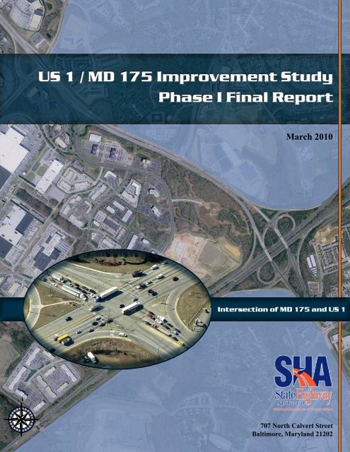
US 1 / MD 175 Improvement Study Phase I Final Report March 2010
US 1 / MD 175 Improvement Study Phase I Final Report March 2010
US 1 / MD 175 Improvement Study Phase I Final Report March 2010
- No tags were found...

Create successful ePaper yourself
Turn your PDF publications into a flip-book with our unique Google optimized e-Paper software.
<strong>US</strong> 1 / <strong>MD</strong> <strong>175</strong> <strong>Improvement</strong> <strong>Study</strong><strong>Phase</strong> I <strong>Final</strong> <strong>Report</strong><strong>March</strong> <strong>2010</strong>Intersection of <strong>MD</strong> <strong>175</strong> and <strong>US</strong> 1N707 North Calvert StreetBaltimore, Maryland 21202
<strong>US</strong> 1/<strong>MD</strong> <strong>175</strong> <strong>Improvement</strong> <strong>Study</strong><strong>March</strong> <strong>2010</strong>SectionTABLE OF CONTENTSPage1.0 Introduction ...................................................................................................................12.0 Existing Conditions.......................................................................................................32.1 <strong>Study</strong> Area Network Roadways and Intersections ........................................................32.2 Background Data..........................................................................................................52.3 Existing Traffic Volumes ...............................................................................................82.4 Existing Conditions Traffic Operations Analyses...........................................................82.5 Simulation Model Development ..................................................................................162.6 Crash Analysis............................................................................................................173.0 Future No Build Conditions ........................................................................................193.1 2015 No Build Traffic Volumes ...................................................................................193.2 2015 No Build Traffic Operations Analyses.................................................................203.3 2035 Programmed No Build Traffic Volumes..............................................................273.4 2035 Programmed No Build Traffic Operations Analyses ...........................................273.5 2035 Without Covenants No Build Traffic Volumes.....................................................353.6 2035 Without Covenants Traffic Operations Analyses ................................................394.0 Concept Development.................................................................................................434.1 <strong>MD</strong> <strong>175</strong> at Snowden River Parkway ...........................................................................444.2 <strong>MD</strong> <strong>175</strong> at Columbia Gateway Drive...........................................................................444.3 <strong>MD</strong> <strong>175</strong> at <strong>MD</strong> 108 .....................................................................................................454.4 <strong>MD</strong> <strong>175</strong> at I-95............................................................................................................464.5 <strong>MD</strong> <strong>175</strong> at <strong>US</strong> 1..........................................................................................................474.6 <strong>MD</strong> <strong>175</strong> at Pocomoke Avenue ....................................................................................484.7 <strong>MD</strong> <strong>175</strong> East of <strong>US</strong> 1..................................................................................................494.8 Columbia Gateway / I-95 Interchange.........................................................................494.9 <strong>MD</strong> <strong>175</strong> Bus Rapid Transit Alignment.........................................................................495.0 Summary and Conclusions ........................................................................................516.0 Next Steps....................................................................................................................54APPENDICESAppendix A: Crash Data and Summary <strong>Report</strong>sAppendix B: HCM Analysis <strong>Report</strong>s – Signalized IntersectionsAppendix C: HCS Analysis <strong>Report</strong>s – Ramp Junctions / Weaving SegmentsAppendix D: CLA <strong>Report</strong>s – Signalized Intersectionsi
<strong>US</strong> 1/<strong>MD</strong> <strong>175</strong> <strong>Improvement</strong> <strong>Study</strong><strong>March</strong> <strong>2010</strong>LIST OF FIGURESTABLE OF CONTENTSPageFigure 1. <strong>Study</strong> Area Map .......................................................................................................... 2Figure 2. Existing Traffic Volumes - AM Peak Hour.................................................................... 9Figure 3. Existing Traffic Volumes - PM Peak Hour...................................................................10Figure 4. Existing Traffic Volumes - Average Daily Traffic.........................................................11Figure 5. Existing Level of Service - AM Peak Hour ..................................................................14Figure 6. Existing Level of Service - PM Peak Hour ..................................................................15Figure 7. 2015 Traffic Volumes - AM Peak Hour .......................................................................21Figure 8. 2015 Traffic Volumes - PM Peak Hour .......................................................................22Figure 9. 2015 Traffic Volumes - Average Daily Traffic .............................................................23Figure 10. 2015 Level of Service - AM Peak Hour.....................................................................24Figure 11. 2015 Level of Service - PM Peak Hour.....................................................................25Figure 12. 2035 Programmed Traffic Volumes - AM Peak Hour................................................28Figure 13. 2035 Programmed Traffic Volumes - PM Peak Hour................................................29Figure 14. 2035 Programmed Traffic Volumes - Average Daily Traffic ......................................30Figure 15. 2035 Programmed Level of Service - AM Peak Hour ...............................................32Figure 16. 2035 Programmed Level of Service - PM Peak Hour ...............................................33Figure 17. 2035 Without Covenants Traffic Volumes - AM Peak Hour ......................................36Figure 18. 2035 Without Covenants Traffic Volumes - PM Peak Hour ......................................37Figure 19. 2035 Without Covenants Traffic Volumes - Average Daily Traffic.............................38Figure 20. 2035 Without Covenants Level of Service - AM Peak Hour......................................40Figure 21. 2035 Without Covenants Level of Service - PM Peak Hour......................................41Figure 22. Preliminary Concepts ...............................................................................................50LIST OF TABLESTable 1. Maximum Queues Observed at <strong>Study</strong> Intersections: AM(PM) ...................................... 6Table 2. Existing Intersection LOS: AM(PM) .............................................................................12Table 3. Existing Interchange Features Capacity and LOS .......................................................13Table 4. <strong>Study</strong> Area Crash Summary........................................................................................18Table 5. 2015 No Build Intersection LOS: AM(PM) ...................................................................20Table 6. 2015 No Build Interchange Features Capacity and LOS .............................................26Table 7. 2035 Programmed No Build Intersection LOS: AM(PM) ..............................................31Table 8. 2035 Programmed No Build Interchange Features Capacity and LOS ........................34Table 9. 2035 Columbia Gateway Developments......................................................................35Table 10. 2035 Population and Household Assumptions for Columbia Gateway.......................35Table 11. 2035 Employment Assumptions for Columbia Gateway ............................................35Table 12. 2035 Without Covenants No Build Intersection LOS: AM(PM)...................................39Table 13. 2035 Without Covenants No Build Interchange Features Capacity and LOS.............42Table 14. Intersection Delays Over Time: AM(PM) ...................................................................52ii
<strong>US</strong> 1/<strong>MD</strong> <strong>175</strong> <strong>Improvement</strong> <strong>Study</strong><strong>March</strong> <strong>2010</strong>1.0 INTRODUCTIONThe Maryland State Highway Administration (SHA) has conducted a comprehensive assessmentof the traffic operations and network performance along <strong>MD</strong> <strong>175</strong> from Snowden River Parkwayto Pocomoke Avenue, just east of <strong>US</strong> 1, in Howard County, Maryland. The study area is shownin Figure 1. The purpose of this study is to assess existing and future No Build traffic operationsthrough analysis of existing and future No Build traffic volumes with existing roadway,intersection, and interchange geometry, and existing traffic controls, as well as to assess existingcrash experience and environmental features, and to develop preliminary concepts foroperational improvements throughout the study area.The study is being led by SHA’s Office of Project Planning and Preliminary Engineering(OPPE), Regional Intermodal Planning Division (RIPD) and the study team is comprised ofrepresentatives from SHA District 7, SHA Travel Forecasting and Analysis Division (TFAD),SHA Office of Traffic and Safety, Traffic Development and Support Division (OOTS, TDSD),the Howard County Department of Public Works, and the Howard County Department ofPlanning and Zoning.This study builds on previous analyses performed by SHA and Howard County, including the<strong>March</strong> 2007 Columbia Gateway Corporate Park Short and Long-Term Traffic Assessment andthe November 2007 <strong>MD</strong> <strong>175</strong> Gateway Park Access and Corridor <strong>Study</strong>. The first study focusedon assessing short-term (5-year) and long-term (30-year) development impacts within GatewayPark. The findings of the first study indicated a need for improved access in and out of GatewayPark due to potential long-term redevelopment and rezoning. The second study evaluated the<strong>MD</strong> <strong>175</strong> corridor between Snowden River Parkway and I-95 to identify impacts of a new accesspoint for Gateway Park under existing conditions and short-term future conditions (year 2012).Traffic data collection, crash experience, queue analysis, and traffic simulation modeling wereincluded in the second study.The results of the second 2007 study did not conclusively prove the benefit of a single newaccess point to Gateway Park, but demonstrated congestion in the study area and the need forfurther study. Specifically, SHA requested the following be considered in any future studies ofthis corridor:• A longer horizon year (2035)• BRAC improvements and traffic patterns• Pedestrian and bicycle needs• Environmental constraints• Impacts to I-95 mainline• <strong>Improvement</strong> alternatives for each interchange and intersection, ranging from at-gradeimprovements and low-cost solutions to a full interchange reconstruction with multiplegrade separations.Page 1
MARYLAND<strong>175</strong><strong>Study</strong> Area MapSewell’sOrchardParkColumbia CrossingShopping CenterMARYLAND108MayfieldWoodsMiddleSchoolAnnettaGardensPaintersHillDeep RunParkSherwoodCrossingINTERSTATE95Gateway OverlookShopping CenterDeep RunElementarySchoolWaterlooParkGatewayCommerceCenterColumbiaGatewayAlladinVillageCedarVillaHeightsParkWashingtonManorState PoliceWaterloo BarracksHoward CountyDetentioinCenterFCCMonitoringStationVillaHeightsINTERSTATE951MarylandWholesaleFood CenterMARYLAND<strong>175</strong>PatuxentInstitutionLegendVegetated WetlandsParksPStreams100-YR FloodplainExisting SignalVicinity MapCarrollHowardMontgomeryBaltimoreAnneArundelPriority Funding Area<strong>US</strong> 1 /PrinceGeorge’s 1MARYLAND DEPARTMENT OF TRANSPORTATIONSTATE HIGHWAY ADMINISTRATION<strong>MD</strong> <strong>175</strong> <strong>Improvement</strong> <strong>Study</strong><strong>Phase</strong> IHoward County, <strong>MD</strong>Figure <strong>March</strong> <strong>2010</strong>
<strong>US</strong> 1/<strong>MD</strong> <strong>175</strong> <strong>Improvement</strong> <strong>Study</strong><strong>March</strong> <strong>2010</strong>As a result, this study was conducted to evaluate existing, 2015 No Build, and 2035 No Buildconditions, including a 2035 scenario that takes into account the removal of covenants on landuse zoning inside Gateway Park. This study has been divided into two phases. <strong>Phase</strong> I, which isdocumented in this report, includes the identification of operational issues expected for 2015 and2035 under the No Build condition, collection of available environmental resource data, and thedevelopment of a number of concepts that could address the anticipated future operational issues.<strong>Phase</strong> II, which will be conducted upon the completion of <strong>Phase</strong> I, will include a more detailedinvestigation of the engineering feasibility, impacts, costs, and operational benefits of a set ofimprovements from the <strong>Phase</strong> I study.2.0 EXISTING CONDITIONS2.1 <strong>Study</strong> Area Network Roadways and IntersectionsThe study network includes six signalized intersections along <strong>MD</strong> <strong>175</strong> and <strong>US</strong> 1 and 11interchange ramp connections to <strong>MD</strong> <strong>175</strong>, as follows:• <strong>MD</strong> <strong>175</strong> at Snowden River Parkway (interchange – two ramp connections, to the east ofSnowden River Parkway)• <strong>MD</strong> <strong>175</strong> at Columbia Gateway Drive (interchange – three ramp connections)• <strong>MD</strong> <strong>175</strong> at <strong>MD</strong> 108 (signalized intersection)• <strong>MD</strong> <strong>175</strong> at I-95 (interchange – six ramp connections and two signalized intersections)• <strong>MD</strong> <strong>175</strong> at <strong>US</strong> 1 (signalized intersection)• <strong>MD</strong> <strong>175</strong> at Pocomoke Avenue (signalized intersection)• <strong>US</strong> 1 at Assateague Drive/Crestmount Road (signalized intersection)The following is a brief description of each roadway in the study area:1. <strong>MD</strong> <strong>175</strong> (Rouse Parkway/Waterloo Road). West of <strong>US</strong> 1, <strong>MD</strong> <strong>175</strong> is a two-way dividedurban freeway expressway, with partial access control, and a 50 mph posted speed, thatranges from two to four through lanes in each direction with auxiliary lanes at rampjunctions and intersections. East of <strong>US</strong> 1, <strong>MD</strong> <strong>175</strong> is a two-way divided state secondaryurban minor arterial, with no access controls, and a 40 mph posted speed, that rangesfrom one to three lanes in each direction with auxiliary lanes at intersections. Land usesalong <strong>MD</strong> <strong>175</strong> within the limits of the study area include commercial, office, and lightindustrial types.2. Snowden River Parkway (CO 1140). Snowden River Parkway is a county-maintained,two-way divided urban minor arterial roadway with partial control of access and a postedspeed of 45 mph that provides three through lanes in each direction in the immediatevicinity of <strong>MD</strong> <strong>175</strong>. Adjacent land uses are residential and commercial.3. Columbia Gateway Drive. In the vicinity of the study area, Columbia Gateway Drive is atwo-way divided roadway with partial control of access and a posted speed of 30 mphPage 3
<strong>US</strong> 1/<strong>MD</strong> <strong>175</strong> <strong>Improvement</strong> <strong>Study</strong><strong>March</strong> <strong>2010</strong>that provides three lanes in each direction. Columbia Gateway Drive provides access toGateway Park, which is characterized by primarily office land uses.4. <strong>MD</strong> 108 (Waterloo Road). In the vicinity of the study area, <strong>MD</strong> 108 is a two-wayundivided urban minor arterial with no access controls, and with a posted speed limit of45 mph, that provides one through lane in each direction. <strong>MD</strong> 108 widens significantly toprovide one right turn lane, 3 left turn lanes, and three receiving lanes just north of<strong>MD</strong> <strong>175</strong>. The adjacent land use along <strong>MD</strong> 108 is primarily commercial.5. Interstate 95 (I-95). In the vicinity of the study area, I-95 is a two-way divided urbaninterstate with full access control and a posted speed limit of 65 mph that provides fourthrough lanes in each direction with auxiliary lanes at interchanges. The interchange of<strong>MD</strong> <strong>175</strong> and I-95 provides directional ramps for the four “right turn” movements, loopramps in the northwest and southeast quadrants to carry “left turn” traffic from <strong>MD</strong> <strong>175</strong>to I-95, and at-grade intersections to allow I-95 “left turn” traffic onto <strong>MD</strong> <strong>175</strong>. Theposted speed limits along the directional ramps vary between 40 mph and 55 mph and theposted speed limit along the loop ramps is 30 mph.6. <strong>US</strong> 1 (Washington Boulevard). In the vicinity of the study area, <strong>US</strong> 1 is a two-wayundivided urban other principal arterial with no access controls, and a 45 mph postedspeed, that provides two through lanes in each direction with auxiliary lanes atintersections. The adjacent land use along <strong>US</strong> 1 within the study area is commercial.7. Pocomoke Avenue (CO 1419). Pocomoke Avenue is a county-maintained, two-wayundivided local roadway with no access controls that provides one lane in each directionnorth of <strong>MD</strong> <strong>175</strong>, and two departure lanes and three approach lanes south of <strong>MD</strong> <strong>175</strong>.There is no posted speed limit along Pocomoke Avenue. North of <strong>MD</strong> <strong>175</strong> PocomokeAvenue provides access to the Howard County Detention Center. South of <strong>MD</strong> <strong>175</strong>Pocomoke Avenue provides access to the Maryland Food Center Authority, which isprimarily a commercial and heavy truck oriented warehousing land use.8. Assateague Drive (CO 1090). Assateague Drive is a county-maintained two-wayundivided local roadway with no access controls and a posted speed of 30 mph thatprovides two through lanes in each direction. Assateague Drive provides access to theMaryland Food Center Authority, which is primarily a commercial and heavy truckoriented warehousing land use.9. Crestmount Road (<strong>MD</strong> 958P). Crestmount Road is a two-way, two-lane undivided localroadway with no access controls. There is no posted speed limit signing alongCrestmount Road. The adjacent land use is primarily commercial.Page 4
<strong>US</strong> 1/<strong>MD</strong> <strong>175</strong> <strong>Improvement</strong> <strong>Study</strong><strong>March</strong> <strong>2010</strong>2.2 Background Data2.2.1 Data CollectionSHA and Howard County officials provided pertinent operational traffic control data such assignal plans and phasing and timing data as well as historic crash data for the study area. Thestudy team also obtained historic traffic count data from SHA files, including 13-hour turningmovement and 48-hour machine classification counts, which was used to assess trafficcharacteristics and to determine peak-hour factors, conflicting pedestrian/bicyclist movements,and percent heavy vehicles. Using aerial photographs and a comprehensive field inventory, thestudy team identified key roadway network characteristics such as roadway geometry, laneconfigurations, posted speeds, and traffic controls. The study team performed a travel time studyand field observations of traffic operations were made throughout the study corridor during theAM and PM peak hours to document maximum vehicular queues, driver behavior, and heavytruck operations. County and SHA officials provided historical crash data and traffic signal plansand timing.2.2.2 Field Observations and Queuing MeasurementsTraffic engineers conducted field observations of traffic operations throughout the study areaduring the AM and PM peak hours of Tuesday, September 1, 2009 and Thursday, September 3,2009 to document maximum vehicular queues, driver behavior, and heavy truck operations. Asummary of the maximum queues observed at study intersections is presented in Table 1. Keyobservations made during the field visits are described below.1. AM Peak Hour Observations.• Significant truck traffic volume in and around the roadways and access points to theMaryland Food Center: <strong>MD</strong> <strong>175</strong> @ <strong>US</strong> 1, <strong>MD</strong> <strong>175</strong> @ Pocomoke Avenue, and <strong>US</strong> 1 atAssateague Drive• The WB <strong>MD</strong> <strong>175</strong> outer through lane queues beyond the right-turn storage, blocking theright turns at the <strong>MD</strong> <strong>175</strong> / <strong>MD</strong> 108 intersection• Trucks from Assateague Drive turn right onto <strong>US</strong> 1 and then left onto <strong>MD</strong> <strong>175</strong> to gainaccess to I-95 (rather than using the <strong>MD</strong> <strong>175</strong> / Pocomoke Avenue intersection to exit theMaryland Food Center)• At the intersection of <strong>MD</strong> <strong>175</strong> and <strong>US</strong> 1, the left turn queue exceeds the NB <strong>US</strong> 1 leftturn storage length• At the intersection of <strong>MD</strong> <strong>175</strong> and <strong>US</strong> 1, some vehicles wait through more than onesignal cycle before being able to clear the intersection• At the intersection of <strong>MD</strong> <strong>175</strong> and <strong>MD</strong> 108, only the rightmost two through lanes in thewestbound direction incur maximum usage• At the intersection of <strong>MD</strong> <strong>175</strong> and <strong>MD</strong> 108, some vehicles on WB <strong>MD</strong> <strong>175</strong> wait throughmore than one signal cycle before being able to clear the intersectionPage 5
<strong>US</strong> 1/<strong>MD</strong> <strong>175</strong> <strong>Improvement</strong> <strong>Study</strong><strong>March</strong> <strong>2010</strong>2. PM Peak Hour Observations.• No vehicles wait through more than one signal cycle before being able to clear theintersection for any intersection within the study area• Queues on <strong>US</strong> 1 approaching <strong>MD</strong> <strong>175</strong> extend back to Assateague Drive• At the intersection of <strong>MD</strong> <strong>175</strong> and <strong>MD</strong> 108, only the rightmost two through lanes in theeastbound direction incur maximum usage, with underutilization of the other lanes• The WB <strong>MD</strong> <strong>175</strong> right lane approaching <strong>MD</strong> 108 experiences significant queues• EB <strong>MD</strong> <strong>175</strong> at the ramp to NB I-95 experiences occasional queues• Vehicles entering WB <strong>MD</strong> <strong>175</strong> from NB I-95 (a left merge) jockey toward the right-mostlane to turn right onto <strong>MD</strong> 108• Vehicles entering EB <strong>MD</strong> <strong>175</strong> from Columbia Gateway Drive queue at the intersection of<strong>MD</strong> <strong>175</strong> and <strong>MD</strong> 108• Of the three SB left turn lanes from <strong>MD</strong> 108 onto EB <strong>MD</strong> <strong>175</strong>, the two lanes toward theright carry the majority of the traffic volume• Occasional queues (lasting up to 20 minutes) on EB <strong>MD</strong> <strong>175</strong> at the NB I-95 ramp, and atthe Columbia Gateway Drive ramp.Table 1. Maximum Queues Observed at <strong>Study</strong> Intersections: AM(PM)AM (PM) PEAK HOUR MAXIMUM QUEUES (veh) (1)NB Approach (3) SB Approach EB Approach WB ApproachLeft Through Right Left Through Right Left Through Right Left Through Right<strong>MD</strong> <strong>175</strong> at <strong>MD</strong> 108 (2)— — — 10(11) — 0(1) 4(12) 15(29) — — 26(23) 15(19)<strong>MD</strong> <strong>175</strong> at <strong>US</strong> 18(12) 7(12) 0(1) 8(7) 12(12) 4(4) 9(11) 14(16) 0(1) 5(4) 8(7) 1(2)<strong>US</strong> 1 at Assateague Drive/Crestmount Road0(0) 11(12) — 6(6) 10(7) — — 0(1) — 1(4) 2(2) —<strong>MD</strong> <strong>175</strong> at Pocomoke Avenue5(4) — 1(1) — — — 1(2) 5(2) 0(0) 2(1) 4(5) —Notes:(1) For multi-lane movements, reported number of vehicles is the maximum observed in one lane.(2) WB through vehicles primarily use the rightmost two through lanes; the other through lanes wereunderutilized.(3) <strong>MD</strong> <strong>175</strong>, Assateague Drive, and Crestmount Road are assumed to operate in an east-west direction.<strong>US</strong> 1, <strong>MD</strong> 108, and Pocomoke Avenue are assumed to operate in a north-south direction.Page 6
<strong>US</strong> 1/<strong>MD</strong> <strong>175</strong> <strong>Improvement</strong> <strong>Study</strong><strong>March</strong> <strong>2010</strong>2.2.3 Travel Time DataThe study team performed a travel time study on Tuesday, September 1, 2009, and Wednesday,September 2, 2009 to establish baseline data necessary to properly calibrate the Synchro andCorsim models developed for the <strong>MD</strong> <strong>175</strong> study corridor. The travel time study was conductedusing the multi-run, “floating car” methodology in accordance with standard industry methodsand practice (ITE Manual of Transportation Engineering Studies). The study team performedfive runs in each direction along <strong>MD</strong> <strong>175</strong> between Snowden River Parkway and PocomokeAvenue during the AM and PM commuter peak hours.2.2.4 Pedestrian, Bicycle, and Transit FacilitiesWithin the limits of the study area, sidewalk is provided at the intersection of <strong>MD</strong> <strong>175</strong> and <strong>US</strong> 1,along <strong>US</strong> 1 from south of <strong>MD</strong> <strong>175</strong> to Assateague Drive, and on the south side of <strong>MD</strong> <strong>175</strong> fromeast of <strong>US</strong> 1 to Pocomoke Avenue. Marked crosswalks, pedestrian signals, and ADA ramps areprovided at the intersection of <strong>MD</strong> <strong>175</strong> at <strong>US</strong> 1 for pedestrians desiring to cross either leg of<strong>MD</strong> <strong>175</strong> and the south leg of <strong>US</strong> 1. Audible pedestrian signals are not provided.There are no marked on or off-road bicycle routes or facilities along any of the roadways withinthe limits of the study area.The study area is served by the Howard County transit service. The Gold and Silver Bus Routesserve patrons along <strong>MD</strong> <strong>175</strong> and the Purple Bus Route serves those along <strong>US</strong> 1. A briefdescription of each route follows:1. Gold Route. The Gold Route runs between the Maryland Food Center (to the east) andColumbia Mall (to the west). The route serves the Gateway Overlook Shopping Centeroff of <strong>MD</strong> 108, the Snowden River Park-and-Ride off of Snowden River Parkway, andthe Maryland Food Center at Assateague Drive, all in the immediate vicinity of the studyarea. The Gold Route has a one-hour headway from 6:30 AM to 8:30 PM Mondaythrough Friday and a two-hour headway from 8:30 AM to 8:30 PM on Saturdays.2. Silver Route. The Silver Route runs between the BWI Light-Rail Station (to the north)and the Columbia Mall (to the west). The route serves the Maryland Food Center atAssateague Drive and the Snowden River Park-and-Ride, both in the immediate vicinityof the study area. The Silver Route has a one-hour headway from 6:00 AM to 10:00 PMMonday through Friday, a one-hour headway from 7:00 AM to 10:00 PM on Saturdays,and a two-hour headway from 10:00 AM to 6:00 PM on Sundays.3. Purple Route. The Purple route runs between the Laurel Mall (to the south) and theElkridge Corners Shopping Center (to the north). The route serves patrons to/from theMaryland Food Center at Assateague Drive. The route has a one-hour headway from6:00 AM to 9:00 PM Monday through Friday and a two-hour headway from 9:00 AM to9:00 PM on Saturdays.Page 7
<strong>US</strong> 1/<strong>MD</strong> <strong>175</strong> <strong>Improvement</strong> <strong>Study</strong><strong>March</strong> <strong>2010</strong>None of these routes have designated intermediate stops along either <strong>MD</strong> <strong>175</strong> or <strong>US</strong> 1 within thebounds of the study area.2.3 Existing Traffic VolumesThe study team acquired existing AM and PM peak hour turning movement volume data andaverage daily traffic (ADT) data from the online SHA Traffic Monitoring System database andfrom data collected during previous studies conducted by SHA, Howard County, and AnneArundel County. Once the available data was collected and cataloged, traffic engineers balancedtraffic volumes between adjacent interchanges and intersections throughout the network (so thatthe traffic volume exiting one intersection would equal the traffic volume entering the nextintersection). This data is summarized in Figures 2, 3, and 4.2.4 Existing Conditions Traffic Operations AnalysesThe HCM and CLA analyses presented in this section are static analyses, which were used toassess operations at each intersection or interchange feature independently and to assess thelocalized capacity constraints. However, these analyses do not consider the effects that queues ordelays at one intersection or interchange feature may have on nearby intersections andinterchange features within the study area. Therefore, the traffic operations and levels of servicepresented in this section may appear to be better than field observation of the study areaintersections and interchanges would indicate.2.4.1 IntersectionsThe study team performed intersection capacity analyses using both Highway Capacity Manual(HCM) and Critical Lane Analysis (CLA) methods for all study intersections. The measures ofeffectiveness (MOEs) that were evaluated include average control delay, level of service (LOS),volume-to-capacity (v/c) ratio, and critical lane volume (CLV). Both the CLA and HCMmethodologies are used to assess LOS and v/c ratio, which are defined as follows:1. Level of Service (LOS). A “qualitative measure describing operational conditions withina traffic stream.” LOS ranges from A to F, where a LOS A represents optimal conditionsand a LOS F represents saturated or failing conditions.2. Volume-to-Capacity (v/c) Ratio. A parameter that describes the relationship between aroadway feature’s capacity (the maximum amount of traffic that a roadway feature canprocess in a given time frame) and the amount of traffic (actual (service) or projected(demand)) using that roadway feature during that same time period. A v/c ratio of 1.0indicates that the facility is operating at capacity, and a ratio greater than 1.0 indicatesthat the roadway facility is failing (i.e., the vehicular demand exceeds the facility’scapacity).Page 8
<strong>US</strong> 1/<strong>MD</strong> <strong>175</strong> <strong>Improvement</strong> <strong>Study</strong><strong>March</strong> <strong>2010</strong>It should be noted that CLA does not typically include incorporation of heavy vehiclepercentages. The CLA method is intended to be a quick assessment of overall conditions, andtherefore does not typically include this kind of detail. However, for this study area, as discussedpreviously, there is a significant amount of truck traffic that moves in and out of the MarylandFood Center, which results in significant heavy vehicle percentages at the intersections of<strong>MD</strong> <strong>175</strong> and <strong>US</strong> 1, <strong>MD</strong> <strong>175</strong> and Pocomoke Avenue, and <strong>US</strong> 1 and Assateague Drive /Crestmount Road. Therefore, the study team determined that the heavy vehicle percentages forthese intersections should be incorporated into the CLAs for those intersections to moreaccurately represent operational conditions at these locations.The results of the HCM and CLA are summarized in Table 2 and illustrated in Figures 5 and 6.See Appendix B and Appendix D, respectively, for the HCM and CLA worksheets. <strong>Study</strong>results indicate that five of the six study intersections operate at LOS D or better under existingconditions. The intersection of <strong>MD</strong> <strong>175</strong> and <strong>US</strong> 1 operates at LOS F during the AM peak hourand operates at LOS E during the PM peak hour.Table 2. Existing Intersection LOS: AM(PM)IntersectionHighway Capacity Manual Analysis Critical Lane Volume AnalysisDelayLOSv/c Ratio CLV LOS v/c Ratio(sec/veh)<strong>MD</strong> <strong>175</strong> at <strong>MD</strong> 108 D (C) 48.7 (21.8) 0.92 (0.67) 1556 (1119) E (B) 0.97 (0.70)<strong>MD</strong> <strong>175</strong> WB atRamp 5 from I-95 SB<strong>MD</strong> <strong>175</strong> EB atRamp 1 from I-95 NBC (C) 33.6 (22.6) 0.82 (0.73) 1224 (1084) C (B) 0.76 (0.68)D (C) 37.2 (31.3) 0.83 (0.79) 1233 (1220) C (C) 0.77 (0.76)<strong>MD</strong> <strong>175</strong> at <strong>US</strong> 1 F (E) 118.2 (73.4) 1.34 (0.98) 1628 (1375) F (D) 1.02 (0.86)<strong>MD</strong> <strong>175</strong> atPocomoke Avenue<strong>US</strong> 1 at AssateagueDrive/Crestmount RoadB (C) 17.1 (32.5) 0.51 (0.85) 784 (1131) A (B) 0.49 (0.71)B (C) 13.7 (21.5) 0.61 (0.63) 1077 (1125) B (B) 0.67 (0.70)2.4.2 Ramp Junctions and Weaving SegmentsThe study team performed capacity analyses for interchange features within the study area,including ramp junctions (i.e., merges and diverges) and weaving segments along <strong>MD</strong> <strong>175</strong>.These analyses are described below.1. Ramp Junctions. Level of service for ramp junctions is based on the density (passengercars per lane per hour) and operating speed of the facility in relation to its ideal speed andflow rate. A point on a freeway that drops or adds a lane should not be evaluated as aramp junction. Rather, these locations are evaluated via the constraining capacity ofeither the ramp roadway or the downstream or upstream freeway lane segment, asrecommended by the Highway Capacity Manual.Page 12
<strong>US</strong> 1/<strong>MD</strong> <strong>175</strong> <strong>Improvement</strong> <strong>Study</strong><strong>March</strong> <strong>2010</strong>2. Weaving Segments. A weaving segment is defined as the crossing of two or more trafficstreams traveling in the same direction along a length of highway without the aid oftraffic control devices. Types of weaving maneuvers fall into the following threecategories:a. Type A. All weaving vehicles must make one lane change.b. Type B. One weaving maneuver can be made without changing lanes, and the otherweaving maneuver requires a single lane change.c. Type C. One weaving maneuver can be made without changing lanes, and the otherweaving maneuver requires two lane changes.The study team analyzed the capacity of ramp junctions and weaving segments along the<strong>MD</strong> <strong>175</strong> corridor using the latest version of Highway Capacity Software, which implements theprocedures defined in the Highway Capacity Manual 2000. Note that only a Type A weavecurrently exists in the <strong>MD</strong> <strong>175</strong> study corridor – WB <strong>MD</strong> <strong>175</strong> between Columbia Gateway Driveand Snowden River Parkway. The results of the capacity analysis are summarized in Table 3 andillustrated in Figures 5 and 6.. Detailed capacity analyses worksheets are provided inAppendix C.Table 3. Existing Interchange Features Capacity and LOSRamp Junction / Weaving Segment<strong>MD</strong> <strong>175</strong> at Snowden River ParkwayTypeLOS /CapacityCheckAM (PM)EB <strong>MD</strong> <strong>175</strong> at Ramp from Snowden River Pkwy Ramp Merge B (B)WB <strong>MD</strong> <strong>175</strong> at Ramp to Snowden River Pkwy Ramp Diverge B (E)WB <strong>MD</strong> <strong>175</strong> between Col. Gateway Drive and Snowden River Pkwy Type A Weave B (D)<strong>MD</strong> <strong>175</strong> at Columbia Gateway DriveWB <strong>MD</strong> <strong>175</strong> at Ramp to Columbia Gateway Dr Ramp Diverge D (B)EB <strong>MD</strong> <strong>175</strong> at Ramp from Columbia Gateway Dr Ramp Merge B (D)WB <strong>MD</strong> <strong>175</strong> at Ramp from Columbia Gateway Dr Ramp Merge C (D)<strong>MD</strong> <strong>175</strong> at I-95EB <strong>MD</strong> <strong>175</strong> at Ramp 6 to I-95 SB [2100] * Lane Drop 865 (1100)EB <strong>MD</strong> <strong>175</strong> at Ramp 5 from SB I-95 [2100] * Lane Add 825 (575)EB <strong>MD</strong> <strong>175</strong> at Ramp 3 to NB I-95 [1900] * Lane Drop 975 (1395)EB <strong>MD</strong> <strong>175</strong> at Ramp 4 from I-95 NB Ramp Merge B (B)WB <strong>MD</strong> <strong>175</strong> at Ramp 2 to NB I-95 Ramp Diverge C (B)WB <strong>MD</strong> <strong>175</strong> at Ramp 1 from NB I-95 [2100] * Lane Add 860 (1185)WB <strong>MD</strong> <strong>175</strong> at Ramp 7 to SB I-95 [1900] * Lane Drop 420 (345)WB <strong>MD</strong> <strong>175</strong> at Ramp 8 from I-95 SB [2100] * Lane Add 1700 (1190)*Highway Capacity Manual Exhibit 25-3 Capacity of Ramp Roadways, one-lane ramp roadway capacities,based on ramp free flow speeds.Page 13
<strong>US</strong> 1/<strong>MD</strong> <strong>175</strong> <strong>Improvement</strong> <strong>Study</strong><strong>March</strong> <strong>2010</strong>Analyses of the interchange features show that all of the ramp junctions and weaving segmentswithin the study area operate at a LOS D or better under Existing conditions, and that all of theramp roadways operate under capacity during both the AM and PM peak hours, although thediverge ramp from WB <strong>MD</strong> <strong>175</strong> to Snowden River Parkway operates at a LOS E during the PMpeak hour.2.5 Simulation Model DevelopmentSimulation models are useful tools for assessing future No Build traffic operations, and forassessment of improvement alternatives under future traffic conditions. While the static analysistools do not take into account the interaction of traffic flows between intersections andinterchanges within the study area, the simulation tool does, providing demonstration of theeffect that queues and delays at one point in the study area may have on the rest of the system.Also, development and calibration of these tools under Existing conditions provides a usefulresource for use in later stages of a study.2.5.1 Simulation Model Validation and CalibrationSynchro is a software package that facilitates analysis of individual intersections and arterialnetworks. SimTraffic is the simulation modeling tool that accompanies Synchro. Corsim isanother software package that facilitates analysis of roadway networks that include freeways andinterchange ramps. These tools are used to perform analyses on roadway networks. The studyteam developed, validated, and calibrated Synchro/SimTraffic and Corsim models of the studyarea network for the AM and PM peak hour using the Existing traffic volumes, traffic signaldata, travel time run data, and field observation data to provide a reasonable replication of realworldexisting traffic operations.Both the Synchro/SimTraffic and Corsim models, once calibrated for Existing conditions, wereused in the assessment of future No Build conditions, to demonstrate system-wide delays as wellas the impact that delays at one intersection may have on another intersection in the study area.The Synchro model was also used to perform the HCM static capacity analyses of signalizedintersections.2.5.2 Results of the Existing Conditions SimulationsThe Existing conditions AM peak hour simulation model showed frequent queues alongwestbound <strong>MD</strong> <strong>175</strong> approaching the <strong>MD</strong> <strong>175</strong> / <strong>MD</strong> 108 intersection, occasional queues on thesouthbound I-95 ramp at its intersection with the westbound <strong>MD</strong> <strong>175</strong> lanes, and notable delays atboth the <strong>MD</strong> <strong>175</strong> / <strong>US</strong> 1 and <strong>MD</strong> <strong>175</strong> / <strong>MD</strong> 108 intersections.For the PM peak hour, the simulation showed queues on eastbound <strong>MD</strong> <strong>175</strong> from the diverge tonorthbound I-95 all the way to the <strong>MD</strong> <strong>175</strong> / <strong>MD</strong> 108 intersection, weaving conflicts alongeastbound <strong>MD</strong> <strong>175</strong> between the on ramp from Columbia Gateway Drive and the <strong>MD</strong> <strong>175</strong> /<strong>MD</strong> 108 intersection, and extensive queues and delays at the <strong>MD</strong> <strong>175</strong> / <strong>US</strong> 1 intersection.Page 16
<strong>US</strong> 1/<strong>MD</strong> <strong>175</strong> <strong>Improvement</strong> <strong>Study</strong><strong>March</strong> <strong>2010</strong>These results are consistent with the Existing conditions field observations.2.6 Crash AnalysisThe crash analysis is based on data provided by the SHA Office of Traffic and Safety (OOTS),Traffic Development and Support Division (TDSD). The data obtained from TDSD is providedin Appendix A.The study team obtained data for the <strong>MD</strong> <strong>175</strong> corridor within the study area for January 1, 2006through December 31, 2008, for <strong>MD</strong> <strong>175</strong> from east of Pocomoke Avenue (milepoint 1.15) towest of Snowden River Parkway (milepoint 3.45). A total of 211 police reported crashesoccurred along this segment of <strong>MD</strong> <strong>175</strong> during the study period. The crash data for the <strong>MD</strong> <strong>175</strong>corridor is summarized in Table 4. This segment of <strong>MD</strong> <strong>175</strong> experienced a higher than averagerear end crash rate, parked vehicle crash rate, and truck related crash rate during the analysisperiod.The study team also obtained data for the <strong>US</strong> 1 corridor within the study area for January 1, 2006through December 31, 2008, for <strong>US</strong> 1 from south of Assateague Drive (milepoint 5.29) to northof <strong>MD</strong> <strong>175</strong> (milepoint 5.70). This data includes a total of 56 police-reported crashes. Thissegment of <strong>US</strong> 1 experienced a higher than average property damage only crash rate and totalcrash rate during the analysis period, as well as a higher than average sideswipe crash rate, leftturn crash rate, angle crash rate, and truck related crash rate.Crash data for each intersection in the study area is described below. Locations marked with anasterisk (*) reference crashes reported between January 1, 2005 and December 31, 2007. Allother locations’ data is for January 1, 2006 through December 31, 2008. Based on the numberand severity of crashes, <strong>MD</strong> <strong>175</strong> at <strong>MD</strong> 108 was identified as a 2008 Candidate Safety<strong>Improvement</strong> Intersection (CSII).• <strong>MD</strong> <strong>175</strong> at Snowden River Parkway (Ramps 2 and 4) – nine crashes *• <strong>MD</strong> <strong>175</strong> at <strong>MD</strong> 108 – 54 crashes• <strong>MD</strong> <strong>175</strong> at I-95o All ramps – 43 crashes *o <strong>MD</strong> <strong>175</strong> at SB I-95 Off Ramp – data not yet availableo <strong>MD</strong> <strong>175</strong> at NB I-95 Off Ramp – three crashes• <strong>MD</strong> <strong>175</strong> at <strong>US</strong> 1 – 21 crashes• <strong>MD</strong> <strong>175</strong> at Pocomoke Avenue – 11 crashes• <strong>US</strong> 1 at Assateague Drive/Crestmount Road – 17 crashesPage 17
<strong>US</strong> 1/<strong>MD</strong> <strong>175</strong> <strong>Improvement</strong> <strong>Study</strong><strong>March</strong> <strong>2010</strong>Table 4. <strong>Study</strong> Area Crash SummaryTime of Day # of Crashes Crash Type # of Crashes12:00 AM to 6:00 AM 27 Rear-End 1146:00 AM to 12:00 PM 51 Left-Turn 612:00 PM to 6:00 PM 89 Angle 156:00 PM to 12:00 AM 44 Sideswipe 20Total 211 Fixed Object 18Vehicle Type # of Vehicles Opposite Direction 2Heavy Trucks 9 Pedestrian related 5Passenger Cars 226 Parked Vehicle 6Light Duty Trucks 54 Other/Unknown 25Passenger Bus 2 Total 211School Bus 2 Probable Cause # of CrashesOther Types 128 Followed too Closely 28Emergency Vehicle 2 Failed to Give Full Attention 59Motor Cycle / Moped 5 Failed to Obey Traffic Signal 7Truck Trailer 19 Failed to Yield Right-of-Way 3Total 447 Improper Lane Change 11<strong>Report</strong>ed Year # of Crashes Too Fast for Conditions 382006 80 Other or Unknown 372007 68 Failed to Obey Other Controls 62008 63 Influence of Alcohol/Drugs 14Total 211 Improper Turn 4Severity # of Crashes Rain/Snow 4Fatal 3 Total 211Injury 75 Direction of Movement # of VehiclesProperty Damage Only 133 SB (L, T, R) (6,29,0)Total 211 NB (L, T, R) (4,22,0)Illumination # of Crashes EB (L, T, R) (6,211,0)Daylight 110 WB (L, T, R) (5,90,1)Dark-Lights On 66 Total (21,352,1)Dark-No Lights 15 Condition of Drivers # of CrashesDawn/Dusk 15 Normal 159Other 5 Drinking/Drugs 23Total 211 Other 29Weather # of Crashes Total 211Clear/Cloudy 165 Surface Conditions # of CrashesFoggy 2 Wet 55Raining 38 Dry 150Snow/Sleet 2 Ice/Snow 2Other 4 Other 4Total 211 Total 211Page 18
<strong>US</strong> 1/<strong>MD</strong> <strong>175</strong> <strong>Improvement</strong> <strong>Study</strong><strong>March</strong> <strong>2010</strong>3.0 FUTURE NO BUILD CONDITIONS3.1 2015 No Build Traffic VolumesThe study team developed 2015 AM and PM peak hour turning movement data and averagedaily traffic (ADT) data using an enhanced version of a travel demand forecasting model, thenpost-processed the data for use in this study. The travel demand forecasting model used for the2015 forecasts was based on an enhanced version of the 2005 year model (Version 3.3.e)developed by the Baltimore Metropolitan Council (BMC) for a study of the roadway networkssurrounding the Fort George G. Meade military installation, and Round 7a socioeconomic data.The enhanced model incorporated disaggregated traffic analysis zones (TAZs), or “TAZ splits,”for portions of Anne Arundel County, Howard County, and the City of Laurel (in PrinceGeorge’s County), as follows:• The Anne Arundel County TAZ splits are those that had been built into the previousversion of SAM 2, Anne Arundel County’s Sub Area Model of West County, over aseries of earlier studies.• The Howard County TAZ splits are those that had been developed by Howard County inthe vicinity of <strong>US</strong> 1, and provided to BMC for incorporation into this version of themodel.• The City of Laurel TAZ splits are the TAZs used for the City of Laurel TAZs in thecurrent travel demand forecasting model maintained by the Metropolitan WashingtonCouncil of Governments (MWCOG).In addition, the study team reviewed the travel demand forecasting model’s roadway network forcoding consistency, added network details to better represent traffic assignment patterns onmajor roadways in the study area, and added additional roadway links to the network in the studyarea. The study team then reviewed travel demand forecasting model outputs for consistencywith recent traffic counts from throughout the study area, and calibrated the travel demandforecasting model to better represent existing conditions.For the <strong>US</strong> 1/<strong>MD</strong> <strong>175</strong> <strong>Improvement</strong> <strong>Study</strong>, the study team enhanced the base model used in theprevious Fort Meade <strong>Study</strong>, extending the region of focus for the calibration effort so that itwould encompass the intersections and interchanges included in this study.Once the 2005 base model was considered to be reasonably calibrated, the study team used 2015socioeconomic data file along with the enhanced version of the 2015 BMC model networks tosimulate the 2015 traffic conditions for the study area. All changes to the highway network andtrip tables made during the model calibration process were carried forward to the 2015 modelrun.Following completion of the model refinements, the study team post-processed outputs of theenhanced 2015 travel demand forecasting model using methods described in the NationalCooperative Highway Research Program’s <strong>Report</strong> Number 255 (NCHRP 255), and balancedPage 19
<strong>US</strong> 1/<strong>MD</strong> <strong>175</strong> <strong>Improvement</strong> <strong>Study</strong><strong>March</strong> <strong>2010</strong>traffic volumes throughout the network in a manner similar to that performed for the Existingconditions. The resulting AM and PM peak hour turning movement volumes and ADTs areprovided in Figures 7, 8, and 9, respectively.3.2 2015 No Build Traffic Operations AnalysesAs discussed for Existing conditions, the HCM and CLA analyses presented in this section arestatic analyses, which assess operations at each intersection or interchange feature independentlyto assess the localized capacity constraints. However, these analyses do not consider the effectsthat queues or delays at one intersection or interchange feature may have on nearby intersectionsand interchange features within the study area.While the static analysis tools do not take into account the interaction of traffic flows betweenintersections and interchanges within the study area, the simulation tool does, providingdemonstration of the effect that queues and delays at one point in the study area may have on therest of the system. Results of the simulation models are included in this section as well, todemonstrate the effects that increased traffic volumes at each intersection and interchange haveon the system as a whole.3.2.1 IntersectionsThe results of the HCM and CLA capacity analyses for 2015 No Build conditions aresummarized in Table 5 and illustrated in Figures 10 and 11. The HCM and CLA worksheets areprovided in Appendix B and Appendix D, respectively.Table 5. 2015 No Build Intersection LOS: AM(PM)IntersectionHighway Capacity Manual Analysis Critical Lane Volume AnalysisDelayLOSv/c Ratio CLV LOS v/c Ratio(sec/veh)<strong>MD</strong> <strong>175</strong> at <strong>MD</strong> 108 E (C) 66.2 (26.1) 1.13 (0.76) 1771 (1252) F (C) 1.11 (0.78)<strong>MD</strong> <strong>175</strong> WB atRamp 5 from I-95 SB<strong>MD</strong> <strong>175</strong> EB atRamp 1 from I-95 NBC (C) 30.2 (34.3) 0.95 (0.85) 1422 (1260) D (C) 0.89 (0.79)D (D) 39.9 (40.3) 0.95 (0.90) 1408 (1378) D (D) 0.88 (0.86)<strong>MD</strong> <strong>175</strong> at <strong>US</strong> 1 F (F) 159.0 (88.3) 1.45 (1.05) 1829 (1698) F (F) 1.14 (1.06)<strong>MD</strong> <strong>175</strong> atPocomoke Avenue<strong>US</strong> 1 at AssateagueDrive/Crestmount RoadC (F) 26.1 (110.3) 0.75 (1.38) 1100 (1429) B (D) 0.69 (0.89)B (C) 16.4 (24.5) 0.71 (0.77) 1242 (1326) C (D) 0.78 (0.83)Page 20
<strong>US</strong> 1/<strong>MD</strong> <strong>175</strong> <strong>Improvement</strong> <strong>Study</strong><strong>March</strong> <strong>2010</strong>Results of the intersection analyses indicate that three of the six study intersections are expectedto continue to operate at LOS D or better in 2015. The intersection of <strong>MD</strong> <strong>175</strong> and <strong>MD</strong> 108 isexpected to operate at LOS E during the AM peak hour, and the intersection of <strong>MD</strong> <strong>175</strong> andPocomoke Avenue is expected to operate at LOS F during the PM peak hour under 2015 NoBuild conditions. Additionally, the intersection of <strong>MD</strong> <strong>175</strong> and <strong>US</strong> 1 is expected to operate atLOS F during the AM and PM peak hours in 2015.3.2.2 Ramp Junctions and Weaving SegmentsThe results of the capacity analysis for interchange features are summarized in Table 6 andillustrated in Figures 10 and 11. Detailed capacity analyses worksheets are included inAppendix C. Results of the analyses indicate that all ramp junctions and weaving segments inthe study area are expected to operate at LOS D or better, and the ramp roadways are forecast tooperate below capacity during both the AM and PM peak hours. However, the merge ramp fromColumbia Gateway Drive to WB <strong>MD</strong> <strong>175</strong> is projected to operate at LOS E during the PM peakhour, and the diverge ramp from WB <strong>MD</strong> <strong>175</strong> to Snowden River Parkway is projected to operateat LOS E during the PM peak hour.Table 6. 2015 No Build Interchange Features Capacity and LOSRamp Junction / Weaving Segment<strong>MD</strong> <strong>175</strong> at Snowden River ParkwayTypeLOS /CapacityCheckAM (PM)EB <strong>MD</strong> <strong>175</strong> at Ramp from Snowden River Pkwy Ramp Merge B (B)WB <strong>MD</strong> <strong>175</strong> at Ramp to Snowden River Pkwy Ramp Diverge C (E)WB <strong>MD</strong> <strong>175</strong> between Col. Gateway Drive and Snowden River Pkwy Type A Weave B (D)<strong>MD</strong> <strong>175</strong> at Columbia Gateway DriveWB <strong>MD</strong> <strong>175</strong> at Ramp to Columbia Gateway Dr Ramp Diverge E (C)EB <strong>MD</strong> <strong>175</strong> at Ramp from Columbia Gateway Dr Ramp Merge B (D)WB <strong>MD</strong> <strong>175</strong> at Ramp from Columbia Gateway Dr Ramp Merge C (E)<strong>MD</strong> <strong>175</strong> at I-95EB <strong>MD</strong> <strong>175</strong> at Ramp 6 to I-95 SB [2100] * Lane Drop 975 (1245)EB <strong>MD</strong> <strong>175</strong> at Ramp 5 from SB I-95 [2100] * Lane Add 945 (655)EB <strong>MD</strong> <strong>175</strong> at Ramp 3 to NB I-95 [1900] * Lane Drop 1060 (1510)EB <strong>MD</strong> <strong>175</strong> at Ramp 4 from I-95 NB Ramp Merge C (C)WB <strong>MD</strong> <strong>175</strong> at Ramp 2 to NB I-95 Ramp Diverge C (C)WB <strong>MD</strong> <strong>175</strong> at Ramp 1 from NB I-95 [2100] * Lane Add 975 (1335)WB <strong>MD</strong> <strong>175</strong> at Ramp 7 to SB I-95 [1900] * Lane Drop 505 (435)WB <strong>MD</strong> <strong>175</strong> at Ramp 8 from I-95 SB [2100] * Lane Add 1840 (1290)*Highway Capacity Manual Exhibit 25-3 Capacity of Ramp Roadways, one-lane ramp roadway capacities,based on ramp free flow speeds.Page 26
<strong>US</strong> 1/<strong>MD</strong> <strong>175</strong> <strong>Improvement</strong> <strong>Study</strong><strong>March</strong> <strong>2010</strong>3.2.3 Results of the 2015 No Build SimulationsThe 2015 No Build conditions AM peak hour simulation model showed frequent queues alongwestbound <strong>MD</strong> <strong>175</strong> that originated at the <strong>MD</strong> <strong>175</strong> / <strong>MD</strong> 108 intersection and occasionallyextended back into the <strong>MD</strong> <strong>175</strong> / I-95 interchange, queues on the southbound I-95 ramp at itsintersection with the westbound <strong>MD</strong> <strong>175</strong> lanes, and notable delays at the <strong>MD</strong> <strong>175</strong> / <strong>US</strong> 1intersection, the <strong>MD</strong> <strong>175</strong> / <strong>MD</strong> 108 intersection, and both <strong>MD</strong> <strong>175</strong> / I-95 exit ramp intersections.For the PM peak hour the simulation showed queues on eastbound <strong>MD</strong> <strong>175</strong> from the diverge tonorthbound I-95 all the way to the <strong>MD</strong> <strong>175</strong> / Columbia Gateway Drive interchange, delays forvehicles exiting Columbia Gateway Drive onto eastbound <strong>MD</strong> <strong>175</strong>, and extensive queues anddelays at the <strong>MD</strong> <strong>175</strong> / <strong>US</strong> 1 and the <strong>MD</strong> <strong>175</strong> / Pocomoke Avenue intersections.These results are consistent with the Existing conditions simulation results, and demonstrate anoverall degradation of traffic operations throughout the study area between 2009 and 2015.3.3 2035 Programmed No Build Traffic VolumesThe enhanced network developed for the 2015 travel demand forecasting model has not yet beendeveloped by BMC for the 2035 condition. Therefore, the study team used the base traveldemand forecasting model developed by BMC for the 2035 horizon year. Comparisons in trafficflow between the 2015 and 2035 travel demand forecasting model outputs were used toincorporate the benefits of the 2015 forecasting model refinements into the 2035 condition.As was done for the 2015 condition, the study team post- processed the outputs of the 2035travel demand forecasting model using methods described in NCHRP 255, and then balancedvolumes throughout the network. The resulting AM and PM peak hour turning movementvolumes and ADTs are provided in Figures 12, 13, and 14.3.4 2035 Programmed No Build Traffic Operations AnalysesAs discussed previously, the HCM and CLA analyses presented in this section are staticanalyses, which assess operations at each intersection or interchange feature independently toassess the localized capacity constraints. However, these analyses do not consider the effects thatqueues or delays at one intersection or interchange feature may have on nearby intersections andinterchange features within the study area.While the static analysis tools do not take into account the interaction of traffic flows betweenintersections and interchanges within the study area, the simulation tool does, providingdemonstration of the effect that queues and delays at one point in the study area may have on therest of the system. Results of the simulation models are included in this section as well, todemonstrate the effects that increased traffic volumes at each intersection and interchange haveon the system as a whole.Page 27
<strong>US</strong> 1/<strong>MD</strong> <strong>175</strong> <strong>Improvement</strong> <strong>Study</strong><strong>March</strong> <strong>2010</strong>3.4.1 IntersectionsThe results of the HCM and CLA capacity analyses are summarized in Table 7 and illustrated inFigures 15 and 16. The HCM and CLA analysis worksheets are provided in Appendix B andAppendix D, respectively. Results of the analyses indicate that two of the study intersections(<strong>MD</strong> <strong>175</strong> EB at Ramp 1 from I-95 NB and <strong>MD</strong> <strong>175</strong> at <strong>US</strong> 1) are expected to operate at LOS Fduring both the AM and PM peak hours. Two of the study intersections (<strong>MD</strong> <strong>175</strong> at <strong>MD</strong> 108 and<strong>MD</strong> <strong>175</strong> WB at Ramp 5 from I-95 SB) are expected to operate at LOS F during the AM peakhour., the intersection of <strong>MD</strong> <strong>175</strong> WB at Ramp 5 from I-95 SB is expected to operate at a LOS Eduring the PM peak hour, and the intersection (<strong>MD</strong> <strong>175</strong> at Pocomoke Avenue) is projected tooperate at LOS F during the PM peak hour. The remaining intersections are projected to continueto operate at a LOS D or better.Table 7. 2035 Programmed No Build Intersection LOS: AM(PM)IntersectionHighway Capacity Manual Analysis Critical Lane Volume AnalysisDelayLOSv/c Ratio CLV LOS v/c Ratio(sec/veh)<strong>MD</strong> <strong>175</strong> at <strong>MD</strong> 108 F (C) 117.7 (30.3) 1.31 (0.88) 2117 (1479) F (E) 1.32 (0.92)<strong>MD</strong> <strong>175</strong> WB atRamp 5 from I-95 SB<strong>MD</strong> <strong>175</strong> EB atRamp 1 from I-95 NBF (E) 85.3 (55.9) 1.13 (1.02) 1688 (1515) F (E) 1.05 (0.95)F (F) 103.7 (87.2) 1.15 (1.10) 1704 (1683) F (F) 1.06 (1.05)<strong>MD</strong> <strong>175</strong> at <strong>US</strong> 1 F (F) 256.9 (163.8) 1.73 (1.29) 2136 (2107) F (F) 1.34 (1.32)<strong>MD</strong> <strong>175</strong> atPocomoke Avenue<strong>US</strong> 1 at AssateagueDrive/Crestmount RoadD (F) 47.0 (197.5) 1.08 (1.77) 1482 (1971) E (F) 0.93 (1.23)D (D) 45.4 (51.1) 1.03 (1.01) 1518 (1589) E (E) 0.95 (0.99)3.4.2 Ramp Junctions and Weaving SegmentsThe results of the capacity analysis for the interchange features are summarized in Table 8 andillustrated in Figures 15 and 16. Detailed capacity analyses worksheets are included inAppendix C. Results of the analyses show that two of the merge ramps (EB <strong>MD</strong> <strong>175</strong> at the rampfrom Columbia Gateway Drive and WB <strong>MD</strong> <strong>175</strong> at the ramp from Columbia Gateway Drive),one of the diverge ramps (WB <strong>MD</strong> <strong>175</strong> at the ramp to Snowden River Parkway), and theweaving segment (WB <strong>MD</strong> <strong>175</strong> between Columbia Gateway Drive and Snowden RiverParkway) are projected to operate at a LOS E during the PM peak hour. The diverge ramp fromWB <strong>MD</strong> <strong>175</strong> to Columbia Gateway Drive is projected to operate at a LOS E during the AM peakhour. All other ramp junctions are projected to operate at a LOS D or better. One ramp roadway(WB <strong>MD</strong> <strong>175</strong> at Ramp 8 from I-95 SB – lane add) is projected to exceed the ramp roadwaycapacity during the AM peak hour. All other ramp roadways are projected to operate belowcapacity.Page 31
<strong>US</strong> 1/<strong>MD</strong> <strong>175</strong> <strong>Improvement</strong> <strong>Study</strong><strong>March</strong> <strong>2010</strong>Table 8. 2035 Programmed No Build Interchange Features Capacity and LOSRamp Junction / Weaving Segment<strong>MD</strong> <strong>175</strong> at Snowden River ParkwayTypeLOS /CapacityCheckAM (PM)EB <strong>MD</strong> <strong>175</strong> at Ramp from Snowden River Pkwy Ramp Merge B (B)WB <strong>MD</strong> <strong>175</strong> at Ramp to Snowden River Pkwy Ramp Diverge C (E)WB <strong>MD</strong> <strong>175</strong> between Col. Gateway Drive and Snowden River Pkwy Type A Weave C (E)<strong>MD</strong> <strong>175</strong> at Columbia Gateway DriveWB <strong>MD</strong> <strong>175</strong> at Ramp to Columbia Gateway Dr Ramp Diverge E (C)EB <strong>MD</strong> <strong>175</strong> at Ramp from Columbia Gateway Dr Ramp Merge C (E)WB <strong>MD</strong> <strong>175</strong> at Ramp from Columbia Gateway Dr Ramp Merge D (E)<strong>MD</strong> <strong>175</strong> at I-95EB <strong>MD</strong> <strong>175</strong> at Ramp 6 to I-95 SB [2100] * Lane Drop 1230 (1485)EB <strong>MD</strong> <strong>175</strong> at Ramp 5 from SB I-95 [2100] * Lane Add 1105 (795)EB <strong>MD</strong> <strong>175</strong> at Ramp 3 to NB I-95 [1900] * Lane Drop 1205 (1735)EB <strong>MD</strong> <strong>175</strong> at Ramp 4 from I-95 NB Ramp Merge C (C)WB <strong>MD</strong> <strong>175</strong> at Ramp 2 to NB I-95 Ramp Diverge C (C)WB <strong>MD</strong> <strong>175</strong> at Ramp 1 from NB I-95 [2100] * Lane Add 1225 (1635)WB <strong>MD</strong> <strong>175</strong> at Ramp 7 to SB I-95 [1900] * Lane Drop 660 (550)WB <strong>MD</strong> <strong>175</strong> at Ramp 8 from I-95 SB [2100] * Lane Add 2115 (1525)*Highway Capacity Manual Exhibit 25-3 Capacity of Ramp Roadways, one-lane ramp roadway capacities,based on ramp free flow speeds.3.4.3 Results of the 2035 Programmed No Build SimulationsThe 2035 Programmed No Build conditions AM peak hour simulation model showed frequentqueues along westbound <strong>MD</strong> <strong>175</strong> that originated at the <strong>MD</strong> <strong>175</strong> / <strong>MD</strong> 108 intersection andoccasionally extended back into the <strong>MD</strong> <strong>175</strong> / I-95 interchange, extensive queues on thesouthbound I-95 ramp at its intersection with the westbound <strong>MD</strong> <strong>175</strong> lanes, and notable delays atthe <strong>MD</strong> <strong>175</strong> / <strong>US</strong> 1 intersection, the <strong>MD</strong> <strong>175</strong> / <strong>MD</strong> 108 intersection, and both <strong>MD</strong> <strong>175</strong> / I-95 exitramp intersections.For the PM peak hour, the simulation showed queues on eastbound <strong>MD</strong> <strong>175</strong> from the diverge tonorthbound I-95 all the way to the <strong>MD</strong> <strong>175</strong> / Columbia Gateway Drive interchange, delays forvehicles exiting Columbia Gateway Drive onto eastbound <strong>MD</strong> <strong>175</strong>, and extensive queues anddelays at the <strong>MD</strong> <strong>175</strong> / <strong>US</strong> 1 and the <strong>MD</strong> <strong>175</strong> / Pocomoke Avenue intersections.These results are consistent with the 2015 No Build conditions simulation results, anddemonstrate an overall degradation of traffic operations throughout the study area between 2015and 2035.Page 34
<strong>US</strong> 1/<strong>MD</strong> <strong>175</strong> <strong>Improvement</strong> <strong>Study</strong><strong>March</strong> <strong>2010</strong>3.5 2035 Without Covenants No Build Traffic VolumesColumbia Gateway is a significant generator of traffic along the <strong>MD</strong> <strong>175</strong> corridor, and is locateddirectly adjacent to the <strong>MD</strong> <strong>175</strong> corridor within the study area. Currently, there are covenants inplace that limit the amount of growth and development that can occur within Columbia Gateway.These covenants are a way of allowing local infrastructure to grow over time so that futuregrowth at Columbia Gateway may be readily accommodated, rather than allow intense growthwithin this significant area before the necessary local roads, schools, and utilities are in place.The current Columbia Gateway covenants will expire in 2017.For reference, the “2035 Forecasted Traffic Volumes – Programmed Condition” are based on thecurrent land use development guidelines in place for Columbia Gateway. In other words, theyassume that the covenants will still be in place in 2035.At this time, the future of Columbia Gateway is unknown. New covenants may be developed toreplace the expired covenants, or the covenants for this region may be removed entirely.Whatever the case, the build-out land use planned by the developer may vary. Therefore, thestudy team modeled a trial condition to assess the impacts of a relative “worst case scenario” thatassumes the covenants will be entirely removed, and that significant development will occurafter 2017. The land use input file for the 2035 travel demand forecasting model was updated toreflect the “without covenants at Columbia Gateway” condition, and the travel demand modelwas re-run. The “with” and “without covenants” at Columbia Gateway 2035 land useassumptions are provided below in Tables 9, 10, and 11.Table 9. 2035 Columbia Gateway DevelopmentsWith Covenants (Programmed Condition)2,751,000 SF of Office Space110,000 SF of Retail4,600 SF of High Turnover Restaurant537 HouseholdsWithout Covenants3,751,000 SF of Office Space610,000 SF of Retail4,600 SF of High Turnover Restaurant5,537 HouseholdsTable 10. 2035 Population and Household Assumptions for Columbia GatewayCondition Population HouseholdsWith Covenants (Programmed Condition) 1,055 537Without Covenants 10,888 5,537Table 11. 2035 Employment Assumptions for Columbia GatewayCondition Retail Office Industrial Other TotalWith Covenants (Programmed Condition) 2,187 13,201 1,719 3,769 20,876Without Covenants 11,729 18,000 1,719 3,769 35,217As for the 2035 Programmed condition, the outputs of the 2035 Without Covenants at ColumbiaGateway travel demand forecasting model were post-processed using methods described inNCHRP 255, and then balanced throughout the network. The resulting AM and PM peak hourturning movement volumes and ADTs are provided in Figures 17, 18, and 19.Page 35
<strong>US</strong> 1/<strong>MD</strong> <strong>175</strong> <strong>Improvement</strong> <strong>Study</strong><strong>March</strong> <strong>2010</strong>3.6 2035 Without Covenants Traffic Operations AnalysesAs discussed previously, the HCM and CLA analyses presented in this section are staticanalyses, which assess operations at each intersection or interchange feature independently toassess the localized capacity constraints. However, these analyses do not consider the effects thatqueues or delays at one intersection or interchange feature may have on nearby intersections andinterchange features within the study area.The study team performed analyses for the 2035 Without Covenants condition as a trial todemonstrate an approximation of the traffic operations issues that would be expected to arise ifthe covenants were removed from Columbia Gateway and that area was fully developed. It wasdetermined that the HCM and CLA results would suffice for this effort, so no simulation modelwas developed for this condition.3.6.1 IntersectionsThe results of the HCM and CLV capacity analyses are summarized in Table 12 and illustratedin Figures 20 and 21. The HCM and CLV analysis worksheets are provided in Appendix B andAppendix D, respectively. Results of the analyses show that four of the six study intersectionsare projected to operate at LOS F during both the AM and PM peak hours. The intersection of<strong>MD</strong> <strong>175</strong> at Pocomoke Avenue is expected to operate at LOS D during the AM peak hour, andthe intersection of <strong>US</strong> 1 and Assateague Drive / Crestmount Road is expected to operate atLOS E during the AM peak hour and at LOS D during the PM peak hour.Table 12. 2035 Without Covenants No Build Intersection LOS: AM(PM)IntersectionHighway Capacity Manual Analysis Critical Lane Volume AnalysisDelayLOSv/c Ratio CLV LOS v/c Ratio(sec/veh)<strong>MD</strong> <strong>175</strong> at <strong>MD</strong> 108 F (F) 323.6 (116.7) 2.06 (1.31) 2879 (2105) F (F) 1.80 (1.32)<strong>MD</strong> <strong>175</strong> WB atRamp 5 from I-95 SB<strong>MD</strong> <strong>175</strong> EB atRamp 1 from I-95 NBF (F) 239.1 (96.7) 1.47 (1.12) 2242 (1673) F (F) 1.40 (1.05)F (F) 220.6 (192.1) 1.42 (1.34) 2092 (2065) F (F) 1.31 (1.29)<strong>MD</strong> <strong>175</strong> at <strong>US</strong> 1 F (F) 316.1 (211.0) 1.96 (1.52) 2402 (2314) F (F) 1.50 (1.45)<strong>MD</strong> <strong>175</strong> atPocomoke Avenue<strong>US</strong> 1 at AssateagueDrive/Crestmount RoadD (F) 52.3 (237.1) 1.09 (1.92) 1512 (2178) E (F) 0.94 (1.36)E (D) 56.7 (51.6) 1.04 (1.06) 1540 (1615) E (F) 0.96 (1.01)Page 39
<strong>US</strong> 1/<strong>MD</strong> <strong>175</strong> <strong>Improvement</strong> <strong>Study</strong><strong>March</strong> <strong>2010</strong>3.6.2 Ramp Junctions and Weaving SegmentsThe results of the interchange feature capacity analysis are summarized in Table 13 andillustrated in Figures 20 and 21. Detailed capacity analyses worksheets are included inAppendix C. Results of the analyses show that one merge ramp (EB <strong>MD</strong> <strong>175</strong> at ramp fromColumbia Gateway Drive) and the weaving segment are projected to operate at LOS F during thePM peak hour. One diverge ramp (WB <strong>MD</strong> <strong>175</strong> at ramp to Columbia Gateway Drive) isprojected to operate at LOS F during the AM peak hour. One merge ramp (WB <strong>MD</strong> <strong>175</strong> at rampfrom Columbia Gateway Drive) and one diverge ramp (WB <strong>MD</strong> <strong>175</strong> at ramp to Snowden RiverParkway) are expected to operate at a LOS E during the PM peak hour. All other ramp junctionsare expected to operate at a LOS D or better. Two ramp roadways (EB <strong>MD</strong> <strong>175</strong> at Ramp 6 to I-95 SB and EB <strong>MD</strong> <strong>175</strong> at Ramp 3 to NB I-95) are projected to exceed the ramp roadwaycapacity during the AM peak hour, and one ramp roadway (WB <strong>MD</strong> <strong>175</strong> at Ramp 8 from I-95SB) is projected to exceed the ramp roadway capacity during the AM peak hour. All other ramproadways are projected to operate under capacity.Table 13. 2035 Without Covenants No Build Interchange Features Capacity andLOSRamp Junction / Weaving Segment<strong>MD</strong> <strong>175</strong> at Snowden River ParkwayTypeLOS /CapacityCheckAM (PM)EB <strong>MD</strong> <strong>175</strong> at Ramp from Snowden River Pkwy Ramp Merge B (C)WB <strong>MD</strong> <strong>175</strong> at Ramp to Snowden River Pkwy Ramp Diverge D (E)WB <strong>MD</strong> <strong>175</strong> between Col. Gateway Drive and Snowden River Pkwy Type A Weave C (F)<strong>MD</strong> <strong>175</strong> at Columbia Gateway DriveWB <strong>MD</strong> <strong>175</strong> at Ramp to Columbia Gateway Dr Ramp Diverge F (D)EB <strong>MD</strong> <strong>175</strong> at Ramp from Columbia Gateway Dr Ramp Merge C (F)WB <strong>MD</strong> <strong>175</strong> at Ramp from Columbia Gateway Dr Ramp Merge D (E)<strong>MD</strong> <strong>175</strong> at I-95EB <strong>MD</strong> <strong>175</strong> at Ramp 6 to I-95 SB [2100] * Lane Drop 1320 (2285)EB <strong>MD</strong> <strong>175</strong> at Ramp 5 from SB I-95 [2100] * Lane Add 1105 (795)EB <strong>MD</strong> <strong>175</strong> at Ramp 3 to NB I-95 [1900] * Lane Drop 1290 (2670)EB <strong>MD</strong> <strong>175</strong> at Ramp 4 from I-95 NB Ramp Merge C (D)WB <strong>MD</strong> <strong>175</strong> at Ramp 2 to NB I-95 Ramp Diverge D (C)WB <strong>MD</strong> <strong>175</strong> at Ramp 1 from NB I-95 [2100] * Lane Add 1855 (1875)WB <strong>MD</strong> <strong>175</strong> at Ramp 7 to SB I-95 [1900] * Lane Drop 660 (550)WB <strong>MD</strong> <strong>175</strong> at Ramp 8 from I-95 SB [2100] * Lane Add 3200 (<strong>175</strong>0)*Highway Capacity Manual Exhibit 25-3 Capacity of Ramp Roadways, one-lane ramp roadway capacities,based on ramp free flow speeds.Page 42
<strong>US</strong> 1/<strong>MD</strong> <strong>175</strong> <strong>Improvement</strong> <strong>Study</strong><strong>March</strong> <strong>2010</strong>4.0 CONCEPT DEVELOPMENTAll traffic analyses and crash history information was shared with the study team to get feedbackon the traffic operational issues identified in the study area. These issues include:• The effect of queues from one location affecting operations at nearby intersections andinterchanges as a result of the relatively small distances between the interchanges andintersections in the study area• Weaving conflicts on <strong>MD</strong> <strong>175</strong> between I-95 and <strong>US</strong> 1 and Columbia Gateway Drive and<strong>MD</strong> 108• Congestion on Columbia Gateway Drive to eastbound <strong>MD</strong> <strong>175</strong>• Heavy <strong>MD</strong> <strong>175</strong> through volumes at <strong>MD</strong> 108, along with heavy turn volumes from<strong>MD</strong> 108 to westbound <strong>MD</strong> <strong>175</strong>• Eastbound <strong>MD</strong> <strong>175</strong> to northbound I-95 queuing due to congestion on northbound I-95• Queuing at the existing traffic signals located at the southbound I-95 to eastbound<strong>MD</strong> <strong>175</strong> and northbound I-95 to westbound <strong>MD</strong> <strong>175</strong> exit ramps• Congestion and delays in all directions at the <strong>MD</strong> <strong>175</strong>/<strong>US</strong> 1 intersection, resulting fromheavy eastbound <strong>MD</strong> <strong>175</strong> to southbound <strong>US</strong> 1, southbound <strong>US</strong> 1 to westbound <strong>MD</strong> <strong>175</strong>,and through volumes• Reduction in the eastbound roadway capacity resulting from <strong>MD</strong> <strong>175</strong> dropping to onelane in each direction east of Pocomoke Avenue,To address these issues, the study team developed preliminary improvement concepts for thestudy area based on existing, forecasted 2015, and forecasted 2035 traffic volumes and projectedoperations. At this stage, the study team did not perform detailed engineering and aerialphotography was used as the basis for developing the improvements. Each of the improvementsis presented as a stand-alone option, but combining improvements for each intersection wouldprovide greater benefit. The study team identified improvements to address documented safetyand capacity issues, but will also need to consider compatibility with potential developerimprovements in the next phase of the study. A traffic analysis of the build conditions has not yetbeen conducted and the improvement concepts will be refined and evaluated further in the nextphase of the study.The study team developed both at-grade and grade-separated alternatives. Preliminaryimprovement concepts for the study area are shown in Figure 22 at the end of this section. Toimprove pedestrian and bicycle access along/across <strong>MD</strong> <strong>175</strong>, bicycle-compatible lanes andpedestrian access improvements will be incorporated with any designed roadway improvements.The issues identified in the traffic analyses and descriptions of the preliminary improvementconcepts, as well as potential environmental impacts, are presented below.Page 43
<strong>US</strong> 1/<strong>MD</strong> <strong>175</strong> <strong>Improvement</strong> <strong>Study</strong><strong>March</strong> <strong>2010</strong>4.1 <strong>MD</strong> <strong>175</strong> at Snowden River ParkwayHCM analyses of the features of the <strong>MD</strong> <strong>175</strong> / Snowden River Parkway interchange show thatthe westbound <strong>MD</strong> <strong>175</strong> diverge toward Snowden River Parkway currently operates at LOS E inthe PM peak hour, and is expected to continue to operate at LOS E in the PM peak hour through2035. The analyses further show that the weave on westbound <strong>MD</strong> <strong>175</strong> between ColumbiaGateway Drive and Snowden River Parkway is expected to degrade to LOS E in the PM peakhour by 2035. All other movements analyzed are expected to operate at LOS D or better through2035. These analyses assess isolated interchange features.The simulation models of the study area network show that under Existing and Future No Buildconditions, the intersection of <strong>MD</strong> <strong>175</strong> and <strong>MD</strong> 108 meters the westbound <strong>MD</strong> <strong>175</strong> traffic,forcing the westbound traffic to approach the <strong>MD</strong> <strong>175</strong> / Snowden River Parkway interchange at areduced rate. Under this condition, the <strong>MD</strong> <strong>175</strong> / Snowden River Parkway interchange is able tooperate at an acceptable level of service. Further, the <strong>MD</strong> <strong>175</strong> / Snowden River Parkwayinterchange has not experienced a higher than average crash history. Therefore, under theseconditions, no improvements are recommended. However, if at some point in the future themetering of westbound <strong>MD</strong> <strong>175</strong> traffic at the <strong>MD</strong> <strong>175</strong> / <strong>MD</strong> 108 intersection is eliminated,improvements may be recommended for westbound <strong>MD</strong> <strong>175</strong> in the vicinity of Snowden RiverParkway.4.2 <strong>MD</strong> <strong>175</strong> at Columbia Gateway DriveHCM analyses of the features of the <strong>MD</strong> <strong>175</strong> / Columbia Gateway Drive interchange show thatthe westbound <strong>MD</strong> <strong>175</strong> diverge toward Columbia Gateway Drive is expected to degrade toLOS E in the AM peak hour by 2015, and remain at LOS E through 2035. Also, the westbound<strong>MD</strong> <strong>175</strong> merge with traffic from Columbia Gateway Drive is expected to degrade to LOS E inthe PM peak hour by 2015, and remain at LOS E through 2035. <strong>Final</strong>ly, the eastbound <strong>MD</strong> <strong>175</strong>merge with traffic from Columbia Gateway Drive is expected to degrade to LOS E in the PMpeak hour by 2035. All other movements analyzed are expected to operate at LOS D or betterthrough 2035. These analyses assess isolated interchange features.As discussed for the <strong>MD</strong> <strong>175</strong> / Snowden River Parkway interchange, the simulation modelsshow that conditions at the <strong>MD</strong> <strong>175</strong> / <strong>MD</strong> 108 interchange effectively meter the westbound<strong>MD</strong> <strong>175</strong> traffic, therefore eliminating the need for operational improvements at the <strong>MD</strong> <strong>175</strong> /Columbia Gateway interchange as long as that metering effect is in place. However, the meteringeffect only applies to operations on westbound <strong>MD</strong> <strong>175</strong>.The simulation of 2035 conditions show that backups are expected to exist in the PM peak hourwhere the ramp from Columbia Gateway Drive merges onto eastbound <strong>MD</strong> <strong>175</strong>. A potentialimprovement would be to add a second lane to the ramp from northbound Columbia GatewayDrive to eastbound <strong>MD</strong> <strong>175</strong>. This improvement is shown as Concept 1A in Figure 22.Page 44
<strong>US</strong> 1/<strong>MD</strong> <strong>175</strong> <strong>Improvement</strong> <strong>Study</strong><strong>March</strong> <strong>2010</strong>The 2035 PM peak hour simulation also shows that conflicts are expected to exist on eastbound<strong>MD</strong> <strong>175</strong> resulting from traffic entering from the Columbia Gateway Drive ramp and weavingacross eastbound <strong>MD</strong> <strong>175</strong> to turn left onto northbound <strong>MD</strong> 108. To address this issue, trafficheading from Columbia Gateway Drive to northbound <strong>MD</strong> 108 could be directed to use a newramp located between the eastbound and westbound <strong>MD</strong> <strong>175</strong> roadway that ties into the existingleft-turn lane from eastbound <strong>MD</strong> <strong>175</strong> to northbound <strong>MD</strong> 108 (see Concept 1B in Figure 22).4.3 <strong>MD</strong> <strong>175</strong> at <strong>MD</strong> 108The intersection of <strong>MD</strong> <strong>175</strong> and <strong>MD</strong> 108 has the highest number of crashes in the study area andwas identified as a Candidate Safety <strong>Improvement</strong> Intersection (CSII) in 2008 based on thenumber and severity of crashes. Over a three-year period, 54 accidents occurred, including onefatal crash and 19 injury crashes.Critical lane analysis shows that the intersection of <strong>MD</strong> <strong>175</strong> and <strong>MD</strong> 108 currently operates atLOS E during the AM peak hour, and is expected to degrade to LOS F during the AM peak hourby 2015. By 2035 the intersection of <strong>MD</strong> <strong>175</strong> and <strong>MD</strong> 108 is expected to operate at LOS Fduring the AM peak hour (with a v/c ratio of 1.32) and LOS E during the PM peak hour.During the AM peak hour the primary conflict is between the westbound <strong>MD</strong> <strong>175</strong> throughmovement, the southbound <strong>MD</strong> 108 left turn movement, and the eastbound <strong>MD</strong> <strong>175</strong> left turnmovement, each of which require their own signal phase. As a result of heavy left turn volumesfrom southbound <strong>MD</strong> 108 to eastbound <strong>MD</strong> <strong>175</strong>, westbound <strong>MD</strong> <strong>175</strong> through traffic queues andexperiences delays. During the PM peak hour the conflict between the heavy eastbound <strong>MD</strong> <strong>175</strong>through movement and the southbound <strong>MD</strong> 108 left turn movement is compounded by queuesextending back from the <strong>MD</strong> <strong>175</strong> / I-95 interchange. Congestion resulting from the northboundI-95 ramp results in queues that extend westward along eastbound <strong>MD</strong> <strong>175</strong> beyond theintersection of <strong>MD</strong> <strong>175</strong> and <strong>MD</strong> 108, and continue to the Columbia Gateway Drive ramps.Two grade-separated options are proposed to address the conflicts created by the heavy left turnvolumes from southbound <strong>MD</strong> 108 to eastbound <strong>MD</strong> <strong>175</strong>. The first option is a grade-separationof the westbound <strong>MD</strong> <strong>175</strong> through traffic (see Concept 2A in Figure 22). Removal of thismovement from the traffic signal would eliminate delays for the westbound <strong>MD</strong> <strong>175</strong> throughtraffic movement, as well as reduce the overall demand on the signal’s timing, particularly in theAM peak hour when the westbound <strong>MD</strong> <strong>175</strong> through movement is the primary throughmovement.The second improvement option is a grade-separation of the triple left turn from southbound<strong>MD</strong> 108 (see Concept 2B in Figure 22). Removal of this movement from the traffic signalwould eliminate conflicts with both eastbound and westbound <strong>MD</strong> <strong>175</strong>. The only remainingconflict for westbound <strong>MD</strong> <strong>175</strong> through traffic would be the eastbound <strong>MD</strong> <strong>175</strong> left turnmovement, which experiences a relatively minor traffic volume.Page 45
<strong>US</strong> 1/<strong>MD</strong> <strong>175</strong> <strong>Improvement</strong> <strong>Study</strong><strong>March</strong> <strong>2010</strong>The feasibility of these options based on distance requirements for grade-separation was brieflyexamined, assuming a 16.5-foot vertical clearance under all structures, and was found to beworthy of further study. Due to the complexity of grade-separating this intersection and thesignificant cost of construction, these potential alternatives are both considered to be long-rangeoptions.At southbound <strong>MD</strong> 108, near the intersection with <strong>MD</strong> <strong>175</strong>, the improvement options mayimpact the 100-year floodplain. Additionally, improvement options at this intersection must takeweaving concerns into consideration. While the study team is aware of potential weavingconcerns, further study (concept design and Corsim/Vissim modeling) is required to evaluate theimprovement options.4.4 <strong>MD</strong> <strong>175</strong> at I-95The operational issues expected to occur at <strong>MD</strong> <strong>175</strong> at I-95, based upon both the HCM analysesand the simulation model results, are as follows:• The exit ramps from southbound I-95 to eastbound <strong>MD</strong> <strong>175</strong> and from northbound I-95 towestbound <strong>MD</strong> <strong>175</strong> queue at the existing traffic signals along <strong>MD</strong> <strong>175</strong>• Eastbound <strong>MD</strong> <strong>175</strong> queues in the PM peak period due to vehicles attempting to accessnorthbound I-95; northbound I-95 is congested and entering traffic is unable to flowfreely• Conflicts arise on eastbound <strong>MD</strong> <strong>175</strong> between I-95 and <strong>US</strong> 1 due to the short weavingsection.As noted previously, improvements to <strong>MD</strong> <strong>175</strong> at <strong>MD</strong> 108 would increase traffic flow along <strong>MD</strong>westbound <strong>MD</strong> <strong>175</strong>, ultimately improving conditions on the exit ramps from southbound I-95 towestbound <strong>MD</strong> <strong>175</strong>.Due to the potential cost of construction, the at-grade alternatives are considered to be short/midrangeoptions and the grade-separated alternatives are considered to be long-range options.The following are at-grade improvement options:• To address the eastbound <strong>MD</strong> <strong>175</strong> to northbound I-95 queuing, add queue storage toaccommodate the eastbound <strong>MD</strong> <strong>175</strong> to northbound I-95 traffic by widening the ramp totwo lanes and lengthening the merge area (see Concept 3D in Figure 22). In the nextphase of study, bridge pier locations and other existing geometric conditions must beexamined to determine the feasibility of widening the ramp.• To avoid conflicts on eastbound <strong>MD</strong> <strong>175</strong> between I-95 and <strong>US</strong> 1 due to the short weavingsection, realign the northbound I-95 to eastbound <strong>MD</strong> <strong>175</strong> exit ramp to the existing signalin order to extend the weaving distance along eastbound <strong>MD</strong> <strong>175</strong> between I-95 and <strong>US</strong> 1(see Concept 3E in Figure 22).Page 46
<strong>US</strong> 1/<strong>MD</strong> <strong>175</strong> <strong>Improvement</strong> <strong>Study</strong><strong>March</strong> <strong>2010</strong>Preliminary geometric investigations found the following grade-separated improvement optionsto be feasible and worthy of additional study:• To address the ramp queues at the existing traffic signals, remove the traffic signals andgrade-separate the exit ramps (flyover or underpass) from southbound I-95 to eastbound<strong>MD</strong> <strong>175</strong> and from northbound I-95 to westbound <strong>MD</strong> <strong>175</strong>; tie the new alignment in withthe existing roadway before crossing I-95 to avoid impacts to the existing structure overI-95 (see Concept 3A in Figure 22)• To address the ramp queues at the existing traffic signals, remove the traffic signals andrealign <strong>MD</strong> <strong>175</strong> between the existing dualized eastbound and westbound lanes. Convertthe existing <strong>MD</strong> <strong>175</strong> eastbound and westbound roadway to flyover ramps fromsouthbound I-95 to eastbound <strong>MD</strong> <strong>175</strong> and from northbound I-95 to westbound <strong>MD</strong> <strong>175</strong>(see Concept 3B in Figure 22)• To address the ramp queues at the existing signals and the eastbound <strong>MD</strong> <strong>175</strong> queuesapproaching the ramp to northbound I-95 due to vehicles unable to enter northbound I-95,realign <strong>MD</strong> <strong>175</strong> between the existing dualized eastbound and westbound lanes. Realignexisting southbound I-95 to eastbound <strong>MD</strong> <strong>175</strong> and northbound I-95 to westbound <strong>MD</strong><strong>175</strong> ramps to use the existing dualized eastbound and westbound lanes. Provide aconnection with Columbia Gateway via John McAdams Drive and Benjamin FranklinDrive (see Concept 3C in Figure 22).There would likely be stream, 100-year floodplain, and forest impacts associated with theimprovement option that provides a connection between the interchange and Columbia Gatewayvia John Mcadams Drive and Benjamin Franklin Drive. Additionally, improvement options atthis interchange must take weaving concerns into consideration. While the study team is awareof potential weaving concerns, further study (concept design and Corsim/Vissim modeling) isrequired to evaluate the improvement options.4.5 <strong>MD</strong> <strong>175</strong> at <strong>US</strong> 1Both the HCM and CLA results show that the intersection of <strong>MD</strong> <strong>175</strong> at <strong>US</strong> 1 operates at LOS Fduring the AM peak hour under Existing conditions, and at LOS D or E during the PM peak hourunder Existing conditions. By 2015, the intersection of <strong>MD</strong> <strong>175</strong> and <strong>US</strong> 1 is expected to operateat LOS F during both the AM and PM peak hours, with conditions degrading further in 2035.With heavy through volumes as well as heavy turning volumes for most of the approaches,congestion and delay are present in all directions.Due to the potential cost of construction, the at-grade alternatives are considered to be short/midrangeoptions, and the grade-separated alternative is considered to be a long-range option.The following are at-grade improvement options:• Extend Crestmount Road to intersect <strong>MD</strong> <strong>175</strong> between I-95 and <strong>US</strong> 1; the intersectionwould be a “Florida-T” intersection on <strong>MD</strong> <strong>175</strong> and westbound <strong>MD</strong> <strong>175</strong> would not bePage 47
<strong>US</strong> 1/<strong>MD</strong> <strong>175</strong> <strong>Improvement</strong> <strong>Study</strong><strong>March</strong> <strong>2010</strong>signalized (see Concept 4B in Figure 22); the majority of the turning movements at the<strong>MD</strong> <strong>175</strong> / <strong>US</strong> 1 intersection would be relocated to Crestmount Road• Add a second right turn lane, controlled by the traffic signal, for the eastbound <strong>MD</strong> <strong>175</strong>to southbound <strong>US</strong> 1 movement (see Concept 4C in Figure 22)• Add a second right turn lane, controlled by the traffic signal, for the southbound <strong>US</strong> 1 towestbound <strong>MD</strong> <strong>175</strong> movement (see Concept 4D in Figure 22).The grade-separated improvement option at this intersection would include converting the<strong>MD</strong> <strong>175</strong> / <strong>US</strong> 1 intersection to a Single Point Urban Interchange (SPUI). <strong>MD</strong> <strong>175</strong> through trafficwould be grade separated to travel over <strong>US</strong> 1 and the intersection’s turning movements (seeConcept 4A in Figure 22). Based on a brief examination of existing grades, <strong>MD</strong> <strong>175</strong> was foundto be a better candidate to cross over <strong>US</strong> 1 than vice versa, but all options will need to be closelyexamined during the next phase of the study. Care should be taken in coordinating the <strong>MD</strong> <strong>175</strong> /I-95 interchange ramps and the <strong>MD</strong> <strong>175</strong> / <strong>US</strong> 1 SPUI ramps in order to avoid potential weavingissues. Further study (concept design and Corsim/Vissim modeling) is required to evaluate theimprovement options.There are likely stream, 100-year floodplain, and forest impacts associated with the improvementoption that provides an extension of Crestmount Road.Through the course of this study, one potential alternative that was examined and dropped fromconsideration created a “Michigan U-turn” west of the <strong>MD</strong> <strong>175</strong> / <strong>US</strong> 1 intersection that wasintended to redirect the westbound <strong>MD</strong> <strong>175</strong> left turn traffic destined for southbound <strong>US</strong> 1 trafficthrough the <strong>MD</strong> <strong>175</strong> / <strong>US</strong> 1 intersection before making a U-turn onto eastbound <strong>MD</strong> <strong>175</strong> andthen a right turn onto southbound <strong>US</strong> 1 to continue on their original travel path.The study team removed the “Michigan U-turn” option from consideration due to its proximityto the <strong>MD</strong> <strong>175</strong> / <strong>US</strong> 1 intersection and the condition that it be unsignalized. The eastbound<strong>MD</strong> <strong>175</strong> approach carries significant volume and the drivers making U-turns would need to notonly merge with that traffic, but weave across several lanes in a very short, distance to turn rightonto southbound <strong>US</strong> 1. During peak periods, eastbound <strong>MD</strong> <strong>175</strong> queues (including those turningright onto southbound <strong>US</strong> 1) would likely restrict this movement. Even if the U-turn weresignalized, the eastbound <strong>MD</strong> <strong>175</strong> queues could still interfere with movement.4.6 <strong>MD</strong> <strong>175</strong> at Pocomoke AvenueThe intersection of <strong>MD</strong> <strong>175</strong> and Pocomoke Avenue is expected to operate at LOS D or betterthrough 2015. However, by 2035 this intersection is expected to operate at LOS D/E in the AMpeak hour and LOS F in the PM peak hour. While turning movements in and out of the HowardCounty Detention Center are expected to be minor, turning movement volumes in and out of theMaryland Wholesale Food Center are expected to be relatively significant, and the throughvolumes along both eastbound and westbound <strong>MD</strong> <strong>175</strong> are expected to be heavy.Page 48
<strong>US</strong> 1/<strong>MD</strong> <strong>175</strong> <strong>Improvement</strong> <strong>Study</strong><strong>March</strong> <strong>2010</strong>Two relatively minor at-grade improvement options could benefit this intersection. First,provision of separate right-turn/through and left-turn lanes on southbound Pocomoke Avenue toreduce the traffic signal phase time needed (see Concept 5A in Figure 22). Concurrently, thereexists the potential to construct a connection between Pocomoke Avenue and Montevideo Roadthat runs parallel to <strong>US</strong> 1. This future connection could serve to redirect some traffic off of <strong>US</strong> 1.The second at-grade improvement option, shown as Concept 5B on Figure 22, would be toredirect traffic entering/exiting the Maryland Wholesale Food Center to the signalizedintersection of <strong>MD</strong> <strong>175</strong> and Oceano Avenue. This diversion could help alleviate delay andcongestion at the intersections of <strong>MD</strong> <strong>175</strong> at Pocomoke Avenue and <strong>US</strong> 1 at Assateague Drive /Crestmount Road. In the next phase of study, redirection strategies such as conversion of the <strong>MD</strong><strong>175</strong> / Pocomoke Avenue intersection to right-in/right-out operation can be examined.4.7 <strong>MD</strong> <strong>175</strong> East of <strong>US</strong> 1East of <strong>US</strong> 1, eastbound <strong>MD</strong> <strong>175</strong> narrows from three lanes in each direction to two lanes in eachdirection. Then, east of Pocomoke Avenue, eastbound <strong>MD</strong> <strong>175</strong> further narrows to provide onlyone travel lane in each direction. This reduction in lanes results in queues that may extendbeyond <strong>US</strong> 1. The improvement proposed to alleviate this issue involves widening <strong>MD</strong> <strong>175</strong> tofour lanes east of Pocomoke Avenue (two lanes in each direction). Dorsey Run Road could beconsidered a logical terminus, as the next signalized intersection past Oceano Avenue, but it isrecommended that improvements further east be considered in future studies. This widening isshown as Concept 6A on Figure 22.4.8 Columbia Gateway / I-95 InterchangeAs a result of the congestion generated by traffic destined for Columbia Gateway at the <strong>MD</strong> <strong>175</strong>/ <strong>MD</strong> 108 intersection and the <strong>MD</strong> <strong>175</strong> / Columbia Gateway Drive interchange, the study teamconsidered a potential improvement option to add a new I-95 interchange between <strong>MD</strong> 32 and<strong>MD</strong> <strong>175</strong>. The new interchange would connect with Columbia Gateway Drive and Mission Roadand redirect Columbia Gateway traffic away from <strong>MD</strong> <strong>175</strong>.After examination, the proximity of the proposed interchange to the existing I-95 interchanges at<strong>MD</strong> <strong>175</strong> and <strong>MD</strong> 32 resulted in this improvement option being dropped from consideration.From an Interstate Access Point Approval (IAPA) standpoint, interchanges must be located aminimum of one mile apart (measured gore-to-gore). The proposed interchange would be lessthan one-half mile from the <strong>MD</strong> <strong>175</strong> interchange and only 0.9 miles from the <strong>MD</strong> 32interchange.4.9 <strong>MD</strong> <strong>175</strong> Bus Rapid Transit AlignmentImplementing a Bus Rapid Transit (BRT) line through the <strong>MD</strong> <strong>175</strong> corridor is potential longrange,multimodal strategy that could serve to increase transit ridership and reduce the number ofvehicles on the road throughout the study area. A BRT facility was initially proposed andpreliminarily discussed in the previous traffic studies performed by SHA and Howard CountyPage 49
LegendWaterlooParkStreams100-YR FloodplainVegetated WetlandsPriority FundingAreaExisting SignalOpen WaterParksProposed Signal1PFACedarVillaHeightsPark1<strong>US</strong> 1 /MARYLAND DEPARTMENT OF TRANSPORTATIONSTATE HIGHWAY ADMINISTRATION<strong>MD</strong> <strong>175</strong> <strong>Improvement</strong> <strong>Study</strong><strong>Phase</strong> IHoward County, <strong>MD</strong>Preliminary ConceptsFigure 22<strong>March</strong> <strong>2010</strong>0 100 200 400
<strong>US</strong> 1/<strong>MD</strong> <strong>175</strong> <strong>Improvement</strong> <strong>Study</strong><strong>March</strong> <strong>2010</strong>(the <strong>March</strong> 2007 Columbia Gateway Corporate Park Short and Long-Term Traffic Assessmentand the November 2007 <strong>MD</strong> <strong>175</strong> Gateway Park Access and Corridor <strong>Study</strong>) as one possibletransit mode option for high-capacity east-west service and connection to the MARC line.With the incorporation of a compatible cross section, a potential BRT line could be aligned asfollows:• From The Mall in Columbia station, travel east on <strong>MD</strong> <strong>175</strong> to a station at ColumbiaGateway• Continue east to the Maryland Wholesale Food Center station at the intersection of<strong>MD</strong> <strong>175</strong> and <strong>US</strong> 1• Travel south on <strong>US</strong> 1 and then east on <strong>MD</strong> 32 to the Savage MARC Station• Continue east on <strong>MD</strong> 32 to a Fort Meade Station• Travel east/north on <strong>MD</strong> 32 to eastbound <strong>MD</strong> <strong>175</strong>, with the final stop located at theOdenton MARC Station.5.0 SUMMARY AND CONCL<strong>US</strong>IONSThe SHA has completed the first phase of a comprehensive study to analyze the existing andfuture traffic operations along <strong>MD</strong> <strong>175</strong>, from Snowden River Parkway to Pocomoke Avenue,and <strong>US</strong> 1 from <strong>MD</strong> <strong>175</strong> to Assateague Drive / Crestmount Road. This study area is locatedimmediately adjacent to Columbia Gateway Park, a significant office employment area, theMaryland Food Center, an industrial land use that draws significant numbers of trucks to thearea, and the <strong>US</strong> 1 Corridor, which is lined with commercial properties. Additionally, the FortGeorge G. Meade military installation and a number of developing business parks are located tothe east of the study area. The <strong>MD</strong> <strong>175</strong> and <strong>US</strong> 1 corridors are important segments of a largerroadway network that carries traffic between residences and businesses throughout the BaltimoreWashington Metropolitan Region.Observation and analysis of Existing traffic operations throughout the study area reveals that theintersections and interchanges within the study area operate at a generally acceptable level ofservice throughout the day. However, the large numbers of vehicles processed through thisregion on a daily basis, combined with the relative density of the surrounding roadway network,result in queues at certain locations that may extend back toward adjacent intersections andcreate conflicts.Specifically, during the AM peak hour, the density of traffic traveling westbound on <strong>MD</strong> <strong>175</strong>toward Columbia Gateway creates a lane volume distribution imbalance resulting in delays at the<strong>MD</strong> <strong>175</strong> / <strong>MD</strong> 108 intersection. Similarly, during the PM peak hour, traffic traveling eastboundon <strong>MD</strong> <strong>175</strong> intending to use the loop ramp at the I-95 interchange to access northbound I-95queues due to congestion on northbound I-95 that constrains traffic flow on this ramp. Thequeues from this movement extend toward the west, again, creating conflict at the <strong>MD</strong> <strong>175</strong> /<strong>MD</strong> 108 intersection. Also in the PM peak hour the high density of traffic entering eastbound<strong>MD</strong> <strong>175</strong> from Snowden River Parkway and Columbia Gateway Drive, intending to merge left toPage 51
<strong>US</strong> 1/<strong>MD</strong> <strong>175</strong> <strong>Improvement</strong> <strong>Study</strong><strong>March</strong> <strong>2010</strong>turn onto <strong>MD</strong> 108, experience conflicts with through traffic on eastbound <strong>MD</strong> <strong>175</strong> which ismoving much faster than the merging traffic. The <strong>MD</strong> <strong>175</strong> / <strong>US</strong> 1 intersection experiencescongestion during both the AM and PM peak hours due to the significant numbers of vehiclespassing through this portion of the network such that all but a few of the twelve possiblemovements at the intersection experience significant volumes during each peak hour, including ahigher than average truck volume due to the nearby Maryland Food Center.Close examination of the analyses show that the study area experiences only a few notable pointsof congestion. However, due to the nature of the roadways and land uses within and adjacent tothe study area the effects from these congested locations are not isolated. Queues from thecongested locations extend through the study area to create conflicts and congestion even underExisting conditions. The analyses and simulations show that these conflicts are expected toincrease in scale, with additional points of conflict developing over time, as regional and localdevelopment occurs, and as traffic volumes increase in accordance. Delays anticipated for eachintersection within the study area are summarized in Table 14 to demonstrate how those delaysare expected to change over time.Table 14. Intersection Delays Over Time: AM(PM)Delay (sec/veh)IntersectionExisting2015 No Build2035 No BuildProgrammedConditions2035 No BuildWithoutCovenants<strong>MD</strong> <strong>175</strong> at <strong>MD</strong> 108 48.7 (21.8) 66.2 (26.1) 117.7 (30.3) 323.6 (116.7)<strong>MD</strong> <strong>175</strong> WB atRamp 5 from I-95 SB<strong>MD</strong> <strong>175</strong> EB atRamp 1 from I-95 NB33.6 (22.6) 30.2 (34.3) 85.3 (55.9) 239.1 (96.7)37.2 (31.3) 39.9 (40.3) 103.7 (87.2) 220.6 (192.1)<strong>MD</strong> <strong>175</strong> at <strong>US</strong> 1 118.2 (73.4) 159.0 (88.3) 256.9 (163.8) 316.1 (211.0)<strong>MD</strong> <strong>175</strong> atPocomoke Avenue<strong>US</strong> 1 at AssateagueDrive/Crestmount Road17.1 (32.5) 26.1 (110.3) 47.0 (197.5) 52.3 (237.1)13.7 (21.5) 16.4 (24.5) 45.4 (51.1) 56.7 (51.6)To address the issues described above, the study team developed potential improvements toimprove traffic operations within the study area, including both at-grade and grade-separatedalternatives. While each of the improvements is presented as a stand-alone option, combiningimprovements for each intersection could provide greater benefit. Some improvement optionsthat address the aforementioned issues are:• Add a second lane to the northbound Columbia Gateway Drive ramp to eastbound<strong>MD</strong> <strong>175</strong>Page 52
<strong>US</strong> 1/<strong>MD</strong> <strong>175</strong> <strong>Improvement</strong> <strong>Study</strong><strong>March</strong> <strong>2010</strong>• Construct a new ramp between the eastbound and westbound <strong>MD</strong> <strong>175</strong> roadway that tiesinto the existing left-turn lane from eastbound <strong>MD</strong> <strong>175</strong> to northbound <strong>MD</strong> 108 to carrytraffic from Columbia Gateway Drive to northbound <strong>MD</strong> 108• Grade-separate westbound <strong>MD</strong> <strong>175</strong> through traffic at the <strong>MD</strong> <strong>175</strong> / <strong>MD</strong> 108 intersection• Grade-separate the triple left turn from southbound <strong>MD</strong> 108 to eastbound <strong>MD</strong> <strong>175</strong>• Add queue storage to accommodate eastbound <strong>MD</strong> <strong>175</strong> to northbound I-95 traffic bywidening the ramp to two lanes and lengthening the merge area• Realign the northbound I-95 to eastbound <strong>MD</strong> <strong>175</strong> exit ramp to the existing signal toextend the weaving distance along eastbound <strong>MD</strong> <strong>175</strong> between I-95 and <strong>US</strong> 1• Remove the traffic signals and grade-separate the exit ramps (flyover or underpass) fromsouthbound I-95 to eastbound <strong>MD</strong> <strong>175</strong> and from northbound I-95 to westbound <strong>MD</strong> <strong>175</strong>• At the I-95 interchange, realign <strong>MD</strong> <strong>175</strong> into the space between the existing eastboundand westbound lanes and convert the existing <strong>MD</strong> <strong>175</strong> eastbound and westboundroadway to flyover ramps from southbound I-95 to eastbound <strong>MD</strong> <strong>175</strong> and fromnorthbound I-95 to westbound <strong>MD</strong> <strong>175</strong>• At the I-95 interchange, realign <strong>MD</strong> <strong>175</strong> into the space between the existing eastboundand westbound lanes and realign the existing southbound I-95 to eastbound <strong>MD</strong> <strong>175</strong>ramp and the existing northbound I-95 to westbound <strong>MD</strong> <strong>175</strong> ramp to use the existing<strong>MD</strong> <strong>175</strong> eastbound and westbound lanes; provide a connection with Columbia Gatewayvia John Mcadams Drive and Benjamin Franklin Drive• Extend Crestmount Road to intersect <strong>MD</strong> <strong>175</strong> between I-95 and <strong>US</strong> 1. The intersectionwould be a “Florida-T” intersection on <strong>MD</strong> <strong>175</strong> and westbound <strong>MD</strong> <strong>175</strong> would not besignalized. The majority of the turning movements at the <strong>MD</strong> <strong>175</strong> / <strong>US</strong> 1 intersectionwould be relocated to Crestmount Road.• Add a second right turn lane, controlled by the traffic signal, for the eastbound <strong>MD</strong> <strong>175</strong>to southbound <strong>US</strong> 1 movement• Add a second right turn lane, controlled by the traffic signal, for the southbound <strong>US</strong> 1 towestbound <strong>MD</strong> <strong>175</strong> movement• Convert the <strong>MD</strong> <strong>175</strong> / <strong>US</strong> 1 intersection to a Single Point Urban Interchange (SPUI).<strong>MD</strong> <strong>175</strong> through traffic would be grade separated to travel over <strong>US</strong> 1 and theintersection’s turning movements.• Separate right-turn/through and left-turn lanes on southbound Pocomoke Avenue to<strong>MD</strong> <strong>175</strong> in order to reduce the traffic signal phase time needed• Redirect traffic entering/exiting the Maryland Wholesale Food Center to the intersectionof <strong>MD</strong> <strong>175</strong> and Oceano Avenue to alleviate delay and congestion at the intersections of<strong>MD</strong> <strong>175</strong> at Pocomoke Avenue and <strong>US</strong> 1 at Assateague Drive / Crestmount Road• Widen <strong>MD</strong> <strong>175</strong> to four lanes east of Pocomoke Avenue• Implement a Bus Rapid Transit (BRT) line through the <strong>MD</strong> <strong>175</strong> corridor.Page 53
<strong>US</strong> 1/<strong>MD</strong> <strong>175</strong> <strong>Improvement</strong> <strong>Study</strong><strong>March</strong> <strong>2010</strong>6.0 NEXT STEPSIn <strong>Phase</strong> II of this study, SHA and its partners will further examine the feasibility andeffectiveness of the improvement options that have been presented. Issues discussed by the studyteam regarding moving forward with <strong>Phase</strong> II include:• Include the intersection of Columbia Gateway Drive and Eli Whitney Drive (in ColumbiaGateway) in the study• Perform traffic analysis on all proposed improvements in order to weigh benefits versuscost• Exclude geometric analysis of Concept 4A (<strong>MD</strong> <strong>175</strong> at <strong>US</strong> 1 SPUI)• Examine the internal Maryland Wholesale Food Center network and traffic movementsresulting from the location of the fuel pumps near the intersection of Pocomoke Avenueand Assateague Drive• Examine possible direct access to Dorsey Run Road from the Maryland Wholesale FoodCenter• Examine secondary traffic impacts at <strong>MD</strong> <strong>175</strong>/Snowden River Parkway if the <strong>MD</strong><strong>175</strong>/<strong>MD</strong> 108 intersection is improved• Evaluate whether a second access point to Columbia Gateway is merited after otherproposed improvements are implemented• Develop measures of effectiveness for a combination of improvements• Develop a forecast scenario where Columbia Gateway developer covenants will beremoved and test the sensitivity of 2035 volumes on the build condition under the“without covenants” scenario.Page 54