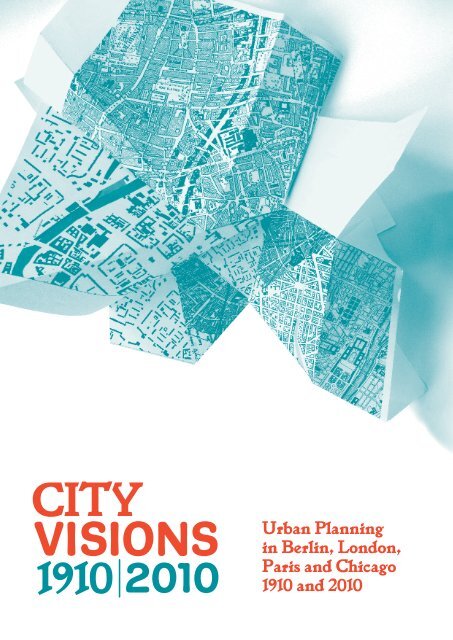
Urban Planning in Berlin, London, Paris and Chicago 1910 and 2010
Urban Planning in Berlin, London, Paris and Chicago 1910 and 2010
Urban Planning in Berlin, London, Paris and Chicago 1910 and 2010

Create successful ePaper yourself
Turn your PDF publications into a flip-book with our unique Google optimized e-Paper software.
<strong>Urban</strong> <strong>Plann<strong>in</strong>g</strong><br />
<strong>in</strong> Berl<strong>in</strong>, <strong>London</strong>,<br />
<strong>Paris</strong> <strong>and</strong> <strong>Chicago</strong><br />
<strong>1910</strong> <strong>and</strong> <strong>2010</strong>
Introduction p. 1<br />
100 Years General Town <strong>Plann<strong>in</strong>g</strong><br />
Exhibition <strong>in</strong> Berl<strong>in</strong><br />
Town plann<strong>in</strong>g concerns everyone. It <strong>in</strong>fluences<br />
not just where <strong>and</strong> how we live <strong>and</strong> work, <strong>and</strong> how<br />
much we move around, but ultimately our happ<strong>in</strong>ess<br />
<strong>and</strong> well-be<strong>in</strong>g <strong>and</strong> that of our descendants. But<br />
it also has an impact on the ‘costs’ of urban liv<strong>in</strong>g,<br />
today <strong>and</strong> <strong>in</strong> the future.<br />
<strong>Plann<strong>in</strong>g</strong> creates hopes <strong>and</strong> visions for a better,<br />
more liveable city. Over the years it has also been the<br />
subject of criticism <strong>and</strong> outrage. It has a long history<br />
<strong>and</strong> has been practised s<strong>in</strong>ce cities came <strong>in</strong>to existence.<br />
It is only s<strong>in</strong>ce shortly before the First World<br />
War, however, that town plann<strong>in</strong>g was established<br />
as a profession with its own visions, pr<strong>in</strong>ciples<br />
<strong>and</strong> methods. And back then it was a success story.<br />
General Town <strong>Plann<strong>in</strong>g</strong> Exhibition <strong>in</strong> Berl<strong>in</strong> <strong>1910</strong><br />
On 1st May, the ‘Allgeme<strong>in</strong>e Städtebau-Ausstellung’<br />
(General Town <strong>Plann<strong>in</strong>g</strong> Exhibition) opened its gates at<br />
the Royal Arts Academy <strong>in</strong> Charlottenburg at Harden -<br />
bergstrasse (today Berl<strong>in</strong>’s University of the Arts).<br />
The exhibition was <strong>in</strong>spired by the urban plann<strong>in</strong>g<br />
competition for Greater Berl<strong>in</strong>, the results of which<br />
were shown alongside many projects <strong>and</strong> plans from<br />
Germany <strong>and</strong> abroad. It reached a broad audience,<br />
attract<strong>in</strong>g 65,000 visitors; success which came<br />
as a surprise to some. The feedback from abroad<br />
was equally positive. In August of the same year,<br />
it was shown <strong>in</strong> Düsseldorf <strong>and</strong> <strong>in</strong> the autumn some<br />
sections of the exhibition were presented at the<br />
International Town <strong>Plann<strong>in</strong>g</strong> Conference <strong>in</strong> <strong>London</strong>.
City Visions <strong>1910</strong> | <strong>2010</strong><br />
Introduction p. 2<br />
The exhibition City Visions <strong>1910</strong> | <strong>2010</strong> is a celebration<br />
of the anniversary of the General Town <strong>Plann<strong>in</strong>g</strong><br />
Exhibition. It compares two key moments <strong>in</strong> time:<br />
The years around <strong>1910</strong> <strong>and</strong> <strong>2010</strong>.<br />
<strong>1910</strong><br />
The plann<strong>in</strong>g exhibition of <strong>1910</strong> presented the<br />
summation of contemporary urbanist thought <strong>and</strong><br />
knowledge. It was the first time that an exhibition<br />
had given a comprehensive account of the reality<br />
of the built environment of metropolitan areas<br />
<strong>in</strong> the <strong>in</strong>dustrial age. The aim was to f<strong>in</strong>d solutions<br />
‘for the dem<strong>and</strong>s of traffic as well as beauty, public<br />
health <strong>and</strong> economic efficiency’. The ma<strong>in</strong> message<br />
was that the problems of large cities could only<br />
be overcome with a multi-discipl<strong>in</strong>ary approach.<br />
<strong>2010</strong><br />
A hundred years later today’s agenda <strong>in</strong> the post-<br />
<strong>in</strong>dustrial metropolis is determ<strong>in</strong>ed by a susta<strong>in</strong>able<br />
design approach. The big themes have rema<strong>in</strong>ed<br />
the same to some degree; their context has changed<br />
dramatically, however. A new underst<strong>and</strong><strong>in</strong>g of urban<br />
development is f<strong>in</strong>d<strong>in</strong>g its way <strong>in</strong>to town plann<strong>in</strong>g<br />
strategies, which are often broad <strong>in</strong> approach <strong>and</strong><br />
controversial <strong>in</strong> design. At the same time new problems<br />
that threaten the <strong>in</strong>tegrity of cities are emerg<strong>in</strong>g<br />
such as a dramatic weaken<strong>in</strong>g of the <strong>in</strong>fluence<br />
of the public sector, the encroachment of private<br />
companies on the public realm <strong>and</strong> new forms of<br />
social polarisation as a result of de-<strong>in</strong>dustrialisation<br />
<strong>and</strong> immigration.<br />
Introduction p. 3<br />
Berl<strong>in</strong> | <strong>Paris</strong> | <strong>London</strong> | <strong>Chicago</strong><br />
The exhibition concentrates on Berl<strong>in</strong>, <strong>Paris</strong>, <strong>London</strong><br />
<strong>and</strong> <strong>Chicago</strong>, four outst<strong>and</strong><strong>in</strong>g metropolitan cities,<br />
whose approaches to town plann<strong>in</strong>g attracted a lot<br />
of attention <strong>in</strong> <strong>1910</strong> as it does today.<br />
Berl<strong>in</strong><br />
In <strong>1910</strong> Berl<strong>in</strong> was try<strong>in</strong>g to f<strong>in</strong>d answers to the<br />
challenges of unplanned growth <strong>in</strong> the <strong>in</strong>dustrial age.<br />
100 years later Berl<strong>in</strong> is considered a model city of<br />
the post-<strong>in</strong>dustrial society.<br />
<strong>Paris</strong><br />
<strong>Paris</strong> <strong>in</strong> <strong>1910</strong> was characterised by the big plans<br />
<strong>and</strong> visions of Eugène Hénard. Today’s Gr<strong>and</strong> Pari(s)<br />
<strong>in</strong>itiative marks an era of a new national urban<br />
development policy.<br />
<strong>London</strong><br />
Previously Greater <strong>London</strong> was the birthplace of the<br />
Garden City Movement, which aimed to decentralise<br />
the metropolis <strong>in</strong> an orderly way. Today it has<br />
become the model of a renaissance of urban centres.<br />
<strong>Chicago</strong><br />
In <strong>Chicago</strong> the world famous plan of Daniel H. Burnham<br />
was <strong>in</strong>troduced <strong>in</strong> 1909. This aspired to enhance<br />
a city seen as lack<strong>in</strong>g <strong>in</strong> beauty. <strong>Chicago</strong> Metropolis<br />
2020 presents itself as a new strategic plan to<br />
develop a susta<strong>in</strong>able metropolitan region.
Population<br />
<strong>1910</strong>: 1.67 million<br />
<strong>2010</strong>: 3.46 million<br />
Size<br />
<strong>1910</strong>: 66 km 2 (25.5 mi 2 )<br />
<strong>2010</strong>: 892 km 2 (344 mi 2 )<br />
10 miles<br />
One hundred years ago Berl<strong>in</strong> was<br />
go<strong>in</strong>g through immense growth,<br />
encouraged by private <strong>in</strong>itiatives.<br />
This raised numerous key issues:<br />
at the fore were the issues of hous<strong>in</strong>g<br />
provision, transport capacity<br />
<strong>and</strong> the availability of public open<br />
space. At the same time plann<strong>in</strong>g<br />
professionals considered Berl<strong>in</strong><br />
to be an urban laboratory, where<br />
new visions <strong>and</strong> new approaches<br />
to plann<strong>in</strong>g were tested. Many<br />
of these ideas were made visible<br />
at the Town <strong>Plann<strong>in</strong>g</strong> Exhibition<br />
<strong>in</strong> <strong>1910</strong>.<br />
After the First World War the<br />
circumstances changed dramatically.<br />
Berl<strong>in</strong> was decentralised,<br />
the construction of hous<strong>in</strong>g <strong>in</strong><br />
urban areas largely ceased <strong>and</strong><br />
urban plann<strong>in</strong>g became public<br />
sector led. By the end of the Second<br />
World War, East <strong>and</strong> West Berl<strong>in</strong><br />
faced grave hous<strong>in</strong>g shortages.<br />
Social hous<strong>in</strong>g delivery, however,<br />
was primarily concentrated <strong>in</strong><br />
suburban areas. The compact <strong>and</strong><br />
densely populated fabric of Berl<strong>in</strong><br />
that had been severely decimated<br />
by bomb<strong>in</strong>gs was further decreased<br />
by demolition programmes<br />
<strong>and</strong> car-oriented <strong>in</strong>frastructure<br />
schemes.<br />
In the years follow<strong>in</strong>g the First<br />
World War, Berl<strong>in</strong> relied on strict<br />
plann<strong>in</strong>g policy controls <strong>and</strong> heavy<br />
subsidies. S<strong>in</strong>ce the fall of the Wall<br />
Berl<strong>in</strong><br />
City Portraits<br />
<strong>in</strong> 1989, Berl<strong>in</strong>’s public sector-led<br />
approach to urban plann<strong>in</strong>g has<br />
faced new challenges. Nowadays,<br />
an age<strong>in</strong>g population, <strong>in</strong>creased<br />
social polarisation <strong>and</strong> climate<br />
change require new wasys of<br />
work<strong>in</strong>g. This comes at a time<br />
when the public sector is drastically<br />
reduc<strong>in</strong>g its lead role.<br />
Today, Berl<strong>in</strong> is concentrat<strong>in</strong>g<br />
its scarce resources on the central<br />
district. Alongside its historic<br />
splendour, the <strong>in</strong>ner city is still<br />
home to former <strong>in</strong>dustrial sites<br />
<strong>and</strong> a great deal of former work<strong>in</strong>gclass<br />
areas with dense tenement<br />
hous<strong>in</strong>g, which suffer from social<br />
exclusion but are also places<br />
to experiment.<br />
The outer districts, especially<br />
their vast social hous<strong>in</strong>g developments,<br />
are also important. The<br />
major city region of today is larger<br />
than its predecessor <strong>in</strong> <strong>1910</strong> <strong>and</strong><br />
it is stretch<strong>in</strong>g beyond Berl<strong>in</strong>’s<br />
adm<strong>in</strong>istrative boundaries <strong>in</strong>to the<br />
federal state of Br<strong>and</strong>enburg.<br />
Limit<strong>in</strong>g urban sprawl on one h<strong>and</strong><br />
<strong>and</strong> address<strong>in</strong>g the renaissance<br />
of the southern half of the city<br />
region, catalysed by the new Berl<strong>in</strong><br />
Br<strong>and</strong>enburg International Airport<br />
<strong>and</strong> the revitalisation of Potsdam,<br />
require comb<strong>in</strong>ed efforts from<br />
the authorities of Berl<strong>in</strong> <strong>and</strong><br />
Br<strong>and</strong>enburg.<br />
10 miles<br />
In <strong>1910</strong>, <strong>London</strong> — the heart of the<br />
British Empire — was the capital<br />
of the largest political system <strong>in</strong> the<br />
world <strong>and</strong> the largest city <strong>in</strong> Europe.<br />
In this era, many urban plann<strong>in</strong>g<br />
strategies were designed to improve<br />
imperial <strong>London</strong>, such as the construction<br />
of the ceremonial route,<br />
The Mall <strong>and</strong> the K<strong>in</strong>gsway through<br />
Holborn. This followed half a century<br />
from 1855 when large scale urban<br />
<strong>in</strong>frastructure projects such as<br />
sewers <strong>and</strong> underground railways<br />
had been pioneered <strong>in</strong> <strong>London</strong>.<br />
Large <strong>and</strong> all-encompass<strong>in</strong>g urban<br />
plans, however, did not really st<strong>and</strong><br />
a chance <strong>in</strong> <strong>London</strong> around 1900,<br />
at least <strong>in</strong> central <strong>London</strong>. The<br />
urban structure of the <strong>in</strong>ner city<br />
experienced little change until the<br />
widespread destruction caused<br />
by the Second World War. Efforts<br />
to decentralise metropolitan<br />
areas, through the development<br />
of garden suburbs <strong>and</strong> new towns,<br />
were meticulously executed over<br />
decades. <strong>London</strong> doubled <strong>in</strong> size<br />
between 1918 <strong>and</strong> 1939 but lost<br />
population <strong>in</strong> the 1950s <strong>and</strong> 1960s<br />
at the height of the decentralisation<br />
to the new <strong>and</strong> exp<strong>and</strong>ed<br />
towns such as Harlow, Stevenage<br />
<strong>and</strong> Peterborough, rega<strong>in</strong><strong>in</strong>g its<br />
upward growth from the 1980s.<br />
Industrial decl<strong>in</strong>e <strong>in</strong> <strong>London</strong> has<br />
freed up many <strong>in</strong>dustrial sites for<br />
redevelopment. One of the largest<br />
such sites, was the port of the<br />
<strong>London</strong><br />
City Portraits<br />
Population<br />
<strong>1910</strong>: 7.16 million<br />
2009: 7.8 million (<strong>in</strong> 2009)<br />
Size<br />
1900: 311 km 2 (120 mi 2 )<br />
2001: 1,623 km 2 (627 mi 2 )<br />
(Greater <strong>London</strong> <strong>in</strong> 2001)<br />
West India Docks <strong>in</strong> East <strong>London</strong>,<br />
which was redeveloped <strong>in</strong>to the<br />
Canary Wharf bus<strong>in</strong>ess district<br />
dur<strong>in</strong>g the 1980s. This vast project<br />
has moved the f<strong>in</strong>ancial centre of<br />
<strong>London</strong> eastwards. The late 1990s<br />
brought a u-turn <strong>in</strong> policy from<br />
de centralisation towards re-urbanisation,<br />
<strong>and</strong> focused on <strong>in</strong>creased<br />
competition <strong>and</strong> <strong>in</strong>novation with<strong>in</strong><br />
the service <strong>and</strong> tourism sectors.<br />
The cuts to the system of local<br />
politics <strong>and</strong> plann<strong>in</strong>g made by the<br />
Conservative government under<br />
Margaret Thatcher, reached their<br />
zenith <strong>in</strong> 1986 with the abolition<br />
of the Greater <strong>London</strong> Council,<br />
<strong>London</strong>’s regional govern<strong>in</strong>g body.<br />
Its functions were transferred to<br />
the boroughs <strong>and</strong> the Government<br />
Office for <strong>London</strong>. The city was<br />
<strong>in</strong> desperate need of coord<strong>in</strong>ated,<br />
regional plann<strong>in</strong>g <strong>and</strong> so, <strong>in</strong> the<br />
year 2000, under Tony Blair’s<br />
Labour government, the Greater<br />
<strong>London</strong> Authority (GLA) was established.<br />
The GLA is an <strong>in</strong>stitution<br />
that sees <strong>London</strong>’s urban development<br />
as a top priority. Strategically<br />
placed urban projects, steered<br />
by a comparatively lean authority,<br />
equipped with similarly lean<br />
budgets, are <strong>in</strong>tended to support<br />
the regeneration of targeted areas<br />
with<strong>in</strong> <strong>London</strong>. The aim is to turn<br />
<strong>London</strong> <strong>in</strong>to a city that is economically<br />
thriv<strong>in</strong>g, <strong>in</strong>clusive <strong>and</strong> susta<strong>in</strong>able,<br />
with high-quality design.
Population<br />
1914: 2.9 million<br />
Greater <strong>Paris</strong> region:<br />
> 4 million s<strong>in</strong>ce 1904<br />
<strong>2010</strong>: 2.2 million<br />
Greater <strong>Paris</strong> region:<br />
10.2 million<br />
Size<br />
<strong>1910</strong>: approx. 100 km 2 (39 mi 2 )<br />
<strong>2010</strong>: 105 km 2 (40 mi 2 )<br />
Greater <strong>Paris</strong> region:<br />
2.8 km 2 (1051 mi 2 )<br />
10 miles<br />
By <strong>1910</strong> <strong>Paris</strong> had accomplished its<br />
dramatic redevelopment programme,<br />
begun dur<strong>in</strong>g the second<br />
half of the 19th century. This redevelopment,<br />
associated with the<br />
name of prefect Georges Eugène<br />
Haussmann, cont<strong>in</strong>ues to affect<br />
the fabric <strong>and</strong> image of the central<br />
city today. Until <strong>1910</strong>, its connectivity<br />
to the outer areas was strongly<br />
limited by the historic city wall.<br />
At that time, all attempts to break<br />
this r<strong>in</strong>g failed. The construction<br />
of the underground metro s<strong>in</strong>ce<br />
1900 <strong>and</strong> later the <strong>in</strong>troduction of<br />
the regional-high speed-rail system<br />
<strong>in</strong> the 1970s, however, has s<strong>in</strong>ce<br />
connected the <strong>in</strong>ner city with outer<br />
areas. S<strong>in</strong>ce the 1960s the urban<br />
r<strong>in</strong>g road, Boulevard Périférique,<br />
forms a new barrier.<br />
Neither government nor any other<br />
official plann<strong>in</strong>g policy co-ord<strong>in</strong>ated<br />
metropolitan plann<strong>in</strong>g / activities<br />
for a long time. The ‘banlieue’, or<br />
urban fr<strong>in</strong>ge, rema<strong>in</strong>ed dom<strong>in</strong>ated<br />
by ‘pavillonnaire’, s<strong>in</strong>gle dwell<strong>in</strong>g<br />
suburban hous<strong>in</strong>g. The construction<br />
of five new satellite cities, ‘villes<br />
nouvelles’, from 1965 onwards<br />
has not changed the situation<br />
notably. However, over the last<br />
ten years some new ideas have<br />
emerged. In 2007 the dispute over<br />
the competition for the conversion<br />
of the covered market, Les Halles,<br />
led to a change <strong>in</strong> op<strong>in</strong>ion about<br />
<strong>Paris</strong><br />
City Portraits<br />
the importance of this central<br />
location for the entire metropolitan<br />
area.<br />
In June 2009 the cross-borough<br />
partnership, <strong>Paris</strong> Métropole, was<br />
founded. The historically s<strong>in</strong>gle<br />
centre-focused <strong>Paris</strong> is mov<strong>in</strong>g<br />
away from splendid isolation.<br />
An expert study by 10 <strong>in</strong>vited<br />
plann<strong>in</strong>g groups, Le Gr<strong>and</strong> Pari du<br />
Gr<strong>and</strong> <strong>Paris</strong> (The Big Challenge<br />
for Greater-<strong>Paris</strong>), began <strong>in</strong> 2008<br />
<strong>and</strong> promised a comprehensive<br />
urban vision. The study envisages<br />
a metropolis suited to the post-<br />
Kyoto Protocol era committ<strong>in</strong>g to<br />
reduce the emission of greenhouse<br />
gases, <strong>in</strong> terms of mobility, density,<br />
densification of the ‘pavillonaire’<br />
(s<strong>in</strong>gle dwell<strong>in</strong>g suburban hous<strong>in</strong>g<br />
areas), regeneration of the ‘gr<strong>and</strong>s<br />
ensembles’ (large social hous<strong>in</strong>g<br />
estates), urban agriculture <strong>and</strong>,<br />
lastly, a new structur<strong>in</strong>g of the<br />
spatial organisation of the entire<br />
metropolitan area. The details<br />
of the overall process are highly<br />
debated by the public. The history<br />
of ‘Gr<strong>and</strong> <strong>Paris</strong>’ might have to<br />
be rewritten.<br />
Population<br />
<strong>1910</strong>: 2.19 million<br />
<strong>2010</strong>: 2.70 million<br />
Greater <strong>Chicago</strong> region:<br />
9.8 million<br />
Size<br />
1920: 500 km 2 (192.8 mi 2 )<br />
<strong>2010</strong>: approx. 606 km 2 (234 mi 2 )<br />
of which approx. 588 km 2<br />
(227 mi 2 ) is l<strong>and</strong> surface.<br />
10 miles<br />
The second half of the 19th century<br />
brought a phase of <strong>in</strong>credible<br />
growth for <strong>Chicago</strong> — which had<br />
not even existed prior to 1800<br />
<strong>and</strong> was only made a city <strong>in</strong> 1836.<br />
With<strong>in</strong> a few decades the city<br />
turned from a small military town<br />
on Lake Michigan to the second<br />
biggest city <strong>in</strong> the USA <strong>and</strong> <strong>in</strong>to one<br />
of largest <strong>in</strong>dustrial metropolitan<br />
areas <strong>in</strong> the world. The city became<br />
famous for its dynamism <strong>and</strong><br />
prosperity. The unmanaged growth<br />
that accompanied <strong>Chicago</strong>’s rapid<br />
<strong>in</strong>dustrialisation, however, was<br />
characterised by hous<strong>in</strong>g shortages,<br />
social conflict, traffic chaos <strong>and</strong><br />
unsanitary conditions. The bus<strong>in</strong>ess<br />
elite of the city, <strong>in</strong> a group called<br />
the Commercial Club, responded<br />
to these problems by commission<strong>in</strong>g<br />
the Plan of <strong>Chicago</strong> (1909).<br />
The Plan, designed by Daniel<br />
Burnham <strong>and</strong> Edward Bennett,<br />
delivered a regional approach to<br />
plann<strong>in</strong>g of hitherto unknown scale.<br />
It was recognised as exemplar<br />
well beyond the borders of the US.<br />
Unfortunately this dynamic ‘Spirit<br />
of <strong>Chicago</strong>’ could not prevent the<br />
post ‘Great Depression’ <strong>and</strong> World<br />
War II decl<strong>in</strong>e of the city which<br />
accelerated because of suburbanisation<br />
<strong>and</strong> de<strong>in</strong>dustrialisation.<br />
Until the early 1980s, <strong>Chicago</strong><br />
was still suffer<strong>in</strong>g from the consequences<br />
of this decl<strong>in</strong>e <strong>and</strong> of<br />
comprehensive <strong>Urban</strong> Renewal<br />
<strong>Chicago</strong><br />
City Portraits<br />
programmes, the construction of<br />
<strong>in</strong>ner city motorways, which were<br />
mostly implemented after World<br />
War II, despite its many modernist<br />
architectural gems. Many parts of<br />
the city were dom<strong>in</strong>ated by urban<br />
decl<strong>in</strong>e <strong>and</strong> poverty, with the<br />
decl<strong>in</strong><strong>in</strong>g central bus<strong>in</strong>ess district<br />
surrounded by derelict, post-<br />
<strong>in</strong>dustrial quarters.<br />
Nowadays, <strong>Chicago</strong>’s <strong>in</strong>ner city<br />
area is an attractive workplace,<br />
popular leisure centre <strong>and</strong> most of<br />
all a desirable residential location.<br />
Its reputation comes ma<strong>in</strong>ly from<br />
an <strong>in</strong>novative approach regard<strong>in</strong>g<br />
urban revitalisation s<strong>in</strong>ce the<br />
1990s, but also from a clever<br />
comb<strong>in</strong>ation of market orientated<br />
development policies <strong>and</strong> strategic<br />
plann<strong>in</strong>g. Once aga<strong>in</strong> the Commercial<br />
Club helped to deliver change<br />
to the City through plann<strong>in</strong>g.<br />
Of particular importance for the<br />
change <strong>in</strong> plann<strong>in</strong>g strategy was<br />
the support given by Richard<br />
M. Daley, Mayor of <strong>Chicago</strong> s<strong>in</strong>ce<br />
1989. The socially ambivalent<br />
consequences of this market-<br />
orientated development are very<br />
much apparent <strong>in</strong> <strong>Chicago</strong>’s urban<br />
fabric today, ma<strong>in</strong>ly <strong>in</strong> buzz<strong>in</strong>g<br />
public spaces <strong>and</strong> parks or re-used<br />
historic build<strong>in</strong>gs.
<strong>1910</strong> Chapter #1<br />
The big urban plan, <strong>and</strong> its presentational<br />
medium, the bird’s eye view,<br />
was considered a driv<strong>in</strong>g force of<br />
urban plann<strong>in</strong>g by <strong>1910</strong>. This approach<br />
formed part of a clear style of 20th<br />
century plann<strong>in</strong>g, dist<strong>in</strong>ct from plann<strong>in</strong>g<br />
practices <strong>in</strong> the 19th century.<br />
This later form of plann<strong>in</strong>g used<br />
more pragmatic urban extension<br />
plans to steer the enormous growth<br />
of cities <strong>in</strong> the era of <strong>in</strong>dustrialisation.<br />
The competition ‘GroßBerl<strong>in</strong><br />
1908/<strong>1910</strong>’ for example, dem<strong>and</strong>ed<br />
a comprehensive reform of the<br />
entire metropolitan region <strong>in</strong>clud<strong>in</strong>g<br />
the historic centre <strong>and</strong> the suburbs.<br />
In the 19th century town plann<strong>in</strong>g<br />
was mostly based on def<strong>in</strong><strong>in</strong>g the<br />
border between public <strong>and</strong> privately<br />
owned l<strong>and</strong>, the regulation of build<strong>in</strong>g<br />
heights, <strong>and</strong> <strong>in</strong>itiatives to improve<br />
the city’s technical <strong>and</strong> transport<br />
<strong>in</strong>fra structures. A more holistic<br />
approach to plann<strong>in</strong>g developed <strong>in</strong><br />
the 20th century, which <strong>in</strong>cluded<br />
subjects such as road <strong>and</strong> rail <strong>in</strong>frastructure,<br />
public recreation spaces<br />
healthy liv<strong>in</strong>g conditions <strong>and</strong> the<br />
group<strong>in</strong>g of gr<strong>and</strong> civic build<strong>in</strong>gs.<br />
The<br />
Big Plan<br />
Fasc<strong>in</strong>ation with the ‘big plan’ was an<br />
<strong>in</strong>ternational phenomenon. The laborious<br />
images were no longer directed<br />
exclusively at aristocrats or plann<strong>in</strong>g<br />
experts, but were look<strong>in</strong>g to appeal<br />
to a broad section of the population<br />
to conv<strong>in</strong>ce them of the need for<br />
radical plans. The American City<br />
Beautiful Movement is a prime example.<br />
In 1909 politicians <strong>and</strong> civilians<br />
alike were particularly drawn to the<br />
Plan of <strong>Chicago</strong> because of its impressive<br />
bird’s eye views pa<strong>in</strong>ted by<br />
Jules Guer<strong>in</strong>. This popular plan,<br />
effective as an advertisement yet<br />
extremely complex, became the<br />
subject of a local, national <strong>and</strong> <strong>in</strong>ternational<br />
media hype. Today the Plan<br />
of <strong>Chicago</strong> cont<strong>in</strong>ues to symbolise<br />
the ‘big plan’.<br />
Make no little plans; they<br />
have no magic to stir men’s<br />
blood […]. Make big plans;<br />
aim high <strong>in</strong> hope <strong>and</strong> work,<br />
remember<strong>in</strong>g that a noble,<br />
logical diagram once record<br />
ed will never die, but long<br />
after we are gone will be a<br />
liv<strong>in</strong>g th<strong>in</strong>g, assert<strong>in</strong>g itself<br />
with evergrow<strong>in</strong>g <strong>in</strong>sistency.<br />
Quote attributed to Daniel H. Burnham,<br />
speech at the Town <strong>Plann<strong>in</strong>g</strong> Conference,<br />
<strong>London</strong> <strong>1910</strong><br />
<strong>1910</strong> #1 — The Big Plan Berl<strong>in</strong> p. 1<br />
1<br />
The plan for the spatial development<br />
of Greater Berl<strong>in</strong> (Grundplan für die<br />
bauliche Entwicklung von Groß-Berl<strong>in</strong>)<br />
is one of two projects that were awarded<br />
the first prize <strong>in</strong> the urban plann<strong>in</strong>g<br />
competition for Greater Berl<strong>in</strong> 1908/<strong>1910</strong>.<br />
The ma<strong>in</strong> topic of Hermann Jansen’s<br />
contribution was ‘with<strong>in</strong> the limits of<br />
possibility’. Jansen became Professor<br />
Hermann Jansen<br />
Plan for the spatial development<br />
of Greater Berl<strong>in</strong><br />
Contribution to the urban plann<strong>in</strong>g competition<br />
for Greater Berl<strong>in</strong> 1908/<strong>1910</strong><br />
of <strong>Urban</strong> <strong>Plann<strong>in</strong>g</strong> at the Technische<br />
Hochschule Berl<strong>in</strong>Charlottenburg <strong>in</strong><br />
1923. The plan at a scale of 1:10,000<br />
roughly covers the area of Berl<strong>in</strong> today,<br />
a size which was <strong>in</strong>itially reached <strong>in</strong> 1920.<br />
The plan <strong>in</strong>cludes eyecatch<strong>in</strong>g features,<br />
<strong>in</strong>clud<strong>in</strong>g parkl<strong>and</strong>s <strong>and</strong> open spaces,<br />
<strong>and</strong> a railway network, both above <strong>and</strong><br />
underground.<br />
1<br />
Hermann Jansen<br />
Contribution to the urban plann<strong>in</strong>g<br />
competition for Greater Berl<strong>in</strong><br />
1908 /<strong>1910</strong>, overview<br />
Courtesy: Architekturmuseum der<br />
Technischen Universität Berl<strong>in</strong>, Inv. Nr. 20513
<strong>1910</strong> #1 — The Big Plan Berl<strong>in</strong> p. 2 <strong>1910</strong> #1 — The Big Plan <strong>Paris</strong> p. 2<br />
Albert Gessner<br />
Vision for Berl<strong>in</strong>’s urban city region<br />
Contribution to the urban plann<strong>in</strong>g competition<br />
for Greater Berl<strong>in</strong> 1908/<strong>1910</strong><br />
2<br />
This aerial view shows a vision of<br />
an ordered, urban metropolis. It<br />
clearly demonstrates how Greater<br />
Berl<strong>in</strong> was perceived on a regional<br />
level. The lower third of the<br />
picture shows Kreuzberg Hill. In<br />
the background is Berl<strong>in</strong>’s green<br />
h<strong>in</strong>terl<strong>and</strong>, with numerous waterways.<br />
The picture was part of the<br />
contribution by Berl<strong>in</strong>’s architect<br />
Albert Gessner for the competition<br />
for Greater Berl<strong>in</strong> 1908/<strong>1910</strong><br />
<strong>and</strong> it won a special prize of the<br />
jury. It followed the motto<br />
‘Become the most comfortable<br />
place to live <strong>in</strong> the world’<br />
(‘Werde der wohnlichste Wohnort<br />
der Welt’).<br />
2<br />
Albert Gessner<br />
Contribution to the urban<br />
plann<strong>in</strong>g competition for<br />
Greater Berl<strong>in</strong> 1908 /<strong>1910</strong>,<br />
Südbahnhofstreet to<br />
Lake Müggel, bird’s eye view<br />
Courtesy: Architekturmuseum der<br />
Technischen Universität Berl<strong>in</strong>, Inv. Nr. 8014<br />
Léon Jaussely / Roger-Henri Expert /<br />
Louis Sollier<br />
Plan for redevelopment <strong>and</strong><br />
extension of <strong>Paris</strong><br />
The plan for the redevelopment <strong>and</strong><br />
extension of <strong>Paris</strong> by Léon Jaussely, Roger<br />
Henri Expert <strong>and</strong> Louis Sollier won the<br />
first prize <strong>in</strong> a competition for the extension<br />
<strong>and</strong> beautification of <strong>Paris</strong> <strong>in</strong> 1919.<br />
The basis for the competition, run by the<br />
Département Se<strong>in</strong>e was the release of a<br />
new town plann<strong>in</strong>g law from 1919<br />
(Loi Cornudet). The awardw<strong>in</strong>n<strong>in</strong>g plan<br />
is considered to be a summary of urban<br />
visions for Gr<strong>and</strong> <strong>Paris</strong> <strong>in</strong> the <strong>1910</strong>s. The<br />
design is rem<strong>in</strong>iscent of the (also awardw<strong>in</strong>n<strong>in</strong>g)<br />
plan, which Hermann Jansen<br />
submitted for Berl<strong>in</strong> <strong>in</strong> <strong>1910</strong>.<br />
Framed facsimile:<br />
Léon Jaussely, Roger-Henri<br />
Expert, Louis Sollier<br />
Plan for the redevelopment<br />
<strong>and</strong> extension of <strong>Paris</strong>, 1919<br />
Courtesy: Académie d’architecture /<br />
Cité de l’architecture et du patrimo<strong>in</strong>e /<br />
Archives d’architecture du XXe siècle<br />
F
<strong>1910</strong> #1 — The Big Plan <strong>London</strong> p. 1<br />
This plan is a curious manifesto of idealism<br />
<strong>and</strong> coherence. Waterhouse reconfigured<br />
the patchwork chaos of <strong>London</strong>’s<br />
urban fabric <strong>in</strong>to a geometrically ordered<br />
plan, but kept the most important sites,<br />
such as a Royal Palace which would have<br />
replaced Buck<strong>in</strong>gham Palace, <strong>in</strong> their<br />
historicallydeterm<strong>in</strong>ed locations. His plan<br />
was a retroactive manifesto as it ma<strong>in</strong>ta<strong>in</strong>ed<br />
the r<strong>and</strong>omness of historical evolution,<br />
<strong>and</strong> so demonstrated how <strong>London</strong><br />
could have been shaped by a general<br />
plan when there was no desire to have<br />
such a plan.<br />
Paul Waterhouse<br />
An Imag<strong>in</strong>ary<br />
Plan for <strong>London</strong><br />
Framed facsimile:<br />
Paul Waterhouse<br />
An Imag<strong>in</strong>ary Plan<br />
of <strong>London</strong>, 1907<br />
Courtesy: RIBA Library<br />
Draw<strong>in</strong>gs & Archives<br />
Collections<br />
F<br />
<strong>1910</strong> #1 — The Big Plan <strong>Chicago</strong> p. 2<br />
Daniel H. Burnham / Edward H. Bennett<br />
Plan of <strong>Chicago</strong><br />
Bird’s-eye view look<strong>in</strong>g at <strong>Chicago</strong><br />
on the banks of Lake Michigan<br />
2<br />
<strong>Chicago</strong>’s strategic position on<br />
two important waterways, <strong>and</strong><br />
its importance as a railway centre,<br />
turned the city <strong>in</strong>to a key <strong>in</strong>frastructure<br />
hub <strong>in</strong> North America<br />
<strong>in</strong> the second half of the 19th<br />
century. Burnham’s vision for<br />
the Plan of <strong>Chicago</strong> was illustrated<br />
with watercolour pa<strong>in</strong>t<strong>in</strong>gs<br />
drawn <strong>in</strong> Burnham’s office but<br />
coloured <strong>in</strong> by Jules Guer<strong>in</strong>. The<br />
vast extent of the area depicted<br />
<strong>in</strong> the draw<strong>in</strong>gs matches the<br />
scale of opportunities available<br />
to the rapidly grow<strong>in</strong>g <strong>Chicago</strong>.<br />
The exist<strong>in</strong>g transport <strong>in</strong>frastructure<br />
<strong>in</strong> the region facilitated<br />
<strong>Chicago</strong>’s expansion plans.<br />
2<br />
Daniel H. Burnham,<br />
Edward H. Bennett<br />
Plan of <strong>Chicago</strong>, bird’s eye<br />
view over <strong>Chicago</strong> on the<br />
banks of Lake Michigan,<br />
1909<br />
Draw<strong>in</strong>g: Jules Guer<strong>in</strong><br />
Courtesy: <strong>Chicago</strong> History<br />
Museum
<strong>1910</strong> Chapter #2<br />
Monumental<br />
City Centre<br />
The exceptional growth of large<br />
urban regions put enormous pressure<br />
to modernise on many pre<strong>in</strong>dustrial<br />
cities <strong>in</strong> Europe. Next to traditional<br />
civic build<strong>in</strong>gs like churches, castles<br />
<strong>and</strong> town halls, new build<strong>in</strong>gs were<br />
erected such as universities, museums,<br />
theatres, monuments to trade <strong>and</strong><br />
commerce, hotels, <strong>and</strong> government<br />
<strong>and</strong> adm<strong>in</strong>istrative build<strong>in</strong>gs. The development<br />
of the contemporary city<br />
centre most notably grew around<br />
tra<strong>in</strong> stations <strong>and</strong> along high streets.<br />
Medieval historic centres were rendered<br />
less relevant <strong>and</strong> became sites<br />
for radical redevelopment <strong>and</strong> demolition,<br />
often to clear the way for new<br />
<strong>in</strong>frastructure.<br />
The ma<strong>in</strong> objective of the rul<strong>in</strong>g<br />
classes <strong>in</strong> the era before the First<br />
World War was the construction of<br />
the Monumentalstadt (Monumental<br />
City). An impressive ‘arrangement of<br />
monumental build<strong>in</strong>gs’ was <strong>in</strong>tended<br />
to give the public realm a new <strong>and</strong><br />
impressive dimension.<br />
The unchallenged model for these<br />
k<strong>in</strong>ds of transformations was <strong>Paris</strong>,<br />
which <strong>in</strong> 1853 was given a modern<br />
yet artful compact shape by GeorgesEugène<br />
Haussmann. Haussmann<br />
concentrated on the meticulous<br />
application of classic design pr<strong>in</strong>ciples<br />
such as ‘axis’ <strong>and</strong> ‘symmetry’<br />
<strong>and</strong> therefore focused on a historically<br />
grounded underst<strong>and</strong><strong>in</strong>g of<br />
‘monumentality’. Via the <strong>Paris</strong>ian<br />
École des Beaux-Arts, which had a<br />
strong <strong>in</strong>fluence on urban plann<strong>in</strong>g<br />
<strong>in</strong> the United States, the idea of monumentality<br />
was adopted by Daniel H.<br />
Burnham <strong>in</strong> the Plan of <strong>Chicago</strong> of<br />
1909 <strong>and</strong> <strong>in</strong>formed the City Beautiful<br />
Movement.<br />
In <strong>London</strong> the redevelopment of the<br />
Mall embodied a symbol of global<br />
power, though was relatively small<br />
<strong>in</strong> size, <strong>and</strong> its impact on the city as<br />
a whole was not great. <strong>Paris</strong> followed<br />
with projects by Eugène Hénard. At<br />
the Greater Berl<strong>in</strong> competition 1908/<br />
<strong>1910</strong>, Eber stadt, Möhr<strong>in</strong>g & Petersen<br />
proposed to transform the Königsplatz<br />
(the K<strong>in</strong>g’s Square) <strong>in</strong>to the Reichsforum<br />
(National Forum) of imperial gr<strong>and</strong>eur,<br />
while Bruno Schmitz, with his bird’s<br />
eye view of a monumental Berl<strong>in</strong>,<br />
even outplayed Burnham’s civic<br />
design for <strong>Chicago</strong>.<br />
Most large cities only show<br />
character <strong>in</strong> their city centres.<br />
Translated from Werner Hegemann, <strong>in</strong>:<br />
‘Der Städtebau nach den Ergebnissen der<br />
Allgeme<strong>in</strong>en Städtebau-Ausstellung <strong>in</strong> Berl<strong>in</strong>’,<br />
Vol. 1, Berl<strong>in</strong> 1911<br />
<strong>1910</strong> #2 — Monumental City Centre Berl<strong>in</strong> p. 1<br />
The most startl<strong>in</strong>g contribution to the<br />
Greater Berl<strong>in</strong> competition was the<br />
set of large charcoal draw<strong>in</strong>gs made by<br />
respected preservationist Bruno Schmitz.<br />
The draw<strong>in</strong>gs displayed a vision for<br />
Berl<strong>in</strong>, which overstated the scale of<br />
Berl<strong>in</strong> as a world city. A ‘monumental<br />
city’ (Monumentalstadt) north of the<br />
Koenigsplatz, accommodat<strong>in</strong>g palaces<br />
of the arts <strong>and</strong> civic build<strong>in</strong>gs, form<br />
the largest of five areas <strong>in</strong>cluded <strong>in</strong> the<br />
expansion of Berl<strong>in</strong>’s city centre. To<br />
avoid disturb<strong>in</strong>g the artistic expression<br />
of his draw<strong>in</strong>gs, Schmitz did not def<strong>in</strong>e<br />
any specific uses.<br />
Havestadt & Contag / Schmitz & Blum<br />
Monumental City Centre<br />
Contribution to the<br />
urban plann<strong>in</strong>g competition<br />
for Greater Berl<strong>in</strong> 1908/<strong>1910</strong><br />
Framed facsimile,<br />
top:<br />
Havestadt & Contag,<br />
Schmitz und Blum<br />
Contribution to the urban<br />
plann<strong>in</strong>g competition for<br />
Greater Berl<strong>in</strong> 1908 /<strong>1910</strong>,<br />
New-Berl<strong>in</strong> around<br />
North Central Station,<br />
bird’s eye view<br />
Courtesy: Architekturmuseum<br />
der Technischen Universität<br />
Berl<strong>in</strong>, Inv. Nr. 8010<br />
bottom:<br />
Havestadt & Contag,<br />
Schmitz und Blum<br />
Contribution to the urban<br />
plann<strong>in</strong>g competition for<br />
Greater Berl<strong>in</strong> 1908 /<strong>1910</strong>,<br />
New-Berl<strong>in</strong> around<br />
South Central Station,<br />
bird’s eye view<br />
Courtesy: Architekturmuseum<br />
der Technischen Universität<br />
Berl<strong>in</strong>, Inv. Nr. 8008<br />
F
<strong>1910</strong> #2 — Monumental City Centre Berl<strong>in</strong> p. 3<br />
Joseph Brix / Felix Genzmer<br />
Upgrad<strong>in</strong>g of Königgrätzer Street between<br />
Anhalt Station <strong>and</strong> Potsdam Station<br />
Contribution to the urban plann<strong>in</strong>g competition<br />
for Greater Berl<strong>in</strong> 1908/<strong>1910</strong><br />
Like other competitors, Brix <strong>and</strong> Genzmer<br />
proposed a northsouth railway l<strong>in</strong>e to be<br />
run under Berl<strong>in</strong>’s central park (Tiergarten).<br />
With two stations close to Potsdamer Platz<br />
there was not enough space to cope with<br />
the number of people mov<strong>in</strong>g to <strong>and</strong> from<br />
the station. This was solved by direct<strong>in</strong>g<br />
commuter tra<strong>in</strong>s to Potsdam Station<br />
(Potsdamer Bahnhof) <strong>and</strong> national rail to<br />
Anhalt Station (Anhalter Bahnhof). Both<br />
were strategically l<strong>in</strong>ked by a newly widened<br />
street, which freed up space for the<br />
expansion of the bus<strong>in</strong>ess district around<br />
Leipziger <strong>and</strong> Potsdamer Platz.<br />
4<br />
3<br />
Brix & Genzmer<br />
Contribution to the urban<br />
plann<strong>in</strong>g competition for<br />
Greater Berl<strong>in</strong> 1908 /<strong>1910</strong>,<br />
perspective view of the<br />
widened Königgrätzer<br />
Street to become a gr<strong>and</strong><br />
boulevard adjacent<br />
to the station.<br />
Pa<strong>in</strong>t<strong>in</strong>g: Otto<br />
Günther-Naumburg<br />
Courtesy: Architekturmuseum<br />
der Technischen Universität<br />
Berl<strong>in</strong>, Inv. Nr. 20132<br />
4<br />
Brix & Genzmer<br />
Königgrätzer Street,<br />
location plan<br />
Courtesy: Architekturmuseum<br />
der Technischen Universität<br />
Berl<strong>in</strong><br />
3<br />
<strong>1910</strong> #2 — Monumental City Centre <strong>Paris</strong> p. 1<br />
Eugène Hénard<br />
Promenade <strong>and</strong> view<strong>in</strong>g corridor between<br />
Champs Élysées <strong>and</strong> Invalides<br />
Only a few of the ideas of Eugène Hénard<br />
were ever realised. One of them was the<br />
magnificent promenade <strong>and</strong> visual axis,<br />
which was created for the World’s Fair <strong>in</strong><br />
1900. The promenade, which spanned the<br />
River Se<strong>in</strong>e, was designed to connect two<br />
significant areas of the city, the Champs<br />
Élysées <strong>and</strong> the Esplanade des Invalides.<br />
The Alex<strong>and</strong>er III Bridge (Pont Alex<strong>and</strong>re<br />
III) was built specifically to form this l<strong>in</strong>k.<br />
Hénard’s promenade effectuated one of<br />
the most significant transformations <strong>in</strong> the<br />
layout of <strong>Paris</strong> s<strong>in</strong>ce the extensive <strong>in</strong>terventions<br />
of GeorgesEugène Haussmann<br />
<strong>in</strong> the 19th century.<br />
1<br />
Eugène Hénard<br />
The new promenade<br />
Champs Élysées –<br />
Esplanade des Invalides,<br />
bird’s eye view<br />
Courtesy: Cité de l‘architecture<br />
et du patrimo<strong>in</strong>e / Archives<br />
d‘architecture du XXe siècle<br />
(Reproduction of unknown orig<strong>in</strong>)<br />
2<br />
Eugène Hénard<br />
The new promenade<br />
Champs Élysées –<br />
Esplanade des Invalides,<br />
plan, 1894 / 1900<br />
Courtesy: Cité de l‘architecture<br />
et du patrimo<strong>in</strong>e / Archives<br />
d‘architecture du XXe siècle<br />
(Reproduction of unknown orig<strong>in</strong>)<br />
1<br />
2
<strong>1910</strong> #2 — Monumental City Centre <strong>London</strong> p. 1<br />
Aston Webb<br />
Design for the<br />
Queen Victoria Monument<br />
Plan <strong>and</strong> bird’s eye view<br />
The redesign of The Mall, by Aston<br />
Webb <strong>in</strong> the early 20th century, forms<br />
the centrepiece of imperial urban plann<strong>in</strong>g<br />
<strong>in</strong> <strong>London</strong>. The large statue of Queen<br />
Victoria <strong>in</strong> front of Buck<strong>in</strong>gham Palace,<br />
<strong>and</strong> Admiralty Arch, which forms the<br />
entrance to The Mall, were part of Webb’s<br />
redesign. Webb also added the very th<strong>in</strong><br />
stone fac<strong>in</strong>g to the palace’s façade.<br />
1<br />
Aston Webb<br />
Design for the Queen<br />
Victoria Monument <strong>and</strong><br />
the redevelopment of The<br />
Mall, bird’s eye view, 1903<br />
Courtesy: RIBA Library Draw<strong>in</strong>gs<br />
& Archives Collections<br />
1<br />
<strong>1910</strong> #2 — Monumental City Centres <strong>London</strong> p. 2<br />
With his plan to create a new thoroughfare<br />
<strong>in</strong> the centre of <strong>London</strong>, Paul<br />
Waterhouse hoped to improve eastwest<br />
circulation of traffic. His street layout,<br />
however, was not straight like Georges<br />
Eugène Haussmann’s design for <strong>Paris</strong>,<br />
but curved, follow<strong>in</strong>g John Nash’s design<br />
Paul Waterhouse<br />
Central Plan of <strong>London</strong><br />
for Regent Street. Waterhouse thought<br />
the composition would create surpris<strong>in</strong>g<br />
moments <strong>and</strong> enable the design of<br />
<strong>in</strong>terest<strong>in</strong>g commercial build<strong>in</strong>gs.<br />
2<br />
Paul Waterhouse<br />
Central Plan of <strong>London</strong><br />
show<strong>in</strong>g changes to the<br />
two ma<strong>in</strong> roads as well<br />
as one additional<br />
thoroughfare south of<br />
the Thames, 1907<br />
Courtesy: RIBA Library<br />
Draw<strong>in</strong>gs & Archives<br />
Collections<br />
2
<strong>1910</strong> #2 — Monumental City Centre <strong>Chicago</strong> p. 1<br />
The planners of <strong>Chicago</strong> paid special<br />
attention to its core or central area, where<br />
central junctions were identified as ideal<br />
locations for gr<strong>and</strong> civic build<strong>in</strong>gs. At the<br />
term<strong>in</strong>us of an impressive boulevard, was<br />
a 50,000 square metre forum for civic<br />
adm<strong>in</strong>istration, with the town hall at its<br />
heart. The adm<strong>in</strong>istrative cluster was never<br />
realised <strong>and</strong> its site is now a huge motorway<br />
junction.<br />
Daniel H. Burnham / Edward H. Bennett<br />
Plan of <strong>Chicago</strong><br />
Bird’s-eye view look<strong>in</strong>g from the west with<br />
proposed Civic Center Plaza as urban centre<br />
1<br />
Daniel H. Burnham,<br />
Edward H. Bennett<br />
Plan of <strong>Chicago</strong>, bird’s eye<br />
view look<strong>in</strong>g over the city<br />
from the west, show<strong>in</strong>g<br />
proposed Civic Center<br />
Plaza as central hub of<br />
a system of ma<strong>in</strong> traffic<br />
thorough-fares <strong>and</strong><br />
surround<strong>in</strong>gs, 1909<br />
Draw<strong>in</strong>g: Jules Guer<strong>in</strong><br />
Courtesy: <strong>Chicago</strong> History<br />
Museum<br />
1
<strong>1910</strong> Chapter #3<br />
New Models for<br />
Dense <strong>Urban</strong> Liv<strong>in</strong>g<br />
‘The hous<strong>in</strong>g problem’ formed the<br />
central debate <strong>in</strong> the European town<br />
plann<strong>in</strong>g discourse. Criticism was<br />
focused on the liv<strong>in</strong>g conditions of<br />
workers <strong>in</strong> denselybuilt <strong>and</strong> overcrowded<br />
tenement hous<strong>in</strong>g areas.<br />
Towards the end of the 19th century<br />
these stretched well beyond the<br />
boundary of the city centres <strong>in</strong>to<br />
new developments <strong>in</strong> the outskirts.<br />
Planners generally saw their own<br />
cities as a ‘bad example’ <strong>and</strong> looked<br />
to others to draw <strong>in</strong>spiration. While<br />
Ebenezer Howard wanted to get rid<br />
of the chaos of <strong>London</strong>, Daniel H.<br />
Burnham recommended George<br />
Eugène Haussmann’s <strong>Paris</strong> as a role<br />
model for <strong>Chicago</strong>’s reorganisation.<br />
This <strong>in</strong> turn was a nightmare prospect<br />
for many reformers <strong>in</strong> Germany, who<br />
viewed <strong>London</strong> with its suburbs as a<br />
role model.<br />
This <strong>in</strong>ternational climate of criticism<br />
<strong>and</strong> propag<strong>and</strong>a furthered impressive<br />
urban alternatives to highdensity city<br />
centres. Berl<strong>in</strong> was one of the centres<br />
of discussion <strong>and</strong> a test<strong>in</strong>g ground<br />
for new ideas. Experiments with new<br />
urban block typologies, private roads,<br />
mixeduse developments <strong>and</strong> new<br />
district centres <strong>in</strong> the urban fr<strong>in</strong>ge<br />
were manifold. Eugène Hénard<br />
<strong>in</strong>vented a new ‘stepped’ build<strong>in</strong>g<br />
structure for <strong>Paris</strong> which allowed<br />
façades to project <strong>in</strong>to the streets<br />
they flanked, an alternative that<br />
never saw the light of day.<br />
<strong>London</strong>’s slums began to be replaced<br />
with modern workers’ quarters funded<br />
from the public purse <strong>and</strong> charities.<br />
Daniel H. Burnham was <strong>in</strong>spired by<br />
an allembrac<strong>in</strong>g streaml<strong>in</strong><strong>in</strong>g of the<br />
large city. All these alternatives <strong>in</strong>sisted<br />
on dense urban patterns, urban<br />
streets <strong>and</strong> public spaces.<br />
The biggest new <strong>in</strong>vention was a new<br />
type of largescale urban project;<br />
new city districts built <strong>in</strong> one go by<br />
a new generation of private l<strong>and</strong> development<br />
companies. These were<br />
typ ically narrow build<strong>in</strong>g blocks with<br />
courtyards <strong>and</strong> were ma<strong>in</strong>ly targeted<br />
at high<strong>in</strong>come residents. To some<br />
progressive planners of the era such<br />
private l<strong>and</strong> development companies<br />
were noth<strong>in</strong>g more than speculative<br />
developers. Their rented apartments<br />
were compared to work<strong>in</strong>g class tenements<br />
<strong>and</strong> urban design exhibitions<br />
largely ignored these typologies.<br />
1,088,269 of Berl<strong>in</strong>’s residents<br />
(exclud<strong>in</strong>g Greater Berl<strong>in</strong>) are<br />
liv<strong>in</strong>g <strong>in</strong> flats, where every<br />
s<strong>in</strong>gle heated room conta<strong>in</strong>s<br />
between 3 <strong>and</strong> 13 people.<br />
Berl<strong>in</strong> has got a population<br />
of 2,040,148.<br />
Translated from Statistical Institute Berl<strong>in</strong><br />
(Chairman He<strong>in</strong>rich Silbergleit),<br />
at the Town <strong>Plann<strong>in</strong>g</strong> Exhibition <strong>1910</strong><br />
<strong>1910</strong> #3 — New Models for Dense <strong>Urban</strong> Liv<strong>in</strong>g Berl<strong>in</strong> p. 2<br />
2<br />
Hermann Jansen<br />
Contribution to the urban<br />
plann<strong>in</strong>g competition for<br />
Greater Berl<strong>in</strong> 1908 /<strong>1910</strong>,<br />
proposed design for<br />
Tempelhofer Feld<br />
Courtesy: Architekturmuseum<br />
der Technischen Universität<br />
Berl<strong>in</strong>, Inv. Nr. 20553<br />
3<br />
L<strong>and</strong> parcels plan of<br />
Tempelhofer Feld<br />
Courtesy: Architekturmuseum<br />
der Technischen Universität<br />
Berl<strong>in</strong>, Inv. Nr. 20570<br />
Hermann Jansen<br />
Development of the Tempelhofer Feld<br />
Contribution to the urban plann<strong>in</strong>g competition<br />
for Greater Berl<strong>in</strong> 1908/<strong>1910</strong><br />
Framed facsimile:<br />
Hermann Jansen<br />
Contribution to the urban<br />
plann<strong>in</strong>g competition for<br />
Greater Berl<strong>in</strong> 1908 /<strong>1910</strong>,<br />
bird’s eye view of the<br />
proposed build<strong>in</strong>gs on<br />
the western part of<br />
Tempelhofer Feld<br />
Courtesy: Architekturmuseum<br />
der Technischen Universität<br />
Berl<strong>in</strong>, Inv. Nr. 20563<br />
2<br />
The development of the western<br />
Tempelhofer Feld (Field) caused one of<br />
the biggest disputes <strong>in</strong> Berl<strong>in</strong> prior to the<br />
First World War. Hermann Jansen submitted<br />
a design proposal to the Greater<br />
Berl<strong>in</strong> 1908/<strong>1910</strong> competition, for a<br />
residential quarter, with an urban block<br />
structure that omitted lateral blocks <strong>and</strong><br />
side w<strong>in</strong>gs. The bird’s eye view from<br />
<strong>1910</strong> shows an attractive urban alternative<br />
to the outdated, dense tenement stock,<br />
<strong>and</strong> a generous green belt can be seen<br />
<strong>in</strong> the background. Jansen’s proposal<br />
was never realised.<br />
3<br />
F
<strong>1910</strong> #3 — New Models for Dense <strong>Urban</strong> Liv<strong>in</strong>g Berl<strong>in</strong> p. 3<br />
Carl-James Bühr<strong>in</strong>g<br />
The Civic Forum Weißensee<br />
In the heyday of local municipal competition,<br />
some suburban authorities developed<br />
local town centres, with the hope<br />
of support<strong>in</strong>g localised urbanisation <strong>and</strong><br />
creat<strong>in</strong>g local identities. This helped to<br />
establish the base for Berl<strong>in</strong>’s polycentric<br />
structure. One example is the Civic Forum<br />
(Kommunales Forum) of the Weißensee<br />
borough. This forum, which was built<br />
between 1907 <strong>and</strong> 1912, was based on<br />
plans by the local development director,<br />
CarlJames Bühr<strong>in</strong>g.<br />
New centre <strong>in</strong> a grow<strong>in</strong>g metropolitan region<br />
4<br />
It comprised a hall for community uses,<br />
a public pool, an <strong>in</strong>novative high school,<br />
fire station <strong>and</strong> hous<strong>in</strong>g for civil servants<br />
arranged around a small lake. Civic development<br />
<strong>in</strong> Weißensee was made possible<br />
by the establishment of a l<strong>and</strong> acquisition<br />
fund, a public <strong>in</strong>itiative to acquire the<br />
necessary properties.<br />
6<br />
4<br />
Carl-James Bühr<strong>in</strong>g<br />
Plan of the Civic Forum<br />
Weißensee<br />
Source: ‘Moderne Bauformen.<br />
Monatshefte für Architektur und<br />
Raumkunst’, 6 / 1915, p. 214<br />
5<br />
Secondary school at the<br />
Civic Forum<br />
Source: ‘Moderne Bauformen.<br />
Monatshefte für Architektur und<br />
Raumkunst’, 6 / 1915, p. 213<br />
6<br />
Hospice at the Civic Forum<br />
Source: ‘Moderne Bauformen.<br />
Monatshefte für Architektur und<br />
Raumkunst’,, 6 / 1915,p. 219<br />
5<br />
<strong>1910</strong> #3 — New Models for Dense <strong>Urban</strong> Liv<strong>in</strong>g <strong>Paris</strong> p. 1<br />
With his Boulevard à Redans — ‘stepped<br />
boulevard’, Eugène Hénard developed<br />
an alternative to the outdated boulevards<br />
of 19th century <strong>Paris</strong>. While Hénard’s<br />
concept did not greatly alter build<strong>in</strong>g<br />
density or l<strong>and</strong>ownership rights, <strong>in</strong>terlock<strong>in</strong>g<br />
build<strong>in</strong>g frontage elements allowed<br />
Eugène Hénard<br />
Boulevard à Redans<br />
for <strong>in</strong>creased w<strong>in</strong>dow sizes, improv<strong>in</strong>g<br />
access to natural light <strong>and</strong> broke up the<br />
wall created by build<strong>in</strong>g frontages Hénard’s<br />
idea, however, was never implemented.<br />
1<br />
Aston Webb<br />
Plan des Queen-Victoria-<br />
Denkmals und die<br />
Neuordnung der Mall.<br />
Situationsplan und<br />
Vogelschau<br />
Quelle: RIBA Library Draw<strong>in</strong>gs & Archives Collections<br />
1 3<br />
1<br />
Eugène Hénard<br />
Boulevard `a Redans,<br />
1903, section, plan<br />
Source: Eugène Hénard, ‘Études<br />
sur les transformations de<br />
<strong>Paris</strong>’, 1903 –1909<br />
2<br />
Comparison to traditional<br />
boulevard<br />
Source: Eugène Hénard, ‘Études<br />
sur les transformations de<br />
<strong>Paris</strong>’, 1903 – 1909<br />
3<br />
Boulevard `a redans,<br />
perspective<br />
Courtesy: Eugène Hénard,<br />
Études sur les transformations<br />
de <strong>Paris</strong>, 1903 - 1909<br />
2
<strong>1910</strong> #3 — New Models for Dense <strong>Urban</strong> Liv<strong>in</strong>g <strong>London</strong> p. 1<br />
<strong>London</strong> County Council (LCC), Architects’ Department<br />
Condition before <strong>and</strong><br />
after redevelopment 1893–1900<br />
1<br />
2<br />
The Boundary Street Estate <strong>in</strong><br />
Bethnal Green (1893–1900) was<br />
the first big project <strong>in</strong>itiated by<br />
the Architects’ Department of<br />
the <strong>London</strong> County Council<br />
(LCC) to clear slums <strong>and</strong> replace<br />
them with flats for workers. The<br />
simple, red brick build<strong>in</strong>gs,<br />
which featured traditional, residential<br />
decorative elements such<br />
as gables, surrounded a circular<br />
green. The LCC applied ideas<br />
from the Arts <strong>and</strong> Crafts Movement<br />
to the design of build<strong>in</strong>gs.<br />
Despite their configuration <strong>in</strong><br />
rows — rather than perimeter<br />
blocks — a mixeduse quarter<br />
with many urban functions<br />
was formed.<br />
1<br />
Boundary Street Scheme,<br />
before renewal, 1893<br />
Courtesy: City of <strong>London</strong> <strong>and</strong><br />
<strong>London</strong> Metropolitan Archives<br />
2<br />
Boundary Street Scheme,<br />
after renewal, 1900<br />
Courtesy: City of <strong>London</strong> <strong>and</strong><br />
<strong>London</strong> Metropolitan Archives<br />
<strong>1910</strong> #3 — New Models for Dense <strong>Urban</strong> Liv<strong>in</strong>g <strong>Chicago</strong> p. 1<br />
Daniel H. Burnham / Edward H. Bennett<br />
Plan of <strong>Chicago</strong><br />
Planned boulevard connect<strong>in</strong>g<br />
north <strong>and</strong> south sides of the river<br />
1<br />
<strong>Chicago</strong>’s transport system<br />
could not cope with its volume<br />
of pass engers, <strong>and</strong> its bus<strong>in</strong>ess<br />
quarter <strong>in</strong> particular was heavily<br />
congested. One solution proposed<br />
by the planners was the<br />
widen<strong>in</strong>g of Michigan Avenue,<br />
which had the purpose to separate<br />
goods <strong>and</strong> service deliveries<br />
from the elegant lives of shoppers.<br />
Planned as a gr<strong>and</strong> boulevard,<br />
the entire road was to be elevated<br />
so that the eastwest<br />
traffic could pass under neath<br />
with help of ramps. A doubledecker<br />
bridge was to then lead<br />
the traffic unh<strong>in</strong>dered across the<br />
<strong>Chicago</strong> River.<br />
1<br />
Daniel H. Burnham,<br />
Edward H. Bennett<br />
Plan of <strong>Chicago</strong>, bird’s eye<br />
view look<strong>in</strong>g over the city<br />
from the west, show<strong>in</strong>g<br />
proposed Civic Center<br />
Plaza as central hub of a<br />
system of ma<strong>in</strong> traffic<br />
thorough-fares <strong>and</strong><br />
surround<strong>in</strong>gs, 1909<br />
Draw<strong>in</strong>g: Jules Guer<strong>in</strong><br />
Courtesy: <strong>Chicago</strong> History<br />
Museum
<strong>1910</strong> Chapter #4<br />
Green Belts,<br />
Corridors <strong>and</strong> Parks<br />
An orderly growth of metropolitan<br />
areas with help of green grids <strong>and</strong><br />
green belts or green wedges was<br />
seen by many social reformers as<br />
a way to achieve health <strong>and</strong> well<br />
be<strong>in</strong>g of the metropolitan population.<br />
Dense development of these areas<br />
was to be structured with ‘decorative,<br />
productive, outer <strong>and</strong> <strong>in</strong>ner parks’<br />
<strong>and</strong> flooded with light <strong>and</strong> air. Public<br />
parks <strong>and</strong> baths, lidos <strong>and</strong> large recreational<br />
areas for play <strong>and</strong> sport<br />
were mostly planned for the work<strong>in</strong>g<br />
classes. It was believed that a healthy<br />
population would lead to an <strong>in</strong>crease<br />
<strong>in</strong> productivity.<br />
In this context the work of l<strong>and</strong>scape<br />
architects came to the fare. The park<br />
section of the Town <strong>Plann<strong>in</strong>g</strong> Exhibition<br />
<strong>1910</strong> was a favourite amongst<br />
the visitors.<br />
In <strong>Paris</strong> Eugène Hénard designed a<br />
plan with n<strong>in</strong>e parks, which, connected<br />
through the ‘Boulevard à Redans’<br />
alongside the former city wall, were<br />
supposed to surround the <strong>in</strong>ner city.<br />
The entries for the Greater Berl<strong>in</strong><br />
competition 1908 conta<strong>in</strong>ed a multitude<br />
of concepts to make the metropolitan<br />
region greener. While<br />
Hermann Jansen proposed two concentric<br />
green belts, Bruno Möhr<strong>in</strong>g<br />
envisaged green strips that connected<br />
the city centre with the city fr<strong>in</strong>ge.<br />
In the US, park plann<strong>in</strong>g reached<br />
hitherto unknown dimensions. The<br />
Plan of <strong>Chicago</strong>, <strong>in</strong>troduced <strong>in</strong> 1909<br />
by Daniel H. Burnham <strong>and</strong> Edward<br />
H. Bennett, envisaged several r<strong>in</strong>gs<br />
of parks <strong>and</strong> thus l<strong>in</strong>ked their plan<br />
conceptually to the Park networks of<br />
the Olmsted Brothers. The aim was<br />
to provide every resident <strong>in</strong> the city<br />
with a park <strong>in</strong> walk<strong>in</strong>g distance. These<br />
American park systems became a<br />
much admired model for Europe.<br />
These parks <strong>and</strong> open space<br />
networks of the American cities<br />
comprise everyth<strong>in</strong>g that people<br />
liv<strong>in</strong>g <strong>in</strong> dense large cities need<br />
for their recreation.<br />
Translated from Leberecht Migge, <strong>in</strong>:<br />
‘Die Gartenkultur des 20. Jahrhunderts’,<br />
Jena 1913<br />
<strong>1910</strong> #4 — Green Belts, Corridors <strong>and</strong> Parks Berl<strong>in</strong> p. 1<br />
The establishment <strong>and</strong> protection of green<br />
<strong>in</strong>frastructure was a central concern for<br />
the Greater Berl<strong>in</strong> competition 1908/10.<br />
The plan by Brix <strong>and</strong> Genzmer, two professors<br />
at the Technical University, aimed<br />
to ma<strong>in</strong>ta<strong>in</strong> surround<strong>in</strong>g woodl<strong>and</strong>s as well<br />
as significantly exp<strong>and</strong><strong>in</strong>g green spaces.<br />
Brix <strong>and</strong> Genzmer also suggested creat<strong>in</strong>g<br />
an association with the purpose of acquir<strong>in</strong>g<br />
<strong>and</strong> manag<strong>in</strong>g the woodl<strong>and</strong>s. However,<br />
the jury criticised the plan, argu<strong>in</strong>g<br />
that the ‘green b<strong>and</strong>s’ did not enter deep<br />
enough <strong>in</strong>to the urban centre.<br />
Joseph Brix / Felix Genzmer<br />
Plan for Green Spaces<br />
Contribution to the urban plann<strong>in</strong>g competition<br />
for Greater Berl<strong>in</strong> 1908/<strong>1910</strong><br />
2<br />
1<br />
Brix & Genzmer<br />
Contribution to the urban<br />
plann<strong>in</strong>g competition for<br />
Greater Berl<strong>in</strong> 1908 /<strong>1910</strong>,<br />
plan for green spaces<br />
Courtesy: Architekturmuseum der<br />
Technischen Universität Berl<strong>in</strong>,<br />
Inv. Nr. 20122<br />
2<br />
Scheme draw<strong>in</strong>g of the<br />
arrangement of green<br />
spaces<br />
Source: Eberstadt, Rudolf /<br />
Möhr<strong>in</strong>g, Bruno / Petersen,<br />
Richard: ‘Groß-Berl<strong>in</strong>. E<strong>in</strong><br />
Programm für die Planung<br />
der neuzeitlichen Großstadt’,<br />
Berl<strong>in</strong> 1901, p. 5<br />
1
<strong>1910</strong> #4 — Green Belts, Corridors <strong>and</strong> Parks Berl<strong>in</strong> p. 2<br />
Before the World War I there was widespread<br />
criticism of the lack of playgrounds<br />
<strong>and</strong> usable small urban spaces (playgrounds,<br />
parks, promenades) <strong>in</strong> Berl<strong>in</strong>.<br />
One attempt to rectify this situation was<br />
the Schillerpark, built 1909–1913 <strong>in</strong> the<br />
North of Berl<strong>in</strong> <strong>and</strong> designed by l<strong>and</strong>scape<br />
architect <strong>and</strong> ‘garden<strong>in</strong>g poet’<br />
Friedrich Bauer of Magdeburg. This park<br />
was widely praised at the time, Werner<br />
Hegemann called the Schillerpark the<br />
Friedrich Bauer<br />
Schillerpark <strong>in</strong> Berl<strong>in</strong><br />
‘first modern park <strong>in</strong> Berl<strong>in</strong>’, as it allotted<br />
large spaces to be used for play<strong>in</strong>g sports<br />
<strong>and</strong> games. The ‘meadow for citizens’<br />
on the left was <strong>in</strong>tended for relaxation<br />
purposes, while the ‘meadow for students’<br />
on the right was for sport.<br />
3<br />
Friedrich Bauer<br />
Plan of the Schillerpark<br />
<strong>in</strong> Berl<strong>in</strong>, 1909 –1913<br />
Source: ‘Bericht über die<br />
Geme<strong>in</strong>de-Verwaltung der Stadt<br />
Berl<strong>in</strong> <strong>in</strong> den Verwaltungs-Jahren<br />
1906 bis <strong>1910</strong>’, Vol.1, Berl<strong>in</strong> 1912,<br />
after p. 222<br />
3<br />
<strong>1910</strong> #4 — Green Belts, Corridors <strong>and</strong> Parks <strong>Paris</strong> p. 1<br />
Eugène Hénard<br />
Expansion of <strong>Paris</strong><br />
1<br />
2<br />
Eugène Hénard’s plan from<br />
1905, which was never implemented,<br />
addressed a public<br />
debate about the extremely low<br />
proportion of green spaces <strong>in</strong><br />
<strong>Paris</strong>. The plann<strong>in</strong>g area <strong>in</strong>cluded<br />
the suburban area (Gr<strong>and</strong><br />
<strong>Paris</strong>) <strong>and</strong> comprised 165 km2<br />
with 3.47 million residents<br />
(1906). The plan proposed a<br />
homogenous distribution of new<br />
parks, particularly <strong>in</strong> areas where<br />
parks were lack<strong>in</strong>g. Furthermore<br />
Hénard suggested a total merge<br />
of the suburbs (banlieue) with<br />
<strong>Paris</strong> — an idea which still preoccupies<br />
planners today.<br />
1<br />
Eugène Hénard<br />
Extension of <strong>Paris</strong> with<br />
exist<strong>in</strong>g <strong>and</strong> newly<br />
created green spaces,<br />
1909<br />
Source: ‘Der Städtebau’,<br />
7/<strong>1910</strong>, table 1/2<br />
2<br />
Eugène Hénard<br />
Population density <strong>in</strong> <strong>Paris</strong><br />
<strong>and</strong> surround<strong>in</strong>gs, 1909<br />
Source: ‘Der Städtebau’,<br />
7/<strong>1910</strong>, table 1/2
<strong>1910</strong> #4 — Green Belts, Corridors <strong>and</strong> Parks <strong>Chicago</strong> p. 2<br />
Frederick Law Olmsted / John Charles Olmsted<br />
Park No.2<br />
2<br />
<strong>Chicago</strong>’s park system <strong>in</strong>cluded<br />
several neighbourhood parks,<br />
which were comparatively small<br />
(on average 4 hectares). They<br />
were used for recreation <strong>and</strong> child<br />
play. Park No. 2, for example conta<strong>in</strong>ed<br />
a large sports field, which<br />
could be turned <strong>in</strong>to an ice skat<strong>in</strong>g<br />
r<strong>in</strong>k <strong>in</strong> the w<strong>in</strong>ter. It also conta<strong>in</strong>ed<br />
a race track, a swimm<strong>in</strong>g<br />
<strong>and</strong> paddl<strong>in</strong>g pool, a playground<br />
<strong>and</strong> play<strong>in</strong>g field for children as<br />
well as a comm u nity centre. Such<br />
facilities were typical of <strong>Chicago</strong>’s<br />
new parks.<br />
2<br />
Park No. 2<br />
Source: Werner Hegemann,<br />
‘Der Städtebau’,<br />
Vol. 2, Berl<strong>in</strong> 1913, fig. 305<br />
<strong>1910</strong> #4 — Green Belts, Corridors <strong>and</strong> Parks <strong>Chicago</strong> p. 3<br />
Grant Park occupies the central part of<br />
the urban waterfront of Lake Michigan.<br />
The park itself was <strong>in</strong>tended to be<br />
<strong>Chicago</strong>’s cultural centre, with museums<br />
<strong>and</strong> a library dedicated to the arts <strong>and</strong><br />
sciences. In front of the park a mar<strong>in</strong>a<br />
was proposed, while to the north <strong>and</strong><br />
south, water parks with lagoons, beaches<br />
<strong>and</strong> promenades were to be added. Their<br />
purpose was to offer recreational facilities<br />
for <strong>Chicago</strong>’s residents, especially dur<strong>in</strong>g<br />
the hot summer months.<br />
Daniel H. Burnham / Edward H. Bennett<br />
Plan of <strong>Chicago</strong><br />
Bird’s eye view of Grant Park with planned<br />
mar<strong>in</strong>a, lagoons <strong>and</strong> park on the south side<br />
Framed facsimile:<br />
Daniel H. Burnham,<br />
Edward H. Bennett<br />
Plan of <strong>Chicago</strong>, bird’s eye<br />
view of Grant Park, the<br />
mar<strong>in</strong>a, lagoons <strong>and</strong> park<br />
on the south side.<br />
Draw<strong>in</strong>g: Jules Guer<strong>in</strong><br />
Courtesy: <strong>Chicago</strong> History<br />
Museum<br />
F
<strong>1910</strong> Chapter #5<br />
New Garden<br />
Suburbs<br />
Suburbs had long existed alongside<br />
large cities, but the arrival of railways<br />
meant they could be far larger <strong>and</strong><br />
further from the city centre. The<br />
prospect of more space <strong>and</strong> escape<br />
from the <strong>in</strong>creas<strong>in</strong>gly dense, noisy<br />
<strong>and</strong> unhealthy central areas gradually<br />
made them favoured residential<br />
districts for the middle class.<br />
In 1898 Ebenezer Howard proposed<br />
a radical new urban model, the<br />
‘garden city’. It was conceived of<br />
as a selfsufficient urban community,<br />
cooperatively organised, made<br />
greener <strong>and</strong> restricted to 32,000<br />
residents. It aimed for an ideal synthesis<br />
of city <strong>and</strong> countryside.<br />
This idea was conv<strong>in</strong>c<strong>in</strong>g. What<br />
made the ‘garden cities’ dist<strong>in</strong>ctive<br />
<strong>and</strong> attractive, <strong>in</strong> particular to the<br />
middle classes, was their l<strong>and</strong>scap<strong>in</strong>g,<br />
small commercial centres <strong>and</strong> good<br />
transport connections to the central<br />
city. Raymond Unw<strong>in</strong> planned the<br />
first, Letchworth, <strong>and</strong> with his partner<br />
Barry Parker produced a memorable<br />
architectural idiom that slyly adjusted<br />
vernacular architectural forms for<br />
civic <strong>and</strong> private life.<br />
The very attractiveness of the image<br />
they produced underm<strong>in</strong>ed the purity<br />
of Howard’s social ideals, because<br />
the architecture was easier to imitate<br />
than the social programme was to<br />
<strong>in</strong>culcate. Consequently what looked<br />
like garden cities were at best garden<br />
suburbs, extensions to towns that<br />
were not selfsufficient <strong>in</strong> the way<br />
Howard envisaged.<br />
The Garden City Movement had<br />
barely begun to take off when it was<br />
absorbed as yet another suburban<br />
typology. Almost all contributions<br />
to the Greater Berl<strong>in</strong> competition<br />
1908/<strong>1910</strong> used this typology. Examples<br />
were the Garden City Frohnau<br />
<strong>in</strong> Berl<strong>in</strong> (1908), <strong>London</strong>’s Hampstead<br />
Garden Suburb (1905), also planned<br />
by Unw<strong>in</strong>, <strong>and</strong> the CitéJard<strong>in</strong> du<br />
Gr<strong>and</strong> <strong>Paris</strong> (1919) <strong>in</strong> <strong>Paris</strong>.<br />
The garden suburb of the early 20th<br />
century was built around its own<br />
local centre <strong>and</strong> tra<strong>in</strong> station, which<br />
differs from later suburbs, characterised<br />
by autocentric, urban sprawl.<br />
Ebenezer Howard, <strong>in</strong>:<br />
‘Garden Cities of Tomorrow’,<br />
<strong>London</strong> 1902<br />
City <strong>and</strong> countryside need to<br />
‘wed’ <strong>and</strong> the outcome will be<br />
new hope, new life <strong>and</strong> a new<br />
culture.<br />
<strong>1910</strong> #5 — New Garden Suburbs Berl<strong>in</strong> p. 1<br />
In 1907, the construction of<br />
Frohnau, a commercial garden<br />
city was planned for the Northern<br />
edge of Berl<strong>in</strong>. The client was<br />
the Berl<strong>in</strong>er Terra<strong>in</strong>Centrale.<br />
The design of Frohnau was decided<br />
through a competition <strong>in</strong><br />
1908, won by Joseph Brix <strong>and</strong><br />
Felix Genzmer, both professors<br />
at the Technical University of<br />
Berl<strong>in</strong>. As the l<strong>and</strong> parcels plan<br />
from 1913 shows, the garden<br />
city had a dist<strong>in</strong>ctive centre with<br />
a square either side of the station,<br />
surrounded by a system of<br />
curved streets.<br />
Joseph Brix / Felix Genzmer<br />
Garden City Frohnau<br />
1 2<br />
1<br />
Felix Genzmer<br />
Plans for Berl<strong>in</strong>-Frohnau,<br />
1908<br />
Courtesy: Architekturmuseum<br />
der Technischen Universität<br />
Berl<strong>in</strong>, Inv. Nr. 1273<br />
2<br />
Plan of the Garden City<br />
Frohnau<br />
Source: ‘Gartenstadt Frohnau<br />
an der Nordbahn zwischen<br />
Hermsdorf und Stolpe’, advert,<br />
Berl<strong>in</strong> 1913
<strong>1910</strong> #5 — New Garden Suburbs Berl<strong>in</strong> p. 3<br />
Shortly before the World War I a radical<br />
change took place <strong>in</strong> the typology of suburban<br />
hous<strong>in</strong>g. The aim was to develop<br />
small settlements <strong>and</strong> s<strong>in</strong>gle house types<br />
to make life outside the city centre <strong>in</strong>creas<strong>in</strong>gly<br />
accessible to the less privileged<br />
social classes. As part of the Greater Berl<strong>in</strong><br />
competition 1908/10 Hermann Jansen presented<br />
a small residential estate with grouped<br />
terraced houses. Jansen succeeded <strong>in</strong><br />
creat<strong>in</strong>g a relatively urban typology for<br />
this project.<br />
Hermann Jansen<br />
A perfect small settlement<br />
Contribution to the urban plann<strong>in</strong>g competition<br />
for Greater Berl<strong>in</strong> 1908/<strong>1910</strong><br />
5<br />
Hermann Jansen<br />
Competition for Greater<br />
Berl<strong>in</strong> 1908 /<strong>1910</strong>, estate<br />
with small residences<br />
(Kle<strong>in</strong>wohnungssiedlung),<br />
bird’s eye view<br />
Courtesy: Architekturmuseum<br />
der Technischen Universität<br />
Berl<strong>in</strong>, Inv. Nr. B 2619,06<br />
5<br />
<strong>1910</strong> #5 — New Garden Suburbs <strong>London</strong> p. 2<br />
Barry Parker / Raymond Unw<strong>in</strong><br />
Hampstead Garden Suburb<br />
Hampstead Garden Suburb was the most<br />
sophisticated <strong>and</strong> conv<strong>in</strong>c<strong>in</strong>g plan for<br />
a new garden suburb <strong>in</strong> <strong>London</strong>. Garden<br />
suburbs differed from garden cities <strong>in</strong><br />
that they were attached to exist<strong>in</strong>g cities,<br />
rather than selfconta<strong>in</strong>ed social <strong>and</strong> economic<br />
entities. It had begun as a social<br />
enterprise by the philanthropist Henrietta<br />
Barnett. In the first plan, Unw<strong>in</strong> <strong>and</strong> Parker<br />
suggested an <strong>in</strong>formal <strong>and</strong> curved network<br />
of streets, which, together with the<br />
traditional English village green, aimed to<br />
give people a sense of traditional village<br />
life. In 1908 Edw<strong>in</strong> Lutyens turned the<br />
Green <strong>in</strong>to a geometrically ordered town<br />
square with the ma<strong>in</strong> frontage formed by<br />
an educational build<strong>in</strong>g with two churches<br />
at either side.<br />
Unw<strong>in</strong> did not have typical suburban<br />
s<strong>in</strong>glefamily dwell<strong>in</strong>gs <strong>in</strong> m<strong>in</strong>d when<br />
he designed Hampstead Garden Suburb.<br />
Even if the s<strong>in</strong>gle dwell<strong>in</strong>g formed the<br />
basic typology these were part of a wider<br />
spatial plan. Group<strong>in</strong>gs of eight white<br />
walled <strong>and</strong> red roofed s<strong>in</strong>gle family<br />
homes were designed, which created a<br />
unified aesthetic, but allowed for slight<br />
differences on second glance. In addition,<br />
they were assembled around a communal<br />
courtyard <strong>and</strong> grouped us<strong>in</strong>g shared<br />
walls <strong>and</strong> roofs to create an<br />
enclosed ensemble.<br />
4<br />
2<br />
3<br />
2<br />
Bary Parker,<br />
Raymond Unw<strong>in</strong><br />
Proposal for Hampstead<br />
Garden Suburb, plan,<br />
1905<br />
Courtesy: City of <strong>London</strong> <strong>and</strong><br />
<strong>London</strong> Metropolitan Archives<br />
3<br />
Bary Parker,<br />
Raymond Unw<strong>in</strong><br />
Plan of Hampstead<br />
Garden Suburb show<strong>in</strong>g<br />
Edw<strong>in</strong> Lutyens’ design for<br />
the town square<br />
Courtesy: <strong>London</strong> Metropolitan<br />
Archives<br />
4<br />
Raymond Unw<strong>in</strong><br />
Design for group of eight<br />
non-detached dwell<strong>in</strong>gs<br />
for Hampstead Garden<br />
Suburb, perspective, 1905<br />
Courtesy: First Garden City<br />
Heritage Museum, Letchworth
<strong>1910</strong> Chapter #6<br />
Metropolitan<br />
Mobility<br />
The traffic problem was hotly debated<br />
at the Town <strong>Plann<strong>in</strong>g</strong> Exhibition <strong>in</strong><br />
<strong>1910</strong>. The prime objective was an improved<br />
organisation of the exp<strong>and</strong><strong>in</strong>g<br />
metropolitan area with the help of a<br />
system of radial highspeed rail <strong>and</strong><br />
primary roads. The centre was to<br />
make way for the modern age of<br />
transport with numerous projects to<br />
drive new roads through historic<br />
urban fabric. Metropolitan regions<br />
<strong>and</strong> masstransport have s<strong>in</strong>ce become<br />
important subjects <strong>in</strong> terms of<br />
town plann<strong>in</strong>g.<br />
The extreme growth of many<br />
metropolises <strong>in</strong> the early 20th century,<br />
made new transport <strong>in</strong>frastructure<br />
projects <strong>in</strong>evitable. The old road<br />
network could no longer cope with<br />
the new requirements of passenger<br />
<strong>and</strong> freight transportation.<br />
The rail l<strong>in</strong>es serv<strong>in</strong>g suburban commuters<br />
already played an important<br />
role <strong>in</strong> <strong>1910</strong>. In the early 20th century<br />
newly built <strong>and</strong> extended railway <strong>and</strong><br />
underground systems <strong>in</strong> Berl<strong>in</strong>, <strong>Paris</strong>,<br />
<strong>London</strong> <strong>and</strong> <strong>Chicago</strong> improved connections<br />
between the city centre <strong>and</strong><br />
the region. These were funded by<br />
private companies or by the<br />
public sector.<br />
Whether l<strong>in</strong>es were planned above or<br />
below ground was often controversial.<br />
Technical, design quality <strong>and</strong> f<strong>in</strong>ancial<br />
arguments had to be weighed<br />
up. Costs for overground l<strong>in</strong>es were<br />
more affordable, but elevated railways<br />
on viaducts were not only a<br />
source of noise but also unsightly. Visions<br />
of highlevel railways jo<strong>in</strong><strong>in</strong>g<br />
the tops of build<strong>in</strong>gs did not come to<br />
fruition.<br />
Many of the plans to open up new<br />
streets <strong>in</strong>side the city centres, which<br />
were exhibited at the Town <strong>Plann<strong>in</strong>g</strong><br />
Exhibition <strong>in</strong> <strong>1910</strong>, never saw the light<br />
of day. That spared catastrophic consequences<br />
for the urban fabric<br />
of many cities.<br />
[…] for the first time ever there<br />
has been a plann<strong>in</strong>g strategy<br />
for the transport <strong>in</strong> metropolitan<br />
areas.<br />
Werner Hegemann on the<br />
importance of transport issues, <strong>in</strong>:<br />
‘Der Städtebau nach den<br />
Ergebnissen der Allgeme<strong>in</strong>en<br />
Städtebau-Ausstellung <strong>in</strong> Berl<strong>in</strong>’,<br />
Vol. 2, Berl<strong>in</strong> 1913<br />
<strong>1910</strong> #6 — Metropolitan Mobility Berl<strong>in</strong> p. 1<br />
Erich Giese<br />
Design for a high-speed rail network<br />
<strong>in</strong> Greater Berl<strong>in</strong><br />
Railways generated rapid growth <strong>in</strong><br />
greater Berl<strong>in</strong> dur<strong>in</strong>g the second half of<br />
the 19th century. Around 1900 highspeed<br />
rail was the primary driver of deurbanisation<br />
as it brought more distant areas<br />
with<strong>in</strong> reach. In response to this pressure,<br />
plans for exp<strong>and</strong><strong>in</strong>g the rail network<br />
became a central part of submissions for<br />
the Greater Berl<strong>in</strong> competition 1908/10.<br />
The proposal by Eric Giese from 1916<br />
shows the fast grow<strong>in</strong>g rail network,<br />
which was slowed down abruptly by<br />
World War I.<br />
1<br />
Erich Giese<br />
Design for a high-speed<br />
rail network for Greater<br />
Berl<strong>in</strong>, 1916<br />
Courtesy: Erich Giese, ‘Das<br />
zukünftige Schnellbahnnetz für<br />
Groß-Berl<strong>in</strong>’, ed. Verb<strong>and</strong> Groß-<br />
Berl<strong>in</strong>, Berl<strong>in</strong> 1919, table 13<br />
1
<strong>1910</strong> #6 — Metropolitan Mobility Berl<strong>in</strong> p. 2<br />
August Scherl<br />
Proposal for an elevated railway<br />
Radical alternatives to the outdated metro<br />
railway system were a frequent topic of<br />
discussion <strong>in</strong> the years before World War I,<br />
due to the <strong>in</strong>creas<strong>in</strong>g importance of highspeed<br />
rail transport for the metropolitan<br />
region. August Scherl, publicist <strong>and</strong> media<br />
mogul proposed an elevated railway <strong>in</strong><br />
1909. He recommended a radialperiphery<br />
system with several concentric r<strong>in</strong>gs,<br />
served by radial railways term<strong>in</strong>at<strong>in</strong>g at<br />
a central station. The elevated tra<strong>in</strong>s never<br />
came to fruition but they did attract a lot<br />
of publicity.<br />
2<br />
3<br />
2<br />
August Scherl<br />
Proposal for the central<br />
station for an elevated<br />
railway, 1909<br />
Courtesy: August Scherl, ‘E<strong>in</strong><br />
neues Schnellbahn-System.<br />
Vorschläge zur Verbesserung<br />
des Personen-Verkehrs’, Berl<strong>in</strong><br />
1909, p. 95<br />
3<br />
August Scherl<br />
Proposal for an elevated<br />
railway, 1909<br />
Courtesy: August Scherl, ‘E<strong>in</strong><br />
neues Schnellbahn-System.<br />
Vorschläge zur Verbesserung<br />
des Personen-Verkehrs’, Berl<strong>in</strong><br />
1909, p. 95<br />
<strong>1910</strong> #6 — Metropolitan Mobility <strong>London</strong> p. 1<br />
Ebenezer Howard<br />
Diagram of a central city with<br />
surround<strong>in</strong>g garden cities<br />
Arthur Crow<br />
Map of the Ten Cities of Health<br />
1<br />
2<br />
With his orig<strong>in</strong>al Garden City<br />
concept of a central city for<br />
58,000 <strong>in</strong>habitants, surrounded<br />
by six wellconnected small garden<br />
cities of 32,000 <strong>in</strong>habitants,<br />
Ebenezer Howard proposed a<br />
metropolitan plann<strong>in</strong>g vision as<br />
an alternative to the chaotically<br />
grow<strong>in</strong>g city. A schematic translation<br />
of this diagram is presented<br />
<strong>in</strong> the proposal of Ten Cities<br />
of Health <strong>in</strong> <strong>London</strong>’s h<strong>in</strong>terl<strong>and</strong>,<br />
presented by Whitechapel’s<br />
district surveyor at the <strong>London</strong><br />
Town <strong>Plann<strong>in</strong>g</strong> Conference of<br />
the RIBA <strong>in</strong> <strong>1910</strong>. It shows how<br />
a social idea with utopian goals<br />
can gradually be translated<br />
<strong>in</strong>to reality. This idea was only<br />
realised after World War II <strong>in</strong><br />
the new towns that followed<br />
Patrick Abercrombie’s Greater<br />
<strong>London</strong> Plan of 1944, the New<br />
Towns Act of 1946 or the Town<br />
<strong>and</strong> Country <strong>Plann<strong>in</strong>g</strong> Act<br />
of 1947.<br />
1<br />
Ebenezer Howard<br />
Diagram of central city<br />
with surround<strong>in</strong>g garden<br />
cities<br />
Source: Ebenezer Howard,<br />
‘Garden Cities of Tomorrow’,<br />
2nd edition, <strong>London</strong> 1902<br />
2<br />
Arthur Crow<br />
Map of the Ten Cities<br />
of Health, <strong>1910</strong><br />
Source: Town <strong>Plann<strong>in</strong>g</strong><br />
Conference, RIBA <strong>1910</strong>
<strong>1910</strong> #6 — Metropolitan Mobility <strong>Chicago</strong> p. 1<br />
The design of the Plan of <strong>Chicago</strong> was<br />
based on contemporary forecasts of population<br />
growth from two to thirteen million<br />
people over 30 years. The developed area<br />
of the region around the southern part<br />
of Lake Michigan had to grow <strong>in</strong> size<br />
Daniel H. Burnham / Edward H. Bennett<br />
Plan of <strong>Chicago</strong><br />
Plan of the outer, concentric<br />
<strong>and</strong> radial highways<br />
accord<strong>in</strong>gly. A system made of radial <strong>and</strong><br />
concentric streets, the longest with a<br />
radius of 90 km, were to provide a future<br />
structure, <strong>in</strong>terconnect<strong>in</strong>g suburbs <strong>and</strong><br />
l<strong>in</strong>k<strong>in</strong>g them back to the centre.<br />
1<br />
1<br />
Daniel H. Burnham,<br />
Edward H. Bennett<br />
Plan of <strong>Chicago</strong>, plan of<br />
the outer, concentric <strong>and</strong><br />
radial highways, 1909<br />
Courtesy: <strong>Chicago</strong> History<br />
Museum
<strong>2010</strong> Chapter #7<br />
Susta<strong>in</strong>able<br />
Mobility<br />
The idea of ‘mobility’ is the trademark<br />
of the 20 th <strong>and</strong> 21st century.<br />
It is the embodiment of progress,<br />
advancement, <strong>and</strong> of the future itself.<br />
Pioneers <strong>in</strong> mobility can be found <strong>in</strong><br />
Engl<strong>and</strong>, Germany, France <strong>and</strong> <strong>in</strong> the<br />
US. Despite highspeed rail <strong>and</strong> electric<br />
vehicle <strong>in</strong>novation, the car, with<br />
its immense appetite for fossil fuels,<br />
is still at the centre of <strong>in</strong>vestment <strong>in</strong><br />
mobility — a potent symbol of <strong>in</strong>dividual<br />
freedom.<br />
Mobility cont<strong>in</strong>ues to dom<strong>in</strong>ate urban<br />
plann<strong>in</strong>g. The construction <strong>and</strong> extension<br />
of motorways is top of the<br />
priority list. This is no longer accepted<br />
by everyone, however, <strong>and</strong> rema<strong>in</strong>s<br />
highly controversial, as it nearly always<br />
has been. The public is aware of the<br />
<strong>in</strong>creased destruction of the countryside<br />
<strong>and</strong> air <strong>and</strong> noise pollution. Traffic<br />
congestion is everyone’s urban nightmare.<br />
Overcrowded public transport<br />
is not a mean<strong>in</strong>gful alternative while<br />
<strong>in</strong>creas<strong>in</strong>g ridership <strong>and</strong> huge costs<br />
make it difficult to satisfy dem<strong>and</strong><br />
economically. Slowly but surely, however,<br />
more susta<strong>in</strong>able means of transport,<br />
which conserve resources <strong>and</strong><br />
reduce space consumption are ga<strong>in</strong><strong>in</strong>g<br />
importance.<br />
Susta<strong>in</strong>able mobility must become an<br />
<strong>in</strong>tegral part of urban plann<strong>in</strong>g. New<br />
transport <strong>in</strong>frastructure is the armature<br />
of our future regions. Dependence<br />
on the car will only decl<strong>in</strong>e if alternatives<br />
like trams <strong>and</strong> electric buses,<br />
new <strong>in</strong>ner city rail stations <strong>and</strong> the<br />
urbanisation of airports, receive<br />
sufficient <strong>in</strong>vestment.<br />
Political <strong>in</strong>itiatives like congestion<br />
charg<strong>in</strong>g, promotion of cycl<strong>in</strong>g <strong>and</strong><br />
public space programmes also play<br />
an important role. Metropolitan<br />
regions are once aga<strong>in</strong> ‘pav<strong>in</strong>g the<br />
way’ for new types of mobility, as<br />
they did a hundred years ago.<br />
Suddenly I had the thought<br />
that the balance between<br />
parks <strong>and</strong> car parks could be<br />
the best <strong>in</strong>dicator for quality<br />
of life <strong>in</strong> our cities.<br />
Lester R. Brown, <strong>in</strong>:<br />
‘Plan B 2.0: Rescu<strong>in</strong>g a Planet under Stress<br />
& a Civilization <strong>in</strong> Trouble’, Wash<strong>in</strong>gton DC, 2006<br />
<strong>2010</strong> #7 — Susta<strong>in</strong>able Mobility Berl<strong>in</strong> p. 1<br />
J. S. K. International / gmp<br />
Turn 3 <strong>in</strong>to 1— The Transformation<br />
of Berl<strong>in</strong>’s Airports<br />
The new Berl<strong>in</strong> Br<strong>and</strong>enburg International<br />
Airport is be<strong>in</strong>g built <strong>in</strong> southeast Berl<strong>in</strong>.<br />
It will cost more than 3 billion <strong>and</strong> will be<br />
complemented by a wide range of facilities<br />
<strong>in</strong>clud<strong>in</strong>g an underground railway<br />
station <strong>and</strong> a bus<strong>in</strong>ess park. It will have a<br />
big impact on movement patterns <strong>in</strong> the<br />
metropolitan area <strong>and</strong> on the hier archy of<br />
urban areas. Berl<strong>in</strong>’s plann<strong>in</strong>g department<br />
expects areas along the axis between the<br />
airport <strong>and</strong> central tra<strong>in</strong> station <strong>in</strong> Berl<strong>in</strong>’s<br />
centre to undergo strong redevelopment.<br />
In South Berl<strong>in</strong> areas of which some have<br />
been prosperous s<strong>in</strong>ce the 19th century<br />
will ga<strong>in</strong> even more importance. In contrast,<br />
comb<strong>in</strong>ed with the closure of the exist<strong>in</strong>g<br />
Tegel Airport, the North will lose out.<br />
1<br />
Masterplan Gateway BBI<br />
Courtesy: Machleidt & Partner<br />
with Thomas Jansen<br />
Ortsplanung<br />
2<br />
BBI Airport City, aerial<br />
perspective<br />
Courtesy: gmp Architects / JSK<br />
International Visualisation:<br />
Björn Rolle<br />
Client:<br />
Berl<strong>in</strong> Br<strong>and</strong>enburg<br />
International Airport (BBI):<br />
FBS Flughafen Berl<strong>in</strong><br />
Schönefeld GmbH<br />
Masterplan Gateway BBI:<br />
Senate Department for<br />
<strong>Urban</strong> Development,<br />
Berl<strong>in</strong><br />
<strong>Plann<strong>in</strong>g</strong>:<br />
Term<strong>in</strong>al:<br />
J.S.K. International<br />
Architekten und Ingenieure<br />
GmbH / gmp<br />
generalplanungsgesellschaft<br />
mbH<br />
Masterplan Gateway BBI:<br />
Machleidt & Partner<br />
When:<br />
1996–2012<br />
Size:<br />
Airport:<br />
1,470 hectares<br />
Term<strong>in</strong>al:<br />
280.000 m²<br />
gross build<strong>in</strong>g area<br />
Airport City:<br />
16 hectares, 148.000 m²<br />
gross floor space<br />
Masterplan Gateway BBI:<br />
450 hectares<br />
Budget:<br />
around 3 billion Euro<br />
1<br />
2
<strong>2010</strong> #7 — Susta<strong>in</strong>able Mobility Berl<strong>in</strong> p. 2<br />
The Berl<strong>in</strong> Senate Department for <strong>Urban</strong><br />
Development has been seek<strong>in</strong>g to <strong>in</strong>crease<br />
the proportion of bicycles among Berl<strong>in</strong>’s<br />
transportation options s<strong>in</strong>ce 2006. At the<br />
moment bicycle trips make up 13% of all<br />
journeys. This should <strong>in</strong>crease to 25% <strong>in</strong><br />
the <strong>in</strong>ner city area. Berl<strong>in</strong>’s cycle lane<br />
network, which covers 125 km, is be<strong>in</strong>g<br />
extended by a further 30 km. New cycle<br />
lanes will be largely located on roads.<br />
Simultaneously, the German rail authority,<br />
Deutsche Bahn, with the city of Berl<strong>in</strong>, is<br />
develop<strong>in</strong>g the StadtRAD project, which<br />
will enable public transport ticket holders<br />
to make use of cycle hire.<br />
Berl<strong>in</strong>’s Cycl<strong>in</strong>g Strategy<br />
Client:<br />
Senate Department for<br />
<strong>Urban</strong> Development,<br />
Berl<strong>in</strong><br />
When:<br />
until 2011<br />
3<br />
Extension of bicycle route<br />
network, July <strong>2010</strong><br />
Courtesy: Senatsverwaltung für<br />
Stadtentwicklung Berl<strong>in</strong><br />
4<br />
StadtRad dock<strong>in</strong>g station<br />
at Potsdamer Platz, <strong>2010</strong><br />
Photo: Thomas Spier<br />
3<br />
4<br />
Cergy-le-Haut<br />
<strong>2010</strong> #7 — Susta<strong>in</strong>able Mobility <strong>Paris</strong> p. 1<br />
N<br />
L<br />
J<br />
L L<br />
Versailles<br />
Matelots<br />
Pontoise<br />
L<br />
J<br />
L<br />
Le gr<strong>and</strong> huit — The Big Eight<br />
Rueil<br />
Versailles<br />
Chantiers<br />
Saclay Sud<br />
The 130 km new highspeed regional<br />
railway project, which consists of two<br />
overlapp<strong>in</strong>g r<strong>in</strong>gs, is <strong>in</strong>tended to improve<br />
connections between <strong>Paris</strong> <strong>and</strong> its h<strong>in</strong>terl<strong>and</strong>.<br />
It will serve the most important<br />
exist<strong>in</strong>g transport hubs <strong>and</strong> development<br />
opportunity areas <strong>in</strong>clud<strong>in</strong>g airports, tra<strong>in</strong><br />
term<strong>in</strong>als, <strong>and</strong> dest<strong>in</strong>ations like La Défense,<br />
MarnelaVallée, Saclay <strong>and</strong> Sa<strong>in</strong>tDenis.<br />
The controversial project is part of the<br />
government’s major action plan to<br />
strengthen the region <strong>in</strong> terms of susta<strong>in</strong>ability,<br />
attractiveness <strong>and</strong> quality of life.<br />
H<br />
Nanterre<br />
Sa<strong>in</strong>t-Cloud<br />
Transilien<br />
2<br />
Pont de Sèvres<br />
Ile Segu<strong>in</strong><br />
Les Moul<strong>in</strong>eaux<br />
Port de<br />
Gennevilliers<br />
Bécon-les-<br />
Bruyères<br />
La Défense<br />
Gr<strong>and</strong>e Arche<br />
Suresnes<br />
Centre<br />
TGV<br />
H H<br />
Les<br />
Agnettes<br />
2<br />
Les Grésillons<br />
Sa<strong>in</strong>t-Ouen<br />
RER C<br />
Porte de<br />
Clichy<br />
Sa<strong>in</strong>t-Lazare<br />
Madele<strong>in</strong>e<br />
Pyramides<br />
Châtelet<br />
Châtillon - Montrouge<br />
Bagneux M4<br />
Arcueil - Cachan<br />
Villejuif Institut<br />
Gustave Roussy<br />
Massy - Palaiseau<br />
Gennevilliers<br />
RER C<br />
Sa<strong>in</strong>t-Denis<br />
Pleyel<br />
Mairie de<br />
Sa<strong>in</strong>t-Ouen<br />
Gare de Lyon<br />
Bercy<br />
Olympiades<br />
Kreml<strong>in</strong>-Bicêtre<br />
Hôpital<br />
Villejuif<br />
Louis Aragon<br />
Triangle<br />
de Gonesse<br />
Le Bourget<br />
Aéroport<br />
Cour St-Emilion<br />
Bibliothèque François Mitterr<strong>and</strong><br />
Aulnay<br />
Vitry Centre<br />
Créteil l’Echat<br />
Le Vert de<br />
Les Ardo<strong>in</strong>es<br />
Maisons<br />
M.I.N Porte<br />
de Thiais<br />
Aéroport d’Orly<br />
Le Bourget<br />
RER B<br />
1<br />
2<br />
3<br />
TGV<br />
4<br />
Client:<br />
French government<br />
<strong>Plann<strong>in</strong>g</strong>:<br />
Secrétariat d’État chargé<br />
du développement de la<br />
région capitale<br />
When:<br />
until ca. 2020<br />
Villep<strong>in</strong>te-Tremblay<br />
Parc des Expositions<br />
Champigny<br />
Le Plant<br />
Ligne rouge<br />
Budget:<br />
21.4 billion Euro<br />
Parc des Expositions<br />
RER B<br />
Sevran-Beaudottes<br />
Sevran-Livry<br />
Aéroport<br />
Charles de Gaulle<br />
Clichy-Montfermeil<br />
Villiers-sur-Marne-<br />
Le Plessis-Trévise<br />
Chelles<br />
Noisy-Champs<br />
TGV<br />
RESEAU DE TRANSPORT STRUCTURANT DU GRAND PARIS<br />
Ligne bleue<br />
Ligne verte<br />
Ligne 14 actuelle<br />
Ligne du<br />
réseau existant<br />
Gare optionnelle<br />
Gare TGV<br />
gare<br />
gare<br />
variante<br />
1<br />
Le gr<strong>and</strong> huit, the new<br />
high-speed regional rail<br />
project, planned routes<br />
Courtesy: Société du Gr<strong>and</strong> <strong>Paris</strong><br />
2<br />
Increase <strong>in</strong> population<br />
of greater <strong>Paris</strong> until 2030<br />
Courtesy: Société du Gr<strong>and</strong> <strong>Paris</strong><br />
3<br />
Location of <strong>Paris</strong>’ bus<strong>in</strong>ess<br />
<strong>and</strong> employment centres<br />
until 2030<br />
Courtesy: Société du Gr<strong>and</strong> <strong>Paris</strong><br />
P<br />
P<br />
K<br />
Tracé variante<br />
Tracé variante<br />
Tracé variante<br />
Corridor de tracés possibles<br />
Source fond de plan : © IGN <strong>2010</strong><br />
1
<strong>2010</strong> #7 — Susta<strong>in</strong>able Mobility <strong>London</strong> p. 1<br />
University College <strong>London</strong> / Gort Scott / URS / Fluid / East<br />
Mapp<strong>in</strong>g Suburban High Streets<br />
— High Street 2012<br />
<strong>London</strong>’s high streets are to be strengthened<br />
<strong>in</strong> recognition of their importance<br />
for the urban fabric. Many used to be<br />
historic corridors for trade. Some date<br />
back to Roman times. High streets suffer<br />
from competition with shopp<strong>in</strong>g centres,<br />
heavy traffic <strong>and</strong> congestion. The High<br />
Street 2012 project will extensively redesign<br />
the stretch between Aldgate <strong>and</strong><br />
Stratford <strong>in</strong> east <strong>London</strong>, showcas<strong>in</strong>g one<br />
of <strong>London</strong>’s key high streets dur<strong>in</strong>g the<br />
2012 Olympic <strong>and</strong> Paralympic Games.<br />
The quality of the public realm is to be<br />
upgraded <strong>and</strong> the dist<strong>in</strong>ctive character of<br />
the areas along the corridor is to be<br />
enhanced <strong>and</strong> celebrated.<br />
2<br />
Project:<br />
High Street <strong>London</strong><br />
(report)<br />
Client:<br />
Design for <strong>London</strong><br />
Project team:<br />
Sir Terry Farrell / Joyce<br />
Bridges / University<br />
College <strong>London</strong> / Gort<br />
Scott / URS<br />
When:<br />
s<strong>in</strong>ce 2009<br />
3<br />
1<br />
High Street 2012,<br />
overview<br />
Courtesy: Design for <strong>London</strong> /<br />
LDA<br />
2<br />
Sketch of redesign of<br />
Whitechapel Market<br />
Courtesy: East Architecture<br />
L<strong>and</strong>scape <strong>Urban</strong> Design<br />
3<br />
Characteristic mixed uses<br />
along high streets<br />
Courtesy: Gort Scott<br />
Project:<br />
High Street 2012<br />
Client:<br />
GLA Group / <strong>London</strong><br />
Borough of Tower<br />
Hamlets / <strong>London</strong><br />
Borough of Newham<br />
<strong>Plann<strong>in</strong>g</strong> team:<br />
Fluid / East Architecture<br />
L<strong>and</strong>scape <strong>Urban</strong> Design<br />
(Detail Whitechapel<br />
Market)<br />
1<br />
<strong>2010</strong> #7 — Susta<strong>in</strong>able Mobility <strong>London</strong> p. 2<br />
4<br />
Crossrail overview<br />
Courtesy: 5th Studio / Design<br />
for <strong>London</strong><br />
5<br />
Vision for the Abbey<br />
Wood Crossrail station<br />
Courtesy: 5th Studio / Design<br />
for <strong>London</strong> / LDA<br />
5th Studio / Regeneris / Marks Barfield<br />
Crossrail <strong>and</strong> Crossrail <strong>Urban</strong> Impact:<br />
Thamesmead / Abbey Wood<br />
Crossrail, the UK’s largest high speed<br />
regional railway <strong>in</strong>frastructure project, is<br />
likely to have several dramatic effects on<br />
<strong>in</strong>ner <strong>and</strong> outer <strong>London</strong> <strong>and</strong> the parts of<br />
its catchment area affected by Crossrail’s<br />
route. From 2018 onwards the new route<br />
will connect Heathrow, the West End,<br />
the City of <strong>London</strong> <strong>and</strong> Canary Wharf.<br />
Design for <strong>London</strong> <strong>and</strong> Crossrail’s <strong>Urban</strong><br />
Integration Team are <strong>in</strong>volved <strong>in</strong> urban<br />
design studies to def<strong>in</strong>e regeneration<br />
priorities <strong>and</strong> to embed <strong>in</strong>dividual stations<br />
like Abbey Wood <strong>in</strong> Thamesmead with<strong>in</strong><br />
their surround<strong>in</strong>gs, focus<strong>in</strong>g on public<br />
realm improvements <strong>and</strong> high quality<br />
developments. This work will help to<br />
maximise the potential of these locations<br />
for urban regeneration.<br />
Project:<br />
Crossrail<br />
Client:<br />
Cross <strong>London</strong> Rail L<strong>in</strong>ks<br />
Limited (Transport for<br />
<strong>London</strong>, Department for<br />
Transport)<br />
When:<br />
2008–2018<br />
Project:<br />
Crossrail <strong>Urban</strong><br />
Integration Study (fig 4)<br />
Client:<br />
<strong>London</strong> Development<br />
Agency / Design for<br />
<strong>London</strong><br />
Consultants:<br />
5th Studio / Regeneris<br />
When:<br />
2009/10<br />
Project:<br />
Thamesmead / Abbey<br />
Wood Crossrail <strong>Urban</strong><br />
Impact Study (fig 5)<br />
Client:<br />
<strong>London</strong> Borough of Bexley<br />
/ <strong>London</strong> Borough of<br />
Greenwich / GLA Group<br />
<strong>in</strong>cl. Design for <strong>London</strong> /<br />
Crossrail<br />
Consultants:<br />
5th Studio / Marks<br />
Barfield<br />
When:<br />
2008/09<br />
4<br />
4<br />
5
<strong>2010</strong> #7 — Susta<strong>in</strong>able Mobility <strong>Chicago</strong> p. 1<br />
1<br />
The expansion of <strong>Chicago</strong><br />
Courtesy: <strong>Chicago</strong> Metropolis<br />
2020<br />
2<br />
‘Intermodal Villages’<br />
<strong>in</strong> the wider <strong>Chicago</strong><br />
region<br />
Courtesy: <strong>Chicago</strong> Metropolis<br />
2020<br />
<strong>Chicago</strong> Metropolis 2020<br />
— Connectivity<br />
1<br />
The <strong>Chicago</strong> Metropolis 2020 framework<br />
proposes to strengthen <strong>and</strong> enhance the<br />
core city, exist<strong>in</strong>g centres <strong>and</strong> districts<br />
<strong>in</strong> the <strong>in</strong>ner urban area. <strong>Urban</strong> growth will<br />
be concentrated with<strong>in</strong> regional centres,<br />
with a diverse social structure <strong>and</strong> a mix<br />
of uses. Local public transport will connect<br />
these centres with suburban employment<br />
areas. A regional green grid will<br />
secure recreational areas close to residential<br />
settlements. Lastly, the plan aims<br />
to create a powerful metropolitan<br />
plann<strong>in</strong>g agency.<br />
Client:<br />
City of <strong>Chicago</strong><br />
When:<br />
2008–2020<br />
2
<strong>2010</strong> Chapter #8<br />
<strong>Urban</strong> L<strong>and</strong><br />
Recycled<br />
Vacant brownfield sites <strong>and</strong> derelict<br />
build<strong>in</strong>gs are a big challenge <strong>and</strong><br />
a unique opportunity for major cities.<br />
Mixeduse quarters <strong>and</strong> large developments,<br />
hard to accommodate <strong>in</strong><br />
<strong>in</strong>ner cities, can be built on<br />
these sites.<br />
The redevelopment of vacant l<strong>and</strong><br />
has <strong>in</strong>creased dramatically. Sites<br />
<strong>in</strong>clude disused military <strong>and</strong> <strong>in</strong>dustrial<br />
areas, railway sid<strong>in</strong>gs <strong>and</strong> docks<br />
as well as derelict commercial build<strong>in</strong>gs<br />
like empty department stores <strong>in</strong><br />
Germany <strong>and</strong> redundant shopp<strong>in</strong>g<br />
centres <strong>in</strong> the US.<br />
Berl<strong>in</strong> has a vast offer<strong>in</strong>g of brownfield<br />
sites that <strong>in</strong>clude a redundant<br />
airport <strong>and</strong> former border zones.<br />
In <strong>London</strong>, <strong>Paris</strong> <strong>and</strong> <strong>Chicago</strong> there<br />
is still plenty of l<strong>and</strong> for development<br />
with<strong>in</strong> the urban area, despite great<br />
dem<strong>and</strong> for growth. The Lower Lea<br />
Valley <strong>in</strong> East <strong>London</strong>, where the<br />
2012 Olympic Park is sited, is a wellknown<br />
example.<br />
A comb<strong>in</strong>ation of historic fabric,<br />
romantic notions of former uses, low<br />
values <strong>and</strong> locational advantages<br />
make urban wastel<strong>and</strong> areas attractive<br />
for urban pioneers with unusual concepts<br />
for temporary uses. This can<br />
have mixed effects. L<strong>and</strong>owners <strong>and</strong><br />
<strong>in</strong>vestors’ objectives often differ from<br />
the requirements of temporary users<br />
<strong>and</strong> exist<strong>in</strong>g residents, but they generally<br />
benefit <strong>in</strong> the longer term. The<br />
<strong>in</strong>itial conflict frequently causes issues<br />
for less wellprepared local authorities.<br />
A well known case study for this<br />
issue is the eastern area of the River<br />
Spree <strong>in</strong> Berl<strong>in</strong>, known as ‘Mediaspree<br />
Areal’.<br />
Unused spaces <strong>and</strong> wastel<strong>and</strong>s<br />
are not a constra<strong>in</strong>t but a base<br />
condition for urban regenera<br />
tion. They act as a ‘future room’<br />
<strong>and</strong> offer a field for learn<strong>in</strong>g <strong>and</strong><br />
experiment<strong>in</strong>g with the future<br />
city. They are part of the richness<br />
of this city.<br />
Translated from Ingeborg Junge-Reyer, <strong>in</strong>:<br />
‘<strong>Urban</strong> Pioneers. Berl<strong>in</strong>: Stadtentwicklung<br />
durch Zwischennutzung’, Berl<strong>in</strong> 2007, p. 18<br />
<strong>2010</strong> #8 — <strong>Urban</strong> L<strong>and</strong> Recycled Berl<strong>in</strong> p. 1<br />
Until recently Berl<strong>in</strong>’s central railway<br />
station sat <strong>in</strong> isolation on a large vacant<br />
site <strong>in</strong> the former border area between<br />
East <strong>and</strong> West Berl<strong>in</strong>. A new urban district<br />
is now develop<strong>in</strong>g around the station<br />
on the basis of the Masterplan Berl<strong>in</strong><br />
Heidestrasse (April 2009), which proposes<br />
a flexible approach to development. The<br />
pharmaceutical company Bayer Healthcare<br />
is also plann<strong>in</strong>g to exp<strong>and</strong> its campus<br />
towards the North Harbour <strong>in</strong> the northern<br />
part of the masterplan area. Appropriate<br />
station forecourts have yet to be designed<br />
<strong>and</strong> implemented.<br />
ASTOC / Studio UC Klaus Overmeyer / ARGUS<br />
<strong>Urban</strong>isation of the<br />
Ma<strong>in</strong> Station Area<br />
Client:<br />
Masterplan Heidestraße:<br />
Berl<strong>in</strong> Borough of Mitte /<br />
Senate Department for<br />
<strong>Urban</strong> Development /<br />
Vivico Real Estate GmbH<br />
/ Deutsche Bahn AG<br />
Lehrter Straße:<br />
Vivico Real Estate GmbH<br />
PharmaCampus Bayer<br />
Healthcare:<br />
Bayer Healthcare<br />
Humboldthafen:<br />
Liegenschaftsfond Berl<strong>in</strong> /<br />
Senate Department for<br />
<strong>Urban</strong> Development,<br />
Berl<strong>in</strong><br />
Lehrter Stadtquartier:<br />
Vivico Real Estate GmbH<br />
/ Motel One / Meermann<br />
Chamart<strong>in</strong> Gruppe<br />
<strong>Plann<strong>in</strong>g</strong>:<br />
Masterplan Heidestraße:<br />
ASTOC Architects &<br />
Planners / Studio UC<br />
Klaus Overmeyer /<br />
ARGUS<br />
Lehrter Straße:<br />
carpaneto.schön<strong>in</strong>gh<br />
Architekten,<br />
FAT KOEHL Architekten<br />
PharmaCampus Bayer<br />
Healthcare:<br />
Barkow Leib<strong>in</strong>ger<br />
Architekten<br />
Humboldthafen:<br />
W<strong>in</strong>kens Architekten /<br />
Augusto Romano Burelli,<br />
Architetto, Kahlfeld<br />
Architekten<br />
Lehrter Stadtquartier:<br />
O. M. Ungers (south of<br />
Invalidenstraße),<br />
Max Dudler (north of<br />
Invalidenstraße),<br />
Station forecourts:<br />
L<strong>and</strong>schaftsarchitekten<br />
Schwartz / Kiefer<br />
When:<br />
until ca. 2030<br />
Size:<br />
Heidestraße:<br />
40 hectares<br />
Lehrter Straße:<br />
ca. 6,5 hectares<br />
Humboldthafen:<br />
ca. 10 hectares<br />
Lehrter Stadtquartier:<br />
ca. 17 hectares<br />
PharmaCampus Bayer<br />
Healthcare:<br />
18 hectares<br />
1<br />
New quarter around<br />
Berl<strong>in</strong> ma<strong>in</strong> station,<br />
overview of the schemes.<br />
Developments shown <strong>in</strong><br />
white are proposed<br />
Courtesy: CAD-Daten:<br />
Senatsverwaltung<br />
für Stadtentwicklung Berl<strong>in</strong><br />
Project Lehrter Strasse:<br />
Vivico / Bayer Healthcare /<br />
Barkow Leib<strong>in</strong>ger Architects<br />
Visualisierung: Aljoscha<br />
Hofmann, R<strong>in</strong>go Bigalk<br />
1
<strong>2010</strong> #8 — <strong>Urban</strong> L<strong>and</strong> Recycled Berl<strong>in</strong> p. 3<br />
Licencee:<br />
Faber, Klenzendorf,<br />
Söcknick GbR<br />
When:<br />
until <strong>2010</strong><br />
Size:<br />
ca. 10,500 m2<br />
Faber / Klenzendorf / Söcknick GbR<br />
Bar 25 —<br />
Temporary Uses at the Spree<br />
5<br />
6<br />
7<br />
Bar 25 was one of the most prom<strong>in</strong>ent<br />
temporary uses along the eastern embankment<br />
of the River Spree. The popular<br />
waterside dr<strong>in</strong>k<strong>in</strong>g spot was created<br />
on the site of a former port area previously<br />
occupied by the Berl<strong>in</strong> Wall. S<strong>in</strong>ce 2002<br />
the city’s municipality has been try<strong>in</strong>g to<br />
attract media bus<strong>in</strong>esses <strong>in</strong>to the area.<br />
This has been a controversial plan which<br />
threatened to force temporary uses out<br />
of the area, of which Bar 25 is a prime<br />
example. For years it fought to stay, but<br />
was eventually closed down <strong>in</strong> October<br />
<strong>2010</strong>. It rema<strong>in</strong>s unclear who owns the<br />
waterside of the Spree <strong>and</strong> who will be<br />
allowed to use it <strong>in</strong> the future.<br />
5<br />
Bar extension<br />
Johannesburg 24, <strong>2010</strong><br />
Photo: Carol<strong>in</strong> Saage<br />
6<br />
Bar 25, plan<br />
7<br />
Bar 25, location<br />
Site survey by the TU Berl<strong>in</strong><br />
Departments for Sociology of<br />
<strong>Plann<strong>in</strong>g</strong> <strong>and</strong> Architecture <strong>and</strong><br />
Build<strong>in</strong>g History, 2009<br />
Survey team led by Aljoscha<br />
Hofmann <strong>and</strong> Tobias Rütenick.<br />
Students: Anne-Marie Arera,<br />
Svea Es<strong>in</strong>s, Nikolai Ka<strong>in</strong>dl,<br />
Janette Pannek, Jan<strong>in</strong>e Sempf,<br />
Daniel Wiest<br />
Edit<strong>in</strong>g: Aljoscha Hofmann<br />
<strong>2010</strong> #8 — <strong>Urban</strong> L<strong>and</strong> Recycled <strong>Paris</strong> p. 1<br />
1<br />
Gare du Nord (shown<br />
bottom left) with a green<br />
corridor to replace<br />
dis-used railway tracks.<br />
The new Nord Europe<br />
station replaces both<br />
exist<strong>in</strong>g stations Gare du<br />
Nord <strong>and</strong> Gare de l’Est.<br />
Courtesy: Atelier Christian de<br />
Portzamparc<br />
2<br />
New Nord Europe station<br />
with bus<strong>in</strong>ess district,<br />
residential build<strong>in</strong>gs <strong>and</strong><br />
circular railway<br />
connection.<br />
Courtesy: Atelier Christian de<br />
Portzamparc<br />
Atelier Christian de Portzamparc /<br />
Institut d’urbanisme de <strong>Paris</strong> / Laboratoire CRÉTEIL<br />
Fenêtre <strong>Paris</strong> Nord<br />
Masterplan<br />
2<br />
Client:<br />
French government,<br />
study Le Gr<strong>and</strong> Pari(s),<br />
2008<br />
<strong>Plann<strong>in</strong>g</strong>:<br />
Atelier Christian de<br />
Portzamparc / Institut<br />
d‘urbanisme de <strong>Paris</strong>,<br />
Université <strong>Paris</strong> XII /<br />
Laboratoire CRÉTEIL<br />
When:<br />
s<strong>in</strong>ce 2007<br />
The masterplan for the socalled ‘North<br />
W<strong>in</strong>dow’ stretches from the stations <strong>Paris</strong><br />
Nord to <strong>Paris</strong> Est <strong>and</strong> from the suburb of<br />
Aubervilliers to Sa<strong>in</strong>t Denis. Architect<br />
Christian de Portzamparc, one of the<br />
practices <strong>in</strong>volved <strong>in</strong> the Gr<strong>and</strong> Pari(s)<br />
study of 2008, proposes to close the railway<br />
stations, but to preserve the glamorous<br />
station concourses, dat<strong>in</strong>g back to the<br />
19th century. Redundant railway tracks<br />
from <strong>Paris</strong> Nord could be transformed<br />
<strong>in</strong>to a green corridor with new residential<br />
build<strong>in</strong>gs alongside its edges. At <strong>Paris</strong> Est<br />
these could also be used for a new, dense<br />
<strong>and</strong> mixeduse residential quarter, whose<br />
ma<strong>in</strong> sp<strong>in</strong>e could extend along the<br />
Boulevard Sébastopol to the newly proposed<br />
Europe Station.<br />
1
<strong>2010</strong> #8 — <strong>Urban</strong> L<strong>and</strong> Recycled <strong>London</strong> p. 1 <strong>2010</strong> #8 — <strong>Urban</strong> L<strong>and</strong> Recycled <strong>London</strong> p. 2<br />
<strong>London</strong>’s Olympic project is a catalyst to<br />
the delivery of muchneeded <strong>in</strong>vestment<br />
<strong>in</strong> East <strong>London</strong> <strong>and</strong> aims to dramatically<br />
improve the quality of life for the communities<br />
of the Lower Lea Valley <strong>and</strong><br />
surround<strong>in</strong>g areas. The Olympic Park<br />
itself will be transformed after the 2012<br />
Olympic <strong>and</strong> Paralympic Games <strong>in</strong>to a<br />
new urban district with 4 Olympic sport<strong>in</strong>g<br />
venues <strong>and</strong> the new park at its heart.<br />
This redevelopment will take around 25<br />
years, <strong>and</strong> will deliver around 10,000 new<br />
homes, neighbourhoods which connect<br />
<strong>in</strong>to the surround<strong>in</strong>g areas, new schools,<br />
workplaces <strong>and</strong> transport connections.<br />
The Olympic Legacy for<br />
the Lower Lea Valley<br />
The areas around the Olympic Park itself<br />
are referred to as the ‘Olympic Fr<strong>in</strong>ge’,<br />
<strong>and</strong> it is expected that the new developments<br />
<strong>in</strong> thse areas will accommodate<br />
around 35,000 new residents, especially<br />
around Stratford, Bromley by Bow, Leyton<br />
<strong>and</strong> Hackney Wick. The Mayor of <strong>London</strong><br />
<strong>and</strong> the Boroughs, <strong>and</strong> the <strong>London</strong> Thames<br />
Gateway Development Corporation are<br />
work<strong>in</strong>g together on masterplans <strong>and</strong> are<br />
already deliver<strong>in</strong>g new public spaces,<br />
connections <strong>and</strong> community facilities to<br />
ensure that all this <strong>in</strong>vestment creates<br />
sucessful places which will have a longlast<strong>in</strong>g<br />
benefit for current <strong>and</strong> future<br />
local communities.<br />
2<br />
Client:<br />
Olympic Site:<br />
Olympic Park Legacy<br />
Company / Olympic<br />
Delivery Authority<br />
Olympic Fr<strong>in</strong>ge:<br />
Design for <strong>London</strong> /<br />
<strong>London</strong> Development<br />
Agency / <strong>London</strong> Thames<br />
Gateway Delivery<br />
Corporation / LB Newham<br />
/ LB Hackney / LB Tower<br />
Hamlets / Waltham Forest<br />
Architects <strong>in</strong>clude:<br />
Olympic Site:<br />
Allies <strong>and</strong> Morrison<br />
Architects / AECOM /<br />
Zaha Hadid / Hopk<strong>in</strong>s<br />
Architects / Populous /<br />
Make Architects /<br />
Hargreaves LDA Design<br />
Olympic Legacy:<br />
Allies & Morrison<br />
Architects / Maccreanor<br />
Lav<strong>in</strong>gton Architects /<br />
Witherford Watson Mann<br />
Architects / Vogt<br />
L<strong>and</strong>scape Architects<br />
Olympic Fr<strong>in</strong>ge:<br />
muf architecture/art /<br />
5th Studio Architects /<br />
Studio Egeret West / East<br />
Architecture L<strong>and</strong>scape<br />
<strong>Urban</strong> Design / K<strong>in</strong>near<br />
L<strong>and</strong>scape Architects /<br />
Churchman L<strong>and</strong>scape<br />
Architects / <strong>Urban</strong> Initiatives<br />
/ <strong>Urban</strong> Practitioners /<br />
AECOM<br />
When:<br />
2005–2012 / 2035<br />
2<br />
Olympic park view <strong>in</strong><br />
legacy<br />
Courtesy: Olympic Park Legacy<br />
Company
<strong>2010</strong> #8 — <strong>Urban</strong> L<strong>and</strong> Recycled <strong>London</strong> p. 4<br />
Design for <strong>London</strong> / East / Terry Farrell / muf /<br />
L<strong>and</strong>room / Maccreanor Lav<strong>in</strong>gton / AECOM amongst others<br />
The Royal Docks<br />
The Royal Docks <strong>in</strong> East <strong>London</strong> are one<br />
of the biggest regeneration opportunities<br />
<strong>in</strong> the UK. Derelict s<strong>in</strong>ce the 1980s, large<br />
swathes of l<strong>and</strong> have la<strong>in</strong> dormant for the<br />
last three decades, despite large amounts<br />
of <strong>in</strong>vestment <strong>and</strong> a number of attempts<br />
at masterplans. In <strong>2010</strong> the local Mayor of<br />
Newham <strong>and</strong> the Mayor of Londo launched<br />
a new vision for the Royal Docks, present<strong>in</strong>g<br />
a strong partnership, us<strong>in</strong>g the comb<strong>in</strong>ation<br />
of l<strong>and</strong> hold<strong>in</strong>gs <strong>and</strong> the local plann<strong>in</strong>g<br />
powers to form a ‘virtual development<br />
corporation’. The plan is to develop a<br />
‘flexible strategy’ able to last over a longerterm<br />
development phase, focus a spatial<br />
plan on rais<strong>in</strong>g the st<strong>and</strong>ard of the <strong>in</strong><br />
between spaces, attract temporary ‘meanwhile<br />
uses’ for 2012 to co<strong>in</strong>cide with the<br />
Olympics, <strong>and</strong> work with the private<br />
sector to establish para meters for development<br />
without be<strong>in</strong>g too prescriptive.<br />
7<br />
8<br />
6<br />
6<br />
Framework plan<br />
Courtesy: Design for <strong>London</strong> /<br />
<strong>London</strong> Development Agency<br />
7<br />
Siemens <strong>Urban</strong><br />
Susta<strong>in</strong>ability Centre,<br />
3D view<br />
(under construction)<br />
Courtesy: Wilk<strong>in</strong>son Eyre<br />
Architects<br />
8<br />
Thames Barrier Park <strong>and</strong><br />
the Royal Docks, aerial<br />
photograph<br />
Photo: David Copeman<br />
Courtesy: Design for <strong>London</strong> /<br />
<strong>London</strong> Development Agency<br />
Client:<br />
Greater <strong>London</strong> Authority /<br />
<strong>London</strong> Development<br />
Agency / <strong>London</strong> Borough<br />
of Newham<br />
<strong>Plann<strong>in</strong>g</strong>:<br />
East Architecture L<strong>and</strong>scape<br />
<strong>Urban</strong> Design / Terry Farrell<br />
with Design for <strong>London</strong> /<br />
muf architecture/art /<br />
L<strong>and</strong>room / Maccreanor<br />
Lav<strong>in</strong>gton /Aecom<br />
When:<br />
s<strong>in</strong>ce 2006<br />
<strong>2010</strong> #8 — <strong>Urban</strong> L<strong>and</strong> Recycled <strong>Chicago</strong> p. 1<br />
Office for Metropolitan Studies OMA<br />
McCormick Tribune Campus Center<br />
The Ill<strong>in</strong>ois Institute of Technology (IIT)<br />
designed by Ludwig Mies van der Rohe<br />
is situated on the south side of <strong>Chicago</strong>,<br />
an area with pockets of social <strong>and</strong> economic<br />
deprivation. As part of a new<br />
masterplan for the campus, Rem Koolhaas<br />
has designed a campus centre, nicknamed<br />
The Tube. The design <strong>in</strong>cludes a<br />
noiseabsorb<strong>in</strong>g steel tube which wraps<br />
the elevated railway above the centre.<br />
The centre itself is a flat build<strong>in</strong>g with<br />
cafes, shops, exhibition <strong>and</strong><br />
conference spaces.<br />
4<br />
Client:<br />
Ill<strong>in</strong>ois Institute<br />
of Technology<br />
Architects:<br />
Office for Metropolitan<br />
Studies OMA<br />
When:<br />
Completed 2003<br />
3<br />
1<br />
McCormick Tribune<br />
Campus Center<br />
floorplan (ground floor)<br />
Courtesy: Office for<br />
Metropolitan Architecture OMA<br />
2<br />
McCormick Tribune<br />
Campus Center <strong>and</strong><br />
railway station<br />
Photo: Philippe Ruault<br />
1<br />
2
<strong>2010</strong> Chapter #9<br />
Alternatives<br />
to Suburban<br />
Sprawl<br />
Suburban sprawl has become one of<br />
the most serious global concerns <strong>in</strong><br />
urban plann<strong>in</strong>g. Suburban development,<br />
once a beacon of hope for<br />
the orderly growth of cities, has lost<br />
some of its appeal <strong>in</strong> recent years.<br />
Sprawl, it is now thought, can<br />
compromise the social <strong>and</strong> cultural<br />
coherence of society. Its dependence<br />
on cars <strong>and</strong> fossil fuels contributes<br />
considerably to climate change.<br />
Sprawl is an issue <strong>in</strong> all countries but<br />
the most critical debate is tak<strong>in</strong>g<br />
place <strong>in</strong> the US. There is a shared<br />
view amongst US professionals,<br />
media, community <strong>in</strong>itiatives <strong>and</strong> <strong>in</strong><br />
politics, particularly under President<br />
Obama, that urban sprawl needs to<br />
be conf<strong>in</strong>ed. The aim is to move<br />
away from its l<strong>and</strong>hungry, car<br />
dependent typology. An updated<br />
version of the historic garden city<br />
has been trialled <strong>in</strong>corporat<strong>in</strong>g higher<br />
densities, social <strong>and</strong> functional<br />
diversity <strong>and</strong> good public transport.<br />
Examples can be found <strong>in</strong> the<br />
<strong>Chicago</strong> region.<br />
Suburban sprawl is no longer as<br />
common <strong>in</strong> Europe where different<br />
problems have arisen. Formerly<br />
sprawl<strong>in</strong>g metropolitan regions have<br />
shrunk <strong>and</strong> reurbanisation has taken<br />
place — a model that has been promoted<br />
<strong>in</strong> the US. Curiously Europe<br />
has also been import<strong>in</strong>g some suburban<br />
models of development from<br />
the US such as ‘gated communities’,<br />
although these are <strong>in</strong>creas<strong>in</strong>gly<br />
resisted as be<strong>in</strong>g socially exclusive.<br />
The metropolitan regions of <strong>London</strong><br />
<strong>and</strong> <strong>Paris</strong> have become laboratories<br />
to test out new models to conta<strong>in</strong><br />
sprawl. The aim is to cut back subsidies,<br />
<strong>in</strong>tensify dispersed comm unities<br />
by add<strong>in</strong>g small centres, encourage<br />
the reuse of brownfield sites <strong>and</strong><br />
make life <strong>in</strong> centres more attractive.<br />
Development of greenfield sites is<br />
heavily regulated <strong>and</strong> must focus on<br />
key transport hubs.<br />
[…] if the Regional Coord<strong>in</strong> at<br />
<strong>in</strong>g Council were even partially<br />
successful <strong>in</strong> creat<strong>in</strong>g <strong>in</strong>termo<br />
dal transportation hubs <strong>in</strong> the<br />
region <strong>and</strong> br<strong>in</strong>g about large<br />
mixeduse developments<br />
surround<strong>in</strong>g these hubs, more<br />
suburban residents would<br />
choose to live <strong>and</strong> work <strong>in</strong> one<br />
of these <strong>in</strong>termodal villages.<br />
Elmer W. Johnson <strong>in</strong>:<br />
‘<strong>Chicago</strong> Metropolis 2020’,<br />
<strong>Chicago</strong> 2001, p. 141<br />
<strong>2010</strong> #9 — Alternatives to Suburban Sprawl <strong>Paris</strong> p. 2<br />
Thirty kilometres east of <strong>Paris</strong> near Euro<br />
Disney, the suburb of Val d’Europe is<br />
be<strong>in</strong>g built. Val d’Europe will have fortythous<strong>and</strong><br />
residents by 2017. A large<br />
shop p<strong>in</strong>g centre adjacent to the local<br />
station, several bus<strong>in</strong>ess <strong>and</strong> residential<br />
areas, large parks <strong>and</strong> a golf course have<br />
already been built. The entire town is<br />
planned <strong>and</strong> managed by Euro Disney<br />
S.C.A. <strong>and</strong> located adjacent to the theme<br />
park, surrounded by car park<strong>in</strong>g.<br />
Cooper Robertson & Partners<br />
Val d’Europe<br />
Client:<br />
Disney Development<br />
Company, Euro Disney<br />
S.C.A.<br />
<strong>Plann<strong>in</strong>g</strong>:<br />
Cooper Robertson &<br />
Partners<br />
Size:<br />
660 hectares<br />
When:<br />
Completion ca. 2017<br />
4<br />
4<br />
Val d‘Europe, design<br />
concept<br />
Courtesy: Cooper, Robertson &<br />
Partners<br />
5<br />
Residential quarter<br />
quartier du parc<br />
Courtesy: Cooper, Robertson &<br />
Partners<br />
6<br />
Square at Val d’Europe<br />
station with access to<br />
shopp<strong>in</strong>g centre<br />
Courtesy: Cooper, Robertson &<br />
Partners<br />
5<br />
6
<strong>2010</strong> #9 — Alternatives to Suburban Sprawl <strong>London</strong> p. 1<br />
Woolwich Town Centre <strong>in</strong> SouthEast<br />
<strong>London</strong> is an important area for growth.<br />
It is well known as the former location<br />
of the biggest ammunition factory of the<br />
British Empire, the Royal Arsenal. The<br />
area has become more attractive for<br />
<strong>in</strong>vestment because of enhanced public<br />
transport connections. A total of approximately<br />
3,700 new units are planned on<br />
the former factory site alone. A variety of<br />
newly designed open spaces will make<br />
Woolwich Town Centre more attractive<br />
for pedestrians <strong>and</strong> stitch together old<br />
<strong>and</strong> new parts of the urban fabric.<br />
East / Witherford Watson Mann /<br />
Gustafson Porter / Allies & Morrison<br />
Woolwich Town Centre<br />
Models for urban renaissance<br />
2<br />
Project:<br />
Woolwich Town Centre<br />
(fig 1–3)<br />
Client:<br />
<strong>London</strong> Borough of<br />
Greenwich / Greenwich<br />
Waterfront Regeneration<br />
Agency / GLA Group <strong>in</strong>cl.<br />
Design for <strong>London</strong><br />
<strong>Plann<strong>in</strong>g</strong>:<br />
Framework Study (fig 1):<br />
East Architecture<br />
L<strong>and</strong>scape <strong>Urban</strong><br />
Design / Sergison Bates<br />
Architects<br />
Public Realm (fig 2 & 3):<br />
Witherford Watson Mann<br />
Architects / Gustafson<br />
Porter<br />
When:<br />
2007–2012<br />
Project:<br />
Royal Arsenal<br />
(fig 4)<br />
Client:<br />
<strong>London</strong> Borough of<br />
Greenwich / GLA Group /<br />
Berkely Homes<br />
Architect:<br />
Allies <strong>and</strong> Morrison<br />
Architects<br />
When:<br />
S<strong>in</strong>ce 2008<br />
1<br />
Woolwich Framework:<br />
urban regeneration<br />
projects <strong>in</strong> Woolwich<br />
Courtesy: East Architecture<br />
L<strong>and</strong>scape <strong>Urban</strong> Design /<br />
Sergison Bates Architects<br />
2<br />
Overview of public realm<br />
to connect Woolwich<br />
town centre with the<br />
Royal Arsenal<br />
development area<br />
Courtesy: Witherford Watson<br />
Mann Architects<br />
3<br />
Woolwich Town Centre:<br />
new l<strong>and</strong>scap<strong>in</strong>g<br />
Courtesy: Witherford Watson<br />
Mann Architects<br />
1<br />
3<br />
<strong>2010</strong> #9 — Alternatives to Suburban Sprawl <strong>London</strong> p. 2
<strong>2010</strong> #9 — Alternatives to Suburban Sprawl <strong>Chicago</strong> p. 1<br />
1<br />
Prairie Cross<strong>in</strong>g<br />
Masterplan<br />
Courtesy: Cross<strong>in</strong>g Institute<br />
2<br />
New development set<br />
<strong>in</strong>to nature reserve<br />
Photo: Barbara Schönig<br />
William Johnson, Peter Lidsay /<br />
Skidmore, Ow<strong>in</strong>gs & Merrill LLP<br />
Prairie Cross<strong>in</strong>g<br />
Susta<strong>in</strong>able urban sprawl<br />
1<br />
2<br />
The development of Prairie<br />
Cross<strong>in</strong>g, which refers to itself<br />
as a ‘conservation community’,<br />
is a residential area located<br />
<strong>in</strong> the outer fr<strong>in</strong>ge of the metropolitan<br />
regions of <strong>Chicago</strong> <strong>and</strong><br />
Milwaukee, Wiscons<strong>in</strong>. It consists<br />
of only 359 houses, one<br />
school, an organic farm <strong>and</strong> a<br />
comm u nity centre. The orig<strong>in</strong>al<br />
plan to develop the centre of the<br />
community with medium density<br />
residential build<strong>in</strong>gs <strong>and</strong> shops<br />
was only partly realised. Special<br />
attention was given to an energyefficient<br />
construction technique,<br />
susta<strong>in</strong>ablysourced materials<br />
<strong>and</strong> sensitive <strong>in</strong>tegration <strong>in</strong>to<br />
the local l<strong>and</strong>scape <strong>and</strong> ecology.<br />
Client:<br />
Prairie Hold<strong>in</strong>gs<br />
Corporation<br />
Architects:<br />
William Johnson, Peter<br />
Lidsay (Masterplan) with<br />
Skidmore, Ow<strong>in</strong>gs &<br />
Merrill LLP<br />
When:<br />
1998–2004<br />
Size:<br />
274 hectares
<strong>2010</strong> Chapter #10<br />
The Green City<br />
Green spaces are enjoy<strong>in</strong>g a renaissance<br />
<strong>in</strong> the metropolitan areas of<br />
Europe <strong>and</strong> the US. Brownfield sites<br />
are be<strong>in</strong>g turned <strong>in</strong>to new urban<br />
quarters with large parks; gardens<br />
<strong>and</strong> parks of various scales are<br />
key requirements <strong>in</strong> plann<strong>in</strong>g policy.<br />
They <strong>in</strong>crease attractiveness<br />
<strong>and</strong> value.<br />
Berl<strong>in</strong>’s former Tempelhof Airport<br />
is currently available for temporary<br />
uses, seen as part of a phased <strong>and</strong><br />
participatory approach to plann<strong>in</strong>g.<br />
<strong>Chicago</strong>’s Meigs Field Airport has<br />
been turned <strong>in</strong>to a park <strong>in</strong> recent<br />
years. The development of the<br />
Lower Lea Valley <strong>in</strong> <strong>London</strong> for the<br />
2012 Games will <strong>in</strong>clude a vast new<br />
urban park. The study Le Gr<strong>and</strong><br />
Pari(s) also suggests the redevelopment<br />
of old <strong>in</strong>dustrial <strong>and</strong> port<br />
areas <strong>in</strong>to new parks.<br />
Allotments <strong>and</strong> urban agriculture are<br />
play<strong>in</strong>g an <strong>in</strong>creas<strong>in</strong>g role. <strong>Urban</strong> agriculture<br />
<strong>in</strong> <strong>Chicago</strong> is used for food<br />
production <strong>and</strong> social <strong>in</strong>tegration.<br />
Berl<strong>in</strong> has developed ideas about<br />
how these bus<strong>in</strong>esses can<br />
offer leisure <strong>and</strong> enterta<strong>in</strong>ment<br />
as well as food retail. Mak<strong>in</strong>g public<br />
green spaces multifunctional has<br />
become a key aim of city councils<br />
<strong>and</strong> park operators.<br />
Climate change <strong>and</strong> global loss of biodiversity<br />
give urban green space a<br />
new mean<strong>in</strong>g. New policies<br />
dem<strong>and</strong> <strong>in</strong>creases <strong>in</strong> green space,<br />
liv<strong>in</strong>g roofs <strong>and</strong> green walls.<br />
In addition to the large green space<br />
projects led by local government,<br />
bottomup community green<strong>in</strong>g,<br />
such as ‘guerrilla’ garden<strong>in</strong>g <strong>in</strong>itiatives,<br />
are contribut<strong>in</strong>g to the green<strong>in</strong>g<br />
of our cities. <strong>Urban</strong> policy has<br />
begun to recognise the importance<br />
of these unplanned projects.<br />
We are not do<strong>in</strong>g this because<br />
it is fashionable, but because it<br />
makes sense. It improves the<br />
public health, makes the city<br />
more beautiful, <strong>in</strong>creases the<br />
quality of life, saves money<br />
<strong>and</strong> will leave a legacy for<br />
generations to come.<br />
The Mayor of <strong>Chicago</strong> Richard Daley<br />
on susta<strong>in</strong>able urban development<br />
<strong>and</strong> green roofs, September 2006<br />
<strong>2010</strong> #10 — The Green City Berl<strong>in</strong> p. 1<br />
Senate Department for <strong>Urban</strong> Development, Berl<strong>in</strong><br />
Tempelhofer Feld<br />
— a Park for Pioneers<br />
A strategy for the reuse of the large area<br />
of the former airport Tempelhof (386<br />
hectares) was agreed <strong>in</strong> the mid 1990s.<br />
The former airfield was to rema<strong>in</strong> a<br />
meadow with development to be allowed<br />
only along the fr<strong>in</strong>ges. One aspect of the<br />
open l<strong>and</strong>scape competition ‘Parkl<strong>and</strong>scape<br />
Tempelhof’ (Parkl<strong>and</strong>schaft<br />
Tempelhof) which took place <strong>in</strong> <strong>2010</strong><br />
was to clarify future management of the<br />
park despite decreas<strong>in</strong>g <strong>in</strong>vestment from<br />
the authorities. The design of the open<br />
spaces is to culm<strong>in</strong>ate <strong>in</strong> an <strong>in</strong>ternational<br />
garden exhibition <strong>in</strong> 2017.<br />
3<br />
Client:<br />
Senate Department for<br />
<strong>Urban</strong> Development,<br />
Berl<strong>in</strong><br />
<strong>Plann<strong>in</strong>g</strong>:<br />
Ideas Workshop:<br />
raumlaborberl<strong>in</strong> / Studio<br />
UC Klaus Overmeyer /<br />
Michael Braum und<br />
Partner<br />
International competition:<br />
six teams were <strong>in</strong>vited to<br />
develop ideas, among<br />
them: Topotek1<br />
L<strong>and</strong>schaftsarchitekten<br />
(Berl<strong>in</strong>) /<br />
Dürig Architekten (Zurich)<br />
/<br />
gross. max. L<strong>and</strong>scape<br />
Architecture / Sutherl<strong>and</strong><br />
Hussey Architects<br />
(Ed<strong>in</strong>burgh)<br />
When:<br />
Ideas Workshop:<br />
2006<br />
International competition:<br />
<strong>2010</strong><br />
International Garden<br />
Exhibition IGA:<br />
2017<br />
Size:<br />
386 hectares<br />
Budget:<br />
Costs to make the former<br />
airport site accessible to<br />
the public <strong>in</strong> <strong>2010</strong>:<br />
ca. 800,000 Euro<br />
estimated costs of IGA:<br />
50.5 million Euro<br />
estimated costs to turn<br />
Tempelhof airport <strong>in</strong>to<br />
a park:<br />
ca. 61.5 million Euro<br />
1<br />
1 & 2<br />
Tempelhofer Feld opened<br />
as a public park <strong>in</strong> <strong>2010</strong><br />
Photo: Cordelia Pol<strong>in</strong>na<br />
3<br />
Masterplan for<br />
Tempelhofer Feld<br />
Courtesy: Senatsverwaltung für<br />
Stadtentwicklung Berl<strong>in</strong><br />
2
<strong>2010</strong> #10 — The Green City <strong>Paris</strong> p. 1<br />
LIN F<strong>in</strong>n Geipel & Giulia Andi<br />
Gr<strong>and</strong> Pari(s)<br />
Multifunctional L<strong>and</strong>scapes<br />
1<br />
2<br />
As part of their contribution to the study<br />
Gr<strong>and</strong> Pari(s), LIN propose that habitation,<br />
water retention, food production, pro tection<br />
of biodiversity <strong>and</strong> energy prod uction<br />
should all be able to coexist <strong>in</strong> equal<br />
measure <strong>in</strong> the ‘multifunctional l<strong>and</strong>scapes’.<br />
The architects suggest <strong>in</strong>sert <strong>in</strong>g ‘green<br />
poles’ <strong>and</strong> ‘ecological microcentres’ <strong>in</strong>to<br />
a number of sparsely pop ulated suburbs<br />
of <strong>Paris</strong>. These could become the l<strong>in</strong>k<br />
between residential areas, small ecological<br />
bus<strong>in</strong>esses <strong>and</strong> agricultural zones.<br />
Additionally, LIN propose the idea of<br />
‘market lanes’, where community<br />
members can buy fresh produce from<br />
local farmers.<br />
Client:<br />
French government, study<br />
Le Gr<strong>and</strong> Pari(s), 2008<br />
<strong>Plann<strong>in</strong>g</strong>:<br />
LIN F<strong>in</strong>n Geipel &<br />
Giulia Andi<br />
When:<br />
s<strong>in</strong>ce 2007<br />
1<br />
<strong>Urban</strong> agricultural zones<br />
with <strong>in</strong>tersect<strong>in</strong>g ‘market<br />
roads’<br />
Courtesy: LIN F<strong>in</strong>n Geipel &<br />
Giulia Andi<br />
2<br />
Multifunctional<br />
l<strong>and</strong>scapes, with a<br />
co-exist<strong>in</strong>g variety<br />
of different programmes<br />
Courtesy: LIN F<strong>in</strong>n Geipel &<br />
Giulia Andi<br />
<strong>2010</strong> #10 — The Green City <strong>London</strong> p. 1<br />
1<br />
Vision of the ‘mature’<br />
state of Bankside <strong>Urban</strong><br />
Forest with a rich diversity<br />
of green <strong>and</strong> open spaces<br />
Courtesy: Witherford Watson<br />
Mann Architects<br />
2<br />
Sketch for the redesign<br />
<strong>and</strong> pedestrianisation of<br />
Flatiron Square<br />
Courtesy: Witherford Watson<br />
Mann Architects<br />
The open space strategy, Bankside <strong>Urban</strong><br />
Forest, will improve the quality of public<br />
realm <strong>in</strong> the Bankside area south of the<br />
River Thames. This area has a lack of green<br />
space <strong>and</strong> is crisscrossed by railway viaducts<br />
<strong>and</strong> busy roads. The <strong>Urban</strong> Forest<br />
establishes a network of clear<strong>in</strong>gs, me<strong>and</strong>er<strong>in</strong>g<br />
paths <strong>and</strong> mysterious spaces along<br />
the railway viaducts. Footpaths <strong>and</strong> bicycle<br />
lanes will be extended <strong>and</strong> upgraded, tree<br />
plant<strong>in</strong>g will make the area greener <strong>and</strong><br />
serene gardens will make the area more<br />
attractive for residents.<br />
Witherford Watson Mann Architects<br />
Bankside <strong>Urban</strong> Forest<br />
1<br />
Client:<br />
<strong>London</strong> Borough of<br />
Southwark / Design for<br />
<strong>London</strong> / <strong>London</strong><br />
Development Agency /<br />
Council / Better Bankside<br />
/ Tate / Architecture<br />
Foundation / Cross River<br />
Partnership<br />
<strong>Plann<strong>in</strong>g</strong> Startegy:<br />
Witherford Watson Mann<br />
Architects<br />
Architect Flatiron Square:<br />
Witherford Watson Mann<br />
Architects<br />
When:<br />
s<strong>in</strong>ce 2007<br />
2
<strong>2010</strong> #10 — The Green City <strong>London</strong> p. 2<br />
3<br />
Lea River Park, overall view<br />
Courtesy: 5th Studio<br />
<strong>2010</strong> #10 — The Green City <strong>London</strong> p. 3<br />
4<br />
Lea River Park,<br />
3D view<br />
Courtesy: 5th Studio<br />
5<br />
The ‘Fatwalk’ <strong>in</strong><br />
Three Mills Green,<br />
3D view<br />
Courtesy: 5th Studio<br />
6<br />
‘Fatwalk’ Poplar Reach<br />
Bridge, 3D view<br />
Courtesy: 5th Studio<br />
5th Studio / Jonathan Cook L<strong>and</strong>scape Architects /<br />
Churchman L<strong>and</strong>scape Architects<br />
Lea River Park<br />
(The Fatwalk)<br />
The Lea Valley is the largest regen eration<br />
area <strong>in</strong> <strong>London</strong>. Together with the 2012<br />
Olympic Park, the Lea River Park will f<strong>in</strong>ally<br />
realise a 26mile connection — first<br />
envisaged <strong>in</strong> the Greater <strong>London</strong> Plan of<br />
1944 — between <strong>London</strong>’s Green Belt<br />
<strong>and</strong> the River Thames. The ‘Fatwalk’ is<br />
the primary project <strong>in</strong> the realisation of<br />
the Lea River Park. It will form a generous<br />
walk<strong>in</strong>g <strong>and</strong> cycl<strong>in</strong>g route between the<br />
River Thames <strong>and</strong> the Olympic Park, as<br />
well as creat<strong>in</strong>g new crossvalley connections<br />
l<strong>in</strong>k<strong>in</strong>g surround<strong>in</strong>g communities to<br />
the River Lea for the first time. Initial works<br />
will establish a cont<strong>in</strong>uous route as the<br />
backbone of the future park <strong>and</strong> projects<br />
therefore address physical severances<br />
<strong>and</strong> obstructions with new bridges, a new<br />
5<br />
lift connection <strong>and</strong> green l<strong>in</strong>ks. These<br />
early pieces of <strong>in</strong>frastructure are regarded<br />
as catalysts for convert<strong>in</strong>g what is currently<br />
l<strong>and</strong> used for gas storage, sewage pump<strong>in</strong>g<br />
<strong>and</strong> transport <strong>in</strong>frastructure <strong>in</strong>to<br />
diverse park spaces of the Lea River Park:<br />
turn<strong>in</strong>g what is today an <strong>in</strong>dustrial backwater<br />
<strong>in</strong>to the foreground of a new public<br />
space which people can start to<br />
access, use <strong>and</strong> enjoy<br />
Client:<br />
<strong>London</strong> Thames Gateway<br />
Development Corporation<br />
/ Lea Valley Regional<br />
Park Authority / Design<br />
for <strong>London</strong> / <strong>London</strong><br />
Development Agency<br />
<strong>Plann<strong>in</strong>g</strong>:<br />
5th Studio / Jonathan Cook<br />
L<strong>and</strong>scape Architects<br />
Three Mills Green:<br />
Churchman L<strong>and</strong>scape<br />
Architects<br />
When:<br />
Phase 1: 2008–2012<br />
4<br />
6
<strong>2010</strong> #10 — The Green City <strong>Chicago</strong> p. 1<br />
Millennium Park completes the historic<br />
layout of Grant Park designed by Daniel<br />
Burnham. As with Grant Park, it was<br />
necessary that transport <strong>in</strong>frastructure<br />
— <strong>in</strong> this case a railway station <strong>and</strong> car<br />
park — was sunk below grade to make<br />
room for the new park. The excit<strong>in</strong>g l<strong>and</strong>scape<br />
features several recreational facilities<br />
<strong>and</strong> stages, sculptures <strong>and</strong> founta<strong>in</strong>s.<br />
The Jay Pritzker Pavilion <strong>and</strong> the BP<br />
Pedestrian Bridge, both designed by Frank<br />
Gehry, are particularly notable. <strong>Chicago</strong><br />
City Council provided $270 million <strong>and</strong><br />
private donors gave $205 million for the<br />
development of the park.<br />
Skidmore, Ow<strong>in</strong>gs & Merrill LLP / Frank O. Gehry<br />
Millennium Park<br />
Client:<br />
City of <strong>Chicago</strong><br />
Architects:<br />
Skidmore, Ow<strong>in</strong>gs &<br />
Merrill LLP / Frank O.<br />
Gehry<br />
(J. K. Pritzker Pavilion)<br />
When:<br />
1998–2004<br />
Size:<br />
10 hectares<br />
Budget:<br />
475 million US Dollar<br />
1<br />
Aerial photo, June 2006<br />
Photo: Okrent Associates<br />
Inc. / Lawrence Okrent<br />
2<br />
Millennium Park,<br />
location plan<br />
Courtesy: <strong>Chicago</strong> Park District<br />
1<br />
2<br />
<strong>2010</strong> #10 — The Green City <strong>Chicago</strong> p. 2<br />
3<br />
Northerly Isl<strong>and</strong>, formerly<br />
Merill C. Meigs Field<br />
Airport, aerial perspective<br />
Courtesy: <strong>Chicago</strong> Park<br />
District / JJR Architects<br />
4<br />
Northerly Isl<strong>and</strong>, plan<br />
Courtesy: <strong>Chicago</strong> Park<br />
District / JJR Architects<br />
JJR L<strong>and</strong>scape Architecture / Studio Gang Architects<br />
Northerly Isl<strong>and</strong> Park<br />
Re-development of an airport close to the city centre<br />
Accord<strong>in</strong>g to local newspapers <strong>Chicago</strong>’s<br />
Mayor Richard Daley arranged to demolish<br />
the runway of Merill C. Meigs Field<br />
Airport on the night of 30th March 2003<br />
<strong>in</strong> what some would describe as a ‘cloak<br />
<strong>and</strong> dagger’ operation <strong>and</strong> <strong>in</strong> breach of a<br />
contract with federal airport authorities.<br />
S<strong>in</strong>ce then, the area has been open to<br />
the public. Open air events are be<strong>in</strong>g<br />
held <strong>and</strong> former airport build<strong>in</strong>gs <strong>and</strong><br />
open areas are be<strong>in</strong>g converted <strong>in</strong>to a<br />
new park. A themed l<strong>and</strong>scape design<br />
was proposed <strong>in</strong> <strong>2010</strong> showcas<strong>in</strong>g pr<strong>in</strong>ciples<br />
of nature conservation <strong>and</strong> susta<strong>in</strong>ability<br />
as part of a development<br />
framework.<br />
Client:<br />
<strong>Chicago</strong> Park District<br />
Architects:<br />
JJR L<strong>and</strong>scape Architecture /<br />
Studio Gang Architects<br />
When:<br />
Development framework<br />
<strong>2010</strong>–2035<br />
Size:<br />
37 hectares<br />
3<br />
4
<strong>2010</strong> Chapter #11<br />
Renewal of<br />
Work<strong>in</strong>g-Class<br />
Neighbourhoods<br />
Pockets of social <strong>and</strong> economic deprivation<br />
have developed <strong>in</strong> many<br />
cities as a consequence of the decl<strong>in</strong>e<br />
of the urban <strong>in</strong>dustrial sector <strong>in</strong> Europe<br />
<strong>and</strong> America. These areas often<br />
function as test<strong>in</strong>g grounds for the<br />
coexistence of different ethnic<br />
groups, while challenges posed<br />
by the transition to a primarily post<strong>in</strong>dustrial<br />
economy are endemic.<br />
Former work<strong>in</strong>gclass areas are<br />
often characterised by highdensity<br />
hous<strong>in</strong>g <strong>and</strong> redundant post<strong>in</strong>dust rial<br />
brownfield sites. They are often close<br />
to the revitalised urban centre. An<br />
<strong>in</strong>creas<strong>in</strong>g number are becom<strong>in</strong>g<br />
attractive residential areas for the reurbanised<br />
upper middle classes. Both<br />
‘gentrification’ <strong>and</strong> revitalisation can<br />
have negative impacts, such as displacement<br />
of exist<strong>in</strong>g residents <strong>and</strong><br />
bus<strong>in</strong>ess owners.<br />
Versatile support programmes<br />
address the problems of former<br />
work<strong>in</strong>gclass areas with vary<strong>in</strong>g success.<br />
S<strong>in</strong>ce the 1980s the modernisation<br />
of residential build<strong>in</strong>gs has<br />
turned Berl<strong>in</strong> <strong>in</strong>to a model of ‘gentle<br />
urban regeneration’.<br />
For the past ten years support has<br />
been focused on improv<strong>in</strong>g social<br />
structures while issues surround<strong>in</strong>g<br />
urban plann<strong>in</strong>g <strong>and</strong> hous<strong>in</strong>g policy<br />
took a back seat. It is only now that<br />
regeneration projects are progress<strong>in</strong>g<br />
with the aim of strengthen<strong>in</strong>g the<br />
neighbourhood centres of problematic<br />
quarters. In <strong>London</strong>, much focus<br />
has been placed on schemes that<br />
emphasise cultural, social <strong>and</strong><br />
spatial conditions.<br />
Important aspects of the future of our<br />
metropolitan regions are be<strong>in</strong>g determ<strong>in</strong>ed<br />
with<strong>in</strong> these <strong>in</strong>nercity former<br />
work<strong>in</strong>gclass areas. They become a<br />
benchmark for weaknesses as well as<br />
opportunities <strong>and</strong> strengths <strong>in</strong> terms<br />
of diversity <strong>and</strong> social <strong>in</strong>cl usion. Due<br />
to their density, mix of uses <strong>and</strong><br />
good public transport, these quarters<br />
can become a model for the susta<strong>in</strong>able<br />
city.<br />
Value what is there.<br />
Nurture the possible.<br />
Def<strong>in</strong>e what is miss<strong>in</strong>g.<br />
muf architecture/art <strong>and</strong> J&L Gibbons LLP <strong>in</strong><br />
‘Mak<strong>in</strong>g Space <strong>in</strong> Dalston’, 2009<br />
<strong>2010</strong> #11 — Renewal of Work<strong>in</strong>g Class Neighbourhoods Berl<strong>in</strong> p. 1<br />
The rundown district centre<br />
of Müllerstraße is located <strong>in</strong><br />
Wedd<strong>in</strong>g, a former workers’<br />
quarter. In 2008 plann<strong>in</strong>g consultants<br />
Jahn, Mack & Partner<br />
presented a development proposal<br />
with the slogan ‘rediscover<br />
Wedd<strong>in</strong>g at the Müllerstraße’<br />
(‘An der Müllerstraße den<br />
Wedd<strong>in</strong>g neu entdecken’). The<br />
proposal seeks to revitalise the<br />
‘hidden treasures’ of the district<br />
centre: the historic Leopoldplatz,<br />
the new areas of Rathausplatz<br />
<strong>and</strong> Müllerstraße, an extension<br />
of the exist<strong>in</strong>g library <strong>and</strong> the<br />
ma<strong>in</strong> arterial road. The concept<br />
is funded by Active Town Centres,<br />
a Federal State programme.<br />
1<br />
Action plan<br />
Courtesy: Senatsverwaltung für<br />
Stadtentwicklung Berl<strong>in</strong> / Jahn,<br />
Mack & Partner<br />
2<br />
The extension of the local<br />
public library, section <strong>and</strong><br />
location plan<br />
Courtesy: Berl<strong>in</strong> Borough of<br />
Mitte / Haberl<strong>and</strong> Architekten<br />
Jahn, Mack & Partner<br />
Revitalisation of the<br />
Local Centre Müllerstraße<br />
Client:<br />
Senate Department for<br />
<strong>Urban</strong> Development,<br />
Berl<strong>in</strong> Borough of Mitte<br />
Architects:<br />
Jahn, Mack & Partner (fig 1)<br />
Haberl<strong>and</strong>architekten (fig 2)<br />
When:<br />
s<strong>in</strong>ce 2008<br />
1<br />
2
<strong>2010</strong> #11 — Renewal of Work<strong>in</strong>g Class Neighbourhoods Berl<strong>in</strong> p. 3<br />
Client:<br />
Senate Department for<br />
<strong>Urban</strong> Development <strong>in</strong><br />
co-operation with the<br />
Berl<strong>in</strong> Borough of<br />
Neukölln<br />
Architects:<br />
Plus 4930—Architektur<br />
won the 1st prize <strong>in</strong><br />
a competition <strong>in</strong> 2009<br />
When:<br />
<strong>Plann<strong>in</strong>g</strong>: 2008–<strong>2010</strong><br />
Size:<br />
ca. 47,900 m²<br />
Budget:<br />
ca. 24 million Euro<br />
In 2006, <strong>in</strong> the wake of teachers protest<strong>in</strong>g<br />
about abusive behaviour by students<br />
at the RütliSchule <strong>in</strong> Neukölln, an event<br />
which caused someth<strong>in</strong>g of a ‘mediastorm’<br />
<strong>in</strong> Germany, an ambitious regeneration<br />
project was started. The project,<br />
which proposes to cluster education <strong>and</strong><br />
welfare <strong>in</strong>stitutions, is led by the Zukunft<br />
Berl<strong>in</strong> Trust (Future Berl<strong>in</strong>) <strong>and</strong> the local<br />
council <strong>in</strong> Neukölln. A masterplan competition<br />
took place <strong>in</strong> May 2009, but<br />
entries were unable to fulfil the brief’s<br />
vision for a new <strong>and</strong> wellconnected<br />
<strong>in</strong>nercity district centre.<br />
Plus 4930 — Architektur<br />
Campus Rütli — CR²<br />
6<br />
6<br />
Campus Rütli,<br />
3D visualisation<br />
Courtesy: Plus<br />
4930 — Architektur<br />
7<br />
Campus Rütli,<br />
plan<br />
Courtesy: Plus<br />
4930 — Architektur<br />
7<br />
<strong>2010</strong> #11 — Renewal of Work<strong>in</strong>g Class Neighbourhoods <strong>London</strong> p. 3<br />
Dalston, <strong>in</strong> the <strong>London</strong> Borough of<br />
Hackney, is a vibrant <strong>and</strong> dynamic neighbourhood.<br />
As a relatively afford able<br />
neighbourhood that is close to Central<br />
<strong>London</strong>, there is <strong>in</strong>creas<strong>in</strong>g development<br />
pressure on the area culm<strong>in</strong>at<strong>in</strong>g <strong>in</strong> the<br />
development around the new East <strong>London</strong><br />
L<strong>in</strong>e Station. In close collaboration with<br />
residents a network of high quality open<br />
spaces has been created to ensure the<br />
community benefit from the transformation<br />
processes. One of the key projects<br />
is the ‘Eastern Curve’ community garden,<br />
a temporary project built on a disused<br />
railway cutt<strong>in</strong>g.<br />
muf architecture/art / J&L Gibbons LLP<br />
Mak<strong>in</strong>g Space <strong>in</strong> Dalston<br />
6<br />
5<br />
5<br />
Mak<strong>in</strong>g Space <strong>in</strong> Dalston,<br />
examples of projects<br />
Courtesy: muf architecture/art /<br />
J&L Gibbons LLP<br />
6<br />
Pr<strong>in</strong>ciples of Mak<strong>in</strong>g<br />
Space <strong>in</strong> Dalston<br />
Courtesy: muf architecture/art /<br />
J&L Gibbons LLP<br />
7<br />
Dalston Eastern Curve<br />
Garden, <strong>2010</strong><br />
Courtesy: muf architecture/art /<br />
J&L Gibbons LLP<br />
Client:<br />
<strong>London</strong> Borough of<br />
Hackney / Design for<br />
<strong>London</strong> / <strong>London</strong><br />
Development Agency<br />
Architects:<br />
J&L Gibbons L<strong>and</strong>scape<br />
Architects <strong>and</strong><br />
muf architecture/art<br />
When:<br />
s<strong>in</strong>ce 2009<br />
7
<strong>2010</strong> #11 — Renewal of Work<strong>in</strong>g Class Neighbourhoods <strong>London</strong> p. 1 <strong>2010</strong> #11 — Renewal of Work<strong>in</strong>g Class Neighbourhoods <strong>London</strong> p. 2<br />
2<br />
Entrance gate to<br />
‘Banglatown’ at the south<br />
end of Brick Lane, <strong>2010</strong><br />
Photo: Cordelia Pol<strong>in</strong>na<br />
3<br />
Bil<strong>in</strong>gual street signs <strong>in</strong><br />
English <strong>and</strong> Bengali,<br />
Brick Lane, 2009<br />
Photo: Cordelia Pol<strong>in</strong>na<br />
4<br />
Brick Lane Cultural Trail<br />
Spitalfields, orientation<br />
map<br />
Courtesy: <strong>London</strong> Borough of<br />
Tower Hamlets<br />
Border<strong>in</strong>g the City of <strong>London</strong> to the east<br />
is the culturally rich urban quarter of<br />
Spitalfields, which has become a centre<br />
for the BangladeshiSylheti community<br />
<strong>and</strong> has traditionally been an area where<br />
immigrants first settle <strong>in</strong> <strong>London</strong>. Brick<br />
Lane, <strong>in</strong> particular, is famous for its curry<br />
houses <strong>and</strong> has been br<strong>and</strong>ed ‘Banglatown’.<br />
The boom<strong>in</strong>g popularity of Brick<br />
Lane’s street market <strong>and</strong> the <strong>in</strong>flux of<br />
‘loft’ dwellers, fash ionable shops, bars,<br />
cafés, restaurants <strong>and</strong> creative bus<strong>in</strong>esses<br />
however is rapidly chang<strong>in</strong>g the area’s<br />
character. Extensive improvements to<br />
David Gallagher Associates<br />
Brick Lane Cultural Trail<br />
2<br />
3 4<br />
historic build<strong>in</strong>gs <strong>and</strong> the public realm<br />
have been carried out s<strong>in</strong>ce the end of<br />
the 1990s to make the area more attractive<br />
for bus<strong>in</strong>esses <strong>and</strong> tourists. The public<br />
spaces <strong>and</strong> streets have been made more<br />
pedestrianfriendly. A culture trail <strong>in</strong>clud<strong>in</strong>g<br />
<strong>in</strong>formation boards <strong>and</strong> an illum<strong>in</strong>ated<br />
M<strong>in</strong>aretlike structure has been implemented<br />
<strong>in</strong> <strong>2010</strong> to make the multicultural<br />
background of the area more accessible<br />
<strong>and</strong> visible.<br />
Client:<br />
<strong>London</strong> Borough of<br />
Tower Hamlets<br />
Architects:<br />
M<strong>in</strong>aret-like structure:<br />
David Gallagher<br />
Associates<br />
When:<br />
Brick Lane Cultural Trail<br />
opened <strong>in</strong> <strong>2010</strong>
<strong>2010</strong> Chapter #12<br />
Hous<strong>in</strong>g Estate<br />
Renewal<br />
After almost a century of <strong>in</strong>vestment<br />
<strong>in</strong> stateled social hous<strong>in</strong>g programmes,<br />
large hous<strong>in</strong>g estates of the post<br />
war period <strong>in</strong> Europe <strong>and</strong> the United<br />
States cont<strong>in</strong>ue to present many<br />
urban challenges <strong>and</strong> some severe<br />
problems.<br />
In France, Engl<strong>and</strong> <strong>and</strong> the US, they<br />
have <strong>in</strong> some extreme <strong>in</strong>stances<br />
become the ‘slums’ they were <strong>in</strong>tended<br />
to eradicate. Many social hous<strong>in</strong>g<br />
build<strong>in</strong>gs have lacked neces sary<br />
ma<strong>in</strong>tenance <strong>and</strong> witnessed the<br />
closure of critical social <strong>and</strong> cultural<br />
facilities despite be<strong>in</strong>g well thought<br />
out, designed <strong>and</strong> constructed. De<strong>in</strong>dustrialisation,<br />
job losses <strong>and</strong> fall<strong>in</strong>g<br />
household <strong>in</strong>comes exacerbated<br />
problems. Those with better <strong>in</strong>comes<br />
often move to other neighbourhoods<br />
<strong>and</strong> are replaced by immigrants,<br />
often with low levels of education.<br />
Similar trends can be seen <strong>in</strong> the vast<br />
hous<strong>in</strong>g areas of Berl<strong>in</strong>, the banlieues<br />
<strong>in</strong> <strong>Paris</strong>, the council hous<strong>in</strong>g estates<br />
<strong>in</strong> <strong>London</strong> <strong>and</strong> the projects <strong>in</strong> <strong>Chicago</strong>.<br />
All four cities developed spatial, social<br />
<strong>and</strong> economical programmes to deliver<br />
the framework for estate regeneration<br />
rang<strong>in</strong>g from refurbishment<br />
to demolition. Each city has enjoyed<br />
some success, mostly address<strong>in</strong>g<br />
spatial, rather than social conditions.<br />
New quarters often <strong>in</strong>clude real<br />
streets <strong>and</strong> places, better l<strong>in</strong>kages<br />
with the urban fabric <strong>and</strong> a focus on<br />
greater mix of tenure. While these<br />
are sensible objectives, they hardly<br />
constitute a solution for the problems<br />
of the spatiallyisolated, most deprived<br />
parts of society.<br />
The significant hous<strong>in</strong>g problem of<br />
the 21st century — which <strong>in</strong>cludes<br />
<strong>London</strong>’s severe shortage of affordable<br />
hous<strong>in</strong>g, the rapidly <strong>in</strong>creas<strong>in</strong>g<br />
number of households brought about<br />
by demographic change, <strong>and</strong> the<br />
need for hous<strong>in</strong>g to help tackle<br />
climate change issues — has yet<br />
to become an <strong>in</strong>tegral, substantial<br />
part of today’s discourse <strong>in</strong> urban<br />
plann<strong>in</strong>g <strong>in</strong> the way it was earlier<br />
<strong>in</strong> the century.<br />
Nowadays urban policies tend to turn<br />
towards areas of opportunity, rather<br />
than areas simply <strong>in</strong> need. A change<br />
<strong>in</strong> political priorities would be seen<br />
as a return to oldfashioned socialism<br />
<strong>and</strong> wealth redistribution with negative<br />
impacts on economic growth.<br />
Metro, boulot, dodo<br />
(commute, work hard, kip)<br />
Graffito dat<strong>in</strong>g back to 1968 as a reaction to build<strong>in</strong>g<br />
large hous<strong>in</strong>g estates <strong>in</strong> France.<br />
Translated from Hartmut Häußermann <strong>in</strong>: ‘Nicht pendeln,<br />
nicht malochen, nur noch pennen’, Die Zeit, 10 November 2005<br />
<strong>2010</strong> #12 — Hous<strong>in</strong>g Estate Renewal Berl<strong>in</strong> p. 1<br />
Büro Stadt Akzent<br />
Regenerat<strong>in</strong>g Marzahn Nord:<br />
Ahrensfelder Terrassen<br />
The Ahrensfelder Terrassen <strong>in</strong> Marzahn,<br />
East Berl<strong>in</strong>, is Germany’s largest residential<br />
estate built with prefabrication techniques<br />
dur<strong>in</strong>g the GDR era. Today, the estate is<br />
considered a successful part of the urban<br />
regen eration of East Berl<strong>in</strong>. Orig<strong>in</strong>ally <strong>in</strong>clud<strong>in</strong>g<br />
1,670 flats <strong>in</strong> eleven storey build<strong>in</strong>gs,<br />
the development was reduced to<br />
409 rented <strong>and</strong> 38 privatelyowned flats<br />
<strong>in</strong> build<strong>in</strong>gs that ranged from three to six<br />
stories. The large roof terraces are extremely<br />
popular, but the public open<br />
spaces rema<strong>in</strong> a cause for concern <strong>and</strong><br />
the overscaled <strong>and</strong> cardom<strong>in</strong>ated streets<br />
are even less attractive when surrounded<br />
by build<strong>in</strong>gs of reduced height.<br />
Award<strong>in</strong>g Authority:<br />
Federal State of Berl<strong>in</strong><br />
Client:<br />
Wohnungsbaugesellschaft<br />
Marzahn /<br />
DEGEWO-Gruppe<br />
<strong>Plann<strong>in</strong>g</strong>:<br />
Büro Stadt Akzent<br />
When:<br />
2002–2004<br />
2<br />
Size:<br />
size of orig<strong>in</strong>al scheme:<br />
78,900 m²<br />
size of new scheme:<br />
27,900 m²<br />
Budget:<br />
ca. 31.5 million Euro<br />
1<br />
Ahrensfelder Terrassen<br />
after redevelopment, <strong>2010</strong><br />
Photo: Thomas Spier<br />
2<br />
Ahrensfelder Terrassen<br />
prior to redevelopment<br />
Courtesy: DEGEWO<br />
Photo: Jens Rötzsch<br />
3<br />
Redevelopment of<br />
hous<strong>in</strong>g estates <strong>in</strong> Marzahn<br />
<strong>and</strong> Hellersdorf<br />
build<strong>in</strong>g to be demolished<br />
build<strong>in</strong>g to be reduced<br />
<strong>in</strong> height<br />
Courtesy: Planergeme<strong>in</strong>schaft<br />
Dubach Kohlbrenner Plan:<br />
Bezirksamt Marzahn-Hellersdorf<br />
von Berl<strong>in</strong> (Editor): ‘Im W<strong>and</strong>el<br />
beständig. Stadtumbau <strong>in</strong><br />
Marzahn und Hellersdorf’, Berl<strong>in</strong><br />
2007, p. 23<br />
1<br />
3
<strong>2010</strong> #12 — Hous<strong>in</strong>g Estate Renewal <strong>Paris</strong> p. 1<br />
Atelier Xavier Bohl<br />
Rebuild<strong>in</strong>g Le Plessis-Rob<strong>in</strong>son<br />
Le PlessisRob<strong>in</strong>son, a social hous<strong>in</strong>g<br />
estate on the <strong>in</strong>ner fr<strong>in</strong>ge of the southern<br />
banlieue of <strong>Paris</strong>, is a classic garden city.<br />
The first garden city on this site, built<br />
between 1924 <strong>and</strong> 1939, was demolished<br />
<strong>in</strong> the late 1980s follow<strong>in</strong>g steady decl<strong>in</strong>e.<br />
It was replaced <strong>in</strong> 2006–09 with a new<br />
version of the Garden City based on a<br />
masterplan by Xavier Pohl, <strong>in</strong>clud<strong>in</strong>g<br />
a mixeduse city centre. Mayor Philippe<br />
Pemezec, a member of the conservative<br />
UMP party led by President Nicolas<br />
Sarkozy <strong>and</strong> key champion of the redevelopment,<br />
was keen to recreate a tradition<br />
al settlement <strong>in</strong> the suburbs (banlieue)<br />
of Gr<strong>and</strong> <strong>Paris</strong>, an area dom<strong>in</strong>ated by<br />
highrise development.<br />
Client:<br />
City of Plessis-Rob<strong>in</strong>son<br />
<strong>Plann<strong>in</strong>g</strong>:<br />
Atelier Xavier Bohl<br />
When:<br />
<strong>Plann<strong>in</strong>g</strong>: 2006–2009<br />
1<br />
Le Plessis-Rob<strong>in</strong>son<br />
Masterplan, 2000<br />
Courtesy: Atelier Xavier Bohl<br />
2<br />
Garden city Le<br />
Plessis-Rob<strong>in</strong>son, 2008<br />
Courtesy: Atelier Xavier Bohl<br />
Photo: Michel E<strong>in</strong>senlohr<br />
1<br />
2<br />
<strong>2010</strong> #12 — Hous<strong>in</strong>g Estate Renewal <strong>London</strong> p. 2<br />
AHMM / muf / Peter Barber /<br />
East / Sergison Bates amongst others<br />
Revitalis<strong>in</strong>g Bark<strong>in</strong>g Town Centre<br />
Bark<strong>in</strong>g Town Centre, once blighted by<br />
neglected public spaces <strong>and</strong> council<br />
hous<strong>in</strong>g follow<strong>in</strong>g the decl<strong>in</strong>e of local<br />
manufactur<strong>in</strong>g — is now benefit<strong>in</strong>g from<br />
a series of <strong>in</strong>tegrated urban design <strong>and</strong><br />
public space proposals <strong>and</strong> projects <strong>and</strong><br />
8,000 new homes. The revital isation<br />
of Bark<strong>in</strong>g Town Centre improves quality<br />
of life <strong>and</strong> creates a sense of coherence<br />
<strong>and</strong> identity for the local population.<br />
Client:<br />
<strong>London</strong> Boroughs of Bark<strong>in</strong>g<br />
und Dagenham / GLA Group<br />
<strong>in</strong>cl. Design for <strong>London</strong><br />
Architects:<br />
Town Square Development:<br />
Alford Hall Monaghan Morris<br />
/ muf architecture/art<br />
Tanner Street:<br />
Peter Barber Architects<br />
Framework Plan:<br />
East Architecture L<strong>and</strong>scape<br />
<strong>Urban</strong> Design<br />
When:<br />
s<strong>in</strong>ce 2005<br />
4<br />
6<br />
4<br />
New mixed-use<br />
development <strong>in</strong>clud<strong>in</strong>g a<br />
library <strong>and</strong> residential<br />
flats, <strong>2010</strong><br />
Photo: Paul Clarke<br />
5<br />
New town square with<br />
arboretum, <strong>2010</strong><br />
Courtesy: muf architecture/art<br />
6<br />
Tanner Street Quarter has<br />
been rebuilt after the<br />
demolition of a post-war<br />
hous<strong>in</strong>g estate<br />
Courtesy: Peter Barber<br />
Architects<br />
Photo: Morley von Sternberg<br />
7<br />
Overview of urban<br />
regeneration projects <strong>in</strong><br />
Bark<strong>in</strong>g, 2004<br />
Courtesy: East Architecture<br />
L<strong>and</strong>scape <strong>Urban</strong> Design /<br />
Sergison Bates<br />
5<br />
7
<strong>2010</strong> #12 — Hous<strong>in</strong>g Estate Renewal <strong>Chicago</strong> p.1<br />
Skidmore, Ow<strong>in</strong>gs & Merrill LLP (Park Boulevard, CHA)<br />
Park Boulevard / Stateway Gardens<br />
Masterplan<br />
With CHAnge — Plan for Transformation<br />
the <strong>Chicago</strong> Hous<strong>in</strong>g Authority launched<br />
a programme to demolish more than<br />
18,000 apartments <strong>in</strong> the city’s large<br />
hous<strong>in</strong>g estates <strong>in</strong> 1999, widely known<br />
as centres of extreme social deprivation.<br />
They are to be replaced by residential<br />
areas with a more diverse social <strong>and</strong><br />
functional mix <strong>in</strong> a traditional layout.<br />
The Robert Taylor Homes (4,230 units)<br />
<strong>and</strong> Stateway Gardens (1,644 units) form<br />
a long b<strong>and</strong> along the South Side of<br />
<strong>Chicago</strong> <strong>and</strong> border the renowned Ill<strong>in</strong>ois<br />
Institute of Technology (IIT). This area is<br />
to become the renamed Legends South<br />
<strong>and</strong> Park Boulevard settlements. The<br />
former will <strong>in</strong>clude 851 social hous<strong>in</strong>g,<br />
800 affordable <strong>and</strong> 800 units for the<br />
private market, the latter a further 439<br />
social hous<strong>in</strong>g, 437 affordable <strong>and</strong> 438<br />
private market flats.<br />
2<br />
3<br />
1<br />
Park Boulevard / Stateway<br />
Gardens Masterplan.<br />
From left to right:<br />
plan <strong>in</strong> 1949; plan <strong>in</strong> 2001;<br />
current layout, 2005–<strong>2010</strong><br />
Courtesy: Skidmore Ow<strong>in</strong>gs<br />
& Merrill<br />
2 & 3<br />
‘Replace Stateway<br />
Gardens Hous<strong>in</strong>g Project<br />
with a mixed <strong>in</strong>come<br />
neighbourhood’ —<br />
Demolition <strong>and</strong> new<br />
build<strong>in</strong>gs<br />
Courtesy: Skidmore Ow<strong>in</strong>gs<br />
& Merrill<br />
Client:<br />
<strong>Chicago</strong> Hous<strong>in</strong>g<br />
Authority CHA<br />
<strong>Plann<strong>in</strong>g</strong>:<br />
Skidmore, Ow<strong>in</strong>gs &<br />
Merrill LLP (Park<br />
Boulevard, CHA)<br />
When:<br />
s<strong>in</strong>ce 1999<br />
1
<strong>2010</strong> Chapter #13<br />
New City Centre —<br />
Mirror of<br />
the City Region<br />
In Europe <strong>and</strong> the US most city<br />
centres are go<strong>in</strong>g through a highly<br />
visible urban renaissance which<br />
significantly alters their shapes <strong>and</strong><br />
functions. This is particularly true<br />
of cities such as Berl<strong>in</strong>, <strong>London</strong> <strong>and</strong><br />
<strong>Chicago</strong>, where the city centres lost<br />
some of their vitality <strong>in</strong> the postwar<br />
period — although <strong>Paris</strong> was perhaps<br />
an exception — prior to a post<br />
<strong>in</strong>dustrial renaissance.<br />
Recent th<strong>in</strong>k<strong>in</strong>g <strong>in</strong> urban plann<strong>in</strong>g<br />
has played an important role <strong>in</strong> the<br />
renaissance of city centres. Many<br />
public spaces have been redesigned<br />
to become more pedestrianfriendly<br />
rather than caroriented. Waterfront<br />
locations like the South Bank <strong>in</strong> <strong>London</strong><br />
have benefitted from <strong>in</strong>vestment. New<br />
parks are be<strong>in</strong>g developed which<br />
can help to mitigate climate change<br />
<strong>and</strong> add attractiveness. <strong>Chicago</strong>’s<br />
Millennium Park is a good example.<br />
After decades of <strong>in</strong>difference, historic<br />
assets which make cities special <strong>and</strong><br />
unique are once aga<strong>in</strong> <strong>in</strong> dem<strong>and</strong>.<br />
Historic build<strong>in</strong>gs <strong>and</strong> spaces are<br />
conserved or reconstructed <strong>and</strong>, as<br />
<strong>in</strong> Berl<strong>in</strong>, historic urban plans are be<strong>in</strong>g<br />
recreated. While some unpopular<br />
modern build<strong>in</strong>gs from the postwar<br />
period have been demolished excit<strong>in</strong>g<br />
new l<strong>and</strong>mark developments are<br />
becom<strong>in</strong>g symbols for the <strong>in</strong>novative<br />
strength of metropolitan regions, but<br />
are quite often controversial.<br />
The renewal of urban centres also<br />
has a social impact. Tourists are attracted<br />
by the recreational qualities of the<br />
enhanced centres <strong>and</strong> there is a<br />
‘gold rush’ atmosphere to <strong>in</strong>vest<br />
private capital. This effect was seen<br />
<strong>in</strong> Berl<strong>in</strong> when the Wall came down<br />
<strong>and</strong> is still evident <strong>in</strong> <strong>London</strong>, even<br />
after the 2008 ‘Credit Crunch’ <strong>and</strong><br />
record prices are still be<strong>in</strong>g achieved<br />
for developments with global appeal.<br />
This effect can result <strong>in</strong> rushed <strong>and</strong><br />
unsympathetic designs of key, central<br />
sites, as well as <strong>in</strong>creas<strong>in</strong>g privatisation<br />
<strong>and</strong> control of public spaces.<br />
Successful urban centres need not<br />
only be beautiful, rich <strong>in</strong> history <strong>and</strong><br />
culture, pedestrian <strong>and</strong> cyclefriendly,<br />
but must also be socially diverse<br />
<strong>and</strong> <strong>in</strong>clusive.<br />
The creation of dynamic town<br />
centers that <strong>in</strong>clude a mix of<br />
hous<strong>in</strong>g, offices, stores, civic<br />
build<strong>in</strong>gs, <strong>and</strong> theaters — all<br />
<strong>in</strong> a pedestrianfriendly sett<strong>in</strong>g<br />
— is one of the most important<br />
trends <strong>in</strong> real estate <strong>and</strong><br />
plann<strong>in</strong>g today.<br />
Charles C. Bohl <strong>in</strong>: ‘Place Mak<strong>in</strong>g. Develop<strong>in</strong>g Town Centers,<br />
Ma<strong>in</strong> Streets, <strong>and</strong> <strong>Urban</strong> Villages’, Wash<strong>in</strong>gton D.C. 2002<br />
<strong>2010</strong> #13 — New City Centre Berl<strong>in</strong> p. 1<br />
1<br />
2<br />
4<br />
David Chipperfield Architects / Franco Stella<br />
Museum Isl<strong>and</strong> <strong>and</strong> Humboldt Forum<br />
3<br />
6<br />
5<br />
1<br />
Masterplan Museum<br />
Isl<strong>and</strong>: Underground<br />
Archeological Promenade<br />
Courtesy: Planungsgruppe<br />
Museums<strong>in</strong>sel<br />
2<br />
Neues Museum, central<br />
staircase <strong>and</strong> Egyptian<br />
courtyard<br />
Courtesy: David Chipperfield<br />
Architects / Stiftung Preußischer<br />
Kulturbesitz<br />
Photo central staircase:<br />
Ute Zscharnt<br />
Foto Egyptian courtyard:<br />
Christian Richters<br />
3<br />
View of Museum Isl<strong>and</strong><br />
with planned James Simon<br />
Gallery<br />
Visual: Stiftung Preussischer<br />
Kulturbesitz / Imag<strong>in</strong>g Atelier<br />
1 4<br />
2 5<br />
3 6<br />
4<br />
James Simon Gallery<br />
Visual: Stiftung Preussischer<br />
Kulturbesitz / Imag<strong>in</strong>g Atelier<br />
5<br />
Visualisation of Humboldt-<br />
Forums, viewn from<br />
Liebknecht bridge<br />
Courtesy: Stella / Stiftung<br />
Berl<strong>in</strong>er Schloss<br />
Humboldt-Forum<br />
6<br />
View from the <strong>in</strong>ner<br />
courtyard to the historic<br />
portal<br />
Courtesy: Stella / Stiftung<br />
Berl<strong>in</strong>er Schloss<br />
Humboldt-Forum<br />
The masterplan of Berl<strong>in</strong>’s<br />
Museum Isl<strong>and</strong> (Museums<strong>in</strong>sel)<br />
proposes the redevelopment<br />
of the Northern Isl<strong>and</strong> <strong>in</strong> the<br />
River Spree (Spree<strong>in</strong>sel) <strong>in</strong> the<br />
city’s historic centre. The exist<strong>in</strong>g<br />
build<strong>in</strong>gs (Altes Museum,<br />
Neues Museum, the Pergamonmuseum,<br />
Alte Nationalgalerie<br />
<strong>and</strong> BodeMuseum) will be refurbished,<br />
modernised <strong>and</strong> connected<br />
through a newly created<br />
Archaeological Promenade for<br />
1.5 billion. The controversial<br />
reconstruction of the Humboldt<br />
Forum on the other side of the<br />
Lustgarten (Pleasure Garden)<br />
park on the isl<strong>and</strong>, envisaged<br />
as ‘an <strong>in</strong>ternational forum for<br />
art, culture <strong>and</strong> science’, will<br />
add another 552 million to the<br />
overall cost. These projects will<br />
strengthen Mitte, Berl<strong>in</strong>’s central<br />
district, as an <strong>in</strong>ternational<br />
cultural dest<strong>in</strong>ation.<br />
Client:<br />
Museum Isl<strong>and</strong>:<br />
Stiftung Preußischer<br />
Kulturbesitz<br />
Humboldt-Forum:<br />
Stiftung Berl<strong>in</strong>er Schloss<br />
– Humboldtforum<br />
<strong>Plann<strong>in</strong>g</strong>:<br />
Masterplan:<br />
<strong>in</strong>ternational competition<br />
<strong>in</strong> 1993<br />
Museum Isl<strong>and</strong>:<br />
Hilmer & Sattler, He<strong>in</strong>z<br />
Tesar, HG März,<br />
Head: David Chipperfield<br />
Architects<br />
Humboldt-Forum:<br />
<strong>in</strong>ternational competition<br />
won by Franco Stella,<br />
2008<br />
When:<br />
1998–2015<br />
Size:<br />
Museums<strong>in</strong>sel:<br />
around 1 km²<br />
Budget:<br />
Museum Isl<strong>and</strong>:<br />
around 1,5 billion Euro,<br />
Humboldtforum:<br />
552 billion Euro
<strong>2010</strong> #13 — New City Centre Berl<strong>in</strong> p. 2<br />
The future of the huge parcel of l<strong>and</strong><br />
between Berl<strong>in</strong>’s Fernseh turm (TV Tower)<br />
<strong>and</strong> the River Spree is highly contested.<br />
Proposals for the site range from reconstruct<strong>in</strong>g<br />
the medieval urban fabric to<br />
a massive water bas<strong>in</strong>. Any substantial<br />
development will have to wait until 2017<br />
however, as there are underground railway<br />
works underway. This redeveloped<br />
‘Old Centre’ is to become a symbol of<br />
800 years of vibrant history <strong>and</strong> act as<br />
an important spatial connector between<br />
East <strong>and</strong> West as well as North <strong>and</strong><br />
South Berl<strong>in</strong>.<br />
David Chipperfield Architects / Graft /<br />
Kiefer L<strong>and</strong>schaftsarchitekten<br />
Vision for Berl<strong>in</strong>’s<br />
Town Hall Forum<br />
Client:<br />
Visionary concepts (fig 9):<br />
Senate Department for<br />
<strong>Urban</strong> Development<br />
<strong>Plann<strong>in</strong>g</strong>:<br />
Bernd Albers<br />
(without commission, fig 8):<br />
Proposal for new city<br />
quarter on historic<br />
street layout<br />
Visionary concepts of the<br />
Senate Department for<br />
<strong>Urban</strong> Development (fig 9):<br />
David Chipperfield<br />
Architects, Graft, Kiefer<br />
L<strong>and</strong>schaftsarchitekten<br />
When:<br />
2017 onwards<br />
Size:<br />
around 14 hectares<br />
7<br />
7<br />
Aerial picture of large<br />
open space <strong>in</strong> Berl<strong>in</strong>’s<br />
historic centre<br />
Photo: Philipp Meuser<br />
8<br />
New quarter proposed<br />
between TV Tower<br />
<strong>and</strong> River Spree<br />
Courtesy: Bernd Albers<br />
9a–c<br />
Proposals for ‘Future<br />
space historic centre’: city<br />
stage / beach terraces /<br />
city green<br />
Project team: David<br />
Chipperfield Architects,<br />
Graft, Kiefer<br />
L<strong>and</strong>schafts-architekten<br />
Courtesy: Client:<br />
Senatsverwaltung für<br />
Stadtentwicklung Berl<strong>in</strong><br />
8<br />
9a<br />
9b<br />
9c<br />
<strong>2010</strong> #13 — New City Centre Berl<strong>in</strong> p. 4<br />
Projektgeme<strong>in</strong>schaft City West / Christoph Mäckler Architekten / SAQ<br />
New Heart of the ‘City West’<br />
‘City West’, the centre of West Berl<strong>in</strong>,<br />
has been <strong>in</strong> economic decl<strong>in</strong>e s<strong>in</strong>ce reunification.<br />
This became apparent when<br />
ma<strong>in</strong>l<strong>in</strong>e tra<strong>in</strong>s no longer stopped at the<br />
local Zoologischer Garten station <strong>and</strong> the<br />
permanent site for Berl<strong>in</strong>’s film festival<br />
was moved to Potsdamer Platz. <strong>Plann<strong>in</strong>g</strong><br />
guidance for City West, developed <strong>in</strong><br />
2009, attempts to address this decl<strong>in</strong>e. At<br />
the heart of City West is Breitscheidplatz<br />
(Breitscheid Square) which will soon be<br />
framed by new build<strong>in</strong>gs. Amongst them<br />
is an <strong>in</strong>terest<strong>in</strong>g build<strong>in</strong>g, the Zoofenster,<br />
a 118m tall skyscraper by architect<br />
Christoph Mäckler.<br />
13<br />
Client:<br />
City West Design Code:<br />
Senate Department for<br />
<strong>Urban</strong> Development<br />
Zoofenster:<br />
Harvest United<br />
Enterprises, Abu Dhabi<br />
Bik<strong>in</strong>i Berl<strong>in</strong>:<br />
Bayerische Bau- und<br />
Immobiliengruppe<br />
Architects:<br />
City West:<br />
Projektgeme<strong>in</strong>schaft City<br />
West: <strong>Urban</strong>izers – Büro<br />
für städtische Konzepte,<br />
Planungsgruppe Stadt +<br />
Dorf, consultants:<br />
Prof. Luise K<strong>in</strong>g<br />
Zoofenster (fig 14:<br />
Prof. Christoph Mäckler<br />
Architekten<br />
Bik<strong>in</strong>i Berl<strong>in</strong> (fig 12):<br />
SAQ Studio<br />
When:<br />
Zoofenster:<br />
Completion mid 2011<br />
Size:<br />
Zoofenster:<br />
ca. 53,420 m²<br />
gross floor area<br />
Bik<strong>in</strong>i Berl<strong>in</strong>:<br />
ca. 90,000 m²<br />
net floor area<br />
Budget:<br />
Zoofenster:<br />
ca. 150–200 million Euro<br />
Bik<strong>in</strong>i Berl<strong>in</strong>:<br />
ca. 100 million Euro<br />
12<br />
Bik<strong>in</strong>i Berl<strong>in</strong>,<br />
Redevelopment of the<br />
Bik<strong>in</strong>ihaus, 3D<br />
visualisation<br />
Courtesy: SAQ<br />
13<br />
Location plan show<strong>in</strong>g<br />
development sites at City<br />
West <strong>in</strong> red<br />
Courtesy: Senatsverwaltung für<br />
Stadtentwicklung Berl<strong>in</strong><br />
14<br />
Zoofenster<br />
Courtesy: Prof. Christoph<br />
Mäckler Architekten<br />
12<br />
14
<strong>2010</strong> #13 — New City Centre <strong>Paris</strong> p. 1<br />
The Forum des Halles replaced <strong>Paris</strong>’<br />
famous central wholesale market demolished<br />
<strong>in</strong> 1971 <strong>and</strong> is now the busiest local<br />
commuter <strong>in</strong>terchange <strong>in</strong> Europe. Considered<br />
to be confus<strong>in</strong>g <strong>and</strong> unattractive, the<br />
plann<strong>in</strong>g process for its second transformation<br />
started <strong>in</strong> 2004. The group SEURA<br />
/ David Mang<strong>in</strong> was commissioned for<br />
the masterplan <strong>and</strong> l<strong>and</strong>scape design.<br />
Architects Patrick Berger <strong>and</strong> Jacques<br />
Anziutti won the <strong>in</strong>ternational competition<br />
<strong>in</strong> 2007 for a large build<strong>in</strong>g — La Canopée<br />
— which will replace the aboveground<br />
build<strong>in</strong>gs. The redesign of the Forum des<br />
Halles will br<strong>in</strong>g more visibility to the<br />
market <strong>and</strong> become the ma<strong>in</strong> gateway<br />
for <strong>Paris</strong>.<br />
David Mang<strong>in</strong> / Groupe SEURA / Patrick Berger /<br />
Jacques Anziutti<br />
Forum des Halles<br />
1<br />
1<br />
Forum des Halles,<br />
aerial view perspective<br />
Courtesy: La Canopée: Patrick<br />
Berger et Jaques<br />
Anziutti architectes<br />
Perspective: Studiosezz<br />
Aerial photo: Philippe Guiguard<br />
Air images<br />
2<br />
Forum des Halles,<br />
Masterplan<br />
Courtesy: SEURA — J.-M. Fritz, D. Mang<strong>in</strong><br />
Client:<br />
City of <strong>Paris</strong><br />
<strong>Plann<strong>in</strong>g</strong>:<br />
Masterplan:<br />
David Mang<strong>in</strong>, Jean-Marc<br />
Fritz, Groupe SEURA /<br />
Patrick Berger, Jacques<br />
Anziutti<br />
L<strong>and</strong>scape design:<br />
Groupe SEURA with<br />
Philippe Ragu<strong>in</strong><br />
Playgrounds:<br />
Henri Marque, Imag<strong>in</strong>al<br />
Ingénierie, AEP<br />
architectes paysagistes<br />
When:<br />
2009–2015<br />
Budget:<br />
760 million Euro<br />
2<br />
<strong>2010</strong> #13 — New City Centre <strong>London</strong> p. 3<br />
William Whitfield / Allies & Morrison amongst others<br />
Paternoster Square <strong>and</strong><br />
St Paul’s Environs<br />
One of the longestrunn<strong>in</strong>g architectural<br />
debates, <strong>in</strong> which Pr<strong>in</strong>ce Charles became<br />
<strong>in</strong>volved, came to a close with the redevelopment<br />
of Paternoster Square <strong>in</strong><br />
the City of <strong>London</strong> <strong>in</strong> 2003. The new<br />
office quarter, assembled around a public<br />
square adjacent to St Paul’s Cathedral,<br />
was built <strong>in</strong> accordance with a masterplan<br />
created by William Whitfield. The architecturally<br />
controversial design embodies<br />
a significant change <strong>in</strong> direction from a<br />
rather dull f<strong>in</strong>ancial quarter to a mixeduse,<br />
multifunctional centre, albeit still<br />
dom<strong>in</strong>ated by major office build<strong>in</strong>gs,<br />
which now also attracts a good number<br />
of tourists. More recently the area has<br />
been revitalised through high quality<br />
l<strong>and</strong>scape improvements led by the city<br />
of <strong>London</strong> <strong>and</strong> Jean Nouvel’s new shopp<strong>in</strong>g<br />
centre ‘One New Change’.<br />
5<br />
4<br />
4<br />
Paternoster Square,<br />
St. Paul´s Cathedral,<br />
Millennium Bridge <strong>and</strong><br />
Tate Modern, aerial view,<br />
April <strong>2010</strong><br />
Courtesy: Sky Eye Aerial<br />
Photography Ltd<br />
5<br />
St. Paul’s Churchyard:<br />
Enhancement of<br />
l<strong>and</strong>scap<strong>in</strong>g <strong>in</strong> proximity<br />
of St. Paul’s Cathedral<br />
(plann<strong>in</strong>g <strong>in</strong> progress)<br />
Courtesy: City of <strong>London</strong><br />
6<br />
View of Paternoster<br />
Square. The column also<br />
acts as<br />
a vent shaft for the car<br />
park below.<br />
Photo: Cordelia Pol<strong>in</strong>na<br />
Client:<br />
MEC / Corporation<br />
of <strong>London</strong><br />
St. Paul’s Environs is one<br />
of 36 selected projects <strong>in</strong><br />
the Mayor’s Great Spaces<br />
Initiative, which is part of<br />
<strong>London</strong>’s Great Outdoors<br />
programme<br />
<strong>Plann<strong>in</strong>g</strong>:<br />
Masterplan:<br />
William Whitfield<br />
<strong>in</strong>dividual build<strong>in</strong>gs by:<br />
MacCormac Jamieson<br />
Prichard, Eric Parry<br />
Architects / Sheppard<br />
Robson, Allies <strong>and</strong><br />
Morrison, Whitfield<br />
Partners with Sidell<br />
Gibson<br />
When:<br />
1996 – 2003,<br />
St Paul’s Environs:<br />
s<strong>in</strong>ce 2009<br />
6
<strong>2010</strong> #13 — New City Centre <strong>London</strong> p. 1<br />
<strong>2010</strong> #13 — New City Centre <strong>London</strong> p. 2<br />
Herzog & de Meuron / Vogt / Foster <strong>and</strong> Partners / ARUP<br />
Tate Modern <strong>and</strong><br />
the Millennium Bridge<br />
The development of the Tate Modern<br />
<strong>and</strong> the Millennium Bridge, two projects<br />
f<strong>in</strong>anced through the Millennium Lottery<br />
Fund, led to the radical transformation<br />
of the South Bank of the River Thames<br />
which had been <strong>in</strong> decl<strong>in</strong>e for several<br />
decades, follow<strong>in</strong>g the closure of the<br />
nearby docks on both sides of the river.<br />
S<strong>in</strong>ce the open<strong>in</strong>g of the Tate Modern —<br />
<strong>in</strong> the disused Bankside Power Station —<br />
<strong>and</strong> the Millennium Bridge, the area has<br />
turned <strong>in</strong>to a desirable real estate location,<br />
popular tourist dest<strong>in</strong>ation <strong>and</strong> wellused<br />
public space. It has also become an icon<br />
of aspirational plann<strong>in</strong>g <strong>in</strong> <strong>London</strong>. A dramatic<br />
new extension of Tate Modern is<br />
under construction on site.<br />
Project:<br />
Tate Modern /<br />
Transform<strong>in</strong>g Tate<br />
Modern<br />
Client:<br />
Tate Foundation<br />
Architects:<br />
Bankside Power Station:<br />
Sir Giles Gilbert Scott<br />
Tate Modern /<br />
Transform<strong>in</strong>g Tate<br />
Modern:<br />
Herzog & de Meuron /<br />
Vogt<br />
L<strong>and</strong>schaftsarchitekten<br />
When:<br />
Bankside Power Station:<br />
1947–1963<br />
Tate Modern: 1995–2000<br />
Transform<strong>in</strong>g Tate<br />
Modern: 2006–2012<br />
Project:<br />
Millennium Bridge<br />
Client:<br />
Competition 1996:<br />
F<strong>in</strong>ancial Times <strong>and</strong><br />
<strong>London</strong> Borough of<br />
Southwark<br />
Architects:<br />
Foster <strong>and</strong> Partners /<br />
Arup / Anthony Caro<br />
When:<br />
19996–2002<br />
2<br />
Transform<strong>in</strong>g Tate Modern<br />
<strong>and</strong> adjacent new<br />
developments, aerial<br />
visualisation<br />
Courtesy: Herzog & de Meuron /<br />
Vogt L<strong>and</strong>schaftsarchitekten<br />
3<br />
Sketch of the connection<br />
Paternoster<br />
Square – Southbank with<br />
Tate Modern<br />
Courtesy: Norman Foster<br />
2<br />
3
<strong>2010</strong> #13 — New City Centre <strong>London</strong> p. 4<br />
East<br />
Farr<strong>in</strong>gdon <strong>Urban</strong> Design Study<br />
In 2018, when Crossrail, the new major<br />
railway l<strong>in</strong>k through Central <strong>London</strong>,<br />
will be completed, the urban quarter<br />
of Farr<strong>in</strong>gdon will become a key focus<br />
of regeneration. The specific character<br />
of the area — located <strong>in</strong> the Northern<br />
fr<strong>in</strong>ge of the City — will be preserved<br />
with the aid of a spatial strategy, which<br />
will also help steer the expected<br />
8<br />
momentum for growth. The railway tracks<br />
that run through the area <strong>and</strong> are parallel<br />
to the subterranean River Fleet are to be<br />
partially decked over to make room for<br />
new public spaces <strong>and</strong> create a better<br />
visual connection with St. Paul’s Cathedral.<br />
7<br />
9<br />
7<br />
Public realm strategy<br />
for Farr<strong>in</strong>gdon<br />
Courtesy: East Architecture L<strong>and</strong>scape <strong>Urban</strong> Design /<br />
Design for <strong>London</strong> / LDA<br />
8<br />
‘Turn Farr<strong>in</strong>gdon outside <strong>in</strong>’:<br />
open<strong>in</strong>g of restricted access<br />
areas<br />
Courtesy: East Architecture L<strong>and</strong>scape <strong>Urban</strong> Design /<br />
Design for <strong>London</strong> / LDA<br />
9<br />
Decks over the railway<br />
tracks <strong>in</strong> Farr<strong>in</strong>gdon<br />
create new public spaces<br />
<strong>and</strong> sports facilities<br />
Courtesy: East Architecture L<strong>and</strong>scape <strong>Urban</strong> Design /<br />
Design for <strong>London</strong><br />
Client:<br />
City of <strong>London</strong> / Crossrail /<br />
GLA Group / <strong>London</strong><br />
Borough of Camden /<br />
<strong>London</strong> Borough of Isl<strong>in</strong>gton<br />
Architects:<br />
East Architecture L<strong>and</strong>scape<br />
<strong>Urban</strong> Design<br />
When:<br />
2009–2029<br />
<strong>2010</strong> #13 — New City Centre <strong>Chicago</strong> p. 1<br />
Skidmore, Ow<strong>in</strong>gs & Merrill LLP<br />
<strong>Chicago</strong> Central Area <strong>Plann<strong>in</strong>g</strong><br />
The Central Area Plan of <strong>Chicago</strong>,<br />
supplemented <strong>in</strong> 2009 with the Central<br />
Area Action Plan, provides guidance<br />
for the development of the city centre<br />
<strong>in</strong> three categories: l<strong>and</strong> use <strong>and</strong> spatial<br />
design; waterfront <strong>and</strong> public realm; <strong>and</strong><br />
public transport. It seeks to strengthen<br />
the city centre by attract<strong>in</strong>g bus<strong>in</strong>ess, develop<strong>in</strong>g<br />
more office space, creat<strong>in</strong>g a<br />
science hub <strong>and</strong> improv<strong>in</strong>g cultural<br />
attractions. The adjacent former <strong>in</strong>dust rial<br />
quarters will be developed with middle<strong>in</strong>come<br />
hous<strong>in</strong>g, parks <strong>and</strong> attractive<br />
public open spaces.<br />
Client:<br />
City of <strong>Chicago</strong><br />
(Department of <strong>Plann<strong>in</strong>g</strong><br />
<strong>and</strong> Development <strong>in</strong><br />
co-operation with Department<br />
of Transportation <strong>and</strong><br />
Department of Environment)<br />
<strong>Plann<strong>in</strong>g</strong>:<br />
Skidmore, Ow<strong>in</strong>gs & Merrill<br />
LLP<br />
When:<br />
2000 – ongo<strong>in</strong>g<br />
1<br />
Proposal for deck<strong>in</strong>g over<br />
of Kennedy Expressway<br />
Courtesy: Skidmore, Ow<strong>in</strong>gs & Merrill<br />
2<br />
<strong>Chicago</strong> Central Area Plan,<br />
vision image<br />
Courtesy: Skidmore, Ow<strong>in</strong>gs & Merrill<br />
1<br />
2
<strong>2010</strong> Chapter #14<br />
The Strategic Plan<br />
Today, the ‘strategic plan’ is considered<br />
a magic w<strong>and</strong> <strong>in</strong> urban plann<strong>in</strong>g;<br />
the answer to all new challenges fac<strong>in</strong>g<br />
major cities <strong>in</strong> Europe <strong>and</strong> the<br />
US. ‘Competition’, ‘quality of life’<br />
<strong>and</strong> ‘susta<strong>in</strong>ability’ are catchwords<br />
found <strong>in</strong> most strategic plans. How<br />
these plans are produced, their targets<br />
implemented <strong>and</strong> who is <strong>in</strong>volved<br />
differs widely.<br />
The plans identify opportunity areas<br />
that should be given development<br />
priority. Economic, social, ecological<br />
<strong>and</strong> cultural ‘goalposts’ are also def<strong>in</strong>ed.<br />
Major topics <strong>in</strong> Berl<strong>in</strong>, <strong>Paris</strong>,<br />
<strong>London</strong> <strong>and</strong> <strong>Chicago</strong> are the demise<br />
of the <strong>in</strong>dustrial sector, how to<br />
<strong>in</strong>crease the ability of locations to<br />
compete, as well as a focus on the<br />
environment <strong>and</strong> how to dampen the<br />
blow of these transformations. The<br />
implementation of these aims focuses<br />
on carefully selected strategic pilot<br />
projects.<br />
<strong>Paris</strong>, <strong>London</strong> <strong>and</strong> <strong>Chicago</strong> are prime<br />
examples of the new renaissance <strong>in</strong><br />
strategic plann<strong>in</strong>g. The <strong>London</strong> Plan<br />
is the central plann<strong>in</strong>g tool of the<br />
Mayor of <strong>London</strong>. The study, Le<br />
Gr<strong>and</strong> Pari(s), was <strong>in</strong>itiated on a<br />
national level as a project for the city<br />
region. In Berl<strong>in</strong> strategic plann<strong>in</strong>g is<br />
ma<strong>in</strong>ly the duty of the city council.<br />
The US plan — <strong>Chicago</strong>: Metropolis<br />
2020 — was not commissioned by<br />
the government but by the Com mercial<br />
Club, a consortium of 300 members<br />
from bus<strong>in</strong>ess, politics, civil society<br />
<strong>and</strong> science backgrounds, which<br />
had also commissioned the Plan of<br />
<strong>Chicago</strong> 1909.<br />
A strategic plan needs expert political<br />
guidance, which selfconfidently communicates<br />
a clear vision supported by<br />
a competent adm<strong>in</strong>istration. A strategic<br />
plan also needs close cooperation<br />
between representatives from politics,<br />
adm<strong>in</strong>istration, civil society, economics<br />
<strong>and</strong> science. This cooperation<br />
dem<strong>and</strong>s a public discussion<br />
around common targets <strong>and</strong> projects.<br />
[…] <strong>London</strong> will not only<br />
lengthen its lead as the greatest<br />
city on earth. It will come to<br />
be seen as the best big city on<br />
earth, the best big city to live<br />
<strong>in</strong>. I believe these strategies<br />
will help us to achieve that<br />
ambition.<br />
<strong>London</strong> Mayor Boris Johnson,<br />
foreword to the ‘Draft Replacement <strong>London</strong> Plan’, 2009<br />
<strong>2010</strong> #14 — The Strategic Plan Berl<strong>in</strong> p. 1<br />
Senate Department for <strong>Urban</strong> Development, Berl<strong>in</strong><br />
Berl<strong>in</strong>’s Strategic Areas<br />
Zukunftsraum Tegel Buch - Mediz<strong>in</strong> im Park<br />
Forschungs- und Industriepark<br />
„Zukunftstechnologien im<br />
L<strong>and</strong>schafts- und Naturraum“<br />
Innovative urbane Milieus<br />
Kreative Branchen<br />
Quartiersmanagement<br />
Innerstädtisches Wohnen<br />
Innenstadt -<br />
Herz der Metropole<br />
Regierungs- und Cityfunktionen<br />
Wirtschaft und Medien<br />
Internationalität und Headquarters<br />
Innerstädtisches Wohnen<br />
Wirtschaft im Westen<br />
Industrielle Kerne, Hafen<br />
Schaufenster am Westkreuz<br />
Messe, Events<br />
Wissenscampus Dahlem<br />
Forschungs- und Bildungsst<strong>and</strong>orte<br />
Wirtschaft und Wissenschaft<br />
Transformationsraum<br />
Südkreuz - Gleisdreieck<br />
Verkehrsknoten Südbahnhof<br />
Innerstädtischer Naturpark<br />
Wohnen und Arbeiten am Park<br />
Zukunftsraum Tegel<br />
In 2006 the Senate Department for <strong>Urban</strong><br />
Development presented a plan cover<strong>in</strong>g<br />
the entire city, po<strong>in</strong>t<strong>in</strong>g out areas of strategic<br />
significance. The plan shows that<br />
the new Berl<strong>in</strong> Br<strong>and</strong>enburg International<br />
Airport will significantly change the hierarchy<br />
of Berl<strong>in</strong>’s urban quarters. Southeast<br />
Berl<strong>in</strong> will ga<strong>in</strong> <strong>in</strong> importance while<br />
the northern section will lose its economic<br />
advantage. The map sets out the<br />
vision of the political leadership, its priorities<br />
<strong>and</strong> where to steer development. It<br />
plays an important role <strong>in</strong> promot<strong>in</strong>g<br />
<strong>in</strong>vestment <strong>in</strong> strategic areas.<br />
STRATEGIERÄUME<br />
City West<br />
Umfeld Hauptbahnhof<br />
Gleisdreieck<br />
Historische Mitte<br />
Medienstadt<br />
Tempelhofer Feld<br />
1<br />
Wissenschaftsstadt Adlershof<br />
Flughafen BBI<br />
Client:<br />
Senate Department for<br />
<strong>Urban</strong> Development, Berl<strong>in</strong><br />
<strong>Plann<strong>in</strong>g</strong>:<br />
Senate Department for<br />
<strong>Urban</strong> Development, Berl<strong>in</strong><br />
When:<br />
<strong>Plann<strong>in</strong>g</strong>: 2006–<strong>2010</strong><br />
Gesundheits- und Wissenschaftsst<strong>and</strong>orte<br />
Wohnen im Grünen<br />
Erholung<br />
Wohnen mit Weitblick<br />
Stadtumbau<br />
Vielfältiges Wohnungsangebot<br />
Zwischennutzungen<br />
Innovation und Enterta<strong>in</strong>ment<br />
am Spreeufer<br />
Medienst<strong>and</strong>orte kreative Branchen<br />
Stadtumbau<br />
Zwischennutzungen<br />
L<strong>and</strong>schaftsraum<br />
Spree - Dahme<br />
Freizeit, Kultur<br />
Wohnen am Wasser<br />
Entwicklungsachse<br />
Innenstadt - Flughafen BBI<br />
Flughafenumfeld BBI<br />
Wissenschaft und Wirtschaft<br />
Verkehr und Logistik<br />
Wohnen und Soziale Stadt<br />
© Senatsverwaltung für Stadtentwicklung, Abteilung Stadtund<br />
Freiraumplanung, 2006 - Aktualisierung: Dezember 2009<br />
Graphik: Studio UC / Unverzagt. Visuelle Kommunikation<br />
/ bit-better visualisierungen<br />
1<br />
1<br />
Berl<strong>in</strong>’s strategic areas<br />
Courtesy: Senatsverwaltung für Stadtentwicklung Berl<strong>in</strong>
<strong>2010</strong> #14 — The Strategic Plan <strong>London</strong> p. 1<br />
One of the ma<strong>in</strong> tasks for the Mayor of<br />
<strong>London</strong> is to produce a spatial development<br />
strategy for <strong>London</strong> which def<strong>in</strong>es<br />
a strategic approach for all press<strong>in</strong>g<br />
issues <strong>in</strong> the metropolitan region. One<br />
of the central ideas is to absorb the large<br />
projected population growth with<strong>in</strong> the<br />
exist<strong>in</strong>g footpr<strong>in</strong>t of <strong>London</strong>, i.e. to avoid<br />
the expansion of the urban area <strong>in</strong>to the<br />
green belt. The <strong>London</strong> Plan itself lacks<br />
detailed spatial plans but is supplemented<br />
with a number of guidance documents.<br />
It can be seen as the benchmark for plann<strong>in</strong>g<br />
strategies <strong>in</strong> metropolitan areas <strong>in</strong><br />
the 21st Century. Design for <strong>London</strong> has<br />
been <strong>in</strong>strumental to communicat<strong>in</strong>g <strong>and</strong><br />
develop<strong>in</strong>gthe Mayor’s spatial strategies.<br />
Mayor of <strong>London</strong> / Greater <strong>London</strong> Authority<br />
The <strong>London</strong> Plan<br />
1<br />
3<br />
1<br />
Project:<br />
Spatial <strong>Plann<strong>in</strong>g</strong> Strategy<br />
— <strong>London</strong> Plan<br />
Author:<br />
Mayor of <strong>London</strong> /<br />
Greater <strong>London</strong> Authority<br />
When:<br />
2004 onwards<br />
1<br />
Town Centres — show<strong>in</strong>g<br />
the ‘Central Activities Zone’<br />
<strong>and</strong> ‘International,<br />
Metropolitan und District<br />
Centres’<br />
Courtesy: Design for <strong>London</strong> / LDA<br />
2<br />
Map of <strong>London</strong> High Streets<br />
Courtesy: Gort Scott<br />
3<br />
Map show<strong>in</strong>g the<br />
‘Opportunity Areas’, ‘Areas<br />
of Regeneration, Areas of<br />
Intensification’ <strong>and</strong> the<br />
wider development area<br />
‘Thames Gateway’<br />
Courtesy: Design for <strong>London</strong> / LDA<br />
4<br />
Map show<strong>in</strong>g the<br />
Green Grid <strong>and</strong> Parks<br />
Courtesy: Design for <strong>London</strong> / LDA<br />
2<br />
4<br />
<strong>2010</strong> #14 — The Strategic Plan <strong>Paris</strong> p. 1<br />
The French President Nicholas Sarkozy<br />
is keen to turn the metropolitan region<br />
of <strong>Paris</strong> <strong>in</strong>to a susta<strong>in</strong>able ‘postKyoto<br />
l<strong>and</strong>scape’ with the focus of reduc<strong>in</strong>g the<br />
emission of greenhouse gases. In 2008,<br />
under the label Le Gr<strong>and</strong> Pari(s), ten<br />
teams led by architects <strong>and</strong> planners<br />
were commissioned to develop ideas of<br />
how to achieve this goal. The team LIN<br />
F<strong>in</strong>n Geipel & Giulia Andi proposes that<br />
LIN F<strong>in</strong>n Geipel & Giulia Andi<br />
<strong>Paris</strong> — ‘Soft Metropolis’<br />
exist<strong>in</strong>g residential <strong>and</strong> mixeduse hubs<br />
should be <strong>in</strong>tensified. Wetl<strong>and</strong>s along the<br />
numerous rivers <strong>in</strong> the region <strong>and</strong> green<br />
spaces should be protected <strong>and</strong> renaturalised.<br />
Given that there are eight<br />
Départements <strong>and</strong> 1,281 local authorities<br />
<strong>in</strong> the Region Île de France it will be a<br />
challenge <strong>in</strong> the realization to overcome<br />
the fragmented structure of local authority.<br />
1<br />
1<br />
The new metropolitan<br />
region, bird’s eye view<br />
3D visualisation<br />
Courtesy: LIN F<strong>in</strong>n Geipel & Giulia Andi<br />
Client:<br />
French government, study<br />
Le Gr<strong>and</strong> Pari(s), 2008<br />
<strong>Plann<strong>in</strong>g</strong>:<br />
LIN F<strong>in</strong>n Geipel & Giulia Andi<br />
When:<br />
s<strong>in</strong>ce 2007
<strong>2010</strong> #14 — The Strategic Plan <strong>Chicago</strong> p. 1<br />
In 1999, the Commercial Club of <strong>Chicago</strong>,<br />
a consortium of 300 members from<br />
bus<strong>in</strong>ess, politics, civil society <strong>and</strong> science<br />
backgrounds, published the strategic<br />
development plan, <strong>Chicago</strong> Metropolis<br />
2020. The document argues that urban<br />
sprawl is reduc<strong>in</strong>g <strong>Chicago</strong>’s competitive<br />
edge by dispers<strong>in</strong>g the benefits of<br />
agglomeration which cities thrive on.<br />
The proposed solution calls for susta<strong>in</strong>able<br />
regional development strategies <strong>and</strong><br />
political reforms. The Commercial Club<br />
founded the nonprofit organisation,<br />
<strong>Chicago</strong> Metropolis 2020, to promote<br />
its ideas.<br />
<strong>Chicago</strong> Metropolis 2020<br />
Development Plan<br />
Client:<br />
Commercial Club<br />
of <strong>Chicago</strong><br />
Implementation:<br />
<strong>Chicago</strong> Metropolis 2020<br />
When:<br />
1999–2020<br />
1<br />
‘Choices for the <strong>Chicago</strong><br />
Region’<br />
Courtesy: <strong>Chicago</strong> Metropolis 2020<br />
1
Berl<strong>in</strong> exhibition<br />
(October – December <strong>2010</strong>)<br />
Credits<br />
Hosted by<br />
Museum of Architecture of the Berl<strong>in</strong> University of Technology<br />
Initiators<br />
Harald Bodenschatz (Professor for Sociology of <strong>Plann<strong>in</strong>g</strong> <strong>and</strong> Architecture<br />
at the Berl<strong>in</strong> University of Technology) <strong>and</strong> Hans-Dieter Nägelke<br />
(Head of the Museum of Architecture of the TU Berl<strong>in</strong>)<br />
<strong>in</strong> cooperation with<br />
Harald Kegler (Bauhaus University Weimar) <strong>and</strong> Wolfgang Sonne (Dortmund<br />
University of Technology)<br />
Curated by<br />
Christ<strong>in</strong>a Gräwe (Kuratorenwerkstatt)<br />
<strong>London</strong> Exhibition<br />
Curated by<br />
Cordelia Pol<strong>in</strong>na (TU Berl<strong>in</strong>/Th<strong>in</strong>k Berl!n),<br />
Tobias Goevert <strong>and</strong> Kal<strong>in</strong> Corom<strong>in</strong>a (Design for <strong>London</strong>)<br />
Editorial support<br />
Lee Mallett, Jeremy Melv<strong>in</strong> (Urbik), David Dunster<br />
Exhibition design<br />
Axel Feldmann, Siaron Hughes, Niki Lampaski (objectif)<br />
Contributors<br />
Harald Bodenschatz (TU Berl<strong>in</strong>), Dorothee Brantz (TU Berl<strong>in</strong>),<br />
Sonja Dümpelmann (University of Maryl<strong>and</strong>), Dieter Frick (TU Berl<strong>in</strong>), Simone<br />
Goevert, Christ<strong>in</strong>a Gräwe (Kuratorenwerkstatt), Aljoscha Hofmann<br />
(TU Berl<strong>in</strong>), Cor<strong>in</strong>ne Jaqu<strong>and</strong> (Ecole nationale supérieure d’architecture<br />
de Clemont-Ferr<strong>and</strong>), Harald Kegler (Bauhaus University Weimar), Hans-Dieter<br />
Nägelke (TU Berl<strong>in</strong>), Cordelia Pol<strong>in</strong>na (TU Berl<strong>in</strong>/Th<strong>in</strong>k Berl!n), Barbara<br />
Schönig (TU Darmstadt), Wolfgang Sonne<br />
(TU Dortmund), Design for <strong>London</strong> team <strong>in</strong>clud<strong>in</strong>g Mark Brearley,<br />
Paul Clarke, Eleanor Fawcett, Tobias Goevert, Eva Herr, Tim Rettler, Edmund<br />
Bird, Alison Mayor, Charlotte Khatso<br />
<strong>in</strong> cooperation with<br />
Regula Lüscher (Director of the Senate Department for <strong>Urban</strong><br />
Development Berl<strong>in</strong>), Senate Department for <strong>Urban</strong> Development Berl<strong>in</strong>,<br />
Borough of Berl<strong>in</strong>-Mitte.<br />
City Visions <strong>1910</strong> | <strong>2010</strong> has been organised by<br />
The Museum of Architecture, Berl<strong>in</strong> University of Technology<br />
Design for <strong>London</strong><br />
Funded by<br />
German Federal M<strong>in</strong>istry of Transport, Build<strong>in</strong>g <strong>and</strong><br />
<strong>Urban</strong> Development — Office for Build<strong>in</strong>g <strong>and</strong> Regional <strong>Plann<strong>in</strong>g</strong><br />
Design for <strong>London</strong> / <strong>London</strong> Development Agency<br />
Barratt Homes<br />
John McAslan + Partners<br />
British Council<br />
Supported by<br />
Mayor of <strong>London</strong><br />
<strong>London</strong> Development Agency<br />
Transport for <strong>London</strong><br />
<strong>London</strong> Borough of Hackney<br />
Hackney Access Project<br />
Open Dalston<br />
Sponsors