

Historic Resource Evaluation Project - Tuolumne Utilities District
Historic Resource Evaluation Project - Tuolumne Utilities District
Historic Resource Evaluation Project - Tuolumne Utilities District

Create successful ePaper yourself
Turn your PDF publications into a flip-book with our unique Google optimized e-Paper software.
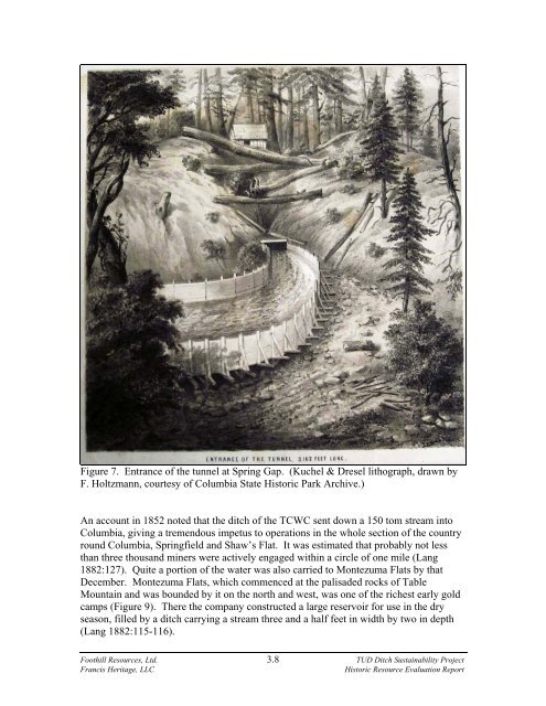
Figure 7. Entrance of the tunnel at Spring Gap. (Kuchel & Dresel lithograph, drawn by<br />
F. Holtzmann, courtesy of Columbia State <strong>Historic</strong> Park Archive.)<br />
An account in 1852 noted that the ditch of the TCWC sent down a 150 tom stream into<br />
Columbia, giving a tremendous impetus to operations in the whole section of the country<br />
round Columbia, Springfield and Shaw’s Flat. It was estimated that probably not less<br />
than three thousand miners were actively engaged within a circle of one mile (Lang<br />
1882:127). Quite a portion of the water was also carried to Montezuma Flats by that<br />
December. Montezuma Flats, which commenced at the palisaded rocks of Table<br />
Mountain and was bounded by it on the north and west, was one of the richest early gold<br />
camps (Figure 9). There the company constructed a large reservoir for use in the dry<br />
season, filled by a ditch carrying a stream three and a half feet in width by two in depth<br />
(Lang 1882:115-116).<br />
Foothill <strong>Resource</strong>s, Ltd. 3.8 TUD Ditch Sustainability <strong>Project</strong><br />
Francis Heritage, LLC<br />
<strong>Historic</strong> <strong>Resource</strong> <strong>Evaluation</strong> Report

