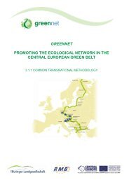
The Green Belt as a European Ecological Network strengths and gaps
The Green Belt as a European Ecological Network strengths and gaps
The Green Belt as a European Ecological Network strengths and gaps

You also want an ePaper? Increase the reach of your titles
YUMPU automatically turns print PDFs into web optimized ePapers that Google loves.
Schlumprecht, H., Laube, J.<br />
MONITORING BIODIVERSITY OF THE THURINGIAN GREEN BELT<br />
<strong>Belt</strong>. <strong>The</strong> following text presents this concept <strong>and</strong> the results of the first survey rounds in the<br />
years 2010 <strong>and</strong> 2011.<br />
1.2 Concept Outline<br />
<strong>The</strong> monitoring programme covers 30 monitoring are<strong>as</strong>. This number w<strong>as</strong> chosen to<br />
<strong>as</strong>sure validity <strong>and</strong> representativeness on the one h<strong>and</strong>, <strong>and</strong> to meet long-term funding<br />
possibilities on the other h<strong>and</strong>. <strong>The</strong> final number of 30 are<strong>as</strong> is the result of a power analysis<br />
b<strong>as</strong>ed on preliminary results in 2010. Power analysis is a statistical method to identify the<br />
minimum required sample size to obtain meaningful results.<br />
<strong>The</strong> monitoring consists of a spatially explicit <strong>and</strong> comprehensive survey of biotopes<br />
(l<strong>and</strong> use types <strong>and</strong> valuable biotopes for nature conservation, according to Article 30 of<br />
Federal German Nature Conservation Law <strong>and</strong> the manual for the Thuringian biotope<br />
mapping [2]). All are<strong>as</strong> of minor conservational value were noted <strong>as</strong> l<strong>and</strong> use types solely. For<br />
all valuable biotopes, a detailed documentation is given (biotope structure, l<strong>and</strong> use, threats,<br />
shrub cover, management proposals). A detailed evaluation (with 3 levels: excellent, good or<br />
poor conditions) of the parameters habitat structure, plant species composition, <strong>and</strong><br />
impairments is given, <strong>and</strong> then summed up for a comprehensive evaluation of each biotope.<br />
Additionally, a comprehensive list of characteristic <strong>and</strong> threatened plants (species lists<br />
including an estimate of abundance) is compiled for each valuable biotope. <strong>The</strong> evaluation<br />
scheme w<strong>as</strong> developed with reference to the evaluation scheme for habitat types of the<br />
Habitats Directive [3].<br />
Furthermore, three animal groups are investigated. A survey of breeding birds is done<br />
according to the German st<strong>and</strong>ard method for territorial bird mapping [4] with 5 survey dates.<br />
<strong>The</strong> survey of butterflies <strong>and</strong> gr<strong>as</strong>shoppers follows the German st<strong>and</strong>ard of butterfly<br />
monitoring: 500 m long transect of 10 reaches, counting individuals at 4 survey dates (see<br />
[5]). Zoological surveys were done in 7 selected monitoring are<strong>as</strong>. <strong>The</strong> number of 7 sites<br />
again are a compromise between costs for field work, accuracy <strong>and</strong> limited funding. For each<br />
species, the reproduction status is <strong>as</strong>sessed. <strong>The</strong> evaluation is b<strong>as</strong>ed only on confirmed <strong>and</strong><br />
probably reproducing species. <strong>The</strong> are<strong>as</strong> of valuable biotopes <strong>as</strong> well <strong>as</strong> l<strong>and</strong> use types of<br />
minor conservational value were mapped <strong>and</strong> digitized in a scale of 1:2500 on aerial<br />
photographs using GIS (ArcGIS 9.3), detailed information on valuable biotopes were<br />
documented in a datab<strong>as</strong>e. One monitoring area can consist of up to 20 l<strong>and</strong> use types <strong>and</strong><br />
valuable biotopes.<br />
1.3 Selection of monitoring are<strong>as</strong><br />
<strong>The</strong> selection of monitoring are<strong>as</strong> followed several aims. Every natural geographic unit<br />
should be represented with at le<strong>as</strong>t one area, <strong>and</strong> large natural geographic units with at le<strong>as</strong>t<br />
two are<strong>as</strong>. Main biotope types should be represented in all the natural geographic units in<br />
which they are common. Thirdly, it w<strong>as</strong> <strong>as</strong>pired to represent different elevations of the<br />
Thuringian <strong>Green</strong> <strong>Belt</strong>. <strong>The</strong>refore, the 30 monitoring are<strong>as</strong> are scattered along the Thuringian<br />
<strong>Green</strong> <strong>Belt</strong> (see Figure 1).<br />
Within this framework, the monitoring are<strong>as</strong> should not represent the „best“ or „most<br />
valuable“ sections of the <strong>Green</strong> <strong>Belt</strong> per natural geographic unit, but were chosen to give<br />
reliable information of the actual state habitats <strong>and</strong> biotopes within the <strong>Green</strong> <strong>Belt</strong>. <strong>The</strong>refore,<br />
strongly degraded open l<strong>and</strong> are<strong>as</strong> were included <strong>as</strong> monitoring sites, but are<strong>as</strong> of the <strong>Green</strong><br />
<strong>Belt</strong> completely covered by forests were not surveyed. <strong>The</strong> monitoring are<strong>as</strong> (2010 <strong>and</strong> 2011)<br />
34