pre-Driving Maritime workbook - North Steyne SLSC
pre-Driving Maritime workbook - North Steyne SLSC
pre-Driving Maritime workbook - North Steyne SLSC

Create successful ePaper yourself
Turn your PDF publications into a flip-book with our unique Google optimized e-Paper software.
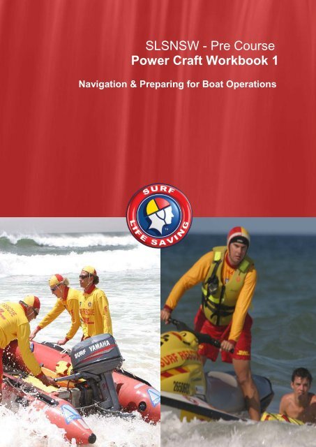
SLSNSW - Pre Course<br />
Power Craft Workbook 1<br />
Navigation & Preparing for Boat Operations<br />
Version 3 – 18th July 2011 SLSNSW PowerCraft/NSW <strong>Maritime</strong> -- Navigation & Preparing for Boat Operations. 1
Surf Life Saving NSW<br />
________<br />
PowerCraft Workbook 1<br />
Version 2 - 27 th July 2010 - Steve Allan, Academy Support Officer, SLSNSW<br />
Version 3 - 18 th July 2011 - Steve Allan, Academy Support Officer, SLSNSW<br />
Candidate Details:<br />
Name:__________________________ D.O.B. / /<br />
Club/Branch: ___________________________________________________<br />
Assessor Name: ________________________ Signature: ______________<br />
Date of Assessment: / /<br />
Competent / Not Yet Competent<br />
Copyright Notice<br />
© Surf Life Saving NSW 2011 - All rights reserved.<br />
This product has been developed for use within Surf Life Saving NSW. Copies may not be printed and/or<br />
reproduced by photocopying, scanning or any other methods for use, hire or resale within Australia or by any<br />
other organisation unless authorised by SLSNSW.<br />
2 SLSNSW PowerCraft/NSW <strong>Maritime</strong> - Navigation & Preparing for Boat Operations. Version 3 – 18th July 2011
Introduction<br />
Welcome to the Powercraft Workbook 1 - Navigation and Preparing for Boat Operations for the Silver<br />
Medallion Inflatable Rescue Boat Driver (SMIRB Driver) and Rescue Water Craft (RWC) certificates.<br />
This <strong>workbook</strong> must be completed successfully (80% correct), and signed off by an endorsed Assessor or<br />
Facilitator prior to commencing any PowerCraft training in the water.<br />
The Assessment consists of a series of short answer and multiple choice questions. They are designed to<br />
reflect the knowledge and skills required to demonstrate competency in Navigation and Preparing for Boat<br />
Operations, as deemed by SLSNSW and NSW <strong>Maritime</strong>.<br />
NOTE: If a member already holds a NSW <strong>Maritime</strong> General Boat, there is no need to complete the<br />
Powercraft Workbook 1 prior to commencing IRB or RWC training in the water.<br />
NSW <strong>Maritime</strong> General Boat Licence<br />
Participants are not required to do the Waterways Boating Safety Course or General Boat licence prior to the<br />
commencement of SMIRBD or RWC training. SLSNSW will issue you with a Powercraft License on<br />
successful completion of the SMIRBD and/or RWC certificate. This licence allows you to drive an IRB or<br />
RWC for Surf Life Saving activities only, and is an exemption agreement between SLSNSW and NSW<br />
<strong>Maritime</strong>.<br />
The trainee driver MUST be under the direct supervision of someone who holds a proficient SLSA SMIRBD<br />
or RWC award AND is a currently endorsed SMIRBD Training Officer or RWC Facilitator (depending on<br />
which award is being trained). The completed <strong>workbook</strong> must be on the beach during all SMIRB Driver and<br />
RWC training.<br />
If a candidate would like to upgrade their SLS SMIRB Driver or RWC award to NSW <strong>Maritime</strong> General Boat<br />
Licence or PWC Licence, they will need to take their IRBD or RWC Certificate into a NSW <strong>Maritime</strong> office.<br />
Prerequisites for the SM IRB Driver and Rescue Water Craft Certificate<br />
Powercraft Workbook 1 - MUST be completed and signed off by an Assessor or Facilitator before a<br />
participant begins driver training in the water OR already hold a NSW <strong>Maritime</strong> General Boat Licence<br />
• See the SLSA “Silver Medallion IRB Driver Learner Guide” for more <strong>pre</strong>requisite information<br />
• See the SLSNSW “RWC Workbook - 2 SAR & RWC Operations” for more <strong>pre</strong>requisite information.<br />
Suggested Supporting Resources<br />
• The Surf Life Saving Powercraft Manual – 7th Edition This manual is a resource for candidates,<br />
trainers and assessors and contains information on skills and knowledge relating to IRB, RWC &<br />
Boat Operations.<br />
• NSW <strong>Maritime</strong> – Boating Handbook This handbook outlines the essential and general boating<br />
information required to safely operate a vessel in your State / Territory Waters.<br />
• Powercraft Owner’s Manual This document comes with your powercraft and contains specific<br />
information relevant to set up procedures, maintenance & servicing, etc.<br />
• SLSA SMIRB Driver Learner Guide This Learner Guide is used throughout the SM IRB Driver<br />
training and contains the Assessment Portfolio (Gathering all assessment documentation will assist<br />
endorsed Trainers & Assessors with the evidence needed to successfully record and deem the<br />
participant competent).<br />
• SLSNSW – RWC Workbook - 2 SAR & RWC Operations This Learner Guide is used throughout the<br />
RWC Driver training and contains the Assessment Portfolio (Gathering all assessment<br />
documentation will assist endorsed Facilitators with the evidence needed to successfully record and<br />
deem the participant competent).<br />
Version 3 – 18th July 2011 SLSNSW PowerCraft/NSW <strong>Maritime</strong> -- Navigation & Preparing for Boat Operations. 3
Assessment<br />
(Where applicable circle the correct answer)<br />
Navigation Section<br />
1. Navigational maps and charts are fundamental tools available for emergency response. List the<br />
four main areas where they will assist lifesavers, provide examples.<br />
• ________________________________________________________<br />
• ________________________________________________________<br />
• ________________________________________________________<br />
• ________________________________________________________<br />
2. The basic measure of distance in all nautical navigation is called the<br />
A. Nautical kilometer<br />
B. Nano mile<br />
C. Nautical Mile<br />
D. Rule of thumb<br />
3. A Nautical chart depth with metric measurements has a depth mark of 48.<br />
What does 48 stand for?<br />
___________________________________________________________________________________<br />
4. The purpose of GPS for search and rescue is to<br />
A. Help retrieve lost sailors at sea<br />
B. Figure out where you will be at a certain time<br />
C. Provide and obtain coordinates to locate missing craft or patients<br />
D. Help find the best fishing locations<br />
5. What is an EPIRB and when would it be used?<br />
______________________________________________________________________________________<br />
6. What is the minimum distance a Powercraft may travel from shore before an EPIRB must be<br />
carried by law in your State / Territory?________________<br />
7. In Surf Life Saving what important information should be passed on to the Surf Command when<br />
planning a navigational course?<br />
8. Why is knowledge of local conditions important to lifesavers involved in search and rescue<br />
operations?<br />
9. Why is it important to have alternative route strategies when performing a SAR operation?<br />
4 SLSNSW PowerCraft/NSW <strong>Maritime</strong> - Navigation & Preparing for Boat Operations. Version 3 – 18th July 2011
Preparing for Boat Operations Section<br />
10. Relevant state marine authorities should be notified:<br />
A. As soon as possible following a boating or marine incident.<br />
B. Within 24 - 48 hours of a boating or marine incident.<br />
C. Only if there is a fatality.<br />
D. Within 3 working days of a boating or marine incident.<br />
11. Power driven boats have right of way over sailing craft and rowing boats.<br />
True / False<br />
12. When two power driven craft are meeting head on, to what direction must each craft alter<br />
each course?<br />
A. Port<br />
B. Starboard<br />
C. Largest powercraft continues in a straight direction while smaller craft alters course to starboard.<br />
D. Smallest powercraft continues in a straight direction while larger<br />
13. Port-hand marks are painted______ and have a _______shaped top mark or buoy.<br />
14. Starboard-hand marks are painted ______ and have a ________ shaped buoy or top mark.<br />
15. What is a cardinal mark?<br />
16. What distance can craft approach a whale or dolphin up to?<br />
17. When stowing equipment for transport, items can be placed anywhere on the powercraft so long<br />
as there is space.<br />
True / False<br />
18. Write down the PPE that is applicable to Lifesavers whilst operating a power craft (RWC / IRB)<br />
19. The responsibility of the master (driver) is to:<br />
A. Maintain a proper lookout and avoid collision.<br />
B. Ensure the safety of those onboard the vessel.<br />
C. Ensure that all safety equipment is accessible and stored onboard correctly.<br />
D. All of the above.<br />
20. Where should you drive a vessel in a channel?<br />
A. On the port (left-hand) side.<br />
B. In the middle of the channel.<br />
C. On the starboard (right-hand) side.<br />
D. On any side – it does not matter as long as a collision does not occur.<br />
21. When crossing a coastal bar it is COMPULSORY to:<br />
A. Ensure that everyone onboard is wearing an approved lifejacket Type 3.<br />
B. Notify a coastal radio station of your intention.<br />
C. Ensure that everyone onboard is wearing an approved lifejacket Type 1.<br />
D. Proceed only if the bar is flat.<br />
Version 3 – 18th July 2011 SLSNSW PowerCraft/NSW <strong>Maritime</strong> -- Navigation & Preparing for Boat Operations. 5
22. All vessels are required to travel at a safe speed at all times. Which of the following<br />
IS considered safe?<br />
A. A vessel travelling at speed in poor visibility.<br />
B. A vessel travelling at a speed at which sudden danger can be avoided.<br />
C. A vessel travelling at speed towards background shore lights at night.<br />
D. A vessel travelling at speed in unfamiliar waters.<br />
23. When driving a power vessel at 10 knots or more or towing a person, what is the MINIMUM<br />
distance both the vessel and the towed person MUST keep from a non-powered vessel or a<br />
person in the water?<br />
A. 60 metres or if not possible a safe distance.<br />
B. 30 metres or if not possible a safe distance.<br />
C. 100 metres or if not possible a safe distance.<br />
D. Any distance which you consider safe.<br />
24. For environmental reasons, where should you avoid driving your boat?<br />
A. Deep river channels.<br />
B. Shallow weedy areas, which may contain endangered seagrasses.<br />
C. Boundaries between murky and clear water.<br />
D. Bar crossings.<br />
25. What MUST you do when driving your vessel within a No Wash Zone?<br />
A. Travel at a speed which creates minimal wash to ensure that your wash does not affect other<br />
people or vessels.<br />
B. Travel at no more than 8 knots.<br />
C. Always travelling at the speed shown on a speed restriction sign.<br />
D. Not tow a waterskier or an aquaplaner.<br />
26. Which of the following vessels are required to have or display lights at night?<br />
A. Power driven vessels.<br />
B. Canoes and rowboats.<br />
C. Sailing vessels.<br />
D. All vessels need to have or display lights at night.<br />
27. You are driving a vessel at high speed and your vision is suddenly affected by sun or<br />
spray. Your immediate reaction should be:<br />
A. Slow down or stop.<br />
B. Continue driving at speed in anticipation that you will regain your vision.<br />
C. Increase speed & manoeuvre vessel to find a direction to minimise spray & the effect of the sun.<br />
D. Alter course to port and continue at speed.<br />
28. An efficient sound signalling device is required to be carried:<br />
A. Only by vessels proceeding to open waters.<br />
B. Only by power driven vessels over 8 metres in length.<br />
C. On all vessels.<br />
D. Only vessels operating after sunset.<br />
29. When is it COMPULSORY to carry an EPIRB (Emergency Position Indicating Radio Beacon)?<br />
A. When crossing a coastal bar.<br />
B. When operating a vessel less than 5 metres in length on enclosed waters.<br />
C. At all times.<br />
D. When operating a vessel, 2 or more nautical miles off the coast.<br />
30. How often should you check your vessel’s safety equipment and fittings?<br />
A. Before every long journey.<br />
B. Before every journey regardless of duration.<br />
C. Before every journey out of sight of land.<br />
D. At the conclusion of each journey.<br />
6 SLSNSW PowerCraft/NSW <strong>Maritime</strong> - Navigation & Preparing for Boat Operations. Version 3 – 18th July 2011
31. In this picture is the powercraft entering the harbour or leaving the harbour to the open sea?<br />
Entering / Leaving<br />
32. You are driving the blue vessel (on the left side of picture) and there is a risk of collision with the<br />
yellow vessel. What must you do to avoid a collision?<br />
A. Give way.<br />
B. Keep your current course and speed.<br />
C. Increase speed to pass ahead of the other vessel.<br />
D. Alter course to port and maintain your speed.<br />
33. You are driving this vessel between sunset and sunrise. What navigation lights MUST be<br />
displayed?<br />
A. Red and green sidelights with an all-round white light.<br />
B. Red and green sidelights only.<br />
C. A white masthead light only.<br />
D. No lights are required.<br />
34. What does this navigation mark indicate? Deeper water lies to the:<br />
A. <strong>North</strong>.<br />
B. East.<br />
C. South.<br />
D. West.<br />
35. What kind of navigation mark is this?<br />
A. A port lateral mark.<br />
B. A channel blocked mark.<br />
C. A special mark.<br />
D. An isolated danger mark.<br />
Version 3 – 18th July 2011 SLSNSW PowerCraft/NSW <strong>Maritime</strong> -- Navigation & Preparing for Boat Operations. 7
36. When travelling UPSTREAM (away from the sea) on which side should you keep<br />
this type of navigation mark to stay in the channel?<br />
A. Your port (left hand side).<br />
B. Your starboard (right hand) side.<br />
C. Either side (it does not matter).<br />
D. Stay in the middle of the channel regardless of the mark.<br />
37. What do these signs mean?<br />
A. 4 kilometres to the next hazard.<br />
B. Water depth is below 4 metres in this direction.<br />
C. Keep 4 metres from the banks in this area.<br />
D. Maximum speed 4 nautical miles per hour (knots).<br />
38. When is the MOST DANGEROUS time to cross a coastal bar?<br />
A. On an incoming tide (flood tide).<br />
B. On an outgoing tide (ebb tide).<br />
C. Slack water (top or bottom of the tide).<br />
D. All of the above.<br />
39. When a vessel displays this signal what does it mean?<br />
A. The vessel is fishing.<br />
B. There are divers working below.<br />
C. The vessel is a commercial vessel. Keep clear.<br />
D. Assistance is required.<br />
40. When returning over a coastal bar or travelling with a large ‘following sea’ offshore, the SAFEST<br />
option is to:<br />
A. Maintain a position behind a wave, but not too close.<br />
B. Maintain a position just in front of a wave.<br />
C. Proceed at speed through the waves.<br />
D. Maintain a position on top of a wave.<br />
41. When can the holder of a General Boat Drivers Licence legally drive a PWC (eg jetski)on NSW<br />
navigable waters:<br />
A. When travelling at less than 10 knots.<br />
B. When travelling in offshore waters only.<br />
C. When learning to ride and a licensed person sits behind the learner.<br />
D. Never. The rider must always hold a valid PWC licence.<br />
8 SLSNSW PowerCraft/NSW <strong>Maritime</strong> - Navigation & Preparing for Boat Operations. Version 3 – 18th July 2011