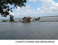
Impact Assessment of Climate Change and Sea Level Rise on ...
Impact Assessment of Climate Change and Sea Level Rise on ...
Impact Assessment of Climate Change and Sea Level Rise on ...

Create successful ePaper yourself
Turn your PDF publications into a flip-book with our unique Google optimized e-Paper software.
2. DATA <str<strong>on</strong>g>and</str<strong>on</strong>g> MODEL<br />
2.1 Data Collecti<strong>on</strong> <str<strong>on</strong>g>and</str<strong>on</strong>g> Compilati<strong>on</strong><br />
Reliable data are prerequisite to carry out flood frequency analysis, establish base c<strong>on</strong>diti<strong>on</strong>s<br />
<strong>on</strong> floods <str<strong>on</strong>g>and</str<strong>on</strong>g> l<str<strong>on</strong>g>and</str<strong>on</strong>g> type. Available water level <str<strong>on</strong>g>and</str<strong>on</strong>g> water flow time series, river bathymetry<br />
<str<strong>on</strong>g>and</str<strong>on</strong>g> rainfall data were collected from sec<strong>on</strong>dary sources such as BWDB <str<strong>on</strong>g>and</str<strong>on</strong>g> BIWTA.<br />
Bathymetry data were collected to develop <str<strong>on</strong>g>and</str<strong>on</strong>g> update the model bathymetry <str<strong>on</strong>g>of</str<strong>on</strong>g> Bay <str<strong>on</strong>g>of</str<strong>on</strong>g><br />
Bengal <str<strong>on</strong>g>and</str<strong>on</strong>g> other regi<strong>on</strong>al models Water level data <str<strong>on</strong>g>and</str<strong>on</strong>g> discharge data were collected to<br />
generate boundaries <str<strong>on</strong>g>and</str<strong>on</strong>g> to re-calibrate the existing models. Rainfall data were collected for<br />
development <str<strong>on</strong>g>of</str<strong>on</strong>g> rainfall-run<str<strong>on</strong>g>of</str<strong>on</strong>g>f model (NAM model). Coverage area <str<strong>on</strong>g>of</str<strong>on</strong>g> T-Aman in three<br />
selected upazilas Bakerganj <str<strong>on</strong>g>of</str<strong>on</strong>g> Barisal district, Raiganj <str<strong>on</strong>g>of</str<strong>on</strong>g> Sirajganj district <str<strong>on</strong>g>and</str<strong>on</strong>g> Gobindaganj<br />
<str<strong>on</strong>g>of</str<strong>on</strong>g> Gaib<str<strong>on</strong>g>and</str<strong>on</strong>g>ha district has been collected in c<strong>on</strong>sultati<strong>on</strong> with each block supervisor <str<strong>on</strong>g>of</str<strong>on</strong>g><br />
corresp<strong>on</strong>ding upazila.<br />
2.2 Available Models<br />
2.2.1 GBM Basin Model<br />
Background<br />
The country’s unique geographical locati<strong>on</strong> with the Indian Ocean to the South, the<br />
Himalayas to the north <str<strong>on</strong>g>and</str<strong>on</strong>g> the prevailing m<strong>on</strong>so<strong>on</strong>s has made it <strong>on</strong>e <str<strong>on</strong>g>of</str<strong>on</strong>g> the wettest countries<br />
<str<strong>on</strong>g>of</str<strong>on</strong>g> the world. Bangladesh is probably the worst victim <str<strong>on</strong>g>of</str<strong>on</strong>g> excessive rainfall in the upper<br />
catchment outside its territory. This external rainfall generates massive run<str<strong>on</strong>g>of</str<strong>on</strong>g>f <str<strong>on</strong>g>of</str<strong>on</strong>g> water that<br />
reaches the Bay <str<strong>on</strong>g>of</str<strong>on</strong>g> Bengal through country’s territory. Almost all the major rivers have their<br />
origins bey<strong>on</strong>d the political border <str<strong>on</strong>g>of</str<strong>on</strong>g> the country, <str<strong>on</strong>g>and</str<strong>on</strong>g> thereby placing it in a disadvantageous<br />
positi<strong>on</strong> to manage its own river systems.<br />
There are 57 border rivers bringing inflows from India. About <strong>on</strong>e-fourth to <strong>on</strong>e-third <str<strong>on</strong>g>of</str<strong>on</strong>g> the<br />
country is normally flooded to varying degrees each year during the period from May through<br />
September. The major flood <str<strong>on</strong>g>of</str<strong>on</strong>g> 1998 caused inundati<strong>on</strong> <str<strong>on</strong>g>of</str<strong>on</strong>g> about 70 % <str<strong>on</strong>g>of</str<strong>on</strong>g> the country. This<br />
figure <str<strong>on</strong>g>of</str<strong>on</strong>g> flooding is expected to be more severe in future due to climate change <str<strong>on</strong>g>and</str<strong>on</strong>g> sea level<br />
rise.<br />
The GBM basin model was applied to reproduce the possible changes <str<strong>on</strong>g>of</str<strong>on</strong>g> m<strong>on</strong>so<strong>on</strong> flood in<br />
the basin resulting from predicted hydro meteorological changes in the area. IWM carried out<br />
this study through updating a previously developed simplified GBM basin model<br />
incorporating up to date informati<strong>on</strong>. The model was used to compute run<str<strong>on</strong>g>of</str<strong>on</strong>g>fs generated from<br />
basins <str<strong>on</strong>g>of</str<strong>on</strong>g> three major rivers, <str<strong>on</strong>g>and</str<strong>on</strong>g> thereby simulate the scenarios regarding m<strong>on</strong>so<strong>on</strong> flood in<br />
the country introducing subsequent effect <str<strong>on</strong>g>of</str<strong>on</strong>g> climate change.<br />
The prime objective <str<strong>on</strong>g>of</str<strong>on</strong>g> this study comp<strong>on</strong>ent “Updating <str<strong>on</strong>g>of</str<strong>on</strong>g> the GBM basin model” is<br />
quantificati<strong>on</strong> <str<strong>on</strong>g>of</str<strong>on</strong>g> inflows generated from three major river basins under recent & changed<br />
climate c<strong>on</strong>diti<strong>on</strong> so that impact <strong>on</strong> m<strong>on</strong>so<strong>on</strong> flooding in Bangladesh resulting from climate<br />
change <str<strong>on</strong>g>and</str<strong>on</strong>g> sea level rise as predicted in 4th assessment report <str<strong>on</strong>g>of</str<strong>on</strong>g> IPCC can be studied.<br />
9