Chenik Lake - Cook Inlet Aquaculture Association, Kenai, Alaska
Chenik Lake - Cook Inlet Aquaculture Association, Kenai, Alaska
Chenik Lake - Cook Inlet Aquaculture Association, Kenai, Alaska
SHOW LESS

You also want an ePaper? Increase the reach of your titles
YUMPU automatically turns print PDFs into web optimized ePapers that Google loves.
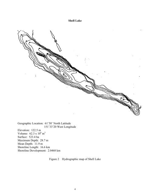
Shell <strong>Lake</strong><br />
Geographic Location: 61˚58’ North Latitude<br />
151˚33’20 West Longitude<br />
Elevation: 122.5 m<br />
Volume: 62.3 x 10 6 m 3<br />
Surface: 523.4 ha<br />
Maximum Depth: 28.7 m<br />
Mean Depth: 11.9 m<br />
Shoreline Length: 16.6 km<br />
Shoreline Development: 2.0468 km<br />
Figure 2 Hydrographic map of Shell <strong>Lake</strong><br />
4