Curriculum Vitae ( 11.3 KB) - Landscape Architecture and Urban ...
Curriculum Vitae ( 11.3 KB) - Landscape Architecture and Urban ...
Curriculum Vitae ( 11.3 KB) - Landscape Architecture and Urban ...
You also want an ePaper? Increase the reach of your titles
YUMPU automatically turns print PDFs into web optimized ePapers that Google loves.
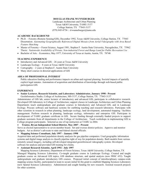
DOUGLAS FRANK WUNNEBURGER<br />
<strong>L<strong>and</strong>scape</strong> <strong>Architecture</strong> <strong>and</strong> <strong>Urban</strong> Planning<br />
Texas A&M University, TAMU-3137<br />
College Station, TX 77843-3137<br />
(979) 845-8756 :: d-wunneburger@tamu.edu<br />
ACADEMIC BACKGROUND<br />
• Ph.D. – Forestry (Remote Sensing/GIS), December 1992, Texas A&M University, College Station, TX 77843<br />
Dissertation: Automating Geographically Referenced Digital Mosaics from Aerial Videography with Area Based<br />
Feature Matching<br />
• Master of Forestry -- Forest Science, August 1981, Stephen F. Austin State University, Nacogdoches, TX 75962<br />
Thesis: Nationwide Availability of Private, Non-industrial Forest <strong>and</strong> Range L<strong>and</strong> for Public Recreation Use<br />
• Bachelor of Arts – Economics, May 1977, University of Texas at Austin, Austin, TX 78740<br />
TEACHING EXPERIENCE<br />
• Introductory <strong>and</strong> Advanced GIS – 26 years at Texas A&M University<br />
• <strong>L<strong>and</strong>scape</strong> Ecology – 8 years at Texas A&M University<br />
• Cartography – 2 years at Stephen F. Austin State University<br />
• Many short courses in directed applications of GIS<br />
AREA OF PROFESSIONAL INTEREST<br />
Public education funding <strong>and</strong> performance impacts on urban <strong>and</strong> regional planning. Societal impacts of spatially<br />
explicit legal statutes. Automation of acquisition <strong>and</strong> distribution of knowledge through web-based public<br />
participation GIS.<br />
EXPERIENCE<br />
• Senior Lecturer, Research Scientist, <strong>and</strong> Laboratory Administrator, January 1998 - Present<br />
GeoInformatics Studio, College of <strong>Architecture</strong>, MS-3137, College Station, TX 77843-3137<br />
Administrator of GIS lab, senior lecturer of introductory <strong>and</strong> advanced GIS, participate in collaborative research.<br />
Developed GIS laboratory in College of <strong>Architecture</strong>; support classes in <strong>L<strong>and</strong>scape</strong> <strong>Architecture</strong> <strong>and</strong> <strong>Urban</strong> Planning<br />
Department; teach undergraduate <strong>and</strong> graduate courses in Introductory <strong>and</strong> Advanced GIS, <strong>and</strong> in <strong>L<strong>and</strong>scape</strong><br />
Ecology. Procure software <strong>and</strong> hardware systems for outfitting teaching <strong>and</strong> research laboratory. Participate with<br />
other scientists in research in urban planning, l<strong>and</strong>scape ecology, l<strong>and</strong> development, automated mapping / facilities<br />
management. Perform research in planning, l<strong>and</strong>scape ecology, informatics <strong>and</strong> enterprise GIS. Participate in<br />
development of TAMU graduate certificate in GIS. Secure funding through externally funded projects to support<br />
graduate assistants from all departments in the College of <strong>Architecture</strong>. Teach workshops in implementing GIS to<br />
College program participants. Selected as one of top instructors at TAMU in 2004.<br />
• Trustee, Bryan Independent School District, May 2007 – Present<br />
Serve as elected representative to seven member board. Set <strong>and</strong> oversee district policies. Approve <strong>and</strong> monitor<br />
budgets. Act as district’s advocate to state <strong>and</strong> federal elected officials.<br />
• Mapping Science Consultant, July 1997 – January 1998<br />
Acquired data <strong>and</strong> performed population density analyses for gas pipeline companies. Used geographic information<br />
systems <strong>and</strong> digital image analysis to classify pipeline right of way for population density. Built models from various<br />
remotely sensed imagery, including self-developed integrated georeferenced videography system. Developed<br />
software for analysis <strong>and</strong> provided GIS training for clients.<br />
• Assistant Research Scientist, April 1992 - July 1997<br />
Mapping Sciences Laboratory, Department of Forest Science, Texas A&M University, College Station, TX<br />
Managed Mapping Sciences Laboratory. Co-taught graduate course in <strong>L<strong>and</strong>scape</strong> Ecology. Created <strong>and</strong> taught<br />
graduate course on Advanced GIS topics, GIS database structure, <strong>and</strong> spatial analysis (now FRSC 652). Taught<br />
undergraduate <strong>and</strong> graduate introductory GIS courses. Proposed initial concept of interdisciplinary campus-wide<br />
mapping science facility, participated in team to secure initial $2.8m grant to establish Mapping Sciences Laboratory<br />
(now Spatial Sciences Laboratory). Administered <strong>and</strong> sought funding for new research. Assisted research projects<br />
for other scientists.
SELECTED PUBLICATIONS<br />
Neuman, M., D.F. Wunneburger, H. Kim, C. Morgan, J. Huang. 2010. Texas <strong>Urban</strong> Triangle: Creating a Spatial<br />
Decision Support System (SDSS) for Mobility Policy <strong>and</strong> Investments that Shape the Sustainable Growth of<br />
Texas, Phase I. Final Report to the UTCM<br />
Van Z<strong>and</strong>t, S. <strong>and</strong> D. Wunneburger. The Relationship between Residential L<strong>and</strong> Use Patterns <strong>and</strong> the Educational<br />
Outcomes of Economically-Disadvantaged Students in Texas. <strong>Urban</strong> Education XX(X) 1-29. 2010,<br />
September 2011.<br />
Dumbaugh, E., R. Rae, <strong>and</strong> D.F. Wunneburger. 2010. Using GIS to Develop a Performance-Based Framework for<br />
Evaluating <strong>Urban</strong> Design <strong>and</strong> Crash incidence. <strong>Urban</strong> Design International Vol. 16, 1, 63-71. 2011.<br />
Wunneburger, D.F., M.A.Olivares <strong>and</strong> P. Maghelal. 2008. Internal Security for Communities:<br />
A Spatial Analysis of the Effectiveness of Sex Offender Laws. Geospatial Technologies in Homel<strong>and</strong><br />
Security, 2008 Springer.<br />
Maghelal, P., M. Olivares, D. Wunneburger <strong>and</strong> G. Roman. 2008. Where are they? A spatial inquiry of sex<br />
offenders in Brazos County. Journal of the <strong>Urban</strong> <strong>and</strong> Regional Information Systems, Vol. 20, No. 1, 2008,<br />
pp. 27 – 34.<br />
Van Z<strong>and</strong>t, S. <strong>and</strong> D.F. Wunneburger. 2007. Residential L<strong>and</strong> Use Patterns <strong>and</strong> Economic Segregation: Impacts on<br />
Educational Outcomes of Economically Disadvantaged Students, ACSP 2007 Annual Conference,<br />
Milwaukee, WI.<br />
Wunneburger, D.F., M. Olivares <strong>and</strong> P. Maghelal. 2006. Assessing Risk of Registered Sex Offenders in<br />
Communities, ACSP 2006 Annual Conference, Fort Worth, TX.<br />
Wunneburger, D.F. <strong>and</strong> B.B. DeFee. 2001. Integrating IT Tools to Assist Local Stakeholders in Open Space<br />
Decisions. CORP 2001: Geo Multimedia 01, February 13-16, 2001, Vienna, AT.<br />
DATE OF PREPARATION: March 2011<br />
2


