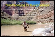
Wisconsin Regional Curves Overview - USGS
Wisconsin Regional Curves Overview - USGS
Wisconsin Regional Curves Overview - USGS

Create successful ePaper yourself
Turn your PDF publications into a flip-book with our unique Google optimized e-Paper software.
Northern Lakes and Forest Proposal<br />
• Select approximately 30-40 <strong>USGS</strong> forested streamgages from Northern Lakes and Forest<br />
Ecoregion in the Michigan Upper Peninsula, <strong>Wisconsin</strong>, and Minnesota and combine with<br />
data from existing hydraulic geometry sites previously sampled for primary analysis of<br />
bankfull characteristics and relation to drainage area and peak flow probabilities.<br />
• Use same WI <strong>USGS</strong>/ USFS/ NRCS protocols, data management, and data analysis as used for<br />
WI statewide study. Collect data in fy2011-2012, starting in the fall 2010.<br />
• Categorize channel types using Rosgen Level II classification.<br />
• Develop regional bankfull curves and flood probability. Compare relationships across Rosgen<br />
channel types.<br />
• Construct comparison plots of data from the streamgages with hydraulic geometry data<br />
collected from approximately 125 reaches with bankfull, drainage area, and channel type from<br />
previous study by Savery and others, 2001<br />
• Compare to other hydraulic geometry data collected previously at ungaged sites.<br />
• Compare to previously published hydraulic geometry/curves in adjacent areas, including<br />
Michigan’s lower peninsula.<br />
• Write proposals with federal, university, and state partners to complete regional curves in<br />
areas where gaps exist in the coverage of Great Lakes tributaries<br />
• Construct geomorphic data base for the Great Lakes tributaries