Wisconsin Regional Curves Overview - USGS
Wisconsin Regional Curves Overview - USGS
Wisconsin Regional Curves Overview - USGS

Create successful ePaper yourself
Turn your PDF publications into a flip-book with our unique Google optimized e-Paper software.
Site Reconnaissance<br />
• Eligible sites are field checked<br />
• 7 for 12 approval rate for north region<br />
• Identify<br />
• Reach length (20+ stream widths)<br />
• Channel stability and riffle/pools<br />
• Bankfull stage indicators<br />
• <strong>USGS</strong> reference marks for gage<br />
• Field issues (special equipment,<br />
unique surveying or pebble count<br />
technique needed, etc.)<br />
• Riparian landowners<br />
• Possible local impacts<br />
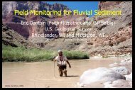
Bad River at Mellen, WI