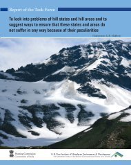
Pandit Govind Ballabh Pant Memorial Lecture: II
Pandit Govind Ballabh Pant Memorial Lecture: II
Pandit Govind Ballabh Pant Memorial Lecture: II

Create successful ePaper yourself
Turn your PDF publications into a flip-book with our unique Google optimized e-Paper software.
1<br />
Tribute<br />
I am indeed very happy to have been chosen to deliver the Second <strong>Pandit</strong><br />
Gobind <strong>Ballabh</strong> <strong>Pant</strong> <strong>Lecture</strong> of the G.B. <strong>Pant</strong> Institute of Himalayan Environment and<br />
Development (GBPIHED). According to Pt. Jawaharlal Nehru, Pt. <strong>Pant</strong>, like the<br />
Himalaya itself, was a colossus in every sense of the word. He was among the greatest<br />
men that the country has produced. All his life, <strong>Pant</strong>ji, shone on the Indian scene like<br />
the Himalaya peaks. Another reason for me to be happy is that it gives me great<br />
satisfaction that the GBP-IHED, after having been conceptualized and formulated during<br />
my tenure as the Secretary to the Government of India, is now taking shape.<br />
Prelude<br />
Looking at the continent of Asia from space, one of the most striking features is the<br />
2500-km long Himalayan belt occupying an area of about 236,000 sq km in India. The<br />
Himalaya alongwith Hindukush is like a battlement (Fig. 1). The long middle portion<br />
extends from north- westerly (longitude East 73 o and Latitude North 37 o ) to southeasterly<br />
(longitude East 97 o and latitude North 27 o ) direction. The middle portion is not<br />
straight but has a bulge in the Nepal- Bhutan area. The flank on the western side<br />
extends into Afganistan in a south-westerly direction. The eastern flank extends into<br />
Myanmar in a south- easterly direction. The eastern flank extends into Myanmar in a<br />
south- easterly direction. The whole range when viewed from space gives the<br />
impression of being protective to Pakistan, India, Nepal, Bhutan, Bangladesh and<br />
Myanmar. The Himalayan ranges are between 240 to 340 km wide and rise from lowlying<br />
Indian plains to over 8000 m. Himalaya is a complex system and separate the<br />
northern part of the Asian continent (Tibet, China, Siberia and contiguous countries)<br />
from the southern part (Afganistan, Pakistan, India, Nepal, Bhutan, Bangladesh and<br />
Myanmar). The latter, in common parlance, is known as the Indian subcontinent, which,<br />
due to Himalaya, is a discreet geographic and ecological entity with its own climate(s).<br />
Fig. 1.<br />
The birth of Himalaya is related to a cataclysmic event of the breakup, some 140<br />
million years ago, of the peninsular part of today’s India (Deccan Plateau) from a<br />
super- continent Gondwanaland. The peninsular Indian Plate was located somewhere<br />
near the present day Madagascar and South Africa. The plate started drifting about<br />
15cm per year northwards, across, what is now known as, the Indian ocean. Finally, it<br />
crashed about 15 million year ago into what was an northern Asian continent, at a<br />
place where the present Assam region is. Such a collision of the peninsular plate under<br />
2<br />
4