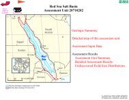
Carupano Basin Gas - USGS Energy Resources Program
Carupano Basin Gas - USGS Energy Resources Program
Carupano Basin Gas - USGS Energy Resources Program

Create successful ePaper yourself
Turn your PDF publications into a flip-book with our unique Google optimized e-Paper software.
<strong>USGS</strong> PROVINCE: Tobago Trough (6103)<br />
GEOLOGIST: C.J. Schenk<br />
TOTAL PETROLEUM SYSTEM: Lower Cruse (610301)<br />
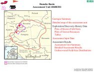
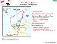
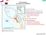
ASSESSMENT UNIT: <strong>Carupano</strong> <strong>Basin</strong> <strong>Gas</strong> (61030101)<br />
DESCRIPTION: The <strong>Carupano</strong> <strong>Basin</strong> is the southernmost part of the larger Tobago Trough.<br />
The assessment unit is defined by a wide zone of faulting associated with the southern wrench<br />
fault boundary of the Caribbean plate. The northern boundary of the assessment unit is the shelf<br />
slope break. Approximately 25 TCF gas has been discovered in this assessment unit, with<br />
several of the larger structures already tested. The largest field is Patao in Venezuelan waters.<br />
SOURCE ROCKS: Source rocks are postulated to be prodeltaic mudstones coeval with the<br />
Miocene Lower Cruse Formation, similar to the Columbus <strong>Basin</strong> of Trinidad immediately south<br />
of this basin.<br />
MATURATION: Mudstones of the lower Cruse Formation are postulated to have reached<br />
maturity in the Pliocene following deposition of several kilometers of sediment in the Miocene<br />
and lower Pliocene.<br />
MIGRATION: Migration of hydrocarbons from the lower Cruse mudstones was mainly<br />
vertical along faults associated with the wrench fault zone. The timing of faulting was late<br />
Pliocene and Pleistocene.<br />
RESERVOIR ROCKS: Reservoirs are mainly deltaic sandstones of the lower Pliocene, but<br />
deeper turbiditic sandstones sourced by the ancestral Orinoco River may also be present. The<br />
reservoir at Patao is reputed to be in turbidite sandstones.<br />
TRAPS AND SEALS: Trap are mainly structural, with normal fault traps formed by<br />
transtension associated with wrench faulting along the 150 km wide fault zone of the southern<br />
margin of the Caribbean plate. Traps formed in transpressional segments of the fault zone are<br />
also present. Seals are mainly intraformational mudstones of the Pliocene deltaic section.<br />
REFERENCES:<br />
Leonard, R., 1983, Geology and hydrocarbon accumulations, Columbus <strong>Basin</strong>, offshore<br />
Trinidad: American Association of Petroleum Geologists Bulletin, v. 67, p. 1081-1093.<br />
Robertson, P., and Burke, K., 1989, Evolution of southern Caribbean plate boundary, vicinity of<br />
Trinidad and Tobago: American Association of Petroleum Geologists Bulletin, v. 73,<br />
p. 490-509.<br />
Speed, R., Torrini, R., and Smith, P.L., 1989, Tectonic origin of the Tobago Trough forearc<br />
basin: Journal of Geophysical Research, v. 94, no. B3, p. 2913-2936.