τεύχος περιλήψεων - ΥΣΜΑ
τεύχος περιλήψεων - ΥΣΜΑ
τεύχος περιλήψεων - ΥΣΜΑ

You also want an ePaper? Increase the reach of your titles
YUMPU automatically turns print PDFs into web optimized ePapers that Google loves.
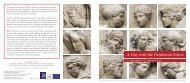
6TH INTERNATIONAL MEETING FOR THE RESTORATION OF THE ACROPOLIS MONUMENTS - ABSTRACTS 35<br />
TOPOGRAPHIC AND PHOTOGRAMMETRIC DOCUMENTATION<br />
AT THE ACROPOLIS OF ATHENS<br />
D. Mavromati, Rural and Surveying Engineer, NTUA. Head of the Programme of Topographic<br />
and Photogrammetric Plotting of the Acropolis, YSMA<br />
Geometric documentation is essential as a basis for any study in the field of the restoration of<br />
monuments.<br />
The introduction of digital photogrammetry techniques in recent years has brought significant<br />
changes in the final deliverables and has lead to the progressive replacement of line drawings<br />
by raster products that combine the geometric accuracy of a drawing with the visual –<br />
qualitative information of a photograph, that is, orthophotomosaics and 3D textured models.<br />
These products are now standard photogrammetric deliverables, especially for the recording of<br />
archaeological sites and monuments.<br />
In the context of the presentation, reference will be made to the project “Development of Geographical<br />
Information Systems at the Acropolis of Athens,”which was funded from the European<br />
Union and the Greek State. The main aims of the project were the relief mapping of the Acropolis<br />
along with complete topographic and photogrammetric documentation, the relief mapping of<br />
the Walls with accuracy of approximately 1 cm and of the groundplan of the Acropolis with an accuracy<br />
of approximately 3 cm, as well as the 3D scanning of the Erechtheion and of the Walls. For<br />
the management of all the data, the project involved the development of a flexible Geographical<br />
Information System (GIS) as well as the upgrade of the existing database of the restoration interventions.<br />
It should be noted that this project is internationally pioneering because of the object<br />
size and morphology. Furthermore, reference will be made to the photogrammetric studies that<br />
were carried out by the Acropolis Restoration Service, from 2007 to 2012, on parts of the<br />
Parthenon at a large scale (1:10 and 1:20), to meet the needs of the projects that are in progress.<br />
Finally, taking into account that the production of orthophotomosaics for the purposes of archaeological<br />
documentation presents significant peculiarities and difficulties compared to the<br />
production of orthophotomaps that are used as bases, for instance, in land register studies or<br />
road planning, reference will also be made to the problems that arise in the photogrammetric<br />
documentation of the ancient monuments.