The Colchester Archaeologist 2002 - Colchester Archaeological Trust
The Colchester Archaeologist 2002 - Colchester Archaeological Trust
The Colchester Archaeologist 2002 - Colchester Archaeological Trust

Create successful ePaper yourself
Turn your PDF publications into a flip-book with our unique Google optimized e-Paper software.
With thanks to all the contributors to this issue of the magazine -<br />
Pat Brown of <strong>Colchester</strong> Young <strong>Archaeologist</strong>s' Club<br />
Mike Corbishley of English Heritage Education<br />
Essex County Council Heritage Conservation<br />
James Fawn<br />
Andrew Phillips<br />
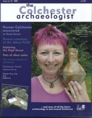
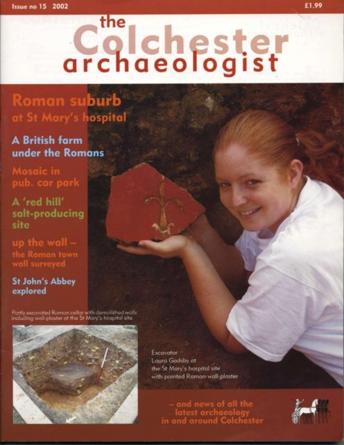
Front cover: <strong>Trust</strong> excavator Laura<br />
Gadsby holding a piece of painted<br />
Roman wall-plaster in the Roman cellar<br />
where it was excavated.<br />
Friends<br />
of the <strong>Colchester</strong> <strong>Archaeological</strong> <strong>Trust</strong><br />
designed by Gillian Adams<br />
unattributed text by Howard Brooks<br />
with additional material by Carl Crossan<br />
Printed by PrintWright Ltd, Ipswich<br />
© <strong>Colchester</strong> <strong>Archaeological</strong> <strong>Trust</strong> <strong>2002</strong><br />
ISSN 0952-0988<br />
All images copyright<br />
<strong>Colchester</strong> <strong>Archaeological</strong> <strong>Trust</strong><br />
unless stated otherwise<br />
If you are interested in following archaeological<br />
discoveries in <strong>Colchester</strong>, then why not consider joining<br />
the Friends of the <strong>Colchester</strong> <strong>Archaeological</strong> <strong>Trust</strong>?<br />
Membership continues to rise and now stands at about<br />
450 individuals and families. <strong>The</strong> subscription rates are<br />
modest, and include an annual copy of the <strong>Colchester</strong><br />
archaeologist magazine delivered to you as soon as it is<br />
published. You can also join tours of current sites and<br />
organised trips to places of historical and archaeological<br />
interest in the region.<br />
<strong>The</strong> annual subscription rates:<br />
Adults and institutions £3.50<br />
Family membership £4.50<br />
Children and students £2.50<br />
Further details can be obtained from Maureen Jones,<br />
Friends of <strong>Colchester</strong> <strong>Archaeological</strong> <strong>Trust</strong>, 5 Ashwin<br />
Avenue, Copford, <strong>Colchester</strong>, Essex C06 1BS or<br />
www.friends-of-cat.ndo.co.uk<br />
<strong>The</strong> <strong>Colchester</strong> archaeologist magazine is largely funded by the<br />
Friends of <strong>Colchester</strong> <strong>Archaeological</strong> <strong>Trust</strong> - see page 32.<br />
<strong>The</strong> <strong>Trust</strong> is grateful to <strong>Colchester</strong> Borough Council for placing an<br />
advertisement on page 33 and for its support of the magazine.<br />
<strong>The</strong> <strong>Colchester</strong> <strong>Archaeological</strong> <strong>Trust</strong> is a full-time professional<br />
unit, providing developers and others with a full<br />
range of archaeological services, from consultancies and site<br />
evaluations to full excavation. We have over 25 years'<br />
experience of working in partnership with construction<br />
industry professionals and local government planning<br />
departments. <strong>The</strong> <strong>Trust</strong> is a registered charity and a company<br />
limited by guarantee.<br />
We design and publish our own reports, books and<br />
magazines in-house.<br />
Picture on opposite page: view of the<br />
St Mary's hospital site from the Hilly<br />
Fields; the tower of the Town Hall is<br />
visible in the background.<br />
<strong>Colchester</strong> <strong>Archaeological</strong> <strong>Trust</strong><br />
12 Lexden Road,<br />
<strong>Colchester</strong>,<br />
Essex C03 3NF<br />
tel.: (01206)541051<br />
tel./fax: (01206)500124<br />
email: archaeologists@colchester-arch-trust.co.uk<br />
web site: www.colchester-arch-trust.co.uk
contents<br />
In brief... 2<br />
A British farm under the Romans<br />
final excavations at the Abbotstone site near <strong>Colchester</strong> Zoo 4<br />
Salt of the earth!<br />
ancient salt-making at Great Wigborough 7<br />
New light on <strong>Colchester</strong> Castle<br />
heavy smokers at the castle 8<br />
Roman <strong>Colchester</strong>'s western suburb 9<br />
major excavations begin at the former St Mary's hospital 10<br />
<strong>The</strong> Victorian workhouse<br />
Andrew Phillips explains how it became an NHS hospital 16<br />
Water supply in Roman <strong>Colchester</strong><br />
not equalled in the town for 1,200 years 18<br />
Britain's first town wall<br />
Roman public buildings recycled 19<br />
(with reconstruction by Scout Design) 20<br />
St John's Abbey explored 23<br />
<strong>The</strong> Young <strong>Archaeologist</strong>s' Club 27<br />
for budding archaeologists in the <strong>Colchester</strong> area by Pat Brown<br />
'Wis for... 28<br />
the bell-maker's mark by James Fawn<br />
Aerial archaeology of 'Constable country'<br />
mapping the past from the air<br />
by Essex County Council Heritage Conservation 29<br />
<strong>The</strong> left luggage game<br />
archaeology for young people<br />
by Mike Corbishley of English Heritage Education 30<br />
Friends of the <strong>Colchester</strong> <strong>Archaeological</strong> <strong>Trust</strong> 32<br />
Mosaic found at the Victoria Inn<br />
part of a large Roman house north of the River Colne 33-34<br />
and earlier discoveries at the Victoria Inn
Open day at St Botolph's priory and<br />
slide show of the St Mary's hospital<br />
site on a monitor, using a laptop.<br />
In brief...<br />
Mr Currey's garden<br />
A few years ago, Mr Ralph<br />
Currey generously permitted<br />
part of his garden wall to be<br />
taken down so that an archaeological<br />
excavation could be<br />
continued into his garden by a<br />
few feet. <strong>The</strong> purpose of the dig<br />
was to find the cremated<br />
remains of a Roman cavalry<br />
officer called Longinus. <strong>The</strong><br />
excavation was a continuation<br />
of the one when James Fawn of<br />
the <strong>Colchester</strong> <strong>Archaeological</strong><br />
Group had famously found the<br />
missing face from Longinus'<br />
tombstone.<br />
In the event, Longinus' mortal<br />
remains were nowhere to be<br />
found, and the wall had to be<br />
replaced. Tendring Construction Ltd very<br />
kindly came to the rescue and sent master<br />
bricklayer Phil 'Swampy' Baker along to<br />
rebuild the wall (see picture).<br />
Phil was keen to do the work because the<br />
wall had been built in the rare 'rat-trap'<br />
bond, and he felt that there was little<br />
chance of his being able to work on a wall of<br />
this kind again. He explained that rat-trap<br />
bond was developed in the 1800s for two<br />
reasons. It was designed to stop rats getting<br />
into roof spaces, and, being semi-hollow<br />
with cross bricks, rat-trap bond saved on<br />
bricks.<br />
Later in the same year, after the garden and<br />
wall had been restored, we were very<br />
saddened to learn of the death of Mr<br />
Currey. He was a former English and History<br />
teacher at the Grammar School, and an<br />
established poet with a national reputation.<br />
2<br />
<strong>The</strong> <strong>Trust</strong> and the <strong>Colchester</strong> <strong>Archaeological</strong><br />
Group are much indebted to Phil<br />
Baker and Tendring Construction for their<br />
help with the wall, and to the late Mr Currey<br />
for his forbearance in making it all possible.<br />
Web site<br />
<strong>The</strong> <strong>Colchester</strong> <strong>Archaeological</strong><br />
<strong>Trust</strong> has a<br />
web-site. It features the<br />
latest news about sites and<br />
publications in <strong>Colchester</strong>,<br />
as well as clickable maps<br />
which allow visitors to<br />
explore interactively some<br />
<strong>Colchester</strong> archaeological<br />
sites. Visit us at www.<br />
colchester-arch-trust.<br />
co.uk.<br />
Friends' donations<br />
Many thanks to the Friends of<br />
CAT for their generosity over<br />
this year. <strong>The</strong> Friends funded:<br />
the purchase of software for the<br />
geophysics surveys, they paid<br />
for the hire of a ground-radar<br />
machine for the town gates<br />
survey (page 22), and they<br />
purchased a seat for the Roman<br />
church (page 32). <strong>The</strong> Friends<br />
also contributed more than<br />
usual for last year's magazine<br />
so that some of the pages inside<br />
could be in full colour.<br />
Offering to a god?<br />
Complete Roman pots characterise<br />
cemetery sites - they are<br />
relatively rare inside the town<br />
walls, where burial was not generally<br />
allowed in Roman times.<br />
Pottery from the town centre is<br />
almost always broken discarded<br />
rubbish. However, an almost complete<br />
white-slipped pot was found<br />
in 2001, on a building site at<br />
St Peter's Vicarage on North Hill.<br />
Because it was probably deposited<br />
complete, it is likely to be part<br />
of a votive deposit containing<br />
food or drink offered to a god.<br />
Examples of such 'votive' offerings<br />
have been found occasionally in<br />
the past in <strong>Colchester</strong>; they include<br />
a pot on the Lion Walk site which<br />
was buried with the remains of<br />
three puppies.<br />
<strong>The</strong> work was funded by the <strong>Colchester</strong><br />
Borough Council.<br />
Volunteer David Sims helps to<br />
process finds from the excavations.<br />
Thanks to all our volunteers<br />
for their help over the year.
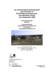
A cautionary tale<br />
Birch airfield was constructed by the United States Air Force in 1 943. In May<br />
2001, when exploratory trenches were dug at the edge of the airfield, one of<br />
the more unusual finds was a large pit containing equipment dumped by the<br />
US 9th Air Force before returning home at the end of World War 2. No Glenn<br />
Miller gramophone records or jeeps came to light, but instead a stove,<br />
electrical items and broken plates were dug out of the upper levels of the pit.<br />
<strong>The</strong> plates are British and include one stamped 'RAF 1941' (see picture),<br />
which seems odd because Birch airfield was never used by the Royal Air<br />
Force. <strong>The</strong>re is an archaeological lesson to be learnt here: without the<br />
wartime documentary record, it would be easy to assume wrongly from the<br />
pottery evidence alone that Birch airfield had been a RAF base. We can only<br />
hope that the Roman military did not exchange equipment in this manner.<br />
<strong>The</strong> work was funded by Hanson Aggregates.<br />
Careful where you stand!<br />
Footprints sometimes occur on Roman<br />
bricks. <strong>The</strong> culprits are usually<br />
animals that have been allowed to<br />
wander among the unfired bricks<br />
(laid out during the manufacturing<br />
process). But a fragment recently<br />
found on a site in West Lodge Road,<br />
Lexden bears the imprint of a hobnailed<br />
boot and points<br />
the finger, so to speak,<br />
at the brick-maker<br />
himself.<br />
<strong>The</strong> work<br />
was<br />
funded by<br />
Crowdel I<br />
Associates.<br />
<strong>The</strong> <strong>Trust</strong>'s book on<br />
the archaeology of<br />
<strong>Colchester</strong> up to<br />
circa 1200 AD has<br />
been reprinted. <strong>The</strong><br />
reprint was made<br />
possible with the<br />
generous support of<br />
the Hervey Benham<br />
Charitable <strong>Trust</strong>.<br />
City of Victory is<br />
available in<br />
bookshops for<br />
£12.50.<br />
Trenching by the kilometre<br />
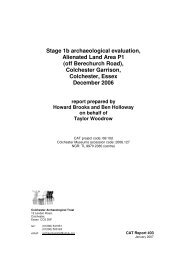
<strong>The</strong> route of the new Northern Approaches Road where it passes through Severalls and<br />
Cuckoo Farm had to be checked for archaeological remains, and so too did some<br />
development land along part of the new road in an area to the west of the General Hospital.<br />
Accordingly the <strong>Trust</strong> excavated over three kilometres of trenches by machine within the<br />
space of about two months. This is the technique normally employed on development sites<br />
to ensure that significant archaeological remains are not damaged or destroyed without<br />
adequate record. In the event, various ditches and gullies of Iron Age and Roman date were<br />
found on the site west of the hospital, whereas the route of the road through Severalls and<br />
Cuckoo Farm was pronounced clear. More archaeological investigations seem likely in both<br />
places.<br />
<strong>The</strong> works were commissioned by Cofton Land and Property (the land west of the General Hospital)<br />
and by AERC on behalf of the Secretary of State for Health (Cuckoo Farm and Severalls).<br />
Pictures - right: a trench with the hospital in the background; below: view of part of the site,<br />
looking towards <strong>Colchester</strong> town centre.<br />
3
A British farm<br />
under the Romans<br />
2001 saw the final season of excavation at the Abbotstone<br />
cropmark site, which is quite close to <strong>Colchester</strong> Zoo.<br />
What was the nature of the site?<br />
Was it a Roman farm, and how is it connected with<br />
Camulodunum?<br />
Where was Camulodunum?<br />
'No man is an island', and neither is<br />
any archaeological site. <strong>The</strong> Abbotstone<br />
site is part of a wider archaeological<br />
landscape of international importance.<br />
Other archaeological sites in the vicinity<br />
are: the Stanway burial site (1400m<br />
east); Grymes Dyke (1600m east); and<br />
the late Iron Age and Roman site at<br />
Gosbecks, with its classical Roman<br />
temple and theatre (east of Grymes<br />
Dyke). Camulodunum had two centres<br />
of activity: Gosbecks, which was probably<br />
the site of king Cunobelin's farmstead,<br />
and Sheepen (near the presentday<br />
<strong>Colchester</strong> Institute), which was<br />
predominantly concerned with trade and<br />
manufacturing.<br />
Camulodunum was defended by a<br />
system of earthworks or dykes (see plan).<br />
<strong>The</strong> burial site at Stanway was actually<br />
outside the defences of Camulodunum,<br />
though it was unquestionably linked to it<br />
socially (and chronologically). Like Stanway,<br />
the Abbotstone site is also outside<br />
the defended parts of Camulodunum.<br />
<strong>The</strong> question then is, to what extent was<br />
the Abbotstone site actually part of<br />
Camulodunum? Another question is the<br />
dynamic between native and Roman<br />
settlement. Stanway was a native burial<br />
site, and Gosbecks was a native site<br />
which became Romanised. How does<br />
the Abbotstone site fit into this picture?<br />
Was it a native farmstead which coexisted<br />
with Gosbecks and then outlived<br />
it, or was it taken over by Roman<br />
settlers?<br />
4
Previous excavations<br />
Like Stanway and Gosbecks, Abbotstone<br />
has been known for some time as a<br />
cropmark site. Fieldwalking surveys (surface<br />
collections of objects) by the <strong>Trust</strong><br />
in 1997 and 1998 scanned areas<br />
beyond the cropmarks, to check for previously<br />
unknown archaeological remains.<br />
We identified thin spreads of prehistoric<br />
flints and Roman brick and tile, with a<br />
thin concentration of Roman brick and<br />
tile directly north of the cropmark site.<br />
Surprisingly there was no surface material<br />
over the cropmark itself. <strong>The</strong> <strong>Trust</strong><br />
undertook a geophysical survey over<br />
the cropmarks in 1998 which failed to<br />
establish the location of archaeological<br />
features below the ploughsoil, possibly<br />
because the ground was too wet. <strong>The</strong><br />
cropmark site was extensively trialtrenched<br />
by the <strong>Trust</strong> in early 1999. This<br />
at last pinpointed the surviving subsoil<br />
features, thereby identifying the areas<br />
where full-scale archaeological excavation<br />
should be carried out.<br />
<strong>The</strong> <strong>Trust</strong>'s excavation in 1999 showed<br />
that the earliest activity here is represented<br />
by a few worked flints of probable<br />
late Neolithic or Bronze Age date. <strong>The</strong><br />
earliest important feature was a ditch<br />
defining a roughly circular enclosure - a<br />
potential prehistoric house site. <strong>The</strong>re<br />
was no sign of the post-holes which<br />
might show the position of a roundhouse,<br />
but the excavation of the ditch<br />
produced Middle Iron Age pottery which<br />
confirmed its prehistoric date (see magazine<br />
no 1 3).<br />
<strong>The</strong> <strong>Trust</strong> excavation team returned to<br />
excavate the rest of the site late in 2000,<br />
but the very wet ground conditions prevented<br />
much digging, and the season had<br />
to be cancelled.<br />
2001 excavation<br />
This year's task was to complete the<br />
excavation of the remainder of the large<br />
Roman enclosure. This was no mean<br />
task - standing water had to be pumped<br />
out of all the features, and the site had to<br />
be scraped clean by machine to remove<br />
the silts which had washed onto the site<br />
over the winter. <strong>The</strong> main results have<br />
been the discovery of many more ditch<br />
lines than were visible on the air<br />
photographs or were expected after the<br />
previous season of digging. A human<br />
skull was found, with some broken<br />
pottery, in a Late Iron Age ditch near the<br />
Middle Iron Age enclosure (see picture).<br />
<strong>The</strong> lower jaw was missing, suggesting<br />
that the skull had been placed here<br />
when already decomposed. <strong>The</strong> skull<br />
may be the remains of a burial or<br />
perhaps a ritual deposit.<br />
<strong>The</strong> remaining part of the ditch around<br />
the house site was excavated, and<br />
(gratifyingly) a ring of post-holes was<br />
discovered. <strong>The</strong>se define the site of a<br />
prehistoric structure (presumably a house)<br />
on this spot. <strong>The</strong> internal diameter of the<br />
post-hole ring was approximately 10m,<br />
so with a conventional thatched roof<br />
over-hanging this post-hole ring, the<br />
structure might have been closer to<br />
approximately 14m external diameterby<br />
no means a small building (see<br />
pictures).<br />
Farming<br />
It would appear that there was a gap in<br />
activity on the site until the late Iron Age,<br />
when ditches were cut to define a large<br />
enclosure. In fact the majority of the<br />
features on the site were ditches defining<br />
three large enclosures - first the Iron<br />
Age one mentioned above, and then<br />
two separate Roman enclosures (north<br />
and south). <strong>The</strong> joint life-time of the<br />
enclosures spanned the later Iron Age to<br />
the mid 3rd century AD. <strong>The</strong> north (and<br />
larger) Roman enclosure had smaller<br />
ditches or gullies splitting it into smaller<br />
paddocks or fields, and other parallel<br />
ditches marking out road lines which<br />
were originally metalled. <strong>The</strong>re were<br />
several cremation burials, one of them<br />
an interesting post-burial (where a<br />
cremation had been placed in a deep<br />
post-hole which presumably held a large<br />
post to mark the spot). What was most<br />
intriguing about the first season's work<br />
was the complete absence of buildings.<br />
Above: Ben Holloway uncovering<br />
the human skull.<br />
Left: plan of Camulodunum.<br />
Opposite page -<br />
Top: sketch of a Middle Iron Age<br />
round-house.<br />
Bottom: the team marking the<br />
positions of the eleven post-holes<br />
of the Middle Iron Age roundhouse.<br />
5
Above: lines were paint-sprayed on the<br />
ground to outline the archaeological<br />
features as they were uncovered by<br />
machine. Parts of the features were then<br />
hand-dug so that we could date them,<br />
explore their physical characteristics,<br />
and recover environmental material.<br />
<strong>The</strong>re was a short stretch of possible<br />
beam-slot associated with the postburial,<br />
but no other structural features at<br />
all. <strong>The</strong> southern (and smaller) Roman<br />
enclosure was equally intriguing. It had<br />
opposed entrances, the northern one<br />
having a pair of gate-posts set back from<br />
the ditch line, which would imply the<br />
existence of an internal bank with the<br />
gate between the ends of the bank.<br />
Still describing the site as a series of<br />
enclosures, it is now possible to suggest<br />
a sequence of development. <strong>The</strong> earliest<br />
enclosure seems to have developed out<br />
of the circular Iron Age house site, and<br />
to have been added to progressively,<br />
until the enclosure was regularised by<br />
being recut in the Roman period as our<br />
north enclosure. <strong>The</strong> south enclosure<br />
was added later on, also in the Roman<br />
period. Some of the ditch lines are<br />
boundaries from an adjacent field<br />
system which join up with the enclosure<br />
ditches, and remind us that the site was<br />
part of a wider farmed landscape.<br />
Given that the site was occupied from<br />
the late Iron Age to the mid 3rd century,<br />
the question of the location of the living<br />
areas then arises. <strong>The</strong> Iron Age roundhouse<br />
is an obvious focus for occupation<br />
at that time, but what about the<br />
Roman period? It seems clear from the<br />
quantities of pottery<br />
debris and occasional<br />
cremation burials, the<br />
cheese presses and the<br />
large number of fragments<br />
of querns (used<br />
for grinding cereals into<br />
flour), that there was a<br />
great deal of activity<br />
here in Roman times,<br />
mostly agricultural activity.<br />
But where were the<br />
buildings? With small<br />
quantities of Roman window glass,<br />
roof-tile fragments and even flue-tiles<br />
(normally associated with hypocaust<br />
systems) coming from this site, there is<br />
an obvious mis-match between the finds<br />
evidence and the site evidence. Perhaps<br />
the Roman structures were surface-built<br />
without rubble foundations, and have<br />
left no trace. Perhaps these finds occur<br />
here as dumped rubbish, having been<br />
transported from somewhere else.<br />
Abbotstone is a" site where we cannot<br />
come up with all the answers. However,<br />
the enclosures are part of a late Iron Age<br />
and mainly Roman rural site concerned<br />
principally with farming. If Roman buildings<br />
were erected here, they have not<br />
survived.<br />
What about the inhabitants? It is difficult<br />
to see a radical change between the Iron<br />
Age enclosure and the Roman enclosures,<br />
so there is no basis for arguing for<br />
Roman settlers coming in to live on an<br />
Iron Age site (there is a lack of high<br />
status finds like coins and evidence of<br />
buildings). In fact, the lack of rich finds<br />
and the almost total absence of metal<br />
finds might indicate that it continued<br />
as a native (British) site which never<br />
became a Roman villa, and was never<br />
lived in by well-to-do Romano-Britons.<br />
To take a different angle, perhaps the<br />
lack of buildings is a reflection of the fact<br />
that the people who farmed here did not<br />
necessarily live here. Perhaps the site<br />
was owned by absentee landlords, who<br />
used a team of locals to work the land<br />
here, and perhaps even those workers<br />
lived off site.<br />
<strong>The</strong> excavations at Abbotstone were<br />
funded by Tarmac Quarry Products<br />
Ltd.<br />
Above: Sam Deeprose hard at work.<br />
Right: an excavation through two intercutting<br />
ditches, with Philip Lomas in the background.<br />
6
Salt of the earth!<br />
Great Wigborough<br />
Salt is one of life's necessities. Before the<br />
discovery of the inland sources of salt in<br />
Cheshire and Warwickshire which still<br />
supply us today, salt was produced<br />
mainly by distillation of sea water at<br />
coastal sites. <strong>The</strong>re is evidence for prehistoric<br />
salt-production at Mucking and<br />
Fenn Creek (Woodham Ferrers) in Essex,<br />
but the best evidence is from the late<br />
Iron Age and Roman period when over<br />
300 salt-making sites are known from<br />
Essex alone. <strong>The</strong>se sites are called 'red<br />
hills', because they survive to this day as<br />
low red mounds at approximately high<br />
water mark.<br />
<strong>The</strong>se curious sites have attracted<br />
antiquarian and archaeological interest<br />
for some time. In days gone by, they<br />
were thought to be Saxon or Danish<br />
potteries, Roman brickyards, or campsites<br />
used by queen Boudica or Alfred<br />
the Great when he was hiding from the<br />
Danes. Organised research dates back<br />
to 1879, but took on fresh impetus in<br />
1906 with the formation of the Red Hills<br />
Exploration Committee which dug at<br />
various red hill sites in Langenhoe and<br />
Hullbridge. In recent years, Kay de<br />
Brisay was the main motivating force in<br />
red hill research, digging sites in Maldon<br />
and Peldon.<br />
When the Essex Wildlife <strong>Trust</strong> applied for<br />
consent to create a wildlife sanctuary<br />
by breaking the sea wall at Great<br />
Wigborough to allow managed retreat<br />
of the coastline by the sea, this affected<br />
several red hill sites. <strong>The</strong> <strong>Trust</strong> was<br />
contracted by the Wildlife <strong>Trust</strong> to fieldwalk<br />
the site and then test-trench any<br />
concentrations of material. <strong>The</strong> fieldwalk<br />
revealed several surface concentrations<br />
(see chart) of Roman pottery and<br />
'briquetage', the debris from salt manufacture.<br />
Where briquetage survives in<br />
identifiable fragments, it appears to be<br />
of large vessels in which salt was dried<br />
out or various pieces of clay rods, props<br />
and bars which might have supported<br />
the clay vessels over the fire. One such<br />
fragment from Wigborough was the 'fire<br />
bar' illustrated above.<br />
Several test-trenches were then cut over<br />
the area of surface finds (see picture).<br />
<strong>The</strong> removal of the ploughsoil revealed<br />
the tell-tale red-coloured earth of two<br />
separate red hills, and the outline of<br />
what may have been clay-lined 'settling<br />
tanks' once used in the salt-making<br />
process. A geophysical survey by Aline<br />
and David Black for the <strong>Trust</strong> located<br />
distinct archaeological 'hot spots' over<br />
the area of one of the red hills. Fired clay<br />
structures like hearths are particularly<br />
susceptible to detection by magnetometry,<br />
and it may be that the geophysical<br />
survey has located a number of<br />
salt-drying hearths on this particular red<br />
hill. When the sea wall is breached, the<br />
site will be flooded, as it was from<br />
Roman times until the construction of<br />
the sea wall.<br />
<strong>The</strong> work at Abbotts Hall Farm was<br />
funded by the Essex Wildlife <strong>Trust</strong>.<br />
Key<br />
• Roman pottery<br />
• Roman tile<br />
• briquetage<br />
<strong>The</strong> fieldwalking<br />
was done with<br />
the help of the<br />
Stoke-by-<br />
Nayland WEA<br />
Fieldwalking<br />
Group.<br />
Top left: briquetage fragment and reconstruction.<br />
Top right: fieldwalking chart.<br />
Above: trenching in field.<br />
Left: the water feature - elsewhere at Abbotts Hall,<br />
excavations for a freshwater lake uncovered wooden posts<br />
stretching across an infilled channel which once drained<br />
towards the estuary. <strong>The</strong> posts are oak, with sharpened points.<br />
Almost a hundred were finally exposed, forming two parallel<br />
lines about three metres apart. Most were left in place and<br />
covered with a protective layer of clay to help preserve them<br />
when the lake is filled. <strong>The</strong> few finds suggest that the structure<br />
- perhaps a jetty or small bridge across the creek - might be<br />
Roman, but as this is not certain, we are eagerly awaiting the<br />
results of tree-ring analysis which will be carried out by the<br />
Dendrochronology Department at Sheffield University.<br />
7
New light on<br />
<strong>Colchester</strong><br />
Castle<br />
A surprising discovery was the large<br />
amount of rubble and broken tile in<br />
many of the trenches. <strong>The</strong> material must<br />
largely relate to the late 17th century<br />
when John Wheeley was knocking down<br />
much of the Castle. It conjures up a<br />
picture of a ruined and half-demolished<br />
Castle surrounded by great heaps of<br />
rubble.<br />
Another striking feature of the work was<br />
the large number of clay-pipe fragments<br />
found in the trenches. <strong>The</strong> shaft for the<br />
lift dug inside the Castle in 1992 was just<br />
the same, and produced large numbers<br />
of bits of broken clay tobacco pipes.<br />
Clearly there must have been a lot<br />
of smoking in and around the castle<br />
in the past. <strong>The</strong> men working on the<br />
demolition of the castle must have<br />
smoked incessantly as they broke up the<br />
walls and cleaned the stone and brick for<br />
reuse by chipping off the old mortar.<br />
However, the most useful outcome of<br />
the excavation was the realisation that<br />
the facing stones on the batter at the<br />
base of the keep wall were removed in<br />
the late 17th century as part of the<br />
demolition works for the castle. We can<br />
tell this because we found that they are<br />
still intact below the ground-level of<br />
<strong>The</strong> installation of new<br />
floodlights for the Castle<br />
meant that over 200 metres of<br />
trenches had to be dug for the<br />
underground cabling. Being an<br />
important archaeological site,<br />
the trenches needed to be dug<br />
by archaeologists and the<br />
loose soil checked with a<br />
metal detector.<br />
circa 1 700. This same level corresponds<br />
to the top of the foundations of the<br />
chapel and other buildings on the south<br />
side of the castle, showing that these<br />
must have been demolished to groundlevel<br />
at the same time. None of this can<br />
be claimed to be especially interesting,<br />
but it all helps us to understand how the<br />
castle came to be in the state that it is<br />
today, and thus what it might have<br />
looked like originally.<br />
PC<br />
<strong>The</strong> excavation was commissioned by<br />
<strong>Colchester</strong> Museums.<br />
8<br />
Top: the castle at the floodlighting<br />
ceremony.<br />
Left: view of two parts of the site, from<br />
the top of the castle and on the ground.<br />
Right: excavators working by the castle<br />
wall.
Roman<br />
<strong>Colchester</strong>'s<br />
western suburb<br />
<strong>The</strong> planned redevelopment of the<br />
St Mary's hospital site presents a<br />
chance to explore part of a large<br />
Roman suburb outside the Balkerne<br />
Gate. <strong>The</strong> nature of the archaeological<br />
remains can be predicted to a degree,<br />
because of the major excavation of the<br />
1970s on the Balkerne Lane site<br />
immediately to the south. And there is<br />
an old, undocumented plan showing<br />
what appears to be the remains of a<br />
Roman temple on the St Mary's<br />
hospital site itself.<br />
Like the modern town, the Roman town<br />
of <strong>Colchester</strong> had suburbs outside the<br />
town wall. A large part of the western<br />
suburbs were excavated by the <strong>Trust</strong> in<br />
the 1970s before the construction of<br />
St Mary's multi-storey car park on<br />
Balkerne Hill. As a result, it was possible<br />
to trace the development of the area<br />
immediately south of the site of the<br />
former St Mary's hospital from the mid<br />
1st century onwards.<br />
<strong>The</strong> growth of the suburb reflects the<br />
growth of the Roman fortress and town<br />
lying to the west. Within a few years of<br />
the Roman conquest of AD 43, a group<br />
of flimsy buildings, perhaps workshops,<br />
had been erected outside the west<br />
gate of the Roman fort. By the time of<br />
the Boudican revolt of AD 60/1, more<br />
sturdy-looking buildings had taken their<br />
place, lining each side of the London<br />
road which now passed through the freestanding<br />
triumphal arch (on the site of<br />
Balkerne Gate). <strong>The</strong>se were presumably<br />
shops and workshops providing service<br />
industries to the town. After the revolt, in<br />
the period AD 80-100, the inhabitants<br />
and shop-keepers in the western suburb<br />
must have felt they didn't fit in in the<br />
quite the same way as before, because<br />
the Roman town wall had now been<br />
erected - a physical barrier between the<br />
suburbs and the town, which incorporated<br />
the previous free-standing archway<br />
and converted it into the west gate of the<br />
town. A Romano-Celtic temple was also<br />
built immediately outside the west gate<br />
(see picture). This was built in the usual<br />
square-within-a-square pattern, with an<br />
inner 'cella' (sanctum) surrounded by<br />
an ambulatory (walkway). Roman policy<br />
was to adopt native religious beliefs<br />
and incorporate them into the Roman<br />
pantheon, so locals could worship their<br />
Balkerne Lane in the<br />
days before the dual<br />
carriageway.<br />
It seemed appropriate<br />
that we should find a<br />
Romano-Celtic temple<br />
(foreground) on a site<br />
occupied by a<br />
monumental<br />
stonemasons' works<br />
until 1974.<br />
own deities as they had previously. <strong>The</strong><br />
second structure was an aqueduct bringing<br />
water to the town from the direction<br />
of springs in the Lexden area. <strong>The</strong><br />
western suburb reached its peak at the<br />
end of the 1st century, but declined<br />
thereafter. By the middle of the 3rd<br />
century, there were only a few buildings<br />
fronting onto the London road. <strong>The</strong><br />
town ditch was widened and diverted<br />
around the Romano-Celtic temple and a<br />
possible shrine to the south of it.<br />
<strong>The</strong>re was a foretaste of the St Mary's<br />
hospital site - a month before the start of<br />
the St Mary's excavation, the <strong>Trust</strong><br />
excavated trial-trenches at Topfield, a<br />
small adjoining site, which revealed a<br />
number of well-preserved Roman graves,<br />
part of the 'Union cemetery'.<br />
<strong>The</strong> St Mary's<br />
hospital site is<br />
here in relation<br />
to the plan.<br />
Above: part of the Ballkerne Lane site in<br />
1975.<br />
<strong>The</strong> St Mary's hospital site lies just to the<br />
west of the Balkerne Gate, the west gate<br />
of Roman <strong>Colchester</strong>. If you stand on the<br />
footpath through the Balkerne Gate,<br />
with the Hole in the Wall pub. on your<br />
right, the view directly west is of the<br />
rather unprepossessing St Mary's multistorey<br />
car park. If you turn slightly right,<br />
you see the empty St Mary's hospital,<br />
formerly the 'Union' workhouse. <strong>The</strong><br />
<strong>Trust</strong> evaluated the site in 1997, and is<br />
now excavating in advance of a new<br />
housing development.<br />
Below: work during the evaluation at<br />
St Mary's hospital.<br />
Left: plan of the Balkerne Lpne site in the<br />
1970s showing Roman houses discovered<br />
during the excavation.<br />
9
William Wire's diary - 5th May 1848<br />
'... visited the excavations for the<br />
foundations of the infirmary at the<br />
Union House, only a few fragments of<br />
pottery have been discovered, but a<br />
foundation at the NW. corner running<br />
west made with fragments of Roman<br />
roof tiles and bricks cemented<br />
together with a loose kind of mortar in<br />
which sand was the principal...'<br />
Major excavations<br />
begin at<br />
St Mary's<br />
hospital<br />
St Mary's Hospital started off as a workhouse<br />
(the Union) and fortunately William<br />
Wire witnessed the building works<br />
and made a record of what was found.<br />
<strong>The</strong> St Mary's hospital site is soon to be<br />
redeveloped, but 21st-century people<br />
are not by any means the first to take an<br />
interest in this plot of land - there is<br />
evidence for a great deal of activity here<br />
long before the building of the Union<br />
here in the 1830s. Prehistoric discoveries<br />
at St Mary's hospital include fragments<br />
of a late Bronze Age bucket urn. In the<br />
late Iron Age, <strong>Colchester</strong> became a<br />
nationally important tribal stronghold -<br />
Camulodunum - centred on the areas<br />
now known as Sheepen Hill and Gosbecks<br />
Farm. Sheepen Hill is only a short<br />
distance west of St Mary's hospital, and<br />
contemporary finds of an Iron Age jar<br />
and a coin of Cunobelin are recorded<br />
from the hospital site. <strong>The</strong> evidence for<br />
previous Roman discoveries at St Mary's<br />
hospital is almost overwhelming. <strong>The</strong>re<br />
are at least four masonry buildings<br />
recorded here, including a possible<br />
square-within-a-square structure believed<br />
to be a Romano-Celtic temple.<br />
<strong>The</strong>re are also extensive records of<br />
burials at St Mary's hospital, known<br />
collectively as 'the Union cemetery'.<br />
Sixteen inhumations, three lead ossuaries<br />
containing cremations and one tile<br />
cist are known, but there are probably<br />
many more undiscovered or unrecorded.<br />
Apart from burials and buildings, many<br />
individual objects such as potsherds,<br />
bone pins, coins and brooches are<br />
recorded from the hospital site, leading<br />
to speculation that the site was used as a<br />
general rubbish-dump for the Roman<br />
town. Saxon finds are limited to two<br />
brooches recorded by William Wire in his<br />
diary. It is quite possible that these<br />
brooches accompanied Saxon burials.<br />
In medieval times, settlement focused<br />
on the walled area of the town, and the<br />
site is presumed to have been pasture.<br />
10
An archaeological evaluation carried out<br />
by the <strong>Trust</strong> in 1997 confirmed the<br />
potential of the St Mary's hospital site. It<br />
revealed an inhumation, the clay floors<br />
of Roman buildings and a fragment<br />
of masonry wall, Boudican destruction<br />
debris, and much other dumped Roman<br />
debris, which confirmed previous ideas that<br />
this had been a rubbish-dump for the<br />
inhabitants of the Roman town. Small finds<br />
included lava quern, bone pins, pottery<br />
counters, a hone, and a fragment of stylus<br />
(a Roman writing instrument).<br />
One of the initial aims of the 2001<br />
excavation was to locate the possible<br />
Roman temple, known from an old,<br />
undocumented plan, so that it could be<br />
preserved in situ as part of the new<br />
development. Unfortunately, the temple<br />
has proved elusive. Geophysical survey<br />
and trial-trenching failed to locate it in<br />
the recorded position, and even the<br />
clearance of a large area was of little<br />
help. Perhaps the finder over-interpreted<br />
what he saw, and there never was a<br />
temple here at all, or it was recorded in<br />
the wrong position and has subsequently<br />
been destroyed. Ironically, the St Mary's<br />
hospital site is precisely the area where<br />
one would expect to find a Romano-<br />
Celtic temple - there was one excavated<br />
outside the Balkerne Gate (immediately<br />
south-east of the site) in 1975, and<br />
others have been recorded at St Helena's<br />
School 800m to the west.<br />
<strong>The</strong> Victorian workhouse<br />
Although it became a hospital in 1938,<br />
St Mary's started off as a workhouse<br />
or 'Union' where the poor and homeless<br />
of the Borough were housed and<br />
given useful employment. <strong>The</strong> sprawling<br />
hospital, which closed in 1993, consisted<br />
of the original Victorian core, and<br />
many more buildings, wards and nurses'<br />
accommodation blocks which had been<br />
added to the site over the 150 years<br />
since the original workhouse was built.<br />
An important part of the archaeological<br />
project at St Mary's hospital has been<br />
the recording of the Union workhouse<br />
building, built by John Brown in 1 837 on<br />
a 3.6 hectare-plot purchased by the<br />
Guardians of the Poor the previous year.<br />
<strong>The</strong> survey consists of a series of photographs<br />
of elevations and significant features,<br />
along side scale drawings of the<br />
elevation (see page 17).<br />
<strong>The</strong> excavation<br />
<strong>The</strong> first phase of excavation focused on<br />
a ten-thousand square metre expanse of<br />
open ground toward the bottom of the<br />
hill. This low-lying area to the north of<br />
the main hospital blocks produced very<br />
promising results from three small<br />
machine trenches in 1997, including a<br />
short stretch of Roman wall foundation.<br />
On the morning of day one, the excavation<br />
quickly uncovered the Roman wall<br />
found in our 1997 trial-trench, and as a<br />
bonus exposed an adjoining small area<br />
of flooring made from the small red tile<br />
cubes known as tesserae. It seemed that<br />
we need only follow the line of the wall to<br />
reveal the rest of this building. In the<br />
following few days, the excavation around<br />
the wall was extended but frustratingly<br />
the remainder of the building was nowhere<br />
to be seen. As we dug deeper<br />
around the foundation, it soon became<br />
apparent why the rest of the building<br />
was so elusive - subsidence. <strong>The</strong> surviving<br />
length of wall had been built over<br />
an earlier deep pit with a high organic<br />
content. With no solid ground to rest on,<br />
the wall foundation along with the<br />
adjacent floor gradually sank into the<br />
soft pit fill, finally settling about a metre<br />
below its original level. Most of the<br />
original Roman construction level at this<br />
point had been lost due to later ground<br />
activity, leaving only the lower depths<br />
into which the foundation and nearby<br />
floor had subsided. We do not know how<br />
long it took for the heavy foundation to<br />
sink this far, but it is very likely that the<br />
Opposite page -<br />
Top: drawing of an Anglo-Saxon brooch<br />
of circa AD 600 from the site of the<br />
Union workhouse, found by workmen<br />
and recorded by William Wire.<br />
Bottom: view of part of the site from the<br />
west.<br />
This page -<br />
Above: machine-trenching on the site.<br />
Below: this early 20th-century building is<br />
to be retained in the new development.<br />
Bottom: the workhouse today with NHS<br />
infill buildings in front of the main range<br />
(St Mary's hospital).<br />
11
Above: cremation pot with lid.<br />
Right: a poorly preserved burial of a<br />
juvenile, under excavation by Hayley<br />
Spencer.<br />
Below right: reconstructed grey ware jar<br />
from the crouched burial (below).<br />
Below: the crouched burial with crushed<br />
jar.<br />
original occupants of the building had<br />
structural problems. We had no complaints<br />
though, as this early example of<br />
'cowboy' construction had actually preserved<br />
part of the building that would<br />
otherwise have disappeared.<br />
Despite the severe disturbance of the<br />
ground in some areas caused by various<br />
activities like terracing, and the many<br />
Victorian rubbish-pits dotted about the<br />
site, we have uncovered some interesting<br />
remains mostly in the form of burials,<br />
buildings and features associated with<br />
water supply.<br />
12<br />
Burials<br />
A number of Roman burials, so far over<br />
thirty, confirm the existence of 'the<br />
Union cemetery' here. Rather than<br />
being tightly packed, as at the Butt Road<br />
site (where over 700 burials were excavated<br />
on the site of the police station in<br />
the 1970s), these burials are much<br />
farther apart, giving the impression that<br />
there was more open space available<br />
for burials on this side of town. <strong>The</strong><br />
St Mary's hospital burials are inhumations,<br />
including one crouched burial,<br />
but there is at least one cremation. Most<br />
are late Roman, dating from the 3rd<br />
century onward. <strong>The</strong> graves were orientated<br />
in a variety of directions and most<br />
contained wooden coffins. Organic materials<br />
seldom survive: at St Mary's, the<br />
wooden coffin planks had completely<br />
decomposed, leaving only the iron fixing<br />
nails in place. <strong>The</strong> majority of the dead<br />
were buried with footwear. Again, like<br />
the wood of the coffins, the leather had<br />
not survived but clusters of up to forty<br />
tiny hobnails were found either on or<br />
very close to the bones of the feet. Some<br />
of the burials are accompanied by 'grave<br />
goods' (principally pots or items of
jewellery), including a box burial for a<br />
child containing six pots and eight<br />
armlets. It is probably true to say that<br />
there were Roman burials all over the<br />
site - a single inhumation was found by<br />
the evaluation in 1997, and the western<br />
extent of the cemetery is demonstrated<br />
by the two burials found in 2001 at the<br />
'Topfield' site, immediately west of the<br />
hospital (see page 9).<br />
Of the parts of this sloping site that have<br />
been removed by terracing since the<br />
Roman period, one of the more severe<br />
examples was in the area known as<br />
'the bowling green'. Creating this flat<br />
recreational area in the north-west corner<br />
of the hospital grounds involved a<br />
large cutting into the side of the hill.<br />
Most of the surviving graves in the<br />
bowling green area lay within a few<br />
centimetres of the lowered surface and it<br />
is probable that other shallower burials<br />
were lost when the area was terraced.<br />
<strong>The</strong> bowling green was made in the<br />
1970s but apparently never used.<br />
Roman buildings<br />
Four Roman masonry buildings have<br />
previously been recorded on this site, so<br />
it is no surprise that these excavations<br />
turned up the remains of three more.<br />
<strong>The</strong> 1997 evaluation located one fragment<br />
of masonry wall, and the latest<br />
excavations have shown that there is not<br />
much more of this structure than was<br />
found in the evaluation. <strong>The</strong> only extra<br />
information is that a small patch of<br />
tessellated flooring is associated with<br />
the wall, and that the whole wall/floor<br />
unit has only survived because it has<br />
slumped into the protective embrace of<br />
a large pit. <strong>The</strong> rest of this structure is<br />
missing, presumably robbed away for<br />
building materials, but there is a possibility<br />
that this is the structure which was<br />
mis-identified as a temple. A second<br />
structure has been heavily robbed, but<br />
survives as a rubble-filled trench.<br />
<strong>The</strong> third structure was a cellar with<br />
a room above. <strong>The</strong> cellar was filled<br />
with debris from the demolition of the<br />
building, showing that the room above<br />
had mud-brick walls decorated with<br />
painted wall-plaster (see front cover). It<br />
is not clear yet how many separate<br />
houses the four structures represent.<br />
Water supply<br />
<strong>The</strong> most interesting discovery so far is<br />
the clay-lined water-channel or supply<br />
of some sort. Initially we thought that<br />
we had found two gravity-fed water<br />
conduits bringing water, one on the east<br />
side of the site for the area of the Sixth<br />
Form College (inside the town walls)<br />
and the other from the direction of the<br />
Chiswell Springs. <strong>The</strong> conduit took the<br />
form of a ditch lined at the bottom with<br />
clay in which there is a rectangular slot<br />
for either a wood-lined channel or a<br />
rectangular-sectioned wooden pipe. For<br />
various reasons, it now appears most<br />
likely that the conduit was a water-main<br />
of the sort found at Balkerne Lane in<br />
the 1970s (see page 9) but set in<br />
clay. Water-mains are usually readily<br />
Below: an inhumation burial during<br />
excavation.<br />
Bottom: the same burial fully excavated.<br />
Pots from the grave (a flagon and two<br />
indented beakers) are shown on the left.<br />
13
ecognised by their iron collars. But the<br />
main on the St Mary's hospital site seems<br />
to have been removed in antiquity,<br />
which is why no collars were found in its<br />
remains.<br />
Normally water-pipes did not need an<br />
impervious lining such as the clay,<br />
because they were designed in such a<br />
way as to be watertight. However, the<br />
St Mary's water-pipe (if that is what it<br />
was), effectively carried the water down<br />
one side of a valley and up the other.<br />
<strong>The</strong> pressure of water would have<br />
been considerable in the lowest<br />
part of the main, hence the use<br />
of a clay lining as an extra<br />
measure to counteract<br />
leakage.<br />
Next steps<br />
<strong>The</strong> first stage of<br />
the excavations came<br />
to a halt in October<br />
2001, but we anticipate<br />
that further<br />
archaeological<br />
excavation will be<br />
carried out in <strong>2002</strong><br />
when details for the<br />
redevelopment project are finalised. <strong>The</strong><br />
St Mary's hospital site has such<br />
interesting archaeological remains that<br />
a solution is being sought which will<br />
minimise the impact of the housing redevelopment.<br />
Current Government policy<br />
is to preserve in position (in situ) as much<br />
archaeological material as possible.<br />
This policy is embodied in a document<br />
named PPG 16, which contains models<br />
of best practice and recommendations<br />
for how archaeological issues should be<br />
dealt with in modern redevelopment.<br />
<strong>The</strong> site developers Jaygate Homes<br />
altered the engineering design of the site<br />
so that as much of the archaeological<br />
material as possible is so left undisturbed.<br />
This will have the benefit of<br />
preserving a considerable slice of the<br />
western suburbs of the town for the future,<br />
and if the area comes up for archaeological<br />
investigation again, the techniques<br />
available to archaeologists in the<br />
future should be much more sophisticated<br />
than those we have today. After all, we<br />
now have ground-probing radars and<br />
other geophysical investigation techniques,<br />
and if the technology develops<br />
even further, there could be some very<br />
useful equipment in the offing!<br />
Above: six pots from the box burial for a<br />
child - five at 25% actual size, and top,<br />
the painted face pot at a different scale<br />
(actual size 17.5 cm high). <strong>The</strong> vessels<br />
probably contained food and drink.<br />
Above right: a shale armlet from the box<br />
burial, one of eight armlets from the<br />
grave, shown at actual size.<br />
14<br />
Right: the face pot during excavation.
Two Roman buildings<br />
Left: the corner of a Roman cellar backfilled with wall-plaster<br />
and 'clay' or 'mud-brick' walls from the demolished Roman<br />
house.<br />
Below: tessellated floor and features which belonged to one<br />
of the Roman houses on the St Mary's hospital site.<br />
<strong>The</strong> excavations at St Mary's<br />
hospital are being funded by<br />
Jaygate Homes Ltd.<br />
Roman water conduit<br />
Above: an iron junction piece<br />
in the base of the slot in the<br />
clay lining. <strong>The</strong> slot in the claylined<br />
ditch is the remains of<br />
some kind of water conduit,<br />
but its form is unclear.<br />
<strong>The</strong> flat iron junction piece<br />
suggests a wood-lined channel<br />
whereas other factors point to<br />
a standard wooden water-pipe<br />
that has been removed.<br />
15
<strong>The</strong> Victorian workhouse<br />
Andrew Phillips describes the Union<br />
workhouse and explains how it<br />
became an NHS hospital<br />
Goodbye to the workhouse<br />
<strong>Colchester</strong>'s Victorian workhouse exudes<br />
a grey gloom. It was built in 1836 in<br />
response to new government policy.<br />
Hitherto each parish had been able to<br />
give money or bread to its resident poor<br />
and to provide employment (repairing<br />
roads, for example) to the able-bodied<br />
poor (ie the unemployed). This generous<br />
(but expensive) welfare system was<br />
swept away by the New Poor Law of<br />
1834. This required each town or district<br />
to build a large workhouse. Anyone<br />
destitute must enter the workhouse. Life<br />
inside was made deliberately bleak to<br />
dissuade the poor from scrounging off<br />
the public. Above all, paupers would be<br />
set to work, to pay for their keep. This<br />
measure was bitterly resented by the<br />
poor. When introduced in the North of<br />
England, there was widespread rioting.<br />
Historians agree that it helped to crush<br />
the rural Essex poor into sullen obedience.<br />
<strong>The</strong>y called it 'the Spike.'<br />
In <strong>Colchester</strong> things were less strident.<br />
No major scandal was recorded, but the<br />
refusal of those in charge, the 'Guardians<br />
of the Poor', to let members of the<br />
Press attend their meetings did keep<br />
the lid on things. We don't know what<br />
happened inside those gates, except<br />
that the <strong>Colchester</strong> workhouse filled up<br />
with three sorts of people: the old, too<br />
feeble to work, the sick, unable to afford<br />
doctors; and the destitute, notably<br />
young women with children. 'Layabouts'<br />
were harder to find. This is because the<br />
workhouse was really a prison.<br />
Able-bodied applicants, in order to enter<br />
the workhouse, had to be destitute -<br />
without money or possessions. How then<br />
were they ever supposed to get out?<br />
Dependent wives and children had to<br />
enter too. Husbands and wives were<br />
then split up into men's and women's<br />
wards, and issued with workhouse<br />
clothing. Each day the men had tasks:<br />
unpicking the threads of old rope, chopping<br />
firewood or breaking big stones into<br />
gravel to surface the roads. <strong>The</strong>y could<br />
never go out, except on Sunday to<br />
church. Some paupers checked which<br />
chapel was furthest away, and asked to<br />
worship there. At least then they got a<br />
walk on Sunday. For all these reasons,<br />
many of the <strong>Colchester</strong> poor, if out of<br />
work, preferred to go cold and hungry<br />
than consider the workhouse. Naturally<br />
the cost of the Poor Law rapidly went<br />
down.<br />
<strong>The</strong> workhouse was run by an ill-paid<br />
resident staff, headed by the Master and<br />
Mistress. <strong>The</strong>y were naturally grateful to<br />
the Clerk to the Guardians, a former<br />
mayor of <strong>Colchester</strong>, who got them the<br />
job. At Christmas 1874 this gratitude<br />
Left: plan of the workhouse in 1 876.<br />
Above: view of the workhouse from the<br />
top of Jumbo, the former water-tower.<br />
16<br />
on opposite page -<br />
Top: the entrance to the workhouse as it<br />
existed in 2001.<br />
Right middle: the house built for the<br />
master and mistress of the workhouse.<br />
Far right: part of the front elevation of<br />
the workhouse.<br />
Below far right: survey of the former<br />
workhouse in progress.<br />
Right: old photograph which is believed<br />
to show women inmates of the Union<br />
workhouse in the early 20th century<br />
(photo, courtesy of Mrs Carol Lyon).
took the form of a slap-up lunch for<br />
the Clerk and his cronies, even as, in<br />
another part of the building, the paupers<br />
lined up for their Christmas treat of a<br />
glass of ale and a pinch of snuff. Quite<br />
by accident a campaigning Liberal activist<br />
interrupted the feast. Before long<br />
the politics of <strong>Colchester</strong> were enlivened<br />
by an 'Anti-Lunch' Party, ruthless in their<br />
search for further skeletons in the workhouse<br />
cupboard. Soon it was discovered<br />
that the quantity of brandy purchased<br />
greatly exceeded the inmates' medical<br />
requirements. <strong>The</strong> workhouse Master<br />
and his wife left suddenly - and without<br />
a reference. New locks on the workhouse<br />
cellar door effected a saving of 18<br />
gallons of beer a week.<br />
By 1900 Victorians felt bad about the<br />
workhouse. It began to get a bad press.<br />
<strong>The</strong> crusading journalist George Sims<br />
wrote a ballad that moved the nation. As<br />
you have probably only heard the first<br />
line, here is the opening:<br />
It is Christmas Day in the<br />
Workhouse... and in long and hungry<br />
line<br />
<strong>The</strong> paupers sat at the tables, for this<br />
is the hour they dine.<br />
And the Guardians and their ladies,<br />
as the wind is in the East,<br />
Have come in their furs and wrappers<br />
to watch their charges feast...<br />
And so on, for 21 verses. In two years,<br />
100,000 copies were sold. <strong>The</strong> campaign<br />
for the Welfare State had begun.<br />
After the First World War, National<br />
Insurance, old age pensions and unemployment<br />
pay began to empty the<br />
workhouse of some of its traditional<br />
residents, though not the small army of<br />
tramps who got a meal and a bed on<br />
condition that they 'moved on', many<br />
doing a regular circuit to Braintree and<br />
to Witham and back. From 1929 the old<br />
Poor Law was replaced by 'public assistance',<br />
dispensed and means-tested by a<br />
committee of the Town Council. Increasingly<br />
the workhouse concentrated on its<br />
infirmary (ie hospital) facilities and its<br />
'long stay', mostly elderly, residents. Only<br />
in 1948 did the Last of the Poor Law go<br />
as the workhouse was transferred via the<br />
National Assistance Board to the Health<br />
Service. <strong>Colchester</strong> workhouse enjoyed a<br />
second career as St Mary's Hospital, a<br />
service they had always provided for the<br />
poor. Not till the 1990s did this function<br />
cease, even though, ironically, homelessness<br />
was now becoming as serious a<br />
problem as it had been in 1836.<br />
Some of the internal details of the<br />
building are of great interest. <strong>The</strong> main<br />
building was significantly and symmetrically<br />
segregated, with women and<br />
girls to the west and men and boys to<br />
the east, on each side of a dim, damp<br />
and dingy dining-hall. <strong>The</strong>re was a<br />
school, and separate wards for elderly<br />
and able-bodied inmates. On the<br />
female side was a nursery ward, wash<br />
house, drying room and laundry. On<br />
the men's side was the flour store, bake<br />
house, bread store and oven, the pump<br />
house, the hearse house, the tramps'<br />
ward, the 'itch ward', a shoemaker's<br />
shop, and a tailor's shop. Around a<br />
central courtyard were the board room,<br />
the master's rooms and the porter's<br />
lodge.<br />
HB<br />
17
Water supply in<br />
Roman <strong>Colchester</strong><br />
Water is another of life's necessities, so it<br />
is no surprise that the paraphernalia<br />
required to extract water and deliver it to<br />
people is often found on excavation sites<br />
in and around the town. <strong>The</strong> discovery of<br />
a water-main or conduit on the St Mary's<br />
hospital site adds to our knowledge of<br />
the water supply to the Roman and later<br />
town.<br />
Excavations at Balkerne Lane in the<br />
1970s uncovered some key evidence for<br />
water supply. A shallow trench running<br />
across the site and heading towards one<br />
of the arches of Balkerne Gate carried<br />
four wooden water-mains (see picture).<br />
Each water-main was made of a series of<br />
straight wooden pipes held together by<br />
flat iron bands hammered into the<br />
thickness of the pipe walls to provide a<br />
water-tight and pressure-resistant joint.<br />
Further evidence was the discovery on<br />
the Balkerne Lane excavation site of two<br />
parallel rows of post-holes which would<br />
have held lines of hefty wooden posts.<br />
This has been interpreted as being the<br />
remains of a Roman aqueduct, which<br />
could have brought water from Lexden<br />
and carried it over the top of the town<br />
wall in a raised culvert (see picture).<br />
After that, we must imagine it being fed<br />
into a water tower of some kind and<br />
redistributed from there along wooden<br />
water-mains to houses and public<br />
fountains in the town. In fact, the Head<br />
Street excavations in 2000 uncovered<br />
what might be the 'rising main'<br />
connection - there was an underground<br />
wooden water-trench with an iron band<br />
which came to an end directly under a<br />
hole in one of the tessellated floors of a<br />
3rd-century Roman house. What happened<br />
above floor-level is not known;<br />
presumably there was a tap and a basin.<br />
Although no waterworks are known<br />
immediately inside the town wall, there<br />
is the suspected one in Castle Park (now<br />
under the children's playground). It was<br />
originally thought to have been a pagan<br />
temple (a mithraeum), but the plan of<br />
the building and the spring which rises in<br />
it suggest otherwise.<br />
<strong>The</strong> problem at <strong>Colchester</strong> was that<br />
most of the Roman town was well above<br />
the spring line. This meant that, to<br />
provide a pressurised water supply, the<br />
water had to be raised in bulk from the<br />
springs to high ground where it could<br />
then be distributed in wooden pipes<br />
under pressure. Water could be raised by<br />
the 'Archimedes screw' or with pumps,<br />
but the most likely method was a series<br />
of water wheels.<br />
18<br />
<strong>The</strong> Romans were<br />
able to provide<br />
pressurised running<br />
water in the town<br />
centre, a standard not<br />
equalled until the<br />
early 17th century.<br />
Water was probably derived from different<br />
sources around the town, but a<br />
major source seems to have been<br />
Chiswell springs, west of the Balkerne<br />
Gate. Another was just east of the<br />
Temple of Claudius, in what is now the<br />
Castle Park. Wells would have been used<br />
along the north side of the walled town<br />
where the water-table was relatively<br />
close to the ground surface.<br />
(For more information about the development<br />
of <strong>Colchester</strong>'s water supply,<br />
see <strong>Colchester</strong> <strong>Archaeological</strong> Report 3,<br />
pages 26-8.)<br />
Above: the remains of four wooden<br />
water-mains excavated in the 1 970s at<br />
Balkerne Lane. <strong>The</strong> mains are curving to<br />
pass under one of the carriageways of<br />
the Balkerne Gate.<br />
Below: reconstruction painting by Peter<br />
Froste of the west side of the Roman<br />
town in the late 1 st century showing the<br />
wooden Paqueduct in the foreground.
Britain's<br />
first town wall<br />
Left: some of the<br />
broken brick in the<br />
town wall near the<br />
Balkerne Gate. It<br />
may be the remains<br />
of public buildings<br />
destroyed during the<br />
Boudican attack on<br />
the town in AD 60/1.<br />
by Philip Crummy<br />
A recent survey produced new theories<br />
about <strong>Colchester</strong>'s town wall. <strong>The</strong> idea<br />
that the wall was built in sections by<br />
gangs of workmen might be expected,<br />
but it seems as if some of the sections<br />
and the handiwork of different gangs<br />
can be identified. More interesting is<br />
the fact that the gangs seem to have<br />
been reusing building materials from<br />
public buildings destroyed during the<br />
Boudican revolt in AD 60/1. If this is<br />
true, then the vast quantity of reused<br />
building material in the wall suggests<br />
that there must have been several<br />
early public buildings of a monumental<br />
scale which as yet we know nothing<br />
about.<br />
<strong>The</strong> town wall is one of the few relics of<br />
the Roman era that can seen above<br />
ground in <strong>Colchester</strong>. <strong>The</strong> wall was a key<br />
feature of the town, not just in Roman<br />
times, but until the 17th century when,<br />
during the Siege of <strong>Colchester</strong>, it performed<br />
its defensive role for the last<br />
time. From its beginning, the wall defined<br />
and shaped the layout of the town<br />
centre, and continues to do so today. It<br />
was about one and three-quarters of a<br />
mile long, of which about two-thirds is<br />
still visible above ground. Substantial<br />
stretches were rebuilt or refaced in the<br />
medieval period, and much is obscured<br />
by modern repairs and patches of<br />
various sorts. <strong>The</strong> best-preserved section<br />
is next to the Balkerne Gate, where large<br />
parts of the external face still survive<br />
more or less as built over 1,900 years<br />
ago.<br />
<strong>The</strong> date of <strong>Colchester</strong>'s town wall has<br />
long been a puzzle. It used to be<br />
regarded as being AD 150 to 200, and<br />
then the early 2nd century was favoured.<br />
But now the preferred date is circa AD<br />
70 to 85, which, if correct, would make<br />
<strong>Colchester</strong>'s town walls the earliest in<br />
Britain.<br />
Some archaeologists are sceptical about<br />
whether a town wall could be as early as<br />
this in Britain, but the archaeological<br />
evidence from excavations at the rear of<br />
the wall strongly point to an early date. A<br />
key point is that <strong>Colchester</strong> was special<br />
in that it was a colony for retired veteran<br />
soldiers, and evidence on the Continent<br />
shows that colonies from the outset were<br />
normally provided with defensive walls.<br />
<strong>Colchester</strong>, being the first colony in<br />
Britain, was therefore in line for a wall at<br />
an early stage.<br />
However, the provision of <strong>Colchester</strong>'s<br />
wall had not been a straightforward<br />
matter, and in fact it was not given a wall<br />
when it was founded. Instead, this event<br />
seems to have occurred as a direct consequence<br />
of the destruction of the town<br />
by fire during the Boudican revolt of<br />
AD 60/1. <strong>The</strong> wall appears to have been<br />
built during the years immediately<br />
following the uprising as part of the refoundation<br />
of the town.<br />
Although the wall has been investigated<br />
many times over the years, it still holds<br />
on to many secrets. Only recently, careful<br />
study of the wall has revealed details<br />
about how the wall was built and how<br />
some of the materials for its construction<br />
might have been obtained.<br />
Plan of Roman <strong>Colchester</strong>.<br />
<strong>The</strong> plan shows the town wall,<br />
the street grid, the blocks of land<br />
formed by the streets (insulae),<br />
the six town gates, internal<br />
towers on the wall (T1 to T8),<br />
and culverts through the wall (C1<br />
to C8). <strong>The</strong>re could have been<br />
more towers and culverts than<br />
are shown here. <strong>The</strong> town was<br />
built on the site of a Roman<br />
legionary fortress, and its location<br />
is indicated on the plan.<br />
(<strong>The</strong> annex on the east side of<br />
the fortress is omitted.)<br />
19
Public buildings destroyed by Boudica?<br />
A surprising feature of the wall is that all<br />
the bricks in it appear to be in pieces. It is<br />
hard to find any brick which looks as if<br />
it might be complete. <strong>The</strong>re are two<br />
possible explanations for this curious<br />
fact. One is that the brick was deliberately<br />
broken up, so that it would make a<br />
stronger wall. However, considering how<br />
much brick is involved, it seems extraordinary<br />
that tilers would make thousands<br />
of bricks only for their handiwork<br />
to be smashed into fragments. <strong>The</strong> other<br />
explanation is that the bricks are in<br />
pieces because the material was salvaged<br />
from buildings which had to be<br />
demolished. However, this explanation<br />
also seems flawed, because had the<br />
bricks been reused in this way, we might<br />
expect to see lumps of earlier mortar<br />
adhering to some of them, and this is not<br />
generally the case. A few do indeed<br />
seem to have bits of attached earlier<br />
mortar, but there is so little of it that<br />
the brick fragments must have been<br />
extremely well cleaned if indeed they<br />
were reused. Thus, although neither<br />
explanation can be claimed to be entirely<br />
convincing, reuse of the bricks<br />
seems by the far the likeliest explanation,<br />
and the question then arises as to<br />
which buildings the brick came from.<br />
Very few houses had brick and stone<br />
walls in the 1st century in <strong>Colchester</strong>. In<br />
fact, even in the 2nd and 3rd centuries,<br />
when the use of stone and brick was at<br />
its peak in domestic construction, most<br />
new house walls were generally made<br />
out of a kind of mud brick rather than<br />
the kiln-fired bricks in the town wall. <strong>The</strong><br />
only source of brick in the quantities<br />
needed for the town wall must have<br />
been public buildings. And even then,<br />
the scale of the buildings must have<br />
been monumental. <strong>The</strong>re was enough<br />
brick in the town wall to have made<br />
six brick walls, 0.8 metres wide and<br />
4 metres high, across the width of the<br />
largest of the squares (insulae) in the<br />
town (ie Insulas 22 and 30). Given that,<br />
like the town wall, the walls of these<br />
buildings would have been made out of<br />
a mixture of brick and stone, it is clear<br />
that several very large public buildings<br />
must have been demolished to produce<br />
all the broken brick for the town wall.<br />
What might the buildings have been?<br />
<strong>The</strong> most obvious candidates are public<br />
baths (probably legionary in origin), a<br />
basilica (an aislea hall) opposite the<br />
Temple of Claudius, the superstructure<br />
of the Temple of Claudius if it needed to<br />
be rebuilt, and a monumental colonnade<br />
around the temple.<br />
<strong>The</strong> wall was not raised as one unit all<br />
round its circuit, but instead was built in<br />
sections by a number of gangs each<br />
working at their own speed and, to a<br />
limited degree, building them in their<br />
own way. A close inspection of the bestreserved<br />
parts of the wall by the<br />
Balkerne Gate has provided evidence of<br />
as many as five different sections of wall,<br />
and indications of several gangs in<br />
operation. <strong>The</strong> coursing is one indicator.<br />
<strong>The</strong> coursing of the brick and stone<br />
forming the sides of the Balkerne Gate<br />
does not match the coursing in the<br />
adjacent sections of wall to the north<br />
and south, apart from at the base. <strong>The</strong>se<br />
discontinuities show that the gate and<br />
the wall were constructed as one until<br />
the work had reached a few feet in<br />
height, when the gate was raised more<br />
quickly. <strong>The</strong>re are also differences in the<br />
fabric of the wall which suggest different<br />
gangs with slightly different working<br />
practices. <strong>The</strong> wall on the north side of<br />
the gate differs from elsewhere in that it<br />
contains thousands of waste chippings<br />
Above: plan showing the probable<br />
extent of the different sections of wall in<br />
which the wall at Balkerne Lane was<br />
built.<br />
Left: drawing of the junction (Joint A) of<br />
the north side of the Balkerne Gate and<br />
the adjacent section of town wall. <strong>The</strong><br />
break in the coursing of the brick and<br />
stone shows that the wall and the gate<br />
were built independently of each other<br />
except for the lowest four courses.<br />
A section at a time<br />
20<br />
Reconstruction of the Balkerne Gate by Scout Design<br />
showing the gate as it might look today had it survived<br />
complete, with the modern buildings behind it. <strong>The</strong><br />
double arch part in the centre is the triumphal arch, which<br />
was incorporated into the new gate in circa AD 70-85.
left over from the dressing of the facing<br />
stones. <strong>The</strong> gate too is different, in that it<br />
was bonded with pink mortar (opus<br />
signinum) rather than the normal white.<br />
(<strong>The</strong> pink colour is due to the addition of<br />
crushed and powdered brick.)<br />
Evidence from past excavations elsewhere<br />
on the wall circuit helps to fill in a<br />
picture of how these gangs operated.<br />
Each gang seems to have had its own<br />
stockpile of materials close at hand.<br />
<strong>The</strong>y dressed the stone and mixed the<br />
mortar on wooden boards next to the<br />
section of wall that they were building.<br />
At the Balkerne Gate, the average<br />
length of each unit of wall seems to be<br />
about 40-60 m, which would mean that<br />
there might be 50 to 75 such sections<br />
round the circuit of the wall as a whole. If<br />
the wall was built very quickly in one<br />
season or so, then the scale of the<br />
project would be such that it might have<br />
been undertaken by a Roman legion (ie<br />
about 5,000 men). However, if the brick<br />
in the wall is indeed reused, then the<br />
building works probably went on for<br />
many years, and their progress must<br />
have depended to an extent on the rate<br />
at which public buildings were being<br />
demolished.<br />
<strong>The</strong> <strong>Trust</strong> is indebted to <strong>Colchester</strong><br />
Museums and the <strong>Colchester</strong> Borough<br />
Council for funding the <strong>Trust</strong>'s recent<br />
review of the town wall. <strong>The</strong> purpose of<br />
the project was to compile an archive<br />
report covering all the archaeological<br />
investigations and records relating to the<br />
wall over the last fifteen years, including<br />
the drawn survey at 1:20 which the <strong>Trust</strong><br />
carried out some years ago. <strong>The</strong> latter<br />
was undertaken with the aid of grants<br />
from English Heritage and <strong>Colchester</strong><br />
Borough Council as part of a wider programme<br />
of works to repair and conserve<br />
the wall.<br />
PC<br />
Below: photo, of a section of wall by the<br />
Balkerne Gate in 2001.<br />
<strong>The</strong> search<br />
for the town<br />
gates of<br />
Roman<br />
<strong>Colchester</strong><br />
Compared with some<br />
other former Roman<br />
towns in Britain, <strong>Colchester</strong><br />
is fortunate to<br />
have the remains of<br />
two of its Roman<br />
gates still exposed.<br />
One of them, the<br />
Balkerne Gate, is so<br />
well preserved that<br />
you can walk under<br />
one of its arches, and<br />
the other, Duncan's<br />
Gate, is sufficiently<br />
intact for the lower<br />
part of the gate to be<br />
completely exposed<br />
and on view (in Castle<br />
Park). But there were<br />
four other Roman<br />
gates, and the size<br />
and layouts of these<br />
gates are not known. This is because,<br />
unlike the Balkerne Gate and Duncan's<br />
Gate, these gates were in use in the<br />
medieval period, and they have since<br />
been removed because of decay and<br />
road improvement schemes. However,<br />
parts or these gates should survive<br />
below ground. Certainly small parts of<br />
the east sides of Head Gate and the<br />
north gate have been observed less<br />
than a foot under the surfaces of the<br />
modern pavements, and the level of<br />
the town wall near St Botolph's Street<br />
indicates that the base and foundations<br />
of the south gate should be<br />
similarly preserved. (<strong>The</strong> east gate may<br />
be exceptional, because it might have<br />
been completely destroyed when the<br />
gradient or East Hill was reduced in the<br />
19th century.)<br />
Opportunities to dig holes on the sites<br />
of the missing gates are limited, for<br />
obvious reasons, so it was decided to<br />
see if it might be possible to detect the<br />
presence of any remains by geophysics.<br />
Resistivity is no good where the surface<br />
is concrete, and magnetometry is not<br />
very effective with metal in the vicinity.<br />
Our only choice was ground radar.<br />
But the sites of all four gates lie under<br />
main roads into town, so to carry out a<br />
ground-radar survey presented a considerable<br />
challenge. Clearly, there had<br />
to be as little traffic as possible, and<br />
night revellers are best avoided. This<br />
left no choice: the survey would have to<br />
be done early on a Sunday morning.<br />
Above: the ground-radar team working<br />
on the site of East Gate, East Hill.<br />
Five o'clock seemed to be the time to<br />
start. Traffic starts to build up by ten, so<br />
that was the deadline for completion.<br />
<strong>The</strong> police were consulted and their<br />
permission obtained, and so too the<br />
Borough's own traffic control officers.<br />
We had flashing lights, as did the<br />
ground-radar machine; we had two<br />
men at work' signs; we wore luminous<br />
jackets; and a risk assessment was<br />
prepared.<br />
<strong>The</strong> plan of action was carefully worked<br />
out beforehand. Precision timing<br />
was vital if we were to finish all four<br />
gates before the traffic beat us. Howard.<br />
Stephen and I marked out the<br />
arias using chalk and strings as guidelines.<br />
<strong>The</strong> grids consisted of lines,<br />
spaced at one-metre intervals over the<br />
sites of each of the gates. We stretched<br />
strings temporarily across the full width<br />
of the streets as the lines were chalked.<br />
Oncoming traffic was always a problem<br />
and a worry. Peter and John<br />
worked the ground-radar machine,<br />
and Tim carried out a back-up survey<br />
using a magnetometer. <strong>The</strong> grid team<br />
started about half an hour before the<br />
others to keep ahead.<br />
21
'Geophys' at <strong>Colchester</strong><br />
Geophysics offers archaeologists the<br />
chance to explore underground without<br />
digging holes. It is quick, cheap<br />
and non-destructive, but results vary<br />
according to such things as the method<br />
used, the ground conditions, and the<br />
type of archaeological features being<br />
explored. Various techniques can be<br />
used; ie magnetometry, resistivity and<br />
ground radar. Magnetometry measures<br />
minute variations in the magnetic field,<br />
and is particularly effective in detecting<br />
burnt areas. <strong>The</strong> downside is that it does<br />
not work well near large metal objects<br />
such as fences. Resistivity measures the<br />
electrical resistance in the ground, and is<br />
better suited to stone and rubble. It is<br />
slower than magnetometry because of<br />
the need to insert probes into the ground<br />
for every reading. Ground radar is relatively<br />
expensive, and the results are the<br />
most difficult to interpret, but it is not<br />
adversely affected by metal and it is<br />
quick.<br />
<strong>The</strong> main project over the past few years<br />
has been Gosbecks, and this will continue<br />
to be the focus of our attention for<br />
some years to come. It is hoped eventually<br />
to survey the whole of the area.<br />
About 11 hectares have been done so<br />
far, but it is early days yet and there<br />
could be as much as 60 hectares to go.<br />
<strong>The</strong> grounds of St John's Abbey have<br />
also been surveyed in the hope of<br />
recovering information about the<br />
demolished abbey (pages 23-5). <strong>The</strong><br />
sites of four of <strong>Colchester</strong>'s Roman town<br />
gates were targeted in the hope of<br />
recovering their plans, and there has<br />
also been work near Copford on the site<br />
of a Roman villa.<br />
Picture: ground-radar plot from<br />
Queen Street. <strong>The</strong> lines are<br />
puzzling and seem too far north<br />
to be part of the gate; perhaps<br />
they indicate the site of a<br />
former pedestrian crossing.<br />
It was pitch dark when we started, and<br />
the town was very quiet, apart from<br />
the occasional car and some street<br />
cleaners. Fortunately, it was dry and<br />
there was little wind to blow the string<br />
around as we laid out the grids. But<br />
there was a problem early on - a street<br />
cleaner thoughtfully warned us that<br />
we had twenty minutes before his<br />
automated cleaning machine washed<br />
away the chalk lines. Oh dear! <strong>The</strong>re<br />
wasn't enough time for the team to<br />
take the readings. But the cleaner was<br />
sympathetic and 'phoned his boss, and<br />
the obliteration was scheduled for a<br />
later time.<br />
In the event, the whole operation went<br />
like clockwork, and Peter pushed the<br />
ground-radar machine along the last<br />
chalk line at ten, and just as the traffic<br />
was building up. All in all, it was a<br />
masterly performance by the team. But<br />
did it work? We would know within a<br />
few hours, after Tim had processed the<br />
data.<br />
We were extremely hopeful for results<br />
of a sort. Given the mass of masonry<br />
which survives under pavements and<br />
how close it is to the surface, it seemed<br />
very likely that we would be able to<br />
detect some of it with the ground radar.<br />
But unfortunately it was not to be. <strong>The</strong><br />
kerbs and the rough surfaces of some<br />
of the roads caused some problems,<br />
but even so, it is very hard to see<br />
anything particularly positive in the<br />
results. We seem to have found evidence<br />
of a pedestrian crossing in Queen<br />
Street which no longer exists, but<br />
otherwise nothing definite. I don't<br />
doubt that geophysics is the way to find<br />
out more about <strong>Colchester</strong>'s town<br />
gates, but it won't be for a while yet.<br />
<strong>The</strong> ground-radar survey was carried<br />
out by Peter Cott, Dr John Woods, Dr<br />
Tim Dennis, Howard Brooks, Stephen<br />
Benfield and myself (Stephen, Peter,<br />
John and Tim are pictured below). <strong>The</strong><br />
hire of the ground-radar machine was<br />
kindly paid for by the Friends of<br />
the <strong>Colchester</strong> <strong>Archaeological</strong> <strong>Trust</strong>.<br />
<strong>The</strong> machine was supplied by Utsi<br />
Electronics.<br />
PC<br />
<strong>The</strong> team<br />
We are lucky to have the services of a<br />
group of four very capable people working<br />
on geophysical projects for the <strong>Trust</strong>.<br />
Peter Cott is the team leader. He is<br />
a communications engineer who has<br />
developed considerable expertise in geophysics<br />
since his retirement. He has<br />
been carrying out geophysical surveys at<br />
<strong>Colchester</strong> and in East Anglia since<br />
1993, particularly at Gosbecks. His first<br />
helpers were Dennis Tripp and James<br />
Fawn. Aline and David Black started as<br />
his assistants a few years ago, and having<br />
caught the bug, now carry out surveying<br />
themselves. Aline and David both<br />
have scientific backgrounds. Many people<br />
will know Aline from her time as Head at<br />
the <strong>Colchester</strong> County High School. Dr<br />
Tim Dennis is Senior Lecturer in the<br />
Department of Electronic Systems Engineering<br />
at the University of Essex. His<br />
primary role in the geophysics projects is<br />
the processing of the field data. He first<br />
became involved with <strong>Trust</strong> when he<br />
helped to organise the publication of live<br />
images of the Stanway excavation on<br />
the internet in 1997.<br />
22
St John's Abbey<br />
explored<br />
St John's Abbey was an important<br />
feature of medieval <strong>Colchester</strong>, yet<br />
thanks to Henry VIII, little now<br />
remains above ground. All that<br />
survives of the abbey is most of the<br />
precinct wall, the 15th-century<br />
gatehouse, part of a porter's lodge,<br />
and lots of fragments of worked<br />
stone in many of the more modern<br />
buildings in and around the site of<br />
the abbey.<br />
Nothing is known about the buildings of<br />
the abbey except for the church which,<br />
fortunately, is depicted in a medieval<br />
drawing (see page 25). <strong>The</strong> illustration<br />
shows a substantial building with a large<br />
central tower rather like the one at<br />
Norwich cathedral, and a west front<br />
apparently flanked by two round towers.<br />
Interestingly, the drawing shows the<br />
south side of the church, and thus it<br />
appears to suggest that the cloisters and<br />
most of the other monastic buildings<br />
were to the north of the church. Not<br />
only would this have been an unusual<br />
arrangement, but it seems to contradict<br />
the early history of the abbey where it is<br />
stated that the monastic buildings were<br />
relocated on the south side of the church<br />
after the abbey burnt down in 1133.<br />
<strong>The</strong> abbey was founded in 1095 by<br />
the Norman baron Eudo Dapifer on the<br />
site of an earlier church dedicated to<br />
St John. From the beginning the abbey<br />
was protected by a high wall. <strong>The</strong><br />
impressive 15th-century gatehouse on<br />
the town side of the abbey is relatively<br />
late, but it was presumably a rebuilt<br />
version of an earlier gate. Another gate<br />
may have existed on the south side of<br />
the precinct (see page 24), its site being<br />
on the west side of the modern Flagstaff<br />
House on Napier Road.<br />
<strong>The</strong> abbey closed in 1538 as part of<br />
Henry Vlll's attack on monasticism and<br />
the Catholic Church. <strong>The</strong> abbot, John<br />
Beche, vigorously opposed the termination<br />
of the abbey and was hanged as a<br />
result. He is said to have resisted the<br />
closure and to have hidden the abbey's<br />
valuable plate. <strong>The</strong> monks were evicted<br />
and the abbey buildings and land sold<br />
off. <strong>The</strong> monastic buildings were largely<br />
destroyed as the estate quickly passed<br />
through the hands of several owners.<br />
<strong>The</strong> estate ended up in the ownership of<br />
the Lucas family, who built a mansion<br />
for themselves probably incorporating<br />
parts of the ruined abbey. <strong>The</strong> mansion<br />
was demolished about a hundred years<br />
later in 1 648 as a result of the Siege of<br />
<strong>Colchester</strong>, when the Royalists<br />
used the walled precinct<br />
as a bulwark against the<br />
Parliamentarians who were<br />
besieging the town.<br />
Top left: Abbot Blyton's seal (14th<br />
century), published in the Book of<br />
<strong>Colchester</strong>.<br />
Above: St John's Abbey precinct in<br />
1748.<br />
Below: part of the first page of the<br />
cartulary of St John's Abbey, with the<br />
initial 'E' for Eudo Dapifer.<br />
(Seal and cartulary reproduced courtesy<br />
of <strong>Colchester</strong> Museums.)<br />
Below: a view of St John's Green in 2001 looking towards St John's<br />
Abbey gatehouse.<br />
23
St John's<br />
Abbey<br />
explored<br />
<strong>The</strong> precinct is not open to the public but<br />
the gatehouse can be visited. Parts of<br />
the precinct wall can be seen in the<br />
surrounding streets.<br />
Right: a speculative layout of the abbey on<br />
the assumption that the cloisters were on<br />
the north side of the abbey church. <strong>The</strong><br />
plan shown here is loosely based on the<br />
Benedictine abbey at Chester which was<br />
arranged in this way. <strong>The</strong>re were probably<br />
more ancillary buildings than are shown<br />
here. According to the 1610 and 1648<br />
maps of <strong>Colchester</strong>, the Lucas house stood<br />
in the southern part of the precinct. <strong>The</strong><br />
house may have incorporated parts of some<br />
of the monastic buildings, as was sometimes<br />
the case in Dissolved monasteries<br />
elsewhere. <strong>The</strong> monastery was apparently<br />
being demolished in 1552, although there<br />
is a record to the effect that part of the<br />
abbey church was still standing as late as<br />
1621. Interestingly, there is a tall building<br />
on the 1610 and 1648 maps, which could<br />
be interpreted as being the partly demolished<br />
abbey church where only the central<br />
tower and the east end have been retained.<br />
(<strong>The</strong> church at St Botolph's Priory in <strong>Colchester</strong><br />
was treated in this way after the<br />
Dissolution, except that it was the nave that<br />
was kept with the central tower and east end<br />
being demolished.)<br />
G A very small part of a<br />
substantial east-west foundation<br />
was found in 1986<br />
during building works on the<br />
east side of the Garrison<br />
Officers' Club. This is the<br />
only part of the abbey buildings<br />
uncovered to date.<br />
B St John's Abbey gatehouse<br />
is a very fine twostoreyed<br />
building of 15thcentury<br />
date. <strong>The</strong> gatehouse<br />
is of two storeys,<br />
with flint flushwork panelling,<br />
battlements and corner<br />
turrets. <strong>The</strong> building<br />
was badly damaged during<br />
the Siege of <strong>Colchester</strong> in<br />
1648, but it seems to have<br />
been accurately restored<br />
in the mid 19th century.<br />
<strong>The</strong> gatehouse is open to<br />
the public, without charge<br />
(but not the upper storey).<br />
24
E St John's church,<br />
demolished 1095;<br />
excavated in 1972<br />
G Wall found<br />
in 1986<br />
12th-century<br />
precinct wall,<br />
masked here<br />
by modern<br />
buttresses<br />
Detail of Speed's map of <strong>Colchester</strong> published in<br />
I610.<br />
<strong>The</strong> Siege map of 1648 appears to show a gate<br />
flanked by two towers on the south side of the<br />
abbey. <strong>The</strong> exact location of the gate may be<br />
where a 19th-century path through the gardens<br />
crossed the line of the precinct wall. <strong>The</strong> path<br />
led southwards from the St John's Abbey gate,<br />
and it could conceivably have survived from the<br />
medieval period.<br />
Above: detail from the Siege map of 1648 showing<br />
the Royalist forces holding the former precinct of<br />
St John's Abbey. Whoever compiled the Siege map<br />
took Speed's map as its core and added in enough<br />
detail around the edges to show surrounding Parliamentarian<br />
siege works. <strong>The</strong> added material includes<br />
the apparent gate on the south side of the<br />
precinct, and what appears to be a more accurate<br />
drawing of the east end of the abbey church.<br />
continued on<br />
pages 26-27<br />
Left: St John's Abbey<br />
church. Compare with<br />
the apparent remains of<br />
the abbey church shown<br />
in the 1610 and 1648<br />
maps above.<br />
A <strong>The</strong> precinct wall. <strong>Archaeological</strong> excavations<br />
in 1971 in the north-east corner of the<br />
precinct showed that the precinct wall was<br />
early and probably built between 1096 and<br />
1133. It was refaced in the 16th century and<br />
has been patched and repaired at various<br />
places around its circuit throughout the<br />
centuries. <strong>The</strong> precinct wall in Mersea Road<br />
(right, in 2001) is dominated by modern<br />
brick buttresses, but its core is Norman. On<br />
the west side of the precinct, the wall has<br />
been much altered, and includes parts of<br />
16th- or 17th-century window openings.<br />
<strong>The</strong>se show that the wall was incorporated in<br />
post-Dissolution buildings erected along the<br />
west side of the precinct.<br />
25
Above: a column of reused<br />
stone fragments on the site of<br />
the abbey precinct in 2001<br />
(composite photo, by Tim<br />
Dennis).<br />
C St Giles' church (above) seems to<br />
have been built on part of the monastic<br />
cemetery some time between 1133 and<br />
1171. It may have been a replacement<br />
for the demolished St John's church.<br />
St Giles' church was partly excavated in<br />
1975 when the building was being converted<br />
into a masonic centre.<br />
Above right: drawings of two floor-tiles<br />
from the church.<br />
A large, ornate bronze votive plaque was<br />
said to have been found somewhere in<br />
the precinct in 1891. It was dedicated to<br />
the god Mars Medocius by a Caledonian<br />
called Lossio Veda. <strong>The</strong> plaque, now in<br />
the British Museum, may indicate the<br />
site of a Roman temple.<br />
D <strong>The</strong> remains of burnt clay buildings<br />
were recorded under the churchyard<br />
wall of St Giles's church when part of the<br />
cemetery was dug away to make a car<br />
park in 1973. <strong>The</strong> buildings appeared to<br />
be the remains of the early 12th-century<br />
monastery which was destroyed by fire in<br />
1133.<br />
26<br />
St John's church<br />
E <strong>The</strong> remains of St John's church.<br />
<strong>The</strong> Anglo-Saxon church was<br />
demolished in 1095 as part of the<br />
preparatory work for the new abbey,<br />
and its site was subsequently used<br />
for burials. <strong>The</strong> church was excavated<br />
in 1 972 when the north-east<br />
corner of the precinct was lowered<br />
for the construction of St Botolph's<br />
roundabout. Roman burials were<br />
found at the same time.<br />
Above: plan of St John's church<br />
and later burials.<br />
Right: part of the tower foundation<br />
of St John's church.<br />
Middle: a monastic burial postdating<br />
the demolition of St John's<br />
church.
<strong>The</strong><br />
Young<br />
<strong>Archaeologist</strong>s'<br />
Club<br />
by Pat Brown<br />
F A substantial elongated earth mound<br />
of uncertain origin. Human remains were<br />
apparently found in the mound in 1867.<br />
<strong>The</strong> earthwork is sometimes said to be a<br />
'plague pit' or a mound for a windmill.<br />
<strong>The</strong> plague pit theory seems unlikely<br />
given that it is a mound, and there were<br />
three windmills close by but all to the<br />
east of the Mersea Road. <strong>The</strong> mound<br />
might simply be a heap of soil left over<br />
from terracing or some other earthmoving<br />
operation inside the precinct.<br />
But perhaps most likely of all is the<br />
possibility that it is an earthwork made<br />
by the Royalists during the Siege of<br />
<strong>Colchester</strong> in 1648. <strong>The</strong> Royalists made<br />
the former walled precinct into a major<br />
place of resistance against the Parliamentarians.<br />
<strong>The</strong> south side, in particular,<br />
came under heavy bombardment from<br />
Parliamentarian positions on the Abbey<br />
Field, so perhaps the mound, being<br />
close behind the precinct wall, was a<br />
gun emplacement or some sort of outpost.<br />
<strong>Colchester</strong> Young <strong>Archaeologist</strong>s' Club<br />
(YAC) was started in April 1994. Since<br />
then the club has had a steady average<br />
attendance of 15 out of a membership<br />
of 30-40. Undoubtedly the club has<br />
benefited from the increase of public<br />
interest in archaeology with television<br />
programmes like Time Team, which<br />
most of us watch avidly. National YAC<br />
was taken over by the Council for British<br />
Archaeology in 1993; it now has 67<br />
branches. National members receive<br />
a magazine, can take part in YAC<br />
holidays and competitions, and are<br />
entitled to free admission to a number<br />
of sites and museums.<br />
<strong>The</strong> <strong>Colchester</strong> club meets once a<br />
month in term-time, in the Charles Gray<br />
Room at <strong>Colchester</strong> Castle, though<br />
during the summer it goes out and<br />
about in <strong>Colchester</strong> and also runs coach<br />
trips to places of archaeological interest<br />
like Flag Fen, West Stow and St Albans.<br />
National YAC helps us with ideas and<br />
information, and ensures that all the<br />
branches maintain high standards of<br />
safety and child-care. <strong>The</strong> club leaders,<br />
all volunteers, are approved by National<br />
YAC. <strong>Colchester</strong> Museum Services have<br />
given help and support from the start,<br />
as has the <strong>Colchester</strong> <strong>Archaeological</strong><br />
Group.<br />
Children pay a £2 annual subscription<br />
to their local club and can take part in a<br />
wide variety of activities - making Saxon<br />
pots and Roman sandals, writing a<br />
newspaper about the latest displays<br />
in the museum, learning about coins<br />
and aerial photography, or being<br />
visited by two ferociously attired<br />
Saxon seamen! Insurance provisions<br />
normally prohibit the under-16s from<br />
working on archaeological sites, but<br />
this year we did have a chance to<br />
take part in a real dig, at the ECC<br />
training school at Cressing Temple<br />
(see picture), and also to participate<br />
in the Museum of London's splendid<br />
'the Dig', where we excavated and<br />
recorded mini-trenches set up by<br />
museum staff. We have tried fieldwalking<br />
and pot-washing, and we<br />
have also recorded most of the<br />
gravestones at Holy Trinity church in<br />
<strong>Colchester</strong>. This year we completed a<br />
survey on St John's Abbey gateway.<br />
Some children just come to see<br />
what it is all about, but others are<br />
'hooked', and some even want to<br />
pursue archaeological careers. Several<br />
of the older children have done<br />
work experience in a museum or at<br />
an archaeological unit like the <strong>Trust</strong>.<br />
If you know anyone aged between 7<br />
and 16 who would be interested in<br />
joining either National or <strong>Colchester</strong><br />
YAC, please contact Pat Brown on<br />
(01206) 575082 or write to her at<br />
172 Lexden Road, <strong>Colchester</strong>, C03<br />
4BZ.<br />
Part of a geophysical survey<br />
undertaken by Aline and David<br />
Black for the <strong>Trust</strong> in 2001. It was<br />
hoped that it might prove possible<br />
to learn something about the<br />
layout of the abbey. However, the<br />
results so far have been inconclusive,<br />
partly because there is<br />
a lot of metalwork on the site<br />
which interferes with the<br />
readings.<br />
27
'W' is for...<br />
James Fawn explores the<br />
mysterious letter 'W inscribed<br />
on some of the fragments of<br />
copper-working moulds found<br />
during the Head Street<br />
excavation in 2000<br />
One interesting discovery during the<br />
<strong>Trust</strong>'s excavation at the Head Street<br />
post-office site in 2000 was a pit which<br />
contained fragments of shaped fired<br />
clay moulds. Expert opinion is that these<br />
were used in the casting of bronze,<br />
especially since the pit also contained<br />
pieces of fused metal waste and soot. A<br />
bronze foundry in Head Street?<br />
<strong>The</strong> accompanying photograph shows a<br />
particularly interesting fragment (top). It<br />
has a letter W (or inverted M) inscribed<br />
on the surface so that the resultant<br />
casting would have been signed by<br />
bearing the moulded letter in relief.<br />
Whose signature? Documentary evidence,<br />
part published and part deposited<br />
in the Essex Record Office, seems to<br />
provide an answer.<br />
In 1605, 'Miles Graye of <strong>Colchester</strong>,<br />
bell-founder' bought the former property<br />
of a beerbrewer, called <strong>The</strong> Swanne with<br />
two Neckes. (Two Neckes or nicks is the<br />
mark of the Vintners' Company, used in<br />
the annual ceremony of Swan Upping<br />
on the Thames). <strong>The</strong> Gray(e)s were a<br />
well-known family of 17th-century bellfounders<br />
who cast bells for most<br />
churches in <strong>Colchester</strong>, many others in<br />
eastern England, one as far north as<br />
Newcastle and another as far south as<br />
Sussex.<br />
<strong>The</strong> name Miles ran through five<br />
generations in the period, but only three<br />
have been identified as bell-founders;<br />
Miles I, II and III. <strong>The</strong> purchaser of the<br />
Swanne for £70 was Miles I, born about<br />
1575; his father was probably a Miles<br />
Graye who lived in St Mary's parish<br />
in 1567. In 1598 the son formally confessed<br />
to making Alice Mullings pregnant<br />
at the house of Richard Bowler, also<br />
a bell-founder in <strong>Colchester</strong> (one of his<br />
bells is on display in <strong>Colchester</strong> Museum).<br />
Alice was probably a domestic and Miles<br />
a keen apprentice who was able to<br />
afford the Swanne six years later and<br />
who has become so well regarded as to<br />
merit the description 'Prince of Bellfounders'.<br />
<strong>The</strong> confession document of 1598 (see<br />
picture) bears the marks of both Miles<br />
and Alice - it takes two to tango -<br />
indicating that they were unable to write<br />
28<br />
their names. While Alice made the usual<br />
cross, Miles marked with a W. For some<br />
reason this 'W' mark is inscribed on<br />
several of his known bells and on bells<br />
attributed to him, instead of the obvious<br />
M.<br />
He and Alice married, no doubt in haste,<br />
and had at least four children. <strong>The</strong><br />
eldest from their encounter in 1598<br />
was probably Miles II. <strong>The</strong> others were<br />
James, who became a millwright, Ann<br />
and Mary. <strong>The</strong>y all married, Ann to a<br />
Michael Darbee who may have been of<br />
the same family as John Darbie, another<br />
bell-founder of the late 17th century.<br />
Miles I lived at the Swanne or close by<br />
until he died. One deed shows that Alice<br />
was still alive in 1639 when he was<br />
about 65, but she must have died not<br />
too long after because Miles' will of<br />
1649 just before his death shows that he<br />
had taken a second wife, Dorothy. His<br />
enterprising spirit obviously persisted<br />
into what would now be considered<br />
retirement age.<br />
While bells nowadays originate from a<br />
foundry, in the time of the Grayes many<br />
were cast close to the churches where<br />
they were hung. <strong>The</strong> tenor bell at<br />
Lavenham, regarded as Miles' masterpiece,<br />
was cast in a field next to the<br />
churchyard. <strong>The</strong> molten bell-metal, a<br />
particular alloy of copper and tin, would<br />
have been poured into a mould with<br />
inner core and outer components buried<br />
in the ground to take the weight without<br />
breaking the mould. Thus many bellfounders<br />
travelled to where the client<br />
churches were; and although Miles II<br />
surely learnt his craft at the Swanne, it<br />
has been suggested that later he often<br />
acted as his father's agent, casting out<br />
of town.<br />
In 1636 Miles I let the Swanne to his<br />
second son James for one penny a year<br />
and took two upper rooms in the latter's<br />
house which apparently was next door.<br />
His grandson, Ann's son Michael Darbie,<br />
was also accommodated with his<br />
bride. Miles II, his wife Jane and their<br />
children are not mentioned in the<br />
documents at this time and there is<br />
evidence that they were living in Saffron<br />
Walden where Miles II had his own<br />
workshop.<br />
One thing we do know is the location of<br />
the Swanne. <strong>The</strong> deed of 1605 which<br />
conveyed the premises to Miles I states<br />
that they abutted 'north on highway<br />
from Lexden to Headgate for about 23<br />
yards' and 'south-east upon highway<br />
from Layer to <strong>Colchester</strong> for about 22<br />
yards'. <strong>The</strong> junction between the two<br />
highways is now Headgate cross-roads,<br />
and the premises must have extended<br />
between Crouch Street and Butt Road.<br />
Other dimensions given indicate that the<br />
Crouch Street frontage was somewhere<br />
between the present Odeon cinema and<br />
'<strong>The</strong> Bull' pub.<br />
<strong>The</strong> deeds show that the curtilage<br />
contained a number of buildings. <strong>The</strong><br />
Swanne was a hall house fronting<br />
Crouch Street on the east of the site. It<br />
had a chamber above the hall, a garret<br />
and a closet. <strong>The</strong> kitchen was a separate<br />
room on the ground floor with a stair<br />
leading to it from the room above the<br />
hall. Other buildings were a stable, a<br />
work house, and a clay house which<br />
stored the carefully selected clay for<br />
moulds, most important for foundry<br />
work. <strong>The</strong> grounds included a 'great<br />
yard', a small yard, access to a well and<br />
an orchard and another dwelling house<br />
west of the Swanne.
In 1648, Crouch Street was the scene of<br />
bitter skirmishes during the Civil War<br />
siege of <strong>Colchester</strong> and properties were<br />
burnt by both opposing sides. <strong>The</strong><br />
Swanne was almost certainly one of<br />
them for, in his will made shortly before<br />
he died in the following year, Miles I<br />
refers to it being 'lately burned down', no<br />
doubt a terrible blow. However, he was<br />
able to leave the work house, clay house,<br />
the orchard and use of well and yards to<br />
Dorothy, and perhaps Miles II used them<br />
while supporting his stepmother until his<br />
death in about 1656. By then some of<br />
the property had passed to him, for his<br />
widow Jane sold part in that year.<br />
Whether his son Miles III had the use of<br />
any of the site is not known.<br />
<strong>The</strong> pottery found with the clay fragments<br />
in the pit suggests that they were<br />
deposited in the 17th century and of<br />
course they could easily have come from<br />
the Swanne site just around the corner.<br />
Not all the fragments were shaped for a<br />
bell and the composition of the bronze<br />
waste was not suitable for bell casting;<br />
this suggests that, like many bellfounders,<br />
the Grayes cast other objects.<br />
<strong>The</strong> fragments shown here were moulds<br />
for the legs of a three-legged vessel,<br />
perhaps to stand in the fire for cooking.<br />
If anyone has an antique bronze vessel<br />
standing on three legs and showing a<br />
W mark, the <strong>Trust</strong> would be most<br />
interested!<br />
Pictures<br />
on opposite page - top left: mould<br />
fragment inscribed with 'W'.<br />
top right: Miles' and Alice's marks on the<br />
confession document. (Reproduced by<br />
courtesy of the Essex Record Office.)<br />
Bottom: mould fragments from Head<br />
Street used in the manufacture of legs<br />
for large copper-alloy bowls.<br />
on this page - above: the pit filled with<br />
foundry waste on the Head Street site.<br />
Aerial archaeology of<br />
'Constable country"<br />
by Essex County Council Heritage Conservation<br />
For over 30 years, the cropmarks of the<br />
Stour valley have been recorded from<br />
the air by Ida McMaster of the <strong>Colchester</strong><br />
<strong>Archaeological</strong> Group and other<br />
members of the CAG, the Essex County<br />
Council, and Cambridge University. <strong>The</strong><br />
cropmarks form an ancient landscape<br />
of monuments, trackways, fields and<br />
enclosures, and include two examples of<br />
cursus (long, narrow earthwork monuments<br />
of the Neolithic period, 4000 to<br />
2000 years BC). While all these remarkable<br />
cropmarks are well known locally,<br />
they are perhaps not so widely appreciated<br />
at a national level as they should be.<br />
A project funded by English Heritage to<br />
study the cropmarks on both the Essex<br />
and Suffolk sides of the river has recently<br />
been completed by ECC Heritage<br />
Conservation.<br />
<strong>The</strong> Stour cropmarks often show a close<br />
relationship to the river; they are frequently<br />
set within meanders or they may<br />
develop as linear sequences running<br />
across the necks of meanders. Among<br />
the systems of fields and trackways in the<br />
valley is an example at Lawford, long<br />
considered to be of Bronze Age origin.<br />
Here a group of monuments is enclosed<br />
within a large rectangular field, which is<br />
one of several linked to a series of<br />
trackways leading from the river floodplain<br />
to the valley side, which here forms<br />
a fairly steep scarp leading to the flat top<br />
of the Tendring plateau. <strong>The</strong>re seems a<br />
clear logic to this field system linking the<br />
valley floor pasture to higher ground<br />
to the south. <strong>The</strong> cropmark fields and<br />
trackways at Lawford are unlikely to be<br />
the work of a single period.<br />
A rather similar cropmark system of<br />
trackways and rectilinear enclosures<br />
associated with large ring-ditch cemeteries<br />
has been identified and extensively<br />
excavated at Ardleigh, about 5km<br />
south-west of Lawford. Here, the earliest<br />
phase of land division clearly belongs<br />
to the Early/Middle Bronze Age, and<br />
the system of trackways changed and<br />
developed throughout the Iron Age and<br />
Roman periods - indeed, some elements<br />
appear to survive as features in the<br />
present landscape.<br />
<strong>The</strong> first phase of the Stour valley project<br />
has provided a firm basis for developing<br />
our understanding of and thus our<br />
management of the cropmarks in the<br />
valley. It is hoped that the cropmarks can<br />
be incorporated into existing schemes of<br />
management, which have for many<br />
years ensured the maintenance and<br />
enhancement of nature conservation<br />
and other aspects of the valley landscape.<br />
Such an approach will be a<br />
significant contribution to sustainable<br />
management of the valley landscape.<br />
It is also intended that future fieldwork<br />
will investigate the development of<br />
the cropmarks in conjunction with<br />
environmental sampling so that we<br />
can gain a clearer understanding of<br />
this immensely old landscape.<br />
Picture<br />
<strong>The</strong> upper half of this aerial photograph<br />
shows an open-ended, elongated<br />
enclosure on the floor of the<br />
Stour valley. <strong>The</strong> most likely interpretation<br />
of this monument is that it<br />
represents the remains of a long<br />
barrow, in which the dark, slightly<br />
curved lines are ditches from which<br />
the upcast was used to form a mound<br />
in between. <strong>The</strong> individual dark spots<br />
may indicate the remains of pits holding<br />
substantial timber uprights. <strong>The</strong>re<br />
is no parallel for this cropmark elsewhere<br />
in Essex, but it probably belongs<br />
to the Neolithic period (about 4000 to<br />
2000 years BC). No trace of either<br />
remains today. In the lower part of the<br />
photo, are two large ring-ditches,<br />
probably of prehistoric date.<br />
29
Play the left luggage game<br />
and win a prize!<br />
Here is a test for you budding<br />
archaeologists! Think like a real<br />
time detective archaeologist and<br />
investigate the evidence you will<br />
find on this page.<br />
Here is a game to play and a<br />
competition to enter. <strong>The</strong>re are 4<br />
bags from different periods in the<br />
past. <strong>The</strong>y have been abandoned<br />
in the Left Luggage department at<br />
a railway station. All you have to do<br />
is to answer the following questions<br />
to stand a chance of winning one<br />
of 3 special 'Time Detectives'<br />
poster game packs. This game is<br />
just one of those featured in these<br />
packs. <strong>The</strong> games were devised<br />
by Mike Corbishley, drawn by<br />
Dai Owen and published<br />
by English<br />
Heritage.<br />
Answer the questions on<br />
the opposite page and<br />
send them, with your<br />
name, age and address,<br />
to the <strong>Colchester</strong> <strong>Archaeological</strong><br />
<strong>Trust</strong>, 1 2 Lexden<br />
Road, <strong>Colchester</strong>, Essex,<br />
C03 3NF. <strong>The</strong> first 3<br />
correct answers out of<br />
our hat are the winners!<br />
Closing date is 1 st<br />
October <strong>2002</strong>.<br />
30
archaeology for<br />
young people<br />
by Mike Corbishley<br />
of English Heritage Education<br />
31
<strong>The</strong> Friends of<br />
<strong>Colchester</strong><br />
<strong>Archaeological</strong><br />
<strong>Trust</strong><br />
<strong>The</strong> most popular events of the year<br />
were both in <strong>Colchester</strong>. One was at the<br />
former St Mary's hospital and the other<br />
at <strong>Colchester</strong> Castle.<br />
A large group took the chance to visit the<br />
excavations at the former St Mary's<br />
hospital site. <strong>The</strong>y were able to see the<br />
remains of the puzzling water-channels,<br />
and how they related to the lie of the<br />
land, which is helpful when trying to<br />
understand what they were for.<br />
<strong>Colchester</strong> Castle has been the subject<br />
of intense study over the past few years,<br />
and some new discoveries have been<br />
made as a result of this. <strong>The</strong> idea of the<br />
visit to the castle was to give the Friends<br />
a chance to examine the building in<br />
more detail than is normally possible in a<br />
tour, and give them an insight into some<br />
of the as yet-unsolved mysteries surrounding<br />
the building and its development.<br />
<strong>The</strong> tour was a bit of a marathon,<br />
lasting two and a quarter hours, but just<br />
about everybody managed to last the<br />
course. <strong>The</strong> maximum number on any<br />
one tour was fixed at 30, so that the<br />
event had to be run three times to<br />
accommodate everybody (see picture).<br />
<strong>The</strong> day trip to Cambridgeshire was<br />
much enriched by the presence of Alison<br />
Taylor, who was the county archaeologist<br />
for many years. Alison seemed to<br />
perform the impossible by showing us<br />
round the Roman town of Cambridge in<br />
a lively and informative manner, despite<br />
there being absolutely nothing of the<br />
place to see! <strong>The</strong> tour concluded with a<br />
visit to the Cambridge and County Folk<br />
Museum where there was an archaeological<br />
exhibition. After Cambridge, we<br />
walked around the Iron Age hill fort at<br />
Wandlebury, before concluding with a<br />
visit to the remarkable Bartlow Hills (see<br />
picture).<br />
<strong>The</strong> annual churches trip found the<br />
Friends heading southwards<br />
to Greensted, Margarefting<br />
and Navestock under the<br />
expert guidance of David<br />
Andrews from the Essex<br />
County Council. <strong>The</strong> focus of<br />
the tour was woodwork.<br />
Harlow Museum was very<br />
hospitable. Chris Lydamore,<br />
the curator, gave the Friends<br />
a tour of St Mary the Virgin<br />
church, and took the group<br />
to the new museum via Harlow's<br />
Roman temple. Chris<br />
outlined his plans for the new<br />
museum. <strong>The</strong> collections are<br />
Pictures<br />
Below right: (top) Friends at the Castle<br />
and (bottom) at the Bartlow Hills.<br />
currently being moved from Passmores<br />
House to what was the stable block of<br />
the demolished Mark Hall manor hall.<br />
<strong>The</strong> building has a walled garden<br />
divided into sections devoted to various<br />
types of plants, some of which are rare.<br />
Various reconstructions and experiments<br />
are planned for the kitchen garden,<br />
including a working hypocaust and a<br />
kiln. Chris rounded the day off with tea,<br />
which was much appreciated.<br />
Liz Davies and Andy Robertson kindly<br />
showed a party of Friends around the<br />
excavations at Maltings Lane, Witham,<br />
where the County Council's field unit are<br />
excavating the site of a farmstead of late<br />
Iron Age and Roman date. <strong>The</strong> site is<br />
very large and will be dug over several<br />
years as areas become available.<br />
32<br />
<strong>The</strong> new bench overlooking the<br />
remains of the church and the<br />
information board, beside the police<br />
station at Maldon Road roundabout.<br />
Rest a while...<br />
<strong>The</strong> Friends of CAT donated a<br />
seat to the people of <strong>Colchester</strong><br />
to mark the beginning of the<br />
new millennium. <strong>The</strong> seat is at<br />
the Butt Road Roman church,<br />
which the <strong>Trust</strong> laid out as a<br />
public monument in 1990 with<br />
the aid of a grant from the Essex<br />
County Council.
Earlier discoveries near the Victoria Inn<br />
This is not the first Roman mosaic to be<br />
found in the vicinity of North Station<br />
Road. A black and white mosaic was<br />
discovered in 1880 (see picture) only a<br />
few yards away from the one discovered<br />
in 2001. <strong>The</strong> two pavements must have<br />
belonged to a grand house. A short<br />
distance to the north, the foundations<br />
of a Roman house were exposed in<br />
1976 when the HSBC bank was being<br />
constructed, and part of a plain red<br />
tessellated pavement was uncovered in<br />
1929 in the pavement nearby. <strong>The</strong>se<br />
and various other discoveries in the area<br />
show that the house with the two mosaic<br />
floors was part of a large suburb which<br />
extended from the Roman north gate at<br />
the foot of the modern North Hill, across<br />
the River Colne and half-way up what is<br />
now North Station Road.<br />
Below: drawing of the 1880<br />
mosaic.<br />
<strong>The</strong> new building beside the Victoria<br />
Inn is to be designed in such<br />
a way as to leave the newlyfound<br />
mosaic undisturbed.<br />
<strong>The</strong> archaeological investigation<br />
at the Victoria Inn<br />
was commissioned and<br />
funded by Glenn Carter<br />
and the Harding Brothers.<br />
33