In Search of Shelter - Center for International Earth Science ...
In Search of Shelter - Center for International Earth Science ...
In Search of Shelter - Center for International Earth Science ...

You also want an ePaper? Increase the reach of your titles
YUMPU automatically turns print PDFs into web optimized ePapers that Google loves.
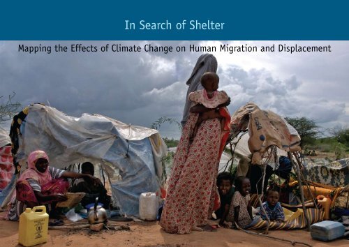
<strong>In</strong> <strong>Search</strong> <strong>of</strong> <strong>Shelter</strong>Mapping the Effects <strong>of</strong> Climate Change on Human Migration and Displacementa
<strong>In</strong> <strong>Search</strong> <strong>of</strong> <strong>Shelter</strong>Mapping the Effects <strong>of</strong> Climate Change on Human Migration and Displacement
This report was written by Koko Warner, the United NationsUniversity <strong>In</strong>stitute <strong>for</strong> Environment and Human Security;Charles Ehrhart, CARE <strong>In</strong>ternational; and Alex de Sherbinin,Susana Adamo, and Tricia Chai-Onn, <strong>Center</strong> <strong>for</strong> <strong>In</strong>ternational<strong>Earth</strong> <strong>Science</strong> <strong>In</strong><strong>for</strong>mation Network at the <strong>Earth</strong> <strong>In</strong>stitute <strong>of</strong>Columbia University.Copyright © May, 2009The report and high-resolution images can be downloadedfrom http://www.careclimatechange.org orhttp://ciesin.columbia.edu/publications.html.The opinions expressed in this report are those <strong>of</strong> theauthors and do not necessarily represent those <strong>of</strong> the UNUniversity, CARE <strong>In</strong>ternational, Columbia University, theUN Refugee Agency (UNHCR), or World Bank. Questionsand comments are welcome and should be addressed tothe primary authors Koko Warner (warner@ehs.unu.edu),Charles Ehrhart (ehrhart@careclimatechange.org), Alex deSherbinin (adesherbinin@ciesin.columbia.edu) and SusanaAdamo (sadamo@ciesin.columbia.edu). Media inquiriesshould be directed to media@careclimatechange.org andSandra Bulling (bulling@care.de).CARE grants permission to all not-<strong>for</strong>-pr<strong>of</strong>it organizationsto reproduce this work, in whole or in part. The followingnotice shall appear conspicuously with any reproduction:“<strong>In</strong> search <strong>of</strong> shelter: mapping the effects <strong>of</strong> climate changeon human migration” © by 2008 Cooperative <strong>for</strong> Assistanceand Relief Everywhere, <strong>In</strong>c. (CARE). Used by permission.Cover photo: ©CARE Kenya/Frederick Courbet, 2007Women and children displaced by floods, which hadimmeadiately followed a drought, in Northeastern KenyaPrinted in an environmentally friendly manner.AcknowledgementsThis report and related activities advocating <strong>for</strong> the protection<strong>of</strong> environmental migrants are possible due to generoussupport from the UN Refugee Agency (UNHCR); the CoganFamily Foundation; and the World Bank, Social DevelopmentDepartment, Social Dimensions <strong>of</strong> Climate Change Team.We would like to acknowledge the EACH-FOR field researchersupon whose empirical work part <strong>of</strong> this report is based. Wethank these contributing authors <strong>for</strong> their input in this report:Stefan Alscher (University <strong>of</strong> Bielefeld) was responsible <strong>for</strong>fieldwork in Mexico and Central America; Tamer Afifi (UNU-EHS)conducted fieldwork in Egypt and Niger; Olivia Dun (UNU-EHS)per<strong>for</strong>med her research in the Mekong Delta; Francois Gemenne(CEDEM, Université de Liège) worked in Tuvalu, Central Asia, andChina; Kees van der Geest (AMIDSt, University <strong>of</strong> Amsterdam )completed the fieldwork in Ghana; Jill Jäger (SERI) was thescientific director <strong>of</strong> EACH-FOR and authored the EACH-FORSynthesis Report; and Alice Poncelet (CEDEM, Université deLiège) per<strong>for</strong>med her fieldwork in Bangladesh.We extend our thanks to Andrés González <strong>for</strong> map design (CIESIN,Columbia University), to Noel Lumbama <strong>for</strong> the report’s design(Noel Creative Media Ltd.), and to Elisabeth Sydor <strong>for</strong> copy editing(CIESIN, Columbia University).We would like to thank all reviewers <strong>of</strong> this document <strong>for</strong> theirhelpful comments: Carina A. Bach<strong>of</strong>en (Social DevelopmentDepartment, World Bank), Paul Block (<strong>In</strong>ternational Research<strong>In</strong>stitute <strong>for</strong> Climate and Society, Columbia University), JanosBogardi (UNU-EHS), Philippe Boncour (IOM), Edwin Castellanos(Universidad del Valle de Guatemala), Christina Chan (CAREUSA), Jean-Francois Duriuex (UNHCR), Robert Ford (Centre<strong>for</strong> GIS Training and Remote Sensing, National University <strong>of</strong>Rwanda), Alessandra Giannini (<strong>In</strong>ternational Research <strong>In</strong>stitute<strong>for</strong> Climate and Society, Columbia University), Madeleen Helmer(Red Cross Climate Centre), Sabine Henry (Département deGéographie, Facultés Universitaires Notre-Dame de la Paix),Malanding Jaiteh (CIESIN, Columbia University), Andrew Jones(CARE USA), Poul Eric Lauridsen (CARE <strong>In</strong>ternational), VikramOdedra Kolmannskog (Norwegian Refugee Council), AlexanderLotsch (WDR, World Bank), Alex Guerra Noriega (Ox<strong>for</strong>dUniversity, UK), David Rain (George Washington University,USA), Marc Stal (UNU-EHS), Yoichiro Tsuchida (UNHCR), andGregory Yetman (CIESIN, Columbia University).We acknowledge and thank the following individuals <strong>for</strong>the development <strong>of</strong> this report and the concepts behind it:Christoph Bals (Germanwatch), Hans-Georg Bohle (University<strong>of</strong> Bonn), Joern Birkmann (UNU-EHS), Tanja Dedovich (IOM),Tom Downing (SEI Ox<strong>for</strong>d), Han Entzinger (Erasmus University),Mohammed Hamza (SEI Ox<strong>for</strong>d), Peter Hoeppe (MunichReinsurance Company), Saleem Huq (IIED), Sven Harmeling(Germanwatch), Claudia Juech (Rockefeller Foundation), JanKowalski (Oxfam Germany), Jenty Kirsch-Wood (OCHA), FrankLaczko (IOM), Michelle Leighton (University <strong>of</strong> San Francisco),Thomas Loster (Munich Re Foundation), Heather McGray (WRI),Robin Mearns Noble (World Bank), Jette Michelsen (IASC),Alina Narusova (IOM), Youssef Nassef (UNFCCC), Tony Oliver-Smith (University <strong>of</strong> Florida), Ursula Oswald Spring (UNAM),Fabrice Renaud (UNU-EHS), Xiaomeng Shen (UNU-EHS),Andras Vag (ATLAS <strong>In</strong>noglobe), Richard Weaver (TearFund),Roger Zetter (Refugee Studies <strong>Center</strong>, University <strong>of</strong> Ox<strong>for</strong>d),and other colleagues in academic, international organizations,civil society, and the public sector, as well as constructivefeedback from the UNFCCC and other UN and intergovernmentalorganizations.We further appreciate the support provided by Sandra Bulling(CARE Germany), Susanne Ludwig (CARE Germany), JohannaMitscherlich (CARE Germany), Sabine Wilke (CARE Germany),Michael Zissener (UNU-EHS), and colleagues at CARE Denmarkand CARE <strong>In</strong>ternational. We appreciate the generous cooperation<strong>of</strong> the City <strong>of</strong> Bonn (Maria Hohn-Berghorn) and the constructivedialogue with local partners and NGOs.ii
Table <strong>of</strong> ContentsExecutive Summary................................................................................................................ ivPolicy Recommendations.......................................................................................................... v1. <strong>In</strong>troduction....................................................................................................................1Migration and global environmental change........................................................................... 1New thinking and the contribution <strong>of</strong> this report.................................................................... 12. Adaptation or a failure to adapt?......................................................................................2Multiple drivers................................................................................................................. 2Framing the issue.............................................................................................................. 23. Climate change and human mobility..................................................................................33.1 Asia: Glacier melt and major irrigated agricultural systems.............................................. 4-53.2 Mexico and Central America: Migration in response to drought and disasters...................... 6-73.3 The Sahel: Pressure on agricultural livelihoods and creeping onward migration................... 8-93.4 The Ganges Delta: Temporary migration as a survival strategy.......................................12-133.5 The Mekong Delta: Living with floods and resettlement................................................14-153.6 The Nile Delta: Between desertification and sea level rise............................................16-173.7 Tuvalu and The Maldives: Sea level rise and small island developing states.....................18-194. Conclusions................................................................................................................... 21End notes............................................................................................................................ 22Technical Annex: Data and Methods......................................................................................... 25List <strong>of</strong> Maps©CAREMap 1:Map 2:Map 3:Map 4:Himalayan glaciers and major riversRun<strong>of</strong>f and population density in CentralAmerica/MexicoRun<strong>of</strong>f and population density in WestAfrica/SahelSea level rise and population density inthe Ganges DeltaMap 5:Map 6:Map 7:Map 8:Sea level rise and population density in theMekong DeltaSea level rise and population density in theNile DeltaSea level rise and TuvaluSea level rise and The Maldivesiii
Executive SummaryThe impacts <strong>of</strong> climate change are already causing migration anddisplacement. Although the exact number <strong>of</strong> people that will beon the move by mid-century is uncertain, the scope and scalecould vastly exceed anything that has occurred be<strong>for</strong>e. People inthe least developed countries and island states will be affectedfirst and worst.The consequences <strong>for</strong> almost all aspects <strong>of</strong> development andhuman security could be devastating. There may also besubstantial implications <strong>for</strong> political stability.Most people will seek shelter in their own countries while otherscross borders in search <strong>of</strong> better odds. Some displacement andmigration may be prevented through the implementation <strong>of</strong>adaptation measures. However, poorer countries are underequippedto support widespread adaptation. As a result,societies affected by climate change may find themselves lockedinto a downward spiral <strong>of</strong> ecological degradation, towards thebottom <strong>of</strong> which social safety nets collapse while tensions andviolence rise. <strong>In</strong> this all-too-plausible worst-case scenario,large populations would be <strong>for</strong>ced to migrate as a matter <strong>of</strong>immediate survival.Climate-related migration and displacement can be successfullyaddressed only if they are seen as global processes ratherthan local crises. The principle <strong>of</strong> common but differentiatedresponsibilities—both in terms <strong>of</strong> minimizing displacementand supporting unavoidable migration—must, there<strong>for</strong>e,underlie policy negotiations and subsequent outcomes. Theburden <strong>of</strong> assisting and protecting displaced populationscannot be allowed to fall on the shoulders <strong>of</strong> most affectedstates alone.Nature and purpose <strong>of</strong> this reportThis report explores how environmental shocks and stresses,especially those related to climate change, can push people toleave their homes in search <strong>of</strong> “greener pastures” … or just tosurvive. <strong>In</strong> order to make in<strong>for</strong>med decisions, policymakers anddevelopment actors need a better understanding <strong>of</strong> the linkagesbetween environmental change, displacement and migration.This report, there<strong>for</strong>e, <strong>of</strong>fers:• empirical evidence from a first-time, multi-continent survey <strong>of</strong>environmental change and migration;• original maps illustrating how, and where, the impacts <strong>of</strong>climate change may prompt significant displacement andmigration;• policy recommendations that reflect the collective thinking<strong>of</strong> key multi-lateral and research institutions, as well as nongovernmentalorganizations working directly with many <strong>of</strong>the world’s most vulnerable populations.Policy decisions made today will determine whethermigration becomes a matter <strong>of</strong> choice amongst arange <strong>of</strong> adaptation options, or merely a matter <strong>of</strong>survival due to a collective failure by the internationalcommunity to provide better alternatives.Key findings• Climate change is already contributing to displacementand migration. Although economic and political factors arethe dominant drivers <strong>of</strong> displacement and migration today,climate change is already having a detectable effect.• The breakdown <strong>of</strong> ecosystem-dependent livelihoods is likely toremain the premier driver <strong>of</strong> long-term migration during thenext two to three decades. Climate change will exacerbate thissituation unless vulnerable populations, especially the poorest,are assisted in building climate-resilient livelihoods.• Disasters continue to be a major driver <strong>of</strong> shorter-termdisplacement and migration. As climate change increases thefrequency and intensity <strong>of</strong> natural hazards such as cyclones,floods, and droughts, the number <strong>of</strong> temporarily displacedpeople will rise. This will be especially true in countries thatfail to invest now in disaster risk reduction and where the<strong>of</strong>ficial response to disasters is limited.• Seasonal migration already plays an important part in manyfamilies’ struggle to deal with environmental change. Thisis likely to become even more common, as is the practice <strong>of</strong>migrating from place to place in search <strong>of</strong> ecosystems thatcan still support rural livelihoods.• Glacier melt will affect major agricultural systems in Asia. Asthe storage capacity <strong>of</strong> glaciers declines, short-term floodrisks increase. This will be followed by decreasing waterflows in the medium- and long-term. Both consequences <strong>of</strong>glacier melt would threaten food production in some <strong>of</strong> theworld’s most densely populated regions.• Sea level rise will worsen saline intrusions, inundation, stormsurges, erosion, and other coastal hazards. The threat isparticularly grave vis-à-vis island communities. There is strongevidence that the impacts <strong>of</strong> climate change will devastatesubsistence and commercial agriculture on many smallislands.• <strong>In</strong> the densely populated Ganges, Mekong, and Nile Riverdeltas, a sea level rise <strong>of</strong> 1 meter could affect 23.5 millionpeople and reduce the land currently under intensiveagriculture by at least 1.5 million hectares. A sea level rise <strong>of</strong>2 meters would impact an additional 10.8 million people andrender at least 969 thousand more hectares <strong>of</strong> agriculturalland unproductive.• Many people won’t be able to flee far enough to adequatelyavoid the negative impacts <strong>of</strong> climate change—unless theyreceive support. Migration requires resources (includingfinancial, social, and political capital) that the most vulnerablepopulations frequently don’t have. Case studies indicate thatpoorer environmental migrants can find their destinations asprecarious as the places they left behind.iv
Policy RecommendationsNew thinking and practical approaches are needed to address thethreats that climate-related migration poses to human security.These include the following principles and commitments <strong>for</strong>action by stakeholders at all levels:Avoid dangerous climate changeReduce greenhouse gas emissions to safe levels.The international community has until December 2009, at theConference <strong>of</strong> Parties to the United Nations Framework Conventionon Climate Change (UNFCCC), to agree on a way <strong>for</strong>ward. If thisdeadline isn’t met, we will almost surely shoot past any safeemissions scenario and commit future generations to a muchmore dangerous world in which climate change-related migrationand displacement, on a truly massive scale, is unavoidable.Focus on human securityProtect the dignity and basic rights <strong>of</strong> persons displaced byclimate change.Climate-related displacement and migration should be treated,first and <strong>for</strong>emost, as a “human security” issue. Sensationalistwarnings must not be permitted to trigger reactionary policiesaimed at blocking the movement <strong>of</strong> “environmental refugees”without genuine concern <strong>for</strong> their welfare.<strong>In</strong>vest in resilience<strong>In</strong>crease people’s resilience to the impacts <strong>of</strong> climate change sothat fewer are <strong>for</strong>ced to migrate.The breakdown <strong>of</strong> natural-resource dependent livelihoods is likelyto remain the premier driver <strong>of</strong> long-term migration during thenext two to three decades. Climate change will exacerbate thesituation unless vulnerable populations, especially the poorest,are assisted in building climate-resilient livelihoods. This willrequire substantial investment in:• in situ adaptation measures including, <strong>for</strong> instance, waterwiseirrigation systems, low/no-till agricultural practices,income diversification, and disaster risk management;• the empowerment <strong>of</strong> women and other marginalized socialgroups to overcome the additional barriers they face toadaptation; and• inclusive, transparent, and accountable adaptation planningwith the effective participation <strong>of</strong> especially vulnerablepopulations.Prioritize the world’s most vulnerable populationsEstablish mechanisms and binding commitments to ensure thatadaptation funding reaches the people that need it most.Negotiations under the United Nations Framework Conventionon Climate Change (UNFCCC) are currently focused on how togenerate sufficient funds <strong>for</strong> adaptation in developing countriesand how the funds should be managed. These are importantquestions. However, it is equally important to determine howfunds will be channeled so that they reach the people whoneed them most. Objective criteria <strong>for</strong> assessing vulnerabilityto the negative impacts <strong>of</strong> climate change—including people’srisk <strong>of</strong> displacement—should be developed to guide priorityassistance.<strong>In</strong>clude migration in adaptation strategiesRecognize and facilitate the role that migration will inevitably playin individual, household and national adaptation strategies.For millennia, people have engaged in long- and short-termmigration as an adaptive response to climatic stress. Millions<strong>of</strong> individuals and households are employing a variant <strong>of</strong> thisstrategy today. Human mobility—permanent and temporary,internal and cross border—must be incorporated into ratherthan excluded from international and national adaptation plans.This can be done in a variety <strong>of</strong> ways at a number <strong>of</strong> levels andmay include:• measures to facilitate and strengthen the benefits <strong>of</strong> migrantremittances;• the rights-based resettlement <strong>of</strong> populations living in lowlyingcoastal areas and small island states. 1Environmentally, socially and economically sustainableresettlement meeting human rights standards (as reflectedinter alia in the Guiding Principles on <strong>In</strong>ternal Displacement)can be costly; and international agreements must address howthese and related needs will be met. Existing mechanisms <strong>for</strong>adaptation funding, which rely on voluntary contributions,have failed to deliver. There<strong>for</strong>e, future agreements under theUN Framework Convention on Climate Change must establishbinding commitments <strong>for</strong> historic high emitters. These fundsmust be new and additional to existing commitments, suchas those <strong>for</strong> Official Development Assistance.Close the gaps in protection<strong>In</strong>tegrate climate change into existing international and nationalframeworks <strong>for</strong> dealing with displacement and migration.The unique challenges posed by climate change must be factoredinto norms and legal instruments dealing with displacement andmigration. Especially important conundrums surround:• disappearing states and non-viable homelands. Unlike somepeople displaced by conflict or persecution who may oneday return home, those displaced by the chronic impacts <strong>of</strong>climate change (e.g. inadequate rainfall and sea level rise)will require permanent resettlement.• irrevocably deteriorating living conditions. Climate changewill result in cases that do not fit into current distinctionsbetween voluntary and <strong>for</strong>ced migration. At present, peoplewho move due to gradually worsening living conditions maybe categorized as voluntary economic migrants and deniedrecognition <strong>of</strong> their special protection needs.<strong>In</strong> order to satisfactorily address such challenges, duty-bearers willneed clear guidelines <strong>for</strong> protecting the rights <strong>of</strong> environmentallyinducedmigrants.Strengthen the capacity <strong>of</strong> national and international institutionsto protect the rights <strong>of</strong> persons displaced by climate change.<strong>In</strong>stitutions tasked with protecting the basic rights <strong>of</strong> migrantsand displaced persons are already under-funded and overstretched.Climate change will add to their strain, making the practice <strong>of</strong>protection even more difficult. The international communitymust, there<strong>for</strong>e, begin substantial discussions about how torealize its duties to protect migrants and displaced persons underconditions <strong>of</strong> radical environmental change.v
©UNHCR/Brendan Bannon
1. <strong>In</strong>troductionUntil recently, climate change research and negotiations havefocused almost exclusively on the imperative <strong>of</strong> reducinggreenhouse gas emissions. Now, however, it is clear that emissionsreductions ef<strong>for</strong>ts have been too little, too late. 2 There<strong>for</strong>e, thechallenges and complex politics <strong>of</strong> adaptation are joining those<strong>of</strong> mitigation at the centre <strong>of</strong> policy debates.It is, there<strong>for</strong>e, crucial <strong>for</strong> the international community toaccelerate learning about effective adaptation. One <strong>of</strong> the mostimportant tasks will be to improve our understanding <strong>of</strong> howenvironmental change affects human mobility. <strong>In</strong> any givenlocation, migration could be an adaptation strategy. But <strong>for</strong>cedmigration and displacement may well be indicators <strong>of</strong> woefullyinadequate adaptive capacity.Migration and global environmental changeOur world has experienced pr<strong>of</strong>ound climatic changes be<strong>for</strong>e. Whatappears to be different this time is that one species, humans, iscontributing to the change, and that climate change is impactingthe ecosystems on which it depends.Environmentally-induced migration and displacement has thepotential to become an unprecedented phenomenon—both interms <strong>of</strong> scale and scope. Its effects on the global economy,international development, and national budgets could havesignificant implications <strong>for</strong> almost all dimensions <strong>of</strong> human securityand wellbeing, in addition to political and state security.Migration—whether permanent or temporary, internal orinternational—has always been a possible adaptation strategy<strong>for</strong> people facing environmental changes. Pre-history and historyare marked by migration and displacement from one climatezone to another, as people sought out environments that wouldsupport survival as well as aspirations <strong>for</strong> a better life. Somewaves <strong>of</strong> migration and displacement have been associated withcultural collapse, as familiar landscapes no longer provided safeor supporting habitats and livelihoods <strong>for</strong> people.Today, environmental change, including climate change, presentsa new threat to human security and a new situation <strong>for</strong> humanmobility. By 2050 when human population is projected to peak,some 9 billion people will live on <strong>Earth</strong>. The majority <strong>of</strong> them willlive in urban areas with crushing environmental footprints. Manymegacities are located in areas prone to sea level rise. Climatechange will visit urban and rural areas alike with increasinglyfrequent and violent hazard events. Flooding, intense storms,or droughts, or more gradual but significant changes in regionalclimates place great stress on livelihood systems. These pressureswill contribute to migration and displacement, along with myriadother factors.<strong>In</strong> coming decades, climate change will motivate or <strong>for</strong>ce millions<strong>of</strong> people to leave their homes in search <strong>of</strong> viable livelihoods andsafety. Although the precise number <strong>of</strong> migrants and displacedpeople may elude science <strong>for</strong> some time, the mass <strong>of</strong> people onthe move will likely be staggering and surpass any historicalantecedent.Most people will seek shelter in their own countries while otherswill cross borders in search <strong>of</strong> better chances. Some migrationand displacement will be prevented through adaptation measures,including changes in agricultural productivity and integrated watermanagement. However, poorer countries are under-equipped toimplement wide-spread adaptation activities; and migration willbe the only option <strong>for</strong> many people in the South. Our responsesto climate change today will help determine whether migrationwill be a matter <strong>of</strong> choice in a wider range <strong>of</strong> adaptation options,or whether <strong>for</strong>ced migration and displacement will be a matter<strong>of</strong> mere survival due to a collective failure to provide adequateadaptation alternatives.New thinking and the contribution <strong>of</strong> this reportNew thinking and practical approaches are needed to addressthe threats that environmental change including climatechange poses <strong>for</strong> migration and displacement. Migration is asignificant—and growing response to climate change, yetneither the literature on climate change nor on human mobilityyet fully reflects this adaptation option, its impacts, or policyalternatives. Policy-makers require better in<strong>for</strong>mation, empiricaldata, and analysis <strong>of</strong> both the threats and potential solutions.This report seeks to respond to that need, and helps to fill thegaps by providing:• empirical evidence from a first-time multi-continent survey <strong>of</strong>environmental change and human mobility; 3• original maps <strong>of</strong> climate change impacts and populationdistributions, representing some <strong>of</strong> the major processesassociated with climate change, and some <strong>of</strong> the majorhuman-ecological systems where these changes could promptmigration and displacement. Presenting recent country casestudies, the paper looks at current patterns <strong>of</strong> climate changeand migration <strong>for</strong> glacier melt and the major river systems inAsia, drying trends in Central America and Western Africa,flooding and sea level rise in major deltas <strong>of</strong> the world, andsea level rise in low-lying Small Island developing states (<strong>for</strong>details, see Technical Annex: Data and Methods);• policy recommendations that reflect the collective thinking<strong>of</strong> key multi-lateral and research institutions, as well as nongovernmentalorganizations working directly with many <strong>of</strong>the world’s most vulnerable populations.What this report does not doThis report does not attempt to provide estimates <strong>of</strong> thenumbers <strong>of</strong> people that may move or be <strong>for</strong>ced to move inresponse to environmental factors including climate change.The report does not attempt to indicate specific geographicaldestinations <strong>for</strong> migrants in the future. The report does notattempt to draw causal relationships between climate changeand migration or displacement, but rather relies on currentscientific understanding <strong>of</strong> environmental processes and howthese processes can affect human mobility. The authors hopethat this report will be useful in discussions <strong>of</strong> where migrationand displacement pressures are currently and where they mayemerge in the future, related to phenomena such as glacialmelting, drying trends, extreme events like flooding, and sealevel rise. The report is intended to present plausible futuredevelopments that provide decision makers a basis <strong>for</strong> focusingtheir discussions on the role <strong>of</strong> human mobility in adaptation.1
2. Adaptation, or failure to adapt?Multiple driversToday, environmental change including climate change contributesto human mobility embedded in linked environmental and socialprocesses. 4 Social system characteristics including social networksplay a mediating role in how environmental change affects whetherpeople move away or stay at home. 5 Migration can represent aresponse to changing environmental and economic conditions,such as a farmer´s choice to migrate due to failing crops andinsecure livelihood prospects. Migration can also exacerbateenvironmental and economic problems in receiving areas. Forexample, urban areas attract migrants seeking better lives.High in-migration contributes to crowding and environmental/sanitation issues in slums.Studies also point towards urbanization as a <strong>for</strong>ce driving regionalwarming (heat islands) which canexacerbate drying trends, among otherproblems. 6 Some <strong>of</strong> these cities, suchas Dhaka, Buenos Aires, Rio de Janeiro,Shanghai and Tianjin, Alexandria andCairo, Mumbai and Kolkata, Jakarta,Tokyo and Osaka-Kobe, Lagos, Bangkok,New York City, and Los Angeles, arelocated in areas exposed to sea levelrise. Sea level rise could motivateresettlement, <strong>for</strong>ced migration, orother <strong>for</strong>ms <strong>of</strong> human mobility. 7Environmental change has a multipliereffect on other migration drivers. 8 Asan illustration, land degradation inNiger has undermined the resilience<strong>of</strong> farmers to recurring drought. 9More erratic weather, rising sea leveland other climate change impacts2How many people will be uprootedby environmental change?Estimates <strong>of</strong> the numbers <strong>of</strong> migrantsand projections <strong>of</strong> future numbers aredivergent and controversial, ranging from25 to 50 million by the year 2010 11 toalmost 700 million by 2050. 12 IOM takesthe middle road with an estimate <strong>of</strong> 200million environmentally-induced migrantsby 2050. 13 The first controversy concernsthe categorization <strong>of</strong> people made mobileby environmental factors including climatechange. Some organisations refer to“environmental refugees” while others,following the strong position <strong>of</strong> UNHCR,stress that the word “refugee” has a specificlegal meaning in the context <strong>of</strong> the 1951Geneva Convention Relating to the Status<strong>of</strong> Refugees. 14 Terms such as “environmentalmigrants” and “environmentally motivatedmigrants” have, there<strong>for</strong>e, been introducedas alternatives. 15will exacerbate both migration pressures and environmentaldegradation. 10What is certain from empirical and theoretical research onenvironmentally-induced migration, in all its varieties, is thatenvironmental change is one <strong>of</strong> many contributing factors.Climate change & mobility: framing the issueTerms and concepts such as environmental or climate changemigration, environmentally-induced or <strong>for</strong>ced migration, ecologicalor environmental refugees, and climate change refugees are usedthroughout the emerging literature, with no general agreement onprecise definition. 16 The main reason <strong>for</strong> the lack <strong>of</strong> definitions <strong>for</strong>migration caused in part by environmental change and degradationis linked to two issues: the challenge <strong>of</strong> isolating environmentalfactors from other migration drivers,and the possible institutional andgovernance implications <strong>of</strong> definingthis range <strong>of</strong> environmentally-relatedmigration. 17This report relies on a working definitionprovided by the <strong>In</strong>ternational Organization<strong>for</strong> Migration (IOM) <strong>for</strong> “environmentallyinducedmigrants” including those mademobile in part due to climate change:“Environmental migrants are persons orgroups <strong>of</strong> persons who, <strong>for</strong> compellingreasons <strong>of</strong> sudden or progressive changesin the environment that adversely affecttheir lives or living conditions, areobliged to leave their habitual homes,or choose to do so, either temporarily orpermanently, and who move either withintheir country or abroad.” 18©CARE/Kate HoltEmergency housing <strong>for</strong> internally displaced persons inthe Democratic Replublic <strong>of</strong> the Congo.
3. Climate change andhuman mobilityThis section explores the regional dynamics <strong>of</strong> climate changeprocesses and human mobility, looking at glacial melt, dryingtrends, flooding and sea level rise in some <strong>of</strong> the world’s hotspotareas. The key contribution <strong>of</strong> this report is the combination <strong>of</strong>unique maps <strong>of</strong> climate change-related trends and populationdistribution patterns, and fieldwork exploring the impacts <strong>of</strong>environmental change on migration, particularly the EACH-FORproject.The point <strong>of</strong> departure <strong>for</strong> this paper is the underlying hypothesisthat environmental change affects human mobility most directlythrough livelihoods which are dependent on ecosystem services,such as agriculture, herding and fishing. This hypothesis was<strong>for</strong>med after a series <strong>of</strong> field investigations where researchersassessed the nature <strong>of</strong> the linkages between environmentalstressors and migration. <strong>In</strong> the EACH-FOR project, the majority<strong>of</strong> migrants interviewed indicated that if the environmenthad affected a decision to migrate, it was most <strong>of</strong>ten becauseenvironmental changes had made it difficult <strong>for</strong> the individual orfamily to earn a living. These observations led to the <strong>for</strong>mation<strong>of</strong> the hypothesis above.<strong>In</strong> this section, the reader follows a journey from the watertowers <strong>of</strong> Asia—the Himalayan glaciers—to the drylands <strong>of</strong>Central America and Western Africa (the Sahel), then on tothree <strong>of</strong> the world’s major deltas (the Ganges, the Mekong, andthe Nile). The journey ends with some <strong>of</strong> the low lying islandstates <strong>of</strong> Tuvalu and Maldives. Each area highlighted in thissection has one map accompanied by a box explaining some <strong>of</strong>the key messages <strong>of</strong> each map, followed by findings from thefield about the relationship between climate change, migration,and displacement.3
Syr Darya0 500 1,000 kmHuang HeAmu DaryaYangtze<strong>In</strong>dusGangesBrahmaputraIrrawadySalweenMekongGlaciersRiversBasinsIrrigated AreasUrban ExtentElevation (meters)40 – 500 500 – 1,000 1,000 – 2,000 2,000 – 4,000 4,000 – 6,000 6,000 – 8,000
3.1 Asia: Glacier melt and irrigated agricultural systemsGlobally, glaciers are retreating at alarming rates. 19 Glaciers areslow moving masses <strong>of</strong> ice that store accumulated snowfall overdecades and even centuries. Glaciers flow down mountainsides,melting at the lower ends while more snow accumulates at theupper ends. Because <strong>of</strong> this constant regeneration throughwinter snow pack, they store water during winter monthsand feed rivers during summer months, regulating the flowdownstream. 20Shrinking glaciers provide a one-time “dividend” <strong>of</strong> water releaseto downstream regions. 21 As the storage capacity <strong>of</strong> glaciersis lost, flooding risks increase in the medium term. This canaffect rural agriculture and urban areas located in river deltas.Once the glacier disappears, it no longer releases water duringthe summer months. The disappearance <strong>of</strong> glaciers impliesdecreased water supply and untimely flows—that is, comingin the wrong (non-cropping) season. The only alternative <strong>for</strong>seasonal water storage are dams, which are costly to constructand can have significant environmental and social impacts,resulting in the displacement <strong>of</strong> thousands or, in rare cases,millions <strong>of</strong> people. 22The Himalayas are known as the Water Tower <strong>of</strong> Asia. Theglacier-fed rivers originating from the Himalaya mountainranges surrounding the Tibetan Plateau comprise the largestriver run-<strong>of</strong>f from any single location in the world. 23 The riversthat drain these mountains move through some <strong>of</strong> the mostpopulous areas in the world. <strong>In</strong> the year 2000, the river basins <strong>of</strong>the <strong>In</strong>dus, Ganges, Brahmaputra, Irrawaddy, Salween, Mekong,Yangtze, and Huang He (Yellow) Rivers collectively supporteda population <strong>of</strong> 1.4 billion people, or almost a quarter <strong>of</strong> theworld’s population.Himalayan glaciers are already in retreat. 24 Their dependenceon glacier run<strong>of</strong>f makes downstream populations particularlyvulnerable to the consequences. The <strong>In</strong>dus River valley supportsone <strong>of</strong> the largest irrigation works in the world (16.2m ha).Approximately 90 percent <strong>of</strong> Pakistan’s crop production is grownunder irrigation, and all <strong>of</strong> the water comes from barrages alongthe <strong>In</strong>dus. The Ganges, Yangtze, and Yellow Rivers also havelarge areas under irrigation —17.9m ha, 5.4m ha, and 2.0m ha,respectively.Hydropower installations along the Mekong and Yangtze are alsosignificant suppliers <strong>of</strong> electricity to urban markets. The recentlycompleted Three Gorges Dam on the Yangtze, the world’s largesthydroelectric installation, will have a power generation capacity<strong>of</strong> 22,500 MW once all generators are installed, more than 20times the capacity <strong>of</strong> an average coal-fired or nuclear powerplant. The project, however, has already displaced 1–2 millionpeople. 25 Plans are underway to add significant hydropowergenerating capacity to the Mekong over the coming decades.Under scenarios <strong>of</strong> rapid glacier melt, it is likely that hundredsmore water retention dams will be constructed. Collectively, thesewill have significant impacts on downstream flow regimes anddeltas, which are already starved <strong>of</strong> flood waters and replenishingsediment. 26 Population displacement and resettlement willbecome larger issues in these areas at significant scales.As a result <strong>of</strong> the intensification <strong>of</strong> cultivation in irrigated areasand power generation, many millions indirectly depend on thefood and energy resources generated by these great rivers. Butthe rivers also provide direct livelihoods to all those employedin irrigated agriculture, small-scale fishing, and aquaculture, andthey are at the heart <strong>of</strong> cultural traditions. For example, to HindusWhat does this map tell us?The map depicts glaciers (white with blue border) in the Himalayas and the major rivers that flow from them. These rivers supportlarge irrigated areas (dark green) and major population centers (red), yet the glaciers that feed them are in retreat. Reductions <strong>of</strong>river flows will affect irrigated areas, but the potential <strong>for</strong> migration out <strong>of</strong> agricultural areas is hard to predict, and will depend onadaptation responses such as dam construction and more efficient irrigation technologies. Broader impacts on food security <strong>for</strong> thishighly populous region could be significant. <strong>In</strong> the absence <strong>of</strong> diversification and adaptation/mitigation measures, as water resourcesgradually diminish agriculture livelihoods will become unsustainable, and people may be <strong>for</strong>ced to leave. Paradoxically, measures tostore water and ward <strong>of</strong>f a water crisis related to shrinking glaciers could result in further displacement and resettlement.the Ganges is sacred, and is personified in Mother Gaṅgā (GaṅgāMātā), representative <strong>of</strong> life-giving maternal waters. 27 Changesin the rivers and livelihoods dependent on them could bringpr<strong>of</strong>ound economic, cultural, and demographic impacts.Should flow reductions become acute, the potential <strong>for</strong> migrationout <strong>of</strong> irrigated areas could be significant. 28 Although destinationareas are hard to predict, it is likely that most migrating ordisplaced people would move to small to medium sized citiesinland, and a smaller number would move to large megacitiesalong the coasts or on the main branches <strong>of</strong> river systems (e.g.Delhi). 29 Movement from interior to coastal areas—a pattern thathas been prevalent in China since the early 1980s—will resultin larger populations vulnerable to sea level rise, and possiblyto extreme floods from upstream regions as the regulatingeffect <strong>of</strong> glaciers diminish. 30 However, many South Asia citieslack the capacity to absorb significant migration streams. Thereis potential <strong>for</strong> significant water saving efficiencies in irrigatedareas <strong>of</strong> Asia, and if properly implemented this may <strong>for</strong>estalldisplacements <strong>of</strong> farmers. 315©CARE/Peter Newsum
EACH-FORStudy AreaCountry BordersChange in Run<strong>of</strong>f (percent)(–) negative 0positive (+)50 – 25 24 – 5 4 – 4 5 – 24 25 – 50Population Density, 2000 (persons per km²)0 1 – 4 5 – 24 25 – 249 250 – 999 1,000 +MéxicoAverage Annual Run<strong>of</strong>f, 1960 – 1990 (mm)BelizeHonduras0 – 100 101 – 200 201 – 500 501 – 750 751 – 1,000GuatemalaEl SalvadorNicaraguaSuitability <strong>of</strong> Agricultural Land <strong>for</strong> Rain-Fed CropsCyclone Frequency, 1980 – 2000Costa RicaPanamá6poorsatisfactory good excellentLowHigh0 500 1,000 km
3.2 Mexico and Central America: Migration in response to drought and disastersMultiple climate-related hazards threaten Mexico and CentralAmerica. This region is known <strong>for</strong> the severity <strong>of</strong> cyclone events,with Hurricane Mitch in 1998 leaving devastation in its wake inHonduras and Nicaragua, and Hurricane Stan in 2005 affectingMexico and Guatemala. Tropical storm Noel in 2007 caused heavyflooding in the state <strong>of</strong> Tabasco, where up to 80 percent <strong>of</strong> thestate was inundated. Several coastal regions in Mexico will facesea level rise, particularly low lying areas <strong>of</strong> the Gulf Coast andthe Caribbean. 32Of particular concern, however, is the likelihood that the regionwill see persistent declines in precipitation over the course <strong>of</strong>this century. The map at left shows that run<strong>of</strong>f in the region willlikely decline by at least 5 percent and possibly more than 70percent, with declines getting progressively worse in the semiaridand arid north. 33 Given the region’s mountainous topography,extensive irrigation is only practicable in the coastal plains thatare dominated by wealthy landowners. Most smallholder farmerswill remain heavily dependent on rain-fed agriculture. However,even large-scale irrigated areas, such as those in Sonora andSinaloa states, the breadbasket <strong>of</strong> Mexico, will be affected asaverage reservoir levels decline. Already, summer droughts duringEl Niño and La Niña events can lead to serious deficits in reservoirlevels. 34<strong>In</strong> the case <strong>of</strong> Guatemala, longer and more intensemidsummer drought periods have been linked to long-termdeclines in rainfall since the 1970s. 35 This drought determines thelevel <strong>of</strong> success or failure <strong>of</strong> rain-fed agriculture.Processes <strong>of</strong> slow-onset land degradation including de<strong>for</strong>estation,soil erosion, and desertification already affect large parts <strong>of</strong> theMexico and Central America. <strong>In</strong> the fragile arid and semi-aridecosystems <strong>of</strong> northern and north-western Mexico more than 60percent <strong>of</strong> the land is considered to be in a total or accelerated state<strong>of</strong> erosion, and mountainous lands with high slopes throughout theregion have suffered de<strong>for</strong>estation and soil erosion.EACH-FOR studies were conducted in the hurricane-proneChiapas state <strong>of</strong> Southern Mexico, and in Tlaxcala state, a highlydesertified state in Central Mexico. Both areas are consideredvery vulnerable to the effects <strong>of</strong> climate change, particularly incombination with de<strong>for</strong>estation, erosion, and underlying povertyand social vulnerability. 36Migration is already a response in Mexico to changingenvironmental conditions, the 1980s agricultural crisis andeconomic liberalization. 37 When Hurricane Stan passed throughChiapas, many people were surprised by the violence <strong>of</strong> itsimpact. One interviewee noted, “The river took away our homesand properties; we also were close to being taken away.” 38 Yetwhen very low-income villagers were asked whether migrationwas an option <strong>for</strong> them, most respondents underlined that theyhave no other place to go. Yet, <strong>for</strong> those who are better <strong>of</strong>f orwho have relatives abroad, migration is an option.The recurrence <strong>of</strong> natural disaster combined with the presence <strong>of</strong>relatives who emigrated due to disasters in the past increases thedesire <strong>of</strong> farmers to emigrate. 39 On the other hand, diversification<strong>of</strong> livelihood strategies 40 and government investment on disasterrisk management decreases the likelihood <strong>of</strong> migration, regardless<strong>of</strong> poverty status. 41Some studies have shown links between desertification andmigration in Mexico, 42 noting the impacts on agriculturallivelihoods. <strong>In</strong> dryland areas such as Tlaxcala, which depends onrain-fed agriculture, the majority <strong>of</strong> interviewees complained <strong>of</strong>shifting rainfall periods, which increases uncertainty and causesa decline in crop yields and incomes. The area <strong>of</strong> Tlaxcala isprojected to have a 10–20 percent decline in run<strong>of</strong>f in associationwith climate change. This indirect link between climatic changesand migration was noted frequently in fieldwork, mostly relatedto unreliable harvests linked to changing rainfall patterns. Returnmigration, and seasonal migration as a livelihood diversificationstrategy have been documented in this area. As explained by twointerviewees:“…when our harvest is bad, we have to rely on ourselves.Many <strong>of</strong> us had to leave, to Canada or the United States…the money I made there… was a big help <strong>for</strong> my family.Without that income, it would have become extremelydifficult.” 43“My grandfather, father and I have worked these lands. Buttimes have changed…the rain is coming later now, so that weproduce less. The only solution is to go away, at least <strong>for</strong> awhile [to the United States]. But leaving my village <strong>for</strong>ever?No. I was raised here and here I will stay.” 44The relevance temporary migration and remittances to copewith unreliable income from agriculture has <strong>of</strong>ten beenhighlighted in the environment-migration literature but notalways sufficiently considered in adaptation and mitigationpolicies.What does this map tell us?The main map depicts projected changes in run<strong>of</strong>f by 2080. Run<strong>of</strong>f is a measure <strong>of</strong> water availability and represents the amount <strong>of</strong>rainfall that runs <strong>of</strong>f the land surface after accounting <strong>for</strong> evaporation, plant transpiration, and soil moisture replenishment. Mexicoand Central America will be widely affected by declines. The map also outlines the Mexican states <strong>of</strong> Tlaxcala and Chiapas, where EACH-FOR conducted research. The top left inset map shows average annual run<strong>of</strong>f <strong>for</strong> the 1960–1990 period, a baseline against which futuredeclines will be applied. The bottom left inset map shows lands suited <strong>for</strong> rain-fed agriculture, which will be particularly affected byprogressive drying in the region. Circular, temporary and seasonal migration has traditionally been a means <strong>of</strong> coping with climatevariability in these areas, and permanent internal and international migration out <strong>of</strong> areas dependent on rain-fed agriculture is adistinct possibility. The inset on the lower right depicts cyclone frequency in the 1980–2000 period. Some models show the number<strong>of</strong> category 4 and 5 hurricanes increasing in the Caribbean.<strong>In</strong>ternal and international migration patterns are wellestablished in Mexico and Central America, 45 and it is difficultto project what effects drying trends associated with climatechange may have. It is clear, however, that environmentalfactors like desertification and extreme weather alreadycontribute to the regions’ complex pattern <strong>of</strong> human mobility.The opportunity <strong>for</strong> some people to migrate seasonally, sendremittances, and return home is an example <strong>of</strong> migrationas an adaptation strategy to deteriorating environmentalconditions.7
Change in Run<strong>of</strong>f (percent)(–) negative 0positive (+) Population Density, 2000 (persons per km²)50 – 25 24 – 5 4 – 4 5 – 24 25 – 50 0 1 – 4 5 – 24 25 – 249 250 – 999 1,000 +EACH-FORStudy AreaMajor CityCountry BordersMauritania0 500 1,000 kmNigerMaliSenegalNiameyChadThe GambiaBurkinaFasoGuinea-BissauGuineaSierra LeoneCôte d’lvoireGhanaNigeriaLiberiaTogoBeninCameroonCentral AfricanRepublicAverage Annual Run<strong>of</strong>f 1960 – 1990 (mm)Suitability <strong>of</strong> Agricultural Land <strong>for</strong> Rain-Fed CropsProportion <strong>of</strong> Area in Pasture80 – 100 101 – 200 201 – 500 501 – 750 751 – 1,000poor satisfactory good excellent0.7 – 0.8 0.8 – 0.9 0.9 – 1.0
3.3 The Sahel: Pressure on agricultural livelihoods and creeping onward migrationLand degradation, desertification, and de<strong>for</strong>estation are factorsthat potentially result in mobility as a household adaptationstrategy. 46 Land degradation, as defined by Article 1 <strong>of</strong> theConvention to Combat Desertification, is defined as a “reductionor loss <strong>of</strong> biological or economic productivity <strong>of</strong> ecosystemsresulting from climatic variations, land uses and a combination<strong>of</strong> processes such as: soil erosion, deterioration <strong>of</strong> soil propertiesand long-term vegetation loss.” Thus, losses <strong>of</strong> land productivityare inextricably linked to climate change.Although precise estimates <strong>of</strong> the land affected by degradationare difficult to obtain, some estimates suggest that more thanone-third <strong>of</strong> drylands are affected by land degradation. 47 Landdegradation is a major concern in West Africa, where about 65percent <strong>of</strong> the cultivable lands have degraded. 48 From 2000-2005, West and Central Africa lost 1.36m ha <strong>of</strong> <strong>for</strong>est coverper year, or a total <strong>of</strong> 67,800 sq km. 49 More than 300 millionpeople in Africa already live with water scarcity, and areasexperiencing water shortages are likely to increase by almosta third by 2050. 50West Africa is made up <strong>of</strong> a diversity <strong>of</strong> ecosystems, rangingfrom more tropical humid in the South to arid in the North.While climate change projections <strong>of</strong> seasonal or annualprecipitation are uncertain, the projected increase in intensity<strong>of</strong> rainfall events, superimposed on the region’s alreadyhigh climate variability, is likely going to lead to increasedfrequency <strong>of</strong> droughts and floods. Water shortage and landdegradation affect large areas <strong>of</strong> the Sahel, a region south <strong>of</strong>the Sahara and north <strong>of</strong> the humid zone that spans west to eastacross nine countries from Mauritania and Senegal to Sudan.<strong>In</strong> the Sahelian zone <strong>of</strong> Western Africa, two different droughtevents—a large drought from 1968–74 and a slightly lessintense one from 1982–84—were among the worst on record. 51During the first drought, more than 100,000 people died, most<strong>of</strong> whom were children. 52 By 1974, more than 750,000 peoplein Mali, Niger and Mauritania were totally dependent on foodaid. 53 These droughts and consequent land degradation arenow understood to have been caused in part by a pattern <strong>of</strong>warming <strong>of</strong> the tropical oceans which itself may have beendriven by anthropogenic climate change. 54 Such environmentalpressures could grow in the future with climate change.Forty-four percent <strong>of</strong> West Africa’s population works in theagricultural sector, most <strong>of</strong> them at a subsistence level. 55 Despitethe high dependence on agriculture in this climatically variableregion, the actual areas under irrigation are among the loweston a per-area basis <strong>for</strong> any region in the world. For example, inSenegal in 2005, only 67,000 ha was irrigated out <strong>of</strong> 8.8m ha, orless than 1 percent <strong>of</strong> the total. 56 Although the Sahel has seena “greening” since the mid-1980s drought, at 2.6 percent theregion still has the second highest population growth rate in theworld (after Central Africa). 57 This population growth combinedwith climatic trends and land degradation could lead to:• declining per capita production <strong>for</strong> the agriculture, includinganimal husbandryWhat does this map tell us?The main map depicts projected declines in run<strong>of</strong>f by the year 2080 superimposed on population density. Run<strong>of</strong>f is a measure<strong>of</strong> water availability, and represents the amount <strong>of</strong> rainfall that runs <strong>of</strong>f the land surface after accounting <strong>for</strong> evaporation, planttranspiration and soil moisture replenishment. The maroon outlined areas depict EACH-FOR study areas. The lower left inset mapshows average annual run<strong>of</strong>f <strong>for</strong> the 1960–1990 period, a baseline against which future declines are compared. The center insetmap provides the area suitable <strong>for</strong> rain-fed agriculture, which largely reflects the population density map. The right inset mapshows pasture lands distribution, an important livelihood <strong>for</strong> many in the Sahel. <strong>In</strong> this region <strong>of</strong> scarce water resources and highclimate variability, any decline in run<strong>of</strong>f or change in rainfall patterns will adversely affect the livelihoods <strong>of</strong> subsistence farmersand pastoralists. Projected drying trends in a context <strong>of</strong> poverty, inequality, limited diversification options and erratic governmentsupport could contibute to trans<strong>for</strong>m current patterns into a more permanent, long-term dynamic.• shortage <strong>of</strong> fuelwood• declining rainfall in some regions with consequences <strong>for</strong> rainfedand irrigated agriculture• food shortages and famines in drought years• movement to urban areas or to more fertile farming areas,such as recently opened areas in the Savannah zone owing tothe eradication <strong>of</strong> river blindness. 58Migration, particularly circular mobility, is a traditional copingmechanism in the region, representing a livelihood diversificationstrategy. 59 But in some areas these traditional patterns havechanged in recent decades. 60 Each location has its specificcharacteristics, but migration and pressures on water and landsystems are common denominators. A significant proportion <strong>of</strong>environmental migrants are displaced due to land degradationand drought in the Sahel, though drought-induced migrationis <strong>of</strong>ten only temporary. Generally, there is a large migrationmovement to the coastal and urban agglomerations, and to thecoastal states. 61One study <strong>of</strong> the impact <strong>of</strong> climate change on drylands inWest Africa noted that between 1960 and 2000, deterioratingsituations due to rainfall decreases, land degradation, andviolence in the arid and semi-arid areas <strong>of</strong> Senegal, Mali, BurkinaFaso and Niger resulted in a rapid intra-country migrationsouthward and a swelling <strong>of</strong> big cities like Dakar, Bamako,Ouagadougou, Niamey and Kano. 62 Estimates <strong>for</strong> Burkina Fasosuggest that close to half <strong>of</strong> the adult population born there hasmoved <strong>for</strong> at least part <strong>of</strong> the year to coastal states like IvoryCoast and Ghana. 63Even those not directly dependent on natural resources <strong>for</strong> theirlivelihoods can be affected by desertification and motivated tomigrate. One migrant from the Difa region in Niger remarked,“I used to live in the Lake Chad region where my activitieswere not directly related to the Lake. I used to be a merchant.However, when the lake dried out, people depending on it left<strong>for</strong> other countries and there<strong>for</strong>e, my business was negativelyaffected and I had to leave <strong>for</strong> Nigeria.” 649
©CARETraditionally pastoralism has represented an importantmechanism <strong>for</strong> adjusting to climate variability, since pastoralistscan move their herds along with the rainfall. 65 A symbioticrelationship <strong>of</strong>ten <strong>for</strong>med between herders and agriculturalists,with agriculturalists receiving animal manure to fertilize theircrops in return <strong>for</strong> allowing livestock to graze on plant stubble.However, as the Sahel has become more densely settled,increasingly severe conflicts over land and water resources haveerupted between pastoralists and sedentary farmers. 66<strong>In</strong> Senegal, fieldwork revealed that environmental changesnegatively affect agricultural livelihoods, and contribute tomigration through different mechanisms. For areas whereirrigated agriculture is possible, farmers living close to theSenegal River expect their way <strong>of</strong> life will continue to bepossible and there<strong>for</strong>e do not intend to migrate in the future.But in areas like the Peanut Basin, where land degradation issevere, interviewees said they plan to move away if agriculturallivelihoods do not improve. Most migrants who already migratedsaid they would return home to the countryside if agriculturallivelihoods improved. <strong>In</strong> Senegal experts observe an increasingmovement <strong>of</strong> people back to the countryside due to the globaleconomic crisis. However, that coping mechanism is runninginto counter-pressures because areas people are returning toare in many cases already degraded. Conflict over access to landseems to be increasing. 67Some farmers do manage to find alternative livelihoods thatallow them to return home. <strong>In</strong> Niger, a returned migrant fromthe village Talcho, Filingue (Tilabéri, Niger) remarked, “I losthope in producing crops, since the soil got too poor due to thedroughts. I used to be a farmer in my home town. There<strong>for</strong>e Ifirst went to Lomé (Togo) and then Libya. Now, I have decidedto return back to Niger where I will start a new business withthe money I managed to collect in Libya.” 68Rather than returning after migrating, the trend goes in theopposite direction. 69 People increasingly migrate step-by-step inpursuit <strong>of</strong> environments that will support them. The residents <strong>of</strong>the village Caré in the Tilabéri region <strong>of</strong> Niger is now home tomigrants from another village called Farka where soil degradationhas made crop cultivation impossible. A migrant remarked:“We were farmers in Farka, but the production level worsenedtoo much and the harvest got completely unreliable due to therain fall shortage and soil degradation. We had no alternativerevenues. There<strong>for</strong>e, we had to flee this village in the year1987…there is no other reason why we left the original village;if this deterioration in the land quality had not happened, wewould have stayed. Currently in Caré we are suffering from similarproblems and might there<strong>for</strong>e leave the village <strong>for</strong> another aswell. We have never planned to leave, but we just ´crept´ afterour living.” 70<strong>In</strong> another study in Burkina Faso, researchers found that peoplefrom drier regions are more likely to migrate temporarily andto a lesser extent permanently to other rural areas (rural–ruralmigration), compared with people from wetter areas. A rainfalldeficit increases the rural-rural migration but decreasesmigration to abroad. No rush to cities has been observedduring periods <strong>of</strong> drought. 71 A fisherman in the village <strong>of</strong> Sirba(Tilabéri, Niger) recounts, “I have been suffering from therain water shortage which made the river very shallow anddecreased my fish production, which had negative implicationson my income. If the situation does not improve, I might leave<strong>for</strong> another country like some <strong>of</strong> my friends and relatives did;they left <strong>for</strong> Nigeria and Burkina Faso and settled there.” 72Studies in other regions support this finding, and suggestthat environmental conditions <strong>of</strong>ten play a more direct rolein short-term moves rather than long-term ones. 73 And yet,if environmental changes render “home” unlivable, shorttermmigration can develop into a pattern <strong>of</strong> creeping onwardmovement.Robert Ford <strong>of</strong> the Centre <strong>for</strong> GIS Training and Remote Sensing,National University <strong>of</strong> Rwanda noted, “Those <strong>of</strong> us living withthese issues here in Africa are already seeing some majormovements <strong>of</strong> people. <strong>In</strong> many parts <strong>of</strong> Africa, people livingon the margin seem to quickly pick up signals that indicatewhether on balance life is better by going to the city orreturning to the land. That this much ferment is happeningnow, be<strong>for</strong>e climate change really hits, tells me that we hadbetter get prepared.” 7410
By the end <strong>of</strong> 2008, Sudan’s internally displaced population had grown to 4.9 million, making it the largest in the world. More than 523,032Sudanese have fled their country as refugees (UNHCR, June 2008). The causes <strong>of</strong> displacement and migration in Sudan are notoriosuly complicated.However, environmental change is broadly recognised as playing an important role.11©CARE/Evelyn Hockstein
Cyclone Frequency, 1980 – 2000High0 50 100 kmLowBangladeshArea under Cropland100%<strong>In</strong>diaDhaka<strong>In</strong>dia0%no dataKolkataMaximum Flood Extent, 2007 ood extentLow Elevation Coast Zone1 meter 2 metersUrban ExtentsEACH-FORStudy AreaMajor CitiesCountry BordersPopulation Density, 2000 (persons per km²)120 1 – 4 5 – 24 25 – 249 250 – 999 1,000 +
3.4 The Ganges Delta: Temporary migration as a survival strategy<strong>In</strong>cluding the Ganges, Bangladesh contains seven major and overtwo hundred minor rivers, all <strong>of</strong> which define the delta geography<strong>of</strong> Bangladesh and the way <strong>of</strong> life <strong>of</strong> its people. Bangladesh isone <strong>of</strong> the most densely populated countries in the world, anda large part <strong>of</strong> its people depends on natural resources <strong>for</strong> theirlivelihoods. Although flooding is a part <strong>of</strong> the livelihood structureand culture, climate change will accelerate change in this alreadydynamic environment and leave millions <strong>of</strong> Bangladeshis exposed toincreased flooding, severe cyclones, and sea level rise impacts. 75More than 5 million Bangladeshis live in areas highly vulnerableto cyclones and storm surges, and over half the populationlives within 100 km <strong>of</strong> the coast, most <strong>of</strong> which is less than12 meters above sea level. 76 Flooding currently displaces about500,000 people every year. <strong>In</strong> 2007, two extreme weather eventsdevastated the country: Flooding caused 3,363 deaths and affected10 million people as well as reducing crop yields by 13 percent.Just months later, Cyclone Sidr destroyed 1.5 million houses,large areas <strong>of</strong> cropland and mangrove <strong>for</strong>ests, and affected 30 out<strong>of</strong> 64 districts in the country. Millions experienced food insecurity(monga) and required evacuation, shelter and relief assistance. 77As devastating as these cyclones were, early warning systems weresuccessful in preventing the deaths <strong>of</strong> many thousands more. <strong>In</strong>1970 a cyclones caused the deaths <strong>of</strong> an estimated 300,000, andin 1991 another 140,000 died. 78The Bangladesh EACH-FOR case study found that flooding andbank erosion are a complex mix <strong>of</strong> natural and socioeconomicprocesses contributing to population displacement. 79 Combinedwith sea level rise, storm surges linked to cyclones couldtemporarily inundate large areas <strong>of</strong> Bangladesh—one studysuggested that up to 25 percent <strong>of</strong> the country could experiencesuch a scenario. 80Temporary migration linked to flooding and other disasters,frequently to Dhaka and other urban centers, is viewed as botha coping and survival strategy to escape riverbank erosion, thedevastation <strong>of</strong> cyclones, and food insecurity. Almost all areas inBangladesh are densely populated and under cultivation, andmany locations are vulnerable to similar environmental risks.There are no guarantees <strong>of</strong> finding employment or housing in theplace <strong>of</strong> destination.For coastal fishing villages, cyclones, storm surges, and sealevel rise pose a <strong>for</strong>midable adaptation challenge. One fishermaninterviewed by a journalist during the 2008 cyclone seasonnoted, “The sea has been coming closer and closer,” thenadded in Bengali, “Allah jane ke hobe. Sahbi shesh ho jabe.”[God only knows what will happen. Everything will come to anend.] <strong>In</strong> spite <strong>of</strong> accelerated erosion related to stronger andhigher tides, villagers are determined to stay and pursue theirlivelihoods as long as possible. The same journalist interviewedanother fisherman who said, “We can´t do anything else, whichis why we think twice about migrating from here. We know theend is coming, but what work will we find to feed our familieselsewhere?” 81What does this map tell us?The main map depicts areas <strong>of</strong> sea level rise at 1 and 2 meters (dark and light blue, respectively) on a population density map withurban extents delineated. It also shows the regions <strong>of</strong> the EACH-FOR study areas in the lower delta. The Ganges delta supporteda population <strong>of</strong> 144 million in 2000, out <strong>of</strong> which 9.4 million lived in areas that would be inundated by a 2 meter sea level rise.The top left inset map shows those areas most frequently impacted by tropical cyclones. Low elevation areas in the southeasterncorner <strong>of</strong> the delta are most affected. The bottom left inset map depicts the area affected by the 2007 flood. The middle insetmap shows the distribution <strong>of</strong> agricultural lands. The delta has 8.5 million ha <strong>of</strong> agricultural lands, <strong>of</strong> which 486 thousand hawould be inundated by a 2 meter sea level rise. <strong>In</strong> the Ganges Delta, living with varying water levels is a way <strong>of</strong> life. Migration,particularly towards coastal urban centers, has emerged as a coping mechanism when extreme events endanger life and livelihoods.With projected sea level rise, combined with the possibility <strong>of</strong> more intense flooding and storm surges, migration may become anecessity <strong>for</strong> many communities, at least <strong>for</strong> parts <strong>of</strong> the year.Even if the causes <strong>of</strong> migration are similar from one person to thenext, people opt <strong>for</strong> different strategies in terms <strong>of</strong> destinationand timing <strong>of</strong> migration. But there might be a moment when theywill not be able to adapt any more. <strong>In</strong> 20 or 30 years Bangladeshmay see mass movement <strong>of</strong> people from flood-prone areas, possiblyto urban centers. The current structures and organizations tohelp the victims <strong>of</strong> disasters will not be enough to cope withthe increase <strong>of</strong> migration flows in the future. Given the politicalinstability <strong>of</strong> the region, population movements associated withclimate change could become an issue <strong>for</strong> regional security.However, adaptation strategies could reduce the environmentalvulnerability and increase the resilience <strong>of</strong> local populations.EACH-FOR research suggests that the population is already workingto adapt to the new situation, mainly by leaving agriculture <strong>for</strong>other livelihoods such as shrimp farming. 82 The worsening <strong>of</strong>the environmental situation in the Ganges delta, however, couldrender migration as one <strong>of</strong> the most realistic options available <strong>for</strong>some Bangladeshi people.13©CARE
Maximum Flood Extent, 2000Area under Croplandno data ood extent100%0%CambodiaPhnom PénhVietnam0 50 100 kmThanh Pho Ho Chi MinhLow Elevation Coast Zone1 meter 2 metersUrban ExtentsEACH-FORStudy AreaMajor CitiesCountry BordersPopulation Density, 2000 (persons per km²)140 1 – 4 5 – 24 25 – 249 250 – 999 1,000 +
3.5 The Mekong Delta: Living with floods and resettlementEnvironmental degradation, particularly impacts caused byflooding, is a contributing factor to rural out migration anddisplacement in the Mekong Delta <strong>of</strong> Vietnam. The Vietnameseportion <strong>of</strong> the Mekong Delta is home to 18 million people, or22 percent <strong>of</strong> Vietnam´s population. It provides 40 percent <strong>of</strong>Vietnam´s cultivated land surface and produces more than aquarter <strong>of</strong> the country´s GDP. Half <strong>of</strong> Vietnam´s rice is produced inthe Mekong Delta, 60 percent <strong>of</strong> its fish-shrimp harvest, and 80percent <strong>of</strong> Vietnam´s fruit crop. Ninety percent <strong>of</strong> Vietnam´s totalnational rice export comes from the Mekong.Flooding plays an important role in the economy and culture <strong>of</strong>the area. People live with and depend on flood cycles, but withincertain bounds. For example, flood depths <strong>of</strong> between half ameter up to three meters are considered part <strong>of</strong> the normal floodregime upon which livelihoods depend. These are so-called “nicefloods” [ngâp nông] by Vietnamese living in the delta, such asupstream in the An Giang Province. Flood depths beyond this suchas between three and four meters [ngâp vùa], however, challengeresilience capacities <strong>of</strong> affected people and <strong>of</strong>ten have harrowingeffects on livelihoods.Floods exceeding the four meter mark, called “ngâp sâu” <strong>for</strong>severe flooding, have increased in magnitude and frequency inVietnam in recent decades. 83 <strong>In</strong> Phnom Penh (Cambodia) onemigrant from the Delta noted, “Flooding occurs every year atmy <strong>for</strong>mer living place. I could not grow and harvest crops. Lifethere<strong>for</strong>e was very miserable. Besides, my family did not knowwhat else we could do other than growing rice and fishing.Flooding sometimes threatened our lives. So we came here t<strong>of</strong>ind another livelihood.” 84Another migrant said, “My family had crop fields but in recentyears, floods occurred very <strong>of</strong>ten so the crop was not stable.<strong>In</strong> addition, the price <strong>of</strong> fertilizer increased very fast, and thediseases <strong>of</strong> the rice plant are too much, so the crop yield wasnothing. Even sometimes the yield was not enough to cover theamount required <strong>for</strong> living.” 85“Natural hazards, in combination with the stress placed on theenvironment due to rapid socioeconomic development withinVietnam and upstream South-east Asian countries, overlaidwith the threats posed to Vietnam by climate change, placesVietnam’s natural resources and those who depend upon them<strong>for</strong> their livelihoods in a precarious position. <strong>In</strong> the face <strong>of</strong>environmental stressors, people in the Mekong Delta adaptin various ways. One type <strong>of</strong> adaptation mechanism may bemigration, particularly in light <strong>of</strong> the rapid socio-economicchanges that Vietnam is currently experiencing, which createstronger pull factors towards urban environments”. 86Fieldwork from the EACH-FOR project indicated that lack <strong>of</strong>alternative livelihoods, deteriorating ability to make a livingin the face <strong>of</strong> flooding, together with mounting debt, cancontribute to the migration “decisions” in the Mekong Delta.People directly dependent on agriculture <strong>for</strong> their livelihood(such as rice farmers) are especially vulnerable when successiveflooding events destroy crops. This can trigger a decision tomigrate elsewhere in search <strong>of</strong> an alternative livelihood. Duringthe flooding season, people undertake seasonal labor migrationand movement towards urban centers to bolster livelihoods.As an extreme coping mechanism, anecdotal in<strong>for</strong>mationfrom fieldwork pointed to human trafficking as one strategyWhat does this map tell us?The main map depicts areas <strong>of</strong> sea level rise at 1 and 2 meters (dark and light blue, respectively) on a population density mapwith urban extents delineated. It also shows the regions <strong>of</strong> the EACH-FOR study areas. The Mekong delta supported a population<strong>of</strong> 28.5 million in 2000, out <strong>of</strong> which 14.2 million lived in areas that would be inundated by a 2m sea level rise. The upper leftinset map shows the area flooded in the year 2000 when unusually widespread monsoon floods deluged nearly 800,000 sq. km <strong>of</strong>land in Cambodia, Vietnam, Thailand, and Laos. The inset map below it shows the distribution <strong>of</strong> agricultural lands. The delta has3 million ha <strong>of</strong> agricultural lands, <strong>of</strong> which 1.4 million ha would be inundated by a 2 meter sea level rise. Resettlement programsare already underway in some areas <strong>of</strong> the delta, and could become more widespread under certain sea level rise scenarios.adopted by some families who have suffered from water-relatedstressors.A migrant interviewee referred to the financial vulnerability <strong>of</strong>her family related to flooding, “Disasters occurred so <strong>of</strong>ten - myfamily lost the crop, my family had to borrow money to spend.Now, my family is not able to pay <strong>of</strong>f the loan so I have to comehere to work to help my family to pay the loan.” 87The government in Vietnam has a program known as “livingwith floods.” 88 This program may become more important asthe impacts <strong>of</strong> climate change become more pronounced. Thegovernment, as part <strong>of</strong> this flood management strategy, iscurrently resettling people living in vulnerable zones along riverbanks in the An Giang province. 89 Almost 20,000 landless andpoor households in this province are targeted <strong>for</strong> relocationby 2020. Households are selected <strong>for</strong> resettlement based ona number <strong>of</strong> factors related to the environment, such as livingin an area at risk <strong>of</strong> natural calamities (flooding, landslides) orriver bank erosion. These resettlement programs allow familiesto take up a five year interest free loan to enable them topurchase a housing plot and basic house frame. Householdsthen <strong>of</strong>ten need a further loan to complete building the house. 90The clusters provide few infrastructure services like access toschools, health, or water and sewage treatment facilities. 91People planned <strong>for</strong> relocation are usually the landless whohave nowhere else to move if their houses collapse and are<strong>of</strong>ten too poor to move to urban areas. For these people,social networks provide the link to livelihoods—most rely onday-to-day employment as laborers. Although the “residentialclusters” are usually located only 1–2 kilometers away fromthe <strong>for</strong>mer residence, moving people out <strong>of</strong> established socialnetworks threatens their livelihoods and contributes to a sense<strong>of</strong> isolation. The resettlement clusters are not yet planned in away that allows participation <strong>of</strong> potential residents.The Vietnamese strategy <strong>of</strong> “living with floods” will combineresettlement, shifting livelihoods (i.e. from rice to fisherybasedjobs), and some migration. <strong>In</strong> the future one out <strong>of</strong> everyten Vietnamese may face displacement by sea level rise in theMekong Delta. 9215
0 50 100 kmAlexandriaPort SaidEgyptArea under Cropland100%Cairo0%no dataLow Elevation Coast ZoneUrban ExtentsMajor Cities1 meter 2 metersPopulation Density, 2000 (persons per km²)160 1 – 4 5 – 24 25 – 249 250 – 999 1,000 +
3.6 The Nile Delta: Between desertification and sea level rise<strong>In</strong> Egypt slow-onset events like sea level rise and desertificationaffect the Nile Delta. 93 The total area <strong>of</strong> the Arab Republic <strong>of</strong>Egypt is about one million km², most <strong>of</strong> which has an arid andhyper-arid climate. The most productive zones in Egypt arethe Nile Delta and Nile Valley (3 percent <strong>of</strong> the total land).Projected increases in sea levels will pressure a quickly growingpopulation into more concentrated areas. Desertification andsoil degradation claim large swaths <strong>of</strong> land on the Eastern andWestern Nile Delta. Large swaths <strong>of</strong> land may be rendered unusableby the dual climate change-related <strong>for</strong>ces <strong>of</strong> desertificationand sea level rise. <strong>In</strong> the future, sea level rise could affect anadditional 16 percent <strong>of</strong> the population. 94The overall area influenced by the active encroachment <strong>of</strong> sandand sand dunes is estimated to be roughly 800,000 hectares. 95Land productivity has diminished by about 25 percent comparedto its original productivity. 96 The annual erosion rate has beenestimated between 0.8 and 5.3 ton/ha/year. 97 Desertificationand land degradation drive some people to migrate internally insearch <strong>of</strong> livelihoods.The government <strong>of</strong> Egypt combats desertification through aninternal migration scheme related to the Mobarak NationalProject in the Western and Eastern Delta. The program wasinitially designed to alleviate environmental programs but alsounemployment, poverty, and overpopulation in Cairo, Beheira,Kafr El-Sheikh, and Qalioubia. This project aimed to create aninternal urban-to-rural migration flow towards the edges <strong>of</strong>the Delta.People who were resettled in the Eastern Delta were mainlyunemployed young men from urban slums. <strong>In</strong> contrast, thepeople who moved to the Western Delta were mainly farmersaffected by a law that favored land owners who could easilydrive away share croppers from desirable agricultural areas. Aftereviction, the share croppers were moved by the government tothe Western Delta.The program allocated each sharecropper/farmer in the Easternand Western Delta a land parcel <strong>of</strong> 10,500m², and <strong>of</strong>tenadditional migrants came to work as peasants in these areas.Soon, however, reclaimed areas began to manifest soil and watersalinity problems. When it became too expensive to dig new wells<strong>for</strong> groundwater, many landowners sold their land and evicted themigrant peasants. One farmer remarked, “When I left my originalvillage called Bassioun-Gharbia in Mid-Delta, I started workingin a newly reclaimed land in the desert. After a while the landwas affected by the problem <strong>of</strong> ground water salinity. The owner<strong>of</strong> the land decided to sell the land…I had to leave the landWhat does this map tell us?The main map depicts areas <strong>of</strong> sea level rise at 1 and 2 meters (dark and light blue, respectively) on a population density mapwith urban extents delineated. It also shows the boundary <strong>of</strong> the Nile delta. The Nile delta supported a population <strong>of</strong> 40.2million in 2000, <strong>of</strong> which 10.7 million lived in areas that would be inundated by a 2 meter sea level rise. The inset map showsthe distribution <strong>of</strong> agricultural lands. The delta has 1.5 million ha <strong>of</strong> agricultural lands, <strong>of</strong> which 518 thousand ha would beinundated by a 2 meter sea level rise. These processes could compress people into a smaller livable area and contribute todeteriorating living standards.and then I came here to Embaba, a desert location in WesternCairo.” 98 The new immigrants received shelter and agriculturalextension and veterinary services from the government andNGOs. Government funding provided migrants with pesticides andartificial crop pollination. Yet initial investments and incentivesto encourage poor people to migrate to new areas tapered <strong>of</strong>fwith time. The Western and Eastern Delta lack access to potablewater, proper infrastructure, public facilities, schools, healthcare, and well-functioning sewage systems. Consequently, manymigrants did not stay and others are expected to leave either toother regions or to return to their original regions. Today, onlyhalf <strong>of</strong> designated resettlement land has been utilized.With the dual processes <strong>of</strong> sea level rise and desertification, thequestion arises where people in the densely-populated Nile Deltawill go? EACH-FOR research suggested that many people do notwant to migrate away from their lands <strong>of</strong> origin. One intervieweeliving along the Nile River noted, “I would have a reason to movebecause <strong>of</strong> the water shortage and soil degradation…and cropyields are declining. However, I cannot leave my land. I haveinherited this land from my father a long time ago and cannotjust leave it. I got used to the place, I have my big family andmy friends here. I have never left this place, I have never goneto Cairo be<strong>for</strong>e, so how shall I simply leave it now and migrate tosomewhere else? We will have to economize in our consumptionand hope that things will get better.” 9917©CARE/Charles Ehrhart
3.7 Tuvalu and The Maldives: Sea level rise and small island developing statesSmall island states are particularly vulnerable to sea level rise dueto climate change. According to the IPCC:Sea-level rise is expected to exacerbate inundation, stormsurges, erosion and other coastal hazards, thus threateningvital infrastructure, settlements and facilities that support thelivelihood <strong>of</strong> island communities. (…) There is strong evidencethat under most climate change scenarios, water resourcesin small islands are likely to be seriously compromised. (…)Climate change is likely to heavily impact coral reefs, fisheriesand other marine-based resources. (…) It is very likely thatsubsistence and commercial agriculture on small islands willbe adversely affected by climate change. 100TuvaluAs one <strong>of</strong> the smallest and most remote low-lying atoll countries onearth, Tuvalu exemplifies a country whose existence is threatenedby sea level rise. Tuvalu´s territory covers over 750,000 km 2 , yetonly 26 km 2 is dry land with no point more than 5 meters abovehigh tide.Its low elevation makes Tuvalu highly vulnerable to sea-levelrise, storm surges, “king tides”, and other climatic events whichaffect the entire population <strong>of</strong> the country (all Tuvaluans liveon the coastline). Tuvalu’s environmental problems are furthercompounded by water shortage, waste disposal and demographicFunafutipressures. Local knowledge <strong>of</strong> global warming is variable, butincreasingly frequent saltwater flooding, accelerated coastalerosion and worsening agriculture provide day-to-day evidence<strong>of</strong> a changing environment. The adaptive capacity <strong>of</strong> manyTuvaluans is already exceeded with storm surges and kingtides. With the possibility <strong>of</strong> sea level rise <strong>of</strong> one meter thiscentury, even if the surface area is not completely submerged,the question arises how long people there can remain and leadnormal lives.Migration patterns in Tuvalu follow two paths: from outer islandsto Funafuti, and from Tuvalu to Fiji and New Zealand. Currentlyabout 3,000 Tuvaluans have migrated to Auckland, New Zealand,many <strong>of</strong> whom were prompted at least in part by concerns aboutthe environment. One interviewee noted his decision to migrateis out <strong>of</strong> fear that Tuvalu will be flooded: “I don´t want to wakeup one morning with the island washed away. Look at whathappened in the Solomon Islands! I prefer to leave now be<strong>for</strong>e Ihave no other choice.” 101Uncertainties about the future seem to be pre-eminent migrationdrivers, even more than actual environmental concerns. Almostall migrants interviewed in New Zealand indicated that climatechange and rising sea levels had contributed to their decisionto migrate. All interviewees noted a concern that their countrycould be inundated permanently. One migrant noted, “When Ileft, it was clear that it would be getting worse year after year…Ireturn once a year, because I still have family in Tuvalu. Maybethey´ll come as well to New Zealand, one day. That depends onhow bad it gets. (…) I don´t know if Tuvalu will disappear orwhat (sic), but I don´t think people have a future in Tuvalu, it’sgoing to get worse.” 102Although media reports have suggested a nation-wideresettlement agreement made between New Zealand and Tuvalu,currently there are labor migration agreements with NewWhat do these maps tell us?These maps depict the areas <strong>of</strong> the capitals <strong>of</strong> Tuvalu (Funafuti)and the Maldives (Malé) that will be affected by a 1m (dark blue)and 2m (light blue) sea level rise. Low lying islands face multiplechallenges <strong>of</strong> development, storm surges and cyclones, coastalerosion, and the specter <strong>of</strong> sea level rise. For some 40 small island
Zealand, but not explicit policies to accept Pacific Islanders whohave been displaced due to rising sea levels. <strong>In</strong>terviews fromfieldwork revealed mixed views on migration, ranging from themost common perception <strong>of</strong> resignation and despair, to hopethat the international community will rally to effectively battleclimate change and prevent sea level rise and other harrowingconsequences. Some believe that climate negotiations that setaside sufficient adaptation financing could preempt a need tomigrate due to changing climate and sea level rise:“The international community needs to do something to help us.We´re not responsible <strong>for</strong> climate change, so our country cannotdisappear. The other countries need to fix this problem.” 103Since Tuvalu joined the United Nations in 2000, it has playedan active role in the Association <strong>of</strong> Small Island States (AOSIS),and has used international <strong>for</strong>a like the climate negotiationsto attract the world´s attention to the specific vulnerabilities<strong>of</strong> small island states and the need to identify acceptableadaptation alternatives in good time.The MaldivesThe Maldives is an atoll country comprised <strong>of</strong> 1,200 islands and298,968 inhabitants in 2006. 104 Its highest point is 2.3 metersabove sea level, and it is considered the lowest laying countryin the world. Male, the capital city, holds 35% <strong>of</strong> the country’spopulation and is one <strong>of</strong> the most densely populated cities onearth. The city is surrounded by a 3.5 meters high sea wall, 105credited with saving the capital from the 2004 Tsunami. 106As indicated in the map, a sea level rise <strong>of</strong> one meter would inundateinfrastructure and threaten living areas. This would pose a threatto the tourism industry that comprises the most important incomesource <strong>for</strong> the Maldives, but this is not the only risk. Maldives’government has identified a number <strong>of</strong> vulnerabilities: land lossand beach erosion, infrastructure and settlement damage, damagedeveloping states, sea level rise could submerge entire parts <strong>of</strong>sovereign nations. The process <strong>of</strong> resettlement may in the longrun be a central adaptation measure. Yet if entire sovereign statesare submerged by rising seas, resettlement poses significantgeopolitical questions and highlights the need <strong>for</strong> effectiveinternational cooperation.to coral reefs, agriculture and food security, water resources, andlack <strong>of</strong> capacity to adapt (both financial and technical). 107 Thenewly elected president <strong>of</strong> the Maldives, Mohamed Anni Nasheed,made international headlines in 2008 when he announced the“Safer Islands Plan” which includes internal resettlement fromsmaller, less populated islands to larger islands with better naturalprotection and enhanced coastal defenses. The plan even addressedthe possible relocation <strong>of</strong> all the Maldives population to anothercountry such as <strong>In</strong>dia or Iceland.Permanent Representative <strong>of</strong> the Maldives to the United Nations,H.E. Ahmed Khaleel noted, “Migration and resettlement fromMalésmaller to larger islands has become an important prerequisite <strong>for</strong>development and <strong>for</strong> our survival.” 108To find adaptation alternatives <strong>for</strong> the approximately <strong>for</strong>tycountries whose existence is threatened by rising sea levels,international cooperation and assistance is needed. Oneresearcher at the recent climate negotiations in Poznan, Poland(COP 14) noted, “So few <strong>of</strong> the migrants we encountered in ourfieldwork worldwide were able to migrate internationally—thevast majority face a situation where they ‘only make it’ to thenext livable place. This will increasingly require countries to worktogether, especially developing countries”. 109
©CARE/Pintu SahaSince 2004, CARE has been working with villagers in southern Bangladesh to help them adapt to increasingly intense and frequentflooding. Activities include the creation <strong>of</strong> “floating gardens” that rest on a bed <strong>of</strong> water hyacinth (eichornia crassipes). Buoyedby the hyacinth, crops can rise above the flood waters to protect a critical source <strong>of</strong> food and income.
4. ConclusionsClimate change is happening with greater speed and intensitythan initially predicted. 110,111 Safe levels <strong>of</strong> atmosphericgreenhouse gases may be far lower than previously thought,and we may be closer to an irreversible tipping point than hadbeen anticipated. 112 Meanwhile, global CO 2emissions are risingat steeper and steeper rates. 113 Emissions reductions ef<strong>for</strong>tshave been too little, too late. There<strong>for</strong>e, the challenges andcomplex politics <strong>of</strong> adaptation are joining those <strong>of</strong> mitigationat the centre <strong>of</strong> policy debates. One <strong>of</strong> the most importantissues to address is how climate change will affect humanmigration and displacement—and what we will do about it.There are many messages to be taken from the empirical evidenceand maps presented in this Report. The following are especiallyimportant:Environmental change, displacement and migrationThe reasons why people migrate are complex but frequently reflecta combination <strong>of</strong> environmental, economic, social, and/or politicalfactors. The influence <strong>of</strong> environmental change on human mobilityis discernible and growing. Current and projected estimates varywidely, with figures ranging from 25 to 50 million by the year 2010to almost 700 million by 2050. The <strong>In</strong>ternational Organisation <strong>for</strong>Migration (IOM) takes the middle road with an estimate <strong>of</strong> 200million environmentally induced migrants by 2050.Livelihoods and human mobilityEnvironmental change is most likely to trigger long-term migrationwhen it undermines the viability <strong>of</strong> ecosystem-dependent livelihoods(such as rainfed agriculture, herding and fishing) and there arelimited local alternatives. The degradation <strong>of</strong> soil, water and <strong>for</strong>estresources, as well as the direct impacts <strong>of</strong> climate change (e.g.shifting rainfall), are playing important roles in emergent patterns<strong>of</strong> human mobility.Differential vulnerabilityPeople’s vulnerability to environmental change reflects acombination <strong>of</strong> their exposure, sensitivity and adaptive capacity.As a result, degree <strong>of</strong> vulnerability varies widely within countries,communities and even households. For instance, poor people’sexposure to the impacts <strong>of</strong> climate change is <strong>of</strong>ten higher thanothers because economic and political <strong>for</strong>ces confine them toliving in high-risk landscapes (e.g. steep hillsides prone toslippage). Meanwhile, one <strong>of</strong> the most important factors shapingadaptive capacity is people’s access to and control over natural,human, social, physical, political and financial resources. Theirstriking lack <strong>of</strong> these things is a major reason why poor people—especially those in marginalised social groups—are muchmore vulnerable to the impacts <strong>of</strong> climate change than others.Women contend with an especially wide array <strong>of</strong> constraintson their adaptive capacity. Gendered roles, as well as culturalprescriptions and prohibitions, make it far more difficult <strong>for</strong> mostwomen and female-headed households to migrate in responseto environmental change.Government action and risksSome <strong>for</strong>ms <strong>of</strong> environmental change, including sea-level riseand glacier melt, may require large-scale government action.However, interventions can leave people no better <strong>of</strong>f, oreven worse, than be<strong>for</strong>e. As described in section 3.3 <strong>of</strong> thisreport, <strong>for</strong> instance, the government <strong>of</strong> Vietnam is currentlyrelocating some people living in areas threatened by riverbankerosion, flooding and storm surges. Though the intention iscommendable, resettlement can carry high costs includingcultural degradation, lost livelihoods, reduced access to socialservices, and the loss <strong>of</strong> employment networks. <strong>In</strong> sum, topdownresponses to environmental change carry substantial risk,including the risk <strong>of</strong> “mal-adaptation.”The importance <strong>of</strong> inclusive, transparent and accountableadaptation processesThe scale <strong>of</strong> current and projected environmental changesnecessitates a crucial role <strong>for</strong> central governments. Yet we havelearnt from experience that benefits can be maximised and risksminimised if vulnerable populations are meaningfully involvedin the planning, implementation, monitoring and evaluation <strong>of</strong>coordinated responses to environmental change.©CARE/Brendan BannonThis points towards one <strong>of</strong> the most important conclusionsto draw from this report. Namely, that the scope and scale <strong>of</strong>challenges we face may be unprecedented; but we meet themalready having many <strong>of</strong> the resources—including knowledge,skills and relationships—needed to protect the dignity andbasic rights <strong>of</strong> persons threatened by displacement fromenvironmental change.21
End Notes1 For rights-based approach see Kolmannskog, V. 2009. Dignity indisasters and displacement —exploring law, policy and practice onrelocation and return in the context <strong>of</strong> climate change. Paper prepared<strong>for</strong> the GECHS Synthesis Conference, “Human Security in an Era <strong>of</strong>Global Change,” June 22-24, 2009, University <strong>of</strong> Oslo, Norway. <strong>In</strong>relation to the use <strong>of</strong> the term “resettlement” in this report, it is notrestricted to the meaning it has assumed in refugee law and policy.2 Solomon, S., D. Qin, M. Manning, R.B. Alley, T. Berntsen, N.L.Bind<strong>of</strong>f, Z. Chen, et al. 2007. Technical summary. <strong>In</strong> Solomon, S., D.Qin, M. Manning, Z. Chen, M. Marquis K. B. Averyt, M. Tignor, andH. L. Miller, eds., Climate Change 2007: The Physical <strong>Science</strong> Basis.Contribution <strong>of</strong> Working Group I to the Fourth Assessment Report <strong>of</strong>the <strong>In</strong>tergovernmental Panel on Climate Change. Cambridge: CambridgeUniversity Press.3 These case studies result from fieldwork in which expert interviews,a survey <strong>of</strong> migrants, and a related survey <strong>of</strong> non-migrants living inareas with documented environmental degradation were carried out byresearchers within the framework <strong>of</strong> the European Commission project“Environmental Change and Forced Migration Scenarios” (EACH-FOR),and in cooperation with the <strong>In</strong>ternational Organization <strong>for</strong> Migration(IOM). The cases provide an evidence-based analysis <strong>of</strong> the challengesposed by climate change to human security and migration. http://www.each-<strong>for</strong>.eu/index.php?module=main.4 Warner, K., T. Afifi, O. Dun, M. Stal, S. Schmidl and J. Bogardi. 2008.Human security, climate change, and environmentally induced migration.<strong>In</strong> Climate Change: Addressing the Impact on Human Security. PolicyPaper. Athens: Hellenic Ministry <strong>of</strong> Foreign Affairs, Human SecurityNetwork Greek Chairmanship 2007-2008.5 Bachh<strong>of</strong>en, C. 2009. Personal communication. Social DevelopmentDepartment, World Bank.6 Jiang, W.M., and Y. Chen. 2008. The impact <strong>of</strong> anthropogenic heat onurban boundary layer structures. Chinese Journal <strong>of</strong> Atmospheric <strong>Science</strong>s31 (1): 37-47.7 McGranahan, G., D. Balk, and B. Anderson. 2007. The rising tide:Assessing the risks <strong>of</strong> climate change and human settlements in lowelevation coastal zones. Environment & Urbanization, 19 (1):17–37.8 Afifi, T., and K. Warner. 2008. The impact <strong>of</strong> environmental degradationon migration flows across countries. Working Paper No.5/2008, UNU-EHS Working Paper Series, United Nations University, <strong>In</strong>stitute <strong>for</strong>Environment and Human Security. Bonn.9 Afifi, T. 2009. Case study report on Niger <strong>for</strong> the Environmental Changeand Forced Migration Scenarios Project. http://www.each-<strong>for</strong>.eu/.10 Bogardi, J., and K. Warner. 2009. Here comes the flood. Nature ReportsClimate Change 3 (January): 9-11. doi.10.1038/climate.2008.138.11 Myers, N. 2001. Environmental refugees: A growing phenomenon <strong>of</strong> the21st century. Philosophical Transactions <strong>of</strong> the Royal Society B 357:609-613. doi 10.1098/rstb.2001.09532212 Christian Aid. 2007. Human tide: The real migration crisis. Christian AidReport. London. http://www.christianaid.org.uk/Images/human-tide.pdf.13 Brown, Oli. 2008. Migration and Climate Change. <strong>In</strong>ternationalOrganization <strong>for</strong> Migration (IOM): Research Series No. 31. Geneva: IOM.14 Castles, S. 2002. Environmental change and <strong>for</strong>ced migration: Makingsense <strong>of</strong> the debate. New Issues in Refugee Research, Working Paper No.70, United Nations High Commissioner <strong>for</strong> Refugees (UNHCR), Geneva;Dun, O. and F. Gemenne. 2008. Defining environmental migration. ForcedMigration Review 31:10-11.15 See <strong>for</strong> example Hugo, G. 1996. Environmental concerns and internationalmigration. <strong>In</strong>ternational Migration Review 30:105-131. See also Renaud,F.G., J.J. Bogardi, O. Dun, and K. Warner. 2007. Control, adapt or flee: Howto face environmental migration? <strong>In</strong>terSecTions, Publications Series <strong>of</strong>UNU-EHS, no. 5/2007, Bonn. See also Renaud, F.G., O. Dun, K. Warner, andJ.J. Bogardi. (under review). Deciphering the importance <strong>of</strong> environmentalfactors in human migration. <strong>In</strong>ternational Migration, special edition onEnvironmental Change, Social Vulnerability, and Forced Migration.16 Dun and Gemenne 2008. See note 14 above.17 Black, R. 2001. Environmental refugees: Myth or reality? New Issuesin Refugee Research, Working Paper No. 34, University <strong>of</strong> Sussex,Brighton. http://www.jha.ac/articles/u034.pdf; McNamara, K.E. 2007.Conceptualizing discourses on environmental refugees at the UnitedNations. Population and Environment 29(1): 12-24.18 <strong>In</strong>ternational Organisation <strong>for</strong> Migration (IOM). 2007. Discussion note:migration and the environment. <strong>In</strong>ternational Organization <strong>for</strong> Migration,Geneva. 14 February 2008, 1. http://www.iom.int/jahia/webdav/shared/shared/mainsite/about_iom/en/council/94/MC_INF_288.pdf.19 The IPCC Fourth Assessment Report found that there were 680documented studies <strong>of</strong> the cryosphere that showed a statisticallysignificant ice retreat consistent with warming trends. See Rosenzweig,C., D. Karoly, V. Vicarelli, P. Ne<strong>of</strong>otis, Q. Wu, G. Casassa, A. Menzel, etal. 2008. Attributing physical and biological impacts to anthropogenicclimate change. Nature 453 (May): 353-357. DOI:10.1038/nature06937.20 <strong>In</strong> one Himalayan catchment, glaciers were found to contribute 87percent <strong>of</strong> run<strong>of</strong>f while rainfall provided only 13 percent. See Singh,P., A. Manohar, and N.K. Goel. 2006. Effect <strong>of</strong> climate change on run<strong>of</strong>f<strong>of</strong> a glacierized Himalayan basin. Hydrological processes 20 (9): 1979-1992.21 According to Singh et al. 2006 (see note 20 above), a temperature rise<strong>of</strong> 2 degrees Celsius results in an increase in run<strong>of</strong>f <strong>of</strong> 28 percent overthe short-term.22 Castro, M., A. de Sherbinin, and S. Vajhalla. 2009. Populationdisplacements associated with environmentally significant infrastructureprojects. A presentation at the 2009 IHDP Open Meeting, 26–30 April,Bonn. http://www.populationenvironmentresearch.org/workshops.jsp.23 UNEP-GRID Arendal Map Gallery. Available at http://maps.grida.no/go/graphic/water-towers-<strong>of</strong>-asia-glaciers-water-and-population-in-thegreater-himalayas-hindu-kush-tien-shan-tib.24 Kehrwald, N., L. Thompson, Y. Tandong, E. Mosley-Thompson, U.Schotterer, V. Alfimov, J. Beer, J. Eikenberg, and M. Davis. 2008. Massloss on Himalayan glacier endangers water resources. GeophysicalResearch Letters 35 (22). DOI:10.1029/2008GL035556; and WWF NepalProgram. 2005. An Overview <strong>of</strong> Glaciers, Glacier Retreat, and SubsequentImpacts in Nepal, <strong>In</strong>dia and China. http://assets.panda.org/downloads/himalayaglaciersreport2005.pdf25 Centre <strong>for</strong> Ethnic and Migration Studies (CEDEM). 2009. Forced migrationand the Three Gorges Dam. Case study report on China <strong>for</strong> the EnvironmentalChange and Forced Migration Scenarios Project. http://www.each-<strong>for</strong>.eu/.26 Vorosmarty, C., J. Syvitski, J. Day, A. de Sherbinin, L. Giosan, and C.Paola. 2009. Battling to save the world’s river deltas. Bulletin <strong>of</strong> theAtomic Scientists (March/April): 31-43.27 BookRags. http://www.bookrags.com/research/ganges-river-eorl-05/.28 Jäger, J., J. Frühmann, S. Grünberger, and A. Vag. 2009. D.3.4 SynthesisReport. Environmental Change and Forced Migration ScenariosProject, 64-66. http://www.each-<strong>for</strong>.eu/documents/EACH-FOR_Synthesis_Report_090515.pdf.29 Water scarcity may eventually effect urban industries and evenhouseholds, though the amount <strong>of</strong> water used <strong>for</strong> industrial and domesticuses is a fraction <strong>of</strong> agricultural use, especially in relatively arid regionssuch as Pakistan.30 Periodic flooding <strong>of</strong> the Yangtze has caused major disasters. Flooding<strong>of</strong> the Yangtze in 1998 resulted in major population displacements andsome 3,000 deaths in and around Shanghai. See de Sherbinin, A., A.Schiller, and A. Pulsipher. 2007. The vulnerability <strong>of</strong> global cities toclimate hazards. Environment & Urbanization 19 (1): 39-64.31 Estimated water use efficiencies are only 50 percent in many Asiancountries. For example, the 11th Five-Year Plan in China set as atarget the increase in water use efficiency <strong>for</strong> irrigated agriculturefrom 45 percent to 50 percent. See National Development and Re<strong>for</strong>mCommission, Ministry <strong>of</strong> Water Resources, Ministry <strong>of</strong> Housing andUrban-Rural Development. 2006. Eleventh Five-Year Plan <strong>for</strong> NationalWater Resources Development. http://www.sdpc.gov.cn/zcfb/zcfbtz/2007tongzhi/W020070607490857858318.pdf.32 Ortiz Pérez, M., and A. Méndez Linares. 1999. Escenarios devulnerabilidad por ascenso del nível del mar en la costa mexicana delGolfo de México y el Mar Caribe. <strong>In</strong>vestigaciones Geográficas 39: 68-81. http://www.igeograf.unam.mx/instituto/publicaciones/boetin/bol39/b39art4.pdf; and Ortiz Pérez, M., and A. Méndez Linares. 2004.Vulnerabilidad al ascenso del nivel del mar y sus implicaciones enlas costas bajas del Golfo de México y el Mar Caribe. <strong>In</strong> Rivera, E.,G. Villalobos, I. Azus, and F. Rosado, eds., El Manejo Costero enMexico. Campeche: EPOMEX/UACAM, 307-320. http://www.uacam.mx/epomex/paginas/pdf/mancos/cap20.pdf.33 Nohara, D., A. Kitoh, M. Hosaka and T. Oki. 2006. Impact <strong>of</strong> climatechange on river run<strong>of</strong>f. Journal <strong>of</strong> Hydrometeorology 7:1076-1089.
34 Conde, P., and C. Gay. 1999. Impact <strong>of</strong> climate change and climate variabilityin Mexico. Acclimations. Newsletter <strong>of</strong> the US National Assessment <strong>of</strong> thePotential Consequences <strong>of</strong> Climate Variability and Change. http://www.usgcrp.gov/usgcrp/Library/nationalassessment/newsletter/1999.10/Mexico.html.35 MARN. 2001. 1ª Comunicación Nacional sobre Cambio Climático. Ministeriode Ambiente y Recursos Naturales de la República de Guatemala. Themidsummer drought is a less wet period in the bimodal rainy season typical<strong>of</strong> southern Mexico and Central America that occurs in July and August.<strong>In</strong> this region it is referred to as “Veranillo” or “Canícula.” Magaña, V., J.Amador, and S. Medina. 1999. The midsummer drought over Mexico andCentral America. Journal <strong>of</strong> Climate 12(6): 577–1588.36 Hérnandez Cerda, M., T. Torres, and M. Valdez. 2003 (1999). SequíaMeteorológica. <strong>In</strong> C. Gay Garcia, ed., México: Una Vision Hacia el SigloXXI. El Cambio Climático en México. Mexico City, UNAM. 28–37. http://www.atmosfera.unam.mx/editorial/libros/cambio_climatico/sequia.pdf.37 Alscher, S. and T. Faist. 2009 Environmental factors in Mexican migration:The cases <strong>of</strong> Chiapas and Tlaxcala. Case study report on Mexico <strong>for</strong> theEnvironmental Change and Forced Migration Scenarios Project. http://www.each-<strong>for</strong>.eu/.38 Ibid, p. 21.39 Saldaña-Zorrilla, S. 2008. Stakeholders’ view in reducing rural vulnerabilityto natural disasters in Southern Mexico: Hazard exposure and coping andadaptive strategy. Global Environmental Change 18: 583-597.40 Research is investigating diversification as an adaptation strategy <strong>for</strong>c<strong>of</strong>fee growers in Mesoamerica to changes <strong>of</strong> global nature, includingmarket fluctuations and climate change. See Eakin, H., C. Tucker, and E.Castellanos. 2005. Market shocks and climate variability: The c<strong>of</strong>fee crisisin Mexico, Guatemala, and Honduras. Mountain Research and Development25(4): 304-309.41 Saldaña-Zorrilla 2008, p. 589. See note 39 above.42 Medellín Leal, F., ed. 1978. La desertificación en México. San Luis Potosí :UASLP / <strong>In</strong>stituto de <strong>In</strong>vestigación de Zonas Áridas; CONAZA.1994. Plan deAcción para combatir la desertificación en México (PACD-México). MexicoCity: Comisión Nacional de Zonas Áridas & Secretaría de Desarrollo Social;Campbell, D., and L. Berry. 2003. Land degradation in Mexico: Its extentand impact. Commissioned by the Global Mechanism with support fromthe World Bank. http://fao.org/Ag/AGL/swlwpnr/reports/y_lm/z_mx/mx_doc/mxtx511.doc.43 Alscher and Faist 2009, p. 25. See note 37 above.44 Alscher and Faist 2009, p. 26. See note 37 above.45 For an overview <strong>of</strong> migration patterns in the area, see Rodriguez Vignoli,J. 2004. Migración <strong>In</strong>terna en América Latina y el Caribe: Estudio Regionaldel Período 1980-2000. Santiago, CELADE. See also CONAPO. 2001. LaPoblación de México en el Nuevo Siglo. Mexico DF, CONAPO; and Bay, G.,J. Martínez, and D. Macadar. 2006. Migración <strong>In</strong>ternacional. ObservatorioDemográfico. America Latina y el Caribe 1(1).46 de Sherbinin, A., L. VanWey, K. McSweeney, R. Aggarwal, A. Barbieri, S.Henry, L. Hunter, W.Twine, and R. Walker. 2007. Household demographics,livelihoods and the environment. Global Environmental Change 18:38-53; and Grote, U., and K. Warner. (under review). Environmental changeand <strong>for</strong>ced migration: Evidence from sub-Saharan Africa.47 Clarke, J., and D. Noin. 1998. <strong>In</strong>troduction. <strong>In</strong> J. Clarke and D. Noin, eds.,Population and Environment in Arid Regions. Paris: UNESCO / PartenonPublishing Group, 1–18; and Murray, S., L. Burke, D. Tunstall and P. Gilruth.1999. Drylands Population Assessment II. New York: UN DevelopmentProgramme.48 UNEP. 2008. Africa Atlas <strong>of</strong> our changing environment. UNEP, Nairobi.http://na.unep.net/AfricaAtlas/AfricaAtlas/. Prince, in contrast, findsthat no extensive degradation <strong>of</strong> the Sahelian and the Sudanian zonescan be detected but the authors do suggest serious land degradationat the local scale. Prince, S.D., E. Brown de Colstoun, and L. L. Kravitz.1998. Evidence from rain-use efficiencies does not indicate extensiveSahelian desertification. Global Change Biology 4:359-374.49 Food and Agriculture Organization <strong>of</strong> the United Nations (FAO). 2005.Forest Resources Assessment. Rome: FAO.50 UNEP 2008. See note 48 above.51 Hulme, M. S. 2001. Climatic perspectives on Sahelian desiccation:1973-1998. Global Environmental Change 11:19-29; Nicholson, S. 2001. Climaticand environmental change in Africa during the last two centuries. ClimateResearch 17:123-144.52 Bryson, R., C. Paddock. On the climates <strong>of</strong> history. <strong>In</strong> Rotberg, R. andT. Rabb, eds., Climate and History: Studies in <strong>In</strong>terdisciplinary History.Princeton: Princeton University Press, 3–4; and Glantz, M. Drought,famine, and the seasons in sub-Saharan Africa. <strong>In</strong> R. Huss-Ashmore and S.Katz, eds., Anthropological Perspectives on the African Famine. New York:Gordon and Breech <strong>Science</strong> Publishers, 1987, 2.53 Wijkman, A., and L. Timberlake. 1984. Natural disasters. Acts <strong>of</strong> God oracts <strong>of</strong> man? London: <strong>Earth</strong>scan.54 Giannini, A., M. Biasutti and M. Verstraete. 2008. A climate model-basedreview <strong>of</strong> drought in the Sahel: Desertification, the re-greening andclimate change. Global Planetary Change 64: 119-128. DOI: 10.1016/j.gloplacha.2008.05.004.55 Food and Agriculture Organization <strong>of</strong> the United Nations (FAO). FAOSTAT.http://faostat.fao.org/.56 Ibid.57 Population Reference Bureau (PRB). 2008. 2008 World Population DataSheet. Washington, DC: PRB.58 UNEP 2008 (See note 51 above); PERN-PRIPODE Cyberseminar onPopulation-Development-Environment Linkages in the Sudano-SahelianZone <strong>of</strong> West Africa, http://www.populationenvironmentresearch.org/seminars092007.jsp.59 See <strong>for</strong> example Cordell, D., J. Gregory and V. Piché. 1996. Hoe and Wage:A Social History <strong>of</strong> a Circular Migration System in West Africa. Boulder:Westview Press; and Rain, D. 1999. Eaters <strong>of</strong> the Dry Season: Circular LaborMigration in the West African Sahel. Boulder: Westview Press.60 See <strong>for</strong> example Henry, S., P. Boyle, and E. Lambin. 2003. Modelinginter-provincial migration in Burkina Faso, West Africa: the role <strong>of</strong> sociodemographicand environmental factors. Applied Geography 23:115-136.See also Dietz, T. and E. Veldhuizen. 2004. Population dynamics. Animportant intervening variable. <strong>In</strong> Dietz, A., R. Ruben, and A. Verhagen,eds., The Impact <strong>of</strong> Climate Change on Drylands. With a Focus on WestAfrica. Dordrecht: Kluwer Academic Publishers; and Guilmoto, C. 1998.<strong>In</strong>stitutions and migrations. Short-term versus long-term moves in ruralWest Africa. Population Studies 52 (1): 85-103.61 Cour, J.-M. 2001. The Sahel in West Africa: Countries in transition toa full market economy. Global Environmental Change 11:31-47; andRaynaut, C. 2001. Societies and nature in the Sahel: Ecological diversityand social dynamics. Global Environmental Change 11:9-18; and MakinwaAdebusoye P. 1995. Emigration dynamics in West Africa. <strong>In</strong>ternationalMigration 33 (3-4): 435-467.62 Dietz and Veldhuizen 2004. See note 60 above.63 Dietz and Veldhuizen 2004. See note 60 above.64 Afifi, T. 2009. Case study report on Niger <strong>for</strong> the Environmental Changeand Forced Migration Scenarios Project. http://www.each-<strong>for</strong>.eu/, p.26.65 Bascom, J. 1995. The new nomads. An overview <strong>of</strong> involuntarymigration in Africa. <strong>In</strong> Baker, J., T. A. Aina, eds, The MigrationExperience in Africa. Uppsala, Sweden: Nordiska Afrikainstitutet[Scandinavian <strong>In</strong>stitute <strong>of</strong> African Studies], 197-219; and Suliman,M. 1994. The predicament <strong>of</strong> displaced people inside the Sudan.Environmental degradation and migration in Africa. <strong>In</strong> Bächler, G., ed.,Umweltflüchtlinge: das Konfliktpotential von morgen? [EnvironmentalRefugees: A Potential <strong>of</strong> Future Conflicts?]. Münster, Germany: agendaVerlag GmbH & Co, 111-132.66 Tonah, S. 2003. <strong>In</strong>tegration or exclusion <strong>of</strong> Fulbe pastoralists in WestAfrica: A comparative analysis <strong>of</strong> interethnic relations, state and localpolicies in Ghana and Cote d’Ivoire. Journal <strong>of</strong> Modern African Studies 41(1): 91-114.67 Ford, R. 2009. Personal communication with CSE staff at IDRC workshopin Dakar, May 12, 2009.68 Afifi 2009, p. 25. See note 64 above.69 Beauchemin, C., S. Henry, and B. Schoumaker. 2007. Côte d’Ivoire -Burkina Faso (1970-2000): Une étude rétrospective des déterminantsindividuels et contextuels du retour. Les migrations internationales.Observation, analyse et perspectives. Colloque international de Budapest(Hongrie, 20–24 septembre 2004). AIDELF. Budapest: 157-177.70 Afifi 2009, p. 26. See note 64 above.71 Henry, S., B. Schoumaker and C. Beauchemin. 2004. The impact <strong>of</strong>rainfall on the first out-migration: A multi-level event-history analysis inBurkina Faso. Population and Environment, 25 (5): 423-460.72 Afifi 2009, p. 24. See note 64 above.73 Massey, D., W. Axinn, and D. Ghimire. 2007. Environmental change andout-migration: Evidence from Nepal. Population Studies <strong>Center</strong> ResearchReport 07-615 (January).74 Ford, R. 2009. Personal communication. 14 May 200975 Vorosmarty et al. 2009. See note 26 above; and Usapdin, T. 2008. SouthAsia: Building safer communities. IFRC.org, 27 August. http://www.ifrc.org/docs/news/08/08082701/; and Poncelet, A. 2009. The land <strong>of</strong> madrivers. Bangladesh Case Study Report <strong>for</strong> the Environmental Change andForced Migration Scenarios Project. http://www.each-<strong>for</strong>.eu/.23
76 McGranahan et al. 2007. See note 7 above.77 Women´s Environment and Development Organization (WEDO), ABANTU<strong>for</strong> Development in Ghana, ActionAid Bangladesh, and ENDA in Senegal.2008. Gender, climate change and human security: Lessons fromBangladesh, Ghana, and Senegal. http://www.wedo.org/files/HSN%20Study%20Final%20May%2020,%202008.pdf.78 British Broadcasting Corporation (BBC). 1988: Bangladesh cyclone ‘worst<strong>for</strong> 20 years‘. BBC.co.uk, 2 December. http://news.bbc.co.uk/onthisday/hi/dates/stories/december/2/newsid_2518000/2518233.stm.79 Poncelet 2009. See note 75 above.80 UNEP-GRID. See note 23 above.81 IRIN. 2008. Bangladesh: When climate change gives you a sinking feeling.IRIN Print Report Humanitarian News and Analysis, IRINnews.org, 22October. http://www.irinnews.org/PrintReport.aspx?ReportId=81079.82 However, alternative livelihoods must be feasible <strong>for</strong> those most vulnerableto climate change and other environmental stressors. The EACH-FOR fieldresearcher <strong>for</strong> the Bangladesh case study noted that some activities likeshrimp farming may be too expensive <strong>for</strong> vulnerable farmers to take upas a livelihood alternative. Poncelet, A. 2009. Alternative livelihoods <strong>for</strong>vulnerable farmers in Bangladesh. Personal communication 11 May 2009.83 Lettenmaier 2000 cited in White, I., ed. 2002. Water management in theMekong Delta: Changes, conflicts and opportunities. IHP-VI TechnicalPapers in Hydrology No.51, UNESCO, Paris, 11; and Nguyen Thanh Binh,Nguyen Thanh. 2009. Flood levels in Vietnam. Personal communication.UNU-EHS WISDOM Project.84 Pancelet 2009: 1785 Ibid.86 Zhang, H., P. Kelly, C. Locke, A. Winkels, and W. N. Adger. 2006. Migrationin a transitional economy: Beyond the planned and spontaneousdichotomy in Vietnam. Ge<strong>of</strong>orum 37: 1066-1081.87 Dun, O. 2009. Linkages between flooding, migration and resettlement.Case study report on Vietnam <strong>for</strong> the Environmental Change and ForcedMigration Scenarios Project, 17. http://www.each-<strong>for</strong>.eu/documents/CSR_Vietnam_090212.pdf Pp.17.88 Ibid.89 Le, T., H. Nguyen, H. Nhan, E. Wolanski, T. Tran, and H. Shigeko. 2007.The combined impact on the flooding in Vietnam’s Mekong River delta <strong>of</strong>local man-made structures, sea level rise and dams upstream in the rivercatchment. Estuarine, Coastal and Shelf <strong>Science</strong>s 71:110-116.90 People’s Committee <strong>of</strong> An Giang Province. 2006. Project: Removal <strong>of</strong>Canal Houses to Secure Environmental Sanitation <strong>of</strong> An Giang Provincefrom now to 2020 (English translation). An Giang: People’s Committee <strong>of</strong>AnGiang Province.91 Dun 2009. See note 87 above.92 Dasgupta, S., B. Laplante, C. Meisner, D. Wheeler, and J. Yan. 2007. Theimpact <strong>of</strong> sea level rise on developing countries: A comparative analysis.World Bank Policy Research Working Paper 4136 (WPS4136), World Bank,Washington.2493 Jager 2009. See note 28 above.94 Ibid.95 Hegazi, A.,M. and I. H. El Bagouri. 2002. Arab Republic <strong>of</strong> Egypt NationalAction Plan <strong>for</strong> Combating Desertification (Provisional). Cairo: ArabRepublic <strong>of</strong> Egypt.96 Arab <strong>Center</strong> <strong>for</strong> the Studies <strong>of</strong> Arid Zones and Dry Lands (ACSAD). 2000.Regional Report on Desertification in the Arab World. Damascus.97 Editorial board. 2005. Egyptian National Action Program to CombatDesertification. Arab Republic <strong>of</strong> Egypt Ministry <strong>of</strong> Agriculture and LandReclamation, UNCCD, and Desert Research <strong>Center</strong>, Cairo. http://www.unccd.int/actionprogrammes/africa/national/2005/egypt-eng.pdf.98 Afifi, T. 2009. Case study report on Egypt <strong>for</strong> the Environmental Changeand Forced Migration Scenarios Project. http://www.each-<strong>for</strong>.eu/documents/CSR_Egypt_090130.pdf.99 Ibid, p. 25.100 Mimura, N., L. Nurse, R. F. McLean, J. Agard, L. Briguglio, P. Lefale, R.Payet and G. Sem. 2007. Small islands. <strong>In</strong> Parry, M. L., O. F. Canziani,J.P. Palutik<strong>of</strong>, P.J. van der Linden and C.E. Hanson, eds., Climate Change2007: Impacts, Adaptation and Vulnerability. Contribution <strong>of</strong> WorkingGroup II to the Fourth Assessment Report <strong>of</strong> the <strong>In</strong>tergovernmentalPanel on Climate Change. Cambridge: Cambridge University Press, 689.101 Gemenne, F., and S. Shen. 2009. Case study report on Tuvalu and NewZealand <strong>for</strong> the Environmental Change and Forced Migration ScenariosProject. http://www.each-<strong>for</strong>.eu/documents/CSR_Tuvalu_090215.pdf.102 Ibid, p.15.103 Ibid, p.13.104 Ministry <strong>of</strong> Planning and National Development (Maldives). 2008.Analytical Report 2006. Population and Housing Census 2006. http://planning.gov.mv/en/images/stories/publications/analysiscd/index.html#.105 The sea wall was built after the 1987 floods, which were caused by tidalsurges.106 British Broadcasting Corporation (BBC). 2005. Sea wall ‘saves Maldivescapital.’ BBC.co.uk, 10 January. http://news.bbc.co.uk/go/pr/fr/-/2/hi/south_asia/4161491.stm.107 Mimura et al. 2007, 705. See note 100 above.108 Saunders, Lucy-Claire. 2008. Paradise lost: When climate change leavesmillions without a home. Mediaglobal.org, 22 December 2008. http://mediaglobal.org/article/2008-12-22/paradise-lost-when-climatechange-leaves-millions-without-a-home.109 Ibid.110 McCarthy, M. 2007. <strong>Earth</strong>’s natural defenses against climate change‘beginning to fail.’ The <strong>In</strong>dependent, 18 May.111 Alexander, C. 2008. World may be heating quickly: Scientist. The SydneyMorning Herald, 7 May. http://news.smh.com.au/world-may-be-heatingquickly-scientist/20080507-2bul.html.112 McKibben. B. 2007. Remember this: 350 parts per million. WashingtonPost, 28 December.113 <strong>Science</strong>Daily. 2008. Greenhouse gases, carbon dioxide and methane,rise sharply in 2007. 24 April. http://www.sciencedaily.com/releases/2008/04/080423181652.htm.114 It could be considered as an external dimension <strong>of</strong> vulnerability, definedby the exposure to hazards or risk just <strong>for</strong> being present at the placeand time <strong>of</strong> occurrence <strong>of</strong> the particular hazard. See Adamo, S. and deSherbinin, A. (<strong>for</strong>thcoming). The impact <strong>of</strong> climate change on the spatialdistribution <strong>of</strong> populations and migration. <strong>In</strong> UN. Population Division.Proceedings <strong>of</strong> the Expert Group Meeting on Population Distribution,Urbanization, <strong>In</strong>ternal Migration and Development.New York: UnitedNations.115 See, <strong>for</strong> example, projections <strong>of</strong> precipitation minus evaporation to2040 using a 19 model ensemble mean, by Vecchi, G.A., R. Seager,and N. Naik, produced by Princeton University’s Geophysical FluidDynamics Laboratory. http://www.ldeo.columbia.edu/res/div/ocp/drought/science.shtml.116 Pfeffer et al. 2008 find that “a total sea-level rise <strong>of</strong> about 2 meters by2100 could occur under physically possible glaciological conditions butonly if all variables are quickly accelerated to extremely high limits.”See Pfeffer, W., J. Harper, and S. O’Neel. 2008. Kinematic constraints onglacier contributions to 21st-century sea-level rise. <strong>Science</strong>, 321(5994):1340-1343.
Technical Annex: Data and MethodsFieldworkThe extent <strong>of</strong> human-induced environmental degradation has beendocumented in a wide range <strong>of</strong> publications. The most commonlydiscussed environmental change resulting from human activities isclimate change, but there are many other signs <strong>of</strong> environmentalchange, including soil fertility depletion, de<strong>for</strong>estation, anddesertification. At the same time, humans face massive social,political, and economic changes today as a result <strong>of</strong> globalizationand technological change.Although there is substantial in<strong>for</strong>mation about environmentalchange, natural hazards, migration, and economic development,systematic empirically- based knowledge about the links betweenenvironmental change processes and migration remains scarce.To help fill this gap, the European Commission funded theEnvironmental Change and Forced Migration Scenarios Project(EACH-FOR) to explore the role environmental changes playin shaping migration decisions. This was done through thesystematic overview and analysis <strong>of</strong> relevant natural and humanmadeenvironment degradation processes, as well as the socioeconomicand demographic contexts in the regions studied inthe project. The project undertook fieldwork in twenty-three sitesaround the world.MappingThe maps in this report represent the integration, at scalesranging from continental to small islands, <strong>of</strong> geospatial datasetssuch as population (size, density, and distribution), hydrology(Asian river basins, highly populated river deltas), projectedsea level rise (1 and 2 meters), agriculture (rain-fed agriculturalland and areas in pasture), projected changes in run<strong>of</strong>f, andcyclones. These databases were compiled from different sourcesand integrated using GIS techniques. Calculations <strong>of</strong> populationsat risk were made using zonal statistics. More in<strong>for</strong>mation aboutdata sources and methodologies used can be found below.This superimposing <strong>of</strong> populated areas and current and projectedenvironmental hazards seeks to provide an initial identification <strong>of</strong>populations and livelihoods potentially at risk <strong>of</strong> climate changeimpacts. This first “layer” <strong>of</strong> vulnerability 114 could be consideredpart <strong>of</strong> the context that shapes migration decisions to a greateror lesser extent.Data setsA list <strong>of</strong> data sets utilized in map production is found below.One issue that needs to be addressed wherever climate changeprojections are employed is which models and scenarios to use,and what specific variable (e.g. temperature or precipitation) is <strong>of</strong>greatest interest. While recognizing that changing temperatureswill have wide-ranging ramifications <strong>for</strong> many tropical and subtropicalregions, especially where temperatures may exceedtolerances <strong>for</strong> specific crops, we felt that precipitation changeis likely to have greater impacts on livelihoods.Once that decision was made, additional choices presentedthemselves. <strong>In</strong> the maps presenting drying trends, we choseto use data on projected changes in run<strong>of</strong>f by Nohara et al(2006) published in the IPCC Fourth Assessment Report (AR4),Working Group 2 Synthesis report. These data were producedusing an ensemble <strong>of</strong> climate models, and correspond broadlyto the pattern <strong>of</strong> changing precipitation minus evaporationfound in other ensemble modeling approaches. 115 Ensemblesare generally more reliable than single model runs, since theyaverage out the extremes. Run<strong>of</strong>f change was chosen ratherthan change in precipitation alone, or precipitation minusevaporation (P-E), because run<strong>of</strong>f represents the water that iseffectively available <strong>for</strong> a range <strong>of</strong> human purposes, includingcrop growth and irrigation, and also <strong>for</strong> aquatic ecosystems,which are important <strong>for</strong> freshwater fisheries. However, asstated, whether one uses run<strong>of</strong>f or P-E, the patterns arebroadly similar: (1) wet areas are getting wetter; (2) dry areasare getting drier; and (3) subtropical dry zones are expandingpoleward.<strong>In</strong> terms <strong>of</strong> sea level rise, the IPCC AR4 projected potentialeustatic (meaning produced by the melting glaciers ratherthan thermal expansion) sea level rise <strong>of</strong> 0.8–1m this century.However, recent research suggests that the upper bound <strong>for</strong> sealevel rise may be closer to 2m. 116 For this reason, we provide 1mand 2m bands <strong>for</strong> each delta area represented in section 4.3.The following provides details on the data sets used <strong>for</strong> the mapsin this report and, where appropriate, the methods <strong>for</strong> makingmap calculations:Map 1: Glacier melt and major irrigated agricultural systemsin AsiaThis map combines glacier data from Armstrong et al. (2009) withriver networks from ESRI (2008) and irrigated areas from FAO(2007) and FAO & IIASA (2006). Watershed boundaries (drainagebasins) are from USGS HydroSHEDS 2007 (Lehner et al. 2006).Urban extents, representing circa 1995 urban areas, are fromCIESIN (2009a).Areas under irrigation and population totals <strong>for</strong> the differentdrainage basins dependent on glacier run<strong>of</strong>f were derived bycompiling zonal statistics based on a grid <strong>of</strong> each drainage basinusing Spatial Analyst in ArcMap 9.3.Map 2: Mexico and Central America: Migration as a CopingStrategy <strong>for</strong> Drought and DisasterThis map combines run<strong>of</strong>f change data from Nohara et al (2006)that were used in the IPCC’s Fourth Assessment Report. Thepopulation density map is from CIESIN (2009b). The run<strong>of</strong>fdata are from Fekete et al (2000). The suitability <strong>of</strong> rain-fedagricultural land is from FAO (2007). Cyclone hazard frequency isfrom CHRR et al (2005).Map 3: West Africa: Pressure on Agricultural Livelihoodsand Creeping Onward MigrationThis map combines run<strong>of</strong>f change data from Nohara et al (2006)that were used in the IPCC’s Fourth Assessment Report. The gridrepresenting run<strong>of</strong>f change was “grown” using standard rasterbasedmethods (each new grid was assigned the maximum value<strong>of</strong> adjacent grid cells) so that it extended to or beyond thecoastline, <strong>for</strong> better visualization. The population density mapis from CIESIN (2009b). The run<strong>of</strong>f data are from Fekete et al(2000). The suitability <strong>of</strong> rain-fed agricultural land is from FAO(2007). The data on the proportion <strong>of</strong> area in pasture land arefrom Ramankutty et al (2008). The pasture map represents areaswhere the proportion <strong>of</strong> pasture is 70 percent or higher.Maps 4, 5 and 6: Flooding and Sea Level Rise in DenselyPopulated Deltas: Ganges, Mekong, and NileThese maps combine the following data sets. Geographicrepresentation <strong>of</strong> the delta areas (delta masks) are from25
Kettner (2009). The population density map represents year2000 population and is from CIESIN (2009b). Urban extentsare from CIESIN (2009a). Data on sea level rise was developedfrom CGIAR’s Shuttle Radar Topography Mission (SRTM) 90 meterdata set (Jarvis et al. 2008). The data on the proportion <strong>of</strong> areaunder crop land are from Ramankutty et al. (2008). Cyclonehazard frequency is from CHRR et al (2005).For the Ganges map, we provide a map <strong>of</strong> flood extent <strong>for</strong> the 2007flood from UNOSAT (courtesy <strong>of</strong> Einar Bjorgo and Luca Dell’Oro).For the Mekong map we provide an inset <strong>of</strong> flood extent <strong>for</strong> theyear 2000 from the Dartmouth Flood Observatory (2006).<strong>In</strong> order to produce estimates <strong>of</strong> the year 2000 population thatwould be affected by a 1 and 2 meter sea level rise, we createda delta grid from Kettner (2009), then we took the year 2000population grid from CIESIN (2009c) and, using ArcMap 9.3’szonal statistics, we calculated zonal statistics <strong>for</strong> the populationthat fell within the mask <strong>for</strong> 1– and 2 meter sea level rise basedon CGIAR’s SRTM data (Jarvis et al. 2008).Maps 7-8: Sea Level Rise and Small Island DevelopingCountriesData on sea level rise was developed from CGIAR’s Shuttle RadarTopography Mission 90 meter data set (Jarvis et al. 2008), andconverted to KML. The images <strong>of</strong> the islands representing thecapitals <strong>of</strong> the Maldives (Male) and <strong>of</strong> Tuvalu (Funafuti) weredownloaded from Google <strong>Earth</strong>.Data referencesArmstrong, R., B. Raup, S.J.S. Khalsa, R. Barry, J. Kargel, C. Helm,and H. Kieffer. 2009. GLIMS glacier database. Boulder, ColoradoUSA: National Snow and Ice Data <strong>Center</strong>. Digital media. Availableat http://www.each-<strong>for</strong>.eu/http://glims.colorado.edu/glacierdata/glacierdata.php<strong>Center</strong> <strong>for</strong> <strong>In</strong>ternational <strong>Earth</strong> <strong>Science</strong> <strong>In</strong><strong>for</strong>mation Network(CIESIN), Columbia University; <strong>In</strong>ternational Food PolicyResearch <strong>In</strong>stitute (IFPRI); The World Bank; and Centro<strong>In</strong>ternacional de Agricultura Tropical (CIAT). 2009a. GlobalRural-Urban Mapping Project (GRUMP), Beta Version: UrbanExtents. Palisades, NY: Socioeconomic Data and Applications<strong>Center</strong> (SEDAC), Columbia University. Soon to be available athttp://www.irinnews.org/Report.aspx?ReportID=81044http://sedac.ciesin.columbia.edu/gpw<strong>Center</strong> <strong>for</strong> <strong>In</strong>ternational <strong>Earth</strong> <strong>Science</strong> <strong>In</strong><strong>for</strong>mation Network(CIESIN), Columbia University; <strong>In</strong>ternational Food Policy Research<strong>In</strong>stitute (IFPRI); The World Bank; and Centro <strong>In</strong>ternacional deAgricultura Tropical (CIAT). 2009b. Global Rural-Urban MappingProject (GRUMP), Beta Version: Population Density Grids.Palisades, NY: Socioeconomic Data and Applications <strong>Center</strong>(SEDAC), Columbia University. Soon to be available at http://www.wedo.org/files/HSN%20Study%20Final%20May%2020,%202008.pdfhttp://sedac.ciesin.columbia.edu/gpw<strong>Center</strong> <strong>for</strong> <strong>In</strong>ternational <strong>Earth</strong> <strong>Science</strong> <strong>In</strong><strong>for</strong>mation Network(CIESIN), Columbia University; <strong>In</strong>ternational Food Policy Research<strong>In</strong>stitute (IFPRI); The World Bank; and Centro <strong>In</strong>ternacional deAgricultura Tropical (CIAT). 2009c. Global Rural-Urban MappingProject (GRUMP), Beta Version: Population Grids. Palisades, NY:Socioeconomic Data and Applications <strong>Center</strong> (SEDAC), ColumbiaUniversity. Soon to be available at http://www.unfpa.org/upload/lib_pub_file/487_filename_migration_report_2005.pdfhttp://sedac.ciesin.columbia.edu/gpwDartmouth Flood Observatory. 2006. Mekong River flood hazardmap. Flooded lands in 2000. Available at http://www.dartmouth.edu/~floods/Atlas.html.Environmental Systems Research <strong>In</strong>stitute (ESRI). 2008. Data &Maps [DVD]. Redlands, CA: ESRI.Fekete, B., C. Vorosmarty, and W. Grabs. 2000. Global CompositeRun<strong>of</strong>f Fields Based on Observed River Discharge and SimulatedWater Balances. University <strong>of</strong> New Hampshire/Global Run<strong>of</strong>f Data<strong>Center</strong> (UNH/GRDC) Composite Run<strong>of</strong>f Fields (v.1). Available athttp://www.grdc.sr.unh.edu/.Food and Agriculture Organization <strong>of</strong> the United Nations(FAO) and <strong>In</strong>ternational <strong>In</strong>stitute <strong>for</strong> Applied Systems Analysis(IIASA). 2006. Mapping biophysical factors that influenceagricultureal production and rural vulnerability,” by H. vanVethuizen et al., Environmental and Natural Resources SeriesNo. 11, Rome: FAO.Food and Agriculture Organization <strong>of</strong> the United Nations (FAO).2007. Combined suitability <strong>of</strong> currently available land <strong>for</strong>pasture and rainfed crops (low input level) (FGGD). Availableat http://www.fao.org:80/geonetwork/srv/en/resources.get?id=14176&fname=Map6_65.zip&access=private.Jarvis, A., H.I. Reuter, A. Nelson, E. Guevara, 2008. Hole-filled SRTM<strong>for</strong> the globe Version 4, CGIAR-CSI SRTM 90m Database. Available athttp://srtm.csi.cgiar.org.Kettner, A. 2009. Delta masks <strong>for</strong> major deltas <strong>of</strong> the world.University <strong>of</strong> Colorado-Boulder, Community Surface DynamicsModeling System.Lehner, B., Verdin, K., Jarvis, A. 2006. HydroSHEDS TechnicalDocumentation. World Wildlife Fund US, Washington, DC. Availableat http://hydrosheds.cr.usgs.gov.Nohara, D., A. Kitoh, M. Hosaka and T. Oki. 2006. Impact <strong>of</strong> climatechange on river run<strong>of</strong>f. Journal <strong>of</strong> Hydrometeorology 7: 1076-1089.Data obtained from the authors via personal communication.Ramankutty, N., A.T. Evan, C. Monfreda, J.A. Foley. 2008.Farming the Planet. 1: The Geographical Distribution <strong>of</strong> GlobalAgricultural Lands in the Year 2000. Global Biogeochemical Cycles,Vol. 22, Issue 1. Data obtained from the authors via personalcommunication.UN <strong>In</strong>stitute <strong>for</strong> Training and Research (UNITAR) OperationalSatellite Applications Programme (UNOSAT). 2009. Maps, etc.Available at http://unosat.web.cern.ch/unosat/asp/prod_free.aspfrom UNITAR / UNOSAT, Geneva.26